PB PlaceMaking - Maryland Department of Transportation
PB PlaceMaking - Maryland Department of Transportation
PB PlaceMaking - Maryland Department of Transportation

You also want an ePaper? Increase the reach of your titles
YUMPU automatically turns print PDFs into web optimized ePapers that Google loves.
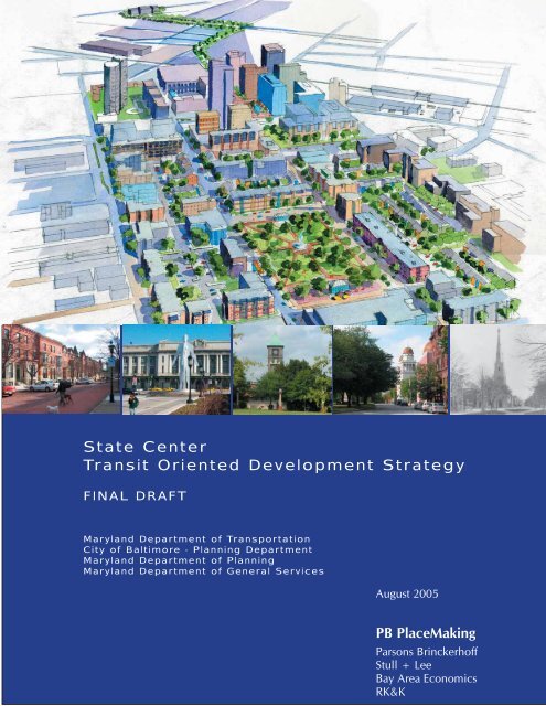
State Center<br />
Transit Oriented Development Strategy<br />
FINAL DRAFT<br />
<strong>Maryland</strong> <strong>Department</strong> <strong>of</strong> <strong>Transportation</strong><br />
City <strong>of</strong> Baltimore - Planning <strong>Department</strong><br />
<strong>Maryland</strong> <strong>Department</strong> <strong>of</strong> Planning<br />
<strong>Maryland</strong> <strong>Department</strong> <strong>of</strong> General Services<br />
August 2005<br />
<strong>PB</strong> <strong>PlaceMaking</strong><br />
Parsons Brinckerh<strong>of</strong>f<br />
Stull + Lee<br />
Bay Area Economics<br />
RK&K
Title: State Center Transit-Oriented Development Strategy<br />
Authors: <strong>Maryland</strong> <strong>Department</strong> <strong>of</strong> <strong>Transportation</strong><br />
City <strong>of</strong> Baltimore - Planning <strong>Department</strong><br />
<strong>Maryland</strong> <strong>Department</strong> <strong>of</strong> Planning<br />
Subject: A planning study for the State Center Office Complex<br />
and Surroundings<br />
Date: August 2005<br />
Abstract: The State Center Transit-Oriented Development Strategy<br />
is an initial assessment <strong>of</strong> the planning and policy<br />
options for attracting Transit-Oriented Development<br />
(TOD) to a 110-acre study area that includes the<br />
State Center Metro Station, State Center government<br />
complex, McCulloh Homes, and the Cultural Center<br />
Light-Rail Station. The Strategy includes a summary<br />
<strong>of</strong> the background, site-specific analyses, and resulting<br />
vision and development concept for the study area. The<br />
development concept consists <strong>of</strong> recommended land<br />
uses, with accompanying infrastructure and services to<br />
accommodate these uses. The Strategy also explores<br />
actions necessary for the successful implementation <strong>of</strong><br />
the development concept.
Table Of Contents<br />
Executive Summary ............................................................................... 1<br />
Background ........................................................................................... 3<br />
Methodology ......................................................................................... 5<br />
Overall Process ............................................................................ 5<br />
Charrette ...................................................................................... 6<br />
Stakeholder Involvement .............................................................. 7<br />
Alternatives .................................................................................. 8<br />
Site Context ........................................................................................ 11<br />
Study Area ................................................................................. 11<br />
Context ...................................................................................... 12<br />
Connections and Destinations ............................................ 12<br />
Existing Uses ...................................................................... 12<br />
History ............................................................................... 14<br />
Market Research ................................................................. 15<br />
Opportunities and Challenges .................................................... 17<br />
Development Concept ........................................................................ 21<br />
Vision Statement ........................................................................ 21<br />
Concept Principles and Features ................................................. 22<br />
Transit Oriented Development ........................................... 22<br />
Neighborhoods .................................................................. 23<br />
Environment ....................................................................... 23<br />
<strong>Transportation</strong> .................................................................... 24<br />
Land Use .................................................................................... 27<br />
Circulation ................................................................................. 29<br />
Street Network ................................................................... 29<br />
Transit ................................................................................ 31<br />
Pedestrian, Bikes, and the Public Realm ............................. 33<br />
Parking Strategy .................................................................. 35<br />
Core Areas ................................................................................. 37<br />
Cultural Core ...................................................................... 37<br />
McCulloh Village ................................................................ 37<br />
Howard Street and MLK Boulevard .................................... 38<br />
Development Program ............................................................... 38<br />
Building Typologies ................................................................... 39<br />
Feasibility Analysis and Economic Benefit .......................................... 41<br />
Key Findings .............................................................................. 41<br />
Methodology & Limitations ........................................................ 43<br />
Development Program ............................................................... 43<br />
Pro Forma Analysis and Feasibility Gap ...................................... 45<br />
Sources <strong>of</strong> Public Subsidy .......................................................... 46<br />
Implementation Strategy ..................................................................... 49<br />
Challenges Presented by the Strategy ......................................... 49<br />
Eutaw District Development Corporation ................................... 50<br />
Appendix .......................................................................................... 51<br />
Urban Design Principals ............................................................ 51<br />
Positive Outdoor Space ...................................................... 51<br />
Animated Edges .................................................................. 51<br />
Building Size and Scale ...................................................... 52<br />
Adaptable Building Form .................................................... 52<br />
Public Realm ...................................................................... 53<br />
Safety ................................................................................. 53
Pennsylvania Ave.<br />
State Center Illustrative Plan<br />
Dolphin St.<br />
Illustrative Plan<br />
Eutaw Place<br />
MLK Blvd.<br />
W. Preston St.<br />
Howard St.<br />
Preston St.<br />
Charles St.
Artist’s renderings <strong>of</strong> project features<br />
Bird’s eye rendering <strong>of</strong> core study area<br />
Executive Summary<br />
The State Center Transit-Oriented Development Strategy envisions a<br />
vibrant cultural, residential and employment center, called the “Eutaw<br />
District”, on 110 acres <strong>of</strong> land located in the heart <strong>of</strong> historic midtown<br />
Baltimore. Transit-Oriented Development (TOD) principles - such as<br />
improving access, mobility, long-term sustainability, and quality <strong>of</strong> life<br />
- were the foundation <strong>of</strong> this effort. Specific elements <strong>of</strong> the preferred<br />
development concept include:<br />
• Integration <strong>of</strong> the Eutaw District with adjacent neighborhoods<br />
to further stimulate revitalization and help meet the goals and<br />
objectives <strong>of</strong> the local neighborhood plans;<br />
• A world-class cultural and regional destination (“Cultural Core”)<br />
that unifies and promotes interaction between the existing<br />
cultural and institutional venues in the area;<br />
• Activity throughout the day resulting from a market-supported<br />
four-phase development program that includes:<br />
– 3,200 new mixed-income residential units in a variety <strong>of</strong><br />
housing types;<br />
– Redevelopment <strong>of</strong> 1.3 million square feet <strong>of</strong> <strong>of</strong>fice space;<br />
– 60,000 additional square feet <strong>of</strong> institutional space;<br />
– The creation <strong>of</strong> 600,000 square feet <strong>of</strong> retail, cultural and<br />
entertainment uses including a supermarket, cineplex, sitdown<br />
dining, and a hotel with 200 rooms;<br />
– 3,000 additional parking spaces (5,800 total);<br />
– A linked and integrated open space system, including a new<br />
3-acre park.<br />
• An improved and rebalanced transportation system that<br />
provides superior access to and within the site for all modes <strong>of</strong><br />
transportation through streetscape improvements, transit station<br />
enhancements, reconfigured street networks, and creation <strong>of</strong><br />
well defined and desirable thoroughfares;<br />
• Fully integrating the McCulloh neighborhood into the fabric <strong>of</strong><br />
the city through its redevelopment as mixed-income community<br />
housing with a range <strong>of</strong> affordable and market-rate housing<br />
choices for existing and new residents; and<br />
• Creation <strong>of</strong> a new public benefit corporation, the Eutaw<br />
District Development Corporation, to coordinate and facilitate<br />
the activities <strong>of</strong> the State, City, and other large institutional<br />
landowners in the study area and nearby. This new entity will<br />
be modeled on Baltimore’s successful history <strong>of</strong> revitalization<br />
through district-based public benefit corporations.<br />
State Center Transit Oriented Development Strategy 1
A Charrette combines creative,<br />
intense work sessions with public<br />
workshops and open houses.<br />
A Charrette is a collaborative<br />
planning process that harnesses<br />
the talents and energies <strong>of</strong> all<br />
interested parties to create<br />
and support a feasible plan<br />
that represents transformative<br />
community change.<br />
http://www.charretteinstitute.org/charrette.html<br />
Bird’s eye rendering <strong>of</strong> Preston Street to Penn Station<br />
2 State Center Transit Oriented Development Strategy<br />
Executive Summary<br />
Due to the complex nature <strong>of</strong> the effort, a unique planning and<br />
design approach was employed that was dynamic, asset-based,<br />
and took advantage <strong>of</strong> the unique character <strong>of</strong> the site and its many<br />
resources - especially the two existing rail transit stations: State<br />
Center Metro and Cultural Center LRT. Stakeholder input was sought<br />
and provided invaluable insight through local knowledge. The fivemonth<br />
process focused on gathering public input and compiling site,<br />
market, economic, financial and technical analyses and led to an<br />
intensive week-long “charrette” where issues, wants and needs could<br />
be explored and addressed credibly and feasibly. To ensure that the<br />
plan accurately reflected the values <strong>of</strong> the community, open houses<br />
were held each night <strong>of</strong> the “charrette” for public input and feedback<br />
on each day’s work. Only with the contribution <strong>of</strong> the public<br />
was the team able to continue with the design process the next<br />
day and advance the Strategy until overall consensus was found.<br />
The consensus is represented in this document as the Preferred<br />
Development Concept.<br />
The following report describes the detailed process by which<br />
the Preferred Development Concept was created, the Concept’s<br />
features, and outlines the recommended next-steps for successful<br />
implementation. The Strategy development was led by <strong>PB</strong><br />
<strong>PlaceMaking</strong> and received significant support from the city staff and<br />
residents <strong>of</strong> Baltimore, the <strong>Maryland</strong> <strong>Department</strong> <strong>of</strong> <strong>Transportation</strong><br />
(MDOT), and the <strong>Maryland</strong> <strong>Department</strong> <strong>of</strong> Planning (MDP).
Transit-Oriented Development<br />
(TOD) is compatible moderate<br />
to higher density development,<br />
located within an easy walk <strong>of</strong> a<br />
major transit stop, generally with a<br />
mix <strong>of</strong> residential, employment and<br />
shopping opportunities. It is designed<br />
for pedestrians without excluding<br />
the automobile. TOD can be new<br />
construction or redevelopment <strong>of</strong> one<br />
or more buildings, whose design and<br />
orientation facilitate transit use.<br />
Background<br />
TOD mixes uses and emphasizes the pedestrian experience<br />
Increasingly, Transit-Oriented Development (TOD) has grown<br />
to become one <strong>of</strong> the principal driving strategies for economic<br />
revitalization, job creation, and quality mixed-use development in<br />
the greater Baltimore / Washington Metropolitan Region. Although<br />
Baltimore has historically been under-recognized as a target for<br />
this type <strong>of</strong> development activity, this attitude is changing as recent<br />
events suggest there is substantial interest, opportunity and unrealized<br />
capacity for TOD at strategically located sites.<br />
In response to this, the <strong>Maryland</strong> <strong>Department</strong> <strong>of</strong> <strong>Transportation</strong><br />
(MDOT) and the <strong>Maryland</strong> <strong>Department</strong> <strong>of</strong> Planning (MDP) have been<br />
working with the Baltimore City Planning <strong>Department</strong> to identify<br />
TOD opportunities in the City. At the same time, the <strong>Maryland</strong><br />
<strong>Department</strong> <strong>of</strong> General Services (DGS) concluded that surplus<br />
land at the State Center Complex should be made available for<br />
redevelopment and asked MDOT for assistance because <strong>of</strong> its TOD<br />
experience in the Washington region. State agencies recognized the<br />
potential <strong>of</strong> redeveloping the State Center Complex site as a TOD for<br />
two primary reasons:<br />
1. Strengthening the quality <strong>of</strong> the overall community would<br />
increase the value <strong>of</strong> the State’s assets; and<br />
2. Creating a more community-friendly design throughout would<br />
increase the desirability <strong>of</strong> transit use in the area.<br />
Both the State <strong>of</strong> <strong>Maryland</strong> andCity <strong>of</strong> Baltimore seized the<br />
opportunity to understand how the redevelopment <strong>of</strong> State Center<br />
might strengthen the community, increase transit access and use, and<br />
increase the land value <strong>of</strong> their assets by sponsoring the State Center<br />
Transit-Oriented Development Strategy.<br />
State Center Transit Oriented Development Strategy 3
Charles Center Metro Station<br />
Pedestrian improvements near Lexington Market<br />
4 State Center Transit Oriented Development Strategy<br />
Background<br />
The City <strong>of</strong> Baltimore has a key role in supporting the transformation<br />
<strong>of</strong> the State Center Complex and strengthening the surrounding<br />
neighborhoods. As such, the City <strong>of</strong> Baltimore was a partner in<br />
the development <strong>of</strong> this Strategy and, although not a regulatory<br />
document, this Strategy is designed to help frame future city<br />
discussions on TOD planning, design and implementation. Specific<br />
local community planning efforts that this Strategy recognizes and<br />
seeks to support include the Midtown Community Plan and the<br />
Upton Master Plan, especially in regard to:<br />
• Preserving the existing strengths <strong>of</strong> surrounding<br />
neighborhoods;<br />
• Reforming traffic and transit in the area to better serve<br />
residents;<br />
• Providing a range <strong>of</strong> affordable housing choices to allow<br />
existing residents to remain in the area;<br />
• Stimulating renovation <strong>of</strong> vacant and dilapidated buildings;<br />
• Improving safety through techniques such as better street<br />
lighting and generation <strong>of</strong> activity throughout the day;<br />
• Reconnecting with the area’s history while looking to the<br />
future; and<br />
• Supporting the continuation <strong>of</strong> a truly mixed-income<br />
community.<br />
In addition to State and City support, the Housing Authority <strong>of</strong><br />
Baltimore City (HABC) sees the opportunity to better integrate its<br />
adjacent McCulloh Homes properties into the fabric <strong>of</strong> the city<br />
furthering their commitment to building and sustaining safe, livable<br />
and quality communities, while providing access to adequate and<br />
affordable housing opportunities.
Methodology<br />
Overall Process<br />
The overall process included three key steps: 1) Analysis, 2) Preferred<br />
Concept Development and 3) Plan Implementation. Given the<br />
complexity <strong>of</strong> the effort and its fast-track schedule, the overall process<br />
was structured around a week long workshop– called a charrette<br />
– that provided a dynamic process for effective and efficient problem<br />
solving over a short period <strong>of</strong> time. Each step <strong>of</strong> the overall process is<br />
briefly described here:<br />
1. Analysis: As a precursor to the charrette, details about the<br />
planning area were identified, through stakeholder interviews,<br />
site character and conditions analysis, and a market analysis<br />
<strong>of</strong> support for new types <strong>of</strong> development. Opportunities and<br />
challenges <strong>of</strong> the site were explored and further revealed during<br />
the charrette when alternative development concepts were<br />
created. The Site Context section, pages 11-19, describes in<br />
more detail the findings <strong>of</strong> the analysis.<br />
2. Preferred Concept Development: At the charrette and with the<br />
help <strong>of</strong> all participants, various alternatives were created and<br />
weighed against the initial site analysis. Evaluation criteria were<br />
determined along with design elements worthy <strong>of</strong> incorporation<br />
into a preferred development concept. Once the preferred<br />
development concept was selected, it was further refined<br />
after the charrette to verify viability <strong>of</strong> proposed elements<br />
with technical feasibility and stakeholder interest. A more<br />
detailed discussion <strong>of</strong> the charrette process is described in the<br />
next subsection, and the Preferred Development Concept is<br />
described on pages 20-40.<br />
3. Plan Implementation: After the preferred concept was refined,<br />
phasing was explored, opinions <strong>of</strong> cost generated, financial<br />
feasibility and fiscal analyses were conducted, and a series<br />
<strong>of</strong> coordinated strategic actions to implement the plan were<br />
identified. Plan Implementation is outlined on pages 49-50.<br />
State Center Transit Oriented Development Strategy 5
“Charrette” is a French word that<br />
means “cart” and is <strong>of</strong>ten used<br />
to describe the final, intense<br />
work effort expended by art and<br />
architecture students to meet a<br />
project deadline. This use <strong>of</strong> the<br />
term is said to originate from the<br />
École des Beaux Arts in Paris during<br />
the 19th century, where proctors<br />
circulated a cart, or “charrette”,<br />
to collect final drawings while<br />
students frantically put finishing<br />
touches on their work.<br />
http://www.charretteinstitute.org/charrette.html<br />
6 State Center Transit Oriented Development Strategy<br />
Methodology<br />
Charrette<br />
As an efficient and effective means to explore multiple development<br />
options for the plan area, a week-long charrette was held. Charrettes<br />
are open, holistic planning techniques that combine intense, creative<br />
work sessions with public open houses. They are collaborative<br />
processes that bring together a variety <strong>of</strong> planning and design<br />
pr<strong>of</strong>essionals with a broad range <strong>of</strong> stakeholders to create a feasible,<br />
credible plan for transformative change. The participants at the State<br />
Center TOD charrette included key stakeholders, citizens, state<br />
and city planning staff and a team <strong>of</strong> pr<strong>of</strong>essional urban designers,<br />
planners, engineers, architects and real estate economists.<br />
Key steps undertaken at the charrette included:<br />
• Project Introduction and Site Visits: After an introductory<br />
presentation, and when needed throughout the week, team<br />
members conducted site visits to gain a better understanding<br />
<strong>of</strong> the existing built environment, activities, specific issues and<br />
community needs.<br />
• Theme Exploration: Six thematic land uses - residential, <strong>of</strong>fice/<br />
institutional, public realm, retail, recreation, and entertainment<br />
- were explored as the emphasis <strong>of</strong> separate, initial concepts to<br />
better gauge the proper intensity that each component could<br />
contribute in a final balanced and holistic plan.
Methodology<br />
• Initial Concept Development: After the intensities <strong>of</strong> the six<br />
thematic land uses had been explored, they were combined into<br />
one <strong>of</strong> two development alternatives. The two development<br />
alternatives were differentiated by their development strategies.<br />
A “transform” group explored a complete tear-down scenario,<br />
in which they took a more aggressive approach to redeveloping<br />
the site. A second alternative, dubbed the “reform” approach,<br />
sought to minimize the impact on the existing built environment<br />
while still making significant positive changes.<br />
• Synthesis: The best aspects <strong>of</strong> each <strong>of</strong> the two initial concept<br />
alternatives were identified, discussed and determined to merit<br />
inclusion, when compatible, into a preferred development<br />
concept.<br />
• Preferred Development Concept Review and Technical Team<br />
Analysis: The preferred development concept was studied in<br />
more detail for initial technical and market feasibility.<br />
• Preferred Development Concept Refinement: A development<br />
program was created and, along with the preferred development<br />
concept, further refined and graphically illustrated.<br />
• Evening Pin-ups and Open Houses: Each night, the team’s<br />
progress was displayed and presented for public viewing and<br />
comment. The input was noted and then evaluated on following<br />
days for merit and feasibility, and incorporation into the strategy.<br />
Stakeholder Involvement<br />
Stakeholder involvement was inherent to the creation <strong>of</strong> this TOD<br />
Strategy and incorporated at every step <strong>of</strong> the process to ensure that<br />
it reflects local priorities, fits with the local planning process, and<br />
complements other TOD efforts in Baltimore. At early stages <strong>of</strong> the<br />
project, stakeholders assisted with the identification <strong>of</strong> the physical<br />
limits <strong>of</strong> the study area boundary. As the process developed, many<br />
stakeholder interviews were conducted with representatives <strong>of</strong> the<br />
City <strong>of</strong> Baltimore, local institutions, organizations, and residents to<br />
identify the opportunities and challenges in the study area. In addition<br />
to the stakeholders that were invited to participate in the weeklong<br />
charrette, a significant outreach effort was deployed to inform<br />
the public <strong>of</strong> the process and invite them to participate at the open<br />
houses that were held each evening. Public input was fundamental<br />
to the design and planning process and was well represented by<br />
the increasing numbers <strong>of</strong> participants throughout the course <strong>of</strong> the<br />
charrette.<br />
State Center Transit Oriented Development Strategy 7
Transform Alternative:<br />
Concept Diagram<br />
Reform Alternative:<br />
Concept Diagram<br />
8 State Center Transit Oriented Development Strategy<br />
Methodology<br />
Alternatives<br />
Two main development concepts were explored during the<br />
charrette: “transform” and “reform”. Both concepts accommodated<br />
the existing employees and residents located in the State Center<br />
Complex and McCulloh Homes. The “transform” alternative<br />
assumed a more aggressive approach to redevelopment, while<br />
the “reform” alternative sought to minimally change the built<br />
environment while creating maximum positive impact. The<br />
“transform” and the “reform” alternatives were analyzed<br />
simultaneously and the strengths <strong>of</strong> each, where compatible, were<br />
merged to produce the initial “rough cut” alternative, as shown<br />
on page 9. The “rough cut” alternative was then further refined<br />
to create the final preferred alternative which is described in the<br />
section, Development Concept on page 20.<br />
Transform Alternative:<br />
Land-Use Diagram<br />
Reform Alternative:<br />
Land-Use Diagram<br />
Transform Alternative:<br />
Circulation Diagram<br />
Reform Alternative:<br />
Circulation Diagram
Methodology<br />
Day 4 Rough Cut Alternative Illustrative Plan Day 5 Preferred Alternative Illustrative Plan<br />
Preferred Alternative Concept Diagram<br />
State Center Transit Oriented Development Strategy 9
Upton<br />
Neighborhood<br />
10 min. walk<br />
Pennsylvania Ave<br />
40<br />
Eutaw Pl<br />
5 min. walk<br />
10 State Center Transit Oriented Development Strategy<br />
Bolton Hill<br />
Neighborhood<br />
Dolphin St<br />
Site Context<br />
110 acre<br />
Study Area<br />
Armory<br />
<strong>Maryland</strong> State Offi ces<br />
Preston St<br />
JD Briscoe<br />
Special Ed<br />
Middle School and<br />
High School<br />
M<br />
St Mary’s<br />
MICA<br />
<strong>Maryland</strong> Institute<br />
College <strong>of</strong> Art<br />
MLK Blvd<br />
Seton Hill<br />
Neighborhood<br />
L<br />
<strong>Maryland</strong><br />
General<br />
Hospital<br />
L<br />
M<br />
University <strong>of</strong><br />
Baltimore<br />
Lyric<br />
Opera<br />
House<br />
I-83<br />
Meyerh<strong>of</strong>f<br />
Symphony<br />
Hall<br />
Symphony Center<br />
Howard St<br />
L<br />
LRT Station<br />
Metro Station<br />
Penn Station<br />
Charles St<br />
Preston St<br />
Mt. Vernon<br />
Neighborhood<br />
Washington<br />
Monument
State Center Complex<br />
Site Context<br />
Study Area<br />
The study area encompasses 110 acres <strong>of</strong> land in the midtown<br />
area <strong>of</strong> Baltimore including, at the center, land owned by the State<br />
<strong>of</strong> <strong>Maryland</strong> (State Center Complex) and the Housing Authority<br />
<strong>of</strong> Baltimore City (McCulloh Homes). In determining study area<br />
boundaries, consideration was given to the maximum distance<br />
(one-half mile) people are typically willing to walk to obtain goods<br />
and services as well as to what became known to the study team<br />
as the “Penn to Penn” corridor (the area between Penn Station and<br />
Pennsylvania Avenue).<br />
McCulloh Homes<br />
State Center Transit Oriented Development Strategy 11
Connections/Destinations Diagram<br />
State Center and McCulloh Homes Land Area<br />
12 State Center Transit Oriented Development Strategy<br />
Site Context<br />
Context<br />
Connections and Destinations<br />
State Center is strategically located within close proximity to<br />
downtown Baltimore and the Inner Harbor. In addition to the<br />
existing State Center Office complex, a few <strong>of</strong> the numerous local<br />
destinations include:<br />
• <strong>Maryland</strong> General Hospital<br />
• Lyric Opera House<br />
• Meyerh<strong>of</strong>f Symphony Hall<br />
• University <strong>of</strong> Baltimore<br />
• <strong>Maryland</strong> Institute College <strong>of</strong> Art<br />
• St. Mary’s Seminary Complex<br />
• Arena Players Theater<br />
Convenient connections to other areas within the city and region is<br />
possible via the Metro Green Line (with a possible future extension)<br />
and the Light Rail Line to places such as the BWI Corridor (for<br />
employment and air travel), Johns Hopkins, and Penn Station (where<br />
Amtrak and MARC connect the area to Washington, D.C. and points<br />
such as New York, N.Y.). Additional future transit connections may<br />
be realized through development <strong>of</strong> the proposed Street Car Project,<br />
Red Line Transit Project and/or a proposed Yellow Line.<br />
Existing Uses<br />
The State Center Complex is the largest concentration <strong>of</strong> State<br />
government <strong>of</strong>fices in <strong>Maryland</strong> and is comprised <strong>of</strong> approximately<br />
24 acres <strong>of</strong> land around the State Center/Cultural Center Metro<br />
station, and across the street from the Cultural Center LRT station.<br />
The site is surrounded by several major streets: Martin Luther King,<br />
Jr. Blvd.; Howard Street; H<strong>of</strong>fman Street; and McCulloh Street.<br />
These streets serve as thoroughfares to and from I-83, I-95, US 40<br />
and the Baltimore-Washington Parkway (I-295). The State Center<br />
Complex has three mid- to high-rise state <strong>of</strong>fice buildings housing<br />
approximately 3,500 employees. The <strong>of</strong>fices were constructed<br />
approximately 30-50 years ago and in their current configuration will<br />
soon surpass their productive lifespan. Two large surface parking<br />
lots for the public and state employees occupy 5 <strong>of</strong> the 24 acres.<br />
The nearby Penn Station is within a ten-minute walk <strong>of</strong> the site and<br />
serves as a major multi-modal transportation hub in Baltimore, with<br />
access to the LRT, Amtrak, MARC commuter rail, as well as several<br />
local and express bus routes.
McCulloh Homes<br />
Bolton Hill<br />
Site Context<br />
McCulloh Homes, a public housing project serving low-income<br />
residents, is located on approximately 31 acres adjacent to the State<br />
Center Complex. It is bordered by Pennsylvania Avenue and Martin<br />
Luther King Jr. Blvd. McCulloh Homes consists <strong>of</strong> several blocks<br />
<strong>of</strong> low-rise apartments as well as two residential towers that house<br />
approximately 800 residents. These apartments range in age from<br />
40 – 60 years old and are also beginning to require significant and<br />
increasing amounts <strong>of</strong> maintenance.<br />
The four adjacent neighborhoods (Bolton Hill, Seton Hill, Mt.<br />
Vernon, and Upton-Marble Hill) maintain historical significance for<br />
a variety <strong>of</strong> reasons including: notable past residents, historic uses,<br />
and architecture. The primary land use in these neighborhoods is<br />
residential, with some commercial uses.<br />
Penn Station<br />
State Center Transit Oriented Development Strategy 13
Dolphin and H<strong>of</strong>fman Streets<br />
Eutaw Place Baptist Church<br />
14 State Center Transit Oriented Development Strategy<br />
Site Context<br />
Corner <strong>of</strong> Read and Biddle Streets<br />
History<br />
The mid-20th century modern buildings <strong>of</strong> the State Center <strong>of</strong>fice<br />
complex, give few hints to the long and rich history <strong>of</strong> the diverse<br />
neighborhoods that surround the site. Just looking at a present<br />
day map gives clues to the unusual character <strong>of</strong> the area – where<br />
the north-south street grid <strong>of</strong> old Downtown Baltimore meets the<br />
diagonal street grid <strong>of</strong> the later residential neighborhoods. For this<br />
reason, State Center is situated at a unique historic and cultural<br />
crossroad.<br />
It is here that older early 19th century neighborhoods <strong>of</strong> Mount<br />
Vernon and Seton Hill and the younger late 19th century residential<br />
communities <strong>of</strong> Bolton Hill, Upton-Marble Arch and Madison Park<br />
eventually grew together. However, rather than forming a true<br />
crossroads, the State Center complex, with is large high rise <strong>of</strong>fices<br />
and expansive parking lots, combined with the scale and orientation<br />
<strong>of</strong> adjacent roadways have formed barriers separating surrounding<br />
neighborhoods. The construction <strong>of</strong> McCulloh Homes further<br />
compounded separation, by isolating its residents from the nearby<br />
communities.<br />
<strong>Maryland</strong> State Center Office Complex 1960’s
View <strong>of</strong> Plaza D’Art<br />
View <strong>of</strong> South Park Plaza<br />
Site Context<br />
Market Research<br />
Research was conducted prior to the charrette to identify the market<br />
potential for various uses in the local market area and to formulate<br />
a development program for the study area. The final development<br />
program is based on the analysis <strong>of</strong> what types <strong>of</strong> development could<br />
be supported over a four-phase implementation period spanning 15 to<br />
20 years.<br />
The local market area, which extends in an approximately one-half<br />
mile radius from the State Center Metro station, contained in 2000<br />
approximately 22,300 persons in 12,100 households. Compared<br />
with the rest <strong>of</strong> the City <strong>of</strong> Baltimore and the surrounding region, it<br />
has smaller households, a considerably higher proportion <strong>of</strong> persons<br />
employed in pr<strong>of</strong>essional or management occupations, and a much<br />
higher proportion <strong>of</strong> persons age 20 – 34. These factors, successful<br />
new apartment and condominium developments in adjacent<br />
areas, and the high-quality and expensive housing in adjacent<br />
neighborhoods such as Bolton Hill and Madison Park, suggest strong<br />
potential for a range <strong>of</strong> housing types for younger and empty-nester<br />
households. The development <strong>of</strong> a range <strong>of</strong> workforce and marketrate<br />
housing can provide choices for existing residents and area<br />
workers seeking more affordable housing as well as attract those<br />
seeking the amenities and convenience <strong>of</strong> in-town living.<br />
Baltimore’s <strong>of</strong>fice market appears to be stabilizing. The Midtown<br />
area, including State Center, has the potential to attract tenants seeking<br />
new high quality <strong>of</strong>fices with excellent accessibility at a slightly lower<br />
cost than downtown. Aside from individual <strong>of</strong>fice tenants with large<br />
space requirements, the greater potential for <strong>of</strong>fice development will<br />
be in the medium- to longer-term. Increased <strong>of</strong>fice development, as<br />
well as existing area educational and medical institutions, will provide<br />
support for the development <strong>of</strong> new middle- to upper middle-range<br />
lodging in the local market area.<br />
The extensive amount <strong>of</strong> existing regional-serving retail means that<br />
local-serving retail has the greatest potential in the local market<br />
area. An immediate opportunity is for a new, modern supermarket–<br />
the local market area currently lacks one even though there is<br />
ample market support. There is also strong potential for certain<br />
entertainment-oriented uses. The nearest multi-screen cineplex is<br />
nearly seven miles away, creating a significant opportunity for a<br />
theater operator familiar with urban markets. A new cineplex could<br />
support additional entertainment and dining uses and complement<br />
existing cultural activities, including other art house theaters in the<br />
area.<br />
State Center Transit Oriented Development Strategy 15
16 State Center Transit Oriented Development Strategy<br />
Site Context
State Center Parking Lots<br />
Cultural Center LRT Platform<br />
Site Context<br />
Opportunities and Challenges<br />
Analysis <strong>of</strong> the site context shows that the existing State Center area<br />
presents a number <strong>of</strong> significant opportunities, as well as significant<br />
challenges, that have been addressed in the preparation <strong>of</strong> this<br />
Strategy. Significant opportunities that create potential for large-scale<br />
revitalization include:<br />
• The existing diversity <strong>of</strong> cultural, civic and educational uses<br />
are regional assets with the potential to provide a catalyst for<br />
development.<br />
• Significant redevelopment potential on both the State Center<br />
Complex and McCulloh Homes sites given the age <strong>of</strong> existing<br />
buildings and the amount <strong>of</strong> underdeveloped/underutilized land<br />
(i.e., surface parking lots).<br />
• Limited ownership <strong>of</strong> large parcels limits requirements for land<br />
acquisition.<br />
• Greater interest in urban living, renewed interest in renovation<br />
<strong>of</strong> existing buildings in surrounding neighborhoods, and rising<br />
values create a favorable environment for complementary new<br />
development that mixes households <strong>of</strong> different income levels.<br />
• Unmet demand for retail, particularly for basis services such as<br />
a supermarket, as well as for entertainment uses such as a movie<br />
theater.<br />
• The proximity <strong>of</strong> the area to Penn Station, Metro and LRT<br />
is already attracting an increasing number <strong>of</strong> residents that<br />
commute to Washington D.C. and seek an urban lifestyle that is<br />
more affordable.<br />
• The merging street grids and presence <strong>of</strong> high traffic volumes<br />
could benefit from improved organization/orientation as well as<br />
providing more pedestrian and bicycle amenities.<br />
• The pedestrian environment could be enhanced to provide<br />
improved connectivity such that the transit system may see<br />
increased utilization and <strong>of</strong>fer alternatives to increasing traffic<br />
congestion.<br />
• Vacant and/or underutilized land could be redeveloped to<br />
provide more desirable uses.<br />
• The strength <strong>of</strong> adjacent neighborhoods, and existing<br />
neighborhood plans, provides needed local support.<br />
At the same time, there are significant challenges that need to be<br />
addressed before successful revitalization can occur, including:<br />
• Creating a high-quality urban environment with attractive public<br />
spaces and streetscapes that mitigates impacts from automobile<br />
traffic and an outdated built environment.<br />
State Center Transit Oriented Development Strategy 17
Richmond Market Renderings (now the<br />
5th Regimental Armory)<br />
18 State Center Transit Oriented Development Strategy<br />
Site Context<br />
• Demonstrating market success for the types <strong>of</strong> new rental and<br />
for-sale developments that have been successfully developed<br />
in nearby areas but not yet in the State Center area.<br />
• Replacing the concentration <strong>of</strong> obsolete public housing in a<br />
manner that assures existing public housing residents that they<br />
can remain in the area and move into new, well designed<br />
family housing.<br />
• Changing negative perceptions and a lack <strong>of</strong> positive identity<br />
for the area.<br />
• Coordinating the activities <strong>of</strong> multiple large public agency<br />
landowners (State, City, universities, etc.) that may have<br />
different objectives and timelines for action.<br />
• Financing public investment in physical improvements and<br />
assistance to early catalyst projects that set the stage to attract<br />
substantial new private investment.<br />
By building on the existing cultural and educational institutions <strong>of</strong><br />
the increasingly vibrant Cultural Center to the east, the opportunity<br />
exists to strengthen the area to become one <strong>of</strong> the city’s most<br />
attractive arts, entertainment, retail and residential districts. This new<br />
and vibrant multi-use area could serve as a bridge to reconnect and<br />
reenergize some <strong>of</strong> the city’s most diverse and historically significant<br />
communities and resources.<br />
This ambitious project has the potential to:<br />
• Provide for the adaptive reuse <strong>of</strong> one <strong>of</strong> Baltimore’s most<br />
distinctive historic structures – the 5th Regimental Armory;<br />
• Build a linkage between the grand landscaped pedestrian<br />
boulevards that run from Mount Vernon’s Washington Square<br />
along Eutaw Place to Druid Hill Park;<br />
• Reconnect the classic row house neighborhoods and gracious<br />
public spaces <strong>of</strong> Bolton Hill and Seton Hill, now isolated<br />
urban islands;<br />
• Provide new housing choices that allow existing residents to<br />
remain, while attracting a broad range <strong>of</strong> new households to<br />
the area; and<br />
• Provide a spark for the renaissance <strong>of</strong> Baltimore’s most storied<br />
Afro-American cultural neighborhoods, the famous music and<br />
dance district that once graced Pennsylvania Avenue in Upton-<br />
Marble Arch.<br />
One reason that the proposed redevelopment project holds such<br />
promise is that it could provide a new connection between these<br />
communities without changing the rich and diverse historic<br />
character that make them unique and important parts <strong>of</strong> Baltimore<br />
City’s heritage.
Area Map 1896<br />
Site Context<br />
State Center Transit Oriented Development Strategy 19
DOLPHIN STREET<br />
NORTH<br />
HOWARD STREET<br />
20 State Center Transit Oriented Development Strategy<br />
6<br />
P<br />
PENN Station<br />
3<br />
1<br />
P<br />
2 M<br />
7 EUTAW STREET B 7<br />
M<br />
P P 7 P<br />
5<br />
7<br />
L<br />
7<br />
7<br />
PRESTON STREET<br />
7<br />
PRESTON STREET<br />
8<br />
9<br />
7<br />
PENNSYLVANIA AVENUE 9 9<br />
P<br />
Preferred Development Concept<br />
7<br />
7<br />
8<br />
8<br />
8<br />
MLK BOULEVARD<br />
6<br />
CHARLES STREET<br />
7<br />
7<br />
7<br />
READ STREET<br />
Legend<br />
M<br />
M<br />
L<br />
B<br />
P<br />
1<br />
2<br />
3<br />
4<br />
5<br />
6<br />
7<br />
8<br />
9<br />
Commercial<br />
Institutional<br />
Residential - Higher Density<br />
Residential - Medium Density<br />
Residential - Lower Density<br />
Office<br />
Mixed-Uses<br />
Proposed Streets<br />
Plaza<br />
Parks<br />
Existing Metro Station<br />
Proposed Metro Portal<br />
Enhanced Light Rail Station<br />
Bus Transit Plaza<br />
Parking Structure<br />
Plaza D’Art<br />
Hotel<br />
Redeveloped Armory<br />
Information Center<br />
Neighborhood Park<br />
Intersection Realignment<br />
Pedestrian Improvements<br />
MLK Enhancements<br />
Pennsylvania Ave.<br />
Enhancements<br />
0 150 300 600 800 1200
Plaza D’Art<br />
PRESTON STREET<br />
EUTAW STREET<br />
Neighborhood Park<br />
HOWARD STREET<br />
PRESTON STREET<br />
Development Concept<br />
Vision Statement<br />
The State Center Transit-Oriented Development Strategy envisions<br />
a vibrant cultural, residential and employment center called the<br />
“Eutaw District”.<br />
Located in the heart <strong>of</strong> historic midtown Baltimore, the Eutaw<br />
District has become a regional cultural, residential and employment<br />
center concentrated near three existing transit stations. The<br />
District is a vibrant 24-hour center that <strong>of</strong>fers lifestyle options and<br />
opportunities to accommodate work, play, and living in a high<br />
quality urban environment. New housing is a modern complement<br />
to the historic character <strong>of</strong> the area and includes everything from<br />
family-oriented townhouses to apartments, condominiums and<br />
popular live/work residences - <strong>of</strong>fering many lifestyle choices. The<br />
wide range <strong>of</strong> housing options provide opportunities for all income<br />
levels from below market-rate to higher-end units. The district’s retail<br />
mix includes a neighborhood supermarket and local-serving retail, as<br />
well as entertainment-oriented uses providing for area residents and<br />
attracting regional visitors. Community life abounds in the District:<br />
in outdoor cafes, restaurants and a new 3-acre neighborhood park.<br />
Patrons <strong>of</strong> the adjacent cultural institutions, such as the Meyerh<strong>of</strong>f<br />
Symphony and the Lyric Opera, arrive early for performances and<br />
stay late to enjoy the full urban cultural experience. A diverse and<br />
exciting place to live, to entertain and be entertained, and to linger<br />
well into the night, that is the Eutaw District.<br />
Bird’s eye conceptualization <strong>of</strong> the Eutaw District<br />
State Center Transit Oriented Development Strategy 21
Bolton Hill Neighborhood — Balancing<br />
Housing and Open Space<br />
Interesting and historic architecture can be a<br />
neighborhood asset<br />
22 State Center Transit Oriented Development Strategy<br />
Development Concept<br />
Concept Principals and Features<br />
The Eutaw District’s land use pattern encourages and supports bus and<br />
rail transit ridership and creates an integrated, efficient, multi-modal<br />
circulation system. It envisions a community <strong>of</strong> complementary<br />
parts that function to foster human interaction and create an inviting,<br />
pleasant, and high quality urban environment. Stated simply, the<br />
Eutaw District is based on four key elements: Neighborhoods,<br />
Environment, and <strong>Transportation</strong>, sensitively orchestrated to create a<br />
successful TOD.<br />
Transit Oriented Development<br />
Transit Oriented Development (TOD) – the stated focus <strong>of</strong> this effort<br />
- is moderate to higher density development, located within an easy<br />
walk <strong>of</strong> a major transit stop, generally with a mix <strong>of</strong> residential,<br />
employment and shopping opportunities, designed for pedestrians<br />
without excluding the automobile. TOD can be new construction or<br />
redevelopment in which community design and orientation encourage<br />
and facilitate transit use. Parking design and management is especially<br />
important to the success <strong>of</strong> any TOD, to manage its function, visual<br />
appearance and financial requirements. TOD design is evident in the<br />
following Eutaw District features:<br />
• A variety <strong>of</strong> uses integrated into one compact area;<br />
• Building orientation towards adjacent streets and transit<br />
facilities;<br />
• Small block sizes; and<br />
• Parking in structures, behind buildings, and on-street.<br />
The TOD Concept
Open space link through an urban<br />
neighborhood.<br />
Mixed-use building blending old with new<br />
Development Concept<br />
Neighborhoods<br />
Neighborhoods are essential to the Eutaw District. Definable<br />
neighborhoods encourage citizens to take responsibility for their<br />
governance, maintenance and evolution. Generally, they should be<br />
compact, mixed-use and pedestrian friendly so that many activities<br />
<strong>of</strong> daily living are within close proximity. Safe, comfortable, and<br />
interesting, they are defined as much by the quality <strong>of</strong> their open<br />
spaces as by the quality <strong>of</strong> their buildings. In order to achieve strong<br />
neighborhoods, the following features are proposed:<br />
• A wide range <strong>of</strong> housing choices to serve diverse populations<br />
and needs, including townhomes, live/work l<strong>of</strong>ts, and highdensity<br />
mid-rise apartments and condominiums; and<br />
• Family-friendly features, including on-site childcare and<br />
recreational courtyards.<br />
• A rebirth <strong>of</strong> architectural excellence in projects that focus on<br />
creating continuity, human scale and pedestrian activity;<br />
• A performing arts theme hotel that anchors and enhances<br />
adjacent cultural institutions;<br />
• Ground floor retail in <strong>of</strong>fice and mixed-use buildings to<br />
serve both local and regional needs, including a modern<br />
neighborhood supermarket;<br />
• Entertainment attractions, such as a cineplex, cafes and<br />
performance venues, ensuring the area is active at night;<br />
Environment<br />
Natural features and processes, including: air and water quality,<br />
wildlife habitat, parks, recreation and public open space are all<br />
part <strong>of</strong> the urban natural environment. Planning and development<br />
that respect the environment can significantly improve quality<br />
<strong>of</strong> life. Squares, gardens, tot lots, sports fields and dog parks are<br />
neighborhood amenities that bring nature into the city. Parks and<br />
open spaces also create neighborhood focal points and help reinforce<br />
neighborhood boundaries. By linking parks and open spaces,<br />
desirable pedestrian routes are created, connecting neighborhoods to<br />
significant destinations and each other. In order to achieve a healthy<br />
environment, the following concept features are proposed:<br />
• A significant public plaza at the Metro entrance;<br />
• A three-acre regional park with playing fields, and dog-friendly<br />
area;<br />
• A linear green street (“Green Necklace”) linking the Eutaw Place<br />
medians and the Washington Monument; and<br />
• “Green” buildings using construction methods, such as<br />
vegetated ro<strong>of</strong>s, drought tolerant landscaping, bio-swales, and<br />
non-toxic and/or sustainably harvested materials create a better<br />
State Center Transit Oriented Development Strategy 23
Bio-swales capture stormwater and can be<br />
attractive landscape amenities.<br />
24 State Center Transit Oriented Development Strategy<br />
Development Concept<br />
living and working environment both indoors and out. Quickly<br />
becoming standard industry practice due to cost effectiveness<br />
and ability to provide environmental benefits, it is proposed that<br />
new development meet US Green Building Council (USGBC)<br />
Leadership in Energy and Environmental Design (LEED)<br />
certification requirements.<br />
<strong>Transportation</strong><br />
<strong>Transportation</strong> elements - especially streets - provide the organizing<br />
structure <strong>of</strong> a community. The best streets are places <strong>of</strong> shared use<br />
that balance the needs <strong>of</strong> pedestrians, bicycles and vehicles. When<br />
properly designed and constructed, they facilitate independent<br />
mobility for all residents - especially important to the young, the<br />
elderly and persons with disabilities. Well-designed streets are also<br />
beautiful as well as functional, and provide a graceful setting for a<br />
community’s architecture.<br />
Sustainable landscape design, such as the use <strong>of</strong> bio-swales and native plants can provide aesthetic and environmental benefits.
Transit can help activate places.<br />
Development Concept<br />
To achieve a balanced transportation system, the Eutaw District will<br />
include:<br />
• Rail transit stations that are physically and visually linked to one<br />
another and that portray a sense <strong>of</strong> arrival and activity through<br />
architecture and landscaping;<br />
• Streets as places <strong>of</strong> shared use, including improvements such<br />
as landscaping, street trees, sidewalk widening, attractive<br />
pedestrian-scaled lighting, street furniture and clear, wellorganized<br />
signage;<br />
• Reconfiguration <strong>of</strong> major automobile thoroughfares into<br />
boulevards, allowing traffic to coexist with pedestrian-oriented<br />
development;<br />
• Well defined pedestrian thoroughfares, including a connection<br />
from Penn Station to Pennsylvania Avenue along West Preston<br />
Street;<br />
• Concentrating commercial parking into structures and locating<br />
residential parking behind buildings to improve the pedestrian<br />
streetscape;<br />
• Reconfiguration <strong>of</strong> Dolphin Street to reflect the historic grid,<br />
improving access and intuitive orientation for pedestrians and all<br />
modes <strong>of</strong> transportation; and<br />
• Reconfiguration <strong>of</strong> the intersection <strong>of</strong> MLK Boulevard and<br />
Howard Street.<br />
A pedestrian-oriented streetscape.<br />
State Center Transit Oriented Development Strategy 25
26 State Center Transit Oriented Development Strategy<br />
Development Concept
Live/work townhouses along rail transit<br />
Compact, mixed-use center<br />
Development Concept<br />
Land Use<br />
The Eutaw District embraces all <strong>of</strong> the principles <strong>of</strong> transit-oriented<br />
development while addressing site-specific qualities and assets.<br />
Included in the district are: high-quality workforce and marketrate<br />
housing, <strong>of</strong>fice space, retail uses, culture and entertainment<br />
destinations; all <strong>of</strong> which are connected by attractive and wellutilized<br />
pedestrian and transit network. The result is a mixed-use,<br />
mixed-income area that seizes the opportunities afforded by existing<br />
development to create a sustainable neighborhood<br />
Higher density housing, commercial and <strong>of</strong>fice land uses are<br />
concentrated in the center <strong>of</strong> the district and along Martin Luther King<br />
Boulevard. In the core <strong>of</strong> the district, residential and employment<br />
mixed-use buildings line Eutaw and Preston Streets. Medium and low<br />
density housing as well as institutional and cultural land uses surround<br />
the center <strong>of</strong> the district. Mixed-use development is also proposed<br />
along Pennsylvania Avenue at the southwestern edge <strong>of</strong> the district.<br />
Parking is concentrated in four parking structures, located near<br />
the northeast edge <strong>of</strong> the district and the Cultural Core. They<br />
are designed to serve the entire district, rather than individual<br />
commercial, residential or <strong>of</strong>fice buildings. They are located within<br />
a 5-minute walk <strong>of</strong> the district’s core, connected by an enhanced<br />
pedestrian network.<br />
A mix <strong>of</strong> uses allows residents to live, work and recreate in close proximity<br />
State Center Transit Oriented Development Strategy 27
28 State Center Transit Oriented Development Strategy<br />
Development Concept
Charrette street sections<br />
Charrette intersection alternative<br />
Development Concept<br />
Circulation<br />
The success <strong>of</strong> the Eutaw District is inextricably linked to<br />
transportation. Although traffic congestion in the city will continue<br />
to increase, the majority <strong>of</strong> trips to and from the district will remain<br />
auto-dependent. Finding a peaceful coexistence with the automobile<br />
will be crucial and only achieved by providing a balanced system that<br />
<strong>of</strong>fers residents and visitors alike the choice <strong>of</strong> auto, transit, bicycle<br />
or pedestrian access. While travel by automobile is essential to the<br />
vitality <strong>of</strong> the district, poorly planned streets and/or parking facilities<br />
can create a level <strong>of</strong> inconvenience that will deter shoppers, art<br />
patrons and other visitors.<br />
The creation <strong>of</strong> an accessible and attractive transportation system<br />
benefits the district and surrounding neighborhoods in two ways:<br />
• Superior accessibility to the district – with a combination <strong>of</strong><br />
street, transit, bicycle and pedestrian improvements, the district<br />
can enjoy substantial accessibility advantages.<br />
• Superior accessibility within the district – regardless <strong>of</strong> how<br />
visitors get to the district, or for those who live in the district,<br />
being able to walk easily and safely to multiple destinations is a<br />
necessity.<br />
Street Network<br />
A return to the historic street grid is proposed to encourage walking,<br />
biking and transit use and to provide better connectivity. Research and<br />
experience indicates that street patterns can greatly influence travel<br />
behavior. Residents in communities with a tight grid <strong>of</strong> streets and a<br />
mix <strong>of</strong> land uses walk more, use transit more, and take up to half as<br />
many automobile trips than those in a typical suburb <strong>of</strong> disconnected<br />
streets and uses. Measures that reduce the number <strong>of</strong> automobile trips,<br />
such as the reinstatement <strong>of</strong> the street grid, will help ease congestion<br />
and improve traffic flow. These include:<br />
• The curved section <strong>of</strong> Dolphin Street, west <strong>of</strong> Howard, will<br />
be removed to reinstate perpendicular street geometry at the<br />
critical intersection <strong>of</strong> Preston and Howard.<br />
State Center Transit Oriented Development Strategy 29
30 State Center Transit Oriented Development Strategy<br />
Development Concept
Existing light-rail service<br />
Metro platform<br />
MTA bus<br />
Development Concept<br />
•<br />
Order is created at the intersection <strong>of</strong> North Howard Street<br />
and Martin Luther King Jr. Boulevard by widening the block<br />
<strong>of</strong> Chase Street between Howard Street and Park Avenue to<br />
accommodate two-way traffic and then eliminating the oneway<br />
westbound segment <strong>of</strong> Martin Luther King, Jr. Blvd. east<br />
<strong>of</strong> Howard Street. This will allow for a more organized traffic<br />
flow and better pedestrian crossing supporting revitalization<br />
<strong>of</strong> North Howard Street as a pedestrian-oriented boulevard<br />
connecting to the Cultural Core.<br />
Transit<br />
The concentration <strong>of</strong> land uses in the core <strong>of</strong> the Eutaw District will be<br />
within easy walking distance <strong>of</strong> the Cultural Center and State Center<br />
rail transit stations, as well as several bus lines, making transit a viable<br />
option for residents and visitors to the district. Not only do the land<br />
uses and street network facilitate the ease <strong>of</strong> using transit, but the<br />
existing stations will be enhanced to ensure that people have a safe,<br />
efficient and pleasant experience.<br />
The Metro station will be an architectural jewel set in the dynamic<br />
Plaza ‘D Art heightening the sense <strong>of</strong> arrival for transit users arriving,<br />
departing, or transferring to one <strong>of</strong> the many transit routes that<br />
converge here. The Cultural Center LRT stop will be reconstructed<br />
as a full-fledged station noted for its innovative design. The stations<br />
will appeal not only to the eye, but to all <strong>of</strong> the senses: they will be<br />
tactile, auditory and fully accessible to persons with disabilities. They<br />
will become the gateways to this new and dynamic destination.<br />
Together, the increased walkability <strong>of</strong> the district and the welcoming<br />
design <strong>of</strong> the transit stations should entice new visitors to use the<br />
transit system and encourage continued use for repeat trips to and<br />
from the district.<br />
State Center Transit Oriented Development Strategy 31
32 State Center Transit Oriented Development Strategy<br />
Development Concept
Streets should accommodate all users<br />
Streets can serve as destinations in themselves<br />
Development Concept<br />
Pedestrians, Bikes and the Public Realm<br />
Once people arrive in the district, they need to be able to easily walk<br />
to any destination. West Preston Street will be restored and enhanced<br />
as a pedestrian-oriented route that links Penn Station to Pennsylvania<br />
Avenue and allows easy access to and through the site upon arrival<br />
from other regional destinations. Several pedestrian oriented streets<br />
link the area’s open spaces including a “green necklace” that extends<br />
from Eutaw Street to the Washington Monument.<br />
Making the district pedestrian-friendly requires designing buildings<br />
and streets to be pleasant and safe. Retail streets need to be a<br />
continuous line <strong>of</strong> stores that entice the shopper to continue along<br />
the street. Attractive streetscape designs should unify the district with<br />
distinctive lighting, benches, plantings and other public amenities that<br />
enhance the quality <strong>of</strong> the environment and encourage use day and<br />
night.<br />
Incorporating the needs <strong>of</strong> bicyclists will also be important. Key streets<br />
are envisioned as including striped bike lanes and will provide the<br />
primary bicycle connections. Other streets will accommodate bicycle<br />
traffic through shared travel lanes. This network will connect to the<br />
existing Jones Falls Bikeway. Bicycle parking will include bike racks,<br />
lockers, and will be incorporated in parking structures.<br />
Destinations should draw people to explore the area on foot. Pleasant<br />
neighborhood streets will link the ‘Plaza D’Art’ to surrounding<br />
communities. Local residents and visitors will be drawn to the<br />
nearby attractions along the District’s tree-lined streets. The restored<br />
sidewalks will provide connections to regional destinations including<br />
nearby university and college campuses and <strong>Maryland</strong> General<br />
Hospital.<br />
State Center Transit Oriented Development Strategy 33
34 State Center Transit Oriented Development Strategy<br />
Development Concept<br />
Left: Illustration <strong>of</strong> Preston street spine linking Pennsylvania Ave to Penn Station.<br />
Above: Example <strong>of</strong> pedestrian linkage<br />
Public gathering places will comprise several key destinations in the<br />
District:<br />
• The ‘Plaza D’Art’ at the center <strong>of</strong> the Cultural Core will be<br />
an important junction where the District’s functions come<br />
together. The Plaza will encourage people to gather both day<br />
and night, activated by a hotel, restaurants and artist venues.<br />
• A strengthening <strong>of</strong> connections between the Meyerh<strong>of</strong>f<br />
Symphony, Lyric Opera and other venues.<br />
• At the intersection <strong>of</strong> Howard Street and Martin Luther King<br />
Jr. Boulevard, a spacious public plaza provides a gateway to<br />
the District from the East and includes eye-catching art and an<br />
information/orientation center with box <strong>of</strong>fice.<br />
• A three-acre park with play fields, dog run, skate park, and<br />
arboretum serves as the centerpiece <strong>of</strong> the reborn McCulloh<br />
Homes community.<br />
• The dignity and grace <strong>of</strong> the existing Eutaw Place park medians<br />
extend through the District, by way <strong>of</strong> careful streetscape<br />
design, creating a pedestrian link to the Washington<br />
Monument.
Illustration <strong>of</strong> parking behind buildings<br />
Example <strong>of</strong> parking behind buildings<br />
Example <strong>of</strong> mixed-use parking structure<br />
Development Concept<br />
Parking Strategy<br />
Reducing automobile dependency, a basic principal <strong>of</strong> TOD, requires<br />
minimizing and consolidating parking. A viable, comprehensive<br />
parking management program for commercial and residential<br />
development will be essential to the Eutaw District’s success. The<br />
program must consider and include three key features:<br />
1. Increased transit use. The two rail transit stations located<br />
on the site will serve the increased numbers <strong>of</strong> employees,<br />
residents and visitors that utilize the new development. It is<br />
anticipated that a number <strong>of</strong> the new residents will work in<br />
nearby areas connected to the State Center Complex by LRT or<br />
Metro. In addition, the marketability <strong>of</strong> the area as a bedroom<br />
community for the DC Metro Area, coupled with the site’s<br />
proximity to Penn Station, will facilitate use <strong>of</strong> commuter rail.<br />
2. Reduced vehicle use. TOD allows people living and working<br />
in the District to walk, bike or use transit to satisfy many <strong>of</strong><br />
their daily needs, thus reducing auto use and the corresponding<br />
demand for parking.<br />
3. Shared parking. Land uses with different peak parking demand<br />
periods can share the same parking spaces over a longer period<br />
<strong>of</strong> each day. For instance, a movie theater primarily needs<br />
parking in the evenings and on weekends, while an <strong>of</strong>fice<br />
chiefly requires daytime weekday parking. The concentration<br />
<strong>of</strong> cultural activities and <strong>of</strong>fice space in close proximity to<br />
one another facilitates shared parking, reducing the need for<br />
individual parking for each use.<br />
Due to the region’s existing reliance on the use <strong>of</strong> automobiles, it is<br />
recommended that adequate parking remain available until the plan<br />
area has established itself and the benefits <strong>of</strong> the TOD are apparent.<br />
The parking strategy will work in accordance with the TOD strategy<br />
as whole; existing land used for parking will become more valuable<br />
and converted to development as the benefits <strong>of</strong> TOD become more<br />
established.<br />
State Center Transit Oriented Development Strategy 35
36 State Center Transit Oriented Development Strategy<br />
Development Concept
Example <strong>of</strong> a vibrant core<br />
Development Concept<br />
Artist’s illustration <strong>of</strong> Plaza D’Art with the Cultural Center LRT station in the background.<br />
Core Areas<br />
Several core areas emerged from the planning and design process.<br />
These areas are key neighborhoods and/or vibrant corridors that<br />
attract pedestrian- and transit-oriented activity. Each is integrated<br />
with the overall urban environment, complementing one another and<br />
promoting long-term sustainability.<br />
Cultural Core<br />
The core <strong>of</strong> the Eutaw District is bound by two rail transit stations and<br />
features the highest density <strong>of</strong> development. Designed to be active<br />
both day and night, there is an intense mix <strong>of</strong> <strong>of</strong>fices, high-density<br />
housing, a Cineplex, ground floor retail, new supermarket, restaurants<br />
and cafes, shops, and specialty stores, such as a bookstore. A new<br />
hotel will serve the many visitors <strong>of</strong> the local cultural and institutional<br />
venues. These lively uses surround a large urban plaza, the ‘Plaza<br />
D’Art, that accommodates a variety <strong>of</strong> public uses throughout the year.<br />
McCulloh Village<br />
The aging buildings <strong>of</strong> McCulloh Homes will be reborn as a new<br />
mixed-density, mixed-income and amenity-rich residential community<br />
oriented to urban and family life. The new housing will allow<br />
existing public residents to remain and enjoy new family housing with<br />
private yards; seniors and the disabled will also benefit from modern,<br />
accessible homes. New housing choices will attract both renters and<br />
owners establishing a diverse, mixed-income neighborhood. Varying<br />
building typologies will create a transition from the activity <strong>of</strong> the<br />
center’s core to the residential focus <strong>of</strong> the village.<br />
State Center Transit Oriented Development Strategy 37
38 State Center Transit Oriented Development Strategy<br />
Development Concept<br />
New buildings stress a vertical integration <strong>of</strong> uses, with <strong>of</strong>fices or<br />
residential above and neighborhood amenities at street level such as:<br />
day care, a dry cleaner, a health club and a grocery store. Nearby,<br />
the original structure <strong>of</strong> the historic Briscoe School will be renovated<br />
into l<strong>of</strong>ts to provide housing options for young pr<strong>of</strong>essionals. Mixedincome<br />
units <strong>of</strong>fering both workforce and market-rate housing will<br />
be dispersed throughout the village and include housing types such<br />
as: townhouses, both traditional and one-over-one; l<strong>of</strong>t (live/work<br />
style) units; and apartments.<br />
Howard Street and MLK Boulevard.<br />
The Howard Street and Martin Luther King Jr. Boulevard<br />
corridors will be revitalized through commercial and residential<br />
redevelopment. Building activity will open onto the street,<br />
providing a lively streetscape for pedestrians and motorists.<br />
Sidewalks will be enhanced for pedestrians to stroll and browse the<br />
numerous stores on Howard Street’s Antique Row. As <strong>Maryland</strong><br />
General Hospital continues to grow, new building additions will<br />
be more open and oriented towards adjoining streets, encouraging<br />
more visual and functional integration with adjacent uses.<br />
Development Program<br />
Offi ce<br />
Use<br />
Institutional<br />
Retail, Culture<br />
& Entertain.<br />
Residential<br />
Hotel<br />
Parking<br />
Existing Development<br />
State Center & McCulloh<br />
1.2 million sq. ft.<br />
0 sq. ft.<br />
1000 sq. ft.<br />
970 dwelling units<br />
0 rooms<br />
est. 2,500 spaces<br />
Total Development<br />
Eutaw District<br />
1.1<br />
1.1 million sq. ft.<br />
63,000 sq. ft.<br />
630<br />
630,000 sq. ft.<br />
2<br />
3,200 dwelling units<br />
200 rooms<br />
5,500 spaces
Modern townhouses<br />
One-over-one townhouses<br />
Development Concept<br />
Mixed-use building incorporating ground floor retail, <strong>of</strong>fice space and residential<br />
Building Typologies<br />
Mixed-use buildings typically combine residential units or <strong>of</strong>fices<br />
over shops, restaurants, community or recreational uses. Successful,<br />
vertically mixed-use buildings typically:<br />
- have separate entries for upper story uses so that they do not<br />
break up the ground floor retail continuity;<br />
- provide secure parking areas for residential tenants;<br />
- position service and rubbish areas to the rear and mitigate any<br />
adverse noises or smells;<br />
- provide adequate sound insulation between uses; and<br />
- vent pollutants, such as parking garage exhaust, away from<br />
housing.<br />
Townhouses are single-family dwelling units, typically two stories<br />
in height, that are attached to three or more similar dwellings.<br />
Residents typically own the lot on which the townhouse is located.<br />
Townhouses generally have both a front and back yard, with parking<br />
contained behind or within the building.<br />
State Center Transit Oriented Development Strategy 39
Examples <strong>of</strong> live/work l<strong>of</strong>ts<br />
40 State Center Transit Oriented Development Strategy<br />
Development Concept<br />
Mixed-use apartment building<br />
One-over-one townhouses are attached multiple-family units that<br />
are two stories or more in height. Each one-over-one townhouse is<br />
comprised <strong>of</strong> a single-family townhouse that is located either above<br />
or below another single-family townhouse. The typical one-over-one<br />
townhouse can be:<br />
• a two-level unit over a one-level unit;<br />
• a one-level unit over a two-level unit; or<br />
• a two-level unit over a two-level unit.<br />
Each dwelling unit has its own separate entryway and address.<br />
Apartments are single-family dwelling units that are attached, both<br />
vertically and horizontally, to other similar units in a multi-family<br />
residential building. All apartments in a building typically share a<br />
single entrance on the ground floor.<br />
Live/work l<strong>of</strong>ts are condominiums that typically have high ceilings<br />
and open floor plans. These “work at home” units accommodate<br />
residential and commercial uses in a single space.
Feasibility Analysis and<br />
Economic Benefit<br />
Key Findings<br />
The proposed development program exceeds $1 billion over four<br />
phases, and creates approximately:<br />
• 1.1 million square feet <strong>of</strong> new or rehabbed <strong>of</strong>fice space (with<br />
approximately half <strong>of</strong> that consisting <strong>of</strong> continued tenancy by<br />
State agencies).<br />
• 630,000 square feet <strong>of</strong> new retail and entertainment uses, including<br />
a new 200-room hotel.<br />
• 3,200 new residential units that include townhouses, condominiums,<br />
and apartments, with 10 percent <strong>of</strong> new units, excluding<br />
the McCulloh Homes site, at below-market rates.<br />
The Strategy calls for McCulloh Homes to be redeveloped to better<br />
meet the needs <strong>of</strong> its residents and enhance new residential and commercial<br />
development on adjacent blocks. McCulloh Homes would<br />
become a mixed-income, mixed-tenure community, with units for residents<br />
who wish to remain.<br />
• Approximately 100 units <strong>of</strong> the new or renovated rowhouses<br />
already planned by the City for the Upton neighborhood would<br />
be made available to interested McCulloh Homes residents.<br />
There is an approximately $81 million feasibility gap for all four<br />
phases. Public financing sources are needed to close this gap and<br />
make new development possible. The feasibility gap is primarily due<br />
to the high costs associated with redevelopment <strong>of</strong> McCulloh Homes<br />
and its replacement housing.<br />
• Redevelopment <strong>of</strong> State-owned property is feasible overall as<br />
well in each <strong>of</strong> the phases, except for the first phase that has a<br />
$4.2 million gap due to up-front infrastructure costs.<br />
New development, and adding State- and HABC-owned property to<br />
the property tax rolls, means that it is feasible to finance $81 million<br />
in Tax Increment Finance (TIF) bonds to close the feasibility gap, while<br />
still generating close to $10 million in additional annual property tax<br />
revenues for the City.<br />
State Center Transit Oriented Development Strategy 41
42 State Center Transit Oriented Development Strategy<br />
Feasibility Analysis and<br />
Economic Benefit
Feasibility Analysis and<br />
Economic Benefit<br />
Methodology & Limitations<br />
BAE separately tested the financial feasibility <strong>of</strong> the current development<br />
program by phase for property owned by: (1) the State; (2)<br />
HABC; and (3) other property owners as a group. Static pro-formas<br />
by product type, ownership and project phase calculated the cost to<br />
develop, required project return and potential feasibility gap. Infrastructure<br />
improvement costs were allocated by ownership and phase.<br />
Reduced parking requirements were identified using shared parking<br />
arrangements based on complementary peak demand periods for<br />
mixed-use development.<br />
The financial analysis as presented is based on a conceptual development<br />
program. It should be expected that the pro-formas will need<br />
to be revised as the objectives and requirements <strong>of</strong> each <strong>of</strong> the three<br />
ownership entities is refined, and work to implement the TOD Strategy<br />
proceeds. Changes in market conditions or cost assumptions will<br />
also affect the validity <strong>of</strong> our findings.<br />
Development Program<br />
Table 1 summarizes the overall development program for all three <strong>of</strong><br />
the ownership entities (State Center, HABC, other property owners):<br />
Table 1: State Center TOD Strategy Development Program By Type <strong>of</strong> Use and Phase<br />
Commercial - Sq. Ft. Phase 1 Phase 2 Phase3 Phase4 All Phases<br />
Office 359,00 332,000 134,000 312,000 1,137,000<br />
Institutional 24,000 16,000 0 23,000 63,00<br />
Retail/Entertainment 68,000 220,000 320,000 22,000 630,000<br />
Total Square Feet 451,000 568,000 454,000 357,000 1,831,000<br />
Residential - Units 647 673 1,071 772 3,163<br />
Source: Parson’s Brincherh<strong>of</strong>f; Bay Area Economica (BAE), 2005<br />
Important assumptions for the development program include:<br />
• Office development is split approximately 50/50 between rehabilitation<br />
/ replacement <strong>of</strong> existing State Center <strong>of</strong>fice buildings<br />
with continued occupancy by State agencies, and construction<br />
<strong>of</strong> new <strong>of</strong>fice buildings. The total net increase in <strong>of</strong>fice use is no<br />
more than 600,000 square feet.<br />
• State <strong>of</strong>fice buildings with continued State use are fully renovated<br />
or replaced by private developers through use <strong>of</strong> a capitalized<br />
lease or other technique that preserves State ownership.<br />
• Residential development includes a mix <strong>of</strong> various types <strong>of</strong><br />
townhouses, condos, and apartments. The residential development<br />
program includes both for-sale and rental residential.<br />
Approximately 10 percent <strong>of</strong> the units in the State Center and<br />
“Other” areas are below-market rate units.<br />
State Center Transit Oriented Development Strategy 43
Table 2: State Center TOD Strategy Infrastructure Costs by Phase<br />
44 State Center Transit Oriented Development Strategy<br />
Feasibility Analysis and<br />
Economic Benefit<br />
• McCulloh Homes is replaced by a mixed-income, mixed-tenure<br />
community. Replacement on-site housing will be provided for<br />
existing McCulloh Homes residents who wish to remain. Slightly<br />
more than 100 residents will be housed in the Upton neighborhood<br />
in new or renovated row houses that are part <strong>of</strong> the City’s<br />
already planned redevelopment for this area.<br />
This development program was used to estimate “hard” construction<br />
costs based on 2005 data from R.S. Means Company. BAE calculated<br />
typical “s<strong>of</strong>t” development costs based on industry standards, including<br />
typical City fees. Infrastructure costs, including new roads and utilities,<br />
as well as demolition <strong>of</strong> existing structures, were based on estimates<br />
for each ownership entity by phase by <strong>PB</strong> Placemaking. A summary <strong>of</strong><br />
total infrastructure costs, by phase, is presented in Table 2:<br />
Since the cost <strong>of</strong> parking has a significant impact on project feasibility,<br />
BAE evaluated options to reduce the required parking for the project.<br />
The City has low parking requirements; BAE assumed higher ratios that<br />
correspond to other TOD projects and would be likelier to meet developer<br />
and lender expectations. The parking ratio per 1,000 square feet<br />
for <strong>of</strong>fice is 2.0 spaces, for retail 2.5 spaces, for entertainment uses 4.0,<br />
and for residential one space per unit. The resulting requirement was<br />
then adjusted because <strong>of</strong> the parking efficiencies possible in mixed-use<br />
projects (e.g. daytime <strong>of</strong>fice parking can be used by entertainment uses<br />
in the evening). This resulted in the following parking requirements<br />
shown in Table 3:<br />
Table 3: State Center TOD Strategy Parking Program by Phase and Existing Ownership<br />
Ownership Phase 1 Phase 2 Phase3 Phase4 Total<br />
State <strong>of</strong> <strong>Maryland</strong> 1,220 1,235 699 801 3,955<br />
HABC 258 252 320 168 998<br />
Other Properties 62 - 388 351 801<br />
Total Spaces 1,540 1,487 1,407 1,320 5,754<br />
Notes: Includes shared parking assumption for retail uses.<br />
Source BAE, 2005<br />
Phase 1 Phase 2 Phase3 Phase4 Total<br />
Total Infrastructure Costs $13,461,379 $8,143,882 $29,116,919 $17,892,777 $47,0009,696<br />
Total Developable Sq. Ft. 1,461,978 1,370,437 1,668,455 1,201,045 2,869,500<br />
Cost Per Devleopable Sq.Ft. $9.21 $5.94 $17.45 $14.90 $16.3<br />
Source BAE, 2005<br />
This analysis assumes implementation <strong>of</strong> a “parking district” or other<br />
management entity to coordinate sharing <strong>of</strong> parking between different<br />
areas and property owners.
Table 4: State Center TOD Strategy Summary <strong>of</strong> Project Returns by Existing Ownership and Phase<br />
Feasibility Analysis and<br />
Economic Benefit<br />
Pro Forma Analysis and Feasibility Gap<br />
Using current market rents and sales prices, except as noted below,<br />
BAE prepared separate pro-formas for each ownership entity by phase<br />
showing the difference between the value <strong>of</strong> each ownership entity’s<br />
completed project and its total cost to develop, including land acquisition<br />
and developer pr<strong>of</strong>it. If the value is less than development cost<br />
(i.e. negative), there is a feasibility gap and a project will likely not be<br />
built without some form <strong>of</strong> public support (positive values mean that<br />
there is excess pr<strong>of</strong>it above the level typically required to attract developer<br />
interest). The pro-forma analysis is summarized in Table 4:<br />
Phase 1 Phase 2 Phase3 Phase4 Total<br />
Total Feasibility Gap: Total Feasibility Gap: Total Feasibility Gap: Total Feasibility Gap: Feasibiltiy Gap:<br />
Project Surplus or Project Surplus or Project Surplus or Project Surplus or Surplus or<br />
Ownership Value (Deficit) Value (Deficit) Value (Deficit) Value (Deficit) (Deficit)<br />
State Center $222,035,451 $(4,181,893) $263,907,011 $10,292,489 $171,367,864 $5,746,514 $147,169,575 $4,443,415 $16,300,525<br />
HABC $68,912,249 $(27,621,1222) $19,211,985 $(25,378,317) $18,857,322 $(31,186,841) $22,678,015 $(20,609,445) $(104,795,824)<br />
Other Properties $13,637,213 $1,554,337 $116,789,373 $1,653,461 $91,246,449 $4,50,564 $7,728,362<br />
Total $(30,248,7777) $(15,085,828) $(23,786,865) $(11,64,466) $(80,766,937)<br />
Source BAE, 2005<br />
Important assumptions for the pro-forma analysis include:<br />
• Office rents are assumed to be $28 per square foot per year, full<br />
service gross. This is above current market levels, but the higher<br />
figure was assumed because (1) it is necessary for new development<br />
to occur; and (2) <strong>of</strong>fice rents are likely to rise to this level<br />
by the time projects are ready to proceed. If these assumptions<br />
do not hold, <strong>of</strong>fice development can be delayed to future<br />
phases.<br />
• Replacement parking spaces used by State employees generate<br />
the same $65 per space per month in parking revenues charged<br />
to other <strong>of</strong>fice tenants. This amount could either be paid by<br />
State employees using parking, or by the State on the employees’<br />
behalf.<br />
• There is an assumed 10 percent increase in market-rate sale<br />
prices and rental rates by Phase 2, reflecting the increased value<br />
generated by TOD, as shown in studies <strong>of</strong> completed TOD projects<br />
throughout the U.S.<br />
• Developers are assumed to purchase (or ground lease) land for<br />
projects from the State, HABC, and other property owners at an<br />
average land value <strong>of</strong> approximately $30 per square foot.<br />
• McCulloh Homes is redeveloped through use <strong>of</strong> HUD Section 8<br />
project-based assistance and does not require financial contributions<br />
from HABC. This technique has been used to redevelop<br />
public housing in a number <strong>of</strong> other cities.<br />
State Center Transit Oriented Development Strategy 45
46 State Center Transit Oriented Development Strategy<br />
Feasibility Analysis and<br />
Economic Benefit<br />
The pro-forma analysis results in the following conclusions:<br />
• The total value <strong>of</strong> new development is slightly more than $1<br />
billion. However, the TOD Strategy has an overall feasibility<br />
gap <strong>of</strong> slightly less than $81 million spread over four phases.<br />
The largest gap is in the first phase. Without some type <strong>of</strong><br />
public assistance, this new development is unlikely to occur.<br />
• Redevelopment <strong>of</strong> State-owned properties is feasible in Phases<br />
2 through 4 without financial assistance to developers from the<br />
State or the City. However in Phase 1 there is a feasibility gap<br />
<strong>of</strong> approximately $4.2 million because <strong>of</strong> up-front infrastructure<br />
costs.<br />
• The biggest feasibility gap is associated with redevelopment <strong>of</strong><br />
McCulloh Homes, at approximately $105 million. One key<br />
to making the TOD Strategy work is to find a way to transfer<br />
the approximately $24 million in extra value from State Center<br />
and other properties to the HABC site.<br />
Sources <strong>of</strong> Public Subsidy<br />
The City has long-standing experience with using Tax Increment Finance<br />
(TIF), which uses the additional property taxes created by new<br />
development, after deducting increased costs for additional public<br />
services, to repay TIF bonds that help finance development costs.<br />
Another commonly used technique is Payment in Lieu <strong>of</strong> Taxes<br />
(PILOT) that gives developer property tax breaks for a negotiated<br />
amount and time period to make new development more feasible.<br />
The use <strong>of</strong> Tax Increment Financing (TIF) is particularly appropriate<br />
for projects with high infrastructure costs (including parking) or projects<br />
that create significant public benefit. While this funding source<br />
is recommended as the primary method to support the program, the<br />
City can ultimately use a combination <strong>of</strong> TIF and PILOT to make<br />
new development feasible.<br />
BAE used current property tax rates and assessed values to analyze<br />
the feasibility <strong>of</strong> using TIF bonds to cover the feasibility gap associated<br />
with the new development called for in the TOD Strategy. The<br />
results <strong>of</strong> this analysis is presented in Table 5:
Feasibility Analysis and<br />
Economic Benefit<br />
Table 5: State Center TOD Strategy Estimated Supportable TIF Bonds by Phase and Ownership<br />
Phase 1 Phase 2 Phase3 Phase4 Total<br />
State Center $162,522,095 $177,065,842 $176,615,439 $100,392,918 $645,801,864<br />
HABC $40,430,020 $19,211,985 $18,857,322 $22,635,631 $106,660,223<br />
Other Properties $23,808,000 $ - $17,624,682 $84,711,898 $132,051,609<br />
Total Estimated Assessed Value $226,760,115 $196,277,827 $213,097,443 $194,726,447 $884,513,696<br />
Less Current Assessed Value $2,058,000 $ - $ - $13,014,000 $15,072,000<br />
Net Increase Assessed Value $224,702,115 $196,277,827 $213,097,443 $194,726,447 $869,441,696<br />
Supportable TIF Bonds $47,954,999 $47,606,121 $47,010,308 $32,846,562 $175,417,989<br />
TIF Bonds Used for Feasibiity Gaps $(30,248,777) $(15,085,828) $(23,786,865) $(11,645,466) $(80,766,937)<br />
Surplus TIF Bond Capacity $17,706,222 $32,520,292 $23,223,442 $21,201,096 $94,651,052<br />
Net Available Tax Increment (c) $1,869,777 $3,434,143 $2,452,396 $2,238,836 $9,995,151<br />
Notes<br />
(a) Includes the following assumptions:<br />
Dept to Coverage Ratio 1.20<br />
Interest Rate / Loan Constant 5% 8.0%<br />
20 year term with semi-annual payments, provides a dept constant <strong>of</strong> 8.0%<br />
Underwritting & Insurance Fees 10%<br />
(b) Assumes use <strong>of</strong> project-based Section 8 vouchers, resulting in the property returning to the tax roll.<br />
(c) Property tax revenues not obligated to repay TIF bonds that is available for other purposes.<br />
Source BAE, 2005<br />
State Center Transit Oriented Development Strategy 47
48 State Center Transit Oriented Development Strategy<br />
Feasibility Analysis and<br />
Economic Benefit<br />
The conclusions from the TIF analysis include:<br />
• The conversion <strong>of</strong> much <strong>of</strong> the State-owned and HABC property<br />
to new development that pays property taxes is a key factor<br />
in generating an increase in assessed values <strong>of</strong> well over $800<br />
million.<br />
• This in turn would potentially support more than $175 million<br />
in TIF bonds, considerably more than the approximately $81<br />
million needed to close the identified feasibility gap.<br />
• The amount <strong>of</strong> TIF financing required by phase range from just<br />
over $30 million in Phase 1 to nearly $12 million in Phase 4.<br />
• Even after deducting the cost <strong>of</strong> TIF bond debt service, the City<br />
would still generate nearly $10 million in annual new property<br />
taxes at full build-out <strong>of</strong> the TOD Strategy.<br />
It should be noted that an important goal for redevelopment is to<br />
strengthen local markets so that less public assistance is needed in<br />
later phases. Thus, the eventual total TIF bond requirement may be<br />
considerably less than the identified $81 million.
Implementation Strategy<br />
Challenges Presented by the Strategy<br />
The State Center TOD Strategy outlines how a 110-acre area in<br />
the center <strong>of</strong> Baltimore can be revitalized to stimulate economic<br />
development, increase employment, provide a diverse range<br />
<strong>of</strong> housing options, and enhance local fiscal revenues. The<br />
Strategy will catalyze development <strong>of</strong> a new thriving mixeduse<br />
neighborhood that is integrated with and supports adjacent<br />
neighborhoods. The proposed development program will attract<br />
substantial new private investment to the area, and sufficient new<br />
revenues to repay required supporting public investment.<br />
The Strategy, while feasible from a market and financial perspective,<br />
still faces significant hurdles that must be addressed before it can be<br />
successfully implemented. These include:<br />
˚ Multiple Institutional Owners – The State <strong>of</strong> <strong>Maryland</strong> and the<br />
Housing Authority <strong>of</strong> Baltimore City own a majority <strong>of</strong> the land<br />
in the study area. These agencies have their own mandates<br />
and institutional objectives that do not necessarily mesh with<br />
market considerations or investor expectations. The plans<br />
and actions <strong>of</strong> other large land owners in the area, such as the<br />
University <strong>of</strong> <strong>Maryland</strong> and the Baltimore City Public School<br />
System, also affect this Strategy. Coordination <strong>of</strong> decisionmaking<br />
by these institutional owners is necessary for the<br />
Strategy to succeed.<br />
˚ Creative Financing Techniques – The financial analysis shows<br />
that there is a need for significant public investment to fund<br />
infrastructure and capital improvement costs. Although many<br />
<strong>of</strong> the funding sources appear to be potentially available,<br />
efforts will be required to obtain them, as well as determine<br />
the optimal mix <strong>of</strong> TIF bonds, Payments-in-Lieu <strong>of</strong> Taxes<br />
(PILOT), and other potential City, state, and federal funding<br />
sources.<br />
˚ Parking Management – The Strategy calls for more parking to<br />
be provided than is required by City codes to meet investor<br />
expectations and lessen potential impacts. At the same time,<br />
it assumes that the various uses and their locations can be<br />
chosen to <strong>of</strong>fset peak parking requirements and reduce the<br />
number <strong>of</strong> needed spaces. The phasing and operation <strong>of</strong><br />
parking will require careful coordination by an experienced<br />
and empowered entity.<br />
˚ Need for Innovative Partnerships – The institutional, financing,<br />
and parking challenges, as well as overlapping City and State<br />
jurisdictions suggest the need for an innovative approach to<br />
implementation <strong>of</strong> this TOD Strategy.<br />
State Center Transit Oriented Development Strategy 49
50 State Center Transit Oriented Development Strategy<br />
Implementation Strategy<br />
Eutaw District Development<br />
Corporation<br />
Baltimore has an extensive and successful history in using a variety<br />
<strong>of</strong> dedicated district-based public benefit corporations to stimulate<br />
revitalization <strong>of</strong> defined areas, as well as provide enhanced services<br />
through improvement districts and other supporting activities.<br />
Notable examples include the Charles Street Development<br />
Corporation; Westside Renaissance; Downtown Partnership;<br />
Midtown Community Benefits District; and Mount Vernon Cultural<br />
District, among others.<br />
Because <strong>of</strong> the unique issues associated with current ownership<br />
patterns, the Strategy recommends the creation <strong>of</strong> a new public<br />
benefit corporation, the Eutaw District Development Corporation. Its<br />
members would include all <strong>of</strong> the landowners within the study area,<br />
as well as other property-owning educational and other institutions<br />
adjacent to the area with a stake in the revitalization <strong>of</strong> the area. The<br />
purpose <strong>of</strong> this new corporation would include:<br />
˚ Facilitate Policy Goals – The new entity will need to facilitate<br />
and coordinate the diverse policy goals and objectives <strong>of</strong> its<br />
members while enabling them to realize maximum benefits<br />
from their properties and promote successful realization <strong>of</strong> the<br />
Strategy.<br />
˚ Provide Expertise to Lead the TOD Strategy to Fruition – Staff<br />
with expertise in TOD and urban revitalization through mixeduse<br />
development is needed to enhance the capabilities <strong>of</strong><br />
each <strong>of</strong> the member organizations and balance public and<br />
institutional interests.<br />
˚ Coordinate Public Investments, Secure Debt, and Other<br />
Financing – A distinct entity will be best positioned to work with<br />
the Baltimore Development Corporation to arrange TIF bonds<br />
and PILOTs, secure additional debt and grant financing sources<br />
from City, State, and federal sources, as well as potentially<br />
receive tax surcharges to support additional services in the area.<br />
˚ Attract Private Investment – This is vital for implementation<br />
<strong>of</strong> the Strategy, and will require a combination <strong>of</strong> planning,<br />
marketing, and facilitation activities.<br />
There are a variety <strong>of</strong> options for how the Eutaw District Development<br />
Corporation could be organized. The potential members <strong>of</strong> this<br />
new entity, with leadership from the City and State, should convene<br />
a stakeholder committee as soon as possible to work through these<br />
choices and decide on how the new entity should be incorporated<br />
and governed. This will also require the provision <strong>of</strong> “seed money”<br />
from the stakeholders for the Corporation’s start-up.
An active urban park<br />
Landscaping and street trees create an<br />
attractive sidewalk<br />
APPENDIX<br />
Urban Design Principles<br />
The design <strong>of</strong> buildings and streets between them create the identity<br />
and quality <strong>of</strong> a place. A combination <strong>of</strong> good design, durable<br />
materials and a commitment to long-term maintenance will be<br />
critical to the success <strong>of</strong> the Eutaw District. Although the following<br />
section does not provide definitive design guidelines, it does provide<br />
an overview <strong>of</strong> the type <strong>of</strong> details that will require thoughtful<br />
consideration.<br />
Positive Outdoor Space<br />
Buildings must define and shape outdoor spaces. Some considerations<br />
include:<br />
– Providing enclosure;<br />
– No ‘left over’ spaces – every space has a purpose;<br />
– Create common “build to” lines;<br />
– Define character, such as “informal recreation” or “formal civic<br />
space”;<br />
– Buildings that front the public realm.<br />
Animated Edges<br />
Public spaces function successfully when the building edges that<br />
define them, contribute to the overall activity within the space. Some<br />
considerations to create active public spaces include:<br />
– Activate building frontages;<br />
– Articulate facades to reflect human scale;<br />
– Include views into and out <strong>of</strong> buildings;<br />
– Orient the most active building functions prominently along the<br />
street edge;<br />
– Respect neighboring buildings;<br />
– Reflect local building traditions; and<br />
– Create building facades that are attractively detailed when<br />
viewed close up as well as from a distance.<br />
State Center Transit Oriented Development Strategy 51
Ground level focus creates pedestrian interest<br />
Example <strong>of</strong> “step down” to blend different<br />
building scales<br />
Varied facade treatment improves building<br />
scaling<br />
52 State Center Transit Oriented Development Strategy<br />
APPENDIX<br />
Building Size and Scale<br />
A building’s height, depth, width and corner treatments all need<br />
to be carefully planned to be compatible with their neighbors<br />
and to create positive pedestrian spaces between. Considerations<br />
include:<br />
– Use building height to signify important focal or activity<br />
areas, such as the ‘Plaza D’Art’;<br />
– Medium-rise buildings typically provide optimum urban<br />
form and enclosure;<br />
– Wrap large, utilitarian buildings , like parking garages, with<br />
thin ‘liner’ buildings that contain active ground floor and<br />
upper-story uses;<br />
– ‘Step down’ large building masses to blend with smaller<br />
neighboring buildings;<br />
– Focus on the ground level most relevant to pedestrian<br />
experience to make it as active and interesting as possible;<br />
– Avoid overly deep building dimensions, they reduce the<br />
opportunity for naturally lit and ventilated spaces; and<br />
– Celebrate important corners with prominent architectural<br />
treatments.<br />
Adaptable Building Form<br />
If consideration is given to the need for buildings to change use<br />
over time, then form becomes more important than function. For<br />
example:<br />
– Most uses are compatible side by side, especially with the<br />
advent <strong>of</strong> cleaner technologies;<br />
– Flexible building spaces allow for a variety <strong>of</strong> use and<br />
response to changing market conditions;<br />
– Buildings should be physically accessible to everyone; and<br />
– Building ‘preservation’ sometimes means ‘adaptive reuse’.
Parks are an important part <strong>of</strong> the public<br />
realm<br />
Visible streetscapes help improve safety<br />
APPENDIX<br />
Public Realm<br />
Social interaction is encouraged by comfortable and stimulating streets<br />
and open spaces. Considerations include:<br />
– Balance active focal areas with quite zones for rest and people<br />
watching;<br />
– Open spaces need to be visible with views across;<br />
– Provide seating area choices;<br />
– Take advantage <strong>of</strong> solar orientation;<br />
– Consider the needs <strong>of</strong> all users, including children, the elderly<br />
and physically impaired;<br />
– Activate spaces with programming and events; and<br />
– Recognize natural, pedestrian desire lines.<br />
Safety<br />
Vital to the success <strong>of</strong> any urban environment are safety and security.<br />
The creation <strong>of</strong> lively, urban areas which are easy to overlook and<br />
oversee, have been demonstrated as the most effective measures for<br />
community safety and crime prevention. Safety consideration should<br />
include:<br />
– Ensuring natural surveillance and human presence;<br />
– Providing safe routes that minimize conflict;<br />
– Designing in community ‘ownership’ <strong>of</strong> public spaces;<br />
– Creating physical security measures that are ornamental in their<br />
design; and<br />
– Exits and entries to buildings should be visible and easily<br />
monitored.<br />
State Center Transit Oriented Development Strategy 53