

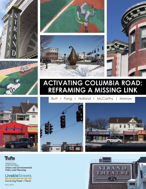
Activating Columbia Road: Reframing a Missing Link
This report was guided by Field Projects, an Urban Planning practicum at Tufts University. Our team (Aqsa Butt, Xianzheng Fang, Marah Holland, Lev McCarthy, and Megan Morrow) was partnered with LivableStreets Alliance to consolidate previous studies, recommendations, and outreach methods relating to Columbia Road. This was in effort to inform Livable Streets’ future community engagement along the corridor.
This report was guided by Field Projects, an Urban Planning practicum at Tufts University. Our team (Aqsa Butt, Xianzheng Fang, Marah Holland, Lev McCarthy, and Megan Morrow) was partnered with LivableStreets Alliance to consolidate previous studies, recommendations, and outreach methods relating to Columbia Road. This was in effort to inform Livable Streets’ future community engagement along the corridor.

You also want an ePaper? Increase the reach of your titles
YUMPU automatically turns print PDFs into web optimized ePapers that Google loves.
ACTIVATING COLUMBIA ROAD:<br />
REFRAMING A MISSING LINK<br />
Butt I Fang I Holland I McCarthy I Morrow<br />
May 2019
INSIDE OF REPORT COVER
ACTIVATING COLUMBIA ROAD:<br />
REFRAMING A MISSING LINK<br />
May 10, 2019<br />
Prepared by:<br />
Aqsa Butt<br />
Xianzheng Fang<br />
Marah Holland<br />
Lev McCarthy<br />
Megan Morrow<br />
Prepared for:<br />
LivableStreets Alliance
ACKNOWLEDGEMENTS<br />
We would like to first and foremost thank our project partner<br />
at LivableStreets Alliance, Tony Lechuga. His guidance and<br />
support, especially as an alumnus of UEP, was invaluable. We<br />
would also like to thank Alice Brown, Amber Christoffersen,<br />
Charlotte Fleetwood, Vineet Gupta, Lori Lobenstine, Michelle<br />
Moon, Alan Mountjoy, David Queeley, Stefanie Seskin, Natalia<br />
Urtubey, and Kishore Varanasi for generously sharing their time<br />
and professional insights with us as we prepared this report.<br />
Lastly, we are grateful to Christine Cousineau and Carolyn<br />
Meklenburg for their constant support and encouragement<br />
throughout the semester.<br />
Left to right: Christine Cousineau, Marah Holland, Lev McCarthy, Aqsa Butt, Xianzheng<br />
Fang, Carolyn Meklenburg, Megan Morrow, and Tony Lechuga.
TEAM MEMBERS<br />
Aqsa Butt<br />
M.A. Candidate, Urban and Environmental<br />
Policy and Planning, Tufts University<br />
linkedin.com/in/aqsab<br />
Xianzheng Fang<br />
M.A. Candidate, Urban and Environmental<br />
Policy and Planning, Tufts University<br />
linkedin.com/in/xianzhengfang<br />
Marah Holland<br />
M.A. Candidate, Urban and Environmental<br />
Policy and Planning, Tufts University<br />
linkedin.com/in/marahholland<br />
Lev McCarthy<br />
M.A. Candidate, Urban and Environmental<br />
Policy and Planning, Tufts University<br />
linkedin.com/in/levmccarthy<br />
Megan Morrow<br />
M.A. Candidate, Urban and Environmental<br />
Policy and Planning, Tufts University<br />
linkedin.com/in/morrowmegan
EXECUTIVE SUMMARY<br />
At first glance, <strong>Columbia</strong> <strong>Road</strong> appears to be a<br />
standard arterial road, running 2.4 miles through<br />
Dorchester and Roxbury, MA. However, its large<br />
width, high traffic, and sparse landscaping belie<br />
both its rich history and future potential. Home to<br />
several historic landmarks, including Boston’s oldest<br />
house, the <strong>Columbia</strong> <strong>Road</strong> corridor is bordered by<br />
several distinct neighborhoods and bookended by<br />
two large parks, Franklin Park and Moakley Park.<br />
Franklin Park is part of the Emerald Necklace, a<br />
series of parks designed in the late 19th century<br />
by Frederick Law Olmsted, known as the father<br />
of American landscape architecture. Olmsted<br />
envisioned that a verdant <strong>Columbia</strong> <strong>Road</strong> would<br />
serve as a key link in this network, yet this vision<br />
was never realized. Instead, <strong>Columbia</strong> <strong>Road</strong> was<br />
widened to host a major streetcar route through<br />
the 1950s before becoming the four-lane road it is<br />
today.<br />
Inspired by this unfinished historical plan, the City of<br />
Boston, as well as several other planning, design,<br />
and advocacy organizations, has proposed<br />
projects to turn this vision of a greenway into a<br />
reality. LivableStreets Alliance (LSA), a nonprofit<br />
501(c)(3) advocacy organization dedicated to<br />
improving transportation systems in the greater<br />
Boston region, is one such organization committed<br />
to helping the City of Boston realize this vision.<br />
Rather than add to this wealth of existing<br />
information, our Field Projects team set out to<br />
consolidate previous studies, recommendations,<br />
and outreach methods in an effort to inform<br />
LSA’s future community engagement along the<br />
corridor. It was our hope that by synthesizing<br />
current information and analyzing themes across<br />
existing planning processes, we could ultimately<br />
help LSA influence the City to prioritize action<br />
along this corridor. Our research methods included<br />
conducting a literature review of existing conditions<br />
and five primary documents, holding semistructured<br />
interviews with key contributors to each<br />
document, reviewing case studies, and performing<br />
related spatial analysis through GIS mapping.<br />
The following primary documents were identified<br />
in partnership with LSA as the most comprehensive<br />
and relevant plans or projects relating to <strong>Columbia</strong><br />
<strong>Road</strong>:<br />
• Fairmount Indigo Planning Initiative: Corridor<br />
Plan<br />
• Boston Green <strong>Link</strong>s<br />
• Go Boston 2030 Vision and Action Plan<br />
• Fulfilling the Promise: Community Building and<br />
the Emerald Necklace<br />
• Imagine Boston 2030: A Plan for the Future of<br />
Boston<br />
These documents were produced by planning<br />
agencies, private firms, and community organizers.<br />
Each document identifies particular needs,<br />
visions, and goals for <strong>Columbia</strong> <strong>Road</strong>. Our team<br />
interviewed key contributors from each document<br />
to gain a deeper understanding of the planning<br />
processes and outcomes. Along with these<br />
documents, we reviewed three case studies of<br />
comparable projects. Lastly, our research explored<br />
how a redesign could benefit mobility, open space,<br />
public health, and placemaking. <strong>Columbia</strong> <strong>Road</strong> is<br />
an important transportation corridor, so we sought<br />
to emphasize mobility in a multi-modal analysis<br />
of walkability, pedestrian experience, bicycle<br />
infrastructure, bus access and use, commuter rail<br />
access and use, and car use and parking.
Following this research process our analysis<br />
revealed three major themes:<br />
• Framing & Anchoring: While the historic Olmsted<br />
connection is a big draw for architects and<br />
planners, it does not take into account current<br />
residents’ wants and needs. Similarly, the<br />
communities surrounding <strong>Columbia</strong> <strong>Road</strong> do<br />
not identify with the “<strong>Columbia</strong> <strong>Road</strong> corridor”<br />
as a distinct place or cohesive community.<br />
• Siloed Interests and Agencies: The separate<br />
jurisdictions and goals among city agencies,<br />
planning processes, adjacent neighborhoods,<br />
and community interests complicate the<br />
process of addressing such a geographically<br />
expansive and socially complex corridor like<br />
<strong>Columbia</strong> <strong>Road</strong>.<br />
• Community Engagement: The majority of the<br />
processes behind the primary documents<br />
included a community component. However,<br />
community engagement has yet to be done<br />
in a way that is corridor-wide, multi-lingual, and<br />
approachable for all residents.<br />
These findings have lead us to make the following<br />
recommendations. First and foremost, we believe<br />
there is a need to demystify the idea of the<br />
Emerald Necklace and to reframe the purpose and<br />
motivations behind the <strong>Columbia</strong> <strong>Road</strong> project.<br />
We recommend moving away from this narrative<br />
and instead using community wants and needs<br />
to drive the decisions made for <strong>Columbia</strong> <strong>Road</strong>.<br />
Through a robust community engagement process,<br />
residents’ thoughts could provide a compelling,<br />
and more relevant, narrative for <strong>Columbia</strong> <strong>Road</strong>.<br />
Our research showed a significant opportunity<br />
to improve all modes of transportation along<br />
the corridor, as well as climate responsiveness,<br />
placemaking, and environmental health factors.<br />
Once the project is reframed, the engagement<br />
process can follow. In order to ensure that<br />
the project will serve the best interests of<br />
the surrounding neighborhoods, community<br />
engagement processes must work across<br />
neighborhood boundaries, within related planning<br />
processes, and in collaboration with multiple<br />
city departments. We recommend enhancing<br />
communication between planning projects,<br />
such as those for Franklin and Moakley Park, and<br />
integrating those projects into the community<br />
engagement process for <strong>Columbia</strong> <strong>Road</strong>. This<br />
includes working collaboratively with the MBTA to<br />
dispel concerns of competing transit modes.<br />
Lastly, we recommend creating and using<br />
multilingual outreach materials for all community<br />
engagement activities, building relationships with<br />
trusted community stakeholders, and collaborating<br />
with key entities along the corridor to ensure that<br />
the project will meet the needs of people who<br />
currently live on or around <strong>Columbia</strong> <strong>Road</strong>. We<br />
believe this expanded scope, combined with a<br />
comprehensive engagement process, will provide<br />
the City with the public input and support needed<br />
to push this project toward implementation.<br />
The factors that make the <strong>Columbia</strong> <strong>Road</strong> corridor<br />
a challenge to tackle - its history, diversity, high<br />
volume traffic, and sheer length - are the same<br />
factors that will make an eventual redesign<br />
that much more impactful. A redesign has the<br />
potential to improve mobility access, public health<br />
outcomes, climate resiliency, and open space<br />
access. Our team hopes that after years of related<br />
planning and conceptualizing, the City of Boston<br />
can use this synthesized report to reframe, reflect,<br />
and focus in on this project.<br />
We also recommend thoughtfully questioning<br />
the motives for this project before proceeding<br />
with any redesign of <strong>Columbia</strong> <strong>Road</strong>. Defining<br />
who this project is for, why it is important for the<br />
project to move forward, and how it should be<br />
framed will ensure that the redesign will serve the<br />
contemporary needs of the corridor rather than<br />
simply follow the trajectory of a historical plan.
Table of Contents<br />
ACKNOWLEDGEMENTS 4<br />
TEAM MEMBERS 5<br />
EXECUTIVE SUMMARY 6<br />
LIST OF FIGURES 10<br />
1. INTRODUCTION 12<br />
2. METHODS 20<br />
3. CONTEXT 26<br />
Environmental Justice Communities 42<br />
Public Health and Environmental Health 50<br />
Placemaking and Public Art 52<br />
Development and Planning Projects 55<br />
4. PRIMARY DOCUMENTS 60<br />
Fairmount Indigo Planning Initiative 63<br />
Boston Green <strong>Link</strong>s 67<br />
Go Boston 2030 69<br />
Fulfilling the Promise: Community Building & the Emerald Necklace 71<br />
Imagine Boston 2030 72<br />
5. MOBILITY 76<br />
Walkability and Pedestrian Experience 78<br />
Bike Counts and Bike Infrastructure 79<br />
Bus Accessibility and Use 81<br />
Fairmount Commuter Rail Line 84<br />
Car Use and Parking 86<br />
6. CASE STUDIES 88<br />
San Pablo Avenue 90<br />
Fountain Avenue 92<br />
Temple Street 94<br />
7. ANALYSIS 96<br />
8. RECOMMENDATIONS 100<br />
9. APPENDIX 104<br />
Glossary 105<br />
Sources of Graphics 106<br />
Interview Questions 109<br />
A Sample of Community Organizations Along and Near the Corridor 110<br />
BIBLIOGRAPHY 111
LIST OF FIGURES<br />
Figure 1: Plan of the Emerald Necklace, 1894<br />
Figure 2: The 1897 Plan of <strong>Columbia</strong> <strong>Road</strong><br />
Figure 3: <strong>Columbia</strong> <strong>Road</strong>, 1948<br />
Figure 4: <strong>Columbia</strong> <strong>Road</strong>, 2019<br />
Figure 5: The Emerald Necklace and <strong>Columbia</strong> <strong>Road</strong> (in Orange)<br />
Figure 6: Historic Timeline of Development along <strong>Columbia</strong> <strong>Road</strong><br />
Figures 7 and 8: The Legacy of Parks and Greenways (Above) and The Emerald Network (Below)<br />
Figure 9: The Economic Benefits of Greenways<br />
Figure 10: Research Methods<br />
Figure 11: Guiding Research Questions<br />
Figure 12: Locus Map: Greater Context of <strong>Columbia</strong> <strong>Road</strong><br />
Figure 13: Study Area by Census Block Group<br />
Figure 14: City of Boston Neighborhood Boundaries<br />
Figure 15: City of Boston Sub-Neighborhoods<br />
Figure 16: 2017 Average Household Income<br />
Figure 17: Predominant Population by Race<br />
Figure 18: Linguistic Isolation<br />
Figure 19: Percentage of Population with a Disability by Census Tract<br />
Figure 20: Percentage of Population Under 18<br />
Figure 21: Percentage of Population Over 65<br />
Figure 22: Distribution of Civic Institutions<br />
Figure 23: Streetscape Types<br />
Figure 24: The Standard <strong>Columbia</strong> <strong>Road</strong> Streetscape with a Tree Median<br />
Figure 25: Land Use Variation Along the Section of <strong>Columbia</strong> <strong>Road</strong> Between Blue Hill Ave and the<br />
Fairmount Commuter Rail Overpass<br />
Figure 26: Environmental Justice Communities<br />
Figure 27: Status of Environmental Justice<br />
Figure 28: Accessibility to Open Space<br />
Figure 29: Social Vulnerability Index<br />
Figure 30: Trips and GHG Emissions in 2016<br />
Figure 31: Flood Hazard Areas<br />
Figure 32: Asthma ED Visits Among 5- to 17-Year-Olds by Neighborhood<br />
Figure 33: Public Kitchen<br />
Figure 34: Artists in Residence<br />
Figure 35: Making Planning Processes Public<br />
Figure 36: Lighting the Line<br />
Figure 37: Imaginary Tea Stop<br />
Figure 38: Light Up the Bridge<br />
Figure 39: Upham’s Street Lab<br />
Figure 40: Placemaking and Public Art Vicinity Map<br />
Figure 41: Dudley Neighbors, Inc. Community Meeting<br />
Figure 42: Development Projects Along <strong>Columbia</strong> <strong>Road</strong><br />
Figure 43: Moakley Park Vision Plan Aerial
Figure 44: Children Play with a Beach-Themed Inflatable Installation as Part of DISCOVER Moakley!<br />
Figure 45: Timeline of <strong>Columbia</strong> <strong>Road</strong> Projects<br />
Figure 46: Cover page of the Fairmount Indigo Planning Initiative Corridor Plan<br />
Figure 47: Upham’s Corner <strong>Road</strong>way Construction Project<br />
Figure 48: Outreach Image Commonly Used for <strong>Columbia</strong> <strong>Road</strong> Green link<br />
Figure 49: Proposed Design for <strong>Columbia</strong> <strong>Road</strong> Green <strong>Link</strong><br />
Figure 50: Cover Page of Go Boston 2030: Vision and Action Plan<br />
Figure 51: <strong>Columbia</strong> <strong>Road</strong> Greenway in Go Boston 2030 Vision and Action Plan<br />
Figure 52: Outreach Image Used for Fulfilling the Promise<br />
Figure 53: Cover page of Imagine Boston 2030: A Plan for the Future of Boston<br />
Figure 54: Planning Process for Imagine Boston 2030 as a Tripod<br />
Figure 55: Outreach Materials for the Imagine Boston 2030 Community Meeting on Franklin Park and<br />
<strong>Columbia</strong> <strong>Road</strong><br />
Figure 56: Bicyclist on <strong>Columbia</strong> <strong>Road</strong><br />
Figure 57: Pedestrian Carrying Laundry on <strong>Columbia</strong> <strong>Road</strong><br />
Figure 58: Pedestrian Crossing <strong>Columbia</strong> <strong>Road</strong><br />
Figure 59: Bicycle Counts on <strong>Columbia</strong> <strong>Road</strong><br />
Figure 60: Bluebikes Stations (Current and Proposed, spring 2019)<br />
Figure 61: Bike Lane on <strong>Columbia</strong> <strong>Road</strong><br />
Figure 62: Bluebikes Station at the Intersection of <strong>Columbia</strong> <strong>Road</strong> and Blue Hill Avenue<br />
Figure 63: Bus stop on <strong>Columbia</strong> <strong>Road</strong><br />
Figure 64: MBTA Bus Stop Usage & Routes<br />
Figure 65: The 16 Bus on <strong>Columbia</strong> <strong>Road</strong><br />
Figure 66: MBTA Better Buses Proposal for the Route 16 bus<br />
Figure 67: <strong>Columbia</strong> <strong>Road</strong> Uses Around the Proposed Rail Stop<br />
Figure 68: Fairmount Line in Relation to <strong>Columbia</strong> <strong>Road</strong><br />
Figure 69: Commute by Car, Truck, or Van<br />
Figure 70: Location of Case Studies<br />
Figure 71: San Pablo Avenue Local Assets<br />
Figure 72: SPARC Mural Project on San Pablo Avenue<br />
Figure 73: SPARC Neighborhood Partners on San Pablo Avenue<br />
Figure 74: Proposed Changes to a Section of Fountain Avenue<br />
Figure 75: The Fountain Avenue Streetscape<br />
Figure 76: Street Safety Advocates Participate in a Demonstration as Part of Temple Street Slow Jams
1. INTRODUCTION
The Emerald Necklace<br />
Inspired by the example of Central Park in New York<br />
City, the City of Boston set out to establish a series<br />
of parks in the late 19th century. To accomplish<br />
this, they turned to the planner of Central Park<br />
himself, Frederick Law Olmsted, known as the<br />
father of American landscape architecture.<br />
Olmsted proceeded to construct a park system<br />
for the Boston Park Commission between 1878 and<br />
1895. The core of this network came to be known<br />
as the Emerald Necklace, including five major<br />
parks and four connecting parkways. Today, the<br />
Emerald Necklace winds through the city of Boston<br />
and parts of Brookline from the Back Bay through<br />
Jamaica Plain, Roxbury and into Dorchester. 1<br />
In an 1897 plan to continue the park system,<br />
Olmsted envisioned that <strong>Columbia</strong> <strong>Road</strong> would<br />
be a greenway. This proposed greenway would<br />
connect Franklin Park, a key part of the Emerald<br />
Necklace, to the Boston Harbor, one of Boston’s<br />
greatest natural assets. Like the other connecting<br />
parkways, it would serve as a link in the larger<br />
Emerald Necklace network. 2<br />
This vision was never realized. Unlike the other<br />
parkways, <strong>Columbia</strong> <strong>Road</strong> was an existing street,<br />
with quickly expanding commercial activities and<br />
traffic needs. Although it was widened in 1897, it<br />
still lacked the road space needed to become a<br />
true greenway and was instead designed similarly<br />
to Blue Hill Avenue, with a streetcar line in the<br />
center. 3,4<br />
1 Zaitzevsky, Frederick Law Olmsted and the Boston Park System.<br />
2 Zaitzevsky, Frederick Law Olmsted and the Boston Park System.<br />
3 Ibid.<br />
4 Historic Boston Incorporated, “Commercial Casebook:<br />
Upham’s Corner.”<br />
Figure 1: Plan of the Emerald Necklace, 1894<br />
Figure 2: The 1897 Plan of <strong>Columbia</strong> <strong>Road</strong><br />
<strong>Activating</strong> <strong>Columbia</strong> <strong>Road</strong>: <strong>Reframing</strong> a <strong>Missing</strong> <strong>Link</strong><br />
13
Figure 3: <strong>Columbia</strong> <strong>Road</strong>, 1948 Figure 4: <strong>Columbia</strong> <strong>Road</strong>, 2019<br />
<strong>Columbia</strong> <strong>Road</strong> has drastically changed since<br />
Olmsted’s time. What used to be a dirt boulevard<br />
for carriages and pedestrians is now a busy<br />
thoroughfare bisected by a sparsely planted<br />
median. Despite these changes, there is no doubt<br />
that a redesign of the corridor could still offer<br />
opportunities to improve mobility, public health,<br />
environmental justice, and placemaking along the<br />
corridor.<br />
To this end, the City of Boston, as well as<br />
several other planning, design, and advocacy<br />
organizations, have proposed projects to turn this<br />
vision of a greenway into a reality.<br />
Figure 5: The Emerald Necklace and <strong>Columbia</strong> <strong>Road</strong> (in Orange)<br />
14 <strong>Activating</strong> <strong>Columbia</strong> <strong>Road</strong>: <strong>Reframing</strong> a <strong>Missing</strong> <strong>Link</strong>
Figure 6: Historic Timeline of Development along <strong>Columbia</strong> <strong>Road</strong><br />
<strong>Activating</strong> <strong>Columbia</strong> <strong>Road</strong>: <strong>Reframing</strong> a <strong>Missing</strong> <strong>Link</strong><br />
15
LivableStreets Alliance<br />
LivableStreets Alliance (LSA) is one of several<br />
organizations committed to helping the City of<br />
Boston realize this vision of transforming <strong>Columbia</strong><br />
<strong>Road</strong> into a greenway. LSA is a nonprofit 501(c)<br />
(3) advocacy organization dedicated to<br />
improving transportation systems in the greater<br />
Boston region. LSA approaches their work with<br />
the knowledge that transportation is integrally<br />
linked to economic justice and public health. The<br />
organization advocates for solutions that help<br />
make communities more connected and livable for<br />
everyone.<br />
terminus of <strong>Columbia</strong> <strong>Road</strong>, the City of Boston<br />
is hiring twenty new transportation department<br />
staff, and the City has dedicated funding for this<br />
redesign project.<br />
To this end, our Field Projects team has partnered<br />
with LSA to synthesize past plans, assess existing<br />
information, and provide recommendations for the<br />
<strong>Columbia</strong> <strong>Road</strong> corridor.<br />
LSA was established in 2004 by a group of<br />
volunteers working out of a bedroom in<br />
Cambridge. At this time, many organizations were<br />
focused on improving the use of streets in the<br />
Boston Metro area for a single mode, like walking or<br />
biking. LSA became the first multi-modal advocacy<br />
organization in Boston, focusing on the inclusive<br />
vision of “streets are for people.” This concept<br />
meant working not only to improve conditions for<br />
people riding bikes in Boston, but also to address<br />
issues for people walking and taking transit. 5<br />
Today, LSA’s work has evolved into three priority<br />
programs: the Emerald Network, Vision Zero,<br />
and Better Buses. The Emerald Network is a<br />
proposed 200+ mile network of shared-use paths<br />
in the Greater Boston area; it builds upon the<br />
original Emerald Necklace, but extends beyond<br />
Boston proper to include suburban areas. When<br />
completed, the Emerald Network will be a system<br />
of safe, primarily non-motorized pathways that<br />
parallel routes in which many people already travel<br />
for commutes, pleasure, and exercise. <strong>Columbia</strong><br />
<strong>Road</strong> is part of this vision as a proposed greenway.<br />
The needs of today’s <strong>Columbia</strong> <strong>Road</strong> have shifted<br />
significantly since the 1800s. Therefore, LSA aims to<br />
encourage a renewed community engagement<br />
process to inform the pending redesign.<br />
Unfortunately, the community has experienced<br />
several false starts over the years, but luckily, in<br />
2019, there finally appears to be a confluence of<br />
planning action in the area. Plans are underway for<br />
Franklin Park and Moakley Park, located at either<br />
Figures 7 and 8: The legacy of parks and greenways (Above)<br />
and The Emerald Network (Below)<br />
5 This text has been paraphrased from an internal LSA<br />
document.<br />
16 <strong>Activating</strong> <strong>Columbia</strong> <strong>Road</strong>: <strong>Reframing</strong> a <strong>Missing</strong> <strong>Link</strong>
Greenways<br />
The term ‘greenway’ can be used to refer to many<br />
types of corridors, including linear parks, like the<br />
Rose Fitzgerald Kennedy Greenway in downtown<br />
Boston, off-road walking and biking routes, like<br />
the East Coast Greenway, or simply corridors with<br />
the ability to connect people and places. 6 The<br />
Emerald Network recognizes four different types<br />
of greenways: park path, off-road, neighborway<br />
and greenway connectors. 7 What all these types<br />
have in common are features that promote active<br />
transportation and a sense of place, such as<br />
connections to parks, lighting and seating, safe<br />
crossings, and plantings and street trees.<br />
Greenways have the potential to deliver benefits in<br />
five areas:<br />
• Mobility Greenways increase access to safe<br />
walking and cycling routes, extending the<br />
reach of multi-modal transportation networks.<br />
• Quality of Life Access to green space and<br />
increased physical activity benefit both physical<br />
and mental health of greenway users.<br />
Figure 9: The Economic Benefits of Greenways<br />
• Economic Development Greenways<br />
provide better access to both retail and job<br />
opportunities; for every million dollars spent on<br />
greenways, sidewalks, and bicycle facilities,17<br />
jobs are created. 8<br />
• Healthy Environment Increased green<br />
infrastructure such as trees, bushes, plants, or<br />
grasses have the potential to reduce flood risk<br />
and air pollution.<br />
• Equity and Opportunity Greenways can attract<br />
investment to neighborhoods by connecting<br />
people to transit and jobs that are otherwise<br />
inaccessible.<br />
6 Greenways, Inc., “Benefits Of Greenways.”<br />
7 LivableStreets Alliance, “Emerald Network.”<br />
8 Emerald Network, “Home.”<br />
<strong>Activating</strong> <strong>Columbia</strong> <strong>Road</strong>: <strong>Reframing</strong> a <strong>Missing</strong> <strong>Link</strong><br />
17
Project Goals<br />
<strong>Columbia</strong> <strong>Road</strong> has a long history, a complicated<br />
present, and a future filled with opportunity. Over<br />
the past decade, organizations including the<br />
Boston Planning and Development Agency, the<br />
Boston Department of Transportation, and the<br />
Boston Society of Architects have contributed<br />
to the conversation surrounding <strong>Columbia</strong> <strong>Road</strong><br />
and the vision for what it could become. Rather<br />
than add to this vision, our research focused on<br />
consolidating previous studies, recommendations,<br />
and outreach methods in an effort to inform LSA’s<br />
future community engagement along the corridor.<br />
This consolidation will not only better inform future<br />
action, but it will also help demonstrate how the<br />
City of Boston is working towards its published goals<br />
and plans. We hope this synthesis will ultimately<br />
help LSA influence the city to prioritize action on this<br />
project.<br />
In producing this report, the following questions<br />
guided our research:<br />
1. What data and information currently exist for<br />
the <strong>Columbia</strong> <strong>Road</strong> corridor?<br />
2. What are LSA and the <strong>Columbia</strong> <strong>Road</strong><br />
stakeholders’ short and long term priorities?<br />
3. How can LSA effectively engage and<br />
communicate with those who live along and<br />
utilize <strong>Columbia</strong> <strong>Road</strong>?<br />
4. How can our team develop materials and<br />
synthesize data to best serve LSA’s community<br />
engagement strategies?<br />
5. How can we package our findings in a way<br />
that helps LSA in their ultimate goal to influence<br />
the city to prioritize <strong>Columbia</strong> <strong>Road</strong>?<br />
18 <strong>Activating</strong> <strong>Columbia</strong> <strong>Road</strong>: <strong>Reframing</strong> a <strong>Missing</strong> <strong>Link</strong>
THIS PAGE INTENTIONALLY LEFT BLANK<br />
<strong>Activating</strong> <strong>Columbia</strong> <strong>Road</strong>: <strong>Reframing</strong> a <strong>Missing</strong> <strong>Link</strong><br />
19
2. METHODS
The primary methods for this project included:<br />
• Research and Literature Review<br />
• Document Analysis and Interviews<br />
• Case Studies<br />
• Mapping<br />
These methods informed an in-depth review of<br />
existing conditions, past planning projects, and<br />
community outreach. With the understanding<br />
that the surrounding neighborhoods may have<br />
experienced “survey fatigue,” we chose not to<br />
seek further community input for the purposes of<br />
our report. Instead, we turned to those who had<br />
previously engaged with the corridor to understand<br />
their findings and any actions their work may have<br />
inspired.<br />
Research and Literature Review<br />
Our online research and literature review identified<br />
existing conditions along the corridor including<br />
demographics, streetscape, environmental justice,<br />
public health, placemaking and public art, current<br />
development and planning projects, and mobility<br />
contexts.<br />
Primary Documents:<br />
1. Fairmount Indigo Planning Initiative: Corridor<br />
Plan<br />
2. Boston Green <strong>Link</strong>s<br />
3. Go Boston 2030 Vision and Action Plan<br />
4. Fulfilling the Promise: Community Building and<br />
the Emerald Necklace<br />
5. Imagine Boston 2030: A Plan for the Future of<br />
Boston<br />
These documents were produced by planning<br />
agencies and community organizers that previously<br />
identified needs, visions, and goals for <strong>Columbia</strong><br />
<strong>Road</strong>. By reviewing the online documentation<br />
and reports related to these documents, and<br />
by conducting interviews, as described below,<br />
our team was able to identify previously utilized<br />
practices for engaging and communicating with<br />
those living along <strong>Columbia</strong> <strong>Road</strong>.<br />
We conducted a series of semi-structured<br />
interviews with key contributors from each of the<br />
five primary documents. This process allowed us to<br />
gather data on the motivations, visions, and goals<br />
of each of these primary documents.<br />
Document Analysis and Interviews<br />
The majority of our research focused on five primary<br />
documents that were identified in partnership with<br />
LSA as the most comprehensive and relevant plans<br />
or projects relating to <strong>Columbia</strong> <strong>Road</strong>.<br />
San Pablo Avenue<br />
Oakland, CA<br />
Fountain Avenue<br />
Brooklyn, NY<br />
Existing Conditions<br />
Mobility<br />
Temple Street<br />
Los Angeles, CA<br />
EJ & Public Health<br />
Placemaking<br />
Reserach & Literature Review<br />
Document Analysis<br />
and Interviews<br />
Case Studies<br />
Mapping<br />
Figure 10: Research Methods<br />
<strong>Activating</strong> <strong>Columbia</strong> <strong>Road</strong>: <strong>Reframing</strong> a <strong>Missing</strong> <strong>Link</strong><br />
21
CURRENT DATA<br />
What data and information currently exist<br />
for the <strong>Columbia</strong> <strong>Road</strong> corridor?<br />
STAKEHOLDERS + PRIORITIES<br />
What are LSA and the <strong>Columbia</strong> <strong>Road</strong><br />
stakeholders’ short and long term priorities?<br />
COMMUNITY ENGAGEMENT TOOLS<br />
How can LSA effectively engage and<br />
communicate with those who live along<br />
and utilize <strong>Columbia</strong> <strong>Road</strong>?<br />
recommendations<br />
research<br />
SYNTHESIZING DATA FOR<br />
COMMUNITY ENGAGEMENT<br />
How can our team develop materials<br />
and synthesize data to best serve LSA’s<br />
community engagement strategies?<br />
PRIORITIZING COLUMBIA ROAD<br />
How can we package our findings in a<br />
way that helps LSA in their ultimate goal<br />
to influence the city to prioritize <strong>Columbia</strong><br />
<strong>Road</strong>?<br />
Figure 11: Guiding Research Questions<br />
22 <strong>Activating</strong> <strong>Columbia</strong> <strong>Road</strong>: <strong>Reframing</strong> a <strong>Missing</strong> <strong>Link</strong>
Michelle Moon<br />
Fairmount Greenway Project<br />
Manager, Fairmount Indigo<br />
CDC Collaborative<br />
David Queeley<br />
Director of<br />
Eco-Innovation, Codman<br />
Square Neighborhood<br />
Development Corporation,<br />
a member of the Fairmount<br />
Indigo CDC Collaborative<br />
Alan Mountjoy<br />
Principal, NBBJ<br />
Amber Christoffersen<br />
Mystic Greenways Director,<br />
Mystic River Watershed<br />
Association<br />
Kishore Varanasi<br />
Principal and Director of<br />
Urban Design, CBT Architects<br />
Lori Lobenstine<br />
Program Design Lead, Design<br />
Studio for Social Intervention<br />
(DS4SI), a core partner in the<br />
Fairmount Culture Corridor<br />
Alice Brown<br />
Director of Planning, Boston<br />
Harbor Now<br />
Charlotte Fleetwood<br />
Senior Transportation Planner,<br />
Boston Transportation Department<br />
Natalia Urtubey<br />
Director of Small Business, City of<br />
Boston<br />
Stefanie Seskin<br />
Active Transportation Director,<br />
Boston Transportation Department<br />
Vineet Gupta<br />
Director of Planning, Boston<br />
Department of Transportation<br />
<strong>Activating</strong> <strong>Columbia</strong> <strong>Road</strong>: <strong>Reframing</strong> a <strong>Missing</strong> <strong>Link</strong><br />
23
Case Studies<br />
We reviewed three case studies of comparable<br />
urban greenway projects in Oakland, CA, Brooklyn,<br />
NY, and Los Angeles, CA.<br />
Mapping<br />
Our final research method employed mapping<br />
to assess existing conditions, understand the<br />
neighborhood context, and to identify gaps in<br />
resources. When available, we utilized existing<br />
maps included in previous reports.<br />
We addressed the following topics:<br />
Mobility<br />
Mobility, including the MBTA bus system, Fairmount<br />
Indigo Line, and commuting patterns.<br />
Figure 64: MBTA Bus Stop Usage & Routes<br />
Figure 68: Fairmount Line in Relation to <strong>Columbia</strong><br />
<strong>Road</strong><br />
Figure 69: Commute by Car, Truck or Van<br />
Existing Conditions<br />
Environmental Justice &<br />
Public Health<br />
Existing conditions, including site context,<br />
neighborhood and sub-neighborhood boundaries,<br />
demographics, locations of civic institutions,<br />
land use, street views, and nearby development<br />
projects.<br />
Figure 12: Locus Map: Greater Context of <strong>Columbia</strong><br />
<strong>Road</strong><br />
Figure 13: Study Area by Census Block Group<br />
Figure 14: City of Boston Neighborhood Boundaries<br />
Figure 15: City of Boston Sub-Neighborhoods<br />
Figure 16: 2017 Average Household Income<br />
Figure 17: Predominant Population by Race<br />
Figure 18: Linguistic Isolation<br />
Figure 19: Percentage of Population with a<br />
Disability by Census Tract<br />
Figure 20: Percentage of Population Under 18<br />
Figure 21: Percentage of Population Over 65<br />
Figure 22: Distribution of Civic Institutions<br />
Figure 23: Streetscape Types<br />
Figure 25: Land Use Variation Along the Section<br />
of <strong>Columbia</strong> <strong>Road</strong> Between Blue Hill Ave and the<br />
Fairmount Commuter Rail Overpass<br />
Figure 42: Development Projects Along <strong>Columbia</strong><br />
<strong>Road</strong><br />
Environmental Justice and public health, including<br />
Environmental Justice communities, access to<br />
open space, social vulnerability, flood hazard<br />
areas, greenhouse gas emissions, and distribution of<br />
chronic disease.<br />
Figure 26: Environmental Justice Communities<br />
Figure 27: Status of Environmental Justice<br />
Figure 28: Accessibility to Open Space<br />
Figure 29: Social Vulnerability Index<br />
Figure 30: Trips and GHG Emissions in 2016<br />
Figure 31: Flood Hazard Areas<br />
Figure 32: Asthma ED Visits Among 5- to 17-Year-<br />
Olds by Neighborhood<br />
Placemaking Initiatives<br />
Placemaking initiatives, including a vicinity map<br />
showing accessibility to placemaking initiatives.<br />
Figure 40: Placemaking and Public Art Vicinity Map<br />
24 <strong>Activating</strong> <strong>Columbia</strong> <strong>Road</strong>: <strong>Reframing</strong> a <strong>Missing</strong> <strong>Link</strong>
THIS PAGE INTENTIONALLY LEFT BLANK<br />
<strong>Activating</strong> <strong>Columbia</strong> <strong>Road</strong>: <strong>Reframing</strong> a <strong>Missing</strong> <strong>Link</strong><br />
25
3. CONTEXT
Location and Demographics<br />
<strong>Columbia</strong> <strong>Road</strong> is a major arterial road extending<br />
for 2.4-miles from the eastern corner of Franklin<br />
Park to Kosciuszko Circle at the southern point<br />
of Moakley Park. It extends through the Boston<br />
neighborhoods of Roxbury and Dorchester (see<br />
Figure 14). Within these neighborhoods, there are<br />
sub-neighborhoods which are especially useful for<br />
our analysis, as this is the scale at which residents<br />
and organizations typically relate (see Figure 15).<br />
One such sub-neighborhood, Upham’s Corner, is<br />
paramount to our research, as <strong>Columbia</strong> <strong>Road</strong> runs<br />
directly through the primary intersection that serves<br />
as the commercial and civic hub of the Upham’s<br />
Corner sub-neighborhood.<br />
We defined the <strong>Columbia</strong> <strong>Road</strong> study area<br />
as census block groups within a ¼-mile of the<br />
roadway. Following this definition, the <strong>Columbia</strong><br />
<strong>Road</strong> corridor consists of 44 census block groups.<br />
The corridor has low average incomes (see Figure<br />
16), is composed of majority African American<br />
residents (see Figure 17), and has several<br />
areas where over 25% or more of residents are<br />
linguistically isolated (see Figure 18). The US Census<br />
Bureau uses the term linguistic isolation to describe<br />
households where English speaking is limited. The<br />
purpose of this measure is to determine where<br />
there are households who might need assistance to<br />
communicate with government, health providers,<br />
and social services. 1 Other socially vulnerable<br />
populations in the corridor include children, seniors,<br />
and residents with disabilities. Nine percent of<br />
residents are over the age of 65, 23.6% are children<br />
under the age of 18, and 15.6% have a disability. 2<br />
Disability metrics include those residents that have<br />
hearing, vision, cognitive, ambulatory, self-care,<br />
and/or independent living difficulties. Please note<br />
that disability metrics were only available at the<br />
census tract level.<br />
1 Siegel et al., “Language Use and Linguistic Isolation: Historical<br />
Data and Methodological Issues.”<br />
2 U.S. Census Bureau, “American Community Survey 5-Year<br />
Estimates.”<br />
<strong>Activating</strong> <strong>Columbia</strong> <strong>Road</strong>: <strong>Reframing</strong> a <strong>Missing</strong> <strong>Link</strong><br />
27
Source: MassGIS<br />
Figure 12: Locus Map: Greater Context of <strong>Columbia</strong> <strong>Road</strong><br />
<strong>Columbia</strong> <strong>Road</strong> extends for 2.4-miles through Dorchester and Roxbury, Massachusetts, two<br />
municipalities within the City of Boston.<br />
28 <strong>Activating</strong> <strong>Columbia</strong> <strong>Road</strong>: <strong>Reframing</strong> a <strong>Missing</strong> <strong>Link</strong>
Source: MassGIS<br />
Figure 13: Study Area by Census Block Group<br />
We defined the study area as the 44 census block groups within 1/4 mile of <strong>Columbia</strong> <strong>Road</strong>. A<br />
quarter mile is a common standard used for accessibility.<br />
<strong>Activating</strong> <strong>Columbia</strong> <strong>Road</strong>: <strong>Reframing</strong> a <strong>Missing</strong> <strong>Link</strong><br />
29
Boston Neighborhoods<br />
Source: MassGIS, Boston Planning and<br />
Development Agnecy<br />
Figure 14: City of Boston Neighborhood Boundaries<br />
<strong>Columbia</strong> <strong>Road</strong> runs through three neighborhoods within the City of Boston: Roxbury, North<br />
Dorchester, and South Dorchester.<br />
30 <strong>Activating</strong> <strong>Columbia</strong> <strong>Road</strong>: <strong>Reframing</strong> a <strong>Missing</strong> <strong>Link</strong>
Boston Sub-Neighborhoods<br />
Source: MassGIS, Boston Planning and<br />
Development Agnecy<br />
Figure 15: City of Boston Sub-Neighborhoods<br />
Five sub-neighborhoods border <strong>Columbia</strong> <strong>Road</strong>.<br />
<strong>Activating</strong> <strong>Columbia</strong> <strong>Road</strong>: <strong>Reframing</strong> a <strong>Missing</strong> <strong>Link</strong><br />
31
Figure 16: 2017 Average Household Income<br />
Source: MassGIS, ACS 2017 (5-year)<br />
Average household incomes along <strong>Columbia</strong> <strong>Road</strong> are lower than average compared with<br />
the City of Boston as a whole. The highest average income in the study area is $120,251 while<br />
the highest average income in the City of Boston is $336,169.<br />
32 <strong>Activating</strong> <strong>Columbia</strong> <strong>Road</strong>: <strong>Reframing</strong> a <strong>Missing</strong> <strong>Link</strong>
Source: MassGIS, Esri,<br />
U.S Census Bureau, NAV/TEQ<br />
Figure 17: Predominant Population by Race<br />
The majority of block groups bordering <strong>Columbia</strong> <strong>Road</strong> have a predominantly African American<br />
population. However, the northern portion of the road is bordered by majority White block<br />
groups and one majority Hispanic block group.<br />
<strong>Activating</strong> <strong>Columbia</strong> <strong>Road</strong>: <strong>Reframing</strong> a <strong>Missing</strong> <strong>Link</strong><br />
33
Source: MassGIS, MassEOEEA<br />
Figure 18: Linguistic Isolation<br />
Several block groups along <strong>Columbia</strong> <strong>Road</strong> qualify as areas of linguistic isolation. The US<br />
Census Bureau uses the term linguistic isolation to describe households where English speaking<br />
is limited.<br />
34 <strong>Activating</strong> <strong>Columbia</strong> <strong>Road</strong>: <strong>Reframing</strong> a <strong>Missing</strong> <strong>Link</strong>
Source: MassGIS, ACS 2017 (5-year)<br />
Figure 19: Percentage of Population with a Disability by Census Tract<br />
Among residents in the <strong>Columbia</strong> <strong>Road</strong> corridor, 15.6% have a disability. Disability metrics<br />
include those residents that have hearing, vision, cognitive, ambulatory, self-care, and/or<br />
independent living difficulties. Please note that disability metrics were only available at the<br />
census tract level.<br />
<strong>Activating</strong> <strong>Columbia</strong> <strong>Road</strong>: <strong>Reframing</strong> a <strong>Missing</strong> <strong>Link</strong><br />
35
Source: MassGIS, ACS 2017 (5-year)<br />
Figure 20: Percentage of Population Under 18<br />
Among residents in the <strong>Columbia</strong> <strong>Road</strong> corridor, 23.6% are children under the age of<br />
18. According to the City of Boston, Dorchester and Roxbury have some of the highest<br />
percentages of teenagers in the City of Boston.<br />
36 <strong>Activating</strong> <strong>Columbia</strong> <strong>Road</strong>: <strong>Reframing</strong> a <strong>Missing</strong> <strong>Link</strong>
Source: MassGIS, ACS 2017 (5-year)<br />
Figure 21: Percentage of Population Over 65<br />
Among residents in the <strong>Columbia</strong> <strong>Road</strong> corridor, 9.2% are over the age of 65.<br />
<strong>Activating</strong> <strong>Columbia</strong> <strong>Road</strong>: <strong>Reframing</strong> a <strong>Missing</strong> <strong>Link</strong><br />
37
Source: MassGIS, ReferenceUSA<br />
Figure 22: Distribution of Civic Institutions<br />
There are a number of different civic institutions surrounding <strong>Columbia</strong> <strong>Road</strong>, with churches<br />
and schools outnumbering other institutions significantly.<br />
38 <strong>Activating</strong> <strong>Columbia</strong> <strong>Road</strong>: <strong>Reframing</strong> a <strong>Missing</strong> <strong>Link</strong>
Figure 23: Streetscape Types<br />
<strong>Activating</strong> <strong>Columbia</strong> <strong>Road</strong>: <strong>Reframing</strong> a <strong>Missing</strong> <strong>Link</strong><br />
39
of Blue Hill Avenue up to the Fairmount Commuter<br />
Line overpass. For the next .9 miles the median<br />
contains concrete planters. At the intersection<br />
with Massachusetts Avenue, the type changes for<br />
the last time to a narrow (about 4-foot) concrete<br />
median with two, and then eventually four, lanes<br />
of vehicular traffic up to where <strong>Columbia</strong> <strong>Road</strong><br />
terminates at the Kosciuszko Circle roundabout.<br />
Figure 24: The Standard <strong>Columbia</strong> <strong>Road</strong><br />
Streetscape with a Tree Median<br />
Over its 2.4-mile length, the <strong>Columbia</strong> <strong>Road</strong><br />
streetscape varies. Starting at the southwest end,<br />
<strong>Columbia</strong> <strong>Road</strong> begins at a four-way intersection<br />
with Blue Hill Avenue. At this terminus, <strong>Columbia</strong><br />
<strong>Road</strong> begins with six vehicular lanes, leaving a<br />
narrowed median, a bicycle lane going east and<br />
bicycle sharrows going west entering the Blue Hill<br />
Ave intersection.<br />
Progressing northeastward from that intersection,<br />
the road narrows and takes the form of the majority<br />
of the corridor: four travel lanes, two in each<br />
direction, with parallel parking on both sides, threefoot<br />
demarcated bike lanes in both directions,<br />
and about a 14-foot median. Most of the corridor<br />
exhibits this standard streetscape, varying only at<br />
intersections. At primary intersections, the median is<br />
narrowed to accommodate turning lanes, and the<br />
bike lanes typically merge into the vehicular lanes<br />
as sharrows.<br />
On either side of the roadway, there is<br />
substantial diversity in the land use of adjacent<br />
parcels. Starting again at the Blue Hill Avenue<br />
intersection, the adjacent properties transition<br />
quickly from commercial, in the intersection, to<br />
residential. Continuing along the corridor, land<br />
use is predominantly residential with clusters of<br />
commercial, retail, and institutional uses at the<br />
primary intersections. Housing types range from<br />
single-family homes with sizeable lawns, to tripledeckers,<br />
to three or four story row houses and<br />
block-wide apartment complexes. There are very<br />
few unbuilt parcels, exceptions being a few parking<br />
lots and one or two vacant lots. The mix of uses<br />
outlined above results in an irregular facade plane.<br />
Some blocks are rows of single-family homes with<br />
substantial setbacks and wide spaces between<br />
houses; some blocks are uniform four-story brick<br />
residential structures right along the sidewalk; and<br />
some blocks are dominated by triple-deckers<br />
divided by driveways.<br />
The median strip between travel lanes alternates<br />
among the four streetscape types described in<br />
Figure 23. Starting again at the intersection of Blue<br />
Hill Ave, the first type is a 4-foot concrete platform<br />
at intersections, where the addition of vehicular<br />
turning lanes narrows the median. Beyond the<br />
intersections, the standard streetscape described<br />
above includes about a 14-foot raised median<br />
that in some places is concrete with raised circular<br />
concrete planters, and in others is planted with a<br />
single row of trees. The row of trees type is found<br />
for about .8 continuous miles from the intersection<br />
40 <strong>Activating</strong> <strong>Columbia</strong> <strong>Road</strong>: <strong>Reframing</strong> a <strong>Missing</strong> <strong>Link</strong>
Figure 25: Land Use Variation Along the Section of <strong>Columbia</strong> <strong>Road</strong> Between Blue Hill Ave and the<br />
Fairmount Commuter Rail Overpass<br />
<strong>Activating</strong> <strong>Columbia</strong> <strong>Road</strong>: <strong>Reframing</strong> a <strong>Missing</strong> <strong>Link</strong><br />
41
Environmental Justice Communities<br />
Our team used spatial analysis, as well as relevant<br />
reports, such as the Boston Open Space and<br />
Recreation Plan 2015-2021, Carbon Free Boston,<br />
and Coastal Resilience Solutions for South Boston,<br />
to gain a comprehensive understanding of existing<br />
conditions in terms of environmental justice, open<br />
space, and climate change resilience.<br />
According to The Massachusetts Executive<br />
Office of Energy and Environmental Affairs<br />
(EOEEA), environmental justice refers to “the<br />
equal protection and meaningful involvement<br />
of all people with respect to the development,<br />
implementation, and enforcement of<br />
environmental laws, regulations, and policies<br />
and the equitable distribution of environmental<br />
benefits.” 3 The enforcement of environmental<br />
justice principles is devoted to enabling everyone<br />
to live in and enjoy a clean and healthful<br />
environment and to be free of environmental<br />
pollution. 4<br />
EOEEA defines environmental justice populations<br />
as neighborhoods that meet one of more of the<br />
following criteria: 5<br />
• Block group whose annual median household<br />
income is equal to or less than 65% of the<br />
statewide median ($62,072 in 2010)<br />
• 25% or more of the residents identify as a race<br />
other than white<br />
• 25% or more of households have no one over<br />
the age of 14 who speaks English only or very<br />
well<br />
Open space, as defined by the state of<br />
Massachusetts, includes conservation land,<br />
recreation land, town forests, parkways, agriculture<br />
land, aquifer protection land, watershed<br />
protection land, cemeteries, and forest land. 6<br />
The Boston Open Space and Recreation Plan<br />
2015-2021 examined the environmental justice<br />
3 Mass.gov, “Smart Growth / Smart Energy Toolkit Modules -<br />
Environmental Justice (EJ).”<br />
4 Ibid.<br />
5 Mass.gov, “Environmental Justice Communities in<br />
Massachusetts.”<br />
6 Massachusetts Document Repository, “MassGIS Data:<br />
Protected and Recreational OpenSpace.”<br />
populations and open space access in all Boston<br />
neighborhoods, including Dorchester and Roxbury.<br />
We similarly evaluated these aspects, with a focus<br />
on the <strong>Columbia</strong> <strong>Road</strong> corridor.<br />
The distribution of open space along <strong>Columbia</strong><br />
<strong>Road</strong> shows a diversity of open space types and<br />
scales - from closely clustered small pocket parks to<br />
the city’s largest park: Franklin Park (see Figure 28).<br />
Franklin Park and Moakley Park, at opposite ends<br />
of the corridor, offer nearby residents a substantial<br />
opportunity to enjoy open space and recreation;<br />
however, the <strong>Columbia</strong> <strong>Road</strong> corridor, as it<br />
currently exists, does not make these parks easily<br />
accessible. A redesign of <strong>Columbia</strong> <strong>Road</strong> could<br />
play a role in increasing access both to these parks<br />
and to the waterfront, providing added benefits<br />
and opportunities to spend time outdoors.<br />
The Boston Open Space and Recreation Plan 2015-<br />
2021 points out that small parks, which are the most<br />
frequent along <strong>Columbia</strong> <strong>Road</strong>, often lack active<br />
facilities, such as athletic fields and courts. This<br />
particularly affects teenagers, many of whom use<br />
local recreation facilities to exercise or spend time<br />
with friends; therefore, Dorchester and Roxbury,<br />
which have some of the highest percentages of<br />
teenagers in the city, would particularly benefit<br />
from enhanced outdoor recreation space. 7<br />
Although open space is fairly accessible to<br />
<strong>Columbia</strong> <strong>Road</strong>, all block groups in the study<br />
area meet the other criteria for environmental<br />
justice populations. Areas close by also qualify,<br />
or are close to meeting the criteria (see figures X<br />
and X). It is generally believed that low-income<br />
and minority communities are at greater risk of<br />
environmental burdens and at the same time<br />
lack environmental assets in their neighborhoods.<br />
Therefore, our assessment of existing environmental<br />
justice populations indicates that these areas need<br />
to enhance access to and quality of open space in<br />
order to improve residents’ quality of life.<br />
7 City of Boston, “Open Space & Recreation Plan 2015-2021:<br />
Section 7.2 - Analysis of Needs: Community Open Space &<br />
Recreation.”<br />
42 <strong>Activating</strong> <strong>Columbia</strong> <strong>Road</strong>: <strong>Reframing</strong> a <strong>Missing</strong> <strong>Link</strong>
We also analyzed the social vulnerability,<br />
greenhouse gas emissions (GHG) levels, and<br />
flood risk along the corridor. We used the Social<br />
Vulnerability Index created by the United States<br />
Centers for Disease Control and Prevention (CDC)<br />
to examine socially vulnerable populations in<br />
nearby neighborhoods. Social vulnerability refers<br />
to “the resilience of communities when confronted<br />
by external stresses on human health, stresses such<br />
as natural or human-caused disasters, or disease<br />
outbreaks.” 8 The entire <strong>Columbia</strong> <strong>Road</strong> corridor<br />
exhibits a high level of social vulnerability.<br />
GHGs were analyzed using the Carbon Free Boston<br />
report, which states that quantities of GHGs per<br />
trip in areas close to the inner city are far smaller<br />
than in outlying neighborhoods due to the shorter<br />
average trip distance and increased mobility<br />
options (see Figure 30). 9 However <strong>Columbia</strong> <strong>Road</strong><br />
hosts an immense traffic flow as a wide corridor<br />
and has a weak connection to existing public<br />
transit options. Lastly, flood risks are concentrated<br />
mainly along the coastline, but they are present<br />
at the northern terminus of <strong>Columbia</strong> <strong>Road</strong>. The<br />
proximity to a high risk coastal area coupled with<br />
high social vulnerability promotes an urgency to<br />
propose strategies for future development that<br />
improve resiliency, environmental justice, and<br />
accessibility to open space.<br />
8 Agency for Toxic Substances and Disease Registry, “CDC’s<br />
Social Vulnerability Index.”<br />
9 Boston Green Ribbon Commission and Boston University,<br />
“Carbon Free Boston: Summary Report 2019.”<br />
<strong>Activating</strong> <strong>Columbia</strong> <strong>Road</strong>: <strong>Reframing</strong> a <strong>Missing</strong> <strong>Link</strong><br />
43
Source: MassGIS, MassEOEEA<br />
Figure 26: Environmental Justice Communities<br />
All block groups in our study area meet the criteria for environmental justice populations for<br />
at least one category. Minority and income are the two most frequently identified categories<br />
along <strong>Columbia</strong> <strong>Road</strong>.<br />
44 <strong>Activating</strong> <strong>Columbia</strong> <strong>Road</strong>: <strong>Reframing</strong> a <strong>Missing</strong> <strong>Link</strong>
Source: MassGIS, MassEOEEA<br />
Figure 27: Status of Environmental Justice<br />
All block groups in the study area meet criteria for environmental justice populations, with most<br />
of the block groups meeting the criteria for two or more categories.<br />
<strong>Activating</strong> <strong>Columbia</strong> <strong>Road</strong>: <strong>Reframing</strong> a <strong>Missing</strong> <strong>Link</strong><br />
45
Source: MassGIS<br />
Figure 28: Accessibility to Open Space<br />
Low-income and minority communities are at greater risk of environmental burdens and at the<br />
same time lack environmental assets in their neighborhoods. Our assessment indicates that<br />
these areas need to enhance access to and quality of open space in order to improve quality<br />
of life for residents.<br />
46 <strong>Activating</strong> <strong>Columbia</strong> <strong>Road</strong>: <strong>Reframing</strong> a <strong>Missing</strong> <strong>Link</strong>
y Census Tract<br />
Source: MassGIS, US Centers for Disease Control and Prevention<br />
Figure 29: Social Vulnerability Index<br />
The entire <strong>Columbia</strong> <strong>Road</strong> corridor exhibits a high level of social vulnerability, with most block<br />
groups exceeding the 0.76 SVI Score.<br />
<strong>Activating</strong> <strong>Columbia</strong> <strong>Road</strong>: <strong>Reframing</strong> a <strong>Missing</strong> <strong>Link</strong><br />
47
Source: Boston Green Ribbon Commission and Boston University, “Carbon Free Boston: Summary Report 2019”<br />
Figure 30: Trips and GHG Emissions in 2016<br />
This map depicts the relationship among three factors: the number of trips made to/from<br />
Boston, the GHG released per trip, and the distance from Boston. A color represents two<br />
dimensions: the number of trips that start or end in Boston, and the quantity of GHG released<br />
per trip. The blue inner core has a greater number of trips, but much lower GHG emissions per<br />
trip compared with outer regions.<br />
Inset Graph: The vertical axis is the average number of daily trips to/from Boston; the horizontal<br />
axis is the GHG released per trip.<br />
48 <strong>Activating</strong> <strong>Columbia</strong> <strong>Road</strong>: <strong>Reframing</strong> a <strong>Missing</strong> <strong>Link</strong>
Source: MassGIS, MassEOEEA<br />
Figure 31: Flood Hazard Areas<br />
Although <strong>Columbia</strong> <strong>Road</strong> is not in immediate danger of flooding, some of the block groups in<br />
our study area are at risk of flooding, increasing the vulnerability for residents in those areas.<br />
<strong>Activating</strong> <strong>Columbia</strong> <strong>Road</strong>: <strong>Reframing</strong> a <strong>Missing</strong> <strong>Link</strong><br />
49
Public Health and Environmental Health<br />
Land use decisions have a major impact on the<br />
public health of communities. This link between<br />
public health and the environment is referred<br />
to as environmental health. The World Health<br />
Organization defines environmental health as “a<br />
holistic consideration for the physical, chemical,<br />
and biological factors external to a person, and all<br />
the related factors impacting behavior.” 10 Obesity,<br />
asthma, and stress, are some of the primary public<br />
health outcomes that correlate with urban living<br />
conditions. Limited access to open space and<br />
walkable destinations can lead to higher rates of<br />
obesity. 11 Particulates from industry and vehicular<br />
traffic can cause asthma, an effect that can be<br />
counteracted by increasing green space and<br />
urban tree canopy. 12 Contact with green space<br />
is associated with multiple mental health benefits,<br />
including stress reduction, and decreased rates of<br />
depression. 13<br />
Data at the neighborhood and zip-code level<br />
provide insights into the health outcomes of<br />
residents along the <strong>Columbia</strong> <strong>Road</strong> corridor. Each<br />
year, the Boston Public Health Commission (BPHC)<br />
releases a report describing the current state<br />
of health for Boston residents. The most recent<br />
report from 2016-2017 offers some valuable data<br />
highlighting some of the public health disparities<br />
across the city’s neighborhoods.<br />
Figure 32: Asthma ED Visits Among<br />
5- to 17-Year-Olds by Neighborhood<br />
The <strong>Columbia</strong> <strong>Road</strong> corridor is entirely contained<br />
within the zip codes 02121 and 02125. This area<br />
fared the worst in 14 of the BPHC’s 28 public<br />
health indicators compared to the city as a whole.<br />
These indicators include: social determinants<br />
of health such as percentage of residents living<br />
below the poverty level and unemployment rates;<br />
environmental health outcomes such as asthma<br />
emergency-room visits among children and asthma<br />
hospitalizations among children; and chronic<br />
disease rates such as hospitalizations for asthma,<br />
diabetes, and heart disease. 14<br />
10 World Health Organization, “Health Topics: Environmental<br />
Health.”<br />
11 Dallat et al., “Urban Greenways Have the Potential to<br />
Increase Physical Activity Levels Cost-Effectively.”<br />
12 Alcock et al., “Land Cover and Air Pollution Are Associated<br />
with Asthma Hospitalisations.”<br />
13 Roe et al., “Green Space and Stress.”<br />
14 Boston Public Health Commission, “Health of Boston 2016-<br />
2017.”<br />
50 <strong>Activating</strong> <strong>Columbia</strong> <strong>Road</strong>: <strong>Reframing</strong> a <strong>Missing</strong> <strong>Link</strong>
There is a growing body of research indicating that<br />
the concentration of asthma-related emergency<br />
room visits and hospitalizations, such as we see in<br />
the neighborhoods surrounding <strong>Columbia</strong> <strong>Road</strong>, is<br />
caused by Traffic Related Air Pollution (TRAP). 15,16<br />
As part of the Fairmount Indigo Planning Initiative,<br />
a research team from Harvard University School<br />
of Public Health rode bikes along the proposed<br />
Fairmount Greenway route at rush hour in the<br />
morning and afternoon wearing equipment<br />
to monitor NO2 and PM2.5 levels. Their route<br />
included a large portion of <strong>Columbia</strong> <strong>Road</strong>,<br />
from Washington Street up to Massachusetts<br />
Avenue. Their findings were consistent with<br />
those of nearby Massachusetts Department of<br />
Environmental Protection monitoring sites, that<br />
show air pollutant and fine particulate levels<br />
well below the annual standard set by the U.S.<br />
Environmental Protection Agency. 17 Although the<br />
findings do not reveal harmful levels of particulates<br />
or air quality, the Harvard researchers recognized<br />
that there is room to improve the methods. More<br />
geographically-refined research methods could<br />
be part of a citizen-science project to uncover the<br />
environmental causes of unequal public health<br />
outcomes for residents of the <strong>Columbia</strong> <strong>Road</strong><br />
corridor.<br />
15 Alotaibi et al., “Traffic related air pollution and the burden of<br />
childhood asthma in the contiguous United States in 2000 and<br />
2010.”<br />
16 Khreis et al.,”Exposure to traffic-related air pollution and risk<br />
of development of childhood asthma: A systematic review and<br />
meta-analysis.”<br />
17 Daouda et al., “Exposure Assessment of Fairmount<br />
Greenway.”<br />
<strong>Activating</strong> <strong>Columbia</strong> <strong>Road</strong>: <strong>Reframing</strong> a <strong>Missing</strong> <strong>Link</strong><br />
51
Placemaking and Public Art<br />
The Design Studio for Social Intervention (DS4SI)<br />
defines placemaking as, “grounded in having<br />
communities imagine their uses of places in ways<br />
that build on their site specificity.” 18 Placemaking<br />
interventions include interactive public art<br />
installations and outdoor markets. We created<br />
the following map (Figure 40) to identify the<br />
community’s accessibility to placemaking initiatives<br />
along <strong>Columbia</strong> <strong>Road</strong>. Along the <strong>Columbia</strong> <strong>Road</strong><br />
corridor, these activities centered around the road<br />
itself and community-driven needs, with many<br />
activities also taking place along the Fairmount<br />
Corridor, half a mile of which intersects with<br />
<strong>Columbia</strong> <strong>Road</strong>. Many activities took place at the<br />
Upham’s Corner Fairmount train station and in the<br />
Four Corners neighborhood, with plans to connect<br />
with creative placemaking efforts all along the<br />
Fairmount Corridor. Much of DS4SI’s role has been<br />
through their core partnership with the Fairmount<br />
Cultural Corridor, described in more detail in the<br />
Primary Documents section.<br />
As an example, in 2014, DS4SI, partnered with<br />
the Fairmount Indigo CDC Collaborative (also<br />
described further in Primary Documents) to do<br />
creative placemaking at the Upham’s Corner and<br />
Four Corner stations, a follow-up to placemaking<br />
activities the Fairmount CDC Collaborative held in<br />
2012. According to DS4SI, the following happened<br />
at the Four Corners/Geneva and Upham’s Corner<br />
Station:<br />
“Over 400 residents, merchants, youth and<br />
community leaders came by and contributed their<br />
ideas about how to make the areas surrounding<br />
the station into more vibrant destinations.” 19<br />
DS4SI believes it is important to think of<br />
placemaking within the context of spatial justice,<br />
and therefore uses their placemaking efforts to<br />
engage the community in deeper conversations<br />
about belonging and community. 20 These<br />
engagements are important to the context of the<br />
<strong>Columbia</strong> <strong>Road</strong> corridor, which, as we established,<br />
is home to several vulnerable populations.<br />
18 Design Studio for Social Intervention, “Placemaking.”<br />
19 Ibid.<br />
20 Design Studio for Social Intervention, “Placemaking.”<br />
52 <strong>Activating</strong> <strong>Columbia</strong> <strong>Road</strong>: <strong>Reframing</strong> a <strong>Missing</strong> <strong>Link</strong>
Figure 33: Public Kitchen<br />
Figure 34: Artists in Residence<br />
Figure 35: Making Planning Processes Public<br />
Figure 36: Lighting the Line<br />
Figure 37: Imaginary Tea Stop<br />
Figure 38: Light Up the Bridge<br />
Figure 39: Upham’s Street Lab<br />
<strong>Activating</strong> <strong>Columbia</strong> <strong>Road</strong>: <strong>Reframing</strong> a <strong>Missing</strong> <strong>Link</strong><br />
53
Source: MassGIS, MBTA, DS4SI, Fairmount Cultural Corridor<br />
Figure 40: Placemaking and Public Art Vicinity Map<br />
Most placemaking and public art initiatives are within ¼ mile of both current Fairmount Line<br />
stops, Upham’s Corner and Four Corners.<br />
54 <strong>Activating</strong> <strong>Columbia</strong> <strong>Road</strong>: <strong>Reframing</strong> a <strong>Missing</strong> <strong>Link</strong>
Development and Planning Projects<br />
A number of development projects are planned,<br />
projected, or recently completed along <strong>Columbia</strong><br />
<strong>Road</strong>. These projects may have significant<br />
influence on the future plans for <strong>Columbia</strong> <strong>Road</strong>.<br />
Upham’s Corner Implementation<br />
At the time of writing, the Upham’s Corner<br />
Implementation project, a neighborhood pilot,<br />
is undergoing a process through which the City<br />
of Boston can prioritize the community’s vision<br />
for development projects. 21 The goals of the<br />
community were previously outlined in past<br />
planning initiatives including Imagine Boston<br />
2030 and the Fairmount Indigo Planning Initiative.<br />
Imagine Boston 2030 listed the <strong>Columbia</strong> <strong>Road</strong><br />
Greenway as a priority project and the Fairmount<br />
Indigo Planning Initiative - Upham’s Corner Station<br />
Area Plan proposed a Dudley Street Gateway,<br />
where <strong>Columbia</strong> <strong>Road</strong> improvements could<br />
“extend a sense of unity in the district along Dudley<br />
Street to create gateways to the district from the<br />
rail station.” 22<br />
The Upham’s Implementation process has engaged<br />
with the community through workshops to plan<br />
for development along <strong>Columbia</strong> <strong>Road</strong>, including<br />
the future of the Strand Theatre, Upham’s Corner<br />
Public Library, new affordable housing, and new<br />
affordable commercial space in Upham’s Corner.<br />
For example, a public meeting held in November<br />
2018 identified community priorities, informed<br />
through previous community engagement, next to<br />
evaluations and guidelines for developers. These<br />
guidelines were implemented under three requests<br />
for proposals (RFPs) coming out under one cover -<br />
Strand Theatre and Public Library, DNI Parcels, and<br />
Municipal Lot. The public meeting was put together<br />
to initiate dialogue and feedback on preferred<br />
uses, hear resident input, and let the community<br />
know that developers would be held accountable<br />
to meet these criteria. 23<br />
Figure 41: Dudley Neighbors, Inc. Community Meeting<br />
This unique “development without displacement”<br />
effort is guided by a partnership between the City<br />
of Boston, the Boston Planning and Development<br />
Agency (BPDA), the Dudley Street Neighborhood<br />
Initiative (DSNI), and the Upham’s Corner<br />
community. 24<br />
21 Boston Planning & Development Agency, “Upham’s Corner<br />
Implementation, Community Planning - Strategic Plans.”<br />
22 Boston Redevelopment Authority. “Fairmount Indigo Planning<br />
Initiative: Upham’s Corner Station Area Plan,” 8.<br />
23 Butt, “Upham’s Corner Implementation Community<br />
Workshop.”<br />
24 Boston Planning & Development Agency. “Upham’s Corner<br />
Implementation.”<br />
<strong>Activating</strong> <strong>Columbia</strong> <strong>Road</strong>: <strong>Reframing</strong> a <strong>Missing</strong> <strong>Link</strong><br />
55
Source: MassGIS, Boston Planning and Development Agency (accessed April 18th, 2019), MassBuilds (accessed April 18th, 2019)<br />
*selected projects as listed on MassBuilds and Upham’s Corner Implementation page on the BPDA website. Full list of projects<br />
and status can be found on the BPDA and MassBuilds webpage.<br />
Figure 42: Development Projects Along <strong>Columbia</strong> <strong>Road</strong><br />
A number of development projects are planned, projected, or recently completed along <strong>Columbia</strong><br />
<strong>Road</strong>. These projects may have significant influence on the future plans for <strong>Columbia</strong> <strong>Road</strong>.<br />
56 <strong>Activating</strong> <strong>Columbia</strong> <strong>Road</strong>: <strong>Reframing</strong> a <strong>Missing</strong> <strong>Link</strong>
Franklin Park<br />
Franklin Park is the largest public park in the City<br />
of Boston. When Frederick Law Olmsted was<br />
commissioned to design an expansive park system<br />
in the 1880’s he sought to recreate some of the<br />
forms found in his most successful projects. Franklin<br />
Park, at the southern end of the Emerald Necklace,<br />
is a traditional Olmsted country park. When<br />
completed in 1885, the park’s 527 acres centered<br />
around an expansive rolling lawn which he called<br />
the “Country Park,” surrounded by forested trails<br />
in a manmade, recreated natural landscape. In<br />
1896, the “Country Park” was converted into a<br />
golf course, which is still in operation in 2019, as<br />
one of only two public courses in the city. In 1912,<br />
a grand promenade along the western edge was<br />
converted into Franklin Park Zoo, which is still open<br />
in 2019. Some later major additions included Boston<br />
Public School’s George Robert White Schoolboy<br />
Stadium built in 1949, and Shattuck Hospital built in<br />
1954 along the park’s western edge. 25<br />
mean for the <strong>Columbia</strong> <strong>Road</strong> corridor. Franklin<br />
Park Coalition Executive Director Janna Cohen-<br />
Rosenthal characterizes this master plan as,<br />
“a generational opportunity to protect and<br />
enhance the public health benefits of our beloved<br />
park, while also developing new opportunity<br />
in partnership with the Park and Recreation<br />
Department”. 28 There are many overlapping<br />
jurisdictions and stakeholders within the bounds of<br />
Franklin Park, and how much the master plan will<br />
look outward into the community to foster social<br />
and physical access is yet to be seen.<br />
Located in the geographic center of the city,<br />
Franklin Park has been a gathering place for<br />
generations for the adjacent neighborhoods of<br />
Roxbury, Dorchester, Jamaica Plain, Roslindale,<br />
and Mattapan, and also a tourist attraction for a<br />
broader public. As part of Imagine Boston 2030,<br />
the Imagine Boston team worked with the Franklin<br />
Park Coalition and the Boston Parks Department to<br />
lead a public process to reimagine a rejuvenated<br />
Franklin Park. This process received a financial boost<br />
in 2018, when the sale of a City-owned parking<br />
garage at 115 Winthrop Square resulted in a $163<br />
million benefits package, $28 million of which was<br />
allocated to Franklin Park. 26 In April 2019, Mayor<br />
Walsh launched a master planning effort, ahead of<br />
the $28 million revitalization. The City worked with<br />
the Franklin Park Coalition to select a master plan<br />
team, which will be led by landscape architecture<br />
firm Reed Hilderbrand working with Agency<br />
Landscape + Planning and MASS Design. 27<br />
At the time of writing, it is not yet clear what this<br />
planning process will involve, and what it will<br />
25 American Society of Landscape Architects, “The Landscape<br />
Architect’s Guide to Boston: Franklin Park History.”<br />
26 City of Boston. “Franklin Park Master Plan Announced by<br />
Mayor Walsh.”<br />
27 Carlock, “Reed Hilderbrand to develop Franklin Park master<br />
plan.”<br />
28 Carlock, “Reed Hilderbrand to develop Franklin Park master<br />
plan.”<br />
<strong>Activating</strong> <strong>Columbia</strong> <strong>Road</strong>: <strong>Reframing</strong> a <strong>Missing</strong> <strong>Link</strong><br />
57
Moakley Park<br />
At the northeast end of <strong>Columbia</strong> <strong>Road</strong>, the street<br />
wraps into the Kosciuszko Circle rotary, where it<br />
continues along the western edge of Moakley<br />
Park. Moakley Park is about sixty acres of green<br />
space, primarily comprised of athletic fields and<br />
open lawns, nestled between Carson Beach and<br />
about 1,500 public housing units. Bounding the<br />
park to the west is the Mary Ellen McCormack<br />
development and the northern edge is mostly<br />
fronted by the Old Colony development. Both<br />
public housing developments are undergoing<br />
major reconstruction into mixed-use, mixed-income<br />
projects. Along with being the convergence<br />
of South Boston and the sea, Moakley park is<br />
the meeting point of multiple city initiatives; this<br />
convergence of waterfront climate resilience,<br />
open space access, and the redevelopment of the<br />
Mary Ellen McCormack and Old Colony housing<br />
complexes, all helped initiate the Moakley Park<br />
Vision Plan process.<br />
(and led by a different team of organizers) it<br />
will be interesting to observe how it will engage<br />
and impact the residents of the <strong>Columbia</strong> <strong>Road</strong><br />
corridor.<br />
The City of Boston Parks and Recreation is working<br />
with the Environmental Department to plan<br />
Moakley’s future. The first step in this process was<br />
a visioning effort, where as of spring 2019, the<br />
City had hosted a series of four public meetings<br />
and events meant to solicit public input. The City<br />
began with two community meetings, where<br />
attendees were asked to explain how they use<br />
the park currently, and what they would like<br />
to see in the rehabilitated public space. The<br />
third step in the planning process was a free<br />
celebratory event called “DISCOVER Moakley!”,<br />
where attendees were invited to participate in<br />
recreational activities, listen to live music, play<br />
with a beach-themed inflatable installation, learn<br />
about resilient landscapes, and explore some<br />
possibilities for the future of Moakley Park. The<br />
event was co-organized by Boston Parks and<br />
Recreation, Greenovate Boston, Save the Harbor/<br />
Save the Bay, Boston Harbor Now, The Trust for<br />
Public Land, and the Department of Conservation<br />
and Recreation. 29 Similar to the process around<br />
Franklin Park, the planning process around Moakley<br />
is an opportunity to strengthen physical and social<br />
connections with the <strong>Columbia</strong> <strong>Road</strong> corridor.<br />
Seeing as this process is more oriented towards<br />
recreational opportunities and climate resilience<br />
29 Whitesides et al., “The Vision Plan for Boston’s Moakley Park.”<br />
58 <strong>Activating</strong> <strong>Columbia</strong> <strong>Road</strong>: <strong>Reframing</strong> a <strong>Missing</strong> <strong>Link</strong>
Figure 43: Moakley Park Vision Plan Aerial<br />
Figure 44: Children Play with a Beach-Themed Inflatable Installation as Part of DISCOVER Moakley!<br />
<strong>Activating</strong> <strong>Columbia</strong> <strong>Road</strong>: <strong>Reframing</strong> a <strong>Missing</strong> <strong>Link</strong><br />
59
4. PRIMARY DOCUMENTS
Over the last 25 years, city-wide planning in Boston<br />
has had various levels of support. Thomas Menino,<br />
Boston’s Mayor from 1993 to 2014, was the city’s<br />
longest serving mayor. 1 Nicknamed an “urban<br />
mechanic,” Menino separated himself from the<br />
typical politician visioning, and even once said<br />
“visionaries don’t get things done.” 2 His intense<br />
focus on ground-level improvements led him away<br />
from implementing long-range planning efforts,<br />
although some great planning did happen during<br />
his tenure. According to Alice Brown, Director of<br />
Planning at Boston Harbor Now and former Boston<br />
Bikes staff member, one of the things that did<br />
happen was the creation of Boston Bikes, which<br />
was a comprehensive bike program for the city.<br />
She mentioned that a decision was made early<br />
on in that process that there needed to be a path<br />
forward for additional planning processes in the<br />
city. 3 The Boston Bikes Bike Network Plan, released in<br />
the final months of Menino’s tenure in 2013, spurred<br />
support for many more planning efforts to come.<br />
<strong>Columbia</strong> <strong>Road</strong> showed up as a small portion of<br />
the bike network, with a simple painted bike lane<br />
spanning most of the corridor.<br />
and actions for the next 5, 10, and 15 years. 5 From<br />
these recommendations came planning initiatives<br />
related to climate change, art, mobility, housing,<br />
economic development, and more. For this report,<br />
we have analyzed five planning efforts as they<br />
relate to the future of <strong>Columbia</strong> <strong>Road</strong>.<br />
After the Bike Network Plan was released, a group<br />
of people began meeting regularly to consider<br />
how to expand on the success of the Bike Network<br />
Plan. Brown recalled that as the bike planning was<br />
happening, people began to think about what an<br />
interconnected world of greenways could mean<br />
for the city, which led to LSA’s Emerald Network<br />
initiative.” 4 With this vision of the Emerald Network,<br />
<strong>Columbia</strong> <strong>Road</strong> started to be thought of as a<br />
future greenway. The corridor was viewed as<br />
an important piece to complete this idea of an<br />
Emerald Network around the city.<br />
Marty Walsh assumed the office of the Mayor<br />
of Boston in January 2014, as the first new<br />
leadership in the city for over 20 years. Knowing<br />
this would be a significant shift for the city, Walsh<br />
put together transition teams to determine how<br />
to move forward. Almost every one of those<br />
transition teams recommended pursuing longterm<br />
planning efforts to guide the city’s decisions<br />
1 Marquard and O’Sullivan, “Thomas M. Menino, Boston’s Longest<br />
Serving Mayor, Has Died at Age 71.”<br />
2 Ibid.<br />
3 Brown, interview.<br />
4 Ibid.<br />
5 Brown, interview.<br />
<strong>Activating</strong> <strong>Columbia</strong> <strong>Road</strong>: <strong>Reframing</strong> a <strong>Missing</strong> <strong>Link</strong><br />
61
Figure 45: Timeline of <strong>Columbia</strong> <strong>Road</strong> Projects<br />
62 <strong>Activating</strong> <strong>Columbia</strong> <strong>Road</strong>: <strong>Reframing</strong> a <strong>Missing</strong> <strong>Link</strong>
Fairmount Indigo Planning Initiative<br />
Boston Planning and Development Agency, September 2014<br />
The Fairmount Indigo Planning Initiative<br />
addresses strategies for business growth, housing<br />
development, public realm improvements, and<br />
employment opportunities along the 9.2-mile<br />
Fairmount Indigo Commuter Line. Beginning in<br />
2012, Boston Planning and Development Agency<br />
(BPDA) prepared this report along with a consultant<br />
team, other City departments, local foundations,<br />
neighborhood stakeholders, and a Community<br />
Advisory Group.<br />
The Fairmount Indigo Planning Initiative impacts<br />
those who live within a half-mile of the Fairmount<br />
commuter rail line and provides opportunities to<br />
link neighborhoods and develop strategies to<br />
transform them into “complete neighborhoods.”<br />
The plan describes a “complete neighborhood” as<br />
follows: “places where resident and business needs<br />
for work, living, gathering, recreation, and health<br />
can be met. Each station area along the Corridor<br />
provides opportunities to improve prosperity,<br />
housing, mobility, a sense of place, open space,<br />
and overall quality of life. This plan defines the<br />
opportunities and component strategies that<br />
will result in communities that are diverse and<br />
“complete” over time.” 6<br />
By strategically building complete neighborhoods,<br />
the plan seeks to reinforce a complete corridor<br />
connected by the Fairmount Line. In addition to the<br />
existing stations, the plan outlines several proposed<br />
stations, including one at <strong>Columbia</strong> <strong>Road</strong>. These<br />
proposed rail stations are also intended to improve<br />
economic opportunity both within and beyond<br />
the Fairmount Corridor. The Upham’s Corner and<br />
Four Corner station areas are in close proximity and<br />
relevant to study of <strong>Columbia</strong> <strong>Road</strong> corridor.<br />
6 Boston Redevelopment Authority, “Fairmount Indigo Planning<br />
Initiative Corridor Plan: Executive Summary,” 23.<br />
<strong>Columbia</strong> <strong>Road</strong><br />
The following strategies for a potential <strong>Columbia</strong> <strong>Road</strong><br />
station area are outlined in the Fairmount Indigo Plan:<br />
“Residential neighborhoods with training and small<br />
business incubators. Improve walkability on key routes<br />
along Quincy Street, <strong>Columbia</strong> <strong>Road</strong> and Ceylon Street.”<br />
1 .Future Strategy for Prosperity:<br />
Invest in training and education, support<br />
small businesses.<br />
2. Future Strategy for Home (neighborhood):<br />
Prevent displacement, encourage<br />
mixed-use main streets.<br />
3. Future Strategy for Place:<br />
Reinforce culture, art and history, focus on the main<br />
street districts.<br />
4. Future Strategy for Getting Around:<br />
Improve walkability and public realm, integrate bus<br />
and shuttle connections.<br />
5. Future Strategy for Parks/Public Space (ceylon park):<br />
Continue streetscape improvements, create station<br />
plazas, expand community gardens.<br />
6. Future Strategy for Quality of Life:<br />
Build neighborhood safety and community, enhance<br />
neighborhood health, add core amenities and<br />
service, strengthen connections to institutions, and<br />
highlight corridor diversity.<br />
Figure 46: Cover Page of the Fairmount Indigo Planning<br />
Initiative: Corridor Plan<br />
<strong>Activating</strong> <strong>Columbia</strong> <strong>Road</strong>: <strong>Reframing</strong> a <strong>Missing</strong> <strong>Link</strong><br />
63
Upham’s Corner<br />
The following strategies for the Upham’s Corner station<br />
area are outlined in the Fairmount Indigo Plan:<br />
“A strong mixed-use center and Corridor-wide arts and<br />
culture destination. Strengthen Dudley Street connections<br />
to the station, Main Streets, and the Strand Theatre.”<br />
1. Future Strategy for Prosperity:<br />
Invest in training and education, strengthen main<br />
street activities, create catalyst investments.<br />
2. Future Strategy for Home<br />
(station gateway/main district):<br />
Create transit oriented housing, grow infill<br />
opportunities, encourage mixed-use main streets.<br />
3. Future Strategy for Place:<br />
Reinforce active storefronts, reinforce culture, art<br />
and history, focus on the main street districts, reorient<br />
activity to the station, build places around food.<br />
4. Future Strategy for Getting Around:<br />
Improve walkability and public realm, integrate bus<br />
and shuttle connections, manage parking.<br />
5. Future Strategy for Parks/Public Space<br />
(Hannon playground):<br />
Leverage vacant conversions, create station plazas,<br />
expand community gardens.<br />
6. Future Strategy for Quality of Life:<br />
Build neighborhood safety and community, enhance<br />
neighborhood health, add core amenities and<br />
service, strengthen connections to institutions, and<br />
highlight corridor diversity.<br />
Four Corners / Geneva Ave<br />
The following strategies for Four Corners/Geneva station<br />
area are outlined in the Fairmount Indigo Plan:<br />
“Residential neighborhood with a vibrant Main Street<br />
center. Focus is new housing and neighborhood-serving<br />
amenity at the Washington Street gateway.”<br />
1. Future Strategy for Prosperity:<br />
Invest in training and education, strengthen main<br />
street activities, create catalyst investments.<br />
2. Future Strategy for Home<br />
(station gateway/main district):<br />
Create transit oriented housing, grow infill<br />
opportunities, encourage mixed-use main streets.<br />
3. Future Strategy for Place:<br />
Reinforce active storefronts, focus on the main street<br />
districts, build places around food.<br />
4. Future Strategy for Getting Around:<br />
Improve walkability and public Realm, integrate bus<br />
and shuttle connections, manage parking.<br />
5. Future Strategy for Parks/Public Space (Franklin Park):<br />
Connect open space networks, create station<br />
plazas, expand community gardens.<br />
6. Future Strategy for Quality of Life:<br />
Build neighborhood safety and community, enhance<br />
neighborhood health, add core amenities and<br />
service, strengthen connections to Institutions, and<br />
highlight corridor diversity.<br />
The Fairmount Indigo Planning Initiative identified<br />
Upham’s Corner to be studied in further detail in a<br />
separate planning study, “Upham’s Corner Station<br />
Area Plan”. 7<br />
As of 2019, the City is planning a mixed-use center<br />
and corridor-wide arts and culture destination<br />
through the Upham’s Corner Implementation pilot<br />
project. This is a unique partnership between the<br />
City of Boston, BPDA, DSNI, and the Upham’s<br />
Corner community. Ten year growth capacities<br />
were identified for Upham’s Corner, which is an<br />
arts and cultural anchor neighborhood of the<br />
Fairmount Indigo Corridor. One of the community<br />
goals is to reinforce a walkable neighborhood<br />
orientation through public realm and open space<br />
improvements. 8<br />
7 Boston Redevelopment Authority, “Fairmount Indigo Planning<br />
Initiative: Upham’s Corner Station Area Plan.”<br />
8 Boston Planning & Development Agency, “Upham’s Corner<br />
Implementation, Community Planning - Strategic Plans.”<br />
The Fairmount Indigo Planning Initiative identified<br />
the Four Corners/Geneva Ave station area to be<br />
studied in further detail in a separate planning<br />
study, “Four Corners/Geneva Ave Station Area<br />
Plan”. 9<br />
Fairmount Indigo CDC Collaborative<br />
While our team was unable to interview anyone<br />
directly involved with the Corridor Plan, we spoke<br />
with several people involved in the Fairmount Indigo<br />
CDC Collaborative and other corridor planning<br />
efforts, such as the Fairmount Cultural Corridor. The<br />
Fairmount Indigo CDC Collaborative is an alliance<br />
of three community development corporations,<br />
Dorchester Bay Economic Development<br />
Corporation, Codman Square Neighborhood<br />
Development Corporation, and Southwest Boston<br />
Community Development Corporation, all working<br />
to strengthen vibrant, sustainable neighborhoods<br />
united by the Fairmount Indigo Line. 10<br />
9 Boston Redevelopment Authority, “Fairmount Corridor Planning<br />
Initiative: Four Corners/Geneva Avenue Station Area Plan.”<br />
10 Fairmount Indigo CDC Collaborative, “Home.”<br />
64 <strong>Activating</strong> <strong>Columbia</strong> <strong>Road</strong>: <strong>Reframing</strong> a <strong>Missing</strong> <strong>Link</strong>
David Queeley, Director of the Eco-Innovation at<br />
Codman Square Neighborhood Development<br />
Corporation, was peripherally involved in the work<br />
around Fairmount. When asked if he could describe<br />
some ways in which collaboration was successful<br />
in uniting the corridor, David cited the fact that<br />
Community Development Corporations (CDCs)<br />
are often tapped into residents in ways the City<br />
simply is not. 11 This can serve as a useful example to<br />
strengthen the collaboration between the City and<br />
local CDC’s, neighborhood groups and councils,<br />
and other existing groups on the ground. 12 Queeley<br />
also offered his thoughts on the threat of green<br />
gentrification in this area of Boston. He shared, “A<br />
lot of people say ‘make the neighborhood better,<br />
but don’t make it too good because we don’t<br />
want people displacing us.’ If we or the City do<br />
anything that displaces people, I will consider that<br />
a failure.” 13<br />
This strategy can also be observed in the<br />
Upham’s Corner Implementation process, in<br />
which community organizations and the City<br />
have worked collaboratively, resulting in an<br />
effective process. The Upham’s Corner plan<br />
seeks development without displacement, with<br />
development including new affordable housing<br />
and new affordable commercial space. 14<br />
Michelle Moon, the Fairmount Greenway Project<br />
Manager Consultant for the Fairmount Indigo<br />
CDC Collaborative was able to comment on<br />
the importance of <strong>Columbia</strong> <strong>Road</strong> relative<br />
to the Fairmount Indigo Line. In our interview<br />
she mentioned that the streetscape design of<br />
<strong>Columbia</strong> <strong>Road</strong> has been overlooked partly<br />
due to the unbuilt station that centered around<br />
<strong>Columbia</strong> <strong>Road</strong>. 15 Moon mentioned that train<br />
and subway corridors in Dorchester go north and<br />
south, unlike bus lines that go east and west, so<br />
bus connections have not been made to connect<br />
people to the Fairmount Line. Because stations<br />
such as Newmarket or Upham’s Corner are a<br />
little further away, there are fewer connections<br />
to <strong>Columbia</strong> <strong>Road</strong> – even though they are within<br />
11 Queeley, interview.<br />
12 Ibid.<br />
13 Ibid.<br />
14 Butt, “Upham’s Corner Implementation Community Workshop.”<br />
15 Moon, interview.<br />
¼-mile. 16 Through our interview, we were able to<br />
understand that although 0.5-mile of the <strong>Columbia</strong><br />
<strong>Road</strong> Corridor falls within the Fairmount Corridor,<br />
it is not seen as part of the train-centric Fairmount<br />
Indigo Line station areas. Moon added that<br />
community organizations think “the introduction of<br />
bus rapid transit on Blue Hill Ave will compete with<br />
the Fairmount line and take away ridership even<br />
though it is different origins and destinations.” 17 This<br />
may also be a concern on <strong>Columbia</strong> <strong>Road</strong> as bus<br />
transit improves in that area.<br />
Alice Brown, who was interviewed in regards to Go<br />
Boston 2030, had similar thoughts on the relationship<br />
between the Fairmount Indigo Line and <strong>Columbia</strong><br />
<strong>Road</strong>. She shared, “there’s been a full decade<br />
more thinking and passion and advocacy for the<br />
Fairmount corridor than for the <strong>Columbia</strong> <strong>Road</strong><br />
corridor. I think we believe in it and have more of a<br />
community identity of being along the Fairmount<br />
line than being along <strong>Columbia</strong> road. They<br />
intersect, but they’re almost like parallel corridors<br />
that are having conversations about them.” 18<br />
These comments highlight a common issue for the<br />
<strong>Columbia</strong> <strong>Road</strong> corridor: the street is considered<br />
a barrier between neighborhoods and residents<br />
do not see their neighborhoods as connected or<br />
sharing a sense of identity. 19 When we asked Moon<br />
what could be done to reflect community needs in<br />
future plans, she said that the real challenge was<br />
to get people to buy-in to the idea that improving<br />
<strong>Columbia</strong> <strong>Road</strong> will be better, quicker and more<br />
efficient for all types of road uses. 20 Moon said, “an<br />
enjoyable environment for people to take transit or<br />
for walking and biking along <strong>Columbia</strong> <strong>Road</strong> can<br />
all fit together on <strong>Columbia</strong> <strong>Road</strong>. The challenge is<br />
that you’re up against people that see <strong>Columbia</strong><br />
<strong>Road</strong> as a highway that divides their communities,<br />
and there are a lot of people who like to drive<br />
their cars because they think it’s quicker than taking<br />
transit. It’s really a lot about changing people’s<br />
perceptions and their behavior, which is hard.” 21<br />
16 Moon, interview.<br />
17 Ibid.<br />
18 Brown, interview.<br />
19 Ibid.<br />
20 Ibid.<br />
21 Ibid.<br />
<strong>Activating</strong> <strong>Columbia</strong> <strong>Road</strong>: <strong>Reframing</strong> a <strong>Missing</strong> <strong>Link</strong><br />
65
Fairmount Cultural Corridor<br />
The Fairmount Cultural Corridor is “a creative<br />
placemaking initiative that combines collaborative<br />
efforts of residents, artists, community organizations<br />
and businesses to support vibrant, livable<br />
neighborhoods along the Fairmount Commuter<br />
Line, made stronger through an active local<br />
creative economy.” 22 Key partners include the<br />
Fairmount Indigo CDC Collaborative, Dudley Street<br />
Neighborhood Initiative, Upham’s Corner Main<br />
Street, the Design Studio for Social Intervention<br />
(DS4SI), and the Boston Foundation. 23<br />
Lori Lobenstine, Program Design Lead at DS4SI,<br />
said that <strong>Columbia</strong> <strong>Road</strong> is very relevant to the<br />
residents, as this is where they shop and take the<br />
bus. In her opinion, the commuter rail has little<br />
presence. Lobenstine mentioned that in 2013<br />
a fence was proposed along the median of<br />
<strong>Columbia</strong> <strong>Road</strong> to decrease jaywalking. 24 DS4SI<br />
publicized it on the streets, with 97% of the 101<br />
voters against a fence that benefited cars over<br />
pedestrians. 25 The fence was controversial as it<br />
“offended those who thought it would be further<br />
used to separate the whiter, richer Jones Hill side<br />
from the other side.” 26 These comments further<br />
demonstrate the positioning of <strong>Columbia</strong> <strong>Road</strong><br />
as a dividing line as opposed to a united corridor.<br />
Drawing parallels between the various Fairmount<br />
Indigo planning initiatives helped our team<br />
understand what possibilities exist for a planning<br />
process on the <strong>Columbia</strong> <strong>Road</strong> corridor.<br />
Figure 47: Upham’s Corner <strong>Road</strong>way Construction Project<br />
22 Fairmount Cultural Corridor, “Home.”<br />
23 Lobenstine, interview.<br />
24 Ibid.<br />
25 Ibid.<br />
26 Ibid.<br />
66 <strong>Activating</strong> <strong>Columbia</strong> <strong>Road</strong>: <strong>Reframing</strong> a <strong>Missing</strong> <strong>Link</strong>
Boston Green <strong>Link</strong>s<br />
City of Boston, NBBJ, 2015<br />
The Green <strong>Link</strong>s Initiative was originally inspired by<br />
a Greenway <strong>Link</strong>s Charrette Competition hosted<br />
by LSA’s Emerald Network and the Boston Society<br />
of Architects in June 2014 which invited local firms<br />
and professionals to submit design ideas for missing<br />
links in Boston’s greenway network. 27 Nine teams<br />
from leading local design firms submitted design<br />
concepts for green links. NBBJ, Nitsch Engineering,<br />
Kittelson & Associates, Klopfer Martin Design Group,<br />
and Lam partners submitted a proposed green<br />
link design for <strong>Columbia</strong> <strong>Road</strong>, highlighting safety,<br />
placemaking, sustainability, legibility of street<br />
signage, and a multimodal balance. 28<br />
As a result of this event, in 2015 the City dedicated<br />
funding to begin a process of identifying potential<br />
green links, defined as “missing bike and pedestrian<br />
connections that, when completed, will create a<br />
seamless network of greenway paths connected to<br />
every neighborhood.” 29 NBBJ was hired to lead this<br />
process and they thought carefully about which<br />
links would provide not only better walkable and<br />
bikeable routes but also could achieve climate<br />
resiliency and social equity goals. 30 It was through<br />
this process that <strong>Columbia</strong> <strong>Road</strong> was officially<br />
identified as a proposed green link which would<br />
connect Franklin Park and Moakley Park.<br />
27 Emerald Network, “Greenway <strong>Link</strong>s Charrette Design Contest<br />
2014.”<br />
28 Nitsch Engineering et al, “Greenway <strong>Link</strong>s // <strong>Columbia</strong> <strong>Road</strong>.”<br />
29 City of Boston, “Boston Green <strong>Link</strong>s.”<br />
30 Mountjoy, interview.<br />
While the Green <strong>Link</strong>s initiative is far-reaching, with<br />
proposed projects all across Boston, it appears that<br />
community engagement has been limited. In the<br />
process of identifying specific green links, the City,<br />
NBBJ, and LSA organized a series of community<br />
walks and rides in which planners were introduced<br />
to the community context and to neighborhood<br />
representatives. In October 2015, LSA hosted a<br />
design charrette in Upham’s Corner in which local<br />
planners, designers, and residents were given the<br />
opportunity to imagine what a <strong>Columbia</strong> <strong>Road</strong><br />
green link could look like. In an interview with our<br />
project team, Amber Christoffersen, former Project<br />
Manager at LSA and organizer of this event,<br />
admitted that while this exercise was certainly<br />
helpful in visualizing the possibilities for the corridor,<br />
there were concerns about implementation and<br />
whether the project would indeed progress. 31<br />
Christoffersen also commented on how this process<br />
revealed issues along the corridor in addition to<br />
pedestrian and cyclist access. She told our team,<br />
“it isn’t all about walking and biking; that was our<br />
orientation but there are a lot of ways it can be<br />
improved.” 32<br />
Green <strong>Link</strong>s is still an active initiative of Boston<br />
Transportation Department, with ongoing projects<br />
around Ruggles Station and the Fairmount<br />
Greenway; however, <strong>Columbia</strong> <strong>Road</strong> remains<br />
merely a proposed link. In an interview with our<br />
project team, Alan Mountjoy, a Principal at<br />
NBBJ, commented on the challenges facing the<br />
<strong>Columbia</strong> <strong>Road</strong> green link, including the sheer<br />
length of the corridor, the amount of funding<br />
required to implement such a project, and the<br />
lack of a constituency, or more specifically, the<br />
lack of awareness along the corridor that links to<br />
nearby parks are even possible. When referring to<br />
conversations with residents, Mountjoy recounted,<br />
“A lot of people said ‘As the crow flies, Franklin Park<br />
is only ¾ of a mile away... we never go there. Or if<br />
we did, we’d get in a car and drive there.” 33<br />
Figure 48: Outreach Image Commonly Used for <strong>Columbia</strong> <strong>Road</strong><br />
Green <strong>Link</strong><br />
31 Christoffersen, interview.<br />
32 Ibid.<br />
33 Mountjoy, interview.<br />
<strong>Activating</strong> <strong>Columbia</strong> <strong>Road</strong>: <strong>Reframing</strong> a <strong>Missing</strong> <strong>Link</strong><br />
67
Mountjoy readily admitted that if the project were<br />
to move forward, it would require an extensive<br />
and in-depth community process, which simply<br />
has not occurred yet. Ironically enough, the most<br />
heavily circulated rendering of what a <strong>Columbia</strong><br />
<strong>Road</strong> green link might look like - the same image<br />
used on the City of Boston’s Green <strong>Link</strong>s website - is<br />
the rendering developed for the 2014 Greenway<br />
<strong>Link</strong>s Charrette Competition, which was produced<br />
without official community input. The proliferation<br />
of this image is unfortunate in that it does not<br />
represent a community vision, but the fact that<br />
<strong>Columbia</strong> <strong>Road</strong> is again identified as a proposed<br />
project by the City of Boston is an encouraging start.<br />
Figure 49: Proposed Design for <strong>Columbia</strong> <strong>Road</strong> Green <strong>Link</strong><br />
68 <strong>Activating</strong> <strong>Columbia</strong> <strong>Road</strong>: <strong>Reframing</strong> a <strong>Missing</strong> <strong>Link</strong>
Go Boston 2030<br />
City of Boston, March 2015<br />
The Go Boston 2030 report is a City of Boston<br />
initiative that lays out transportation and mobility<br />
plans for the City over the course of the next 5,<br />
10, and 15 years. Released in 2015, the report is<br />
based on 5,000 questions and comments collected<br />
from the public as well as the 650 people who<br />
participated in the initiative’s 2-day Visioning<br />
Lab, which included interactive walls and data<br />
infographics to help shape the report’s goals. The<br />
three guiding principles of the report are:<br />
• Equity<br />
• Economic opportunity<br />
• Climate responsiveness<br />
Over the course of two years, the City engaged<br />
with residents through a “Question Campaign,”<br />
roundtables, visioning workshops, an online portal,<br />
and project voting ballots. The goals that came<br />
out of that process focused primarily on expanding<br />
access, improving safety, and ensuring reliability.<br />
The Go Boston 2030 community engagement<br />
process was managed by Alice Brown, Boston<br />
Transportation Department’s Project Manager<br />
for Go Boston 2030, who in spring 2019 is the<br />
Director of Planning at Boston Harbor Now. The first<br />
round of community engagement focused on a<br />
question campaign; a “What’s Your Question?”<br />
truck circulated the city’s neighborhoods,<br />
collecting residents’ questions about the future<br />
of transportation in Boston. Brown described that<br />
they “primarily used the question truck, but we had<br />
internet options and we had ads on the subway<br />
and things that few other plans will ever have the<br />
funding to do.” 34 The second round focused on<br />
collecting ideas about what Boston’s transportation<br />
future could be. This was done on maps and<br />
cards, at a bike trailer that went around the city,<br />
and with another online web interface. They also<br />
collected data through workshops around the city<br />
and a “Share your Trip” program, which allowed<br />
the Boston Transportation Department (BTD) staff to<br />
join a resident on their commute to work and get a<br />
sense of their barriers and challenges. These efforts<br />
gathered over 3,500 policy and project ideas, with<br />
close to 4,000 people voting on their top priority<br />
projects. 35,36<br />
On <strong>Columbia</strong> <strong>Road</strong>, many of these efforts centered<br />
around the Upham’s Corner area rather than<br />
the whole corridor. Brown explained “By the time<br />
Imagine Boston began, every single one of the<br />
other plans had been through Upham’s Corner, not<br />
just somewhere on <strong>Columbia</strong> <strong>Road</strong>, but through<br />
Upham’s Corner.” 37 Brown mentioned that their<br />
question truck went to Upham’s Corner, as well<br />
as the bike cart and a shared trip with BTD. All of<br />
these activities allowed planners to hear directly<br />
from people who lived or traveled through this<br />
section of the corridor. “It became, maybe even<br />
less <strong>Columbia</strong> <strong>Road</strong> but more Upham’s Corner,<br />
became the center of a lot of planning efforts.<br />
Everyone kept coming there. People had ideas.<br />
In terms of continuing to think of it as a greenway,<br />
that was still largely happening outside of the<br />
neighborhood.” 38 Although these community<br />
Figure 50: Cover Page of Go Boston 2030: Vision and Action Plan<br />
34 Brown, interview.<br />
35 Ibid.<br />
36 City of Boston, “Go Boston 2030: Vision and Action Plan,” 3.<br />
37 Brown, interview<br />
38 Ibid.<br />
<strong>Activating</strong> <strong>Columbia</strong> <strong>Road</strong>: <strong>Reframing</strong> a <strong>Missing</strong> <strong>Link</strong><br />
69
engagement activities generated a wealth of<br />
questions, ideas, and visions for pieces of <strong>Columbia</strong><br />
<strong>Road</strong>, they still did not address the corridor as a<br />
whole. The idea of looking at <strong>Columbia</strong> <strong>Road</strong> as<br />
one cohesive project was, and still is, an idea that is<br />
not shared among residents, stakeholders, or some<br />
city staff. Brown commented on the segmentation<br />
by stating “I think by and large people are saying,<br />
the planning that’s happened since [Go Boston<br />
2030] has been around the Upham’s Corner area<br />
and not the roadway in its entirety. That still remains<br />
an idea for advocates and planners.” 39<br />
After the initial round of information gathering,<br />
the Go Boston 2030 team, led by Brown, spent the<br />
fall conducting workshops to further develop the<br />
vision for mobility and transportation around the<br />
city. The workshops had people sit in groups where<br />
everyone was from a different neighborhood.<br />
“People had such different stories of how they<br />
got there and how they get around. It instantly<br />
diversified the conversation, from reasons<br />
something wouldn’t work because you could<br />
commiserate around your loss of parking with<br />
your neighbor versus hearing how hard it was for<br />
someone to take the bus there. Or the lengths<br />
that someone went to take the bus to get there.” 40<br />
Although the closest workshop to <strong>Columbia</strong><br />
<strong>Road</strong> was in Dudley Square, approximately 1.5<br />
miles away from the Upham’s Corner area of the<br />
corridor, conversations were beginning about<br />
<strong>Columbia</strong> <strong>Road</strong> and its potential.<br />
Figure 51: <strong>Columbia</strong> <strong>Road</strong> Greenway in Go Boston 2030 Vision<br />
and Action Plan<br />
In the final Go Boston 2030 report, the proposed<br />
<strong>Columbia</strong> <strong>Road</strong> Greenway is listed as a “top<br />
project” and “early-action project” that will create<br />
a “context-sensitive linear park” along the corridor<br />
in 5 to 15 years. 41 Although <strong>Columbia</strong> <strong>Road</strong> is<br />
39 Brown, interview.<br />
40 Ibid.<br />
41 City of Boston, “Go Boston 2030: Vision and Action Plan,” 172.<br />
listed as a priority project, differing timelines are<br />
expressed in various sections. The following passage<br />
demonstrates the vision held by the City of Boston:<br />
“With over 100-feet between building faces,<br />
<strong>Columbia</strong> <strong>Road</strong> is one of the widest streets<br />
in Boston. The proposed greenway would<br />
preserve vehicle travel in both directions<br />
while consolidating the median, sidewalks,<br />
and wider areas into a context-sensitive linear<br />
park stretching from Franklin Park to Moakley<br />
Park. The allocation of roadway space will be<br />
determined in conjunction with local residents<br />
and will include improved pedestrian paths<br />
and crossings, protected bike paths, and<br />
significantly more trees to transform this former<br />
boulevard into a vibrant green corridor that<br />
is connected to the Blue Hill multi use path to<br />
the south (p199), the Fairmount Greenway<br />
(p161), Dorchester Ave. Complete Street<br />
(p158), and the Carson Beach bike path,<br />
creating a continuous protected bicycling<br />
network into Downtown.”<br />
- Go Boston 2030: Vision and Action Plan<br />
The report highlights the important role that<br />
<strong>Columbia</strong> <strong>Road</strong> could play in connecting its<br />
adjacent parks, as well as the waterfront. Adding<br />
safe and comfortable walking and biking facilities<br />
would further the corridor’s goal of connection and<br />
unity. These facilities would improve public health<br />
by shifting modes to active transportation and<br />
away from car use, as well as improve air quality.<br />
The proposed greenway would also provide an<br />
essential last-mile connection for thousands of<br />
people to the Fairmount Commuter Rail at Four<br />
Corners Station and the Red Line at JFK/UMass<br />
Station. 42 <strong>Columbia</strong> <strong>Road</strong> has the potential to<br />
become the central part of a continuous through<br />
connection from Dedham to Downtown, serving<br />
Hyde Park, Mattapan, Dorchester, and South<br />
Boston. 43<br />
42 City of Boston, “Go Boston 2030: Vision and Action Plan,”<br />
172.<br />
43 Ibid.<br />
70 <strong>Activating</strong> <strong>Columbia</strong> <strong>Road</strong>: <strong>Reframing</strong> a <strong>Missing</strong> <strong>Link</strong>
Fulfilling the Promise:<br />
Community Building & the Emerald Necklace<br />
Boston Society of Architects, March-May 2017<br />
In 2017, the Boston Society of Architects (BSA)<br />
hosted a four-part community education<br />
series with the goal of identifying community<br />
building opportunities and an action plan for the<br />
improvement of <strong>Columbia</strong> <strong>Road</strong>. 44 Events were<br />
hosted at the BSA and open to the public. The first<br />
event focused on the community context and<br />
background, while the second and third events<br />
brought in representatives from other domestic and<br />
international greenway examples. The final event<br />
focused on implementation strategies. The BSA<br />
livestreamed these events and provided full videos<br />
of these four events on their website for those<br />
unable to attend.<br />
After working on the 2024 Olympic Games bid<br />
for Boston and mapping city-wide assets, CBT<br />
Architects recognized the incomplete nature of<br />
the Emerald Necklace, especially the connection<br />
between Franklin Park and Moakley Park. They<br />
decided to explore existing conditions along<br />
<strong>Columbia</strong> <strong>Road</strong> and the meaning of completing<br />
Olmsted’s great vision. Acknowledging that the<br />
context of <strong>Columbia</strong> <strong>Road</strong> is very different from 100<br />
years ago, they sought to reconstruct these ideas in<br />
a contemporary way.<br />
Kishore Varanasi, Director of Urban Design at CBT<br />
Architects and the host of this event series, joined<br />
our field project team for an interview. He thought<br />
44 Boston Society of Architects, “Fulfilling the Promise:<br />
Community Building and the Emerald Necklace.”<br />
that the series was a well-run initiative, from the<br />
selection of panelists to the timing of events. He<br />
mentioned that the BSA was “looking for projects<br />
that create engagement with the community.” 45 In<br />
his view, the focus of this series was not to create a<br />
design but to “create a conversation and define<br />
the problem a little more.” 46 He also pointed out this<br />
topic was worth researching, especially given the<br />
fact that both Go Boston 2030 and Imagine Boston<br />
2030 included the <strong>Columbia</strong> <strong>Road</strong> Greenway as a<br />
priority.<br />
Varanasi also discussed what he saw as obstacles<br />
preventing the city from completing the Emerald<br />
Necklace. He discussed the lack of funding as a big<br />
problem and indicated that there is no consistent,<br />
strong idea about what needs to happen to<br />
<strong>Columbia</strong> <strong>Road</strong>. What’s more, communities<br />
with distinct contexts may have completely<br />
different concerns, so a comprehensive way of<br />
understanding nearby neighborhoods is needed.<br />
“Unless and until there is a more concrete way<br />
of thinking about what needs to happen with<br />
the corridor, there is really no concrete way<br />
for the communities to engage.”<br />
- Kishore Varanasi<br />
As for public participation, on the one<br />
hand, Varanasi thought they did have some<br />
representation and attendance from surrounding<br />
neighborhoods; on the other hand, he mentioned<br />
that since this series was not a serious project, many<br />
communities were not involved. Furthermore, he<br />
admitted that if these events had been held in<br />
the <strong>Columbia</strong> <strong>Road</strong> neighborhood, perhaps they<br />
would have had better responses. He expressed<br />
concern with resident perception of the project<br />
and the difficulty of involving the community<br />
without getting their hopes up.<br />
Overall, Varanasi believed that the attendees<br />
gained a great deal of knowledge and experience<br />
from these events, which they could then bring<br />
back to and incorporate into their professional<br />
practice.<br />
Figure 52: Outreach Image Used for Fulfilling<br />
the Promise<br />
45 Varanasi, interview.<br />
46 Ibid.<br />
<strong>Activating</strong> <strong>Columbia</strong> <strong>Road</strong>: <strong>Reframing</strong> a <strong>Missing</strong> <strong>Link</strong><br />
71
Imagine Boston 2030<br />
City of Boston, July 2017<br />
On May 6, 2015, the City of Boston Mayor’s Office<br />
announced what was to be the first city-wide<br />
plan since the 1965-1975 General Plan for the City<br />
of Boston and the Region. 47 Imagine Boston 2030<br />
was one of a series of planning initiatives kicked<br />
off by the newly-elected mayoral administration<br />
to build on the momentum of a substantial city<br />
leadership transition process. In an interview<br />
with our project team, Natalia Urtubey, former<br />
Director of Engagement for Imagine Boston<br />
2030, said the planning initiative stemmed from<br />
concerns of economic opportunity and housing<br />
affordability the mayor heard on the campaign<br />
trail. Urtubey described housing pressure as a<br />
driver of the initial suite of planning initiatives, and<br />
that community engagement was the leading<br />
factor in those processes. 48 Imagine Boston 2030<br />
overlapped in time or in content with at least 19<br />
47 City of Boston, “Mayor Walsh Announces ‘Imagine Boston<br />
2030’ At Design and Architecture Summit.”<br />
48 Urtubey, interview.<br />
Figure 54: Planning Process for Imagine Boston 2030<br />
as a Tripod<br />
other City planning initiatives. Both Urtubey and<br />
Vineet Gupta, Director of Planning at the Boston<br />
Transportation Department (BTD), described<br />
Imagine Boston 2030 as an umbrella for all of these<br />
parallel planning initiatives.<br />
The two-year Imagine Boston 2030 process<br />
culminated with the publication of Imagine<br />
Boston 2030: A Plan for the Future of Boston. To<br />
commemorate the publication, the City hosted a<br />
series of events meant to celebrate the initiative’s<br />
completion and launch the next steps towards<br />
implementation. In an editorial in The Boston Globe<br />
dated July 13, 2017, Mayor Walsh commemorated<br />
a recent launch event in Upham’s Corner, and<br />
lauded Imagine Boston 2030, saying, “It’s a driver of<br />
connection and consensus. It’s a plan of action. It’s<br />
a living document”. 49<br />
Figure 53: Cover Page of Imagine Boston 2030: A Plan for the<br />
Future of Boston<br />
This consensus was based on 15,000 resident<br />
inputs, collected over two years through a series<br />
of varied community engagement activities.<br />
Some of these engagement methods included<br />
neighborhood open houses, street team surveys,<br />
text message surveys, community workshops,<br />
49 Walsh, “Envisioning Boston’s Future.”<br />
72 <strong>Activating</strong> <strong>Columbia</strong> <strong>Road</strong>: <strong>Reframing</strong> a <strong>Missing</strong> <strong>Link</strong>
online mapping tools, and “building blocks”<br />
visioning activities. Engagement happened in<br />
every city neighborhood. Imagine Boston 2030<br />
staff combined this resident outreach with mayoral<br />
priorities, existing data, and research to identify<br />
broad goals, organize the goals into projects, and<br />
lay out actionable priorities.<br />
The Imagine Boston 2030 plan identifies five primary<br />
goals: 50<br />
• Encourage affordability, reduce displacement,<br />
and improve quality of life<br />
• Increase access to opportunity<br />
• Drive inclusive economic growth<br />
• Promote a healthy environment and prepare<br />
for climate change<br />
• Invest in open space, arts and culture,<br />
transportation, and infrastructure<br />
Strategies to achieve these goals are organized<br />
into ten categories: 51<br />
• Housing<br />
• Health and Safety<br />
• Education<br />
• Economy<br />
• Energy and Environment<br />
• Open Space<br />
• Transportation<br />
• Technology<br />
• Arts and Culture<br />
• Land Use Planning<br />
As a city-wide initiative, the Imagine Boston 2030<br />
process involved communities along the <strong>Columbia</strong><br />
<strong>Road</strong> corridor; some of the proposed initiatives<br />
would directly impact the corridor or adjacent<br />
neighborhoods.<br />
main street fabric, enable economic mobility and<br />
local innovation, and support a vibrant arts and<br />
culture hub.” 52 Urtubey highlighted how Upham’s<br />
Corner is a pilot for Enhanced Neighborhoods but<br />
also combines all five of Imagine Boston 2030’s<br />
goals for growth areas: expanding neighborhoods,<br />
enhancing neighborhoods, creating a waterfront<br />
for future generations, generating networks of<br />
opportunity, and encouraging a mixed use core. 53<br />
Since Imagine Boston 2030 concluded in 2017, the<br />
City has initiated an involved planning process in<br />
Upham’s Corner, which may serve as a model for<br />
implementation along other portions of <strong>Columbia</strong><br />
<strong>Road</strong>. A description of the Upham’s Corner<br />
Implementation Plan can be found in the Current<br />
Development and Planning section of this report.<br />
Franklin Park also emerged as a focus areas for<br />
Imagine Boston 2030. In our interview, Natalia<br />
Urtubey described a brainstorming event that<br />
Imagine Boston 2030 and the Franklin Park Coalition<br />
led in February of 2017 to engage the community<br />
to reimagine and revitalize Franklin Park. This<br />
meeting was one part of a planning process<br />
around Franklin Park that Urtubey highlighted as<br />
an example of effective community engagement.<br />
Franklin Park has complex jurisdictions, but Urtubey<br />
applauds the way Imagine Boston 2030 engaged<br />
all the various city departments, elected officials,<br />
advocacy organizations, and residents, to ensure<br />
that the community knew a discussion was<br />
happening. She mentioned that Imagine Boston<br />
52 City of Boston, “Imagine Boston 2030: A Plan for the Future of<br />
Boston,” 27.<br />
53 Urtubey, interview.<br />
Upham’s Corner was intentionally chosen as<br />
the location for one of the plan’s launch events<br />
because the neighborhood is specifically called<br />
out in the plan for several initiatives. Upham’s<br />
Corner is listed as one hub of the plan’s “Enhancing<br />
Neighborhoods” initiative, and a place where<br />
investment will “strengthen the community’s historic<br />
50 City of Boston, “Imagine Boston 2030: A Plan for the Future of<br />
Boston,” 14.<br />
51 Ibid.<br />
Figure 55: Outreach Materials for the Imagine Boston<br />
2030 community meeting on Franklin Park<br />
and <strong>Columbia</strong> <strong>Road</strong><br />
<strong>Activating</strong> <strong>Columbia</strong> <strong>Road</strong>: <strong>Reframing</strong> a <strong>Missing</strong> <strong>Link</strong><br />
73
2030 framed the process well to residents, in a way<br />
that kept conversations realistic while remaining<br />
open to suggestions and ideas. 54 More information<br />
about the implementation process around Franklin<br />
Park can be found in the Current Development<br />
and Planning Projects section of this report.<br />
for <strong>Columbia</strong> <strong>Road</strong>. Early guiding principles<br />
from neighbors and residents include street<br />
enhancements to make <strong>Columbia</strong> <strong>Road</strong> easy to<br />
navigate, multimodal, green, and reflective of the<br />
culture and creativity of the communities that live<br />
along the road.” 56<br />
Among the specific investment actions described in<br />
the Imagine Boston 2030 plan is a recommendation<br />
to invest in <strong>Columbia</strong> <strong>Road</strong> as a “green and active<br />
corridor.” 55 This same action item is found in the<br />
report in several places, first under the Upham’s<br />
Corner “Enhancing Neighborhoods” section, next<br />
under the Fairmount Corridor “Generate Networks<br />
of Opportunity” section, and lastly as a stand-alone<br />
transportation initiative, with explanatory text.<br />
In our interview, Natalia Urtubey described the<br />
role <strong>Columbia</strong> <strong>Road</strong> plays in the Imagine Boston<br />
2030 plan, and how it overlaps with neighboring<br />
initiatives:<br />
“The reason <strong>Columbia</strong> <strong>Road</strong> is so important,<br />
aside from completing the Emerald Necklace,<br />
is that <strong>Columbia</strong> <strong>Road</strong> tends to be a<br />
throughway for residents of the City of Boston.<br />
So people are just driving through. They’re not<br />
stopping, and they’re not engaging with these<br />
neighborhoods. We really want to see a green<br />
active corridor, and really think about how<br />
the residents of the City of Boston can benefit<br />
from existing connections to both Franklin Park<br />
and Moakley Park.” - Natalia Urtubey<br />
<strong>Columbia</strong> <strong>Road</strong>, Upham’s Corner, and Franklin<br />
Park feature prominently in Imagine Boston 2030,<br />
but the plan intentionally stops short of making<br />
any specific design or program recommendations.<br />
The nearest the document comes to an indication<br />
of next steps for <strong>Columbia</strong> <strong>Road</strong> is this statement<br />
in the transportation section, which is identical to<br />
language in Go Boston 2030:<br />
“A community process will help set priorities<br />
54 Urtubey, interview.<br />
55 City of Boston, “Imagine Boston 2030: A Plan for the Future of<br />
Boston,” 27.<br />
56 City of Boston, “Imagine Boston 2030: A Plan for the Future of<br />
Boston,” 373.<br />
74 <strong>Activating</strong> <strong>Columbia</strong> <strong>Road</strong>: <strong>Reframing</strong> a <strong>Missing</strong> <strong>Link</strong>
THIS PAGE INTENTIONALLY LEFT BLANK<br />
<strong>Activating</strong> <strong>Columbia</strong> <strong>Road</strong>: <strong>Reframing</strong> a <strong>Missing</strong> <strong>Link</strong><br />
75
5. MOBILITY
Our primary documents highlight a range of<br />
transportation and mobility topics along the<br />
<strong>Columbia</strong> <strong>Road</strong> corridor. Go Boston 2030 and the<br />
Fairmount Indigo Planning Initiative, combined<br />
with other data sources such as Boston Bikes data,<br />
Bluebikes data, MBTA data, other local information<br />
gathering initiatives, as well as interviews with<br />
key stakeholders provided additional context<br />
for understanding the mobility challenges and<br />
opportunities on <strong>Columbia</strong> <strong>Road</strong>. The five primary<br />
areas of mobility along the corridor are walkability,<br />
bikeability, bus ridership, train ridership, and car use.<br />
Figure 56: Bicyclist on <strong>Columbia</strong> <strong>Road</strong><br />
<strong>Activating</strong> <strong>Columbia</strong> <strong>Road</strong>: <strong>Reframing</strong> a <strong>Missing</strong> <strong>Link</strong><br />
77
Walkability and Pedestrian Experience<br />
<strong>Columbia</strong> <strong>Road</strong> is one of the widest streets in the<br />
City of Boston. 1 The pedestrian experience could<br />
benefit from many enhancements throughout<br />
the corridor. The Go Boston 2030 report suggests<br />
reallocating a portion of the current road space<br />
to wider sidewalks, place-making areas, and<br />
more numerous and visible crosswalks in order to<br />
strengthen the residents and visitors’ ability to use<br />
the space by foot, both for safety and comfort. The<br />
City is also eager to make the corridor a greenway<br />
by planting a substantial number of trees that will<br />
add shade for pedestrians, collect air particulates,<br />
and increase comfort in the various sections of<br />
<strong>Columbia</strong> <strong>Road</strong>.<br />
According to Boston’s Complete Streets Guidelines<br />
<strong>Columbia</strong> <strong>Road</strong> fits a “Neighborhood Main” street<br />
type, which should have a preferred pedestrian<br />
zone width of eight feet, with a minimum of five<br />
feet. There is also a greenscape/furnishing zone,<br />
which has a preferred width of six feet, and<br />
a minimum of one to six feet. The total width,<br />
including a frontage zone and curb zone should<br />
be a preferred 16.5 feet, and a minimum of seven<br />
feet. 2<br />
Figure 57: Pedestrian Carrying Laundry on <strong>Columbia</strong> <strong>Road</strong><br />
1 City of Boston, “Go Boston 2030: Vision and Action<br />
Plan.”<br />
2 City of Boston and Boston Transportation Department, “Boston<br />
Complete Streets: Design Guidelines,” 23.<br />
Figure 58: Pedestrian Crossing <strong>Columbia</strong> <strong>Road</strong><br />
78 <strong>Activating</strong> <strong>Columbia</strong> <strong>Road</strong>: <strong>Reframing</strong> a <strong>Missing</strong> <strong>Link</strong>
Bike Counts and Bike Infrastructure<br />
The City of Boston has a goal of increasing<br />
bicycling by a factor of four by 2030. 3 Better<br />
biking facilities and connections to the greater<br />
bike network, especially from Franklin Park to the<br />
waterfront along <strong>Columbia</strong> <strong>Road</strong>, are clear goals<br />
that came out of the community process for Go<br />
Boston 2030.<br />
The 2017 Boston Bike Counts recorded bike trips at<br />
one location on <strong>Columbia</strong> <strong>Road</strong>, at its intersection<br />
with Quincy Street. At this location, an average<br />
of 87 bike trips per day were counter over a 48-<br />
hour period, which represented 0.3% of all vehicles<br />
traveling through that location. 4 This number is up<br />
from a counted 52 average bike rides at the same<br />
time and same location a year earlier in 2016,<br />
potentially indicating that more people are using<br />
3 City of Boston, “Bike Data.”<br />
4 Ibid.<br />
<strong>Columbia</strong> <strong>Road</strong> by bike every year. 5 Below are<br />
figures from Boston Bikes 2017 report illustrating how<br />
bike travel was distributed throughout the day, bike<br />
travel direction, and total bike trips versus car trips.<br />
In addition to personal bike use, <strong>Columbia</strong> <strong>Road</strong><br />
has significant access to Bluebikes, Boston’s<br />
regional bike sharing system. Bluebikes gives<br />
members access to more than 2,500 bikes and<br />
over 260 stations, designed to offer a one-way<br />
transportation option, similar to a bus or train.<br />
There are currently two Bluebikes stations directly<br />
on <strong>Columbia</strong> <strong>Road</strong> south of Quincy Street, and<br />
two proposed stations on the northern half at the<br />
intersections of Stoughton Street and Massachusetts<br />
Avenue. There are also multiple stations in close<br />
proximity to the corridor, as can be seen in the<br />
station map below.<br />
5 City of Boston, “Bike Data.”<br />
Figure 59: Bicycle Counts on <strong>Columbia</strong> <strong>Road</strong><br />
Figure 60: BlueBikes Stations (Current and Proposed, Spring 2019)<br />
<strong>Activating</strong> <strong>Columbia</strong> <strong>Road</strong>: <strong>Reframing</strong> a <strong>Missing</strong> <strong>Link</strong><br />
79
Figure 61: Bike Lane on <strong>Columbia</strong> <strong>Road</strong><br />
Figure 62: BlueBikes Station at the Intersection of <strong>Columbia</strong> <strong>Road</strong> and Blue Hill Avenue<br />
80 <strong>Activating</strong> <strong>Columbia</strong> <strong>Road</strong>: <strong>Reframing</strong> a <strong>Missing</strong> <strong>Link</strong>
Bus Accessibility and Use<br />
<strong>Columbia</strong> <strong>Road</strong> currently has limited bus access<br />
for most of the corridor, with the exception of the<br />
16 bus that runs nearly the full length of the road<br />
from its intersection with Massachusetts Avenue<br />
through Franklin Park. At Massachusetts Ave, the<br />
8 bus intersects <strong>Columbia</strong> <strong>Road</strong> and the 17 and<br />
41 travel along <strong>Columbia</strong> <strong>Road</strong> until Upham’s<br />
Corner. At Upham’s Corner the 15 bus intersects the<br />
corridor, the 41 turns west onto Dudley Street, and<br />
the 17 turns south east onto Hancock Street. Further<br />
south on the corridor, the 19 bus crosses <strong>Columbia</strong><br />
<strong>Road</strong> on Geneva Avenue and the 23 crosses on<br />
Washington Street. Lastly, the terminus of <strong>Columbia</strong><br />
<strong>Road</strong> at Franklin Park has multiple bus routes<br />
that run north and south along Blue Hill Avenue<br />
including the 14, 22, 28, 29, and 45.<br />
comes only once every 30 minutes, which is a<br />
low frequency for the number of passengers it<br />
moves up and down the corridor. Nationally, the<br />
accepted definition of frequent service is every<br />
15 minutes or better from early morning to midevening<br />
routes. By this definition, only 26, or 15% of<br />
the MBTA’s 176 bus routes provide frequent service. 9<br />
In 2019, the MBTA made the decision to expand<br />
early morning service on a select number of routes,<br />
including the 16 bus. This resulted in 17 additional<br />
morning trips along the corridor, starting at<br />
4:00am. 10<br />
The Better Bus Project is an MBTA initiative to<br />
improve bus service on key bus routes throughout<br />
the Metro Boston region. This project is part of a<br />
larger $8 billion modernization effort, which includes<br />
replacing subway fleets, upgrading tracks, signals,<br />
and switches, reinventing the bus system to reflect<br />
changing demographics, replacing the fare<br />
collection system, and bringing all of the MBTA’s<br />
assets to a state of good repair. 6<br />
The 16 bus is one of 63 routes listed as priority<br />
routes in the Better Bus Project. The change will<br />
add midday and Saturday service to JFK/UMass<br />
on Route 16, which currently only operates at<br />
weekday peak times. 7 The key changes for the<br />
route will include:<br />
Figure 63: Bus Stop on <strong>Columbia</strong> <strong>Road</strong><br />
• About a 3-minute shorter wait time for 1,374<br />
midday (25%) route 16 riders<br />
• 69 passenger hours saved and 137 new<br />
passenger trips each weekday<br />
According to the project proposal, the 16 bus is<br />
described as a “local route” which is defined as<br />
routes that provide service along major arterials<br />
and local streets and serve over 3,000 people<br />
per day. The 16 bus is the 22nd highest ridership<br />
route in the metro area, regularly carrying over<br />
5,000 people per week day. 8 This route, however,<br />
is infrequent. During the weekday, the 16 bus<br />
6 MBTA, “Better Bus Project.”<br />
7 MBTA, “Route 16,” 2.<br />
8 MBTA, “Better Bus Project.”<br />
9 MBTA, “Better Bus Project.”<br />
10 Better Bus Project, MBTA, and Nelson Nygaard, “State of the<br />
Bus System, 2018,” 19.<br />
<strong>Activating</strong> <strong>Columbia</strong> <strong>Road</strong>: <strong>Reframing</strong> a <strong>Missing</strong> <strong>Link</strong><br />
81
Source: MassGIS<br />
Figure 64: MBTA Bus Stop Usage & Routes<br />
There are numerous bus stops along <strong>Columbia</strong> <strong>Road</strong>, most of which are serviced exclusively<br />
by the 16 bus. The majority of the bus stops directly on <strong>Columbia</strong> <strong>Road</strong> have an above<br />
average number of weekday boardings, between 207-814.<br />
82 <strong>Activating</strong> <strong>Columbia</strong> <strong>Road</strong>: <strong>Reframing</strong> a <strong>Missing</strong> <strong>Link</strong>
Figure 65: The 16 Bus on <strong>Columbia</strong> <strong>Road</strong><br />
Figure 66: MBTA Better Buses Proposal for the Route 16 Bus<br />
<strong>Activating</strong> <strong>Columbia</strong> <strong>Road</strong>: <strong>Reframing</strong> a <strong>Missing</strong> <strong>Link</strong><br />
83
Fairmount Commuter Rail Line<br />
The Fairmount Commuter Line has been a source<br />
of conversation and planning for decades. Often<br />
viewed as an underutilized asset, the line has<br />
significant potential to increase mobility for the<br />
people living along its route. The Fairmount Line<br />
travels through the Boston neighborhoods of<br />
Dorchester, Mattapan, and Hyde Park, providing<br />
ample opportunity to a population that has limited<br />
access to rapid transit services. 11<br />
There are two Fairmount Commuter Line stops<br />
near <strong>Columbia</strong> <strong>Road</strong>: Four Corners/Geneva<br />
and Upham’s Corner. The railway travels above<br />
<strong>Columbia</strong> <strong>Road</strong> at Hamilton Street, bisecting the<br />
street about halfway from Blue Hill avenue to<br />
Massachusetts Avenue. According to the Fairmount<br />
Indigo Planning Initiative Corridor Plan, <strong>Columbia</strong><br />
<strong>Road</strong> has been proposed as a potential station<br />
that will increase transit access in an area that<br />
is only serviced by the 16 bus. 12 The area where<br />
the station is proposed includes commercial and<br />
light industrial uses along Quincy Street, Grove<br />
Hall and Bowdoin Street near the outer edge of<br />
a half mile walking distance. This area has one of<br />
the highest residential densities along the corridor,<br />
meaning that this stop could be well utilized if<br />
built. 13 New development has also arisen on Quincy<br />
Street, including new housing and commercial<br />
redevelopment.<br />
In order to realize this new station, the MBTA<br />
is recommending multimodal improvements<br />
such as increased bike connections at its stops,<br />
coordinating local bus schedules to ensure fast<br />
and reliable transfers stops, and improving the<br />
walkability of the area, specifically Quincy Street,<br />
Ceylon Street, and <strong>Columbia</strong> <strong>Road</strong>. 14 The entire<br />
Fairmount Corridor has significantly less parking<br />
than most commuter lines, as this route is meant<br />
to be accessed by people walking, biking, or<br />
transferring from a local bus route. The following<br />
passage from the Corridor Plan highlights the<br />
multimodal priorities of the Fairmount Line:<br />
“Walkability, pedestrian safety and comfort are the<br />
most critical improvements to residential access<br />
and quality of life in the short term. Enhanced<br />
access routes to the existing stations through<br />
improved pedestrian crossings and streetscape<br />
along primary routes would enhance ridership<br />
opportunities at those stations (Upham’s Corner<br />
and Four Corners) and reinforce alternatives to<br />
driving.” 15<br />
Although most commuter rail stops are spaced two<br />
to five miles apart to prioritize speed, the Fairmount<br />
Line stops are spaced at one mile intervals, similar<br />
to rapid train lines like the MBTA subway. 16 This<br />
design prioritizes access over speed, a necessary<br />
factor for this line, considering that over 80% of<br />
Fairmount Corridor residents identify as a minority,<br />
and about 24% of residents live in a low-income<br />
household. 17<br />
The Fairmount Line could provide better, faster,<br />
more frequent, and reliable service for the many<br />
transit-dependent riders along the line. The MBTA<br />
has already added weekday peak and off-peak<br />
trips, and has begun providing all-day weekend<br />
service. 18 In order to continue to see improvements<br />
to transit service, access, and reliability,<br />
coordination between modes is a must.<br />
Figure 67: <strong>Columbia</strong> <strong>Road</strong> Uses Around the Proposed Rail Stop<br />
11 The Boston Foundation and Nelson Nygaard, “Increasing<br />
Ridership on the Fairmount Line: Final Report,” 1.<br />
12 Boston Redevelopment Authority, “Fairmount Indigo Planning<br />
Initiative: Corridor Profile,” 122.<br />
13 Ibid.<br />
14 Boston Redevelopment Authority, “Fairmount Indigo Planning<br />
Initiative: Corridor Profile,” 122.<br />
15 Ibid.<br />
16 The Boston Foundation and Nelson Nygaard, “Increasing<br />
Ridership on the Fairmount Line: Final Report,” 6.<br />
17 Ibid, 4.<br />
18 Ibid, 1.<br />
84 <strong>Activating</strong> <strong>Columbia</strong> <strong>Road</strong>: <strong>Reframing</strong> a <strong>Missing</strong> <strong>Link</strong>
Source: MassGIS, MBTA<br />
Figure 68: Fairmount Line in Relation to <strong>Columbia</strong> <strong>Road</strong><br />
The Fairmount Line travels above <strong>Columbia</strong> <strong>Road</strong> at Hamilton Street, bisecting the street<br />
about halfway from Blue Hill avenue to Massachusetts Avenue. <strong>Columbia</strong> <strong>Road</strong> has been<br />
proposed as a potential station that will increase transit access in an area that is only<br />
serviced by the 16 bus.<br />
<strong>Activating</strong> <strong>Columbia</strong> <strong>Road</strong>: <strong>Reframing</strong> a <strong>Missing</strong> <strong>Link</strong><br />
85
Car Use and Parking<br />
<strong>Columbia</strong> <strong>Road</strong> is a heavily traveled road via car<br />
or personal vehicle. According to MAPC’s 2010<br />
Census block group summary on vehicle ownership,<br />
18,475 vehicles are owned by people who live in<br />
our study area, block groups within one quarter<br />
mile of <strong>Columbia</strong> <strong>Road</strong>. 19 There are currently 12,336<br />
people who drive their vehicles to commute in our<br />
study area. 20<br />
The northern point of the corridor intersects with<br />
I-93, the major north-south highway passing through<br />
the city. At Kosciuszko Circle, just past the ramp<br />
for I-93, multiple streets intersect at the rotary<br />
that provide vehicle connections to major areas<br />
like the University of Massachusetts, Boston, Joe<br />
Moakley Park, South Boston, and the Seaport, all<br />
of which have limited transit access. Moving south<br />
to Everett Square, the South Bay Shopping Center<br />
is located to the west, with a large surface parking<br />
lot, encouraging vehicle use. Further down the<br />
corridor, the Dudley and Stoughton intersection<br />
provides vehicle access to Dudley Square and<br />
the Dorchester Ave commercial area, both of<br />
which have ample on-street parking. There are<br />
multiple surface parking lots along <strong>Columbia</strong><br />
<strong>Road</strong>, including at Cushing Ave, Hancock Street,<br />
Sayward Street, Quincy Street, Oldfields <strong>Road</strong>,<br />
and Washington Street. Almost the full length<br />
of the corridor has on-street parking on both<br />
sides of the street as well. These design features<br />
actively encourage vehicle use, while decreasing<br />
walkability and bike-ability along <strong>Columbia</strong> <strong>Road</strong>.<br />
If the bus system and bike infrastructure were<br />
improved, all or some of the 12,336 people who<br />
currently drive could use alternative modes of<br />
transportation, effectively reducing congestion<br />
along <strong>Columbia</strong> <strong>Road</strong>.<br />
According to April 2019 Vision Zero Crash Data,<br />
<strong>Columbia</strong> <strong>Road</strong> is a high crash site, seeing 179<br />
motor vehicle crashes on the corridor since record<br />
keeping began in 2015. 21 This data includes<br />
crashes between two or more motor vehicles,<br />
motor vehicle and bicycle, and motor vehicle and<br />
pedestrian.<br />
19 Metropolitan Area Planning Council, “Massachusetts Vehicle<br />
Census.”<br />
20 American FactFinder, “Means of Transportation to Work.”<br />
21 Analyze Boston, “Vision Zero Crash Records.”<br />
86 <strong>Activating</strong> <strong>Columbia</strong> <strong>Road</strong>: <strong>Reframing</strong> a <strong>Missing</strong> <strong>Link</strong>
Source: American FactFinder Census 2010<br />
Figure 69: Commute by Car, Truck, or Van<br />
The majority of the block groups in our study area have more than 50% of people<br />
commuting to work by car, truck, or van. There are currently 12,336 people who drive their<br />
vehicles to commute in our study area.<br />
<strong>Activating</strong> <strong>Columbia</strong> <strong>Road</strong>: <strong>Reframing</strong> a <strong>Missing</strong> <strong>Link</strong><br />
87
6. CASE STUDIES
As part of our research process, we chose to<br />
highlight three case studies of similar roadway<br />
redesigns in comparable U.S. cities. These examples<br />
mirror the case of <strong>Columbia</strong> <strong>Road</strong> in many ways,<br />
from streetscape, to park connections, to complex<br />
local dynamics. We found great value in observing<br />
and analyzing how community engagement<br />
strategies were successful, or not so successful, in<br />
these examples.<br />
Figure 70: Location of Case Studies<br />
<strong>Activating</strong> <strong>Columbia</strong> <strong>Road</strong>: <strong>Reframing</strong> a <strong>Missing</strong> <strong>Link</strong><br />
89
SAN PABLO AVENUE<br />
Historically an African-American neighborhood with<br />
a prosperous business, music and cultural scene,<br />
the San Pablo Avenue area has experienced years<br />
of disinvestment. Over the last decade, the area<br />
has seen an increase in vacant land, abandoned<br />
homes, and incidents of crime. 1 Gentrification has<br />
pushed many long-time residents out of Oakland.<br />
In 1980, African Americans made up 47% of<br />
Oakland’s population, but in 2018 it was down to<br />
24.7%. 2 In the 1950s, ‘60s and ‘70s, infrastructure<br />
projects like the interstate highway system,<br />
Bay Area Rapid Transit, and others displaced a<br />
significant number of West Oakland’s businesses<br />
and residents. 3<br />
In 2014, the East Bay Asian Local Development<br />
Corporation formed the San Pablo Area<br />
Revitalization Collaborative (SPARC) to combat<br />
the downturn the neighborhood was experiencing.<br />
As of 2019, SPARC is a partnership of over 25<br />
organizations, residents, and institutions. The group<br />
developed a mission to improve the health and<br />
wellbeing of the area’s roughly 8,000 residents<br />
living along the 1.5 miles of the corridor, as well as<br />
the surrounding neighborhoods in West Oakland. 4<br />
When forming the Collaborative, the founders<br />
made a conscious decision to not reinvent previous<br />
work on the corridor, but to instead build upon<br />
neighborhood assets, align efforts, and pool<br />
resources to reach their collective goals. 5<br />
1 East Bay Asian Local Development Corporation, “San Pablo<br />
Area Revitalization Collaborative (SPARC).”<br />
2 Voynovskaya, “A Black Cultural Corridor Takes Shape on<br />
Oakland’s San Pablo Avenue.”<br />
3 Ibid.<br />
4 East Bay Asian Local Development Corporation, “San Pablo<br />
Area Revitalization Collaborative (SPARC).”<br />
5 Ibid.<br />
By working together, SPARC has identified their top<br />
priorities for action: 6<br />
• Healthy Residents<br />
◦ Healthcare<br />
◦ Community & resident engagement<br />
• Healthy Community & Housing<br />
◦ Green spaces<br />
◦ Housing options<br />
• Healthy Economy<br />
◦ Business development<br />
◦ Jobs & work<br />
SPARC has led a number of community projects to<br />
improve quality of life for people on and around<br />
San Pablo Avenue. One noteworthy project was<br />
the Paint the Town mural project in partnership<br />
with the City of Oakland. 7 A well-known dangerous<br />
intersection on San Pablo Avenue was transformed<br />
with a colorful music-themed plaza, creating<br />
a road diet to decrease speeding traffic while<br />
reclaiming space for people. At the end of 2018,<br />
SPARC opened the first full-service grocery store<br />
on San Pablo Avenue in more than 10 years. 8<br />
In addition to healthy food options, the store<br />
provides local jobs for residents and space to<br />
hold community meetings. 9 SPARC is also offering<br />
residents mini-grants and training to produce<br />
their own community projects, which have so far<br />
included median clean-ups, community gardens,<br />
and other street beautification projects.<br />
The City of Oakland lists commercial buildings on<br />
San Pablo Avenue as “opportunity sites” for mixed-<br />
6 East Bay Asian Local Development Corporation, “San Pablo<br />
Area Revitalization Collaborative (SPARC).”<br />
7 San Pablo Area Revitalization Collaborative, “Home.”<br />
8 Ibid.<br />
9 Ibid.<br />
Figure 71: San Pablo Avenue Local Assets<br />
90 <strong>Activating</strong> <strong>Columbia</strong> <strong>Road</strong>: <strong>Reframing</strong> a <strong>Missing</strong> <strong>Link</strong>
Figure 72: SPARC Mural Project on San Pablo Avenue<br />
use construction, in accordance with the city’s<br />
West Oakland Specific Plan. 10 The City-County<br />
Neighborhood Initiative, a collaboration of city and<br />
county agencies, community-based organizations,<br />
neighborhood groups, and the University of<br />
California, Berkeley, has been working in the area<br />
for over ten years. As part of this initiative, the City<br />
has organized walks with seniors to identify areas<br />
of potential improvements, one being a triangular<br />
park on San Pablo Avenue. In 2016, the City of<br />
Oakland received a $456,000 grant to renovate<br />
this park. 11 This sparked push back from residents<br />
who were concerned that a physical renovation<br />
wouldn’t solve the social problems within it,<br />
including people hanging out and drug use. Local<br />
residents have been pushing for a larger investment<br />
in the community, beyond the park space.<br />
Although this corridor hasn’t had a full redesign<br />
process yet, the smaller changes both from local<br />
residents and the City have greatly improved its<br />
safety, beautification, economic vitality and the<br />
health of the surrounding residents. Previous to a full<br />
redesign process for <strong>Columbia</strong> <strong>Road</strong>, Boston could<br />
learn from the example of San Pablo Avenue to<br />
implement “early-action,” quick, community-based<br />
and supported changes to improve the corridor for<br />
those living and traveling along it.<br />
Figure 73: SPARC Neighborhood Partners on San Pablo Avenue<br />
10 Baldassari, “St. Andrews Plaza.”<br />
11 Ibid.<br />
<strong>Activating</strong> <strong>Columbia</strong> <strong>Road</strong>: <strong>Reframing</strong> a <strong>Missing</strong> <strong>Link</strong><br />
91
FOUNTAIN AVENUE<br />
Fountain Avenue runs for 1.8 miles through East<br />
New York in Brooklyn, lying approximately 4 miles<br />
west of John F. Kennedy Airport. Like <strong>Columbia</strong><br />
<strong>Road</strong>, it is a wide, busy road with parking on either<br />
side and a median running down the middle, a<br />
design which contributed to 73% of northbound<br />
and 63% of southbound vehicles driving above<br />
the speed limit. 12 Unsurprisingly, it is a high-crash<br />
corridor, ranking in the top third of Brooklyn streets,<br />
with 14 serious injuries between 2012-2016. 13<br />
Just half a mile from Fountain Avenue’s northern<br />
terminus lies Highland Park and its southern terminus<br />
leads directly into Shirley Chisholm Park: a new park<br />
proposed by New York State. This park will serve as<br />
an entrance to and connecting link of the Jamaica<br />
Bay Greenway, a planned 28-mile greenway<br />
network looping around Jamaica Bay and through<br />
Brooklyn and Queens. To increase safety, especially<br />
for cyclists and pedestrians, and to provide for easy<br />
access to the proposed park, the New York DOT<br />
12 New York City DOT and Vision Zero, “East New York Safety<br />
Improvements & Bicycle Network: Fountain Ave, Hinsdale St,<br />
Snediker Ave.”<br />
13 New York City DOT and Vision Zero, “Fountain Avenue Park<br />
Access Improvements.”<br />
proposed several “complete streets” improvements<br />
to the Fountain Avenue streetscape, including<br />
narrowing and organizing the roadway, installing<br />
curbside bicycle lanes, and removing parking<br />
spaces at some intersections.<br />
Community engagement was carried out as part<br />
of a series of East New York Bike Network expansion<br />
projects. Outreach was conducted between<br />
Summer 2016 and Winter 2017 with presentations<br />
to the Brooklyn Community Board 5 Transportation<br />
Committee in February 2017. Further projectspecific<br />
outreach was conducted between May<br />
and June 2017 with the help of this Transportation<br />
Committee. Engagement strategies included<br />
tabling at popular intersections and community<br />
spaces, such as the public library. While it is unclear<br />
what other events were organized relating to this<br />
particular piece of the network, previous bicycle<br />
network expansion plans in the area used a series<br />
of public workshops to discuss and prioritize typical<br />
designs and recommended routes. Past projects<br />
also organized bicycle neighborhood tours, helmet<br />
fittings, and bicycle safety education workshops. 14<br />
14 Trottenberg, “East New York & Brownsville Community Bicycle<br />
Network Phase II.”<br />
Figure 74: Proposed Changes to a Section of Fountain Avenue<br />
92 <strong>Activating</strong> <strong>Columbia</strong> <strong>Road</strong>: <strong>Reframing</strong> a <strong>Missing</strong> <strong>Link</strong>
Today, the project is still incomplete but NYC DOT<br />
has begun to install bicycle lanes on sections of<br />
the street. With Shirley Chisholm Park expected to<br />
open in 2019, these bicycle network improvements<br />
will play a large role in providing access to the<br />
park. Seeing as these street improvements mirror<br />
those envisioned for <strong>Columbia</strong> <strong>Road</strong>, the City of<br />
Boston could learn from NYC DOT and take note<br />
to observe their process over the next few years.<br />
In August 2015, Los Angeles Mayor Eric Garcetti<br />
Figure 75: The Fountain Avenue Streetscape<br />
<strong>Activating</strong> <strong>Columbia</strong> <strong>Road</strong>: <strong>Reframing</strong> a <strong>Missing</strong> <strong>Link</strong><br />
93
TEMPLE STREET<br />
Figure 76: Street Safety Advocates Participate in a Demonstration as Part of Temple Street Slow Jams<br />
launched his city’s Vision Zero Initiative in response<br />
to an alarmingly high number of endemic traffic<br />
fatalities; every forty hours, an Angeleno lost their<br />
life in a traffic collision. In announcing the Vision<br />
Zero Initiative, Mayor Garcetti kicked off a process<br />
of redesigning city streets and instilling regulatory<br />
strategies to reduce the death toll to zero by 2025. 15<br />
Since that announcement, LA’s Vision Zero Initiative<br />
has progressed slowly, and nowhere has this<br />
beleaguered pace been more admonished than<br />
along Temple Street, a 2.3 mile stretch of roadway<br />
that serves as the main commercial corridor for the<br />
Filipinotown neighborhood.<br />
Temple Street is a busy road, and like <strong>Columbia</strong><br />
<strong>Road</strong>, has four lanes of traffic with parallel parking<br />
on either side, but unlike <strong>Columbia</strong> <strong>Road</strong>, Temple<br />
Street has no central median. The road runs parallel<br />
to part of Route 101, and the neighborhood street is<br />
commonly used by drivers trying to leapfrog traffic<br />
on the 101.<br />
The roadway is notoriously dangerous for all users.<br />
The California Highway Patrol Database shows<br />
that from 2009 to 2017, 34 people were severely<br />
injured and five people died in traffic crashes. 16<br />
The city has responded by including Temple Street<br />
15 Los Angeles DOT and Vision Zero. “Vision Zero Los Angeles<br />
2015 - 2025: Action Plan.”<br />
16 Tinoco, “LA Taps the Brakes on Temple Street <strong>Road</strong> Diet.”<br />
as one of its 40 Vision Zero priority corridors listed<br />
in the Vision Zero Action Plan. But the process to<br />
make Temple Street safer has ground to a widelypublicized,<br />
and much-critiqued halt.<br />
In July 2017, the city of Los Angeles Vision Zero<br />
team held a public workshop to gain community<br />
input into some proposed safety improvements.<br />
Prior to that meeting, the Los Angeles Department<br />
of Transportation (LADOT) released a tentative plan<br />
for some pilot infrastructure improvements, meant<br />
to be the first step in a community-involved, longterm<br />
solution. Those improvements included a road<br />
diet to trim the four road lanes down to two, with<br />
a continuous central vehicular left turn lane, and<br />
add new bike lanes in both directions. Crosswalk<br />
signals would be retimed to give pedestrians a<br />
head start in front of turning vehicles, and new<br />
speed feedback signs would be installed. A second<br />
round of improvements proposed new high-visibility<br />
flashing crosswalks at three primary intersections,<br />
and left-turn signals for vehicles. 17<br />
These proposed changes ran into staunch<br />
opposition from Los Angeles City Council members<br />
citing concern for local businesses’ economic<br />
wellbeing and increased travel times for driving<br />
pass-through commuters. This site-specific<br />
17 Linton, “Vision Zero Safety Improvements Planned For Temple<br />
Street.”<br />
94 <strong>Activating</strong> <strong>Columbia</strong> <strong>Road</strong>: <strong>Reframing</strong> a <strong>Missing</strong> <strong>Link</strong>
opposition is in the context of city-wide opposition<br />
to road diets, the most famous example being a<br />
lawsuit filed against LADOT for another Vision Zero<br />
initiative road diet. 18<br />
In the face of this opposition, a coalition of<br />
activists, community organizations, artists, and<br />
residents joined together to encourage LADOT to<br />
proceed with the traffic calming improvements as<br />
planned, and not give in to the city council and<br />
outside lobbying groups. This coalition worked to<br />
inventively activate the street, highlight LADOT’s<br />
inaction, and raise awareness of how dangerous<br />
Temple Street was and remains. These groups, led<br />
by social engagement consultants, Public Matters,<br />
organized two community-based education and<br />
engagement projects along the Temple Street<br />
corridor. In 2017 and 2018, the coalition organized<br />
participatory festivals and activations that were<br />
directed and informed by an in-depth community<br />
engagement process. Public Matters led outreach<br />
meetings with local stakeholders, presented Vision<br />
Zero materials to over 1,300 community members,<br />
coordinated with local businesses, and worked<br />
with a diverse group of stakeholders and residents<br />
to design, plan, and enact the many activities<br />
involved in the Slow Jams activations and festivals.<br />
Some of these activations included walk- and biketours,<br />
participatory musical performances, parades,<br />
murals, and community conversations.<br />
Since the initial road diet was announced in 2017,<br />
the road diet has faded from view, but some<br />
incremental improvements have been made. As<br />
of this writing, LADOT is initiating a “Temple Street -<br />
Beverly to Beaudry Project” that includes extensive<br />
resurfacing, curb and sidewalk repair, painted<br />
curb extensions, flashing crosswalks, pedestrian<br />
head-start signals, and new traffic signals. The<br />
activists view these improvements as inferior to<br />
the initial proposal, and indicative of LADOT’s<br />
prioritization of politician and special interest groups<br />
over neighborhood resident demands. The final<br />
streetscape of Temple Street is still undecided, but<br />
the process has a lot of lessons to offer streetscape<br />
improvement initiatives along <strong>Columbia</strong> <strong>Road</strong>.<br />
18 Linton, “‘Keep L.A. Moving’ Organization Files Lawsuit Against<br />
Playa Del Rey Street Safety Improvements.”<br />
<strong>Activating</strong> <strong>Columbia</strong> <strong>Road</strong>: <strong>Reframing</strong> a <strong>Missing</strong> <strong>Link</strong><br />
95
7. ANALYSIS
Our team has identified three recurring themes in<br />
the process of researching the <strong>Columbia</strong> <strong>Road</strong><br />
corridor, previous planning initiatives, and similar<br />
case studies. These themes are: framing and<br />
anchoring, siloed interests and agencies, and<br />
community engagement.<br />
Framing and Anchoring<br />
In every primary document and in almost every<br />
mention of this project, the <strong>Columbia</strong> <strong>Road</strong><br />
Greenway is positioned as an extension of<br />
Olmsted’s Emerald Necklace. While this is a natural<br />
way to frame the project, it may not resonate with<br />
as many people as we would expect. The historical<br />
connection to Olmsted is a much larger draw for<br />
architects, planners, and long-term Bostonians,<br />
but does not take into account the immigrants,<br />
communities of color, or newcomers to the area<br />
since Olmsted’s time. Therefore, this positioning<br />
may not be the most effective way to garner<br />
community support and buy-in. However, reframing<br />
to center the community does not have to entirely<br />
negate the Olmsted history. This romantic vision of a<br />
completed Emerald Necklace does have potential<br />
benefits in a reimagined community process along<br />
<strong>Columbia</strong> <strong>Road</strong>. As we have seen, leveraging<br />
the Olmsted legacy is an effective way to garner<br />
attention and resources. Is there a way for a new<br />
framing of the <strong>Columbia</strong> <strong>Road</strong> corridor to remain<br />
community-driven, but be fueled by Olmstedinspired<br />
energy and support?<br />
In a similar vein, the way in which this project has<br />
resurfaced in the past few years has anchored its<br />
subsequent positioning. For example, the way in<br />
which the project was first envisioned as part of<br />
the BSA’s Greenway <strong>Link</strong>s Charrette Competition,<br />
then promoted as part of the Boston 2024 Summer<br />
Olympics Bid, before making its way into the Go<br />
Boston 2030 and Imagine Boston 2030 reports, has<br />
prevented any organic planning processes from<br />
taking shape. Each planning initiative has built off<br />
of the previous one, eventually leading back to<br />
the charrette, which we previously mentioned,<br />
was developed without community input. What<br />
this means is that planners have found it difficult<br />
to steer away from these prior processes and they<br />
may never have the opportunity to approach<br />
this project as a clean slate; the motivations and<br />
beneficiaries of such a project have been lost over<br />
time. However, despite this obstacle, we at least<br />
interpret the enduring nature of this project as a<br />
good sign that implementation will one day occur.<br />
Lastly, many key contributors highlighted the<br />
difficulty in framing this project as pertaining to<br />
the “<strong>Columbia</strong> <strong>Road</strong> corridor.” Looking at a map,<br />
it appears this 2.4 mile road is an integrated,<br />
well-connected route; however, in actuality, the<br />
corridor is quite divided, with no real centralized<br />
sense of place among residents. Neighborhood<br />
boundaries come right up to, but do not cross<br />
<strong>Columbia</strong> <strong>Road</strong>. The heavy car traffic splits the<br />
corridor down the middle, and busy intersections<br />
splice up the area into disconnected blocks.<br />
People living in the area relate to Uphams Corner<br />
or Grove Hall, Dorchester or Roxbury, but our<br />
research found that <strong>Columbia</strong> <strong>Road</strong> is seen as a<br />
boundary and an edge, not a connection or a<br />
public place. There is an intense need to forge<br />
connections across neighborhood boundaries and<br />
between major nodes, such as Upham’s Corner<br />
and Franklin Park. Only when we connect these<br />
disjointed places can a planning process address<br />
<strong>Columbia</strong> <strong>Road</strong> in its entirety.<br />
Siloed Interests and Agencies<br />
In addition to hindering a sense of place along<br />
the corridor, neighborhood boundaries also<br />
contribute to a division of community involvement<br />
and interests. Neighborhoods naturally define<br />
communities and neighborhood identity is, of<br />
course, valued and important. However, the<br />
multiplicity of neighborhoods and community<br />
groups along <strong>Columbia</strong> <strong>Road</strong> complicate the<br />
planning process. Future engagement strategies<br />
will need to work between and among these<br />
multiple areas and groups to be successful.<br />
Previous planning initiatives have steered in the<br />
opposite direction, using fragmented approaches<br />
which divide engagement by sub-neighborhoods.<br />
While this can appear to be more efficient, it results<br />
in neighborhood isolation and miscommunication<br />
across neighborhood boundaries. When a plan<br />
spans such a large area, planners must take<br />
the extra step to relay information and promote<br />
collaboration across neighborhood boundaries.<br />
The City must similarly work to break down barriers<br />
between zones, specifically between adjacent<br />
planning projects and between related city<br />
<strong>Activating</strong> <strong>Columbia</strong> <strong>Road</strong>: <strong>Reframing</strong> a <strong>Missing</strong> <strong>Link</strong><br />
97
agencies. For example, in 2019, planning processes<br />
are underway for Franklin Park, Moakley Park,<br />
and Upham’s Corner – all adjacent to <strong>Columbia</strong><br />
<strong>Road</strong>. Although these processes are managed<br />
by different entities (Parks and Recreation and<br />
the Boston Planning and Development Agency),<br />
they must take into account areas of overlap<br />
and efficiency. When the <strong>Columbia</strong> <strong>Road</strong><br />
project officially begins, the Boston Transportation<br />
Department must similarly work to communicate<br />
with these adjacent developments.<br />
Within a single planning process, there is also the<br />
difficulty of communicating and coordinating<br />
with multiple city agencies, such as the Public<br />
Works Department (PWD), Boston Bikes, and the<br />
Massachusetts Bay Transportation Authority (MBTA).<br />
The <strong>Columbia</strong> <strong>Road</strong> corridor will require special<br />
attention to this challenge, due to its length and<br />
mixed-use nature. The Boston Complete Streets<br />
guidelines provide excellent resources outlining<br />
public agency fiduciary responsibilities and where<br />
they intersect. 1<br />
Community Engagement<br />
Community engagement has also emerged as a<br />
major theme of our analysis. While engagement<br />
strategies varied widely among the planning<br />
projects described in the primary documents<br />
and case studies, processes were generally<br />
multifaceted. Within specific planning processes,<br />
engagement strategies often included a design<br />
component, such as a charrette or visioning<br />
process, an active, event-based component, such<br />
as a neighborhood bike ride or pop-up event, and<br />
an online component, such as a portal or question<br />
campaign. We have observed that a multifaceted<br />
engagement strategy encourages involvement<br />
by many parties; for example, design professionals<br />
can contribute their expertise through more formal<br />
charrettes, neighborhood residents are engaged<br />
through site-specific, pop-up events, and residents<br />
unable to engage in person can contribute<br />
through online portals. It is important for planning<br />
processes to devise a community engagement<br />
strategy that includes several different avenues for<br />
engagement, so as to involve as many people as<br />
possible in ways that are most comfortable and<br />
available to them.<br />
1 City of Boston and Boston Transportation Department, “Boston<br />
Complete Streets: Design Guidelines,” 250.<br />
Communications and marketing surrounding<br />
the engagement process are just as, if not more,<br />
important than the engagement processes<br />
themselves. Events, portals, and contact<br />
information must be made widely available to<br />
residents affected by planning processes. In our<br />
analysis, creative advertising appeared to be<br />
especially effective, such as with the Go Boston<br />
2030 Ideas on the Street pop-up, transported via<br />
cargo bike. Communication must also be made<br />
accessible to the linguistically isolated communities<br />
of greater Boston. It is imperative that materials be<br />
produced in multiple languages and tailored to<br />
the neighborhoods in which they are distributed.<br />
This has not always been prioritized in past planning<br />
processes, which has led to limited engagement<br />
from certain communities.<br />
In some instances, community members and<br />
leaders have been given the opportunity to lead<br />
engagement processes from within the community.<br />
This strategy can produce effective results by<br />
engaging more people simply via neighborhood<br />
connections, rather than by forced participation.<br />
The Design Studio for Social Intervention has many<br />
good examples of ways to do this. 2 Similarly,<br />
engagement processes that call on specific<br />
resident groups to participate, such as business<br />
owners or local organization members, can tap into<br />
knowledge that top-down processes may not be<br />
able to.<br />
When it comes to <strong>Columbia</strong> <strong>Road</strong>, it has become<br />
clear that past planning processes did not engage<br />
with residents along the corridor at a deep enough<br />
level. Particularly at the early stages, when the<br />
project was first resurfacing, the planning process<br />
was very top-down. After a while, it appears that<br />
the project sometimes lost sight of who it was really<br />
meant to impact and why it was necessary. As<br />
it progressed through larger city efforts, residents<br />
were brought in on a larger scale, but still not at<br />
the scale necessary to garner widespread buy-in<br />
and advocacy. Engagement efforts focused on<br />
particular nodes, such as Upham’s Corner, or the<br />
intersection with Blue Hill Avenue, but not often on<br />
a corridor-wide level.<br />
2 Design Studio for Social Intervention, “Civic Engagement.”<br />
98 <strong>Activating</strong> <strong>Columbia</strong> <strong>Road</strong>: <strong>Reframing</strong> a <strong>Missing</strong> <strong>Link</strong>
Due to the diversity of the <strong>Columbia</strong> <strong>Road</strong><br />
corridor, the threat of gentrification is that much<br />
more intimidating for residents living in the area.<br />
Therefore, when a community engagement<br />
process begins, it is imperative that it includes<br />
strategies to prevent displacement, ensure<br />
affordable housing, and promote neighborhood<br />
continuity. The Upham’s Corner Implementation<br />
process is leading by example in this respect in how<br />
it is working with the Dudley Street Neighborhood<br />
Initiative to ensure affordable housing and<br />
commercial space is prioritized in the planning<br />
process.<br />
At the time of writing, funds have been allocated<br />
to the <strong>Columbia</strong> <strong>Road</strong> project for fiscal year 2019.<br />
However, if a request for proposals (RFP) for a<br />
community engagement strategy is not released<br />
by the end of June, the funds will be reallocated<br />
and the budget must be renewed in the new fiscal<br />
year. The City has expressed an interest in hiring a<br />
Corridor Transportation Planner before proceeding<br />
with the RFP, but action will likely be delayed and<br />
current funding lost. Our research revealed a broad<br />
consensus from the Boston planning community<br />
that <strong>Columbia</strong> <strong>Road</strong> is due for constructive<br />
attention and investment. So what should be the<br />
next step? The three themes identified above<br />
inform what our team thinks an equitable, effective,<br />
and sustainable process for <strong>Columbia</strong> <strong>Road</strong> should<br />
entail. In the next section, we will outline specific<br />
recommendations for this process.<br />
<strong>Activating</strong> <strong>Columbia</strong> <strong>Road</strong>: <strong>Reframing</strong> a <strong>Missing</strong> <strong>Link</strong><br />
99
8. RECOMMENDATIONS
The original goal of our partnership with LSA was<br />
to build out the research, data collection and<br />
visualization, and planning components of the<br />
<strong>Columbia</strong> <strong>Road</strong> Greenway. This project was<br />
intended to help promote a holistic vision for this<br />
corridor that addresses issues of environmental and<br />
transit justice, climate-smart policies, and promotes<br />
a healthy multi-modal Boston. After our initial<br />
meeting with LSA and some preliminary research,<br />
we determined that the most useful role we could<br />
play would be to compile all existing information<br />
instead of developing additional new information,<br />
since there was already a wealth of existing<br />
information about the corridor.<br />
It is our hope that this report will be used<br />
to reference all existing information about<br />
<strong>Columbia</strong> <strong>Road</strong>, including mobility, public health,<br />
environmental justice, placemaking, and climate<br />
readiness. LSA will be using this report to further<br />
their community engagement strategies along<br />
the corridor, focusing on residents, frequent users,<br />
businesses, and key stakeholders. This report is<br />
also intended to encourage city action for both<br />
targeted early-implementation projects as well as<br />
larger corridor reconstruction.<br />
Through our historical research, we identified the<br />
significant role that Olmsted’s vision held, and<br />
still holds, for completing the Emerald Necklace.<br />
This vision has been the driving narrative behind<br />
referring to <strong>Columbia</strong> <strong>Road</strong> as a “greenway.”<br />
However, we question this continued use of<br />
Olmsted’s vision as the reason for moving this<br />
project forward. Although, as was evident from<br />
our research, we have found extensive community<br />
benefits to greenway designs, this vision was<br />
not developed by the community who lives in<br />
or around the corridor. Much of the work that<br />
has been done, from visioning, planning, and<br />
design, has not included community voice. We<br />
recommend moving away from this narrative<br />
and instead using community wants and needs<br />
to drive the decisions made for <strong>Columbia</strong> <strong>Road</strong>.<br />
Our research showed a significant opportunity<br />
to improve all modes of transportation along<br />
the corridor, as well as climate responsiveness,<br />
placemaking, and environmental health factors.<br />
Through a robust community engagement process,<br />
residents’ thoughts could provide a compelling,<br />
and more relevant, narrative for <strong>Columbia</strong> <strong>Road</strong>.<br />
This may result in a design that more accurately<br />
reflects community priorities, rather than leading<br />
with a historical vision of <strong>Columbia</strong> <strong>Road</strong> as a<br />
greenway.<br />
We recommend asking all parties involved a<br />
series of questions about motives for this project<br />
before proceeding with the redesign of <strong>Columbia</strong><br />
<strong>Road</strong>. Who are these improvements for? There<br />
can be many answers to this question, including<br />
neighborhood residents, people passing through,<br />
employees, tourists, and more. Ultimately, the<br />
project should benefit the people who live there,<br />
and not cause displacement, although it can<br />
benefit additional groups as well. Why do we care<br />
about moving this project forward? Is it because<br />
the neighborhood is underserved? Or is it because<br />
there is a gap in the Emerald Necklace? Should<br />
it become a “greenway”? Should it be framed<br />
as a “greenway”? Language and framing are<br />
essential to ensure that the final product meets its<br />
goals. Concepts like “Vision Zero,” “greenways,”<br />
and “complete streets” all come with different<br />
assumptions, benefits, and effects. Which do we<br />
want? What are the unintended consequences of<br />
completing this project? And lastly, how can this<br />
project be applicable to other corridor projects in<br />
Boston, like Blue Hill Avenue?<br />
At the time of writing, there are many planning<br />
and development projects happening around<br />
<strong>Columbia</strong> <strong>Road</strong>. Two of them, as we have<br />
discussed, are the Franklin Park and Moakley<br />
Park planning processes. In addition, there are<br />
multiple development projects in progress in<br />
Upham’s Corner and other areas in close proximity<br />
to the corridor. We recommend enhancing<br />
communication between planning projects, and<br />
integrating those projects into the community<br />
engagement process for <strong>Columbia</strong> <strong>Road</strong>. This will<br />
ensure that the community is aware of all changes<br />
happening, and that they are able to contribute<br />
to the conversations around park access, new<br />
businesses, and additional housing.<br />
Transportation is a critical aspect of the <strong>Columbia</strong><br />
<strong>Road</strong> project and we have learned that there are<br />
concerns about competition between modes.<br />
We recommend working collaboratively with the<br />
<strong>Activating</strong> <strong>Columbia</strong> <strong>Road</strong>: <strong>Reframing</strong> a <strong>Missing</strong> <strong>Link</strong><br />
101
MBTA to address worries about the Fairmount<br />
Line competing for riders with the bus system,<br />
particularly the 16 bus. There is fear that the new<br />
train stop will take away ridership from the bus, or<br />
that the train may not have as much ridership as<br />
predicted if the bus routes are improved through<br />
the Better Buses Project. A collaborative approach<br />
could instead work to transfer people who currently<br />
use a vehicle as their main mode of transportation<br />
to the bus or train, which would reduce traffic<br />
congestion and air pollution, and may also<br />
enhance safety for pedestrians and bicyclists.<br />
route changes and mode shifts. Knowing that this<br />
report did not create any new research but rather<br />
compiled existing information, we recommend<br />
extensive, in-depth research be conducted in all<br />
related and adjacent neighborhoods to hear from<br />
residents about their vision for <strong>Columbia</strong> <strong>Road</strong>.<br />
To improve the process going forward, we<br />
recommend creating and using multilingual<br />
outreach materials for all community engagement<br />
activities, building relationships with trusted<br />
community stakeholders, and collaborating with<br />
key entities along the corridor to ensure that the<br />
project will meet the needs of people who currently<br />
live or work on or around <strong>Columbia</strong> <strong>Road</strong>. Working<br />
within the City of Boston’s Complete Streets<br />
Guidelines will be essential to ensure safety, climate<br />
responsiveness, and efficient mobility. It may<br />
be useful to connect with planners, advocates,<br />
and/or city officials involved with the three case<br />
studies we presented in our report in order to<br />
learn more about their challenges, successes, and<br />
best practices for moving forward. We propose<br />
that project managers and the city engage in a<br />
thoughtful, action-oriented process to determine<br />
anti-displacement policies and practices that will<br />
ensure people who lived in the corridor before<br />
the redesign will still be able to live there after the<br />
redesign. Displacement after built environment<br />
changes is a significant concern that should be<br />
addressed with a specific, actionable plan prior to<br />
the project breaking ground.<br />
Finally, we recommend further research<br />
be conducted for a more comprehensive<br />
understanding of the needs, wants, and desires<br />
for <strong>Columbia</strong> <strong>Road</strong>. For example, a news analysis<br />
could be completed to understand the public<br />
support or opposition for the project, and to<br />
strategize about how to address recurring<br />
community concerns. A more thorough<br />
transportation analysis of road use would be helpful<br />
to understand the challenges and opportunities,<br />
as well as the unintended consequences of<br />
102 <strong>Activating</strong> <strong>Columbia</strong> <strong>Road</strong>: <strong>Reframing</strong> a <strong>Missing</strong> <strong>Link</strong>
THIS PAGE INTENTIONALLY LEFT BLANK<br />
<strong>Activating</strong> <strong>Columbia</strong> <strong>Road</strong>: <strong>Reframing</strong> a <strong>Missing</strong> <strong>Link</strong><br />
103
9. APPENDIX
Glossary<br />
<strong>Columbia</strong> <strong>Road</strong> Corridor: The 44 block<br />
groups within ¼ mile of <strong>Columbia</strong> <strong>Road</strong><br />
Complete Neighborhoods: Places where<br />
resident and business needs for work, living,<br />
gathering, recreation, and health can be<br />
met. (Boston Redevelopment Authority)<br />
Complete Streets: Streets designed<br />
and operated to enable safe use and<br />
support mobility for all users. Those<br />
include people of all ages and abilities,<br />
regardless of whether they are travelling<br />
as drivers, pedestrians, bicyclists, or public<br />
transportation riders. (US DOT)<br />
Community Development Corporation<br />
(CDC): CDCs engage local residents<br />
and businesses to work together to<br />
undertake community development<br />
programs, projects and activities, which<br />
develop and improve urban, rural and<br />
suburban communities in sustainable<br />
ways that create and expand economic<br />
opportunities for low- and moderateincome<br />
people. (Massachusetts<br />
Association of Community Development<br />
Corporations)<br />
Environmental Health: A holistic<br />
consideration for the physical, chemical,<br />
and biological factors external to a person,<br />
and all the related factors impacting<br />
behavior. (World Health Organization)<br />
Environmental Justice: Neighborhoods<br />
that meet one of more of the following<br />
criteria: Block group whose annual median<br />
household income is equal to or less than<br />
65% of the statewide median ($62,072 in<br />
2010); 25% or more of the residents identify<br />
as a race other than white; 25% or more<br />
of households have no one over the age<br />
of 14 who speaks English only or very well.<br />
(Massachusetts Executive Office of Energy<br />
and Environmental Affairs)<br />
Gentrification: The process of repairing<br />
and rebuilding homes and businesses in<br />
a deteriorating area (such as an urban<br />
neighborhood) accompanied by an influx<br />
of middle-class or affluent people and that<br />
often results in the displacement of earlier,<br />
usually poorer residents. (Merriam-Webster)<br />
Green Gentrification: How green initiatives<br />
cause and/or enhance gentrification<br />
(Gould, Lewis)<br />
Greenway: A corridor of undeveloped<br />
land preserved for recreational use or<br />
environmental protection. (Merriam-<br />
Webster)<br />
Linguistic Isolation: Households where<br />
English speaking is limited. (US Census)<br />
Placemaking: Grounded in having<br />
communities imagine their uses of places<br />
in ways that build on their site specificity<br />
(DS4SI)<br />
Request for Proposal: A project funding<br />
announcement posted by a business<br />
or organization for which companies<br />
can place bids to complete the project<br />
(Investopedia)<br />
Sharrows: <strong>Road</strong> markings used to indicate<br />
a shared lane environment for bicycles<br />
and automobiles (National Association of<br />
City Transportation Officials)<br />
<strong>Activating</strong> <strong>Columbia</strong> <strong>Road</strong>: <strong>Reframing</strong> a <strong>Missing</strong> <strong>Link</strong><br />
105
Sources of Graphics<br />
Cover Page and Chapter Pages: Photos by Lev McCarthy<br />
Report Layout: Aqsa Butt<br />
Basemaps: Marah Holland and Megan Morrow<br />
Figure 1: Harvard University, Harvard Map Collection<br />
(https://iiif.lib.harvard.edu/manifests/view/<br />
ext:aHR0cHM6Ly9paWlmLmxpYi5oYXJ2YXJkLmVkdS9tYW5pZmVzdHMvaWRzOjMwNDMzNTM=$1i)<br />
Figure 2: Map reproduction courtesy of the Norman B. Leventhal Map & Education Center at the Boston<br />
Public Library (https://collections.leventhalmap.org/search/commonwealth:1257b8974)<br />
Figure 3: Boston City Archives (https://www.flickr.com/photos/cityofbostonarchives/6082757592/)<br />
Figure 4: Lev McCarthy<br />
Figure 5: Google Maps, with added graphics by Xianzheng Fang (https://www.google.com/maps)<br />
Figure 6: Lev McCarthy<br />
Figure 7: Emerald Network (https://www.emeraldnetwork.info/vision)<br />
Figure 8: Emerald Network (https://www.emeraldnetwork.info/)<br />
Figure 9: American Association of State Highway and Transportation Officials (https://www.<br />
emeraldnetwork.info/)<br />
Figure 10: City of Boston Archives, Imagine Boston 2030, Xianzheng Fang, Aqsa Butt<br />
Figure 11: Aqsa Butt<br />
Figure 12: Aqsa Butt, MassGIS<br />
Figure 13: Aqsa Butt, MassGIS<br />
Figure 14: Aqsa Butt, MassGIS, Boston Planning and Development Agency (http://www.bostonplans.org/)<br />
Figure 15: Aqsa Butt, MassGIS, Boston Planning and Development Agency (http://www.bostonplans.org/)<br />
Figure 16: Megan Morrow, MassGIS, ACS 2017 (5-year)<br />
Figure 17: Aqsa Butt, MassGIS, 2012 ESRI, U.S Census Bureau, NAV/TEQ<br />
Figure 18: Aqsa Butt, MassGIS, Mass EOEEA<br />
Figure 19: Megan Morrow, MassGIS, 2017 ACS (5-year)<br />
Figure 20: Megan Morrow, MassGIS, 2017 ACS (5-year)<br />
Figure 21: Megan Morrow, MassGIS, 2017 ACS (5-year)<br />
Figure 22: Xianzheng Fank, MassGIS, Reference USA<br />
Figure 23: Lev McCarthy<br />
Figure 24: Lev McCarthy<br />
Figure 25: Lev McCarthy, Google Earth<br />
Figure 26: Xianzheng Fang, MassGIS, Mass EOEEA<br />
Figure 27: Xianzheng Fang, MassGIS, Mass EOEEA<br />
Figure 28: Xianzheng Fang, MassGIS<br />
Figure 29: Xianzheng Fang, MassGIS, US Centers for Disease Control and Prevention<br />
Figure 30: Carbon Free Boston (https://www.greenribboncommission.org/wp-content/uploads/2019/01/<br />
FINAL_CFB_SummaryRpt_FEB19.pdf)<br />
Figure 31: Xianzheng Fang, MassGIS, FEMA<br />
Figure 32: Boston Public Health Commission (http://www.bphc.org/healthdata/health-of-boston-report/<br />
Documents/_HOB_16-17<br />
Figure 33: Design Studio for Social Intervention (https://www.ds4si.org/placemaking)<br />
Figure 34: Design Studio for Social Intervention (https://www.ds4si.org/placemaking)<br />
106 <strong>Activating</strong> <strong>Columbia</strong> <strong>Road</strong>: <strong>Reframing</strong> a <strong>Missing</strong> <strong>Link</strong>
Figure 35: Design Studio for Social Intervention (https://www.ds4si.org/placemaking)<br />
Figure 36: Design Studio for Social Intervention (https://www.ds4si.org/placemaking)<br />
Figure 37: Design Studio for Social Intervention (https://www.ds4si.org/placemaking)<br />
Figure 38: Design Studio for Social Intervention (https://www.ds4si.org/placemaking)<br />
Figure 39: Design Studio for Social Intervention (https://www.ds4si.org/placemaking)<br />
Figure 40: Aqsa Butt, MBTA, MassGIS, DS4SI, Fairmount Cultural Corridor<br />
Figure 41: Aqsa Butt<br />
Figure 42: Aqsa Butt, MassGIS, Boston Planning and Development Agency, MassBuilds<br />
Figure 43: City of Boston (https://www.boston.gov/departments/parks-and-recreation/moakley-parkvision-plan)<br />
Figure 44: Stoss Landscape Urbanism (https://www.boston.gov/news/connecting-people-and-gaininginput-through-discover-moakley<br />
)<br />
Figure 45: Xianzheng Fang<br />
Figure 46: Boston Redevelopment Authority (http://www.bostonplans.org/getattachment/653f6e4d-a482-<br />
4163-ad39-11876d8f656a)<br />
Figure 47: Lori Lobenstine<br />
Figure 48: NBBJ (https://d3n8a8pro7vhmx.cloudfront.net/livablestreetsalliance/pages/6395/attachments/<br />
original/1553280429/7_<strong>Columbia</strong>_<strong>Road</strong>_Final_Presentation-min.pdf?1553280429)<br />
Figure 49: NBBJ (https://d3n8a8pro7vhmx.cloudfront.net/livablestreetsalliance/pages/6395/attachments/<br />
original/1553280429/7_<strong>Columbia</strong>_<strong>Road</strong>_Final_Presentation-min.pdf?1553280429)<br />
Figure 50: City of Boston (https://www.boston.gov/departments/transportation/go-boston-2030)<br />
Figure 51: City of Boston (https://www.boston.gov/departments/transportation/go-boston-2030)<br />
Figure 52: Boston Society of Architects with added graphics by Aqsa Butt (https://www.architects.org/<br />
programs-and-events/fulfilling-promise)<br />
Figure 53: City of Boston (https://imagine.boston.gov/)<br />
Figure 54: Lev McCarthy<br />
Figure 55: Boston Planning and Development Agency (http://www.bostonplans.org/news-calendar/<br />
calendar/2017/06/08/imagining-franklin-park-columbia-road)<br />
Figure 56: Lev McCarthy<br />
Figure 57: Lev McCarthy<br />
Figure 58: Lev McCarthy<br />
Figure 59: Boston Department of Transportation https://www.boston.gov/sites/default/files/documentfile-02-2018/2017_boston_bike_counts_report.pdf<br />
Figure 60: Lev McCarthy, Bluebikes (https://member.bluebikes.com/map/)<br />
Figure 61: Lev McCarthy<br />
Figure 62: Lev McCarthy<br />
Figure 63: Lev McCarthy<br />
Figure 64: Marah Holland, MassGIS, American FactFinder Census 2010<br />
Figure 65: Lev McCarthy<br />
Figure 66: MBTA (https://static1.squarespace.com/static/5c2e4ea0a9e028ddcab570eb/t/5c49d4db21c67<br />
c91563b738c/1548342491724/Route+5+%26+16_Accessible_Final.pdf)<br />
Figure 67: Boston Redevelopment Authority ( http://tamcc.org/wp-content/uploads/2015/08/BRA_CAG_<br />
Corridor-Profile_2013.pdf)<br />
<strong>Activating</strong> <strong>Columbia</strong> <strong>Road</strong>: <strong>Reframing</strong> a <strong>Missing</strong> <strong>Link</strong><br />
107
Figure 68: Aqsa Butt, MBTA, MassGIS<br />
Figure 69: Marah Holland, MassGIS, American FactFinder Census 2010<br />
Figure 70: Google Maps with added graphics by Xianzheng Fang<br />
Figure 71: East Bay Asian Local Development Corporation (https://ebaldc.org/what-we-do/<br />
neighborhood-collaborations/sparc/)<br />
Figure 72: SPARC Oakland (https://www.sparcoakland.com/projects)<br />
Figure 73: SPARC Oakland (https://www.sparcoakland.com/)<br />
Figure 74: New York City Department of Transportation (https://www1.nyc.gov/html/dot/downloads/pdf/<br />
east-new-york-fountain-hinsdale-snediker-jun2017.pdf)<br />
Figure 75: New York City Department of Transportation (https://www1.nyc.gov/html/dot/downloads/pdf/<br />
east-new-york-fountain-hinsdale-snediker-jun2017.pdf)<br />
Figure 76: Public Matters (https://publicmattersgroup.com/vztssj181030/)<br />
ext:aHR0cHM6Ly9paWlmLmxpYi5oYXJ2YXJkLmVkdS9tYW5pZmVzdHMvaWRzOjMwNDMzNTM=$1i)<br />
108 <strong>Activating</strong> <strong>Columbia</strong> <strong>Road</strong>: <strong>Reframing</strong> a <strong>Missing</strong> <strong>Link</strong>
Interview Questions<br />
The following questions were prioritized in the interview process. Due to the varied work<br />
of interviewees, we adjusted questions as necessary.<br />
• (In referencing a specific section of a primary document) What research methods<br />
did you use in determining this?<br />
◦ What data sources did you use?<br />
• What kind of community outreach did your organization perform in the process?<br />
• If your organization was tasked with doing this project again this year, what would<br />
you do differently?<br />
• What was the aftermath/follow-up of your project?<br />
• What were the priorities of your organization at the time? What kind of instruction did<br />
you receive from the city?<br />
• What were the priorities of the City of Boston?<br />
• What do you perceive to be the biggest obstacle preventing the city from<br />
completing this project?<br />
• Do you have any recommendations of other organizations we should research or<br />
speak with?<br />
<strong>Activating</strong> <strong>Columbia</strong> <strong>Road</strong>: <strong>Reframing</strong> a <strong>Missing</strong> <strong>Link</strong><br />
109
A Sample of Community Organizations Along and Near<br />
the Corridor<br />
Alternatives for the Community and<br />
Environment<br />
The Bird Street Community Center<br />
Boston Cyclists Union<br />
Bowdoin Geneva Main Streets<br />
Bowdoin Street Health Center<br />
Codman Square Neighborhood<br />
Development Corporation<br />
<strong>Columbia</strong>-Savin Hill Civic Association<br />
Design Studio for Social Intervention<br />
Dorchester Bay Economic Development<br />
Corporation<br />
Dorchester Unified Neighborhood<br />
Association<br />
Dudley Street Neighborhood Initiative<br />
The Emerald Necklace Conservancy<br />
Fairmount Cultural Corridor<br />
Fairmount Indigo CDC Collaborative<br />
Fields Corner Main Street<br />
Four Corners Main Street<br />
Hancock Street Civic Association<br />
Harvard Street Neighborhood Health<br />
Center<br />
John W. McCormack Civic Association<br />
Jones Hill Association<br />
Kroc Corps Community Center<br />
Lena Park Community Development<br />
Corporation<br />
Meetinghouse Hill Civic Association<br />
Project R.I.G.H.T. Inc.<br />
Southwest Boston Community<br />
Development Corporation<br />
Saint Mark’s Area Civic Association<br />
Sip & Spoke Bike Kitchen<br />
Talbot Norfolk Triangle (TNT) Neighbors<br />
United<br />
Upham's Corner Health Center<br />
Upham’s Corner Main Street<br />
Upham's Corner West Side Neighborhood<br />
Association<br />
Franklin Park Coalition<br />
Greater Four Corners Action Coalition<br />
Greater Grove Hall Main Streets<br />
110 <strong>Activating</strong> <strong>Columbia</strong> <strong>Road</strong>: <strong>Reframing</strong> a <strong>Missing</strong> <strong>Link</strong>
BIBLIOGRAPHY<br />
Agency for Toxic Substances and Disease Registry. “CDC’s Social Vulnerability Index,”<br />
September 12, 2018. https://svi.cdc.gov/.<br />
Alcock, Ian, Mathew White, Mark Cherrie, Benedict Wheeler, Jonathon Taylor, Rachel McInnes, Eveline<br />
Otte im Kampe, et al. “Land Cover and Air Pollution Are Associated with Asthma Hospitalisations:<br />
A Cross-Sectional Study.” Environment International 109 (December 1, 2017): 29–41. https://doi.<br />
org/10.1016/j.envint.2017.08.009.<br />
Alotaibi, Raed; Bechle, Mathew; Marshall, Julian D.; Ramani, Tara; Zietsman, Josias; Nieuwenhuijsen,<br />
Mark J.; Khreis, Haneen. “Traffic related air pollution and the burden of childhood asthma in the<br />
contiguous United States in 2000 and 2010.” Environmental International (April 3, 2019) https://doi.<br />
org/10.1016/j.envint.2019.03.041<br />
American Fact Finder. “Means of Transportation to Work.” April 2019. https://factfinder.census.gov/faces/<br />
nav/jsf/pages/searchresults.xhtml?refresh=t<br />
American Society of Landscape Architects. “The Landscape Architect’s Guide to Boston: Franklin Park<br />
History.” n.d. Accessed at https://www.asla.org/uploadedFiles/Guide/Boston/Neighborhoods/<br />
Emerald_Necklace/Franklin_Park.pdf<br />
Analyze Boston. “Vision Zero Crash Records,” May 1, 2018. https://data.boston.gov/dataset/vision-zerocrash-records.<br />
Baldassari, Erin. “St. Andrews Plaza: More than a Triangle.” East Bay Express. Accessed April 15,<br />
2019. https://www.eastbayexpress.com/oakland/st-andrews-plaza-more-than-a-triangle/<br />
Content?oid=4705691.<br />
Better Bus Project, MBTA, and Nelson Nygaard. “State of the Bus System, 2018,” 2018. https://cdn.mbta.<br />
com/sites/default/files/projects/betterbus/documents/mbta-better-bus-project-state-of-the-bussystem-2018-v2.pdf.<br />
Bluebikes. “Media Kit.” Blue Bikes Boston. Accessed April 3, 2019. http://www.bluebikes.com/about/<br />
media-kit.<br />
Boston 2024 Partnership, “Boston 2024, Number 1: Overall Games Concept,” December 1, 2014, https://<br />
www.scribd.com/doc/266802914/Boston-2024-Bid-Book#fullscreen&from_embed.<br />
The Boston Foundation, and Nelson Nygaard. “Increasing Ridership on the Fairmount Line: Final Report,”<br />
April 2017. https://fairmountindigonetwork.org/wp-content/uploads/2017/07/Increasing-Ridershipon-the-Fairmount-Line.pdf.<br />
Boston Green Ribbon Commission and Boston University, “Carbon Free Boston: Summary Report 2019,”<br />
2019, https://www.greenribboncommission.org/wp-content/uploads/2019/01/FINAL_CFB_<br />
SummaryRpt_FEB19.pdf.<br />
Boston Planning & Development Agency. “Development Projects,” 2018. http://www.bostonplans.org/<br />
projects/development-projects.<br />
Boston Planning & Development Agency. “Upham’s Corner Implementation,” 2018. http://www.<br />
bostonplans.org/planning/planning-initiatives/Upham’scorner.<br />
Boston Planning & Development Agency. “Upham’s Corner Implementation, Community Planning -<br />
Strategic Plans,” 2018. http://www.bostonplans.org/getattachment/58876a1b-abf2-4322-b549-<br />
7c091999311b<br />
Boston Public Health Commission. “Health of Boston 2016-2017,” 2018. http://www.bphc.org/healthdata/<br />
health-of-boston-report/Documents/_HOB_16-17_FINAL_SINGLE%20PAGES.pdf<br />
Boston Redevelopment Authority. 1965/1967 General Plan for the City of Boston and the Regional Core,<br />
1964. http://archive.org/details/19651967generalp00bost.<br />
Boston Redevelopment Authority, “Fairmount Indigo Planning Initiative: Blue Hill Avenue<br />
Cummnings Highway Station Area Plan.” October 2015. http://www.bostonplans.org/<br />
getattachment/7ed0b97b-2d36-497f-8b73-fcd2512480f9<br />
Boston Redevelopment Authority. “Fairmount Indigo Planning Initiative Corridor Plan,” September 2014.<br />
http://www.bostonplans.org/getattachment/653f6e4d-a482-4163-ad39-11876d8f656a.<br />
<strong>Activating</strong> <strong>Columbia</strong> <strong>Road</strong>: <strong>Reframing</strong> a <strong>Missing</strong> <strong>Link</strong><br />
111
Boston Redevelopment Authority. “Fairmount Indigo Planning Initiative: Corridor Profile,” January 2013.<br />
http://tamcc.org/wp-content/uploads/2015/08/BRA_CAG_Corridor-Profile_2013.pdf.<br />
Boston Redevelopment Authority. “Fairmount Indigo Planning Initiative Corridor Plan: Executive Summary,”<br />
September 2014. http://www.bostonplans.org/getattachment/9251b1ae-7526-4b43-b7f5-<br />
77732890169f.<br />
Boston Redevelopment Authority, “Fairmount Indigo Planning Initiative: Four Corners/Geneva Avenue<br />
Station Area Plan.” February 2015. http://www.bostonplans.org/getattachment/37b906ca-1bc4-<br />
4420-abcd-e22892b99dac<br />
Boston Redevelopment Authority. “Fairmount Indigo Planning Initiative: Upham’s Corner Station<br />
Area Plan,” April 2014. http://www.bostonplans.org/getattachment/24e82e21-dcb9-4fb9-<br />
a03e-832730029125.<br />
Boston Society of Architects. “Examples from Elsewhere: Copenhagen and Indianapolis,” May 1, 2017.<br />
https://www.architects.org/programs-and-events/examples-elsewhere-copenhagen-andindianapolis.<br />
Boston Society of Architects. “Examples from Elsewhere: NYC and Washington DC,” April 25, 2017. https://<br />
www.architects.org/programs-and-events/examples-elsewhere-nyc-and-washington-dc.<br />
Boston Society of Architects. “Fulfilling the Promise: Community Building and the Emerald Necklace.”<br />
Accessed February 26, 2019. https://www.architects.org/programs-and-events/fulfilling-promise.<br />
Boston Society of Architects. “Implementation,” May 10, 2017. https://www.architects.org/programs-andevents/implementation.<br />
Boston Society of Architects. “Setting the Stage,” March 29, 2017. https://www.architects.org/programsand-events/setting-stage.<br />
Brown, Alice. Interview, March 21, 2019.<br />
Butt, Aqsa. “Upham’s Corner Implementation Community Workshop,” 2018. http://www.bostonplans.org/<br />
news-calendar/calendar/2018/11/28/upham-s-corner-implementation-community-workshop.<br />
Carlock, Catherine. “Reed Hilderbrand to develop Franklin Park master plan,” Boston Business Journal.<br />
April 8, 2019. https://www.bizjournals.com/boston/news/2019/04/08/reed-hilderbrand-to-developfranklin-park-master.html<br />
Cheng, Liang, “<strong>Columbia</strong> <strong>Road</strong> Greenway Design,” 2016, http://www.northeastern.edu/peter.furth/wpcontent/uploads/2016/08/<strong>Columbia</strong>-<strong>Road</strong>-Gr<br />
eenway-Design.pdf.<br />
Christoffersen, Amber. Interview, April 1, 2019.<br />
City of Boston. “Bike Data.” Boston.gov, February 12, 2018. https://www.boston.gov/departments/bostonbikes/bike-data.<br />
City of Boston. “Boston Green <strong>Link</strong>s.” Boston.gov, March 4, 2019. https://www.boston.gov/departments/<br />
transportation/boston-green-links.<br />
City of Boston, “Coastal Resilience Solutions for South Boston: Final Report,” October 2018, https://www.<br />
boston.gov/sites/default/files/imce-uploads/2018 10/climatereadysouthboston_final_report_<br />
v11.1s_web.pdf.<br />
City of Boston. “Franklin Park Master Plan Announced by Mayor Walsh,” April 5, 2019. https://www.boston.<br />
gov/news/franklin-park-master-plan-announced-mayor-walsh<br />
City of Boston. “Go Boston 2030: Vision and Action Plan,” March 2017. https://www.boston.gov/sites/<br />
default/files/go_boston_2030_-_full_report_to_download.pdf.<br />
City of Boston. “Imagine Boston 2030: A Plan for the Future of Boston,” July 2017. https://imagine.boston.<br />
gov/.<br />
City of Boston. “Mayor Walsh Announces “Imagine Boston 2030” At Design and Architecture Summit,”<br />
May 6, 2015. https://www.cityofboston.gov/news/default.aspx?id=20108<br />
City of Boston, “Open Space & Recreation Plan 2015-2021: Section 7.2 - Analysis of Needs: Community<br />
Open Space & Recreation,” January 2015, https://www.cityofboston.gov/images_documents/<br />
Section-7.2.5_tcm3-52995.pdf.<br />
112 <strong>Activating</strong> <strong>Columbia</strong> <strong>Road</strong>: <strong>Reframing</strong> a <strong>Missing</strong> <strong>Link</strong>
City of Boston, “Tactical Public Realm Guidelines,” August 2018, https://www.boston.gov/sites/default/<br />
files/document-file-08-2018/fina_tactical_public_real m-8.18-no-wrap_1.pdf.<br />
City of Boston and Boston Transportation Department. “Boston Complete Streets: Design Guidelines,”<br />
2013. https://bostoncompletestreets.org/pdf/2013/BCS_Guidelines_LowRes.pdf.<br />
City of Boston and Metropolitan Area Planning Council. “Upham’s Corner Cultural Planning: Arts &<br />
Innovation District, Managing Neighborhood Change,” June 2018, 118.<br />
Dallat, Mary Anne T., Isabelle Soerjomataram, Ruth F. Hunter, Mark A. Tully, Karen J. Cairns, and Frank<br />
Kee. “Urban Greenways Have the Potential to Increase Physical Activity Levels Cost-Effectively.”<br />
European Journal of Public Health 24, no. 2 (April 1, 2014): 190–95. https://doi.org/10.1093/eurpub/<br />
ckt035.<br />
Daouda, Misbath; Guimaraes, Mariana; Minovi, Darya; and Zhou, Michael. “Exposure Assessment of<br />
Fairmount Greenway.”<br />
Design Studio for Social Intervention. “Civic Engagement.” ds4si.org, Accessed April 18, 2019. https://www.<br />
ds4si.org/civic-engagement.<br />
Design Studio for Social Intervention. “Creative Placemaking Recommendations: Implementation Plan,<br />
Four Corners/Geneva & Upham’s Corner Station Areas.” ds4si.org, Accessed April 19, 2019.<br />
https://static1.squarespace.com/static/53c7166ee4b0e7db2be69480/t/5682d4dfdc5c<br />
b44ad77e7a02/1451414751090/Creative_Placemaking_Implementation_Plan_<br />
FairmountIndigoLineCDCCollaborative_DS4SI_final.pdf<br />
Design Studio for Social Intervention. “Placemaking.” ds4si.org, Accessed April 4, 2019. https://www.ds4si.<br />
org/placemaking.<br />
East Bay Asian Local Development Corporation. “San Pablo Area Revitalization Collaborative (SPARC).”<br />
EBALDC. Accessed April 15, 2019. https://ebaldc.org/what-we-do/neighborhood-collaborations/<br />
sparc/.<br />
Emerald Network. “Greenway <strong>Link</strong>s Charrette Design Contest 2014.” Emerald Network. Accessed April 3,<br />
2019. https://www.emeraldnetwork.info/greenway_links_charette_design_contest_2014.<br />
Emerald Network. “Home.” Emerald Network. Accessed May 8, 2019. https://www.emeraldnetwork.info/<br />
Emerald Network. “Vision.” Emerald Network. Accessed March 15, 2019. https://www.emeraldnetwork.<br />
info/vision.<br />
Fairmount Cultural Corridor. “Home.” Fairmount Cultural Corridor. Accessed April 20, 2019. http://www.<br />
fairmountculturalcorridor.org/.<br />
Fairmount Indigo CDC Collaborative. “Home.” Fairmount Indigo (blog). Accessed April 20, 2019. https://<br />
fairmountcollaborative.org/.<br />
Fleetwood, Charlotte. Interview, March 13, 2019.<br />
Gould, Kenneth A., and Tammy L. Lewis. Green Gentrification: Urban Sustainability and the Struggle for<br />
Environmental Justice. 1st ed. Routledge, 2017<br />
Greenways, Inc. “Benefits Of Greenways,” 2018. http://www.greenways.com/benefits-of-greenways.<br />
Gupta, Vineet. Interview, April 12, 2019.<br />
Historic Boston Incorporated. “Commercial Casebook: Upham’s Corner,” 2015. http://historicboston.org/<br />
wp-content/uploads/Casebook-Upham’s-Corner.pdf.<br />
Humphries, Courtney. “Boston Planners See a Greenway Where There’s a High-Traffic <strong>Road</strong>.” Next City,<br />
April 18, 2017, 4.<br />
Kenton, Will. “How Requests for Proposal (RFP) Work.” Investopedia. Accessed May 7, 2019. https://www.<br />
investopedia.com/terms/r/request-for-proposal.asp.<br />
Khreis, Haneen; Kelly, Charlotte; Tate, James; Parslow, Roger; Lucas, Karen; Nieuwenhuijsen, Mark.<br />
“Exposure to traffic-related air pollution and risk of development of childhhood asthma: A<br />
systematic review and meta-analysis.” Environmental International 100 (March, 2017): 1-31. https://<br />
doi.org/10.1016/j.envint.2016.11.012<br />
<strong>Activating</strong> <strong>Columbia</strong> <strong>Road</strong>: <strong>Reframing</strong> a <strong>Missing</strong> <strong>Link</strong><br />
113
Levenson, Michael. 2015. “Boston 2024 sees <strong>Columbia</strong> <strong>Road</strong> as Olmsted jewel.” The Boston Globe, July 20,<br />
2015. https://www.bostonglobe.com/metro/2015/07/19/boston-pledges-complete-olmsted-visioncolumbia-road/VdXZpgM6VKdT3JJeDsbjIP/story.html<br />
Linton, Joe. “‘Keep L.A. Moving’ Organization Files Lawsuit Against Playa Del Rey Street Safety<br />
Improvements.” Streetsblog Los Angeles (blog), August 10, 2017. https://la.streetsblog.<br />
org/2017/08/10/keep-l-a-moving-organization-files-lawsuit-against-playa-del-rey-street-safetyimprovements/.<br />
Linton, Joe. “Vision Zero Safety Improvements Planned For Temple Street”. Streetsblog LA, July 18, 2017.<br />
Retrieved from: https://la.streetsblog.org/2017/07/18/vision-zero-safety-improvements-planned-fortemple-street/<br />
LivableStreets Alliance. “Emerald Network.” Emerald Network. Accessed March 31, 2019. https://www.<br />
emeraldnetwork.info/.<br />
LivableStreets Alliance. “Maps and Projects.” https://www.livablestreets.info/maps_and_projects<br />
LivableStreets Alliance. “Research and Design Concepts.” https://www.livablestreets.info/research_and_<br />
design_concepts<br />
Lobenstine, Lori. Interview, April 11, 2019.<br />
Los Angeles DOT, and Vision Zero. “Vision Zero Los Angeles 2015 - 2025: Action Plan.” iJanuary, 2017.http://<br />
visionzero-prod.azurewebsites.net/wp-content/uploads/2017/04/VisionZeroActionPlan-2017.pdf<br />
Marquard, Bryan, and Jim O’Sullivan. “Thomas M. Menino, Boston’s Longest Serving Mayor, Has Died<br />
at Age 71 - The Boston Globe.” BostonGlobe.com. Accessed April 14, 2019. https://www.<br />
bostonglobe.com/metro/2014/10/30/thomas-menino-boston-longest-serving-mayor-has-diedage/zAuWXQ4ccPJSv7uuW0kcDK/story.html.<br />
Massachusetts Association of Community Development Corporations. “CDC Theory of Change,” 2019.<br />
https://macdc.org/node/91#What%20are%20CDCs?<br />
Massachusetts Document Repository. “MassGIS Data: Protected and Recreational OpenSpace.”<br />
Accessed April 21, 2019. https://docs.digital.mass.gov/dataset/massgis-data-protected-andrecreational-openspace.<br />
“Massachusetts: Mayor Walsh Announces “Imagine Boston 2030” At Design and Architecture Summit”. US<br />
Official News. May 8, 2015 Friday. https://advance-lexis-com.ezproxy.library.tufts.edu/api/docume<br />
nt?collection=news&id=urn:contentItem:5FYD-KC01-DXCW-D4GD-00000-00&context=1516831.<br />
Mass.gov. “Environmental Justice Communities in Massachusetts.” Mass.gov. Accessed April 5, 2019.<br />
https://www.mass.gov/info-details/environmental-justice-communities-in-massachusetts.<br />
Mass.gov. “Smart Growth / Smart Energy Toolkit Modules - Environmental Justice (EJ).” Mass.gov.<br />
Accessed April 4, 2019. https://www.mass.gov/service-details/smart-growth-smart-energy-toolkitmodules-environmental-justice-ej.<br />
MBTA. “Better Bus Project.” Accessed April 16, 2019. https://www.mbta.com/projects/better-bus-project.<br />
MBTA. “Route 16,” December 10, 2018. https://cdn.mbta.com/sites/default/files/projects/betterbus/routeprofiles/16.pdf.<br />
McNickles, Melissa. 2017. Franklin Park, redesign of <strong>Columbia</strong> <strong>Road</strong> discussed at meeting. Dorchester<br />
Reporter, June 15. https://www.dotnews.com/2017/franklin-park-redesign-columbia-roaddiscussed-meeting<br />
Metropolitan Area Planning Council, “How to Develop Walking Routes to the Lower Mystic River and Its<br />
Tributaries: A Tool Kit,” March 2012, http://www.mapc.org/wp-content/uploads/2017/09/Walking-<br />
Routes-Toolkit_March_2012.pdf.<br />
Metropolitan Area Planning Council. “Massachusetts Vehicle Census,” 2014. https://www.mapc.org/<br />
learn/data/#vehiclecensus.<br />
Metropolitan Area Planning Council, “Metro Boston Regional Indicators State of Equity 2017 Update:<br />
Executive Summary,” February 2017, http://ftp.mapc.org/StateOfEquity/SOE_2017Update_<br />
ExecutiveSummary.pdf.<br />
114 <strong>Activating</strong> <strong>Columbia</strong> <strong>Road</strong>: <strong>Reframing</strong> a <strong>Missing</strong> <strong>Link</strong>
Mirriam-Webster. “Definition of GENTRIFICATION.” Accessed May 7, 2019. https://www.merriam-webster.<br />
com/dictionary/gentrification.<br />
Mirriam-Webster. “Definition of GREENWAY.” Accessed May 7, 2019. https://www.merriam-webster.com/<br />
dictionary/greenway.<br />
Moon, Michelle. Interview, April 1, 2019.<br />
Mountjoy, Alan. Interview, March 7, 2019.<br />
National Association of City Transportation Officials, “Shared Lane Markings.” December 14, 2011. https://<br />
nacto.org/publication/urban-bikeway-design-guide/bikeway-signing-marking/shared-lanemarkings/.<br />
NBBJ. 2014. <strong>Columbia</strong> <strong>Road</strong> existing conditions/proposed design images. https://twitter.com/nbbjdesign/<br />
status/481464684823195648<br />
New York City DOT, and Vision Zero. “East New York Safety Improvements & Bicycle Network: Fountain<br />
Ave, Hinsdale St, Snediker Ave.” June 26, 2017. https://www1.nyc.gov/html/dot/downloads/pdf/<br />
east-new-york-fountain-hinsdale-snediker-jun2017.pdf.<br />
New York City DOT, and Vision Zero. “Fountain Avenue Park Access Improvements.” presented at the<br />
Brooklyn Community Board 5 Transportation Committee, September 24, 2018. http://www.nyc.<br />
gov/html/dot/downloads/pdf/fountain-ave-park-access-sept2018.pdf.<br />
Nitsch Engineering, Kittelson & Associates, NBBJ, Klopfer Martin Design Group, and Lam Partners.<br />
“Greenway <strong>Link</strong>s // <strong>Columbia</strong> <strong>Road</strong>,” June 2014. https://d3n8a8pro7vhmx.cloudfront.net/<br />
livablestreetsalliance/pages/6395/attachments/original/1553280429/7_<strong>Columbia</strong>_<strong>Road</strong>_Final_<br />
Presentation-min.pdf?1553280429.<br />
Olmsted, Frederick Law. “City of Boston Plan of <strong>Columbia</strong> <strong>Road</strong>, Showing Connection with Franklin Park<br />
and Marine Park - Norman B. Leventhal Map & Education Center,” 1897. https://collections.<br />
leventhalmap.org/search/commonwealth:1257b8974.<br />
Olmsted, Frederick Law. “Plan of <strong>Columbia</strong> <strong>Road</strong>, Showing Connection with Franklin Park and Marine<br />
Park.” 1897. https://www.digitalcommonwealth.org/search/commonwealth:1257b8974.<br />
Queeley, Dave. Interview, April 5, 2019.<br />
Rocheleau, Matt. “The 58 Transportation Projects Boston Wants to Tackle.” The Boston Globe, (March 17,<br />
2017). https://www.bostonglobe.com/metro/2017/03/07/the-transportation-projects-boston-wantstackle/mTGnryBsWIn1EzIGC90vFP/story.html.<br />
Roe, Jenny J., Catharine Ward Thompson, Peter A. Aspinall, Mark J. Brewer, Elizabeth I. Duff, David Miller,<br />
Richard Mitchell, and Angela Clow. “Green Space and Stress: Evidence from Cortisol Measures in<br />
Deprived Urban Communities.” International Journal of Environmental Research and Public Health;<br />
Basel 10, no. 9 (September 2013): 4086–4103.<br />
San Pablo Area Revitalization Collaborative. “Home.” San Pablo Area Revitalization Collaborative.<br />
Accessed April 15, 2019. https://www.sparcoakland.com/.<br />
Seskin, Stefanie. Interview, March 13, 2019.<br />
Siegel, Paul, Elizabeth Martin, and Rosalind Bruno. “Language Use and Linguistic Isolation: Historical Data<br />
and Methodological Issues,” U.S. Census Bureau. (February 12, 2001). https://www.census.gov/<br />
hhes/socdemo/language/data/census/li-final.pdf<br />
Tinoco, Matt. “LA Taps the Brakes on Temple Street <strong>Road</strong> Diet.” Curbed LA, March 22, 2018. https://<br />
la.curbed.com/2018/3/22/17139304/temple-street-road-diet.<br />
Trottenberg, Polly. “East New York & Brownsville Community Bicycle Network Phase II.” October 20, 2014.<br />
http://www.nyc.gov/html/dot/downloads/pdf/2014-10-eastnewyork-bkcb5.pdf.<br />
Urtubey, Natalia. Interview. Audio recording and notes, April 5, 2019.<br />
U.S. Census Bureau. 2013-2017 American Community Survey 5-Year Estimates via American FactFinder.<br />
Accessed April 16, 2019. https://factfinder.census.gov/<br />
US Department of Transportation. “Complete Streets.” Text. US Department of Transportation, August 24,<br />
2015. https://www.transportation.gov/mission/health/complete-streets<br />
Varanasi, Kishore. Interview, March 14, 2019.<br />
<strong>Activating</strong> <strong>Columbia</strong> <strong>Road</strong>: <strong>Reframing</strong> a <strong>Missing</strong> <strong>Link</strong><br />
115
Voynovskaya, Nastia. “A Black Cultural Corridor Takes Shape on Oakland’s San Pablo Avenue.” KQED,<br />
November 1, 2018. https://www.kqed.org/arts/13843513/a-black-cultural-corridor-takes-shape-onoaklands-san-pablo-avenue.<br />
Walker, Erica. “2016 Greater Boston Noise Report.” 2016 GREATER BOSTON NOISE REPORT. Accessed<br />
February 6, 2019. http://boston.noiseandthecity.org/.<br />
Walsh, Martin J. “Envisioning Boston’s Future.” The Boston Globe, July 13, 2017. https://www.bostonglobe.<br />
com/opinion/2017/07/12/envisioning-boston-future/ncNm1sVDyLkp9FjOVhdHgL/story.html.<br />
Whitesides, Amy; Stokes, Elaine; Marchinski, Alex. “The Vision Plan for Boston’s Moakley Park.” Parks &<br />
Recreation Magazine. April 5, 2019. https://www.nrpa.org/parks-recreation-magazine/2019/april/<br />
the-vision-plan-for-bostons-moakley-park/<br />
World Health Organization. “Health Topics: Environmental Health.” Accessed April 2, 2019. http://www.<br />
searo.who.int/topics/environmental_health/en/<br />
Zaitzevsky, Cynthia. Frederick Law Olmsted and the Boston Park System. The Belknap Press of Harvard<br />
University Press, 1982.<br />
116 <strong>Activating</strong> <strong>Columbia</strong> <strong>Road</strong>: <strong>Reframing</strong> a <strong>Missing</strong> <strong>Link</strong>
THIS PAGE INTENTIONALLY LEFT BLANK<br />
<strong>Activating</strong> <strong>Columbia</strong> <strong>Road</strong>: <strong>Reframing</strong> a <strong>Missing</strong> <strong>Link</strong><br />
117