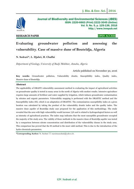
Evaluating groundwater pollution and assessing the vulnerability. Case of massive dune of Bouteldja, Algeria
The applicability of DRASTI vulnerability assessment method in evaluating the impact of agricultural activities on groundwater quality is tested in many areas in the north of Algeria with modest results. Intensive agriculture requires large amounts of fertilizer and water supplied by irrigation, which induces groundwater contamination by nitrates and organic parameters. Vulnerability mapping is performed with the DRASTIC method and the Susceptibility index (SI), which is an adaptation of DRASTIC. The contamination susceptibility index at a given location was calculated by taking the product of the vulnerability drastic index and the quality index. The massive dune aquifer of Bouteldja study case proposed for the application of this methodology. The study revealed that the area with high vulnerability would increase 73% and is related to hydrogeological factors as well as intensity of agricultural practices. The index map indicates that the most susceptible groundwater occupied the majority of the study area. The validity of these methods in the massive dune of Bouteldja aquifer was tested by a comparison between nitrate concentration and distribution of the vulnerability classes in the study area. This comparison has proved that the SI method is the most valid method. This is due to the introduction of the hydro chemicals parameters.
The applicability of DRASTI vulnerability assessment method in evaluating the impact of agricultural activities on groundwater quality is tested in many areas in the north of Algeria with modest results. Intensive agriculture requires large amounts of fertilizer and water supplied by irrigation, which induces groundwater contamination
by nitrates and organic parameters. Vulnerability mapping is performed with the DRASTIC method and the Susceptibility index (SI), which is an adaptation of DRASTIC. The contamination susceptibility index at a given location was calculated by taking the product of the vulnerability drastic index and the quality index. The massive dune aquifer of Bouteldja study case proposed for the application of this methodology. The study revealed that the area with high vulnerability would increase 73% and is related to hydrogeological factors as well as intensity of agricultural practices. The index map indicates that the most susceptible groundwater occupied the majority of the study area. The validity of these methods in the massive dune of Bouteldja aquifer was tested
by a comparison between nitrate concentration and distribution of the vulnerability classes in the study area. This comparison has proved that the SI method is the most valid method. This is due to the introduction of the hydro chemicals parameters.

Create successful ePaper yourself
Turn your PDF publications into a flip-book with our unique Google optimized e-Paper software.
J. Bio. & Env. Sci. 2016<br />
Journal <strong>of</strong> Biodiversity <strong>and</strong> Environmental Sciences (JBES)<br />
ISSN: 2220-6663 (Print) 2222-3045 (Online)<br />
Vol. 9, No. 5, p. 129-136, 2016<br />
http://www.innspub.net<br />
RESEARCH PAPER<br />
OPEN ACCESS<br />
<strong>Evaluating</strong> <strong>groundwater</strong> <strong>pollution</strong> <strong>and</strong> <strong>assessing</strong> <strong>the</strong><br />
<strong>vulnerability</strong>. <strong>Case</strong> <strong>of</strong> <strong>massive</strong> <strong>dune</strong> <strong>of</strong> <strong>Bouteldja</strong>, <strong>Algeria</strong><br />
N. Sedrati*, L. Djabri, H. Chaffai<br />
Department <strong>of</strong> Geology, University <strong>of</strong> Badji Mokhtar, Annaba, <strong>Algeria</strong><br />
Article published on November 30, 2016<br />
Key words: Groundwater <strong>pollution</strong>, Vulnerability drastic, Susceptibility index, Quality index,<br />
Massive <strong>dune</strong> <strong>of</strong> <strong>Bouteldja</strong>.<br />
Abstract<br />
The applicability <strong>of</strong> DRASTI <strong>vulnerability</strong> assessment method in evaluating <strong>the</strong> impact <strong>of</strong> agricultural activities<br />
on <strong>groundwater</strong> quality is tested in many areas in <strong>the</strong> north <strong>of</strong> <strong>Algeria</strong> with modest results. Intensive agriculture<br />
requires large amounts <strong>of</strong> fertilizer <strong>and</strong> water supplied by irrigation, which induces <strong>groundwater</strong> contamination<br />
by nitrates <strong>and</strong> organic parameters. Vulnerability mapping is performed with <strong>the</strong> DRASTIC method <strong>and</strong> <strong>the</strong><br />
Susceptibility index (SI), which is an adaptation <strong>of</strong> DRASTIC. The contamination susceptibility index at a given<br />
location was calculated by taking <strong>the</strong> product <strong>of</strong> <strong>the</strong> <strong>vulnerability</strong> drastic index <strong>and</strong> <strong>the</strong> quality index. The<br />
<strong>massive</strong> <strong>dune</strong> aquifer <strong>of</strong> <strong>Bouteldja</strong> study case proposed for <strong>the</strong> application <strong>of</strong> this methodology. The study<br />
revealed that <strong>the</strong> area with high <strong>vulnerability</strong> would increase 73% <strong>and</strong> is related to hydrogeological factors as well<br />
as intensity <strong>of</strong> agricultural practices. The index map indicates that <strong>the</strong> most susceptible <strong>groundwater</strong> occupied<br />
<strong>the</strong> majority <strong>of</strong> <strong>the</strong> study area. The validity <strong>of</strong> <strong>the</strong>se methods in <strong>the</strong> <strong>massive</strong> <strong>dune</strong> <strong>of</strong> <strong>Bouteldja</strong> aquifer was tested<br />
by a comparison between nitrate concentration <strong>and</strong> distribution <strong>of</strong> <strong>the</strong> <strong>vulnerability</strong> classes in <strong>the</strong> study area.<br />
This comparison has proved that <strong>the</strong> SI method is <strong>the</strong> most valid method. This is due to <strong>the</strong> introduction <strong>of</strong> <strong>the</strong><br />
hydro chemicals parameters.<br />
* Corresponding Author: N. Sedrati nassimasedrati@yahoo.fr.<br />
129 | Sedrati et al.
J. Bio. & Env. Sci. 2016<br />
Introduction<br />
The intensification <strong>of</strong> agricultural activities, combined<br />
with urbanization is very fast from <strong>the</strong> <strong>massive</strong> <strong>dune</strong><br />
<strong>of</strong> <strong>Bouteldja</strong>, resulted in a net increase <strong>of</strong> water<br />
dem<strong>and</strong>, accompanied by a significant <strong>pollution</strong> into<br />
<strong>groundwater</strong> supplies (Sedrati, 2006). Some diffuse<br />
sources <strong>of</strong> <strong>pollution</strong> from human activities<br />
(agricultural activities, uncontrolled discharging,<br />
savage sanitation systems) threatening <strong>the</strong>se<br />
resources (Babiker et al, 2005).<br />
It has a triangular form <strong>and</strong> limited from <strong>the</strong> North by<br />
<strong>the</strong> Mediterranean Sea, from <strong>the</strong> South by <strong>the</strong><br />
<strong>Bouteldja</strong> plain, from <strong>the</strong> West by <strong>the</strong> Mafragh river<br />
mouth <strong>and</strong> from <strong>the</strong> East by <strong>the</strong> Rosa cap.<br />
To recognize <strong>the</strong> need to an efficient method to<br />
protect <strong>groundwater</strong> resources from contamination,<br />
scientists <strong>and</strong> managers develop aquifer <strong>vulnerability</strong><br />
techniques for predicting which areas are <strong>the</strong> most<br />
vulnerable (Khemiri et al, 2013). The assessment <strong>of</strong><br />
<strong>groundwater</strong> <strong>vulnerability</strong> to <strong>pollution</strong> has been <strong>the</strong><br />
subject to intensive research during <strong>the</strong> past years<br />
<strong>and</strong> a many approaches have been developed to<br />
evaluate aquifer <strong>vulnerability</strong> (Kherici, 1985,<br />
Bousnoubra, 2009, Attoui et al, 2014).<br />
To preserve <strong>the</strong> <strong>groundwater</strong> resources <strong>of</strong> <strong>massive</strong><br />
<strong>dune</strong> <strong>of</strong> <strong>Bouteldja</strong> a susceptibility indexing method<br />
(Pusalti et al, 2009), based on <strong>vulnerability</strong> <strong>and</strong><br />
quality index, was proposed.<br />
This new assessment <strong>vulnerability</strong> methodology shows<br />
<strong>the</strong> area where agricultural activities increase <strong>the</strong><br />
potential level <strong>of</strong> <strong>groundwater</strong> <strong>vulnerability</strong> to<br />
<strong>pollution</strong>. The validity <strong>of</strong> <strong>the</strong>se methods in <strong>the</strong> <strong>massive</strong><br />
<strong>dune</strong> <strong>of</strong> <strong>Bouteldja</strong> was tested by a comparison between<br />
some pollutants concentration (Sedrati, 2006) <strong>and</strong><br />
distribution <strong>of</strong> <strong>the</strong> <strong>vulnerability</strong> class.<br />
Materials <strong>and</strong> methods<br />
Study area<br />
The region is <strong>the</strong> <strong>massive</strong> <strong>dune</strong> <strong>of</strong> <strong>Bouteldja</strong> which is<br />
situated in <strong>the</strong> extreme <strong>Algeria</strong>n Nor<strong>the</strong>ast, between<br />
Annaba city <strong>and</strong> <strong>the</strong> <strong>Algeria</strong>n-Tunisian border (Fig.<br />
1). It extends along <strong>the</strong> Mediterranean coast, with a<br />
width <strong>of</strong> approximately 10 km <strong>and</strong> a surface <strong>of</strong> 170 Km².<br />
The <strong>massive</strong> <strong>dune</strong> <strong>of</strong> <strong>Bouteldja</strong> has an altitude <strong>of</strong> 90 m.<br />
Fig. 1. Location geography <strong>and</strong> geological map <strong>of</strong> <strong>the</strong><br />
study area (from Gaud, 1976, amended 2009).<br />
The aquifer <strong>and</strong> <strong>the</strong> vadose zone <strong>of</strong> <strong>the</strong> massif <strong>dune</strong><br />
region are located in Quaternary layer system which<br />
is constituted mainly by <strong>the</strong> s<strong>and</strong>s formations settled<br />
on an impermeable clayey s<strong>and</strong>y substratum, with<br />
average permeability 6.10 -5 to 10 -4 m.s -1 KHERICI<br />
[1993]. The effective thickness <strong>of</strong> <strong>the</strong> s<strong>and</strong>y aquifer<br />
varies from 40 m in <strong>the</strong> East to 180 m in <strong>the</strong> West.<br />
Hence, it results in an easily infiltration <strong>of</strong> nutrients<br />
in <strong>the</strong> <strong>groundwater</strong>.<br />
The s<strong>and</strong>y formations, locally clayey s<strong>and</strong>y<br />
constituted a free water table on <strong>the</strong> whole <strong>of</strong> <strong>the</strong><br />
<strong>massive</strong> <strong>dune</strong>, except in <strong>the</strong> South, where <strong>the</strong> aquifer<br />
becomes semi confined. The effective thickness <strong>of</strong> <strong>the</strong><br />
s<strong>and</strong>y aquifer varies from 40 m in <strong>the</strong> East to 180 m<br />
in <strong>the</strong> West. Taking into account <strong>the</strong> thickness <strong>of</strong><br />
<strong>the</strong>se s<strong>and</strong>s <strong>and</strong> <strong>the</strong>ir interstitial porosity, <strong>the</strong> water<br />
reserves are appreciable <strong>and</strong> exceeded 34 Mm 3 /year,<br />
but annual abstraction by pumping from more 200<br />
wells st<strong>and</strong>s at 30775m 3 /day (Haied, 2015).<br />
The <strong>groundwater</strong> supply is under threat due to an<br />
intense urban occupation as Nitrate measures are<br />
generally
J. Bio. & Env. Sci. 2016<br />
exceed 50mg/ltoward agglomeration: Sebaa, Righia <strong>and</strong><br />
Berrihane (Assassi, 2004; Sedrati, 2006) where one<br />
registers values largely higher than <strong>the</strong> potability<br />
st<strong>and</strong>ards revealing an important anthropogenic<br />
<strong>pollution</strong>. For <strong>the</strong>se reasons, a new water management<br />
planning is highly required.<br />
Materials<br />
Numerous <strong>vulnerability</strong> modeling approaches is<br />
proposed. A comprehensive ground water <strong>vulnerability</strong><br />
model must include parameters to describe how much a<br />
site is risky to be contaminated <strong>and</strong> how <strong>the</strong><br />
contaminant moves from <strong>the</strong> contamination site to <strong>the</strong><br />
aquifer. In this study, <strong>the</strong> <strong>vulnerability</strong> rating used is <strong>the</strong><br />
Susceptibility index SI (Pusalti, 2009).<br />
The application <strong>of</strong> <strong>the</strong>se methods required <strong>the</strong> collection<br />
<strong>and</strong> processing a data, digital <strong>and</strong> mapping, for <strong>the</strong> study<br />
area. These data were processed <strong>and</strong> analyzed with<br />
different s<strong>of</strong>tware programs: Surfer 10, Diagramme 2.<br />
This enabled us to syn<strong>the</strong>size our distributed data<br />
already translated into digital format. The final results<br />
will be translated in <strong>the</strong> form <strong>of</strong> maps representing <strong>the</strong><br />
aquifer <strong>vulnerability</strong> to <strong>pollution</strong>.<br />
Vulnerability assessment methodology<br />
DRASTIC Method<br />
This is one <strong>of</strong> <strong>the</strong> most used methods in <strong>the</strong> world. It<br />
assigns a note between 1 <strong>and</strong> 10 <strong>and</strong> a weight between<br />
1 <strong>and</strong> 5 for each used parameter (Table 1).<br />
Table 1. Attribution <strong>of</strong> notes for DRASTIC model parameters.<br />
Class D (m) Note Class A Note Class S Note Class C (m/s) Note<br />
0 - 1.5<br />
Masive shale<br />
Thin orabsent 1 1.5. 10 −7 5.10 −5<br />
1.5 - 4<br />
4.5 – 9<br />
9.0 - 15<br />
15 - 23<br />
23 - 30<br />
9<br />
7<br />
5<br />
3<br />
2<br />
Métamorphic<br />
Altered -S<strong>and</strong>stone<br />
<strong>massive</strong> limestone<br />
massif S<strong>and</strong>sone S<strong>and</strong><br />
<strong>and</strong> gravel<br />
6<br />
8<br />
6<br />
8<br />
10<br />
Gravels<br />
S<strong>and</strong>s<br />
S<strong>and</strong>y Silts<br />
Silty loam<br />
Shales<br />
10<br />
9<br />
6<br />
3<br />
1<br />
1. 5. 10 −5 –15.10 −5<br />
15. 10 −5 – 33.10 −5<br />
33.10−5 – 5.10 −4<br />
5.10 −4 – 9, 5. 10 −4<br />
>9,5.10 −4<br />
2<br />
4<br />
6<br />
8<br />
10<br />
>30 1 Karstic Limestone<br />
Class R (mm) Note Class T (%) Note Class I<br />
Note<br />
0 – 50<br />
50 – 100<br />
100 – 175<br />
175 - 225<br />
>225<br />
1<br />
3<br />
6<br />
8<br />
9<br />
0 à 2<br />
2 à 6<br />
6 à 12<br />
12 à 18<br />
>18<br />
10<br />
9<br />
5<br />
3<br />
1<br />
Silt <strong>and</strong> Shales<br />
Shale<br />
Limestones<br />
S<strong>and</strong>stones<br />
S<strong>and</strong> <strong>and</strong> gravels with passage silt <strong>and</strong> Shale<br />
S<strong>and</strong> <strong>and</strong> gravels<br />
3<br />
3<br />
3<br />
6<br />
6<br />
8<br />
In <strong>the</strong> present study <strong>the</strong> DRASTIC method, proposed<br />
by <strong>the</strong> US Environmental Protection Agency (Aller et<br />
al, 1987; Vrba Zaporozec, 1994) isone method to<br />
evaluate <strong>the</strong> vertical <strong>vulnerability</strong> based on <strong>the</strong><br />
following seven parameters: Depth to water (D), net<br />
Recharge (R), Aquifer media (A), Soil media (S),<br />
Topography (T), Impact <strong>of</strong> <strong>the</strong> vadose zone (I), <strong>and</strong><br />
hydraulic Conductivity (C). Each mapped factor is<br />
classified ei<strong>the</strong>r into ranges (for continuous variables)<br />
or into significant media types (for <strong>the</strong>matic data)<br />
which have an impact on <strong>pollution</strong> potential. Weight<br />
multipliers are <strong>the</strong>n used for each factor to balance<br />
<strong>and</strong> enhance <strong>the</strong>ir importance. The final <strong>vulnerability</strong><br />
index is a weighted sum <strong>of</strong> <strong>the</strong> seven factors. The<br />
DRASTIC index (Di) can be computed using<br />
expression (1):<br />
Di = Dr. Dw + Rr. Rw + Ar. Aw + Sr. Sw + Tr. Tw +<br />
Ir. Iw + Cr. Cw(1)<br />
Where D, R, A, S, T, I, <strong>and</strong> C are <strong>the</strong> seven<br />
parameters, r is <strong>the</strong> rating value <strong>of</strong> <strong>the</strong> analyzed<br />
subarea, <strong>and</strong> w is <strong>the</strong> weight associated to each<br />
parameter.<br />
Susceptibility Index (SI) method<br />
The Susceptibility index (SI) with <strong>the</strong> contamination<br />
<strong>of</strong> water were calculated by taking <strong>the</strong> product <strong>of</strong> <strong>the</strong><br />
<strong>vulnerability</strong> index (VI) <strong>and</strong> <strong>the</strong> quality index (QI);<br />
SI = (VI) ∗ (QI)Pusalti, 2009) .<br />
The index VI is deduced by using <strong>the</strong> DRASTIC<br />
method to evaluate <strong>the</strong> hydrogeological<br />
characteristics <strong>of</strong> <strong>the</strong> aquifer. The quality index (QI) is<br />
calculated by basing our study on <strong>the</strong> hydrochemical<br />
classification <strong>of</strong> water. The quality index calculation<br />
procedure based on a water quality classification scheme<br />
was introduced to evaluate hydrochemical data.<br />
131 | Sedrati et al.
J. Bio. & Env. Sci. 2016<br />
The IQ is calculated on <strong>the</strong> basis <strong>of</strong> <strong>the</strong> classification<br />
proposed by Pusalti, for irrigation waters, <strong>and</strong> on that<br />
proposed by Neubert et al, 2008, for those intended<br />
for drinkable water supply (Table 2). The suggested<br />
susceptibility indexing method was applied to <strong>the</strong><br />
Menderes river basin located in western Turkey<br />
(Pusalti, 2009), to Chebba Melloulich aquifer <strong>of</strong><br />
Tunisia (Saidi et al, 2012) <strong>and</strong> to<br />
High Cheliff Alluvial aquifer <strong>of</strong> <strong>Algeria</strong> (Djoudar<strong>and</strong><br />
Toubal, 2011). The susceptibility index map shows<br />
both hydrogeological <strong>and</strong> hydrochemical data related<br />
to <strong>the</strong> contamination problem including areas that<br />
should be taken into consideration during water<br />
management planning. Different DRASTIC<br />
parameters described in <strong>the</strong> section method allowed<br />
us to develop <strong>the</strong>matic maps presented in “Fig. 2”<br />
Table 2. Water classification (Neubert et al, 2008, WHO ,2006).<br />
Parameters<br />
Drinking Water Limits<br />
Class I<br />
(very good)<br />
Class II<br />
(good)<br />
Class III<br />
(usable)<br />
Class IV<br />
(usable with caution)<br />
Class V<br />
(harmful)<br />
EC (μS/cm) 0 – 180 180 - 400 400 - 2000 2000 – 3000 > 3000<br />
Cl _ (mg/l) 0 - 25 25 - 200<br />
NO3 - (mg/l) 0 – 10 10 - 25 25 - 50 > 50<br />
SO4 2- (mg/l) 0 - 25 25 - 250 > 250<br />
Na + (mg/l) 0 – 20 20 - 200 > 200<br />
The <strong>massive</strong> <strong>dune</strong> <strong>of</strong> <strong>Bouteldja</strong> is relatively a flat<br />
topography (2 to 6%), inclined to <strong>the</strong> north <strong>and</strong><br />
opening on <strong>the</strong> Mediterranean Sea.<br />
Fig. 2. Groundwater sampling location <strong>of</strong> <strong>the</strong> study<br />
area.<br />
Results <strong>and</strong> discusions<br />
Analysis <strong>of</strong> all <strong>the</strong>se <strong>the</strong>matic maps <strong>and</strong> <strong>the</strong><br />
<strong>vulnerability</strong> map showing <strong>the</strong> areas that are exposed<br />
to <strong>the</strong> greatest risk <strong>of</strong> threats occupy <strong>the</strong> majority <strong>of</strong><br />
<strong>the</strong> study area. The combination <strong>of</strong> all <strong>the</strong>se<br />
parameters was used to determine <strong>the</strong> DRASTIC<br />
index ranging from 108-176 (Fig. 3). On <strong>the</strong> basis <strong>of</strong><br />
classification (Neubert <strong>and</strong> Benabdallah, 2003), two<br />
classes have developed to DRASTIC method (Fig. 3).<br />
They cover respectively for moderate <strong>and</strong> high class<br />
<strong>vulnerability</strong>, 27% <strong>and</strong> 73% <strong>of</strong> <strong>the</strong> study area.<br />
The importance <strong>of</strong> <strong>the</strong> depth <strong>of</strong> <strong>groundwater</strong> in <strong>the</strong><br />
assessment <strong>of</strong> <strong>the</strong> <strong>vulnerability</strong> to <strong>pollution</strong> has<br />
already been underlined (Brou, 2013). However, <strong>the</strong><br />
parameter which strongly influences <strong>the</strong> <strong>vulnerability</strong><br />
is <strong>the</strong> lithology <strong>of</strong> <strong>the</strong> unsaturated zone <strong>and</strong> aquifer<br />
materials (Fig. 3 a, g), <strong>the</strong> both are characterized by<br />
<strong>the</strong> dominance <strong>of</strong> a single major facies: S<strong>and</strong> in<br />
almost every <strong>of</strong> <strong>the</strong> region. The permeable material is<br />
predominant.<br />
The presence <strong>of</strong> high <strong>vulnerability</strong> could be justified<br />
by <strong>the</strong> existence <strong>of</strong> areas with higher permeability<br />
(6.10 -5 to 10 -4 m/s) that must associate shallow<br />
<strong>groundwater</strong> table (D
J. Bio. & Env. Sci. 2016<br />
3b. Net Recharge R.<br />
3f. Vadose zone I.<br />
3c. Aquifer Media A.<br />
3g. Hydraulic Conductivity.<br />
Fig. 3. Seven DRASTIC Maps to compute <strong>the</strong><br />
<strong>vulnerability</strong> index (a TO g). Fig. (a-g.) Maps <strong>of</strong><br />
ground water depth, net recharge, aquifer media, soil<br />
type, topography, vadosezone <strong>and</strong> hydraulic<br />
conductivity.<br />
3d. Soil Type S.<br />
3e. Topography T.<br />
Indeed, <strong>the</strong> <strong>vulnerability</strong> analysis map shows that,<br />
more than 25% <strong>of</strong> areas with higher <strong>vulnerability</strong> is<br />
found in a low <strong>groundwater</strong> depth <strong>and</strong> high recharge<br />
(25,5mm/year) would be a favorable condition for<br />
increasing <strong>the</strong> <strong>vulnerability</strong> to <strong>pollution</strong> <strong>of</strong> aquifers. It<br />
results in a low capacity to attenuate <strong>the</strong><br />
contaminants. It corresponds to <strong>the</strong> location <strong>of</strong> <strong>the</strong><br />
urban areas. The extension <strong>of</strong> <strong>pollution</strong> is due to<br />
heavy pumping for irrigation <strong>and</strong> supply water to two<br />
city Annaba And El Taref, resulting in increased<br />
salinity (coastal region).<br />
133 | Sedrati et al.
J. Bio. & Env. Sci. 2016<br />
In fact, zones with <strong>the</strong> average <strong>vulnerability</strong> class<br />
generally found at <strong>the</strong> s<strong>and</strong> soils with a appearances<br />
gravel <strong>and</strong> clays (confined aquifer) covering<br />
approximately 73% <strong>of</strong> <strong>the</strong> study area, In terms <strong>of</strong><br />
susceptibility index, only one class dominated has been<br />
identified from <strong>the</strong> combination <strong>of</strong> <strong>the</strong> drastic index<br />
<strong>and</strong> <strong>the</strong> quality index for drinking water (Fig. 4-5).<br />
This is <strong>of</strong> high water susceptibility index (IS> 8840),<br />
As a consequence, this area reveals a high<br />
<strong>vulnerability</strong>. <strong>the</strong>se results thus reinforcing <strong>the</strong><br />
hypo<strong>the</strong>sis <strong>of</strong> <strong>pollution</strong> by Sulphates, Sodium,<br />
Nitrates <strong>and</strong> Chlorides in excess <strong>groundwater</strong> <strong>of</strong><br />
<strong>massive</strong> <strong>dune</strong> <strong>of</strong> <strong>Bouteldja</strong>, because it coincides with a<br />
s<strong>and</strong>s, <strong>and</strong> activities which are hazardous to<br />
<strong>groundwater</strong> such as agricultural (which applies<br />
fertilizers <strong>and</strong> pesticides abundantly) have no proper<br />
sewage treatment facilities <strong>and</strong> <strong>the</strong> insufficiency or<br />
<strong>the</strong> inexistence <strong>of</strong> canal evacuation in <strong>the</strong> majority <strong>of</strong><br />
towns (Stigter et al, 2006), or by <strong>the</strong> low rate <strong>of</strong><br />
connection to <strong>the</strong> cleaning up network. Analyses <strong>of</strong><br />
BDO5 (Sedrati, 2006) revealed contents exceeding<br />
5mg/l; thus supporting <strong>the</strong> preceding observation,<br />
<strong>and</strong> ra<strong>the</strong>r confirms <strong>the</strong> urban origin.<br />
The <strong>vulnerability</strong> <strong>of</strong> <strong>the</strong> <strong>dune</strong> aquifer towards to<br />
possible surface contaminants remains to define <strong>and</strong><br />
ameliorate by studies in <strong>the</strong> transfer parameters <strong>and</strong><br />
organic <strong>pollution</strong> parameters in <strong>the</strong> unsaturated zone,<br />
<strong>the</strong> study enabled to definite two zones <strong>of</strong> <strong>pollution</strong><br />
risk. At present, <strong>the</strong> high vulnerable region reveals<br />
highly Nitrates contents directly due to <strong>the</strong><br />
agglomerations activities effect.<br />
Fig. 4. Map <strong>of</strong> DRASTIC index (A) <strong>and</strong> <strong>groundwater</strong><br />
Vulnerability (B).<br />
The establishment <strong>of</strong> perimeter protection (Sadoune,<br />
2012) is not sufficient to ensure effective security; it<br />
must be complemented by <strong>the</strong> establishment <strong>of</strong> an<br />
overall plan drainage <strong>of</strong> sewerage systems <strong>and</strong> by <strong>the</strong><br />
construction <strong>of</strong> stations effluent treatment in urban<br />
areas (Bousnoubra, 2009).<br />
Fig. 5. Drinking water susceptibility index <strong>of</strong> <strong>the</strong><br />
Massive <strong>dune</strong> <strong>of</strong> <strong>Bouteldja</strong>.<br />
Conclusion<br />
The use <strong>of</strong> both <strong>vulnerability</strong> data <strong>and</strong> quality index<br />
one in a GIS environment proved to be a powerful<br />
tool for <strong>the</strong> <strong>groundwater</strong> management. The<br />
combining Drastic <strong>and</strong> susceptibility index show that<br />
<strong>groundwater</strong> in <strong>massive</strong> <strong>dune</strong> <strong>of</strong> <strong>Bouteldja</strong> is<br />
characterized by two classes as follow: moderate<br />
<strong>vulnerability</strong> ranked <strong>groundwater</strong> areas dominated<br />
<strong>the</strong> study area (≈73%), which occupy more half <strong>of</strong> <strong>the</strong><br />
study area, while (>25%) <strong>of</strong> <strong>the</strong> <strong>massive</strong> <strong>dune</strong> <strong>of</strong><br />
<strong>Bouteldja</strong> is higt <strong>groundwater</strong> <strong>vulnerability</strong>.<br />
134 | Sedrati et al.
J. Bio. & Env. Sci. 2016<br />
The water susceptibility indexes show a high water<br />
drinking quality, covering <strong>the</strong> majority <strong>of</strong> <strong>the</strong> study<br />
area. Indeed, <strong>the</strong>re is a very high similarity between<br />
<strong>the</strong> more hazardous <strong>pollution</strong> zones <strong>and</strong> <strong>the</strong> areas<br />
with harmful water quality; <strong>the</strong> susceptibility map<br />
prepared by this method <strong>the</strong>refore reflects <strong>the</strong> reality.<br />
References<br />
Aller L, Lehr J H, Petty R, Bennett T. 1987.<br />
DRASTIC: A st<strong>and</strong>ardized system to evaluate<br />
Groundwater Pollution using Hydrogeologic setting.<br />
Jour. Geol. Soc. India 29, 23-37.<br />
Assassi F, Hani A, Djabri L. 2004. Evolution<br />
chimique et vulnérabilité à la <strong>pollution</strong> de l’aquifère<br />
dunaire de <strong>Bouteldja</strong> (Nordest Algérien). Sciences &<br />
Technologie 21, 89-95.<br />
Attoui B, Kherici N, Kherici-Bousnoubra H.<br />
2014. Use <strong>of</strong> <strong>the</strong> new method for determining <strong>the</strong><br />
<strong>vulnerability</strong> <strong>and</strong> risk <strong>of</strong> <strong>pollution</strong> <strong>of</strong> major<br />
<strong>groundwater</strong> reservoirs in <strong>the</strong> region <strong>of</strong> Annaba-<br />
<strong>Bouteldja</strong> (NE <strong>Algeria</strong>). Environmental Earth<br />
Sciences 72, 891-903.<br />
BabikerI S, Mohamed AA, Hiyama T, Kato K.<br />
2005. A GIS based DRASTIC model for <strong>assessing</strong><br />
aquifer <strong>vulnerability</strong> in Kakamigahara Heights, Gifu<br />
Prefecture, Central Japan. Science <strong>of</strong> <strong>the</strong> Total<br />
Environment 345, 127-140.<br />
Brou D, Lazare KK, Soumahoro M, Brice KA,<br />
Dago G. 2013. Assessment <strong>of</strong> <strong>vulnerability</strong> to<br />
<strong>pollution</strong> <strong>of</strong> aquifers <strong>of</strong> wea<strong>the</strong>red layer by DRASTIC<br />
<strong>and</strong> SYNTACS methods: <strong>Case</strong> <strong>of</strong> M’ Bahiakro city,<br />
Central Côte d’Ivoire .International Journal <strong>of</strong><br />
Innovation <strong>and</strong> Applied Studies 2, 464-476.<br />
Djoudar D, Toubal AC. 2011. Vulnérabilité à la<br />
<strong>pollution</strong> de la nappe alluviale de la Mitidja orientale<br />
Algérie, rapport PNR Ressources En Eau 27-34.<br />
Gaud B. 1976. Etude hydrogéologique du système<br />
aquifère Annaba-<strong>Bouteldja</strong>, système de<br />
reconnaissance et recherche des condition de<br />
modélisation (Rapport d’étude A.R.H d’Annaba).<br />
Haied N, Chaab S, Saaidia B, Bougherira N.<br />
2015. Impact <strong>of</strong> water recharge on <strong>the</strong> ground water<br />
quality <strong>of</strong> <strong>the</strong> <strong>Bouteldja</strong> unconfined <strong>dune</strong> aquifer. Rev<br />
Sci Technol Synthèse 30, 48-57.<br />
Khemiri S, Khnissi A, Ben Alaya M, Saidi S,<br />
Zargouni F. 2013. Using GIS for <strong>the</strong> Comparison <strong>of</strong><br />
Intrinsic Parametric Methods Assessment <strong>of</strong><br />
Groundwater Vulnerability to Pollution in Scenarios <strong>of</strong><br />
Semi-Arid Climate. The <strong>Case</strong> <strong>of</strong> Foussana Ground water<br />
in <strong>the</strong> Central <strong>of</strong> Tunisia. Journal Water Resource <strong>and</strong><br />
Protection 5, 835-845.<br />
Kherici N, Derradji EF, ElK<strong>and</strong> Y. 2009.<br />
Vulnerability to <strong>pollution</strong> <strong>and</strong> Urban Development <strong>of</strong><br />
<strong>the</strong> <strong>massive</strong> <strong>dune</strong> <strong>of</strong> <strong>Bouteldja</strong>, Nor<strong>the</strong>aster <strong>Algeria</strong><br />
Geographica Technica 1, 1-7.<br />
Kherici N. 1993. Vulnérabilité à la <strong>pollution</strong><br />
chimique des eaux souterraines d'un système de<br />
nappes superposées en milieu industriel et agricole<br />
(Annaba-la-Mafragh) Nord-Est algerien. Doctoral<br />
<strong>the</strong>sis 170-189.<br />
Kherici N. 1985. Aquifère sableux de bords de mer.<br />
Hydrodynamique et hydrochimie. Exemple de la<br />
nappe de <strong>Bouteldja</strong> (Nord Est algérien). Thèse de<br />
Doctorat 3 ème cycle USTL 202-215.<br />
Neubert, Ben Abdallah. 2003. Système d’évaluation<br />
de la qualité des eaux souterraines SEQ- Eaux<br />
Souterraines, Rapport de présentation 0.1, pp75.<br />
Pusalti TO, Camur ZM, Yazicigil H. 2009.<br />
Susceptibility indexing method for irrigation water<br />
management planning: applications to K. Menderes<br />
river basin, Turkey. J Environ Manage 90, 341-347.<br />
Sadoune A. 2012. Vulnérabilité, et évaluation des<br />
ressources en eau dans l’extrême Nord-est algérien,<br />
Mémoire de Magister, Annaba University 130-149.<br />
Saidi S, Bouri S, Anselme B, Ben Dhia H.<br />
2012.Guideline for Groundwater Resource Management<br />
Using <strong>the</strong> GIS Tools in Arid to Semi-Arid Climate<br />
Regions, Problems, Perspectives <strong>and</strong> Challenges <strong>of</strong><br />
Agricultural Water Management, In Tech Europe 8,<br />
277-292.<br />
135 | Sedrati et al.
J. Bio. & Env. Sci. 2016<br />
Sedrati N. 2006. Vulnerability <strong>and</strong> impact <strong>of</strong><br />
agglomeration in <strong>the</strong> water quality <strong>of</strong> <strong>massive</strong> <strong>dune</strong> <strong>of</strong><br />
<strong>Bouteldja</strong>, Mémoire de Magister, Geology, Annaba<br />
University 43-78.<br />
Stigter TY, Ribeiro L, Carvalho Dill AMM.<br />
2006. Evaluation <strong>of</strong> an intrinsic <strong>and</strong> a specific<br />
<strong>vulnerability</strong> assessment method in comparison with<br />
<strong>groundwater</strong> salinisation <strong>and</strong> nitrate contamination<br />
levels in two agricultural regions in <strong>the</strong> south <strong>of</strong><br />
Portugal: hydrogeology journal, volume 14,1, 79-99.<br />
Vrba J, Zaporozec A. 1994. Guidebook on<br />
mapping <strong>groundwater</strong> <strong>vulnerability</strong>, In: International<br />
contributions to hydrogeology, Heise, Hannover,<br />
Germany 16, 131 pp.<br />
World Health Organization WHO. 2006.<br />
Guidelines for Drinking-water Quality,<br />
Recommendations, 3rd edition 1, pp 595.<br />
136 | Sedrati et al.