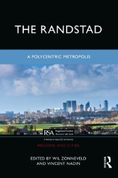
The Randstad, a polycentric metropolis, by Vincent Nadin & Will Zonneveld. (Introduction Chapter)
Introduction The Randstad is a cluster of relatively medium-sized and small cities in the western Netherlands that encircles an expanse of largely open land. It is undoubtedly an important urban region, hosting in an area of about 7,000 km2, Europe’s largest seaport, third busiest airport, second largest Internet Exchange, and about 7 million people. But the Randstad is much more than this. Since the 1960s, it has acquired distinction as the archetypal polycentric metropolis, an integrated urban ring around a Green Heart, with the status of a world-class metropolitan region. There is a presumption too, that government has played an inf luential role in strengthening the polycentricity of the region, especially through its renowned capability in spatial planning. But the reality of the polycentric Randstad as opposed to the idea is controversial, as is the role of spatial planning. Do the interconnections between the four main cities – Amsterdam, The Hague, Rotterdam, and Utrecht – and the many smaller settlements in-between function as an integrated polycentric region? Does the economic and social performance of the combined whole of the Randstad add up to more than the sum of its parts? Advocates point to the apparent complementarity of the main cities with a tendency for business and financial functions to be centred in Amsterdam, port and logistics in Rotterdam, governance and international justice in The Hague, and research and development in Utrecht. Critics draw attention to the relatively limited f lows of commuters between the cities, and the concentration of the daily urban f lows within the individual city-regions, which they argue operate independently.
Introduction
The Randstad is a cluster of relatively medium-sized and small cities in the
western Netherlands that encircles an expanse of largely open land. It is undoubtedly
an important urban region, hosting in an area of about 7,000 km2,
Europe’s largest seaport, third busiest airport, second largest Internet Exchange,
and about 7 million people. But the Randstad is much more than
this. Since the 1960s, it has acquired distinction as the archetypal polycentric
metropolis, an integrated urban ring around a Green Heart, with the status of
a world-class metropolitan region. There is a presumption too, that government
has played an inf luential role in strengthening the polycentricity of the
region, especially through its renowned capability in spatial planning.
But the reality of the polycentric Randstad as opposed to the idea is controversial,
as is the role of spatial planning. Do the interconnections between the
four main cities – Amsterdam, The Hague, Rotterdam, and Utrecht – and
the many smaller settlements in-between function as an integrated polycentric
region? Does the economic and social performance of the combined
whole of the Randstad add up to more than the sum of its parts? Advocates
point to the apparent complementarity of the main cities with a tendency for
business and financial functions to be centred in Amsterdam, port and logistics
in Rotterdam, governance and international justice in The Hague, and
research and development in Utrecht. Critics draw attention to the relatively
limited f lows of commuters between the cities, and the concentration of the
daily urban f lows within the individual city-regions, which they argue operate
independently.

You also want an ePaper? Increase the reach of your titles
YUMPU automatically turns print PDFs into web optimized ePapers that Google loves.
Introducing the <strong>Randstad</strong> 13<br />
and 92%, respectively (excluding very small countries) 2 , growing from 52%<br />
in 1950 (UN Department of Economic and Social Affairs, 2018). <strong>The</strong>se relatively<br />
high figures are more pronounced for the <strong>Randstad</strong>, which has a population<br />
density of about 1,000 persons/km 2 , although the urban profile is ‘low<br />
rise’. <strong>The</strong> population is spread evenly across the region, with only 2.5 million<br />
in the four main cities. And it is diverse. In the Netherlands, as a whole for<br />
2019, 27% of the population had a ‘migration background’, that is, a parent<br />
born in another country. 3 <strong>The</strong> population is also remarkably well-housed<br />
in comparison to most other metropolitan regions. Elsinga et al. explain in<br />
<strong>Chapter</strong> 9 how post-war governments have intervened strongly to initially<br />
solve a housing shortage, and later to improve the conditions of the housing<br />
and its urban surroundings. Government-led and subsidised housing has been<br />
instrumental in the spatial development of the <strong>Randstad</strong>, contributing to<br />
the conversion of the region from a cluster of self-contained cities to a dense<br />
network of urban settlements.<br />
Almost complete urbanisation of the <strong>Randstad</strong> is reflected in the density<br />
of infrastructure. <strong>The</strong> Netherlands is second only to Belgium among<br />
European countries for road density. It has the fifth highest road density in<br />
the world, including a very high provision of motorways, some 127 km for<br />
each 1,000 km 2 land area, with much of it concentrated in the <strong>Randstad</strong><br />
and especially around the port of Rotterdam. 4 However, the road network<br />
is outshone <strong>by</strong> the water infrastructure, even though much of that which<br />
is keeping the feet of the Dutch dry is invisible. It includes thousands of<br />
pumping stations, 22,000 km of dikes and 70,000 km of watercourses. <strong>The</strong><br />
<strong>Randstad</strong> has a disproportionate share given that a majority of its surface area<br />
is below sea level. Water transport on the other hand is plainly visible. <strong>The</strong><br />
<strong>Randstad</strong> has <strong>by</strong> far the highest density of water transport in Europe save for<br />
one region, also in the Netherlands – Zeeland. Railways too are well catered<br />
for with South Holland having the seventh most dense network in Europe<br />
(133 km/1,000 km 2 ), behind German and Czech regions. Travellers from<br />
most other countries are impressed with the rail service which is a true network<br />
with fine stations (part of a national programme of planning projects),<br />
and many precise interconnections between lines, and between rail, other<br />
public transport, and cycling. Despite its strengths, the public transport network<br />
is somewhat weak at the scale of the <strong>Randstad</strong>. Only the main stations<br />
are connected across the <strong>Randstad</strong> between Rotterdam and Amsterdam,<br />
since 2009 with the option of the Netherlands, only high-speed line. This<br />
dense infrastructure network also services the ports: Rotterdam Port, the<br />
largest port in Europe handling the equivalent of 37,000 ‘20-foot containers’<br />
each day; and Schiphol Amsterdam Airport, the fourth busiest airport in the<br />
world for international traffic which provides in the peak period more than<br />
200,000 passenger seats per day. 5<br />
<strong>The</strong> development of extensive physical and soft infrastructure has since<br />
the seventeenth century gone hand in hand with the growth of the economy<br />
Taylor & Francis