

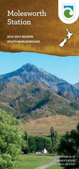
Molesworth Station, South Marlborough - Department of Conservation
Molesworth Station, South Marlborough - Department of Conservation
Molesworth Station, South Marlborough - Department of Conservation

You also want an ePaper? Increase the reach of your titles
YUMPU automatically turns print PDFs into web optimized ePapers that Google loves.
<strong>Molesworth</strong><br />
<strong>Station</strong><br />
2012/2013 SEASON<br />
SOUTH MARLBOROUGH
Preface<br />
Welcome to <strong>Molesworth</strong>, the biggest farm in New Zealand,<br />
where conservation, farming and recreation go hand in hand.<br />
The 180,787‑hectare <strong>Molesworth</strong> <strong>Station</strong> unites original<br />
high‑country stations: Tarndale, <strong>Molesworth</strong> and St Helens.<br />
<strong>Molesworth</strong> reverted to the Crown in 1938 when the runholders<br />
walked <strong>of</strong>f; St Helens, including the Dillon Run, was added in<br />
1949. The combined stations once ran around 95,000 sheep<br />
but, when the Crown took over, the land was suffering from<br />
loss <strong>of</strong> vegetation and severe erosion caused by overgrazing<br />
by sheep and rabbits and repeated burning <strong>of</strong> tussocklands.<br />
The land was gradually restored to good health under careful<br />
management that included rabbit control, revegetation and<br />
the replacement <strong>of</strong> sheep with cattle.<br />
Today, <strong>Molesworth</strong> is administered by the <strong>Department</strong> <strong>of</strong><br />
<strong>Conservation</strong> with Landcorp Farming Limited responsible for<br />
farming operations under a lease agreement that respects<br />
the property’s outstanding conservation and recreation values<br />
as well as the working farm.<br />
Photo: Steve Bagley<br />
To ensure a safe and enjoyable <strong>Molesworth</strong> experience, travel<br />
only on roads that are open to the public. As well as being<br />
potentially dangerous, <strong>of</strong>f‑road driving can damage fragile<br />
plants, spread weeds and start fires.<br />
Check any signs along the route; these may warn <strong>of</strong> road<br />
closures, which can occur at any time. Roads may be closed<br />
due to slips, washouts or snow; to allow stock movement; or<br />
(on Rainbow <strong>Station</strong>) for Defence Force exercises. The Acheron<br />
Road status can be checked 24 hours a day by contacting<br />
DOC <strong>South</strong> <strong>Marlborough</strong> Area Office (03) 572 9100. Fill your<br />
fuel tank before setting out and carry a good quality spare tyre.<br />
Travel through <strong>Molesworth</strong> is at your own risk. Be aware<br />
that there is no cellphone coverage. Automobile Association<br />
breakdown services may not be available and some vehicle<br />
insurance policies do not apply.<br />
Driving through <strong>Molesworth</strong> is a unique high country<br />
experience. We wish you an enjoyable trip.
Contents<br />
The land 1<br />
Landforms 1<br />
Climate 2<br />
Vegetation 3<br />
Wildlife 4<br />
The people 6<br />
Early explorers 6<br />
Farming 7<br />
Travelling through <strong>Molesworth</strong> 10<br />
The Acheron Road 10<br />
The Hanmer–St Arnaud Road 17<br />
<strong>Molesworth</strong> <strong>Station</strong> map 14<br />
Recreation options 20<br />
Open periods 20<br />
Guided tours 21<br />
Tramping/walking 23<br />
Other recreation options 25<br />
Horse trekking 25<br />
Mountain biking 25<br />
Rafting 26<br />
Fishing 27<br />
Hunting 27<br />
Camping and huts 28<br />
<strong>Molesworth</strong> fact file 28<br />
Please remember 29<br />
<strong>Molesworth</strong> Care Code 30<br />
Contacts 32<br />
The land<br />
To the traveller, the rounded mountains and broad valleys<br />
<strong>of</strong> <strong>Molesworth</strong> <strong>Station</strong> appear vast and timeless. Yet this is a<br />
place <strong>of</strong> constant change wrought by geological movement,<br />
an extreme climate and, more recently, by human endeavour<br />
to farm this most challenging environment.<br />
What we find today is a land <strong>of</strong> shifting screes, wide grasslands<br />
and steep hillsides, supporting hardy plant communities<br />
adapted to survive in one <strong>of</strong> New Zealand’s harshest<br />
environments.<br />
Landforms<br />
<strong>Molesworth</strong>’s history <strong>of</strong> glaciation can be read in the landscape.<br />
Terminal and lateral moraines, glacial outwash plains, hanging<br />
valleys and waterfalls, cirque basins, tarns and arêtes are all<br />
reminders <strong>of</strong> the region’s past ice ages.<br />
The headwaters <strong>of</strong> the Clarence, Wairau and Acheron Rivers<br />
were all formerly glaciated.<br />
Several major, active fault lines transect the property, causing<br />
mountain uplift and more recent horizontal jolts, which trigger<br />
landslides and rockfalls.<br />
The under‑lying rocks are mostly greywacke and argillite<br />
mudstone, dating back 135–235 million years to the Triassic<br />
and Jurassic eras. Valley floors and major basins are filled with<br />
glacial and outwash gravels, in places covered with river‑borne<br />
gravel and silt. Soils are generally greywacke‑derived, with<br />
relatively infertile, older soils generally found in the higher<br />
rainfall, western areas and more fertile, younger soils on<br />
terraces and flood plains in the lower rainfall, eastern areas.<br />
Snow-covered hills. Photo: Shannel Courtney<br />
1
Climate<br />
<strong>Molesworth</strong> endures a continental climate <strong>of</strong> extremes.<br />
Hot and generally dry summers are followed by harsh winters.<br />
Snow may fall at any time <strong>of</strong> the year, some years covering<br />
the entire property for up to eight weeks in winter. At the<br />
homestead, frosts are recorded as <strong>of</strong>ten as two days in three.<br />
Average annual rainfall ranges from 670 mm in the east to<br />
3000 mm in the west, the marked gradient reflected in the<br />
varied soils and vegetation.<br />
2<br />
Lake Tennyson. Photo: Neil Deans<br />
Vegetation<br />
<strong>Molesworth</strong> is an area <strong>of</strong> national ecological significance.<br />
Over 70 threatened plant species grow here, a quarter <strong>of</strong> which<br />
are acutely threatened. These are mostly herbs and include<br />
two native mistletoes, five daisies, a hairy mountain cress, a<br />
buttercup, a gentian, a plantain and a hebe.<br />
More than 60 endemic plant species are found in <strong>South</strong><br />
<strong>Marlborough</strong> (the area south <strong>of</strong> the Richmond Ranges to the<br />
Conway River); close to half <strong>of</strong> these grow on <strong>Molesworth</strong>.<br />
3
A Protected Natural Areas (PNA) survey <strong>of</strong> the station in<br />
1987/88 identified 25 recommended areas for protection<br />
(RAPs), totalling nearly 30% <strong>of</strong> the <strong>Station</strong>’s total area. Progress<br />
is being made on fencing and protecting ecological values at<br />
these sites.<br />
Vegetation reflects the east–west rainfall gradient from<br />
670 mm in the east to 3000 mm in the west. At the dry end <strong>of</strong><br />
the scale, you will see gravelfield and scree communities as<br />
well as shrublands, where native species include matagouri,<br />
hebe, tauhinu and mountain flax. On lower altitude riverbeds,<br />
basins, terraces and mountain footslopes, exotic grasslands<br />
are common. Introduced sweet briar and the invasive flatweed<br />
hieracium are evident. Short tussock grasses grow on valley<br />
floors and lower mountain side‑slopes; tall tussocks grow in<br />
upper catchments and on mountain slopes.<br />
In wetter country, patches <strong>of</strong> red tussocks can be found<br />
on lower altitude river terraces, fans, old flood plains and<br />
moraines. Shaded gullies and valley floors that have escaped<br />
burning host remnants <strong>of</strong> mountain beech. Mānuka and<br />
kānuka shrubland communities have in some areas risen<br />
from the ashes <strong>of</strong> burned beech and are nursing regenerating<br />
forests.<br />
Lakes, wetlands and kettlehole bogs provide a treasure trove<br />
<strong>of</strong> moisture‑loving plants, especially around Lakes Tennyson<br />
and Sedgemere on the Hanmer–Rainbow route.<br />
Wildlife<br />
<strong>Molesworth</strong> supports one <strong>of</strong> New Zealand’s most diverse lizard<br />
faunas. The nationally threatened scree skink and spotted<br />
skink are found here, as well as more common species.<br />
The New Zealand falcon, banded dotterel and black‑fronted<br />
tern are among threatened bird species found on <strong>Molesworth</strong>.<br />
Land‑locked native fish species, including members <strong>of</strong> the<br />
bully and galaxiid families, occur in lakes and tarns, some<br />
4<br />
Penwiper— Notothlaspi rosulatum. Photo: Cathy Jones<br />
Scree skink. Photo: Garry Holz<br />
unique to <strong>Marlborough</strong>. Rivers and streams are populated by<br />
native fish species and trout.<br />
There is still much to learn about New Zealand native insects,<br />
but several species <strong>of</strong> spectacularly large giant wētā occur<br />
within <strong>Molesworth</strong>, as do speargrass weevils.<br />
5
<strong>Molesworth</strong> Cob Cottage. Photo: Martin Heine<br />
The people<br />
Despite its isolation, <strong>Molesworth</strong> <strong>Station</strong> has a long human<br />
history.<br />
Early explorers<br />
Māori are likely to have explored this area and unlocked its<br />
routes over 600 years ago. Established trails were used by Ngāi<br />
Tahu for food gathering and access between the west coast, an<br />
important source <strong>of</strong> pounamu or jade, and the east coast.<br />
In 1830, a splinter group from a northern war party travelled<br />
south via the Upper Wairau, Tarndale and Hanmer to attack<br />
the Ngāi Tahu pā at Kaiapoi, while the main party travelled the<br />
east coast by canoe.<br />
Māori described interior routes to early European settlers and<br />
guided explorers, including Thomas Brunner and William<br />
Travers.<br />
In 1850, explorers Mitchell and Dashwood found a derelict<br />
Māori whare in the lower Acheron. Travers recorded finds <strong>of</strong><br />
Māori artefacts on his run at remote Lake Guyon.<br />
In the late 1850s and 1860s, Nelson and <strong>Marlborough</strong><br />
pastoralists were supplying newly established Canterbury runs<br />
with stock more cheaply and efficiently via <strong>Molesworth</strong> than by<br />
importing animals from Australia. During the 1857–58 season,<br />
some 24,000 sheep were driven south from Nelson; drovers and<br />
travellers followed stock routes through <strong>Molesworth</strong> well into<br />
the 20 th century.<br />
6<br />
The most popular route from the Awatere to Canterbury<br />
crossed Barefell Pass, following the Guide River into the<br />
Acheron Valley, over Jollies Pass to Hanmer and beyond.<br />
Nelson and Wairau stock were taken via Tophouse and the<br />
Upper Wairau, over Island Pass, down the Clarence Valley and<br />
across Jacks Pass to Hanmer. An alternative route was to cross<br />
from the Waihopai into the Acheron via Canterbury Spur.<br />
The accommodation houses at Tophouse, Rainbow, Tarndale<br />
and Acheron were part <strong>of</strong> a chain <strong>of</strong> dwellings placed to service<br />
travellers using ‘the Canterbury Track’. These were built from<br />
cob, a mixture <strong>of</strong> wet clay reinforced with dung and tussock,<br />
which sets hard when dry. The Acheron Accommodation<br />
House and the cob cottage at the eastern entrance to the<br />
<strong>Station</strong> are registered with the New Zealand Historic Places<br />
Trust.<br />
Both the <strong>Molesworth</strong> roads were built to enable the<br />
construction and maintenance <strong>of</strong> power lines. The Hanmer–<br />
Rainbow Road was built in the 1950s to supply the Nelson and<br />
Buller regions; the Acheron Road was built in the late 1960s to<br />
enable installation <strong>of</strong> the high‑voltage cable that connects the<br />
North and <strong>South</strong> Islands.<br />
Farming<br />
<strong>Molesworth</strong> brings together the best traditions <strong>of</strong> New Zealand<br />
high country farming and modern agriculture.<br />
The farm calendar follows the cycle <strong>of</strong> the seasons, with cattle<br />
grazed on warm valley floors in the cold winter months then<br />
ranging free on the higher altitude back‑country during<br />
summer. A team <strong>of</strong> stockmen are employed, camping out with<br />
their dogs and horses for days at a time in remote huts.<br />
Acheron Accommodation House. Photo: Markus Baumann<br />
7
Up to 10,000 Angus and Angus/Hereford cross cattle are<br />
run as these are considered the most resilient breeds for the<br />
prevailing conditions. Despite the harsh climate and the fact<br />
that stock are largely left to fend for themselves, the station<br />
uses modern genetic selection and rigorous culling to achieve<br />
a calving rate <strong>of</strong> around 92% in October/November, which is<br />
quite outstanding for the conditions.<br />
Calves stay on their mothers through their first winter, then are<br />
weaned in spring, just before the cows drop their next season’s<br />
calf. All yearling cattle are carried through, with surplus heifers<br />
sold as two‑year‑olds and steers as three‑year‑olds.<br />
About 10,000 hectares <strong>of</strong> the property, particularly lower slopes<br />
and valley floors, have been aerially oversown with pasture<br />
species, including clover, cocksfoot and lotus, and topdressed<br />
with superphosphate plus sulphur, applied to blocks one year<br />
in three. Burning has not been used as a management tool<br />
since the 1940s.<br />
Weed control requires a significant investment, with briar,<br />
broom and wilding pines the main targets. The invasive<br />
flatweed hieracium is a farming and ecological headache,<br />
spreading slowly but surely, especially in the mid‑altitude<br />
country.<br />
Possums, ferrets and pigs are a significant threat to animal<br />
health because <strong>of</strong> their ability to transmit bovine tuberculosis,<br />
which is present on the station.<br />
8<br />
Five permanent farm staff, including the station manager,<br />
are employed, plus five stockmen and a general hand (mostly<br />
involved with weed control) for all but the winter months.<br />
For all stock work, staff use horses, bred and broken in on the<br />
station. About 80 horses and up to 45 working dogs may be<br />
on the station during the season.<br />
An aircraft is hired for spotting cattle prior to mustering and<br />
to locate stragglers afterwards, saving days <strong>of</strong> riding.<br />
Stockman<br />
Photo: Veronique Cornille<br />
Angus and Hereford cross cattle<br />
9
Travelling through <strong>Molesworth</strong><br />
The Acheron Road<br />
Distances in brackets are provided firstly from Blenheim and<br />
secondly from Hanmer.<br />
The Acheron Road is open 7 am–7 pm from 28 December to<br />
Sunday 7 April, but may be closed without warning due to<br />
weather conditions or fire danger. The Acheron Road status<br />
can be checked 24 hours a day by contacting DOC <strong>South</strong><br />
<strong>Marlborough</strong> Area Office (03) 572 9100. The road is unsealed<br />
and suitable for two wheel drive cars. Vehicles towing trailers,<br />
caravans, buses or vehicles over 7 metres long are not<br />
permitted.<br />
The 207‑kilometre journey from Blenheim to Hanmer Springs<br />
follows the Awatere River, then crosses Wards Pass to follow<br />
the Acheron to its confluence with the Clarence River. After<br />
100 kilometres <strong>of</strong> travel up the Awatere Valley, you reach<br />
the <strong>Molesworth</strong> Cob Cottage, near the station boundary.<br />
The section through <strong>Molesworth</strong> is 59 kilometres, taking a<br />
minimum <strong>of</strong> two hours <strong>of</strong> driving.<br />
10<br />
<strong>Molesworth</strong> <strong>Station</strong>. Photo: Markus Baumann<br />
Awatere turn-<strong>of</strong>f (22 km/185 km)<br />
From Blenheim, follow State Highway 1 south, then turn right<br />
at the Awatere Valley intersection just north <strong>of</strong> Seddon and<br />
the Awatere Valley Bridge. A sign here will indicate whether<br />
the <strong>Molesworth</strong> Road is open.<br />
Along the public Awatere Valley Road, picnic and toilet<br />
facilities are <strong>of</strong>fered at the <strong>Marlborough</strong> District Council’s<br />
Blairich Recreation Reserve (37 km/161 km) and the Hodder<br />
Bridge Picnic Area (76 km/132 km). The latter is where<br />
trampers set out to climb Mount Tapuae‑o‑Uenuku (2885 m),<br />
New Zealand’s tallest mountain outside the southern divide.<br />
The Awatere Valley is known for fine‑woolled Merino sheep<br />
and distinctive wines.<br />
<strong>Molesworth</strong> Cob Cottage (122 km/85 km)<br />
For visitors who have travelled up the Awatere Valley, the<br />
original cob homestead built by John Murphy in 1866 is the<br />
gateway to <strong>Molesworth</strong> where the Acheron Road begins.<br />
If the road is closed, please go no further.<br />
11
Camping is available near the cottage at a cost <strong>of</strong> $ 6.00 per<br />
night per adult (age 18+) and $3.00 per night per child (age<br />
5–17). Toilets, water and information panels are provided.<br />
The existing <strong>Molesworth</strong> homestead (closed to the public)<br />
replaced the cob cottage in 1885 and still houses the farm<br />
manager and his family. The homestead, historic woolshed,<br />
staff accommodation and various outbuildings, including a<br />
blacksmith shop for shoeing the 80‑odd horses on the station,<br />
can be viewed from a low hill behind the cottage.<br />
Please respect residents’ privacy by staying away from this<br />
area. For a view over the settlement, climb the stile and follow<br />
the poles for a short distance.<br />
Wards Pass (131 km/76 km)<br />
Crossing the flats from the cob cottage, look south towards the<br />
triangular‑shaped Dillon Cone (2174 m) and straight ahead to<br />
Barefell Pass, recorded by Frederick Weld in 1850 and still used<br />
for moving stock from the Awatere to the Acheron catchment.<br />
The road then climbs to Wards Pass (1145 m), closed by<br />
snowfalls for long periods.<br />
As you drop from Wards Pass, you cross a section <strong>of</strong> Muller<br />
<strong>Station</strong>, courtesy <strong>of</strong> the runholders.<br />
Isolated Flat (132 km/75 km)<br />
The 250‑hectare expanse <strong>of</strong> Isolated Flat is an outwash plain,<br />
bounded by the Awatere Fault.<br />
From January until April, masses <strong>of</strong> tall, white gentian flowers<br />
can be seen growing amongst clumps <strong>of</strong> short tussock and<br />
pasture grass. Introduced blue borage (Echium vulgare)<br />
also grows pr<strong>of</strong>usely, the blue flowers attracting bees, which<br />
produce delicately flavoured honey for sale throughout<br />
New Zealand and are important pollinators for pasture plants,<br />
including clover.<br />
The flood‑prone, braided bed <strong>of</strong> the Acheron River is a habitat<br />
for numerous bird species, including the nationally threatened<br />
banded dotterel and black‑fronted tern that breed in the area,<br />
as well as native fish species and trout.<br />
In 1850, explorers Mitchell and Dashwood wrote <strong>of</strong> Isolated<br />
Flat: “The soil and the grass here were much improved and<br />
good cattle stations might be farmed but I fear the immense<br />
quantity <strong>of</strong> speargrass and other prickles would prove an<br />
obstacle for sheep.”<br />
Leaving the flat, the road climbs up and over Isolated Saddle<br />
down to the junction with the Tarndale track.<br />
12<br />
Looking down on Isolated Flat from Mt Augarde. Photo: Jim Herdman<br />
Red Gate (145 km/62 km)<br />
Here, the Severn River — which has a significant catchment<br />
starting on the <strong>Molesworth</strong> boundary — meets the Acheron<br />
River.<br />
On your right (travelling west) is a stand <strong>of</strong> pines and willows<br />
marking the grave <strong>of</strong> Ivanhoe Augarde, who shot himself here<br />
on 29 January 1868. Augarde, a worker at St Helens <strong>Station</strong>,<br />
was courting Miss Kate Gee, who lived in the Upper Wairau.<br />
He had written her a letter and given it to ‘German Charlie’,<br />
who worked at Tarndale, to deliver. Charlie, however, opened<br />
the letter en route and entertained various groups <strong>of</strong> men along<br />
the way with its contents. Learning <strong>of</strong> this, Augarde rode to<br />
Tarndale and shot Charlie (who died shortly afterwards) then<br />
carried on to Red Gate where he shot himself. Mount Augarde,<br />
to the right <strong>of</strong> Alma Valley, was named in his memory.<br />
From here, looking down the Alma Valley you can see the<br />
routes to the upper Wairau and Tarndale, where cattle spend<br />
summer after calving. The Tarndale turn‑<strong>of</strong>f (no public access<br />
up this track) leads to the historic Tarndale Homestead, built<br />
from cob in 1874 and still used by stockworkers.<br />
This building replaced an older cob accommodation house<br />
built in the early 1860s near Sedgemere which was described<br />
by traveller J. C. Richmond in 1863 as “the very minimum <strong>of</strong> an<br />
accommodation house. The bedroom to which I was consigned<br />
with my two travelling companions was about as weathertight<br />
as a four-rail fence. The best thing about the house was<br />
the excellent boiled beef. The nobblers <strong>of</strong> rum are liberal.”<br />
13
14<br />
To St Arnaud 37 km<br />
Locked gate toll applies 10 km<br />
Rainbow<br />
<strong>Station</strong><br />
Lake<br />
Tennyson<br />
Island Gully Hut<br />
St James<br />
<strong>Conservation</strong><br />
Area<br />
Jacks Pass<br />
To Christchurch<br />
134 km<br />
Locked gate<br />
(April–December)<br />
Sedgemere<br />
Sleepout<br />
Island Saddle<br />
1347 m<br />
(alpine pass)<br />
Fish Lake<br />
Historic Acheron<br />
Accommodation<br />
House<br />
Jollies Pass<br />
Hanmer Springs<br />
Top Leatham Hut<br />
Severn<br />
Hut<br />
Bowscale Tarn<br />
Lake Sedgemere<br />
Island Lake<br />
Elder<br />
1910 m<br />
Isolated Flat<br />
Mt Augarde<br />
1237 m<br />
Red<br />
Gate<br />
Pudding Hill<br />
1284 m<br />
Bottom<br />
Gordon<br />
Hut<br />
Saxton<br />
Hut<br />
Wards Pass<br />
1145 m<br />
(alpine pass)<br />
Barefell<br />
Pass<br />
Visitor centre<br />
Standard hut<br />
Basic hut/bivvy<br />
Standard campsite<br />
Basic campsite<br />
Backcountry<br />
campsite<br />
Top Gordon Hut<br />
Mt<br />
Chisholm<br />
1518 m<br />
Dillon Cone<br />
2174 m<br />
Muller<br />
<strong>Station</strong><br />
Historic <strong>Molesworth</strong><br />
Cob Cottage<br />
Palmer<br />
Hut<br />
Historic building<br />
Picnicking<br />
Toilet<br />
Information<br />
Viewpoint<br />
4WD<br />
Mountain biking<br />
Rafting<br />
Locked gate<br />
To Blenheim 100 km<br />
Lake<br />
McRae<br />
Lake<br />
McRae Hut<br />
Elliott<br />
Bivvy<br />
<strong>Molesworth</strong> <strong>Station</strong><br />
Public access zones<br />
Seymour<br />
Hut<br />
Open May to December<br />
Open all year<br />
Open November to April<br />
Central zone*<br />
general access by permit<br />
Acheron Road<br />
Hanmer–Rainbow Road<br />
Public road<br />
Tramping track<br />
Route<br />
* Activity permits are required for access into the central zone at all times; however,<br />
a permit to drive through the station on the Acheron Road during the period when<br />
the road is open is not required.<br />
0<br />
5 10<br />
kilometres<br />
15
Guide River (161 km/46 km)<br />
On the opposite side <strong>of</strong> the Acheron is the confluence with<br />
the Guide River, important for stock movement between the<br />
Awatere and Acheron Valleys leading up to Barefell Pass.<br />
Hieracium — the flatweed that is invading much <strong>of</strong><br />
New Zealand’s hill and high country — is evident here,<br />
smothering grass species and reducing grazing areas.<br />
Since first recorded on <strong>Molesworth</strong> in the 1950s, hieracium<br />
has spread rapidly to cover 60–65% <strong>of</strong> the grazeable part <strong>of</strong><br />
the property. Also a weed is the sweet briar you see here,<br />
introduced as an ornamental around homesteads. Briar fruit<br />
was reportedly made into rosehip jam, used to mask the<br />
flavour <strong>of</strong> poison when controlling rabbits.<br />
Acheron Accommodation House (181 km/26 km)<br />
At the confluence <strong>of</strong> the Acheron and Clarence Rivers, the<br />
Acheron Accommodation House is the oldest building on<br />
<strong>Molesworth</strong>. Constructed in 1862 by cob builder Ned James,<br />
it features a tussock‑thatched ro<strong>of</strong> with beech rafters tied with<br />
flax, still visible from inside the building.<br />
This was an overnight stop for travellers and stockmen moving<br />
though the inland route between Nelson and Canterbury<br />
16<br />
Hieracium<br />
until 1932. Two shillings and sixpence (25 c) bought a bed, meal<br />
and stabling for horses.<br />
Camping is available here, at a cost <strong>of</strong> $ 6.00 per night per adult<br />
(age 18+) and $3.00 per night per child (age 5–17), with toilets<br />
and water provided. Accommodation is not permitted in the<br />
house.<br />
Jollies Pass junction (193 km/14 km)<br />
This original road to Hanmer is now suitable only for 4WD<br />
vehicles. Cattle leaving <strong>Molesworth</strong> from the southern end are<br />
driven over Jollies Pass from the Clarence Valley and trucked<br />
from Landcorp’s bull farm at Hanmer.<br />
Jollies Pass was once the social centre <strong>of</strong> the district, boasting<br />
a store, un<strong>of</strong>ficial Post Office and hotel.<br />
Vegetation, including mountain beech forest remnants on the<br />
west side <strong>of</strong> the Acheron River between the Accommodation<br />
House and Jollies Pass reflects a slightly higher rainfall than<br />
on the rest <strong>of</strong> the route. Unfortunately, pines and exotic broom<br />
are abundant.<br />
Jacks Pass/Rainbow junction (199 km/8 km)<br />
Here, the main route to Hanmer turns left, heading over Jacks<br />
Pass and into town. The Hanmer–Rainbow Road turns <strong>of</strong>f to<br />
the right.<br />
The Hanmer–St Arnaud Road<br />
Distances in brackets are provided firstly from Hanmer and<br />
secondly from St Arnaud.<br />
The 112‑kilometre Hanmer–St Arnaud Road is accessible by<br />
4WD vehicles only. Combined with the Acheron Road, this<br />
makes a good — albeit long — round trip.<br />
The route is remarkable for the landscape’s transition from<br />
wide tussocklands and screes along the Clarence River to<br />
craggy, beech‑covered mountains in the Wairau catchment.<br />
Allow at least three hours to drive from Hanmer to State<br />
Highway 63, on a road which crosses Rainbow <strong>Station</strong> courtesy<br />
<strong>of</strong> the runholder. This is a wilderness driving experience and<br />
travellers must be self‑sufficient and prepared for sudden<br />
weather changes.<br />
From Hanmer, the route follows the Clarence River along<br />
<strong>Molesworth</strong>’s boundary with St James <strong>Conservation</strong> Area<br />
to its origin at Lake Tennyson. After crossing the Alpine<br />
Island Saddle (1347 m), it follows the Wairau River through<br />
<strong>Molesworth</strong> and Rainbow <strong>Station</strong> to State Highway 63<br />
17
near St Arnaud (85 km from Nelson/131 km from Picton via<br />
Blenheim).<br />
From 26 December 2012 until 1 April 2013 (Easter Monday)<br />
the road is a toll road; $25 per 4WD vehicle, $15 per motorbike,<br />
$2 per mountain or push bike, trampers free. The toll is<br />
collected at the Rainbow cob homestead. Outside this season,<br />
two gates are locked; at Hell’s Gate (76 km/36 km, near the<br />
<strong>Molesworth</strong> boundary) and at Six Mile. Access permission to<br />
4WD, tramp, hunt, fish or mountain bike must be obtained<br />
from Star Holdings Limited, Nelson.<br />
Jacks Pass/Rainbow junction (8 km/104 km)<br />
Jacks Pass opens the main route to the Hanmer–Rainbow<br />
Road, with Jollies Pass accessible only to 4WD vehicles<br />
(see page 17).<br />
Lake Tennyson (32 km/80 km)<br />
On the boundary between <strong>Molesworth</strong> <strong>Station</strong> and St James<br />
<strong>Conservation</strong> Area, Lake Tennyson’s combination <strong>of</strong> water,<br />
forest, high mountains, tussock and scree creates a scenic<br />
highlight. The 239‑hectare lake is dammed behind glacial<br />
moraines. The vegetation is a mosaic <strong>of</strong> moraine communities<br />
including open red tussockland and low shrubland with<br />
patches <strong>of</strong> tall tussockland. A large area <strong>of</strong> mountain beech<br />
forest grows on surrounding slopes.<br />
To the west is Mt Una (2301 m), the highest point in the<br />
Spenser Range, where many peaks are named after characters<br />
in Edmund Spenser’s classic 17 th century poem, “The Faerie<br />
Queene”.<br />
This is a popular area for camping, with toilets available.<br />
Island Saddle (44 km/68 km)<br />
At 1347 metres, this alpine pass is the highest point on the<br />
Rainbow–Hanmer Road and the highest public accessible road<br />
in New Zealand. The pass straddles the boundary between<br />
<strong>Marlborough</strong> and Canterbury and is the watershed between<br />
the Wairau and Clarence Rivers.<br />
Short and tall tussocklands occur on mountain slopes, with a<br />
mosaic <strong>of</strong> carpetgrass turflands and alpine plants on mountain<br />
crests.<br />
Sedgemere Lakes (55 km/57 km)<br />
Turk Ridge, Mt Balaclava, and the Crimea Range are among the<br />
names that date exploration <strong>of</strong> this area to the Crimean War in<br />
the 1850s.<br />
18<br />
The Sedgemere Lakes can be viewed from a short track <strong>of</strong>f the<br />
road (walking/bicycle access only). Here you may enjoy an<br />
incredible summer display <strong>of</strong> the native gentian Gentianella<br />
corymbifera in flower.<br />
In the Sedgemere Protected Area, a range <strong>of</strong> landforms over a<br />
relatively small area has resulted in diverse vegetation types,<br />
with the wetlands including over 100 indigenous species <strong>of</strong><br />
flowering plants. Bog pine and mountain toatoa stands are<br />
remnants <strong>of</strong> once larger shrub communities.<br />
The lakes are regularly frequented by waders and waterfowl:<br />
pied stilt, pied oystercatcher, black‑fronted tern, banded<br />
dotterel and grey duck. This is an important moulting area for<br />
paradise shelduck.<br />
Coldwater Creek camping area (66 km/46 km)<br />
After crossing the bridge over Coldwater Creek (where a toilet<br />
is provided), the road enters Hell’s Gate, a narrow gorge.<br />
Rainbow Ski Area turn-<strong>of</strong>f (86 km/26 km)<br />
Outside the ski season, the 8 km skifield road is closed for<br />
vehicle access but open for walking. Alpine flowers, tarns and<br />
views are the summer attractions.<br />
St Arnaud (112 km/0 km)<br />
This is the front door <strong>of</strong> Nelson Lakes National Park.<br />
Food, petrol and a range <strong>of</strong> accommodation are available.<br />
Gentian — Gentianella species. Photo: Cathy Jones<br />
19
Recreation options<br />
Open periods<br />
The open periods for public access vary across <strong>Molesworth</strong><br />
with restrictions in place to protect the working farm. The<br />
Upper Clarence/Wairau river area in the western part <strong>of</strong> the<br />
station is open throughout the year. The Acheron Road through<br />
the station is open from 28 December 2012 to 7 April 2013.<br />
Two large areas — in the north‑west and east — are open for<br />
seasonal access.<br />
A permit is required for access to the central part <strong>of</strong> the station,<br />
essential to the farming operation. However, permits are not<br />
required to drive through the station on the Acheron Road<br />
during the period when the road is open.<br />
Those seeking access permits should contact the DOC <strong>South</strong><br />
<strong>Marlborough</strong> Area Office, Ph (03) 572 9100.<br />
20<br />
See the <strong>Molesworth</strong> map on page 14 for more details on<br />
areas open for public access. Open areas may be temporarily<br />
closed due to weather‑related conditions and for short periods<br />
due to farming operations.<br />
Guided tours<br />
DOC grants concessions for a number <strong>of</strong> reputable tour<br />
operators, who <strong>of</strong>fer visitors to <strong>Molesworth</strong> the option <strong>of</strong> being<br />
driven through the property by a knowledgeable guide.<br />
Special interest tours include cycling, rafting, kayaking and<br />
horse‑trekking.<br />
Guided tours may be available outside the dates the Acheron<br />
Road is open to the public, depending on conditions. For<br />
more information, contact the i‑SITE in Blenheim or Hanmer.<br />
Pudding Hill — looking towards Isolated Flat in the distance.<br />
Photo: Jim Herdman<br />
21
22<br />
Look for this type <strong>of</strong> marker<br />
on the tracks in <strong>Molesworth</strong><br />
Mt Augarde<br />
1237 m<br />
Isolated<br />
Saddle<br />
Severn River<br />
Pudding Hill<br />
1284 m<br />
) (<br />
Isolated Flat<br />
n<br />
o<br />
r<br />
e<br />
h<br />
c<br />
A<br />
r<br />
e<br />
v<br />
i<br />
R<br />
To Hanmer Springs<br />
Unsealed road<br />
Tramping track<br />
Historic building<br />
Standard campsite<br />
Toilet<br />
Information<br />
Locked gate<br />
0 1 2 3 4<br />
kilometres<br />
This map is a guide only. For<br />
more information consult the<br />
following Topo50 maps:<br />
• BS25 Severn<br />
• BS26 Mount Muller<br />
• BT25 Mount Northampton<br />
) (<br />
Wards Pass<br />
1145 m<br />
(alpine pass)<br />
Trig Lookout<br />
1279 m<br />
Mt Chisholm<br />
1518 m<br />
Historic To Blenheim<br />
<strong>Molesworth</strong><br />
Cob Cottage<br />
Tramping/walking<br />
There are five tramping tracks accessible from the Acheron<br />
Road; from short tracks from the cob buildings at <strong>Molesworth</strong><br />
and Acheron to longer tracks with panorama views.<br />
<strong>Molesworth</strong> Homestead Lookout Track,<br />
10 min (450 m)<br />
Starting from behind the Cob Cottage the track starts proper<br />
from a kissing gate entrance taking walkers across a paddock<br />
to a point for views <strong>of</strong> <strong>Molesworth</strong> Homestead and surrounding<br />
farm buildings.<br />
Acheron Lookout Loop Track, 20 min (1 km)<br />
This 20‑minute loop track starting from Acheron<br />
Accommodation House gives views <strong>of</strong> the accommodation<br />
house, Clarence River and the surrounding valley.<br />
Trig Lookout Track, 25 min (1.3 km),<br />
Mt Chisholm Track, 1h 20 min (3.5 km)<br />
The track to Trig Lookout and Mt Chisholm starts from the car<br />
park on the <strong>Molesworth</strong> side <strong>of</strong> Wards Pass. From the car park<br />
follow a 4WD track to the junction where signs direct you to<br />
the Trig Lookout and on to Mt Chisholm.<br />
From the summit all round views take in the Awatere Valley<br />
and Inland Kaikoura Ranges to the east, Acheron valley to the<br />
north‑west and views across Isolated Flat and Mt Barefell to<br />
the south.<br />
The track is a tramping track marked with poles, is unformed,<br />
steep with rough sections suitable for walkers with a good level<br />
<strong>of</strong> fitness.<br />
23
From Mt Augarde looking down the Severn to the Acheron. Photo: Jim Herdman<br />
Mt Augarde Track, 1 h (1.5 km)<br />
From a car park at the southern end <strong>of</strong> Isolated Flat is where<br />
the track to Mt Augarde starts. Parts <strong>of</strong> the track are unformed,<br />
steep, and rough. Follow the ridge to the summit.<br />
At the beginning <strong>of</strong> the track is a plaque in memory <strong>of</strong> Rangi<br />
Gill, a bulldozer driver who worked on many roads in the area.<br />
From the summit <strong>of</strong> Mt Augarde are views north across<br />
Isolated Flat and the distant tops <strong>of</strong> the Severn, Saxton and<br />
Acheron Ranges. To the south lays the Waima River where<br />
it joins the Severn River flowing past Red Gate towards the<br />
Acheron confluence in the east.<br />
The track is marked with poles and is suitable for walkers with<br />
good fitness.<br />
Pudding Hill, 2 h (4 km)<br />
Pudding Hill summit is reached after a two‑hour walk.<br />
From here looking south the Acheron River winds its way<br />
towards its confluence with the Clarence River. Looking<br />
due north the Boddington Range separates Isolated Flat<br />
from the Acheron River.<br />
The track follows an old road and is suitable for mountain<br />
biking.<br />
If you plan walking to the summit <strong>of</strong> Pudding Hill start<br />
your day early to allow the necessary time to take in this<br />
half day walk.<br />
24<br />
Other recreation options<br />
Horse trekking<br />
At all times <strong>of</strong> the year, permission is required to horse trek<br />
through <strong>Molesworth</strong>. Routes and logistics need to be carefully<br />
planned. Contact DOC <strong>South</strong> <strong>Marlborough</strong>, Ph (03) 572 9100,<br />
for advice on necessary permits and appropriate routes,<br />
including overnight stops.<br />
Mountain biking<br />
Keep to roads and marked walking routes only, as cross‑<br />
country cycling is not permitted. These are high‑altitude routes<br />
where weather conditions can change rapidly. Always carry<br />
wind‑ and water‑pro<strong>of</strong> clothing.<br />
The distance from Blenheim to Hanmer via the Acheron Road<br />
is 207 km. Open dates are the same as for motorists. Outside<br />
Cyclists descending Ward Pass to Isolated Flat<br />
25
East West Route and<br />
Leatham <strong>Molesworth</strong> Route<br />
The East West Route and Leatham <strong>Molesworth</strong> Route is<br />
suitable for people with a high level <strong>of</strong> back country<br />
experience including navigation and map reading skills.<br />
Most <strong>of</strong> these routes are unmarked and follow natural<br />
features such as streams, rivers and ridges. You will need<br />
to carry and know how to use a topographic map. The<br />
relevant 1:50,000 Topo50 maps are: BS25 Severn, BS26<br />
Mount Muller, BT25 Mount Northhampton, BT26 Mount<br />
Clear, BS27 Tapuae‑o‑Uenuku, BT27 Kaikoura.<br />
More information is available at:<br />
www.doc.govt.nz/molesworthroutes.<br />
26<br />
Island<br />
Gully Hut<br />
Island Saddle<br />
1347 m<br />
To Hanmer Springs<br />
Toll gate<br />
Locked gate<br />
(April–December)<br />
Sedgemere<br />
Sleepout<br />
Fish<br />
Lake<br />
To St Arnaud<br />
Coldwater<br />
Stream<br />
Campsite<br />
Bowscale Tarn<br />
Lake Sedgemere<br />
Island Lake<br />
Base data supplied by Geographx Ltd<br />
copyright reserved<br />
Severn<br />
Saddle<br />
Severn Hut<br />
Pudding Hill<br />
1284 m<br />
Top<br />
Leatham<br />
Hut<br />
Saxton Hut<br />
Isolated Flat<br />
Mt Augarde<br />
1237 m<br />
To Hanmer<br />
Springs<br />
Bottom<br />
Gordon<br />
Hut<br />
East West Route, 5-6 days (115 km)<br />
The East West route links the Kahutara River in Ka Whata<br />
Tu o Rakihouia (Clarence) <strong>Conservation</strong> Park with the<br />
Sedgemere Lakes Area in the <strong>Molesworth</strong> Recreation Reserve.<br />
At least 5‑6 days should be allowed for the East West Route.<br />
This unmarked route is suitable for trampers with a high<br />
degree <strong>of</strong> <strong>of</strong>f‑track experience and fitness.<br />
<strong>Molesworth</strong> Leatham Route, 4-5 days (56 km)<br />
There is also a route that is mainly unmarked from Bottom<br />
Gordon Hut in the Leatham <strong>Conservation</strong> Area called the<br />
Leatham <strong>Molesworth</strong> Route. This route travels via Severn<br />
and Saxton Huts in the <strong>Molesworth</strong> Recreation, round to Top<br />
Gordon Hut and back to Bottom Gordon Hut. At least 4‑5<br />
days should be allowed for the Leatham <strong>Molesworth</strong> Route.<br />
Wards<br />
Pass<br />
1145 m<br />
Barefell<br />
Pass<br />
Top<br />
Gordon<br />
Hut<br />
Saxton<br />
Saddle<br />
To Blenheim<br />
Saxton<br />
Pass<br />
Mt<br />
Chisholm<br />
1518 m<br />
Robinson<br />
Saddle<br />
0<br />
Unsealed road<br />
4WD track<br />
Tramping track<br />
Route<br />
kilometres<br />
Historic <strong>Molesworth</strong><br />
Cob Cottage<br />
Lake<br />
McRae<br />
Hut<br />
Palmer Hut<br />
5 10<br />
Lake<br />
McRae<br />
Elliott<br />
Bivvy<br />
Standard hut<br />
Basic hut/bivvy<br />
Standard campsite<br />
Basic campsite<br />
Backcountry<br />
campsite<br />
Toilet<br />
Information<br />
4WD<br />
Mountain biking<br />
Locked gate<br />
This map is a guide only.<br />
For more information<br />
consult the Topo50 maps<br />
• BS25 Severn<br />
• BS26 Mount Muller<br />
• BT25 Mount Northampton<br />
• BT26 Mount Clear<br />
Seymour Hut<br />
To Kahutara<br />
Car Park<br />
Warden Hut<br />
27
28<br />
Severn Valley. Photo: Jim Herdman<br />
For your safety<br />
Trampers should be well equipped, fit and self‑sufficient.<br />
Poor visibility due to mist on the tops can make route finding<br />
and orientation difficult. The terrain is <strong>of</strong>ten rough. Rain and<br />
flooded streams can alter your plans and freezing conditions<br />
can occur at any time <strong>of</strong> year. It is recommended that you leave<br />
your intentions with a friend or relative prior to the start <strong>of</strong> your<br />
trip. There is also a website www.adventuresmart.org.nz where<br />
outdoor intentions can be logged. Remember to notify them<br />
when you have completed your trip. It is advisable to carry a<br />
GPS and an emergency beacon (hire outlets are listed on<br />
www.beacons.org.nz).<br />
Remember: your safety is your responsibility.<br />
To report any safety hazards in the outdoors call:<br />
DOC HOTline 0800 362 468.<br />
Lake McRae. Photo: Jim Herdman 29
the open season mountain bikers must apply for a permit from<br />
<strong>South</strong> <strong>Marlborough</strong> Area Office.<br />
Along the Awatere Road, toilet facilities are provided at the<br />
<strong>Marlborough</strong> District Council’s Blairich Recreation Reserve<br />
(37 km/161 km) and Hodder Bridge Picnic Area (76 km/132 km).<br />
Allow a full day to cycle the 59 km section through <strong>Molesworth</strong>,<br />
camping a night at the <strong>Molesworth</strong> Cob Cottage before setting<br />
out the next morning or — if you are beginning your journey in<br />
Hanmer — by the Acheron Accommodation House, 27 km from<br />
the township ($ 6.00 per night per adult (age 18+) and $3.00 per<br />
night per child (age 5–17)). These are the<br />
only sites along the Acheron Road where<br />
camping is permitted.<br />
Allow two days to ride from St Arnaud<br />
to Hanmer Springs on the Hanmer–<br />
Rainbow Road. Check the dates you have<br />
in mind with Star Holdings Limited,<br />
Nelson, Ph (03) 545 7600.<br />
Rafting<br />
Rafting the Clarence River is a multi‑day wilderness experience<br />
<strong>of</strong>fered by a number <strong>of</strong> adventure tourism companies<br />
employing qualified guides. Trips are generally 4 nights and<br />
5 days.<br />
Rafts are launched where the Acheron River meets the<br />
Clarence River and the journey ends 214 kilometres later where<br />
the Clarence meets the sea. Rapids are a moderate grade two<br />
and three. October to December is the main rafting season,<br />
when water levels are sufficiently high.<br />
For information about guided rafting trips, contact the i‑SITE<br />
in Hanmer or Blenheim. Anyone thinking <strong>of</strong> an independent<br />
trip should contact DOC <strong>South</strong> <strong>Marlborough</strong> to obtain the<br />
required hut tickets.<br />
30<br />
Photo: Neil Deans<br />
Fishing<br />
Good trout fishing is<br />
available in rivers and<br />
streams close to the Acheron<br />
and Hanmer–Rainbow<br />
Roads, especially in the<br />
Clarence and upper Wairau<br />
River areas. Please park your<br />
vehicle and walk, as <strong>of</strong>f‑<br />
road driving is prohibited.<br />
Walking access is possible<br />
on the margins <strong>of</strong> rivers and<br />
major streams.<br />
Salmon can be caught by<br />
walking downstream from<br />
where the Acheron River<br />
meets the Clarence. Brown<br />
trout are abundant in Lake<br />
Tennyson and common<br />
Photo: Neil Deans<br />
in the Sedgemere Lakes,<br />
Island Lake, Fish Lake and<br />
Bowscale Tarn. Small boats can be launched from the beach at<br />
Tennyson but the other lakes and tarns are accessible only by<br />
walking or mountain bike.<br />
Fishing is only permitted during the open season (1 October<br />
to 30 April) and requires a licence from Fish & Game<br />
New Zealand.<br />
Anyone wanting access when the road is closed must apply for<br />
a special permit from DOC <strong>South</strong> <strong>Marlborough</strong>.<br />
Hunting<br />
Among hunters, <strong>Molesworth</strong> is best known for its Canada<br />
Geese Hunts. Organised shoots are held throughout the year,<br />
with as many as 250 hunters spending up to four days on the<br />
property. Usually between 400 and 1500 birds are bagged,<br />
depending on the time <strong>of</strong> year.<br />
Goats, chamois, pigs and deer are also hunted at <strong>Molesworth</strong>.<br />
Hunting on public conservation land requires a permit from<br />
DOC <strong>South</strong> <strong>Marlborough</strong>. This will cover specified dates and<br />
areas. If intending to hunt on Rainbow <strong>Station</strong>, please seek<br />
permission from Star Holdings Limited, Nelson.<br />
Further information on hunting is available from <strong>South</strong><br />
<strong>Marlborough</strong> Area Office.<br />
31
Camping and huts<br />
The <strong>Molesworth</strong> Cob Cottage and Acheron Accommodation<br />
House are the only camping sites along the Acheron Road,<br />
located at either end <strong>of</strong> the route through <strong>Molesworth</strong> <strong>Station</strong>.<br />
Costs per night are $ 6.00 per adult and $ 3.00 per child.<br />
On the Hanmer–Rainbow Road, the four‑bunk Island Gully and<br />
the six‑bunk Sedgemere Hut are available to the public. While<br />
a woodburning stove is provided for heating, hut users should<br />
bring their own firewood and it is recommended that gas<br />
stoves be carried in for cooking. A DOC hut pass is required<br />
for each person overnighting here. Camping is allowed at Lake<br />
Tennyson, Coldwater Creek and Sedgemere, adjacent to the<br />
access way to the tarns. Non‑vehicle based freedom camping is<br />
permitted in Public Access Zones during the periods that they<br />
are open.<br />
<strong>Molesworth</strong> fact file<br />
• At 180,787 hectares, <strong>Molesworth</strong> is New Zealand’s biggest<br />
farm, supporting the country’s biggest herd <strong>of</strong> beef cattle<br />
numbering up to 10,000 over winter.<br />
• The property ranges in altitude from 549 metres to over<br />
2100 metres.<br />
• Ground frosts occur at the <strong>Molesworth</strong> homestead roughly<br />
two days in three.<br />
• At 900 metres <strong>Molesworth</strong><br />
is the highest occupied<br />
(year round) homestead in<br />
New Zealand. Tarndale at<br />
1000 metres is occupied by<br />
stockmen, but not during<br />
the winter.<br />
• The 1347‑metre Island<br />
Saddle is the highest point<br />
on a publicly accessed<br />
road in New Zealand.<br />
• Over 60 endemic plant<br />
species are found in <strong>South</strong><br />
<strong>Marlborough</strong> with almost<br />
half <strong>of</strong> these growing on<br />
<strong>Molesworth</strong>.<br />
32<br />
Scree harebell —Wahlenbergia<br />
cartilaginea. Photo: Cathy Jones<br />
Please remember<br />
Dogs<br />
Dogs and other pets MUST remain in vehicles for the entire<br />
journey and are not permitted at the campgrounds. For more<br />
information on dogs refer to the <strong>Molesworth</strong> Care Code on<br />
page 34.<br />
Didymo<br />
To prevent the spread <strong>of</strong> the aquatic pest Didymo,<br />
please comply with MAF Biosecurity New Zealand<br />
guidelines at www.biosecurity.govt.nz and check,<br />
clean and dry all equipment. To report a suspected find <strong>of</strong><br />
didymo, contact MAF Biosecurity New Zealand as soon as<br />
possible on 0800 809 966.<br />
Safety<br />
Remember — your safety is your responsibility.<br />
33
<strong>Molesworth</strong> Care Code<br />
34<br />
Fires are prohibited<br />
Fires damage protected natural areas in <strong>Molesworth</strong>,<br />
destroying vegetation and exposing soil to erosion. Fire can<br />
also threaten critical winter feed for cattle. Open fires are not<br />
allowed, even in cottage fireplaces. Use portable stoves for<br />
cooking.<br />
Leave gates as you find them<br />
<strong>Molesworth</strong> is a working farm. Please leave gates as you find<br />
them, ensuring they are properly latched. Failing to shut a<br />
gate can mean days <strong>of</strong> extra work in re‑mustering blocks and<br />
separating mixed mobs <strong>of</strong> cattle.<br />
If you need to cross a fence and there is no gate, climb carefully<br />
through or over the fence at a post or stile.<br />
Keep vehicles to the formed roads provided for<br />
public access<br />
This is a vast property where weather and road conditions can<br />
change rapidly; it is important that you can be found quickly<br />
if isolated. Off‑road driving can damage fragile plants, spread<br />
weeds and risk starting a fire.<br />
Dogs are prohibited without a permit<br />
Dogs endanger native wildlife and can upset and transfer<br />
diseases to livestock. Hunters may apply for written consent to<br />
bring a dog into some areas.<br />
Protect native plants and animals<br />
<strong>Molesworth</strong> supports plant and animal species that are unique<br />
and <strong>of</strong>ten rare. Damaging or removing native plants and<br />
animals destroys part <strong>of</strong> this special environment.<br />
Help reduce the spread <strong>of</strong> weeds<br />
Care must be taken not to carry any plant material onto<br />
<strong>Molesworth</strong>; check for seeds and for aquatic weed plants on<br />
water craft and vehicles.<br />
Remove rubbish<br />
Rubbish is unattractive, harmful to farmed animals as well as<br />
wildlife and can increase vermin and disease. Carry out any<br />
rubbish that you carry in.<br />
Bury toilet waste<br />
Use the toilets provided. Otherwise, bury your toilet waste<br />
in a hole well away from waterways, tracks, campsites and<br />
huts. Campervans are not permitted to discharge waste on<br />
<strong>Molesworth</strong>.<br />
Keep streams and lakes clean<br />
When cleaning and washing, take the water in a bucket and<br />
wash well away from the water source. Soaps and detergents<br />
are harmful to water life, so tip used water into the soil, where<br />
it will be filtered. Water may be contaminated; boil it for at<br />
least three minutes before drinking, filter, or chemically treat.<br />
Respect our cultural heritage<br />
The historic buildings on <strong>Molesworth</strong> are a reminder <strong>of</strong> our<br />
past. Treat these places with consideration and respect.<br />
Enjoy your visit<br />
Take a last look before leaving an area; will the next visitor<br />
know that you have been there? Protect the environment for<br />
your own sake, for the sake <strong>of</strong> those who come after you and<br />
for the environment itself.<br />
Toitū te whenua — Leave the land undisturbed.<br />
35
Contacts<br />
<strong>Department</strong> <strong>of</strong> <strong>Conservation</strong><br />
<strong>South</strong> <strong>Marlborough</strong> Area Office<br />
Ph: (03) 572 9100 (24‑hour Acheron Road Information)<br />
Email: southmarlboroughao@doc.govt.nz<br />
Nelson Lakes Visitor Centre<br />
Ph: (03) 521 1806<br />
Email: nelsonlakesvc@doc.govt.nz<br />
Fish & Game New Zealand<br />
<strong>Marlborough</strong> <strong>of</strong>fice<br />
Ph: (03) 578 8421<br />
Nelson <strong>of</strong>fice<br />
Ph: (03) 544 6382<br />
i-SITE visitor information centres<br />
Hurunui i‑SITE, Hanmer<br />
Ph: (03) 315 7128/0800 442 663<br />
Email: info@alpinepacifictourism.co.nz<br />
Blenheim i‑SITE<br />
Ph: (03) 577 8080<br />
Email: blenheim@i‑SITE.org<br />
<strong>Molesworth</strong> <strong>Station</strong><br />
The Manager<br />
Ph: (03) 575 7043<br />
Email: molesworth@landcorp.co.nz<br />
Rainbow <strong>Station</strong><br />
Star Holdings Limited, Nelson<br />
Ph: (03) 545 7600 Fax: (03) 545 7601<br />
Published by:<br />
<strong>Department</strong> <strong>of</strong> <strong>Conservation</strong><br />
Nelson/<strong>Marlborough</strong> Conservancy<br />
Private Bag 5, Nelson 7042<br />
New Zealand<br />
October 2012<br />
Crown copyright<br />
Cover photo: <strong>Molesworth</strong> Cob<br />
Cottage; unless otherwise shown,<br />
photos: Chip Warren.


