BALTIC SEA ENVIRONMENT PROCEEDINGS WATER ... - Helcom
BALTIC SEA ENVIRONMENT PROCEEDINGS WATER ... - Helcom
BALTIC SEA ENVIRONMENT PROCEEDINGS WATER ... - Helcom
You also want an ePaper? Increase the reach of your titles
YUMPU automatically turns print PDFs into web optimized ePapers that Google loves.
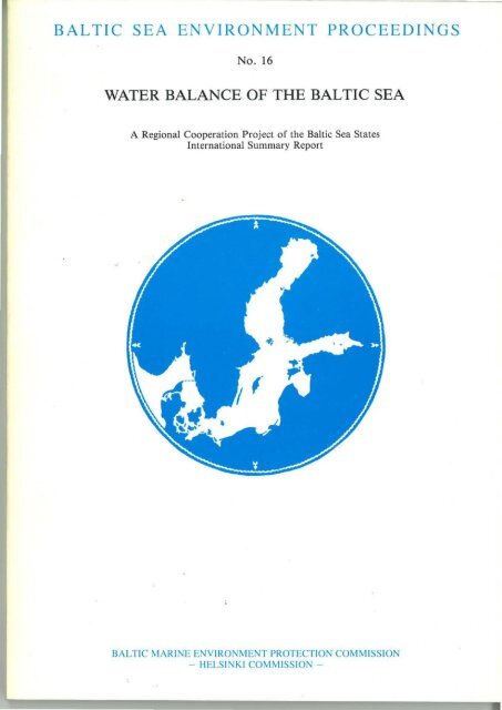
<strong>BALTIC</strong> <strong>SEA</strong> <strong>ENVIRONMENT</strong> <strong>PROCEEDINGS</strong><br />
No. 16<br />
<strong>WATER</strong> BALANCE OF THE <strong>BALTIC</strong> <strong>SEA</strong><br />
A Regional Cooperation Project of the Baltic Sea States<br />
International Summary Report<br />
<strong>BALTIC</strong> MARI NE <strong>ENVIRONMENT</strong> PROTECTION COMMISSION<br />
- HELSI Kl COM M ISSIO -
<strong>BALTIC</strong> <strong>SEA</strong> <strong>ENVIRONMENT</strong> <strong>PROCEEDINGS</strong><br />
No. 16<br />
<strong>WATER</strong> BALANCE OF THE <strong>BALTIC</strong> <strong>SEA</strong><br />
A Regional Cooperation Project of the Baltic Sea States<br />
International Summary Report<br />
<strong>BALTIC</strong> MARINE <strong>ENVIRONMENT</strong> PROTECTION COMMISSION<br />
- HELSINKI COMMISSION -<br />
June 1986
Thi s Internationa l Summary Report has been edited for t he purposes<br />
o[ t he Helsinki Commission by Professor Malin Falkenmark , Executive<br />
Secretary o f the Swedi sh IHP Commi ttee .<br />
For bibliogr aphi c purposes this document should be cited as : Baltic<br />
Marine Envir onment Protection Commission -Helsi nkj Commi ssi on-, 1986<br />
Baltic Sea Env i ronment Proceedings No. 16, 174 pp.<br />
Copyright 1986 by the Baltic Marine Environment Protection<br />
Commiss i on -Helsinki Commission-<br />
ISSN 0357- 2994<br />
felsinki 1986 - Cb.anrert. Pri.nt:.irB G:rrt:re<br />
<strong>WATER</strong> BALANCE OF THE <strong>BALTIC</strong> <strong>SEA</strong><br />
A Regional Cooperation Project of the Baltic S0a States<br />
Internati onal Summary Report<br />
CONTENT :<br />
Chapter 1<br />
.Chapter 2<br />
Chapter 3<br />
Chapt e r 4<br />
PREFACE<br />
HISTORY OF THE PROJECT<br />
1.1 Early water balance studies 1<br />
1.2 International hydrological studies 2<br />
1 . 3 Shaping the project 3<br />
1.4 Methodological studies during<br />
Pilot Study Year 4<br />
1.5 Final phase 5<br />
PAGE<br />
THE <strong>BALTIC</strong> AS A SYSTEM<br />
2 . 1 Regional division of the Baltic<br />
2 . 1 . 1 Western boundary of the<br />
7<br />
Baltic Sea 7<br />
2.1.2 Seven main sea regions 8<br />
2.1.3 Sea areas and volumes 12<br />
2 . 2 Drainage basin of the Baltic and its<br />
subbasins 12<br />
2 . 2.1 Geographical extension<br />
2.2 . 2 Subcatchments of the seven<br />
12<br />
regions<br />
13<br />
2.3 International character of the<br />
drainage basin<br />
15<br />
METHODOLOGY<br />
3 . 1 Introduction 16<br />
3 . 2 Water renewal concepts 16<br />
3 . 3 Separate determination of individual<br />
water balance elements 19<br />
3.4 Regional subdivision of the Baltic<br />
system 19<br />
3 . 5 Methodology development 21<br />
3 . 6 The Pilot Study Year 23<br />
INFLOW FROM DRAINAGE BASIN<br />
4 . 1 Method of calculation<br />
4.1 . 1 Selection of method<br />
4 . 1 . 2 Selection of representative<br />
rivers<br />
4 . 1 . 3 Precision achieved<br />
4 . 1 . 4 Some adjustments<br />
4 . 2 Analysis of river inflow to the<br />
Baltic<br />
24<br />
24<br />
25<br />
26<br />
26<br />
27
Chapter 5<br />
Chap-cer 6<br />
4.2 . 1 Long-term fluctuation<br />
4.2 . 2 Seasonality<br />
4 . 2.3 Horizontal water renewal<br />
4.2 . 4 Statistical inflow analysis<br />
4.2.5 Concluding remarks<br />
DETERMINATION OF AREAL PRECIPITATION<br />
FOR THE <strong>BALTIC</strong> <strong>SEA</strong><br />
5.1 Introduction<br />
5.2 Methodology<br />
5 . 2.1 Error influences at point<br />
measurements<br />
5.2 . 2 The quantitative correction<br />
effect obtained by the various<br />
methods<br />
5. 2. 3 Some aspects on the a1·eal<br />
estimation problem<br />
5 . 2.4 Statistical interpolation<br />
of precipitation at sea<br />
5.2.5 Normalization of tne<br />
precipitation field<br />
5.2.6 Normalization due to<br />
variability<br />
5 . 3 Results of the computations<br />
5.3.1 Areal estimates and<br />
comparison with previous results<br />
5.3.2 Verification of results<br />
5.4 Conclusions<br />
5 . 4 .1 The estimation problem<br />
5 .4.2 The estimates<br />
5.4.3 Urgent future activities<br />
EVAPORATION FROM THE <strong>BALTIC</strong><br />
6 .1 Introduction<br />
6 . 2 The data<br />
6.2 .1 Bulk aerodynamic method<br />
(BAM)<br />
6 . 2 . 2 Aerological method<br />
6 . 3 Procedures<br />
6.3. 1 Bulk aerodynamic method<br />
(BAM)<br />
6.3 . 2 Aerological method<br />
6 . 4 Results<br />
6.4.1 Figures from previous<br />
investigations<br />
6.4.2 Long-term averages by<br />
application of BAM<br />
6.4 . 3 Evaporation during the<br />
extended Pilot Study Year<br />
6 .4.4 Estimates for the Pilot<br />
Study Yeclr achieved by the aerological<br />
method<br />
6 . 5 Conclusions<br />
27<br />
30<br />
32<br />
32<br />
34<br />
35<br />
35<br />
36<br />
37<br />
38<br />
38<br />
39<br />
41<br />
41<br />
41<br />
42<br />
47<br />
47<br />
47<br />
48<br />
49<br />
49<br />
49<br />
50<br />
51<br />
51<br />
52<br />
54<br />
54<br />
56<br />
56<br />
60<br />
60<br />
Chapter 7<br />
Chapter 8<br />
----<br />
VARIATI ONS OF MEAN <strong>SEA</strong> LEVEL AND <strong>WATER</strong><br />
VOLUME OF THE <strong>BALTIC</strong> <strong>SEA</strong><br />
7.1 Earlier studies<br />
7.2 IHP project activities<br />
7.3 Sea-level observations of the<br />
Baltic<br />
7 . 4 Reduction of sea-level r ecords<br />
to uniformity<br />
7 . 5 Sea-level surface<br />
7.5.1 Sea-l evel surface<br />
reliability<br />
7.5.2 Extreme monthly sea-level<br />
surfaces<br />
7.5.3 Long-term average sealevel<br />
surfaces<br />
7 . 5.4 Water volume increments<br />
7.6 Results<br />
7.6.1 Mean sea-level for the<br />
period 1951-70<br />
7 . 6 . 2 Water levels in the five<br />
subbasins<br />
7.6.3 Sea-levels during Pilot<br />
Study Year<br />
7.6.4 Water storage changes in<br />
the five subbasins<br />
7.7 Conc l usions and proposals<br />
<strong>WATER</strong> EXCHANGE THROUGH THE DANISH<br />
STRAITS<br />
8 . 1 On the concept of seawater<br />
exchange<br />
8 . 1 . 1 Early studies<br />
8.1 . 2 Studies based on lightship<br />
8.2<br />
8 . 3<br />
64<br />
65<br />
66<br />
66<br />
69<br />
69<br />
70<br />
70<br />
73<br />
73<br />
73<br />
74<br />
74<br />
77<br />
79<br />
81<br />
81<br />
observations 83<br />
8 . 1 . 3 Time variability of the<br />
seawater exchange 84<br />
8.1 . 4 Some methodological<br />
conclusions 86<br />
Field measurements of the seawater<br />
exchange 86<br />
8 . 2.1 Calculation of the seawater<br />
exchange 89<br />
8 . 2.2 The Belt sections 90<br />
8.2.3 The sections of the Sound 90<br />
8.2.4 Results 92<br />
Discussion of results 92<br />
8.3 . 1 Time lapse of the exchange 95<br />
8.3.2 Differences observed<br />
between the Belts and the Sound 95<br />
8 . 3 . 3 Long- term mean discharge 98
Chapter 9<br />
8 .4<br />
RIVER<br />
9 . 1<br />
9.2<br />
9.3<br />
9.4<br />
8.3.4 Modelling the seawater<br />
exchange 98<br />
Conclusions 98<br />
INPUT OF SUSPENDED MATTERS<br />
Introduction<br />
Network density<br />
Methods used in measurements<br />
and calculations<br />
9.3.1 Water sampling<br />
101<br />
102<br />
106<br />
106<br />
9.3.2 Methods of analysing 106<br />
9.3.3 Data prosessing<br />
109<br />
Calculation of input of suspended<br />
matters into the Baltic Sea 110<br />
9 . 4.1 Pilot study<br />
110<br />
9.4.2 Input of material during<br />
the period 1961-70<br />
112<br />
9.4 . 3 Discussion of the results 115<br />
Chapter 10 CALCULATED FRESH<strong>WATER</strong> BUDGET OF THE<br />
<strong>BALTIC</strong> AS A SYSTEM<br />
10.1 Introduction 117<br />
10 . 2 Long term average conditions 119<br />
10 . 2 .1 Average annual water budget<br />
of the Baltic as a system 119<br />
10 . 2.2 Interannual f luctuations 122<br />
10.2.3 Seasonal variations of<br />
water b alance elements 124<br />
10 . 3 Short term variations of the<br />
water balance 126<br />
10.3 . 1 Pilot study year 126<br />
10.3.2 Seasonal variations during<br />
extreme years 130<br />
10 . 4 Regional differentiation of the<br />
water budget 132<br />
10.4 . 1 Baltic Sea as a cascade of<br />
interconnected subsystems 132<br />
10 . 4.2 Hydrological comparison of<br />
individual subbasins of t h e<br />
Baltic<br />
10 .4. 3 Seasonal fluctuations of<br />
132<br />
the endogenous water balance<br />
10 . 4.4 Real water exchange ,<br />
134<br />
considering also the freshwater<br />
throughflow 134<br />
10 . 4 . 5 Overall freshwater exchange<br />
of the whole system 1 37<br />
Chapter 11<br />
CONCLUSIONS<br />
11 . 1 Interdisciplinary problems of<br />
semi-enclosed basin<br />
11 . 2<br />
11 . 3<br />
11 . 4<br />
Th e international project<br />
Some conclusions<br />
Closing remarks<br />
the<br />
140<br />
141<br />
142<br />
142<br />
Chapter 12 REFERENCES<br />
1 2 .1 Joint refe rences<br />
1 2 . 2 Specific references<br />
12.2.1 Chapter 1<br />
12.2 . 2 Chapter 2<br />
12 . 2.3 Chapter 3<br />
1 2 . 2.4 Chapter 4<br />
12.2.5 Chapter 5<br />
12.2 . 6 Chapter 6<br />
12 . 2 .7 Chapter 7<br />
12 . 2 . 8 Chapter 8<br />
12 . 2.9 Chapter 9<br />
1 2 . 2 . 10 Chapte r 10<br />
12 . 2 . 11 Main Tables<br />
145<br />
146<br />
146<br />
146<br />
146<br />
147<br />
147<br />
149<br />
1 51<br />
152<br />
153<br />
155<br />
156
Chapter 1<br />
HIS'l'ORY OF THE PROJECT<br />
Zdzislaw Mikulski (Poland)<br />
-1-<br />
1.1 EARLY <strong>WATER</strong> BALANCE STUDIES<br />
Studies on the water balance of the Baltic Sea have a long-term<br />
tradition, dating back to the turn of 19th and 20th centuries.<br />
Studies were obviously favoured by the establishment in 1902 of<br />
the Commission for Studies of Northern Seas (later on transformed<br />
into the International Council for the Exploration of the Sea,<br />
which is still active). The first calculation of water balance<br />
elements of the Baltic was made by Krummel who presented the<br />
results in 1903 at Institut fur Meereskunde at the Uni.versity<br />
of Berlin (Krummel 1904). 'I'he calculations allowed to draft,<br />
for the f:crst time, a complete water balance of the Baltic Sea.<br />
Later attempts at calculating were done by Spethmann (1912)<br />
and Witting (1918). Great contribution to the work on the water<br />
balance of the Bal·tic was made by !\undo, co-founder of the<br />
Pussian Hydrological Institute (later State Hydrological<br />
Institute in Leningrad) . an outstanding Polish hydrologist and<br />
chief of Polish hydrological service in the period 1937-39. At<br />
the annual meeting of the Russian hydrological Institute in<br />
1922, he indicated the necess.ity to undertake studies on the<br />
water balance of the Baltic (Runde 1922).<br />
Organized studies on the balance were undertaken during the 1930's<br />
whithin the framework of Hydrological Conferences of the Baltic<br />
Countries. At the Third Conference in 1930 in Warsaw, !\undo<br />
presented his significant appeal to undertake studies on river<br />
inflow to the Baltic and other elements of the water balance<br />
(Runde 1930). At the Fourth Conference in Leningrad in 1933,<br />
Sokolowsky presented a paper on the balance of the Baltic in<br />
which he gave the first water balance equation (Sokolovsky 1933)<br />
Following conferences patronized the studies so that after a few<br />
years, a lot of valuable material had been gathered. A turningpoint<br />
was Brogmus work, published in 1952, which revised the<br />
water balance of the Baltic and which for the first ·time took<br />
into account also the share of ocean waters in the water balance<br />
(Brogmus 1952). Two years later, Wyrtki conducted detailed<br />
analysis of the seasonal changes of the water balance components<br />
as well as of the long-term variations (Wyrtki 1954).<br />
In 1956 the Conferences of Baltic Oceanographers were started<br />
with the purpose to inspire joint coordinated research. Ten years<br />
later, at the Fifth Conference in 1966 in Leningrad, the Polish<br />
side presented a paper on Variability of river inflow to the sea,<br />
and proposed ·to resume the water balance studies. The proposal<br />
was accepted and at the Sixth Conference in 1968 in Sopot,<br />
results of calculation of river inflow to the Baltic in the<br />
period 1951-1960 were presented (Mikulski 1970).
Chapter 3<br />
-16-<br />
Mi.,'.L'I JODOLOG Y<br />
Zclz.i.sJ.aw Mikulski (Poland), Malin Falkenmark (Sweden) and<br />
Ulf Ehlin (Sweden)<br />
3. 1 INTRODUC'l'ION<br />
The Baltic Sea is claimed to be one of the most polluted sees<br />
of the world. Ecological impact assessments depend on good<br />
information on the water renevli'tl of the different parts of the<br />
system. The necessity to determine the water balance was pointed<br />
out already by the beginning of the present century (KrUmmel<br />
1904, Spethman 1912, Witting 1918, Runde 1922). However, well<br />
organized measurements had to wait for the foundation of the<br />
J,ydrological Conferences of the Baltic States in 1926 to be<br />
made poss.i.ble.<br />
Until 1939, only partially homogenous incomplete hydrological<br />
data were brought together, and the data had to wait for<br />
\'Jorldwar II to end before compilation and analysis became<br />
possible (Brogmus 1952). Two years later, also the fluctuations<br />
of the water balance had been analyzed (Wyrtki 1 954) . Since then,<br />
continuously increased interest in the system has been generated<br />
by oceanographers and ecologists, in response to the environmentAl<br />
problems developing in the wake of ever increasing pollution<br />
loads from the countr i.es border inq the sea.<br />
3. 2 vJATER RENEWAL CONCEPTS<br />
Oceanographers working with the Baltic mostly focus on internal<br />
water exchange processes, such as the mixing between layers<br />
and between subregions, mixing between coastal waters and the<br />
open water mass etc. They are further interested in the water<br />
exchanqe with the North Sea, the path followed by individual salt<br />
water inflows, the salinity distribution in the Baltic, and the<br />
development of the oxygen conditions in its deep water.<br />
Hydrologists, on the other hand, tend to reqard the semienclosed<br />
sc'a more as a whole, and to see it in close relation to the land<br />
area drained. They are occupied with the water storage in the<br />
basin and with the external water exchanqe, and take less notice<br />
or the salinity of the different water balance elements.<br />
'L'lw Baltic Sea is, in general, characterized by a positive fresh<br />
water balance, and its water is therefore brackish. The basin is<br />
-I 7-<br />
in hydraulic contact with the North Sea over the shallow<br />
thresholds on the Danish Straits, which allow a restrlcted wat.er<br />
exchange only. Basically, the water mass of the Baltic conslsts<br />
of an upper layer with continuous throughflow of fresh water<br />
from the rivers discharging into the Baltic, and a lower layer of<br />
higher salinity, where the water is renewed in an oscillatory<br />
manner through irregular salt water instrusions from the North<br />
Sea.<br />
Basically, the dynamics can roughly be described by the simple<br />
exchange model in Fig. 3.1. The external forcing functions<br />
governing the water exchange are<br />
* fresh water supply from the land drained<br />
* outside sea level and salinity (North Sea)<br />
* meteorological forcings.<br />
'l'he renewal of the water mass is described by the water balance,<br />
a concept quite extensively used by hydrologists. The concept<br />
includei the quantitative relationships and the different<br />
interconnections between all the elements responsible for the<br />
renewal of the water by different exterior processes:<br />
precipitation (P), evaporation (E), input by land runoff (L),<br />
salt water inflow through the straits connecting the semienclosed<br />
basin with the bordering sea (M), water storage or<br />
retention (LW), and water outflow (H).<br />
H<br />
M<br />
p<br />
E<br />
L<br />
tJ.V<br />
H-M =<br />
p E<br />
--<br />
--- - -- --- --l-<br />
precipitation<br />
evaporation<br />
river inflow<br />
storage difference<br />
net outflow<br />
3.1 Water exchange model<br />
I<br />
-- -- - - tJ.V<br />
L
Chapter 7.<br />
-64-<br />
VARIATIONS OF MEAN LEVEL AND <strong>WATER</strong> VOLUME OF THE <strong>BALTIC</strong> <strong>SEA</strong><br />
N.N. Lazarenko (USSR)<br />
7. 1 .<br />
EARLIER STUDIES<br />
systematic investigations of mean sea levels in the Baltic were<br />
initiated early in the 19th century for various purposes (sea<br />
port projects, hydrographic surveys, studies of recent coastal<br />
vertical movements (RCVM), selection of gauge datum for a<br />
highly accurate adjustment of the national networks in the<br />
Baltic countries, selection of depth datum for sea charts, etc.)<br />
In a fundamental monograph, Rudovits (1917) presented a detailed<br />
analysis of the Russian tide-gauge and mareograph network<br />
operation; a first attempt to analyse homogeneity of data on<br />
sea levels; and computed mean level for some of the gauges.<br />
Among other scientists who investigated mean levels of the<br />
Baltic Sea are Blorr.qvist and Renqvist (1914), Madsen (1914),<br />
Bergsten (1925), Hela (1944, 1947), and Lisitzin (1953), Particular<br />
attention should be paid to the work of R. Witting (1918, 1945).<br />
He was the first to substantiate and evaluate the surface slope<br />
of the mean Baltic Sea level; he prepared one of the first maps<br />
of the recent movements of the sea shores, and he tried to<br />
combine the heights of the Baltic levc,lling polygon (BLP) with<br />
the position of the mean sea-level surface.<br />
Mean sea level investigations made before world War II showed<br />
that the position of the surface of the mean sea level deviated<br />
from the geoid of the Earth and changed its height in time.<br />
Therefore, much efforts were concentrated around this problem<br />
considering its particular practical and scientific importance.<br />
In 1938-1940 the scientists of Leningrad collected data to<br />
adjust the Baltic levelling polygon system, with the aim at<br />
achieving a complete uniformity in sea-level records.<br />
After world war II, work on the problem of the Baltic mean sea<br />
level continued in the USSR.<br />
At the first stage of this work the following was implemented<br />
(Lazarenko, 1951):<br />
- development of methodology for a reliable reduction of mean<br />
annual levels of the entire system of sea-level gauges since<br />
the start of observations till 1937 to complete uniformity<br />
- compilation of the RCVM map of the Baltic Sea coast on the<br />
basis of observations before 1938, reduced to complete<br />
uniformity<br />
-65-<br />
- accurate geodetic adjustment of the BLP polygon system above<br />
the initial gauge datum of the Kronstadt gauge by the dynamic<br />
method (BLP, 1950) with the account of RCVM at the bench mark<br />
sites during the organization of national levelling networks<br />
in other countries<br />
- compilation of the map of mean level position of the Baltic<br />
Sea surface for 1901-1937.<br />
The second research stage included the following (Lazarenko,<br />
1961):<br />
- determination of mean daily, mean monthly and mean annual<br />
levels of the Baltic Sea for 1901-1940 from the results of<br />
observations at 26 level gauges reduced to complete uniformity<br />
- compilation of monthly mean sea level maps both for average<br />
conditions for the period 1901-1940 and for extreme conditions<br />
- investigations of the main peculiarities of sea-level fluctuations<br />
in the Baltic.<br />
An attempt was made to reduce sea-level records before and after<br />
World War II to uniformity. This problem could, however, be<br />
solved only for some of the level gauges because of the short<br />
duration of post-war observation at that time.<br />
7.2 IHP PROJECT ACTIVITIES<br />
The third stage which took place within the framework of the<br />
international project on the water balance of the Baltic Sea<br />
had the following main results:<br />
- sea-level records before and after World War II were produced<br />
to uniformity<br />
- the RCVM map for the Baltic Sea coast was compiled on the<br />
basis of uniform level records<br />
- mean monthly and mean annual sea levels and water volume<br />
increments for the five subbasins and for the Baltic as a<br />
whole were determined for the historic period (1951 - June<br />
1975) and for the Pilot Study Year (June 1975 - December 1976)<br />
- mean daily levels and water volume increments were determined<br />
for the Pilot Study Year (July 1975 - December 1976).
8.2.2. The Belt sections<br />
-90-<br />
Without further information about the amounts of water passing<br />
the Great Belt it is not possible to decide which section to<br />
rely upon (if any) for extended studies. Because of poor<br />
instrumentation in the southern section and because of the<br />
discrepancies of the calculations from this section when compared<br />
to the other two it was, however, decided to reject results from<br />
the southern section. Of the two remaining, the northern section<br />
was preferred because it had six instruments and also because<br />
the flow was expected to be of a simpler and more uniform<br />
structure than further south. The island of Sprogo rises just<br />
north of the middle section, and the ridge divides the Great<br />
Belt into two parts, Vesterrenden and Osterrenden. This choice<br />
was confirmed later by results from the equation of water balance<br />
(Jacobsen, 1980).<br />
Transports in the Little Belt were calculated at the northern<br />
section (station 547), as the currents at station 530 in the<br />
southern Little Belt cannot be considered as representative of<br />
the movement of the water through this strait (Jacobsen 1980).<br />
The Fehmarn Belt section could not be used until the Institute of<br />
Marine Research, Kiel, on October 12, 1976 moored an additional<br />
station (529) with three instruments at the 20 m contour outside<br />
Fehmarn. The last two and a half month of the Pilot Study Year<br />
has, however, not been included in the calculations as data from<br />
the Danish station 528 were very scanty.<br />
8.2.3. The sections of the Sound<br />
In the section in the southern part of the sound (stations<br />
526, 527, 552) continuous recordings failed because of frequent<br />
interference of the mechanical part of the current meters (the<br />
rotors) with drifting sea weed.<br />
The section in the northern part of the Sound (station 549) was<br />
not established until November 1975, and the highly irregular<br />
current which frequently consists of a narrow northgoing swift<br />
surface current of low salinity, embedded in denser water of small<br />
velocities (Jacobsen and Nielsen, 1978) did not encourage<br />
calculations, when only two instruments (7 and 25 metres) covered<br />
the section. The 15 metre instrument was added in February 1977.<br />
In the preliminary tables of the water exchange, presented in<br />
Rostock 1977 (Nielsen and Jacobsen, 1977) use was made of the<br />
estimates of the surface current from the lighttower Drogden,<br />
and Q 5 was calculated according to:<br />
( 8. 2)<br />
-91-<br />
The formula has been proposed by Jacobsen (1925). VDR is almost<br />
always reported in directions sao (outgoing) or 2300 (ingoing) .<br />
A later investigation based on intensive current measurements<br />
during September 1976 showed that the factor of proportionality<br />
between Q 5 and VDR has increased almost monotonically since 1931<br />
and is now about aoubled (3 instead of 1.5), (Jacobsen 1978,<br />
1980). No safe explanation of this has yet been found. It should<br />
also be pointed out that the annual average of the current from<br />
Drogden has been ingoing on many occasions since 1943. It is,<br />
however, hard to accept that the annual net exchange through the<br />
Sound should also have been negative.<br />
In consequence of this the previous presented monthly values for<br />
Q (Nielsen and Jacobsen, 1977) are too small. It was not<br />
c§nsidered safe to utilize the observations from Drogden with a<br />
larger constant of proportionality, as long as the question of<br />
the change in the constant not has been settled. Alternatively,<br />
a simple model has been established which permits Q to be<br />
calculated from a frictionally balanced barotropic rlow over the<br />
shallow-area north of Drogden (Jacobsen 1978, 1980). The barotropic<br />
pressure gradient is calculated from the sea level difference<br />
between Klagshamn and Copenhagen:<br />
where<br />
D<br />
K<br />
hKlagshamn - h Copenhagen<br />
( 8. 3)<br />
hKlagshamn is measured relative to the Swedish ''heightsystem 1900"<br />
and hCopenhagen relative to DNN (Danish Normal Zero) .<br />
D accounts for the expected difference between the Swedish and<br />
the Danish levelling zeroes.<br />
The model was calibrated to give a good description of the<br />
exchange during periods of uniform flow of moderate to high<br />
intensity. It is likely to fail during situations with small sea<br />
level differences, and also if the transport is averaged over<br />
many current reversals. It has, however, owing to lack of better<br />
data been used to reproduce the monthly values of Q 5 for the<br />
Pilot Study Year.<br />
The Danish Neteorological Institute and the Swedish Meteorological<br />
and Hydrological Institute kindly supplied the hourly readings<br />
from the two tide gauges. During March 1976, the tide gauge in<br />
Copenhagen was out of order, and tentatively was substituted:<br />
QS (km 3 /month) = 3.0 VDR (cm/s)<br />
'<br />
( 8. 4)
-100-<br />
The distribution of the current over the cross section depends<br />
much on the density stratification, which again is intercorrelated<br />
to the direction of the flow. Outflow is usually connected with<br />
stratified flow, while the fronts during strong inflow move<br />
south to the sills of Drogden and Darss, and the stratification<br />
may virtually disappear in the Belt Sea. This systematic change<br />
in the flow pattern is likely to introduce a bias in the net<br />
exchange, which is calcula·ted over an entire cycle of inflow and<br />
outflow, and the bias :LE; expected to be of the same order of<br />
r.1agni ·tude as the long term net flow.<br />
It seems therefore :justified also to study the water exchange on<br />
a time scale which resolves all important. modes of motion and it<br />
is useful to introduce the average exchange regardless of the<br />
ditection, · It has not been attempted to obtain a vertical<br />
resolu tj_on of the exchange from the direct current measurements.<br />
To be useful it requires a more detailed knowledge about the<br />
position and stability of the density interface than could be<br />
obtained from the relatively few moored selfrecording instruments.<br />
Chapter 9<br />
-101-<br />
RIVER INPU'r OF SUSPENDED MATTERS<br />
Bengt Nilsson (Sweden)<br />
9.1. INTRODUCTION<br />
----------------------------------------<br />
In the countries bordering the Baltic Sea investigations on<br />
sediment transport have been going on for a long time. The purpose<br />
of the measurements, however have varied widely and different<br />
methods of sampling, analysing and data processing have been used.<br />
In Sweden the studies have often been initiated because of building<br />
operations, water regulations, dredgings or other artificial<br />
·measures in the rivers.<br />
The observations and the measurements often cover a fairly short<br />
period, as the aim has been to determine the concentration of<br />
suspended material during the period of disturbance, an information<br />
of great importance for instance for water supply plants<br />
and paper mills. The rate of silting in reservoirs and the sedimentation<br />
in river channels are also of interest.<br />
Lately special attention has been paid to the fact that the<br />
suspended material is often contaminated with dissolved, colloidal<br />
and solid matter from waste material. This implies a serious<br />
environmental problem, as the waste material often contains heavy<br />
metals, toxic substances and other undesired contaminants, which<br />
affect the sediments, especially within the coastal depositional<br />
areas.<br />
Thus there was a great interest of a joint study on the sediment<br />
transport within the research project "The water balance of the<br />
Baltic Sea". The problems involved were the following:<br />
- intercalibrate the different methods used in water sampling<br />
and water analysing<br />
- measure the transport during a Pilot Study Year (July 1975 to<br />
December 1976)<br />
- calculate the transport of suspended matter into the Baltic Sea<br />
during the period 1961-70 (second decade of the historical<br />
20-year period chosen for the project).<br />
According to differences in drainage pattern and, to some extent,<br />
also to river regime differences, the drainage basin of the Baltic<br />
sea may be divided into two main regions. In one region, Finland<br />
and Sweden, the numerous medium size rivers create problems in<br />
terms of the network density and the cost factors involved in an<br />
investigation. In the south and south-eastern part of the<br />
drainage basin the rivers are few with very large drainage<br />
areas, and the measurement problems will be of another kind.<br />
Considering this fact and also other practical reasons,
-11 6--<br />
Though sligthly disturbed by the large lake areas of middle<br />
Sweden, central Finland and of the Neva drainage basin, the<br />
geographical pattern of the denudation in the individual river<br />
basins shows an increase from the north to the south. In view<br />
of this fact, the estimated denudation of Denmark, which is<br />
high, might be rather reasonable.<br />
Chapter 10<br />
--117-<br />
CALCULATED FRESH<strong>WATER</strong> BUDGET OF THE <strong>BALTIC</strong> AS A SYSTEM<br />
Zdzislaw Mikulski (Sweden) and Halin Falkenmark (Sweden)<br />
10.1. INTRODUCTIQN<br />
As described in Chapter 3, the basic aim of the Baltic Sea project<br />
was to arrive at separate determination of all the individual<br />
water balance elements for the joint "historical" time period,<br />
1951-70. This effort would give homogenous and mutually comparable<br />
data and would better reflect the water balance in its various<br />
details than earlier studies which have had to operate with data<br />
for different time periods, i.e. non-homogenous data. By comparing<br />
the long term averages of the individual elements and their relations,<br />
earlier conclusions could be cheked for reliability. Interannual<br />
variations between years of different character could be studied.<br />
This would give a good idea also of various extreme conditions in<br />
the Baltic system.<br />
The main part of the study was to be based on monthly averages<br />
of the different water balance elements. Durinq the 18-monthperiod<br />
of intensified synchronous studies, the-so-called Pilot<br />
Study Year (July 1975 - December 1976), some elements were even<br />
analysed on a day-by-day basis. During the pilot study, the<br />
closing error should be evaluated, and the basic phenomena<br />
characterizing the water exchange through the Danish Straits be<br />
illuminated.<br />
By basing all the element studies on a regional differentiation<br />
of the Baltic, composed of five different subbasins inside the<br />
thresholds in the Danish straits, and two additional areas in<br />
the transitional estuary region, a deeper understanding should be<br />
arrived at. Conditions in the different subregions or subbasins<br />
could be compared, and an increased understanding achieved of the<br />
water renewal of the different parts of the Baltic. The conditions<br />
should be studied both as long-term average conditions, and as<br />
conditions during extreme years and extreme monthly situations<br />
on the whole.<br />
The studies performed on the individual elements have been reported<br />
in some detail in the earlier chapters 4-9 of this International<br />
Summary Report. In this chapter, the whole budget will be discussed<br />
and analyzed.<br />
For easy reference, the final data on water balance elements are<br />
exposed in a separate data annex to this report, according to<br />
the following key table (Table 10.1).
11.3. SOME CONCLUSIONS<br />
-142-<br />
The Pilot Study was organized to make possible concentrated and<br />
synchronous measuremen-ts of all the individual water balance<br />
components. By cooperation with the Danish Belt Project it<br />
included also field measurements of the water exchange with the<br />
North Sea. New and more precise methods were applied for<br />
determination of evaporation. Thanks to this, more reliable data<br />
were achieved on the sea evaporation. It was concluded that<br />
earlier calculations had underestimated the evaporation by about<br />
7 %. A theoretically based earlier hypothesis that the sea<br />
evaporation culminates in late autumn and early winter was confirmed.<br />
In spite of the large efforts directed towards the water exchange<br />
with the North Sea that element remains the weak point of the<br />
water balance. It was concluded that the most reliable method for<br />
determination of the long-term water exchange remained the water<br />
balance equation. This is due to the methodological problems<br />
involved in current measurements in a complicated system of<br />
straits, characterized by complex water movements back and forth<br />
and successive entrainment of ingoing water in the outgoing<br />
water mass, as one moves downstream through the straits. At the<br />
present level of methodological development, the errors involved<br />
in current measurements remain rather large, and the instruments<br />
are not yet reliable enough to produce continuous data.<br />
Unfortunately, the time gaps in the final data series made it<br />
impossible to arrive at determining the closing errors.<br />
The project produced the conclusion that in earlier studies,<br />
precipitation had been severely underestimated, due to neglect<br />
of errors involved in point measurement of precipitation.<br />
For river inflow it was possible to study a 55 year data ser.ies,<br />
thereby allowing even better ins.ight .into the time variab.ility,<br />
espec.ially as the river .inflow, when seen in a long-term<br />
perspective, plays a dominating role over the vertical balance.<br />
A stat.istical study on the 55 year series illuminated the<br />
characteristics and the long-term variat.ions .in the input of<br />
river flow. It was concluded that consecut.ive decade averages<br />
did not differ very much from each other dur.ing that period.<br />
The sea water storage represents a quite dom.inating factor in the<br />
water balance when seen on a monthly or da.ily basis. When averaged<br />
over a 20-year period, however, the storage change tends to vanish<br />
in the water balance, in line with the general hydrological water<br />
balance hypothesis.<br />
11.4. CLOSING REMARKS<br />
The project represents 15 years of close cooperation and work of<br />
a great number of experts in the seven countries participating in<br />
the project. The experts involved have achieved the best knowledge<br />
-143-<br />
now available on the indj_vidual components of the water balance<br />
of the Baltic Sea. Now that the hydrologists have finalized<br />
their part of the relay-race, it is our hope that<br />
their results will be absorbed by the scientific community in the<br />
bordering countries, in order to make the best possible use of<br />
·the new understanding achieved. The oceanographers, who initiated<br />
the st:udy by asking for more reliable data on the freshwater<br />
balance, are now provided with such data, together with new<br />
information on the characteristics of the different parts of the<br />
cascade, and on the variability in time and space characterizing<br />
the different elements. Oceanographers should therefore now have<br />
a better basis than earlier for understanding the peculiarities<br />
of the different subregions composing the Baltic system.<br />
Ecologists, on the other hand, may now also be in a position to<br />
deepen their understanding of the Baltic sea and its different<br />
subregions from an environmental viewpoint. We now know much more<br />
than earlier about the input and output of freshwater, and some<br />
substances that they carry to the system. The study included the<br />
j_nput of suspended material to the various subbasins of the system.<br />
Also, the input of dissolved substances with the rivers was<br />
appreciated within the project. The accelerating interest in<br />
these elements within the Helsinki Convention work have, however<br />
already produced later data, thereby outdating the preliminary<br />
studies performed within the IHD/IHP-project.<br />
1\lhen ecologists and oceanographers end by understanding the large<br />
role played by the freshwater budget, they will become interested<br />
intrying to follow, on a continuous basis, the freshwater balance<br />
and its components, as a measure of keeping control over the<br />
Baltic as an environment of considerable value for all the<br />
bordering states. This would make it desirable to keep the Baltic<br />
Sea under continuous observat.ion through an operational water<br />
budget monitoring. Such a control program could very well be<br />
organized, based on the methodological experiences gained within<br />
the IHD/IHP project, as a matter of cooperation between the<br />
operational hydrological services in the countries involved.<br />
The experiences gained through this study of a semi-enclosed<br />
sea could probably be helpful also in the study of other semienclosed<br />
seas. It is particularly interesting to note that a<br />
semi-enclosed sea may not be as homogenous as earlier considered.<br />
The complications due to mixing processes have been better<br />
explained by the differentiation of the Baltic sea in its seven<br />
subbasins.<br />
In this regard, there is a cons.iderable difference between the<br />
complex eascade of partial seas composing the Baltic, and an<br />
inland sea like the Black Sea. For instance, the Bothnian Bay JG<br />
practically influenced only by freshwater, and the same holds<br />
for the Gulf of Finland and the Gulf of Riga. In the Bothnian<br />
Sea and the Baltic Proper, conditions are vastly different: the<br />
water balance gets much rriore complex. These throughflow subbaslnrJ<br />
receive water both from the land areas drained, and as inflow<br />
from upstream subbasins. On a short term basis, the back and<br />
forth movement of water masses between neighbouring subbasins<br />
may be considerable, but in the long-term perspective, they<br />
converge to the net water exchange determined by the freshwater
-154--<br />
Hasholt, B., 1977: Grindsted-Varde A-systemet.<br />
Kvicksolvundersogelser 1974-1976, Arbejdsrapport nr 2,<br />
Kobenhavn.<br />
Hasholt, B., 1975: Maling af suspenderet transport i udvalgte<br />
Sjallandske vandlob. Typewritten report.<br />
Heiss, P.B., 1974: Gudenaundersogelsen 1973-75. Nordisk Hydr.<br />
Konference, Bd 1 Kobenhavn.<br />
Host-Madsen, M. & Edens, J.J., 1974: Sediment transport in<br />
Danish Streams. Nordisk Hydr. Konference, Bd 1 Kobenhavn.<br />
Lisitsina, K.N. & Aleksandrova, W.I., 1972: Stok nanosov rek<br />
evropejskov territorii SSSR, Trudy GGI vyp 191.<br />
Lvovic, M.I., 1971: Reki SSSR, Moskva.<br />
Measurements data GGI, 1975-76, Leningrad<br />
Melin, R. & Carlsson, E., 1964: Vattenkvalitetsundersokningar. BSM<br />
EC/U0-142040, Typewritten report, Stockholm.<br />
Mikulski, z., 1975: River runoff to the Baltic Sea, Project<br />
Document no 3, IHP.<br />
Nilsson, B., 1969: Development of a depth-integrating water<br />
sampler: UNGI rapport nr 2, Uppsala.<br />
Nilsson, B., 1971: Sedimenttransport i svenska alvar. Ett IHD-projekt.<br />
Del 1 Metodik. UNGI rapport nr 4, Uppsala.<br />
Nilsson, B., 1972: Sedimenttransport i svenska alvar. Ett IHDprojekt.<br />
Del 2 Avrinningsomraden, stationer och resultat<br />
1967-69, UNGI rapport nr 16, Uppsala.<br />
Nilsson, B., 1974: Ett exempel pa vattenregleringarnas inverkan<br />
pa sedimenttransporten, UNGI rapport 34, sid 583-597,<br />
Uppsala.<br />
Nilsson, B., 1976: Input of suspended inorganic sediment into the<br />
Baltic Sea.Vannet i Norden nr 1.<br />
Nilsson, G. & Martvall, s., 1972: Clrealven och dess meanderlopp.<br />
En fluvialmorfologisk studie. UNGI rapport 19, Uppsala.<br />
PasXawski, Z., 1973: Metody hydrometrii rzecznej, Warszawa.<br />
Sundborg, A. & Norrman, J., 1963: Gota alv. Hydrologi och<br />
morfologi med sarskild hansyn till erosionsprocesserna.<br />
Avh. Geogr Inst. Uppsala Univ. nr 3, Stockholm.<br />
Wartiovaara, J., 1975: Jokien ainevirtaamista Suomen rannikolla.<br />
Publ. of the Water Research Inst., 13, Helsinki.<br />
Wartiovaara, J., 1978: Phosphorus and organic matter discharge<br />
by Finnish rivers to the Baltic Sea, Publ. of the Water<br />
research Inst., 29, Helsinki.<br />
12.2.10. Chapter 10<br />
-155-<br />
Henning, D., 1985: see reference under chapter 6<br />
Jacobsen, T.S., 1980: see reference under chapter 7<br />
Lazarenko, N.N., 1980: see reference under chapter 3<br />
Mikulski, z., 1982: see reference under chapter 3.
MAIN TABLE 2. SHARE<br />
Table<br />
No. Country<br />
1 USSR<br />
2 Sweden<br />
3 Poland<br />
4 Finland<br />
5 Denmark<br />
6 GDR<br />
7 FRG<br />
8 Norway<br />
9 Czechoslovakia<br />
Years;Month<br />
1921-1930<br />
1931-1940<br />
1941-1950<br />
1951-1960<br />
1961-1970<br />
1971-1975<br />
1921-1975<br />
1931-1960<br />
1951-1975<br />
*) = European part<br />
OF THE <strong>BALTIC</strong> COUNTRIES IN THE DRAINAGE AREA OF THE <strong>BALTIC</strong> <strong>SEA</strong><br />
compiled by Zdzislaw Mikulski (Poland)<br />
Drainage area<br />
594 600<br />
445 300<br />
310 950<br />
303 400<br />
23 400<br />
18 260<br />
5 130<br />
12 000<br />
8 200<br />
%<br />
34.5<br />
25.8<br />
18 . 1<br />
17.6<br />
1 • 4<br />
1 • 1<br />
0.3<br />
0.7<br />
0.5<br />
Area of Country<br />
5 570 000*)<br />
449 964<br />
312 683<br />
337 032<br />
43 075<br />
108 178<br />
248 611<br />
323 886<br />
127 977<br />
%<br />
1 0 • 7<br />
99 .0<br />
99.5<br />
90.0<br />
54.4<br />
1 6 . 9<br />
2 • 1<br />
3.7<br />
6.4<br />
Length of shore line**)<br />
km<br />
2 670<br />
5 450<br />
590<br />
2 970<br />
2 480<br />
**) =Evaluated on basis of 1:1.7 min map/Bathymetric map, Helsinki 1981 - obta.ined valued<br />
are aproximated to 10 km/.<br />
m 3 /s 10877<br />
km 3<br />
29.134<br />
3<br />
T!! /S . 994" ...<br />
km 3<br />
26.602<br />
m 3 ;s 9042<br />
km 3<br />
24.191<br />
rr.J /s 9948<br />
km 3<br />
26.648<br />
m 3 /s 10682<br />
km 3<br />
28.612<br />
m 3 /s 12228<br />
krr? 32.893<br />
n. 3 /s 10292<br />
km 3<br />
21.570<br />
m 3 ;'s 9644<br />
km 3<br />
25.814<br />
m 3 ;s 10952<br />
km 3<br />
29.384<br />
HAUl Tl'BLE 3. RIVER INFL0\'1 TO THE <strong>BALTIC</strong> <strong>SEA</strong> (SUBBASINS 1-7)<br />
Monthly and annual means for different time periods. Table compiled by<br />
Zdzislaw Mikulski (Poland)<br />
I<br />
II III IV v VI VII VIII IX<br />
9983 11906 17388 24 705 25988 19142 15772 15084<br />
24.343 31.891 45.070 66.171 57.361 51.271 42.252 39.105<br />
9522 12490 17470 23823 21955 16139 14295 13624<br />
23.279 33.452 45.2&4 63.808 56.906 43.228 38.288 35.311<br />
9423 11078 17931 22256 21758 15500 12713 11855<br />
22.993 29.670 46.478 59.611 56.374 41.518 34.049 30.727<br />
10212 11454 18507 25052 22344 16756 14942 13932<br />
24.921 30.655 47.974 67.090 57.904 44.870 40.016 35.971<br />
10931 12016 19746 25061 20707 13640 13334 13184<br />
26.647 34.863 51.181 67.124 53.672 36.534 35.711 34.174<br />
12743 12431<br />
31.151 34.109<br />
10262 11847<br />
25.047 32.288<br />
9719 11674<br />
23.731 31.269<br />
15571<br />
40.707<br />
17969<br />
46.607<br />
17969<br />
46.579<br />
11295 11967 17941<br />
27.573 33.219 46.621<br />
21221<br />
56.931<br />
23911<br />
64.049<br />
23710<br />
63.503<br />
17961<br />
46.584<br />
22133<br />
57.365<br />
22019<br />
57.061<br />
13420<br />
35.912<br />
15980<br />
42.796<br />
16132<br />
43.207<br />
11832<br />
31.909<br />
13995<br />
37.504<br />
13983<br />
37.451<br />
11177<br />
28.983<br />
13321<br />
34.505<br />
13137<br />
34.003<br />
660<br />
400<br />
X XI<br />
15250 16084<br />
40.844 41.690<br />
14202 13760<br />
38.040 35.668<br />
12417 11994<br />
33.256 31.095<br />
13568 12599<br />
36.338 32.652<br />
%<br />
17 .6<br />
35 .8<br />
3 .. 9<br />
1 9 • 5<br />
1 6 • 3<br />
4 .3<br />
2 .6<br />
XII I-XII<br />
12939 16260<br />
34.658 513.792<br />
11172 14866<br />
29.925 469.952<br />
11178 13929<br />
29.939 439.907<br />
10961 15023<br />
29.358 474.425<br />
12905 13948 11992 14929<br />
U1<br />
34.567 36.156 32.118 471.357 f•<br />
12581 12614<br />
33.686 32.650<br />
13570 13580<br />
36.343 35.197<br />
13396 12784<br />
35.877 33.138<br />
23778 20337 14605 13369 12764 13018 13054<br />
63.713 52.7L0 39.107 35.879 33.043 34.863 33.819<br />
12214 13832<br />
32.702 438.220<br />
11700 14895<br />
31.336 470.644<br />
11104 14606<br />
29.741 461.428<br />
11772 14595<br />
31.393 461.332<br />
Ul<br />
00<br />
I
No. 10<br />
No. 11<br />
No. 12<br />
No. 13<br />
No. 14<br />
No. 15<br />
TEN YEARS AFTER THE SIGNING OF THE HELSINKI CONVENTION<br />
National Statements by the Contracting Parties on the<br />
Achievements in Implementing the Goals of the Convention<br />
on the Protection of the Marine Environment of the<br />
Baltic Sea Area<br />
(1984)<br />
STUDIES ON SHIP CASUALTIES IN THE <strong>BALTIC</strong> <strong>SEA</strong> 1979-1981<br />
Helsinki University of Technology, Ship Hydrodynamics<br />
Laboratory, Otaniemi, Finland<br />
P. Tuovinen, V. Kostilainen and A. Hamalainen<br />
( 1984)<br />
GUIDELINES FOR THE <strong>BALTIC</strong> MONITORING PROGRAMME FOR THE<br />
SECOND STAGE<br />
( 1984)<br />
ACTIVITIES OF THE COMMISSION 1983<br />
- Report of the activities of the Baltic Marine Environment<br />
Protection Commission during 1983 including<br />
the Fifth Meeting of the Commission held in Helsinki<br />
13-16 March 1984<br />
- HELCOM Recommendations passed during 1983 and 1984<br />
(1984)<br />
SEMINAR ON REVIEW OF PROGRESS MADE IN <strong>WATER</strong> PROTECTION<br />
MEASURES<br />
17-21 October 1983, Espoo, Finland<br />
(1985)<br />
ACTIVITIES OF THE COMMISSION 1984<br />
- Report on the activities of the Baltic Marine Environment<br />
Protection Commission during 1984 including<br />
the Sixth Meeting of the Commission held in Helsinki<br />
12-15 March 1985<br />
- HELCOM Recommendations passed during 1984 and 1985<br />
(1985)
Baltic Marine Environment<br />
Protection Commission<br />
-Helsinki Commission<br />
Mannerheimintie 12 A<br />
SF-00130 Helsinki<br />
ISSN 0357-2994<br />
Helsinki 1986, Governmcn( Priming Centre


