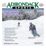
10 <strong>Adirondack</strong> <strong>Sports</strong> Gear up for the Holidays! Old Forge <strong>Adirondack</strong> Base Camp McCauley Mt Ski Area 29 Slopes, Trails & Glades 15K Groomed XC Trails 1 Big Mountain Experience with $mall Mountain Attitude www.MountainmanOutdoors.com 490 Broadway, Saratoga Springs •• (518) 584-3500 Rt. 28, Old Forge, •• (315) 369-6672 Info & Webcams: OldForgeNY.com Save Up To 45% Off Lift Tickets By Buying Now! Experience the greatest vertical east of the Rockies plus top-ranked off-hill activities www.Whiteface.com A_WHITEFACE
CROSS-COUNTRY SKIING & SNOWSHOEING Ski and Snowshoe Trails I in the <strong>Adirondack</strong>s J DECEMBER <strong>2022</strong> 11 The <strong>Adirondack</strong> Mountain Club has released a new edition of its winter guidebook, Ski and Snowshoe Trails in the <strong>Adirondack</strong>s, by Tony Goodwin. First published in 2003, the second edition of ADK’s winter guidebook is a comprehensive collection of 50 popular and lesser-known adventures for all ability levels throughout the <strong>Adirondack</strong> Park. It includes the iconic trips like Mount Marcy and the Whiteface Mountain Toll Road, as well as lesser-known destinations, such as Hoffman Notch, Berrymill Flow, and Moxham Mountain. The book features GPS coordinates for trailheads and parking areas, page map sketches by illustrator Terry Brosseau, and images by well-known photographer Nancie Battaglia. Tony shares his decades of winter recreation experience throughout, including winter safety, round-trip distances, and difficulty ratings for skiers and snowshoers. Tony Goodwin, who has authored ADK’s High Peaks Trails guidebook and High Peaks <strong>Adirondack</strong> Trail Map since 1984, is a well-known figure in the <strong>Adirondack</strong>s. He retired as head of the <strong>Adirondack</strong> Trail HAYS BROOK AND THE SHEEP MEADOW, 2021. Improvement Society in 2021 and was a NANCIE BATTAGLIA founder of the <strong>Adirondack</strong> Ski Touring Council, which constructed the 24-mile Jackrabbit Trail. The 160-page is available now at Hays Brook Truck book and outdoor supply stores, ADK’s High Peaks Information Center and Trail to Grass Pond Cascade Welcome Center near Lake and the Sheep Placid, through mail order at 800-395- 8080, and at adk.org. Proceeds support Meadow ADK’s programs in conservation, education, recreation, stewardship and Meadow. Round-trip: 3.8 mi (6.1 km) to Round-trip: 7.8 mi (12.5 km) to Sheep advocacy. Enjoy these three excerpts Grass Pond. Elevation change: minimal. from the book. Difficulty: ski, novice; snowshoe, beginner. Map: TI 746: GG18. GPS coordinates: 44.481471, -74.280840 (trailhead). Pharaoh Lake Both destinations that start at this Round-trip: 8 mi (12.8 km) to S end of trailhead offer not only easy terrain and lake; 12.4 mi (20 km) to N end of lake. a scenic lean-to, but also usually bountiful snow. The longer trip – to the Sheep Elevation change: minimal. Difficulty: Ski, novice-intermediate; snowshoe, Meadow – has a few short pitches that beginner. Map: TI 743: Q28. GPS coordinates: 43.761789, -73.689251 (trailhead). skiers, but overall, these wide roads are might be a bit challenging for novice This two-mile-long lake with several easy to ski. picturesque lean-tos along its shores is Trailhead: The start is at the end of a not only beautiful, but also might be the 0.2 mi access road off NY Route 30 that largest <strong>Adirondack</strong> lake not reached by leads to the N end of Mountain Pond. a maintained road. The approach is a This access road, marked by a large DEC generally easy ski on a long-abandoned sign, is 3.8 mi N of the junction of NY road in the Pharaoh Lake Wilderness, 30 and NY Route 86 in Paul Smiths, or where snowmobiles are prohibited. 5.4 mi S of the junction of NY 30 and NY TERRY BROSSEAU Trailhead: From Exit 25 of the Route 458. (The road and parking area <strong>Adirondack</strong> Northway (I-87) take NY was plowed more consistently in 2021 than in previous years. If required to park on NY Route 8 approximately 8 mi E through 30, be sure to park on the shoulder, behind the white line.) From the parking area, walk the hamlet of Brant Lake to the NE end of another 100 yd to a trail that is a shortcut to the truck trail and register that avoids the barrier gate at the entrance to the truck trail. There are both horse and snowmobile markers Brant Lake. Turn left onto Palisades Rd. then right onto Beaver Pond Rd., the third on the trail, but snowmobile use has ended. road to the right, 1.5 mi from NY 8. Go 1 From the register, the trail crosses the Osgood River at 0.5 mi, just before it meets mi on Beaver Pond Rd. to the beginning the junction of the Grass Pond side trail (described below). Just past this side trail, the of Pharaoh Rd. on the right. This road is marked route to the Sheep Meadow diverges to the left to “cut the corner” and save 0.3 mi. plowed for the first few hundred yards Snowshoers might choose to follow the marked route, and while it is skiable, the easiest past some private camps to a parking area TERRY BROSSEAU skiing is on the truck trail, which climbs for another 0.2 mi and is then flat to a junction at the trailhead, which is also plowed. at 1.2 mi. Turning left here, the trail soon begins a gradual descent. At 1.6 mi, the marked From the trailhead, the skiing is route comes in from the left, and both routes continue to descend to a bridge over Hays nearly level through a notch between Park and No. 8 mountains to the wide valley of Brook at 1.8 mi. After the bridge crossing, the trail climbs a short, steep pitch, soon levels Mill Brook and the former summer parking area at 1.5 mi. After crossing Mill Brook on a out, and is then mostly level to the Sheep Meadow lean-tos at 3.9 mi. plank bridge, the trail soon begins to climb. At 2 mi, the grade eases, and gentle ups and The trip to Grass Pond begins as a right turn at the junction at 0.5 mi from the start of downs lead to a bridge across Pharaoh Lake Brook at 2.7 mi. After crossing the brook, the the trail. It makes a short, moderate climb to the top of a high bank above the Osgood River, trail climbs briefly and then levels out next to an extensive open area of beaver activity on after which it is mostly flat to the lean-to at Grass Pond at 1.9 mi. One road leads left from the left. Continuing generally close to the brook, the trail reaches the S end of Pharaoh the lean-to, down to the outlet, and on to a former lean-to site on the N shore. Another Lake at 4 mi. Although this is a good destination in itself, if ice conditions permit, most road going past the lean-to can be skied partway along the E shore, but soon becomes skiers will want to ski up the lake to one of the several lean-tos along the shore. The views overgrown, and not easily passable. There are no additional views from the frozen pond, of the surrounding mountains widen rapidly on the ski up the lake. It is approximately but it might offer some sun to make it a warmer lunch spot than the lean-to. 2.2 mi more to the lean-to at the N end of the lake. t t Continued on page 13