Bureau of Land Management's Decision Record and Environmental
Bureau of Land Management's Decision Record and Environmental
Bureau of Land Management's Decision Record and Environmental

Create successful ePaper yourself
Turn your PDF publications into a flip-book with our unique Google optimized e-Paper software.
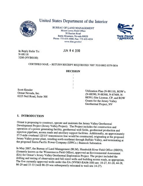
In Reply Refer To:<br />
N-881 18<br />
3200 (NVBO100)<br />
United States Department <strong>of</strong> the Interior<br />
BUREAU OF LAND MANAGEMENT<br />
Mount Lewis Field Office<br />
50 Bastian Road<br />
Battle Mountain, Nevada 89820<br />
Phone: 775-635-4000: Fax: 775-635-4034<br />
www.blm.gov/nv/<br />
JUN 0 4 2010<br />
CERTWIED MAIL— RETURN RECEIPT REQUESTED 7007 7010 0002 0379 0854<br />
Scott Kessler<br />
Ormat Nevada, Inc.<br />
6225 Neil Road, Suite 300<br />
1. INTRODUCTION<br />
DECISION<br />
TAKE PRIDE<br />
Utilization Plan (N-88 118), ROW’s<br />
(N-88390, N-88368, N-87409, N-<br />
8839 1) Site License, CP, <strong>and</strong> ROW<br />
Grants for the Jersey Valley<br />
Geothermal Project, NV<br />
Ormat is proposing to construct, operate <strong>and</strong> maintain the Jersey Valley Geothermal<br />
Development Project (Jersey Valley Project). The Project includes the construction <strong>and</strong><br />
operation <strong>of</strong> a power generating facility, geothermal well fields, geothermal production <strong>and</strong><br />
injection pipelines, access roads <strong>and</strong> ancillary support facilities. Additionally, an approximately<br />
27.5-mile overhead 120 kV transmission line would be constructed, originating at the proposed<br />
Jersey Valley power plant, trending north-northeast through Buffalo Valley, <strong>and</strong> terminating at<br />
the proposed Sierra Pacific Power Company (SPPCo.) Bannock Substation.<br />
In May 2007, the <strong>Bureau</strong> <strong>of</strong> <strong>L<strong>and</strong></strong> Management (BLM), Humboldt River Field Office (HRFO),<br />
(formerly known as the Winnemucca Field Office), approved an <strong>Environmental</strong> Assessment<br />
(EA) for Ormat’s Jersey Valley Geothermal Exploration Project. The project included the<br />
drilling <strong>and</strong> testing <strong>of</strong> observation <strong>and</strong> full-sized wells <strong>and</strong> building access roads, as appropriate.<br />
The five currently approved wells under this EA (NV063-EAO6-l00) are: 18-27, 8 1-28, 44-28,<br />
86-29 <strong>and</strong> 33-33 (well 86-29 was subsequently relocated to well site 14-27).<br />
INAMERICA
In June 2007, Ormat created the Jersey Valley Federal Geothermal Unit (NVN-83483X), which<br />
is comprised <strong>of</strong> federal geothermal leases NVN-74881, NVN-74883, NVN-77481, NVN-77482<br />
<strong>and</strong> NVN-77483, <strong>and</strong> is in Pershing <strong>and</strong> <strong>L<strong>and</strong></strong>er Counties, Nevada.<br />
In November 2008, the BLM, HRFO approved an EA for the Jersey Valley II Geothermal<br />
Exploration Project, also for the drilling <strong>and</strong> testing <strong>of</strong> observation <strong>and</strong> full-sized wells <strong>and</strong><br />
access road construction, as appropriate.<br />
In March 2010, pursuant to a Memor<strong>and</strong>um <strong>of</strong> Underst<strong>and</strong>ing for the management <strong>of</strong> this project<br />
with the HRFO, Ormat submitted the Utilization Plan for the Jersey Valley geothermal power<br />
plant <strong>and</strong> the Plan <strong>of</strong> Developments (POD) for the power line <strong>and</strong> road to the BLM MLFO. In<br />
March 2010, Ormat submitted a draft <strong>Environmental</strong> Assessment for the Jersey Valley<br />
geothermal power plant, <strong>and</strong> right-<strong>of</strong>-ways for the transmission line <strong>and</strong> the road to the BLM<br />
MLFO.<br />
<strong>Environmental</strong> Assessment (EA), DOI-B LM-NV-063-EAO8-09 1, dated April, 2010, has been<br />
reviewed through the interdisciplinary team process; as well as being sent to the Nevada State<br />
Clearinghouse <strong>and</strong> the public for a 15 day comment period. The EA was sent to 99 individual<br />
interest groups <strong>and</strong> companies, including the County Commissioners for <strong>L<strong>and</strong></strong>er <strong>and</strong> Pershing<br />
Counties <strong>and</strong> the <strong>L<strong>and</strong></strong>er County Public <strong>L<strong>and</strong></strong> Use Advisory Committee (PLUAC).<br />
Following the comment period, the MLFO received comments from the Nevada Department <strong>of</strong><br />
Wildlife <strong>and</strong> Mike <strong>and</strong> Barb Stremler. The comment responses are included in Appendix F<br />
Comment Responses. There were no significant changes to the EA based on comments.<br />
Bonding is required (43 CFR 3273.19) in order to ensure that the operator performs all<br />
obligations <strong>of</strong> the lease contract, including but not limited to; royalty obligations, plugging wells,<br />
surface reclamation, <strong>and</strong> cleanup <strong>of</strong> ab<strong>and</strong>oned operations. BLM may increase the required bond<br />
amount that was determined to be $100,000 for the Geothermal Power Plant <strong>and</strong> $1,175,000 for<br />
the ROW’s.<br />
Ormat Nevada Inc. relinquished the leases for the Buffalo Valley Geothermal Leases in May,<br />
2010. The references <strong>and</strong> statements to the Buffalo Valley geothermal power plant have been<br />
withdrawn from the EA, DOI-BLM-NV-0630EA08-09 1. The withdrawing <strong>of</strong> the Buffalo Valley<br />
power plant from the EA will result in fewer impacts to resources (127 acres <strong>of</strong> total permanent<br />
disturbance with the Buffalo Valley Plant versus 82 acres <strong>of</strong> permanent disturbance minus the<br />
Buffalo Valley Plant). As a result, the MLFO amended the EA to reflect this revision to the<br />
analysis as well as incorporate public comments. The EA is attached for reference (Attachment<br />
B).<br />
DECISION<br />
I have concluded that the interests <strong>of</strong> the public would be best served by selecting the proposed<br />
action, <strong>of</strong> EA DOI-BLM-NV-063-EAO8-091 (Attachment B), dated April, 2010.<br />
2
The BLM MLFO has determined that installation, construction, <strong>and</strong> operation <strong>of</strong> the Jersey<br />
Valley Geothermal Plant would not result in significant impacts to the environment <strong>and</strong> an<br />
<strong>Environmental</strong> Impact Statement (EIS) is not required based on the <strong>Environmental</strong> Assessment<br />
(EA) DOI-BLM-NV-063-EAO8-091(Attachment B) <strong>and</strong> Finding <strong>of</strong> No Significant Impact<br />
(FONSI) (Attachment C).<br />
Therefore, it is my decision to:<br />
1. Approve Ormat Nevada Inc. Utilization Plan <strong>and</strong> Operations Plan for the Jersey<br />
Valley Geothermal Project with the required conditions <strong>of</strong> approval specified in<br />
Attachment E.<br />
We received Ormat’s Utilization Plan to construct, operate <strong>and</strong> maintain the Jersey Valley<br />
Geothermal Development Project (Jersey Valley Project) in March 2010. The Project includes<br />
the construction <strong>and</strong> operation <strong>of</strong> a geothermal power generating facility, geothermal well fields,<br />
geothermal production <strong>and</strong> injection pipelines, access roads <strong>and</strong> ancillary support facilities<br />
(Attachment A <strong>and</strong> B).<br />
The Jersey Valley geothermal project is located within the Jersey Valley geothermal unit, <strong>and</strong><br />
encompasses approximately 8,470 acres <strong>of</strong> public <strong>and</strong> private l<strong>and</strong>s in Sections 15-16, 20-22, 27-<br />
29 <strong>and</strong> 32-34, Township 27 North, Range 40 east (T.27N. R.40E.), Mount Diablo Baseline <strong>and</strong>,<br />
Meridian (MDB&M), <strong>and</strong> the entirety <strong>of</strong> Section 3 <strong>and</strong> portions <strong>of</strong> Sections 4 <strong>and</strong> 5, T.26N.<br />
R.40E., MDB&M (Attachment A).<br />
The regulations, 43 CFR 3270 through 3279 cover the permitting <strong>and</strong> operating procedures for<br />
the utilization <strong>of</strong> geothermal resources.<br />
2. Approve the issuance <strong>of</strong> the Site License, Commercial Use Permit <strong>and</strong> Construction<br />
Permit for the Ormat Nevada Inc. Jersey Valley Geothermal Project.<br />
BLM received the Site License application for the Jersey Valley geothermal power plant from<br />
Ormat on April 28, 2010. Enclosed in the application were the site plan drawing <strong>and</strong> legal<br />
description for the proposed power plant. The regulation, 43 CFR 3273 provides direction <strong>and</strong><br />
guidance for Site License. -<br />
The Commercial Use Permit has not been received <strong>and</strong> must be submitted <strong>and</strong> approved prior to<br />
the commencement <strong>of</strong> operation <strong>of</strong> the GEOT power plant. The regulations at, 43 CFR 3274<br />
provides direction <strong>and</strong> guidance for the Commercial Use Permit submission.<br />
The Construction Permit was submitted on May 14, 2010 <strong>and</strong> is approved in accordance with 43<br />
CFR 3272.<br />
3
3. Approve the issuance <strong>of</strong> ROW grants N-87409, N-88368, N-88390 <strong>and</strong> N-88391.<br />
In accordance with Title V <strong>of</strong> the Federal <strong>L<strong>and</strong></strong> Policy <strong>and</strong> Management Act <strong>of</strong> October 21,<br />
1976 (90 Stat. 2776; 43 U.S.C. 1761) the ROW grants specified above are approved.<br />
Attachment G includes the Form 2800-14 for each ROW. The attached ROW Grants must be<br />
signed prior to proceeding with construction.<br />
In accordance with the provisions <strong>of</strong> 43 CFR 2801.10 (b) <strong>and</strong> 3200.5 (b), this decision is<br />
immediately effective <strong>and</strong> remain in effect while appeals are pending unless a stay is granted in<br />
accordance with §4.21(b).<br />
RATIONALE<br />
The Proposed Action in combination with the mitigation measures detailed in EA DOI-BLM<br />
NV-063-EAO8-09 1 <strong>and</strong> the attached FONSI show that all practicable means to avoid or<br />
minimize environmental impacts have been adopted <strong>and</strong> that unnecessary or undue degradation<br />
<strong>of</strong> the public l<strong>and</strong>s will not occur as a result <strong>of</strong> construction within the project area.<br />
A FONSI has been determined <strong>and</strong> is based on consideration <strong>of</strong> the Council on <strong>Environmental</strong><br />
Quality’s (CEQ) criteria for significance (40 CFR 1508.27), both with regard to the context <strong>and</strong><br />
the intensity <strong>of</strong> impacts described in the EA. BLM specialist, contractors, other government<br />
agencies through research <strong>and</strong> the use <strong>of</strong> regulations as well as policies were utilized in the<br />
development <strong>of</strong> mitigations measures during the NEPA process. The mitigation measures<br />
developed into conditions <strong>of</strong> approvals <strong>and</strong>/or stipulations which provided the necessary<br />
direction to avoid significant impact.<br />
The Proposed Action is in conformance with the Shoshone-Eureka Resource Management Plan<br />
<strong>Record</strong> <strong>of</strong> <strong>Decision</strong> (1986) <strong>and</strong> the Winnemucca Management Framework Plan (1982).<br />
The Proposed Action is in conformance with the President’s National Energy Policy <strong>of</strong> 2005 as<br />
per Instruction Memor<strong>and</strong>um (IM-2002-053), as put forth in Executive Order 13212 <strong>and</strong> will not<br />
have an adverse impact on energy development, production, supply, <strong>and</strong>/or distribution. The EA<br />
<strong>and</strong> FONSI support this decision.<br />
The BLM is required to act on applications for geothermal development <strong>and</strong> associated <strong>of</strong>f lease<br />
facilities in accordance with the federal regulations at 43 CFR 3200 <strong>and</strong> 2800 respectively. In<br />
doing so, BLM is required to comply with federal laws such as NEPA <strong>and</strong> the Federal <strong>L<strong>and</strong></strong><br />
Policy Management Act (FLPMA). These <strong>Decision</strong> are in conformance with the National<br />
<strong>Environmental</strong> Policy Act (NEPA) <strong>of</strong> 1969 (P.L. 9 1-190) as amended (72 USC 4321 et.seq.);<br />
General <strong>and</strong> Title V <strong>of</strong> the Federal <strong>L<strong>and</strong></strong> Management Policy Act <strong>of</strong> 1976 (FLPMA).<br />
4
APPEAL PROVISIONS<br />
<strong>Decision</strong>s may be appealed to the Interior Board <strong>of</strong> <strong>L<strong>and</strong></strong> Appeals, Office <strong>of</strong> the Secretary, in<br />
accordance with the regulations contained in 43 CFR, Part 4 <strong>and</strong> the enclosed Form 1842-1. If<br />
an appeal is taken, your notice <strong>of</strong> appeal must be filed in this <strong>of</strong>fice (at the above address) within<br />
30 days from receipt <strong>of</strong> this decision. The appellant has the burden <strong>of</strong> showing that the decision<br />
appealed from is in error.<br />
If you wish to file a petition pursuant to regulation 43 CFR 4.21 (b) for a stay <strong>of</strong> the effectiveness<br />
<strong>of</strong> this decision during the time that your appeal is being reviewed by the Board, the petition for<br />
a stay must accompany your notice <strong>of</strong> appeal. A petition for a stay is required to show sufficient<br />
justification based on the st<strong>and</strong>ards listed below. Copies <strong>of</strong> the notice <strong>of</strong> appeal <strong>and</strong> petition for a<br />
stay must also be submitted to each party named in this decision <strong>and</strong> to the Interior Board <strong>of</strong><br />
<strong>L<strong>and</strong></strong> Appeals <strong>and</strong> to the appropriate Office <strong>of</strong> the Solicitor (see 43 CFR 4.4 13) at the same time<br />
the original documents are filed in this <strong>of</strong>fice. If you request a stay, you have the burden <strong>of</strong><br />
pro<strong>of</strong> to demonstrate that a stay should be granted.<br />
STANDARDS FOR OBTAINING A STAY<br />
Except as otherwise provided by law or other pertinent regulations, a petition for a stay <strong>of</strong> a<br />
decision pending shall show sufficient justification based on the following st<strong>and</strong>ards:<br />
(1) The relative harm to the parties if the stay is granted or denied,<br />
(2) The likelihood <strong>of</strong> the appellant’s success on the merits,<br />
(3) The likelihood <strong>of</strong> immediate <strong>and</strong> irreparable harm if the stay is not granted, <strong>and</strong><br />
(4) Whether the public interest favors granting the stay.<br />
Mount Lewis Field Office<br />
5
Attachments<br />
A. MAPS<br />
B. ENVORONMENTAL ASSESSMENT<br />
C. FONSI<br />
D. ROW GRANTS FORMS 2800-14<br />
E. CONDITIONS OF APPROVAL FOR GEOTHERMAL UTILIZATION<br />
F. EA COMMENT RESPONCES<br />
G. MAILING LIST<br />
6
Al. Vicinity Map<br />
A2. Unit Map<br />
A3. Road Map<br />
Attachment A<br />
Maps
Legend<br />
M11<br />
9<br />
rr*d Trrr, U e<br />
Sra PfleP*c &At1êM1<br />
JIe lIu G.edaIm Or*tAr*a<br />
ih iid<br />
D 1.5 3<br />
Al. Vicinity Map<br />
N<br />
S<br />
—1<br />
—<br />
M11r5 “—Y<br />
rd<br />
b.<br />
t_.
tsgend<br />
Al Unit Map<br />
• B. sflpa WtaBX7j tanar4 La...<br />
A B.AcLAçsctfl6 n* Ww, C.vc.M Urt*e.ftt4-S3flLq<br />
fr.d&aApt..a R&j2D7 La,cw<br />
— ft*daWAffac..4caf2O*<br />
o<br />
0 0.5<br />
kca.1.’aI&aa<br />
J1MNfl I,.!’N<br />
2 PAles rctn ..,*,<br />
CT
c 14: Ploposud<br />
‘Sohtaiion La’,cut <strong>and</strong><br />
L.<br />
- QWij<br />
?<br />
A3. Road Map
ATFACHMENT B<br />
ENVIRONMENTAL ASSESSMENT
U.S. Department <strong>of</strong> the Interior<br />
<strong>Bureau</strong> <strong>of</strong> <strong>L<strong>and</strong></strong> Management<br />
<strong>Environmental</strong> Assessment DOI-BLM-NV-063-EAO8-091<br />
DATE: May 2010<br />
Jersey Valley<br />
Geothermal Development Project<br />
Pershing <strong>and</strong> <strong>L<strong>and</strong></strong>er Counties, Nevada<br />
ENVIRONMENTAL ASSESSMENT<br />
Battle Mountain District Office<br />
<strong>Bureau</strong> <strong>of</strong> <strong>L<strong>and</strong></strong> Management<br />
50 Bastian Road<br />
Battle Mountain, Nevada 89820-1240<br />
Phone: 775-635-4000<br />
Fax: 775-635-4034
Ormat Nevada, Inc.<br />
Jersey Valley Geothermal Development Project<br />
<strong>Environmental</strong> Assessment<br />
Table <strong>of</strong> Contents<br />
INTRODUCTION 1<br />
1.1 Background 1<br />
1.2 Location <strong>and</strong> Summary <strong>of</strong> Proposed Action 1<br />
1.3 Purpose <strong>and</strong>Need 2<br />
1.4 <strong>L<strong>and</strong></strong> Use Plan Conformance 3<br />
1.5 Relationship to Laws, Regulations <strong>and</strong> Other Plans 4<br />
1.6 Identified Issues 5<br />
2 PROPOSED ACTION AND ALTERNATIVES 9<br />
2.1 Proposed Action 9<br />
2.1.1 ThePowerPlant 9<br />
2.1.1 .1 Operation <strong>and</strong> Maintenance Procedures 9<br />
2.1.1.2 Construction Procedures <strong>and</strong> Surface<br />
Disturbance 10<br />
2.1.2 Wells, Weilfields, Well Maintenance <strong>and</strong> Other<br />
Ancillary Facilities 11<br />
2.1.2.1 Well Drilling <strong>and</strong> Testing 12<br />
2.1.2.2 WellOperations 14<br />
2.1.3 Geothermal Pipelines 14<br />
2.1.3.1 Operation <strong>and</strong> Maintenance Procedures <strong>of</strong><br />
Pipeline 14<br />
2.1.4 Rights-<strong>of</strong>-Way for the Power Line <strong>and</strong> Access Road 15<br />
2.1.5 Transmission Line Corridor 15<br />
2.1.5.1 Facility Design Factors <strong>and</strong> Additional<br />
Components 15<br />
2.1.6 Site Access <strong>and</strong> Road Construction 16<br />
2.1.6.1 Construction Procedures <strong>and</strong> Surface<br />
Disturbance <strong>of</strong> the Transmission Line 17<br />
2.1.6.2 Construction Procedures <strong>and</strong> Surface<br />
Disturbance for the Pipelines <strong>and</strong> Well Fields 17<br />
2.1.6.3 Operation <strong>and</strong> Maintenance Procedures for the<br />
Transmission Line 18<br />
2.1.7 Water Requirements <strong>and</strong> Source 19<br />
2.1.8 Aggregate Requirements <strong>and</strong> Source(s) 19<br />
2.1.9 WorkForce <strong>and</strong> Schedule 19<br />
2.1.10 Project Decommissioning <strong>and</strong> Site Reclamation 20<br />
2.1.11 Adopted <strong>Environmental</strong> Protection Measures 21<br />
2.2 Alternatives 22<br />
2.2.1 Alternative 1 22<br />
2.3 Surface Disturbance Summary 23
Jersey Valley Geothermal Development Project<br />
<strong>Environmental</strong> Assessment NV063-EAO8-091<br />
No Action Alternative 24<br />
3 Affected Environment/<strong>Environmental</strong> Consequences 35<br />
3.2 Air Quality 36<br />
3.2.1 Affected Environment 36<br />
3.2.2 <strong>Environmental</strong> Consequences 37<br />
3.2.2.1 Proposed Action 37<br />
3.2.2.2 Alternative 1 38<br />
3.3 Cultural Resources 38<br />
3.3.1 Affected Environment 38<br />
3.3.2 <strong>Environmental</strong> Consequence 38<br />
3.3.2.1 Proposed Action 38<br />
3.3.2.2 Alternative 1 39<br />
3.4 Native American Religious Concerns 39<br />
3.4.1 Affected Environment 39<br />
3.4.2 <strong>Environmental</strong> Consequences 41<br />
3.4.2.1 Proposed Action 41<br />
3.4.2.2 Alternative 1 42<br />
3.5 Wildlife (Including Threatened <strong>and</strong> Endangered Species,<br />
Special Status Species <strong>and</strong> Migratory Birds) 43<br />
3.5.1 Affected Environment 43<br />
3.5.2 <strong>Environmental</strong> Consequences 49<br />
3.5.2.1 Proposed Action 49<br />
3.5.2.2 Alternative 1 53<br />
3.6 Invasive, Nonnative Species 53<br />
3.6.1 Affected Environment 53<br />
3.6.2 <strong>Environmental</strong> Consequences 54<br />
3.6.2.1 Proposed Action 54<br />
3.6.2.2 Alternative 1 55<br />
3.7 Soils 55<br />
3.7.1 Affected Environment 55<br />
3.7.2 <strong>Environmental</strong> Consequences 58<br />
3.7.2.1 Proposed Action 58<br />
3.7.2.2 Alternative 1 58<br />
3.8 Vegetation 58<br />
3.8.1 Affected Environment 58<br />
3.8.2 <strong>Environmental</strong> Consequences 61<br />
3.8.2.1 Proposed Action 61<br />
3.8.2.2 Alternative 1 64<br />
3.9 Water Quality <strong>and</strong> Quantity 64<br />
3.9.1 Affected Environment 64<br />
3.9.2 <strong>Environmental</strong> Consequences 67<br />
3.9.2.1 Proposed Action 67<br />
3.9.2.2 Alternative 1 71<br />
3.10 Wetl<strong>and</strong>s <strong>and</strong> Riparian 71<br />
3.10.1 Affected Environment 71
Jersey Valley Geothermal Development Project<br />
<strong>Environmental</strong> Assessment NV063 -EAO8-09 1<br />
3.10.2 <strong>Environmental</strong> Consequences 72<br />
3.10.2.1 Proposed Action 72<br />
3.10.2.2 Alternative 1 72<br />
3.11 Wastes (Hazardous <strong>and</strong> Solid) 72<br />
3.11.1 Affected Environment 72<br />
3.11.2 <strong>Environmental</strong> Consequences 73<br />
3.11.2.1 ProposedAction 73<br />
3.11.2.2 Alternative 1 75<br />
3.12 Rangel<strong>and</strong> 75<br />
3.12.1 Affected Environment 75<br />
3.12.2 <strong>Environmental</strong> Consequences 76<br />
3.12.2.1 Proposed Action 76<br />
3.12.2.2 Alternative 1 77<br />
3.13 Recreation 77<br />
3.13.1 Affected Environment 77<br />
3.13.2 <strong>Environmental</strong> Consequences 77<br />
3.13.2.1 Proposed Action 77<br />
3.13.2.2 Alternative 1 78<br />
3.14 VisualResources 78<br />
3.14.1 Affected Environment 78<br />
3.14.2 <strong>Environmental</strong> Consequences 79<br />
3.14.2.1 Proposed Action 79<br />
3.14.2.2 Alternative 1 80<br />
3.15 Socio-Economic Values 80<br />
3.15.1 Affected Environment 80<br />
3.15.2 <strong>Environmental</strong> Consequences 81<br />
3.15.2.1 Proposed Action 81<br />
3.15.2.2 Alternative 1 82<br />
3.16 <strong>L<strong>and</strong></strong> Use Authorizations 82<br />
3.16.1 Affected Environment 82<br />
3.16.2 <strong>Environmental</strong> Consequences 83<br />
3.16.2.1 Proposed Action 83<br />
3.16.3.2 Alternative 1 83<br />
4 CUMULATIVE EFFECTS 84<br />
4.1 CUMULATIVE EFFECTS STUDY AREA 84<br />
4.2. Past <strong>and</strong> Present Actions 84<br />
4.3 REASONABLY FORESEEABLE FUTURE ACTIONS 86<br />
4.4 CUMULATIVE EFFECTS FOR THE PROPOSED<br />
ACTION 86<br />
4.4.1 Air Quality 86<br />
4.4.3 Cultural Resources 87<br />
4.4.3 Native American Religious Concerns 87<br />
4.4.4 Wildlife (Including Threatened <strong>and</strong> Endangered Species,<br />
Special Status Species <strong>and</strong> Migratory Birds) 87<br />
4.4.5 Invasive, Normative Species 88<br />
— III —
Jersey Valley Geothermal Development Project<br />
<strong>Environmental</strong> Assessment NV063-EAO8-091<br />
4.4.6 Soils 89<br />
4.4.7 Vegetation 89<br />
4.4.8 Water Quality <strong>and</strong> Quantity 89<br />
4.4.9 Wastes (Hazardous <strong>and</strong> Solid) 89<br />
4.4.10 Rangel<strong>and</strong> 90<br />
4.4.11 Recreation 90<br />
4.4.12 Visual Resources 90<br />
4.4.13 Socio-Economic Values 91<br />
4.4.14 <strong>L<strong>and</strong></strong> use Authorizations 91<br />
5 COORDINATION AND CONSULTATION 92<br />
5.1 List <strong>of</strong> Preparers 92<br />
5.2 Agencies, Groups <strong>and</strong> Individuals Contacted 92<br />
6 REFERENCES 94<br />
List <strong>of</strong> Tables<br />
Table 1: Project Submittals 2<br />
Table 2: Well Drilling Specifics 12<br />
Table 3: Transmission Line Typical Design Characteristics 15<br />
Table 4: Staging Area Locations 16<br />
Table 5: Proposed Action <strong>and</strong> Alternative I Surface Disturbance 23<br />
Table 6: Supplemental Authorities 35<br />
Table 7: Other Resources 36<br />
Table 8: Chemical Species Information for the Jersey Valley Hot Springs 66<br />
Table 9: Materials <strong>and</strong> Chemicals Commonly Used During Well Drilling 73<br />
Table 10: Jersey Valley Unit Area Allotment Information 75<br />
Table 11: Transmission Line Corridor Allotment Information 76<br />
Table 12: AUM Reductions in the Buffalo Valley <strong>and</strong> South Buffalo Allotments 76<br />
Table 13: Economic Values Data 80<br />
Table 14: <strong>L<strong>and</strong></strong> Use Authorizations within the Jersey Valley Unit Area <strong>and</strong><br />
Transmission Line Corridor 82<br />
List <strong>of</strong> Figures<br />
Figure 1: Project Vicinity Map 6<br />
Figure 2: Jersey Valley Unit Area <strong>and</strong> Currently Approved Activities 7<br />
Figure 3: Jersey Valley Unit Area <strong>and</strong> Transmission Line Corridor 8<br />
Figure 4: Jersey Valley Project Activities 25<br />
Figure 5: Transmission Line Staging Areas 26<br />
Figure 6: Jersey Valley Water Sources 27<br />
Figure 7: Alternative 1 within the Jersey Valley Unit Area 28<br />
Figure 8: Jersey Valley Water Sources -<br />
Figure 9: Jersey Valley Unit Area <strong>and</strong> Transmission Line - Corridor<br />
Figure 10: Recommended Construction St<strong>and</strong>ards for Enclosure Fences in<br />
Alternative<br />
1<br />
Alternative<br />
29<br />
1 30<br />
Livestock Areas 31<br />
- Iv -
Jersey Valley Geothermal Development Project<br />
<strong>Environmental</strong> Assessment NV063 -EAO8-09 1<br />
Figure 11: Proposed Substation <strong>and</strong>/or Switching Station Layout <strong>and</strong> New Access<br />
Road 32<br />
Figure 12: Single Pole Structure 33<br />
Figure 13: Single Pole Angle Structure 34<br />
Figure 14: Soil Associations within the Jersey Valley Unit Area (Proposed<br />
Action) 56<br />
Figure 15: Soil Associations within the Jersey Valley Unit Area (Alternative 1) 57<br />
Figure 16: Vegetation Communities within the Jersey Valley Unit Area (Proposed<br />
Action) 59<br />
Figure 17: Vegetation Communities within the Jersey Valley Unit Area<br />
(Alternative 1) 60<br />
Figure 18: Cumulative Effects Study Area 85<br />
Appendices<br />
Appendix A: Geothermal Lease Stipulations
1 INTRODUCTION<br />
1.1 BACKGROUND<br />
Ormat Nevada, Inc.<br />
Jersey Valley Geothermal Development Project<br />
<strong>Environmental</strong> Assessment<br />
Ormat Nevada, Inc. (Ormat) has conducted geothermal exploration activities within the Jersey<br />
Valley area <strong>of</strong> Pershing County, Nevada (see Figure 1). A summary <strong>of</strong> these activities <strong>and</strong><br />
project approvals is provided below.<br />
In May 2007, the <strong>Bureau</strong> <strong>of</strong> <strong>L<strong>and</strong></strong> Management (BLM), Humboldt River Field Office (HRFO),<br />
(formerly known as the Winnemuca Field Office), approved an <strong>Environmental</strong> Assessment (EA)<br />
for Ormat’s Jersey Valley Geothermal Exploration Project. The project included the drilling <strong>and</strong><br />
testing <strong>of</strong> observation <strong>and</strong> full-sized wells <strong>and</strong> building access roads, as appropriate. The five<br />
currently approved wells under this EA (NV063-EAO6-lOO) are: 18-27, 81-28, 44-28, 86-29 <strong>and</strong><br />
33-33 (well 86-29 was subsequently relocated to well site 14-27) (see Figure 2). Total surface<br />
disturbance associated with the Jersey Valley Exploration Project was less than 10 acres.<br />
In June 2007, Ormat created the Jersey Valley Federal Geothermal Unit (NVN-83483X), which<br />
is comprised <strong>of</strong> federal geothermal leases NVN-74881, NVN-74883, NVN-77481, NVN-77482<br />
<strong>and</strong> NVN-77483, <strong>and</strong> is in Pershing <strong>and</strong> <strong>L<strong>and</strong></strong>er Counties, Nevada (see Figure 2).<br />
In November 2008, the BLM, HRFO approved an EA for the Jersey Valley II Geothermal<br />
Exploration Project, also for the drilling <strong>and</strong> testing <strong>of</strong> observation <strong>and</strong> full-sized wells <strong>and</strong><br />
access road construction, as appropriate. The two currently approved wells under this EA<br />
(LLNV-WOl000-2009-002-EA) are 77-28 <strong>and</strong> 13-34 (see Figure 2). Total surface disturbance<br />
associated with the Jersey Valley II Exploration Project was less than 10 acres.<br />
Based on the successful results <strong>of</strong> the exploration activities within the Jersey Valley Unit, Ormat<br />
has determined that the geothermal resources are capable <strong>of</strong> commercial production. As such,<br />
Ormat is proposing the Jersey Valley Geothermal Development Project.<br />
1.2 LOCATION AND SUMMARY OF PROPOSED ACTION<br />
Ormat is proposing to construct, operate <strong>and</strong> maintain the Jersey Valley Geothermal<br />
Development Project (Jersey Valley Project or Project). The Project includes the construction<br />
<strong>and</strong> operation <strong>of</strong> a power generating facility, a geothermal welifield, geothermal production <strong>and</strong><br />
injection pipelines, access roads <strong>and</strong> ancillary support facilities. Additionally, an approximately<br />
27.59-mile overhead 120 kV transmission line (NVN-87409) would be constructed, originating<br />
at the proposed Jersey Valley power plant, trending north-northeast <strong>and</strong> terminating at the<br />
proposed Sierra Pacific Power Company (SPPCo.) Bannock substation (see Figure 3).
Jersey Valley Geothermal Development Project<br />
<strong>Environmental</strong> Assessment: NV063-EAO8-091<br />
The Jersey Valley Project is located within the Jersey Valley geothermal unit, <strong>and</strong> encompasses<br />
approximately 8,470 acres <strong>of</strong> public <strong>and</strong> private l<strong>and</strong>s in Sections 15-16, 20-22, 27-29 <strong>and</strong> 32-34,<br />
Township 27 North, Range 40 east (T.27N. R.40E.), Mount Diablo Baseline <strong>and</strong> Meridian<br />
(MDB&M), <strong>and</strong> the entirety <strong>of</strong> Section 3 <strong>and</strong> portions <strong>of</strong> Sections 4 <strong>and</strong> 5, T.26N. R.40E.,<br />
MDB&M (see Figure 2).<br />
The Proposed Action also includes the construction <strong>and</strong> operation <strong>of</strong> an approximately<br />
27.59-mile overhead electrical transmission line originating at the proposed Jersey Valley power<br />
plant <strong>and</strong> terminating at the proposed SPPCo. substation (see Figure 3). Table 1 shows what has<br />
been submitted to the BLM on behalf <strong>of</strong> the Project.<br />
Table 1: Project Submittals<br />
Operations Plan 1 Utilization Plan 2 ROW/PoD 3<br />
Original Revised Original Revised Original Revised<br />
Jersey Valley April 2009 March 2010 April 2009 April 2010 n’a n/a<br />
Transmission<br />
Line<br />
n/a n/a n/a nla April 2009 April 2010<br />
New Road nla n/a n/a n/a March 2010 April 2010<br />
I For approval to drill <strong>and</strong> test those geothermal wells located on public i<strong>and</strong>s managed by the BLM which would be used for<br />
production <strong>and</strong> injection <strong>of</strong> geothermal fluid for the Project.<br />
2 For approval <strong>of</strong> the utilization facilities (i.e. power plant, pipelines, etc.) located on public l<strong>and</strong>s managed by the BLM.<br />
3 For those portions <strong>of</strong> the transmission line corridor <strong>and</strong> the new road located on public l<strong>and</strong>s managed by the BLM.<br />
1.3 PURPOSE AND NEED<br />
Background<br />
Ormat’s purpose <strong>of</strong> the Project is to commercially develop the geothermal resources within the<br />
federal geothermal unit; to construct <strong>and</strong> operate a commercial geothermal power plant <strong>and</strong><br />
weilfield within the unit; <strong>and</strong> to transport generated electricity from the Project to a power<br />
purchaser in compliance with the Nevada State m<strong>and</strong>ated Renewable Portfolio St<strong>and</strong>ard. The<br />
purpose <strong>of</strong> the Project’s transmission line <strong>and</strong> electrical substation is to provide the electrical<br />
interconnection with the existing SPPCo./Nevada Energy (NVE) electrical transmission system<br />
at the proposed junction in an economically viable manner which minimizes transmission line<br />
energy losses <strong>and</strong> adverse environmental impacts. Ormat needs to be able to produce geothermal<br />
resources in commercial quantities from the Unit or the federal geothermal leases will terminate.<br />
Agency’s Purpose <strong>and</strong> Need<br />
Under the Federal <strong>L<strong>and</strong></strong> Policy <strong>and</strong> Management Act <strong>of</strong> 1976 <strong>and</strong> its implementing regulations,<br />
including 43 CFR 2800, BLM must respond to Ormat’s ROW applications. Under the terms <strong>of</strong><br />
the Geothermal Steam Act, its revisions <strong>of</strong> 2007, <strong>and</strong> it’s implementing regulations; <strong>and</strong> the<br />
Programmatic Geothermal <strong>Environmental</strong> Impact Statement <strong>and</strong> its <strong>Record</strong> <strong>of</strong> <strong>Decision</strong> <strong>of</strong><br />
December, 2008. BLM must respond to the proposed plans, applications <strong>and</strong> programs submitted<br />
-2-
Jersey Valley Geothermal Development Project<br />
<strong>Environmental</strong> Assessment: NV063 -EAO8 -091<br />
by the lessee or the lessee’s designated operator. The BLM is also required to comply with<br />
NEPA <strong>and</strong> the Council on <strong>Environmental</strong> Quality (CEQ) regulations.<br />
The Agency’s need for the Proposed Action is to respond to the submitted Operations Plan,<br />
Utilization Plan <strong>and</strong> FLPMA ROW applications submitted by the proponent to constrnct <strong>and</strong><br />
operate the Jersey Valley Geothermal Development Project.<br />
The BLM has determined that an EA would be needed to evaluate <strong>and</strong> disclose the potential<br />
environmental impacts associated with this proposed action <strong>and</strong> any reasonable alternatives to<br />
the proposed action which would include a no action alternative. This EA will serve as a<br />
decision-making tool to assist BLM Battle Mountain District Office (BMDO) in its<br />
determination to approve the proposed action, require modification or deny the proposed action.<br />
At the conclusion <strong>of</strong> the EA process, the BLM must determine if the proposed action <strong>and</strong>/or any<br />
modifications <strong>of</strong> the proposed action would cause significant environmental impacts to the<br />
human environment. If no such impact would occur, then a Finding <strong>of</strong> No Significant Impact<br />
(FONST) would be prepared, <strong>and</strong> the BLM would approve the submitted Operations Plan,<br />
Utilization Plan <strong>and</strong> Right-<strong>of</strong>-Way applications. If, at any time during the analysis, a<br />
determination <strong>of</strong> significant impacts is made that could not be appropriately mitigated at the EA<br />
level, an <strong>Environmental</strong> Impact Statement (EIS) would be required.<br />
1.4 LAND USE PLAN CONFORMANCE<br />
The Jersey Valley Unit Area <strong>and</strong> the southern half <strong>of</strong> the proposed transmission line are<br />
administered by the BLM through the HRFO. The area is subject to the BLM WFO<br />
Sonoma-Gerlach Management Framework Plan (MFP), dated July 9, 1982. Objective M-5 <strong>of</strong> the<br />
MFP states “Make energy resources available on all public l<strong>and</strong>s <strong>and</strong> other l<strong>and</strong>s containing<br />
federally owned minerals.” The MFP provides for the development <strong>of</strong> geothermal resources in<br />
noncompetitive areas <strong>and</strong> all Known Geothermal Resource Areas (KGRAs) except those which<br />
are areas <strong>of</strong> significant environmental conflict or have historical <strong>and</strong>/or cultural significance.<br />
The northern half <strong>of</strong> the proposed transmission line is administered by the BLM through the<br />
MLFO <strong>and</strong> is subject to the BLM Shoshone-Eureka Resource Management Plan (RMP), which<br />
was approved in 1986.<br />
Part II, Section E, “Management Actions Not Expressly Addressed by the Resource Management<br />
Plan,” <strong>of</strong> the RI\4P includes the section “Minerals Objectives <strong>and</strong> Management <strong>Decision</strong>s,”<br />
brought forward unaltered from the earlier BLM “Management Framework Plan” (<strong>Record</strong> <strong>of</strong><br />
<strong>Decision</strong>, page 29). Minerals Objectives 1, 2 <strong>and</strong> 3 lead to Management <strong>Decision</strong> #2 (Leaseable<br />
Minerals Steam). The three objectives are:<br />
-<br />
Geothermal<br />
• Objective 1: Make available <strong>and</strong> encourage development <strong>of</strong> mineral resources to meet<br />
national, regional <strong>and</strong> local needs consistent with national objectives for an adequate<br />
supply <strong>of</strong> minerals.
Jersey Valley Geothermal Development Project<br />
<strong>Environmental</strong> Assessment: NV063 -EAO8-09 1<br />
• Objective 2: Assure that mineral exploration, development <strong>and</strong> extraction are carried<br />
out in such a way as to minimize environmental <strong>and</strong> other resource damage <strong>and</strong> to<br />
provide, where legally possible, for the rehabilitation <strong>of</strong> l<strong>and</strong>s.<br />
• Objective 3: Develop detailed mineral resource data in areas where different resources<br />
conflict so that informed decisions may be made that result in optimum use <strong>of</strong> the l<strong>and</strong>s.<br />
Management <strong>Decision</strong> #2 (Leaseable Minerals — Geothermal Steam), states that: “All areas<br />
designated by the BLM as prospectively valuable for geothermal steam will be open for<br />
exploration <strong>and</strong> development unless withdrawn or restricted from mineral entry. All public l<strong>and</strong>s<br />
disposed <strong>of</strong> in these areas will have the geothermal resources reserved to the federal<br />
government.” (BLM 1987).<br />
The Proposed Action is in conformance with the Sonoma-Gerlach MFP <strong>and</strong> Shoshone-Eureka<br />
RMP.<br />
1.5 RELATIONSHIP TO LAWS, REGULATIONS AND OTHER PLANS<br />
The EA has been prepared in accordance with the following statutes <strong>and</strong> implementing<br />
regulations, Policies <strong>and</strong> Procedures:<br />
• The National <strong>Environmental</strong> Policy Act <strong>of</strong> 1969, as amended (Public Law [PL] 91-190,<br />
42 U.S.C. 4321 (etseq.);<br />
o 40 CFR 1500 (et seq.). Regulations for Implementing the Procedural Provisions<br />
<strong>of</strong> the National <strong>Environmental</strong> Policy Act.<br />
o Considering Cumulative Effects under the National <strong>Environmental</strong> Policy Act<br />
[CEQ 1997];<br />
o USD1 requirements (Departmental Manual 516, <strong>Environmental</strong> Quality [USD1<br />
2007]);<br />
o BLM NEPA H<strong>and</strong>book (H-1790 1) (BLM 1988 <strong>and</strong> BLM 2008a);<br />
• The Federal <strong>L<strong>and</strong></strong> Policy <strong>and</strong> Management Act <strong>of</strong> 1976 (PL 94 579, 43 U.S.C. 1761 (et<br />
seq.);<br />
o 43 CFR 2800, Rights-<strong>of</strong>-Way, Principles <strong>and</strong> Procedures; Rights-<strong>of</strong>-Ways under<br />
the Federal <strong>L<strong>and</strong></strong> Policy <strong>and</strong> Management Act <strong>and</strong> the Mineral Leasing Act; Final<br />
Rule, April 22, 2005.<br />
• The Geothermal Steam Act <strong>of</strong> 1970 (Act) (30 USC 100 1-1025).<br />
o 43 CFR 3200, Geothermal Resources Leasing <strong>and</strong> Operations; Final Rule, May 2,<br />
2007.<br />
• The 2005 Energy Policy Act; The National Energy Policy, Executive Order 13212;<br />
• Best Management Practices as defined in the Surface Operating St<strong>and</strong>ards <strong>and</strong> Guidelines<br />
for Oil <strong>and</strong> Gas Exploration <strong>and</strong> Development (Gold Book); <strong>and</strong><br />
Other environmental analysis documents which were used in production <strong>of</strong> this EA:<br />
-4--
Jersey Valley Geothermal Development Project<br />
<strong>Environmental</strong> Assessment: NV063 -EAO8-09 I<br />
• Programmatic <strong>Environmental</strong> Assessment Geothermal Leasing <strong>and</strong> Exploration<br />
Shoshone-Eureka Planning Area (BLM BMFO 2002);<br />
• Geothermal Resources Programmatic Leasing <strong>Environmental</strong> Assessment (BLM WFO<br />
2002);<br />
• Jersey Valley Geothermal Exploration Project <strong>Environmental</strong> Assessment (BLM 2007);<br />
<strong>and</strong><br />
• Jersey Valley II Geothermal Exploration Project <strong>Environmental</strong> Assessment (BLM<br />
200 Sd),)<br />
1.6 IDENTIFIED ISSUES<br />
The scope <strong>of</strong> this EA is based upon specific issues <strong>and</strong> concerns identified by BLM, other federal<br />
agencies, state agencies <strong>and</strong> local agencies. These issues <strong>and</strong> concerns include:<br />
• Avoidance <strong>of</strong> cultural resource sites;<br />
• Riparian vegetation associated with the Hot Springs;<br />
• Special Status Species;<br />
• The quality <strong>and</strong> quantity <strong>of</strong> waters on public l<strong>and</strong>s; <strong>and</strong><br />
• Invasive, nonnative species
€C5- N. •3CdCd N. 9.Od N.<br />
“G1 N “13° N. 25C N “3’ N. N. N3C N. 75’ N S6- N. N. 12’ N •2N N N. 43°<br />
;J<br />
1<br />
.J<br />
V 1+L J<br />
... --<br />
.<br />
HSOL\ IW<br />
1N,.i’S<br />
vi<br />
N<br />
Cd<br />
‘<<br />
EZ1<br />
-<br />
(D<br />
.<br />
L -<br />
,<br />
-<br />
._<br />
—<br />
1’ /<br />
(D<br />
5- / 7 \<br />
S,i!Ii<br />
C<br />
o ti<br />
/ F- /<br />
1p’ I<br />
\<br />
><br />
— -_1—_L_—<br />
fI<br />
I<br />
4<br />
(D<br />
— —s--<br />
1_3 .[. I L_ —<br />
i<br />
‘I<br />
___<br />
rfl<br />
‘S. 4<br />
5ç<br />
S_4<br />
3j I<br />
- j-;S<br />
/<br />
,e*S___ 5-<br />
N<br />
5-<br />
/<br />
ES<br />
I<br />
ft<br />
.;<br />
iNd:<br />
5:j/i<br />
c z.;<br />
m<br />
—a- .—._ L53&5d_<br />
— %i.<br />
D)<br />
I I<br />
.N ,4<br />
r<br />
‘sJ -.<br />
I—’<br />
t<br />
S<br />
- F<br />
-S<br />
---— i-r<br />
I<br />
VS<br />
S<br />
3%kC<br />
tE r-/ .<br />
4<br />
Hr *.ct,::T1 tVS______<br />
J_: ‘A. zr.- rnr—<br />
C<br />
N C.<br />
0<br />
I<br />
3<br />
In<br />
Id J<br />
m<br />
- 7d<br />
If<br />
ji,LL,<br />
IC<br />
0<br />
6<br />
4<br />
3•• I<br />
45<br />
.-S-<br />
.<br />
__<br />
N<br />
‘A’E’<br />
03<br />
.3!) fr3<br />
IS 4; /I, I’k<br />
dOQQ00Oss N. 1’°0 N. 00240,, N. 50370005 N. 0494000 N. Cd6100000 N. .CS534000 N. 8600000 N 94’ N. 33fl005 N. 23°°°5- N. 4335000o N. 0i430 N. &/“‘ N. 0073050so N. 00930005. N.<br />
it<br />
0 3100
Figure 2: Jersey Valley Unit Area <strong>and</strong> Currently Approved Activities<br />
J\\,ç .ij<br />
NVS<br />
- \\ —<br />
\ •VS_V21<br />
°5ç 140E<br />
• ‘<br />
J<br />
L /<br />
o,Rte.<br />
LEGEND<br />
\<br />
•<br />
I<br />
E1 Currently Approved Well Site (2007)<br />
( Currently Approved Well Site (2008)<br />
• }<br />
/<br />
Currently Approved Access (2007)<br />
Currently Approved Access (2008)<br />
V<br />
V<br />
N<br />
- ___Io<br />
-<br />
. N —).- —<br />
-<br />
7 -<br />
-<br />
S_c_;V<br />
NVN-77481<br />
—<br />
V<br />
V<br />
I<br />
--<br />
- St<br />
V V<br />
Vt<br />
V<br />
V<br />
-.<br />
V<br />
— V<br />
V<br />
V<br />
-<br />
V. VVV<br />
- - -<br />
NVN-74883<br />
0 0.5 2 Miles<br />
——4<br />
V<br />
V<br />
V<br />
:3343<br />
‘VI<br />
L1 Currently Approved Gravel Source<br />
V<br />
8t-28<br />
27<br />
:V.VV V<br />
- VVVSV<br />
V<br />
V<br />
V<br />
V<br />
VVV<br />
V<br />
.<br />
V •O<br />
‘45. . — -<br />
VVV<br />
United States Department <strong>of</strong> the Interior<br />
<strong>Bureau</strong> <strong>of</strong> <strong>L<strong>and</strong></strong> Management<br />
Mount Lewis Field Office<br />
i:j Geothermal Lease Boundary 50 Bastan Road<br />
:Jersey Valley Geothermal Unit Area (NVN-83483X)<br />
<strong>Bureau</strong> <strong>of</strong> <strong>L<strong>and</strong></strong> Management <strong>L<strong>and</strong></strong><br />
NVN-71483 V<br />
LVO<br />
Battle Mountatn, NV 89820<br />
V4VO’<br />
mOootymyth05<br />
<strong>L<strong>and</strong></strong> Management as to ble atuirrany<br />
relpabtitty. or000nptetoness <strong>of</strong> these data<br />
LV Private <strong>L<strong>and</strong></strong> fonindinidoalmeoraggrngathusseth<br />
other data<br />
V<br />
‘V<br />
8<br />
•NVN-77482<br />
(V<br />
t8-27-<br />
Vflskn<br />
1344g.<br />
VSVV ./VL<br />
V5<br />
VVnL<br />
‘ •
Figure 3: Jersey Valley Unit Area <strong>and</strong> Transmission Line Corridor - Proposed Action<br />
LEGEND<br />
/<br />
U<br />
44\<br />
A’><br />
s•i/<br />
‘0<br />
-I<br />
(I ii<br />
\\ / (I<br />
9<br />
co\jWJ469 L<br />
:L’ atI.<br />
/ 1’4f<br />
t<br />
0’<br />
4•_ 8Y<br />
• Bannock Substation - Proposed<br />
— 120 kV Power ROW - Proposed<br />
, Jersey Valley Geothermal Unit Area (NVN-83483X)<br />
0 1.5 3 6 Miles<br />
\ / \.<br />
caIs)2<br />
‘•<br />
Suffalo<br />
\ I<br />
—— — —— —<br />
‘N<br />
5_<br />
/A<br />
• ,1<br />
14Ø<br />
—, g<br />
-<br />
c2 ‘c<br />
h 5 .ar1 I —<br />
—‘L<br />
a sroaf ‘4<br />
‘i3rO<br />
F Os,<br />
NO a,manty is made by the <strong>Bureau</strong> Of<br />
bard Managemerrasto the accurracy,<br />
stability, or completeness <strong>of</strong> these data<br />
for individual use or aggregate use arith<br />
other data<br />
The data shown on the map uses the<br />
OnfeersalTrarsmeroator(Znne fiN)<br />
Coordinate syotem <strong>and</strong> uses ho N0D83<br />
peoecton<br />
c”s<br />
m$ )L4ç<br />
—--<br />
1•<br />
;:— Spr#g<br />
\<br />
i’<br />
United States Department <strong>of</strong> the Interior<br />
<strong>Bureau</strong> <strong>of</strong> <strong>L<strong>and</strong></strong> Management<br />
Mount Lewis Field Office<br />
50 Bastian Road<br />
Battle Mountain, NV 89820<br />
Map Date. rvuonmber 3, 29<br />
r/<br />
p4’<br />
I<br />
‘I<br />
I,<br />
‘it<br />
W•E
Jersey Valley Geothermal Development Project<br />
<strong>Environmental</strong> Assessment: NV063-EAO8-091<br />
2 PROPOSED ACTION AND ALTERNATIVES<br />
2.1 PROPOSED ACTION<br />
2.1.1 The Power Plant<br />
The Jersey Valley power plant will be an approximately 30 Megawatt (MW) geothermal power<br />
plant. The proposed power plant would be located in the SE1/4, SE1/4 Section 28 T.27N..<br />
R.40E. A switching station, used to transform generated low voltage to the higher voltage<br />
required for a transmission line, would be constructed within the power plant boundaries as<br />
shown in Figure 4.<br />
A microwave communication tower would be about eight (8) feet tall; a radome antenna on a<br />
monopole; <strong>and</strong> attached to the power plant building. The tower will transmit to the Fencemaker<br />
microwave building/tower. It would also be built within the Jersey Valley power plant area <strong>and</strong><br />
would consist <strong>of</strong> a microwave antenna, aimed west toward the existing communication link on<br />
the Tobin Range (NVN-57070). This system would be used to deliver signals from control<br />
centers <strong>and</strong> other remote locations, report operating status, <strong>and</strong> provide voice communication<br />
from dispatchers to power plant operators <strong>and</strong> maintenance personnel. This system would be<br />
considered an exclusive use communications system for Ormat.<br />
Permanent <strong>and</strong> temporary surface disturbance for the power plant can be found in Table 5.<br />
2.1.1.1 Operation <strong>and</strong> Maintenance Procedures<br />
The Ormat power plant will utilize a binary design with an air-cooled heat rejection system.<br />
The geothermal fluids for the binary power plant will be produced from the production wells by<br />
pumping. Once delivered to the power plant, the heat in the geothermal fluid will be transferred<br />
to the “binary” (or secondary) fluid in multiple stage non-contact heat exchangers. The binary<br />
turbine units will use pentane (C5H12<br />
), a flammable but non-toxic hydrocarbon, as the binary<br />
fluid, which circulates in a closed loop. The heat from the geothermal fluid vaporizes the binary<br />
fluid, which turns the binary turbine <strong>and</strong> electrical generator to make electricity.<br />
The vaporized binary fluid exits the turbine <strong>and</strong> is condensed back into a liquid in a<br />
shell-<strong>and</strong>-tube, non-contact, air-cooled condenser. The condensed binary fluid is then pumped<br />
back to the heat exchangers for re-heating <strong>and</strong> vaporization, completing the closed cycle.<br />
The residual geothermal fluid from the heat exchangers is pumped under pressure out to the<br />
geothermal injection wells through the injection pipelines <strong>and</strong> injected back into the geothermal<br />
reservoir. The geothermal fluid will flow through the binary power plant in a closed system, with<br />
no emissions <strong>of</strong> non-condensable gases to the atmosphere.
Jersey Valley Geothermal Development Project<br />
<strong>Environmental</strong> Assessment: NV063 -EAO8-09 1<br />
The air-cooled condenser will range between 28 <strong>and</strong> 35 feet in height <strong>and</strong> are about two-thirds<br />
the length <strong>of</strong> the binary power plant site. In addition to the geothermal fluid h<strong>and</strong>ling system,<br />
turbine-generators <strong>and</strong> turbine building, control <strong>and</strong> support buildings, the substation <strong>and</strong><br />
electrical systems, <strong>and</strong> the binary fluid storage tank(s); the power plant site will include a water<br />
storage tank <strong>and</strong> pumps for non-potable uses <strong>and</strong> fire protection.<br />
Photo 1: Air Cooled Geothermal Power Plant<br />
2.1.1.2 Construction Procedures <strong>and</strong> Surface Disturbance<br />
Power plant site preparation activities would begin with clearing, earthwork, drainage <strong>and</strong> other<br />
improvements necessary for commencement <strong>of</strong> construction. Clearing would include removal <strong>of</strong><br />
organic material, stumps, brush <strong>and</strong> slash.<br />
A portion <strong>of</strong> the power plant site <strong>and</strong> adjacent well pads would be devoted to equipment <strong>and</strong><br />
materials laydown, storage, construction equipment parking, small fabrication areas, <strong>of</strong>fice<br />
trailers <strong>and</strong> parking. Equipment <strong>and</strong> materials laydown space is required for large turbine parts,<br />
structural steel, piping spools, electrical components, switchyard apparatus, <strong>and</strong> building parts.<br />
Mobile trailers or similar suitable facilities (e.g., modular <strong>of</strong>fices) would be brought to the site to<br />
-10-
Jersey Valley Geothermal Development Project<br />
<strong>Environmental</strong> Assessment: NV063 -EAO8-09 1<br />
be used as construction <strong>of</strong>fices for owner, contractor, <strong>and</strong> subcontractor personnel. Travel trailers<br />
would be used for construction management to reside on the site <strong>and</strong> would provide for 24 hour<br />
management <strong>and</strong> emergency response. Parking would be provided for construction workers <strong>and</strong><br />
visitors within the power plant area.<br />
Temporary utilities will be provided for the construction <strong>of</strong>fices, the laydown area, <strong>and</strong> the<br />
power plant site. Temporary construction power will be supplied by a temporary generator <strong>and</strong>,<br />
if available when the transmission line is completed, at the site by utility-furnished power. Area<br />
lighting will be provided for safety <strong>and</strong> security. Drinking water will be imported <strong>and</strong> distributed<br />
daily. Portable toilets will be provided throughout the site, <strong>of</strong>fice <strong>and</strong> travel trailers <strong>and</strong> would<br />
connect to temporary septic holding systems.<br />
Consistent with safety requirements, power plant buildings, structures, security fencing, pipe,<br />
etc. would each be painted an appropriate color (likely covert green) to blend with the area <strong>and</strong><br />
minimize visibility.<br />
The proposed power plant site is downgradient from a significant watershed, though it does not<br />
interrupt the current shallow drainage channel for this watershed. The nature <strong>of</strong> alluvial<br />
streambeds is lateral migration over time, due to erosion <strong>and</strong> deposition. Low-impact earthen<br />
berms are proposed to direct storm event run<strong>of</strong>f towards a controlled “low water crossing” in the<br />
access roadway, <strong>and</strong> to influence the alluvial run<strong>of</strong>f to maintain its current channel location<br />
during the life <strong>of</strong> the power plant.<br />
Three berrns are proposed; two directing run-on to the access road, <strong>and</strong> one providing a safety<br />
barrier against channel migration adjacent to the plant site; a total <strong>of</strong> 2700 LF. Each berm would<br />
be constructed by balanced removal <strong>of</strong> upsiope material, probably by small bulldozer dipped<br />
blade, cutting about 12” deep. The removed material would be placed in a 12” tall berm downhill<br />
<strong>of</strong> the cut. The total disturbance width is about 17 ft. The total disturbed area from these features<br />
is 1.05 acres (see also Table 5).<br />
2.1.2 Wells, Weilfields, Well Maintenance <strong>and</strong> Other Ancillary Facilities<br />
The Proposed Action includes the construction <strong>and</strong> operation <strong>of</strong> geothermal fluid production <strong>and</strong><br />
injection wells, access roads, geothermal fluid pipelines <strong>and</strong> a power generation facility within<br />
the Jersey Valley Geothermal Unit (Jersey Valley Unit Area or Unit Area).<br />
Production wells flow geothermal fluid to the surface. Injection wells are used to inject<br />
geothermal fluid from the power plant into the geothermal reservoir. Injection ensures the<br />
longevity <strong>and</strong> renewability <strong>of</strong> the geothermal reservoir. The number <strong>of</strong> geothermal production<br />
<strong>and</strong> injection wells required for the Project is principally dependent on the productivity (or<br />
injectivity) <strong>of</strong> the wells <strong>and</strong> the temperature <strong>and</strong> pressure <strong>of</strong> the produced geothermal fluid.<br />
Within the Jersey Valley Unit Area, Ormat expects that 17 geothermal production wells <strong>and</strong><br />
7 geothermal injection wells are needed (see Figure 4). Each well is or would be located on a<br />
well pad in the shape <strong>of</strong> a rectangle <strong>and</strong> approximately 4.2 acres in size.
Jersey Valley Geothermal Development Project<br />
<strong>Environmental</strong> Assessment: NV063-EAO8-091<br />
Reserve pits would be constructed in accordance with best management practices identified in<br />
the “Surface Operating St<strong>and</strong>ards <strong>and</strong> Guidelines for Oil <strong>and</strong> Gas Exploration <strong>and</strong> Development<br />
(The Gold Book)” (Fourth Edition — 2007) on each pad for the containment <strong>and</strong> temporary<br />
storage <strong>of</strong> water, drill cuttings <strong>and</strong> waste drilling mud during drilling operations. Geothermal<br />
fluid produced from the well during flow testing will also drain to the reserve pit. The reserve pit<br />
waste will be sampled for hazardous contaminants. Typical tests may include the Toxicity<br />
Characteristic Leaching Procedure (TCLP) (EPA Method 1311), tested for heavy metals; pH<br />
(EPA method 9045D); Total Petroleum Hydrocarbons/Diesel (EPA Method 8015B); <strong>and</strong> Oil <strong>and</strong><br />
Grease (EPA Method 413.1).<br />
The reserve pits would be fenced with an exclosure fence on three sides <strong>and</strong> then fenced on the<br />
fourth side once drilling has been completed to prevent access by persons, wildlife or livestock.<br />
The fence would remain in place until pit reclamation begins. For the drilling <strong>of</strong> each well, the<br />
reserve pit would measure approximately 75 feet by 200 feet by 10 feet deep. Figure 10 shows<br />
the recommended construction st<strong>and</strong>ards for exclosure fences in livestock areas (Gold Book,<br />
Fourth Edition — 2007).<br />
Permanent <strong>and</strong> temporary surface disturbance associated with the geothermal weilfields can be<br />
found in Table 5.<br />
2.1.2.1 Well Drilling <strong>and</strong> Testing<br />
Specific drilling information is provided in Table 2.<br />
Table 2: Well Drilling Specifics<br />
Rig Type Rig Height Trucks Needed I Drilling Time orkers On Site I Depth<br />
.. (ft.) (on average) I (days)<br />
Large rotary I 25+<br />
160-170 I<br />
tractor/trailer 452 Avg. 9-10<br />
I drilling rig 8 small trucks I Max = 18<br />
I i Difficulties encountered during the drilling process, including the need to re-drill the well, could as much as<br />
I double the time required to successfully complete each well.<br />
2 Drilling would be conducted 24 hours a day, 7 days a week.<br />
The drilling supervisor <strong>and</strong> mud logger would typically sleep in a trailer on the active drill site<br />
while the well is being drilled. The drilling crew may also live “on site” during the drilling<br />
operations in a self-contained “bunkhouse” (sleeping quarters, galley, water tank <strong>and</strong> septic tank)<br />
or portable trailers which would be placed on one <strong>of</strong> the drill sites not being actively drilled to<br />
accommodate the drill rig workers.<br />
“Blow-out” prevention equipment would be utilized while drilling below the surface casing.<br />
During drilling operations, a minimum <strong>of</strong> 10,000 gallons <strong>of</strong> cool water <strong>and</strong> 12,000 pounds <strong>of</strong><br />
inert, non-toxic, non-hazardous barite (barium sulfate) would likely be stored at each well site for<br />
use in preventing uncontrolled well flow (“killing the well”), as necessary.<br />
The well bore would be drilled using non-toxic, temperature-stable drilling mud composed <strong>of</strong> a<br />
bentonite clay-water or polymer-water mix for all wells. Variable concentrations <strong>of</strong> additives<br />
-12-
Jersey Valley Geothermal Development Project<br />
<strong>Environmental</strong> Assessment: NV063-EAO8-091<br />
would be added to the drilling mud as needed to prevent corrosion, increase mud weight, <strong>and</strong><br />
prevent mud loss. Some <strong>of</strong> the mud additives may be hazardous substances (see Section 3.11),<br />
but they would only be used in low concentrations that would not render the drilling mud toxic.<br />
Additional drilling mud would be mixed <strong>and</strong> added to the mud system as needed to maintain the<br />
required quantities.<br />
Each well may need to be worked over or redrilled. Depending on the circumstances<br />
encountered, working over a well may consist <strong>of</strong> lifting the fluid in the well column with air or<br />
gas or stimulation <strong>of</strong> the formation using dilute acid or rock fracturing techniques.<br />
Well redrilling may consist <strong>of</strong>: 1) reentering <strong>and</strong> redrilling the existing well bore; 2) reentering<br />
the existing well bore <strong>and</strong> drilling <strong>and</strong> casing a new well bore; or 3) sliding the rig over a few<br />
feet on the same well pad <strong>and</strong> drilling a new well bore through a new conductor casing. While<br />
the drill rig is still over the well, the residual drilling mud <strong>and</strong> cuttings would be flowed from the<br />
well bore <strong>and</strong> discharged to the reserve pit.<br />
Short-Term Well Testing<br />
Each test, lasting approximately 3 to 5 days on average, would consist <strong>of</strong> flowing the well into<br />
the reserve pit or portable steel tanks brought onto the well site while monitoring geothermal<br />
fluid temperatures, pressures, flow rates, chemistry <strong>and</strong> other parameters. An “injectivity” test<br />
may also be conducted by injecting the produced geothermal fluid from the reserve pit or steel<br />
tanks back into the well <strong>and</strong> the geothermal reservoir. The drill rig would likely be moved from<br />
the well site following completion <strong>of</strong> these short-term test(s). Each short-term well test is<br />
expected to flow approximately 1.5 million gallons.<br />
Long-Term Well Testing<br />
One or more long-term flow test(s) <strong>of</strong> each well drilled would likely be conducted following the<br />
short-term flow test(s) to more accurately determine long-term well <strong>and</strong> geothermal reservoir<br />
productivity. The long-term flow test(s), each lasting between 7-30 days, would be conducted by<br />
pumping the geothermal fluids from the well through onsite test equipment closed to the<br />
atmosphere (using a line shaft turbine pump or electric submersible pump) to the reserve pit.<br />
Each long-term well test is expected to flow approximately 15 million gallons.<br />
A surface booster pump would then pump the residual produced geothermal water/fluid from the<br />
reserve pit through a temporary 8” to 10” diameter pipeline to either inject the fluid into one <strong>of</strong><br />
the other geothermal wells drilled within the Project area or to the reserve pit on another well<br />
pad. The temporary pipeline would either be laid “cross-country” or on the surface <strong>of</strong> the<br />
disturbed shoulders on the access roads connecting the geothermal full-size wells (as required,<br />
roads would be crossed by trenching <strong>and</strong> burying the temporary pipe in the trench). The onsite<br />
test equipment would include st<strong>and</strong>ard flow metering, recording, <strong>and</strong> sampling apparatus.<br />
I<br />
- 13-
Jersey Valley Geothermal Development Project<br />
<strong>Environmental</strong> Assessment: NV063 -EAO8 -091<br />
2.1.2.2 Well Operations<br />
Once the well is drilled <strong>and</strong> well head completed, an industrial grate is placed over the hole to<br />
prevent humans <strong>and</strong> wildlife from falling into the cellar.<br />
Each <strong>of</strong> the production wells would be equipped with a pump to bring the geothermal fluid to the<br />
surface under pressure. The electricity to power the well pump motors would be supplied via an<br />
electric conductor installed from the power plant along the connecting pipelines.<br />
Wellhead dimensions for the production wells are not expected to exceed a height <strong>of</strong> fifteen feet<br />
above the ground surface or four feet in diameter. Welihead dimensions for the injection wells<br />
would be much smaller.<br />
An approximately 15-foot by 15-foot by 10-foot high motor control building may be located<br />
within approximately 50 feet <strong>of</strong> each production well.<br />
2.1.3 GEOTHERMAL PIPELINES<br />
Geothermal production pipelines bring the geothermal fluid from the production wells to the<br />
power plant. Geothermal injection pipelines deliver the cooled geothermal fluid from the power<br />
plant to the injection wells.<br />
Approximately 4.72 miles <strong>of</strong> production pipeline <strong>and</strong> 2.85 miles <strong>of</strong> injection pipeline would be<br />
constructed within the Jersey Valley Unit Area (see Figure 4). The production <strong>and</strong> injection<br />
pipeline routes generally follow the shortest distance from each well pad to the next well pad or<br />
the power plant in order to minimize the amount <strong>of</strong> pipe required, reduce heat losses, reduce the<br />
energy required to move the fluids, <strong>and</strong> to minimize the amount <strong>of</strong> ground disturbance.<br />
Additionally, the proposed pipeline routes generally follow existing or proposed roads to<br />
facilitate ongoing monitoring <strong>and</strong> future maintenance.<br />
The final alignment <strong>of</strong> the pipeline routes would be dictated by the specific wells completed for<br />
the project <strong>and</strong> the need to match fluid characteristics <strong>and</strong> balance fluid volumes in these<br />
pipelines.<br />
Permanent <strong>and</strong> temporary surface disturbance associated with pipeline construction activities can<br />
be found in Table 5.<br />
2.1.3.1 Operation <strong>and</strong> Maintenance Procedures <strong>of</strong> Pipeline<br />
The pipelines would be periodically inspected for leak detection, safety <strong>and</strong> v<strong>and</strong>alism during<br />
normal operations. The pipelines also would be subject to periodic ultrasonic thickness testing to<br />
detect any substantial thinning <strong>of</strong> the pipe wall.<br />
-14-
Jersey Valley Geothermal Development Project<br />
<strong>Environmental</strong> Assessment: NV063 -EAO8-09 1<br />
2.1.4 Rights-<strong>of</strong>-Way for the Power Line <strong>and</strong> Access Road<br />
The Proposed Action also includes the construction <strong>and</strong> operation <strong>of</strong> an approximately<br />
27.59-mile overhead electrical transmission line (NVN-87409) originating at the proposed Jersey<br />
Valley power plant <strong>and</strong> terminating at the proposed SPPCo. Bannock substation (see Figure 3).<br />
An additional ROW is requested from <strong>L<strong>and</strong></strong>er County’s Buffalo Valley Road to the proposed<br />
SPPCo. Bannock substation <strong>and</strong>/or switching station. The proposed road is located seven (7)<br />
miles west <strong>of</strong> the junction <strong>of</strong> Highway 305 <strong>and</strong> the Buffalo Valley junction, <strong>and</strong> extends south<br />
approximately 0.50 miles to the substation <strong>and</strong>/or switching station (see Figure 11).<br />
2.1.5 Transmission Line Corridor<br />
Ormat is also proposing to construct, operate <strong>and</strong> maintain an approximately 27.59 mile<br />
overhead 120 kV transmission line, originating at the proposed Jersey Valley power plant site<br />
<strong>and</strong> terminating at a proposed SPPCo. Bannock substation in the NE1/4, SE1/4 Section 28,<br />
T3ON, R43E; which is located on private l<strong>and</strong>s (see Figure 3). The proposed transmission line<br />
would require a 200-foot wide ROW (90-foot permanent width <strong>and</strong> an additional 110-foot<br />
temporary width required for construction).<br />
Design characteristics can be found in Table 3.<br />
Table 3: Transmission Line Typical Design Characteristics<br />
Line length Approximately 27.59 miles<br />
Type <strong>of</strong> structure Single pole<br />
Structure height Single pole: 55 to 70 feet<br />
Span length Single pole: Approximately 300 to 400 feet<br />
Number <strong>of</strong> structures/mile Single pole: Approximately 14 to 18 per mile<br />
Voltage 120,000<br />
2.1.5.1 Facility Design Factors <strong>and</strong> Additional Components<br />
The transmission line would be designed to meet all temperature, wind, voltage, span <strong>and</strong><br />
structure height clearance requirements. The proposed transmission line would also provide<br />
raptor protection in compliance with the st<strong>and</strong>ards described in the “Suggested Practices for<br />
Raptor Protection on Power Lines, The State <strong>of</strong> the Art in 2006” (APLIC 2006). To prevent<br />
perching, a cone (Kaddas Enterprises type KE1058 or equal) would be installed on the top <strong>of</strong><br />
each transmission line pole along the entirety <strong>of</strong> the transmission line (see Figure 12 <strong>and</strong> Figure<br />
13).<br />
Staging areas would be located on public l<strong>and</strong> <strong>and</strong> would be used to temporarily store materials<br />
required for construction (see Table 4 <strong>and</strong> Figure 5).<br />
- 15-
Jersey Valley Geothermal Development Project<br />
<strong>Environmental</strong> Assessment: NV063-EAO8-091<br />
Table 4: Staging Area Locations<br />
Staging Areas I Township/Range I Legal Description I<br />
i (Section Number & Aliquot Part) I<br />
Jersey Valley Power Plant Area T.27N., R.40E. I SE1/4, SE1/4 Section 28<br />
NVE Substation Area T.30N., R.43E. I NW 1/4, NW1/4 Section 19<br />
Pulling stations, required for installing the conductors, would be located approximately every<br />
two to three miles within the ROW. Pulling <strong>of</strong> the conductors would be accomplished by trucks<br />
capable <strong>of</strong> <strong>of</strong>f-road travel. Grading or clearing <strong>of</strong> the surface would occur only when absolutely<br />
necessary for safe access or for installing the conductors <strong>and</strong> would only occur within the<br />
proposed ROW. These pulling stations would each be used for only short periods <strong>of</strong> time during<br />
the final construction process <strong>and</strong> would be reclaimed as necessary upon project completion.<br />
Permanent <strong>and</strong> temporary surface disturbance associated with transmission line construction<br />
activities can be found in Table 5.<br />
2.1.6 Site Access <strong>and</strong> Road Construction<br />
The Project Area is accessed by traveling south on State Route 305 from Battle Mountain<br />
approximately 11.5 miles to Copper Basin Road. Turn right onto Copper Basin Road <strong>and</strong> travel<br />
southwest for approximately 11 miles. Continue onto County Road 121 for approximately 12<br />
miles. County Road 121 becomes Jersey Valley Road. Continue on Jersey Valley Road for<br />
approximately 8 miles. Turn left onto an unnamed dirt road traveling southeast <strong>and</strong> traverse for<br />
approximately 1.5 miles <strong>and</strong> proceed to the signed area on the west side <strong>of</strong> the road (see Figure<br />
3).<br />
Numerous other roads <strong>and</strong> “two-tracks” exist within <strong>and</strong> around the Jersey Valley Unit Area <strong>and</strong><br />
transmission line corridor. To the extent feasible, existing roads will be utilized for project<br />
construction <strong>and</strong> operation. Existing roads would be maintained as necessary to prevent the<br />
formation <strong>of</strong> deep ruts.<br />
Within the Jersey Valley Unit Area, approximately 4.10 miles <strong>of</strong> new access roads will be<br />
constructed (see Figure 4). All road construction would be approximately 22 feet wide.<br />
Large portions <strong>of</strong> the proposed transmission line would be constructed along existing roads<br />
<strong>and</strong>/or County maintained roads. However, some two-track roads may be needed along some<br />
portions <strong>of</strong> the proposed transmission line. Portions <strong>of</strong> approximately 1,910 feet <strong>of</strong> existing roads<br />
in Sections 18-20, T.30N., R.43E. will need to be improved (i.e. widened, graded, or bladed)<br />
<strong>and</strong>/or constructed (see Figure 11). From the southern portion <strong>of</strong> the existing road to be<br />
improved, approximately 1,310 feet <strong>of</strong> new road would be constructed to access the proposed<br />
substation <strong>and</strong>/or switching station (see Figure 11).<br />
Permanent <strong>and</strong> temporary surface disturbance associated with access road construction can be<br />
found in Table 5.<br />
-16-
Jersey Valley Geothermal Development Project<br />
<strong>Environmental</strong> Assessment: NV063 -EAO8 -091<br />
2.1.6.1 Construction Procedures <strong>and</strong> Surface Disturbance <strong>of</strong> the Transmission Line<br />
Transmission line poles would be transported to the staging areas via commercial trucks.<br />
Approximately 25 semi-truck-trailer loads would be required to bring the materials to the staging<br />
areas. Once at the staging areas, the poles would be transported to individual installation sites via<br />
flat bed trucks designed for overl<strong>and</strong> travel.<br />
A st<strong>and</strong>ard truck-mounted auger <strong>and</strong> backhoe would be used to drill the holes for pole<br />
installation. The poles would be lifted by crane <strong>and</strong> installed with the assistance <strong>of</strong> a boom truck.<br />
Additionally, three existing transmission line poles (NVN-48871) will need to be repaired or<br />
replaced in the Wl/4 Section 20, T.30N., R.43E.<br />
Construction <strong>of</strong> the new Bannock Substation would be conducted by SPPCo. Within the<br />
substation site, SPPCo. will construct a switching station consisting <strong>of</strong> 3-120kV breakers,<br />
associated switches, take <strong>of</strong>f structures <strong>and</strong> bus work. This will include all grounding, fencing<br />
<strong>and</strong> control enclosures.<br />
2.1.6.2 Construction Procedures <strong>and</strong> Surface Disturbance for the Pipelines <strong>and</strong> Well<br />
Fields<br />
The geothermal fluid pipelines would be constructed from seamless, welded-steel pipe. They are<br />
expected to range in diameter from 8 inches to 24 inches. Two to three inches <strong>of</strong> insulation <strong>and</strong> a<br />
protective aluminum sheath would jacket the steel production pipes, increasing the diameter <strong>of</strong><br />
the finished production pipelines by up to six inches.<br />
Horizontal <strong>and</strong>/or vertical expansion loops (a square bend in the pipeline approximately 30 feet<br />
in length by 30 feet in width) would be constructed about every 250 to 350 feet along the<br />
production pipelines. Expansion loops allow the pipeline to flex as it lengthens <strong>and</strong> shortens due<br />
to heating <strong>and</strong> cooling. Fewer expansion loops are needed along the injection pipelines, as the<br />
injection pipelines are subject to less heating <strong>and</strong> cooling.<br />
The pipelines would be constructed near ground level (averaging about one foot <strong>of</strong> ground<br />
clearance) on steel supports called “sleepers.” Sleepers support the pipeline <strong>and</strong> are constructed<br />
approximately every 30 feet. Table 5 depicts the total disturbed area.<br />
When completed, the top <strong>of</strong> the new geothermal pipelines would average three feet above the<br />
ground surface. However, a number <strong>of</strong> pipeline lengths could be up to six feet in height to<br />
accommodate terrain undulations <strong>and</strong> to facilitate movement <strong>of</strong> wildlife <strong>and</strong> livestock through<br />
the wellfield.<br />
Electrical power <strong>and</strong> instrumentation cables for the wells would then either be installed in steel<br />
conduit constructed along the same pipe sleepers or buried in a trench dug along the pipeline<br />
route. If the trenching option for the power <strong>and</strong> control cables is selected, an approximately<br />
-17-
Jersey Valley Geothermal Development Project<br />
<strong>Environmental</strong> Assessment: NV063-EAO8-091<br />
12-inch wide trench would be excavated to an average depth <strong>of</strong> approximately three feet deep<br />
along the pipeline sleepers.<br />
The pipelines would be constructed across roads to allow continued vehicle access, either by<br />
trenching under the road, or running the roadbed up <strong>and</strong> over the pipeline. Photo 2 below shows<br />
a typical pipeline with electrical cables.<br />
Photo 2: Typical Pipeline with Electrical Cables<br />
2.1.6.3 Operation <strong>and</strong> Maintenance Procedures for the Transmission Line<br />
Maintenance would include transmission line <strong>and</strong> pole repair <strong>and</strong>/or replacement. No routine<br />
maintenance would be performed on the transmission line. Ormat would annually inspect the<br />
transmission line from a light, <strong>of</strong>f-road vehicle. Repairs <strong>and</strong>/or facility replacement would<br />
transpire, as necessary. Routine travel within the ROW is not expected.<br />
- 18-
Jersey Valley Geothermal Development Project<br />
<strong>Environmental</strong> Assessment: NV063 -EAO8 -091<br />
2.1.7 Water Requirements <strong>and</strong> Source<br />
For activities within the Jersey Valley Unit Area, water required for well drilling could range up<br />
to as much as 30,000 gallons per day. Water requirements for grading, construction, <strong>and</strong> dust<br />
control would average substantially less. Construction <strong>of</strong> the power plant <strong>and</strong> related facilities<br />
would require approximately 5,000 gallons per day (5.60 acre-feet per year) during construction<br />
<strong>of</strong> the power plant.<br />
Water necessary for construction activities within the Jersey Valley Unit Area will be obtained<br />
from established private ranch sources Home Station Ranch (NW1/4 Section 7, T.26N., R.40E.)<br />
or McCoy Ranch (SE1/4 Section 29, T.26N., R.39E.) <strong>and</strong> trucked onsite (see Figure 6).<br />
Additional water may be obtained from a well owned by the Saval Ranch Company on private<br />
l<strong>and</strong>s within the Jersey Valley unit (NW/14, SW1/4 Section 34, T.27N. R.40E.) <strong>and</strong> piped to the<br />
power plant site (see Figure 6). The temporary construction pipeline would be laid on the side <strong>of</strong><br />
the existing roads <strong>and</strong> no additional surface disturbance is anticipated.<br />
Up to approximately 325 gallons <strong>of</strong> water will be consumed per day for the facility operations<br />
(0.37 acre-feet per year). This water will be obtained from the established private ranch sources<br />
identified above (see Figure 6). This water, used for septic purposes, will be trucked to the power<br />
plant <strong>and</strong> stored onsite. Drinking water will be purchased from a commercial bottled water<br />
source.<br />
2.1.8 Aggregate Requirements <strong>and</strong> Source(s)<br />
As much as possible, native materials (derived from grading to balance cut <strong>and</strong> fill) will be used<br />
for site <strong>and</strong> road building materials.<br />
For activities within the Jersey Valley Unit Area, total aggregate required for the well pad <strong>and</strong><br />
access road construction is estimated at 40,250 cubic yards. Approximately 92,000 cubic yards<br />
<strong>of</strong> surfacing material may be needed for power plant <strong>and</strong> pipeline construction. Aggregate would<br />
be obtained from an established <strong>L<strong>and</strong></strong>er County aggregate pit in NE1/4, SE1/4, Section 21,<br />
T.27N. R.40E. Additionally, the existing pit will be exp<strong>and</strong>ed approximately 5.5 acres to the<br />
southeast (SW1/4, SW1/4 Section 22, T.27N. R.40E.) to accommodate the Project’s aggregate<br />
needs (see Figure 4).<br />
Permanent <strong>and</strong> temporary surface disturbance associated with aggregate sources can be found in<br />
Table 5.<br />
2.1.9 Work Force <strong>and</strong> Schedule<br />
Drilling would be conducted by a crew <strong>of</strong> 9-10 workers with as many as 18 workers on site<br />
during short periods. Power plant <strong>and</strong> pipeline construction would likely require a maximum <strong>of</strong><br />
up to 50 workers, with an average <strong>of</strong> 20 workers after grading <strong>and</strong> excavation. Substation <strong>and</strong>lor<br />
switching station construction would be conducted by approximately 25-30 workers for site <strong>and</strong><br />
grid layout; thereafter, approximately 5 workers would be needed for construction <strong>of</strong> the<br />
-19-
Jersey Valley Geothermal Development Project<br />
<strong>Environmental</strong> Assessment: NV063 -EAO8-09 1<br />
substation <strong>and</strong>/or switching station. Construction <strong>of</strong> the transmission line would require<br />
approximately 20 workers. Once operating, the Project would have approximately 20 employees.<br />
The power plants would be staffed <strong>and</strong> approximately 5 employees may be onsite at a given<br />
time.<br />
Construction <strong>of</strong> the power plant <strong>and</strong> well field facilities would require 12 months once all<br />
permits are obtained <strong>and</strong> equipment orders scheduled. Transmission line construction is expected<br />
to take approximately 6 months. Commercial operations are anticipated to commence in the<br />
fourth quarter <strong>of</strong> 2010.<br />
2.1.10 Project Decommissioning <strong>and</strong> Site Reclamation<br />
The estimated life <strong>of</strong> the Project is 50 years.<br />
Once drilling is complete, approximately half <strong>of</strong> the drill pad area can be reclaimed, but the<br />
remaining half must be kept clear for ongoing operations <strong>and</strong> the potential need to work on or<br />
re-drill the well. The portions <strong>of</strong> the cleared well sites not needed for operational <strong>and</strong> safety<br />
purposes would be recontoured to a final or intermediate contour that would blend with the<br />
surrounding topography as much as possible. Areas able to be reclaimed will be ripped, tilled, or<br />
disked on contour, as necessary <strong>and</strong> reseeded with native grasses <strong>and</strong> forbs. The stockpiled<br />
topsoils will also be spread on the area to aid in revegetation.<br />
At the end <strong>of</strong> Project operations the wells would be plugged <strong>and</strong> ab<strong>and</strong>oned as required by BLM<br />
regulations <strong>and</strong> NAC 534.420. Ab<strong>and</strong>onment typically involves filling the well bore with clean,<br />
heavy ab<strong>and</strong>onment mud <strong>and</strong> cement until the top <strong>of</strong> the cement is at ground level, which is<br />
designed to ensure that fluids would not move across these barriers into different aquifers. The<br />
well head (<strong>and</strong> any other equipment) would then be removed, the casing cut <strong>of</strong>f well below<br />
ground surface <strong>and</strong> the hole backfilled to the surface.<br />
All roads would be reclaimed. Reclamation would include recontouring the roads back to the<br />
original contour, seeding, controlling noxious weeds <strong>and</strong> may include other techniques to<br />
improve reclamation success, such as ripping, scarifying, replacing topsoil, pitting <strong>and</strong> mulching.<br />
All above-ground equipment, including the power plant <strong>and</strong> ancillary facilities <strong>and</strong> the pipelines<br />
<strong>and</strong> their supports, would be removed <strong>and</strong> reclaimed. Reclamation would include placing fill in<br />
any trenches <strong>and</strong> compacting, regrading cut-<strong>and</strong>-fill slopes to restore the original contour,<br />
replacing topsoil <strong>and</strong> revegetating in accordance with a reclamation plan.<br />
Poles, conductors, <strong>and</strong> hardware associated with the 120 kV transmission line would remain in<br />
place for future use. When time to be removed, the remaining holes would be filled with soil<br />
gathered from the immediate vicinity. The areas where the poles were removed would be raked<br />
to match the surrounding topography. Bladed areas would be recontoured <strong>and</strong> seeded with the<br />
appropriate seed mix.<br />
- 20 -
Jersey Valley Geothermal Development Project<br />
<strong>Environmental</strong> Assessment: NV063-EAO8-09l<br />
Ormat would prepare a site reclamation plan for BLM approval prior to plan implementation.<br />
The plan would address restoring the surface grades, surface drainage, revegetation <strong>of</strong> cleared<br />
areas <strong>and</strong> weed management. Stormwater diversion would remain in place until successful<br />
revegetation is attatined.<br />
2.1.11 Adopted <strong>Environmental</strong> Protection Measures<br />
Ormat would comply with all special lease stipulations which are applicable to the proposed<br />
Project operations on these leases (see Appendix A). In addition, Ormat would implement the<br />
following additional environmental protection measures:<br />
• Water would be applied to the ground during the construction <strong>and</strong> utilization <strong>of</strong> the drill<br />
pads, access roads, <strong>and</strong> other disturbed areas as necessary to control dust.<br />
• Portable chemical sanitary facilities would be available <strong>and</strong> used by all personnel during<br />
periods <strong>of</strong> well drilling <strong>and</strong>/or flow testing, <strong>and</strong> construction. These facilities would be<br />
maintained by a local contractor.<br />
• To prevent the spread <strong>of</strong> invasive, nonnative species, all contractors will be required to<br />
powers wash their vehicles <strong>and</strong> equipment, including body <strong>and</strong> undercarriage, prior to<br />
entering public l<strong>and</strong>s managed by the BLM.<br />
• All construction <strong>and</strong> operating equipment would be equipped with applicable exhaust<br />
spark arresters. Fire extinguishers would be available on the active sites. Water that is<br />
used for construction <strong>and</strong> dust control would be available for fire fighting. Personnel<br />
would be allowed to smoke only in designated areas, <strong>and</strong> they would be required to<br />
follow applicable BLM regulations regarding smoking.<br />
• Cut <strong>and</strong> fill activities have been minimized through the selection <strong>of</strong> the power plant site<br />
<strong>and</strong> pipeline routes. Off-site storm water would be intercepted in ditches <strong>and</strong> channeled to<br />
energy dissipaters as necessary to minimize erosion around the power plant. To minimize<br />
erosion from storm water run<strong>of</strong>f, access roads would be maintained consistent with the<br />
best management practices applicable to development roads. BLM best management<br />
practices for storm water would be followed, as applicable, on public l<strong>and</strong>s.<br />
• Geothermal fluids would not be discharged to the ground under normal operating<br />
conditions. Accidental discharges <strong>of</strong> geothermal fluids are unlikely because <strong>of</strong> frequent<br />
inspections, ultrasonic testing <strong>of</strong> the pipeline, flow <strong>and</strong> pressure monitoring <strong>and</strong> well<br />
pump <strong>and</strong> pipeline valve shutdown features.<br />
• Following project construction, areas <strong>of</strong> disturbed l<strong>and</strong> no longer required for operations<br />
would be reclaimed to promote the reestablishment <strong>of</strong> native plant <strong>and</strong> wildlife habitat.<br />
• Any areas containing cultural resources <strong>of</strong> significance would be avoided, or the potential<br />
for impacts mitigated in a manner acceptable to the BLM. Ormat employees, contractors,<br />
<strong>and</strong> suppliers would be reminded that all cultural resources are protected <strong>and</strong> if<br />
uncovered shall be left in place <strong>and</strong> reported to the Ormat representative <strong>and</strong>/or their<br />
supervisor.<br />
• A buffer <strong>of</strong> approximately 30 to 50 meters would be established around eligible <strong>and</strong><br />
unevaluated cultural sites that lie very close to project activities. When initial<br />
-21-
Jersey Valley Geothermal Development Project<br />
<strong>Environmental</strong> Assessment: NV063-EAO8-091<br />
construction is close to the buffered areas, an archaeological monitor would be present to<br />
insure that eligible <strong>and</strong> unevaluated cultural sites are not disturbed.<br />
• The power plant, pipelines, wellheads, pump motors <strong>and</strong> motor control buildings would<br />
each be painted an appropriate color to blend with the area <strong>and</strong> minimize visibility.<br />
• The proposed transmission line would also provide raptor protection in compliance with<br />
the st<strong>and</strong>ards described in the “Suggested Practices for Raptor Protection on Power<br />
Lines, The State <strong>of</strong> the Art in 2006.”<br />
• An anti-perching device, (a cone, Kaddas Enterprises type KE1058 or equal) would be<br />
installed on the top <strong>of</strong> each transmission line pole along the entirety <strong>of</strong> the transmission<br />
line (see Figure 12 <strong>and</strong> Figure 13).<br />
• All power poles will utilize BLM-approved raptor deterrents.<br />
• Bird flight diverters will be attached to the transmission line conductors located<br />
immediately over the open water areas <strong>of</strong> the Jersey Valley <strong>and</strong> Buffalo Valley hot<br />
springs, <strong>and</strong> out to approximately 100 feet on each side <strong>of</strong> the hot springs. The spacing <strong>of</strong><br />
the diverters will be approximately 15 feet between each device.<br />
• Should construction be planned within the greater sage-grouse wintering season, prior to<br />
the commencement <strong>of</strong> construction, areas proposed for disturbance will be surveyed by a<br />
qualified biologist to determine if wintering concentrations <strong>of</strong> sage-grouse exist. Any<br />
wintering concentrations <strong>of</strong> birds will be avoided by 0.6 miles.<br />
• Construction noise would be minimized through practices which avoid or minimize<br />
actions which may typically generate greater noise levels, or generate distinctive impact<br />
noise.<br />
• Ormat will obtain <strong>and</strong> comply with an Underground Injection Control (UIC) permit, as<br />
appropriate.<br />
2.2 ALTERNATIVES<br />
NEPA requires that a reasonable range <strong>of</strong> alternatives to the Proposed Action be considered that<br />
could feasibly meet the objectives <strong>of</strong> the Proposed Action as defined in the purpose <strong>and</strong> need for<br />
the project [40 CFR 1502.14(a)]. The range <strong>of</strong> alternatives required is governed by a “rule <strong>of</strong><br />
reason” (i.e., only those feasible alternatives necessary to permit a reasoned choice need be<br />
considered). Reasonable alternatives are those that are practical or feasible based on technical<br />
<strong>and</strong> economic considerations [46 Federal Register 18026 (March 23, 1981), as amended;<br />
51 Federal Register 15618 (April 25, 1986)].<br />
Alternatives to the Proposed Action must be considered <strong>and</strong> assessed whenever there are<br />
unresolved conflicts involving alternative uses <strong>of</strong> available resources (BLM 1988 <strong>and</strong> BLM<br />
2008a). One alternative to the Proposed Action has been identified to reduce or avoid potential<br />
effects to bat species within the Jersey Valley Unit Area.<br />
2.2.1 Alternative 1<br />
Alternative 1 differs from the Proposed Action only within the Jersey Valley Unit Area. Whereas<br />
the weilfield remains the same under Alternative 1, the power plant, pipeline system, road<br />
- 22 -
Jersey Valley Geothermal Development Project<br />
<strong>Environmental</strong> Assessment: NV063 -EAO8 -091<br />
network, construction water pipeline alignment <strong>and</strong> transmission line corridor have been<br />
relocated (see Figure 7, Figure 8 <strong>and</strong> Figure 9).<br />
The Alternative 1 power plant would be located on approximately 9-acres in the SE 1/4, NW1/4<br />
Section 28 T.27N. R.40E. (see Figure 7).<br />
Approximately 3.17 miles <strong>of</strong> production pipeline <strong>and</strong> 3.03 miles <strong>of</strong> injection pipeline are<br />
proposed under Alternative 1 (see Figure 7). The Alternative 1 production pipeline is<br />
approximately 0.55 miles longer than the Proposed Action. The Alternative 1 injection pipeline<br />
is approximately 0.18 miles longer than the Proposed Action.<br />
Approximately 4.71 miles <strong>of</strong> new road would be constructed under Alternative 1 (Figure 7), as<br />
opposed to 4.10 miles constructed under the Proposed Action.<br />
The transmission line corridor is slightly different from the Proposed Action in that the<br />
transmission line originates at the power plant in the SE1/4, NW1/4 Section 28 T.27N. R.40E.,<br />
<strong>and</strong> follows the county road due north (see Figure 9). When the Alternative 1 transmission line<br />
enters Section 16, T.27N. R.40E., the route becomes identical to the Proposed Action alignment.<br />
The length <strong>of</strong> the Alternative 1 alignment is virtually identical to the Proposed Action alignment<br />
<strong>and</strong> the associated surface disturbances are the same.<br />
Permanent <strong>and</strong> temporary surface disturbance comparing the Proposed Action with Alternative 1<br />
can be found in Table 5.<br />
2.3 SURFACE DISTURBANCE SUMMARY<br />
A comparison <strong>of</strong> the temporary <strong>and</strong> permanent surface disturbance associated with the Proposed<br />
Action <strong>and</strong> Alternative 1 can be found in Table 5.<br />
Table 5: Proposed Action <strong>and</strong> Alternative 1 Surface Disturbance<br />
Jersey Valley Unit Area<br />
Proposed Action Alternative 1<br />
I Temporary Permanent Temporary Permanent<br />
Injection Wells 28.70 14.35 28.70 14.35<br />
Production Wells 69.70 34.85 69.70 34.85<br />
Injection Pipeline 6.91 1.73 7.35 1.84<br />
ProductionPipeline 11.45 2.86 8.99 2.25<br />
Power Plant 9.0 9.0 9.0 9.0<br />
Access Roads 9.95 4.97 1 1.43 5.72<br />
Aggregate Source 5.50 5.50 5.50 5.50<br />
BermlDiversionDitch 1.05 1.05 1.05 1.05<br />
SUB-TOTAL 142.26 74.31 141.72 74.56<br />
Transmission Line Corridor<br />
Pole Placement 13.85 0.02 13.85 0.02<br />
- 23 -
Jersey Valley Geothermal Development Project<br />
<strong>Environmental</strong> Assessment: NV063 -EAO8-09 1<br />
Proposed Action Alternative 1<br />
Temporary Permanent Temporary Permanent<br />
Staging Areas 4.0 0 4.0 0<br />
Substation 5.75 5.75 5.75 5.75<br />
Pole Reconstruction 0.69 0 0.69 0<br />
Access Roads 0.78 0.58 0.78 0.58<br />
SUB-TOTAL 25.07 6.35 25.07 6.35<br />
TOTAL 167.33 80.66 166.79 80.91<br />
Total permanent surface disturbance is slightly (0.25 acre) greater with Alternative 1.<br />
No Action Alternative<br />
The No Action Alternative would occur if Ormat was prevented from implementing the Project<br />
as proposed on federal l<strong>and</strong>s, <strong>and</strong> the environmental effects from implementation <strong>of</strong> the Project<br />
would not occur as proposed. Implementation <strong>of</strong> the No Action Alternative would not meet<br />
Ormat’s purpose <strong>and</strong> need for the proposed Project. Selection <strong>of</strong> the No Action Alternative may<br />
also impair geothermal development rights granted to Ormat through the issuance <strong>of</strong> the Unit.<br />
- 24 -
Figure 4: Proposed Action within the Jersey Valley Unit Area<br />
1’<br />
/ -,<br />
LEGEND<br />
•<br />
Injection Well<br />
Production Well<br />
Enisting Access<br />
— Proposed Access<br />
-<br />
120kV Power ROW - Proposed Action<br />
Power Plant Location<br />
Proposed Gravel Source<br />
Injection Pipeline<br />
Production Pipeline<br />
Injection <strong>and</strong> Production Pipelines<br />
T27N, R4OE<br />
United States Department <strong>of</strong> the Interior<br />
<strong>Bureau</strong> <strong>of</strong> Laud Management<br />
Mount Lewis Field Office r •••••••f<br />
50 Bastian Road<br />
Battle Mountain, NV 89820<br />
“No warranty is made by the <strong>Bureau</strong> Of<br />
<strong>L<strong>and</strong></strong> Management as to the accurracy,<br />
rntabiiity. compietenoss <strong>of</strong> these daia<br />
for individual use or aggregate use with<br />
other data.<br />
The data shovsn on the may uses the<br />
i.kuiversai Traesrr’ersetoeiZore ‘INI<br />
coordinate system <strong>and</strong> uses the N000f<br />
peoieorion.<br />
0 025 0.8 1 Miles Map Dote November 1 N, Dung<br />
We
LEGEND<br />
I Jersey Valley Staging Area<br />
• Bannock Substation<br />
— 120 kV Power ROW - Proposed<br />
Jersey Valley Geothermal Unit Area (NVN-83483X)<br />
O 1.5 3 OMrles<br />
United States Department <strong>of</strong> the Interior<br />
<strong>Bureau</strong> <strong>of</strong> Lund Management<br />
Mount Lewis Field Office<br />
50 Bastian Road<br />
Battle Mountain, NV 89820<br />
mO warranty is made by the <strong>Bureau</strong> <strong>of</strong><br />
Lend Management as to Urn accurracy.<br />
relpabit p. on completeness <strong>of</strong> these data<br />
ten indroidoal coy on ewraeate use wdn<br />
other data<br />
The data slrousnt on the map uses the<br />
Universal Transme,caton (Zone tN)<br />
Coordinate sysem <strong>and</strong> uses the NADB3<br />
pnoiecbon<br />
Mop Date. November 3, 29<br />
W•
Figure 6: Jersey Valley Water Sources -<br />
I /<br />
,1<br />
-A\7 :;77<br />
/<br />
— L<br />
Proposed<br />
N<br />
•K1Y -/<br />
c al<br />
AL /<br />
vi<br />
Action /<br />
3-ipc<br />
\<br />
)/.4 fl<br />
wr $-<br />
“°/‘./mU<br />
7<br />
If<br />
7414<br />
Az J#<br />
/\ )__<br />
N<br />
(1<br />
— (<br />
‘-a<br />
c<br />
U<br />
I<br />
S Oj<br />
LEGEND<br />
United States Department <strong>of</strong> the Interior<br />
<strong>Bureau</strong> <strong>of</strong> <strong>L<strong>and</strong></strong> Management<br />
Mount Lewa Reid Ot9ce<br />
50 Bastian Road<br />
Proposed Power Plant (9.2 acres) N Battle Mountam, NV 89820<br />
, PossibleWaterSources<br />
— Proposed Temporary ConstrucOon Water Pipeline W B<br />
.<br />
Geothermal Lease Boundary at a<br />
Jersey Valley Geothermal Unit Area (NVN 83483X)<br />
r n Ca (ZO tiN)<br />
Concdeate system <strong>and</strong> Uses mn 50083<br />
U.<br />
- <strong>Bureau</strong> <strong>of</strong> <strong>L<strong>and</strong></strong> Management <strong>L<strong>and</strong></strong> nrnwnmnn.<br />
0 4Miles<br />
Private <strong>L<strong>and</strong></strong> I I I I I I I I I<br />
M Da, ws,rnim, 0339
LEGEND •<br />
J<br />
T27N, R4OE<br />
Alternative Power Plant Location<br />
Injection Well<br />
• Production Well<br />
Proposed 1 20kV Transmission Line - Alternative<br />
Injection Pipeline —<br />
Existing Access<br />
Injection <strong>and</strong> Production Pipelines —<br />
— Proposed Access<br />
Production Pipeline Proposed Gravel Source<br />
0 0.25 0.5 1 Miles<br />
United States Department <strong>of</strong> the Interior<br />
<strong>Bureau</strong> <strong>of</strong> <strong>L<strong>and</strong></strong> Management<br />
Mount Lewis Field Office<br />
50 Bastian Road<br />
Battle Mountain, NV 89820<br />
Ny wannanty is made by the Byreay <strong>of</strong><br />
<strong>L<strong>and</strong></strong> Management as to the aounaon<br />
t&iabpty.uroompietenessotthese data<br />
ton ind,oidoat we onaggnegate osn seth<br />
onhen data<br />
nt. data shmwn on the map nuns thy<br />
tynomsat nnunemennatonlZonn his)<br />
Comdrutesystnm <strong>and</strong> tens the NAnt3<br />
pnoytun<br />
Map Date noonnembet3o.2nn9<br />
W
.1<br />
—I<br />
/1<br />
/<br />
Figure 8 Jersey Valley Water Sources-Afternwe1<br />
LEGEND<br />
a1;r170<br />
0y<br />
• Possible Water Source<br />
Geothermal Lease Boundary<br />
c1)(rJcc’J<br />
I<br />
tc<br />
LNThJ arN’<br />
0<br />
•i<br />
G<br />
‘::. -<br />
cI I -<br />
Jersey Valley Geothermal Unit Area (NVN-83483X)<br />
Alternative Power Plant Location<br />
Temporary Construction Pipeline<br />
<strong>Bureau</strong> <strong>of</strong> <strong>L<strong>and</strong></strong> Management <strong>L<strong>and</strong></strong><br />
Private <strong>L<strong>and</strong></strong><br />
/[5-/7i 4uI<br />
c_ & I<br />
0 1 2<br />
• LrTh<br />
0 ‘ç’’-<br />
IcA rP’<br />
United States Department <strong>of</strong> the Interior<br />
<strong>Bureau</strong> <strong>of</strong> <strong>L<strong>and</strong></strong> Management<br />
Mount Lewrs Reid <strong>of</strong>ftce<br />
80 Bastran Road<br />
Battle Moantatn, NV 89820<br />
No rearerty 5 ream bn he Brea or<br />
<strong>L<strong>and</strong></strong> Managerrentasto the aocegtacn.<br />
retabl,ty or nnpIoteness <strong>of</strong> these data<br />
for ndiaioat roe or aggregate o,tb<br />
________<br />
YtG__<br />
-a-<br />
1/ l:J (cJJL’ii7<br />
_,<br />
—II<br />
v—______<br />
a<br />
L0<br />
II Stdan<br />
4 Miles<br />
Ore data ehoen or the map tees the<br />
uyraereal Transmerrator (Zone ffN(<br />
Cao<strong>of</strong>rte segem are see/a NO/CO<br />
Mao Dare Ncaerrrbar22 2agM<br />
‘IN<br />
WE
I-i<br />
Figure 9: Jersey Valley Unit Area <strong>and</strong> Transmission Line Corridor - Alternative I<br />
5”<br />
LEGEND<br />
cr<br />
J I<br />
r<br />
,<br />
If<br />
7<br />
L<br />
• Bannock Substation - Proposed<br />
— Proposed Power ROW 120kV - Alternative 1<br />
Jersey Valley Geothermal U nit Area (NVN-83483X)<br />
0 1.5 3 6 Miles<br />
U<br />
/<br />
‘5<br />
I‘
•1<br />
---: v<br />
V<br />
.- ROAD<br />
AO6DTO<br />
PRPO 120kV.<br />
TO ORMAT -<br />
OPMAT<br />
APN 07-020-17<br />
(Figure 11: Proposed I<br />
c<br />
•t.<br />
-<br />
L..<br />
.<br />
.•-..f. -s..<br />
I Substation Layout <strong>and</strong> NVEnergy A - -<br />
I I NVSPC83uS1<br />
L Access —<br />
‘S..<br />
ISTALL l.EW 3 . -<br />
POLE DEADC.
Figure 10: Recommended Construction St<strong>and</strong>ards for Exciosure Fences in Livestock<br />
Areas<br />
7 minimum brace<br />
7 minimum 7 minimum<br />
-f• -<br />
7 minimum<br />
4<br />
n<br />
I LJ<br />
Lz<br />
see mortise detail<br />
_JJzzzz<br />
7 minimum 7 minimum<br />
End Panel-Type 1 End Panel-Type 2<br />
Stress Panel<br />
as specified)<br />
Mortise Detail<br />
Line Panels<br />
Add a rock deadmon (mm. weight 50 lbs.) when<br />
space between bottom wire <strong>and</strong> ground exceeds 20”<br />
Panel at Minor Depression<br />
twisted wire or wood stay
NOTES<br />
1 TANGENT STRUCTURES WILL BE<br />
WOOD OR WEATHERING STEEL POLES,<br />
DIRECT BURIED 10% +2’ OF TOTAL<br />
POLE LENGTH.<br />
INSTALL POLE TOP CONE FOR<br />
ANTI—PERCHING AS REQUIRED.<br />
KADDAS ENTERPRISES TYPE KE1058<br />
OR EQUAL.<br />
OPTIONAL:<br />
INSTALL ONE SIDE GUY<br />
AND ANCHOR FOR SLIGHT<br />
ANGLES UP TO 10 DEGREES.<br />
%Sç ORMAT JERSEY VALLEY 120 kV LINE 1 SHEET<br />
NVEnergy Figure 12: Single Pole Structure<br />
DWN. ENGR. CHK’D. APPRV. DATE REV. 1<br />
JDR<br />
56 6’<br />
NOMINAL<br />
I<br />
PROPOSED STRUCTURE<br />
1/8” =<br />
JAL<br />
I<br />
04/10<br />
() 3/8” STEEL<br />
SHIELD WIRE 2 TYPICAL SPAN LENGTHS WILL BE<br />
(3) 397.5MCM<br />
ALL ALUMINUM<br />
CONDUCTORS<br />
(DIA=. 724”)<br />
\ \<br />
20’ TO 25’<br />
GUY LEAD<br />
\\<br />
350’ TO 400’<br />
1 OF 1<br />
ST274
NOTES<br />
1 HEAVY ANGLE STRUCTURES WILL BE<br />
WOOD OR WEATHERING STEEL POLE,<br />
DIRECT BURIED 1O +2’ OF TOTAL<br />
POLE LENGTH.<br />
2 TYPICAL SPAN LENGTHS WILL BE<br />
350’ TO 400’<br />
3 INSTALL (4) ANCHORS AND (8) GUY WIRES<br />
PER STRUCTURE<br />
QINSTALL POLE TOP CONE FOR ANTI—PERCHING<br />
AS REQUIRED. KADDAS ENTERPRISES TYPE<br />
KE1058 OR EQUAL.<br />
NVEnergy,<br />
30’ TO 35’<br />
GUY LEAD<br />
DWN. ENGR. CHK’D. APPRV. DATE REV. Structure<br />
JDR JAL 04/10<br />
PROPOSED STRUCTURE<br />
1/8” = 1—0”<br />
ORMAT JERSEY VALLEY 120 kV LINE<br />
Figure 13: Single Pole Angle<br />
(1) 3/8” STEEL<br />
SHIELD WIRE<br />
(3) 397.5MCM<br />
ALL ALUMINUM<br />
CONDUCTORS<br />
(DIA. 724”)<br />
56—66’<br />
NOMINAL<br />
HEIGHT<br />
SHEET 1 OF 1<br />
DRAWING NUMBER<br />
HA282
Jersey Valley Geothermal Development Project<br />
<strong>Environmental</strong> Assessment: NV063-EAO8-09 1<br />
3 AFFECTED ENVIRONMENT/ENVIRONMENTAL CONSEQUENCES<br />
To comply with NEPA, the BLM is required to address specific elements <strong>of</strong> the environment that<br />
are subject to requirements specified in statute or regulation or by executive order (BLM 1988<br />
<strong>and</strong> BLM 2008a). Table 6 outlines the elements that must be addressed in all environmental<br />
assessments, as well as other resources deemed appropriate for evaluation by the BLM, <strong>and</strong><br />
denotes if the Proposed Action or No Action Alternative affects those elements.<br />
Table 6: Supplemental Authorities<br />
Element<br />
Present<br />
Yes/No<br />
Affected<br />
Yes/No<br />
JUSTIFCATION<br />
Air Quality YES YES See section 3.2<br />
Cultural Resources YES NO See section 3.3<br />
<strong>Environmental</strong> Justice NO NO No minority or low income populations<br />
would be disproportionally affected by the<br />
proposed Project.<br />
Fish Habitat NO NO There is no fish habitat in the Jersey Valley<br />
Unit Area or transmission line corridor.<br />
Floodplains NO NO There are no FEMA-designated 100-year<br />
floodplains in the Jersey Valley Unit Area or<br />
transmission line corridor.<br />
Forests <strong>and</strong> Rangel<strong>and</strong> YES YES There is no forestry within either the Jersey<br />
Valley Unit Area or within the transmission<br />
line corridor. See section 3.12 for rangel<strong>and</strong><br />
information.<br />
Migratory Birds YES YES See section 3.5<br />
Native American<br />
Religious Concerns<br />
YES YES See section 3.4<br />
Threatened, <strong>and</strong>/or<br />
Endangered, Species<br />
YES NO See section 3.5<br />
Wastes, Hazardous or YES YES See section 3.11<br />
Solid<br />
Water Quality Drinking— YES YES See section 3.9<br />
Ground<br />
Wetl<strong>and</strong>s <strong>and</strong> Riparian YES YES See section 3.10<br />
Zones<br />
Wild <strong>and</strong> Scenic Rivers NO NO There are no wild <strong>and</strong> scenic rivers in the<br />
Jersey Valley Unit Area or transmission line<br />
corridor.<br />
Wilderness NO NO There are no wilderness areas within the<br />
Jersey Valley Unit Area or the transmission<br />
line corridor<br />
35 -
Jersey Valley Geothermal Development Project<br />
<strong>Environmental</strong> Assessment: NV063 -EAO8-09 1<br />
Other resources <strong>of</strong> the human environment that have been considered for this EA are listed in<br />
Table 7 below.<br />
Table 7: Other Resources<br />
Other Resources<br />
Present<br />
Yes/No<br />
Affected<br />
Yes/No<br />
JUSTIFICATION<br />
Geology <strong>and</strong> Minerals YES NO Geology <strong>and</strong> Minerals would not be adversely<br />
affected by implementation <strong>of</strong> the Proposed<br />
Action. Geothermal resources are a leasable<br />
mineral <strong>and</strong> given that the resource is not<br />
consumed during plant operations, geothermal<br />
resources should not be affected.<br />
Paleontological Resources YES NO The southern portion <strong>of</strong> the Jersey Valley<br />
Unit area host supporting geologic<br />
Soils YES YES<br />
structures for vertebrate paleontological<br />
resources. However the Project is located<br />
north <strong>of</strong> these geological structures, <strong>and</strong> is not<br />
projected to affect vertebrate paleontological<br />
resources.<br />
See section 3.7<br />
Invasive, Nonnative Species<br />
<strong>and</strong> Noxious Weeds<br />
YES YES See section 3.6<br />
Vegetation YES YES See section 3.8<br />
Wildlife Resources YES YES See section 3.5<br />
Recreation YES YES See section 3.13<br />
Visual Resources YES YES See section 3.14<br />
Socio-Economic Values YES YES See section 3.15<br />
Special Status Species YES YES See section 5.50<br />
Areas <strong>of</strong> Critical NO NO The proposed Project is not located in or near<br />
<strong>Environmental</strong> Concern any ACECs.<br />
Prime or Unique Farml<strong>and</strong>s NO NO There are no prime or unique farml<strong>and</strong>s<br />
within the Jersey Valley Unit Area or<br />
transmission line corridor.<br />
Wild Horse <strong>and</strong> Burro NO NO The Jersey Valley Unit Area <strong>and</strong> the proposed<br />
transmission line are not located within a<br />
Herd Management Area (HMA).<br />
<strong>L<strong>and</strong></strong> Use Authorizations YES YES See section 3.16<br />
3.2 AIR QUALITY<br />
3.2.1 Affected Environment<br />
The Nevada Department <strong>of</strong> Conservation <strong>and</strong> Natural Resources (NDCNR), Division <strong>of</strong><br />
<strong>Environmental</strong> Protection (NDEP), <strong>Bureau</strong> <strong>of</strong> Air Pollution Control (BAPC) has been delegated<br />
- 36 -
Jersey Valley Geothermal Development Project<br />
<strong>Environmental</strong> Assessment: NV063-EAO8-091<br />
responsibility by both the federal <strong>Environmental</strong> Protection Agency (USEPA) <strong>and</strong> the State <strong>of</strong><br />
Nevada to regulate air pollution <strong>and</strong> emissions <strong>of</strong> air pollutants in all areas <strong>of</strong> the State, other<br />
than Clark <strong>and</strong> Washoe Counties.<br />
Air quality in <strong>L<strong>and</strong></strong>er <strong>and</strong> Pershing Counties has been designated as “attainment/unclassified”<br />
(which means it either meets, or is assumed to meet, the applicable federal ambient air quality<br />
st<strong>and</strong>ards) for all st<strong>and</strong>ard (“criteria”) air pollutants [ozone, carbon monoxide, nitrogen dioxide,<br />
sulfur dioxide, inhalable particulate matter (PM<br />
<strong>and</strong> hydrogen sulfide] (U.S. EPA 2009).<br />
10<br />
), fine particulate matter (PM<br />
25<br />
), lead particles<br />
Neither the Jersey Valley Unit Area nor the transmission line corridor are located in or adjacent<br />
to any m<strong>and</strong>atory Class I (most restrictive) Federal air quality areas, U.S. Fish <strong>and</strong> Wildlife<br />
Service Class I air quality units, or American Indian Class I air quality l<strong>and</strong>s.<br />
3.2.2 <strong>Environmental</strong> Consequences<br />
3.2.2.1 Proposed Action<br />
The primary pollutant <strong>of</strong> concern during construction activities would be particulates in the form<br />
<strong>of</strong> fugitive dust. Fugitive dust would be generated from earth-moving activities <strong>and</strong> travel on<br />
unpaved roads during power plant, drill pad, pipeline, road construction <strong>and</strong> drilling activities.<br />
Based on implementation <strong>of</strong> environmental protection measures specified by Ormat, water <strong>and</strong><br />
gravel would be applied to the ground as necessary to control dust (see Section 2.1.11). Each <strong>of</strong><br />
the well pads, access roads <strong>and</strong> the power plant site would be surfaced with aggregate to<br />
minimize dust. This would minimize fugitive dust emission during construction activities.<br />
The dust which could be generated when drilling with air would be controlled by a<br />
separator/muffler, <strong>and</strong> only the air <strong>and</strong> water vapor would be discharged to the air.<br />
An NDEP-BAPC Surface Area Disturbance Permit, documenting the areas <strong>of</strong> proposed<br />
disturbance <strong>and</strong> the best practical dust control methods to be used, will be required for the<br />
Project because the surface disturbed by the Project would be greater than 5 acres. Best practical<br />
dust control methods applicable to the project activities include use <strong>of</strong> water trucks to spray<br />
water on disturbed areas on a regular basis; pre-watering <strong>of</strong> areas to be disturbed; graveling <strong>of</strong><br />
roadways, storage areas <strong>and</strong> staging areas; posting <strong>and</strong> limiting vehicle speeds to 10 to 15 miles<br />
per hour, <strong>and</strong> use <strong>of</strong> wind fences to reduce wind impacts. Implementation <strong>of</strong> the applicable best<br />
practical dust control methods, through compliance with the Surface Area Disturbance Permit,<br />
would minimize fugitive dust emissions during construction, operation <strong>and</strong> decommissioning <strong>of</strong><br />
the project.<br />
Combustion emissions <strong>of</strong> criteria air pollutants [nitrogen dioxide (NO<br />
2), sulfur dioxide (SO<br />
2),<br />
carbon monoxide (CO), <strong>and</strong> particulate matter less than or equal to 10 microns in diameter<br />
(PM<br />
)], criteria air pollutant precursors [volatile organic compounds (VOCs)] <strong>and</strong> air toxics<br />
10<br />
(small quantities <strong>of</strong> diesel PM, acetaldehyde, benzene, <strong>and</strong> formaldehyde) would be released<br />
during well drilling <strong>and</strong> construction activities from the diesel engines used.<br />
- 37 -
Jersey Valley Geothermal Development Project<br />
<strong>Environmental</strong> Assessment: NV063-EAO8-091<br />
Small quantities <strong>of</strong> naturally occurring non-condensable gases, such as carbon dioxide (C0 2),<br />
hydrogen sulfide (H2S), nitrogen (N2), <strong>and</strong> methane (CH 4), would be emitted to the air during<br />
geothermal well testing. With a binary power plant, some <strong>of</strong> the binary working fluid (pentane)<br />
would be released to the atmosphere from gaskets, rotating seals, <strong>and</strong> flanges during operations.<br />
Also during normal operations, a small quantity <strong>of</strong> air enters the pentane loop in the air-cooled<br />
condenser. This air leaked into the pentane loop is discharged back to the atmosphere through a<br />
stack, along with a small quantity <strong>of</strong> pentane. During major maintenance activities on the<br />
pentane side <strong>of</strong> the binary power plant units, the liquid pentane would first be transferred to the<br />
pentane storage tank. However, not all <strong>of</strong> the pentane can be removed in this manner, <strong>and</strong> the<br />
residual pentane would be discharged to the atmosphere when the binary power plant unit is<br />
opened. All <strong>of</strong> these releases, estimated to average about 12 tons per year, are regulated through<br />
a permit issued by BAPC to ensure that these emissions do not result in ambient concentrations<br />
<strong>of</strong> ozone (which can be created from the reaction <strong>of</strong> ambient concentrations <strong>of</strong> hydrocarbons <strong>and</strong><br />
NOR) in excess <strong>of</strong> the applicable AAQS.<br />
3.2.2.2 Alternative 1<br />
The air quality impacts from construction, operation, maintenance <strong>and</strong> reclamation <strong>of</strong><br />
Alternative 1 would be identical to those described for the Proposed Action.<br />
3.3 CULTURAL RESOURCES<br />
3.3.1 Affected Environment<br />
Cultural resource surveys were conducted by Kautz <strong>Environmental</strong> in 2008 <strong>and</strong> 2009. The area<br />
surveyed (area <strong>of</strong> potential effect, APE) consisted <strong>of</strong> two large blocks, one in <strong>L<strong>and</strong></strong>er County<br />
totaling 4,146 acres, <strong>and</strong> one in Pershing County totaling 2,493 acres, as well as a transmission<br />
line corridor totaling 1,282 acres (Kautz 2009).<br />
The survey resulted in the identification <strong>and</strong> evaluation <strong>of</strong> 99 archaeological sites, seven <strong>of</strong><br />
which were previously recorded resources. These include 62 historic sites, 33 prehistoric sites<br />
<strong>and</strong> 4 sites which contain both prehistoric <strong>and</strong> historic components. In addition to the<br />
archaeological sites, 161 isolated finds were also observed <strong>and</strong> recorded.<br />
Seven archaeological sites are recommended eligible for listing on the National Register <strong>of</strong><br />
Historic Places (NRHP), which include four prehistoric scatters. Fourteen prehistoric scatters<br />
remain unevaluated. The remaining 78 sites are recommended not eligible for listing on the<br />
NRHP (Kautz 2009).<br />
3.3.2 <strong>Environmental</strong> Consequence<br />
3.3.2.1 Proposed Action<br />
All surface disturbing activities associated with the proposed project would avoid the<br />
recommended eligible <strong>and</strong> unevaluated cultural resources. A buffer <strong>of</strong> approximately 30 to<br />
- 38 -
Jersey Valley Geothermal Development Project<br />
<strong>Environmental</strong> Assessment: NV063-EAO8-09 1<br />
50 meters would be established around eligible <strong>and</strong> unevaluated cultural sites that lie very close<br />
to project activities. When initial construction is close to the buffered areas, an archaeological<br />
monitor would be present to insure that eligible <strong>and</strong> unevaluated cultural sites are not disturbed<br />
(see Section 2.1 .11). As such, the proposed Project would have no impact on any archaeological<br />
sites that are either unevaluated or recommended eligible for nomination to the NRHP.<br />
Regulations implementing the Archaeological Resources Protection Act (ARPA), codified at 43<br />
CFR 7, as well as regulations implementing the Native American Graves Protection <strong>and</strong><br />
Repatriation Act (NAGPRA), codified at 43 CFR 10, both provide protection for historic<br />
properties, cultural resources, <strong>and</strong> Native American funerary items <strong>and</strong>/or physical remains<br />
located on federal l<strong>and</strong>. In addition, ARPA provides for the assessment <strong>of</strong> criminal <strong>and</strong>/or civil<br />
penalties for damaging cultural resources. To ensure compliance with the ARPA <strong>and</strong> NAGPRA,<br />
the following mitigation measure is proposed:<br />
Mitigation Measure<br />
Any unplanned discovery <strong>of</strong> cultural resources, human remains, items <strong>of</strong> cultural<br />
patrimony, sacred objects, or funerary items, requires that all activity in the vicinity <strong>of</strong> the<br />
find ceases, <strong>and</strong> notification be made to Doug Furtado, Field Manager, Mt. Lewis Field<br />
Office, 50 Bastian Way, Battle Mountain, NV, 89820 (775—635—4000), by telephone, with<br />
written confirmation to follow, immediately upon such discovery. The location <strong>of</strong> the find<br />
should not be publicly disclosed <strong>and</strong> any human remains must be secured <strong>and</strong> preserved in<br />
place until a Notice to Proceed is issued by the authorized <strong>of</strong>ficer.<br />
3.3.2.2 Alternative 1<br />
As with the Proposed Action, surface disturbing activities associated with Alternative 1 would<br />
avoid the recommended eligible <strong>and</strong> unevaluated cultural resources. The impacts to cultural<br />
resources <strong>of</strong> Alternative 1 would be the same as for the Proposed Action. Mitigation proposed<br />
under the Proposed Action would be equally applicable to Alternative 1.<br />
3.4 NATIVE AMERICAN RELIGIOUS CONCERNS<br />
3.4.1 Affected Environment<br />
Located within the traditional territory <strong>of</strong> the Western Shoshone (<strong>and</strong> possibly some Paiute)<br />
Tribes, the BLM MLFO administrative boundary contains spiritual/traditional/cultural resources,<br />
sites, <strong>and</strong> social practices that aid in maintaining <strong>and</strong> strengthening social, cultural, <strong>and</strong> spiritual<br />
integrity. Recognized tribes with known interests within the BLM MLFO administrative<br />
boundary are the Te-Moak Tribe <strong>of</strong> Western Shoshone (Elko, South Fork, Wells, <strong>and</strong> Battle<br />
Mountain B<strong>and</strong>s), Duck Valley Sho-Pai Tribes <strong>of</strong> Idaho <strong>and</strong> Nevada, Duckwater Shoshone<br />
Tribe, Ely Shoshone Tribe, Yomba Shoshone, the Timbisha Shoshone Tribe, <strong>and</strong> various other<br />
Tribal groups, community members, <strong>and</strong> individuals.<br />
- 39<br />
-
Jersey Valley Geothermal Development Project<br />
<strong>Environmental</strong> Assessment: NV063 -EAO8-09 1<br />
Though archaeological data <strong>and</strong> theory states that the Western Shoshone (Newe) began to inhabit<br />
the Great Basin area around 600 years ago, contemporary Western Shoshone contend they were<br />
here since “time immemorial.” Social activities that define the culture took place across the<br />
Great Basin. Pine nut gathering, edible <strong>and</strong> medical plant gathering, hunting <strong>and</strong> fishing,<br />
spiritual/ceremonial practices, <strong>and</strong> trade occurred as the Great Basin peoples practiced a mobile<br />
hunting <strong>and</strong> gathering lifestyle. As with the delicate <strong>and</strong> sensitive nature <strong>of</strong> the fragile resources<br />
<strong>of</strong> the Great Basin, the native cultures appeared to be heavily impacted by social, cultural, <strong>and</strong><br />
environmental change, which rapidly accompanied the non-native migration from east to west.<br />
Confined to reservations <strong>and</strong> “encouraged” to participate in a more sedentary lifestyle (farming<br />
<strong>and</strong> cattle ranching), the Western Shoshone <strong>and</strong> other Great Basin tribes continued to practice<br />
certain cultural/spiritual/traditional activities, visited their sacred sites, <strong>and</strong> hunted <strong>and</strong> gathered<br />
the available game <strong>and</strong> medicinal/edible plants. Through oral history, the practice <strong>of</strong> h<strong>and</strong>ing<br />
down knowledge from the elders to the younger generations, many Western Shoshone continue<br />
to maintain a world view not unlike that <strong>of</strong> their ancestors.<br />
Such sites <strong>of</strong> importance include, but are not limited to: existing antelope traps; certain mountain<br />
tops used for prayer; medicinal <strong>and</strong> edible plant gathering locations; prehistoric <strong>and</strong> historic<br />
village sites <strong>and</strong> gravesites; sites associated with creation stories; hot <strong>and</strong> cold springs; material<br />
used for basketry <strong>and</strong> cradle board making; locations <strong>of</strong> stone tools such as points <strong>and</strong> grinding<br />
stones (mono <strong>and</strong> metate); chert <strong>and</strong> obsidian quarries; hunting sites; sweat lodge locations;<br />
locations <strong>of</strong> consistent pine nut harvesting, family gathering, <strong>and</strong> camping; boulders used for<br />
<strong>of</strong>ferings <strong>and</strong> medicine gathering; tribally identified Traditional Cultural Properties (TCP’s);<br />
TCP’s found eligible to the National Register <strong>of</strong> Historic Places; rock shelters; “rock art”<br />
locations; l<strong>and</strong>s that are near, within, or bordering current reservation boundaries; l<strong>and</strong>s included<br />
in tribal l<strong>and</strong> acquisition efforts that involve the Nevada Congressional Delegation, water sources<br />
in general, which are considered the “life blood <strong>of</strong> the Earth <strong>and</strong> all who dwell upon it.”<br />
Specifically, the cultural resources inventory <strong>of</strong> the Jersey Valley Unit Area <strong>and</strong> transmission<br />
line corridor identified ninety-nine archaeological sites (seven <strong>of</strong> which were previously<br />
recorded), including both historic <strong>and</strong> prehistoric resources. Of these, seven have been<br />
recommended by Kautz as eligible for inclusion on the National Register <strong>of</strong> Historic Places<br />
(NRHP), <strong>and</strong> fourteen sites remain unevaluated due to their location in coppice dunes, with the<br />
potential to contain intact, stratified cultural deposits (Kautz 2009) (see also Section 3.3).<br />
In accordance with the National Historic Preservation Act (P.L. 89-665), the National<br />
<strong>Environmental</strong> Policy Act (P.L. 9 1-190), the Federal <strong>L<strong>and</strong></strong> Policy <strong>and</strong> Management Act (P. L.94-<br />
579), the American Indian Religious Freedom Act (P.L. 95-341), the Native American Graves<br />
Protection <strong>and</strong> Repatriation Act (P.L. 101-601) <strong>and</strong> Executive Order 13007, the BLM must also<br />
provide affected tribes an opportunity to comment <strong>and</strong> consult on the proposed Project. BLM<br />
must attempt to limit, reduce, or possibly eliminate any negative impacts to Native American<br />
traditionallcultural/ sites, activities, <strong>and</strong> resources.<br />
The BLM initiated consultation with the following Tribes: Battle Mountain B<strong>and</strong> Council, Te<br />
Moak Tribe <strong>of</strong> Western Shoshonc, Yomba Shoshone Tribe <strong>and</strong> the Duckwater Shoshone Tribe.<br />
To date, the Battle Mountain B<strong>and</strong> has primarily been the most active <strong>and</strong> participating tribal<br />
- 40 -
Jersey Valley Geothermal Development Project<br />
<strong>Environmental</strong> Assessment: NV063-EAO8-091<br />
entity with a field visit having been conducted on June 4, 2009. Recent communications with<br />
tribal leadership has resulted in another field tour request by the Battle Mountain B<strong>and</strong><br />
Chairman. Arrangements are forthcoming.<br />
3.4.2 <strong>Environmental</strong> Consequences<br />
3.4.2.1 Proposed Action<br />
Concerns <strong>and</strong> discussion topics raised to date include impacts to identified cultural resources<br />
within the proposed Project Area, <strong>and</strong> also impacts to hot springs.<br />
• BLM law enforcement monitoring significant sites especially Jersey Valley hot springs;<br />
• Eliminating impacts to wildlife during heavy construction periods especially near water<br />
sources <strong>and</strong> allowing access to water sources up the canyons above the Project Area;<br />
• Responsibility for road maintenance <strong>and</strong> improvement;<br />
• Tribal monitor/observer opportunities during transmission line, facility <strong>and</strong> pipeline<br />
construction <strong>and</strong> any planned or inadvertent data recovery efforts;<br />
• Maintaining existing access routes (trails <strong>and</strong> roads) <strong>and</strong> not increasing access to formerly<br />
inaccessible locations;<br />
• Ensuring no drawdown <strong>of</strong> hot <strong>and</strong> cold spring sources <strong>and</strong> preventing any continued<br />
degradation <strong>of</strong> local springs; <strong>and</strong><br />
• Undeniable impacts to cold <strong>and</strong> hot water sources as a result <strong>of</strong> previous mining <strong>and</strong><br />
geothermal projects throughout Nevada.<br />
Adopted environmental protection measures <strong>and</strong> mitigations have been proposed which address<br />
these concerns <strong>and</strong> include avoidance <strong>of</strong> all eligible <strong>and</strong> unevaluated cultural resource sites <strong>and</strong><br />
implementation <strong>of</strong> a hydrologic monitoring plan (see Sections 2.1.11, 3.9.2, <strong>and</strong> 3.3.2).<br />
Additionally, geothermal lease stipulations (see Appendix A), direct that adverse impacts to<br />
springs are not allowed.<br />
Vehicles, equipment, <strong>and</strong> personnel used for planning, exploration, construction <strong>and</strong><br />
maintenance purposes can have negative impacts to areas utilized by native peoples <strong>and</strong><br />
associated artifacts as identified in Section 33. Long <strong>and</strong> short term noise <strong>and</strong> visual impacts can<br />
have a detrimental impact to existing cultural/traditional/spiritual activities that may occur in<br />
certain areas. As consistently stated during previous communications, sacred sites such as prayer,<br />
sweat lodge, medicinal/strength gathering, <strong>and</strong> edible/medicinal plant gathering locations must<br />
remain quiet <strong>and</strong> undisturbed <strong>and</strong> a sense <strong>of</strong> reverence maintained.<br />
The physical remains <strong>of</strong> past cultural <strong>and</strong> subsistence practices <strong>and</strong> activities (antelope traps,<br />
points, flakes, stone tools, grinding stones, etc...) are also considered to be extremely important<br />
<strong>and</strong> sacred due to such artifacts having been made by the ancestors <strong>and</strong> considered the evidence<br />
<strong>of</strong> thous<strong>and</strong>s <strong>of</strong> years <strong>of</strong> native inhabitance. Archaeological sites within or in close proximity to<br />
certain project boundaries have been known to experience various levels <strong>of</strong> degradation, thus<br />
eliminating not only the physical evidence <strong>of</strong> native occupation, but also archaeological data,<br />
which can produce a better underst<strong>and</strong>ing <strong>of</strong> past <strong>and</strong> present cultures. Archaeological data along<br />
-41-
Jersey Valley Geothermal Development Project<br />
<strong>Environmental</strong> Assessment: NV063-EAO8-091<br />
with native oral history can reveal information pertaining to past cultural activities <strong>and</strong><br />
associated social practices, trade routes, subsistence activities, environmental changes, etc.<br />
Roads leading to project activities, can experience further use by members <strong>of</strong> the public to access<br />
formerly inaccessible locations. If members <strong>of</strong> the general public increasingly utilize Project<br />
roads, the cultural/traditional/spiritual integrity <strong>of</strong> any adjacent Native use site may be<br />
compromised.<br />
Also, the act <strong>of</strong> drilling wells (regardless <strong>of</strong> the data being sought) is <strong>of</strong>ten viewed by traditional<br />
practitioners <strong>and</strong> believers as being harmful to “mother earth” due to impacts to underground <strong>and</strong><br />
surface waters, which are considered the “life blood <strong>of</strong> the Earth <strong>and</strong> all who dwell upon it.”<br />
Other than consumption by people, wildlife, <strong>and</strong> plant species, certain hot <strong>and</strong> cold spring<br />
locations are also used for healing <strong>and</strong> spiritual purposes. For this specific Project to date,<br />
contemporary traditional/cultural uses have not been identified within or near the Project<br />
boundaries. However, continued consultation may reveal otherwise.<br />
During the Project activities, if any cultural properties, items, or artifacts (stone tools, Projectile<br />
points, etc...) are encountered, it must be stressed to those involved in the proposed Project<br />
activities that such items are not to be collected. Cultural <strong>and</strong> Archaeological resources are<br />
protected under the Archaeological Resources Protection Act (16 U.s.c 470ii) <strong>and</strong> the Federal<br />
<strong>L<strong>and</strong></strong> Management Policy Act (43 U.S.C. 1701). The above language is applicable to previously<br />
identified artifacts <strong>and</strong> site locations, surface artifacts possibly missed during the original survey,<br />
<strong>and</strong> any subsurface artifacts (below ground).<br />
Though the possibility <strong>of</strong> disturbing Native American gravesites within most Project areas is<br />
extremely low, inadvertent discovery procedures must be noted. Under the Native American<br />
Graves Protection <strong>and</strong> Repatriation Act, section (3)(d)(l), it states that the discovering individual<br />
must notify the l<strong>and</strong> manager in writing <strong>of</strong> such a discovery. If the discovery occurs in<br />
connection with an authorized use, the activity, which caused the discovery, is to cease <strong>and</strong> the<br />
materials are to be protected until the l<strong>and</strong> manager can respond to the situation.<br />
If any traditional cultural properties or artifacts are identified before or during development<br />
activities, a protective “buffer zone” may be acceptable, where physical avoidance is an issue,<br />
<strong>and</strong> if doing so satisfies the needs <strong>of</strong> the BLM, the proponent, <strong>and</strong> affected Tribe. The size <strong>of</strong> any<br />
“buffer zone” would be determined through coordination <strong>and</strong> communication between all<br />
participating entities. All NRHP-eligible <strong>and</strong> unevaluated cultural sites that were identified<br />
during the cultural resources inventory would be avoided.<br />
3.4.2.2 Alternative 1<br />
The impacts to Native American Religious Concerns from the construction, operation,<br />
maintenance <strong>and</strong> reclamation <strong>of</strong> Alternative 1 would be the same as those described for the<br />
Proposed Action.<br />
- 42 -
Jersey Valley Geothermal Development Project<br />
<strong>Environmental</strong> Assessment: NV063-EAO8-091<br />
3.5 WILDLIFE (INCLUDING THREATENED AND ENDANGERED SPECIES, SPECIAL STATUS<br />
SPECIES AND MIGRATORY BIRDS)<br />
3.5.1 Affected Environment<br />
A biological survey <strong>of</strong> portions <strong>of</strong> the Jersey Valley Unit Area <strong>and</strong> the entire transmission line<br />
corridor was conducted by Great Basin Ecology in May 2008 (GBE 2008). Subsequent to the<br />
May 2008 biological survey, additional areas <strong>of</strong> proposed surface disturbing activities were<br />
identified at the transmission line substation area. A survey <strong>of</strong> this area was conducted on April<br />
22, 2009.<br />
Similar wildlife species are likely to be found within the Jersey Valley Unit Area <strong>and</strong><br />
transmission line corridor. These species include a variety <strong>of</strong> small mammals, raptors, reptiles<br />
<strong>and</strong> insects <strong>and</strong> are identified <strong>and</strong> described below.<br />
Common mammalian species include the black-tailed jackrabbit (Lepus calfornicus), kangaroo<br />
rats (Dipodomys sp.), coyote (Canus latrans), badger (Taxidea taxus), <strong>and</strong> a variety <strong>of</strong> other<br />
small mammals (i.e. mice, voles, ground squirrels, etc) (GBE 2008).<br />
The Jersey Valley Unit Area does not have any known raptor nests nor does it provide suitable<br />
nesting habitat. One previously active prairie falcon nest <strong>and</strong> one previously active burrowing<br />
owl nest exist within 1 mile <strong>of</strong> the proposed transmission corridor <strong>and</strong> will be addressed further<br />
in the Special Status Species Section. No other known raptor nests or suitable habitat exists<br />
within the transmission corridor.<br />
Foraging habitat for raptors such as golden eagle (Aquila chrysaetos), red-tailed hawk (Buteo<br />
jamaicensis), common raven (Corvus corax), prairie falcon (Falco mexicanus), ferruginous hawk<br />
(Buteo regalis), <strong>and</strong> northern harrier (Circus cvaneus) may be found within the Jersey Valley<br />
Unit Area <strong>and</strong> along the transmission line corridor.<br />
A variety <strong>of</strong> reptiles have the potential to occur within the Jersey Valley Unit Area <strong>and</strong><br />
transmission line corridor. Such species include the western whiptail lizard (Cnemidophorus<br />
tigris), leopard lizard (Gambemia wislizenii) <strong>and</strong> western fence lizard (Sceloporus occidentalis).<br />
The Great Basin rattlesnake (Crotalus atrox) is likely to occur in the broken rocks <strong>and</strong> brush<br />
habitats on the east side <strong>of</strong> the Jersey Valley Unit Area.<br />
The BLM identified mule deer (Odocoileus hemionus), bighorn sheep (Ovis canadensis nelsoni)<br />
<strong>and</strong> pronghorn antelope (Antilocapra americana) habitat as potentially occurring within portions<br />
<strong>of</strong> the Jersey Valley Unit Area <strong>and</strong>/or the transmission line corridor, as described below.<br />
Mule deer<br />
Mule deer move between various zones from the forest edges at higher elevations to the desert<br />
floor, depending on the season. While the mule deer occupies almost all types <strong>of</strong> habitat within<br />
its range, it seems to prefer arid, open areas <strong>and</strong> rocky hillsides. Seasonal movements involving<br />
- 43<br />
-
Jersey Valley Geothermal Development Project<br />
<strong>Environmental</strong> Assessment: NV063-EAO8-09 1<br />
migrations from higher elevations (summer ranges) to lower winter ranges are associated, in part,<br />
with decreasing temperatures, severe snowstorms, <strong>and</strong> snow depths that reduce mobility <strong>and</strong><br />
food supply. Mule deer in the arid southwest may migrate in response to rainfall patterns<br />
(Stamm 2006).<br />
Mule deer crucial winter, summer or year round habitat has not been identified in the Unit Area<br />
or the transmission line corridor (NDOW 2005b, NDOW 2005c <strong>and</strong> NDOW 2005e). Mule deer<br />
winter habitat was identified in only the easternmost portion <strong>of</strong> the Jersey Valley Unit Area<br />
(NDOW 2005d).<br />
Bighorn sheep<br />
Bighorn sheep inhabit alpine meadows, grassy mountain slopes <strong>and</strong> foothill country near rugged,<br />
rocky cliffs <strong>and</strong> bluffs, allowing for quick escape. In winter, Bighorn sheep prefer slopes 2,500-<br />
5,000 feet where annual snowfall is less than 60 inches a year, because they cannot paw through<br />
deep snow to feed. Their summer range is between 6,000-8,500 feet in elevation (Stamm 2006).<br />
There are no bighorn sheep migration corridors within the Unit Area or the transmission line<br />
corridor (NDOW 2005a). The eastern half <strong>of</strong> the Jersey Valley Unit Area <strong>and</strong> the central <strong>and</strong><br />
northern portions <strong>of</strong> the transmission line corridor have been mapped as bighorn sheep<br />
distribution habitat (NDOW 2005a).<br />
Pronghorn antelope<br />
Pronghorn antelope inhabit the grassl<strong>and</strong>s, brushl<strong>and</strong>s, bunch-grass <strong>and</strong> sagebrush areas <strong>of</strong> open<br />
plains <strong>and</strong> deserts (Stamm 2006).<br />
The westernmost portion <strong>of</strong> the Jersey Valley Unit Area <strong>and</strong> the southern half <strong>of</strong> the transmission<br />
line corridor have been mapped as potential Pronghorn antelope habitat (NDOW 2007). The<br />
northern half <strong>of</strong> the transmission line corridor has been mapped as year-round Pronghorn<br />
antelope habitat (NDOW 2007).<br />
Threatened <strong>and</strong> Endangered Species<br />
Section 7(c) <strong>of</strong> the Endangered Species Act (ESA) <strong>of</strong> 1973, as amended, requires federal<br />
agencies to consult with the U.S. Fish <strong>and</strong> Wildlife Service (USFWS) concerning species listed<br />
under the ESA. Consistent with this requirement, a letter requesting information regarding<br />
threatened <strong>and</strong> endangered species which may occur within the Unit Area <strong>and</strong> the transmission<br />
line corridor was sent to the USFWS on August 11, 2008.<br />
The USFWS responded in a letter dated September 12, 2008 that, to the best <strong>of</strong> their knowledge,<br />
no listed or proposed species exist in the subject area (USFWS 2008).<br />
In February 2008, the Nevada Natural Heritage Program (NNHP) provided a Sensitive Taxa<br />
<strong>Record</strong> Search for endangered, threatened, c<strong>and</strong>idate <strong>and</strong>/or at risk plant <strong>and</strong> animal taxa<br />
- 44 -
Jersey Valley Geothennal Development Project<br />
<strong>Environmental</strong> Assessment: NV063 -EAO8-09 1<br />
recorded within or near the Jersey Valley Unit Area <strong>and</strong> the proposed transmission line corridor<br />
(NNHP 2008a <strong>and</strong> 2008b). No threatened or endangered species were identified.<br />
Special Status Species<br />
The USFWS expressed concern that the proposed Project activities could potentially impact the<br />
greater sage grouse (Centrocercus urophasianus) <strong>and</strong> the pygmy rabbit (Brachylagus<br />
idahoensis).<br />
The NNHP identified (either within the proposed Project area or a 5 km buffer around the subject<br />
l<strong>and</strong>s): Lahontan beardtongue (Pensternon palmeri var. macranthus), windloving buckwheat<br />
(Eriogonum anemophilum) <strong>and</strong> Reese River phacelia (Phacelia glaberrima). Habitat may also be<br />
available for the Sadas pyrg (Pyrgulopsis sadai) <strong>and</strong> the Dixie Valley pyrg (Pyrgulopsis<br />
dixensis) (NNHP 2008a <strong>and</strong> 2008b).<br />
Additionally, the BLM MLFO requested surveys for burrowing owls <strong>and</strong> bats, <strong>and</strong> identified the<br />
ferruginous hawk (Buteo regalis), prairie falcon (Falco mexicanus) <strong>and</strong> golden eagle (Aquila<br />
chrysaetos) as potentially within or adjacent to the proposed Project Area.<br />
Greater Sage- Grouse<br />
Greater sage-grouse use sagebrush habitats with significant grass <strong>and</strong> forb components. Breeding<br />
habitat consists <strong>of</strong> habitat suitable for leks, nesting, <strong>and</strong> early brood-rearing areas. Suitable<br />
nesting <strong>and</strong> early brood rearing habitats are dominated by sagebrush with a healthy herbaceous<br />
understory. From late June to early November, sage-grouse will use a variety <strong>of</strong> moist <strong>and</strong> mesic<br />
habitats where succulent forbs are found. These habitats include riparian areas, wet meadows,<br />
lakebeds, farml<strong>and</strong>s, upl<strong>and</strong>s including sagebrush <strong>and</strong> recently burned areas. During the winter<br />
months sage-grouse feed almost exclusively on sagebrush. Sagebrush st<strong>and</strong>s with canopy covers<br />
<strong>of</strong> 10-30% <strong>and</strong> winter cover heights <strong>of</strong> at least 25 centimeters above the snow is needed.<br />
Topographic relief <strong>and</strong> a diversity <strong>of</strong> sagebrush heights in an area are important (Stamm 2006).<br />
All <strong>of</strong> the seasonal habitats for sage-grouse were either lacking within the surveyed portions <strong>of</strong><br />
the Jersey Valley Unit Area or were only present in marginal condition. No extensive st<strong>and</strong>s <strong>of</strong><br />
sagebrush were present <strong>and</strong> no signs <strong>of</strong> sage-grouse were observed (GBE 2008).<br />
The sagebrush within the transmission line corridor may occasionally serve as sage-grouse<br />
winter habitat for birds that normally spend the entire year in the Fish Creek Mountains or in the<br />
Tobin Range. In rare years when snow accumulation in these mountain areas is sufficiently deep<br />
to cover the sagebrush, sage-grouse may use the valley floor sagebrush (GBE 2008). Although<br />
some potential movement between the Fish Creek Mountains <strong>and</strong> the Tobin Range exists, data<br />
suggests this movement is seldom <strong>and</strong> unlikely. Based on radio telemetry data gathered from<br />
2003-04 in the Fish Creek Mountains, sage-grouse in the Fish Creeks appear to be nonmigratory,<br />
spending the entirety <strong>of</strong> the year in that range. In addition, no locations <strong>of</strong> individuals<br />
were recorded within 2 miles <strong>of</strong> any portion <strong>of</strong> the Project vicinity. Also, Great Basin Ecology<br />
- 45 -
Jersey Valley Geothermal Development Project<br />
<strong>Environmental</strong> Assessment: NV063-EAO8-091<br />
did not observe any sage-grouse sign within the transmission line corridor during their 2008<br />
survey.<br />
Pygmy Rabbit<br />
Pygmy rabbits are North America’s smallest rabbits, <strong>and</strong> the only rabbits that commonly<br />
construct their own burrows, usually in st<strong>and</strong>s <strong>of</strong> tall, dense sagebrush in locations with deep,<br />
loose soils. Pygmy rabbits are patchily distributed throughout most <strong>of</strong> the Great Basin. Though<br />
locally common, these animals have apparently never been generally abundant during historical<br />
times, <strong>and</strong> may have undergone serious population declines, habitat <strong>and</strong> population<br />
fragmentation, <strong>and</strong> local extinction in recent decades. Pygmy rabbits are sagebrush obligates <strong>and</strong><br />
their decline is probably closely related to loss <strong>and</strong> degradation <strong>of</strong> sagebrush habitats<br />
(Stamm 2006).<br />
Pygmy habitat was marginal within the surveyed portions <strong>of</strong> the Jersey Valley Unit Area <strong>and</strong><br />
neither pygmy rabbits nor their sign (i.e. burrows, droppings, etc.) were observed (GBE 2008).<br />
The sagebrush associated with some <strong>of</strong> the drainages crossed by the transmission line corridor<br />
appeared to be suitable habitat for the pygmy rabbit. These drainages were extensively surveyed<br />
<strong>and</strong> no pygmy rabbits or their sign were observed during the field survey (GBE 2008).<br />
Lahontan beardtongue<br />
Lahontan beardtongue is a tall perennial herb with w<strong>and</strong>-like stems <strong>and</strong> showy pink tubular<br />
flowers with darker markings. It is typically found along washes, roadsides <strong>and</strong> canyon floors,<br />
particularly on carbonate-containing substrates, usually where subsurface moisture is available<br />
throughout most <strong>of</strong> the summer (NNHP 2001c). It is found at elevations between 3,400 <strong>and</strong><br />
4,550 feet amsl.<br />
Given the elevation <strong>and</strong> soils within the Jersey Valley Unit Area, suitable habitat could exist.<br />
However, the only water sources available throughout the summer were the hot springs <strong>and</strong> the<br />
associated soils are not suitable for this species. No Lahontan beardtongue was observed during<br />
the survey period within the Jersey Valley Unit Area (GBE 2008). Within the transmission line<br />
corridor, neither Lahontan beardtongue populations nor suitable habitat were observed<br />
(GBE 2008).<br />
Windloving buckwheat<br />
At high elevations the Windloving buckwheat is found on dry, exposed, relatively barren <strong>and</strong><br />
undisturbed, gravelly, limestone or volcanic ridges <strong>and</strong> ridgeline knolls, on outcrops or shallow<br />
rocky soils over bedrock, with Artemisia arbuscula, Ericameria viscidflora, Poa secunda,<br />
Elymus elymoides, Arenaria kingii, etc. At low elevations the Windloving buckwheat is found on<br />
dry, relatively barren <strong>and</strong> undisturbed knolls <strong>and</strong> slopes <strong>of</strong> light-colored, platy volcanic tuff<br />
weathered to form stiff clay soils, on all aspects, with Tetradymia canescens, Ericameria<br />
nauseosa, E. viscidiflora, Atrilex confertifolia, Elymus elymoides, Elymus cinereus, Astragalus<br />
calycosus, etc (NNHP 2001a).<br />
- 46 -
Jersey Valley Geothermal Development Project<br />
<strong>Environmental</strong> Assessment: NV063-EAO8-091<br />
Suitable habitat may be present within the surveyed portions <strong>of</strong> the Jersey Valley Unit Area,<br />
however no individuals were observed during the field survey (GBE 2008). Habitat may also be<br />
present along portions <strong>of</strong> the transmission line corridor, however the season long grazing on this<br />
area has reduced the plant diversity over time <strong>and</strong> this species was not observed during the field<br />
survey (GBE 2008).<br />
Reese River Phacelia<br />
Reese River Phacelia habitat is open, dry to moist, alkaline, nearly barren, sometimes scree<br />
covered, whitish to brownish shrink-sell clay soils derived from fluviolacustrine volcanic ash <strong>and</strong><br />
tuff deposits, generally on the steeper slopes <strong>of</strong> low hills, bluffs, <strong>and</strong> badl<strong>and</strong>s in the<br />
shadscale-greasewood, sagebrush, <strong>and</strong> lower pinyon-juniper zones with A triplex confertifolia,<br />
A canescens, Artemisia tridentate, Sarcobatus vermiculatus, tetradym Ia, Phacelia gymnoclada,<br />
Cleomella, etc (NNHP 2001b).<br />
Suitable habitat may be present within the surveyed portions <strong>of</strong> the Jersey Valley Unit Area,<br />
however no species were observed during the field survey (GBE 2008). No Reese River Phacelia<br />
populations were observed along the transmission line corridor (GBE 2008).<br />
Sadaspyrg <strong>and</strong> Dixie Valley pyrg<br />
The Sadas pyrg (Pyrgulopsis sadai) <strong>and</strong> Dixie Valley pyrg (P. dtrensis) are both springsnails<br />
associated with freshwater seeps <strong>and</strong> springs. While the springs occupied by springsnails vary in<br />
their water quality <strong>and</strong> quantity, generally speaking, the springs need to be perennial, have<br />
moderate to high flows, cool temperatures, <strong>and</strong> good water quality. Springs that have been<br />
developed or heavily impacted by livestock, wild horses, or wildlife, are not as likely to have<br />
springsnails as springs with good water quality <strong>and</strong> riparian vegetation (GBE 2008).<br />
The perennial water sources within the Jersey Valley Unit Area consisted <strong>of</strong> two springs, neither<br />
possesses cool water <strong>and</strong> flows were very low. Additionally, both springs were impacted by wild<br />
horses <strong>and</strong> livestock <strong>and</strong> did not appear to be suitable habitat for springsnails. No springsnails<br />
were observed within either spring (GBE 2008). No perennial waters occurred along the<br />
transmission line corridor, <strong>and</strong> therefore, no suitable habitat for the springsnalls existed (GBE<br />
2008).<br />
Western burrowing owl<br />
Western burrowing owls inhabit open terrain <strong>and</strong> typically create a nest by occupying an<br />
ab<strong>and</strong>oned burrow created by other animals such as a badger (Taxidea taxus). They are also<br />
found in roadside berms (Stamm 2006).<br />
Burrowing owl habitat is marginal within the surveyed portions <strong>of</strong> the Jersey Valley Unit Area.<br />
One historically active burrowing owl nest exists within 1 mile <strong>of</strong> the proposed transmission<br />
corridor thus surveys were completed specific to this species. Numerous burrows were observed<br />
during GBE’s 2008 survey, but no sign <strong>of</strong> burrowing owl activity was observed. The survey was<br />
- 47 -
Jersey Valley Geothermal Development Project<br />
<strong>Environmental</strong> Assessment: NV063-EAO8-091<br />
conducted during the nesting season <strong>and</strong> it is likely owls would have been observed if present<br />
(GBE 2008). Northern portions <strong>of</strong> the transmission corridor appeared suitable for burrowing<br />
owls. The more extensive sagebrush st<strong>and</strong>s were evidence that these areas were not seasonally<br />
saturated. None <strong>of</strong> the burrows observed showed any signs <strong>of</strong> burrowing owl activity <strong>and</strong> no<br />
burrowing owls were observed during the field survey (GBE 2008).<br />
Townsend’s big-eared bat <strong>and</strong>pallid bat<br />
Townsend’s big-eared bat (Corynorhinus townsendii) is associated with areas containing caves<br />
<strong>and</strong> cave analogs for roosting habitat. Townsend’s big-eared bat requires spacious cavern-like<br />
structures for roosting during all stages <strong>of</strong> its lifecycle (Pierson et al. 1999).<br />
The pallid bat (Antrozous pallidus) breeds in arid deserts <strong>and</strong> grassl<strong>and</strong>s, <strong>of</strong>ten near rocky<br />
outcrops <strong>and</strong> water. It is present but less abundant in evergreen <strong>and</strong> mixed conifer woodl<strong>and</strong>. The<br />
bat will usually roost in a rock crevice or building, <strong>and</strong> less <strong>of</strong>ten in a cave, tree hollow, or mine.<br />
There is a major bat maternity colony <strong>and</strong> hibernaculum located within Sections 27 <strong>and</strong> 34,<br />
T.27N., R.40E. <strong>of</strong> the Jersey Valley Unit Area. The spring areas <strong>and</strong> associated vegetation<br />
provide for foraging habitat. The desert shrub <strong>and</strong> sagebrush vegetation communities also<br />
provide foraging habitat for the Townsend’s big-eared bat <strong>and</strong> the pallid bat (GBE 2008).<br />
The transmission line corridor is located in potential foraging habitat for the Townsend’s<br />
big-eared bat <strong>and</strong> the pallid bat in the Battle Mountain Range, near the Phoenix Mine. However,<br />
no suitable roosting habitat occurs along the transmission line corridor (GBE 2008).<br />
Ferruginous hawk<br />
The ferruginous hawk is a nesting-summer resident <strong>of</strong> the planning area. A number <strong>of</strong> nests have<br />
been recorded over the years. Juniper trees are the preferred nesting sites <strong>of</strong> the ferruginous<br />
hawk, <strong>and</strong> nests are <strong>of</strong>ten constructed in juniper “stringers” which overlook large open areas on<br />
alluvial fans. Prey consists primarily <strong>of</strong> ground squirrels in the spring <strong>and</strong> early summer <strong>and</strong><br />
jackrabbits in late summer <strong>and</strong> fall. Ferruginous hawks are more sensitive to nest disturbance<br />
than most raptors (Stamm 2006). An active ferruginous hawk nest was found within the<br />
transmission corridor in April 2009. Suitable foraging habitat for ferruginous hawks exists<br />
throughout the Project vicinity.<br />
Prairiefalcon<br />
The Prairie Falcon has a body length <strong>of</strong> 15 — 20 inches, a 31/2 foot wingspan, <strong>and</strong> weighs 1 —<br />
2 pounds. Prairie Falcons inhabit hills, canyons, <strong>and</strong> mountains <strong>of</strong> arid grassl<strong>and</strong>s <strong>and</strong> shrub<br />
steppes <strong>of</strong> southwestern Canada, western United States, Baja California, <strong>and</strong> northern Mexico.<br />
An active prairie falcon nest was identified in 2000 within 1 mile <strong>of</strong> the proposed transmission<br />
corridor. Suitable foraging habitat for prairie falcon exist throughout the Project vicinity.<br />
Golden eagle<br />
-48 -
Jersey Valley Geothermal Development Project<br />
<strong>Environmental</strong> Assessment: NV063-EAO8-091<br />
The golden eagle is Nevada’s largest resident bird <strong>of</strong> prey, sometimes weighing over twelve<br />
pounds <strong>and</strong> having a wingspan that may exceed seven feet. This bird is highly adaptable, has<br />
world-wide distribution <strong>and</strong> is a common year-long resident <strong>of</strong> the planning area. Golden eagles<br />
feed primarily on small mammals-jackrabbits, cottontails, <strong>and</strong> ground squirrels-though they are<br />
capable <strong>of</strong> taking larger prey (Stamm 2006). There have been many sightings <strong>of</strong> golden eagle in<br />
the Project vicinity, though there are no known nests nearby.<br />
Migratory Birds<br />
Migratory birds may be found in the proposed Project area as either seasonal residents or as<br />
migrants. Provisions <strong>of</strong> the Migratory Bird Treaty Act (16 Usc 701-718h) prohibit the killing <strong>of</strong><br />
any migratory birds, including the taking <strong>of</strong> any nest or egg, without a permit. Executive<br />
Order 13 186, titled “Responsibilities <strong>of</strong> Federal Agencies to Protect Migratory Birds,” was<br />
signed on October 1, 2001 to further enhance <strong>and</strong> ensure the protection <strong>of</strong> migratory birds.<br />
Migratory bird species utilize almost all <strong>of</strong> the Shoshone-Eureka Planning Area during some<br />
time <strong>of</strong> the year.<br />
Bird species include meadowlarks (Sturnella meglectus), horned larks (Eremophilia alpestris),<br />
mourning doves (Zenaidura macroura), <strong>and</strong> barn swallows (Hirunda rustica). Red-winged<br />
blackbirds (Agelaius phoeniceus) <strong>and</strong> killdeer (Charadrius vocferous) were observed near the<br />
two spring areas within the Jersey Valley Unit Area. House finches (Carpodacus mexicanus)<br />
were observed <strong>and</strong> heard along the eastern Jersey Valley Unit Area boundary near the<br />
pinyon-juniper woodl<strong>and</strong>s on the hill slopes.<br />
3.5.2 <strong>Environmental</strong> Consequences<br />
3.5.2.1 Proposed Action<br />
Surface disturbance associated with construction activities would result in the loss <strong>of</strong> wildlife<br />
habitat. The direct displacement <strong>of</strong> wildlife would result from the surface disturbance required<br />
for construction <strong>of</strong> the drilling pads, power plant site, pipelines, transmission line, switching<br />
station <strong>and</strong> access roads. A slight reduction in wildlife carrying capacity would be expected to<br />
occur for some species, but most wildlife would be expected to adjust <strong>and</strong> relocate to similar<br />
habitat that is abundant in the Project vicinity.<br />
The transmission line poles would provide perching sites for raptors. The approximately<br />
27.59-mile-long transmission line would also increase the potential for bird collisions,<br />
electrocution <strong>and</strong> bird mortality. However, Ormat has agreed to adopt transmission line raptor<br />
protection practices which would minimize bird electrocutions with the transmission line <strong>and</strong><br />
reduce bird mortality. Additionally, to prevent perching, (a cone, Kaddas Enterprises type<br />
KE1058 or equal) would be installed on the top <strong>of</strong> each transmission line pole along the entirety<br />
<strong>of</strong> the transmission line (see Figure 12, Figure 13 <strong>and</strong> Section 2.1.11).<br />
Project-generated noise could also keep some animals away from areas directly affected by<br />
surface disturbance during the construction, drilling <strong>and</strong> power plant operations. Other indirect<br />
- 49 -
Jersey Valley Geothermal Development Project<br />
<strong>Environmental</strong> Assessment: NV063-EAO8-091<br />
effects could result from general human activity, which could displace individuals or reduce<br />
breeding success <strong>of</strong> species that are sensitive to human activity. The indirect effects would be<br />
temporary <strong>and</strong> short-term for the proposed construction <strong>and</strong> drilling operations, but would<br />
continue over the life <strong>of</strong> the Project for power plant operations. Wildlife would be able to<br />
re-occupy the disturbed areas upon completion <strong>of</strong> the Project <strong>and</strong> site reclamation. There should<br />
be no residual impacts to wildlife resources.<br />
Threatened <strong>and</strong> Endangered Species<br />
There would be no impacts to threatened <strong>and</strong> endangered species as none are known to exist<br />
within the surveyed portions <strong>of</strong> the Jersey Valley Unit Area <strong>and</strong> proposed transmission line<br />
corridor.<br />
Special Status Species<br />
Sage- Grouse<br />
No impacts to sage-grouse are expected within the Jersey Valley Unit Area as sage-grouse<br />
habitat is marginal <strong>and</strong> no sage-grouse were observed during the biological survey. Within the<br />
transmission line corridor, sage-grouse may use the sagebrush in the valley floor as winter<br />
habitat on the rare occasions when the snow accumulation in the Fish Creek Mountains or the<br />
Tobin Range is sufficiently deep to cover the sagebrush. To reduce the potential impacts to<br />
wintering concentrations <strong>of</strong> sage-grouse, Ormat has committed to adopt protection measures<br />
which would reduce potential impacts to sage-grouse (see Section 2.1.11).<br />
Pygmy Rabbit<br />
No impacts to pygmy rabbits are expected within the Jersey Valley Unit as pygmy rabbit habitat<br />
is marginal <strong>and</strong> no pygmy rabbits were observed during the biological survey. As some <strong>of</strong> the<br />
sagebrush associated with a few <strong>of</strong> the drainages crossed by the transmission line corridor were<br />
suitable habitat for pygmy rabbits, potential impacts to pygmy rabbits exist during construction<br />
<strong>of</strong> the transmission line. However, transmission line poles could be located outside <strong>of</strong>, <strong>and</strong><br />
“span,” the existing drainages. As no surface disturbing activities associated with construction <strong>of</strong><br />
the transmission line are proposed within any pygmy rabbit habitat, direct impacts to pygmy<br />
rabbits are minimal.<br />
The additional traffic resulting from the construction crew traffic will increase the amount <strong>of</strong><br />
dust in the area <strong>and</strong> will increase the probability <strong>of</strong> running over a pygmy rabbit. However, the<br />
rough roads will limit the speed <strong>of</strong> the vehicles. Ormat has also proposed to apply water to the<br />
ground during the construction <strong>and</strong> utilization <strong>of</strong> the drill pads <strong>and</strong> access roads as necessary to<br />
control dust (see Section 2.1.11). Therefore, the proposed Project may impact individuals, but<br />
would not likely contribute to a trend towards Federal listing or cause a loss <strong>of</strong> viability to the<br />
population or species.<br />
- 50 -
Jersey Valley Geothennal Development Project<br />
<strong>Environmental</strong> Assessment: NV063-EAO8-091<br />
Lahontan Beardtongue<br />
Given the marginal L.ahontan Beardtongue habitat <strong>and</strong> the absence <strong>of</strong> this species observed in the<br />
surveyed portions <strong>of</strong> the Jersey Valley Unit Area <strong>and</strong> proposed transmission line corridor, it is<br />
not likely that the proposed Project would have an effect on this species.<br />
Windloving buckwheat<br />
No impacts to the Windloving buckwheat are expected within the Jersey Valley Unit Area <strong>and</strong><br />
proposed transmission line corridor as habitat is marginal <strong>and</strong> no species were observed during<br />
the biological survey.<br />
Reese River Phacelia<br />
No impacts to the Reese River Phacelia are expected within the surveyed portions <strong>of</strong> the Jersey<br />
Valley Unit Area <strong>and</strong> proposed transmission line corridor as none were observed during the<br />
biological survey.<br />
Sadas Pvrg <strong>and</strong> Dixie Valle,v Pyrg<br />
No impacts to the Sadas Pyrg <strong>and</strong> Dixie Valley Pyrg are expected as none were found within the<br />
springs within the Jersey Valley Unit Area <strong>and</strong> suitable habitat is not known to exist. There is no<br />
suitable habitat for the spring snails within the transmission line corridor <strong>and</strong> no impacts are<br />
anticipated.<br />
Western burrowing owl<br />
As western burrowing owl habitat is marginal within the surveyed portions <strong>of</strong> the Jersey Valley<br />
Unit Area, <strong>and</strong> no burrowing owls were observed during the survey, activities conducted within<br />
the Jersey Valley Unit Area would not likely have an effect on the burrowing owl.<br />
The northern portions <strong>of</strong> the transmission line corridor appeared suitable for burrowing owls,<br />
though no owls were observed. The survey was conducted during the nesting season <strong>and</strong> it is<br />
likely owls would have been observed if present. A mitigation measure (see below in Migratory<br />
Birds section) has been recommended, which should reduce potential impacts to burrowing owls.<br />
To’vnsend big-eared bat <strong>and</strong>pallid bat<br />
Potential impacts to bat roosting habitat are not anticipated. To avoid potential impacts to those<br />
bats which use the mine adits located in Sections 27 <strong>and</strong> 34, T27N, R4OE, Federal Geothermal<br />
Lease NVN-77483 applies a “no surface occupancy” restriction to l<strong>and</strong>s within 0.25 mile <strong>of</strong><br />
these adits. No activities are proposed which would occur within 0.25 miles <strong>of</strong> these adits <strong>and</strong> no<br />
impacts are anticipated.<br />
-51 -
Jersey Valley Geothermal Development Project<br />
<strong>Environmental</strong> Assessment: NV063-EAO8-091<br />
However, bats may forage within the riparian areas <strong>of</strong> the Jersey Valley Unit. As there are no<br />
surface disturbing activities proposed within any riparian area, there will be no direct impacts to<br />
riparian vegetation <strong>and</strong> there should be no impacts to bat species. Additionally, geothermal lease<br />
stipulations (see Appendix A), direct that adverse impacts to springs are not allowed, therefore<br />
indirect impacts to the associated riparian vegetation are not anticipated. Mitigation requiring<br />
hydrologic monitoring has been recommended (see Section 3.9.2). Lights used for drilling at<br />
night <strong>and</strong> power plant operations may attract <strong>and</strong> concentrate moths <strong>and</strong> other insects on which<br />
the bats may feed, which could be a beneficial effect.<br />
Ferruginous hawk, prairie falcon <strong>and</strong> golden eagle<br />
Impacts to ferruginous hawks, prairie falcons, <strong>and</strong> golden eagles include potential electrocution<br />
through direct strikes to transmission lines when flying or when attempting to perch on<br />
transmission lines poles. To reduce potential impacts to raptors <strong>and</strong> deter raptors from the Project<br />
vicinity, Ormat has proposed an environmental protection measure (see Section 2.1.11).<br />
An additional mitigation measure (see below in Migratory Birds section) has been<br />
recommended, which should reduce potential impacts to nesting birds.<br />
Migratory Birds<br />
Construction <strong>of</strong> the proposed Project (regardless <strong>of</strong> the season constructed) would result in the<br />
direct loss <strong>of</strong> potential migratory bird habitat until reclaimed. Project construction is temporary<br />
<strong>and</strong> short-term. Migratory birds would adjust <strong>and</strong> relocate to abundant similar habitat in the<br />
vicinity <strong>and</strong> beyond.<br />
Project-generated construction <strong>and</strong> drilling noise (estimated at an average 83 decibels (dBA) at a<br />
distance <strong>of</strong> 50 feet) could also keep some migratory birds away from areas generating this noise<br />
(typically areas <strong>of</strong> new surface disturbance). Other indirect effects could result from general<br />
human activity, which could displace individuals or reduce breeding success <strong>of</strong> species that are<br />
sensitive to human activity.<br />
The indirect impacts would be temporary <strong>and</strong> short-term for the proposed construction <strong>and</strong><br />
drilling operations, but would continue over the life <strong>of</strong> the Project for power plant operations.<br />
Migratory birds would be able to re-occupy the disturbed areas upon completion <strong>of</strong> the Project<br />
<strong>and</strong> site reclamation. There should be negligible residual impacts to migratory birds.<br />
To avoid the potential for direct destruction <strong>of</strong> a nest during surface disturbing activities, the<br />
following mitigation is proposed.<br />
Mitigation Measure:<br />
Initial ground disturbing activities would not be conducted during the migratory bird<br />
nesting season (April 1-August 15) unless necessary, <strong>and</strong> then only after inventories for<br />
migratory birds <strong>and</strong> nests were conducted by a qualified biologist acceptable to the BLM.<br />
- 52 -
Jersey Valley Geothermal Development Project<br />
<strong>Environmental</strong> Assessment: NV063-EAO8-091<br />
This survey would be conducted to identify either breeding adult birds or nest sites within<br />
the specific areas to be disturbed. If active nests are present within the areas to be<br />
disturbed, Ormat would coordinate with the BLM or appropriate state <strong>of</strong>ficials, as<br />
applicable, to develop appropriate protection measures for the active nest sites, which may<br />
include avoidance, construction constraints, <strong>and</strong>/or the establishment <strong>of</strong> buffers.<br />
Following the implementation <strong>of</strong> this mitigation measure, the potential impacts to migratory<br />
birds should be reduced.<br />
3.5.2.2 Alternative 1<br />
The construction, operation <strong>and</strong> maintenance <strong>of</strong> Alternative 1 would differ from the Proposed<br />
Action only by the small increase (0.25 acre) in the total permanent surface disturbance. The<br />
potential impacts to bats would be less given that the majority <strong>of</strong> the surface disturbance is<br />
located further away from the adits. Conversely, the positive benefit to bats (lights associated<br />
with project activities potentially attracting moths <strong>and</strong> other insects on which the bats may feed)<br />
is reduced as the Project components are further from the adits.<br />
The mitigation measures recommended for the Proposed Action also would be equally applicable<br />
to Alternative 1.<br />
3.6 INvAsIVE, NONNATIVE SPECIES<br />
3.6.1 Affected Environment<br />
Noxious weeds <strong>and</strong> invasive species are typically nonnative plants that infest <strong>and</strong>/or invade areas<br />
<strong>of</strong> fresh soil/ground disturbance. Generally, on disturbed sites where noxious weed species have<br />
invaded the plant has the attributes to rapidly out-compete native vegetation for vital natural<br />
resources. Noxious weeds, invasive <strong>and</strong> normative species impact native ecosystems by reducing<br />
overall biodiversity, by altering local hydrologic <strong>and</strong> soil characteristics <strong>and</strong> can immediately<br />
increase fire intensity. On a smaller scale, noxious weeds interfere with native plant successional<br />
pathways by competing for pollinators, being prolific seed producers <strong>and</strong> inundating the<br />
surrounding soil with weed seed, displacing rare plant species, serving as reservoirs <strong>of</strong> plant<br />
pathogens <strong>and</strong> converting complex plant communities into simple plant communities.<br />
Noxious weed, invasive <strong>and</strong> nonnative species seed or vegetative plant parts are carried,<br />
transported or deposited into <strong>and</strong> infest weed-free areas by people, equipment, livestocklwildlife<br />
or by abiotic means (wind, water).<br />
As <strong>of</strong> 2009, the State <strong>of</strong> Nevada under Nevada Administrative Code 555.0 10 listed 47 species on<br />
the Nevada Noxious Weed List.<br />
A noxious weed, invasive <strong>and</strong> nonnative species inventory was conducted during the biological<br />
survey within the Jersey Valley Unit Area <strong>and</strong> the transmission line corridor. The biological<br />
- 53 -
Jersey Valley Geothermal Development Project<br />
<strong>Environmental</strong> Assessment: NV063-EAO8-091<br />
survey conducted in 2008 (see Section 3.5) also included an inventory for noxious weeds,<br />
invasive <strong>and</strong> non-native species.<br />
Two State <strong>of</strong> Nevada noxious weed species were observed within the Jersey Valley Unit Area.<br />
Hoary cress (Cardaria draba) was observed associated with the spring in Section 28. The patch<br />
was discontinuous <strong>and</strong> linear, infesting the wetted perimeter <strong>of</strong> the spring outflow. The entire<br />
area <strong>of</strong> infestation was less than one-half acre (GBE 2008). Saltcedar (Tamarix ramosissima)<br />
was observed in two locations in Section 28. There was a large single tree near the spring in<br />
Section 28. The spring outflow enters into an incised channel with scattered patches <strong>of</strong> young<br />
salt cedar saplings (GBE 2008). This channel extends outside <strong>of</strong> the survey boundary.<br />
Along the transmission line corridor, no State <strong>of</strong> Nevada noxious weeds were observed however<br />
3 species considered to be invasive or nonnative were observed; cheatgrass (Bromus tectorum),<br />
Russian thistle (Salsola iberica) <strong>and</strong> halogeton (Halogeton glomeratus) (GBE 2008).<br />
Personnel from the Battle Mountain District-Mount Lewis Field Office (MLFO) have conducted<br />
noxious weed inventories throughout the Jersey Valley Unit Area <strong>and</strong> along the roadsides<br />
associated with the transmission line corridor. A search <strong>of</strong> the GIS (Graphic Information System)<br />
database indicates that within the Jersey Valley Unit Area tamarisk, a State <strong>of</strong> Nevada noxious<br />
weed, is present through many <strong>of</strong> the ephemeral washes draining Jersey Canyon, consistent with<br />
the GBE 2008 findings. In the past 2 years the MLFO has made an effort to control the tamarisk<br />
in these washes through chemical <strong>and</strong> mechanical control methods. Continued treatment <strong>of</strong> these<br />
infested washes is planned for subsequent years. The other State <strong>of</strong> Nevada noxious weed found<br />
within the Jersey Valley Unit Area is hoary cress. Hoary cress can be found growing along<br />
roadsides where disturbance is constant <strong>and</strong> wetted areas within the Jersey Valley Unit Area. In<br />
addition to the invasive plants identified by GBE 2008 there are documented records <strong>of</strong> bull<br />
thistle <strong>and</strong> curly dock within the Jersey Valley Unit Area.<br />
It should be noted that hoary cress <strong>and</strong> Russian knapweed (Acroptilon repens), another State <strong>of</strong><br />
Nevada noxious weed, has been identified on private property where spring water may be<br />
obtained for the project, see Section 2.1.7. Any proposed mitigation measures should also be<br />
followed when exiting these areas.<br />
Along sections <strong>of</strong> the transmission line corridor there are documented infestations <strong>of</strong> tamarisk,<br />
hoary cress, musk thistle <strong>and</strong> Russian knapweed have been identified.<br />
3.6.2 <strong>Environmental</strong> Consequences<br />
3.6.2.1 Proposed Action<br />
The proposed Project could contribute to the spread <strong>of</strong> noxious weeds, invasive <strong>and</strong> nonnative<br />
species within the Jersey Valley Unit Area <strong>and</strong> the transmission line corridor through the<br />
proposed surface disturbing activities <strong>and</strong> the number <strong>of</strong> construction <strong>and</strong> drilling vehicles<br />
involved.<br />
- 54 -
Jersey Valley Geothermal Development Project<br />
<strong>Environmental</strong> Assessment: NV063 -EAO8-09 1<br />
Ormat has committed to follow the mitigation measures (see Section 2.1.11), “To prevent the<br />
spread <strong>of</strong> invasive, nonnative species, vehicles <strong>and</strong> equipment would be power washed,<br />
including body <strong>and</strong> undercarriage, prior to entering public l<strong>and</strong>s managed by the BLM” <strong>and</strong><br />
geothermal resources special lease stipulations found in Appendix A <strong>of</strong> this document (WFO &<br />
BMFO NVN-77483, NVN-77482, NVN-77481, WFO N-74883 & N-7488l). Following the<br />
implementation <strong>of</strong> these environmental protection measures, there would remain the potential for<br />
the spread <strong>of</strong> noxious weeds, invasive <strong>and</strong> normative species (seed <strong>and</strong> vegetative plant parts)<br />
within the Jersey Valley Unit Area <strong>and</strong> along the transmission line corridor, which would be a<br />
residual impact. Ormat has also committed to re-vegetate disturbed areas using BLM approved<br />
weed-free seed mixes.<br />
3.6.2.2 Alternative 1<br />
Alternative 1 would differ from the Proposed Action in that there would be an increase (0.25<br />
acres) in the total amount <strong>of</strong> permanent surface disturbance due to construction, operation <strong>and</strong><br />
maintenance. The impacts <strong>of</strong> Alternative 1 from invasive, normative species would not be<br />
substantially different from that <strong>of</strong> the Proposed Action.<br />
3.7 SOILS<br />
3.7.1 Affected Environment<br />
Soil associations in the Jersey Valley Unit Area <strong>and</strong> the transmission line corridor have been<br />
mapped by the USDA, Natural Resource Conservation Service (NRCS).<br />
Soil associations within the Jersey Valley Unit Area are: 211, Preble variant-Whirlo; 662,<br />
Oxcorel-Whirlo-Trocken variant; 673, Misad-Golconda-Tenabo; 2711, Burrita-Burnborough;<br />
2721, Burnborough-Sumine-Burrita; 2555, Laped-Colbar; 251, Whirlo-Beoska-Oxcorel; 652,<br />
Burrita-Hoot-Rock outcrop; 1340, Laped-Colbar; <strong>and</strong> 653, Buirrita-Burnborough (USDA, NRCS<br />
2008a <strong>and</strong> 2008b) (see 14 <strong>and</strong> Figure 15).<br />
Soil associations within the transmission line corridor are: 596, Trunk-Burrita; 661,<br />
Oxcorrel-Orovada; 670, Misap-Snapp-Oxcorel (USDA, NRCS 2008b); 240, Bubus; 245,<br />
Bubus-Needle Peak-Yipor; 247, Bubus-Isolde; 701, Orovada; 835, Reese-Ocala; 1169,<br />
Whirlo-Broyles; 1292, Kingingham-Golconda-Whirlo; 2062 ,Oxcorel-Orovada; <strong>and</strong> 2066,<br />
Oxcorel-Broyles-Dun Glen; (USDA, NRCS 2008a). Soil associations 652 <strong>and</strong> 662 (USDA,<br />
NRCS 2008b) are within the transmission line corridor <strong>and</strong> have been stated above.<br />
— 55<br />
-
LEGEND<br />
Soil Association Symbol<br />
1340<br />
cz 211<br />
251<br />
482<br />
653<br />
662<br />
673<br />
911<br />
EJ Geothermal Lease Boundary<br />
iI Jersey Valley Geothermal Unit Area (NVN-83483X)<br />
• Construction Waler Source<br />
— Existing Access Road<br />
Proposed Access Road<br />
— 120 kV Power ROW - Proposed Action<br />
Proposed Power Plant Location<br />
Construction Water Pipeline<br />
Construction Water <strong>and</strong> Injection Pipelines<br />
Water, Injection, <strong>and</strong> Production Pipelines<br />
Injection Pipeline<br />
Injection <strong>and</strong> Production Pipelines<br />
Production Pipeline<br />
Currently Approved Gravel Source<br />
0.5 1<br />
United States Department <strong>of</strong> the Interior<br />
<strong>Bureau</strong> <strong>of</strong> <strong>L<strong>and</strong></strong> Management<br />
Mount Lewis Field Office<br />
50 Bastian Road<br />
Battle Mountain. NV 89820<br />
Nowamar,iysrnadobyihenureau at<br />
La,rdksarraqenrorrtastoiheaoourracy.<br />
rnt,ab ity. 0, compieterress at these data<br />
for ,nd,edua use or aggregate use odd<br />
other data<br />
The data sheen err bra map uses the<br />
un,vsr,attran,mercaioriZoneltdi<br />
Coordirate system <strong>and</strong> uses the NADO3<br />
Poe odor<br />
Map Oat. Mardi 6, OntO<br />
W•E<br />
2 Miles
LEGEND<br />
Soil Association Symbol<br />
1340<br />
211<br />
— 482<br />
— 653<br />
251<br />
— 662<br />
— 911<br />
673<br />
• Construction Water Source<br />
— Existing Access Road<br />
Proposed Access Road<br />
— 120 kV Power ROW -Alternative<br />
Proposed Power Plant Location<br />
Construction Water Pipelines<br />
Injection, Production, <strong>and</strong> Construction Water Pipelines<br />
Injection Pipeline<br />
Production Pipeline<br />
Currently Approved Gravel Source<br />
:: Geothermal Lease Boundary<br />
([Jersey Valley Geothermal Unit Area (NVN-83483X)<br />
0 0.5<br />
United States Department <strong>of</strong> the Interior<br />
<strong>Bureau</strong> <strong>of</strong> <strong>L<strong>and</strong></strong> Management<br />
Mount Lewis Fieid Office<br />
50 Bastian Road<br />
Battie Mountain, NV ff9820<br />
‘nio,..arrsniys macicbyihe<strong>Bureau</strong>oi<br />
<strong>L<strong>and</strong></strong> Menagemnni as in the acc,srraoy<br />
,er,ab ito. or compieie005e 01 these dais<br />
for nd v,doai use oraggrenaieuSeso,ifl<br />
oiher dais<br />
The dais shOar on the map lees ic<br />
Uruuersairrars”nerusio-izoee lisUi<br />
Coordrate syninm <strong>and</strong> jses lie NODES<br />
Woie5<br />
0n<br />
Map cain ManOr 16 2010<br />
We<br />
2 Miles
Jersey Valley Geothermal Development Project<br />
<strong>Environmental</strong> Assessment: NV063 -EAO8-09 1<br />
3.7.2 <strong>Environmental</strong> Consequences<br />
3.7.2.1 Proposed Action<br />
The potential for erosion within the Jersey Valley Unit Area is slight to moderate. The potential<br />
for erosion within the the transmission line corridor is moderate to high.<br />
Surface disturbance <strong>and</strong> vegetation removal during construction <strong>of</strong> proposed project facilities<br />
within the Jersey Valley Unit Area <strong>and</strong> transmission line corridor would increase the potential<br />
for erosion through exposure <strong>of</strong> denuded surfaces. Based on implementation <strong>of</strong> environmental<br />
protection measures specified by Ormat, water would be applied to the ground during<br />
construction as necessary to control dust (see Section 2.1.11). Each <strong>of</strong> the well pads, access roads<br />
<strong>and</strong> the power plant site would be surfaced with aggregate which would minimize dust <strong>and</strong><br />
stabilize erosive soils. Additionally, disturbed areas would be reclaimed in accordance with<br />
applicable BLM requirements (see Section 2.1.10).<br />
An NDEP-BAPC Surface Area Disturbance Permit, documenting the areas <strong>of</strong> proposed<br />
disturbance <strong>and</strong> the best practical dust control methods to be use, will be required for activities<br />
conducted within the Jersey Valley Unit Area <strong>and</strong> transmission line corridor because the surface<br />
disturbed within each area would be greater than 5 acres (see Section 3.2). Implementation <strong>of</strong> the<br />
applicable best practical dust control methods, through compliance with the Surface Area<br />
Disturbance Permit, would minimize fugitive dust emissions <strong>and</strong> soil erosion from wind <strong>and</strong><br />
water during construction, operation <strong>and</strong> decommissioning <strong>of</strong> the proposed Project.<br />
3.7.2.2 Alternative 1<br />
The construction, operation <strong>and</strong> maintenance <strong>of</strong> Alternative 1 would differ from the Proposed<br />
Action only by the small increase (0.25 acre) in the total permanent surface disturbance. The<br />
impacts <strong>of</strong> Alternative 1 to soils would not be different from that <strong>of</strong> the Proposed Action.<br />
3.8 VEGETATION<br />
3.8.1 Affected Environment<br />
Differences in the kind <strong>of</strong> vegetation are closely related to the kind <strong>of</strong> soil. Soils within the<br />
Jersey Valley Unit Area <strong>and</strong> the transmission line corridor were mapped by the USDA, Natural<br />
Resource Conservation Service (NRCS) in the <strong>L<strong>and</strong></strong>er County, North Part, soil survey <strong>and</strong> the<br />
Pershing County, East Part, soils survey (see Section 3.7.1). Vegetation communities mapped<br />
within the Jersey Valley Unit can be found in Figure 16 <strong>and</strong> Figure 17).<br />
- 58 -
LEGEND<br />
Vegetation Community<br />
[J<br />
EZI<br />
Great Basin Foothilt <strong>and</strong> Lower Montana Riparian Woodl<strong>and</strong> <strong>and</strong> Shrubl<strong>and</strong><br />
Great Basin Pinyoc-Juniper Woodl<strong>and</strong><br />
Great Basin Xenc Mixed Sagebrush Shrubl<strong>and</strong><br />
Inter-Mountain Basins Big Sagebrush Shrubl<strong>and</strong><br />
Inter-Mountain Basins Big Sagebrush Steppe<br />
Inter-Mountain Basins Ctiff <strong>and</strong> Canyon<br />
Inter-Mountain Basins Greasewood Flat<br />
Inter-Mountain Basins Mixed Salt Desert Scrub<br />
Inter-Mountain Basins Montane Sagebrush Steppe<br />
Inter-Mountain Basins Semi-Desert Grasst<strong>and</strong><br />
Invasive Annual Grassl<strong>and</strong><br />
Invasive Annual <strong>and</strong> Biennial Fcrrbl<strong>and</strong><br />
• Construction Water Source<br />
— Existing Access Road<br />
Proposed Access Road<br />
— 120kV Power ROW - Proposed Action<br />
jJersey Valley Geothermal Unit Area (NVN-83483X)<br />
Geothermal Lease Boundary<br />
Proposed Power Plant Location<br />
Construction Water Pipeline<br />
Construction Water <strong>and</strong> Injection Pipelines<br />
Water, Injection, <strong>and</strong> Production Pipelines<br />
Injection Pipeline<br />
Injection <strong>and</strong> Production Pipelines<br />
W Production Pipeline<br />
Currently Approved Gravel Source<br />
United States Department <strong>of</strong> the Interior<br />
<strong>Bureau</strong> ot <strong>L<strong>and</strong></strong> Management -<br />
Mount Lewis Field Office<br />
50 Bastian Road<br />
Banle Mountain, NV 89820<br />
No warranty is made by thu <strong>Bureau</strong> at<br />
<strong>L<strong>and</strong></strong> Managsmenta,tn the atcurracy<br />
reliability or non,pteteress vi mesa data<br />
torindmduatusooraggregatnuse atfl<br />
other data<br />
The data shower untie ma p uses the<br />
xnieersatTrarsmercator(Zore 15)<br />
000rdnatesystemard uses the NADBS<br />
poojeotiun<br />
Map Ode Mardi 6 2010<br />
0 0.25 0.5 1 Miles<br />
W•E
LEGEND • Construction Waler Source<br />
— Existing Access Road<br />
Vegetation Community<br />
Proposed Access Road<br />
1 Great Basin Foothill <strong>and</strong> Lower Montane Riparian Woodl<strong>and</strong> <strong>and</strong> Shrubl<strong>and</strong><br />
—120 kV Power ROW -Alternative<br />
[_J Great Basin Pinyon-Juntper Woodl<strong>and</strong><br />
3Jersey United States Department <strong>of</strong> the Interior<br />
Valley Geothermal Unit Area (NVN-83483X)<br />
<strong>Bureau</strong> <strong>of</strong> <strong>L<strong>and</strong></strong> Management<br />
Mount Lewis Field Office<br />
50 Bastion Road<br />
Battle Mountain, NV 89820<br />
Great Basin Xeric Mixed Sagebrush Shrubl<strong>and</strong><br />
Inter-Mountain Basins Big Sagebrush Shnibl<strong>and</strong><br />
Inter-Mountain Basins Big Sagebrush Steppe<br />
Geothermal Lease Boundary<br />
Proposed Power Plant Location<br />
Construction Water Pipeline<br />
5 toads by the Borean <strong>of</strong><br />
<strong>L<strong>and</strong></strong> Management as to Ste accurracy<br />
na5uh50fnhttnt550ttht5ta<br />
to, individual use or anu’enale use with<br />
other data N<br />
Inter-Mountain Basins Cliff <strong>and</strong> Canyon Injection. Production, <strong>and</strong> Construction Water Pipelines<br />
LEI Inter-Mountain Basins Greasewood Flat InteCtion Ptpeltne<br />
The data ehOoso On Die naP uses the<br />
UnversalTransmeocatir(Zone tiN)<br />
Coordinate system <strong>and</strong> uses the NADS3<br />
protenhon<br />
E<br />
Inter-Mountain Basins Mixed Salt Desert Scrub<br />
Inter-Mountain Basins Montane Sagebrush Steppe<br />
E1<br />
Inter-Mountain Basins Semi-Desert Grassl<strong>and</strong><br />
Invasive Annual Grassl<strong>and</strong><br />
Invasive Annual <strong>and</strong> Biennial Forbi<strong>and</strong><br />
Production Ptpeltne<br />
Currently Approved Gravel Source<br />
‘<br />
W•<br />
Map Data Marcy 5 25w S<br />
0 0.26 0.5 1 Miles
Jersey Valley Geothermal Development Project<br />
<strong>Environmental</strong> Assessment: NV063-EAO8-091<br />
The only recorded fire within the Jersey Valley Unit Area <strong>and</strong> proposed transmission line<br />
corridor was the Gooseberry Fire which burned within the very southwest corner <strong>of</strong> the Jersey<br />
Valley Unit Area in 2001.<br />
3.8.2 <strong>Environmental</strong> Consequences<br />
3.8.2.1 Proposed Action<br />
Surface disturbance associated with the proposed Project activities within the Jersey Valley Unit<br />
Area <strong>and</strong> transmission line corridor would result in the loss <strong>of</strong> vegetation.<br />
Approximately 86.67 acres <strong>of</strong> the proposed disturbance within the Jersey Valley Unit Area <strong>and</strong><br />
transmission line corridor is “temporary” (see Table 5) <strong>and</strong> vegetation can be allowed to recover<br />
after construction is completed.<br />
Approximately 80.66 acres <strong>of</strong> proposed disturbance within the Jersey Valley Unit Area <strong>and</strong><br />
transmission line corridor is “permanent” (see Table 5) <strong>and</strong> would be “lost” over the life <strong>of</strong> the<br />
proposed Project, but would be recovered without residual impact after site reclamation<br />
commences.<br />
Disturbed areas could have an increase in cheatgrass compared to non-disturbed areas (see<br />
Section 3.6).<br />
As part <strong>of</strong> the Project, disturbed areas would be reclaimed in accordance with applicable BLM<br />
requirements. The following mitigation measure is recommended to seed disturbed areas with<br />
seed mixtures <strong>and</strong> minimize the spread <strong>of</strong> invasive, normative species.<br />
Mitigation Measures:<br />
Seeding <strong>of</strong> disturbed areas associated with soil association 211 would be completed using<br />
the following BLM-approved native seed mixture <strong>and</strong> application rate:<br />
Common Name Scientific Name Pounds/acre (bulk)<br />
Indian Ricegrass Oryzopsis hymenoides 3.40<br />
Bottlebrush Squirreltail Elvrnus elvrnoides 1.70<br />
Needle <strong>and</strong> Thread Stipa Comata 3.78<br />
Scarlet Globemallow Sphaeralcea coccinea 0.78<br />
Seeding <strong>of</strong> disturbed areas associated with soil associations 662, 673, 2711, 2721, 2555, 251,<br />
652 <strong>and</strong> 1340 would be completed using the following BLM-approved native seed mixture<br />
<strong>and</strong> application rate:<br />
-61-
Jersey Valley Geothermal Development Project<br />
<strong>Environmental</strong> Assessment: NV063 -EAO8-09 1<br />
Common Name Scientific Name Pounds/acre (bulk)<br />
Basin Wildrye Leyn2us cinereus 4.65<br />
Indian Ricegrass Oryzopsis hymenoides 1.70<br />
Alkali sacaton Sporo b/its airo ides 0.12<br />
Scarlet Globemallow Sphaeralcea coccinea 0.52<br />
Seeding <strong>of</strong> disturbed areas associated with soil association 653 would be completed using<br />
the following BLM-approved native seed mixture <strong>and</strong> application rate:<br />
Common Name Scientific Name Pounds/acre (bulk)<br />
Bluebunch Wheatgrass<br />
Pseudoroegneria spicata ssp.<br />
spicata<br />
6.22<br />
Basin Wildrye Leymus cinereus 2.61<br />
Thurbers Needlegrass Stipa thurberiana 5.23<br />
Seeding <strong>of</strong> disturbed areas associated with soil association 2066 would be completed using<br />
the following BLM-approved native seed mixture <strong>and</strong> application rate:<br />
Common Name Scientific Name Pounds/acre (bulk)<br />
Indian Ricegrass Oryzopsis hymeno ides 3.40<br />
Bottlebrush Squirreltail E/ymus elymoides 1.58<br />
Needle <strong>and</strong> Thread Stipa Comata 3.78<br />
Scarlet Globemallow Sphaeralcea coccinea 0.78<br />
Seeding <strong>of</strong> disturbed areas associated with soil association 1169 would be completed using<br />
the following BLM-approved native seed mixture <strong>and</strong> application rate:<br />
Common Name Scientific Name Pounds/acre (bulk)<br />
Basin Wildrye Leymus cinereus 4.65<br />
Alkali sacaton Sporoblus airoides 0.45<br />
Bottlebrush Squirreltail E/ymus e/yrnoides 1.70<br />
Seeding <strong>of</strong> disturbed areas associated with soil association 247 would be completed using<br />
the following BLM-approved native seed mixture <strong>and</strong> application rate:<br />
Common Name Scientific Name Pounds/acre (bulk)<br />
Bottlebrush Squirreltail Elymus elymo ides 4.16<br />
Basin Wildrye Leymus cinereus 2.61<br />
Indian Ricegrass Oryzopsis hymenoides 2.34<br />
- 62 -
Jersey Valley Geothermal Development Project<br />
<strong>Environmental</strong> Assessment: NV063-EAO8-091<br />
Seeding <strong>of</strong> disturbed areas associated with soil associations 596, 661, 670, 701, 835 <strong>and</strong> 2062<br />
would be completed using the following BLM-approved native seed mixture <strong>and</strong><br />
application rate:<br />
Common Name Scientific Name Pounds/acre (bulk)<br />
Indian Ricegrass Oryzopsis hymenoides 3.40<br />
Bottlebrush Squirreltail Elymus elvmoides 1.58<br />
Needle <strong>and</strong> Thread Stipa Comata 3.78<br />
Scarlet Globemallow Sphaeralcea coccinea 0.78<br />
Basin Big Sagebrush .<br />
. . Artemisia<br />
tridentata ssp.<br />
tridentata<br />
0.31<br />
Seeding <strong>of</strong> disturbed areas associated with soil association 1292 would be completed using<br />
the following BLM-approved native seed mixture <strong>and</strong> application rate:<br />
Common Name Scientific Name Pounds/acre (bulk)<br />
Bottlebrush Squirreltail Elvinus elymoides 4.1 6<br />
Basin Wildrye Leymus cinereus 2.61<br />
Indian Ricegrass Oryzopsis hyrnenoides 2.34<br />
Basin Big Sagebrush .<br />
. . Artemisia<br />
tridentata ssp.<br />
tridentata<br />
0.31<br />
Seeding <strong>of</strong> disturbed areas associated with soil association 240 <strong>and</strong> 245 would be completed<br />
using the following BLM-approved native seed mixture <strong>and</strong> application rate:<br />
Common Name Scientific Name Pounds/acre (bulk)<br />
Basin Wildrye Leymus cinereus 4.65<br />
Alkali sacaton Sporoblus airoides 0.45<br />
Bottlebrush Squirreltail Elymus elymoides 1.70<br />
Artemisia tridentata ssp.<br />
Basin Big Sagebrush 0.31<br />
tridentata<br />
Following the implementation <strong>of</strong> these mitigation measures, there should be no residual impacts<br />
to vegetation.<br />
Implementation <strong>of</strong> the proposed action would increase the potential for human caused fires<br />
during construction <strong>and</strong> operation <strong>of</strong> the proposed Project. Accidental discharge during<br />
transportation <strong>and</strong> storage <strong>of</strong> flammable materials or chemicals (such as pentane or fuel) could<br />
accelerate the ignition <strong>of</strong> fires along the County Road or at the power plant site. Impacts from<br />
these fires would vary based on fire size <strong>and</strong> could result in the destruction <strong>of</strong> structures,<br />
livestock forage, <strong>and</strong> wildlife habitat.<br />
- 63<br />
-
Jersey Valley Geothermal Development Project<br />
<strong>Environmental</strong> Assessment: NV063 -EAO8 -091<br />
A hazardous material h<strong>and</strong>ling, storage <strong>and</strong> transportation plan has been produced <strong>and</strong> would<br />
reduce the potential for fires (see Section 3.11). Ormat has also proposed environmental<br />
protection measures to further reduce the potential for human caused fires (see Section 2.1.11).<br />
Power transmission lines have been known to start fires either from arcing or electrocution <strong>of</strong><br />
birds. Installation <strong>of</strong> anti electrocution perching sites on power poles <strong>and</strong> maintenance <strong>of</strong> roads<br />
<strong>and</strong>/or constructing fuel breaks along the Rights <strong>of</strong> Way would also reduce potential impacts.<br />
3.8.2.2 Alternative 1<br />
The construction, operation <strong>and</strong> maintenance <strong>of</strong> Alternative 1 would differ from the Proposed<br />
Action only by the small increase (0.25 acre) in the total permanent surface disturbance. The<br />
impacts <strong>of</strong> Alternative 1 to vegetation would not be different from that <strong>of</strong> the Proposed Action.<br />
The mitigation measures recommended for the Proposed Action would be equally applicable to<br />
Alternative 1.<br />
3.9 WATER QUALITY AND QUANTITY<br />
3.9.1 Affected Environment<br />
The Nevada State Engineer <strong>of</strong> the Division <strong>of</strong> Water Resources, Department <strong>of</strong> Conservation <strong>and</strong><br />
Natural Resources (NDCNR-DWR) places the Jersey Valley Unit Area within the 142 square<br />
mile Jersey Valley Hydrographic Area (Number 132 <strong>of</strong> 232 in the State <strong>of</strong> Nevada)<br />
(NDCNR-DWR 2009a). The Jersey Valley Hydrographic Area is located within the Central<br />
Hydrographic Region (Number 10 <strong>of</strong> 14 in the State <strong>of</strong> Nevada), which covers nearly 30 million<br />
acres. The Jersey Valley Hydrographic Area makes up approximately 0.3 percent (about<br />
91,000 acres) <strong>of</strong> the Central Hydrographic Region.<br />
The Jersey Valley Hydrographic Area is one <strong>of</strong> seven ground water basins that are connected<br />
with the Dixie Valley ground water basin (Hydrographic Area Number 128), which together<br />
form a closed hydrologic unit referred to as the Dixie-Fairview Valley Area (Cohen <strong>and</strong> Everett<br />
1963). All seven <strong>of</strong> these ground water basins were “designated” by the State Engineer in 1978<br />
in order to better manage the ground water in Dixie Valley (NDCNR-DWR 2005;<br />
NDCNR-DWR 1978). “Designating” a basin gives the Nevada State Engineer additional<br />
authority in the administration <strong>of</strong> the water resources within that basin. Basins are typically<br />
“designated” by the State Engineer when permitted ground water rights approach or exceed the<br />
estimated average recharge. The Dixie Valley ground water basin has committed ground water<br />
rights <strong>of</strong> approximately 30,700 acre-feet per year (AFY), <strong>and</strong> an estimated perennial yield (the<br />
amount <strong>of</strong> water that can be drawn indefinitely without depleting the resource) <strong>of</strong> 15,000 AFY<br />
(NDCNR-DWR 201 Oh).<br />
The Jersey Valley Hydrographic Area ground water basin is recharged by precipitation,<br />
primarily spring snowmelt resulting in seasonal stream flows. Near-surface ground water is<br />
primarily stored in unconsolidated sedimentary deposits that range from a few hundred feet thick<br />
in Jersey Valley to over 1,000 feet thick in Dixie Valley (Cohen <strong>and</strong> Everett 1963). Ground<br />
- 64 -
Jersey Valley Geothermal Development Project<br />
<strong>Environmental</strong> Assessment: NV063-EAO8-091<br />
water movement is transmitted mostly through unconsolidated sediments in the valley floor <strong>and</strong>,<br />
to a lesser extent, through localized areas <strong>of</strong> highly fractured consolidated rocks. Ground water<br />
from the Jersey Valley basin eventually flows to the southwest <strong>and</strong> contributes to the Dixie<br />
Valley Hydrographic Area ground water basin recharge.<br />
The Jersey Valley Hydrographic Area has committed ground water rights <strong>of</strong> 27.25 AFY <strong>and</strong> an<br />
estimated perennial yield <strong>of</strong> 250 AFY. The manner <strong>of</strong> use for all <strong>of</strong> the committed ground water<br />
rights is reported as industrial (NDCNR-DWR 2009a). The point <strong>of</strong> diversion for this ground<br />
water use is located within the privately owned l<strong>and</strong> block within the JV Unit Area in the<br />
NW¼SW¼ <strong>of</strong> Section 34, T27N, R4OE (see Figure 6). The application for this ground water<br />
right was filed on March 25, 2009 (NDCNR-DWR 2009b). As <strong>of</strong> January 2010, the<br />
NDCNR-DWR had no well drill log records available for this ground water diversion point<br />
(NDCNR-DWR 201 Oc).<br />
There is one recorded ground water well located within five miles <strong>of</strong> the Jersey Valley hot<br />
springs. This well, currently owned by the BLM, is located in the Jersey Valley Hydrographic<br />
Area, approximately 4 miles southwest <strong>of</strong> the Jersey Valley unit area, in the SE¼, SW¼ <strong>of</strong><br />
Section 11, T26N, R39E (see Figure 6). The well was constructed in 1957 to a total depth <strong>of</strong><br />
200 feet with a reported depth to ground water <strong>of</strong> 138 feet (NDCNR-DWR 2010c). Subsequent<br />
measurements <strong>of</strong> the depth to ground water in this well, taken during 1981 <strong>and</strong> 1982, show a<br />
consistent depth to ground water <strong>of</strong> 136 feet (USGS 2009b). The USGS has no available ground<br />
water quality data from this well (USGS 2009c).<br />
Between 1981 <strong>and</strong> 1982, fourteen geothermal exploration (temperature gradient) “wells” were<br />
drilled within five miles <strong>of</strong> the Jersey Valley unit area. Of these, nine are located within the<br />
Jersey Valley unit area (NDCNR-DWR 2010c). All <strong>of</strong> these geothermal exploration “wells”<br />
were drilled to relatively shallow depths (ranging from 340 feet to 500 feet). The NDWR does<br />
not list these wells as plugged <strong>and</strong> ab<strong>and</strong>oned, although the drilling logs on file indicate that they<br />
were sealed with cement upon completion. No depth-to-ground water measurements or water<br />
quality data are available for any <strong>of</strong> these geothermal exploration “wells” (NDNR-DWR 2OlOc).<br />
Surface water within the Jersey Valley unit area is limited to a few springs <strong>and</strong> associated ponds<br />
<strong>and</strong> a few west-flowing stream channels. Figure 6 shows streams flowing out <strong>of</strong> Jersey Canyon,<br />
Butcher Canyon <strong>and</strong> several unnamed canyons within the unit area. These streams are either<br />
ephemeral (flowing only during or immediately after rain events) or intermittent (flowing part <strong>of</strong><br />
the year, principally due to rain events <strong>and</strong> spring snowmelt, but dry the rest <strong>of</strong> the year). No<br />
stream flow or water quality data are available for these streams.<br />
Figure 6 also shows five springs within the Jersey Valley unit area. The eastcrnmost spring is a<br />
cold water spring located at the mouth <strong>of</strong> Jersey Canyon on private l<strong>and</strong> within the Jersey Valley<br />
unit area in the NW¼SW¼ <strong>of</strong> Section 34. The northernmost spring, located in Section 15, <strong>and</strong><br />
the westernmost spring, located in the center <strong>of</strong> Section 29, are both small hot springs/seeps with<br />
little flow.<br />
- 65 -
Jersey Valley Geothermal Development Project<br />
<strong>Environmental</strong> Assessment: NV063 -EAO8-09 1<br />
The other two springs, located in the center <strong>of</strong> the unit area in the SW¼, SW¼ <strong>of</strong> Section 28 <strong>and</strong><br />
the SE¼, SE¼ <strong>of</strong> Section 29, respectively, have been singly <strong>and</strong> collectively referred to as the<br />
Jersey Hot Springs. The spring located in Section 28 consists <strong>of</strong> a number <strong>of</strong> seeps which<br />
provide little flow. Due to the condition <strong>of</strong> the springs/seeps, the area cannot be accurately<br />
monitored. The spring located in Section 29 maintains a flow that supports a small pool <strong>and</strong> is<br />
commonly known as the main Jersey Hot Spring. These springs have temperatures reported at<br />
29°C to 57°C (84°F to 135°F) (NBMG, 2004). Samples from the Jersey Hot Springs pool have<br />
shown it to principally be a sodium chloride/calcium sulfate water with a total dissolved solids<br />
(TDS) concentration <strong>of</strong> about 700 parts per million (ppm) <strong>and</strong> a temperature <strong>of</strong> 123°F (Ormat<br />
2008). Boron concentrations (a chemical element generally diagnostic for geothermal waters)<br />
averaged about 1.75 ppm (see Table 8).<br />
Table 8: Chemical Species Information for the Jersey Valley Hot Springs<br />
Species<br />
Chemical Species Concentrations (ppm)<br />
Jersey Valley Hot<br />
Springs<br />
Jersey Valley Wells<br />
Ammonia (NH4)<br />
0.80 - 1.30 0.00 - 0.54<br />
Potential <strong>of</strong> Hydrogen (pH)<br />
7.00 - 7.52 7.28 - 9.34<br />
Bicarbonate (HCO3)<br />
82.00 - 350.00 153.70 - 386.20<br />
Carbonate (C03)<br />
9.60 - 9.60 0.00 - 73.67<br />
Total Alkalinity<br />
28.00 - 290.00 0.00 - 320.00<br />
Orthophosphate, as P<br />
0.01 - 0.01 0.00 - 0.34<br />
Chloride (Cl)<br />
58.00 - 286.00 136.80 - 2398.00<br />
Fluoride (F)<br />
0.81 - 8.00 6.96 - 18.00<br />
Sulfate (S04)<br />
110.00 - 352.00 104.67 - 431.00<br />
Nitrate Nitrogen (N03)<br />
0.29 - 0.35 0.00 - 0.76<br />
Total Dissolved Solids (TDS) 670.00 - 700.00 1100.00 - 4972.00<br />
Electrical Conductivity<br />
890.00 - 990.00 1400.00 - 8220.00<br />
Aluminum (Al)<br />
0.00 - 0.00 0.00 - 1.89<br />
Barium (Ba)<br />
0.10 - 0.14 0.19 - 3.18<br />
Beryllium (Be)<br />
0.00 - 0.00 0.00 - 0.003<br />
Boron (B)<br />
1.40 - 2.74 2.00 - 2.38<br />
Calcium (Ca)<br />
25.00 - 43.84 9.20 - 1185.00<br />
Chromium (Cr)<br />
0.08 - 0.10 0.00 - 0.34<br />
Copper (Cu)<br />
0.00 - 0.00 0.00 - 0.00<br />
Iron (Fe)<br />
0.04 - 0.07 0.07 - 6.36<br />
Lead (Pb)<br />
0.00 - 0.00 0.00 - 0.012<br />
Lithium (Li)<br />
1.10 - 1.61 0.49 - 5.99<br />
Magnesium (Mg)<br />
3.30 - 6.19 1.40 - 8.66<br />
Manganese (Mn)<br />
0.13 0.18 0.08 - 0.98<br />
Potassium (K)<br />
19.00 - 32.17 28.67 - 136.23<br />
Silicon Dioxide (Si02)<br />
120.00 - 199.56 115.11 - 315.00<br />
Sodium (Na)<br />
160.00 - 293.30 223.48 - 593.78<br />
Strontium (Sr)<br />
0.64 - 0.81 0.35 - 20.64<br />
Zinc (Zn)<br />
0.00 - 0.00 0.00 - 0.24<br />
Mercury (Hg)<br />
0.00 - 0.006 0.00 - 0.0088<br />
Antimony (Sb)<br />
0.00 - 0.00 0.00 - 0.18<br />
Arsenic (As)<br />
0.02 - 0.03 0.00 - 0.12<br />
Thallium (TI)<br />
0.00 - 0.00 0.00 - 0.001<br />
- 66 -
Jersey Valley Geothennal Development Project<br />
<strong>Environmental</strong> Assessment: NV063 -EAO8-09 1<br />
The NDWR lists eight points <strong>of</strong> diversion for surface water rights located within the Jersey<br />
Valley unit area. One <strong>of</strong> these is a certified irrigation right <strong>of</strong> 44.16 AFY from a stream source<br />
located on private l<strong>and</strong> in Section 34. The remaining seven are vested stock water rights totaling<br />
237.72 AFY from springs located in Sections 28 <strong>and</strong> 29 which are associated with the Jersey Hot<br />
Springs (NDCNR-DWR 2009b).<br />
Ormat has collected <strong>and</strong> analyzed samples <strong>of</strong> geothermal fluid from several <strong>of</strong> the geothermal<br />
wells drilled <strong>and</strong> flow-tested by Ormat as part <strong>of</strong> its exploration <strong>of</strong> the Jersey Valley unit area.<br />
These produced geotheimal fluids are, like the Jersey Hot Springs, a sodium chloride/calcium<br />
sulfate water, but with a substantially higher TDS concentration (approximately 2,600 ppm)<br />
(Ormat 2008) (see Table 8). Boron concentrations averaged about 2.21 ppm.<br />
3.9.2 <strong>Environmental</strong> Consequences<br />
3.9.2.1 Proposed Action<br />
The geothermal wells would be drilled using non-toxic drilling mud to prevent the loss <strong>of</strong><br />
drilling fluids into the rock <strong>and</strong> the risk <strong>of</strong> contamination to any aquifers from the drilling fluid.<br />
Reserve pits would be constructed at each well site for the containment <strong>and</strong> temporary storage <strong>of</strong><br />
drilling mud, drill cuttings, geothermal fluid <strong>and</strong> storm water run<strong>of</strong>f from each constructed well<br />
pad. Because non-toxic drilling mud would be used, the reserve pits are not proposed to be lined.<br />
Additionally, the bentonite drilling muds discharged into the reserve pits would tend to act as a<br />
liner, in the same way they prevent the loss <strong>of</strong> drilling fluids in the well bore into the rock.<br />
Therefore, contamination <strong>of</strong> the local ground water aquifers as a result <strong>of</strong> the temporary<br />
discharges into the reserve pits is unlikely.<br />
Over the operational life <strong>of</strong> the project, accidental discharges <strong>of</strong> geothermal fluids could<br />
contaminate surface or ground waters. However, these are unlikely because <strong>of</strong> the frequent<br />
inspections <strong>and</strong> ultrasonic testing <strong>of</strong> the geothermal pipelines, the pipeline flow <strong>and</strong> pressure<br />
monitoring <strong>and</strong> the well pump <strong>and</strong> pipeline valve shutdown features. Contamination <strong>of</strong> surface or<br />
ground waters from spills <strong>of</strong> petroleum products (such as diesel fuel or lubricants) is also<br />
unlikely because the well pads <strong>and</strong> power plant sites, where most petroleum products would be<br />
used <strong>and</strong> stored, would be bermed to contain <strong>and</strong> control any spills. The project includes the<br />
development <strong>of</strong> a spill <strong>and</strong> disposal contingency plan which would describe the methods for<br />
cleanup <strong>and</strong> abatement <strong>of</strong> any petroleum hydrocarbon or other hazardous material spill.<br />
During construction, the Jersey Valley Project would consume about 105 acre-feet <strong>of</strong> ground<br />
water over the anticipated 12-month construction period, principally for geothermal well drilling<br />
<strong>and</strong> dust control. This one-time quantity <strong>of</strong> construction water, obtained from existing private<br />
water well source, is substantially less than the perennial yield estimated for the basin. Thus,<br />
there is little potential for creating any adverse affects on the quantity <strong>of</strong> either surface waters or<br />
ground waters in or adjacent to the geothermal operations area. The following monitoring<br />
measure is proposed for the Jersey Valley project to verify the absence <strong>of</strong> adverse effects on the<br />
quantity <strong>and</strong> quality <strong>of</strong> ground waters.<br />
- 67 -
Jersey Valley Geothermal Development Project<br />
<strong>Environmental</strong> Assessment: NV063 -EAO8 -091<br />
Monitoring Requirement<br />
The unit operator shall monitor the fresh water spring located on private l<strong>and</strong> at the mouth<br />
<strong>of</strong> Jersey Canyon in the SE/4NW/4SW/4 <strong>of</strong> Section 34, T27N, R4OE, MDB&M unless access<br />
to the spring for monitoring purposes is denied by the private l<strong>and</strong>owners <strong>and</strong> the unit<br />
operator provides to BLM documentation from the private l<strong>and</strong>owners that access for<br />
monitoring has been denied. The unit operator shall annually collect <strong>and</strong> analyze samples<br />
from this springs for basic water chemistry, <strong>and</strong> monitor representative flow, stage or<br />
equivalent from this spring on the following schedule, unless otherwise modified by the<br />
BLM authorized <strong>of</strong>ficer:<br />
• Once immediately prior to the commencement <strong>of</strong> drilling, <strong>and</strong> once immediately<br />
following the completion <strong>of</strong> drilling, <strong>of</strong> each new or redrilled geothermal well in the<br />
geothermal unit area;<br />
• Each year until the commencement <strong>of</strong> construction <strong>of</strong> the utilization facility;<br />
• Once each quarter from the commencement <strong>of</strong> construction <strong>of</strong> utilization facility<br />
until the cessation <strong>of</strong> all geothermal fluid production <strong>and</strong> injection operations from<br />
the geothermal unit area for the utilization facility; <strong>and</strong><br />
• Once each year from the cessation <strong>of</strong> all geothermal fluid production <strong>and</strong> injection<br />
operations from the geothermal unit area for the utilization facility until all<br />
geothermal wells within the geothermal unit area have been ab<strong>and</strong>oned.<br />
Collected data shall be reported to the BLM in written form by the unit operator annually<br />
within 30 days <strong>of</strong> the end <strong>of</strong> each calendar year, together with an interpretation <strong>of</strong> the<br />
monitoring data collected during the preceding calendar year.<br />
Due to the potential <strong>of</strong> some unknown impacts <strong>of</strong> this geothermal project on perennial cold<br />
springs, seeps or other surface waters, the BLM will require additional monitoring <strong>of</strong> such<br />
features by the unit operator. If any such features exist within one mile <strong>of</strong> the production<br />
or injection well field <strong>of</strong> the Jersey Valley project, the unit operator will monitor on a<br />
quarterly basis all such features for a period <strong>of</strong> three years upon start-up <strong>of</strong> each well field<br />
<strong>and</strong> power plant. The unit operator will work with the BLM to establish monitoring points<br />
at each such feature; <strong>and</strong> establish a written protocol to measure surface flow for each<br />
feature. It is understood that such flows are influenced by meteoric events such as spring<br />
run-<strong>of</strong>f; high intensity storm events, etc.<br />
Measures would also be taken by the proposed Project to minimize the effects <strong>of</strong> construction<br />
<strong>and</strong> unit operations on the quality <strong>of</strong> surface <strong>and</strong> ground waters. To minimize erosion <strong>and</strong> stream<br />
channel sedimentation, storm water run<strong>of</strong>f from undisturbed areas around the constructed well<br />
pads, power plant sites <strong>and</strong> switching station would be directed into ditches surrounding the<br />
disturbed areas <strong>and</strong> back onto undisturbed ground consistent with best management practices for<br />
storm water. Access roads would also be constructed <strong>and</strong> maintained consistent with the best<br />
management practices for road construction applicable to the intended use (temporary or<br />
permanent) <strong>of</strong> the road. To minimize erosion <strong>and</strong> stream channel sedimentation, grading or<br />
clearing <strong>of</strong> the surface for construction <strong>of</strong> the transmission line would occur only when<br />
- 68 -
Jersey Valley Geothermal Development Project<br />
<strong>Environmental</strong> Assessment: NV063-EAO8-09 1<br />
absolutely necessary for safe access or installing the conductors <strong>and</strong> would only occur within the<br />
proposed ROW.<br />
The geothermal wells would be cased with steel to a depth well below the shallow ground water<br />
reservoirs. The casing would be cemented into the ground to prevent the loss <strong>of</strong> any geothermal<br />
resource into, <strong>and</strong> prevent the contamination or mixing <strong>of</strong>, any shallow ground waters by the<br />
geothermal production or injection fluid. The Underground Injection Control Permit required for<br />
the project’s injection program from the Nevada Department <strong>of</strong> <strong>Environmental</strong><br />
Protection-<strong>Bureau</strong> <strong>of</strong> Water Pollution Control (NDEP-BWPC) would require that the injection<br />
program be designed <strong>and</strong> monitored to prevent degradation <strong>of</strong> underground sources <strong>of</strong> drinking<br />
water due to the geothermal fluid injection practices.<br />
By their very nature, geothermal fluid production <strong>and</strong> injection operations change the<br />
distribution <strong>of</strong> pressures in the developed geothermal reservoirs. The sources <strong>of</strong> the thermal<br />
waters which discharge from the Jersey Valley Hot Springs could be substantially connected to<br />
the geothermal reservoirs to be developed by these proposed Project. If this were the case, it is<br />
possible that the geothermal production <strong>and</strong> injection operations could alter the pressures in the<br />
hot spring thermal reservoirs sufficiently to cause the flow <strong>of</strong> the hot springs to increase,<br />
diminish or even cease. It is also possible that the hot springs discharge from reservoirs which<br />
are isolated from the geothermal reservoirs to be developed by the Project. In this case, these<br />
geothermal reservoirs could be developed for the Project without risk <strong>of</strong> altering the flows <strong>of</strong> the<br />
Jersey Valley hot springs.<br />
Insufficient information is currently available to know the nature <strong>of</strong>, <strong>and</strong> relationship between,<br />
the geothermal reservoirs to be produced for the proposed Project <strong>and</strong> the thermal reservoirs<br />
from which the hot springs flow. The geothermal leases on which this proposed Project would be<br />
developed contain stipulations which require the monitoring <strong>of</strong> the quality, quantity <strong>and</strong><br />
temperature <strong>of</strong> the adjacent hot springs; <strong>and</strong> prohibit adverse impacts to these hot springs from<br />
lease activities (see Appendix A). To determine if adverse changes to the hot springs may be<br />
occurring, <strong>and</strong> to comply with federal geothermal lease stipulations applicable to these proposed<br />
Project, a progressive geothermal resource monitoring program could be implemented. Should<br />
this monitoring program indicate that adverse impacts to the hot springs may be occurring, the<br />
unit operator would be required to retain a competent consultant, acceptable to the BLM, to<br />
evaluate the collected data <strong>and</strong> recommend appropriate, reasonable mitigation measures. A group<br />
consisting <strong>of</strong> the applicable stakeholders would be convened to review the recommended<br />
measures. Such mitigation measures may include providing compensation to the current water<br />
rights holder, if any; providing supplemental geothermal fluids to the affected hot springs; <strong>and</strong>/or<br />
the implementation <strong>of</strong> geothermal reservoir management techniques (such as altering geothermal<br />
production <strong>and</strong> injection well pressures, locations <strong>and</strong> depths), which are <strong>of</strong>ten employed to<br />
change the pressure distribution in geothermal reservoirs to modify or reverse adverse pressure<br />
changes. The effectiveness <strong>of</strong> any implemented mitigation measures <strong>and</strong>/or reservoir<br />
management techniques could be evaluated by the ongoing information collected by the<br />
geothermal reservoir monitoring program, <strong>and</strong> adjusted as necessary.<br />
The following monitoring <strong>and</strong> mitigation measures are proposed for Jersey Valley Project.<br />
- 69<br />
-
Jersey Valley Geothermal Development Project<br />
<strong>Environmental</strong> Assessment: NV063 -EAO8-09 1<br />
Mitigation Measures<br />
The unit operator shall monitor <strong>and</strong> collect representative temperature; flow, stage or<br />
equivalent; <strong>and</strong> basic thermal water chemistry from each <strong>of</strong> the two springs known as the<br />
Jersey Valley Hot Springs, which are located in the SW1/4, SW¼ <strong>of</strong> Section 28 <strong>and</strong> the SE¼,<br />
SE% <strong>of</strong> Section 29, respectively.<br />
The unit operator shall monitor <strong>and</strong> collect representative temperature; flow, stage or<br />
equivalent; <strong>and</strong> basic thermal water chemistry from these hot springs on the following<br />
schedule, unless otherwise modified by the BLM authorized <strong>of</strong>ficer:<br />
• Once immediately prior to the commencement <strong>of</strong> drilling, <strong>and</strong> once immediately<br />
following the completion <strong>of</strong> drilling, <strong>of</strong> each new or redrilled geothermal well in the<br />
geothermal unit area;<br />
• Each year until one year before the commencement <strong>of</strong> geothermal fluid production<br />
<strong>and</strong> injection operations from the geothermal unit area for the utilization facility;<br />
• Once each quarter from one year before the commencement <strong>of</strong> geothermal fluid<br />
production <strong>and</strong> injection operations from the geothermal unit area for the<br />
utilization facility until the cessation <strong>of</strong> all geothermal fluid production <strong>and</strong> injection<br />
operations from the geothermal unit area for the utilization facility; <strong>and</strong><br />
• Once each year from the cessation <strong>of</strong> all geothermal fluid production <strong>and</strong> injection<br />
operations from the geothermal unit area for the utilization facility until all<br />
geothermal wells within the geothermal unit area have been ab<strong>and</strong>oned.<br />
Collected data shall be reported to the BLM in written form by the unit operator within<br />
30 days <strong>of</strong> its receipt. The unit operator shall also submit an annual report to the BLM<br />
within 30 days <strong>of</strong> the end <strong>of</strong> each calendar year summarizing <strong>and</strong> interpreting the<br />
monitoring data collected during the preceding calendar year.<br />
If the BLM authorized <strong>of</strong>ficer determines that the available monitoring information<br />
indicates the need for further monitoring information to determine if unit operations are<br />
creating adverse impacts to the hot springs, then the BLM authorized <strong>of</strong>ficer may require<br />
that the unit operator conduct additional monitoring <strong>of</strong> the hot springs, including:<br />
• Collection <strong>of</strong> monitoring data at increased monitoring frequencies;<br />
• Collection <strong>of</strong> additional monitoring parameters from current monitoring locations;<br />
<strong>and</strong>/or<br />
• Collection <strong>of</strong> monitoring data from additional monitoring locations.<br />
Should this monitoring program demonstrate that adverse impacts to the hot springs may<br />
be occurring, the unit operator shall, as required by the BLM authorized <strong>of</strong>ficer,<br />
immediately retain a qualified third-party consultant, acceptable to the BLM authorized<br />
<strong>of</strong>ficer, to review the collected data <strong>and</strong> to evaluate the collected data <strong>and</strong> recommend<br />
reasonable mitigation measures. A group consisting <strong>of</strong> the applicable stakeholders,<br />
- 70 -
Jersey Valley Geothermal Development Project<br />
<strong>Environmental</strong> Assessment: NV063 -EAO8-09 1<br />
including the current holder <strong>of</strong> water rights from the hot springs, if any, would be<br />
convened to review the recommended measures. Such measures may include:<br />
• Providing compensation to the current water rights holder for the loss <strong>of</strong> any water<br />
rights from the hot springs;<br />
• Providing geothermal fluids to the affected hot springs <strong>of</strong> a quality <strong>and</strong> quantity<br />
sufficient to restore the pre-production temperature; flow, stage or equivalent; <strong>and</strong><br />
basic thermal water chemistry <strong>of</strong> the hot springs; <strong>and</strong>/or<br />
• Implementing appropriate geothermal reservoir management techniques to adjust<br />
the geothermal reservoir pressure regime <strong>and</strong> reduce <strong>and</strong>/or reverse these adverse<br />
affects to the hot springs. Such geothermal reservoir management techniques may<br />
include:<br />
• Modifying the volume (<strong>and</strong>/or pressure) <strong>of</strong> geothermal fluids produced from one<br />
or more production wells within the geothermal unit area field <strong>and</strong> monitor the<br />
reservoir <strong>and</strong> hot spring response;<br />
• Modifying the volume (<strong>and</strong>/or pressure) <strong>of</strong> geothermal fluids injected into one or<br />
more injection wells within the geothermal unit area field <strong>and</strong> monitor the<br />
reservoir <strong>and</strong> hot spring response; <strong>and</strong>/or<br />
• Discontinuing the use <strong>of</strong> one or more geothermal unit area production or<br />
injection well(s);<br />
• Changing the depth <strong>of</strong> geothermal fluid injection in one or more geothermal unit<br />
area injection wells;<br />
• Relocating one or more production or injection well(s) within the geothermal<br />
unit area; <strong>and</strong>/or<br />
• Any other measure as directed by the BLM authorized <strong>of</strong>ficer which, pursuant<br />
to the lease stipulations, may include shutting down the operation.<br />
3.9.2.2 Alternative 1<br />
The impacts to water quality <strong>and</strong> quantity from the alternative power plant location <strong>and</strong> modified<br />
pipeline system <strong>and</strong> road network within the Jersey Valley Unit Area would be the same as those<br />
described for the Proposed Action. The location <strong>of</strong> the Jersey Valley power plant site closer to<br />
the central part <strong>of</strong> Jersey Valley may result in a very small reduction in the potential for conflicts<br />
between the mineral claimant <strong>and</strong> the power plant in the Jersey Valley Unit Area.<br />
3.10 WETLANDS AND RIPARIAN<br />
3.10.1 Affected Environment<br />
The Jersey Valley Unit Area contains two spring areas. Both springs appeared to be perennial<br />
based on the vegetation at each site (GBE 2008).<br />
The spring in the SW1/4 Section 28, at one time, had a meadow area associated with the spring<br />
area. However, this area has received heavy use by livestock <strong>and</strong> the meadow grasses have been<br />
largely replaced by annual weeds. Salt grass was still present in some patches. Rushes (Juncus<br />
- 71 -
Jersey Valley Geothermal Development Project<br />
<strong>Environmental</strong> Assessment: NV063 -EAO8-09 1<br />
sp.) were present in an area immediately adjacent to the spring source. The spring source was<br />
primarily vegetated with cattail (Typhus sp.). The spring brook extended approximately 150 feet<br />
from the spring source on May 13, 2008 (GBE 2008).<br />
The second spring in the SE1/4 Section 29 was directed to a reservoir. However, the flow to the<br />
reservoir was very limited <strong>and</strong> the reservoir had silted in over the years. Based on the amount <strong>of</strong><br />
riparian vegetation, the flow from the spring apparently reaches the reservoir area as subsurface<br />
flow. The area had an outer “ring” <strong>of</strong> rushes <strong>and</strong> central area <strong>of</strong> cattails <strong>and</strong> sedges (Carex sp.)<br />
(GBE 2008).<br />
No perennial streams were observed in the Jersey Valley Unit Area. Total riparian vegetation<br />
within the Jersey Valley Unit Area is approximately 9 acres.<br />
Within the transmission line corridor, there were no springs, riparian areas or wetl<strong>and</strong>s. The<br />
corridor crossed several ephemeral drainages, but none were conveying any surface flow during<br />
the survey referenced in Section 3.5 (GBE 2008).<br />
3.10.2 <strong>Environmental</strong> Consequences<br />
3.10.2.1 Proposed Action<br />
As there are no surface disturbing activities proposed within any riparian area, there will be no<br />
direct impacts to riparian vegetation. Additionally, geothermal lease stipulations (see Appendix<br />
A), direct that adverse impacts to springs are not allowed, therefore indirect impacts to the<br />
associated riparian vegetation are not anticipated. Mitigation requiring hydrologic monitoring<br />
has been recommended (see Section 3.9.2).<br />
3.10.2.2 Alternative 1<br />
The impacts <strong>of</strong> Alternative 1 to Wetl<strong>and</strong>s <strong>and</strong> Riparian Resources would not be different from<br />
that <strong>of</strong> the Proposed Action.<br />
3.11 WASTES (HAZARDOUS AND SOLID)<br />
3.11.1 Affected Environment<br />
There are no hazardous material storage facilities in the Jersey Valley Unit Area or transmission<br />
line corridor, nor are hazardous materials known to be routinely used. The transport <strong>and</strong> h<strong>and</strong>ling<br />
<strong>of</strong> hazardous materials in Nevada are subject to numerous federal <strong>and</strong> state laws <strong>and</strong> regulations.<br />
- 72 -
Jersey Valley Geothermal Development Project<br />
<strong>Environmental</strong> Assessment: NV063-EAO8-091<br />
3.11.2 <strong>Environmental</strong> Consequences<br />
3.11.2.1 Proposed Action<br />
Diesel fuel, lubricants, hydraulic fluids <strong>and</strong> drilling chemicals (drilling mud, caustic soda, barite,<br />
etc.), would be transported to, stored on <strong>and</strong> used by the project at the proposed drill sites (see<br />
Table 9). The project must conform to both federal <strong>and</strong> state requirements for h<strong>and</strong>ling these<br />
hazardous/regulated wastes materials. Typical <strong>of</strong> most construction projects, the storage <strong>and</strong> use<br />
<strong>of</strong> these materials may result in minor, incidental spills <strong>of</strong> diesel fuel or oil to the ground during<br />
fueling <strong>of</strong> equipment, filling <strong>of</strong> fuel storage tanks, <strong>and</strong> h<strong>and</strong>ling lubricants. Other incidental spills<br />
could be associated with equipment failures such as ruptured hoses. The project includes the<br />
development <strong>of</strong> a hazardous material spill <strong>and</strong> disposal contingency plan, as identified in the<br />
Utilization Plan, which would describe the methods for cleanup <strong>and</strong> abatement <strong>of</strong> any petroleum<br />
hydrocarbon (including petroleum contaminated soils) or other hazardous material spill.<br />
Table 9: Materials <strong>and</strong> Chemicals Commonly Used During Well Drilling<br />
Product Quantity Quantity Stored Hazardous<br />
Used Material?’<br />
Drilling Mud Gel (Bentonite Clay) 200,000 lbs 100 lb sacks on pallets No<br />
Salt (NaCl) 80,000 lbs 50 lb sacks on pallets No<br />
Barite (BaSO4) 12,000 lbs 50 lb sacks on pallets No<br />
Tannathin (Lignite) 2,500 lbs 50 lb sacks on pallets No<br />
Lime (Calcium Hydroxide) 2,000 lbs 50 lb sacks on pallets Yes<br />
Caustic Soda (Sodium Hydroxide) 1,000 lbs 50 lb sacks on pallets Yes<br />
Diesel Fuel 30,000 gals 6,000 gal tank Yes<br />
Lubricants (Motor Oil, Compressor Oil) 1,000 gals 55 gal drums Yes<br />
Hydraulic fluid 200 gals 55 gal drums No<br />
Anti-Freeze (Ethylene Glycol) 100 gals 55 gal drums No<br />
Liquid Polymer Emulsion (partially<br />
hydrolyzed polyacrylamide / 100 gals 5 gal buckets No<br />
polyacrylate (PHPA) copolymer)<br />
1. Hazardous materials are defined <strong>and</strong> regulated in the United States primarily by laws <strong>and</strong> regulations<br />
administered by the U.S. <strong>Environmental</strong> Protection Agency (EPA), the U.S. Occupational Safety <strong>and</strong><br />
Health Administration (OSI-IA), the U.S. Department <strong>of</strong> Transportation (DOT), <strong>and</strong> the U.S. Nuclear<br />
Regulatory Commission (NRC). Each has its own definition <strong>of</strong> a “hazardous material.’<br />
2. The material is characteristically hazardous due to its corrosivity<br />
3. The material is characteristically hazardous due to its flammability<br />
4. This material is considered orally toxic following ingestion.<br />
Well workover operations may involve placing a dilute mixture <strong>of</strong> hydrochloric (muriatic) <strong>and</strong><br />
hydr<strong>of</strong>luoric acids down the well, <strong>and</strong> would only transpire when <strong>and</strong> if needed. The amount <strong>of</strong><br />
dilute acid placed in the well bore (which can vary from 10,000 gallons to 50,000 gallons or<br />
more) is determined by calculating the amount <strong>of</strong> each type <strong>of</strong> mineral to be dissolved.<br />
- 73 -<br />
2<br />
2<br />
3<br />
3<br />
4
Jersey Valley Geothermal Development Project<br />
<strong>Environmental</strong> Assessment: NV063 -EAO8 -091<br />
Concentrated (3 5%) hydrochloric acid <strong>and</strong> 40% ammonium fluoride solution (to make the<br />
hydr<strong>of</strong>luoric acid) would be delivered via truck to the site on use (i.e. would not be stored onsite<br />
during well drilling <strong>and</strong> testing). The acids are mixed on site with water by experienced<br />
contractors. The dilute acid mixture is placed in the cased well bore, followed by water to push<br />
the mixture into the geothermal reservoir. After dissolving the minerals in the geothermal<br />
reservoir, the water <strong>and</strong> now spent acids are flowed back through the well to the surface where<br />
they are tested, neutralized if necessary (using sodium hydroxide or crushed limestone or<br />
marble), <strong>and</strong> discharged to the reserve pit, which will be sampled prior to reclamation <strong>of</strong> the pit<br />
(see Section 2.1.2).<br />
The project must comply with BLM requirements to ensure that any geothermal fluid<br />
encountered during the drilling does not flow uncontrolled to the surface. These include the use<br />
<strong>of</strong> “blow-out” prevention equipment during drilling <strong>and</strong> the installation <strong>of</strong> well casing cemented<br />
into the ground.<br />
After drilling operations are completed, the liquids from the reserve pits would either naturally<br />
evaporate, or be removed as may be necessary to reclaim the reserve pits. The non-hazardous,<br />
non-toxic residual solid contents <strong>of</strong> the pits would be mixed with the excavated rock <strong>and</strong> soil <strong>and</strong><br />
buried by backfihling the reserve pit.<br />
The small quantities <strong>of</strong> solid wastes (paper trash <strong>and</strong> garbage) generated by the project would be<br />
transported <strong>of</strong>fsite to an appropriate l<strong>and</strong>fill facility. Portable chemical toilet wastes would be<br />
removed by a local contractor. Given Ormat’s compliance with the associated lease stipulations,<br />
no effects would result from solid wastes generated by the project (see also Section 2.1.11). The<br />
disposal <strong>of</strong> these wastes would be a residual impact <strong>of</strong> the project.<br />
Small quantities <strong>of</strong> hazardous waste would be generated by construction operations. Typically<br />
these wastes would be in the form <strong>of</strong> empty drums or spent lead acid batteries used for<br />
construction equipment. Construction activities typically generate waste oils, oily rags, <strong>and</strong> oil<br />
impregnated absorbent materials used to clean up minor spills from construction equipment.<br />
However, most waste generated from the construction activities would be solid (non-hazardous)<br />
waste.<br />
Hazardous materials stored on site during normal power plant operations include diesel fuel for<br />
the fire pump <strong>and</strong> st<strong>and</strong>by generator, lubricating oils, <strong>and</strong> small quantities <strong>of</strong> paint, antifreeze,<br />
cleaning solvents, battery acid, transformer insulating fluid, <strong>and</strong> laboratory reagent chemicals.<br />
Air pollution abatement chemicals <strong>and</strong> geothermal fluid h<strong>and</strong>ling chemicals will also be stored<br />
on site. These materials will typically be stored within secondary containment <strong>and</strong> there will be<br />
little potential for adverse effects from spills or releases <strong>of</strong> these materials.<br />
Substantial quantities <strong>of</strong> the binary working fluid, pentane, would be stored <strong>and</strong> used (though not<br />
consumed or intentionally released). Pentane is a flammable but non-toxic hydrocarbon similar<br />
to, but less volatile than propane. During major maintenance activities on the pentane side <strong>of</strong> the<br />
binary power plant units, the liquid pentane would first be transferred to the pentane storage<br />
tank. However, not all <strong>of</strong> the pentane can be removed in this manner, <strong>and</strong> the residual pentane<br />
- 74 -
Jersey Valley Geothermal Development Project<br />
<strong>Environmental</strong> Assessment: NV063-EAO8-091<br />
would be discharged to the atmosphere when the binary power plant unit is opened. These<br />
releases are estimated to average about 12 tons per year.<br />
Small quantities <strong>of</strong> typical <strong>of</strong>fice <strong>and</strong> industrial trash will be generated during power plant<br />
operations. Similar to construction wastes, the operations waste will be removed from the site by<br />
a local waste contractor <strong>and</strong> deposited in an <strong>of</strong>fsite disposal facility authorized to accept the<br />
wastes. Sanitary wastes will be h<strong>and</strong>led by a septic system constructed as part <strong>of</strong> the power plant<br />
facilities.<br />
Proper h<strong>and</strong>ling, storage <strong>and</strong> disposal <strong>of</strong> these hazardous materials, hazardous/regulated wastes<br />
<strong>and</strong> solid wastes in conformance with federal <strong>and</strong> state regulations would ensure that no soil,<br />
ground water, or surface water contamination would occur with any adverse effects on the<br />
environment or worker health <strong>and</strong> safety.<br />
The following mitigation measures are provided to help prevent contamination <strong>of</strong> soils <strong>and</strong><br />
reduce the potential for contamination <strong>of</strong> the reserve pit.<br />
Mitigation Measure:<br />
Absorbent pads or sheets would be placed under Likely spill sources.<br />
3.11.2.2 Alternative 1<br />
The impacts <strong>of</strong> Alternative 1 to Wastes (Hazardous <strong>and</strong> Solid) would not be different from that<br />
<strong>of</strong> the Proposed Action.<br />
3.12 RANGELAND<br />
3.12.1 Affected Environment<br />
The following is applicable within the Jersey Valley Unit Area (see Table 10):<br />
Table 10: Jersey Valley Unit Area Allotment Information<br />
Allotment Operator<br />
Season <strong>of</strong><br />
Use<br />
Use Area Kind’ AUMs<br />
<strong>L<strong>and</strong></strong> Status<br />
(acres)<br />
Buffalo<br />
Valley<br />
Goemmer L&L<br />
Buffalo Ranch, LLC<br />
7/16-9/15<br />
4/15-5/15<br />
5/1-7/15<br />
Jersey Valley LO<br />
Jersey Valley LO<br />
Jersey Valley HI<br />
C<br />
C<br />
C<br />
159<br />
20<br />
222<br />
Public: 137,150<br />
Private: 2.730<br />
South Goemmer L&L 7/16-9/15 Jersey Valley LO C 903 Public: 233,654<br />
Buffalo Buffalo Ranch, LLC 4/15-5/15 Jersey Valley LO C 116 Private: 12,039<br />
Jersey Jersey Valley Cattle 5/1-7/3 1 2<br />
N/A C 932 Public: 66,711<br />
Valley Co., LLC 8/1-1 1/30 2<br />
N/A C 914 Private: 1,612<br />
1. CattleC<br />
2. Jersey Valley Allotment alternates use every other year. (i.e. Year 1<br />
Year 2 allotment is used 8/1-11/30)<br />
allotment is used 5/1-7/3 1;<br />
- 75 -
Jersey Valley Geothermal Development Project<br />
<strong>Environmental</strong> Assessment: NV063-EAO8-091<br />
The following is applicable within the transmission line corridor (see Table 11).<br />
Table 11: Transmission Line Corridor Allotment Information<br />
Allotment Operator<br />
Season <strong>of</strong><br />
Use<br />
Use Area Kind’ AUMs<br />
<strong>L<strong>and</strong></strong> Status<br />
(acres)<br />
Copper<br />
Canyon<br />
Gary Snow Livestock<br />
<strong>and</strong> Grain<br />
Chiara Ranch<br />
Ellison Ranching Co.<br />
11/1-3/3 1<br />
1 1/1-2/28<br />
11/1-4/30<br />
N/A<br />
N/A<br />
N/A<br />
S<br />
C<br />
S<br />
1,002<br />
50<br />
384<br />
Public: 61,607<br />
Private: 45,465<br />
Badger Ranch 3/1-2/28 N/A C 3,587<br />
1. Cattle = C; Sheep = S<br />
The Buffalo Valley Allotment, South Buffalo Valley Allotment <strong>and</strong> Jersey Valley Allotment are<br />
also within the transmission line corridor (see Table 10).<br />
The Buffalo Valley <strong>and</strong> South Buffalo Allotments combined comprised 388,639 acres <strong>and</strong><br />
support 13,135 animal unit months (AUMs) during the year (approximately 30 acres per AUM)<br />
(Darrington 2010). An AUM is the amount <strong>of</strong> forage needed to sustain one cow, five sheep or<br />
five goats for a month.<br />
There have been several range improvements within <strong>and</strong> adjacent to the proposed Project area,<br />
primarily, a number <strong>of</strong> fences exist, as does the Cow Creek Pipeline.<br />
3.12.2 <strong>Environmental</strong> Consequences<br />
3.12.2.1 Proposed Action<br />
This project could disturb up to 166.28 acres. It would also reduce the 13,135 AUMs within the<br />
allotment by 10 AUMs, or less than one percent <strong>of</strong> the AUMs within the combined allotments.<br />
(see Table 12).<br />
Table 12: AUM Reductions in the Buffalo Valley <strong>and</strong> South Buffalo Allotments<br />
AUM Reductions<br />
Buffalo Valley <strong>and</strong> South Buffalo Allotments<br />
Allotment Operator % <strong>of</strong> Total Current AUMs AUM Reduction *<br />
AUMs<br />
Buffalo Valley Goemmer L & L<br />
Buffalo Ranch<br />
LLC<br />
28% 3,624 2.45 AUMs<br />
Ellison Ranching<br />
Co.<br />
4% 595 0.35 AUMs<br />
South Buffalo Goemmer L & L<br />
Buffalo Ranch<br />
LLC<br />
68% 8,916 5.94 AUMs<br />
- 76 -
Jersey Valley Geothermal Development Project<br />
<strong>Environmental</strong> Assessment: NV063 -EAO8-09 1<br />
* AUMs will be rounded to the appropriate whole number<br />
All Project activities are located away from sources <strong>of</strong> water in the vicinity <strong>and</strong> will not prevent<br />
livestock access to the available sources <strong>of</strong> water in the area.<br />
To prevent access by cattle to areas which might be harmful to them, Ormat has committed to<br />
fence reserve pits <strong>and</strong> the power plant site in conformance with the Gold Book, <strong>and</strong> has not<br />
proposed any Project activities which would substantially limit livestock’s access to the<br />
undisturbed portions <strong>of</strong> the Jersey Valley Unit Area.<br />
Due to the small percentage <strong>of</strong> the allotment’s acres lost to direct disturbance, Ormat’s fencing <strong>of</strong><br />
those Project facilities potentially harmful to livestock, <strong>and</strong> the fact that Project facilities <strong>and</strong><br />
practices would not prevent continued access by livestock to the undisturbed l<strong>and</strong>s within the<br />
Jersey Valley Unit Area <strong>and</strong> along the transmission line corridor, no impacts to range resources<br />
are expected.<br />
Ormat’s proposed activities are generally located away from the range improvement projects.<br />
The transmission line is proposed to cross the Cow Creek Pipeline. Ormat has committed to<br />
“span” this pipeline <strong>and</strong> not place transmission line poles in such a way as to damage the existing<br />
pipeline, therefore no impacts to the Cow Creek Pipeline are anticipated.<br />
3.12.2.2 Alternative 1<br />
The construction, operation <strong>and</strong> maintenance <strong>of</strong> Alternative 1 would differ from the Proposed<br />
Action only by the small increase (0.25 acre) in the total permanent surface disturbance. The<br />
impacts <strong>of</strong> Alternative 1 to Rangel<strong>and</strong> would not be different from that <strong>of</strong> the Proposed Action.<br />
3.13 RECREATION<br />
3.13.1 Affected Environment<br />
Known dispersed recreational use within the Jersey Valley Unit Area is evidenced in the soaking<br />
facility constructed downstream <strong>of</strong> the hot springs located in the SW1/4 Section 29, T27N, R4OE<br />
(see Section 3.9.1). Within the transmission line corridor, recreation use is low <strong>and</strong> mainly<br />
associated with dispersed driving for pleasure, hunting, wildlife viewing <strong>and</strong> OHV use.<br />
3.13.2 <strong>Environmental</strong> Consequences<br />
3.13.2.1 Proposed Action<br />
The closest project activity within the Jersey Valley Unit Area is well site 17-28 <strong>and</strong> the<br />
associated production pipeline. As these proposed Project components are over 0.25 miles from<br />
the soaking facility, no impacts are anticipated.<br />
Project operations should not adversely affect the ability <strong>of</strong> recreational users to either access or<br />
- 77<br />
-
Jersey Valley Geothermal Development Project<br />
<strong>Environmental</strong> Assessment: NV063-EAO8-09 1<br />
utilize the hot springs within the Jersey Valley Unit Area as there would be no affect on the<br />
quality or quantity <strong>of</strong> the surface or ground waters in the Unit Area (see Section 3.9.2) or the<br />
surrounding environment.<br />
The Project does not propose any activity which would prevent continued access by recreational<br />
users to the public l<strong>and</strong>s within the Jersey Valley Unit Area <strong>and</strong> proposed transmission line<br />
corridor. Project operations should also not impact the ability <strong>of</strong> hunters to access previous<br />
hunting grounds, or impact the abundance <strong>of</strong> game animals.<br />
Air quality impacts to recreation users could include dust from vehicle traffic on unpaved roads<br />
<strong>and</strong> exhaust from construction vehicles. As discussed in Section 3.2.2, these would be short-term<br />
<strong>and</strong> temporary. Ormat has also stated that water would be applied to the disturbed ground during<br />
the construction activities as necessary to control dust (see Section 2.1.11).<br />
Project-generated noise <strong>and</strong> traffic could cause some recreational users within the Jersey Valley<br />
Unit Area <strong>and</strong> proposed transmission line corridor to stay away during the Project construction<br />
<strong>and</strong> drilling activities. These indirect effects would be temporary <strong>and</strong> short-term. The Project<br />
should have no residual impacts on recreation.<br />
3.13.2.2 Alternative 1<br />
The impacts <strong>of</strong> Alternative 1 to Recreation would not be different from that <strong>of</strong> the Proposed<br />
Action.<br />
3.14 VISUAL RESOURCES<br />
3.14.1 Affected Environment<br />
The BLM initiated the visual resource management (VRM) process to manage the quality <strong>of</strong><br />
l<strong>and</strong>scapes on public l<strong>and</strong> <strong>and</strong> to evaluate the potential impacts to visual resources resulting from<br />
development activities. VRM class designations are determined by assessing the scenic value <strong>of</strong><br />
the l<strong>and</strong>scape, viewer sensitivity to the scenery, <strong>and</strong> the distance <strong>of</strong> the viewer to the subject<br />
l<strong>and</strong>scape. These management classes identify various permissible levels <strong>of</strong> l<strong>and</strong>scape alteration,<br />
while protecting the overall visual quality <strong>of</strong> the region. They are divided into four levels<br />
(Classes I, II, III, <strong>and</strong> IV). Class I is the most restrictive <strong>and</strong> Class IV is the least restrictive<br />
(BLM 1986).<br />
The entire Jersey Valley Unit Area <strong>and</strong> proposed transmission line corridor are located in a VRM<br />
Class IV area (BLM, MLFO 2006b). The objective <strong>of</strong> Class IV is to provide for management<br />
activities that require major modification <strong>of</strong> the existing l<strong>and</strong>scape character. The level <strong>of</strong> change<br />
to the characteristic l<strong>and</strong>scape can be high. Management activities may dominate the view <strong>and</strong> be<br />
the major focus <strong>of</strong> viewer attention. Every attempt, however, should be made to minimize the<br />
impact <strong>of</strong> these activities through careful location, minimal disturbance, <strong>and</strong> repeating the basic<br />
l<strong>and</strong>scape elements (BLM 1986).<br />
- 78 -
Jersey Valley Geothermal Development Project<br />
<strong>Environmental</strong> Assessment: NV063-EAO8-091<br />
3.14.2 <strong>Environmental</strong> Consequences<br />
3.14.2.1 Proposed Action<br />
During the 45-day drilling operations the drill rig may extend up to about 175 feet above ground<br />
level. These operations will be 24-hour per day, 7 days per week. During drilling operations, the<br />
rig will be visible at distances <strong>of</strong> greater than one mile from the respective drill sites, <strong>and</strong> lights<br />
used when drilling at night would increase rig visibility. Impacts to visual resources from drilling<br />
operations would primarily affect the elements <strong>of</strong> line <strong>and</strong> color. Drilling operations will be<br />
temporary <strong>and</strong> short-term. The following mitigation measure is recommended to reduce visual<br />
impacts during drilling operations.<br />
Mitigation Measure<br />
All drill rig <strong>and</strong> well test facility lights would be limited to those required to safely conduct<br />
the operations, <strong>and</strong> would be shielded <strong>and</strong>/or directed in a manner which focuses direct<br />
light to the immediate work area.<br />
Most power plant facilities will be single story <strong>and</strong> will not be visible at a distance from the<br />
power plant site(s). The tallest permanent structure on each power plant site will be the<br />
air-cooled condensers estimated to be about 35± feet tall.<br />
Within the transmission line corridor the single poles would be up to 70 feet tall <strong>and</strong> would be<br />
spaced about 3 00-400 feet apart.<br />
The proposed transmission line generally parallels an existing distribution line or the existing<br />
County Road. The transmission line will be visually apparent in the foreground to travelers along<br />
the County Road. The transmission line will add an extended linear feature to the l<strong>and</strong>scape.<br />
Project activities would be consistent with the Class IV classification <strong>of</strong> the area.<br />
The following mitigation measures are recommended to reduce the visual impacts to permanent<br />
project related facilities within the Jersey Valley Unit Area.<br />
Mitigation Measure<br />
Permanent project facilities within the Jersey Valley Unit Area would be painted a color,<br />
subject to approval by the authorized <strong>of</strong>ficer, which would blend with the l<strong>and</strong>scape (likely<br />
covert green). Prior to painting, Ormat would contact the Mount Lewis Field Office project<br />
lead.<br />
Permanent project facilities within the Jersey Valley Unit Area would be limited to those<br />
required to safely conduct the operations, <strong>and</strong> would be shielded <strong>and</strong>/or directed in a<br />
manner which focuses direct light to the immediate work area.<br />
- 79 -
Jersey Valley Geothermal Development Project<br />
<strong>Environmental</strong> Assessment: NV063 -EAO8-09 1<br />
The following mitigation measure is recommended to reduce the visual impacts from the<br />
permanent facilities at the north end <strong>of</strong> the transmission line corridor.<br />
Mitigation Measure<br />
The substation at the north end <strong>of</strong> the transmission line corridor would be painted a color,<br />
subject to approval by the authorized <strong>of</strong>ficer, which would blend with the l<strong>and</strong>scape. Prior<br />
to painting, Ormat would contact the Mount Lewis Field Office project lead.<br />
3.14.2.2 Alternative 1<br />
The impacts <strong>of</strong> Alternative 1 to Visual Resources would not be different from that <strong>of</strong> the<br />
Proposed Action. The mitigation measures proposed under the Proposed Action would be<br />
equally applicable for Alternative 1.<br />
3.15 Soclo-EcoNoMic VALUES<br />
3.15.1 Affected Environment<br />
The closest population center to the project area is Battle Mountain, in <strong>L<strong>and</strong></strong>er County. Adjacent<br />
population centers/counties are Lovelock, in Pershing County <strong>and</strong> Winnemucca, in Humboldt<br />
County. Pertinent economic values are provided in Table 13.<br />
Table 13: Economic Values Data<br />
Total<br />
Population Units<br />
Housing Labor<br />
Occupied Median Value ($) <strong>of</strong><br />
(%) owner-occupied<br />
Labor<br />
Force<br />
Leading Employers<br />
Management, pr<strong>of</strong>essional <strong>and</strong><br />
Pershing<br />
County<br />
(U.S. Census<br />
<strong>Bureau</strong> 2009a)<br />
6,693 2,389 82.1 82,200 2,478<br />
‘<br />
related industries (22.7%)<br />
Service occupation (19.9%)<br />
Sales <strong>and</strong> <strong>of</strong>fice industry<br />
(18.9%)<br />
‘ Service occupation (25.9%)<br />
Lovelock<br />
(U.S. Census<br />
<strong>Bureau</strong> 2009b)<br />
2,003 957 81.8 81,700 917<br />
Management, pr<strong>of</strong>essional <strong>and</strong><br />
related industries (23.2%)<br />
Production, transportation, <strong>and</strong><br />
material moving occupations<br />
(19.9%)<br />
‘ Management, pr<strong>of</strong>essional <strong>and</strong><br />
related industries (24.4%)<br />
<strong>L<strong>and</strong></strong>er<br />
Construction, extraction, <strong>and</strong><br />
County<br />
(U.S. Census<br />
5,794 2,780 75.3 82,400 2,741<br />
maintenance occupations<br />
(21.7%)<br />
<strong>Bureau</strong> 2009c) Production, transportation, <strong>and</strong><br />
material moving occupations<br />
(19.1%)<br />
- 80 -
Jersey Valley Geothermal Development Project<br />
<strong>Environmental</strong> Assessment: NV063-EAO8-09 1<br />
Total<br />
Population Units<br />
Housing<br />
Occupied Median Value ($) <strong>of</strong> Labor<br />
(%) owner-occupied Force<br />
Labor<br />
Leading Employers<br />
Management, pr<strong>of</strong>essional <strong>and</strong><br />
related industries (22.1%)<br />
Battle<br />
Construction, extraction, <strong>and</strong><br />
Mountain maintenance occupations<br />
CDP<br />
2,871 1.411 74.6 79,600 1.473<br />
(U.S. census (20.1%)<br />
<strong>Bureau</strong> 2009d)<br />
Production, transportation. <strong>and</strong><br />
material moving occupations<br />
(19.9%)<br />
Management, pr<strong>of</strong>essional <strong>and</strong><br />
related industries (25.7%)<br />
Humboldt Sales <strong>and</strong> <strong>of</strong>fice industry<br />
County<br />
(U.S. Census<br />
<strong>Bureau</strong> 2009e)<br />
Winnemucca<br />
16,106 6,594 83 117,400 7,653 (21.7%)<br />
Constniction. extraction, <strong>and</strong><br />
maintenance occupations<br />
(20.5%)<br />
Management. pr<strong>of</strong>essional <strong>and</strong><br />
related industries (30.4%)<br />
Sales <strong>and</strong> <strong>of</strong>fice industry<br />
(U.S. Census<br />
<strong>Bureau</strong> 2OO9f<br />
7,174 3,319 85 124,000 4,586 (25.0%)<br />
3.15.2 <strong>Environmental</strong> Consequences<br />
3.15.2.1 Proposed Action<br />
Constntction, extraction, <strong>and</strong><br />
maintenance occupations<br />
(14.9%)<br />
Construction <strong>of</strong> the well field, pipelines <strong>and</strong> power plant(s) within the Jersey Valley Unit Area is<br />
expected to require 50 workers <strong>and</strong> is anticipated to last approximately 12 months. Construction<br />
<strong>of</strong> the transmission line, switching station, <strong>and</strong> laydown areas is expected to consist <strong>of</strong> 25-30<br />
workers <strong>and</strong> is anticipated to last approximately 6 months. Some <strong>of</strong> these workers would be<br />
recruited locally, though most would be specialized workers from outside <strong>of</strong> the local area.<br />
Typically, non-local skilled workers do not bring families with them on these construction<br />
assignments. Therefore, most are expected to stay in local hotels or rental housing units.<br />
Non-local construction workers typically are paid a per diem rate for daily housing <strong>and</strong> meal<br />
costs. Workers normally spend the per diem on motel accommodations or RV campground space<br />
rent, restaurants, groceries, gasoline, <strong>and</strong> entertainment. In addition, Ormat likely would<br />
purchase or rent some portion <strong>of</strong> the equipment <strong>and</strong> supplies required to drill <strong>and</strong> complete the<br />
construction activities (such as grading equipment, fuel <strong>and</strong> tools) from local suppliers. This<br />
spending activity associated with the construction <strong>of</strong> the Project would have a small but positive<br />
effect on local businesses in Pershing <strong>and</strong> <strong>L<strong>and</strong></strong>er Counties.<br />
-8!-
Jersey Valley Geothermal Development Project<br />
<strong>Environmental</strong> Assessment: NV063 -EAO8-09 1<br />
Operation <strong>of</strong> the project is expected to require 20 workers, <strong>and</strong> would not induce population<br />
growth in an area. Neither does the proposed Project create or provide any infrastructure which<br />
would indirectly induce substantial population growth.<br />
3.15.2.2 Alternative 1<br />
The impacts to Socio-economic values <strong>of</strong> Alternative 1 would be the same as those described for<br />
the Proposed Action.<br />
3.16 LAND USE AUTHORIZATIONS<br />
3.16.1 Affected Environment<br />
Several rights-<strong>of</strong>-way (ROWs) have been granted by the BLM on the public l<strong>and</strong>s within the<br />
Jersey Valley Unit Area <strong>and</strong> transmission line corridor (see Table 14), <strong>and</strong> generally consist <strong>of</strong><br />
ROWs for power lines, telephone lines, access roads, <strong>and</strong> pipelines (BLM 2008c). Additionally,<br />
a public water reserve (PWR 107) <strong>and</strong> several authorizations for fences <strong>and</strong> a pipeline are<br />
located within the Jersey Valley Unit Area.<br />
Table 14: <strong>L<strong>and</strong></strong> Use Authorizations within the Jersey Valley Unit Area <strong>and</strong> Transmission Line<br />
Corridor<br />
Holder ROW/Activity Case File No. Location<br />
Nevada Bell Telephone ROW/ NVCC-002 1089 27N 40E, sec 3, 16, & 20<br />
Fiber Optic Line 28N 40E, sec 13, 23, 24, 26, & 35<br />
28N 41E, sec. 2, 3, 8, 9, 17, & 18<br />
29N 41E, sec. 24, 25, 26, 34, & 35<br />
29N 42E, sec. 3,4, 8, 9, 17, 18, & 19<br />
30N 42E, sec. 24, 26, 27, & 34<br />
30N 43E, sec. 10, 16, & 20<br />
AT&T Telephone ROW NVN-46266 27N 40E, sec 3 & 20<br />
28N 40E, sec. 13, 23, 24, & 26<br />
28N 41E, sec. 2, 3, 8, 9, 17, & 18<br />
29N 41E, sec. 24, 25, 26, & 35<br />
29N 42E, sec. 4,8,9, 17, 18, & 19<br />
30N 42E, sec. 24, 26, 27, & 34<br />
30N 43E, sec. 10, 11, 16, & 17<br />
Ormat Nevada Inc. Road ROW NVN-82304 27N 40E, sec. 21, 22, & 27<br />
Barbara <strong>and</strong> Mike Temporary Water NVN-85 141 27N 40E, sec. 29<br />
Stremler Pipeline ROW<br />
Deborah & Jerry Kelly FLPMA sec 302 NVN-44630 28N 41E, sec. 9<br />
Permit 30N 43E, sec. 16<br />
Sierra Pacific Power Power Line ROW NVN-57376 28N 41E, sec. 3 & 9<br />
29N 41E, sec 24, 25, 26, 34 & 35<br />
29N 42E, sec. 3,4, 8, 9, 17, 18, & 19<br />
30N 42E, sec. 24, 26, 27, & 34<br />
30N 43E, sec. 10, 16, & 20<br />
- 82 -
Jersey Valley Geothermal Development Project<br />
<strong>Environmental</strong> Assessment: NV063-EAO8-091<br />
Holder ROW/Activity Case File No. Location<br />
Sierra Pacific Power Power Line ROW NVN-0056560 28N 41E, sec 9<br />
Nevada Bell Telephone ROW NVN-1608 30N 42E, sec. 24, 25, & 26<br />
30N 43E, sec.16, 17, & 20<br />
Sierra Pacific Power Power Line ROW NVN-0005 1984 30N 42E, sec. 26<br />
Nevada Bell Telephone ROW NVN-0005 640 30N 42E, sec. 26<br />
American Tower Corp Communication NVN-0057070 30N 42E, sec. 24<br />
Site ROW<br />
<strong>L<strong>and</strong></strong>er County Road ROW NVN-48 143 30N 43E, sec. 16<br />
Sierra Pacific Power Power Line ROW NVN-48871 30N 43E, sec. 20<br />
Newrnont Expl. Ltd. Power Line ROW NVN-78954 30N 43E, sec. 16, 17, & 20<br />
Newmont USA Ltd. Road ROW NVN-80925 30N 43E, sec. 10<br />
Dba NMC<br />
Southwest Gas Corp. Oil & Gas Pipeline NVN-0065084 30N 43E, sec. 10 & 1 1<br />
ROW<br />
Nevada Bell Telephone ROW NVN-0066582 30N 43E, sec. 10<br />
3.16.2 <strong>Environmental</strong> Consequences<br />
3.16.2.1 Proposed Action<br />
All project activities within the Jersey Valley Unit Area are located away from the authorized<br />
ROWs, so there would be no impacts to l<strong>and</strong>s <strong>and</strong> realty within the geothermal operations area.<br />
Transmission line poles would not be located within any existing ROWs <strong>and</strong> no impacts are<br />
expected. The transmission line wires would pass over several l<strong>and</strong> use authorizations, but would<br />
not interfere with any existing ROWs. No impacts are anticipated.<br />
3.16.3.2 Alternative 1<br />
The impacts to l<strong>and</strong>s <strong>and</strong> realty from Alternative 1 would be identical to those described for the<br />
Proposed Action.<br />
-83 -
Jersey Valley Geothermal Development Project<br />
<strong>Environmental</strong> Assessment: NV063 -EAO8-09 1<br />
4 CUMULATIVE EFFECTS<br />
The CEQ regulations for implementing NEPA (40 CFR 1508.7) define cumulative impacts as:<br />
“. . . the impact on the environment which results from the incremental impact <strong>of</strong> the action when<br />
added to other past, present, or reasonably foreseeable future actions regardless <strong>of</strong> what agency<br />
(Federal or non-Federal) or person undertakes such actions. Cumulative impacts can result from<br />
individually minor but collectively significant actions taking place over a period <strong>of</strong> time.”<br />
4.1 CUMULATIVE EFFECTS STUDY AREA<br />
The cumulative effects study area (CESA) is the approximately 407,360 acre area which was<br />
determined on a hydrologic <strong>and</strong> topographical basis (see Figure 23).<br />
4.2. PAST AND PRESENT ACTIONS<br />
Past <strong>and</strong> present actions consist primarily <strong>of</strong> livestock grazing, recreational activities,<br />
transportation <strong>and</strong> access, wildfires, wild horse <strong>and</strong> burro use (including wild horse gathers),<br />
mineral exploration <strong>and</strong> geothermal exploration activities.<br />
Livestock grazing — Portions <strong>of</strong> seven BLM-managed grazing allotments are within the CESA:<br />
North Buffalo, South Buffalo, Jersey Valley, Home Station Gap, Pumpernickel, Copper Canyon,<br />
Cottonwood <strong>and</strong> Carico Lake (BLM, NV 2005). In order to support the management <strong>of</strong> these<br />
allotments, a variety <strong>of</strong> range improvement projects have been implemented through the years,<br />
including fences, cattleguards <strong>and</strong> wells.<br />
Recreational activities — Dispersed recreation occurs within the CESA <strong>and</strong> includes <strong>of</strong>f-highway<br />
vehicle (OHV) use, wildlife viewing <strong>and</strong> hunting.<br />
Transportation <strong>and</strong> access — Past <strong>and</strong> present actions within the CESA are supported by a<br />
transportation system which includes gravel County Roads, BLM Roads, <strong>and</strong> dirt roads or<br />
“two-tracks” on public l<strong>and</strong>s. Few are regularly maintained.<br />
Wildfires — Within the past decade there have been seven wildfires within the CESA: two<br />
unnamed fires (1999 <strong>and</strong> 2000), the Gooseberry Fire (2001), Smelser Pass Fire (2006),<br />
Cottonwood Fire (2006), the Buffalo Ranch Fire (2006) <strong>and</strong> the Horse Fire (2007) (BLM, MLFO<br />
2006a).<br />
Wild Horse <strong>and</strong> Burro Use — Portions <strong>of</strong> two BLM-managed Herd Management Areas (HMAs)<br />
are within the CESA: Tobin Range HMA <strong>and</strong> the Augusta Mountains HMA (BLM, NV 2007).<br />
Mineral exploration — Hundreds <strong>of</strong> active mining claims exist within the CESA.<br />
- 84 -
t’! )<br />
LEGEND<br />
Figure 18: Cumulative Effects Study Area<br />
/i<br />
— 120 kV Power ROW -<br />
— 120 kV Power ROW -<br />
Proposed<br />
Alternative<br />
!iJersey Valley Geothermal Unit Area (NVN-83483X)<br />
Cumulative Effects Study Area<br />
0 3 12 Miles<br />
•‘i( .c<br />
‘‘LL?
Jersey Valley Geothermal Development Project<br />
<strong>Environmental</strong> Assessment: NV063-EAO8-091<br />
Geothermal exploration — Ormat has conducted geothermal temperature gradient hole <strong>and</strong><br />
geothermal observation well drill activities within the Jersey Valley Geothermal Unit Area (see<br />
Section 1.1).<br />
4.3 REASONABLY FORESEEABLE FUTURE ACTIONS<br />
The past <strong>and</strong> present actions identified above are expected to persist in the same manner <strong>and</strong> to<br />
the same degree as they have been conducted in the present <strong>and</strong> recent past.<br />
Other reasonably foreseeable future actions (RFFAs) include a pending FLPMA l<strong>and</strong> sale<br />
(NVN-78534), pending access road ROW (NVN-84251) <strong>and</strong> a pending Plan <strong>of</strong> Operations<br />
(NVN-81365).<br />
<strong>L<strong>and</strong></strong> Sale — a FLPMA l<strong>and</strong> sale (NVN-78534) is pending. The proponent <strong>of</strong> the l<strong>and</strong> sale is<br />
Buffalo Valley Farms. The sale involves approximately 7,370.09 acres located within Sections<br />
1-3, T.30N. R.40E. <strong>and</strong> Sections 11, 14, 15, 22, 23, 25-27, 34, <strong>and</strong> 35, T.31N. R.41E. This l<strong>and</strong><br />
sale has been pending since April 2004.<br />
Access Road ROW — an access road ROW (NVN-84251) is pending. The proponent is the<br />
<strong>L<strong>and</strong></strong>er County Public Works Department. The ROW is approximately 4.470 acres <strong>and</strong> would be<br />
located at Sections 6 <strong>and</strong> 18, T.30N. R.43E.; <strong>and</strong> Section 32, T.3 1E. R.43E. This access road<br />
ROW has been pending since October 2007.<br />
Plan <strong>of</strong> Operations — a mining Plan <strong>of</strong> Operations (NVN-8 1365) is pending. The proponent is<br />
Independence Gold. The Plan <strong>of</strong> Operations involves 50 acres <strong>of</strong> surface disturbance <strong>and</strong> is<br />
located at Section 33, T.31N. R.43E. This Plan <strong>of</strong> Operations has been pending since December<br />
2005.<br />
Mining — the BLM has been apprised <strong>of</strong> a potential hard rock mine development located in the<br />
CESA. This mine is anticipated to be approximately 900 acres in size (all facilities); currently is<br />
not planned for dewatering <strong>of</strong> the pit; <strong>and</strong> has a potential mine life <strong>of</strong>ten (10) plus years.<br />
4.4 CUMULATIVE EFFECTS FOR THE PROPOSED ACTION<br />
4.4.1 Air Quality<br />
Past <strong>and</strong> present actions have generated fugitive dust, principally from surface disturbing<br />
activities <strong>and</strong> travel on unpaved roads. Reasonably foreseeable future actions are expected to add<br />
to these fugitive dust emissions, although the increases could vary depending on a variety <strong>of</strong><br />
factors.<br />
Fugitive dust would be generated by the proposed action but mitigated by implementation <strong>of</strong><br />
environmental protection measures specified by Ormat <strong>and</strong> the best practical dust control<br />
measures specified in the NDEP-BAPC Surface Area Disturbance Permit. As a result, the<br />
potential for cumulative impacts from the proposed action are minimal.<br />
- 86 -
Jersey Valley Geothermal Development Project<br />
<strong>Environmental</strong> Assessment: NV063 -EAO8-09 1<br />
4.4.3 Cultural Resources<br />
Impacts to the integrity <strong>of</strong> setting <strong>of</strong> any subsequently identified National Register listed/eligible<br />
sites where integrity <strong>of</strong> setting is critical to their listing/eligibility could occur from mineral<br />
exploration, a wind farm <strong>and</strong> geothermal development activities. Construction activities could<br />
increase the likelihood <strong>of</strong> v<strong>and</strong>alism <strong>of</strong> cultural sites.<br />
Effects to cultural resources could be prevented by site avoidance <strong>and</strong> by prosecuting <strong>of</strong>fenses<br />
under the Archaeological Resources Protection Act. In some cases archaeological monitors<br />
(archaeologists permitted by Nevada BLM) may be required by the BLM to ensure that sites are<br />
avoided by the project activities. If all sites that are determined eligible for inclusion on the<br />
NRHP are avoided, <strong>and</strong> sites whose NRHP status is unevaluated are also avoided, then this<br />
project will have no effect to historic properties <strong>and</strong> the cumulative effect will be negligible.<br />
4.4.3 Native American Religious Concerns<br />
Over the last 15 to 20 years, BLM <strong>and</strong> the tribes have witnessed an increase in the use <strong>of</strong> l<strong>and</strong>s<br />
administered by BLM, by various groups, organizations, <strong>and</strong> individuals. New ways to utilize the<br />
public l<strong>and</strong>s are also on the rise. Livestock grazing, pursuit <strong>of</strong> recreation opportunities,<br />
hunting/fishing, Oil, Gas, Geothermal, <strong>and</strong> Mining leasing, exploration <strong>and</strong> development, along<br />
with relatively “newer” uses such as OHV use, interpretive trails, <strong>and</strong> mountain biking are<br />
among many increasing activities within the BLM MLFO administrative boundary. In addition<br />
to all the existing, growing, <strong>and</strong> developing uses <strong>of</strong> the public l<strong>and</strong>s, fluid mineral leasing,<br />
exploration <strong>and</strong> development would continue to contribute to the general decline in sites <strong>and</strong><br />
associated activities <strong>of</strong> a cultural, traditional, <strong>and</strong> spiritual nature.<br />
It is believed that cultural resources, including tribal resources <strong>and</strong> sites <strong>of</strong> cultural, traditional,<br />
spiritual use <strong>and</strong> associated activities are increasingly in danger <strong>of</strong> losing their physical <strong>and</strong><br />
spiritual integrity. At one time central <strong>and</strong> northern Nevada contained some <strong>of</strong> the more remote<br />
<strong>and</strong> undeveloped locations in the Great Basin. However, as populations grow, public interest in<br />
utilizing l<strong>and</strong>s administered by the BLM increases <strong>and</strong> thus the potential for the decline <strong>of</strong><br />
culturally sensitive areas also increases. Diverse world views, social <strong>and</strong> spiritual practices,<br />
economic <strong>and</strong> employment pursuits, resource utilization, <strong>and</strong> traditions <strong>and</strong> beliefs <strong>of</strong>ten conflict<br />
with each other. Because traditional l<strong>and</strong>s encompass the majority <strong>of</strong> the State <strong>of</strong> Nevada<br />
including the BLM Mount Lewis administrative area, it is imperative that BLM <strong>and</strong> affected<br />
Tribes remain flexible <strong>and</strong> open to productive <strong>and</strong> proactive communication in order to assist<br />
each other in making decisions that will significantly reduce or eliminate any adverse affects to<br />
all party’s interests, resources, <strong>and</strong>/or activities.<br />
4.4.4 Wildlife (Including Threatened <strong>and</strong> Endangered Species, Special Status Species <strong>and</strong><br />
Migratory Birds)<br />
Additional wildlife habitat could be disturbed by the additional mineral exploration activities <strong>and</strong><br />
activities proposed under the Plan <strong>of</strong> Operations <strong>and</strong> through the creation <strong>of</strong> roads <strong>and</strong> other<br />
surface disturbing activities associated with the RFFAs. Wildlife habitat directly disturbed by<br />
- 87<br />
-
Jersey Valley Geothermal Development Project<br />
<strong>Environmental</strong> Assessment: NV063-EAO8-091<br />
these activities would be “lost” until reclaimed. General human activity <strong>and</strong> generated noise<br />
could also keep some animals away from habitat not directly affected by surface disturbance.<br />
The amount <strong>of</strong> this direct <strong>and</strong> indirect surface disturbance expected from the cumulative projects<br />
is a small portion <strong>of</strong> the CESA. There is comparable wildlife habitat in the vicinity <strong>and</strong> region,<br />
<strong>and</strong> wildlife should be able to move away from small areas <strong>of</strong> direct disturbance <strong>and</strong> into<br />
adjacent suitable habitat. Reclamation <strong>of</strong> disturbed areas, as proposed by the Project, could<br />
reestablish habitat for wildlife.<br />
Threatened <strong>and</strong> Endangered Species<br />
As the proposed Project would have no effect on threatened <strong>and</strong> endangered species, there would<br />
be no cumulative impacts.<br />
Special Status Species<br />
The activities associated with the RFFAs would not be allowed in areas where there would be a<br />
negative impact on special status species. Implementation <strong>of</strong> mitigation measures, as identified<br />
for the proposed Project, could help to reduce the potential for adverse effects if also<br />
implemented for the other actions.<br />
Migratory Birds<br />
The amount <strong>of</strong> surface disturbance which may be created within the CESA by the RFFAs would<br />
be a very small portion <strong>of</strong> the CESA. Mitigation measure(s) requiring inventories for migratory<br />
bird nests <strong>and</strong> limiting ground disturbing activities, if conducted during the migratory bird<br />
nesting season, would help to reduce the potential adverse effects if also implemented for the<br />
other actions.<br />
4.4.5 Invasive, Nonnative Species<br />
Past <strong>and</strong> present actions may <strong>and</strong> have the potential to introduce <strong>and</strong> contribute to the spread <strong>of</strong><br />
noxious weeds, invasive <strong>and</strong> nonnative species (seed <strong>and</strong> vegetative plant parts) within the<br />
CESA, <strong>and</strong> the same may be expected from the RFFAs. Ongoing mineral exploration activities<br />
would cause the most extensive surface disturbance <strong>and</strong> would present the greatest opportunity<br />
for noxious weed, invasive <strong>and</strong> nonnative species introduction <strong>and</strong> proliferation. The number <strong>and</strong><br />
size <strong>of</strong> construction vehicles <strong>and</strong> construction activities could lend themselves to transporting<br />
noxious weeds, invasive <strong>and</strong> nonnative species (seed <strong>and</strong> vegetative plant parts) to areas where<br />
they had not previously existed.<br />
Mitigation measures include the inventory <strong>and</strong> treatment <strong>of</strong> newly disturbed areas <strong>and</strong> the<br />
washing <strong>of</strong> construction vehicles <strong>and</strong> workers’ boots to help reduce the potential effects.<br />
Additionally, impacts would be reduced when reclamation (reseeding/re-vegetation) activities<br />
commence.<br />
-88-
Jersey Valley Geothermal Development Project<br />
<strong>Environmental</strong> Assessment: NV063-EAO8-091<br />
4.4.6 Soils<br />
Additional impacts to soils could be expected to occur from additional mineral exploration <strong>and</strong><br />
other activities within the CESA. Additional roads could be constructed <strong>and</strong> mineral exploration<br />
holes drilled. Each <strong>of</strong> these activities would disturb the soils in the affected areas, which would<br />
be “lost” until reclaimed following completion <strong>of</strong> the Project. Mitigation measure(s) requiring<br />
the salvaging <strong>of</strong> topsoil could help reduce the potential effects if implemented for the other<br />
actions.<br />
4.4.7 Vegetation<br />
Each <strong>of</strong> the cumulative activities would disturb <strong>and</strong>/or remove vegetation in the CESA.<br />
Mitigation measure(s) requiring timely reclamation <strong>and</strong> re-seeding <strong>of</strong> disturbed areas, as<br />
proposed by the Project, would reduce impacts to vegetation. The contribution <strong>of</strong> the proposed<br />
Project to these cumulative effects on vegetation would be minimal.<br />
4.4.8 Water Quality <strong>and</strong> Quantity<br />
Impacts to water quality could be expected to occur from additional mineral exploration <strong>and</strong><br />
other activities within the CESA. Additional roads could be constructed <strong>and</strong> mineral exploration<br />
holes drilled. Each <strong>of</strong> these activities would have the potential to degrade surface water quality in<br />
the affected areas, although measures requiring the implementation <strong>of</strong> best management practices<br />
for erosion <strong>and</strong> sedimentation could help reduce the potential effects if implemented for the other<br />
actions. None <strong>of</strong> the past, present or reasonably foreseeable future actions would add any<br />
potential for impacts to the hot springs identified for the Proposed Action.<br />
4.4.9 Wastes (Hazardous <strong>and</strong> Solid)<br />
The transportation, use, storage <strong>and</strong> disposal <strong>of</strong> hazardous materials <strong>and</strong> wastes are subject to<br />
numerous federal, state <strong>and</strong> local laws <strong>and</strong> regulations which are intended to protect the public<br />
<strong>and</strong> the environment, <strong>and</strong> which are applicable to all <strong>of</strong> these past, present <strong>and</strong> RFFAs.<br />
Hazardous materials are expected to be used by both the mineral exploration <strong>and</strong> activities<br />
proposed under the Plan <strong>of</strong> Operations project, including petroleum fuels (principally diesel<br />
fuel), hydraulic fluid, lubricants <strong>and</strong> drilling chemicals <strong>and</strong> materials. Additional non-hazardous<br />
solid waste <strong>and</strong> liquids would also be generated by the reasonably foreseeable future projects.<br />
Proper h<strong>and</strong>ling, storage <strong>and</strong> disposal <strong>of</strong> the proposed action hazardous materials, hazardous<br />
wastes <strong>and</strong> solid wastes in conformance with federal <strong>and</strong> state regulations would ensure that no<br />
soil, ground water or surface water contamination would occur from the proposed action. Thus,<br />
the potential for cumulative impacts from the hazardous or solid wastes produced by the<br />
proposed action would be minimal.<br />
- 89<br />
-
Jersey Valley Geothermal Development Project<br />
<strong>Environmental</strong> Assessment: NV063 -EAO8-09 1<br />
4.4.10 Rangel<strong>and</strong><br />
Primary impacts that could occur from the RFFAs would be cumulative increases in vegetation<br />
<strong>and</strong> soil disturbances, which could result in incremental losses in the availability <strong>of</strong> grazing used<br />
for livestock. Some <strong>of</strong> this reduction in forage would be temporary, until reclaimed, though some<br />
could be longer term. No cumulative activities are expected to prevent livestock access to<br />
available sources <strong>of</strong> water in the area.<br />
The amount <strong>of</strong> surface disturbance which could impact livestock habitat constitutes a small<br />
percentage <strong>of</strong> the grazing allotments. Effects <strong>of</strong> potential proposed actions on livestock<br />
populations would be analyzed <strong>and</strong> mitigation measures developed to reduce impacts, or<br />
restrictions developed to protect livestock. The contribution <strong>of</strong> the proposed Project to these<br />
cumulative effects on grazing management would be minimal. Additionally, impacts would be<br />
reduced when reclamation activities commence.<br />
4.4.11 Recreation<br />
The mineral exploration <strong>and</strong> activities conducted under the Plan <strong>of</strong> Operations would prevent<br />
continued access by recreational users to some <strong>of</strong> the public l<strong>and</strong>s within the CESA.<br />
Fugitive dust from vehicle traffic on unpaved roads, as well as noise <strong>and</strong> traffic from cumulative<br />
activities, could cause some recreational users to avoid those active portions <strong>of</strong> the area during<br />
the cumulative project construction <strong>and</strong> operational activities. The contribution <strong>of</strong> the proposed<br />
Project to these indirect cumulative effects on recreation would be minimal.<br />
4.4.12 Visual Resources<br />
The CESA is rated as VRM Class IV (modification). Construction activities associated with the<br />
mineral exploration <strong>and</strong> other RFFAs would result in long-term modifications to the line, form,<br />
color, <strong>and</strong> texture <strong>of</strong> the characteristic l<strong>and</strong>scape. The creation <strong>of</strong> roads create strong horizontal<br />
linear contrasts. Vegetation <strong>and</strong> soil removal create color, textural, <strong>and</strong> linear contrasts with<br />
adjacent areas that could be visible long after all the facilities were removed. Constructed<br />
structures would have strong geometric <strong>and</strong> linear shapes, <strong>and</strong> solid colors, all contrasting with<br />
the natural l<strong>and</strong>scapes <strong>and</strong> continuing throughout the life <strong>of</strong> the project.<br />
All <strong>of</strong> these contrasts could be mitigated on a case-by-case basis in order to maintain the area<br />
consistent with VRM Class IV. Project components could be sited <strong>and</strong>/or colored to blend in<br />
with the natural <strong>and</strong> existing horizontal features <strong>of</strong> the l<strong>and</strong>scape. Disturbed areas could be<br />
revegetated to minimize the contrasts. Larger structures could be painted with colors that would<br />
blend in with the surrounding l<strong>and</strong>scape.<br />
The contribution <strong>of</strong> the proposed Project to these cumulative effects on visual resources would<br />
be minimal.<br />
- 90 -
Jersey Valley Geothermal Development Project<br />
<strong>Environmental</strong> Assessment: NV063-EAO8-09l<br />
4.4.13 Soclo-Economic Values<br />
Past <strong>and</strong> present activities have had a generally positive economic impact. Generally positive<br />
economic impacts would also be expected from the RFFAs, as some <strong>of</strong> the construction <strong>and</strong><br />
operation activities would be contracted out to local contractors <strong>and</strong> builders, <strong>and</strong> some <strong>of</strong> the<br />
required supplies <strong>and</strong> construction materials could also be purchased from local merchants.<br />
Some positive economic impacts could also be realized from the rental <strong>of</strong> hotel rooms <strong>and</strong><br />
purchase <strong>of</strong> meals <strong>and</strong> entertainment by construction workers.<br />
The contribution <strong>of</strong> the proposed action to these cumulative effects on socioeconomic values<br />
would be minimal to moderate.<br />
4.4.14 <strong>L<strong>and</strong></strong> use Authorizations<br />
Granting <strong>of</strong> new rights-<strong>of</strong>-way for non-geothermal development would need to take into<br />
consideration existing geothermal leases <strong>and</strong> mineral claims. No other impacts to l<strong>and</strong> use or<br />
realty are expected to occur.<br />
-91-
Jersey Valley Geothermal Development Project<br />
<strong>Environmental</strong> Assessment: NV063 -EAO8 -091<br />
5 COORDINATION AND CONSULTATION<br />
5.1 LIsT OF PREPARERS<br />
<strong>Bureau</strong> <strong>of</strong> <strong>L<strong>and</strong></strong> Management, Mount Lewis Field Office<br />
Susan Cooper, Migratory Birds, Wildlife <strong>and</strong> Threatened <strong>and</strong> Endangered Species<br />
Tim Coward, Project Manager<br />
Will Coyle, GIS<br />
Tom Darrington, Range, Vegetation <strong>and</strong> Soils<br />
Dave Davis, Planning <strong>and</strong> <strong>Environmental</strong> Coordinator<br />
Gerald Dixon, Native American Religious Concerns, Consultation<br />
Janice George, Cultural Resources <strong>and</strong> Paleontology<br />
Bob Hassmiller, Floodplains, Wetl<strong>and</strong>s, Riparian<br />
Todd Neville, Recreation, Visual Resources <strong>and</strong> Wilderness<br />
Shawna Richardson, Wild Horse <strong>and</strong> Burros<br />
Jon Sherve, Hydrology<br />
Daniel Tecca, Hazardous Materials<br />
Michael Vermeys, Invasive, Nonnative Species<br />
Lisa Walker, Fire Resources<br />
Schirete Zick, Public Affairs<br />
<strong>Bureau</strong> <strong>of</strong> <strong>L<strong>and</strong></strong> Management, RECO BMDO<br />
Wendy Seley, <strong>L<strong>and</strong></strong>s <strong>and</strong> Realty<br />
<strong>Environmental</strong> Management Associates<br />
Heather Altman, Project Manager<br />
Nancy Army, GIS specialist<br />
Dwight Carey, Principal<br />
Erin Wielenga, <strong>Environmental</strong> Analyst<br />
5.2 AGENCIES, GROUPS AND INDIVIDUALS CONTACTED<br />
Nevada Natural Heritage Project<br />
Eric S. Miskow, Data Manager<br />
Native American Consultation<br />
Battle Mountain B<strong>and</strong> Council<br />
Te-Moak Tribe <strong>of</strong> Western Shoshone<br />
Yomba Shoshone Tribe<br />
Duckwater Shoshone Tribe<br />
Ormat Nevada, Inc.<br />
Scott Kessler, Project Manager<br />
- 92 -
Jersey Valley Geothermal Development Project<br />
<strong>Environmental</strong> Assessment: NV063 -EAO8-09 1<br />
Great Basin Ecology, Inc.<br />
Dr. Gary N. Back, Ecologist<br />
Angel L. Nicholson, Biological Consultant<br />
McKenzie A. Smith, Biological Consultant<br />
Cogstone Resource Management<br />
Sherri Gust, Principal Paleontologist<br />
Kim Scott, Paleontology Field <strong>and</strong> Lab Director<br />
Kautz <strong>Environmental</strong> Consultants<br />
Barbara E. Malinky, M.A.<br />
- 93 -
Jersey Valley Geothermal Development Project<br />
<strong>Environmental</strong> Assessment: NV063-EA08-091<br />
6 REFERENCES<br />
Avian Power Line Interaction Committee (APLIC). 2006. Suggested Practices for Avian<br />
Protection on Power Lines, The State <strong>of</strong> the Art in 2006. Edison Electric Institute,<br />
APLIC, <strong>and</strong> the California Energy Commission, Washington, D.C. <strong>and</strong> Sacramento, CA.<br />
<strong>Bureau</strong> <strong>of</strong> <strong>L<strong>and</strong></strong> Management (BLM). 1986. <strong>Bureau</strong> <strong>of</strong> <strong>L<strong>and</strong></strong> Management Manual H<strong>and</strong>book<br />
H-84l0-l Visual Resource Inventory. January 1, 1986.<br />
<strong>Bureau</strong> <strong>of</strong> <strong>L<strong>and</strong></strong> Management (BLM). 1987. Shoshone-Eureka Resource Management Plan<br />
Amendment. United States Department <strong>of</strong> the Interior, <strong>Bureau</strong> <strong>of</strong> <strong>L<strong>and</strong></strong> Management,<br />
Battle Mountain Field Office. March 1987.<br />
<strong>Bureau</strong> <strong>of</strong> <strong>L<strong>and</strong></strong> Management (BLM). 1988. <strong>Bureau</strong> <strong>of</strong> <strong>L<strong>and</strong></strong> Management National<br />
<strong>Environmental</strong> Policy Act H<strong>and</strong>book (BLM NEPA H<strong>and</strong>book H- 1790-1). October 25,<br />
1988.<br />
<strong>Bureau</strong> <strong>of</strong> <strong>L<strong>and</strong></strong> Management (BLM). 2002. Phoenix Project Final <strong>Environmental</strong> Impact<br />
Statement (EIS). Battle Mountain Field Office, Battle Mountain, Nevada.<br />
<strong>Bureau</strong> <strong>of</strong> <strong>L<strong>and</strong></strong> Management (BLM). 2006. Buffalo Valley Geothermal Exploration Project<br />
<strong>Environmental</strong> Assessment. NV063 -EAO6- 100. September 2006.<br />
<strong>Bureau</strong> <strong>of</strong> <strong>L<strong>and</strong></strong> Management (BLM). 2007. Jersey Valley Geothermal Exploration Project<br />
<strong>Environmental</strong> Assessment. NVO2O-07-EA-01. May 2007.<br />
<strong>Bureau</strong> <strong>of</strong> <strong>L<strong>and</strong></strong> Management (BLM). 2008a. <strong>Bureau</strong> <strong>of</strong> <strong>L<strong>and</strong></strong> Management National<br />
<strong>Environmental</strong> Policy Act H<strong>and</strong>book (BLM NEPA H<strong>and</strong>book H-1790-l). January 2008.<br />
<strong>Bureau</strong> <strong>of</strong> <strong>L<strong>and</strong></strong> Management (BLM). 2008b. BLM Nevada’s War Against Weeds.<br />
http ://www.blm.gov/nv/st/en/prog/moreprograms/invasive_species.html. Accessed April<br />
16, 2008.<br />
<strong>Bureau</strong> <strong>of</strong> <strong>L<strong>and</strong></strong> Management (BLM). 2008c. LR2000 Case <strong>Record</strong>ation Geographic Report for<br />
<strong>L<strong>and</strong></strong>s. Internet address<br />
http ://www.blni . gov/l<strong>and</strong><strong>and</strong>resourcesreports/rptapp/criteria_select.cfm?rptld= 1 &APPC<br />
D=2&. Accessed on November 13, 2008.<br />
<strong>Bureau</strong> <strong>of</strong> <strong>L<strong>and</strong></strong> Management (BLM). 2008d. Jersey Valley II Geothermal Exploration Project<br />
<strong>Environmental</strong> Assessment. LLNV-WO1000-2009-0002-EA. November 2008.<br />
<strong>Bureau</strong> <strong>of</strong> <strong>L<strong>and</strong></strong> Management (BLM) 2008e. Geographic Report, System Id= CR. <strong>L<strong>and</strong></strong> <strong>and</strong><br />
Mineral <strong>Record</strong>s, LR2000. Retrieved on 11/13/2008.<br />
- 94 -
Jersey Valley Geothermal Development Project<br />
<strong>Environmental</strong> Assessment: NV063-EAO8-091<br />
<strong>Bureau</strong> <strong>of</strong> <strong>L<strong>and</strong></strong> Management (BLM). 200Sf. Geographic Report, System Id = MC. <strong>L<strong>and</strong></strong> <strong>and</strong><br />
Mineral <strong>Record</strong>s, LR2000. Retrieved on 11/13/2008.<br />
<strong>Bureau</strong> <strong>of</strong> <strong>L<strong>and</strong></strong> Management (BLM), Battle Mountain Field Office (BMFO). 2002. Geothermal<br />
Leasing: Programmatic <strong>Environmental</strong> Assessment. August 2002.<br />
<strong>Bureau</strong> <strong>of</strong> <strong>L<strong>and</strong></strong> Management (BLM). 2009. Serial Register Pages, Case <strong>Record</strong>ation, LR2000.<br />
Retrieved on 10/02/09.<br />
<strong>Bureau</strong> <strong>of</strong> <strong>L<strong>and</strong></strong> Management (BLM), Nevada (NV). 2005. AllotmentO3O5 shapefile. Data<br />
source: BLM-NV website:<br />
http://www.blni .gov/nv/st/en/prog/more programs/geographic scienccs/gis/gcospatial_d<br />
ata.html, dataset last modified March 25, 2005. Downloaded January 2, 2008.<br />
<strong>Bureau</strong> <strong>of</strong> <strong>L<strong>and</strong></strong> Management (BLM), Mount Lewis Field Office (MLFO). 2006a. bmfire2006<br />
shapefile. Data source: Unpublished geospatial data, dataset last modified 2006. Received<br />
via U.S. mail on March 24, 2008.<br />
<strong>Bureau</strong> <strong>of</strong> <strong>L<strong>and</strong></strong> Management (BLM), Mount Lewis Field Office (MLFO). 2006b. vrm<br />
WSApolygon shapefile. Data source: Unpublished geospatial data, dataset last modified<br />
2006. Received via U.S. mail on March 24, 2008.<br />
<strong>Bureau</strong> <strong>of</strong> <strong>L<strong>and</strong></strong> Management (BLM), Nevada (NV). 2007. nv hma geodatabase. Data source:<br />
BLM-NV website:<br />
http ://www.blm.gov/nv/st/enlprog/moreprograms/geographicsciences/gis/geospatiald<br />
ata.html, dataset last modified February 27, 2007. Downloaded on January 2, 2008.<br />
<strong>Bureau</strong> <strong>of</strong> <strong>L<strong>and</strong></strong> Management (BLM), Winnemucca Field Office (WFO). 2002. Geothermal<br />
Resources Leasing: Programmatic <strong>Environmental</strong> Assessment. August 2002.<br />
Cates, Delores. 2004. Personal Communication. Geologist, <strong>Bureau</strong> <strong>of</strong> <strong>L<strong>and</strong></strong> Management,<br />
Winnemucca Field Office. June 18, 2004.<br />
Cogstone Resource Management (Cogstone). 2008. Paleontological Literature Search for the<br />
Buffalo Valley <strong>and</strong> Jersey Valley Geothermal Areas Exploration <strong>and</strong> Development,<br />
<strong>L<strong>and</strong></strong>er <strong>and</strong> Pershing Counties, Nevada. Submitted to <strong>Environmental</strong> Management<br />
Associates, Inc. September 2008.<br />
Cohen, Philip <strong>and</strong> Everett, D.E. 1963. U.S. Department <strong>of</strong> Interior (USD1)- Geologic Survey,<br />
— Ground-Water Resources<br />
Ground-Water Hydrology <strong>of</strong> the Dixie-Fairview Valley Area, Nevada.<br />
Reconnaissance<br />
Series Report 23. A Brief Appraisal <strong>of</strong> the<br />
Garside, Larry J.; Schilling, John H. 1979. Nevada <strong>Bureau</strong> <strong>of</strong> Mines <strong>and</strong> Geology, Bulletin 91,<br />
Thermal Waters <strong>of</strong> Nevada.<br />
- 95<br />
-
Jersey Valley Geothermal Development Project<br />
<strong>Environmental</strong> Assessment: NV063 -EAO8-09 1<br />
Google Earth, Image USDA Farm Service Agency; Image @ 2009 Digital Globe. Imagery<br />
Dates: October 13, 2003-May 25, 2006. Retrieved on 10/7/09.<br />
Great Basin Ecology, Inc. (GBE). 2008. Jersey Valley <strong>and</strong> Buffalo Valley Geothermal Project<br />
Baseline Survey. Report Prepared for <strong>Environmental</strong> Management Associates. December<br />
2008.<br />
Johnson, Maureen G. 1977. Nevada <strong>Bureau</strong> <strong>of</strong> Mines <strong>and</strong> Geology, Bulletin 89, Geology <strong>and</strong><br />
Mineral Deposits <strong>of</strong> Pershing County, Nevada.<br />
Kautz <strong>Environmental</strong> Consultants, Inc. (Kautz). 2009. A Cultural Resources Inventory for<br />
Ormat’s Geothermal Developments in Buffalo <strong>and</strong> Jersey Valleys, <strong>L<strong>and</strong></strong> <strong>and</strong> Pershing<br />
Counties, Nevada. BLM Report Nos. CR2-3008(P); BLM6-2763-1(P). March 2009.<br />
Lindsey, Joe. 2009. Personal Communication. <strong>L<strong>and</strong></strong>er County Building Official. <strong>L<strong>and</strong></strong>er County<br />
Building Department. September 24, 2009.<br />
Nevada <strong>Bureau</strong> <strong>of</strong> Mines <strong>and</strong> Geology, 2000. Special Publication 27, Living with Earthquakes in<br />
Nevada.<br />
Nevada <strong>Bureau</strong> <strong>of</strong> Mines <strong>and</strong> Geology (NBMG). 2004. Geothermal Resources <strong>of</strong> Nevada.<br />
Internet Address: http://www.//nbmg.unr.edu/geothermal/site.php?sid=Jerscy%2OValley.<br />
Nevada <strong>Bureau</strong> <strong>of</strong> Mines <strong>and</strong> Geology (NBMG). 2008. Buffalo Valley Hot Springs (updated<br />
2008). Internet address:<br />
http:// 134.1 97.46.69/geotherrnal/site.php’?sid=Buffalo°A2OValley%2OHot%20Springs.<br />
Accessed June 22, 2008.<br />
Nevada Department <strong>of</strong> Conservation <strong>and</strong> Natural Resources, Office <strong>of</strong> the State Engineer,<br />
Division <strong>of</strong> Water Resources (NDCNR-DWR). 1978. Order 715. “Designating <strong>and</strong><br />
Describing the Dixie-Fairview Valley Area, Mineral, Churchill, Pershing <strong>and</strong> <strong>L<strong>and</strong></strong>er<br />
Counties, Nevada.” June 8, 1978.<br />
Nevada Department <strong>of</strong> Conservation <strong>and</strong> Natural Resources, Office <strong>of</strong> the State Engineer,<br />
Division <strong>of</strong> Water Resources (NDCNR-DWR). 2005. Designated Ground Water Basins<br />
<strong>of</strong> Nevada.<br />
Nevada Department <strong>of</strong> Conservation <strong>and</strong> Natural Resources- Division <strong>of</strong> Water Resources<br />
(NDCNR-DWR). 2009a. Hydrographic Area Summary, Jersey Valley Hydrographic<br />
Area No. 132. Internet address: http ://water.nv. gov/WaterPlanning/UGactive/index.cfrn.<br />
Retrieved on October 12, 2009a.<br />
Nevada Department <strong>of</strong> Conservation <strong>and</strong> Natural Resources- Division <strong>of</strong> Water Resources<br />
(NDCNR-DWR). 2009b. Hydrographic Abstract (Water Rights), Selection Criteria:<br />
basinlN (132) AND pod_twn ll’ (26N,27N) AND pod_mg IN (39E,40E). Internet<br />
- 96 -
Jersey Valley Geothermal Development Project<br />
<strong>Environmental</strong> Assessment: NV063-EAO8-091<br />
address:<br />
http ://water.nv. gov/water%20Rights/permit/hyd abs2 .cfm?CFID=268076&CFTOKEN=<br />
70764 189. Retrieved on October 27, 2009.<br />
Nevada Department <strong>of</strong> Conservation <strong>and</strong> Natural Resources- Division <strong>of</strong> Water Resources<br />
(NDCNR-DWR). 2009c. Hydrographic Abstract (Water Rights), Selection Criteria:<br />
basiniN (131) AND pod_twn IN (30N,29N,28N) AND pod mg IN (41E,42E). Internet<br />
address:<br />
http://water.nv.gov/water%20Rinhts/perrnit/hydabs2.cfm?CFID=268076&CFTOKEN=<br />
70764189 Retrieved on October 22, 2009.<br />
Nevada Department <strong>of</strong> Conservation <strong>and</strong> Natural Resources- Division <strong>of</strong> Water Resources<br />
(NDCNR-DWR). 2010a. Hydrographic Area Summary, Buffalo Valley Hydrographic<br />
Area No. 131. Internet address: http://watcr.nv.gov/Water Planning/UGactive/indcx.cfm.<br />
Retrieved on January 27, 2010.<br />
Nevada Department <strong>of</strong> Conservation <strong>and</strong> Natural Resources- Division <strong>of</strong> Water Resources<br />
(NDCNR-DWR). 2010b. Hydrographic Area Summary, Dixie Valley Hydrographic Area<br />
No. 128. Internet address: http://water.nv.gov/Water Planning/UGactive/indcx .cfm.<br />
Retrieved on January 27, 2010.<br />
Nevada Department <strong>of</strong> Conservation <strong>and</strong> Natural Resources-Division <strong>of</strong> Water Resources<br />
(NDCNR-DWR). 2OlOc. Well Drillers Log General Report-Basin 132. Internet address:<br />
http://water.nv.gov/engineering/wlog/wlogrcport.cfm. Retrieved on January 28, 2010.<br />
Nevada Department <strong>of</strong> Conservation <strong>and</strong> Natural Resources-Division <strong>of</strong> Water Resources<br />
(NDCNR-DWR). 201 Od. Well Drillers Log General Report-Basin 131. Internet address:<br />
http://water.nv. gov/cngincering/wlog/wlog report.cfm. Retrieved on January 28, 2010.<br />
Nevada Department <strong>of</strong> Wildlife (NDOW). 2005a. Big Horn Sheep Distribution NAD83<br />
shapefile. Data source: NDOW interactive map webpagc<br />
http://gis.ndow.nv.gov/irnt7imf.jsp?site=ndowpublic, dataset last modified 2005.<br />
Downloaded on March 14, 2008.<br />
Nevada Department <strong>of</strong> Wildlife (NDOW). 2005b. Mule_Deer_Crncial_WinterHabitatNAD83<br />
shapefile. Data source: NDOW interactive map webpage<br />
http://gis.ndow.nv.gov/imf/irnf.isp?site=ndow public, dataset last modified 2005.<br />
Downloaded on March 18, 2008.<br />
Nevada Department <strong>of</strong> Wildlife (NDOW). 2005c. Mule Deer Summer NADX3 shapefile. Data<br />
source: NDOW interactive map webpage<br />
http://gis.ndow.nv.gov/irnf/imfjsp?site=ndovpublic, dataset last modified 2005.<br />
Downloaded on March 18, 2008.<br />
- 97 -
Jersey Valley Geothermal Development Project<br />
<strong>Environmental</strong> Assessment: NV063 -EAO8 -091<br />
Nevada Department <strong>of</strong> Wildlife (NDOW). 2005d. Mule Deer WinterNAD83 shapefile. Data<br />
source: NDOW interactive map webpage<br />
http://gis.ndow.nv.gov/imf/irnf.isp?site=ndow public, dataset last modified 2005.<br />
Downloaded on March 18, 2008.<br />
Nevada Department <strong>of</strong> Wildlife (NDOW). 2005e. Mule Deer All YearNAD83 shapefile. Data<br />
source: NDOW interactive map webpage<br />
http ://gi s.ndow.nv . gov/imf/imf.j sp?site=ndow public,<br />
September 26, 2005. Downloaded on March 18, 2008.<br />
dataset last modified<br />
Nevada Department <strong>of</strong> Wildlife (NDOW). 2007. Pronghom_NAD83 shapefile. Data source:<br />
NDOW interactive map webpage http://gis.ndow.nv.gov/irnf/imf.jsp’?site=ndow public,<br />
dataset last modified April 25, 2007. Downloaded on March 18, 2008.<br />
Nevada Natural Heritage Program (NNHP). 2001a. Rare Plant Fact Sheet: Windloving<br />
Buckwheat. Compiled June 25, 2001.<br />
Nevada Natural Heritage Program (NNHP). 2001b. Rare Plant Fact Sheet: Reese River Phacelia.<br />
Compiled June 25, 2001.<br />
Nevada Natural Heritage Program (NNHP). 2001c. Rare Plant Fact Sheet: Lahontan<br />
Beardtongue. Compiled June 25, 2001.<br />
Nevada Natural Heritage Program (NNHP). 2008a. Sensitive Taxa recorded on or near the Jersey<br />
Valley Geothermal Development Project Area. Nevada Department <strong>of</strong> Conservation <strong>and</strong><br />
Natural Resources. Carson City, Nevada. February 4, 2008.<br />
Nevada Natural Heritage Program (NNHP). 2008b. Sensitive Taxa recorded on or near the<br />
Buffalo Valley Geothermal Development Project Area. Nevada Department <strong>of</strong><br />
Conservation <strong>and</strong> Natural Resources. Carson City, Nevada. February 4, 2008.<br />
Ormat Nevada, Inc. Undated. Geology Report on Jersey Valley <strong>and</strong> Buffalo Valley.<br />
Ormat Nevada, Inc. 2006. Analyses <strong>of</strong> water samples from the Buffalo Valley Hot Springs.<br />
Samples collected 2006.<br />
Ormat Nevada, Inc. 2008. Letter to Bob Edwards, Field Manager, Humboldt River Field Office,<br />
U.S. <strong>Bureau</strong> <strong>of</strong> <strong>L<strong>and</strong></strong> Management re: Jersey Valley Hydrologic Monitoring —<br />
NVN-083483X, Jersey Valley —<br />
2008.<br />
NV-020 — 43 CFR 3265 — NV023.01. December 10,<br />
Stager, Harold K.; Stewart, John H; Mckee, Edwin H. 1977. Nevada <strong>Bureau</strong> <strong>of</strong> Mines <strong>and</strong><br />
Geology, Bulletin 88, Geology <strong>and</strong> Mineral Deposits <strong>of</strong> <strong>L<strong>and</strong></strong>er County, Nevada.<br />
- 98 -
Jersey Valley Geothermal Development Project<br />
<strong>Environmental</strong> Assessment: NV063-EAO8-091<br />
Safford, C.J. 2009. Personal Communication. Building Inspector. Pershing County Building<br />
Department. September 25, 2009.<br />
U.S. Census <strong>Bureau</strong>. 2009a. Pershing County Quickfacts from the U.S. Census <strong>Bureau</strong>. Internet<br />
Address:<br />
http ://factfinder.census.gov/selet/SAFFFacts?eventSearch&geo_id= 1 6000US324300<br />
0&_geoContext=0 1 000U S 04000US32 I 6000US3 243000&street=&county=pershing+<br />
county&cityTown=pershing+county&state=04000US32& zip=& lang=en&sse=on&<br />
ActiveGeoDiv=geoSelect&useEV=&pctxt=fph&pgsI=I 60&_submenuld=factsheet 1 &<br />
ds_name=DEC_2000_SAFF&_ci_nbr=null&grname=null®=null%3AnulI&_keywor<br />
d=&industry=. Accessed February 9, 2009.<br />
U.S. Census <strong>Bureau</strong>. 2009b. Lovelock Quickfacts from the U.S. Census <strong>Bureau</strong>. Internet<br />
Address:<br />
http ://factfinder.census. gov/servlet/SAFFFacts? event=Search&geo id= 1 6000US320490<br />
0&geoContext=0 1 000US 04000US3 2 1 6000US3 204900&_street=&_county=lovelock&<br />
cityTown=lovclock&state=04000US32&zip=& lang=en&_sse=on&ActivcGeoDiv=<br />
geoSelect&_useEV=&pctxt=fph&pgsl= 1 60&submenuld=factsheet 1 &dsname=DEC<br />
2000 SAFF&ci_nbr=nul1&gr_name=null®=null%3Anull&_keyword&_industiy=.<br />
Accessed February 9, 2009.<br />
U.S. Census <strong>Bureau</strong>. 2009c. <strong>L<strong>and</strong></strong>er County Quickfacts from the U.S. Census <strong>Bureau</strong>.<br />
http ://factfinder. census .gov/servlet/SAFFFacts?_event=Search&geojd&_geoContext=<br />
&street=&county=l<strong>and</strong>er+county&_cityTown=l<strong>and</strong>er+county&_state=&_zip=&_1ang<br />
=en&sse=on&pctxt=fph&pgs1010. Accessed February 9, 2009.<br />
U.S. Census <strong>Bureau</strong>. 2009d. Battle Mountain CDP Quickfacts from the U.S. Census <strong>Bureau</strong>.<br />
Address:<br />
http ://factfinder.census.gov/servlet/SAFFFacts?_event=Search&geo id=05000U S320 15<br />
Internet<br />
&geoContext=0 1 000US%7C04000US32%7C05000U532015 &street=&county=battl<br />
e+mountain&cityTownbattle+mountain&state04000US32&zip&langen&sse<br />
=on&ActiveGeoDiv=geoSelect&useEV=&pctxt=fph&pgsl=050&_submenuId=factshee<br />
t_ 1 &dsname=DEC2000_SAFF&_ci_nbr=null&qr_name=null®=null%3Anull&_ke<br />
yword=&industry=. Accessed February 9, 2009.<br />
U.S. Census <strong>Bureau</strong>. 2009e. Humboldt County Quickfacts from the U.S. Census <strong>Bureau</strong>. Internet<br />
Address:<br />
http ://factfinder.census. gov/servlet/SAFFFacts? event=Search&geo id=05000US3 2027<br />
&geoContext=0 1 000US 04000U S32105 000U53 2027& street=& county=humboldt+co<br />
un&ciTown=humboldt+county&state=04000US32&zip=&langen&sse=on&<br />
ActiveGeoDiv=gcoSelect& uscEV=&pctxt=fph&pgsl=050&submenuld=factsheet I &<br />
ds_narne=DEC_2000_SAFF&_c i_nbr=null&gr_namenull®=nu1l%3Anul1&_keywor<br />
d=&_industryz=. Accessed February 9, 2009.<br />
- 99 -
Jersey Valley Geothermal Development Project<br />
<strong>Environmental</strong> Assessment: NV063 -EAO8-09 1<br />
U.S. Census <strong>Bureau</strong>. 2009f. Winnemucca Quickfacts from the U.S. Census <strong>Bureau</strong>. Internet<br />
Address:<br />
http ://factfinder.census. gov/servlet/SAFFFacts? event=Search&geo id=05 000US320 13<br />
&geoContext=0 I 000US 04000US32 05000US320 13 & street=&_county=winnemucca<br />
& cityTown=wiimemucca& state=04000US32& zip=& lang=en& sse=on&ActiveGeo<br />
Div=geoSel ect& useEV=&pctxt=fph&pgsl=050& subrnenuld=factsheet 1 &dsname=<br />
DEC 2000 SAFF& ci_nbrnuil&qr_name=null®=null%3Anul1& keyword=& indu<br />
Accessed February 9, 2009.<br />
U.S. <strong>Environmental</strong> Protection Agency (EPA). 2009. Currently Designated Nonattainment Areas<br />
for All Criteria Pollutants. http ://www. epa. gov/oar/oaqps/greenbk!ancl.html#NEVADA.<br />
Accessed February 9, 2009.<br />
United States Geological Survey (USGS). 2008. National Seismic Hazard Mapping Project<br />
(2008). Internet address: http://earthguake. usgs. gov/regional/statcs/nevada/hazards.php.<br />
Retrieved 10/01/09.<br />
United States Geological Survey (USGS). 2009a. 2002 Earthquake Probability Mapping.<br />
htt ://cgint. cr.usgs. gov/cgprob/2002/ index .php. Retrieved 9/23/2009.<br />
United States Geological Survey (USGS). 2009b. Ground Water for Nevada: Water Levels; Site:<br />
USGS 400753117334401 128 N26 E39 11CDD 1 USBLM. Internet address:<br />
http://watcrdata.usgs . gov/nv/nwis/gwlevels?. Retrieved on October 27, 2009.<br />
United States Geological Survey (USGS). 2009c. USGS National Water Information System<br />
(NWIS) Site Information for Nevada: Site Inventory; Site: USGS 400753117334401128<br />
N26 E39 11CDD 1 USBLM. Internet address:<br />
http://watcrdata.usgs.gov/nv/nwis/inventory 7 Retrieved on October 12, 2009.<br />
United States Geological Survey (USGS). 2009d. USGS National Water Information System<br />
(NWIS) Site Information for Nevada: Site Inventory; Internet address:<br />
http ://waterdata.usgs. gov/nv/nwi s/inventory? Retrieved on October 27, 2009.<br />
United States Geological Survey (USGS). 2010a. USGS National Water Information System<br />
(NWIS) Water Quality Samples for Nevada. Internet address:<br />
http://nwis .waterdata.usgs . gov/nv/nwis/gwdata?search. Retrieved on February 16, 2010.<br />
USDA, Natural Resources Conservation Service (NRCS). 2008a. Web Soil Survey: <strong>L<strong>and</strong></strong>er<br />
County, Nevada, North Part: Map Unit Description, Physical Soil Properties <strong>and</strong> Water<br />
Features. http://websoilsurvey.nrcs.usda.gov/ Accessed July 14, 2008.<br />
USDA, Natural Resources Conservation Service (NRCS). 2008b. Web Soil Survey: Pershing<br />
County, East Part: Map Unit Description, Physical Soil Properties <strong>and</strong> Water Features.<br />
http://websoilsurvey.nrcs.usda.gov/ Accessed July 14, 2008.<br />
- 100 -
Jersey Valley Geothermal Development Project<br />
<strong>Environmental</strong> Assessment: NV063-EAO8-091<br />
USDA, Natural Resources Conservation Service (NRCS). 2008c. Web Soil Survey: <strong>L<strong>and</strong></strong>er<br />
County, Nevada, North Part: Rangel<strong>and</strong> Productivity <strong>and</strong> Plant Composition.<br />
http://websoilsurvey.nrcs.usda.gov/ Accessed July 14, 2008.<br />
USDA, Natural Resources Conservation Service (NRCS). 2008d. Web Soil Survey: Pershing<br />
County, East Part: Rangel<strong>and</strong> Productivity <strong>and</strong> Plant Composition.<br />
http ://websoi lsurvey. nrcs.usda.gov/ Accessed July 14, 2008.<br />
U.S. Fish <strong>and</strong> Wildlife Service (USFWS). 2008. Species List Request for Jersey Valley <strong>and</strong><br />
Buffalo Valley Geothermal Development Project, Pershing <strong>and</strong> <strong>L<strong>and</strong></strong>er Counties,<br />
Nevada. File No. 2008-SL-0462. Received September 13, 2008.<br />
University <strong>of</strong> Nevada, Reno Seismic Lab (UNRSL), 2009a. Catalog Search: UNR1852-1999.cat.<br />
Internet address: http://www.seismo.unr.cdu/cgi-bin/catalog-searcb. Retrieved 9/16/2009.<br />
University <strong>of</strong> Nevada, Reno Seismic Lab (IJNRSL). 2009b. Catalog Search: UNR2000-<br />
prsent.cat. Internet address: http://www.seismo.unr,edu/cgi-bin/catalog-search. Retrieved<br />
9/16/2009.<br />
- 101 -
Appendix A: Geothermal Lease Stipulations
7/266 11:55 81775BB1671 PIGE /17<br />
HLM WINNEMUCCA FIELD OFFICE<br />
GEOTHERMAL LEASE STIPULATION<br />
FOR SPECIAL STATUS SPECIES<br />
NVN-77483<br />
Pcnsiemc,n palmerli var. macranthus, <strong>and</strong> Labontao. beardstongie, both special status plant<br />
species (T&ElSensitive) have been identified in the vicinity l<strong>and</strong>s contained in this lease. The<br />
lease l<strong>and</strong>s contain similar habitat <strong>and</strong> associated plant species. Prior to approval <strong>of</strong> ground<br />
disturbing activities, the lessee shall contact the BLM to coordinate the need for a field inventory<br />
to determine the presence <strong>of</strong> this species. Ifthese plant species are identified in the area <strong>of</strong><br />
proposed surface dsturbing activities, then the Winncmiicca Field Office Geothermal Lease<br />
Stipulations for Threatened, Endangered or Sensitive Species will apply.<br />
Signaturef Lessee Date<br />
____<br />
DANIEL .Ci]OCtET RECEIVED<br />
VICE PRESIDENT flur. <strong>of</strong> <strong>L<strong>and</strong></strong> Management<br />
JUL&12O<br />
NEVADA STATE OFFICE<br />
RENO. NEVADA
08/07/2006 11:55 817758616710 PAGE 09/17<br />
ELM WINNEMUCCA FIELD OFFICE<br />
GEOTHERMAL LEASE STIPULATION<br />
FOR BATS<br />
NVN-77483<br />
Two species <strong>of</strong> bats, the Pallid bat (AnfrozouspallEdus) <strong>and</strong> Townsend’s big-eared bat<br />
(Corynorkinus townsendir) use adits located within sees. 27 <strong>and</strong> 34, T. 27 N., K. 40 E., MUM,<br />
Nevada. The lease wilt be subject to the following protection measures:<br />
a) The No Surface Occupancy restriction will apply to a 0,25-mile radius around the<br />
openings <strong>of</strong> adits occupied by these bats.<br />
b) Caution should be used to avoid coming in contact with any <strong>of</strong> the adits during<br />
drilling.<br />
c) Personnel should be cautioned to avoid entering the 0.25-mile radius around the<br />
openings <strong>of</strong>’ 4dits occupied by these bats.<br />
Signature <strong>of</strong> Lessee Date<br />
DANIEL 3CHOCHT<br />
vxc PRESIDENT RECEIVED<br />
Stir, <strong>of</strong> <strong>L<strong>and</strong></strong> Management<br />
iY.<br />
JUL 12005<br />
NEVADA STATE OFFICE<br />
RENO. NEVADA
08/67/2006 11:55 917750516716 PAGE 10/17<br />
flM WINNEMUCCA FIELD OFFICE<br />
GEOTHERMAL LEASE STIPULATIONS<br />
NVN-77483<br />
Noncornpetitive areas <strong>and</strong> all Known Geothermal Resource Areas (KGR.A) will be open to<br />
geothermal leasing with the following restrictions:<br />
flezroRse: The following stipulations apply to protect sage grouse <strong>and</strong> their habitat. Known<br />
habitat is defined as those areas where sage grouse have been obsened. Potential habitat is an<br />
areas where sage grouse may occur. Known Breeding habitat <strong>and</strong> Leks: February through<br />
June, but may vary on jte specific basis. Avoid all activity within 3.3 km. (2 miles) <strong>of</strong> known<br />
leks during the mating season -<br />
March<br />
through May, or as determined by P1cM Office <strong>and</strong><br />
Wildlife Personnel. No surface occupancy within 3.3 km (2 miles) <strong>of</strong> known leks at all times.<br />
Nestiag Habitat <strong>and</strong> Brood-rearing habitats: (April through August per interim NV<br />
Guidelines) <strong>and</strong> Winter Habitats: (October through March). KnoWn Habitat: Avoid all<br />
development or exploration activities within 3.3 kin (2 miles) or other appropriate distance based<br />
on site-specific conditions, <strong>of</strong> leks, or within 1 km. (0.6 nil.) <strong>of</strong> known nesting, broo&readng <strong>and</strong><br />
winter habitat. Potential Habitat: Avoid permanent occupancy <strong>of</strong> potential habitat.<br />
General Sane Grouse StipuI*tions: Prior to entry on any lease areas which include known or<br />
potential habitat, the lessee (operator) shall contact the appropriate BLM Field 0111cc to discuss<br />
any proposed activities.<br />
CtrolIed Or limited Surface,,flsc (avoidance <strong>and</strong>/or required mitigation measures to be<br />
developed) — Are applicable for i! leases proposed in areas <strong>of</strong> crucial deer, antelope, <strong>and</strong> big<br />
horn sheep habitat during migration <strong>and</strong> critical fawning <strong>and</strong> kidding areas.<br />
Oilier Biota: Prior to site development, a survey frr invertebrates will be conducted on areas<br />
where geothermal surface expressions occur.<br />
Tbnatened, Endangered or Sensitive Species;<br />
No surface occupancy: No surface occupancy within I mile <strong>of</strong> occupied or identified potential<br />
Lahontan Catthroat Trout (LCT) habitat.<br />
Controlled Or Limited Surface Use: (avoidance <strong>and</strong>/or mitigation measures to be developed)<br />
The lease area may now or hereafter contain plants, animals, or their habitats determined to be<br />
threatened, endangered, or other special status species. BLM may recommend modifications to<br />
exploration <strong>and</strong> development proposals to further its conservation <strong>and</strong> management objective to<br />
avoid BLM-approved activity that will contribute to a need to list such, a species or their habitat.<br />
BLM may require modifications to or disapprove proposed activity that is likely to result in<br />
jeopardy to the continued existence <strong>of</strong> a proposed or listed threatened or endangered species or<br />
result in the destruction or adverse modifications <strong>of</strong> a designated or proposed critical habitat.<br />
ELM will not approve any ground-disturbing activity that may affect any such species or critical<br />
habitat until it completes its obligations under applicable requirements <strong>of</strong> the Endangered<br />
Species Act, 16 u.s.c. 1531, as amended, including completion <strong>of</strong> any required procyjj<br />
ED<br />
conference or consultation.<br />
Bur. <strong>of</strong> Lard Management<br />
JULOI2005<br />
NEVADA STATE OFFlC<br />
RENO, NEVADA
08/67/200E. 11:55 817758616710 PAGE 11/17<br />
Wild Horse <strong>and</strong> Burros;<br />
Controlled or Limited Surface Use: (avoidance <strong>and</strong>/or mitigation measures to be developed.)<br />
If wild hone or burro poptiasions are located on sites proposed for development, it may be<br />
necessary to avoid or develop mitigation measures to reduce adverse impacts to horses. These<br />
measures may include providing alternative water sources for horses <strong>of</strong> equal quality <strong>and</strong><br />
quantity.<br />
Mi2raton’ Birasi Surface disturbing activities during the migratory bird nesting season (March<br />
to July) may be restricted in order to avoid potential violation <strong>of</strong> the Migratory Bird Act.<br />
Appropriate inventories <strong>of</strong> migratory birds shall be conducted during analysis <strong>of</strong> actual site<br />
development. If active nests are located, the proponent shall coordinate with BLM to establish<br />
appropriate protcction measures for the nesting sites which may include avoidance or restricting<br />
or excluding development during certain areas to times when nests <strong>and</strong> nesting birds will not be<br />
disturbed. During development <strong>and</strong> production phases, if artificial ponds potentially<br />
detrimental to migratory birds are created, these shall be fitted with exclusion devices such as<br />
netting or floating balls.<br />
Vegetation<br />
Controlled Or Limited. Surface Use: (avoidance <strong>and</strong>/or mitigation measures to be developed).<br />
All areas <strong>of</strong> exploration <strong>and</strong> or development disturbance will be reclaimed including re<br />
contouring disturbed areas to blend with the surrounding topography <strong>and</strong> using appropriate<br />
methods to seed with a diverse perennial seed mix. The seed mix used to reclaim disturbed areas<br />
would be “certified” weed free,<br />
Riparian Areas: No surface occupancy within 650 feet (horizontal measurement) <strong>of</strong> any<br />
surface water bodies, riparian areas, wetl<strong>and</strong>s, playas or 100-year floodplains to protect the<br />
integrity <strong>of</strong> these resources (as indicated by the presence <strong>of</strong>riparian vegetation <strong>and</strong> not actual<br />
water). Exceptions to this restriction may be considered on a case-by-case basis if the BLM<br />
determines at least one <strong>of</strong> the following conditions apply: 1) additional development is proposed<br />
in an area where cun’ent development has shown no adverse impacts, 2) suitable <strong>of</strong>f-site<br />
mitigation will be provided if habitat loss is expected, or 3) BLM determines development<br />
proposed under any plan <strong>of</strong> operations ensures adequate protection <strong>of</strong> the resources.<br />
Nozious Weeds: During all phases <strong>of</strong> exploration <strong>and</strong> development, the lessee shall maintain a<br />
noxious weed control program consisting <strong>of</strong> monitoring <strong>and</strong> eradication for species listed on the<br />
Nevada Designated Noxious Weed List (NRS 555.010).<br />
Cultural Resources<br />
ND surface occupancy: No surface occupancy within the setting <strong>of</strong> National Register eligible<br />
sites where integrity <strong>of</strong> setting is critical to their eligibility.<br />
Controlled Or Limited Surface Use: (avoidance <strong>and</strong>for mitigation measures to be developed).<br />
All surface disturbing activities proposed alter issuance <strong>of</strong> the lease are subject to compliance<br />
with Section 106 <strong>of</strong> th.e National Historic Protection Act (NHPA) <strong>and</strong> it’s implementation<br />
through the protocol between the BLM Nevada State Director <strong>and</strong> the Nevada State Historic<br />
Preservation Officer.<br />
Native American<br />
No surface occupancy: No surface occupancy within the setting <strong>of</strong> National Register eligible<br />
Traditional Cultural Properties (TCPs) where integrity <strong>of</strong> the setting is critical to their eligibility.<br />
For dcvelopment <strong>and</strong> production phases, surface occupancy inay be limited to a specifiqJeccED<br />
2 Bur. o <strong>L<strong>and</strong></strong> Management<br />
jf JUL lii 2005<br />
NEVADA STATE OFFICE
09/e7/2886 11:55 817759616710 PW5E 12/17<br />
or precluded at hot springs, pending conclusion <strong>of</strong> the Native American consultation process.<br />
All development activities proposed under the authority <strong>of</strong> this lease are subject to the<br />
requirement for Native American consultation prior to BLM authorizing the activity. Depending<br />
on the nature <strong>of</strong> the lease developments being proposed <strong>and</strong> the resources <strong>of</strong> concerns to tribes<br />
potentially effected, Native American consultation <strong>and</strong> resulting mitigation measures to avoid<br />
significant impacts may extend time frames for processing authorizations for development<br />
activities, as well as, change in thc ways in which developments are implemented.<br />
Paleontolopical Resources<br />
Where significant paleontological resources are identified, mitigating measures such as<br />
data recovery, restrictions on development, <strong>and</strong> deletion <strong>of</strong> some areas from development may be<br />
required on a case by cast basis.<br />
Water Resources<br />
As exploration <strong>and</strong> development activities commence, the operator shall institute a hydrologic<br />
monitoring program. The details <strong>of</strong> the monitoring programs will be site specific <strong>and</strong> the<br />
intensity shall, be commensurate with the level <strong>of</strong> exploratiot. For example, if the proponent will<br />
be conducting seismic studies the monitoring would be limited to the identification <strong>of</strong> water<br />
resources to be monitored as activities continue; if a drilling program were to be undertaken the<br />
number <strong>of</strong> aquifers encountered, their propcrties their quality, <strong>and</strong> their saturated thickness<br />
would be documented. The information collected will be submitted to the <strong>Bureau</strong> <strong>of</strong> <strong>L<strong>and</strong></strong><br />
Management <strong>and</strong> will be used to support future NEPA documentation as development<br />
progresses. Adverse impacts to surface expressions <strong>of</strong> the geothermal reservoir (hot springs), <strong>and</strong><br />
Threatened <strong>and</strong> Endangered Species habitat are not acceptable. The lessee will monitor the<br />
quality, quantity, <strong>and</strong> temperature <strong>of</strong> any hot springs or other water resource within the project<br />
area whenever they are conducting activities which have the potential to impact those resources.<br />
If adverse impacts do occur, BLM will require the lessee to take corrective action to mitigate the<br />
impact. Corrective action may include shutting down the operation. These ae in addition to the<br />
other stipulations. These are LEASE stipulations, not operational, the information gathered under<br />
the monitoring stipulation will be used to identify fbture impacts at the operational stage.<br />
<strong>L<strong>and</strong></strong>s & Real’y<br />
No drilling, including exploration or development activities within linear Rights-<strong>of</strong>•Way<br />
Bazardous,Materiats<br />
Prior to exploration <strong>and</strong> development, an emergency response plan will be developed to include<br />
contingencies for hazardous material spills <strong>and</strong> disposal.<br />
Siiturc <strong>of</strong> Lessee Date<br />
DANIEL SCHOCHET<br />
tafl<br />
VICE PRESIDENT RECEIVED<br />
Stir. <strong>of</strong> <strong>L<strong>and</strong></strong> Management<br />
3 I’f JULQI200S<br />
NEVADA STATE OFFICE<br />
RENO, NEV4J)A
09/07/2005 11:55 817758615710 PAGE 13/17<br />
NVN-77483<br />
Stipulations to be applied to the portion <strong>of</strong> Geothermal Lease Application<br />
PWN-77483 located in the Shoshone-Eureka Planning Area <strong>of</strong> the Battle<br />
Mountain Field Office.<br />
I<br />
I<br />
eoperaton....... ..erequiredtoirn enntatt.xedirecionoLt<br />
Assistant Field Manager testing <strong>of</strong> emissions fur 1125 <strong>and</strong> other<br />
noxious I deadly gases where there is indication that these gases may<br />
occur.<br />
Cultural resources would be avoided arid mitigation measures would<br />
be developed on a case-by-ease basis as required by regulations, lease<br />
tents <strong>and</strong> attached stipulations developed during site specific NEPA<br />
analysis.<br />
As surface disturbing activities occur, the SUrf would require that the<br />
operator monitor the water temperature <strong>and</strong> outflow <strong>of</strong> water from<br />
local hot springs <strong>and</strong> existing wells as directed by the Assistant Field<br />
Manager. If the temperature <strong>and</strong> outflow <strong>of</strong> the water from the spring<br />
or well were impacted to a degree determined by the Assistant Field<br />
Manager to be more than negligible, the ELM would require the<br />
operator to take corrective actions. Failure <strong>of</strong> the operator to take the<br />
corrective measures as directed could result in ELM’s terminating the<br />
- .e lease area may now or hereafter contain plants, anitmig, or their<br />
habitats determined to be threatened, endangered, or other special<br />
status species. The special status species list is reviewed <strong>and</strong>! or<br />
updated annually <strong>and</strong> as species are added, new mitigations I<br />
stipulations may add finther restrictions. ELM may recommend<br />
modifications to exploration <strong>and</strong> development proposals to further its<br />
conservation <strong>and</strong> management objective to avoid ELM-approved<br />
activity that will conthbute to a need to list such a species or their<br />
habitat ELM may require modifications to or disapprove pcoposed<br />
activity that is likely to result in jeopardy to the continued existence <strong>of</strong><br />
a proposed or listed threatened or endangered species or result in the<br />
desti-uctiort or adverse modification <strong>of</strong>t designated or proposed<br />
critical habitat. ELM will not approve any grounddistuxbing activity<br />
that may affect any such species or critical habitat until it completes its<br />
obligations wider applicable requirements <strong>of</strong> the Endangered Species<br />
Act as amended, 16 U.S.C. 1531 et seq., including completion <strong>of</strong> any<br />
requited procedure for conference or consultation.<br />
Exploratory endeavors on the public l<strong>and</strong>s would require a Special<br />
Status Species review, <strong>and</strong> may require a field survey for the presence<br />
<strong>of</strong> Special Status Species. Potential impacts to Special Status Species<br />
would be analyzed on a case..by-case basis. Mitigation measures<br />
would be developed on an individual project basis depending upon the<br />
results <strong>of</strong> the survey.<br />
-infl within ‘/ mile <strong>of</strong> extloraton activities would be inventoriett<br />
Bur. <strong>of</strong> <strong>L<strong>and</strong></strong> Management<br />
1<br />
JUL U 1 2%5<br />
NEVADA STATE OFFICE<br />
REND, NEVADA
88f07/2eE, 11:55 817758616710 PAGC 14/17<br />
- ApproAi.roate<br />
DyL_... - Jsupervise4p_r<br />
Operations would avoid nesting <strong>and</strong> brod rearing habitat (csj,eciaJiy<br />
riparian habitat where broods conccnu’ate beginning usually in June)<br />
by ‘/2 miLe during the time such areas arc in use. Approximate dates:<br />
April 1 - August 15<br />
tie presence <strong>of</strong><br />
Invertebrates. If a raie genus, such as Pyrgulopsis, is found,<br />
identification to sptees <strong>and</strong> mouftoring <strong>of</strong>efftcts <strong>of</strong> the proposed<br />
action would be required <strong>and</strong> cite-specific mitigation any he<br />
developed by the BLM.<br />
ELM could require measwes listed below for activibes in sage poue<br />
<strong>and</strong> ferruginous hawk habitat.<br />
Sage grouse:<br />
Opentivus would avoid active leks (strufting grounds) by 2 miles<br />
during srnining season (see Management Guidelines for Sage Grouse<br />
<strong>and</strong> Sagebrush Ecosystems in Nevath, Octobet 2000). Approximate<br />
dates: March 1 - May iS<br />
Operations would avoid sage grouse wintering habitat by 4 mile while<br />
occupied. Most bown wintering rounds in the Shoshone-Eureka<br />
Resource Area occur at high elevations <strong>and</strong> are not likely to be<br />
affected. Avoidance dates would vary with severity <strong>of</strong> the winter.<br />
ELM would limit the disturbance to <strong>and</strong> fragmentation <strong>of</strong> all biown<br />
sage grouse habitat.<br />
Ferruginoua hawks:<br />
Operations would avoid active nests by ‘Ii mile.<br />
dates: March 15 -<br />
2<br />
July<br />
1<br />
9:00<br />
AM.<br />
RECEIVED<br />
Bur. <strong>of</strong> <strong>L<strong>and</strong></strong> Managernern<br />
JUL 012005<br />
NEVADA STATE OPFPCE<br />
RENO, NEVADA
D8/O7/200S 11:55 81775961b710 PAGE 15117<br />
9:00 JUL 012005<br />
Mi.<br />
NEVADA STATE OFFICE<br />
HENO, NEVADA<br />
-J<br />
- for explorat.onperinits __Jberequiredto s a<br />
-<br />
surface water inventory to the Assistant Field Manager before<br />
authorization would be granted The inventory would include a map <strong>of</strong><br />
appropriate scale (such as 1:24,000) indicating the location <strong>of</strong> all<br />
surfAce water on public l<strong>and</strong> within ‘h mile radius from the suxfae.<br />
distusbin activity.<br />
At the cornrnencermeait <strong>of</strong> surface disturbing activities for the drilling <strong>of</strong><br />
exploration wells, the ELM would require that the drilling company<br />
monitor the water temperature <strong>and</strong>? or outflow <strong>of</strong> water from local<br />
springs <strong>and</strong> existing wells as directed by the Assistant Field Manager.<br />
If the temperature <strong>and</strong> outflow <strong>of</strong> the water from the spring or well<br />
were impacted to a degree determined by the Assistant Field Manager<br />
to be n-nrc than negligible, the BLM would require the operator to take<br />
corrective actions. Failure <strong>of</strong>’the operator to take the corrective<br />
measures as directed ceuld result in BL?vVs terminating the operation.<br />
Results would be reported to Federal <strong>and</strong> State agencies on the status<br />
<strong>of</strong> these hydrologic systems dining drilling-<br />
Impacts include, twit are not limited to, the following:<br />
Change in water temperaime<br />
Change in discharge rate<br />
Substantial decrease is water Iab]e level<br />
Surface subsidence<br />
In the event <strong>of</strong> irxçaccs to surface or subsurface waters, determined by<br />
the Assistant Field Manager to be more than negligible, or if a<br />
violation <strong>of</strong> Federal or State water quality st<strong>and</strong>ards occurs, the<br />
Assistant Field Manager would assess the situation, <strong>and</strong> may require<br />
the operator to amend, relocate or discontinue operations. If<br />
operations were terminated, the BUM would develop <strong>and</strong> the operator<br />
would implement remediation measures.<br />
Typical measures include:<br />
No use <strong>of</strong> the surface water;<br />
Limitations on the type <strong>of</strong> equipmcnl that may be used; <strong>and</strong><br />
Restrictions <strong>of</strong> activities during certain times <strong>of</strong>tbe year.<br />
Surface waters, wetl<strong>and</strong>s <strong>and</strong> riparian areas would be avoided as much<br />
as possible. No exploration activities should occur within 100 feet <strong>of</strong><br />
riparian areas-<br />
The NOTICE OF INTENT TO CONDUCT GEOTHERMAL<br />
RESOURCE EXPLORATION OPERATIONS (Form 3200.9). terms<br />
<strong>and</strong> conditions, nunther 10 states that “Vegetation shall not be<br />
disturbed within 300 feet <strong>of</strong> waters designated by the Authorized<br />
Officer, except at approved stream crossing.”<br />
Where surface waters, wetl<strong>and</strong>s <strong>and</strong> ripariati areas casuict be avoided<br />
(100 feet for non-surface disturbing exploration activities <strong>and</strong> 300 feet<br />
for surface disturbing exploration activities), mitigation would be<br />
developed on a cs,se-by.case basis,<br />
RECEIVED<br />
Sur. <strong>of</strong> <strong>L<strong>and</strong></strong> Menagemeii’:<br />
3<br />
JUL II) Zikirt<br />
NEVADA SThTC C3c<br />
REND, NEaH
38/67/2u06 11:55 81 775861 6713 PAGE 16/17<br />
Typical measures include:<br />
No use <strong>of</strong> the surface waten<br />
Limitations on the type <strong>of</strong> equipment that may be used; <strong>and</strong><br />
Restrictions <strong>of</strong> activities during certain times <strong>of</strong> the year.<br />
The ELM would require that the drilling company monitor the<br />
temperature <strong>and</strong> outflow <strong>of</strong> water from local hot springs. If the<br />
temperature <strong>and</strong> / or outflow <strong>of</strong> water from a spring were impacted to a<br />
degree determined by the Assistant Field Manager to be more than<br />
negligible, the BLM would requite the operator to take corrective<br />
scion. Failure <strong>of</strong> the operator to tikt the corrective measures as<br />
directed could result in DLMs terminating the operation.<br />
Areas to be involved in surface disturbing activities would be<br />
inventoried for the presence <strong>of</strong>invasive, nonnative species <strong>and</strong> treated<br />
ifpresent.<br />
The exterior <strong>of</strong> ill vehicles <strong>and</strong> heavy equipment would be cleaned by<br />
water before entering public l<strong>and</strong>s to do work. To minimize the<br />
possibility for contamination, a designated wash area would be<br />
desiptated by the DIM <strong>and</strong> would be established <strong>and</strong> monitored by the<br />
operator in high use areas.<br />
The boots <strong>of</strong> operators <strong>and</strong> other penons working in the areas would<br />
be cleaned <strong>of</strong> seed before coming onto DIEM l<strong>and</strong>s.<br />
The aIM would develop <strong>and</strong> the opentor would implement a weed<br />
iteannent program from. the time operation connences until the site is<br />
ab<strong>and</strong>oned.<br />
Seed <strong>and</strong> mulch used to reclaim distinbed areas would be free <strong>of</strong><br />
invasive normative species.<br />
Operator <strong>and</strong> workers would driving tirough or parking in areas where<br />
invasive nonnative species occur.<br />
When sites are ab<strong>and</strong>oned, they would be inventoried for the presence<br />
<strong>of</strong>invasive nonztative species <strong>and</strong> treated if present.<br />
Avoid existing rights-<strong>of</strong>-way where possible. Proposed leases would<br />
not be allowed to overlap existing l<strong>and</strong> use authorizations ifthey<br />
would adversely_affect the valid existing autl,otization.<br />
It’ operations cause a water source to become unavailable to livestock,<br />
the Authorized Officer may require a new well to be drilled, or another<br />
water development to be constructed in the general area to provide<br />
adequate water for livestock,<br />
If the lease area is within a grazing allotment, the Assistant Field<br />
Manager may require additional measures, including seasonal<br />
restrictions ot no surIce occupancy.<br />
None identiffei<br />
None identified.<br />
- RE..EIVED<br />
Bur. <strong>of</strong> <strong>L<strong>and</strong></strong> Management<br />
4<br />
JULO1ZOO5<br />
NEVADA STATE OFFICE<br />
RENO, NEVADA
D8/O7/2OCE 11:55 91 77 59 S1E.719 PAGE 17/17<br />
Signature <strong>of</strong> Le5sei<br />
DANIEL SCHCCHET<br />
VICE PRESIDENT<br />
— - I areas would be resettled v or intron i plant<br />
species, depending on the site conditions. Disturbed areas would be<br />
reseeded with pure live seed (certified weed free) with the mixes in<br />
Appendix F.<br />
Native vegetation would be used wherever possible.<br />
However, to conwete with invasive nonnative species, introduced<br />
as uggested in the seed list in Appendix E, would be used, —<br />
Note identified.<br />
The BLM would limit the amotmt <strong>of</strong> ground clearing or other<br />
disturbance (such as the creation <strong>of</strong>crowcotmtiy access to drill sites)<br />
that an operator ny do during the migratory bird nesting season.<br />
Areas to bedisturbed would be surveyed, by personnel approved <strong>and</strong><br />
supervised by the ELM to determine the existence <strong>and</strong> location <strong>of</strong>any<br />
nests. Ifany nests were located, the nest would be avoided by ¼ mile.<br />
If the nest area cannot be avoided, mitigation would be developed on<br />
a case-by-case basisif<br />
operations cause a water source to become unavailable to wildlife,<br />
the Authorized Officer may require a new well to be drilled, or another<br />
water development lobe constructed in the general area to provide<br />
adequate water for wildlife.<br />
Ifthe lease area is within a wildlife management ares, the Assistant<br />
Field Manager may require additional measures, including, seasonal<br />
restrictions or no surface occupancy.<br />
• If operations cause a water source to become unavailable to wild<br />
horses, the Authorized Officer may require a new well to be drilled, or<br />
another waler development to be constructed In the general area to<br />
provide adequate water for the wild horses.<br />
If the lease area is within a HMA, the Assistant Field Manager may<br />
require additional rocastres for the protection <strong>of</strong> wild horses <strong>and</strong><br />
burros, such as seasonal restrictions.<br />
Opemtors would adhere to nfl St<strong>and</strong>ard Operating Procedures as<br />
outlined in this BA, unlesc specifically waived by the Assistant Field<br />
Manager.<br />
Became plans are inortant recreational places, apt to have cultural<br />
sites nearby <strong>and</strong> provide critical habitat for some migratory waterbirds<br />
<strong>and</strong> shorebirds, includitig Special Status Species such as the Snowy<br />
Plover, mitigation measures would be developed on * case-by-case<br />
basis. Mitigation may include no surface occupancy <strong>and</strong> seasonal<br />
restrictions.<br />
5<br />
Date<br />
!:1b?<br />
a<br />
RECEIVED<br />
Bur. <strong>of</strong> <strong>L<strong>and</strong></strong> Management<br />
JULU12005<br />
NEVADA STATE OFFICE<br />
REND, NEVAJA
QB/O7(26Q6 11:55 817758616718<br />
REbEVEL HSQ BLM<br />
General StiDulation qjJe..asing Geothçtesoutces<br />
Manaced by the<br />
Genenl Spe Grouse Stipulation<br />
Z1j Office (Wian Stip)<br />
PAGE 85/17<br />
Serial Number N-74883<br />
Prior to entry on any lease areas which include known or potential habitat, the lessee (operator) shall contact the<br />
appropriate BLM Field Office to discuss any proposed activities,<br />
Other Eiota<br />
Prior to site development a survey for invertebrates will be conducted on areas where geothermal surface<br />
expressions occur.<br />
Controlled Or Limited Surface Use (Avoidance <strong>and</strong>/or Mitigation Measures To Be Developed)<br />
The lease area may now or hereafter contain plants, animals<br />
endarigered, or other special status species. BLM may recommend m.odi.f;cations to exploration <strong>and</strong><br />
1 or their habitats determined to be threatened,<br />
development proposals to further its conservation <strong>and</strong> management objective to avoid BLM-approved activity<br />
that will contribute to a need to list such a species or their habitat. BLM may require modifications to or<br />
disapprove proposed activity that is likely to result in jeopardy to the continued existence <strong>of</strong> a proposed or listed<br />
threatened or endangered species or result in the destruction or adverse modifications <strong>of</strong> a designated or<br />
proposed critical habitat. BLM will not approve any goi.md-disturbing activity that may affect any such species<br />
or critical habitat until it completes its obligations under applicable requirements <strong>of</strong> the Endangered Species<br />
Act, 16 u.s .C- 1531, as amended, including completion <strong>of</strong> any required procedure for conference or<br />
consultation.<br />
Wild Horse <strong>and</strong> Burros<br />
If wild horse or burro populations are located on sites proposed for development, it maybe necessary to avoid or<br />
develop mitigation measures to reduce adverse impacts to horses. These measures may include providing<br />
alternative water sources for horses <strong>of</strong> equal quality <strong>and</strong> quantity.<br />
Mjgratorv Birds<br />
Surface disturbing activities during the migratory bird nesting season (March to July) may be restricted in order<br />
to avoid potential violation <strong>of</strong> the Migratory Bird Act. Appropriate inventories <strong>of</strong> migratory birds shall be<br />
conducted during analysis <strong>of</strong> actual site development. Ifac6ve nests are located, the proponent shall coordinate<br />
with ELM to establish appropriate protection measures for the nesting sites which may include a”oidaocc or<br />
restricting or excluding development during certain areas to times when nests <strong>and</strong> nesting birds will, not be<br />
disturbed. During development <strong>and</strong> production phases, if arti&ial ponds potentially detrimental to migratory<br />
birds are created, these shall be fitted with exclusion devices such as netting or floating bails.<br />
Veet.ation<br />
All areas <strong>of</strong> exploration <strong>and</strong> or development disturbance will be reclaimed including re-contouring disturbed<br />
areas to blend with the surrounding topography <strong>and</strong> using appropriate methods to seed with a diverse perennial<br />
seed mix. The seed mix used to reclaim disturbed areas would be “certified” weed free.
Ds/7f2OO6 11:55 817753B16710 PAGE 06/17<br />
Riparian Areas<br />
RECENED HSO LM<br />
2X2SEP $ 3 9:.<br />
No surface occupancy within (150 feet (honronta) measurement) <strong>of</strong> any surface water bodies, riparian areas,<br />
wetl<strong>and</strong>s, playas or 100-year fioodplains to protect the integrity <strong>of</strong> these risources(as indicated by the presence<br />
<strong>of</strong> riparian vegetation <strong>and</strong> not actual water). Exceptions to this restriction may be considered on a casebybcase<br />
basis if the BUy! determines at least one <strong>of</strong> the following conditions apply: 1) additional development is<br />
proposed in an area where current development has shown no adverse impacts, 2) suitable <strong>of</strong>f-site mitigation<br />
will be provided if habitat loss is expected, or 3) BLM determines development proposed under any plan <strong>of</strong><br />
operations ensures adequate protection <strong>of</strong> the resources.<br />
Noxious Weeds<br />
During all phases <strong>of</strong> exploration <strong>and</strong> development, the lessee shall maintain a noxious weed control program<br />
consisting <strong>of</strong> monitoring <strong>and</strong> eradication for species listed on the Nevada Designated Noxious Weed List (NRS<br />
555.010).<br />
Cultural Resources<br />
Controlled Or Limited Surface Use (Avoidance <strong>and</strong>lor Mitigation Measures To Be Developed).<br />
All surface disturbing activities proposed after issuance <strong>of</strong> the lease are subject to compliance with Section 106<br />
<strong>of</strong> the National Historic Protection Act (NHPA) <strong>and</strong> it’s implementation through the protocol between the BLM<br />
Nevada State Director <strong>and</strong> the Nevada State Historic Preservation Officer.<br />
Native American<br />
No Surface Occupancy<br />
No surface occupancy within the setting <strong>of</strong> National Register eligible Traditional Cultural Properties (TCPs)<br />
where integrity <strong>of</strong>the setting is critical to their eligibility. For development <strong>and</strong> production phases, surface<br />
occupancy may be limited to a specific distance or precluded at hot springs, pending conclusion <strong>of</strong> the Native<br />
Añicriean consultation process. All development activities proposed under the authority <strong>of</strong> this lease are subject<br />
to thc requirement for Natiye American consultation prior to BLM authorizing the activity. Depending on the<br />
nature <strong>of</strong> the lease developments being proposed <strong>and</strong> the resources <strong>of</strong> concerns to tribes potentially effected,<br />
Native American consultation <strong>and</strong> resulting mitigation measures to avoid significant impacts may extend time<br />
frames for processing authorizations for development activities, as well as, change in the ways in which<br />
developments are implemented.<br />
Paleontolopical Resources<br />
Where significant palcontological resources are identified, mitigatiii.g measures such as data recovery,<br />
restrictions ori development, <strong>and</strong> dcletion <strong>of</strong> some areas from development may be required on a case by case<br />
basis.<br />
Water Resources<br />
As eploration <strong>and</strong> development activities commence, the operator shall institute a hydrologic monitoring<br />
program. The details <strong>of</strong> the monitoring programs will be site specific <strong>and</strong> the intensity shall be commensuYate<br />
with the level <strong>of</strong> exploration. For example, if the proponent will he conducting seismic studies the monitoring<br />
would be limited to the identification <strong>of</strong> watcr resources to be monitored as activities continue; if a drilling<br />
program were to be undertaken the number <strong>of</strong> aquifers encountered, their properties, their quality, <strong>and</strong> their<br />
saturated thickness would be documented.
08/07/20% 11:55 9177586167i0 RAGE 07117<br />
REtEIVED NSQ &N<br />
The iDfonnation collected will be submitted4&EU1Aat Lnb4anagement <strong>and</strong> Will be used to support<br />
future NEPAL documentation as development progresses. Adverse impacts to surface expressions <strong>of</strong> the<br />
geothermal reservoir (hot springs), <strong>and</strong> Threatened <strong>and</strong> Endangered Species habitat are not acceptable. The<br />
lessee will monitor the quality, quantity, <strong>and</strong> temperature <strong>of</strong> any hot springs or other water resource within the<br />
project area whenever they are conducting activities which have the potential to impact those resources. IT<br />
adverse impacts do occur, BLM will require the lessee to take corrective action to mitigate the impact.<br />
Corrective action may include shutting down the operation.<br />
These are in addition to the other stipulations. These are LEASE stipulations, not operational, the information<br />
gathered under the monitoring stipulation will he used to identify future impacts at the operational stage.<br />
<strong>L<strong>and</strong></strong>s & eal<br />
No drilling, including exploration or development activities within linear Rights-<strong>of</strong>-Way.<br />
Hazardous Materials<br />
Prior to exploration <strong>and</strong> development, an emergency response plan will developed that include contingencies for<br />
hazardous material spills <strong>and</strong> disposal.<br />
Signanwe <strong>of</strong> Less em, or Attorney in Fact<br />
I 5vk Zc.ot<br />
Date
09/07/2006 11:55 917758616710 PAGE 02/17<br />
RECEtVED SO :SLtl<br />
General St1Pthtjflfl$rfO.Jeinu Geothermal Resources<br />
Managed bVWlëWiWeñiu&a Field Office (Winn Stip)<br />
Serial Number N-74881<br />
General Satt(rouse Stivulatioc<br />
Prior to entry on any lease areas which include known or potential habitat, the lessee (operator) shall contact the<br />
appropziate ELM Field Office to discuss any proposed activities.<br />
Other Blota<br />
Prior to site development, a survey for invertebrates will be conducted on areas where geothermal surface<br />
expressions occur.<br />
Controlled Or Limited Surface Use (Avoidance <strong>and</strong>/or Mitigation Measures To Be Developed)<br />
The lease area may now or hereafter contain plants, animals, or their habitats determined to be threatened,<br />
endangered, or other special status species. BLM may recommend modifications to exploration, <strong>and</strong><br />
development proposals to further its conservation <strong>and</strong> management objective to avoid BLM-approved activity<br />
that will contribute to a need to list such a species or their habitat. BLM may require modifications to or<br />
disapprove proposed activity that is likely to result in jeopardy to the continued existence <strong>of</strong> a proposed or listed<br />
threatened oreridangered species or result in the destruction or adverse modifications <strong>of</strong> a designated or<br />
proposed critical habitat. BLM will not approve any ground-disturbing activity that may affect any such species<br />
or critical habitat until it completes its obligations under applicable requirements <strong>of</strong> the Endangered Species<br />
Act, 16 U.S.C. 1.531, as amended, including completion <strong>of</strong> any required procedure for conference or<br />
consultation.<br />
Wild Horse <strong>and</strong> Burros<br />
If wild horse or burro populations ae located on sites proposed for development, it may be necessary to avoid or<br />
develop mitigation measures to reduce adverse impacts to horses. These measures may include providing<br />
alternative water sources for horses <strong>of</strong> equal quality <strong>and</strong> quantity.<br />
Migratory Birds<br />
Surface disturbing activities during the migratory bird nesting season (March to July) may be restricted in order<br />
to avoid. potential violation <strong>of</strong> the Migratory Bird Act. Appropriate inventories <strong>of</strong> migratory birds shall be<br />
conducted during analysis <strong>of</strong> actual site development. Jf active nests are located, th proponent shall coordinate<br />
with ELM to establish appropriate protection measures for the nesting sites which may include avoidancc or<br />
restricting or excluding development during certain areas to times when nests <strong>and</strong> nesting birds will not be<br />
disturbed. During development <strong>and</strong> production phases, if artificial ponds potentially dewimentai to migratory<br />
birds are created, these shall be fitted with exclusion devices such as netting or floating balls!<br />
Veetation<br />
All areas <strong>of</strong> exploration <strong>and</strong> or development disturbance will be reclaimed including re-contouring disturbed<br />
areas to blend with the surrounding topography <strong>and</strong> using appropriate methods to seed with a diverse perennial<br />
seed mit The seed mix used to reclaim disturbed areas would be “certified” weed ftee,
08/07/2066 11:55 817758615710 PAGE 03/17<br />
jjparian AreM<br />
REElVEfl.tSO. Bill<br />
2W? SEP F8 fr3 9 [8<br />
No surface occupancy within 650 feet (horiwnial measurement) <strong>of</strong> any surface water bodies, riparian areas,<br />
wetl<strong>and</strong>s, playas or 100-year fioodplains to protect the integrity <strong>of</strong> these resources (as indicated by the presence<br />
<strong>of</strong> ripariari vegetation <strong>and</strong> not actual water). Exceptions to this restriction may be considered on a case-by-case<br />
basis ifthe BLM determines at least one <strong>of</strong> the following conditions apply: 1) additional development is<br />
proposed in an area where current development has shown no adverse impacts, 2) suitable <strong>of</strong>f-site mitigation<br />
will be provided if habfta: loss is expected, or 3) 3LM determines development proposed under any plan <strong>of</strong><br />
operations ensures adequate protection <strong>of</strong> the resources.<br />
Noxious Weeds<br />
During all phases <strong>of</strong> exploration arid development, the lessee shall maintain a noxious weed control program<br />
consisting <strong>of</strong> monitoring <strong>and</strong> eradication for species listed on the Nevada Designated Noxious Weed List (NRS<br />
555.01 0)<br />
Cultural Resources<br />
Controlled Or Limited Surface Use (Avoidance <strong>and</strong>/or Mitigation Measures To Be Developed).<br />
All surface disturbing activities proposed after issuance <strong>of</strong> the lease are subject to compliance with ection 106<br />
<strong>of</strong> the National Historic Protection Act (NHPA) <strong>and</strong> it’s implementation through the protocol betwen the BLM<br />
Nevada State Director <strong>and</strong> the Nevada State Historic Preservation Officer.<br />
Native American<br />
No Surface Occupancy<br />
No surface occupancy within the setting <strong>of</strong> National Register eligible Traditional Cultural Propertie (TCPs)<br />
where inteity <strong>of</strong> the setting is critical to their eligibility. For development arid production phases, urface<br />
occupancy may be limited to a specific distance or precluded at hot springs, pending conclusion <strong>of</strong> t4e Native<br />
American consultation process. All development activities proposed under the authority <strong>of</strong> this lea4 are subject<br />
to the requirement for Native American consultation prior to BLM authorizing the activity. Dependtn,g on the<br />
nature <strong>of</strong> the lease developments being proposed <strong>and</strong> the resources <strong>of</strong> concerns to tribes potentially 4fected,<br />
Native American consultation <strong>and</strong> resulting mitigation measures to avoid significant impacts may eAtend time<br />
frames for processing authorizations for development activities, as well as, change in the ways in. which<br />
developments axe implemented.<br />
PaleontoloRica) Resources<br />
Where siifieant paleonto]ogical resources are identified, mitigating measures such as data reeover’,<br />
restrictions on development, <strong>and</strong> deletion <strong>of</strong> some areas from development may be required on a cask by case<br />
basis.<br />
Water fcipurces<br />
As exploration <strong>and</strong> development activities commence, the operator shall institute a hydrologic ‘non oring<br />
program. The details <strong>of</strong> the monitoring programs will be site specific <strong>and</strong> the intensity shall be comthensurate<br />
with the level <strong>of</strong> exploration. For example, if the proponent will be conducting seismk studies the 4onitoring<br />
would be limited to the identification <strong>of</strong> water resources to be monitored as activities continue; if a rilliug<br />
program were to be undertaken the number <strong>of</strong> aquifers encountered, their properties, their quality, a4d tbei.r<br />
saturated thickness would be documented,
08/07/2606 11:55 817758616716 PAGE 04/17<br />
REt WEJJ NSfl<br />
The information collected will be sSiJt e%t8f <strong>L<strong>and</strong></strong> Management <strong>and</strong> will be used to support<br />
future NEPA documentation as development progresses. Adverse impacts to surface expressions <strong>of</strong> the<br />
geothnmal reservoir (hot springs). <strong>and</strong> Threatened <strong>and</strong> Endangered Species habitat are not acceptable. The<br />
leasee will monitor the quality, quantity, <strong>and</strong> temperature <strong>of</strong> any hot springs or other water resource within the<br />
project rca whenever they are conducting activities which have the potential to impact those resources. if<br />
adverse impacts do occur, BLM will require the lessee to take corrective action to mitigate the impact.<br />
Corrective action may include shutting down the operation.<br />
These are in addition to the other stipulations. These are LEASE stipulations, not operational, the information<br />
gathered under the monitoring stipulation will be used to identi& future impacts at the operational stage.<br />
<strong>L<strong>and</strong></strong>s & Realty<br />
No drilling, including exploration or developm.en.t activities within linear Rights-<strong>of</strong>-Way.<br />
Hazardous Matejiak<br />
Prior to exploration <strong>and</strong> development, an emergency response plan will developed that include contingencies for<br />
hazardous material spills <strong>and</strong> disposal.<br />
Signatu1Agent,orAn,ey in Fact<br />
(B S.e,j. 2czn...<br />
Date
ATFACHMENT C<br />
FINDING OF NO SIGNIFICANT IMPACT
Finding <strong>of</strong> No Significant Impact<br />
For<br />
Jersey Valley Geothermal Development Project<br />
DOI-BLM-NV-063-EAO8-091<br />
<strong>Environmental</strong> Assessment (EA), DOI-BLM-NV-063-EAO8-091. dated April, 2010, has been<br />
reviewed through the interdisciplinary team process; as well as being sent to the Nevada State<br />
Clearinghouse <strong>and</strong> the public for a 15 day comment period. The EA was sent to 99 individuals,<br />
groups <strong>and</strong> companies, including the County Commissioners for <strong>L<strong>and</strong></strong>er <strong>and</strong> Pershing Counties;<br />
<strong>and</strong> the <strong>L<strong>and</strong></strong>er County Public <strong>L<strong>and</strong></strong> Use Advisory Committee (PLUAC) that had stated an<br />
interest in the project. After consideration <strong>of</strong> the environmental effects <strong>of</strong> the <strong>Bureau</strong> <strong>of</strong> <strong>L<strong>and</strong></strong><br />
Management’s (BLM’s) preferred alternative (proposed action) described in the EA <strong>and</strong><br />
supporting documentation, it has been determined that the proposed action identified in the EA is<br />
not a major Federal action <strong>and</strong> will not significantly affect the quality <strong>of</strong> the human environment;<br />
individually or cumulatively with other actions in the general area. No environmental effects<br />
meet the definition <strong>of</strong> significance in context or intensity as described in 40 CFR 1508.27.<br />
Therefore, preparation <strong>of</strong> an <strong>Environmental</strong> Impact Statement (EIS) is not required as per section<br />
102(2) (c) <strong>of</strong> the National <strong>Environmental</strong> Policy Act (NEPA).<br />
<strong>L<strong>and</strong></strong> Use Plan Conformance<br />
It has been determined that the proposed action is in conformance with the Winnemucca<br />
District’s Sonoma-Gerlach Management Framework Plan dated July, 1982.<br />
The Jersey Valley area is subject to the BLM Winnemucca District Office’s Sonoma-Gerlach<br />
Management Framework Plan (MEP), dated July 9, 1982. Objective M-5 <strong>of</strong> the MFP states<br />
“Make energy resources available on all public l<strong>and</strong>s <strong>and</strong> other l<strong>and</strong>s containing federally owned<br />
minerals.” The MFP provides for the development <strong>of</strong> geothermal resources in noncompetitive<br />
areas <strong>and</strong> all Known Geothermal Resource Areas (KGRAs) except those which are areas <strong>of</strong><br />
significant environmental conflict or have historical <strong>and</strong>/or cultural significance.<br />
It has been determined that the proposed action is in conformance with the approved Shoshone<br />
Eureka Resource Management Plan <strong>of</strong> March, 1986.<br />
The northern half <strong>of</strong> the proposed transmission line is administered by the BLM through the<br />
Mount Lewis Field Office (MLFO). The transmission line area is subject to the BLM<br />
Shoshone-Eureka Resource Management Plan (RMP), which was approved in 1986.<br />
Part II, Section E, “Management Actions Not Expressly Addressed by the Resource Management<br />
Plan,” <strong>of</strong> the RMP includes the section “Minerals Objectives <strong>and</strong> Management <strong>Decision</strong>s,”<br />
brought forward unaltered from the earlier BLM “Management Framework Plan” (<strong>Record</strong> <strong>of</strong><br />
<strong>Decision</strong>, page 29). Minerals Objectives 1, 2 <strong>and</strong> 3 lead to Management <strong>Decision</strong> #2 (Leaseable<br />
Minerals - Geothermal Steam). The three objectives are:<br />
FONS<br />
iis hina1 c<br />
I H II Hi \I— \-(I3—EA
• Objective 1: Make available <strong>and</strong> encourage development <strong>of</strong> mineral resources to meet<br />
national, regional <strong>and</strong> local needs consistent with national objectives for an adequate<br />
supply <strong>of</strong> minerals.<br />
• Objective 2: Assure that mineral exploration, development <strong>and</strong> extraction are carried<br />
out in such a way as to minimize environmental <strong>and</strong> other resource damage <strong>and</strong> to<br />
provide, where legally possible, for the rehabilitation <strong>of</strong> l<strong>and</strong>s.<br />
• Objective 3: Develop detailed mineral resource data in areas where different resources<br />
conflict so that informed decisions may be made that result in optimum use <strong>of</strong> the l<strong>and</strong>s.<br />
Management <strong>Decision</strong> #2 (Leasable Minerals — Geothermal Steam), states that: “All areas<br />
designated by the BLM as prospectively valuable for geothermal steam will be open for<br />
exploration <strong>and</strong> development unless withdrawn or restricted from mineral entry. All public l<strong>and</strong>s<br />
disposed <strong>of</strong> in these areas will have the geothermal resources reserved to the federal<br />
government.” (BLM 1987).<br />
The proposal is consistent with the plans <strong>and</strong> policies <strong>of</strong> neighboring local, county, state, tribal<br />
<strong>and</strong> federal agencies <strong>and</strong> governments.<br />
This finding <strong>and</strong> conclusion is based on the consideration <strong>of</strong> the Council on <strong>Environmental</strong><br />
Quality’s (CEQ) criteria for significance (40 CFR 1508.27), both with regard to the context <strong>and</strong><br />
the intensity <strong>of</strong> impacts described in the EA.<br />
Context:<br />
In April, 2009 the Mount Lewis Field Office (MLFO), <strong>of</strong> the <strong>Bureau</strong> <strong>of</strong> <strong>L<strong>and</strong></strong> Management<br />
(BLM), received an application from Oi-mat Nevada Incorporated (Ormat) which filed an<br />
Operating Plan (OP), Utilization Plan (UP) <strong>and</strong> Plan <strong>of</strong> Development (POD) for both the Jersey<br />
Valley <strong>and</strong> Buffalo Valley Geothermal Power Plants <strong>and</strong> associated infrastructure. On May 17 th,<br />
2010, the Nevada State Office <strong>of</strong> the <strong>Bureau</strong> <strong>of</strong> <strong>L<strong>and</strong></strong> Management was advised by Ormat <strong>of</strong> the<br />
Company’s intention to relinquish all <strong>of</strong> its Buffalo Valley geothermal leases. This FONSI <strong>and</strong><br />
associated documents now reflect this change by addressing the Jersey Valley power plant<br />
development, the plant’s related infrastructure, <strong>and</strong> the transmission power line <strong>and</strong> Bannock<br />
Substation.<br />
The infrastructure included a 27.59 mile power line, injection <strong>and</strong> production wells for the<br />
plants’ geothermal injection <strong>and</strong> production well fields; pipelines to transport geothermal fluids<br />
from the well fields <strong>and</strong> return pipelines to the injection well fields; construction a new Bannock<br />
Substation that will connect the produced electricity to the existing Nevada power grid; storm<br />
water diversion dikes/ditches; <strong>and</strong> roads to access <strong>and</strong> maintain this infrastructure.<br />
Total permanent surface disturbance is expected to be approximately 85 acres. The life <strong>of</strong> the<br />
project, as currently projected, is 50 years, at which time the entire project will be<br />
decommissioned <strong>and</strong> reclaimed. A total <strong>of</strong> 30 Megawatts <strong>of</strong> electrical energy per year is<br />
projected to be generated by the project.<br />
iS’s \afley (1 hrcniI Lnt<br />
TX•—B1Jv -\\-() .\((()
1<br />
NI::- •:<br />
I, —<br />
Ii
The application for the ROW amendment is made under the authority <strong>of</strong> Section 504 <strong>of</strong> the<br />
Federal <strong>L<strong>and</strong></strong> Policy <strong>and</strong> Management Act <strong>of</strong> 1976, as amended, (FLPMA).<br />
Intensity:<br />
1) Impacts that may be both beneficial <strong>and</strong> adverse.<br />
The EA considered both beneficial <strong>and</strong> adverse impacts <strong>of</strong> the applications <strong>and</strong> resulting project<br />
construction. The proposal would result in a reliable renewable energy power supply to both<br />
Nevada <strong>and</strong> National power grids. It is likely that the direct jobs for the construction <strong>and</strong><br />
permanent work force will increase both Pershing <strong>and</strong> <strong>L<strong>and</strong></strong>er County payroll base. The indirect<br />
jobs created to support the new construction <strong>and</strong> permanent jobs will also add to the Counties’<br />
payrolls. Building assessments, depending on each Counties assessment process, should also add<br />
the County c<strong>of</strong>fers. Adverse impacts <strong>of</strong> the proposed Project <strong>and</strong> appurtenant facilities are<br />
minimal or minimized through mitigation <strong>and</strong> geothermal lease stipulations, as described in the<br />
EA, POD, <strong>and</strong> OP <strong>and</strong> UP.<br />
None <strong>of</strong> the environmental impacts discussed in detail in Chapters Three <strong>and</strong> Four <strong>of</strong> the EA are<br />
considered significant.<br />
2) The degree to which the proposed action affects public health or safety.<br />
The effects <strong>of</strong> the proposed action on public health <strong>and</strong> safety are considered to be positive.<br />
Ormat’s compliance with the EA’s mitigation <strong>and</strong> the lease stipulation requirements ensure the<br />
public’s <strong>and</strong> Ormat’s work forces’ safety.<br />
3) Unique characteristics <strong>of</strong> the geographic area such as proximity to historic or cultural<br />
resources, park l<strong>and</strong>s, prime farml<strong>and</strong>s, wetl<strong>and</strong>s, wild <strong>and</strong> scenic rivers, or ecologically critical<br />
areas.<br />
The proposed project area has been extensively surveyed for cultural resources (Cultural Reports<br />
BLM-6-2763, BLM-6-2763-1, BLM-6-2763-2, <strong>and</strong> BLM-6-2720). All surface disturbing<br />
activities associated with the proposed Project will avoid the National Register <strong>of</strong> Historic Places<br />
(NHRP) eligible sites, <strong>and</strong> those sites whose NHRP eligibility remains unevaluated. A buffer <strong>of</strong><br />
approximately 30 to 50 meters will be established around eligible <strong>and</strong> unevaluated cultural sites<br />
that lie very close to project activities. When initial construction is close to the buffered areas, an<br />
archaeological monitor shall be present to ensure that NHRP eligible sites <strong>and</strong> unevaluated<br />
cultural sites are not disturbed. The archaeological monitor will be an archaeologist who is<br />
currently permitted by the Nevada BLM to work on the Winnemucca <strong>and</strong> Battle Mountain<br />
Districts that comprise the project areas. As such, the proposed Project would have no impact on<br />
any archaeological sites that are either unevaluated or recommended eligible for nomination to<br />
the National Register <strong>of</strong> Historic Places (NHRP). As a result, there would be no direct, indirect<br />
or cumulative impacts to cultural resources from the proposed action, as described in Chapters<br />
Three <strong>and</strong> Four <strong>of</strong> the EA.<br />
\dk (Lot<br />
S<br />
L\1 \\ F
The “wetl<strong>and</strong>s” potentially impacted by the Project is the Jersey Valley Hot Springs. Currently,<br />
there are no direct impacts projected to occur to the Hot Springs that may result by implementing<br />
the project. The lease stipulations for all <strong>of</strong> the geothermal leases provide for no impacts to the<br />
Jersey Valley Hot Springs as a result <strong>of</strong> Ormat’s project. If Ormat is unable to mitigate any<br />
impacts to the Hot Springs that may occur, operations by Ormat are required to cease. The EA<br />
provides specific mitigation should monitoring <strong>of</strong> the Hot Springs indicate any changes in flow<br />
or temperature to the Hot Springs.<br />
There are no park l<strong>and</strong>s, prime or unique farm l<strong>and</strong>s, wild <strong>and</strong> scenic rivers, ecological critical<br />
areas, or Areas <strong>of</strong> Critical <strong>Environmental</strong> Concern that will be impacted by the project.<br />
4) The degree to which the effects on the quality <strong>of</strong> the human environment are likely to be<br />
highly controversial.<br />
The proposed action is not expected to be controversial. Renewable energy projects such as the<br />
Jersey Valley Geothermal Power Plants are important aspects <strong>of</strong> the Nation’s goal <strong>of</strong> reducing<br />
dependence on foreign oil imports. This project will also help meet Nevada’s renewable energy<br />
goals.<br />
5) The degree to which the possible effects on the human environment are highly uncertain or<br />
involve unique or unknown risks.<br />
Insufficient information is currently available to know the nature <strong>of</strong> <strong>and</strong> relationship between<br />
the geothermal reservoirs to be produced for the proposed Project <strong>and</strong> the thermal reservoirs<br />
from which the Hot Springs flow. The geothermal leases on which this proposed project would<br />
be developed contain stipulations which require the monitoring <strong>of</strong> the quality, quantity <strong>and</strong><br />
temperature <strong>of</strong> the adjacent Hot Springs; <strong>and</strong> prohibit adverse impacts to these Hot Springs from<br />
lease activities (see Appendix A <strong>of</strong> the EA for these lease stipulations). To determine if adverse<br />
changes to the Hot Springs may be occurring, <strong>and</strong> to comply with federal geothermal lease<br />
stipulations applicable to this proposed Project, a progressive geothermal resource monitoring<br />
program will be implemented. Should this monitoring program indicate that adverse impacts to<br />
the Hot Springs may be occurring; the unit operator would be required to retain a competent<br />
consultant, acceptable to the BLM, to evaluate the collected data <strong>and</strong> recommend appropriate,<br />
reasonable mitigation measures. A group consisting <strong>of</strong> the applicable stakeholders would be<br />
convened to review the recommended measures. Such mitigation measures may include<br />
providing compensation to the current water rights holder, if any; providing supplemental<br />
geothermal fluids to the affected Hot Springs; <strong>and</strong>lor the implementation <strong>of</strong> geothermal reservoir<br />
management techniques (such as altering geothermal production <strong>and</strong> injection well pressures,<br />
locations <strong>and</strong> depths), which are <strong>of</strong>ten employed to change the pressure distribution in<br />
geothermal reservoirs to modify or reverse adverse pressure changes. The effectiveness <strong>of</strong> any<br />
implemented mitigation measures <strong>and</strong>/or reservoir management techniques could be evaluated<br />
by the ongoing information collected by the geothermal reservoir monitoring program, <strong>and</strong><br />
adjusted as necessary.<br />
Ultimately, if impacts to the Jersey Valley Hot Springs cannot be mitigated, the lease stipulations<br />
require Ormat to cease operations.<br />
aUc t,trir i)<br />
1—f[\ \\>-()
Based on the monitoring <strong>and</strong> proposed mitigation, as well as the lease stipulation that would<br />
require Ormat to cease operations if their project impacts the Jersey Valley Hot Springs, this<br />
unknown effect does not meet the Council on <strong>Environmental</strong> Quality’s (CEQ) criteria for<br />
significance (40 CFR 1508.27), both with regard to the context <strong>and</strong> the intensity <strong>of</strong> impacts<br />
described in the EA.<br />
6) The degree to which the action may establish a precedentforfuture actions with significant<br />
effects or represents a decision in principle about a future consideration.<br />
The proposed action is in concert with National direction to develop renewable energy resources,<br />
including generation <strong>of</strong> electricity using geothermal resources. The proposed action has been<br />
found to cause no significant effects to the environment <strong>and</strong> does not represent a decision in<br />
principle.<br />
There are other geothermal lease holders adjacent to the current Ormat leases. There are no<br />
drilling exploration programs on these leases; <strong>and</strong> currently no applications for developing any<br />
additional geothermal leases for power generation on these adjacent leases.<br />
Any future actions on public l<strong>and</strong>s within the surrounding area would be analyzed on their own<br />
merits <strong>and</strong> carried out, or not, independently <strong>of</strong> the action currently proposed.<br />
7) Whether the action is related to other actions with individually insignificant but cumulatively<br />
significant impacts.<br />
As currently proposed, the project located in the Jersey Valley is a “st<strong>and</strong> alone” action. The<br />
BLM is unaware <strong>of</strong> any similar geothermal power plants planned for development in Jersey<br />
Valley.<br />
Past, present <strong>and</strong> reasonably foreseeable future actions have been considered in the cumulative<br />
impacts analysis in the EA (Chapter 4). The cumulative impacts analysis examined all <strong>of</strong> the<br />
other appropriate actions <strong>and</strong> determined that the proposed action would not have significant<br />
cumulative impacts or incrementally contribute to significant cumulative impacts. In addition,<br />
for any actions that might be proposed in the future, further environmental analysis, including<br />
assessment <strong>of</strong> cumulative impacts, would be required prior to authorizing surface disturbing<br />
activities.<br />
8) The degree to which the action may adversely affect districts, sites, highways, structures, or<br />
objects listed in or eligible for listing in the NRHP or may cause loss or destruction <strong>of</strong> significant<br />
scientific, cultural, or historical resources.<br />
The site <strong>of</strong> the proposed action, including the power plant, ancillary facilities such as the<br />
production <strong>and</strong> injection well fields, <strong>and</strong> the power line <strong>and</strong> associated roads have been<br />
extensively surveyed. There would be no loss or destruction <strong>of</strong> NRI-IP eligible historic properties<br />
(cultural resources) or unevaluated cultural resource sites. Nor would there be loss or<br />
destruction <strong>of</strong> significant scientific, cultural, or historic resources.<br />
I\ ‘<br />
\‘ll G III I }‘rc.t<br />
[)_ •R!\1 \\ I)’I
The EA’s mitigation <strong>and</strong> permit approvals specifically require Ormat to avoid both identified<br />
NRHP eligible sites as well as unevaluated sites. Further, an archaeological monitor approved<br />
by the Nevada BLM to work on the Winnemucca <strong>and</strong> Battle Mountain Districts must be present<br />
for each earth disturbing activity that may be proximate to an eligible or unevaluated<br />
archaeological site.<br />
9) The degree to which the action may adversely affect an endangered or threatened species or<br />
its habitat that has been determined to be critical under the ESA <strong>of</strong> 1973.<br />
The U.S. Fish <strong>and</strong> Wildlife Service (FWS) <strong>and</strong> the Nevada Natural Heritage Program (NNHP)<br />
were contacted for information concerning special status species. The FWS (letter <strong>of</strong> September<br />
12, 2008) <strong>and</strong> NNHP, in February 2008 provided a Sensitive Taxa <strong>Record</strong> Search for<br />
endangered, threatened, c<strong>and</strong>idate <strong>and</strong>lor at risk plant <strong>and</strong> animal taxa recorded within or near<br />
the Jersey Valley Unit Area <strong>and</strong> the proposed transmission line corridor.<br />
No threatened or endangered species were identified in the project area or power line corridor.<br />
Both agencies did indicate that some c<strong>and</strong>idate species may occur in the area. The FWS<br />
identified concerns that the proposed project activities could potentially impact the greater sage<br />
grouse <strong>and</strong> pygmy rabbit. The NNHP identified (either within the proposed Project areas or a 5<br />
km buffer around the subject l<strong>and</strong>s): Lahontan beardtongue (Penstemon palmeri var.<br />
macranthus), windloving buckwheat (Eriogonum anemophilumn) <strong>and</strong> Reese River phacelia<br />
(Phacelia glaberrimna). Habitat may also be available for the Sadas pyrg (Pyrgulopsis sadai) <strong>and</strong><br />
the Dixie Valley pyrg (Pyrgulopsis dixensis).<br />
The proposed action is not expected to adversely affect any threatened or endangered species<br />
because their habitats do not occur in the project area. Impacts to wildlife species (including<br />
threatened, endangered <strong>and</strong> other sensitive status species) were analyzed in Chapter 3 <strong>of</strong> the EA.<br />
In order for Ormat to protect or mitigate impacts to all wildlife, including sensitive species <strong>and</strong><br />
migratory birds, Ormat’ s Adopted <strong>Environmental</strong> Protection Measures <strong>and</strong> the mitigation<br />
provided in the EA will require Ormat to:<br />
• The proposed transmission line would also provide raptor protection in compliance with<br />
the st<strong>and</strong>ards described in the “Suggested Practices for Raptor Protection on Power<br />
Lines, The State <strong>of</strong> the Art in 2006.”<br />
• An anti-perching device, (a cone, Kaddas Enterprises type KE1058 or equal) would be<br />
installed on the top <strong>of</strong> each transmission line pole along the entirety <strong>of</strong> the transmission<br />
line (see Figure 15 <strong>and</strong> Figure 16).<br />
• All power poles will utilize BLM-approved raptor deterrents.<br />
• Bird flight diverters will be attached to the transmission line conductors located<br />
: )\<br />
.hiscy \fflc t 1 )‘
immediately over the open water areas <strong>of</strong> the Jersey Valley Hot Springs, <strong>and</strong> out to<br />
approximately 100 feet on each side <strong>of</strong> the Hot Springs. The spacing <strong>of</strong> the diverters will be<br />
approximately 15 feet between each device.<br />
• Should construction be planned within the greater sage-grouse wintering season, prior to<br />
the conirnencement <strong>of</strong> construction, areas proposed for disturbance will be surveyed by a<br />
qualified biologist to determine if wintering concentrations <strong>of</strong> sage-grouse exist. Any<br />
wintering concentrations <strong>of</strong> birds will be avoided by 0.6 miles.<br />
• Initial ground disturbing activities would not be conducted during the migratory bird<br />
nesting season (April 1-August 15) unless necessary, <strong>and</strong> then only after inventories for<br />
migratory birds <strong>and</strong> nests were conducted by a qualified biologist acceptable to the BLM.<br />
This survey would be conducted to identify either breeding adult birds or nest sites within<br />
the specific areas to be disturbed. If active nests are present within the areas to be disturbed,<br />
Ormat would coordinate with the BLM or appropriate state <strong>of</strong>ficials, as applicable, to develop<br />
appropriate protection measures for the active nest sites, which may include avoidance,<br />
construction constraints, <strong>and</strong>lor the establishment <strong>of</strong> buffers.<br />
10) Whether the action threatens a violation <strong>of</strong> Federal, State, or local law or requirements<br />
imposedfor the protection <strong>of</strong> the environment.<br />
The proposed action will not violate or threaten to violate any Federal, State, or local law or<br />
requirement imposed for the protection <strong>of</strong> the environment.<br />
Douglas .<br />
u adV<br />
Field ana / Date<br />
Mount ewis Field Office<br />
)()—F \i
• •., •• ‘t! •: •*<br />
‘E.<br />
. •).<br />
•<br />
• •. ,.;•‘ •<br />
• •‘4L 4 •.<br />
H.<br />
• I:,<br />
C.
ATfACHMENT D<br />
RIGHT-OF-WAY GRANT FORMS 2800-14
Form 2800- Issuing Office<br />
14 (August<br />
1985) UNITED STATES<br />
DEPARTMENT OF THE 1NTERIOR Tonopah Field Office<br />
BUREAU OF LAND MANAGEMENT<br />
Serial Number<br />
RIGHT-OF-WAY GRANTITEMPORARY” °‘T N-88391- Short-term<br />
1. A (right-<strong>of</strong>-way) is hereby granted pursuant to:<br />
a. Title V <strong>of</strong> the Federal <strong>L<strong>and</strong></strong> Policy <strong>and</strong> Management Act <strong>of</strong> October 21, 1976 (90 Stat.<br />
2776; 43 U.S.C. 1761).<br />
b. D Section 28 <strong>of</strong> the Mineral Leasing Act <strong>of</strong> 1920, as amended (30 u.s.c. 185);<br />
c. J Other (describe)<br />
2. Nature <strong>of</strong> Interest:<br />
a. By this instrument, the holder(s) Ormat Nevada, Inc. receives a right to, construct,<br />
maintain, <strong>and</strong> terminate a(n) access road <strong>and</strong> 120 kV Transmission Line Corridor on<br />
public l<strong>and</strong>s (or Federal l<strong>and</strong> for MLA Rights-<strong>of</strong>-Way) described as follows:<br />
Mount Diablo Meridian, Nevada<br />
See attached legal descriptions<br />
commonly known as the 120 kV Transmission Line<br />
Temporary access road <strong>and</strong> transmission line corridor for construction purposes only.<br />
b. The right-<strong>of</strong>-way granted herein is 110-feet wide, 115,051.20 feet long or 21.79 miles in<br />
length. The right-<strong>of</strong>-way contains 289.7 acres, more or less.<br />
c. This instrument shall terminate on December 31, 2012, 3 years from its effective date unless,<br />
prior thereto, it is relinquished, ab<strong>and</strong>oned, terminated, or modified pursuant to the terms <strong>and</strong><br />
conditions <strong>of</strong> this instrument or <strong>of</strong> any applicable Federal law or regulation.<br />
d. This instrument may be renewed. If renewed, the right-<strong>of</strong>-way or permit shall be subject to<br />
the regulations existing at the time <strong>of</strong> renewal <strong>and</strong> any other terms <strong>and</strong> conditions that the<br />
authorized <strong>of</strong>ficer deems necessary to protect the public interest.<br />
e. Notwithst<strong>and</strong>ing the expiration <strong>of</strong> this instrument or any renewal there<strong>of</strong>, early<br />
relinquishment, ab<strong>and</strong>onment, or termination, the provisions <strong>of</strong> this instrument, to the extent<br />
applicable, shall continue in effect <strong>and</strong> shall be binding on the holder, its successors, or<br />
assigns, until they have fully satisfied the obligations <strong>and</strong>/or liabilities accruing herein before<br />
or on account <strong>of</strong> the expiration, or prior termination, <strong>of</strong> the grant.
3. Rental: 43 CFR 2806.11; 43 CFR 2806.12; 43 CFR 2806.20; 43 CFR 2806.23<br />
For <strong>and</strong> in consideration <strong>of</strong> the rights granted, the holder agrees to pay the <strong>Bureau</strong> <strong>of</strong> <strong>L<strong>and</strong></strong><br />
Management fair market value rental as determined by the authorized <strong>of</strong>ficer unless<br />
specifically exempted from such payment by regulation. Provided, however, that the rental<br />
may be adjusted by the authorized <strong>of</strong>ficer, whenever necessary, to reflect changes in the fair<br />
market rental value as determined by the application <strong>of</strong> sound business management<br />
principles, <strong>and</strong> so far as practicable <strong>and</strong> feasible, in accordance with comparable commercial<br />
practices.<br />
4. Terms <strong>and</strong> Conditions:<br />
a. This grant or permit is issued subject to the holder’s compliance with all applicable regulations<br />
contained in Title 43 Code <strong>of</strong> Federal Regulations part 2800 <strong>and</strong> 2880.<br />
b. Upon grant termination by the authorized <strong>of</strong>ficer, all improvements shall be removed from the<br />
public l<strong>and</strong>s within 120 days, or otherwise disposed <strong>of</strong> as provided in paragraph (4)(d) or as directed<br />
by the authorized <strong>of</strong>ficer.<br />
c. Each grant issued for a term <strong>of</strong> 20 years or more shall, at a minimum, be reviewed by the authorized<br />
<strong>of</strong>ficer at the end <strong>of</strong> the 20th year <strong>and</strong> at regular intervals thereafter not to exceed 10 years.<br />
Provided, however, that a right-<strong>of</strong>-way or permit granted herein may be reviewed at any time<br />
deemed necessary by the authorized <strong>of</strong>ficer.<br />
d. The stipulations, plans, maps, or designs set forth in Exhibit(s) A — Maps <strong>and</strong> B- Stipulations,<br />
attached hereto, are incorporated into <strong>and</strong> made a part <strong>of</strong> this grant instrument as fully <strong>and</strong><br />
effectively as if they were set forth herein in their entirety.<br />
c. Failure <strong>of</strong> the holder to comply with applicable law or any provision <strong>of</strong> this right-<strong>of</strong>-way grant or<br />
permit shall constitute grounds for suspension or termination there<strong>of</strong>.<br />
f. The holder shall perform all operations in a good <strong>and</strong> workmanlike manner so as to ensure<br />
protection <strong>of</strong> the environment <strong>and</strong> the health <strong>and</strong> safety <strong>of</strong> the public.<br />
IN WITNESS WHEREOF, The undersigned agrees to the terms <strong>and</strong> conditions o s right-<strong>of</strong>-way grant<br />
or permit.<br />
(Signature <strong>of</strong> Holder)<br />
5iF Seeeriy<br />
%;<br />
(Title)<br />
cThAJe C C)/C<br />
Douglas<br />
Fiel ger, Mt. Lewis Field Office<br />
(Title)<br />
(Date) (Effective Date <strong>of</strong> Grant)
I<br />
Table 1: Legal Description <strong>of</strong> Transmission Line Corridor<br />
Township! Section Aliquot Part<br />
Range Number<br />
On lease. Within Jersey Valley Unit Area<br />
27 SW1/4SW1/4, NW1/4SW1!4, SW1/4NW1/4,<br />
T27NR4OE<br />
22<br />
NW1/4NW1/4<br />
SW1/4SW1/4<br />
16 E1/2<br />
Off lease: North <strong>of</strong> Jersey Valley Unit Area to new Switching Station (includes former<br />
Buffalo Valley Unit Area)<br />
10 NW1/4SW1/4, SW1/4NW1/4, NE1/4NW1/4<br />
T27NR40E<br />
3 SW1/4SE1/4, NW1/4SE1/4, NE1/4SE1/4,<br />
SE1/4NE1/4<br />
2 NW1/4NW1/4<br />
35 SW1/4SW1/4, NW1/4SW1/4, SW1/4NW1/4,<br />
SE1/4NW1/4, NE1/4NW1/4<br />
26 SE1/4SW1/4, SW1/4SE1/4, NW1/4SE1/4,<br />
T28NR4OE<br />
23<br />
SW1/4NE1/4, NW1/4NE1/4<br />
SE 1/4SE1/4, NE 1/45E 1/4<br />
24 SW1/4NW1/4, SE1/4NW1/4, NE1/4NW1/4,<br />
NW1/4NE1/4<br />
13 SE1/4SE1/4<br />
18 SW1/4SW1/4, SE1/4SW1/4, NE1/45W1/4,<br />
NW1/45E1/4, SE1/4NE1/4<br />
17 SW1/4NW1/4, NW1/4NW1/4, NE1/4NW1/4<br />
8 SW1/45E1/4, SE1/45E1/4<br />
9 NW1/4SW1/4, NE1/4SW1/4, NW1/4SE1/4,<br />
T28NR41E SW1/4NE1/4, SE1/4NE1/4<br />
10 SW1/4NW1/4, SE1/4NW1/4, NE1/4NW1/4,<br />
NW1/4NE1/4<br />
3 SE1/4SE1/4, NE1/4SE1/4<br />
2 NW1/45W1/4, SW1/4NW1/4, SE1/4NW1/4,<br />
NE1/4NW1/4<br />
35 SW1/45E1/4, NE1!4SE1/4, SE1/4NE1/4<br />
36 SW1/4NW1/4, NW1/4NW1/4, NE1/4NW1/4<br />
T29NR41E<br />
25 SE1/4SW1/4, SW1/4SE1/4, NE1/4SW1/4,<br />
NW1/45E1/4, SE1/4NW1/4, NE1/4NW1/4,<br />
NW 1/4NE 1/4<br />
24 SW1/4SE1/4, SE1/4SE1/4<br />
19 SW1/4NW1/4, NW1/4NW1/4, NE1/4NW1/4<br />
18 SE1/4SW1/4, SW1/4SE1/4, NW1/4SE1/4,<br />
T2 9NR42E 17<br />
NE1/4SE1/4, SE1/4NE1/4<br />
SW1/4NW1/4, NW1/4NW, 1/4 NE1/4NW1/4<br />
8 SE1/45W1/4, SW1/4SE1/4, NW1/4SE1/4,<br />
SE 1/4NE 1/4
Township! Section Aliquot Part<br />
Range Number<br />
9 NW1/4NW1/4<br />
4 SE1/4SW1/4, NW1/4SE1/4, SW1/4NE1/4,<br />
SE1/4NE1/4, NE1/4NE1/4<br />
3 NW1/4NW1/4<br />
34 SW1/4SW1/4, SE1/4SW1/4, NE1/4SW1/4,<br />
SE1/4NE1/4, NW1/4NE1/4, NE1/4NE1/4<br />
27 SE1/4SE1/4<br />
T3ONR42E 26 SW1/4SW1/4, NW1/4SW1/4, NE1/4SW1/4,<br />
SW1/4NE1/4, SE1/4NE1/4, NE1/4NE1/4<br />
25 NW1/4NW1/4, NE1/4NW1/4<br />
24 SW1/4SE1/4, SE1/4SE1/4<br />
T3ONR43E 19 NW1/4SW1/4, NE1/4SW1/4, SE1/4NW1/4,<br />
SW1/4NE1/4, SE1/4NE1/4<br />
Table 2: Acres <strong>of</strong> Rights-<strong>of</strong>-Way<br />
Location County Right-<strong>of</strong>- Right-<strong>of</strong>-Way Total Right-<br />
Way Length Width (ft) <strong>of</strong>-Way Acres<br />
Within JV Unit Area 110 ft (temp) 41.5 (temp)<br />
Pershing 3.1 1 mi.<br />
(on lease) 90 feet (perm) 33.9 (perm)<br />
Between JV Unit 110 ft (temp) 92.4 (temp)<br />
Pershing 6.93 mi.<br />
Area <strong>and</strong> New 90 feet (perm) 75.6 (perm)<br />
Switching Station 1 10 ft (temp) 233.2 (temp)<br />
<strong>L<strong>and</strong></strong>er 17.55 mi.<br />
(<strong>of</strong>f lease) 90 feet (perm) 191.4 (perm)
Jersey Valley Master Title Plat <strong>and</strong> Transmission Line Map<br />
LEGEND<br />
— 120kv Puwe, ROW -AJto,nate<br />
— 120kv Pver ROW - Proposed Actori<br />
w ORMAT*
Buffalo Valley (NVN-83484X) E [I fl;.<br />
Jersey Valley (NVN-83483X) / .<br />
.ORMATTechnologies<br />
4<br />
V<br />
/<br />
21 0290N 0400E<br />
Winnemucca District<br />
I<br />
21 0280N<br />
p::c\.4/:j. ....•<br />
/5<br />
MDM Neva a, T.26N., R. 40E.<br />
6411sL0400E<br />
Zi<br />
-1LH -<br />
24<br />
—S.<br />
:t.<br />
i/li<br />
21 0280?41dE -<br />
S..<br />
—<br />
/<br />
[H irTi<br />
2102/0<br />
21 0270N 041 CE<br />
z<br />
Battle MountE<br />
- L<br />
21 422<br />
— -2-G3OON0--<br />
in District<br />
h-H,<br />
21 0290N 042<br />
21 0280N 042<br />
21 02701<br />
21 0260N 0410E 21 0260N<br />
I<br />
8 —<br />
NATIONAL )<br />
i1’K•] -<br />
PUBUC LANDS!<br />
...egend<br />
I<br />
MT. Lewis Field Office<br />
Battle Mountain District<br />
Projection: UTM NAD 83, Zone uN<br />
May2010<br />
No .:.rr:.iiIy jISS i_,reao n I kind<br />
rtceaueacvreiiabicnieS0heda<br />
without notification<br />
Nevada<br />
MapExtent<br />
township_lines_bmdo_alIOt_1 mibuf<br />
‘%./ 120 kV Power ROW Proposed Action<br />
[Z1<br />
5J<br />
Buffalo Valley Geothermal Unit Area<br />
Jersey Valley Geothermal Unit Area<br />
Buffalo Valley Staging Area<br />
Jersey Valley Staging Area<br />
NVE Bannock Substation Staging Area<br />
1’l District Boundary<br />
<strong>L<strong>and</strong></strong>owner<br />
<strong>Bureau</strong> <strong>of</strong> <strong>L<strong>and</strong></strong> Management<br />
Private<br />
‘.4o ACeaC’ ‘.nh.<br />
inoratUi.may<br />
dida! mere rd rev be uedaed
— Figure 12: Jersey Valley Unit Area, Buffalo Valley Unit Area <strong>and</strong> Transmission Line Corridor - Alternative I<br />
LEGEND<br />
• Bannock Substation -<br />
Proposed<br />
Proposed Power ROW 120kV - Alternative 1<br />
Buffalo Valley Geothermal Unit Area (NVN-838484X)<br />
Jersey Valley Geothermal Unit Area (NVN-83483X)<br />
1.5 3<br />
6 Mes<br />
/<br />
United States Department <strong>of</strong> the interior<br />
<strong>Bureau</strong> <strong>of</strong> <strong>L<strong>and</strong></strong> Management<br />
Mount LaMe Field 018G.<br />
50 Bastian Road<br />
Battle Mountain, NV 89820<br />
yow.n.ey bned. by a au..u u4<br />
L.,d M.n.g.n.rd . b I,.<br />
u,.Nu... u(I,..aa<br />
IfldN.<br />
N0 dNu<br />
lb. N.. b. n 1. th.<br />
O’mN.b.n.nbrtZon. 1Ht<br />
C.n*.5. .yn5n, .nd ,.. 0<br />
545 ON.: ..*22. oe<br />
WE
May 10, 2010 N-88391<br />
EXflIBIT B<br />
1.0 General Stipulations:<br />
STPULATIONS<br />
1. In case <strong>of</strong> change <strong>of</strong> address, the Holder shall immediately notify the BLM Authorized Officer.<br />
2. In the event that the public l<strong>and</strong> underlying the right-<strong>of</strong>-way (N-8839 1) encompassed in this grant, or<br />
a portion there<strong>of</strong>, is conveyed out <strong>of</strong> Federal ownership <strong>and</strong> administration <strong>of</strong> the ROW or the l<strong>and</strong><br />
underlying the ROW is not being reserved to the United States in the patentldeed <strong>and</strong>Jor the ROW is<br />
not within a ROW corridor being reserved to the United States in the patent/deed, the United States<br />
waives any right it has to administer the right-<strong>of</strong>-way, or portion there<strong>of</strong>, within the conveyed l<strong>and</strong><br />
under Federal laws, statutes, <strong>and</strong> regulations, including the regulations at 43 CFR Part [2800] [2880],<br />
including any rights to have the Holder apply to BLM for amendments, modifications, or assignments<br />
<strong>and</strong> for BLM to approve or recognize such amendments, modifications, or assignments. At the time<br />
<strong>of</strong> conveyance, the patentee/grantee, <strong>and</strong> their successors <strong>and</strong> assigns, shall succeed to the interests <strong>of</strong><br />
the United States in all matters relating to the right-<strong>of</strong>-way, or portion there<strong>of</strong>, within the conveyed<br />
l<strong>and</strong> <strong>and</strong> shall be subject to applicable State <strong>and</strong> local government laws, statutes, <strong>and</strong> ordinances.<br />
After conveyance, any disputes concerning compliance with the use <strong>and</strong> the terms <strong>and</strong> conditions <strong>of</strong><br />
the ROW shall be considered a civil matter between the patentee/grantee <strong>and</strong> the ROW Holder.<br />
3. This grant is subject to all valid rights existing on the effective date <strong>of</strong> this grant.<br />
4. Holder shall maintain a copy <strong>of</strong> this Grant <strong>and</strong> stipulations <strong>and</strong> Plan <strong>of</strong> Development on the<br />
construction site at all times.<br />
5. All reports, notices or advisories required under the terms, conditions <strong>and</strong> stipulations <strong>of</strong> this Right<strong>of</strong>-Way<br />
Grant are to be made to the BLM’s Authorized Officer as follows:<br />
Douglas W. Furtado, Field Manager<br />
Mount Lewis Field Office, <strong>Bureau</strong> <strong>of</strong> <strong>L<strong>and</strong></strong> Management<br />
Battle Mountain District Office<br />
50 Bastian Rd.<br />
Battle Mountain, NV 89820<br />
(775) 635-4000<br />
6. All design, material, <strong>and</strong> construction, operation, maintenance, <strong>and</strong> termination practices shall be in<br />
accordance with safe <strong>and</strong> proven engineering practices.<br />
7. The Holder shall conduct all activities associated with the construction, operation, <strong>and</strong> termination <strong>of</strong><br />
the right-<strong>of</strong>-way within the authorized limits <strong>of</strong> the right-<strong>of</strong>-way.<br />
8. Roads <strong>and</strong> Construction sites shall be maintained in a sanitary condition at all times; waste materials<br />
shall be disposed <strong>of</strong> promptly at an appropriate waste disposal site. “Waste’ means all discarded<br />
matter including, but not limited to: human waste, trash, garbage, vegetation, refuse, oil drums,<br />
petroleum products, ashes, <strong>and</strong> equipment.<br />
1
9. The Holder shall comply with all applicable Federal, State, <strong>and</strong> local laws <strong>and</strong> regulations, existing or<br />
hereafter enacted or promulgated, with regard to any hazardous material, as defined in this paragraph,<br />
that will be used, produced, transported or stored on or within the R/W or any <strong>of</strong> the R!W facilities, or<br />
used in the construction, operation, maintenance or termination <strong>of</strong> the R!W or any <strong>of</strong> its facilities.<br />
“Hazardous material” means any substance, pollutant, or contaminant that is listed as hazardous under<br />
the Comprehensive <strong>Environmental</strong> Response, Compensation, <strong>and</strong> Liability Act (CERCLA) <strong>of</strong> 1980,<br />
as amended, 43 U.S.C. 9601 et seq., <strong>and</strong> its regulations. The definition <strong>of</strong> hazardous substances under<br />
CERCLA includes any “hazardous waste” as defined in the Resource Conservation <strong>and</strong> Recovery Act<br />
(RCRA) <strong>of</strong> 1976, as amended, 42 U.S.C. 6901 et seq., <strong>and</strong> its regulations. The term hazardous<br />
materials also includes any nuclear or byproduct material as defined by the Atomic Energy Act <strong>of</strong><br />
1954, as amended, 42 U.S.C. 2011 Ct seq. The term does not include petroleum, including crude oil<br />
or any fraction there<strong>of</strong> that is not otherwise specifically listed or designated as a hazardous substance<br />
under CERCLA section 101 (14), 42 U.S.C. 9601 (14), nor does the term include natural gas.<br />
10. The Holder <strong>of</strong> Right-<strong>of</strong>-Way N-8 8391 agrees to indemnify the United States against any liability<br />
arising from the release <strong>of</strong> any hazardous substance or hazardous waste (as these terms are defined in<br />
the Comprehensive <strong>Environmental</strong> Response, Compensation <strong>and</strong> Liability Act <strong>of</strong> 1980, 42 U.S.C.<br />
9601, et. seq. or the Resource Conservation <strong>and</strong> Recovery Act (RCRA) <strong>of</strong> 1976, as amended, 42<br />
U.S.C. 6901 et seq.) on the right-<strong>of</strong>-way (unless the release or threatened release is wholly unrelated<br />
to the right-<strong>of</strong>-way Holder’s activity on the right-<strong>of</strong>-way). This agreement applies without regard to<br />
whether a release is caused by the Holder, its agent, or unrelated third parties.<br />
11. The Holder shall construct, operate, <strong>and</strong> maintain the facilities, improvements, <strong>and</strong> structures within<br />
this right-<strong>of</strong>-way in strict conformity with the Plan <strong>of</strong> Development that accompanied the Application<br />
<strong>and</strong> was approved <strong>and</strong> made part <strong>of</strong> the grant. Any relocation, additional construction, or use that is<br />
not in accord with the approved plan <strong>of</strong> development, shall not be initiated without the prior written<br />
approval <strong>of</strong> the Authorized Officer. A copy <strong>of</strong> the complete right-<strong>of</strong>-way grant, including all<br />
stipulations <strong>and</strong> approved plan <strong>of</strong> development, shall be made available on the right-<strong>of</strong>-way during<br />
construction, operation, <strong>and</strong> termination to the Authorized Officer. Noncompliance with the above<br />
will be grounds for immediate temporary suspension <strong>of</strong> activities if it constitutes a threat to public<br />
health <strong>and</strong> safety or the environment.<br />
12. The Holder shall protect all survey monuments found within the right-<strong>of</strong>-way. Survey monuments<br />
include, but are not limited to, General <strong>L<strong>and</strong></strong> Office <strong>and</strong> <strong>Bureau</strong> <strong>of</strong> <strong>L<strong>and</strong></strong> Management Cadastral<br />
Survey Corners, reference corners, witness points, U.S. Coastal <strong>and</strong> Geodetic benchmarks <strong>and</strong><br />
triangulation stations, military control monuments, <strong>and</strong> recognizable civil (both public <strong>and</strong> private)<br />
survey monuments. In the event <strong>of</strong> obliteration or disturbance <strong>of</strong> any <strong>of</strong> the above, the Holder shall<br />
immediately report the incident, in writing, to the Authorized Officer <strong>and</strong> the respective installing<br />
authority if known. Where General <strong>L<strong>and</strong></strong> Office or <strong>Bureau</strong> <strong>of</strong> <strong>L<strong>and</strong></strong> Management right-<strong>of</strong>-way<br />
monuments or references are obliterated during operations, the Holder shall secure the services <strong>of</strong> a<br />
registered l<strong>and</strong> surveyor or a <strong>Bureau</strong> cadastral surveyor to restore the disturbed monuments <strong>and</strong><br />
references using surveying procedures found in the Manual <strong>of</strong> Surveying Instructions for the Survey<br />
<strong>of</strong> the Public <strong>L<strong>and</strong></strong>s in the United States, latest edition. The Holder shall record such survey in the<br />
appropriate county <strong>and</strong> send a copy to the Authorized Officer. If the <strong>Bureau</strong> cadastral surveyors or<br />
other Federal surveyors are used to restore the disturbed survey monument, the Holder shall be<br />
responsible for the survey cost.<br />
13. Holder shall limit excavation to the areas <strong>of</strong> construction. No borrow areas for fill material will be<br />
permitted on the site. All <strong>of</strong>f-site borrow areas on public l<strong>and</strong>s must be approved in writing by the<br />
Authorized Officer in advance <strong>of</strong> excavation. All waste material resulting from construction or use <strong>of</strong><br />
the site by Holder shall be removed from the site. All waste disposal sites on public l<strong>and</strong> must be<br />
2
approved in writing by the Authorized Officer in advance <strong>of</strong> use.<br />
14. The Holder shall mark the exterior boundaries <strong>of</strong> the right-<strong>of</strong>-way with a stake <strong>and</strong>/or lath at 50-foot<br />
intervals. The intervals may be varied at the time <strong>of</strong> staking at the discretion <strong>of</strong> the Authorized<br />
Officer. The tops <strong>of</strong> the stakes <strong>and</strong>/or laths will be painted <strong>and</strong> the laths flagged in a distinctive color<br />
as determined by the Holder. The survey station numbers will be marked on the boundary stakes<br />
<strong>and</strong>/or laths at the entrance to <strong>and</strong> the exit from public l<strong>and</strong>. Holder shall maintain all boundary<br />
stakes <strong>and</strong>/or laths in place until final cleanup <strong>and</strong> restoration is completed <strong>and</strong> approved by the<br />
Authorized Officer. The stakes <strong>and</strong>/or laths will then be removed at the direction <strong>of</strong> the Authorized<br />
Officer.<br />
15. Use <strong>of</strong> pesticides shall comply with the applicable Federal <strong>and</strong> state laws. Pesticides shall be used<br />
only in accordance with their registered uses <strong>and</strong> within limitations imposed by the Secretary <strong>of</strong> the<br />
Interior. Prior to the use <strong>of</strong> pesticides, the Holder shall obtain from the Authorized Officer written<br />
approval <strong>of</strong> a plan showing the type <strong>and</strong> quantity <strong>of</strong> material to be used, pest(s) to be controlled,<br />
method <strong>of</strong> application, location <strong>of</strong> storage <strong>and</strong> disposal <strong>of</strong> containers, <strong>and</strong> any other information<br />
deemed necessary by the Authorized Officer. Emergency use <strong>of</strong> pesticides shall be approved in<br />
writing by the Authorized Officer prior to such use.<br />
16. During the period <strong>of</strong> May 1 through October 1 <strong>of</strong> each year, Holder should consider using spark<br />
arresters on vehicles <strong>and</strong> equipment in the project area, due to the potential for fire ignition from<br />
project related activities. This includes emission <strong>of</strong> hot carbon particles from diesel powered<br />
equipment, improperly equipped or poorly operating exhaust systems on gas powered vehicles <strong>and</strong><br />
direct contact <strong>of</strong> wildi<strong>and</strong> fuels with catalytic converters. Individuals, groups, businesses or<br />
corporations found responsible for the ignition <strong>of</strong> a wild fire may be held liable for the costs<br />
associated with the suppression <strong>of</strong> that fire.<br />
17. The Holder shall permit free <strong>and</strong> unrestricted public access to <strong>and</strong> upon the R/W for all lawful<br />
purposes, except for those specific areas designated as restricted by the Authorized Officer to protect<br />
the public, wildlife, livestock, or facilities constructed within the R/W.<br />
18. Within 90 days <strong>of</strong> construction completion, the Holder shall provide the Authorized Officer with data<br />
in a format compatible with the <strong>Bureau</strong>’s Arc-Info Geographic Information System to accurately<br />
locate <strong>and</strong> identify the right-<strong>of</strong>-way:<br />
Acceptable data formats are:<br />
• Corrected Global Positioning System files with sub-meter accuracy or better, in<br />
UTM NAD 83; Zone 11;<br />
• ARCGIS export files on a CD ROM, shapefile, geodatabase.<br />
Data may be submitted in any <strong>of</strong> the following formats:<br />
• ARCGIS interchange, shapefile or geodatabase format.<br />
• CD ROM in compressed or uncompressed format.<br />
19. The Holder shall comply with all applicable Federal, State, <strong>and</strong> local laws <strong>and</strong> regulations existing or<br />
thereafter enacted or promulgated.<br />
20. In accordance with Federal regulations in 43 CFR 2807.21 any proposed transfer <strong>of</strong> any right or<br />
interest in the right-<strong>of</strong>-way grant shall be filed with the BLM Authorized Officer. An application for<br />
assignment shall be accompanied by a showing <strong>of</strong> qualifications <strong>of</strong> the Assignee. The assignment<br />
3
shall be supported by a stipulation that the Assignee agrees to comply with <strong>and</strong> to bound by the terms<br />
<strong>and</strong> conditions <strong>of</strong> the grant to be assigned. No assignment shall be recognized unless <strong>and</strong> until it is<br />
approved in writing by the Authorized Officer.<br />
2.0 Construction Stipulations:<br />
21. The Authorized Officer may suspend or terminate in whole, or in part, any notice to proceed which<br />
has been issued when, in his judgment, unforeseen conditions arise which result in the approved terms<br />
<strong>and</strong> conditions being inadequate to protect the public health <strong>and</strong> safety or to protect the environment.<br />
22. The Holder shall not initiate any construction or other surface disturbing activities on the right-<strong>of</strong>-way<br />
without the prior written authorization <strong>of</strong> the Authorized Officer. Such authorization shall be a<br />
written notice to proceed issued by the Authorized Officer. Any notice to proceed shall authorize<br />
construction or use only as therein expressly stated <strong>and</strong> only for the particular location or use therein<br />
described.<br />
23. The Holder shall designate a representative(s) who shall have the authority to act upon <strong>and</strong> to<br />
implement instructions from the Authorized Officer. The Holder’s representative shall be available<br />
for communication with the Authorized Officer within a reasonable time when construction or other<br />
surface disturbing activities are underway.<br />
24. Holder will hire an independent third-party Compliance Inspection Contractor, approved by the<br />
Authorized Officer, to insure compliance with the terms, conditions <strong>and</strong> stipulations <strong>of</strong> this Grant,<br />
N-88391. All questions or concerns regarding compliance with the terms, conditions, <strong>and</strong> stipulations<br />
<strong>of</strong> this Grant shall be directed to the BLM Authorized Officer or Project Manager.<br />
25. Overnight parking <strong>and</strong> storage <strong>of</strong> equipment <strong>and</strong> materials, including staging or stockpiling <strong>of</strong> same,<br />
shall be within 1) previously disturbed areas, 2) areas cleared by biologist <strong>and</strong> 3) areas inventoried<br />
<strong>and</strong> cleared for cultural resources.<br />
26. Holder shall remove only the minimum amount <strong>of</strong> vegetation necessary for the construction <strong>of</strong><br />
structures <strong>and</strong> facilities. Where possible <strong>and</strong> if needed, topsoil shall be conserved during excavation<br />
<strong>and</strong> reused as cover on disturbed areas to facilitate regrowth <strong>of</strong> vegetation.<br />
27. The Holder shall be responsible for weed control on disturbed areas within the limits <strong>of</strong> the right-<strong>of</strong>way.<br />
The Holder is responsible for consultation with the Authorized Officer <strong>and</strong>/or local authorities<br />
for acceptable weed control methods (within limits imposed in the grant stipulations).<br />
28. Future modifications, construction <strong>of</strong> improvements, or maj or maintenance operations involving<br />
disturbance <strong>of</strong> the l<strong>and</strong>, shall not occur until plans for such actions have been submitted <strong>and</strong> approved<br />
in writing by the Authorized Officer. Any proposals involving new surface disturbance shall require<br />
a cultural inventory <strong>and</strong> may require completion <strong>of</strong> an environmental assessment.<br />
29. The Holder shall prevent any activities which may cause erosion. Where erosion has resulted, the<br />
Holder shall re-vegetate <strong>and</strong> re-habilitate the location. The Holder is responsible for consultation<br />
with the Authorized Officer for an acceptable proposal.<br />
30. Ninety days prior to tennination <strong>of</strong> the right-<strong>of</strong>-way, the Holder shall contact the Authorized Officer<br />
to arrange a joint inspection <strong>of</strong> the right-<strong>of</strong>-way. This inspection will be held to agree to an<br />
acceptable termination (<strong>and</strong> rehabilitation) plan. This plan shall include, but is not limited to,<br />
removal <strong>of</strong> facilities, drainage structures, or surface material, recontouring, topsoiling, or seeding.<br />
4
The Authorized Officer must approve the plan in writing prior to the Holder’s commencement <strong>of</strong> any<br />
termination activities.<br />
3.0 Wildlife Stipulations:<br />
31. Prior to any planned disturbance in potential migratory bird nesting habitat from April 1 to August<br />
15 (the approximate nesting season), a field survey for migratory birds, their nests, eggs, or young<br />
should be performed, in order to prevent violation <strong>of</strong> the Migratory Bird Treaty Act (MBTA). If any<br />
nests, eggs, or young are found either the project should be delayed until the birds have completed<br />
their nesting <strong>and</strong> brood rearing activities, or the project should be re-designed as to not harm the<br />
migratory birds, their nests, eggs, or young. A migratory bird is any species <strong>of</strong> bird except upl<strong>and</strong><br />
game species, feral pigeons, European starlings, <strong>and</strong> English house sparrows. Potential migratory<br />
bird nesting habitat is any habitat that may provide nesting opportunity for any species <strong>of</strong> migratory<br />
bird. Any violation <strong>of</strong> the MBTA can incur penalties up to $15,000 or 6 months imprisonment, or<br />
both per individual <strong>of</strong>fense. Any questions about the Migratory Bird Treaty Act should be referred to<br />
the Reno Office <strong>of</strong> the U.S. Fish <strong>and</strong> Wildlife Service at (775) 861-6300, or e-mail at<br />
“asknevada(fws.gov”.<br />
4.0 Cultural Stipulations:<br />
32. Any cultural or paleontological resource (historic or prehistoric site or object) or Native American<br />
human remains, funerary item, sacred object, or objects <strong>of</strong> cultural patrimony discovered by the<br />
permit Holder, or any person working on their behalf, during the course <strong>of</strong> activities on Federal l<strong>and</strong>,<br />
shall be immediately reported to the Authorized Officer by telephone, with written confirmation. The<br />
permit Holder shall suspend all operations in the immediate area <strong>of</strong> such discovery <strong>and</strong> protect it until<br />
an evaluation <strong>of</strong> the discovery will be made by the Authorized Officer.<br />
For cultural resources other than Native American human remains, funerary item, sacred object, or<br />
objects <strong>of</strong> cultural patrimony, this evaluation will determine the significance <strong>of</strong> the discovery <strong>and</strong><br />
what mitigation measures are necessary to allow activities to proceed. The Holder is responsible for<br />
the cost <strong>of</strong> evaluation <strong>and</strong> mitigation. Any decision on treatment <strong>and</strong>/or mitigation will be made by<br />
the Authorized Officer after consulting with the permit Holder. Operations may resume only upon<br />
written authorization to proceed from the Authorized Officer.<br />
5.0 Bonding Stipulations:<br />
33. The holder shall provide a bond in the amount <strong>of</strong> $100,000.00 to be maintained until restoration <strong>of</strong><br />
disturbed areas <strong>and</strong> other requirements relative to the construction phase <strong>of</strong> the project have been<br />
accepted by the Authorized Officer. Upon completion, or partial completion <strong>of</strong> these construction<br />
related requirements, the Authorized Officer may terminate or reduce the amount <strong>of</strong> the bond.<br />
34. Should the bond delivered under this grant become unsatisfactory to the authorized <strong>of</strong>ficer, the<br />
holder, shall, within 30 days <strong>of</strong> dem<strong>and</strong>, furnish a new bond.<br />
5
Form 2800-<br />
14 (August<br />
1985) UNITED STATES<br />
Issuing Office<br />
DEPARTMENT OF THE iNTERIOR Tonopah Field Office<br />
BUREAU OF LAND MANAGEMENT<br />
Serial Number<br />
RIGHT-OF-WAY GRANT/TEMPORARY USE PERMIT N-87409<br />
1. A (right-<strong>of</strong>-way) is hereby granted pursuant to:<br />
a. Title V <strong>of</strong> the Federal <strong>L<strong>and</strong></strong> Policy <strong>and</strong> Management Act <strong>of</strong> October 21, 1976 (90 Stat.<br />
2776; 43 U.S.C. 1761).<br />
b. Section 28 <strong>of</strong> the Mineral Leasing Act <strong>of</strong> 1920, as amended (30 U.S.C. 185);<br />
c. D Other (describe)<br />
2. Nature <strong>of</strong> Interest:<br />
a. By this instrument, the holder(s) Ormat Nevada, Inc. receives a right to, construct,<br />
maintain, <strong>and</strong> terminate a(n) access road <strong>and</strong> 120 kV transmission line on public l<strong>and</strong>s (or<br />
Federal l<strong>and</strong> for MLA Rights-<strong>of</strong>-Way) described as follows:<br />
Mount Diablo Meridian, Nevada<br />
See attached legal descriptions<br />
Commonly known as the 120 kV Transmission Line<br />
b. The right-<strong>of</strong>-way granted herein is 90-feet wide, 115,051.20 feet long or 21.79 miles in<br />
length. The right-<strong>of</strong>-way contains 237.6 acres, more or less.<br />
c. This instrument shall terminate on December 31, 2039, 30 years from its effective date<br />
unless, prior thereto, it is relinquished, ab<strong>and</strong>oned, terminated, or modified pursuant to the<br />
terms <strong>and</strong> conditions <strong>of</strong> this instrument or <strong>of</strong> any applicable Federal law or regulation.<br />
d. This instrument may be renewed. If renewed, the right-<strong>of</strong>-way or permit shall be subject to<br />
the regulations existing at the time <strong>of</strong> renewal <strong>and</strong> any other terms <strong>and</strong> conditions that the<br />
authorized <strong>of</strong>ficer deems necessary to protect the public interest.<br />
e. Notwithst<strong>and</strong>ing the expiration <strong>of</strong> this instrument or any renewal there<strong>of</strong>, early<br />
relinquishment, ab<strong>and</strong>onment, or termination, the provisions <strong>of</strong> this instrument, to the extent<br />
applicable, shall continue in effect <strong>and</strong> shall be binding on the holder, its successors, or<br />
assigns, until they have fully satisfied the obligations <strong>and</strong>lor liabilities accruing herein before<br />
or on account <strong>of</strong> the expiration, or prior termination, <strong>of</strong> the grant.
3. Rental: 43 CFR 2806.11; 43 CFR 2806.12; 43 CFR 2806.20; 43 CFR 2806.23<br />
For <strong>and</strong> in consideration <strong>of</strong> the rights granted, the holder agrees to pay the <strong>Bureau</strong> <strong>of</strong> <strong>L<strong>and</strong></strong><br />
Management fair market value rental as determined by the authorized <strong>of</strong>ficer unless<br />
specifically exempted from such payment by regulation. Provided, however, that the rental<br />
may be adjusted by the authorized <strong>of</strong>ficer, whenever necessary, to reflect changes in the fair<br />
market rental value as determined by the application <strong>of</strong> sound business management<br />
principles, <strong>and</strong> so far as practicable <strong>and</strong> feasible, in accordance with comparable commercial<br />
practices.<br />
4. Terms <strong>and</strong> Conditions:<br />
a. This grant or permit is issued subject to the holde?s compliance with all applicable regulations<br />
contained in Title 43 Code <strong>of</strong> Federal Regulations part 2800 <strong>and</strong> 2880.<br />
b. Upon grant termination by the authorized <strong>of</strong>ficer, all improvements shall be removed from the<br />
public l<strong>and</strong>s within 120 days, or otherwise disposed <strong>of</strong> as provided in paragraph (4)(d) or as directed<br />
by the authorized <strong>of</strong>ficer.<br />
c. Each grant issued for a term <strong>of</strong> 20 years or more shall, at a minimum, be reviewed by the authorized<br />
<strong>of</strong>ficer at the end <strong>of</strong> the 20th year <strong>and</strong> at regular intervals thereafter not to exceed 10 years.<br />
Provided, however, that a right-<strong>of</strong>-way or permit granted herein may be reviewed at any time<br />
deemed necessary by the authorized <strong>of</strong>ficer.<br />
d. The stipulations, plans, maps, or designs set forth in Exhibit(s) A — Maps <strong>and</strong> B- Stipulations,<br />
attached hereto, are incorporated into <strong>and</strong> made a part <strong>of</strong> this grant instrument as fully <strong>and</strong><br />
effectively as if they were set forth herein in their entirety.<br />
e. Failure <strong>of</strong> the holder to comply with applicable law or any provision <strong>of</strong> this right-<strong>of</strong>-way grant or<br />
permit shall constitute grounds for suspension or termination there<strong>of</strong>.<br />
f. The holder shall perform all operations in a good <strong>and</strong> workmanlike manner so as to ensure<br />
protection <strong>of</strong> the environment <strong>and</strong> the health <strong>and</strong> safety <strong>of</strong> the public.<br />
TN WITNESS WHEREOF, The undersigned agrees to the terms <strong>and</strong> conditions<br />
or permit.<br />
(Signature <strong>of</strong> Holder)<br />
(Title)<br />
4/9IQL1<br />
5S/plAj*&CZ<br />
ije. Z, Zoip<br />
(Title)<br />
(Date) (Effective Data <strong>of</strong> Grant)<br />
right-<strong>of</strong>-way grant
Table 1: Legal Description <strong>of</strong> Transmission Line Corridor<br />
Township! Section ‘1ot Part :•<br />
Range Numbet<br />
On lease: Within Jersey Valley Unit Area<br />
27 SW1/4SW1/4, NW1/4SW1/4, SW1/4NW1/4,<br />
T27NR4OE<br />
22<br />
NW1/4NW1/4<br />
SW1/4SW1/4<br />
16 E1/2<br />
Off lease: North <strong>of</strong>Jersey Valley Unit Area to new Switching Station (includes former<br />
Buffalo Valley Unit Area)<br />
10 NW1/4SW1/4, SW1/4NW1/4, NE1/4NW1/4<br />
T27NR40E<br />
3 SW1/4SE1/4, NW1/4SE1/4, NE1/4SE1/4,<br />
SE1/4NE1/4<br />
2 NW1/4NW1/4<br />
35 SW1/4SW1/4, NW1/4SW1/4, SW1/4NW1/4,<br />
SE1/4NW1/4, NE1/4NW1/4<br />
26 SE1/4SW1/4, SW1/4SE1/4, NW1/4SE1/4,<br />
T28NR4OE<br />
23<br />
SW1/4NE1/4, NW1/4NE1/4<br />
SE1/4SE114, NE1I4SE1I4<br />
24 SW1/4NW1/4, SE1/4NW1/4, NE1/4NW1/4,<br />
NW1/4NE1/4<br />
13 SE1/4SE1/4<br />
18 SW1/4SW1/4, SE1/4SW1/4, NE1/4SW1/4,<br />
NW1/4SE1/4, SE1/4NE1/4<br />
17 SW1/4NW1/4, NW1/4NW1/4, NE1/4NW1/4<br />
8 SW1/4SE1/4, SE1/4SE1/4<br />
9 NW1/4SW1/4, NE1/4SW1/4, NW1/4SE1/4,<br />
T28NR4 1E SW1/4NE1/4, SE1/4NE1/4<br />
10 SW1/4NW1/4, SE1/4NW1/4, NE1/4NW1/4,<br />
NW1/4NE1/4<br />
3 SE1I4SE1/4, NE1/4SE1/4<br />
2 NW1/4SW1/4, SW1/4NW1/4, SE1/4NW1/4,<br />
NE1/4NW1/4<br />
35 SW1/4SE1/4, NE1/4SE1/4, SE1/4NE1/4<br />
36 SW1/4NW1/4, NW1/4NW1/4, NE1/4NW1/4<br />
T29NR41E<br />
25 SE1/4SW1/4, SW1/4SE1/4, NE1/4SW1/4,<br />
NW1/4SE1/4, SE1/4NW1/4, NE1/4NW1/4,<br />
NW1/4NE 1/4<br />
24 SW1/4SE1/4, SE1/4SE1/4<br />
19 SW1/4NW1/4, NW1/4NW1/4, NE1/4NW1/4<br />
18 SE1/4SW1/4, SW1/4SE1/4, NW1/4SE1/4,<br />
T2 NR42E<br />
17<br />
NE1/4SE1/4, SE1/4NE1/4<br />
SW1/4NW1/4, NW1/4NW, 1/4 NE1/4NW1/4<br />
8 SE1/4SW1/4, SW1/4SE1/4, NW1/4SE1/4,<br />
SE1/4NE1/4
Township! Section Aliquot Part<br />
Range Number<br />
9 NW1/4NW1/4<br />
4 SE1/4SW1/4, NW1/4SE1/4, SW1/4NE1/4,<br />
SE1/4NE1/4, NE1/4NE1/4<br />
3 NW1/4NW1/4<br />
34 SW1/4SW1/4, SE1/4SW1/4, NE1/4SW1/4,<br />
SE1/4NE1/4, NW1/4NE1/4, NE1/4NE1/4<br />
27 SE1/4SE1/4<br />
T3ONR42E 26 SW1/4SW1/4, NW1/4SW1/4, NE1/4SW1/4,<br />
SW1/4NE1/4, SE1/4NE1/4, NE1/4NE1/4<br />
25 NW1/4NW1/4, NE1/4NW1/4<br />
24 SW1/4SE1/4, SE1/4SE1/4<br />
T3ONR43E 19 NW1/4SW1/4, NE1/4SW1/4, SE1/4NW1/4,<br />
SW1/4NE114, SE1/4NE1/4<br />
Table 2: Acres <strong>of</strong> Rihts-<strong>of</strong>-Way<br />
Location County Right-<strong>of</strong>- Right-<strong>of</strong>-Wy Total Right-<br />
Way Length Width (ftj <strong>of</strong>-Way Acres<br />
Within JV Unit Area 110 ft (temp) 41.5 (temp)<br />
Pershing 3.1 1 mi.<br />
(on lease) 90 feet (perm) 33.9 (perm)<br />
Between JV Unit 110 ft (temp) 92.4 (temp)<br />
Pershing 6.93 mi.<br />
Area <strong>and</strong> New 90 feet (perm) 75.6 (perm)<br />
Switching Station 110 ft (temp) 233.2 (temp)<br />
<strong>L<strong>and</strong></strong>er 17.55 mi.<br />
(<strong>of</strong>f lease) 90 feet (perm) 191.4 (perm)
Buffalo Valley (NVN-83484X) E<br />
Jersey Valley (NVN-83483X) /<br />
ORMAT Technologies<br />
*<br />
21 0290N 0400E<br />
-<br />
Winnemucca District<br />
.<br />
—.<br />
—ç: /<br />
/‘
Jersey Valley Master Title Plat <strong>and</strong> Transmission Line MapJ<br />
. Ji<br />
1V : ffi<br />
f rzv’H.<br />
-<br />
7/ H<br />
lJ H<br />
zz<br />
LWIi/<br />
_i* I<br />
t—<br />
LEGEND<br />
F:j<br />
— 2Q kV Power ROW -Wte,nUv ORMAT<br />
— 120 kV Per ROW -<br />
PropoodAotion<br />
0 125 2.5 5<br />
I I I I I I I I I Map Date 08/10109
May 10, 2010 N-87409<br />
EXHIBIT B<br />
1.0 General Stipulations:<br />
STIPULATIONS<br />
1. In case <strong>of</strong> change <strong>of</strong> address, the Holder shall immediately notif’ the BLM Authorized Officer.<br />
2. In the event that the public l<strong>and</strong> underlying the right-<strong>of</strong>-way (N-87409) encompassed in this grant, or<br />
a portion there<strong>of</strong>, is conveyed out <strong>of</strong> Federal ownership <strong>and</strong> administration <strong>of</strong> the ROW or the l<strong>and</strong><br />
underlying the ROW is not being reserved to the United States in the patent/deed <strong>and</strong>/or the ROW is<br />
not within a ROW corridor being reserved to the United States in the patent/deed, the United States<br />
waives any right it has to administer the right-<strong>of</strong>-way, or portion there<strong>of</strong>, within the conveyed l<strong>and</strong><br />
under Federal laws, statutes, <strong>and</strong> regulations, including the regulations at 43 CFR Part [2800] [28801,<br />
including any rights to have the Holder apply to BLM for amendments, modifications, or assignments<br />
<strong>and</strong> for BLM to approve or recognize such amendments, modifications, or assignments. At the time<br />
<strong>of</strong> conveyance, the patentee/grantee, <strong>and</strong> their successors <strong>and</strong> assigns, shall succeed to the interests <strong>of</strong><br />
the United States in all matters relating to the right-<strong>of</strong>-way, or portion there<strong>of</strong>, within the conveyed<br />
l<strong>and</strong> <strong>and</strong> shall be subject to applicable State <strong>and</strong> local government laws, statutes, <strong>and</strong> ordinances.<br />
After conveyance, any disputes concerning compliance with the use <strong>and</strong> the terms <strong>and</strong> conditions <strong>of</strong><br />
the ROW shall be considered a civil matter between the patentee/grantee <strong>and</strong> the ROW Holder.<br />
3. This grant is subject to all valid rights existing on the effective date <strong>of</strong> this grant.<br />
4. Holder shall maintain a copy <strong>of</strong> this Grant <strong>and</strong> stipulations <strong>and</strong> Plan <strong>of</strong> Development on the<br />
construction site at all times.<br />
5. All reports, notices or advisories required under the terms, conditions <strong>and</strong> stipulations <strong>of</strong> this Right<strong>of</strong>-Way<br />
Grant are to be made to the BLM’s Authorized Officer as follows:<br />
Douglas W. Furtado, Field Manager<br />
Mount Lewis Field Office, <strong>Bureau</strong> <strong>of</strong> <strong>L<strong>and</strong></strong> Management<br />
Battle Mountain District Office<br />
50 Bastian Rd.<br />
Battle Mountain, NV 89820<br />
(775) 635-4000<br />
6. All design, material, <strong>and</strong> construction, operation, maintenance, <strong>and</strong> termination practices shall be in<br />
accordance with safe <strong>and</strong> proven engineering practices.<br />
7. The Holder shall conduct all activities associated with the construction, operation, <strong>and</strong> termination <strong>of</strong><br />
the right-<strong>of</strong>-way within the authorized limits <strong>of</strong> the right-<strong>of</strong>-way.<br />
8. Roads <strong>and</strong> Construction sites shall be maintained in a sanitary condition at all times; waste materials<br />
shall be disposed <strong>of</strong> promptly at an appropriate waste disposal site. ‘Waste” means all discarded<br />
matter including, but not limited to: human waste, trash, garbage, vegetation, refuse, oil drums,<br />
petroleum products, ashes, <strong>and</strong> equipment.<br />
1
9. The Holder shall comply with all applicable Federal, State, <strong>and</strong> local laws <strong>and</strong> regulations, existing or<br />
hereafter enacted or promulgated, with regard to any hazardous material, as defined in this paragraph,<br />
that will be used, produced, transported or stored on or within the R!W or any <strong>of</strong> the R/W facilities, or<br />
used in the construction, operation, maintenance or termination <strong>of</strong> the RIW or any <strong>of</strong> its facilities.<br />
“Hazardous material” means any substance, pollutant, or contaminant that is listed as hazardous under<br />
the Comprehensive <strong>Environmental</strong> Response, Compensation, <strong>and</strong> Liability Act (CERCLA) <strong>of</strong> 1980,<br />
as amended, 43 U.S.C. 9601 et seq., <strong>and</strong> its regulations. The definition <strong>of</strong> hazardous substances under<br />
CERCLA includes any “hazardous waste” as defined in the Resource Conservation <strong>and</strong> Recovery Act<br />
(RCRA) <strong>of</strong> 1976, as amended, 42 U.S.C. 6901 et seq., <strong>and</strong> its regulations. The term hazardous<br />
materials also includes any nuclear or byproduct material as defined by the Atomic Energy Act <strong>of</strong><br />
1954, as amended, 42 U.S.C. 2011 et seq. The term does not include petroleum, including crude oil<br />
or any fraction there<strong>of</strong> that is not otherwise specifically listed or designated as a hazardous substance<br />
under CERCLA section 101 (14), 42 U.S.C. 9601 (14), nor does the term include natural gas.<br />
10. The Holder <strong>of</strong> Right-<strong>of</strong>-Way N-87409 agrees to indemnify the United States against any liability<br />
arising from the release <strong>of</strong> any hazardous substance or hazardous waste (as these terms are defined in<br />
the Comprehensive <strong>Environmental</strong> Response, Compensation <strong>and</strong> Liability Act <strong>of</strong> 1980, 42 U.S.C.<br />
9601, et. seq. or the Resource Conservation <strong>and</strong> Recovery Act (RCRA) <strong>of</strong> 1976, as amended, 42<br />
U.S.C. 6901 et seq.) on the right-<strong>of</strong>-way (unless the release or threatened release is wholly unrelated<br />
to the right-<strong>of</strong>-way Holder’s activity on the right-<strong>of</strong>-way). This agreement applies without regard to<br />
whether a release is caused by the Holder, its agent, or unrelated third parties.<br />
11. The Holder shall construct, operate, <strong>and</strong> maintain the facilities, improvements, <strong>and</strong> structures within<br />
this right-<strong>of</strong>-way in strict conformity with the Plan <strong>of</strong> Development that accompanied the Application<br />
<strong>and</strong> was approved <strong>and</strong> made part <strong>of</strong> the grant. Any relocation, additional construction, or use that is<br />
not in accord with the approved plan <strong>of</strong> development, shall not be initiated without the prior written<br />
approval <strong>of</strong> the Authorized Officer. A copy <strong>of</strong> the complete right-<strong>of</strong>-way grant, including all<br />
stipulations <strong>and</strong> approved plan <strong>of</strong> development, shall be made available on the right-<strong>of</strong>-way during<br />
construction, operation, <strong>and</strong> termination to the Authorized Officer. Noncompliance with the above<br />
will be grounds for immediate temporary suspension <strong>of</strong> activities if it constitutes a threat to public<br />
health <strong>and</strong> safety or the environment.<br />
12. The Holder shall protect all survey monuments found within the right-<strong>of</strong>-way. Survey monuments<br />
include, but are not limited to, General <strong>L<strong>and</strong></strong> Office <strong>and</strong> <strong>Bureau</strong> <strong>of</strong> <strong>L<strong>and</strong></strong> Management Cadastral<br />
Survey Corners, reference corners, witness points, U.S. Coastal <strong>and</strong> Geodetic benchmarks <strong>and</strong><br />
triangulation stations, military control monuments, <strong>and</strong>, recognizable civil (both public <strong>and</strong> private)<br />
survey monuments. In the event <strong>of</strong> obliteration or disturbance <strong>of</strong> any <strong>of</strong> the above, the Holder shall<br />
immediately report the incident, in writing, to the Authorized Officer <strong>and</strong> the respective installing<br />
authority if known. Where General <strong>L<strong>and</strong></strong> Office or <strong>Bureau</strong> <strong>of</strong> <strong>L<strong>and</strong></strong> Management right-<strong>of</strong>-way<br />
monuments or references are obliterated during operations, the Holder shall secure the services <strong>of</strong> a<br />
registered l<strong>and</strong> surveyor or a <strong>Bureau</strong> cadastral surveyor to restore the disturbed monuments <strong>and</strong><br />
references using surveying procedures found in the Manual <strong>of</strong> Surveying Instructions for the Survey<br />
<strong>of</strong> the Public <strong>L<strong>and</strong></strong>s in the United States, latest edition. The Holder shall record such survey in the<br />
appropriate county <strong>and</strong> send a copy to the Authorized Officer. If the <strong>Bureau</strong> cadastral surveyors or<br />
other Federal surveyors are used to restore the disturbed survey monument, the Holder shall be<br />
responsible for the survey cost.<br />
13. Holder shall limit excavation to the areas <strong>of</strong> construction. No borrow areas for fill material will be<br />
permitted on the site. All <strong>of</strong>f-site borrow areas on public l<strong>and</strong>s must be approved in writing by the<br />
Authorized Officer in advance <strong>of</strong> excavation. All waste material resulting from construction or use <strong>of</strong><br />
the site by Holder shall be removed from the site. All waste disposal sites on public l<strong>and</strong> must be<br />
2
approved in writing by the Authorized Officer in advance <strong>of</strong> use.<br />
14. The Holder shall mark the exterior boundaries <strong>of</strong> the right-<strong>of</strong>-way with a stake <strong>and</strong>/or lath at 50-foot<br />
intervals. The intervals may be varied at the time <strong>of</strong> staking at the discretion <strong>of</strong> the Authorized<br />
Officer. The tops <strong>of</strong> the stakes <strong>and</strong>/or laths will be painted <strong>and</strong> the laths flagged in a distinctive color<br />
as determined by the Holder. The survey station numbers will be marked on the boundary stakes<br />
<strong>and</strong>/or laths at the entrance to <strong>and</strong> the exit from public l<strong>and</strong>. Holder shall maintain all boundary<br />
stakes <strong>and</strong>/or laths in place until fmal cleanup <strong>and</strong> restoration is completed <strong>and</strong> approved by the<br />
Authorized Officer. The stakes <strong>and</strong>/or laths will then be removed at the direction <strong>of</strong> the Authorized<br />
Officer.<br />
15. Use <strong>of</strong> pesticides shall comply with the applicable Federal <strong>and</strong> state laws. Pesticides shall be used<br />
only in accordance with their registered uses <strong>and</strong> within limitations imposed by the Secretary <strong>of</strong> the<br />
Interior. Prior to the use <strong>of</strong> pesticides, the Holder shall obtain from the Authorized Officer written<br />
approval <strong>of</strong> a plan showing the type <strong>and</strong> quantity <strong>of</strong> material to be used, pest(s) to be controlled,<br />
method <strong>of</strong> application, location <strong>of</strong> storage <strong>and</strong> disposal <strong>of</strong> containers, <strong>and</strong> any other information<br />
deemed necessary by the Authorized Officer. Emergency use <strong>of</strong> pesticides shall be approved in<br />
writing by the Authorized Officer prior to such use.<br />
16. During the period <strong>of</strong> May 1 through October 1 <strong>of</strong> each year, Holder should consider using spark<br />
arresters on vehicles <strong>and</strong> equipment in the project area, due to the potential for fire ignition from<br />
project related activities. This includes emission <strong>of</strong> hot carbon particles from diesel powered<br />
equipment, improperly equipped or poorly operating exhaust systems on gas powered vehicles <strong>and</strong><br />
direct contact <strong>of</strong> wildl<strong>and</strong> fuels with catalytic converters. Individuals, groups, businesses or<br />
corporations found responsible for the ignition <strong>of</strong> a wild fire may be held liable for the costs<br />
associated with the suppression <strong>of</strong> that fire.<br />
17. The Holder shall permit free <strong>and</strong> unrestricted public access to <strong>and</strong> upon the RIW for all lawful<br />
purposes, except for those specific areas designated as restricted by the Authorized Officer to protect<br />
the public, wildlife, livestock, or facilities constructed within the P1W.<br />
18. Within 90 days <strong>of</strong> construction completion, the Holder shall provide the Authorized Officer with data<br />
in a format compatible with the <strong>Bureau</strong>’s Arc-Info Geographic Information System to accurately<br />
locate <strong>and</strong> identify the right-<strong>of</strong>-way:<br />
Acceptable data formats are:<br />
• Corrected Global Positioning System files with sub-meter accuracy or better, in<br />
UTM NAD 83; Zone 11;<br />
• ARCGIS export files on a CD ROM, shapefile, geodatabase.<br />
Data may be submitted in any <strong>of</strong> the following formats:<br />
• ARCGIS interchange, shapefile or geodatabase format.<br />
• CD ROM in compressed or uncompressed format.<br />
19. The Holder shall comply with all applicable Federal, State, <strong>and</strong> local laws <strong>and</strong> regulations existing or<br />
thereafter enacted or promulgated.<br />
20. In accordance with Federal regulations in 43 CFR 2807.21 any proposed transfer <strong>of</strong> any right or<br />
interest in the right-<strong>of</strong>-way grant shall be filed with the BLM Authorized Officer. An application for<br />
assignment shall be accompanied by a showing <strong>of</strong> qualifications <strong>of</strong> the Assignee. The assignment<br />
3
shall be supported by a stipulation that the Assignee agrees to comply with <strong>and</strong> to bound by the terms<br />
<strong>and</strong> conditions <strong>of</strong> the grant to be assigned. No assignment shall be recognized unless <strong>and</strong> until it is<br />
approved in writing by the Authorized Officer.<br />
2.0 Construction Stipulations:<br />
21. The Authorized Officer may suspend or terminate in whole, or in part, any notice to proceed which<br />
has been issued when, in his judgment, unforeseen conditions arise which result in the approved terms<br />
<strong>and</strong> conditions being inadequate to protect the public health <strong>and</strong> safety or to protect the environment.<br />
22. The Holder shall not initiate any construction or other surface disturbing activities on the right-<strong>of</strong>-way<br />
without the prior written authorization <strong>of</strong> the Authorized Officer. Such authorization shall be a<br />
written notice to proceed issued by the Authorized Officer. Any notice to proceed shall authorize<br />
construction or use only as therein expressly stated <strong>and</strong> only for the particular location or use therein<br />
described.<br />
23. The Holder shall designate a representative(s) who shall have the authority to act upon <strong>and</strong> to<br />
implement instructions from the Authorized Officer. The Holder’s representative shall be available<br />
for communication with the Authorized Officer within a reasonable time when construction or other<br />
surface disturbing activities are underway.<br />
24. Holder will hire an independent third-party Compliance Inspection Contractor, approved by the<br />
Authorized Officer, to insure compliance with the terms, conditions <strong>and</strong> stipulations <strong>of</strong> this Grant,<br />
N-87409. All questions or concerns regarding compliance with the terms, conditions, <strong>and</strong> stipulations<br />
<strong>of</strong> this Grant shall be directed to the BLM Authorized Officer or Project Manager.<br />
25. Overnight parking <strong>and</strong> storage <strong>of</strong> equipment <strong>and</strong> materials, including staging or stockpiling <strong>of</strong> same,<br />
shall be within 1) previously disturbed areas, 2) areas cleared by biologist <strong>and</strong> 3) areas inventoried<br />
<strong>and</strong> cleared for cultural resources.<br />
26. Holder shall remove only the minimum amount <strong>of</strong> vegetation necessary for the construction <strong>of</strong><br />
structures <strong>and</strong> facilities. Where possible <strong>and</strong> if needed, topsoil shall be conserved during excavation<br />
<strong>and</strong> reused as cover on disturbed areas to facilitate regrowth <strong>of</strong> vegetation.<br />
27. The Holder shall be responsible for weed control on disturbed areas within the limits <strong>of</strong> the right-<strong>of</strong>way.<br />
The Holder is responsible for consultation with the Authorized Officer <strong>and</strong>/or local authorities<br />
for acceptable weed control methods (within limits imposed in the grant stipulations).<br />
28. Future modifications, construction <strong>of</strong> improvements, or major maintenance operations involving<br />
disturbance <strong>of</strong> the l<strong>and</strong>, shall not occur until plans for such actions have been submitted <strong>and</strong> approved<br />
in writing by the Authorized Officer. Any proposals involving new surface disturbance shall require<br />
a cultural inventory <strong>and</strong> may require completion <strong>of</strong> an environmental assessment.<br />
29. The Holder shall prevent any activities which may cause erosion. Where erosion has resulted, the<br />
Holder shall re-vegetate <strong>and</strong> re-habilitate the location. The Holder is responsible for consultation<br />
with the Authorized Officer for an acceptable proposal.<br />
30. Ninety days prior to termination <strong>of</strong> the right-<strong>of</strong>-way, the Holder shall contact the Authorized Officer<br />
to arrange a joint inspection <strong>of</strong> the right-<strong>of</strong>-way. This inspection will be held to agree to an<br />
acceptable termination (<strong>and</strong> rehabilitation) plan. This plan shall include, but is not limited to,<br />
removal <strong>of</strong> facilities, drainage structures, or surface material, recontouring, topsoiling, or seeding.<br />
4
(4<br />
4
The Authorized Officer must approve the plan in writing prior to the Holder’s commencement <strong>of</strong> any<br />
termination activities.<br />
3.0 Wildlife Stipulations:<br />
31. Prior to any planned disturbance in potential migratory bird nesting habitat from April 1 to August<br />
15 (the approximate nesting season), a field survey for migratory birds, their nests, eggs, or young<br />
should be performed, in order to prevent violation <strong>of</strong> the Migratory Bird Treaty Act (MBTA). If any<br />
nests, eggs, or young are found either the project should be delayed until the birds have completed<br />
their nesting <strong>and</strong> brood rearing activities, or the project should be re-designed as to not harm the<br />
migratory birds, their nests, eggs, or young. A migratory bird is any species <strong>of</strong> bird except upl<strong>and</strong><br />
game species, feral pigeons, European starlings, <strong>and</strong> English house sparrows. Potential migratory<br />
bird nesting habitat is any habitat that may provide nesting opportunity for any species <strong>of</strong> migratory<br />
bird. Any violation <strong>of</strong> the MBTA can incur penalties up to $15,000 or 6 months imprisonment, or<br />
both per individual <strong>of</strong>fense. Any questions about the Migratory Bird Treaty Act should be referred to<br />
the Reno Office <strong>of</strong> the U.S. Fish <strong>and</strong> Wildlife Service at (775) 861-6300, or e-mail at<br />
“asknevada@fws.gov”.<br />
4.0 Cultural Stipulations:<br />
32. Any cultural or paleontological resource (historic or prehistoric site or object) or Native American<br />
human remains, funerary item, sacred object, or objects <strong>of</strong> cultural patrimony discovered by the<br />
permit Holder, or any person working on their behalf, during the course <strong>of</strong> activities on Federal l<strong>and</strong>,<br />
shall be immediately reported to the Authorized Officer by telephone, with written confirmation. The<br />
permit Holder shall suspend all operations in the immediate area <strong>of</strong> such discovery <strong>and</strong> protect it until<br />
an evaluation <strong>of</strong> the discovery will be made by the Authorized Officer.<br />
For cultural resources other than Native American human remains, funerary item, sacred object, or<br />
objects <strong>of</strong> cultural patrimony, this evaluation will determine the significance <strong>of</strong> the discovery <strong>and</strong><br />
what mitigation measures are necessary to allow activities to proceed. The Holder is responsible for<br />
the cost <strong>of</strong> evaluation <strong>and</strong> mitigation. Any decision on treatment <strong>and</strong>/or mitigation will be made by<br />
the Authorized Officer after consulting with the permit Holder. Operations may resume only upon<br />
written authorization to proceed from the Authorized Officer.<br />
5.0 Bonding Stipulations:<br />
33. The holder shall provide a bond in the amount <strong>of</strong> $1,000,000.00 to be maintained until restoration <strong>of</strong><br />
disturbed areas <strong>and</strong> other requirements relative to the construction phase <strong>of</strong> the project have been<br />
accepted by the Authorized Officer. Upon completion, or partial completion <strong>of</strong> these construction<br />
related requirements, the Authorized Officer may terminate or reduce the amount <strong>of</strong> the bond.<br />
34. Should the bond delivered under this grant become unsatisfactory to the authorized <strong>of</strong>ficer, the<br />
holder, shall, within 30 days <strong>of</strong> dem<strong>and</strong>, furnish a new bond.<br />
5
Form 2800- Issuing Office<br />
14 (August<br />
1985) UNITED STATES<br />
DEPARTMENT OF THE INTERIOR<br />
BUREAU OF LAND MANAGEMENT<br />
RIGHT-OF-WAY GRANTITEMPORARY USE PERMIT<br />
1. A (right-<strong>of</strong>-way) is hereby granted pursuant to:<br />
Tonopah Field Office<br />
Serial Number<br />
N-88390 -<br />
a. Title V <strong>of</strong> the Federal <strong>L<strong>and</strong></strong> Policy <strong>and</strong> Management Act <strong>of</strong> October 21, 1976 (90 Stat.<br />
2776; 43 U.S.C. 1761).<br />
b. LI Section 28 <strong>of</strong> the Mineral Leasing Act <strong>of</strong> 1920, as amended (30 U.S.C. 185);<br />
c. U Other (describe)<br />
2. Nature <strong>of</strong> Interest:<br />
a. By this instrument, the holder(s) Ormat Nevada, Inc. receives a right to, construct,<br />
maintain, <strong>and</strong> terminate a(n) short-term access road on public l<strong>and</strong>s (or Federal l<strong>and</strong> for<br />
MLA Rights-<strong>of</strong>-Way) described as follows:<br />
Mount Diablo Meridian, Nevada<br />
T. 30 N., R. 43 E.,<br />
Sec. 20, W’/2NW<br />
1/4.<br />
Commonly known as the Bannock Switching Station Access Road<br />
Temporary access road for construction purposes only.<br />
b. The right-<strong>of</strong>-way granted herein is 35-feet wide, 1,310 feet long or 0.248 miles in length<br />
The right-<strong>of</strong>-way contains 1.05 acres, more or less.<br />
c. This instrument shall terminate on December 31, 2012, 3 years from its effective date unless,<br />
prior thereto, it is relinquished, ab<strong>and</strong>oned, terminated, or modified pursuant to the terms <strong>and</strong><br />
conditions <strong>of</strong> this instrument or <strong>of</strong> any applicable Federal law or regulation.<br />
d. This instrument may be renewed. If renewed, the right-<strong>of</strong>-way or permit shall be subject to<br />
the regulations existing at the time <strong>of</strong> renewal <strong>and</strong> any other terms <strong>and</strong> conditions that the<br />
authorized <strong>of</strong>ficer deems necessary to protect the public interest.<br />
e. Notwithst<strong>and</strong>ing the expiration <strong>of</strong> this instrument or any renewal there<strong>of</strong>, early<br />
relinquishment, ab<strong>and</strong>onment, or termination, the provisions <strong>of</strong> this instrument, to the extent<br />
applicable, shall continue in effect <strong>and</strong> shall be binding on the holder, its successors, or<br />
assigns, until they have fully satisfied the obligations <strong>and</strong>/or liabilities accruing herein before<br />
or on account <strong>of</strong> the expiration, or prior termination, <strong>of</strong> the grant.<br />
Short-term
3. Rental: 43 CFR 2806.11; 43 CFR 2806.12; 43 CFR 2806.20; 43 CFR 2806.23<br />
For <strong>and</strong> in consideration <strong>of</strong> the rights granted, the holder agrees to pay the <strong>Bureau</strong> <strong>of</strong> <strong>L<strong>and</strong></strong><br />
Management fair market value rental as determined by the authorized <strong>of</strong>ficer unless<br />
specifically exempted from such payment by regulation. Provided, however, that the rental<br />
may be adjusted by the authorized <strong>of</strong>ficer, whenever necessary, to reflect changes in the fair<br />
market rental value as determined by the application <strong>of</strong> sound business management<br />
principles, <strong>and</strong> so far as practicable <strong>and</strong> feasible, in accordance with comparable commercial<br />
practices.<br />
4. Terms <strong>and</strong> Conditions:<br />
a. This grant or permit is issued subject to the holder’s compliance with all applicable regulations<br />
contained in Title 43 Code <strong>of</strong> Federal Regulations part 2800 <strong>and</strong> 2880.<br />
b. Upon grant termination by the authorized <strong>of</strong>ficer, all improvements shall be removed from the<br />
public l<strong>and</strong>s within 120 days, or otherwise disposed <strong>of</strong> as provided in paragraph (4)(d) or as directed<br />
by the authorized <strong>of</strong>ficer.<br />
c. Each grant issued for a term <strong>of</strong> 20 years or more shall, at a minimum, be reviewed by the authorized<br />
<strong>of</strong>ficer at the end <strong>of</strong> the 20th year <strong>and</strong> at regular intervals thereafter not to exceed 10 years.<br />
Provided, however, that a right-<strong>of</strong>-way or permit granted herein may be reviewed at any time<br />
deemed necessary by the authorized <strong>of</strong>ficer.<br />
d. The stipulations, plans, maps, or designs set forth in Exhibit(s) A — Maps <strong>and</strong> B- Stipulations,<br />
attached hereto, are incorporated into <strong>and</strong> made a part <strong>of</strong> this grant instrument as fully <strong>and</strong><br />
effectively as if they were set forth herein in their entirety.<br />
e. Failure <strong>of</strong> the holder to comply with applicable law or any provision <strong>of</strong> this right-<strong>of</strong>-way grant or<br />
permit shall constitute grounds for suspension or termination there<strong>of</strong>.<br />
f. The holder shall perform all operations in a good <strong>and</strong> workmanlike manner so as to ensure<br />
protection <strong>of</strong> the environment <strong>and</strong> the health <strong>and</strong> safety <strong>of</strong> the public.<br />
IN WITNESS WHEREOF, The undersigned agrees to the terms <strong>and</strong> conditions t is right-<strong>of</strong>-way grant<br />
or permit.<br />
(Signature <strong>of</strong> Holder)<br />
/I3I)L/__ Ser,+A<br />
(Title)<br />
c1€ ,<br />
(Date)<br />
?&)o<br />
Field Manager, Mt. Lewis Field Office<br />
(Title)<br />
(Effective Date <strong>of</strong> drant)<br />
0
—y . —i<br />
I<br />
I<br />
RO.*D 10<br />
1.<br />
I.<br />
—<br />
u_S.. S ..<br />
.<br />
- S - •.<br />
.s_, ‘2• 1-<br />
r -‘ -<br />
:- .- -<br />
- PPIOf’OeB) 120kv.. .:.<br />
--‘ TO4AT ••<br />
• . ..‘t..<br />
.. ?<br />
Figure 14:Proposed<br />
Substation Layout <strong>and</strong><br />
.1<br />
NVEnergy..<br />
I<br />
Access<br />
I<br />
6100 NEIL RD.<br />
69511<br />
5-604-4011<br />
-<br />
02017<br />
, u••J55•4)...••.<br />
- 420*<br />
]<br />
.5.<br />
—<br />
N-’<br />
C\2<br />
..<br />
WVEN Al’<br />
EXISTI<br />
o.cOi 4.<br />
.ÔFN P702012 —<br />
r••<br />
.S. •‘Hi•<br />
20kV ..-‘.I<br />
-.<br />
S 1••<br />
f:4<br />
., .5..<br />
—.<br />
— t. ... . S<br />
. ;I—_,..<br />
• IISTALL t-W 3 POLE<br />
;DEADBJ<br />
- POLE<br />
1TOOVE<br />
‘•MODFY EUQ<br />
3l1E<br />
1ISTALL PEWSE<br />
TANff<br />
.4OE BOSN4O<br />
I’ISTALL. PEW 3<br />
POLE DEAD)<br />
I<br />
J<br />
775—8i4—5391<br />
I LR454OZLR2<br />
NPC 83 US Fl
aley/<br />
- -<br />
.<br />
-<br />
-. i.<br />
4214<br />
chnologies<br />
Buffalo Va<br />
DRMATT<br />
.4— ;is<br />
I<br />
4<br />
-<br />
42.24.:<br />
9 36.&INO4oc3 II42.u5f<br />
,V ascs. /I)<br />
(UNOcoj<br />
,;‘<br />
‘.<br />
359<br />
IT’<br />
4;<br />
H:<br />
42.34<br />
jj 42D I<br />
:<br />
1887/<br />
-I<br />
NATIONAL<br />
442.23<br />
ELK LANDS 45<br />
. Recx<br />
‘iEi4d Oft?w Oil!<br />
_.r<br />
— Le<br />
5fltainVMtfo tt<br />
Nail,<br />
‘1 NAD 8qffine uN<br />
4221 119 4233 20’<br />
N 46e66 /0 Yv o&,<br />
I<br />
7; 38<br />
a’4 flroJection:U1<br />
P4<br />
C J93<br />
I 3422 I<br />
2/2O1Q<br />
4<br />
-<br />
41608 /Q<br />
wIJr.ii. _<br />
ii Ri itaii 411 I_ti ci kIt ir.I intl<br />
..<br />
iht:ja. . . 4%jfl . s :r ur iii,,<br />
.‘r iiJI.lr.nI niur&eJItIiPwnt.ctjitc diii ...‘rjiii: ift-i<br />
wcrc LLenpIIcll Ciirn &unJn ciac. :rtj-duTtIc±anu<br />
Itoh II Ir ‘ha “III \Ifi ;Lnist-. Sti lRStIfIIW. Iii it prnili&I<br />
I ICr, IfI ii Ilifl1IEI I i.hy liii ii L.1IV. iitil lit flhllI<br />
wilito. “iiicb<br />
I ALtar, /171<br />
p<br />
20’<br />
2 34261<br />
Nevada<br />
147V4r3F37, 40’<br />
20<br />
9<br />
334i;j<br />
+<br />
1<br />
i/6/1957<br />
4<br />
WE<br />
Map atent<br />
//ev 03116<br />
Deed to (25<br />
M’Thn<br />
i6/<br />
a.. -—<br />
If,<br />
0.25<br />
IYA .fl—_ i-. -
____________<br />
Buffalo Valley Jersex VaIle --<br />
T NSHIP 30 ORTH RANGE 43 EAST OF THE MOUNT DIASLO MERIDIAN, NEVADA<br />
\‘<br />
ORMAT Technologies LANDER COUNTY<br />
STATUS 0€ PIMUC DOMAIN<br />
LAND AND MINERAL TITLES<br />
BATTLE 14TH Gft DIST<br />
[4 (allIs .nes FO 407011 qlfl.<br />
9Ti4041t217 I ian<br />
II,<br />
(1 2541 4 .44411 4045<br />
II 40.7110 4’,7 15 a31 IS 13’_,4<br />
4440 F 4574 4042 [l—d, 1511 44/317 flat’! 5330<br />
—- L<br />
43A 4247,1 4141112 4(4,4<br />
—i-- --<br />
il.<br />
MT PLAT<br />
L L ..L -<br />
.;°.E,f •a&k -<br />
- -r<br />
INDEX TO SLOHEGTEO<br />
.r.ua,r , r4141W& 3U1018<br />
1334113 -2<br />
J.C<br />
41<br />
4*. 4*44*4<br />
rrtfsrsyu<br />
.7L IIS<br />
;7;j-’<br />
4—.<br />
L’S 4’,,<br />
F?<br />
E 34401<br />
1V ‘oen 74t4W44.’&<br />
0710.0.0<br />
— — — ‘4,0<br />
42<br />
12<br />
--4<br />
rCR r4Q(yS eFFECT/uT /v$PQS4LO44iL!C_<br />
LW.V7/4T#FW 74447$ W/T/,tWAWk 4/10 CE.4$5W’C1V<br />
I<br />
/7 .11-0577<br />
0,0<br />
S<br />
7<br />
1<br />
4u4042476 4,,<br />
2<br />
70,4, NATIONAL )<br />
r<br />
9 4 44 lilt 473<br />
S 2424<br />
5>’<br />
44?1<br />
PUBUC LAND/<br />
‘.4<br />
/02<br />
‘.4<br />
‘7<br />
—/24 1<br />
/ l,iz<br />
:<br />
-Battle Mountain-District<br />
0211<br />
t7-<br />
35F s7jI’-<br />
Thjëdlä5Z1JtMiNAIY83, Zone uN<br />
3<br />
l_14<br />
-<br />
- :<br />
JZ4i2211QZE<br />
— — lw<br />
ii. Ob<br />
1W<br />
13 •. - *5<br />
4 .050 -<br />
No ‘aarnnty is math b” be <strong>Bureau</strong> <strong>of</strong> <strong>L<strong>and</strong></strong> Manapewut<br />
iv II) tile aecllrae, nthlbi[tv. Ot eemplueruss <strong>of</strong> these ca:a<br />
—4<br />
Far irdisidaai or augreguic usa with rather data t3rtsinal data<br />
1*..<br />
were ctnnt1ed ficot various sourees. lhiu inlonnatten any<br />
7440<br />
444?’ 1’ii<br />
not meet National Map Aceumay St<strong>and</strong>ards, This prodee<br />
20<br />
19<br />
23<br />
22<br />
“ 21<br />
was developed thmugh digria. means ar.d tory he updated<br />
Witiout nottfrcaticn<br />
4” 3411<br />
1440<br />
Nevada<br />
It.<br />
I 24411 14 ‘430 Ii 4544<br />
1r 4040<br />
I .Oatla hiSs 4 4514<br />
i- ..-h 35<br />
,.i<br />
25<br />
26<br />
27<br />
If 4471<br />
3 204 1 47t2 I ‘‘1<br />
4 3.43+ 30075 42IZJ’ 41114<br />
i nti-iii n.d; iaoyb 4411<br />
tb 1110113.2rL ur<br />
35<br />
I 1 I<br />
0040?’,<br />
4 317113 40114 4 ‘nIt 1iiiii’<br />
--w,eitfl-/0<br />
._L L<br />
lc, I--,<br />
5 Inst i mat 0 tI.4<br />
‘ i.’<br />
A<br />
(.0 4 14<br />
I- 3I— 32 33 34 39 —, 36<br />
15874 124147 440<br />
NE<br />
F —<br />
413 I) 4511(4 453<br />
1,11 411i1l43”Pl.<br />
52i4.”/’04’443<br />
2<br />
) 0.5 1<br />
11515(’j<br />
-— toRsos<br />
Oral r
42<br />
N 46266 /0’<br />
c2/N000)<br />
3599 15<br />
4223<br />
Field Office<br />
42 21 lie 42.33 2ON2.44<br />
ntain District<br />
N 46266 /O’g”<br />
NAD 83, Zone 11<br />
ProtIJ<br />
44<br />
‘93<br />
s’arnnty mad: :Iu <strong>of</strong> taut<br />
Xo<br />
accuracy. icliabil:tv.<br />
is b’, Uurcau<br />
cctnplttcrtss<br />
I.<strong>and</strong><br />
<strong>of</strong> tact<br />
Marrase<br />
as to<br />
irdicidua araugre$ate Original<br />
lie or these<br />
for<br />
eatn,iled various<br />
usa<br />
uounxs,<br />
with other<br />
Ihis information<br />
dara. data<br />
svere<br />
National<br />
firm:<br />
.eeunrcy St<strong>and</strong>ards prodiet<br />
may<br />
rot moat<br />
develaped thmuph<br />
Mr.p<br />
dtgtla tnrans aid updated<br />
This<br />
was may he<br />
N57376 —<br />
ivittout sot:f cation<br />
20’<br />
Nevada<br />
*W4$67/ 40’<br />
34.3<br />
3/6/1957<br />
Recon<br />
New 03416<br />
Deed to US<br />
NoYki<br />
tE<br />
/6!
May 10, 2010 N-88390<br />
EXHIBIT B<br />
1.0 General Stipulations:<br />
STIPULATIONS<br />
1. In case <strong>of</strong> change <strong>of</strong> address, the Holder shall immediately notify the BLM Authorized Officer.<br />
2. In the event that the public l<strong>and</strong> underlying the right-<strong>of</strong>-way (N-88390) encompassed in this grant, or<br />
a portion there<strong>of</strong>, is conveyed out <strong>of</strong> Federal ownership <strong>and</strong> administration <strong>of</strong> the ROW or the l<strong>and</strong><br />
underlying the ROW is not being reserved to the United States in the patent/deed <strong>and</strong>/or the ROW is<br />
not within a ROW corridor being reserved to the United States in the patent/deed, the United States<br />
waives any right it has to administer the right-<strong>of</strong>-way, or portion there<strong>of</strong>, within the conveyed l<strong>and</strong><br />
under Federal laws, statutes, <strong>and</strong> regulations, including the regulations at 43 CFR Part [2800] [2880],<br />
including any rights to have the Holder apply to BLM for amendments, modifications, or assignments<br />
<strong>and</strong> for BLM to approve or recognize such amendments, modifications, or assignments. At the time<br />
<strong>of</strong> conveyance, the patentee/grantee, <strong>and</strong> their successors <strong>and</strong> assigns, shall succeed to the interests <strong>of</strong><br />
the United States in all matters relating to the right-<strong>of</strong>-way, or portion there<strong>of</strong>, within the conveyed<br />
l<strong>and</strong> <strong>and</strong> shall be subject to applicable State <strong>and</strong> local government laws, statutes, <strong>and</strong> ordinances.<br />
After conveyance, any disputes concerning compliance with the use <strong>and</strong> the terms <strong>and</strong> conditions <strong>of</strong><br />
the ROW shall be considered a civil matter between the patentee/grantee <strong>and</strong> the ROW Holder.<br />
3. This grant is subject to all valid rights existing on the effective date <strong>of</strong> this grant.<br />
4. Holder shall maintain a copy <strong>of</strong> this Grant <strong>and</strong> stipulations <strong>and</strong> Plan <strong>of</strong> Development on the<br />
construction site at all times.<br />
5. All reports, notices or advisories required under the terms, conditions <strong>and</strong> stipulations <strong>of</strong> this Right<strong>of</strong>-Way<br />
Grant are to be made to the BLM’s Authorized Officer as follows:<br />
Douglas W. Furtado, Field Manager<br />
Mount Lewis Field Office, <strong>Bureau</strong> <strong>of</strong> <strong>L<strong>and</strong></strong> Management<br />
Battle Mountain District Office<br />
50 Bastian Rd.<br />
Battle Mountain, NV 89820<br />
(775) 635-4000<br />
6. All design, material, <strong>and</strong> construction, operation, maintenance, <strong>and</strong> termination practices shall be in<br />
accordance with safe <strong>and</strong> proven engineering practices.<br />
7. The Holder shall conduct all activities associated with the construction, operation, <strong>and</strong> termination <strong>of</strong><br />
the right-<strong>of</strong>-way within the authorized limits <strong>of</strong> the right-<strong>of</strong>-way.<br />
8. Roads <strong>and</strong> Construction sites shall be maintained in a sanitary condition at all times; waste materials<br />
shall be disposed <strong>of</strong> promptly at an appropriate waste disposal site. “Waste” means all discarded<br />
matter including, but not limited to: human waste, trash, garbage, vegetation, refuse, oil drums,<br />
petroleum products, ashes, <strong>and</strong> equipment.<br />
1
9. The Holder shall comply with all applicable Federal, State, <strong>and</strong> local laws <strong>and</strong> regulations, existing or<br />
hereafter enacted or promulgated, with regard to any hazardous material, as defined in this paragraph,<br />
that will be used, produced, transported or stored on or within the R/W or any <strong>of</strong> the RIW facilities, or<br />
used in the construction, operation, maintenance or termination <strong>of</strong> the RJW or any <strong>of</strong> its facilities.<br />
“Hazardous material” means any substance, pollutant, or contaminant that is listed as hazardous under<br />
the Comprehensive <strong>Environmental</strong> Response, Compensation, <strong>and</strong> Liability Act (CERCLA) <strong>of</strong> 1980,<br />
as amended, 43 U.S.C. 9601 et seq., <strong>and</strong> its regulations. The definition <strong>of</strong> hazardous substances under<br />
CERCLA includes any “hazardous waste” as defined in the Resource Conservation <strong>and</strong> Recovery Act<br />
(RCRA) <strong>of</strong> 1976, as amended, 42 U.S.C. 6901 et seq., <strong>and</strong> its regulations. The term hazardous<br />
materials also includes any nuclear or byproduct material as defined by the Atomic Energy Act <strong>of</strong><br />
1954, as amended, 42 U.S.C. 2011 et seq. The term does not include petroleum, including crude oil<br />
or any fraction there<strong>of</strong> that is not otherwise specifically listed or designated as a hazardous substance<br />
under CERCLA section 101 (14), 42 U.S.C. 9601 (14), nor does the term include natural gas.<br />
10. The Holder <strong>of</strong> Right-<strong>of</strong>-Way N-8 8390 agrees to indemnify the United States against any liability<br />
arising from the release <strong>of</strong> any hazardous substance or hazardous waste (as these terms are defined in<br />
the Comprehensive <strong>Environmental</strong> Response, Compensation <strong>and</strong> Liability Act <strong>of</strong> 1980, 42 U.S.C.<br />
9601, et. seq. or the Resource Conservation <strong>and</strong> Recovery Act (RCRA) <strong>of</strong> 1976, as amended, 42<br />
U.S.C. 6901 et seq.) on the right-<strong>of</strong>-way (unless the release or threatened release is wholly unrelated<br />
to the right-<strong>of</strong>-way Holder’s activity on the right-<strong>of</strong>-way). This agreement applies without regard to<br />
whether a release is caused by the Holder, its agent, or unrelated third parties.<br />
11. The Holder shall construct, operate, <strong>and</strong> maintain the facilities, improvements, <strong>and</strong> structures within<br />
this right-<strong>of</strong>-way in strict conformity with the Plan <strong>of</strong> Development that accompanied the Application<br />
<strong>and</strong> was approved <strong>and</strong> made part <strong>of</strong> the grant. Any relocation, additional construction, or use that is<br />
not in accord with the approved plan <strong>of</strong> development, shall not be initiated without the prior written<br />
approval <strong>of</strong> the Authorized Officer. A copy <strong>of</strong> the complete right-<strong>of</strong>-way grant, including all<br />
stipulations <strong>and</strong> approved plan <strong>of</strong> development, shall be made available on the right-<strong>of</strong>-way during<br />
construction, operation, <strong>and</strong> termination to the Authorized Officer. Noncompliance with the above<br />
will be grounds for immediate temporary suspension <strong>of</strong> activities if it constitutes a threat to public<br />
health <strong>and</strong> safety or the environment.<br />
12. The Holder shall protect all survey monuments found within the right-<strong>of</strong>-way. Survey monuments<br />
include, but are not limited to, General <strong>L<strong>and</strong></strong> Office <strong>and</strong> <strong>Bureau</strong> <strong>of</strong> <strong>L<strong>and</strong></strong> Management Cadastral<br />
Survey Corners, reference corners, witness points, U.S. Coastal <strong>and</strong> Geodetic benchmarks <strong>and</strong><br />
triangulation stations, military control monuments, <strong>and</strong> recognizable civil (both public <strong>and</strong> private)<br />
survey monuments. In the event <strong>of</strong> obliteration or disturbance <strong>of</strong> any <strong>of</strong> the above, the Holder shall<br />
immediately report the incident, in writing, to the Authorized Officer <strong>and</strong> the respective installing<br />
authority if known. Where General <strong>L<strong>and</strong></strong> Office or <strong>Bureau</strong> <strong>of</strong> <strong>L<strong>and</strong></strong> Management right-<strong>of</strong>-way<br />
monuments or references are obliterated during operations, the Holder shall secure the services <strong>of</strong> a<br />
registered l<strong>and</strong> surveyor or a <strong>Bureau</strong> cadastral surveyor to restore the disturbed monuments <strong>and</strong><br />
references using surveying procedures found in the Manual <strong>of</strong> Surveying Instructions for the Survey<br />
<strong>of</strong> the Public <strong>L<strong>and</strong></strong>s in the United States, latest edition. The Holder shall record such survey in the<br />
appropriate county <strong>and</strong> send a copy to the Authorized Officer. If the <strong>Bureau</strong> cadastral surveyors or<br />
other Federal surveyors are used to restore the disturbed survey monument, the Holder shall be<br />
responsible for the survey cost.<br />
13. Holder shall limit excavation to the areas <strong>of</strong> construction. No borrow areas for fill material will be<br />
permitted on the site. All <strong>of</strong>f-site borrow areas on public l<strong>and</strong>s must be approved in writing by the<br />
Authorized Officer in advance <strong>of</strong> excavation. All waste material resulting from construction or use <strong>of</strong><br />
the site by Holder shall be removed from the site. All waste disposal sites on public l<strong>and</strong> must be<br />
2
approved in writing by the Authorized Officer in advance <strong>of</strong> use.<br />
14. The Holder shall mark the exterior boundaries <strong>of</strong> the right-<strong>of</strong>-way with a stake <strong>and</strong>/or lath at 50-foot<br />
intervals. The intervals may be varied at the time <strong>of</strong> staking at the discretion <strong>of</strong> the Authorized<br />
Officer. The tops <strong>of</strong> the stakes <strong>and</strong>/or laths will be painted <strong>and</strong> the laths flagged in a distinctive color<br />
as determined by the Holder. The survey station numbers will be marked on the boundary stakes<br />
<strong>and</strong>/or laths at the entrance to <strong>and</strong> the exit from public l<strong>and</strong>. Holder shall maintain all boundary<br />
stakes <strong>and</strong>/or laths in place until final cleanup <strong>and</strong> restoration is completed <strong>and</strong> approved by the<br />
Authorized Officer. The stakes <strong>and</strong>/or laths will then be removed at the direction <strong>of</strong> the Authorized<br />
Officer.<br />
15. Use <strong>of</strong> pesticides shall comply with the applicable Federal <strong>and</strong> state laws. Pesticides shall be used<br />
only in accordance with their registered uses <strong>and</strong> within limitations imposed by the Secretary <strong>of</strong> the<br />
Interior. Prior to the use <strong>of</strong> pesticides, the Holder shall obtain from the Authorized Officer written<br />
approval <strong>of</strong> a plan showing the type <strong>and</strong> quantity <strong>of</strong> material to be used, pest(s) to be controlled,<br />
method <strong>of</strong> application, location <strong>of</strong> storage <strong>and</strong> disposal <strong>of</strong> containers, <strong>and</strong> any other information<br />
deemed necessary by the Authorized Officer. Emergency use <strong>of</strong> pesticides shall be approved in<br />
writing by the Authorized Officer prior to such use.<br />
16. During the period <strong>of</strong> May 1 through October 1 <strong>of</strong> each year, Holder should consider using spark<br />
arresters on vehicles <strong>and</strong> equipment in the project area, due to the potential for fire ignition from<br />
project related activities. This includes emission <strong>of</strong> hot carbon particles from diesel powered<br />
equipment, improperly equipped or poorly operating exhaust systems on gas powered vehicles <strong>and</strong><br />
direct contact <strong>of</strong> wildl<strong>and</strong> fuels with catalytic converters. Individuals, groups, businesses or<br />
corporations found responsible for the ignition <strong>of</strong> a wild fire may be held liable for the costs<br />
associated with the suppression <strong>of</strong> that fire.<br />
17. The Holder shall permit free <strong>and</strong> unrestricted public access to <strong>and</strong> upon the RJW for all lawful<br />
purposes, except for those specific areas designated as restricted by the Authorized Officer to protect<br />
the public, wildlife, livestock, or facilities constructed within the R/W.<br />
18. Within 90 days <strong>of</strong> construction completion, the Holder shall provide the Authorized Officer with data<br />
in a format compatible with the <strong>Bureau</strong>’s Arc-Info Geographic Information System to accurately<br />
locate <strong>and</strong> identify the right-<strong>of</strong>-way:<br />
Acceptable data formats are:<br />
• Corrected Global Positioning System files with sub-meter accuracy or better, in<br />
UTM NAD 83; Zone 11;<br />
• ARCGIS export files on a CD ROM, shapefile, geodatabase.<br />
Data may be submitted in any <strong>of</strong> the following formats:<br />
• ARCGIS interchange, shapefile or geodatabase format.<br />
• CD ROM in compressed or uncompressed format.<br />
19. The Holder shall comply with all applicable Federal, State, <strong>and</strong> local laws <strong>and</strong> regulations existing or<br />
thereafter enacted or promulgated.<br />
20. In accordance with Federal regulations in 43 CFR 2807.21 any proposed transfer <strong>of</strong> any right or<br />
interest in the right-<strong>of</strong>-way grant shall be filed with the BLM Authorized Officer. An application for<br />
assignment shall be accompanied by a showing <strong>of</strong> qualifications <strong>of</strong> the Assignee. The assignment<br />
3
. 1;
shall be supported by a stipulation that the Assignee agrees to comply with <strong>and</strong> to bound by the terms<br />
<strong>and</strong> conditions <strong>of</strong> the grant to be assigned. No assignment shall be recognized unless <strong>and</strong> until it is<br />
approved in writing by the Authorized Officer.<br />
2.0 Construction Stipulations:<br />
21. The Authorized Officer may suspend or terminate in whole, or in part, any notice to proceed which<br />
has been issued when, in his judgment, unforeseen conditions arise which result in the approved terms<br />
<strong>and</strong> conditions being inadequate to protect the public health <strong>and</strong> safety or to protect the environment.<br />
22. The Holder shall not initiate any construction or other surface disturbing activities on the right-<strong>of</strong>-way<br />
without the prior written authorization <strong>of</strong> the Authorized Officer. Such authorization shall be a<br />
written notice to proceed issued by the Authorized Officer. Any notice to proceed shall authorize<br />
construction or use only as therein expressly stated <strong>and</strong> only for the particular location or use therein<br />
described.<br />
23. The Holder shall designate a representative(s) who shall have the authority to act upon <strong>and</strong> to<br />
implement instructions from the Authorized Officer. The Holder’s representative shall be available<br />
for communication with the Authorized Officer within a reasonable time when construction or other<br />
surface disturbing activities are underway.<br />
24. Holder will hire an independent third-party Compliance Inspection Contractor, approved by the<br />
Authorized Officer, to insure compliance with the terms, conditions <strong>and</strong> stipulations <strong>of</strong> this Grant,<br />
N-88390. All questions or concerns regarding compliance with the terms, conditions, <strong>and</strong> stipulations<br />
<strong>of</strong> this Grant shall be directed to the BLM Authorized Officer or Project Manager.<br />
25. Overnight parking <strong>and</strong> storage <strong>of</strong> equipment <strong>and</strong> materials, including staging or stockpiling <strong>of</strong> same,<br />
shall be within 1) previously disturbed areas, 2) areas cleared by biologist <strong>and</strong> 3) areas inventoried<br />
<strong>and</strong> cleared for cultural resources.<br />
26. Holder shall remove only the minimum amount <strong>of</strong> vegetation necessary for the construction <strong>of</strong><br />
structures <strong>and</strong> facilities. Where possible <strong>and</strong> if needed, topsoil shall be conserved during excavation<br />
<strong>and</strong> reused as cover on disturbed areas to facilitate regrowth <strong>of</strong> vegetation.<br />
27. The Holder shall be responsible for weed control on disturbed areas within the limits <strong>of</strong> the right-<strong>of</strong>way.<br />
The Holder is responsible for consultation with the Authorized Officer <strong>and</strong>/or local authorities<br />
for acceptable weed control methods (within limits imposed in the grant stipulations).<br />
28. Future modifications, construction <strong>of</strong> improvements, or major maintenance operations involving<br />
disturbance <strong>of</strong> the l<strong>and</strong>, shall not occur until plans for such actions have been submitted <strong>and</strong> approved<br />
in writing by the Authorized Officer. Any proposals involving new surface disturbance shall require<br />
a cultural inventory <strong>and</strong> may require completion <strong>of</strong> an environmental assessment.<br />
29. The Holder shall prevent any activities which may cause erosion. Where erosion has resulted, the<br />
Holder shall re-vegetate <strong>and</strong> re-habilitate the location. The Holder is responsible for consultation<br />
with the Authorized Officer for an acceptable proposal.<br />
30. Ninety days prior to termination <strong>of</strong> the right-<strong>of</strong>-way, the Holder shall contact the Authorized Officer<br />
to arrange a joint inspection <strong>of</strong> the right-<strong>of</strong>-way. This inspection will be held to agree to an<br />
acceptable termination (<strong>and</strong> rehabilitation) plan. This plan shall include, but is not limited to,<br />
removal <strong>of</strong> facilities, drainage structures, or surface material, recontouring, topsoiling, or seeding.<br />
4
The Authorized Officer must approve the plan in writing prior to the Holder’s commencement <strong>of</strong> any<br />
termination activities.<br />
3.0 Wildlife Stipulations:<br />
31. Prior to any planned disturbance in potential migratory bird nesting habitat from April 1 to August<br />
15 (the approximate nesting season), a field survey for migratory birds, their nests, eggs, or young<br />
should be performed, in order to prevent violation <strong>of</strong> the Migratory Bird Treaty Act (MBTA). If any<br />
nests, eggs, or young are found either the project should be delayed until the birds have completed<br />
their nesting <strong>and</strong> brood rearing activities, or the project should be re-designed as to not harm the<br />
migratory birds, their nests, eggs, or young. A migratory bird is any species <strong>of</strong> bird except upl<strong>and</strong><br />
game species, feral pigeons, European starlings, <strong>and</strong> English house sparrows. Potential migratory<br />
bird nesting habitat is any habitat that may provide nesting opportunity for any species <strong>of</strong> migratory<br />
bird. Any violation <strong>of</strong> the MBTA can incur penalties up to $15,000 or 6 months imprisonment, or<br />
both per individual <strong>of</strong>fense. Any questions about the Migratory Bird Treaty Act should be referred to<br />
the Reno Office <strong>of</strong> the U.S. Fish <strong>and</strong> Wildlife Service at (775) 861-6300, or e-mail at<br />
“asknevada@fws.gov”.<br />
4.0 Cultural Stipulations:<br />
32. Any cultural or paleontological resource (historic or prehistoric site or object) or Native American<br />
human remains, funerary item, sacred object, or objects <strong>of</strong> cultural patrimony discovered by the<br />
permit Holder, or any person working on their behalf, during the course <strong>of</strong> activities on Federal l<strong>and</strong>,<br />
shall be immediately reported to the Authorized Officer by telephone, with written confirmation. The<br />
permit Holder shall suspend all operations in the immediate area <strong>of</strong> such discovery <strong>and</strong> protect it until<br />
an evaluation <strong>of</strong> the discovery will be made by the Authorized Officer.<br />
For cultural resources other than Native American human remains, funerary item, sacred object, or<br />
objects <strong>of</strong> cultural patrimony, this evaluation will determine the significance <strong>of</strong> the discovery <strong>and</strong><br />
what mitigation measures are necessary to allow activities to proceed. The Holder is responsible for<br />
the cost <strong>of</strong> evaluation <strong>and</strong> mitigation. Any decision on treatment <strong>and</strong>/or mitigation will be made by<br />
the Authorized Officer after consulting with the permit Holder. Operations may resume only upon<br />
written authorization to proceed from the Authorized Officer.<br />
5.0 Bonding Stipulations:<br />
33. The holder shall provide a bond in the amount <strong>of</strong> $25,000.00 to be maintained until restoration <strong>of</strong><br />
disturbed areas <strong>and</strong> other requirements relative to the construction phase <strong>of</strong> the project have been<br />
accepted by the Authorized Officer. Upon completion, or partial completion <strong>of</strong> these construction<br />
related requirements, the Authorized Officer may terminate or reduce the amount <strong>of</strong> the bond.<br />
34. Should the bond delivered under this grant become unsatisfactory to the authorized <strong>of</strong>ficer, the<br />
holder, shall, within 30 days <strong>of</strong> dem<strong>and</strong>, furnish a new bond.<br />
5
Form 2800-<br />
14 (August<br />
1985) UNITED STATES<br />
Issuing Office<br />
DEPARTMENT OF THE iNTERIOR Tonopah Field Office<br />
BUREAU OF LAND MANAGEMENT<br />
Serial Number<br />
RIGHT-OF-WAY GRANTITEMPORARY USE PERMIT N-88368<br />
1. A (right-<strong>of</strong>-way) is hereby granted pursuant to:<br />
a. Title V <strong>of</strong> the Federal <strong>L<strong>and</strong></strong> Policy <strong>and</strong> Management Act <strong>of</strong> October 21, 1976 (90 Stat.<br />
2776; 43 U.S.C. 1761).<br />
b.j Section 28 <strong>of</strong> the Mineral Leasing Act <strong>of</strong> 1920, as amended (30 U.S.C. 185);<br />
c. Other (describe)<br />
2. Nature <strong>of</strong> Interest:<br />
a. By this instrument, the holder(s) Ormat Nevada, Inc. receives a right to, construct,<br />
maintain, <strong>and</strong> terminate a(n) access road on public l<strong>and</strong>s (or Federal l<strong>and</strong> for MLA Rights<strong>of</strong>-Way)<br />
described as follows:<br />
Mount Diablo Meridian, Nevada<br />
T. 30 N., R. 43 E.,<br />
Sec. 18,Lot2O;<br />
Sec. 20, WY 2NW’%.<br />
Commonly known as the Bannock Switching Station Access Road<br />
b. The right-<strong>of</strong>-way granted herein is 25-feet wide, 1,785 feet long or 0.338 miles in length<br />
The right-<strong>of</strong>-way contains 1.02 acres, more or less.<br />
c. This instrument shall terminate on December 31, 2039, 30 years from its effective date<br />
unless, prior thereto, it is relinquished, ab<strong>and</strong>oned, terminated, or modified pursuant to the<br />
terms <strong>and</strong> conditions <strong>of</strong> this instrument or <strong>of</strong> any applicable Federal law or regulation.<br />
d. This instrument may be renewed. If renewed, the right-<strong>of</strong>-way or permit shall be subject to<br />
the regulations existing at the time <strong>of</strong> renewal <strong>and</strong> any other terms <strong>and</strong> conditions that the<br />
authorized <strong>of</strong>ficer deems necessary to protect the public interest.<br />
e. Notwithst<strong>and</strong>ing the expiration <strong>of</strong> this instrument or any renewal there<strong>of</strong>, early<br />
relinquishment, ab<strong>and</strong>onment, or termination, the provisions <strong>of</strong> this instrument, to the extent<br />
applicable, shall continue in effect <strong>and</strong> shall be binding on the holder, its successors, or<br />
assigns, until they have fully satisfied the obligations <strong>and</strong>/or liabilities accruing herein before<br />
or on account <strong>of</strong> the expiration, or prior termination, <strong>of</strong> the grant.
3. Rental: 43 CFR 2806.11; 43 CFR 2806.12; 43 CFR 2806.20; 43 CFR 2806.23<br />
For <strong>and</strong> in consideration <strong>of</strong> the rights granted, the holder agrees to pay the <strong>Bureau</strong> <strong>of</strong> <strong>L<strong>and</strong></strong><br />
Management fair market value rental as detennined by the authorized <strong>of</strong>ficer unless<br />
specifically exempted from such payment by regulation. Provided, however, that the rental<br />
may be adjusted by the authorized <strong>of</strong>ficer, whenever necessary, to reflect changes in the fair<br />
market rental value as determined by the application <strong>of</strong> sound business management<br />
principles, <strong>and</strong> so far as practicable <strong>and</strong> feasible, in accordance with comparable commercial<br />
practices.<br />
4. Terms <strong>and</strong> Conditions:<br />
a. This grant or permit is issued subject to the holde?s compliance with all applicable regulations<br />
contained in Title 43 Code <strong>of</strong> Federal Regulations part 2800 <strong>and</strong> 2880.<br />
b. Upon grant termination by the authorized <strong>of</strong>ficer, all improvements shall be removed from the<br />
public l<strong>and</strong>s within 120 days, or otherwise disposed <strong>of</strong> as provided in paragraph (4)(d) or as directed<br />
by the authorized <strong>of</strong>ficer.<br />
c. Each grant issued for a term <strong>of</strong> 20 years or more shall, at a minimum, be reviewed by the authorized<br />
<strong>of</strong>ficer at the end <strong>of</strong> the 20th year <strong>and</strong> at regular intervals thereafter not to exceed 10 years.<br />
Provided, however, that a right-<strong>of</strong>-way or permit granted herein may be reviewed at any time<br />
deemed necessary by the authorized <strong>of</strong>ficer.<br />
d. The stipulations, plans, maps, or designs set forth in Exhibit(s) A — Maps <strong>and</strong> B- Stipulations,<br />
attached hereto, are incorporated into <strong>and</strong> made a part <strong>of</strong> this grant instrument as fully <strong>and</strong><br />
effectively as if they were set forth herein in their entirety.<br />
e. Failure <strong>of</strong> the holder to comply with applicable law or any provision <strong>of</strong> this right-<strong>of</strong>-way grant or<br />
permit shall constitute grounds for suspension or termination there<strong>of</strong>.<br />
f. The holder shall perform all operations in a good <strong>and</strong> workmanlike manner so as to ensure<br />
protection <strong>of</strong> the environment <strong>and</strong> the health <strong>and</strong> safety <strong>of</strong> the public.<br />
TN WITNESS WHEREOF, The undersigned agrees to the terms <strong>and</strong> conditions <strong>of</strong> s right-<strong>of</strong>-way grant<br />
or permit.<br />
(Signature <strong>of</strong> Holder) Douglas W /<br />
J14p<br />
_______<br />
I3i4 (SR Field er, Mt. Lewis Field Office<br />
(Title) -<br />
(Date)<br />
2.<br />
- .<br />
(Title)<br />
(Effective Date <strong>of</strong> drant)
4<br />
— -<br />
FIOAD1O<br />
:<br />
c:ç<br />
•<br />
•.• •. .1.y..<br />
- PROO120kV<br />
— TO OAT<br />
— 4 I<br />
‘<br />
:<br />
L<br />
L<br />
• C**AAT<br />
APN07-020-17<br />
1<br />
-<br />
N882<br />
\: :•1<br />
•<br />
• q<br />
J.<br />
I••i. 3.<br />
i<br />
V.<br />
•.,.•. I.<br />
:0kv<br />
• :.••-<br />
i_ I.<br />
J-02Q-13<br />
POLE TAN1<br />
IMOE EXI8T4Q<br />
H-FAkE<br />
8t4LLW NE<br />
-<br />
• POLEDEDB<br />
14STAA 1EW 3<br />
POLE DEAD<br />
EO81T’IO120kV<br />
TOO - - •-<br />
Figure 14: Proposed .1 I I<br />
Substation Layout <strong>and</strong> NvEnergy.<br />
Access<br />
NEIL RD.<br />
88511<br />
775—834—4011<br />
I<br />
.<br />
II<br />
rl2OkV<br />
.ooor LR45LOZLR2<br />
NVSPC 6.3 US FT
- tk-.<br />
4. . .‘. #.. . “1<br />
•<br />
-;<br />
,k;t<br />
4<br />
— 1 -‘<br />
4<br />
I’ $ I<br />
It -. ‘C”<br />
SI ,4s<br />
-<br />
.,‘<br />
4<br />
$4’<br />
- :--‘.-<br />
4t -flC<br />
—<br />
— —<br />
4.<br />
- ,4 ‘*‘<br />
•t%., ‘r} -<br />
9$<br />
- 4, 4<br />
‘ • . ‘--i .. :_<br />
- ‘: ‘ •... #-&<br />
3-<br />
‘C’<br />
$<br />
4<br />
-%<br />
- -C’- -<br />
%k-. . -- -—<br />
f. •I!.•<br />
•.“•“<br />
4 4 Itj S<br />
,4444 •- 0’ 4<br />
c<br />
?.<br />
- -<br />
‘It “ I-<br />
• 1-’.-.-,:- “$‘-‘.-.‘-<br />
• 4<br />
1•. I,.<br />
:.‘‘<br />
1t<br />
-‘<br />
1<br />
- •.<br />
-<br />
1-..<br />
-<br />
I<br />
4’,,<br />
‘It, - .-<br />
-<br />
IF<br />
54<br />
-<br />
-<br />
--.‘j- --‘<br />
44<br />
‘Is<br />
‘.4. , . -S. ‘ ..<br />
,;.43t4 Ic<br />
Id<br />
- ‘•• ..‘ ;_<br />
3!’.<br />
- - .<br />
I I<br />
•rs<br />
‘.* ‘W4A<br />
1.-j<br />
4$’ t’ç<br />
“1<br />
-<br />
‘<br />
A<br />
—<br />
.<br />
- - .<br />
• - - y t.-I: Li’.<br />
It<br />
-<br />
-<br />
z-\ - . .<br />
-<br />
/<br />
.1-4 Ct<br />
-I<br />
—<br />
‘C<br />
-<br />
-<br />
,•<br />
4
A PA<br />
a,.<br />
0.25<br />
i8’<br />
NoUm<br />
Maptent<br />
VVE<br />
Dd tt (Jç<br />
Nv OJ1!6<br />
4 34341<br />
J/6/1957<br />
it)<br />
i-j 9--’<br />
334<br />
20<br />
çf4r3/)7) -1’<br />
Nevada<br />
2 3426<br />
20’<br />
- iihz n..p Viz<br />
I<br />
1—<br />
?4JJ<br />
1z.r r.Ji•.iLI : ]Ir.1c&wnr,c4t1- ijI LIciInz.1y)<br />
w.zj-c igI1piIL3 iifi1 LufJ j_tj. r1 ..JIzI:..I.4: IIz.<br />
liii! u.r Ni ...LI SLJi_LiI.. i1ii Iti41Lb_I<br />
—n..— ii. i iIii—.tI ii I,I ii •1I1 ,,iaI iii,<br />
!J % & Iz&. ‘., • V<br />
-<br />
(iI ‘ JJTTIzr- I Jjl.<br />
. ii<br />
. iii. .li IF.lII .11 I _iii. I<br />
* 4)608 /Q<br />
3422<br />
42/2O1O<br />
L.<br />
—‘ 21.Projection: UT<br />
I NAD 8jne uN<br />
-<br />
N M,n<br />
N 46e66 /0(L) ?1i<br />
stintain 4J.<br />
Oil!<br />
— Le<br />
— -V4_\. •<br />
17 36O3I 42 2• 119 4233 l2O:2’44:.<br />
6O<br />
BUC LANDS/ •4.91<br />
142.23<br />
1.14<br />
‘FVi8Dfl.(3.<br />
• L’j •<br />
NATIONAL /<br />
1%<br />
; 35j 4:8\ \-F 4234<br />
I?<br />
_; .<br />
: (‘f/NO 3D)<br />
10’<br />
? 4<br />
N 1266<br />
9 36.iTht) 42OOJTi 42.15 1T 42.4’<br />
J?5J<br />
N1<br />
/6 42O4<br />
‘N754’<br />
I.<br />
ORMAT T<br />
chnologies /<br />
•<br />
•<br />
-<br />
Buffalo Va<br />
reaIey j 414:<br />
X.
::: tj3t<br />
.:<br />
a z:;<br />
I “a<br />
V t.<br />
•<br />
•<br />
...<br />
•<br />
$<br />
:4.<br />
- --a • -
£vIes C —<br />
— 42002211<br />
) 0.5 1<br />
2<br />
tIfl’<br />
-— 18I IC, ‘4 73447. 33 2<br />
24141643’S<br />
it fl.973 . —.-----<br />
\<br />
2340i 3 501 4175.<br />
Map Eent<br />
VVE<br />
3I——-- 4,41 32 33 34 35 36<br />
INo.,s.e<br />
K I<br />
I,<br />
1 4411 ‘34474 44)30<br />
4054<br />
a<br />
- .i- -<br />
z.44c,<br />
I 347,15 40175<br />
I<br />
‘saL Ii 4ai<br />
9,”,,,<br />
I I<br />
...-1, ..i<br />
4i<br />
, n,sli si*#Jii •S4h 40.11<br />
01*4) 4)42 I 4’I5 2371<br />
29<br />
031<br />
-F;.. 400j 4004<br />
27<br />
25<br />
i 144i+ 5341<br />
3446) 4 44.34 ha 4344<br />
.4 4040 I 340357000411 -104*<br />
2 144411 340*) I<br />
Nevada<br />
4* —<br />
wit’mout riotiticitidn<br />
42;<br />
was devebped thmuh digila. means ar,d niry Ie updated<br />
9<br />
20<br />
___11’ 21<br />
22<br />
23<br />
901 nieci Notional Mop “2000rtsoy StaTid3rds. This sr,th.eI<br />
4041,<br />
2E<br />
were c,rn,iled frt various sources, Ibis Int)nflatioIi iniy<br />
let irdisidua. oraregaw us, with othor daa. Original data<br />
o lu the aecurcy. ohiobiI’l. r cc00pktCI5sS eI[heSC cala<br />
22 1008<br />
\O ssarr3nhy is niiid: by b url3au <strong>of</strong> <strong>L<strong>and</strong></strong> Manacnsnt<br />
Ez22i2O1E<br />
4*±<br />
$-l 44\<br />
15<br />
1—I<br />
3<br />
j<strong>of</strong>tLUIMJNAD83, Zone 11 N<br />
‘4!<br />
0 4114 [<br />
04-<br />
•.I11<br />
4.ç34).<br />
-Battle Mountain—District<br />
2—/<br />
MT; tewis-Field-Office<br />
4 4’<br />
I! 43)4<br />
93<br />
—.<br />
.5,<br />
PUBUC<br />
4041.<br />
4 9440<br />
9 i it.i*li 4 i’s<br />
S<br />
134441<br />
7<br />
$<br />
12<br />
3 I<br />
o’EFERTO00 NATIONAL ]<br />
oNOs7.5’<br />
100 0422.74 W414000*W0 f,0<br />
Dc<br />
Fo.7 - S)FE!”?4V 0ISPOS4,’..<br />
7’<br />
J—2y __v<br />
4<br />
I<br />
0’<br />
470I<br />
4 43411 4274<br />
H’<br />
43, 006,0.<br />
,92<br />
EZEZ-j<br />
0<br />
I? 4’,ILs19,2-h0<br />
0<br />
7a0f’<br />
1’<br />
B 4*. 06#<br />
— ..—2—.j- I<br />
441,2134264<br />
4.53I 400<br />
.2 3474113 man Ii. Sn. Fm 45!’<br />
4 .1 L J — -<br />
.“4..i— J_ _L ..-i. _L. L _L -<br />
-<br />
9 4334-I- 110 40 12 42fl*0 4.02<br />
444)713 4431 II *sn 1,<br />
#0.0404401<br />
4001 12 40*5<br />
/ ,‘l I Oe i 42171’ 3312 4074<br />
• 4I3 404112<br />
•‘ Os 34 I 7 •3 Is .soo I, znrr’ -<br />
317<br />
4003 I si 5434<br />
MT PLAT<br />
I<br />
B.Afl•..E MTh DIST<br />
LAND AND MINERAL TITLES<br />
ORMAT Technologies LAND€R CNTY<br />
T NSHIP 30 ORTH RANGE 43 EAST OF THE MOUNT DIABLO MERIDIAN, NEVADA<br />
Buffalo Valley Jerse Valley \
3 RAiIn<br />
0.2<br />
4 43.56j<br />
43.46 40.36 13 40.3812 40.31311 40.40 2<br />
I 34.36d<br />
II<br />
JA//957<br />
Recon<br />
Nev 03416<br />
Deed to US<br />
No 4th<br />
/6/<br />
MapEEent<br />
/6/<br />
T<br />
19<br />
20<br />
a<br />
N4997/ 40’<br />
S. ti’ jar<br />
Nevada<br />
it’econ<br />
1<br />
3438jJ<br />
2 34261<br />
N57376 —<br />
20’<br />
N<br />
So ssarrinty is mud: by he <strong>Bureau</strong> oi Lund Munase:swut<br />
o to the accuracy. ivliuN[tv. tr ccrnplctencss <strong>of</strong> these ca;a<br />
Fer cdi.. idin: oraegmgatc us: with rither da:a. Original data<br />
were c:aniled fran: various sources. Ibis inlisamation may<br />
sot maci National Mep Accuracy St<strong>and</strong>ards, This prodse<br />
war devebped thmufl digits, means ard mew he updated<br />
witiout not:ficsurn<br />
N /608 /Q<br />
I 34.22 1<br />
—I I<br />
AI’flI’)fllfl<br />
/93<br />
— N 78954<br />
_r’ so’<br />
4.<br />
Proip,gIuIM NAD 83, Zone uN<br />
‘93<br />
N4o25 /O’g?J<br />
Deed to h/S<br />
Ø%4Ø’<br />
17 36.03fl8 4221 119 42.33\12O’2.44<br />
Field Office<br />
1..ttflpgntain District<br />
— —1---<br />
142.23 -<br />
10<br />
;u;uc LANDS<br />
I 14 N4887/iO<br />
NATIONAL<br />
15 4J8\vJ 42.34<br />
I<br />
p4<br />
N 46256 /0’<br />
(UN/JOt?)<br />
9 2 42,2r<br />
N 42.04<br />
N78954<br />
F<br />
7 41.92 1 5 42.14<br />
Buffalc<br />
ORMA<br />
1gnInp1<br />
ETyy[<br />
/93<br />
2;<br />
0,<br />
Valley Jersey Valley<br />
-
,t.
May 10, 2010 N-88368<br />
EXHIBIT B<br />
1.0 General Stipulations:<br />
STPULATIONS<br />
1. In case <strong>of</strong> change <strong>of</strong> address, the Holder shall immediately notify the BLM Authorized Officer.<br />
2. In the event that the public l<strong>and</strong> underlying the right-<strong>of</strong>-way (N-88368) encompassed in this grant, or<br />
a portion there<strong>of</strong>, is conveyed out <strong>of</strong> Federal ownership <strong>and</strong> administration <strong>of</strong> the ROW or the l<strong>and</strong><br />
underlying the ROW is not being reserved to the United States in the patentldeed <strong>and</strong>/or the ROW is<br />
not within a ROW corridor being reserved to the United States in the patent/deed, the United States<br />
waives any right it has to administer the right-<strong>of</strong>-way, or portion there<strong>of</strong>, within the conveyed l<strong>and</strong><br />
under Federal laws, statutes, <strong>and</strong> regulations, including the regulations at 43 CFR Part [2800] [2880],<br />
including any rights to have the Holder apply to BLM for amendments, modifications, or assignments<br />
<strong>and</strong> for BLM to approve or recognize such amendments, modifications, or assignments. At the time<br />
<strong>of</strong> conveyance,, the patentee/grantee, <strong>and</strong> their successors <strong>and</strong> assigns, shall succeed to the interests <strong>of</strong><br />
the United States in all matters relating to the right-<strong>of</strong>-way, or portion there<strong>of</strong>, within the conveyed<br />
l<strong>and</strong> <strong>and</strong> shall be subject to applicable State <strong>and</strong> local government laws, statutes, <strong>and</strong> ordinances.<br />
After conveyance, any disputes concerning compliance with the use <strong>and</strong> the terms <strong>and</strong> conditions <strong>of</strong><br />
the ROW shall be considered a civil matter between the patentee/grantee <strong>and</strong> the ROW Holder.<br />
3. This grant is subject to all valid rights existing on the effective date <strong>of</strong> this grant.<br />
4. Holder shall maintain a copy <strong>of</strong> this Grant <strong>and</strong> stipulations <strong>and</strong> Plan <strong>of</strong> Development on the<br />
construction site at all times.<br />
5. All reports, notices or advisories required under the terms, conditions <strong>and</strong> stipulations <strong>of</strong> this Right<strong>of</strong>-Way<br />
Grant are to be made to the BLM’s Authorized Officer as follows:<br />
Douglas W. Furtado, Field Manager<br />
Mount Lewis Field Office, <strong>Bureau</strong> <strong>of</strong> <strong>L<strong>and</strong></strong> Management<br />
Battle Mountain District Office<br />
50 Bastian Rd.<br />
Battle Mountain, NV 89820<br />
(775) 635-4000<br />
6. All design, material, <strong>and</strong> construction, operation, maintenance, <strong>and</strong> termination practices shall be in<br />
accordance with safe <strong>and</strong> proven engineering practices.<br />
7. The Holder shall conduct all activities associated with the construction, operation, <strong>and</strong> termination <strong>of</strong><br />
the right-<strong>of</strong>-way within the authorized limits <strong>of</strong> the right-<strong>of</strong>-way.<br />
8. Roads <strong>and</strong> Construction sites shall be maintained in a sanitary condition at all times; waste materials<br />
shall be disposed <strong>of</strong> promptly at an appropriate waste disposal site. “Waste” means all discarded<br />
matter including, but not limited to: human waste, trash, garbage, vegetation, refuse, oil drums,<br />
petroleum products, ashes, <strong>and</strong> equipment.<br />
1
•(.1 •. ., . . -<br />
• ..a<br />
-. - j:-,<br />
• - ;<br />
II . .. . .<br />
1 .<br />
.<br />
• :.<br />
,.ip*..<br />
I; .t . --<br />
- (i t; -:-<br />
13
9. The Holder shall comply with all applicable Federal, State, <strong>and</strong> local laws <strong>and</strong> regulations, existing or<br />
hereafter enacted or promulgated, with regard to any hazardous material, as defined in this paragraph,<br />
that will be used, produced, transported or stored on or within the R/W or any <strong>of</strong> the RJW facilities, or<br />
used in the construction, operation, maintenance or termination <strong>of</strong> the R!W or any <strong>of</strong> its facilities.<br />
“Hazardous material” means any substance, pollutant, or contaminant that is listed as hazardous under<br />
the Comprehensive <strong>Environmental</strong> Response, Compensation, <strong>and</strong> Liability Act (CERCLA) <strong>of</strong> 1980,<br />
as amended, 43 U.S.C. 9601 et seq., <strong>and</strong> its regulations. The definition <strong>of</strong> hazardous substances under<br />
CERCLA includes any “hazardous waste” as defined in the Resource Conservation <strong>and</strong> Recovery Act<br />
(RCRA) <strong>of</strong> 1976, as amended, 42 U.S.C. 6901 et seq., <strong>and</strong> its regulations. The term hazardous<br />
materials also includes any nuclear or byproduct material as defined by the Atomic Energy Act <strong>of</strong><br />
1954, as amended, 42 U.S.C. 2011 et seq. The term does not include petroleum, including crude oil<br />
or any fraction there<strong>of</strong> that is not otherwise specifically listed or designated as a hazardous substance<br />
under CERCLA section 101 (14), 42 U.S.C. 9601 (14), nor does the term include natural gas.<br />
10. The Holder <strong>of</strong> Right-<strong>of</strong>-Way N-88368 agrees to indemnify the United States against any liability<br />
arising from the release <strong>of</strong> any hazardous substance or hazardous waste (as these terms are defined in<br />
the Comprehensive <strong>Environmental</strong> Response, Compensation <strong>and</strong> Liability Act <strong>of</strong> 1980, 42 U.S.C.<br />
9601, et. seq. or the Resource Conservation <strong>and</strong> Recovery Act (RCRA) <strong>of</strong> 1976, as amended, 42<br />
U.S.C. 6901 et seq.) on the right-<strong>of</strong>-way (unless the release or threatened release is wholly unrelated<br />
to the right-<strong>of</strong>-way Holder’s activity on the right-<strong>of</strong>-way). This agreement applies without regard to<br />
whether a release is caused by the Holder, its agent, or unrelated third parties.<br />
11. The Holder shall construct, operate, <strong>and</strong> maintain the facilities, improvements, <strong>and</strong> structures within<br />
this right-<strong>of</strong>-way in strict conformity with the Plan <strong>of</strong> Development that accompanied the Application<br />
<strong>and</strong> was approved <strong>and</strong> made part <strong>of</strong> the grant. Any relocation, additional construction, or use that is<br />
not in accord with the approved plan <strong>of</strong> development, shall not be initiated without the prior written<br />
approval <strong>of</strong> the Authorized Officer. A copy <strong>of</strong> the complete right-<strong>of</strong>-way grant, including all<br />
stipulations <strong>and</strong> approved plan <strong>of</strong> development, shall be made available on the right-<strong>of</strong>-way during<br />
construction, operation, <strong>and</strong> termination to the Authorized Officer. Noncompliance with the above<br />
will be grounds for immediate temporary suspension <strong>of</strong> activities if it constitutes a threat to public<br />
health <strong>and</strong> safety or the environment.<br />
12. The Holder shall protect all survey monuments found within the right-<strong>of</strong>-way. Survey monuments<br />
include, but are not limited to, General <strong>L<strong>and</strong></strong> Office <strong>and</strong> <strong>Bureau</strong> <strong>of</strong> <strong>L<strong>and</strong></strong> Management Cadastral<br />
Survey Corners, reference corners, witness points, U.S. Coastal <strong>and</strong> Geodetic benchmarks <strong>and</strong><br />
triangulation stations, military control monuments, <strong>and</strong> recognizable civil (both public <strong>and</strong> private)<br />
survey monuments. In the event <strong>of</strong> obliteration or disturbance <strong>of</strong> any <strong>of</strong> the above, the Holder shall<br />
immediately report the incident, in writing, to the Authorized Officer <strong>and</strong> the respective installing<br />
authority if known. Where General <strong>L<strong>and</strong></strong> Office or <strong>Bureau</strong> <strong>of</strong> <strong>L<strong>and</strong></strong> Management right-<strong>of</strong>-way<br />
monuments or references are obliterated during operations, the Holder shall secure the services <strong>of</strong> a<br />
registered l<strong>and</strong> surveyor or a <strong>Bureau</strong> cadastral surveyor to restore the disturbed monuments <strong>and</strong><br />
references using surveying procedures found in the Manual <strong>of</strong> Surveying Instructions for the Survey<br />
<strong>of</strong> the Public <strong>L<strong>and</strong></strong>s in the United States, latest edition. The Holder shall record such survey in the<br />
appropriate county <strong>and</strong> send a copy to the Authorized Officer. If the <strong>Bureau</strong> cadastral surveyors or<br />
other Federal surveyors are used to restore the disturbed survey monument, the Holder shall be<br />
responsible for the survey cost.<br />
13. Holder shall limit excavation to the areas <strong>of</strong> construction. No borrow areas for fill material will be<br />
permitted on the site. All <strong>of</strong>f-site borrow areas on public l<strong>and</strong>s must be approved in writing by the<br />
Authorized Officer in advance <strong>of</strong> excavation. All waste material resulting from construction or use <strong>of</strong><br />
the site by Holder shall be removed from the site. All waste disposal sites on public l<strong>and</strong> must be<br />
2
approved in writing by the Authorized Officer in advance <strong>of</strong> use.<br />
14. The Holder shall mark the exterior boundaries <strong>of</strong> the right-<strong>of</strong>-way with a stake <strong>and</strong>/or lath at 50-foot<br />
intervals. The intervals may be varied at the time <strong>of</strong> staking at the discretion <strong>of</strong> the Authorized<br />
Officer. The tops <strong>of</strong> the stakes <strong>and</strong>/or laths will be painted <strong>and</strong> the laths flagged in a distinctive color<br />
as determined by the Holder. The survey station numbers will be marked on the boundary stakes<br />
<strong>and</strong>/or laths at the entrance to <strong>and</strong> the exit from public l<strong>and</strong>. Holder shall maintain all boundary<br />
stakes <strong>and</strong>/or laths in place until final cleanup <strong>and</strong> restoration is completed <strong>and</strong> approved by the<br />
Authorized Officer. The stakes <strong>and</strong>/or laths will then be removed at the direction <strong>of</strong> the Authorized<br />
Officer.<br />
15. Use <strong>of</strong> pesticides shall comply with the applicable Federal <strong>and</strong> state laws. Pesticides shall be used<br />
only in accordance with their registered uses <strong>and</strong> within limitations imposed by the Secretary <strong>of</strong> the<br />
Interior. Prior to the use <strong>of</strong> pesticides, the Holder shall obtain from the Authorized Officer written<br />
approval <strong>of</strong> a plan showing the type <strong>and</strong> quantity <strong>of</strong> material to be used, pest(s) to be controlled,<br />
method <strong>of</strong> application, location <strong>of</strong> storage <strong>and</strong> disposal <strong>of</strong> containers, <strong>and</strong> any other information<br />
deemed necessary by the Authorized Officer. Emergency use <strong>of</strong> pesticides shall be approved in<br />
writing by the Authorized Officer prior to such use.<br />
16. During the period <strong>of</strong> May 1 through October 1 <strong>of</strong> each year, Holder should consider using spark<br />
arresters on vehicles <strong>and</strong> equipment in the project area, due to the potential for fire ignition from<br />
project related activities. This includes emission <strong>of</strong> hot carbon particles from diesel powered<br />
equipment, improperly equipped or poorly operating exhaust systems on gas powered vehicles <strong>and</strong><br />
direct contact <strong>of</strong> wildl<strong>and</strong> fuels with catalytic converters. Individuals, groups, businesses or<br />
corporations found responsible for the ignition <strong>of</strong> a wild fire may be held liable for the costs<br />
associated with the suppression <strong>of</strong> that fire.<br />
17. The Holder shall permit free <strong>and</strong> unrestricted public access to <strong>and</strong> upon the R/W for all lawful<br />
purposes, except for those specific areas designated as restricted by the Authorized Officer to protect<br />
the public, wildlife, livestock, or facilities constructed within the R/W.<br />
18. Within 90 days <strong>of</strong> construction completion, the Holder shall provide the Authorized Officer with data<br />
in a format compatible with the <strong>Bureau</strong>’s Arc-Info Geographic Information System to accurately<br />
locate <strong>and</strong> identify the right-<strong>of</strong>-way:<br />
Acceptable data formats are:<br />
• Corrected Global Positioning System files with sub-meter accuracy or better, in<br />
UTM NAB 83; Zone 11;<br />
• ARCGIS export files on a CD ROM, shapefile, geodatabase.<br />
Data may be submitted in any <strong>of</strong> the following formats:<br />
• ARCGIS interchange, shapefile or geodatabase format.<br />
• CD ROM in compressed or uncompressed format.<br />
19. The Holder shall comply with all applicable Federal, State, <strong>and</strong> local laws <strong>and</strong> regulations existing or<br />
thereafter enacted or promulgated.<br />
20. In accordance with Federal regulations in 43 CFR 2807.21 any proposed transfer <strong>of</strong> any right or<br />
interest in the right-<strong>of</strong>-way grant shall be filed with the BLM Authorized Officer. An application for<br />
assignment shall be accompanied by a showing <strong>of</strong> qualifications <strong>of</strong> the Assignee. The assignment<br />
3
shall be supported by a stipulation that the Assignee agrees to comply with <strong>and</strong> to bound by the terms<br />
<strong>and</strong> conditions <strong>of</strong> the grant to be assigned. No assignment shall be recognized unless <strong>and</strong> until it is<br />
approved in writing by the Authorized Officer.<br />
2.0 Construction Stipulations:<br />
21. The Authorized Officer may suspend or terminate in whole, or in part, any notice to proceed which<br />
has been issued when, in his judgment, unforeseen conditions arise which result in the approved terms<br />
<strong>and</strong> conditions being inadequate to protect the public health <strong>and</strong> safety or to protect the environment.<br />
22. The Holder shall not initiate any construction or other surface disturbing activities on the right-<strong>of</strong>-way<br />
without the prior written authorization <strong>of</strong> the Authorized Officer. Such authorization shall be a<br />
written notice to proceed issued by the Authorized Officer. Any notice to proceed shall authorize<br />
construction or use only as therein expressly stated <strong>and</strong> only for the particular location or use therein<br />
described.<br />
23. The Holder shall designate a representative(s) who shall have the authority to act upon <strong>and</strong> to<br />
implement instructions from the Authorized Officer. The Holder’s representative shall be available<br />
for communication with the Authorized Officer within a reasonable time when construction or other<br />
surface disturbing activities are underway.<br />
24. Holder will hire an independent third-party Compliance Inspection Contractor, approved by the<br />
Authorized Officer, to insure compliance with the terms, conditions <strong>and</strong> stipulations <strong>of</strong> this Grant,<br />
N-88368. All questions or concerns regarding compliance with the terms, conditions, <strong>and</strong> stipulations<br />
<strong>of</strong> this Grant shall be directed to the BLM Authorized Officer or Project Manager.<br />
25. Overnight parking <strong>and</strong> storage <strong>of</strong> equipment <strong>and</strong> materials, including staging or stockpiling <strong>of</strong> same,<br />
shall be within 1) previously disturbed areas, 2) areas cleared by biologist <strong>and</strong> 3) areas inventoried<br />
<strong>and</strong> cleared for cultural resources.<br />
26. Holder shall remove only the minimum amount <strong>of</strong> vegetation necessary for the construction <strong>of</strong><br />
structures <strong>and</strong> facilities. Where possible <strong>and</strong> if needed, topsoil shall be conserved during excavation<br />
<strong>and</strong> reused as cover on disturbed areas to facilitate regrowth <strong>of</strong> vegetation.<br />
27. The Holder shall be responsible for weed control on disturbed areas within the limits <strong>of</strong> the right-<strong>of</strong>way.<br />
The Holder is responsible for consultation with the Authorized Officer <strong>and</strong>/or local authorities<br />
for acceptable weed control methods (within limits imposed in the grant stipulations).<br />
28. Future modifications, construction <strong>of</strong> improvements, or major maintenance operations involving<br />
disturbance <strong>of</strong> the l<strong>and</strong>, shall not occur until plans for such actions have been submitted <strong>and</strong> approved<br />
in writing by the Authorized Officer. Any proposals involving new surface disturbance shall require<br />
a cultural inventory <strong>and</strong> may require completion <strong>of</strong> an environmental assessment.<br />
29. The Holder shall prevent any activities which may cause erosion. Where erosion has resulted, the<br />
Holder shall re-vegetate <strong>and</strong> re-habilitate the location. The Holder is responsible for consultation<br />
with the Authorized Officer for an acceptable proposal.<br />
30. Ninety days prior to tennination <strong>of</strong> the right-<strong>of</strong>-way, the Holder shall contact the Authorized Officer<br />
to arrange a joint inspection <strong>of</strong> the right-<strong>of</strong>-way. This inspection will be held to agree to an<br />
acceptable termination (<strong>and</strong> rehabilitation) plan. This plan shall include, but is not limited to,<br />
removal <strong>of</strong> facilities, drainage structures, or surface material, recontouring, topsoiling, or seeding.<br />
4
The Authorized Officer must approve the plan in writing prior to the Holder’s commencement <strong>of</strong> any<br />
termination activities.<br />
3.0 Wildlife Stipulations:<br />
31. Prior to any planned disturbance in potential migratory bird nesting habitat from April 1 to August<br />
15 (the approximate nesting season), a field survey for migratory birds, their nests, eggs, or young<br />
should be performed, in order to prevent violation <strong>of</strong> the Migratory Bird Treaty Act (MBTA). If any<br />
nests, eggs, or young are found either the project should be delayed until the birds have completed<br />
their nesting <strong>and</strong> brood rearing activities, or the project should be re-designed as to not harm the<br />
migratory birds, their nests, eggs, or young. A migratory bird is any species <strong>of</strong> bird except upl<strong>and</strong><br />
game species, feral pigeons, European starlings, <strong>and</strong> English house sparrows. Potential migratory<br />
bird nesting habitat is any habitat that may provide nesting opportunity for any species <strong>of</strong> migratory<br />
bird. Any violation <strong>of</strong> the MBTA can incur penalties up to $15,000 or 6 months imprisonment, or<br />
both per individual <strong>of</strong>fense. Any questions about the Migratory Bird Treaty Act should be referred to<br />
the Reno Office <strong>of</strong> the U.S. Fish <strong>and</strong> Wildlife Service at (775) 861-6300, or e-mail at<br />
“asknevada@fws.gov”.<br />
4.0 Cultural Stipulations:<br />
32. Any cultural or paleontological resource (historic or prehistoric site or object) or Native American<br />
human remains, funerary item, sacred object, or objects <strong>of</strong> cultural patrimony discovered by the<br />
permit Holder, or any person working on their behalf, during the course <strong>of</strong> activities on Federal l<strong>and</strong>,<br />
shall be immediately reported to the Authorized Officer by telephone, with written confirmation. The<br />
permit Holder shall suspend all operations in the immediate area <strong>of</strong> such discovery <strong>and</strong> protect it until<br />
an evaluation <strong>of</strong> the discovery will be made by the Authorized Officer.<br />
For cultural resources other than Native American human remains, funerary item, sacred object, or<br />
objects <strong>of</strong> cultural patrimony, this evaluation will determine the significance <strong>of</strong> the discovery <strong>and</strong><br />
what mitigation measures are necessary to allow activities to proceed. The Holder is responsible for<br />
the cost <strong>of</strong> evaluation <strong>and</strong> mitigation. Any decision on treatment <strong>and</strong>/or mitigation will be made by<br />
the Authorized Officer after consulting with the permit Holder. Operations may resume only upon<br />
written authorization to proceed from the Authorized Officer.<br />
5.0 Bonding Stipulations:<br />
33. The holder shall provide a bond in the amount <strong>of</strong> $50,000.00 to be maintained until restoration <strong>of</strong><br />
disturbed areas <strong>and</strong> other requirements relative to the construction phase <strong>of</strong> the project have been<br />
accepted by the Authorized Officer. Upon completion, or partial completion <strong>of</strong> these construction<br />
related requirements, the Authorized Officer may terminate or reduce the amount <strong>of</strong> the bond.<br />
34. Should the bond delivered under this grant become unsatisfactory to the authorized <strong>of</strong>ficer, the<br />
holder, shall, within 30 days <strong>of</strong> dem<strong>and</strong>, furnish a new bond.<br />
5
ATFACHMENT E<br />
CONDITIONS OF APPROVAL FOR GEOTHERMAL UTILIZATION
Attachment E<br />
CONDITIONS OF APPROVAL FOR GEOTHERMAL UTILIZATION<br />
Ormat’s Adopted <strong>Environmental</strong> Protection Measures:<br />
• Ormat would comply with all special lease stipulations which are applicable to the<br />
proposed operations on these leases (Appendix A <strong>of</strong> the <strong>Environmental</strong> Assessment). In<br />
addition, Ormat would implement the following additional environmental protection<br />
measures:<br />
• Water would be applied to the ground during the construction <strong>and</strong> utilization <strong>of</strong> the drill<br />
pads, access roads, <strong>and</strong> other disturbed areas as necessary to control dust;<br />
• Portable chemical sanitary facilities would be available <strong>and</strong> used by all personnel during<br />
periods <strong>of</strong> well drilling <strong>and</strong>/or flow testing, <strong>and</strong> construction. These facilities would be<br />
maintained by a local contractor;<br />
• To prevent the spread <strong>of</strong> invasive, nonnative species, all contractors will be required to<br />
powers wash their vehicles <strong>and</strong> equipment, including body <strong>and</strong> undercarriage, prior to<br />
entering public l<strong>and</strong>s managed by the BLM;<br />
• All construction <strong>and</strong> operating equipment would be equipped with applicable exhaust<br />
spark arresters. Fire extinguishers would be available on the active sites. Water that is<br />
used for construction <strong>and</strong> dust control would be available for fire fighting. Personnel<br />
would be allowed to smoke only in designated areas, <strong>and</strong> they would be required to<br />
follow applicable BLM regulations regarding smoking;<br />
• Cut <strong>and</strong> fill activities have been minimized through the selection <strong>of</strong> the power plant site<br />
<strong>and</strong> pipeline routes. Off-site storm water would be intercepted in ditches <strong>and</strong> channeled to<br />
energy dissipaters as necessary to minimize erosion around the power plant. To minimize<br />
erosion from storm water run<strong>of</strong>f, access roads would be maintained consistent with the<br />
best management practices applicable to development roads. BLM best management<br />
practices for storm water would be followed, as applicable, on public l<strong>and</strong>s;<br />
• Geothermal fluids would not be discharged to the ground under normal operating<br />
conditions. Accidental discharges <strong>of</strong> geothermal fluids are unlikely because <strong>of</strong> frequent<br />
inspections, ultrasonic testing <strong>of</strong> the pipeline, flow <strong>and</strong> pressure monitoring <strong>and</strong> well<br />
pump <strong>and</strong> pipeline valve shutdown features;<br />
• Following construction, areas <strong>of</strong> disturbed l<strong>and</strong> no longer required for operations would<br />
be reclaimed to promote the reestablishment <strong>of</strong> native plant <strong>and</strong> wildlife habitat;<br />
• Any areas containing cultural resources <strong>of</strong> significance would be avoided, or the potential<br />
for impacts mitigated in a manner acceptable to the BLM. Ormat employees, contractors,<br />
<strong>and</strong> suppliers would be reminded that all cultural resources are protected <strong>and</strong> if<br />
uncovered shall be left in place <strong>and</strong> reported to the Ormat representative <strong>and</strong>/or their<br />
supervisor;<br />
1
Attachment E<br />
CONDITIONS OF APPROVAL FOR GEOTHERMAL UTILIZATION<br />
• A buffer <strong>of</strong> approximately 30 to 50 meters would be established around eligible <strong>and</strong><br />
unevaluated cultural sites that lie very close to activities. When initial construction is<br />
close to the buffered areas, an archaeological monitor would be present to insure that<br />
eligible <strong>and</strong> unevaluated cultural sites are not disturbed;<br />
• The power plant, pipelines, wellheads, pump motors <strong>and</strong> motor control buildings would<br />
each be painted an appropriate color to blend with the area <strong>and</strong> minimize visibility. BLM<br />
will approve the appropriate color;<br />
• The proposed transmission line would also provide raptor protection in compliance with<br />
the st<strong>and</strong>ards described in the “Suggested Practices for Raptor Protection on Power<br />
Lines, The State <strong>of</strong> the Art in 2006.”;<br />
• An anti-perching device, (a cone, Kaddas Enterprises type KE1058 or equal) would be<br />
installed on the top <strong>of</strong> each transmission line pole along the entirety <strong>of</strong> the transmission<br />
line (see Figure 15 <strong>and</strong> Figure 16 <strong>of</strong> the EA);<br />
• All power poles will utilize BLM-approved raptor deterrents;<br />
• Bird flight diverters will be attached to the transmission line conductors located<br />
immediately over the open water areas <strong>of</strong> the Jersey Valley Hot Springs, <strong>and</strong> out to<br />
approximately 100 feet on each side <strong>of</strong> the hot springs. The spacing <strong>of</strong> the diverters will<br />
be approximately 15 feet between each device;<br />
• Should construction be planned within the greater sage-grouse wintering season, prior to<br />
the commencement <strong>of</strong> construction, areas proposed for disturbance will be surveyed by a<br />
qualified biologist to determine if wintering concentrations <strong>of</strong> sage-grouse exist. Any<br />
wintering concentrations <strong>of</strong> birds will be avoided by 0.6 miles;<br />
• Construction noise would be minimized through practices which avoid or minimize<br />
actions which may typically generate greater noise levels, or generate distinctive impact<br />
noise;<br />
• Ormat will obtain <strong>and</strong> comply with an Underground Injection Control (UIC) permit, as<br />
appropriate.<br />
BLM Conditions <strong>of</strong> Approval <strong>and</strong> Stipulations for Geothermal Utilization<br />
• Air Quality:<br />
An NDEP-BAPC Surface Area Disturbance Permit, documenting the areas <strong>of</strong> proposed<br />
disturbance <strong>and</strong> the best practical dust control methods to be used, will be required for<br />
because the surface disturbed would be greater than 5 acres. Best practical dust control<br />
2
Attachment E<br />
CONDITIONS OF APPROVAL FOR GEOTHERMAL UTILIZATION<br />
methods applicable to the activities include use <strong>of</strong> water trucks to spray water on disturbed<br />
areas on a regular basis; pre-watering <strong>of</strong> areas to be disturbed; graveling <strong>of</strong> roadways, storage<br />
areas <strong>and</strong> staging areas; posting <strong>and</strong> limiting vehicle speeds to 10 to 15 miles per hour, <strong>and</strong><br />
use <strong>of</strong> wind fences to reduce wind impacts. Implementation <strong>of</strong> the applicable best practical<br />
dust control methods, through compliance with the Surface Area Disturbance Permit, would<br />
minimize fugitive dust emissions during construction, operation <strong>and</strong> decommissioning.<br />
• Cultural Resources:<br />
Any unplanned discovery <strong>of</strong> cultural resources, human remains, items <strong>of</strong> cultural patrimony,<br />
sacred objects, or funerary items, requires that all activity in the vicinity <strong>of</strong> the find ceases,<br />
<strong>and</strong> notification be made to, Field Manager, Mt. Lewis Field Office, 50 Bastian Way, Battle<br />
Mountain, NV, 89820 (775—635—4000), by telephone, with written confirmation to follow,<br />
immediately upon such discovery. The location <strong>of</strong> the find should not be publicly disclosed<br />
<strong>and</strong> any human remains must be secured <strong>and</strong> preserved in place until a Notice to Proceed is<br />
issued by the authorized <strong>of</strong>ficer.<br />
• Native American Religious Concerns:<br />
Adopted environmental protection measures <strong>and</strong> mitigations proposed to address these<br />
concerns include avoidance <strong>of</strong> all eligible <strong>and</strong> unevaluated cultural resource sites <strong>and</strong><br />
implementation <strong>of</strong>ahydrologic monitoring plan which would (see EA Sections 2.1.11, 3.9.2,<br />
<strong>and</strong> 3.3.2). Additionally, geothermal lease stipulations (see Attachment E), direct that adverse<br />
impacts to springs are not allowed.<br />
During the activities, if any cultural properties, items, or artifacts (stone tools, ile points,<br />
etc...) are encountered, it must be stressed to those involved in the proposed activities that<br />
such items are not to be collected. Cultural <strong>and</strong> Archaeological resources are protected under<br />
the Archaeological Resources Protection Act (16 U.S.C 470ii) <strong>and</strong> the Federal <strong>L<strong>and</strong></strong><br />
Management Policy Act (43 U.S.C. 1701). The above language is applicable to previously<br />
identified artifacts <strong>and</strong> site locations, surface artifacts possibly missed during the original<br />
survey, <strong>and</strong> any subsurface artifacts (below ground).<br />
Though the possibility <strong>of</strong> disturbing Native American gravesites within most areas is<br />
extremely low, inadvertent discovery procedures must be noted. Under the Native American<br />
Graves Protection <strong>and</strong> Repatriation Act, section (3)(d)(1), it states that the discovering<br />
individual must notify the l<strong>and</strong> manager in writing <strong>of</strong> such a discovery. If the discovery<br />
occurs in connection with an authorized use, the activity, which caused the discovery, is to<br />
cease <strong>and</strong> the materials are to be protected until the l<strong>and</strong> manager can respond to the<br />
situation.<br />
If any traditional cultural properties or artifacts are identified before or during development<br />
activities, a protective “buffer zone” may be acceptable, where physical avoidance is an<br />
issue, <strong>and</strong> if doing so satisfies the needs <strong>of</strong> the BLM, the proponent, <strong>and</strong> affected Tribe. The<br />
size <strong>of</strong> any “buffer zone” would be determined through coordination <strong>and</strong> communication<br />
3
Attachment E<br />
CONDITIONS OF APPROVAL FOR GEOTHERMAL UTILIZATION<br />
between all participating entities. All NRHP-eligible <strong>and</strong> unevaluated cultural sites that were<br />
identified during the cultural resources inventory would be avoided.<br />
• WILDLIFE (INCLUDING THREATENED AND ENDANGERED SPECIES,<br />
SPECIAL STATUS SPECIES AND MIGRATORY BIRDS)<br />
Mitigation Measure:<br />
Initial ground disturbing activities would not be conducted during the migratory bird nesting<br />
season (April 1-August 15) unless necessary, <strong>and</strong> then only after inventories for migratory<br />
birds <strong>and</strong> nests were conducted by a qualified biologist acceptable to the BLM. This survey<br />
would be conducted to identify either breeding adult birds or nest sites within the specific<br />
areas to be disturbed. If active nests are present within the areas to be disturbed, Ormat would<br />
coordinate with the BLM or appropriate state <strong>of</strong>ficials, as applicable, to develop appropriate<br />
protection measures for the active nest sites, which may include avoidance, construction<br />
constraints, <strong>and</strong>/or the establishment <strong>of</strong> buffers. Following the implementation <strong>of</strong> this<br />
mitigation measure, the potential impacts to migratory birds should be reduced.<br />
• INVASIVE, NONNATIVE SPECIES:<br />
Ormat has committed to follow the mitigation measures (see Section 2.1.11), “To prevent the<br />
spread <strong>of</strong> invasive, nonnative species, vehicles <strong>and</strong> equipment would be power washed,<br />
including body <strong>and</strong> undercarriage, prior to entering public l<strong>and</strong>s managed by the BLM” <strong>and</strong><br />
geothermal resources special lease stipulations.<br />
• VEGETATION:<br />
Mitigation Measures:<br />
Seeding <strong>of</strong> disturbed areas associated with soil association 211 would be completed using the<br />
following BLM-approved native seed mixture <strong>and</strong> application rate:<br />
Common Name Scientific Name Pounds/acre (bulk)<br />
Indian Ricegrass Oryzopsis hymenoides 3.40<br />
Bottlebrush Squirreltail Elymus elymoides 1.70<br />
Needle <strong>and</strong> Thread Stipa Comata 3.78<br />
Scarlet Globemallow Sphaeralcea coccinea 0.78<br />
Seeding <strong>of</strong> disturbed areas associated with soil associations 662, 673, 2711, 2721, 2555,<br />
251, 652 <strong>and</strong> 1340 would be completed using the following BLM-approved native seed<br />
mixture <strong>and</strong> application rate:<br />
Common Name Scientific Name Pounds/acre<br />
Basin Wildrye Leymus cinereus 4.65<br />
Indian Ricegrass Oryzopsis hymenoides 1.70<br />
4
Attachment E<br />
CONDITIONS OF APPROVAL FOR GEOTHERMAL UTILIZATION<br />
Alkali sacaton Sporoblus airoides 0.12<br />
Scarlet Globemallow Sphaeralcea coccinea 0.52<br />
Seeding <strong>of</strong> disturbed areas associated with soil association 653 would be completed using<br />
the following BLM-approved native seed mixture <strong>and</strong> application rate:<br />
Common Name Scientific Name Pounds/acre (bulk)<br />
Bluebunch Wheatgrass Pseudoroegneria spicata ssp. 6.22<br />
spicata<br />
Basin Wildrye Leymus cinereus 2.61<br />
Thurbers Needlegrass Stipa thurberiana 5.23<br />
Seeding <strong>of</strong> disturbed areas associated with soil association 2066 would be completed<br />
using the following BLM-approved native seed mixture <strong>and</strong> application rate:<br />
Common Name Scientific Name Pounds/acre (bulk)<br />
Indian Ricegrass Oryzopsis hymenoides 3.40<br />
Bottlebrush Squirreltail Elymus elyinoides 1.58<br />
Needle <strong>and</strong> Thread Stipa Comata 3.78<br />
Scarlet Globemallow Sphaeralcea coccinea 0.78<br />
Seeding <strong>of</strong> disturbed areas associated with soil association 1140, 740, 1169, 1570 <strong>and</strong><br />
1145 would be completed using the following BLM-approved native seed mixture <strong>and</strong><br />
application rate:<br />
Common Name Scientific Name J Pounds/acre (bulk)<br />
Basin Wildrye Leymus cinereus J 4.65<br />
Alkali sacaton Sporoblus airoides 0.45<br />
Bottlebrush Squirreltail Elymus elymoides 1.70<br />
Seeding <strong>of</strong> disturbed areas associated with soil association 247 would be completed using<br />
the following BLM-approved native seed mixture <strong>and</strong> application rate:<br />
Common Name Scientific Name Pounds/acre (bulk)<br />
Bottlebrush Squirreltail Elymus elymoides 4.16<br />
Basin Wildrye Leymus cinereus 2.61<br />
Indian Ricegrass Oryzopsis hymenoides 2.34<br />
5
Attachment E<br />
CONDITIONS OF APPROVAL FOR GEOTHERMAL UTILIZATION<br />
Seeding <strong>of</strong> disturbed areas associated with soil associations 596, 661, 670, 701, 835 <strong>and</strong><br />
2062 would be completed using the following BLM-approved native seed mixture <strong>and</strong><br />
application rate:<br />
Common Name Scientific Name Pounds/acre<br />
Indian Ricegrass Oryzopsis hymenoides 3.40<br />
Bottlebrush Squirreltail Elymus elyrnoides 1.58<br />
Needle <strong>and</strong> Thread Stipa Comata 3.78<br />
Scarlet Globemallow Sphaeralcea coccinea 0.78<br />
Basin Big Sagebrush Arternisia tridentata ssp. 0.31<br />
tridentata<br />
Seeding <strong>of</strong> disturbed areas associated with soil association 1292 would be completed<br />
using the following BLM-approved native seed mixture <strong>and</strong> application rate:<br />
Common Name Scientific Name Pounds/acre<br />
Bottlebrush Squirreltail Elymus elvmoides 4.16<br />
Basin Wildrye Leyrnus cinereus 2.61<br />
Indian Ricegrass Oryzopsis hymenoides 2.34<br />
Basin Big Sagebrush Artemisia tridentata ssp. 0.31<br />
tridentata<br />
Seeding <strong>of</strong> disturbed areas associated with soil association 240 <strong>and</strong> 245 would be<br />
completed using the following BLM-approved native seed mixture <strong>and</strong> application rate:<br />
Common Name Scientific Name Pounds/acre<br />
Basin Wildrye Leymus cinereus 4.65<br />
Alkali sacaton Sporoblus airoides 0.45<br />
Bottlebrush Squirreltail Elymus elymoides 1.70<br />
Basin Big Sagebrush Artemisia tridentata ssp. 0.31<br />
tridentata<br />
• WATER QUALITY AND QUANTITY:<br />
The unit operator shall monitor the fresh water spring located on private l<strong>and</strong> at the mouth <strong>of</strong><br />
Jersey Canyon in the SE/4NW/4SW/4 <strong>of</strong> Section 34, T27N, R4OE, MDB&M unless access to<br />
the spring for monitoring purposes is denied by the private l<strong>and</strong>owners <strong>and</strong> the unit operator<br />
provides to BLM documentation from the private l<strong>and</strong>owners that access for monitoring has<br />
6
Attachment E<br />
CONDITIONS OF APPROVAL FOR GEOTHERMAL UTILIZATION<br />
been denied. The unit operator shall annually collect <strong>and</strong> analyze samples from the springs<br />
for basic water chemistry, <strong>and</strong> monitor representative flow, stage or equivalent from this<br />
spring on the following schedule, unless otherwise modified by the BLM authorized <strong>of</strong>ficer:<br />
Once immediately prior to the commencement <strong>of</strong> drilling, <strong>and</strong> once immediately<br />
following the completion <strong>of</strong> drilling, <strong>of</strong> each new or redrilled geothermal well in<br />
the geothermal unit area;<br />
Each year until the commencement <strong>of</strong> construction <strong>of</strong> the utilization facility;<br />
Once each quarter from the commencement <strong>of</strong> construction <strong>of</strong> utilization facility<br />
until the cessation <strong>of</strong> all geothermal fluid production <strong>and</strong> injection operations<br />
from the geothermal unit area for the utilization facility; <strong>and</strong><br />
Once each year from the cessation <strong>of</strong> all geothermal fluid production <strong>and</strong> injection<br />
operations from the geothermal unit area for the utilization facility until all<br />
geothermal wells within the geothermal unit area have been ab<strong>and</strong>oned.<br />
Collected data shall be reported to the BLM in written form by the unit operator annually<br />
within 30 days <strong>of</strong> the end <strong>of</strong> each calendar year, together with an interpretation <strong>of</strong> the<br />
monitoring data collected during the preceding calendar year.<br />
Due to the potential <strong>of</strong> some unknown impacts <strong>of</strong> the geothermal on perennial cold<br />
springs, seeps or other surface waters, the BLM will require additional monitoring <strong>of</strong><br />
such features by the unit operator. If any such features exist within one mile <strong>of</strong> the<br />
production or injection well field <strong>of</strong> the Jersey Valley, the unit operator will monitor on a<br />
quarterly basis all such features for a period <strong>of</strong> three years upon start-up <strong>of</strong> each well field<br />
<strong>and</strong> power plant. The unit operator will work with the BLM to establish monitoring<br />
points at each such feature; <strong>and</strong> establish a written protocol to measure surface flow for<br />
each feature. It is understood that such flows are influenced by meteoric events such as<br />
spring run-<strong>of</strong>f; high intensity storm events, etc.<br />
Measures would also be taken to minimize the effects <strong>of</strong> construction <strong>and</strong> unit operations<br />
on the quality <strong>of</strong> surface <strong>and</strong> ground waters. To minimize erosion <strong>and</strong> stream channel<br />
sedimentation, storm water run<strong>of</strong>f from undisturbed areas around the constructed well<br />
pads, power plant sites <strong>and</strong> switching station would be directed into ditches surrounding<br />
the disturbed areas <strong>and</strong> back onto undisturbed ground consistent with best management<br />
practices for storm water. Access roads would also be constructed <strong>and</strong> maintained<br />
consistent with the best management practices for road construction applicable to the<br />
intended use (temporary or permanent) <strong>of</strong> the road. To minimize erosion <strong>and</strong> stream<br />
channel sedimentation, grading or clearing <strong>of</strong> the surface for construction <strong>of</strong> the<br />
transmission line would occur only when absolutely necessary for safe access or<br />
installing the conductors <strong>and</strong> would only occur within the proposed ROW.<br />
7
Attachment E<br />
CONDITIONS OF APPROVAL FOR GEOTHERMAL UTILIZATION<br />
The geothermal wells would be cased with steel to a depth well below the shallow ground<br />
water reservoirs. The casing would be cemented into the ground to prevent the loss <strong>of</strong> any<br />
geothermal resource into, <strong>and</strong> prevent the contamination or mixing <strong>of</strong>, any shallow<br />
ground waters by the geothermal production or injection fluid. The Underground<br />
Injection Control Permit required for injection program from the Nevada Department <strong>of</strong><br />
<strong>Environmental</strong> Protection-<strong>Bureau</strong> <strong>of</strong> Water Pollution Control (NDEP-BWPC) would<br />
require that the injection program be designed <strong>and</strong> monitored to prevent degradation <strong>of</strong><br />
underground sources <strong>of</strong> drinking water due to the geothermal fluid injection practices.<br />
Should this monitoring program demonstrate that adverse impacts to the hot springs may<br />
be occurring, the unit operator shall, as required by the BLM authorized <strong>of</strong>ficer,<br />
immediately retain a qualified third-party consultant, acceptable to the BLM authorized<br />
<strong>of</strong>ficer, to review the collected data <strong>and</strong> to evaluate the collected data <strong>and</strong> recommend<br />
reasonable mitigation measures. A group consisting <strong>of</strong> the applicable stakeholders,<br />
including the current holder <strong>of</strong> water rights from the hot springs, if any, would be<br />
convened to review the recommended measures.<br />
• WASTES (HAZARDOUS AND SOLID)<br />
Mitigation Measure:<br />
Absorbent pads or sheets would be placed under likely spill sources.<br />
• VISUAL RESOURCES:<br />
Mitigation Measure:<br />
All drill rig <strong>and</strong> well test facility lights would be limited to those required to safely conduct<br />
the operations, <strong>and</strong> would be shielded <strong>and</strong>/or directed in a manner which focuses direct light<br />
to the immediate work area.<br />
Permanent facilities within the Jersey Valley Unit Area would be painted a color, subject to<br />
approval by the authorized <strong>of</strong>ficer, which would blend with the l<strong>and</strong>scape (likely covert<br />
green). Prior to painting, Ormat would contact the Mount Lewis Field Office lead.<br />
Permanent facilities within the Jersey Valley Unit Area <strong>and</strong> will have lighting limited to<br />
those required to safely conduct the operations, <strong>and</strong> would be shielded <strong>and</strong>/or directed in a<br />
manner which focuses direct light to the immediate work area.<br />
The substation at the north end <strong>of</strong> the transmission line corridor would be painted a color,<br />
subject to approval by the authorized <strong>of</strong>ficer, which would blend with the l<strong>and</strong>scape. Prior to<br />
painting, Ormat would contact the Mount Lewis Field Office lead.<br />
8
Attachment E<br />
CONDITIONS OF APPROVAL FOR GEOTHERMAL UTILIZATION<br />
Stipulations Unique to Lease NVN-77483<br />
BLM WINNEMUCCA FIELD OFFICE GEOTHERMAL LEASE STIPULATION FOR<br />
BATS<br />
Two species <strong>of</strong> bats, the Pallid bat (Antrozous pallidus) <strong>and</strong> Townsend’s big-eared bat<br />
(Corynorhinus townsendii) use adits located within secs. 27 <strong>and</strong> 34, T. 27 N., R. 40 E., MOM,<br />
Nevada. The lease will be subject to the following protection measures:<br />
a) The No Surface Occupancy restriction will apply to a 0.25-mile radius around the openings <strong>of</strong><br />
adits occupied by these bats.<br />
b) Caution should be used to avoid coming in contact with any <strong>of</strong> the adits during drilling.<br />
c) Personnel should be cautioned to avoid entering the 0.25-mile radius around the openings <strong>of</strong><br />
adits occupied by these bats.<br />
BLM WINNEMUCCA FIELD OFFICE GEOTHERMAL LEASE STIPULATIONS<br />
Noncompetitive areas <strong>and</strong> all Known Geothermal Resource Areas (KGRA) will be open to<br />
geothermal leasing with the following restrictions:<br />
Sage grouse: The following stipulations apply to protect sage grouse <strong>and</strong> their habitat. Known<br />
habitat is defined as those areas where sage grouse have been observed. Potential habitat is an<br />
area where sage grouse may occur. Known Breeding habitat <strong>and</strong> Leks: February through June,<br />
but may vary on site specific basis. Avoid all activity within 3.3 km. (2 miles) <strong>of</strong> known leks<br />
during the mating season -<br />
Personnel. No surface occupancy within 3.3 km (2 miles) <strong>of</strong> known leks at all times. Nesting<br />
March<br />
through May, or as determined by Field Office <strong>and</strong> Wildlife<br />
Habitat <strong>and</strong> Brood-rearing habitats: (April through August per Interim NY Guidelines) <strong>and</strong><br />
Winter Habitats: (October through March). Known Habitat: Avoid all development or<br />
exploration activities within 3.3 km (2 miles) or other appropriate distance based on site-specific<br />
conditions, <strong>of</strong> leks or within 1 km (0.6 mi.) <strong>of</strong> known nesting brood-rearing <strong>and</strong> winter habitat.<br />
Potential Habitat: Avoid permanent occupancy <strong>of</strong> potential habitat.<br />
General Sage Grouse Stipulations:<br />
Prior to entry on any lease areas which include known or potential habitat, the lessee (operator)<br />
shall contact the appropriate BLM Field Office to discuss any proposed activities. Controlled Or<br />
Limited Surface Use: (avoidance <strong>and</strong>/or required mitigation measures to be developed) -<br />
applicable for all leases proposed in areas <strong>of</strong> crucial deer, antelope, <strong>and</strong> big horn sheep habitat<br />
during migration <strong>and</strong> critical fawning <strong>and</strong> kidding areas.<br />
Other B iota: Prior to site development, a survey for invertebrates will be conducted on areas<br />
where geothermal surface expressions occur.<br />
9<br />
Are
Attachment E<br />
CONDITIONS OF APPROVAL FOR GEOTHERMAL UTILIZATION<br />
Threatened, Endangered or Sensitive Species:<br />
No surface occupancy: No surface occupancy within I mile <strong>of</strong> occupied or identified potential<br />
Lahontan Cutthroat Trout (LCT) habitat.<br />
Controlled Or Limited Surface Use: (avoidance <strong>and</strong>/or mitigation measures to be developed) The<br />
lease area may now or hereafter contain plants, animals, or their habitats determined to be<br />
threatened, endangered, or other special status species. BLM may recommend modifications to<br />
exploration <strong>and</strong> development proposals to further its conservation <strong>and</strong> management objective to<br />
avoid BLM-approved activity that will contribute to a need to list such a species or their habitat.<br />
BLM may require modifications to or disapprove proposed activity that is likely to result in<br />
jeopardy to the continued existence <strong>of</strong> a proposed or listed threatened or endangered species or<br />
result in the destruction or adverse modifications <strong>of</strong> a designated or proposed critical habitat.<br />
BLM will not approve any ground-disturbing activity that may affect any such species or critical<br />
habitat until it completes its obligations under applicable requirements <strong>of</strong> the Endangered<br />
Species Act, 16 U.S.C. 1531, as amended, including completion <strong>of</strong> any required procedure for<br />
conference or consultation.<br />
Wild Horn <strong>and</strong> Burros:<br />
Controlled or Limited Surface Use: (avoidance <strong>and</strong>/or mitigation measures to be developed.) If<br />
wild horse or burro populations are located on sites proposed for development, it may be<br />
necessary to avoid or develop mitigation measures to reduce adverse impacts to horses. These<br />
measures may include providing alternative water sources for horses <strong>of</strong> equal quality <strong>and</strong><br />
quantity.<br />
Migratory Birds: Surface disturbing activities during the migratory bird nesting season (March to<br />
July) may be restricted in order to avoid potential violation <strong>of</strong> the Migratory Bird Act.<br />
Appropriate inventories <strong>of</strong> migratory birds shall be conducted during analysis <strong>of</strong> actual site<br />
development. If active nests are located, the proponent shall coordinate with BLM to establish<br />
appropriate protection measures for the nesting sites which may include avoidance or restricting<br />
or excluding development during certain areas to times when nests <strong>and</strong> nesting birds will not be<br />
disturbed. During development <strong>and</strong> production phases, if artificial ponds potentially detrimental<br />
to migratory birds are created, these shall be fitted with exclusion devices such as netting or<br />
floating balls.<br />
Vegetation<br />
Controlled Or Limited Surface Use: (avoidance <strong>and</strong>/or mitigation measures to be developed).All<br />
areas <strong>of</strong> exploration <strong>and</strong> or development disturbance will be reclaimed including recontouring<br />
disturbed areas to blend with the surrounding topography <strong>and</strong> using appropriate methods to seed<br />
with a diverse perennial seed mix. The seed mix used to reclaim disturbed areas would be<br />
“certified” weed free.<br />
10
Attachment E<br />
CONDITIONS OF APPROVAL FOR GEOTHERMAL UTILIZATION<br />
Riparian Areas: No surface occupancy within. 650 feet (horizontal measurement) <strong>of</strong> any surface<br />
water bodies, riparian areas, wetl<strong>and</strong>s, playas or 100-year floodplains to protect the integrity <strong>of</strong><br />
these resources (as indicated by the presence <strong>of</strong> riparian vegetation <strong>and</strong> not actual water).<br />
Exceptions to this restriction may be .considered on a case-by-case basis if the BLM determines<br />
at least one <strong>of</strong> the following conditions apply: I) additional development is proposed in an area<br />
where current development has shown no adverse impacts, 2) suitable <strong>of</strong>f-site mitigation will be<br />
provided if habitat loss is expected, or 3) BLM determines development proposed under any plan<br />
<strong>of</strong> operations ensures adequate protection <strong>of</strong> the resources.<br />
Noxious Weeds: During all phases <strong>of</strong> exploration <strong>and</strong> development, the lessee shall maintain a<br />
noxious weed control program consisting <strong>of</strong> monitoring <strong>and</strong> eradication for species listed on the<br />
Nevada Designated Noxious Weed List (NRS 555.010).<br />
Cultural Resources<br />
No surface occupancy: No surface occupancy within the setting <strong>of</strong> National Register eligible<br />
sites where integrity <strong>of</strong> setting is critical to their eligibility. Controlled Or Limited Surface Use:<br />
(avoidance <strong>and</strong>/or mitigation measures to be developed). All surface disturbing activities<br />
proposed after issuance <strong>of</strong> the lease are subject to compliance with Section 106 <strong>of</strong> the National<br />
Historic Protection Act (NHPA) <strong>and</strong> its implementation through the protocol between the BLM<br />
Nevada State Director <strong>and</strong> the Nevada State Historic Preservation Officer.<br />
Native American<br />
No surface occupancy: No surface occupancy within the setting <strong>of</strong> National Register eligible<br />
Traditional Cultural Properties (TCPs) where integrity <strong>of</strong> the setting is critical to their eligibility.<br />
For development <strong>and</strong> production phases, surface occupancy may be limited to a specific distance<br />
or precluded at hot springs, pending conclusion <strong>of</strong> the Native American consultation process. All<br />
development activities proposed under the authority <strong>of</strong> this lease are subject to the requirement<br />
for Native American consultation prior to BLM authorizing the activity. Depending on the nature<br />
<strong>of</strong> the lease developments being proposed <strong>and</strong> the resources <strong>of</strong> concerns to tribes potentially<br />
affected, Native American consultation <strong>and</strong> resulting mitigation measures to avoid significant<br />
impacts may extend time frames for processing authorizations for development activities, as well<br />
as, change in the ways in which developments are implemented.<br />
Paleotological Resources<br />
Where significant paleontological resources are identified, mitigating measures such as data<br />
recovery, restrictions on development, <strong>and</strong> deletion <strong>of</strong> some areas from development may be<br />
required on a case by case basis.<br />
Water Resources<br />
11
Attachment E<br />
CONDITIONS OF APPROVAL FOR GEOTHERMAL UTILIZATION<br />
As exploration <strong>and</strong> development activities commence, the operator shall institute a hydrologic<br />
monitoring program. The details <strong>of</strong> the monitoring programs will be site specific <strong>and</strong> the<br />
intensity shall be commensurate with the level <strong>of</strong> exploration. For example, if the proponent will<br />
be conducting seismic studies the monitoring would be limited to the identification <strong>of</strong> water<br />
resources to be monitored as activities continue; if a drilling program were to be undertaken the<br />
number <strong>of</strong> aquifers encountered, their properties, their quality, <strong>and</strong> their saturated thickness<br />
would be documented. The information collected will be submitted to the <strong>Bureau</strong> <strong>of</strong> <strong>L<strong>and</strong></strong><br />
Management <strong>and</strong> will be used to support future NEPA documentation as development<br />
progresses. Adverse impacts to surface expressions <strong>of</strong> the geothermal reservoir (hot springs), <strong>and</strong><br />
Threatened <strong>and</strong> Endangered Species habitat are not acceptable. The lessee will monitor the<br />
quality, quantity, <strong>and</strong> temperature <strong>of</strong> any hot springs or other water resource within the area<br />
whenever they are conducting activities which have the potential to impact those resources. If<br />
adverse impacts do occur, BLM will require the lessee to take corrective action to mitigate the<br />
impact. Corrective action may include shutting down the operation. These are in addition to the<br />
other stipulations. These are LEASE stipulations, not operational, the information gathered under<br />
the monitoring stipulation will be used to identify future impacts at the operational stage.<br />
<strong>L<strong>and</strong></strong>s & Realty<br />
No drilling, including exploration or development activities within linear Rights-<strong>of</strong>-Way.<br />
Hazardous Materials<br />
Prior to exploration <strong>and</strong> development, an emergency response plan will be developed to include<br />
contingencies for hazardous material spills <strong>and</strong> disposal.<br />
STIPULATIONS TO BE APPLIED TO THE PORTION OF THE GEOTHERMAL<br />
LEASE APPLICATION NVN-77483 LOCATED IN THE SHOSHONE-EUREKA<br />
PLANNING AREA OF THE BATTLE MOUNTAIN FIELD OFFICE<br />
Air Oualitv<br />
The operator would be required to implement at the direction <strong>of</strong> the Assistant Field Manager<br />
testing <strong>of</strong> emissions for H2S <strong>and</strong> other noxious! deadly gases where there is indication that these<br />
gases may occur.<br />
Cultural-Historical Resources<br />
Cultural resources would be avoided <strong>and</strong> mitigation measures would be developed on a case-by<br />
case basis as required by regulations, lease terms <strong>and</strong> attached stipulations developed during site<br />
specific NEPA analysis.<br />
Native American Religious Concerns<br />
12
Attachment E<br />
CONDITIONS OF APPROVAL FOR GEOTHERMAL UTILIZATION<br />
As surface disturbing activities occur, the BLM will require the operator to monitor the water<br />
temperature <strong>and</strong> outflow or water from local hot springs <strong>and</strong> existing wells as directed by the<br />
Assistant Field Manager. If the temperature <strong>and</strong> outflow from the spring or well were impacted<br />
to a degree determined by the Assistant Field Manager to be more than negligible, the BLM shall<br />
require the operator to take corrective actions. Failure <strong>of</strong> the operator to take the corrective<br />
measures as directed will result in BLM terminating the operation.<br />
Special Status Species<br />
The lease area may now or hereafter contain plants, animals, or their habitats determined to be<br />
threatened, endangered, or other special status species. The special status species list is reviewed<br />
<strong>and</strong>! or updated annually <strong>and</strong> as species are added, new mitigations/stipulations may add further<br />
restrictions. BLM may recommend modifications to exploration <strong>and</strong> development proposals to<br />
further its conservation <strong>and</strong> management objective to avoid BLM approved activity that will<br />
contribute to a need to list such a species or their habitat. BLM may require modifications to or<br />
disapprove proposed activity that is likely to result in jeopardy to the continued existence <strong>of</strong> a<br />
proposed or listed threatened or endangered species or result in the destruction or adverse<br />
modification <strong>of</strong> a designated or proposed critical habitat. BLM will not approve any ground-<br />
disturbing activity that may affect any such species or critical habitat until it completes its<br />
obligations under applicable requirements <strong>of</strong> the Endangered Species Act as amended, 16 U.S.C.<br />
§ 1531 et seq., including completion <strong>of</strong> any required procedure for conference or consultation.<br />
Exploratory endeavors on the public l<strong>and</strong>s will require a Special Status Species review, <strong>and</strong> may<br />
require a field survey for the presence <strong>of</strong> Special Status Species. Potential impacts to Special<br />
Status Species will be analyzed on a case-by-case basis. Mitigation measures shall be developed<br />
on an individual basis depending upon the results <strong>of</strong> the survey.<br />
Springs within ½ mile <strong>of</strong> exploration activities shall be inventoried by BLM approved <strong>and</strong><br />
supervised personnel for the presence <strong>of</strong> invertebrates. If a rare genus, such as Pyrgulopsis, is<br />
found, identification to species <strong>and</strong> monitoring <strong>of</strong> effects <strong>of</strong> the proposed action shall be required<br />
<strong>and</strong> site-specific mitigation may be developed by the BLM.<br />
Sage grouse: BLM will require operations to avoid active leks (strutting grounds) by 2 miles<br />
during strutting season (see Management Guidelines for Sage Grouse <strong>and</strong> Sagebrush Ecosystems<br />
in Nevada, October 2000). Approximate dates: March 1 -<br />
May<br />
15<br />
Operations would avoid nesting <strong>and</strong> brood rearing habitat (especially riparian habitat where<br />
broods concentrate beginning usually in June) by ½ mile during the time such areas are in use.<br />
Approximate dates: April I August 15<br />
Operations would avoid sage grouse wintering habitat by ½ mile, while occupied. Most known<br />
wintering grounds in the Shoshone-Eureka Resource Area occur at high elevations <strong>and</strong> are not<br />
likely to be affected. Avoidance dates will vary with severity <strong>of</strong> the winter.<br />
13
Attachment E<br />
CONDITIONS OF APPROVAL FOR GEOTHERMAL UTILIZATION<br />
BLM will limit the disturbance to <strong>and</strong> fragmentation <strong>of</strong> all known sage grouse habitat.<br />
Ferruginous hawks: Operations shall avoid active nests by ½ mile. Approximate dates: March 15<br />
- July 1<br />
Hydrology <strong>and</strong> Water Quality <strong>and</strong> Quantity<br />
All applicants for exploration permits will be required to submit a surface water inventory to the<br />
Assistant Field Manager before authorization may be granted. The inventory will include a map<br />
<strong>of</strong> appropriate scale (such as 1:24,000) indicating the location <strong>of</strong> all surface water on public l<strong>and</strong><br />
within ½ mile radius from the surface disturbing activity.<br />
At the commencement <strong>of</strong> surface disturbing activities for the drilling <strong>of</strong> exploration wells, the<br />
BLM will require that the drilling company monitor the water temperature <strong>and</strong> outflow <strong>of</strong> water<br />
from local springs <strong>and</strong> existing wells as directed by the Assistant Field Manager. If the<br />
temperature <strong>and</strong>/or outflow <strong>of</strong> the water from the spring or well were impacted to a degree<br />
determined by the Assistant Field Manager to be more than negligible, the BLM will require the<br />
operator to take corrective actions. Failure <strong>of</strong> the operator to take the corrective measures as<br />
directed will result in BLM terminating the operation.<br />
Results will be reported to Federal <strong>and</strong> State agencies on the status <strong>of</strong> these hydrologic systems<br />
during drilling.<br />
Impacts include, but are not limited to, the following:<br />
Change in water temperature<br />
Change in discharge rate<br />
Substantial decrease in water table level<br />
Surface subsidence<br />
In the event <strong>of</strong> impacts to surface or subsurface waters, determined by the Assistant Field<br />
Manager to be more than negligible, or if a violation <strong>of</strong> Federal or State water quality st<strong>and</strong>ards<br />
occurs, the Assistant Field Manager will assess the situation, <strong>and</strong> may require the operator to<br />
amend, relocate or discontinue operations. If operations are terminated, the BLM will develop<br />
<strong>and</strong> the operator shall implement remediation measures.<br />
Additional stipulations may include:<br />
No use <strong>of</strong> the surface water;<br />
14
Attachment E<br />
CONDITIONS OF APPROVAL FOR GEOTHERMAL UTILIZATION<br />
Limitations on the type <strong>of</strong> equipment that may be used; <strong>and</strong> Restrictions <strong>of</strong> activities during<br />
certain times <strong>of</strong> the year.<br />
Surface waters, wetl<strong>and</strong>s <strong>and</strong> riparian areas would be avoided as much as possible. No<br />
exploration activities should occur within 100 feet <strong>of</strong> riparian areas.<br />
Wetl<strong>and</strong>s I Riparian Zones<br />
The NOTICE OF INTENT TO CONDUCT GEOTHERMAL RESOURCE EXPLORATION<br />
OPERATIONS (form 3200-9), terms <strong>and</strong> conditions, number 10 states that “Vegetation shall not<br />
be disturbed within 300 feet <strong>of</strong> waters designated by the Authorized Officer, except at approved<br />
stream crossing.”<br />
Where surface waters, wetl<strong>and</strong>s <strong>and</strong> riparian areas cannot be avoided (100 feet for non-surface<br />
disturbing exploration activities <strong>and</strong> 300 feet for surface disturbing exploration activities),<br />
mitigation would be developed on a case-by-case basis.<br />
Typical Measures include:<br />
No use <strong>of</strong> the surface water;<br />
Limitations on the type <strong>of</strong> equipment that may be used; <strong>and</strong><br />
Restrictions <strong>of</strong> activities during certain times <strong>of</strong> the year<br />
The BLM will require that the drilling company monitor the temperature <strong>and</strong> outflow <strong>of</strong> water<br />
from local hot springs. If the temperature <strong>and</strong>/or outflow <strong>of</strong> water from a spring were impacted to<br />
a degree determined by the Assistant Field Manager to be more than negligible, the BLM will<br />
require the operator to take corrective action. Failure <strong>of</strong> the operator to take the corrective<br />
measures as directed will result in BLM terminating the operation.<br />
Invasive Nonnative Species<br />
Areas to be involved in surface disturbing activities will be inventoried for the presence <strong>of</strong><br />
invasive, nonnative species <strong>and</strong> treated if present.<br />
The exterior <strong>of</strong> all vehicles <strong>and</strong> heavy equipment shall be cleaned by water before entering<br />
public l<strong>and</strong>s to do work. To minimize the possibility for contamination, a designated wash area<br />
will be designated by the BLM <strong>and</strong> shall be established <strong>and</strong> monitored by the operator in high<br />
use areas.<br />
The boots <strong>of</strong> operators <strong>and</strong> other person working in the areas shall be cleaned <strong>of</strong> seed before<br />
coming onto BLM l<strong>and</strong>s.<br />
15
Attachment E<br />
CONDITIONS OF APPROVAL FOR GEOTHERMAL UTILIZATION<br />
The BLM will develop <strong>and</strong> the operator shall implement a weed treatment program from the<br />
time operation commences until the site is ab<strong>and</strong>oned.<br />
Seed <strong>and</strong> mulch used to reclaim disturbed areas shall be free <strong>of</strong> invasive nonnative species.<br />
Operators <strong>and</strong> workers shall avoid driving through or parking in areas where invasive nonnative<br />
species occur.<br />
When sites are ab<strong>and</strong>oned, they will be inventoried for the presence <strong>of</strong> invasive nonnative<br />
species <strong>and</strong> treated if present.<br />
<strong>L<strong>and</strong></strong> Use Authorizations<br />
Avoid existing rights-<strong>of</strong>-way where possible. Proposed leases shall not overlap existing l<strong>and</strong> use<br />
authorizations if they would adversely affect the valid existing authorization.<br />
Allotment Management<br />
If operations cause a water source to become unavailable to livestock, the Authorized Officer<br />
will require a new well to be drilled, or another water development to be constructed in the<br />
general area to provide adequate water for livestock.<br />
If the lease area is within an allotment, the Assistant Field Manager may require additional<br />
measures, including seasonal restrictions or no surface occupancy.<br />
Recreation<br />
None identified.<br />
Soils<br />
None identified.<br />
Vegetation<br />
Disturbed areas will be reseeded with native or introduced plant species, depending on the site<br />
conditions. Disturbed areas will be reseeded with pure live seed (certified weed free) with the<br />
mixes in Appendix F. Native vegetation will be used wherever possible. However, to compete<br />
with invasive nonnative species, introduced species, as suggested in the seed list in Appendix F,<br />
will be used.<br />
Visual Resources<br />
None identified.<br />
16
Migratory Birds<br />
Attachment E<br />
CONDITIONS OF APPROVAL FOR GEOTHERMAL UTILIZATION<br />
The BLM will limit the amount <strong>of</strong> ground clearing or other disturbance (such as the creation <strong>of</strong><br />
cross-country access to drill sites) that an operator may do during the migratory bird nesting<br />
season. Areas to be disturbed shall be surveyed by personnel approved <strong>and</strong> supervised by BLM<br />
to determine the existence <strong>and</strong> location <strong>of</strong> any nests. If any nests are located, the nest will be<br />
avoided by 1/4 mile. If the nest area cannot be avoided, mitigation would be developed on a<br />
case-by-case basis.<br />
Wildlife<br />
If operations cause a water source to become unavailable to wildlife, the Authorized Officer will<br />
require a new well to be drilled, or another water development to be constructed in the general<br />
area to provide adequate water for wildlife.<br />
If the lease area is within a wildlife management area, the Assistant Field Manager may require<br />
additional measures, including seasonal restrictions or no surface occupancy.<br />
Wild Horses <strong>and</strong> Burros<br />
If operations cause a water source to become unavailable to wild horses, the Authorized Officer<br />
may require a new well to be drilled, or another water development to be constructed in the<br />
general area to provide adequate water for the wild horses.<br />
If the lease area is within a HMA, the Assistant Field Manager may require additional<br />
stipulations for the protection <strong>of</strong> wild horses <strong>and</strong> burros, including seasonal restrictions or no<br />
surface occupancy.<br />
All Resources<br />
Operators shall adhere to all St<strong>and</strong>ard Operating Procedures as outlined in this EA, unless<br />
specifically waived by the Assistant Field Manager.<br />
Playa<br />
Because playas are important recreational places apt to have cultural sites nearby <strong>and</strong> provide<br />
critical habitat for some migratory waterbirds <strong>and</strong> shorebirds, including Special Status Species<br />
such as the Snowy Plover, mitigation measures will be developed on a case-by-case basis.<br />
Mitigation may include, but is not limited to, no surface occupancy <strong>and</strong> seasonal restrictions.<br />
Leases NVN-77481, NVN-77482, NVN-77483<br />
BLM WINNEMUCCA FIELD OFFICE GEOTHERMAL LEASE STIPULATION FOR<br />
SPECIAL STATUS SPECIES<br />
17
Attachment E<br />
CONDITIONS OF APPROVAL FOR GEOTHERMAL UTILIZATION<br />
Penstemon palmerii var. macranthus, <strong>and</strong> Lahontan beardstongue, both special status plant<br />
species (T&E/Sensitive) have been identified in the vicinity l<strong>and</strong>s contained in this lease. The<br />
lease l<strong>and</strong>s contain similar habitat <strong>and</strong> associated plant species. Prior to approval <strong>of</strong> ground<br />
disturbing activities, the lessee shall contact the BLM to coordinate the need for a field inventory<br />
to determine the presence <strong>of</strong> this species. If these plant species are identified in the area <strong>of</strong><br />
proposed surface disturbing activities, then the Winnemucca Field Office Geothermal Lease<br />
Stipulations for Threatened, Endangered or Sensitive Species will apply.<br />
LEASE STIPULATIONS COMMON TO NVN-74881 & NVN-74883<br />
GENERAL STIPULATIONS FOR LEASING GEOTHERMAL RESOURCES<br />
MANAGED BY THE WINNEMUCCA FIELD OFFICE (WINN STIP)<br />
General Sage Grouse Stipulation<br />
Prior to entry on any lease areas which include known or potential habitat, the lessee (operator)<br />
shall contact the appropriate BLM Field Office to discuss any proposed activities.<br />
Other Biota<br />
Prior to site development, a survey for invertebrates will be conducted on areas where<br />
geothermal surface expressions occur.<br />
Controlled or Limited Surface Use (Avoidance <strong>and</strong>/or Mitigation Measures to Be Developed)<br />
The lease area may now or hereafter contain plants, animals, or their habitats determined to be<br />
threatened, endangered, or other special status species. BLM may recommend modifications to<br />
exploration <strong>and</strong> development proposals to further its conservation <strong>and</strong> management objective to<br />
avoid BLM-approved activity that will contribute to a need to list such a species or their habitat.<br />
BLM may require modifications to or disapprove proposed activity that is likely to result in<br />
jeopardy to the continued existence <strong>of</strong> a proposed or listed threatened or endangered species or<br />
result in the destruction or adverse modifications <strong>of</strong> a designated or proposed critical habitat.<br />
BLM will not approve any ground-disturbing activity that may affect any such species or critical<br />
habitat until it completes its obligations under applicable requirements <strong>of</strong> the Endangered<br />
Species Act, 16 U.S.C. 1531, as amended including completion <strong>of</strong> any required procedure for<br />
conference or consultation.<br />
Wild Horse <strong>and</strong> Burros<br />
If wild horse or burro populations are located on sites proposed for development, it may be<br />
necessary to avoid or develop mitigation measures to reduce adverse impacts to horses. These<br />
measures may .include providing alternative water sources for horses <strong>of</strong> equal quality <strong>and</strong><br />
quantity.<br />
18
Migratory Birds<br />
Attachment E<br />
CONDITIONS OF APPROVAL FOR GEOTHERMAL UTILIZATION<br />
Surface disturbing activities during the migratory bird nesting season (March to July) may be<br />
restricted in order to avoid potential violation <strong>of</strong> the Migratory Bird Act. Appropriate inventories<br />
<strong>of</strong> migratory birds shall be conducted during analysis <strong>of</strong> actual site development. If active nests<br />
are located, the proponent shall coordinate with BLM to establish appropriate protection<br />
measures for the nesting sites which may include avoidance or restricting or excluding<br />
development during certain areas to times when nests <strong>and</strong> nesting birds will not be disturbed.<br />
During development <strong>and</strong>. production phases, if artificial ponds potentially detrimental to<br />
migratory birds are created, these shall be fitted with exclusion devices such as netting or<br />
floating balls.<br />
Vegetation<br />
All areas .<strong>of</strong> exploration <strong>and</strong> or development disturbance will be reclaimed including re<br />
contouring disturbed areas to blend with the surrounding topography <strong>and</strong> using appropriate<br />
methods to seed with a diverse perennial seed mix: The seed mix used to reclaim disturbed areas<br />
would be ‘certified’ weed free.<br />
Riparian Areas<br />
No surface occupancy within 650 feet (horizontal measurement) <strong>of</strong> any surface water bodies,<br />
riparian areas, wetl<strong>and</strong>s, playas or 100-year floodplains to protect the integrity <strong>of</strong> these resources<br />
(as indicated by the presence <strong>of</strong> riparian vegetation <strong>and</strong> not actual water). Exceptions to this<br />
restriction may be considered on a case-by-case basis if the BLM determines at least one <strong>of</strong> the<br />
following conditions apply: 1) additional development is proposed in an area where current<br />
development has shown no adverse impacts, 2) suitable <strong>of</strong>f-site mitigation will be provided if<br />
habitat loss is expected, or 3) BLM determines development proposed under any plan <strong>of</strong><br />
operations ensures adequate protection <strong>of</strong> the resources, Noxious Weeds. During all phases <strong>of</strong><br />
exploration <strong>and</strong> development, the lessee shall maintain a noxious weed control program<br />
consisting <strong>of</strong> monitoring <strong>and</strong> eradication for species listed on the Nevada Designated Noxious<br />
Weed List (NRS 555.010).<br />
Cultural Resources<br />
Controlled or Limited Surface Use (Avoidance <strong>and</strong>/or Mitigation Measures to Be Developed)<br />
All surface disturbing activities proposed after issuance <strong>of</strong> the lease are subject to compliance<br />
with Section 106 <strong>of</strong> the National Historic Protection Act (NHPA) <strong>and</strong> its implementation through<br />
the protocol between the BLM Nevada State Director <strong>and</strong> the Nevada State Historic Preservation<br />
Officer.<br />
19
Native American<br />
No Surface Occupancy<br />
Attachment E<br />
CONDITIONS OF APPROVAL FOR GEOTHERMAL UTILIZATION<br />
No surface occupancy within the setting <strong>of</strong> National Register eligible Traditional Cultural<br />
Properties (TCPs) where integrity <strong>of</strong> the setting is critical to their eligibility. For development<br />
<strong>and</strong> production phases, surface occupancy may be limited to a specific distance or precluded at<br />
hot springs, pending conclusion <strong>of</strong> the Native American consultation process. All development<br />
activities proposed under the authority <strong>of</strong> this lease are subject to the requirement for Native<br />
American consultation prior to BLM authorizing the activity. Depending on the nature <strong>of</strong> the<br />
lease developments being proposed <strong>and</strong> the resources <strong>of</strong> concerns to tribes potentially effected,<br />
Native American consultation <strong>and</strong> resulting mitigation measures to avoid significant impacts<br />
may extend time frames for processing authorizations for development activities, as well as,<br />
change in the ways in which developments axe implemented.<br />
Paleontoloizical Resources<br />
Where significant paleontological resources are Identified, mitigating measures such as data<br />
recovery, restrictions on development, <strong>and</strong> deletion <strong>of</strong> some areas from development may be<br />
required on a case by case.<br />
Water Resources<br />
As exploration <strong>and</strong> development activities commence, the operator shall institute hydrologic<br />
monitoring program. The details <strong>of</strong> the monitoring programs will be site specific <strong>and</strong> the<br />
intensity shall be commensurate with the level <strong>of</strong> exploration. For example, if the proponent will<br />
be conducting seismic studies the monitoring would be limited to the identification <strong>of</strong> water<br />
resources to be monitored as activities continue; if a drilling program were to be undertaken the<br />
number <strong>of</strong> aquifers encountered, their properties, their quality, <strong>and</strong> their saturated thickness<br />
would be documented.<br />
The information collected will be submitted to the <strong>Bureau</strong> <strong>of</strong> <strong>L<strong>and</strong></strong> Management <strong>and</strong> will be used<br />
to support future NEPA documentation as development progresses. Adverse impacts to surface<br />
expressions <strong>of</strong> the geothermal reservoir (hot springs), <strong>and</strong> Threatened <strong>and</strong> Endangered Species<br />
habitat are not acceptable. The lessee will monitor the quality, quantity, <strong>and</strong> temperature <strong>of</strong> any<br />
hot springs or other water resource within the area whenever they are conducting activities<br />
which have the potential to impact those resources. If adverse impacts do occur, BLM will<br />
require the lessee to take corrective action to mitigate the impact Corrective action may include<br />
shutting down the operation. These are in addition to the other stipulations. These are LEASE<br />
stipulations, not operational, the information gathered under the monitoring stipulation will be<br />
used to identify future impacts at the operational stage.<br />
20
<strong>L<strong>and</strong></strong>s & Realty<br />
Attachment E<br />
CONDITIONS OF APPROVAL FOR GEOTHERMAL UTILIZATION<br />
No drilling, including exploration or development activities within linear Rights-<strong>of</strong>-Way.<br />
Hazardous Materials<br />
Prior to exploration <strong>and</strong> development, an emergency response plan will developed that includes<br />
contingencies for hazardous material spills <strong>and</strong> disposal.<br />
21
ATJ’ACHMENT F<br />
EA COMMENT RESPONSES
ATTACHMENT F<br />
EA COMMENT RESPONSES<br />
The following are comment responses from the BLM related to input received from various<br />
groups related to the Mt. Lewis field <strong>of</strong>fice’s preliminary environmental assessment (EA):<br />
“Jersey Valley <strong>and</strong> Buffalo Valley Geothermal Development Projects Pershing <strong>and</strong> <strong>L<strong>and</strong></strong>er<br />
Counties, Nevada, DOI-BLM-NV-063-EA08-09 1 “.<br />
Copies <strong>of</strong> these comments are attached for your perusal.<br />
On May l7, 2010 Ormat Nevada, Incorporated (Ormat) informed the Nevada State Office <strong>of</strong><br />
the <strong>Bureau</strong> <strong>of</strong> <strong>L<strong>and</strong></strong> Management (BLM) that the Company had decided to relinquish its<br />
geothermal leases for the Buffalo Valley Geothermal Leases. These responses to comments have<br />
been modified to reflect these changes.<br />
BLM Public Comment Responses to Jersey Valley/Buffalo Valley Geothermal Development<br />
Nevada Department <strong>of</strong> Wildlife<br />
Project EA<br />
Comment 1: Stamm citation: The citations in the EA refer to conversations between the EA<br />
preparer, EMA, <strong>and</strong> Mike Stamm, Wildlife Biologist (retired). The citations have been changed<br />
to reflect these conversations.<br />
Comment 2: Wildlife Affected Environment: BLM has requested the site specific location <strong>of</strong> the<br />
guzzler so the BLM may provide that information to Ormat; in order to prevent any conflicts<br />
between Ormat’s project <strong>and</strong> this particular NDOW guzzler. The guzzler is located on lease, but<br />
a considerable distance from all <strong>of</strong> the Jersey Valley Project activities; <strong>and</strong> will not be impacted<br />
by the project.<br />
Comment 3: Citation <strong>of</strong> sage grouse telemetry data: The BLM has cited the source <strong>of</strong> this data in<br />
the EA.<br />
Comment 4: Townsend Big Eared <strong>and</strong> Pallid Bats: The comment is noted. In addition, the<br />
NDOW has informed the BLM that NDOW will place data logger monitoring devices in this<br />
particular adit so as to ascertain any changes that may result to the adit’s stable temperature as a<br />
result <strong>of</strong> the pumping <strong>of</strong> the Jersey Valley geothermal well field.<br />
Comment 5: Weeds: Appendix A <strong>of</strong> the EA contains the five (5) sets <strong>of</strong> lease stipulations that<br />
comprise Ormat’s geothermal leases. Of these five sets <strong>of</strong> stipulations (some are stipulations<br />
common to more than one lease) <strong>and</strong> the relinquishment <strong>of</strong> Ormat’s Buffalo Valley geothermal<br />
leases, only the following lease stipulations apply: NVN-74881, NVN-74883, NVN-77883,<br />
NVN-77481, NVN-77482, <strong>and</strong> NVN-77483.
Each set <strong>of</strong> stipulations provides positive <strong>and</strong> effective measures/requirements for control <strong>of</strong><br />
weeds, invasive <strong>and</strong> non-invasive species that Ormat must adhere to throughout all aspects <strong>of</strong><br />
their projects; from construction through site closure <strong>and</strong> reclamation. These stipulations<br />
include, but are not limited to: weed inventory <strong>and</strong> monitoring throughout the project area <strong>and</strong><br />
over the life <strong>of</strong> the project; re-seeding <strong>of</strong> all disturbed areas with certified weed free seed;<br />
monitoring <strong>of</strong> the reclamation/re-seeding to ensure weeds do not invade the reclamation; a weed<br />
treatment program from project initiation through site reclamation, to name a few.<br />
Please refer to the five (5) sets <strong>of</strong> lease stipulations in Appendix A <strong>of</strong> the EA for the complete<br />
requirements related to weeds, invasive <strong>and</strong> non-invasive species Ormat must adhere to as part <strong>of</strong><br />
the projects’ approval.<br />
Mr. <strong>and</strong> Mrs. Mike Stremler<br />
As noted by Mr. <strong>and</strong> Mrs. Stremler’s comments, the Nevada Division <strong>of</strong> Water Resources<br />
(NDWR) is responsible for regulating water use within Nevada.<br />
The BLM, in approving the Jersey Valley Geothermal Project must ensure the BLM approvals<br />
<strong>and</strong> Ormat’s use <strong>of</strong> water are in concert with Nevada Water Law <strong>and</strong> all NDWR regulations <strong>and</strong><br />
requirements. In addition, geothermal waters are leasable minerals under the Minerals Leasing<br />
Act <strong>of</strong>1920 as amended as well as the Geothermal Lease Act <strong>of</strong> 1970; <strong>and</strong> as such are subject to<br />
BLM oversight <strong>and</strong> regulation.<br />
Lease stipulations for all geothermal leases held by Ormat in the Jersey Valley specifically<br />
require that the Jersey Valley Hot Springs will not be affected by Ormat’s operations.<br />
With respect to certain specific comments from the Stremlers:<br />
While the statement is true that the Stemlers have a RS 2339 right-<strong>of</strong>-way (ROW), the current<br />
diversion <strong>and</strong> associated pipeline have been constructed outside the boundaries <strong>of</strong> that approved<br />
RS 2339 ROW <strong>and</strong> must be brought into compliance with current BLM regulations;<br />
The BLM does have law enforcement authority on the Public <strong>L<strong>and</strong></strong>s <strong>of</strong> Nevada. Since the Jersey<br />
Hot Springs are located on BLM Public <strong>L<strong>and</strong></strong>s, BLM law enforcement authority extends to those<br />
hot springs.<br />
The comment from Page 45, Section 3.4.2.1 is taken out <strong>of</strong> context. During consultation with<br />
various Native American groups <strong>and</strong> Tribes, hot springs have been noted numerous times by<br />
these groups as having important cultural, spiritual <strong>and</strong> traditional values. The concern, as<br />
presented, is the likelihood <strong>of</strong> increased visitation to both the Jersey Valley <strong>and</strong> Buffalo Hot<br />
Springs sights by construction workers <strong>and</strong> plant personnel (<strong>and</strong> additional publics as the<br />
primary roads are maintained <strong>and</strong> improved). Increased visitation <strong>and</strong> use, with respect to Native<br />
American concerns, indicate a likelihood <strong>of</strong> increased disturbance, trash <strong>and</strong> in general, a<br />
lowering <strong>of</strong> the values the Native Americans groups <strong>and</strong> Tribes state are important. During<br />
consultation with the Native American groups <strong>and</strong> tribes, various comments included a request
for increased patrols to the Jersey/Buffalo Valley hot springs by BLM law enforcement; with the<br />
intent <strong>of</strong> addressing the Native American groups <strong>and</strong> Tribes’ concerns noted above.<br />
The description <strong>of</strong> the eight points <strong>of</strong> water diversions for surface water rights on page 75 was<br />
taken directly from the NDWR’s web site; which provides the most up-to-date information on<br />
NDWR permits. The BLM st<strong>and</strong>s by the statement.<br />
The page 89, recreational use comment: historically, hot springs across the state have been used,<br />
either legally or illegally, by citizens travelling in Nevada’s open spaces. Both Jersey <strong>and</strong><br />
Buffalo Hot Springs have had recreational use. The Stremler’s comments even note the presence<br />
at one time <strong>of</strong> a “soak tub”; since removed. The BLM does not sanction or approve the use <strong>of</strong><br />
hot springs on Public <strong>L<strong>and</strong></strong>s. Many such sites are too hot for use by humans.<br />
Comment from Page 94: The Public Water Reserve: This is also taken out <strong>of</strong> context. The<br />
Jersey Valley Geothermal Lease contains 8,470 acres <strong>of</strong> Public <strong>L<strong>and</strong></strong>s <strong>and</strong> sub-surface leasable<br />
mineral rights, i.e geothermal fluids. The public water reserve (PWR) referenced on page 94 <strong>of</strong><br />
the EA refers to a PWR located on those 8,470 acres; <strong>and</strong> does not imply or state any PWR tied<br />
to the Jersey Hot Springs.<br />
Department <strong>of</strong> Administration, Nevada State Clearinghouse<br />
Division <strong>of</strong> State <strong>L<strong>and</strong></strong>s<br />
Page 91 <strong>and</strong> 92, under “Mitigation” for Visual Resource Management impacts <strong>of</strong> the EA, along<br />
with the required Best Management Practices (BMPs) (Appendix D) from the “Final<br />
Programmatic <strong>Environmental</strong> Impact Statement for Geothermal Leasing in the Western United<br />
States” requires the BLM <strong>and</strong> Ormat to address the Department <strong>of</strong> Administration’s concern with<br />
respect Nevada’s “Dark Skies” initiative; <strong>and</strong> other visual resource impacts, such as painting<br />
permanent structures so they blend into their surrounding environment.<br />
The mitigation in the EA <strong>and</strong> the required BMPs from the Programmatic EIS meet or exceed the<br />
comments provided by the Division <strong>of</strong> State <strong>L<strong>and</strong></strong>s.<br />
Division <strong>of</strong> Water Resources<br />
The approvals for all aspects <strong>of</strong> Ormat’s Jersey Valley Geothermal Project require that Ormat<br />
must comply with all local, State <strong>and</strong> Federal regulations. This includes compliance with<br />
Nevada Division <strong>of</strong> Water Resource regulations <strong>and</strong> requirements.<br />
State Historic Preservation Officer<br />
Comment noting project support as is written is noted by the BLM.
ATTACHEMNT G<br />
MAILING LIST
U,<br />
C’1<br />
CC)<br />
0<br />
CD<br />
0<br />
CD<br />
0)<br />
C<br />
0<br />
CD<br />
C)<br />
CD<br />
CD<br />
0<br />
o 000 C.C<br />
Co F-. Co F-. CO<br />
0)0)0)0) 0)<br />
CD C C a a<br />
0)<br />
e 0<br />
P-N<br />
C C<br />
— 0<br />
0 — P.C<br />
Co<br />
0)<br />
C.,<br />
Co<br />
0)<br />
CS)<br />
0<br />
CD CD<br />
Co<br />
0)<br />
Co<br />
0)<br />
L<br />
CD<br />
C<br />
0)<br />
0<br />
Co<br />
0)<br />
0<br />
CCI<br />
Co<br />
0)<br />
C<br />
0<br />
CCC 0<br />
C C<br />
0) 0)<br />
Co<br />
0)<br />
CO<br />
P-I<br />
0<br />
Co<br />
0)<br />
0 0<br />
Co<br />
0)<br />
Co<br />
0)<br />
0)<br />
CD<br />
0<br />
0<br />
CCC —Co<br />
P.C 00<br />
0<br />
0) 0)0)<br />
I CCC,<br />
CCI<br />
LI)<br />
NCo 000) Co<br />
00 0_r CD CD.- 0<br />
‘C)F. CCOU) 00 F-.<br />
0) O) 0) 0)0)<br />
Co<br />
0)<br />
C COO