CU4201

You also want an ePaper? Increase the reach of your titles
YUMPU automatically turns print PDFs into web optimized ePapers that Google loves.
CASEstudy<br />
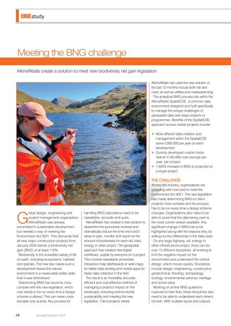
Meeting the BNG challenge<br />
AtkinsRéalis create a solution to meet new biodiversity net gain legislation<br />
AtkinsRéalis has used the new solution in<br />
the last 12 months include both rail and<br />
road, as well as utilities and masterplanning.<br />
The analytical BNG process sits within the<br />
AtkinsRéalis SpatialCDE, a common data<br />
environment designed and built specifically<br />
to manage the unique challenges of<br />
geospatial data over large projects or<br />
programmes. Benefits of the SpatialCDE<br />
approach across certain projects include:<br />
More efficient data collation and<br />
management within the SpatialCDE<br />
saves £300,000 per year on each<br />
development<br />
Quickly developed custom tools<br />
deliver £160,000 cost savings per<br />
year, per project<br />
1,000% increase in BNG is projected on<br />
a single project.<br />
Global design, engineering and<br />
project management organisation<br />
AtkinsRéalis was already<br />
committed to sustainable development<br />
but needed a way of meeting the<br />
Environment Act 2021. This demands that<br />
all new major construction projects from<br />
January 2024 deliver a biodiversity net<br />
gain (BNG) of at least 110%.<br />
Biodiversity is the incredible variety of life<br />
on earth, including ecosystems, habitats<br />
and species. The new law makes sure a<br />
development leaves the natural<br />
environment in a measurably better state<br />
than it was beforehand.<br />
Determining BNG has become more<br />
complex with the new legislation, which<br />
now needs to be run every time a design<br />
scheme is altered. This can mean costs<br />
escalate very quickly. Any process for<br />
handling BNG calculations need to be<br />
repeatable, accurate and quick.<br />
AtkinsRéalis has created a new solution to<br />
streamline the processes involved and<br />
dramatically reduce the time and cost it<br />
takes to plan, monitor and report on the<br />
amount of biodiversity for each rail, road,<br />
energy or other project. The geospatial<br />
approach has created new digital<br />
workflows, usable by everyone on a project.<br />
This involves repeatable processes,<br />
interactive map dashboards or web maps<br />
for better data sharing and mobile apps for<br />
faster data collection in the field.<br />
The result is an incredibly accurate,<br />
efficient and cost-effective method of<br />
managing a project's impact on the<br />
landscape, ensuring environmental<br />
sustainability and meeting the new<br />
legislation. Client projects where<br />
THE CHALLENGE<br />
Across the industry, organisations are<br />
grappling with how best to meet the<br />
Environment Act 2021. The new legislation<br />
has made determining BNG on client<br />
projects more complex and the process<br />
has to be run every time a design scheme<br />
changes. Organisations also need to be<br />
able to prove that the data being used is<br />
the most current version available. Any<br />
significant change in BNG has to be<br />
highlighted along with the reasons why, by<br />
setting out the differences in the data used.<br />
On any large highway, rail, energy or<br />
other infrastructure project, there can be<br />
over 12 different disciplines, all working to<br />
limit the negative impact on the<br />
environment and understand the central<br />
design, which moves quickly. Disciplines<br />
include design, engineering, construction,<br />
geotechnical, flooding, archaeology,<br />
ecology, environmental services, heritage<br />
and social value.<br />
Working on similar BNG questions<br />
nuanced to their field, these disciplines also<br />
need to be able to understand each other's<br />
domain. With multiple inputs and outputs<br />
28<br />
January/February 2024