Create successful ePaper yourself
Turn your PDF publications into a flip-book with our unique Google optimized e-Paper software.
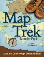
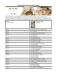
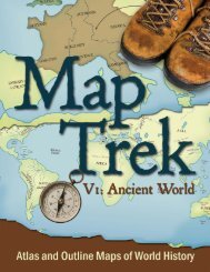
V1: Ancient World
<strong>Map</strong><br />
<strong>Trek</strong><br />
Atlas and Outline <strong>Map</strong>s of World History<br />
Created by Terri Johnson
<strong>Map</strong> <strong>Trek</strong><br />
Atlas and Outline <strong>Map</strong>s of World History<br />
Created by Terri Johnson<br />
Published by: Bramley Books, a division of<br />
<strong>Knowledge</strong> <strong>Quest</strong>, Inc.<br />
Post Offi ce Box 789<br />
Boring, OR 97009-0789<br />
All rights reserved. However, <strong>Knowledge</strong> <strong>Quest</strong>, Inc. grants the right to<br />
the individual purchaser to reproduce the maps herein for noncommercial,<br />
individual use. Reproduction for an entire classroom, school or school<br />
system is strictly prohibited. Please call (210) 745-0203 or email orders@<br />
knowledgequestmaps.com for information on quantity sale discounts. No<br />
part of this book may be reproduced or transmitted in any form or by any<br />
means, electronic or mechanical, including photocopying, recording or by any<br />
information storage and retrieval system without written permission from<br />
the author.<br />
Copyright: 2009 <strong>Knowledge</strong> <strong>Quest</strong>, Inc.<br />
and Terri Johnson<br />
www.<strong>Knowledge</strong><strong>Quest</strong><strong>Map</strong>s.com<br />
www.BramleyBooks.com<br />
Printed in the United States of America<br />
ISBN 978-1-932786-36-1 (ebook)<br />
Cover design by Cathi Stevenson, Nova Scotia
Table of Contents<br />
Why should we study history? ........................................................................................................... 5<br />
Introduction .............................................................................................................................................6<br />
Lesson Plans .............................................................................................................................................8<br />
Glossary ...................................................................................................................................................20<br />
World <strong>Map</strong> (landforms) .................................................................................................................... 21<br />
Descendents of Noah .......................................................................................................................... 23<br />
Sumeria ................................................................................................................................................... 27<br />
Mesopotamia ......................................................................................................................................... 25<br />
Called Out of Ur ................................................................................................................................... 29<br />
Abraham’s Journey ...............................................................................................................................31<br />
Ancient Africa ....................................................................................................................................... 33<br />
Old Kingdom of Egypt ........................................................................................................................ 35<br />
Ancient Egypt ....................................................................................................................................... 37<br />
The Exodus ............................................................................................................................................ 39<br />
Early Greece ...........................................................................................................................................41<br />
The Promised Land ..............................................................................................................................43<br />
12 Tribes of Israel .................................................................................................................................45<br />
The Assyrian Empire ........................................................................................................................... 47<br />
Israel’s Golden Age ..............................................................................................................................49<br />
Phoenicia’s Trading Empire ............................................................................................................... 51<br />
Solomon’s Kingdom ............................................................................................................................. 53<br />
Israel’s Divided Kingdom ................................................................................................................... 55<br />
Ancient India ......................................................................................................................................... 57<br />
Ancient China ....................................................................................................................................... 59<br />
The Founding of Rome ....................................................................................................................... 61<br />
Babylonian Empire............................................................................................................................... 63<br />
The Persian Empire ............................................................................................................................. 65<br />
Greco-Persian Wars ............................................................................................................................ 67<br />
Golden Age of Greece ......................................................................................................................... 69<br />
Ancient Europe ...................................................................................................................................... 71<br />
Alexander the Great ............................................................................................................................ 73<br />
The Punic Wars .................................................................................................................................... 75<br />
Palestine during time of Christ .........................................................................................................77<br />
The Early Church ..................................................................................................................................79<br />
The Roman Empire ............................................................................................................................... 81<br />
The Roman Empire Divided .............................................................................................................. 85<br />
Barbarian Invasions ............................................................................................................................. 83<br />
World <strong>Map</strong> (with grid) ...................................................................................................................... 87<br />
Blank grid for world map ....................................................................................................................88<br />
Egypt <strong>Map</strong> (with grid) ....................................................................................................................... 89<br />
Israel <strong>Map</strong> (with grid) .........................................................................................................................90<br />
Greece <strong>Map</strong> (with grid) ...................................................................................................................... 91<br />
Roman <strong>Map</strong> (with grid) ......................................................................................................................92<br />
Blank grid for regional maps ............................................................................................................. 93
Why should we study history?<br />
“The kind of events that once took place will by reason of human nature take place again.”<br />
−Thucydides<br />
“That is the supreme value of history. The study of it is the best guarantee against repeating it.”<br />
− John Buchan, Baron Tweedsmuir<br />
“The time for extracting a lesson from history is ever at hand for those who are wise.”<br />
− Demosthenes<br />
“Take hold of instruction; let her not go. Keep her; for she is thy life.”<br />
− Solomon (Proverbs 4:13)
Introduction<br />
It only makes sense to study geography alongside history. In history, we learn about<br />
times, places and people. Geography covers the “places” part. Each aspect of historical study<br />
is important in its own right, but they cannot be studied exclusively of one another. For<br />
example, when you study Alexander the Great, it only makes sense to see the large land area<br />
that he conquered by looking at a map. Modern maps will not give you the same information or<br />
perspective as historical maps do.<br />
We, at <strong>Knowledge</strong> <strong>Quest</strong>, Inc., have set out to provide you with the most usable,<br />
yet attractive, historical map book possible. Within these pages, you will fi nd a full-color<br />
historical atlas for the teacher, along with blank outline maps for the student. In this way, the<br />
teacher has full access to the answers thereby eliminating any frustration or bewilderment on<br />
her part. The teacher may decide whether to provide this answer map to her students, or have<br />
them research the answers on their own using a globe, wall map, internet search or another<br />
historical atlas.<br />
As the teacher, you may wish to print out this entire ebook. However, if you want to<br />
save on the expense of printer ink or toner, you might prefer to print only the student maps,<br />
which will exhaust a minimal amount of ink. The water is shaded a very slight (10%) blue so as<br />
to help the students differentiate the water from the land masses.<br />
Lesson plans have been included for you. They have been broken down into three<br />
categories for learners in various stages. Level A is for children who are in grades 1-4. However,<br />
if you have a kindergarten who is ready for a little challenge or a 5 th grader that needs some<br />
extra assistance, feel free to adjust these ranges to suit your students’ needs. Also, with this<br />
age group, the teacher should be willing to help with spelling or writing if the child needs some<br />
help. Often times, a child’s brain is much more advanced and ready for information than his<br />
hand is in recording it! <strong>Map</strong> work should be fun and interactive; not a test or drill.<br />
Level B is for students in 5 th through 8 th grade. These kids are ready for additional<br />
challenge and are capable of more writing/recording than the younger kids. Level C is for high<br />
schoolers (9 th through 12 th grade) and includes the most challenging assignments. They are<br />
often asked to do some research in order to fi ll in their maps completely.<br />
Teachers, please remember, no matter what age or stage your child is in, learning<br />
geography comes with familiarity and repetition. In fact, if the student incorporates all of these<br />
maps into his study of world history, he will begin to memorize geographical facts that will<br />
remain with him for a lifetime. If you feel that your student needs extra geography review or<br />
perhaps a different way to learn it, please check out this free resource:<br />
Globalmania - http://www.knowledgequestmaps.com/globalmania.htm
Since these maps are chronological in sequence, you may use them easily with any<br />
chronological history program. Some good history curricula to consider are:<br />
★<br />
★<br />
★<br />
★<br />
★<br />
★<br />
★<br />
★<br />
★<br />
★<br />
★<br />
Truth<strong>Quest</strong> History<br />
Story of the World<br />
Biblioplan for Families<br />
Tapestry of Grace<br />
Sonlight Curriculum<br />
Mystery of History<br />
My Father’s World<br />
Learning Adventures<br />
Living Books Curriculum<br />
Ambleside Online<br />
Winter Promise<br />
This is certainly not an exhaustive list and there are many other good history programs to choose from.<br />
To gain the most benefi t from these outline maps, it would be advantageous to have<br />
on hand a globe, wall map and/or separate atlas for reference. The student may be asked to<br />
look something up on the globe and then label it onto the blank map. Also, have available<br />
some decent art supplies. As your student matures, he or she should be expected to present<br />
to you upon completion a neatly colored or pencil shaded map. For variety, allow your child<br />
to experiment with watercolors for a different effect, or let her use glue and glitter on a major<br />
route. No matter what their age, children should always be encouraged to do their best.<br />
Once completed, your children may want to post these maps to a bulletin board or<br />
the refrigerator. Our students compile the maps into a notebook along with narrations from<br />
history books we have read and pictures of historical events that the children have drawn<br />
and captioned. When we have completed a unit of history study, the children have their own<br />
“book” which they have made which tells the story of the history that they have learned and<br />
summarized. The maps make nice colorful entries into their notebooks.<br />
There are enough maps included in this unit so that you can assign map work once a<br />
week. You may want to schedule a specifi c time for this activity during the week. Or perhaps<br />
you will want to hand your kids a map to label and color while you read from your history<br />
book or text. How and when you assign map work is up to you, but I fi nd that I am much more<br />
likely to actually work on the maps if I have it scheduled into our weekly school calendar.<br />
We hope these maps enhance your study of history and make learning geography and<br />
enjoyable and interactive learning experience for your children.
1.<br />
Lessons Plans<br />
Ancient World (landforms)<br />
Level A – Grades 1-4 (with parental assistance as necessary)<br />
o Look at a globe and notice that over two-thirds of it is covered in water that is all connected.<br />
This one large body of water, or ocean, has fi ve different names at fi ve separate locations on<br />
our world. Label them on your map – Pacifi c, Atlantic, Indian, Arctic and Southern.<br />
o Label the seven continents – Asia, Africa, Europe, Australia, Antarctica, North and South<br />
America.<br />
o Color in the land areas.<br />
Level B – Grades 5-8<br />
o Complete all of the above, plus…<br />
o Label the smaller bodies of water – Beaufort Sea, Gulf of Alaska, Hudson Bay, Gulf of<br />
Mexico, Caribbean Sea, Mediterranean Sea, Black Sea, Caspian Sea, Red Sea, North Sea,<br />
Baltic Sea, Arabian Sea, Bay of Bengal, E. China Sea, S. China Sea, Tasman Sea, Coral Sea, Sea<br />
of Okhotsk, Bering Sea, Laptev Sea, Kara Sea and Barent Sea.<br />
o Label the mountain ranges – Sierra Nevadas, Rockies, Appalachian, Andies, Pyrenees, Alps,<br />
Caucasus, Ural, Himalayas and the Great Dividing Range.<br />
Level C – Grades 9-12<br />
o Complete all of the above, plus…<br />
o Label all of the rivers shown here – St. Lawrence, Mississippi, Amazon, Thames, Seine,<br />
Rhine, Vistula, Danube, Dnieper, Vulga, Ural, Ob, Nile, Tigris, Euphrates, Indus, Ganges,<br />
Yellow, Yangtze and Lena.<br />
o Label the deserts and peninsulas – Death Valley, Great Basin, Sonoran Desert, Atacama<br />
Desert, Patagonian Desert, Sahara Desert, Kalahari Desert, Arabian Desert, Sinai Peninsula,<br />
Italian Peninsula, Greek Peninsula, Iranian Desert, Turkestan Desert, Indian Desert, Takla<br />
Makan Desert, Gobi Desert, Great Sandy Desert and Great Victoria Desert.<br />
Optional (all levels)<br />
o Make a salt dough map of an imaginary country. Include at least one mountain, one river, a<br />
desert and a peninsula or an island.<br />
MAPPING DOUGH<br />
1 c. salt<br />
1 c. fl our<br />
2/3 c. water<br />
Food color (or poster paint when mixture is dry and map is formed and you are ready to paint)<br />
Mix salt, fl our and water until mixture is like icing. Add food coloring if you want dough colored.<br />
Otherwise paint dry map with poster paint. On board, shape dough into hills, valleys oceans to make<br />
topography map. Let dry.
2. Eden/Noah<br />
Level A – Grades 1-4 (with parental assistance as necessary)<br />
o Label Mt. Ararat and the possible location of the Garden of Eden.<br />
o Label the areas where Noah’s three sons migrated after the fl ood.<br />
o Color in your map.<br />
3.<br />
4.<br />
5.<br />
Levels B and C – Grades 5-12<br />
o Complete all of the above, plus…<br />
o Label all bodies of water shown on this map – Mediterranean Sea, Black Sea, Red Sea,<br />
Caspian Sea, Persian Gulf, Tigris and Euphrates Rivers.<br />
o Label the deserts and surrounding regions.<br />
Mesopotamia<br />
Level A – Grades 1-4 (with parental assistance as necessary)<br />
o Label the region known as the Fertile Crescent.<br />
o Label these two rivers – Tigris and Euphrates.<br />
o Meso means “between” and potamia means “rivers” (think: where the hippopotamus lives�).<br />
Point to the area that would have been known as “Mesopotamia”.<br />
o Color your map.<br />
Levels B and C – Grades 5-12<br />
o Complete all of the above, plus…<br />
o Label all of the cities and bodies of water shown on this map.<br />
o Trace and label the Ancient Trade Route.<br />
Sumerians of Mesopotamia (zoomed-in view)<br />
Level A – Grades 1-4 (with parental assistance as necessary)<br />
o Label the region known as Mesopotamia.<br />
o Label these two rivers – Tigris and Euphrates.<br />
o Label the ziggurat civilizations.<br />
o Color your map.<br />
Levels B and C – Grades 5-12<br />
o Complete all of the above, plus…<br />
o Label the bodies of water shown on this map.<br />
Called Out of Ur<br />
Level A – Grades 1-4 (with parental assistance as necessary)<br />
o Label the Tigris and Euphrates rivers.<br />
o Label these cities – Ur, Babylon and Haran.<br />
o Trace Abraham’s journey.<br />
o<br />
Color your map.
6.<br />
7.<br />
8.<br />
Level B – Grades 5-8<br />
o Complete all of the above, plus…<br />
o Label these cities – Uruk, Kish, Memphis, Thebes.<br />
o Label the four seas (hint: actually one is a gulf).<br />
o Shade in the region of the fertile crescent from Ur to Memphis (hint: your shading should<br />
resemble a crescent moon or crescent roll�).<br />
Level C – Grades 9-12<br />
o Complete all of the above, plus…<br />
o Label these cities in the land of Canaan, where Abraham settled and raised his family<br />
– Dothan, Shechem, Succoth, Bethel, Ephrath, Gerar, Hebron, Beer-sheba, Sodom and<br />
Gomorrah.<br />
Abraham’s Journey<br />
Level A – Grades 1-4 (with parental assistance as necessary)<br />
o This map is a close up view of last week’s map.<br />
o Label the Mediterranean Sea and the two mountains shown here – Mt. Gilead and Mt.<br />
Moriah.<br />
o Label three Canaanite cities of your choice.<br />
o Color in your map.<br />
Levels B and C – Grades 5-12<br />
o Complete all of the above, plus…<br />
o Label the remaining cities.<br />
o Using a pencil, draw in Abraham’s route from Haran.<br />
o Do some research and fi nd out the names of the three remaining bodies of water shown on<br />
this map which are unlabeled.<br />
Ancient Africa<br />
Level A – Grades 1-4 (with parental assistance as necessary)<br />
o Label the regions of Egypt, Nubia, Kush and Sudan.<br />
o Label the Sahara Desert and the Cape of Good Hope, then color your map.<br />
Levels B and C – Grades 5-12<br />
o Complete all of the above, plus…<br />
o Label all bodies of water shown on this map – Atlantic Ocean, Indian Ocean, Red Sea, Lake<br />
Victoria, Lake Tanganyika, Lake Malawi, Nile, Niger, Congo and Zambezi Rivers.<br />
o Label the region of Bantu, the island of Madagascar and the Atlas Mountains.<br />
o Using the distance scale, determine approximately how far the region of Sudan is from<br />
Egypt.<br />
Old Kingdom of Egypt<br />
Level A – Grades 1-4 (with parental assistance as necessary)<br />
o Label the areas known as Upper Egypt and Lower Egypt. Looking at this map, does this
o<br />
o<br />
strike you as peculiar or seem funny to you? “Lower” in this case refers to elevation, rather<br />
than southernmost on the map.<br />
Label the Red Lands, the Black Lands and the Nile River. Do you know why the Egyptians<br />
referred to the land surrounding the Nile as “black”? Black lands refer to the fertile black soil<br />
deposited from the annual fl ooding of the Nile River.<br />
Color your map.<br />
Levels B and C – Grades 5-12<br />
o Complete all of the above, plus…<br />
o Label the Nile Delta, the two seas and the three cataracts. Do you know what cataracts are?<br />
The cataracts of the Nile are sections of the river where there are many boulders and islets,<br />
creating white water rapids.<br />
9. Ancient Egypt (If you prefer, you may add to last week’s map or start a new one)<br />
Level A – Grades 1-4 (with parental assistance as necessary)<br />
o Label the two seas – Mediterranean and Red.<br />
o Label Giza and the Valley of the Kings<br />
o Label Nubia and Kush<br />
o Color your map.<br />
Levels B and C – Grades 5-12<br />
o Complete all of the above, plus…<br />
o Label the cities of Egypt and the regions of the pyramids.<br />
o Optional – using the grid provided at the end of this book, draw a map of Egypt.<br />
10. The Exodus<br />
Level A – Grades 1-4 (with parental assistance as necessary)<br />
o Label the regions of Goshen and Sinai on your map.<br />
o Label the city of Raamses and Mt. Sinai.<br />
o Trace the possible route of the Exodus out of Egypt.<br />
o Color your map<br />
11.<br />
Levels B and C – Grades 5-12<br />
o Complete all of the above, plus…<br />
o Label the three seas – Mediterranean, Red and Dead, the Bitter Lakes, the two wildernesses<br />
– Shur and Paran, and the remaining fi ve cities.<br />
o Research and draw an alternate route taken by the Israelites out of Egypt.<br />
Early Greece<br />
Level A – Grades 1-4 (with parental assistance as necessary)<br />
o Label the Aegean Sea that is located between the countries of Lydia and Greece.<br />
o Label the island of Crete and these two peninsulas – Peloponnese and Euboia.<br />
o Label the cities of Troy and Athens.<br />
o<br />
Color your map
Level B – Grades 5-8<br />
o Complete all of the above, plus…<br />
o Label these islands – Thera, Corfu, Ithaca, Zakynthas, Kythera, Skyros, Khias, Lesbos and<br />
Same.<br />
Level C – Grades 9-12<br />
o Complete all of the above, plus…<br />
o Label the remaining cities and regions.<br />
o Label the Hellespont – the waterway between the Aegean Sea and another waterway shown<br />
here. Research its name and label it.<br />
o Label two more seas not labeled here – the Ionian and Mediterranean Seas.<br />
12. The Promised Land<br />
Level A – Grades 1-4 (with parental assistance as necessary)<br />
o Label the three seas shown here – Mediterranean, Galilee and Dead.<br />
o Label the city of Jericho. What important event happened here?<br />
o Color your map<br />
Levels B and C – Grades 5-12<br />
o Complete all of the above, plus…<br />
o Label the two highways. Research to fi nd out who used these highways and their purposes.<br />
o Label the landforms of Canaan – Plain of Acco, Jezreel Valley, Plain of Sharon, Coastal<br />
Plain, Plain of Philistia, Cisjordan, Transjordan, Jordan Rift, the Negev and the Western<br />
Mountains.<br />
13. The 12 Tribes of Israel<br />
Level A – Grades 1-4 (with parental assistance as necessary)<br />
o Label the 12 tribes of Israel – Simeon, Judah, Reuben, Dan, Ephraim, Gad, Manasseh,<br />
Issachar, Zebulun, Nephtali, Asher and Benjamin. The remaining tribe, the tribe of Levi, was<br />
the only Israelite tribe that received no designated tribal land. However, they did receive<br />
cities and “the Lord himself as their inheritance.” (Joshua 13:33)<br />
o Color your map<br />
Levels B and C – Grades 5-12<br />
o Complete all of the above, plus…<br />
o Label the surrounding people groups who still dwelled in the land of Canaan.<br />
o Label the Mediterranean Sea, plus the three unlabeled seas shown here. Consult an atlas,<br />
wall map or globe. Alternately, you may do a google search for “map of Israel” and select<br />
images for your results.<br />
14. The Assyrian Empire<br />
Level A – Grades 1-4 (with parental assistance as necessary)<br />
o Find the city where Jonah was to go and preach (Nineveh).<br />
o Tarshish is not shown on this map. See the map “The Punic Wars” and locate Cadiz - this is<br />
the approximate location of Tarshish (considered then the end of the world).
o<br />
o<br />
Label the surrounding bodies of water.<br />
Color your map<br />
Levels B and C – Grades 5-12<br />
o Complete all of the above, plus…<br />
o Label the remaining cities shown on the map.<br />
15. Israel’s Golden Age (If you prefer, you may add to 12 Tribes map or start a new one)<br />
Level A – Grades 1-4 (with parental assistance as necessary)<br />
o Label Mt. Gilboa and the Valley of Elah.<br />
o Label the cities of Jerusalem and Bethlehem.<br />
o Label the surrounding regions of the Philistines, Moabites and Amorites.<br />
o Color your map<br />
Levels B and C – Grades 5-12<br />
o Complete all of the above, plus…<br />
o Label the remaining cities shown on the map.<br />
o Optional – using the grid provided at the end of this book, draw a map of Israel.<br />
16. Phoenicia’s Trading Empire<br />
Level A – Grades 1-4 (with parental assistance as necessary)<br />
o Choose two colors. Color in region of Phoenicia in one color and the Phoenician colonies<br />
another color.<br />
o Label the cities of Tyre and Sidon.<br />
o Note the locations where certain minerals and other materials were mined or collected.<br />
o Color the rest of your map.<br />
Levels B and C – Grades 5-12<br />
o Complete all of the above, plus…<br />
o Label the remaining cities shown on the map.<br />
o Do some research to fi nd out what major contribution the Phoenicians gave to the western<br />
world – besides ship building and international trade? (Teacher: here is a helpful website -<br />
http://www.phoenician.org/alphabet.htm).<br />
17. Solomon’s Extended Kingdom<br />
Level A – Grades 1-4 (with parental assistance as necessary)<br />
o Color in the area controlled by King Solomon.<br />
o Find the region or country of Sheba and label it.<br />
o Label the Mediterranean Sea and the Rivers Tigris and Euphrates.<br />
o Color the rest of your map.<br />
Levels B and C – Grades 5-12<br />
o Complete all of the above, plus…<br />
o<br />
Using the scale on the map, determine the approximate distance which the Queen of
o<br />
o<br />
Sheba traveled to visit with King Solomon.<br />
Label the cities of Tyre and Ezion-geber. The King of Tyre provided Solomon with what raw<br />
material in which to build the temple?<br />
Label the remaining bodies of water shown on this map. Look up the answers for the two<br />
mystery bodies on a globe or wall map (hint: one is a lake and the other a sea).<br />
18. Israel’s Divided Kingdom<br />
Level A – Grades 1-4 (with parental assistance as necessary)<br />
o Trace over the dividing line between the Kingdom of Judah and the Kingdom of Israel. Color<br />
these two regions different colors.<br />
o Label and color the surrounding regions.<br />
Levels B and C – Grades 5-12<br />
o Complete all of the above, plus…<br />
o Label the cities shown here – Dan, Shechem, Samaria, Bethel, Jerusalem and Tekoa.<br />
o Label the four bodies of water (do you know the name of the very small one towards the top<br />
of the map? It is now known as Lake Hula or the Hula Reserve).<br />
19. Ancient India<br />
Level A – Grades 1-4 (with parental assistance as necessary)<br />
o Label the Arabian Sea, the Indian Ocean and the Bay of Bengal.<br />
rd o Label Mt. Everest and Mt. Kanchenjunga (3 largest peak after Everest and K2).<br />
o Label the Indus River and the Himalayan Mountains.<br />
o Color your map.<br />
Levels B and C – Grades 5-12<br />
o Complete all of the above, plus…<br />
o Label the other two rivers shown here – Ganges and Brahmaputra.<br />
o Label the remaining topographical features – Western Ghats Mtns and Eastern Ghats Mtns,<br />
Deccan Plateau, Thar Desert and the Northern Plains.<br />
o Label the region of Tibet.<br />
20. Ancient China<br />
Level A – Grades 1-4 (with parental assistance as necessary)<br />
o Label the Huang He River (also known as the Yellow River) and the Yangtze River.<br />
o Label the regions of Mongolia and Manchuria as well as the two seas – Yellow and South<br />
China Sea.<br />
o Color your map.<br />
Levels B and C – Grades 5-12<br />
o Complete all of the above, plus…<br />
o<br />
Label the Gobi Desert, the Sichuan Basin, the Yangtze Valley and Qin Ling Mountains.
21. The Founding of Rome<br />
Level A – Grades 1-4 (with parental assistance as necessary)<br />
o Label the land areas and islands – Italy, Corsica, Sardinia and Sicily. (Hint: Italy looks like a<br />
high-heeled boot).<br />
o Label the three seas shown here – Adriatic, Tyrrhenian and Mediterranean.<br />
o Color your map<br />
22.<br />
23.<br />
Levels B and C – Grades 5-12<br />
o Complete all of the above, plus…<br />
o Label the Appenine Mountains, the Tiber River, the Bay of Naples and the Gulf of Tarentia.<br />
o Label the four cities shown on this map – Rome, Alba Longa, Pompeii and Syracuse.<br />
o Label the regions of the four people groups that lived on the Italian peninsula – Greek,<br />
Etruscans, Sabines, Samnites.<br />
Babylonian Empire<br />
Level A – Grades 1-4 (with parental assistance as necessary)<br />
o Trace the path taken by the Israelites when they were taken into captive by the Babylonians.<br />
Why do you suppose they did not walk in a straight line, the shortest distance possible?<br />
o Label the cities of Jerusalem and Babylon.<br />
o Label the Mediterranean Sea, Red Sea and Persian Gulf.<br />
o Color your map.<br />
Levels B and C – Grades 5-12<br />
o Complete all of the above, plus…<br />
o Label the other four cities shown here – Megiddo, Haran, Nineveh and Ashur.<br />
o Label the two bodies of water not labeled on the map, plus the two main rivers emptying<br />
into the Persian Gulf.<br />
o Using the scale provided for you, calculate the distance between Jerusalem and Babylon.<br />
The Persian Empire<br />
Level A – Grades 1-4 (with parental assistance as necessary)<br />
o Label the large area known as Persia.<br />
o Trace the Royal Road and label the four cities located on it.<br />
o Label Egypt, Israel and Media.<br />
o Color your map.<br />
Level B – Grades 5-8<br />
o Complete all of the above, plus…<br />
o Label the remaining regions shown on this map – Phyrgia, Ionia, Lydia, Greece, Macedonia,<br />
Thrace, Cappadocia and India.<br />
o Label the city of Byzantium. Do you know its modern day name or the country in which it is<br />
the capital city?<br />
o<br />
Label the two mountain ranges – Caucasus and Zagros Mtns.
24.<br />
25.<br />
Level C – Grades 9-12<br />
o Complete all of the above, plus…<br />
o Label all bodies of water, including the four rivers.<br />
o Label the islands shown here although not labeled on the answer map – Cyprus, Crete,<br />
Euboea, Sicily, Sardinia and Corsica.<br />
Greco-Persian Wars<br />
Level A – Grades 1-4 (with parental assistance as necessary)<br />
o Label the areas known as Greece, Macedonia, Lydia and ionia.<br />
o Label the battles at Thermopylae and Marathon.<br />
o Label the city of Athens.<br />
o Label Mt. Olympus and the location of Delphi.<br />
o Color your map<br />
Level B – Grades 5-8<br />
o Complete all of the above, plus…<br />
o How many miles is it between the two cities of Marathon and Athens? Look it up if you<br />
do not know. Here’s a short synopsis you can read for more information about the battle of<br />
Marathon -<br />
o http://library.thinkquest.org/CR0210200/ancient_greece/persian_war.htm.<br />
o Label the remaining cities and all of the islands named on the map.<br />
Level C – Grades 9-12<br />
o Complete all of the above, plus…<br />
o Label the bodies of water shown on this map.<br />
o Optional – using the grid provided at the end of this book, draw a map of Greece.<br />
Golden Age of Greece<br />
Level A – Grades 1-4 (with parental assistance as necessary)<br />
o Label the areas known as Greece, Macedonia, Lydia and ionia.<br />
o Label the city of Athens.<br />
o Label Mt. Olympus and the location of Delphi.<br />
o Color your map<br />
Level B – Grades 5-8<br />
o Complete all of the above, plus…<br />
o Label the remaining cities, Mt. Mimas and all of the islands named on the map.<br />
Level C – Grades 9-12<br />
o Complete all of the above, plus…<br />
o Label the bodies of water shown on this map.<br />
o<br />
Optional – using the grid provided at the end of this book, draw a map of Greece.
26. Ancient Europe<br />
Level A – Grades 1-4 (with parental assistance as necessary)<br />
o Label these bodies of water – Atlantic Sea, North Sea, Baltic Sea and Mediterranean Sea.<br />
o Label the Rhine and Danube Rivers.<br />
o Color your map<br />
Levels B and C – Grades 5-12<br />
o Complete all of the above, plus…<br />
o Label the remaining bodies of water, including the rivers.<br />
o Label the three mountain ranges and the fi ve cities shown here.<br />
o Label the British Isles (which includes Ireland), the Scandanavian, Iberian and Balkan<br />
peninsulas.<br />
27. Alexander the Great<br />
Level A – Grades 1-4 (with parental assistance as necessary)<br />
o Color in the large area conquered by Alexander the Great.<br />
o Alexander’s father was from Macedonia. Label the regions of Macedonia and Greece and the<br />
islands of Crete and Cyprus.<br />
o Count the number of cities named Alexandria and label the one located in Egypt.<br />
o Color the rest of your map.<br />
Levels B and C – Grades 5-12<br />
o Complete all of the above, plus…<br />
o Label all bodies of water shown on this map.<br />
o Trace the route of Alexander the Great and label the cities that he journeyed through.<br />
o Label the regions that were managed by his three successors – Antigonus, Seleucus and<br />
Ptolemy – and the Indian ruler Chandragupta.<br />
28. The Punic Wars<br />
Level A – Grades 1-4 (with parental assistance as necessary)<br />
o Label the three peninsulas shown on this map – Greek, Italian and Iberian.<br />
o Label the islands shown here – Sicily, Corsica, Sardinia and the Balearic Islands.<br />
o Label the Strait of Gibraltar.<br />
o Color your map.<br />
Levels B and C – Grades 5-12<br />
o Complete all of the above, plus…<br />
o Label all bodies of water shown on this map.<br />
o Label the fi ve rivers in the region of modern-day Spain.<br />
o Label the two mountain ranges – The Alps and the Pyrenees Mtns.<br />
o Label the four cities shown here.<br />
o Draw the route by which the armies of Carthage were able to sneak into Italy and attack<br />
Rome.
29. Palestine<br />
Level A – Grades 1-4 (with parental assistance as necessary)<br />
o Label the cities of Cana, Nazareth, Bethlehem and Jerusalem. What important events took<br />
place in those cities?<br />
o Label the Sea of Galilee and the Dead Sea.<br />
o Color your map.<br />
Levels B and C – Grades 5-12<br />
o Complete all of the above, plus…<br />
o Research and discover two more names for the Sea of Galilee.<br />
o Label the remaining cities and surrounding regions.<br />
o Label the princedoms of Herod and Philip.<br />
30. The Early Church<br />
Level A – Grades 1-4 (with parental assistance as necessary)<br />
o Trace the four journeys of Paul.<br />
o Label the cities that he traveled through.<br />
o Color your map.<br />
Levels B and C – Grades 5-12<br />
o Complete all of the above, plus…<br />
o Label the islands, both labeled and unlabeled, on this map<br />
o Label all bodies of water and the surrounding regions listed on this map.<br />
31. The Roman Empire<br />
Level A – Grades 1-4 (with parental assistance as necessary)<br />
o Label Israel, Egypt, Northern Africa, Spain, France and Britain.<br />
o Color in the shaded section of your map – the Roman Empire at its greatest extent.<br />
o Color in the rest of your map.<br />
32.<br />
Levels B and C – Grades 5-12<br />
o Complete all of the above, plus…<br />
o Label the fi ve cities shown here plus all bodies of water.<br />
o Using the scale provided for you, calculate the distance between Athena and Rome.<br />
Roman Empire Divided<br />
Level A – Grades 1-4 (with parental assistance as necessary)<br />
o Label Israel, Egypt, Northern Africa, Spain, France and Britain.<br />
o Color in the shaded section of your map – the Roman Empire at its greatest extent.<br />
o Draw the dividing line between the eastern and western empires.<br />
o<br />
Color in the rest of your map.
33.<br />
34.<br />
Levels B and C – Grades 5-12<br />
o Complete all of the above, plus…<br />
o Label the fi ve cities shown here plus all bodies of water.<br />
o Using the scale provided for you, calculate the distance between Rome and Constantinople<br />
– the new capital city designated by Constantine.<br />
o Optional – using the grid provided at the end of this book, draw a map of the Roman<br />
Empire.<br />
Barbarian Invasions<br />
Level A – Grades 1-4 (with parental assistance as necessary)<br />
o What is the name of the continent shown here? Label it (Europe).<br />
o Label the mountain range that divides Europe from Asia.<br />
o Label the Black Sea and Caspian Sea.<br />
o Color your map.<br />
Levels B and C – Grades 5-12<br />
o Complete all of the above, plus…<br />
o Label the cities of Rome and Byzantium (Constantinople).<br />
o Label the Atlantic Ocean and the Mediterranean Sea.<br />
o Label the barbarian tribes in the regions which they conquered.<br />
World <strong>Map</strong> - Levels B and C – Grades 5-12<br />
o Using the grid provided at the end of this book, draw a map of the world. (You might not<br />
want to tackle this whole project in one day, but spread it out over 2-3 days.)<br />
o<br />
Consider drawing regions as well using the grid maps of Egypt, Israel, Greece and Rome.
Glossary of Terms Used<br />
Artifact – a simple man-made object that provides evidence of an ancient culture.<br />
Continent – one of the seven great land masses of the world – Europe, Asia, Africa, North America,<br />
South America, Australia and Antarctica.<br />
Delta – deposited land at the branching mouth of a river.<br />
Desert – a large area of land where there is very little water and plants do not grow.<br />
Empire – a kingdom which has been extended by military might to include countries which<br />
were originally independent.<br />
Gulf – an area of sea partly surrounded by land, larger but with a narrower opening than a bay.<br />
Inlet – a narrow arm of the sea or of a river.<br />
Island – a piece of land, smaller than a continent, entirely surrounded by water.<br />
Islet – small island or rock mass.<br />
Key – something to help you decipher a code.<br />
Kilometer (Km) – a unit of distance measurement equaling 1,000 meters.<br />
Mile – a unit of distance measurement equaling 1,760 yards.<br />
Ocean – the large bodies of salt water which comprise the majority (over 2/3) of the earth’s<br />
surface.<br />
Republic – a form of government in which the head of state is an elected president rather than<br />
a monarch.<br />
River – a stream of fresh water fl owing into another body of water.<br />
Sea – a body of water smaller than an ocean, partly or completely enclosed by land.<br />
Geographical Regions Covered<br />
Red Sea Mediterranean Sea Mesopotamia<br />
Tigris River Euphrates River Persian Gulf<br />
Caspian Sea Nile River Crete<br />
India Indian Ocean Babylon<br />
Egypt Assyria China<br />
Yellow River Yangtze River Greece<br />
Aegean Sea Phoenicia Africa<br />
Sahara Desert Dead Sea Israel<br />
Persia Italy Carthage<br />
Roman Empire Palestine Britain<br />
Europe<br />
Teacher or parent, you may choose to use these terms and geographical regions listed to put together an end of the<br />
year quiz. However, if you follow the lesson plans throughout the year, you may not feel that this is necessary.
Teacher’s Answer <strong>Map</strong><br />
Arctic<br />
Ocean<br />
Laptev<br />
Sea<br />
Kara<br />
Sea<br />
WORLD MAP<br />
Beaufort<br />
Sea<br />
© 2009 <strong>Knowledge</strong> <strong>Quest</strong><br />
Lena<br />
Barent<br />
Sea<br />
Bering<br />
Sea<br />
Gulf of<br />
Alaska<br />
Sea of<br />
Okhotsk<br />
Hudson<br />
Bay<br />
Ob<br />
U r a l<br />
Baltic<br />
Sea<br />
Vistula<br />
North<br />
Sea<br />
NORTH AMERICA<br />
Vulga<br />
ASIA<br />
Ural<br />
Dnieper<br />
EUROPE<br />
Alps<br />
Rhine<br />
Seine<br />
Thames<br />
St. Lawrence<br />
G o b i D e s e r t<br />
Caspian<br />
Sea<br />
Turkestan<br />
Desert<br />
Black<br />
Sea<br />
Anatolia<br />
Iranian<br />
Desert<br />
Takla Makan<br />
Desert<br />
Danube<br />
Italian<br />
Peninsula Greek<br />
Peninsula<br />
Sicily<br />
Mediterranean<br />
Sea<br />
Crete<br />
Sinai<br />
Peninsula<br />
& Desert<br />
Pyrenees<br />
Rockies<br />
Great<br />
Basin<br />
Sierra<br />
Caucasus<br />
Appalachian<br />
Mississippi<br />
Sonoran<br />
Desert<br />
Death<br />
Valley<br />
Yellow (Huang Ho)<br />
Yangtze<br />
Tigris<br />
Euphrates<br />
Gulf of<br />
Mexico<br />
E. China<br />
Sea<br />
H i m a l a y a s<br />
Indus<br />
Nile<br />
Ganges<br />
Indian<br />
Arabian Desert<br />
Sea Bay of<br />
Bengal<br />
Arabian<br />
Desert<br />
Red<br />
Sea<br />
S a h a r a D e s e r t<br />
Atlantic<br />
Ocean<br />
AFRICA<br />
Caribbean<br />
Sea<br />
Amazon<br />
S. China<br />
Sea<br />
Indian<br />
Ocean<br />
Andes<br />
Pacific<br />
Ocean<br />
Coral<br />
Sea<br />
SOUTH<br />
AMERICA<br />
Great Dividing Range<br />
Great Sandy<br />
Desert<br />
Kalahari<br />
Desert<br />
AUSTRALIA<br />
Great Victoria<br />
Desert<br />
Atacama Desert<br />
Tasman<br />
Sea<br />
Patagonian<br />
Desert<br />
MAPS by<br />
<strong>Knowledge</strong> <strong>Quest</strong>, Inc.<br />
ANTARCTICA<br />
(Southern Ocean)<br />
© 2009 Terri Johnson
Student <strong>Map</strong><br />
WORLD MAP<br />
© 2009 <strong>Knowledge</strong> <strong>Quest</strong><br />
© 2009 Terri Johnson
Teacher’s Answer <strong>Map</strong><br />
The Descendants of NOAH<br />
ITALY<br />
Black Sea<br />
Caspian<br />
Sea<br />
GREECE<br />
Mt Ararat<br />
J A P H E T H<br />
ANATOLIA<br />
Tigris<br />
Mediterranean Sea<br />
S H E M<br />
Garden of<br />
Eden<br />
Euphrates<br />
Sinai<br />
Desert<br />
H A M<br />
Nile<br />
INDIA<br />
Persian<br />
Gulf<br />
Arabian Peninsula<br />
Red<br />
Sea<br />
Arabian<br />
Desert<br />
MAPS by<br />
<strong>Knowledge</strong> <strong>Quest</strong>, Inc.<br />
© 2009 Terri Johnson
Student <strong>Map</strong><br />
The Descendants of NOAH<br />
MAPS by<br />
<strong>Knowledge</strong> <strong>Quest</strong>, Inc.<br />
© 2009 Terri Johnson
Teacher’s Answer <strong>Map</strong><br />
MESOPOTAMIA<br />
Caspian<br />
Sea<br />
Tig ris<br />
Ancient Trade Route<br />
Mediterranean<br />
Sea<br />
Akkad<br />
Euphrates<br />
F E R T I L E C R E S C E N T<br />
Kish<br />
Babylon<br />
Uruk<br />
Memphis<br />
Ur<br />
Persian<br />
Gulf<br />
Red<br />
Sea<br />
Thebes<br />
0 500 Miles<br />
0 800 Km<br />
MAPS by<br />
<strong>Knowledge</strong> <strong>Quest</strong>, Inc.<br />
© 2009 Terri Johnson
Student <strong>Map</strong><br />
MESOPOTAMIA<br />
0 500 Miles<br />
0 800 Km<br />
MAPS by<br />
<strong>Knowledge</strong> <strong>Quest</strong>, Inc.<br />
© 2009 Terri Johnson
The Sumerians of<br />
Mesopotamia<br />
5000BC - 2000BC<br />
R . Euphrates<br />
© 2010 Terri Johnson<br />
R. Tigris<br />
Kish<br />
Eshnunn<br />
S U M E R<br />
Eridu<br />
Ur<br />
0 500 Miles<br />
0 800 Km<br />
Caspian Sea<br />
Persian Gulf<br />
Teacher’s Answer <strong>Map</strong><br />
MAPS by<br />
<strong>Knowledge</strong> <strong>Quest</strong>, Inc.
The Sumerians of<br />
Mesopotamia<br />
5000BC - 2000BC<br />
© 2010 Terri Johnson<br />
0 500 Miles<br />
0 800 Km<br />
MAPS by<br />
<strong>Knowledge</strong> <strong>Quest</strong>, Inc.<br />
Student <strong>Map</strong>
Teacher’s Answer <strong>Map</strong><br />
Caspian<br />
Sea<br />
Called Out of UR<br />
Haran<br />
Tig ris<br />
Abraham’s journey<br />
Ancient Trade Route<br />
Mediterranean<br />
Sea<br />
Akkad<br />
Euphrates<br />
F E R T I L E C R E S C E N T<br />
Kish<br />
Babylon<br />
Uruk<br />
Dothan<br />
Shechem<br />
Bethel Succoth<br />
Ephrath<br />
Gerar Hebron<br />
Beer-sheba<br />
Sodom Gomorrah<br />
Memphis<br />
Ur<br />
Persian<br />
Gulf<br />
Thebes<br />
Red Sea<br />
0 500 Miles<br />
0 800 Km<br />
MAPS by<br />
<strong>Knowledge</strong> <strong>Quest</strong>, Inc.<br />
© 2009 Terri Johnson
Student <strong>Map</strong><br />
Called Out of UR<br />
F E R T I L E C R E S C E N T<br />
0 500 Miles<br />
0 800 Km<br />
MAPS by<br />
<strong>Knowledge</strong> <strong>Quest</strong>, Inc.<br />
© 2009 Terri Johnson
ABRAHAM’s Journey<br />
M e d i t e r r a n e a n<br />
Sea<br />
Gerar<br />
MAPS by<br />
<strong>Knowledge</strong> <strong>Quest</strong>, Inc.<br />
© 2009 Terri Johnson<br />
Dothan<br />
Bethel<br />
Mt. Moriah<br />
Ephrath<br />
Cave of<br />
Machpelah<br />
Hebron<br />
Beersheba<br />
Shechem<br />
Sodom<br />
Succoth<br />
Gomorrah<br />
Abraham’s Journey from Haran<br />
Mt. Gilead<br />
Teacher’s Answer <strong>Map</strong><br />
0 30 Miles<br />
0 30 Km
MAPS by<br />
<strong>Knowledge</strong> <strong>Quest</strong>, Inc.<br />
© 2009 Terri Johnson<br />
ABRAHAM’s Journey<br />
0 30 Miles<br />
0 30 Km<br />
Student <strong>Map</strong>
Niger<br />
Atlantic Ocean<br />
0 1000 Miles<br />
0 1700 Km<br />
MAPS by<br />
<strong>Knowledge</strong> <strong>Quest</strong>, Inc.<br />
© 2009 Terri Johnson<br />
Atlas Mountains<br />
Ancient AFRICA<br />
5000BC - 2000BC<br />
EGYPT<br />
S A H A R A<br />
Desert Nile<br />
Congo<br />
BANTU<br />
Zambezi<br />
KUSH<br />
SUDAN<br />
Cape of Good Hope<br />
NUBIA<br />
White Nile<br />
Ethiopian<br />
Highlands<br />
Lake<br />
Victoria<br />
Lake<br />
Tanganyika<br />
Lake<br />
Malawi<br />
Red<br />
Sea<br />
Teacher’s Answer <strong>Map</strong><br />
Indian Ocean<br />
MADAGASCAR
0 1000 Miles<br />
0 1700 Km<br />
MAPS by<br />
<strong>Knowledge</strong> <strong>Quest</strong>, Inc.<br />
© 2009 Terri Johnson<br />
Ancient AFRICA<br />
5000BC - 2000BC<br />
Student <strong>Map</strong>
MAPS by<br />
<strong>Knowledge</strong> <strong>Quest</strong>, Inc.<br />
© 2009 Terri Johnson<br />
Old Kingdom of EGYPT<br />
5000BC - 2000BC<br />
Mediterranean Sea<br />
NILE DELTA<br />
LOWER EGYPT<br />
Red Lands<br />
Black Lands<br />
Third Cataracts<br />
Red Lands<br />
Nile R.<br />
Second Cataracts<br />
UPPER EGYPT<br />
First Cataracts<br />
Teacher’s Answer <strong>Map</strong><br />
Red Sea
MAPS by<br />
<strong>Knowledge</strong> <strong>Quest</strong>, Inc.<br />
© 2009 Terri Johnson<br />
Old Kingdom of EGYPT<br />
5000BC - 2000BC<br />
Student <strong>Map</strong>
KUSH<br />
MAPS by<br />
<strong>Knowledge</strong> <strong>Quest</strong>, Inc.<br />
© 2009 Terri Johnson<br />
Ancient EGYPT<br />
5000BC - 2000BC<br />
NILE DELTA<br />
Third Cataracts<br />
Heliopolis<br />
Memphis<br />
LOWER EGYPT<br />
Meidum<br />
Giza<br />
Sakkar<br />
Abusir<br />
Abydos<br />
Valley of the Kings<br />
Herakleopolis<br />
Nile R.<br />
Second Cataracts<br />
Thebes<br />
UPPER EGYPT<br />
First Cataracts<br />
NUBIA<br />
Teacher’s Answer <strong>Map</strong><br />
Red Sea
MAPS by<br />
<strong>Knowledge</strong> <strong>Quest</strong>, Inc.<br />
© 2009 Terri Johnson<br />
Ancient EGYPT<br />
5000BC - 2000BC<br />
Student <strong>Map</strong>
Teacher’s Answer <strong>Map</strong><br />
The Exodus<br />
from EGYPT<br />
1300BC<br />
Jericho<br />
MAPS by<br />
<strong>Knowledge</strong> <strong>Quest</strong>, Inc.<br />
Mediterranean Sea<br />
THE NEGEV<br />
Beer Lahai Roi<br />
Raamses<br />
Kadesh-barnea<br />
EDOM<br />
GOSHEN<br />
Succoth<br />
Wilderness of Shur<br />
Bitter<br />
Lakes<br />
Wilderness of Paran<br />
Ezion-geber<br />
0 100 Miles<br />
SINAI<br />
Red Sea<br />
0 150 Km<br />
Mt. Sinai/<br />
Horeb<br />
Note: Both the date of the Exodus and the route taken by the Israelites are considered by scholars to be uncertain. The date is believed to be<br />
somewhere between 1450 and 1200. Some scholars believe that they traveled further south than shown here to the tip of the Red Sea as we know<br />
it today and then doubled back up north. Others believe that they crossed further north by the Bitter Lakes, which may also have been considered<br />
at that time part of the “Sea of Reeds” or “Red Sea”.<br />
© 2009 Terri Johnson
Student <strong>Map</strong><br />
The Exodus<br />
from EGYPT<br />
1300BC<br />
MAPS by<br />
<strong>Knowledge</strong> <strong>Quest</strong>, Inc.<br />
0 100 Miles<br />
0 150 Km<br />
Note: Both the date of the Exodus and the route taken by the Israelites are considered by scholars to be uncertain. The date is believed to be<br />
somewhere between 1450 and 1200. Some scholars believe that they traveled further south than shown here to the tip of the Red Sea as we know<br />
it today and then doubled back up north. Others believe that they crossed further north by the Bitter Lakes, which may also have been considered<br />
at that time part of the “Sea of Reeds” or “Red Sea”.<br />
© 2009 Terri Johnson
Corfu<br />
Ithaca<br />
Zakynthos<br />
Pylos<br />
MACEDON<br />
GREECE<br />
Akhaia<br />
Corinth<br />
Olympia<br />
Iolkos<br />
Orchomenus<br />
Mycenae<br />
Tiryns<br />
Argos<br />
PELOPONNESE<br />
Sparta<br />
MAPS by<br />
<strong>Knowledge</strong> <strong>Quest</strong>, Inc.<br />
© 2009 Terri Johnson<br />
EUBOIA<br />
Gla<br />
Marathon<br />
Athens<br />
C a pe M a le e<br />
Kythera<br />
Early GREECE<br />
1300BC - 500BC<br />
ATTICA<br />
Skyros<br />
Aegean<br />
Sea<br />
Cyclades Islands<br />
Knossos<br />
Hagia<br />
Triada<br />
Ismaros<br />
Thera<br />
CRETE<br />
Tenedos<br />
Lesbos<br />
Mt. Mimas<br />
Khios<br />
Same<br />
Phaestos<br />
Troy<br />
Mallia<br />
Hellespont<br />
Teacher’s Answer <strong>Map</strong><br />
LYDIA<br />
Miletus<br />
Zakro
MAPS by<br />
<strong>Knowledge</strong> <strong>Quest</strong>, Inc.<br />
© 2009 Terri Johnson<br />
Early GREECE<br />
1300BC - 500BC<br />
Student <strong>Map</strong>
The Promised Land<br />
c. 1260<br />
Mediterranean<br />
Sea<br />
International Coastal Highway<br />
MAPS by<br />
<strong>Knowledge</strong> <strong>Quest</strong>, Inc.<br />
© 2009 Terri Johnson<br />
Plain of<br />
Philistia<br />
NEGEV<br />
Plain of<br />
Sharon<br />
COASTAL PLAIN<br />
Plain of<br />
Acco<br />
Jezreel<br />
Valley<br />
C I S J O R D A N<br />
WESTERN MTNS.<br />
Jericho<br />
WADI<br />
Dead<br />
Sea<br />
JORDAN RIFT<br />
Sea of<br />
Galilee<br />
T R A N S J O R D A N<br />
Teacher’s Answer <strong>Map</strong><br />
0 30 Miles<br />
0 30 Km<br />
The King’s Highway<br />
EASTERN PLATEAU
MAPS by<br />
<strong>Knowledge</strong> <strong>Quest</strong>, Inc.<br />
© 2009 Terri Johnson<br />
The Promised Land<br />
c. 1260<br />
0 30 Miles<br />
0 30 Km<br />
Student <strong>Map</strong>
12 Tribes of ISRAEL<br />
c. 1200<br />
Mediterranean<br />
Sea<br />
PHILISTINES<br />
MAPS by<br />
<strong>Knowledge</strong> <strong>Quest</strong>, Inc.<br />
© 2009 Terri Johnson<br />
Dan<br />
Ephraim<br />
Simeon<br />
Judah<br />
Asher<br />
Zebulun<br />
Issachar<br />
Manasseh<br />
AMORITES<br />
Benjamin<br />
EDOM<br />
Nephtali<br />
HITTITES<br />
PHOENICIA<br />
Manasseh<br />
Gad<br />
Reuben<br />
MOAB<br />
SYRIA<br />
Teacher’s Answer <strong>Map</strong><br />
AMMON<br />
0 30 Miles<br />
0 30 Km
MAPS by<br />
<strong>Knowledge</strong> <strong>Quest</strong>, Inc.<br />
© 2009 Terri Johnson<br />
12 Tribes of ISRAEL<br />
c. 1200<br />
0 30 Miles<br />
0 30 Km<br />
Student <strong>Map</strong>
Teacher’s Answer <strong>Map</strong><br />
Caspian<br />
Sea<br />
Khorsabad<br />
Nimrud<br />
Nineveh<br />
Ashur<br />
Gozan<br />
MEDIA<br />
Tarshish (on the<br />
southwestern coast<br />
of Spain)<br />
ISRAEL<br />
SAMARIA Damascus<br />
Gath-hepher<br />
JUDAH<br />
Joppa<br />
KEDAR<br />
Mediterranean<br />
Sea<br />
Babylon<br />
Noph (Memphis)<br />
The ASSYRIAN Empire<br />
1500BC - 600BC<br />
Persian<br />
Gulf<br />
Red<br />
Sea<br />
Yeb (Elephantine)<br />
0 500 Miles<br />
0 800 Km<br />
MAPS by<br />
<strong>Knowledge</strong> <strong>Quest</strong>, Inc.<br />
© 2009 Terri Johnson
Student <strong>Map</strong><br />
The ASSYRIAN Empire<br />
1500BC - 600BC<br />
0 500 Miles<br />
0 800 Km<br />
MAPS by<br />
<strong>Knowledge</strong> <strong>Quest</strong>, Inc.<br />
© 2009 Terri Johnson
Mediterranean<br />
Sea<br />
PHILISTINES<br />
MAPS by<br />
<strong>Knowledge</strong> <strong>Quest</strong>, Inc.<br />
© 2009 Terri Johnson<br />
ISRAEL’s Golden Age<br />
Gaza<br />
Ephraim<br />
Ekron Dan<br />
Ashdod<br />
Ashkelon<br />
Gath<br />
Simeon<br />
Judah<br />
Asher<br />
Valley of Elah<br />
Zebulun<br />
Issachar<br />
Mt. Gilboa<br />
Manasseh<br />
Mizpah<br />
Ramah<br />
EDOM<br />
Nephtali<br />
Jerusalem<br />
Bethlehem<br />
En Gedi<br />
Horesh<br />
HITTITES<br />
PHOENICIA<br />
Manasseh<br />
Gad<br />
Reuben<br />
MOAB<br />
SYRIA<br />
Teacher’s Answer <strong>Map</strong><br />
AMMON<br />
0 30 Miles<br />
0 30 Km
MAPS by<br />
<strong>Knowledge</strong> <strong>Quest</strong>, Inc.<br />
© 2009 Terri Johnson<br />
ISRAEL’s Golden Age<br />
0 30 Miles<br />
0 30 Km<br />
Student <strong>Map</strong>
Teacher’s Answer <strong>Map</strong><br />
PHOENICIA’s Trading Empire<br />
1100BC - 800BC<br />
Byblos<br />
Sidon<br />
Gades<br />
Tyre<br />
Carthage<br />
Tripoli<br />
Silver<br />
Lead<br />
Copper<br />
Olive Oil<br />
Wood<br />
Glass<br />
Key<br />
Gold<br />
Salt<br />
Ivory<br />
Phoenicia<br />
Phoenican Colony<br />
Trade Routes<br />
MAPS by<br />
<strong>Knowledge</strong> <strong>Quest</strong>, Inc.<br />
© 2009 Terri Johnson
Student <strong>Map</strong><br />
PHOENICIA’s Trading Empire<br />
1100BC - 800BC<br />
Silver<br />
Lead<br />
Copper<br />
Olive Oil<br />
Wood<br />
Key<br />
Glass<br />
Gold<br />
Salt<br />
Ivory<br />
Phoenicia<br />
Phoenican Colony<br />
Trade Routes<br />
MAPS by<br />
<strong>Knowledge</strong> <strong>Quest</strong>, Inc.<br />
© 2009 Terri Johnson
Teacher’s Answer <strong>Map</strong><br />
Tigris<br />
Euphrates<br />
Mediterranean<br />
Sea<br />
Tyre<br />
The King’s Highway<br />
International C oastal Highway<br />
Solomon’s Extended Kingdom<br />
990BC<br />
Ezion-geber<br />
Persian<br />
Gulf<br />
0 200 Miles<br />
0 300 Km<br />
SHEBA<br />
MAPS by<br />
<strong>Knowledge</strong> <strong>Quest</strong>, Inc.<br />
Red<br />
Sea<br />
© 2009 Terri Johnson
Student <strong>Map</strong><br />
Solomon’s Extended Kingdom<br />
990BC<br />
0 200 Miles<br />
0 300 Km<br />
MAPS by<br />
<strong>Knowledge</strong> <strong>Quest</strong>, Inc.<br />
© 2009 Terri Johnson
ISRAEL’s Divided Kingdom<br />
922-722BC<br />
Mediterranean<br />
Sea<br />
PHILISTIA<br />
© 2009 Terri Johnson<br />
MAPS by<br />
<strong>Knowledge</strong> <strong>Quest</strong>, Inc.<br />
Jerusalem<br />
Mt. Carmel<br />
Tekoa<br />
KINGDOM<br />
OF<br />
JUDAH<br />
Shechem<br />
Samaria<br />
PHOENICIA<br />
KINGDOM<br />
Bethel<br />
OF<br />
ISRAEL<br />
EDOM<br />
Dan<br />
MOAB<br />
SYRIA<br />
Teacher’s Answer <strong>Map</strong><br />
AMMON<br />
0 30 Miles<br />
0 30 Km
ISRAEL’s Divided Kingdom<br />
922-722BC<br />
© 2009 Terri Johnson<br />
MAPS by<br />
<strong>Knowledge</strong> <strong>Quest</strong>, Inc.<br />
0 30 Miles<br />
0 30 Km<br />
Student <strong>Map</strong>
Indus R.<br />
THAR DESERT<br />
Ancient INDIA<br />
N O R T H E R N P L A I N S<br />
Ganges R.<br />
Arabian Sea Bay of<br />
Bengal<br />
MAPS by<br />
<strong>Knowledge</strong> <strong>Quest</strong>, Inc.<br />
© 2009 Terri Johnson<br />
DECCAN PLATEAU<br />
Western Ghats Mtns.<br />
Indian<br />
Ocean<br />
Eastern Ghats Mtns.<br />
HIMALAYAN MOUNTAINS<br />
Mt. Everest<br />
Teacher’s Answer <strong>Map</strong><br />
TIBET<br />
Mt. Kanchenjunga<br />
Brahmaputra R .<br />
0 400 Miles<br />
0 600 Km
MAPS by<br />
<strong>Knowledge</strong> <strong>Quest</strong>, Inc.<br />
© 2009 Terri Johnson<br />
Ancient INDIA<br />
0 400 Miles<br />
0 600 Km<br />
Student <strong>Map</strong>
G o b i D e s e r t<br />
0 400 Miles<br />
0 600 Km<br />
Sichuan<br />
Basin<br />
MAPS by<br />
<strong>Knowledge</strong> <strong>Quest</strong>, Inc.<br />
© 2009 Terri Johnson<br />
Ancient CHINA<br />
MONGOLIA<br />
Huang He R.<br />
Yangtz e R.<br />
Y a n g t z e V a l l e y<br />
Q i n L i n g M o u n t a i n s<br />
Teacher’s Answer <strong>Map</strong><br />
S. China<br />
Sea<br />
MANCHURIA<br />
Yellow<br />
Sea
0 400 Miles<br />
0 600 Km<br />
MAPS by<br />
<strong>Knowledge</strong> <strong>Quest</strong>, Inc.<br />
© 2009 Terri Johnson<br />
Ancient CHINA<br />
Student <strong>Map</strong>
0 100 Miles<br />
0 100 Km<br />
CORSICA<br />
SARDINIA<br />
© 2009 Terri Johnson<br />
The Founding of Rome<br />
753BC<br />
Greek<br />
Colonists<br />
Etruscans<br />
Sabines<br />
Appenine Mtns.<br />
Tiber R.<br />
Rome<br />
(Palatine<br />
Hill)<br />
Tyrrhenian Sea<br />
Alba Longa<br />
Bay of<br />
Naples<br />
SICILY<br />
MAPS by<br />
<strong>Knowledge</strong> <strong>Quest</strong>, Inc.<br />
Adriatic Sea<br />
Samnites<br />
Pompeii<br />
Syracuse<br />
Teacher’s Answer <strong>Map</strong><br />
MAGNA GRAECIA<br />
Gulf of<br />
Tarentia<br />
Mediterranean<br />
Sea
0 100 Miles<br />
0 100 Km<br />
© 2009 Terri Johnson<br />
The Founding of Rome<br />
753BC<br />
MAPS by<br />
<strong>Knowledge</strong> <strong>Quest</strong>, Inc.<br />
Student <strong>Map</strong>
Teacher’s Answer <strong>Map</strong><br />
Nineveh<br />
Haran<br />
Ashur<br />
Israelites probable path to Babylon<br />
Mediterranean<br />
Sea<br />
Neo-Babylonian Empire<br />
610 BC<br />
Megiddo<br />
Babylon<br />
Jerusalem<br />
Persian<br />
Gulf<br />
0 200 Miles<br />
0 300 Km<br />
MAPS by<br />
<strong>Knowledge</strong> <strong>Quest</strong>, Inc.<br />
Red<br />
Sea<br />
© 2009 Terri Johnson
Student <strong>Map</strong><br />
Neo-Babylonian Empire<br />
610 BC<br />
0 200 Miles<br />
0 300 Km<br />
MAPS by<br />
<strong>Knowledge</strong> <strong>Quest</strong>, Inc.<br />
© 2009 Terri Johnson
Teacher’s Answer <strong>Map</strong><br />
The PERSIAN Empire Under King Darius<br />
500BC<br />
Aral<br />
Sea<br />
Black Sea<br />
THRACE<br />
Byzantium<br />
Caspian<br />
Sea<br />
Caucasus Mtns<br />
MACEDONIA<br />
The Royal Road<br />
CAPPADOCIA<br />
LYDIA<br />
Sardis<br />
IONIA PHYRGIA<br />
GREECE<br />
Mediterranean Sea<br />
MEDIA<br />
Tigris<br />
Indus<br />
P E R S I A<br />
ISRAEL<br />
Zagros Mtns<br />
Euphrates<br />
Babylon<br />
EGYPT<br />
Susa<br />
Persepolis (Persis)<br />
INDIA<br />
Nile<br />
Persian<br />
Gulf<br />
Red<br />
Sea<br />
Arabian<br />
Sea<br />
MAPS by<br />
<strong>Knowledge</strong> <strong>Quest</strong>, Inc.<br />
© 2009 Terri Johnson
Student <strong>Map</strong><br />
The PERSIAN Empire Under King Darius<br />
500BC<br />
MAPS by<br />
<strong>Knowledge</strong> <strong>Quest</strong>, Inc.<br />
© 2009 Terri Johnson
Corfu<br />
Ithaca<br />
Zakynthos<br />
MACEDONIA<br />
(Dorians)<br />
Pylos<br />
GREECE<br />
Olympia<br />
Iolkos<br />
Sparta<br />
MAPS by<br />
<strong>Knowledge</strong> <strong>Quest</strong>, Inc.<br />
© 2009 Terri Johnson<br />
Mt. Olympus<br />
Delphi<br />
PELOPONNESE<br />
Greco-Persian Wars<br />
546BC - 479BC<br />
Thessalonica<br />
Thermopylae<br />
Kythera<br />
EUBOIA<br />
Marathon<br />
Corinth Athens<br />
Thebes<br />
Achaea<br />
Mycenae<br />
ATTICA<br />
C a pe M a le e<br />
Philippi<br />
Bay of Sala mis<br />
Skyros<br />
Aegean<br />
Sea<br />
Cyclades Islands<br />
Knossos<br />
Ismaros<br />
Thera<br />
(Cycladics)<br />
CRETE<br />
(Minoans)<br />
Tenedos<br />
Lesbos<br />
Mt. Mimas<br />
Khios<br />
Same<br />
Troy<br />
Hellespont<br />
(Trojans)<br />
Patmos<br />
Teacher’s Answer <strong>Map</strong><br />
LYDIA<br />
Ephesus<br />
IONIA (Ionians)<br />
Miletus<br />
ASIA MINOR
MAPS by<br />
<strong>Knowledge</strong> <strong>Quest</strong>, Inc.<br />
© 2009 Terri Johnson<br />
Greco-Persian Wars<br />
546BC - 479BC<br />
Student <strong>Map</strong>
Corfu<br />
Ithaca<br />
Zakynthos<br />
MACEDONIA<br />
(Dorians)<br />
Pylos<br />
GREECE<br />
Sparta<br />
Golden Age of GREECE<br />
400BC<br />
Delphi<br />
Gla<br />
EUBOIA<br />
Marathon<br />
Corinth Athens<br />
Thebes<br />
Achaea<br />
Mycenae<br />
ATTICA<br />
Olympia<br />
Iolkos<br />
MAPS by<br />
<strong>Knowledge</strong> <strong>Quest</strong>, Inc.<br />
© 2009 Terri Johnson<br />
Mt. Olympus<br />
PELOPONNESE<br />
Thessalonica<br />
C a pe M a le e<br />
Kythera<br />
Philippi<br />
Bay of Sala mis<br />
Skyros<br />
Aegean<br />
Sea<br />
Cyclades Islands<br />
Knossos<br />
Ismaros<br />
Thera<br />
(Cycladics)<br />
CRETE<br />
(Minoans)<br />
Tenedos<br />
Lesbos<br />
Mt. Mimas<br />
Khios<br />
Same<br />
Troy<br />
Hellespont<br />
(Trojans)<br />
Patmos<br />
Teacher’s Answer <strong>Map</strong><br />
LYDIA<br />
Ephesus<br />
IONIA (Ionians)<br />
Miletus<br />
ASIA MINOR
MAPS by<br />
<strong>Knowledge</strong> <strong>Quest</strong>, Inc.<br />
© 2009 Terri Johnson<br />
Golden Age of GREECE<br />
400BC<br />
Student <strong>Map</strong>
Atlantic<br />
Ocean<br />
Iberian<br />
Peninsula<br />
Strait of Gibralta r<br />
Iceland<br />
Bay of<br />
Biscay<br />
The Pyrenees<br />
British<br />
Isles<br />
E nglish C ha nnel<br />
Rhone R .<br />
MAPS by<br />
<strong>Knowledge</strong> <strong>Quest</strong>, Inc.<br />
© 2009 Terri Johnson<br />
North<br />
Sea<br />
Corsica<br />
Ancient EUROPE<br />
500BC - 44AD<br />
Norwegian<br />
Sea<br />
Po R.<br />
Sardinia<br />
Rhine R.<br />
The Alps<br />
Scandinavian<br />
Peninsula<br />
The Apennines<br />
Rome<br />
Elbe R.<br />
Adriatic Sea<br />
Sicily<br />
Mediterranean Sea<br />
Baltic<br />
Sea<br />
Danube R.<br />
Balkan<br />
Peninsula<br />
0 500 Miles<br />
0 800 Km<br />
Carpathian Mtns<br />
Dardanelles<br />
Aegean<br />
Sea<br />
Athens<br />
Crete<br />
Dnieper R.<br />
B o s p o r u s<br />
Teacher’s Answer <strong>Map</strong><br />
Black Sea<br />
Cyprus<br />
Alexandria<br />
Nile R.<br />
Volga R.<br />
Tyre<br />
Damascus<br />
Red<br />
Sea
MAPS by<br />
<strong>Knowledge</strong> <strong>Quest</strong>, Inc.<br />
© 2009 Terri Johnson<br />
Ancient EUROPE<br />
500BC - 44AD<br />
0 500 Miles<br />
0 800 Km<br />
Student <strong>Map</strong><br />
Nile R.
Teacher’s Answer <strong>Map</strong><br />
ALEXANDER the GREAT<br />
323BC<br />
Aral<br />
Sea<br />
Black Sea<br />
MACEDONIA<br />
Alexandria<br />
Eskhata<br />
Caspian<br />
Sea<br />
GREECE<br />
Alexandria<br />
Oxiane<br />
Bactra<br />
ANTIGONUS<br />
Sardis<br />
Hecatompylos<br />
Alexandria<br />
Areia<br />
Tarsus<br />
Rhagae<br />
Issus<br />
Alexandria<br />
(Kandahar)<br />
Nineveh<br />
CRETE<br />
Taxila<br />
SELEUCUS<br />
Thapsacus<br />
CHANDRAGUPTA<br />
CYPRUS<br />
Jerusalem<br />
Gaza<br />
Alexandria<br />
Babylon Susa<br />
Pattala<br />
Siwa<br />
Persepolis<br />
PTOLEMY<br />
Persian<br />
Gulf<br />
0 500 Miles<br />
Red<br />
Sea<br />
0 800 Km<br />
MAPS by<br />
<strong>Knowledge</strong> <strong>Quest</strong>, Inc.<br />
© 2009 Terri Johnson
Student <strong>Map</strong><br />
ALEXANDER the GREAT<br />
323BC<br />
0 500 Miles<br />
0 800 Km<br />
MAPS by<br />
<strong>Knowledge</strong> <strong>Quest</strong>, Inc.<br />
© 2009 Terri Johnson
Teacher’s Answer <strong>Map</strong><br />
The Punic Wars<br />
200BC<br />
Atlantic<br />
Ocean<br />
The Alps<br />
Bay of<br />
Biscay<br />
Pyrenees Mtns.<br />
Duero<br />
Italian<br />
Peninsula<br />
Ebro<br />
Barcelona<br />
Tagus<br />
CORSICA<br />
Guadiana<br />
Jucar<br />
Iberian<br />
Peninsula<br />
SARDINIA<br />
Balearic<br />
Islands<br />
Cadiz Malaga<br />
Greek<br />
Peninsula<br />
Strait of Gibraltar<br />
Greek Colonies<br />
SICILY<br />
Carthage<br />
Numidia<br />
Canary<br />
Islands<br />
Mediterranean<br />
Sea<br />
Carthaginian<br />
Colonies<br />
MAPS by<br />
<strong>Knowledge</strong> <strong>Quest</strong>, Inc.<br />
© 2009 Terri Johnson
Student <strong>Map</strong><br />
The Punic Wars<br />
200BC<br />
MAPS by<br />
<strong>Knowledge</strong> <strong>Quest</strong>, Inc.<br />
© 2009 Terri Johnson
PALESTINE During the<br />
Time of Christ<br />
30AD<br />
MAPS by<br />
<strong>Knowledge</strong> <strong>Quest</strong>, Inc.<br />
© 2009 Terri Johnson<br />
Caesarea<br />
SAMARIA<br />
JUDAEA<br />
Nazareth<br />
Emmaus<br />
Bethany<br />
Jerusalem<br />
Bethlehem<br />
PHOENICIA<br />
Princedom<br />
of Herod<br />
AntipasCapernum<br />
Cana<br />
Sea of<br />
GALILEE Galilee<br />
Jer icho<br />
Dead<br />
Sea<br />
Caesarea<br />
Philippi<br />
DECAPOLIS<br />
Princedom<br />
of Herod<br />
Antipas<br />
SYRIA<br />
Princedom<br />
of Philip<br />
Teacher’s Answer <strong>Map</strong><br />
0 30 Miles<br />
0 30 Km
PALESTINE During the<br />
Time of Christ<br />
30AD<br />
© 2009 Terri Johnson<br />
MAPS by<br />
<strong>Knowledge</strong> <strong>Quest</strong>, Inc.<br />
0 30 Miles<br />
0 30 Km<br />
Student <strong>Map</strong>
Teacher’s Answer <strong>Map</strong><br />
The Rise of the Early Church<br />
1 - 100AD<br />
Paul’s First Missionary Journey<br />
Paul’s Second Missionary Journey<br />
Paul’s Third Missionary Journey<br />
Paul’s Journey to Rome<br />
Black Sea<br />
GALATIA<br />
THRACE<br />
Philippi<br />
MACEDONIA<br />
ITALY<br />
Rome<br />
Antioch<br />
Seleucia<br />
SYRIA<br />
Antioch<br />
Thessalonika<br />
Attalia<br />
Ephesus<br />
Corinth<br />
ACHAIA<br />
SICILY<br />
CRETE<br />
Syracuse<br />
Hippo Acra<br />
Sidon<br />
Hippo Regius<br />
Malta<br />
Carthage<br />
Jerusalem<br />
M e d i t e r r a n e a n S e a<br />
Alexandria<br />
0 500 Miles<br />
Red Sea<br />
Nile<br />
0 800 Km<br />
MAPS by<br />
<strong>Knowledge</strong> <strong>Quest</strong>, Inc.<br />
S A H A R A<br />
Desert<br />
© 2009 Terri Johnson
Student <strong>Map</strong><br />
The Rise of the Early Church<br />
1 - 100AD<br />
Paul’s First Missionary Journey<br />
Paul’s Second Missionary Journey<br />
Paul’s Third Missionary Journey<br />
Paul’s Journey to Rome<br />
0 500 Miles<br />
0 800 Km<br />
Nile<br />
MAPS by<br />
<strong>Knowledge</strong> <strong>Quest</strong>, Inc.<br />
© 2009 Terri Johnson
Teacher’s Answer <strong>Map</strong><br />
The ROMAN Empire<br />
largest c. 114AD<br />
BRITAIN<br />
GERMANY<br />
FRANCE<br />
Black Sea<br />
Constantinople<br />
Thessalonica<br />
Rome<br />
SPAIN<br />
Pompeii<br />
Athena<br />
ISRAEL<br />
Mediterranean Sea<br />
AFRICA<br />
EGYPT<br />
0 500 Miles<br />
0 800 Km<br />
MAPS by<br />
<strong>Knowledge</strong> <strong>Quest</strong>, Inc.<br />
© 2009 Terri Johnson
Student <strong>Map</strong><br />
The ROMAN Empire<br />
largest c. 114AD<br />
0 500 Miles<br />
MAPS by<br />
<strong>Knowledge</strong> <strong>Quest</strong>, Inc.<br />
0 800 Km<br />
© 2009 Terri Johnson
Teacher’s Answer <strong>Map</strong><br />
MAPS by<br />
<strong>Knowledge</strong> <strong>Quest</strong>, Inc.<br />
Ural Mountains<br />
Barbarian Invasions<br />
500 - 800AD<br />
PICTS<br />
H U N S<br />
ANGLES/<br />
SAXONS<br />
CELTS<br />
BRETONS<br />
FRANKS<br />
Caspian<br />
Sea<br />
Caucasus Mtns<br />
OSTROGOTHS<br />
BURGUN-<br />
DIANS<br />
SUEVES<br />
Black<br />
Sea<br />
Byzantium<br />
(Constantinople)<br />
Rome<br />
VISIGOTHS<br />
0 500 Miles<br />
Antioch<br />
0 800 Km<br />
VANDALS/ALANS<br />
© 2009 Terri Johnson
Student <strong>Map</strong><br />
MAPS by<br />
<strong>Knowledge</strong> <strong>Quest</strong>, Inc.<br />
Barbarian Invasions<br />
500 - 800AD<br />
0 500 Miles<br />
0 800 Km<br />
© 2009 Terri Johnson
Teacher’s Answer <strong>Map</strong><br />
The ROMAN Empire Divided<br />
BRITAIN<br />
395AD<br />
GERMANY<br />
FRANCE<br />
Black Sea<br />
Constantinople<br />
(formerly Byzantium<br />
currently Istanbul)<br />
Thessalonica<br />
Rome<br />
SPAIN<br />
Pompeii<br />
Athena<br />
ISRAEL<br />
Mediterranean Sea<br />
AFRICA<br />
EGYPT<br />
0 500 Miles<br />
0 800 Km<br />
MAPS by<br />
<strong>Knowledge</strong> <strong>Quest</strong>, Inc.<br />
© 2009 Terri Johnson
Student <strong>Map</strong><br />
The ROMAN Empire Divided<br />
395AD<br />
0 500 Miles<br />
MAPS by<br />
<strong>Knowledge</strong> <strong>Quest</strong>, Inc.<br />
0 800 Km<br />
© 2009 Terri Johnson
Teacher’s Answer <strong>Map</strong><br />
Arctic<br />
Ocean<br />
Laptev<br />
Sea<br />
Kara<br />
Sea<br />
WORLD MAP<br />
Beaufort<br />
Sea<br />
© 2009 <strong>Knowledge</strong> <strong>Quest</strong><br />
Lena<br />
Barent<br />
Sea<br />
Bering<br />
Sea<br />
Gulf of<br />
Alaska<br />
Sea of<br />
Okhotsk<br />
Hudson<br />
Bay<br />
Ob<br />
U r a l<br />
Baltic<br />
Sea<br />
Vistula<br />
North<br />
Sea<br />
NORTH AMERICA<br />
Vulga<br />
ASIA<br />
Ural<br />
Dnieper<br />
EUROPE<br />
Alps<br />
Rhine<br />
Seine<br />
Thames<br />
St. Lawrence<br />
G o b i D e s e r t<br />
Caspian<br />
Sea<br />
Turkestan<br />
Desert<br />
Black<br />
Sea<br />
Anatolia<br />
Iranian<br />
Desert<br />
Takla Makan<br />
Desert<br />
Danube<br />
Italian<br />
Peninsula Greek<br />
Peninsula<br />
Sicily<br />
Mediterranean<br />
Sea<br />
Crete<br />
Sinai<br />
Peninsula<br />
& Desert<br />
Pyrenees<br />
Rockies<br />
Great<br />
Basin<br />
Sierra<br />
Caucasus<br />
Appalachian<br />
Mississippi<br />
Sonoran<br />
Desert<br />
Death<br />
Valley<br />
Yellow (Huang Ho)<br />
Yangtze<br />
Tigris<br />
Euphrates<br />
Gulf of<br />
Mexico<br />
E. China<br />
Sea<br />
H i m a l a y a s<br />
Indus<br />
Nile<br />
Ganges<br />
Indian<br />
Arabian Desert<br />
Sea Bay of<br />
Bengal<br />
Arabian<br />
Desert<br />
Red<br />
Sea<br />
S a h a r a D e s e r t<br />
Atlantic<br />
Ocean<br />
AFRICA<br />
Caribbean<br />
Sea<br />
Amazon<br />
S. China<br />
Sea<br />
Indian<br />
Ocean<br />
Andes<br />
Pacific<br />
Ocean<br />
Coral<br />
Sea<br />
SOUTH<br />
AMERICA<br />
Great Dividing Range<br />
Great Sandy<br />
Desert<br />
Kalahari<br />
Desert<br />
AUSTRALIA<br />
Great Victoria<br />
Desert<br />
Atacama Desert<br />
Tasman<br />
Sea<br />
Patagonian<br />
Desert<br />
MAPS by<br />
<strong>Knowledge</strong> <strong>Quest</strong>, Inc.<br />
ANTARCTICA<br />
(Southern Ocean)<br />
© 2009 Terri Johnson
KUSH<br />
MAPS by<br />
<strong>Knowledge</strong> <strong>Quest</strong>, Inc.<br />
© 2009 Terri Johnson<br />
Ancient EGYPT<br />
5000BC - 2000BC<br />
NILE DELTA<br />
Third Cataracts<br />
Heliopolis<br />
Memphis<br />
LOWER EGYPT<br />
Meidum<br />
Giza<br />
Sakkar<br />
Abusir<br />
Abydos<br />
Valley of the Kings<br />
Herakleopolis<br />
Nile R.<br />
Second Cataracts<br />
Thebes<br />
UPPER EGYPT<br />
First Cataracts<br />
NUBIA<br />
Teacher’s Answer <strong>Map</strong><br />
Red Sea
Mediterranean<br />
Sea<br />
PHILISTINES<br />
MAPS by<br />
<strong>Knowledge</strong> <strong>Quest</strong>, Inc.<br />
© 2009 Terri Johnson<br />
ISRAEL’s Golden Age<br />
Gaza<br />
Ephraim<br />
Ekron Dan<br />
Ashdod<br />
Ashkelon<br />
Gath<br />
Simeon<br />
Judah<br />
Asher<br />
Valley of Elah<br />
Zebulun<br />
Issachar<br />
Mt. Gilboa<br />
Manasseh<br />
Mizpah<br />
Ramah<br />
EDOM<br />
Nephtali<br />
Jerusalem<br />
Bethlehem<br />
En Gedi<br />
Horesh<br />
HITTITES<br />
PHOENICIA<br />
Manasseh<br />
Gad<br />
Reuben<br />
MOAB<br />
SYRIA<br />
Teacher’s Answer <strong>Map</strong><br />
AMMON<br />
0 30 Miles<br />
0 30 Km
Corfu<br />
Ithaca<br />
Zakynthos<br />
MACEDONIA<br />
(Dorians)<br />
Pylos<br />
GREECE<br />
Sparta<br />
Golden Age of GREECE<br />
400BC<br />
Delphi<br />
Gla<br />
EUBOIA<br />
Marathon<br />
Corinth Athens<br />
Thebes<br />
Achaea<br />
Mycenae<br />
ATTICA<br />
Olympia<br />
Iolkos<br />
MAPS by<br />
<strong>Knowledge</strong> <strong>Quest</strong>, Inc.<br />
© 2009 Terri Johnson<br />
Mt. Olympus<br />
PELOPONNESE<br />
Thessalonica<br />
C a pe M a le e<br />
Kythera<br />
Philippi<br />
Bay of Sala mis<br />
Skyros<br />
Aegean<br />
Sea<br />
Cyclades Islands<br />
Knossos<br />
Ismaros<br />
Thera<br />
(Cycladics)<br />
CRETE<br />
(Minoans)<br />
Tenedos<br />
Lesbos<br />
Mt. Mimas<br />
Khios<br />
Same<br />
Troy<br />
Hellespont<br />
(Trojans)<br />
Patmos<br />
Teacher’s Answer <strong>Map</strong><br />
LYDIA<br />
Ephesus<br />
IONIA (Ionians)<br />
Miletus<br />
ASIA MINOR
Teacher’s Answer <strong>Map</strong><br />
The ROMAN Empire<br />
largest c. 114AD<br />
BRITAIN<br />
GERMANY<br />
FRANCE<br />
Black Sea<br />
Constantinople<br />
Thessalonica<br />
Rome<br />
SPAIN<br />
Pompeii<br />
Athena<br />
ISRAEL<br />
Mediterranean Sea<br />
AFRICA<br />
EGYPT<br />
0 500 Miles<br />
0 800 Km<br />
MAPS by<br />
<strong>Knowledge</strong> <strong>Quest</strong>, Inc.<br />
© 2009 Terri Johnson
$10 Off the Collection<br />
Use coupon code: HEFBundle10<br />
⇒ Apply towards the 2 CD Set -<br />
http://www.knowledgequestmaps.com/<strong>Map</strong><strong>Trek</strong>CD.php<br />
⇒ Or the hardcover + CD set -<br />
http://www.knowledgequestmaps.com/<strong>Map</strong>-<strong>Trek</strong>-Hardcover-Atlas-+-CD-ROM.html<br />
Or grab the Mobile App for iPhone/iPad for just $9.99 here:<br />
http://itunes.apple.com/us/app/maptrek-ancient-world/id429111249?mt=8