global changes, sea level rising and the danube delta - GeoEcoMar
global changes, sea level rising and the danube delta - GeoEcoMar
global changes, sea level rising and the danube delta - GeoEcoMar

You also want an ePaper? Increase the reach of your titles
YUMPU automatically turns print PDFs into web optimized ePapers that Google loves.
N. Panin - Global Changes, Sea Level Rrbrng <strong>and</strong> <strong>the</strong> Danube Delta<br />
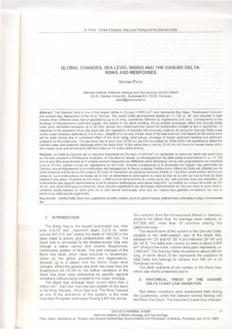
GLOBAL CHANGES, SEA LEVEL RISING AND THE DANUBE DELTA:<br />
RISKS AND RESPONSES<br />
Nicolae Pautru<br />
National lnstitute of Marine Geology <strong>and</strong> Geo-ecology (GEoEcoMAR)<br />
23-25, Dimitrie Onciul Str-, Bucharest RO-70318, Romania<br />
panin@geoecomar.ro<br />
Abstract. The Danube Delta is one of <strong>the</strong> largest <strong>delta</strong>s in Europe (-5800 kmz) <strong>and</strong> represents <strong>the</strong> Upper Pleistocene-Holocene<br />
<strong>and</strong> present-day depocentre of <strong>the</strong> River Danube. The recent Delta development started at -1 1,700 yr. BP <strong>and</strong> includes 5 main<br />
phases when ciifferent lobes had progradations (up to 10 m/a), sometimes followed by regressions (4-6 m/a). Consequently to <strong>the</strong><br />
shortage of Danube-borne sediment supply, due mainly to <strong>the</strong> dams building, strong erosion processes affect <strong>the</strong> Danube Delta<br />
coast zone (shoreline recession up to 20 m/a), except very limited sections where <strong>the</strong> sedimentary budget is still in equilibrium. In<br />
response to <strong>the</strong> expected future <strong>sea</strong> <strong>level</strong> rise, <strong>the</strong> regression of beaches will obviously continue all along <strong>the</strong> Danube Delta coast<br />
(mean coast recession estimate to 3 to 5 m/a.). Despite of a not very critical value of <strong>the</strong> <strong>sea</strong> <strong>level</strong> rise, <strong>the</strong> impact on <strong>the</strong> shore zone<br />
will be quite strong due to combined effect of <strong>the</strong> <strong>level</strong> <strong>rising</strong>, wind set-up, shortage of beach sediment feeding <strong>and</strong> anthropic<br />
pressure on <strong>the</strong> coast area. The <strong>sea</strong><strong>level</strong> rise of more than 20-30 cm (as it is forecasted tor 202O-2030) will significantly affect <strong>the</strong><br />
Danube water <strong>and</strong> sediment discharge within <strong>the</strong> <strong>delta</strong> front. At <strong>the</strong> same time a rise by 20-30 cm will flood <strong>the</strong> lowest areas within<br />
<strong>the</strong> coastal zone <strong>and</strong> will enhance <strong>the</strong> flood risks on <strong>the</strong> entire <strong>delta</strong> territory.<br />
R6sum6, Le Delta du Danube est un des plus importants de l'Europe (-5.e00 km2) et repr6sente le centre de d6p6t des s6diments<br />
du Danube pendant le Pldistoc€ne Sup6rieur, le Holocdne et l'actuel. Le d6veloppement du <strong>delta</strong> actuel a commenc6 il y a -1'1 .700<br />
ans et peut Ctre sous-divis6e en 5 phases pendant lesquelles les diff6rents lobes <strong>delta</strong>iques ont eu des progradations en moyenne<br />
jusqu'd 1Om/an, parfois suivies de rdgressions de .4"6 m/an. Comme cons6quence d la diminution de I'apport des sEdiments du<br />
Danube, due principalement i la construction des barrages sur le fleuve, presque I'entidre zone c6tidre du Delta est affectde par de<br />
fortes 6rosions {retrait de la c6te jusqu'd 20 m/an) i I'exception de quelques secteurs limit6s ou l'6quilibre s6dimentaire est encore<br />
pr6serv6. La mont6e pr6vue du niveau de la mer va d6terminer la continuation du recul du trait de la c6te sur tout le front du <strong>delta</strong><br />
(estim6 d une valeur moyenne de 3-5 mlan). L'effet cumul6 de la mont6e du niveau de la mer, des surcotes dues aux temp€tes, de<br />
la diminution des apports s6dimentaires et de la pression anthropique sera assez important. La mont6e du niveau de la mer de 20-<br />
30 cm vers 202A-2030 pourra influencer d'une manidre significative les d6charges s6dimentaires du Danube dans la zone c6tidre,<br />
certaines zones basses du <strong>delta</strong> pr€s de la c6te seront submerg6s, ainsi que les risques des gr<strong>and</strong>es inondations sur tout le<br />
territoire du <strong>delta</strong> seront augment6s.<br />
Key words: Dan6e Delta, Black Sea, coadalzone, shoreline, er6ion, <strong>sea</strong> <strong>level</strong>, <strong>global</strong> <strong>changes</strong>, sediment load, sedimantary budget, environmental<br />
risk.<br />
1. INTRODUCTION<br />
<strong>the</strong> continent from <strong>the</strong> Schwarzwald Massif in Germany<br />
down to <strong>the</strong> Black Sea. lts drainaoe basin extends on<br />
817,000 km2, more than 15 colntries sharing this<br />
The Blac[ Se4 is <strong>the</strong> largest l<strong>and</strong>locked <strong>sea</strong>: total catchment area.<br />
area 4.2x10⁵ km2, ^maximum depth 2.212 m, water The second term of <strong>the</strong> system is <strong>the</strong> Danube Delta,<br />
volume 547.015 km", bellow <strong>the</strong> depth of 15G200 m <strong>the</strong> situated in <strong>the</strong> north-western part of <strong>the</strong> Black Sea,<br />
deep water is anoxic <strong>and</strong> contaminated with HzS. The between 44'25'<strong>and</strong> 45" 30' N <strong>and</strong> between 28' 45' <strong>and</strong><br />
Black Sea is connected to <strong>the</strong> Mediterranean Sea only 29^46' E. The <strong>delta</strong> plain covers an area of about 5,800<br />
through a ra<strong>the</strong>r narrow <strong>and</strong> shallow Bosphorous- km" of which <strong>the</strong> lower, marine <strong>delta</strong> plain represents ca.<br />
Dardanelles system of straits. The past <strong>changes</strong> of <strong>the</strong> 1,800 km'. The Danube Delta shoreline is about 24O km<br />
Black Sea <strong>level</strong>, which have occurred in Quaternary, long, of which about 75 km represents <strong>the</strong> coastline of<br />
driven by <strong>the</strong> <strong>global</strong> glaciations <strong>and</strong> deglaciations, Kilia Delta <strong>and</strong> belongs to Ukraine <strong>and</strong> 165 km is on<br />
followed up to a certain limit <strong>the</strong> World Ocean <strong>level</strong> Romanian territory.<br />
<strong>changes</strong>. When <strong>the</strong> general <strong>sea</strong> <strong>level</strong> was lower than <strong>the</strong> The o<strong>the</strong>r end-term of <strong>the</strong> system is <strong>the</strong> Black Sea,<br />
Bosphorous sill (32-34 m) <strong>the</strong> fur<strong>the</strong>r variations of <strong>the</strong> which was shortly presented above.<br />
Black Sea <strong>level</strong> were determined by speciflc regional<br />
conditions without being coupled to <strong>the</strong> ocean <strong>changes</strong>.<br />
The Black Sea drainage basin covers more than 2<br />
million km2. The main rivei-<strong>sea</strong> geo-system of this basin<br />
is <strong>the</strong> River Danube - Black Sea one. The River Danube<br />
as one of <strong>the</strong> end-terms of this system, is <strong>the</strong> most<br />
important European wateruuays flowing 2,857 km across<br />
2. HISTORICAL TREND OF THE DANUBE<br />
DELTA COAST LINE MIGRATION<br />
The <strong>delta</strong>ic conditions were established here during<br />
<strong>the</strong> Quaternary, when <strong>the</strong> Danube started flowing into<br />
<strong>the</strong> Black Sea basin. The important Quaternary <strong>changes</strong><br />
GEO-ECO-MAR\NA, U1999<br />
le<br />
National lnstitute of Marine Geology <strong>and</strong> Geo-ecology<br />
Proc. lntern. Workshop on "Modern <strong>and</strong> Ancient Sedimentary Environments <strong>and</strong>Processes" in Moeciu, Romania, OcL &15, 1998
N. Panin - Global Changes, Sea leyel Rrsing <strong>and</strong> <strong>the</strong> Danube Delta<br />
of <strong>the</strong> <strong>sea</strong> <strong>level</strong> strongly influenced <strong>the</strong> Danube Delta spit", <strong>the</strong> <strong>delta</strong>-front advanced beyond <strong>the</strong> present-day<br />
<strong>and</strong> its coastline evolution. The WUrmian regressions, shoreline by 10-15 km.<br />
<strong>and</strong> especially that of <strong>the</strong> Neoeuxinian stage of <strong>the</strong> Black 4. At <strong>the</strong> same time (3,500-1,500 yr. BP) in <strong>the</strong><br />
Sea (<strong>the</strong> minimum at about 18,000 yr. BC), when <strong>the</strong> sou<strong>the</strong>rn part of <strong>the</strong> <strong>delta</strong> area, a little secondary <strong>delta</strong> -<br />
<strong>sea</strong> <strong>level</strong> lowered to -130 + -150 m, brought about <strong>the</strong> <strong>the</strong> "Cosna-Sinoie Delta", was formed by a secondary<br />
intense erosion of much of <strong>the</strong> older Quaternary <strong>delta</strong> distributary named DunavSt. lts front line prograded at<br />
deposits. One can still recognise some remnants of least by 5 km offshore from <strong>the</strong> present shoreline.<br />
<strong>the</strong>se older deposits (assigned to Karangatian <strong>and</strong><br />
Surojskian), preserved behind some relics of <strong>the</strong> 5. The next phase (-2,800 yr. BP - present) is<br />
pre<strong>delta</strong>ic relief. The present-day Danube Delta edifice represented by <strong>the</strong> formation of two new <strong>delta</strong>ic lobes:<br />
(tens to 300-400 m thickness of detritai deposits) was "Kilia Delta" in <strong>the</strong> North, built up by a new Danube<br />
<strong>the</strong>refore formed mainly during <strong>the</strong> Upper Pleistocenedistributary<br />
- Kilia, <strong>and</strong> "St" George ll Delta" in <strong>the</strong> South,<br />
(Karangatian, Surojskian, Neoeuxinian) <strong>and</strong> especially corresponding to a reactivation of <strong>the</strong> $t. George<br />
during <strong>the</strong> Holocene (Panin et al., 1983).<br />
distributary. By <strong>the</strong>n <strong>the</strong> Sulina distributary was partly<br />
The development of <strong>the</strong> Danube Delta during <strong>the</strong> clogged <strong>and</strong> <strong>the</strong> Sulina Delta gradually eroded. Thus,<br />
Holocene time is marked by <strong>the</strong> following main phases during <strong>the</strong> last -2,800 yr. <strong>the</strong> new lobes have prograded<br />
(Panin ef a/., 1983; Panin, 1989, 1998) (Fig.1, 2): by 16-18 Km, while Sulina Delta coast line regressed by<br />
about 10-12 km. The same process of erosion <strong>and</strong> coast<br />
1. "Letea-Caraorman initial spit" phase (11,700- regression (by few km) has been recorded at <strong>the</strong><br />
7,500 yr.BP): <strong>the</strong> coastline was represented by a spit "Cosna-Sinoie Delta" within <strong>the</strong> Portita-Periboina section<br />
located at <strong>the</strong> entrance into <strong>the</strong> "Danube Gulf' at about of <strong>the</strong> littoral zone.<br />
25-30 km West of <strong>the</strong> present <strong>delta</strong> shoreline;<br />
2. The first <strong>delta</strong> of <strong>the</strong> River Danube - "St.<br />
George I Delta" was formed by <strong>the</strong> first Danube<br />
distributary - <strong>the</strong> Paleo-St. George branch in <strong>the</strong> 9,000-<br />
7,200 yr. BP period. In about 2,000 yr. <strong>the</strong> Delta St.<br />
George I has prograded <strong>sea</strong>ward by about I km;<br />
3. The following phase (7,200-2,000 yr. BP) is<br />
represented by <strong>the</strong> development of a new distributary -<br />
Sulina <strong>and</strong> rts <strong>delta</strong>ic lobe - "Sulina Delta". The<br />
maximum progradation was of 30-35 km from <strong>the</strong> "initial<br />
Table 1 Main characteristics of <strong>the</strong> River Danube water <strong>and</strong> sediment discharqes<br />
3. PRESENT.DAY STATE OF THE DANUBE<br />
DELTA COASTALZONE<br />
3.1 Processes <strong>and</strong> dynamic factors controlling<br />
<strong>the</strong> <strong>delta</strong> coastline morphology <strong>and</strong> development<br />
a. River Danube water <strong>and</strong> sediment input<br />
The following table characterises <strong>the</strong> River Danube<br />
water <strong>and</strong> sediment discharges during 1840-1990 period<br />
at <strong>the</strong> entrance into <strong>the</strong> <strong>delta</strong> territory (Bondar ef a/_,<br />
2000).<br />
Characteristic values<br />
Mean multiannual discharoe<br />
Mean annual maximum discharoe <strong>and</strong> date<br />
Mean annual minimal discharse <strong>and</strong> date<br />
Maximum dailv discharoe <strong>and</strong> date<br />
Water Q<br />
6.283 m'/s (198.3 km'/vr.)<br />
9.420 m"/s in 1941<br />
3.160 m'/s in 1863<br />
20,940 m'/s in 07.1897<br />
Sediment discharqe R<br />
1,737 kals (54.8 M Vvr.)<br />
4.780 kois in 1871<br />
224ko/s in 1990<br />
Minimum dailv discharoe <strong>and</strong> date 1.350 m"/s in 10.1921<br />
The sediment discharges presented in <strong>the</strong> Table 1<br />
resulted from a mediation of values measured before<br />
<strong>and</strong> after lron Gate I <strong>and</strong> ll dams building. The average<br />
annual suspended sediment discharge before <strong>the</strong> dams<br />
building was 2,140 Kg.s-' (67,5 mittions Vyr), out of<br />
which s<strong>and</strong>y alluvia ca. 10% (Almazov ef a/., 1963;<br />
Stangik ef a/., 1 988).<br />
After '1970, originates mainly in <strong>the</strong> sediments eroded from <strong>the</strong> river<br />
bottom.<br />
b. Meteorological factors - wind system<br />
consequently to <strong>the</strong> building of lron<br />
Gates I dam (Km.942,95 from <strong>the</strong> Black Sea) <strong>and</strong>,<br />
especially after <strong>the</strong> lron Gates ll (Ostrovul Mare) dam<br />
(Km 864) building in 1983, <strong>the</strong> sediment discharge<br />
decreased catastrophically (Fig. 3): at present, one can<br />
estimate that <strong>the</strong> Danube total average sediment<br />
discharge could not be larger than 35 - 40 million Uyr.,<br />
out of which less than 4 million Uyr. is s<strong>and</strong>y material<br />
(Panin, 1996). This is <strong>the</strong> only amount of s<strong>and</strong>y<br />
sediments contributing yearly to <strong>the</strong> littoral zone<br />
sedimentary budget, which since 1970 became strongly<br />
uncompensated. lt is also obvious that <strong>the</strong> present day<br />
coarse sediment load (bed load) of <strong>the</strong> Danube<br />
The western <strong>and</strong> north-western areas of <strong>the</strong> Black<br />
Sea basin are zones of active atmospheric circulation,<br />
being situated at <strong>the</strong> interference of <strong>the</strong> routes of Aflantic<br />
<strong>and</strong> Polar, Mediterranean <strong>and</strong> Euro-Asian air masses.<br />
Thus, winds exceeding 2mls are recorded for 80-g0% of<br />
a year, winds exceeding 6 m/s for 30-55% <strong>and</strong> those<br />
exceeding 11 m/s tor 4-15o/o. Prevaiiing winds are from<br />
<strong>the</strong> nor<strong>the</strong>rn sector (40-50%); <strong>the</strong> nor<strong>the</strong>rn winds are<br />
also <strong>the</strong> strongest. The frequency <strong>and</strong> duration of storms<br />
from <strong>the</strong> nor<strong>the</strong>rn sector are clearly predominant (more<br />
than 55%).<br />
c. Sea <strong>level</strong> <strong>and</strong> subsidence<br />
The Delta is situated in an area of high mobility of <strong>the</strong><br />
Earth crust, repeatedly affected by strong subsidence<br />
GEO-ECO-MARINA.<br />
4/1 999<br />
National lnstitute of Marine Geology <strong>and</strong> Geo-ecology<br />
Proc' lntern. Workshop on "Modern <strong>and</strong> Ancient Sedimentary Environmeiis <strong>and</strong>processej; in Maeciu, Romanla, oct, g-15. 199g
m'!Kl<br />
,m<br />
l*z<br />
|<br />
.4,<br />
t;<br />
l' ,-t--r.$<br />
N. Panin - Global Changes, Sea Level <strong>and</strong> <strong>the</strong> Danube De,ta<br />
e4.topinr l.<br />
a<br />
'6t<br />
::H<br />
.t-<br />
.F'<br />
9-<br />
-ts<br />
+v<br />
^tOItVt^lto{t<br />
I !l-la|fu.!lrl t<br />
n'l'eor(t -S&tr<br />
Pll-Purehl ll<br />
L il-L6aa ll<br />
lll.lin.r I<br />
t-3*l--:L-l--!<br />
Fig. 1 The Danube Delta geomorphologic-sedimentologic structure.<br />
The map outlines <strong>the</strong> main sets of beach ridges <strong>and</strong> <strong>the</strong> phases<br />
of <strong>delta</strong> development during <strong>the</strong> Holocene.<br />
SII GEORGE //<br />
OTLfT<br />
(1 - Brlt cg<br />
t?-{rrDrl<br />
rl<br />
(l -Pl!!lo, Cta16,(al<br />
!rl<br />
ltt |frlu<br />
t,r o1 ir<br />
r rrl<br />
21<br />
National Institute of Maine Geology <strong>and</strong> Gea-ecology<br />
Proc. Intern. Workshop on "Madern <strong>and</strong> Ancient Sedimentary Environments <strong>and</strong>Pl'ocesses" in Moeciu, Romania, Act. 8-15, 1998<br />
H'
N. Panin - Global Changes, Sea leyel Rarng <strong>and</strong> <strong>the</strong> Danube Delta<br />
-fu"r'<br />
f'o63na-$inoie<br />
N/_{**detta<br />
a% 3.$1.5 K yr. BP<br />
<strong>and</strong> important sediment accumulation. At present <strong>the</strong><br />
subsidence of<strong>the</strong> coastal zone nearby <strong>the</strong> Danube Delta<br />
rs appreciated to 1.$1.8 mm/yr.<br />
The present-day variations of <strong>the</strong> Black Sea <strong>level</strong><br />
depend on <strong>sea</strong>sonal, multiannual or eustatic <strong>changes</strong> of<br />
<strong>sea</strong> water balance as well as on <strong>the</strong> deformation of free<br />
water surface under <strong>the</strong> influence of different external<br />
g\<br />
n I n d c r e r{"<br />
gua.<br />
a sY.<br />
eEtl0<br />
St.George ll<br />
Delta<br />
Fig. 2 The Danube Delta evolution during <strong>the</strong> Horocene <strong>and</strong> correspondent<br />
coastline position <strong>changes</strong> (panin & E. <strong>and</strong> G. lon, 1997)<br />
t t<br />
I<br />
.,. I<br />
t<br />
','n<br />
..,,'*<br />
lr<br />
::;I., f,<br />
'ln J*<br />
f<br />
E<br />
{<br />
''t<br />
IOrCeS.<br />
During <strong>the</strong> last century <strong>the</strong> maregraphic observations<br />
have shown <strong>the</strong> tendency of <strong>rising</strong> by 1.S-4 mm/year of<br />
<strong>the</strong> refative <strong>sea</strong> <strong>level</strong> (2.S95 mm/yr. - Selariu, 1972; 3.71<br />
nT{yr. at $ulina, 2,67 mmlyr. at Constaniza - Bondar,<br />
1989).<br />
22<br />
G EO-ECO.M ARIN A, 4/1 999<br />
National lnstitute of Marine Geatogy <strong>and</strong> Geo_ecotogy<br />
Proc lntem. workshop on 'Modern <strong>and</strong> Ancient Sedimentary Environmeiis <strong>and</strong> processes ,,<br />
in Moeciu, Romania, oct. g-15. 199g<br />
,,t<br />
,l<br />
oi<br />
v<br />
h
N. Panin - Global Changes, Sea Leyel Rislng <strong>and</strong> <strong>the</strong> Danube Delta<br />
DanubeS€dimentDischargeatVaduOiihydrographicatation.Km.24T (1961.1996)<br />
yF54,285x-105108<br />
R'? : o 1492<br />
1 955 1 900<br />
I 965 1970 1 S75<br />
Fig. 3 The River Danube mean annual sediment discharge variation at Vadu Oii hydrographic station (Kn 247).<br />
<strong>and</strong> important sediment accumulation. At present <strong>the</strong><br />
energy is of approximately 2,000 kWh/m (Spdtaru, 1984,<br />
subsidence of<strong>the</strong> coastal zone nearby <strong>the</strong> Danube Delta<br />
1e92).<br />
is appreciated to 1.5-1.8 mm/yr.<br />
The atmospheric circulation <strong>and</strong> o<strong>the</strong>r hydrological<br />
The present-day variations of <strong>the</strong> Black Sea <strong>level</strong><br />
<strong>and</strong> morphological factors determine in <strong>the</strong> Black Sea a<br />
depend on <strong>sea</strong>sonal, multiannual or eustatic <strong>changes</strong> of<br />
general cyclonic water circulation with numerous<br />
<strong>sea</strong> water balance as well as on <strong>the</strong> deformation of free<br />
secondary <strong>and</strong> smaller scale eddies. In <strong>the</strong> north-<br />
water surface under <strong>the</strong> influence of different external western <strong>and</strong> western areas of <strong>the</strong> <strong>sea</strong>, this current, is<br />
forces.<br />
flowing southward towards <strong>the</strong> Bosphorous. Within <strong>the</strong><br />
During <strong>the</strong> last century <strong>the</strong> maregraphic observations Danube Delta coastal area, <strong>the</strong>re is, even during quiet<br />
have shown <strong>the</strong> tendency of <strong>rising</strong> by 1.5-4 mm/year of<br />
periods, a generally southward current characterised by<br />
<strong>the</strong> relative <strong>sea</strong> <strong>level</strong> (2.595 mm/yr. - Selariu, 1972; 3.73<br />
5-50 cm/s velocity depending on <strong>the</strong> water supply of<br />
mm/yr. at Sulina, 2,67 mmlyr. at Constantza - Bondar, rivers <strong>and</strong> <strong>the</strong> Coriolis Force. In addition to this current,<br />
1e89).<br />
<strong>the</strong> winds, of different velocity <strong>and</strong> stability, generate a<br />
Amongst <strong>the</strong> short-term deformational oscillation of<br />
complex current system generally roughly corresponding<br />
<strong>the</strong> <strong>sea</strong> water surface seiches, wind surges <strong>and</strong> tides are<br />
to <strong>the</strong> wind direction, influencing <strong>the</strong> direction <strong>and</strong><br />
to be mentioned. The seiches in <strong>the</strong> north-western <strong>and</strong><br />
spreading of <strong>the</strong> river jet-like wedge.<br />
western areas of <strong>the</strong> Black Sea have periods from few As regards <strong>the</strong> Danube Delta <strong>sea</strong>shore, <strong>the</strong><br />
minutes to 13 hours <strong>and</strong> amplitudes from few longshore sediment drift is directed towards south. lts<br />
centimetres to 2.0 m. The storm surges from nor<strong>the</strong>rn, intensity is high enough to transport <strong>the</strong> coarse-grained<br />
north-eastern, eastern <strong>and</strong> south-eastern directions discharge of <strong>the</strong> Danube many tens of km south of <strong>the</strong><br />
induce <strong>sea</strong> <strong>level</strong> set-up of up to 1,2-1.5 m. The tide in<br />
distributary mouths along <strong>the</strong> shore. Local perturbations<br />
<strong>the</strong> Black Sea has insignificant values (amplitudes of Z-<br />
of southward littoral sediment movement are induced by<br />
11 cm, average period of 12.25 h) (Bondar et at., 1973:<br />
different anthropogenic structures built on <strong>the</strong> shoreline<br />
Sorokin, '1982).<br />
(e.9. <strong>the</strong> eddy circulation south of <strong>the</strong> Sulina jetties)<br />
(Almazov ef a/., 1963; Bondar et al., 1973).<br />
d. Waves, currents <strong>and</strong> longslrore sediment drift<br />
system<br />
3.2. The present-day state of coastal degradation<br />
The wave regime in <strong>the</strong> western <strong>and</strong> nodh-western At present <strong>the</strong> Romanian Danube Delta coast<br />
parts<br />
zone<br />
of <strong>the</strong> Black Sea basin can be characterised as<br />
follows (Cristescu, Diaconu,<br />
',|980):<br />
can be divided into 11 sections with specific dynamic<br />
tranquil (smooth) <strong>sea</strong> <strong>and</strong> equilibrium characteristics. These sections are <strong>the</strong><br />
(waves below 0.2 m) represents 49.1o/o of <strong>the</strong> whole bulk foilowing (Panin, 1976; Giosan et at.,1997) (Fig. 4):<br />
of data concerning <strong>the</strong> waves, wind waves - 33olo <strong>and</strong><br />
swell, 17.9o/o. The most frequent wind waves are 1. Baia de Nord or Baia Musura (Nor<strong>the</strong>rn Bav<br />
recorded<br />
or<br />
along NE direction, corresponding to <strong>the</strong> Musura Bay), situated north of Sulina<br />
prevailing<br />
distributary, li km<br />
wind direction, while from east are recorded long,.with a very low, marshy coast. A tendency<br />
almost<br />
of<br />
40o/o of swell waves. The mean <strong>and</strong> maxrmum clogging by <strong>the</strong> sediment input of Kilia distributarv<br />
heights<br />
is<br />
of wind <strong>and</strong> swelt waves (5.2 m at Constantza. reported.<br />
7.0 m at Sulina at <strong>the</strong> jetties end) are higher for <strong>the</strong><br />
eastern direction for which <strong>the</strong> wind fetch is maximum.<br />
The energy of storm waves reaches important<br />
_<br />
2. Sulina<br />
values:<br />
e.g. on 17-th of February 1979 <strong>the</strong>re was a storm<br />
characterised by 12,242 kWh/m, while usually <strong>the</strong><br />
section, South of Sulina distributary, about<br />
8 km long, with a complex barrier beach, teO by tne<br />
eddy-like cunent generated by Sulina jetties, as well as<br />
artificially, with <strong>the</strong> s<strong>and</strong> dredged from <strong>the</strong> port of Sulina.<br />
GEO-ECO-MARINA. 4/1 999<br />
L-t<br />
National lnstitute of Marine Geology <strong>and</strong> Geo_ecology<br />
Proc. Intem- workshop on "Modern <strong>and</strong> Ancient Sedlmentary Environmeiis anabrocesses,,ln Moeciu, Romania, oct. g-1s. lgg1
45"00 r<br />
44"0$<br />
N. Panin - Globai Changes, Sea Level Rising <strong>and</strong> <strong>the</strong> Danube Detta<br />
ROMANIA<br />
5'\<br />
\?l<br />
30"00<br />
Fig' 4 Romanian Black Sea ooast <strong>and</strong> <strong>the</strong> longshore sedment transport model for <strong>the</strong> Danube Delta coast. The<br />
sections described in <strong>the</strong> text are shown on <strong>the</strong> figure (numbers 1 to 11). Sediment drifi (arrows) <strong>and</strong> transport<br />
rates in thous<strong>and</strong>s of cubjc meters pgr year (figures-by.<strong>the</strong> arrows). Ciicled + <strong>and</strong> - represent idvancing inO<br />
retreating sections respectively (after Giosan et al.,,lgg7\.<br />
GEO-ECO.MARINA, 4/1 999<br />
Nationa! lnstitute of Marine Geotogy <strong>and</strong> Geo-ecology<br />
Proc' lntern.workshop on "Madern <strong>and</strong> Ancient sedimentary Envkonmeits<strong>and</strong>processes" in Moeciu, Romania, oct. B-Is. lggB
\-<br />
N. Panin - Global Changes, Sea Level Rising <strong>and</strong> <strong>the</strong> Danube Delta<br />
This sector is slowly prograding near <strong>the</strong> jetties (in its<br />
nof<strong>the</strong>rn paft) <strong>and</strong> is almost in equilibrium in its central<br />
<strong>and</strong> sou<strong>the</strong>rn parts (Fig.5).<br />
'irr *<br />
'ilr R<br />
t6<br />
lg&<br />
'p $<br />
$n<br />
*s<br />
$s<br />
'&<br />
'F<br />
tB<br />
\s<br />
is<br />
s<br />
is<br />
Ie<br />
tn.--E<br />
s<br />
c<br />
s<br />
i<br />
s<br />
s<br />
d lsRr<br />
s<br />
$r*<br />
$-<br />
3 w<br />
Vadanei 5E<br />
4.-...^"<br />
{<br />
a<br />
U)<br />
Fig. 5 The evolution of <strong>the</strong> coastline of <strong>the</strong> Danube<br />
Delta Front in <strong>the</strong> Sulina -St.George section<br />
during <strong>the</strong> last century<br />
Y<br />
N. Panin - Global Changeg Sea Level Rising <strong>and</strong> <strong>the</strong> Danube Delta<br />
George (Kedrilles), <strong>the</strong> secondary arm, named Cdinelui,<br />
divided into Seredne <strong>and</strong> Turcului distributaries. The St.<br />
George secondary <strong>delta</strong> front is prograding <strong>and</strong> is<br />
characterised by very fine-grained sediments.<br />
7. Ciotic-Perisor section, about 20 km long, is subject The <strong>global</strong> change <strong>and</strong> <strong>the</strong> <strong>sea</strong> <strong>level</strong> (SL) rise will<br />
of very strong erosion (10-20 m/yr. ) <strong>and</strong> a very<br />
certainly affect <strong>the</strong> state of <strong>the</strong> <strong>delta</strong> <strong>and</strong> coastal zone<br />
negative littoral budget of sediments. The coastline ecosystem. The impact will depend on synergetic effect<br />
regressed since 1950 more than 500 m <strong>and</strong>, thus, lakes of factors controlling <strong>the</strong> <strong>delta</strong>ic <strong>and</strong> littoral processes<br />
as Zitonul Mare became bay opened towards <strong>the</strong> <strong>sea</strong>, described above as well as on <strong>the</strong> <strong>delta</strong> plain <strong>and</strong><br />
after quite entire destruction of a narrow barrier beach. shoreline elevation, which can give us <strong>the</strong> basis for a<br />
general forecasting of possible environmental <strong>changes</strong><br />
8 Perisor-Periteasca section corresponds to <strong>the</strong> <strong>and</strong> flooding risk areas.<br />
littoral accumulative body Perisor. The coast line of this<br />
section is almost stable, suffering 5-10 m movements<br />
2",(cm)<br />
Isacceo<br />
Gal/f,e<br />
t-<br />
C@bl lzrrrail<br />
Gauge<br />
I<br />
laf-;Ho&sb,<br />
I<br />
I<br />
'gLT*o.J'f;L<br />
I<br />
is;rgogd";<br />
River Danuhe<br />
ce,?arstceorge i,llahmdia<br />
nrlcea Gauge &uge<br />
nuf* | |<br />
ra<br />
UzlitE<br />
(9tr@<br />
T<br />
I<br />
I<br />
Atnavatdranrd<br />
&uge<br />
I<br />
I<br />
..4<br />
rykrygg,!!st!9!ds<br />
'{sfr.rral levees<br />
"1lvat'fea<br />
Fig. 7 Longitudinal profile of <strong>the</strong> St.George distributary right bank (natural levee <strong>and</strong> protection dykes)<br />
<strong>and</strong> <strong>the</strong> high of water free surface at different water discharges (after Bondar ef a/., 2000).<br />
back-<strong>and</strong>-forth depending of wave energy <strong>level</strong> of <strong>the</strong><br />
considered year.<br />
4. IMPACTS OF CLIMATE CHANGE AND SEA<br />
LEVEL RISE ON THE ROMANIAN DANUBE<br />
DELTA SHORELINE<br />
4.1. Danube Delta Plain <strong>and</strong> <strong>sea</strong> shore zone<br />
hypsometry<br />
9. Periteasca-Portita section, 15 km long, represents The marine <strong>delta</strong> plain is a very low area with<br />
<strong>the</strong> beach barrier of <strong>the</strong> inter beach-ridge depression marshes, lakes <strong>and</strong> numerous old beach ridges, which in<br />
Leahova <strong>and</strong> is characterised by a very strong longshore certain zones generate, by juxtaposition, large<br />
drift <strong>and</strong> active erosion of <strong>the</strong> coast.<br />
accumulative littoral bodies (<strong>the</strong> main of <strong>the</strong>m are Letea,<br />
Caraorman<br />
'l0<br />
<strong>and</strong> Sdr6turile) (Fig.1). The interdistributary<br />
Portita-Periboina section, about 18 km long, is <strong>and</strong> inter beach-ridge depressions are lying only a few<br />
<strong>the</strong> beach barrier of <strong>the</strong> lagoon complex Razim-Sinoie. lt cm above (<strong>and</strong> sometimes even below) <strong>the</strong> SL, while <strong>the</strong><br />
is subject of a strong erosion <strong>and</strong> intensive southward beach ridges have altitudes of few tens of cm to 1.7 m<br />
longshore sediment drifr. The section is protected by a above <strong>the</strong> <strong>sea</strong> <strong>level</strong>. The only more elevated zones of<br />
setback line of embankments limiting losses of beach <strong>the</strong> marine <strong>delta</strong> plain are <strong>the</strong> above mentioned<br />
s<strong>and</strong> by ovenvashing.<br />
accumulative bodies, with mean heights of about 1.0 -<br />
1.5 m, <strong>and</strong> in certain places with dunes reaching<br />
11, Chituc section, about 20 km long, is a littoral altitudes up to 12 m.<br />
accumulative body built up with <strong>the</strong> material eroded from ln <strong>the</strong> fluvial <strong>delta</strong> plain one notes as more elevated<br />
<strong>the</strong> Cosna-Sinoie Delta. The coastline of this sector is morphological elements <strong>the</strong> fluvial natural levees <strong>and</strong><br />
temporarily eroded <strong>and</strong> is characterised by strong some old lacustrian spits (e.9. Stipoc). For example, <strong>the</strong><br />
longshore drift of beach sediments.<br />
natural levees heights are starting near <strong>the</strong> river mouth<br />
Lo GEOECO_MARiNA.4/1999<br />
National lnstitute of Maine Geology <strong>and</strong> Geo-ecology<br />
Proc. lntem. Workshop on "Modern <strong>and</strong> Ancient Sedimentary Environmeiis <strong>and</strong> Processes'; in Moeciu, Romania, oct. g-15. lggg<br />
I<br />
oE<br />
gl<br />
$-<br />
f;r<br />
i;<br />
I<br />
I<br />
:<br />
I<br />
o<br />
I x<br />
IE't-<br />
.di<br />
It '$<br />
r<br />
at<br />
at<br />
al.<br />
Ft<br />
D in<br />
irta
iEA<br />
IBE<br />
will<br />
)ne<br />
ect<br />
ies<br />
ind<br />
a<br />
res<br />
N. Panin - Global Changes, Sea Leyel Risrng <strong>and</strong> tha Danube Delta<br />
at +20-30 cm above SL, <strong>and</strong> finish at +450 cm above SL<br />
at <strong>the</strong> <strong>delta</strong> apex (Ceatal-lzmail) (Lepsi, 1942, Eondar e/<br />
aL, 2A0Q (Fig.7). The interdistributary depressions (as<br />
Fortuna-Papadia, Matita-Merhei, Uzlina-Gorgova,<br />
Dranov, Rosu-Lumina etc.) are characterised by an<br />
infinity of lakes of different size <strong>and</strong> depth. The water<br />
inflow/outflow into/from <strong>the</strong>se depressions is realised<br />
trough numerous natural channels <strong>and</strong> crevasses,<br />
artificial canals <strong>and</strong>, at high waters, by overflowing <strong>the</strong><br />
natural levees.<br />
The present-day s<strong>and</strong>y beach barrier is also very low<br />
(<strong>the</strong> upper berms at +A.7 - +1.5 m), <strong>the</strong> lowest sections<br />
being: Gdrla lmputita-Cdsla Vddanei, Ciotic-Perisor <strong>and</strong><br />
Portita-Periboina (see chapter 3.2). These sections are<br />
at <strong>the</strong> same time, <strong>the</strong> most vulnerable zones of <strong>the</strong> <strong>delta</strong><br />
coastline.<br />
The free water table within <strong>the</strong> <strong>delta</strong> depends of <strong>the</strong><br />
hydrological regime of <strong>the</strong> River Danube (Lepsi, 1942;<br />
Almazov et a1,,1963; Panin, '1992;<br />
mean slope of <strong>the</strong> free water surface within <strong>the</strong> <strong>delta</strong><br />
territory has a value of 5.35 cm/km (Fig. 8).<br />
For an easier appreciation of <strong>the</strong> river water free<br />
table within <strong>the</strong> <strong>delta</strong> tenitory one define <strong>the</strong> so named<br />
'hydro-degree",<br />
representing one tenth of <strong>the</strong> highest<br />
water <strong>level</strong> at a given point along <strong>the</strong> river course.<br />
Consequently, <strong>the</strong> hydro-degree has different values for<br />
different zones of <strong>the</strong> <strong>delta</strong> <strong>and</strong> along <strong>the</strong> river as follows<br />
(Lepsi, '1942):<br />
Sulina - 8.1 cm, Vilcov -'10 cm, Tulcea -<br />
47,7 cm, lsaccea - 54,2 cm, Galati - 64,4 cm, Br6ila -<br />
69.3 cm. The table 2 points out <strong>the</strong> non-flooded area at<br />
different <strong>level</strong>s of <strong>the</strong> River Danube water.<br />
4.3. lmpacts on rainfall <strong>and</strong> water flow <strong>and</strong><br />
resources<br />
Bondar et al.,2000\.<br />
At <strong>the</strong> mean lowest river water <strong>level</strong>, <strong>the</strong> free water<br />
surface is slightly deeping <strong>sea</strong>ward from <strong>the</strong> <strong>delta</strong> head<br />
(Ceatal lzmail), where it is at about 44 cm above SL, to<br />
Tulcea at 39 cm <strong>and</strong> to Sulina at 0 cm: its average slope<br />
is of 0.54 cm/km, At <strong>the</strong> mean high water <strong>level</strong>, with <strong>the</strong><br />
height of <strong>the</strong> water at Tulcea of 293 cm above SL <strong>and</strong> at<br />
Sulina of 49 cm, <strong>the</strong> mean slope of <strong>the</strong> free water table<br />
is 3.3 cm/km. At <strong>the</strong> highest river water <strong>level</strong> (recorded in<br />
1897), with <strong>the</strong> water <strong>level</strong> at Ceatal lzmail of 531 cm, at<br />
Tulcea ol 477 cm <strong>and</strong> at Sulina of 81 cm above SL. <strong>the</strong><br />
In accordance with <strong>the</strong> generally accepted models<br />
<strong>the</strong> most important <strong>changes</strong> in <strong>the</strong> climate would be <strong>the</strong><br />
northward shift of climate zones, <strong>the</strong> leng<strong>the</strong>ning of<br />
summer at <strong>the</strong> expense of o<strong>the</strong>r <strong>sea</strong>sons, <strong>the</strong> <strong>changes</strong><br />
of winter cyclonic patterns etc.<br />
The models show that <strong>the</strong> increase of <strong>the</strong> mean<br />
temperature by 1.50C in <strong>the</strong>se conditions will determine<br />
a decline with at least 10% of <strong>the</strong> river flow <strong>and</strong> this fact<br />
combined with a decrease of water energy by <strong>the</strong> <strong>rising</strong><br />
of <strong>the</strong> base <strong>level</strong> will substantiallv lower <strong>the</strong> fresh water<br />
input into <strong>the</strong> <strong>sea</strong>.<br />
Table 2 Non-flooded areas within <strong>the</strong> Danube Delta at different <strong>level</strong>s of <strong>the</strong> river water (after Lepsi, 1942 with modifications)<br />
Geomorphologic<br />
Cafeooriec<br />
Non flooded area (ha)<br />
Lowest waters<br />
3 hvdro-deorees<br />
Low waters<br />
4hd<br />
Ordinary waters<br />
5-6 hd<br />
Highest waters<br />
1o hd<br />
Natural fluvial levees 19.757 15,343 9,850<br />
Lacustrine spits 3,005 2,607 2.210 30<br />
Present dav barrier beach 2,400 2.390 2.380 1.800<br />
Geomorphologic<br />
Cateoories<br />
Non flooded area (ha)<br />
Littoral accumulative bodies.<br />
of which:<br />
26,215<br />
x,811<br />
21,410<br />
10,000<br />
- Letea (max.+'l 2,6 m)<br />
- Caraorman (max. +6.5m)<br />
- Saraturile<br />
TOTAL<br />
12,714<br />
5,540<br />
5,465<br />
72,542<br />
1 2,1 85<br />
4,565<br />
4,990<br />
62 13'l<br />
11,660<br />
3,590<br />
4,51s<br />
51.045<br />
7,915<br />
165<br />
2,000<br />
1.7 -7-7<br />
E<br />
Lesser <strong>and</strong> more erratic precipitation will reduce <strong>the</strong> of cummulated effect of <strong>the</strong> SL <strong>rising</strong>, wind set-up, <strong>the</strong><br />
groundwater recharge <strong>and</strong> will disbalance <strong>the</strong> fresh shortage of beach feeding by decreased river-borne<br />
versus marine water equilibrium. Despite an increased sediment input (especially of <strong>the</strong> River Danube) <strong>and</strong>, of<br />
need for irrigation water, <strong>the</strong> average storage in <strong>the</strong> course <strong>the</strong> anthropic pressure on <strong>the</strong> coast area.<br />
reseruoirs will fall as a consequence of decreased river According to Bruun <strong>the</strong>ory <strong>and</strong> formulas <strong>and</strong> using <strong>the</strong><br />
flow <strong>and</strong> participation <strong>and</strong> increased evapo-transpiration. specific data for Romanian beaches we can find average<br />
Reduction of rainfall during <strong>the</strong> hot summer period might values for coast recession of 3-5 m/yr.<br />
cause deficiency in soil moisture, thus degrading soil The change of <strong>the</strong> base energy <strong>level</strong> will diminish<br />
structure <strong>and</strong> fertility <strong>and</strong> finally affecting <strong>the</strong> agricultural significantly <strong>the</strong> water <strong>and</strong> <strong>the</strong> sediment discharge of <strong>the</strong><br />
production.<br />
Danube River. A very rough model of <strong>the</strong> SL rise impact<br />
on <strong>the</strong> Danube water <strong>and</strong> sediment discharges within <strong>the</strong><br />
4.2. lmpacts on <strong>the</strong> Danube Delta territory <strong>and</strong> <strong>delta</strong> territory shows (Panin, 1992) that a base-<strong>level</strong> rise<br />
coastal zone.<br />
by 2G30 cm can be significant (inducing reductions<br />
larger than 10olo) only for free water table slopes less<br />
f n response to <strong>the</strong> forecasted for 2020-2030 SL rise than 1.1 cm/km (at a river water <strong>level</strong> of two hydro-<br />
with 20-30 cm, <strong>the</strong> regression of beaches will, obviously, degrees). The perturbations produced by <strong>the</strong> base-<strong>level</strong><br />
continue all along <strong>the</strong> north-western <strong>and</strong> western Black <strong>rising</strong> could be shortly presented as follows:<br />
Sea coast. Despite a not critical value of SL rise, <strong>the</strong> - a rise of 20 cm of SL will produce a decrease of<br />
impact on <strong>the</strong> shore zone will be strong enough because water discharge by 1Oo/o at a free water table (FWT)<br />
GEO-ECO-MAR[NA,4/1999<br />
21<br />
National lnstifuta of Maine Geology <strong>and</strong> Geo-ecology<br />
Proc. lntem- Workshop on "Modern <strong>and</strong> Ancient Sedimentary Environments <strong>and</strong>Processes" in Moeciu, Romania, OcL &15, 1998
N. Panin - Global Changes, Sea Level Rising <strong>and</strong> <strong>the</strong> Danube Delta<br />
Fig. I lsolines of <strong>the</strong> free water surface in <strong>the</strong> Danube Delta at a river water discharge of 1 5,000 m3.sl<br />
(after Bondar ef a/., 2000).<br />
sfope of 1.143 cm/km <strong>and</strong> by 260/o at a FWT slope of<br />
0.54 cm/km (at <strong>the</strong> lowest water <strong>level</strong>), <strong>the</strong> current<br />
vefocity will decrease by 12o/o <strong>and</strong> respectively 28,6 o/o<br />
<strong>and</strong>, correspondingly its sediment transport capacity will<br />
decline;<br />
- a rise by 30 cm of SL will produce a decrease of <strong>the</strong><br />
water dischargeby 160/o for a FWT slope of 1.'143 cm/km<br />
<strong>and</strong> by 47o/o for that of 0.57 cm/km. The mean current<br />
velocity will decrease by 19o/o <strong>and</strong> respectively 50o/o.<br />
The reduced fresh water input would influence <strong>the</strong><br />
general salinity of <strong>the</strong> Black Sea especially when <strong>the</strong><br />
general SL will rise continuously. That involve a greater<br />
supply of saline Mediterranean water by <strong>the</strong> bottom<br />
Bosphorous current <strong>and</strong> a decrease of <strong>the</strong> thickness of<br />
<strong>the</strong> less saline superficial layer of <strong>the</strong> Black Sea.<br />
At <strong>the</strong> Danube distributaries mouth zone <strong>the</strong><br />
penetration of <strong>the</strong> salt wedge deeper upstream into <strong>the</strong>ir<br />
course will create a significant disturbance in <strong>the</strong><br />
processes oftransfer of bed-load to <strong>the</strong> mouth bar <strong>and</strong><br />
fur<strong>the</strong>r to <strong>the</strong> littoral zone. The diminished sediment input<br />
would induce a greater deficit in <strong>the</strong> sedimentary budget<br />
of <strong>the</strong> littoral zone.<br />
As regards <strong>the</strong> <strong>delta</strong>ic shore, a rise of SL by 20-30<br />
cm corresponds to an equivalent river water rise with of<br />
at least 34 hydro-degrees. This means that a very<br />
extended area of <strong>the</strong> <strong>delta</strong> nearbv <strong>the</strong> shore zone would<br />
GEO-ECO-MARIN A, 4/1 I 99<br />
National lnstitute of Marine Geology <strong>and</strong> Geo-ecology<br />
Proc. lntem. Workshop on "Modern <strong>and</strong> Ancient Sedimentary Environments <strong>and</strong> Processes" in Moeciu, Romania, Oct. &1 5, 1998<br />
b<br />
d<br />
t I<br />
I
I<br />
i<br />
I<br />
l-<br />
REFERENCES<br />
N. Panln - Gtobal Changes, Sea Level Riing <strong>and</strong><strong>the</strong> Danube Delta<br />
be flooded <strong>and</strong> also greater flood risks on <strong>the</strong> entire CAsla Vddanei section which corresponds to <strong>the</strong> Rosu<strong>delta</strong><br />
territory will occur (Panin, 1992).<br />
Lumina interdistributary depression <strong>and</strong> Ciotic-Perisor<br />
The <strong>delta</strong>ic coast will be reshaped by marine section <strong>and</strong> lesser in <strong>the</strong> Portiia-Periboina zone<br />
processes, but in <strong>the</strong> more vulnerable sections as G6rla (corresponding to <strong>the</strong> lagoon complex Razim-Sinoie)<br />
lmputita-Cdsla V6danei, Ciotic-Perisor <strong>and</strong> Portita- where <strong>the</strong> beach barrier is at present protected by a<br />
Periboina conditions will be ga<strong>the</strong>red to transform <strong>the</strong> setback line of embankments limiting losses of beach<br />
corresponding intra<strong>delta</strong>ic depression or lagoon areas material by ovenivashing.<br />
into bays. Such risk is greater in <strong>the</strong> G6rla lmputita -<br />
ALMMOV A.A., BONOAR C,, DIACONU C., GHEDERIM VFTURIA, RossETTr c., REy F., (eds), 1931, La Commission Europ6enne<br />
MIHAILoVA.N., MITA P., NICHIFoRoV I,D., RAI I,A., RODIONOV du Danube et son oeuvre de 1856 a 1931 . lmprimerie<br />
N.A., SrAuescu S., STANESCU V., VAGHIN N,F., 1963, Zona Nationale. Paris. 499 p.<br />
de virsare a Dunirii. Morfografie hidrologic6, 396 p., Ed. SELARIU O.,1972, Asupra oscilatiilor de nivel ale Mtrii Negre la<br />
Tehnic6, Bucuregti.<br />
Constanta. Stud. Cercet. Geogr. asupra Dobrogei, Soc.<br />
BoNDAR c., SrArE 1., RoVENTA V,, 1973, Marea Neagr6 in zona St.Geogr., Fil. Constanla<br />
litoralului romAnesc. Monografie hidrologice. lMH, 516 p., SoRoKtN 1., 1982, The Black Sea. Ed. Nauka Acad. Sc. USSR:<br />
Bucuresti.<br />
216 p., Moskva.<br />
BoNDAR C., 1989, Trends in <strong>the</strong> evoiution of <strong>the</strong> mean Black SPATARU A., 1984, Re<strong>sea</strong>rch Programme for Coastal Protection<br />
Sea <strong>level</strong>. Meteorology <strong>and</strong> Hydrology, 19, 2, 23-28, Works, Hydraulics Re<strong>sea</strong>rch, XXX, 159-214, Bucuresti.<br />
Bucuresti.<br />
SPATARU A., 1992, Cercetiri hidraulice pentru protectia plajelor.<br />
BoNDAR C., 1993, Secular evolution of some components of <strong>the</strong><br />
Studii de hidraulicd, XXXlll, 299-314, Bucuregti.<br />
hydrological Danube regime <strong>and</strong> of <strong>the</strong> mean <strong>level</strong> of <strong>the</strong><br />
STANCTK<br />
Black Sea. Proc. World Coast Conf.. 891-893.<br />
4., JovANovrc S. ef a/., 1988, Hydrology of <strong>the</strong> river<br />
Danube. Perioda Publ. House: 271 p..Bratislava.<br />
BoNDAR C., BUTA CARMEN. HARABAGIU ELENA, 1994. Variation<br />
<strong>and</strong> trend of <strong>the</strong> water, sediment <strong>and</strong> salt runoff for <strong>the</strong><br />
Danube River at <strong>the</strong> inlet in our country, during <strong>the</strong> period<br />
18210-1992. XVll-th Conf.of <strong>the</strong> Danube Countries on<br />
Hydrological Bases of Water Management, Budapest, 5-9<br />
Sept.,1994,671-676.<br />
BoNDAR c., N. PANTN, G. NrccoLrNt, 2000, The Danube Delta<br />
Hydrologic DataBase <strong>and</strong> Modelling. In Final Report EC:<br />
"Fluxes of greenhouse gases in <strong>the</strong> north-western region of<br />
<strong>the</strong> Black Sea coastal zone: lnfluence of <strong>the</strong> Danube River<br />
System', 35 p., Romania-ltaly.<br />
CRlsTEscU T.M., DrAcoNU V., 1980, Energy aspects of <strong>the</strong> wind<br />
profile structure over <strong>the</strong> wave field. Cercetdri Marine, 13,<br />
17-25, Constanta.<br />
GIOSAN L., BOKUNIEWICZ H., PANIN N., POSTOLACHE I., 1997,<br />
Longshore Sediment Transport Pattern along Romanian<br />
Danube Delta Coast. Geo-EcoMarina,2, 11-24, Bucharest.<br />
HARTLEY CH.A., 1862, Description of <strong>the</strong> Danube <strong>and</strong> of <strong>the</strong><br />
works, recently executed at Sulina Mouth. Proc.lnst.of Civil<br />
Engineering, London.<br />
LEPSI 1., 1942, Materiale pentru studiul Deltel Dundrii. I, Bul.<br />
Muz. Regional Bassarabia, 10, 94-325, Chisin6u.<br />
PAN|N N., 1976, Some aspects of fluvial <strong>and</strong> marine processes<br />
in <strong>the</strong> Danube Delta. An. Inst. Geol. Geophys, 50, 149-165,<br />
Bucuresti.<br />
Pnntru N., 1989, Danube Delia. Genesis, evolution <strong>and</strong><br />
sedimentology. Rev. Roum. G6ol, G6ophys. G6ogr.,<br />
Ser.G6ographie, 33, 25-36, Bucuresti.<br />
PAN|N N., 1992, lmpacts of expected climate <strong>changes</strong> <strong>and</strong> <strong>sea</strong><strong>level</strong><br />
rise on Romanian Black Sea shore, especially on <strong>the</strong><br />
Danube Delta area. In: lmplications of Climate Change in <strong>the</strong><br />
Black Sea Region , Editor: Macram Gerges, UNEP (Oceans<br />
<strong>and</strong> Coastal Areas Programme Activity Centre) WG.,19/<br />
contribution 8, 1-1 1 , lstanbul.<br />
PAN|N N., 1996, Danube Delta. Genesis, evolution, geological<br />
setting <strong>and</strong> sedimentology. Geo-Eco-Marina, 1, 7-23,<br />
Bucharest.<br />
PANrN N., 1998, Danube Delta: Geology, Sedimentology,<br />
Evolution. Ass. Sedimentologistes Frangais, 66,<br />
Fontaibleau.<br />
PANIN N,, PANIN STEFAM, HERZ N., NOAKES J.E., 1983,<br />
Radiocarbon dating of Danube Delta deposits. Quaternary<br />
Re<strong>sea</strong>rch,'lS, 249-255, Washington,<br />
GEO-ECO.MARINA,41999<br />
29<br />
National lnstitute of Maine Geology <strong>and</strong> Geo-ecology<br />
Proa. lntem. Workshop on "Modern <strong>and</strong> Ancient Sedimentary Environments <strong>and</strong> Processes" in Moeciu, Romania, OcL 8-15, 1998