talking point - Rhondda Cynon Taf
talking point - Rhondda Cynon Taf
talking point - Rhondda Cynon Taf

Create successful ePaper yourself
Turn your PDF publications into a flip-book with our unique Google optimized e-Paper software.
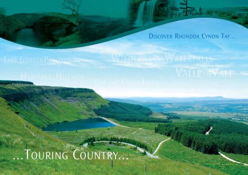
...TOURING COUNTRY...<br />
DISCOVER RHONDDA CYNON TAF...
WELCOME! • CROESO!<br />
The <strong>Rhondda</strong>, the <strong>Cynon</strong>, the <strong>Taf</strong>, three rivers which have cut deep into the coalfield plateau to create<br />
the distinctive landscape in which the teeming towns and villages of the valleys, strung together by<br />
necklaces of terraced houses, are framed in the magnificent décor of the mountains which tower above<br />
them, aloof and eternal sentinels to the parade of history below.<br />
Silurian warlords, Roman legions, Arthur’s warriors, Welsh chieftains and Llantrisant bowmen; later,<br />
awesome preachers ministering to the thousands of settlers who came from every part of the British<br />
Isles and Europe to forge iron or win the coal from the rich seams which powered the world.<br />
Now, in our own time, the great furnaces are cold and the mines and their spoil heaps are largely gone,<br />
but the people are still here, still living in the old terraces, hewn from the Pennant Stone of the mighty<br />
hills above. Nowhere else in the world will you find such a diverse country, or such pride and passion,<br />
or such a warm welcome - we invite you to discover <strong>Rhondda</strong> <strong>Cynon</strong> <strong>Taf</strong>.<br />
3<br />
www.rhondda-cynon-taf.gov.uk/visiting Tel. 01443 424085
STARTING YOUR TOUR<br />
4<br />
We have devised five tours which will help you to<br />
discover <strong>Rhondda</strong> <strong>Cynon</strong> <strong>Taf</strong>. All the tours start<br />
from or are based in Pontypridd , 12 miles north<br />
of Cardiff and 8 miles north of Junction 32 where<br />
the M4 and the A470 expressway meet. From the<br />
north the A465 Heads of the Valleys Road meets<br />
the A470 at Merthyr Tydfil.<br />
TAFF GORGE & PONTYPRIDD<br />
HERITAGE AND HILLSIDE<br />
WILDERNESS AND WATERFALLS<br />
VALLEY AND VALE<br />
CYNON COAL AND IRON
Tour 1<br />
TAFF GORGE & PONTYPRIDD<br />
Discover the <strong>Taf</strong>f Gorge and Pontypridd, gateway to the Valleys<br />
<strong>talking</strong> <strong>point</strong><br />
...the Welsh National anthem, Hen Wlad fy<br />
Nhadau was composed in Pontypridd in 1856<br />
by Evan James and his son James James<br />
5<br />
www.rhondda-cynon-taf.gov.uk/visiting Tel. 01443 424085<br />
Discover the <strong>Taf</strong>f Gorge and Castell<br />
Coch, the Marquis of Bute’s ‘fairytale<br />
castle’ and Pontypridd, nestling at<br />
the foot of steep, wooded slopes<br />
where the River <strong>Rhondda</strong> joins the<br />
River <strong>Taf</strong>f, a bustling, traditional<br />
market town, a place of curiosities<br />
and characters, a town which needs<br />
to be discovered on foot.
The A470 dual carriageway northwards from Cardiff, Wales’<br />
bustling capital city, and home of the Millennium Stadium,<br />
pierces the M4 at Junction 32 and enters <strong>Rhondda</strong> <strong>Cynon</strong><br />
<strong>Taf</strong> through the <strong>Taf</strong>f Gorge where Castell Coch stands guard,<br />
a Wagnerian folly well suited to its dramatic setting.<br />
Pontypridd, our touring base, can be reached in a matter of<br />
minutes, but it is well worth transferring to the old road up<br />
the <strong>Taf</strong>f Valley, the A4054. <strong>Taf</strong>f’s Well was originally<br />
developed as a small spa town, the spring has been noted<br />
for its healing powers since the middle ages if not Roman<br />
times. More recently Mynydd y Garth, the mountain above<br />
the town was the setting for the Hugh Grant film “The<br />
Englishman who went up a Hill and Came Down a<br />
Mountain”.<br />
Castell Coch<br />
This late nineteenth-century 'fairytale'-style castle is<br />
built on medieval remains and was designed for the<br />
third Marquis of Bute by William Burges. It is<br />
lavishly decorated and furnished in the Victorian<br />
Gothic style; a Romantic vision of the Middle Ages<br />
6
Two miles further north we come to Nantgarw, once famous for its<br />
China works, now commemorated in a museum. The brainchild of<br />
William Billingsley who wanted to produce quality, soft-paste<br />
China, the Works was established in 1813, but unfortunately the<br />
manufacturing process was not perfected, and the high<br />
proportion of reject pieces made his venture too costly to sustain.<br />
Nantgarw China was produced for only a short period in the early<br />
19th century, but the pretty flower patterns of Nantgarw Ware are<br />
highly prized by collectors.<br />
The A470 is easily re-joined from here although a short<br />
detour along the A468 will take us to Caerphilly Castle, one<br />
of the great medieval castles of western Europe and a<br />
revolutionary masterpiece of military planning.<br />
Pontypridd is then just a few miles further on, and<br />
although the valley floor is heavily industrialised all the<br />
way, the mountain slopes above are dotted with dairy<br />
and sheep farms. A narrow road up to the right at<br />
Dynea gives access to the slopes of Mynydd Eglwysilan<br />
and Cwrt-y-felin Farm where <strong>Taf</strong>f Valley Quad Bike<br />
and Activity Centre offers a wealth of outdoor<br />
sporting activities to visitors, including archery, claypigeon<br />
shooting and buggy trails.<br />
7<br />
During the19th century, Pontypridd was a<br />
boom town, a centre of heavy industry and coal mining, and<br />
built an enviable reputation for culture and sport which today is as strong as<br />
ever. Pontypridd Rugby Club and the boot of record <strong>point</strong>s scorer Neil Jenkins are<br />
famous the world over, and there are excellent indoor and outdoor facilities at<br />
the Hawthorn Leisure Centre. Opera stars Stuart Burrows and Sir Geraint Evans<br />
and pop star Tom Jones were all born in the surrounding villages, whilst the<br />
Welsh National anthem Hen Wlad fy Nhadau (Land of my Fathers) was composed<br />
here in 1856 by Evan James and his son James James – there is a fine memorial<br />
to them by sculptor Goscombe John in Ynysangaharad Park. The park is only a<br />
stones throw away from the busy shopping centre and is a place of gardens,<br />
putting greens and a childrens outdoor pool. Green spaces provide fine views of<br />
the surrounding mountains and is the location for many major events, including<br />
international cricket and pop concerts.
Pottery of a different sort is made at the World of Groggs in Trefforest, just south<br />
of the town centre on the A4054. Here, some 40 years ago, craftsmen John Hughes<br />
and Richard Hughes began creating caricature figurines called Groggs and now<br />
have a studio and business of international repute. Groggs have been made of pop<br />
stars, politicians, miners and sheep, but the most famous ones are undoubtedly<br />
those which celebrate Rugby players from Wales and around the world: Gareth<br />
Edwards, Barry John, Neil Jenkins, Gavin Hastings, Laurence Dallaglio, Philippe<br />
Sella, Keith Wood and many, many more!<br />
8
The performing arts in the town are well served by the Muni Arts<br />
Centre where events as diverse as a tribute to Abba and a Jack and<br />
the Beanstalk pantomime have taken place. Concerts also take<br />
place in the many churches and chapels as well as at the<br />
University. And like all market towns, Pontypridd really comes alive<br />
on market days. Every Wednesday and Saturday the biggest openair<br />
market in Wales fills the streets with bustle and bargains galore!<br />
Meanwhile, in the indoor market, tables groan with fresh produce;<br />
cabbages and cauliflowers are stacked high, and apples – real<br />
apples; all the old varieties. There are local cheeses, butter fresh<br />
from the churn, and bara lawr, a Welsh speciality formed from<br />
healthy edible seaweed.<br />
The story of Pontypridd is told at the Cultural and<br />
Historical Centre which stands on the banks of the <strong>Taf</strong>f,<br />
next to the town’s famous Old Bridge. Pierced by six<br />
elegantly engineered holes to direct the thrust of the<br />
high, single-span stone arch, the bridge was built by<br />
William Edwards in 1756, when it was the longest stone<br />
span in Europe and so famous that Josiah Wedgwood<br />
used it as a design for a dinner service commissioned by<br />
Empress Catherine the Great of Russia.<br />
Above Pontypridd Town Centre is the Common, a high plateau, strewn with boulders left by retreating glaciers<br />
thousands of years ago. ‘The Common’, with its famous Rocking Stone and Gorsedd Circle has often been used for<br />
rallies and public meetings: here the firebrand MP and miners leader William Abraham addressed his people in<br />
the early 1900s, quelling hecklers by singing hymns!<br />
To reach the Common, take the exit from the Llanover Arms roundabout signposted for the A4054 to Cilfynydd and<br />
then straight ahead at the first crossroads. Beyond the Common, the road descends past the Round Houses, two<br />
towers built by Dr William Price (1800-1893). Dr Price’s eccentricities are described in Tour 4, but it is a fitting<br />
tribute to the man who secured the recognition of cremation that the first crematorium in Wales is just below the<br />
Round Houses at Glyntaff: it was opened in 1924.<br />
Above the Common, Pontypridd Golf Club enjoys a spectacular mountain setting fringed by woodland with longdistance<br />
views west over Pontypridd town into the valleys of the <strong>Rhondda</strong> and Cwmnantclydach. The Club<br />
welcomes visitors by arrangement to its 18-hole par 69 course.<br />
9
Tour 2<br />
HERITAGE & HILLSIDE<br />
Discover Cwm <strong>Rhondda</strong> and the Glamorgan Highlands<br />
11<br />
www.rhondda-cynon-taf.gov.uk/visiting Tel. 01443 424085<br />
The <strong>Rhondda</strong> – one of the most famous names in<br />
Wales, home of world-renowned male voice choirs and<br />
brass bands, cradle of a proud coal-mining heritage<br />
and crucible of radical Non-Conformity, and also a<br />
place of natural beauty on a heroic scale, forest and<br />
crag towering over the terraced houses of the pit<br />
villages below.<br />
<strong>talking</strong> <strong>point</strong><br />
“<strong>Rhondda</strong>” was originally the name of two<br />
rivers, the Fawr and Fach which flow in parallel<br />
courses until they unite at Porth. When coal<br />
mines were sunk and towns grew up around<br />
the pits, the name was applied to the urban<br />
area as well as the rivers and their valleys.
From Pontypridd - follow the signs for A4058 <strong>Rhondda</strong> Valleys. Precipitous<br />
hillsides immediately close in as rail, road and river compete for space in the gorge.<br />
Then as the valley widens out, we pass Capel <strong>Rhondda</strong> where in 1904 composer<br />
John Hughes wrote the tune “Cwm <strong>Rhondda</strong>” for a cymanfa ganu or hymn-singing<br />
festival. Cwm <strong>Rhondda</strong> is one of the most famous hymns in the world, sung in<br />
Wales with equal fervour at both religious services and rugby internationals.<br />
Beyond the Chapel, the road straightens out. On the left is the delightful Little<br />
Friends Pet Farm and Barry Sidings Countryside Park, a community walk through<br />
the valley bottom woodlands, from Maesycoed to Trehafod, with a visitors centre in<br />
the middle. The park is also the start of<br />
many walks into the adjoining<br />
countryside, providing excellent<br />
views of the <strong>Rhondda</strong> Valleys and<br />
surrounding areas, finally, the<br />
chimney and winding gear of the<br />
<strong>Rhondda</strong> Heritage Park appear<br />
in front.<br />
Situated next to the imaginatively designed buildings of the Heritage Park Hotel, the Heritage<br />
Park itself has an attractive art gallery and cafeteria above a re-creation of a 19th century<br />
street, but its fame rests on the portrayal of how coal was won at the Face, and how the<br />
communities above survived all adversity.<br />
A film narrated by Neil Kinnock sets the scene and then, accompanied by ex-miners who act<br />
as guides, we don protective helmets to descend into the tunnels beneath the pit-head and<br />
experience conditions underground. The tour ends with a nail-biting ride back to the open<br />
air where the last dram of coal to be raised at Maerdy, the last pit in the <strong>Rhondda</strong>, is<br />
preserved - a haunting reminder of a past now dead.<br />
12<br />
Porth<br />
And so to Porth, gateway to the two <strong>Rhondda</strong><br />
Valleys, dominated by the Thomas and Evans<br />
Welsh Hills Works - this former home of Corona<br />
pop has been turned into state-of-the-art recording<br />
studios, hosting televised shows and concerts and<br />
acting as the nerve centre for one of the world’s<br />
top teams of recording engineers - who still trade<br />
under the name of the “Pop Factory”!<br />
<strong>Rhondda</strong> Heritage Park
Our route now enters the <strong>Rhondda</strong> Fawr, via the B4278 to Tonypandy. Here again there is a bustling<br />
town centre, nowadays part pedestrianised: the town is famous for the riots of 1910 when the Army<br />
was sent in by Home Secretary Winston Churchill to quell striking miners. The pits are now long<br />
gone, but in the main street they have an evocative memorial by Howard Bowcott in the form of a<br />
tapering column precisely 4.6 metres high: each millimetre represents 1,000,000 years in the<br />
evolution of the Earth and a two-foot-nine inch band of slate represents the height of the coal<br />
seam beneath the town.<br />
Just to the north, at the side of the A4119 stands the inspirational statue of a Miner and His<br />
Family by Robert Thomas, who was born in Cwmparc a few miles further up the valley. The<br />
figures evoke grit and determination, but also hope and belief that things can, and someday<br />
will be better - a moving homage to the men who won the coal which fired the boilers of<br />
trains and ships throughout the world, men who worked in cramped and dangerous<br />
conditions, and whose wives waged a constant struggle to bring families up in a world<br />
of dirt and pain.<br />
On the slope of the wooded mountain opposite, lie some of the<br />
original miners’ cottages, the so-called Scotch Terraces,<br />
named after the Scotch Colliery which was<br />
developed by coal-owner Archibald<br />
Hood, whose own statue<br />
occupies a site high<br />
above the road.<br />
Although our route now follows the signs to Ystrad to rejoin the A4058, a detour of only a hundred yards along<br />
the B4223 will allow a visit to the Glyncornel Environmental Centre, a Site of Special Scientific Interest where<br />
visitors have free access to the ancient oak woodland and lake. Walks in these grounds are easy and pleasant, but there are longer and<br />
more challenging walks organised all year round, offering locals and visitors alike the chance to discover the rare plant and bird life of<br />
the magnificent uplands.<br />
Back on the A4058, however, our journey takes us ever deeper into the <strong>Rhondda</strong>, one village leading to the next without break, all hemmed<br />
in by great, green mountains. Notice St Peter’s Church in Pentre and the fine houses beyond with their ornamental fretwork iron balconies and<br />
canopies, and then we arrive in Treorci (also spelt Treorchy), a small town built of local Pennant stone.<br />
If the <strong>Rhondda</strong> is known for choirs in general, then surely Treorci Male Voice Choir is known the world over, although in fact this is only one of<br />
four globe-trotting <strong>Rhondda</strong> choirs whose concerts have resounded from Moscow to New York and Sydney. A left turn will take us to the Parc<br />
and Dare Theatre, built from the contributions of the miners of the nearby Park and Dare pits and still the centre of the cultural life of the<br />
<strong>Rhondda</strong>, though our route lies straight on towards Treherbert.<br />
13<br />
Tonypandy
Blaencwm<br />
The valley is now flat and straight: on the left,<br />
the “hanging valley” of Cwmsaerbren, its<br />
mouth left high and dry when a moving ice<br />
sheet gouged out the main <strong>Rhondda</strong> Valley at<br />
the end of the last ice-age; up ahead, the<br />
sheer walls of Pen-pych, known also as the<br />
Sentinel, guarding the head of the valley<br />
above the villages of Blaenrhondda and<br />
Blaencwm, reached by taking the left fork at<br />
the end of Treherbert’s wide main street.<br />
Craig-y-llyn<br />
Just before the bridge into Blaencwm a track on the right leads to a<br />
Forestry Enterprise carpark and picnic area at the start of the Waterfall<br />
Walk. This is a gravel track which winds gently up Cwm Lluest to a series of<br />
cascades issuing from the summit ridge. A demanding walk suitable for more<br />
experienced walkers climbs up to the highest of the waterfalls, and continues to the top of<br />
Pen-pych, but even from the gravel track there are spectacular views of dramatic steep sided cliffs and<br />
sheer mountain shoulders.<br />
From Treherbert the A4061 climbs steadily out of the <strong>Rhondda</strong> Fawr, offering fine views at every turn. Known as the Rhigos<br />
Mountain Road this is one of the higher A-roads in Britain, topping out at 1618 feet above sea-level. There are carparks and picnic areas,<br />
views out over the Brecon Beacons, and waymarked trails leading off into the forestry plantations. As well as access to the Coed Morgannwg Way west<br />
to Port Talbot, to Route 47, and to the Highland Route back to Pontypridd, to the left is the 1969-foot Craig-y-llyn, highest <strong>point</strong> in <strong>Rhondda</strong> <strong>Cynon</strong> <strong>Taf</strong>,<br />
which drops sheer into the waters of Llyn Fawr: when the lake was drained in 1909 to create a reservoir, two Celtic cauldrons and a horde of some of<br />
the oldest iron implements ever found in Britain were discovered. These are now displayed in the National Museum of Wales in Cardiff.<br />
As we descend onto the saddle of high land between the <strong>Cynon</strong> and Neath valleys we pass Tower Colliery, the only working pit in South Wales, and then<br />
turn right to head for Aberdare. In the town centre, follow A4233 for Maerdy, ascending the ridge by a series of hairpin bends from which the views out<br />
to the north are staggering, the Carmarthen and Brecon Beacons and all the mountains in-between lined up on the northern horizon for inspection.<br />
14
The road crosses a desolate moorland before making a gentle descent to Maerdy, at<br />
1100 feet above sea-level one of the highest villages in Wales. Before the descent the<br />
Route 47 cycle and walking trackway crosses the A4233 – carparks on both sides of<br />
the road are excellent bases for mountain expeditions of varying length and<br />
difficulty. The top of the <strong>Rhondda</strong> Fach is a tranquil, shallow basin filled by the<br />
Lluest Wen reservoir: there is an ancient packhorse bridge just below the dam.<br />
The upper <strong>Rhondda</strong> Fach is less built-up than the Fawr and the largest<br />
settlement in the valley, Ferndale, is a comparatively isolated<br />
community. Originally known by its Welsh name<br />
Glynrhedynog, it is a friendly place with a busy High Street<br />
and some particularly fine Victorian houses, though<br />
Ferndale’s greatest assets are its three extensive parks, of<br />
which Darran Park is a secret too long kept.<br />
The Park is also the starting <strong>point</strong> for a<br />
number of steep, though relatively short paths up<br />
to the summit of Mynydd Ty’n-tyle with fine views<br />
of the Brecon Beacons and Exmoor.<br />
Meanwhile, a second park at the bottom of<br />
the valley has memorials to Ferndale’s most<br />
famous son, the actor Sir Stanley Baker, and<br />
to the 231 victims of two pit disasters<br />
which, in 1867 and 1869 ripped the heart<br />
out of this tight-knit community: both<br />
memorials can be reached from the road<br />
to Blaenllechau, which is also the starting <strong>point</strong> for walks along<br />
the river bank, up through the forests on the north side of the<br />
valley to the site of a Roman marching camp, established in the<br />
second century AD, and to Route 47 and the wilderness area<br />
around Llanwynno described in Route 3.<br />
Our touring route now heads down the valley to Tylorstown,<br />
a mining village formerly home to world boxing champion<br />
Jimmy Wilde, and birthplace of rugby legend John Bevan.<br />
At the Tylorstown roundabout, we take the B4512 to Penrhys to gain the summit of Cefn<br />
<strong>Rhondda</strong>, the ridge separating the Fach and Fawr where a carpark opens off the hilltop<br />
roundabout. The Statue of Our Lady of Penrhys, cast down during the Reformation in 1538<br />
and re-erected in 1953, marks an important site of medieval pilgrimage; on the hill below<br />
stands the “Little Church” housing St Mary’s Well, a chalybeate spring once thought to offer<br />
miraculous cures for arthritis and other ailments.<br />
Penrhys<br />
15<br />
It lies above the town in the mountain’s embrace, overshadowed by<br />
the cliffs known as Craig <strong>Rhondda</strong> Fach. At every turn there are<br />
spectacular views up through the ancient woodland, home to owls<br />
and falcons, or out across the valley to the farms on the sunny,<br />
south-facing slopes of Blaenllechau. And at the back of the Park,<br />
underneath the crags, lies the mysterious, deep Llyn-y-forwyn, the<br />
Maiden’s Lake. The “Maiden” was an enchantress called Nelferch who<br />
left her home at the bottom of the lake to marry a young farmer,<br />
only to disappear back into the deeps after a quarrel: a statue of<br />
Nelferch, bare-breasted and brooding, stands mute amidst the trees<br />
by the shore, in a place where the sun sets early behind the<br />
mountain above, and the gloom of a long<br />
twilight makes her spirit world palpable<br />
and sinister.<br />
The<br />
road below<br />
the Statue leads to<br />
the <strong>Rhondda</strong> Golf Club,<br />
a breezy, mountain-top<br />
course of 18 holes over 6200 yards –<br />
the Club welcomes visitors, and many of the<br />
greens have breathtaking views down into the valleys and<br />
out over mile after mile of mountain ridges.<br />
Return to the Tylorstown roundabout and turn right down the valley<br />
until you reach the turning up to the left signposted “Wattstown”. Here,<br />
you can visit Tir Gwaidd Farm, the home of quad biking and outdoor<br />
fitness training for all levels of ability and stamina.<br />
And so by following the A4233 to Porth and rejoining the A4058 for<br />
Pontypridd, our tour comes full circle.
Tour 3<br />
WILDERNESS & WATERFALLS<br />
Discover an Unknown Land of Precipice and Torrent<br />
Valleys filled with winding streets of terraced<br />
houses and chapels – the South Wales cliché,<br />
but that picture in its frame of pre-conception<br />
stands in a vast gallery filled with images of a<br />
much wilder and lonelier landscape. Our third<br />
tour therefore explores the remote tangle of<br />
uplands between the <strong>Rhondda</strong> and<br />
<strong>Cynon</strong> Valleys, and goes on to the waterfall<br />
country and windswept<br />
uplands of the Brecon Beacons National<br />
Park, a place of big skies and broad heights<br />
which fills the northern quarter of<br />
<strong>Rhondda</strong> <strong>Cynon</strong> <strong>Taf</strong>.<br />
17<br />
www.rhondda-cynon-taf.gov.uk/visiting Tel. 01443 424085<br />
<strong>talking</strong> <strong>point</strong><br />
The remote area at the heart of <strong>Rhondda</strong> <strong>Cynon</strong> <strong>Taf</strong> is<br />
the parish of Llanwynno, founded by Gwynno, a holy<br />
man from Brittany who had joined a company of<br />
monks who had fled to Brittany from Wales to avoid a<br />
terrible outbreak of plague in AD547.
<strong>Taf</strong>f Trail<br />
Stretching from Cardiff, the capital city to the<br />
Brecon Beacons National Park, the <strong>Taf</strong>f Trail is<br />
a network of linking paths, alternative routes<br />
and circular walks. The 55 mile long Trail passes<br />
through the heart of the County Borough, taking<br />
you through some of the South Wales Valleys most<br />
scenic and historic countryside.<br />
From Pontypridd - we take the B4273 to Ynysybwl, where we are<br />
greeted firstly by the terraces of the mining village and then, half-amile<br />
further on, Old Ynysybwl, where the road bridges the edge of a<br />
wooded gorge and a narrow lane leads down to the Old Ynysybwl Inn<br />
which has nestled, stone-flagged and low-ceilinged in a glade next to the<br />
river since before 1650.<br />
Back on the main road, a wilder country closes in, and we take a lefthand<br />
fork for Llanwynno and Ferndale. This challenging stretch of road passes<br />
through St Gwynno Forest, but the drive is well worth the effort as the<br />
valley is filled by woods of fir and beech, a quilt of green and gold in<br />
Autumn, often mantled in snow during the Winter.<br />
As the road emerges from the trees, there is a Forestry Enterprise picnic<br />
area on the left which is a good starting <strong>point</strong> for several walks and<br />
mountain bike trails. A track heads off into an uninhabited wilderness<br />
giving a good idea of the landscape of pre-industrial South Wales. In<br />
a clearing stands the lonely farmstead called Darwynno (also<br />
Daerwynno) which is now run as an outdoor education centre by<br />
a group of volunteers: activities include environmental<br />
awareness, kayaking, orienteering, mountain biking,<br />
walking, and climbing on a purpose-built concrete<br />
rockface.<br />
18<br />
Pistyll Goleu<br />
Further on, the track comes to<br />
the middle of the valley and by<br />
following the Nant Clydach<br />
stream downwards into the<br />
gorge we can hike to our first<br />
waterfall, Pistyll Goleu, hidden<br />
in a dank, north-facing gully.
Back on the road, we soon reach the Brynffynon Inn and St<br />
Gwynno’s Church, which are all that is left of the hamlet of<br />
Llanwynno. The Brynffynon, relaxed and timeless with a<br />
reputation for excellent food, dreams the years away in its<br />
mossy glade, leather sofas round roaring fires in the lounge<br />
in winter. The Church is thirteenth century, much rebuilt in<br />
the late nineteenth, but standing on a site selected by St<br />
Gwynno who settled here c. AD549. Inside the church there is<br />
a 1,300-year-old stone cross, but most visitors come to see<br />
the churchyard and the grave of Griffith Morgan (1700-1737),<br />
known as Guto Nyth Brân after his farm near Porth. Guto was<br />
a legendary runner who once covered the 13 miles from<br />
Bedwas to Newport in 53 minutes to win a 1000 guinea<br />
purse, but dropped dead when slapped on the back in<br />
congratulation by his girlfriend Siân! Races in Guto’s<br />
honour are still run round the streets of nearby<br />
Mountain Ash by the light of flaring torches on<br />
New Year’s Eve.<br />
St Gwynno’s Church<br />
From Llanwynno, the road wins<br />
the open summit of Cefn Gwyngul by a<br />
steep pull and then the world drops away in front<br />
to reveal a vast panorama of mountain ridges marching<br />
ever westwards, whilst to the left is Tylorstown Tip, a truncated cone<br />
of colliery spoil which is a permanent feature in many landscapes from the<br />
Brecon Beacons to Exmoor, like a prop which remains doggedly on stage during<br />
different productions. There is a path to the summit with probably the best 360 degree<br />
view in South Wales.<br />
The stretch of the A4233 between Ferndale and Aberdare with its views of Carmarthen and<br />
Brecon Beacons and its zig-zag descent into the <strong>Cynon</strong> Valley is described in Route 2 “Heritage<br />
and Hillside” and Aberdare is covered in Route 4. Our present route takes us through Aberdare<br />
Town Centre following the A4059 signs for Neath and Hirwaun for some three miles and then<br />
choosing the A4059 for Brecon at the roundabout where the A465 heads off towards Neath.<br />
19
The A4059 leads us into our second wilderness area, and to the<br />
true waterfall country of South Wales. The only village along the<br />
road is Penderyn, a settlement which has grown with the<br />
extensive limestone quarries in the area, and which is the home<br />
of Welsh whisky or chwisgi. With a visitor centre due to open to<br />
the public in 2006, Penderyn’s Welsh Whisky Company has<br />
revived the ancient art of distilling in Wales after a gap of over<br />
100 years by producing two high quality single malts, Penderyn<br />
and Aur Cymru (“Welsh Gold”).<br />
At the northern end of Penderyn is a crossroads in front of the<br />
Lamb Hotel: the road to the left is a narrow lane leading up to<br />
the ancient Llew Goch (“Red Lion”) Inn which stands just across<br />
the road from St Cadog’s, another thirteenth century church<br />
with several interesting monuments in the cemetery. The<br />
vicinity of the Lamb Hotel is also a good place to park to access<br />
the footpath to Sgwd-yr-eira, literally Snow Falls, where the<br />
River Hepste thunders over a fifty foot cliff into a deep gorge.<br />
20
The path to the Falls leads over a sloping plateau with views of the wide, wild slopes of the Brecon<br />
Beacons before entering a more rugged and remote land: here there is no sign of road or habitation,<br />
only rock-strewn ridges clothed in pine, oak and beech. Great care should be taken on the precipitous<br />
descent into the gorge as the steps are always wet and slippery from the waterfall’s spray – but finally<br />
the path reaches the bottom, crossing the river by following a rock ledge actually behind the Sgwd-yreira<br />
waterfall so that you can look out down the gorge from behind the veil of falling water, a truly<br />
amazing experience! The further bank of the Hepste is in Powys and the path soon climbs steeply to a<br />
circular walk along cliff edges to the many other waterfalls in the canyons of the Hepste and Mellte<br />
rivers. However, returning to the <strong>Rhondda</strong> <strong>Cynon</strong> <strong>Taf</strong> side of Sgwd-yr-eira and climbing back up to the<br />
lip of the eastern precipice, a footpath leads south-west above the gorge to Craig-y-ddinas, a great slab<br />
of rock beneath which ancient warriors are said to sleep in fairy caves filled with treasure until the<br />
time shall come when they are called to save their country: in some legends they are the<br />
warriors of Arthur, in others they are led by Owain Lawgoch, the Welsh<br />
nobleman who as Yvain de Galles is the hero of many a medieval<br />
French romance as he fought against the English in the<br />
Hundred Years War.<br />
Back at Penderyn, our tour can be<br />
completed either by following the A4059<br />
out across a wide, barren wilderness with<br />
the view dominated to the north-east by<br />
Pen-y-fan, at 2906 feet the summit of the<br />
Brecon Beacons and the highest <strong>point</strong> in<br />
Southern Britain outside Snowdonia. Turn<br />
right when you meet the A470 and look<br />
out for the narrow lane to Garwnant<br />
Forestry Centre about a mile beyond the<br />
Nant Ddu Lodge Hotel.<br />
21<br />
From Garwnant, return to the A470 and a<br />
straight, fast road will bring you back to<br />
our starting <strong>point</strong> in Pontypridd in about<br />
half an hour.
Tour 4<br />
VALLEYS & VALE<br />
The Green Vale and the Ancient Home of the Longbowmen<br />
<strong>talking</strong> <strong>point</strong><br />
Llantrisant was the home of the longbowmen<br />
who served under Edward Prince of Wales. Their<br />
skill annihilated a French army at Crecy in 1346<br />
and so won the opening stage of the Hundred<br />
Years War. The French King’s ally, blind King Jan<br />
of Bohemia, was killed leading a desperate,<br />
final charge, and in homage to his valour the<br />
Prince of Wales adopted his three-feather<br />
badge, later adding the motto “Ich dien”,<br />
(Welsh “Eich dyn”) which means “Your Man”.<br />
23<br />
www.rhondda-cynon-taf.gov.uk/visiting Tel. 01443 424085<br />
South-west of Pontypridd lies the Vale of<br />
Glamorgan, a broad swathe of rolling dairy country. Here the<br />
climate is mild and soft, the grass a vivid green and the soil rich and deep,<br />
and there are plenty of opportunities for horse riding, fishing and walking in a less<br />
challenging environment than that offered by the airy routes across the mountain<br />
ridges to the north. Standing sentinel over the Vale, the ancient town of Llantrisant<br />
dreams away epochs and centuries on a high bluff, its main square presided over by the<br />
statue of eccentric scholar Dr William Price. And on hot summer days the beaches of<br />
the Glamorgan Heritage Coast are just a short drive away to the south.
From Pontypridd - take the A473 to Trefforest<br />
which was originally famous for its tinplate<br />
works and is now the home of the University of<br />
Glamorgan. The road now rises to Tonteg,<br />
where we turn right at the traffic lights to head<br />
across to Upper Church Village where the<br />
Church of St Illtyd, although dating from the<br />
16th century, is on the site of a much older<br />
foundation. A holy man who came to Wales<br />
from Brittany in the sixth century AD, Illtud also<br />
gave his name to the village of Llantwit Fardre<br />
(Welsh Llanilltud Faerdref).<br />
24<br />
Church Village<br />
Turn left at the church and then right<br />
onto the A473 which now runs along the<br />
northern edge of the Vale of Glamorgan<br />
towards Llantrisant. In recent years this<br />
area has become a dormitory for Cardiff,<br />
but narrow lanes off to the left lead<br />
deeper into the Vale where a mild and<br />
sunny climate makes for excellent<br />
farming country: prize-winning “Cariad”<br />
wines are produced at Llanerch at<br />
Junction 34 of the M4, and just north of<br />
the same junction lies the Miskin Manor<br />
Country House Hotel.
Where the A473 meets the A4119, a right turn will take us towards the ancient town of Llantrisant.<br />
A detour straight on, following the A473 for Bridgend and then the A4222 for Cowbridge will take<br />
us through Pontyclun where the Talygarn Equestrian Centre have riding for all abilities. However,<br />
back on the A4119 going north, the hills rise abruptly on either side of the Ely Valley plain, with<br />
Llantrisant topping a high bluff. On the left we pass New Parc out-of-town shopping development,<br />
with supermarkets, factory outlets, designer stores and ample carparking.<br />
Llantrisant<br />
At the traffic lights at the entrance to the valley we turn right up the<br />
hill past the Leisure Centre and then sharp left to zig-zag up the cliff<br />
until another left turn leads to Llantrisant’s main square, known as<br />
the Bullring, and to a carpark.<br />
Today, Llantrisant is a sleepy town, but its heart still beats to the<br />
martial drum of history, for in 1346 the town’s bowmen, serving<br />
under Edward Prince of Wales, rendered invaluable service to the<br />
English King in his wars against the French. At the battle of Crecy, it<br />
was the superior range of the Welsh longbow which allowed the<br />
archers to destroy the French army without ever coming within reach<br />
of enemy fire: a grateful King Edward III then gave a charter to the<br />
men of Llantrisant and their descendants giving them the right to<br />
graze cattle on Llantrisant Common free of all taxes in perpetuity, a<br />
right which still exists today under the watchful eye of the Town Trust.<br />
But for Llantrisant, 1346 is but a landmark in a much longer history,<br />
the town being one of the oldest in Wales. At the top of the Bullring<br />
stands the Model House, originally the Workhouse where inmates<br />
were expected to lead a “model life” but now housing a centre for the<br />
production, exhibition and sale of crafts of all kinds, which can also<br />
be seen nearby at the Hill Top Studio and at the Butchers Arms<br />
Gallery. Also fronting onto the Bullring are several delightful shops<br />
and tea rooms, including a traditional General Store, a restorer of<br />
dolls and teddy bears and the Bakehouse Pottery Studio.<br />
25
Just below the main entrance to the Model House is a<br />
statue to Dr William Price, the eccentric surgeon and scholar,<br />
who, when over eighty years old, fathered a son whom he<br />
named Iesu Grist (“Jesus Christ”). When his son died, he<br />
successfully tested the legality of human cremation by the<br />
simple method of selling tickets to the infant’s cremation<br />
ceremony and winning the subsequent court case.<br />
Stroll up the hill beyond and the streets are lined with charming 18th and<br />
early 19th century cottages. The church is thirteenth century and dedicated<br />
to Saints Gwynno, Illtyd and Tyfodwg who are commemorated in the town’s<br />
name, which means “Church of Three Saints”. Also in the thirteenth<br />
century, Richard de Clare, Lord of Glamorgan, built Llantrisant Castle: all<br />
that remains today is a broken tower and a section of wall, but the Castle<br />
Green is a pleasant place to rest, and is also the site of the Guildhall of<br />
1777, now the headquarters of the Town Trust.<br />
26
Royal Mint<br />
From every street corner there are wide views out over the Vale of Glamorgan or north to<br />
the higher hills of the <strong>Rhondda</strong>, and we now have a choice of routes into those distant<br />
Highlands. A left turn at the bottom of the Bullring will take us to Beddau: the route back<br />
to Pontypridd lies straight on at the roundabout in the centre of the village but a<br />
detour to the left soon leaves houses and people behind and enters a<br />
heavily wooded valley with access to Tri-Nant trout Farm. Set in 45<br />
acres of countryside, the farm has four purposebuilt<br />
lakes, stocked daily with trout and<br />
triploids, as well as a B&B and<br />
restaurant serving home<br />
cooked fayre.<br />
Returning to the roundabout at the centre of Beddau,<br />
turn left to complete our route via the hilltop village of<br />
Penycoedcae and a long, dramatic descent into the<br />
centre of Pontypridd. At the top of this hill, a sideturning<br />
called Maindy Road leads to the Fforest Uchaf<br />
Horse and Pony Rehabilitation Centre about a quarter of<br />
a mile on the left. The Centre caters for many animals in<br />
distress and is open to visitors on weekdays from the<br />
beginning of May to the end of September.<br />
A longer route into the Valleys from Llantrisant involves<br />
returning to the A4119 and following the road north up<br />
the Ely Valley. A mile above Llantrisant the road passes<br />
the Royal Mint where coins and medals for the United<br />
Kingdom and many other countries are made, and then<br />
continues to Tonyrefail and Porth via the A4233 and<br />
another hilltop village, Trebanog, before a very steep<br />
descent into Porth through a harsh, rock-strewn valley –<br />
a complete contrast to the lush meadows of the Ely<br />
Valley. From here it is a short drive back to Pontypridd,<br />
with time perhaps to visit the <strong>Rhondda</strong> Heritage Park<br />
which is described in Route 1.<br />
27
Tour 5<br />
QUEEN OF THE VALLEYS<br />
Discover where the Coal, Iron and …Film Industries Began<br />
<strong>talking</strong> <strong>point</strong><br />
In the opening years of the twentieth century, Aberdare was<br />
briefly the centre of World Cinema. Film pioneer William<br />
Haggar challenged sedate Edwardian society by sending up<br />
figures of authority and making his murderous villains likeably<br />
human; there are hair-raising police chases on trains and<br />
groundbreaking use of camera techniques much copied in<br />
France and the USA.<br />
29<br />
www.rhondda-cynon-taf.gov.uk/visiting Tel. 01443 424085<br />
The River <strong>Cynon</strong> is born on a high saddle of land between the<br />
southern edge of the Brecon Beacons and the northern<br />
escarpment of the Blaenau Morgannwg or Glamorgan Highlands,<br />
and flows south-east to join the <strong>Taf</strong>f at Abercynon. The <strong>Cynon</strong><br />
Valley was famous for iron as well as coal, the furnaces of Aberdare<br />
and Hirwaun dating from the start of the Industrial Revolution in<br />
the late 1700s.
Midway up the Valley, Mountain Ash is chiefly famous for its<br />
annual Nos Galan or “New Year’s Eve” Races which are run around<br />
the streets of the town during the evening to commemorate the<br />
career of legendary runner Guto Nyth Brân. Guto is buried three<br />
miles away in Llanwynno Churchyard (see Route 3) and so the<br />
races are inaugurated by a group of athletes who run from his<br />
grave to Mountain Ash by the light of flaring torches, an<br />
unforgettable sight on a cold December night.<br />
30<br />
From Pontypridd - we join the A470<br />
north to the roundabout where the<br />
A4059 branches off into the <strong>Cynon</strong><br />
Valley. A detour just before the A4059<br />
roundabout allows access via the<br />
B4273 to Abercynon, terminus of the<br />
first ever steamtrain journey: in<br />
February 1804 Richard Trevithick, an<br />
engineer at the Penydarren Ironworks<br />
in Merthyr Tydfil, ran his steam<br />
engine and wagons on rails between<br />
Penydarren and the canal basin at<br />
Abercynon, covering the 9 miles in 4<br />
hours and 5 minutes, twenty years<br />
before Stevenson’s “Rocket”<br />
performed a similar feat in England.
Across the river from the Town Centre is a right turn leading into Cwmpennar, a<br />
side valley with a hamlet of the same name, idyllic cottages hidden away from<br />
the bustle of the valley floor with tiny gardens full of flowers and a sylvan<br />
outlook. Meanwhile the A4059 offers a fine route into Aberdare, known as the<br />
Queen of the Valleys because, unlike other valley towns, it occupies a broad<br />
vale with an open aspect. Here, film-maker William Haggar produced some of<br />
the world’s first ever feature films, beginning with The Maid of Cefn Ydfa in<br />
1901 and followed by over forty melodramas and thrillers which, with their<br />
violence and police chases were especially popular both in Britain and America,<br />
where they influenced the Keystone Cops!<br />
31<br />
The town centre is crowned by the 180-foot spire of St Elvan’s Church,<br />
completed in 1852. Around the church are the main shopping areas,<br />
including Victoria Square which has a fine statue of the choral conductor<br />
Caradog, baton raised, at one end, and the Cenotaph built by Sir Edwin<br />
Lutyens as a prototype for the one in London’s Whitehall at the other. The<br />
shopping streets are packed with small shops, some of them, highly<br />
specialised, and as the focal <strong>point</strong> for the whole of the <strong>Cynon</strong> Valley,<br />
Aberdare also boasts a large number of restaurants and cafés,<br />
pubs and hotels.<br />
Much of the shopping area is pedestrianised, and no stroll through the<br />
town would be complete without a visit to the Indoor Market, which<br />
offers a fantastic range of goods and bargains – everything you<br />
always forget to remember to buy! There is also a plaque<br />
commemorating the life of William Haggar on the<br />
Market Hall wall as this was the site of his<br />
first Cinema.
At the edge of the town<br />
centre, the Church of St John<br />
the Baptist is largely unaltered<br />
since its completion in about<br />
1189, whilst nearby the <strong>Cynon</strong><br />
Valley Museum and Gallery is<br />
housed in the surviving<br />
buildings of the historic<br />
Gadlys Ironworks. The<br />
Museum tells the history of<br />
Aberdare and its people, and<br />
also offers the chance to<br />
watch William Haggar’s “Life of<br />
Charles Peace”. The Museum<br />
also acts as an Art Gallery,<br />
showing the work of local<br />
artists, and has an excellent<br />
restaurant.<br />
32<br />
The B4275 leads northwest<br />
to Trecynon and to<br />
Aberdare Park. For a few days every<br />
July, the Park is the setting for International<br />
Motorbike Racing, but the rest of the time this<br />
is a haven of peace with tree-lined walks and<br />
a lake, very much a traditional Victorian park<br />
with bands playing at the weekend in the<br />
ornamental bandstand and fine displays of<br />
roses. Close to the Park gates are the<br />
Coliseum Theatre with a year-round<br />
programme of films, concerts and shows,<br />
and the Rose and Crown Inn where the<br />
choral conductor Caradog, whose statue<br />
stands in Victoria Square, was born.
WILLIAM HAGGAR 1851-1925<br />
William Haggar spent many years travelling before settling in Aberdare, where he married the daughter of the<br />
owner of the Bird-in-Hand pub.<br />
During the late 1890s, when film-making was in its infancy, Haggar operated a travelling cinema showing films<br />
made by others, but then decided to make films for himself.<br />
Between 1901 and 1908 Haggar made over forty feature films, choosing exciting stories for his subjects. His two most influential<br />
films seem to have been A Desperate Poaching Affray and A Life of Charles Peace, where innovations included the use of<br />
panning shots and stunts. Both films were shown widely abroad, where they influenced the development of the Keystone Cops.<br />
The History of Charles Peace can be seen at the <strong>Cynon</strong> Valley Museum and<br />
Gallery, and there is a plaque to Haggar’s memory on the<br />
wall of the Market Hall.<br />
33<br />
In a hidden side valley above the town lies Dare Valley Country Park.<br />
Accessed by following the A4233 for Maerdy out of Victoria Square and<br />
turning right where the houses end, the Park offers a peaceful retreat<br />
with Visitor Centre, restaurant and accommodation, also the<br />
Greenmeadow Riding Stables which, in addition to cross-country treking,<br />
offers courses for children and riding for the disabled. The Park is also<br />
the starting <strong>point</strong>s for some exhilarating walks, including the strenuous<br />
ascent of Craig y Bwllfa, giving long-distance hikers access to the Coed<br />
Morgannwg Way stretching all the way to Port Talbot, thirty miles distant.<br />
Continue on the A4233, described in tour 2, and from there continue on<br />
to Porth and finally our starting <strong>point</strong> Pontypridd.