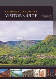
talking point - Rhondda Cynon Taf
talking point - Rhondda Cynon Taf
talking point - Rhondda Cynon Taf

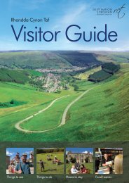
Create successful ePaper yourself
Turn your PDF publications into a flip-book with our unique Google optimized e-Paper software.
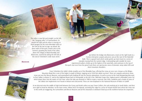
Blaencwm<br />
The valley is now flat and straight: on the left,<br />
the “hanging valley” of Cwmsaerbren, its<br />
mouth left high and dry when a moving ice<br />
sheet gouged out the main <strong>Rhondda</strong> Valley at<br />
the end of the last ice-age; up ahead, the<br />
sheer walls of Pen-pych, known also as the<br />
Sentinel, guarding the head of the valley<br />
above the villages of Blaenrhondda and<br />
Blaencwm, reached by taking the left fork at<br />
the end of Treherbert’s wide main street.<br />
Craig-y-llyn<br />
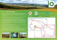
Just before the bridge into Blaencwm a track on the right leads to a<br />
Forestry Enterprise carpark and picnic area at the start of the Waterfall<br />
Walk. This is a gravel track which winds gently up Cwm Lluest to a series of<br />
cascades issuing from the summit ridge. A demanding walk suitable for more<br />
experienced walkers climbs up to the highest of the waterfalls, and continues to the top of<br />
Pen-pych, but even from the gravel track there are spectacular views of dramatic steep sided cliffs and<br />
sheer mountain shoulders.<br />
From Treherbert the A4061 climbs steadily out of the <strong>Rhondda</strong> Fawr, offering fine views at every turn. Known as the Rhigos<br />
Mountain Road this is one of the higher A-roads in Britain, topping out at 1618 feet above sea-level. There are carparks and picnic areas,<br />
views out over the Brecon Beacons, and waymarked trails leading off into the forestry plantations. As well as access to the Coed Morgannwg Way west<br />
to Port Talbot, to Route 47, and to the Highland Route back to Pontypridd, to the left is the 1969-foot Craig-y-llyn, highest <strong>point</strong> in <strong>Rhondda</strong> <strong>Cynon</strong> <strong>Taf</strong>,<br />
which drops sheer into the waters of Llyn Fawr: when the lake was drained in 1909 to create a reservoir, two Celtic cauldrons and a horde of some of<br />
the oldest iron implements ever found in Britain were discovered. These are now displayed in the National Museum of Wales in Cardiff.<br />
As we descend onto the saddle of high land between the <strong>Cynon</strong> and Neath valleys we pass Tower Colliery, the only working pit in South Wales, and then<br />
turn right to head for Aberdare. In the town centre, follow A4233 for Maerdy, ascending the ridge by a series of hairpin bends from which the views out<br />
to the north are staggering, the Carmarthen and Brecon Beacons and all the mountains in-between lined up on the northern horizon for inspection.<br />
14