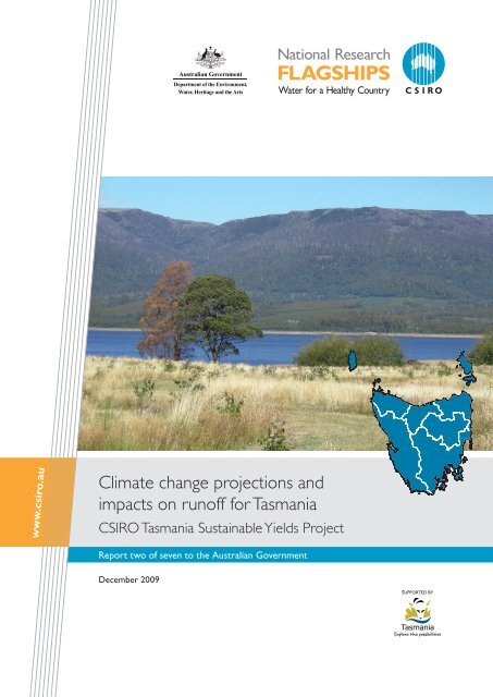
Climate change projections and impacts on runoff for Tasmania
Climate change projections and impacts on runoff for Tasmania
Climate change projections and impacts on runoff for Tasmania

Create successful ePaper yourself
Turn your PDF publications into a flip-book with our unique Google optimized e-Paper software.
<str<strong>on</strong>g>Climate</str<strong>on</strong>g> <str<strong>on</strong>g>change</str<strong>on</strong>g> <str<strong>on</strong>g>projecti<strong>on</strong>s</str<strong>on</strong>g> <str<strong>on</strong>g>and</str<strong>on</strong>g><br />
<str<strong>on</strong>g>impacts</str<strong>on</strong>g> <strong>on</strong> <strong>runoff</strong> <strong>for</strong> <strong>Tasmania</strong><br />
CSIRO <strong>Tasmania</strong> Sustainable Yields Project<br />
Report two of seven to the Australian Government<br />
December 2009
About the project<br />
Following the November 2006 Summit <strong>on</strong> the southern<br />
Murray-Darling Basin (MDB), the then Prime Minister <str<strong>on</strong>g>and</str<strong>on</strong>g> MDB state<br />
Premiers commissi<strong>on</strong>ed CSIRO to undertake an assessment of sustainable<br />
yields of surface water <str<strong>on</strong>g>and</str<strong>on</strong>g> groundwater systems within the MDB.<br />
The project set an internati<strong>on</strong>al benchmark <strong>for</strong> rigorous <str<strong>on</strong>g>and</str<strong>on</strong>g> detailed<br />
basin-scale assessment of the anticipated <str<strong>on</strong>g>impacts</str<strong>on</strong>g> of climate <str<strong>on</strong>g>change</str<strong>on</strong>g>,<br />
catchment development <str<strong>on</strong>g>and</str<strong>on</strong>g> increasing groundwater extracti<strong>on</strong> <strong>on</strong> the<br />
availability <str<strong>on</strong>g>and</str<strong>on</strong>g> use of water resources.<br />
On 26 March 2008, the Council of Australian Governments (COAG)<br />
agreed to exp<str<strong>on</strong>g>and</str<strong>on</strong>g> the CSIRO assessments of sustainable yield so that, <strong>for</strong><br />
the first time, Australia would have a comprehensive scientific assessment<br />
of water yield in all major water systems across the country. This would<br />
allow a c<strong>on</strong>sistent analytical framework <strong>for</strong> water policy decisi<strong>on</strong>s across<br />
the nati<strong>on</strong>. The CSIRO <strong>Tasmania</strong> Sustainable Yields Project, together with<br />
allied projects <strong>for</strong> northern Australia <str<strong>on</strong>g>and</str<strong>on</strong>g> south-west Western Australia,<br />
provides a nati<strong>on</strong>-wide expansi<strong>on</strong> of the assessments.<br />
In <strong>Tasmania</strong>, neither surface water nor groundwater extracti<strong>on</strong>s<br />
are metered in a c<strong>on</strong>sistent way. C<strong>on</strong>sequently it was necessary to<br />
model the movement <str<strong>on</strong>g>and</str<strong>on</strong>g> use of water within the project area using a<br />
comprehensive suite of river models. For groundwater, three models<br />
covering key groundwater areas were also used. Flow stress rankings<br />
were used to determine the potential ecological <str<strong>on</strong>g>impacts</str<strong>on</strong>g> of <str<strong>on</strong>g>change</str<strong>on</strong>g>s in<br />
streamflow <strong>on</strong> subcatchments <str<strong>on</strong>g>and</str<strong>on</strong>g> key ecological sites (150 sites were<br />
selected comprising all Ramsar wetl<str<strong>on</strong>g>and</str<strong>on</strong>g>s, estuaries with high c<strong>on</strong>servati<strong>on</strong><br />
value, <str<strong>on</strong>g>and</str<strong>on</strong>g> river sites <str<strong>on</strong>g>and</str<strong>on</strong>g> riverine wetl<str<strong>on</strong>g>and</str<strong>on</strong>g>s with high c<strong>on</strong>servati<strong>on</strong> value<br />
currently impacted by local extracti<strong>on</strong>s of water).<br />
Reporting of the CSIRO <strong>Tasmania</strong> Sustainable Yields Project is covered<br />
by a range of products including a suite of regi<strong>on</strong> reports (of which this is<br />
<strong>on</strong>e) <str<strong>on</strong>g>and</str<strong>on</strong>g> a suite of technical reports. There are seven regi<strong>on</strong> reports:<br />
1. Water availability <strong>for</strong> <strong>Tasmania</strong><br />
2. <str<strong>on</strong>g>Climate</str<strong>on</strong>g> <str<strong>on</strong>g>change</str<strong>on</strong>g> <str<strong>on</strong>g>projecti<strong>on</strong>s</str<strong>on</strong>g> <str<strong>on</strong>g>and</str<strong>on</strong>g> <str<strong>on</strong>g>impacts</str<strong>on</strong>g> <strong>on</strong> <strong>runoff</strong> <strong>for</strong> <strong>Tasmania</strong><br />
3. Water availability <strong>for</strong> the Arthur-Inglis-Cam regi<strong>on</strong><br />
4. Water availability <strong>for</strong> the Mersey-Forth regi<strong>on</strong><br />
5. Water availability <strong>for</strong> the Pipers-Ringarooma regi<strong>on</strong><br />
6. Water availability <strong>for</strong> the South Esk regi<strong>on</strong><br />
7. Water availability <strong>for</strong> the Derwent-South East regi<strong>on</strong><br />
For citati<strong>on</strong> details of these reports see the back cover of this report <str<strong>on</strong>g>and</str<strong>on</strong>g><br />
<strong>for</strong> a full list of the technical reports see the inside back cover.<br />
<strong>Tasmania</strong> Sustainable Yields Project disclaimers<br />
Derived from or c<strong>on</strong>tains data <str<strong>on</strong>g>and</str<strong>on</strong>g>/or software provided<br />
by the Organisati<strong>on</strong>s. The Organisati<strong>on</strong>s give no warranty<br />
in relati<strong>on</strong> to the data <str<strong>on</strong>g>and</str<strong>on</strong>g>/or software they provided<br />
(including accuracy, reliability, completeness, currency<br />
or suitability) <str<strong>on</strong>g>and</str<strong>on</strong>g> accept no liability (including without<br />
limitati<strong>on</strong>, liability in negligence) <strong>for</strong> any loss, damage or<br />
costs (including c<strong>on</strong>sequential damage) relating to any use<br />
or reliance <strong>on</strong> the data or software (including any material<br />
derived from that data or software). Data must not be used<br />
<strong>for</strong> direct marketing or be used in breach of the privacy laws.<br />
Organisati<strong>on</strong>s include: the <strong>Tasmania</strong>n Department of Primary<br />
Industries, Parks, Water, <str<strong>on</strong>g>and</str<strong>on</strong>g> Envir<strong>on</strong>ment; Hydro <strong>Tasmania</strong><br />
C<strong>on</strong>sulting; Sinclair Knight Merz; Aquaterra C<strong>on</strong>sulting;<br />
Antarctic <str<strong>on</strong>g>Climate</str<strong>on</strong>g> <str<strong>on</strong>g>and</str<strong>on</strong>g> Ecosystems CRC; <strong>Tasmania</strong>n Irrigati<strong>on</strong><br />
Development Board; Private Forests <strong>Tasmania</strong>; <str<strong>on</strong>g>and</str<strong>on</strong>g> the<br />
Queensl<str<strong>on</strong>g>and</str<strong>on</strong>g> Department of Envir<strong>on</strong>ment <str<strong>on</strong>g>and</str<strong>on</strong>g> Resource<br />
Management.<br />
Data <strong>on</strong> proposed irrigati<strong>on</strong> developments were supplied by<br />
the <strong>Tasmania</strong>n Irrigati<strong>on</strong> Development Board in June 2009.<br />
Data <strong>on</strong> projected increases in commercial <strong>for</strong>est plantati<strong>on</strong>s<br />
were provided by Private Forests <strong>Tasmania</strong> in February 2009.<br />
CSIRO advises that the in<strong>for</strong>mati<strong>on</strong> c<strong>on</strong>tained in this<br />
publicati<strong>on</strong> comprises general statements based <strong>on</strong> scientific<br />
research. The reader is advised <str<strong>on</strong>g>and</str<strong>on</strong>g> needs to be aware<br />
that such in<strong>for</strong>mati<strong>on</strong> may be incomplete or unable to be<br />
used in any specific situati<strong>on</strong>. No reliance or acti<strong>on</strong>s must<br />
there<strong>for</strong>e be made <strong>on</strong> that in<strong>for</strong>mati<strong>on</strong> without seeking prior<br />
expert professi<strong>on</strong>al, scientific <str<strong>on</strong>g>and</str<strong>on</strong>g> technical advice. To the<br />
extent permitted by law, CSIRO (including its employees<br />
<str<strong>on</strong>g>and</str<strong>on</strong>g> c<strong>on</strong>sultants) excludes all liability to any pers<strong>on</strong> <strong>for</strong> any<br />
c<strong>on</strong>sequences, including but not limited to all losses, damages,<br />
costs, expenses <str<strong>on</strong>g>and</str<strong>on</strong>g> any other compensati<strong>on</strong>, arising directly<br />
or indirectly from using this publicati<strong>on</strong> (in part or in whole)<br />
<str<strong>on</strong>g>and</str<strong>on</strong>g> any in<strong>for</strong>mati<strong>on</strong> or material c<strong>on</strong>tained in it. Data is<br />
assumed to be correct as received from the Organisati<strong>on</strong>s.<br />
C<strong>on</strong>tents<br />
Introducti<strong>on</strong> 1<br />
Project overview 1<br />
Scenarios assessed 1<br />
Project regi<strong>on</strong>s 1<br />
Key findings 2<br />
Under historical climate (1924 to 2007) 2<br />
Under recent climate (1997 to 2007) 2<br />
Under future climate ~2030 3<br />
Under future development ~2030 3<br />
<strong>Tasmania</strong> – an isl<str<strong>on</strong>g>and</str<strong>on</strong>g> setting 4<br />
Biophysical facts <str<strong>on</strong>g>and</str<strong>on</strong>g> figures 4<br />
Populati<strong>on</strong> <str<strong>on</strong>g>and</str<strong>on</strong>g> l<str<strong>on</strong>g>and</str<strong>on</strong>g> use 5<br />
<str<strong>on</strong>g>Climate</str<strong>on</strong>g> 6<br />
Historical climate 6<br />
Recent climate 8<br />
Future climate 9<br />
Runoff 12<br />
Runoff under historical climate 12<br />
Runoff under recent climate 13<br />
Runoff under future climate 14<br />
Runoff under future development 16<br />
Citati<strong>on</strong><br />
CSIRO (2009) <str<strong>on</strong>g>Climate</str<strong>on</strong>g> <str<strong>on</strong>g>change</str<strong>on</strong>g> <str<strong>on</strong>g>projecti<strong>on</strong>s</str<strong>on</strong>g> <str<strong>on</strong>g>and</str<strong>on</strong>g> <str<strong>on</strong>g>impacts</str<strong>on</strong>g> <strong>on</strong><br />
<strong>runoff</strong> <strong>for</strong> <strong>Tasmania</strong>. Report two of seven to the Australian<br />
Government from the CSIRO <strong>Tasmania</strong> Sustainable Yields<br />
Project, CSIRO Water <strong>for</strong> a Healthy Country Flagship,<br />
Australia.<br />
Publicati<strong>on</strong> Details<br />
Published by CSIRO © 2009 all rights reserved. This work<br />
is copyright. Apart from any use as permitted under the<br />
Copyright Act 1968, no part may be reproduced by any<br />
process without prior written permissi<strong>on</strong> from CSIRO.<br />
ISSN 1835-095X<br />
Photos courtesy of: CSIRO <str<strong>on</strong>g>and</str<strong>on</strong>g> DPIPWE.<br />
Cover: Huntsman Lake behind Me<str<strong>on</strong>g>and</str<strong>on</strong>g>er Dam (CSIRO)
Introducti<strong>on</strong><br />
This report is <strong>on</strong>e in a series* from the<br />
CSIRO <strong>Tasmania</strong> Sustainable Yields Project.<br />
The terms of reference <strong>for</strong> the project<br />
required an assessment of the current <str<strong>on</strong>g>and</str<strong>on</strong>g><br />
likely future extent <str<strong>on</strong>g>and</str<strong>on</strong>g> variability of surface<br />
water <str<strong>on</strong>g>and</str<strong>on</strong>g> groundwater resources in <strong>Tasmania</strong>.<br />
This in<strong>for</strong>mati<strong>on</strong> will help governments,<br />
industry <str<strong>on</strong>g>and</str<strong>on</strong>g> communities c<strong>on</strong>sider the<br />
envir<strong>on</strong>mental, social <str<strong>on</strong>g>and</str<strong>on</strong>g> ec<strong>on</strong>omic aspects<br />
of the sustainable use <str<strong>on</strong>g>and</str<strong>on</strong>g> management of<br />
the precious water assets of <strong>Tasmania</strong>.<br />
For the first time, the <str<strong>on</strong>g>impacts</str<strong>on</strong>g> of<br />
catchment development (commercial<br />
<strong>for</strong>estry plantati<strong>on</strong>s <str<strong>on</strong>g>and</str<strong>on</strong>g> future irrigati<strong>on</strong><br />
development), changing groundwater<br />
extracti<strong>on</strong>, climate variability <str<strong>on</strong>g>and</str<strong>on</strong>g><br />
anticipated climate <str<strong>on</strong>g>change</str<strong>on</strong>g> <strong>on</strong> water<br />
resources at a whole-of-regi<strong>on</strong> scale have<br />
been assessed. This was achieved through<br />
the most comprehensive hydrological<br />
modelling ever attempted <strong>for</strong> <strong>Tasmania</strong>,<br />
using rainfall-<strong>runoff</strong> models, groundwater<br />
recharge models, river models <str<strong>on</strong>g>and</str<strong>on</strong>g><br />
groundwater models.<br />
The project has drawn <strong>on</strong> the scientific<br />
knowledge <str<strong>on</strong>g>and</str<strong>on</strong>g> technical expertise of<br />
nati<strong>on</strong>al <str<strong>on</strong>g>and</str<strong>on</strong>g> state government agencies,<br />
as well as Australia’s leading academics<br />
<str<strong>on</strong>g>and</str<strong>on</strong>g> industry c<strong>on</strong>sultants. The assessments<br />
have been subject to a comprehensive<br />
process of internal <str<strong>on</strong>g>and</str<strong>on</strong>g> external review,<br />
providing quality assurance <strong>on</strong> all the work<br />
per<strong>for</strong>med <str<strong>on</strong>g>and</str<strong>on</strong>g> all the results delivered.<br />
Oversight of this <str<strong>on</strong>g>and</str<strong>on</strong>g> allied projects<br />
<strong>for</strong> northern Australia <str<strong>on</strong>g>and</str<strong>on</strong>g> south-west<br />
Western Australia was provided by the<br />
CSIRO Water <strong>for</strong> a Healthy Country<br />
Flagship, a research initiative established<br />
to deliver the science required <strong>for</strong><br />
sustainable management of water<br />
resources in Australia.<br />
Other reports in this series examine<br />
current <str<strong>on</strong>g>and</str<strong>on</strong>g> future surface water <str<strong>on</strong>g>and</str<strong>on</strong>g><br />
groundwater availability across five project<br />
regi<strong>on</strong>s. To set the scene <strong>for</strong> the ‘regi<strong>on</strong>’<br />
reports, this report examines climate<br />
<str<strong>on</strong>g>and</str<strong>on</strong>g> <strong>runoff</strong> <strong>for</strong> the whole of <strong>Tasmania</strong>.<br />
The <str<strong>on</strong>g>projecti<strong>on</strong>s</str<strong>on</strong>g> shown in this report<br />
are then used in the regi<strong>on</strong> reports to<br />
examine current <str<strong>on</strong>g>and</str<strong>on</strong>g> future surface water<br />
<str<strong>on</strong>g>and</str<strong>on</strong>g> groundwater availability <strong>for</strong> each of<br />
the project regi<strong>on</strong>s. For a more detailed<br />
technical analysis readers should also refer<br />
to the associated technical reports.<br />
Project overview<br />
As shown in Figure 1, the overall approach of the project included: (i) defining different<br />
climate scenarios <str<strong>on</strong>g>and</str<strong>on</strong>g> generating daily climate data to describe these scenarios,<br />
(ii) modelling the implicati<strong>on</strong>s<br />
of these climate scenarios <strong>for</strong><br />
catchment <strong>runoff</strong> <str<strong>on</strong>g>and</str<strong>on</strong>g> aquifer<br />
recharge, (iii) propagating<br />
the <strong>runoff</strong> <str<strong>on</strong>g>and</str<strong>on</strong>g> recharge<br />
implicati<strong>on</strong>s through river<br />
system <str<strong>on</strong>g>and</str<strong>on</strong>g> groundwater<br />
models, (iv) assessing ecological<br />
<str<strong>on</strong>g>impacts</str<strong>on</strong>g> <str<strong>on</strong>g>and</str<strong>on</strong>g> (v) reporting<br />
the implicati<strong>on</strong>s <strong>for</strong> water<br />
availability <str<strong>on</strong>g>and</str<strong>on</strong>g> water use.<br />
Figure 1. Project framework<br />
Scenarios assessed<br />
The assessments of current <str<strong>on</strong>g>and</str<strong>on</strong>g> future water availability have been undertaken by<br />
c<strong>on</strong>sidering four scenarios of historical, recent <str<strong>on</strong>g>and</str<strong>on</strong>g> future climate, <str<strong>on</strong>g>and</str<strong>on</strong>g> current <str<strong>on</strong>g>and</str<strong>on</strong>g><br />
future development. A fifth scenario represents no c<strong>on</strong>sumptive extracti<strong>on</strong>s. All<br />
scenarios were defined by daily time series of climate variables based <strong>on</strong> different<br />
scalings of the observed climate from 1 January 1924 to 31 December 2007.<br />
The first scenario is a historical climate scenario <str<strong>on</strong>g>and</str<strong>on</strong>g> is used as the baseline against<br />
which other scenarios are compared. Current levels (December 2007) of surface<br />
water <str<strong>on</strong>g>and</str<strong>on</strong>g> groundwater development were used. For groundwater <strong>on</strong>ly, results<br />
are reported using three 23-year periods selected from the historical sequence,<br />
representing a wet extreme, median <str<strong>on</strong>g>and</str<strong>on</strong>g> dry extreme historical climate.<br />
The sec<strong>on</strong>d scenario is a recent climate scenario <strong>for</strong> assessing water availability based<br />
<strong>on</strong> the climate of the recent past (1 January 1997 to 31 December 2007). Current<br />
levels of surface water <str<strong>on</strong>g>and</str<strong>on</strong>g> groundwater development were used.<br />
The third scenario is a future climate scenario. Fifteen global climate models with<br />
three estimates of temperature <str<strong>on</strong>g>change</str<strong>on</strong>g>s due to global warming were used to<br />
provide a spectrum of possible ~2030 climates. From this spectrum, three were<br />
selected <strong>for</strong> reporting, representing a wet extreme, median <str<strong>on</strong>g>and</str<strong>on</strong>g> dry extreme future<br />
climate. Current levels of surface water <str<strong>on</strong>g>and</str<strong>on</strong>g> groundwater development were used.<br />
The fourth scenario is a future climate with future development scenario. This<br />
scenario used the same climate time series as the future climate scenario, but future<br />
levels of development were used. Future development c<strong>on</strong>sisted of 24 proposed<br />
irrigati<strong>on</strong> schemes, as well as ~2030 <str<strong>on</strong>g>projecti<strong>on</strong>s</str<strong>on</strong>g> of commercial plantati<strong>on</strong> <strong>for</strong>ests<br />
<str<strong>on</strong>g>and</str<strong>on</strong>g> an assumed increase in groundwater extracti<strong>on</strong> to 25 percent of recharge.<br />
The fifth scenario is a without-extracti<strong>on</strong>s scenario using historical climate, current<br />
infrastructure <str<strong>on</strong>g>and</str<strong>on</strong>g> no extracti<strong>on</strong>s. This allows the impact of extracti<strong>on</strong>s to be<br />
explicitly c<strong>on</strong>sidered.<br />
Project regi<strong>on</strong>s<br />
In this report, <str<strong>on</strong>g>change</str<strong>on</strong>g>s in climate <str<strong>on</strong>g>and</str<strong>on</strong>g> <strong>runoff</strong> are<br />
c<strong>on</strong>sidered <strong>for</strong> the whole of <strong>Tasmania</strong>. However,<br />
other publicati<strong>on</strong>s from this project* document<br />
<str<strong>on</strong>g>change</str<strong>on</strong>g>s in water availability <strong>for</strong> five regi<strong>on</strong>s:<br />
Arthur-Inglis-Cam (including Flinders <str<strong>on</strong>g>and</str<strong>on</strong>g> King isl<str<strong>on</strong>g>and</str<strong>on</strong>g>s),<br />
Mersey-Forth, Pipers-Ringarooma, South Esk <str<strong>on</strong>g>and</str<strong>on</strong>g><br />
Derwent-South East (Figure 2). The West Coast regi<strong>on</strong><br />
shown in the figure relates to this report <strong>on</strong>ly. Other<br />
regi<strong>on</strong>s are menti<strong>on</strong>ed occasi<strong>on</strong>ally when referring to<br />
broad regi<strong>on</strong>al trends.<br />
Figure 2. CSIRO <strong>Tasmania</strong> Sustainable Yields Project regi<strong>on</strong>s<br />
* A full list of project reports can be found <strong>on</strong> the inside back cover <str<strong>on</strong>g>and</str<strong>on</strong>g> the back cover of this report.<br />
Rainfall-<strong>runoff</strong><br />
<str<strong>on</strong>g>and</str<strong>on</strong>g> recharge<br />
modelling<br />
system inflows system inflows<br />
River system<br />
modelling <str<strong>on</strong>g>and</str<strong>on</strong>g><br />
assessment<br />
Scenario<br />
definiti<strong>on</strong><br />
Ecological<br />
assessment<br />
Reporting<br />
Arthur-Inglis-<br />
Cam Mersey-<br />
Forth<br />
West<br />
Coast<br />
Groundwater<br />
modelling <str<strong>on</strong>g>and</str<strong>on</strong>g><br />
assessment<br />
Pipers-<br />
Ringarooma<br />
South Esk<br />
Derwent-<br />
South East<br />
December 2009 1
Key findings<br />
><br />
Under historical climate (1924 to 2007)<br />
The mean annual rainfall under historical climate averaged<br />
over <strong>Tasmania</strong> is 1266 mm. Rainfall is winter-dominated, with<br />
maximum m<strong>on</strong>thly rainfall usually occurring in July or August<br />
<str<strong>on</strong>g>and</str<strong>on</strong>g> minimum m<strong>on</strong>thly rainfall usually occurring in January or<br />
February. The seas<strong>on</strong>al differences are greatest in the<br />
north-west of <strong>Tasmania</strong> <str<strong>on</strong>g>and</str<strong>on</strong>g> reduce towards the south-east.<br />
There is a clear east–west rainfall gradient across <strong>Tasmania</strong>,<br />
where rainfall is highest in the west (mean annual rainfall of<br />
more than 4000 mm <strong>for</strong> the wettest areas) <str<strong>on</strong>g>and</str<strong>on</strong>g> lowest in the<br />
east (mean annual rainfall of just over 450 mm <strong>for</strong> the driest<br />
areas). The mean annual areal potential evapotranspirati<strong>on</strong><br />
averaged over <strong>Tasmania</strong> is 989 mm, ranging from more than<br />
Gauging stati<strong>on</strong> <strong>on</strong> the South Esk River (CSIRO)<br />
2 <str<strong>on</strong>g>Climate</str<strong>on</strong>g> <str<strong>on</strong>g>change</str<strong>on</strong>g> <str<strong>on</strong>g>projecti<strong>on</strong>s</str<strong>on</strong>g> <str<strong>on</strong>g>and</str<strong>on</strong>g> <str<strong>on</strong>g>impacts</str<strong>on</strong>g> <strong>on</strong> <strong>runoff</strong> <strong>for</strong> <strong>Tasmania</strong><br />
1100 mm <strong>on</strong> Flinders Isl<str<strong>on</strong>g>and</str<strong>on</strong>g> in the north-east to less than<br />
850 mm in the south of the state. Areal potential<br />
evapotranspirati<strong>on</strong> is highest in summer, averaging 403 mm<br />
<str<strong>on</strong>g>and</str<strong>on</strong>g> decreasing to an average of just 104 mm in winter.<br />
Under the historical climate, mean annual <strong>runoff</strong> is 689 mm<br />
or about 54 percent of the mean annual rainfall. This<br />
represents about 47,000 GL of <strong>runoff</strong> generated annually<br />
<strong>on</strong> the <strong>Tasmania</strong>n mainl<str<strong>on</strong>g>and</str<strong>on</strong>g> <str<strong>on</strong>g>and</str<strong>on</strong>g> its nearby isl<str<strong>on</strong>g>and</str<strong>on</strong>g>s. There is<br />
more <strong>runoff</strong> in winter than in any other seas<strong>on</strong>, c<strong>on</strong>tributing<br />
39 percent of the annual <strong>runoff</strong>. Summer is the driest seas<strong>on</strong><br />
<str<strong>on</strong>g>and</str<strong>on</strong>g> c<strong>on</strong>tributes <strong>on</strong>ly 13 percent of the annual <strong>runoff</strong>.<br />
Under recent climate (1997 to 2007)<br />
In general, under the recent climate, c<strong>on</strong>diti<strong>on</strong>s are drier than those<br />
of the last 84 years. Mean annual rainfall over <strong>Tasmania</strong> is 1193 mm<br />
under the recent climate (a decrease of about 6 percent relative<br />
to the historical climate). This reducti<strong>on</strong> in rainfall is greatest over<br />
the north-east of the state with the Pipers-Ringarooma regi<strong>on</strong><br />
decreasing by 12 percent. The severity of the reducti<strong>on</strong> in rainfall<br />
is lessened moving towards the south with the Arthur-Inglis-Cam<br />
regi<strong>on</strong> decreasing by 9 percent, the South Esk regi<strong>on</strong> by 8 percent,<br />
the Mersey-Forth regi<strong>on</strong> by 7 percent, <str<strong>on</strong>g>and</str<strong>on</strong>g> the Derwent-South East<br />
regi<strong>on</strong> by 6 percent. The reducti<strong>on</strong>s in rainfall are not distributed<br />
evenly throughout the year, with the largest reducti<strong>on</strong>s across every<br />
regi<strong>on</strong> occurring in autumn (with a maximum 21 percent reducti<strong>on</strong><br />
in autumn rainfall across the Pipers-Ringarooma regi<strong>on</strong>). The next<br />
largest seas<strong>on</strong>al reducti<strong>on</strong>s are in summer <strong>for</strong> all regi<strong>on</strong>s except the<br />
Pipers-Ringarooma regi<strong>on</strong> where rainfall decreases by 14 percent<br />
in winter <str<strong>on</strong>g>and</str<strong>on</strong>g> 12 percent in summer. Changes in spring are minimal,<br />
ranging from a 2 percent decrease in the Arthur-Inglis-Cam regi<strong>on</strong> to<br />
just under a 2 percent increase in the Mersey-Forth regi<strong>on</strong>.<br />
Except <strong>for</strong> a few isolated regi<strong>on</strong>s of increased <strong>runoff</strong>, there is an<br />
overall tendency towards less <strong>runoff</strong> under recent climate, with<br />
86 percent of <strong>Tasmania</strong> having less <strong>runoff</strong> than under the historical<br />
climate. The spatial patterns of <str<strong>on</strong>g>change</str<strong>on</strong>g> in <strong>runoff</strong> under recent<br />
climate (relative to historical climate) str<strong>on</strong>gly reflect the patterns of<br />
<str<strong>on</strong>g>change</str<strong>on</strong>g> in rainfall. Averaged over <strong>Tasmania</strong>, this reducti<strong>on</strong> is about<br />
7 percent, from 689 mm to 641 mm. In percentage terms, the<br />
reducti<strong>on</strong>s in <strong>runoff</strong> under recent climate are greatest in autumn <str<strong>on</strong>g>and</str<strong>on</strong>g><br />
least in spring.
Leven River at Ulverst<strong>on</strong>e (CSIRO)<br />
Under future climate ~2030<br />
When c<strong>on</strong>sidering future climate, the focus is <strong>on</strong> the wet extreme,<br />
median <str<strong>on</strong>g>and</str<strong>on</strong>g> dry extreme range of future climate.<br />
On average, under the future climate, rainfall increases by 1 percent<br />
under the wet extreme <str<strong>on</strong>g>and</str<strong>on</strong>g> decreases by 6 percent under the dry<br />
extreme <str<strong>on</strong>g>and</str<strong>on</strong>g> by 2 percent under the median future climate. Under the<br />
wet extreme, the largest increases in rainfall occur in summer <str<strong>on</strong>g>and</str<strong>on</strong>g> winter.<br />
Under the median, decreases in rainfall occur in summer, autumn <str<strong>on</strong>g>and</str<strong>on</strong>g><br />
spring <str<strong>on</strong>g>and</str<strong>on</strong>g> slightly increase in winter. Under the dry extreme, the largest<br />
decrease in rainfall occurs in summer <str<strong>on</strong>g>and</str<strong>on</strong>g> spring but with drying occurring<br />
all year round.<br />
Under the wet extreme, mean annual <strong>runoff</strong> is greater than under the<br />
historical climate in the South Esk <str<strong>on</strong>g>and</str<strong>on</strong>g> Derwent-South East regi<strong>on</strong>s but<br />
decreases elsewhere. In c<strong>on</strong>trast, under the dry extreme, <strong>runoff</strong> is less<br />
than under the historical climate almost everywhere, especially in central<br />
<str<strong>on</strong>g>and</str<strong>on</strong>g> far north-west <strong>Tasmania</strong>. Averaged over <strong>Tasmania</strong>, <str<strong>on</strong>g>change</str<strong>on</strong>g>s in <strong>runoff</strong><br />
(relative to historical climate) range from an increase of 2 percent under<br />
the wet extreme to a decrease of 8 percent under the dry extreme.<br />
Runoff decreases by 3 percent under the median future climate.<br />
Under future development<br />
~2030<br />
Except where stated, <str<strong>on</strong>g>change</str<strong>on</strong>g>s under future<br />
development are in additi<strong>on</strong> to <str<strong>on</strong>g>change</str<strong>on</strong>g>s<br />
under future climate.<br />
The area of commercial plantati<strong>on</strong> <strong>for</strong>ests<br />
is projected to increase by about 730 km 2<br />
(a 5 percent increase in total plantati<strong>on</strong><br />
<strong>for</strong>est). Averaged over <strong>Tasmania</strong>, the<br />
reducti<strong>on</strong> in total <strong>runoff</strong> due to commercial<br />
plantati<strong>on</strong> <strong>for</strong>ests is 0.3 percent, with the<br />
largest decreases occurring in northern<br />
<strong>Tasmania</strong>. In c<strong>on</strong>trast to the <str<strong>on</strong>g>impacts</str<strong>on</strong>g> of<br />
climate <str<strong>on</strong>g>change</str<strong>on</strong>g>, the <str<strong>on</strong>g>change</str<strong>on</strong>g>s in <strong>runoff</strong> due<br />
to development (as a result of projected<br />
increases in commercial plantati<strong>on</strong> <strong>for</strong>ests<br />
from Private Forests <strong>Tasmania</strong>) are much<br />
smaller both over the whole of <strong>Tasmania</strong><br />
<str<strong>on</strong>g>and</str<strong>on</strong>g> at the project regi<strong>on</strong> scale. However, at<br />
a finer scale, these <str<strong>on</strong>g>change</str<strong>on</strong>g>s in <strong>runoff</strong> can be<br />
much greater <str<strong>on</strong>g>and</str<strong>on</strong>g> can exceed the expected<br />
<str<strong>on</strong>g>change</str<strong>on</strong>g>s in <strong>runoff</strong> due to climate <str<strong>on</strong>g>change</str<strong>on</strong>g><br />
<str<strong>on</strong>g>and</str<strong>on</strong>g> may be significant <strong>for</strong> water availability<br />
in certain catchments.<br />
December 2009 3
<strong>Tasmania</strong> – an isl<str<strong>on</strong>g>and</str<strong>on</strong>g> setting<br />
Lying just 240 km off the south-east corner of the Australian mainl<str<strong>on</strong>g>and</str<strong>on</strong>g> <str<strong>on</strong>g>and</str<strong>on</strong>g> covering an<br />
area of 68,019 km 2 , <strong>Tasmania</strong> is Australia’s <strong>on</strong>ly isl<str<strong>on</strong>g>and</str<strong>on</strong>g> state. It is bounded by the Southern<br />
Ocean <strong>on</strong> the south <str<strong>on</strong>g>and</str<strong>on</strong>g> west, the Tasman Sea <strong>on</strong> the east, <str<strong>on</strong>g>and</str<strong>on</strong>g> Bass Strait to the north.<br />
It is <strong>on</strong>e of the world’s most mountainous isl<str<strong>on</strong>g>and</str<strong>on</strong>g>s, <str<strong>on</strong>g>and</str<strong>on</strong>g> is dominated by peaks that have<br />
a uniquely serrated profile. The geology reflects its millennia-old relati<strong>on</strong>ship with<br />
Antarctica. More than 40 percent of the isl<str<strong>on</strong>g>and</str<strong>on</strong>g> is protected as nati<strong>on</strong>al parks <str<strong>on</strong>g>and</str<strong>on</strong>g> reserves<br />
<str<strong>on</strong>g>and</str<strong>on</strong>g> about 73 percent remains a relatively natural envir<strong>on</strong>ment.<br />
Biophysical facts <str<strong>on</strong>g>and</str<strong>on</strong>g> figures<br />
<strong>Tasmania</strong> experiences a maritime climate<br />
with average maximum daily temperatures<br />
of 17 to 23 °C in summer <str<strong>on</strong>g>and</str<strong>on</strong>g> 3 to 11 °C<br />
in winter. Rainfall varies dramatically over<br />
the isl<str<strong>on</strong>g>and</str<strong>on</strong>g>. In the south-east, Hobart<br />
has mean annual rainfall of 626 mm (it is<br />
Australia’s sec<strong>on</strong>d-driest capital city after<br />
Adelaide). In c<strong>on</strong>trast, mean annual rainfall<br />
in some places <strong>on</strong> the west coast exceeds<br />
4000 mm. <strong>Tasmania</strong> has 12 percent of<br />
Australia’s freshwater resources even<br />
though it covers less than 1 percent of its<br />
total l<str<strong>on</strong>g>and</str<strong>on</strong>g> mass. The mean annual <strong>runoff</strong><br />
is around 47,000 GL. Fr<strong>on</strong>tal activity<br />
bringing moisture-laden winds out of<br />
the Southern Ocean dominates winter<br />
weather patterns <str<strong>on</strong>g>and</str<strong>on</strong>g> can result in flood<br />
events. <strong>Tasmania</strong> has experienced some<br />
severe periods of drought in recent years.<br />
The varied topography <str<strong>on</strong>g>and</str<strong>on</strong>g> rainfall of<br />
<strong>Tasmania</strong> makes <strong>for</strong> a diverse range<br />
of physical envir<strong>on</strong>ments, many of<br />
which are globally significant <str<strong>on</strong>g>and</str<strong>on</strong>g><br />
have World Heritage status. The<br />
jagged outcrops of Frenchmans Cap,<br />
Federati<strong>on</strong> Peak <str<strong>on</strong>g>and</str<strong>on</strong>g> the Arthur Range<br />
are spectacular <strong>for</strong>ms in the south-west,<br />
><br />
Cradle Mountain (DPIPWE)<br />
4 <str<strong>on</strong>g>Climate</str<strong>on</strong>g> <str<strong>on</strong>g>change</str<strong>on</strong>g> <str<strong>on</strong>g>projecti<strong>on</strong>s</str<strong>on</strong>g> <str<strong>on</strong>g>and</str<strong>on</strong>g> <str<strong>on</strong>g>impacts</str<strong>on</strong>g> <strong>on</strong> <strong>runoff</strong> <strong>for</strong> <strong>Tasmania</strong><br />
<str<strong>on</strong>g>and</str<strong>on</strong>g> Cradle Mountain, Ben Lom<strong>on</strong>d <str<strong>on</strong>g>and</str<strong>on</strong>g><br />
Freycinet Peninsula are other well-known<br />
l<str<strong>on</strong>g>and</str<strong>on</strong>g>marks. <strong>Tasmania</strong>’s Central Plateau<br />
<strong>for</strong>ms the most extensive alpine<br />
envir<strong>on</strong>ment in Australia, overlain by an<br />
interc<strong>on</strong>necting system of lakes <strong>for</strong>med by<br />
numerous ice ages. <strong>Tasmania</strong>’s lakes <str<strong>on</strong>g>and</str<strong>on</strong>g><br />
rivers include the Gord<strong>on</strong> River, which<br />
has the sec<strong>on</strong>d highest discharge rate of<br />
any river in the country, <str<strong>on</strong>g>and</str<strong>on</strong>g> Lake St Clair<br />
which is the deepest <str<strong>on</strong>g>and</str<strong>on</strong>g> <strong>on</strong>e of the most<br />
geomorphologically significant in Australia.<br />
<strong>Tasmania</strong> also c<strong>on</strong>tains numerous<br />
intricately c<strong>on</strong>nected cave systems, many<br />
of which have significant karst <strong>for</strong>mati<strong>on</strong>s.<br />
Groundwater resources, though extensive,<br />
are not evenly distributed <str<strong>on</strong>g>and</str<strong>on</strong>g> both quality<br />
<str<strong>on</strong>g>and</str<strong>on</strong>g> yield can be highly variable, depending<br />
<strong>on</strong> the aquifer type, the topographic<br />
locati<strong>on</strong> <str<strong>on</strong>g>and</str<strong>on</strong>g> the rainfall.<br />
<strong>Tasmania</strong>’s streams typically flow over<br />
rugged terrain <str<strong>on</strong>g>and</str<strong>on</strong>g> there<strong>for</strong>e have<br />
swift-flowing, turbulent water <str<strong>on</strong>g>and</str<strong>on</strong>g> rocky<br />
beds. Most streams arise not far from the<br />
coast <str<strong>on</strong>g>and</str<strong>on</strong>g> do not have large depositi<strong>on</strong>al<br />
areas be<strong>for</strong>e reaching the sea. However,<br />
some streams, such as the Me<str<strong>on</strong>g>and</str<strong>on</strong>g>er <str<strong>on</strong>g>and</str<strong>on</strong>g><br />
> Poppy irrigati<strong>on</strong> in the Jordan<br />
catchment (DPIPWE)<br />
Macquarie rivers, do me<str<strong>on</strong>g>and</str<strong>on</strong>g>er <str<strong>on</strong>g>and</str<strong>on</strong>g> braid as<br />
they pass through very flat country during<br />
their depositi<strong>on</strong>al phase. The main rivers<br />
are the South Esk, Derwent, Gord<strong>on</strong>,<br />
Arthur, Hu<strong>on</strong>, Mersey, Franklin, Pieman<br />
<str<strong>on</strong>g>and</str<strong>on</strong>g> the North Esk.<br />
Over 800 wetl<str<strong>on</strong>g>and</str<strong>on</strong>g>s cover a combined<br />
area of about 410 km 2 . The variety of<br />
l<str<strong>on</strong>g>and</str<strong>on</strong>g><strong>for</strong>ms <str<strong>on</strong>g>and</str<strong>on</strong>g> rainfall patterns have<br />
resulted in many different types of wetl<str<strong>on</strong>g>and</str<strong>on</strong>g><br />
ranging from marine waters, estuaries,<br />
brackish lago<strong>on</strong>s <str<strong>on</strong>g>and</str<strong>on</strong>g> mudflats <strong>on</strong> the<br />
coast, to highl<str<strong>on</strong>g>and</str<strong>on</strong>g> lakes <str<strong>on</strong>g>and</str<strong>on</strong>g> extensive<br />
peatl<str<strong>on</strong>g>and</str<strong>on</strong>g>s. Ten wetl<str<strong>on</strong>g>and</str<strong>on</strong>g>s are listed as<br />
internati<strong>on</strong>ally significant under the<br />
Ramsar C<strong>on</strong>venti<strong>on</strong>: Moulting, Logan,<br />
Lavinia, Pitt Water-Orielt<strong>on</strong>, Jocks<br />
<str<strong>on</strong>g>and</str<strong>on</strong>g> East Coast-Cape Barren Isl<str<strong>on</strong>g>and</str<strong>on</strong>g><br />
lago<strong>on</strong>s; Flood Plain Lower Ringarooma<br />
River; Apsley Marshes; Interlaken<br />
(Lake Crescent); <str<strong>on</strong>g>and</str<strong>on</strong>g> Little Waterhouse<br />
Lake. Areas like Orielt<strong>on</strong> Lago<strong>on</strong>,<br />
Moulting Lago<strong>on</strong> <str<strong>on</strong>g>and</str<strong>on</strong>g> Robbins Passage<br />
are internati<strong>on</strong>ally important feeding <str<strong>on</strong>g>and</str<strong>on</strong>g><br />
breeding sites <strong>for</strong> waterfowl <str<strong>on</strong>g>and</str<strong>on</strong>g><br />
migratory waders.<br />
<strong>Tasmania</strong>’s alpine areas, rain<strong>for</strong>ests,<br />
eucalypt <strong>for</strong>ests, grassl<str<strong>on</strong>g>and</str<strong>on</strong>g>s <str<strong>on</strong>g>and</str<strong>on</strong>g> heathl<str<strong>on</strong>g>and</str<strong>on</strong>g><br />
complexes reflect the enormous diversity<br />
of vegetati<strong>on</strong> types found <strong>on</strong> this small<br />
isl<str<strong>on</strong>g>and</str<strong>on</strong>g>. Western <str<strong>on</strong>g>and</str<strong>on</strong>g> south-western<br />
<strong>Tasmania</strong> are dominated by ancient plants<br />
like myrtle, Hu<strong>on</strong> pine <str<strong>on</strong>g>and</str<strong>on</strong>g> sassafras,<br />
whereas the drier eastern <str<strong>on</strong>g>and</str<strong>on</strong>g> northern<br />
parts of <strong>Tasmania</strong> are dominated by<br />
eucalypts, wattles <str<strong>on</strong>g>and</str<strong>on</strong>g> banksias.
Populati<strong>on</strong> <str<strong>on</strong>g>and</str<strong>on</strong>g> l<str<strong>on</strong>g>and</str<strong>on</strong>g> use<br />
<strong>Tasmania</strong>’s populati<strong>on</strong> is 494,520 (March<br />
2008) <str<strong>on</strong>g>and</str<strong>on</strong>g> is divided almost equally between<br />
the north <str<strong>on</strong>g>and</str<strong>on</strong>g> south. The main centres are<br />
Hobart (the capital city with 203,600 people),<br />
Launcest<strong>on</strong> (98,500), Burnie (18,000) <str<strong>on</strong>g>and</str<strong>on</strong>g><br />
Dev<strong>on</strong>port (25,000).<br />
Based <strong>on</strong> data from 2001, the dominant l<str<strong>on</strong>g>and</str<strong>on</strong>g><br />
uses in <strong>Tasmania</strong> are native vegetati<strong>on</strong> <str<strong>on</strong>g>and</str<strong>on</strong>g><br />
<strong>for</strong>estry (Figure 3). Native vegetati<strong>on</strong> covers<br />
50.2 percent of the state, <strong>for</strong>estry covers<br />
22.2 percent <str<strong>on</strong>g>and</str<strong>on</strong>g> 1.4 percent is irrigated<br />
cropping (Table 1).<br />
King<br />
Isl<str<strong>on</strong>g>and</str<strong>on</strong>g><br />
Town<br />
Major river<br />
Other river<br />
Lake / storage<br />
Wetl<str<strong>on</strong>g>and</str<strong>on</strong>g><br />
Irrigati<strong>on</strong><br />
Forestry<br />
Native vegetati<strong>on</strong><br />
Arthur River<br />
Grazing <str<strong>on</strong>g>and</str<strong>on</strong>g> dryl<str<strong>on</strong>g>and</str<strong>on</strong>g> cropping<br />
Other<br />
0 50 100<br />
Kilometres<br />
Figure 3. <strong>Tasmania</strong>’s l<str<strong>on</strong>g>and</str<strong>on</strong>g> use in the year 2001<br />
Smitht<strong>on</strong><br />
Table 1. Broad l<str<strong>on</strong>g>and</str<strong>on</strong>g> use in <strong>Tasmania</strong> in the year 2001 (Source: Department of<br />
Primary Industries, Water <str<strong>on</strong>g>and</str<strong>on</strong>g> Envir<strong>on</strong>ment, GIS Secti<strong>on</strong>, 2001)<br />
Strahan<br />
L<str<strong>on</strong>g>and</str<strong>on</strong>g> use Area<br />
percent km 2<br />
Native vegetati<strong>on</strong> 50.2% 34,164<br />
Forestry 22.2% 15,111<br />
Grazing <str<strong>on</strong>g>and</str<strong>on</strong>g> dryl<str<strong>on</strong>g>and</str<strong>on</strong>g> cropping<br />
Grazing modified pastures 17.6% 12,002<br />
Livestock grazing 4.6% 3,142<br />
Dryl<str<strong>on</strong>g>and</str<strong>on</strong>g> cropping 0.0% 10<br />
Sub-total 22.3% 15,154<br />
Irrigati<strong>on</strong><br />
Irrigated pastures 0.6% 435<br />
Irrigated cropping 1.4% 961<br />
Sub-total 2.1% 1,396<br />
Water 1.8% 1,198<br />
Other 1.5% 996<br />
Total 100.0% 68,019<br />
Burnie<br />
River Forth<br />
Queenstown<br />
Dev<strong>on</strong>port<br />
Mersey River<br />
River Derwent<br />
George Town<br />
Pipers River<br />
Launcest<strong>on</strong><br />
Deloraine<br />
L<strong>on</strong>g<strong>for</strong>d<br />
Bridport<br />
Hobart<br />
Kingst<strong>on</strong><br />
Ringar oo m a River<br />
Scottsdale<br />
South Esk River<br />
Flinders<br />
Isl<str<strong>on</strong>g>and</str<strong>on</strong>g><br />
St Helens<br />
December 2009 5
<str<strong>on</strong>g>Climate</str<strong>on</strong>g><br />
Historical climate<br />
The baseline scenario (<strong>for</strong> comparis<strong>on</strong> with other scenarios) uses the observed<br />
historical climate from 1 January 1924 to 31 December 2007 <str<strong>on</strong>g>and</str<strong>on</strong>g> assumes current levels<br />
of surface <str<strong>on</strong>g>and</str<strong>on</strong>g> groundwater development, <str<strong>on</strong>g>and</str<strong>on</strong>g> l<str<strong>on</strong>g>and</str<strong>on</strong>g> cover <str<strong>on</strong>g>and</str<strong>on</strong>g> l<str<strong>on</strong>g>and</str<strong>on</strong>g> use. This secti<strong>on</strong><br />
describes rainfall <str<strong>on</strong>g>and</str<strong>on</strong>g> areal potential evapotranspirati<strong>on</strong> under this historical climate.<br />
Historical daily climate data <strong>for</strong> the<br />
84-year period from 1924 to 2007 (based<br />
<strong>on</strong> ~5 x 5 km grid cells across <strong>Tasmania</strong>)<br />
were examined.<br />
Annual rainfall <strong>for</strong> the period is shown in<br />
Figure 4. There were wetter c<strong>on</strong>diti<strong>on</strong>s in<br />
the 1950s <str<strong>on</strong>g>and</str<strong>on</strong>g> 1970s <str<strong>on</strong>g>and</str<strong>on</strong>g> drier c<strong>on</strong>diti<strong>on</strong>s<br />
in the 1960s <str<strong>on</strong>g>and</str<strong>on</strong>g> the last decade.<br />
Figure 5 shows the mean rainfall <strong>for</strong><br />
<strong>Tasmania</strong> under these historical climate<br />
c<strong>on</strong>diti<strong>on</strong>s distributed annually <str<strong>on</strong>g>and</str<strong>on</strong>g> <strong>for</strong><br />
summer (December to February), autumn<br />
(March to May), winter (June to August)<br />
<str<strong>on</strong>g>and</str<strong>on</strong>g> spring (September to November).<br />
The mean annual rainfall averaged<br />
over <strong>Tasmania</strong> is 1266 mm. Rainfall is<br />
winter-dominated, with the maximum<br />
m<strong>on</strong>thly rainfall usually occurring in July or<br />
August <str<strong>on</strong>g>and</str<strong>on</strong>g> the minimum m<strong>on</strong>thly rainfall<br />
usually occurring in January or February.<br />
The seas<strong>on</strong>al differences are greatest in<br />
the north-west of the state <str<strong>on</strong>g>and</str<strong>on</strong>g> reduce<br />
towards the south-east.<br />
><br />
Grapevines near the Pipers River (CSIRO)<br />
2000<br />
1600<br />
1200<br />
800<br />
6 <str<strong>on</strong>g>Climate</str<strong>on</strong>g> <str<strong>on</strong>g>change</str<strong>on</strong>g> <str<strong>on</strong>g>projecti<strong>on</strong>s</str<strong>on</strong>g> <str<strong>on</strong>g>and</str<strong>on</strong>g> <str<strong>on</strong>g>impacts</str<strong>on</strong>g> <strong>on</strong> <strong>runoff</strong> <strong>for</strong> <strong>Tasmania</strong><br />
A clear east–west rainfall gradient across<br />
<strong>Tasmania</strong> is evident as shown in Figure 5,<br />
with rainfall highest in the west (mean<br />
annual rainfall of more than 4000 mm <strong>for</strong><br />
the wettest grid cell) <str<strong>on</strong>g>and</str<strong>on</strong>g> lowest in the<br />
east (mean annual rainfall of just over<br />
450 mm <strong>for</strong> the driest grid cell).<br />
The mean annual <str<strong>on</strong>g>and</str<strong>on</strong>g> seas<strong>on</strong>al areal<br />
potential evapotranspirati<strong>on</strong> (APET) are<br />
Annual rainfall (mm)<br />
Mean<br />
shown in Figure 6. Mean annual APET<br />
averaged over <strong>Tasmania</strong> is 989 mm,<br />
ranging from more than 1100 mm <strong>on</strong><br />
Flinders Isl<str<strong>on</strong>g>and</str<strong>on</strong>g> in the north-east to less<br />
than 850 mm in the south of the state.<br />
APET is highest in summer averaging<br />
403 mm, reducing to an average of just<br />
104 mm in winter.<br />
400<br />
1924 1944 1964 1984 2004<br />
Figure 4. Annual rainfall averaged over <strong>Tasmania</strong> under historical climate
Annual<br />
Mean annual rainfall (mm)<br />
Figure 5. Spatial distributi<strong>on</strong> of mean annual <str<strong>on</strong>g>and</str<strong>on</strong>g> seas<strong>on</strong>al rainfall under historical climate<br />
Mean seas<strong>on</strong>al rainfall (mm)<br />
300 400 500 600 800 1000 1200 1600 2000 2400 2800 4200 0 100 200 300 400 500 600 700 800 1000 1200 1400<br />
Annual<br />
Mean annual APET (mm)<br />
Summer Autumn<br />
Winter Spring<br />
Summer Autumn<br />
Winter Spring<br />
Mean seas<strong>on</strong>al APET (mm)<br />
750 800 850 900 950 1000 1050 1100 1150 50 100 150 200 250 300 350 400 450 500<br />
Figure 6. Spatial distributi<strong>on</strong> of mean annual <str<strong>on</strong>g>and</str<strong>on</strong>g> seas<strong>on</strong>al areal potential evapotranspirati<strong>on</strong> (APET) under historical climate<br />
December 2009 7
Recent climate<br />
The recent climate scenario is based <strong>on</strong> climate characteristics of the recent past<br />
(11 years from 1 January 1997 to 31 December 2007). It is used to evaluate the<br />
impact of the recent drought in <strong>Tasmania</strong>.<br />
In general, the recent climate has been<br />
drier than that of the historical 84-year<br />
period as shown in Figure 7. The spatial<br />
distributi<strong>on</strong> of these <str<strong>on</strong>g>change</str<strong>on</strong>g>s can be seen<br />
in Figure 8. Across <strong>Tasmania</strong>, mean annual<br />
rainfall under the recent climate is<br />
1193 mm, a 6 percent reducti<strong>on</strong> relative to<br />
the historical climate. This reducti<strong>on</strong><br />
in rainfall is greatest in the north-east<br />
Mean m<strong>on</strong>thly rainfall (mm)<br />
200<br />
150<br />
100<br />
50<br />
0<br />
Historical<br />
Recent<br />
8 <str<strong>on</strong>g>Climate</str<strong>on</strong>g> <str<strong>on</strong>g>change</str<strong>on</strong>g> <str<strong>on</strong>g>projecti<strong>on</strong>s</str<strong>on</strong>g> <str<strong>on</strong>g>and</str<strong>on</strong>g> <str<strong>on</strong>g>impacts</str<strong>on</strong>g> <strong>on</strong> <strong>runoff</strong> <strong>for</strong> <strong>Tasmania</strong><br />
of the state where rainfall in the<br />
Pipers-Ringarooma regi<strong>on</strong> decreases<br />
by 12 percent. The severity of the<br />
reducti<strong>on</strong> in rainfall lessens towards<br />
the south – decreasing by 9 percent in<br />
the Arthur-Inglis-Cam, 8 percent in the<br />
South Esk, 7 percent in the Mersey-Forth<br />
<str<strong>on</strong>g>and</str<strong>on</strong>g> 6 percent in the Derwent-South East<br />
regi<strong>on</strong>s. Under the recent climate,<br />
J F M A M J J A S O N D<br />
Figure 7. Mean m<strong>on</strong>thly rainfall averaged over <strong>Tasmania</strong> under<br />
historical <str<strong>on</strong>g>and</str<strong>on</strong>g> recent climate<br />
Annual<br />
Percent <str<strong>on</strong>g>change</str<strong>on</strong>g> in rainfall<br />
–30 –20 –10 –5 –2 2 5 10 20 30<br />
rainfall decreases over almost all of the<br />
state with a small patch increasing in the<br />
West Coast regi<strong>on</strong> (Figure 8). However,<br />
as that area of the state c<strong>on</strong>tains very few<br />
rain gauges, this increase should be treated<br />
with some cauti<strong>on</strong>. As the West Coast<br />
regi<strong>on</strong> is excluded from an analysis of<br />
<str<strong>on</strong>g>change</str<strong>on</strong>g>s in water availability in this project,<br />
this possible anomaly does not affect the<br />
results of the overall project.<br />
The reducti<strong>on</strong> in rainfall is not distributed<br />
evenly throughout the year – the largest<br />
occurs in autumn (12 percent) followed<br />
by summer (6 percent) then winter<br />
(4 percent) <str<strong>on</strong>g>and</str<strong>on</strong>g> finally spring (2 percent).<br />
Summer Autumn<br />
Winter Spring<br />
Figure 8. Spatial distributi<strong>on</strong> of percent <str<strong>on</strong>g>change</str<strong>on</strong>g> in mean annual <str<strong>on</strong>g>and</str<strong>on</strong>g> seas<strong>on</strong>al rainfall under recent climate relative to<br />
historical climate
Future climate<br />
The future (~2030) climate scenario was derived by modifying the historical<br />
climate sequence. To do this, a range of possible future climates were c<strong>on</strong>sidered<br />
using three global warming levels <str<strong>on</strong>g>and</str<strong>on</strong>g> 15 of the global climate models (GCMs)<br />
included in the Fourth Assessment Report of the Intergovernmental Panel <strong>on</strong><br />
<str<strong>on</strong>g>Climate</str<strong>on</strong>g> Change. Changes in rainfall <str<strong>on</strong>g>and</str<strong>on</strong>g> areal potential evapotranspirati<strong>on</strong> were<br />
derived directly from the GCMs. Rainfall <str<strong>on</strong>g>projecti<strong>on</strong>s</str<strong>on</strong>g> were further refined through<br />
dynamic downscaling. This secti<strong>on</strong> describes rainfall under the future climate.<br />
While there are c<strong>on</strong>siderable differences between the rainfall<br />
<str<strong>on</strong>g>projecti<strong>on</strong>s</str<strong>on</strong>g> of the 15 GCMs, generally mean annual rainfall decreases<br />
under the future climate, particularly over the northern half of<br />
<strong>Tasmania</strong>, with less rainfall occurring in spring, summer <str<strong>on</strong>g>and</str<strong>on</strong>g> autumn.<br />
Winter rainfall also decreases over the northern half of <strong>Tasmania</strong> but<br />
increases over the southern half.<br />
This report focuses <strong>on</strong> the wet extreme, median <str<strong>on</strong>g>and</str<strong>on</strong>g> dry extreme<br />
range of future climate (taken as the noti<strong>on</strong>al 90 th , 50 th <str<strong>on</strong>g>and</str<strong>on</strong>g> 10 th<br />
percentiles of future rainfall <str<strong>on</strong>g>projecti<strong>on</strong>s</str<strong>on</strong>g> respectively).<br />
Changes in mean annual <str<strong>on</strong>g>and</str<strong>on</strong>g> seas<strong>on</strong>al rainfall across <strong>Tasmania</strong> are shown<br />
in Figure 9 <str<strong>on</strong>g>and</str<strong>on</strong>g> summarised in Table 2.<br />
The methods used to derive the future climate sequences are<br />
described in the associated technical report Producti<strong>on</strong> of climate<br />
scenarios <strong>for</strong> <strong>Tasmania</strong>.<br />
><br />
New Norfolk <strong>on</strong> the Derwent River (CSIRO)<br />
> Flood alert stati<strong>on</strong> <strong>on</strong> the Me<str<strong>on</strong>g>and</str<strong>on</strong>g>er<br />
River (CSIRO)<br />
December 2009 9
Annual<br />
Summer<br />
Autumn<br />
Winter<br />
Spring<br />
Wet extreme Median Dry extreme<br />
Figure 9. Spatial distributi<strong>on</strong> of percent <str<strong>on</strong>g>change</str<strong>on</strong>g> in mean annual <str<strong>on</strong>g>and</str<strong>on</strong>g> seas<strong>on</strong>al rainfall over <strong>Tasmania</strong> under wet extreme, median<br />
<str<strong>on</strong>g>and</str<strong>on</strong>g> dry extreme future climate relative to historical climate<br />
10 <str<strong>on</strong>g>Climate</str<strong>on</strong>g> <str<strong>on</strong>g>change</str<strong>on</strong>g> <str<strong>on</strong>g>projecti<strong>on</strong>s</str<strong>on</strong>g> <str<strong>on</strong>g>and</str<strong>on</strong>g> <str<strong>on</strong>g>impacts</str<strong>on</strong>g> <strong>on</strong> <strong>runoff</strong> <strong>for</strong> <strong>Tasmania</strong><br />
Percent <str<strong>on</strong>g>change</str<strong>on</strong>g> in rainfall<br />
–30 –20 –10 –5 –2 2 5 10 20 30
Under the future climate, mean annual rainfall<br />
increases by 1 percent under the wet extreme<br />
<str<strong>on</strong>g>and</str<strong>on</strong>g> decreases by 6 percent under the dry<br />
extreme <str<strong>on</strong>g>and</str<strong>on</strong>g> by 2 percent under the the<br />
median future climate. These <str<strong>on</strong>g>change</str<strong>on</strong>g>s are not<br />
evenly distributed throughout the year. Under<br />
the wet extreme future climate, the largest<br />
increases occur in summer <str<strong>on</strong>g>and</str<strong>on</strong>g> winter. Under<br />
the median future climate, decreases occur in<br />
summer, autumn <str<strong>on</strong>g>and</str<strong>on</strong>g> spring <str<strong>on</strong>g>and</str<strong>on</strong>g> winter rainfall<br />
increases slightly. Under the dry extreme<br />
future climate, the largest decreases occur<br />
in summer <str<strong>on</strong>g>and</str<strong>on</strong>g> spring, but the general trend<br />
is <strong>for</strong> a year-round decrease. As the <str<strong>on</strong>g>change</str<strong>on</strong>g>s<br />
in rainfall shown in Table 2 were derived<br />
separately, both annually <str<strong>on</strong>g>and</str<strong>on</strong>g> <strong>for</strong> each seas<strong>on</strong>,<br />
the seas<strong>on</strong>al means do not combine to give<br />
the annual mean. This is because the seas<strong>on</strong>al<br />
results may come from four different models<br />
– <strong>on</strong>e <strong>for</strong> each seas<strong>on</strong>, while the annual result<br />
comes from the <strong>on</strong>e model <strong>for</strong> the whole<br />
year. These seas<strong>on</strong>al results represent the<br />
extreme <str<strong>on</strong>g>change</str<strong>on</strong>g> in rainfall <strong>on</strong> a seas<strong>on</strong>al basis<br />
<str<strong>on</strong>g>and</str<strong>on</strong>g> were not used <strong>for</strong> modelling the other<br />
comp<strong>on</strong>ents of the project.<br />
Although rainfall over <strong>Tasmania</strong> in general<br />
decreases under the future climate, intense<br />
rainfall events increase, particularly in summer<br />
<str<strong>on</strong>g>and</str<strong>on</strong>g> spring, <str<strong>on</strong>g>and</str<strong>on</strong>g> less so in winter <str<strong>on</strong>g>and</str<strong>on</strong>g> autumn.<br />
Mean m<strong>on</strong>thly rainfall over the last 84 years<br />
<strong>for</strong> the whole of <strong>Tasmania</strong> as well as the<br />
median <str<strong>on</strong>g>and</str<strong>on</strong>g> projected range under the<br />
future climate is shown in Figure 10. Rainfall<br />
decreases in most m<strong>on</strong>ths (the future median<br />
is lower than under the historical climate).<br />
In additi<strong>on</strong>, <strong>for</strong> most m<strong>on</strong>ths, the historical<br />
rainfall is close to the upper bound of the<br />
future range, implying that future c<strong>on</strong>diti<strong>on</strong>s<br />
will, in general, be drier than past c<strong>on</strong>diti<strong>on</strong>s.<br />
><br />
Boom irrigator operating near Sassafras (CSIRO)<br />
Table 2. Change in rainfall under future climate relative to historical climate<br />
Wet extreme future climate<br />
Mean m<strong>on</strong>thly rainfall (mm)<br />
200<br />
150<br />
100<br />
50<br />
0<br />
Annual Summer Autumn Winter Spring<br />
Future range<br />
Future median<br />
Historical<br />
percent<br />
Change in rainfall mean 1% 5% 2% 4% 2%<br />
Percentage of <strong>Tasmania</strong><br />
becoming drier<br />
Median future climate<br />
28% 8% 19% 5% 27%<br />
Change in rainfall mean –2% –5% –2% 1% –4%<br />
Percentage of <strong>Tasmania</strong><br />
becoming drier<br />
Dry extreme future climate<br />
84% 91% 65% 39% 94%<br />
Change in rainfall mean –6% –15% –8% –4% –11%<br />
Percentage of <strong>Tasmania</strong><br />
becoming drier<br />
99% 100% 97% 92% 100%<br />
J F M A M J J A S O N D<br />
Figure 10. Mean m<strong>on</strong>thly rainfall averaged over <strong>Tasmania</strong><br />
under historical <str<strong>on</strong>g>and</str<strong>on</strong>g> the future climate<br />
December 2009 11
Runoff<br />
Throughout this project, the Simhyd rainfall-<strong>runoff</strong> model was used to simulate <strong>runoff</strong> across <strong>Tasmania</strong>. Simhyd was<br />
calibrated <strong>for</strong> 90 gauged catchments <str<strong>on</strong>g>and</str<strong>on</strong>g> the resulting parameter sets were used to regi<strong>on</strong>alise simulati<strong>on</strong>s to ungauged<br />
parts of <strong>Tasmania</strong>. The modelling of <strong>runoff</strong> under future development included c<strong>on</strong>siderati<strong>on</strong> of <strong>for</strong>est plantati<strong>on</strong><br />
developments because of the impact these have <strong>on</strong> <strong>runoff</strong>. The simulati<strong>on</strong>s projected daily <strong>runoff</strong> under the historical,<br />
recent <str<strong>on</strong>g>and</str<strong>on</strong>g> future climate scenarios described previously.<br />
For more details <strong>on</strong> Simhyd <str<strong>on</strong>g>and</str<strong>on</strong>g> its calibrati<strong>on</strong>, refer to the compani<strong>on</strong> document Rainfall-<strong>runoff</strong> modelling <strong>for</strong> <strong>Tasmania</strong>.<br />
Runoff under historical climate<br />
Under the historical climate, mean annual <strong>runoff</strong> averaged<br />
over <strong>Tasmania</strong> is 689 mm (Table 3) – about 54 percent of the<br />
mean annual rainfall. This represents about 47,000 GL of <strong>runoff</strong><br />
generated annually from the <strong>Tasmania</strong>n mainl<str<strong>on</strong>g>and</str<strong>on</strong>g> <str<strong>on</strong>g>and</str<strong>on</strong>g> its nearby<br />
isl<str<strong>on</strong>g>and</str<strong>on</strong>g>s. Winter yields more <strong>runoff</strong> than any other seas<strong>on</strong> <str<strong>on</strong>g>and</str<strong>on</strong>g>,<br />
averaged over the state, c<strong>on</strong>tributes 39 percent of the annual<br />
<strong>runoff</strong>. Summer is the driest seas<strong>on</strong> <str<strong>on</strong>g>and</str<strong>on</strong>g> c<strong>on</strong>tributes 13 percent<br />
of the annual <strong>runoff</strong>, which varies between 437 mm <str<strong>on</strong>g>and</str<strong>on</strong>g> 1010 mm<br />
from year to year (Figure 11). While annual <strong>runoff</strong> varies<br />
c<strong>on</strong>siderably, inter-annual variability is low by Australian st<str<strong>on</strong>g>and</str<strong>on</strong>g>ards.<br />
The spatial pattern of <strong>runoff</strong> generati<strong>on</strong> is characterised by<br />
a str<strong>on</strong>g east–west gradient with <strong>runoff</strong> highest in the west<br />
(Figure 12). The pattern of mean annual <strong>runoff</strong> resembles that<br />
of rainfall, reflecting its role as the most important driver of<br />
<strong>runoff</strong> processes. The highest mean annual <strong>runoff</strong> (3434 mm)<br />
occurs in parts of the West Coast regi<strong>on</strong> <str<strong>on</strong>g>and</str<strong>on</strong>g> the lowest<br />
(17 mm) occurs in parts of the Derwent-South East regi<strong>on</strong>.<br />
The annual pattern of <strong>runoff</strong> is broadly retained in each<br />
seas<strong>on</strong>, with the same gradient still apparent. However, as<br />
shown in Figure 12, it is also apparent that <strong>runoff</strong> in northern<br />
<strong>Tasmania</strong> is str<strong>on</strong>gly winter-dominated <str<strong>on</strong>g>and</str<strong>on</strong>g> in southern<br />
<strong>Tasmania</strong> is distributed more evenly am<strong>on</strong>g the seas<strong>on</strong>s. The<br />
most str<strong>on</strong>gly winter-dominated area generates 62 percent of<br />
its <strong>runoff</strong> in winter <str<strong>on</strong>g>and</str<strong>on</strong>g> <strong>on</strong>ly 3 percent in summer. In c<strong>on</strong>trast,<br />
the least winter-dominated area generates 27 percent of its<br />
<strong>runoff</strong> in winter <str<strong>on</strong>g>and</str<strong>on</strong>g> 26 percent in summer.<br />
Figure 12.<br />
Spatial distributi<strong>on</strong><br />
of mean annual<br />
<str<strong>on</strong>g>and</str<strong>on</strong>g> seas<strong>on</strong>al<br />
<strong>runoff</strong> under<br />
historical climate<br />
Annual<br />
Mean annual <strong>runoff</strong> (mm)<br />
12 <str<strong>on</strong>g>Climate</str<strong>on</strong>g> <str<strong>on</strong>g>change</str<strong>on</strong>g> <str<strong>on</strong>g>projecti<strong>on</strong>s</str<strong>on</strong>g> <str<strong>on</strong>g>and</str<strong>on</strong>g> <str<strong>on</strong>g>impacts</str<strong>on</strong>g> <strong>on</strong> <strong>runoff</strong> <strong>for</strong> <strong>Tasmania</strong><br />
Annual <strong>runoff</strong> (mm)<br />
Table 3. Mean annual <str<strong>on</strong>g>and</str<strong>on</strong>g> seas<strong>on</strong>al <strong>runoff</strong> under historical<br />
climate<br />
1200<br />
Annual Summer Autumn Winter Spring<br />
1000<br />
800<br />
600<br />
400<br />
Mean<br />
mm<br />
689 93 148 268 180<br />
200<br />
1924 1944 1964 1984 2004<br />
Figure 11. Annual <strong>runoff</strong> <strong>for</strong> the whole of <strong>Tasmania</strong> under<br />
historical climate<br />
Summer Autumn<br />
Winter Spring<br />
Mean seas<strong>on</strong>al <strong>runoff</strong> (mm)<br />
0 100 200 300 400 600 800 1200 1600 2000 3500 0 25 50 100 150 200 300 400 600 800 1300
Runoff under recent climate<br />
For <strong>runoff</strong> modelling, the recent climate scenario was based <strong>on</strong> an<br />
84-year climate series produced using rainfall <str<strong>on</strong>g>and</str<strong>on</strong>g> APET characteristics<br />
of the recent past (1 January 1997 to 31 December 2007). This was<br />
used to assess the water availability of the recent past.<br />
Under the recent climate, mean m<strong>on</strong>thly <strong>runoff</strong> in most m<strong>on</strong>ths is less<br />
than under the historical climate (Figure 13). Excepti<strong>on</strong>s occur in early<br />
spring. For <strong>Tasmania</strong>, under the recent climate, the biggest increase<br />
in <strong>runoff</strong> occurs in October (11 percent), <str<strong>on</strong>g>and</str<strong>on</strong>g> the biggest decrease<br />
occurs in November (23 percent). This suggests that the recent<br />
climate features increased variability in <strong>runoff</strong> generati<strong>on</strong> in spring.<br />
In additi<strong>on</strong> to this temporal variability,<br />
the increased patchiness of the spring<br />
distributi<strong>on</strong> (relative to other seas<strong>on</strong>s)<br />
shown in Figure 14 suggests that this<br />
variability may also have a spatial<br />
comp<strong>on</strong>ent. Apart from November, <strong>on</strong>ly<br />
<strong>on</strong>e other m<strong>on</strong>th (April, 22 percent) has a<br />
decreased <strong>runoff</strong> of more than 15 percent.<br />
In this case, however, the directi<strong>on</strong> <str<strong>on</strong>g>and</str<strong>on</strong>g><br />
magnitude of the <str<strong>on</strong>g>change</str<strong>on</strong>g> are c<strong>on</strong>sistent with<br />
those of surrounding m<strong>on</strong>ths, indicating<br />
that the reducti<strong>on</strong>s in autumn <strong>runoff</strong> are<br />
sustained throughout the seas<strong>on</strong>.<br />
Except <strong>for</strong> a few isolated areas of increased<br />
<strong>runoff</strong>, there is an overall tendency towards<br />
reduced mean annual <strong>runoff</strong> under the<br />
Annual<br />
Percent <str<strong>on</strong>g>change</str<strong>on</strong>g> in <strong>runoff</strong><br />
Mean m<strong>on</strong>thly <strong>runoff</strong> (mm)<br />
150<br />
100<br />
50<br />
Historical<br />
Recent<br />
0<br />
J F M A M J J A S O N D<br />
Figure 13. Mean m<strong>on</strong>thly <strong>runoff</strong> averaged over the whole of<br />
<strong>Tasmania</strong> under historical <str<strong>on</strong>g>and</str<strong>on</strong>g> recent climate<br />
Table 4. Change in annual <str<strong>on</strong>g>and</str<strong>on</strong>g> seas<strong>on</strong>al <strong>runoff</strong> under recent climate relative to<br />
historical climate<br />
Annual Summer Autumn Winter Spring<br />
percent<br />
Change in <strong>runoff</strong> mean –7% –6% –17% –5% –1%<br />
Percentage of <strong>Tasmania</strong><br />
with decreasing <strong>runoff</strong><br />
86% 81% 97% 78% 60%<br />
recent climate relative to the historical<br />
climate (Figure 14), with 86 percent of<br />
<strong>Tasmania</strong> having less <strong>runoff</strong> (Table 4). The<br />
spatial pattern of the <str<strong>on</strong>g>change</str<strong>on</strong>g> in <strong>runoff</strong><br />
str<strong>on</strong>gly reflects the patterns of <str<strong>on</strong>g>change</str<strong>on</strong>g> in<br />
the rainfall. Averaged over <strong>Tasmania</strong>, this<br />
reducti<strong>on</strong> in <strong>runoff</strong> is about 7 percent –<br />
–70 –30 –20 –15 –10 –5 5 10 15 20 30 70<br />
from 689 mm to 641 mm. In percentage<br />
terms, the reducti<strong>on</strong>s in <strong>runoff</strong> under the<br />
recent climate are greatest in autumn<br />
(17 percent) <str<strong>on</strong>g>and</str<strong>on</strong>g> least in spring (1 percent)<br />
with decreases of 6 percent in summer <str<strong>on</strong>g>and</str<strong>on</strong>g><br />
5 percent in winter.<br />
Summer Autumn<br />
Winter Spring<br />
Figure 14. Spatial distributi<strong>on</strong> of percent <str<strong>on</strong>g>change</str<strong>on</strong>g> in mean annual <str<strong>on</strong>g>and</str<strong>on</strong>g> seas<strong>on</strong>al <strong>runoff</strong> under recent climate relative to<br />
historical climate<br />
December 2009 13
Runoff under future climate<br />
Changes in <strong>runoff</strong> under future climate<br />
(~2030) relative to the historical climate<br />
vary depending <strong>on</strong> the GCMs <str<strong>on</strong>g>and</str<strong>on</strong>g> global<br />
warming scenarios up<strong>on</strong> which they are<br />
based. However, there is str<strong>on</strong>g c<strong>on</strong>sensus<br />
in all seas<strong>on</strong>s about the directi<strong>on</strong> of <str<strong>on</strong>g>change</str<strong>on</strong>g><br />
in many parts of <strong>Tasmania</strong>. Decreases occur<br />
in the western half of <strong>Tasmania</strong> <str<strong>on</strong>g>and</str<strong>on</strong>g> in much<br />
of the north-east, <str<strong>on</strong>g>and</str<strong>on</strong>g> there are increases<br />
al<strong>on</strong>g parts of the east coast <str<strong>on</strong>g>and</str<strong>on</strong>g> in other<br />
isolated parts of inl<str<strong>on</strong>g>and</str<strong>on</strong>g> eastern <strong>Tasmania</strong>.<br />
Change in mean seas<strong>on</strong>al <strong>runoff</strong> is less<br />
clear-cut but tends to decrease in summer,<br />
autumn <str<strong>on</strong>g>and</str<strong>on</strong>g> spring, <str<strong>on</strong>g>and</str<strong>on</strong>g> increase in winter.<br />
Refer to the associated technical report<br />
Rainfall-<strong>runoff</strong> modelling <strong>for</strong> <strong>Tasmania</strong> <strong>for</strong><br />
further details <strong>on</strong> GCM selecti<strong>on</strong>.<br />
Changes in <strong>runoff</strong> under the wet extreme,<br />
median <str<strong>on</strong>g>and</str<strong>on</strong>g> dry extreme range of future<br />
climate (taken as the noti<strong>on</strong>al 90 th , 50 th <str<strong>on</strong>g>and</str<strong>on</strong>g><br />
10 th percentiles of future <strong>runoff</strong> <str<strong>on</strong>g>projecti<strong>on</strong>s</str<strong>on</strong>g><br />
respectively) are shown in Table 5.<br />
Changes to mean annual <str<strong>on</strong>g>and</str<strong>on</strong>g> seas<strong>on</strong>al<br />
<strong>runoff</strong> under future climate relative to the<br />
historical climate are shown in Figure 15.<br />
Under the wet extreme future climate,<br />
annual <strong>runoff</strong> tends to increase over much<br />
of eastern <strong>Tasmania</strong> but little <str<strong>on</strong>g>change</str<strong>on</strong>g> is<br />
seen elsewhere. In c<strong>on</strong>trast, under the dry<br />
extreme future climate, <strong>runoff</strong> decreases<br />
almost everywhere, especially in central<br />
<strong>Tasmania</strong> <str<strong>on</strong>g>and</str<strong>on</strong>g> the far north-west.<br />
14 <str<strong>on</strong>g>Climate</str<strong>on</strong>g> <str<strong>on</strong>g>change</str<strong>on</strong>g> <str<strong>on</strong>g>projecti<strong>on</strong>s</str<strong>on</strong>g> <str<strong>on</strong>g>and</str<strong>on</strong>g> <str<strong>on</strong>g>impacts</str<strong>on</strong>g> <strong>on</strong> <strong>runoff</strong> <strong>for</strong> <strong>Tasmania</strong><br />
Spatially, the mean annual <strong>runoff</strong> ranges<br />
from a decrease of 11 percent to an<br />
increase of 34 percent under the wet<br />
extreme future climate; from a decrease<br />
of 25 percent to an increase of 17 percent<br />
under the median future climate; <str<strong>on</strong>g>and</str<strong>on</strong>g> from<br />
a decrease of 30 percent to an increase of<br />
11 percent under the dry extreme future<br />
climate (Figure 15). Note that the <str<strong>on</strong>g>change</str<strong>on</strong>g>s<br />
in <strong>runoff</strong> in Figure 15 are based <strong>on</strong> different<br />
GCMs to the <str<strong>on</strong>g>change</str<strong>on</strong>g>s in rainfall in Figure 9<br />
so they are not directly comparable.<br />
Averaged over <strong>Tasmania</strong>, <str<strong>on</strong>g>change</str<strong>on</strong>g>s in<br />
annual <strong>runoff</strong> under the future climate<br />
(relative to the historical climate) range<br />
from an increase of 2 percent under the<br />
wet extreme to a decrease of 8 percent<br />
under the dry extreme (Table 5). Under<br />
the median future climate, <strong>runoff</strong> decreases<br />
by 3 percent. These whole-of-<strong>Tasmania</strong><br />
averages are str<strong>on</strong>gly influenced by<br />
the <str<strong>on</strong>g>change</str<strong>on</strong>g>s <strong>for</strong> the West Coast which<br />
c<strong>on</strong>tributes 54 percent of <strong>Tasmania</strong>’s<br />
47,000 GL of mean annual <strong>runoff</strong> under<br />
the historical climate. The seas<strong>on</strong>al <strong>runoff</strong><br />
<strong>for</strong> the whole of <strong>Tasmania</strong> under the<br />
median future climate is less than under the<br />
historical climate in all seas<strong>on</strong>s (Table 5).<br />
The seas<strong>on</strong>al reducti<strong>on</strong>s range from<br />
1 percent in winter to 6 percent in spring<br />
<str<strong>on</strong>g>and</str<strong>on</strong>g> summer.<br />
Table 5. Change in annual <str<strong>on</strong>g>and</str<strong>on</strong>g> seas<strong>on</strong>al <strong>runoff</strong> under the future climate relative to<br />
historical climate<br />
Wet extreme future climate<br />
Annual Summer Autumn Winter Spring<br />
percent<br />
Change in <strong>runoff</strong> mean 2% 7% 1% 2% –1%<br />
Percentage of <strong>Tasmania</strong><br />
with decreasing <strong>runoff</strong><br />
Median future climate<br />
28% 22% 28% 32% 49%<br />
Change in <strong>runoff</strong> mean –3% –6% –4% –1% –6%<br />
Percentage of <strong>Tasmania</strong><br />
with decreasing <strong>runoff</strong><br />
Dry extreme future climate<br />
82% 86% 80% 57% 83%<br />
Change in <strong>runoff</strong> mean –8% –18% –9% –1% –14%<br />
Percentage of <strong>Tasmania</strong><br />
with decreasing <strong>runoff</strong><br />
97% 92% 91% 50% 94%<br />
><br />
Cethana Dam spillway (CSIRO)<br />
> Hops <str<strong>on</strong>g>and</str<strong>on</strong>g> <strong>for</strong>estry near Branxholm<br />
(CSIRO)
Annual<br />
Summer<br />
Autumn<br />
Winter<br />
Spring<br />
Wet extreme Median Dry extreme<br />
Percent <str<strong>on</strong>g>change</str<strong>on</strong>g> in <strong>runoff</strong><br />
–90 –30 –20 –15 –10 –5 5 10 15 20 30 90<br />
Figure 15. Spatial distributi<strong>on</strong> of percent <str<strong>on</strong>g>change</str<strong>on</strong>g> in mean annual <str<strong>on</strong>g>and</str<strong>on</strong>g> seas<strong>on</strong>al <strong>runoff</strong> across <strong>Tasmania</strong> under wet extreme, median<br />
<str<strong>on</strong>g>and</str<strong>on</strong>g> dry extreme future climate relative to historical climate<br />
December 2009 15
Mean m<strong>on</strong>thly <strong>runoff</strong> <strong>for</strong> <strong>Tasmania</strong> under<br />
the future climate relative to the historical<br />
climate is shown in Figure 16. Averaged<br />
over <strong>Tasmania</strong>, the <strong>runoff</strong> under the<br />
median future climate is slightly less than<br />
the <strong>runoff</strong> under the historical climate<br />
in all m<strong>on</strong>ths. The greatest proporti<strong>on</strong>al<br />
reducti<strong>on</strong>s in <strong>runoff</strong> are about 6 percent<br />
<str<strong>on</strong>g>and</str<strong>on</strong>g> occur during the five m<strong>on</strong>ths<br />
from October to February. The smallest<br />
reducti<strong>on</strong>s in <strong>runoff</strong> (less than 1 percent)<br />
occur in July <str<strong>on</strong>g>and</str<strong>on</strong>g> August. In most m<strong>on</strong>ths,<br />
the upper limit of the range in m<strong>on</strong>thly<br />
<strong>runoff</strong> under the future climate is<br />
close to the <strong>runoff</strong> under the historical<br />
climate (within 2 percent), but between<br />
December <str<strong>on</strong>g>and</str<strong>on</strong>g> February it exceeds<br />
<strong>runoff</strong> under the historical climate by<br />
7 to 8 percent. The lower limit of the<br />
range in m<strong>on</strong>thly <strong>runoff</strong> under the future<br />
climate is up to 20 percent below that<br />
under the historical climate between<br />
December <str<strong>on</strong>g>and</str<strong>on</strong>g> February, but less than<br />
5 percent below in July <str<strong>on</strong>g>and</str<strong>on</strong>g> August.<br />
Runoff under future development<br />
Projecti<strong>on</strong>s of <strong>runoff</strong> under future<br />
development were made by incorporating<br />
a measure of increased commercial<br />
plantati<strong>on</strong> <strong>for</strong>ests into the rainfall-<strong>runoff</strong><br />
modelling. <str<strong>on</strong>g>Climate</str<strong>on</strong>g> inputs were the<br />
same as those used under the future<br />
climate described above. Comparis<strong>on</strong>s<br />
of <str<strong>on</strong>g>change</str<strong>on</strong>g> in <strong>runoff</strong> under current <str<strong>on</strong>g>and</str<strong>on</strong>g><br />
future development are made relative to<br />
the median future climate. For a more<br />
detailed descripti<strong>on</strong> of the method see<br />
the compani<strong>on</strong> document Rainfall-<strong>runoff</strong><br />
modelling <strong>for</strong> <strong>Tasmania</strong>.<br />
Under future development, any <str<strong>on</strong>g>change</str<strong>on</strong>g>s<br />
in <strong>runoff</strong> are solely as a result of increased<br />
commercial <strong>for</strong>estry plantati<strong>on</strong>s. The<br />
projected area of additi<strong>on</strong>al plantati<strong>on</strong><br />
is 730 km 2 (an increase of 5 percent),<br />
distributed mainly in the northern part of<br />
<strong>Tasmania</strong>. Averaged over <strong>Tasmania</strong>, <strong>runoff</strong><br />
under future development (relative to<br />
current levels of development) decreases<br />
by 0.3 percent with the largest regi<strong>on</strong>al<br />
16 <str<strong>on</strong>g>Climate</str<strong>on</strong>g> <str<strong>on</strong>g>change</str<strong>on</strong>g> <str<strong>on</strong>g>projecti<strong>on</strong>s</str<strong>on</strong>g> <str<strong>on</strong>g>and</str<strong>on</strong>g> <str<strong>on</strong>g>impacts</str<strong>on</strong>g> <strong>on</strong> <strong>runoff</strong> <strong>for</strong> <strong>Tasmania</strong><br />
Mean m<strong>on</strong>thly <strong>runoff</strong> (mm)<br />
150<br />
100<br />
50<br />
0<br />
Future range<br />
Future median<br />
Historical<br />
Generally under the future climate, the<br />
patterns of <str<strong>on</strong>g>change</str<strong>on</strong>g> in large daily <strong>runoff</strong><br />
events closely reflect the patterns of<br />
<str<strong>on</strong>g>change</str<strong>on</strong>g> in mean annual <str<strong>on</strong>g>and</str<strong>on</strong>g> seas<strong>on</strong>al<br />
<strong>runoff</strong>. However, where mean annual<br />
<strong>runoff</strong> decreases, the decrease in<br />
large daily <strong>runoff</strong> events is less severe.<br />
C<strong>on</strong>versely where mean annual <strong>runoff</strong><br />
increases, the increase in large daily <strong>runoff</strong><br />
reducti<strong>on</strong>s being 1.5 percent in the<br />
Mersey-Forth regi<strong>on</strong> <str<strong>on</strong>g>and</str<strong>on</strong>g> 1.2 percent in<br />
the Pipers-Ringarooma regi<strong>on</strong> (Table 6).<br />
The percent reducti<strong>on</strong>s tend to be greater<br />
in summer than in other seas<strong>on</strong>s because<br />
of the lower streamflows at that time.<br />
Runoff <str<strong>on</strong>g>change</str<strong>on</strong>g>s resulting from increases<br />
in commercial <strong>for</strong>estry plantati<strong>on</strong>s al<strong>on</strong>e<br />
are much smaller than those due to<br />
J F M A M J J A S O N D<br />
Figure 16. Mean m<strong>on</strong>thly <strong>runoff</strong> averaged over <strong>Tasmania</strong><br />
under historical <str<strong>on</strong>g>and</str<strong>on</strong>g> future climate<br />
events is more substantial. There<strong>for</strong>e<br />
under the future climate, whether<br />
<strong>runoff</strong> increases or decreases, the larger<br />
flow events are likely to carry a larger<br />
proporti<strong>on</strong> of the total flow than they do<br />
under the historical climate.<br />
future climate <str<strong>on</strong>g>change</str<strong>on</strong>g> (Table 5) at both<br />
the project regi<strong>on</strong> level <str<strong>on</strong>g>and</str<strong>on</strong>g> <strong>for</strong> the whole<br />
of <strong>Tasmania</strong>. However, in some areas,<br />
<str<strong>on</strong>g>change</str<strong>on</strong>g>s in <strong>runoff</strong> due to development can<br />
exceed those under future climate. These<br />
<str<strong>on</strong>g>change</str<strong>on</strong>g>s in <strong>runoff</strong> may also be significant<br />
<strong>for</strong> water availability in certain catchments.<br />
This is explored in the regi<strong>on</strong> reports<br />
listed <strong>on</strong> the back cover.<br />
Table 6. Change in annual <str<strong>on</strong>g>and</str<strong>on</strong>g> seas<strong>on</strong>al <strong>runoff</strong> under future development relative to<br />
current development <strong>for</strong> six regi<strong>on</strong>s <str<strong>on</strong>g>and</str<strong>on</strong>g> the whole of <strong>Tasmania</strong><br />
Annual Summer Autumn Winter Spring<br />
percent<br />
Arthur-Inglis-Cam –0.4% –1.0% –0.5% –0.3% –0.3%<br />
Mersey-Forth –1.5% –2.0% –1.4% –1.5% –1.4%<br />
Pipers-Ringarooma –1.2% –1.8% –1.7% –1.1% –1.0%<br />
South Esk –0.9% –1.1% –0.9% –0.9% –0.9%<br />
Derwent-South East –0.2% –0.3% –0.2% –0.2% –0.2%<br />
West Coast 0.0% 0.0% 0.0% 0.0% 0.0%<br />
Whole of <strong>Tasmania</strong> –0.3% –0.3% –0.3% –0.3% –0.3%
Prepared by CSIRO <strong>for</strong> the Australian<br />
Government under the Water <strong>for</strong><br />
the Future Plan of the Australian<br />
Government Department of the<br />
Envir<strong>on</strong>ment, Water, Heritage<br />
<str<strong>on</strong>g>and</str<strong>on</strong>g> the Arts. Important aspects<br />
of the work were undertaken by<br />
the <strong>Tasmania</strong>n Department of<br />
Primary Industries, Parks, Water<br />
<str<strong>on</strong>g>and</str<strong>on</strong>g> Envir<strong>on</strong>ment; Hydro <strong>Tasmania</strong><br />
C<strong>on</strong>sulting; Sinclair Knight Merz; <str<strong>on</strong>g>and</str<strong>on</strong>g><br />
Aquaterra C<strong>on</strong>sulting.<br />
Technical reports<br />
Graham B, Hardie S, Gooderham J, Gurung S, Hardie D, Marvanek S, Bobbi C,<br />
Krasnicki T <str<strong>on</strong>g>and</str<strong>on</strong>g> Post DA (2009) Ecological <str<strong>on</strong>g>impacts</str<strong>on</strong>g> of water availability <strong>for</strong> <strong>Tasmania</strong>.<br />
A report to the Australian Government from the CSIRO <strong>Tasmania</strong> Sustainable Yields<br />
Project, CSIRO Water <strong>for</strong> a Healthy Country Flagship, Australia.<br />
Harringt<strong>on</strong> GA, Crosbie R, Marvanek S, McCallum J, Currie D, Richards<strong>on</strong> S,<br />
Waclawik V, Anders L, Georgiou J, Middlemis H <str<strong>on</strong>g>and</str<strong>on</strong>g> B<strong>on</strong>d K (2009) Groundwater<br />
assessment <str<strong>on</strong>g>and</str<strong>on</strong>g> modelling <strong>for</strong> <strong>Tasmania</strong>. A report to the Australian Government from<br />
the CSIRO <strong>Tasmania</strong> Sustainable Yields Project, CSIRO Water <strong>for</strong> a Healthy Country<br />
Flagship, Australia.<br />
Ling FLN, Gupta V, Willis M, Bennett JC, Robins<strong>on</strong> KA, Paudel K, Post DA <str<strong>on</strong>g>and</str<strong>on</strong>g><br />
Marvanek S (2009) River modelling <strong>for</strong> <strong>Tasmania</strong>. Volume 1: the Arthur-Inglis-Cam<br />
regi<strong>on</strong>. A report to the Australian Government from the CSIRO <strong>Tasmania</strong> Sustainable<br />
Yields Project, CSIRO Water <strong>for</strong> a Healthy Country Flagship, Australia.<br />
Ling FLN, Gupta V, Willis M, Bennett JC, Robins<strong>on</strong> KA, Paudel K, Post DA <str<strong>on</strong>g>and</str<strong>on</strong>g><br />
Marvanek S (2009) River modelling <strong>for</strong> <strong>Tasmania</strong>. Volume 2: the Mersey-Forth regi<strong>on</strong>.<br />
A report to the Australian Government from the CSIRO <strong>Tasmania</strong> Sustainable Yields<br />
Project, CSIRO Water <strong>for</strong> a Healthy Country Flagship, Australia.<br />
Ling FLN, Gupta V, Willis M, Bennett JC, Robins<strong>on</strong> KA, Paudel K, Post DA <str<strong>on</strong>g>and</str<strong>on</strong>g><br />
Marvanek S (2009) River modelling <strong>for</strong> <strong>Tasmania</strong>. Volume 3: the Pipers-Ringarooma<br />
regi<strong>on</strong>. A report to the Australian Government from the CSIRO <strong>Tasmania</strong> Sustainable<br />
Yields Project, CSIRO Water <strong>for</strong> a Healthy Country Flagship, Australia.<br />
Ling FLN, Gupta V, Willis M, Bennett JC, Robins<strong>on</strong> KA, Paudel K, Post DA <str<strong>on</strong>g>and</str<strong>on</strong>g><br />
Marvanek S (2009) River modelling <strong>for</strong> <strong>Tasmania</strong>. Volume 4: the South Esk regi<strong>on</strong>. A<br />
report to the Australian Government from the CSIRO <strong>Tasmania</strong> Sustainable Yields<br />
Project, CSIRO Water <strong>for</strong> a Healthy Country Flagship, Australia.<br />
Ling FLN, Gupta V, Willis M, Bennett JC, Robins<strong>on</strong> KA, Paudel K, Post DA <str<strong>on</strong>g>and</str<strong>on</strong>g><br />
Marvanek S (2009) River modelling <strong>for</strong> <strong>Tasmania</strong>. Volume 5: the Derwent-South East<br />
regi<strong>on</strong>. A report to the Australian Government from the CSIRO <strong>Tasmania</strong> Sustainable<br />
Yields Project, CSIRO Water <strong>for</strong> a Healthy Country Flagship, Australia.<br />
Post DA, Chiew FHS, Teng J, Vaze J, Yang A, Mpelasoka F, Smith I, Katzfey J, Marst<strong>on</strong> F,<br />
Marvanek S, Kir<strong>on</strong>o D, Nguyen K, Kent D, D<strong>on</strong>ohue R, Li L <str<strong>on</strong>g>and</str<strong>on</strong>g> McVicar T (2009)<br />
Producti<strong>on</strong> of climate scenarios <strong>for</strong> <strong>Tasmania</strong>. A report to the Australian Government<br />
from the CSIRO <strong>Tasmania</strong> Sustainable Yields Project, CSIRO Water <strong>for</strong> a Healthy<br />
Country Flagship, Australia.<br />
Viney NR, Post DA, Yang A, Willis M, Robins<strong>on</strong> KA, Bennett JC, Ling FLN <str<strong>on</strong>g>and</str<strong>on</strong>g><br />
Marvanek S (2009) Rainfall-<strong>runoff</strong> modelling <strong>for</strong> <strong>Tasmania</strong>. A report to the Australian<br />
Government from the CSIRO <strong>Tasmania</strong> Sustainable Yields Project, CSIRO Water <strong>for</strong> a<br />
Healthy Country Flagship, Australia.<br />
All technical reports are available <strong>for</strong> download from<br />
.<br />
C<strong>on</strong>tributors<br />
The following people c<strong>on</strong>tributed to the producti<strong>on</strong> of this report<br />
through their involvement in the CSIRO <strong>Tasmania</strong> Sustainable<br />
Yields Project:<br />
Project Leader – David Post<br />
Report compiled by – Frances Marst<strong>on</strong><br />
Project Team – T Hatt<strong>on</strong>, M Kirby, NR Viney, GA Harringt<strong>on</strong>,<br />
FLN Ling, B Graham, FHS Chiew, T McGilli<strong>on</strong>, L Merrin, S Cuddy,<br />
J Teng, A Yang, G Walker, S Richards<strong>on</strong>, H Middlemis, M Ahmad,<br />
W Francis, J Katzfey, J McGregor, K Nguyen, R Crosbie, S Marvanek,<br />
S Hardie, J Gooderham, V Gupta, M Willis, D Kir<strong>on</strong>o, I Smith,<br />
J McCallum, M Hartcher, S Gurung, L Schmidt, M Latinovic,<br />
D Hardie, JC Bennett, KA Robins<strong>on</strong>, K Paudel, D Currie, J Georgiou,<br />
B Schmidt, S Duffy, H Buettikofer, F Mpelasoka, J Vaze, A Freebairn,<br />
C Bobbi, T Krasnicki, A Dyce, S Gallant, C Maguire, B Wurcker,<br />
W Cai, J Bathols, R D<strong>on</strong>ohue, L Li, T McVicar, D Kent, D Rockliff,<br />
K Jacka, V Waclawik, L Anders, K B<strong>on</strong>d.<br />
CSIRO <strong>Tasmania</strong> Sustainable Yields Project acknowledgments<br />
Project guidance was provided by the Steering Committee:<br />
Australian Government Department of the Envir<strong>on</strong>ment, Water,<br />
Heritage <str<strong>on</strong>g>and</str<strong>on</strong>g> the Arts; <strong>Tasmania</strong>n Department of Primary<br />
Industries, Parks, Water <str<strong>on</strong>g>and</str<strong>on</strong>g> Envir<strong>on</strong>ment; CSIRO Water <strong>for</strong> a<br />
Healthy Country Flagship; <str<strong>on</strong>g>and</str<strong>on</strong>g> the Bureau of Meteorology.<br />
Valuable input was provided by the Sustainable Yields Technical<br />
Reference Panel: CSIRO L<str<strong>on</strong>g>and</str<strong>on</strong>g> <str<strong>on</strong>g>and</str<strong>on</strong>g> Water; Australian Government<br />
Department of the Envir<strong>on</strong>ment, Water, Heritage <str<strong>on</strong>g>and</str<strong>on</strong>g> the Arts;<br />
<strong>Tasmania</strong>n Department of Primary Industries, Parks, Water, <str<strong>on</strong>g>and</str<strong>on</strong>g><br />
Envir<strong>on</strong>ment; Western Australian Department of Water; <str<strong>on</strong>g>and</str<strong>on</strong>g> the<br />
Nati<strong>on</strong>al Water Commissi<strong>on</strong>.
Regi<strong>on</strong> reports<br />
CSIRO (2009) Water availability <strong>for</strong> <strong>Tasmania</strong>. Report <strong>on</strong>e of seven to the Australian<br />
Government from the CSIRO <strong>Tasmania</strong> Sustainable Yields Project, CSIRO Water <strong>for</strong> a<br />
Healthy Country Flagship, Australia.<br />
CSIRO (2009) <str<strong>on</strong>g>Climate</str<strong>on</strong>g> <str<strong>on</strong>g>change</str<strong>on</strong>g> <str<strong>on</strong>g>projecti<strong>on</strong>s</str<strong>on</strong>g> <str<strong>on</strong>g>and</str<strong>on</strong>g> <str<strong>on</strong>g>impacts</str<strong>on</strong>g> <strong>on</strong> <strong>runoff</strong> <strong>for</strong> <strong>Tasmania</strong>. Report<br />
two of seven to the Australian Government from the CSIRO <strong>Tasmania</strong> Sustainable Yields<br />
Project, CSIRO Water <strong>for</strong> a Healthy Country Flagship, Australia.<br />
CSIRO (2009) Water availability <strong>for</strong> the Arthur-Inglis-Cam regi<strong>on</strong>. Report three of seven<br />
to the Australian Government from the CSIRO <strong>Tasmania</strong> Sustainable Yields Project,<br />
CSIRO Water <strong>for</strong> a Healthy Country Flagship, Australia.<br />
CSIRO (2009) Water availability <strong>for</strong> the Mersey-Forth regi<strong>on</strong>. Report four of seven to<br />
the Australian Government from the CSIRO <strong>Tasmania</strong> Sustainable Yields Project, CSIRO<br />
Water <strong>for</strong> a Healthy Country Flagship, Australia.<br />
CSIRO (2009) Water availability <strong>for</strong> the Pipers-Ringarooma regi<strong>on</strong>. Report five of seven<br />
to the Australian Government from the CSIRO <strong>Tasmania</strong> Sustainable Yields Project,<br />
CSIRO Water <strong>for</strong> a Healthy Country Flagship, Australia.<br />
CSIRO (2009) Water availability <strong>for</strong> the South Esk regi<strong>on</strong>. Report six of seven to the<br />
Australian Government from the CSIRO <strong>Tasmania</strong> Sustainable Yields Project, CSIRO<br />
Water <strong>for</strong> a Healthy Country Flagship, Australia.<br />
CSIRO (2009) Water availability <strong>for</strong> the Derwent-South East regi<strong>on</strong>. Report seven<br />
of seven to the Australian Government from the CSIRO <strong>Tasmania</strong> Sustainable Yields<br />
Project, CSIRO Water <strong>for</strong> a Healthy Country Flagship, Australia.<br />
All regi<strong>on</strong> reports <str<strong>on</strong>g>and</str<strong>on</strong>g> a glossary are available <strong>for</strong> download from<br />
.<br />
Enquiries<br />
More in<strong>for</strong>mati<strong>on</strong> about the CSIRO <strong>Tasmania</strong> Sustainable Yields Project can be found at<br />
. This in<strong>for</strong>mati<strong>on</strong> includes the full terms of<br />
reference <strong>for</strong> the project <str<strong>on</strong>g>and</str<strong>on</strong>g> all associated reporting products.<br />
More in<strong>for</strong>mati<strong>on</strong> about the Water <strong>for</strong> the Future Plan of the Australian Government can<br />
be found at .<br />
This publicati<strong>on</strong> has been designed by the Visual Resources Unit, CSIRO Plant Industry<br />
<str<strong>on</strong>g>and</str<strong>on</strong>g> printed by New Millennium Print to comply with a very high st<str<strong>on</strong>g>and</str<strong>on</strong>g>ard of<br />
envir<strong>on</strong>mental per<strong>for</strong>mance as stipulated in the Good Envir<strong>on</strong>ment Choice<br />
envir<strong>on</strong>mental labelling st<str<strong>on</strong>g>and</str<strong>on</strong>g>ard GECA 20 – Printers <str<strong>on</strong>g>and</str<strong>on</strong>g> Printed Matter –<br />
www.geca.org.au/st<str<strong>on</strong>g>and</str<strong>on</strong>g>ardsregister.htm.<br />
Web: www.csiro.au/flagships