OSSIM Command Line Applications - OSGeo Download Server
OSSIM Command Line Applications - OSGeo Download Server
OSSIM Command Line Applications - OSGeo Download Server

Create successful ePaper yourself
Turn your PDF publications into a flip-book with our unique Google optimized e-Paper software.
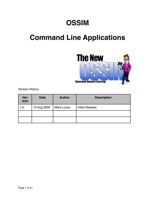
Version History<br />
Version<br />
<strong>OSSIM</strong><br />
<strong>Command</strong> <strong>Line</strong> <strong>Applications</strong><br />
Date Author Description<br />
1.0 15 Aug 2005 Mark Lucas Initial Release<br />
Page 1 of 31
Table of Contents<br />
Introduction 4<br />
Geo Spatial Production Tools 4<br />
Data Preparation Tools 4<br />
<strong>Command</strong> <strong>Line</strong> applications 5<br />
Page 2 of 31<br />
adrg_header_dump 5<br />
applanix2ogeom 5<br />
band-merge 6<br />
bilsplitter 7<br />
btoa 7<br />
ccfinfo 7<br />
chgkwval 7<br />
cibcadrg_ovr 8<br />
cibcadrg_split 8<br />
cmm 9<br />
create_cg 9<br />
create_histo 10<br />
datums 11<br />
deg2dms 11<br />
deg2rad 12<br />
deminfo 12<br />
dms2deg 12<br />
dtedInfo 12<br />
dtedlist 12<br />
ecg2ocg 12<br />
extract_vertices 12<br />
factory_dump 13<br />
icp 13<br />
igen 15<br />
image_info 15<br />
imagebounds 17<br />
img2md 17<br />
img2rr 18<br />
listgeo 19<br />
mtrsPerDeg 19<br />
mosaic 19<br />
mtrs2ft 20
ossim_height 20<br />
orthoigen 21<br />
pixelflip 23<br />
prune 25<br />
rpc2ogeom 26<br />
shpbuilder 26<br />
shpcutter 26<br />
shpdump 27<br />
space_imaging 27<br />
swapbytes 28<br />
tiffinfo 28<br />
tfw2ogeom 28<br />
thumbnail 29<br />
toc_dump 29<br />
vec2ras 29<br />
vector2kwl 31<br />
Summary 31<br />
Page 3 of 31
Introduction<br />
This document provides a summary of all of the command line applications and tools<br />
that are included in the <strong>OSSIM</strong> software distribution. <strong>OSSIM</strong> open source software for<br />
advanced remote sensing, image processing and geospatial mapping located at<br />
www.ossim.org . The core functionality of <strong>OSSIM</strong> is embedded in the <strong>OSSIM</strong> software<br />
library, the distributed command line applications are used the functionality that is stored<br />
in the software library. The distributed tools range from simple conversion utilities, data<br />
preparation and analysis to sophisticated product engines. The tools can be used from<br />
a shell or terminal, scripted, or called from other applications. For example, Image-<br />
Linker and iView are GUI applications that call some of the command line tools to provide<br />
functionality.<br />
Not all applications are created equal. To help orient the reader the following command<br />
line applications are highlighted by category:<br />
Geo Spatial Production Tools<br />
• icp - change from one geo-spatial format to another<br />
• igen - generate a geo-spatial image<br />
• mosaic - build a mosaic from multiple geo-spatial inputs<br />
• orthoigen - ortho-rectify and build a geo-spatial product<br />
Data Preparation Tools<br />
• img2rr - create reduced resolution pyramid images<br />
• create_histo - create a histogram<br />
• cmm - calculate minimum and maximum pixel values<br />
• extract_vertices - Detects the vertices of a projected image<br />
The following is an alphabetical listing of the individual command line applications:<br />
Page 4 of 31
<strong>Command</strong> <strong>Line</strong> applications<br />
adrg_header_dump<br />
Performs a listing of an Arc Digitized Raster Graphic (ADRG) file.<br />
Usage: ./adrg_header_dump <br />
This application dumps to screen the contents of an ADRG Header<br />
(.gen) file.<br />
applanix2ogeom<br />
A utility to convert applanix meta-data to an ossim geometry file.<br />
Usage: applanix2ogeom <br />
Options:<br />
--disable-elev Will disable the elevation<br />
--disable-notify Takes an argument. Arguments are ALL, WARN,<br />
NOTICE, INFO, FATAL, DEBUG. If you want multiple<br />
disables then just do multiple --disable-notify on the<br />
command line. All argument are case insensitive.<br />
Default is all are enabled.<br />
--ossim-logfile takes a logfile as an argument. All output<br />
messages are redirected to the specified log file.<br />
By default there is no log file and all messages<br />
are enabled.<br />
-K specify individual keywords to add to the<br />
preferences keyword list: name=value<br />
-P specify a preference file to load<br />
-T specify the classes to trace, ex:<br />
ossimInit|ossimImage.*<br />
will trace ossimInit and all ossimImage classes<br />
-h or --help Shows help<br />
camera_file Serial number specific keyword list with camera<br />
parameters.<br />
exterior_orientation_file Applanix exterior orientation file.<br />
imageToProcess Image to create geometry for.<br />
option_output_directory Option directory to output<br />
geometry file(s) to. If not set the imageToProcess<br />
directory will be used.<br />
Page 5 of 31
and-merge<br />
Merges multiple image files into a single band merged file.<br />
Usage:<br />
Options:<br />
--disable-elev Will disable the elevation<br />
--disable-notify Takes an argument. Arguments are ALL, WARN, NOTICE,<br />
INFO, FATAL, DEBUG. If you want multiple disables<br />
then just do multiple --disable-notify on the command<br />
line. All argument are case insensitive. Default is<br />
all are enabled.<br />
--ossim-logfile takes a logfile as an argument. All output messages<br />
are redirected to the specified log file. By default<br />
there is no log file and all messages are enabled.<br />
-K specify individual keywords to add to the preferences<br />
keyword list: name=value<br />
-P specify a preference file to load<br />
-T specify the classes to trace, ex:<br />
ossimInit|ossimImage.*<br />
will trace ossimInit and all ossimImage classes<br />
-h or --help Display this information<br />
-o or --create-overiew Creates and overview for the output image<br />
-w or --tile-width Defines the tile width for the handlers that support<br />
tiled output<br />
band_merge: Band Merge<br />
Usage:<br />
band_merge [-h][-o][-w tile_width] <br />
... <br />
Optional argument list:<br />
-h -- display Usage/Help<br />
-o -- create an ossim overview file with output file<br />
-w -- tile width (default = 32)<br />
NOTES:<br />
"-w" option only valid with tiff type.<br />
"Tile width must be a multiple of 32.<br />
Valid output writer types:<br />
• tiff_strip<br />
• tiff_strip_band_separate<br />
Page 6 of 31
• tiff_tiled<br />
• tiff_tiled_band_separate<br />
• general_raster_bip<br />
• general_raster_bil<br />
• general_raster_bsq<br />
• jpeg<br />
bilsplitter<br />
Splits an input Band Interleaved by <strong>Line</strong> (BIL) file into multiple output files<br />
with each file containing an individual band.<br />
usage:<br />
bilsplitter <br />
<br />
NOTE:<br />
Given a band interleaved by line (bil) image this application will split<br />
the file into separate one band files and write to the output directory.<br />
btoa<br />
Binary to ASCII conversion.<br />
USAGE: btoa <br />
converts a file from binary to ascii<br />
ccfinfo<br />
Lists information on a Chip Chunk Format (CCF) file.<br />
Usage: ccfinfo <br />
Dumps a ccf header to screen. CCF stands for chip chunk format and used in<br />
government locations by the Harris MET program.<br />
chgkwval<br />
Usage: chgkwval <br />
Changes the keyword value within the keyword list to value specified.<br />
Example: chgval band1.spec area.size "pixels 7689 8031"<br />
Changes the keyword value of area.size to pixels 7689 8031<br />
Page 7 of 31
Note 1: Use no colon ":" after the keyword.<br />
Note 2: If the keyword is present in the keyword list it will<br />
be overwritten.<br />
Note 3: If the keyword is not in the keyword list it will be added.<br />
Note 4: Enclose value in double quotes if it is more than one string.<br />
cibcadrg_ovr<br />
cibcadrg [options] <br />
-o takes the entry you wish<br />
to build an overview for<br />
-e lists all entries for the passed<br />
in product<br />
-p llists all the products<br />
-g prints the image geometry for the specified entry<br />
-a build overviews for all entries<br />
cibcadrg_split<br />
cibcadrg_split [-h] [-l] [-p] [-e] [-o]<br />
<br />
-h | -H -- Display Usage/Help<br />
-l -- List all entries in product<br />
-p -- specify product to split<br />
-e -- specify entry to split<br />
-o you can specify a different output directory<br />
the default is the same directory as the a.toc<br />
file<br />
Examples:<br />
cibcadrg_split -e 2 -o /my/path/out /my/rpf/a.toc<br />
will export entry 2 in the a.toc file to<br />
/my/path/out<br />
Page 8 of 31
cmm<br />
Compute min/max pixel values from within a file. Important to run this on<br />
radiometries other than 8 bit.<br />
Usage: cmm <br />
This program will force a recompute of Min/Max Pixel Values.<br />
Options:<br />
--disable-elev Will disable the elevation<br />
--disable-notify Takes an argument. Arguments are ALL, WARN,<br />
NOTICE, INFO, FATAL, DEBUG. If you want multiple<br />
disables then just do multiple --disable-notify on the<br />
command line.<br />
All arguments are case insensitive. Default is all are<br />
enabled.<br />
--ossim-logfile takes a logfile as an argument. All output messages are<br />
redirected to the specified log file. By default there<br />
is no log file and all messages are enabled.<br />
-K specify individual keywords to add to the preferences<br />
keyword list: name=value<br />
-P specify a preference file to load<br />
-T specify the classes to trace, ex: ossimInit|ossimImage.*<br />
will trace ossimInit and all ossimImage classes-<br />
-e or --entry Give the entry(zero based) to compute min / max for.<br />
NOTE: Option only valid with a single file.<br />
-h or --help Display this information<br />
-l or --list-entries Lists the entries within the image and returns without<br />
doing anything else.<br />
-p print values to standard output<br />
NOTES:<br />
- Default output is to a ".omd" file so if the image was "foo.tif" you<br />
will get a "foo.omd".<br />
- If the .omd file exists already this will open it and add<br />
or, overwrite the min, max keywords only.<br />
- If the -p option is used no .omd file will be written.<br />
create_cg<br />
create coarse grid<br />
Page 9 of 31
Usage: create_cg [options] <br />
Options:<br />
--disable-elev Will disable the elevation<br />
--disable-notify Takes an argument. Arguments are ALL, WARN, NOTICE,<br />
INFO,<br />
FATAL, DEBUG. If you want multiple disables then just do<br />
multiple --disable-notify on the command line. All argument<br />
are case insensitive. Default is all are enabled.<br />
--ossim-logfile takes a logfile as an argument. All output messages are<br />
redirected to the specified log file. By default there is<br />
no log file and all messages are enabled.<br />
-K specify individual keywords to add to the preferences<br />
keyword list: name=value<br />
-P specify a preference file to load<br />
-T specify the classes to trace, ex: ossimInit|ossimImage.*<br />
will trace ossimInit and all ossimImage classes<br />
-e default is .1. This is basically the pixel<br />
accuracy of the grid<br />
-h or --help Shows help<br />
-o Specify a new base output name default<br />
it's base name is .dat and .geom.<br />
If specified then the output is .dat and<br />
.geom where the .dat is the coarse grid<br />
and the .geom is the model<br />
-s give the min line sample spacing<br />
for the coarse grid. Helps in converging. Basically will<br />
stop splitting if number of pixels per grid cell gets<br />
below this number.<br />
create_histo<br />
create histogram<br />
Usage: create_histo <br />
Options:<br />
--disable-elev Will disable the elevation<br />
--disable-notify Takes an argument. Arguments are ALL, WARN, NOTICE,<br />
INFO,<br />
FATAL, DEBUG. If you want multiple disables then just do<br />
multiple --disable-notify on the command line. All argument<br />
are case insensitive. Default is all are enabled.<br />
Page 10 of 31
--ossim-logfile takes a logfile as an argument. All output messages are<br />
redirected to the specified log file. By default there is<br />
no log file and all messages are enabled.<br />
-K specify individual keywords to add to the preferences<br />
keyword list: name=value<br />
-P specify a preference file to load<br />
-T specify the classes to trace, ex: ossimInit|ossimImage.*<br />
will trace ossimInit and all ossimImage classes<br />
-h or --help Display this information<br />
-i Creates a histogram from the image_file.<br />
-l Output the specified number of res levels (not<br />
supported for import histogram -i option<br />
-o Output the histogram to the indicated file.<br />
-p Imports imagelinks proprietary<br />
histogram_file.<br />
examples:<br />
create_histo foo.tif<br />
Will create a histogram for the input image and call<br />
it foo.his<br />
create_histo -i foo.tif -o foo.his<br />
this will compute a histogram from the input foo.tif<br />
and write it to foo.his<br />
create_histo -p foo2.his -o foo.his<br />
will import the proprietary histogram file and output<br />
an ossim histogram file to foo.his<br />
NOTE: If no output is given it will default to output.his<br />
unless the special case of a single input image is given<br />
datums<br />
list the datums<br />
datums invokes a utility that prints all of the <strong>OSSIM</strong> supported datums to the<br />
screen.<br />
deg2dms<br />
degrees to degrees minutes seconds. Interactive command line program.<br />
Page 11 of 31
deg2rad<br />
converts from degrees to radians<br />
deminfo<br />
A: deminfo<br />
Usage: deminfo<br />
Dumps a dem header to screen.<br />
dms2deg<br />
A: converts from degrees minutes seconds to decimal degrees<br />
dtedInfo<br />
dumps information on a dted cell<br />
Usage: dtedInfo <br />
NOTE: This application outputs all header information associated with a<br />
DTED Level 1 file.<br />
dtedlist<br />
dtedList<br />
Usage: dtedlist <br />
NOTE: This application outputs all header information and Data record information<br />
associated with a DTED Level 1 file.<br />
ecg2ocg<br />
A: converts from an enhanced coarse grid to an ossim coarse grid. ecgs are<br />
used by the government and output by a program called MET.<br />
ecg2ocg<br />
Usage: ./ecg2ocg<br />
extract_vertices<br />
Used to compute the valid vertices (corners) of an image. Defines a polygon<br />
- inside the polygon are valid sampled pixels outside are nulls.<br />
extract_vertices <br />
NOTE:<br />
Page 12 of 31
The vertices define the bounds of the valid imagery. Map projected image files<br />
typically contain “Null” pixels that are outside the valid sampled pixels.<br />
Scans the image, extracts vertices and writes results to a keyword list.<br />
Name of the keyword list is the image_file with"_vertices.kwl" appended.<br />
So if image = "foo.tif" then results file = "foo_vertices.kwl".<br />
factory_dump<br />
A: factory_dump<br />
Performs a listing of all of the internal <strong>OSSIM</strong> factories. Factories are a<br />
mechanism for registering and serving functionality within the library.<br />
icp<br />
image copy - converts from one format to another. icp operates in image<br />
space - not in geographical space. It is used to chip or crop existing images,<br />
change file formats and also select from existing reduced resolution layers<br />
where they exist. icp does not resample the imagery, it reformats and can<br />
segment from the source file. The iView GUI application operates as a<br />
viewer and a way to set up parameters for icp. icp can be called from the<br />
command line or from an application - e.g. iView.<br />
Usage: icp [options] <br />
Options:<br />
--disable-elev Will disable the elevation<br />
Page 13 of 31
--disable-notify Takes an argument. Arguments are ALL, WARN,<br />
NOTICE, INFO, FATAL, DEBUG. If you want multiple<br />
disables then just do multiple --disable-notify<br />
on the command line. All argument are case<br />
insensitive. Default is all are enabled.<br />
--ossim-logfile takes a logfile as an argument. All output<br />
messages are redirected to the specified log<br />
file. By default there is no log file and all<br />
messages are enabled.<br />
-K specify individual keywords to add to the<br />
preferences keyword list: name=value<br />
-L or --end-line Which end line do you wish to copy from the<br />
input. If none is given then max line is used<br />
-P specify a preference file to load<br />
-T specify the classes to trace, ex:<br />
ossimInit|ossimImage.*<br />
will trace ossimInit and all ossimImage classes<br />
-a or --use-scalar-remapper Uses scalar remapper, transforms to 8-bit<br />
-b or --bands uses the specified bands: ex. "1, 2, 4" will<br />
select bands 1 2 and 4 of the input image. Note:<br />
it is 1 based<br />
-c or --compression-type Uses compression. Currently valid for only tiff<br />
output -c jpeg will use jpeg compression<br />
-e or --entry For multi image handlers which entry do you wish<br />
to extract<br />
-h or --help Display this information<br />
-l or --start-line Which start line do you wish to copy from the<br />
input. If none is given then 0 is used<br />
-o or --create-overview Creates and overview for the output image<br />
-p or --end-sample Which end sample do you wish to copy from the<br />
input. If none is given then max sample is used<br />
-q or --compression-quality Uses compression. Valid for jpeg type. default<br />
is 75 where 100 is the best and 1 is the worst<br />
-r or --res-level Which res level to extract from the input: ex -r<br />
1 will get res level 1<br />
-s or --start-sample Which start sample do you wish to copy from the<br />
input. If none is given then 0 is used<br />
-t or --create-thumbnail Takes an argument which is the maximum pixel<br />
dimension desired.<br />
Create thumbnail flag is enabled<br />
-w or --tile-width Defines the tile width for the handlers that<br />
support tiled output<br />
Page 14 of 31
NOTES:<br />
Valid output writer types:<br />
• tiff_strip<br />
• tiff_strip_band_separate<br />
• tiff_tiled<br />
• tiff_tiled_band_separate<br />
• jpeg<br />
• general_raster_bip<br />
• general_raster_bil<br />
• general_raster_bsq<br />
• general_raster_bip_envi<br />
• general_raster_bil_envi<br />
• general_raster_bsq_envi<br />
• nitf_block_band_separate<br />
• nitf_block_band_sequential<br />
igen<br />
image generator, makes a product as defined in the spec file<br />
Usage: igen [options] <br />
Options:<br />
--disable-elev Will disable the elevation<br />
--disable-notify Takes an argument. Arguments are ALL, WARN, NOTICE,<br />
INFO, FATAL, DEBUG. If you want multiple disables then just do multiple<br />
--disable-notify on the command line. All arguments are case insensitive.<br />
Default is all are enabled.<br />
--ossim-logfile takes a logfile as an argument. All output messages are<br />
redirected to the specified log file. By default there is<br />
no log file and all messages are enabled.<br />
-K specify individual keywords to add to the preferences<br />
keyword list: name=value<br />
-P specify a preference file to load<br />
-T specify the classes to trace, ex: ossimInit|ossimImage.*<br />
will trace ossimInit and all ossimImage classes<br />
-h or --help Display this information<br />
-t or --thumbnail thumbnail resolution<br />
image_info<br />
Page 15 of 31
Usage: image_infoimage_info [-i] [-p] [-v] [-o ]<br />
Options:<br />
--disable-elev Will disable the elevation<br />
--disable-notify Takes an argument. Arguments are ALL, WARN, NOTICE,<br />
INFO,<br />
FATAL, DEBUG. If you want multiple disables then just do<br />
multiple --disable-notify on the command line. All argument<br />
are case insensitive. Default is all are enabled.<br />
--ogeom-format Formats the data to an ossim gemetry file, seperate files<br />
for multi image file formats<br />
--ossim-logfile takes a logfile as an argument. All output messages are<br />
redirected to the specified log file. By default there is<br />
no log file and all messages are enabled.<br />
-K specify individual keywords to add to the preferences<br />
keyword list: name=value<br />
-P specify a preference file to load<br />
-T specify the classes to trace, ex: ossimInit|ossimImage.*<br />
will trace ossimInit and all ossimImage classes<br />
-h Display this information<br />
-i Will print out the general image information.<br />
-o Will output the information to the file specified. Default<br />
is to standard out.<br />
-p Will print out the projection information.<br />
-s Force the ground rect to be the specified datum<br />
-v Overwrite existing geometry.<br />
examples:<br />
image_info -i ./myfile.tif<br />
prints out only general image information<br />
image_info -p ./myfile.tif<br />
prints out only image projection information<br />
image_info -p -s wge ./myfile.tif<br />
prints out only image projection information and shifts to wgs84<br />
image_info -p -i ./myfile.tif<br />
prints out both image and projection information<br />
image_info -p -i ./myfile.tif -o ./myfile.geom<br />
writes geometry file with both image and projection information<br />
Page 16 of 31
image_info -p -i ./myfile.tif -v -o ./myfile.geom<br />
writes geometry file with both image and projection information<br />
while overwriting exisitng .geom file.<br />
imagebounds<br />
imagebounds [-d ] [-t ] [-c ] [-o outputfile] inputfile<br />
options:<br />
-t give an output format. Default is csv. The only valid options are:<br />
csv.<br />
-c give the coordinate type for the output bounds. Default geographic.<br />
This currently an be:<br />
geographic<br />
meters<br />
-o Give the optional output file name.<br />
-d output datum code<br />
inputfile This is the file we will use to compute the image bounds for<br />
outputfile This is the file we will use to output the information to. If this<br />
is not given then by default it will change the extension of the inputfile<br />
to match the given output type. For example csv output would have<br />
a .csv<br />
extension.<br />
NOTE: The last argument must be the input file<br />
img2md<br />
Image to meta data<br />
I've added an "img2md" application. Application to output metadata given<br />
metadata type, source image, output file. Additional keywords can be passed<br />
to writer via the "-t" option which takes a keyword list.<br />
So you can do:<br />
$ img2md tiff_world_file foo.tif foo2.tfw<br />
Now you have a tfw file.<br />
Or:<br />
Page 17 of 31
$ img2md ossim_readme foo.tif foo_readme.txt<br />
img2rr<br />
This command creates reduced resolution images, also known as a pyramid<br />
image structure from the input image.<br />
Reduced resolution layers are created by iteratively downsampling the full resolution<br />
image. The results are stored in a .ovr (overview) file. This structure improves<br />
the efficiency of arbitrary access to different spatial resolutions and areas of<br />
interest. The <strong>OSSIM</strong> library will automatically select the appropriate layer and area<br />
of interest for needed operations.<br />
Usage: img2rr [options] <br />
Options:<br />
--disable-elev Will disable the elevation<br />
--disable-notify Takes an argument. Arguments are ALL, WARN, NO-<br />
TICE,<br />
INFO, FATAL, DEBUG. If you want multiple disables<br />
then just do multiple --disable-notify on the command<br />
line. All argument are case insensitive. Default is<br />
all are enabled.<br />
--list-entries Lists the entries within the image<br />
--ossim-logfile takes a logfile as an argument. All output messages<br />
are redirected to the specified log file. By default<br />
Page 18 of 31
there is no log file and all messages are enabled.<br />
-K specify individual keywords to add to the preferences<br />
keyword list: name=value<br />
-P specify a preference file to load<br />
-T specify the classes to trace, ex:<br />
ossimInit|ossimImage.*<br />
will trace ossimInit and all ossimImage classes<br />
-a or --include-fullres Wants to include full res dataset as well as reduced<br />
res sets.<br />
-e or --entry Give the entry(zero based) to build an overview for.<br />
-h or --help Shows help<br />
listgeo<br />
from geoTiff<br />
Usage: listgeo [-d] [-tfw] [-proj4] [-no_norm] [-t tabledir] filename<br />
-d: report lat/long corners in decimal degrees instead of DMS.<br />
-tfw: Generate a .tfw (ESRI TIFF World) file for the target file.<br />
-proj4: Report PROJ.4 equivelent projection definition.<br />
-no_norm: Don't report 'normalized' parameter values.<br />
filename: Name of the GeoTIFF file to report on.<br />
mtrsPerDeg<br />
Usage: mtrsPerDeg <br />
Outputs the meters per degree and meters per minute for a given latitude.<br />
NOTE: Values are based on the geodetic radius of the WGS 84 ellipsoid.<br />
mosaic<br />
mosaic builds a mosaic from specified input<br />
Usage:<br />
mosaic [-h][-k ][-t ][-i ][-o ][-m ]<br />
Optional argument list:<br />
-h -- display Usage/Help<br />
Page 19 of 31
-i -- list of input images<br />
-k -- keyword list to load from<br />
-m -- Mosaic type (SIMPLE, BLEND, or FEATHER)<br />
-o -- output image file<br />
-t -- output a template<br />
Please see the usage.txt file for more info.<br />
mtrs2ft<br />
converts from meters to feet. Also has a command line switch to calculate<br />
US survey feet. For example, state plane projections are often calculated<br />
using survey feet.<br />
Usage: mtrs2ft [-u] <br />
This will give you feet from meters.<br />
Options:<br />
-u -- Use US survey feet per meter. (0.3048006096 meter = one foot)<br />
ossim_height<br />
Queries a lat/lon point and returns the elevation at that point as calculated<br />
by <strong>OSSIM</strong>. Useful for validating that ossim_preferences and paths to elevation<br />
sets and geoids are set up properly.<br />
Usage: ossim_height <br />
Options:<br />
--disable-elev Will disable the elevation<br />
--disable-notify Takes an argument. Arguments are ALL, WARN, NOTICE,<br />
INFO,<br />
FATAL, DEBUG. If you want multiple disables then just do<br />
multiple --disable-notify on the command line. All argument<br />
are case insensitive. Default is all are enabled.<br />
--ossim-logfile takes a logfile as an argument. All output messages are<br />
redirected to the specified log file. By default there is<br />
no log file and all messages are enabled.<br />
-K specify individual keywords to add to the preferences<br />
keyword list: name=value<br />
-P specify a preference file to load<br />
Page 20 of 31
-T specify the classes to trace, ex: ossimInit|ossimImage.*<br />
will trace ossimInit and all ossimImage classes<br />
-h or --help Shows help<br />
orthoigen<br />
Orthorectifies an image and is built on top of igen. It is better suited for<br />
scripting as many settings can be passed in as parameters and it supports<br />
but doesn’t require a keyword list.<br />
For orthoigen you must at a minimum specify an input and an output. This<br />
would actually be equivalent to an image copy.<br />
Currently the ouptut writer type is specified by the extension of the filename.<br />
In most cases you will also be specifying a<br />
view.<br />
SIMPLE<br />
orthoigen <br />
Assume we have input foo.tif and we wish to convert it to foo.jpg:<br />
orthoigen foo.tif foo.jpg<br />
PROJECTION<br />
orthoigen --utm <br />
orthoigen --geo <br />
orthoigen --geo-scaled <br />
orthoigen --input-proj <br />
orthoigen --view-template view_template/utm_8.kwl <br />
TILING_TEMPLATE<br />
For now we have to enable a view when tiling<br />
orthoigen --utm --tiling-template <br />
Page 21 of 31
EXAMPLES:<br />
BLEND thumbnail<br />
orthoigen /data/sanfran_ccf/foo.ccf /data/sanfran_map/sanfran_map.tif<br />
output/blend.jpg --combiner-type ossimBlendMosaic -t 512 --utm<br />
1024x1024 tiling<br />
orthoigen --chain-template chain_templates/landsat_projected_321.kwl<br />
--tiling-template tiling_templates/1024x1024.kwl --thumbnail 2048 --utm<br />
/data/p44r34/l71044034_03420000725_hrf.fst output/<br />
SRTM 90 meter tiling<br />
orthoigen --geo --tiling-template tiling_templates/orthoigen_srtm_3arc.kwl<br />
/data/ele1/DTED3arc/w100/n40.dt1 output/<br />
orthoigen --view-template view_template/utm_8.kwl<br />
/data/sanfran_ccf/foo.ccf output/utm8.jpg --thumbnail 1024<br />
orthoigen<br />
Usage:<br />
Options:<br />
--chain-template Specify an external file that contains chain informatio<br />
--combiner-template Specify an external file that contains combiner<br />
information<br />
--combiner-type Specify what mosaic to use, ossimImageMosiac or<br />
ossimFeatherMosaic or osimBlendMosaic ... etc<br />
--disable-elev Will disable the elevation<br />
--disable-notify Takes an argument. Arguments are ALL, WARN, NOTICE,<br />
INF<br />
FATAL, DEBUG. If you want multiple disables then just<br />
multiple --disable-notify on the command line. All<br />
argument are case insensitive. Default is all are<br />
enabled.<br />
--geo Defaults to a geographic image chain with GSD = to the<br />
input. Origin of latitude is on the equator.<br />
--geo-scaled Takes a latitude as an argument for purpose of scaling.<br />
Page 22 of 31
Specifies that no spec file was defined. Defaults to a<br />
scaled geographic image chain with GSD = to the input.<br />
--input-proj Makes the view equal to the input. If more than one fi<br />
then the first is taken<br />
--meters Specifies an override for the meters per pixel<br />
--ossim-logfile takes a logfile as an argument. All output messages ar<br />
redirected to the specified log file. By default there<br />
is no log file and all messages are enabled.<br />
--resample-type Specify what resampler to use, nearest neighbor,<br />
bilinear, bicubic<br />
--slave-buffers number of slave tile buffers for mpi processing (defaul<br />
= 2)<br />
--tiling-template Specify an external file that contains tiling informati<br />
--utm Defaults to a utm image chain with GSD = to the input<br />
--view-template Specify an external file that contains view information<br />
--writer-template Specify an external file that contains tiling informati<br />
-K specify individual keywords to add to the preferences<br />
keyword list: name=value<br />
-P specify a preference file to load<br />
-T specify the classes to trace, ex: ossimInit|ossimImage.<br />
will trace ossimInit and all ossimImage classes<br />
-h or --help Display this information<br />
-t or --thumbnail thumbnail resolution<br />
pixelflip<br />
converts pixel values<br />
Usage: pixelflip [options] <br />
<br />
Options:<br />
--disable-elev Will disable the elevation<br />
--disable-notify Takes an argument. Arguments are ALL, WARN,<br />
NOTICE, INFO, FATAL, DEBUG. If you want multiple<br />
disables then just do multiple --disable-notify on the<br />
command line. All argument are case insensitive. Default<br />
is all are enabled.<br />
--ossim-logfile takes a logfile as an argument. All output messages<br />
are redirected to the specified log file. By default<br />
Page 23 of 31
there is no log file and all messages are enabled.<br />
-K specify individual keywords to add to the preferences<br />
keyword list: name=value<br />
-P specify a preference file to load<br />
-T specify the classes to trace, ex:<br />
ossimInit|ossimImage.*<br />
will trace ossimInit and all ossimImage classes<br />
-c or --clamp-value clamp values (any pixel with value larger than input<br />
will be clamped to input)<br />
-h or --help Display this information<br />
-m Replacement mode (see notes below)<br />
-o or --create-overview Creates and overview for the output image<br />
-w output tile width(only valid with tiled output<br />
types). Must be a multiply of 16<br />
NOTES:<br />
-m Replacement mode option explanation:<br />
Valid modes = "all", "partial", and "full" (default=all)<br />
If mode is "all" (default):<br />
Any pixel with dn of target will be replaced.<br />
If mode is "partial":<br />
Target will be replaced only at least one subpixel(band) does<br />
not have the target.<br />
If mode is "full":<br />
Target will be repaced only if all subpixels(bands) have the target.<br />
Example:<br />
target = 0<br />
replacement = 1<br />
Pixel at (0, 0) r=0, g=0, b=0<br />
Pixel at (0, 1) r=0, g=30, b=21<br />
Mode is "all":<br />
Pixel at (0, 0) becomes r=1, g=1, b=1<br />
Pixel at (0, 1) becomes r=1, g=30, b=21<br />
Mode is "partial":<br />
Pixel at (0, 0) remains r=0, g=0, b=0<br />
Pixel at (0, 1) becomes r=1, g=30, b=21<br />
Page 24 of 31
Mode is "full":<br />
Pixel at (0, 0) becomes r=1, g=1, b=1<br />
Pixel at (0, 1) remains r=0, g=30, b=21<br />
Valid output writer types:<br />
• tiff_strip<br />
• tiff_strip_band_separate<br />
• tiff_tiled<br />
• tiff_tiled_band_separate<br />
• jpeg<br />
• general_raster_bip<br />
• general_raster_bil<br />
• general_raster_bsq<br />
• general_raster_bip_envi<br />
• general_raster_bil_envi<br />
• general_raster_bsq_envi<br />
• nitf_block_band_separate<br />
• nitf_block_band_sequential<br />
prune<br />
The prune command was designed to be scripted against directories of files<br />
to determine which files were blank or contained only null values. As an example,<br />
large areas can get output as geographic or image based tiles. When<br />
operating on projected imagery it is possible that many of the individual tiles<br />
will contain only null values. The prune utility can be run against the images<br />
to determine those cases.<br />
Page 25 of 31
<strong>OSSIM</strong> can produce tiled output on geographic or pixel boundaries. prune can test<br />
for null or empty tiles.<br />
prune: Displays if image is null or not.<br />
Usage: prune<br />
rpc2ogeom<br />
converts from residual polynomial coefficients to an ossim geometry file.<br />
rpc2ogeom []<br />
Currently we have tag readers<br />
for nitf<br />
Is an optional output file. It<br />
will default to the input file and change<br />
to a .geom extension.<br />
shpbuilder<br />
USAGE: shpbuilder <br />
This program creates an ESRI shapefile from an EMET or <strong>OSSIM</strong> spec file.<br />
NOTES:<br />
- Remember to uncomment keywords (ie. // area.lat_lon)<br />
- Polygon shape is created from bounding rectangle, not vertices<br />
shpcutter<br />
ESRI Shapefile cutter<br />
USAGE: shputils <br />
USAGE: shputils <br />
{ }<br />
{ }<br />
{ }<br />
{ }<br />
Clip functions for Cut and Polygon are not supported yet...<br />
{ }<br />
{ }<br />
Page 26 of 31
{ }<br />
{ }<br />
The program will append to an existing shape file or it will<br />
create a new file if needed.<br />
Only the items in the first output file will be preserved.<br />
When an item does not match with the append theme then the item<br />
might be placed to an existing item at the same position and type.<br />
OTHER FUNCTIONS:<br />
- Select a group of shapes from a comma separated selection list.<br />
- UnSelect a group of shapes from a comma separated selection list.<br />
- Clip boundary extent or by theme boundary.<br />
Touch writes all the shapes that touch the boundary.<br />
Inside writes all the shapes that are completely within the boundary.<br />
*(N/A) Cut will cookie-cut shapes that are touching the boundary.<br />
Boundary clips are only the min and max of a theme boundary.<br />
*(N/A) Polygon clips use the polygons within a theme.<br />
- Erase boundary extent or by theme boundary.<br />
Erase is the direct opposite of the Clip function.<br />
- Change coordinate value units between meters and feet.<br />
There is no way to determine the input unit of a shape file.<br />
Skip this function if the shape file is already in the correct unit.<br />
Clip and Erase will be done before the unit is changed.<br />
A shift will be done after the unit is changed.<br />
- Shift X and Y coordinates.<br />
Finally, There can only be one select or unselect in the command line.<br />
There can only be one clip or erase in the command line.<br />
There can only be one unit and only one shift in the command line.<br />
EX: shputils in.shp out.shp CLIP 10 10 90 90 Touch UNIT Feet SHIFT 40 40<br />
shputils in.shp out.shp SELECT countycode 3,5,9,13,17,27<br />
shpdump<br />
lists a shape file<br />
shpdump<br />
space_imaging<br />
A: makes a geometry file from space_imaging format<br />
space_imaging out_geom<br />
Page 27 of 31
Note: out_geom is defaulted to output.kwl<br />
swapbytes<br />
swapbytes<br />
USAGE: swapbytes [-h][-b ] input_file> <br />
Swaps bytes of input_file and outputs result to output_file.<br />
Note:<br />
- Data type of a short (two bytes per pixel) is the default.<br />
- Supported bytes_per_pixel: 2, 4, and 8<br />
tiffinfo<br />
Provides info on the tiff tags from a tif file.<br />
LIBTIFF, Version 3.7.1<br />
Copyright (c) 1988-1996 Sam Leffler<br />
Copyright (c) 1991-1996 Silicon Graphics, Inc.<br />
usage: tiffinfo [options] input...<br />
where options are:<br />
-D read data<br />
-i ignore read errors<br />
-c display data for grey/color response curve or colormap<br />
-d display raw/decoded image data<br />
-f lsb2msb force lsb-to-msb FillOrder for input<br />
-f msb2lsb force msb-to-lsb FillOrder for input<br />
-j show JPEG tables<br />
-o offset set initial directory offset<br />
-r read/display raw image data instead of decoded data<br />
-s display strip offsets and byte counts<br />
-w display raw data in words rather than bytes<br />
-z enable strip chopping<br />
-# set initial directory (first directory is # 0)<br />
tfw2ogeom<br />
Convert a tiff world file to an ossim geometry file.<br />
Page 28 of 31
tfw2ogeom []<br />
Options:<br />
-h Display usage.<br />
-w Write a template to template_file.<br />
See template.kwl for descriptions<br />
[] optional argumaent and if not supplied<br />
defaults to the tif world file with a<br />
.geom extension<br />
thumbnail<br />
libtiff utility thumbnail file generator<br />
usage: thumbnail [options] input.tif output.tif<br />
where options are:<br />
-h # specify thumbnail image height (default is 274)<br />
-w # specify thumbnail image width (default is 216)<br />
-c linear use linear contrast curve<br />
-c exp50 use 50% exponential contrast curve<br />
-c exp60 use 60% exponential contrast curve<br />
-c exp70 use 70% exponential contrast curve<br />
-c exp80 use 80% exponential contrast curve<br />
-c exp90 use 90% exponential contrast curve<br />
-c exp use pure exponential contrast curve<br />
toc_dump<br />
table of contents listing.<br />
usage:<br />
toc_dump<br />
vec2ras<br />
vector to raster conversion<br />
Page 29 of 31
vec2ras [options] <br />
Options:<br />
-k Takes a keywordlist that describes the<br />
drawing techniques of the vector file and<br />
the output projection. Please see the -t<br />
option to generate template kwl to edit<br />
-t Generates a keywordlist for this app to take in<br />
with the -k option<br />
-o Raster output filename<br />
currently only geotiff output<br />
-d dump vertices to file<br />
Currently we only support shape files<br />
.shp .dbf .shx<br />
Typical usage example:<br />
Assuming you have file my_shape_file.shp to convert.<br />
run the command:<br />
vec2ras -t my_shape_file.kwl<br />
The above command will output a my_shape_file.kwl which is a template.<br />
Edit my_shape_file.kwl for desired output.<br />
NOTE:<br />
The meters_per_pixel keywords determine the file size.<br />
If your shape file covers a large geographic area and you use<br />
a meters_per_pixel of 1 you're going to get a huge output file.<br />
After editing the my_shape.kwl.<br />
run the command:<br />
vec2ras -k my_shape_file.kwl -o my_shape_file.tif my_shape_file.shp<br />
You now should have a rasterized shape file called my_shape_file.tif.<br />
Page 30 of 31
vector2kwl<br />
converts a vector to a keyword list<br />
vector2kwl -o <br />
the vector file<br />
to convert to keywordlist<br />
This must be last<br />
optional output file for keywordlist<br />
General information:<br />
This application is a start of a generic vector file to ossim<br />
Annotation keywordlist. Currently only shape files are supported<br />
and outputs only polygons and assumes geographic with a wgs84<br />
ellipsoid.<br />
Summary<br />
This document provided a quick summary of the various command line applications,<br />
tools and utilities that are included in the <strong>OSSIM</strong> distribution. These tools can be used<br />
from the shell or terminal or scripted for more complex image processing flows. Refer<br />
to www.ossim.org for additional information and join the mailing list their for questions<br />
and assistance.<br />
Page 31 of 31