Village of Spencerport Eastern Village Corridor Concept Study
Village of Spencerport Eastern Village Corridor Concept Study
Village of Spencerport Eastern Village Corridor Concept Study

Create successful ePaper yourself
Turn your PDF publications into a flip-book with our unique Google optimized e-Paper software.
II. Inventory and Analysis<br />
The highest number <strong>of</strong> accidents within the study area occurred at the Canal-Big Ridge<br />
intersection. Based on the summary information provided for this intersection, a majority <strong>of</strong><br />
the accidents were “Property Damage Only” and not injury type accidents. The Lyell<br />
Avenue / Union Street intersection has the second highest number <strong>of</strong> accidents within the<br />
study area.<br />
PEDESTRIAN AND BICYCLE CONDITIONS<br />
Providing safe routes <strong>of</strong> travel for cars, bicycles, and pedestrians is a responsibility and<br />
priority for all communities. The safety <strong>of</strong> the Pedestrian Realm is appraised based on factors<br />
such as sidewalk width and quality, and the presence <strong>of</strong> a buffer zone, sometimes called the<br />
tree-lawn or the furnishings and edge zones. Pedestrian safety factors present in the<br />
travelway include crosswalk length and quality and the presence (or absence) <strong>of</strong> medians as<br />
well as the type <strong>of</strong> median. Bicycle safety is judged on the presence or absence <strong>of</strong> a<br />
dedicated bicycle facility, shared lane widths including the on-street parking lane, and the<br />
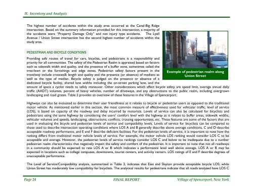
Example <strong>of</strong> pedestrian realm along<br />
Union Street<br />
amount <strong>of</strong> space a cyclist needs to safely maneuver. Other considerations which affect bicycle safety are speed limit, average annual daily<br />
traffic (AADT) volumes, percent <strong>of</strong> heavy vehicles, number <strong>of</strong> driveways, and any obstructions to the public realm, including overgrown<br />
landscaping and road grates. Table 2 provides an overview <strong>of</strong> these features in the <strong>Village</strong> <strong>of</strong> <strong>Spencerport</strong>.<br />
Highways can also be evaluated to determine their user friendliness as it relates to bicycle or pedestrian users as opposed to the traditional<br />
motor vehicle. As mentioned earlier in this section, the most common measure <strong>of</strong> effectiveness used for vehicular traffic, level <strong>of</strong> service<br />
(LOS), is based on capacity <strong>of</strong> the roadway and delay incurred by motorists. Levels <strong>of</strong> service can also be calculated for bicyclists and<br />
pedestrians using the same highway by considering the users’ comfort level with the highway as it relates to buffer areas, sidewalk widths,<br />
vehicular volumes and speeds, landscaping, obstructions, conflicts, crossing opportunities, etc. These features are some <strong>of</strong> the factors that are<br />
used in evaluating the bicycle and pedestrian levels <strong>of</strong> service and compatibility levels. Levels <strong>of</strong> service for bicyclists can be compared to<br />
those used to describe intersection operating conditions where LOS A and B generally describe above average conditions, C and D describe<br />
acceptable roadway performance, and E and F describe deficient facilities. For the pedestrian levels <strong>of</strong> service, it is important to note how the<br />
ranking differs from traditional motor vehicle levels <strong>of</strong> service. For example, the motor vehicle LOS ranking would consider LOS C to be<br />
acceptable and average. However, the pedestrian levels <strong>of</strong> service rankings consider LOS C and below to be inadequate due to a number<br />
pedestrian realm characteristics that negatively impact the safety and comfort <strong>of</strong> the pedestrian. It is important to note that not all roadways<br />
in a community should be expected to rate LOS A or B which indicates a performance level well above average. LOS A or B may be<br />
expected in locations such as college campuses, downtowns, tourist centers, and activity centers. LOS ratings <strong>of</strong> E and F describe degrees <strong>of</strong><br />
unacceptable performance.<br />
The Level <strong>of</strong> Service/Compatibility analysis, summarized in Table 3, indicates that East and Slayton provide acceptable bicycle LOS; while<br />
Union Street has moderately low compatibility for bicyclists. The analytical results for pedestrians indicate that all roads analyzed have LOS C<br />
Page 24 FINAL REPORT<br />
<strong>Village</strong> <strong>of</strong> <strong>Spencerport</strong>, New York