3D Analyst – Visualization with ArcGlobe - Esri
3D Analyst – Visualization with ArcGlobe - Esri
3D Analyst – Visualization with ArcGlobe - Esri
SHOW LESS

Create successful ePaper yourself
Turn your PDF publications into a flip-book with our unique Google optimized e-Paper software.
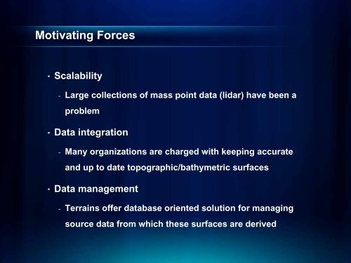
Motivating Forces<br />
• Scalability<br />
- Large collections of mass point data (lidar) have been a<br />
problem<br />
• Data integration<br />
- Many organizations are charged <strong>with</strong> keeping accurate<br />
and up to date topographic/bathymetric surfaces<br />
• Data management<br />
- Terrains offer database oriented solution for managing<br />
source data from which these surfaces are derived