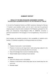
SUMMARY REPORT - MGB Region III
SUMMARY REPORT - MGB Region III
SUMMARY REPORT - MGB Region III

Create successful ePaper yourself
Turn your PDF publications into a flip-book with our unique Google optimized e-Paper software.
17. Palayan City<br />
• Updating of the 2005 Hazard Map (UNDP 2005)<br />
• Barangay locations are included in the geohazard database.<br />
• Landslide and flooding hazards are present in the city.<br />
• Barangays with susceptibility to flooding are influenced by the Pampanga River<br />
and creeks traversing the barangays. There are generally low lying portions with<br />
moderate to high susceptibility to flooding.<br />
• The mountainous areas have moderate to high susceptibility to landslides.<br />
18. Municipality of Pantabangan<br />
• There are three (3) barangays with low landslide susceptibility (East Poblacion,<br />
Malbang and Fatima).<br />
• There are three (3) barangays with low to moderate landslide susceptibility<br />
especially along the highway and road shoulders (BLISS-San Juan, Naponnapon<br />
and Conversion).<br />
• There is one (1) barangay with moderate to high landslide susceptibility. There<br />
are indications of old landslides in the barangay (Marikit).<br />
• Active riverbank erosion is observed in three (3) barangays (Fatima, Cambitala<br />
and BLISS-San Juan).<br />
• There are two (2) barangays with portions susceptible to moderate to high level<br />
floods. These barangays are located near active creeks/river and with portions<br />
that are located in generally low-lying areas. (Ganduz and Cadaclan).<br />
19. Municipality of Peñaranda<br />
• In terms of landslide susceptibility, no barangays in Peñaranda have the potential<br />
for landslide occurrence.<br />
• Active riverbank erosion is observed in seven (7) barangays (Callos, San Josef,<br />
Sinasajan, Las Piñas, Sto. Tomas, Poblacion 3 and Poblacion 4).<br />
13