

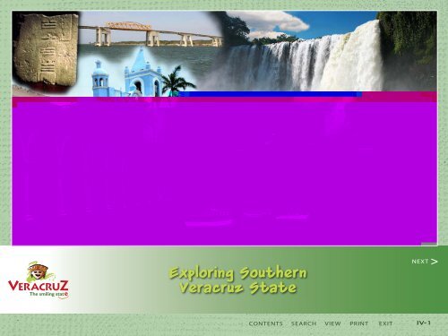
Exploring Southern Veracruz State (part 4) - Veracruz-smile.com
Exploring Southern Veracruz State (part 4) - Veracruz-smile.com
Exploring Southern Veracruz State (part 4) - Veracruz-smile.com

Create successful ePaper yourself
Turn your PDF publications into a flip-book with our unique Google optimized e-Paper software.
The smiling stat<br />
<strong>Exploring</strong> <strong>Southern</strong><br />
<strong>Veracruz</strong> <strong>State</strong><br />
CONTENTS SEARCH VIEW PRINT EXIT<br />
NEXT ><br />
IV-1
<strong>Southern</strong> Route<br />
The smiling stat<br />
<strong>Exploring</strong> South of <strong>Veracruz</strong> City<br />
CONTENTS SEARCH VIEW PRINT EXIT<br />
NEXT ><br />
< BACK<br />
IV-2
The smiling stat<br />
<strong>Exploring</strong> <strong>Southern</strong> <strong>Veracruz</strong> <strong>State</strong><br />
Sierra Los Tuxtlas Area<br />
CONTENTS SEARCH VIEW PRINT EXIT<br />
NEXT ><br />
< BACK<br />
IV-3
EXPLORING SOUTHERN<br />
VERACRUZ STATE<br />
This loop travels South from <strong>Veracruz</strong> City, Acayucan, to the Sierra Los Tuxtlas,<br />
Tlacotalpan, Alvarado and back to <strong>Veracruz</strong> City. Take a look at the driving<br />
route on page IV-2 to see the route to explore region in a circle trip from<br />
<strong>Veracruz</strong> City.<br />
SIERRA DE LOS TUXTLAS<br />
Some 260 km (161 miles) from <strong>Veracruz</strong>, an<br />
imposing cluster of volcanoes rises from<br />
the coastal plains of southern <strong>Veracruz</strong> creating<br />
the “Tuxtla Mountains” (pronounced<br />
TOOKS-tlahs). Not mountains in a traditional<br />
sense, rather a gigantic bowl of rich soil crisscrossed<br />
by rivers and blanketed with tropical<br />
vegetation, waterfalls and placid lakes.<br />
Peaks in this range include Volcano Santa<br />
Marta and Volcano San Martín Tuxtla,<br />
both rising above 1,700 meters (5,570 feet).<br />
The smiling stat<br />
<strong>Exploring</strong> South: Sierra de los Tuxtlas<br />
San Martín Tuxtla is the only recently-active<br />
volcano in the belt, erupting in 1664 and<br />
again in May 1793.German naturalist and<br />
explorer, Alexander Von Humboldt, <strong>com</strong>pared<br />
the region to Switzerland. Cortés himself<br />
laid claim to the area and built several<br />
sugar mills.<br />
The Sierra is located between the basins of<br />
the Papaloapan and Coatzacoalcos Rivers.<br />
The elevation makes the climate more <strong>com</strong>fortable<br />
and cooler than in lowland areas.<br />
This area is also the homeland to the great<br />
Olmec culture. Of the 17 giant Olmec stone<br />
heads which have been unearthed to date,<br />
all have <strong>com</strong>e from southern <strong>Veracruz</strong> and<br />
the neighboring state of Tabasco. These<br />
stone heads are considered to be among the<br />
richest discoveries of Mesoamerica’s earliest<br />
advanced civilization.<br />
There are many other lakes in this region,<br />
including Catemaco, Encantada,<br />
Chalchoapan and Majahual. With the<br />
exception of Catemaco, all of these are little<br />
visited and offer only basic services. The<br />
CONTENTS SEARCH VIEW PRINT EXIT<br />
NEXT ><br />
< BACK<br />
IV-4
OVERVIEW continues<br />
coastline of Los Tuxtlas region is gorgeous,<br />
but difficult to access. There are headlands,<br />
lagoons, bays, cattle pastures, and green hills<br />
rolling down the shore. The deserted beaches<br />
are dotted with small fishing villages, like La<br />
Barra, Playa Escondida, Montepió and Roca<br />
Partida.<br />
CATEMACO<br />
166 km south of <strong>Veracruz</strong> City<br />
Catemaco sits on the western shore of the mystical<br />
Laguna (Lake) Catemaco. At 361 meters (1,115 feet) in<br />
elevation, the area enjoys a relatively moderate climate.<br />
(However, it is usually more humid after heavy rainfall<br />
in June and October.) The oval-shaped lake is 8 km (4.9<br />
miles) wide and 11 km (6.8 miles) long, and lies in a crater<br />
ringed by volcanic hills. It is filled by four gushing rivers.<br />
The lake is nearly surrounded by a country road, and<br />
numerous islands jut from the dark green waters. Most<br />
visitors use Catemaco City as their base and take boat<br />
excursions to explore this beautiful lake, its shoreline<br />
and island attractions.<br />
Catemaco is arguably Mexico’s most picturesque lake.<br />
It’s surrounded by lush vegetation, including a wide vari-<br />
The smiling stat<br />
<strong>Exploring</strong> South: Catemaco<br />
ety of hardwood trees like cedar, mahogany, oak, walnut,<br />
laurel, ceiba, primavera, chico sapote (the source of<br />
chewing gum) and others. As for the wildlife, there are<br />
armadillos, raccoons, deer, squirrels, monkeys, ocelots,<br />
coyotes, and tlacuaches (Mexican opossums). The region<br />
is also known for its variety of poisonous snakes such as<br />
the coral snake, rattlesnake, sorda, and capulincillo.<br />
The Lake Catemaco area hosts some 550 species of<br />
migratory and local birds. Sparrows, woodpeckers, cardinals,<br />
doves, parakeets, herons, chachalacas, sparrow<br />
hawks, and other species thrive here and make this one<br />
of Latin America’s prime bird watching zones. In April<br />
and May, hundreds of herons nest on the tiny Isla de la<br />
Garzas. (Island of the Herons).<br />
The region’s exuberant ecology has caught the eye of<br />
Mystical Catemaco<br />
Catemaco is known throughout Mexico<br />
and Central America as sort of “ground<br />
zero” for mysticism, spells, white magic,<br />
ceremonial magic, incantations, and black<br />
magic. Melding pre-Hispanic, Catholic<br />
and West African voodoo practices, the<br />
town has more brujos (shaman) and traditional<br />
healers than anywhere else in<br />
Mexico. This marriage of religion and<br />
“witchcraft” has produced an interesting<br />
cultural heritage. Locals are known to<br />
attend mass, then cross the plaza to seek<br />
the services of mystics and shamans. It’s<br />
<strong>com</strong>mon for visitors to <strong>part</strong>icipate in simpler<br />
practices such as a limpia (cleansing)<br />
or perhaps a bit of white magic (spells<br />
and incantations).<br />
The town draws attention each year during<br />
its annual Witches Conference. The<br />
first Friday in March of each year, mystics<br />
from Mexico and other countries arrive to<br />
<strong>part</strong>icipate in a mass cleansing ceremony.<br />
The ceremony takes place on Cerro Mono<br />
Blanco (White Monkey Hill) just outside of<br />
Catemaco City. The town gets quite full,<br />
so channel your hotel reservation early!<br />
CONTENTS SEARCH VIEW PRINT EXIT<br />
NEXT ><br />
< BACK<br />
IV-5
Los Tuxtlas Biosphere Reserve<br />
Declared a Protected Area in 1979, this<br />
mountainous region is one of Mexico’s most biodiverse<br />
ecological treasures. The Reserve is centered<br />
on the San Martín Volcano, with mountainous<br />
terrain between 3300 and 5,600 feet altitude.<br />
The centerpiece (literally) in the San Martin<br />
Volcano, the highest peak in the region. There<br />
are three craters, countless streams, and ideal<br />
(humid) conditions for a proliferation of plant and<br />
animal species.<br />
For guide services to explore this region, look<br />
into the directory at www.mexicosagaz.<strong>com</strong>.<br />
The smiling stat<br />
CATEMACO continues<br />
<strong>Exploring</strong> North: Lake Catemaco<br />
Hollywood producers. Several major films have<br />
been shot here including Medicine Man (starring<br />
Sean Connery) and more recently Mel Gibson’s<br />
Apocalypto. Consider staying at, or stopping by the<br />
charming, 1950’s style La Finca Resort & Spa. The<br />
junior suites are named after famous actors.<br />
The town of Catemaco (population: 30,000) is<br />
located on the lake’s western shore. The tree-shaded<br />
city slopes gently toward the lake. Two blocks up<br />
from the waterfront is an attractive Plaza (zócalo),<br />
with its delightful Iglesia del Carmen and municipal<br />
palace. This colorful church has an ornately<br />
painted interior, while blue and silver accents highlight<br />
the golden stucco exterior. Note: In front of the<br />
palace, notice the ancient stone carved blocks that<br />
almost litter the sidewalk . It’s as if they had so many<br />
they didn’t know where to put them!<br />
Two blocks down from the zócalo is the malecón or<br />
boardwalk -- alive with restaurants, merchant stalls<br />
and hawkers enticing visitors onto boat tours. A<br />
two-hour shoreline/island tour costs around $6 US<br />
per person and is among the state’s highlights. For<br />
lake swimming, there are sandy beaches just a short<br />
walk north from downtown.<br />
Catemaco has a number of nurseries growing a wide<br />
variety of ornamental plants, fruit trees and medici-<br />
nal herbs. It is said that one thousand types of bromeliad<br />
grow along the shores of Catemaco. Floating<br />
water lilies dot the lake’s surface and several inlets<br />
are carpeted by flowering aquatic plants.<br />
Hotels in Catemaco include the 3-star Del Brujo (in<br />
town) and the lakeside 4-star La Finca (www.lafinca.<br />
<strong>com</strong>.mx) and 4-star Playa Azul (www.hotelplayaazul.<strong>com</strong>.mx).<br />
Note: La Finca is the most <strong>com</strong>plete<br />
and <strong>com</strong>fortable with a spa, lakeside pool, swimming<br />
beach and a good restaurant. Mel Gibson lived here for<br />
some four months while filming Apocalypto in 2005.<br />
Lake Tours<br />
To experience the lake from the water, there are dozens<br />
of boats to rent (literally on-demand) from different<br />
points around the lake. The per-person cost is<br />
usually around $6 US or $45US if you want a private<br />
tour. A typical trip goes something like this…<br />
Your panga will cruise from the waterfront of<br />
Catemaco City to the north shore, a zone rich in mineral<br />
springs. The most famous are those of Coyame,<br />
which provide mineral water for beverages with<br />
reputed medicinal benefits. Along the shore you’ll<br />
also see sandy beaches, birds of all sizes and colors<br />
(some nesting in the small islets), and enormous<br />
floating patches of water lilies.<br />
CONTENTS SEARCH VIEW PRINT EXIT<br />
NEXT ><br />
< BACK<br />
IV-6
LAKE CATEMACO continues<br />
The Parque Ecológico Nanciyaga is a mandatory<br />
stop for most lake tours. Located just 7 kms (4.3 miles)<br />
from Catemaco and reachable by car or taxi, this ecological<br />
reserve/Olmec-themed jungle walk is where<br />
the movie Medicine Man was filmed. While a bit contrived<br />
and <strong>com</strong>mercial, the park includes guided jungle<br />
tours past Olmec ceremonial replicas, temazcals, a<br />
spa, mineral water well, an amphitheater with occasional<br />
musical performances, and a shaman’s hut for<br />
limpias.<br />
Within the park, there are ten simple lakeside cabanas<br />
for rent. There is also a good restaurant, gift shop and<br />
kayak rentals. The 30-minute walking tour costs 30<br />
pesos (about $3 US) per person, but there are plenty<br />
of chances to drop some dinero along the way. The<br />
park is open daily 9am -6pm; tel. 52-294-943-0199;<br />
www.nanciyaga.<strong>com</strong>. The site claims to be “the most<br />
northerly patch of tropical rainforest on the planet.”<br />
From here, you’ll likely cross to the Isla Tanaxpi (also<br />
known as<br />
the Island of<br />
Monkeys). The<br />
island is home<br />
to about 60<br />
red-faced<br />
monkeys<br />
The smiling stat<br />
brought from Thailand in the 1970s by the University<br />
of <strong>Veracruz</strong> for “research”. Despite attempts to leave<br />
them in peace, an armada of boats visit throughout<br />
the day, filled with camera clicking, tortilla tossing<br />
vacationers. Despite the disruption, the colony is<br />
quite healthy. They keep reproducing and university<br />
staff monitors their habitat.<br />
From here the basic tour returns to Catemaco’s<br />
waterfront.<br />
De<strong>part</strong>ing Catemaco take a detour to experience the<br />
awesome Salto de Eyipantla, a 40-meter-wide (130<br />
feet), 50-meter-tall (160 feet) waterfall of exceptional<br />
beauty. The drive from Catemaco winds past simple<br />
roadside villages and tobacco fields where wooden<br />
sheds are used to cure the leaves with the heat of the<br />
sun. Park at the entrance to the waterfall and descend<br />
<strong>Exploring</strong>: Lake Catemaco, San Andrés Tuxtla<br />
some 170 steps to get an unforgettable view of this<br />
magnificent cascade. There’s also a trail along the<br />
waterfall’s rim (used by Mel Gibson in Apocalypto)<br />
with thrilling views of the river.<br />
SAN ANDRES TUXTLA<br />
12 km from Lake Catemaco<br />
San Andrés Tuxtla (12 kms/7.4 miles west of<br />
Catemaco; pop. 60,000) is a bustling city and regional<br />
capital. Highlighted by the San Andres River, this<br />
area is famous for its beautiful tropical rainforests<br />
that have inspired poets, musicians, and painters.<br />
The economy is based on the farming of beans, corn,<br />
plantain, coffee, and tobacco. Its provincial atmosphere<br />
and handsome old homes provide the backdrop<br />
to a bustling modern city with pleasant, hospitable<br />
people who hold tight to their customs and<br />
traditions. There’s not much in the way of tourism<br />
attractions, but take the opportunity to soak up some<br />
small town Mexican life and purchase some premium<br />
Mexican puros (cigars).<br />
Premium-quality leaves make it possible to manufacture<br />
internationally famous cigars. The Cruz Real and<br />
Santa Clara factories on the outskirts of town offer<br />
free tours. This is Mexico’s cigar capital and affordable,<br />
good quality puros are a real treat.<br />
CONTENTS SEARCH VIEW PRINT EXIT<br />
NEXT ><br />
< BACK<br />
IV-7
SAN ANDREAS TUXTLA continues<br />
The city lacks the charm of Santiago Tuxtla (your next<br />
stop), but there are some eco-recreation attractions<br />
nearby. The Laguna Encantada is a small lake situated<br />
within a crater (ideal for swimming). And further<br />
up the same road are trails that explore the now<br />
The smiling stat<br />
<strong>Exploring</strong> South: Santiago Tuxtla<br />
dormant Volcán de San Martín. Or contact Ecobiospera<br />
(www.ecobiosfera.<strong>com</strong> tel: 52-294-114-5849) who operates<br />
cabañas and an assortment of soft and more challenging<br />
eco-based activities.<br />
Lodging here is limited, but re<strong>com</strong>mended properties<br />
are the three-star<br />
Hotel San Martín, or<br />
the Hotel Michelle.<br />
View other options at<br />
www.allmexicohotels.<br />
<strong>com</strong><br />
SANTIAGO<br />
TUXTLA<br />
25 km from Lake<br />
Catemaco<br />
This small town (pop.<br />
16,000) was founded<br />
in 1525 and has a<br />
very relaxed charm<br />
and understates its<br />
importance to Olmec<br />
archaeology. It’s<br />
just13 km/8.3 miles<br />
farther north from<br />
San Andres along the<br />
main highway. Cortés himself founded Santiago<br />
Tuxtla in 1525. The town prospers from agriculture<br />
(tobacco primarily) and ranching. It rests in a river<br />
valley and boasts a verdant riverside plaza and is<br />
surrounded by rolling green foothills of the volcanic<br />
Sierra de los Tuxtlas.<br />
The Tepango River runs through the city, giving<br />
movement and freshness to the provincial<br />
atmosphere. The architecture of its handsome old<br />
houses with tile roofs, whitewashed walls, and<br />
cool verandas embrace neighbors that chat to the<br />
rhythm of their rocking chairs. This makes an ideal<br />
backdrop for the lives of warm, fun-loving people.<br />
In the colonial downtown area, an enormous<br />
Olmec head sits imposingly in the main square.<br />
The head is the largest ever discovered at 40 tons<br />
and 11 feet high! It has closed eyes and no nostrils<br />
--unlike the other heads found to date. It is known<br />
as the “Cobata head,” after the estate where it<br />
was found. The Tuxteco Regional Museum (also<br />
located in the town square) houses artifacts<br />
belonging to the Totonaco and Olmec cultures.<br />
Lodging is available at the Hotel Castellanos<br />
(one of the most unusually shaped hotels in the<br />
Americas, resembling a “stack of dishes”, which<br />
is ideally located adjacent to the main plaza. (tel.<br />
52- 294-947-0300). The four-star Hotel Kingdian is<br />
CONTENTS SEARCH VIEW PRINT EXIT<br />
NEXT ><br />
< BACK<br />
IV-8
SANTIAGO TUXTLA continues<br />
another option or the Gran Santiago Plaza.<br />
Santiago Tuxtla serves as a good base for exploring<br />
the town and archaeological site at Tres Zapotes (23<br />
km/14.2 miles to the west). Despite its former status<br />
as a stronghold of the Olmec culture, today the<br />
archaeological site is just mounds and cornfields<br />
(most of the site’s Olmec relics<br />
have been transplanted to either<br />
Xalapa or Mexico City). The site<br />
dates back to the early Olmec<br />
period (1,200 B.C.) and flourished<br />
from around 500 BC until 100 BC.<br />
The smiling stat<br />
The city once controlled a vast area of<br />
southern Mexico.<br />
The archaeological site is famed for its<br />
“Stela C.” A stela is an obelisk or upright<br />
stone pillar, thought to be a primitive<br />
<strong>com</strong>memoration or gravestone.<br />
In 1939, archeologist Matthew Stirling<br />
discovered the bottom half of Stela C.<br />
This stela was carved from basalt, with<br />
one side showing Olmec-style engraving<br />
and on the other was the oldest<br />
Mesoamerican long count calendar<br />
ever unearthed (use of bars and<br />
dots numbering system later adopted<br />
by the Mayan and Zapotec). It is said<br />
this finding gives the earliest positive<br />
proof of the Olmec “discovery” of the concept of<br />
zero. The small museum at the site also displays some<br />
of the most relevant finds of Olmec civilization. The<br />
Tres Zapotes Olmec head is here (dating to about 100<br />
B.C.) – the first head found in modern times (1862).<br />
<strong>Exploring</strong> South: Santiago Tuxtla, Tlacotalpan<br />
TLACOTALPAN<br />
98 km from Lake Catemaco; pop. 9,000; elevation 30 feet<br />
This color splashed colonial town lies 98 kms (61<br />
miles) from Catemaco and 97 kms (60 miles) south<br />
of <strong>Veracruz</strong> City. The name “Tlacotalpan” is Nahuatl<br />
meaning “place between the rivers.” In keeping with<br />
its namesake, this is a riverside city of colonial streets<br />
lined with porticos and striking buildings fronted by<br />
colonnades. It is known for its classic architecture and<br />
buildings painted in bright, contrasting pastel colors<br />
and red tiled roofs.<br />
Tlacotalpan was chosen as a UNESCO World<br />
Heritage Site in 1998. The designation reads the<br />
“urban layout and architecture of Tlacotalpan represent<br />
a fusion of Spanish and Caribbean traditions of<br />
exceptional importance and quality... Its outstanding<br />
character lies in its townscape of wide streets,<br />
modest houses in an exuberant variety of styles and<br />
colors, and many mature trees in public and private<br />
open spaces.” (UNESCO, 1998.) The city is a delight to<br />
explore and when visiting during the hot summer<br />
months you’ll have the place to yourself.<br />
The area had been inhabited since pre-Columbian<br />
times by the Totonaco and Toltec peoples, however<br />
little remains of these cultures. Spanish conquistador<br />
Pedro de Alvarado first visited the area in 1518.<br />
In the late 1520’s, Hernán Cortés formed Mexico’s<br />
CONTENTS SEARCH VIEW PRINT EXIT<br />
NEXT ><br />
< BACK<br />
IV-9
The smiling stat<br />
<strong>Exploring</strong> South: Tlacotalpan<br />
TLACOTALPAN continues<br />
first sugar cane mills here. Spanish settlers launched<br />
dozens of cane-based haciendas and the city of San<br />
Cristobal de Tlacotalpan was founded in 1541.<br />
As a center of wealth along an easily navigated river,<br />
Tlacotalpan was the site of fierce fighting against<br />
European pirates who coveted the city during the 17th<br />
and 18th centuries. Under the Spaniards, it was a port<br />
for frigates and ships from Havana, Cartagena, and<br />
Campeche. In the nineteenth century, the Papaloapan<br />
River would wel<strong>com</strong>e large sailing vessels and schooners<br />
sailing to and from Europe. Steamships carrying<br />
passengers, precious wood, tobacco, animal skins,<br />
cotton, and other wealth from the interior of the state<br />
fueled a building boom. Export of this merchandise<br />
facilitated the import of dishware, ceramic, tablecloths,<br />
marble, and all kinds of luxury items from abroad.<br />
The city’s artists had the opportunity to study in Italy,<br />
France and England, and to this day painting, music,<br />
poetry, and literature are an integral <strong>part</strong> of the lives of<br />
Tlacotalpan’s inhabitants.<br />
With its deeply rooted feasts and traditions,<br />
Tlacotalpan is the cradle of <strong>Veracruz</strong> folklore, especially<br />
for the celebration of the Fiesta de la Virgen<br />
de la Candelaria (Candlemas Madonna Festival). The<br />
festival begins on January 31st at 3pm and lasts for 8<br />
days, until February 9th, all day and all night. People<br />
dress in traditional clothing and traditional foods<br />
such as arroz a la tumbada (rice cooked in fish broth),<br />
pescado a la veracruzana (fish, with tomatoes, olives,<br />
chillies, and onions), white gorditas (a sweet bread,<br />
about the size and shape of an English muffin, longaniza<br />
(a type of sausage), enchiladas, naranjas rellenas<br />
(stuffed oranges), and dulce de leche (similar to caramel<br />
candy) are served.<br />
The “Virgen de la Candelaria” (Virgin of Candlemas)<br />
is brought out onto the streets of the village to bless<br />
the fishing and the people. At the front of the procession<br />
is the Roman Catholic Archbishop of the Port of<br />
<strong>Veracruz</strong>, along with other important clergy in the<br />
region. The band from the Naval Academy in nearby<br />
Antón Lizardo gives a performance and there<br />
are fireworks at night. The celebration draws<br />
thousands of visitors.<br />
This riverside town’s malecón is lined with restaurants<br />
and guides hawking riverboat tours.<br />
The city has seven well-tended plazas in all and<br />
strolling from one to the next is a delight. After<br />
CONTENTS SEARCH VIEW PRINT EXIT<br />
NEXT ><br />
< BACK<br />
IV-10
TLACOTALPAN continues<br />
parking near the Plaza Colón, walk toward the main<br />
square (Plaza Zaragoza) and admire the Iglesia de San<br />
Cristobal. Stop and enjoy a drink or coffee at one of<br />
the adjacent sidewalk cafes the walk past the Iglesia<br />
de la Virgen de la Candelario toward the immaculate<br />
Plaza Hidalgo and the Museo Salvador Ferrando.<br />
The gregarious museum caretaker is happy to show<br />
off the eclectic display of regal and everyday antiques<br />
from England, Spain and France, brought during the<br />
city’s 19th century heyday as an international port.<br />
There are also two museums devoted to the city’s most<br />
revered native son Agustin Lara (1900-70), one of Latin<br />
America’s most prolific and popular <strong>com</strong>posers and<br />
singers.<br />
For dining, try the Restaurante Doña Lala (also a popular<br />
three-star hotel). The Hotel Candelaria is also a well-<br />
The smiling stat<br />
liked lodging option.<br />
<strong>Exploring</strong> South: Tlacotalpan, Alvarado<br />
From Tlacotalpan it’s 97 kms (60 miles) to get back<br />
to <strong>Veracruz</strong> City. The somewhat disjointed highway<br />
passes through coastal towns and past large sand<br />
dunes that occasionally yield glimpses of the Gulf of<br />
Mexico.<br />
ALVARADO<br />
Traveling north from Tlacotalpan, the Alvarado<br />
Bridge stretches over the Papaloapan River, connecting<br />
the town of Alvarado to the southern<br />
reaches of <strong>Veracruz</strong> state. Views from the bridge<br />
showcase the beautiful river and bustling city<br />
below. The Port of Alvarado is noteworthy for its<br />
elegant architecture, such as the Palacio Municipal,<br />
the city’s beautiful zócalo, and the Iglesia de la<br />
Virgen del Rosario, a lovely colonial church dating<br />
back to the 18th century.<br />
Located just 72 km (44.7 miles) from the port of<br />
<strong>Veracruz</strong>, Alvarado brings together jungle, dunes,<br />
and sea. The climate is very warm (with heavy rainfall<br />
in the summer and early fall) and an annual<br />
average temperature of 26° C / 78.8 F.<br />
Settled first by the Totonacs and then by the Olmecs<br />
during the expansion of the Aztec Empire, the town<br />
was originally called Atlizintla, which means “next to<br />
the abundant water.” It owes its present name to the<br />
Spanish Conquistador, Captain Pedro de Alvarado.<br />
The territory is washed by the Papaloapan and<br />
Blanco Rivers (tributaries of Lake Alvarado), which<br />
flow into the sea here. This seaport, nicknamed “La<br />
Sultana del Papaloapan” (Sultan of Papaloapan), is<br />
famous in history for its battle against U.S. troops who<br />
invaded it in 1846. It is also known as “generosa” (bighearted)<br />
for having supported the city of Tlacotalpan<br />
when it was flooded by the Papaloapan River in 2000.<br />
The economy is<br />
based on growing<br />
corn, rice, beans,<br />
mangos and<br />
oranges, as well<br />
as cattle ranching,<br />
industry, and<br />
fishing. The city’s<br />
outskirts are a bit<br />
tattered, but the<br />
main square is a<br />
delight.<br />
CONTENTS SEARCH VIEW PRINT EXIT<br />
NEXT ><br />
< BACK<br />
IV-11