2008 Site Environmental Report for Pantex Plant
2008 Site Environmental Report for Pantex Plant
2008 Site Environmental Report for Pantex Plant

Create successful ePaper yourself
Turn your PDF publications into a flip-book with our unique Google optimized e-Paper software.
<strong>2008</strong> <strong>Site</strong> <strong>Environmental</strong> <strong>Report</strong><br />
<strong>for</strong> <strong>Pantex</strong> <strong>Plant</strong><br />
September 2009
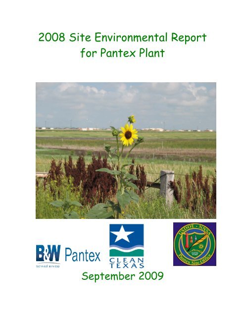
The central flower on the cover is a common sunflower, Helianthus annuus L,<br />
surrounded by curly dock, Rumex crispus L.<br />
The photo was taken by <strong>Plant</strong> Agronomist Monty G. Schoenhals.<br />
The Clean Texas Seal is used to signify that on September 20, 2007, <strong>Pantex</strong> <strong>Plant</strong> officially<br />
received the Texas Commission on <strong>Environmental</strong> Quality (TCEQ) Clean Texas Program<br />
“GOLD” Leadership level of recognition. <strong>Pantex</strong> <strong>Plant</strong> was ceremoniously honored in Austin<br />
on May 6, <strong>2008</strong>, with a certificate and a flag. This program is a voluntary one that requires<br />
a critical review by representatives of the TCEQ, which considers only the very best<br />
environmental organizations in the State of Texas as State Leaders.
<strong>2008</strong> <strong>Site</strong> <strong>Environmental</strong> <strong>Report</strong><br />
<strong>for</strong> <strong>Pantex</strong> <strong>Plant</strong><br />
September 2009<br />
Work Per<strong>for</strong>med Under Contract No. DE-AC04-00AL66620<br />
Prepared <strong>for</strong><br />
U.S. Department of Energy/National Nuclear Security Administration<br />
<strong>Pantex</strong> <strong>Site</strong> Office<br />
Prepared by<br />
Regulatory Compliance Department, Waste Operations Department, and<br />
The Projects Division<br />
<strong>Pantex</strong> <strong>Plant</strong><br />
Babcock & Wilcox Technical Services <strong>Pantex</strong>, LLC (B&W <strong>Pantex</strong>)<br />
Amarillo, Texas 79120-0020<br />
www.pantex.com
This page left blank intentionally.<br />
<strong>Pantex</strong> <strong>Plant</strong> ~ ~ ~ Amarillo, Texas
Help Us Make This <strong>Site</strong> <strong>Environmental</strong> <strong>Report</strong> More Useful <strong>for</strong> You!<br />
We want this summary to be easy to read and useful. To help continue this ef<strong>for</strong>t, please<br />
take a few minutes to let us know if this annual report meets your needs. Then tear out<br />
this page and mail or fax it to: Priscilla Thompson, B&W <strong>Pantex</strong>/12-132,<br />
P.O. Box 30020, Amarillo, TX 79120-0200.<br />
Phone: (806) 477-4098; Fax: (806) 477-6889.<br />
1. How do you use the in<strong>for</strong>mation in this summary?<br />
To become more familiar with <strong>Pantex</strong> <strong>Plant</strong> monitoring<br />
To help me make a decision about moving to the Texas Panhandle<br />
To send to others outside the Texas Panhandle<br />
To prepare <strong>for</strong> public meetings<br />
Other (please explain).<br />
2. What parts of the summary do you use?<br />
<strong>Pantex</strong> <strong>Plant</strong> overview/mission<br />
<strong>Site</strong> management<br />
<strong>Environmental</strong> compliance<br />
<strong>Environmental</strong> monitoring<br />
Quality assurance<br />
Regulatory oversight<br />
Current issues and actions.<br />
3. Does this guide contain<br />
Enough detail? Too much detail? Too little detail?<br />
Comments:<br />
4. If you could change this guide to make it more readable and useful to you, what<br />
would you change?<br />
What is your affiliation? Please circle.<br />
<strong>Pantex</strong> contractor DOE<br />
State agency Federal agency<br />
Public interest group Member of the public<br />
Member of Native American Nation Local government<br />
University Industry.<br />
Other Comments?<br />
Thank you!
Annual <strong>Site</strong> <strong>Environmental</strong> <strong>Report</strong> <strong>for</strong> <strong>Pantex</strong> <strong>Plant</strong><br />
Priscilla Thompson<br />
B&W <strong>Pantex</strong>/12-132<br />
P.O. Box 30020<br />
Amarillo, TX 79120-0200
i<br />
Contents<br />
FIGURES ..................................................................................................................................................... v<br />
TABLES .................................................................................................................................................... vii<br />
CHEMICALS AND UNITS OF MEASURE .............................................................................................. ix<br />
ABBREVIATIONS AND ACRONYMS .................................................................................................... xi<br />
GLOSSARY .............................................................................................................................................. xiii<br />
ACKNOWLEDGEMENTS ................................................................................................................... xxiii<br />
EXECUTIVE SUMMARY ..................................................................................................................... xxv<br />
Chapter 1 - Introduction<br />
1.1 <strong>Site</strong> Location and <strong>Environmental</strong> Setting .......................................................................................... 1-1<br />
1.2 Facility History and Mission ............................................................................................................. 1-1<br />
1.3 Facility Description ............................................................................................................................ 1-3<br />
1.4 Climatological Data ........................................................................................................................... 1-5<br />
1.5 Geology ............................................................................................................................................ 1-10<br />
1.6 Hydrology ........................................................................................................................................ 1-11<br />
1.6.1 Ogallala Aquifer .................................................................................................................. 1-11<br />
1.6.2 Dockum Group Aquifer ....................................................................................................... 1-11<br />
1.6.3 Water Use ............................................................................................................................ 1-11<br />
1.7 Seismology...................................................................................................................................... 1-12<br />
1.8 Land Use and Population ................................................................................................................. 1-12<br />
1.9 Organization of the <strong>Report</strong> .............................................................................................................. 1-14<br />
Chapter 2 - Compliance Issues and Activities<br />
2.1 <strong>Environmental</strong> Regulations ................................................................................................................ 2-1<br />
2.2 Clean Air Act ..................................................................................................................................... 2-4<br />
2.2.1 40 CFR 61 Subpart H (Emissions of Radionuclides Other Than Radon from<br />
DOE Facilities) ..................................................................................................................... 2-4<br />
2.2.2 40 CFR 61 Subpart M (National Emissions Standard <strong>for</strong> Asbestos) .................................... 2-5<br />
2.2.3 40 CFR 68 (Chemicals) ........................................................................................................ 2-5<br />
2.2.4 40 CFR 82 (Air Condition Systems) ..................................................................................... 2-5<br />
2.2.5 Air Provisions in RCRA Permit ............................................................................................ 2-5<br />
2.2.6 Air Quality Permits and Authorizations .............................................................................. 2-6<br />
2.2.7 Federal Operating Permit Program ....................................................................................... 2-6<br />
2.2.8 Air Quality Inspection .......................................................................................................... 2-6<br />
2.2.9 Emission Tracking and Calculation ...................................................................................... 2-6<br />
2.3 Comprehensive <strong>Environmental</strong> Response, Compensation, and Liability Act (CERCLA<br />
or Superfund) ..................................................................................................................................... 2-9<br />
2.4 Endangered Species Act .................................................................................................................... 2-9<br />
2.5 Federal Insecticide, Fungicide, and Rodenticide Act ...................................................................... 2-11<br />
2.5.1 Agricultural Pesticide Use in <strong>2008</strong> ..................................................................................... 2-11<br />
2.5.2 Maintenance Department and Contractor Pesticide Use in <strong>2008</strong>........................................ 2-11<br />
2.5.3 Pesticide Use Summary ...................................................................................................... 2-12<br />
2.6 Federal Water Pollution Control Act (or Clean Water Act) And Texas Water Code ...................... 2-12<br />
2.6.1 Discharge Permit Inspections ............................................................................................... 2-12<br />
2.7 Medical Waste ................................................................................................................................. 2-13
<strong>2008</strong> <strong>Site</strong> <strong>Environmental</strong> <strong>Report</strong> <strong>for</strong> <strong>Pantex</strong> <strong>Plant</strong><br />
2.8 National <strong>Environmental</strong> Policy Act .................................................................................................. 2-14<br />
2.9 National Historic Preservation Act, Archaeological Resource Protection Act, and Native ....................<br />
American Graves Protection and Repatriation Act .......................................................................... 2-15<br />
2.10 Resource Conservation and Recovery Act ..................................................................................... 2-15<br />
2.10.1 Active Waste Management .................................................................................................. 2-16<br />
2.10.2 Hazardous Waste Permit Modifications ............................................................................. 2-17<br />
2.10.3 Release <strong>Site</strong> and Potential Release <strong>Site</strong> Investigation, Monitoring, and Corrective<br />
Action .................................................................................................................................. 2-17<br />
2.10.4 Underground Storage Tanks .............................................................................................. 2-18<br />
2.11 Safe Drinking Water Act ............................................................................................................... 2-18<br />
2.11.1 Drinking Water Inspection .................................................................................................. 2-18<br />
2.11.2 Drinking Water System Achievements ............................................................................... 2-18<br />
2.12 Toxic Substances Control Act ......................................................................................................... 2-19<br />
2.13 Emergency Planning and Community Right-to-Know Act ............................................................. 2-19<br />
2.14 Floodplains/Wetlands <strong>Environmental</strong> Review Requirement (10 CFR 1022) .................................. 2-20<br />
Chapter 3 - <strong>Environmental</strong> Management In<strong>for</strong>mation<br />
3.1 <strong>Environmental</strong> Management System ................................................................................................. 3-1<br />
3.2 Oversight ............................................................................................................................................ 3-8<br />
3.3 Pollution Prevention .......................................................................................................................... 3-8<br />
3.4 Natural Resources ............................................................................................................................ 3-10<br />
3.5 Cultural Resources ........................................................................................................................... 3-18<br />
3.6 Educational Resources and Outreach Opportunities at <strong>Pantex</strong> <strong>Plant</strong> ............................................... 3-21<br />
3.7 <strong>Environmental</strong> Restoration .............................................................................................................. 3-22<br />
3.8 <strong>Environmental</strong> Monitoring .............................................................................................................. 3-26<br />
Chapter 4 - <strong>Environmental</strong> Radiological Program<br />
4.1 The Scope of the Program.................................................................................................................. 4-1<br />
4.2 Radiological Units and <strong>Report</strong>ing ..................................................................................................... 4-1<br />
4.3 Radiological Emissions and Doses .................................................................................................... 4-2<br />
4.3.1 Doses to Members of the Public ............................................................................................. 4-2<br />
4.3.2 Protection of Biota .................................................................................................................. 4-4<br />
4.3.3 Dose Comparisons .................................................................................................................. 4-7<br />
4.4 Release of Property Containing Residual Radioactive Material ....................................................... 4-7<br />
4.5 Unplanned Releases ........................................................................................................................... 4-9<br />
4.6 <strong>Environmental</strong> Radiological Monitoring ........................................................................................... 4-9<br />
4.6.1 <strong>Environmental</strong> Dosimetry ....................................................................................................... 4-9<br />
4.6.2 Other <strong>Environmental</strong> Measurements of Radiation ................................................................ 4-11<br />
4.7 Conclusions ...................................................................................................................................... 4-12<br />
Chapter 5 - Air Monitoring<br />
5.1 The Scope of the Program.................................................................................................................. 5-1<br />
5.2 Visual Emissions Evaluation (VEE) Monitoring ............................................................................... 5-1<br />
5.3 Routine Radiological Air Monitoring ................................................................................................ 5-1<br />
5.3.1 Collection of Samples ............................................................................................................... 5-1<br />
5.3.2 Sample Analysis Results ........................................................................................................... 5-7<br />
ii
iii<br />
Contents<br />
5.3.3 Data Interpretation .................................................................................................................... 5-8<br />
5.4 Conclusions ........................................................................................................................................ 5-9<br />
Chapter 6 - Groundwater Monitoring and Plume Management<br />
6.1 The Scope of the Program.................................................................................................................. 6-1<br />
6.2 Hydrogeologic Characterization ........................................................................................................ 6-1<br />
6.3 Plume Management .......................................................................................................................... 6-3<br />
6.3.1 Perched Groundwater Pump and Treat Systems ...................................................................... 6-3<br />
6.3.2 Perched Groundwater In Situ Bioremediation System ............................................................ 6-4<br />
6.4 Groundwater Monitoring Results ...................................................................................................... 6-4<br />
6.4.1 Pump and Treat Extraction Wells ............................................................................................ 6-5<br />
6.4.2 Perched Groundwater Wells ................................................................................................... 6-8<br />
6.4.3 Ogallala/Dockum Aquifer Wells ........................................................................................... 6-11<br />
6.5 Conclusions ...................................................................................................................................... 6-15<br />
Chapter 7 - Drinking Water<br />
7.1 The Scope of the Program.................................................................................................................. 7-1<br />
7.2 New Requirements and Program Changes ......................................................................................... 7-1<br />
7.3 Water Production and Use ................................................................................................................. 7-2<br />
7.4 Sampling Locations ........................................................................................................................... 7-2<br />
7.5 Results ................................................................................................................................................ 7-4<br />
7.5.1 Radiological Monitoring (30 TAC 290.108) ........................................................................... 7-4<br />
7.5.2 Chemical Monitoring (30 TAC 290.107) ................................................................................. 7-4<br />
7.5.3 Lead and Copper Monitoring (30 TAC 290.117). ................................................................... 7-4<br />
7.5.4 Biological Monitoring (30 TAC 290.109) .............................................................................. 7-5<br />
7.5.5 Disinfection By-Products (30 TAC 290.113) ......................................................................... 7-5<br />
7.6 Comparisons ...................................................................................................................................... 7-5<br />
7.7 Inspections ......................................................................................................................................... 7-5<br />
Chapter 8 - Wastewater<br />
8.1 The Scope of the Program.................................................................................................................. 8-1<br />
8.2 New Requirements and Program Changes ......................................................................................... 8-2<br />
8.3 Sampling Locations ............................................................................................................................ 8-4<br />
8.4 Analytical Results ............................................................................................................................... 8-4<br />
8.5 Historical Comparisons ...................................................................................................................... 8-6<br />
8.6 Conclusions ........................................................................................................................................ 8-6<br />
Chapter 9 - Surface Water<br />
9.1 The Scope of the Program.................................................................................................................. 9-1<br />
9.2 Sampling Locations and Monitoring Results ..................................................................................... 9-3<br />
9.2.1 Playa 1 Basin ........................................................................................................................... 9-7<br />
9.2.2 Playa 2 Basin ........................................................................................................................... 9-9<br />
9.2.3 Playa 3 Basin ........................................................................................................................... 9-9<br />
9.2.4 Playa 4 Basin ......................................................................................................................... 9-10<br />
9.2.5 <strong>Pantex</strong> Lake ........................................................................................................................... 9-11
<strong>2008</strong> <strong>Site</strong> <strong>Environmental</strong> <strong>Report</strong> <strong>for</strong> <strong>Pantex</strong> <strong>Plant</strong><br />
9.3 Historical Comparisons .................................................................................................................... 9-11<br />
9.4 Conclusions ...................................................................................................................................... 9-11<br />
Chapter 10 - Soil<br />
10.1 The Scope of the Program................................................................................................................ 10-1<br />
10.2 Sampling and Analysis .................................................................................................................... 10-1<br />
10.3 Data Comparisons ............................................................................................................................ 10-1<br />
10.4 Results ............................................................................................................................................. 10-2<br />
10.4.1 Metals Analysis .................................................................................................................. 10-2<br />
10.4.2 Explosives Analysis ............................................................................................................ 10-4<br />
10.5 Conclusions .................................................................................................................................... 10-4<br />
Chapter 11 - Fauna<br />
11.1 The Scope of the Programs .............................................................................................................. 11-1<br />
11.2 Radiological Surveillance in Fauna ................................................................................................. 11-1<br />
11.3 General Health and Disease Surveillance in Prairie Dogs ............................................................... 11-3<br />
11.4 Conclusions .................................................................................................................................... 11-4<br />
Chapter 12 - Flora<br />
12.1 The Scope of the Program................................................................................................................ 12-1<br />
12.2 Radiological Surveillance of Vegetation ......................................................................................... 12-1<br />
12.2.1 Native Vegetation Onsite and Offsite ................................................................................. 12-1<br />
12.2.2 Native Vegetation .............................................................................................................. 12-4<br />
12.2.3 Crops ................................................................................................................................... 12-4<br />
12.3 Conclusions .................................................................................................................................... 12-5<br />
Chapter 13 - Quality Assurance<br />
13.1 The Scope of the Program................................................................................................................ 13-1<br />
13.2 Planning and Implementation ......................................................................................................... 13-1<br />
13.3 Data Quality Assessment ................................................................................................................ 13-1<br />
13.3.1 Laboratory Quality Assurance ........................................................................................... 13-2<br />
13.3.2 Data Qualification .............................................................................................................. 13-2<br />
13.3.3 Laboratory Technical Per<strong>for</strong>mance .................................................................................... 13-4<br />
13.3.4 Field Operations Quality Assurance .................................................................................. 13-4<br />
13.4 Onsite Analytical Laboratories ....................................................................................................... 13-6<br />
13.5 Continuous Improvement ................................................................................................................ 13-6<br />
Appendix A – Analytes Monitored in <strong>2008</strong> ............................................................................................................ A-1<br />
Appendix B – Birds Identified at <strong>Pantex</strong> ............................................................................................................... B-1<br />
Appendix C – References ........................................................................................................................................ C-1<br />
Questionnaire – Help Us Make This <strong>Site</strong> <strong>Environmental</strong> <strong>Report</strong> More Useful <strong>for</strong> You!….….following title page<br />
Helpful In<strong>for</strong>mation ........................................................................................................................... inside back cover<br />
iv
FIGURES<br />
v<br />
Contents<br />
1.1 <strong>Pantex</strong> <strong>Plant</strong> <strong>Site</strong> Location ................................................................................................................. 1-2<br />
1.2 Principal Features of the <strong>Pantex</strong> <strong>Plant</strong> <strong>Site</strong> ........................................................................................ 1-4<br />
1.3 <strong>Pantex</strong> <strong>Plant</strong> Wind Roses <strong>for</strong> <strong>2008</strong> .................................................................................................... 1-9<br />
1.4 <strong>Pantex</strong> <strong>Plant</strong> Monthly Temperature Range and Amarillo National Weather Service (NWS)<br />
Precipitation during <strong>2008</strong> ................................................................................................................ 1-10<br />
1.5 Population Distribution within 50 Miles of <strong>Pantex</strong> <strong>Plant</strong> (2000) ..................................................... 1-13<br />
2.1 PTE versus Actual Yearly Emissions ................................................................................................. 2.8<br />
3.1 Work Activity Structure of the <strong>Pantex</strong> Integrated Safety Management System ................................ 3-1<br />
3.2 Energy Use versus Cost ..................................................................................................................... 3-5<br />
3.3 Energy Use versus Required Percentage Reduction .......................................................................... 3-5<br />
3.4 Actual Water Use versus Required Percentage Reduction ................................................................ 3-6<br />
3.5 Gasoline Use versus Required Percentage Reduction ....................................................................... 3-6<br />
3.6 Alternative Fuel Use versus Required Percentage Reduction ............................................................ 3-7<br />
3.7 Bobcat on the Lookout ..................................................................................................................... 3-12<br />
3.8 Jackrabbit on the Alert ...................................................................................................................... 3-12<br />
3.9 Locations of Prairie Dog Colonies at <strong>Pantex</strong> <strong>Plant</strong> .......................................................................... 3-14<br />
3.10 Location of the Prairie Dog Colony at <strong>Pantex</strong> Lake ........................................................................ 3-15<br />
3.11 Inert Replicas of the B43, the Fat Man, and the B57 Displayed at the Cafeteria .......................... 3-19<br />
3.12 Frisbee Toss at Earth Fest <strong>2008</strong> ....................................................................................................... 3-21<br />
3.13 Summary of Actions <strong>for</strong> Solid Waste Management Units .............................................................. 3-22<br />
3.14 Perched Groundwater Plumes and Treatment Systems .................................................................. 3-25<br />
3.15 Potential Pathways <strong>for</strong> <strong>Environmental</strong> Transport of Contaminants ............................................... 3-27<br />
4.1 Trend of Cumulative Effective Dose Equivalent <strong>for</strong> Maximally Exposed Individual Member of the<br />
General Population 2006- <strong>2008</strong> ......................................................................................................... 4-5<br />
4.2 Comparison of Ionizing Dose Ranges .............................................................................................. 4-7<br />
4.3 Locations of <strong>Pantex</strong> <strong>Plant</strong> Thermoluminescent Dosimeters ............................................................ 4-10<br />
5.1 Locations of Onsite and Fence Line Air Monitoring Stations ........................................................... 5-2<br />
5.2 Offsite Air Sampling Stations ............................................................................................................ 5-4<br />
5.3 Typical Air Monitoring <strong>Site</strong> .............................................................................................................. 5-6<br />
5.4 Low-Vol Sampling Apparatus .......................................................................................................... 5-6<br />
5.5 Exceedances of Historical Averages ................................................................................................. 5-9<br />
6.1 Perched Groundwater Plumes and Remediation Systems ................................................................. 6-2<br />
6.2 Perched Groundwater Pump and Treat Wells Sampled ................................................................... 6-6<br />
6.3 Count of Results above Comparison Levels and above Detection<br />
For Pump and Treat Extraction Wells .............................................................................................. 6-8<br />
6.4 Perched Groundwater Monitoring Wells Sampled ........................................................................... 6-9<br />
6.5 Count of Results above Comparison Levels (except ISB Monitoring Results)<br />
For Perched Groundwater Monitoring Wells ................................................................................. 6-11<br />
6.6 Ogallala/Dockum Aquifer Monitoring Wells Sampled ................................................................... 6-12<br />
6.7 PTX06-1056 Boron Concentrations Over Time .............................................................................. 6-14
<strong>2008</strong> 2 <strong>Site</strong> <strong>Environmental</strong> <strong>Report</strong> <strong>for</strong> <strong>Pantex</strong> <strong>Plant</strong><br />
8.1 Wastewater Treatment Facility, Facultative Lagoon ......................................................................... 8-1<br />
8.2 Wastewater Storage Lagoon ............................................................................................................ 8-2<br />
8.3 Playa 1 Drainage Ditch ..................................................................................................................... 8-3<br />
9.1 A Playa Lake at <strong>Pantex</strong> <strong>Plant</strong> ............................................................................................................ 9-1<br />
9.2 Drainage Basins, Playas, and Outfalls at <strong>Pantex</strong> <strong>Plant</strong> ..................................................................... 9-2<br />
9.3 Storm Water Discharging at <strong>Pantex</strong> <strong>Plant</strong>.......................................................................................... 9-4<br />
9.4 Retention Blankets Installed <strong>for</strong> Soil Stabilization ............................................................................ 9-4<br />
9.5 <strong>Pantex</strong> Surface Water Schematic, <strong>2008</strong> ............................................................................................ 9-5<br />
9.6 Sampling at Playa 1 .......................................................................................................................... 9-8<br />
9.7 Monitoring Equipment at STORM 07; Playa 3 (dry) in Background ............................................ 9-10<br />
10.1 Burning Ground Multi-Incremental Soil Sampling Locations <strong>for</strong> <strong>2008</strong> .......................................... 10-2<br />
12.1 Onsite Vegetation Monitoring Locations ........................................................................................ 12-2<br />
12.2 Offsite Vegetation Monitoring Locations ....................................................................................... 12-3<br />
13.1 <strong>2008</strong> Data Rejection Summary ....................................................................................................... 13-3<br />
13.2 <strong>2008</strong> MAPEP Results ..................................................................................................................... 13-4<br />
13.3 History of Useable Results Data .................................................................................................... 13-7<br />
vi
TABLES<br />
vii<br />
Contents<br />
1.1 <strong>Pantex</strong> <strong>2008</strong> Monthly Climatological Data ....................................................................................... 1-8<br />
2.1 Major <strong>Environmental</strong> Regulations Applicable to <strong>Pantex</strong> <strong>Plant</strong> ......................................................... 2-1<br />
2.2 Tracked Emission Sources at <strong>Pantex</strong> ................................................................................................ 2-7<br />
2.3 Endangered, Threatened, and Candidate Species and Species of Concern Known to Appear<br />
on or near <strong>Pantex</strong> <strong>Plant</strong> ................................................................................................................... 2-10<br />
2.4 Numbers of Pesticide Applications Conducted at <strong>Pantex</strong> ............................................................... 2-12<br />
2.5 Permits Issued to <strong>Pantex</strong> <strong>Plant</strong> ....................................................................................................... 2-13<br />
2.6 Waste Volumes Generated at <strong>Pantex</strong> (in cubic meters) .................................................................. 2-17<br />
2.7 <strong>2008</strong> Activities <strong>for</strong> Compliance with the Emergency Planning and Community<br />
Right-to-Know Act .......................................................................................................................... 2-19<br />
3.1 B&W <strong>Pantex</strong>’s List of Objectives and Targets <strong>for</strong> <strong>2008</strong> ................................................................... 3-3<br />
3.2 <strong>Pantex</strong> <strong>Plant</strong> <strong>Site</strong>wide Recycling <strong>for</strong> <strong>2008</strong> ......................................................................................... 3-9<br />
3.3 Mammals Identified at <strong>Pantex</strong> <strong>Plant</strong> During <strong>2008</strong> ........................................................................... 3-13<br />
3.4 Reptiles and Amphibians Identified at <strong>Pantex</strong> <strong>Plant</strong> During <strong>2008</strong> .................................................. 3-17<br />
3.5 Number of <strong>Environmental</strong> Media Sampling Locations in <strong>2008</strong> ...................................................... 3-28<br />
4.1 <strong>Pantex</strong> Radiological Atmospheric Emissions in Curies (Bq) ............................................................ 4-3<br />
4.2 <strong>Pantex</strong> Radiological Doses in <strong>2008</strong> .................................................................................................. 4-4<br />
4.3a Evaluation of Dose to Aquatic Biota in <strong>2008</strong> .................................................................................... 4-6<br />
4.3b Evaluation of Dose to Terrestrial Biota in <strong>2008</strong> ................................................................................ 4-6<br />
4.4 Surface Activity Limits – Allowable Total Residual Surface Activity (dpm/100cm 2 ) ..................... 4-8<br />
4.5 <strong>Environmental</strong> Doses Measured by Thermoluminescent Dosimeters in <strong>2008</strong>, in millirem ........... 4-11<br />
5.1 <strong>2008</strong> Schedule <strong>for</strong> Air Sampling and Analysis .................................................................................. 5-5<br />
5.2 Concentrations of Radionuclides in Air <strong>for</strong> <strong>2008</strong> at Onsite Locations .............................................. 5-7<br />
5.3 Concentrations of Radionuclides in Air <strong>for</strong> <strong>2008</strong> at Upwind Locations ............................................ 5-7<br />
5.4 Concentrations of Radionuclides in Air <strong>for</strong> <strong>2008</strong> at Downwind Locations ....................................... 5-8<br />
5.5 Concentrations of Radionuclides in Air <strong>for</strong> <strong>2008</strong> at the Background Location ................................. 5-8<br />
6.1 Summary of Wells by Type and Aquifer ........................................................................................... 6-1<br />
6.2 Summary of <strong>2008</strong> Groundwater Monitoring Program ....................................................................... 6-5<br />
6.3 Comparative Levels <strong>for</strong> Contaminants of Concern (mg/L) .............................................................. 6-5<br />
6.4 Summary of Detections <strong>for</strong> Pump and Treat Extraction Wells (mg/L) ............................................ 6-7<br />
6.5 Summary of Detections <strong>for</strong> Perched Groundwater Monitoring Wells (mg/L) ............................... 6-10<br />
6.6 Summary of Detections <strong>for</strong> Ogallala/Dockum Aquifer Monitoring Wells (mg/L) ........................ 6-15<br />
7.1 Drinking Water and Production Well Sampling Locations, <strong>2008</strong> .................................................... 7-3<br />
7.2 Water Quality Comparison ............................................................................................................... 7-6<br />
8.1 Annual Irrigation Summary, <strong>2008</strong> .................................................................................................... 8-4<br />
8.2 Water Quality Results from Outfall 031, <strong>2008</strong> .................................................................................. 8-5<br />
9.1 Annual Storm Water Results (metals), <strong>2008</strong> (mg/L) ......................................................................... 9-7<br />
10.1 Comparison of <strong>2008</strong> Soil Sampling Analytical Results <strong>for</strong> Metals ................................................. 10-3
<strong>2008</strong> 2 <strong>Site</strong> <strong>Environmental</strong> <strong>Report</strong> <strong>for</strong> <strong>Pantex</strong> <strong>Plant</strong><br />
11.1 Tritium, 233/234 U, and 238 U in Prairie Dogs in <strong>2008</strong>, in pCi/g Dry Weight ..................................... 11-2<br />
11.2 Tritium, 233/234 U, and 238 U in Cottontail Rabbits in <strong>2008</strong>, in pCi/g Dry Weight ........................... 11-3<br />
.<br />
viii
aCi attocurie<br />
Ag silver<br />
As arsenic<br />
Ba barium<br />
Be beryllium<br />
Bq Becquerel<br />
EC degrees Celsius<br />
Ca calcium<br />
Cd cadmium<br />
cfm cubic feet per minute<br />
Ci Curie<br />
cm centimeter<br />
CO carbon monoxide<br />
Cr chromium<br />
Cu copper<br />
cu yd cubic yard<br />
DMSO dimethyl sulfoxide<br />
dps disintegrations per second<br />
E "n exponential (E) is10"n<br />
where n is some number<br />
(see Helpful In<strong>for</strong>mation<br />
on inside back cover)<br />
EF degrees Fahrenheit<br />
Fe iron<br />
ft foot/feet<br />
ft/sec feet per second<br />
ft5 square foot<br />
ft 3<br />
cubic feet<br />
g or gm gram<br />
g/dL grams per deciliter<br />
gal gallon<br />
gpm gallons per minute<br />
Hg mercury<br />
hr hour<br />
HMX octahydro-1,3,5,7-<br />
tetranitro-1,3,5,7-<br />
tetrazocine<br />
in inch(es)<br />
K2O potassium oxide<br />
kg kilogram<br />
km kilometer<br />
kW kilowatt<br />
L liter(s)<br />
lb pound<br />
m meter<br />
m/s meters per second<br />
m5 square meter<br />
CHEMICALS AND UNITS OF MEASURE<br />
ix<br />
Contents<br />
m 3 cubic meter (approx. 1.308<br />
cubic yards)<br />
Ma million years ago<br />
Mcf thousand cubic feet<br />
MEK methyl ethyl ketone<br />
MeV Megavolt (a.k.a. Million<br />
electron volts)<br />
mg/dL milligrams per deciliter<br />
mg/kg milligrams per kilogram<br />
mg/L milligrams per liter<br />
mg/m 3 milligrams per cubic meter<br />
mi mile<br />
mi5 square mile<br />
min minute<br />
Mn manganese<br />
mph miles per hour<br />
mps meters per second<br />
mrem/hr millirem per hour<br />
mSv millisievert<br />
μCi microcurie<br />
μCi/ml microcuries per millimeter<br />
μg/L micrograms per liter<br />
μg/m 3 micrograms per cubic<br />
meter<br />
μL microliter<br />
μmho/cm micromhos per centimeter<br />
μR microroentgen<br />
NO2 nitrogen dioxide<br />
O3 ozone<br />
Pb lead<br />
PCBs polychlorinated biphenyls<br />
pCi/g picocuries per gram<br />
pCi/mL picocuries per milliliter<br />
PETN Pentaerythrithol tetranitrate<br />
PM10 particulate matter with a<br />
mean aerodynamic<br />
diameter #10 micrometers<br />
ppb parts per billion<br />
ppm parts per million<br />
psf pounds per square foot<br />
psi pounds per square inch<br />
R Roentgen<br />
rem Roentgen equivalent man<br />
RDX hexahydro-1,3,5-trinitro-<br />
1,3,5-triazine<br />
scfm standard cubic ft per<br />
minute
<strong>2008</strong> 2 <strong>Site</strong> <strong>Environmental</strong> <strong>Report</strong> <strong>for</strong> <strong>Pantex</strong> <strong>Plant</strong><br />
sec second<br />
SO2 sulfur dioxide<br />
SU standard units<br />
Sv Sievert<br />
TCE trichloroethylene or<br />
trichloroethene<br />
Ti titanium<br />
x<br />
TNB trinitrobenzene<br />
TNT trinitrotoluene<br />
TPY tons per year<br />
yr year<br />
Zn zinc<br />
μ micro (1.0 H 10 -6 )
ARPA Archaeological Resource<br />
Protection Act<br />
BCG Biota Concentration Guide<br />
BOD Biochemical oxygen demand<br />
B&W Babcock & Wilcox Technical<br />
<strong>Pantex</strong> Services <strong>Pantex</strong>, LLC<br />
CAA Clean Air Act<br />
CERCLA Comprehensive<br />
<strong>Environmental</strong> Response,<br />
Compensation, and Liability<br />
Act<br />
CFR Code of Federal Regulations<br />
CMS/FS Corrective Measures<br />
Study/Feasibility Study<br />
COC Chain of Custody<br />
COD Chemical oxygen demand<br />
COPC Contaminant of Potential<br />
Concern<br />
CP<br />
Compliance Plan<br />
CRM Cultural resource<br />
management<br />
CWA Clean Water Act<br />
CY Calendar Year<br />
DCG Derived concentration guide<br />
DOC U.S. Department of<br />
Commerce<br />
DOE U.S. Department of Energy<br />
DOECAP DOE Consolidated Audit<br />
Program<br />
DQO Data Quality Objective<br />
EID <strong>Environmental</strong> In<strong>for</strong>mation<br />
Document<br />
EIS <strong>Environmental</strong> Impact<br />
Statement<br />
EMS <strong>Environmental</strong> Management<br />
System<br />
EPA U.S. <strong>Environmental</strong><br />
Protection Agency<br />
ER<br />
<strong>Environmental</strong> Restoration<br />
ERA Ecological Risk Assessment<br />
ESA Endangered Species Act<br />
FIFRA Federal Insecticide,<br />
Fungicide, and Rodenticide<br />
Act<br />
FM<br />
Farm-to-Market Road<br />
FGZ Fine-grained zone<br />
ABBREVIATIONS AND ACRONYMS<br />
xi<br />
Contents<br />
FY<br />
Fiscal year (October 1 -<br />
September 30)<br />
GAC Granular activated carbon<br />
GW-MSC Groundwater medium<br />
specific concentration<br />
HE<br />
High explosives<br />
HHRA Human Health Risk<br />
Assessment<br />
HVAC Heating-ventilation-air<br />
conditioning<br />
ITRD Innovative Treatment<br />
Remediation Demonstration<br />
ISM Interim Stabilization Measure<br />
ISMS Integrated Safety<br />
Management System<br />
ISO International Standards<br />
Organization<br />
IWQP Inland Water Quality<br />
Parameter<br />
MAPEP Mixed Analyte Per<strong>for</strong>mance<br />
Evaluation Program<br />
Max Maximum<br />
MCL Maximum contaminant level<br />
MDA Minimum detectable activity<br />
MDL Method detection limit<br />
Min Minimum<br />
MSDS Material safety data sheet<br />
MSGP Multi-Sector General Permit<br />
N/A Not applicable<br />
NAGPRA Native American Graves<br />
Protection and Repatriation<br />
Act<br />
NCRP National Council on<br />
Radiation Protection and<br />
Measurements<br />
ND Not detected<br />
NELAC National <strong>Environmental</strong><br />
Laboratory Accreditation<br />
Conference<br />
NEPA National <strong>Environmental</strong><br />
Policy Act<br />
NHPA National Historic<br />
Preservation Act<br />
NNSA National Nuclear Security<br />
Administration<br />
No. Number
<strong>2008</strong> 2 <strong>Site</strong> <strong>Environmental</strong> <strong>Report</strong> <strong>for</strong> <strong>Pantex</strong> <strong>Plant</strong><br />
NPS National Park Service<br />
N/S No sample<br />
PGWCD Panhandle Ground Water<br />
Conservation District<br />
PRCM <strong>Pantex</strong> Radiation Control<br />
Manual<br />
ppm Parts per million<br />
PE<br />
Per<strong>for</strong>mance evaluations<br />
PIDAS Perimeter Intrusion Detection<br />
and Surveillance<br />
PQL Practical Quantitation Limit<br />
PTE Potential to emit<br />
PXSO <strong>Pantex</strong> <strong>Site</strong> Office<br />
PA/CRMP Programmatic Agreement/<br />
Cultural Resources<br />
Management Plan<br />
QA Quality assurance<br />
QC Quality control<br />
Qtr Quarter<br />
RCRA Resource Conservation and<br />
Recovery Act<br />
RFIR RCRA Facility Investigation<br />
<strong>Report</strong><br />
RRS Risk Reduction Standard<br />
SARA Superfund Amendments and<br />
Reauthorization Act<br />
SDWA Safe Drinking Water Act<br />
SHPO State Historic Preservation<br />
Office<br />
Std Dev Standard deviation<br />
SOW Statement of Work<br />
SVE Soil vapor extraction<br />
SVOC Semi-volatile organic<br />
compound<br />
SWMU Solid Waste Management<br />
Unit<br />
TAC Texas Administrative Code<br />
TCEQ Texas Commission on<br />
<strong>Environmental</strong> Quality<br />
TDSHS Texas Department of State<br />
Health Services<br />
TLD Thermoluminescent<br />
dosimeter<br />
TPDES Texas Pollutant Discharge<br />
Elimination System<br />
TRI Toxic Chemical Release<br />
Inventory<br />
xii<br />
TSCA Toxic Substances Control<br />
Act<br />
TSS Total suspended solids<br />
TTRF Texas Tech Research Farm<br />
USACE U.S. Army Corps of<br />
Engineers<br />
VOC Volatile organic compound<br />
WMG Waste Management Group<br />
WWTF Wastewater treatment facility
Activity - The rate of disintegration or<br />
trans<strong>for</strong>mation of radioactive material, generally<br />
expressed in units of Curies (Ci). The official SI<br />
unit is the Becquerel (Bq). One Bq (one<br />
disintegration or trans<strong>for</strong>mation per second) is<br />
equivalent to 2.7 H10 -11 Ci.<br />
ALARA - An acronym and phrase, “As Low As<br />
Reasonably Achievable,” used to describe an<br />
approach to radiation exposures and emission<br />
control or management whereby the exposures and<br />
resulting doses to the public are maintained as far<br />
below the specified limits as economic, technical,<br />
and practical considerations will permit. ALARA<br />
is not a dose limit.<br />
Alpha particle - Type of particulate radiation<br />
(identical to the nucleus of the helium atom)<br />
consisting of two protons and two neutrons.<br />
Ammonium nitrate - A colorless crystalline salt<br />
(N2H4O3) used in explosives, fertilizers, and<br />
veterinary medicine.<br />
Anion - A negatively charged ion that migrates to<br />
an anode, as in electrolysis.<br />
ANSI - American National Standards Institute, a<br />
voluntary standards organization; Administrator,<br />
U.S. Technical Advisory Group to the<br />
International Standards Organization (ISO).<br />
Aquifer - Rock or sediment in a <strong>for</strong>mation, group<br />
of <strong>for</strong>mations, or part of a <strong>for</strong>mation that is<br />
saturated and sufficiently permeable to transmit<br />
economic quantities of water to wells and springs.<br />
Archeology - The scientific discipline responsible<br />
<strong>for</strong> recovering, analyzing, interpreting, and<br />
explaining the unwritten portion of the prehistoric<br />
and historic past.<br />
Archival - Relating to, contained in, or<br />
constituting archives, which are places where<br />
generally unpublished public records or historical<br />
documents are preserved.<br />
GLOSSARY<br />
xiii<br />
Contents<br />
Artifact - Any object manufactured or modified<br />
by human beings.<br />
Asbestos - Group of naturally occurring minerals<br />
that separate into fibers. The asbestos family<br />
includes actinolite, anthophyllite, chrysotile,<br />
crocidolite, and tremolite.<br />
Assembly - The process of putting together a<br />
nuclear weapon or nuclear weapon component.<br />
This process takes place at <strong>Pantex</strong> <strong>Plant</strong>.<br />
Background or control samples - Samples<br />
obtained from a background sampling location <strong>for</strong><br />
comparison with samples obtained at or near<br />
<strong>Pantex</strong>. Background or control samples are not<br />
expected to be affected by <strong>Pantex</strong> operations. The<br />
U.S. Department of Agriculture Research Station<br />
and the Texas Agrilife Bush Research Farm at<br />
Bushland, Texas, have often been used as a<br />
control or background location.<br />
Background radiation - Ionizing radiation in the<br />
natural environment, including cosmic rays and<br />
radiation from the naturally radioactive elements,<br />
both outside and inside the bodies of humans and<br />
animals.<br />
Becquerel (Bq) S The Système International<br />
d'Unités (SI units) unit of radioactivity is the<br />
becquerel, defined as one nuclear disintegration<br />
per second; there<strong>for</strong>e, one Curie (Ci) is equivalent<br />
to 3.7H10 10 Bq.<br />
Best Management Practices - Practices that are<br />
not required by law, regulation, or permit, but are<br />
designed to help ensure that <strong>Pantex</strong> <strong>Plant</strong> produces<br />
the highest quality services and products.<br />
Beta particle - Type of particulate radiation<br />
emitted from the nucleus of an atom that has a<br />
mass and charge equal in magnitude to that of the<br />
electron.<br />
Biomass - Literally, Aliving weight,@ refers to<br />
mass having its origin as living organisms.
<strong>2008</strong> <strong>Site</strong> <strong>Environmental</strong> <strong>Report</strong> <strong>for</strong> <strong>Pantex</strong> <strong>Plant</strong><br />
Biome - Recognizable community units <strong>for</strong>med by<br />
the interaction of regional climate, regional biota,<br />
and substrate, e.g., the same biome units generally<br />
can be found on different continents at the same<br />
latitudes with approximately the same weather<br />
conditions and where topography is similar.<br />
Biomes are the largest land community units<br />
recognized.<br />
Biota - Living organisms.<br />
Biota Concentration Guide – The limiting<br />
concentration of a radionuclide in soil, sediment,<br />
or water that would not cause dose limits <strong>for</strong><br />
protection of aquatic and terrestrial biota to be<br />
exceeded. An analogue to the Derived<br />
Concentration Guide (DCG) used <strong>for</strong> human<br />
exposure.<br />
Blackwater Draw Formation - Quaternary<br />
<strong>for</strong>mation consisting primarily of pedogenically<br />
modified eolian sands and silts interbedded with<br />
numerous caliche layers. The Blackwater Draw<br />
Formation overlies the Tertiary Ogallala<br />
Formation at <strong>Pantex</strong>.<br />
Burning Ground - The <strong>Pantex</strong> <strong>Plant</strong> location<br />
where thermal processing (burning) of high<br />
explosives (HE) is conducted.<br />
Calibration - The adjustment of a measurement<br />
system and the determination of its accuracy using<br />
known sources and instrument measurements.<br />
Adjustment of flow, temperature, humidity, or<br />
pressure gauges and the determination of system<br />
accuracy should be conducted using standard<br />
operating procedures and sources that are<br />
traceable to the National Institute of Standards and<br />
Technology.<br />
Cation – A positively charged ion that in an<br />
electrolyte moves toward a negative electrode.<br />
Cell - (1) This is the smallest unit capable of<br />
independent functioning. (2) A structure at <strong>Pantex</strong><br />
in which certain nuclear explosive assembly or<br />
disassembly operations are conducted.<br />
xiv<br />
Central flyway - A major migratory route used by<br />
large numbers of migrating birds in fall and spring<br />
that crosses the central portion of North America<br />
from Canada to Mexico.<br />
Centripetal drainage - The flow of water in a<br />
basin toward a central drain or sink, such as a<br />
pond or lake.<br />
Code of Federal Regulations (CFR) - Final<br />
federal regulations in <strong>for</strong>ce: published in codified<br />
<strong>for</strong>m.<br />
Composite samples – Samples that contain a<br />
certain number of subsamples.<br />
Council on <strong>Environmental</strong> Quality (CEQ) -<br />
Created, in the Executive Office of the President,<br />
by the National <strong>Environmental</strong> Policy Act<br />
(NEPA), such that its members are exceptionally<br />
well qualified to analyze and interpret<br />
environmental trends and in<strong>for</strong>mation of all kinds;<br />
to appraise programs and activities of the Federal<br />
Government in the light of the policy set <strong>for</strong>th in<br />
Title I of NEPA; to be conscious of and<br />
responsive to the scientific, economic, social,<br />
aesthetic, and cultural needs and interests of the<br />
Nation; and to <strong>for</strong>mulate and recommend national<br />
policies to promote the improvement of the quality<br />
of the environment.<br />
Cultural Resources - Districts, sites, structures,<br />
and objects and evidence of some importance to a<br />
culture, a subculture, or a community <strong>for</strong><br />
scientific, traditional, religious, and other reasons.<br />
These resources and relevant environmental data<br />
are important <strong>for</strong> describing and reconstructing<br />
past lifeways, <strong>for</strong> interpreting human behavior,<br />
and <strong>for</strong> predicting future courses of cultural<br />
development.<br />
Depleted uranium - Uranium <strong>for</strong> which the<br />
content of the isotope of uranium-235 is smaller<br />
than the 0.7 percent; the level found in naturally<br />
occurring uranium (and thus generally<br />
synonymous with the isotope uranium-238).
Derived Concentration Guide - The<br />
concentration of a radionuclide in air or water that,<br />
under conditions of continuous exposure <strong>for</strong> one<br />
year by one exposure mode (<strong>for</strong> example,<br />
ingestion of water or breathing the air) would<br />
result in an effective dose equivalent of 100 mrem,<br />
(0.1 rem or 1 mSv). Values <strong>for</strong> these<br />
concentrations are listed <strong>for</strong> each of the indicated<br />
exposure modes in Chapter III of DOE Order<br />
5400.5 by radionuclide.<br />
Dismantlement - The disassembly of a nuclear<br />
weapon no longer required by the DOD. This<br />
process takes place at <strong>Pantex</strong> <strong>Plant</strong>.<br />
Dockum Group - Triassic sedimentary rocks that<br />
underlie the Ogallala Formation at <strong>Pantex</strong> <strong>Plant</strong>.<br />
The Dockum Group rocks consist of shale, clayey<br />
siltstone, and sandstone.<br />
Dose - The quantity of ionizing radiation received.<br />
Often used in the sense of exposure dose (a<br />
measure of the total amount of ionization that the<br />
radiation could produce in air, measured in<br />
roentgens [R]). This should be distinguished from<br />
the absorbed dose (measured in rads) that<br />
represents the energy absorbed from the radiation<br />
per gram of any material. Furthermore, dose<br />
equivalent (or biological dose), given in rem, is a<br />
term used to express the amount of effective<br />
radiation when modifying factors such as quality<br />
factors have been considered. It is there<strong>for</strong>e a<br />
measure of the biological damage to living tissue<br />
from the radiation exposure.<br />
Duplicate sample - A sample that is taken at the<br />
same location and the same site; it may be taken<br />
simultaneously or consecutively. This sample<br />
may be collected <strong>for</strong> the purpose of evaluating the<br />
per<strong>for</strong>mance of a measurement system or of the<br />
homogeneity of a sample population; i.e., to<br />
determine whether the sample results are<br />
representative or an anomaly. The duplicates are<br />
supposed to be similar in terms of the population<br />
sampled.<br />
Ecosystem - Living organisms and their nonliving<br />
(abiotic) environment functioning together as a<br />
community.<br />
xv<br />
Contents<br />
Effective Dose Equivalent (EDE) - The sum of<br />
the products of the exposures to individual organs<br />
and tissues and appropriate weighting factors<br />
representing the risk relative to that <strong>for</strong> an equal<br />
dose to the whole body.<br />
Effects Screening Levels (ESL) - Guideline<br />
concentrations established by TCEQ to evaluate<br />
the potential impacts of air pollutant emissions<br />
including acute and chronic health effects, odor<br />
nuisance potential, vegetation effects or corrosion<br />
effects. ESLs are set to provide a margin of safety<br />
below levels at which adverse effects are reported<br />
in scientific literature. This margin of safety is<br />
added to protect sensitive sub-populations, such as<br />
children, the elderly, and persons with pre-existing<br />
illnesses.<br />
Effluent - A fluid discharged into the<br />
environment; an outflow of waste. Its monitoring<br />
is conducted at the point of release.<br />
Emission - A substance discharged to the air.<br />
Emissions standards - Legally en<strong>for</strong>ceable limits<br />
on the quantities and/or kinds of air contaminants<br />
that can be emitted into the atmosphere.<br />
Encephalitis - Inflammation of the brain<br />
(specifically western equine and eastern equine).<br />
In the U.S., this is an acute, often fatal, viral<br />
disease of the central nervous system that is<br />
transmitted to humans by mosquitoes (arthropods)<br />
after a blood meal from infected horses or mules.<br />
<strong>Environmental</strong> Monitoring - Sample collection<br />
and analysis of environmental media, i.e., air,<br />
water, soil, foodstuff, and biota <strong>for</strong> the purpose of<br />
assessing effects of operations at that site on the<br />
local environment. It consists of effluent<br />
monitoring and environmental surveillance.<br />
<strong>Environmental</strong> Protection Agency (EPA) -<br />
Federal agency created to protect the nation's<br />
water, land, and air from pollution or<br />
environmental damage.<br />
<strong>Environmental</strong> Restoration (ER) Program -<br />
Program at <strong>Pantex</strong> responsible <strong>for</strong> investigation
<strong>2008</strong> <strong>Site</strong> <strong>Environmental</strong> <strong>Report</strong> <strong>for</strong> <strong>Pantex</strong> <strong>Plant</strong><br />
and remediation of Solid Waste Management<br />
Units.<br />
<strong>Environmental</strong> Surveillance - The collection and<br />
analysis of samples, or direct measurements of air,<br />
water, soil, foodstuff, and other media <strong>for</strong> the<br />
purpose of determining compliance with<br />
applicable standards and permit requirements,<br />
assessing radiation exposures of members of the<br />
public, and assessing the effects, if any, on the<br />
local environment.<br />
Ephemeral - Lasting only a short period of time.<br />
Used in this document to describe water bodies<br />
that often do not have water year round.<br />
Typically, these water bodies have water<br />
following the wet seasons and then are dry during<br />
the dry seasons.<br />
Evapotranspiration - The sum of evaporation,<br />
the process by which water passes from the liquid<br />
to the vapor state, and transpiration, the process by<br />
which plants give off water vapor through their<br />
leaves.<br />
Fauna - Animal life, or animals as a whole,<br />
especially those that are characteristic of a region.<br />
Fecal coli<strong>for</strong>m bacteria - Simple organisms<br />
associated with the intestine of warm-blooded<br />
animals that are commonly used to indicate the<br />
presence of fecal material and the potential<br />
presence of organisms capable of causing human<br />
disease.<br />
Flora - <strong>Plant</strong> life or plants as a whole, especially<br />
those that are characteristic of a region.<br />
Gamma ray (gamma radiation) – High-energy,<br />
short wavelength electromagnetic radiation (a<br />
packet of energy) emitted from the nucleus.<br />
(Gamma radiation frequently accompanies alpha<br />
and beta emissions and always accompanies<br />
fission.) Gamma rays are very penetrating and can<br />
be stopped or shielded against by dense materials<br />
such as lead or uranium. Gamma rays are similar<br />
to X-rays, but are usually more energetic.<br />
xvi<br />
Grab sample - A single sample, collected at one<br />
time and place.<br />
Hantavirus Pulmonary Syndrome - The<br />
hantavirus is found in saliva, urine, or feces of<br />
various rodent species and is transmitted to<br />
humans by inhalation. It causes rapidly<br />
progressive pulmonary symptoms that result in<br />
serious illness. Human-to-human transmission has<br />
not been demonstrated.<br />
Hazardous material - A material, including a<br />
hazardous substance, as defined by 49 CFR 171.8<br />
that poses a risk to health, safety, and property<br />
when handled or transported.<br />
Hazardous waste - Defined by 40 CFR Part 261,<br />
as any material that a) is a solid waste, and b) is a<br />
listed hazardous waste (Subpart D), or c) exhibits<br />
any of the characteristics of ignitibility,<br />
corrosivity, reactivity or toxicity (Subpart C).<br />
Hemoglobin - A protein found in red blood cells<br />
that transports oxygen.<br />
Herpesvirus - Any virus belonging to the family<br />
Herpesviridae. It is basically a wildlife disease,<br />
and offers possible implications to research on<br />
human viruses.<br />
Herbicide - A substance (usually chemical) used<br />
to destroy undesirable plants.<br />
Herpetofauna - Reptiles (snakes, turtles, lizards,<br />
etc.) and amphibians (frogs, toads, salamanders).<br />
High explosives (HE) - Any chemical compound<br />
or mechanical mixture which, when subjected to<br />
heat, impact, friction, shock, or other suitable<br />
initiation stimulus undergoes a very rapid<br />
chemical change with the evolution of large<br />
volumes of highly heated gases that exert pressure<br />
in the surrounding medium.<br />
Histopathology - The science or study of dealing<br />
with the structure of abnormal or diseased tissue;<br />
examination of the tissue changes that accompany<br />
a disease.
Historic - Of, relating to, or existing in times<br />
postdating the development of written records.<br />
Historic cultural resources are all evidences of<br />
human occupations that date to recorded periods<br />
in history. Historic resources also may be<br />
considered to be archeological resources when<br />
archeological work is involved in their<br />
identification and interpretation.<br />
Industrial solid waste - Solid waste resulting<br />
from or incidental to any process of industry or<br />
manufacturing, or mining or agricultural<br />
operations.<br />
Infrastructure - The basic services, facilities and<br />
equipment needed <strong>for</strong> the functioning and growth<br />
of an area.<br />
Insecticide - A substance used to destroy<br />
undesirable insects.<br />
Interim Stabilization Measure (ISM) - Action<br />
taken to control or abate threats to human health<br />
and/or the environment from releases and/or to<br />
prevent or minimize the further spread of<br />
contamination while long-term remedies are<br />
pursued.<br />
International System of Units - An<br />
internationally accepted coherent system of<br />
physical units, derived from the Meter, Kilogram,<br />
Second, Ampere (MKSA) system, using the meter,<br />
kilogram, second, ampere, kelvin, mole, and<br />
candela as the basic units (SI units) of the<br />
fundamental quantities length, mass, time, electric<br />
current, temperature, and luminous intensity.<br />
Abbr.: SI from the French B ASystème<br />
Internationale d=Unités.@<br />
Invertebrate - Animals characterized by not<br />
having a backbone or spinal column, including a<br />
wide variety of organisms such as insects, spiders,<br />
worms, clams, crayfish, etc.<br />
Isotope - Any of two or more species of atoms of<br />
a chemical element with the same atomic number<br />
and position in the periodic table and nearly<br />
identical chemical behavior but with different<br />
numbers of neutrons in their nuclei, and thus<br />
xvii<br />
Contents<br />
differing atomic mass number and different<br />
physical properties.<br />
Lacustrine - Pertaining to, produced by, or<br />
inhabiting a lake or lakes.<br />
Lagomorph - Any of the various gnawing<br />
mammals in the order Lagomorpha, including<br />
rabbits, hares, and pikas.<br />
Less than 55-gallon Hazardous Waste<br />
Accumulation <strong>Site</strong>s - Temporary hazardous or<br />
mixed waste accumulation points located at or<br />
near the point of generation to collect no more<br />
than a total of 55 gallons of hazardous waste or no<br />
more than 1 quart of acutely hazardous waste.<br />
This area must be under the control of the operator<br />
of the process generating the waste.<br />
Less than 90-Day Hazardous Waste<br />
Accumulation <strong>Site</strong>s - These are temporary<br />
accumulation areas used to collect hazardous<br />
wastes <strong>for</strong> 90 days or less be<strong>for</strong>e transfer to an<br />
interim status or permitted hazardous waste<br />
processing or storage facility.<br />
Llano Estacado - Spanish <strong>for</strong> Astaked plains,@<br />
used to refer to the Southern High Plains.<br />
Low-level radioactive waste - Waste containing<br />
radioactivity not classified as high-level,<br />
transuranic waste, spent nuclear fuel, or special<br />
by-product material.<br />
Mammal - Animals in the class Mammalia that<br />
are distinguished by having self-regulating body<br />
temperature, hair, and in females, milk-producing<br />
mammary glands to feed their young.<br />
Matrix spike duplicates - Used to evaluate the<br />
precision of a specific analysis.<br />
Maximum Contaminant Levels (MCLs) - The<br />
maximum permissible level of a contaminant in<br />
water that is delivered to the free flowing outlet of<br />
the ultimate user of a public water system. MCLs<br />
are en<strong>for</strong>ceable standards.
<strong>2008</strong> <strong>Site</strong> <strong>Environmental</strong> <strong>Report</strong> <strong>for</strong> <strong>Pantex</strong> <strong>Plant</strong><br />
Method Detection Limit - A measure of<br />
instrument sensitivity using solutions that have<br />
been subjected to all sample preparation steps <strong>for</strong><br />
the method.<br />
Metric System - See International System of<br />
Units.<br />
Mitigation - The alleviation of adverse impacts on<br />
resources by avoidance through project redesign<br />
or project relocation.<br />
Mixed waste - Waste containing both<br />
radionuclides as defined by the Atomic Energy<br />
Act, and hazardous constituents as defined by 42<br />
USC 6901 et seq. and 40 CFR 261.<br />
Mortuary remains - Human physical remains and<br />
associated artifacts that exist in prehistoric and<br />
historic temporal contexts.<br />
National Ambient Air Quality Standards<br />
(NAAQS) - Standards developed, under the<br />
authority of the Clean Air Act by the<br />
<strong>Environmental</strong> Protection Agency, to protect the<br />
quality of the air we breathe. Standards are set <strong>for</strong><br />
six pollutants: sulfur dioxide, particulate matter<br />
with a mean aerodynamic diameter of 10 microns<br />
or less, carbon monoxide, ozone, nitrogen dioxide,<br />
and lead.<br />
National <strong>Environmental</strong> Policy Act (NEPA) -<br />
Federal statute promulgated under 40 CFR part<br />
1500 through 1508; requires Federal facility<br />
actions be evaluated <strong>for</strong> environmental impacts,<br />
usually in the <strong>for</strong>m of <strong>Environmental</strong> Impact<br />
Statements or <strong>Environmental</strong> Assessments.<br />
National Pollutant Discharge Elimination<br />
System (NPDES) - U.S. Federal Regulation (40<br />
CFR, Parts 122 and 125) that requires permits <strong>for</strong><br />
the discharge of pollutants from any point source<br />
into the waters of the United States.<br />
National Register of Historic Places - A national<br />
list of districts, sites, buildings, structures, and<br />
objects significant in American history,<br />
architecture, archeology, engineering, and culture.<br />
xviii<br />
Native American - A tribe, people, or culture that<br />
is indigenous to the United States.<br />
Necropsy - Autopsy, postmortem examination.<br />
Nuclear weapon - Any weapon with a nuclear<br />
device designed specifically to produce a large<br />
release of energy (nuclear explosion) from the<br />
fission and/or fusion of atomic nuclei.<br />
Off-Normal Event - Abnormal or unplanned<br />
events or conditions that adversely affect,<br />
potentially affect, or are indicative of degradation<br />
in, the safety, security, environmental or health<br />
protection per<strong>for</strong>mance or operation of a facility.<br />
Offsite - Outside the <strong>Pantex</strong> <strong>Plant</strong> site boundary.<br />
Onsite - Within the <strong>Pantex</strong> <strong>Plant</strong> site boundary.<br />
Ogallala Formation - Tertiary <strong>for</strong>mation<br />
consisting of gravel, sand, silt, and clay. This is<br />
the principal geologic unit in the High Plains<br />
Aquifer. Comprises the Ogallala Aquifer in the<br />
panhandle of Texas, the primary source of<br />
groundwater in the region. The top of the Ogallala<br />
Formation in large areas of Texas and New<br />
Mexico consists of a resistant caliche layer. The<br />
Ogallala Formation at <strong>Pantex</strong> overlies the Triassic<br />
Dockum Group strata and underlies the<br />
Quaternary Blackwater Draw Formation.<br />
Outfall - The outlet of a body of water. In the<br />
surface water permitting program, the term outfall<br />
refers to the effluent monitoring location identified<br />
by the permit. An outfall may be Ainternal@<br />
(associated with a building) or Afinal@ (the last<br />
monitoring point at <strong>Pantex</strong>.)<br />
Perched aquifer - Groundwater separated from<br />
the underlying main body of ground water, or<br />
aquifer, by unsaturated rock.<br />
Permian - The last period of the Paleozoic era<br />
(after the Pennsylvanian) thought to have covered<br />
the span of time between 280 and 225 million<br />
years ago (Ma); also, the corresponding system of<br />
rocks. It is named after the province of Perm,<br />
Russia, where rocks of this age were first studied.
Plague - An acute infection caused by the<br />
bacterium Yersinia pestis. It is transmitted from<br />
rodent to humans by the bite of an infected flea. It<br />
is less commonly transmitted by direct contact<br />
with infected animals or airborne droplets. This<br />
disease is also manifested by an acute onset of<br />
fever followed by shock, multiple organ failure,<br />
and death; caught early, it is treatable with<br />
antibiotics.<br />
Playa - A natural depression acting as a detention<br />
basin receiving surface runoff within a watershed<br />
area; an ephemeral lake.<br />
Plume - An elongated pattern of contaminated air<br />
or water originating at a point source, such as a<br />
smoke stack or a hazardous waste disposal site.<br />
Plutonium - A heavy, radioactive, manmade<br />
metallic element with atomic number 94. Its most<br />
important isotope is fissile plutonium-239, which<br />
is produced by neutron irradiation of uranium-238.<br />
The nuclei of all atoms of this isotope contain 94<br />
protons and 145 neutrons.<br />
Pollution prevention – The process of reducing<br />
and/or eliminating the generation of waste<br />
materials through source reduction, process<br />
modification, and recycling/reuse to minimize<br />
environmental or health hazards associated with<br />
hazardous wastes, pollutants or contaminants.<br />
Potable - Suitable <strong>for</strong> drinking.<br />
Potentially interested parties - Under the<br />
National Historic Preservation Act (NHPA),<br />
organizations that have requested to be in<strong>for</strong>med<br />
of Federal actions at a particular site.<br />
Practical Quantitation Limit (PQL) - The Final<br />
Risk Reduction Rule Guidance is used to identify<br />
the quantifiable limit of detection <strong>for</strong> sampled<br />
constituents at <strong>Pantex</strong>. This limit is defined as<br />
Practical Quantitation Limit. A PQL is the lowest<br />
level that can be accurately and reproducibly<br />
quantified.<br />
Prehistoric - Of, relating to, or existing in times<br />
antedating written history. Prehistoric cultural<br />
xix<br />
Contents<br />
resources are those that antedate written records<br />
of the human cultures that produced them.<br />
Process knowledge - Used to characterize a waste<br />
stream when it is difficult to sample because of<br />
physical <strong>for</strong>m, the waste is too heterogeneous to<br />
be characterized by one set of samples, or the<br />
sampling and analysis of the waste stream results<br />
in unacceptable risks of radiation exposure.<br />
Programmatic Agreement - The document<br />
outlining specific plans <strong>for</strong> the management of<br />
cultural resources at <strong>Pantex</strong> <strong>Plant</strong> be<strong>for</strong>e the longterm<br />
Cultural Resource Management Plan was<br />
implemented. The parties to the agreement were<br />
the U.S. Department of Energy, the President's<br />
Advisory Council on Historic Preservation, and<br />
the Texas State Historic Preservation Office.<br />
Pseudorabies - A highly contagious disease<br />
affecting cattle, horses, dogs, swine, and other<br />
mammalian species, caused by porcupine herpes<br />
virus 1, which has its reservoir in swine. In<br />
species other than swine, pseudorabies is highly<br />
fatal.<br />
Pullman soil series - Silty clay loams; soils found<br />
in the interplaya areas at <strong>Pantex</strong> <strong>Plant</strong>.<br />
Quaternary - The second period of the Cenozoic<br />
era, following the Tertiary; also, the corresponding<br />
system of rocks. It began two to three Ma and<br />
extends to the present. It consists of two epochs,<br />
the Pleistocene and the Holocene.<br />
Rabies - A rapidly fatal disease of the central<br />
nervous system that may be transmitted to any<br />
warm-blooded animal. The disease starts with a<br />
fever, headache, muscle aches, nausea, and<br />
vomiting. It progresses to agitation, confusion,<br />
combativeness, increased salivation and decreased<br />
swallowing, followed by coma and death. It is<br />
transmitted to humans by the bite of an infected<br />
dog, cat, skunk, wolf, fox, raccoon, or bat.<br />
Radiation (nuclear) – Particles (alpha, beta,<br />
neutrons) or photons (gamma) emitted from the<br />
nucleus of an unstable (radioactive) atom as a<br />
result of radioactive decay. It does not include
<strong>2008</strong> <strong>Site</strong> <strong>Environmental</strong> <strong>Report</strong> <strong>for</strong> <strong>Pantex</strong> <strong>Plant</strong><br />
non-ionizing radiation, such as microwaves or<br />
visible, infrared or ultraviolet light.<br />
Radioactive - The state of emitting radiation in<br />
the <strong>for</strong>m of waves (rays) or particles.<br />
Radioactivity – The spontaneous emission of<br />
radiation, generally alpha or beta particles, often<br />
accompanied by gamma rays, from the nucleus of<br />
an unstable isotope.<br />
Randall soil series - Clay soils present in the<br />
playa bottoms at <strong>Pantex</strong> <strong>Plant</strong>.<br />
Raptor - Birds of prey including various species<br />
of hawks, falcons, eagles, vultures, and owls.<br />
Replicate analysis - A repeated operation<br />
occurring within an analytical procedure, e.g., two<br />
or more analyses <strong>for</strong> the same constituent in an<br />
extract of a single sample. Replicate<br />
environmental samples measure the overall<br />
precision of the sampling or analytical methods,<br />
while replicate analyses are identical analyses<br />
carried out on the same sample multiple times.<br />
They measure analytical laboratory precision only.<br />
Resource Conservation and Recovery Act<br />
(RCRA) - Federal statute which governs current<br />
and planned hazardous waste management<br />
activities.<br />
Risk Reduction Rules - 30 TAC 335 Subchapter<br />
S, outline three risk reduction levels to be<br />
considered relative to the corrective measures<br />
(DOE, 2002).<br />
Risk Reduction Standard 1 /<br />
Closure/remediation to background levels by<br />
removing or decontaminating all waste,<br />
waste residues, leachate, and contaminated<br />
media to levels unaffected by waste<br />
management activities.<br />
Risk Reduction Standard 2 /<br />
Closure/remediation to health-based<br />
standards and criteria by removing,<br />
containing, or decontaminating all waste,<br />
waste residues, leachate, and contaminated<br />
media to meet standards and criteria such that<br />
any substantial present and future threats to<br />
xx<br />
human health and the environment are very<br />
low.<br />
Risk Reduction Standard 3 /<br />
Closure/remediation with controls, which<br />
entails removal, containment, or<br />
decontamination of waste, waste residues,<br />
leachate, and contaminated media to such<br />
levels and in such a manner that any<br />
substantial present or future threats to human<br />
health and the environment are reduced to an<br />
acceptable level, based on use.<br />
Sanitization - The irreversible modification or<br />
destruction of a component or part of a component<br />
of a nuclear weapon, device, trainer or test<br />
assembly, as necessary, to prevent revealing<br />
classified or otherwise controlled in<strong>for</strong>mation, as<br />
required by the Atomic Energy Act of 1954, as<br />
amended.<br />
Saturated zone - The zone in which the voids in<br />
the rock or soil are filled with water at a pressure<br />
greater than atmospheric. The water table is the<br />
top of the saturated zone in an unconfined aquifer.<br />
Sedimentation - The process of deposition of<br />
sediment, especially by mechanical means from a<br />
state of suspension in air or water.<br />
Seismic - Pertaining to any earth vibration,<br />
especially an earthquake.<br />
Sievert (Sv) S The Système International d'Unités<br />
(SI units) unit of equivalent dose. One sievert is<br />
equivalent to 100 rem.<br />
<strong>Site</strong> - A geographic entity comprising leased or<br />
owned land, buildings, and other structures<br />
required to per<strong>for</strong>m program activities.<br />
<strong>Site</strong> (archeological) - Any area or location<br />
occupied as a residence or used by humans <strong>for</strong> a<br />
sufficient length of time to leave physical remains<br />
or traces of occupancy. The sites are extremely<br />
variable in size and may range from a single<br />
hunting camp to an extensive land surface with<br />
evidence of numerous settlements and activities.<br />
The site(s) may consist of secondarily deposited<br />
archeological remains.
Slug test - An aquifer test made either by pouring<br />
a small instantaneous charge of water into a well<br />
or by withdrawing a slug of water from the well.<br />
The rate of recovery of the water table to<br />
equilibrium conditions is monitored as the stress is<br />
applied to the aquifer. In<strong>for</strong>mation from slug tests<br />
can be used to estimate the hydraulic conductivity<br />
of the aquifer.<br />
Solid Waste Management Unit (SWMU) - Any<br />
unit from which hazardous constituents may<br />
migrate, as defined by RCRA. A designated area<br />
that is, or is suspected to be, the source of a release<br />
of hazardous material into the environment that<br />
will require investigation and/or corrective action.<br />
Split - One larger sample is split into Aequal@<br />
parts. The goal of a split sample is to evaluate<br />
analytical accuracy. If a sample is split into two<br />
parts: one may go to the contractor, one to the<br />
regulator; or the two parts may go to two different<br />
labs <strong>for</strong> comparison purposes, or one may be sent<br />
to a laboratory <strong>for</strong> analysis; the second one held<br />
<strong>for</strong> later confirmatory analysis, or in case the first<br />
one is lost/broken.<br />
Standard deviation - The absolute difference<br />
between one of a set of numbers and their means.<br />
It is a statistic used as a measure of dispersion in a<br />
distribution, the square root of the arithmetic<br />
average of the squares of the deviations from the<br />
mean.<br />
Storm water - A precipitation event that leads to<br />
an accumulation of water; it includes storm water<br />
runoff, snowmelt runoff, surface runoff, and<br />
drainage.<br />
Surface water - Water that is open to the<br />
atmosphere and subject to surface runoff. Surface<br />
water includes storm water.<br />
Tertiary - The first period of the Cenozoic era<br />
(after the Cretaceous of the Mesozoic era and<br />
be<strong>for</strong>e the Quaternary) thought to have covered<br />
the span of time between 65 and 2 Ma; also, the<br />
corresponding system of rocks.<br />
xxi<br />
Contents<br />
Texas Commission on <strong>Environmental</strong> Quality<br />
(TCEQ) - The state agency responsible <strong>for</strong> the<br />
environmental quality of Texas. TCEQ has the<br />
lead regulatory role <strong>for</strong> RCRA-regulated waste<br />
generated at <strong>Pantex</strong> <strong>Plant</strong>.<br />
Thermoluminescent Dosimeter (TLD) - A<br />
device containing crystalline materials that, when<br />
struck by radiation, contain more energy than in<br />
their normal state. At the end of the measurement<br />
period, heat is used to anneal the crystals and free<br />
the energy, which emerges as a light pulse. The<br />
pulse is then mathematically converted to the dose<br />
received by the TLD Correction factors in the<br />
conversion equation adjusted <strong>for</strong> various filters,<br />
TLD crystal elements and incident radiation. The<br />
device can either be carried by a radiation worker,<br />
or, as used in this document, placed at a specific<br />
location to measure the cumulative radiation dose.<br />
Thorium - A radioactive metallic element that<br />
occurs combined in minerals and is usually<br />
associated with rare earth elements (Th, Atomic #:<br />
90).<br />
Toxic Substances Control Act (TSCA) - Federal<br />
statute that establishes requirements <strong>for</strong><br />
identifying and controlling toxic chemical hazards<br />
to human health and the environment.<br />
Tracer - A labeled element used to trace the<br />
course of a chemical or biological process.<br />
Transuranic waste (TRU) - Waste, without<br />
regard to source or <strong>for</strong>m, that is contaminated with<br />
alpha-emitting radionuclides of atomic number<br />
greater than 92 (uranium) and with half-lives<br />
greater than 20 years in concentrations greater<br />
than 100 nanocuries per gram.<br />
Triassic - The first period of the Mesozoic era<br />
(after the Permian of the Paleozoic era, and be<strong>for</strong>e<br />
the Jurassic) thought to have covered the span of<br />
time between 225 and 190 Ma; also, the<br />
corresponding system of rocks.
<strong>2008</strong> <strong>Site</strong> <strong>Environmental</strong> <strong>Report</strong> <strong>for</strong> <strong>Pantex</strong> <strong>Plant</strong><br />
Trihalomethanes - One of the family of organic<br />
compounds (methane derivatives) in which three<br />
of the four hydrogen atoms in methane are<br />
substituted by a halogen atom in the molecular<br />
structure.<br />
2,4,6-trinitrotoluene (TNT) - A flammable toxic<br />
compound (C7H5N3O6) obtained by nitrating<br />
toluene and used as a high explosive and in<br />
chemical synthesis.<br />
Trip blanks - Provided <strong>for</strong> each shipping<br />
container to be analyzed <strong>for</strong> VOCs. Analytical<br />
results from trip blanks are used to evaluate<br />
whether there was any contamination of the<br />
sample bottle during shipment from the<br />
manufacturer, storage of the bottles, during<br />
shipment to the laboratories, or during analysis at<br />
the laboratory.<br />
Tritium - A radioactive isotope of hydrogen with<br />
one proton and two neutrons in its nucleus. It is<br />
chemically identical to natural hydrogen and<br />
reacts with other substances and is absorbed into<br />
the body in the same manner. Elemental tritium<br />
incorporates readily with water to <strong>for</strong>m tritiated<br />
water (HTO) or oxidized tritium. When this<br />
tritiated water is present in the gaseous state in the<br />
atmosphere, it is referred to as tritiated water<br />
vapor. Tritium decays by beta emission with a<br />
radioactive half-life of about 12.5 years.<br />
Tularemia - A disease caused by Francisella<br />
tularensis and transmitted to humans by rodents<br />
through the bite of a deer fly, Chrysops discalis,<br />
and other bloodsucking insects; it can also be<br />
acquired directly through the bite of an infected<br />
animal or through handling of an infected animal<br />
carcass.<br />
Uranium - A silvery, heavy, radioactive,<br />
polyvalent metallic element that is found<br />
especially in pitchblende and uraninite and exists<br />
naturally as a mixture of three isotopes of mass<br />
number 234, 235, and 238 in the proportions of<br />
0.006 percent, 0.71 percent, and 99.28 percent,<br />
respectively (U, Atomic Number: 92).<br />
xxii<br />
Vadose zone - Also called the unsaturated zone,<br />
the zone between the land surface and the water<br />
table. The pore spaces in the vadose zone contain<br />
water at less than atmospheric pressure, as well as<br />
air and other gases. Saturated bodies, such as<br />
perched aquifers, may exist in the vadose zone.<br />
Volatile organic compounds (VOCs) - Organic<br />
compounds capable of being readily vaporized at<br />
normal temperatures and pressures. Examples are<br />
benzene, toluene, and carbon tetrachloride.<br />
Waste generator - Any individual or group of<br />
individuals that generate radioactive, mixed,<br />
hazardous, or other types of wastes at <strong>Pantex</strong><br />
<strong>Plant</strong>.<br />
Waste minimization - Refers to a practice that<br />
reduces the environmental or health hazards<br />
associated with hazardous wastes, pollutants, or<br />
contaminants after generation.<br />
Waste Tracking System Database -<br />
Computerized log maintained by the Waste<br />
Operations Department.<br />
Watershed – A ridge of high land dividing two<br />
areas that are drained by different river systems. It<br />
can also be the region draining into a river, river<br />
system, or body of water.<br />
Weapon component - A part specifically<br />
designed <strong>for</strong> use in a weapon. These parts require<br />
sanitization prior to disposal.<br />
Weir - A fence or enclosure set in a waterway to<br />
raise the water level or to gauge or divert its flow.<br />
Wetlands - Land or areas exhibiting hydric soil<br />
concentrations, saturated or inundated soil during<br />
some portion of the year, and plant species<br />
tolerant of such conditions.
xxiii<br />
Acknowledgements<br />
This report was prepared primarily by the staffs of the <strong>Environmental</strong> Programs of Babcock & Wilcox<br />
Technical Services <strong>Pantex</strong>, LLC (B&W <strong>Pantex</strong>). The Regulatory Compliance Department is managed by<br />
Jeffrey R Flowers, the Projects Division is managed by Dennis E. Huddleston, Jr., the Waste Operations=<br />
manager is Deborah R. Franklin, and the <strong>Environmental</strong> Monitoring Program is managed by David W. Griffis.<br />
<strong>Report</strong> preparation was managed by Priscilla J. Thompson. Editorial support was provided by Robert K.<br />
Roulston, Dale Stout, and William R. Wyatt. Graphics support was provided by Barry Guidry and Perry R.<br />
Hoag. Thomas G. Hammer of the B&W <strong>Pantex</strong> Utilities Department and Jesse Flores of the City of Amarillo<br />
provided technical support.<br />
The following authors provided in<strong>for</strong>mation <strong>for</strong> the chapters <strong>for</strong> this year’s report:<br />
William R. Allen, Jr.<br />
Anthony T. Biggs<br />
Brent M. Bowen<br />
Julie A. Chavarria<br />
Ramon Coronado, Jr.<br />
Boyd E. Deaver<br />
Tonya D. Detten<br />
Jeffrey R. Flowers<br />
Laura I. Fox<br />
Sandra K. Gilmore<br />
David W. Griffis<br />
H. Wayne Hardin<br />
Shawn A. Hess<br />
T. Michelle Jarrett<br />
H.F. (Fred) Johnson<br />
J. Michael Keck<br />
D. David McBride<br />
Kevin D. Morris<br />
Barbara A. Nester<br />
Robert H. Pankratz<br />
Christopher A. Puroff<br />
James D. Ray<br />
Monty G. Schoenhals<br />
Raj O. Sheth<br />
Priscilla J. Thompson<br />
Alphonso S. Vaughn<br />
The results presented in this report are from samples collected by the Projects Division=s Sampling and<br />
Analysis Section. Many other staff members in the environmental departments worked on validating data,<br />
conducting quality checks, and in making the data available electronically.<br />
The <strong>2008</strong> <strong>Site</strong> <strong>Environmental</strong> <strong>Report</strong> <strong>for</strong> <strong>Pantex</strong> <strong>Plant</strong> was reviewed by George Weathers on April 14, 2009,<br />
<strong>for</strong> classification and security issues; it was determined to be Unclassified.
This page was intentionally left blank.<br />
xxiv
xxv<br />
Executive Summary<br />
The U.S. Department of Energy (DOE), National Nuclear Security Administration (NNSA), oversees the<br />
operation of <strong>Pantex</strong> <strong>Plant</strong> through the <strong>Pantex</strong> <strong>Site</strong> Office (PXSO). Babcock & Wilcox Technical Services<br />
<strong>Pantex</strong>, LLC (B&W <strong>Pantex</strong>) manages the environmental aspects of its operations systematically, in a manner<br />
consistent with Integrated Safety <strong>Environmental</strong> Management.<br />
The Purpose of the <strong>Report</strong><br />
The <strong>2008</strong> <strong>Site</strong> <strong>Environmental</strong> <strong>Report</strong> <strong>for</strong> <strong>Pantex</strong> <strong>Plant</strong> summarizes the ef<strong>for</strong>ts, data, and status of B&W<br />
<strong>Pantex</strong>’s environmental protection, compliance, and monitoring programs <strong>for</strong> calendar year <strong>2008</strong>. This report<br />
is prepared in accordance with DOE Order 231.1A, Environment, Safety and Health <strong>Report</strong>ing, and DOE<br />
Order 5400.5, Radiation Protection of the Public and Environment. These orders and DOE Order 450.1,<br />
<strong>Environmental</strong> Protection Program (December 2005), outline the requirements <strong>for</strong> environmental protection<br />
programs at DOE facilities to ensure that programs fully comply with applicable federal, state, and local<br />
environmental laws and regulations, executive orders, and DOE policies.<br />
<strong>Environmental</strong> Management and Monitoring<br />
<strong>Pantex</strong> <strong>Plant</strong> has a comprehensive environmental program. The environmental policies (pp. xxix-xxx) define<br />
the program that contains components of environmental management including, but not limited to, regulatory<br />
compliance, pollution prevention, and environmental monitoring. The <strong>Pantex</strong> <strong>Plant</strong>’s environmental<br />
management system (EMS) has been upgraded to meet the requirements of DOE Orders, including full<br />
assimilation into the Integrated Safety Management System. B&W <strong>Pantex</strong> completed the system upgrade<br />
ahead of the DOE due date of December 2005.<br />
The purpose of the environmental monitoring component of the <strong>Plant</strong>’s EMS is to provide indicators of<br />
potential impact to human health and the environment and to demonstrate compliance with applicable<br />
regulatory limits. The environmental monitoring program monitors air, groundwater, drinking water, surface<br />
water, wastewater, soil, vegetation, and fauna. B&W <strong>Pantex</strong> also operates a meteorological monitoring<br />
program that supports several of the requirements. Samples <strong>for</strong> <strong>2008</strong> were routinely collected at diverse<br />
locations, and 25,257 analyses were per<strong>for</strong>med <strong>for</strong> substances including explosives, metals, organic<br />
chemicals, inorganic chemicals, radionuclides, and water quality indicators.<br />
Data from the monitoring program obtained in past years are summarized in previous annual site<br />
environmental reports, which are available in the reserve library at Amarillo College, in Amarillo, Texas. The<br />
monitoring data, as well as the annual site environmental reports since 1996, have been made available<br />
electronically on the <strong>Pantex</strong> worldwide website at http://www.pantex.com.<br />
In <strong>2008</strong>, the calculated annual radiation dose from releases to the atmosphere from <strong>Plant</strong> operations was 2.96<br />
x 10 –6 mrem (2.96 x 10 -8 mSv) <strong>for</strong> a hypothetical, maximally exposed member of the public. (See footnote 3<br />
in Chapter 4 of this document.) This annual dose continues to be several orders of magnitude below the U.S.<br />
<strong>Environmental</strong> Protection Agency’s (EPA’s) standard <strong>for</strong> the air pathway of 10 mrem per year above<br />
background. The radiological monitoring results in <strong>2008</strong> were consistent with those of previous years. The<br />
background radiation dose measured at control locations (excluding radon) was attributed to naturally<br />
occurring terrestrial and cosmic radiation, and averaged 100 mrem <strong>for</strong> the year <strong>2008</strong>. This is consistent with<br />
historical data. No unplanned radionuclide releases occurred at <strong>Pantex</strong> <strong>Plant</strong> in <strong>2008</strong>.
<strong>2008</strong> <strong>Site</strong> <strong>Environmental</strong> <strong>Report</strong> <strong>for</strong> <strong>Pantex</strong> <strong>Plant</strong><br />
Ambient air monitoring results <strong>for</strong> <strong>2008</strong> were generally similar to those from previous years. All results were<br />
below the applicable DOE Derived Concentration Guide (DCG).<br />
As in past years, monitoring results of perched groundwater beneath the Zone 12 operations area and beneath<br />
properties neighboring the <strong>Plant</strong> to the south and southeast provide evidence of nonradiological<br />
contamination. Primary contaminants in perched groundwater beneath the Zone 12 operations area are<br />
explosives, metals, and organic solvents. The primary contaminant in perched groundwater beneath<br />
neighboring properties to the south and southeast is explosives. Constituents detected in the Ogallala Aquifer<br />
were either one-time detections (i.e., not reproduced upon confirmation sampling) or attributable to sediments<br />
in the groundwater.<br />
<strong>Pantex</strong> monitors drinking water <strong>for</strong> organic chemicals, inorganic chemicals, metals, water quality parameters,<br />
radionuclides, residual disinfectants, and miscellaneous constituents. Results from routine drinking water<br />
sampling in <strong>2008</strong> confirmed that the drinking water system at <strong>Pantex</strong> <strong>Plant</strong> met all applicable regulatory<br />
requirements.<br />
Permit-required sampling of wastewater and storm water and environmental surveillance sampling of surface<br />
water was conducted <strong>for</strong> both radiological and nonradiological constituents. Sampling at the Wastewater<br />
Treatment Facility (WWTF) was conducted at outfalls in accordance with Texas Pollutant Discharge<br />
Elimination System (TPDES) Permit No. 02296 and Texas Land Application Permit No. 04397, each issued<br />
by the TCEQ. Results of permit-required sampling were reported monthly, quarterly, and annually to the<br />
TCEQ, as required by the industrial wastewater permits.<br />
Surface water monitoring is generally dependent on precipitation or discharge events, since samples can only<br />
be collected when flow occurs. Storm water runoff involving industrial activities at <strong>Pantex</strong> <strong>Plant</strong> is sampled<br />
in accordance with the TCEQ issued TPDES Multi-Sector General Permit No. TXR0P506 (MSGP) <strong>for</strong> storm<br />
water. Results of sampling at the surface water outfalls and playas (when samples could be collected) were<br />
normal and consistent with past monitoring results.<br />
Soil samples were collected and analyzed <strong>for</strong> radionuclides, metals, explosives, semi-volatile, and volatile<br />
organic compounds (VOCs). Onsite soil monitoring results <strong>for</strong> <strong>2008</strong> were, with few exceptions, within the<br />
concentration ranges observed <strong>for</strong> uncontaminated local soil and were comparable to both historical results<br />
and to those <strong>for</strong> the control locations. Samples in most cases indicate that concentrations observed were<br />
naturally occurring and at background levels.<br />
Flora and fauna monitoring results indicated that there were no detrimental impacts from <strong>Plant</strong> operations in<br />
<strong>2008</strong>. The final section of this report describes the quality assurance program. Quality assurance is<br />
incorporated into all aspects of the B&W <strong>Pantex</strong> environmental program and includes per<strong>for</strong>mance checks,<br />
rigorous quality control checks, and intensive data management.<br />
<strong>Environmental</strong> Remediation<br />
Historical waste management practices at the <strong>Plant</strong> resulted in impacts to onsite soil and perched groundwater.<br />
These historical practices include disposal of spent solvents to unlined pits and sumps, and disposal of high<br />
explosive (HE) wastewater and industrial wastes to unlined ditches and playas. As a result, HE, solvents, and<br />
metals were found in the soil in the main operational areas and the Burning Ground at the <strong>Plant</strong>, and in the<br />
perched groundwater beneath <strong>Pantex</strong>. The <strong>Environmental</strong> Restoration program at <strong>Pantex</strong> <strong>Plant</strong> is conducted<br />
xxvi
xxvii<br />
Executive Summary<br />
in compliance with all regulatory requirements, with the goal of gaining full acceptance by the public,<br />
regulatory agencies, and natural resource trustees.<br />
Two types of risk assessments, completed in 2006-7, were approved in <strong>2008</strong>. Human Health Risk<br />
Assessments (HHRA) that evaluated potential radiological and chemical risks to onsite workers and <strong>Plant</strong><br />
neighbors, were based on how they could be exposed to impacted soil, soil gas, or groundwater. The<br />
assessments identified key contaminants and media that require further remedial action because they pose a<br />
potential risk to human health. The assessments evaluated all Risk Reduction Standard 3 units. An Ecological<br />
Risk Assessment (ERA) completed in 2006 evaluated potential chemical and radiological impacts to plants<br />
and wildlife from soils, sediment, and surface water impacted by historical operations. The conclusion of this<br />
assessment was that risks to plants and wildlife are below regulatory thresholds with no further remedial<br />
actions required.<br />
A groundwater treatability study involving pump and treat technology on the perched groundwater began in<br />
1995 and was expanded as an Interim Stabilization Measure. The system capacity at the end of <strong>2008</strong> was 300<br />
gallons per minute (gpm) using 65 extraction wells and three injection wells. From the beginning of the pump<br />
and treat operations to the end of <strong>2008</strong>, more than 644 million gallons of contaminated water extracted from<br />
the perched groundwater had been treated, removing 6,141 pounds of explosives and more than 409 pounds<br />
of chromium. A second pump and treat system, near Playa 1, was constructed and completed in <strong>2008</strong>. It is<br />
focused on treating high explosives and metals from perched groundwater beneath Playa 1 and reducing the<br />
mound of perched groundwater associated with Playa 1. The system went through start up testing in the last<br />
quarter of <strong>2008</strong> and treated approximately 5.1 million gallons of water by the end of the year.<br />
Based on earlier evaluations, a series of pilot scale studies <strong>for</strong> permeable reactive barriers, using two different<br />
reducing agents, in two different locations began in 2005. The studies were completed in <strong>2008</strong> and<br />
designated wells within the calcium polysulfide treatment zone will continue to be monitored <strong>for</strong> effectiveness<br />
over time.<br />
Contamination has not been detected in the deep aquifers. In December <strong>2008</strong>, drilling began on the<br />
installation of seven new deep aquifer wells <strong>for</strong> the purpose of early detection of potential impacts. <strong>Site</strong><br />
characterization, contaminant source definition, and a description of the nature and extent of contaminants are<br />
discussed in Chapter 6.<br />
Regulatory Compliance and Permitting<br />
During <strong>2008</strong>, the <strong>Plant</strong> had no exceedances of permit limits or violations of either the Water Quality Permit<br />
No. 02296, which regulates wastewater discharges to an onsite playa lake, or the Texas Land Application<br />
Permit No. 04397, which regulates disposal of treated wastewater through a subsurface irrigation system.<br />
The TCEQ acted on the site’s request <strong>for</strong> a renewal and major modification of its wastewater discharge permit<br />
by issuing Permit No. 02296 solely under the authority of the Texas Water Code.<br />
On June 2-4, <strong>2008</strong>, the TCEQ conducted a Resource Conservation and Recovery Act inspection at <strong>Pantex</strong>, to<br />
determine compliance with the <strong>Plant</strong>’s Hazardous Waste Permit No. HW-50284. Approximately 56 waste<br />
management units were inspected; no violations or areas of concern were identified by the TCEQ. The results<br />
of the inspection represent 14 consecutive years with no violations or areas of concern noted <strong>for</strong> the<br />
management of waste.
<strong>2008</strong> <strong>Site</strong> <strong>Environmental</strong> <strong>Report</strong> <strong>for</strong> <strong>Pantex</strong> <strong>Plant</strong><br />
The TCEQ conducted a Comprehensive Compliance Evaluation Investigation of <strong>Pantex</strong> <strong>Plant</strong>’s Drinking<br />
Water System on September 20, <strong>2008</strong>. The system was determined to be operating satisfactorily and no<br />
violations or areas of concern were identified. The inspector noted that the B&W <strong>Pantex</strong> program is<br />
particularly strong in the areas of water quality monitoring and data evaluation. Following the inspection,<br />
<strong>Pantex</strong> requested that the <strong>Pantex</strong> Water System be classified as a Superior Public Water Supply. It is<br />
anticipated that <strong>Pantex</strong> will receive this recognition in 2009.<br />
<strong>Pantex</strong> <strong>Plant</strong> applied to the TCEQ <strong>for</strong> a Flexible Air Quality Permit on April 28, <strong>2008</strong>. It was deemed<br />
administratively complete on May 2, <strong>2008</strong>. This permit, if approved, will combine air quality permits No.<br />
21233 and No. 18379 into Permit No. 84802. Its provisions will allow the <strong>Plant</strong> the ability to flex air<br />
emission limitations from process to process. It will give the <strong>Plant</strong> much more latitude in dealing with its air<br />
emissions. Approval <strong>for</strong> this permit is expected in 2009.<br />
During <strong>2008</strong>, the TCEQ notified <strong>Pantex</strong> that as an incentive <strong>for</strong> having qualified as a Gold level member of<br />
the Clean Texas Program, <strong>Pantex</strong> had qualified <strong>for</strong> a reduction in regulatory oversight inspections. <strong>Pantex</strong><br />
will receive a maximum of one scheduled air compliance inspection, one scheduled waste water compliance<br />
investigation, and no further scheduled petroleum storage tank compliance investigations through December<br />
31, 2010. The TCEQ did not <strong>for</strong>ego conducting any unscheduled investigations in any media through this<br />
period.<br />
Pollution Prevention<br />
In November 1999, the Secretary of Energy updated the waste reduction goals and established FY 2005 as the<br />
year that the new goals were to be met. By the end of 2005, B&W <strong>Pantex</strong> met and exceeded the Secretary’s<br />
goals <strong>for</strong> low level radioactive, low level mixed, and hazardous waste. Routine sanitary waste was reduced by<br />
21.2 percent from FY 1993 levels. This successful reduction was primarily the result of increasing the<br />
percentage of waste paper that was disintegrated and recycled. B&W <strong>Pantex</strong> is aggressively seeking costeffective<br />
means of recycling more of the sanitary waste streams.<br />
To continue the success achieved through the pollution prevention leadership goals that expired in 2005,<br />
DOE has established per<strong>for</strong>mance-based Pollution Prevention (P2) and Sustainable <strong>Environmental</strong><br />
Stewardship goals that are to be demonstrated by DOE sites through the integration of P2 into environmental<br />
management systems pursuant to DOE 450.1 (DOE, <strong>2008</strong>).<br />
These goals have been incorporated into the P2 and EMS programs at <strong>Pantex</strong>. These programs have been<br />
effectively used to identify specific site-wide environmental goals associated with prevention of pollution<br />
and minimization of waste.<br />
During <strong>2008</strong>, B&W <strong>Pantex</strong> was recognized by NNSA as recipient of three Pollution Prevention Awards <strong>for</strong><br />
ef<strong>for</strong>ts in the following areas: Recycling, EMS and Waste Minimization/Pollution Prevention. The award<br />
winning projects included enhanced recycling initiatives at the <strong>Plant</strong>, achievement of <strong>Environmental</strong><br />
Management System (EMS) Program goals and incorporation of digital X-ray equipment to replace the<br />
chemical and photographic film X-ray processor. Replacing the X-ray equipment alone resulted in an annual<br />
reduction of 1.7 tons of waste and annual cost avoidances in excess of $19,000.<br />
********<br />
xxviii
xxix<br />
Executive Summary<br />
Please complete the questionnaire following the title page of this report to give us your comments or request<br />
in<strong>for</strong>mation.<br />
********<br />
The DOE, through PXSO, is supportive of the <strong>Plant</strong>’s <strong>Environmental</strong> Policy. Below is the B&W <strong>Pantex</strong><br />
environmental statement of policy <strong>for</strong> <strong>2008</strong>.<br />
B&W <strong>Pantex</strong> <strong>Environmental</strong> Policy<br />
As part of the B&W <strong>Pantex</strong> Strategic Plan, we have an environmental policy to protect and conserve the<br />
natural environment within which we per<strong>for</strong>m the <strong>Plant</strong> mission. This policy is the basis <strong>for</strong> our<br />
<strong>Environmental</strong> Management System (EMS). The EMS is a significant component of the <strong>Pantex</strong><br />
Integrated Safety Management System that holds superior the goal of protecting our employees, the<br />
community, and the environment. Important areas of focus within the EMS are environmental<br />
compliance, waste management, energy conservation, pollution prevention, and environmental<br />
remediation.<br />
This policy is a concise declaration of how we, B&W <strong>Pantex</strong> employees, will conduct work. The policy<br />
should be incorporated into each individual’s personal commitment to protect the environment while<br />
accomplishing the <strong>Pantex</strong> mission.<br />
B&W <strong>Pantex</strong>’s <strong>Environmental</strong> Policy<br />
To Excel In:<br />
Implementing appropriate controls and actions to minimize environmental impacts caused by our<br />
activities, products, and services;<br />
Continual improvement of our protection of the environment in <strong>Plant</strong> processes, including pollution<br />
prevention;<br />
Strict compliance with relevant regulations and requirements;<br />
Setting and reviewing environmental objectives and targets;<br />
Communication of this policy to all employees; and<br />
Availability of the policy to the public.<br />
Approved: John G. Meyer, General Manager, B&W <strong>Pantex</strong>, 5/12/08
<strong>2008</strong> <strong>Site</strong> <strong>Environmental</strong> <strong>Report</strong> <strong>for</strong> <strong>Pantex</strong> <strong>Plant</strong><br />
The following is the <strong>Pantex</strong> <strong>Site</strong> Office environmental statement of policy <strong>for</strong> <strong>2008</strong>.<br />
xxx
Introduction<br />
The <strong>Pantex</strong> <strong>Plant</strong> site, consisting of 7,001 hectares (17,503 acres), is located 27 kilometers (17 miles)<br />
northeast of Amarillo, Texas, in Carson County. The <strong>Plant</strong> was a World War II munitions factory and was<br />
converted to a nuclear weapons assembly facility in 1951. Today, it is the nation=s only assembly<br />
/disassembly facility supporting the nuclear weapons arsenal. Included within this chapter are brief<br />
discussions of the <strong>Plant</strong> location, history and mission, and facility description, followed by the climate,<br />
geology, hydrology, seismology, land use, and population of the area around <strong>Pantex</strong> <strong>Plant</strong>.<br />
1.1 <strong>Site</strong> Location and <strong>Environmental</strong> Setting<br />
The <strong>Pantex</strong> <strong>Plant</strong> site is located in Carson County in the Texas Panhandle, north of U.S. Highway 60. The<br />
<strong>Plant</strong> is located 27 kilometers (17 miles) 1 northeast of downtown Amarillo (Figure 1.1). It is centered on an<br />
approximately 7,001-hectare (17,503-acre) site. The <strong>Pantex</strong> <strong>Plant</strong> site consists of land owned and leased by<br />
the DOE. The DOE owns 4,681 hectares (11,703 acres), including 3,683 hectares (9,100 acres) in the main<br />
<strong>Plant</strong> area, 610 hectares (1,526 acres) in four tracts purchased in the latter part of <strong>2008</strong> (east of FM-2373<br />
near the main <strong>Plant</strong> area), and 436 hectares (1,077 acres) at <strong>Pantex</strong> Lake, which is located approximately 4<br />
kilometers (2.5 miles) northeast of the main <strong>Plant</strong> area. Although <strong>Pantex</strong> <strong>Plant</strong> proposes to develop the<br />
<strong>Pantex</strong> Renewable Energy Project (PREP) on the newly acquired land east of FM-2373, no government<br />
industrial operations are conducted at the <strong>Pantex</strong> Lake property. In addition, 2,347 hectares (5,800 acres) of<br />
land south of the main <strong>Plant</strong> area are leased from Texas Tech University <strong>for</strong> a safety and security buffer<br />
zone (<strong>Pantex</strong> <strong>Plant</strong>, EID, 1998).<br />
<strong>Pantex</strong> <strong>Plant</strong> is located on the Llano Estacado (staked plains) portion of the Great Plains at an elevation of<br />
approximately 1,067 meters (3,500 feet). The topography at <strong>Pantex</strong> <strong>Plant</strong> is relatively flat, characterized by<br />
rolling grassy plains and numerous natural playa basins. The term “playa” is used to describe shallow<br />
lakes, mostly less than 1 kilometer (0.6 mile) in diameter. The region is a semi-arid farming and ranching<br />
area. <strong>Pantex</strong> <strong>Plant</strong> is surrounded by agricultural land, but several significant industrial facilities are also<br />
located nearby.<br />
1.2 Facility History and Mission<br />
<strong>Pantex</strong> <strong>Plant</strong> is a government-owned, contractor-operated facility. DOE oversees the operation of <strong>Pantex</strong><br />
<strong>Plant</strong> through the <strong>Pantex</strong> <strong>Site</strong> Office. By year-end <strong>2008</strong>, approximately 4,000 people were employed at the<br />
<strong>Plant</strong>. Mason & Hanger Corporation (MHC) was the operating contractor of the <strong>Pantex</strong> <strong>Plant</strong> from 1956<br />
through May 1999 when it became a subsidiary of Day & Zimmermann, Inc. (D&Z). MHC (D&Z) was<br />
replaced as operating contractor by BWXT <strong>Pantex</strong>, LLC (BWXT <strong>Pantex</strong>), on February 1, 2001. BWXT<br />
<strong>Pantex</strong> combined elements of BWX Technologies, Honeywell, and Bechtel. Effective in January <strong>2008</strong>, the<br />
name of the company was officially changed to Babcock & Wilcox Technical Services <strong>Pantex</strong>, LLC (B&W<br />
<strong>Pantex</strong>).<br />
From 1942 to 1945, the U.S. Army used the <strong>Pantex</strong> Ordnance <strong>Plant</strong> <strong>for</strong> loading conventional ammunition<br />
shells and bombs. In 1951, the Atomic Energy Commission arranged to begin rehabilitating portions of the<br />
original <strong>Plant</strong> and constructing new facilities <strong>for</strong> nuclear weapons operations. In 1974, the Energy Research<br />
and Development Administration replaced the Atomic Energy Commission and took responsibility <strong>for</strong> the<br />
operation of <strong>Pantex</strong> <strong>Plant</strong>, and in 1977, the Energy Research and Development Administration was replaced<br />
1<br />
This report will generally use the convention of identifying a unit of measure in Système Internationale (abbreviated SI) units and<br />
providing the “English unit” equivalent in parentheses [<strong>for</strong> example as “X kilometers (Y miles)].” Because radiological<br />
measurements are compared to several limits that are generally specified using “English units,” the convention is reversed <strong>for</strong> those<br />
measurements [<strong>for</strong> example “X :Ci/mL (Y Bq/m<br />
1-1<br />
3 )].”
<strong>2008</strong> <strong>Site</strong> <strong>Environmental</strong> <strong>Report</strong> <strong>for</strong> <strong>Pantex</strong> <strong>Plant</strong><br />
by the DOE. In 2000, the DOE enfolded the National Nuclear Security Administration (NNSA) into its<br />
structure.<br />
FIGURE 1.1 — <strong>Pantex</strong> <strong>Plant</strong> <strong>Site</strong> Location<br />
1-2
1-3<br />
Introduction<br />
The employees of B&W <strong>Pantex</strong> are committed to anticipate and satisfy DOE requirements by providing<br />
competitive, quality, on-time products and services that exceed expectations and are achieved in a manner<br />
that protects the environment, ensures the safety and health of employees and the public, and protects our<br />
national security. B&W <strong>Pantex</strong> is organized to meet the challenges of the modern weapons complex and<br />
become the manufacturing leader in a safe, integrated, modern nuclear weapons complex. <strong>Pantex</strong> <strong>Plant</strong>=s<br />
primary mission is to:<br />
C Assemble nuclear weapons <strong>for</strong> the nation's stockpile.<br />
C Disassemble nuclear weapons being retired from the stockpile.<br />
C Evaluate, repair, and retrofit nuclear weapons in the stockpile.<br />
C Provide interim storage <strong>for</strong> plutonium pits.<br />
C Develop, fabricate, and test chemical explosives and explosive components <strong>for</strong> nuclear weapons<br />
and to support DOE initiatives.<br />
Weapons assembly, disassembly, maintenance, and evaluation activities involve short-term handling (but<br />
not processing) of encapsulated tritium, uranium, and plutonium, as well as a variety of nonradioactive<br />
hazardous or toxic chemicals. In addition, environmental restoration of the facility is an integral part of the<br />
DOE environmental management=s mission to clean up its sites.<br />
1.3 Facility Description<br />
The <strong>Plant</strong> is composed of several functional areas, commonly referred to as numbered zones (Figure 1.2).<br />
Overall, there are more than 400 buildings at the <strong>Plant</strong>. Many of these areas are grouped into large<br />
functional zones, four of which remain active. Included within the zones are a weapons<br />
assembly/disassembly area, a weapons staging area, an area <strong>for</strong> experimental explosives development, a<br />
drinking water treatment plant, a sanitary wastewater treatment facility, and vehicle maintenance and<br />
administrative areas. Other functional areas include a utilities area <strong>for</strong> steam and compressed air, an<br />
explosives test-firing facility, a Burning Ground <strong>for</strong> thermally processing (i.e., burning or flashing)<br />
explosive materials, and landfills. One functional area is currently used only <strong>for</strong> storage.<br />
The weapons assembly/disassembly area covers approximately 80 hectares (200 acres) and contains more<br />
than 100 buildings. Nuclear components, parts received from other DOE plants, chemical explosive<br />
components, and metal parts fabricated at <strong>Pantex</strong> <strong>Plant</strong> can be assembled into nuclear weapons in this zone.<br />
Nuclear weapons are also disassembled there.<br />
One zone is used <strong>for</strong> general warehousing and temporary holding (or staging) of weapons and weapon<br />
components awaiting movement to another area <strong>for</strong> modification, repair, or disassembly; <strong>for</strong> shipment to<br />
other DOE facilities <strong>for</strong> reworking; <strong>for</strong> shipment to a facility <strong>for</strong> sanitization; or <strong>for</strong> shipment to the<br />
military. The warehouse area is also used <strong>for</strong> interim storage of plutonium components from disassembly<br />
operations.<br />
The explosives development area consists of facilities <strong>for</strong> synthesizing, <strong>for</strong>mulating, and characterizing<br />
experimental explosives.
<strong>2008</strong> <strong>Site</strong> <strong>Environmental</strong> <strong>Report</strong> <strong>for</strong> <strong>Pantex</strong> <strong>Plant</strong><br />
FIGURE 1.2 ⎯ Principal Features of the <strong>Pantex</strong> <strong>Plant</strong> <strong>Site</strong><br />
1-4
1-5<br />
Introduction<br />
The drinking water treatment facility consists of production wells, chlorination/pumping facilities, storage<br />
tanks, and associated distribution lines. This facility also supplies non-potable water to the high-pressure<br />
fire protection system. The utilities area includes a steam generation facility (boiler house) and a central air<br />
compressor facility.<br />
Wastewater generated at <strong>Pantex</strong> <strong>Plant</strong> is routed through a sewer system to a wastewater treatment facility.<br />
On October 6, 2003, the Texas Commission on <strong>Environmental</strong> Quality (TCEQ) issued B&W <strong>Pantex</strong> a<br />
Texas Land Application Permit that authorizes beneficial reuse of the wastewater <strong>for</strong> the purpose of<br />
agricultural irrigation via a subsurface fluid distribution system. Construction of the subsurface fluid<br />
distribution system was completed prior to the end of 2004. Treated effluent from the wastewater treatment<br />
facility and from the perched aquifer pump and treat system are currently discharged to this subsurface<br />
irrigation system. B&W <strong>Pantex</strong> is also authorized to discharge wastewater to an onsite playa lake pursuant<br />
to a Texas Water Quality Permit issued by the TCEQ on June 24, <strong>2008</strong>. The TCEQ issued this renewal<br />
under the provisions of Chapter 26 of the Texas Water Code.<br />
The explosives test-firing facility (commonly called “firing sites”) includes several test-shot stands and<br />
small-quantity, test-firing chambers <strong>for</strong> measuring detonation properties of explosive components. The<br />
firing sites also include supporting facilities <strong>for</strong> setting up test-shots, interpreting the results, and sanitizing<br />
some components. The Burning Ground is used <strong>for</strong> processing explosives, explosive components, and<br />
explosives-contaminated materials and waste by means of controlled open burning and flashing.<br />
The land disposal area, north of Zone 10, is divided into two landfill sites, one of which currently receives<br />
some nonhazardous solid wastes, primarily construction debris, and one that receives nonhazardous solid<br />
waste management unit debris. Be<strong>for</strong>e 1989, the <strong>Plant</strong>'s domestic solid waste was sent to an onsite sanitary<br />
landfill <strong>for</strong> disposal. Since then, this waste has been processed to remove recyclable materials and the<br />
nonrecyclable material is sent to an offsite landfill. Practices preclude disposal of hazardous materials in<br />
onsite landfills; there<strong>for</strong>e, hazardous materials are transported offsite <strong>for</strong> disposal in accordance with<br />
applicable regulations.<br />
The newly acquired land east of FM-2373 has not been assigned a <strong>for</strong>mal zone designation. However,<br />
meteorological towers and proposed wind turbines <strong>for</strong> the generation of electrical power will be installed<br />
during the completion of the proposed PREP in the near future.<br />
1.4 Climatological Data<br />
The area’s climate is classified as semi-arid and is characterized by hot summers and relatively cold<br />
winters, with large variations in daily temperature extremes, low relative humidity, and irregularly spaced<br />
rainfall of moderate amounts. Three-fourths of the average precipitation falls from April through<br />
September, generally occurring with thunderstorm activity. The average annual snowfall is 17.9 inches<br />
(DOCa). Snow usually melts within a few days after it falls. Heavier snowfalls of l0 inches or more, usually<br />
with near blizzard conditions, average once every 5 years and last 2 to 3 days.<br />
The Amarillo area is subject to extreme and rapid temperature changes, especially during the fall and winter<br />
months when cold fronts from the northern Rocky Mountain and Plains states sweep across the area.<br />
Temperature drops of 50 to 60 degrees (F) within a 12-hour period are not uncommon. Temperature drops<br />
of 40 degrees have occurred within a few minutes.
<strong>2008</strong> <strong>Site</strong> <strong>Environmental</strong> <strong>Report</strong> <strong>for</strong> <strong>Pantex</strong> <strong>Plant</strong><br />
Humidity averages are low, occasionally dropping below 20 percent in the spring. Low humidity moderates<br />
the effect of high summer afternoon temperatures, permits evaporative cooling systems to be very effective,<br />
and provides many pleasant evenings and nights.<br />
Severe local storms are infrequent throughout the cool season, but occasional thunderstorms with large hail,<br />
lightning, and damaging wind occur during the warm season, especially during the spring. These storms are<br />
often accompanied by heavy rain, which can produce local flooding, particularly of roads and streets.<br />
<strong>Pantex</strong> <strong>Plant</strong> is located in an area with a relatively high frequency of tornados: an average of 14 tornadoes<br />
each year occurred in the 20 counties of the Texas Panhandle during the period between 1950 and 2000<br />
(DOCb). While the threat of tornadoes is real, tornado occurrences in Amarillo are generally rare.<br />
Tornadoes are most common from April to June. There were 12 tornadoes reported over the Texas<br />
Panhandle during the <strong>2008</strong>, close to the average, but 50 fewer than those that were observed during the very<br />
active year of 2007 (DOCc).<br />
The normal annual mean temperature in Amarillo is 13.9˚C (57˚F), while the normal annual rainfall <strong>for</strong><br />
Amarillo is 49.9 cm (19.65 in.) (Department of Commerce [DOCc]). The year <strong>2008</strong> was slightly wetter<br />
than normal in the area of the <strong>Pantex</strong> <strong>Plant</strong>, as the official Amarillo Airport National Weather Service<br />
(NWS) rain gauge recorded 57.0 cm (22.44 in.) of precipitation. 2 This amount is approximately 14 percent<br />
above the normal. Snowfall totaled 18.0 cm (7.1 in) at the NWS, or only 40 percent of normal. The<br />
potential gross lake surface evaporation in the area is estimated to be about 178 cm (70 in.) or 350 percent<br />
of the average annual rainfall. The mean temperature at the Amarillo NWS during <strong>2008</strong> was slightly (0.4˚C<br />
[0.8˚F]) above normal.<br />
The <strong>Pantex</strong> <strong>Plant</strong> maintains a meteorological monitoring station located on the northeast corner of the site.<br />
The monitoring station is an instrumented 60-m (197-ft) tower located approximately 3.7 km (2.3 mi) north<br />
of the Zone 12 production area. The tower is equipped with two sets of sensors, located at the 10- and<br />
60-meter (33- and 197-foot) levels. Wind speed, wind direction, and temperature sensors are located at<br />
both levels and a relative humidity sensor is located at the 10-m (33-ft) level. A barometer measures the<br />
atmospheric pressure on the tower approximately 1.8 m (6 ft) above the tower base. A pyranometer<br />
(instrument that measures insolation or incoming solar radiation) and a tipping bucket rain gauge are<br />
located adjacent to the tower at approximately 1 m (3.3 ft) above ground level. Sensor measurements are<br />
taken every 2-8 seconds. The tower’s datalogger calculates and stores 15-minute averages of the data.<br />
Every 15 minutes, the system uploads the meteorological data <strong>for</strong> the latest 15-minute interval to a standalone<br />
personal computer located in the Operations Center.<br />
The frequencies of wind direction and speed during <strong>2008</strong> at the <strong>Pantex</strong> <strong>Plant</strong> are illustrated by the “wind<br />
roses” in Figure 1.3. As usual, Figure 1.3(a) indicates a large percentage (nearly 50 percent) of the winds<br />
blew from the southeast through southwest during the year. A secondary maximum (almost 8 percent) of<br />
winds from the north-northeast is primarily a result of cold air masses impacting the Texas panhandle<br />
during the cold season. Wind direction and speed frequencies vary by season: Northwesterly winds are<br />
most frequent during winter [Figure 1.3(b)], wind direction frequency is most bi-modal during spring<br />
([Figure 1.3(c)] and the vast majority of winds are from the southern sector in summer, including over 40<br />
percent from the south and south-southwest directions [Figure 1.3(d)]. In addition, wind speeds are highest<br />
in winter and spring and lowest in summer and autumn.<br />
2 Precipitation includes the liquid water equivalent from snowfall.<br />
1-6
Introduction<br />
Table 1.1 is a compilation of climatological data (temperature, relative humidity, dew point temperature,<br />
precipitation, 3 snowfall 4 and wind speed) <strong>for</strong> <strong>2008</strong> from the <strong>Pantex</strong> <strong>Plant</strong> meteorological instrumentation.<br />
The range of mean monthly temperatures and monthly precipitation totals during the year measured at the<br />
meteorological tower and the Amarillo NWS are shown in Figure 1.4. The first half of the year was<br />
primarily drier and warmer than normal. The lack of rain across the Texas panhandle and typical strong<br />
winds led to drought conditions and numerous wildfires. The severe weather season was less eventful than<br />
is typical with only 12 tornadoes reported across the Texas panhandle.<br />
The summer began with hot weather during the first two weeks of June with the high temperature<br />
exceeding 37.8˚C (100˚F) on 3 days including the highest of the year of 39.3˚C (103˚F) on June 2. Strong<br />
thunderstorms on June 8 and 19 dropped welcome heavy rain but they were accompanied by strong winds<br />
with peak gusts of 28.9 m/s (65 mph) and 29.9 m/s (67 mph), respectively. Rainfall was much above normal<br />
in July and August as remnants of two hurricanes drenched the Panhandle area. A weak thundershower on<br />
July 7 caused strong winds with the peak gust reaching 33.6 m/s (75 mph) at <strong>Pantex</strong> <strong>Plant</strong>. The Amarillo<br />
NWS received 7.1 cm (2.79 inches) of rain on July 28 and 8.0 cm (3.14 inches) on the 3-day period ending<br />
on August 18. The clouds and rain also kept the area unusually cool with the high temperature reaching<br />
only 19.5˚C (67˚F) on August 16 and 17.<br />
Yet another remnant of a hurricane caused heavy rainfall in October with 5.8 cm (2.28 inches) falling on the<br />
4 days ending on the 14 th . It was the last significant precipitation of the year as dry weather returned. Strong<br />
Chinook winds with a peak gust of 31.1 m/s (71 mph) occurred on November 5. December was windy and<br />
primarily warm with large daily temperature fluctuations. The high temperature reached at least 21˚C<br />
(70˚F) on three separate days during the month including 21.6˚C (71˚F) on the 30 th , the maximum <strong>for</strong> the<br />
month. Several Arctic air masses caused strong winds and very cold weather. The most dramatic<br />
temperature swings occurred in the middle of the month. After a mild day with a high temperature of 16˚C<br />
(61˚F) on the 14 th , a strong Arctic cold front passed though the area in late afternoon, dropping temperatures<br />
by about 9˚C (16˚F) in a 15-minute period. The mercury dipped to -12˚C (10˚F) several hours later. The<br />
temperature remained below -10.5˚C (13˚F) until mid afternoon on the 16 th , when a warm front caused the<br />
temperature to increase about 22˚C (40˚F) over 6 hours. Another Arctic air mass caused the temperature to<br />
dip to -14˚C (7˚F) on the 21 st .<br />
3<br />
Precipitation values are from the Amarillo NWS office at the Amarillo Rick Husband International Airport <strong>for</strong> the entire year<br />
because the <strong>Pantex</strong> measurements were suspect.<br />
4<br />
Snowfall measurements are from the Amarillo NWS office.<br />
1-7
<strong>2008</strong> <strong>Site</strong> <strong>Environmental</strong> <strong>Report</strong> <strong>for</strong> <strong>Pantex</strong> <strong>Plant</strong><br />
Month<br />
Mean<br />
Daily<br />
Max<br />
JAN 10.3<br />
(50.5)<br />
FEB 13.0<br />
(55.5)<br />
MAR 16.7<br />
(62.0)<br />
APR 21.7<br />
(71.0)<br />
MAY 26.2<br />
(79.2)<br />
JUN 32.7<br />
(90.9)<br />
JUL 31.0<br />
(87.8)<br />
AUG 29.3<br />
(84.7)<br />
SEP 25.9<br />
(78.7)<br />
OCT 21.4<br />
(70.4)<br />
NOV 16.2<br />
(61.2)<br />
DEC 12.0<br />
(53.5)<br />
Annual 21.3<br />
(70.4)<br />
TABLE 1.1 — <strong>Pantex</strong> <strong>2008</strong> Monthly Climatological Data<br />
Mean<br />
Daily<br />
Min<br />
-4.8<br />
(23.4)<br />
-3.6<br />
(25.6)<br />
0.0<br />
(32.0)<br />
5.1<br />
(41.2))<br />
10.8<br />
(51.4)<br />
17.1<br />
(62.8)<br />
18.8<br />
(65.9)<br />
17.8<br />
(64.0)<br />
12.6<br />
(54.7)<br />
7.5<br />
(45.4)<br />
1.8<br />
(35.3)<br />
-4.4<br />
(24.1)<br />
6.6<br />
(43.8)<br />
Temperature<br />
EC (EF)<br />
Mean<br />
Daily<br />
Avg<br />
2.8<br />
(37.0)<br />
4.7<br />
(40.5)<br />
8.4<br />
(47.0)<br />
13.4<br />
(56.1)<br />
18.5<br />
(65.3)<br />
24.9<br />
(76.8)<br />
24.9<br />
(76.9)<br />
23.5<br />
(74.4)<br />
19.3<br />
(66.7)<br />
14.4<br />
(57.9)<br />
9.0<br />
(48.2)<br />
3.8<br />
(38.8)<br />
14.0<br />
(57.1)<br />
1-8<br />
Mean<br />
Rel.<br />
Hum.<br />
(%)<br />
Mean<br />
Dew<br />
Point<br />
Temp<br />
EC (EF)<br />
Precip. a<br />
cm<br />
(inches)<br />
Snow b<br />
cm<br />
(inches)<br />
Wind Speed<br />
m/s<br />
(mph)<br />
Max Min Mean Peak<br />
Gust<br />
20.6<br />
(69)<br />
23.4<br />
(74)<br />
25.6<br />
(78)<br />
31.5<br />
(89)<br />
35.0<br />
(95)<br />
39.3<br />
(103)<br />
35.3<br />
(96)<br />
36.0<br />
(97)<br />
31.6<br />
(89)<br />
30.8<br />
(87)<br />
26.3<br />
(79)<br />
21.6<br />
(71)<br />
39.3<br />
(103)<br />
-14.3<br />
(6)<br />
-10.9<br />
(12)<br />
-7.7<br />
(18)<br />
-2.4<br />
(28)<br />
-0.9<br />
(30)<br />
12.6<br />
(55)<br />
15.3<br />
(60)<br />
14.5<br />
(58)<br />
8.5<br />
(47)<br />
-1.9<br />
(29)<br />
-5.7<br />
(22)<br />
-13.9<br />
(7)<br />
-14.3<br />
(6)<br />
48 -8.6<br />
(16.6)<br />
54 -5.8<br />
(21.6)<br />
51 -3.6<br />
(25.5)<br />
42 -3.3<br />
(26.1)<br />
48 5.0<br />
(41.0)<br />
47 10.1<br />
(50.2)<br />
57 14.7<br />
(58.4)<br />
65 15.1<br />
(59.3)<br />
63 10.8<br />
(51.4)<br />
64 5.8<br />
(42.5)<br />
52 -2.3<br />
(27.8)<br />
47 -8.0<br />
(17.6)<br />
53 2.5<br />
(36.5)<br />
0.61<br />
(0.24)<br />
1.50<br />
(0.59)<br />
0.76<br />
(0.30)<br />
0.97<br />
(0.38)<br />
5.28<br />
(2.08)<br />
10.24<br />
(4.03)<br />
12.60<br />
(4.96)<br />
11.25<br />
(4.43)<br />
3.35<br />
(1.32)<br />
9.83<br />
(3.87)<br />
0.48<br />
(0.19)<br />
0.13<br />
(0.05)<br />
57.00<br />
(22.44)<br />
6.9<br />
(2.7)<br />
0.8<br />
(0.3)<br />
6.4<br />
(14.2)<br />
5.6<br />
(12.5)<br />
8.9 6.3<br />
(3.5) (14.2)<br />
- 7.0<br />
(15.7)<br />
- 6.7<br />
(15.0)<br />
- 7.1<br />
(15.9)<br />
- 5.8<br />
(13.0)<br />
- 4.5<br />
(10.1)<br />
- 4.9<br />
(10.9)<br />
- 5.5<br />
(12.3)<br />
- 5.7<br />
(12.8)<br />
1.5<br />
(0.6)<br />
18.0<br />
(7.1)<br />
6.4<br />
(14.3)<br />
6.0<br />
(13.4)<br />
30.5<br />
(68)<br />
28.3<br />
(63)<br />
27.8<br />
(62)<br />
23.9<br />
(53)<br />
26.7<br />
(60)<br />
29.9<br />
(67)<br />
33.6<br />
(75)<br />
27.6<br />
(62)<br />
26.9<br />
(60)<br />
21.9<br />
(49)<br />
31.1<br />
(69.6)<br />
a Includes water equivalent of snowfall. Precipitation values are from the Amarillo NWS office at the Amarillo Rick Husband<br />
International Airport <strong>for</strong> the entire year because the <strong>Pantex</strong> measurements were suspect.<br />
b Snowfall measurements are from the Amarillo NWS office.<br />
34.2<br />
(77)<br />
34.2<br />
(77)
NORTH<br />
20%<br />
16%<br />
12%<br />
8%<br />
4%<br />
WEST EAST<br />
SOUTH<br />
NORTH<br />
20%<br />
16%<br />
12%<br />
8%<br />
4%<br />
WEST EAST<br />
SOUTH<br />
a.<br />
WIND SPEED<br />
(m/s)<br />
>= 10.8<br />
8.2 - 10.8<br />
5.1 - 8.2<br />
3.1 - 5.1<br />
1.5 - 3.1<br />
0.5 - 1.5<br />
Calms: 0.05%<br />
NORTH<br />
20%<br />
16%<br />
12%<br />
8%<br />
4%<br />
WEST EAST<br />
WIND SPEED<br />
(m/s)<br />
>= 10.8<br />
8.2 - 10.8<br />
5.1 - 8.2<br />
3.1 - 5.1<br />
1.5 - 3.1<br />
0.5 - 1.5<br />
Calms: 0.00%<br />
SOUTH<br />
b. c.<br />
d.<br />
1-9<br />
WIND SPEED<br />
(m/s)<br />
>= 10.8<br />
8.2 - 10.8<br />
5.1 - 8.2<br />
3.1 - 5.1<br />
1.5 - 3.1<br />
0.5 - 1.5<br />
Calms: 0.01%<br />
NORTH<br />
20%<br />
16%<br />
12%<br />
8%<br />
4%<br />
WEST EAST<br />
FIGURE 1.3 ⎯ <strong>Pantex</strong> <strong>Plant</strong> Wind Roses <strong>for</strong> <strong>2008</strong><br />
Wind speed (mph)<br />
>= 24 (7.4%)<br />
19-24 (12.7%)<br />
12-19 (30.4%)<br />
7.5-12 (31.6%)<br />
4-7.5 (14.1%)<br />
1-4 (3.7%)<br />
SOUTH<br />
NORTH<br />
20%<br />
16%<br />
12%<br />
8%<br />
4%<br />
WEST EAST<br />
SOUTH<br />
Introduction<br />
WIND SPEED<br />
(m/s)<br />
>= 10.8<br />
8.2 - 10.8<br />
5.1 - 8.2<br />
3.1 - 5.1<br />
1.5 - 3.1<br />
0.5 - 1.5<br />
Calms: 0.00%<br />
WIND SPEED<br />
(m/s)<br />
>= 10.8<br />
8.2 - 10.8<br />
5.1 - 8.2<br />
3.1 - 5.1<br />
1.5 - 3.1<br />
0.5 - 1.5<br />
Calms: 0.00%<br />
A wind rose is a graphical depiction of the annual frequency distribution of wind speed and the direction<br />
from which the wind has blown. Wind speed frequency <strong>for</strong> each direction is indicated by the line widths.<br />
Wind roses are shown <strong>for</strong> a) all of <strong>2008</strong>, b) winter (December through February), c) spring (March through<br />
May), d) summer (June through August), and e) autumn (September through November).<br />
e.
<strong>2008</strong> <strong>Site</strong> <strong>Environmental</strong> <strong>Report</strong> <strong>for</strong> <strong>Pantex</strong> <strong>Plant</strong><br />
Temperature (F)<br />
Rainfall (inches)<br />
90<br />
80<br />
70<br />
60<br />
50<br />
40<br />
30<br />
20<br />
5<br />
4<br />
3<br />
2<br />
1<br />
0<br />
<strong>Pantex</strong><br />
Monthly Rainfall<br />
Amarillo NWS<br />
Monthly Temperature Range<br />
JAN FEB MAR APR MAY JUN JUL AUG SEP OCT NOV DEC<br />
JAN FEB MAR APR MAY JUN JUL AUG SEP OCT NOV DEC<br />
Month in <strong>2008</strong><br />
FIGURE 1.4 ⎯ <strong>Pantex</strong> <strong>Plant</strong> Monthly Temperature Range and Amarillo National Weather Service<br />
(NWS) Precipitation during <strong>2008</strong><br />
1.5 Geology<br />
The primary surface deposits at <strong>Pantex</strong> <strong>Plant</strong> are the Pullman and Randall soil series, which grade<br />
downward to the Blackwater Draw Formation. This <strong>for</strong>mation consists of about 15 meters (50 feet) of<br />
interbedded silty clays, with caliche, and very fine sands, with caliche.<br />
Underlying the Blackwater Draw Formation, the Ogallala Formation consists of interbedded sands, silts,<br />
clays, and gravels. The base of the Ogallala Formation is an irregular surface that represents the pre-<br />
Ogallala topography. As a result, depths to the base of the Ogallala vary. At <strong>Pantex</strong> <strong>Plant</strong>, the vertical<br />
distance to the base of the Ogallala varies from 90 meters (300 feet) at the southwest corner to 220 meters<br />
(720 feet) at the northeast corner of the <strong>Plant</strong>. (Purtymun and Becker, 1982)<br />
Underlying the Ogallala Formation is sedimentary rock of the Dockum Group, consisting of shale, clayey<br />
siltstone, and sandstone. A detailed discussion of rocks older than Triassic age, as well as the regional<br />
structural setting, is provided in Chapter 3 of the <strong>Environmental</strong> In<strong>for</strong>mation Document (EID) (<strong>Pantex</strong><br />
<strong>Plant</strong>, 1998). The deep geology (1,200 meters or 4,000 feet) below the <strong>Plant</strong> has a major influence on the<br />
1-10
1-11<br />
Introduction<br />
natural radiation environment, because radon is released from the granitic rocks there. (See Section 4.3.3 of<br />
this document <strong>for</strong> more in<strong>for</strong>mation concerning natural radiation.)<br />
1.6 Hydrology<br />
The principal surface water feature on the Southern High Plains is the Canadian River, which flows<br />
southwest to northeast approximately 27 kilometers (17 miles) north of the <strong>Plant</strong>. <strong>Plant</strong> surface waters do<br />
not drain into this system, but <strong>for</strong> the most part discharge into onsite playas. Storm water from agricultural<br />
areas at the periphery of the <strong>Plant</strong> drains into offsite playas. From the various playas, water either<br />
evaporates or infiltrates the soil. Two principal subsurface water-bearing units exist beneath <strong>Pantex</strong> <strong>Plant</strong><br />
and adjacent areas: the Ogallala Aquifer and the underlying Dockum Group Aquifer. The vadose, or<br />
unsaturated, zone above the Ogallala Aquifer consists of as much as 140 meters (460 feet) of sediment that<br />
lies between the land surface and the Ogallala Aquifer.<br />
1.6.1 Ogallala Aquifer<br />
The water-bearing units within the Ogallala Formation beneath <strong>Pantex</strong> <strong>Plant</strong> are the perched aquifer in the<br />
vadose zone and the Ogallala Aquifer below. A discontinuous perched aquifer is present above the main<br />
zone of saturation. Perched aquifers <strong>for</strong>m above clayey layers that have lower permeability. Data collected<br />
from wells at <strong>Pantex</strong> <strong>Plant</strong> indicate that the zone of saturation in the perched aquifer varies in thickness by<br />
as much as 15-25 meters (~70 feet). Depths from the surface to the perched aquifer range from 64 to 85<br />
meters (209 to 280 feet).<br />
The main Ogallala Aquifer lies beneath the perched water zones. Depth to the main Ogallala Aquifer<br />
ranges from 102 to 168 meters (~325 to 500 feet) below ground surface. The saturated thickness varies<br />
from 12 to 98 meters (~39 to ~400 feet; Panhandle Ground Water Conservation District [PGWCD], 1980).<br />
The aquifer is defined as the basal water-saturated portion of the Ogallala Formation and is a principal<br />
water supply on the High Plains. The regional gradient of the Ogallala Aquifer beneath <strong>Pantex</strong> <strong>Plant</strong> trends<br />
from the southwest to the northeast, where the zone of saturation is thickest. The <strong>Plant</strong>'s production wells<br />
are located in this northeast area. The City of Amarillo's Carson County Well Field is located north and<br />
northeast of <strong>Pantex</strong> <strong>Plant</strong>'s well field.<br />
1.6.2 Dockum Group Aquifer<br />
The Dockum Group Aquifer lies under the Ogallala Formation at <strong>Pantex</strong> <strong>Plant</strong>. Water contained in<br />
sandstone layers within the Dockum Group supplies domestic and livestock wells south and southeast of<br />
<strong>Pantex</strong> <strong>Plant</strong>. Other wells reaching the Dockum Group Aquifer are located 16 kilometers (10 miles) south<br />
and west of the <strong>Plant</strong>. The aquifer may be semiconfined with respect to the overlying Ogallala Aquifer<br />
because of lateral variations in the Ogallala and shale layers within the Dockum Group.<br />
1.6.3 Water Use<br />
The major surface water source near <strong>Pantex</strong> <strong>Plant</strong> is the Canadian River, which flows into man-made Lake<br />
Meredith approximately 40 kilometers (25 miles) north of the <strong>Plant</strong>. Many local communities use water<br />
from Lake Meredith <strong>for</strong> domestic purposes. The major groundwater source in the vicinity of the <strong>Plant</strong> is the<br />
Ogallala Aquifer, which is used as a domestic source by numerous municipalities, and by industries in the<br />
High Plains. Historical groundwater withdrawals, and long-term pumping from the Ogallala in Carson<br />
County and the surrounding eight-county area, have exceeded the natural recharge rate to the Ogallala.
<strong>2008</strong> <strong>Site</strong> <strong>Environmental</strong> <strong>Report</strong> <strong>for</strong> <strong>Pantex</strong> <strong>Plant</strong><br />
These overdrafts have removed large volumes of groundwater from recoverable storage, and have caused<br />
substantial water-level declines.<br />
The large demands of the Amarillo area, which are primarily agricultural, are responsible <strong>for</strong> the drop in the<br />
water table. The average change in “depth to water” from 1,209 Ogallala Aquifer observation wells in the<br />
Panhandle during 1988 to 1997 was 1.49 feet. Groundwater withdrawals from the Ogallala Aquifer in<br />
Carson County have averaged 121,000 acre-ft (14,931 hectare-meters) over the last several years (Brady,<br />
2005). This withdrawal rate is more than 10 times greater than the estimated annual recharge rate of<br />
11,500 acre-ft (1,419 hectare-meters). Withdrawal rates are expected to decline each decade to<br />
approximately 65,000 acre-ft in 2060 (Crowell, 2007).<br />
The City of Amarillo, the largest municipal Ogallala water user in the area, pumps water <strong>for</strong> public use<br />
from the Carson County Well Field north and northeast of the <strong>Plant</strong>. Total water production from the<br />
Carson County field in <strong>2008</strong>, by the City of Amarillo, was 20.1 billion liters (5.3 billion gallons) (City of<br />
Amarillo, <strong>2008</strong>). <strong>Pantex</strong> <strong>Plant</strong> obtains water from four wells in the northeast corner of the site. In <strong>2008</strong>,<br />
<strong>Pantex</strong> pumped approximately 441.9 million liters (116.6 million gallons) from the Ogallala Aquifer. Most<br />
of the water used at <strong>Pantex</strong> <strong>Plant</strong> is <strong>for</strong> domestic purposes. Through an agreement with Texas Tech<br />
University, <strong>Pantex</strong> <strong>Plant</strong> provides water <strong>for</strong> its domestic and livestock uses.<br />
1.7 Seismology<br />
Seismic events have occurred infrequently in the region, and their magnitudes have been low. The stress<br />
conditions at the site are such that the possibility of high-order seismic events is extremely unlikely. A<br />
qualitative understanding of present conditions at <strong>Pantex</strong> <strong>Plant</strong> indicates that anticipated seismic activity is<br />
well below the level that is necessary to cause significant damage to structures at the <strong>Plant</strong>. The potential<br />
<strong>for</strong> local or regional earthquakes (with a magnitude great enough to damage structures at the site to the<br />
degree that hazardous materials would be released) is extremely low (McGrath, 1995).<br />
1.8 Land Use and Population<br />
The land around <strong>Pantex</strong> <strong>Plant</strong> is used mainly <strong>for</strong> winter wheat and grain sorghum farming, <strong>for</strong> ranching, and<br />
<strong>for</strong> mining (oil and gas). Although dryland farming is dominant, some fields are irrigated from the Ogallala<br />
Aquifer or, less commonly, from local playas. Ranching in the region consists of cow-calf and yearling<br />
operations. The economy of the rural Panhandle region depends mainly on agriculture, but diversification<br />
has occurred in the more populated counties of the region in such areas as manufacturing, distribution, food<br />
processing, and medical services. Nationally known businesses that are major employers in the greater<br />
Amarillo area include Bell Helicopter, Tyson Foods, a single rail beef-slaughtering operation; <strong>Pantex</strong> <strong>Plant</strong>;<br />
Owens-Corning Fiberglass, a fiberglass rein<strong>for</strong>cement plant; ASARCO, a large silver and copper refiner;<br />
and Cactus Feeders, one of the largest cattle-feeding operations in the world. Conoco-Phillips Petroleum<br />
and Xcel Energy are also major industrial presences in the Panhandle region.<br />
A land-use census of the residential population surrounding <strong>Pantex</strong> <strong>Plant</strong> showed that most of the<br />
population is located west-southwest of <strong>Pantex</strong> <strong>Plant</strong> in the Amarillo metropolitan area. Figure 1.6 shows<br />
the population distribution. In 2000, the population within an 8-kilometer (5-mile) radius of <strong>Pantex</strong> <strong>Plant</strong><br />
was 130; the population within 80 kilometers (50 miles) of the <strong>Plant</strong> was estimated at 295,837 (2000 census<br />
figures). The population within the 80-kilometer (50-mile) circle is fairly evenly distributed at a density of<br />
about 5,916 people per square mile.<br />
1-12
FIGURE 1.5 — Population Distribution Within 50 Miles of <strong>Pantex</strong> <strong>Plant</strong> (2000)<br />
1-13<br />
Introduction
<strong>2008</strong> <strong>Site</strong> <strong>Environmental</strong> <strong>Report</strong> <strong>for</strong> <strong>Pantex</strong> <strong>Plant</strong><br />
The total population of the 20-county area (defined as the Texas Panhandle) surrounding the <strong>Plant</strong> is<br />
334,410. The population of the City of Amarillo (173,627 in 2000) represents about 52 percent of the<br />
counties’ population. Another approximately 32 percent of the population lives in other incorporated cities,<br />
and about 16 percent reside in unincorporated areas. The communities of Pampa, Borger, Here<strong>for</strong>d,<br />
Dumas, and Canyon each have populations between 12,000 and 18,000. The population density of these<br />
counties ranges from 1 to 125 persons per square mile. The 20-county area can be described as sparsely<br />
populated, with Potter and Randall Counties being the exception. Potter, Randall, Carson, and Armstrong<br />
Counties make up the Amarillo Metropolitan Statistical Area (MSA). Hutchinson County (in which Borger<br />
is located) and Gray County (in which Pampa is located) are now classified as micropolitan statistical areas<br />
(DOC, 2006). Hartley, Moore, Roberts, Oldham, Deaf Smith, Donley, Dallam, Sherman, Hans<strong>for</strong>d,<br />
Ochiltree, Lipscomb, Hemphill, Wheeler, and Collingsworth are the remaining counties of the defined area,<br />
although the population contained in the northerly portions of Castro, Swisher, and Briscoe counties is also<br />
included in the 80-km population estimate described above. The U.S. Bureau of the Census also makes<br />
population figures available to the public on the Internet. 5<br />
1.9 Organization of the <strong>Report</strong><br />
The remainder of this report is organized into 11 chapters and three appendices:<br />
Chapter 2 discusses regulatory requirements <strong>for</strong> environmental compliance during <strong>2008</strong> and describes the<br />
<strong>Plant</strong>'s compliance-related issues and activities. It presents results of various regulatory inspections and<br />
environmental activities and lists the environmental permits issued to the <strong>Plant</strong>.<br />
Chapter 3 provides a brief summary of the environmental programs that are conducted at <strong>Pantex</strong> <strong>Plant</strong>.<br />
Overviews are provided <strong>for</strong> environmental management, pollution prevention, natural and cultural<br />
resources management, and environmental restoration. The <strong>Plant</strong>’s <strong>Environmental</strong> Monitoring Plan (EMP)<br />
(<strong>Pantex</strong> <strong>Plant</strong>, <strong>2008</strong>) is also discussed.<br />
Chapter 4 describes the environmental radiological monitoring program, which deals with the potential<br />
exposure of the public and the environment to radiation resulting from <strong>Plant</strong> operations. Also discussed are<br />
results of the environmental thermoluminescent dosimetry program and other radiological monitoring<br />
programs <strong>for</strong> various environmental media, i.e., air, groundwater, surface water, soil, plants, and animals.<br />
Chapters 5 through 12 discuss radiological and nonradiological monitoring and surveillance programs <strong>for</strong><br />
individual environmental media. Chapter 5 discusses the air-monitoring program. The groundwater,<br />
drinking water, wastewater, and surface water monitoring programs are discussed in Chapters 6, 7, 8, and 9,<br />
respectively. Chapter 10 describes the soil-monitoring program, and vegetation and faunal monitoring are<br />
discussed in Chapters 11 and 12. Each of these chapters includes a description of the monitoring program<br />
<strong>for</strong> the specific medium and an analysis of radiological and nonradiological data <strong>for</strong> the <strong>2008</strong> samples.<br />
Chapter 13 reviews <strong>Pantex</strong> <strong>Plant</strong>'s quality assurance program <strong>for</strong> environmental monitoring ef<strong>for</strong>ts, as<br />
initiated in response to 10 CFR 830.120 and DOE Order 414.1. The chapter also includes an analysis of<br />
quality control samples collected during <strong>2008</strong> and a data validation summary.<br />
Appendix A lists all of the materials <strong>for</strong> which environmental analyses were conducted, Appendix B lists all<br />
of the birds sighted at <strong>Pantex</strong> <strong>Plant</strong>, and Appendix C provides references.<br />
5 http://www.census.gov/population/estimates/metro-city.<br />
1-14
Compliance Issues and Activities<br />
<strong>Pantex</strong>’s policy is to conduct all operations in compliance with applicable environmental regulations and<br />
statutes and with the requirements of the various permits issued to the <strong>Plant</strong>. This chapter reviews<br />
current issues and actions related to these requirements. In <strong>2008</strong>, <strong>Pantex</strong> <strong>Plant</strong> operated in compliance<br />
with applicable environmental permits, laws, and regulations. <strong>Pantex</strong> remains committed to maintaining<br />
full compliance with all applicable environmental requirements.<br />
2.1 <strong>Environmental</strong> Regulations<br />
This chapter summarizes the compliance status of <strong>Pantex</strong> <strong>Plant</strong> <strong>for</strong> <strong>2008</strong>. It contains a discussion of<br />
initiatives and clean-up agreements in place, as well as measures to support DOE-wide health, safety, and<br />
environmental per<strong>for</strong>mance indicators. Table 2.1 presents the major environmental regulations pertaining<br />
to the <strong>Pantex</strong> <strong>Plant</strong>.<br />
Regulatory Description<br />
ARCHAEOLOGICAL<br />
RESOURCE PROTECTION<br />
ACT (ARPA)<br />
ARPA provides <strong>for</strong> the protection<br />
of archeological resources and<br />
sites located on public and Native<br />
American lands.<br />
CLEAN AIR ACT (CAA)<br />
CAA and the Texas Clean Air Act<br />
(TCAA), through their<br />
implementing regulations, control<br />
the release of regulated emissions<br />
to the atmosphere and provide <strong>for</strong><br />
the maintenance of ambient air<br />
quality.<br />
COMPREHENSIVE<br />
ENVIRONMENTAL<br />
RESPONSE, COMPENSATION,<br />
AND LIABILITY ACT<br />
(CERCLA)<br />
CERCLA provides the regulatory<br />
framework <strong>for</strong> the remediation of<br />
releases of hazardous substances<br />
and cleanup of inactive hazardous<br />
substance disposal sites.<br />
TABLE 2.1 C Major <strong>Environmental</strong> Regulations Applicable to <strong>Pantex</strong> <strong>Plant</strong><br />
Authority<br />
Federal: Advisory Council<br />
on Historic Preservation<br />
State: State Historic<br />
Preservation Office (SHPO)<br />
Federal: U.S. <strong>Environmental</strong><br />
Protection Agency (EPA)<br />
State: Texas Commission on<br />
<strong>Environmental</strong> Quality (TCEQ)<br />
Texas Department of State Health<br />
Services (TDSHS)<br />
Federal: U.S. <strong>Environmental</strong><br />
Protection Agency<br />
2-1<br />
Codification<br />
Federal: Title 36 of the<br />
Code of Federal Regulations,<br />
Chapter 79 (39 CFR §79),<br />
43 CFR §7<br />
Federal: 40 CFR §50-§82<br />
State: Title 30 of the Texas<br />
Administrative Code, Chapter<br />
101 through Chapter 125 (30<br />
TAC §101-§125) & §305<br />
25 TAC §295 (Asbestos only)<br />
Federal: 40 CFR §300,<br />
§302, §355, & §370<br />
Status<br />
All archeological surveys and<br />
testing at <strong>Pantex</strong> <strong>Plant</strong> con<strong>for</strong>med<br />
to ARPA standards.<br />
<strong>Pantex</strong> <strong>Plant</strong> complies with<br />
permits and Permits-by-Rule<br />
issued or promulgated by the<br />
TCEQ to authorize releases of<br />
pollutants to the atmosphere.<br />
<strong>Pantex</strong> <strong>Plant</strong> complies with: the<br />
requirements of 40 CFR §61,<br />
Subpart H controlling releases of<br />
radioactive material to the<br />
atmosphere and submits the annual<br />
report required by the subpart to<br />
the EPA; the requirements of 40<br />
CFR §61, Subpart M concerning<br />
asbestos; 40 CFR §68 concerning<br />
chemical accident prevention, and<br />
with 40 CFR §82 concerning<br />
stratospheric ozone protection.<br />
<strong>Pantex</strong> <strong>Plant</strong> has been on the<br />
National Priorities List since 1994.<br />
A petition to delete <strong>Pantex</strong> from<br />
the National Priorities List was<br />
submitted to the EPA in July 1998.<br />
EPA, TCEQ, and the PXSO agreed<br />
to an Interagency Agreement<br />
during <strong>2008</strong>. The Record of<br />
Decision was issued in September<br />
<strong>2008</strong>.<br />
Interested Co-Trustees have been<br />
involved in the planning and<br />
completion of the ecological risk
<strong>2008</strong> <strong>Site</strong> <strong>Environmental</strong> <strong>Report</strong> <strong>for</strong> <strong>Pantex</strong> <strong>Plant</strong><br />
Regulatory Description<br />
Section 107 provides <strong>for</strong> the<br />
protection of natural resources on<br />
publicly owned property through<br />
designation of Natural Resource<br />
Trustees.<br />
ENDANGERED SPECIES<br />
ACT (ESA)<br />
ESA prohibits federal agencies<br />
from taking any action that would<br />
jeopardize the continued existence<br />
of endangered or threatened<br />
species or result in the destruction<br />
or adverse modification of a<br />
critical habitat.<br />
FEDERAL INSECTICIDE,<br />
FUNGICIDE, AND<br />
RODENTICIDE ACT (FIFRA)<br />
FIFRA governs the manufacture<br />
and use of biocides, specifically<br />
the use, storage, and disposal of<br />
all pesticides and pesticide<br />
containers and residues.<br />
FEDERAL WATER<br />
POLLUTION<br />
CONTROL ACT / CLEAN<br />
WATER ACT (CWA)<br />
The Texas Water Code, through its<br />
implementing regulations,<br />
regulates the quality of water<br />
discharged to waters of the State<br />
of Texas<br />
Authority<br />
Federal: U.S. Fish and<br />
Wildlife Service<br />
State: Texas Parks and<br />
Wildlife Department (TPWD)<br />
Federal: EPA<br />
State: Texas Department<br />
of Agriculture; Structural Pest<br />
Control Board<br />
State: TCEQ<br />
2-2<br />
Codification<br />
Federal: 50 CFR §10; 50<br />
CFR §17; Title 16 of the United<br />
States Code USC, Chapter 153<br />
(16 USC §153), et seq.<br />
State: Texas Parks and<br />
Wildlife Code, §68, §88<br />
Federal: 40 CFR §170-§171<br />
State: 4 TAC §7.1-§7.40;<br />
Structural Pest Control<br />
Act (Art. 135b-5),<br />
22 TAC §591-§599<br />
State:<br />
30 TAC §205-§299, §305, §309,<br />
§317 & §319.<br />
Status<br />
assessment (ERA) <strong>for</strong> <strong>Pantex</strong>. Co-<br />
Trustees and TCEQ approved the<br />
ERA in October <strong>2008</strong> and no<br />
further action <strong>for</strong> ecological<br />
receptors is required. EPA<br />
approved the ERA in April <strong>2008</strong>.<br />
The Agency <strong>for</strong> Toxic Substances<br />
and Disease Registry published its<br />
final report Public Health<br />
Assessment-<strong>Pantex</strong> <strong>Plant</strong> in<br />
September 1998.<br />
Ongoing and proposed actions are<br />
assessed as to their potential<br />
adverse effects on threatened and<br />
endangered species.<br />
State-licensed personnel apply<br />
pesticides in accordance with<br />
regulations.<br />
The <strong>Plant</strong> implemented a landapplied<br />
chemical use plan in 1996.<br />
The plan was most recently<br />
updated in 2004.<br />
On June 24, <strong>2008</strong>, the Texas<br />
Commission on <strong>Environmental</strong><br />
Quality issued a renewal and<br />
major modification on the <strong>Plant</strong>’s<br />
Wastewater Discharge Permit,<br />
Permit WQ0002296000.<br />
The Permit was issued solely<br />
under the authority of the Texas<br />
Water Code, in recognition that the<br />
CWA does not apply to this<br />
discharge.<br />
The <strong>Plant</strong> has coverage under<br />
TPDES Construction General<br />
Permit, via Permit No.<br />
TXR150000. It complies with<br />
requirements of the permit<br />
whenever applicable to a project<br />
As of the end of <strong>2008</strong>; two active<br />
projects had been registered with<br />
the TCEQ.<br />
The <strong>Plant</strong> operates under TCEQ<br />
General Permit <strong>for</strong> Discharges of<br />
Storm Water from Industrial<br />
Sources Registration No.<br />
TXR05P506
Regulatory Description Authority<br />
MEDICAL WASTE Federal: US Department of<br />
Transportation<br />
MIGRATORY BIRD TREATY<br />
ACT<br />
This statute requires that all<br />
migratory birds, their parts, and<br />
their nests be fully protected.<br />
<strong>Pantex</strong> provides habitat <strong>for</strong> many<br />
migratory bird species protected<br />
by federal law.<br />
Executive Order 13186: This<br />
Executive Order requires that<br />
Federal Agencies establish a<br />
commitment to migratory bird<br />
protection, management, research,<br />
and outreach on federal<br />
properties. This statute reaffirms<br />
the relationship between the U.S.<br />
Fish and Wildlife Service and<br />
other federal agencies.<br />
NATIONAL ENVIRONMENTAL<br />
POLICY ACT (NEPA)<br />
NEPA establishes a broad national<br />
policy to conduct federal activities<br />
in ways that promote the general<br />
welfare and are in harmony with<br />
the environment. NEPA<br />
procedures must ensure that<br />
environmental in<strong>for</strong>mation is<br />
available to public officials and<br />
citizens be<strong>for</strong>e decisions are made<br />
and be<strong>for</strong>e actions are taken.<br />
NATIONAL HISTORIC<br />
PRESERVATION ACT (NHPA)<br />
NHPA identifies, evaluates, and<br />
protects historic properties<br />
eligible <strong>for</strong> listing in the National<br />
Register of Historic Places.<br />
Historic properties can be<br />
archeological sites, historic<br />
structures, or historic documents,<br />
records, or objects.<br />
NATIVE AMERICAN GRAVES<br />
PROTECTION AND<br />
REPATRIATION ACT<br />
(NAGPRA)<br />
NAGPRA requires the<br />
identification, protection, and<br />
repatriation of Native American<br />
grave remains and associated<br />
objects.<br />
State: Texas Department of State<br />
Health Services<br />
Federal: U.S. Fish and<br />
Wildlife Service<br />
State: TPWD<br />
Federal: U.S. Department of<br />
Energy<br />
Federal: U.S. Department of<br />
Energy; Council <strong>for</strong><br />
<strong>Environmental</strong> Quality<br />
Federal: Advisory Council on<br />
Historic Preservation<br />
State: SHPO<br />
Federal: Advisory Council on<br />
Historic Preservation<br />
State: SHPO<br />
2-3<br />
Codification<br />
Federal: 29 CFR §1910<br />
State: 30 TAC §330.1010<br />
and 25 TAC §1.131-§1.137<br />
Federal: Code of Federal<br />
Regulations, 50 CFR §10<br />
pursuant to 16 USC §703-§704<br />
State: Texas Parks and<br />
Wildlife Code, §64<br />
Volume 66 of the Federal<br />
Register, page 3853<br />
Federal: 10 CFR §1021,<br />
40 CFR §1500-§1508<br />
Federal: 36 CFR §60,<br />
§63, §79, §800<br />
State: Texas Natural<br />
Resources Code, §191.001-.<br />
§174<br />
Compliance Issues and Activities<br />
Status<br />
The <strong>Plant</strong> manages medical waste<br />
in accordance with applicable<br />
regulations.<br />
Construction and maintenance<br />
actions being considered at <strong>Pantex</strong><br />
<strong>Plant</strong> are reviewed through the<br />
NEPA process, which considers<br />
impacts to migratory species.<br />
Nuisance and other bird situations<br />
at the <strong>Pantex</strong> <strong>Plant</strong> are handled<br />
within compliance of the<br />
Migratory Bird Treaty Act.<br />
In <strong>2008</strong>, 9 Standard NEPA Review<br />
Forms, 53 Internal NEPA Review<br />
Forms, and 19 amendments were<br />
prepared. One <strong>Environmental</strong><br />
Assessment (EA) was approved by<br />
DOE/NNSA. One Notice of Intent<br />
was published <strong>for</strong> preparation of<br />
an EA.<br />
Compliance with applicable<br />
statutes and regulations is<br />
accomplished under a<br />
programmatic agreement and<br />
cultural resource management<br />
plan. This plan was last updated<br />
in 2004.<br />
Federal: 43 CFR §10 No Native American mortuary<br />
remains or funerary artifacts have<br />
been found at <strong>Pantex</strong> <strong>Plant</strong>.
<strong>2008</strong> <strong>Site</strong> <strong>Environmental</strong> <strong>Report</strong> <strong>for</strong> <strong>Pantex</strong> <strong>Plant</strong><br />
Regulatory Description<br />
PROTECTION OF BIRDS,<br />
NONGAME SPECIES, AND<br />
FUR-BEARING ANIMALS<br />
This statute requires the protection<br />
of all indigenous birds and ringnecked<br />
pheasants, non-game<br />
species, and fur-bearing animals<br />
except where exceptions are stated<br />
in the Texas Parks & Wildlife<br />
Code.<br />
RESOURCE CONSERVATION<br />
AND RECOVERY ACT (RCRA)<br />
RCRA and the Texas Solid Waste<br />
Disposal Act govern the<br />
generation, storage, handling,<br />
treatment, and disposal of<br />
hazardous waste. These statutes<br />
and regulations also regulate<br />
underground storage tanks and<br />
spill release cleanup.<br />
SAFE DRINKING WATER ACT<br />
(SDWA)<br />
SDWA and the Texas Water Code<br />
govern public water supplies.<br />
<strong>Pantex</strong> <strong>Plant</strong>’s water distribution<br />
system is classified as a nontransient,<br />
non-community, public<br />
water supply system.<br />
TOXIC SUBSTANCES<br />
CONTROL ACT (TSCA)<br />
TSCA requires the<br />
characterization of toxicity and<br />
other harmful properties of<br />
manufactured substances and<br />
regulates the manufacture,<br />
distribution, and use of regulated<br />
materials.<br />
2.2 Clean Air Act<br />
Authority<br />
Federal: U.S. Fish and<br />
Wildlife Service<br />
State: TPWD<br />
Federal: EPA<br />
State: TCEQ<br />
Federal: EPA<br />
State: TCEQ<br />
Federal: EPA<br />
2-4<br />
Codification<br />
Federal: Code of Federal<br />
Regulations, 50 CFR §10<br />
State: Texas Parks and<br />
Wildlife Code, 67, 71<br />
Federal: Code of Federal<br />
Regulations, 40 CFR §260-§280<br />
State: Texas Administrative<br />
Code, 30 TAC §305, §327,<br />
§334, and §335<br />
Federal: Code of Federal<br />
Regulations, 40 CFR §141-§143<br />
State: Texas Administrative<br />
Code, 30 TAC §290<br />
Federal: Code of Federal<br />
Regulations, 40 CFR<br />
§700-§766, 10 CFR §850<br />
Status<br />
Actions being considered at<br />
<strong>Pantex</strong> <strong>Plant</strong> are reviewed,<br />
including through the NEPA<br />
process, which considers impacts<br />
to all protected species.<br />
<strong>Pantex</strong> <strong>Plant</strong> is defined as a<br />
large-quantity generator. Permit<br />
HW-50284 authorizes the<br />
management of hazardous wastes<br />
in various storage and processing<br />
units at the <strong>Plant</strong>. Permit CP-<br />
50284, addresses corrective<br />
action requirements at the <strong>Plant</strong>.<br />
<strong>Pantex</strong> operates a Non-Transient,<br />
Non-Community Public Water<br />
Supply system (No. 030007). In<br />
<strong>2008</strong>, the system was recognized<br />
as a Superior Public Water System<br />
by the TCEQ.<br />
The <strong>Plant</strong> manages PCBs,<br />
asbestos, beryllium, and chemicals<br />
in compliance with applicable<br />
regulations.<br />
Most requirements of the Federal Clean Air Act in Texas are implemented under the Texas Clean Air Act,<br />
which is administered by the TCEQ. The exceptions to this delegation of authority from the EPA include:<br />
40 CFR §61, Subpart H (Emissions of Radionuclides Other Than Radon from Department of Energy<br />
Facilities), and 40 CFR §61, Subpart M (National Emissions Standard <strong>for</strong> Asbestos). The regulatory<br />
authority <strong>for</strong> 40 CFR §61, Subpart M is delegated to the Texas Department of State Health Services<br />
(TDSHS).<br />
2.2.1 40 CFR §61 Subpart H (Emissions of Radionuclides Other Than Radon from DOE<br />
Facilities)<br />
All new projects are evaluated to determine the applicability of Subpart H to the project. Under 40 CFR<br />
§61.92, emissions of radionuclides to the ambient air from DOE facilities shall not exceed those amounts<br />
that would cause any member of the public to receive an effective dose equivalent of 10 millirem per year
2-5<br />
Compliance Issues and Activities<br />
(10 mrem/yr) or 0.10 milliSievert per year (0.10 mSv/yr). Evaluations, using the most conservative<br />
assumptions about the emissions of radionuclides from several <strong>Plant</strong> locations that have the potential to<br />
emit radioactive materials, were conducted during <strong>2008</strong>. B&W <strong>Pantex</strong> has determined that the maximum<br />
effective dose equivalent that any member of the public received in <strong>2008</strong> was 2.96 x 10 -6 mrem (2.96 x<br />
10 -8 mSv), which is in compliance with the EPA standard.<br />
Continuous emission monitoring, as described in 40 CFR §61.93, is not required of any source at <strong>Pantex</strong><br />
<strong>Plant</strong>, based on each source’s emission potential. The <strong>Plant</strong> does per<strong>for</strong>m periodic confirmatory<br />
measurements, as well as modeling, to assure compliance with 40 CFR §61, Subpart H regulations.<br />
2.2.2 40 CFR §61 Subpart M (National Emissions Standard <strong>for</strong> Asbestos)<br />
Each year, <strong>Pantex</strong> files a “Notification of Consolidated Small Operations Removing Asbestos-Containing<br />
Material” with the Texas Department of Health Services <strong>for</strong> maintenance activities to be conducted by the<br />
<strong>Plant</strong> in the next calendar year. To verify that operations are consistent with the notification, <strong>Pantex</strong> keeps<br />
a log of all its affected maintenance activities during the year to track quantities of material disturbed.<br />
Subcontractors at <strong>Pantex</strong> <strong>Plant</strong> are required to prepare separate notifications <strong>for</strong> work that qualifies as<br />
“demolition” or “renovation” as defined in 40 CFR §61, Subpart M, and 25 TAC §295.61, which<br />
implements the “Texas Asbestos Health Protection Act.” Separate notifications are also required <strong>for</strong> jobs<br />
conducted by <strong>Pantex</strong> personnel that involve amounts that would require job-specific notifications. <strong>Pantex</strong><br />
maintains the required certifications <strong>for</strong> the personnel who plan, oversee, and conduct these ef<strong>for</strong>ts. By<br />
filing the required <strong>for</strong>ms and maintaining the described records, <strong>Pantex</strong> demonstrates that it is in<br />
compliance with 40 CFR §61, Subpart M.<br />
2.2.3 40 CFR §68 (Chemicals)<br />
<strong>Pantex</strong> has established and maintains controls on the introduction of new chemicals to any area of the<br />
<strong>Plant</strong>. Through this process, <strong>Pantex</strong> has been able to demonstrate that it has control of the chemicals in<br />
use. It continues to ensure that the quantities of chemicals in process at any location are below the<br />
threshold quantities stated in 40 CFR §68, thus, exempting <strong>Pantex</strong> from having to per<strong>for</strong>m risk<br />
management planning per the requirements of this regulation.<br />
2.2.4 40 CFR §82 (Air Conditioning Systems)<br />
<strong>Pantex</strong> maintains fixed and mobile air conditioning systems at the <strong>Plant</strong>. Technicians conducting this<br />
work have been trained in the proper use of approved recycling devices while conducting these ef<strong>for</strong>ts.<br />
<strong>Pantex</strong> maintains records of training and maintenance activities to demonstrate compliance with these<br />
regulations.<br />
2.2.5 Air Provisions in RCRA Permit<br />
Permit HW-50284 authorizes the storage and treatment of hazardous waste at <strong>Pantex</strong> <strong>Plant</strong> and the<br />
emissions to the atmosphere from these units, including the emissions and operations associated with nonhazardous<br />
waste. <strong>Pantex</strong> has established and maintains programs to ensure that emissions from these<br />
operations are within the limits imposed by Permit HW-50284.
<strong>2008</strong> <strong>Site</strong> <strong>Environmental</strong> <strong>Report</strong> <strong>for</strong> <strong>Pantex</strong> <strong>Plant</strong><br />
2.2.6 Air Quality Permits and Authorizations<br />
The TCEQ has issued Air Quality Permits 18379 and 21233 to the <strong>Pantex</strong> <strong>Plant</strong>. <strong>Pantex</strong> also claimed a<br />
number of Permits-by-Rule <strong>for</strong> sources not included in the two Air Quality Permits or Permit HW-50284.<br />
On April 23, <strong>2008</strong>, the <strong>Pantex</strong> <strong>Plant</strong> submitted an Air Quality Permit Application <strong>for</strong> a Flexible Permit.<br />
The TCEQ declared this application Administratively Complete on May 2, <strong>2008</strong>, and assigned the<br />
application the Permit Number of 84802. Beginning June 25, <strong>2008</strong>, the TCEQ issued several requests <strong>for</strong><br />
additional in<strong>for</strong>mation, including a request to per<strong>for</strong>m site-wide air dispersion modeling on the sources at<br />
<strong>Pantex</strong> <strong>Plant</strong>. As of December 31, <strong>2008</strong>, <strong>Pantex</strong> was continuing to provide the TCEQ the in<strong>for</strong>mation the<br />
TCEQ believes is needed to complete its technical review of the application.<br />
2.2.7 Federal Operating Permit Program<br />
The Title V Federal Operating Permit Program is administered and en<strong>for</strong>ced by regulatory oversight<br />
agencies, namely the <strong>Environmental</strong> Protection Agency (EPA) Region 6 Office, and the TCEQ. During<br />
<strong>2008</strong>, <strong>Pantex</strong> maintained documentation demonstrating that it was not a major source, as defined by the<br />
Federal Operating Permit Program. <strong>Pantex</strong> currently operates under a PTE Certification authorized in<br />
April of 2006.<br />
2.2.8 Air Quality Inspection<br />
During <strong>2008</strong>, the TCEQ did not per<strong>for</strong>m an air quality-related inspection of <strong>Pantex</strong> <strong>Plant</strong>; this is a benefit<br />
to both the State and the site, flowing from the <strong>Plant</strong>’s Gold status under the Clean Texas program. The<br />
<strong>Pantex</strong> <strong>Plant</strong> did respond to a TCEQ request in July <strong>2008</strong> to provide data in support of a state-wide Minor<br />
Source Emission Inventory review.<br />
2.2.9 Emission Tracking and Calculation<br />
2.2.9.1 Scope of the <strong>Pantex</strong> <strong>Plant</strong> Emission Tracking System<br />
<strong>Pantex</strong> <strong>Plant</strong>, being an industrial facility, is subject to the federal Clean Air Act (CAA) and State of Texas<br />
regulations under 30 Texas Administrative Code (TAC) §§101, 106, 111, 115, 116, & 122. The main<br />
scope or function of the <strong>Plant</strong>’s air emission tracking system is to monitor process emissions, in order to<br />
maintain the facility designation of “Synthetic Minor” under the federal Title V program, and comply<br />
with permit limits.<br />
The <strong>Pantex</strong> <strong>Plant</strong> began tracking emissions from specific sources (facilities) in September of 1999, and<br />
has continued to update the tracking process to comply with changing regulations and better management<br />
practices. <strong>Pantex</strong> <strong>Plant</strong> processes that have emissions are conducted under the authority of various<br />
regulations and authorizations (Permits, Standard Exemptions [SE], and Permits-by-Rule [PBR]).<br />
Table 2.2, below, identifies the tracked emission sources at <strong>Pantex</strong> and their authorizations.<br />
2-6
TABLE 2.2 C Tracked Emission Sources at <strong>Pantex</strong><br />
2-7<br />
Compliance Issues and Activities<br />
Process:* Authorization Permit # Standard<br />
Exemption<br />
Permit By Rule<br />
HE Synthesis Facility Permit 21233<br />
HE Fabrication Permit 21233<br />
Firing <strong>Site</strong> Activities Permit 21233<br />
Boiler House, Natural Gas Usage Permit 18379<br />
Boiler House, Diesel Usage Permit 18379<br />
Permitted Standby Emergency<br />
Generators<br />
Permit 18379<br />
Boiler House, Diesel Storage Permit 18379<br />
Burning Ground Activities Permit HW 50284<br />
Hazardous Waste Storage Permit HW 50284<br />
Hazardous Waste Processing Permit HW 50284<br />
Welding and Cutting SE 39<br />
Dual Chamber Incinerator SE 2<br />
Plastics Shop SE 25, 39, 40, 70,<br />
75<br />
Parts Cleaning SE 118<br />
Epoxy Foam Production Registration #43702 PBR 262<br />
Component Sanitization Registration #41577 PBR 261 & 262<br />
Machining SE 39, 41, 42 PBR 433 & 452<br />
VMF Fueling Operations PBR 412<br />
Body Shop PBR 227 & 436<br />
HWTF Liquid Processing Facility Registration #48297 PBR 261<br />
Chlorination Facilities PBR 531 & 532<br />
<strong>Pantex</strong> <strong>Site</strong>-wide Cooling Towers PBR 371<br />
Load Leveling Engines Registration #53377 and #53378 SE 6<br />
Standby Emergency Engines PBR 511<br />
Painting Facilities Registration # 32674, 52638, 52639 SE 75<br />
Pressing & Transferring HE & Mock SE 106 & 118<br />
Burning Grounds-Soil Vapor Extraction Registration # 70894 PBR 533<br />
Miscellaneous Chemical Tracking NA<br />
Chemical Transfer Operations Registration # 72373 PBR 262, 472, & 473<br />
Zone-11 Soil-Vapor Extraction System<br />
* Authorization dates (the effective dates) can be found in Table 2.5.<br />
PBR 533<br />
2.2.9.2 Program Structure and Requirements<br />
As stated earlier, <strong>Pantex</strong> <strong>Plant</strong> is designated as a Synthetic Minor. The upper threshold of emission limits<br />
that are federally set <strong>for</strong> a facility to remain in this category is 25 tons per year Hazardous Air Pollutants<br />
(HAP), (or 10 tons of a single HAP) and 100 tons per year of all others. Under this designation, a facility<br />
is not required to declare its emissions every year to the TCEQ; however, a certification of Potential-to-<br />
Emit (PTE) is required by 30 TAC § 122.122 when significant changes of emissions take place. The PTE,<br />
once approved by the TCEQ, becomes the federally en<strong>for</strong>ceable document <strong>for</strong> allowable emissions.<br />
Essentially, the PTE establishes emission limits that are administratively set by <strong>Pantex</strong> and authorized by<br />
the TCEQ.<br />
The <strong>Pantex</strong> <strong>Plant</strong> management initiated a tracking process to comply with allowable emissions. This<br />
tracking process is implemented through Air Quality Management Requirement (AQMR) documents,<br />
which are placed into the every-day operational procedures/activities that have either point source or<br />
fugitive emissions. AQMRs are management driven documents that outline regulatory requirements <strong>for</strong>
<strong>2008</strong> <strong>Site</strong> <strong>Environmental</strong> <strong>Report</strong> <strong>for</strong> <strong>Pantex</strong> <strong>Plant</strong><br />
operators to follow based upon process activities and the requirements of the federal and state air<br />
emission regulations. The approved AQMRs usually incorporate sections that outline the internal<br />
reporting and recordkeeping requirements <strong>for</strong> process operators.<br />
Operational data are gathered daily by process operators and then input on a monthly basis into enhanced<br />
commercial off-the-shelf computer software. The software uses emission factors from source tests,<br />
manufacturer’s data, and EPA documentation to calculate both hourly and rolling 12-month emissions.<br />
2.2.9.3 Types and Tracking of Emissions<br />
During <strong>2008</strong>, <strong>Pantex</strong> tracked the emissions from 30 different processes both at specific locations and<br />
across the <strong>Plant</strong>. <strong>Pantex</strong> personnel responsible <strong>for</strong> air program compliance gathered plant data on<br />
emissions of common air pollutants including nitrogen oxides (NOx), carbon monoxide (CO), volatile<br />
organic compounds (VOC), sulfur oxides (SOx), particulate matter (PM), and hazardous air pollutants<br />
(HAP). The data, once gathered, are compiled into a monthly report that compares the cumulative past 12<br />
month emissions <strong>for</strong> the <strong>Plant</strong>, to the annual limits set in the authorized PTE.<br />
2.2.9.4 Conclusions of Air Emission Tracking <strong>for</strong> <strong>2008</strong><br />
Over the 12 months of air emission tracking <strong>for</strong> <strong>2008</strong>, operations at the <strong>Pantex</strong> <strong>Plant</strong> remained well below<br />
the certified and authorized PTE levels <strong>for</strong> each of the pollutants tracked. Figure 2.1 below is a graphic<br />
representation of the emission in<strong>for</strong>mation gathered over the 12-month period from January through<br />
December, expressed in relation to the PTE certification in Tons per Year. There<strong>for</strong>e, the <strong>Pantex</strong> <strong>Plant</strong><br />
continues to meet the requirements of the Title V program <strong>for</strong> the designation of Synthetic Minor.<br />
Tons per year<br />
100.00<br />
90.00<br />
80.00<br />
70.00<br />
60.00<br />
50.00<br />
40.00<br />
30.00<br />
20.00<br />
10.00<br />
0.00<br />
PTE and Rolling 12-month Emissions<br />
December <strong>2008</strong><br />
(January 1, <strong>2008</strong> to December 31, <strong>2008</strong>)<br />
NOx CO VOC SOx PM HAP<br />
Potential to Emit 91.27 30.98 30.61 4.80 18.41 21.52<br />
12-Month Emissions 28.10 4.95 6.54 0.45 11.10 5.72<br />
Synthetic Minor limit <strong>for</strong> HAP is 25 tons, all others are 100 tons.<br />
FIGURE 2.1 C PTE versus Actual Yearly Emissions<br />
2-8
2-9<br />
Compliance Issues and Activities<br />
2.3 Comprehensive <strong>Environmental</strong> Response, Compensation, and Liability Act (CERCLA or<br />
Superfund)<br />
The <strong>Environmental</strong> Restoration program at <strong>Pantex</strong> <strong>Plant</strong> is conducted in compliance with all regulatory<br />
requirements, with the goal of gaining full acceptance by the public, regulatory agencies, and natural<br />
resource trustees.<br />
As <strong>Pantex</strong> <strong>Plant</strong> is listed on the National Priorities List, CERCLA Section 107 (Title 42 of the United<br />
States Code, Chapter 9607) is applicable to <strong>Pantex</strong> <strong>Plant</strong>. Section 107 provides <strong>for</strong> the designation of<br />
federal and state trustees who are responsible <strong>for</strong> assessing damages <strong>for</strong> injury to, destruction of, and loss<br />
of natural resources. As <strong>Pantex</strong> <strong>Plant</strong>’s primary Natural Resource Trustee [per 40 CFR §300.600(b)(3)],<br />
the DOE is responsible <strong>for</strong> encouraging the involvement of designated federal and state trustees. To meet<br />
this responsibility, DOE held meetings with state and federal agencies. DOE and EPA jointly issued an<br />
Interagency Agreement in December 2007 in conclusion of negotiations between DOE, B&W <strong>Pantex</strong>,<br />
EPA, and TCEQ. This agreement became effective in February <strong>2008</strong>.<br />
The Corrective Measures Study/Feasibility Study was re-submitted to the TCEQ and EPA in September<br />
2007 to reflect comments received on the June 2006 submittal. TCEQ and EPA issued conditional<br />
approvals on the Corrective Measures Study/Feasibility Study in <strong>2008</strong>.<br />
The <strong>Site</strong>-Wide Proposed Plan <strong>for</strong> <strong>Pantex</strong> pursuant to 40 CFR §300.430(f)(2), was issued <strong>for</strong> public review<br />
and comment in March <strong>2008</strong>. Additionally, the EPA National Remedy Review Board scrutinized the<br />
alternatives analysis and preferred alternatives <strong>for</strong> soil and groundwater at <strong>Pantex</strong> and conditionally<br />
concurred with the Proposed Plan. The <strong>Pantex</strong> <strong>Plant</strong> <strong>Site</strong>-Wide Record of Decision [40 CFR §300.430 (f)<br />
(4)] was issued jointly by PXSO and the EPA on September 25, <strong>2008</strong>, with TCEQ concurrence.<br />
<strong>Pantex</strong> submitted the <strong>Site</strong> Management Plan (SMP), a primary document required by Article 7.2 of the<br />
Interagency Agreement <strong>for</strong> the <strong>Plant</strong>, in November <strong>2008</strong>. The SMP is a schedule with deadlines and<br />
timetables <strong>for</strong> completion of all primary documents required by the Interagency Agreement. Design and<br />
implementation of the selected remedy continued throughout <strong>2008</strong>, with the Preliminary Construction<br />
Completion <strong>Report</strong> anticipated in July 2009.<br />
2.4 Endangered Species Act<br />
<strong>Pantex</strong> <strong>Plant</strong> provides habitat <strong>for</strong> several species protected by federal and state endangered species laws.<br />
In 1992, <strong>Pantex</strong> <strong>Plant</strong> began a program to assess its natural resources (See Chapter 3). Each year, wildlife<br />
observations are recorded and state and federal rare species lists are examined <strong>for</strong> changes. <strong>Pantex</strong><br />
personnel have confirmed the presence of several species listed by the state and federal governments, as<br />
well as the potential presence of others. The current status of endangered or threatened species, as well as<br />
species of concern, known to appear on or near <strong>Pantex</strong> <strong>Plant</strong> (Carson and Potter counties) is summarized<br />
in Table 2.3. <strong>Pantex</strong> <strong>Plant</strong> is in compliance with the provisions of the Endangered Species Act.
<strong>2008</strong> <strong>Site</strong> <strong>Environmental</strong> <strong>Report</strong> <strong>for</strong> <strong>Pantex</strong> <strong>Plant</strong><br />
Common Name<br />
Birds<br />
American peregrine falcon<br />
Arctic peregrine falcon<br />
Baird's sparrow<br />
Bald eagle<br />
Ferruginous hawk<br />
Interior least tern<br />
Lesser prairie chicken<br />
Mountain plover<br />
Snowy plover<br />
Western burrowing owl<br />
Prairie falcon<br />
Whooping crane<br />
Mammals<br />
Big free-tailed bat<br />
Black bear<br />
Black-tailed prairie dog<br />
Cave myotis bat<br />
Pale Townsend’s big-eared bat<br />
Plains spotted skunk<br />
Swift fox<br />
Western small-footed bat<br />
TABLE 2.3 C Endangered, Threatened, and Candidate Species and<br />
Species of Concern Known to Appear on or near <strong>Pantex</strong> <strong>Plant</strong><br />
Scientific Name<br />
Falco peregrinus anatum<br />
Falco peregrinus tundrius<br />
Ammodramus bairdii<br />
Haliaeetus leucocephalus<br />
Buteo regalis<br />
Sterna antillarum athalassos<br />
Tympanuchus pallidicinctus<br />
Charadrius montanus<br />
Charadrius alexandrinus<br />
Athene cunicularia hypugea<br />
Falco mexicanus<br />
Grus Americana<br />
Nyctinomops macrotis<br />
Ursus americanus<br />
Cynomys ludovicianus<br />
Myotis velifer<br />
Corynorhinus townsendii<br />
pallescens<br />
Spilogale putorius interrupta<br />
Vulpes velox<br />
Myotis ciliolabrum<br />
Reptiles<br />
Texas horned lizard<br />
Phrynosoma cornutum<br />
a<br />
Presence documented at <strong>Pantex</strong> <strong>Plant</strong> in <strong>2008</strong>.<br />
b<br />
Candidate, threatened.<br />
c<br />
Proposed <strong>for</strong> federal listing as threatened of endangered.<br />
2-10<br />
Present<br />
in <strong>2008</strong><br />
a<br />
a<br />
a<br />
a<br />
a<br />
a<br />
Federal<br />
Status<br />
Concern<br />
Concern<br />
Concern<br />
Concern<br />
Concern<br />
Endangered<br />
Candidate b<br />
Concern<br />
Concern<br />
Concern<br />
Concern<br />
Endangered<br />
Concern<br />
Concern<br />
Concern<br />
Concern<br />
Concern<br />
Concern<br />
Concern<br />
Concern<br />
Concern<br />
State Status<br />
Endangered<br />
Threatened<br />
Not listed<br />
Threatened<br />
Not listed<br />
Endangered<br />
Not listed<br />
Not listed<br />
Not listed<br />
Not listed<br />
Not listed<br />
Endangered<br />
Not listed<br />
Threatened<br />
Not listed<br />
Not listed<br />
Not listed<br />
Not listed<br />
Not listed<br />
Not listed<br />
Threatened<br />
Several species are listed <strong>for</strong> Carson or surrounding counties, yet are not included in Table 2.3 because of<br />
their dependence on habitat not found on High Plains soils, or because they are considered extirpated<br />
from the region. The Arkansas River shiner (Notropis girardi) and Arkansas River speckled chub<br />
(Macrhybopsis tetranemus) would only be expected in streams on the Canadian River floodplain located<br />
in adjacent Potter County. The Wiest’s sphinx moth (Euproserpinus wiesti) is listed, but its host plants are<br />
restricted to aeolian dunes in the Canadian River valley. The Mexican mud-plantain (Heteranthera<br />
mexicana) is an aquatic plant that grows sporadically and has been documented a few times growing in<br />
Panhandle ditches and ponds. The gray wolf (Canis lupus) and black-footed ferret (Mustela nigripes), are<br />
listed, but are considered extirpated, in this area. Ferret releases are being made in surrounding states, as<br />
the captive-reared program has resulted in an ample captive population. Captive ferret numbers are so<br />
high that the U.S. Fish and Wildlife Service is relaxing protocol concerning requirements <strong>for</strong> acceptable<br />
release sites. Thus, dispersing ferrets could potentially be observed in the region.<br />
As described in Section 2.8, federal actions being considered at <strong>Pantex</strong> <strong>Plant</strong> are reviewed through the<br />
NEPA process, which includes consideration of impacts to species of concern. A biological assessment<br />
associated with the Final <strong>Environmental</strong> Impact Statement <strong>for</strong> the Continued Operation of the <strong>Pantex</strong>
2-11<br />
Compliance Issues and Activities<br />
<strong>Plant</strong> and Associated Storage of Nuclear Weapon Components (DOE, 1996) was completed in April 1996.<br />
(See discussion in Section 3.4.)<br />
2.5 Federal Insecticide, Fungicide, and Rodenticide Act<br />
The Federal Insecticide, Fungicide, and Rodenticide Act regulates the manufacture and use of pesticides.<br />
The EPA has federal jurisdiction pursuant to 40 CFR §150-§189; and the Texas Department of Agriculture<br />
and the Structural Pest Control Board have state jurisdiction pursuant to 4 TAC, Chapter 7, and 22 TAC<br />
§591-§599. Regulations promulgated under the statute govern the use, storage, and disposal of pesticides<br />
and pesticide containers. State-licensed personnel in accordance with federal and state regulations apply<br />
pesticides needed <strong>for</strong> <strong>Pantex</strong> <strong>Plant</strong> operations.<br />
The Texas Herbicide Law and the Texas Structural Pest Control Act regulate applications of pesticides at<br />
<strong>Pantex</strong> <strong>Plant</strong>, which are administered by the Texas Department of Agriculture and the Structural Pest<br />
Control Board, respectively.<br />
The federal and state statutes and regulations establish standards <strong>for</strong> application of pesticides to prevent<br />
unreasonable risk to human health and to protect workers and others during the production of agricultural<br />
field crops or structural maintenance. Compliance with these statutes at <strong>Pantex</strong> <strong>Plant</strong> accommodates<br />
agricultural production, infrastructure maintenance, and vegetation control onsite, while ensuring the<br />
safety and protection of employees and the environment from improper use of pesticides.<br />
Guidance <strong>for</strong> pesticide use at <strong>Pantex</strong> <strong>Plant</strong> is outlined in the Land-Applied Chemical Use Plan <strong>for</strong> <strong>Pantex</strong><br />
<strong>Plant</strong> (<strong>Pantex</strong> <strong>Plant</strong>, 2005). This plan coordinates procedures <strong>for</strong> communication, worker notification,<br />
record keeping, applicator education and licensing, and application of pesticides. The plan also requires<br />
review and approval of all land-applied pesticides used at the <strong>Plant</strong>.<br />
2.5.1 Agricultural Pesticide Use in <strong>2008</strong><br />
Texas Tech Research Farm submitted 28 agricultural spray requests during the <strong>2008</strong> growing season. All<br />
28 agricultural spray requests were reviewed and approved by B&W <strong>Pantex</strong> and the <strong>Pantex</strong> <strong>Site</strong> Office.<br />
(See Table 2.4.)<br />
2.5.2 Maintenance Department and Contractor Pesticide Use in <strong>2008</strong><br />
The B&W <strong>Pantex</strong> Maintenance Department made 105 applications of pesticides during <strong>2008</strong>. The<br />
majority of these applications were <strong>for</strong> weed control in Zone 4, Zone 11, Zone 12, and the associated<br />
Perimeter Intrusion Detection and Surveillance beds. The second most frequent pesticide use was an<br />
Aquashade application <strong>for</strong> algae suppression in the facultative lagoon and the irrigation storage ponds.<br />
Subcontractors made two applications that accounted <strong>for</strong> the remainder of pesticide use in <strong>2008</strong>.
<strong>2008</strong> <strong>Site</strong> <strong>Environmental</strong> <strong>Report</strong> <strong>for</strong> <strong>Pantex</strong> <strong>Plant</strong><br />
TABLE 2.4 ⎯ Numbers of Pesticide Applications Conducted at <strong>Pantex</strong><br />
Year of Pesticide<br />
Applications<br />
TTRF<br />
2-12<br />
Maintenance<br />
Department<br />
Contractors Total<br />
2003 22 90 35 147<br />
2004 22 86 28 136<br />
2005 29 174 2 205<br />
2006 16 151 11 178<br />
2007 25 84 13 122<br />
<strong>2008</strong> 28 105 2 135<br />
2.5.3 Pesticide Use Summary<br />
The Land-Applied Chemical Use Plan <strong>for</strong> <strong>Pantex</strong> <strong>Plant</strong> has provided an adequate framework <strong>for</strong> use of<br />
pesticides at <strong>Pantex</strong> <strong>Plant</strong>. The Plan provides guidance to request, approve, notify, apply, and document<br />
pesticide applications at <strong>Pantex</strong> <strong>Plant</strong>.<br />
2.6 Federal Water Pollution Control Act (or Clean Water Act) and Texas Water Code<br />
As stated in Table 2.5, the <strong>Pantex</strong> <strong>Plant</strong> does not discharge any wastewater into or adjacent to waters of<br />
the United States; thus, it is not subject to the Federal Water Pollution Control Act. Its discharges are<br />
subject to the requirements of the Texas Water Code; and all discharges must be done in compliance with<br />
the requirements of the Code and its implementing regulations.<br />
<strong>Pantex</strong> has obtained several authorizations to discharge wastewater and storm water into and adjacent to<br />
waters of the State of Texas. On October 24, 2004, <strong>Pantex</strong> submitted an application to renew and amend<br />
its Texas Pollutant Discharge Elimination System Permit (Permit WQ0002296000). On June 24, <strong>2008</strong>,<br />
the TCEQ issued this renewal solely under the provisions of Chapter 26 of the Texas Water Code.<br />
On October 6, 2003, <strong>Pantex</strong> was issued Permit WQ0004397000, which authorizes the <strong>Plant</strong> to apply<br />
treated wastewater to crops via an underground, drip irrigation system to approximately 300 acres. This<br />
authorization was issued in conjunction with Underground Injection Control (UIC) Permit 5W2000017.<br />
UIC Permit 5W2000017 authorizes <strong>Pantex</strong> to apply treated wastewater to fallow ground via the<br />
underground, drip irrigation system to approximately 300 acres.<br />
2.6.1 Discharge Permit Inspections<br />
The TCEQ did not conduct a Comprehensive Compliance Inspection relevant to WQ0002296000,<br />
WQ0004397000, or 5W2000017 during <strong>2008</strong>.
TABLE 2.5 ⎯ Permits Issued to <strong>Pantex</strong> <strong>Plant</strong><br />
2-13<br />
Issuing<br />
Agency<br />
Compliance Issues and Activities<br />
Effective<br />
Date<br />
Building or Activity Permit Number<br />
Expiration Date<br />
Air<br />
Buildings 16-13, 12-108 18379 TCEQ 10/23/2003 10/22/2013<br />
Buildings 11-50, 11-55,<br />
12-19, Firing <strong>Site</strong>s/Chambers<br />
21233<br />
TCEQ 09/24/2004 09/23/2014<br />
All other small sources Standard<br />
TCEQ Various dates When changes occur to<br />
Exemptions &<br />
the process that modify<br />
Permit-by Rule<br />
the character or nature of<br />
the air emission, or<br />
modify the process so that<br />
the Permit-by-Rule may<br />
not longer be used.<br />
Clean Air Act Title V Declaration, 30 TAC<br />
§122<br />
Solid Waste<br />
Permit 1667 TCEQ 05/22/2000 None<br />
Solid Waste Registration Number TX-4890110527 EPA 10/30/1980 None<br />
30459<br />
TCEQ 10/30/1980 None<br />
Industrial and Solid Waste Management <strong>Site</strong> TX-4890110527 EPA 10/21/2003 10/20/2013<br />
Permit<br />
HW-50284<br />
TCEQ 10/21/2003 10/20/2013<br />
RCRA Compliance Plan<br />
CP-50284<br />
TCEQ 06/09/2003 06/08/2013<br />
Underground Injection<br />
TCEQ 06/27/2003 When canceled.<br />
TLAP associated<br />
5W2000017<br />
TCEQ 11/29/2004 When canceled.<br />
ER Program<br />
5X2600215<br />
TCEQ 10/23/2001 When canceled.<br />
Water<br />
5X2500106<br />
TCEQ 11/28/2005 When canceled.<br />
Texas Water Quality Permit WQ0002296000 TCEQ 06/24/<strong>2008</strong> 12/01/2010<br />
Texas Land Application Permit WQ0004397000 TCEQ 10/06/2003 12/01/2010<br />
TPDES Multi-Sector (Industrial)<br />
Storm Water Permit<br />
TXR05P506 TCEQ 11/14/2006 08/14/2011<br />
TPDES Storm Water General Permit <strong>for</strong><br />
Construction Activities<br />
TXR150000<br />
TCEQ 03/05/<strong>2008</strong> 03/05/2013<br />
Perched Aquifer Dewatering Project<br />
High Explosive Pressing Facility<br />
Natural Resources<br />
Scientific Permit<br />
Letter of Authorization: Trap and Release<br />
Fur-bearing Animals<br />
Letter of Authorization: Transportation of<br />
Skunks <strong>for</strong> Euthanization<br />
2.7 Medical Waste<br />
TXR15LK43<br />
TXR15LI64<br />
SPR-1296-844<br />
TCEQ<br />
TCEQ<br />
06/04/<strong>2008</strong><br />
05/15/<strong>2008</strong><br />
TXPWD 12/05/1997<br />
When completed.<br />
When completed.<br />
12/05/2011<br />
TXPWD 07/28/2000 Renewed annually.<br />
USDA-<br />
APHIS<br />
Wildlife<br />
Services<br />
03/16/2000 When canceled.<br />
Medical waste at <strong>Pantex</strong> <strong>Plant</strong> is regulated by the Department of Transportation, the State of Texas, and<br />
associated <strong>Plant</strong> requirements and remains in compliance with their provisions.
<strong>2008</strong> <strong>Site</strong> <strong>Environmental</strong> <strong>Report</strong> <strong>for</strong> <strong>Pantex</strong> <strong>Plant</strong><br />
2.8 National <strong>Environmental</strong> Policy Act<br />
The National <strong>Environmental</strong> Policy Act (NEPA) establishes requirements that federal agencies must meet<br />
to make well-in<strong>for</strong>med decisions on proposed activities. The decisions must be based on alternatives that<br />
consider, in part, detailed in<strong>for</strong>mation concerning potential significant environmental impacts. To<br />
minimize environmental impacts from <strong>Pantex</strong> <strong>Plant</strong> operations, proposed activities are reviewed <strong>for</strong><br />
NEPA requirements. NEPA subject matter experts (SMEs) determine whether proposed <strong>Plant</strong> activities<br />
can be tiered off previously-approved NEPA documents or if they are new projects. In the <strong>for</strong>mer case, an<br />
internal NEPA Review Form would be prepared, while in the latter case, a standard NEPA Review Form<br />
is prepared, in order to assess the need <strong>for</strong> additional NEPA documentation. The SMEs consider<br />
compliance with the applicable environmental laws in determining NEPA designations. Amendments to<br />
previously approved NEPA Review Forms provide documentation of changes made to the project as the<br />
project progresses to completion.<br />
If environmental impacts are minimal and a categorical exclusion applies, the NEPA Compliance Officer<br />
can make the determination <strong>for</strong> the project, described in the standard NEPA Review Form. If the standard<br />
NEPA Review Form is approved and any identified compliance issues have been resolved, the activity<br />
can begin. <strong>Pantex</strong> <strong>Plant</strong> continues in compliance with NEPA requirements.<br />
An environmental assessment (EA) is prepared if the activity has potential environmental impacts, if the<br />
activity does not qualify <strong>for</strong> a categorical exclusion, or if the DOE/NNSA determines that further analysis<br />
is needed <strong>for</strong> planning and decision-making. For each EA that is to be prepared, a notice of intent is<br />
published in the local media.<br />
The scope of an EA is developed by an interdisciplinary <strong>Plant</strong> team, which identifies alternatives and<br />
considers the associated issues in coordination with a DOE/NNSA management review team. Once<br />
prepared, the draft EA is reviewed by DOE/NNSA and provided to the State, and a notice of its<br />
availability is published in the local media. DOE takes into consideration any comments by the State and<br />
other stakeholders in preparing the final EA.<br />
When the EA is completed, the DOE determines if a Finding of No Significant Impact (FONSI) can be<br />
issued. If DOE/NNSA decides to issue a FONSI, a notice of availability of the FONSI and the final EA is<br />
published in the local media, be<strong>for</strong>e the project is started. If a FONSI cannot be issued, an environmental<br />
impact statement (EIS) is prepared.<br />
If it is decided that an EIS is required, a notice of intent is published in the Federal Register, by which the<br />
public is invited to participate in scoping meetings. When a draft of the EIS is completed, a notice of its<br />
availability is published in the Federal Register, inviting the public to comment on the draft EIS. The<br />
comment period is <strong>for</strong> a minimum of 45 days, during which at least one public hearing is held.<br />
Comments to the EIS are considered, and may be incorporated. DOE Headquarters then decides whether<br />
the NEPA documentation is adequate <strong>for</strong> the proposed action.<br />
Upon resolution of comments, and if the DOE considers the EIS adequate, the final EIS is released and<br />
the DOE publishes its notice of availability in the Federal Register. If the NEPA documentation is<br />
determined to be inadequate, the EIS is rewritten and submitted again or the decision is made to terminate<br />
the project. Publicizing the availability of the final EIS starts a 30-day waiting period. After the 30-day<br />
waiting period, the DOE may then issue its Record of Decision (ROD) that announces the preferred<br />
alternative is chosen and that the EIS has been signed and issued. The DOE then publishes the ROD in<br />
the Federal Register.<br />
2-14
2-15<br />
Compliance Issues and Activities<br />
Every five years, the DOE is required to evaluate site-wide EISs (SWEIS) by means of a Supplement<br />
Analysis. Based on the Supplement Analysis, DOE determines whether the existing EIS remains<br />
adequate, or whether to prepare a new SWEIS or supplement the existing EIS. The determination and<br />
supporting analysis will be made available in the appropriate DOE public reading room(s) or in other<br />
appropriate location(s) <strong>for</strong> a reasonable time. In <strong>2008</strong>, a final Supplement Analysis <strong>for</strong> the 10-year review<br />
of the SWEIS, was submitted to the DOE/NNSA <strong>for</strong> approval.<br />
In <strong>2008</strong>, one EA was approved by DOE/NNSA, one Revised FONSI was approved by the DOE/NNSA,<br />
nine Standard NEPA Review Forms, 53 Internal NEPA Review Forms, and 19 amendments were prepared<br />
and all, but one, were approved. The DOE/NNSA approved eight Standard NEPA Review Forms and<br />
determined that more in<strong>for</strong>mation and possibly an EA were required <strong>for</strong> a ninth Standard Review Form.<br />
(See Table 2.1 <strong>for</strong> all major environmental regulations pertaining to the <strong>Plant</strong>.)<br />
2.9 National Historic Preservation Act, Archaeological Resource Protection Act, and Native<br />
American Graves Protection and Repatriation Act<br />
In October 2004, PXSO, <strong>Pantex</strong>, the Texas State Historic Preservation Office (SHPO), and the President’s<br />
Advisory Council on Historic Preservation (Advisory Council) completed execution of a new<br />
Programmatic Agreement and Cultural Resource Management Plan (PA/CRMP). This PA/CRMP<br />
ensures compliance with Sections 106 and 110 of the NHPA, providing <strong>for</strong> more efficient and effective<br />
review of <strong>Plant</strong> projects having the potential to impact prehistoric, World War II era, or Cold War era<br />
properties. In addition, the PA/CRMP outlines a range of preservation activities planned <strong>for</strong> the <strong>Plant</strong>’s<br />
compliance program. The PA/CRMP provides <strong>for</strong> the systematic management of all archeological and<br />
historic resources at <strong>Pantex</strong> <strong>Plant</strong> under a single document.<br />
Compliance with the Archaeological Resource Protection Act’s requirements <strong>for</strong> site protection and<br />
collections curation is addressed in the PA/CRMP. Even though Native American mortuary remains or<br />
funerary artifacts have not been found at the <strong>Plant</strong>, compliance with the Native American Graves<br />
Protection and Repatriation Act is also addressed in the plan. Both archeological and natural resources at<br />
<strong>Pantex</strong> <strong>Plant</strong> are closely concentrated around four playa lakes. These playa and floodplain areas have<br />
been reserved <strong>for</strong> comprehensive ecosystem management, resulting in preservation of many of the <strong>Plant</strong>’s<br />
archeological sites.<br />
Fulfilling the <strong>Plant</strong>’s cultural resource management obligations under Section 106 of the National Historic<br />
Preservation Act, 81 projects were evaluated in <strong>2008</strong> under the PA/CRMP. Twelve of these projects either<br />
did not involve National Register-eligible properties or possible adverse effects, or design modifications<br />
were suggested and incorporated to avoid impacts to National Register-eligible properties. A number of<br />
modification projects are continuing at the <strong>Plant</strong>, involving historic eligible National Register properties,<br />
which provide continued use and reuse, which is the strongest and most effective preservation possible at<br />
<strong>Pantex</strong>. The modifications would not adversely impact the historical characteristics of the building.<br />
2.10 Resource Conservation and Recovery Act<br />
The TCEQ has been granted authority <strong>for</strong> administering and en<strong>for</strong>cing the RCRA program in Texas. The<br />
current permit <strong>for</strong> Industrial Solid Waste Management (Permit Number HW-50284) was renewed on<br />
October 21, 2003, by the TCEQ. This permit authorizes storage, processing of wastes and the associated<br />
emissions to the atmosphere, in accordance with limitations, requirements, and conditions set <strong>for</strong>th in the<br />
permit. <strong>Pantex</strong> <strong>Plant</strong> remains in compliance with its provisions.
<strong>2008</strong> <strong>Site</strong> <strong>Environmental</strong> <strong>Report</strong> <strong>for</strong> <strong>Pantex</strong> <strong>Plant</strong><br />
2.10.1 Active Waste Management<br />
The types of wastes generated at <strong>Pantex</strong> <strong>Plant</strong> include hazardous waste, universal waste, non-hazardous<br />
waste, waste regulated by the Toxic Substance Control Act (TSCA), low-level radioactive waste, mixed<br />
low-level radioactive waste, and sanitary waste. Wastes generated from the operation, maintenance, and<br />
environmental cleanup of <strong>Pantex</strong> <strong>Plant</strong> in calendar year <strong>2008</strong> are summarized in Table 2.6. Overall, the<br />
amount of waste generated in <strong>2008</strong> increased 221.5 percent from 2007. This is due primarily to an<br />
increase in the generation of non-hazardous wastes from deactivation and decommissioning of excess<br />
facilities and construction projects.<br />
During <strong>2008</strong>, <strong>Pantex</strong> <strong>Plant</strong> generated 411.9 cubic meters (m 3 ) of hazardous waste. Typical hazardous<br />
wastes generated at <strong>Pantex</strong> <strong>Plant</strong> included explosives-contaminated solids, spent organic solvents, and<br />
solids contaminated with spent organic solvents, metals, and/or explosives. Hazardous wastes were<br />
managed in satellite accumulation areas, less than 90-day waste accumulation sites, or RCRA permit<br />
authorized waste management units. Some hazardous wastes, such as explosives, were processed onsite<br />
be<strong>for</strong>e the process residues were shipped offsite <strong>for</strong> final treatment and disposal. During the year,<br />
environmental restoration projects and construction projects contributed 0.4 percent of the total hazardous<br />
waste generated. Hazardous wastes and residues from hazardous waste processing are shipped to<br />
commercial facilities authorized <strong>for</strong> final treatment and disposal or, as applicable, recycling.<br />
During <strong>2008</strong>, <strong>Pantex</strong> <strong>Plant</strong> generated 22,934.93 m 3 of non-hazardous waste. Non-hazardous wastes<br />
generated at the <strong>Plant</strong> were characterized as either Class 1 non-hazardous industrial solid or Class 2 nonhazardous<br />
industrial solid waste, as defined by Title 30 of the Texas Administrative Code. Class 1 nonhazardous<br />
wastes generated at <strong>Pantex</strong> were managed in a similar manner as hazardous waste, including<br />
shipment to offsite treatment and/or disposal facilities. Some Class 2 non-hazardous wastes (inert and<br />
insoluble materials such as bricks, concrete, glass, dirt, and certain plastics and rubber items that are not<br />
readily degradable) were disposed of in an onsite Class 2 non-hazardous waste landfill. Other Class 2<br />
non-hazardous wastes, generally liquids, were shipped to commercial facilities <strong>for</strong> treatment and disposal.<br />
The <strong>Pantex</strong> <strong>Plant</strong>’s environmental restoration projects, deactivation and decommissioning of excess<br />
facilities and construction projects contributed 71.7 percent of the total non-hazardous waste generated,<br />
during <strong>2008</strong>. In addition, during the year, <strong>Pantex</strong> <strong>Plant</strong> generated 1,465.56 m 3 of sanitary waste (cafeteria<br />
waste and general office trash). Sanitary wastes were also characterized as Class 2 non-hazardous wastes<br />
and disposed of at authorized offsite landfills.<br />
<strong>Pantex</strong> <strong>Plant</strong> generated 115.2 m 3 of wastes regulated by the Toxic Substances Control Act (TSCA), during<br />
<strong>2008</strong>. These wastes include asbestos, asbestos-containing material, and materials containing or<br />
contaminated by polychlorinated biphenyls (PCBs). During the year, construction projects and<br />
deactivation and decommissioning of excess facilities contributed 96.4 percent of the total TSCA waste<br />
generated. All TSCA wastes were shipped offsite <strong>for</strong> final treatment and disposal.<br />
2-16
Waste Type<br />
Non-hazardous<br />
Waste<br />
Sanitary Waste<br />
Hazardous Waste<br />
Low-Level Waste<br />
Mixed Waste<br />
TSCA Waste<br />
Universal Waste a<br />
Total<br />
TABLE 2.6 C Waste Volumes Generated at <strong>Pantex</strong> (in cubic meters)<br />
1993<br />
10,885<br />
612<br />
369.6<br />
287<br />
37.5<br />
112.9<br />
-<br />
12,304<br />
2005<br />
4,873.6<br />
2006<br />
9,786.21<br />
2-17<br />
2007<br />
5,751.5<br />
Compliance Issues and Activities<br />
<strong>2008</strong><br />
22,934.93<br />
722.4 672.23 1,377.04 1,465.56<br />
543.6 701.7 561.9 411.9<br />
73.98 66.05 32.71 34.01<br />
1.39 0.22 0.32 0.076<br />
1,556.7 112.5 25.02 115.2<br />
23.5 9.11 20.35 16.3<br />
7,795.2 11,348.02 7,768.85 24,977.98<br />
a In 2001, <strong>Pantex</strong> began managing some Hazardous Waste under the Universal Waste Rules.<br />
% Increase<br />
or Decrease<br />
from<br />
1993<br />
110.7<br />
139.5<br />
11.4<br />
(88.1)<br />
(99.8)<br />
2.0<br />
% Increase<br />
or Decrease<br />
from<br />
2007<br />
During <strong>2008</strong>, <strong>Pantex</strong> <strong>Plant</strong> generated 16.3 m 3 of waste that were managed as universal wastes. Universal<br />
wastes are defined as hazardous wastes that are subject to alternative management standards in lieu of<br />
regulation, except as provided in applicable sections of the Texas Administrative Code. Universal wastes<br />
include batteries, pesticides, paint and paint-related waste, and fluorescent lamps. During the year,<br />
deactivation and decommissioning of excess facilities and construction projects contributed 32.5 percent<br />
of the total universal waste generated. These wastes are shipped offsite <strong>for</strong> final treatment, disposal, or, as<br />
applicable, recycling.<br />
<strong>Pantex</strong> <strong>Plant</strong> generated 34.01 m 3 of low-level radioactive waste, during <strong>2008</strong>. The low-level radioactive<br />
wastes were generated by weapons-related and weapons-support activities.<br />
Assembly and disassembly of weapons also results in some wastes that include both radioactive and<br />
hazardous constituents, which are referred to as “mixed waste.” The hazardous portion of the mixed<br />
waste is regulated by the TCEQ pursuant to RCRA regulations. The radioactive portion is regulated<br />
under the Atomic Energy Act. During <strong>2008</strong>, <strong>Pantex</strong> <strong>Plant</strong> generated 0.076 m 3 of mixed waste. The<br />
mixed wastes generated at the <strong>Plant</strong> were generated by weapons-related and weapons-support activities.<br />
2.10.2 Hazardous Waste Permit Modifications<br />
Permit HW-50284 was not modified during the <strong>2008</strong> calendar year.<br />
2.10.3 Release <strong>Site</strong> and Potential Release <strong>Site</strong> Investigation, Monitoring, and Corrective Action<br />
Pursuant to Compliance Plan No. 50284, <strong>Pantex</strong> continued RCRA Facility Investigation activities during<br />
<strong>2008</strong>. These activities included soil and groundwater monitoring and implementation of interim<br />
stabilization measures/voluntary cleanup actions. (See Section 3.7 <strong>for</strong> additional in<strong>for</strong>mation.)<br />
-<br />
103.0<br />
298.8<br />
6.4<br />
(26.7)<br />
4.0<br />
(76.3)<br />
360.4<br />
(19.9)<br />
221.5
<strong>2008</strong> <strong>Site</strong> <strong>Environmental</strong> <strong>Report</strong> <strong>for</strong> <strong>Pantex</strong> <strong>Plant</strong><br />
Two progress reports, required by Section VII.C.2 of the Compliance Plan, and Article 16.4 of the <strong>Pantex</strong><br />
Interagency Agreement were submitted in <strong>2008</strong>. They contained groundwater monitoring in<strong>for</strong>mation and<br />
in<strong>for</strong>mation on the required actions implemented <strong>for</strong> the period of July 1, 2007 to June 30, <strong>2008</strong>,<br />
2.10.4 Underground Storage Tanks<br />
The <strong>Plant</strong> operated five regulated underground Petroleum Storage Tanks (PSTs) during <strong>2008</strong>. Of the five<br />
regulated underground storage tanks at <strong>Pantex</strong>, two are used <strong>for</strong> emergency generator fuel storage. Three<br />
other USTs at the <strong>Plant</strong> are used <strong>for</strong> vehicle fueling, storing unleaded gasoline, diesel, and ethanol (E-85).<br />
In March of <strong>2008</strong>, <strong>Pantex</strong> installed a new inventory control system <strong>for</strong> logging fuel loadings into the<br />
tanks, and <strong>for</strong> tracking fuel usage by vehicle. During August and December of <strong>2008</strong>, <strong>Pantex</strong> incorporated<br />
a new Automatic Tank Gauge (ATG) system <strong>for</strong> the three vehicle fueling tanks. No inspections were<br />
conducted by the EPA or State of Texas regulatory agencies on these PST systems; however, ATG systems<br />
and inventory control procedures indicate no problems with tank integrity.<br />
2.11 Safe Drinking Water Act<br />
The <strong>Plant</strong> operates non-community, non-transient Public Drinking Water System No. 0330007, as<br />
registered with the TCEQ. The <strong>Plant</strong> obtains its drinking water from the Ogallala Aquifer through five<br />
wells located at the northeast corner of the <strong>Plant</strong>. The water is chlorinated onsite and tested in accordance<br />
with requirements <strong>for</strong> public drinking water systems pursuant to the Safe Drinking Water Act and the<br />
implementing regulations of the State of Texas. Chapter 7 details the <strong>Plant</strong>'s activities to ensure<br />
compliance with the requirements of the TCEQ regulations and the Safe Drinking Water Act.<br />
2.11.1 Drinking Water Inspection<br />
On September 16, <strong>2008</strong>, a TCEQ subcontractor conducted required sampling of the Drinking Water<br />
system. No problems were noted in the results from sampling. On September 30, <strong>2008</strong>, the TCEQ<br />
Region 1 office conducted a Comprehensive Compliance Inspection of the <strong>Pantex</strong> Public Drinking Water<br />
system. Samples of the system were also collected. No program deficiencies were noted in the TCEQ’s<br />
inspection and the analytical results indicated that the system was providing water of appropriate quality<br />
to the <strong>Plant</strong> population.<br />
2.11.2 Drinking Water System Achievements<br />
On December 1, <strong>2008</strong>, the TCEQ issued the <strong>Pantex</strong> <strong>Plant</strong> Public Water System its Total Coli<strong>for</strong>m Rule<br />
(TCR) Program award, <strong>for</strong> having fulfilled the requirements of that program <strong>for</strong> calendar year 2007:<br />
having no TCR violations from 2003 through 2007.<br />
On December 17, <strong>2008</strong>, the TCEQ notified <strong>Pantex</strong> that its Public Water System had achieved a “Superior<br />
Rating.” Organizations receiving the Superior Public Drinking Water System Award are recognized <strong>for</strong><br />
their overall excellence in all aspects of operating a public water system (PWS). To be recognized, a<br />
PWS must go above and beyond the minimum standards in protecting public health and ensuring reliable<br />
operation. Public water systems receiving this award have demonstrated no violations (frequency,<br />
number, or MCL) of the drinking water standards <strong>for</strong> microbiological quality parameters during the years<br />
2004 through 2007 and all chemical primary and secondary water quality parameters and constituents.<br />
The system must have implemented a source water protection program. The system must be well<br />
maintained, staffed and maintained by trained operators, and designed to exceed the minimum storage and<br />
production requirements of the State of Texas.<br />
2-18
2.12 Toxic Substances Control Act<br />
2-19<br />
Compliance Issues and Activities<br />
The major objective of Toxic Substances Control Act (TSCA) is to ensure that the risk to humans and the<br />
environment, posed by toxic materials, has been characterized and understood be<strong>for</strong>e it is introduced into<br />
commerce. The goal is not to regulate all chemicals that pose a risk, but to regulate those that present<br />
unreasonable risk to human health or the environment. Of the materials regulated by TSCA, those<br />
containing asbestos, beryllium and materials and parts containing, contaminated, or potentially<br />
contaminated by polychlorinated biphenyl (PCB) are of concern at the <strong>Pantex</strong> <strong>Plant</strong>.<br />
As a user of chemical substances, <strong>Pantex</strong> complies with regulations issued under the Act, refrains from<br />
using PCBs, except as allowed by EPA regulations, and refrains from using any chemical substance that<br />
<strong>Plant</strong> personnel know, or have reason to believe, has been manufactured, produced, or distributed in<br />
violation of the Act.<br />
As of December 31, 1996, all new parts and equipment that contain PCBs, used at <strong>Pantex</strong> <strong>Plant</strong>, have<br />
PCBs that are in concentrations of less than 50 parts per million.<br />
2.13 Emergency Planning and Community Right-to-Know Act<br />
The Emergency Planning and Community Right-to-Know Act, which was enacted as part of the<br />
Superfund Amendment and Reauthorization Act of 1986 (SARA), requires that the public be provided<br />
with in<strong>for</strong>mation about hazardous chemicals in the community; and establishes emergency planning and<br />
notification procedures to protect the public in the event of a release. In order to accomplish these goals,<br />
the Emergency Planning and Community Right-to-Know Act and Executive Order 12856 require that<br />
<strong>Pantex</strong> <strong>Plant</strong> file several annual reports with EPA (Table 2.7) and participate in local Emergency Planning<br />
Committee activities. <strong>Pantex</strong> <strong>Plant</strong> remains in compliance with provisions of this Act.<br />
TABLE 2.7 — <strong>2008</strong> Activities <strong>for</strong> Compliance with the Emergency Planning and<br />
Community Right-to-Know Act<br />
Requirement Applicable Comment<br />
Planning Notification (302-303) Yes Seven chemicals were stored at <strong>Pantex</strong> in quantities<br />
above the threshold planning quantities in <strong>2008</strong>.<br />
Extremely Hazardous Substance<br />
Notification (304)<br />
MSDS a /Chemical Inventory<br />
(311-312)<br />
Yes Two chemicals were stored at <strong>Pantex</strong> in quantities<br />
above the threshold planning quantities in <strong>2008</strong>.<br />
Yes This requirement was satisfied by the Texas Tier<br />
Two <strong>Report</strong>. b Seven chemicals were listed in the<br />
report <strong>for</strong> <strong>2008</strong>.<br />
TRI c <strong>Report</strong>ing (313) Yes A TRI report was required <strong>for</strong> calendar year <strong>2008</strong>.<br />
a<br />
MSDS - Material Safety Data Sheet.<br />
b<br />
Letter report submitted annually to the Chief, Hazard Communication Branch, Occupational Safety and Health Division,<br />
Texas Department of Health, the Local Emergency Planning Committee, and the local Fire Department.<br />
c<br />
TRI - Toxic Chemical Release Inventory.
<strong>2008</strong> <strong>Site</strong> <strong>Environmental</strong> <strong>Report</strong> <strong>for</strong> <strong>Pantex</strong> <strong>Plant</strong><br />
2.14 Floodplains/Wetlands <strong>Environmental</strong> Review Requirements (10 CFR §1022)<br />
Floodplain management is taken into account when surface water or land use plans are prepared or<br />
evaluated. Use of these resources must be determined to be appropriate, relative to the degree of hazard<br />
involved. The U.S. Army Corps of Engineers, Tulsa District, completed a floodplain delineation report<br />
in January 1995 (USACE, 1995), revising an earlier delineation. In calendar year <strong>2008</strong>, all proposed<br />
activities at <strong>Pantex</strong> <strong>Plant</strong> were evaluated during the NEPA process <strong>for</strong> potential impacts on floodplains<br />
and wetlands and other criteria required by 10 CFR §1022.<br />
The Final <strong>Environmental</strong> Impact Statement <strong>for</strong> the Continued Operation of the <strong>Pantex</strong> <strong>Plant</strong> and<br />
Associated Storage of Nuclear Weapon Components (DOE, 1996) describes compliance with 10 CFR<br />
§1022 <strong>for</strong> the following ongoing activities at <strong>Pantex</strong> <strong>Plant</strong>:<br />
C Monitoring and characterization activities related to environmental restoration and waste<br />
management<br />
C <strong>Environmental</strong> surveillance and permit monitoring<br />
C Natural resource management in floodplains, wetlands, and playa management units<br />
C Texas Tech University agriculture<br />
C Cultural resource management.<br />
Management of floodplains and protection of the wetlands is addressed in the Integrated Plan <strong>for</strong> Playa<br />
Management at <strong>Pantex</strong> <strong>Plant</strong> (<strong>Pantex</strong> <strong>Plant</strong>, 2002).<br />
2-20
<strong>Environmental</strong> Management In<strong>for</strong>mation<br />
To implement sound stewardship practices that are protective of the air, water, land, and other natural and<br />
cultural resources impacted by Department of Energy (DOE) operations, a comprehensive <strong>Environmental</strong><br />
Management System (EMS) was developed that is a major component of the Integrated Safety Management<br />
System (ISMS). These integrated systems envelop all personnel that work at the <strong>Plant</strong> and all of the <strong>Plant</strong>’s<br />
activities, products, and services and are the means by which DOE cost effectively meets or exceeds<br />
compliance with applicable environmental, public health, and resource protection requirements. In addition<br />
to environmental compliance and monitoring, environmental management at <strong>Pantex</strong> <strong>Plant</strong> includes a<br />
pollution prevention (P2) element to reduce emissions, effluent, and waste. EMS emphasizes natural resource<br />
management to minimize the impacts of both production and agricultural activities onsite. A cultural<br />
resource management element addresses archeology, the World War II era, and Cold War era contexts. The<br />
environmental restoration element includes characterization, remediation, and post-closure care of release<br />
sites. State and Federal regulatory agencies conduct oversight of the <strong>Plant</strong> to ensure compliance with<br />
stewardship guidelines.<br />
3.1 <strong>Environmental</strong> Management System<br />
The B&W <strong>Pantex</strong> approach to managing the environmental aspects of its operations is in accordance with the<br />
U.S. Department of Energy (DOE) Policy 450.4 and DOE G 450.4-1B (Volumes 1&2). That policy sets <strong>for</strong>th<br />
DOE's expectations of line management ensuring that all operations are adequately implementing<br />
environment, safety, and health requirements. The EMS is organized according to the five safety functions of<br />
the ISMS that are essential to planning and safely per<strong>for</strong>ming hazardous work. It defines the current EMS <strong>for</strong><br />
<strong>Pantex</strong>. This system promotes the active protection of personnel doing work and the environment in which<br />
that work is per<strong>for</strong>med. Feedback and continuous improvement are integrated into a structure that includes<br />
scope definition, hazard identification, implementation of controls, and input into work per<strong>for</strong>mance. (See<br />
Figure 3.1).<br />
Provides the necessary structure <strong>for</strong> work activity that could potentially affect the<br />
public, worker, or the environment.<br />
FIGURE 3.1 — Work Activity Structure of the <strong>Pantex</strong> Integrated Safety Management System<br />
3-1
<strong>2008</strong> <strong>Site</strong> <strong>Environmental</strong> <strong>Report</strong> <strong>for</strong> <strong>Pantex</strong> <strong>Plant</strong><br />
<strong>Pantex</strong> has an EMS that meets the requirements of DOE Order 450.1A, <strong>Environmental</strong> Protection Program.<br />
(Please see the Executive Summary, pp. xxix and xxii, <strong>for</strong> the official B&W <strong>Pantex</strong> and PXSO <strong>Environmental</strong><br />
Policies.) It provides <strong>for</strong> systematic planning, integrated execution, and evaluation of programs <strong>for</strong>: 1) public<br />
health and environmental protection, 2) pollution prevention (P2), 3) recycling, and 4) compliance with<br />
applicable environmental protection requirements. It includes policies, procedures, and training to identify<br />
activities with significant environmental impacts, to manage, control, and mitigate the impacts of these<br />
activities, and to assess per<strong>for</strong>mance and implement corrective actions where needed. Measurable<br />
environmental goals, objectives, and targets are reviewed annually and updated when appropriate.<br />
The <strong>Plant</strong>’s EMS is modeled on the International Organization <strong>for</strong> Standardization’s (ISO) 14001,<br />
<strong>Environmental</strong> Management Systems – Requirements with Guidance <strong>for</strong> Use, 2004. The following are<br />
specific requirements <strong>for</strong> an EMS according to that model and are included in the <strong>Pantex</strong> EMS:<br />
Define Scope:<br />
• Develop and maintain an environmental policy.<br />
Identify Hazards:<br />
• Evaluate impacts of activities, products, and services to determine environmental aspects/prioritize<br />
impacts to determine significance.<br />
• Identify environmental objectives to specifically target reduction of environmental impacts; and<br />
• Legal and other requirements.<br />
Implement Controls:<br />
• Resources, roles, responsibility and authority<br />
• Competence, training, and awareness<br />
• Communication<br />
• Documentation<br />
• Control of documents<br />
• Operational controls; and<br />
• Emergency preparedness and response.<br />
Per<strong>for</strong>m Work:<br />
• Monitoring and measurement<br />
• Evaluation of compliance<br />
• Noncon<strong>for</strong>mity, corrective action and preventive action<br />
• Control of records; and<br />
• Internal audit.<br />
Feedback:<br />
• Management review.<br />
Complementary components of the EMS related to the DOE Order or other requirements are:<br />
• Regular building assessments to evaluate the efficacy and effectiveness of the site EMS<br />
• <strong>Environmental</strong> reviews to support compliance with the National <strong>Environmental</strong> Policy Act<br />
(NEPA)<br />
• Systematic planning, integrated execution, and evaluation of programs <strong>for</strong> protection of the public<br />
3-2
and the environment<br />
• Cultural, historical, and natural resource management<br />
1<br />
Legal Requirement-approval to use mixed oxidant system as replacement to existing chlorination.<br />
3-3<br />
<strong>Environmental</strong> Management In<strong>for</strong>mation<br />
• P2 (waste elimination, material substitution, waste minimization, recycling, energy and water<br />
conservation), water, and RCRA (waste management) permitting and compliance<br />
• <strong>Environmental</strong> restoration (solid waste management unit remediation, technical development,<br />
CERCLA integration)<br />
• Assisting the DOE in meeting its requirements <strong>for</strong> Executive Order 13423, Strengthening Federal<br />
<strong>Environmental</strong>, Energy, and Transportation Management.<br />
• A procurement program to consider P2 in the specification and acquisition of supplies to cost<br />
effectively maximize procurement of recycled-content and bio-based content materials, and other<br />
environmentally preferable products and services; and<br />
• Procedures to maximize the use of safe alternatives to ozone depleting substances (ODSs).<br />
Each year, the significant environmental impacts associated with <strong>Plant</strong> operations are re-evaluated to<br />
determine the goals <strong>for</strong> next year. During <strong>2008</strong>, the aspects review team developed and worked five<br />
targets/objectives. The five items successfully met their targets as scheduled. This process produces<br />
continuous improvement of the B&W <strong>Pantex</strong> EMS. Table 3.1 represents the status of Objectives and Targets<br />
<strong>for</strong> <strong>2008</strong>.<br />
TABLE 3.1 - B&W <strong>Pantex</strong>’s List of Objectives and Targets <strong>for</strong> <strong>2008</strong><br />
Objective Target(s) Status/Comments<br />
Reduce the<br />
Consumption of<br />
Fossil Fuels<br />
Reduce the<br />
Consumption of<br />
Water<br />
Reduce the<br />
Consumption of<br />
Water & Chemical<br />
Use 1<br />
Reduce the fleet total consumption<br />
of petroleum products by 2 percent,<br />
while increasing the use of nonpetroleum<br />
based fuel by 10 percent<br />
annually (base lined against 2005)<br />
by 9/30/08.<br />
Install flow meters on five<br />
production wells during FY08 <strong>for</strong><br />
improved water balance tracking<br />
(to meet requirements of metering<br />
and annual 2% reduction through<br />
2015 (per EO 13423 2(c)) by<br />
9/30/08.<br />
Receive State (TCEQ) approval <strong>for</strong><br />
use of a “mixed oxidant” process to<br />
replace existing chlorination<br />
process <strong>for</strong> the <strong>Plant</strong>’s water<br />
distribution system by 8/15/08.<br />
Unleaded vehicles (24 out of 101) have been<br />
exchanged <strong>for</strong> 24 E-85 types. This will equate to<br />
~21,400 gallons of unleaded gas saved per year<br />
(>12% projected savings <strong>for</strong> consumption of<br />
petroleum products <strong>for</strong> rest of the year).<br />
TARGET MET<br />
TARGET MET<br />
Received letter from State of Texas on October<br />
30, 2007, approving an exception to chlorination.<br />
TARGET MET<br />
Regulatory Compliance and Utilities Depts. are<br />
in the process of preparation to install equipment<br />
<strong>for</strong> an “exceeds” of this target.<br />
Reduce Sediment Incorporate, into <strong>Plant</strong> Design Language completed and added to Division 1
<strong>2008</strong> <strong>Site</strong> <strong>Environmental</strong> <strong>Report</strong> <strong>for</strong> <strong>Pantex</strong> <strong>Plant</strong><br />
Objective Target(s) Status/Comments<br />
Loading of Ditches<br />
and Playas & Reduce<br />
Generation of Non<br />
Hazardous Waste 2<br />
Criteria Manual (PDCM), Division Specifications on February 21, <strong>2008</strong>.<br />
1 Specifications, and other<br />
guidance documents (as identified) Statements on incorporation of bio-degradable<br />
the requirement to utilize<br />
erosion control have been included into the Storm<br />
biodegradable erosion control Water Pollution Prevention Plan (Section 8),<br />
products, in construction/<br />
March 20, <strong>2008</strong>.<br />
demolition activities by 5/31/08. TARGET MET<br />
Reduce the<br />
To reduce fuel use, emissions, labor Activity completed on December 20, <strong>2008</strong>.<br />
Consumption of and equipment needs, and also to TARGET MET<br />
Fossil Fuels/ reduce potential of safety incidents, Note: A request <strong>for</strong> additional 1,000 rubber mats<br />
Degradation of Air install available crumb rubber mats has been made <strong>for</strong> use in other places.<br />
Quality/Operation along FM 2373 below notice of<br />
Cost by Re-directing trespass signs from East Gate south<br />
Labor Availability toward State Highway 60 by<br />
4/30/08.<br />
The objectives and associated specific targets are set to improve the management of significant environmental<br />
aspects related to <strong>Pantex</strong> activities, products, and services. By approving these objectives, B&W <strong>Pantex</strong><br />
commits to achieving the management goals and ensures that appropriate resources (technical, organizational<br />
infrastructure, financial, human, and special skills) will be made available to accomplish the environmental<br />
targets. Appropriate authority and responsibility are assigned to each relevant function and level within the<br />
organization to meet the objectives. Specific accomplishments <strong>for</strong> <strong>2008</strong> are listed below.<br />
EMS Accomplishments <strong>for</strong> <strong>2008</strong><br />
On September 20, 2007, <strong>Pantex</strong> <strong>Plant</strong> officially received the Texas Commission on<br />
<strong>Environmental</strong> Quality (TCEQ) Clean Texas Program “GOLD” Leadership level of recognition. <strong>Pantex</strong><br />
<strong>Plant</strong> was ceremoniously honored in Austin on May 6, <strong>2008</strong>, with a certificate and a flag. This program is a<br />
voluntary one that requires a critical review by representatives of the TCEQ, which considers only the very<br />
best environmental organizations in the State of Texas as State Leaders.<br />
The regular schedule of building assessments (mini-audits) continued with a frequency of approximately two<br />
per month. These assessments emphasize EMS principles, energy conservation, recycling, safety, and P2.<br />
Results of these assessments sometimes led to the establishment of corrective actions.<br />
The aspects review process began in May of 2007 and resulted in five Objectives and Targets that were<br />
approved as FY08 goals <strong>for</strong> environmental improvement.<br />
Prior to per<strong>for</strong>ming the annual aspects review, each Department Manager submitted responses to an EMS<br />
questionnaire (electronically). The <strong>Environmental</strong> Aspects questionnaire was updated <strong>for</strong> easier and quicker<br />
departmental responses.<br />
2<br />
Legal Requirement to provide sediment load control in Storm Water Pollution Prevention Plan, recommended use gives<br />
efficiency options.<br />
3-4
3-5<br />
<strong>Environmental</strong> Management In<strong>for</strong>mation<br />
In addition, energy consumption was reduced by approximately 2 percent compared to 2007 use. (See Figure<br />
3.2)<br />
FIGURE 3.2 - Energy Use versus Cost<br />
Rolling 12-month-tracking of energy use reveals consumption maintained below required reduction rate. (See<br />
Figure 3.3).<br />
BTU/SQ FT<br />
400,00<br />
350,00<br />
300,00<br />
BTU /Sq. Ft.<br />
250,00<br />
200,00<br />
150,00<br />
100,00<br />
50,00<br />
0<br />
160,000<br />
150,000<br />
140,000<br />
130,000<br />
120,000<br />
110,000<br />
100,000<br />
2003<br />
Energy 30% Reduction Target and<br />
YTD Rolling A ctuals<br />
2004<br />
2005<br />
<strong>Pantex</strong> Energy Use vs Cost<br />
1985 1986 1987 1988 1989 1990 1991 1992 1993 1994 1995 1996 1997 1998 1999 2000 2001 2002 2003 2004 2005 2006 2007 <strong>2008</strong><br />
2006<br />
BTU/ Ft2/YR Total<br />
2007<br />
<strong>2008</strong><br />
2009<br />
2010<br />
Annual<br />
Target BTU/SqFt Actual BTU/sqft<br />
2011<br />
2012<br />
2013<br />
FIGURE 3.3 - Energy Use versus Required Percentage Reduction<br />
2014<br />
2015<br />
$8,000,00<br />
$7,000,00<br />
$6,000,00<br />
$5,000,00<br />
$4,000,00<br />
$3,000,00<br />
$2,000,00<br />
$1,000,00<br />
$0<br />
Cos
<strong>2008</strong> <strong>Site</strong> <strong>Environmental</strong> <strong>Report</strong> <strong>for</strong> <strong>Pantex</strong> <strong>Plant</strong><br />
Water consumption was reduced by nearly 5 percent compared to 2007 use. (Figure 3.4).<br />
Thousand Gallons<br />
FIGURE 3.4 - Actual Water Use versus Required Percentage Reduction<br />
<strong>Pantex</strong> <strong>Plant</strong> continued to successfully reduce the use of gasoline. (See Figure 3.5.)<br />
Gallons<br />
Water 16% Reduction Target<br />
Compared to Actual Annual Use<br />
130,000<br />
125,000<br />
120,000<br />
115,000<br />
110,000<br />
105,000<br />
100,000<br />
160000<br />
140000<br />
120000<br />
100000<br />
80000<br />
60000<br />
40000<br />
20000<br />
0<br />
2005<br />
2007<br />
2006<br />
<strong>2008</strong><br />
Reduction of Gasoline<br />
Fuel Since 2005<br />
2007<br />
2009<br />
<strong>2008</strong><br />
2009<br />
3-6<br />
2010<br />
2011<br />
Annual<br />
2012<br />
2013<br />
2014<br />
2% per year Unleaded Fuel<br />
FIGURE 3.5 - Gasoline Use versus Required Percentage Reduction<br />
Employees increased the use of alternative (non-fossil fuels) in <strong>Plant</strong> vehicles (Figure 3.6).<br />
2010<br />
Projected 2% Annual Reduction<br />
Actual Groundwater Used<br />
2011<br />
2012<br />
Annual<br />
2013<br />
2014<br />
2015<br />
2015
Gallons<br />
90000<br />
80000<br />
70000<br />
60000<br />
50000<br />
40000<br />
30000<br />
20000<br />
10000<br />
0<br />
2005<br />
2006<br />
<strong>Pantex</strong> E-85 Usage<br />
2007<br />
<strong>2008</strong><br />
2009<br />
3-7<br />
2010<br />
<strong>Environmental</strong> Management In<strong>for</strong>mation<br />
2011<br />
Annual<br />
2012<br />
2013<br />
2014<br />
Projected 10% increase (E-85)<br />
Actual Annual Usage (E-85)<br />
FIGURE 3.6 - Alternative Fuel Use versus Required Percentage Increase<br />
An integral part of the EMS is to establish goals <strong>for</strong> improving the environmental impacts of <strong>Plant</strong> operations.<br />
In <strong>2008</strong>, B&W <strong>Pantex</strong> set five environmental objectives and associated specific targets <strong>for</strong> fiscal year 2009.<br />
These objectives were developed by using risk-ranked environmental aspects from all activities, products and<br />
services at the <strong>Plant</strong>. These objectives will be tracked throughout 2009 to ensure reasonable progress toward<br />
attainment. The five environmental objectives are:<br />
� Gauge and reduce consumption of groundwater by accurately metering production wells.<br />
� Reduce consumption of fossil fuels by continuing to switch to alternate fuel vehicles.<br />
� Reduce non-hazardous waste generation and save landfill space by using biodegradable erosion<br />
control methods.<br />
� Improve the disinfection of the <strong>Pantex</strong> <strong>Plant</strong> water supply and reduce hazardous material storage by<br />
switching from chlorine to a mixed oxidant injection system; and<br />
� Reduce consumption of fossil fuels and generation of air emissions by employing passive weed<br />
control methods (crumb rubber mats).<br />
Working in cooperation with EMS is Emergency Services (emergency preparedness and response), a robust<br />
emergency management program. An integral part of the emergency management program at <strong>Pantex</strong> <strong>Plant</strong> is<br />
the Public Alert and Warning System within the 10-mile radius Emergency Planning Zone. The design and<br />
installation of this warning system was closely coordinated with local jurisdictions (Carson, Armstrong, and<br />
Potter counties and the City of Amarillo). The warning system consists of eight electronic sirens and all<br />
weather radios, available to the general public.<br />
Local jurisdictions have the capability of activating their portion of this system, or the <strong>Pantex</strong> Emergency<br />
Operations Center can activate the entire warning system. This system consists of 16 additional electronic<br />
2015
<strong>2008</strong> <strong>Site</strong> <strong>Environmental</strong> <strong>Report</strong> <strong>for</strong> <strong>Pantex</strong> <strong>Plant</strong><br />
sirens and strobe lights that are installed on <strong>Pantex</strong> <strong>Plant</strong> and adjacent Texas Tech University property. The<br />
system provides an effective outdoor warning <strong>for</strong> <strong>Plant</strong> personnel and immediate neighbors. Energy<br />
conservation is designed into the system in the <strong>for</strong>m of photovoltaic solar cells used to charge its batteries.<br />
This renewable energy source design avoids substantial electricity costs and eliminates the need <strong>for</strong> overhead<br />
electrical power lines to remote areas.<br />
3.2 Oversight<br />
Federal Agencies. The results of compliance inspections and/or other oversight activities conducted by the<br />
U.S. <strong>Environmental</strong> Protection Agency (EPA) in <strong>2008</strong> are discussed in Chapter 2 of this document.<br />
State of Texas. The results of compliance inspections conducted by various state agencies in <strong>2008</strong> are<br />
discussed in Chapter 2 of this document. An additional oversight mechanism was initiated in 1989 when the<br />
Secretary of Energy invited the host state of each DOE facility to oversee the evaluation of environmental<br />
impacts from facility operations. As a result, the DOE entered into a five-year Agreement in Principle with<br />
the State of Texas in August 1990, which was renegotiated in 1995, 2000, and 2005. The current agreement is<br />
effective until September 30, 2010. It focuses on three activities: general cooperation with all state agencies,<br />
environmental monitoring, and emergency management. Six state agencies are involved: the Governor's<br />
Office (acting through the State Energy Conservation Office), the Texas Attorney General’s Office, the<br />
TCEQ, the Texas Department of Public Safety-Division of Emergency Management, the Texas Department of<br />
State Health Services-Radiation Control, and the Texas Bureau of Economic Geology.<br />
The agreement also provides <strong>for</strong> joint emergency planning with Armstrong, Carson, and Potter counties, and<br />
the City of Amarillo. A number of meetings between DOE and these agencies were held in <strong>2008</strong>; in addition,<br />
DOE provided in<strong>for</strong>mation to the State of Texas, as required, and the State conducted its own environmental<br />
sampling and research, and participated in joint emergency exercises and drills with <strong>Pantex</strong> <strong>Plant</strong> and local<br />
jurisdictions.<br />
3.3 Pollution Prevention<br />
Activities in support of the pollution prevention program are waste elimination, material substitution, waste<br />
minimization, recycling, and energy and water conservation. The Waste Operations Department’s Pollution<br />
Prevention Section per<strong>for</strong>ms pollution prevention opportunity assessments (PPOAs) on <strong>Plant</strong> processes to<br />
identify new ideas <strong>for</strong> waste reduction. At <strong>Pantex</strong> <strong>Plant</strong>, the team that per<strong>for</strong>ms the PPOA works with the<br />
owner of the process to implement the waste reduction recommendations. In <strong>2008</strong>, 15 PPOAs were<br />
per<strong>for</strong>med.<br />
Ef<strong>for</strong>ts to reduce and eliminate waste from routine operations at <strong>Pantex</strong> <strong>Plant</strong> have resulted in significant<br />
waste reductions over the last 20 years. From 1987 to <strong>2008</strong>, the generation of routine hazardous waste<br />
decreased by more than 99 percent, even though the <strong>Plant</strong> population increased and the focus of the <strong>Plant</strong>’s<br />
mission changed from weapons assembly during the Cold War to dismantlement.<br />
The Secretary of Energy established two goals <strong>for</strong> the reduction of ozone depleting substances (ODS). B&W<br />
<strong>Pantex</strong> has already met the first goal by replacing all chillers with greater than 150 tons of cooling capacity<br />
that were manufactured be<strong>for</strong>e 1984 and used Class 1 ODS refrigerants. This was completed during 2001,<br />
well ahead of the goal <strong>for</strong> completion by 2006. <strong>Pantex</strong> has made good progress on the second goal, which is<br />
to eliminate the use of Class 1 ODS by 2010, to the extent that safe alternative chemicals are available.<br />
<strong>Pantex</strong> restricts the purchase of ODS <strong>for</strong> <strong>Plant</strong> use through the <strong>Pantex</strong> Chemical Control System. All new<br />
purchases of Class 1 ODS are rejected unless a critical need can be justified.<br />
3-8
<strong>Environmental</strong> Management In<strong>for</strong>mation<br />
In November 1999, the Secretary of Energy updated the waste reduction goals and established 2005 as the<br />
year that the new goals were to be met. By the end of 2005, B&W <strong>Pantex</strong> met and exceeded the Secretary’s<br />
goals <strong>for</strong> low level radioactive, low level mixed, and hazardous waste. Routine sanitary waste was reduced by<br />
21.2 percent from 1993 levels. This successful reduction was primarily the result of increasing the percentage<br />
of waste paper that is disintegrated and recycled. B&W <strong>Pantex</strong> is aggressively seeking cost-effective means of<br />
recycling more of the sanitary waste streams.<br />
To continue the success achieved through the pollution prevention leadership goals that expired in 2005,<br />
DOE has established five per<strong>for</strong>mance-based P2 and Sustainable <strong>Environmental</strong> Stewardship goals that are to<br />
be demonstrated by DOE sites through the integration of P2 into environmental management systems<br />
pursuant to DOE 450.1 (DOE, <strong>2008</strong>).<br />
Goals set by the DOE/NNSA include protecting the environment and enhancing mission accomplishment<br />
through:<br />
• Waste prevention<br />
• Reduction of environmental releases<br />
• <strong>Environmental</strong>ly preferable purchasing<br />
• <strong>Environmental</strong> stewardship in program planning and operations design; and<br />
• Post-consumer material recycling.<br />
These goals have been incorporated into the Pollution Prevention and EMS programs at <strong>Pantex</strong>. These<br />
programs have been effectively used to identify specific sitewide environmental goals associated with<br />
pollution prevention and waste minimization.<br />
B&W <strong>Pantex</strong> has continued an active recycling program, which reduces the waste disposal volumes and saves<br />
taxpayers’ money. Results of recycling initiatives in <strong>2008</strong> are shown in Table 3.2. This table includes both<br />
ongoing recycling programs and new projects implemented during <strong>2008</strong>.<br />
TABLE 3.2 ⎯ <strong>Pantex</strong> <strong>Plant</strong> <strong>Site</strong>wide Recycling <strong>for</strong> <strong>2008</strong><br />
<strong>2008</strong> Totals<br />
Recycled Material Pounds Kilograms<br />
Miscellaneous metals 1,472,417 667,763<br />
Wood 404,270 183,342<br />
Office and mixed paper 195,170 88,512<br />
Asphalt 156,580 71,011<br />
Corrugated cardboard 112,540 51,039<br />
Concrete 110,710 50,209<br />
Computers 55,521 25,180<br />
Engine oils 35,960 15,363<br />
Tires 24,520 11,120<br />
Batteries 22,610 10,254<br />
Newspapers/Magazines 11,294 5,122<br />
Food waste 7,500 3,401<br />
Toner cartridges 6,750 3,061<br />
Plastic 6,480 2,939<br />
Scrap rubber 5,841 2,649<br />
Oil filters 4,425 1,975<br />
Activated Carbon 4,290 1,946<br />
Fluorescent bulbs 3,411 1,547<br />
Wastewater 2,935 1,331<br />
3-9
<strong>2008</strong> <strong>Site</strong> <strong>Environmental</strong> <strong>Report</strong> <strong>for</strong> <strong>Pantex</strong> <strong>Plant</strong><br />
<strong>2008</strong> Totals<br />
Recycled Material Pounds Kilograms<br />
Aluminum cans 2,015 914<br />
Paint-related waste 1,893 859<br />
Total 2,647,132 1,188,463<br />
During <strong>2008</strong>, B&W <strong>Pantex</strong> was recognized by NNSA as recipient of three Pollution Prevention Awards <strong>for</strong><br />
ef<strong>for</strong>ts in the following areas: Recycling, <strong>Environmental</strong> Management System, and Waste Minimization/<br />
Pollution Prevention. The award winning projects included enhanced recycling initiatives at the <strong>Plant</strong>, EMS<br />
Program, and incorporation of digital x-ray equipment to replace the chemical and photographic film x-ray<br />
processor. During <strong>2008</strong>, B&W <strong>Pantex</strong> installed a computer-based radiography x-ray machine using digital<br />
film in the <strong>Pantex</strong> Occupational Medical Department. This x-ray machine uses the latest solid state<br />
technology to provide improved digital radiography images thus eliminating the chemicals and film needed<br />
<strong>for</strong> processing patient’s x-ray viewgraphs. This change eliminates the generation of silver contaminated film<br />
wastes, and reduces annual waste generation by approximately 1.7 tons. This new technology will have the<br />
end result of annual cost avoidances in excess of $19,000.<br />
In 2006, B&W <strong>Pantex</strong> joined the EPA Federal Electronics Challenge (FEC) and pledged to make progress<br />
toward meeting all FEC criteria <strong>for</strong> environmentally responsible management of electronic equipment. The<br />
B&W <strong>Pantex</strong> process <strong>for</strong> computer disposition meets the FEC criteria <strong>for</strong> recycling and reuse of computer<br />
equipment. Through these ongoing ef<strong>for</strong>ts, B&W <strong>Pantex</strong> has demonstrated an environmentally friendly<br />
approach to lifecycle management of electronic equipment while ensuring the protection of national security<br />
in<strong>for</strong>mation from unauthorized disclosure. Because of the progress made, B&W <strong>Pantex</strong> received the EPA<br />
FEC Bronze Award <strong>for</strong> Electronics Stewardship in 2007. B&W <strong>Pantex</strong> joined the <strong>Environmental</strong> Protection<br />
Agency (EPA) 2007-<strong>2008</strong> Federal Electronics Challenge, “Electronics Reuse and Recycling Campaign.”<br />
B&W <strong>Pantex</strong> reused/recycled a total of 55,521 pounds of electronics during the campaign.<br />
3.4 Natural Resources<br />
Flora and Fauna. As across most of the Southern High Plains, cultivation and industrial activities have<br />
reduced acreage of native habitat at <strong>Pantex</strong> <strong>Plant</strong>. The remaining areas of near-native habitat at the <strong>Plant</strong> are<br />
small, and include wetlands and shortgrass prairie uplands, which are primarily around the playas.<br />
A biological assessment of <strong>Pantex</strong> <strong>Plant</strong>, completed in 1996, addressed the impacts of continuing <strong>Plant</strong><br />
operations on endangered or threatened species and species of concern that may occur in or migrate through<br />
the area (see Table 2.3). The assessment was approved by the U.S. Fish and Wildlife Service and it concurred<br />
with the conclusion that continued <strong>Plant</strong> operation would not be likely to adversely affect any federally-listed<br />
threatened or endangered species (<strong>Pantex</strong> <strong>Plant</strong>, 1998). Descriptions of the plant and animal species found at<br />
<strong>Pantex</strong> <strong>Plant</strong>, as well as management activities designed to enhance biodiversity, are provided below. Results<br />
of the plant and animal sampling are also discussed in Chapters11 and 12.<br />
Flora. Most of the flora occurring on <strong>Pantex</strong> <strong>Plant</strong> were identified during field surveys conducted in 1993 and<br />
1995 (Johnston and Williams, 1993; Johnston, 1995). The surveys focused on the remaining natural areas of<br />
the <strong>Plant</strong>. Many of the species found were not native and some of the native species were represented by only<br />
a few individuals.<br />
As discussed in past annual reports, <strong>Pantex</strong> <strong>Plant</strong> developed and implemented plans <strong>for</strong> the revegetation of<br />
some <strong>for</strong>merly cultivated areas. Areas of <strong>for</strong>merly cultivated land were planted with native grasses several<br />
years ago. These areas included <strong>for</strong>merly cultivated land around Playas 1, 2, and 3, an area southeast of Playa<br />
2, and fields within Zone 11. Moisture during the early years helped to fully establish the native grasses in<br />
3-10
3-11<br />
<strong>Environmental</strong> Management In<strong>for</strong>mation<br />
these revegetated areas. In Zone 11, revegetated areas have been mowed each year to reduce fuel load <strong>for</strong><br />
wildfire potential. Grasses in the other revegetated areas were sufficiently established that mowing <strong>for</strong> weed<br />
control was not necessary. The <strong>Plant</strong>’s cultivated area was expanded into 550 acres of cultivated ground and<br />
all 550 acres were planted with buffalograss and blue grama at that time. This area was fully established with<br />
good native grass cover in the summer of <strong>2008</strong>.<br />
Two years be<strong>for</strong>e, it was also determined that additional cultivated areas (166 acres) would be taken out of<br />
production and revegetated with native grass species. These areas were identified as being within the agreed<br />
to Solid Waste Management Unit extent lines. Approximately 50 acres of this area were planted in 2007.<br />
Late winter and early spring rains helped the native grasses to germinate and establish 50 to 55 percent<br />
coverage by the end of the growing season and was fully established by the end of <strong>2008</strong>. The remaining 111<br />
acres were planted in the spring of <strong>2008</strong>. This planting was not well established by the end of the <strong>2008</strong><br />
growing season.<br />
In past years, native grasses were seeded in several disturbed areas such as abandoned parking areas, well<br />
construction sites, denuded ditches, landfill covers, and roadsides, in an ef<strong>for</strong>t to minimize soil erosion. Areas<br />
reseeded remained in poor to fair condition <strong>for</strong> several years because of poor soil moisture conditions during<br />
the growing season. Grasses and plantings in these areas were sufficiently established by 2006. A living<br />
visual barrier of four-wing saltbush (Atriplex canescens) and aromatic sumac (Rhus aromatica) was planted<br />
several years ago on the south boundary of Playa 2 <strong>for</strong> controlling the spread of prairie dogs from that area,<br />
and <strong>for</strong> improving biodiversity. The monitoring continued and dead shrubs are replaced, as necessary.<br />
Prescribed grazing was used in <strong>2008</strong> only at Playa 1. <strong>Pantex</strong> Lake, other rangeland areas, and some cultivated<br />
croplands managed by the Texas Tech Research Facility and their cooperators were also grazed in earlier<br />
years.<br />
Mammals. At least 15 species (Table 3.3) of mammals were recorded at <strong>Pantex</strong> <strong>Plant</strong> in <strong>2008</strong> during field<br />
activities, nuisance animal responses, and fall spotlight surveys. Although not new to the vicinity, a<br />
pronghorn (Antilocapra americana) observed at <strong>Pantex</strong> Lake represented a first sighting on <strong>Pantex</strong>. The alltime<br />
mammal list <strong>for</strong> <strong>Pantex</strong> includes 43 species.<br />
For the third consecutive year, bobcats (Lynx rufus) were present on the <strong>Plant</strong> in <strong>2008</strong>. A female bobcat<br />
raised a litter of kittens in the treebelt located on the west side of Building 12-36, and a litter was raised in,<br />
and moved around several locations in Zone 11. Sightings of kittens or families at Buildings 11-2, 11-17, 11-<br />
51, the Yard Group laydown yard, Buildings T9-059, T9-061, 16-12, and the BN5A area are believed to have<br />
involved one of these two litters. Other sightings occurred in Zone 12, in the Property Protected Area (PPA),<br />
and around the perimeter of the <strong>Plant</strong>. Two bobcats – a 20-pound female and a 15-pound male – were killed<br />
by vehicles onsite, and a 17-pound female was electrocuted in a ground-level trans<strong>for</strong>mer at Firing <strong>Site</strong>-21.<br />
A contract was initiated with West Texas A&M University to assess biological and nuisance aspects of<br />
bobcats at <strong>Pantex</strong>, and <strong>2008</strong> expenditures resulted in a proposal and the purchase of necessary equipment.<br />
The project involves testing of trapping techniques, ear-tagging of bobcats, and radio-marking and tracking of<br />
adult resident females. See two common <strong>Pantex</strong> residents in Figures 3.7 and 3.8.
<strong>2008</strong> <strong>Site</strong> <strong>Environmental</strong> <strong>Report</strong> <strong>for</strong> <strong>Pantex</strong> <strong>Plant</strong><br />
FIGURE 3.7 ⎯ Bobcat on the Lookout<br />
FIGURE 3.8 ⎯ Jackrabbit on the Alert<br />
3-12
3-13<br />
<strong>Environmental</strong> Management In<strong>for</strong>mation<br />
In <strong>2008</strong>, a survey of black-tailed prairie dog (Cynomys ludovicianus) colonies conducted with the assistance<br />
of Global Positioning Satellite (GPS) equipment revealed that the colonies occupied about 161.9 hectares<br />
(400 acres) at the <strong>Plant</strong> and <strong>Pantex</strong> Lake. Figures 3.9 and 3.10 show the locations of prairie dog colonies on<br />
the <strong>Plant</strong> site. Areas of operational concern were treated in <strong>2008</strong> to remove black-tailed prairie dogs.<br />
TABLE 3.3 — Mammals Identified at <strong>Pantex</strong> <strong>Plant</strong> During <strong>2008</strong><br />
Common Name Scientific Name<br />
Black-tailed jackrabbit Lepus cali<strong>for</strong>nicus<br />
Black-tailed prairie dog Cynomys ludovicianus<br />
Bobcat Lynx rufus<br />
Brazilian free-tailed bat Tadarida brasiliensis<br />
Cottontail Sylvilagus spp.*<br />
Coyote Canis latrans<br />
Gray fox Urocyon cinereoargenteus<br />
Mule deer Odocoileus hemionus<br />
Nine-banded armadillo Dasypus novemcinctus<br />
Pronghorn Antilocapra Americana<br />
Red fox Vulpes vulpes<br />
Striped skunk Mephitis mephitis<br />
Virginia opossum Didelphis virginiana<br />
White-tailed deer Odocoileus virginianus<br />
Yellow-faced pocket gopher Cratogeomys castanops<br />
* Desert (S. audubonii) and Eastern (S. floridanus) cottontails occur on the <strong>Plant</strong>.
<strong>2008</strong> <strong>Site</strong> <strong>Environmental</strong> <strong>Report</strong> <strong>for</strong> <strong>Pantex</strong> <strong>Plant</strong><br />
FIGURE 3.9 — Locations of Prairie Dog Colonies at <strong>Pantex</strong> <strong>Plant</strong><br />
3-14
3-15<br />
<strong>Environmental</strong> Management In<strong>for</strong>mation<br />
FIGURE 3.10 — Location of the Prairie Dog Colony at <strong>Pantex</strong> Lake
<strong>2008</strong> <strong>Site</strong> <strong>Environmental</strong> <strong>Report</strong> <strong>for</strong> <strong>Pantex</strong> <strong>Plant</strong><br />
Birds. Migratory birds are an important part of <strong>Pantex</strong> <strong>Plant</strong>’s natural resources. Bird migrations vary from<br />
year to year, depending on production, weather, and range conditions. A bird checklist <strong>for</strong> <strong>Pantex</strong> <strong>Plant</strong><br />
compiled by Seyffert (1994) indicates the species and their abundances expected at the <strong>Pantex</strong> <strong>Plant</strong> area<br />
during various seasons of the year, based on habitat types and knowledge of migrations through the local area.<br />
The Integrated Plan <strong>for</strong> Playa Management at <strong>Pantex</strong> <strong>Plant</strong> (<strong>Pantex</strong> <strong>Plant</strong>, 2002) provides <strong>for</strong> monitoring of<br />
birds at the playas. Staff members make notes on bird observations during work activities at the playas, as<br />
well as other areas of the <strong>Plant</strong>. In <strong>2008</strong>, 43 species of birds were observed at the <strong>Plant</strong> (Appendix B). No<br />
new species were observed; however, staff did observe a Clark’s nutcracker (Nucifraga columbiana) on the<br />
neighboring Texas Tech Research Farm. The all-time bird list <strong>for</strong> <strong>Pantex</strong> includes 189 species.<br />
Executive Order 13186, Responsibilities of Federal Agencies To Protect Migratory Birds (2001), also<br />
provides guidance. As opportunities arise, B&W <strong>Pantex</strong> participates in regional bird initiatives (Playa Lakes<br />
Joint Venture, Western Burrowing Owl Working Group, etc.) and incorporates best management practices<br />
and regional strategies concerning priority species and habitats. A rest-rotation grazing system continues to<br />
be used to manage shortgrass prairie habitat on the <strong>Plant</strong>. Prescribed fire is being discussed <strong>for</strong> <strong>Pantex</strong> <strong>Plant</strong><br />
shortgrass prairie areas, and staff assisted with the development of the Wildland Fire Management Plan and<br />
preparation of NEPA documents <strong>for</strong> prescribed burning. To ensure habitat restoration <strong>for</strong> species of concern<br />
and other endemic wildlife, staff continues to incorporate prairie restoration strategies into appropriate<br />
documents to ensure proper species and seeding percentage <strong>for</strong> upland soil types on the site. Staff members<br />
have worked in the past with maintenance personnel to better coordinate mowing schedules <strong>for</strong> protection and<br />
enhancement of roadside wildlife habitat, and manage the contract <strong>for</strong> mowing of many areas of the <strong>Plant</strong>.<br />
In <strong>2008</strong>, the Electrical Distribution System Upgrade project included raptor protection on new power poles to<br />
reduce electrocution of raptors that use poles <strong>for</strong> perching. Collection of previously mentioned bird data, and<br />
protection of burrowing owls during prairie dog control activities meets objectives of the executive order, as<br />
does the <strong>Plant</strong>’s stance on feral cats. Cats are captured and delivered to the Amarillo Animal Control Facility.<br />
Staff members continue to promote bird conservation through public outreach, such as presentations, and the<br />
Purple Martin Outreach Program. In <strong>2008</strong>, 639 nestling purple martins (Progne subis) were banded at 9<br />
residences in four communities in the Texas Panhandle and nearby western Oklahoma.<br />
Reptiles and Amphibians. At least 12 species of reptiles and amphibians were recorded at <strong>Pantex</strong> in <strong>2008</strong><br />
during field activities and nuisance animal response (Table 3.4). None of the species documented were new<br />
to the Panhandle. The all-time list of amphibians and reptiles at <strong>Pantex</strong> includes 27 species.<br />
Cooperative Contract Studies with Universities. A manuscript was published in <strong>2008</strong>, resulting from a<br />
subcontract with West Texas A&M University (FY00-FY03) that evaluated macrovertebrate diversity at<br />
<strong>Pantex</strong> <strong>Plant</strong>. The publication was a “coffee-table” style book entitled:<br />
• Cokendolpher, J. C., S. M. Torrence, J. T. Anderson, W. David Sissom, N. Duperre, J. D. Ray, and L.<br />
M. Smith. <strong>2008</strong>. Arachnids associated with wet playas in the Southern High Plains (Llano<br />
Estacado), USA. Special publication of the Museum of Texas Tech University. Lubbock. 77 pp.<br />
3-16
3-17<br />
<strong>Environmental</strong> Management In<strong>for</strong>mation<br />
TABLE 3.4 — Reptiles and Amphibians Identified at <strong>Pantex</strong> <strong>Plant</strong> During <strong>2008</strong><br />
Common Name Scientific Name<br />
Bullsnake Pituophis melanoleucus sayi<br />
Checkered garter snake Thamnophis marcianus marcianus<br />
Eastern yellow-belly racer Coluber constrictor flaviventris<br />
Great Plains skink Eurneces obsoletus<br />
Great Plains toad Bufo cognatus<br />
Prairie-lined racerunner Cnemidophorus sexlineatus viridis<br />
Prairie rattlesnake Crotalus viridis viridis<br />
Spotted chorus frog Pseudacris clarkia<br />
Texas horned lizard Phrynosoma cornutum<br />
Western coachwhip Masticophis flagellum testaceus<br />
Woodhouse’s Toad Bufo woodhouseii woodhouseii<br />
Yellow mud turtle Kinosternon flavescens flavescens<br />
A manuscript was published in <strong>2008</strong>, resulting from a loan of radio-transmitter equipment to Texas Tech<br />
University. The manuscript appeared in a technical journal:<br />
• Chipman, E. D., N. E. McIntyre, R. E. Strauss, M. C. Wallace, J. D. Ray, and C. W. Boal. <strong>2008</strong>.<br />
Effects of Human Land Use on Western Burrowing Owl Foraging and Activity Budgets. Journal of<br />
Raptor Research 42(2):87-98.<br />
Subcontracts were secured with West Texas A&M University <strong>for</strong> FY08-FY10 (as well as previous years) to<br />
evaluate abundance, habitat use, and seasonal activity patterns of Texas horned lizards at <strong>Pantex</strong> <strong>Plant</strong>, and to<br />
conduct a general herpetological survey at <strong>Pantex</strong> <strong>Plant</strong>. Results from the first portion of the study were<br />
reported in a final project report, as well as various annual reports. The focus of the current work includes an<br />
evaluation of the importance of sink holes as wintering habitat <strong>for</strong> herpetofauna not associated with prairie<br />
dog towns, and further investigate the association of Texas horned lizards to two-track travel lanes.<br />
Objectives are also incorporated to evaluate the response of herptofauna to prescribed burning or wildfire,<br />
should such fires occur during the contract years. Lastly, activity and mortality comparisons will continue <strong>for</strong><br />
translocated nuisance snakes versus snakes not involved in translocations.<br />
Nuisance Animal Management. Nuisance wildlife problems in the areas of health, safety, and interferences<br />
with operations continued at <strong>Pantex</strong> <strong>Plant</strong> in <strong>2008</strong>. The primary species causing problems were the striped<br />
skunk, feral pigeon, feral cat, and cottontail rabbit. Nuisance feral cats, stray dogs, and skunks are captured<br />
and removed. Other fur-bearing species are relocated to other onsite locations in accordance with a letter of<br />
authority issued to <strong>Pantex</strong> <strong>Plant</strong> by the Texas Parks and Wildlife Department. In <strong>2008</strong>, four feral cats were<br />
captured and transported to the City of Amarillo Animal Control Facility. Twenty-one skunks were captured<br />
and euthanized, and a number of snakes and Virginia opossums (Didelphis virginiana) were removed from<br />
operational areas and released elsewhere on the <strong>Plant</strong>.
<strong>2008</strong> <strong>Site</strong> <strong>Environmental</strong> <strong>Report</strong> <strong>for</strong> <strong>Pantex</strong> <strong>Plant</strong><br />
In the vicinity of perimeter intrusion detection and assessment system (PIDAS) beds, cottontail rabbits and<br />
black-tailed jackrabbits are controlled by the <strong>Pantex</strong> Security Department. In <strong>2008</strong>, 408 cottontails and<br />
jackrabbits were removed from PIDAS bed protected areas.<br />
Pigeons, swallows, and house sparrows nesting around doorways, walkways, and air intakes cause both<br />
nuisance conditions and health concerns. Nixalite® wire was previously installed on walls and on nesting<br />
surfaces to discourage birds from these areas of concern, and smooth plastic strips were installed beneath<br />
overhangs of some buildings to prevent swallows from nesting over doorways. In <strong>2008</strong>, 24 feral pigeons<br />
were controlled under procedures that allow Security to control pigeons at the request of building managers.<br />
3.5 Cultural Resources<br />
Cultural resources identified at <strong>Pantex</strong> <strong>Plant</strong> include archeological sites from prehistoric Native American use<br />
of <strong>Plant</strong> land; standing structures that were once part of the World War II-era <strong>Pantex</strong> Ordnance <strong>Plant</strong> (1942-<br />
1945); and buildings, structures, and equipment associated with the <strong>Plant</strong>’s Cold War operations (1951-1991).<br />
In addition, many artifacts and historical documents have been preserved that are valuable sources <strong>for</strong><br />
interpreting prehistoric and historic human activities at the <strong>Plant</strong>. Some of these cultural resources are eligible<br />
<strong>for</strong> inclusion in the National Register of Historic Places (National Register), thus requiring protection and<br />
preservation under the National Historic Preservation Act (NHPA) and related cultural resource management<br />
(CRM) requirements. The <strong>Plant</strong>’s CRM program ensures compliance with all applicable State and Federal<br />
requirements.<br />
The goal of the CRM program is to manage the <strong>Plant</strong>’s cultural resources efficiently and systematically,<br />
taking into account both the <strong>Plant</strong>’s continuing mission and historic preservation concerns. This goal is<br />
achieved through coordination with the <strong>Plant</strong>’s project review process <strong>for</strong> compliance with the National<br />
<strong>Environmental</strong> Policy Act, and through consultation with the Texas State Historic Preservation Office<br />
(SHPO) and the President’s Advisory Council on Historic Preservation (Advisory Council).<br />
A draft <strong>Pantex</strong> <strong>Plant</strong> Cold War context statement was completed in 1999, to assist in the evaluation of the<br />
<strong>Plant</strong>’s Cold War resources <strong>for</strong> eligibility in the National Register. A draft cultural resources management<br />
plan was completed in 2000, to describe the management of all <strong>Pantex</strong> <strong>Plant</strong> resources determined eligible <strong>for</strong><br />
the National Register. The draft Cold War context statement was significantly revised in 2001, incorporating<br />
review comments from the Texas SHPO, Advisory Council, other DOE sites, and academic and federal<br />
personnel with historic preservation and Cold War history background and responsibilities. In 2003, the Cold<br />
War context statement was finalized. In October 2004, PXSO, <strong>Pantex</strong> <strong>Plant</strong>, the Texas SHPO, and the<br />
Advisory Council completed execution of a new Programmatic Agreement and Cultural Resource<br />
Management Plan (PA/CRMP). This PA/CRMP ensures compliance with Section 106 of the NHPA,<br />
providing <strong>for</strong> more efficient and effective review of <strong>Plant</strong> projects having the potential to impact prehistoric,<br />
World War II era, or Cold War era properties. In addition, the PA/CRMP outlines a range of preservation<br />
activities planned <strong>for</strong> the <strong>Plant</strong>=s compliance program. The PA/CRMP provides <strong>for</strong> the systematic<br />
management of all archeological and historic resources at <strong>Pantex</strong> <strong>Plant</strong> under a single document. No changes<br />
were made to the program in <strong>2008</strong>.<br />
Archeology. Approximately half of the DOE-owned and -leased land at <strong>Pantex</strong> <strong>Plant</strong> has been systematically<br />
surveyed <strong>for</strong> archeological resources, and a site-location model has been developed. In 1995, a 960-hectare<br />
(2,400-acre) survey confirmed that prehistoric archeological sites at <strong>Pantex</strong> <strong>Plant</strong> are situated within<br />
approximately 0.4 kilometer (0.25 mile) of playas or their major drainage locations. Conversely, such sites do<br />
not occur in interplaya upland areas (Largent, 1995).<br />
The 69 archeological sites identified at <strong>Pantex</strong> <strong>Plant</strong> consist of 57 prehistoric sites represented by scatters of<br />
bone artifacts, and 12 Euro-American farmstead sites represented by foundation remains and small artifact<br />
3-18
3-19<br />
<strong>Environmental</strong> Management In<strong>for</strong>mation<br />
scatters. In consultation with the SHPO, PXSO determined that the 12 historic sites are not eligible <strong>for</strong><br />
inclusion in the National Register. PXSO and the SHPO concluded that two of the 57 prehistoric sites<br />
(41CZ66 and 41CZ23) are potentially eligible <strong>for</strong> the National Register, but that additional field work would<br />
be required to make a final eligibility determination. PXSO will continue to protect these two sites and<br />
monitor them on a regular basis, as though they are eligible. If additional features are exposed and found,<br />
excavation will proceed if they cannot be adequately protected in-situ. These exposed features will be<br />
analyzed, mapped, collected, and excavated by archeological methods. In addition, 22 prehistoric sites are<br />
protected within playa management units surrounding the four DOE-owned playas. <strong>Plant</strong> work instructions<br />
and procedures have been implemented <strong>for</strong> the protection and preservation of these sites. This was rein<strong>for</strong>ced<br />
through a <strong>Plant</strong>-wide publication requiring early Regulatory Compliance Department staff notification and<br />
coordination of any projects requiring ground disturbing activities relating to these prehistoric sites.<br />
World War II. In 1942, the U.S. Army Ordnance Department chose the site <strong>for</strong> construction of a bombloading<br />
facility. The 16,000-acre industrial <strong>Pantex</strong> Ordnance <strong>Plant</strong>, designed and constructed in only 9<br />
months, sprang up in the middle of a traditional rural farming and ranching community, bringing with it great<br />
social and demographic change.<br />
The World War II-era historical resources of <strong>Pantex</strong> <strong>Plant</strong> consist of 118 standing buildings and structures, all<br />
of which have been surveyed and recorded. In consultation with the SHPO, PXSO has determined that these<br />
properties are not eligible <strong>for</strong> inclusion in the National Register within a World War II context. However, 69<br />
buildings that were constructed during World War II and used during the Cold War are eligible <strong>for</strong> inclusion<br />
in the National Register under the Cold War context. The WWII era buildings and structures have been<br />
preserved to some extent through survey documentation, photographs, individual site <strong>for</strong>ms, and oral<br />
histories. The demolition process has begun on Building 12-9, an ineligible property, and the CRM staff has<br />
documented, photographed, and collected artifacts <strong>for</strong> preservation purposes and potential use <strong>for</strong> future<br />
research.<br />
A display of weapons has been completed and includes representations of the Fat Man (WW II), the B-43<br />
(Cold War) and the B-57 (Cold War) (See Figure 3.11). This display has been dedicated to the workers of<br />
<strong>Pantex</strong>. Other small pockets of photo displays are being developed throughout the <strong>Plant</strong>.<br />
FIGURE 3.11 — Inert Replica of the B43, the Fat Man, and the B57 Displayed at the Cafeteria
<strong>2008</strong> <strong>Site</strong> <strong>Environmental</strong> <strong>Report</strong> <strong>for</strong> <strong>Pantex</strong> <strong>Plant</strong><br />
“Fat Man” is the codename <strong>for</strong> the atomic bomb that was detonated over Nagasaki, Japan, by the United<br />
States on August 9, 1945. It was the second of the two nuclear weapons to be used in warfare and was the<br />
third man-made nuclear explosion at that time. The name also refers more generically to the early nuclear<br />
weapon designs of U.S. weapons based on the Fat Man model. It was an implosion-type weapon with a<br />
plutonium core. The original Fat Man bomb was loaded on the B-29 Bock's Car and dropped over Nagasaki,<br />
Japan.<br />
In July <strong>2008</strong>, the Public Broadcast Radio station interviewed the <strong>Pantex</strong> Historian to capture the history of<br />
<strong>Pantex</strong> <strong>Plant</strong>'s involvement in World War II. Interest has been generated by the 2007 KACV-TV interview by<br />
Ken Burns <strong>for</strong> “The War” series. The Historian coordinated several tours, with visits to the WWII<br />
foundations, and has given a series of presentations to offsite groups regarding the history of <strong>Pantex</strong>.<br />
Cold War. The National Historic Preservation Act typically applies only to historic properties that are at<br />
least 50 years old, unless they are of “exceptional importance” (NPS Bulletin 15). Many properties at <strong>Pantex</strong><br />
<strong>Plant</strong> are associated with the Cold War arms race (1951 through 1991), and are of exceptional importance. As<br />
the final assembly, maintenance, surveillance, and disassembly facility <strong>for</strong> the nation’s nuclear weapons<br />
arsenal, <strong>Pantex</strong> <strong>Plant</strong> lies at the very heart of Cold War history.<br />
The Cold War-era historical resources of <strong>Pantex</strong> <strong>Plant</strong> consist of approximately 650 buildings and structures<br />
and a large inventory of process-related equipment and documents. The historical resources of this period are<br />
among the <strong>Plant</strong>'s most significant, and offer a valuable contribution to the nation's cultural heritage.<br />
Today. The <strong>Plant</strong>’s CRM program is now focused on implementing the new PA/CRMP and completing the<br />
range of preservation activities described therein. The <strong>Plant</strong>’s commitment to the PA/CRMP to comply with<br />
state and federal regulations has been visible all year long. Initiatives outlining objectives throughout the<br />
<strong>Plant</strong> have been implemented through a 10-year site plan and incorporate historical preservation goals.<br />
Under the Cold War directive, six Cold War railcars were preserved and an exhibit is being developed to<br />
interpret the significance of the railcars and the role they played in the Cold War. The railcars played a major<br />
role in the transportation of weapons on and offsite. An accompanying exhibit will include diagrams of the<br />
different car types. The display will also feature illustrations and photos of the train in action and of the<br />
loading process.<br />
A multi-themed high-level exhibit is planned, focusing on archeology and natural resources and representing<br />
the historic context of <strong>Pantex</strong> <strong>Plant</strong>. The archeological exhibit will be displayed in the entry of the new<br />
Visitors Center and will include the natural and cultural history of the <strong>Pantex</strong> site. The display will highlight<br />
the <strong>Plant</strong>’s dedication to environmental stewardship, the protection of flora and fauna, and the preservation of<br />
archaeological remains (bison bones).<br />
The in-progress Visitors Center will emphasize present history and modern functions of <strong>Pantex</strong> <strong>Plant</strong> within<br />
the context of U.S. and global history, in particular in the context of the U.S. nuclear stockpile. The exhibits<br />
will show the historical influences that have shaped the operations at this site, and how <strong>Pantex</strong> operations<br />
have contributed and continue to contribute to the U.S. defense system. Other exhibits that have been<br />
completed include a weapons display, pictured above, and various pockets of historic items, which are shown<br />
throughout the <strong>Plant</strong>.<br />
The Cultural Resources Program made great strides toward the completion of its Visitors Center in <strong>2008</strong><br />
through the receipt of newly acquired funding. The exhibits in the Center will fulfill Section 110 of the<br />
Programmatic Agreement and focus on Prehistory, World War II, the Cold War Era, and <strong>Pantex</strong> missions<br />
today. The Visitors Center is expected to be completed in 2009.<br />
3-20
3.6 Educational Resources and Outreach Opportunities at <strong>Pantex</strong> <strong>Plant</strong><br />
3-21<br />
<strong>Environmental</strong> Management In<strong>for</strong>mation<br />
Educational Outreach is an important part of B&W <strong>Pantex</strong>’s community commitment. B&W <strong>Pantex</strong> sponsors<br />
more than 25 educational programs from elementary school through graduate school. B&W <strong>Pantex</strong> is funding<br />
a $300,000 technical scholarship program. The company also initiated collaboration with Texas Tech<br />
University, West Texas A&M University, and the Amarillo Economic Development Corporation <strong>for</strong> a new<br />
engineering graduate studies program in Amarillo. B&W <strong>Pantex</strong> also supports the Help One Student To<br />
Succeed (HOSTS) Tutoring Program. B&W <strong>Pantex</strong> employees tutor Amarillo students in reading and math.<br />
<strong>Pantex</strong> scientists who donate their time and talent to middle school groups receive recognition from the<br />
Amarillo Independent School District <strong>for</strong> partnership with middle schools through their Future Scientists and<br />
Engineers Club.<br />
The Pollution Prevention Team has continued its ef<strong>for</strong>ts in public outreach and pollution prevention education<br />
during <strong>2008</strong>. Through increased emphasis on public outreach, B&W <strong>Pantex</strong> ef<strong>for</strong>ts have resulted in a positive<br />
impact on the local community with regard to pollution prevention and recycling. The Pollution Prevention<br />
Team has partnered with local organizations to sponsor public events <strong>for</strong> Earth Day and Pollution Prevention<br />
Week. B&W <strong>Pantex</strong> has also partnered with local communities to help expand their recycling ef<strong>for</strong>ts<br />
including the ongoing partnership with the City of Panhandle in which <strong>Pantex</strong> provides cardboard, magazines,<br />
newspapers and phonebooks.<br />
The fifth annual <strong>Pantex</strong> Earth Day Event was held offsite at Wildcat Bluff Nature Center on a beautiful<br />
Saturday in April. B&W <strong>Pantex</strong> co-sponsored “Earth Fest <strong>2008</strong>” with Xcel Energy and Wildcat Bluff. (See<br />
Figure 3.12.) Personnel from the Department of Energy (DOE), Waste Operations, Regulatory Compliance,<br />
and Conservation Management, along with volunteers from across the <strong>Plant</strong>, contributed their time and ef<strong>for</strong>ts<br />
to make the event a huge success. Activities included making bird feeders, Frisbee toss, basketball throw,<br />
ring toss, Earth Day Jeopardy, watershed in a cup, energy conservation quiz, and other Earth Day games.<br />
This event provided more than 1,800 children and their parents the opportunity to learn more about recycling,<br />
waste reduction, resource conservation, and things everyone can do to help protect the environment.<br />
FIGURE 3.12 ─ Frisbee Toss at Earth Fest <strong>2008</strong>
<strong>2008</strong> <strong>Site</strong> <strong>Environmental</strong> <strong>Report</strong> <strong>for</strong> <strong>Pantex</strong> <strong>Plant</strong><br />
Science Bowl competitions <strong>for</strong> both middle schools and high schools throughout the Panhandle have been in<br />
place <strong>for</strong> several years. They are educational events developed by DOE in 1990, which were created to<br />
recognize outstanding students and motivate them to higher learning in math and science. B&W <strong>Pantex</strong><br />
employees organize and staff these competitions each year.<br />
The Middle School Fuel Cell Car Race, held each spring, challenges students to design and build a vehicle to<br />
complete the race in the shortest possible time. Some cars can run the 10-meter track in 4 seconds. The car is<br />
powered by hydrogen, which is produced by the fuel cell and solar energy. This project gives the students a<br />
chance to see how much they can do with a science or engineering education. B&W <strong>Pantex</strong> also has<br />
sponsored the Atomic Energy Merit Badge program <strong>for</strong> Boy and Girl Scouts since 1969. In addition, B&W<br />
<strong>Pantex</strong> sponsors the Atomic Energy Merit Badge at the National Boy Scout Jamboree in Virginia.<br />
The Natural Resources staff made several presentations to school and community groups on a variety of<br />
topics including Wildlife Management and Research at <strong>Pantex</strong>, Ecology of Prairie Rattlesnakes, and Ecology<br />
of Texas Horned Lizards. Staff members banded Purple Martins through the Purple Martin Outreach<br />
Program. In <strong>2008</strong>, staff provided outreach at nine locations in four communities, in two states (Texas and<br />
Oklahoma). They banded 639 nestlings <strong>for</strong> the year.<br />
3.7 <strong>Environmental</strong> Restoration<br />
Introduction. Historical waste management practices at the <strong>Plant</strong> resulted in impacts to onsite soil and<br />
perched groundwater. These historical practices include disposal of spent solvents to unlined pits and sumps,<br />
and disposal of high explosive (HE) wastewater and industrial wastes to unlined ditches and playas. As a<br />
result, HE, solvents, and metals were found in the soil in the main operational areas and the Burning Ground<br />
at the <strong>Plant</strong>, and in the perched groundwater beneath <strong>Pantex</strong>. Investigations that identified the nature and<br />
extent of contamination were submitted to the TCEQ and EPA in the <strong>for</strong>m of RCRA Facility Investigation<br />
<strong>Report</strong>s based on various geographic areas nominally called solid waste management units. Initially, 254<br />
units were identified at the <strong>Pantex</strong> <strong>Plant</strong> <strong>for</strong> further investigation and cleanup. Figure 3.13 displays the<br />
disposition of the 254 units. The 16 units still in active use will be closed in accordance with the RCRA<br />
permit provisions when they are no longer in active use. A detailed summary of actions <strong>for</strong> the 254 units can<br />
be found in the <strong>Pantex</strong> <strong>Site</strong>-Wide Record of Decision (ROD), September <strong>2008</strong>.<br />
Summary of Actions <strong>for</strong> Solid Waste<br />
Management Units (254 Total)<br />
Limited Action<br />
Release Units<br />
18%<br />
Institutional<br />
Controls<br />
45%<br />
3-22<br />
Active<br />
6%<br />
Closed<br />
31%<br />
FIGURE 3.13 — Summary of Actions <strong>for</strong> Solid Waste Management Units
3-23<br />
<strong>Environmental</strong> Management In<strong>for</strong>mation<br />
Human Health Risk Assessments (HHRA) that evaluated potential radiological and chemical risks to onsite<br />
workers and neighbors that live near the <strong>Plant</strong> based on how they could be exposed to impacted soil, soil gas,<br />
or groundwater, were completed in 2006 and 2007. The assessments identified key contaminants and media<br />
(<strong>for</strong> example, soil or groundwater) that require further remedial action because they pose a potential risk to<br />
human health. The assessments evaluated all Risk Reduction Standard 3 units. All risk assessments were<br />
approved by TCEQ and EPA by <strong>2008</strong>.<br />
An Ecological Risk Assessment (ERA) completed in 2006 evaluated potential chemical and radiological<br />
impacts to plants and wildlife from soils, sediment, and surface water impacted by historical operations. The<br />
conclusion of the assessment was that risks to plants and wildlife are below regulatory thresholds with no<br />
further remedial actions required. The ERA was approved by the TCEQ on October 12, 2006, and by EPA on<br />
April 28, <strong>2008</strong>.<br />
As discussed in Section 2.3, a CMS/FS was supplied to the TCEQ and EPA in 2007 as a step towards the<br />
issuance of a Record of Decision and the start of Long-Term Stewardship activities. TCEQ issued its<br />
conditional approval of the CMS/FS on February 8, <strong>2008</strong>. The EPA conditionally approved it on April 28,<br />
<strong>2008</strong>.<br />
Proposed Plan and Record of Decision. The <strong>Pantex</strong> <strong>Plant</strong> issued the <strong>Site</strong>-Wide Proposed Plan in March<br />
<strong>2008</strong> to supplement the CMS/FS and provide the public with a reasonable opportunity to comment on the<br />
preferred alternative cleanup remedy, as well as alternate plans considered, and to participate in the selection<br />
of the final remedial action at the site. Be<strong>for</strong>e the final remedial action was selected, public comments –<br />
including comments from the EPA National Remedy Review Board - were accepted and reviewed. A<br />
summary of public comments and how they were addressed is included in the Record of Decision (ROD). The<br />
ROD was issued jointly by PXSO and the EPA on September 25, <strong>2008</strong>. The TCEQ issued its concurrence<br />
with the ROD on September 25, <strong>2008</strong>.<br />
Summary of cleanup strategies:<br />
For soil units<br />
• Continue to control land use by restricting access and maintaining protective measures <strong>for</strong><br />
workers.<br />
• Maintain protective covers of clean soil over landfills and ditch liners that are already in place.<br />
• Continue to operate a system to treat solvents released into subsurface soils at the Burning<br />
Ground.<br />
For impacted perched groundwater<br />
• Expand and improve controls <strong>for</strong> restricting access and use.<br />
• Pump to the surface and treat.<br />
• Establish and maintain in situ treatment zones where the groundwater <strong>for</strong>mation is not conducive<br />
to pumping.<br />
Other developments in <strong>2008</strong> included:<br />
• Completion of the construction of the Playa 1 Perched Aquifer Pump and Treat System.<br />
• Final design and start of construction of the Zone 11 In-situ Bioremediation Project – a system that<br />
will address a plume of perchlorate and TCE in the perched groundwater moving south from Zone<br />
11.
<strong>2008</strong> <strong>Site</strong> <strong>Environmental</strong> <strong>Report</strong> <strong>for</strong> <strong>Pantex</strong> <strong>Plant</strong><br />
• The purchase of property to the east of the <strong>Plant</strong> that has been impacted by the spread of<br />
contamination in the perched groundwater; and<br />
• Work with two nationally-recognized groundwater-monitoring experts, as well as the EPA and<br />
TCEQ, to develop the long-term groundwater monitoring program involving more than 100 wells<br />
that provide samples <strong>for</strong> internal and independent analysis.<br />
Burning Ground. The Burning Ground (WMG 13) consists of active and inactive operational areas. Active<br />
operations occur in the center of the site and consist of processing of detonable high explosive waste and<br />
sanitization of high explosives. The various commingled SWMUs located within the Burning Ground<br />
inactive area were evaluated together with respect to characterization and remediation. High explosives,<br />
perchlorate, metals, radionuclides, pesticides, SVOCs, and VOCs have been identified as COPC <strong>for</strong> the<br />
Burning Ground.<br />
A Soil Vapor Extraction (SVE) system at the Burning Ground was constructed in February 2002 to address<br />
the VOCs present in the vadose (unsaturated) zone at the Burning Ground. Due to the successful reduction in<br />
VOCs, the system was downsized in 2006, allowing <strong>for</strong> the conversion from a thermal oxidation unit to a<br />
granular activated carbon (GAC) unit. Through mid <strong>2008</strong>, the system had removed approximately 15,000 lbs<br />
of VOCs. In <strong>2008</strong>, <strong>Pantex</strong> enlisted Savannah River National Laboratory’s Center <strong>for</strong> Sustainable Groundwater<br />
and Soil Solutions, to assist in evaluating the potential <strong>for</strong> transitioning the SVE system to Enhanced<br />
Attenuation. Testing began in June <strong>2008</strong> and continued through November <strong>2008</strong>, with recommendations<br />
expected in early 2009.<br />
Groundwater. Groundwater beneath the <strong>Pantex</strong> <strong>Plant</strong> and vicinity occurs in the Ogallala Formation at two<br />
intervals. The main aquifer is located in the lowest portion of the <strong>for</strong>mation on top of the Triassic Dockum<br />
Group. A smaller water-bearing zone (“the perched aquifer”) is present in the upper portion of the <strong>for</strong>mation<br />
with significant contamination present in the southeast portion of the <strong>Plant</strong> property. These water-bearing<br />
zones are commonly referred to as the Deep Aquifers and perched groundwater, respectively<br />
Because concentrations of contaminants in the perched groundwater beneath the <strong>Plant</strong>’s property and offsite<br />
to the south and east currently exceed drinking water standards, the water is not safe <strong>for</strong> domestic use. Onsite<br />
use of perched groundwater is restricted by <strong>Pantex</strong> <strong>Plant</strong>. With the exception of one domestic supply well<br />
north of <strong>Pantex</strong> <strong>Plant</strong>, no public or private wells exist in the perched groundwater in the immediate vicinity of<br />
<strong>Pantex</strong> <strong>Plant</strong>. The one domestic well is not in an area impacted by historic operations. The perched<br />
groundwater is 30-60 meters (98-197 feet) above the next lower aquifer. A zone of fine-grained sediment that<br />
<strong>for</strong>ms a barrier to downward migration of contaminants is found between the perched groundwater and the<br />
underlying aquifers. Groundwater monitoring results <strong>for</strong> <strong>2008</strong> are presented in Chapter 6.<br />
Perched Groundwater. The primary contaminants in the perched aquifer are the explosives HMX and RDX,<br />
perchlorate, boron, chromium, and chlorinated-ethene solvents. As part of the ROD, two pump and treat<br />
systems and two ISB systems were accepted as the final remedy <strong>for</strong> perched contamination. Figure 3.10<br />
depicts the full extent of contamination in perched groundwater, the extent of major contaminants in the<br />
perched, and the location of the treatment systems.<br />
During <strong>2008</strong>, ten design/characterization wells were installed and developed as part of the Zone 11 ISB<br />
design and the installation of the Long-Term Groundwater Monitoring Network wells began. The final Zone<br />
11 ISB design consisted of installation of 26 wells to be completed in 2009. <strong>Pantex</strong> <strong>Plant</strong> is planning to<br />
install 11 new perched groundwater wells <strong>for</strong> the purpose of monitoring groundwater and the environmental<br />
cleanup progress. The monitoring network will become final after it goes through TCEQ, EPA, and public<br />
review as a part of the application to modify the Compliance Plan.<br />
3-24
3-25<br />
<strong>Environmental</strong> Management In<strong>for</strong>mation<br />
A groundwater treatability study involving pump and treat technology on the perched groundwater began in<br />
1995 and was expanded as an Interim Stabilization Measure in 2002. The Southeast Pump and Treat System<br />
was further expanded with the addition of 15 extraction wells in 2007. The system capacity at the end of<br />
<strong>2008</strong> was 300 gallons per minute (gpm) using 62 extraction wells and three injection wells. The original<br />
system was designed to treat chromium contamination through a chemical precipitation/micro-filtration unit.<br />
A study per<strong>for</strong>med in 2005 revealed that ion exchange was more efficient and cost effective <strong>for</strong> treating<br />
chromium. Installed in October 2005, the ion exchange unit has a maximum capacity of 300 gpm, The<br />
chemical precipitation/micro-filtration treatment unit was removed from service. Dissolved high explosives<br />
and chlorinated ethene solvents are treated by sorption onto a GAC substrate. The system also has an ion<br />
exchange resin unit to reduce boron concentrations. Treated water is then either reinjected or sent to the<br />
WWTF. From the beginning of the pump and treat operations to the end of <strong>2008</strong>, more than 644 million<br />
gallons of contaminated water extracted from the perched groundwater had been treated, removing 6,141<br />
pounds of explosives and more than 409 pounds of chromium.<br />
FIGURE 3.14 - Perched Groundwater Plumes and Treatment Systems
<strong>2008</strong> <strong>Site</strong> <strong>Environmental</strong> <strong>Report</strong> <strong>for</strong> <strong>Pantex</strong> <strong>Plant</strong><br />
A second Pump and Treat system, near Playa 1, was constructed and completed in <strong>2008</strong>. It is focused on<br />
treating high explosives and metals from perched groundwater beneath Playa 1 and reducing the hydraulic<br />
head, which affects the movement of the southeast plume, by reducing the mound of perched groundwater<br />
associated with Playa 1. It consists of 10 extraction wells placed west, south and southwest of the playa. The<br />
system went through start up testing in the last quarter of <strong>2008</strong> and treated approximately 5.1 million gallons<br />
of water by the end of the year.<br />
Based on evaluations of permeable reactive barriers by the Innovative Treatment and Remediation<br />
Demonstration (ITRD) workgroup in 2002, a series of pilot scale studies <strong>for</strong> permeable reactive barriers using<br />
two different reducing agents in two different locations was conducted at <strong>Pantex</strong> beginning in 2005. The<br />
studies were completed in <strong>2008</strong> and designated wells within the calcium polysulfide treatment zone will<br />
continue to be monitored <strong>for</strong> effectiveness over time.<br />
The ITRD also evaluated in-situ bioremediation (ISB) barriers in 2005 in a pilot scale study of nine injection<br />
and four monitor wells. Study results indicated that emulsified vegetable oil injected into perched<br />
groundwater promoted the growth of microorganisms capable of degrading HE compounds and reducing<br />
hexavalent chromium and chlorinated ethene solvents. A full scale ISB system (Southeast ISB) was installed<br />
on the leading edge of the plume moving to the southeast from the <strong>Plant</strong>. In 2007, 42 injection wells were<br />
installed (along with eight new monitoring wells) in order to establish a bounding treatment zone. A fixed<br />
mixing station, fed by a pipeline from the effluent from the Pump and Treat facility, was constructed so that<br />
the oil amendment could be mixed to the appropriate strength and a routing manifold controlled. A limited<br />
amount of sampling was per<strong>for</strong>med in order to establish a baseline condition prior to the injection of the<br />
emulsified vegetable oil that began in November 2007. The first monitoring report of the system was received<br />
in November <strong>2008</strong> and indicated 99 percent effectiveness in the treatment zone.<br />
In July <strong>2008</strong>, <strong>Pantex</strong> began designing a second full-scale ISB system (Zone 11 ISB) to treat perchlorate and<br />
trichloroethene (TCE) in the perched groundwater south of Zone 11. In December <strong>2008</strong>, ten design/<br />
characterization wells were installed and developed as part of the Zone 11 ISB design.<br />
Contamination has not been detected in the deep aquifers. In December <strong>2008</strong>, drilling began on the<br />
installation of seven new deep aquifer wells <strong>for</strong> the purpose of early detection of potential impacts.<br />
Groundwater monitoring results <strong>for</strong> the Ogallala/Dockum aquifers at <strong>Pantex</strong> are presented in Chapter 6.<br />
3.8 <strong>Environmental</strong> Monitoring<br />
Prior to the release of DOE Order 450.1, “<strong>Environmental</strong> Protection Program” in January 2003, the<br />
superseded DOE Order 5400.1, “General <strong>Environmental</strong> Protection Program,” required the preparation, or<br />
annual review and updating, of a plan containing the rationale and design criteria <strong>for</strong> the monitoring program<br />
as well as the extent and frequency of monitoring and measurements. Although DOE Order 450.1 contains no<br />
equivalent requirement, B&W <strong>Pantex</strong> (and its predecessor organizations) has continued to produce<br />
monitoring plans as a best management practice to implement changes required by environmental permits and<br />
regulations, advances in industry practices, and public input. As in previous years, the plan prepared <strong>for</strong> <strong>2008</strong><br />
monitoring was implemented using a consistent system <strong>for</strong> collecting, assessing, and documenting<br />
environmental data of known and documented quality in order to: detect, characterize and respond to releases<br />
from DOE activities; assess impacts and characterize exposures and doses to individual members of the<br />
general public, to the population, and to biota in the vicinity of the <strong>Pantex</strong> <strong>Plant</strong>; and demonstrate compliance<br />
with applicable regulatory and permit limits. The potential pathways along which contaminants could travel<br />
are illustrated in Figure 3.15<br />
3-26
3-27<br />
<strong>Environmental</strong> Management In<strong>for</strong>mation<br />
FIGURE 3.15— Potential Pathways <strong>for</strong> <strong>Environmental</strong> Transport of Contaminants<br />
The a<strong>for</strong>ementioned plan described the comprehensive environmental monitoring program in place at the<br />
<strong>Pantex</strong> <strong>Plant</strong> and the process <strong>for</strong> the acquisition and assessment of environmental monitoring data. In this<br />
process, each environmental media scientist/subject matter expert <strong>for</strong> the environmental radiological, air,<br />
groundwater, drinking water, surface water, soil, floral, and faunal monitoring programs defined data<br />
collection requirements using guidance developed from the EPA process <strong>for</strong> developing data quality<br />
specifications and data quality objectives. The specific monitoring program was scheduled and executed<br />
based upon the technical specifications indicated in the approved objectives <strong>for</strong> the specific program. These<br />
specifications included such items as the sampling location, sampling frequency, and analytical method.<br />
Samples were analyzed <strong>for</strong> a variety of substances, including radionuclides, metals, water quality indicators,<br />
organic chemicals, and explosives.<br />
Control samples <strong>for</strong> most media were collected in the vicinity of Bushland, Texas, at the U.S. Department of<br />
Agriculture-Agricultural Research Service’s Conservation and Production Research Laboratory or the Texas<br />
Agrilife Bush Research Farm. Both facilities are located 56 kilometers (35 miles) from the <strong>Plant</strong>. Control<br />
samples <strong>for</strong> the fauna monitoring program are collected at the U.S. Fish and Wildlife Service’s Buffalo Lake<br />
National Wildlife Refuge, 72 kilometers (45 miles) from the <strong>Plant</strong>. Target analytes <strong>for</strong> each medium are listed<br />
in Appendix A.<br />
<strong>Environmental</strong> monitoring activities described in the <strong>Environmental</strong> Monitoring Plan included (but were not<br />
limited to):<br />
• Establishing sampling criteria and procedures <strong>for</strong> monitoring the environment at and around <strong>Pantex</strong><br />
<strong>Plant</strong>
<strong>2008</strong> <strong>Site</strong> <strong>Environmental</strong> <strong>Report</strong> <strong>for</strong> <strong>Pantex</strong> <strong>Plant</strong><br />
• Applying appropriate quality assurance and quality control measures to environmental<br />
monitoring activities<br />
• Conducting radiological and nonradiological monitoring and surveillance in accordance with<br />
applicable regulations<br />
• Analyzing and documenting routine and special environmental samples and measurements<br />
• Tracking, trending, and evaluating analytical results and comparing them to historical results and<br />
results from control locations<br />
• Estimating the amounts of radionuclides released to air, water, and soil from routine <strong>Plant</strong> operations<br />
• Summarizing and reporting analytical data to shareholders in a variety of <strong>for</strong>mats, including this<br />
annual site environmental report.<br />
Several data assessment processes were employed by B&W <strong>Pantex</strong> to verify that the data collected <strong>for</strong> all of<br />
the monitoring programs met the specified data acceptance criteria. These processes included evaluation of<br />
sampling quality assurance, laboratory technical per<strong>for</strong>mance and quality assurance, and data validation.<br />
Media-specific descriptions, as well as the results of the monitoring program <strong>for</strong> samples collected during<br />
<strong>2008</strong>, are contained in the remaining chapters of this report. Table 3.5 identifies the number of sampling<br />
locations <strong>for</strong> the year.<br />
TABLE 3.5 — Number of <strong>Environmental</strong> Media Sampling Locations in <strong>2008</strong><br />
Media<br />
Air<br />
Ambient External Radiation (TLDs b )<br />
Drinking Water<br />
Fauna<br />
Groundwater<br />
Soil/Sediment<br />
Surface Water<br />
Vegetation (crops, native species)<br />
Wastewater<br />
a Includes fenceline.<br />
b Thermoluminescent dosimeters.<br />
3-28<br />
Offsite a<br />
Onsite<br />
4 22<br />
5 12<br />
38 0<br />
10 1<br />
202 113<br />
5 0<br />
12 0<br />
27 14<br />
3 0<br />
Total 306 162
<strong>Environmental</strong> Radiological Monitoring<br />
Most nuclear weapon parts that include radioactive materials are sealed, thus minimizing the<br />
likelihood of contamination of the weapons themselves, the workers, the public, or the<br />
environment. However, some operations involve the potential release of small amounts of<br />
radionuclides. Monitoring of environmental pathways in <strong>2008</strong> indicated levels below relevant<br />
standards and similar to background conditions.<br />
4.1 The Scope of the Program<br />
This chapter summarizes radiological emissions from normal <strong>Plant</strong> operations. There were no<br />
emissions due to unplanned releases during the reporting period. This section of the ASER would<br />
evaluate these releases in the unlikely event an unplanned incident were to occur.<br />
During <strong>2008</strong>, <strong>Pantex</strong> <strong>Plant</strong>'s environmental radiological monitoring program was conducted<br />
according to U.S. Department of Energy (DOE) Orders 450.1, “<strong>Environmental</strong> Protection<br />
Program,” and 5400.5, “Radiation Protection of the Public and the Environment.” The program<br />
involved measuring radioactivity in environmental samples in addition to calculating the potential<br />
radiological dose to the offsite public. The program monitored <strong>for</strong> the principal radionuclides<br />
associated with <strong>Plant</strong> operations: tritium ( 3 H), uranium 234 ( 234 U), uranium 238 ( 238 U), and<br />
plutonium 239 ( 239 Pu) in air, groundwater, drinking water, surface water, soil, flora, and fauna<br />
samples (see Chapters 5, 6, 7, 9, 10, 11, and 12). The radionuclides 234 U, 238 U, and 239 Pu emit<br />
primarily alpha particles. 1 Tritium emits beta particles. Gamma radiation emissions from these<br />
radionuclides were also monitored and evaluated.<br />
Based on the <strong>2008</strong> operational data, <strong>Pantex</strong> emitted a dose to the maximally exposed member of<br />
the general public of 2.96 x 10 –6 mrem/yr. This dose is significantly below the U.S.<br />
<strong>Environmental</strong> Protection Agency (EPA) maximum permissible exposure limit to the public (and<br />
the DOE “air pathway” limit) of 10 mrem/yr. The regulatory limits are purposely set at levels<br />
well below those known to cause any adverse effects on the public and/or the environment. The<br />
monitoring and analysis results demonstrate that no adverse effects occurred from <strong>Plant</strong><br />
operations in <strong>2008</strong>.<br />
4.2 Radiological Units and <strong>Report</strong>ing<br />
Radiological results are reported in units that are specific to different types of exposure and<br />
environmental media (i.e., air, water, soil, etc.). For example:<br />
• Individual doses from airborne emissions of radionuclides and from gamma radiation are<br />
reported in millirem per year (mrem/yr) 2 or millisievert per year (mSv/yr). 3<br />
1 The alpha energies of 233 U (4.82 MeV and 4.78 MeV ) and 234 U (4.77 MeV and 4.72 MeV) are very similar. Alphaspectroscopy<br />
techniques used to per<strong>for</strong>m analyses can not distinguish between the two isotopes. Accordingly a single<br />
analysis result will indicate both isotopes in the “pair” (as 233/234 U). Similarly, the alpha energies of 239 Pu (5.16 MeV<br />
and 5.11 MeV) and 240 Pu (5.17 MeV and 5.12 MeV) are not distinguishable by alpha-spectroscopy and analysis will<br />
indicate both isotopes in a single analysis result (as 239/240 Pu).<br />
2 The reader should note that various prefixes, e.g., milli (m), micro (μ), can be used to modify the “base units” of<br />
radiation measurement, e.g., rem, Sievert (Sv), Curie (Ci), Roentgen (R). These various prefixes are related as<br />
indicated in the “Scientific Notation Used <strong>for</strong> Units” section of the “Helpful In<strong>for</strong>mation” table located on the inside<br />
back cover. Thus, <strong>for</strong> example, 0.00125 mrem could also be written as 1.25 x 10 -3 mrem, as 1.25 x 10 -6 rem, or even as<br />
1.25 μrem. Additionally, 1.25 x 10 -6 mSv could also be written as 1.25 nSv. However, to af<strong>for</strong>d comparison with the<br />
a<strong>for</strong>ementioned DOE Order, doses will be reported as indicated.<br />
4-1
<strong>2008</strong> <strong>Site</strong> <strong>Environmental</strong> <strong>Report</strong> <strong>for</strong> <strong>Pantex</strong> <strong>Plant</strong><br />
C Population dose 4 is reported in person-rem per year or person-sievert per year.<br />
C Exposure rates are reported in microroentgen per hour (μR/hour).<br />
Further descriptions of the radiological and statistical parameters discussed in this chapter may be<br />
found in many publications dealing with measurements of radioactivity (e.g., NCRP, 1985) or<br />
statistical texts (e.g., Gilbert, 1987).<br />
4.3 Radiological Emissions and Doses<br />
4.3.1 Doses to Members of the Public<br />
The exposure of members of the public to all DOE sources of radiation is limited by the DOE to<br />
levels that shall not cause, in a year, an effective dose equivalent greater than 100 mrem (1 mSv).<br />
Demonstration of compliance with this limit is documented by a combination of measurements<br />
and calculations including the comparison of concentrations of radioactive material in air and<br />
water to “Derived Concentration Guides” (DCGs) listed in Chapter III of DOE Order 5400.5. 5<br />
The potential environmental pathways <strong>for</strong> radioactive material released from <strong>Pantex</strong> <strong>Plant</strong> are<br />
illustrated in Figure 3.15.<br />
The DOE provides a level of protection <strong>for</strong> persons consuming water from a public drinking<br />
water supply equivalent to the drinking water criteria in 40 CFR 141 by limiting the effective<br />
dose equivalent in a year to 4 mrem (0.04 mSv). Current <strong>Pantex</strong> <strong>Plant</strong> policy does not allow the<br />
discharge of radioactive material into liquid effluent, thus eliminating any future potential impact<br />
to groundwater from that source. Compliance with the a<strong>for</strong>ementioned criterion is accomplished<br />
by comparing measured concentrations of radionuclides in drinking water to 4 percent of the<br />
DCG values <strong>for</strong> ingested water. The results of these measurements as well as those <strong>for</strong> other<br />
water monitoring programs are discussed in Chapters 6-9.<br />
The DOE further limits emissions of radionuclides to the ambient air from DOE facilities to those<br />
amounts that would not cause any member of the public to receive, in any year, an effective dose<br />
equivalent of 10 mrem/yr (0.1 mSv/year). This limit is equivalent to the limit <strong>for</strong> emissions of<br />
radionuclides other than radon to this pathway established by the EPA at 40 CFR 61.92.<br />
Compliance with the dose limit specified in 40 CFR 61.92 (and hence that <strong>for</strong> the air pathway<br />
specified in DOE Order 5400.5) is demonstrated by calculating the effective dose equivalent<br />
received by the maximally exposed individual member of the general public. This individual is a<br />
person who resides near <strong>Pantex</strong> <strong>Plant</strong>, and who would receive, based on theoretical assumptions<br />
about lifestyle that maximize exposure to radiological emissions, the highest effective dose<br />
equivalent from <strong>Plant</strong> operations. Calculations are per<strong>for</strong>med using the EPA’s CAP88-PC model<br />
3 The Système Internationale unit <strong>for</strong> dose equivalent analogous to the rem is the Sievert (Sv). One Sievert is<br />
equivalent to 100 rem and 1 millisievert (mSv) is equivalent to 100 mrem.<br />
4 It is the summation of the product of the calculated effective dose equivalent <strong>for</strong> the average exposed individual in<br />
each of the sectors illustrated in Figure 1.6 multiplied by the number of people living in that sector.<br />
5 A DCG is defined as the concentration of a radionuclide in air or water that, under conditions of continuous<br />
exposure <strong>for</strong> one year would result in an effective dose equivalent of 100 mrem. The DCG values were themselves<br />
derived from dose rate conversion factors and other parameters in accordance with dose limitation systems<br />
recommended by the International Commission on Radiological Protection (ICRP) in its several publications (e.g.,<br />
ICRP, 1977; ICRP, 1988) and used by the EPA, the Nuclear Regulatory Commission, and DOE in establishing<br />
standards <strong>for</strong> radiological protection.<br />
4-2
<strong>Environmental</strong> Radiological Monitoring<br />
(EPA, 1992). Since 1994, the meteorological data used in this modeling ef<strong>for</strong>t have been<br />
obtained from the meteorological tower at <strong>Pantex</strong> <strong>Plant</strong>. (See Section 1.4.) Sensors at the tower<br />
automatically record average wind speed and direction, and several other parameters, every 15<br />
minutes. In<strong>for</strong>mation about average tropospheric mixing height is obtained from the National<br />
Weather Service station at the Rick Husband Amarillo International Airport. The source term <strong>for</strong><br />
releases to air was calculated based on process knowledge of the releases of radionuclides from<br />
the routine operations at <strong>Pantex</strong> (e.g., calibration of radiation detection instrumentation,<br />
sanitization 6 of components at the Burning Ground and Firing <strong>Site</strong>s, etc.), the number of<br />
operations conducted during the year, and other modifying factors. In estimating the emissions,<br />
conservative assumptions concerning the <strong>for</strong>m of the radioactive material and the presence or<br />
absence of engineering controls such as High-Efficiency Particulate Air (HEPA) filters were<br />
made to maximize the potential emissions. A very small percentage (3E-06 percent) of these<br />
calculated emissions is due to emissions of 238 U and other radionuclides from various routine<br />
<strong>Plant</strong> activities, while the balance is due to emissions of 3 H. 7 These emissions are summarized in<br />
Table 4.1 below.<br />
TABLE 4.1 — <strong>Pantex</strong> Radiological Atmospheric Emissions in Curies (Bq)<br />
Tritium Total Uranium a Total Total Other<br />
Plutonium Actinides<br />
3.28E-02<br />
(1.21E+09)<br />
9.58E-10<br />
(3.54E+01)<br />
None None None<br />
a Total Uranium (grams) = 2.87E-03<br />
b This category includes the following: 85 Kr, Total Radioiodine, Total Radiostrontium, Noble Gases (T1/2 <<br />
40 day), Short-lived Fission and Activation Products (T 1/2 < 3 hr), and Fission and Activation Products (T 1/2 ><br />
3 hr).<br />
Based on the results of the CAP88-PC modeling, the maximally exposed individual <strong>for</strong> <strong>2008</strong><br />
(located approximately 5430 meters [3.38 miles] northnorthwest [NNW] of Building 12-53 8<br />
would have received a dose of 2.96 ×10 -6 mrem (2.96 ×10 -8 mSv). This dose equivalent is 2.96<br />
×10 -6 percent of the DOE Public Dose Limit <strong>for</strong> all pathways, is 2.98 ×10 -5 percent of the<br />
effective dose equivalent standard specified in 40 CFR 61, Subpart H, and is also only 0.003<br />
percent of the level requiring emission monitoring (set at 1 percent of the standard). Based upon<br />
the same CAP88-PC modeling results, the collective population dose equivalent received by<br />
those living within 80 kilometers (50 miles) of <strong>Pantex</strong> <strong>Plant</strong> would have been 1.12 ×10 -5 personrem/year<br />
(1.12×10 -7 person-sievert/year) in <strong>2008</strong>. The majority of this collective population dose<br />
equivalent is contributed by 3 H.<br />
The dose equivalent received by the maximally exposed individual during <strong>2008</strong>, the <strong>2008</strong><br />
collective population dose, and the <strong>2008</strong> natural background population dose are tabulated in<br />
6 See the definition of this term in the glossary.<br />
Other b<br />
7 The overwhelming majority (97.5%) of these releases arose from calibration activities conducted in Building 12-53.<br />
The balance of the releases arose from sanitization activities conducted at the Burning Ground and Firing <strong>Site</strong>s.<br />
8<br />
The location of the maximally exposed individual member of the population is the same physical location as that<br />
reported <strong>for</strong> CY 2007. However, because during <strong>2008</strong> the releases from the calibration activities at 12-53 are much<br />
larger than those from the Burning Ground and Firing <strong>Site</strong>s, the distance from the calibration activity is used rather than<br />
the closer sites..<br />
4-3
<strong>2008</strong> <strong>Site</strong> <strong>Environmental</strong> <strong>Report</strong> <strong>for</strong> <strong>Pantex</strong> <strong>Plant</strong><br />
Table 4.2. Because there were no releases from <strong>Pantex</strong> <strong>Plant</strong> to the water pathway or any other<br />
pathway, the indicated dose represents that <strong>for</strong> the air pathway as well as all pathways. The<br />
calculated effective dose equivalents received by the maximally exposed individual in Calendar<br />
Years 2006, 2007, and <strong>2008</strong> are illustrated in Figure 4.1. The downward trend of the dose<br />
equivalent over the indicated years although the total quantity of radiological material estimated<br />
to have been released has increased during the same period is explained by the fact that a larger<br />
fraction of the activities were conducted at a larger distance from the maximally exposed<br />
individual member of the general public. As noted previously, all doses are several orders of<br />
magnitude less than the EPA limit (10mrem/yr).<br />
TABLE 4.2 — <strong>Pantex</strong> Radiological Doses in <strong>2008</strong><br />
Dose to Maximally Exposed % of DOE Estimated Population Dose Population Estimated<br />
Individual from <strong>Pantex</strong> 100-mrem from <strong>Pantex</strong> Operations within 80 km Background Radiation<br />
Operations<br />
Limit<br />
(50 miles) Population Dose at<br />
(person-rem)( person-Sv)<br />
<strong>Pantex</strong> <strong>Plant</strong><br />
(mrem) (mSv)<br />
(person-rem)<br />
6.20 x 10 -6 6.20 x 10 -8 6.20 x 10 -6 7.91 x 10 -8 7.91x10 -10 296,000 29,600<br />
4.3.2 Protection of Biota<br />
The DOE limits the dose to aquatic animals, to terrestrial plants, and to terrestrial animals to 1<br />
rad/day, 1 rad/day and 0.1 rad/day, respectively (DOE, 2002). In the past, it has been assumed<br />
that compliance with dose limits established <strong>for</strong> the protection of humans would provide<br />
sufficient protection <strong>for</strong> other living organisms. This assumption is no longer considered valid,<br />
since plant and/or animal populations may be exposed to radionuclides from both natural and<br />
man-made sources to a greater extent than are humans. Accordingly, the DOE prepared a<br />
technical standard DOE-STD-1153-2002, A Graded Approach <strong>for</strong> Evaluating Radiation Doses to<br />
Aquatic and Terrestrial Biota (DOE, 2002), to provide methods and guidance to be used to<br />
evaluate doses of ionizing radiation to populations of aquatic animals, terrestrial plants and<br />
terrestrial animals.<br />
4-4
4-5<br />
<strong>Environmental</strong> Radiological Monitoring<br />
FIGURE 4.1 ⎯ Trend of Cumulative Effective Dose Equivalent <strong>for</strong> Maximally Exposed<br />
Individual Member of the General Population 2006-<strong>2008</strong><br />
B&W <strong>Pantex</strong> has used a calculation tool (RAD-BCG) provided by the DOE <strong>for</strong> implementing the<br />
technical standard to compare existing radionuclide concentration data from co-located sampling<br />
locations <strong>for</strong> surface water, sediments and soils on and around the <strong>Pantex</strong> site during <strong>2008</strong> to<br />
biota concentration guide (BCG) limits in the technical standard. Available concentration data<br />
<strong>for</strong> radionuclides in each environmental medium were entered into the calculation tool. The<br />
value <strong>for</strong> each radionuclide was automatically divided by the BCG <strong>for</strong> that radionuclide to<br />
calculate a partial fraction <strong>for</strong> each nuclide <strong>for</strong> each medium. Partial fractions <strong>for</strong> each medium<br />
were added to produce a sum of fractions.<br />
The dose limit <strong>for</strong> aquatic animals may be assumed to have been met if the sum of fractions <strong>for</strong><br />
the water medium plus that <strong>for</strong> the sediment medium is less than 1.0. Similarly, the dose limits<br />
<strong>for</strong> both terrestrial plants and animals may be assumed to have been met if the sum of fractions<br />
<strong>for</strong> the water medium plus that <strong>for</strong> the soil medium is less than 1.0. The maximum site<br />
concentrations <strong>for</strong> each medium, applicable BCGs, partial fractions, and sums of fractions are<br />
illustrated in Tables 4.3a and 4.3b.
<strong>2008</strong> <strong>Site</strong> <strong>Environmental</strong> <strong>Report</strong> <strong>for</strong> <strong>Pantex</strong> <strong>Plant</strong><br />
Nuclide Water<br />
Concentration<br />
(pCi/L)<br />
TABLE 4.3a ⎯ Evaluation of Dose to Aquatic Biota in <strong>2008</strong><br />
BCG<br />
(Water)<br />
(pCi/L)<br />
Partial<br />
Fraction<br />
(Water)<br />
Sediment<br />
Concentration<br />
(pCi/g)<br />
4-6<br />
BCG<br />
(Sediment)<br />
(pCi/g)<br />
Partial<br />
Fraction<br />
(Sediment)<br />
Sum of<br />
Fractions<br />
(Water &<br />
Sediment)<br />
Hydrogen-3 64.00 2.65E+08 2.42 E-07 0.11 3.74 E+05 2.94 E-07 5.35 E-07<br />
Uranium-<br />
234<br />
4.15<br />
2.02E+02 2.06 E-02 0.79 5.27 E+03 1.50 E-04 2.07 E-02<br />
Uranium-<br />
235<br />
0.01 2.18E+02 4.60 E-05 5.00 E-04 a<br />
3.72 E+03 1.34 E-07 4.61 E-05<br />
Uranium-<br />
238<br />
3.57 2.23E+02 1.60 E-02 0.87 2.49 E+03 3.50 E-04 1.63 E-02<br />
Plutonium-<br />
239<br />
0.05<br />
1.87E+02 2.68 E-04 0.02 5.86 E+03 3541E-06 2.71 E-04<br />
Sum of<br />
Fractions<br />
3.69 E-02 5.04 E-04 3.74 E-02<br />
a In both Table 4.3a and 4.3b, the sediment/soil concentration value is estimated and is the product of an isotope–<br />
specific solid/solution distribution coefficient and the concentration of the isotope in the water sample.<br />
TABLE 4.3b ⎯ Evaluation of Dose to Terrestrial Biota in <strong>2008</strong><br />
Nuclide Water<br />
BCG Partial Soil<br />
Concentration (Water) Fraction Concentration<br />
(pCi/L) (Water)<br />
(pCi/L)<br />
a<br />
BCG Partial Sum of<br />
(Soil) Fraction Fractions<br />
(pCi/g) (pCi/g) (Soil) (Water &<br />
Soil)<br />
Hydrogen-<br />
3<br />
64.00 2.31 E+08 2.77 E-07 0.11 1.71 E+05 6.44 E-07 9.21 E-07<br />
Uranium-<br />
234<br />
4.15<br />
4.04 E+05 1.03 E-05 0.79 5.13 E+03 1.54 E-04 1.64 E-04<br />
Uranium-<br />
235<br />
0.01 4.19 E+05 2.38 E-08 5.00 E-04 a<br />
2.84 E+03 1.76 E-07 2.00 E-07<br />
Uranium-<br />
238<br />
3.57 4.06E+05 8.80 E-06 0.87 1.58 E+03 5.51 E-04 5.60 E-04<br />
Plutonium-<br />
239<br />
0.05<br />
2.00 E+05 2.50 E-07 0.02 6.12 E+03 3.27 E-06 3.52 E-06<br />
Sum of<br />
Fractions<br />
1.96 E-05 7.10 E-04 7.29 E-04<br />
As the sum of fractions <strong>for</strong> the aquatic system and the terrestrial system are 3.74 x 10 -2 and 7.29 x<br />
10 -4 respectively, applicable BCGs were met <strong>for</strong> both evaluations. It can, there<strong>for</strong>e, be concluded<br />
that populations of aquatic and terrestrial biota on and near the <strong>Pantex</strong> site are not being exposed<br />
to doses in excess of the existing DOE dose limits. 9<br />
B&W <strong>Pantex</strong> intends to continue to evaluate the exposure of aquatic and terrestrial biota and<br />
make changes to the monitoring program <strong>for</strong> affected populations in future years based upon the<br />
results obtained.<br />
9 The largest results from similar calculations using data obtained during monitoring in several offsite playa basins<br />
per<strong>for</strong>med by the TDSHS during <strong>2008</strong> (as reported in documents such as “<strong>Pantex</strong> Facility <strong>Environmental</strong> Sample<br />
Results <strong>for</strong> <strong>2008</strong>” [TDSHS, 2009]) were total fractions of 1.04 x 10 -5 and 6.49x 10 -8 <strong>for</strong> the aquatic and terrestrial<br />
systems respectively. As was the case with the B&W <strong>Pantex</strong> data, a limited amount of co-located sediment and water<br />
samples required the use of an isotope-specific solid/solution distribution coefficient to determine the a<strong>for</strong>ementioned<br />
fractions.
4.3.3. Dose Comparisons<br />
<strong>Environmental</strong> Radiological Monitoring<br />
The calculated doses to the public and to the environment from <strong>Plant</strong> operations discussed above<br />
are minute when compared to those from naturally occurring sources and those from other manmade<br />
sources such as medical treatments and consumer products (TV, smoke detectors, etc.) 10 .<br />
The estimated total average annual effective dose equivalent to any member of the U.S.<br />
population from natural sources (including approximately 0.27mSv (27mrem) from cosmic-rays<br />
that strike the upper atmosphere; 0.28mSv (28mrem) from external terrestrial radiation sources;<br />
0.39mSv (39mrem) from radionuclides in the body; and 2mSv (200mrem) from inhaled<br />
radionuclides such as radon) is 3mSv (300mrem). (See NCRP, 1987a, and NCRP, 1987b). A<br />
comparison of the dose rates from several of these sources is illustrated at Figure 4.2. The <strong>Pantex</strong><br />
doses are several orders of magnitude smaller than the smallest doses illustrated.<br />
FIGURE 4.2 – Comparison of Ionizing Dose Ranges<br />
4.4 Release of Property Containing Residual Radioactive Material<br />
DOE Order 5400.5 provides release limits and requirements <strong>for</strong> the release of potentially<br />
contaminated materials from the <strong>Pantex</strong> <strong>Plant</strong> to the public. The order distinguishes real property<br />
(land and structures) from personal or non-real property (any materials not land and structures) in<br />
its discussion of release protocol and limits. To implement the requirements of this Order, DOE<br />
10<br />
The National Council on Radiation Protection and Measurement (NCRP) has published detailed reports on exposures<br />
from these types of radiation sources in NCRP <strong>Report</strong> No. 100 (NCRP, 1989) and <strong>Report</strong> No. 95 (NCRP, 1987c)<br />
respectively.<br />
4-7
<strong>2008</strong> <strong>Site</strong> <strong>Environmental</strong> <strong>Report</strong> <strong>for</strong> <strong>Pantex</strong> <strong>Plant</strong><br />
requires that the property that has been or is suspected of being contaminated with radioactive<br />
material be adequately surveyed (radiologically characterized) to ensure that the property meets<br />
approved authorized limits or release guidelines prior to release to the public. 10 CFR 835<br />
provides the requirements <strong>for</strong> release of materials and equipment from radiological areas to<br />
controlled areas within the <strong>Plant</strong>. The application of DOE 5400.5 and 10 CFR 835 release<br />
requirements independently would provide a two-tiered system <strong>for</strong> release; i.e., one set of criteria<br />
would apply to release of property from a radiological area to a controlled area, and then another<br />
set of criteria would then be applied to release the property from the controlled area to the public.<br />
At <strong>Pantex</strong>, in the interest of efficiency, simplicity, and effectiveness, property is released with the<br />
consistent and appropriate application of one set of release criteria. In effect, DOE 5400.5<br />
provides the limits and protocol <strong>for</strong> all property release. Table 4.4 indicates the DOE 5400.5<br />
(and, there<strong>for</strong>e, the <strong>Pantex</strong>) release limits.<br />
TABLE 4.4 ⎯ Surface Activity Limits -Allowable Total Residual Surface Activity<br />
(dpm/100 cm 2 )<br />
Radionuclides Average Maximum Removable<br />
Group 1 - Transuranics, I-125, I-129, Ac-227, Ra-226,<br />
Ra-228, Th-228, Th-230, Pa-231<br />
Group 2 - Th-natural, Sr-90, I-126, I-131, I-133, Ra-<br />
223, Ra-224, U-232, Th-232<br />
Group 3 - U-natural, U-235, U-238 and associated<br />
decay products, alpha emitters<br />
Group 4 - Beta-gamma emitters (radionuclides with<br />
decay modes other than alpha emission or spontaneous<br />
fission) except Sr-90 and others noted above<br />
Tritium (applicable to surface and subsurface)<br />
4-8<br />
100<br />
1,000<br />
5,000<br />
5,000<br />
NA<br />
300<br />
15,000<br />
15,000<br />
15,000<br />
NA<br />
20<br />
200<br />
1,000<br />
1,000<br />
10,000<br />
Since 1993 the <strong>Pantex</strong> <strong>Plant</strong>’s release process, as stated in the <strong>Pantex</strong> Radiological Control<br />
Manual (PRCM), requires the Radiation Safety Department’s (RSD’s) evaluation of any<br />
materials exiting a radiological area to ensure criteria <strong>for</strong> unrestricted release. To release material<br />
from <strong>Pantex</strong> <strong>Plant</strong> in general requires:<br />
• RSD approval <strong>for</strong> material that is to be excessed<br />
• PX-4008, “Waste Operations Department Scrap Metal Disposition Form,” <strong>for</strong> disposition<br />
of any scrap metal (in compliance with Secretary Richardson’s moratorium on recycling<br />
certain metals)<br />
• PX-2643, “Material Evaluation Form,” <strong>for</strong> release of all waste<br />
• PX-691, “Shipment Request,” <strong>for</strong> release of outbound non-weapon shipments<br />
• PX-2189, “Radiation Safety Material Clearance,” <strong>for</strong> components and other items not<br />
covered by one of the preceding methods.
<strong>Environmental</strong> Radiological Monitoring<br />
The volume of radiological waste generated at <strong>Pantex</strong> during <strong>2008</strong> is discussed in Section 2.10.1.<br />
No other releases of property containing residual radioactive material occurred.<br />
4.5 Unplanned Releases<br />
No unplanned releases of radioactive material occurred at <strong>Pantex</strong> <strong>Plant</strong> during <strong>2008</strong>.<br />
4.6 <strong>Environmental</strong> Radiological Monitoring<br />
4.6.1 <strong>Environmental</strong> Dosimetry<br />
The environmental dosimetry program uses thermoluminescent dosimeters (TLDs) to measure<br />
gamma radiation on and around <strong>Pantex</strong> <strong>Plant</strong>. This program has been conducted at several<br />
locations in parallel with the Texas Department of State Health Services (TDSHS) since the early<br />
1980s (see Table 4.5). During <strong>2008</strong>, <strong>Pantex</strong> <strong>Plant</strong> and TDSHS co-sampled at eight locations (one<br />
onsite, six along the perimeter fence, and one offsite). The <strong>Plant</strong> also monitored independently at<br />
four other locations onsite and four offsite or perimeter locations while TDSHS monitored<br />
independently at four other offsite or perimeter locations. <strong>Pantex</strong> <strong>Plant</strong>’s TLDs are generally<br />
placed at the same locations where <strong>Pantex</strong> <strong>Plant</strong> operates air monitors, as discussed in Chapter 5<br />
(See Figure 5.3)<br />
Figure 4.3 shows the locations of the <strong>Plant</strong>’s dosimeters during <strong>2008</strong>. <strong>Pantex</strong> <strong>Plant</strong>'s TLDs are<br />
analyzed and replaced at the end of each calendar quarter. The data provide the cumulative<br />
radiation exposure at each location over the approximately 90 days of uninterrupted deployment<br />
they receive while exposed to the environment at the various locations.<br />
Table 4.5 lists results <strong>for</strong> <strong>2008</strong>, and reflects the dose that an individual would have received at the<br />
TLD location, if the person were present continuously <strong>for</strong> a full quarter. The average quarterly<br />
dose <strong>for</strong> all onsite locations during <strong>2008</strong> was approximately 20.0 mrem. The equivalent average<br />
annual dose is 79.9 mrem/year (0.80 mSv/year). The average quarterly dose at monitoring<br />
stations which are located in the direction of the predominant wind direction 11 at the <strong>Pantex</strong> <strong>Plant</strong><br />
(and thus the expected direction in which theoretical releases of radiological material from <strong>Pantex</strong><br />
would be expected to travel) was 22.1 mrem (88.5 mrem/year or 0.88 mSv/year), while the<br />
quarterly dose at upwind locations (those locations which are located in the direction opposite to<br />
the predominant wind direction) averaged 22.0 mrem (87.9 mrem/yr or 0.88 mSv/year).<br />
Although quarterly measurements during the winter quarter (when the northern hemisphere is<br />
closet to the sun and levels of cosmic radiation are highest) were generally higher than during<br />
other quarters, the average of quarterly measurements at only one location (PD-04) exceeded the<br />
quarterly average dose of 22.6 mrem (90.5 mrem/year or 0.90 mSv/year) measured at the<br />
background or control 12 location at Bushland, Texas, <strong>for</strong> the same period. All of the measured<br />
doses are similar to those obtained during previous years, and the equivalent average annual<br />
doses are consistent with the sum of the external components of natural background (i.e.,<br />
approximately 1mSv [100mrem/yr]). See Section 4.3.3. 13<br />
11 See Section 1.4.<br />
12 See the definition in the Glossary.<br />
13<br />
Background radiation comes from primordial and cosmogenic radionuclides (NCRP, 1987). These types of<br />
exposures include those from cosmic radiation and from terrestrial sources. Background radiation levels in the Texas<br />
Panhandle are approximately 100 mrme/yr.<br />
4-9
<strong>2008</strong> <strong>Site</strong> <strong>Environmental</strong> <strong>Report</strong> <strong>for</strong> <strong>Pantex</strong> <strong>Plant</strong><br />
FIGURE 4.3 ⎯ Locations of <strong>Pantex</strong> <strong>Plant</strong> Thermoluminescent Dosimeters<br />
4-10
TABLE 4.5 ⎯ <strong>Environmental</strong> Doses Measured by<br />
Thermoluminescent Dosimeters in <strong>2008</strong>, in millirem 14<br />
Location 1 st Qtr 2nd Qtr 3rd Qtr 4th Qtr<br />
Onsite<br />
PD-02<br />
PD-03<br />
PD-04<br />
PD-06 a<br />
PD-07<br />
Upwind<br />
FD-10 a<br />
FD-12 a<br />
FD-16B a<br />
FD-17 a<br />
OD-06<br />
Downwind<br />
FD-05 a<br />
FD-06 a<br />
FD-07 a<br />
OD-02<br />
OD-04 a<br />
OD-05<br />
19.5<br />
18.5<br />
23.5<br />
18.5<br />
19.5<br />
21.5<br />
23.5<br />
23.5<br />
22.5<br />
23.5<br />
23.5<br />
23.5<br />
21.5<br />
22.5<br />
22.5<br />
22.5<br />
19<br />
18<br />
23<br />
18<br />
18<br />
20<br />
20<br />
N/S b<br />
22<br />
20<br />
20<br />
22<br />
19<br />
20<br />
22<br />
20<br />
<strong>Environmental</strong> Radiological Monitoring<br />
Avg. Qtrly<br />
14<br />
All measurements have been “blank corrected.” This is accomplished by measuring the residual doses on dosimeters<br />
which have been stored in a location where they receive no exposure during the same period as those dosimeters which<br />
have been deployed at the indicated locations. The residual dose (the blank correction <strong>for</strong> each quarter) which was<br />
subtracted from the raw data of the deployed dosimeters is indicated in the table.<br />
4-11<br />
19<br />
19<br />
23<br />
18<br />
20<br />
21<br />
23<br />
23<br />
21<br />
23<br />
21<br />
21<br />
20<br />
21<br />
23<br />
23<br />
20<br />
20<br />
24<br />
20<br />
21<br />
21<br />
23<br />
20<br />
23<br />
23<br />
23<br />
23<br />
20<br />
21<br />
23<br />
23<br />
19.4<br />
18.9<br />
23.4<br />
18.6<br />
19.6<br />
20.9<br />
22.4<br />
22.2<br />
22.1<br />
22.4<br />
21.9<br />
22.4<br />
20.1<br />
21.1<br />
22.6<br />
22.1<br />
Control<br />
OD-13 23.5 20 24 23 22.6<br />
Blank<br />
Correction<br />
2.5 2 1 1<br />
a Locations co-sampled with Texas Department of State Health Services<br />
(TDSHS). Results <strong>for</strong> the TDSHS monitoring program during <strong>2008</strong> at the<br />
indicated co-sampling locations are of the same order of magnitude as the<br />
B&W <strong>Pantex</strong> results, averaging 21.4, 22.5, and 21.7 mrem/quarter <strong>for</strong> the same<br />
onsite, upwind, and downwind categories shown. Although the TDSHS does<br />
not have a background (control) monitoring location at Bushland, the radiation<br />
exposure at an equivalent monitoring location near the City of Amarillo’s Ross-<br />
Osage Wastewater Treatment <strong>Plant</strong> during <strong>2008</strong> was 19.9 mrem/quarter. All<br />
monitoring results are reported by the TDSHS in documents such as “<strong>Pantex</strong><br />
Facility <strong>Environmental</strong> Sample Results <strong>for</strong> <strong>2008</strong>” (TDSHS, 2009). Note: A<br />
“background correction” was not applied <strong>for</strong> the TDSHS data.<br />
b The TLD from this location was destroyed during a grass fire which occurred<br />
in the vicinity of the monitoring location during May <strong>2008</strong> and no measurement<br />
could be obtained.. The average quarterly dose at this location is the average of<br />
the remaining quarterly measurements.<br />
4.6.2 Other <strong>Environmental</strong> Measurements of Radiation<br />
Gamma monitoring within Zone 4 West, which was discussed in the 2005 <strong>Site</strong> <strong>Environmental</strong><br />
<strong>Report</strong>, using Reuter-Stokes gamma radiation detectors/monitors (pressurized ionization
<strong>2008</strong> <strong>Site</strong> <strong>Environmental</strong> <strong>Report</strong> <strong>for</strong> <strong>Pantex</strong> <strong>Plant</strong><br />
chambers) was discontinued in 2006. A review of records from the RSD’s periodic surveys<br />
conducted within and near the several magazines within Zone 4 during <strong>2008</strong> continued to indicate<br />
evidence of seasonality between the several quarterly measurements as the measurements taken<br />
during the winter quarter (when the northern hemisphere is closest to the sun and levels of cosmic<br />
radiation are highest) are generally higher than those taken during the remainder of the year.<br />
However, in a similar manner to measurements taken during the last several years, the<br />
background dose rate baseline (15.2 μrem/hr) from the survey conducted in 1994 at the time the<br />
(then) Secretary of Energy signed a Record of Decision (ROD) <strong>for</strong> the Interim Storage of<br />
Plutonium Components at <strong>Pantex</strong> was not exceeded during <strong>2008</strong>.<br />
B&W <strong>Pantex</strong> will continue to obtain and review records of the RSD’s periodic surveys conducted<br />
within and near the several magazines within Zone 4 West as a portion of continuing to ensure<br />
that the DOE/NNSA public dose limit <strong>for</strong> all exposure modes from all DOE/NNSA sources of<br />
radiation is not exceeded.<br />
As discussed in the previous section, none of the doses measured by the <strong>Pantex</strong> Radiological<br />
<strong>Environmental</strong> Monitoring Program is distinguishable from the external components background<br />
radiation levels during the past 5 years in the Texas Panhandle (about 100 mrem).<br />
4.7 Conclusions<br />
The environmental radiological monitoring program at <strong>Pantex</strong> <strong>Plant</strong> continues to provide<br />
in<strong>for</strong>mation that supports the hypothesis that current <strong>Plant</strong> operations do not have a detrimental<br />
effect on the quality of the environment at or near the <strong>Pantex</strong> <strong>Plant</strong>.<br />
4-12
5-1<br />
Air Monitoring<br />
Radiological ambient air monitoring was conducted at 27 locations; the maximum radiation levels measured<br />
at any station were less than 0.11 percent of the allowable standard. No nonradiological air monitoring has<br />
been conducted at <strong>Pantex</strong> <strong>Plant</strong> since November 2003, when the requirement <strong>for</strong> such monitoring by the<br />
Texas Commission on <strong>Environmental</strong> Quality (TCEQ) was eliminated.<br />
5.1 The Scope of the Program<br />
All monitoring and sampling to detect possible airborne emissions of pollutants at <strong>Pantex</strong> <strong>Plant</strong> are conducted<br />
as part of environmental surveillance at onsite and offsite locations. The monitoring program at <strong>Pantex</strong> <strong>Plant</strong><br />
has been described in several documents (e.g., the <strong>Environmental</strong> In<strong>for</strong>mation Document [EID] [<strong>Pantex</strong> <strong>Plant</strong>,<br />
1998c]). Some <strong>Pantex</strong> <strong>Plant</strong> operations are sources or potential sources of airborne emissions. Monitoring of<br />
ambient air 1 <strong>for</strong> releases of airborne emissions from <strong>Pantex</strong> <strong>Plant</strong> facilities has historically been done at fixed<br />
remote locations, primarily because of the lack of discrete release points at the facilities.<br />
During current operations at <strong>Pantex</strong> <strong>Plant</strong>, various radioactive materials including tritium, plutonium,<br />
uranium, and miscellaneous sources (e.g., thorium, cobalt and cesium) may be present in the components of<br />
nuclear weapons being managed. However, in normal operating situations, the nature of the work at <strong>Pantex</strong><br />
<strong>Plant</strong> and the physical <strong>for</strong>m of the material are such that there is very little potential <strong>for</strong> the public, the<br />
environment, or <strong>Pantex</strong> <strong>Plant</strong> personnel to be affected by releases of radioactive materials as a result of <strong>Plant</strong><br />
operations. As shown in Table 4.1, most of the small numbers of radionuclide releases during normal<br />
operations at <strong>Pantex</strong> <strong>Plant</strong> are tritium releases. Very small amounts of tritium escape as gas or vapor during<br />
normal operations, although some tritium vapor continues to be released into the atmosphere from the area of<br />
the accidental release that occurred in 1989. This incident is described in the <strong>Environmental</strong> In<strong>for</strong>mation<br />
Document.<br />
5.2 Visual Emissions Evaluation (VEE) Monitoring<br />
As noted above, <strong>Pantex</strong> ceased using non-radiological ambient air monitors in 2003. However, a qualitative<br />
monitoring system has continued to operate. During <strong>2008</strong>, the <strong>Pantex</strong> <strong>Plant</strong> had three people certified by the<br />
TCEQ under Title 30 of the Texas Administrative Code (TAC) Chapter 111 to per<strong>for</strong>m Visual Emission<br />
Evaluations (VEE). A VEE is conducted to Visually Determine the Opacity of Emissions from Stationary<br />
Sources (exhaust stacks). A certified VEE Evaluator must renew certification every 6 months. Two VEEs<br />
were conducted during the calendar year (June 18, <strong>2008</strong>, and December 12, <strong>2008</strong>); both were determined to<br />
meet the compliance thresholds <strong>for</strong> opacity.<br />
5.3 Routine Radiological Air Monitoring<br />
5.3.1 Collection of Samples<br />
A total of 26 air monitoring stations were used to monitor <strong>for</strong> radionuclides in air in <strong>2008</strong>. Four onsite<br />
monitoring stations, designated as PA-AR-XX (<strong>for</strong> <strong>Plant</strong> air) in the tables and as PA on the figures, are placed<br />
near operating areas where airborne releases could potentially occur (see Figure 5.1). Stations PA-AR-03 and<br />
PA-AR-04 are located around the firing sites to monitor areas contaminated with depleted uranium during test<br />
1 Ambient air monitoring refers to the monitoring of air at remote locations where it is assumed that the material (either radioactive<br />
material or hazardous pollutants) being measured and compared to some risk-based standard is well mixed in the atmosphere and that<br />
any concentration present represents what might be inhaled by an individual. This type of monitoring is distinguished from direct<br />
monitoring of emissions of the material at the stack or point of release.
<strong>2008</strong> <strong>Site</strong> <strong>Environmental</strong> <strong>Report</strong> <strong>for</strong> <strong>Pantex</strong> <strong>Plant</strong><br />
firing of components that contained uranium, which ceased in 1986. Station PA-AR-04 is adjacent to the<br />
north fence of Zone 4 East. Since the winds are predominantly from the south to southwest, this station is<br />
also used to monitor ambient air <strong>for</strong> potential releases of radioactive material during shipping and receiving<br />
operations conducted in Zone 4. Station PA-AR-06 is located near an area where nuclear components have<br />
been handled, and close to where the unplanned release of tritium occurred in 1989. Station PA-AR-07 is<br />
located so that it can monitor potential releases of radioactive material during shipping and receiving<br />
operations conducted in Zone 4.<br />
FIGURE 5.1 — Locations of Onsite and Fence Line Air Monitoring Stations<br />
5-2
5-3<br />
Air Monitoring<br />
Seventeen radiological monitoring stations, designated as FL-AR-XX (<strong>for</strong> fence line), along the <strong>Plant</strong><br />
perimeter provide coverage in the principal compass directions and in directions where residences are located<br />
(Figure 5.1). The concerns of the Texas Department of State Health Services and other stakeholders were<br />
considered in establishing the locations. The fence line samplers at the southern end of the <strong>Plant</strong> are located<br />
south of U.S. 60. These locations were chosen <strong>for</strong> convenient access, to avoid the collection of dust generated<br />
by activities on the railroad (which is located adjacent to the southern boundary of the <strong>Plant</strong>), and to better<br />
represent air quality near actual residences.<br />
Five offsite air monitoring stations designated as OA-AR-XX surround <strong>Pantex</strong> <strong>Plant</strong> (Figure 5.2). Stations<br />
OA-AR-02, OA-AR-04, OA-AR-05, and OA-AR-06 are about 8 kilometers (5 miles) from the center of<br />
<strong>Pantex</strong> <strong>Plant</strong>. The fifth offsite station, designated as OA-AR-13, is a control station and is located upwind at<br />
the U.S. Department of Agriculture - Agricultural Research Service Conservation and Production Research<br />
Laboratory at Bushland, Texas.<br />
Because air monitoring data <strong>for</strong> the last several years has not indicated significant releases of elemental<br />
tritium to the atmosphere (see ASERs <strong>for</strong> all years from 1994 through 2007 inclusive), during <strong>2008</strong> <strong>Pantex</strong><br />
discontinued monitoring <strong>for</strong> this substance and replaced the dual-pass monitoring system described in the<br />
previous ASERs at the several fence line monitoring locations with low-volume air samplers (as described<br />
below).<br />
Another modification to the air monitoring program was also made during <strong>2008</strong>. This change included the<br />
elimination of one onsite monitoring location 6 as well as the reduction in the frequency of operation at the<br />
several fence line and non-control offsite air monitoring stations surrounding the <strong>Pantex</strong> <strong>Plant</strong>. Air monitors<br />
were operated according to the schedule shown in Table 5.1 below. This schedule was designed to reduce<br />
costs associated with environmental monitoring while still ensuring that any hypothetical releases of<br />
radiological material to the atmosphere from <strong>Pantex</strong> <strong>Plant</strong> operations could still be adequately characterized.<br />
The four remaining onsite locations as well as the control location were scheduled to be operated<br />
continuously.<br />
Several fence line monitoring stations are located in the direction of the predominant wind direction 7 at the<br />
<strong>Pantex</strong> <strong>Plant</strong> (and thus the expected direction in which theoretical releases of radiological material from<br />
<strong>Pantex</strong> would be expected to travel). These downwind locations (those designated as FL-AR-03, -04, -05, -06,<br />
-07, and -08 in addition to those designated as OA-AR-02, -04, and -05) are operated more frequently than<br />
those which are located in the direction opposite to the predominant wind direction (i.e., those located upwind<br />
from the <strong>Pantex</strong> <strong>Plant</strong>). Monitoring stations designated as FL-AR-01, -02, -09, -10, -11, -12, -13, -14, -15, -<br />
16, and -17, as well as that designated OA-AR-06 are included in the later category. (As noted previously, all<br />
locations are illustrated at Figures 5.1 and 5.2 above.)<br />
Each monitoring station was equipped with a high-volume air sampler 8 and a low-volume air sampler 9 . (See<br />
Figure 5.3. At far-left is a container <strong>for</strong> the co-located TLD discussed in Chapter 4. The high-volume<br />
sampler is located on the left and a “doghouse” containing the low-volume sampler on the right.) The<br />
samplers (when operated) ran continuously, and filters or silica gel samples were collected from the samplers<br />
on a (nominally) weekly basis. Operational characteristics of the samplers, such as the flow rates at the<br />
beginning and at the end of the sample collection period, the length of the sample collection period (known as<br />
6 The air monitors at the <strong>for</strong>mer location designated as PA-AR-02 were removed since that location is located near the FL-AR-06<br />
location and historical monitoring results have been consistently similar.<br />
7 See Section 1.4.<br />
8 These samplers contain filters that were later analyzed <strong>for</strong> several α-emitting radionuclides.<br />
9 These samplers contain silica gel used to collect tritiated water vapor.
<strong>2008</strong> <strong>Site</strong> <strong>Environmental</strong> <strong>Report</strong> <strong>for</strong> <strong>Pantex</strong> <strong>Plant</strong><br />
the “run time”), and other parameters were recorded by the sampling technicians at the initiation and/or at the<br />
completion of the sampling activity.<br />
FIGURE 5.2 ⎯ Offsite Air Sampling Stations<br />
5-4
Location<br />
TABLE 5.1 ⎯ <strong>2008</strong> Schedule <strong>for</strong> Air Sampling and Analysis<br />
5-5<br />
Month<br />
Air Monitoring<br />
Onsite 1 2 3 4 5 6 7 8 9 10 11 12<br />
PA-AR-03 X X X X X X X X X X X X<br />
PA-AR-04 X X X X X X X X X X X X<br />
PA-AR-05 X X X X X X X X X X X X<br />
PA-AR-06 X X X X X X X X X X X X<br />
Fence line<br />
FL-AR-01 X X X X<br />
FL-AR-02 X X X X<br />
FL-AR-03 X X X X X X<br />
FL-AR-04 X X X X X X<br />
FL-AR-05 X X X X X<br />
FL-AR-06 X X X X X X<br />
FL-AR-07 X X X X X X<br />
FL-AR-08 X X X X X X<br />
FL-AR-09 X X X X<br />
FL-AR-10 X X X X<br />
FL-AR-11 X X X X<br />
FL-AR-12 X X X X<br />
FL-AR-13 X X X X<br />
FL-AR-14 X X X X<br />
FL-AR-15 X X X X<br />
FL-AR-16 X X X X<br />
FL-AR-17 X X X X<br />
Offsite<br />
OA-AR-02 X X X X X X<br />
OA-AR-04 X X X X X X<br />
OA-AR-05 X X X X X X<br />
OA-AR-06 X X X X<br />
Control<br />
OA-AR-13 X X X X X X X X X X X X<br />
The high-volume samplers operated at a flow rate of approximately 1.13 cubic meters per minute (40 ft 3 per<br />
minute [ft 3 /min or more commonly cfm]). During sampling, particles were collected on 20 × 25-centimeter<br />
(8 × 10-inch) filters. Each air filter sample included particulate matter from about 11, 400 cubic meters of air<br />
(~ 403,000 ft 3 ). Weekly samples <strong>for</strong> a given month were combined as one sample <strong>for</strong> later analysis <strong>for</strong> 234 U,<br />
238 U, and 239 Pu 10 by a radiological analysis laboratory.<br />
Nominal airflow through the low-volume air samplers was much smaller than that <strong>for</strong> the high-volume<br />
samplers, being 42.5 liters per minute (1.5 ft 3 /min). Each low-volume sampler contained silica gel within the<br />
“U-tube” illustrated at Figure 5.4. The silica gel acted as a desiccant, removing water vapor (including any<br />
tritiated water vapor) from air as it flowed through the sampler. The silica gel samples were collected at the<br />
same time as the individual filters were collected from the high-volume samplers (i.e., weekly).<br />
10 The alpha energies of 233 U (4.82 MeV and 4.78 MeV ) and 234 U (4.77 MeV and 4.72 MeV) are very similar. Alpha-spectroscopy<br />
techniques used to per<strong>for</strong>m analyses can not distinguish between the two isotopes. Accordingly a single analysis result will indicate<br />
both isotopes in the “pair” (as 233/234 U). Similarly, the alpha energies of 239 Pu (5.16 MeV and 5.11 MeV) and 240 Pu (5.17 MeV and<br />
5.12 MeV]) are not distinguishable by alpha-spectroscopy and analysis will indicate both isotopes in a single analysis result (as<br />
239/240 Pu).
<strong>2008</strong> <strong>Site</strong> <strong>Environmental</strong> <strong>Report</strong> <strong>for</strong> <strong>Pantex</strong> <strong>Plant</strong><br />
FIGURE 5.3 – Typical Air Monitoring <strong>Site</strong><br />
FIGURE 5.4 – Low-Vol Sampling Apparatus<br />
5-6
5-7<br />
Air Monitoring<br />
Any tritiated water vapor present in the sampled air was recovered and quantified during later analysis of the<br />
silica gel by a radiological analysis laboratory.<br />
5.3.2 Sample Analysis Results<br />
All analytical results obtained from the laboratory were converted to concentrations in air by dividing the<br />
quantity of radionuclide collected in the sample by the volume of air sampled. This quantity was calculated<br />
using the operational characteristics recorded by the sampling technicians and (when necessary) temperature,<br />
pressure, and relative humidity data obtained from the meteorological tower described in Section 1.4.<br />
Tables 5.2 through 5.5 summarize several values <strong>for</strong> each of the several analytes in each of the four categories<br />
of monitoring stations (onsite, upwind, downwind, and control [or background]). The values indicated are:<br />
the mean and the standard deviation; the maximum value and its associated counting error; the “historical<br />
background” 11 and the Derived Concentration Guide (DCG) 12 are also shown <strong>for</strong> comparison.<br />
TABLE 5.2 ⎯ Concentrations of Radionuclides in Air a <strong>for</strong> <strong>2008</strong> at Onsite Locations<br />
Radionuclide Number of Samples<br />
Collected/Planned b<br />
Mean "Std. Max "Counting Hist. Bkgd. DCG<br />
Dev.<br />
Error<br />
3<br />
H 196/208 5.82 ± 14.93 152.50 ± 12.22 27.10 1,000,000<br />
233/234<br />
U 46/48 29.61 ± 15.73 80.86 ± 11.27 121.00 90,000<br />
238<br />
U 46/48 30.43 ± 17.39 100.70 ± 14.22 103.00 100,000<br />
239/240<br />
Pu 46/48 0.38± 0.56 3.55 ± 1.82 5.43 20,000<br />
a -13 3 -18 233/234 238<br />
Units in all tables are x 10 :Ci/mL <strong>for</strong> H measurements and x 10 :Ci/mL <strong>for</strong> α-emitting radionuclides ( U, U, and<br />
239/240<br />
Pu).<br />
b<br />
Differences between the number of samples planned and those collected in all tables was due to sample non-collection during a<br />
period when the power supply to the monitor was disabled, insufficient sample volume, sample breakage at the analysis laboratory, or<br />
other reasons.<br />
TABLE 5.3 ⎯ Concentrations of Radionuclides in Air a <strong>for</strong> <strong>2008</strong> at Upwind Locations<br />
Radionuclide Number of Samples<br />
Collected/Planned bc<br />
Mean "Std. Max "Counting Hist. Bkgd DCG<br />
Dev.<br />
Error<br />
3<br />
H 176/208 1.87 ± 5.18 21.89 ± 16.10 27.10 1,000,000<br />
233/234<br />
U 42/48 27.57 ± 16.70 80.86 ± 11.27 121.00 90,000<br />
238<br />
U 42/48 27.92 ± 16.09 75.30 ± 9.31 103.00 100,000<br />
239/240<br />
Pu 42/48 0.31 ± 0.25 0.98 ± 1.22 5.43 20,000<br />
C See the discussion concerning the percentage of sample collection <strong>for</strong> this category of locations below.<br />
11 The upper one-sided 95% confidence limit calculated as described on Pages 138-139 of Gilbert (Gilbert, 1987) using analysis<br />
results <strong>for</strong> the indicated radionuclides from 2003-2005 obtained at the Bushland background location. If an analysis result <strong>for</strong> <strong>2008</strong><br />
exceeds the value of this parameter, one is 95% confident that the result is greater than background.<br />
12 See the definition of this term in the glossary and the extended discussion at footnote 5 to Chapter 4.
<strong>2008</strong> <strong>Site</strong> <strong>Environmental</strong> <strong>Report</strong> <strong>for</strong> <strong>Pantex</strong> <strong>Plant</strong><br />
TABLE 5.4 ⎯Concentrations of Radionuclides in Air a <strong>for</strong> <strong>2008</strong> at Downwind Locations<br />
Radionuclide Number of Samples<br />
Collected/Planned b<br />
Mean "Std.<br />
Dev.<br />
5-8<br />
Max<br />
"Counting<br />
Error<br />
Hist. Bkgd DCG<br />
3 H 234/242 1.95 ± 4.88 21.01 ± 14.21 27.10 1,000,000<br />
233/234 U 55/56 25.03 ± 12.85 59.43 ± 9.31 121.00 90,000<br />
238 U 55/56 25.16 ± 13.44 58.06 ± 7.15 103.00 100,000<br />
239/240 Pu 55/56 0.29 ± 0.25 0.99 ± 1.06 5.43 20,000<br />
TABLE 5.5 ⎯ Concentrations of Radionuclides in Air a <strong>for</strong> <strong>2008</strong> at the Background Location<br />
Radionuclide Number of Samples<br />
Collected/Planned b<br />
Mean "Std.<br />
Dev.<br />
Max<br />
"Counting<br />
Error<br />
Hist. Bkgd DCG<br />
3 H 51/52 1.34 ± 4.93 12.80 ± 13.39 27.10 1,000,000<br />
233/234 U 12/12 50.52 ± 20.89 88.04 ± 11.82 121.00 90,000<br />
238 U 12/12 50.95 ± 23.34 88.43 ± 11.82 103.00 100,000<br />
239/240 Pu 12/12 0.36 ± 0.34 1.35 ± 0.99 5.43 20,000<br />
As shown in Table5.3 above, a large number of planned samples were not collected <strong>for</strong> the upwind category<br />
of locations. Due to highway construction in the vicinity of the monitoring location designated as FL-AR-12,<br />
none of the 18 planned tritium sampling events or 4 each planned collections of 233/234 U, 238 U, and 239/240 Pu at<br />
that location occurred during the year. If these 30 planned “events” are excluded from calculations, <strong>Pantex</strong><br />
collected approximately 95 percent of the planned samples at onsite locations, 94 percent at upwind locations,<br />
97 percent at downwind locations and 99 percent at the Bushland control location. Many of the remaining<br />
“missing” samples are due to the destruction of the sampling equipment and infrastructure at the monitoring<br />
location designated as FL-AR-16 in a grassfire near that location in May <strong>2008</strong>. Intermittent power losses at<br />
other locations, low “moisture content” <strong>for</strong> tritium samples during the summer months, and laboratory errors<br />
accounted <strong>for</strong> the remaining “missing” samples.<br />
5.3.3. Data Interpretation<br />
As in previous years, relatively high values of tritium at PA-AR-06 during <strong>2008</strong> occurred during periods of<br />
rapid changes in barometric pressure with the highest value (1.52 ± 0.12 Ci/mL) recorded on March 26, <strong>2008</strong>.<br />
These measurements likely result from continued off-gassing from soils near Cell 1 during these pressure<br />
fluctuations. These measurements, however, continue a relative downward trend from those measured during<br />
the first few years after the 1989 release near this location.<br />
The maximum measurements <strong>for</strong> the α-emitting radionuclides ( 233/234 U, 238 U, and 239/240 Pu) during the year<br />
occurred during periods of agricultural activity and/or periods of high winds in the Texas Panhandle. Because<br />
these activities and/or meteorological phenomena would be expected to cause increased resuspension of dust<br />
into the atmosphere and because the relative maxima were observed to be occurring both upwind and<br />
downwind from <strong>Pantex</strong> <strong>Plant</strong>, it is likely that many of the maximum measurements represent the collection of<br />
increased quantities of naturally occurring radioactive material during these periods.<br />
A review of the ratio of the mean values of the concentrations of 233/234 U and 238 U in each of the four<br />
categories of locations shows good correlations between the calculated means. The fact that the ratio of the<br />
activities of 234 U and 238 U is not much different from unity indicates radiological equilibrium between the two<br />
radionuclides and is another indication of the absence of any anthropogenic discharges of uranium during
<strong>Pantex</strong> operations.<br />
5-9<br />
Air Monitoring<br />
No radiological concentrations in ambient air during <strong>2008</strong> exceeded the applicable DCG <strong>for</strong> the radiological<br />
materials analyzed. Comparisons of the <strong>2008</strong> population and the data used to calculate the historical means in<br />
each of the four categories of monitoring stations, as well as comparisons of the <strong>2008</strong> data population <strong>for</strong><br />
individual locations to historical data from the background location <strong>for</strong> each α-emitting radionuclide and<br />
tritium, generally indicate that all results are equivalent (i.e., results from areas affected by <strong>Pantex</strong> operations<br />
are not distinguishable from background). This continues a trend illustrated in Figure 5.5 indicating the rate of<br />
exceedance of the historical background levels during the period 2004 through <strong>2008</strong>. 13<br />
Yearly % > hist. avg.<br />
2.50<br />
2.00<br />
1.50<br />
1.00<br />
0.50<br />
0.00<br />
% H-3 2.26 1.58 1.29 1.18 1.66<br />
% alpha 0.34 0.21 0.10 0.21 0.00<br />
5.4 Conclusions<br />
2004 2005 2006 2007 <strong>2008</strong><br />
FIGURE 5.5 ─ Exceedances of Historical Averages<br />
% H-3<br />
% alpha<br />
The air monitoring program at <strong>Pantex</strong> <strong>Plant</strong> continues to provide in<strong>for</strong>mation that supports the hypothesis that<br />
current <strong>Plant</strong> operations do not have a detrimental effect on the quality of the environment at or near <strong>Pantex</strong>.<br />
<strong>Plant</strong>.<br />
13 The rate of exceedance of a historical background level during any particular year is determined by dividing the number of<br />
exceedances of the historical background level <strong>for</strong> a particular radionuclide by the total number of analyses per<strong>for</strong>med. For example,<br />
in 2007 the respective historical background <strong>for</strong> 233/234 U, 238 U, or 239/240 Pu was exceeded twice in a total of 969 analyses per<strong>for</strong>med<br />
from all samples collected from all locations, so the rate of occurrence is 0.21% while the rate of historical background exceedance<br />
<strong>for</strong> tritium (1.18%) was based upon 11 exceedances in 933 analyses. The rates of occurrence are summed <strong>for</strong> all alpha-emitting<br />
radionuclides and <strong>for</strong> tritium.
<strong>2008</strong> <strong>Site</strong> <strong>Environmental</strong> <strong>Report</strong> <strong>for</strong> <strong>Pantex</strong> <strong>Plant</strong><br />
This page was intentionally left blank.<br />
5-10
Groundwater Monitoring and Plume Management<br />
Groundwater monitoring at <strong>Pantex</strong> <strong>Plant</strong> began in 1975, when the first investigative wells were installed.<br />
B&W <strong>Pantex</strong> completed its investigations in 2005 that identified contaminant plumes in the perched<br />
groundwater with approval of the Groundwater RCRA Facility Investigation <strong>Report</strong> by State and Federal<br />
regulators. Previous investigative wells in the perched groundwater are now being used to monitor two<br />
remedial ef<strong>for</strong>ts: a Southeast Pump and Treat System consisting of 62 operating extraction wells and 3<br />
injection wells is currently treating up to 300 gallons per minute of contaminated perched groundwater,<br />
and the deployment of an in situ bioremediation system southeast of <strong>Pantex</strong> <strong>Plant</strong>. With the finalization<br />
of the Record of Decision in <strong>2008</strong>, another in situ bioremediation system was being installed south of<br />
Zone 11 during <strong>2008</strong> and a new pump and treat system was installed at Playa 1. The two pump and treat<br />
systems are designed to remove and treat perched groundwater, provide hydraulic control of plume<br />
movement away from <strong>Pantex</strong>, and reduce the saturated thickness of the perched to reduce the potential<br />
<strong>for</strong> impacted perched groundwater to migrate to the drinking water aquifer below. The in situ<br />
bioremediation systems treat the impacted groundwater as it moves through the bioremediation zone.<br />
The new systems will be included in the monitoring <strong>for</strong> 2009.<br />
6.1 The Scope of the Program<br />
Groundwater is monitored at <strong>Pantex</strong> <strong>Plant</strong> in accordance with U.S. Department of Energy (DOE) Order<br />
450.1, “<strong>Environmental</strong> Protection Program,” and the requirements of the Texas Commission on<br />
<strong>Environmental</strong> Quality (TCEQ) Compliance Plan CP-50284 (issued October 21, 2003 and corrected on<br />
March 15, 2004) associated with Hazardous Waste Permit HW-50284. <strong>Pantex</strong> is also subject to<br />
requirements in the InterAgency Agreement (IAG), signed jointly by the U.S. <strong>Environmental</strong> Protection<br />
Agency (EPA) and TCEQ, and issued effective in <strong>2008</strong>. The Compliance Plan identified monitor wells in<br />
both the perched groundwater and Ogallala/Dockum Aquifers. A Sampling and Analysis Plan, approved<br />
by the TCEQ in 2003, identified constituents of potential concern to be sampled as part of the ongoing<br />
monitoring program. These monitoring requirements are anticipated to change as the remediation<br />
program moves into the long-term stewardship phase as described in Section 3.7 with the focus being on<br />
a select few Contaminants of Concern (COC). Table 6.1 summarizes the number of wells as to purpose<br />
and function currently used in monitoring and plume management ef<strong>for</strong>ts. Figure 6.1 depicts the extent of<br />
perched groundwater, extent of contamination in perched groundwater, remediation systems, and the<br />
perched and Ogallala/Dockum wells sampled during <strong>2008</strong>.<br />
TABLE 6.1 ⎯ Summary of Wells by Type and Aquifer<br />
Well Type Ogallala/Dockum Aquifers Perched Groundwater<br />
Investigation Well 7 123<br />
Compliance Monitoring Well 22 26<br />
Piezometer 13<br />
Pump & Treat Extraction Well 72<br />
Pump & Treat Injection Well 3<br />
In Situ Bioremediation Injection Well 49<br />
Total 29 286<br />
6.2 Hydrogeologic Characterization<br />
The first water-bearing unit below the <strong>Pantex</strong> <strong>Plant</strong> in the Ogallala Formation is a zone of perched<br />
groundwater located at approximately 200 to 300 feet below ground surface. A perched zone is a generic<br />
term that denotes a shallow reservoir of local extent that typically does not provide potable water or<br />
sufficient quantities <strong>for</strong> general use. This perched water zone is retained by a relatively low permeability<br />
zone referred to as the ‘fine-grain zone’ (FGZ) that consists of clay, silt, and fine-grained sand. At <strong>Pantex</strong><br />
6-1
<strong>2008</strong> <strong>Site</strong> <strong>Environmental</strong> <strong>Report</strong> <strong>for</strong> <strong>Pantex</strong> <strong>Plant</strong><br />
FIGURE 6.1 — Perched Groundwater Plumes and Remediation Systems<br />
<strong>Plant</strong>, the perched groundwater is associated with natural recharge from Playas 1, 2, and 4, treated<br />
wastewater discharge to Playa 1, historical releases to the ditches draining Zones 11 and 12, and storm<br />
water runoff from buildings, streets, parking lots, and fields that flows overland and through unlined<br />
ditches. Although some of the surface water from the ditches and playas is associated with perched<br />
groundwater recharge, most is lost to evapotranspiration. Surface water in the playas initially migrates<br />
down to the FGZ and then outward in a radial manner away from the playa lakes and is then quickly<br />
influenced by the regional south to southeast gradient. A hydraulically separate, relatively small, perched<br />
zone occurs around Playa 3, near the Burning Ground and near the Old Sewage Treatment <strong>Plant</strong> in the<br />
northeast corner of <strong>Pantex</strong>. The perched groundwater ranges in saturated thickness from less than a foot<br />
to more than 75 feet. Historical operations at <strong>Pantex</strong> <strong>Plant</strong> resulted in contamination of this perched<br />
groundwater, and the contaminant plume has migrated past the <strong>Plant</strong> boundaries and beneath adjacent<br />
6-2
6-3<br />
Groundwater Monitoring and Plume Management<br />
property to the south and east. Property to the east was purchased in <strong>2008</strong> to allow better access to the<br />
property <strong>for</strong> monitoring and control of perched groundwater.<br />
The second water-bearing zone is known as the High Plains Aquifer, which is located below the FGZ in<br />
the Ogallala and Dockum Formation. The High Plains Aquifer is a primary drinking and irrigation water<br />
source <strong>for</strong> most of the High Plains. The groundwater surface beneath the <strong>Plant</strong> is approximately 400-500<br />
feet below ground surface and saturated thickness is approximately 1 to 100 feet in the southern regions<br />
of the <strong>Plant</strong> and approximately 250 to 400 feet in the northern regions. The base of the Ogallala is<br />
deposited on the Dockum Group. In the vicinity of the <strong>Plant</strong>, the primary flow direction of the High<br />
Plains Aquifer is north to northeast due to the influence of the City of Amarillo’s well field that is located<br />
north of the <strong>Plant</strong>. Some monitoring wells are screened across both the Ogallala and Dockum Formations<br />
and some of the monitoring wells along the southern <strong>Plant</strong> margin are only screened in the Dockum.<br />
6.3 Plume Management<br />
The Final RCRA Facility Investigation <strong>Report</strong> (RFIR) <strong>for</strong> Groundwater <strong>for</strong> the U.S. Department of<br />
Energy was completed and submitted to the regulators in March 2004. This report identified current and<br />
historical groundwater quality at <strong>Pantex</strong> and the contaminants of potential concern in perched<br />
groundwater. A risk assessment was per<strong>for</strong>med to determine the future potential migration pathways to<br />
the drinking water aquifer below. The results of the risk assessment indicated that an area to the<br />
southeast of <strong>Pantex</strong>, on TTU property, was sensitive to vertical migration and without cleanup measures,<br />
the drinking water aquifer could be impacted in the future.<br />
As discussed in Section 3.7, a Corrective Measures Study/Feasibility Study was supplied to TCEQ and<br />
EPA in 2007. A Proposed Plan was completed in <strong>2008</strong> and the final corrective measures <strong>for</strong> soils and<br />
perched groundwater were documented in the Record of Decision. Interim Corrective Measures<br />
previously implemented (Southeast Pump and Treat System and Southeast ISB System) to minimize the<br />
spread and amount of contamination was adopted as the final corrective measure <strong>for</strong> perched<br />
groundwater. Additionally, a new pump and treat system initiated as an early action at Playa 1 was<br />
approved as well as a new ISB system south of Zone 11. The Playa 1 Pump and Treat System was<br />
completed in late <strong>2008</strong> and the Zone ISB System installation will be complete in early 2009.<br />
6.3.1 Perched Groundwater Pump and Treat Systems<br />
The Southeast Pump and Treat System Interim Stabilization Measure (ISM) is currently operational, and<br />
has regulatory approval <strong>for</strong> treatment of water from the perched groundwater. A more complete<br />
description can be found in Section 3.7. The Pump and Treat system is located in the southeast section of<br />
<strong>Pantex</strong> <strong>Plant</strong>, and covers approximately 400 acres. Figure 6.1 (above) identifies the locations of the<br />
extraction and injection wells associated with this and other remediation systems.<br />
Fifteen new extraction wells were completed in 2007 with use expected in <strong>2008</strong>. The system now<br />
consists of 62 extraction wells used to remove perched groundwater contaminated with high explosives<br />
(HE), volatile organic compounds, and total chromium. In <strong>2008</strong>, 81 million gallons of water were treated,<br />
removing 604 pounds of HE and 106 pounds of chromium. The treated water was transferred to a<br />
subsurface irrigation system <strong>for</strong> beneficial reuse. Extraction wells were sampled in <strong>2008</strong> to assist with<br />
mapping groundwater plumes. The detailed maps are included in the Annual Progress <strong>Report</strong> provided to<br />
EPA and TCEQ in April <strong>2008</strong>. Figure 6.1 depicts the complete extent of groundwater plumes, the most<br />
widespread plumes, and the remediation systems.<br />
The Playa 1 Pump and Treat System was completed in <strong>2008</strong> and began operations in September <strong>2008</strong>.<br />
This system focuses on treating high explosives and metals from perched groundwater beneath Playa 1<br />
and reducing the hydraulic head, which affects the movement of the southeast plume by reducing the
<strong>2008</strong> <strong>Site</strong> <strong>Environmental</strong> <strong>Report</strong> <strong>for</strong> <strong>Pantex</strong> <strong>Plant</strong><br />
mound of perched groundwater associated with Playa 1. The system treated approximately 5.1 million<br />
gallons of water by the end of the year. The extraction wells at Playa 1 were not sampled in <strong>2008</strong>. A<br />
limited number of wells will be sampled in 2009 to assist with mapping of groundwater plumes and to<br />
determine mass removal amounts <strong>for</strong> the system.<br />
6.3.2 Perched Groundwater In Situ Bioremediation System<br />
Based on the successful demonstration of a pilot in situ bioremediation project, a large project was<br />
undertaken on the leading edge of the plume moving to the southeast from the <strong>Plant</strong> where risk<br />
assessment modeling results predicted potential future migration of contamination to the drinking water<br />
aquifer if no remediation occurred. In 2007, 42 injection wells were installed (along with eight new<br />
monitoring wells) in order to establish a treatment zone at the southeast margin of the plume (The<br />
injection wells are labeled PTX06-ISB010 through PTX06-ISB051 on Figure 6.1.) A fixed mixing<br />
station, fed by a pipeline from the effluent from the Pump and Treat facility, was constructed so that the<br />
emulsified vegetable oil amendment could be mixed to the appropriate strength and a routing manifold<br />
controlled. A limited amount of sampling was per<strong>for</strong>med in order to establish a baseline condition prior<br />
to the injection of the emulsified vegetable oil that began in November 2007. The first monitoring report<br />
of the system was received in November <strong>2008</strong> and indicated 99 percent effectiveness in the treatment<br />
zone. <strong>Pantex</strong> has collected groundwater samples from the ISB wells recently; however, the results are<br />
difficult to interpret because of interference from the amendment. <strong>Pantex</strong> is working on developing<br />
methods that will minimize interference and produce reliable results.<br />
A second ISB system was approved as the final remedy <strong>for</strong> cleanup of a perched groundwater plume<br />
emanating from Zone 11. In December <strong>2008</strong>, ten design/characterization wells were installed and<br />
developed as part of the Zone 11 ISB design. The full system design and construction, consisting of a<br />
total of 23 mitigation wells, will be complete in 2009.<br />
Groundwater Monitoring Results<br />
As presented in Table 6.2, there were 396 groundwater sampling events that resulted in 10,153 laboratory<br />
analyses in <strong>2008</strong>. Sampling frequency varied from quarterly to semi-annually to annually depending on<br />
well specific conditions and trends to minimize non-value-added data. All sampling and analysis<br />
activities are per<strong>for</strong>med in accordance with <strong>for</strong>mal procedures. Water is collected from monitoring wells<br />
primarily through the use of dedicated piston pumps. The bulk of analysis is per<strong>for</strong>med by NELAC 1 -<br />
accredited DOECAP 2 -audited offsite contract laboratories with strict custody control protocols followed<br />
<strong>for</strong> all sample transfers. Analyses with short (less than 24-hour) holding times are per<strong>for</strong>med on-<strong>Plant</strong>.<br />
Results are reviewed in detail regarding quality characteristics be<strong>for</strong>e the data are validated as useable.<br />
Validated results are then uploaded to a database. Results are first reviewed as conservatively as possible<br />
to determine if anything was measured and to compare to past results to determine if an unusual or<br />
changing situation was encountered with the intent of taking action as soon as possible. Results are then<br />
viewed to assess the validity of measured concentrations relative to Practical Quantitation Limits (PQL)<br />
(or background levels) and groundwater medium-specific concentrations (MSCs) from the State of Texas<br />
Risk Reduction Rules (30 TAC 335, Subchapter S) <strong>for</strong> the COC. The MSCs are Risk Reduction Standard<br />
2 (RRS 2) values that consist of MCLs, when available, or a calculated concentration that is considered<br />
safe <strong>for</strong> long-term ingestion of groundwater. The RRS 2 values are listed consistent with the current<br />
compliance progress reporting because clean-up values (Groundwater Protection Standards [GWPSs])<br />
have not been established <strong>for</strong> everything until the Remedial Design is approved. Table 6.3 lists the<br />
comparative values <strong>for</strong> the 18 COC that are the focus of long-term stewardship activities.<br />
1 National <strong>Environmental</strong> Laboratory Accreditation Conference.<br />
2 DOE Consolidated Audit Program.<br />
6-4
6-5<br />
Groundwater Monitoring and Plume Management<br />
Detailed results are provided in the <strong>2008</strong> Annual Progress <strong>Report</strong> (April 2009) that is available at<br />
http://www.pantex.com/about/environment/erDocs/index.htm. Results are summarized below <strong>for</strong> the<br />
Pump and Treat Extraction wells, perched groundwater monitoring wells, and Ogallala/Dockum Aquifer<br />
monitoring wells.<br />
TABLE 6.2 ⎯ Summary of <strong>2008</strong> Groundwater Monitoring Program<br />
Number of Wells<br />
Sampled<br />
Number of Chemical<br />
Parameters Measured<br />
in Laboratory a<br />
Number of Sampling<br />
Events<br />
Number of Detected<br />
Results<br />
Pump and Treat<br />
Extraction Wells<br />
Perched<br />
Groundwater<br />
Monitoring Wells<br />
Ogallala/Dockum<br />
Aquifers<br />
Monitoring<br />
Wells<br />
52 95 26<br />
35 65 40<br />
58 241 97<br />
1259 3114 591<br />
a Field parameters not included were: Dissolved Oxygen, Oxidation-Reduction Potential, pH,<br />
Specific Conductance, Temperature, Turbidity, and Water Depth.<br />
TABLE 6.3 ⎯ Comparative Levels <strong>for</strong> Contaminants of Concern (mg/L)<br />
Analyte Comparative Basis <strong>for</strong> RRS 2<br />
level comparison<br />
a<br />
Boron 0.1939 Background 7.3<br />
Chromium, Total 0.0318 Background 0.1<br />
Chromium, Hexavalent 0.01 PQL 0.1<br />
1,2-Dichloroethane 0.005 PQL 0.005<br />
1,4-Dioxane 0.01 PQL 0.0077<br />
1,3-Dinitrobenzene 0.001 PQL 0.0037<br />
2,4-Dinitrotoluene 0.001 PQL 0.00013<br />
2,6-Dinitrotoluene 0.001 PQL 0.00013<br />
2-Amino-4,6-Dinitrotoluene 0.001 PQL 0.0061<br />
4-Amino-2,6-Dinitrotoluene 0.001 PQL 0.0061<br />
HMX 0.001 PQL 1.825<br />
Tetrachloroethene 0.005 PQL 0.005<br />
Perchlorate 0.012 PQL 0.026<br />
RDX 0.001 PQL 0.0077<br />
Trichloroethene 0.005 PQL 0.005<br />
Chloro<strong>for</strong>m 0.005 PQL 0.365<br />
1,3,5-Trinitrobenzene 0.001 PQL 1.095<br />
TNT 0.001 PQL 0.0183<br />
a<br />
RRS 2 – Risk Reduction Standard 2<br />
6.4.1 Pump and Treat Extraction Wells<br />
The extraction wells <strong>for</strong> the Pump and Treat System are all located in contaminated perched groundwater.<br />
Extraction well locations were shown in Figure 6.2 below.
<strong>2008</strong> <strong>Site</strong> <strong>Environmental</strong> <strong>Report</strong> <strong>for</strong> <strong>Pantex</strong> <strong>Plant</strong><br />
Results <strong>for</strong> all analytes measured are summarized in Table 6.4 along with fundamental descriptive<br />
statistics (counts of analyses per<strong>for</strong>med and measurements obtained, central tendency (as expressed by the<br />
mean), and variance (as expressed by the range, which is the difference between the maximum and the<br />
minimum). Overall results were as expected given that contamination is known to be present in the<br />
perched groundwater.<br />
Figure 6.3 is a graphical display of the results <strong>for</strong> 21 measured analytes that were validated as detections<br />
compared to the decision levels listed in Table 6.3. RDX is the primary contaminant in perched<br />
groundwater as the majority of results exceed the cleanup goal. Several other high explosives, chromium,<br />
and TCE also exceed the RRS 2 values. Boron results indicate that the extracted perched groundwater<br />
exceeds background levels the majority of the time with only a small fraction of the analyses above the<br />
RRS 2.<br />
FIGURE 6.2 ⎯ Perched Groundwater Pump and Treat Wells Sampled<br />
6-6
6-7<br />
Groundwater Monitoring and Plume Management<br />
TABLE 6.4 ⎯ Summary of Detections <strong>for</strong> Pump and Treat Extraction Wells (mg/L)<br />
Minimum<br />
Measured<br />
Value Mean<br />
Maximum<br />
Measured<br />
Value<br />
Analyte # Samples<br />
#<br />
Detections<br />
1,3,5-Trinitrobenzene 70<br />
High Explosives<br />
40 0.0002 0.417 1.3<br />
1,3-Dinitrobenzene 58 0<br />
2,4-Dinitrotoluene 58 42 0.0002 0.002 0.018<br />
2,6-Dinitrotoluene 58 0<br />
2-Amino-4,6-Dinitrotoluene 58 44 0.0005 0.007 0.023<br />
4-Amino-2,6-Dinitrotoluene 58 51 0.00026 0.007 0.023<br />
HMX 85 79 0.0004 0.152 0.66<br />
RDX 98 97 0.0018 0.868 3.5<br />
TNT (2,4,6-Trinitrotoluene) 58 39<br />
Inorganics<br />
0.0003 0.015 0.095<br />
Aluminum 58 2 0.011 0.015 0.018<br />
Barium 58 58 0.1 0.215 0.389<br />
Boron 58 58 0.113 0.691 1.77<br />
Chromium, Hexavalent 58 41 0.005 0.159 2.4<br />
Chromium, Total 58 50 0.005 0.179 3.67<br />
Manganese 58 20 0.0008 0.024 0.329<br />
Molybdenum 58 51 0.0024 0.005 0.015<br />
Nickel 58 43 0.0009 0.015 0.202<br />
Vanadium 58 9 0.0042 0.010 0.021<br />
Nitrate as N 55 54 0.56 2.30 5.68<br />
Perchlorate 2 0<br />
Volatile Organic Compounds<br />
1,2-Dichloroethane 58 20 0.0004 0.0009 0.002<br />
Chloro<strong>for</strong>m 58 3 0.0002 0.001 0.001<br />
cis-1,2-Dichloroethene 58 0<br />
Tetrachloroethylene (PCE) 58 17 0.0004 0.002 0.005<br />
trans-1,2-Dichloroethene 58 0<br />
Trichloroethene (TCE) 58 24 0.0014 0.013 0.024<br />
Vinyl Chloride 58 0
<strong>2008</strong> <strong>Site</strong> <strong>Environmental</strong> <strong>Report</strong> <strong>for</strong> <strong>Pantex</strong> <strong>Plant</strong><br />
Count<br />
120<br />
100<br />
80<br />
60<br />
40<br />
20<br />
0<br />
1,3,5-Trinitrobenzene<br />
2,4-Dinitrotoluene<br />
2-Amino-4,6-Dinitrotoluene<br />
4-Amino-2,6-Dinitrotoluene<br />
HMX<br />
RDX<br />
TNT (2,4,6-Trinitrotoluene)<br />
Aluminum<br />
Barium<br />
Boron<br />
Chromium, Hexavalent<br />
Chromium, Total<br />
Manganese<br />
Molybdenum<br />
Nickel<br />
Vanadium<br />
Nitrate as N<br />
1,2-Dichloroethane<br />
Chloro<strong>for</strong>m<br />
Tetrachloroethylene(PCE)<br />
Trichloroethene<br />
6-8<br />
Analyte<br />
# Detected Below PQL/Background # > PQL/Background RRS 2<br />
FIGURE 6.3 ⎯ Count of Results above Comparison Levels and above Detection<br />
For Pump and Treat Extraction Wells<br />
6.4.2 Perched Groundwater Wells<br />
The perched groundwater monitoring wells are located in both clean and contaminated perched<br />
groundwater. Well locations are shown in Figure 6.4. Results <strong>for</strong> all analytes measured are shown in<br />
Table 6.5. Results are also included <strong>for</strong> ISB wells.<br />
Results in perched groundwater are expected because contaminants are present in many of the wells.<br />
Results in the ISB wells indicate a reducing environment and signify degradation is occurring. The<br />
breakdown products of RDX are present and the volatile fatty acids indicate that bioremediation is<br />
actively occurring.<br />
Two other volatile organic compounds were measured. Acetone was detected in 8 out of 61 analyses with<br />
3 being validated as non-detect due to problems with the analysis and the other 5 being “J” flagged. These<br />
results are likely false positive results as acetone is not a contaminant in the perched and acetone is a<br />
common lab contaminant. Toluene was detected in 3 out of 61 analyses with all results validated as nondetect<br />
due to problems with the analysis. Metals, including arsenic, barium, manganese, and vanadium,<br />
were detected at higher concentrations in the ISB wells. Elevated levels of metals are expected in the<br />
reducing zone but are expected to precipitate out of solution once the water leaves the reducing zone.<br />
Figure 6.5 is a graphical display of the results <strong>for</strong> 26 analytes that were validated as detections compared<br />
to the decision levels listed in Table 6.3. The COCs not detected were 1,3-dinitrobenzene, PETN, trans<br />
1,2-dichloroethene, and vinyl chloride. Results are similar to those shown <strong>for</strong> the extraction wells with<br />
the inclusion of metals from the ISB system and four more COCs (perchlorate, chloro<strong>for</strong>m, TCE and<br />
PCE) found in the water south of Zone 11.
6-9<br />
Groundwater Monitoring and Plume Management<br />
FIGURE 6.4 ⎯ Perched Groundwater Monitoring Wells Sampled
<strong>2008</strong> <strong>Site</strong> <strong>Environmental</strong> <strong>Report</strong> <strong>for</strong> <strong>Pantex</strong> <strong>Plant</strong><br />
TABLE 6.5 ⎯ Summary of Detections <strong>for</strong> Perched Groundwater Monitoring Wells (mg/L)<br />
Analyte # Samples # Detections<br />
6-10<br />
Minimum<br />
Measured<br />
Value Mean<br />
Maximum<br />
Measured<br />
Value<br />
High Explosives<br />
1,3,5-Trinitrobenzene 199 20 0.0002 0.153 0.595<br />
1,3-Dinitrobenzene 199 0<br />
2,4-Dinitrotoluene 199 13 0.0005 0.003 0.022<br />
2,6-Dinitrotoluene 199 5 0.0002 0.0005 0.0007<br />
2-Amino-4,6-Dinitrotoluene 199 38 0.0002 0.007 0.032<br />
4-Amino-2,6-Dinitrotoluene 201 100 0.0002 0.008 0.04<br />
HMX 205 117 0.0002 0.062 0.42<br />
PETN 3 0<br />
RDX 206 132 0.0002 0.573 4.3<br />
TNT (2,4,6-Trinitrotoluene) 202 22 0.0003 0.022 0.0638<br />
Inorganics<br />
Aluminum 131 79 0.0063 1.50 35.9<br />
Arsenic 30 25 0.0047 0.039 0.104<br />
Barium 135 135 0.0318 1.04 20.5<br />
Boron 93 93 0.0629 0.570 1.69<br />
Chromium, Hexavalent 122 54 0.005 0.366 7.148<br />
Chromium, Total 191 150 0.0016 0.402 9.04<br />
Manganese 131 118 0.001 2.70 34.1<br />
Molybdenum 131 121 0.0003 0.025 0.46<br />
Nickel 131 129 0.0007 0.045 0.94<br />
Perchlorate 114 41 0.0007 0.307 1.17<br />
Volatile Organic Compounds<br />
1,4-Dioxane 37 30 0.0020 0.009 0.035<br />
1,2-Dichloroethane 162 52 0.0003 0.004 0.025<br />
Acetone 61 8 0.00138 0.003 0.008<br />
Chloro<strong>for</strong>m 162 31 0.0002 0.010 0.070<br />
Cis-1,2-Dichloroethene 162 30 0.0003 0.015 0.044<br />
Tetrachloroethylene (PCE) 162 31 0.0003 0.002 0.009<br />
Toluene 61 3 0.0003 0.0003 0.0003<br />
trans-1,2-Dichloroethene 162 0<br />
Trichloroethene (TCE) 162 78 0.0003 0.040 0.249<br />
Vinyl Chloride 162 0<br />
ISB Monitoring<br />
1,3,5-Trinitroso-1,3,5-<br />
Triazacylcohexane (TNX) 41 25 0.0007 0.180 0.9<br />
1-Nitroso-3,5-Dinitroso-1,3,5-<br />
Triazacyclohexane (DNX) 34 12 0.001 0.022 0.1<br />
1-Nitroso-3,5-Dinitroso-1,3,5-<br />
Triazacyclohexane (MNX) 33 8 0.00073 0.056 0.22<br />
Methylene Dinitramine (MDNA) 35 6 0.059 0.1985 0.47<br />
Acetic Acid 26 23 0.08 375.97 1200<br />
Butyric Acid 26 17 0.1 56.66 260<br />
Hexanoic Acid 26 19 0.17 23.07 110<br />
i-Hexanoic Acid 26 7 0.1 0.47 1.2
Analyte # Samples # Detections<br />
6-11<br />
Groundwater Monitoring and Plume Management<br />
Minimum<br />
Measured<br />
Value Mean<br />
Maximum<br />
Measured<br />
Value<br />
i-Pentanoic Acid 26 17 0.11 3.04 11<br />
Lactic Acid and HIBA 26 12 0.23 27.83 180<br />
Methane 6 0<br />
Pentanoic Acid 26 16 1.5 185.3375 1000<br />
Propionic Acid 26 20 0.07 86.3345 580<br />
Pyruvic Acid 26 18 0.14 6.90 25<br />
Count<br />
160<br />
140<br />
120<br />
100<br />
80<br />
60<br />
40<br />
20<br />
Analyte<br />
0<br />
1,3,5-Trinitrobenzene<br />
2,4-Dinitrotoluene<br />
2,6-Dinitrotoluene<br />
2-Amino-4,6-Dinitrotoluene<br />
4-Amino-2,6-Dinitrotoluene<br />
HMX<br />
RDX<br />
TNT<br />
Aluminum<br />
Arsenic<br />
Barium<br />
Boron<br />
Chromium, Hexavalent<br />
Chromium, Total<br />
Manganese<br />
Molybdenum<br />
Nickel<br />
Perchlorate<br />
1,4-Dioxane<br />
1,2-Dichloroethane<br />
Acetone<br />
Chloro<strong>for</strong>m<br />
cis-1,2-Dichloroethene<br />
PCE<br />
Toluene<br />
TCE<br />
# Detected Below PQL/Background # > PQL/Background RRS 2<br />
FIGURE 6.5 ⎯ Count of Results above Comparison Levels (except ISB Monitoring Results)<br />
For Perched Groundwater Monitoring Wells<br />
6.4.3 Ogallala/Dockum Aquifer Wells<br />
The Ogallala/Dockum Aquifer monitoring wells are all located in clean groundwater that has not been<br />
impacted by the <strong>Pantex</strong> <strong>Plant</strong> operations. Well locations are shown in Figure 6.6. Results <strong>for</strong> all analytes<br />
measured are shown in Table 6.6. The results indicate that the perched groundwater has not impacted the<br />
Ogallala/Dockum Aquifer.<br />
One measured result was reported <strong>for</strong> HMX. The sample was reanalyzed using a method that can more<br />
reliably detect and measure high explosives at low concentrations. The reanalysis did not confirm the<br />
original measured result and subsequent sampling at that well did not indicate the presence of any high<br />
explosive.
<strong>2008</strong> <strong>Site</strong> <strong>Environmental</strong> <strong>Report</strong> <strong>for</strong> <strong>Pantex</strong> <strong>Plant</strong><br />
With respect to metals, hexavalent chromium, total chromium, boron, manganese, and nickel was<br />
measured above background or PQL. Most metal detections were near the background level and all but<br />
one were below the MCL or RRS 2. The following discusses the metal detections above background.<br />
FIGURE 6.6 ⎯ Ogallala/Dockum Aquifer Monitoring Wells Sampled<br />
6-12
6-13<br />
Groundwater Monitoring and Plume Management<br />
• Nickel was high relative to background in PTX06-1033 (well is located in an area where<br />
impacted perched groundwater is present), but was below the MCL. Nickel is not a contaminant<br />
in the perched.<br />
• Manganese was high relative to background in PTX01-1013 and PTX06-1067. These wells are<br />
on the northwest boundary and northwest of the plant and not near known source areas <strong>for</strong><br />
contamination. Manganese in these wells has been consistently above background, but exhibits a<br />
stable or decreasing trend when looking at all data collected at the well. This indicates that<br />
manganese is naturally occurring in these wells.<br />
• Most boron detections were near background, with the exception of PTX06-1056 (on TTU<br />
property south of <strong>Pantex</strong> within the plume of contaminated perched groundwater). Boron has<br />
always been slightly elevated in this well, relative to backgrounds developed <strong>for</strong> the local area<br />
Ogallala Aquifer. This well is influenced by Dockum water. However, one detection in February<br />
<strong>2008</strong>, was the highest detection measured (0.318 mg/L) <strong>for</strong> PTX06-1056. This well was recently<br />
redeveloped because flow was significantly impeded. A sample taken in July indicates that boron<br />
was detected at a concentration of 0.219 mg/L, similar to results obtained in the past from this<br />
well. The boron results <strong>for</strong> sampling over time is presented in Figure 6.7. The data indicate that<br />
concentrations have remained stable and are not indicative of an impact. This well will continue<br />
to be monitored and trended <strong>for</strong> boron concentrations to ensure that boron is not increasing.<br />
• Total Chromium was high relative to background and the MCL in PTX06-1058, on the west side<br />
of <strong>Pantex</strong> along the TTU boundary. This well was redeveloped and resampled with the resulting<br />
total chromium concentration within background indicating that fine sediment in the well affected<br />
the sample. The one hexavalent chromium measured value (below MCL) was found in this same<br />
well, near the limit of detection. Hexavalent chromium was not resampled, but results from total<br />
chromium suggest that sediment in the well is the likely cause <strong>for</strong> the hexavalent and total<br />
chromium detections above background. This well will continue to be monitored <strong>for</strong> total<br />
chromium and hexavalent chromium in the future.<br />
With respect to volatile organic compounds, four VOCs have measured values.<br />
• Acetone and toluene have measured values reported <strong>for</strong> several wells. The detections are all<br />
qualified as non-detect. Acetone and toluene are common laboratory contaminants and are not<br />
common in impacted soil or perched groundwater at <strong>Pantex</strong>.<br />
• PCE was reported in one well, with the measured value qualified as non-detect due to blank<br />
contamination in the laboratory.<br />
• Methylene chloride was detected above the PQL and the MCL in one well. The well was<br />
resampled and methylene chloride was not detected. Methylene chloride is also a common<br />
laboratory contaminant and is not common in impacted soil or perched groundwater at <strong>Pantex</strong>.<br />
There were no other detections of organic compounds or metals.<br />
.
<strong>2008</strong> <strong>Site</strong> <strong>Environmental</strong> <strong>Report</strong> <strong>for</strong> <strong>Pantex</strong> <strong>Plant</strong><br />
Concentrations (ug/L)<br />
350<br />
300<br />
250<br />
200<br />
150<br />
100<br />
50<br />
0<br />
221<br />
208<br />
223<br />
206<br />
223<br />
211<br />
6-14<br />
214<br />
248<br />
216<br />
197<br />
231<br />
241<br />
Aug-01<br />
Dec-01<br />
Apr-02<br />
Aug-02<br />
Dec-02<br />
Apr-03<br />
Aug-03<br />
Dec-03<br />
Apr-04<br />
Aug-04<br />
Dec-04<br />
Apr-05<br />
Aug-05<br />
Dec-05<br />
Apr-06<br />
Aug-06<br />
Dec-06<br />
Apr-07<br />
Aug-07<br />
Dec-07<br />
Apr-08<br />
Date<br />
Boron Concentrations<br />
FIGURE 6.7 ⎯ PTX06-1056 Boron Concentrations Over Time<br />
318<br />
219
6-15<br />
Groundwater Monitoring and Plume Management<br />
TABLE 6.6 ⎯ Summary of Detections <strong>for</strong> Ogallala/Dockum Aquifer Monitoring Wells (mg/L)<br />
Analyte # Samples # Detections<br />
Minimum<br />
Measured<br />
Value Mean<br />
Maximum<br />
Measured<br />
Value<br />
High Explosives<br />
1,3,5-Trinitrobenzene 65 0<br />
1,3-Dinitrobenzene 65 0<br />
2,4-Dinitrotoluene 65 0<br />
2,6-Dinitrotoluene 65 0<br />
2-Amino-4,6-Dinitrotoluene 65 0<br />
4-Amino-2,6-Dinitrotoluene 65 0<br />
HMX 66 1 0.000177 0.000177 0.000177<br />
RDX 66 0<br />
TNT (2,4,6-Trinitrotoluene) 65 0<br />
Inorganics<br />
Aluminum 38 12 0.0109 0.0345 0.174<br />
Barium 69 69 0.0675 0.13535652 0.19<br />
Boron 10 10 0.187 0.2098 0.318<br />
Chromium, Hexavalent 28 5 0.006 0.0082 0.014<br />
Chromium, Total 87 58 0.0018 0.01008793 0.257<br />
Manganese 38 20 0.0011 0.010195 0.0584<br />
Molybdenum 38 38 0.0021 0.0055 0.0276<br />
Nickel 38 33 0.00058 0.00844121 0.124<br />
Vanadium 38 38 0.0011 0.01388947 0.0258<br />
Perchlorate 55 0<br />
Volatile Organic Compounds<br />
1,2-Dichloroethane 64 0<br />
Acetone 61 13 0.0019 0.00269077 0.00335<br />
Chloro<strong>for</strong>m 64 0<br />
cis-1,2-Dichloroethene 64 0<br />
Methylene Chloride 9 1 0.00528 0.00528 0.00528<br />
Tetrachloroethylene (PCE) 64 1 0.000477 0.000477 0.000477<br />
Toluene 60 1 0.000324 0.000324 0.000324<br />
trans-1,2-Dichloroethene 64 0<br />
Trichloroethene 64 0<br />
Vinyl Chloride 64 0<br />
6.5 Conclusions<br />
During <strong>2008</strong>, <strong>Pantex</strong> has progressed towards implementing the final remedy <strong>for</strong> perched groundwater and<br />
towards implementing the long-term stewardship monitoring. Current monitoring of the perched<br />
groundwater indicates that the remedial systems are effectively treating perched groundwater.<br />
Monitoring also indicates no unexpected condition was found in perched groundwater.<br />
Monitoring of the Ogallala/Dockum Aquifer indicates the constituents detected were either naturally<br />
occurring (i.e., background) or due to natural variations in the analysis process. Groundwater monitoring<br />
data continue to confirm that groundwater contamination attributable to <strong>Pantex</strong> <strong>Plant</strong> is present only in the<br />
perched groundwater.
<strong>2008</strong> <strong>Site</strong> <strong>Environmental</strong> <strong>Report</strong> <strong>for</strong> <strong>Pantex</strong> <strong>Plant</strong><br />
This page was intentionally left blank.<br />
6-16
7-1<br />
Drinking Water<br />
By regulation, B&W <strong>Pantex</strong> is required to monitor <strong>for</strong> fecal coli<strong>for</strong>m, lead & copper, pH and residual<br />
chlorine. Compliance monitoring <strong>for</strong> volatile/semi-volatile organic compounds, minerals, and<br />
disinfection by-products is conducted by the Texas Commission on <strong>Environmental</strong> Quality (TCEQ).<br />
However, as a best management practice, <strong>Pantex</strong> monitors <strong>for</strong> organic/inorganic chemicals, metals, lead<br />
& copper, radionuclides, and miscellaneous water quality constituents. Results from routine drinking<br />
water monitoring in <strong>2008</strong> confirmed that the drinking water system at <strong>Pantex</strong> <strong>Plant</strong> met all applicable<br />
regulatory requirements. All analytical results <strong>for</strong> radionuclides, volatile/semi-volatile organic<br />
compounds, and miscellaneous compounds were below regulatory limits.<br />
7.1 The Scope of the Program<br />
<strong>Pantex</strong> <strong>Plant</strong>’s drinking water system (State of Texas Public Water System I.D. No. 0330007) is<br />
considered a non-transient, non-community public water supply (NTNCPWS) system under Federal Safe<br />
Drinking Water Act regulations. This category was created by the U.S. <strong>Environmental</strong> Protection Agency<br />
(EPA) to identify private systems that continuously supply water to small groups of people (<strong>for</strong> example,<br />
in schools and factories). Water supplied by such systems is consumed daily by the same group of people<br />
over long periods of time.<br />
The <strong>Plant</strong>’s drinking water is obtained from the Ogallala Aquifer. The drinking water production wells<br />
are located in the northeast section of the <strong>Plant</strong> and supply all of the <strong>Plant</strong>’s water needs. In addition, the<br />
wells provide water to Texas Tech University <strong>for</strong> domestic and agricultural use. Be<strong>for</strong>e being transferred<br />
to the distribution system, all water is treated with chlorine.<br />
Samples from the drinking water system were collected and analyzed monthly <strong>for</strong> biological<br />
contaminants, and quarterly and/or annually <strong>for</strong> chemical and radiological contaminants identified in the<br />
Safe Drinking Water Act (40 Code of Federal Regulations [CFR] 141, 142, 143, and 30 Texas<br />
Administrative Code [TAC] 290).<br />
Analytical results were evaluated, and compared to regulatory guidelines <strong>for</strong> drinking water. The<br />
constituents <strong>for</strong> which analyses were conducted in <strong>2008</strong> are listed in Appendix A. Sampling locations<br />
were chosen to meet regulatory requirements and to provide system operators with data that will assist<br />
their evaluation of the system’s integrity.<br />
7.2 New Requirements and Program Changes<br />
The EPA published the Stage 2 Disinfectants and Disinfection Byproducts Rule (Stage 2 DBPR) on<br />
January 4, 2006. The Stage 2 DBPR builds on existing regulations by requiring water systems to meet<br />
disinfection byproduct (DBP) maximum contaminant levels (MCLs) at each monitoring site in the<br />
distribution system to better protect public health. The Stage 2 DBPR includes a provision requiring all<br />
community water systems and only non-transient, non-community water systems serving more than<br />
10,000 people to conduct an initial distribution system evaluation (IDSE). NTNCPWS serving less than<br />
10,000(e.g., <strong>Pantex</strong>, which serves an estimated population of 3,300) are currently exempted from IDSE<br />
requirements, but will need to comply with the Stage 2 DBPR compliance monitoring requirements not<br />
later than October 1, 2013.<br />
DBPs are broken into two groups: Trihalomethanes (TTHM) and Haloacetic Acids (HAA5). Total<br />
trihalomethanes are reported as the sum of the chloro<strong>for</strong>m, dibromochloromethane, bromodichloromethane,<br />
and bromo<strong>for</strong>m concentrations in milligrams per liter. Haloacetic acids are reported as<br />
the sum of the monochloroacetic acid, dichloroacetic acid, trichloroacetic acid, monobromoacetic acid,
<strong>2008</strong> <strong>Site</strong> <strong>Environmental</strong> <strong>Report</strong> <strong>for</strong> <strong>Pantex</strong> <strong>Plant</strong><br />
and dibromoacetic acid concentrations in milligrams per liter. The MCL <strong>for</strong> TTHMs is 0.08 mg/L and<br />
the MCL <strong>for</strong> HAA5 is 0.06 mg/L.<br />
In July 2007, B&W <strong>Pantex</strong> prepared and submitted a request <strong>for</strong> authorization to use an alternate<br />
disinfectant <strong>for</strong> the public water supply at <strong>Pantex</strong> <strong>Plant</strong>. This request proposes to replace the existing<br />
chlorine (gas) injection system with a MIOX or mixed-oxide (liquid-injection) system to provide<br />
disinfection <strong>for</strong> the water supply. The mixed-oxidant solution used <strong>for</strong> water disinfection leaves durable<br />
chlorine residual yet reduces DBP <strong>for</strong>mation (DPF). MIOX-system providers estimate that water systems<br />
can expect a 20 to 50 percent reduction in TTHM <strong>for</strong>mation. The MIOX process is recognized as a<br />
successful method of disinfection <strong>for</strong> public water supplies and is typically much safer than using chlorine<br />
gas, while maintaining more consistent chlorine residual levels. The chlorine residual from mixed<br />
oxidants is expected to last longer in the distribution system as it is more stable than chlorine residual<br />
resulting from the use of chlorine gas, even at lower dosages. The MIOX process can enhance the<br />
elimination of bio-film caused by the accumulation of organic matter inside the water lines, resulting in<br />
improved taste and odor quality. The MIOX process also protects communities and on-site personnel by<br />
eliminating the transportation, handling, and storage of hazardous chlorine gas. B&W <strong>Pantex</strong> has<br />
provided additional in<strong>for</strong>mation to the TCEQ and anticipates implementation after the plans are reviewed<br />
and approved.<br />
7.3 Water Production and Use<br />
In <strong>2008</strong>, <strong>Pantex</strong> <strong>Plant</strong> pumped approximately 441.4 million liters (116.6 million gallons) from the<br />
Ogallala Aquifer. This is a reduction of 68 million liters (18.1 million gallons), compared to water<br />
produced in 2007. B&W <strong>Pantex</strong> remains committed to reducing the amount of produced water used <strong>for</strong><br />
industrial purposes by implementing a water reuse and recycling program. Examples of the program<br />
effectiveness include the reduction in make-up water necessary <strong>for</strong> wastewater chlorination due to<br />
discharge of wastewater to a subsurface irrigation system (there is no chlorination of wastewater used <strong>for</strong><br />
subsurface irrigation) and the procurement of more efficient industrial cooling equipment such as water<br />
re-circulating systems. Most of the water used at <strong>Pantex</strong> is <strong>for</strong> domestic purposes. The water used as<br />
industrial process water provides com<strong>for</strong>t cooling, heat exchange, and boiler operations. Through an<br />
agreement with Texas Tech University, <strong>Pantex</strong> <strong>Plant</strong> provides water <strong>for</strong> domestic and livestock uses.<br />
7.4 Sampling Locations<br />
Routine drinking water samples were collected at 38 locations during <strong>2008</strong>. Ten locations were sampled<br />
<strong>for</strong> biological indicators and residual disinfectant levels, 20 locations <strong>for</strong> lead and copper, 4 of the<br />
production wells and 4 locations were monitored <strong>for</strong> chemical and radiological constituents. These<br />
sampling sites are representative of drinking water at <strong>Pantex</strong> <strong>Plant</strong>. Their locations are listed in Table 7.1.<br />
Not all sampling locations are designated with the “DR” code because the sampling locations are<br />
periodically changed to assure adequate <strong>Plant</strong> coverage.<br />
Samples <strong>for</strong> chemical and radiological analysis were collected at the inlet to the water distribution system<br />
(DR-115) during <strong>2008</strong>. Three additional locations (DR-23, DR-28, and DR-43) were monitored <strong>for</strong> water<br />
quality indicators, chemical, and radiological constituents. These tests are conducted as a “best<br />
management” practice to evaluate the integrity of the distribution system.<br />
7-2
TABLE 7.1 — Drinking Water and Production Well Sampling Locations, <strong>2008</strong><br />
Description Location<br />
Chemical and Radiological Sampling<br />
a DR-23<br />
DR-28<br />
DR-43<br />
DR-115<br />
Biological and Disinfectant Level Sampling<br />
DR-116<br />
DR-117<br />
DR-118<br />
DR-119<br />
Pb/Cu Sampling<br />
7-3<br />
Building 12-2<br />
Building 12-6<br />
Firing <strong>Site</strong> 1<br />
Building 15-27<br />
Production Wells 15-16A<br />
15-17<br />
15-20<br />
15-26<br />
15-32<br />
a Some drinking water sampling locations are designated by use of “DR” numbers.<br />
Building 12-103<br />
Building 18-1<br />
Building 12-6<br />
Building 16-12<br />
Building 12-70<br />
Building 11-2<br />
Building 15-27<br />
Building 16-1<br />
Building 10-9<br />
Texas Tech Facility<br />
12-100 Women’s Restroom<br />
12-102 Men’s Restroom<br />
12-104 Men’s Restroom<br />
12-106 Men’s Restroom<br />
12-107 Men’s Restroom<br />
T9-060 Men’s Restroom<br />
12-121 Mechanical Room #1<br />
18-1 Killgore Lab Sink<br />
Texas Tech House<br />
11-2<br />
11-21<br />
12-21<br />
12-15<br />
12-21<br />
12-70<br />
12-86<br />
16-1<br />
16-12<br />
16-18<br />
16-24<br />
Drinking Water
<strong>2008</strong> <strong>Site</strong> <strong>Environmental</strong> <strong>Report</strong> <strong>for</strong> <strong>Pantex</strong> <strong>Plant</strong><br />
7.5 Results<br />
In general, results <strong>for</strong> drinking water and production well monitoring in <strong>2008</strong> were similar to those<br />
reported <strong>for</strong> 2007. Trace amounts (below regulatory limits) of radionuclides and miscellaneous<br />
compounds were detected. Based on historical data, these concentrations are thought to be due to<br />
naturally occurring elements commonly found in the soil.<br />
7.5.1 Radiological Monitoring (30 TAC §290.108)<br />
Radiological monitoring is not required <strong>for</strong> NTNCPWS; however, as a best management practice, <strong>Pantex</strong><br />
<strong>Plant</strong> routinely monitors <strong>for</strong> these contaminants. Radiological monitoring results <strong>for</strong> <strong>2008</strong> documented<br />
compliance with federal Safe Drinking Water Act requirements (40 CFR §141), state water quality<br />
requirements (30 TAC §290), and U.S. Department of Energy Order 5400.5, “Radiation Protection of the<br />
Public and the Environment.” For a more thorough discussion on radiological analysis, refer to Section<br />
4.1 of this document.<br />
In the unlikely event that either gross alpha or gross beta readings are significantly higher than the<br />
historical average or the maximum contaminant levels (MCLs), then additional testing (i.e., isotopic<br />
analysis) would be conducted to determine the cause. All detected radiological constituents were below<br />
the MCL.<br />
7.5.2 Chemical Monitoring (30 TAC §290.107)<br />
Chemical monitoring is conducted at each production well and at four locations within the water<br />
distribution system. These locations were chosen to be representative of water entering and within the<br />
distribution system. Chemical analysis includes herbicides, pesticides, volatile and semi-volatile organic<br />
compounds. For a complete list of chemicals, please refer to Appendix A. Concentrations of chemical<br />
constituents in routine samples were below any regulatory limits established in the CFR and the TAC.<br />
7.5.3 Lead and Copper Monitoring (30 TAC §290.117)<br />
The Lead and Copper Rule of the Safe Drinking Water Act requires that concentrations of lead and<br />
copper remain below action levels (0.015 and 1.3 mg/L, respectively) <strong>for</strong> the 90 th percentile 1 of the<br />
sampling locations. By regulation, the compliance monitoring frequency <strong>for</strong> lead and copper was reduced<br />
from annual sampling to triennial sampling, in 1997. However, as a best management practice, <strong>Pantex</strong><br />
conducts annual monitoring <strong>for</strong> lead and copper in the drinking water system. Due to an increase in the<br />
<strong>Plant</strong> population during 2005, <strong>Pantex</strong> was required to monitor 20 sites instead of 10, beginning in <strong>2008</strong>.<br />
During <strong>2008</strong>, <strong>Pantex</strong> collected lead & copper samples <strong>for</strong> compliance purposes. Results <strong>for</strong> compliance<br />
sampling <strong>for</strong> both lead and copper were below the Safe Drinking Water limits. The 90 th percentile values<br />
<strong>for</strong> lead and copper were 0.005 and 0.175 mg/L, respectively.<br />
1 Determination of 90th percentile levels shall be obtained by ranking the results of lead and copper samples collected during a<br />
monitoring period in ascending order (lowest concentration equal sample Number 1; highest concentration equal sample<br />
Numbers 10, 20, 30, 40, 50, etc.), up to the total number of samples collected. The number of samples collected during the<br />
monitoring period shall be multiplied by 0.9 and the concentration of lead and copper in the numbered sample yielded by this<br />
calculation is the 90th percentile sample contaminant level. The system is in compliance with the lead and/or copper action levels<br />
if the 90th percentile sample contaminant level is equal to or less than the action levels.<br />
7-4
7.5.4 Biological Monitoring (30 TAC §290.109)<br />
7-5<br />
Drinking Water<br />
A total of 60 samples were tested <strong>for</strong> biological contamination (i.e., coli<strong>for</strong>m 2 ) in <strong>2008</strong>. No samples<br />
confirmed the presence of coli<strong>for</strong>m. The system complied with all applicable federal (40 CFR §141) and<br />
state (30 TAC § 290) water quality requirements <strong>for</strong> biological contaminants. As a cooperative ef<strong>for</strong>t<br />
between B&W <strong>Pantex</strong> and the TCEQ, the TCEQ collected samples <strong>for</strong> residual chlorine and conducted a<br />
pressure test from the drinking water supply system in September <strong>2008</strong>. Results of this testing<br />
demonstrates that <strong>Pantex</strong> <strong>Plant</strong> meets or exceeds the requirements of the Safe Drinking Water Act <strong>for</strong><br />
Public Water Supplies.<br />
7.5.5 Disinfection By-Products (30 TAC §290.113)<br />
DBPs are produced by the reaction between the disinfectant (chlorine) and naturally occurring organic<br />
matter in the water. Reducing the amount of organic matter in the source water be<strong>for</strong>e disinfection can<br />
help control the quantity of DBPs produced. In addition, limiting the amount of disinfectant introduced in<br />
the system reduces the <strong>for</strong>mation of these byproducts. All public water systems where chlorine is used<br />
are required to maintain residual levels between 0.2 and 4.0 mg/L (milligrams per liter). These levels<br />
provide assurance that the water is safe from most water-borne pathogens while minimizing any adverse<br />
health risks to the population from disinfection by-products.<br />
All DBPs were at or below safe drinking water MCLs (Table 7.2).<br />
7.6 Comparisons<br />
Constituent concentrations in routine samples in <strong>2008</strong> were within ranges observed in previous years.<br />
Table 7.2 shows a tabular representation of drinking water results from <strong>Pantex</strong> compared to the City of<br />
Amarillo, the City of Canyon, and regulatory limits under the Safe Drinking Water Act.<br />
7.7 Inspections<br />
In September <strong>2008</strong>, the TCEQ conducted a Comprehensive Compliance Investigation of the <strong>Pantex</strong><br />
Public Water Supply. The investigation consisted of a tour of the production wells, the storage tanks, and<br />
the chlorine injection facility, followed by a record review. Residual chlorine and pressure testing were<br />
conducted in Building 16-12. The residual chlorine level found by the TCEQ inspector using a pocket<br />
colorimeter) was 1.12 milligrams per liter (mg/L) CL. Residual chlorine must be between 0.2 and 4.0<br />
mg/L. The pressure test (taken at the janitor’s closet) 50-53 psi; pressure readings must be at least 20 psi.<br />
As a result of the investigation, no findings or violations were noted.<br />
2 Coli<strong>for</strong>m is an indicator that other potentially harmful organisms may be present.
<strong>2008</strong> <strong>Site</strong> <strong>Environmental</strong> <strong>Report</strong> <strong>for</strong> <strong>Pantex</strong> <strong>Plant</strong><br />
Substance or<br />
Contaminant<br />
Inorganics:<br />
Unit of<br />
Measure<br />
TABLE 7.2 — Water Quality Comparison<br />
Maximum<br />
Contaminant<br />
Level<br />
City of<br />
Amarillo<br />
Average<br />
2007<br />
(latest results)<br />
7-6<br />
City of<br />
Canyon<br />
Max.<br />
2005-2007<br />
(latest results)<br />
<strong>Pantex</strong><br />
Water<br />
System<br />
Average<br />
<strong>2008</strong><br />
Antimony ppm 0.006 NS NS < 0.006<br />
Arsenic ppm 0.05 0.0028 0.0046 < 0.010<br />
Barium ppm 2 0.158 0.087 0.121<br />
Beryllium ppm 0.004 NS NS < 0.004<br />
Boron ppm NA NS NS ND<br />
Copper*<br />
ppm<br />
*Action Level<br />
= 1.3<br />
100% below<br />
AL 0.239 0.175<br />
Chromium ppm 0.1 NS NS < 0.1<br />
Fluoride ppm 4 0.64 3.1 1.58<br />
Lead* ppm<br />
*Action Level =<br />
0.015<br />
100% below<br />
AL 0.0045 0.005<br />
Nitrate ppm 10 0.956 1.54 1.45<br />
Nitrite ppm 1
Substance or<br />
Contaminant<br />
Radionuclides: (avg.)<br />
Unit of<br />
Measure<br />
Maximum<br />
Contaminant<br />
Level<br />
City of<br />
Amarillo<br />
Average<br />
2007<br />
(latest<br />
results)<br />
7-7<br />
City of<br />
Canyon<br />
Max.<br />
2005-2007<br />
(latest results)<br />
<strong>Pantex</strong><br />
Water<br />
System<br />
Average<br />
<strong>2008</strong><br />
Gross Alpha emitters pCi/L 15 6.1 6.1 6.8<br />
Gross Beta photon<br />
emitters** pCi/L 50 8.4 9.7 7.0<br />
Total Radium pCi/L 5 0.09 0.3 1.3<br />
Tritium<br />
Secondary Contaminants:<br />
pCi/L 20,000 NS NS 21.5<br />
Chloride ppm 300 NS NS 8.63<br />
Corrosivity mm/year Noncorrosive NS NS 0.34<br />
Iron ppm 0.3 NS NS ND<br />
Manganese<br />
Total Trihalomethanes:<br />
ppm 0.05 NS NS ND<br />
Drinking Water<br />
Typical<br />
Source<br />
Naturally occurring elements<br />
found in the soil, manmade<br />
materials<br />
Naturally occurring elements<br />
found in the soil, manmade<br />
materials<br />
Naturally occurring elements<br />
found in the soil, manmade<br />
materials<br />
Naturally occurring elements<br />
found in the soil, manmade<br />
materials<br />
Naturally occurring elements<br />
found in the soil<br />
A secondary parameter (nonhealth<br />
related) indicating the<br />
aggressiveness of water to<br />
corrode piping<br />
Naturally occurring elements<br />
found in the soil<br />
Naturally occurring elements<br />
found in the soil<br />
Chloro<strong>for</strong>m ppm - - 0.004 0.0049 0.0017 By-Product of Chlorination<br />
Bromodichloromethane ppm - - 0.010 0.0114 0.0026 By-Product of Chlorination<br />
Chlorodibromomethane ppm - - 0.0019 0.0188 0.0029 By-Product of Chlorination<br />
Bromo<strong>for</strong>m ppm - - 0.0095 0.0082 0.0018 By-Product of Chlorination<br />
Sum of all TTHMs ppm 0.08 0.018 0.0522 0.009 By-Products of Chlorination<br />
Total Haloacetic Acids:<br />
Monochloroacetic Acid ppm - - 0.002 - - 0.003 By-Product of Chlorination<br />
Monobromoacetic Acid ppm - - ND - - 0.002 By-Product of Chlorination<br />
Trichloroacetic Acid ppm - - 0.0015 - - 0.0012 By-Product of Chlorination<br />
Dibromoacetic Acid ppm - - 0.0031 - - 0.004 By-Product of Chlorination<br />
Dichloroacetic Acid ppm - - 0.0031 - - 0.004 By-Products of Chlorination<br />
Sum of all HA Acids: ppm 0.06 0.0097 0.0127 0.0142 By-Products of Chlorination
<strong>2008</strong> <strong>Site</strong> <strong>Environmental</strong> <strong>Report</strong> <strong>for</strong> <strong>Pantex</strong> <strong>Plant</strong><br />
Substance or<br />
Contaminant<br />
Water Quality Constituents:<br />
Unit of<br />
Measure<br />
Maximum<br />
Contaminant<br />
Level<br />
City of<br />
Amarillo<br />
Average<br />
2007<br />
(latest<br />
results)<br />
7-8<br />
City of<br />
Canyon<br />
Max.<br />
2005-2007<br />
(latest results)<br />
<strong>Pantex</strong><br />
Water<br />
System<br />
Average<br />
<strong>2008</strong><br />
Alkalinity ppm - - NS NS 218<br />
Calcium Hardness ppm - - NS NS 218<br />
Chloride ppm - - NS NS 8.63<br />
Chlorine ppm<br />
0.2 min.<br />
4.0 max.<br />
0.28min<br />
2.06max<br />
0.2 min.<br />
2.0 max.<br />
0.61 min.<br />
2.20 max.<br />
Typical<br />
Source<br />
Naturally occurring elements<br />
found in the soil<br />
Naturally occurring elements<br />
found in the soil<br />
Naturally occurring elements<br />
found in the soil<br />
Chlorine gas added as a<br />
disinfectant<br />
Important Definitions:<br />
* 90 th percentile value as defined by the TCEQ<br />
** Primary MCL <strong>for</strong> the annual dose equivalent to the total body or to any internal organ. Compliance with this MCL is assumed if gross beta<br />
particle activity is less than 50pCi/l, and if average annual concentration of tritium is less than 20,000 pCi/l and strontium-90 is less than<br />
8pCi/l.<br />
Maximum Contaminant Level (MCL) = The highest level of contaminant that is allowed in drinking water.<br />
Action Level = The concentration of a contaminant that triggers a treatment technique requirement.<br />
Treatment Technique = If a contaminant exceeds the Action Level, EPA may require the system to use a treatment technique that will reduce<br />
the level of a contaminant(s) in drinking water.<br />
NS = No samples taken<br />
ND = Not detected<br />
ppm = Parts per million (milligrams/liter)
Wastewater<br />
B&W <strong>Pantex</strong> owns and operates an onsite wastewater treatment facility. The wastewater treatment system<br />
consists of a facultative lagoon and two wastewater storage lagoons. This facility is permitted by the Texas<br />
Commission on <strong>Environmental</strong> Quality (TCEQ) to treat and dispose of domestic and industrial wastewater.<br />
8.1 The Scope of the Program<br />
Domestic and industrial wastewaters generated at <strong>Pantex</strong> <strong>Plant</strong> are treated in an onsite Wastewater Treatment<br />
Facility (WWTF). Industrial effluents from plant operations are generally pre-treated and are directed into the<br />
WWTF <strong>for</strong> further treatment. All such effluents are routed to the sanitary sewer be<strong>for</strong>e either disposed of<br />
through an underground irrigation system or discharged to an onsite playa lake through the permitted outfall. 1<br />
The playa is an ephemeral lake and is not connected to any other lakes, rivers, or streams.<br />
The WWTF (Figure 8.1) is a clay-lined, facultative lagoon that covers approximately 1.58 hectares (3.94<br />
acres) and has a capacity of 42 million liters (11 million gallons). <strong>Pantex</strong> also has two storage lagoons used<br />
<strong>for</strong> storage and retention of treated wastewater. The east lagoon is a storage lagoon with a polyethylene liner<br />
that covers an area the same size as the facultative lagoon and can serve as the facultative lagoon should the<br />
need arise.<br />
FIGURE 8.1 — Wastewater Treatment Facility, Facultative Lagoon<br />
1<br />
An outfall is a predetermined point of compliance <strong>for</strong> wastewater monitoring where effluent is discharged to the environment.<br />
All permit-required sampling is conducted at this point.<br />
8-1
<strong>2008</strong> <strong>Site</strong> <strong>Environmental</strong> <strong>Report</strong> <strong>for</strong> <strong>Pantex</strong> <strong>Plant</strong><br />
The northern storage lagoon is a clay-lined lagoon, which covers approximately 1.05 hectares (2.6 acres) and<br />
has a capacity of 25.54 million liters (6.74 million gallons). This lagoon is used only <strong>for</strong> the storage of treated<br />
wastewater.<br />
FIGURE 8.2 — Wastewater Storage Lagoon<br />
The treatment process in the facultative lagoon involves a combination of aerobic, anaerobic, and facultative<br />
bacteria. At the surface, aerobic bacteria and algae exist in a symbiotic relationship. Oxygen is provided by<br />
natural aeration processes, algal photosynthesis, and by mechanical aerators. Bacteria use the oxygen <strong>for</strong> the<br />
aerobic degradation of organic matter. Nutrients and carbon dioxide released in the degradation process are<br />
used by the algae. In the middle zone, treatment and degradation of organic matter is accomplished with<br />
facultative bacteria. At the bottom of the facultative lagoon, organic matter is deposited in a sludge layer and<br />
is decomposed by anaerobic bacteria. The wastewater treatment process in a facultative lagoon is complex;<br />
nearly all treatment is provided by biological activity.<br />
8.2 New Requirements and Program Changes<br />
The TCEQ is the permitting authority <strong>for</strong> wastewater discharges. During <strong>2008</strong>, <strong>Pantex</strong> had three permits <strong>for</strong><br />
wastewater disposal. On June 24, <strong>2008</strong>, the TCEQ re-issued a Water Quality Permit (WQ0002296000) <strong>for</strong><br />
industrial discharges which allows <strong>Pantex</strong> to discharge treated wastewater into Playa 1 (Figure 8.3). These<br />
permits require analytical monitoring and periodic reporting to the TCEQ. <strong>Pantex</strong> is also permitted to dispose<br />
of treated wastewater by means of a subsurface irrigation system. This permit is referred to as a Texas Land<br />
Application Permit (TLAP WQ0004397000). During periods when the agricultural fields are fallow, B&W<br />
<strong>Pantex</strong> is authorized to apply limited quantities of water to the irrigation area under the Underground Injection<br />
8-2
8-3<br />
Wastewater<br />
Control (UIC) authorization (5W2000017). Together, these three permits ensure that B&W <strong>Pantex</strong> manages<br />
and discharges treated effluent in a manner that protects the environment.<br />
FIGURE 8.3 — Playa 1 Drainage Ditch<br />
Prior to application in the fields, the treated wastewater passes through a series of filters designed to remove<br />
dirt, debris, and particulate matter. After filtration, the water is pumped to a field filter building where it is<br />
filtered again. From this point, water is distributed through manifold pipes to individual zones located within<br />
three 100-acre tracts of land.<br />
During <strong>2008</strong>, B&W <strong>Pantex</strong> beneficially applied approximately 88.4 million gallons of treated wastewater to<br />
crops managed by Texas Tech University (TTU). This is an increase of 26.3 million gallons; compared to<br />
water that was beneficially reused during 2007. This irrigation system consists of more than 100 miles of<br />
piping, tubing, and pressure-compensating drip emitters. The irrigation area consists of three approximately<br />
100-acre tracts of agricultural land farmed by TTU. Crops grown in this area may include winter wheat,<br />
sorghum, soybeans, cotton, corn, oats, and opportunity wheat. Crops will vary from field to field, depending<br />
on the cropping needs of TTU. During <strong>2008</strong>, winter wheat and sorghum were grown and harvested. During<br />
certain periods, the ground will remain fallow. This may occur during periods between harvesting, cultivating<br />
and planting, or during winter months.<br />
Table 8.1 shows the volume of water and the nitrogen loading rate <strong>for</strong> each irrigation tract.
<strong>2008</strong> <strong>Site</strong> <strong>Environmental</strong> <strong>Report</strong> <strong>for</strong> <strong>Pantex</strong> <strong>Plant</strong><br />
Irrigation Tract Irrigation<br />
Area<br />
(acres)<br />
TABLE 8.1— Annual Irrigation Summary, <strong>2008</strong><br />
Volume<br />
Applied<br />
(gallons)<br />
8-4<br />
Volume<br />
Applied<br />
(acre ft./ac)<br />
Nitrogen<br />
Applied a<br />
(lb/ac)<br />
101 100.86 34,697,000 1.06 1.19<br />
201 100.5 42,218,000 1.28 7.72<br />
301 98.75 11,473,000 0.36 1.01<br />
a According to the following equation, nitrogen loading rates are calculated using the volume of wastewater (cumulative<br />
flow values <strong>for</strong> the month) and the sum of ammonia (as N) and nitrate/nitrite (as N).<br />
8.3 Sampling Locations<br />
Sampling was conducted at the incoming weir of the lagoon system (be<strong>for</strong>e treatment) and at the permitted<br />
discharge point <strong>for</strong> the subsurface irrigation system, Outfall 031. Monitoring the water quality at the<br />
incoming weir was done to determine the effectiveness of the wastewater treatment system. When using the<br />
irrigation system, water quality monitoring was conducted after treatment and filtration at Outfall 031 in<br />
accordance with the land application permit. During <strong>2008</strong>, there was no discharge through Outfall 001.<br />
8.4 Analytical Results<br />
In <strong>2008</strong>, sampling was routinely conducted at permitted Outfall 031. Permit-required analyses <strong>for</strong> the period<br />
September 2007 – August <strong>2008</strong> were reported to the TCEQ in December <strong>2008</strong>. There were no exceedances<br />
under either permit. A summary of these results is shown in Table 8.2.
Analyte<br />
TABLE 8.2 — Water Quality Results from Outfall 031, <strong>2008</strong><br />
TLAP<br />
Limits<br />
(mg/L)<br />
(Max)<br />
Minimum<br />
Conc.<br />
(mg/L)<br />
Maximum<br />
Conc.<br />
(mg/L)<br />
8-5<br />
Average<br />
Conc.<br />
(mg/L)<br />
Permit<br />
Exceedance/<br />
Violation<br />
Wastewater<br />
Percent<br />
Compliance<br />
Antimony <strong>Report</strong> ND ND ND 0/0 100<br />
Arsenic 0.3 ND 0.005 0.003 0/0 100<br />
Beryllium <strong>Report</strong> ND ND ND 0/0 100<br />
Cadmium 0.2 ND 0.0006 NA 0/0 100<br />
Chromium 5.0 ND 0.002 NA 0/0 100<br />
Cobalt <strong>Report</strong> ND ND ND 0/0 100<br />
Copper 2.0 0.003 0.121 0.022 0/0 100<br />
Lead 1.5 0.001 0.001 0.0002 0/0 100<br />
Manganese 3.0 0.001 0.067 0.036 0/0 100<br />
Mercury 0.01 ND ND ND 0/0 100<br />
Molybdenum <strong>Report</strong> 0.002 0.007 0.005 0/0 100<br />
Nickel 3.0 ND 0.016 0.004 0/0 100<br />
Selenium 0.2 0.001 0.018 0.002 0/0 100<br />
Silver 0.2 ND ND ND 0/0 100<br />
Thallium <strong>Report</strong> ND 0.001 0.0005 0/0 100<br />
Titanium <strong>Report</strong> 0.001 0.018 0.005 0/0 100<br />
Zinc 6.0 0.005 0.641 0.061 0/0 100<br />
HMX <strong>Report</strong> ND 0.002 NA 0/0 100<br />
RDX <strong>Report</strong> ND 0.0008 NA 0/0 100<br />
PETN <strong>Report</strong> ND ND ND 0/0 100<br />
TNT <strong>Report</strong> 0.0002 0.0017 0.001 0/0 100
<strong>2008</strong> <strong>Site</strong> <strong>Environmental</strong> <strong>Report</strong> <strong>for</strong> <strong>Pantex</strong> <strong>Plant</strong><br />
Analyte<br />
8.5 Historical Comparisons<br />
TABLE 8.2 — Water Quality Results from Outfall 031, continued<br />
Results <strong>for</strong> ammonia, BOD, COD, explosives, metals, and oil and grease were comparable to data collected<br />
during 2007, and during previous years.<br />
8.6 Conclusions<br />
TLAP<br />
Limits<br />
(mg/L)<br />
(Avg/Max)<br />
Minimum<br />
Conc.<br />
(mg/L)<br />
Maximum<br />
Conc.<br />
(mg/L)<br />
Approximately 381 analyses were accomplished <strong>for</strong> permit-required samples taken from Outfall 031, with no<br />
reported violations. All sample results were below any effluent limitations established in the Land<br />
Application Permit. As a best management practice and <strong>for</strong> process control, an additional 38 samples were<br />
collected from the influent weir and 38 samples <strong>for</strong> miscellaneous (non-permitted) constituents. These ef<strong>for</strong>ts<br />
provide in<strong>for</strong>mation on the treatment capability and efficiency of the wastewater treatment system.<br />
Through significant ef<strong>for</strong>ts on the part of many organizations, B&W <strong>Pantex</strong> has beneficially reused more than<br />
307 million gallons of treated wastewater <strong>for</strong> agricultural purposes. These activities demonstrate not only the<br />
successful operation and maintenance of the irrigation system, but also provide a valuable resource to the<br />
Texas Tech Research Facility.<br />
8-6<br />
Average<br />
Conc.<br />
(mg/L)<br />
Permit<br />
Exceedances/<br />
Violations<br />
Percent<br />
Compliance<br />
Ammonia <strong>Report</strong> 0.03 4.41 1.48 0/0 100<br />
BOD <strong>Report</strong> 6.80 39.0 14.42 0/0 100<br />
COD <strong>Report</strong> 19.0 99.0 59.0 0/0 100<br />
NO2/NO3 <strong>Report</strong> 0.05 2.51 1.16 0/0 100<br />
Oil/Grease <strong>Report</strong> 1.47 17.1 4.2 0/0 100<br />
PH<br />
6.0 Min.<br />
10.0 Max.<br />
8.5 9.3 8.9 0/0 100<br />
Total<br />
Cyanide<br />
Note:<br />
<strong>Report</strong> 0.002 0.008 0.004 0/0 100<br />
An exceedance is defined as a measured value above or below a permit limit.<br />
A violation is defined as a missing permit parameter. For example, failure to obtain a permit-required sample.<br />
ND = Not detected.
Surface Water<br />
Analytical data obtained <strong>for</strong> the surface water program during <strong>2008</strong> were consistent with historical data from<br />
past monitoring activities, indicating that operations at <strong>Pantex</strong> <strong>Plant</strong> have not been adversely impacting the<br />
surface water environment at <strong>Pantex</strong>.<br />
9.1 The Scope of the Program<br />
<strong>Pantex</strong> <strong>Plant</strong> has a semi-arid climate and is located in a region of relatively flat topography. Surface water<br />
represented by rivers or streams does not exist around the facility site; all surface water drains to isolated<br />
playa lakes (Figure 9.1). Playa lakes are a unique topographic feature in the Texas Panhandle. Playas are<br />
shallow, ephemeral lakes that have clay-lined basins that fill periodically with runoff. Playa lakes are<br />
extremely important hydrologic features that provide prime habitat <strong>for</strong> wildlife, especially waterfowl that<br />
winter in the southern High Plains. Playas are also believed by most authorities to be an important source of<br />
recharge <strong>for</strong> the Ogallala Aquifer, the area’s primary source of groundwater.<br />
Six playas are found on U.S. Department of Energy (DOE)-owned and -leased property. Two of these are on<br />
property owned by Texas Tech University. Most of the surface drainage on the DOE-owned and -leased<br />
lands flows via man-made ditches, natural drainage channels, or by sheet-flow to these onsite playa basins.<br />
Playa basins consist of the ephemeral lakes themselves and their surrounding watersheds. Figure 9.2 is a map<br />
that shows the locations of the six playas at the facility site with their respective drainage basins (watersheds).<br />
Some storm water on the outer perimeter of the facility site flows to offsite playa basins. These areas are at<br />
the outer periphery of the site and, <strong>for</strong> the most part, a considerable distance from most <strong>Plant</strong> operations.<br />
FIGURE 9.1 — A Playa Lake at <strong>Pantex</strong> <strong>Plant</strong>
<strong>2008</strong> <strong>Site</strong> <strong>Environmental</strong> <strong>Report</strong> <strong>for</strong> <strong>Pantex</strong> <strong>Plant</strong><br />
FIGURE 9.2 — Drainage Basins, Playas, and Outfalls at <strong>Pantex</strong> <strong>Plant</strong><br />
9-2
9-3<br />
Surface Water<br />
Industrial effluents from <strong>Pantex</strong> operations, as well as domestic wastewater, are treated and directed into the<br />
onsite Wastewater Treatment Facility (WWTF). Wastewater management at <strong>Pantex</strong> is discussed in more<br />
detail in Chapter 8. Effluent from the WWTF and storm water runoff from Zones 4, 12, and the eastern<br />
portion of Zone 11 are permitted to discharge through ditches to Playa 1. Storm water runoff from western<br />
portions of Zone 11 is channeled to Playa 2 via the ditch system. Storm water runoff from the Burning<br />
Ground flows, primarily as sheet flow, into Playa 3. Storm water runoff from southern portions of Zones 10,<br />
11, and 12, discharges into Playa 4 on Texas Tech University property. There are no <strong>Plant</strong> discharges to<br />
<strong>Pantex</strong> Lake, which is located on DOE property to the northeast of the main <strong>Plant</strong> property, or to Playa 5,<br />
which is on Texas Tech University property to the southwest. Both of these playas receive storm water runoff<br />
from surrounding pastures and agricultural operations.<br />
Surface water sampling occurs as a result of precipitation or discharge events. During <strong>2008</strong>, storm water and<br />
playa sampling was conducted in accordance with permits issued by the Texas Commission on <strong>Environmental</strong><br />
Quality (TCEQ) and the site’s <strong>Environmental</strong> Monitoring Plan.<br />
Storm water runoff at <strong>Pantex</strong> <strong>Plant</strong> is sampled in accordance with the Texas Pollutant Discharge Elimination<br />
System (TPDES) Multi-Sector General Permit (MSGP) <strong>for</strong> storm water. The general permit was issued in<br />
August of 2006. B&W <strong>Pantex</strong> filed <strong>for</strong> coverage under the MSGP in November of 2006. The permit<br />
expires in August 2011. Storm water sampling locations, known as “outfalls,” are conveyances in which<br />
storm water accumulates and discharges (Figure 9.3).<br />
Two TPDES permits <strong>for</strong> storm water involving construction activities were in effect at the end of <strong>2008</strong>.<br />
These general permits do not require analytical monitoring, but rely on best management practices, such as<br />
storm water pollution prevention plans, erosion controls, soil stabilization controls (Figure 9.4), and routine<br />
field inspections. The State of Texas was delegated permitting authority <strong>for</strong> construction storm water from<br />
the EPA. The TCEQ developed a general permit <strong>for</strong> construction storm water in March 2003. The general<br />
permit expired in March of this year; however, the State revised and reissued the permit <strong>for</strong> five more years<br />
through March of 2013. This permit and the <strong>Plant</strong>'s surface water compliance status are discussed in more<br />
detail in Chapter 2.<br />
9.2 Sampling Locations and Monitoring Results<br />
B&W <strong>Pantex</strong> conducted surface water monitoring during <strong>2008</strong> at designated sampling locations in<br />
accordance with permit requirements. <strong>Environmental</strong> surveillance monitoring was also conducted at selected<br />
locations as a best management practice. Ensuring that <strong>Plant</strong> operations are not impacting storm water or the<br />
playas is of paramount importance.<br />
In addition to routine sampling at four onsite playas, <strong>Pantex</strong> <strong>Plant</strong> has two permitted industrial outfalls near<br />
the WWTF and eight storm water outfalls (see Figure 9.2). The flow diagram in Figure 9.5 shows how<br />
storm water and treated industrial effluents discharge through these outfalls, and ultimately to the playas or<br />
the subsurface drip irrigation system on the <strong>Pantex</strong> site. During <strong>2008</strong>, All of the <strong>Site</strong>’s treated wastewater<br />
was used in the <strong>Site</strong>’s subsurface drip irrigation system. No treated wastewater was discharged to Playa 1<br />
during <strong>2008</strong>. Appendix A lists the <strong>2008</strong> surface water analytes.
<strong>2008</strong> <strong>Site</strong> <strong>Environmental</strong> <strong>Report</strong> <strong>for</strong> <strong>Pantex</strong> <strong>Plant</strong><br />
FIGURE 9.3 — Storm Water Discharging at <strong>Pantex</strong> <strong>Plant</strong><br />
FIGURE 9.4 — Retention Blankets Installed <strong>for</strong> Soil Stabilization<br />
9-4
Storm Water from<br />
Zone 4, Zone 11<br />
East & Zone 12<br />
North<br />
Storm Water<br />
from the<br />
Landfill Area,<br />
VMF, & Zone 11<br />
West<br />
Storm Water<br />
from the<br />
Burning Ground<br />
Storm Water<br />
from Zones 10,<br />
11, & 12 South<br />
Storm Water<br />
from<br />
Non-operational<br />
areas; agricultural<br />
areas<br />
<strong>Pantex</strong> <strong>Plant</strong><br />
Domestic & Industrial<br />
Wastewater<br />
Sanitary<br />
Sewer<br />
Storm Water Outfalls 01 & 02<br />
Storm Water Outfalls 06 & 08<br />
Storm Water Outfall 07<br />
9-5<br />
Permitted<br />
Outfall 031<br />
Wastewater<br />
Treatment<br />
Facility<br />
(~29 million gal)<br />
Subsurface Irrigation System<br />
(~300 acres) Permitted<br />
Outfall 001<br />
Storm Water Outfalls 03, 04, & 05<br />
FIGURE 9.5 — <strong>Pantex</strong> Surface Water Schematic, <strong>2008</strong><br />
PLAYA 1<br />
(79.3 acres)<br />
PLAYA 2<br />
(74 acres)<br />
PLAYA 3<br />
(54 acres)<br />
PLAYA 4<br />
(112.5 acres)<br />
PANTEX LAKE<br />
(offsite, 337 acres)<br />
Surface Water
<strong>2008</strong> <strong>Site</strong> <strong>Environmental</strong> <strong>Report</strong> <strong>for</strong> <strong>Pantex</strong> <strong>Plant</strong><br />
The following sections of this chapter describe each playa drainage basin, the associated storm water<br />
outfalls, and the respective sampling conducted in <strong>2008</strong>.<br />
During <strong>2008</strong>, sampling was conducted at seven of eight storm water outfalls and at only one of six playa lakes<br />
found on DOE-owned and –leased land. Based on data from the Amarillo-National Weather Service northeast<br />
of Amarillo and southwest of <strong>Pantex</strong> <strong>Plant</strong>, rainfall during <strong>2008</strong> was approximately 48.5 cm <strong>for</strong> the year (19<br />
inches), very close to the annual average amount (49.7 cm or 19.56 inches).<br />
Storm water monitoring required by the TPDES MSGP in <strong>2008</strong> consisted of two types of monitoring. These<br />
were visual monitoring and analytical monitoring. Visual monitoring involves the examination of the<br />
physical properties of storm water including color, clarity, odor, oil sheen, solids, and foam. Visual samples<br />
taken and examined in <strong>2008</strong> appeared to be of good quality, and none showed any abnormalities based on the<br />
criteria specified in the General Permit. Analytical monitoring consisted of metals (Inland Water Quality<br />
Parameters [IWQPs]) listed in 30 TAC 319.22 and sector-specific analytes required by the permit. Metals<br />
were compared with IWQPs in <strong>2008</strong>. Sector-specific analytes are compared to benchmarks listed in the<br />
permit. Only seven of the eight storm water outfalls had sufficient flow <strong>for</strong> sampling during <strong>2008</strong>. Not all<br />
storm water outfalls were sampled each quarter of the calendar year due to a lack of precipitation in their<br />
respective watersheds. Table 9.1 lists the metal analyte results from the storm water outfalls in <strong>2008</strong>.<br />
<strong>Environmental</strong> surveillance sampling was conducted at the playas <strong>for</strong> both radiological and non-radiological<br />
constituents. Playas 1, 2, 3, and 4 are monitored as a best management practice to confirm that <strong>Plant</strong><br />
operations are not impacting the water quality of those playas. In addition to the <strong>Site</strong>’s playa sampling<br />
program, radiological co-sampling is per<strong>for</strong>med at select playas in coordination with the Texas Department of<br />
State Health Services (TDSHS) throughout the year.<br />
Non-radiological sampling at the playas during <strong>2008</strong> included metals, volatile organic compounds (VOCs),<br />
semi-volatile organic compounds (SVOCs), and explosives. Results of metal analyses were compared to<br />
IWQPs and with historical values. VOCs, SVOCs, and explosives were measured against their respective<br />
Practical Quantitation Limits (PQLs) and also compared to historic results.<br />
Radiological sampling at the playas included gross alpha/beta, tritium, and limited isotopic radiological<br />
analyses. Radiological analyses were compared to the Maximum Contaminant Levels (MCLs) <strong>for</strong> drinking<br />
water <strong>for</strong> tritium. Isotopic radiological analyses were compared to Derived Concentration Guides (DCGs)<br />
<strong>for</strong> water. Specific analytes detected are described in subsequent sections of this chapter.<br />
9-6
Outfall<br />
STORM01<br />
9.2.1 Playa 1 Basin<br />
TABLE 9.1 — Annual Storm Water Results (metals), <strong>2008</strong> (mg/L)<br />
Outfall<br />
STORM02<br />
Outfall<br />
STORM03<br />
Outfall<br />
STORM04<br />
9-7<br />
Outfall<br />
STORM05<br />
Arsenic 0.003 0.012 0.0021<br />
0.004<br />
0.002<br />
<strong>2008</strong> <strong>Site</strong> <strong>Environmental</strong> <strong>Report</strong> <strong>for</strong> <strong>Pantex</strong> <strong>Plant</strong><br />
FIGURE 9.6 — Sampling at Playa 1<br />
playa and all metals were below the IWQPs. Both VOCs and SVOCs were below their respective PQLs. The<br />
explosives, HMX and RDX, were detected in September and October. HMX was detected in September and<br />
October at 0.002 mg/L, above a PQL of 0.0005 mg/L. RDX was detected in September and October at 0.001<br />
mg/L and 0.002 mg/L, respectively, above a PQL of 0.0005. Both HMX and RDX have been detected at<br />
similarly low levels in Playa 1 in past years.<br />
Tritium was below the MCLs <strong>for</strong> drinking water. Gross alpha and gross beta were both above the MCLs <strong>for</strong><br />
drinking water at 140 pCi/L (MCL=15 pCi/L) and 223 pCi/L (MCL=50 pCi/L), respectively, in January.<br />
These samples contained a considerable amount of sediment, which can result in erroneous values. Upon<br />
filtering the sediment, both the gross alpha and gross beta values dropped considerably, below the MCLs <strong>for</strong><br />
drinking water. Isotopic radiological analyses <strong>for</strong> uranium and plutonium were below the Derived<br />
Concentration Guides (DCGs) <strong>for</strong> ingested water.<br />
Storm Water Outfall 01—Zone 12 North at BN5A. Flow through this outfall consists entirely of storm<br />
water and originates in the operational areas of Zone 12 North. Storm water flows northward from the<br />
outfall through the BN5A (east parking lot) ditch and on northward, finally discharging into Playa 1.<br />
Permit-required monitoring at Storm Water Outfall 01 was conducted during the second, third, and fourth<br />
quarters of <strong>2008</strong>. Sampling included visual monitoring, pH testing, total suspended solids (TSS), and<br />
metals. Visual examinations showed no abnormalities based on the visual criteria contained in the MSGP.<br />
All metals were below IWQPs in <strong>2008</strong>.<br />
Storm Water Outfall 02—Zone 12 East at S. 15 th Street. Flow through this outfall includes storm water<br />
discharges from the eastern portions of Zone 12. Storm water flows northward through the BN5A ditch and<br />
on to Playa 1, ultimately using the same drainage as Storm Water Outfall 01 be<strong>for</strong>e entering the playa.<br />
9-8
9-9<br />
Surface Water<br />
Permit-required monitoring at Storm Water Outfall 02 was conducted during the third and fourth quarters of<br />
<strong>2008</strong>. Monitoring included visual monitoring, pH testing, and metals. Visual examinations showed no<br />
abnormalities based on the visual criteria contained in the MSGP. All metals were below IWQPs in <strong>2008</strong>.<br />
9.2.2 Playa 2 Basin<br />
Playa 2 is approximately 30 hectares (74 acres) and receives only storm water runoff. Playa 2 receives runoff<br />
from the west side of Zone 11, the north side of Zone 10, and an area of agricultural fields. In <strong>2008</strong>, storm<br />
water monitoring within the Playa 2 basin was conducted at Storm Water Outfalls 06 and 08. The playa itself<br />
was not sampled due to the dry conditions experienced all year long.<br />
Storm Water Outfall 06 —Vehicle Maintenance Facility (VMF). This outfall receives storm water runoff<br />
from an area that includes the VMF, including portions of the parking lot around the VMF where vehicles<br />
awaiting maintenance are staged. The refueling stations <strong>for</strong> the <strong>Plant</strong> fleet are also located in this drainage<br />
area. The drainage area is primarily a paved area used <strong>for</strong> parking and staging vehicles on the south side of<br />
the VMF.<br />
Monitoring at Storm Water Outfall 06 was conducted during all four quarters of <strong>2008</strong>. Monitoring included<br />
visual monitoring, pH testing, total petroleum hydrocarbons (TPHs), radiological, and metals. Visual<br />
examinations showed no abnormalities based on the visual criteria contained in the MSGP. TPH results were<br />
low each quarter. These results indicate that runoff from the VMF staging area and refueling operations is not<br />
contributing significant pollutants to the environment. All metals were below IWQPs in <strong>2008</strong>.<br />
Storm Water Outfall 08—Landfill. This outfall receives storm water runoff from an area that includes the<br />
<strong>Plant</strong>’s active landfill. Runoff from active open landfill cells is retained within the cells. Storm water runoff<br />
at the outfall consists of runoff over closed cells. Storm water from this area eventually flows on northward<br />
to Playa 2.<br />
Permit-required monitoring at Storm Water Outfall 08 was conducted during the third and fourth quarters in<br />
<strong>2008</strong>. Monitoring included visual monitoring, pH testing, and metals. Visual examinations showed no<br />
abnormalities based on the visual criteria contained in the MSGP and pH was within the normal range. All<br />
metals were below IWQPs in <strong>2008</strong>.<br />
9.2.3 Playa 3 Basin<br />
Playa 3, the smallest playa at the <strong>Pantex</strong> site, is approximately 22 hectares (54 acres) and receives only storm<br />
water runoff. Playa 3 receives storm water runoff from pastureland, agricultural land, and portions of the<br />
Burning Ground. No well-defined ditches feed into the playa, and runoff occurs primarily as sheet flow.<br />
Storm Water Outfall 07 is located northeast of Playa 3 between the playa and the <strong>Pantex</strong> Burning Ground. In<br />
<strong>2008</strong>, storm water monitoring in the Playa 3 basin was not conducted at Storm Water Outfall 07 or the playa<br />
itself due to the dry conditions experienced in <strong>2008</strong>.<br />
Storm Water Outfall 07—Burning Ground. This outfall receives only storm water runoff, primarily as<br />
sheet flow, from the Burning Ground operational area. The drainage area is primarily grassland, and the<br />
outfall is located between the Burning Ground to the northeast and Playa 3 to the southwest (Figure 9.7).<br />
No sampling was conducted at Storm Water Outfall 07 during <strong>2008</strong> due to dry conditions.
<strong>2008</strong> <strong>Site</strong> <strong>Environmental</strong> <strong>Report</strong> <strong>for</strong> <strong>Pantex</strong> <strong>Plant</strong><br />
FIGURE 9.7 — Monitoring Equipment at STORM 07; Playa 3 (dry) in Background<br />
9.2.4 Playa 4 Basin<br />
Playa 4 is approximately 46 hectares (112.5 acres) and is located on property owned by Texas Tech<br />
University. The playa receives runoff from primarily agricultural areas but does receive some storm water<br />
runoff from operational areas on the <strong>Pantex</strong> site. The playa receives discharges from portions of Zone 10<br />
(through Storm Water Outfall 05), Zone 11 (through Storm Water Outfall 04), and Zone 12 South (through<br />
Storm Water Outfall 03). Discharges from Zone 12 are predominately storm water runoff; however,<br />
occasionally, Fire Department personnel discharge potable water when flushing the Fire Department’s storage<br />
tanks or testing fire hydrants. In <strong>2008</strong>, storm water monitoring was conducted at Storm Water Outfalls 03,<br />
04, and 05. During the year, the playa itself was not sampled due to the dry conditions experienced in <strong>2008</strong>.<br />
Storm Water Outfall 03—Zone 12 South. Surface water monitored at this outfall is primarily storm water<br />
runoff from the south end of Zone 12 that flows to Playa 4. Three drainages along the <strong>Plant</strong> boundary with<br />
TTU, draining the southern portions of Zones 11 and 12, convey most of the water from Zones 11 and 12 to<br />
Playa 4. Periodically, potable water from the <strong>Plant</strong>’s fire protection system is discharged through this outfall.<br />
There are no industrial effluents discharged through this outfall.<br />
Permit-required monitoring at Storm Water Outfall 03 was conducted during all four quarters of <strong>2008</strong>.<br />
Monitoring included visual monitoring, pH testing, and radiological and metals analyses. Visual<br />
examinations showed no abnormalities based on the visual criteria contained in the MSGP and pH was<br />
normal. Tritium was below the MCL <strong>for</strong> drinking water and isotopic radionuclides were below the DCGs <strong>for</strong><br />
ingested water. All metals were below IWQPs in <strong>2008</strong>.<br />
Storm Water Outfall 04—Zone 11 South. Surface water monitored at this outfall is entirely storm water<br />
runoff from the south end of Zone 11. Storm water from this area discharges southward to Playa 4. No<br />
industrial effluents are discharged through this outfall.<br />
9-10
9-11<br />
Surface Water<br />
Permit-required monitoring at Storm Water Outfall 04 was conducted during the second, third, and fourth<br />
quarters of <strong>2008</strong>. Monitoring included visual monitoring, pH testing, and metals analyses. Visual<br />
examinations showed no abnormalities based on the visual criteria contained in the MSGP and pH was<br />
normal. All metals were below IWQPs in <strong>2008</strong>.<br />
Storm Water Outfall 05—Zone 10 South. Water monitored at this outfall is entirely storm water runoff<br />
from the south side of Zone 10 in an area where several contractor laydown yards are located. There are<br />
no industrial effluents discharged through this outfall.<br />
Permit-required monitoring at Storm Water Outfall 05 was conducted during the second and third quarters of<br />
<strong>2008</strong>. Monitoring included visual monitoring, pH testing, and metals analyses. Visual examinations showed<br />
no abnormalities based on the visual criteria contained in the MSGP. All metals were below IWQPs in <strong>2008</strong>.<br />
9.2.5 <strong>Pantex</strong> Lake<br />
<strong>Pantex</strong> Lake is the largest playa controlled by B&W <strong>Pantex</strong> and is approximately 136 hectares (337 acres) in<br />
size. The playa is located off the <strong>Plant</strong> proper in a remote area northeast of the main <strong>Plant</strong> site and receives<br />
only storm water runoff. Although <strong>Plant</strong> discharges to <strong>Pantex</strong> Lake were discontinued in 1970, routine<br />
monitoring at the playa continued through 2003 because of historical wastewater discharges. There are no<br />
monitored storm water outfalls in the <strong>Pantex</strong> Lake basin. The area surrounding <strong>Pantex</strong> Lake is used <strong>for</strong><br />
agricultural purposes, primarily livestock grazing. Since there are no <strong>Plant</strong> operations within the <strong>Pantex</strong> Lake<br />
watershed, monitoring was discontinued.<br />
9.3 Historical Comparisons<br />
Sampling per<strong>for</strong>med at storm water outfalls during <strong>2008</strong> showed no significant changes during the year and<br />
was consistent with historical data from past years. All monitoring results are within the Inland Water<br />
Quality Parameters established by the State of Texas. Sampling continues to indicate that storm water<br />
discharges at <strong>Pantex</strong> are of good quality and that current operations at the <strong>Plant</strong> are not degrading storm water<br />
quality.<br />
Playa analytical results in <strong>2008</strong> were minimal due to dry conditions on the High Plains. Sampling results that<br />
were obtained were consistent with past monitoring results. This in<strong>for</strong>mation continues to support the<br />
argument that operations at <strong>Pantex</strong> <strong>Plant</strong> do not have a negative impact on the water quality of the playas.<br />
9.4 Conclusions<br />
Monitoring storm water runoff and the playa lakes at <strong>Pantex</strong> <strong>Plant</strong> is per<strong>for</strong>med as required by State<br />
environmental permits and as a best management practice. It is important to regularly monitor the surface<br />
waters at the site to ensure that as the <strong>Plant</strong> continues to operate, it does so in a manner that is<br />
environmentally acceptable. The surface water monitoring program at <strong>Pantex</strong> <strong>Plant</strong> continues to provide data<br />
that rein<strong>for</strong>ces the premise that continuing <strong>Plant</strong> operations are having no detrimental impact to the quality of<br />
the surface waters at the <strong>Plant</strong>. Maintaining storm water quality and keeping environmental impacts to the<br />
playas to a minimum are important in maintaining quality habitats <strong>for</strong> wildlife and protecting groundwater<br />
recharge.
<strong>2008</strong> <strong>Site</strong> <strong>Environmental</strong> <strong>Report</strong> <strong>for</strong> <strong>Pantex</strong> <strong>Plant</strong><br />
This page was intentionally left blank.<br />
9-12
10-1<br />
Soil<br />
Onsite soil monitoring results <strong>for</strong> <strong>2008</strong> were, with three exceptions, within the background levels<br />
established <strong>for</strong> Burning Ground surface soils during 2006.<br />
10.1 The Scope of the Program<br />
This chapter presents the results of surface soil sampling at <strong>Pantex</strong> <strong>Plant</strong>. During <strong>2008</strong>, soil samples were<br />
collected onsite and analyzed <strong>for</strong> metals and explosives in accordance with Provision VI.H of the <strong>Pantex</strong><br />
<strong>Plant</strong> Hazardous Waste Permit HW-50284 (Permit HW-50284). (Specific compounds are listed in<br />
Appendix A.)<br />
10.2 Sampling and Analysis<br />
In <strong>2008</strong>, soil samples were collected from two general landscape positions: playa bottoms and interplaya<br />
uplands. The characteristic soil types <strong>for</strong> these landscape positions are Randall clay in playas, and Pullman<br />
clay loam in the uplands. Samples <strong>for</strong> non-radiological analyses were collected as sub-samples from the<br />
first 2-inches depth from each associated grid area, and composited to <strong>for</strong>m individual samples (See Figure<br />
10.1).<br />
During <strong>2008</strong>, soil was sampled at five onsite locations, representing three upland and two playa sampling<br />
areas associated with the Burning Ground. All samples were analyzed by offsite contract laboratories that<br />
meet U.S. <strong>Environmental</strong> Protection Agency requirements.<br />
10.3 Data Comparisons<br />
The background comparison levels were determined by obtaining samples taken during three consecutive<br />
calendar quarters in 2006 <strong>for</strong> each monitoring parameter indicated in Tables VI.D.2.b of the Permit HW-<br />
50284. If all of the analytical results of the background samples <strong>for</strong> a particular constituent at any location<br />
were less than the Method Detection Limit (MDL) identified in Table VI.D.2.b, the background value was<br />
set at the MDL or the Practical Quantitation Limit (PQL), whichever was greater. If the analytical results<br />
of less than 50 percent of the background samples <strong>for</strong> a particular constituent at any location were greater<br />
than the MDL identified in Table VI.D.2.b, the background value was set at the highest detected value, the<br />
MDL, or the PQL, whichever was greater. If the analytical results of more than 50 percent of the<br />
background samples <strong>for</strong> a particular constituent at any location were greater than the MDL identified in<br />
Table VI.D.2.b, the background value was calculated using a 95 percent upper tolerance limit with 99.9<br />
percent coverage.<br />
Interpretation of soils data is based on several comparisons, each of which is applicable or appropriate<br />
<strong>for</strong> some, but not necessarily all, analytical contexts. Comparison with the Texas Risk Reduction<br />
Standard (RRS), a site-specific administrative regulatory standard, is useful only <strong>for</strong> those<br />
contaminants of potential concern (COPC) with established values <strong>for</strong> the site.
<strong>2008</strong> <strong>Site</strong> <strong>Environmental</strong> <strong>Report</strong> <strong>for</strong> <strong>Pantex</strong> <strong>Plant</strong><br />
FIGURE 10.1 — Burning Ground Multi-Incremental Soil Sampling Locations <strong>for</strong> <strong>2008</strong><br />
10.4 Results<br />
Analytical results are summarized in the following sections. Results <strong>for</strong> metals are reported in 10.4.1 and<br />
explosive compounds are reported in 10.4.2.<br />
10.4.1 Metals Analysis<br />
Soil samples from the Burning Ground and Playa 3 were analyzed <strong>for</strong> 10 metals. (See the “Soil” column in<br />
Appendix A.) With the exceptions of copper, mercury, and silver at sampling location BG-SS-C1, all of<br />
the metal concentrations observed in <strong>2008</strong> were below the established permit background concentrations.<br />
The initial sampling results indicated potential statistically significant increases (SSIs) <strong>for</strong> copper (133<br />
mg/kg), mercury (0.35 mg/kg), and silver (8.9 mg/kg). The established background concentrations are;<br />
67.34 mg/kg <strong>for</strong> copper, 0.29 mg/kg <strong>for</strong> mercury, and 8.42 mg/kg <strong>for</strong> silver. The confirmation sampling,<br />
as provided <strong>for</strong> in Provision VI.F.1.a of Permit HW-50284, results were 515 mg/kg <strong>for</strong> copper, 0.56 mg/kg<br />
<strong>for</strong> mercury, and 10.5 mg/kg <strong>for</strong> silver. Both the initial and confirmation sample results <strong>for</strong> mercury and<br />
10-2
silver were well below their respective concentrations of 22.9 mg/kg and 13.0 mg/kg documented during<br />
the Burning Ground RFI (Stoller, 2002).<br />
The concentration of copper resulting from confirmation sampling triggered requirements of Provision<br />
VI.F.2 of Permit HW-50284. To determine appropriate and applicable corrective action requirements,<br />
additional soil samples were collected on June 25, <strong>2008</strong>, from five areas of location BG-SS-C1. These<br />
five sub-locations were designated BG-SS-C1a, BG-SS-C1b, BG-SS-C1c, BG-SS-C1d, and BG-SS-C1e.<br />
Thirty subsamples were composited <strong>for</strong> each sub-location with the original <strong>2008</strong> coordinate locations<br />
included as a sub-sampling location in the appropriate composite.<br />
The samples collected from these sub-locations were analyzed <strong>for</strong> silver, copper, and mercury to determine<br />
if any overlap of past operations, as determined by sample location coordinates used in the Burning<br />
Ground RCRA Facility Investigation <strong>Report</strong> may have contributed to the <strong>2008</strong> SSIs. The analytical<br />
results of this soil sampling event are presented in Table 1 with comparisons to other results.<br />
Results <strong>for</strong> copper and silver in each sub-location were below the background values established <strong>for</strong><br />
Burning Ground Monitoring comparisons. The initial and confirmation sample result <strong>for</strong> copper and silver<br />
appear to be anomalous, as they could not be replicated with additional sampling that included subsamples<br />
from the original sampling coordinates in the composites. Results <strong>for</strong> mercury, with the exception<br />
of one sub-location were below the established background value. The result <strong>for</strong> mercury at the one sublocation<br />
where the established background value was exceeded was well below the concentration of<br />
mercury in surface soil at the Burning Ground resulting from historical operations as previously<br />
established during the Burning Ground RCRA Facility Investigation.<br />
To determine if active Burning Ground operations could be responsible <strong>for</strong> the SSIs, a comprehensive<br />
review of materials processed during the monitored period and associated emissions was conducted. The<br />
results of the review indicated that there were no emissions resulting from active operations during the<br />
monitoring period (May 17, <strong>2008</strong> through March 13, <strong>2008</strong>) <strong>for</strong> silver, copper or mercury.<br />
TABLE 1 - Comparison of <strong>2008</strong> Soil Sampling Analytical Results <strong>for</strong> Metals<br />
Location Unit of<br />
Measurement<br />
Silver Copper Mercury<br />
BG-SS-C1a MG/KG 0.38 56.4 J 0.06<br />
BG-SS-C1b MG/KG 1.7 11.7 J 0.51<br />
BG-SS-C1c MG/KG 1.9 13.9 J 0.13<br />
BG-SS-C1d MG/KG 6.3 14 J 0.12<br />
BG-SS-C1e<br />
BG-SS-C1<br />
MG/KG 0.32 13.1 J 0.03<br />
(Original <strong>2008</strong> Results) MG/KG 8.9 133 J 0.35<br />
BG-SS-C1 (Confirmation Results)<br />
BG-SS-C1 (Established Background<br />
MG/KG 10.5 515 J+ 0.56 J-<br />
Values)<br />
Burning Ground (RFIR-Highest<br />
MG/KG 8.42 67.34 0.29<br />
Value) MG/KG 13 190 22.9<br />
Risk Reduction Standard 1 MG/KG 0.5 16 0.025<br />
Risk Reduction Standard 2 MG/KG 51 130 0.15<br />
J The associated numerical value is an estimated quantity.<br />
J+ The associated numerical value is an estimated quantity with a suspected positive bias.<br />
J- The associated numerical value is an estimated quantity with a suspected negative bias.<br />
10-3<br />
Soil
<strong>2008</strong> <strong>Site</strong> <strong>Environmental</strong> <strong>Report</strong> <strong>for</strong> <strong>Pantex</strong> <strong>Plant</strong><br />
10.4.2 Explosives Analysis<br />
Soil samples collected from the Burning Ground and Playa 3 were analyzed <strong>for</strong> eight explosive<br />
compounds (Appendix A). All sampling results <strong>for</strong> explosives in <strong>2008</strong> were below the established permit<br />
background concentrations.<br />
10.5 Conclusions<br />
With the three exceptions noted, onsite Burning Ground soil monitoring results <strong>for</strong> <strong>2008</strong> were within the<br />
concentration ranges of the established background levels. The complete Burning Ground soil sampling<br />
results are reported to the Texas Commission on <strong>Environmental</strong> Quality in the Annual Burning Ground<br />
<strong>Report</strong>. Assessment of the contaminant risk and remediation of the Burning Ground, if appropriate, is part<br />
of the B&W <strong>Pantex</strong>’s <strong>Environmental</strong> Restoration Program.<br />
10-4
11-1<br />
Fauna<br />
Radionuclide concentrations in fauna samples (black-tailed prairie dogs and cottontail rabbits) were<br />
compared to historical values and values observed in samples from control locations. These comparisons<br />
indicated no detrimental impacts from <strong>Plant</strong> operations in <strong>2008</strong>.<br />
11.1 The Scope of the Program<br />
Fauna surveillance is complementary to air, flora, water, and soil monitoring in assessing potential short- and<br />
long-term effects of <strong>Pantex</strong> <strong>Plant</strong> operations on the environment. Animals at <strong>Pantex</strong> <strong>Plant</strong> were sampled to<br />
determine whether <strong>Plant</strong> activities have an impact on them. Prairie dogs and cottontail rabbits were the<br />
species selected <strong>for</strong> sampling because they interact with both primary (air, water, soil) and secondary<br />
(vegetation) environmental media being analyzed. Prairie dog samples were analyzed <strong>for</strong> radionuclides and<br />
<strong>for</strong> various diseases that could potentially impact <strong>Plant</strong> personnel working in areas where prairie dog colonies<br />
have been established. Cottontails were sampled <strong>for</strong> radionuclides, because the rabbits are present across the<br />
<strong>Plant</strong>, including around work areas in Zones 4 and 12. The results of fauna sampling are summarized in<br />
Sections 11.2 and 11.3.<br />
Further explanations and the justification <strong>for</strong> the faunal surveillance monitoring program are contained within<br />
data quality objectives (DQOs) established as a part of the <strong>Environmental</strong> Monitoring Plan (<strong>Pantex</strong> <strong>Plant</strong>,<br />
<strong>2008</strong>) described in Section 3.8 of this document. Analytical data are maintained in the <strong>Plant</strong>’s Integrated<br />
<strong>Environmental</strong> Database, managed by the Projects Division.<br />
11.2 Radiological Surveillance in Fauna<br />
Radionuclide surveillance of fauna at <strong>Pantex</strong> was conducted semi-annually at ten onsite locations and one<br />
control location. This included new sites added in <strong>2008</strong> (sampling <strong>for</strong> prairie dogs west of Zone 4 and at<br />
<strong>Pantex</strong> Lake). Thus areas now sampled are the Burning Ground, Firing <strong>Site</strong>-4 (FS-4), Zone 4, Zone 12 South,<br />
northwest of Building 12-36, west of Zone 4, Playa 2, Playa 3, Zone 8, and <strong>Pantex</strong> Lake (Figure 3.9).<br />
Control samples are collected at Buffalo Lake National Wildlife Refuge near Umbarger, Texas. Buffalo Lake<br />
was chosen as the control site because populations there are far enough from the <strong>Pantex</strong> <strong>Plant</strong> (66 km/41 mi)<br />
to be unaffected by <strong>Plant</strong> operations, and, more so than on private lands, af<strong>for</strong>ds a dependable availability of<br />
prairie dogs and property access.<br />
Sample animals are live-trapped, euthanized, and shipped to the analytical lab. Whole-body composites are<br />
prepared <strong>for</strong> determination of tritium, 233/234 U, and 238 U levels. These analytes are associated with <strong>Pantex</strong><br />
activities, and all are naturally occurring in <strong>Pantex</strong> soils.<br />
Analytical results of the <strong>2008</strong> faunal sampling are presented in Table 11.1 (prairie dogs) and 11.2<br />
(cottontails), as are the historical means (1997-2000) <strong>for</strong> prairie dogs. Twenty-seven prairie dogs and 12<br />
cottontails were sampled. Although historic means are not established <strong>for</strong> cottontails, or <strong>for</strong> prairie dogs<br />
collected at the FS-4, Zone 4, west of Zone 4, Zone 12 South, 12-36, and <strong>Pantex</strong> Lake sites, all <strong>2008</strong> results<br />
<strong>for</strong> those samples, and <strong>for</strong> all prairie dog samples, were below minimum detection activity levels (mda) levels.<br />
Regarding cottontail values above mda levels, values or associated means were similar to results of other<br />
sites or data from the previous year.
Tritium<br />
<strong>2008</strong> <strong>Site</strong> <strong>Environmental</strong> <strong>Report</strong> <strong>for</strong> <strong>Pantex</strong> <strong>Plant</strong><br />
Location<br />
Zone 4<br />
Zone 8<br />
Playa 2<br />
Burning Ground<br />
Playa 3<br />
FS-4<br />
12-36<br />
Buffalo Lake d<br />
233/234 Uranium<br />
Zone 4<br />
Zone 8<br />
Playa 2<br />
Burning Ground<br />
Playa 3<br />
FS-4<br />
12-36<br />
Buffalo Lake<br />
238 Uranium<br />
Zone 4<br />
Zone 8<br />
Playa 2<br />
Burning Ground<br />
Playa 3<br />
FS-4<br />
12-36<br />
Buffalo Lake<br />
TABLE 11.1 C Tritium, 233/234 U, and 238 U in Prairie Dogs in <strong>2008</strong>, in pCi/g Dry Weight<br />
No. of<br />
Samples<br />
(# ≤ MD)<br />
4 (4)<br />
4 (2)<br />
4 (4)<br />
2 (2)<br />
4 (4)<br />
2 (2)<br />
4 (4)<br />
3 (3)<br />
4 (4)<br />
4 (4)<br />
4 (4)<br />
2 (2)<br />
4 (4)<br />
2 (2)<br />
4 (4)<br />
3 (3)<br />
4 (4)<br />
4 (4)<br />
4 (4)<br />
2 (2)<br />
2 (2)<br />
2 (2)<br />
4 (4)<br />
3 (3)<br />
Maximum a<br />
0.428 " 0.488<br />
0.958 " �0.614<br />
0.503 " 0.506<br />
0.029 " 0.616<br />
0.762 " 0.545<br />
0.882 " 0.617<br />
0.030 " 0.654<br />
0.726 " 0.580<br />
0.035 " 0.014<br />
0.039 " �0.017<br />
0.018 " 0.016<br />
0.036 " 0.016<br />
0.013 " 0.014<br />
0.057 " 0.017<br />
0.036 " 0.013<br />
0.033 " 0.015<br />
0.026 " 0.014<br />
0.029 " �0.015<br />
0.018 " 0.012<br />
0.008 " 0.009<br />
0.012 " 0.009<br />
0.047 " 0.015<br />
0.016 " 0.011<br />
0.025 " 0.014<br />
Minimum a<br />
-0.140 c " 0.438<br />
0.075 " �0.452<br />
-0.062 " 0.434<br />
-0.079 " 0.632<br />
-0.092 " 0.459<br />
0.569 " 0.673<br />
-0.815 " 0.790<br />
-0.119 " 0.459<br />
0.014 " 0.010<br />
0.008 " �0.012<br />
0.014 " 0.011<br />
0.020 " 0.014<br />
0.010 " 0.019<br />
0.019 " 0.011<br />
0.000 " 0.191<br />
0.021 " 0.013<br />
0.002 " 0.008<br />
0.011 " �0.009<br />
-0.002 " 0.010<br />
0.004 " 0.009<br />
0.011 " 0.009<br />
0.019 " 0.010<br />
0.000 " 0.191<br />
0.010 " 0.012<br />
11-2<br />
Mean� "� Std. b<br />
0.196 " 0.278<br />
0.563 " �0.454<br />
0.212 " 0.253<br />
-0.025 " 0.076<br />
0.247 " 0.386<br />
0.726 " 0.221<br />
-0.366 " 0.348<br />
0.398 " 0.453<br />
0.028 " 0.010<br />
0.020 " �0.015<br />
0.015 " 0.002<br />
0.028 " 0.011<br />
0.011 " 0.002<br />
0.038 " 0.027<br />
0.016 " 0.016<br />
0.026 " 0.006<br />
0.017 " 0.011<br />
0.018 " �0.008<br />
0.012 " 0.009<br />
0.006 " 0.003<br />
0.012 " 0.000<br />
0.033 " 0.020<br />
0.011 " 0.007<br />
0.017 " 0.008<br />
No. of<br />
Samples in<br />
1997-2000<br />
--<br />
14<br />
14<br />
11<br />
14<br />
--<br />
--<br />
14<br />
--<br />
11<br />
11<br />
9<br />
11<br />
--<br />
--<br />
11<br />
--<br />
11<br />
11<br />
9<br />
11<br />
--<br />
--<br />
11<br />
1997-2000<br />
Mean " Std<br />
--<br />
0.017 " �0.065<br />
0.055 " �0.136<br />
0.152 " 0.300<br />
0.019 " 0.070<br />
--<br />
--<br />
0.015 " 0.055<br />
--<br />
0.012 " �0.019<br />
0.013 " 0.022<br />
0.018 " 0.040<br />
0.020 " 0.022<br />
--<br />
--<br />
0.017 " �0.025<br />
--<br />
0.010 " 0.021<br />
0.009 " �0.009<br />
0.013 " 0.026<br />
0.011 " 0.015<br />
--<br />
--<br />
0.015 " 0.029<br />
a<br />
Counting error at 95 % confidence level. The second of each paired set of values in the “Max” and “Min” columns is the<br />
“error.”<br />
b<br />
Standard deviation. (See definition in Glossary.)<br />
c<br />
Negative values indicate results below the (statistically determined) background level <strong>for</strong> the counting system used at the<br />
analytical laboratory.<br />
d<br />
Control location.
Location<br />
Tritium<br />
Zone 4<br />
Zone 12 South<br />
Buffalo Lake d<br />
233/234 Uranium<br />
Zone 4<br />
Zone 12 South<br />
Buffalo Lake d<br />
238 Uranium<br />
Zone 4<br />
Zone 12 South<br />
Buffalo Lake d<br />
TABLE 11.2 C Tritium, 233/234 U, and 238 U in Cottontail Rabbits in <strong>2008</strong>, in pCi/g Dry Weight<br />
No. of<br />
Samples<br />
(# ≤ MD)<br />
4 (4)<br />
4 (4)<br />
4 (4)<br />
4 (4)<br />
4 (4)<br />
4 (3)<br />
4 (3)<br />
4 (4)<br />
4 (3)<br />
Maximum a<br />
0.340 " 0.648<br />
0.848 " �0.581<br />
0.723 " 0.609<br />
0.039 " 0.017<br />
0.026 " �0.013<br />
0.089 " 0.026<br />
0.038 " 0.016<br />
0.014 " �0.010<br />
0.059 " 0.020<br />
Minimum a<br />
-0.091 c " 0.452<br />
-0.191 " �0.434<br />
-0.115 " 0.442<br />
0.016 " 0.018<br />
0.004 " �0.009<br />
0.017 " 0.015<br />
0.003 " 0.005<br />
0.003 " �0.010<br />
0.014 " 0.010<br />
11-3<br />
Mean� �Std. b<br />
0.118 " 0.198<br />
0.348 " �0.551<br />
0.302 " 0.350<br />
0.025" 0.010<br />
0.016 " �0.010<br />
0.043 " 0.034<br />
0.018 " 0.016<br />
0.007 " �0.005<br />
0.033 " 0.020<br />
Samples<br />
In <strong>2008</strong><br />
4<br />
4<br />
4<br />
4<br />
4<br />
4<br />
4<br />
4<br />
4<br />
Fauna<br />
<strong>2008</strong><br />
Mean " Std<br />
-0.025 " 0.330<br />
0.288 " �0.506<br />
0.041 " 0.184<br />
0.006" 0.008<br />
0.012 " �0.009<br />
0.052 " 0.035<br />
0.005 " 0.003<br />
0.004 " �0.005<br />
0.035 " 0.028<br />
a<br />
Counting error at 95 % confidence level. The second of each paired set of values in the “Max” and “Min” columns is the<br />
“error.”<br />
b<br />
Standard deviation. (See definition in Glossary.)<br />
c<br />
Negative values indicate results below the (statistically determined) background level <strong>for</strong> the counting system used at the<br />
analytical laboratory.<br />
d<br />
Control location.<br />
11.3 General Health and Disease Surveillance in Prairie Dogs<br />
Prairie dog analysis <strong>for</strong> disease at <strong>Pantex</strong> <strong>Plant</strong> began in July 1996. A veterinary medical diagnostic<br />
laboratory was subcontracted to assess the health of the prairie dogs through histopathological analysis,<br />
necropsy, and complete blood counts, using standard diagnostic laboratory procedures. The results provide<br />
in<strong>for</strong>mation about the presence of diseases and the general health of the prairie dog populations at <strong>Pantex</strong><br />
<strong>Plant</strong>, and at Buffalo Lake National Wildlife Refuge, the control site. Cottontails are not tested <strong>for</strong> disease,<br />
but would be subject to sampling should an outbreak be suspected or indicated.<br />
Twenty-seven prairie dogs (from <strong>Pantex</strong> and Buffalo Lake) were collected in <strong>2008</strong> and tested <strong>for</strong> diseases<br />
that might impact human or animal populations, including eastern and western equine encephalitis, West Nile<br />
virus, tularemia, plague, and pseudorabies. With the assumption that <strong>Pantex</strong> sites are close enough that<br />
disease would likely impact multiple areas, sampling <strong>for</strong> disease is only conducted at sites established prior to<br />
2005, with the exception of <strong>Pantex</strong> Lake, which was added as a sampling location in <strong>2008</strong>. This site is<br />
located several miles from other sampled locations, is in close association to many private landowners, and<br />
thus is the subject of concerns that include disease issues.<br />
With the exception of Herpesvirus, no other antibodies or diseases were detected in prairie dogs during <strong>2008</strong>.<br />
Herpesvirus testing has been continued despite it not being a factor in human health. It is, however, of<br />
interest to researchers involved in wildlife diseases, with possible implications to research on human viruses.
<strong>2008</strong> <strong>Site</strong> <strong>Environmental</strong> <strong>Report</strong> <strong>for</strong> <strong>Pantex</strong> <strong>Plant</strong><br />
Many mammalian species have some <strong>for</strong>m of associated herpesvirus, and some <strong>for</strong>ms may become endemic<br />
to certain host populations. Prairie dogs at <strong>Pantex</strong> <strong>Plant</strong>, as well as the control site, have demonstrated the<br />
presence of a herpesvirus since sampling began in 1996. Fourteen of 19 (74 percent) individuals analyzed in<br />
<strong>2008</strong> tested positive <strong>for</strong> herpesvirus, up from 12 of 22 (55 percent) in 2007. All three of the prairie dogs<br />
sampled at the control site tested positive. Herpesvirus normally affects only its host species; it is not easily<br />
transmissible to humans and is, there<strong>for</strong>e, not a significant human health risk (Mock, 2004).<br />
11.4 Conclusions<br />
Radionuclide concentrations in fauna samples (black-tailed prairie dogs and cottontail rabbits) were<br />
comparable to values observed in samples from control locations and indicated no detrimental impacts from<br />
<strong>Plant</strong> operations in <strong>2008</strong>.<br />
11-4
12-1<br />
Flora<br />
Radionuclide concentrations in vegetation samples, which included both native vegetation and crops from<br />
onsite and offsite locations, were compared to historical values and values observed in samples from control<br />
locations. These comparisons indicated no detrimental impacts from <strong>Plant</strong> operations in <strong>2008</strong>.<br />
12.1 The Scope of the Program<br />
Flora surveillance is complementary to air, fauna, water, and soil monitoring in assessing potential short- and<br />
long-term effects of <strong>Pantex</strong> <strong>Plant</strong> operations on the environment. Radionuclide analyses were per<strong>for</strong>med on<br />
both native vegetation and crops. Native vegetation species on the southern High Plains consist primarily of<br />
prairie grasses and <strong>for</strong>bs. Crops are defined as any agricultural product harvested or gathered <strong>for</strong> animal or<br />
human food, including garden produce, <strong>for</strong>age, or fiber. Data <strong>for</strong> the <strong>2008</strong> onsite and offsite vegetation<br />
surveillance programs are summarized in Sections 12.2 and 12.3. Because various vegetation species<br />
accumulate contaminants differently under varied growing conditions, data interpretation is complex, and<br />
results must be evaluated in concert with other environmental media.<br />
Further explanations and the justification <strong>for</strong> the floral surveillance monitoring program are contained within<br />
data quality objectives (DQOs) established as a part of the <strong>Environmental</strong> Monitoring Plan (<strong>Pantex</strong> <strong>Plant</strong>,<br />
<strong>2008</strong>) described in Section 3.8 of this document. Analytical data are maintained in the <strong>Plant</strong>’s Integrated<br />
<strong>Environmental</strong> Database, managed by the <strong>Environmental</strong> Projects & Operations Department.<br />
12.2 Radiological Surveillance of Vegetation<br />
Surveillance of vegetation at onsite and offsite locations monitors potential impacts from current <strong>Plant</strong><br />
operations at the Burning Ground, the firing sites, Zone 12 (Figure 12.1), and offsite at the immediate<br />
perimeter of the <strong>Plant</strong> site and out to approximately 8 kilometers (5 miles) from the center of the <strong>Plant</strong> (Figure<br />
12.2). Background samples of crop and native vegetation species were collected from control locations at<br />
Bushland, Texas. The control locations were selected because of their distance and direction from <strong>Pantex</strong><br />
<strong>Plant</strong>, ease of access, lack of industrial activity, and the presence of typical Southern High Plains vegetation.<br />
Sampling locations are approximately 10-meter diameter circles from which vegetation is collected, when it is<br />
available. Drought, cultivation, excessive grazing and/or mowing may limit vegetation availability during<br />
certain parts of the growing season. Vegetation samples were analyzed <strong>for</strong> tritium, 233/234 U and 238 U. All<br />
results were reported in pCi/g dry weight. The onsite and offsite data were compared to those from the<br />
control locations and 6-year mean values, where possible, to identify and interpret differences.<br />
Although the DOE limits the dose to terrestrial plants to one rad/day (see Section 4.3.2), there are currently no<br />
limiting concentrations <strong>for</strong> tritium or uranium in vegetation.<br />
12.2.1 Native Vegetation Onsite and Offsite<br />
Native vegetation samples, primarily consisting of stems and leaves from grasses and <strong>for</strong>bs, were collected<br />
from one control, seven onsite, and 13 offsite locations (Figures 12.1 and 12.2).
<strong>2008</strong> <strong>Site</strong> <strong>Environmental</strong> <strong>Report</strong> <strong>for</strong> <strong>Pantex</strong> <strong>Plant</strong><br />
FIGURE 12.1 ⎯ Onsite Vegetation Monitoring Locations<br />
NOTE: On Figures 12.1 and 12.2, see that O designates offsite, V is <strong>for</strong> vegetation, P designates playa, GR<br />
designates garden produce, and CR is <strong>for</strong> crops. Any sample with H behind the historical location is not<br />
currently being sampled.<br />
12-2
FIGURE 12.2 ⎯ Offsite Vegetation Monitoring Locations<br />
12-3<br />
Flora
<strong>2008</strong> <strong>Site</strong> <strong>Environmental</strong> <strong>Report</strong> <strong>for</strong> <strong>Pantex</strong> <strong>Plant</strong><br />
12.2.2 Native Vegetation<br />
Samples were collected during the growing season, no more frequently than once per month at any location,<br />
in <strong>2008</strong>. The presence of adequate vegetation <strong>for</strong> sampling varies due to dry conditions during the growing<br />
season. All native vegetation samples were analyzed <strong>for</strong> tritium, 233/234 U and 238 U. Analytical data were<br />
corrected <strong>for</strong> moisture content and reported in pCi/g dry weight.<br />
Tritium results from 81 percent of onsite and offsite sample locations were at or below minimum detectable<br />
activity (MDA) levels; the mean results of tritium analyses at onsite and offsite locations were similar to the<br />
results at the control location OV-VS-20 and the historical mean (calendar years 1997-2002). One sampling<br />
event during May at OV-VS-15 resulted in a higher measured value <strong>for</strong> tritium than the control location. The<br />
sampling result <strong>for</strong> that location was greater than the offsite control location results, and was an all-time high<br />
<strong>for</strong> the location. The location is northeast of the <strong>Plant</strong>. The tritium value at this location looks to be an outlier<br />
and sample results <strong>for</strong> this location later in the year were not elevated and were comparable to the control<br />
location. Results <strong>for</strong> all other offsite locations were consistent with those found in previous years.<br />
Concentrations of tritium in native vegetation indicate that no additional uptake of tritium into vascular plants<br />
has occurred.<br />
The percentage of vegetation samples above the MDA level <strong>for</strong> 233/234 U and 238 U in all vegetation were 44 and<br />
43 percent respectively and may be attributed to the fact that area soils have naturally occurring uranium.<br />
Since vegetation samples are not washed, they may contain some dirt and dust. The mean plus 2 standard<br />
deviations of the resulting values of 233/234 U and 238 U at all onsite and offsite locations during <strong>2008</strong> were<br />
similar to the values obtained at the control location and to historical results<br />
12.2.3 Crops<br />
Crop surveillance enables evaluation of potential impacts from <strong>Plant</strong> operations on humans and livestock.<br />
Samples consisting of stems and leaves of winter wheat and grain sorghum were collected onsite and at the<br />
Bushland control locations.<br />
Crop sampling locations vary annually according to crop rotation. Garden produce was sampled at two<br />
specially-grown garden locations: one on the northeast side of the <strong>Pantex</strong> property, and one near the Killgore<br />
Building on the southwest side of the Texas Tech property (see Figure 12.1). Seven winter wheat samples<br />
and a duplicate from onsite were collected in May <strong>2008</strong>, and one control sample was collected from<br />
Bushland. Onsite winter wheat and grain sorghum sampling locations were near the Burning Ground, with the<br />
remainder evenly distributed across the <strong>Plant</strong>. Seven onsite samples and a duplicate sample of grain sorghum<br />
were collected in August <strong>2008</strong>.<br />
Fruits and leaves from garden plants were sampled in September <strong>2008</strong>. All crop and garden samples were<br />
analyzed <strong>for</strong> tritium, 233/234 U and 238 U. The mean plus 2 standard deviations of the resulting values of tritium,<br />
233/234 U and 238 U at the garden locations during <strong>2008</strong> were similar to the values obtained at the control location<br />
and to historical results with the exception of GR-CR-01 which was 0.04 <strong>for</strong> 233/234 U and 0.01 <strong>for</strong> 238 U greater<br />
than the standard deviation <strong>for</strong> the control location. The elevated measured vales were not all time highs <strong>for</strong><br />
the location.<br />
Tritium results in grain sorghum were similar to the onsite and offsite vegetation samples. The results <strong>for</strong> all<br />
onsite wheat and grain sorghum locations in <strong>2008</strong> were comparable to historical figures. Results <strong>for</strong> 233/234 U<br />
12-4
12-5<br />
Flora<br />
and 238 U in wheat and grain sorghum were comparable to results from offsite control locations and to the<br />
value of the historical mean plus 2 standard deviations.<br />
12.3 Conclusions<br />
Radionuclide concentrations in flora samples were comparable to values observed in samples from control<br />
locations and indicated no detrimental impacts from <strong>Plant</strong> operations in <strong>2008</strong>.
<strong>2008</strong> <strong>Site</strong> <strong>Environmental</strong> <strong>Report</strong> <strong>for</strong> <strong>Pantex</strong> <strong>Plant</strong><br />
This page intentionally left blank.<br />
12-6
Quality Assurance<br />
Quality is an integral part of every function at <strong>Pantex</strong> <strong>Plant</strong>. An aggressive program is in place to<br />
ensure that all environmental monitoring data meet appropriate quality assurance/quality control<br />
requirements. Of the 25,527 individual results obtained from all laboratory analyses during <strong>2008</strong>,<br />
the results determined to be useable amounted to 97.3 percent. Quality assurance (QA) practices are<br />
employed to ensure that highly reliable data were consistently produced as a result of the QA<br />
process.<br />
13.1 The Scope of the Program<br />
<strong>Pantex</strong> <strong>Plant</strong> has an established quality assurance/quality control (QA/QC) program designed to<br />
ensure the reliability of analytical data used to support all site environmental programs. This program<br />
satisfies the quality requirements of DOE Order 450.1. During <strong>2008</strong>, the QA/QC program enhanced<br />
the reliability of data acquired <strong>for</strong> environmental monitoring, which includes air, soil, groundwater,<br />
surface water, flora, and fauna programs.<br />
The ultimate goal of the <strong>Pantex</strong> QA/QC program is to generate reliable, high quality environmental<br />
monitoring data consistently. This program is also designed to maximize the amount of usable<br />
environmental data and minimize potential sources of error during sample collection, laboratory<br />
analysis, and data management that could impact data quality and associated environmental decisions.<br />
13.2 Planning and Implementation<br />
The QA/QC features of the <strong>Plant</strong>’s environmental monitoring program are described in the<br />
<strong>Environmental</strong> Monitoring Plan <strong>for</strong> <strong>2008</strong> (<strong>Pantex</strong> <strong>Plant</strong>, submitted December <strong>2008</strong>). Acquisition of<br />
environmental monitoring data is planned with its end use in mind. Each media scientist or subject<br />
matter expert defines data collection requirements based on program needs and using guidance from<br />
the U.S. <strong>Environmental</strong> Protection Agency (EPA) process <strong>for</strong> developing data quality objectives<br />
(DQOs), such as EPA QA/G4 Guidance <strong>for</strong> Data Quality Objective Process (EPA/600/R-96/055,<br />
September 1994). DOE technical standards, such as A Graded Approach <strong>for</strong> Evaluating Radiation<br />
Doses to Aquatic and Terrestrial Biota (DOE-STD-1153-2002), are also used as guidance. Media<br />
scientists prepared the DQOs based on the overall data collection needs, regulatory requirements,<br />
stakeholder concerns, technical factors, and historical data in their respective areas of expertise.<br />
The approved DQO <strong>for</strong> a specific monitoring program was scheduled and executed by using technical<br />
specifications in the DQO. This includes sample location, sampling frequency, analytical method,<br />
and data acceptance criteria. During <strong>2008</strong>, each DQO was associated with a procedure, defining<br />
requirements <strong>for</strong> sample collection and data management. Procedures were reviewed and updated, as<br />
necessary, to reflect new requirements in associated DQOs or enhancements to the sample collection<br />
and data management process.<br />
13.3 Data Quality Assessment<br />
Several assessment processes are employed by <strong>Pantex</strong> as part of an ongoing quality assurance<br />
program to verify that collected site environmental program data are compatible with the data<br />
collection goals. These processes included evaluation of laboratory quality assurance, data<br />
qualification, laboratory technical per<strong>for</strong>mance, and field operations quality assurance. Each of these<br />
individual quality elements provided a comprehensive indicator of the reliability of data generated<br />
from the program.
<strong>2008</strong> <strong>Site</strong> <strong>Environmental</strong> <strong>Report</strong> <strong>for</strong> <strong>Pantex</strong> <strong>Plant</strong><br />
__________________________________________________________________________<br />
13.3.1 Laboratory Quality Assurance<br />
During <strong>2008</strong>, the <strong>Pantex</strong> <strong>Plant</strong> Laboratory Quality Assurance Program (LQAP) continued to provide<br />
qualified laboratory auditors to participate in the DOE Consolidated Audit Program (DOECAP). The<br />
primary function of DOECAP is to evaluate laboratory quality assurance systems and verify that they<br />
are effective. <strong>Pantex</strong> supports this resource-sharing approach to laboratory quality assurance.<br />
To ensure that all subcontract laboratories provide high quality analytical services, an effective<br />
approach to laboratory quality assurance was implemented through the LQAP, which used three key<br />
processes to ensure overall quality of environmental monitoring data:<br />
• Technical and programmatic laboratory auditing, per<strong>for</strong>med at least annually, aided in selecting<br />
and retaining qualified laboratories and ensuring all existing subcontract laboratories are qualified to<br />
provide high quality analytical laboratory services <strong>for</strong> <strong>Pantex</strong> <strong>Plant</strong> under DOECAP.<br />
• Data package assessments (DPAs) were per<strong>for</strong>med semi-annually. Technical specialists selected<br />
random analytical deliverables and reviewed all supporting documentation: worksheets, calibration<br />
records, method detection limit studies, and QA/QC reports. The review evaluated daily adherence to<br />
the quality requirements specified in the <strong>Pantex</strong> Statement of Work (SOW) <strong>for</strong> Analytical<br />
Laboratories (<strong>Pantex</strong> <strong>Plant</strong>, June 2005) and in the subcontract laboratory's QA/QC program.<br />
• A technical and contractual verification of the laboratory deliverables, per<strong>for</strong>med by staff<br />
scientists as analytical results were received from the laboratories, ensured that contractual<br />
deliverable specifications, technical content, and QC deliverables complied with SOW requirements<br />
consistent with industry standards.<br />
13.3.2 Data Qualification<br />
Historically, the vast majority of analytical results are usable unless there is a catastrophic QA/QC<br />
failure (such as no surrogate or radiotracer recovery) during the analytical process that causes the<br />
results to be rejected (declared unusable).<br />
Sample results were qualified as usable by means of various data qualifier flags, based on industry<br />
standard conventions, to alert the end user to any limitations in using the result. This approach was<br />
taken to make use of as many sample results as possible without sacrificing quality. Sample results<br />
that were completely unusable were rejected. Several criteria were used during the verification<br />
process so that analytical results could be appropriately qualified. Some of the criteria used were:<br />
• Missed Holding Times. The analysis was not initiated, or the sample was not extracted/prepared,<br />
within the time frame required by the USEPA method and the SOW.<br />
• Control Limits. A quality control parameter such as a surrogate, spike recovery, response factor,<br />
or tracer recovery associated with a sample failed to meet the limits of acceptability.<br />
• Not Confirmed. Analytical methods <strong>for</strong> high explosives and perchlorate may employ enhanced<br />
confirmation techniques, such as mass spectral or diode array detectors. This in<strong>for</strong>mation is used<br />
to qualify data obtained from traditional techniques, such as use of a second chromatographic<br />
column, which may be prone to matrix interference. Second column confirmation is especially<br />
susceptible to false positives when the constituent of interest is at or near the method detection<br />
limit.<br />
13-2
13-3<br />
Quality Assurance<br />
• Sample or Blank Contamination. The sensitivity of modern analytical techniques makes it<br />
virtually impossible to have a blank sample that is truly analyte-free. This is especially true <strong>for</strong><br />
inorganic parameters such as metals. When the laboratory either accidentally contaminated the<br />
actual sample or the lab blank contained parameters of interest above a control limit, the<br />
associated sample results may be qualified.<br />
• Other. This category includes, but is not limited to, the following:<br />
o Broken Chain-of-Custody (COC). There was a failure to maintain proper custody of samples,<br />
as documented on chain-of-custody <strong>for</strong>ms and laboratory sample log-in records.<br />
o Instrument Failure. Either the instrument failed to attain minimum method per<strong>for</strong>mance<br />
specifications or the instrument or a piece of equipment was not functioning.<br />
o Preservation Requirements. The requirements, as identified by the EPA or a specific method,<br />
were not met and/or properly documented.<br />
o Incorrect Test Method. The analysis was not per<strong>for</strong>med according to a method contractually<br />
required by <strong>Pantex</strong> <strong>Plant</strong>.<br />
o Incorrect or Inadequate Detection or <strong>Report</strong>ing Limit. The laboratory is required to attain<br />
specific levels of sensitivity when reporting target analytes, unless matrix effects prevent<br />
adequate detection and quantitation of the compound of interest.<br />
The end user was alerted to any limitations in the use of the data, based on the DQO requirements. Of the<br />
25,527 individual results obtained in <strong>2008</strong> from all laboratory analyses, 97.3 percent were deemed to be<br />
of suitable quality <strong>for</strong> the intended end use of the data. Figure 13.1 graphically represents the causes <strong>for</strong><br />
the 2.7 percent of data rejected.<br />
# Unusable Individual Lab Results<br />
200 Missed Holding<br />
Times<br />
150<br />
100<br />
50<br />
0<br />
7<br />
200<br />
4<br />
FIGURE 13.1 — <strong>2008</strong> Data Rejection Summary<br />
41<br />
20<br />
Control Limits<br />
Sample or Blank<br />
Contamination<br />
Confirmation<br />
Failure<br />
Other
<strong>2008</strong> <strong>Site</strong> <strong>Environmental</strong> <strong>Report</strong> <strong>for</strong> <strong>Pantex</strong> <strong>Plant</strong><br />
__________________________________________________________________________<br />
13.3.3 Laboratory Technical Per<strong>for</strong>mance<br />
All subcontract laboratories were required to participate in inter-laboratory comparison studies<br />
administered by DOE and EPA. In <strong>2008</strong>, <strong>Pantex</strong> <strong>Plant</strong> offsite subcontract laboratories participated in the<br />
Mixed Analyte Per<strong>for</strong>mance Evaluation Program (MAPEP), sponsored by the DOE/Idaho Operations<br />
Office.<br />
The MAPEP includes radionuclides, inorganic, and organic parameters. Under MAPEP, the DOE Idaho<br />
Operations Office publishes evaluation reports, rating the analyses from each participating laboratory.<br />
MAPEP results <strong>for</strong> all participating subcontract laboratories used by <strong>Pantex</strong> <strong>Plant</strong> in <strong>2008</strong> (GEL, STL,<br />
and Southwest Research) are presented in Figure 13.2.<br />
100%<br />
80%<br />
60%<br />
40%<br />
20%<br />
0%<br />
97.5%<br />
GEL TestAmerica Southwest Research<br />
Acceptable Not Acceptable<br />
FIGURE 13.2 — <strong>2008</strong> MAPEP Results<br />
The SOW and DOECAP have requirements that all labs shall participate in several per<strong>for</strong>mance<br />
evaluations (PE), including the potable and non-potable water programs (EPA Supply and Water<br />
Pollution), and MAPEP, and includes PE matrices such as air filters, soils, waters, and vegetation.<br />
MAPEP also has PE matrices containing inorganic, organic, and radioisotopic constituents to test the<br />
laboratory’s processes of handling mixed-waste type samples.<br />
The primary purpose of the PE programs is to measure a laboratory’s implementation of methods to<br />
obtain accurate results, and as a comparison between laboratories. All subcontract laboratories used by<br />
<strong>Pantex</strong> <strong>Plant</strong> had acceptable MAPEP per<strong>for</strong>mance in <strong>2008</strong>.<br />
13.3.4 Field Operations Quality Assurance<br />
Quality assurance samples, such as duplicates, replicates, blanks, and equipment rinsates, were collected<br />
at intervals specified in the DQOs. This was initiated to allow the media scientists to evaluate the data <strong>for</strong><br />
potential bias or variability originating from either the sampling or the analytical process.<br />
13-4<br />
96.7%<br />
96.7%
Duplicate and Replicate Analyses<br />
13-5<br />
Quality Assurance<br />
During <strong>2008</strong>, B&W <strong>Pantex</strong> continued to collect and analyze field duplicate and replicate samples to<br />
evaluate sampling procedures, as well as analytical precision (extraction procedures and analytical<br />
systems). A true field duplicate sample set consists of a thoroughly homogenized sample collected from<br />
one desired location; the sample has been split into two discrete samples, and labeled as representing two<br />
separate sampling locations. When the laboratory is not in<strong>for</strong>med that the two samples are sub-samples<br />
from a single sampling location, these samples are referred to as “blind field duplicate samples.” When<br />
samples are collected from the same site at the same time, the samples are considered field replicates. For<br />
comparison purposes, field duplicates and field replicates are evaluated by the same criteria. Random<br />
replicate samples were collected <strong>for</strong> all media, except air and fauna. These exceptions are based upon the<br />
uniqueness of the sample type and the inability to replicate the sample. For example, animals collected in<br />
a trap do not lend themselves well to duplicate analysis while monitors, which are used to collect air<br />
samples, are not duplicated at a particular site.<br />
The vegetation program’s radiochemical data were analyzed to compare actual sample values to field<br />
replicate values. This program was chosen <strong>for</strong> statistical analysis because of the relatively high number of<br />
replicates required during the sample collection process. The replicate error ratio (RER) was used to<br />
per<strong>for</strong>m the replicate analysis. The ratio takes into account the sample and replicate uncertainty to<br />
determine data variability. The RER is given by:<br />
RER = | S – R | / (σ95S + σ95R)<br />
Where:<br />
RER = replicate error ratio<br />
S = sample value (original)<br />
R = replicate sample value<br />
σ95S = sample uncertainty (95%)<br />
σ95R = replicate uncertainty (95%)<br />
An RER of less than or equal to 1 indicates that the replicates are comparable within the 95 percent<br />
confidence interval. For <strong>2008</strong>, the average RER <strong>for</strong> vegetation data value was 0.444, with an associated<br />
standard deviation of 0.581. The <strong>2008</strong> vegetation sample RER analysis indicated that field replicate<br />
sample precision accurately reflects the actual sample value.<br />
Blanks and Rinsates<br />
During <strong>2008</strong>, trip blanks, field blanks, and/or rinsate samples were collected <strong>for</strong> all media except fauna.<br />
Blank samples were used to evaluate contamination that may have occurred during sampling, sample<br />
shipment, or laboratory operations. Trip blank and field blank values were used to qualify detects found<br />
in sample values. These detects found were used to qualify sample detects as "U" (undetected).<br />
• A rinsate (equipment) blank is a sample of analyte-free water poured over or through decontaminated<br />
sampling equipment. The rinse solution is collected to show that there is no contamination from the<br />
sampling tool, or cross contamination between samples.<br />
• Field blanks are analyte-free water samples that are taken to the field and opened <strong>for</strong> the duration of<br />
the sampling event, and then closed and sent to the lab. Field blanks assess if airborne contamination<br />
exists at the sampling site.
<strong>2008</strong> <strong>Site</strong> <strong>Environmental</strong> <strong>Report</strong> <strong>for</strong> <strong>Pantex</strong> <strong>Plant</strong><br />
__________________________________________________________________________<br />
• Trip blanks are provided <strong>for</strong> each shipping container (cooler) to evaluate potential contamination of<br />
the sample bottles during shipment from the manufacturer, storage of the bottles, shipment to the<br />
laboratories, or analysis at the laboratory. Volatile organic compounds such as methylene chloride,<br />
toluene, and acetone were detected in trip blanks in <strong>2008</strong>. These compounds are indicative of<br />
common laboratory solvents and materials associated with the sampling containers. The frequency of<br />
detection was 3.2 percent. Other analytes detected in blanks were metals such as aluminum, calcium,<br />
chromium, magnesium and sodium, which may be present in trace amounts in ASTM Type II grade<br />
reagent water.<br />
13.4 Onsite Analytical Laboratories<br />
A limited number of samples were analyzed onsite during <strong>2008</strong>, using approved USEPA or standard<br />
industry methods:<br />
• Safety and Industrial Hygiene Department laboratory analysis of samples <strong>for</strong> chemical oxygen<br />
demand, biochemical oxygen demand, nitrites, alkalinity, and total hardness.<br />
• Analytical Services laboratory analysis of samples <strong>for</strong> alkalinity, color, hardness, nitrates, nitrites, and<br />
hexavalent chromium.<br />
These onsite laboratories followed an internal quality control program similar to the program outlined in<br />
the <strong>Pantex</strong> analytical laboratory SOW. The onsite laboratories were audited by the <strong>Plant</strong>’s internal quality<br />
audit program. Sampling technicians per<strong>for</strong>med field measurements of certain samples <strong>for</strong> residual<br />
chlorine, dissolved oxygen, turbidity, conductivity, hydrogen sulfide, temperature, and pH.<br />
13.5 Continuous Improvement<br />
During <strong>2008</strong>, the DOE and <strong>Pantex</strong> <strong>Plant</strong> acquired analytical data to support several aspects of the<br />
environmental monitoring program as required by permits, regulations, and DOE Orders. The QA/QC<br />
program described in this chapter was implemented to ensure the programmatic and technical elements<br />
required to meet these criteria. In addition, this program functioned to provide cost efficient analytical<br />
data of known and defensible quality.<br />
As would be expected, the overall data quality has improved as a result of continuous improvement in<br />
analytical methods, quality control/assurance practices, and refinement of data quality objectives, which<br />
can be quantified by trending the increased amount of useable data (This is the number of verified<br />
analyses, per attempted analyses, per total analyses scheduled.) acquired over the past 13 years (Figure<br />
13.3). Using 1996 as the base year, a 95 percent lower per<strong>for</strong>mance target was established to trend data<br />
usability. As with any data collection process, improvements are continually being made in defining<br />
technical specifications and improving sample collection methodology, laboratory instrumentation, and<br />
quality control practices. It is important to remember that any viable quality system undergoes continuous<br />
improvement by the very nature of the quality elements employed. This is the QA/QC program<br />
perspective used to review data critically <strong>for</strong> the annual site environmental report.<br />
13-6
Percent Useable<br />
125<br />
100<br />
75<br />
50<br />
25<br />
95<br />
98.12<br />
96.94<br />
96.66<br />
97.34<br />
Useable Data<br />
96.3<br />
13-7<br />
95.7<br />
97.8<br />
98.4<br />
98.3<br />
Quality Assurance<br />
1996 1997 1998 1999 2000 2001 2002<br />
Year<br />
2003 2004 2005 2006 2007 <strong>2008</strong><br />
FIGURE 13.3 — History of Useable Results Data<br />
98.4<br />
98.1<br />
97.3<br />
95% Per<strong>for</strong>mance Target<br />
A well-established quality framework exists at <strong>Pantex</strong> that supports the environmental monitoring<br />
program. The acquisition and review of analytical data is based on procedurally controlled sampling,<br />
analysis, data management (validation) and standardized technical specifications governing analytical<br />
measurements. The integration of each of these elements ensures environmental data collection and<br />
monitoring requirements are achieved meeting all site and stakeholder requirements <strong>for</strong> quality and<br />
reliability.
<strong>2008</strong> <strong>Site</strong> <strong>Environmental</strong> <strong>Report</strong> <strong>for</strong> <strong>Pantex</strong> <strong>Plant</strong><br />
__________________________________________________________________________<br />
This page was intentionally left blank.<br />
13-8
Appendix A Analytes Monitored in <strong>2008</strong><br />
Analyte<br />
Radionuclides<br />
Gross alpha, total<br />
Gross beta, total<br />
239/240 Plutonium<br />
Tritium<br />
233/234 Uranium<br />
235 Uranium<br />
238 Uranium<br />
Metals<br />
Aluminum<br />
Antimony<br />
Arsenic<br />
Barium<br />
Beryllium<br />
Boron<br />
Cadmium<br />
Chromium<br />
Calcium<br />
Chromium (hexavalent)<br />
Cobalt<br />
Copper<br />
Iron<br />
CAS Number<br />
12587-46-1<br />
12587-47-2<br />
10-12-8<br />
10028-17-8<br />
11-08-5<br />
15117-96-1<br />
7440-61-1<br />
7429-90-5<br />
7440-36-0<br />
7440-38-2<br />
7440-39-3<br />
7440-41-7<br />
7440-42-8<br />
7440-43-9<br />
7440-47-3<br />
7440-70-2<br />
18540-29-9<br />
7440-48-4<br />
7440-50-8<br />
7439-89-6<br />
Air<br />
-<br />
-<br />
�<br />
�<br />
�<br />
-<br />
�<br />
-<br />
-<br />
-<br />
-<br />
-<br />
-<br />
-<br />
-<br />
-<br />
-<br />
-<br />
-<br />
-<br />
GW 1<br />
-<br />
-<br />
-<br />
-<br />
-<br />
-<br />
-<br />
�<br />
-<br />
�<br />
�<br />
-<br />
�<br />
-<br />
�<br />
�<br />
�<br />
-<br />
-<br />
�<br />
A-1<br />
DW 2<br />
�<br />
�<br />
-<br />
�<br />
-<br />
-<br />
-<br />
�<br />
�<br />
�<br />
�<br />
�<br />
SW 3<br />
-<br />
-<br />
-<br />
�<br />
-<br />
�<br />
�<br />
-<br />
IW 4<br />
-<br />
-<br />
Soil<br />
-<br />
-<br />
- -<br />
- -<br />
- -<br />
-<br />
-<br />
-<br />
- �<br />
� �<br />
�<br />
� -<br />
�<br />
�<br />
-<br />
-<br />
-<br />
�<br />
�<br />
-<br />
- �<br />
-<br />
� �<br />
� �<br />
- -<br />
-<br />
-<br />
- �<br />
� �<br />
�<br />
-<br />
-<br />
-<br />
-<br />
-<br />
�<br />
�<br />
-<br />
�<br />
�<br />
�<br />
�<br />
-<br />
�<br />
�<br />
-<br />
Veg. 5<br />
-<br />
-<br />
-<br />
�<br />
�<br />
-<br />
�<br />
-<br />
-<br />
-<br />
-<br />
-<br />
-<br />
-<br />
-<br />
-<br />
-<br />
-<br />
-<br />
-<br />
Fauna<br />
-<br />
-<br />
-<br />
�<br />
�<br />
-<br />
�<br />
-<br />
-<br />
-<br />
-<br />
-<br />
-<br />
-<br />
-<br />
-<br />
-<br />
-<br />
-<br />
-
<strong>2008</strong> <strong>Site</strong> <strong>Environmental</strong> <strong>Report</strong> <strong>for</strong> <strong>Pantex</strong> <strong>Plant</strong><br />
Analyte<br />
Lead<br />
Magnesium<br />
Manganese<br />
Mercury<br />
Molybdenum<br />
Nickel<br />
Potassium<br />
Selenium<br />
Silver<br />
Sodium<br />
Strontium<br />
Thallium<br />
Titanium<br />
Zinc<br />
Explosives<br />
1,3-dinitrobenzene<br />
1,3,5-trinitrobenzene<br />
2-amino-4,6-dinitrotoluene<br />
2-nitrotoluene<br />
2,4-dinitrotoluene<br />
2,6-dinitrotoluene<br />
3-nitrotoluene<br />
CAS Number<br />
7439-92-1<br />
7439-95-4<br />
7439-96-5<br />
7439-97-6<br />
7439-98-7<br />
7440-02-0<br />
7440-09-7<br />
7782-49-2<br />
7440-22-4<br />
7440-23-5<br />
7440-24-6<br />
7440-28-0<br />
7440-32-6<br />
7440-66-6<br />
99-65-0<br />
99-35-4<br />
35572-78-2<br />
88-72-2<br />
121-14-2<br />
606-20-2<br />
99-08-1<br />
Air<br />
-<br />
-<br />
-<br />
-<br />
-<br />
-<br />
-<br />
-<br />
-<br />
-<br />
-<br />
-<br />
-<br />
-<br />
-<br />
-<br />
-<br />
-<br />
-<br />
-<br />
-<br />
GW 1<br />
�<br />
�<br />
�<br />
-<br />
�<br />
�<br />
�<br />
�<br />
-<br />
�<br />
�<br />
-<br />
-<br />
-<br />
-<br />
�<br />
�<br />
-<br />
�<br />
�<br />
-<br />
A-2<br />
DW 2<br />
�<br />
-<br />
�<br />
�<br />
-<br />
-<br />
-<br />
�<br />
�<br />
-<br />
-<br />
�<br />
-<br />
�<br />
-<br />
-<br />
-<br />
-<br />
-<br />
-<br />
SW 3<br />
IW 4<br />
� �<br />
-<br />
-<br />
� �<br />
� �<br />
- �<br />
� �<br />
- -<br />
� �<br />
� �<br />
- -<br />
-<br />
-<br />
- �<br />
- �<br />
� �<br />
�<br />
�<br />
�<br />
�<br />
�<br />
�<br />
�<br />
-<br />
-<br />
-<br />
-<br />
-<br />
-<br />
-<br />
Soil<br />
�<br />
�<br />
-<br />
�<br />
-<br />
�<br />
�<br />
�<br />
�<br />
�<br />
-<br />
-<br />
-<br />
�<br />
-<br />
�<br />
-<br />
-<br />
�<br />
�<br />
-<br />
Veg. 5<br />
-<br />
-<br />
-<br />
-<br />
-<br />
-<br />
-<br />
-<br />
-<br />
-<br />
-<br />
-<br />
-<br />
-<br />
-<br />
-<br />
-<br />
-<br />
-<br />
-<br />
-<br />
Fauna<br />
-<br />
-<br />
-<br />
-<br />
-<br />
-<br />
-<br />
-<br />
-<br />
-<br />
-<br />
-<br />
-<br />
-<br />
-<br />
-<br />
-<br />
-<br />
-<br />
-<br />
-
Analytes Monitored in <strong>2008</strong><br />
A-3<br />
Analyte<br />
CAS Number<br />
Air<br />
GW 1<br />
DW 2<br />
SW 3<br />
IW 4<br />
Soil<br />
Veg. 5<br />
Fauna<br />
4-amino-2,6-dinitrotoluene<br />
1946-51-0<br />
-<br />
�<br />
-<br />
�<br />
-<br />
-<br />
-<br />
-<br />
4-nitrotoluene<br />
99-99-0<br />
-<br />
-<br />
-<br />
�<br />
-<br />
-<br />
-<br />
-<br />
HMX<br />
2691-41-0<br />
-<br />
�<br />
�<br />
� �<br />
�<br />
-<br />
-<br />
Nitrobenzene<br />
98-95-3<br />
-<br />
-<br />
-<br />
�<br />
-<br />
-<br />
-<br />
-<br />
PETN<br />
78-11-5<br />
-<br />
-<br />
�<br />
� �<br />
�<br />
-<br />
-<br />
RDX<br />
121-82-4<br />
-<br />
�<br />
�<br />
� �<br />
�<br />
-<br />
-<br />
TATB<br />
3058-38-6<br />
-<br />
-<br />
-<br />
-<br />
-<br />
�<br />
-<br />
-<br />
Tetryl<br />
479-45-8<br />
-<br />
-<br />
-<br />
�<br />
-<br />
-<br />
-<br />
-<br />
TNT<br />
118-96-7<br />
-<br />
�<br />
�<br />
� �<br />
�<br />
-<br />
-<br />
Polychlorinated<br />
Biphenyls (PCBs)<br />
Aroclor 1016<br />
12674-11-2<br />
-<br />
-<br />
�<br />
-<br />
-<br />
-<br />
-<br />
-<br />
Aroclor 1221<br />
1104-28-2<br />
-<br />
-<br />
�<br />
-<br />
-<br />
-<br />
-<br />
-<br />
Aroclor 1232<br />
11141-16-5<br />
-<br />
-<br />
�<br />
-<br />
-<br />
-<br />
-<br />
-<br />
Aroclor 1242<br />
53469-21-9<br />
-<br />
-<br />
�<br />
-<br />
-<br />
-<br />
-<br />
-<br />
Aroclor 1248<br />
12672-29-6<br />
-<br />
-<br />
�<br />
-<br />
-<br />
-<br />
-<br />
-<br />
Aroclor 1254<br />
11091-69-1<br />
-<br />
-<br />
�<br />
-<br />
-<br />
-<br />
-<br />
-<br />
Aroclor 1260<br />
11096-82-5<br />
-<br />
-<br />
�<br />
-<br />
-<br />
-<br />
-<br />
-<br />
Pesticides<br />
Alachlor<br />
15972-60-8<br />
-<br />
-<br />
�<br />
-<br />
-<br />
-<br />
-<br />
-<br />
Aldrin<br />
309-00-2<br />
-<br />
-<br />
�<br />
-<br />
-<br />
-<br />
-<br />
-<br />
Atrazine<br />
1912-24-9<br />
-<br />
-<br />
�<br />
-<br />
-<br />
-<br />
-<br />
-<br />
Bromacil<br />
314-40-9<br />
-<br />
-<br />
�<br />
-<br />
-<br />
-<br />
-<br />
-
<strong>2008</strong> <strong>Site</strong> <strong>Environmental</strong> <strong>Report</strong> <strong>for</strong> <strong>Pantex</strong> <strong>Plant</strong><br />
Analyte<br />
Chlordane<br />
Dieldrin<br />
Endrin<br />
Heptachlor<br />
Heptachlor epoxide<br />
Lindane (gamma-BHC)<br />
Methoxychlor<br />
Methyl n,n-dimethyl-n-<br />
{(methlycarbamoyl)oxy}-1<br />
s-Methyl-n-((Methylcarb<br />
amoyl)-oxy)-thioacetimidate<br />
Metribuzin<br />
Prometon<br />
Propachlor<br />
Sevin (carbaryl)<br />
Simazine<br />
Herbicides<br />
2,3,7,8-TCDD (Dioxin)<br />
2,4-D<br />
Miscellaneous<br />
Alkalinity<br />
Ammonia (as N)<br />
Biochemical oxygen<br />
demand<br />
Chemical oxygen demand<br />
CAS Number<br />
57-74-9<br />
60-57-1<br />
72-20-8<br />
76-44-8<br />
1024-57-3<br />
58-89-9<br />
72-43-5<br />
23135-22-0<br />
16752-77-5<br />
21087-64-9<br />
1610-18-0<br />
1918-16-7<br />
63-25-2<br />
122-34-9<br />
1746-01-6<br />
94-75-7<br />
T-005<br />
7664-41-7<br />
10-26-3<br />
C-004<br />
Air<br />
-<br />
-<br />
-<br />
-<br />
-<br />
-<br />
-<br />
-<br />
-<br />
-<br />
-<br />
-<br />
-<br />
-<br />
-<br />
-<br />
-<br />
-<br />
-<br />
-<br />
GW 1<br />
-<br />
-<br />
-<br />
-<br />
-<br />
-<br />
-<br />
-<br />
-<br />
-<br />
-<br />
-<br />
-<br />
-<br />
-<br />
-<br />
�<br />
-<br />
-<br />
-<br />
A-4<br />
DW 2<br />
�<br />
�<br />
�<br />
�<br />
�<br />
�<br />
�<br />
�<br />
�<br />
�<br />
�<br />
�<br />
�<br />
�<br />
�<br />
-<br />
�<br />
-<br />
-<br />
-<br />
SW 3<br />
-<br />
-<br />
-<br />
-<br />
-<br />
-<br />
-<br />
-<br />
-<br />
-<br />
-<br />
-<br />
-<br />
-<br />
-<br />
-<br />
-<br />
IW 4<br />
-<br />
-<br />
-<br />
-<br />
-<br />
-<br />
-<br />
-<br />
-<br />
-<br />
-<br />
-<br />
-<br />
-<br />
-<br />
-<br />
-<br />
- �<br />
- �<br />
- �<br />
Soil<br />
-<br />
-<br />
-<br />
�<br />
�<br />
�<br />
�<br />
-<br />
-<br />
-<br />
-<br />
-<br />
-<br />
-<br />
-<br />
�<br />
-<br />
-<br />
-<br />
-<br />
Veg. 5<br />
-<br />
-<br />
-<br />
-<br />
-<br />
-<br />
-<br />
-<br />
-<br />
-<br />
-<br />
-<br />
-<br />
-<br />
-<br />
-<br />
-<br />
-<br />
-<br />
-<br />
Fauna<br />
-<br />
-<br />
-<br />
-<br />
-<br />
-<br />
-<br />
-<br />
-<br />
-<br />
-<br />
-<br />
-<br />
-<br />
-<br />
-<br />
-<br />
-<br />
-<br />
-
Analyte<br />
Chloride<br />
Chlorine residual<br />
Color<br />
Corrosivity<br />
Cyanide, free<br />
Cyanide, total<br />
Fluoride<br />
Foaming agents<br />
(surfactants)<br />
Nitrate (as N)<br />
Nitrate/nitrite (as N)<br />
Nitrite (as N)<br />
Oil and grease<br />
Perchlorate<br />
pH<br />
Specific conductance<br />
Sulfate<br />
Temperature<br />
Total dissolved solids<br />
Total hardness (as CaCO3)<br />
Total organic carbon<br />
Total petroleum<br />
hydrocarbons<br />
Turbidity<br />
CAS Number<br />
16887-00-6<br />
7782-50-5<br />
M-002<br />
10-37-7<br />
10-71-9<br />
57-12-5<br />
7782-41-4<br />
NA<br />
14797-55-8<br />
1-005<br />
14797-65-0<br />
10-30-0<br />
14797-73-0<br />
10-29-7<br />
10-34-4<br />
14808-79-8<br />
NA<br />
10-33-3<br />
11-02-9<br />
C-012<br />
10-90-2<br />
G-019<br />
Air<br />
-<br />
-<br />
-<br />
-<br />
-<br />
-<br />
-<br />
-<br />
-<br />
-<br />
-<br />
-<br />
-<br />
-<br />
-<br />
-<br />
-<br />
-<br />
-<br />
-<br />
-<br />
-<br />
GW 1<br />
�<br />
-<br />
-<br />
-<br />
-<br />
-<br />
�<br />
-<br />
�<br />
-<br />
�<br />
-<br />
�<br />
-<br />
-<br />
�<br />
-<br />
�<br />
�<br />
-<br />
-<br />
�<br />
A-5<br />
DW 2<br />
�<br />
�<br />
�<br />
�<br />
�<br />
�<br />
�<br />
�<br />
�<br />
-<br />
�<br />
-<br />
�<br />
�<br />
�<br />
�<br />
�<br />
�<br />
�<br />
�<br />
-<br />
�<br />
SW 3<br />
-<br />
-<br />
-<br />
-<br />
-<br />
IW 4<br />
-<br />
-<br />
-<br />
-<br />
-<br />
- �<br />
-<br />
-<br />
-<br />
-<br />
-<br />
-<br />
- �<br />
-<br />
-<br />
- �<br />
-<br />
-<br />
� �<br />
-<br />
-<br />
�<br />
-<br />
-<br />
-<br />
�<br />
-<br />
-<br />
-<br />
�<br />
-<br />
-<br />
-<br />
-<br />
-<br />
Analytes Monitored in <strong>2008</strong><br />
Soil<br />
-<br />
-<br />
-<br />
-<br />
-<br />
-<br />
-<br />
-<br />
�<br />
-<br />
-<br />
-<br />
-<br />
�<br />
-<br />
-<br />
-<br />
-<br />
-<br />
-<br />
-<br />
-<br />
Veg. 5<br />
-<br />
-<br />
-<br />
-<br />
-<br />
-<br />
-<br />
-<br />
-<br />
-<br />
-<br />
-<br />
-<br />
-<br />
-<br />
-<br />
-<br />
-<br />
-<br />
-<br />
-<br />
-<br />
Fauna<br />
-<br />
-<br />
-<br />
-<br />
-<br />
-<br />
-<br />
-<br />
-<br />
-<br />
-<br />
-<br />
-<br />
-<br />
-<br />
-<br />
-<br />
-<br />
-<br />
-<br />
-<br />
-
<strong>2008</strong> <strong>Site</strong> <strong>Environmental</strong> <strong>Report</strong> <strong>for</strong> <strong>Pantex</strong> <strong>Plant</strong><br />
A-6<br />
Analyte<br />
CAS Number<br />
Air<br />
GW 1<br />
DW 2<br />
SW 3<br />
IW 4<br />
Soil<br />
Veg. 5<br />
Fauna<br />
Volatile Organics<br />
1,1,1,2-tetrachloroethane<br />
630-20-6<br />
-<br />
-<br />
�<br />
�<br />
-<br />
-<br />
-<br />
-<br />
1,1,2,2-tetrachloroethane<br />
79-34-5<br />
-<br />
-<br />
�<br />
�<br />
-<br />
-<br />
-<br />
-<br />
1,1,1-trichloroethane<br />
71-55-6<br />
-<br />
�<br />
�<br />
�<br />
-<br />
-<br />
-<br />
-<br />
1,1,2-trichloroethane<br />
79-00-5<br />
-<br />
-<br />
�<br />
�<br />
-<br />
-<br />
-<br />
-<br />
1,2,3-tricholorobenzene<br />
87-61-6<br />
-<br />
-<br />
�<br />
-<br />
-<br />
-<br />
-<br />
-<br />
1,2,3-trichloropropane<br />
96-18-4<br />
-<br />
-<br />
�<br />
�<br />
-<br />
-<br />
-<br />
-<br />
1,2,4-trimethylbenzene<br />
95-63-6<br />
-<br />
-<br />
�<br />
-<br />
-<br />
-<br />
-<br />
-<br />
1,3,5-trimethylbenzene<br />
108-67-8<br />
-<br />
-<br />
�<br />
-<br />
-<br />
-<br />
-<br />
-<br />
1,1-dichloroethane<br />
75-34-3<br />
-<br />
-<br />
�<br />
�<br />
-<br />
-<br />
-<br />
-<br />
1,1-dichloroethene<br />
75-35-4<br />
-<br />
-<br />
�<br />
�<br />
-<br />
�<br />
-<br />
-<br />
1,1-dichloropropene<br />
563—58-6<br />
-<br />
-<br />
�<br />
-<br />
-<br />
-<br />
-<br />
-<br />
1,2-dibromo-3-<br />
chloropropane 96-12-8<br />
-<br />
-<br />
�<br />
�<br />
-<br />
-<br />
-<br />
-<br />
1,2-dibromoethane<br />
106-93-4<br />
-<br />
-<br />
�<br />
�<br />
-<br />
-<br />
-<br />
-<br />
1,2-dichlorobenzene<br />
95-50-1<br />
-<br />
-<br />
�<br />
�<br />
-<br />
-<br />
-<br />
-<br />
1,2-dichloroethane<br />
107-06-2<br />
-<br />
-<br />
�<br />
�<br />
-<br />
�<br />
-<br />
-<br />
1,2-dichloroethene<br />
156-60-5<br />
-<br />
-<br />
-<br />
�<br />
-<br />
-<br />
-<br />
-<br />
cis-1,2-dichloroethene<br />
156-59-2<br />
-<br />
�<br />
�<br />
�<br />
-<br />
-<br />
-<br />
-<br />
trans-1,2-dichloroethene<br />
156-60-5<br />
-<br />
�<br />
�<br />
�<br />
-<br />
-<br />
-<br />
-<br />
1,2-dichloropropane<br />
78-87-5<br />
-<br />
-<br />
�<br />
�<br />
-<br />
-<br />
-<br />
-<br />
1,3-dichlorobenzene<br />
541-73-1<br />
-<br />
-<br />
�<br />
�<br />
-<br />
-<br />
-<br />
-<br />
1,3-dichloropropane<br />
142-28-9<br />
-<br />
-<br />
�<br />
-<br />
-<br />
-<br />
-<br />
-
Analytes Monitored in <strong>2008</strong><br />
A-7<br />
Analyte<br />
CAS Number<br />
Air<br />
GW 1<br />
DW 2<br />
SW 3<br />
IW 4<br />
Soil<br />
Veg. 5<br />
Fauna<br />
cis-1,3-dichloropropene<br />
10061-01-5<br />
-<br />
-<br />
�<br />
�<br />
-<br />
-<br />
-<br />
-<br />
trans-1,3-dichloropropene<br />
10061-02-6<br />
-<br />
-<br />
�<br />
�<br />
-<br />
-<br />
-<br />
-<br />
trans-1,4-dichloro-2-butene 110-57-6 - - - �<br />
-<br />
-<br />
-<br />
-<br />
1,4-dichlorobenzene<br />
106-46-7<br />
-<br />
-<br />
�<br />
-<br />
-<br />
�<br />
-<br />
-<br />
2,2-dichloropropane<br />
594-20-7<br />
-<br />
-<br />
�<br />
-<br />
-<br />
-<br />
-<br />
-<br />
2-butanone (methyl ethyl<br />
ketone)<br />
78-93-3<br />
-<br />
-<br />
�<br />
�<br />
-<br />
�<br />
-<br />
-<br />
2-chloro-1,3-butadiene<br />
126-99-8 - - - �<br />
-<br />
-<br />
-<br />
-<br />
2-chlorotoluene<br />
95-49-8<br />
-<br />
-<br />
�<br />
-<br />
-<br />
-<br />
-<br />
-<br />
2-hexanone<br />
591-78-6<br />
-<br />
-<br />
�<br />
�<br />
-<br />
-<br />
-<br />
-<br />
4-chlorotoluene<br />
106-43-4<br />
-<br />
-<br />
�<br />
-<br />
-<br />
-<br />
-<br />
-<br />
4-isopropyltoluene<br />
99-87-6<br />
-<br />
-<br />
�<br />
-<br />
-<br />
-<br />
-<br />
-<br />
Acetone<br />
67-64-1<br />
-<br />
�<br />
�<br />
�<br />
-<br />
-<br />
-<br />
-<br />
Acetonitrile<br />
75-05-8<br />
-<br />
-<br />
-<br />
�<br />
-<br />
-<br />
-<br />
-<br />
Acrolein<br />
107-02-8<br />
-<br />
-<br />
-<br />
�<br />
-<br />
-<br />
-<br />
-<br />
Acrylonitrile<br />
107-13-1<br />
-<br />
-<br />
�<br />
�<br />
-<br />
-<br />
-<br />
-<br />
Allyl Chloride<br />
107-05-1<br />
-<br />
-<br />
-<br />
�<br />
-<br />
-<br />
-<br />
-<br />
Benzene<br />
71-43-2<br />
-<br />
-<br />
�<br />
�<br />
-<br />
�<br />
-<br />
-<br />
Bromobenzene<br />
108-86-1<br />
-<br />
-<br />
�<br />
-<br />
-<br />
-<br />
-<br />
-<br />
Bromochloromethane<br />
74-97-5<br />
-<br />
-<br />
�<br />
-<br />
-<br />
-<br />
-<br />
-<br />
Bromodichloromethane<br />
75-27-4<br />
-<br />
-<br />
�<br />
�<br />
-<br />
-<br />
-<br />
-<br />
Bromo<strong>for</strong>m<br />
75-25-2<br />
-<br />
-<br />
�<br />
�<br />
-<br />
-<br />
-<br />
-<br />
Bromomethane<br />
74-83-9<br />
-<br />
-<br />
�<br />
�<br />
-<br />
-<br />
-<br />
-<br />
sec-Butylbenzene<br />
135-98-8<br />
-<br />
-<br />
�<br />
-<br />
-<br />
-<br />
-<br />
-
<strong>2008</strong> <strong>Site</strong> <strong>Environmental</strong> <strong>Report</strong> <strong>for</strong> <strong>Pantex</strong> <strong>Plant</strong><br />
Analyte<br />
tert-Butylbenzene<br />
Carbon disulfide<br />
Carbon tetrachloride<br />
Chlorobenzene<br />
Chloroethane<br />
Chloro<strong>for</strong>m<br />
Chloromethane<br />
Dibromochloromethane<br />
Dibromomethane<br />
Dichlorodifluoromethane<br />
Ethylbenzene<br />
Ethyl methacrylate<br />
Freon 113<br />
Iodomethane<br />
Isobutyl alcohol<br />
Isopropylbenzene<br />
CAS Number<br />
98-06-6<br />
75-15-0<br />
56-23-5<br />
108-90-7<br />
75-00-3<br />
67-66-3<br />
74-87-3<br />
124-48-1<br />
74-95-3<br />
75-71-8<br />
100-41-4<br />
97-63-2<br />
76-13-1<br />
74-88-4<br />
78-83-1<br />
98-82-8<br />
Air<br />
-<br />
-<br />
-<br />
-<br />
GW 1<br />
-<br />
-<br />
-<br />
-<br />
A-8<br />
DW 2<br />
Methylacrylonitrile 126-98-7 - - - �<br />
Methylene chloride<br />
75-09-2<br />
Methyl isobutyl ketone 108-10-1 - - � �<br />
Methyl methacrylate<br />
n-Butylbenzene<br />
n-Propylbenzene<br />
80-62-6<br />
104-51-8<br />
103-65-1<br />
-<br />
-<br />
-<br />
-<br />
-<br />
-<br />
-<br />
-<br />
-<br />
-<br />
-<br />
-<br />
-<br />
-<br />
-<br />
-<br />
-<br />
-<br />
-<br />
-<br />
-<br />
-<br />
-<br />
-<br />
-<br />
-<br />
-<br />
-<br />
�<br />
-<br />
-<br />
-<br />
�<br />
�<br />
�<br />
�<br />
�<br />
�<br />
�<br />
�<br />
�<br />
�<br />
�<br />
�<br />
-<br />
�<br />
-<br />
�<br />
�<br />
�<br />
�<br />
�<br />
SW 3<br />
-<br />
�<br />
�<br />
�<br />
�<br />
�<br />
�<br />
�<br />
�<br />
�<br />
�<br />
�<br />
�<br />
�<br />
�<br />
-<br />
�<br />
�<br />
-<br />
-<br />
IW 4<br />
-<br />
-<br />
-<br />
-<br />
-<br />
-<br />
-<br />
-<br />
-<br />
-<br />
-<br />
-<br />
-<br />
-<br />
-<br />
-<br />
-<br />
-<br />
-<br />
-<br />
-<br />
-<br />
Soil<br />
-<br />
-<br />
�<br />
�<br />
-<br />
�<br />
-<br />
-<br />
-<br />
-<br />
-<br />
-<br />
-<br />
-<br />
-<br />
-<br />
-<br />
-<br />
-<br />
-<br />
-<br />
-<br />
Veg. 5<br />
-<br />
-<br />
-<br />
-<br />
-<br />
-<br />
-<br />
-<br />
-<br />
-<br />
-<br />
-<br />
-<br />
-<br />
-<br />
-<br />
-<br />
-<br />
-<br />
-<br />
-<br />
-<br />
Fauna<br />
-<br />
-<br />
-<br />
-<br />
-<br />
-<br />
-<br />
-<br />
-<br />
-<br />
-<br />
-<br />
-<br />
-<br />
-<br />
-<br />
-<br />
-<br />
-<br />
-<br />
-<br />
-
Analytes Monitored in <strong>2008</strong><br />
A-9<br />
Analyte<br />
CAS Number<br />
Air<br />
GW 1<br />
DW 2<br />
SW 3<br />
IW 4<br />
Soil<br />
Veg. 5<br />
Fauna<br />
Pentachloroethane<br />
76-01-7<br />
-<br />
-<br />
-<br />
�<br />
-<br />
-<br />
-<br />
-<br />
Propionitrile<br />
107-12-0<br />
-<br />
-<br />
-<br />
�<br />
-<br />
-<br />
-<br />
-<br />
Styrene<br />
100-42-5<br />
-<br />
-<br />
�<br />
�<br />
-<br />
-<br />
-<br />
-<br />
tert-Butyl methyl ether<br />
1634-04-4<br />
-<br />
-<br />
�<br />
-<br />
-<br />
-<br />
-<br />
-<br />
Tetrachloroethylene<br />
127-18-4<br />
-<br />
�<br />
�<br />
�<br />
-<br />
�<br />
-<br />
-<br />
Tetrahydrofuran<br />
109-99-9<br />
-<br />
-<br />
�<br />
-<br />
-<br />
-<br />
-<br />
-<br />
Toluene<br />
108-88-3<br />
-<br />
�<br />
�<br />
�<br />
-<br />
-<br />
-<br />
-<br />
Trichloroethene<br />
(Trichloroethylene)<br />
79-01-6<br />
-<br />
�<br />
�<br />
�<br />
-<br />
�<br />
-<br />
-<br />
Trichlorofluoromethane<br />
75-69-4<br />
-<br />
-<br />
�<br />
�<br />
-<br />
-<br />
-<br />
-<br />
Vinyl acetate<br />
108-05-4<br />
-<br />
-<br />
�<br />
�<br />
-<br />
-<br />
-<br />
-<br />
Vinyl chloride<br />
75-01-4<br />
-<br />
�<br />
�<br />
�<br />
-<br />
�<br />
-<br />
-<br />
Xylene, m & p<br />
NA<br />
-<br />
-<br />
�<br />
-<br />
-<br />
-<br />
-<br />
-<br />
Xylene, o<br />
95-47-6<br />
-<br />
-<br />
�<br />
-<br />
-<br />
-<br />
-<br />
-<br />
Xylene, Total<br />
1330-20-7<br />
-<br />
-<br />
-<br />
�<br />
-<br />
-<br />
-<br />
-<br />
Semi Volatile Organic<br />
Compounds<br />
1,2,4,5-tetrachlorobenzene<br />
95-94-3<br />
-<br />
-<br />
-<br />
�<br />
-<br />
-<br />
-<br />
-<br />
1,2,4-trichlorobenzene<br />
120-82-1<br />
-<br />
-<br />
�<br />
�<br />
-<br />
-<br />
-<br />
-<br />
1,4-dioxane<br />
123-91-1<br />
-<br />
�<br />
-<br />
�<br />
-<br />
-<br />
-<br />
-<br />
1,4-naphthoquinone<br />
130-15-4<br />
-<br />
-<br />
-<br />
�<br />
-<br />
-<br />
-<br />
-<br />
2,3,4,6-tetrachlorophenol<br />
58-90-2<br />
-<br />
-<br />
-<br />
�<br />
-<br />
-<br />
-<br />
-<br />
2,4,5-trichlorophenol<br />
95-95-4<br />
-<br />
-<br />
-<br />
�<br />
-<br />
�<br />
-<br />
-<br />
2,4,6-trichlorophenol<br />
88-06-2<br />
-<br />
-<br />
-<br />
�<br />
-<br />
�<br />
-<br />
-
<strong>2008</strong> <strong>Site</strong> <strong>Environmental</strong> <strong>Report</strong> <strong>for</strong> <strong>Pantex</strong> <strong>Plant</strong><br />
A-10<br />
Analyte<br />
CAS Number<br />
Air<br />
GW 1<br />
DW 2<br />
SW 3<br />
IW 4<br />
Soil<br />
Veg. 5<br />
Fauna<br />
2,4-dichlorophenol<br />
120-83-2<br />
-<br />
-<br />
-<br />
�<br />
-<br />
-<br />
-<br />
-<br />
2,4-dimethylphenol<br />
105-67-9<br />
-<br />
-<br />
-<br />
�<br />
-<br />
-<br />
-<br />
-<br />
2,4-dinitrophenol<br />
51-28-5<br />
-<br />
-<br />
-<br />
�<br />
-<br />
-<br />
-<br />
-<br />
2-chloronaphthalene<br />
91-58-7<br />
-<br />
-<br />
-<br />
�<br />
-<br />
-<br />
-<br />
-<br />
2-chlorophenol<br />
95-57-8<br />
-<br />
�<br />
-<br />
-<br />
-<br />
-<br />
-<br />
-<br />
2-methylnaphthalene<br />
91-57-6<br />
-<br />
-<br />
-<br />
�<br />
-<br />
-<br />
-<br />
-<br />
2-methylphenol (o-Cresol)<br />
96-48-7<br />
-<br />
-<br />
-<br />
�<br />
-<br />
-<br />
-<br />
-<br />
4,6-dinitro-2-methylphenol<br />
534-52-1<br />
-<br />
-<br />
-<br />
�<br />
-<br />
-<br />
-<br />
-<br />
4-chloroaniline<br />
106-47-8<br />
-<br />
�<br />
-<br />
�<br />
-<br />
-<br />
-<br />
-<br />
4-chlorophenyl phenyl ether<br />
7005-72-3<br />
-<br />
-<br />
-<br />
�<br />
-<br />
-<br />
-<br />
-<br />
4-methylphenol (p-Cresol)<br />
106-44-5<br />
-<br />
-<br />
-<br />
�<br />
-<br />
-<br />
-<br />
-<br />
Acenaphthene<br />
83-32-9<br />
-<br />
-<br />
�<br />
�<br />
-<br />
-<br />
-<br />
-<br />
Acenaphthylene<br />
208-96-8<br />
-<br />
-<br />
�<br />
�<br />
-<br />
-<br />
-<br />
-<br />
Acetophenone<br />
98-86-2<br />
-<br />
-<br />
-<br />
�<br />
-<br />
-<br />
-<br />
-<br />
Anthracene<br />
120-12-7<br />
-<br />
-<br />
�<br />
�<br />
-<br />
-<br />
-<br />
-<br />
Benzidine<br />
92-87-5<br />
-<br />
-<br />
-<br />
�<br />
-<br />
-<br />
-<br />
-<br />
Benzo[a]anthracene<br />
56-55-3<br />
-<br />
-<br />
�<br />
�<br />
-<br />
-<br />
-<br />
-<br />
Benzo[a]pyrene<br />
50-32-8<br />
-<br />
-<br />
�<br />
�<br />
- -<br />
-<br />
-<br />
Benzo[b]fluoranthene<br />
205-99-2<br />
-<br />
-<br />
�<br />
�<br />
- -<br />
-<br />
-<br />
Benzo[g,h,i]perylene<br />
191-24-2<br />
-<br />
-<br />
�<br />
�<br />
- -<br />
-<br />
-<br />
Benzo[k]fluoranthene<br />
207-08-9<br />
-<br />
-<br />
�<br />
�<br />
- -<br />
-<br />
-<br />
Benzoic acid<br />
65-85-0<br />
-<br />
-<br />
-<br />
�<br />
- -<br />
-<br />
-
Analyte<br />
Benzyl alcohol<br />
bis(2-chloroethyl) ether<br />
bis(2-chloroisopropyl) ether<br />
bis(2-ethylhexyl) phthalate<br />
Butyl benzyl phthalate<br />
Carbazole<br />
Cresol, m<br />
Chrysene<br />
Dibenz[a,h]anthracene<br />
Dibenzofuran<br />
Dibromoacetic acid<br />
Dichloroacetic acid<br />
Diethyl phthalate<br />
Dimethyl phthalate<br />
Di-n-butyl phthalate<br />
Di-n-octyl phthalate<br />
Diphenylamine<br />
Fluoranthene<br />
Fluorene<br />
Hexachlorobenzene<br />
Hexachlorobutadiene<br />
Hexachlorocyclopentadiene<br />
Hexachloroethane<br />
CAS Number<br />
100-51-6<br />
111-44-4<br />
39638-32-9<br />
117-81-7<br />
85-68-7<br />
86-74-8<br />
108-39-4<br />
218-01-9<br />
53-70-3<br />
132-64-9<br />
631-64-1<br />
79-43-6<br />
84-66-2<br />
131-11-3<br />
84-74-2<br />
117-84-0<br />
122-39-4<br />
206-44-0<br />
86-73-7<br />
118-74-1<br />
87-68-3<br />
77-47-4<br />
67-72-1<br />
Air<br />
-<br />
-<br />
-<br />
-<br />
-<br />
-<br />
-<br />
-<br />
-<br />
-<br />
-<br />
-<br />
-<br />
-<br />
-<br />
-<br />
-<br />
-<br />
-<br />
-<br />
-<br />
-<br />
-<br />
GW 1<br />
-<br />
-<br />
-<br />
-<br />
-<br />
-<br />
-<br />
-<br />
-<br />
-<br />
-<br />
-<br />
-<br />
-<br />
-<br />
-<br />
-<br />
-<br />
-<br />
-<br />
-<br />
-<br />
-<br />
A-11<br />
DW 2<br />
-<br />
-<br />
-<br />
�<br />
�<br />
-<br />
-<br />
�<br />
�<br />
-<br />
�<br />
�<br />
�<br />
�<br />
�<br />
-<br />
-<br />
-<br />
�<br />
�<br />
�<br />
�<br />
-<br />
SW 3<br />
�<br />
�<br />
�<br />
�<br />
�<br />
�<br />
-<br />
�<br />
�<br />
�<br />
-<br />
-<br />
�<br />
-<br />
�<br />
�<br />
�<br />
�<br />
�<br />
-<br />
�<br />
-<br />
�<br />
IW 4<br />
Analytes Monitored in <strong>2008</strong><br />
Soil<br />
- -<br />
- -<br />
- -<br />
- -<br />
- -<br />
- -<br />
- �<br />
- -<br />
- -<br />
- -<br />
- -<br />
- -<br />
- -<br />
- -<br />
- -<br />
- -<br />
- -<br />
- -<br />
- -<br />
-<br />
-<br />
-<br />
-<br />
�<br />
�<br />
-<br />
�<br />
Veg. 5<br />
-<br />
-<br />
-<br />
-<br />
-<br />
-<br />
-<br />
-<br />
-<br />
-<br />
-<br />
-<br />
-<br />
-<br />
-<br />
-<br />
-<br />
-<br />
-<br />
-<br />
-<br />
-<br />
-<br />
Fauna<br />
-<br />
-<br />
-<br />
-<br />
-<br />
-<br />
-<br />
-<br />
-<br />
-<br />
-<br />
-<br />
-<br />
-<br />
-<br />
-<br />
-<br />
-<br />
-<br />
-<br />
-<br />
-<br />
-
<strong>2008</strong> <strong>Site</strong> <strong>Environmental</strong> <strong>Report</strong> <strong>for</strong> <strong>Pantex</strong> <strong>Plant</strong><br />
Analyte<br />
Indeno(1,2,3-c,d)pyrene<br />
Isophorone<br />
Monobromoacetic acid<br />
Monochloroacetic acid<br />
Naphthalene<br />
N-nitrosodiethylamine<br />
N-nitrosodimethylamine<br />
N-nitrosodiphenylamine<br />
N-nitrosodi-n-propylamine<br />
N-nitrosopyrrolidine<br />
Parathion, ethyl<br />
Parathion, methyl<br />
Pentachlorophenol<br />
Phenanthrene<br />
Phenol<br />
Pronamide<br />
Pyrene<br />
Pyridine<br />
Trichloroacetic acid<br />
Biological<br />
Complete blood count<br />
Histopathology<br />
CAS Number<br />
193-39-5<br />
78-59-1<br />
79-08-3<br />
79-11-8<br />
91-20-3<br />
55-18-5<br />
62-75-9<br />
86-30-6<br />
621-64-7<br />
930-55-2<br />
56-38-2<br />
298-00-0<br />
87-86-5<br />
85-01-8<br />
108-95-2<br />
23950-58-5<br />
129-00-0<br />
110-86-1<br />
76-03-9<br />
NA<br />
NA<br />
Air<br />
-<br />
-<br />
-<br />
-<br />
-<br />
-<br />
-<br />
-<br />
-<br />
-<br />
-<br />
-<br />
-<br />
-<br />
-<br />
-<br />
-<br />
-<br />
-<br />
-<br />
-<br />
GW 1<br />
-<br />
-<br />
-<br />
-<br />
-<br />
-<br />
-<br />
-<br />
-<br />
-<br />
-<br />
-<br />
-<br />
-<br />
-<br />
-<br />
-<br />
-<br />
-<br />
-<br />
-<br />
A-12<br />
DW 2<br />
�<br />
-<br />
�<br />
�<br />
�<br />
-<br />
-<br />
-<br />
-<br />
-<br />
�<br />
�<br />
-<br />
�<br />
-<br />
-<br />
�<br />
-<br />
�<br />
-<br />
-<br />
SW 3<br />
�<br />
�<br />
-<br />
-<br />
�<br />
�<br />
�<br />
�<br />
�<br />
�<br />
-<br />
-<br />
�<br />
�<br />
�<br />
�<br />
�<br />
-<br />
-<br />
-<br />
-<br />
IW 4<br />
Soil<br />
- -<br />
- -<br />
- -<br />
- -<br />
- -<br />
- -<br />
- -<br />
- -<br />
- -<br />
- -<br />
- -<br />
- -<br />
-<br />
�<br />
- -<br />
- -<br />
- -<br />
-<br />
-<br />
-<br />
-<br />
-<br />
-<br />
�<br />
-<br />
-<br />
-<br />
Veg. 5<br />
-<br />
-<br />
-<br />
-<br />
-<br />
-<br />
-<br />
-<br />
-<br />
-<br />
-<br />
-<br />
-<br />
-<br />
-<br />
-<br />
-<br />
-<br />
-<br />
-<br />
-<br />
Fauna<br />
-<br />
-<br />
-<br />
-<br />
-<br />
-<br />
-<br />
-<br />
-<br />
-<br />
-<br />
-<br />
-<br />
-<br />
-<br />
-<br />
-<br />
-<br />
-<br />
�<br />
�
Analyte<br />
Necropsy<br />
Total coli<strong>for</strong>m bacteria<br />
Escherichia coli<br />
Eastern encephalitis<br />
Western encephalitis<br />
West Nile virus<br />
Hanta virus<br />
Plague bacteria<br />
Pseudorabies<br />
CAS Number<br />
NA<br />
10-46-8<br />
NA<br />
NA<br />
NA<br />
NA<br />
NA<br />
NA<br />
NA<br />
Tuleremia<br />
NA<br />
1<br />
Groundwater.<br />
2<br />
Drinking water & production wells.<br />
3<br />
Storm water and playas.<br />
4<br />
Irrigation Water.<br />
5<br />
Vegetation.<br />
� = Sampled <strong>for</strong>.<br />
- = Not sampled.<br />
NA = Not available.<br />
Air<br />
-<br />
-<br />
-<br />
-<br />
-<br />
-<br />
-<br />
-<br />
-<br />
-<br />
GW 1<br />
-<br />
-<br />
-<br />
-<br />
-<br />
-<br />
-<br />
-<br />
-<br />
-<br />
A-13<br />
DW 2<br />
-<br />
�<br />
�<br />
-<br />
-<br />
-<br />
-<br />
-<br />
-<br />
-<br />
SW 3<br />
-<br />
-<br />
-<br />
-<br />
-<br />
-<br />
-<br />
-<br />
-<br />
-<br />
IW 4<br />
-<br />
-<br />
-<br />
-<br />
-<br />
-<br />
-<br />
-<br />
-<br />
-<br />
Analytes Monitored in <strong>2008</strong><br />
Soil<br />
-<br />
-<br />
-<br />
-<br />
-<br />
-<br />
-<br />
-<br />
-<br />
-<br />
Veg. 5<br />
-<br />
-<br />
-<br />
-<br />
-<br />
-<br />
-<br />
-<br />
-<br />
-<br />
Fauna<br />
�<br />
-<br />
-<br />
�<br />
�<br />
�<br />
�<br />
�<br />
�<br />
�
<strong>2008</strong> <strong>Site</strong> <strong>Environmental</strong> <strong>Report</strong> <strong>for</strong> <strong>Pantex</strong> <strong>Plant</strong><br />
This page was intentionally left blank.<br />
A-14
APPENDIX B Birds Identified at <strong>Pantex</strong><br />
COMMON NAME SCIENTIFIC NAME<br />
Cattle egret Bubulcus ibis<br />
Great blue heron Ardea herodias<br />
Sandhill crane Grus canadensis<br />
Canada goose Branta canadensis<br />
Mallard Anas platyrhynchos<br />
Northern shoveler Anas clypeata<br />
Canvasback Aythya valisineria<br />
Lesser scaup Aythya affinis<br />
Black-necked stilt Himantopus mexicanus<br />
Killdeer Charadrius vociferus<br />
Upland sandpiper Bartramia longicauda<br />
American kestrel Falco sparverius<br />
Prairie falcon Falco mexicanus<br />
Red-tailed hawk Buteo jamaicensis<br />
Swainson’s hawk Buteo swainsoni<br />
Rough-legged hawk Buteo lagopus<br />
Ferruginous hawk Buteo regalis<br />
Northern harrier Circus cyaneus<br />
Sharp-shinned hawk Accipiter striatus<br />
Turkey vulture Cathartes aura<br />
Bald eagle Haliaeetus leucocephalus<br />
Scaled quail Callipepla squamata<br />
Ring-necked pheasant Phasianus colchicus<br />
Rock dove (feral pigeon) Columba livia<br />
Mourning dove Zenaida macroura<br />
Barn owl Tyto alba<br />
Short-eared owl Asio flammeus<br />
B-1
<strong>2008</strong> <strong>Site</strong> <strong>Environmental</strong> <strong>Report</strong> <strong>for</strong> <strong>Pantex</strong> <strong>Plant</strong><br />
COMMON NAME SCIENTIFIC NAME<br />
Northern flicker Colaptes auratus collaris<br />
Western kingbird Tyrannus verticalis<br />
Barn swallow Hirundo rustica<br />
Cliff swallow Hirundo pyrrhonota<br />
Horned lark Eremophila alpestris<br />
Chihuahuan raven Corvus cryptoleucus<br />
Loggerhead shrike Lanius ludovicianus<br />
Northern mockingbird Mimus polyglottos<br />
Curve-billed thrasher Toxostoma curvirostre<br />
European starling Sturnus vulgaris<br />
Lark bunting Calamospiza melanocorys<br />
Western meadowlark Sturnella neglecta<br />
Red-winged blackbird Agelaius phoeniceus<br />
Great-tailed grackle Quiscalus mexicanus<br />
House sparrow Passer domesticus<br />
House finch Carpodacus mexicanus<br />
B-2
Appendix C References<br />
Brady, Ray. Water statistics: Telephone conversation and memo-to-file. February 2005.<br />
Bureau of the Census. Internet. http:/www.census.gov/population/estimates/metro-city. U.S. Bureau of the<br />
Census. 2000.<br />
Chipman, E. D. Behavioral ecology of western burrowing owls (Athene cunicularia hypugaea) in<br />
Northwestern Texas. M.S. Thesis, Texas Tech University, Lubbock. 100 pp. 2006.<br />
Crowell, Amy. Telephone conversation and memo-to-file. Panhandle Groundwater Conservation District,<br />
Whitedeer, Texas, January 30, 2007.<br />
DOC. U.S. Census Bureau, Population Division, 2007, Metropolitan and Metropolitan Statistical Areas,<br />
www.census.gov/population/estimates/metroarea.html<br />
DOCa, “NWS Amarillo Climate Description,” U.S. Department of Commerce, National Oceanic and<br />
Atmospheric Administration, National Weather Service Amarillo Office report, published on internet at<br />
http://www.srh.noaa.gov/ama/climate/climo_narrative.htm.<br />
DOCb, “NWS Amarillo Tornadoes by County 1950-2000,” U.S. Department of Commerce, National Oceanic<br />
and Atmospheric Administration, National Weather Service Amarillo Office report, published on internet at<br />
http://www.srh.noaa.gov/ama/climate/tornadostats.htm.<br />
DOCc, “<strong>2008</strong> Weather Year in Review,” U.S. Department of Commerce, National Oceanic and Atmospheric<br />
Administration, National Weather Service Amarillo Office report, published on internet at<br />
http://www.srh.noaa.gov/ama/climate/<strong>2008</strong>wxreview.htm.<br />
U.S. Department of Energy (DOE). Final <strong>Environmental</strong> Impact Statement <strong>for</strong> the Continued Operation of<br />
the <strong>Pantex</strong> <strong>Plant</strong> and Associated Storage of Nuclear Weapon Components. DOE/EIS-0225, U.S. Department<br />
of Energy, Washington, D.C., 1996.<br />
DOE. A Graded Approach <strong>for</strong> Evaluating Radiation Doses to Aquatic and Terrestrial Biota, DOE-STD-<br />
1153-2002, U.S. Department of Energy. Washington, D.C. 2002.<br />
DOE. Final <strong>Report</strong>: Risk Reduction Rule Guidance to the <strong>Pantex</strong> RCRA Facility Investigation. U.S.<br />
Department of Energy, <strong>Pantex</strong> <strong>Plant</strong>, Amarillo, Texas. 2002.<br />
DOE Order 231.1. Environment, Safety and Health <strong>Report</strong>ing. U.S. Department of Energy, Washington, DC.<br />
1995.<br />
DOE Order 450.1, <strong>Environmental</strong> Protection Program, U.S. Department of Energy, Washington, DC.<br />
December 2005.<br />
DOE Order 5400.5. Radiological Protection of the Public and the Environment. U.S. Department of Energy,<br />
Washington, DC. 1993.<br />
C-1
<strong>2008</strong> <strong>Site</strong> <strong>Environmental</strong> <strong>Report</strong> <strong>for</strong> <strong>Pantex</strong> <strong>Plant</strong><br />
DOE Policy 450.5. Line Environment, Safety and Health Oversight. U.S. Department of Energy,<br />
Washington, DC. 1997.<br />
DOE. <strong>Pantex</strong> <strong>Site</strong>-Wide Record of Decision (ROD), U.S. Department of Energy, Washington, DC.<br />
September <strong>2008</strong>.<br />
EPA. “Designations and Classifications.” Federal Register 56, no. 215, U.S. <strong>Environmental</strong> Protection<br />
Agency, November 6, 1991.<br />
EPA Contract Laboratory Program (CLP). CLP Statement of Work (SOW) <strong>for</strong> Multi-Media, Multi-<br />
Concentration Inorganic Analysis (ILM05.2), and Analysis of Organic Compounds (OLM04.2).<br />
EPA. User's Guide <strong>for</strong> CAP88-PC, Version 1.0. <strong>Report</strong> 402-B-92-001, U.S. <strong>Environmental</strong> Protection<br />
Agency, Office of Radiation Programs, Las Vegas, Nevada, 1992.<br />
EPA. USEPA QA/G4 Guidance <strong>for</strong> Data Quality Objective Process (EPA/600/R-96/055), September 1994.<br />
Fujikawa, Y., et al. Variation in Uranium Isotopic Ratios 234 U/ 238 U and 235 U/total-U in Japanese Soil and<br />
Water Samples – Application to <strong>Environmental</strong> Monitoring. Research Reactor Institute, Kyoto University,<br />
Osaka, Japan. 1999.<br />
Geo-Marine. Resource Management Evaluation Recommendation <strong>Report</strong> <strong>for</strong> Non-Operational Areas at the<br />
<strong>Pantex</strong> <strong>Plant</strong>. Geo-Marine, Inc., Plano, Texas and Dames and Moore, Inc., Houston, Texas. 1996.<br />
Helsel, D. R. & R. M. Hirsch. Statistical Methods in Water Resources, Elsevier Science Publishers, New<br />
York.. 1992.<br />
ICRP. International Commission on Radiological Protection (ICRP), ICRP Publication 26, Pergamon Press,<br />
New York, 1977.<br />
ICRP. Limits of the Intake of Radionuclides by Workers, ICRP Publication 30, Pergamon Press, New York,<br />
1988.<br />
International Organization <strong>for</strong> Standardization (ISO), <strong>Environmental</strong> Management Systems -<br />
Requirements with Guidance <strong>for</strong> Use (ISO 14001), Washington, DC. 2004.<br />
Jacobs. Final RCRA Facility Investigation <strong>Report</strong> <strong>for</strong> Construction Landfills 5, 6, 7, 9, 10, 12, and 15<br />
(Group III), <strong>Pantex</strong> <strong>Plant</strong>, Amarillo, Texas, prepared by Jacobs Engineering Group, Inc., December 1,<br />
1995 (AL-PX-07-000301)<br />
Johnston, M.C. and J.K. Williams. Floristic Survey of the <strong>Pantex</strong> <strong>Plant</strong> <strong>Site</strong>, Carson County, Texas, Prepared<br />
<strong>for</strong> the U.S. Department of Energy, by Marshall C. Johnston, Austin, Texas. 1993.<br />
Johnston, M.C. Floristic Survey of the <strong>Pantex</strong> <strong>Plant</strong> <strong>Site</strong>, Carson County, Texas, Prepared <strong>for</strong> the U.S.<br />
Department of Energy, by Marshall C. Johnston, Austin, Texas. 1995.<br />
Kazmaeir, Richard. Abundance, Habitat Use, and Seasonal Activity Patterns of Texas Horned Lizards,<br />
Spatial Ecology of Prairie Rattlesnakes, and Herpetological Survey at <strong>Pantex</strong> <strong>Plant</strong>, a presentation given on<br />
C-2
C-3<br />
References<br />
prairie rattlesnakes at the annual meeting, February 24, 2007, Texas Chapter of The Wildlife Society,<br />
Beaumont, Texas. 2007.<br />
Kronfeld, J. and Adams, J.A.S. Hydrologic Investigation of the Groundwaters of Central Texas Using<br />
234 U/ 238 U Disequilibrium. Journal of Hydrology, 22:77-88. 1994.<br />
Largent, F.B. A Cultural Resources Survey of 2,400 Acres at the U.S. Department of Energy <strong>Pantex</strong> <strong>Plant</strong>,<br />
Carson County, Texas, Mason & Hanger Corporation, Amarillo, Texas. 1995.<br />
McCaffrey, R.E. Biodiversity Associated With Active and Extirpated Black-tailed Prairie Dog Colonies,<br />
Texas Tech University. Lubbock, Texas. December 2001.<br />
McCaffrey, R. E., M. C. Wallace, J. F. Kamler, and J. D. Ray. Noteworthy distributional records of the<br />
prairie vole in the Texas and Oklahoma Panhandles. Southwestern Naturalist 48(4):717-719, 2003.<br />
McGrath, D.A. Fault Identification Study <strong>for</strong> the <strong>Pantex</strong> <strong>Plant</strong>. DOE/AL/65030-9512, Mason & Hanger —<br />
Silas Mason Co., Inc., Amarillo, Texas. 1995.<br />
Mock, Richard. Memo to file, Texas A&M Research Center, Amarillo, Texas, August 27, 2004.<br />
NCRP. A Handbook of Radioactivity Measurement Procedures. <strong>Report</strong> No. 58, National Council on<br />
Radiation Protection and Measurements, Bethesda, Maryland. 1985.<br />
NCRPa. Ionizing Radiation Exposure of the Population of the United States. <strong>Report</strong> No. 93, National<br />
Council on Radiation Protection and Measurements, Bethesda, Maryland. 1987.<br />
NCRPb. Exposure to the Population in the United States and Canada from Natural Background Radiation.<br />
<strong>Report</strong> No. 94, National Council on Radiation Protection and Measurements, Bethesda, Maryland. 1987.<br />
NCRPc. Radiation Exposure of the U.S Population from Consumer Products and Miscellaneous Sources. .<br />
<strong>Report</strong> No. 95, National Council on Radiation Protection and Measurements, Bethesda, Maryland. 1987.<br />
NCRP. Exposure to the U.S. Population from Diagnostic Medical Radiation. <strong>Report</strong> No. 100, National<br />
Council on Radiation Protection and Measurements, Bethesda, Maryland. 1989.<br />
NPS Bulletin 15. “How to Apply the National Register Criteria <strong>for</strong> Evaluation.” National Register Bulletin<br />
15, National Park Service, Washington, D.C. 1991.<br />
NWWA (National Well Water Association). RCRA Ground Water Monitoring Technical En<strong>for</strong>cement<br />
Guidance Document (TEGD). National Water Well Association. Dublin, Ohio. 1986.<br />
Paine, Jeffrey G. Final <strong>Report</strong>, Evaluating The Perched Aquifer And Ogallala Fine-Grained Zone Using<br />
Airborne Geophysics. Texas Tech University. Lubbock, Texas. July 2004.<br />
<strong>Pantex</strong> <strong>Plant</strong>. <strong>Pantex</strong> <strong>Plant</strong> Comprehensive Natural Resources Management Strategy. Battelle <strong>Pantex</strong>,<br />
Amarillo, Texas. 1998.<br />
<strong>Pantex</strong> <strong>Plant</strong>. Management Plan <strong>for</strong> Prairie Dogs at <strong>Pantex</strong> <strong>Plant</strong>. Battelle <strong>Pantex</strong>. Amarillo, Texas.1998.
<strong>2008</strong> <strong>Site</strong> <strong>Environmental</strong> <strong>Report</strong> <strong>for</strong> <strong>Pantex</strong> <strong>Plant</strong><br />
<strong>Pantex</strong> <strong>Plant</strong> <strong>Environmental</strong> In<strong>for</strong>mation Document: In Support of the National <strong>Environmental</strong> Policy Act<br />
Documents <strong>for</strong> <strong>Pantex</strong> <strong>Plant</strong>, PTX-PLN-20, Amarillo, Texas. 1998.<br />
<strong>Pantex</strong> <strong>Plant</strong>. Groundwater Protection Management Program Plan <strong>for</strong> <strong>Pantex</strong> <strong>Plant</strong>. PTX–PLN-8, Amarillo,<br />
Texas. 2001.<br />
<strong>Pantex</strong> <strong>Plant</strong>. Management Plan <strong>for</strong> Nuisance Animals at <strong>Pantex</strong> <strong>Plant</strong>. Amarillo, Texas. 2001.<br />
<strong>Pantex</strong> <strong>Plant</strong>. Cropland and Rangeland Conservation Plan, Amarillo, Texas. February 2002.<br />
<strong>Pantex</strong> <strong>Plant</strong>. Integrated Plan <strong>for</strong> Playa Management at <strong>Pantex</strong> <strong>Plant</strong>. Amarillo, Texas. 2002.<br />
<strong>Pantex</strong> <strong>Plant</strong>. Statement of Work (SOW) <strong>for</strong> Analytical Laboratories, Rev. 4., Amarillo, Texas. 2002.<br />
<strong>Pantex</strong> <strong>Plant</strong>. Groundwater Sampling and Analysis Plan. Amarillo, Texas. 2003.<br />
<strong>Pantex</strong> <strong>Plant</strong>. <strong>Environmental</strong> Management – Per<strong>for</strong>mance Management Plan <strong>for</strong> Accelerated Cleanup of the<br />
<strong>Pantex</strong> <strong>Plant</strong>. Amarillo, Texas. July 2003.<br />
<strong>Pantex</strong> <strong>Plant</strong>. Radiological Investigative <strong>Report</strong>, <strong>Pantex</strong> <strong>Plant</strong>. Amarillo, Texas. February 2004.<br />
<strong>Pantex</strong> <strong>Plant</strong>. Programmatic Agreement and Cultural Resource Management Plan <strong>for</strong> <strong>Pantex</strong> <strong>Plant</strong>.<br />
Amarillo, Texas. October 2004.<br />
<strong>Pantex</strong> <strong>Plant</strong>. Land-Applied Chemical Use Plan <strong>for</strong> <strong>Pantex</strong> <strong>Plant</strong>, Amarillo, Texas. March 2004.<br />
<strong>Pantex</strong> <strong>Plant</strong>. Burning Ground Monitoring <strong>Report</strong>, 2004. Amarillo, Texas. 2004.<br />
<strong>Pantex</strong> <strong>Plant</strong>. <strong>Environmental</strong> Monitoring Plan <strong>for</strong> 2007. Amarillo, Texas. July 2007.<br />
<strong>Pantex</strong> <strong>Plant</strong>. 2006 Prairie Dog Management Plan, Annual Review and <strong>Report</strong>, Amarillo, Texas. 2006.<br />
<strong>Pantex</strong> <strong>Plant</strong>. 2006 <strong>Site</strong> <strong>Environmental</strong> <strong>Report</strong> <strong>for</strong> <strong>Pantex</strong> <strong>Plant</strong>, Amarillo, Texas. September 2007.<br />
<strong>Pantex</strong> <strong>Plant</strong>. Wildland Fire Management Plan, Amarillo, Texas. 2007.<br />
PGWCD. Approximate Altitude of the Base of the Ogallala Formation. Panhandle Ground Water<br />
Conservation District No. 3, White Deer, Texas. 1980.<br />
Pruett, A. L. Black-tailed prairie dog association with playa lakes in the Southern High Plains and A new<br />
approach to estimating colony population sizes. M.S. Thesis, Texas Tech University, Lubbock. 73 pp.<br />
2005.<br />
Purtymun, W.D., and N. M. Becker. Supplementary Documentation <strong>for</strong> an <strong>Environmental</strong> Impact Statement<br />
Regarding the <strong>Pantex</strong> <strong>Plant</strong>: Geohydrology. LA-9445-PNTX-I, Los Alamos National Laboratory, Los<br />
Alamos, New Mexico. 1982.<br />
C-4
C-5<br />
References<br />
Seyffert, K.D. Checklist of Birds, <strong>Pantex</strong> <strong>Plant</strong> <strong>Site</strong>, Carson County, Texas. Prepared <strong>for</strong> the U.S.<br />
Department of Energy, Amarillo, Texas. 1994.<br />
Stoller, Draft Final RCRA Facility Investigation <strong>Report</strong> <strong>for</strong> Group II Landfills (AL-PX-07) (Construction<br />
Landfills 3, 13, Original, 1, 2, Sanitary, and Abandoned Zone 10), U. S. Department of Energy, <strong>Pantex</strong> <strong>Plant</strong>,<br />
Amarillo, Texas, S.M. Stoller Corporation, Lafayette, Colorado (AL-PX-07-000604). November 15, 2002.<br />
Stoller. Burning Ground Waste Management Group, Final RCRA Facility Investigation <strong>Report</strong>, prepared by<br />
S.M. Stoller Corporation, Lafayette, Colorado (AL-PX-01-002980 – 2984). March 15, 2002.<br />
Stoller. Final RCRA Facility Investigation <strong>Report</strong> <strong>for</strong> the Fire Training Area, National Nuclear Security<br />
Administration, U. S. Department of Energy, <strong>Pantex</strong> <strong>Plant</strong>, Amarillo, Texas, prepared by S.M. Stoller<br />
Corporation, Lafayette, Colorado (AL-PX-05-003457). March 15, 2002.<br />
Stoller. Final RCRA Facility Investigation <strong>Report</strong> (RFIR) <strong>for</strong> Groundwater <strong>for</strong> the U.S. Department of<br />
Energy, <strong>Pantex</strong> <strong>Plant</strong>, Amarillo, Texas, prepared by S.M. Stoller, Boulder, Colorado, March 2004.<br />
Teaschner, A. Burrowing owl nest site use and productivity on prairie dog colonies in the Southern High<br />
Plains of Texas. M.S. Thesis, Texas Tech University, Lubbock. 61 pp. 2005.<br />
Texas A&M University Veterinary Diagnostic Library. Memo <strong>for</strong> Record: “West Texas Nile Virus,”<br />
conversation with W. Gilmore, August 2002.<br />
Texas Commission on <strong>Environmental</strong> Quality (TCEQ). Compliance Plan - 50284, March 15, 2004.<br />
Texas Tech University, Methods <strong>for</strong> Mapping Black-Tailed Prairie Dog Burrows: A Feasibility Study, Texas<br />
Tech University, Lubbock, Texas. December 2002.<br />
USACE. Floodplain Delineation <strong>Report</strong>, prepared by U.S. Army Corps of Engineers, Tulsa District, Tulsa,<br />
Oklahoma, March 1995.<br />
USACE/Jacobs. Draft Final RCRA Facility Investigation <strong>Report</strong>, Supplemental Verification <strong>Site</strong>s 1, 2, 3, 5,<br />
6, and 7, prepared by U.S. Army Corps of Engineers, Tulsa District, Tulsa, Oklahoma (AL-PX-13-000136).<br />
April 1996.<br />
Executive Order 13148. Greening of the Government Through Leadership in <strong>Environmental</strong> Management.<br />
April 21, 2000.<br />
Executive Order 13186. Responsibilities of Federal Agencies to Protect Migratory Birds. January 10, 2001.<br />
Executive Order 13221. Energy Efficiency Standby Power Devices, July 31, 2001.<br />
Executive Order 13423. Strengthening Federal <strong>Environmental</strong>, Energy, and Transportation Management<br />
January 24, 2007.<br />
4 Texas Administrative Code (TAC) §7, “Manufacture and Use of Pesticides.”<br />
22 TAC §591-599, “Pesticides.”<br />
30 TAC §113, “Control of Air Pollution from Toxic Materials.”
<strong>2008</strong> <strong>Site</strong> <strong>Environmental</strong> <strong>Report</strong> <strong>for</strong> <strong>Pantex</strong> <strong>Plant</strong><br />
30 TAC §290, “Public Drinking Water Requirements.”<br />
30 TAC §319.22, “Inland Water Quality Parameters.”<br />
30 TAC §335, “Risk Reduction Standards.”<br />
30 Code of Federal Regulations (CFR) 830.120, Nuclear Safety Management, “Quality Assurance<br />
Requirements.”<br />
40 CFR 61. Subpart H, “Emissions of Radionuclides Other Than Radon <strong>for</strong> Department of Energy Facilities.”<br />
40 CFR 61. Subpart M, “National Emission Standard <strong>for</strong> Asbestos.”<br />
40 CFR 68. “Risk Management Planning.”<br />
40 CFR 82. “Stratospheric Ozone Protection.”<br />
40 CFR 141. “National Primary Drinking Water Regulations.”<br />
40 CFR 300. “National Oil and Hazardous Substances Pollution Prevention Contingency Plan.”<br />
16 U.S. Code (USC) 470 et seq. National Historic Preservation Act, as amended.<br />
16 USC 1531 et seq. Endangered Species Act of 1973, as amended.<br />
25 USC 3001 et seq. Native American Graves Protection and Repatriation Act.<br />
40 USC 9601 et seq. Comprehensive <strong>Environmental</strong> Response, Compensation, and Liability Act of 1980.<br />
42 USC 300 et seq. Safe Drinking Water Act, as amended.<br />
42 USC 2011 et seq. Atomic Energy Act of 1954, as amended.<br />
42 USC 4321 et seq. National <strong>Environmental</strong> Policy Act of 1969, as amended.<br />
42 USC 6924 et seq. Resource Conservation and Recovery Act of 1976, as amended.<br />
42 USC 7401 et seq. Clean Air Act, as amended.<br />
42 USC 9601 et seq. Superfund Amendments and Reauthorization Act of 1986.<br />
42 USC 11001. Emergency Planning and Community Right-to-Know Act.<br />
C-6
Multiple<br />
1 H 10 3<br />
1 H 10 -2<br />
1 H 10 -3<br />
1 H 10 -6<br />
1 H 10 -9<br />
1 H 10 -12<br />
1 H 10 -18<br />
Current System<br />
curie (Ci)<br />
rad<br />
rem<br />
When you<br />
know<br />
cm<br />
m<br />
km<br />
kg<br />
L<br />
L<br />
hectare<br />
km 2<br />
m 3<br />
Helpful In<strong>for</strong>mation<br />
Units of Radiation Measurement<br />
Systéme International Conversion<br />
becquerel (Bq) 1 Ci = 3.7 H 10 10 Bq<br />
gray (Gy) 1 rad = 0.01 Gy<br />
sievert (Sv) 1 rem = 0.01 Sv<br />
Scientific Notation Used <strong>for</strong> Units<br />
Decimal Equivalent Notation Prefix<br />
1,000 E+03 kilo-<br />
0.01 E-02 centi-<br />
0.001 E-03 milli-<br />
0.000001 E-06 micro-<br />
0.000000001 E-09 nano-<br />
0.000000000001 E-12 pico-<br />
0.000000000000000001 E-18 atto-<br />
Multiply<br />
by<br />
Metric Conversions<br />
To Get When you<br />
know<br />
Multiply<br />
by<br />
0.39 in. in. 2.54<br />
3.28 ft ft 0.305<br />
0.62 mi mi 1.61<br />
2.21 lb lb 0.45<br />
0.26 gal gal 3.79<br />
1.04 quart quart 0.95<br />
2.47 acre acre 0.40<br />
0.39 mi 2 mi 2 2.59<br />
35.32 ft 3 ft 3 0.03<br />
To Get<br />
cm<br />
m<br />
km<br />
kg<br />
L<br />
L<br />
hectare<br />
km 2<br />
To convert the temperature in degrees Celsius (EC) to degrees Fahrenheit (EF),<br />
use EF = 1.8(EC) + 32E.<br />
m 3<br />
Symbol<br />
k<br />
c<br />
m<br />
F<br />
n<br />
p<br />
a
<strong>Pantex</strong> <strong>Plant</strong>, Amarillo, Texas