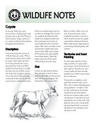
Locating Potential Cougar (Puma concolor) Corridors in New ...
Locating Potential Cougar (Puma concolor) Corridors in New ...
Locating Potential Cougar (Puma concolor) Corridors in New ...

Create successful ePaper yourself
Turn your PDF publications into a flip-book with our unique Google optimized e-Paper software.
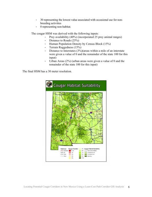
- 30 represent<strong>in</strong>g the lowest value associated with occasional use for nonbreed<strong>in</strong>g<br />
activities<br />
- 0 represent<strong>in</strong>g non-habitat.<br />
The cougar HSM was derived with the follow<strong>in</strong>g <strong>in</strong>puts:<br />
- Prey availability (40%) (<strong>in</strong>corporated 25 prey animal ranges)<br />
- Distance to Roads (25%)<br />
- Human Population Density by Census Block (15%)<br />
- Terra<strong>in</strong> Ruggedness (15%)<br />
- Distance to Interstates (3%)(areas with<strong>in</strong> a mile of an <strong>in</strong>terstate<br />
were given a value of 0 and the rema<strong>in</strong>der of the state 100 for this<br />
<strong>in</strong>put)<br />
- Urban Areas (2%) (urban areas were given a value of 0 and the<br />
rema<strong>in</strong>der of the state 100 for this <strong>in</strong>put)<br />
The f<strong>in</strong>al HSM has a 30 meter resolution.<br />
<strong>Locat<strong>in</strong>g</strong> <strong>Potential</strong> <strong>Cougar</strong> <strong>Corridors</strong> <strong>in</strong> <strong>New</strong> Mexico Us<strong>in</strong>g a Least-Cost Path Corridor GIS Analysis 6