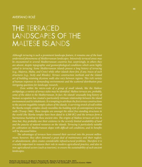
The Terraced landscapes of The MalTese Islands - Landscape Europe
The Terraced landscapes of The MalTese Islands - Landscape Europe
The Terraced landscapes of The MalTese Islands - Landscape Europe

You also want an ePaper? Increase the reach of your titles
YUMPU automatically turns print PDFs into web optimized ePapers that Google loves.
aVerTano rolé<br />
<strong>The</strong> <strong>Terraced</strong><br />
<strong>landscapes</strong> <strong>of</strong> <strong>The</strong><br />
<strong>MalTese</strong> <strong>Islands</strong><br />
Although terracing is such a prominent landscape feature, it remains one <strong>of</strong> the least<br />
understood phenomena <strong>of</strong> Mediterranean <strong>landscapes</strong>. Intensively terraced areas may<br />
be encountered in several Mediterranean countries but, surprisingly, in others they<br />
are absent, despite topographic and geomorphological conditions which seem highly<br />
suited to terracing. Some Mediterranean islands possess a long history <strong>of</strong> terracing<br />
(e.g., Majorca, Malta, and Crete) while other islands show few, if any, traces <strong>of</strong> such<br />
structures (e.g., Sicily and Rhodes). Terrace construction methods and the related<br />
art <strong>of</strong> building retaining drystone walls also vary between regions. This rich variety<br />
<strong>of</strong> human responses to demanding environments and the scattered distribution pose<br />
intriguing questions for landscape research.<br />
Even within the micro-scale <strong>of</strong> a group <strong>of</strong> small islands, like the Maltese<br />
archipelago, a variety <strong>of</strong> terrace styles may be identified. Maltese terraces are, probably,<br />
some <strong>of</strong> the oldest in the Mediterranean. In fact, the islands’ unusually long history <strong>of</strong><br />
human occupation has created a particularly intimate relationship between the island<br />
environment and its inhabitants. It is tempting to attribute the first terrace constructions<br />
to the ancient megalithic temple culture <strong>of</strong> the islands. A surviving stretch <strong>of</strong> wall within<br />
the Skorba temple complex closely resembles the building style <strong>of</strong> contemporary terrace<br />
walls (Trump 1966). <strong>The</strong>se temples are amongst the oldest free-standing structures in<br />
the world (the Skorba temples have been dated to 4,500 BC) and the terraces form a<br />
harmonious backdrop to these ancient sites. <strong>The</strong> origins <strong>of</strong> Maltese terraces are lost in<br />
time but, they probably owe their existence to the severely limited availability <strong>of</strong> land<br />
and the paucity <strong>of</strong> natural resources on the islands. Terracing is particularly suitable<br />
for cultivation on Mediterranean slopes with difficult soil conditions, and its benefits<br />
will be discussed below.<br />
<strong>The</strong> advantages <strong>of</strong> terraces have ensured their survival into the present millennium;<br />
however, they <strong>of</strong>ten demand a great deal <strong>of</strong> maintenance and their neglect,<br />
or abandonment, <strong>of</strong>ten creates considerable infrastructural problems. <strong>The</strong>refore it is<br />
crucially important to reassess their role in modern agricultural practice, and also in<br />
non-agricultural sectors (such as tourism), to ensure the sustainability <strong>of</strong> such ancient<br />
<strong>landscapes</strong>.<br />
Pedroli B, Van Doorn A, De Blust G, Paracchini ML, Wascher D & Bunce F (Eds. 2007).<br />
<strong>Europe</strong>’s living <strong>landscapes</strong>. Essays on exploring our identity in the countryside. LANDSCAPE EUROPE / KNNV.<br />
| 05
06 | Chapter 24: Rolé<br />
1 <strong>The</strong> Corso was a period, extending from the<br />
Middle Ages to the beginning <strong>of</strong> the nineteenth<br />
century, during which Maltese corsairs roamed<br />
the Mediterranean in search <strong>of</strong> Ottoman shipping.<br />
2<br />
One <strong>of</strong> the most severe raids occurred in 1429<br />
when the islands were sacked by Moslem corsairs<br />
who carried <strong>of</strong>f the entire population <strong>of</strong> Gozo<br />
into slavery. Several settlements were abandoned<br />
while agriculture suffered long term consequences,<br />
since there were no farm animals left for<br />
ploughing (Wettinger 1975, Dalli 2002)<br />
<strong>The</strong> landscape <strong>of</strong> norTh-wesT MalTa<br />
<strong>Landscape</strong> studies <strong>of</strong> Malta are limited and whatever descriptions are available are <strong>of</strong>ten highly localised. <strong>The</strong>y<br />
are also scattered amongst a number <strong>of</strong> <strong>of</strong>ficial reports which focus on planning and management issues (Planning<br />
Services Division and Colin Buchanan & Partners 1990; Planning Services Division 1990). Some notable<br />
exceptions exist, such as Bowen-Jones et al. (1961) which has considerable historical importance. A more<br />
recent study is that <strong>of</strong> Haslam and Borg (1998) which focuses on Maltese valleys. <strong>The</strong> latest significant contribution<br />
is that <strong>of</strong> the <strong>Landscape</strong> assessment Study (MEPA 2004) which highlights the features and issues that<br />
influence a dynamic Maltese <strong>Landscape</strong>. This study was carried out as part <strong>of</strong> the revision <strong>of</strong> Malta’s Structure<br />
Plan as well as to fulfil national obligations undertaken through Malta’s participation in the <strong>Europe</strong>an <strong>Landscape</strong><br />
Convention (Mallia 2003). <strong>The</strong> main landscape units identified by this exercise are shown in Figure 1.<br />
Other studies which focus primarily on the north-west have been carried out within a coastal area management<br />
framework. <strong>The</strong> Coastal Area Management Program (CAMP) (UNEP/MAP 2003) also contributed<br />
significantly to issues related to landscape structure. One thematic activity within CAMP-Malta addressed<br />
problems related to soil erosion and desertification, identifying processes which contributed to the morphology<br />
(Tanti et al. 2002). Since terraced <strong>landscapes</strong> on the main island <strong>of</strong> Malta are largely confined to the northwestern<br />
part <strong>of</strong> the island, this chapter will focus on this particular region.<br />
an anthropogenic landscape<br />
<strong>Terraced</strong> slopes have long formed an integral element <strong>of</strong> the Mediterranean landscape. To northern <strong>Europe</strong>ans,<br />
such a landscape <strong>of</strong>ten evokes romantic and idyllic images <strong>of</strong> sun-drenched hills rich with grapevines, olives,<br />
and citrus trees. However, in reality, Mediterranean terraced <strong>landscapes</strong> are better perceived as a human response<br />
to a harsh and demanding environment. <strong>The</strong> relative scarcity <strong>of</strong> land suitable for arable agriculture gave<br />
rise to an intensive form <strong>of</strong> cultivation which demanded a high input <strong>of</strong> labour with little mechanical aid.<br />
“All visitors to Malta are invariably impressed by the vast extent <strong>of</strong> stone terrace walls which give the<br />
ground-level observer an impression <strong>of</strong> rocky barrenness” (Bowen-Jones et al. 1961 p.188). This impression is<br />
reinforced by the fact that tree crops are very limited on the island. Surprisingly, olives and vines were scarce<br />
until very recently, despite the fact that historical records reveal that olive oil was a major export commodity<br />
during the Roman period <strong>of</strong> Maltese history. <strong>The</strong> explanation for this curious phenomenon is rooted in past.<br />
<strong>The</strong> Maltese <strong>Islands</strong> have long played a major role in the power games <strong>of</strong> the Mediterranean basin and<br />
their conquest was a high priority for a series <strong>of</strong> rising empires in the region. This conditioned agricultural<br />
activity in three distinct ways. <strong>The</strong> first was a need to provide the local garrison with fresh, perishable produce<br />
which could not be imported easily. A second imperative was that some crops were cultivated to suit specific<br />
military needs. An example <strong>of</strong> this is the cotton crop grown during the Corso 1 which provided raw material<br />
for sail cloth (Earle 1970, Blouet 1967). A third consequence dates back to medieval times when tree crops,<br />
like olives, were no longer cultivated. This is because such crops were more vulnerable to hostile invasions, and<br />
they could easily be destroyed 2 . Unlike annual crops, olives require long-term capital investment which takes a<br />
long time to bear fruit. <strong>The</strong> Maltese olive industry never fully recovered from its medieval demise.<br />
At present, the Maltese economy is no longer geared towards servicing a military presence, but this has<br />
been replaced by the domestic market, as well as a large tourist sector. Because <strong>of</strong> this, market gardening still<br />
accounts for most agricultural production. <strong>Europe</strong>an accession has also served to revive the long-inactive<br />
olive and viticulture sectors.<br />
<strong>The</strong> social context: comparing traditional rural <strong>landscapes</strong> with the<br />
urbanising tourist front<br />
After the arrival <strong>of</strong> the Crusading Order <strong>of</strong> St. John in Malta in 1530, a spatial dichotomy developed within<br />
the island. By that period, the Order was a maritime power in the Mediterranean and it recognised the value<br />
<strong>of</strong> Malta’s harbours in its new role as a bulwark <strong>of</strong> Christendom in the Central Mediterranean. Moreover, the<br />
Pedroli B, Van Doorn A, De Blust G, Paracchini ML, Wascher D & Bunce F (Eds. 2007).<br />
<strong>Europe</strong>’s living <strong>landscapes</strong>. Essays on exploring our identity in the countryside. LANDSCAPE EUROPE / KNNV.
Figure 1. <strong>Landscape</strong> Character Map <strong>of</strong> Malta (MEPA 2004)<br />
Figure 2. Map <strong>of</strong> Malta showing the geology and boundary for the Northwest<br />
Order was essentially a <strong>Europe</strong>an institution, and it valued its cultural and economic links with the continent.<br />
As such, the new seat <strong>of</strong> power within the islands shifted towards the Grand Harbour, where new fortifications<br />
and palaces were constructed. This process reached its peak with the construction <strong>of</strong> the new capital city <strong>of</strong><br />
Valletta, a city fortress which epitomised the best elements <strong>of</strong> military architecture. In 1565, Malta’s survival <strong>of</strong><br />
the Great Siege by the Ottomans confirmed its role as a fortress island.<br />
This new city was in stark contrast to the ancient walled capital <strong>of</strong> Mdina which, for defensive reasons,<br />
was situated inland on top <strong>of</strong> the limestone plateau. It was surrounded by extensive terraces which were able<br />
to thrive under the protection <strong>of</strong> the city’s defences. Mdina was also the seat <strong>of</strong> the old nobility and clergy,<br />
who were <strong>of</strong>ten at odds with the Crusading Order <strong>of</strong> St. John. Thus the scene was set for the development <strong>of</strong><br />
two types <strong>of</strong> landscape. <strong>The</strong> outward-looking, maritime, urban harbour which depended on external trade<br />
contrasted sharply with an inward-looking, traditional, inland, rural terraced landscape. This dichotomy is<br />
epitomised by the use <strong>of</strong> the Maltese terms tal-Belt (the city dweller) and ir-rahhal (the villager).<br />
This divide still exists to some extent, despite the rapid development that has seen the villages near the<br />
Harbour coalesce into an urban continuum. <strong>The</strong> last British military base in Malta was eventually closed in<br />
1979, while the Royal Admiralty Dockyard was privatised and entered a phase <strong>of</strong> rapid decline. With these<br />
events the focus <strong>of</strong> the national economy switched to a rapidly growing tourist sector. This change in economic<br />
focus had some important repercussions on the geography <strong>of</strong> the island. Tourist development has now<br />
shifted the spatial focus <strong>of</strong> economic activity towards the north-eastern coastline where the major bays and<br />
bathing areas are located. Competing demands for land by residential and tourist-oriented sectors is acute,<br />
especially along the Sliema Seafront where hotels and multi-residential units outbid each other for highlyprized<br />
shoreline views.<br />
Tourist development has entered a new phase; the spread <strong>of</strong> construction on non-urban land has slowed<br />
down, possibly due to stricter development control but the pressure on rural areas is still intense. Over the last<br />
decade a great deal <strong>of</strong> heated debate has been stirred up over applications to develop golf courses. Such debates<br />
are now questioning the sustainability <strong>of</strong> the tourist sector which seems to have entered a phase <strong>of</strong> stagnation<br />
and virtual decline.<br />
Pedroli B, Van Doorn A, De Blust G, Paracchini ML, Wascher D & Bunce F (Eds. 2007).<br />
<strong>Europe</strong>’s living <strong>landscapes</strong>. Essays on exploring our identity in the countryside. LANDSCAPE EUROPE / KNNV.<br />
| 07
0 | Chapter 24: Rolé<br />
Figure 3. Aerial view <strong>of</strong> typical terraced landscape <strong>of</strong> Maltese Northwest Figure 4. Maltese geophysical and stratigraphic structure<br />
<strong>The</strong> biophysical context I: terracing as a necessary response to<br />
geomorphological conditions<br />
Topography and geomorphology play a dominant role in the shaping <strong>of</strong> <strong>landscapes</strong>, particularly in the case<br />
<strong>of</strong> the terraces <strong>of</strong> north-west Malta (Figure 2). This area comprises a number <strong>of</strong> plateaux which are faulted<br />
into separate units and incised by a series <strong>of</strong> deep valleys. This is the sort <strong>of</strong> landscape which is particularly<br />
suited to terracing (Figure 3). In fact, the north-west is still largely rural in character and has escaped the<br />
intensive urbanisation that has occurred in other parts <strong>of</strong> the island. <strong>The</strong> locality also possesses some <strong>of</strong> the<br />
most spectacular scenery in Malta, which makes it crucially important to the tourist industry: a fact that has<br />
been recognised in successive development control legislation.<br />
<strong>The</strong> key to understanding Maltese terraced <strong>landscapes</strong> is the relatively simple geophysical and stratigraphic<br />
setting (Figure 4). <strong>The</strong> Maltese islands are composed <strong>of</strong> a series <strong>of</strong> five horizontal sedimentary strata<br />
which dip towards the north-east. <strong>The</strong> uppermost and lowermost <strong>of</strong> these rock strata are relatively dense<br />
crystalline limestones which are relatively resistant to erosion. Between these two layers are sandwiched other<br />
sedimentary strata <strong>of</strong> much less resistant sandstones, clays, and a fine-grained globigerina (micro-fossil limestone).<br />
<strong>The</strong> selective erosion <strong>of</strong> these s<strong>of</strong>ter strata has produced the distinctive slopes which have been extensively<br />
terraced throughout the north-west.<br />
<strong>The</strong> geo-stratigraphic tilt <strong>of</strong> the island exposes a series <strong>of</strong> near-vertical cliffs on the western coast. <strong>The</strong>se<br />
are composed <strong>of</strong> a resistant lower coralline limestone and reach a height <strong>of</strong> 130 metres. Unlike the south-east,<br />
much <strong>of</strong> the upper geo-structural layers still remain in the north-west area and present a series <strong>of</strong> flat-topped<br />
plateaux dissected by deeply incised valleys.<br />
A series <strong>of</strong> faults, aligned north-east to south-west, cut across the island and have produced some distinctive<br />
horst (raised slab) and graben (rift valley) structures. <strong>The</strong> most significant <strong>of</strong> these, known as the<br />
Great Fault, has created a physical topographic divide which was exploited as a defensive structure <strong>of</strong> the<br />
island. Other major faults collapsed into two to four kilometre-wide grabens which became sand-filled bays.<br />
<strong>The</strong>se have proved to be highly important for the leisure and tourist industry.<br />
<strong>The</strong> geophysical tilt <strong>of</strong> the islands has also played an important role in the availability <strong>of</strong> scarce water<br />
supplies on this semi-arid island. <strong>The</strong> north-easterly dip <strong>of</strong> the rock strata ensures that seasonal surface drainage<br />
tends to flow towards the north-eastern coast. At the same time, the presence <strong>of</strong> a stratum <strong>of</strong> blue clay underlying<br />
the upper coralline limestone and greensand strata has permitted the formation <strong>of</strong> a series <strong>of</strong> perched<br />
aquifers. <strong>The</strong>se release trapped groundwater along spring lines and this precious water has been traditionally<br />
harvested by farmers to irrigate their terraces. Of course, the springs also maintained a rich community <strong>of</strong><br />
evergreen woodland and Mediterranean scrub which must have predated terrace cultivation.<br />
Pedroli B, Van Doorn A, De Blust G, Paracchini ML, Wascher D & Bunce F (Eds. 2007).<br />
<strong>Europe</strong>’s living <strong>landscapes</strong>. Essays on exploring our identity in the countryside. LANDSCAPE EUROPE / KNNV.
<strong>The</strong> biophysical context II: the natural vegetation <strong>of</strong> the north-west<br />
It is believed that the original climax vegetation cover <strong>of</strong> the Maltese <strong>Islands</strong> was sclerophyllous woodland<br />
composed largely <strong>of</strong> Aleppo pine (Pinus halipensis) and holm oak (Quercus ilex). This has practically been<br />
destroyed, except for a small isolated stand <strong>of</strong> oaks located at Wardija. Estimates <strong>of</strong> the age <strong>of</strong> individual specimens<br />
vary between 500 to 900 years (Lanfranco et al. 1996). Much <strong>of</strong> this woodland must have been cleared<br />
for arable cultivation since it would have occupied the most fertile soils on the island. It is very probable that<br />
the regeneration <strong>of</strong> woodland would have been further prevented through grazing and possibly fire.<br />
Degraded sclerophyllous woodland was converted, by a series <strong>of</strong> anthropogenic processes, into a patchy,<br />
evergreen scrub community known as macchia. This is quite common in most Mediterranean countries and<br />
is composed <strong>of</strong> large shrubs and small trees which may reach a height <strong>of</strong> three metres; though they are <strong>of</strong>ten<br />
limited to one or two metres. This macchia is characterised by olive (Olea europaea), lentisk (Pistacia lentiscus),<br />
wild fig (Ficus carica), carob (Ceratonia siliqua), wild almond (Amygdalus communis) and bay (Laurus<br />
nobilis).<br />
<strong>The</strong> more exposed limestone platforms have been colonised by a natural vegetation cover <strong>of</strong> garigua.<br />
This is largely composed <strong>of</strong> aromatic, spiny, woody scrub species which are resistant to the stressful Mediterranean<br />
summer drought and extreme exposure. <strong>The</strong>y are <strong>of</strong>ten found growing in pockets <strong>of</strong> residual soil and the<br />
more common species include Mediterranean heath (Erica mutliflora) and aromatic herbs such as Mediterranean<br />
thyme (Thymus capitatus), and rosemary (Rosmarinus <strong>of</strong>ficinalis ). <strong>The</strong> aromatic oils contained within<br />
these herbs makes them more resistant to drought conditions. Many sub-types <strong>of</strong> garigua can be found depending<br />
upon variations in slope and exposure to salt-laden winds. Most <strong>of</strong> these ecosystems are highly valuable<br />
to science since they contain several endemic species. Such species include: Maltese spurge (Euphorbia<br />
melitensis); Maltese fleabane (Chiliadenus bocconei); Maltese spider orchid (Ophrys melitensis) and Maltese<br />
sea lavender (Limonium melitensis). <strong>The</strong>y have thus been accorded protection within national environmental<br />
and planning legislation.<br />
1 : <strong>The</strong> construction <strong>of</strong> drystone walls<br />
Terraces are simple but ingenious engineering exercises in the management <strong>of</strong> slopes. Farmers gain a wide area <strong>of</strong> cultivable land by reducing its slope<br />
while stabilising the steepened slope at the terrace face. Such steep slopes are supported by a buttress <strong>of</strong> drystone walls. Terraces can be very stable<br />
structures but their integrity depends upon the maintenance <strong>of</strong> these drystone walls, as well as the original method <strong>of</strong> construction.<br />
Even on a small island like Malta, practices vary but some common factors can be identified (Figure 5), which include:<br />
• a highly porous structure where rocks are fitted in such a way as to maximise drainage while locking the constituent rocks in place<br />
• a structure which is held together by the angular shape <strong>of</strong> its rock components and not by the use <strong>of</strong> mortar<br />
• a stable pyramidal structure achieved by the construction <strong>of</strong> two walls which are<br />
slightly tilted inwards and meet at the apex<br />
• Larger component rocks are placed at lower levels where stress is greatest, with the<br />
wider surface area in contact with the bedrock maximising friction.<br />
• <strong>The</strong> internal structural integrity is secured by an infill <strong>of</strong> much smaller stones. <strong>The</strong>se<br />
occupy the spaces between the angular shapes <strong>of</strong> the larger facing rocks and provide<br />
rigidity while maximizing drainage.<br />
• Occasional cross-members span the two sides <strong>of</strong> the wall; with elongated slabs locking<br />
the component parts together; thus adding greater structural integrity.<br />
• <strong>The</strong> whole structure may be capped by large, heavy, and relatively flat rocks; which<br />
bridge the two walls at their narrowest part, and apply vertical pressure on the Figure 5: Structure <strong>of</strong> a terrace-retaining dry rubble wall<br />
whole structure, thus increasing slope friction.<br />
Pedroli B, Van Doorn A, De Blust G, Paracchini ML, Wascher D & Bunce F (Eds. 2007).<br />
<strong>Europe</strong>’s living <strong>landscapes</strong>. Essays on exploring our identity in the countryside. LANDSCAPE EUROPE / KNNV.<br />
| 0
10 | Chapter 24: Rolé<br />
2 : Mapping erosion risk maps for terraced <strong>landscapes</strong><br />
Unfortunately the general public’s attitude towards the garigua habitat still varies from neutral to negative.<br />
<strong>The</strong> Maltese term for garigua is xaghri and this <strong>of</strong>ten carries connotations <strong>of</strong> wasteland and a general<br />
perception <strong>of</strong> unproductive land. Manifestations <strong>of</strong> this attitude take the form <strong>of</strong> occasional fly tipping by insensitive<br />
individuals, as well as the more serious dumping <strong>of</strong> construction waste by some building contractors.<br />
This attitude seems to be slowly changing and credit needs to be given to educational campaigns organised by<br />
NGOs as well as environmental and educational authorities.<br />
Equally neutral or negative perceptions apply to the Mediterranean steppe habitat. Such ecosystems are<br />
most <strong>of</strong>ten a product <strong>of</strong> the degradation <strong>of</strong> arable land, garigua, or macchia, and form grasslands with no tree<br />
cover. <strong>The</strong>se steppic grasslands dry out during the summer drought and its plants shrivel into various shades<br />
<strong>of</strong> yellows and browns giving the impression <strong>of</strong> a Mediterranean desert.<br />
Many <strong>of</strong> the plants which colonise steppe are opportunistic annual plants which include a high proportion<br />
<strong>of</strong> exotics. Examples <strong>of</strong> the most common exotics include cape sorrel (Oxalis pes-caprae) and crown daisy<br />
(Chrysanthemum coronarium). Other species, however, are native to the islands and include common awngrass<br />
(Stipa capensis), thistles such as the mediterranean thistle (Galactites tomentosa) and clustered carline<br />
thistle (Carlina involucrata); umbellifers such as wild carrot (Daucus carota), common fennel (Foeniculum<br />
vulgare), and giant fennel (Ferula communis); legumes such as common vetch (Vicia sativa) and, tuberous or<br />
bulbous species like the southern star <strong>of</strong> Bethlehem (Ornithogalum narbonense). Rocky steppe is also quite<br />
common in many parts <strong>of</strong> north-west Malta and this harbours geophytes such as asphodel (Asphodelus aestivus)<br />
and sea squill (Urginea maritima).<br />
A careful observation <strong>of</strong> the landscape <strong>of</strong> the north-west reveals some very interesting patterns in the<br />
distribution <strong>of</strong> natural habitats and corresponding human land use patterns. Several features can be recognised,<br />
including beaches, sea cliffs, inland cliffs, wide flat-bottomed graben valleys, and incised v-shaped valleys.<br />
<strong>The</strong> last present some interesting patterns and will be discussed further.<br />
<strong>The</strong> effectiveness and longevity <strong>of</strong> terraces depends largely upon the buttressing <strong>of</strong> the slope by a retaining terrace wall and, in Malta, this is largely<br />
achieved through the construction <strong>of</strong> drystone walls (Figure 6). <strong>The</strong>se walls contain no binding mortar (hence the term drystone) and this plays a crucial<br />
role in allowing surface flowing and internally flowing storm water to drain freely through the gaps between individual stones. However, walls <strong>of</strong> this sort<br />
require a considerable degree <strong>of</strong> maintenance and skilled reconstruction when breaches occur. Repairing such breaches is a time-consuming exercise and<br />
<strong>of</strong>ten necessitates costly skilled labour. In the long run, breaches have a tendency<br />
to widen and the consequent soil erosion rates accelerate rapidly.<br />
In a recent study, conducted within MAP-CAMP (Malta)*, the author and a<br />
team <strong>of</strong> colleagues addressed the issue <strong>of</strong> land degradation in north-west Malta,<br />
by locating and evaluating the problem <strong>of</strong> soil erosion within the area; as well<br />
as identifying the processes which contribute to land degradation in general.<br />
<strong>The</strong> study included the first empirical application <strong>of</strong> the FAO/UNEP system for<br />
erosion risk mapping (PAP/RAC & FAO 1997). It was produced through the superimposition<br />
<strong>of</strong> a series <strong>of</strong> thematic maps which were overlaid within a geographic<br />
information system (GIS). <strong>The</strong> layering scheme is presented graphically in Figure<br />
7 while the final Erosion Risk map is reproduced in Figure 8.<br />
<strong>The</strong> study has demonstrated that the areas with the highest risk <strong>of</strong> soil erosion<br />
are rain-fed terrace slopes on underlying clay. <strong>The</strong> surface flow <strong>of</strong> water on<br />
such fields is particularly high since the clay-rich soils inhibit absorption. Another<br />
reason for the disproportionate erosion levels is that terrace walls, which are<br />
designed to control soil erosion, cannot be adequately constructed in such areas,<br />
Figure 6. A typical example <strong>of</strong> a dry rubble wall armouring a terrace slope<br />
because clay is not a suitable foundation for drystone walls.<br />
* MAP CAMP stands for UNEP’s Mediterranean Action Plan – Coastal Area Management Programme. Several CAMPs have been conducted for most countries <strong>of</strong> the Mediterranean Basin and some are still in progress.<br />
Pedroli B, Van Doorn A, De Blust G, Paracchini ML, Wascher D & Bunce F (Eds. 2007).<br />
<strong>Europe</strong>’s living <strong>landscapes</strong>. Essays on exploring our identity in the countryside. LANDSCAPE EUROPE / KNNV.
Layer 1<br />
Lith<strong>of</strong>acies<br />
(geological substrate)<br />
Layer 2<br />
Slope<br />
Layer 3<br />
Field Survey - State<br />
<strong>of</strong> Terraces and<br />
Retaining Rubble<br />
Walls<br />
Layer 4<br />
Land Use<br />
Layer 1<br />
Lith<strong>of</strong>acies<br />
(geological substrate)<br />
Layer 1<br />
Lith<strong>of</strong>acies<br />
(geological substrate)<br />
Figure 7. Modified layering scheme for CAMP Malta’s application<br />
<strong>of</strong> FAO/UNEP system for erosion risk mapping<br />
Layer 1<br />
Lith<strong>of</strong>acies<br />
(geological substrate)<br />
readInG <strong>The</strong> landscape; IdenTIfyInG<br />
paTTerns wIThIn a TypIcal Valley <strong>of</strong> <strong>The</strong><br />
norTh-wesT MalTa<br />
Figure 9 is a generalised natural habitat distribution and land use scheme for Maltese valleys <strong>of</strong> the north-west.<br />
Many <strong>of</strong> these valleys are located parallel to the Great Fault and dissect the upper coralline plateau, cutting<br />
down through all the less resistant sedimentary strata until they reach the underlying lower coralline limestone.<br />
Such valleys initially drain towards the north-west but then link with the main Qlejjgha valley drainage<br />
basin which extends to Salina Bay. <strong>The</strong>se valleys are a typical landscape feature <strong>of</strong> the north-west and can best<br />
be represented by Tas-Santi Valley. Distinct zones can be identified and each one <strong>of</strong> these is shaped by a specific<br />
set <strong>of</strong> natural processes and conditioned by human land use. Each zone is characterised by different types<br />
<strong>of</strong> terraces depending upon the angle <strong>of</strong> slope and aspect, as well as the availability <strong>of</strong> water. <strong>The</strong> identified<br />
zones commence on the upper karst plateau and descend across the valley.<br />
Within such environments, the key to understanding the distribution pattern <strong>of</strong> natural vegetation and<br />
human activity is the availability and/or channelling <strong>of</strong> scarce water supplies.<br />
Zone 1: <strong>The</strong> karstic upper coralline limestone plateaux consist <strong>of</strong> bare rock, and stony platforms with<br />
little available water. Much <strong>of</strong> the natural vegetation cover <strong>of</strong> such plateaux consists <strong>of</strong> various types <strong>of</strong> garigua<br />
in different stages <strong>of</strong> ecological succession. Arable cultivation is only possible wherever farmers can find<br />
shallow depressions; <strong>of</strong>ten dolines (collapsed caves), which maintain some soil cover. <strong>The</strong>se farmers have to<br />
irrigate their crops from reserves <strong>of</strong> trapped groundwater in the perched aquifers <strong>of</strong> the area. <strong>The</strong> plateaux are<br />
highly exposed locations and crop wind burn is a common hazard. Most fields are enclosed by a one metre<br />
high drystone wall, but this provides little protection during the windy season. Grazing has all but disappeared<br />
from the Maltese countryside. <strong>The</strong> selective cropping <strong>of</strong> goats and sheep exerted a strong and lasting influence<br />
on the ecosystem <strong>of</strong> the area, and it will be interesting to see the changes that this significant reduction will<br />
create in the composition <strong>of</strong> the vegetation on these plateaux. Alternative non-agricultural land-uses include<br />
bird hunting and trapping, which <strong>of</strong>ten conflict with other recreational activities and sometimes tourism.<br />
Pedroli B, Van Doorn A, De Blust G, Paracchini ML, Wascher D & Bunce F (Eds. 2007).<br />
<strong>Europe</strong>’s living <strong>landscapes</strong>. Essays on exploring our identity in the countryside. LANDSCAPE EUROPE / KNNV.<br />
Figure 8. Final Erosion Risk map<br />
for Malta’s northwest<br />
| 11<br />
“Il-Hajt tas-Sejjieh, aktar ma<br />
jkun sabih, aktar jaqla’ iddriegh”<br />
- a proverb <strong>of</strong>ten quoted<br />
by Carmelo Bonnici (a farmer,<br />
now deceased, who owned a terraced<br />
farm near Hal Far).<br />
Translation: <strong>The</strong> more beautiful<br />
a rubble wall, the more demanding<br />
it is in terms <strong>of</strong> manual<br />
labour. This highlights the fact<br />
that terrace walls are a huge,<br />
long-term capital investment in<br />
Maltese <strong>landscapes</strong> and need to<br />
be adequately maintained through<br />
the management <strong>of</strong> socio-agricultural<br />
processes.
12 | Chapter 24: Rolé<br />
Figure 9. Generalised natural habitat distribution and land use<br />
scheme for Maltese valleys <strong>of</strong> the northwest<br />
Figure 10. Vestiges <strong>of</strong> old irrigation systems can still be seen in Wied Babu (limits <strong>of</strong> Zurrieq)<br />
Zone 2: <strong>The</strong> upper coralline plateaux are <strong>of</strong>ten undercut by erosion <strong>of</strong> the less resistant greensand and<br />
blue clays and large blocks detach and slide down into the valley. Such erosion also leaves near-perpendicular<br />
cliff faces which are colonised by rupestral plant communities. One <strong>of</strong> the more common examples is the caper<br />
bush (Capparis orientalis). <strong>The</strong> presence <strong>of</strong> large boulders and the inherent geomorphological instability<br />
<strong>of</strong> the area render it marginal to arable cultivation. Some narrow terraces may be found at the base <strong>of</strong> the cliffs,<br />
but these have now largely been abandoned and are currently being taken over by regenerating macchia. Until<br />
a few years ago, these marginal fields were grazed, but the virtual disappearance <strong>of</strong> foraging herds <strong>of</strong> goats and<br />
sheep is now accelerating the process <strong>of</strong> regeneration.<br />
What is far more important in this zone is the presence <strong>of</strong> springs, which are occasionally found just<br />
above the impervious Blue clay stratum. <strong>The</strong> availability <strong>of</strong> this water is probably what drove the first Maltese<br />
terrace builders to this cultivation structure. Here was a reliable source <strong>of</strong> water which required no pumping,<br />
since it could be easily fed to fields under gravity, along traditional stone channels; called driegi or dorog<br />
(singular dorga). <strong>The</strong>se are simple, regularly-sized blocks <strong>of</strong> stone into which a groove has been chiselled; they<br />
have then been placed end-to-end, and cemented in some way, to form a continuous run. Most <strong>of</strong>ten these<br />
driegi are fashioned out <strong>of</strong> the s<strong>of</strong>ter globigerina limestone. Unfortunately, the dorga system has now largely<br />
been replaced by modern piping, but some vestiges <strong>of</strong> old irrigation systems can still be seen in Wied Babu<br />
(Figure 10) Wied Hazrun, and at Wied il-Lunzjata (located on the island <strong>of</strong> Gozo).<br />
Zone 3: Larger terraces are normally found mid-slope and are <strong>of</strong>ten the most productive fields. <strong>The</strong>ir<br />
soils may vary considerably depending on the underlying substrate. <strong>The</strong> friable greensand and eroded upper<br />
coralline limestone produce typical terra rossa soils which are normally shallow but can have a well-drained<br />
structure. <strong>The</strong>se are <strong>of</strong>ten irrigated and used intensively to produce multiple annual crops.<br />
<strong>The</strong> mid-slope terraces which were built on clay slopes produce much deeper soils, but their texture<br />
presents problems for arable cultivation since it is blocky and difficult to work. Most <strong>of</strong>ten these fields are used<br />
to grow rain-fed cereals and fodder, and yield just one annual crop. Terraces with underlying clay also pose a<br />
more serious problem in terms <strong>of</strong> the construction <strong>of</strong> drystone walls. <strong>The</strong>se walls serve to maintain structural<br />
integrity by buttressing the steep slope on the outside <strong>of</strong> the terrace. In the case <strong>of</strong> clay slopes, it is <strong>of</strong>ten impossible<br />
to excavate solid foundations for drystone walls without incurring massive expense and effort. Most<br />
Pedroli B, Van Doorn A, De Blust G, Paracchini ML, Wascher D & Bunce F (Eds. 2007).<br />
<strong>Europe</strong>’s living <strong>landscapes</strong>. Essays on exploring our identity in the countryside. LANDSCAPE EUROPE / KNNV.
terrace walls in such fields require a good deal <strong>of</strong> maintenance and suffer badly from neglect and abandonment.<br />
This is one <strong>of</strong> the main reasons why terraces on the island <strong>of</strong> Gozo, which possess a higher proportion<br />
<strong>of</strong> exposed clay slopes, are experiencing accelerated soil erosion.<br />
Zone 4: This is the zone where terraces are occasionally prone to some flood damage during the intense,<br />
torrential, autumn rain. <strong>The</strong>se terraces retain a fair degree <strong>of</strong> moisture even during the summer drought and<br />
are <strong>of</strong>ten devoted to horticulture; with a special focus on citrus and other fruit trees. In some cases, as in Tas-<br />
Santi Valley, these terraces are not contained behind drystone walls but are retained by dense growths <strong>of</strong> the<br />
great reed (Arundo donax).<br />
Zone 5: This is the valley watercourse and the area in the immediate vicinity <strong>of</strong> the stream, which is<br />
prone to frequent seasonal flooding. Such watercourses are considered highly valuable ecosystems by scientists<br />
because they are very rare habitats in a semi-arid country. Moreover they <strong>of</strong>ten harbour rare and endemic<br />
species; a good example is the endemic freshwater crab (Potamon fluviatile lanfrancoi).<br />
Unfortunately, the high regard for watercourses is not universal. All too <strong>of</strong>ten, streams act as disposal<br />
areas, although this practice has decreased considerably over the last few years. This may be attributed to<br />
a change in perception and appreciation <strong>of</strong> such habitats amongst the general population. Moreover, such<br />
habitats enjoy the protection <strong>of</strong> environmental and planning legislation. Such protection has been increased<br />
to such an extent that it has raised conflicting issues with farmers. In fact, during the CAMP process, farmers<br />
complained that watercourses were creating problems <strong>of</strong> flood damage, since they could not legally be cleared<br />
to allow fast drainage during intense rainstorms. This was raising the level <strong>of</strong> storm-water run<strong>of</strong>f to such a<br />
height that serious soil erosion was occurring along the lower terraces located near the watercourse (Tanti et<br />
al.).<br />
3 : <strong>The</strong> spread <strong>of</strong> recreational squatter settlements in the north-west <strong>of</strong> Malta; the Ghadira and Armier sagas<br />
Recreational squatter settlements are rather curious landscape elements that have appeared near Maltese bathing areas during the last few decades. In<br />
some cases, such squatters have taken up terraced lands which were illegally sub-let to them by tenant farmers. <strong>The</strong>se settlements are composed <strong>of</strong> a series<br />
<strong>of</strong> illegally built structures, with varying degrees <strong>of</strong> permanence, which occupy state-owned land in close proximity to beaches and other bathing areas<br />
(Figure 11).<br />
Most units consist <strong>of</strong> wooden sheds, while others are mobile caravans which are permanently fixed to a spot. Some were even made up <strong>of</strong> shipping<br />
containers that were modified for temporary habitation. In time the owners modified their “caravans” with the addition <strong>of</strong> verandas, small gardens, car<br />
ports, and other embellishments.<br />
<strong>The</strong>se settlements can trace their origins to the campers who pitched their tents on the sandy beach <strong>of</strong> Mellieha Bay during the sixties and seventies.<br />
Such camps <strong>of</strong>ten lasted for most <strong>of</strong> the summer months and became an obstacle for Malta’s budding tourist industry. For this reason, overnight camping on<br />
the beach was banned in the seventies and camps were relocated to a series <strong>of</strong> terraced<br />
fields overlooking the bay. This proved attractive to other prospective squatters and, very<br />
soon, the so-called Ghadira Caravan Site grew uncontrollably. <strong>The</strong> Ghadira settlement<br />
was legally recognised during the eighties, when settlers were acknowledged as tenants,<br />
and water, sewerage, and electricity services were provided.<br />
Meanwhile, other recreational squatter sites mushroomed in prime coastal locations<br />
like Armier Bay and Cirkewwa; probably encouraged by the legal recognition granted to<br />
the Ghadira settlement. <strong>The</strong> Cirkewwa site was eventually cleared by government agencies,<br />
because <strong>of</strong> the construction <strong>of</strong> a water desalination plant, but others are proving to<br />
be far more difficult to remove.<br />
While it is widely accepted that such recreational squats are an eyesore and constitute<br />
a blight on the landscape, the residents claim that they fulfil a social need. Many<br />
Figure 11: Recreational squatter settlements at Mellieha Bay. <strong>The</strong>se are<br />
illegally constructed, semi-permanent to fully-permanent, structures<br />
which occupy state-owned land in close proximity to beaches and other<br />
bathing areas<br />
Pedroli B, Van Doorn A, De Blust G, Paracchini ML, Wascher D & Bunce F (Eds. 2007).<br />
<strong>Europe</strong>’s living <strong>landscapes</strong>. Essays on exploring our identity in the countryside. LANDSCAPE EUROPE / KNNV.<br />
state that they have rediscovered a sense <strong>of</strong> neighbourhood which has been largely lost<br />
from their home suburbs. This may explain the ironic fact that, although residents normally<br />
possess a comfortable home, they are willing to sacrifice their usual conveniences<br />
to spend some three months living in cramped quarters, albeit close to the sea.<br />
| 13
1 | Chapter 24: Rolé<br />
Several watercourses in northwest Malta have been colonised by the great reed (Arundo donax) and<br />
these are regularly harvested in order to make cane furniture. Some farmers; especially in the San Blas area<br />
<strong>of</strong> Gozo; construct very effective wind breaks out <strong>of</strong> the reeds, which are worked into the rubble walls <strong>of</strong> the<br />
terraces. This creates a very picturesque form <strong>of</strong> terracing which is largely restricted to the island and is rare<br />
in Malta.<br />
No permanent rivers exist in Malta. <strong>The</strong>re are only seasonal streams in the larger drainage basins and<br />
several ephemeral streams. This is partly due to the seasonal precipitation regime which is characteristic <strong>of</strong><br />
Mediterranean climatic regimes and also partly due to the karstic nature <strong>of</strong> its geology. In fact, the Maltese<br />
word for valley is wied, which shows the Semitic origin <strong>of</strong> the language, but it also has connotations <strong>of</strong> dry<br />
river valleys with highly seasonal flow regimes (Arabic wadi or oued). As in other Semitic cultures, a valley in<br />
Malta is not named after the stream that flows through it, since this is normally not permanent, but refers to<br />
the terrestrial topographic feature (e.g., Wied il-Kbir – the Large Valley not the Large River). Streams in Malta<br />
have no name but the valley through which they flow does. Moreover, different stretches <strong>of</strong> a wied may have<br />
different names along different parts <strong>of</strong> its length; so, for example, changes to the name Wied il-Kbir include<br />
Wied ic-Cawsli and Wied Qirda. A wied system may change names as frequently as six times within a length<br />
<strong>of</strong> 10 kilometres.<br />
: <strong>The</strong> impact <strong>of</strong> Laws <strong>of</strong> Inheritance on the rural landscape<br />
Legislation has a pr<strong>of</strong>ound impact on the evolution <strong>of</strong> <strong>landscapes</strong> and never more so than in the Mediterranean. Many countries in the region possess<br />
legislative systems which are based, in varying degrees, on the ancient Roman Civil Code. <strong>The</strong> Maltese judicial system is no different; despite two hundred<br />
years <strong>of</strong> British colonial rule. <strong>The</strong>refore, legislation that regulates inheritance is based upon the principle <strong>of</strong> equity amongst inheritors. This is very different<br />
from other cultures, like the Anglo-Saxon tradition, which permits an individual to transfer his estate to just one <strong>of</strong> his <strong>of</strong>fspring.<br />
<strong>The</strong> Law <strong>of</strong> Inheritance has been largely responsible for the problem <strong>of</strong> fragmentation <strong>of</strong> landholdings within the Maltese <strong>Islands</strong>. <strong>The</strong> problem is<br />
compounded by the fact that titles <strong>of</strong> tenancy are also inherited in the same manner. This means that state-owned land, leased to individual tenants, is also<br />
highly fragmented. Average farm size (76%) for the Maltese <strong>Islands</strong> is no more than one hectare in size (NSO 2001), while some farmers may be forced<br />
to cultivate several small fields which may be located kilometres apart.<br />
Land fragmentation has various negative consequences on the rural landscape. <strong>The</strong>se include an increased demand for access roads, the limited application<br />
<strong>of</strong> modern agricultural techniques, and marginal economic returns. Faced with such constraints, it is not surprising to observe that the agricultural<br />
sector is in decline. Of the total number <strong>of</strong> farmers, 89% now work on a part time basis, and 55% are over 50 years <strong>of</strong> age (NSO 2001). It is feared that<br />
this trend may be exacerbated by competition from cheaper agricultural imports following Malta’s accession to the <strong>Europe</strong>an Union.<br />
<strong>The</strong>se factors contribute significantly to an increased risk <strong>of</strong> land abandonment and, in the case <strong>of</strong> terraced <strong>landscapes</strong>, the consequences are<br />
particularly serious. Similar experiences in other parts <strong>of</strong> the Mediterranean (Roxo et al 1996; Margaris et al 1996), and further afield (Mainguet 1994;<br />
Middleton and Thomas 1997), show a strong causative relationship between unfavourable socio-economic factors, land abandonment, and accelerated soil<br />
erosion. Lack <strong>of</strong> maintenance <strong>of</strong> terrace walls eventually results in the removal <strong>of</strong> entire soil pr<strong>of</strong>iles, especially if grazing inhibits the development <strong>of</strong> a<br />
dense vegetation cover. This is disastrous if one considers the fact that the terrace constitutes a form <strong>of</strong> inherited rural capital which is irreplaceable within<br />
a human time frame.<br />
Is the rural landscape <strong>of</strong> Malta doomed?<br />
<strong>The</strong> survival <strong>of</strong> the Maltese rural landscape has <strong>of</strong>ten been questioned. <strong>The</strong> factors that contribute to its possible<br />
demise include: a combination <strong>of</strong> acute demand for tourist and residential development; increased recreational<br />
pressure; marginal agricultural activity; water stress; terrace wall maintenance; and unfavourable<br />
land tenure systems.<br />
Malta is already the most densely populated country in <strong>Europe</strong> but the voracious appetite <strong>of</strong> the construction<br />
industry seems to be unchecked. Rising land prices, coupled with economic and political pressures,<br />
resulted in MEPA revising the boundaries <strong>of</strong> development zones in 2006. It seems that the term sustainability<br />
assumes new interpretations under such circumstances.<br />
Pedroli B, Van Doorn A, De Blust G, Paracchini ML, Wascher D & Bunce F (Eds. 2007).<br />
<strong>Europe</strong>’s living <strong>landscapes</strong>. Essays on exploring our identity in the countryside. LANDSCAPE EUROPE / KNNV.
Figure 12. Urbanised terraced slopes overlooking Mellieha Bay<br />
chanGes In <strong>Terraced</strong> <strong>landscapes</strong><br />
“Understanding terraces is the key to understanding the chronology and development <strong>of</strong> many Mediterranean<br />
<strong>landscapes</strong>. We do not have that key.” (Grove and Rackham 2001; p.112) This lament is particularly applicable<br />
to Maltese terraced <strong>landscapes</strong>, since the task <strong>of</strong> assigning unequivocal dates to terraces is notoriously difficult.<br />
This is partly due to the combination <strong>of</strong> factors which follow.<br />
• Terrace wall construction methods were not deemed to be <strong>of</strong> such importance as to warrant specific study and<br />
no written records have been found which document the construction methods employed centuries ago.<br />
• Terrace construction methods have apparently changed little over time. It is only recently that some farmers<br />
have taken short-cuts and repaired terrace retaining walls with standard limestone building blocks.<br />
Such repairs never last long.<br />
• Terraces are in constant need <strong>of</strong> repair. Sections <strong>of</strong> drystone walls are <strong>of</strong>ten rebuilt quickly following collapse,<br />
in order to prevent further soil erosion, and consequently the same terrace wall would have multiple<br />
dates.<br />
• It is impossible to identify a particular style which can be dated to a known historical period.<br />
Pedroli B, Van Doorn A, De Blust G, Paracchini ML, Wascher D & Bunce F (Eds. 2007).<br />
<strong>Europe</strong>’s living <strong>landscapes</strong>. Essays on exploring our identity in the countryside. LANDSCAPE EUROPE / KNNV.<br />
| 15
16 | Chapter 24: Rolé<br />
Figure 13. Several hectares <strong>of</strong> abandoned and degraded terraced<br />
lands have been rehabilitated and planted with vines<br />
Figure 14. Bird hunting hides and trapping sites have become a regular feature<br />
<strong>of</strong> the Maltese countryside<br />
It is obvious that highly significant changes to terraced <strong>landscapes</strong> are currently occurring. This is due<br />
to a number <strong>of</strong> processes which are causing negative as well as some positive impacts on environmental and<br />
agrarian quality. Such processes have set trends which are expected to continue into the foreseeable future.<br />
Probably the single greatest impact on terraced <strong>landscapes</strong> in Malta is the spread <strong>of</strong> urbanisation and<br />
concomitant peri-urban development. Such development includes quarrying, manufacturing, warehousing,<br />
and other industry which is generally deemed as undesirable within residential urban areas. Some residential<br />
complexes, on the other hand, actively favour terraced locations which <strong>of</strong>ten command spectacular and<br />
unhindered views. Examples <strong>of</strong> such development include the Busietta Gardens complex in Madliena valley,<br />
Santa Maria Estate in Mellieha, and the north-facing terraced slopes overlooking Mellieha Bay (Figure 12).<br />
5 : Some impacts on terraced <strong>landscapes</strong> <strong>of</strong> Malta’s accession to the <strong>Europe</strong>an Union<br />
<strong>Terraced</strong> cultivation is deeply influenced by external factors; probably more so than conventional large-scale agriculture. Maltese terraces are small in area<br />
and cannot generally accommodate heavy machinery. <strong>The</strong>refore production tends to be small-scale, artisanal, and particularly prone to suffer from the<br />
liberalisation <strong>of</strong> trade and associated cheaper imports. Despite the fact that the Maltese agricultural sector is still in transition, some obvious impacts can<br />
already be identified within the rural landscape.<br />
With the notable exception <strong>of</strong> early potatoes destined for the <strong>Europe</strong>an market, most Maltese agricultural effort was geared towards satisfying local<br />
demand. <strong>The</strong> sector was protected through a complex system <strong>of</strong> trade barriers which allowed some imports as the need arose (Role et al 2005). <strong>Europe</strong>an<br />
accession spelled the end <strong>of</strong> this system, but it opened opportunities for two particular activities which are perfectly suited to terrace cultivation: viticulture<br />
and olive cultivation.<br />
<strong>The</strong> Maltese wine industry has experienced a considerable amelioration in quality during the last two decades; this was partly fuelled by the demand<br />
for good quality local wines generated by the tourist sector. Most <strong>of</strong> the grapes needed to satisfy this demand used to be imported until May 2006. <strong>Europe</strong>an<br />
accession now obliges local vintners to use local grapes in order to satisfy DOC requirements and this has resulted in a steep rise in demand for local, quality<br />
grapes. Some wine producers even provide the vines and help in their planting, provided that the farmer signs a contract to supply them with the produce.<br />
Many farmers have thus been encouraged to plant vines on terraces which were previously semi-abandoned (Figure 13).<br />
<strong>Europe</strong>an accession has also boosted olive cultivation. This crop has experienced a revival over the last few years since the edaphic conditions found<br />
in Malta seem ideal for producing an extremely high quality olive oil. As with viticulture, the higher value <strong>of</strong> olives is serving as an incentive to rehabilitate<br />
previously semi-abandoned terraces and bring them back into production.<br />
Pedroli B, Van Doorn A, De Blust G, Paracchini ML, Wascher D & Bunce F (Eds. 2007).<br />
<strong>Europe</strong>’s living <strong>landscapes</strong>. Essays on exploring our identity in the countryside. LANDSCAPE EUROPE / KNNV.
6 : Terrace wall reconstruction and EU subsidies<br />
<strong>The</strong> structural integrity <strong>of</strong> Maltese terraces depends largely on the effectiveness <strong>of</strong> their retaining drystone walls. For this reason, a specific study was<br />
carried out within the CAMP process, which mapped the condition <strong>of</strong> the retaining walls. This State <strong>of</strong> Drystone Walls Map was also used as an additional<br />
layer within the Erosion GIS for the compilation <strong>of</strong> the final Physical Erosion Risk Map (Figure 15). A review <strong>of</strong> the findings concludes that, not surprisingly,<br />
the walls which exhibited most damage were those which were constructed on clay slopes. Such walls require a greater degree <strong>of</strong> maintenance, while the<br />
economic return is <strong>of</strong>ten marginal.<br />
Abandoned fields also showed considerable damage. Stormwater damage is common in such areas, but a curious finding was that some rubble<br />
walls were damaged by people while they hunted for edible snails. <strong>The</strong>y <strong>of</strong>ten overturned stones and dislodged keystones thus threatening the structural<br />
integrity <strong>of</strong> whole stretches <strong>of</strong> wall. Farmers <strong>of</strong>ten complained <strong>of</strong> this particular practice during CAMP stakeholder meetings.<br />
Drystone walls also serve as an important habitat for wildlife. Several species <strong>of</strong> reptiles and small mammals seek refuge within the walls and the<br />
maintenance <strong>of</strong> such walls needs to be appreciated as a valuable environmental measure.<br />
In recognition <strong>of</strong> these problems, the Maltese Government and the <strong>Europe</strong>an Union instituted a series <strong>of</strong> measures to persuade farmers to rebuild<br />
terrace walls. Some <strong>of</strong> these measures included legislation (Legal Notice 160 <strong>of</strong> 1997; amended by LN 169 <strong>of</strong> 2004) which specifically forbids damage to<br />
walls and their rebuilding with inferior products. In some cases, landowners used rusty oil drums, filled with loose rubble, to repair breaches in terrace<br />
walls. However, a more attractive measure was subsidies; implemented through the Rural Development Plan; which met half the cost <strong>of</strong> rebuilding walls. In<br />
this case; in order to qualify for state subsidies; farmers were asked to sign a contract guaranteeing sustainable husbandry and environmental protection<br />
(Rural Dev Plan 2004). <strong>The</strong> success <strong>of</strong> this scheme can be measured by the fact that some 723 farmers benefited from the Plan.<br />
Another interesting process is the rise in the number <strong>of</strong> small hobby farms. It seems that accelerated<br />
urbanisation has driven individuals to stake their claim to a place in whatever remains <strong>of</strong> the rural environment<br />
and they use such sites as week-end recreational retreats. This has proved to be a mixed blessing in some<br />
respects. On one hand, hobby farmers have been instrumental in maintaining terraces and rebuilding collapsed<br />
drystone walls. <strong>The</strong>y have also injected external cash into the rural economy. On the other hand, hobby<br />
farmers put enormous pressure on government authorities to be allowed to erect a variety <strong>of</strong> buildings on<br />
their properties. <strong>The</strong>se range from single rooms to elaborate farmhouses. Such constructions mar the essential<br />
rural character <strong>of</strong> the landscape and, in this respect, the Malta Environment and Planning Authority (MEPA)<br />
has been instrumental in slowing this trend by withholding the necessary development permits.<br />
Sometimes hobby farms are bought as a form <strong>of</strong> speculative investment, on the assumption that urban<br />
growth would proceed in the direction <strong>of</strong> the farm. If that were to occur, property values would soar with its<br />
re-zoning as a building development area. A related phenomenon is recreational bird hunting and trapping<br />
which has increased rapidly over the last few years. In addition, such activity has intensified over a smaller<br />
area since extensions in building development have eaten up more and more <strong>of</strong> the remaining countryside.<br />
Bird hunting normally occurs in and around cultivated terraces where some farmers may actually be hunters<br />
themselves. In fact, hunting hides and trapping sites have become a regular feature <strong>of</strong> the Maltese countryside<br />
(Figure 14). <strong>The</strong>y are highly concentrated in terraced areas overlooking the coastal cliffs but several others are<br />
located on the upper coralline limestone plateaux.<br />
Bird trapping requires the construction <strong>of</strong> trapping sites, the laying down <strong>of</strong> nets, and an elaborate trigger<br />
mechanism. All vegetation is removed from the trapping site and a hide is constructed which allows a trapper<br />
to sit while waiting to spring the trap. Besides the negative environmental impact on avifauna, the removal <strong>of</strong><br />
vegetation poses the added threat <strong>of</strong> soil erosion. Many trappers have no interest in farming and maintaining<br />
terrace walls, therefore land degradation is particularly evident around trapping sites. This sort <strong>of</strong> recreational<br />
activity also constitutes a lucrative alternative for landowners. Anecdotal evidence reveals that well-placed<br />
trapping sites on the island <strong>of</strong> Gozo are leased for annual sums reaching LM 600 (approximately €1400). This<br />
income is far more than can be realised through cultivation and, in addition, demands no effort on the part<br />
<strong>of</strong> the landowner. Perhaps a more benign change in terraced <strong>landscapes</strong> is the current trend amongst farmers<br />
<strong>of</strong> replanting terraces with vines and olives. This is a direct result <strong>of</strong> Malta’s accession to the <strong>Europe</strong>an Union<br />
Pedroli B, Van Doorn A, De Blust G, Paracchini ML, Wascher D & Bunce F (Eds. 2007).<br />
<strong>Europe</strong>’s living <strong>landscapes</strong>. Essays on exploring our identity in the countryside. LANDSCAPE EUROPE / KNNV.<br />
| 17
1 | Chapter 24: Rolé<br />
7 : Quarries and subsidence structures in Maltese <strong>landscapes</strong><br />
Maltese buildings are nearly all constructed from blocks <strong>of</strong> globigerina limestone. <strong>The</strong>se have given the urban landscape a particular character which successive<br />
planning instruments have sought to preserve (Planning Services Division 1990). <strong>The</strong> negative aspect <strong>of</strong> these policies is that the rural landscape<br />
<strong>of</strong> the islands is marred by a series <strong>of</strong> spent, or still active, quarries (Figures 15 and 16).<br />
A related problem is the disposal <strong>of</strong> inert material originating from excavated rock and demolished constructions. This accounts for about 95% <strong>of</strong> the<br />
material which used to be dumped at Malta’s main landfill site; located at Maghtab. <strong>The</strong> obvious solution was to utilise this inert material to refill the spent<br />
quarries and rehabilitate such sites for arable cultivation. However, strict controls were necessary to ensure that the fill material contained no contaminants<br />
which could threaten the quality <strong>of</strong> groundwater supplies.<br />
While this may appear to be an innovative environmental scheme, there are some interesting precedents. For several decades, small quarries in<br />
Malta were filled with inert building spoil. In several cases these were then used for citrus orchards, since citrus trees are particularly prone to wind damage.<br />
Moreover, the artificially deep soil retains far more moisture than the usual, relatively shallow Maltese soils.<br />
Other depressions have been used in cultivation for far longer. <strong>The</strong>se are subsidence structures which are typical <strong>of</strong> karstic lithology and originate<br />
from collapsed caves which leave distinctive round depressions on the surface (dolines). <strong>The</strong>se sites are attractive to farmers because they are sheltered<br />
from strong winds and retain moisture well, like the spent quarries. Another advantage is that they contain deeper soils than the surrounding limestone<br />
plateaux and such soils are normally augmented rather than eroded.<br />
<strong>The</strong> older dolines are normally used for cultivation; like H<strong>of</strong>ret-ir-Riz (h<strong>of</strong>ra means hole in Maltese) and that <strong>of</strong> Bahrija. Both <strong>of</strong> these are located<br />
on the upper coralline plateau. A more recent subsidence produced Il-Maqluba and written records indicate a date <strong>of</strong> November 1343 (Pedley, et al 2002).<br />
This feature is not used for cultivation; possibly because there is no easy access to the floor. This has permitted the development <strong>of</strong> an interesting vegetation<br />
community which is currently protected by environmental legislation (Figure 17).<br />
Figure 15. Active hardstone (Coralline limestone) quarry<br />
producing crushed gravel and sand for concrete slurries<br />
– Ghar Lapsi<br />
and its need to fill specific agricultural quotas. <strong>The</strong> Maltese wine industry is playing a lead role in this process<br />
since it needs to obtain high quality Maltese grapes in order to satisfy DOC requirements. It has been reported<br />
that several hectares <strong>of</strong> abandoned and degraded terraced lands have been rehabilitated and planted with vines<br />
(Role et al. 2005) (Figure 13). Future sustainable management <strong>of</strong> these landholdings may reverse the widespread<br />
perception that viticulture is <strong>of</strong>ten responsible for high rates <strong>of</strong> soil erosion and land degradation (as<br />
reported by Brandt and Thornes 1996; Grove and Rackham 2001; Geeson, Brandt, and Thornes 2002)<br />
A similar process applies to the planting <strong>of</strong> olive groves on terraced land. Some <strong>of</strong> the more interesting<br />
cases involve the setting up <strong>of</strong> organic olive groves which command premium prices for extra high quality<br />
olive oil. This high level <strong>of</strong> added value is giving a new lease <strong>of</strong> life to terraced cultivation and it should, hopefully,<br />
be emulated elsewhere. Moreover, the practice <strong>of</strong> minimum-to-zero tillage in cultivation, as well as<br />
extensive soil mulching, are having significant positive impacts on soil conservation. Other benefits include<br />
water conservation since the need for irrigation is kept at a minimum.<br />
Figure 16. Active s<strong>of</strong>tstone (Globigerina) quarry<br />
producing stone blocks for building - Dwejra, Gozo<br />
Pedroli B, Van Doorn A, De Blust G, Paracchini ML, Wascher D & Bunce F (Eds. 2007).<br />
<strong>Europe</strong>’s living <strong>landscapes</strong>. Essays on exploring our identity in the countryside. LANDSCAPE EUROPE / KNNV.<br />
Figure 17.– Il-Maqluba – a collapsed cave structure<br />
reported to have occurred in November 1343. Il-Maqluba<br />
now shelters an interesting vegetation community which is<br />
currently protected by environmental legislation
: <strong>Europe</strong>an landscape characterization <strong>of</strong> Malta<br />
Topography and geomorphology play a dominating role in the shaping <strong>of</strong> <strong>landscapes</strong> and even more so in the case <strong>of</strong> the terraced <strong>landscapes</strong> <strong>of</strong> northwest<br />
Malta. This area presents a number <strong>of</strong> plateaus which are faulted into separate units and incised by a series <strong>of</strong> deep valleys.<br />
<strong>The</strong> <strong>Europe</strong>an <strong>Landscape</strong> Map (LANMAP2) does not show much detail for an island like Malta due to its small size on a <strong>Europe</strong>an scale. <strong>The</strong> only information<br />
LANMAP2 provides for Malta is that it is covered by the landscape type “Mediterranean lowland dominated by sediments and arable land (Mhs_al)”.<br />
<strong>The</strong>refore, it must be concluded that on a very regional scale the <strong>Europe</strong>an <strong>Landscape</strong> map does not provide much information and underestimates the<br />
richness in local variation. This is also the reason why one always needs to consider the scale <strong>of</strong> a map and its minimum mapping unit, which is respectively<br />
1:2M and 11 square kilometres and is not sufficient for an island as Malta. Although everybody can already imagine that a Mediterranean arable land<br />
region located in the Mediterranean Sea is very rich in its cultural and biophysical attributes.<br />
This Box has been produced by C.A. Mücher, D.M. Wascher and P. Dziamski<br />
Pedroli B, Van Doorn A, De Blust G, Paracchini ML, Wascher D & Bunce F (Eds. 2007).<br />
<strong>Europe</strong>’s living <strong>landscapes</strong>. Essays on exploring our identity in the countryside. LANDSCAPE EUROPE / KNNV.<br />
| 1
20 | Chapter 24: Rolé<br />
references<br />
Blouet B (1967) <strong>The</strong> Story <strong>of</strong> Malta. Faber and Faber, London.<br />
Bowen Jones H, Dewdney J C & Fischer W B (1961) Malta - Background for Development, Durham, Geography<br />
Dept. Durham Colleges.<br />
Brandt C J, Geeson N & Thornes J B (2002) Mediterranean Desertification: A Mosaic <strong>of</strong> Processes and Responses<br />
Chichester, John Wiley and Sons.<br />
Brandt C J & Thornes J B (1996) Mediterranean Desertification and Land Use, Chichester, Wiley.<br />
Dalli C (2002) Iz-Zmien N<strong>of</strong>sani Malti, PIN, Pjeta, Malta.<br />
Earle P (1970) Corsairs <strong>of</strong> Malta and Barbary, London.<br />
Grove A T & Rackham O (2001) <strong>The</strong> Nature <strong>of</strong> Mediterranean <strong>Europe</strong>: an ecological history, New Haven, Yale<br />
University Press.<br />
Haslam S M & Borg J (1998) <strong>The</strong> River Valleys <strong>of</strong> the Maltese <strong>Islands</strong>: environment and human impact, Valletta,<br />
F.I.S. (Univ. <strong>of</strong> Malta) and CIHEAM.<br />
Lanfranco E (1996) Flora <strong>of</strong> the Maltese <strong>Islands</strong>. In Sultana J & Falzon V (Eds.) Wildlife <strong>of</strong> the Maltese <strong>Islands</strong>.<br />
Floriana, Environment Protection Department.<br />
Mainguet M (1994) Desertification: natural background and human mismanagement, Berlin, Springer Verlag,.<br />
Mallia F (2003) <strong>The</strong> Relevance <strong>of</strong> the <strong>Europe</strong>an <strong>Landscape</strong> Convention to the Maltese Context. In <strong>Landscape</strong><br />
in the <strong>Europe</strong>an Policy. Council <strong>of</strong> <strong>Europe</strong> Conference Proceedings, Rome, Italy (Nov 2003)<br />
Malta environment and planning authority (2004) <strong>Landscape</strong> Assessment Study <strong>of</strong> the Maltese <strong>Islands</strong>. Government<br />
<strong>of</strong> Malta.<br />
Margaris N S, Koutsidou E & Giourga C (1996) Changes in Traditional Mediterranean Land-Use Systems. In<br />
Brandt C J & Thornes J (Eds.) Mediterranean Desertification and Land-Use. Chichester, John Wiley.<br />
Middleton N & Thomas D (1997) World Atlas <strong>of</strong> Desertification, UNEP Arnold.<br />
National statistics <strong>of</strong>fice (2001) Census <strong>of</strong> Agriculture, Floriana, Malta, NSO.<br />
PAP/RAC & FAO (1997) Guidelines for Mapping and Measurement <strong>of</strong> Rainfall-induced Erosion Processes in<br />
the Mediterranean Coastal Areas. Split, PAP/RAC & FAO.<br />
Pedley M, Hughes-Clark M & Galea P (2002) Limestone Isles in a Crystal Sea, San Gwann, Malta, PEG.<br />
Planning services division (1990) Structure Plan for the Maltese <strong>Islands</strong>. Valletta, Government <strong>of</strong> Malta.<br />
Planning Services division & Colin Buchanan & partners (1990) Malta Structure Plan - Report <strong>of</strong> Survey.<br />
Government <strong>of</strong> Malta.<br />
Role A, Attard G, Muscat J, Camilleri S, Sammut S J, Camilleri P & Scicluna K (2005) Sustainable rural land<br />
management in the Maltese <strong>Islands</strong>: an evaluation <strong>of</strong> policy instruments and future needs. IN ZDRULI, P.<br />
& LIUZZI, G. T. (Eds.) MEDCOASTLAND: Drafting Appropriate Policies and Guidelines to Support Sustainable<br />
Land Management in the Mediterranean Region. Bari, Italy<br />
Roxo M J, P Cortesao Casimiro & R Soeiro de Brito (1996) Inner Lower Alentejo Field Site: Cereal Cropping,<br />
Soil Degradation and Desertification. In Brandt C J & Thornes, J. (Eds.) Mediterranean Desertification and<br />
Land-Use. Chichester, John Wiley.<br />
Rural Development Department (2004) <strong>The</strong> Rural Development Plan for Malta. Ministry for Rural Affairs and<br />
the Environment, .<br />
Tanti C, Role A, Borg A & Calleja I (2003) Protection <strong>of</strong> Soil and Rural <strong>Landscape</strong>s in Northwest Malta.<br />
In UNEP/MAP (Ed.) MAP Tech Rep. No. 138 - Coastal Area Management Programme Athens, EPD and<br />
UNEP.<br />
trump DH (1966) Skorba. London, <strong>The</strong> Society <strong>of</strong> Antiquaries.<br />
UNEP/MAP (2003) MAP CAMP Project "Malta". MAP Tech Rep. No. 138 - Coastal Area Management Programme<br />
Athens.<br />
Wettering, G. (1975) <strong>The</strong> Lost Villages and Hamlets <strong>of</strong> Malta. In Luttrell A T (Ed.) Medieval Malta: Studies on<br />
Malta Before the Knights. London (181-216).<br />
Pedroli B, Van Doorn A, De Blust G, Paracchini ML, Wascher D & Bunce F (Eds. 2007).<br />
<strong>Europe</strong>’s living <strong>landscapes</strong>. Essays on exploring our identity in the countryside. LANDSCAPE EUROPE / KNNV.