Hillslope and Watershed Hydrology FE 537 Syllabus Fall 2004 Four ...
Hillslope and Watershed Hydrology FE 537 Syllabus Fall 2004 Four ...
Hillslope and Watershed Hydrology FE 537 Syllabus Fall 2004 Four ...

Create successful ePaper yourself
Turn your PDF publications into a flip-book with our unique Google optimized e-Paper software.
<strong>Four</strong> Credits, Lecture (4 hours per week)<br />
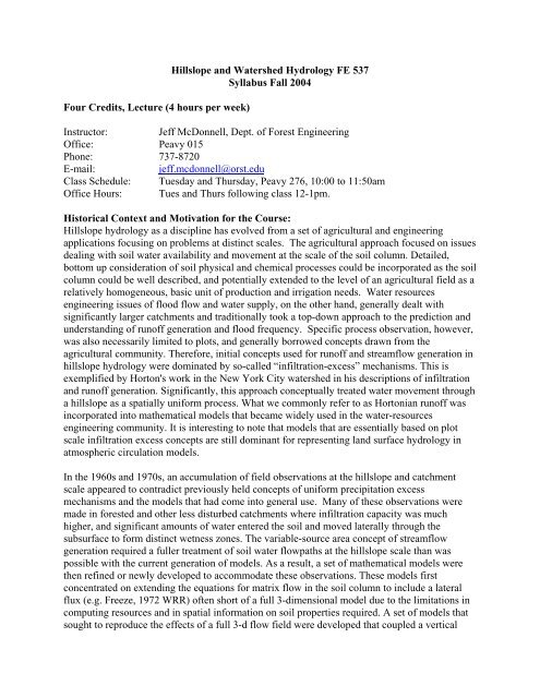
<strong>Hillslope</strong> <strong>and</strong> <strong>Watershed</strong> <strong>Hydrology</strong> <strong>FE</strong> <strong>537</strong><br />
<strong>Syllabus</strong> <strong>Fall</strong> <strong>2004</strong><br />
Instructor: Jeff McDonnell, Dept. of Forest Engineering<br />
Office: Peavy 015<br />
Phone: 737-8720<br />
E-mail: jeff.mcdonnell@orst.edu<br />
Class Schedule: Tuesday <strong>and</strong> Thursday, Peavy 276, 10:00 to 11:50am<br />
Office Hours: Tues <strong>and</strong> Thurs following class 12-1pm.<br />
Historical Context <strong>and</strong> Motivation for the Course:<br />
<strong>Hillslope</strong> hydrology as a discipline has evolved from a set of agricultural <strong>and</strong> engineering<br />
applications focusing on problems at distinct scales. The agricultural approach focused on issues<br />
dealing with soil water availability <strong>and</strong> movement at the scale of the soil column. Detailed,<br />
bottom up consideration of soil physical <strong>and</strong> chemical processes could be incorporated as the soil<br />
column could be well described, <strong>and</strong> potentially extended to the level of an agricultural field as a<br />
relatively homogeneous, basic unit of production <strong>and</strong> irrigation needs. Water resources<br />
engineering issues of flood flow <strong>and</strong> water supply, on the other h<strong>and</strong>, generally dealt with<br />
significantly larger catchments <strong>and</strong> traditionally took a top-down approach to the prediction <strong>and</strong><br />
underst<strong>and</strong>ing of runoff generation <strong>and</strong> flood frequency. Specific process observation, however,<br />
was also necessarily limited to plots, <strong>and</strong> generally borrowed concepts drawn from the<br />
agricultural community. Therefore, initial concepts used for runoff <strong>and</strong> streamflow generation in<br />
hillslope hydrology were dominated by so-called “infiltration-excess” mechanisms. This is<br />
exemplified by Horton's work in the New York City watershed in his descriptions of infiltration<br />
<strong>and</strong> runoff generation. Significantly, this approach conceptually treated water movement through<br />
a hillslope as a spatially uniform process. What we commonly refer to as Hortonian runoff was<br />
incorporated into mathematical models that became widely used in the water-resources<br />
engineering community. It is interesting to note that models that are essentially based on plot<br />
scale infiltration excess concepts are still dominant for representing l<strong>and</strong> surface hydrology in<br />
atmospheric circulation models.<br />
In the 1960s <strong>and</strong> 1970s, an accumulation of field observations at the hillslope <strong>and</strong> catchment<br />
scale appeared to contradict previously held concepts of uniform precipitation excess<br />
mechanisms <strong>and</strong> the models that had come into general use. Many of these observations were<br />
made in forested <strong>and</strong> other less disturbed catchments where infiltration capacity was much<br />
higher, <strong>and</strong> significant amounts of water entered the soil <strong>and</strong> moved laterally through the<br />
subsurface to form distinct wetness zones. The variable-source area concept of streamflow<br />
generation required a fuller treatment of soil water flowpaths at the hillslope scale than was<br />
possible with the current generation of models. As a result, a set of mathematical models were<br />
then refined or newly developed to accommodate these observations. These models first<br />
concentrated on extending the equations for matrix flow in the soil column to include a lateral<br />
flux (e.g. Freeze, 1972 WRR) often short of a full 3-dimensional model due to the limitations in<br />
computing resources <strong>and</strong> in spatial information on soil properties required. A set of models that<br />
sought to reproduce the effects of a full 3-d flow field were developed that coupled a vertical
infiltration model with a method for moving soil moisture downslope either by attempting to<br />
trace topographically controlled flowpaths with a local Darcy flux or developing a conceptual<br />
redistribution scheme (e.g. Topmodel).<br />
During this time, a new set of scientific questions have evolved, separate in focus <strong>and</strong><br />
intermediate in scale to traditional agricultural <strong>and</strong> water resources engineering. These dealt with<br />
problems in non-point source contaminants, acid rain, <strong>and</strong> other integrated watershed hydrologic<br />
processes <strong>and</strong> required a fuller underst<strong>and</strong>ing of the vertical distribution of flowpaths through<br />
hillslopes, their velocities <strong>and</strong> residence (or contact) times, <strong>and</strong> temporal dynamics on storm to<br />
seasonal time scales.Partially in response to these emerging problems, in the 1980s <strong>and</strong> 1990s,<br />
catchments (both hillslopes <strong>and</strong> streams) have been intensively studied by simultaneously<br />
monitoring the distribution <strong>and</strong> flux of water <strong>and</strong> chemicals at many locations in space <strong>and</strong> time.<br />
Technical advances in methods of measuring soil water distribution in the soil profile (TDR),<br />
soil <strong>and</strong> substrate structure (ground penetrating radar), <strong>and</strong> the use of chemical <strong>and</strong> isotopic<br />
tracers to source streamwater during this time have dramatically increased the amount of<br />
information available to study basic processes by which water moves through hillslopes. The<br />
information is not consistent in certain cases, between isotopic <strong>and</strong> chemical signals, with signals<br />
derived from more st<strong>and</strong>ard hydrometric methods.<br />
As our ability to measure hillslope flowpaths <strong>and</strong> the evolution of soil moisture patterns <strong>and</strong><br />
chemistry progressed, it was recognized that the concept of matrix flow as the dominant<br />
subsurface pathway may not be universally applicable. It is now recognized that the process of<br />
macropore flow <strong>and</strong> other preferential flowpaths through hillslopes are significant at least under<br />
certain conditions. Over the last 10-15 years, their has been a rapid advance in our ability to<br />
observe distributed processes in watersheds over a range of scales. The intensive monitoring of<br />
catchments has been made possible by automatic sampling <strong>and</strong> remote sensing techniques. The<br />
advent of isotopic methods to study the source <strong>and</strong> evolution of stormwater have added<br />
significantly to our knowledge base, sometimes yielding information that appears to conflict<br />
with previously held concepts <strong>and</strong> more traditional hydrometric data collection methods. These<br />
observations have raised many questions <strong>and</strong> issues about all of our commonly held concepts of<br />
streamflow generation <strong>and</strong> soil water dynamics.<br />
Current model development continues to seek to incorporate the distribution <strong>and</strong> dynamics of<br />
soil moisture <strong>and</strong> the set of possible flowpaths that become important under given conditions.<br />
However, at present there does not appear to be either a general underst<strong>and</strong>ing or consensus on<br />
how the dominant processes of water input, internal flow (pathway dynamics) <strong>and</strong> outflow<br />
(including evapotranspiration) interact <strong>and</strong> evolve on different hillslopes. At the same time, an<br />
underst<strong>and</strong>ing of these processes <strong>and</strong> their interactions have become critical to a set of pressing<br />
scientific questions regarding flood generation, water supply, water quality <strong>and</strong> l<strong>and</strong>/atmosphere<br />
interactions. This course will explore the state of the art of <strong>Hillslope</strong> <strong>Hydrology</strong> as it forms the<br />
foundation of the many water-mediated reactions that relate to it in the context of contemporary<br />
environmental problems.<br />
Learning Objectives of the Course:
The learning objectives of the course are to define a robust physical description of how water<br />
moves into, through <strong>and</strong> out of hillslopes in the context of how this information can <strong>and</strong> should<br />
be captured in model formulation, calibration <strong>and</strong> testing at small to large catchment scales.<br />
More detailed learning objectives will accompany each of the 3 course sections<br />
Course Description<br />
<strong>FE</strong> <strong>537</strong> is a research-oriented course intended to provide students with an overview of hillslope<br />
hydrology from a process perspective. The course will focus on processes <strong>and</strong> pathways of water<br />
fluxes in catchments <strong>and</strong> how hillslopes modulate water transfers in the l<strong>and</strong>scape. Runoff<br />
production mechanisms will be reviewed <strong>and</strong> combined hydrometric <strong>and</strong> tracer techniques will<br />
be explored in the context of quantifying the age, origin <strong>and</strong> pathway of subsurface stormflow.<br />
The course will be evenly divided into lecture periods that address plot, hillslope <strong>and</strong> catchment<br />
scales.<br />
Course Grading<br />
Completion of Rainfall Runoff Web material 15%<br />
Quizzes 30%<br />
Project Report 40%<br />
Classroom Participation 15%<br />
Course Text<br />
No course text will be used. A reader of Benchmark Papers in <strong>Hillslope</strong> <strong>Hydrology</strong> will be used.<br />
This is downloadable at the course web page at<br />
http://www.cof.orst.edu/cof/fe/watershd/Documents/Teaching/<strong>FE</strong>605/INDEX.HTM<br />
The Workbook by Tarboton to accompany the web module is at:<br />
http://media.engineering.usu.edu/RRP/<br />
Lecture Schedule:<br />
Sept 28 Course introduction <strong>and</strong> overview<br />
Sept 30 Field trip<br />
Oct 5 Rainfall-Runoff process<br />
Oct 7 Plot scale 1:<br />
Oct 12 Plot scale 2<br />
Oct 14 Plot scale 3<br />
Oct 19 Discussion, Quiz<br />
Oct 21 <strong>Hillslope</strong> scale 1<br />
Oct 26 <strong>Hillslope</strong> Scale 2<br />
Oct 28 <strong>Hillslope</strong> Scale 3<br />
Nov 2 Discussion, Quiz<br />
Nov 4 Catchment scale 1<br />
Nov 9 Catchment scale 2<br />
Nov 11 Veteran’s Day<br />
Nov 15 Catchment Scale 3<br />
Nov 18 Discussion, Quiz<br />
Nov 23 Field Project Presentations <strong>and</strong> Discussion<br />
Nov 25 Thanksgiving
Nov 30 Field Trip re-visit<br />
Dec 2 Final lecture<br />
Course Web Page<br />
http://www.cof.orst.edu/cof/fe/watershd/Documents/Teaching/<strong>FE</strong>605/INDEX.HTM