Geology of the Van Buren and Lavaca Quadrangles, Arkansas ...
Geology of the Van Buren and Lavaca Quadrangles, Arkansas ...
Geology of the Van Buren and Lavaca Quadrangles, Arkansas ...

You also want an ePaper? Increase the reach of your titles
YUMPU automatically turns print PDFs into web optimized ePapers that Google loves.
STATE OF ARKANSAS<br />
Dale Bumpers, Governor<br />
<strong>Arkansas</strong> Department <strong>of</strong> Commerce<br />
Richard W. Longing, Director<br />
<strong>Arkansas</strong> Geological Commission<br />
Norman F. Williams, State Geologist
STATE OF ARKANSAS<br />
<strong>Arkansas</strong> Geological Commission<br />
Norman F. Williams, State Geologist<br />
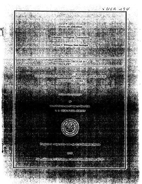
INFORMATION CIRCULAR 20-1<br />
GEOLOGY OF THE VAN BUREN AND LAVACA QUADRANGLES<br />
ARK ANSAS-OKLAHOMA<br />
bY<br />
Boyd R. Haley <strong>and</strong> Thomas A. Hendricks<br />
U. S. GEOLOGICAL SURVEY<br />
Prepared in coeperation with <strong>the</strong> U. S. Geolegical Survey<br />
1972<br />
(also published (M U. S. Geolegical Survey Pr<strong>of</strong>essional Paper 657-A)
CONTENTS<br />
Pam<br />
A1<br />
1<br />
3<br />
3<br />
3<br />
3<br />
6<br />
6<br />
6<br />
6<br />
8<br />
8<br />
8<br />
8<br />
9<br />
9<br />
9<br />
9<br />
9<br />
9<br />
9<br />
ILLUSTRATIONS<br />
[Plates are in pocket1<br />
PLATE 1. Geologic map <strong>of</strong> <strong>Van</strong> <strong>Buren</strong> <strong>and</strong> <strong>Lavaca</strong> quadrangles, <strong>Arkansas</strong> <strong>and</strong> Oklahoma.<br />
2. Stratigraphic sections.<br />
3. Lithologic sections <strong>of</strong> post-Atoka rocks in <strong>Lavaca</strong> quadrangle.<br />
4. Electrical log correlation <strong>of</strong> <strong>the</strong> Atoka Formation.<br />
5. Structure-contour <strong>and</strong> coal-bed map.<br />
6. Structural sections.<br />
7. Graphs showing thickness, maximum porosity, <strong>and</strong> gas content <strong>of</strong> <strong>the</strong> s<strong>and</strong>stone part <strong>of</strong> selected zones in <strong>the</strong> Atoka<br />
Formation.<br />
Page<br />
FIQURE 1. Index map <strong>of</strong> reportarea-_____________-_-___________-____---------------~---------------------- A2<br />
2. Chart showing stratigraphic nomenclature <strong>of</strong> rocks--- - - - - - - - - - - - - - - - - - - - - - - - - - - - - - - - - - - - - - - - - - - - - - - - 4<br />
3. Section showing correlation <strong>of</strong> rocks between <strong>the</strong> Everton <strong>and</strong> Boone Formations- - - - - - - - - - - - - - - - - - - - - - - -<br />
4-10. Map showing thickness <strong>of</strong>:<br />
7<br />
4. The Chattanooga Shale <strong>and</strong> <strong>the</strong> Boone Formation, Moorefield Formation, <strong>and</strong> Fayetteville Shale--- -<br />
5. The Pitkin Limestone, combined Fayetteville Shale, Moorefield Formation, <strong>and</strong> Boone Formation,<br />
10<br />
post-Chattanooga Mississippian rocks, <strong>and</strong> <strong>the</strong> Chattanooga Shale <strong>and</strong> Mississippian rocks- - - - - - 12<br />
6. Morrow rocks ________________________________________-------------------------<br />
---------- 14<br />
7. The Cane Hill <strong>and</strong> Prairie Grove Members <strong>of</strong> <strong>the</strong> Hale Formation <strong>and</strong> <strong>the</strong> Hale <strong>and</strong> Bloyd Formations- 16<br />
8. The lower, middle, <strong>and</strong> upper parts <strong>of</strong> <strong>the</strong> Atoka Formation, <strong>and</strong> its total thickness- - - - - - - - - - - - - - - -<br />
9. The s<strong>and</strong>y parts <strong>of</strong> zones 28, 58, 67, <strong>and</strong> 93 in <strong>the</strong> Atoka Formation- - - - - - - - - - - - - - - - - - - - - - - - - - - - -<br />
18<br />
20<br />
10. The s<strong>and</strong>y parts <strong>of</strong> zones 98, 99, 100, <strong>and</strong> 101 in <strong>the</strong> Atoka Formation.. - - - - - - - - - - - - - - - - - - - - - - - - - -<br />
11. Map showing location <strong>of</strong> wells drilled in <strong>the</strong> report area- - - - - - - - - - - - - - - - - - - - - - - - - - - - - - - - - - - - - - - - - - - - - -<br />
12. Maps showing possible maximum-porosity trends in <strong>the</strong> s<strong>and</strong>stone part <strong>of</strong> zone 98- - - - - - - - - - - - - - - - - - - - - - -<br />
m<br />
22<br />
29<br />
31<br />
Page<br />
9<br />
A14<br />
24<br />
24<br />
24<br />
24<br />
25<br />
25<br />
25<br />
25<br />
25<br />
26<br />
27<br />
27<br />
27<br />
27<br />
28<br />
28<br />
30<br />
30<br />
30<br />
32
Iv CONTENTS<br />
TABLES
GEOLOGY OF THE ARKANSAS VALLEY COAL FIELD-PART 2<br />
GEOLOGY OF THE VAN BUREN AND LAVACA QUADRANGLES,<br />
ARKANSAS AND OKLAHOMA<br />
ABSTRACT<br />
<strong>Van</strong> <strong>Buren</strong> <strong>and</strong> <strong>Lavaca</strong> quadrangles cover an area <strong>of</strong> about<br />
488 square miles in east-central Oklahoma <strong>and</strong> west-central<br />
<strong>Arkansas</strong>. Rocks <strong>of</strong> Middle Pennsylvanian age <strong>and</strong> unconsoli-<br />
dated alluvial deposits <strong>of</strong> Quaternary age are exposed at <strong>the</strong><br />
surface, <strong>and</strong> rocks <strong>of</strong> Ordovician to Middle Pennsylvanian age<br />
have been penetrated by wells drilled in <strong>the</strong> area.<br />
The rocks have been folded into east-trending broad, gentle<br />
folds whose limbs have been broken by north- or south-dipping<br />
normal faults. Displacement across <strong>the</strong> faults is generally less<br />
than 1,500 feet but may be as much as 2,500 feet across <strong>the</strong> fault<br />
that separates <strong>the</strong> <strong>Arkansas</strong> Valley section from <strong>the</strong> Ozark<br />
Plateaus province. Folding <strong>and</strong> faulting started on a major scale<br />
during <strong>the</strong> deposition <strong>of</strong> <strong>the</strong> Atoka Formation <strong>and</strong> continued<br />
until after deposition <strong>of</strong> <strong>the</strong> youngest Pennsylvanian beds. The<br />
structural relief in <strong>the</strong> report area, as measured on <strong>the</strong> base <strong>of</strong><br />
<strong>the</strong> Hartshorne S<strong>and</strong>stone, may be as much as 4,450 feet.<br />
The Atoka, McAlester, <strong>and</strong> Savanna Formations contain coal<br />
beds. The Lower Hartshorne coal bed, near <strong>the</strong> base <strong>of</strong> <strong>the</strong><br />
McAlester Formation, <strong>and</strong> <strong>the</strong> Charleston coal bed, near <strong>the</strong> base<br />
<strong>of</strong> <strong>the</strong> Savanna Formation, have been <strong>the</strong> most economically<br />
important.<br />
Natural gas has been found in rocks <strong>of</strong> Silurian, Devonian,<br />
Mississippian, <strong>and</strong> Pennsylvanian age. Most <strong>of</strong> <strong>the</strong> gas is in<br />
rocks <strong>of</strong> Pennsylvanian age, in <strong>the</strong> Atoka Formation. The gas<br />
in Pennsylvanian rocks is lithologically entrapped, <strong>and</strong> structure<br />
appears to have had little influence on <strong>the</strong> location or extent <strong>of</strong><br />
gas accumulation.<br />
Building stone <strong>and</strong> road metal have been obtained from <strong>the</strong><br />
Atoka, Hartshorne, McAlester, <strong>and</strong> Savanna Formations. Gravel<br />
<strong>and</strong> s<strong>and</strong> are obtained from <strong>the</strong> alluvial deposits, <strong>and</strong> <strong>the</strong> shale<br />
in <strong>the</strong> McAlester Formation has been quarried for brick <strong>and</strong> tile.<br />
INTRODUCTION<br />
This report is one <strong>of</strong> a series <strong>of</strong> geological reports<br />
being prepared by <strong>the</strong> US. Geological Survey in co-<br />
operation with <strong>the</strong> <strong>Arkansas</strong> Geological Commission.<br />
It has been prepared (1) to provide geologic <strong>and</strong> struc-<br />
ture maps <strong>of</strong> <strong>the</strong> quadrangles on a modern topographic<br />
base; (2) to relate <strong>the</strong> structure <strong>and</strong> stratigraphy <strong>of</strong> <strong>the</strong><br />
rocks exposed at <strong>the</strong> surface to that <strong>of</strong> <strong>the</strong> subsurface<br />
rocks; (3) to show <strong>the</strong> extent <strong>and</strong> thickness <strong>of</strong> known<br />
By BOYD R. HALEY <strong>and</strong> THOMAS A. EENDRICKS<br />
coal beds, <strong>and</strong> to present estimates <strong>of</strong> coal resources<br />
where data permit ; (4) to provide geologic data <strong>and</strong> <strong>the</strong><br />
authors' interpretations <strong>of</strong> <strong>the</strong>se data relevant to <strong>the</strong><br />
accumulation <strong>of</strong> natural gas; <strong>and</strong> (5) to provide infor-<br />
mation about <strong>the</strong> availability <strong>of</strong> building stone, gravel,<br />
s<strong>and</strong>, <strong>and</strong> clay.<br />
This report toge<strong>the</strong>r with added lithologic descrip-<br />
tions <strong>of</strong> rocks penetrated by selected wells <strong>and</strong> shallow<br />
holes is also published, under separate cover, as <strong>Arkansas</strong><br />
Geological Commission Information Circular 20-1.<br />
The <strong>Van</strong> <strong>Buren</strong> quadrangle (lat 35'15' <strong>and</strong> 35"30' N.,<br />
long 94'15' <strong>and</strong> 94'30' W.) has an area <strong>of</strong> about 244<br />
square miles, <strong>of</strong> which about 60 square miles is in Le<br />
Flore <strong>and</strong> Sequoyah Counties, Okla., <strong>and</strong> about 184<br />
square miles is in Sebastian <strong>and</strong> Crawford Counties,<br />
Ark. The <strong>Lavaca</strong> quadrangle (lat 35'15' <strong>and</strong> 35'30' N.,<br />
long 94'00' <strong>and</strong> 94'15' W.) adjoins <strong>the</strong><strong>Van</strong> <strong>Buren</strong> quad-<br />
rangle on <strong>the</strong> east. It has an area <strong>of</strong> about 244 square<br />
miles in Sebastian, Franklin, <strong>and</strong> Crawford Counties,<br />
Ark. (fig. 1).<br />
Generalized geologic reports pertaining in part to <strong>the</strong><br />
<strong>Van</strong> <strong>Buren</strong> <strong>and</strong> <strong>Lavaca</strong> quadrangles have been made by<br />
Winslow (1888), Smith (1914), Croneis (1930), <strong>and</strong><br />
Haley (1960) for <strong>the</strong> <strong>Arkansas</strong> part, <strong>and</strong> by Drake<br />
(1897), Taff <strong>and</strong> Adams (1900), Taff (1905), Snider<br />
(1914), Smith (1914), <strong>and</strong> Shannon <strong>and</strong> o<strong>the</strong>rs (1926)<br />
for <strong>the</strong> Oklahoma part.<br />
Detailed geologic reports pertaining in part to <strong>the</strong> two<br />
quadrangles have been made by Collier (1907) <strong>and</strong><br />
Hendricks <strong>and</strong> Parks (1937,1950) for <strong>the</strong> <strong>Arkansas</strong> part,<br />
<strong>and</strong> by Knechtel (1949) for <strong>the</strong> Oklahoma part.<br />
The stratigraphic boundaries <strong>of</strong> <strong>the</strong> post-Atoka rocks<br />
established by Hendricks <strong>and</strong> Parks (1950, p. 69) are<br />
used in this report. The stratigraphic nomenclature <strong>of</strong><br />
<strong>the</strong>se rocks as reported in Hendricks <strong>and</strong> Parks (1950)<br />
was modified by Merewe<strong>the</strong>r <strong>and</strong> Haley (1961), who<br />
adopted Miser's (1954) terminology <strong>of</strong> McAlester<br />
Al
A2 GEOLOGY OF T m ARKANSAS VALLEY COAL FIELWPART 2<br />
Formation, Savanna Formation, <strong>and</strong> Boggy Formation,<br />
<strong>and</strong> Oakes’ (1953) classscation <strong>of</strong> <strong>the</strong> Krebs Group,<br />
which includes <strong>the</strong> Hartshorne S<strong>and</strong>stone <strong>and</strong> <strong>the</strong> Mc-<br />
Alester, Savanna, <strong>and</strong> Boggy Formations. Haley (1961)<br />
moved <strong>the</strong> base <strong>of</strong> <strong>the</strong> Boggy Formation stratigraphi-<br />
cally upward, <strong>the</strong>reby conforming to <strong>the</strong> definition estab-<br />
lished by Miser (1954). The stratigraphic nomenclature<br />
<strong>and</strong> boundaries <strong>of</strong> Atoka <strong>and</strong> preAtoka rocks used in<br />
this report conform, in general, to those used elsewhere<br />
-<br />
0 25 50 MILES<br />
FIGURE 1.-Location <strong>of</strong> report area (I, d) <strong>and</strong> areas <strong>of</strong> o<strong>the</strong>r published reports: A, Delaware quadrangle (Merewe<strong>the</strong>r <strong>and</strong> Haley,<br />
1961) ; B, Paris quadrangle (Haley, 1961) ; C, Barber quadrangle (Haley, 1966) ; E, Knoxville quadrangle (Merewe<strong>the</strong>r, 1967) ;<br />
F <strong>and</strong> a, Greenwood quadrangle (Haley <strong>and</strong> Hendricks, 1968) ; G <strong>and</strong> b, Scranton <strong>and</strong> New Blaine quadrangles (Haley, 1968) ;<br />
<strong>and</strong> H <strong>and</strong> c, Coal Hill, Hartman, <strong>and</strong> Clarksville quadrangles (Merewe<strong>the</strong>r <strong>and</strong> Haley, 1969).<br />
in <strong>Arkansas</strong>. This nomenclature is compared with that<br />
used in nearby areas in figure 2.<br />
The authors express thanks to <strong>the</strong> <strong>Arkansas</strong> Geolog-<br />
ical Commission for providing rock samples from 23<br />
wells drilled in <strong>the</strong> area, <strong>and</strong> to Gulf Oil Corp. for pro-<br />
viding copies <strong>of</strong> <strong>the</strong> electrical logs <strong>and</strong> loaning <strong>the</strong> rock<br />
samples from <strong>the</strong> shallow holes drilled in <strong>the</strong> area.<br />
Members <strong>of</strong> <strong>the</strong> US. Geological Survey who examined
VAN BUREN AND LAVACA QUADRANGLES, ARKANSAS AND OKLAHOMA A3<br />
<strong>and</strong> logged rock samples from 26 wells in <strong>the</strong> area are<br />
acknowledged in table 3.<br />
STRATIGRAPHY<br />
Rocks <strong>of</strong> Middle Pennsylvanian age <strong>and</strong> sediments <strong>of</strong><br />
Quaternary age are exposed in <strong>the</strong> mapped area a d<br />
are shown on plate 1. Rocks <strong>of</strong> Early Ordovician to<br />
Middle Pennsylvanian age have been penetrated by<br />
wells drilled in <strong>the</strong> area, <strong>and</strong> <strong>the</strong> general lithology <strong>of</strong><br />
<strong>the</strong>se rocks is shown graphically on plates 2 <strong>and</strong> 3.<br />
Detailed descriptions <strong>of</strong> eight <strong>of</strong> <strong>the</strong> lithologic sections<br />
shown on plate 2 <strong>and</strong> <strong>of</strong> all sections shown on plate 3<br />
are included in <strong>Arkansas</strong> Geological Commission In-<br />
formation Circular 20-1. The lithology <strong>of</strong> rocks pene-<br />
trated in wells 57, 73, <strong>and</strong> 137 shown on plate 2 was<br />
described by Sheldon (1954, p. 48-52, 53-56, <strong>and</strong><br />
163-167).<br />
ORDOVICIAN SYSTEM<br />
EVERTON FORMATION, ST. PETER SANDSTONE, AND<br />
JOACHIM DOLOMITE UNDIVIDED<br />
In nor<strong>the</strong>rn <strong>Arkansas</strong>, <strong>the</strong> Everton Formation, pre-<br />
dominantly dolomite with some s<strong>and</strong>stone, is uncon-<br />
formably overlain by <strong>the</strong> St. Peter S<strong>and</strong>stone. The St.<br />
Peter, predominantly s<strong>and</strong>stone with a minor amount<br />
<strong>of</strong> dolomite, is conformably overlain by <strong>the</strong> Joachim<br />
Dolomite. The Joachim, dolomite with some s<strong>and</strong>stone,<br />
is unconformably overlain by younger rocks <strong>of</strong> Ordo-<br />
vician, Silurian, Devonian, or Mississippian age. These<br />
younger rocks unconformably overlie <strong>the</strong> St. Peter<br />
where <strong>the</strong> Joachim is missing, or <strong>the</strong> Everton where <strong>the</strong><br />
Joachim <strong>and</strong> St. Peter are missing.<br />
In <strong>the</strong> area <strong>of</strong> this report, <strong>the</strong> rocks assigned to <strong>the</strong><br />
Everton, St. Peter, <strong>and</strong> Joachim Formations undivided<br />
are known to have been penetrated by eight wells drilled<br />
for gas. The rock samples from five <strong>of</strong> <strong>the</strong>se wells have<br />
been examined <strong>and</strong> logged by geologists <strong>of</strong> <strong>the</strong> US.<br />
Geological Survey.<br />
Well 134 (pl. 1; table 3) penetrated 108 feet <strong>of</strong><br />
s<strong>and</strong>stone that resembles <strong>the</strong> St. Peter S<strong>and</strong>stone;<br />
apparently <strong>the</strong> Joachim is missing in this well. Well 136<br />
penetrated 110 feet <strong>of</strong> dolomite <strong>and</strong> s<strong>and</strong>stone that<br />
resemble Joachim underlain by St. Peter, or alter-<br />
natively, this 110 feet <strong>of</strong> rock could be <strong>the</strong> Everton<br />
Formation with <strong>the</strong> Joachim <strong>and</strong> St. Peter missing. Well<br />
102 penetrated 85 feet <strong>of</strong> intercalated dolomite, s<strong>and</strong>-<br />
stone, shale, <strong>and</strong> limestone that could not be identified<br />
by lithology. The sequence is in fault contact with rocks<br />
<strong>of</strong> Mississippian age ; thus its stratigraphic position is<br />
indeterminate. Well 57 penetrated 93 feet <strong>of</strong> s<strong>and</strong>stone<br />
<strong>and</strong> dolomite that is ei<strong>the</strong>r St. Peter or St. Peter <strong>and</strong><br />
Everton; in ei<strong>the</strong>r case, <strong>the</strong> Joachim is absent. Well 23<br />
penetrated 212 feet <strong>of</strong> s<strong>and</strong>stone, dolomite, shale, <strong>and</strong><br />
limestone that is thought to be St. Peter <strong>and</strong> Everton<br />
with <strong>the</strong> Joachim absent.<br />
The above correlations are uncertain because (1) <strong>the</strong><br />
distance from <strong>the</strong> wells to <strong>the</strong> outcrop area <strong>of</strong> <strong>the</strong> for-<br />
mations is long; (2) unconformities exist between <strong>the</strong>se<br />
formations <strong>and</strong> between <strong>the</strong>se <strong>and</strong> overlying formations;<br />
(3) detailed field mapping <strong>of</strong> facies changes needed to<br />
identify <strong>the</strong>se formations in many <strong>of</strong> <strong>the</strong> outcrop areas<br />
has not been done; <strong>and</strong> (4) <strong>the</strong> logged wells are not deep<br />
enough to penetrate an identifiable formation older<br />
than <strong>the</strong> Everton , which would aid in distinguishing<br />
<strong>the</strong> overlying three units.<br />
The Everton, St. Peter, <strong>and</strong> Joachim undivided in <strong>the</strong><br />
five wells logged consists <strong>of</strong> s<strong>and</strong>stone, dolomite, shale,<br />
<strong>and</strong> limestone. The s<strong>and</strong>stone is white to light gray <strong>and</strong><br />
is composed <strong>of</strong> fine to coarse rounded <strong>and</strong> frosted grains;<br />
most is dolomitic, <strong>and</strong> some is limy. The dolomite is very<br />
light to medium gray <strong>and</strong> dense to very finely crystalline;<br />
most is finely to medium s<strong>and</strong>y, some is limy, <strong>and</strong> some<br />
contains very finely crystalline pyrite. The limestone is<br />
medium gray, dense to granular, dolomitic in part, <strong>and</strong><br />
finely to medium s<strong>and</strong>y in part. The shale is medium to<br />
dark gray <strong>and</strong> greenish gray; some is slightly dolomitic.<br />
PLATTlN LIMESTONE<br />
In nor<strong>the</strong>rn <strong>Arkansas</strong>, <strong>the</strong> Plattin unconformably<br />
3verlies <strong>the</strong> Joachim Dolomite or older rocks <strong>and</strong> is<br />
unconformably overlain by <strong>the</strong> Kimmswick Limestone,<br />
<strong>the</strong> Fernvale Limestone, or rocks <strong>of</strong> Mississippian age.<br />
The Plattin Limestone is known to have been partly or<br />
mtirely penetrated by 10 wells drilled for natural gas<br />
m <strong>the</strong> <strong>Van</strong> <strong>Buren</strong> <strong>and</strong> Lavacs quadrangles. The rock<br />
samples from five <strong>of</strong> <strong>the</strong>se wells have been examined<br />
md logged (table 3). The younger Kimmswick Lime-<br />
gtone has not been identified in <strong>the</strong> logged wells; if<br />
present, it is included in <strong>the</strong> Plattin in this report.<br />
The Plattin is 60-74 feet thick in <strong>the</strong> logged wells;<br />
dectrical log correlations <strong>of</strong> o<strong>the</strong>r wells indicate that<br />
t may be as thin as 50 feet. In well 136, <strong>the</strong> rocks that<br />
werlie <strong>the</strong> Everton, St. Peter, <strong>and</strong> Joachim interval<br />
md underlie <strong>the</strong> Penters Chert are very thin (76 ft)<br />
lecause <strong>of</strong> ei<strong>the</strong>r normal faulting or pre-Penters erosion.<br />
Dolomitic greenish-gray shale at a depth <strong>of</strong> 8,185-8,195<br />
'eet in this well resembles <strong>the</strong> Cason Shale, which<br />
suggests that limy dolomite <strong>and</strong> dolomitic dark-gray<br />
imestone in <strong>the</strong> underlying interval, 8,195-8,222 feet,<br />
*epresent <strong>the</strong> Plattin <strong>and</strong> <strong>the</strong> Fernvale Limestones.<br />
l'he Plattin in well 134 is 70 feet thick <strong>and</strong> is light- to<br />
nedium-gray granular to finely crystalline limestone<br />
:ontaining fine crystals <strong>of</strong> dolomite <strong>and</strong> widely scat-<br />
;ered fragments <strong>of</strong> light-brownish-gray dense chert.<br />
4 unit 21 feet thick in well 62 probably represents <strong>the</strong><br />
ipper part <strong>of</strong> <strong>the</strong> Plattin. It consists <strong>of</strong> very light to<br />
ight-gray dense to very finely crystalline dolomite
West-central <strong>Arkansas</strong><br />
I Hendricks <strong>and</strong> Parks. 1950)<br />
Nor<strong>the</strong>ast <strong>and</strong> east-central 1 East-central Oklahoma<br />
Oklahoma I (Knechtel. 1940)<br />
Northwestern <strong>Arkansas</strong><br />
This report I<br />
~<br />
Boggy Shale<br />
I<br />
Boggy Formation<br />
Boggy Formation<br />
Savanna S<strong>and</strong>stone<br />
Savanna Formation<br />
--<br />
Savanna Formation<br />
Savanna Formation<br />
~~<br />
~~~<br />
McAlester Formation<br />
McAlester Formation Z<br />
Mc Alester Formation<br />
d<br />
McAlester Formation<br />
Hartshorne<br />
S<strong>and</strong>stone Lower<br />
Hartshorne S<strong>and</strong>stone<br />
~<br />
member<br />
~- -- I member z<br />
e<br />
1 Hartshorne S<strong>and</strong>stone<br />
~~ ~~<br />
M<br />
z<br />
4<br />
Atoka Formation<br />
Atoka Formation<br />
5<br />
Atoka Formation 1<br />
Atoka Formation<br />
> x<br />
Atoka Formation<br />
~-<br />
Kessler<br />
Bloyd Limestone Member<br />
Kessler Limestone<br />
Member equivalent<br />
Formation<br />
Formation<br />
;<br />
Uloyrl<br />
Formation<br />
Brentwood<br />
Member<br />
Brentwood<br />
Limestone Member<br />
I<br />
.~ __<br />
><br />
1 Brentwood Limestone<br />
Member equivalent<br />
__ --I<br />
Prairie Grove<br />
Member<br />
Prairie Grove<br />
Member<br />
Hale Formation<br />
'<br />
Prairie Grove<br />
Member<br />
Cane Hill<br />
Member<br />
Formation<br />
Hale Formation<br />
Hill<br />
Member<br />
~ Cane<br />
I<br />
Cane Hill<br />
Member<br />
Pitkin Limestone<br />
Pitkin Limestone<br />
Pitkin Limestone<br />
Wedington<br />
Fayetteville Shale<br />
Wedington (1)<br />
S<strong>and</strong>stone Member<br />
Fayetteville<br />
Shale<br />
Hindsville Limestone<br />
Ruddell Shale<br />
Moorefield Formation<br />
Moorefield Formation
VAN' BUREN AND LAVACA QUADRANGLES, ARKANSAS AND OKLAHOMA A5<br />
-<br />
Y<br />
.c m<br />
v)<br />
m<br />
2<br />
c<br />
c<br />
c)<br />
.lam07 I<br />
NVlddlSSISSIMl I NVINOA3a<br />
NVIddISSISSIIII I NVINOhB(I<br />
Jam07<br />
NVIddISSISSICV c. NVINOIZHU<br />
SnolI3dIN<strong>of</strong>txv3<br />
NvIHnllS<br />
NVlHnlIS<br />
L<br />
Jaddn<br />
NVI3IAOaFO
A6 GEOLOGY OF THE ARKANSAS VALLEY COAL FIELGPART 2<br />
containing very finely to finely crystalline pyrite.<br />
The Plattin is 60 feet thick where penetrated by well 57<br />
<strong>and</strong> consists <strong>of</strong> medium- to dark-gray granular to finely<br />
crystalline limestone that is silty in part <strong>and</strong> finely<br />
s<strong>and</strong>y <strong>and</strong> dolomitic in <strong>the</strong> lower 5 feet. The Plattin is<br />
74 feet thick where penetrated by well 23 <strong>and</strong> consists <strong>of</strong><br />
very light to light-gray slightly dolomitic dense to<br />
granular limestone containing widely scattered frag-<br />
ments <strong>of</strong> very light gray <strong>and</strong> brownish-light-gray,<br />
smoky dense chert. A few thin beds <strong>of</strong> medium-gray<br />
granular limestone are near <strong>the</strong> base.<br />
FERNVALE LIMESTONE<br />
In nor<strong>the</strong>rn <strong>Arkansas</strong>, <strong>the</strong> Fernvale Limestone<br />
unconformably overlies <strong>the</strong> Kimmswick or clder<br />
formations <strong>and</strong> is unconformably overlain by <strong>the</strong><br />
Cason Shale or younger rocks. In <strong>the</strong> area <strong>of</strong> this<br />
report it is underlain by <strong>the</strong> Plattin <strong>and</strong> overlain by<br />
<strong>the</strong> Cason Shale. It has been penetrated by 11 wells;<br />
samples from five <strong>of</strong> <strong>the</strong>se wells were logged (table 3).<br />
It is 15-30 feet thick in logged wells <strong>and</strong>, according to<br />
electrical log correlation, ranges between <strong>the</strong>se two<br />
thicknesses in o<strong>the</strong>r wells. In well 34 <strong>the</strong> Fernvale is<br />
15 feet thick <strong>and</strong> is a light- to medium-gray finely to<br />
medium-crystalline limestone. In well 23 it is 16 feet<br />
thick a.nd is a light-gray dense limestone. Well 62<br />
penetrated 22 feet <strong>of</strong> white to very light gray very<br />
finely crystalline dolomite <strong>and</strong> dark-gray shale that<br />
is thought to represent <strong>the</strong> Fernvale. In well 57 <strong>the</strong><br />
Fernvale is 30 feet thick <strong>and</strong> consists <strong>of</strong> medium-<br />
gray medium-crystalline limestone, medium-gray silty,<br />
clayey, <strong>and</strong> slightly dolomitic finely to medium-crystal-<br />
line limestone, <strong>and</strong> thin layers <strong>of</strong> dark-gray shale.<br />
CASON SHALE<br />
In nor<strong>the</strong>rn <strong>Arkansas</strong> <strong>the</strong> Cason unconformably<br />
overlies <strong>the</strong> Fernvale or <strong>the</strong> Kimmswick <strong>and</strong> is uncon-<br />
formably overlain by <strong>the</strong> St. Clair Limestone or by<br />
younger rocks <strong>of</strong> Devonian or Mississippian age. In<br />
<strong>the</strong> area <strong>of</strong> this report, <strong>the</strong> Cason is underlain by <strong>the</strong><br />
Fernvale Limestone <strong>and</strong> overlain by <strong>the</strong> St. Clair<br />
Limestone.<br />
The Cason is known to have been penetrated by 11<br />
wells drilled in <strong>the</strong> <strong>Van</strong> <strong>Buren</strong> <strong>and</strong> <strong>Lavaca</strong> quad-<br />
rangles. The rock samples from five <strong>of</strong> <strong>the</strong>se have been<br />
examined <strong>and</strong> logged (table 3). In <strong>the</strong>se wells, <strong>the</strong> Cason<br />
is 2-35 feet thick <strong>and</strong> is a medium- to dark-gray or<br />
greenish-gray shale that is slightly dolomitic in some<br />
places.<br />
SILURIAN SYSTEM, ST. CLAIR LIMESTONE<br />
The St. Clair Limestone <strong>of</strong> this report includes rocks<br />
equivalent to <strong>the</strong> Brassfield Limestone, St. Clair Lime-<br />
stone, <strong>and</strong> Lafferty Limestone <strong>of</strong> nor<strong>the</strong>rn <strong>Arkansas</strong> <strong>and</strong><br />
to <strong>the</strong> St. Clair Limestone <strong>of</strong> eastern Oklahoma.<br />
The St. Clair <strong>of</strong> tbis report overlies <strong>the</strong> Cason Shale<br />
<strong>and</strong> is overlain by <strong>the</strong> Penters Chert. The nature <strong>of</strong> <strong>the</strong><br />
lower <strong>and</strong> upper contacts is not known in this area, but<br />
in nor<strong>the</strong>rn <strong>Arkansas</strong> <strong>the</strong> contacts are unconformities.<br />
The St. Clair is 66-245 feet thick in <strong>the</strong> nine wells<br />
whose rock samples have been examined, <strong>and</strong> it may<br />
be as thick as 275 feet in well 127 according to <strong>the</strong><br />
electrical log. In four <strong>of</strong> <strong>the</strong> logged wells <strong>the</strong> St. Clair<br />
is mostly very light to light-gray granular to finely<br />
crystalline limestone that is slightly dolomitic to dolo-<br />
mitic. Fine to coarse crystals <strong>of</strong> pink calcite are present<br />
in some parts, <strong>and</strong> white to very light gray translucent<br />
chert is common in <strong>the</strong> upper part. In wells 96, 58, <strong>and</strong><br />
23 <strong>the</strong> limestone contains units, as much as 25 feet<br />
thick, <strong>of</strong> very light gray limy granular dolomite. In well<br />
62, white to very light gray granular dolomite com-<br />
prises most <strong>of</strong> <strong>the</strong> lower 90 feet <strong>of</strong> <strong>the</strong> St. Clair. That<br />
part (110 f t thick) <strong>of</strong> <strong>the</strong> St. Clair penetrated by well<br />
158 is 80 percent dolomite <strong>and</strong> 20 perent limestone;<br />
<strong>the</strong> part (76 ft thick) <strong>of</strong> <strong>the</strong> St. Clair in well 136 is 70<br />
percent dolomite <strong>and</strong> 30 percent shale.<br />
Frezon <strong>and</strong> Glick (1959, p. 177) believed that pre-<br />
Devonian erosion could account for <strong>the</strong> thinning <strong>of</strong> <strong>the</strong><br />
Silurian rocks in northwestern <strong>Arkansas</strong> but considered<br />
<strong>the</strong> available data inconclusive. In <strong>the</strong> <strong>Van</strong> <strong>Buren</strong>-<br />
<strong>Lavaca</strong> quadrangles, <strong>the</strong> authors could not find conclu-<br />
sive evidence to confirm or disprove pre-Penters erosion.<br />
Thickness changes <strong>of</strong> intraformational units in <strong>the</strong> St.<br />
Clair (fig. 3) suggest, however, that several periods <strong>of</strong><br />
erosion may have occurred during St. Clair time.<br />
This hypo<strong>the</strong>sis is extremely tentative because it is<br />
based, for <strong>the</strong> most part, on correlations <strong>of</strong> electrical<br />
logs from a few wells drilled through predominantly<br />
carbonate rocks. Carbonate rock sequences do not lend<br />
<strong>the</strong>mselves readily to subdivision on electrical logs<br />
because <strong>the</strong> curves show limited variation <strong>and</strong> few<br />
distinctive characteris tics.<br />
DEVONIAN SYSTEM, PENTERS CHERT<br />
The Penters Chert in nor<strong>the</strong>rn <strong>Arkansas</strong> uncon-<br />
formably overlies rocks ranging in age from Silurian to<br />
Ordovician <strong>and</strong> is unconformably overlain by <strong>the</strong><br />
Chattanooga Shale or <strong>the</strong> Boone Formation. In <strong>the</strong><br />
area <strong>of</strong> this report, <strong>the</strong> Penters overlies <strong>the</strong> St. Clair<br />
<strong>and</strong> is overlain by <strong>the</strong> Chattanooga.<br />
The Penters ranges in thickness from 43 to 93 feet<br />
in <strong>the</strong> 14 logged wells (table 3), but it may be as thin<br />
as 27 feet in well 85 according to electrical log correla-<br />
tion. The Penters is predominantly white to very light<br />
gray translucent smoky or milky dense chert, but it<br />
contains some dark-gray to black dense chert <strong>and</strong>, in its
127<br />
Stephens Production Co<br />
Harris 1<br />
Sec. 23. T. 8 N.. R. 32 W.<br />
A8 GEOLOGY OF THE ARKANSAS VALLEY COAL FIJCL+PAFtT 2<br />
uppermost part, very fine to medium-grained s<strong>and</strong>stone<br />
<strong>and</strong> quartz s<strong>and</strong>. Some parts <strong>of</strong> <strong>the</strong> Penters are limy;<br />
o<strong>the</strong>r parts are dolomitic. Very light gray limy granular<br />
to very fine crystalline dolomite is present. Some <strong>of</strong> <strong>the</strong><br />
dolomite contains white translucent to milky chert.<br />
Very light gray dolomitic granular to very finely<br />
crystalline limestone containing white to very light<br />
gray translucent to milky dense chert is present.<br />
DEVONIAN AND MISSISSIPPIAN SYSTEMS, CHATTANOOGA<br />
SHALE<br />
The Chattanooga in nor<strong>the</strong>rn <strong>Arkansas</strong> unconform-<br />
ably overlies <strong>the</strong> Penters <strong>and</strong> is unconformably overlain<br />
by <strong>the</strong> Boone Formation. In <strong>the</strong> area <strong>of</strong> this report <strong>the</strong><br />
Chattanooga overlies <strong>the</strong> Penters Chert <strong>and</strong> is over-<br />
lain by <strong>the</strong> Boone Formation or, in those areas where<br />
<strong>the</strong> Boone-type rocks are absent, by <strong>the</strong> Moorefield<br />
Formation.<br />
The Chattanooga is known to range in thickness from<br />
9 to 121 feet in <strong>the</strong> two quadrangles (fig. 4). In <strong>the</strong><br />
<strong>Lavaca</strong> quadrangle, <strong>the</strong> Chattanooga thickens south-<br />
ward by about <strong>the</strong> same amount that <strong>the</strong> overlying<br />
Boone Formation thins; this relationship is less con-<br />
sistent in <strong>the</strong> <strong>Van</strong> <strong>Buren</strong> quadrangle (fig. 4). The<br />
formation is a dark-gray to grayish-black sooty-<br />
appearing shale that contains very finely to coarsely<br />
crystalline pyrite <strong>and</strong>, locally, very thin layers <strong>of</strong><br />
medium-gray silts tone.<br />
MISSISSIPPIAN SYSTEM<br />
The Mississippian System <strong>of</strong> this report comprises, in<br />
ascending order, <strong>the</strong> Boone Formation, Moorefield<br />
Formation, Fayetteville Shale, <strong>and</strong> Pitkin Limestone.<br />
The Mississippian rocks range in thickness from 290 to<br />
604 feet <strong>and</strong> are thickest in <strong>the</strong> central part <strong>of</strong> <strong>the</strong> area<br />
(fig. 5C). The thickness <strong>of</strong> <strong>the</strong> Chattanooga Shale <strong>and</strong><br />
younger Mississippian rocks is shown in figure 5D. In<br />
northwestern <strong>Arkansas</strong> <strong>and</strong> nor<strong>the</strong>astern Oklahoma, <strong>the</strong><br />
Boone is mostly limestone <strong>and</strong> chert; <strong>the</strong> Moorefield is<br />
shale, silty shale, siltstone, limy siltstone, <strong>and</strong> silty<br />
limestone; <strong>the</strong> Fayetteville is mostly nonsilty shale; <strong>and</strong><br />
<strong>the</strong> Pitkin is mostly limestone.<br />
A study <strong>of</strong> thickness maps (figs. 4, 5) shows that <strong>the</strong><br />
Boone <strong>and</strong>, to a lesser extent, <strong>the</strong> Fayetteville Formations<br />
(fig. 4B, 0,) are thin where <strong>the</strong> intervening<br />
Moorefield (fig. 4C) is thick, <strong>and</strong> that <strong>the</strong> combined<br />
thickness <strong>of</strong> <strong>the</strong> three formations (fig. 5B) varies in<br />
proportion to <strong>the</strong> thickness <strong>of</strong> <strong>the</strong> post-Chattanooga<br />
Mississippian rocks (fig. 5C).<br />
The compensating thickening <strong>and</strong> thinning <strong>of</strong> <strong>the</strong><br />
Moorefield in relation to <strong>the</strong> adjacent units can be<br />
explained by <strong>the</strong> following sequence <strong>of</strong> events: (1)<br />
Boone deposition; (2) post-Boone-pre-Moorefield erosion;<br />
(3) Moorefield deposition; (4) post-Moorefield-<br />
pre-Fayetteville erosion; <strong>and</strong> (5) Fayetteville deposi-<br />
tion. Post-Boone-pre-Moorefield erosion would explain<br />
<strong>the</strong> absence <strong>of</strong> limestone <strong>and</strong> chert <strong>of</strong> <strong>the</strong> Boone in many<br />
parts <strong>of</strong> western <strong>Arkansas</strong> <strong>and</strong> eastern Oklahoma, but<br />
itpparently any such erosion did not remove all <strong>the</strong> shale<br />
Df <strong>the</strong> underlying Chattanooga at any place. In <strong>the</strong> area<br />
3f this report <strong>the</strong> Chattanooga is thickest where <strong>the</strong><br />
Boone is thin or absent (fig. 4A, B). In parts <strong>of</strong> nor<strong>the</strong>rn<br />
<strong>Arkansas</strong> <strong>the</strong> Chattanooga is absent, but in <strong>the</strong>se areas<br />
<strong>the</strong> Boone is present.<br />
It seems more logical to <strong>the</strong> authors <strong>of</strong> this report to<br />
account for thickness changes in <strong>the</strong> Moorefield by<br />
relating <strong>the</strong>m to facies changes in <strong>the</strong> Boone from<br />
Limestone <strong>and</strong> chert to silty limestone, limy siltstone,<br />
siltstone, <strong>and</strong> silty shale, <strong>and</strong> in <strong>the</strong> Fayetteville from<br />
nonsilty shale to shale, silty shale, <strong>and</strong> siltstone. Thus<br />
in some areas <strong>of</strong> this report, <strong>the</strong> silty, noncherty rocks<br />
in <strong>the</strong> lowermost part <strong>of</strong> <strong>the</strong> Moorefield we thought to<br />
be equivalent to a part or all <strong>of</strong> <strong>the</strong> cherty rocks <strong>of</strong> <strong>the</strong><br />
Boone in o<strong>the</strong>r areas. Likewise, <strong>the</strong> silty rocks in <strong>the</strong><br />
upper part <strong>of</strong> <strong>the</strong> Moorefield in some areas are thought<br />
to be equivalent to <strong>the</strong> nonsilty shale in <strong>the</strong> lower part<br />
<strong>of</strong> <strong>the</strong> Fayetteville in o<strong>the</strong>r areas.<br />
BOONE FORMATION<br />
In nor<strong>the</strong>rn <strong>Arkansas</strong> <strong>the</strong> Boone Formation uncon-<br />
formably overlies <strong>the</strong> Chattanooga <strong>and</strong> is unconform-<br />
ably overlain by <strong>the</strong> Moorefield Formation. In <strong>the</strong> area<br />
<strong>of</strong> this report <strong>the</strong> Boone unconformably overlies <strong>the</strong><br />
Chattanooga, but it appears to be conformably over-<br />
lain by <strong>the</strong> Moorefield.<br />
The Boone ranges in measured thickness from a<br />
fea<strong>the</strong>redge to 240 feet in <strong>the</strong> area <strong>of</strong> this report. It is<br />
absent in <strong>the</strong> sou<strong>the</strong>rn part <strong>and</strong> is thickest in <strong>the</strong> north-<br />
western, central, <strong>and</strong> nor<strong>the</strong>astern parts (fig. 4B). The<br />
Boone is predominantly white to light-gray translucent<br />
to milky dense to granular chert. Beds <strong>of</strong> light- to<br />
medium-gray dense to finely crystalline limestone <strong>and</strong><br />
cherty limestone are common. Chert is <strong>the</strong> identifying<br />
characteristic <strong>of</strong> <strong>the</strong> Boone Formation. If <strong>the</strong> rocks<br />
directly overlying <strong>the</strong> Chattanooga do not contain<br />
chert, <strong>the</strong>y are identified as Moorefield even though<br />
<strong>the</strong>y may be continuous with <strong>the</strong> Boone in o<strong>the</strong>r<br />
nearby areas.<br />
MOOREFIELD FORMATION<br />
The Moorefield Formation <strong>of</strong> this report overlies <strong>the</strong><br />
Boone or, where cherty Boone-type rocks are absent,<br />
<strong>the</strong> Chattanooga. It ranges in measured thickness from<br />
20 to 344 feet <strong>and</strong> is thickest in <strong>the</strong> south-central <strong>and</strong><br />
north-central parts (fig. 4C). The Moorefield consists <strong>of</strong><br />
dark-gray to grayish-black mostly silty shale, siltstone,<br />
limy siltstone, <strong>and</strong> silty limestone. Lack <strong>of</strong> chert in <strong>the</strong><br />
Moorefield generally differentiates it from <strong>the</strong> Boone.
VAN' BUREN AND LAVACA QUADRANGLES, ARKANSAS AND OKLAHOMA A9<br />
The presence <strong>of</strong> siltstone differentiates it from <strong>the</strong><br />
overlying Fayetteville. A cherty zone in <strong>the</strong> middle <strong>of</strong><br />
<strong>the</strong> Moorefield (intervals 4,430-4,440 ft in well 57 <strong>and</strong><br />
6,225-6,230 ft in well 101) may represent a tongue <strong>of</strong><br />
Boone-type rocks extending from <strong>the</strong> northwest into<br />
<strong>the</strong> area <strong>of</strong> <strong>the</strong>se wells.<br />
FAYElTEVILLE SHALE<br />
The Fayetteville Shale overlies <strong>the</strong> Moorefield <strong>and</strong><br />
is overlain by <strong>the</strong> Pitkin Limestone. It ranges in meas-<br />
ured thickness from 12 to 96 feet <strong>and</strong> is thickest in <strong>the</strong><br />
north-central part <strong>of</strong> <strong>the</strong> area (fig. 40). The Fayetteville<br />
is dark-gray to grayish-black nonsilty shale, some <strong>of</strong><br />
which is slightly limy. Near <strong>the</strong> top <strong>of</strong> <strong>the</strong> Fayetteville<br />
is a s<strong>and</strong>y <strong>and</strong> silty zone, usually less than 20 feet thick,<br />
that may be equivalent to <strong>the</strong> Wedington S<strong>and</strong>stone<br />
Member <strong>of</strong> nor<strong>the</strong>rn <strong>Arkansas</strong>. This zone consists <strong>of</strong><br />
siltstone, limy siltstone, very finely s<strong>and</strong>y siltstone, or<br />
very silty very fine grained s<strong>and</strong>stone. In this report, <strong>the</strong><br />
base <strong>of</strong> <strong>the</strong> Fayetteville is placed at <strong>the</strong> top <strong>of</strong> <strong>the</strong> first<br />
siltstone below <strong>the</strong> Wedington(?). This arbitrarily<br />
selected lithologic boundary may place some rocks<br />
equivalent to <strong>the</strong> Fayetteville in <strong>the</strong> underlying<br />
Moorefield.<br />
PITKIN LIMESTONE<br />
The Pitkin overlies <strong>the</strong> Fayetteville <strong>and</strong> is overlain<br />
by <strong>the</strong> Cane Hill Member <strong>of</strong> <strong>the</strong> Hale Formation or,<br />
where <strong>the</strong> Cane Hill is absent, by <strong>the</strong> Prairie Grove<br />
Member <strong>of</strong> <strong>the</strong> Hale Formation. The Pitkin ranges in<br />
measured thickness from 52 to 210 feet <strong>and</strong> is thickest<br />
in <strong>the</strong> east-central part <strong>of</strong> <strong>the</strong> area (fig. 5A). The Pitkin<br />
is mostly light- to medium-gray oolitic fossiliferous<br />
dense to medium-crystalline limestone but includes<br />
some dark-gay to grayish-black shale.<br />
PENNSYLVANIAN SYSTEM<br />
MORROW SERIES<br />
The Morrow Series in this area consists <strong>of</strong> <strong>the</strong> Hale<br />
Formation, which is made up <strong>of</strong> <strong>the</strong> Cane Hill <strong>and</strong><br />
Prairie Grove Members, <strong>and</strong> <strong>the</strong> overlying Bloyd For-<br />
mation, which is made up <strong>of</strong> shale <strong>and</strong> <strong>of</strong> thin limestone<br />
units that may be equivalent to <strong>the</strong> Brentwood <strong>and</strong><br />
Kessler Limestone Members <strong>of</strong> nor<strong>the</strong>rn <strong>Arkansas</strong>. The<br />
Morrow Series ranges in measured thickness from 380<br />
to 692 feet, <strong>and</strong> it is thickest in <strong>the</strong> eastern part <strong>of</strong> <strong>the</strong><br />
area (fig. 6).<br />
HALE FORMATION<br />
The Hale Formation unconformably overlies <strong>the</strong><br />
Pitkin Limestone <strong>and</strong> is conformably overlain by <strong>the</strong><br />
Bloyd Formation. The Hale ranges in measured thick-<br />
ness from 97 feet to 412 feet <strong>and</strong> is thickest in <strong>the</strong> central<br />
<strong>and</strong> eastern parts <strong>of</strong> <strong>the</strong> report area (fig. 719). It is com-<br />
posed mainly <strong>of</strong> shale <strong>and</strong> limy s<strong>and</strong>stone, with some<br />
limestone <strong>and</strong> siltstone.<br />
CANE HILL MEMBER<br />
The Cane Hill overlies <strong>the</strong> Pitkin <strong>and</strong> is overlain by<br />
<strong>the</strong> Prairie Grove Member. In nor<strong>the</strong>rn <strong>Arkansas</strong>,<br />
Frezon <strong>and</strong> Glick (1959, p. 181) considered <strong>the</strong> lower<br />
contact <strong>of</strong> <strong>the</strong> Cane Hill to be an unconformity. In <strong>the</strong><br />
western part <strong>of</strong> <strong>the</strong> <strong>Van</strong> <strong>Buren</strong> quadrangle, both <strong>the</strong><br />
Cane Hill <strong>and</strong> <strong>the</strong> underlying Pitkin are thin, which<br />
could be explained by erosion during part <strong>of</strong> Cane Hill<br />
time. The nature <strong>of</strong> <strong>the</strong> contact is not evident in <strong>the</strong><br />
<strong>Lavaca</strong> quadrangle (figs. 5A, 7A). The upper contact<br />
<strong>of</strong> <strong>the</strong> Cane Hill is considered to be unconformable in<br />
<strong>the</strong> area <strong>of</strong> this report for <strong>the</strong> following reasons: (1) In<br />
some parts <strong>of</strong> <strong>the</strong> area where <strong>the</strong> overlying Prairie<br />
Grove is thick <strong>the</strong> Cane Hill is thin; however, not by<br />
<strong>the</strong> same amount; <strong>and</strong> (2) in <strong>the</strong> <strong>Lavaca</strong> quadrangle,<br />
where <strong>the</strong> Cane Hill is thin or absent, <strong>the</strong> underlying<br />
Pitkin is not significantly thinner than elsewhere as<br />
might be expected if <strong>the</strong>re had been no Cane Hill de-<br />
posited; <strong>the</strong>refore, it is assumed that <strong>the</strong> Cane Hill was<br />
removed by channeling during or preceding <strong>the</strong> deposi-<br />
tion <strong>of</strong> <strong>the</strong> Prairie Grove. Channeling <strong>of</strong> <strong>the</strong> Cane Hill<br />
is reported in nor<strong>the</strong>rn <strong>Arkansas</strong> (Frezon <strong>and</strong> Glick,<br />
1959, p. 184).<br />
A thin shale between <strong>the</strong> Prairie Grove <strong>and</strong> <strong>the</strong> Pitkin<br />
in western <strong>Van</strong> <strong>Buren</strong> quadrangle possibly is not <strong>the</strong><br />
Cane Hill but represents a soil formed by erosion before<br />
or during Prairie Grove time.<br />
The measured thickness <strong>of</strong> <strong>the</strong> Cane Hill Member<br />
ranges from a fea<strong>the</strong>redge to 66 feet <strong>and</strong> is greatest in<br />
<strong>the</strong> east-central part <strong>of</strong> <strong>the</strong> <strong>Lavaca</strong> quadrangle. The<br />
member consists <strong>of</strong> dark-gray shale, most <strong>of</strong> which is<br />
silty, some thin beds <strong>of</strong> siltstone, <strong>and</strong> a few thin beds <strong>of</strong><br />
silty s<strong>and</strong>stone.<br />
PRAIRIE GROVE MEMBER<br />
The Prairie Grove unconformably overlies <strong>the</strong> Cane<br />
Hill <strong>and</strong> is conformably overlain by <strong>the</strong> Bloyd Forma-<br />
tion. It ranges in measured thickness from 74 to 391<br />
feet <strong>and</strong> is thickest in <strong>the</strong> eastern part <strong>of</strong> <strong>the</strong> report<br />
area (fig. 723). The Prairie Grove consists mostly <strong>of</strong><br />
light-gray limy fine- to medium-grained s<strong>and</strong>stone that<br />
grades laterally into light- to medium-gray fine- to<br />
medium-s<strong>and</strong>y limestone. Some medium-gray siltstone<br />
<strong>and</strong> dark-gray shale is present.<br />
BLOYD FORMATION<br />
The Bloyd overlies <strong>the</strong> Prairie Grove <strong>and</strong> is overlain<br />
by <strong>the</strong> Atoka Formation. It ranges in measured thick-<br />
ness from 237 feet to 439 feet <strong>and</strong> is thickest in <strong>the</strong><br />
southwestern part <strong>of</strong> <strong>the</strong> report area (fig. 70). The<br />
Bloyd consists <strong>of</strong> dark-gray shale with medium-gray
A10<br />
. .' 0<br />
GEOLOGY OF THE ARRANSAS VALLEY COAL FIELD-PART 2<br />
94'30' 15'<br />
35"30'1 I / * - I<br />
35"<br />
u<br />
' A. CHATTANOOGA SHALE<br />
. LAVACA<br />
QUADRANGLE<br />
VAN BUREN I QUADRANGLE 0 5 10 MILES<br />
.. 0 0 0, I I I I I I<br />
I<br />
B. BOONE FORMATION<br />
94'00'<br />
LAVACA<br />
QUADRANGLE<br />
10 MILES<br />
FIGURE<br />
4.-Maps showing thickness <strong>of</strong> <strong>the</strong> Chattanooga Shale (Devonian <strong>and</strong> Mississippian)<br />
<strong>and</strong> <strong>the</strong> Boone formation, Moorefield Formation, <strong>and</strong> Fayetteville Shale (Mississippian).<br />
Thickness lines are dashed where projected; interval is 10 or 20 feet. Numbers indicate<br />
thickness <strong>of</strong> mapped unit, in feet. (See fig. 11 <strong>and</strong> table 3 for well number <strong>and</strong> location.)<br />
Stipple indicates possible reservoir area around well reported as producing or having a<br />
show <strong>of</strong> gas; diameter is arbitrarily shown as 1 mile to agree with well spacing.
9<br />
35'31<br />
35"lt<br />
9i<br />
35"3C<br />
35'15<br />
VAN BUREN AND LAVACA QUADRANGLES, ARKANSAS AND OKLAHOMA<br />
0' 15' 94"OO'<br />
. .* .<br />
.* \- VAN BUREN<br />
QUADRANGLE<br />
. QUADRANGLE<br />
c. MOOREFIELD FORMATION<br />
5 10 MILES<br />
I<br />
0' 15' 94-00,<br />
I). FAYETTEVILLE SHALE<br />
EXPLANATION<br />
$c -<br />
Well producing gas<br />
+<br />
Well with show <strong>of</strong> gas<br />
QUADRANGLE<br />
0<br />
5 10 MILES<br />
I I I I I I I<br />
Well being drilled<br />
as <strong>of</strong> Sept. 30,1966<br />
Well that did not penetrate <strong>the</strong><br />
mapped unit or that has in-<br />
+ complete or unavailable<br />
Well with no show <strong>of</strong> gas records<br />
A1 1
A12<br />
94<br />
3 5"30<br />
35"l<br />
9,<br />
35'3(<br />
35"l<br />
Y<br />
GEOLOGY OF THE ARKANSAS VALLEY COAL FIELD-PART 2<br />
. ..<br />
I'<br />
9% /<br />
.<br />
15' 94"OO'<br />
'<br />
--VAN<br />
J<br />
/<br />
BUREN .<br />
LAVACA<br />
QUADRANGLE<br />
/ ,<br />
o 5<br />
I I I I I I<br />
10 MILES<br />
I<br />
A. PlTKlN LIMESTONE<br />
15' 94'00'<br />
LAVACA<br />
QUADRANGLE<br />
10 MILES<br />
B. FAYETTEVILLE SHALE, MOOREFIELD FORMATION, AND BOONE FORMATION<br />
FIGURE<br />
5.-Maps showing thickness <strong>of</strong> <strong>the</strong> Pitkin Limestone (Mississippian), <strong>the</strong> combined<br />
thickness <strong>of</strong> <strong>the</strong> Fayetteville Shale, Moorefield <strong>and</strong> Boone Formations (Mississippian),<br />
<strong>the</strong> thickness <strong>of</strong> <strong>the</strong> post-Chattanooga Mississippian rocks, <strong>and</strong> <strong>the</strong> thickness <strong>of</strong> <strong>the</strong> Chat-<br />
tanooga Shale <strong>and</strong> Mississippian rocks. Thickness lines are dashed where projected; inter-<br />
val is 20 feet. Numbers indicate thickness <strong>of</strong> mapped unit, in feet. (See fig. 11 <strong>and</strong> table 3<br />
for well number <strong>and</strong> location.) Stipple indicates possible reservoir area around well re-<br />
ported as producing or having a show <strong>of</strong> gas; diameter is arbitrarily shown as 1 mile to<br />
agree with well spacing.
414-469 0 - 71 - 2<br />
VAN BUREN AND LAVACA QUADRANGLES, ARRANSAS AND 0 ~ ~ 0<br />
C. POST-CHATTANOOGA MISSISSIPPIAN ROCKS<br />
D. CHATTANOOGA SHALE AND MISSISSIPPIAN ROCKS<br />
*<br />
Well producing gas<br />
EXPLANATION<br />
+<br />
Well being drilled<br />
as <strong>of</strong> Sept. 30,1966<br />
Y<br />
Well with show <strong>of</strong> gas<br />
+<br />
Well that did not penetrate <strong>the</strong><br />
mapped unit or that has incomplete<br />
or unavailable<br />
Well with no show <strong>of</strong> gas records<br />
.<br />
A13
A14 GEOLOGY OF THE ARKANSAS VALLEY COAL FIEL-PART 2<br />
"30' 15' 94'00<br />
\ ' I l'i<br />
*- \\ ( 1 VAN BUREN<br />
. .*. \ \ y$d//QUADF?ANGLE 0 5 10 MILES<br />
4aA+,+j t522 I I<br />
* &<br />
Well producing gas<br />
f<br />
Well with show <strong>of</strong> gas<br />
EXPLANATION<br />
Well being drilled<br />
as <strong>of</strong> Sept. 30,1966<br />
.<br />
Well that did not penetrate <strong>the</strong><br />
mapped unit or that has in-<br />
Well with no + show <strong>of</strong> gas<br />
complete or unavailable<br />
records<br />
LAVACA<br />
QUADRANGLE<br />
FIQURE 6.-Map showing thickness <strong>of</strong> Morrow rocks. Thickness lines are dashed where projected;<br />
interval is 20 feet. Numbers indicate thickness, in feet. (See fig. 11 <strong>and</strong> table 3 for<br />
well number <strong>and</strong> location.) Stipple indicates possible reservoir area around well reported<br />
as producing or having a show <strong>of</strong> gas; diameter is arbitrarily shown as 1 mile to agree with<br />
well spacing.<br />
s<strong>and</strong>y limestone, <strong>and</strong> some medium-gray siltstone. The<br />
limestone in <strong>the</strong> upper part <strong>of</strong> <strong>the</strong> Bloyd grades laterally<br />
to <strong>the</strong> southwest into a fine- to medium-grained limy<br />
s<strong>and</strong>stone.<br />
ATOKA SERIES<br />
The Atoka Series consists <strong>of</strong> <strong>the</strong> Atoka Formation.<br />
In this report, <strong>the</strong> Atoka Formation has been divided<br />
into three lithologic parts which were fur<strong>the</strong>r subdivided<br />
into zones on <strong>the</strong> basis <strong>of</strong> electrical log characteristics.<br />
The zones are numbered in nonconsecutive order from<br />
1 near <strong>the</strong> top <strong>of</strong> <strong>the</strong> formation to 109 near <strong>the</strong> base<br />
(pls. 2, 4).<br />
The Atoka Formation overlies <strong>the</strong> Bloyd <strong>and</strong> is<br />
unconformably overlain by <strong>the</strong> Hartshorne S<strong>and</strong>stone.<br />
In nor<strong>the</strong>rn <strong>Arkansas</strong> where <strong>the</strong> contact between <strong>the</strong><br />
Atoka <strong>and</strong> <strong>the</strong> underlying Bloyd is exposed, it is<br />
unconformable. In <strong>the</strong> area <strong>of</strong> this report <strong>the</strong> contact<br />
relations cannot be determined with certainty, but <strong>the</strong><br />
contact is probably unconformable. In this report, <strong>the</strong><br />
base <strong>of</strong> <strong>the</strong> Atoka is placed at <strong>the</strong> base <strong>of</strong> <strong>the</strong> first<br />
s<strong>and</strong>stone (base <strong>of</strong> s<strong>and</strong>stone in zone 109 or zones 108<br />
<strong>and</strong> 109, pls. 2, 4) above beds <strong>of</strong> Bloyc-type lithology<br />
(shale containing limestone, s<strong>and</strong>y limestone, <strong>and</strong> limy<br />
s<strong>and</strong>stone). Light-colored bentonitic(?) shale is in or<br />
just above <strong>the</strong> upper part <strong>of</strong> <strong>the</strong> s<strong>and</strong>stone in zone 109<br />
or zones 108 <strong>and</strong> 109 (pl. 2, wells 158, 137, 72, 115, 50,<br />
96, <strong>and</strong> 134). Frezon <strong>and</strong> Schultz (1961) described this<br />
as a marker bed in <strong>the</strong> lowermost Atoka. However, in<br />
parts <strong>of</strong> <strong>the</strong> <strong>Van</strong> <strong>Buren</strong> <strong>and</strong> <strong>Lavaca</strong> quadrangles <strong>and</strong><br />
elsewhere in <strong>Arkansas</strong>, <strong>the</strong> base <strong>of</strong> <strong>the</strong> Atoka is difficult<br />
to identify because <strong>the</strong> limestone in <strong>the</strong> upper part <strong>of</strong><br />
<strong>the</strong> Bloyd grades into s<strong>and</strong>stone, <strong>and</strong> more than one<br />
bed <strong>of</strong> bentonitic shale exists in <strong>the</strong> lowermost 700 feet<br />
<strong>of</strong> <strong>the</strong> Atoka.<br />
The amount <strong>of</strong> erosion at <strong>the</strong> unconformity between<br />
<strong>the</strong> Atoka Formation <strong>and</strong> <strong>the</strong> overlying Hartshorne<br />
S<strong>and</strong>stone is uncertain. In well 36 <strong>the</strong> Atoka sequence<br />
between <strong>the</strong> top <strong>of</strong> zone 1 <strong>and</strong> <strong>the</strong> base <strong>of</strong> <strong>the</strong> Hartshorne<br />
S<strong>and</strong>stone is 185 feet thick; <strong>the</strong> same unit in<br />
well 38 (pl. 4, sec. X-X'), about 1 mile to <strong>the</strong> southwest,<br />
is only 110 feet thick; <strong>and</strong> in well 37, about 1 mile west<br />
<strong>of</strong> well 38 (pl. 4, sec X-X'), <strong>the</strong> unit is only 82 feet
VAN BUREN AND LAVACA QUADRANGLES, ARKANSAS AND OKLAHOMA A15<br />
thick. A complementary thickening <strong>of</strong> <strong>the</strong> Hartshorne<br />
S<strong>and</strong>stone occurs in wells 36 <strong>and</strong> 37; thus post-Atoka<br />
erosion removed as much as 103 feet <strong>of</strong> Atoka in <strong>the</strong><br />
area <strong>of</strong> <strong>the</strong>se wells. Atoka rocks are 223 feet thick above<br />
zone 1 in well 167 (pl. 4, sec. Y-Y’) ; thus, a comparison<br />
between wells 37 <strong>and</strong> 167 suggests that post-Atoka ero-<br />
sion removed as much as 141 feet <strong>of</strong> Atoka rocks. How-<br />
ever, regional thickening <strong>of</strong> <strong>the</strong> rocks above zone l may<br />
account for <strong>the</strong> southward thickening between <strong>the</strong>se<br />
two wells, <strong>and</strong> for as much as 101 feet <strong>of</strong> southward<br />
thickening between wells 37 <strong>and</strong> 143 (pl. 4, sec. Y-Y’).<br />
The Atoka is known to range in thickness from 4,375<br />
to 6,755 feet, <strong>and</strong> it may be as much as 8,800 feet thick<br />
in <strong>the</strong> sou<strong>the</strong>astern part <strong>of</strong> <strong>the</strong> report area (fig. 8).<br />
In comparing <strong>the</strong> thickness <strong>of</strong> <strong>the</strong> Atoka (pl. 4; fig. 8)<br />
in relation to <strong>the</strong> structure <strong>of</strong> <strong>the</strong> Hartshorne S<strong>and</strong>stone<br />
(top <strong>of</strong> <strong>the</strong> Atoka) (pl. 5), it is apparent that in most <strong>of</strong><br />
<strong>the</strong> area <strong>the</strong> Atoka is thinner where folded into anticlines<br />
<strong>and</strong> thicker where folded into synclines, <strong>and</strong> that where<br />
<strong>the</strong> Atoka changes thicknesses all parts <strong>of</strong> <strong>the</strong> Atoka<br />
thicken or thin in proportion. Such a relationship sug-<br />
gests that <strong>the</strong> anticlines <strong>and</strong> synclines were developing<br />
during <strong>the</strong> deposition <strong>of</strong> <strong>the</strong> Atoka. It is also possible<br />
to conclude that displacement occurred along many, if<br />
not all, <strong>of</strong> <strong>the</strong> major faults shown on plate 5 during <strong>the</strong><br />
deposition <strong>of</strong> most <strong>of</strong> <strong>the</strong> Atoka. Many <strong>of</strong> <strong>the</strong> major<br />
faults are in <strong>the</strong> area between thick <strong>and</strong> thin Atoka,<br />
<strong>and</strong> <strong>the</strong> thicker part <strong>of</strong> <strong>the</strong> Atoka is on <strong>the</strong> downthrown<br />
side.<br />
In this report, <strong>the</strong> Atoka is arbitrarily divided into<br />
three parts or groups <strong>of</strong> zones as shown in table 1. The<br />
thickness <strong>of</strong> each part is shown in figure 8. If <strong>the</strong> thick-<br />
ness changes reflect tectonic movements during deposi-<br />
tion, <strong>the</strong>n a study <strong>of</strong> <strong>the</strong> thickness maps <strong>of</strong> <strong>the</strong> three<br />
parts <strong>of</strong> <strong>the</strong> Atoka shows that, in most <strong>of</strong> <strong>Van</strong> <strong>Buren</strong><br />
<strong>and</strong> in nor<strong>the</strong>rn <strong>Lavaca</strong> quadrangles, <strong>the</strong> amount <strong>of</strong><br />
flexing was greatest during deposition <strong>of</strong> <strong>the</strong> lower part<br />
<strong>of</strong> <strong>the</strong> Atoka <strong>and</strong> least during deposition <strong>of</strong> <strong>the</strong> upper<br />
part.<br />
The thickness <strong>of</strong> <strong>the</strong> s<strong>and</strong>stone in some <strong>of</strong> <strong>the</strong><br />
numbered zones (figs. 9, 10) seems to have been<br />
influenced by this flexing, particularly in zone 93<br />
(fig. 90). The thickness trends in zone 93 are about<br />
parallel to <strong>the</strong> thickness trends <strong>of</strong> <strong>the</strong> lower part <strong>of</strong><br />
<strong>the</strong> Atoka (fig. 8A). The thickness trends in zones<br />
98, 99, <strong>and</strong> 100 (fig. lOA-C) seem to be parallel to<br />
those in <strong>the</strong> lower part <strong>of</strong> <strong>the</strong> Atoka in some areas,<br />
but <strong>the</strong> thickness trends in zone 101 (fig. 100) are<br />
not parallel in any area. The thickness trends <strong>of</strong> <strong>the</strong><br />
s<strong>and</strong>stone in zones 58 <strong>and</strong> 67 (fig. 9B, 6‘) are somewhat<br />
parallel to those <strong>of</strong> <strong>the</strong> middle part <strong>of</strong> <strong>the</strong> Atoka<br />
(fig. 8B) in a few areas. The thickness trends in zone<br />
28 (fig. 9A) in some areas are parallel to those in <strong>the</strong><br />
upper part <strong>of</strong> <strong>the</strong> Atoka (fig. 80.<br />
TABLE 1.-Division <strong>of</strong> <strong>the</strong> Atoka Formation in <strong>Van</strong> <strong>Buren</strong> <strong>and</strong><br />
<strong>Lavaca</strong> quadrangles, <strong>Arkansas</strong> <strong>and</strong> Oklahoma<br />
[The Hartshorne S<strong>and</strong>stone overlies zone 1, <strong>and</strong> <strong>the</strong> Bloyd Formation underlies<br />
zone 1091<br />
Zone<br />
number<br />
in this<br />
report<br />
1<br />
Part <strong>of</strong><br />
Atoka in<br />
:his report<br />
4<br />
6<br />
7<br />
10<br />
16 upper<br />
18<br />
____-<br />
19<br />
24<br />
Informal nomenclature used by local oil <strong>and</strong> gas industry<br />
Jarpentar mud, Carpenter “A” s<strong>and</strong><br />
~~<br />
.%<br />
’m<br />
‘ -<br />
5<br />
I Upper Alma s<strong>and</strong><br />
M<br />
67<br />
68<br />
-__<br />
69<br />
60<br />
62<br />
__-<br />
63<br />
1 Lower Carpenter s<strong>and</strong>, Carpenter “B” s<strong>and</strong><br />
66<br />
___ ~<br />
67<br />
Moms s<strong>and</strong><br />
71<br />
72<br />
__-<br />
73<br />
74<br />
78<br />
79 --<br />
80<br />
Middle<br />
82<br />
___<br />
83<br />
84<br />
____<br />
Bynum s<strong>and</strong><br />
______---<br />
--______-__-<br />
__-<br />
____<br />
85<br />
-~<br />
90<br />
Lower Bynum s<strong>and</strong><br />
- _________-____-<br />
92<br />
Freiburg s<strong>and</strong><br />
____ __<br />
93<br />
Casey s<strong>and</strong><br />
96<br />
96<br />
97<br />
Lower Vernon s<strong>and</strong><br />
___<br />
101<br />
106<br />
108<br />
109<br />
Durn “A” s<strong>and</strong>, Sells s<strong>and</strong><br />
Ralph Barton s<strong>and</strong>, Dunn “B” s<strong>and</strong>, Jenkins s<strong>and</strong><br />
Dunn “C” s<strong>and</strong>, Dawson s<strong>and</strong><br />
Paul Barton s<strong>and</strong>, Lower Dawson s<strong>and</strong><br />
_ _ _ _ ~<br />
Cecil Spiro s<strong>and</strong>, Hamm s<strong>and</strong><br />
~ _ _ _ _<br />
p_-_____
A16<br />
94<br />
35"30<br />
35'15<br />
GEOLOGY OF THE ARKANSAS VALLEY COAL FIELD-PART 2<br />
3' 15' 94'00'<br />
LAVACA<br />
QUADRANGLE<br />
0 5 10 MILES<br />
A.CANE HILL MEMBER OF HALE FORMATION<br />
94"30' 15' 94"OO'<br />
B. PRAIRIE GROVE MEMBER OF HALE FORMATION<br />
FIGURE<br />
7.-Maps showing thickness <strong>of</strong> <strong>the</strong> Cane Hill <strong>and</strong> Prairie Grove Members <strong>of</strong> <strong>the</strong> Hale<br />
Formation <strong>and</strong> <strong>the</strong> thicknesses <strong>of</strong> <strong>the</strong> Hale <strong>and</strong> <strong>the</strong> Bloyd Formations, all <strong>of</strong> Morrow age.<br />
Thickness lines are dashed where projected; interval is 10 or 20 feet. Numbers indicate<br />
thickness <strong>of</strong> mapped unit, in feet. (See fig. 11 <strong>and</strong> table 3 for well number <strong>and</strong> location.)<br />
Stipple indicates possible reservoir area around well reported as producing or having a<br />
show <strong>of</strong> gas; diameter is arbitrarily shown as 1 mile to agree with well spacing.
9r<br />
35"3C<br />
35"1!<br />
VAN BUREN AND LAVACA QUADRANGLES, ARKANSAS AND OKLAHOMA<br />
)' 15' 94"OO'<br />
C. HALE FORMATION<br />
15'<br />
D. BLOYD FORMATION<br />
EXPLANATION<br />
* -<br />
Well producing gas<br />
*<br />
Well with show <strong>of</strong> gas<br />
Well being drilled<br />
as <strong>of</strong> Sept. 30,1966<br />
Well that did not penetrate <strong>the</strong><br />
mapped unit or that has in-<br />
+ complete or unavailable<br />
Well with no show <strong>of</strong> gas<br />
records<br />
.<br />
LAVACA<br />
QUADRANGLE<br />
10 MILES<br />
94 10'<br />
A17
A18<br />
9f<br />
35'3C<br />
35-1<br />
GEOLOGY OF THE ARKANSAS VALLEY COAL FIEL+PART 2<br />
I I i<br />
I<br />
15' 94"OO'<br />
0 5 1C MILES<br />
,,,,:3q t'428 I I I I I I I<br />
LAVACA OU A DR AN G LE<br />
VAN BUREN QUADRANGLE<br />
A. LOWER PART<br />
/<br />
/<br />
+<br />
0 5<br />
10 MILES<br />
I I I I I I I<br />
LAVACA QUADRANGLE<br />
B. MIDDLE PART<br />
FIGURE<br />
8.-Maps showing thickness <strong>of</strong> <strong>the</strong> lower (from <strong>the</strong> base <strong>of</strong> <strong>the</strong> Atoka to <strong>the</strong> top <strong>of</strong><br />
zone 83), middle (from <strong>the</strong> top <strong>of</strong> zone 83 to <strong>the</strong> top <strong>of</strong> zone 58), <strong>and</strong> upper (from <strong>the</strong> top<br />
<strong>of</strong> zone 58 to <strong>the</strong> top <strong>of</strong> <strong>the</strong> formation) parts <strong>of</strong> <strong>the</strong> Atoka Formation, <strong>and</strong> its total thick-<br />
ness. Thickness lines are dashed where projected; interval is 100 feet. Numbers indicate<br />
thickness <strong>of</strong> mapped unit, in feet. (See fig. 11 <strong>and</strong> table 3 for well number <strong>and</strong> location.)<br />
show <strong>of</strong> gas, including areas around wells not identified in this report <strong>and</strong> drilled before<br />
1936; diameter is arbitrarily shown as 1 mile to agree with well spacing.
91<br />
35"3C<br />
35'15<br />
VAN BUREN AND LAVACA QUADRANGLES, ARKANSAS AND OKLAHOMA<br />
30' 15' 94"OO'<br />
*<br />
Well producing gas<br />
f<br />
Well with show <strong>of</strong> gas<br />
C. UPPER PART<br />
D. TOTAL THICKNESS<br />
EXPLANATION<br />
-<br />
Well being drilled<br />
as <strong>of</strong> Sept. 30,1966<br />
Well that did not penetrate <strong>the</strong><br />
mapped unit or that has in-<br />
+ complete or unavailable<br />
Well with no show <strong>of</strong> gas<br />
records<br />
A19
A20<br />
. *'/<br />
GEOLOGY OF THE ARKANSAS VALLEY COAL FIELD-PART 2<br />
94"30' 15' 94"OO'<br />
VAN BUREN<br />
~<br />
A.ZONE 28<br />
94"30' 15' 94"OO'<br />
QUADRANGLE<br />
YJ f+ -+<br />
B. ZONE 58<br />
LAVACA<br />
QUADRANGLE<br />
0 5 10 MILEI<br />
1 1 1 1 1 1 I<br />
FIGURE<br />
9.-Maps showing thickness <strong>of</strong> <strong>the</strong> s<strong>and</strong>y parts <strong>of</strong> zones 28, 58, 67, <strong>and</strong> 93 in <strong>the</strong><br />
Atoka Formation. Thickness lines are dashed where projected; interval is 20 feet. Numbers<br />
indicate thickness <strong>of</strong> mapped zone, in feet. (See fig. 11 <strong>and</strong> table 3 for well number <strong>and</strong><br />
location.) Stipple indicates possible reservoir area around well reported as producing or<br />
having a show <strong>of</strong> gas, including areas around wells not identified in this report <strong>and</strong> drilled<br />
before 1936; diameter is arbitrarily shown as 1 mile to agree with well spacing.
35030'<br />
VAN BUREN AND LAVACA QUADRANGLES, ARKANSAS AND OKLAHOMA<br />
94"30' 15' 94"OO'<br />
35"15'<br />
+/ . .*<br />
YJ<br />
VAN BUREN<br />
QUADRANGLE<br />
++ +<br />
D.ZONE 93<br />
EX PLANATION<br />
ic &<br />
Well producing gas<br />
Y<br />
Well with show <strong>of</strong> gas<br />
LAVACA<br />
QUADRANGLE<br />
0 5 10 MILES<br />
l ( I I I l I<br />
Well being drilled<br />
as <strong>of</strong> Sept. 30,1966<br />
Well that did not penetrate <strong>the</strong><br />
mapped unit or that has in-<br />
+ complete or unavailable<br />
Well with no show <strong>of</strong> gas<br />
records<br />
LAVACA<br />
QUADRANGLE<br />
A21
A22<br />
91<br />
35"3C<br />
35'1:<br />
GEOLOGY OF THE ARKANSAS VALLEY COAL FIELD-PART 2<br />
0' 15' 94"OO'<br />
.<br />
$5<br />
.<br />
A.ZONE 98<br />
LAVACA<br />
QUADRANGLE<br />
0 5 10 MILES<br />
94"30' 15' 94"OO'<br />
35'30'1<br />
B. ZONE 99<br />
FIQURE<br />
10.-Maps showing thickness <strong>of</strong> <strong>the</strong> s<strong>and</strong>y parts <strong>of</strong> zones 98, 99, 100, <strong>and</strong> 101 in <strong>the</strong><br />
Atoka Formation. Thickness lines are dashed where projected; interval is 20 feet. Numbers<br />
indicate thickness <strong>of</strong> mapped zone, in feet. (See fig. 11 <strong>and</strong> table 3 for well number <strong>and</strong><br />
location.) Stipple indicates possible reservoir area around well reported as producing or<br />
having a show <strong>of</strong> gas; diameter is arbitrarily shown aa 1 mile to agree with well spacing.
9d<br />
35"3C<br />
35'1!<br />
91<br />
35'3C<br />
35"1!<br />
VAN BUREN AND LAVACA QUADRANGLES, ARKANSAS AND OKLAHOMA<br />
I, 15' 94'00'<br />
C. ZONE 100<br />
0' 15'<br />
81 +/<br />
.<br />
QUADRANGL<br />
x<br />
Well producing gas<br />
+<br />
Well with show <strong>of</strong> gas<br />
D. ZONE 101<br />
EXPLANATION<br />
LAVACA<br />
QUADRANGLE<br />
0 5 10 MILES<br />
I<br />
.<br />
Well beGg drilled<br />
as <strong>of</strong> Sept. 30,1966<br />
Well that did not penetrate <strong>the</strong><br />
mapped unit or that has in-<br />
+ complete or unavailable<br />
Well with no show <strong>of</strong> gas records<br />
LAVACA<br />
QUADRANGLE<br />
5 10 MILEI<br />
A23
A24 GEOLOGY OF THE ARKANSAS VALLEY COAL FIELD-PART 2<br />
Electrical log correlations, some <strong>of</strong> which are shown<br />
on plate 4, <strong>and</strong> electrical log <strong>and</strong> lithological log<br />
correlations, some <strong>of</strong> which are shown on plate 2,<br />
suggest that many zones thicken because <strong>of</strong> <strong>the</strong> addition<br />
<strong>of</strong> s<strong>and</strong>stone <strong>and</strong> siltstone above <strong>the</strong> shale at <strong>the</strong> base<br />
<strong>of</strong> <strong>the</strong> zones. (See zones 18, 28, 50, 93, <strong>and</strong> 105, pl. 4.)<br />
In <strong>the</strong> report area <strong>the</strong> Atoka is aboub 55 percent shale,<br />
much <strong>of</strong> which is silty, 20 percent light- to dark-gray<br />
siltstone, <strong>and</strong> 25 percent very light to medium-gray<br />
s<strong>and</strong>stone. A few thin beds <strong>of</strong> bentonitic (?) shale,<br />
limestone, <strong>and</strong> coal are interspersed in <strong>the</strong>se clastic<br />
beds. The shale is mostly dark gray, but it is also<br />
commonly grayish black. Where exposed, <strong>the</strong> shale is<br />
fissile bedded. Well-preserved plant fossils are present<br />
above <strong>the</strong> coal bed in <strong>the</strong> WSNEXSEX sec. 3, T. 9 N.,<br />
R. 32 W., <strong>and</strong> in <strong>the</strong> SWXNEX sec. 32, T. 10 N.,<br />
R. 30 W. The siltstone, where exposed, is thin to thick<br />
bedded, foreset bedded in part, lenticular bedded in<br />
part, <strong>and</strong> commonly ripple marked; fossil plant<br />
fragments are common <strong>and</strong> marine fossils are sparse.<br />
The exposed s<strong>and</strong>stone is thin bedded, very fine<br />
grained, <strong>and</strong> ripple marked where a s<strong>and</strong>stone unit<br />
(two or more beds <strong>of</strong> s<strong>and</strong>stone) is thin, <strong>and</strong> it is thick<br />
to massive bedded <strong>and</strong> fine to coarse grained where a<br />
s<strong>and</strong>stone unit is thick. Where a s<strong>and</strong>stone unit is thin,<br />
<strong>the</strong> s<strong>and</strong>stone generally is gradational with <strong>the</strong> under-<br />
lying siltstone; <strong>and</strong> where a unit is thick, <strong>the</strong> s<strong>and</strong>stone<br />
may overlie siltstone or shale with a channel-type<br />
contact. The top <strong>of</strong> thin or thick s<strong>and</strong>stone units is<br />
flat <strong>and</strong> generally is overlain by nonsilty dark-gray or<br />
grayish-black shale which in many places contains<br />
plant fossils or a coaly zone just above <strong>the</strong> s<strong>and</strong>stone.<br />
Fragments <strong>of</strong> plant fossils are common in <strong>the</strong> s<strong>and</strong>stone;<br />
marine fossils are common only at water level on <strong>the</strong><br />
north side <strong>of</strong> Lee Creek in <strong>the</strong> NW. cor. sec. 6, T. 9 N.,<br />
R. 32 W., <strong>and</strong> in a streambed just north <strong>of</strong> <strong>the</strong> report<br />
area near <strong>the</strong> center <strong>of</strong> NWjiNEj@WjiSW>i sec. 33, T.<br />
10 N., R. 32 W.<br />
DES MOINES SERIES, KREBS GROUP<br />
The Krebs Group consists <strong>of</strong>, in ascending order, <strong>the</strong><br />
Hartshorne S<strong>and</strong>stone, McAlester Formation, Savanna<br />
Formation, <strong>and</strong> Boggy Formation. The Boggy Forma-<br />
tion <strong>and</strong> most <strong>of</strong> <strong>the</strong> Savanna Formation have been<br />
removed from <strong>the</strong> area <strong>of</strong> this report by erosion.<br />
HARTSHORNE SANDSTONE<br />
The Hartshorne S<strong>and</strong>stone <strong>of</strong> this report is <strong>the</strong> first<br />
laterally continuous s<strong>and</strong>stone unit below <strong>the</strong> Lower<br />
Hartshorne coal bed <strong>and</strong> is <strong>the</strong> lower s<strong>and</strong>stone member<br />
<strong>of</strong> <strong>the</strong> Hartshorne S<strong>and</strong>stone <strong>of</strong> Oklahoma (fig. 2). It<br />
overlies <strong>the</strong> Atoka Formation unconformably <strong>and</strong> is<br />
conformably overlain by <strong>the</strong> McAlester Formation.<br />
The thickness <strong>of</strong> <strong>the</strong> Hartshorne ranges from 15 feet<br />
in shallow hole 271 to 229 feet in well 134.<br />
The Hartshorne is mostly very light to light-gray<br />
very fine to fine grained s<strong>and</strong>stone but contains a few<br />
gray siltstone beds <strong>and</strong> lenses <strong>and</strong> thin layers <strong>of</strong> dark-<br />
gray shale. In <strong>the</strong> southwestern part <strong>of</strong> <strong>the</strong> <strong>Lavaca</strong><br />
quadrangle, <strong>the</strong> formation consists <strong>of</strong> two s<strong>and</strong>stone<br />
units separated by a unit, about 50 feet thick, <strong>of</strong> dark-<br />
gray silty shale <strong>and</strong> dark-gray shale.<br />
The bedding is thin to massive <strong>and</strong> is regular, ir-<br />
regular, lenticular, foreset, or convolute. Fragments <strong>of</strong><br />
plant fossils are common.<br />
The formation is well exposed in <strong>the</strong> quarries in secs.<br />
5 <strong>and</strong> 6, T. 8 N., R. 29 W., <strong>and</strong> sec. 17, T. 9 N., R.<br />
31 W., <strong>and</strong> along Mill Creek in sec. 32, T. 9 N., R. 29 W.<br />
M’ALESTER FORMATION<br />
The McAlester conformably overlies <strong>the</strong> Hartshorne<br />
<strong>and</strong> is overlain by <strong>the</strong> Savanna Formation with a con-<br />
tact that, according to Hendricks <strong>and</strong> Parks (1950,<br />
p. 76), represents a minor unconformity. Haley (1961,<br />
p. 7) reported that <strong>the</strong> McAlester <strong>and</strong> Savanna in <strong>the</strong><br />
vicinity <strong>of</strong> Pans, Ark. (about 18 miles east <strong>of</strong> <strong>the</strong> report<br />
area), have an interfingering relationship. Merewe<strong>the</strong>r<br />
<strong>and</strong> Haley (1969) stated that <strong>the</strong> formations interfinger<br />
in <strong>the</strong> vicinity <strong>of</strong> Clarksville, Ark. (about 30 miles east<br />
<strong>of</strong> <strong>the</strong> report area). In <strong>the</strong> sou<strong>the</strong>astern part <strong>of</strong> <strong>Van</strong><br />
<strong>Buren</strong> quadrangle (pl. 1) where <strong>the</strong> basal s<strong>and</strong>stone <strong>of</strong><br />
<strong>the</strong> Savanna is in channels cut in shale <strong>of</strong> <strong>the</strong> McAlester,<br />
<strong>the</strong> contact appears unconformable, but <strong>the</strong> lateral ex-<br />
tent <strong>of</strong> <strong>the</strong> channels could not be determined because<br />
<strong>of</strong> alluvial cover. In northwestern <strong>Lavaca</strong> quadrangle,<br />
a study <strong>of</strong> <strong>the</strong> lithologic logs <strong>of</strong> <strong>the</strong> shallow holes seems<br />
to indicate that <strong>the</strong> two formations interfinger.<br />
The McAlester is about 715, 700, <strong>and</strong> 705 feet thick<br />
in wells 33, 35, <strong>and</strong> 36, respectively, in northwestern<br />
<strong>Lavaca</strong> quadrangle, <strong>and</strong> is estimated to be as much as<br />
950 feet thick in <strong>the</strong> sou<strong>the</strong>astern part <strong>of</strong> <strong>the</strong> <strong>Lavaca</strong><br />
quadrangle (pl. 6).<br />
The McAlester Formation is mostly shale with a<br />
minor amount <strong>of</strong> siltstone <strong>and</strong> s<strong>and</strong>stone. The shale is<br />
dark gray, nonsilty, <strong>and</strong> fissile bedded for <strong>the</strong> most part.<br />
A persistent zone <strong>of</strong> dark-gray to grayish-black shale<br />
(25-60 ft. thick) is present about 100 feet above <strong>the</strong><br />
base <strong>of</strong> <strong>the</strong> formation. Pyrite <strong>and</strong> ironstone concretions<br />
are common in all <strong>the</strong> shale. Scattered plant <strong>and</strong> in-<br />
vertebrate fossils <strong>and</strong> phosphate pellets are present (pl.<br />
3). The siltstone is light to medium gray <strong>and</strong> clayey in<br />
part. It is generally thin, irregularly bedded, <strong>and</strong> ripple<br />
marked. Mica <strong>and</strong> plant fragments are common. The<br />
s<strong>and</strong>stone is light to medium gray, very fine grained,<br />
very silty, <strong>and</strong> clayey. Bedding ranges from thin to<br />
thick <strong>and</strong> is regular to irregular or convolute. The lower
VAN BUREN AND LAVACA QUADRANGLES, ARKANSAS AND OKLAHOMA A25<br />
Hartshorne coal bed is present near <strong>the</strong> base <strong>of</strong> <strong>the</strong><br />
formation everywhere in <strong>the</strong> two quadrangles.<br />
SAVANNA FORMATION<br />
The Savanna Formation has been partly or totally<br />
removed by erosion from <strong>the</strong> report area. The remaining<br />
Savanna is about 500 feet thick in northwestern<br />
<strong>Lavaca</strong> quadrangle <strong>and</strong> about 1,100 feet thick in<br />
sou<strong>the</strong>astern <strong>Lavaca</strong> quadrangle (pls. 3, 6).<br />
The Savanna is mostly shale with some siltstone <strong>and</strong><br />
a minor amount <strong>of</strong> s<strong>and</strong>stone. Thin coal beds are<br />
common in <strong>the</strong> lower 140 feet. Rocks in <strong>the</strong> Savanna<br />
wea<strong>the</strong>r light greenish brown, in contrast to <strong>the</strong> rocks<br />
in <strong>the</strong> McAlester, Hartshorne, <strong>and</strong> Atoka, which<br />
generally wea<strong>the</strong>r gray. The shale is mostly dark gray,<br />
micaceous, <strong>and</strong> slightly silty to silty. Some <strong>of</strong> <strong>the</strong> shale is<br />
light to medium gray <strong>and</strong>, from <strong>the</strong> appearance <strong>of</strong> <strong>the</strong><br />
rock samples from shallow holes, is nonbedded; thus it<br />
could be ei<strong>the</strong>r claystone or underclay. Ironstone concretions<br />
are common in <strong>the</strong> shale, <strong>and</strong> pyrite is present<br />
in some places. The siltstone is light to medium gray,<br />
micaceous, <strong>and</strong> very finely s<strong>and</strong>y in part <strong>and</strong> shows<br />
common sedimentcflow features. The s<strong>and</strong>stone is light<br />
to medium gray, very fine grained, very silty, <strong>and</strong><br />
generally clayey. Sediment-flow features are so prevalent<br />
that <strong>the</strong>y aid in differentiating <strong>the</strong> s<strong>and</strong>stone <strong>of</strong><br />
<strong>the</strong> Savanna from <strong>the</strong> s<strong>and</strong>stone <strong>of</strong> <strong>the</strong> underlying<br />
formations. Excellent examples <strong>of</strong> sediment-flow features<br />
are exposed in <strong>the</strong> quarry <strong>and</strong> road junction in<br />
<strong>the</strong> SW% sec. 9, T. 7 N., R. 31 W., in <strong>the</strong> quarry in <strong>the</strong><br />
SE%NW>i sec. 17, T. 7 N., R. 31 W., <strong>and</strong> in <strong>the</strong> quarry<br />
in <strong>the</strong> NW% sec. 16, T. 7 N., R. 31 W. The channeloid<br />
character <strong>of</strong> some <strong>of</strong> <strong>the</strong> s<strong>and</strong>stone in <strong>the</strong> Savanna is<br />
well exemplified in <strong>the</strong> NE% sec. 19, <strong>the</strong> NWg sec. 20,<br />
<strong>the</strong> SW%NW>I sec. 3, <strong>and</strong> <strong>the</strong> NE>i sec. 2 in T. 7 N.,<br />
R. 31 W.; <strong>the</strong> SEjI sec. 13, T. 7 N., R. 29 W.; <strong>and</strong> in<br />
<strong>the</strong> adjoining corners <strong>of</strong> secs. 19,20,29, <strong>and</strong> 30, T. 7 N.,<br />
R. 28 W.<br />
The Charleston coal bed is near <strong>the</strong> base <strong>of</strong> <strong>the</strong> formation,<br />
<strong>and</strong> <strong>the</strong> Paris coal bed is in <strong>the</strong> upper part <strong>of</strong><br />
<strong>the</strong> formation. Marine fossils are present in an iron-rich<br />
limestone above <strong>the</strong> Paris coal bed. Plant fossils are<br />
common in <strong>the</strong> shale, <strong>and</strong> fragments <strong>of</strong> plant fossils are<br />
common in all rock types.<br />
QUATERNARY SYSTEM<br />
TERRACE DEPOSITS<br />
Alluvial material is present in terrace deposits at two<br />
levels along many streams <strong>and</strong> in discontinuous terrace<br />
deposits at a single level along <strong>the</strong> <strong>Arkansas</strong> River.<br />
The upper terrace, common to both <strong>the</strong> smaller streams<br />
<strong>and</strong> <strong>the</strong> <strong>Arkansas</strong> River, is 30-40 feet above <strong>the</strong> present<br />
drainage levels. The lower terrace, recognizable along<br />
local streams only, is generally less than 10 feet above<br />
<strong>the</strong> present drainage levels. The alluvial material<br />
deposited by <strong>the</strong> <strong>Arkansas</strong> River contains abundant<br />
pebbles <strong>and</strong> cobbles <strong>of</strong> chert that help to distinguish it<br />
from terrace deposits <strong>of</strong> local origin. Some chert pebbles<br />
contain fusulinids. These pebbles must have been<br />
transported from north-central Oklahoma by <strong>the</strong><br />
<strong>Arkansas</strong> River. Stream-terrace deposits in secs. 2, 3,<br />
10, <strong>and</strong> 11, T. 9 N., R. 32 W., contain widely scattered<br />
pebbles <strong>and</strong> cobbles <strong>of</strong> chert that probably were trans-<br />
ported by Lee Creek from an outcrop <strong>of</strong> <strong>the</strong> Boone<br />
Formation about 18 miles north <strong>of</strong> <strong>the</strong> report area.<br />
The upper terrace deposits may be Pleistocene in age<br />
(Hendricks <strong>and</strong> Parks, 1950, p. 78, pl. 13; <strong>and</strong> Miser,<br />
1954.)<br />
ALLUVIUM<br />
Alluvial material is present along <strong>the</strong> <strong>Arkansas</strong> River<br />
<strong>and</strong> along most local streams. The alluvium along <strong>the</strong><br />
river generally is less clayey <strong>and</strong> contains coarser grains<br />
<strong>of</strong> quartz than <strong>the</strong> alluvium along <strong>the</strong> local streams.<br />
STRUCTURE<br />
<strong>Van</strong> <strong>Buren</strong> <strong>and</strong> <strong>Lavaca</strong> quadrangles are in <strong>the</strong><br />
nor<strong>the</strong>rn part <strong>of</strong> <strong>the</strong> <strong>Arkansas</strong> Valley section <strong>of</strong> <strong>the</strong><br />
Ouachita province <strong>and</strong> in <strong>the</strong> extreme sou<strong>the</strong>rn part <strong>of</strong><br />
<strong>the</strong> Ozark Plateaus province (fig. 1). The rocks have<br />
been broadly folded <strong>and</strong> broken by north- or south-<br />
dipping normal faults. (pls 5, 6). The <strong>Arkansas</strong> Valley<br />
section is separated from <strong>the</strong> Ozark Plateaus province<br />
by a southward-dipping normal-fault system across<br />
which <strong>the</strong> displacement may be as much as 2,500 feet.<br />
The elevation <strong>of</strong> <strong>the</strong> base <strong>of</strong> <strong>the</strong> Hartshorne S<strong>and</strong>stone<br />
ranges from about 1,450 feet below sea level in <strong>the</strong><br />
sou<strong>the</strong>astern <strong>Lavaca</strong> quadrangle to an estimated 3,000<br />
feet above sea level in northwestern <strong>Van</strong> <strong>Buren</strong> quad-<br />
rangle, a structural relief <strong>of</strong> about 4,450 feet.<br />
FOLDS<br />
Folds in <strong>the</strong> report area consist <strong>of</strong> eastward-trending<br />
anticlines <strong>and</strong> synclines whose limbs have been broken<br />
in many places by normal faults. The limbs <strong>of</strong> <strong>the</strong> folds<br />
dip less than 10' except near fault zones, where <strong>the</strong>y<br />
may dip as much as 25'. Hendricks <strong>and</strong> Parks (1950)<br />
based <strong>the</strong>ir report on <strong>the</strong> Fort Smith district on geologic<br />
information ga<strong>the</strong>red prior to 1934 <strong>and</strong> thus did not<br />
have advantage <strong>of</strong> <strong>the</strong> wealth <strong>of</strong> information that can<br />
be obtained from <strong>the</strong> records <strong>of</strong> wells <strong>and</strong> shallow holes<br />
drilled since that time. This new information plus field<br />
mapping by Haley (1960, 1961) has shown that <strong>the</strong><br />
rocks in <strong>the</strong> nor<strong>the</strong>rn two-thirds <strong>of</strong> <strong>the</strong> <strong>Van</strong> <strong>Buren</strong> <strong>and</strong><br />
<strong>Lavaca</strong> quadrangles are faulted to a far greater extent<br />
than Hendricks <strong>and</strong> Parks realized. Consequently,<br />
many <strong>of</strong> <strong>the</strong> folds shown on plate 13 <strong>of</strong> <strong>the</strong>ir report ei<strong>the</strong>r
A26 GEOLOGY OF THE ARKANSAS<br />
do not exist or cannot be identified with certainty.<br />
Those folds that can be identified are shown wherever<br />
possible on plates 1, 5, <strong>and</strong> 6.<br />
Central, Bloomer, <strong>and</strong> Charleston synclines are <strong>the</strong><br />
only synclines that are not bounded on both sides by<br />
normal faults, <strong>and</strong> <strong>the</strong> Biswell Hill anticline is <strong>the</strong> only<br />
anticline that is not bounded on both sides by normal<br />
faults (pls. 5,6). The rest <strong>of</strong> <strong>the</strong> synclines are essentially<br />
grabens, <strong>and</strong> <strong>the</strong> anticlines are horsts. How much <strong>of</strong><br />
<strong>the</strong> folding is <strong>the</strong> result <strong>of</strong> drag induced by <strong>the</strong> faulting<br />
is unknown, but it seems likely that folding <strong>and</strong> tilting<br />
did occur during <strong>the</strong> faulting. If <strong>the</strong> structural sections<br />
shown on plate 6 are reconstructed to remove <strong>the</strong><br />
displacement across all faults that cut <strong>the</strong> top <strong>of</strong> <strong>the</strong><br />
Atoka Formation, <strong>the</strong> result is structural relief <strong>of</strong> about<br />
2,100 feet in section A-A' <strong>and</strong> B-B' between <strong>the</strong> top <strong>of</strong><br />
<strong>the</strong> Atoka on <strong>the</strong> crest <strong>of</strong> <strong>the</strong> Cecil anticline <strong>and</strong> <strong>the</strong><br />
top <strong>of</strong> <strong>the</strong> Atoka in <strong>the</strong> trough <strong>of</strong> <strong>the</strong> Bloomer syncline.<br />
This amount <strong>of</strong> structural relief at <strong>the</strong> top <strong>of</strong> <strong>the</strong> Atoka<br />
must represent post-Atoka folding <strong>and</strong> faulting <strong>of</strong> <strong>the</strong><br />
rocks in <strong>the</strong> area.<br />
If at <strong>the</strong> end <strong>of</strong> Atoka time <strong>the</strong> top <strong>of</strong> <strong>the</strong> Atoka<br />
Formation in <strong>the</strong> report area was about level, <strong>the</strong>n <strong>the</strong><br />
base <strong>of</strong> <strong>the</strong> Atoka had a measurable structural relief <strong>of</strong><br />
at least 2,380 feet <strong>and</strong> an estimated structural relief <strong>of</strong><br />
as much as 4,500 feet (based on fig. 80). This structural<br />
relief on <strong>the</strong> base <strong>of</strong> <strong>the</strong> Atoka can be attributed to<br />
folding or faulting, or to a combination <strong>of</strong> folding <strong>and</strong><br />
faulting, all <strong>of</strong> which occurred during Atoka time.<br />
FAULTS<br />
Faults in <strong>the</strong> report area are normal <strong>and</strong> dip ei<strong>the</strong>r<br />
north or south at angles <strong>of</strong> 33'-63'; however, <strong>the</strong><br />
dip <strong>of</strong> most <strong>of</strong> <strong>the</strong> faults is 40'-50'. Maximum dis-<br />
placement across <strong>the</strong> faults ranges from 10 feet to<br />
2,500 feet. Where faults with opposing dips intersect,<br />
some <strong>of</strong> <strong>the</strong> south-dipping faults terminate downward<br />
against north-dipping faults, whereas all <strong>the</strong> north-<br />
dipping faults apparently are terminated by south-<br />
dipping faults; in ei<strong>the</strong>i case <strong>the</strong> throughgoing faults<br />
everywhere have larger displacements than any <strong>of</strong> <strong>the</strong><br />
opposite-dipping intersecting faults.<br />
Fault planes known to have been penetrated by wells<br />
have been projected to <strong>the</strong> surface, even though a few<br />
may not reach that far. The extensive alluvial cover,<br />
particularly along <strong>the</strong> <strong>Arkansas</strong> River, obscures <strong>the</strong><br />
bedrock, <strong>and</strong> <strong>the</strong>refore <strong>the</strong> surface traces <strong>of</strong> only a few<br />
faults could be verified.<br />
In this publication <strong>the</strong> reported amount <strong>of</strong> displace-<br />
ment across a particular part <strong>of</strong> a fault is determined<br />
by <strong>the</strong> stratigraphic displacement. The amount <strong>of</strong><br />
movement along <strong>the</strong> fault will everywhere be larger<br />
because <strong>the</strong> fault planes are inclined ra<strong>the</strong>r than<br />
vertical.<br />
ALLEY COAL FIEL-PART 2<br />
Six wells in <strong>the</strong> report area cut faults that have a<br />
greater stratigraphic displacement in rocks below <strong>the</strong><br />
Hartshorne than at <strong>the</strong> base <strong>of</strong> <strong>the</strong> Hartshorne S<strong>and</strong>-<br />
stone. Well 13 cut two faults with measured displace-<br />
ment totaling 1,277 feet at depth <strong>and</strong> decreasing to<br />
ebout 650 feet at <strong>the</strong> base <strong>of</strong> <strong>the</strong> Hartshorne; in o<strong>the</strong>r<br />
wells, displacements decrease upward from 310 to 200<br />
feet in well 22, 1,487 to 800 feet in well 57, <strong>and</strong> 595 to<br />
150 feet in well 87. Well 38 cut a fault with 420 feet <strong>of</strong><br />
displacement that decreases to 200 feet in younger<br />
rocks in well 39 <strong>and</strong> about 150 feet at <strong>the</strong> base <strong>of</strong> <strong>the</strong><br />
Hartshorne. Many o<strong>the</strong>r wells-including wells 10,<br />
22, 23, 34, 35, 36, 37, 39, 65, 88, 102, <strong>and</strong> 103-cut<br />
faults estimated to have a greater displacement in<br />
rocks below <strong>the</strong> Hartshorne than at <strong>the</strong> base <strong>of</strong> <strong>the</strong><br />
Hartshorne. All <strong>the</strong>se wells, except well 57, are in<br />
areas where <strong>the</strong> Atoka thickens.<br />
The amount <strong>of</strong> displacement at different places along<br />
<strong>the</strong> Mill Creek fault can be determined from <strong>the</strong> follow-<br />
ing table, in which <strong>the</strong> wells are listed from east to west.<br />
No. <strong>of</strong> well Displacement Depth<br />
(ft.) (ft.)<br />
The amount <strong>of</strong> displacement along <strong>the</strong> Mill Creek<br />
fault increases from well 54 eastward, <strong>and</strong> (except for<br />
well 22) <strong>the</strong> difference in magnitude cannot be associated<br />
with <strong>the</strong> age <strong>of</strong> rock cut by <strong>the</strong> fault (compare well 5<br />
with 6 <strong>and</strong> well 18 with 19). Well 22 is <strong>the</strong> only well in<br />
this group that cuts <strong>the</strong> fault in <strong>the</strong> area <strong>of</strong> thickening <strong>of</strong><br />
<strong>the</strong> Atoka (fig. 80). The displacement across <strong>the</strong> fault<br />
in this well decreases upward to about 450 feet at <strong>the</strong><br />
base <strong>of</strong> <strong>the</strong> Hartshorne.<br />
The increasing displacement <strong>of</strong> faults at depth <strong>and</strong><br />
<strong>the</strong> relation <strong>of</strong> thicker Atoka on <strong>the</strong> downthrown side<br />
<strong>of</strong> <strong>the</strong> faults indicate that faulting occurred in <strong>the</strong> area<br />
during <strong>the</strong> deposition <strong>of</strong> <strong>the</strong> Atoka.<br />
The lower part <strong>of</strong> <strong>the</strong> Atoka (fig. 8A) is, in general,<br />
thicker in <strong>the</strong> synclines than on <strong>the</strong> anticlines, indicat-<br />
ing that faulting, or possibly folding, was occurring by<br />
<strong>the</strong> time that zone 83 was deposited. The similarity <strong>of</strong><br />
<strong>the</strong> thickness trends shown in figure 9D to <strong>the</strong> thickness<br />
trends in <strong>the</strong> lower part <strong>of</strong> <strong>the</strong> Atoka suggests that<br />
s<strong>and</strong> deposition in zone 93 was affected by <strong>the</strong> faulting<br />
<strong>and</strong> is greater in <strong>the</strong> areas <strong>of</strong> <strong>the</strong> synclines. In some<br />
areas, <strong>the</strong> similarity <strong>of</strong> <strong>the</strong> thickness trends <strong>of</strong> <strong>the</strong>
VAN BUREN AND LAVACA QUADRANGLES, ARKANSAS AND OKLAHOMA A27<br />
s<strong>and</strong>stone in zones 99 <strong>and</strong> 100 (fig. 10B, C) to <strong>the</strong><br />
thickness trends in <strong>the</strong> lower part <strong>of</strong> <strong>the</strong> Atoka suggests<br />
that faulting affected some s<strong>and</strong> deposition in <strong>the</strong>se<br />
zones. Thickness trends indicate that deposition <strong>of</strong><br />
zone 101 (fig. 100) <strong>and</strong> <strong>of</strong> Morrow rocks (figs. 6, 7)<br />
was not affected by contemporaneous faulting. Thus<br />
faulting in <strong>the</strong> report area may have started after zone<br />
101 was deposited <strong>and</strong> before zone 100 was deposited<br />
<strong>and</strong> continued at least through <strong>the</strong> time <strong>of</strong> deposition<br />
<strong>of</strong> <strong>the</strong> youngest part <strong>of</strong> <strong>the</strong> Savanna Formation that<br />
is present.<br />
ECONOMIC GEOLOGY<br />
COAL<br />
Coal beds are present in <strong>the</strong> Atoka, McAlester, <strong>and</strong><br />
Savanna Formations. The Lower Hartshorne, Charles-<br />
ton, <strong>and</strong> Pans coal beds have been mined in some<br />
areas. The outcrops <strong>of</strong> known coal beds are shown on<br />
plate 1; <strong>the</strong> extent, known thickness, <strong>and</strong> mined areas<br />
<strong>of</strong> known coal beds are shown on plate 5. All coal in<br />
<strong>the</strong> report area is classified as low-volatile bituminous<br />
(Haley, 1960, pl. 62) on <strong>the</strong> basis <strong>of</strong> percentage <strong>of</strong> dry<br />
mineral-matter-free fixed carbon, in accordance with<br />
<strong>the</strong> specifications <strong>of</strong> <strong>the</strong> American Society for Testing<br />
<strong>and</strong> Materials (1964). Estimated original reserves are<br />
tabulated in table 2 in accordance with st<strong>and</strong>ards <strong>and</strong><br />
procedures established by Averitt (1961, p. 14-26).<br />
COAL BEDS IN THE ATOKA FORMATlON<br />
All coal beds in <strong>the</strong> Atoka are thin-6 inches or<br />
less-<strong>and</strong> <strong>of</strong> poor quality. The extent <strong>of</strong> <strong>the</strong> coal beds<br />
is unknown.<br />
COAL BEDS IN THE McALESTER FORMATION<br />
The Lower Hartshorne coal bed near <strong>the</strong> base <strong>of</strong><br />
<strong>of</strong> <strong>the</strong> McAlester Formation is <strong>the</strong> thickest, most<br />
extensive, <strong>and</strong> most economically important coal bed<br />
in <strong>the</strong> report area. Its known thickness ranges from<br />
8 to 72 inches. It is under less than 1,000 feet <strong>of</strong> over-<br />
burden except in <strong>the</strong> sou<strong>the</strong>ast corner <strong>of</strong> <strong>the</strong> <strong>Lavaca</strong><br />
quadrangle. The thickness, amount <strong>of</strong> overburden,<br />
mined areas, <strong>and</strong> reserve categories <strong>of</strong> <strong>the</strong> coal in <strong>the</strong><br />
Lower Hartshorne are shown on plate 5.<br />
TABLE 2.-Eslimated original resewes <strong>of</strong> coal in <strong>the</strong> <strong>Arkansas</strong> part <strong>of</strong> <strong>Van</strong> <strong>Buren</strong> <strong>and</strong> <strong>Lavaca</strong> quadrangles, <strong>Arkansas</strong> <strong>and</strong> Oklahoma<br />
Reserves, in millions <strong>of</strong> short tons. in beds <strong>of</strong> thickness stated<br />
--________ ______<br />
Measured <strong>and</strong> indicated reserves Inferred reserves Total reserves, all categories<br />
Overburdm (fi) --~_______~ _______ _-__ __-_ __ -____ -----------<br />
Thickness <strong>of</strong> wl (inches)<br />
~________<br />
Thickness <strong>of</strong> coal (inches)<br />
Thickness <strong>of</strong> coal (inches)<br />
Total ___________-_-_ Total __ Total<br />
14-28 28-42 42+ 14-28 28-42 42+ 14-28 28-12 42+<br />
LOWER HABTSHORNE COAL BED<br />
Qnwfwd County<br />
0-1,000 _ _______ 0. 148 0. 910 0. 114 1. 172 13. 478 8. 614 0. 721 22. 813 13. 626 9. 524 0. 835 23. 905<br />
FmnkUn County<br />
Seh#.n County<br />
0-1,000 ________ 1. 686 2. 731 3.207 7. 624 14. 983 15. 338 3. 114 33.435 16. 669 18.069 6. 321 41. 059<br />
1,000-2,000 ________________________________________ . 638 ________________ . 638 . 638 -___--------- --- . 638<br />
Total _________ 1. 686 2. 731 3. 207 7. 624 15. 621 15. 338 3. 114 34. 073 17. 307 18. 069 6. 321 41. 697<br />
0-1,000 _ _______ 2.675 3. 641 3. 321 9. 637 32, 655 23. 952 3.835 60. 442 35. 330 27. 593 7. 156 70.079<br />
l,OO(r2,000~___~~~~~~~~_________________________~~~<br />
1.486 ________________ 1.486 1.486 -___------------ 1.486<br />
Total _ ________ 2. 675 3. 641 3. 321 9. 637 34. 141 23. 952 3. 835 61. 928 36. 816 27. 593 7. 156 71. 565<br />
CHARLESTON COAL BED<br />
RB~LUI\ County<br />
0-1,000 ________ 0.477 ________________ 0.477 1.980 ________________ 1.980 2.457 ____------- ----- 2.457
A28 GEOLOGY OF THE ARKANSAS VALLEY COAL FIELD-PART 2<br />
TABLE 2.-Estimated original reserves <strong>of</strong> coal in <strong>the</strong> <strong>Arkansas</strong> part <strong>of</strong> <strong>Van</strong> <strong>Buren</strong> <strong>and</strong> Lavaea quadrangles, <strong>Arkansas</strong> <strong>and</strong> Oklahma-<br />
Continued<br />
Overburden (It)<br />
Reserves, in millions <strong>of</strong> short tons, in beds <strong>of</strong> thickness stated<br />
Measured <strong>and</strong> indicated reserves Inferred reserves Total reserve& all CateROrieS<br />
~ --<br />
Thickness <strong>of</strong> coal (inches)<br />
Thickness <strong>of</strong> coal (inches) Thickness <strong>of</strong> coal (inches)<br />
- -_____ Total<br />
-____ Total ___ Total<br />
14-28 2&42 42+ 14-28 z-42 42+ 14-28 28.42 a+<br />
CHARLESTON COAL BED-Continued<br />
Sehathn County<br />
0-1,000 __-_____ 0. 174 ________________ 0. 174 0. 545 ________________ 0. 545 0. 719 ________________ 0. 719<br />
PARIS COAL BED<br />
Franklin County<br />
0-1,000 ________ 0. 138 ________________ 0. 138 0. 277 ________________ 0. 277 0.415 ______________-- 0.415<br />
ALL COAL BEDS, ALL COUNTIV<br />
0-1,000 ________ 3.464 3. 641 3. 321 10.426 35.457 23. 952 3.835 63. 244 38.921 27. 593 7. 156 73.670<br />
1,000-2, 000 ________________________________________- 1. 486 ________________ 1.486 1.486 ________________ 1.486<br />
Total _________ 3.464 3. 641 3. 321 10. 426 36. 943 23. 952 3. 835 64.730 40.407 27. 593 7. 156 75. 156<br />
An estimated 71,565,000 short tons <strong>of</strong> coal in <strong>the</strong><br />
Lower Hartshorne was present in <strong>the</strong> <strong>Arkansas</strong> part<br />
<strong>of</strong> <strong>the</strong> report area prior to mining. The amount <strong>of</strong> coal<br />
that has been mined <strong>and</strong> lost in mining is unknown but<br />
is estimated to be 723,000 short tons; thus about<br />
70,800,000 short tons <strong>of</strong> Lower Hartshorne coal is<br />
estimated to remain. The amount <strong>of</strong> coal present in<br />
<strong>the</strong> Oklahoma part is unknown, but approximately<br />
2,880 acres are underlain by <strong>the</strong> Lower Hartshorne<br />
coal bed. If <strong>the</strong> coal averages 24 inches in thickness,<br />
about 10,370,000 short tons <strong>of</strong> coal was present before<br />
<strong>the</strong> start <strong>of</strong> mining. The Lower Hartshorne coal in<br />
<strong>the</strong> Oklahoma part <strong>of</strong> <strong>the</strong> area was briefly described by<br />
Trumbull (1957).<br />
COAL BEDS IN THE SAVANNA FORMATION<br />
Many coal beds are present in <strong>the</strong> Savanna Forma-<br />
tion, particularly in its lower part (pls. 3, 5), but only<br />
<strong>the</strong> Charleston <strong>and</strong> <strong>the</strong> Paris are sufficiently thick <strong>and</strong><br />
extensive to be <strong>of</strong> economic importance. The Charleston<br />
is near <strong>the</strong> base <strong>of</strong> <strong>the</strong> formation <strong>and</strong> is not known to be<br />
more than 24 inches thick. The coal bed that is mined<br />
in <strong>the</strong> sou<strong>the</strong>astern part <strong>of</strong> <strong>the</strong> report area as <strong>the</strong><br />
Charleston coal is one <strong>of</strong> at least three coal beds in or<br />
just above <strong>the</strong> basal s<strong>and</strong>stone <strong>of</strong> <strong>the</strong> Savanna. The<br />
coal bed mined as Charleston coal probably is a single<br />
continuous bed, but, as most <strong>of</strong> <strong>the</strong> coal beds in <strong>the</strong><br />
Savanna are lenticular <strong>and</strong> <strong>of</strong> local extent, <strong>the</strong> coal<br />
possibly is in discontinuous lenses at about <strong>the</strong> same<br />
stratigraphic position.<br />
The outcrop <strong>and</strong> all known surface measured thick-<br />
nesses <strong>of</strong> <strong>the</strong> Charleston coal bed are shown on plates<br />
1 <strong>and</strong> 5, <strong>and</strong> <strong>the</strong> known mined areas are shown on<br />
plate 5.<br />
The amount <strong>of</strong> coal in <strong>the</strong> Charleston bed mined<br />
<strong>and</strong> lost in mining is unknown, but it is probably less<br />
than 100,000 tons; more than 3,000,000 short tons <strong>of</strong><br />
Charleston coal probably remain. This estimate per-<br />
tains to <strong>the</strong> sou<strong>the</strong>rn park <strong>of</strong> <strong>the</strong> <strong>Lavaca</strong> quadrangle.<br />
Coal is present in <strong>the</strong> northwestern part <strong>of</strong> <strong>the</strong> Lavacs<br />
quadrangle, but reserves cannot be estimated because<br />
<strong>the</strong>re <strong>the</strong> thickness <strong>of</strong> coal is unknown. Additional coal<br />
may be present in west-central <strong>Van</strong> <strong>Buren</strong> quadrangle.<br />
The Paris coal bed, in <strong>the</strong> upper part <strong>of</strong> <strong>the</strong> Savanna<br />
Formation, is present only in <strong>the</strong> sou<strong>the</strong>astern part <strong>of</strong><br />
<strong>the</strong> <strong>Lavaca</strong> quadrangle. (See pls. 1, 5.) It has been<br />
removed by erosion elsewhere. The Pans coal is not<br />
known to be more than 18 inches thick.<br />
So far as is known, <strong>the</strong> Paris coal has not been mined<br />
in <strong>the</strong> report area, but it has been ra<strong>the</strong>r extensively<br />
mined in <strong>the</strong> area immediately to <strong>the</strong> sou<strong>the</strong>ast.<br />
OIL AND GAS<br />
Oil has not been discovered in <strong>the</strong> report area, but<br />
blebs <strong>and</strong> streaks <strong>of</strong> solid hydrocarbons have been noted<br />
in <strong>the</strong> rock samples <strong>of</strong> <strong>the</strong> Everton, St. Peter, <strong>and</strong><br />
Joachim Formations undivided in wells 57 <strong>and</strong> 134, <strong>the</strong><br />
St. Clair Limestone in wells 57, 63, <strong>and</strong> 158, <strong>and</strong> <strong>the</strong><br />
Penters Chert in well 136. This suggests that liquid<br />
hydrocarbons were once present in <strong>the</strong>se pre-Carbonif-<br />
erous rocks <strong>and</strong> have been devolatilized by heat <strong>and</strong><br />
pressure.<br />
Natural gas has been reported as a show from lime-<br />
stone in <strong>the</strong> Plattin Limestone, as being produced from<br />
limestone <strong>and</strong> dolomite in <strong>the</strong> St. Clair Limestone, as<br />
being produced from chert in <strong>the</strong> Penters Chert <strong>and</strong> <strong>the</strong><br />
Boone Formation, as a show from limestone in <strong>the</strong><br />
Pitkin Limestone <strong>and</strong> from siltstone in <strong>the</strong> Cane Hill
VAN BUREN AND LAVACA QUADRANGLES, ARKANSAS AND OKLAHOMA A29<br />
94-30, 15' 94"OO'<br />
R 27 E<br />
/---<br />
1' PEN0 '1<br />
Gas field<br />
Dushed 11 IE indicates approximate<br />
boundary <strong>of</strong> named gas field<br />
Electrical log correlation line<br />
Shoum on plate 4<br />
Possible reservoir area arvuna<br />
well reported as producing or<br />
having a show <strong>of</strong> gas<br />
Diameter arbitrarilu shown as 1 mile<br />
to agree with well spacing<br />
0 5 10 MILES<br />
EXPLANATION<br />
. .6<br />
Prcducing gas<br />
336 +<br />
Show <strong>of</strong> gas<br />
443 +<br />
No show <strong>of</strong> gas<br />
Wells<br />
Symbol without number indicates<br />
well not identgied in this report<br />
<strong>and</strong> drilled before 19.36 Svmbol<br />
with number &sagnates well listed<br />
in . . table 3<br />
-1<br />
Well being drilled as <strong>of</strong><br />
Sept. 30,1966<br />
FIGURE ll.-Location <strong>of</strong> wells drilled in <strong>the</strong> <strong>Van</strong> <strong>Buren</strong> <strong>and</strong> <strong>Lavaca</strong> quadrangles.<br />
Member <strong>of</strong> <strong>the</strong> Hale Formation, <strong>and</strong> as being produced<br />
from s<strong>and</strong>stone in <strong>the</strong> Prairie Grove Member <strong>of</strong> <strong>the</strong><br />
Hale Formation <strong>and</strong> in <strong>the</strong> Bloyd <strong>and</strong> Atoka Forma-<br />
tions. The Atoka Formation has yielded <strong>the</strong> most gas,<br />
<strong>and</strong> <strong>the</strong> Prairie Grove Member is <strong>the</strong> next most pro-<br />
ductive. Information on <strong>the</strong> occurences in wells drilled<br />
as <strong>of</strong> September 30, 1966, is in table 3. The distri-<br />
bution <strong>of</strong> gas found in all wells is shown in figure 11.<br />
The reservoir rock for <strong>the</strong> gas in <strong>the</strong> Prairie Grove<br />
Member <strong>of</strong> <strong>the</strong> Hale Formation <strong>and</strong> in <strong>the</strong> Bloyd Forma-<br />
tion is limy s<strong>and</strong>stone, <strong>and</strong> <strong>the</strong> amount <strong>of</strong> gas is in-<br />
versely proportional to <strong>the</strong> amount <strong>of</strong> lime cement.<br />
Probably this lithologic control <strong>of</strong> <strong>the</strong> porosity <strong>and</strong><br />
permeability is responsible for <strong>the</strong> scattered distribution<br />
<strong>of</strong> producing wells <strong>and</strong> groups <strong>of</strong> producing wells (figs.<br />
6, 7). The accumulation <strong>of</strong> <strong>the</strong> gas in <strong>the</strong> Prairie Grove<br />
<strong>and</strong> in <strong>the</strong> Bloyd is apparently unrelated to <strong>the</strong> thickness<br />
<strong>of</strong> <strong>the</strong>se rock units or to <strong>the</strong> thickness <strong>of</strong> <strong>the</strong> total<br />
414-469 0 - 71 - 3<br />
10 N<br />
9 N.<br />
8 N.<br />
7 N.<br />
i Morrow (figs. 6, 7). However, most <strong>of</strong> <strong>the</strong> Morrow gas<br />
wells are in those areas where <strong>the</strong> lower part <strong>of</strong> <strong>the</strong><br />
~ overlying Atoka is thin (compare fig. 6 with fig. 8A).<br />
Such a relationship can be explained by <strong>the</strong> migration<br />
<strong>of</strong> gas that originated in <strong>the</strong> Morrow to <strong>the</strong> top <strong>of</strong> <strong>the</strong><br />
structures formed in Morrow reservoir rocks during <strong>the</strong><br />
deposition <strong>and</strong> faulting <strong>of</strong> <strong>the</strong> lower part <strong>of</strong> <strong>the</strong> Atoka<br />
Formation. In areas where <strong>the</strong> Atoka is thicker (wells<br />
10 <strong>and</strong> 24, for example), <strong>the</strong> gas may not have migrated<br />
because <strong>of</strong> lithologic barriers such as abundance <strong>of</strong> lime<br />
cement, or possibly because <strong>the</strong> early Atoka faults<br />
broke <strong>the</strong> continuity <strong>of</strong> <strong>the</strong> reservoir rocks before <strong>the</strong><br />
gas had an opportunity to migrate to a higher part <strong>of</strong><br />
<strong>the</strong> structure.<br />
Commercial quantities <strong>of</strong> gas have been produced<br />
from 12 zones in <strong>the</strong> Atoka, <strong>and</strong> shows <strong>of</strong> gas have been<br />
reported from eight o<strong>the</strong>r zones in <strong>the</strong> Atoka Formation<br />
(table 3). The reported interval <strong>of</strong> gas production
A30 GEOLOGY OF THE ARKANSAS<br />
<strong>and</strong> gas shows is shown for each well on plate 4. The<br />
distribution <strong>of</strong> gas in certain zones is shown in figure 9.<br />
Zones 28 <strong>and</strong> 58 have been <strong>the</strong> most productive to date<br />
(fig. 9A, I?). Gas production from <strong>the</strong>se zones began in<br />
1904 when <strong>the</strong> Massard Prairie gas field was discovered.<br />
Later, production began from <strong>the</strong> Kibler gas field in<br />
1915, <strong>the</strong> Williams gas field in 1918, <strong>the</strong> Alma gas field<br />
in 1922, <strong>the</strong> <strong>Lavaca</strong> part <strong>of</strong> <strong>the</strong> Ewing gas field in 1928,<br />
<strong>and</strong> <strong>the</strong> Vesta gas field in 1932. Declining production<br />
indicates that much <strong>of</strong> <strong>the</strong> gas has been drained from<br />
<strong>the</strong>se zones in <strong>the</strong> above fields.<br />
The reservoir rock for <strong>the</strong> gas in <strong>the</strong> Atoka Formation<br />
is s<strong>and</strong>stone, which in <strong>the</strong> better producing reservoirs<br />
is nonlimy, well sorted, coarser than very fine grained,<br />
<strong>and</strong> quartzose. Clay, silt, <strong>and</strong> very fine grained s<strong>and</strong> in<br />
<strong>the</strong> s<strong>and</strong>stone inhibit <strong>the</strong> production <strong>of</strong> gas by reducing<br />
permeability <strong>and</strong> porosity. Most gas in <strong>the</strong> Atoka Formation<br />
appears to be entrapped by variations in porosity<br />
because <strong>the</strong>re is not any discernible relationship between<br />
<strong>the</strong> distribution <strong>of</strong> <strong>the</strong> gas <strong>and</strong> (1) <strong>the</strong> thickness <strong>of</strong> <strong>the</strong><br />
rock unit containing <strong>the</strong> gas, (2) <strong>the</strong> thickness <strong>of</strong> <strong>the</strong><br />
rock unit or units above <strong>the</strong> gas reservoir, <strong>and</strong> (3) its<br />
present-day structural position (compare pl. 5 <strong>and</strong> figs.<br />
8-11).<br />
Maximum porosity values were calculated by William<br />
L. Pugh, consultant petroleum engineer, Denver, Colo.,<br />
from available electrical logs <strong>of</strong> wells drilled through<br />
zones 58, 67, 93, 98, 99, 100, <strong>and</strong> 101. These values<br />
are plotted (pl. 7) relative to <strong>the</strong> thickness <strong>of</strong> <strong>the</strong> s<strong>and</strong>-<br />
stone in <strong>the</strong>ir respective zones. The information shown<br />
on plate 7 <strong>and</strong> in figures 9 <strong>and</strong> 10 is summarized below.<br />
Minimum Range<strong>of</strong><br />
Range <strong>of</strong> thickness <strong>of</strong> thickness <strong>of</strong><br />
Zone No. measured commercial calculated 10<br />
thicknass production percent or less<br />
(feet) (feet) merimurn<br />
porosity (feet)<br />
Some wells drilled prior to 1936 in zone 58 produce<br />
gas from areas where <strong>the</strong> s<strong>and</strong>stone may be as thin as<br />
84 feet (pl. 7A).<br />
Equal porosity lines based on <strong>the</strong> data on plate 7 <strong>of</strong><br />
this report can be positioned to show ei<strong>the</strong>r a s0uthwar.d<br />
or an eastward alinement for nearly all zones. An<br />
example <strong>of</strong> each alinement for zone 98 is shown in<br />
figure 12. The southward alinement <strong>of</strong> porosity as shown<br />
in figure 12A would result from (1) winnowing <strong>of</strong> <strong>the</strong><br />
ALLEY COAL FIEL+PART 2<br />
sediments by <strong>the</strong> southward-flowing streams, (2) little,<br />
if any, winnowing along an eastward-trending shoreline<br />
<strong>of</strong> <strong>the</strong> Atoka Sea, <strong>and</strong> (3) a direct relationship between<br />
higher porosity <strong>and</strong> thicker sediments. The eastward<br />
alinement shown in figure 12B would result from (1) a<br />
minor amount <strong>of</strong> winnowing by <strong>the</strong> southward-flowing<br />
streams, (2) a major amount <strong>of</strong> winnowing along <strong>the</strong><br />
eastward-trending shoreline <strong>of</strong> <strong>the</strong> Atoka Sea, <strong>and</strong> (3)<br />
Little if any relationship between higher porosity <strong>and</strong><br />
thicker sediments.<br />
Which <strong>of</strong> <strong>the</strong> porosity alinements shown for zone 98<br />
is more nearly correct in <strong>the</strong> report area cannot be<br />
determined from <strong>the</strong> available porosity, thickness, <strong>and</strong><br />
Lithologic data, but an eastward alinement is more in<br />
harmony with <strong>the</strong> lithologic characteristics <strong>and</strong> assumed<br />
depositional environment <strong>of</strong> <strong>the</strong> Atoka Formation.<br />
Bartlett (1966, p. 144, fig. 8) reported a southward<br />
alinement <strong>of</strong> producing wells in <strong>the</strong> area east <strong>of</strong> <strong>Lavaca</strong><br />
quadrangle. He attributed this alined production to <strong>the</strong><br />
presence <strong>of</strong> southward-elongated areas <strong>of</strong> high porosity<br />
in <strong>the</strong> Dunn “A” s<strong>and</strong> (zone 98).<br />
BUILDING STONE<br />
Blocks <strong>and</strong> slabs <strong>of</strong> s<strong>and</strong>stone from <strong>the</strong> Atoka <strong>and</strong><br />
McAlester Formations have been used as building<br />
stone on many buildings in <strong>the</strong> report area, <strong>and</strong> slabs <strong>of</strong><br />
s<strong>and</strong>stone from <strong>the</strong> McAlester Formation have been<br />
used as flagstone in <strong>the</strong> city <strong>of</strong> Fort Smith. The Harts-<br />
horne S<strong>and</strong>stone has been <strong>the</strong> source <strong>of</strong> excellent<br />
quality building stone in <strong>Arkansas</strong>. S<strong>and</strong>stone with even<br />
foreset beds as much as 50 feet long <strong>and</strong> 2-8 inches thick<br />
is being quarried in <strong>the</strong> area east <strong>of</strong> <strong>the</strong> <strong>Lavaca</strong> quad-<br />
rangle, <strong>and</strong> some stone has been quarried from <strong>the</strong> Harts-<br />
horne in nor<strong>the</strong>astern <strong>Lavaca</strong> quadrangle. However, in<br />
most <strong>of</strong> <strong>the</strong> area <strong>of</strong> this report <strong>the</strong> s<strong>and</strong>stone beds in <strong>the</strong><br />
Hartshorne are too thick, thin, irregular, or lenticular<br />
to be used as sources <strong>of</strong> building stone. Shale in <strong>the</strong><br />
McAlester Formation has been used in making brick<br />
<strong>and</strong> tile in <strong>the</strong> vicinity <strong>of</strong> Fort Smith.<br />
ROAD METAL<br />
Shale, shale <strong>and</strong> siltstone, <strong>and</strong> s<strong>and</strong>stone in <strong>the</strong> Atoka,<br />
Hartshorne, McAlester, <strong>and</strong> Savanna Formations have<br />
been quarried in <strong>the</strong>se quadrangles for road metal <strong>and</strong><br />
tor riprap along <strong>the</strong> <strong>Arkansas</strong> River. The gravel, s<strong>and</strong>,<br />
silt, <strong>and</strong> clay in <strong>the</strong> uppermost <strong>Arkansas</strong> River terrace<br />
jeposits have been extensively used as road metal.<br />
GRAVEL, SAND, AND CLAY<br />
Gravel, s<strong>and</strong>, <strong>and</strong> clay is present in <strong>the</strong> river <strong>and</strong><br />
stream terraces <strong>and</strong> alluvium. Most <strong>of</strong> <strong>the</strong> gravel <strong>and</strong><br />
s<strong>and</strong> has been obtained from <strong>the</strong> river terraces <strong>and</strong><br />
alluvium, but some has been dredged from <strong>the</strong> channel<br />
3f <strong>the</strong> <strong>Arkansas</strong> River.
9i<br />
35"3C<br />
35'15<br />
9<br />
35"3(<br />
35"1!<br />
VAN BUREN AND LAVACA QUADRANGLES, ARKANSA,S AND OKLAHOMA A31<br />
0' 15' 94"00'<br />
0<br />
4<br />
LAVACA<br />
QUADRANGLE<br />
0 5 10 MILES<br />
1 1 1 1 4 1 I<br />
A MAXIMUM POROSITY VALUES CONTOURED TO SHOW<br />
.<br />
NORTH-SOUTH POROSITY TREND<br />
0' 15' 94-00'<br />
AN BUREN<br />
B. MAXIMUM POROSITY VALUES CONTOURED TO SHOW<br />
EAST-WEST POROSITY TREND<br />
.+<br />
0<br />
LAVACA<br />
QUADRANGL<br />
EXPLANATION<br />
Area <strong>of</strong> maximum uorositv value<br />
<strong>of</strong> 15 percentor. more<br />
Area <strong>of</strong> maximum porosity value<br />
from 10 to 15 percent<br />
<strong>of</strong> 10 percent or less<br />
---<br />
Thickness line<br />
Dashed where projected. Interval<br />
20 feet<br />
*<br />
Well producing gas<br />
9<br />
Well with show <strong>of</strong> gas<br />
+<br />
Well with no show <strong>of</strong> gas<br />
f<br />
Well being drilled as <strong>of</strong><br />
Sept. 30,1966<br />
Well that did not penetrate zone<br />
ar that has unavailable or in-<br />
complete records<br />
22<br />
Maximum porosity, in percent,<br />
as determined from electrical<br />
logs<br />
5 denotes 5 percent or less porosity<br />
FIGURE<br />
12.-Possible maximum-porosity trends in <strong>the</strong> s<strong>and</strong>stone part <strong>of</strong> zone 98 <strong>of</strong> <strong>the</strong> Atoka Formation in <strong>Van</strong> <strong>Buren</strong> <strong>and</strong><br />
<strong>Lavaca</strong> quadrangles, <strong>Arkansas</strong> <strong>and</strong> Oklahoma.
A32 GEOLOGY OF THE ARKANSAS VALLEY COAL FIELD-PART 2<br />
REFERENCES CITED<br />
American Society for Testing <strong>and</strong> Materials, 1964, St<strong>and</strong>ard<br />
specifications for classification <strong>of</strong> coals by rank [ASTM<br />
designation D 388-381, in 1964 Book <strong>of</strong> ASTM St<strong>and</strong>ards:<br />
Am. SOC. for Testing <strong>and</strong> Materials, pt. 19, p. 71-76.<br />
Averitt, Paul, 1961, Coal reserves <strong>of</strong> <strong>the</strong> United States-A<br />
progress report, January 1, 1960: U.S. Geol. Survey Bull.<br />
1136, 116 p.<br />
Bartlett, C. S., Jr., 1966, Arkoma’s search for porosity broadens:<br />
Oil <strong>and</strong> Gas Jour., v. 64, no. 4, p. 126-144.<br />
Collier, A. J., 1907, The <strong>Arkansas</strong> coal field, with reports on <strong>the</strong><br />
paleontology by David White <strong>and</strong> G. H. Girty: U.S. Geol.<br />
Survey Bull. 326, 158 p.<br />
Croneis, C. G., 1930, <strong>Geology</strong> <strong>of</strong> <strong>the</strong> <strong>Arkansas</strong> Paleozoic area,<br />
with special reference to oil <strong>and</strong> gas possibilities: <strong>Arkansas</strong><br />
Geol. Survey Bull. 3, 457 p.<br />
Drake, N. F., 1897, A geological reconnaissance <strong>of</strong> <strong>the</strong> coal<br />
fields <strong>of</strong> <strong>the</strong> Indian Territory: Am. Philos. SOC. Proc., v. 36,<br />
p. 326-419.<br />
Fenneman, N. M., <strong>and</strong> Johnson, D. W., 1946, Physical divisions<br />
<strong>of</strong> <strong>the</strong> United States: U.S. Geol. Survey map (repr. 1949).<br />
Frezon, S. E., <strong>and</strong> Glick, E. E., 1959, Pre-Atoka rocks <strong>of</strong><br />
nor<strong>the</strong>rn <strong>Arkansas</strong>: U.S. Geol. Survey Pr<strong>of</strong>. Paper 314-H,<br />
p. 171-189.<br />
Frezon, S. E., <strong>and</strong> Schultz, L. G., 1961, Possible bentonite beds<br />
in <strong>the</strong> Atoka formation in <strong>Arkansas</strong> <strong>and</strong> Oklahoma, in<br />
Short papers in <strong>the</strong> geologic <strong>and</strong> hydrologic sciences: U.S.<br />
Geol. Survey Pr<strong>of</strong>. Paper 424-C, p. C82-C84.<br />
Haley, B. R., 1960, Coal resources <strong>of</strong> <strong>Arkansas</strong>: U.S. Geol.<br />
Survey Bull. 1072-P, p. 795-831.<br />
1961, <strong>Geology</strong> <strong>of</strong> Paris quadrangle, Logan County,<br />
<strong>Arkansas</strong>: <strong>Arkansas</strong> Geol. Comm. Inf. Circ. 20-B, 40 p.<br />
1966, <strong>Geology</strong> <strong>of</strong> <strong>the</strong> Barber quadrangle, Sebastian<br />
County <strong>and</strong> vicinity, <strong>Arkansas</strong>: <strong>Arkansas</strong> Geol. Comm. Inf.<br />
Cir. 20-4, 76 p.<br />
1968, <strong>Geology</strong> <strong>of</strong> <strong>the</strong> Scranton <strong>and</strong> New Blaine quad-<br />
rangles, Logan <strong>and</strong> Johnson Counties, <strong>Arkansas</strong>: U.S.<br />
Geol. Survey Pr<strong>of</strong>. Paper 536-B, 10 p.<br />
Haley, B. R., <strong>and</strong> Hendricks, T. A., 1968, <strong>Geology</strong> <strong>of</strong> <strong>the</strong> Green-<br />
wood qu<strong>and</strong>rangle, <strong>Arkansas</strong>-Oklahoma: U. s. Geol. Survey<br />
Pr<strong>of</strong>. Paper 536-A, 15 p.<br />
Hendricks, T. A., <strong>and</strong> Parks, Bryan, 1937, <strong>Geology</strong> <strong>and</strong> mineral<br />
resources <strong>of</strong> <strong>the</strong> western part <strong>of</strong> <strong>the</strong> <strong>Arkansas</strong> coal field:<br />
U.S. Geol. Survey Bull. 847-E, p. 189-224.<br />
1950, <strong>Geology</strong> <strong>of</strong> <strong>the</strong> Fort Smith district, <strong>Arkansas</strong>: U.S.<br />
Geol. Survey Pr<strong>of</strong>. Paper 221-E, p. 67-94 [1951].<br />
Knechtel, M. M., 1949, <strong>Geology</strong> <strong>and</strong> coal <strong>and</strong> natural gas<br />
sources <strong>of</strong> nor<strong>the</strong>rn Le Flore County, Oklahoma: Oklahoma<br />
Geol. Survey Bull. 68, 76 p.<br />
Merewe<strong>the</strong>r, E. A., 1967, <strong>Geology</strong> <strong>of</strong> Knoxville quadrangle,<br />
Johnson <strong>and</strong> Pope Counties, <strong>Arkansas</strong>: <strong>Arkansas</strong> Geol.<br />
Comm. Inf. Circ. 20-E, 55 p.<br />
Merewe<strong>the</strong>r, E. A., <strong>and</strong> Haley, B. R., 1961 <strong>Geology</strong> <strong>of</strong> <strong>the</strong><br />
Delaware quadrangle, Logan County <strong>and</strong> vicinity, <strong>Arkansas</strong>:<br />
<strong>Arkansas</strong> Geol. Comm. Inf. Circ. 20-A, 30 p.<br />
1969, <strong>Geology</strong> <strong>of</strong> <strong>the</strong> Coal Hill, Hartman, <strong>and</strong> Clarksville<br />
quadrangles, Johnson County <strong>and</strong> vicinity, <strong>Arkansas</strong>:<br />
U.S. Geol. Survey Pr<strong>of</strong>. Paper 536-C, 27 p; also published<br />
as <strong>Arkansas</strong> Geol. Comm. Inf. Circ. 20-H.<br />
Miser, H. D., 1954, Geologic map <strong>of</strong> Oklahoma: U.S. Geol.<br />
Survey.<br />
Oakes M. C. 1953, Krebs<strong>and</strong> Cabanissgroups, <strong>of</strong> Pennsylvanian<br />
age, in Oklahoma: Am. Assoc. Petroleum Geologists Bull.,<br />
v. 37, no. 6, p. 1523-1526.<br />
Shannon, C. W., <strong>and</strong> o<strong>the</strong>rs, 1926, Coal in Oklahoma (revised<br />
<strong>and</strong> edited by C. L. Cooper): Oklahoma Geol. Survey Bull.<br />
4, 11op.<br />
Sheldon, M. G., compiler, 1954, Sample descriptions <strong>and</strong> correlations<br />
for selected wells in nor<strong>the</strong>rn <strong>Arkansas</strong>: <strong>Arkansas</strong><br />
Resources Devel. Comm., Div. <strong>Geology</strong> Inf. Circ. 17, 222 p.<br />
Smith, C. D., 1914, Structure <strong>of</strong> <strong>the</strong> Fort Smith-Poteau gas<br />
field, <strong>Arkansas</strong> <strong>and</strong> Oklahoma: U.S. Geol. Survey Bull.<br />
541-B, p. 23-33.<br />
Snider, L. C., 1914, <strong>Geology</strong> <strong>of</strong> east-central Oklahoma with<br />
special reference to <strong>the</strong> occurrence <strong>of</strong> petroleum <strong>and</strong> natural<br />
gas: Oklahoma Geol. Survey Bull. 17, 25 p.<br />
Taff, J. A., 1905, Progress <strong>of</strong> coal work in Indian Territory: U.s,<br />
Geol. Survey Bull. 260-1, p. 382-401.<br />
Taff, J. A., <strong>and</strong> Adams, G. I., 1900, <strong>Geology</strong> <strong>of</strong> <strong>the</strong> eastern<br />
Choctaw coal field, Indian Territory: U.S. Geol. Survey<br />
21st Ann. Rept., pt. 2, p. 257-311.<br />
Trumbull, J. V. A., 1957, Coal resources <strong>of</strong> Oklahoma: U.S.<br />
Geol. Survey Bull. 1042-5, p. 307-382.<br />
Winslow, Arthur, 1888, A preliminary report on a portion <strong>of</strong><br />
<strong>the</strong> coal regions <strong>of</strong> <strong>Arkansas</strong>: <strong>Arkansas</strong> Geol. Survey Ann.<br />
Rept. 1888, v. 3, 109 p.
TABLE 3.-Descriptions <strong>of</strong> selected wells drilled in <strong>Van</strong> <strong>Buren</strong> <strong>and</strong> <strong>Lavaca</strong> quadrangles, <strong>Arkansas</strong> <strong>and</strong> Oklahoma, as <strong>of</strong> September 50, 1966<br />
well<br />
Date Bottom <strong>of</strong> well<br />
Pmduclng zone<br />
No.<br />
Loeation (EL. east line: (Comoletion Reoorted Remrted<br />
(pls. Companyname Leasename NL north'line. SL dite, gfiund Reported pmduction Remarks (est., estimated)<br />
south line; WL,'wea( unless elevation Depth Stratigraphic Formation Zone Member depth (cuft r<br />
~ 0 ) o<strong>the</strong>rwise (ft) (ft) unit No. (ft) dayr<br />
noted)<br />
Ark-<br />
d *<br />
1 Stephens R. McKinney 150 ft SW. <strong>of</strong> center, sec. Being __._.......<br />
Production Co. 1. 31, T. 10 N., R. 28W. drilled.<br />
2 <strong>Arkansas</strong> West- H. Jackson 1. 400 ft S., 400 ft E. <strong>of</strong> July 1966--. . 444<br />
Fault with an est. displace<br />
em Gas Co.<br />
center, sec. 36. T. 10N..<br />
ment <strong>of</strong> 435 ft cut at est.<br />
R.29W. '<br />
depth <strong>of</strong> 2,000 ft.<br />
3 Stephens Inc ___._ J.S. Snodgras 120 ft S., 270 It E. <strong>of</strong> can- July 1964.-. . 1 420 4,807 Pitkin Ls ...... -....-do ..--....- 95 ........____ 3,351 Show <strong>of</strong> gas.. - Fault with 630 ft <strong>of</strong> dis-<br />
1. ter see 6, T. 9N.,<br />
00<br />
~,~m,ooo. placement cut at est.<br />
R.'28W'.<br />
Hale Fm ..____. 120<br />
1,480,000. depth <strong>of</strong> 2,500 it.<br />
4 _.___do. ____..__. . D. L. Dean 1.. 1,650 It. from NL, 75 ft. May 1964 .-.. 1 380 4.837 Cane Hill Mhr. ..___do _....__.. 120 Prairie 4.6774.736 4,650,000- - _.__ Fault with 300 ft <strong>of</strong> disfrom<br />
WL, seo. 8, T. 9N.,<br />
<strong>of</strong> Hale Fm.<br />
ffrove.<br />
placement out at est.<br />
R. 28W.<br />
depth <strong>of</strong> 1,800 It.<br />
5 <strong>Arkansas</strong> Louisi- H. L. Evans 50 ft S., 500 ft W. <strong>of</strong> cen- April 1953.. . 804.98 4.m ...-. do -........- AtokaFm _._._ 67 .........-.- 2 W 2 288 6908000 ..____ Fault With 598 ft <strong>of</strong> disanaGasCo.<br />
1. ter, see. 19, T. 9N.,<br />
Hale Fm _____.. 120 Prairie 42864:385 8:M)o:WO. placement cut at depth<br />
<strong>and</strong> <strong>Arkansas</strong> R. 28W.<br />
Grove.<br />
Of 3,975 It.<br />
Oklahoma Gas<br />
co.<br />
6 -...-do. - - .....-.. L. B. Craw- 150 It N., 2.50 ft E. <strong>of</strong> cen- June 1952. -. 676 4,844 Pitkin Ls ____._. Atoka Fm _._.. 67 .._...______ 1 781-1 808 5 800 000- .___ Fault with 635 ft <strong>of</strong> disford<br />
1. ter, SBC. 30, T. 9N.,<br />
HaleFm _._..__ 120 Prairie 4,'51&4;W 2,'300;000. phwment cut at depth<br />
R. 28W.<br />
Grove.<br />
<strong>of</strong> 800 ft. Rock samples<br />
examined <strong>and</strong> logged by<br />
8. E. Frezon.<br />
7 <strong>Arkansas</strong> Louisi- L. Posey 1. -.. 475 ft from NL, 376 ft from Sept. 1959. .- 778 5,690 __.__ do-. - --. .. .- Atoka Fm.. -.- 67 ..__........ 2, 46W2.488 Show <strong>of</strong> gas.. -<br />
ana Gas Co. WL SEX sec.31,T.<br />
98 .... ~ .....-- 4,!%+4,323 1,400,000.<br />
9N.: R. &W.<br />
Hale Fm -...... 120 Prairie 5,3934,417 Show <strong>of</strong>gas.<br />
Grove.<br />
8 <strong>Arkansas</strong> Westem H. Jackson 1. 400 It S., 400 ft. E <strong>of</strong> cen- June 1966 ____ 375 5,139 ._.._do _._......__ Atoka Fm .____ 98 _____._.._..<br />
3,766-3,782 4O,OOO,000 .__.__ Fault with 572 ft <strong>of</strong> dis-<br />
Gas co.<br />
ter sec. 1, T. 9N., R. 29<br />
W.<br />
9 <strong>Arkansas</strong> C. Wright 5. __ MM ft N. <strong>of</strong> center sec. 5, Sept. 1963. .. 384 6,957 Everton Fm.. __._.. .do ._....___. 93 ......______ 4,571-4,688 850,000.. ..--.-<br />
Louisiana Gas<br />
T. 9N., R. 29 W.<br />
co.<br />
10 do .___....._._ J. Porter 1 .._. 550 ft N., 750 It W. <strong>of</strong> cen- July 1965 .-.. 378 5,903 St. Clair Ls ....-.-..- do .._.____._<br />
03 ........-... 3,97&3,976 Show <strong>of</strong> gas. -<br />
ter sec. 7, T. 9N., R.<br />
Hale Fm ....... 116 Prairie 5,244-5.260 5,900,000. ft <strong>of</strong> displawment cut at<br />
29W.<br />
Grove.<br />
depths <strong>of</strong> 1.170 ft <strong>and</strong><br />
2,580 ft, respectively.<br />
11 <strong>Arkansas</strong> Western 0. Vinsant 1. Mo ft S., 200 ft W. <strong>of</strong> cen- Dee. 1961 ____ 380 6,037 AtokaFm ....... Atoka Fm ...-. 67 _.._..._..._ 3.275 Show <strong>of</strong> gas. - -<br />
Gas Co.<br />
ter sec. 10, T. 9N., R. 29<br />
W<br />
12 <strong>Arkansas</strong> Tom <strong>and</strong> 8Git from SL, 2,MM It from Apr. 1963 _.__ 1 380 5,151 Cane Hill Mbr. _.___do ._____.___<br />
98 __.___...... 3,952-3,970<br />
Louisiana Gas Frank Alex- EL, sec. 13, T. SN., R.<br />
<strong>of</strong> Hale Fm. 99 ..__________<br />
4.016-4,023 )2p000,000------co.<br />
finder 1. 29W.<br />
Hale Fm .....-- 120 Prairie 4,9524.993 4,200,000.<br />
Gmvn.<br />
13 <strong>Arkansas</strong> Western P. Alex<strong>and</strong>er 1,000 ft S.. 250 ft E. <strong>of</strong> Sept. 1965-.. 389 5,535. Pitkin Ls ___._._ Atoka Fm __..__ 93 ..._________<br />
4,2884,296 1,500,OOO ....-.- Faults with 836 ft <strong>and</strong> 441<br />
Gas co. 1. center seo. 16, T. RN.,<br />
98 __....____.. 4,63134,842 Show <strong>of</strong>gas. deDths It <strong>of</strong> displacement <strong>of</strong> 4.115 ft <strong>and</strong> cut at<br />
R.29 W.<br />
4,720 ft, respectively.<br />
14 __..-do ____..__...<br />
~ A. Morse 1. .- ~ 730 ft from NL, 390 ft from Mar. 1964 __._ 380 7,320 St. Clair Ls.. ..__..__ do .._.______ I _____ __...._ 1,881-1,889 2 480 OOO _._____<br />
Fault with 612 ft <strong>of</strong> dis-<br />
WL, NW%SE% sec. 17,<br />
93 __._..___...<br />
5,423 Show'<strong>of</strong>gas. placement cut at depth <strong>of</strong><br />
T. 9N., R. 29W.<br />
99 .._.......__ 5,937 Show <strong>of</strong> gas. 6,660 It.<br />
Bloyd (1) Fm-.. .-. ...__...._..__. 6,7314,743 1,940,000.<br />
15 <strong>Arkansas</strong> C.Wright 500ftfromSL,MOftfrom Oct.1962.-.. 380 7,501 Fayetteville Sh Atoka Fm ... - - 93 ...._...__. . 5,675 5,700 275,000.. . .....<br />
Louisiana Gas <strong>and</strong> F.A. WL. SBC. 19, T. RN., R.<br />
98 ....____._.. 6,136-6,160 45,000,OOO.<br />
co. HumDhreys 29 W.<br />
uniti.<br />
16 -...-do ______...._.<br />
C. Hiatt 1 ____ 300 ft from SL, 200 ft from Oct. 1963 -... 1 440 5,229 St.PeterSs _._.._____<br />
do _.__..___.<br />
58 .._______ ~.- 1507 Show <strong>of</strong> gas.. - Faults with 425 ft <strong>and</strong> 524<br />
WL see. 22, T. 9N..<br />
93 ....________<br />
3:577-3,582 900,ooO (Shut- ft <strong>of</strong> displacement cut at<br />
R. hW.<br />
in) . depths <strong>of</strong> 860 ft <strong>and</strong><br />
9% ..-.-....-.. 3.942-3.959 9500,000. 4,856 It respectively.<br />
17 ____.do ._.___..____<br />
F. Holden 1..- 267 ft N.. 557 it E. <strong>of</strong> Nov. 1960.-- 402 5,340 CaneHillMbr. ..___do ___......_ 93 .._......_._ 3,787-3,809 &O,OOO ...-...center<br />
sec. 23, T. SN.,<br />
<strong>of</strong> Hale Fm.<br />
98 __._____.___<br />
4 1424,155 2,000,000,<br />
R. 29W.<br />
99 .....____<br />
___ 4:251-4,256 \<br />
18 ___._do ____. .... ... L. D. Morris 1- 330 ft S., 330 It E. <strong>of</strong> Feb. 1952 776 5.008 Penten Chert .._._.._ do ____.___._<br />
677 _._.._..._..<br />
Fault with 658 ft <strong>of</strong> discenter<br />
sec. 24, T. SN.,<br />
? - - - - - -. . -. .<br />
placement out at depth <strong>of</strong><br />
R. 29W.<br />
4 ekamined 505 ft. Rock <strong>and</strong> samples logged by<br />
E. E. Gliclr.<br />
19 _____do ________ ____ G. Hamm et 600 ft from NL, 50 ft from Feb. 1954 ..__ 569 4,670 Prairie Grove _..._ do ._._.____<br />
~ 99 __-------___ 3 583-3 589 1800000 ___.___<br />
Fault with 645 ft <strong>of</strong> disa1<br />
1. WL, SEW, sec. 2.5, T.<br />
Mbr. <strong>of</strong> Hale Hale (1) Fm. __ 1161 Prairie 4 611-4670 9:000:000. placment cut at depth <strong>of</strong><br />
SN., R. 29W.<br />
Fm. Grove.<br />
774 ft.<br />
See footnotes at end <strong>of</strong> table, p. All.
TABLE 3.-Descriptions <strong>of</strong> selected wells drilled in <strong>Van</strong> <strong>Buren</strong> <strong>and</strong> <strong>Lavaca</strong> quadrangles, <strong>Arkansas</strong> <strong>and</strong> Oklahoma, as <strong>of</strong> September 30, 1966-Continued<br />
Well Date Bottom <strong>of</strong> well Producing zone<br />
No. Location (EL east line’ (Completion Reported Reported<br />
(ph. Companyname Lessensme NL, north iine; SL,’ date, Re rted production Remarks (wt., estimated)<br />
south line; WL, west unless e?%%n De th Stratigraphic Formation Zone Member 8pth (cuftper<br />
line) o<strong>the</strong>rwise (it) (f8 unit No. (ft) day)<br />
noted)<br />
Arlun-Continued<br />
4,895 Pitkh Ls .__-. -- Atoka Fm -..... 93 ~ _--_____--- 3, MB Show <strong>of</strong> gas.- - Fault with 615 ft <strong>of</strong> dis-<br />
98 .____<br />
I<br />
.-- __.. 3,614-3,640<br />
placement cut at de th <strong>of</strong><br />
99 . .- __ ___. .__ 3,610-3.656<br />
2.688 ft. ~ osampL c ~<br />
100 ________.___<br />
3,714-3,738 74pooov000’ examined <strong>and</strong> logged by<br />
101 ... -_ _... _.. 3,808-3,828<br />
8. E. Frezon.<br />
HaleFm ___.___<br />
120 Prairie<br />
Qrove. 1 2 a % ll*m*OOO.<br />
4,790 CaneHillblbr. AtokaFm ____-_ 98 .-.-<br />
~ ____--- 3,6W,aoS 3,600,000 ____ __ Fanltwith698ft<strong>of</strong>dis<strong>of</strong><br />
Hale Fm.<br />
nlacement cut at est.<br />
bpth <strong>of</strong> 6OO ft.-<br />
Pitkin Ls.. ________ .-do ________.__ 3 328-3 340 18,750 000.-..- Faultswith 310ft <strong>and</strong> 747<br />
Bloyd Fm-..--<br />
i032-4049 1 760’000. ft <strong>of</strong> displacement cut at<br />
Hale Fm-.-...-<br />
4, .1oM, Ma lb, 2&, 000. depths <strong>of</strong> 1 287 ft <strong>and</strong><br />
2,~ee it. r&pectively.<br />
Everton Fm- _.__ ..____.___ ...___<br />
Slieht show <strong>of</strong> Faults wtth 1.200 ft <strong>and</strong> 120<br />
gss.<br />
ft <strong>of</strong> displa0ement cut at<br />
denths _ ~ r <strong>of</strong> 3.668 ft <strong>and</strong><br />
~ ~ .,... _ ~. ~ -~~~<br />
4,417 ft, respectively. Rock<br />
samples exsmined <strong>and</strong><br />
1 ed by B. R. Haley.<br />
Cane Hill Mbr. Atoka Fm--.--<br />
2,1ob2,13O Show <strong>of</strong> gas- __ Fazwith 4(Ui ft <strong>of</strong> dis<strong>of</strong><br />
Hale Fm.<br />
3,8684,879 4, 000, 000. placement cut at depth<br />
Hale Fm-.---.- $$zgi\ 29,000,000. Of97Oft.<br />
Prairie Grove Bloyd Fm<br />
4,3014,324 3 3% 000-....-<br />
Mbr. <strong>of</strong> Hale Hale Fm _._____ 463e.4706 a;m:000.<br />
’736.88<br />
20 Arkannag 8. A. Tan- Center SW%SW%NE% Oct. 1962 ____<br />
Loulslana Gas kersley 1. sec. 28, T. 9N., 29W.<br />
co.<br />
.___<br />
~ -..-. .- N. Shannon 1- 300 ft from NL, 100 ft Oct. 1962 __._ 7726<br />
400<br />
380<br />
21 _____do<br />
from EL, SW% SBC. 27,<br />
T.9N R.29d.<br />
22 _____ do ... _________ F. Martln 1 ____ 1,980 ft N 1 980 ft W. <strong>of</strong> Oct. lssl____<br />
8E Cor.’z. 29, T. BN.,<br />
R. 29W.<br />
23 _____do _.___<br />
_____ __ C. Wright 1- __ 800 ft N 160 ft E. <strong>of</strong> Sept. 1969 ____<br />
eentei’sec. 30, T. BN.,<br />
R. 29W.<br />
406<br />
800 ft S., 100 ft E. <strong>of</strong> May - -<br />
center SBC. 31, T. 9N.,<br />
24 -. Arbuckle<br />
Heirs 1.<br />
luio<br />
1 470<br />
819<br />
630<br />
777<br />
R. 29 W.<br />
I _.___do. ____.______<br />
D.M.. 43OftN <strong>and</strong>330ftE.<strong>of</strong> Mar.1962---<br />
Eubrmks 1. eente;’sec. 32, T. 9 N.,<br />
R.Bb -_ . . .<br />
28 StephensInvest. A. I. 1,lM ft from SL 330 ft<br />
ment Co. Stephens 1. from WL, N E sec. ~ 33,<br />
T. 9N., R. 29 W.<br />
27 ArkarlsasLouis- R. Rebsamen 1 . 616 ft from NL 76 ft from<br />
isna GasCO.<br />
EL SW% d. 34, T.<br />
9 ~ R ’ ab.<br />
28 _____do ____________ W. T. Mc- 1,100 &. N., 210 ft E. <strong>of</strong><br />
Donald Center SBC. 36, T. 9N.,<br />
et all. R. 29 W.<br />
8. Btubble- 50 ft from NL, 100 ft from<br />
field 1. WL, SEX m. 36, T.<br />
BN., R. 29b.<br />
Qrove.<br />
6,617 Penters Chert..- Atoka Fm-- ___ 68 ____________ 3,166 Show <strong>of</strong> gas-.. Fault with MO ft <strong>of</strong> dis-<br />
98 ----_<br />
placement cut at depth<br />
~ _-.--- 6,6243-6.623 680 000.<br />
99 ____ __ ______ 6, SlW, 840 ShAw <strong>of</strong> gas. <strong>of</strong> 6,096 ft.<br />
Boom Fm- __ ______.__.<br />
________ ___ 6,378-6,390 Show <strong>of</strong> gas.<br />
386<br />
Atoka Fm- - - __ 74 __ -<br />
86 ___ ____<br />
397<br />
30 J.M.Huber J.B.ging 750ftfromSL2365ft Msy1966..--<br />
Corp. B-1. from WL, d. i, T. QN.,<br />
R. 30 W.<br />
31 ArkamasLouis- W.R. 1,000 ft N., 6OO ft W. <strong>of</strong><br />
iansGasCo. Alex<strong>and</strong>er2 cantersec.8,T.9N., ”%id.<br />
R. 30 W.<br />
32 Ambsssador F. E. Shearer 990 ft N., 2,310 ft E. <strong>of</strong> Jan. 1962-. __<br />
oil cow. Unit 1. SW. wr. sec. 9, T. 9N..<br />
R. 30 W.<br />
6,286 Prairie Grove<br />
__ -<br />
Mbr. <strong>of</strong> Hale<br />
~ ____<br />
__ - - 4,2464,256 Show <strong>of</strong> gas--. Faults with 190 ft <strong>and</strong> 88 ft<br />
6,0374,046 Show <strong>of</strong> gas. <strong>of</strong> displacement cut at<br />
93 ____________ 6,2166,316 663.877. depths <strong>of</strong> 6 746 ft <strong>and</strong><br />
ti 912 ft resbtively.<br />
dell abl<strong>and</strong>oned as dry in<br />
July 1964.<br />
7. 000 ----.do _____ _____do __________ 18 ____________ 2,1%5-2,146 11,ggO,OOO ___-_<br />
98 ____._______<br />
6,828-5,861 6,276,oM).<br />
6,681, Pitkin Ls ____ ___ _____ do _____ _____ 68 ____________ 2 490-2 610 4,806 000 ______ Faults ft <strong>of</strong> with displacement 616 ft <strong>and</strong> cut 872 at<br />
Hale Fm.----- 116 Prairie d,Wl-d,622 4,7~,000.<br />
Qrove.<br />
depths <strong>of</strong> 766 ft <strong>and</strong> 4,830<br />
ft __, rnennatlvnlv.<br />
_-_r--_ -._.. -<br />
6,540 Bloyd Fm ______ Ataka Fm _____ 68 ____________ 2 674-2 641 6 OW 000 ______ Faults with 680 ft <strong>and</strong> 664<br />
100 _______ ~ ____ S;OS&O~S l~,d,,ooo. ft depths <strong>of</strong> displscement <strong>of</strong> 2 3oR ft <strong>and</strong> cut at<br />
LS~O ft. rdoecttvelJr.<br />
6, 000 Cane Hill Mbr _____ do-.- ____ __ 68 ____________ 3,387 Show <strong>of</strong> gas-.. Faults ft <strong>of</strong> displscement<br />
dth 770 ft <strong>and</strong> cut 639 at<br />
<strong>of</strong> Hale Fm.<br />
93 ___-___-__-- 465?4680 1800.000.<br />
99 ___ ________- 6’0106 022 3’200 000. depths <strong>of</strong> 3 766 ft <strong>and</strong><br />
100 _-_ - - - - _-__ 5: 1243-6: 143 3: 920: ooo. 4 , ft, ~ resbectiveb.<br />
391<br />
378<br />
386<br />
386<br />
33 Qull Oil Corp ____ H. A. Rich 1. WM ft from NL 160 ft June 1966--.<br />
from WL. NEX SBC. 11.<br />
T.9N k.3OW. .<br />
34 _____do ____________ McVey 1 _.____ 920 ft 9.61 NW. mr.NE% Jan. 1966....<br />
sec. 13, T. SN., R. 3OW.<br />
I ----.do _________-<br />
__ Thicksten 1- __ 750 ft from NL 200 ft Dec. 1963- - -<br />
from EL N*% see. 14,<br />
T. 9N.. k. 3OW.<br />
36 _____do ____________ D. Bysrs 1 ____ 707 ft from NL 1933 ft Nov. IW...<br />
from EL, set: ih, T. BN.,<br />
R. 3OW.
37 mb-dor newer -. g33 ft from SL, 1,976 ft June 1961- __ 396 6,918 Boom Fm. _--_-_---_ do- - - ----_- 68 ----- ------- 2,393-2.W Show Of gas-.. Faults with 349 ft <strong>and</strong> 690 ft<br />
corp.<br />
from WL sec.17, T.<br />
98 --_---_-___- 4,9784966 600,000. <strong>of</strong> displacement cut at<br />
9N., R. 3bW.<br />
Bloyd Fm- __ --_ -_____ __-_-__--- _- 6,6294,632 Show <strong>of</strong> gas. depths <strong>of</strong> 2 068 ft <strong>and</strong><br />
6 683 ft, rekpectively. Rock<br />
lesfromla70to<br />
4dft <strong>and</strong> fro& 6,400 to<br />
5,910 by ft B. examined R. Haley. <strong>and</strong> logged<br />
1 markopro- HmaU&1. 1,000ftSE.<strong>of</strong>NW. cor. Sept.196L.- 370 6,900 ChattanwSh.. AtOka Fm---.- 67 ------------ 3.u0-3,~ m,000..-..- F8ultwfth420ft<strong>of</strong>dls- .<br />
98 --- ----- _--- 6 499-6 604 &OW duction Co.<br />
NEU SO. 21, T. 9N.,<br />
<strong>of</strong> gas.<br />
cut at depth <strong>of</strong><br />
R. 3OW.<br />
108 ___-_______- 63098-8'102 4 a00 000. placement 6,630 ft.<br />
39 Stephens pro- M. A. H w 800 ft from SL, 400 ft from Apr. 1960- - - 410 6,061 Femvale LS --__ ~ _-_-_ do- -- --_--- 68 -- ----- ----- i, 409 dhk Of gas. __ Faults with 200 ft <strong>and</strong> 543 ft<br />
duction Co. 1.<br />
EL, SWN 880.21, T.<br />
Of dis lscement at depths<br />
SN., R. 30".<br />
<strong>of</strong> 3,9& ft <strong>and</strong> 4,603 It,<br />
respectively.<br />
40 ~ulfoi1 carp...- Denman 1 ____ 700ft from NL, 1,940ft Oct. 1963 ____ 389 7,020 Pitkin Ls ____.__.____<br />
do _______ __ 93 67 _._..-._._.<br />
____________ ~ 6 3,428-3.v10 3u-4392 2.m 2,W, m, 0- .<br />
from EL, sac. 22, T. 9N.,<br />
R. 3OW.<br />
98 ------ ----- ~ a:m6,sn 3,646:000.<br />
loo .---- -_-_--- 6984-6000 1,100,000.<br />
41 __...do- __ --. __. __ C. Meodors l-- 800 ft from NL, 2,340 ft July, 1963. __ 388 6,488 Atoka Fm- - ___ .___ .-do- - __.__. 93 _______.___<br />
6'@36-
i@<br />
w<br />
Q,<br />
TABLE 3.-Descriptions <strong>of</strong> selected wells drilled in <strong>Van</strong> <strong>Buren</strong> <strong>and</strong> <strong>Lavaca</strong> quadrangles, <strong>Arkansas</strong> <strong>and</strong> Oklahoma, as <strong>of</strong> September SO, 1966-Continued<br />
Well<br />
Date Bottom <strong>of</strong> well Producing zone<br />
No. Location (EL east line’ (Completion Reported<br />
Reported<br />
(pls. Company name Lease name NL, north ’line; SL: date, ground Reported production Remarks (est., estimated)<br />
1, 5;<br />
south line; WL, west unless elevation Depth Stratigraphic Formation Zone Member depth (cu ft per<br />
sg.<br />
line)<br />
o<strong>the</strong>rwise (ft) (ft) unit No. (ft) day)<br />
11)<br />
noted)<br />
Arkamam-Continued<br />
57 Industrial Oil Brownlee 1 ____ Center SEX NWX, sec. June 1942. __ 492 5,087 St. Peter 8s _.___ ?<br />
<strong>and</strong> gas Co.<br />
22, T. 9N., R. 31W.<br />
0<br />
%I<br />
tivelv. Rock sixnphs<br />
exdned <strong>and</strong> logged by<br />
E. E. Qliek.<br />
58 Gulf Oil Corp .... Titsworth 1.. . 750 ft from NL, 150 ft Feb. 1963 .... 492 6.370 St. Clair Ls. .... Atoka Fm.. ... 93 ............ 4,5144,544 3,500, ooO ...... Faultwith 287 ft <strong>of</strong> disfrom<br />
WL SEX, sec. 24, 98 ............ 4,777-4.792) placement cut at depth<br />
T. 9N., R.31W. Hale Fm ....... 116 Prairie 5,43%5,452 1,ooO.ooO. <strong>of</strong> 4,873 ft Rock samples<br />
1%) Grove. 5,529-5, w2) were examined <strong>and</strong><br />
logged by B. R. Haley.<br />
61 ..... do ............<br />
c1<br />
0<br />
$<br />
59 Ambassador Oil N.E. Brinegar Center SW%SE%NWX Dee. 196L.. 463 5,840 Pitkin Ls ....... Atoka Fm ..... 98 ............ 4 6684 686 7 950 ooo...-..<br />
cop.<br />
Unit 1. see. 25,T. 9N., R.31W.<br />
100 ............ 4: 5 86I3-4: 614-5 872 622 5: 200: ooO.<br />
Hale Fm ....... 116 Prairie<br />
1ml Grove. 5: 7G-5: 774) 379* wo.<br />
60 ..... do ............ BaileyUnit 1.. Center SWXNWXSE% Mar. 1962 .... 461 5,840 __-.-do ........... Atoka Fm ..... 58 ............ 2. B6 Show <strong>of</strong> gas. -.<br />
sec. 26, T. 9N., R. 31W.<br />
99 ............ 4.7W4.725 13.500.000.<br />
99 ............<br />
100 ........... ......<br />
105 ............ 4 -.-. ~ 7 mn ~ 5<br />
~ ~ )___,<br />
Hale Fm. ...... 116 Prairie 6,588-5,614 1.600, ooO.<br />
1201 Grove. 4,794-4.821 5,712-5,740) 3,200,000 ......<br />
Biggerstsff 1.. ],Do0 ft SE <strong>of</strong> center sec. Apr, 1964.. 468 5,892 Cane Hill Mbr. Atoka Fm. - - - 99 ............<br />
27, T. SN., R. 31w.<br />
<strong>of</strong> Hale Fm.<br />
100 ............ 4 912-4 952 18 800 OOO.<br />
Bloyd Fm ....... ................... 5: 323-5: 326 24: ooO: WO.<br />
62 ShellOil Co ...... Vinsett l..... 860 ft from NL, 662 ft Dee. 1964.-.. 472 5.756 Plattin Ls ....... Atoka Fm.---. 50 ............ 1,765 Show <strong>of</strong>gas..- Faults with 260 ft <strong>and</strong><br />
from WL SEW sec. 28,<br />
58 ............ 2,260-2,295 2, soo. ooO. SW ft <strong>of</strong> displacement<br />
T. 9N., R. 31W.<br />
cut at depths <strong>of</strong> 4,670 ft<br />
<strong>and</strong> 5 176 It respectively.<br />
Rock’sampies from<br />
4,800 to 4,920 It <strong>and</strong><br />
5,100 to 5,758 ft examined<br />
<strong>and</strong> logged by<br />
B. R. Haley.<br />
Nov. 1965. 405 5.297 Prairie Grove ..... do .......... 28 ............ 1,766 Show <strong>of</strong> gas. . - Faults with 275 ft <strong>and</strong> 160 ft<br />
Mbr. <strong>of</strong> Hale 28 ............ 1,790-1.804 240, OOO. <strong>of</strong> displacement cut at<br />
Fm. 9a ............ 2 iz2 2;) 8,600, Ow. depths <strong>of</strong> 2 850 ft <strong>and</strong><br />
YY ............<br />
3,068 It, respctively.<br />
100 ............ 4.44.5-4.460 . ~- 6.250. OOO.<br />
64 Steve Gose ....... <strong>Van</strong> Z<strong>and</strong>t 2,590 It from NL 1 980 ft Apr. 1964.--. 397 6,375 CaneHillMbr. ..... do .......... 18 ............ 1: 617 Show <strong>of</strong> gas- -.<br />
Unit 1. from EL, sec. $1,’~. SN.,<br />
<strong>of</strong> Hale Fm. 98 ............<br />
R. 31W.<br />
99 ............ 2Z22) 3,00%000.<br />
100 ............ 5,4565,464 2,750, ooo.<br />
65 Shell Oil Co--.-.. Whiteside L . 750 ft from SL, 1,980 ft May 1965.. .. 402 5,900 St. Clair Ls .......... do .......... 58 .~ ............ 2,402-2.450 5,620,000 ...... Fault with 814 ft <strong>of</strong> disfrom<br />
WL, NWX sec. 32,<br />
YY ............ 4.80”. 830 3.330. OOO. placement cut at depth<br />
T.9N R.31W<br />
Boone Fm ........................ 5; 532-5; 548 Show <strong>of</strong> gas. <strong>of</strong> 5,510 ft.<br />
66 ..... do.. .......... Edwards L... 860 ft frdh NL, 2:130 ft May 1966.. .. 500 5,570 Prairie Grove Atoka Fm ..... 58 ............ 2,28&2,290 4,650, O .<br />
from EL. see. 33, T. 9N.,<br />
Mbr. <strong>of</strong> Hale Hale Fm ....... 116 Prairie 5,393-5,431 11,100, ooO.<br />
R. 31W.<br />
Fm. Grove.<br />
67 <strong>Arkansas</strong>Okla- E. L. 3M)ftE 400ftS.<strong>of</strong> Dec. 1952- - - 436.3 3,142 Atoka Fm .......................................... .............. Dry ........... Electrical log was not run.<br />
homa Gas Co. McDaniel 1. cente; NWK sec. 33,<br />
T.9N ’ R.31W.<br />
68 J. A. Chapman- - Chambless Center $w% swx NE~, July 1959 .... 1464 5,676 Prairie Grove(?) Atoka(7) Fm-- loll ............ 4.839 Show<strong>of</strong>gas--. Electrical log not available<br />
Unit 1. sea 33, T.SN., R.31W.<br />
Mbr.<strong>of</strong>Hale(?) Hale(?) Fm.-.- ll6? Prairie 5,6444,582 Show <strong>of</strong> gas. to authors.<br />
Fm. Grove.<br />
69 Ambassador Oil Neidecker 1,ooO it NE. <strong>of</strong> center, sec. Mar. 1963-.- 490 6,608 Penters Chert.-- Atoka Fm ..... 28 ............ 1,72’&1.804 1,350,OOO __._.. Rock samples from 4 400 to<br />
Corp.<br />
Unit 1. 34, T.9N., R.31W.<br />
lrm ............ 4,954-4,982 8,900,ooO. 4,770 It, 5,180 to 5.h ft,<br />
109 ............ 5,31C5,318<br />
<strong>and</strong> 5,800 to 6,508 ft ex-<br />
Bloyd Fm- ....................... 5,3384,362 )970poo0. amined <strong>and</strong> logged by<br />
Boone Fm---------..-.------.-.--<br />
B. R. Haley.<br />
S. Greig 1,140 it N 330 ft E. <strong>of</strong> Aug. 1960- - - 451 5,709 Pitkin Ls ....... Atoka Fm ..... 28 ............<br />
. Fault with 230 ft <strong>of</strong> discenter<br />
sic. 35, T.9N..<br />
99 -. -. - -. - -.<br />
placement cut at depth<br />
R.31W.<br />
loo - - - - -. -. . -- -<br />
<strong>of</strong> 4.527 ft.<br />
Hale Fm ....... 120 Prairie 5,6844,614 ]<br />
Grove.<br />
63 ... ..do.-. ......... Vinsett A-1- -. 2O<strong>of</strong>tS. UMftW.0f<br />
center‘sec. 29, T. SN.,<br />
R. 31W.
_____do __________ Atoka Fm------ Fault with 236 ft Of displacement<br />
cut at depth<br />
Of 3.244 ft.<br />
71 _____do ___________ H. J. Morris 1,000 NW. <strong>of</strong> center, see. Dee. 1 ~)- 447<br />
Unit 1. 36, T.9N., R.31W.<br />
72 FloydE. Sagely-. J. 5. Rich- #)<strong>of</strong>t from NL Wft Dec. 1961--. 422<br />
mond<br />
Fault with<br />
1. from WL, SWX SEX<br />
est. 400 ft <strong>of</strong><br />
sec.16, T.gN., R.3!2W.<br />
dtsPl8CmLent Cut at 8ll<br />
est. depth <strong>of</strong> 360 ft. Rock<br />
Sampl& examined <strong>and</strong><br />
73 Citizens Gas Co-- T. I. Qreen- Center SWX NEX sec. Nov. 1927..- 806<br />
logged by B. R. Haley.<br />
Penters Chert ________ do-- ___ ____ 1,2161,236 610.000- _______ Electrical log was not run.<br />
street 1. 18, T.gN., R.32W.<br />
Rock sam lea examined<br />
<strong>and</strong> loggetby 8. E.<br />
74 Q. C. Parker- ___ J. B. Har- Center SEX SEX NWX, May 1966 ____ Un<br />
Frezon.<br />
6,742 St. Clak LS ------------._.-.-------<br />
~ _.___------.________---.-.-..~<br />
Dry ___________ Fault with 610 ft <strong>of</strong> diswood<br />
1. See. 33, T.9N.. R.32W.<br />
placement cut at depth<br />
Of 4,956 ft.<br />
76 Stephens Inc _____ A. Triplett l-- 3 110 ft from NL 2 000 ft Oct. 1969 ____ 1620 6,262 ? _______ -----_- -. Atoka Fm. __-- 1011 - ----- -- ---- 4,773 Show <strong>of</strong> gas--- Electrical log was not run.<br />
irom EL, see. 6: +.8N.,<br />
R.28W.<br />
76 Stephens Invest- C. Hiatt 1. - - 2,000 It from NL 360 It Dec. 1966. - - 676 6,801 Cane Hill Mbr. ___._do -_________ 98 ___.________<br />
4,6254 832 500 000 ________<br />
ment Co. from WL N E MC. ~ 1,<br />
<strong>of</strong> Hale Fm. Bloyd Fm- - - - - --_ --_ - - .- .- - - __ ._ - 6,364-i, 370 ShAw <strong>of</strong> gas.<br />
T. 8N., A. 29W.<br />
Hale Fm- ----_. 120 Prairle 6,676-6,696 Show <strong>of</strong>gas.<br />
Grove.<br />
. Bush Estate 1. . 2,140 It from NL 330 ft Mar. 1961- - -<br />
6,648 Prairie Qrove Atoka Fm ___._ 98 ___._.__.___<br />
4 4814 602 2860000 ______ from WL, NEk sec. 2,<br />
Mbr. <strong>of</strong> Hale<br />
100 _.__________<br />
i,701-1)714 &,Oh.<br />
T.8N R 29W<br />
Fm.<br />
L. Spencer 1- - 466 ft S.;iodft w:oi May 1969 -...<br />
6,986 ? .___.____.._._._.-___________<br />
_.-_-______.___. .-.-. Dry _____ ___.__<br />
Electrical log WBS not run.<br />
center SBC. 3, T. 8N.,<br />
R. 29W.<br />
79 Stephens Pro- H. T8te l----- 2,iki it from NL 100 ft Mar. 1968- __ 6,636 CaneHillMbr. AtokaFm _____ 100 __.________<br />
~ 4,484-4 506 3,600,000<br />
duction Co.<br />
from EL NE& SBC. 4,<br />
<strong>of</strong> Hale Fm. Bloyd Fm- -<br />
T. 8N.. k. _______ _--_-_-_ -_ -_ ___ 6,034-6: 036 4,750,000.<br />
29W.<br />
80 Stephens Inc----- N. Williams 1- 3,700 ft from NL 200 ft Aug. 1961. - -<br />
6.610 Ptkh Ls ___.-.- Atoka Fm _____ Fault placement with 'AX cut ft at <strong>of</strong> an dis- eat.<br />
from WL NE~, sec. 6,<br />
Hale Fm<br />
T. 8N., A.<br />
_______<br />
29W.<br />
J. B. Hobbs<br />
de tb<strong>of</strong>2300ft<br />
1- 2,977 ft from NL 126 ft Apr. 1962.<br />
6.495 Cane Hill Mbr. Atoka Fm _____<br />
Fad with 'hi ft df disfrom<br />
WL N E sec. ~ 6,<br />
<strong>of</strong> Hale Fm. 100 - - - - -. - -. - -<br />
.-__- lacement cut at an eat.<br />
T. 8N., 6.29W.<br />
Hale Fm __.____ 116 Prairie<br />
B epth <strong>of</strong> 626 ft.<br />
120 } Grove.<br />
82 Stephens Pro- L. Khilllng l-- 200 ft N., 6OO ft E. <strong>of</strong> Sept. 1984.-. 1 100 6,271 PitkinLs _____.__.___<br />
do _.________<br />
116 Prairie<br />
Fault with 332 ft <strong>of</strong> dlsduction<br />
Co. canter NC. 7, T. BN.,<br />
120 } Qrove.<br />
placement cut at depth<br />
R. 29W.<br />
<strong>of</strong> 6,253 ft.<br />
83 -.-.do ___________ - 0. G8ttk l---- 466 ft N., 466 ft 8. <strong>of</strong> Feb. 1964- 1 390 6,496 --..do _____ - .___ - Atoka Fm-- -<br />
6 4 371-6 2546: 404 314 22,6OO,000- Fault with 50 ft Of discenter<br />
sec. 8, T. 8N.,<br />
Hale Fm _._.___<br />
8,000,000. lacement cut at an est.<br />
R. 29W.<br />
B epth <strong>of</strong> 2,100 ft.<br />
84 ____do ________.___<br />
I. W. Jones L- M)o ft N. 600 ft W. <strong>of</strong> Feb. 1966- - - 1 410 6,406 Pitkin(?) Ls. - _- Atoka(?) Fm- -<br />
6,2004,208 1200000-. Electrical log not available<br />
center sec. 9, T. SN.,<br />
6,7284,786 9:2GQ:000. to authors.<br />
R. 29W.<br />
86 Gulf Oil Cmp ____ T. C. Drake 1. 742 it S., 742 ft E. <strong>of</strong> Sept. 196L.. 437 4860 St. Clsir Ls _.-.- Atoka Fm _____ 67 _---_-.-----<br />
3, W3,W 3,026,000- -. __- Faults with 50 ft <strong>and</strong> 260 It<br />
center sec. 14, T. 8N.,<br />
<strong>of</strong> displacement cut at<br />
R. 29W.<br />
depths <strong>of</strong> 2,980 ft <strong>and</strong><br />
6,424l ft. Rock am les<br />
from 3 410 to 6 860%<br />
eramided <strong>and</strong> iogged by<br />
B. R. Haley<br />
88 Stephens Pro- L. Keck 1- -..- 160 it 8.. 960 ft W. <strong>of</strong> May 1966 ____ 1 rlw) 7,635 ? Pentem(?) -_--_ ._-__-.------<br />
6,690-6,697 1,100,000- - ___. Electrical log not SVailable<br />
duction Co. canter sec. 16, T. 8N.,<br />
Chert.<br />
R. 29W<br />
to authors.<br />
-- . .<br />
87 Qulf Oil Corp ____ A. E. Wilson 1. 660 ft N., 330 ft W. <strong>of</strong> Nov. 1964... 601 6,143 Pit& LS ______.<br />
Hale Fm _______ 120 Prairle 6, &?4-6,928 4,300,000- - ___. Fault with 696 ft <strong>of</strong> discenter<br />
see. 17, T. 8N.,<br />
R. 29W.<br />
Grove. p-lacement cut at depth<br />
Of 6,066 ft.<br />
88 Stephens Pro- W. W. Nixon 1. 430 ft S., 200 ft E. <strong>of</strong> Feb. 19&5--- 1460 6,339 Boone Fm ____._<br />
Atoka Fm ____. 68 ___._.__.__-<br />
2,687.62,723 1,300,000~ - .__. Faults with 91 ft 641 ft<br />
duction Co.<br />
canter sec. 18, T. 8N.,<br />
<strong>and</strong> 122 ft <strong>of</strong> di&ce-'<br />
R. 28W.<br />
ment rut at depths <strong>of</strong><br />
4404ft 4960ft <strong>and</strong><br />
6,350 Pitkin LS-- .---.-----do. - - -..... 66 -... ....- ___ 2.108-2,129 Show <strong>of</strong>gas- - - Faults 6:190 ft: with rkpectively. 200 ft 161 ft 279<br />
89 Qulf Oil Corp ____ 8. M. Lyons 1- 1,OWft N.,260ft E.<strong>of</strong>cen- July 1966 ____ 416<br />
ter, see. 19, T. 8N., R.<br />
68 ----..._____<br />
2,400-2.460 7,500,000. ft, <strong>and</strong> 56 ft <strong>of</strong> ddplace&ent<br />
29w.<br />
101 .-._. _._._._ 6,130-6,140 1,270, 000. Cut at depths <strong>of</strong> 606 It 2090<br />
ft. 3.166, <strong>and</strong> 4.040 h.<br />
respectively.<br />
90 8tephensPm- 0. R.Moore1. 900ftN.,lWftw.<strong>of</strong> Apr. 1966..-- 1600 7,266 ? _-.._ do-. - _.__<br />
__ 287 .._._______.<br />
2,420 Show <strong>of</strong> gas-- - Electrical log not available<br />
duction Co. center sec. 20. T.8N..<br />
671 ____._.._.__<br />
2,969-3,011 6, soO.ooO.<br />
R.29W.<br />
to authors.<br />
'<br />
Hale Fm.?-_ ___ ? __.___..____<br />
6,170-6.178 6,200,ooo.<br />
91 ____.do- - ~ -. - - ~ __ . J. Montgom- 200 ft N., 880 ft w. <strong>of</strong> cen- Apr. 1966 - - - 1470 7,381 1 _.___<br />
__ ___- - ._..___----._____<br />
__ _.___.._._______ .-- Dry ___._______<br />
ElectriCallognOtaVailableto<br />
ery I. ter, sec.21,T.8N., R.<br />
authors.<br />
30w .<br />
92 ____.do ___________ J. W. T8te L-- Wft N., 200ftw.<strong>of</strong>cen- Jan. 1966 ____ I480 8,331 Everton Fm- --_ ----..____----_.<br />
_____ ________________ __.__________<br />
Dry--. ___.____<br />
Faultwith 126ft <strong>of</strong> displace<br />
ter sec.23, T. BN., R.<br />
ment cut at depth <strong>of</strong>6,109<br />
zsd..<br />
93 ____.do ______ _____ E.Mekalfl--. 400ftS Wftw.<strong>of</strong>center, MSy1966-..- 1420<br />
ft.<br />
4,078 Atok8 Fm ------ Atoka Fm -_.._ 671 __..--..____<br />
8%. 2$, T. 8N.. R. 29W.<br />
to authors.<br />
8W footnotes at end Of table. p. All.<br />
3,769-3.791 3,100,000 _ _____ Electrical log not available
TABLE 3.-Descriptwns <strong>of</strong> selected wells drilled in <strong>Van</strong> <strong>Buren</strong> <strong>and</strong> <strong>Lavaca</strong> quadrangles, <strong>Arkansas</strong> <strong>and</strong> Oklahoma, as <strong>of</strong> September 30, 1966-Continued<br />
Well Date Bottom <strong>of</strong> well<br />
Producing tone<br />
No. Loeation (EL, east line; (Completion Reported Reported<br />
(pis. Companyname Leasename NL, north line; SL, date, ground Reported production Remarks (est., estimated)<br />
16' south line; WL, west unless elevation Depth Stratigraphic Formation Zone Member dFe.y (cuftper<br />
dg.' line) o<strong>the</strong>rwise (It) (it) unit No. day)<br />
11) noted)<br />
Alhnas-Continued<br />
94 J.M.Hnber McFerrtnl____ 1,0M)ftN.<strong>of</strong>centersec.29, Mar. 1966--. 416 7,244 HaleFm ______._____.<br />
do .__...__. 58 ___._<br />
~ .-.-.- 2,8224,878 683,000 _._....cow.<br />
T. SN., R. 29W. P<br />
96 -.... do--- -. . _..__ Pope 1 .___..__ 659ft S.,675ft E.<strong>of</strong>center, Aug. 1965-- 484 3,976 Atoka Fm.- ._.____.. do- .- _._.__ 68 __._________<br />
2,792-2,933 1,510,000 ._____ M<br />
sec.32,T.BN.,R.29W. 67 __. . -. -. - - - 3,543-3,622 1,720, 000.<br />
96 _____ do-.. ._._..._ Nixon 1 _-.____<br />
3,0tiOftfromNL,1,930ft Oct. 1962 .... 430 8.337 St. Clair Ls _.____._._<br />
do ___._____<br />
28 .___.____-._ 1.945 Show Of gas- - - Fault with 8<strong>of</strong>t <strong>of</strong> displacefrom<br />
WL,sec.33, T. 8N.,<br />
58 ._._________<br />
2,87e2,945 5,800,000. ment cut at de th <strong>of</strong> 1 010<br />
R. 29W.<br />
67 .-. -. - .-. - .- 3,768-3,910 12,300, 000.<br />
<strong>and</strong> ft. Rock logged sampfes by B.R. exaxhined HaleY. 8 4<br />
97 -....do __._______.<br />
Hiatt 1 __._..._ 442ItS.,917ftW.<strong>of</strong>center, May 1965 __._ 427 4,255 Atoka Fm .....-..... do ___....._____<br />
? _...__.__..- ? Show<strong>of</strong>gas..-.<br />
8ec.34, T. 8N., R.28W. 0<br />
98 SteveQose-Oil Lambert I.... 860ftN.,673ftE.<strong>of</strong> Sept. 1965L- 487 8.086 Pitkin Ls .-....- Hale Fm _______ 116 Prairie 7,896 Show <strong>of</strong> gas- - - Fault with 180 ft OfdhplaW<strong>and</strong><br />
Gas Pro-<br />
center,sec.36, T.8N., Qrove. pit Cut at depth Of 6,934 c;l<br />
- ,.,..-.<br />
ducer.<br />
m. aiW.<br />
A*.<br />
99 Stephens Pro- E. J. Ingram 1 900ftfromSL 150ftfrom Feb. 1965-<br />
8.020 ?<br />
AtokaFm -...- 58? ..._._.___._<br />
2,621-2.658 1,700, OOO. -. -. . Electrical log not available to<br />
duction Co.<br />
EL,SW%&. 2, T. 8N.,<br />
authors.<br />
WW.<br />
100 -...-do _....__._.. W. Qmh 1,300 ft from SL 250 ft Feb. 1964- - -<br />
6,597 Boone Fm _._._.___._<br />
do .__.___._ 99 ._._____._._<br />
6,110-5,128 3,150,000 ._____ Faultswith320ft<strong>and</strong>UftOf<br />
displacement cut at depths<br />
Unit 1. from WL SEd sec. 3,<br />
100 __._._._____<br />
5,250-5,272 9,eoO,000.<br />
T. 8N., d. 30W.<br />
<strong>of</strong> 4,094 ft <strong>and</strong> 6,415 ft, respectively.<br />
101 Industrial Oil Q. W. Wil- 1,200ftS. 1300ftW.NE. JulylWl.-..<br />
6,578 St. Clair Ls-.. -. . ?<br />
? . -. . -. . - -<br />
? 25, 000.. . - - Electrical Rock samples log was were uot W. exam<strong>and</strong><br />
Qas Co. liams 3. cor.. NWW 8ec. 6,<br />
T. SN., R. 30W.<br />
ined <strong>and</strong> loaaed __ by - R. J.<br />
Lantz.<br />
102 R. T. Smith ______ Robbins-Fine 950ftfromSL,2,789ftfrom Sept. 1962 ...<br />
7,288 Peuters Chert-.. Atoka Fm. -. __ 100 . -. -. _...___ 5,980-6,014 3,700, 000.. . ..- Fault ment with cut 587 at depth ft Of displace- <strong>of</strong> 7,197<br />
1.<br />
WL, sec. 9, T. SN, R.<br />
30W.<br />
ft. Rock samples from 6,000<br />
to 7 288 ft examined <strong>and</strong><br />
1oggidhyB.R.Haley.<br />
103 Stephens Pro- F. Wright l.-. 500 It N., 150 ft W. <strong>of</strong> cen- Mar. 1964. - -<br />
7.475 Fernvale Ls ____.___..<br />
do-. . _ _ _ _ _ _ 100 ._______._._<br />
6,1524,165 7,500, 000 .-.... Fault ment with cut Iw5 at depth ft <strong>of</strong> displace- <strong>of</strong> 7,078<br />
duction Co.<br />
ter, sec. 13, T. SN., R. 30<br />
W.<br />
ft ~.. .<br />
104 _.___do- - - ..-~ .___ U. R. Ray 1.. 2,975 ft from SL 2 790 ft Dec. 1965- - -<br />
7,528 Cane Hill Mbr. .................................................. Dry __..__.____<br />
from WL sec' i5,<br />
<strong>of</strong>Hale Fm.<br />
T. BN., R: 30W:<br />
2,407 It from SL 2 746 ft July 1965----<br />
7,wW Evertou Fm ____ Atoka Fm- ____ 100 ____________ 5 807-5 637 2 150 000- _.__ Fault placement with 373 cut ft at <strong>of</strong> depth dls- <strong>of</strong><br />
from EL 880. $1: T.<br />
Hale Fm _______ 116 Prairie 6:532-6:546 2b3O:oOO.<br />
SN., R. hW.<br />
Qrove. 1,280 ft.<br />
BOOftN 150ftW.<strong>of</strong> Mar.1965--.<br />
6,167 Cane Hill (1) Atoka(?) Fm- - 581 ._.____..___<br />
2 635-2 566 495,000 __._____<br />
Electrical log not available<br />
centei'sec. 24, T. SN.,<br />
Mbr. <strong>of</strong> Hale 100'1 .___________<br />
d,O7O-~os3 12,600,000. to authors.<br />
R. 3OW.<br />
Fm.?<br />
85OftN.,Z€OftW.<strong>of</strong> Dec.1965--.<br />
7,672 Fernvale(?) Ls.. St. Clair(?) Ls. _.___.<br />
~ .______..___<br />
7,66&7,568 Show <strong>of</strong> gas-.. Electrical log not available<br />
center sec. 26, T. 8N.,<br />
to authors.<br />
R. 3oW.<br />
400 ft. N 400 ft E. <strong>of</strong> Sept. 1961.-.<br />
5,800 Pitkin Ls.. __.__ Atoka Fm- ____ 100 ____.______-<br />
4,78U,787 2,400,000. - .--centeriec.<br />
2. T. BN.,<br />
R. 31W. N<br />
109 _._-_do __________.<br />
Daughertyl-- 800ftfromSL,#X)ftfrom Aug.l 963... 444 6,878 CaneHillMbr. ___._do _________ 99 68 ______.__.._<br />
._.____._---<br />
2,3924,424 4,8014,848 2,280,000-.-..-<br />
1,150,000.<br />
EL, NWX sec. 3, T.<br />
<strong>of</strong> Hale Fm.<br />
SN R 31W<br />
110 0. C. Parker. ___ W. Williams 1. 860 ft"S.,'wO ft'W. <strong>of</strong> cen- Sept. 1964..- 427 6,159 Pitkin Ls ___._____.__<br />
do. _._____ 99 ._.___._____<br />
5,081-5,098 Show <strong>of</strong> gas-.ter<br />
sec. 4. T. SN., R.<br />
31W.<br />
111 _____do _._________<br />
MyenA-1 -... CenterNW%NW%SE% Oct.19 65 . 399 6,273 -....do __________.____<br />
do _________ 28 ________.__<br />
~ 1.88&1,707 2,000,000 _-.-- -<br />
8W.8, T. 8N., R. 31W.<br />
99 .________.._<br />
5 172-5 182 3 900 OOO.<br />
Hale Fm.-. ~ .-- 116 Prairie 6: 0164: 084 s'h<strong>of</strong>f <strong>of</strong> gas.<br />
Qrove.<br />
112 0. C. Parker Myen 1-.-...- 2,380 ft from NL, 2.510 ft July 1958--. 400 6,478 _____ do- - ____. ~.- Atoka Fm- ____ 28 ._.___.-.--- 1 800 Show <strong>of</strong> gas-.<strong>and</strong><br />
J. A. from WL, sec. 9, T. 8N., 99 ._.________<br />
~ 5:305-5,340 1,400.000.<br />
Chapman. R. 31W.<br />
113 0. C. Parker- ___ Tibbetts 1- ___ 900 ft N., 120 ft W. <strong>of</strong> cen- June 1964. __ 427 6,693 ____.do- ___._.__<br />
~ _____ do. ________ 99 ____._._____<br />
4 942-4 950 4 950 OOO- ____ Fault with 98 ft Of dlPlW*<br />
sec. 11, T. SN., R. 31W. 109 ___ ~. -. - __ - - 5: 361-6 382 4:#X):W. ment cut at depth <strong>of</strong> 3,908<br />
it.<br />
114 J. M. Huber Lincoln 1- - __ Center SE%NW%sec. 16, Mar. 1961- __ 414 5,727 _._._do- ______ ______ .-do- __ ___.<br />
~ 99 ~ __ _______ 4,554-4, 688 4,550,000- ____ Fault with 392 ft <strong>of</strong> dlscorp.<br />
T. 8N., R. 31W. 109 _______-.---<br />
5 0546 084 ment cut at depth <strong>of</strong> 2,486<br />
Hale Fm.. - __ - - 116 Prairie 5: 510-5: 616 ]385p000* It.<br />
Qrove.
________.________________<br />
116 R. T. Smlth <strong>and</strong> Crawford 1,870 ft from NL 1 870 ft Aug. 1962. __ 400 6,226 Penters Chert.-- Atoka Fm.-.- -- 28 ___......._. 1.744-1.762 820,000- -. ._.__ Faults with 376 ft <strong>and</strong> 76 ft<br />
L<strong>and</strong>a Oil Co. County from EL sec. i7: T.<br />
99 ___._....._. 4,8244,632<br />
<strong>of</strong> displacement cut at<br />
Levee 1. 8N.. R. 3iW.<br />
depths <strong>of</strong> 4 437 ft <strong>and</strong> 4,872<br />
HaleFm .--.... 116 Prairie 6,M)o Show <strong>of</strong> gas. It. respecti+ely. Rock<br />
Grove. samples from 4,400 to<br />
4 800 ft <strong>and</strong> 4 970 to6 220<br />
by fd examined B. R. Haley. '<strong>and</strong> logged<br />
116 Stephens Pro- T. M. Horan 1- 600 ft from NL 977 ft Mar. 1968- - - 410 6,626 Hale(?) Fm _____ Atok8(?) Fm. - 1097 ________._._<br />
6,1&6,166 4,000,000- ____ Electrical log not available<br />
duction Co. from EL, NWX sec 19, Bloyd(7) Fm-. - 6,200-5,216 } to authors.<br />
T.8N R.31W.<br />
117 Steve Owe- Gilbert Unit 1- 839 ft f&6 NL, 285 ft Nov. 19f36--. 396 6, 406 Pitkin(?) Ls. - - Atoka Fm- ___ - 287 ____ ~ _. . _.__ 1,670-1.672 1,200,OOO- - - ___ Electrical log not available<br />
Oil <strong>and</strong> Gas from WL, NE% 8ec. 24, 99? _____.._._._<br />
6,067-5,082 3,M)o,oOO. to authors.<br />
Producer. T. 8N.. R. 31W.<br />
118 ..-..do ___________ L.L. Pad- Bl<strong>of</strong>t N 160ft W. Of Mar. 1964 ____ 410 6,632 ? ______._______. Dry. __________ Electrical log was not run.<br />
dock 1. center'Lee. 28, T. SN.,<br />
R. 31W.<br />
119 _._._do _____ _.__._ Goebel Es- 200 ft from NL 300 ft from June 1967 __.- 420 6,666 Pitkin Ls _______ Atoka Fm _____ 101 .__.__..._._<br />
4,7734,822 6, OOO. OOO ._.___<br />
tate 1. EL, SW% &. 29, Hale Fm ._..__. 116 Prairie 6,4284,610 Show <strong>of</strong>gas.<br />
T. SN., R. 31W. Qrove.<br />
120 -...-do- __ .- .- - B. Williams l-- 676 ft from NL 280 ft from July 1963.. . 447 6.361 ..-..do- __ __ __ -. Atoka Fm- __ __ 68 -. . __ --. . __. 2, OM) Show <strong>of</strong> gas-.- Fault with 66 ft <strong>of</strong> dis lace<br />
ELNWX, &.30,T.8N.,<br />
109<br />
._.__-_.-<br />
R.31W.<br />
Bloyd Fm- __ ~ __ __. . . - __ ---<br />
.- -. -. -. 1 4, -, 976 zo, 000, OOO.<br />
ment out at depth 072 03i<br />
ft. Electrical log from 6,417<br />
Penten(?) __ .- -. -. -. .~ __.._._ 6,8964,988 2,200, 000. to 6,361 It not available<br />
Chert. to authors.<br />
St. Clair(7) Ls ___....____._._.__..<br />
6 llgS 238 10 OOO OOO.<br />
121 W. R. Stephens M. F. F. 200 ft from SL, 860 from Jan. 1967 .... 486 6,614 7<br />
Hale(?) Fm-. . ____ - _. - Prairie 6:392-6: 443 27: OOO: OOO. - __. Electrical log not available<br />
Investment Co. Allen 1. EL, SW% sec. 30, Grove(?). to authors.<br />
T. BN. R. 31W. U<br />
1'22 Stephens Prc- D. A. Pigg 1. - 876 ft frob SL, 200 it from Feb. 1961 __._ 417 6,874 Cane Hill Mbr. Bloyd Fm- ____. -... .-. .. __ __. - 5,413-6,426 16,600, OOO. ___ - Fault with 276 ft <strong>of</strong> displaceduction<br />
Co. EL, SWW sec. 31, <strong>of</strong> Hale Fm. ment cut at depth <strong>of</strong> r<br />
T. 8N., R. 31W. 3 433 It. P<br />
133 __.__do ____ - _..___ P. M. Finton 300 ft N., 100 ft W. <strong>of</strong> June 1960- __ 646 6,894 Prairie Grove Atoka Fm _____ 28 _.._._.____. 1 698 Show <strong>of</strong> gas- - ~ Fa& with 210 It <strong>and</strong> 300<br />
1. center sec. 32, T. BN., Mbr. <strong>of</strong> Hale 68 -. . -. -. - - - - - 2: 760 Show <strong>of</strong> gas. It. <strong>of</strong> dis lacement cut at<br />
R. 31W. Fm.<br />
depths 071,404 It <strong>and</strong> 3,624 0<br />
ft, respectively.<br />
P<br />
124 ..... do.. ________.<br />
W. W. Ward 1. - 200 ft from NL, 240 ft from Feb. 1962 __._ 1 400 6, 716 7<br />
-__.-do- - __ -. -. 28 - .. .. -.-_-_- 2,436-2,462 1,760,000.. _-_ - Electrical log from 3,782 to<br />
EL, SWW sec. 1, T. SN.,<br />
6,716 ft was not run.<br />
R. 32W<br />
1211 Athletic Mining C. P. Wilson 292 ft from NL 90 ft from June 1961 -... 404 6,044 Pitkin Ls .__.__._____<br />
do _____.___<br />
28 _.__________<br />
2 009-2 023 3 160 OOO __.___ Faults with 40 ft <strong>and</strong> 198 ft<br />
<strong>and</strong> Smelting 1. WL SEX set. i2, T. 8N., Hale Fm ___. ~.- 116 Prairie 6:880-6:936 h,ObO. <strong>of</strong> displacement cut at<br />
co. R'. 32W. Grove. depths <strong>of</strong> 1 7211 ft <strong>and</strong> 4,130<br />
It, rertiiely.<br />
128 Stephens Pro- Free Ferry 76 ft S., 1,200ft E. <strong>of</strong> Mar. 1963 ____ E<br />
I 400 6,494 St. Clair Ls- .- ~ ~ Atoka Fm- ___ 67 . __ _..._._ 2 860-2 420 2 OM) 000.. --. - Fault th 70 ft <strong>of</strong> dls lace<br />
duction Co. Estate 1. center sec. 13, T. BN.,<br />
Bloyd Fm. - -. . -. . . _.__ -. . 6: 345-6: 364 &, 060. ment cut at depth or - fi<br />
R. 32W. 2,782 It. M<br />
127 _____do _____ --___- 9. Had3 I-- _. 800 ft S., 600 ft E. <strong>of</strong> Mar. 1964 ____ 417 6, 969 Everton Fm __._ Atoka Fm _____ 281 _.__..______<br />
1, W1,740 76,000 _.-.-.-.<br />
~ Electrical log to depth <strong>of</strong> rn<br />
center sec. 23, T. SN., Atoka(7) Fm.-. 1091 ___.._._____ 6,019 ft not available to "<br />
R. 32W.<br />
Bloyd(7) Fm--- 1 . -. -. __ -. __ ) 69 46' zao* OoO' authors. Well depleted <strong>and</strong><br />
St. Clair Ls _._.__._._______-_._---<br />
E<br />
+<br />
6,3424,348 Show <strong>of</strong> gas. awdoned in Feb. 1966.<br />
128 _____do.-. - - .__._- C. Young 1- . - 276 ft N., 960 ft E. <strong>of</strong> July 1982.- - - M)I, 6,386 Fernvale(?) Ls.. Atoka(7) Fm ... 671 --. __ ___.__<br />
2,3344,478 2,100, OOO. -.-. - Electnoal log not available<br />
center sec. 24, T. 8N.,<br />
1097 -. -. . -. . - - -<br />
to authors.<br />
R. 32W.<br />
Bloyd(7) Fm ... ..- .- -. __.__.<br />
_____ 1 6r<br />
394 600* OoO'<br />
St. Clair(7) Ls-- .__.______________<br />
6 2814 297 3 400 OOO.<br />
u1<br />
129 _____do. -. . _______ R. Sengel l--- 450 it from NL., 475 ft Oct. 1968 ____ 443 6,685 Fayetteville 8h- Hale Fm ____ ___ 116 Prairie 6: 330-6 362 lk, oob, OOO _____ Faults with 206 ft <strong>and</strong> 76 It +<br />
from WL BEY sec. 25 Grove. <strong>of</strong> displacement cut at m<br />
T. BN., R.32# depths <strong>of</strong> 3,404 ft <strong>and</strong> 4,383<br />
ft, respectively.<br />
130 ___.-do.. - -. ______ Hardscrabble- 1sOft N., 600 ft E. <strong>of</strong> cen- June 196Y-. . 440 6,891 Pitkin L.. -. -.. Atoka Fm- - - - - 98 __..__.-__--<br />
4,9914 994<br />
Faults with 90 ft <strong>and</strong> 168 ft f?<br />
country ter, 8ec. 26, T. 8N., 99 ______._____<br />
6,O62-5,068 2,600, OOO ______ <strong>of</strong> displacement cut at tl<br />
Club 1. R. 32W. 101 .___._._.___<br />
6,312-6,3!34<br />
depths <strong>of</strong> 2,610 ft <strong>and</strong> 5,376<br />
ft, respectively.<br />
131 ----_do. -. . ~ _--_-- Municipal 700 It from SL., 60 ft from Feb. 1960..-. 480 6,201 __._.do. -. - - _._. ___.._ do.. . ____ 99 __ ..__._____<br />
5,102-5,114 1,600,OOO.<br />
Airport 2.-.. EL NWX sec. 35,<br />
T. kN., R.'32W.<br />
182 <strong>Arkansas</strong> Municipal M) ft S., 600 ft W. <strong>of</strong> center, Oct. 1963 .___ 440 6,802 Prairie Grove? Bloyd Fm- __ ._.._______._________<br />
6, 343-5,346 400, OOO __.____.<br />
Electrical lo from 0 ft to<br />
Oklahoma Qas Airport 1 __._ sec. 36, T. 8N., R. 32W. Mbr. <strong>of</strong> Hale? 3,013 ft anlfrom 5,408 ft<br />
co. Fm. to 6,802 ft was not run.<br />
188 Shamrock Oil B. Berry 1 .--- 2,W ft from NL 2 066 ft Jan 1966 __.__ 430 4,402 Atoka Fm ...___ Atoka Fm _..._ 10 ____________ 1,262 Show <strong>of</strong> gas.<br />
<strong>and</strong> Gas Corp. from WL, see. f, %. 7N.,<br />
68 - - - - - - - - - - - - 3,141 Show <strong>of</strong> w.<br />
R.2YW.<br />
134 Western Natural W. B. 2,678 ft from NL, l,97& ft Mar. 1954 ____ 420 8,326 St. Peter 8s ________..do.. . .____ 67 ._ _.._ ______ 3,660-3,814 Show <strong>of</strong> gas--. Fault with 160 ft <strong>of</strong> dis-<br />
Gas Go. Bergkump 1. from WL, sec. 1, T. 7N., 98 ____.___....<br />
6,9%&6,94l placement cut at depth<br />
R. 3OW.<br />
99 ___.._______<br />
6,986-6,012 )show Of gas' Of 3 215 ft. Rock samples<br />
exakined <strong>and</strong> logged by<br />
E. E. Qlick.<br />
136 Ozark Natural 9. Girard 1 ____ 1,OOO N., 660 ft E. SW. Dec. 1937 ___.. 1 780 5,940 Atoka Fm.-. . ......._._._____<br />
~ ___..__._____.___.__-------------..<br />
Dry _______.___<br />
Electrical log was not run.<br />
Gas co. cor. NWXNEX see.<br />
Rock sam 1% examined<br />
21, T. 7N., R. 3OW.<br />
<strong>and</strong> loggel by 8. E.<br />
Frezon.<br />
1% Shell Oil Co. Western Coal Center, NEXSWX, sec. July 1963 ____ 484 8,336 St. Peter 8s. ____ St. Clair L.. ___.__..__________..__<br />
8,206-8.236 Show <strong>of</strong> gas-.. Rock samples from 7,940 to<br />
<strong>and</strong> Mining 30, T. 7N., R. 31W.<br />
8 330 ft examined <strong>and</strong><br />
co. 4.<br />
lked by B. R. Haley.<br />
See footnotes at end <strong>of</strong> table, p. All. CD
TABLE 3.-Descriptions <strong>of</strong> selected wells drilled in <strong>Van</strong> <strong>Buren</strong> <strong>and</strong> <strong>Lavaca</strong> quadrangles, <strong>Arkansas</strong> <strong>and</strong> Oklahoma, as <strong>of</strong> September SO, 1966-Continued lE 0<br />
Producing zone<br />
Remarks (est., estimated)<br />
Reported<br />
Reported production<br />
Formation Zone Member depth (cu ft per<br />
No. (ft) day)<br />
Bottom <strong>of</strong> well<br />
Reported<br />
ground<br />
elevation Depth Stratigraphic<br />
(ft) (ft) unit<br />
Date<br />
(Completion<br />
date,<br />
unless<br />
o<strong>the</strong>rwise<br />
noted)<br />
Location (EL, east line;<br />
NL, north line; SL,<br />
south line; WL, west<br />
line)<br />
Company name Lease name<br />
Well<br />
No.<br />
(PlS.<br />
1. 5:<br />
fig :<br />
11)<br />
Arkanma-Continued<br />
-<br />
137 <strong>Arkansas</strong>- G. Bieker 1. Center, NWXSEX sec. Dee. 1951 ____ 491 5,810 Pitkin Ls.-.. __. ?<br />
? ____._._.___<br />
? 24, OOO, 000- - - - - Rock samples examined<br />
Oklahoma Gas<br />
2, T. 7N., R. 32W.<br />
<strong>and</strong> logged by E. E.<br />
co.<br />
QUck.<br />
138 Stephens R. Orr 1. .. 2,498 ft from NL. 1,320 ft Apr. 1968 ..-. 495 6,315 Pitkin (7) Ls ____ Atoka (?) Fm.- 587 ____._______<br />
2,42&2,480 275, OOO _______ - Electrical log was not run.<br />
Production<br />
from EL, sec. 3, T. 7N.,<br />
P<br />
co. R. 32W.<br />
H<br />
139 ...__ do.. --. .._.__ Buell Ranch 600 ft from SL, 100 ft Feb. 1963 ____ I 490 6,770 Fernvale Ls ....._.__. do.. . _.___. 78 ._____._.___<br />
3,858 Show <strong>of</strong> gas.-. Faults with 110 ft <strong>and</strong> 123 0<br />
3. from EL, NWX, sec. 109 __..__.-.-__<br />
5,486-5,523 ft <strong>of</strong> displacement cut at I?<br />
9, T. 7N., R. 32W.<br />
}16, OOo, OOO. de ths <strong>of</strong> 3 276 ft <strong>and</strong> 0<br />
Bloyd Fm .... ~ _______.____.__.___<br />
5,636-5,682<br />
4,983 ft, resbctively. !3<br />
140 <strong>Arkansas</strong> Buell Ranch 670 ft from NL, 550 It Jan 1953 _._._ 497 5,740 Bloyd (7) Fm. .- Atoka (1) Fm. 987 ..._..._._.- 5,100 Show <strong>of</strong> gas. - - Electrical log not available cc<br />
Oklahoma 2. from EL, NWX sec. 10,<br />
1097 ..__ _. . - -. ._<br />
to mthors.<br />
Bloyd (1) Fm..-. .-. . ~ ...-.... ...-- }6, so%5,656 4, ooo, 000.<br />
Gas co.<br />
T. 7N.. R. 32W.<br />
0<br />
141 Athletic Mining W. W. Ayers 5- 1,994 ft from NL, 180 It Nov. 1947-- I 505 2,440 Atoka Fm ...-.. b87 ._.___.___..<br />
?<br />
160, OOO ......__ Electrical log was not run.<br />
~ Atoka Fm.<br />
r<br />
<strong>and</strong> Smelting from EL, sec. 10, T.<br />
co. 7N. R.32W.<br />
142 Stephens Buell Ranch 600 ft irom SL, 200 It from June 1957.. . 480 6.145 Pitkin(?)Ls ._.__......._______...........-.----------......-..-..-<br />
Dry _....______<br />
Electrical log was not run.<br />
Production 2. EL, SWW sec. 10, T.<br />
co. 7N., R. 32W.<br />
143 <strong>Arkansas</strong> W. W. Ayers 1- 630 ft S., 1,200 E. <strong>of</strong> NW. Aug. 1952-. . 501 5,474 Pitkin Ls ___.___._________._.___.-.-.-.---.....-..----.---...--.--<br />
Dry ._.....__..<br />
Oklahoma<br />
cor. see. 11, T. 7N., R.<br />
Gas co. 32W.<br />
144 Athletic Mining W. W. Ayers 6. 1,m ft from SL, 1,992 Jan. 1949 .___ I480 6,385 Penten Chert ................................. ~ ...._.___.......___<br />
Dry.. ..___... Elecrrical log was not run.<br />
<strong>and</strong> Smelting<br />
ft from EL, sec. 11, T.<br />
Rock samples from 5.410<br />
to 6,385 ft. examined <strong>and</strong><br />
co. 7N.. R. 3?W. logged by R. J. Lantr.<br />
145 Stephens Pro- C. Stephens 1. 600 ft N., 100 ft E. <strong>of</strong> Dec. 1963_. 1645 7,160 St. Clair Ls. ____ Atoka Fm- -.. 98 ._.....___.<br />
~ 5,551. -.....- Show <strong>of</strong> gas--. Fault with 80 ft <strong>of</strong> disduction<br />
Co. center sec. 16, T. 7N..<br />
placement cut at depth<br />
R.32W.<br />
<strong>of</strong> 6,293 ft .<br />
146 Tennew Oil Co.. T. J. McBride 2,970 ft from NL, 2,310 ft Being .._._.....____....._.---........-...--.-......---....-<br />
~ ......____........__-......-.......---........-.-<br />
Unit 1. from EL, sec. 20, T. drilled.<br />
7N. R.32W.<br />
147 Shell Oil Co- _.._ Missouri Im- 1,497 it from SL, 1.660 ft Sept. 1965.. 503 7,971 St. Clair Ls -.-.... ...__......_<br />
~ ................................... Dry-. ._._____<br />
provement from WL, SBC. 25, T.<br />
unit 1. 7N., R. 32W.<br />
148 ....- do-. ...-....- Bull Unit 1- _ _ 1,602 It from SL, 1,805 ft Mar. 1964. -. 526 8,265 St. Peter Ss ..___ Atoka Fm __.._ 58 ......______<br />
3.775 Show <strong>of</strong> gas- - -<br />
from EL, see. 26, T.7N.,<br />
Pitkin Ls ....____...__......._____<br />
7,411-7,450 Show <strong>of</strong> gas.<br />
R. 32W. ~ ~ ~ n 1 .......___......___<br />
~ ~ ~ ~ 7,9iaa,oo2 ’ t 8,m.ooo.<br />
Plattin Ls- ___.__......_____.....-<br />
8,17%8.190 Show <strong>of</strong> gas.<br />
cc<br />
Q<br />
0<br />
b<br />
3 m<br />
i;<br />
Oklahoma<br />
%<br />
149 E. L. Cox _....___ Cates 1 __.._ 1,650 ft from NL, 2,565 ft Spudded 2 429 5,925 Penters Chert ... Hale Fm. - .. __ 116 Prairie 5 476-5 502 Show <strong>of</strong> gas-.. Fault with 610 ft <strong>of</strong> disfrom<br />
WL, sac. 21, T. June 1966.<br />
Qrove. 5: 543-5: 547)<br />
placement cut at depth k<br />
10N 27E. <strong>of</strong> 5,255 ft. e<br />
150 Sun Oil Co- .___ <strong>Arkansas</strong> CenteiNW%NWXNEX Spudded 416 6,000 Bloyd Fm __.___ Atoka Fm. ..__ 109 ...__.__..._ 5,8845,924 3,000,000- __.. Fault with 250 ft <strong>of</strong> dis-<br />
Valley sec. 8, T. lON., R. 27E. Feb. 1966. placement cut at depth N<br />
Farms 1.<br />
<strong>of</strong> 1,541 ft.<br />
151 _____do. ._......._ <strong>Arkansas</strong> Center N%, see. 9, T. Spudded 2 420 6,665 St. Clair Ls _____ Bloyd Fm.- .._..____.._..__._._.-<br />
5.6B5.660 Show <strong>of</strong> gas. -.<br />
Valley lON., R. 27E. June 1966.<br />
Farms<br />
“B”-l.<br />
152 __.._do. _________.<br />
Forsgren Center NWXSEX sec. Spudded 414 6,489 Pitkin Ls ---.... Atoka Fm- ____ 6 .....___.... Show <strong>of</strong> gas<br />
Bros. 1. 16, T. lON., R. 27E. Feh. 1968. 109 . .. . -. - - - -<br />
Bloyd Fm _.______....__...______<br />
1,020~ooo------<br />
Hale Fm ._...__ 116 Prairie 6.354-6.390 4,600.000.<br />
Grove.<br />
153 _____do.-. ......._ B. E. Cobb 1-. Center NWUNEN 880. Spudded 2 431 6,975 St. Clair Ls.. . Atoka Fm- .-.. 58 _........___ 3,016-3,030 1,044,oOO.. .... Fault placement with 355 cut ft at <strong>of</strong> depth dis-<br />
17, T. lON., R. 27E. Aug. 1965. 109 ____._._____<br />
5 890-5 942 2225000.<br />
Hale Fm ___..._ 116 Prairie 6:29&6:383 She; <strong>of</strong> gas. <strong>of</strong> 5,152 ft.<br />
Grove.<br />
Penters Chert __....... ______..._._<br />
6 842-6 855 Show <strong>of</strong> gas.<br />
154 ...._ do- .____...__<br />
R. A. Wilson Center NWXSEX sec. 18, Spudded 418.8 6,751 Prairie Grove Atoka Fm-. --. 109 7 ..._._._____<br />
..._____._..<br />
6,318-6,336 i, 7Wi, 720 250,OOO. Show <strong>of</strong> gas--- Faults ft <strong>of</strong> displacament<br />
with 210 ft <strong>and</strong> cut 105 at<br />
1. T. lON., R. 27E. Mar. 1966. Mbr. <strong>of</strong> Hale depths at 4 457 It <strong>and</strong><br />
Fm. 5,175 ft, res&ive~ly.<br />
1 599&1-69M)4
6,726 ... --do. ............. .-do--- ....... 58 ............ 3,636 Ghow <strong>of</strong> gas-.. Fault with 635 It <strong>of</strong> dk-<br />
.................. 4,8744,884 Show <strong>of</strong> gas. placement cut at depth<br />
109 ............ 6,2374252 3,300,000. <strong>of</strong> 6,113 ft.<br />
6,696 Bloyd Fm ........... do .......... 6 ............ 1,467 Show <strong>of</strong> gas.<br />
58 ............ 3,2723,278 500,000.<br />
7,233 Plattin Ls- ~. . -. --.do ____ .. -. __ 109 - ~ - .. __ ___ - - 5,985 Show <strong>of</strong> gas--- Fault with 137 ft <strong>of</strong> displacement<br />
cut at depth <strong>of</strong><br />
4,872 ft.<br />
7,260 St. Clair Ls __.._ Hale Fm _______ 116 Prairie<br />
Fault with 185 ft <strong>of</strong> dis-<br />
6,70(tB,795 show <strong>of</strong> gas.-- placement cut at depth <strong>of</strong><br />
....... 5 B(n ft. Rock samples<br />
Hill.<br />
ekamined B. R. Haley. <strong>and</strong> logged by<br />
Pitkin Ls ........................<br />
424<br />
165 ..... do ............ F. Watkins 1.. Center NEXSWWNEX Spudded<br />
sec. 19, T. lON., R. 27 E. Apr. 1966.<br />
416<br />
4oB<br />
166 ___._do ............ Murray “A” Center SE%NW%sec. 20, Spudded<br />
1. T. lON., R. 27 E. Feb. 1966.<br />
167 ..... do ............ <strong>Arkansas</strong> Val- Center NEXNWXSEH Spudded<br />
ley Fa- sec. 21, T. lON., R. 27 E. Apr. 1%.<br />
“A”-l.<br />
158 ..... do ............ H. V. Murray Center NEXNEXSWX Spudded<br />
1. sec. 29, T. lON., R. 27 E. Jan. 1964.<br />
C<br />
In<br />
418<br />
St. Clair Ls ....................... 7,162-7.163 Show <strong>of</strong> gas.<br />
6,350 Bloyd Fm. ..... Bloyd Fm- ....................... 6,2744,290 4,070,000 .......<br />
3 433<br />
6,906 7 .................................................. Dry ........... Electrical log not available<br />
to authors.<br />
6,405 Pitkin(?) Ls.--. ? 7 ............ 5,778-5,856 14,500,000 ...... Electrical log not available<br />
to authors.<br />
6,398 7 7 7 ............ 5,8685,915 24,500,000 ...... Electrical log not available<br />
to authors.<br />
6,588 7 7 7 ............ 6,5124,549 1,000,000 ....... Electrical log not available<br />
to authors.<br />
6,502 7 7 7 ............ 7 ?<br />
Electrical log not available<br />
to authors.<br />
6,475 ? .................................... Dry ........... Electrical log not available<br />
to authors.<br />
6,297 BloydFm _____.<br />
7 ? ............ 7 Gas ...........<br />
2 510<br />
2 499<br />
434<br />
1420<br />
1 440<br />
1420<br />
414<br />
473<br />
159 Monsanto Co ..... Hickman 1. .. 1,405 ft from SL 1 235 It Spudded<br />
from WL. sec.’3i. T. July 1966.<br />
160 Stephens Pro- H. L. Swink 1.<br />
Spudded<br />
duction Co.<br />
. Mar.1962.<br />
161 ... .-do. ........... Trimble l....-<br />
Spudded<br />
Jan. 1966.<br />
162 Le Flore County M. McWaters<br />
Spudded<br />
Gas <strong>and</strong> Elec- 1.<br />
Sept. 1961.<br />
tric Go.<br />
163 ..... do ............ Richison R-1-<br />
Spudded<br />
July 1956.<br />
164 ..... do ............ V. Karl-<br />
Spudded<br />
Cedars 7.<br />
May 1947.<br />
165 .... -do-. .......... Karl 2 .........<br />
Spudded<br />
7 1957.<br />
166 ..... do ............ Kilgore 1. .....<br />
Spudded<br />
? 1957.<br />
167 ... .-do-. .......... Hoover l.....-<br />
Spudded<br />
Mar. 1955.<br />
6,690 Prairie Grove Atoka Fm ..... 109 ............ 6,1354,192 1,250,000 .......<br />
Mbr. <strong>of</strong> Hale<br />
Fm.<br />
6,444 Bloyd Fm- .......... do .......... 109 ...........<br />
Bloyd Fm ....................... 6*-*308 lo@%OOO----<br />
‘460<br />
188 ..... do ............ Pamelll..-.-. Center NWXNWXSEX Spudded<br />
sea. 18, T. 9N., R. 27 E. Sept. 1954.<br />
1 Estimated from plate 1. 2 Derrick floor. 3 Estimated from kelly bushing.