propagation Modelling and Decision Aids for Communications
propagation Modelling and Decision Aids for Communications
propagation Modelling and Decision Aids for Communications

Create successful ePaper yourself
Turn your PDF publications into a flip-book with our unique Google optimized e-Paper software.
a ADVISORY GROUP FOR AEROSPACE RESEARCH L DEVELOPMENT<br />
7 RUE ANCELLE, 92200 NEUILLY-SUR-SEINE,<br />
FRANCE<br />
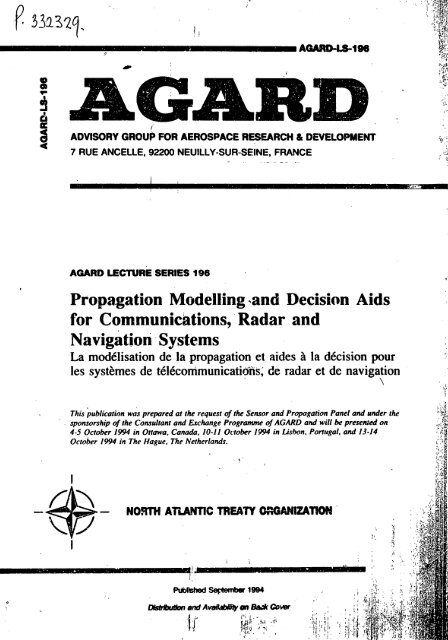
AWWD LECTURE SERIES 196<br />
- . . . - .. -. . . ,<br />
Propgation <strong>Modelling</strong> .<strong>and</strong> <strong>Decision</strong> <strong>Aids</strong><br />
<strong>for</strong> Communickrtions, Radar <strong>and</strong><br />
Navigation Systems<br />
La modelisation de la <strong>propagation</strong> et aides B la dCcision pour<br />
les syst2mes de tCICcommunicatirjns; de radar et de navigation<br />
1<br />
This publication was prepared at the request of the Sensor <strong>and</strong> Propagation Panel <strong>and</strong> under the<br />
sponsorship of the Consultant ond Exchange Programme of AGARD <strong>and</strong> will bt, presented on<br />
4-5 October 1994 in Ottawa, Canada, IO-il October 1994 in Lisbon, Portugal. <strong>and</strong> 13-14<br />
October 1994 in The Hague, The Netherl<strong>and</strong>s.<br />
I
I<br />
AQARD-LS-196<br />
ADVISORY GROUP FOR AEROSPACE RESEARCH 4% DEVELOPMENT<br />
7 RUE ANCELLE, 92200 NEUILLY-SUR-SEINE, FRANCE<br />
I<br />
AGARD LECTURE SERIES 196<br />
Propagation <strong>Modelling</strong> <strong>and</strong> <strong>Decision</strong> <strong>Aids</strong> <strong>for</strong><br />
Communicatichu, Radar <strong>and</strong> Navigation<br />
Systems<br />
La modClisation de la <strong>propagation</strong> et aides B la d6cisivn pour les syst2mes de<br />
tCl6communications. d radar et de navigation<br />
p :<br />
This prthlication was prepared at the request of the Sensor <strong>and</strong> Propagation Panel <strong>and</strong> under the<br />
sponsorship of the Consultant <strong>and</strong> E-rchange Programme. of AGMD <strong>and</strong> will he presented on<br />
4-5 October 1994 in Ottawa. Canada, 10-11 October I994 in Lisbon. Portugal, <strong>and</strong> 13-14<br />
Ormher 1993 in The Hagrre. The Netherl<strong>and</strong>s.<br />
North Atlantic Treaty 0;ganitation<br />
Organisation du trait6 de I'Atlanfique Nod<br />
'<br />
I
.i<br />
r<br />
T$e Mission of A6ARD j: rJr<br />
According to its Charter, the mission 01 A GW is to bring together the leading personalities of the NATO nations in the<br />
fields of science <strong>and</strong> technology relating to aerospace <strong>for</strong> the following purposes:<br />
- Recommending effective ways <strong>for</strong> the member nations to use their research <strong>and</strong> development capabilities <strong>for</strong> the<br />
common benefit of the NATO community;<br />
- Providing scientific <strong>and</strong> technical advice <strong>and</strong> assistance to the Military Committee in the field of aerospace iresearch<br />
<strong>and</strong> development (with particuiar regard to its military application);<br />
- Continuously stimulating advances in the aerospace sciences relevant to strengthening the common defence posture;<br />
- hiproving the co-operation among member nations in aerospace research <strong>and</strong> development;<br />
- Exchange of scientific <strong>and</strong> technical in<strong>for</strong>mation;<br />
- Providiiig assistance to member natiom <strong>for</strong> the purpose of increasing their scientific <strong>and</strong> technical potentie!;<br />
-Rendering scientific <strong>and</strong> technical assistance. as requested, to other NATO bcdies <strong>and</strong> to member nations in<br />
connection with resewch <strong>and</strong> development problems in the aerospace field.<br />
The highest authority within AGARD is the National Delegates Board consisting of officia!ly appointed senior<br />
representatives from each member nation. Ihe mission of ACARD is carried out through the Panels which arc composed of<br />
expcrts appointed by the National Drlegares, the Consultant <strong>and</strong> Exchange Prcpmme <strong>and</strong> the Aerospace Applications<br />
Studies Programme. The results of AGARD work ere &ported to the member nations <strong>and</strong> the NATO Authorities through the<br />
AGARD series or publications of which this is one. ?<br />
Participation in AGARD activities is by invitation only <strong>and</strong> is normally limited to citizens of the NATO nations.<br />
The content of this publication h& been reproduced<br />
directly from material supplied by AGARD or the authors.<br />
Publi+ed September 1994<br />
Copy~i,@t 0 AGARD 1994<br />
All Rights Reserved<br />
ISBN 92-836-1004-0<br />
Printed by Canado Communication Gmup<br />
45 Sad-Ceur BI ud. Hull (Qii4bec). Canada KIA OS7<br />
i
Abstract<br />
In recent years, a number of powerful, flexible, modelling tools <strong>for</strong> the assessment <strong>and</strong> exploitation of <strong>propagation</strong> conditions<br />
have become available. Rapid advances in mini <strong>and</strong> microcomputer technology have put complex models with sophisticated<br />
user interfaces at the disposal of the non-specialist user. These range from system design tools to near real-time operational<br />
<strong>and</strong> tactical decision aids that include models <strong>and</strong> databases of the necessary environmental parameters. Prediction tools are<br />
required <strong>for</strong> communications, radar <strong>and</strong> navigation applications, <strong>and</strong> cover the frequency spectrum from ELF to optical.<br />
The lectures will concentrite on the prediction tools, but will also cover the Lackground required to underst<strong>and</strong> the models<br />
used. The emphmis will be on frlequencies from HF to optical. Topics will include the ionosphcre, ground wave <strong>propagation</strong>,<br />
terrain diffraction, refractive effects, hydrometeors, atmospheric gases, electro-optics md the sensing of radiometeorological<br />
parameters. Both empiricaVstatistical system planning methods, <strong>and</strong> more theoretica!ly based deterministic operational<br />
decision aids will be covered.<br />
This Lecture Series, sponsored by the Sensor <strong>and</strong> PrrJpagation Panei of AGARD, has been implemented by the hnsultant<br />
<strong>and</strong> Exchiliige Programme.<br />
*<br />
Abr6g6<br />
Au cours de; demibres annks, bon nombre d'outils de modClisation puissants et souples pour I'kvaluation et I'exploitation<br />
des conditions de <strong>propagation</strong> sont arrivQ sur le mnrcht. Des avancks rapides en technologies mini et micro ordinateur ont<br />
mis h la disposition de I'utilisateur non sp6cialid des modtles complexes, incorporant des interfaces utilisateur Cvoluks. Ces<br />
aides vont dcs outils de conception des systhes $I des aides h la dkision tactique et op6rationnelle en temps quasi-r&l<br />
intkgratit Ics modhles et les bases de doiiiikc., dcs pvaniktres de I'environnement nkcessaires. Des outils de pddiction sont<br />
dem<strong>and</strong>& pour des applications LUX commuriicatiot, ., aux radars et h la navigation. couvrant le spectre de frhuences du ELF<br />
h I'optique.<br />
Les pksentations se concentreront sur les outils tie pdiction mais elles couvriront Cgalement les technologies de base<br />
nkessaires 31 la comprbhension des modUes utilisCs. L'accent sera mis sur la gamme de f*uences du HF I'optique. Les<br />
srtjets traitts comprendont I'ionosphtre. la <strong>propagation</strong> des onoL de sol, la diffraction du terrain, !es effets de &fraction. les<br />
hydrc?om6thres, les gaz atmosphCriques. 1'Clectro-o ltiqsle et la detection des paramhtres radiomCtCorologiques. Les m6thcdes<br />
empiriqircdstatistiques de planification sys!tnmes seroni discutees, ainsi que les aides dCtenninistes h la dkcisiori<br />
op6rationnelle. bades sur des considCrations d'ordre thkorique.<br />
Ce cycle de confbrences cst pdsentb dans le cadre du programme des consultants et des khanges. SOUS I'Cgide du Panel de<br />
Sensor et Propagation de I'AGARD.<br />
I<br />
i
List of AuthordSpeakers<br />
Lecture Series Director. Dr. Ken H. CRAIG<br />
Radio <strong>Communications</strong> Research Unit<br />
Ruther<strong>for</strong>d Appelton Laboratory<br />
Chilton, Didcot<br />
Oxon OX1 lOQX<br />
UK<br />
Dr. Paul S. CANNON<br />
Radio Propagation Exploitarion Group<br />
Space arid <strong>Communications</strong> Dept.<br />
Defence Research Agency<br />
St. Andrews Road t<br />
Malvern<br />
Worcs. WR14 3PS<br />
1JK<br />
Dr. Jucrgen H. RICHTER<br />
Oceaii <strong>and</strong> Atmospheric Sciences Div<br />
NCCOSC KDTI? DIV 543<br />
53570 Silvergate Ave<br />
San Diego CA 92152-5230<br />
USA<br />
Dr. Anton KOWE<br />
Forschungsinstitut fur Optik (FfO)<br />
Schloss Kressbach<br />
D-72072 TUbingeii<br />
GERMANY<br />
I I<br />
AuthordSpeakers<br />
h<br />
Dr. Jim H. WHTXTEKER<br />
<strong>Communications</strong> Research Cenrre<br />
P.O. Box 11490<br />
Station H<br />
3701 Carling AV<br />
Ottawa, Ontario K2H 8S2<br />
CANADA<br />
Mr. Herb V. HlTNEY<br />
NCCOSC RDTE DIV 543<br />
53 I70 Woodward Rod<br />
Sar Diego, CA 92152-7385<br />
USA<br />
,
AbstracUAbr6g6<br />
List of AuthodSpeakers . .<br />
Introduction <strong>and</strong> Overview'<br />
by Dr. K.H. CRAIG<br />
Propagation in the Ionosphere (A)<br />
by Dr. Paul S. CANNON<br />
Propagation in 'the Ionosphere (B)<br />
by Dr. Paui S. CANNON .<br />
Ground Wave <strong>and</strong> Diffraction (A)<br />
by Dr. Jim H. WHIITEKER<br />
Ground Wave <strong>and</strong> Diffraction (B)<br />
by Dr. Jim H. WHI?TEKER<br />
Sensing of Radio Refractivity <strong>and</strong> Aerosol Exllnction<br />
by Dr. Juergen 11. RICHWR<br />
Refractive Effects from VFH to EHF (A)<br />
by Mr. Herbert V. HITNEY<br />
Refractive Effects from VFH to EHF (B)<br />
by Mr. Herbert V. HITNEY<br />
Contents<br />
Electro-optics: Propagation from IR to W ad Sensor Considerations (A)<br />
by Dr. Anton KOHNLE<br />
Electro-optics: Propagation from IR to W <strong>and</strong> Sensor Considerations (B)<br />
by Dr. Anton KOHNLE<br />
Relevance of <strong>Decision</strong> <strong>Aids</strong> to the New NATO Strategy<br />
by Dr. Juergen H. RICHTER<br />
Effects of Hydrometeors <strong>and</strong> Atmospheric Gases at SMF/EW<br />
by Dr. K.H. CRAIG<br />
?<br />
I<br />
Page<br />
iii<br />
iv<br />
I<br />
1B<br />
2A<br />
2B<br />
3<br />
4A<br />
4B<br />
SA<br />
SB<br />
6<br />
7<br />
' .:
<strong>propagation</strong> <strong>Modelling</strong> <strong>and</strong> <strong>Decision</strong> <strong>Aids</strong> <strong>for</strong><br />
<strong>Communications</strong>, Radar,<strong>and</strong>' Navigation Systems<br />
1 INTRODUCTION<br />
Any communications. radar or navigation syrtem thzt iclies on<br />
the <strong>propagation</strong> of e1ect;c)magnetic (e.m.) ~vaves between an<br />
emitter <strong>and</strong> a receiver is affectpi by the environment in which<br />
the wa'ves propagate. An understmding of this cnvircriment.<br />
2nd the w:iy in which it nffccts <strong>propagation</strong>. is csscntiai <strong>for</strong> an<br />
nsscssmcnt nntl prrtliction of systcrn pci<strong>for</strong>ni:incc.<br />
The medium through which the waves propagate ha:; a direct'<br />
influcncc on prop;ig;ition. In the HF <strong>and</strong> lower llcqucncy<br />
h<strong>and</strong>s. thc ionosphcrc (the ionised region of :the ntmosphcre<br />
cxlcritlirig Trcirti iihwit H5 tu If#M kin I I I ~ T tlir Ewtli's<br />
surfacc) h:is thc grc;itcst cflect. wliilc at freque&ics l'rom VHF<br />
to optical. the troposphere (the non-ionised. lower part of the<br />
atmosphere. extending from the surface up to the tropopause<br />
'at a height of 10-15 km) dominates. Variatixs in the<br />
rcfractivc index of the medium deterpine how the waves<br />
deviate from thc straight line paths that they would have in<br />
free space. 'll~ese effects can be explbited (<strong>for</strong> example to<br />
provide communications far beyond the horizon) or can be a<br />
source of system per<strong>for</strong>mance degradation (as <strong>for</strong> example in<br />
the <strong>for</strong>mation of radar coverage holes). Attenuation of the<br />
signal also occurs in the ionosphere <strong>and</strong> the troposphere. <strong>and</strong><br />
scatter from particulates (such as rain, fdg 2nd smoke) can he a<br />
significant impairment. particularly on electro-optics systems.<br />
The Earth's wrfacc also affects SVS!CIC per<strong>for</strong>mance. The<br />
effect may be direct. by means of diffraction ar:d scatter where<br />
the Earth's bulg!: or terrain features intrude into the<br />
<strong>propagation</strong> path. or it may be indirect. due to the influcncc of<br />
the Each's surface on the !oca1 meteorology <strong>and</strong> hence on the<br />
refractive index structure of the lower atmosphere.<br />
The <strong>propagation</strong> medium varies in both time <strong>and</strong> space, <strong>and</strong> on<br />
various sc3les. The spatial scales of interest range from<br />
thous<strong>and</strong>s of kilcmetres <strong>for</strong> global communications via the<br />
ionosphere to less thm a metre <strong>for</strong> the effects of atmosphcric<br />
turbulence on optical sys!ems. Time scales range from many<br />
years (solar cycle effects on ionospheric <strong>propagation</strong>) to hours<br />
or even minutes (the scale of weather phcnomena).<br />
Thcsc Iccturcs address the ,modelling of the efftkts of the<br />
pn>pi;y:Iliiiii cnvit nnmcnl on system per<strong>for</strong>mnnce. Much ef<strong>for</strong>t<br />
has ken dcvo~cd to this task nnd.to improving senson <strong>for</strong> the<br />
direct or remote sensing of the ei;vironmcnt. In recent years.<br />
the capabi:ities of <strong>propagation</strong> irodels have advanced<br />
significantly due to the ready availability of pwerful mini <strong>and</strong><br />
microcomputers:<br />
Introduction <strong>and</strong> Overview<br />
K.H. Craig<br />
Radio <strong>Communications</strong> Research Unit<br />
Ruther<strong>for</strong>d Appleton Lahoratory<br />
Chilton. Didcot. OX1 1 OQX<br />
U.K.<br />
,<br />
1-1<br />
- more complex solutions using numerical meihods have been<br />
applied to ii wider range of prohlems;<br />
: , I.<br />
- this in turn has,led to a requirement <strong>for</strong> better <strong>and</strong> more upto-date<br />
environmental data;<br />
- thc devclopmcnt of sophisticntcd. intcmctivc uscr intcrfaccs<br />
on personal computer systems has givcn rise to <strong>propagation</strong><br />
tools that can be used by non-spccialists;<br />
,<br />
- <strong>propagation</strong> motlcls have evolvcd into tlccision aids hy thc<br />
incorporation of systcni pcr<strong>for</strong>mnnx in<strong>for</strong>mntion. The<br />
sropc of thcsc m y hc qiiitc widc, prrscnting tiictic.~l iidvicc<br />
to the non-specialist user. <strong>and</strong> the <strong>propagation</strong> clemLnt may<br />
be only one pzrt of a more complex. system.<br />
In order to mcdel the effect of the environment on the<br />
<strong>propagation</strong> 01' c!cctromagnrtic waves. two components arc<br />
required:<br />
(i) an electromagnetic wave <strong>propagation</strong> model;<br />
(ii) mezsurer:c:s ar a model of the ewironment in which the<br />
waves propagate as input data <strong>for</strong> the <strong>propagation</strong> modcl.<br />
2 E.M. WAVE PROPACATION MODEL!<br />
In principle. a <strong>propagation</strong> mcdel <strong>for</strong> any e.m. wave problem<br />
is provided by a solution of Maxwell's quations. This type of<br />
model is deterministic in the sense that if the <strong>propagation</strong><br />
medh is characterised e:ucrly, the solution would also be an<br />
exact description of the <strong>propagation</strong> conditions <strong>for</strong> the given<br />
path at the given time. In practice, of course,. it is more<br />
complicated than this. Approximations <strong>and</strong> simplifications are<br />
required <strong>and</strong> no practical solution of Maxwell's equation (that<br />
is. one that is analytically solvable or is numenally tractable).<br />
will be applicable to all <strong>propagation</strong> problems. Different<br />
<strong>propagation</strong> mechanisms require different approximations. <strong>and</strong><br />
this has led to the development of various mahadologks<br />
throughout the e.m. spectrum. Sevetal models an3 computer<br />
packages have evolved to deal with different applidon ~UUUI.<br />
<strong>and</strong> one of the aims of this Lecture Series is to help the user to<br />
identify the packages most devant to his or her area of<br />
interest.<br />
Deterministic modcis arc particularly rckvant when ,<br />
@cth (or even <strong>for</strong>ecast) of be pufonnance of a specif%<br />
system is required (II a spacitlc kcatia, <strong>and</strong> aime(facxampk, .':<br />
dCWf@$lg tk kS Shituude M<br />
fly to avoid daectlon by an ene<br />
cmpWscd that the accuracy of a<br />
.
1-2<br />
dcpcndent of thc quality (<strong>and</strong> perhaps quantity) of real-time<br />
environmental dat;~ nvaili1hlc: thc (I: :k of) availability of such<br />
data is u.;unlly n rnorc serious cotis:raict on the prediction<br />
accurncy thxn thc ;iccur;icy of thc prop;ig,ition modd itr.c!f.<br />
Sincc thc prop:ig;ition cnvironmcnt is never known exac:ly. a<br />
dctcrniinistic approach to thc prohlcm may he undcsirahle.<br />
Indccd. :I prcdictinn m;iy hc rcquircd, whcn no direct<br />
mcnsurcmcnt ol' thc cnvimnmcnt is pvaiI;ihlc. In this casc, a<br />
prcdictinn may s!iII hc pnssihlc. hui it must he hrir.cd either on<br />
historical d:it;i conccrning. ' thc cnvironmcnt. or on<br />
mensurcmcnts of the pcr<strong>for</strong>mancc of similar systems in similar<br />
<strong>propagation</strong> conditions. This crrrpirical type of modcl is<br />
sufficicnt <strong>for</strong> many applications. In gencral thc complcxity of<br />
thc model is less than in thc dctcrministic case, <strong>and</strong> this can<br />
lcad to nrar-instnntancous prcdictinns. Empirical models are<br />
thercfiirc cspccially suitnhlc <strong>for</strong> systcm planning or simulatiun<br />
purposes. whcrc thc rcquircmcnt is rnorc to achievc good<br />
. prcdiction iccuracy "on the avcragc". rather ihan <strong>for</strong> an<br />
individual cnsc.<br />
Empirirnl models can hc taken a step further by making<br />
striiisirccrl prcdictinns: <strong>for</strong> cxnmple. predicting thc pcrccntagc<br />
of thc timc thiit ;I pivcn prcpagation path will he "opcn'! <strong>for</strong><br />
' communic;itinii. or thc pcrccntiige of thc timc that n link will<br />
hc unusnhlc hccausc of rain. Ag;iin. thc main application is in<br />
long-term systcrn pl;iiiriing,<br />
Ihisiorr tiids will rcqiiirc systcrii inlnrmntion in addition to a<br />
prop:ipition modcl ant1 cr.virnnmcntal data. The nccd <strong>for</strong><br />
pcr<strong>for</strong>rnnncc critcria 01 thc cornmunicaiions. radar or<br />
nnvig;itinn systcin itself is ohvious. Howvcr. thcrr may hc a<br />
ncctl <strong>for</strong> othcr in<strong>for</strong>m:ition. For cxample. t:irget <strong>and</strong><br />
h:rckgrciur\tl vr cllittcr ch:ir:ictcristics will he ncnwiiry to<br />
cstirii;itc thc dc(cctint1 cap;ihilitics of a radar or imiiging<br />
system. Thc human npcrator is also an intcgral part of most<br />
dctcction systems. <strong>and</strong> thc pcr<strong>for</strong>mancc of thc opcrntor should ;<br />
also hc takcn iiito ;icckunt <strong>and</strong> modcllcd.<br />
3 ENVIRONMENTAI, DATA<br />
Ohtnininp, <strong>and</strong> assimjlntinp infcirmntion ahout the <strong>propagation</strong><br />
cnvironmcnt is iin intcgrnl piirt of nny dccision aid. In some<br />
- casts thc dat:i rcquircd will hc csscntially static <strong>and</strong> nccd only<br />
hc olltaincd oncc: an cxarnplc would be terrain elemtion data<br />
rcquircd <strong>for</strong> !he motlcllinp of tcrrain diffraction. H,iwcvcr. the<br />
<strong>propagation</strong> mcdium itsclf generally varics with time <strong>and</strong><br />
sensm must he dcplovcd to ohtain timely <strong>and</strong> yxescntativc<br />
mrasuremcnts of thc mcdium.<br />
Direct sensing is currcntly the most widcly available source of<br />
data in thc troposphere. principally by means of radiosor.de<br />
hnlloon ascents. However rcccnt dcvclnpments in reniote<br />
sensing of thc troposphcrc show provise <strong>for</strong> ohtaining<br />
refrectivc indcx in<strong>for</strong>mation with greater spatial <strong>and</strong> temporal<br />
rcsolution than is pcrssihlc hy radiosonde methods: ground-<br />
hascd remote scnsors arc also less @one to detection than is a<br />
radiosondc hnllmn. In the iono2phere. remote sensing by<br />
ionosondcs has heen widely cmployed <strong>for</strong> many years.<br />
Real-time dcterministic prediction (nowcasting) acd<br />
<strong>for</strong>ccasting rnndcls requirc a regular update of meteorological<br />
or ionnsphcric data. Forecasting o systcm per<strong>for</strong>mance rclies<br />
on accurntc <strong>for</strong>ecasts of the statc d f the probapation medium,<br />
nnd improvements are closely ,tied to 'developments in<br />
nunicricnl wcnth.r <strong>and</strong> ionosphcric' prediction models.<br />
4 CONCLUSION<br />
The main aim of these lectures is to describe the <strong>propagation</strong><br />
models <strong>and</strong> decision aids that are availahle. However, in ordcr<br />
to underst<strong>and</strong> the mdels, <strong>and</strong> the scope of their applicnhility,<br />
some background on the propapation mcchanisms is<br />
necessery. The major topic areas arc presented in two piIris.<br />
the first covering the <strong>propagation</strong> mechanisms. <strong>and</strong> thc second<br />
concentrating on the <strong>propagation</strong> mndcls <strong>and</strong> dccision iiids.<br />
The lectures concentrate on frequcncics from HF to optic:il.<br />
Although there are important system applications in thc<br />
frcquency b<strong>and</strong>s below HF (navigation in particular).<br />
<strong>propagation</strong> v!gdelling at the lowcr frequencies was<br />
extensively covered in ;I recent AGARD publication [I]: this<br />
publication is complementary to the present lecture\yries <strong>and</strong><br />
is recommended <strong>for</strong> further reading. Reference may also he<br />
made to an AGARD Symposium publication 121 which covers<br />
recent research results <strong>and</strong> developments in opcrational<br />
decision aids. Another source of empirical <strong>and</strong> statistical<br />
<strong>propagation</strong> modcls is the Kadiocommunicatiom sector of thc<br />
International Telecommunication Union (ITU-t?,. <strong>for</strong>merly<br />
known as the Consultative Committec lntcrnatiorial Radio<br />
(CCIR). This body publishes an extensive series of reports 131<br />
that arc used in the design of civil communications systcms.<br />
!<br />
The,dissolution of the Warsaw Pact <strong>and</strong> thc "Partncrship <strong>for</strong><br />
Peace" accord has causcd a rcassessmcnt of thc rolc of NATO.<br />
Prcpagation assessment tools will he required to maximise the<br />
cfficicncy. cffcctivcncss <strong>and</strong> flexihility of reduccd lcvcls cif<br />
<strong>for</strong>ces <strong>and</strong> weapons in the post Cold War NATO. Ihc<br />
relcvaiice 2.f. dccision aids to the ncw NATO stratcgy <strong>and</strong><br />
future directions <strong>for</strong> operational asscssmcnt tools arc discusscd<br />
further in 3 separate lecture. '<br />
5 REFERENCE.'<br />
[I] Richter, J.H. (ed), "Radio wave <strong>propagation</strong> modcling,<br />
drediction <strong>and</strong> assessment". AGARDograph No. 326.<br />
AGARD, Paris, 1990, (ISBN 92-835-0598-0).<br />
[ 2) AGARD, "Operational decision aids <strong>for</strong> exploiting or<br />
mitigatir.p electromagnetic' <strong>propagation</strong> cffccts", AGARD-<br />
CP-453, 1989. .'<br />
131 ITU, "Recommendations <strong>and</strong> Reports of the CCIR".<br />
XVllth Plenary Asscmbly. Geneva, 1990.<br />
'<br />
A,
1. Introduction<br />
The ionosphere, the ionised region of the atmosphere<br />
between about 85 km <strong>and</strong> IO00 km affects all radio<br />
signals that pass through or via id. Soma of the<br />
associated radio systems can only operate because of<br />
thc ionosphere. but it can also degrade radio system<br />
operation. Sometimes the effects of the ionosphere are<br />
highly significant, sometimes they can all but be<br />
ignored.<br />
If the ionosphere were stable in time <strong>and</strong> constant in<br />
space it would be relatively easy to determine the effect<br />
of the ionisation on the radio <strong>propagation</strong> <strong>and</strong> hence on<br />
the radio sy.,tcni. Un<strong>for</strong>tunately, stability is not the<br />
nom. particularly in the high latitude regions [Cannon.<br />
19891, <strong>and</strong> as a consequence <strong>propagation</strong> models <strong>and</strong><br />
other decision aid. have been, <strong>and</strong> are being, developed.<br />
These characterise the medium <strong>and</strong> estimate the system<br />
per<strong>for</strong>mance. implicitly or explicitly aci-jising the<br />
operator on a course of action to improve systeni<br />
per<strong>for</strong>mance. By the nature of the human intervention<br />
needed to interpret the in<strong>for</strong>mation the decision aid<br />
must be considered an off-line pgcess.<br />
One category of decision aid consists of .the<br />
<strong>propagation</strong> model (ideally with good input <strong>and</strong> output<br />
capabilities) sometimes augmented with systems<br />
advisory in<strong>for</strong>mation. The lattcr might consist, <strong>for</strong><br />
example, of advice to change frequency. These<br />
<strong>propagation</strong> models incorporate one or more of a<br />
number of elements.<br />
i) An ionospheric model. .'<br />
ii) A ray tracing model.<br />
iii)<br />
iv)<br />
I<br />
System factors including antecnas. noise etc.<br />
A methodology to update the ionospheric<br />
model.<br />
The <strong>propagation</strong> model is often used For long tenn<br />
prediction of system per<strong>for</strong>mance over one or m' ire<br />
months. In such cases it is usual to provide monthly<br />
rnediarl estimates of system per<strong>for</strong>mance. Alternatively.<br />
<strong>for</strong>ecasts (<strong>for</strong> the next few minutes, hours or Cays) of<br />
system per<strong>for</strong>mance can be generated. This is a f~<br />
more difficult process requiring up-to-date ionosphcric<br />
measiirements <strong>and</strong> strategies <strong>for</strong> using these data.<br />
The data used <strong>for</strong> updating ionospheric modeis can dso<br />
be used as a decision aid in its own right. Such data<br />
may, <strong>for</strong> example. consist of actual measurements1 A<br />
Propagation In the Ionosphere - (A)<br />
Paul S Carnon<br />
Radio Propagstion Exploitation Group<br />
Space <strong>and</strong> <strong>Communications</strong> Dept<br />
Defence Research Agency<br />
Malvern, Worcs, WR14 3PS<br />
United Kingdom<br />
<strong>for</strong>ccasts of geomagnetic activity, or sunspot number,<br />
or even basic ionospheric parameters siich as foF2, (the<br />
critical frequency of the ionospheric F - region). Armed<br />
with such in<strong>for</strong>mation the decision aid can provide<br />
evidence that the system operating parameters must tx:<br />
adjusted to compensate <strong>for</strong> the <strong>propagation</strong><br />
environment.<br />
The ionospheric models <strong>and</strong> the more sophisticated of<br />
the ray tracing models cnn also he used together as a<br />
decision aid although it must be accepted that very<br />
skilled users are required to make best use of such<br />
systems. As an example, backscatter ionograms may be<br />
synthesised <strong>and</strong> compared wiih actual ionograms to aid<br />
the interpretation of thc lattcr.<br />
In this first of two lectures we will first introduce the<br />
physical basis <strong>for</strong> ionospheric decision aids by reference<br />
to ionospheric morphology <strong>and</strong> the basic theory of<br />
ionospheric <strong>propagation</strong>. We will then go on to review<br />
ionospheric <strong>propagation</strong> <strong>and</strong> r3y tracing techniques.<br />
The second lecture wi!l describe a number of decision<br />
aids related to the ionosphere in general <strong>and</strong> specifically<br />
to high frequency (HF) systems, meteor burst (MB)<br />
systems <strong>and</strong> satellite to ground systems. These aids<br />
provide system focused in<strong>for</strong>mation on the current,<br />
<strong>for</strong>ecast md predicted state of the ionospl-ere <strong>and</strong> of<br />
course the current, <strong>for</strong>ecast <strong>and</strong> predicted syste>m<br />
per<strong>for</strong>mance.<br />
Since time does not permit we have elected not to<br />
address very low frequency (VLF) systems, low<br />
frequency (LF) systems <strong>and</strong> medium frequency (MF)<br />
systems.<br />
Extensive citation of the relevant literature is given<br />
throughout this paper but the reader is referred to the<br />
excellent general texts by Duvies [1990]. McNumru<br />
[I9911 <strong>and</strong> Goodman [1992]. The reader is also<br />
referred to the AGARD symposium on "Operational<br />
<strong>Decision</strong> <strong>Aids</strong> <strong>for</strong> Exploiting or Mitigating<br />
Electromagnetic Propagation Effects" [AGARD, 19891<br />
<strong>and</strong> the AGARDograph on "Radio wave <strong>propagation</strong><br />
modclling, predi4on <strong>and</strong> assessment" [AGARD, IWO].<br />
2. Ionospheric Morphology<br />
2.1 Introdoctlon<br />
The ionosphere is a highly ionised region of the<br />
atmosphen lying in the altitude range 83 km to IO00<br />
1A-1 .
1A-2<br />
km. Figure 1. The ionisation of the earth's atmoy'lere<br />
which produces the ionosphere is caused by sweral<br />
mechanisms. The most important of these, at non-<br />
aurorai latitudes, are the sun's extreme ultra violet<br />
(EW), X-ray, <strong>and</strong> Lyman a together with solar cosmic<br />
rays. At high latitudes, particularly during magnetically<br />
active periods, the effects of energetic particlcs <strong>and</strong><br />
electer I'rclds are also important.<br />
600<br />
Sunssot Min<br />
Figure 1. The ionosphere<br />
Electron Density<br />
The rates of ionisation at any altitude depends on the<br />
atmospheric composition as well as the characteristics<br />
of the incident rirdiation at that height. As the solar<br />
radiation propagates down through the neutral<br />
atmosphere the various frequency (energy) b<strong>and</strong>s of this<br />
radiation are attenuated by different amounts. At the<br />
same time the composition of the atmosphere alters with<br />
altitude. Consequently, different ionisation processes<br />
become predominant at different heights resulting in a<br />
layered structure. The principal layers are designated<br />
D, E <strong>and</strong> F (see Figure I), each being characterised by a<br />
different set of ionisation process-s. Somei of these<br />
legions are themselves layered or structured into the E,<br />
Es, Fl <strong>and</strong> F2 regions. The number of layers. their<br />
heights <strong>and</strong> their ionisation density vary with time <strong>and</strong><br />
in space. The high latitude ionosphere is particularly<br />
complicated <strong>and</strong> will not be dealt with here but is<br />
dzscribed by Cannon [1989] <strong>and</strong> in the general texts<br />
referred to above.<br />
2.2 The quiet time D-reglon<br />
The D-region is the lowest layer of the ionosphere <strong>and</strong><br />
extends from 50 km to 90 km although there is little<br />
ionisalion below 85 km. Being the lowest region it is<br />
produced by the most penttrating of the ionising<br />
radiation. It is characteristically a region of very w ee<br />
ionisation, the neutral density exceeding the electron<br />
density by several orders of magnitude. The electron<br />
density exhibits a strong diurnal variation being some<br />
two orders of magnitude higher durirg the day Vie<br />
three main production sources are X-rays (wavelengths<br />
O.lmm to Imm) between 85 km <strong>and</strong> 90 km, Lyman U<br />
between 75km <strong>and</strong> U5 km <strong>and</strong> solar cosmic rays below<br />
75 km.<br />
Although the electron density is small compared to that<br />
of other regions the electron-neutral collision frequency<br />
is high dw to the high neutral gas density <strong>and</strong> this leads<br />
to strong absorption. Absorption in the D-region where<br />
the refractive index is close to unity is called non<br />
deviative?. Ncn - deviictive losses typically vary in an<br />
inverse square relationship with frequency <strong>and</strong> as a<br />
result at frequencies well above the HF b<strong>and</strong> D-region<br />
absorption is inconsequential. Further, because D-<br />
region ionisation is due to the sun's radiation <strong>and</strong><br />
because recombination is rapid at these altitudes D-<br />
region absorption is primarily a day-time phenomenon.<br />
Two to three hours after sunset the absorptioli becomes<br />
negligihle.<br />
2.3 The quiet time E-region<br />
The E-region peaks near 1 IO km, see Figure 1, <strong>and</strong><br />
results from ELV radiation between 30 nm <strong>and</strong> 102.6<br />
nm <strong>and</strong> X-rays from 1 nm to IC nm. The E-region can<br />
be closely modelled as 2 Chapman layer <strong>and</strong> is very<br />
predictable compared to the F2 layer ahve.<br />
A large volume of vertical-incidence ionosoi:de data has<br />
been collected over about three solar cycles <strong>and</strong> the<br />
characteristics of the E-region are well known. The<br />
minimum vertical height of the E-region <strong>and</strong> ifre<br />
variation of the maximum electron density Cfin have<br />
been recorded as a function of time <strong>and</strong> geographical<br />
location. In the day-time the E-region is so regular that<br />
the distribution spread can be considered negligible<br />
(deciles at fS%). At night there is less data but it is also<br />
reasonable to assume a small spread in values. As a<br />
guide the maximum electron density occurs during the<br />
day at - 110 km <strong>and</strong> the semi-thickness is - 20 km.<br />
[Frihagen, 19651. The peak electron density can be<br />
calculated from first principles or alternatively it can be<br />
estimated from statistical data hases. Uwally. the E-<br />
layer critical frequency is determined by a @emi -<br />
empirical equation involving the sunspot number <strong>and</strong><br />
the zenith angle of the sun. An alterndtive approach<br />
uses numerical coefficients mapped in terms of<br />
geographic co-ordinates md universal time [Lefrin.<br />
19761.<br />
Within the E-region there also exists an ill predicted<br />
layer known sporadic-E (Es). This layer ofyn <strong>for</strong>ms<br />
at about -e 105 km <strong>and</strong> may be optically dense <strong>and</strong> i<br />
J<br />
spatially thin. In such cases it reflects radio signals well.<br />
Sporadic-E, however. also includes partially transparent<br />
layers <strong>and</strong> irregu!ar patches of ionisation in which case<br />
signals may be reflected, or scattered, or little affected<br />
by the layer. The mechanisms producing sporadic-E are<br />
not weli understood.<br />
2.4 The quiet t he F-region<br />
I<br />
The F-region consisu of two regions known as the Fi,<br />
which usually lies between 150 <strong>and</strong> 200 km altitude.<br />
<strong>and</strong> the F2 which lies above. The ,F2 region has a '<br />
higher electron density <strong>and</strong> it consequently has a<br />
stmnger impact on radio waves which traverse it. 7 %~<br />
FI layer. which is most obvious during the summa<br />
doytime, snd the M layer are separated by a ledge in the<br />
'.<br />
, I<br />
c<br />
d<br />
,t<br />
5
electron density. At night the FI layer essentially<br />
disappears since it is under solar control. In the F2<br />
iegion, however, transport processes dominate dr e to<br />
the decreased neutral densities. Ambipolar diffusion,<br />
electrodynalDic drift <strong>and</strong> neutral winds determine the<br />
density distribution <strong>and</strong> maintain an ambient electron<br />
density even during the polar winter. As a consequence<br />
of the transport processes the F2 layer is highly variable<br />
( IO to 30% from day to daj).<br />
The F-region also exhibits significant geographical<br />
variations in electron ddnsity, including the equa1,lrial<br />
anomaly, the !rough <strong>and</strong> the auroral oval. Cawon<br />
[ 19891 reviewed the F-region in the high latitude region.<br />
Due to the wide variation of F-region electron density<br />
profiles as a function of position time, averaged maps of<br />
the F-region electron density are generally used<br />
although other modelling approaches cre now being<br />
addressed. These will be referred to later in this lecture.<br />
3.<br />
Theory of Propagation Via the Ionosphere<br />
The ionosphere is a dispersive medium, that is to say the<br />
refractive index of the medium varies as a function of<br />
frequency. As a consequence different frequencies<br />
travel with different spcedg causing spreading of the<br />
pulse. The ionosphere is also layered, as we have<br />
described, <strong>and</strong> this leads to multi-p;'ll <strong>propagation</strong>. The<br />
earth's magnetic field introduces a further complication<br />
in as much as it rendcrs the ionosphere anisotropic.<br />
This means that the incident ray will be split into two<br />
rays on enLering the ionosphere in a manner similar to<br />
that of crystal optics. The two differently polarised rays<br />
are referred lo as ordinary (0) an extraordinary (x)<br />
rays. One result of this splitting is P ,he phenbmerion of<br />
Faraday rotation of the wave polarisation plane as it<br />
traverses the ionosphere. The ionosphere, however, is<br />
above all a region where the refractive index is less than<br />
unity resulting in a group iclocity which is less than<br />
that of light in free space. A consequence of this is that<br />
vertically launched rays can be reflected <strong>and</strong> oblique<br />
rays are progressively bent away from the vertical.<br />
Obliquely launched HF rays are in fact often turned<br />
back towards the ground. In these lectures a number of<br />
equations will be given describing the evaluation of<br />
specific quantities of interest. However, a fundamental<br />
equation from which the great majority can be derived<br />
is the so called Appleton-Lassen <strong>for</strong>mula which<br />
describes the complex refractivc index, n2. In<br />
particular the equation is important to describe the<br />
<strong>propagation</strong> of HF waves. When collisions between<br />
the electrons <strong>and</strong> neutrals are negiigible (in the E <strong>and</strong> F<br />
regions) the real part of the refractive index p can be<br />
determine i from a simplified <strong>for</strong>m of the Appletonbssen<br />
<strong>for</strong>mula:<br />
2Xl1- xb<br />
y*=1- 2 2 112<br />
2( 1 - X) - Y: f [ -yT" + 4( 1 - X ) YL<br />
]<br />
1<br />
where:<br />
X=Ne 2 /~m m2, Y ,=eBL/m m, <strong>and</strong> Y +BT/mm.<br />
IA-3<br />
The subscripts T <strong>and</strong> L icfer to transverse <strong>and</strong><br />
longitudinal components of the imposed geomagnetic<br />
flux (B) with reference to the direction of the wave<br />
normal of <strong>propagation</strong>. N is the electron density per<br />
cubic metre, e is the charge on the electron, rn is the<br />
mass of the electron, 6 is the permittivity of free space<br />
<strong>and</strong> o is the angular wave frequency. The plus sign<br />
above refers to the ordinary wave <strong>and</strong> the minus sign<br />
refers to the extra-ordinary wave. If, the magnetic field<br />
is ignored the above reduces to:<br />
where fN = (Ne2/~m)0,5 <strong>and</strong> is known as the plasma or<br />
critical frequency. The constant k = 80.5, N is in<br />
electrons per cubic mctie <strong>and</strong>fis in Hertz.<br />
Reflection at vertical incidence occurs when p = 0 but<br />
at oblique incidence reflection takes place at finite<br />
values of the refractive index. Equation 2 demonstrates<br />
that <strong>for</strong> low frequencies such that ffN as described by Snell's law <strong>for</strong> total<br />
internal reflection.<br />
4. Ionospheric Models<br />
4.1 Introduction<br />
The most difficult aspect of <strong>propagation</strong> modelling is<br />
the generation of the ionospheric model. The efficacy<br />
of the <strong>propagation</strong> modelling decision aid is no better<br />
than our knowledge of the underlying ionosphere.<br />
Fortunately, there have been substantial improvements<br />
in ionospheric modelling capabilities over the past few<br />
years, both as a result of improved computing fzcilities<br />
<strong>and</strong>, as a result of improved ground b.ased sensor: which<br />
can be used to provide real time updates.<br />
Bilirzn [ I989 <strong>and</strong> 1990) provides excellent summaries<br />
of I.;. i:aTious ionospheric models. These cover electron<br />
density, temperatore, ion compcsition. ionospheric<br />
electric field, auroral precipitation <strong>and</strong> conductivity<br />
models. From the system users point or view the<br />
electron density distribution is paramount <strong>and</strong> we will<br />
restrict our discussions to those models only. ,<br />
Both statistically based <strong>and</strong> theoretically based electron<br />
density models exist <strong>and</strong> these have been reviewed by<br />
Davics (1981). Rush [I9861 <strong>and</strong> Schunk <strong>and</strong><br />
Szuszczewicz [ 19881. Un<strong>for</strong>tunately, the computer run<br />
times <strong>for</strong> the theoretical models are high. Typically,
I A 4<br />
several hours are needed on a CRAY I' computer to<br />
s-ecify the global electron density [Bilirza, 1989: As a<br />
consequence of these long riin times the theoretical<br />
models are not 2ppropriate <strong>for</strong> real-time or even near<br />
real-time applications.<br />
4.2 Theoretical Simulation<br />
Theoretical simulations are based on the self consistent<br />
solution of the continuity, energy. <strong>and</strong> momentum<br />
equations <strong>for</strong> electrons <strong>and</strong> ions. Typical input<br />
parameters are the solar EUV radiation, the auroral<br />
particle precipitation (together with the interaction cross<br />
sections) <strong>and</strong> the atmospheric <strong>and</strong> magnetospheric<br />
boundary conditions. From those inputs <strong>and</strong> equations<br />
the plasma densities, temperatures <strong>and</strong> drifts are<br />
obtained numerically from the non-linear coupl~ bd<br />
system of equations. The most advanced compuler<br />
simulations have been developed at Utah State<br />
University, USA [Schunk et al., 19861; at University<br />
College London <strong>and</strong> the University of Sheffield, UK<br />
[e.g. Fuller-Rowel/ et al. 19871 <strong>and</strong> at the National<br />
Center <strong>for</strong> Atmospheric Research in Bouldcr,<br />
Colorado. USA [e.g. Rohle er al., 1988).<br />
4.3 Empirical Models<br />
Empirical models of the electron density are curren .y<br />
of the most operational use. Empirical models are<br />
essentially climatological models <strong>for</strong> specified solar<br />
<strong>and</strong>/or inngnctic :ictivity levels. season, time of day,<br />
geographical area etc. The value of a number of<br />
empirical models <strong>for</strong> radic communications purpose is<br />
described by Dudeney <strong>and</strong> Kressman [ 19861 <strong>and</strong> by<br />
Bradley [ 19901.<br />
The first three models described below are chbacterised<br />
in terms of a very limited number of parameters foF2.<br />
fuFI. fuE <strong>and</strong> M(3000) ( = MUF(3000)/foF2 being<br />
related to the F-region peak altitude). These values can<br />
be used to generate a straight line <strong>and</strong> simple parabolic<br />
foE fj foF2<br />
Plasma frequency<br />
Figure 2 ilrxky-lludcncy npproximilte rnn
Figure 3 CCIR Report 340 map of foF2 <strong>for</strong> Septembt r at 20 UT when the sunspot number is 100.<br />
also enter into the empirical exprewions describing<br />
some of the other regions. Alternatively, the URSI<br />
coefficients or the users own coefficicnts can be usisd.<br />
Like Report 340 the model is parametric in month,<br />
universal time <strong>and</strong> sunspot number. The [RI uses a<br />
mixture of analytical calculations, iterztive searches <strong>and</strong><br />
empirical rules to provide its vertical profile. There arc<br />
however, horizontal discontinuities, <strong>for</strong> example the J I<br />
region appears <strong>and</strong> disappears according to local tir .c.<br />
The iterative searches are also non-linear <strong>and</strong> so it iq not<br />
possible to obtain analytic derivatives of the quantities<br />
they calculate. As a consequence of these two problems<br />
the IRI cannot be used <strong>for</strong> ray tracing without<br />
modification.<br />
4.4 Parameterisd Models<br />
We have so far described two approaches to specifying<br />
the ionospheric electron density profile. namely:<br />
- Numerical simulations based on physical models.<br />
- Statistical or c1;matological models.<br />
Each h;\s its advantages <strong>and</strong> disadvnntdges. The first is<br />
more intellectually appealing but slow to run in real<br />
tine. Tne second is limited by the network of dnta<br />
gathering measui~ix~t rtRtinns, by averaging. <strong>and</strong> the<br />
adopted rules <strong>for</strong> extrapolation.<br />
I A-5<br />
A third approach is the parsmeterised version of the<br />
physical model. Here the physical model is<br />
parameterised in terms of solar <strong>and</strong> geographical<br />
parameters. The parameterised modcl begins with a<br />
physical model which gives a more realistic<br />
representation of the spatial structure of the ionosphere<br />
than the statistical model cm provide. (Any statistical<br />
data base inevitably averages over simi'iar geophysical<br />
conditions resulting in a smoothed model which is un-<br />
repregentative of the instantancoils ionosphere.)<br />
4.4.1 SLIM<br />
The Semi-Empiricar ,ow-Latitude Ionospheric Model<br />
(SLIM) [Andersorr er 01.. 19871 is an example of this<br />
approach where theoretical simulations of the low<br />
latitude ionosphere have been undertaken on a regular<br />
latitude-longitude grid. at various local times, times of<br />
the year <strong>and</strong> at high <strong>and</strong> low sunspot conditions. The<br />
theoretical profiles have then been pararncterised in<br />
terms of modified Chapman functions using just six<br />
coefficients per profile. When the model is run the<br />
parameters can be adjus!ed to reflect current<br />
geophysical <strong>and</strong> sol,u conditions.<br />
4.4.2 PIM<br />
A promising g:obal parameterised model is PI4<br />
(Parameterised Ionosphetk Model). This model<br />
[Danie!!, 1993a. a d Daniel1 t'f ai.. 1?!941 is itself an<br />
amalgam of a number of other mcdels <strong>and</strong> uses either<br />
'*.
1A-6<br />
Figure 4. Contours of the maximum ionisation density in the F2 region (in units ot Id cm-3) in polar projection<br />
from PIM <strong>for</strong> high solar activity, moderate magnctic activity. at OOUT <strong>and</strong> a! the Decemher solstice. The "tongue of<br />
ionisation" produced by a steady convection patteni is clearly evident. Lccal midnight is at the bottom, from Dmieil<br />
er ul. 119941.<br />
the foF2 CCIR coefficients <strong>for</strong> normalisation .of the<br />
electron density profiles or it uses coefficients pri!.Juced<br />
by the U:lh State University model. The ca1cula.h of<br />
the electron density profile is based upon the underlying<br />
neutral composition. tptnperature <strong>and</strong> wind together<br />
with electric field distributions. auroral precipitation <strong>and</strong><br />
the solar EUV spectrum. Inputs to the model consist of<br />
universal time, the daily value of 'F,i,, (the sol;ir ilux a!<br />
a wavelength of 10.7 cm) or the solar sunspot number,<br />
the current value of kp (the index of solar geophysical<br />
activity) <strong>and</strong> the sign (positive or negative) of the<br />
interplanetary magnetic ficld y component. This latter<br />
factor is used to select one of two convection patterns in<br />
the high latitude region. As we will see latcr, howevcr,<br />
:he PIM model is at its most powerfb! when it is<br />
adjusted by real time inputs. Figure 4 shows typical<br />
outout from PIM <strong>and</strong> illustratcs the high latitude<br />
structure inherent in t!ie model.<br />
i<br />
4.4.3 ICED /<br />
The biospheric Conductivity <strong>and</strong> Electron Density<br />
[ICED] tnodel is also being developed <strong>for</strong> the USAF Air<br />
Weather :?erlice Tascione et al. (19881. This modt:l is<br />
controlled by the sunspot number (SSN) <strong>and</strong> tile<br />
ge2magnetii: Q index which is rklatcd io the, better<br />
known geotnqnetic kp index.^ The kp indea is<br />
rettospectively zvailable from a number of sources such<br />
as the Space Eni-ironment Laboratory, Eou!der CO<br />
i80303.1 IJSA. In addition <strong>for</strong>ecast v+es are available<br />
from the same <strong>and</strong> other sources <strong>for</strong> the following 24<br />
hours, see Cannon I1 9941.<br />
4.5 Real time updatei to models<br />
Empirical models of the non-auroral, quiet ionosphere<br />
typically describe the median monthly or seasonal<br />
conditions at every hour. Day to day foF2 deviations<br />
from these m.edian values can range from 10 tc 313%<br />
even <strong>for</strong> quiet magnetic conditions <strong>and</strong> will be higher<br />
still during ionosphcric storms. Furthermore, there are<br />
short term variations due to atmospheric gravity waves<br />
which typically have periods of IO - 120 minutes. The<br />
difference between monthly median prcdicted <strong>and</strong><br />
measured signal strengths can be up to 40 dB.<br />
Theoretical <strong>and</strong> parametensed models, do not rely on<br />
historical statistical data bases but they. are reliant on<br />
accurate input data to drive the model.<br />
In order to compensate <strong>for</strong> the temporal variations in the il<br />
ionosphw;. it is necessary to intrduce real-time values<br />
<strong>and</strong> to r.iap these real-time vaiues into the median,<br />
theoretical or parmeterised model. Trxhniques <strong>for</strong><br />
achieving this in respect to h e empirical models are<br />
being addressed by the PQlME (Prediction <strong>and</strong><br />
?<br />
,.<br />
1., t<br />
*?i<br />
!it,,<br />
I,!<br />
"
--e -<br />
Vertical Oblique<br />
a<br />
I<br />
I A<br />
Ionosphere<br />
- 1 - -, -------<br />
I<br />
I<br />
t r T R<br />
L<br />
Earth Surface<br />
Figure 5. Geometry <strong>for</strong> ray <strong>propagation</strong>. Earth <strong>and</strong> ionosphere are plane surfaces. The transmitter <strong>and</strong> receiver<br />
are at T (1) <strong>and</strong> R (r) respectivAy. The true point of reflection is at B (b) <strong>and</strong> ihe virtual point of reflection is at A<br />
(a).<br />
Retrospectivc: <strong>Modelling</strong> in Europe) group in Europe<br />
/e.g. Bmdlry, 1389).<br />
The most important developments in this field derive<br />
from the IJSA in support of'ilie Air Force Space<br />
Forecast Center (AFSFC). Both the ICED <strong>and</strong> PIM<br />
models were conceived to allow <strong>for</strong> real-time updates of<br />
the input parmeters from a number of sensors. ICED<br />
updates are based only on changcs of the effective<br />
sunspot number SSNeff <strong>and</strong> the auroral Q index<br />
whereas real-time control of PIM, via the model known<br />
as PRISM. (Paiameterjsed Real-Time Ionospheric<br />
Specification Model) is by five input parameters as<br />
already described.<br />
4.5.1 ICED with real time updates<br />
Whilst ICED can be used as a st<strong>and</strong> alone model it can<br />
be diiven by real time data. The model is partly updated<br />
from real-time data from a network of digital<br />
ionosoudes. The fo F2 values from the ionosnnde<br />
network are compared to model foF2 values anti the<br />
SSN adjusted to provide the best match. The resultant<br />
SSN is called the effective sunspot number, SSNeff. For<br />
real time updates the Q index is used rather than kp.<br />
Feldstein [ 19661 related the position of the auroral oval<br />
to the Q ii:dex <strong>and</strong> the AWS reverses the procedure to<br />
obtain the Q index from DMSP satellite measurements<br />
of the position of the auroral boundary. At the US Air<br />
Force Space Forecast Center (AFSFC) the model is<br />
typically updated half hodrly or hourly.<br />
4.S.2 PRISM<br />
PRISM can take real time data from a very extensive<br />
array of ground <strong>and</strong> space based instrumentation to<br />
adj&st the parameterised model, P N. The adjustment<br />
parameters in PRISM vary with location <strong>and</strong><br />
consequently PRISM promises greater accuracy than<br />
ICED [Daniell. 1992bI.<br />
5 Ray Tracing <strong>Decision</strong> <strong>Aids</strong><br />
5.1 Introduction<br />
1A-7<br />
It is often necessary to evaliiate the point where an HF<br />
ray launched upward towards the ionosphere returns<br />
again tn .the ground <strong>and</strong> this requircs a ray tracing<br />
procedure. If the ray is of sufficiently high frequency it<br />
will penetrate the ionosphere providing a satellite to<br />
ground or ground to satellite path. These too will<br />
deviate from their paths d:ie to refraction <strong>and</strong> will<br />
suffer time <strong>and</strong> frequency dispersion; the magnitude of<br />
these effec;s can also be estimated by ray tracing.<br />
5.2 Virtual Techniques<br />
The simplest ray tracing technique is known as virtual<br />
ray tfacing apd it assumes that the actual <strong>propagation</strong><br />
'can be a1:proximated by reflcction from a simple<br />
horizontal mirror at an appropriate height (the secant<br />
law, Breit <strong>and</strong> Tuve's theorem <strong>and</strong> Martyn's equivalent<br />
path theorem [e.g. McNamuru, 19911). This approach is<br />
implemented in most HF prediction decision aids apart<br />
from a few or-the most recent (e.g. AMBCOM). The<br />
major advantage of this approacii is that it is<br />
computationally efficient. Its major disadvantage is<br />
that it cannot deal with a horizo~itally non-stratified<br />
ionosphere. It may, there<strong>for</strong>e, be considered an<br />
approximate method <strong>and</strong> more complicated ray tracing<br />
methods' are necessary in certain situations. Virtual<br />
techni ues are. however, well matched to a median<br />
-7.5,<br />
ionoSp enc data base <strong>and</strong> simple ionospheric profiles.<br />
Indeed, in most circumstances the use of a more<br />
complicated model is not justified given the available<br />
ionospheric model.<br />
'T
I A-8<br />
5.3 Numerical Ray Tracing Deckion <strong>Aids</strong><br />
We-have discussed above the limitation of virtual<br />
techniques <strong>for</strong> HF systems <strong>and</strong> the possible ncd <strong>for</strong><br />
numerical ray tracing techniques. Numerical ray tracin:,<br />
is also essential <strong>for</strong> a precise assessment of magnetic-<br />
ionic effects. These include Faraday rotation .of the<br />
polalisation vector, cn satellite to ground links <strong>and</strong><br />
angle of arrival calculations. Typical applications are<br />
satellite navigation <strong>and</strong> altimetry systems. ,The st<strong>and</strong>ard<br />
decision aid <strong>for</strong> nilmerical ray tracing is the Jones <strong>and</strong><br />
Stephenson [ 19751 program. The program is based on<br />
the sohtions of a set of six coupled, first order, non-<br />
linear differential equations, in spherical co-ordinates<br />
(providing that the time dependencies of the ionosphere<br />
are neglected).<br />
Numerical ray tracing techniques are as accurate as the<br />
ionospheric model allows but they are computationally<br />
intensive 10 rin. In many applications the issue of ray<br />
homing is critical <strong>and</strong> several tech<br />
problem have been reported. I<br />
5.4 Analytic Ray Tracing<br />
A technique intermediate between the simple but<br />
inaccurate virtual technique <strong>and</strong> the complicated <strong>and</strong><br />
accurate numerical technique also exists. The analytic<br />
technique relies on describing the ionosphere by<br />
functions that can be integrated. The technique was<br />
first pioneered by Croft <strong>and</strong> Hoognsion (19681 <strong>for</strong><br />
realistic spherical earth models <strong>and</strong> was extended by<br />
Mifsom [ 1985). In its simplest <strong>for</strong>m it requires the use of<br />
quasi-parabolic (QP) <strong>and</strong> linear ionospheric segments<br />
which are appnximations to the true situation.<br />
To woid the reed to resort to r.umerica1 ray tracing<br />
when a real ionosphere is used Baker <strong>and</strong> Lambert<br />
[ 1989) <strong>and</strong> Dyson <strong>and</strong> Bennett [ 1989) have more<br />
recently developed the multi-quasi-parabolic (MQP)<br />
description of the ionospheric electron density profile.<br />
In this approach an arbitrary ionospheric proftle is<br />
approximated by any number of QP segments through<br />
which each ray can be analytically traced. The MQP<br />
model can also be set up using a fixed number of<br />
segments to match the scaled ionospheric parameters<br />
such a! the layer.critica1 frequency <strong>and</strong> the layer scmi-<br />
thickness.<br />
MQP techniques provide a good compromise between<br />
computational speed <strong>and</strong> per<strong>for</strong>mance <strong>for</strong> many<br />
applications <strong>and</strong> as a consequence they are now being<br />
employed in many of the newer HF predictions decision<br />
aids. They also provide a very useful st<strong>and</strong> alone<br />
decision aid which can be used to both ray trace single<br />
paths apd simulate backscatter ionograms. The MQP<br />
analytic approach has a further significant advantages<br />
over virtual techniques; it provides an analytic<br />
determination of spatial attenuation. Un<strong>for</strong>tunately, tic<br />
MQP approach only works if magnetic field effects are<br />
ignored though an estimate <strong>for</strong> their inclusion has been<br />
developed [Bennett er al.. 19911. It has been estimated<br />
that neglecting the magnetic field can, in sei. ?<br />
circumstances, give rise to a 15% error in iono!;ip!,,:ic<br />
specification at 10 MHz [Goodman, 19921. At higher<br />
frequencies the error from neglecting the magnetic field<br />
diminishes.<br />
6 Summary<br />
This lecture has addressed ionospheric models <strong>and</strong> ray<br />
tracing models which can, at a basic level, be<br />
considered <strong>Decision</strong> <strong>Aids</strong>. In the next lecture we will<br />
address the more sophisticated <strong>Decision</strong> <strong>Aids</strong> which<br />
provide system directed advice to the operator.<br />
7 References<br />
AGARD. "Operational decision aids <strong>for</strong> exploiting or<br />
mitigating electromagnetic <strong>propagation</strong> effects," ,<br />
AGARD, Paris, i989.<br />
AGARD. "Radio wave <strong>propagation</strong> modelling<br />
prediction <strong>and</strong> assessment," AGARD, Paris, 1990.<br />
Anderson, D. N., M. Mendillo <strong>and</strong> B. Herniter, A semi-<br />
empirical low latitude ionospheric model, Radio Sci.,<br />
22,292, 1987.<br />
Baker, D. C. <strong>and</strong> S. Lambert, Range estimation <strong>for</strong> SSL<br />
HFDF by means of a multi-quasi-parabolic ionospheric<br />
model, IEE Proc, Pt H. 136, (2): 120-125, 1989.<br />
Bennett, J. A., J. Chen, P. L. Dyson, Analytic ray<br />
tracing <strong>for</strong> the study of HF magneto-ionic radio<br />
<strong>propagation</strong> in the ionosphere, App. Computational<br />
Electromagnetics J. ,6, 1 92-2 IO. 199 1.<br />
Bent, R. B., S. K. Llewellyn. G. Nesterczuk <strong>and</strong> P. E.<br />
Schmid, The development of a highly successful worldwide<br />
empirical ionosphcric model <strong>and</strong> its use in certain<br />
aspects of space communications <strong>and</strong> world wide total<br />
electron content investigations, Proc. Symp. on Effects<br />
of the Ionosphere on Space Syst. <strong>and</strong> Communicatinns ,<br />
(IES'75), Naval Research Lab., Arlington, Virginia,<br />
USA,' 13-28. US Government Printing Office, \,<br />
Washington DC 20402, USA, 1975.<br />
Bilitza, D., The world-wide ionospheric data base.,<br />
Report, NSSDUWDC-A-R&S 89-03, National Space<br />
Science CenterNorld Data Center A <strong>for</strong> Rockets <strong>and</strong><br />
Satellites. 1989.<br />
Bilitza, D., Solar-terrestrial models <strong>and</strong> application<br />
softpvare, NSSLWWLC-A-R&S 90-19, National Space<br />
Sciences Data Center. World Data Center A <strong>for</strong> Rockets<br />
<strong>and</strong> Satellites, Goddard Space Flight Center, Greenbelt,<br />
Maryl<strong>and</strong>, 1990.<br />
Bradley, i;. A., New prediction <strong>and</strong> retmspectivc<br />
I ,<br />
ionospheric zsde!Iing initiative over Europe (PRIME). ? I<br />
NKPP Research Note 1 14, Ruther<strong>for</strong>d Appleton<br />
, ..l<br />
f,' , ! :J';><br />
tsboratory. UK. 1989. ,: ;,<br />
' t , , .;:,;<br />
i
Bradley, P., Use of electron density profiles in HF<br />
<strong>propagation</strong> assessment, Presented at WLI COSPAR<br />
Plenary Meeting, The Hague. Netherl<strong>and</strong>s, 1990.<br />
Bradley, P. A. <strong>and</strong> J. R. Dudeney, A simple model of<br />
the vertical distribution of the electron concentration in<br />
the ionosphere, J. Amos. Tcrr. Phys., 35,2131-21lLi,<br />
1973.<br />
Brown, L. D., R. E. Daniell. M. W. Fox, J. A.<br />
Klobuchar <strong>and</strong> P. H. Doherty, Evaluation of six<br />
ionospheric models as predictors of total electron<br />
content, Radio Sci., 26, (4): 1007-1015, 1991.<br />
Cannon, P. S., Morphology of the high latitude<br />
ionosphere <strong>and</strong> its implications <strong>for</strong> HF communica! i3ns<br />
systems, IEE Proc., Pt I, 136, (I): 1-10. 1989.<br />
Cannon, P. S. Propagation in the Ionosphere - (B), in<br />
AGARD Lecturs Series ,196 on Propagation <strong>Modelling</strong><br />
<strong>and</strong>. <strong>Decision</strong> <strong>Aids</strong> <strong>for</strong> Communication, Radar <strong>and</strong><br />
Navigation Systems, 1994.<br />
CCIR, Atlas of ionospheric characteristics, Repon,<br />
340-4, ComitC Consultatif International des<br />
Radiocommunications, International ~<br />
Telecommunications Union, Geneva, 1988.<br />
Croft, T. A. <strong>and</strong> H. Hoogasian, Exact ray calculations in<br />
a quasi-pxabolic ionosphere, Radio Sci., 3, (I): 69-74,<br />
1968.<br />
Daniell, R.E., W.G. Whartenby, L. 9. Brcwn,<br />
Parameterised Real Time Ionospheric Specification<br />
Model, PRISM version 1.2, AlgoritHm description,<br />
Computational Physics, Inc., 385 Elliot St, Newton,<br />
MA02 164. USA, I993a.<br />
Daniell. R.E., W.G. Whartenby. L. . Brown,<br />
Parameterised Real Time Ionospher ? ,c Specification<br />
Model, PRISM version 1.2, Validation Repoh,<br />
Coiiipiitaiional l"h,;Ls, inc., 355 E!!iot St, Newton,<br />
MA02164, USA, 1993b.<br />
Daniell. R.E., W.G. Whartenby. L. D. Brown, D. N.<br />
Anderson, M. W. Fox, P.N. Doheny, D.T. Decker, J.J.<br />
Sojka, R. W. Schunk, PRISM: A Pcsameterised Real-<br />
Time Ionospkeric Sp-cification Model, Submitted to<br />
Radio Science, 1994.<br />
Davies, K., Review of recent progress in ionospheric<br />
predictions, Radio Sci., 16, 1407-1430, 1981.<br />
Davies, K., "Ionospheric Radio," Peter Peregrins.<br />
Londo.1, United Kingdom, 1990.<br />
Dudeney, J. R. <strong>and</strong> R. I. Kressman. Empirical models of<br />
the electron concentration of thc ionosphere <strong>and</strong> their<br />
value <strong>for</strong> radio communications pupses. Radio Sci.,<br />
21, (3): 319-330, 1986.<br />
Dyson, P. <strong>and</strong> J. A. Bennett. A model of the vertical<br />
distribution of the electron Concentration in the<br />
ionosphere <strong>and</strong> its application to oblique <strong>propagation</strong><br />
studies, J. Atmos. Terr. Phys., 50,3,251-262, 1988.<br />
Feldstein, Y..I., Planetary <strong>and</strong> Space Sci., 14, 121.<br />
1966.<br />
1 A-9<br />
Fox, M. W. <strong>and</strong> L. F. McNamma, Improved empirical<br />
world maps of FOE: 1. The method, Technical Report<br />
IPS-TR-86-03, Ionospheric Prediction Service, Sidney,<br />
Australia. 19%.<br />
Fnhagen, J., Electron density profiles in he ionosphere<br />
<strong>and</strong> exosphere, Proc. NATO Advanced Study Inst.,<br />
Finse, Norway, North Holl<strong>and</strong>, John Wiley <strong>and</strong> Sons,<br />
New York, USA, 1965.<br />
i<br />
Fuller-Rowell. T. J., J. D. Rees. S. Quegan. R. J.<br />
Moffett <strong>and</strong> G. J. Bailey, Interactions between neutral<br />
thermospheric composition <strong>and</strong> the pola ionospherethermosphere<br />
model, J. Geophys. Res, 92,7744-7743,<br />
1987.<br />
Goodman, J. M., "HF <strong>Communications</strong> Science <strong>and</strong><br />
Technology," Van Nostr<strong>and</strong> Reinhold, New York, 1992.<br />
Jones, R. M. <strong>and</strong> J. J. Srcphenson, A three-dimensional<br />
ray tracing computer program <strong>for</strong> radio waves in thc<br />
ionosphere, OT Repon 75-76, US Dept of Commerce.<br />
Office of Telecommunications. 1975.<br />
Leftin, M., Numerical representation of the monthly<br />
median critical frequencies cf the regular E-region<br />
(foE), OT reporr 76-88. US Government printing office,<br />
1976<br />
McNamara, L. F., "The ionosphere, communications,<br />
surveillance <strong>and</strong> direction finding," Strother, ed..<br />
Krieger Publishing Company, Malabar, Florida, 1991.<br />
Milsom, J. D., Exact ray path calculations in a modified<br />
Bradley-Dudeney model ionosphere, IEE Proc. H,<br />
Microwaves, Antennas & Propagation, 132,33-38,<br />
1985.<br />
Rawer, K. <strong>and</strong> D. Bilitza, International Reference<br />
Ionosphere - Plasma densities: Status 1988, Adv. Space<br />
Res, 10, (8): (8)s- (8)14. 1990.<br />
Roble, R. G., T. Killeen, N. W. Spencer, R. A. Heelis.<br />
1'. H. Reiff <strong>and</strong> 1. D. Winningham, Thermospheric<br />
dynaniics during November 21-22, I981 : Dynamics<br />
explorer measurements <strong>and</strong> thermospheric general<br />
circulation model <strong>and</strong> predictions, J. Geophys. Res., 93,<br />
209-225. 1988.<br />
Rush, C. M.. Ionospheric radio <strong>propagation</strong> models <strong>and</strong><br />
predictions- A mini-review, IEEE Trans. on Ant. <strong>and</strong><br />
Prop.. AP-34, (9): 1 143-: 170. 1986.<br />
Rush, C. M.. M. PoKempner, G. N. Anderson, E'. G.<br />
Stewst 4 J. Ferry, Improving ionospheric maps using<br />
thco~tically derivcd values of foF2. Radio Sci, 18, (1):<br />
\<br />
95- 107, 1983.
IA-IO<br />
Rush, C. M.. M. PoKempner.'Ij. N. Anderson, F. G.<br />
Stewart <strong>and</strong> R. Reasoner, MVS of FoF2 derived from<br />
pbservations <strong>and</strong> theoretical bata, Rudio Sci., 19, (4):<br />
1083-1097, 1984.<br />
Schunk, R. W. <strong>and</strong> E. P. Szuszczewicz, First principal<br />
<strong>and</strong> empirical modelling of the global scale ionosphere.,<br />
Annafes Ceophysicae, 6, 19-30, 1988.<br />
Schunk, R. W.. J. J. Sojka <strong>and</strong> M.'D. Bowline,<br />
Theoretical study of the electron temperature in the<br />
high-latitude ionosphere <strong>for</strong> solar maximum <strong>and</strong> winter<br />
conditions, J. Geophys. Res., 91, 12041-12054, 1986.<br />
=Taxione. T. F., H. W. Kroehl, R. Creiger, J. W.<br />
Freeman Jnr, R. A. Wolf, R. W. Spiro, R. V. Hilnier, J.<br />
W. Shade <strong>and</strong> B. A. Hausman, New ionospheric Itnd<br />
magnetospheric specification models, Padio Sci., 23,<br />
(3): 21 1-222, 1988.<br />
Q British Crown Copyright 1994DRA. Published withrhe<br />
permission of Her Britannic Majesty's Stationary Office.<br />
/'<br />
/<br />
t
1 Introduction<br />
Propag \tion In the Ionosphere - (B)<br />
Paul S Cannon<br />
Radio Propagation Exploitation Group<br />
, Space <strong>and</strong> <strong>Communications</strong> Dept<br />
Defence Research Agency<br />
/ Malvern, Worcs, WR14 3PS<br />
In the first paper [Cannon, 19941 we brierly discussed<br />
the morphology of the ionosphere <strong>and</strong> the theory of<br />
<strong>propagation</strong> through the ionosphere. This provided us<br />
with the basic tools to underst<strong>and</strong> a number cf<br />
ionospheric models <strong>and</strong> ray tracing techniques which<br />
follow the path of r radio ray through the ionosphere.<br />
Whilst requiring considerable skill in interpretation the<br />
ionospheric models nnd the ray tracing models can be<br />
considered a? decision aids in their own right.<br />
In this paper we will go on to exp<strong>and</strong> our discussion on<br />
decision nitls. These integrate all, or sorne;of the topics<br />
discuss4 in the firsr paper into (oftcn) sophisticatctl<br />
coinputcr prcigratiiei or rquipmcnts. )IF (high frcqucncy)<br />
systems. satellite to ground systems <strong>and</strong> MB (meteor<br />
burst) systems will be addressed.. Much. of the<br />
discussion will be in the aTea of HF systems, this<br />
reflecting the importance of the ionospheric model <strong>and</strong><br />
decision aid to those systems. Emphasis will be given to<br />
mature niodcls <strong>and</strong> decision aids which provide ilie'user<br />
(rather than the scientist) with in<strong>for</strong>mation which can<br />
improve system operation.<br />
.This paper can be supplemented by the excellent<br />
general texts of 'Davies [ 1990],'McNclnturu [1991] <strong>and</strong><br />
Goodman [ 19921. The reader is also referred to the<br />
AGARD symposium on "Operational <strong>Decision</strong> <strong>Aids</strong> <strong>for</strong><br />
Exploiting or Mitigating Electromagnetic Propagation<br />
Effects" [AGARD, 19891 <strong>and</strong> the AGARDograph on<br />
"Radio wave <strong>propagation</strong> modelling, prcdiction <strong>and</strong>.<br />
assessment" [AGARD. 19901.<br />
2 Short Term Ionospheric Forecasts<br />
Be<strong>for</strong>e moving on to address various systems we will<br />
first consider the short term ionospheric <strong>for</strong>ecast (STIF)<br />
<strong>and</strong> geomagnetic <strong>for</strong>ecest which are respectively<br />
"weather <strong>for</strong>ecasts" of the electron density <strong>and</strong> the<br />
geomagnetic activity levels. In Cannon [ I9941 we<br />
emphasised the necessity of excellent ionospheric<br />
models if the system decision aids <strong>and</strong> <strong>propagation</strong><br />
models are to provide a useful capability. Any <strong>for</strong>ward<br />
estimste of system per<strong>for</strong>mance must consequend:' ivly<br />
an the quality of the STlF or the geomagnetic <strong>for</strong> ':cast<br />
(which inny indirectly act ns n driver of nn ionospheric<br />
model).<br />
I 4<br />
I<br />
Uni:ed Kingdom<br />
18-1<br />
The Space Environment Space Center (SESC) in<br />
Boulder Colorado provides <strong>for</strong>ecasts both in the USA<br />
<strong>and</strong> world-wide but <strong>for</strong>ecasts are nlso provided by other<br />
organisations such as the Marconi Research Centre<br />
(MRC) in the UK [Wheadonet al, 19911. These<br />
<strong>for</strong>ecasts are communicated by fax, telex <strong>and</strong> even by<br />
satellite links. Typically, they cover geomagnetic<br />
activity, sunspot number <strong>and</strong> other ionospheric<br />
in<strong>for</strong>mation <strong>for</strong> the immediate past, current <strong>and</strong><br />
immediate fiJture epochs. Such data can bc used in<br />
various models.<br />
In addition <strong>for</strong>ecasts are made of HF <strong>propagation</strong><br />
conditions. Tables 1 <strong>and</strong> 2 nre typical <strong>for</strong>ecasts from<br />
respectively MKC (<strong>for</strong> 1-2 Fchrunry, 1994) <strong>and</strong> SESC<br />
(28-30 January, 1994). It is to hc notcd thnt thc SESC<br />
<strong>for</strong>ecast provides a <strong>for</strong>xast of the effective sunspot<br />
number specifically required by the ICED model.<br />
A system known as DIAS (Disturbance Impact<br />
Assessment System) has been developed by Rose<br />
[ 19931 to assess the effects of solar flares on the high<br />
latitude ionosphere in terms of sudden ionospheric<br />
disturbances, polar cap absoty!ion. ionospheric stoims,<br />
auroral zone absorption <strong>and</strong> auroral sporadic E <strong>and</strong><br />
auroral E. This system also provides a very ascful<br />
training facility.<br />
3 HF <strong>Decision</strong> <strong>Aids</strong><br />
3.1 Introduction<br />
*<br />
. HF comrnunications <strong>and</strong> radar decision aids cover a<br />
number of applications. Broadcast services <strong>and</strong> HF<br />
Over The Horizon Radar (OTHR) systems require<br />
coverage patterns showing skip zones <strong>and</strong> signal<br />
strength <strong>for</strong> each operating frequency. Broadcast<br />
services are pqicularly constrained since they are<br />
unlikely to have many aqsigned operating frequencies.<br />
Within this small set the operator must provide a<br />
reliable prediction of the optimum reception frequency.<br />
Furthermore. the system designer requires a prediction<br />
method to plan <strong>for</strong> the installation of new transmission<br />
facilidesi, OTHR systems on the other hnnd are likely to<br />
have a large frequency set available to maintain<br />
~verage but the operators are very Interested in whm<br />
the signals 80 <strong>for</strong> co-ordinate rcgistrrtion purposes.<br />
Point-to-point HF communications operntors are<br />
particularly interested in selecting the best frequency <strong>for</strong><br />
transmission. This may be one that provides the lowest<br />
'
18-2<br />
intersymbol interference, higpest signal strength <strong>and</strong><br />
lowest noise <strong>and</strong> interference le?el. For many<br />
applications an estimate of variability is required <strong>and</strong><br />
this is often provided 3y upper <strong>and</strong> lower decile values.<br />
3.2 Prediction Models at HF<br />
rropagation Model <strong>Decision</strong> Aid development has<br />
largely followed the evolution of the ionosphcric model<br />
<strong>and</strong> more recently the development of analytk ray<br />
tracing as described in Cannon [ 19941. HF <strong>propagation</strong><br />
decision aids are in fact not new, but date back to<br />
World War 11. Through the years a large number of<br />
models have been developed <strong>and</strong> are still being<br />
developed. Many of the decision aids are, however, not<br />
generally available <strong>and</strong> of course a number have fallen<br />
into disuse because of the availability of thz newer<br />
modek. As a consequence this lecture will restrict itself<br />
to a mall number of the mos: popular <strong>and</strong> accessible<br />
decision aids.<br />
IONCAP [Teters et al., 1'9831. This is a very popular<br />
progriim developed by Institute of Telecommunications<br />
Sciences (ITS) in the USA <strong>and</strong> it will run on both main<br />
frame <strong>and</strong> personal computers (PC). Un<strong>for</strong>tunately, in<br />
its basic <strong>for</strong>m the input of data is rather cumbersome but<br />
a number of user friendly front ends have been<br />
. developed, <strong>for</strong> example the derivative VOACAP [Lane<br />
et nf: 19931 which also makes a number of small<br />
changes to the calculations used in IONCAP. IONCAP<br />
<strong>and</strong> its derivntivcs use n number of approximations <strong>for</strong><br />
the <strong>propagation</strong> inodcl including the use of an<br />
equivalent mirror height <strong>for</strong> reflection.<br />
FTZ [Ochs. 19701. This model was developed by the<br />
1)eutscLe Bundespost. It includes an empirical<br />
representation of field strength. The methctd is based<br />
upon observations of signal level associated with a large<br />
number of circuit-hours <strong>and</strong> paths, with the majority of<br />
the paths terminating in Germany. The signal level data<br />
were analysed without accounting <strong>for</strong> the individual<br />
modes. The FTZ model is computation.ally very<br />
efficient <strong>and</strong> it is consequently a valuable method.<br />
CCIR 252-2: [CCIR. 19701. This mode! tenned CCIR<br />
Interim Method <strong>for</strong> Estimating SkywGve Fie L' Strength<br />
<strong>and</strong> Transmission Loss Between Approximat. Limits of<br />
2 <strong>and</strong> 30 MHz was initially adopted by CCIR at the<br />
1970 New Delhi p!enary session. It was the first of<br />
three computer methods <strong>for</strong> field strength prediction<br />
- which were sanctioned by the CUR.<br />
CCIR 252-2 Supplement : [CCIR, 19781. A field<br />
prediction method entitled Second CCIR Computer-<br />
based Interim Method <strong>for</strong> Estimuting Shywave Field<br />
Strength <strong>and</strong> Transmission Loss <strong>and</strong> Frequencies<br />
Between 2 <strong>and</strong> 30 MHL The methad is more complex<br />
than the method of CCIR 252-2 in a number of respc .ts.<br />
<strong>and</strong> the machine time required reflects this additional<br />
complexity. A major change is the consideration of<br />
longitudinal gradients <strong>for</strong> the first time. A computer<br />
program was completed in :987.<br />
/<br />
CCIR 894-1: [CCIR, 19821. To assist in the World<br />
Administrative Radio Conference (WARC) HF<br />
Broadcast Conference, a rapid computational method<br />
was documented as CCIR Report 894. The CCIR<br />
approach is used <strong>for</strong> paths less than 7000 km, F.Tz is<br />
used fDr paths greater than 9000 km, <strong>and</strong> linear<br />
interpolation schemes are applied <strong>for</strong> intermediate path<br />
lengths.<br />
CCIR 533-3: [CCIR. 19921. This ccinputer code is<br />
derived, from the method of Report 894 <strong>and</strong> includes r7<br />
number of antenna models leading to improved<br />
estimates of signal level. *<br />
AMBCOM: [Ifurfiefd, 19801. This program was<br />
developed by SRI International <strong>and</strong> differs from many<br />
of the other prediction decision aids in that it employs a<br />
2-D analytic ray-tracing routine rather than the virtual<br />
mirror approach. In addition, AMBCOM contain?<br />
within its ionospheric sub-model a considerable amouni<br />
of high latitude in<strong>for</strong>mation including improved aurorzl<br />
absorption models. This provides <strong>for</strong> an improved<br />
ptediction capability <strong>for</strong> paths through or close to the<br />
high latitude region. The program is generally slower<br />
than simpler models. AMBCOM documentation is not<br />
as widely distributed as the IONCAP or the CCIR<br />
methods.<br />
ICEPAC: [Stewart <strong>and</strong> H<strong>and</strong>, 19941. The ICEPAC (or<br />
Ionospheric <strong>Communications</strong> Enhanced Profiln<br />
Analysis <strong>and</strong> Circuit) prediction program is the 1ntc.x'<br />
prediction decision aid from ITS. It uses the ICEP<br />
, electron density model which should in particular gi-;c<br />
. improved per<strong>for</strong>mance in the high latitude regions.<br />
3.2.1 Typical Output from ICEBAC<br />
ICEPAC represents one of the very newest of the I: -<br />
prediction decision aids <strong>and</strong> as such it is worthy of mc: '<br />
detailed discussion. Its outputs are very similar *<br />
IONCAP <strong>and</strong> it provides in total 29 different outp:"<br />
options. These are listed in Table 3.<br />
locospheric Descriptions, Methods I or 2<br />
I<br />
'Methods 1 <strong>and</strong> 2 provide specialist output relating to the<br />
ionospheric parameters.<br />
MUF output options, Methods 3 to 12 urd 25-29<br />
These methods include listings <strong>and</strong> graphical output c;<br />
the basic maximum usable frequency (MUF) 3-v'<br />
frequency of optimum-transmission (FOT) <strong>for</strong> the F:CP<br />
<strong>and</strong> <strong>for</strong> individual modes E, Es, Fl ard F2. Thcy ais-<br />
provide in<strong>for</strong>mation on angle of takz off. Method 1''<br />
(Table 4) illustrates typicel output <strong>for</strong> a path from tile<br />
southern UK to Ottawa, Canada <strong>for</strong> January 1994.<br />
System Per<strong>for</strong>mance options, Methodr 16 to 24.<br />
The system per<strong>for</strong>mance outputs arc largely tabular ani<br />
provide system per<strong>for</strong>mance data. Method 16 ('Table 5)<br />
illustrates typical output from ICEPAC <strong>for</strong> the path<br />
from Southern Engl<strong>and</strong> to Ottawa, Canada. Listed at<br />
each time (UT) <strong>and</strong> frequency (FREQ) are the most<br />
reliable propagating modes (MODE j, amvai angles<br />
{ANGLE). the path delay (DELAY), the virtual height<br />
(V WE), the probability that the operating frequency
will exceed the predicted MUF (F IDAYS), the median<br />
system loss in decibels (LOSS), signal strength in dBm,<br />
(DBU), median signal <strong>and</strong> noise powers at the receiver<br />
input terminals in dBw (S DRW <strong>and</strong>(N DBM!), signal<br />
to noise ratio (SNR), the required Icombinhtion of<br />
tratlsmittcr power <strong>and</strong> antenna gains needed to adrieve<br />
the required reliability in decibels (RPWG), reliability,<br />
i.e. the probability that the SNR exceeds the required<br />
SNR (REL). <strong>and</strong> the probability of an additional mode<br />
within the multipath tolerances (MPROB).<br />
Coverage area diagram<br />
ICEPAC can also be used to provide signal level<br />
contours over a wide geographical area. Figure I shows<br />
an example of such a diagram <strong>for</strong> transmissions from<br />
southern Engl<strong>and</strong>. Such diagrams are mwe effective in<br />
colour but the central region close to the transmitter<br />
shows the skip or area where no signals are received.<br />
Also apparent is the result of ;he high latitude<br />
ionosphere which distorts the coverage area<br />
significantly.<br />
Antenna output options, Methodfl3 to I5<br />
ICEPAC includes the antenna gain description ,of a<br />
number of antennas which may be specified at the<br />
transmitter <strong>and</strong> receiver. These antennas include the<br />
isotropic referencc radiator, dipoles, rhombics <strong>and</strong><br />
sloping V antennas. The radiation pattern of the<br />
antennas can bc plotted <strong>and</strong> the effects of the antennas<br />
on the system perfmance evaluated via methods 16 to<br />
24. This is a capability'not generally available in<br />
prediction codes.<br />
3.2.2 Application specific modcls<br />
The a<strong>for</strong>ementioned <strong>propagation</strong> models exhibit a<br />
general architecture which makes them useful in many<br />
applications. A number of systems have, however, bzen<br />
developed which take these generalised architectures<br />
<strong>and</strong> develop them <strong>for</strong> specific applications.<br />
In the HF field one of the earliest to do this was<br />
PROPHET [Argo <strong>and</strong> Rothmullcr, 1979; Rose, 19891.<br />
It was stimulcted by the availability of satellites in the<br />
early 1970s which had been developed to measure solar<br />
radiation characteristics (e.g. X-ray flux solar wind,<br />
etc.). PROPHST was developed using simple empirical<br />
ionospheric models but it has proliferated into misIly<br />
different versions with 500 terminals in operati nn.<br />
Figure 2 is a typical output showing the NKJF<br />
(maximum usable frequency) FOT (frequency of<br />
optimum transmission) ' <strong>and</strong> LU.F ']lowest usable<br />
frequsncy). This kind of analysis <strong>and</strong> display has<br />
proved to be a very lielpful decision aid <strong>for</strong><br />
communications. A further decision aid is showrr in<br />
Figure 3. MUF <strong>and</strong> LUF are displayed <strong>for</strong> a specific<br />
path (Honolulu to San Diego). The operator. cm choose<br />
from a library of hostile intercept stations: The solid<br />
filled areas indicate a frequency-time regioh <strong>for</strong> which<br />
the signal cannot be intercepted. Tke grey shaded<br />
region inciicate the possibility of interception by just one<br />
station <strong>and</strong> consequently no position fix. ' The white<br />
areas indicate regions where the signal can be<br />
intercepted by a number of stations to obtain a fix.<br />
I<br />
3.3 'On Air' <strong>Decision</strong> <strong>Aids</strong><br />
So far we have restricted our discussions to modcl based<br />
decision aids but there are a number of 'on-air' decision<br />
aids. We consider off-line techniques which are distinct<br />
from embedded approaches such ;IS those embodied in<br />
HF communication ARCS (automatic radio control<br />
systems) [Goodman 19921. (ARCS were previously<br />
known by the acronym RTCE (Real Time Channel<br />
Evaluation) <strong>and</strong> ALE (Automatic Link Establishment)).<br />
An important aspect of the embedded approach is its<br />
ability to make automatic system changes. after<br />
characterising the HF channel, without recourse to<br />
human intervention.<br />
3.3.1 Ionospheric Sounders<br />
'On air' decision aids include instrumentation to<br />
measure the channel characteristics but without the<br />
automatic system adaptation elements characteristic of<br />
ARCS. Skilled operators, sometimes combined with<br />
computer programs, are then needed to intepet the<br />
off-line measurements <strong>and</strong> appropriately adapt the<br />
system operation. One category of 'on air' decision aid iq<br />
the ionospheric sounder. Ionospheric sounders<br />
(ionosondts) are essentially radars which measure the<br />
group delay of signals propagating via the ionosphere.<br />
Due to the structure of the ionosphere multiple kadar<br />
returns can be obtained at a single frequency.<br />
lonospheric sounders can be monostatic with the<br />
receiver <strong>and</strong> transmitter co-located or they can be<br />
bistatic with the transmitter <strong>and</strong> receiver separated by<br />
many tens, hundreds or thous<strong>and</strong>s of kilometres. The<br />
<strong>for</strong>mer produce vertical ionograms <strong>and</strong> the latter<br />
oblique ionograms. A further category, the backscatter<br />
sounder, will not be discussed here.<br />
,<br />
2 6<br />
,. .<br />
The HF Chi;psoutideriM manufactured by Barry<br />
Research (USA) (sometimes known as the ANRRQ-35)<br />
is an off-line oblique ionospheric sounder which<br />
provides HF channel (<strong>and</strong> ionospheric in<strong>for</strong>mation)<br />
such as propagating frequencies <strong>and</strong> multipath over the<br />
path from the sounder transmitter to the sounder<br />
receiver. If the HF communications is ever the same<br />
path as the sounder the latter provides ar: invaluable<br />
decision aid to choose the correct operating frequency.<br />
Figure 4 shows an ionogram from the ROSE (Radio<br />
Oblique , Sounder Equipment) chirp ionosonde<br />
debeloped at the Defence Research Agmcy in the UK<br />
[Arthur <strong>and</strong> Cannon, 19943 which is compatible with<br />
the ChirpsounderTM <strong>for</strong>mat but which provides higher<br />
resolution with the signal amplitude colour coded. In<br />
this monochrome example an operator might choose to<br />
1 .<br />
I I.<br />
operate at 18 MHz where the signal levdi IS high <strong>and</strong> . .<br />
where there is no multipath. ' , p. ~<br />
4 .<br />
Goodman <strong>and</strong> Daehler :1988] <strong>and</strong> Shuklu <strong>and</strong> Cunncn<br />
[ 19941 (<strong>for</strong> example) have extended the measurements<br />
on one HP path to a broader area by comparing the<br />
scaled values of the junction fiquency (JF) of the F-<br />
trace to predicted values over the path. (The junction<br />
frequency is, <strong>for</strong> simple <strong>propagation</strong> conditions, the<br />
highest propagating frequency <strong>and</strong> is generally given<br />
<strong>for</strong> the F2 mode. in Figure 4 it is close to the cross<br />
i<br />
*<br />
!<br />
I<br />
1. :<br />
.I ..<br />
F *' :.<br />
+ ",<br />
J ,'<br />
i :;'
I B-4<br />
by an iterative process which uses the sunspot number<br />
as a variable. This pseudo sunsFt number (PSSN) is<br />
then used <strong>for</strong> all predictions in the local aka. Figure 5<br />
shows an application of this technique. A PSSN has<br />
been derived <strong>for</strong> the path Andgya (Norway) to<br />
Farnborough (UK). which is then used to update the<br />
Jan Mayen Isl<strong>and</strong> (Norway) to Farnborough (UK) path<br />
(Figure 5 top panel). The update is per<strong>for</strong>med every six<br />
hours at which time the measured MUF obtained from a<br />
sounder on the path is very close to the value derived<br />
from the other path. During the following six hours the<br />
difference between the actual <strong>and</strong> spatially extrapolated<br />
value increases but generally remains smaller than the<br />
difference between the measured value <strong>and</strong> the<br />
predicted value (derived using a method known as<br />
APPLAB). This improvement is quantified in Figure 5b<br />
which shows the RMS errors between the modelled <strong>and</strong><br />
measured MrJF.<br />
Vertical looking ionosondes can also be used to derive<br />
the electron density directly over the site [Titheredge,<br />
19881. These can then be used to provide real time<br />
updates to the ionospheric models previously described.<br />
This is the method used by the US Air Weather Service<br />
to determine up to date models of the ionosphere.<br />
Electron density in<strong>for</strong>mation can also be obtained from<br />
oblique ionogram traces although there are more<br />
inherent inaccuracies assminted with this approach. The<br />
oblique icnograms must be scaled to obtain a trace<br />
representing group path versus frequency. in<strong>for</strong>mation<br />
over the path. This is a difficuit process. The scaled<br />
trncc is thcn converted to nn equivnlent verticnl<br />
ionogrnin trace [Rcilly, 1985 <strong>and</strong> 19891 from which the<br />
electron density can be extracted using tbe technique<br />
appropriate to vertical ionograms.<br />
4 Space to Ground Models <strong>and</strong> <strong>Decision</strong> <strong>Aids</strong><br />
4.1 Introduction<br />
A radio signal which pcnetrates the anisDtropic<br />
ionosphere is modified in a number of ways. Both large<br />
scale changes due to the variation in electron density<br />
<strong>and</strong> small scale irregularities affect the signal. The<br />
effects include scintillation, absorption, variation in the<br />
direction of arrival, group path delay, disp.:rsion,<br />
Doppler shift, polarisation rotation, refractioa <strong>and</strong> phase<br />
advance. With the exception of the scintillation all of<br />
these effects are proportional to the total electron<br />
content (TEC) or its time derivative <strong>and</strong> inversely<br />
pruponional to frequency to the appropriate powrr. The<br />
TEC is the total number of electrons in a colurnr with a<br />
1 m2 base along the path irom the transmitter to the<br />
receiver. Table 6 shows the magnitude cf these effects<br />
<strong>for</strong> a specimen frequency of 1 GHz.<br />
AGARW [ 19901 describes the relationship between the<br />
magnitude of the effects <strong>and</strong> the TEC. In all cases, the<br />
working frequenc;. is assumed to be much greater than<br />
the critical frequencies of the ionosphere.<br />
/<br />
,<br />
Group Path Delay<br />
The excess time delay, over the free space transit time,<br />
in trans-ionospheric <strong>propagation</strong> is given by:<br />
where TEC is the total number of electrons in a column<br />
with a 1 m2 base along the path from transmitter to<br />
receiver, c is the velocity of light in ms-I <strong>and</strong> f is the<br />
operating ,frequency in Hz. A plot of time delay versus<br />
system frequency <strong>for</strong> TEC values from 10l6 to !O19<br />
eh2 is given in Figure 6 [CCIR. 19861.<br />
RF Carrier Phase Advance<br />
The phase @ of the carrier of the radio frequency<br />
transmission is changed by the ionosphere; it is<br />
advanced with respect to the phase in the absence of the<br />
ionosphere. The importance of this effect is rnar.ifested<br />
when determining space object velocities by means of<br />
range rate measurements. n e phase increase may be<br />
expressed as:<br />
A0 =<br />
1.34 x Io-'<br />
f<br />
TEC (cycles) (Eq 2)<br />
Doppler Shifr<br />
With frequency being the time derivative of the phase,<br />
an additional Doppler shift (on top of geometric shift)<br />
rcsulta from thc cliiingiiig TIC. rind ~tisy hc cxprcssctl<br />
by :<br />
!'<br />
Faraday Polarisation Rotation<br />
When a linearly polarised radio wave traverses the<br />
ionosphere. the wave undergoes rotation of the plane of<br />
polarisation. At frequencies above about 100 MHz. the<br />
polarisation rotation may be described by :<br />
' R = - ik BL TEC(rad)<br />
f'<br />
where k =2.36x10⁻⁵ <strong>and</strong> BL is the magnetic field<br />
coniponent parallel' to the wave direction, taken at a<br />
mean ionospheric height. ,<br />
The Faraday effect has been widely used by the<br />
scientific community to measure TEC with emissions<br />
from orbiting <strong>and</strong> geostationary satellites. The Faraday<br />
rotation may result in no signal on a linearly polarised<br />
receiving antenna positioned to receive linearly<br />
polarised satellite-emitted signals, unless the receiving<br />
antenna is properly aligned.<br />
Angular Refmction<br />
The refrnctive index of the earth's ionospheie is<br />
responsible <strong>for</strong> the bendink of radio waves from a<br />
straight line geometric path. The bending produces an<br />
\ I
apparent elevation angle higher than the geometric<br />
elevation. The angular refraction may be expressed by:<br />
where Eo is the apparent elevation angle, R is the<br />
geometric range, r, is the earth's radius <strong>and</strong> hi is the<br />
height of the centroid of the TEC distribution, geiierally<br />
between 300 <strong>and</strong> 400 km. AR, the excess range over the<br />
geometrical range, is computed from:<br />
AR = (40.3 / f') . TEC. (metres). ,.Q 6)<br />
Distortion of Pulse Wme<strong>for</strong>ms<br />
Dispersion, or differential time delay due to the<br />
ionosphere, produces a difference in pulse arrivvl time<br />
across a b<strong>and</strong>width Af of:<br />
At = 80*6x10" Af. TEC(s)<br />
cf'<br />
When the difference in group delay across thc<br />
b<strong>and</strong>width of the pulse is the same magnitude as the<br />
width of the pulse. The latter will be significantly<br />
disturbed by the ionosphere.<br />
Ahsorpfinn <<br />
In general, ut a frequency prcakr than IO MHz, the<br />
absorption on an oblique path, wi!h angle of incidence<br />
at the ionosphere i, varies in proportion to sec(i)/f2<br />
Enhanced absorption occurs due to increased solar<br />
activity <strong>and</strong> due to polar cap <strong>and</strong> auroral events.<br />
Table 6 estimates maximum values <strong>for</strong> ionospheric<br />
effects at a frequency of IGHz. It'is assumed that the<br />
total zenith electron content of the ionosphere is IO1*<br />
electrons m-2. A one way traversal of waves through<br />
the ionozphere at 30" elevation angle is also assumed.<br />
4.2 TEC Based Mdels <strong>and</strong> <strong>Decision</strong> <strong>Aids</strong>.<br />
The TEC is normally determined by integration through<br />
the monthly median rnodels discussed in Cannon<br />
[ 19941.<br />
A algorithm <strong>for</strong> an approximate 50% correction to the<br />
world-wide TEC. <strong>for</strong> use in single frequency global<br />
positioning satellite (GPS) has been developed by<br />
Klobuchar [ 19871 <strong>and</strong> evaluated by Feess <strong>and</strong> Stephens<br />
[1987]. The model fits monthly average TEC at those<br />
times of the day when TEC is the greatest. The diurnal<br />
variation in TEC is modelled as :?e positive portion of<br />
a cosine wave during the daytime but is held constant at<br />
night. The latitude dependency is modelled by holding<br />
the night-time <strong>and</strong> cosine phasing terms constant <strong>and</strong><br />
by using third order polynomials to depict cosine<br />
amplitudes <strong>and</strong> periods as functions of the geomagnetic<br />
latitude. Polynomial coefficients are chosen daily from<br />
sets of constants that reflect the sensitivity to solar flux,<br />
I<br />
19-5<br />
<strong>and</strong>seasonal variations. No attempt to account <strong>for</strong> day-<br />
to-day variability is made. Only eight coefficients are<br />
used to represent the amplitude <strong>and</strong> period of TEC on a<br />
global scale.<br />
The US Air<strong>for</strong>ce is procuring [Bishop cr al.. 19891 a<br />
fully autonlated trans-ionospheric sensing system<br />
(TISS). This will consist of a global network of stations<br />
making real-time measurements of the time delay of the<br />
ionosphere, its rate of change <strong>and</strong> its amplitude <strong>and</strong><br />
phase scintillation. NAVSTAR-GPS signals will be<br />
used. Such data will feed into the ICED <strong>and</strong> WBMOD<br />
ionospheric scintillation (see later) model to provide<br />
them with near real-time updates. This will greatly<br />
improve the specification of <strong>propagation</strong> effects on<br />
specific paths. This future capability to generate near<br />
real-time reports will. allow system operators to adjust<br />
operating modes to mitigate trans-ionospheric effects.<br />
4.3 Scintillation Based Predictions <strong>and</strong> <strong>Decision</strong><br />
<strong>Aids</strong><br />
Ionnspheric scintillation is the fluctuation of amplitude,<br />
phase, polarisation. <strong>and</strong> angle of amval produced when<br />
radio waves pass through electron density irregularities<br />
in the ionosphere. The irregularities vary in size from<br />
metre to kilometre scales. Scintillation can be severe<br />
<strong>and</strong> present problems to radio systems ranging in<br />
operating frequencies from 20 MHz to Jbout IO GHz. A<br />
review of ionospheric scintillation thc ories is given-by<br />
Yeh et a1 [ 19821 nnd n review of the glohol morpholopy<br />
of ionospheric wintil1:ition is pivcn by hirvm I Ic)H?].<br />
Figure 8 shows the global picture of scintillation<br />
morphology <strong>for</strong> L-b<strong>and</strong> (1.6 GHz) signals after Baru et<br />
al., [ 19881. Scintillation is worse in tropical regions.<br />
during the evenings around the equinoxes <strong>and</strong> in thc<br />
auroral zones.<br />
A global model of sciatillation has been developed to<br />
assess its impact on systems [Fremouw er al. 19781. The<br />
model is known as WCMOD <strong>and</strong> it permits the user to<br />
specify an operating scenario including frequency,<br />
location, local time, sunspot number <strong>and</strong> planetary<br />
geomagnetic index, kp. The user must also specify the<br />
longest time the system needs phase stability. The<br />
model output includes, the spectral index p <strong>for</strong> the<br />
power law of phase scintillation, a spectral strength<br />
parameter (T), the st<strong>and</strong>ard deviation of the phase<br />
variations <strong>and</strong> the scintillation index S,.<br />
The spectral index, p describes the power law which<br />
characterises the scintillating irregularities whcre the<br />
scintillation power spectrum, P(u) is given by:<br />
where A is a cnnstant <strong>and</strong> v is the frequency. A typical<br />
example is given in Figure 9.<br />
The S, index describes the st<strong>and</strong>ard devintion of tl?r<br />
received power divided by the mean value of th=<br />
received power, i.e.-<br />
\
having a finite initial radius by the time the scattering<br />
process cnmmences while the second term shows the<br />
subsequen: exponential decay in the received signal<br />
strength.<br />
5.3 Sophisticated MB Mdek<br />
Meteor burst (MB) communications systems have<br />
per<strong>for</strong>mance requirements most usually quantified by.<br />
the concepts of message waiting timc <strong>and</strong> average data<br />
throughput. The <strong>for</strong>mer can vary from an acceptable<br />
value of a few seconds up to a few hours. An<br />
acceptable data throughput may be as slow as It; bps<br />
(bits per second) or may be as high as io00 bps. The<br />
meteor burst operating per<strong>for</strong>mance is controlled by a<br />
number of factors including transmitter power. antenna<br />
gain, the sporadic meteor radiant density map. <strong>and</strong> the<br />
shower meteor radiant density map. The sporadic<br />
meteor radiant density map <strong>and</strong> shower meteor radiant<br />
density map recognise the astronomical variation of<br />
apparent meteor sources as a function of tine of day,<br />
month <strong>and</strong> year. Retrospective assessment of s} -:em<br />
per<strong>for</strong>mance, extrapolation of the path per<strong>for</strong>mani.e to<br />
another location or time of year, the design of a new<br />
system to meet certain waiting time <strong>and</strong> average<br />
throughput criteria all need a MB decision aid in the<br />
foty of a model.<br />
MB decision aids have been developed with two dihct<br />
philosophies. The first is the reference model approach<br />
which computes the waiting time <strong>and</strong> duty cycle on one<br />
path, by scaling the known per<strong>for</strong>mance of nnothcr<br />
experimental path. The reference model approach<br />
provides a simplified algorithm <strong>for</strong> rapid prediction of<br />
link per<strong>for</strong>mance. Reference based MB decision aids<br />
should be accurate <strong>for</strong> modelled links which are similar<br />
to the reference link but as the modelled link deviates<br />
more <strong>and</strong> more from the reference link the nutput<br />
becomes more questionable. In pqrticular it is very<br />
difficult to account <strong>for</strong> dramatically different antenna<br />
configurations or radically different bperating latitudes.<br />
The physical modelling approach is a more<br />
computationally difficult approach but one which<br />
should provide better success. This appoach considers<br />
path geometry in relation to the meteor radiant density<br />
map <strong>and</strong> corresponjing velocity distribution, the power<br />
loss due to spreading, the power loss on scattering <strong>and</strong><br />
many other system factors including noise models <strong>and</strong><br />
antenna models. Typical outputs consist of the number<br />
of meteors detected pLr unit time above a certain<br />
minimum received power level (RSL), the duty cycle,<br />
or the waiting time presented as monthly, daily or<br />
hourly averages. Schnker [ 1990) describes a number<br />
of decision aids which have been developed in the USA<br />
based on the physical modelling concept. Desourdis<br />
[ 19931 describes in detail the background <strong>and</strong><br />
mathematical basis of the METEOR LINK programs,<br />
one of a number of programs in the METEOKCOM<br />
family of MB communications modelling <strong>and</strong> rnalysis<br />
programs.<br />
By way of illustration we describe some output from a<br />
similar model developed in !he UK [Akram <strong>and</strong><br />
1 EL7<br />
\<br />
Cannon, 19941. Figure 10a shows four panels <strong>for</strong> a<br />
hypothetical path with a transmitter lying on the<br />
Greenwich meridian <strong>and</strong> on the equator. The receiver<br />
is also placed on the equator but at IO0 east.<br />
Horizontally polarised antenna are used at bcth ends of<br />
the link. In exh panel the centre of the path is located<br />
at link co-ordinates (0.0) with the transmitter <strong>and</strong><br />
receiver respectively located at -(* 555.0) km.<br />
The banel labelled 'Probability Distribution' shows the<br />
probability distribution that a meteor will be correcly<br />
oriented to scatter signals from transmitter to the<br />
receiver if meteors arrived uni<strong>for</strong>mly from all<br />
directions. This diagram shows a maximum over both<br />
transmitter <strong>and</strong> receiver <strong>and</strong> a minimum at the centre of<br />
the path. In reality. however, meteors arrive from a wide<br />
variety of directions but are constrained to orbits close<br />
to the ecliptic :nd maximise in the direction of the<br />
earth's way <strong>and</strong> at angles -60' from that direction.<br />
Further, the probability is also controlled by the earth's<br />
inclination to the ecliptic. As a consequence the<br />
probability distribution is asymmetrical with respect to<br />
the great circle path as shown in the panel labelled<br />
'Probability Distribution II'. Moreover this distribution<br />
varies as the day progresses as described in Figure lob.<br />
c <strong>and</strong> d. The third panel labelled 'Trail Duration'<br />
quantifies the time that a trail will last <strong>and</strong> describes the<br />
second exponential in Equation 9. We see that this<br />
factor maximises in the centre of !he path, where the<br />
probability of the trail being detected is lowest. The<br />
fourth panel addresses the 'Polarisation Coupling' loss<br />
which combines the effects of antenna polarisation,<br />
Faraday rotation [Cannon, 19861 <strong>and</strong> the sin2a term in<br />
equation 9. In the illustration an isotropic radiator is<br />
employed.<br />
An obvious application of such a model is to quantify<br />
the data throughput over the path <strong>for</strong> design purposes.<br />
For example various antenna configurations can be<br />
tried to optimise the system antenna design.<br />
6 The way ahead<br />
A recurring theme throughout these two papers has been<br />
the adaptation of system operation by skilled yrsonnel<br />
who have selected <strong>and</strong> interpreted the output from a<br />
computer program or experimental technique. The only<br />
exception to this rule is ARCS which operates<br />
automatically providing a transparent (to the user)<br />
decision aid. .4n important thrust <strong>for</strong> the future must be<br />
the further development of automatic decision aids. An<br />
artificial intelligence system [e.g. Rose, 19891 might<br />
rzplace human operator, selecting <strong>and</strong> using the models<br />
<strong>and</strong> experimental techniques to best advantage.<br />
7 References<br />
Aarons. I., Global morphology of ionospheric<br />
scintillation, Proc. IEEE. 70,360-378, 1982.<br />
AGARD. "Operational decision aids <strong>for</strong> exploiting or<br />
mitigating eleztromagnetic <strong>propagation</strong> effects."<br />
AGAFZD, Paris, 1989.<br />
'<br />
;<br />
:<br />
:
18-8<br />
AGARD, “Radio wave <strong>propagation</strong> modelling<br />
prediction <strong>and</strong> assessment,” AGARD, Paris, 1990.<br />
Akram, A. <strong>and</strong> P. S. Cannon, A meteor scatter:<br />
communications system data throughput model, IEE<br />
Conf. HF Systems <strong>and</strong> Techniques, York, July 1994.<br />
Argo, P.E. <strong>and</strong> I. J. Rothmulier. “PROPHET”; an<br />
application of <strong>propagation</strong> <strong>for</strong>ecasting principles”,<br />
Solar-Terrestrial Predictions Proc, Vol. I, 312-<br />
32 I , 1979.<br />
Arthur, P. C. <strong>and</strong> P. S. Cannon, ROSE, A high<br />
per<strong>for</strong>mance oblique ionosonde providing new<br />
opportunities <strong>for</strong> ionospheric research, Annuli di<br />
Geojsiia, XXKVII, I, 1994.<br />
Basu, S. <strong>and</strong> E. Mackenzie, Ionospheric constraints on<br />
VHF/UHF communication links during solar maximum<br />
snd minimum periods. Radio Sci., 23,363-378. 1988.<br />
Bishop, G. J.. J. A. Klobucher, A. E. Romm<strong>and</strong> M. G.<br />
Bedard, A modern trans-ionospheric <strong>propagation</strong><br />
sensing system, AGARD Conf. Proc. 453 on<br />
“Operational decision aids <strong>for</strong> exploiting or mitigating<br />
electromagnetic <strong>propagation</strong> effects., San Diego, USA,<br />
1989.<br />
Cnnnon. P. S. Polurisntion rotation in meteor burst<br />
communication sys:ems. 21, 3, 501-510, 1986.<br />
Cannon, F. S., Propagation in the ionosphere - (A),<br />
hopagation modelling <strong>and</strong> decision a’ds <strong>for</strong><br />
communication, radar <strong>and</strong> navigation 5 ystems.;AGARD<br />
Lecture Series 196. AGARD. 1994. ’<br />
Cannon, P. S. <strong>and</strong> A. P. C. Reed, The evolution t<br />
meteor burst communications systems, J. Inst. Elec.<br />
Rad. Elg, 57, (3): 101-1 12, 1987.<br />
CCIR XIIth Plena:. Assembly, New Delhi, “CCLR<br />
Interim Method <strong>for</strong> Estimating Sky-Wave Field<br />
Strength <strong>and</strong> Transmission Loss at frequencies between<br />
the approximate limits of 2 <strong>and</strong> 30 MHt”, Report 252-2,<br />
Geneva, Int. Telecomm Union 1970.<br />
CCIR XlVth Plena7 Assembly, Kyoto, “Second CCIR<br />
Computer-based interim method <strong>for</strong> estimating skywave<br />
field strength <strong>and</strong> transmission loss at frequencies<br />
between 2 <strong>and</strong> 30 MY-, Supplement to P.eprt 252-2.<br />
Geneva, Int. Telecomm Union 1978.<br />
CCIR, XVth Plenary Assembly; Geneva, .“Propagation<br />
prediction methods <strong>for</strong> high frequency broadcasting.<br />
Rcport 894“ Propagation in Ionized Media,<br />
Recommendations <strong>and</strong> Reports of the CCIR, 1982, Vol.<br />
VI, Geneva, Int. Telecomm Union, 1982.<br />
CCIR. XVIth Plenory Assembly, Dubrovnik<br />
“Ionospheric effects upon earth-space <strong>propagation</strong>”;<br />
Report 263-6 in “Propagation in ionized media”, Vol.<br />
VI, Geneva, International Telecomm. Union, 1986.<br />
I<br />
I<br />
CCIR ‘‘CCP: HF Propagation Pqliction Methop,<br />
Report 533” Propagation in Ionized Media,<br />
Recommendations <strong>and</strong> Reports of the CCIR 1992, Vol.<br />
VI, Geneva Int.. Telecomm Union 1992.<br />
_.<br />
Davies. K., “Ionospheric Radio,” Peter Peregrins,<br />
London, United Kingdom, 1990.<br />
Desoodis, R. I., “<strong>Modelling</strong> <strong>and</strong> Analysis of meteor<br />
burst communications,” Meteor burst communications-<br />
Theory add practice, Schilling, ed. Wilry- Interscience<br />
Publication, New York, 1993.<br />
Feess, W. A. <strong>and</strong> S. G. Stephens, Evaluation of GPS<br />
ionospheric time delay model, IEEE Trans. Aeros. <strong>and</strong><br />
Electr. Systems, AES-23,332-338, 1987.<br />
Fremouw, E. J., k. L. Leadabr<strong>and</strong>, R. C. Livingston. M.<br />
D. Cousins, C. L. Rino. B. C. Fair <strong>and</strong> R. A. Lonng,<br />
Early results from the DNA wideb<strong>and</strong> satellite<br />
experiments - Complex signal scintillation, Radio Sci.,<br />
13, 167-187, 1978.<br />
Goodman, J. M. <strong>and</strong> M. Daehler, Use of oblique<br />
incidence sounders in HF frequency management, IEE<br />
4th International Conference on HF radio systems <strong>and</strong><br />
techniques, London. 66-70. IEE, 1988.<br />
Goodman, J. M., “HF <strong>Communications</strong> Science md<br />
Technology.” Van Nostr<strong>and</strong> Reinhold, New York. 1992.<br />
Hatfield. V. E., HF <strong>Communications</strong> predictions, 1978<br />
(An economical +to-date computer code<br />
(AMBCOM), Solar predictions proceedings, 4: D2 1 -<br />
15. 1980.<br />
Xlobucher, J. A., Ionospheric time-delay algorithm <strong>for</strong><br />
single freqmicy GPS users, IEEE Trans Aeros. <strong>and</strong><br />
Electr. System, AES-23,325-33 I , 1987.<br />
Lane, G., F. J. Rhoads <strong>and</strong> L. DeBlasio, Voico, of<br />
America coverage analysis program, (VOACAP)<br />
A guide to VOACAP, B/ESA Technical Report 01-93,<br />
US In<strong>for</strong>mation Agency, Bureau of Broadcasting,<br />
Washington, D. C. 20547-0001, 1993.<br />
McNamaa, L. F.. “The ionosphere. communications,<br />
surveillance <strong>and</strong> direction finding.” Strother, ed.,<br />
Krieger Publishing Company, Malabar, Florida, 1991.<br />
Ochs, A., The <strong>for</strong>ecasti,-g system of<br />
Fernmeldetechnischen Zentralamt (nz), NATO<br />
AGARD EPP Symposium, CP-49: Paper 43.1970.<br />
Reilly, M. H., Ionospheric true height profiles from<br />
oblique ,i,onngrruris. Radio Pi.. U), (3): 280-286, 1985.<br />
Reilly,.M. H., A method <strong>for</strong> real height analysis ox<br />
oblique ionograms, Radio Sci., 24, (4): 515-583, 1989.<br />
Rose, R. B., A high latitude ionospheric disturbance<br />
assessment system, Rudio Sci., 28, (1): 97-104, 1993.<br />
<<br />
,<br />
.<br />
. ‘<br />
.
Rose, R. B., Operatioilal decision aids <strong>for</strong> exploiting or<br />
mitigating electromagnetic wave <strong>propagation</strong> effects in<br />
PROPHET <strong>and</strong> future signal warfare decision aids,<br />
AGARD Conf., San Diego, USA, Roc 453: 8-1 to :! 4,<br />
1989.<br />
Schankcr. J. 2.. "Meteor burst communicaticns,"<br />
Artech, Boston, USA, 1990.<br />
Shukla, A. K. <strong>and</strong> P. S. Cannon, Prediction model<br />
updating using ionospheric sounden pt mid <strong>and</strong> higirer<br />
latitudes, IEE HFConference, York, IEE, 1994.<br />
Stewart, F. G. <strong>and</strong> G. H<strong>and</strong>, Technical descriptiotr of the<br />
ICEPAC Propagation prediction program, Private<br />
Communication, Institution of Telecommunications<br />
Sciences. 1994.<br />
Teters. L. R.. J. L. Lloyd, G. W. Haydon <strong>and</strong> D. L.<br />
Lucvs, Estimating thc per<strong>for</strong>mance of<br />
telecommunications systems using the ionospheric<br />
transmission channel: Ionospheric <strong>Communications</strong><br />
Analysis <strong>and</strong> Prediction Program (IONCAP) User's<br />
manual, NTIA report 83-127. MIS order no N70-<br />
24144. NTIA. Springfield, VA, USA, 1983.<br />
Titheridpe, J. E.. The reai ;eight anal sis of ionogrms:<br />
A generalized <strong>for</strong>mulation, Radio Sci:. r 23, (51: 53.1-839,<br />
1988.<br />
Whrndon. N. S., J. D. Milsom <strong>and</strong> R. Lnrscn, The<br />
research <strong>and</strong> dcvcloptnent of n fully automated daily<br />
short-term ion >spheric <strong>for</strong>ecasting service, Conf on HF<br />
Radio Systems <strong>and</strong> Techniques, Heriot-Watt University,<br />
Edinburgh, 113-1 16, IEE. 1991.<br />
Yeh, K. C. <strong>and</strong> C. H. Liu, Radio Wave scintillation in<br />
the ionosphere, Proc. IEEE, 70,324-360. 1982.<br />
0 British Crown Copyright 1994DRA Published with the<br />
permission of Hcr Britannic Majesty's Stationary Office.<br />
t<br />
i<br />
1 B-9
18-10<br />
Table 1. hlRG Ionosgheric <strong>for</strong>ecast<br />
SHORT TERM IONOSPHERIC FORECAST FOR EUROPE<br />
**BULLErIN BCARD 0245 76233 (7E1 7511200) I<br />
FORECAST ISSUED 15:58UT : 01 Feb 1974<br />
CEC PLST SLMpv\AY 12-12 UT 31 .lan-Ol Feb<br />
___________--_____-__----------_------------__-----------_----<br />
HF SKYWAVE MIF VARIATIONS<br />
12-18 18-74 00-06 06-12 UT<br />
9.5 - 1 1 0 65-120 75-95 35-100<br />
DA\TIME LUF : NORMAL<br />
SHORTWAVE FADES : NONE<br />
GEOMAGNETIC ACTIVITY : 31 Jan<br />
A = 12 ( UNSETTLED )<br />
SUNSPOT NUMBER : 81<br />
10 CM FLUX VALUE : 98<br />
FAIR TO NORMAL HF RADIO CONDITIONS<br />
PREVAILED FOR THE PAST 24 HOURS .<br />
FORECAST 1800-1800 U'? 01 Feb-02 Feb<br />
_____________-_--________---_-_------__.__------------<br />
SKYWAVE VARIATION MUF VARIATIONS<br />
18-24 00-06 16-12 12-1s IW<br />
NORMAL NORMAL N0W.L .B3RMAL<br />
DAYTIME LUF : NOYMAL<br />
SWF PROBABILITY : 8 PERCENT<br />
GEOMAGNETIC ACTIVITY : 02-04 Frb<br />
A = 11/23/1F. ( UNSETTIJXI ) -<br />
FAIR TO N OWL HF RADIC CONDITIONS<br />
ARE EXPECTED FOR THE NMT 24 HOURS .<br />
Table 2. SESC lonojpheric <strong>for</strong>ecast<br />
!;\IN. )IF RhntO PKOPADXTION REPORT<br />
JOINT USAFlNCAA BULLETIN PREPARFD AT THE AIR FORCE SPACE<br />
FORECAST CENTER, FALCON AFB. COLORADO.<br />
PRIMhRY HF RADIO PROPAGATION REPORT ISSUED AT 28/05252 JAN 94.<br />
PART I. SUMMARY 28/00002 TO 2e/o6ooz >JAII 941<br />
FORECAST 28/06002 TO 2Rll '002 JAN 94.<br />
QUADRANT<br />
I I1 I11 IV<br />
0 TO 9CW 3OW TO 180 180 TO 90E<br />
RFGION POLAP N4 NO N5<br />
AURORAL N3 N3 NO<br />
MIDDLE N6 N6 Nl<br />
LOW N7 N7 Nl<br />
EQUATORIAL Nl N7 N6<br />
s<br />
_<br />
I<br />
90E TO 0<br />
N5<br />
N4<br />
N7<br />
Nl<br />
Nl<br />
PART 11.<br />
GENERAL DESCRIPTION OF HF RADIO PROPAGATION CCNCITIONS<br />
OBSERVED DllRING THE 24 HOUR PERIOD ENDING 27/24002, AND FORECAST CONDITIONS FOR THE NEXT 24 WURS.<br />
CONDITIONS WERE GENERALLY NORUAL, EXCEPT FOR SOME DEGRADATIONS REPORTED IN THE TRANSITION SECTORS OF THE<br />
AURORAL ZONE. THE DEGRADATIONS WERE MOSTLY SPREAD-F AND NON-DEVIATIVE ABSORPTION.<br />
FORECAST: EXPPCT MOSTLY N O W CONDITIONS EXCEPT FOR THE AURORAL SECTORS, ESPECIALLY THE TRANSITION SECTORS.<br />
WERE MINOR PROBLEMS SUCH AS INCRVSED SPREAD-F AND NON-DEVIATIVE ABSORPTION CAN RE ANTICIPATED.<br />
PART 111.<br />
SUMMARY OF SOLAR FLARE INCLUDED IONOSPHERIC DISTURBANCES WHICH HAY HAVE CAUSED SHORT WAVE FADES IN<br />
THE SUNLIT HEMISPHCRE DURING THE'24 HOUR PERIOD ENDING 27/24002 JAN 94 . . . .<br />
START -. -.<br />
en, CONFIRMED FREQS AFFECTED<br />
05082 05312<br />
NO<br />
UP TO 13 KHZ<br />
PROBABILITY FOR THE NEXT 24 HOURS . . . . SLIGHT<br />
- _<br />
PART IV. OBSERVED/FORECAST 10.7 CU FLUX AND K/AP.<br />
THE OBSERVED 10.7 CN FLUX FOR 27 JAN 94 WAS 120.<br />
THE FORECAST 10.7 CM FLUX FOR 2 , 29, g n 30 JAN 94<br />
ARE 120, 115. AND 110. 1<br />
THE OBSERVED R/AP VALUE FOR 27 JAN 94 WAS 03/16.<br />
TKE FORECAST K/AP VALUES FOR 28, 29, AND 30 JAN 94<br />
ARE 03/18, 02/10. AND 03/15. '<br />
SATELLITE X-RAY BACKGROUND: 83.5 (3.5 E MINUS 04 ERXICII S QISEC).<br />
THE EFFECTIVE SUNSPOT MJHBER FOR 27 JAV 94 WAS 062.0.
Table 3. Available Output Methods in ICEPAC<br />
vthod<br />
1 Ionosphrric Parameters<br />
Dmmcriptiorr af raw<br />
2<br />
3<br />
4<br />
5<br />
6<br />
7<br />
8<br />
9<br />
10<br />
11<br />
12<br />
13<br />
14<br />
15<br />
16<br />
17<br />
18<br />
19<br />
20<br />
21<br />
22<br />
23<br />
24<br />
25<br />
26<br />
27<br />
2e<br />
Ionogrars<br />
MUF - F M lines (no ogrrml<br />
rn - POT QraDh I"<br />
HPF - UUF- --FOT &aph ;<br />
W F - FOT - ES graph<br />
MOT - tRIF table (full ionosphere)<br />
UUF - POT graph<br />
HPF - UUF - FOT graph<br />
MUF - FOT - ANG graph<br />
UUF - FOT - Es graph<br />
HUF by magnetic indices, K (not implemented)<br />
Transmitter antenna pattern<br />
ReceCver antenna pattern<br />
Both transmitter <strong>and</strong> receiver antenna patterns<br />
Systec. per<strong>for</strong>mance (S.P.1<br />
Condensed system per<strong>for</strong>mance, reliability<br />
Condensed system per<strong>for</strong>mance, service probability<br />
Propagation path geometry<br />
Complete system r.er<strong>for</strong>mance 1C.S.P.)<br />
Forced long path model (C.S.P.;<br />
Forced short path model lC.S.P.1<br />
User elected output lines (set by TOPLINES <strong>and</strong> BOTLINES)<br />
MUF-REL table<br />
All modes table<br />
MUF - LUF - FOT (nomogram)<br />
FOT - LUF graph<br />
MUF - FOT - LUF araDh<br />
Table 4 ICEPAC Method 10 output<br />
JAN 1994 SSN - 62. Qeff= 3.0<br />
Cohbete 1ll11, UN CRC, Ottown, Conndo AZIMUTHS N. MI. KM<br />
51.27 N .63 E - ~5.40 N 75.9a w aw.37 53.117 3934.6 5434.4<br />
HINIMU?4 ANGLE 3.00 DEGREES<br />
XMTR 2-30 CCIR.OOO ISOTROPE + * .O JBi Azim=295.0 OFFaz=360.C .SOOkW<br />
RCJH 2-30 CCIR.030 CCIR IISOTROPE Azim= .O OFFaz= 53.9<br />
MUF(. . . . 1 FOT(XXXX1 ANG (++++ 1<br />
00 02 04 06 OR 10 12 14 16 1R 20 22 01 '!<br />
UHZ*-r-*-*-r-+-+-+-+-+-+-+-.+-+-+-*-~-+..+-+-+-+-+-+-+MHZ<br />
40- -40<br />
38- -38<br />
36- -36 GCr MUF FOT<br />
34- -34 1.0 9.0 7.5 9.6<br />
- 2.0 6.7 7.; 9.7<br />
32- -32 3.0 8.9 7.3 9.7<br />
- 4.0 9.1 7.5 9.7<br />
Ill- -30 5.0 8.8 7.2 9.6<br />
- 6.0 7.4 6.1 9.3<br />
28- -28 ?.O 7.2 5.9 8.4<br />
- 8.0 7.9 6.6 8.9<br />
26- -26 9.0 9.0 7.1 7.9<br />
. . - 10.0 10.7 8.4 7.1<br />
24- -24 11.3 13.7 10.8 6.3<br />
- l2IO l8.i 14.3 5.7<br />
22- . x -72 13.0 22.4 1.6.8 5.6<br />
X - 14.0 25.2 18.9 5.6<br />
20- -20 15.0 26.0 21.8 5.7<br />
x x . - 16.0 24.6 20.7 6.4<br />
ie-<br />
-18 17.0 22.7 19.1 6.5<br />
y : x<br />
.- 18.0 19.3 16.2 7.0 ..<br />
16- x . -16 19.0 15.9 12.4 7.3<br />
- 20.C 13.2 10.3 8.1<br />
14- . x<br />
. .<br />
-14 21.0 11.6 9.1 8.5<br />
- 22.0 10.5 8.2 e.8<br />
12- x . -12 23.0 9.6 8.1 9.5<br />
. x - 24.0 9.2 7.8 9.1<br />
10- + + + + + x . . + -10<br />
- . . . . . . * + . X + + . -<br />
08- x x + . + x + + x x x -oe<br />
- x x x x . . x x + + +<br />
06- x x + 4 + + . * . , -06<br />
04- .-U4<br />
02- -02<br />
IIWZ+-+-+-*-+-+-+-+-r-*-+-+-+-+-+-+-*-+-+-+-+-+-+-+-+-+UHZ<br />
00 02 04 06 08 io 12 14 16 ie 20 22 00<br />
UNIVERSAL TIME<br />
ANG<br />
18-11<br />
1<br />
I<br />
i<br />
i .<br />
!
1812<br />
Table 5. ICEPAC Method 16 output. .<br />
CCIR COEFFICIENTS HETHOD 16 ICEPAC Version ITS.01 PAGE 1<br />
I JAN 1994<br />
SSN = 62. Qeff= 3.0<br />
Cobbett Hill, UK CRC, Ottawa, Canada AZIMUTHS<br />
N. MI. KM<br />
51.17 N .63 E - 45.40 N 75.92 W : 294.97 53.87 2934.6 5434.4<br />
MINIMUM ANGLE 3.00 DEGREES<br />
XNTR 2-30 IOMCAP Const lOdB Arims295.0 OFFaz-360.0 10.000kW<br />
R c ~ 2-30 CCIR.OOO CCIR IISOTROPE ,Azim= .O OFFaz= 53.9<br />
3 EJiZ NOISE c -136.0 DEI REP. REL -5 .90 REQ. SNR 44.0 DB<br />
MULTIPATH POWER TOLERANCE = lO.O( 3B MULTZPATH,DELAY TOLERAIJCE = .E50 MS<br />
14.025.2 2.0 4.0 6.0 7.0 9.'0 11.0 13.0 15.0 17.0 19.0 21.0 FREQ<br />
2F2 5 E 4 E 4 E 4F2 3F2 3F2 2F2 2F2 2F2 2F2 2F2 MODE<br />
5.6 y.0 3.2 3.7 19.4 13.2 11.1 4.8 4.0 4.0 4.1 4.3 qNGLE<br />
18.9 a.4 18.3 18.4 20.0 19.4 19.1 18.8 18.7 18.7 18.7 18.8 DELAS<br />
29c 71 75 81 287 288 251 269 248 248 251 254 v KITE<br />
.50 1.00 1.00 1.00 1.00 1.00 1.00 .99 .98 .95 .90 .60 F. LAYS-<br />
162 291 241 214 177 16: 153 147 144 143 144 146 LOSS<br />
13 -138 -82 -27 -10 8 17 25 2.9 29 29 28 DBU<br />
-122 -251 -201 -149 -134 - 18 -111 -105 -103 -102 -104 -106 S 3BW<br />
-162 -131 -119 -144 -146 -149 - 152 :-154 -155 -157 -158 -159 N DBW<br />
40 -120 -61 -5 12 !31 41 49 53 54 55 53 SNR<br />
30 176 118 63 46 27 20 11 10 11 15 16 RPWRG<br />
.41 .OO .OO .OO .OO :07 .35 .66 .13 .73 .70 .68 REL<br />
.OO .OO .CO .OO .OO .OO .09 .,OO .OO .OO .OO .OO MPROB<br />
15.0 26.0 2.0 4.0 6.0 7.0 9.0 11.0 13.0 15.0 17.0 19.0 21.0 FREQ<br />
2F2 5 E 4 E 4 E 4F2 3F2 3F2 2F2 2F2 2F2 2F3 2F2 MODE<br />
5.7 5.0 3.2 3.9 18.3 11.9 10.9 4.0 4.C 4.0 4.1 4.3 ANGLE<br />
18.9 18.4 18.3 18.4 19.9 19.2 19.1 18.7 18.7 18.7 18.7 18.8 DELAY<br />
291 71 75 83 271 265 248 249 241 249 251 256 v HITE<br />
.50 1.00 l..OO 1.00 1.00 1.00 1.00 1.00 1.00 1.00<br />
.98 .94 F DAY5<br />
162 301 250 222 180 163 154 147 144 143 142 142 LOSS<br />
14 -147 -91 -30 -13 6 16 25 29 31 32 32 DBU<br />
-122 -261 -710 -153 -137 -120 -112 -104 -1C2 -101 -101 -102 S DBW<br />
-162 -131 -139 -144 -146 -149 -152 -154 -155 -157 -158 -159 N DUW<br />
40 -130 -71 -9 9 29 40 49 53 56 57 , 57 SNR<br />
29 1.93 124 62 44 . 24 14 5 1 0 0 5 RWmG<br />
.02 .oc .oo .GO .oo .os .37 .75 .a7 .9i . ~ 9 .a2 REL<br />
.30 .Or1 .OO .OO .OO .OO .08. .38 .51 .OO .OO .OO MPROB<br />
16.0 24.6 2.'0 4.0 6.0 7.0 9.0 11.0 13.0 15.0 17.0 19.0 21.0 FREQ<br />
2F2 5 E 4 E QF2 3F2 3F2 2F2 2F2 2F3 2F2' 7F2 2F2 MODE<br />
6.4 5.0 3.4 lR.3 13.4 11.0 4.0 3.9 4.0 4.0 4.2 4.6 ANGLE<br />
i?.o i1;.4 18.3 19.9 19.4 19.1 tA.1 18.~7 18.7 in.7 I A ~ R 18.8 DELAY<br />
.(79 71 71 271 292 249 218 245 24A 248 254 263 V HlTE<br />
.SO 1.00 1.00 1.00 1.00 1.00 1.00 1.00 1.00 .99 .97 .88 F DAYS<br />
160 284 242 187 174 1.60 150 146 143 142 141 142 LOSS<br />
15 -13C -75 -22 -7 9. 21 27 30 32 32 32 DRU<br />
-120 -243 -194 -144 -131 5117 -107 -103 -101 -100 -101 -102 S DBW<br />
-161 -131 -139 -144 21-46 -149 -152 -154 -155 -157 -158 -159 N DBW<br />
41 -112 -55 0 15 32 44 51 55 57 58 57'SNR<br />
29 164 105 51 .35 19 6 1 -3 -4 -2 5 RPWRG<br />
.44 .OO .PO .OO .OO .08 .52 .88 .96 .96 .94 .82 REI,<br />
.OO .OO .OO .OO .OO .01 .21 .46 .SI .OO .03 .OO MPROB<br />
Table 6. Estimated maximum ionospheric effects at 1GHz <strong>for</strong> elevation angles of about 30"; one-way traverse<br />
to a geostationary orbit.<br />
Effect<br />
*<br />
Magnitude Frequency dependence<br />
Faraday rotation<br />
Propagation delay<br />
108'<br />
0.25 p<br />
f-2<br />
f-2<br />
Refraction<br />
Variation in direction of arrival<br />
Polar Cap Absorption<br />
Cubbar4 Hill. iJK CbNST 17pEtOkW Odeg 16ut 1S.OOOMHr JAN 64ssn 3.00- 301J<br />
1l:EPAC Uprsinn ITS.01 I , CS;~.<br />
i 1 I<br />
Figure I. ICEPAC coverage area <strong>for</strong> a transmitter located in southern Engl<strong>and</strong> <strong>for</strong> the<br />
%<br />
specified operating conditions.<br />
F<br />
48<br />
32<br />
cl 24<br />
9<br />
SIGNAL STFIENGTH (m movE i MICROVOLT)<br />
I'<br />
Figure 2. 24-hotrr PROPHET sigrial strength contours <strong>for</strong> the Honolulu to San Diego path.<br />
. -.<br />
IB-13<br />
!<br />
I<br />
I '
IB-14<br />
F<br />
R<br />
E<br />
0<br />
U<br />
E<br />
tJ<br />
C<br />
Y<br />
20<br />
IQ<br />
Figure 3, 24-hour secure communications display.<br />
Figure 4. Monochrome ROSE ionogram <strong>for</strong> the path from Oslo, Norway to Southern Engl<strong>and</strong><br />
?<br />
_. .
40<br />
30<br />
.-<br />
i: 3<br />
2<br />
I<br />
0<br />
S N - 74 SSN-68<br />
1 I SN-68<br />
I I<br />
h MeasuredMUFrsingmunder<br />
-0- 6 hr extrapolated MUF using APPLAB <strong>and</strong> PSSN<br />
* Predicted MUF using APPLAB<br />
4 Update per<strong>for</strong>med<br />
I J. I<br />
RMS error (predicted - measured)<br />
0 RMS error (extrapolater i - measured) ,<br />
14 20 / 02 08 14 20 02<br />
Time (UT)<br />
Figure 5. The application of pseud6 sunspot numbers to update ionospheric predictions. Top panel; measured<br />
predicted <strong>and</strong> extrapolated values. Bottom panel; RMS errors.<br />
1<br />
18-15
IB-16<br />
Figure 6. Ionospheric time delay versus frequency<br />
<strong>for</strong> various values of electron content.<br />
SOLAR MAXIMUM SOLAR MINIMUM<br />
L' BAND<br />
Figure 8. Global picture of scintillation<br />
moiphology <strong>for</strong> L-B<strong>and</strong> (1,6 GHz) signals<br />
(after Busu et al. 1988)<br />
IOOOA<br />
Figure 7. Faraday rotation versus frequency<br />
<strong>for</strong> various values of TEC.<br />
sc)I<br />
*OIYK12LO<br />
- um m<br />
- no<br />
- 3.0 Y<br />
T-- -T--,-TT,T., ---- -..--.<br />
-1 i<br />
Figure 9. Power spectrum of ATS-6 signals at<br />
Boulder<br />
!
Figure IOa Typical graphical output from the compurcr<br />
model in the <strong>for</strong>m of contour plots. The panels illustrnte<br />
the behaviour of an eqiiatorial link running East-West at<br />
0600 hours local time.<br />
PROBABILITY DISTRIBUTION 111)<br />
I<br />
m.0 0.0 nD.0<br />
X-oxis/km<br />
Figur? 10b Plot of the probability of meteor scatter at<br />
I200 LT <strong>for</strong> the equatorial East-West link.<br />
I<br />
, -' .<br />
0 PROBABILITY DlSTRIEUTlON (11)<br />
I<br />
: -nlo.o 0.0 11D.O<br />
I X-oxis/km<br />
I<br />
1B-17<br />
Figure 1Oc Plot of the probability of meteor scatter at<br />
1800 LT <strong>for</strong> the equatorial East-West link.<br />
'i .<br />
0 PROBABILII'Y DISTRIBUTION (11)<br />
I<br />
'<br />
d . -/<br />
: -nob 0.0 IID.0<br />
I X-axis/km<br />
Figure 1Od Plot of the probability of meteor scatter at<br />
oo00 LT <strong>for</strong> the equatorial Eas:-West link.<br />
. ...<br />
I<br />
$<br />
5'<br />
$0
SUMMARY<br />
The two lectures on ground wave <strong>and</strong> diffraction review the<br />
effect of the ground <strong>and</strong> of trees <strong>and</strong> buildings oii the pmpagalion<br />
of radio waves. The first lecture (A), concentrates on the<br />
physical models <strong>and</strong> basic mathematical ,methods used to<br />
describe graund-wave <strong>propagation</strong> <strong>and</strong> terrain diffraction. The<br />
discussion progresses from mcthcds appropriate to smooth <strong>and</strong><br />
uni<strong>for</strong>m terrain. to those appmpriatc lo irregular tcnnin surmounted<br />
with trecs <strong>and</strong> huildings. At the same time. the radio<br />
frequencies of intercst tend to progress from 111: ond below to<br />
higher frequencies. ?he second lecturc (B) descrihes a range nf<br />
tools. mosl hut not all of them computer-bnwl 1h.f cur. :.Y uscd<br />
10 plan ryslcms that nrc affccled by these phcnomena. These<br />
planniiig tools range frnm simple equ'alions <strong>and</strong> graphs to compiiter<br />
prngrnins that do intensive calculations based on detailed<br />
tcrrnin clntn. They may he empirical or thcorctical, or a mixture.<br />
1.0 INI'HODUC'I'ION<br />
The suhjcct of this lecture is the attenuation of a radio signal<br />
rehltinp from its interaction with the ground (<strong>and</strong> in some<br />
cases with 0hjcct.s on Ihc ground). Ihcre is no sharp division<br />
hctwccn thc tcrins 'ground wave' <strong>and</strong> 'terrain dilTraction'. but<br />
the term 'ground wave' is usually used at IIF <strong>and</strong> below, p xtic-<br />
ularly <strong>for</strong> ranges short enough that the earth can he considcrcd<br />
flat. <strong>and</strong> 'diffraction' is usually used <strong>for</strong> a curved earth <strong>and</strong> at<br />
VHl <strong>and</strong> abovc. At the lower frequencies, the electrical charac-<br />
teristics of the ground are very imporIan1 <strong>and</strong> thc height v:iria-<br />
lions less so. while at the higher frequencies, the opposite is<br />
true. At the lower frequencies. the wave is usually vertical!:;<br />
polarized, since antennas arc close lo the ground in terms of<br />
wavelengths. <strong>and</strong> a horizontnlly polariird wave tends to tn:<br />
shorted out by the conductivity of tne earth. At the higher frc-<br />
40 r<br />
Ground Wave <strong>and</strong> Diffraction (A)<br />
J.H. Whltteker<br />
<strong>Communications</strong> Research Centre<br />
3701 Carling Ave.<br />
Ottawa. Canada K2H 8S2<br />
.<br />
quencies. both polarizations arc uscd, <strong>and</strong> at the highest frc-<br />
quencies, it makes little difference which is used.<br />
A previous AGARD lecture on this subje-; was given by<br />
Palmer (1982). King <strong>and</strong> Page (1973) giie an earlier review of<br />
diffraction. A monograph by Mccks (1982) includes some<br />
mulerial on diffraction. <strong>and</strong> an extensive bibliography up to that<br />
date. A text hy Boilhias (1987) covers some hasics of ground<br />
wave <strong>and</strong> diffraction. I? receiit AGARDograph (Richter. 1990)<br />
includes material on ground wave <strong>and</strong> diffraction. as docs<br />
CClR Reommendation 526-1 (1990).<br />
',<br />
Figure 1 illunlrates the diffraction of waves over a somewhat<br />
simplified hill. The diagram shows the wave frnnts. <strong>and</strong> perpcndicular<br />
to them. the wave normals. which indicalc the local<br />
dircction of <strong>propagation</strong>. 'the amplitude of the field is indicated<br />
hy the density of the wave normals. 'Ihe calculation used tn<br />
plot ttic diagram wnn donc hy onc of the mcttiods to he cliacusscd<br />
Inter, untlcr tlic ossiirnplic~ii hat tlic ground is prfcctly<br />
rondwting. Here. it is intended only lo illustrate how wcvcs<br />
can diffract over a hill.<br />
2.0 BASIC IDEAS AND CONVENTIONS<br />
2.1 Phase<br />
Phase can be assumed to increase with time <strong>and</strong> decrease with<br />
distance along thewave iiormai. giving a field variation of exp<br />
i (01 - kr) or to decrease with time <strong>and</strong> increase with distance<br />
giving exp i (Rx - wr) . Ikre, 0) = 2nj. wherefis frequency.<br />
<strong>and</strong> R = 2n/l. where I is wavelength. An author may use<br />
either convention, <strong>and</strong> usually says which is being used, but not<br />
always, <strong>and</strong> it may not bc immediately obvious which is in use,<br />
sime the qp fiar factor is usually suppressed. Nhich convention<br />
is used makes no difference to any physical rcsult, pro-<br />
0 100 200 300 400 500 600 700 800 900 1000 ~<br />
I Distance (rn)<br />
Figure 1. Wave front end wave nornals <strong>for</strong> a 50-MHz wave dlbcting over a hill con8t~cted of pertoCUy reflechg plm. I<br />
! ;<br />
I
2A-2<br />
vided one is w,ed c?nsistently. hut any quantity calculated with<br />
one convenLon will be the complex conjugate of that calcu-<br />
lated with the other. Ike first convention seems (0 be more<br />
common in recent years, <strong>and</strong> that is what is used here. T.ie<br />
quantity 6 CNI & denoted by either i or j. Neither choice is<br />
likely to cause confusion. .<br />
2.2 Rcclproclty<br />
The reciprocity theorem states that the transmission loss when<br />
A is transmitting to B is the same as whea B is transmitting to .<br />
A. 3here are exceptions, but only in ionized media permeatcd<br />
by a steady magnetic field (Monteath, 1973. p.137). For our<br />
purposes, the theorcm can be regarded as absolute. However.<br />
the theorem does not allow us to interchange antennas,<br />
although it would usually make little difference. <strong>and</strong> certainly<br />
does not allow us to interchange antenna towers. A particular<br />
consequence of reciprocity is that <strong>for</strong> radar. at least when the<br />
transmitter <strong>and</strong> receiver are in the same place, the path loss to<br />
the target is the same as the path loss on the return hip.<br />
2.3 +Ikansmhslon loss <strong>and</strong> field lntenslty<br />
According to CCIK Recommendation 341 -2 (1990). the basic<br />
transmission loss of a radio link is the transmission loss
-<br />
E rtccose,+ Re-~tKme,<br />
=e<br />
(9)<br />
I Eo1<br />
where I Eo( is a constant <strong>and</strong> z is the vertical coordinate. as<br />
indicated in Figure 2. By differentiating, it is easy to discovcr<br />
that at the surface, where z = 0.<br />
-- I aE<br />
E az<br />
<strong>for</strong> vertical polarization, <strong>and</strong><br />
= ikAo<br />
I<br />
<strong>for</strong> horizontal polarization. All the <strong>for</strong>egoing refers to plane<br />
waves <strong>and</strong> a flat eartb:<br />
(11)<br />
An important generalization known as the Leontovich bound-<br />
ary conditiorl states that equations (IO) <strong>and</strong> (1 I) hold <strong>for</strong> any<br />
wave <strong>and</strong> any surface (cose, is set to unity). This condition is<br />
not exact. but <strong>for</strong> an earth that has a large refractive index, md<br />
is not too rcugh, it is a very good approximation. It is (or can<br />
be) used in the derivation of most of the ground-wave results<br />
that follow.<br />
3.3 Flat earth - simple solution<br />
An object docs not have to block the line of sight to be an<br />
obstacle to radio <strong>propagation</strong>. The Rat earth can be considered<br />
an obstacle, particularly if the antennas are low or the w an<br />
length is great. <strong>and</strong> it will serve as our first path-loss calcula-<br />
tion. First a littlc Kcnmctry: mnsidcr FiRure 3.<br />
Figure 3. Antennas at A <strong>and</strong> B, se mted by horizontal<br />
distance x, on towers of R&hts hA <strong>and</strong> hB on a<br />
plane earth.<br />
Wc. want to know the difference in length between the direct<br />
path N) <strong>and</strong> the req7tcd path. The directpath length is<br />
[x2 i- (h, - he) *] ' . The reflected path length is the same as<br />
if the path came from the image of A or went to the image of B.<br />
mat is, it may be fqyd by negating h, or h,, <strong>and</strong> is<br />
[ 2 + (h, + hn) J . In terrestrial <strong>propagation</strong> problems, the<br />
antenna heights can almost always be assumed to be much<br />
smaller than the path length. There<strong>for</strong>e the reflected path is<br />
approximately x + (h , + h, ) */2x. <strong>and</strong> similarly <strong>for</strong> tbe<br />
direct path. <strong>and</strong> the difference between them is<br />
This ia a useful fmula to remember when ground reflections<br />
arc considered. If the ontennas me not too bw. <strong>and</strong> the wave-<br />
length not too great. the <strong>propagation</strong> from A IO B can be<br />
tksyibed in terms drays following the two paths just dis-<br />
X<br />
U-3<br />
' cussed. U4he <strong>propagation</strong> constant is it = 2n/l, he held at B<br />
due to a unit sourCe at A is given by<br />
where R is the refleion coefficient. For most terrestrial paths<br />
we can put rl r in the denominator of the last term (but not in<br />
the exponent. since Rr is a large number). This leads to<br />
,<br />
e-lt r<br />
E = - [ 1 + Rcosk ( rl - r) - iRsint ( r, - r) 1 ( 14)<br />
Ir<br />
where we can use equs!ion (12) <strong>for</strong> rI - r. If we let rincreaqe,<br />
<strong>and</strong> let R approach the value -1 (which it will do <strong>for</strong> grazing<br />
incidence). we find that the quantity in square brackets<br />
approaches i2kh, hB/r. Thepwer that would be received in<br />
free space given in eqn. (I). is reduced by the magnitude of this<br />
quantity squared, which means that the ratio of power transmit-<br />
ted to power received is. <strong>for</strong> isotrupic antennas over a plane<br />
earth at sufficiently great distances.<br />
This is equation (9) of Bullington (1977). which exhibih en<br />
often-quoted power dependence of 11r4 . The <strong>for</strong>mula is<br />
remarkably simple; the path loss depends only on the path<br />
length <strong>and</strong> the antenna heights, not on frequency. Its validity<br />
depends on a number of wsumptions. as we have just seen. Parllcularly<br />
at mlcrownve frrquciicics. real terrain may be oftcn<br />
too mugh <strong>for</strong> the reflection coefficient to become close to -1 .<br />
The variation of field amplitude with distance according to eqn.<br />
(14) is illustratedin, Figure 4.<br />
- m<br />
71<br />
U<br />
v<br />
- k<br />
E<br />
._<br />
0<br />
51<br />
6<br />
'5<br />
e a<br />
e l-<br />
9<br />
10<br />
.<br />
I
2Ad<br />
3.4 Flat earth - rfgorous solution<br />
This is not the end of the flat eartb poblem. Suppose om or<br />
both of the antennas is close to the ground or even on the<br />
ground, ns is usually the case at the longer wavelengths. Illis is<br />
the famous Sommerfeld problem. For sin 0,<br />
1. the solution<br />
may be written in the following <strong>for</strong>m (Maclean <strong>and</strong> Wu, 1993.<br />
p. 105; Wait 1964):<br />
That is, it is the simple approximate solution given above with<br />
an added term. The two or;ginal terms constitute what is often<br />
caUcd the space wave, while the third one is 6sually called the<br />
Norton surface wave. It is important only close to the surface<br />
because the field due to the space wave is small there. Tbe<br />
functicn F is defined in detail elsewhere (Maclean <strong>and</strong> Wu.<br />
1993, p.106). but when its argument w is large, it has the simple<br />
<strong>for</strong>m F = -1 / (2w) . ?he dimensionless qiiantity w. known as<br />
the numerical distance. is proportional to thebumtwr of wave-<br />
lengths in distance r,, modified by certain factors, i.e.<br />
ikr,<br />
<strong>for</strong> vertical polarization. For horizontal polarization, A, is<br />
replaced by 6,. IJsually, sin28,= 1 <strong>and</strong> ccs0, is small, so that<br />
thc factors inultiplying r, depend mostly on the electrical con.<br />
stants of the carth<br />
111 cotitrout to the highly simplified result cxprcsscd by equntiotl<br />
(15). the field predicted by (14) or by (16) does not continue to<br />
decrease to mro as (he ground is approached, but is roughly<br />
constant from the ground up to some height. In mathematical<br />
<strong>for</strong>m, if the transmitting antenna is not too bigb. the field close<br />
to the ground <strong>for</strong> vertical polarization is (Maclean <strong>and</strong> Wu,<br />
1993, p.104)<br />
E = E, (1 + ikA,,z) (18)<br />
where EB is the field on the ground. This may be obtained<br />
directly from the Leontovich boundary condition. eqn (IO). I<br />
Because the second term on the right side is mostly imaginary,<br />
this means that the magnitude of E dc ds not vary much up to a<br />
height of about hl. = I/lkAol <strong>for</strong> vertical polarization, some-<br />
time's called the minunum effective antenna height. For hori-<br />
zontal polarization. the'corrcspnding height is h, = l/lk6,1.<br />
When must you use the Sommerfeld resulti<strong>and</strong> when is the sim-<br />
ple one of equation (1 4) adequate? This can be answered by<br />
comparing thc magnitude of the surface wave with the magni-<br />
tudc of the space wave. From equations (4). (16), <strong>and</strong> (17) <strong>and</strong><br />
using F = -I/ (2w) , we cm find, approximately, <strong>for</strong> small<br />
values of cose,. that the ratio of the amplitude of the space<br />
wave to that of the surface wave is<br />
(19)<br />
The simple thwry will be sufficient if tpe absolute value of this<br />
ratio is somewhat larger than unity. This will be M) ifeitbcr<br />
antenna height is much greater than h,. Figure 5 in a plot of the<br />
heights h, as a function of frequency <strong>for</strong> various types of<br />
ground. The variation of field amplitude with height is illus-<br />
trated in Figures 6 <strong>and</strong> 7. In Gese examples, the parameters ve<br />
n<br />
E<br />
U<br />
7<br />
c<br />
1000<br />
100<br />
10<br />
1<br />
!<br />
0.1 1 .o 10.0 100.0 1000.0<br />
rrequency (MHz)<br />
Figure 5. The 'minimum effective antenna heighr h, <strong>for</strong><br />
ve d <strong>and</strong> <strong>for</strong> wet earth, <strong>and</strong> <strong>for</strong> the sea, <strong>for</strong><br />
veu(v) <strong>and</strong> horizontal h) polarization, using<br />
CClR electrical constants I or these types of<br />
grwnd. The dotted line indicates the wavelength<br />
at each frequency.<br />
identical except <strong>for</strong> the electrical constants of the earth. There<br />
are .some obvious differences in the results: The characteristic<br />
height h, is about IO m in one case md I00 m in the other.<br />
Close to the surface, the field is much genter over sea than<br />
over l<strong>and</strong>. The simple theory (eqn. 14) is accurate over l<strong>and</strong> at<br />
this frequency, but it is beginning to fail over seawater, where<br />
the very simple eqn. (15) becomes wildly inaccurate.<br />
The concliiion to be drawn from Figures 5.6. <strong>and</strong> 7 is that <strong>for</strong><br />
horizontal polarization, the simple theory is valid under all con-<br />
ditions at VHF <strong>and</strong> UHF at least, whereas <strong>for</strong> vertical plariza-<br />
tion, it may not be valid under all conditions, particularly <strong>for</strong><br />
VHF <strong>and</strong> lower frequencies over sea water.<br />
3.5 Spherf&l.Ehrth<br />
'h next @at problem in diffraction theory <strong>for</strong> radio banshis-<br />
sion was <strong>propagation</strong> over a spherical earth. The problem was<br />
solved by use of the Watson trans<strong>for</strong>mation which results in the<br />
so-called residue series (the word 'residue' comes from the the-<br />
ory of complex variables). The solution <strong>for</strong> the magnitude of<br />
the field may be written as follows (Boithias, 1987, p.176;<br />
Bremmer, 1949, p. 75; Wait, 1964. p.178):<br />
where E, is the &-space field. X is a dimensionless quantity<br />
pportional to path length. <strong>and</strong> 6 is another dimensionless<br />
quantity depending on the radius of ule earth <strong>and</strong> the surface<br />
impedance of the ground. The numbers T~ are 6 xd <strong>for</strong> each n.<br />
EBcb fa is a heigbiBain function. For reception points well<br />
beyond the horizon. the tenns of the saies da-ease rapidly m a<br />
function OF% <strong>and</strong> at sufficiently graatdirrtancsr, only the Bnt<br />
term Is required. In that case, cbs squatbn shows &at at a con-<br />
stant beigbt, field rwngth decays almort exponentially with<br />
distance. Tbe variation with height is described by Boithlas.<br />
i<br />
I
-<br />
E<br />
W<br />
E<br />
.- m<br />
0)<br />
I<br />
300<br />
200 -<br />
100<br />
0<br />
I<br />
. .<br />
I .<br />
\<br />
\<br />
9 . .<br />
- -<br />
_...<br />
..e- ..__.-.-<br />
-.- * I<br />
tially. Of course, the field eventually stops increasing. M it<br />
approaches the freGspaae value, but by then it is no longer<br />
desnibed by the Brst term of the residue series.<br />
An example of field as a function of beight is shown in<br />
Figure 8. At 100 MHz over sea water, h, 10 m, <strong>and</strong><br />
Figure 8. Field as n function of height over sea vmter<br />
E = 70, U = 5. duebe 100MHzImnsmitter,<br />
v&tica~~y polarized, BO ~cn away, with an antenna<br />
height of 100 m. .<br />
h, = 100 m. The region up to 10 m where the field does not<br />
change much is obvious. but the transition from a linear varia-<br />
tion (6 dB <strong>for</strong> eoch doubling of height) to ai1 exponential one (7<br />
or 8 dB per doubling) is very gredual.<br />
We have discitssed the field at ranges short enough that the<br />
enrth may be considered flat, <strong>and</strong> also in the deep shadow of a<br />
curved earth. There is an awkward region in between, where<br />
neither approach works very well. That is, the earth can no<br />
longer be considered flat but on the other h<strong>and</strong>, the residue<br />
series converges very slowly. For this region. Brrmer (1458)<br />
<strong>and</strong> Hill <strong>and</strong> Wait (1?80), give an exten:.ion of the flat earth the-<br />
ory in the <strong>for</strong>m of two series in which the first term b the flat<br />
earth cxpression. Which series is w:d depends mainly on the<br />
ground impednnce.<br />
4.0 INHOMOGENEOUS AND IRREGULAR GROUND<br />
n.2 next step towards realism <strong>and</strong> complexity is to entertain<br />
the possibility that the earth may not be bomogeneow rind<br />
smooth. Inhomogeneities in electrical constants arc relatively<br />
important at the lowa irequencies, while the height <strong>and</strong> ibape<br />
of obskles am relatively important at VHF <strong>and</strong> UHF.<br />
4.1 Rough oapu (or earth)<br />
Suppow next that the surface is flat OT spherical on a lsrge<br />
scale, but mugh IY corrugated on a scak comparable with or<br />
smaller thw a wavelength. Bmrick (1971a.b) discusses this sit-<br />
uation. <strong>and</strong> finda that the U .eq already discussed here CM be<br />
employed. with the effect of the roughness being cxprrssed ZLI (I<br />
'
2Ad<br />
niodified surface impedance. Tbe new surface impedance,<br />
applicable particularly to the ocean. depends on the height<br />
spectrum of the surface. A rough Ocean can reduce the field<br />
strcngth considerably, as indicated in Figure 9 (Barrick. 1971b,<br />
p.532). although at 50 MHz a useful ground-wave signal does<br />
not go beyond a few hundred kilometres in any case. A physical<br />
picture of what happens is thnt wave energy is scattered<br />
upward by the irregularities, <strong>and</strong> is removed from the coherent<br />
wave close to the ground. 1<br />
3<br />
* 25 I I I<br />
IO 30 I<br />
Figure 9.<br />
Sea State til<br />
30 knot wid<br />
100 300 lo00<br />
Range. kilometers<br />
Added transmission loss due to se^ state .at<br />
50 MHt. Figure 9 of Banick (1971 b).<br />
. .<br />
4.5 Inhomogeneous p und<br />
'h stdace may be smooth but with electrical paramctci3 that<br />
vary along the path. At I,F to HE <strong>propagation</strong> (verticnl polar-<br />
ization) is much better over sea than over l<strong>and</strong>. Wait (1980)<br />
describes two methods <strong>for</strong> dealing with mixed paths. Che is<br />
based on thc compcnsation theomm. See section 4.4 below.<br />
'[hc other method is mode-matching. n;e terms of the residue<br />
wries already mentioned can be considered to be <strong>propagation</strong><br />
modcs, somewhat similar to modes in a wavegbide. Suppose a<br />
path passes over l<strong>and</strong> <strong>and</strong> then sea. There is a particular set of<br />
modes on the l<strong>and</strong> part. <strong>and</strong>. one supposes. a different set of<br />
modes on the .sea part. If backscatter is neglected. the modes on<br />
the first part are known, since they are not influenced by Ihz<br />
second psrt. The modes on the second part are nol known at<br />
firsf but they can be found by making them mnsistenl with the<br />
electrical constants of the second part <strong>and</strong> dem<strong>and</strong>ing that the<br />
fields a function of height match at the boundary between the<br />
two parts of the path. It turns out that both approaches lead to<br />
exactly the same result. I<br />
Figure 10. An inhomogeneous path. The ekctricel<br />
constants of the earth am diffemnt fcr the<br />
of lengths d,,.d> <strong>and</strong> ds<br />
Then is also a simple appmdmate method due to Millington<br />
(1949),<strong>and</strong>outlinedinCClR Repofl717-3(1!lW)thatis<br />
widely used. <strong>and</strong> is consider4 accurate enough <strong>for</strong> most pur-<br />
/<br />
poses. me idea is first to find the received field amplitude over<br />
the whole path, assuming it to be honlogeneous with the elec-<br />
trical ccnstants ol he last segment. Then this value is corrected<br />
<strong>for</strong> the different electrical constants of the first part of the path<br />
by finding the difference between the fields found wherhhe<br />
first part of the path is done with the correct constants, <strong>and</strong><br />
when it is done with the constants of the laqt segment. If the<br />
first part of the path is iLwlf mixed, the process continues in the<br />
same way. Then the same thing is done starting with the first<br />
segment, <strong>and</strong> the two resulLs averaged. so that the result is<br />
reciprocal. U Em (d) is the field celculated <strong>for</strong> distance d using<br />
the ground constants of the n'th segment, the first field feud is<br />
! ER = El (dl) -E2 (dl) +E, (d1+ d2)<br />
'Ej(d1 +d2) .kEj(d,+d2+d,).<br />
(21)<br />
where the distances d,, dz, <strong>and</strong> d3 are indicated in Figure IO.<br />
The corresponding field E, is then found by interchanging the<br />
subscripts 1 <strong>and</strong> 3. <strong>and</strong> the final result is thc average of E~<strong>and</strong><br />
.-<br />
ER<br />
4.3 Irregular terraln - p und wnve<br />
Finally. suppose that the terrain along the <strong>propagation</strong> path varics<br />
in both electrical properties <strong>and</strong> in height. Much of thc rest<br />
of this lecture will be devoted to this situation. flow it is treated<br />
depends<br />
I<br />
on the frequency in question. The discussion begins<br />
with methods appropriate to the lower frequencies, in which<br />
there are two main npproaches: the compensation theorem<br />
(Maclean <strong>and</strong> Wu, 1993) <strong>and</strong> an integral equation <strong>for</strong> fields on .<br />
the surface of the terrain (Ott 1992).<br />
4.4 Compensation theorem<br />
The compensation thcorcm appmach is related to the reciproc-<br />
ity theorem. It is assurnel' that the antennas at both ends of the<br />
transmission path are emitting. Begin with an unperturbed<br />
ground. say a plane surface with constant electrical characteris-<br />
tics, that is simple enough to allow the fields to hc calculatea in<br />
a straight<strong>for</strong>ward way. as illustrated in Figure 11.<br />
A<br />
Q<br />
perturbed<br />
ground<br />
B<br />
T<br />
I simple ground EB 1<br />
Rgure 11. Compensation theorem, with simple <strong>and</strong><br />
rturbed ground between antennbs A <strong>and</strong><br />
k<br />
For this unperturbed (simple) ground. the electric <strong>and</strong> magnetic<br />
Gelds on the ground due to antenna A are EA <strong>and</strong> HA respec-<br />
. When the<br />
tively, nnd hose due to antenna B are E,, <strong>and</strong> H,,<br />
ground is pertudwd (irrekular). the mmsponding (unknown)<br />
fields arc FA <strong>and</strong> H', . If antenna B is a hdzontal magnetic<br />
'cumnt element of strength im,,dl (equivalent to a vertical<br />
electric current element). then the compensation theorem<br />
(Maclean <strong>and</strong> Wu, 9.168) slates that
where the vector n is the unit vector normal to the pund, <strong>and</strong><br />
intcgration is over the ground. The fields in this equation are to<br />
be rcgarded as vectors. In the integr<strong>and</strong>, electric <strong>and</strong> magnelic<br />
fields can be related to each other in terms of surface imped-<br />
ance. Jf the perturbed ground is not much different from the<br />
simple ground, then E', <strong>and</strong> WA can be replaced by their<br />
unprimectamnterparts in the integral. <strong>and</strong> it will not make<br />
much diffcrence to the answer. ('lhis is the idea of a perturba-<br />
tion theory.) Ot!!erwise, (eqn 22) becomes an integral equation<br />
that must be solved somehow, numerically in the general case.<br />
4.5 Green's theorem<br />
Ihc othcr approach (Huf<strong>for</strong>d. 1952 Ott 1992) begins with<br />
Green's theorem. which relatcs the ficld on a closcd dathemat-<br />
ical surface to the ficld in the interior of the surface. liere. part<br />
of this surface coincides w;th the surface of the ground. The<br />
rccuit is an integral equation. Huf<strong>for</strong>d's version is the easier to<br />
underst<strong>and</strong>. The basic equation involves an (electric or mag-<br />
netic) Bcld w (R) at pint B, <strong>and</strong> its value w,'(R) in frcc<br />
space. Thc cquntion is<br />
whcrc r is the clistancc QU. A,, is thc surfacc ibpcdance.<br />
tlclined in (6). <strong>and</strong> the intcgration is ovcr thc gkound. *I&<br />
gcornetry is illustrated in Figure 12.<br />
A n<br />
ground<br />
Figure 12. Irregular ground between antennas A <strong>and</strong><br />
9. nnd the integral equation resulting from<br />
Green's theorem.<br />
'Ihis cquation is something like Huygens' principle (more on<br />
this later) in which exh pint on the ground radiates with an<br />
ampl;rudc pmportional to the field.\y (e)<br />
. <strong>and</strong> !he resulting<br />
wave crrives at B with a free-space <strong>propagation</strong> factor<br />
exp (-ikr) /r. ik<strong>for</strong>c intcgratior:, the equation is made onedimensional,<br />
ancl the efl'ect of pints beyond B (backscatter) is<br />
ncglecicd. n e fi:.ld on the srrface is ilot known initially, but<br />
eqn. ('X; can bc .ipplied to pin:: on Uie surfacc as well as to<br />
elevated points. 17iere<strong>for</strong>e thc field at al;;. Fint on the surface<br />
can be foqnd in to ms of thc field along the path up to that<br />
point. It ihs out that this equation is not easy to integrate<br />
numerical)): cxcep at very !ow frequencies. Howcver. Ott <strong>and</strong><br />
Berry (1970) replaccd the free-spat <strong>propagation</strong> factor with<br />
one resembling the solution to the Sommcrfeld plane-eertb<br />
problem. The resulting integral equation is similar to the one<br />
rewlting from the cornpensahon theorem. With it they have<br />
been ahlc to integrate the equation. in the most recent instance<br />
(011. 1y92). <strong>for</strong> frequencies up to 100 MHz.<br />
4.6 Fiinit.~u<br />
I:urut.su (1982) has generalized the residue series appach h~<br />
a curved earth to itdude paths on -which the electrical consmils<br />
<strong>and</strong> the elevation are different on several sections of the patb.<br />
but uni<strong>for</strong>m within a section. 3ere may also be a narro-s ridge.<br />
or knifo edge, at the boundary bctween any two sections. The<br />
typ of path profile is illustrated in Figure 13.<br />
t J-ks<br />
A<br />
Figum 13. A th composed of homogeneous sections<br />
wiFdiscontinuities between the sections <strong>and</strong><br />
a knife edge at one discontinuity.<br />
2A -1<br />
The solution is expressed in terms of a multiple residue scries.<br />
according to the number of terrain sections. The ,nethod of<br />
solution is an iterative one, <strong>and</strong> not all possible terms arc kept,<br />
an approximation equivalent to a Kirchhoff approrimation pre-<br />
viously made by Wait (196';). The solution is a compic. one. is<br />
based largely an rigorous theory. <strong>and</strong> it can he expected to be<br />
accurale pmvidcd thc tcrrain can bc reasonably modclled in the<br />
way rcquired.<br />
5.0 DIFFRACTION AT VHF ANI) HIGHER<br />
5.1 Fresnel mncs<br />
'Ihe concepts <strong>and</strong> methods that tcnd to be used at VIW <strong>and</strong><br />
higher are quite different from those used at ;hc lowet frequen-<br />
cics. Thc emphasis is less on a close intcractiorl with the<br />
ground. <strong>and</strong> more on things simply being in thc way.<br />
A concept that is very ohcn USP! ia :hat (2 Frcsncl zones. Con-<br />
sidcr the direct path (a straight iine) from A ta B. <strong>and</strong> consider<br />
also the path of a wave scattered by some terrain frnture (the<br />
dotted path indicated in Pigurc 14). If the differencc in the two<br />
path lengths happns to be exactly onc half wavelength. then<br />
the :main feature is at the cdgc of the first Frcsnel zone. If the<br />
diffemnce is one wavelength. it is at the edge of the second<br />
Fresnel zone, <strong>and</strong> so on in half-wavelength steps.<br />
It is the first Fresnel zone that is of most interest. If the first<br />
Fresnel wne is not obstnp,ced anywhere along the path. then<br />
the path may be considem! to bc a clear line-of-sight path.<br />
Sometimes the criterion 0.6 of the first-Fresnel-zone radius is<br />
used instead. This is because a wave paqsing over a knife edge<br />
with 0.5 Fresrel-zone clearance has about the same amplitude<br />
s an unobstructed wave. llsing the full Fresnel-mne radius is a<br />
moE conservative criterion. The first Frcsnel7nnc is circular in<br />
cross section perpendicular to thc ;inc of sight <strong>and</strong> its radiuq is<br />
given by<br />
= /c+x<br />
ndAd, (24)<br />
where the distances dA <strong>and</strong> d, are indicated ill Figure 14. Over<br />
the whok path, considered in three dimensions. tbe boundary<br />
of the first (or any other) Fresne! tone traces sn ellipsoid.<br />
somethin1 like a very elopgated balloon attached at the ends to<br />
the antenhas. as il1,Jstraled in Figure 14.<br />
4 vertical mss section of a Fresnel ellipsoid is a circular<br />
Fresnel zone. On the other h<strong>and</strong>, a horizontal section i R a very<br />
elongated ellipse. 'Ihm<strong>for</strong>e, when the interaction of the wave<br />
with tbe gmund is considered. the area of ground that must be<br />
taken into account kr of the order of 8, i.-r width transverse to<br />
the <strong>propagation</strong> path. but very much longer along !he path. par-<br />
.<br />
'<br />
:<br />
.<br />
,
ppaB<br />
2A-8<br />
/<br />
................ ...........<br />
Figure 14. The first Fresnel ellipsoid betwoen antennas A<br />
<strong>and</strong> B. A Fresnel zone has radius RI. In.this<br />
illustration, the te.rrain petrates the ellipsid<br />
only a little. The line A need not be<br />
horizontal.<br />
ticularly if the terrain is flat or gently curved. At the lower fre-<br />
quencies, it may cover almost all of the <strong>propagation</strong> path.<br />
If obstacles pnetrate.into the first Fresnel zone. ihe attenuation<br />
deEnds on bow much of it is blocked (<strong>and</strong> on the shape of the<br />
obstacle). The simplest example is a sharp transverse ridge<br />
(modelled as a knife edge) that blocks exactly half of the first<br />
Fresnel zone. In that case. the field amplitude is reduced by<br />
half. with a power loss of 6 dB. An obstruction that is broad in<br />
the direction of <strong>propagation</strong> would cause greater attenuation.<br />
At VIIF <strong>and</strong> higher frequencies, the simplest problem to con-<br />
sider is perhaps the same as at lower frequencies, namely the<br />
plane earth. but only the simple solulion is used, since the<br />
wavelength is short, <strong>and</strong> the antennas are usually higher than<br />
the characteristic heights shown in Figure 2.7he next simplest<br />
problem is the knife edge, discussed next.<br />
5.2 Knlfe edge - physical optla<br />
If thc pn)pngntion pith is obstnicletl by n siriglc hill Ulnl is iiturow<br />
in the direction of <strong>propagation</strong>. it can be idealized as a vertical<br />
screen w;th a straight-edge top. The screen does not have<br />
any particular electrical propertic-, but is supposed to simp I'<br />
absorb any radiation incident on it. This is the realm of phy-kal<br />
optics. The waveiength is assumed to be much shorter than any<br />
Far1 of he pmpneation path. if the <strong>propagation</strong> path is divided<br />
into parts by knife edgw or other discrete objects. However, the<br />
wavelerigth is not so short that geometric optics applies. That<br />
is, wc are still thinking in terms of waves, not rays. One 01 the<br />
basic ideas of physical optics is Huygcns' principle. It stabs<br />
Bat the field at any point ib space can be considered as a point<br />
source of radiation. More precisely. in the configuration inclicated<br />
in Figure 15, the field C at MY point B is given by (Beckmznn<br />
<strong>and</strong> Spiz~ichino, l ' t ~ ', p.181; Whitteker. 1990)<br />
C-itr ,<br />
ik<br />
E ( R) = - JJ ( cos 6,+ cos €I2) E-dS<br />
r<br />
4rr s<br />
(25)<br />
where the angles 8, <strong>and</strong> 8,. the distance r, <strong>and</strong> the surface S of<br />
integration, are indicated in Figure 15.<br />
In the integr<strong>and</strong>. E is the field at the Hdygens point source. <strong>and</strong><br />
the wave is modified by the factor exp (-ikr) /r on its way to<br />
B. Ordinarily, the horizontal distances are much longer than<br />
vertical ones, so the cosines can be set to unity. To solve the<br />
knife-edge problem in R simple way, we assume that tbe field E<br />
in the space above the knife edge is just thl free-space field<br />
from the source. which is of the <strong>for</strong>m exp (-iks) /s. where s is<br />
the distailce from the source.<br />
Thc field relntive to the free-space field Eo is then<br />
,<br />
Figum 15. A knife edge (heavy black line) <strong>and</strong> the<br />
. surface S above it Over which E is integrated,<br />
where the integral is one <strong>for</strong>m of the well-known Fresnel inte-<br />
gral, h is the height of the knife edge above a straight line<br />
between A <strong>and</strong> B, <strong>and</strong> 1-1 is a scale height<br />
!'<br />
(27)<br />
The variable of integratiun r is a dimensionless anaiog of the<br />
vertical coordinate in the surface S. A popular alternative <strong>for</strong>m<br />
of (26) is _-<br />
where i<br />
(CCIR Recommendation 526-1).<br />
5.3 RoundHill<br />
The solution to a single rounded hill is similar to that <strong>for</strong>.the<br />
spherical earth, already considered. The residue series mqy be<br />
used <strong>for</strong> points deep in the sbaduw, but numerical integration of<br />
a complex integral representation of the field may be used <strong>for</strong><br />
points where. the iesidue series converges slowly (Vogler.<br />
1985). It is not necessary to do a new calculation <strong>for</strong> evcry pos-<br />
sible combination of frequency, soil type, <strong>and</strong> radius <strong>and</strong> height<br />
of hill. These quantities can be combined into three dimension-<br />
less parameters, relating mainly to the fkqiiency <strong>and</strong> ground .<br />
constants, height cf the hill, <strong>and</strong> radius of the hill, <strong>and</strong> calcu-<br />
kted once <strong>and</strong> <strong>for</strong> all. Plots (Vogler. 1985) have buen made of<br />
these results. IT the terrain consists of only one regularly-<br />
shaped rounded obstacle. then these curves provide II good pre-<br />
diction of path loss. Formulas that represent approximately .<br />
attenmiion overa binpJe hill. applicable also to the spbaical<br />
earth. exapt in the. case of vertical polarization over seewater.<br />
am given in CCIR Recommendation 526-1 (1990).<br />
5.4 Mohlpk Knlfe Edges<br />
U terrain is rugged enough. it can be modelled as s e d knife<br />
edges. @vm &ugh a single hire edge kads to M easy result.<br />
several do rmt, at least in genmtl. Tbc integration of eqn. (U)
Figure 16. Three hife edges (N= 3) between antennas<br />
A <strong>and</strong> E. The fdd is integrated over the<br />
vertical surfaces indicated by dotted lines<br />
using eqn. (25). The thin segmented line<br />
connects one of many sets of integrabon<br />
points.<br />
must be pcr<strong>for</strong>nied successively on surfaces St. Sz. 53 .... as<br />
indicated in Figure 16. Millington e? d. (1962) worked out the<br />
attehationdue to two knife edges as a two-dimensional<br />
i7resneI integrd. The <strong>for</strong>mutetion is fairli easy to program into<br />
a computer. It is based on exactly the same ptysical-optics<br />
scheme that was just outlined <strong>for</strong> a single knife edge.<br />
For N knife Ldges, Vopler (1982) worked out how to evaluate<br />
the requircd multiple integral by exp<strong>and</strong>ing part of the expo-<br />
ncnt of the integr<strong>and</strong> as a power series. The series is somewhat<br />
complicated. <strong>and</strong> the time required to compute it rises very mp-<br />
idly as a function of the number of knife edges. but it very<br />
nicely breaks through the N=2 barrier. The series does not con-<br />
verge everywhere, but the problems <strong>for</strong> which it does not con-<br />
verge can be trans<strong>for</strong>med into problems in which it does (niore<br />
on this later).<br />
In the very special case in whicb the knife edges are .dl the<br />
same height <strong>and</strong> evenly spaced, the multiple integral <strong>for</strong> N<br />
knife edges has been worked out analytically <strong>for</strong> a few antenna<br />
positions. In a particularly simple case, wbere both antenmi<br />
are in line with the knife edges, <strong>and</strong> separated from them bj the<br />
knife-edge spacing. the field relative to the free-space field is<br />
1 / (N + 1) . Xia <strong>and</strong> Bertoni (1992) have exploited these solu-<br />
tions to model buildings as knife edges (see Part B of this lec-<br />
ture).-<br />
5.5 Heurlstic schemes<br />
There are also approximate methods of estimating the attenua-<br />
tion duo to several knife edges that are based only partly on the-<br />
ory. These are much less computationally intensive than the<br />
methods just mentioned. but they are also less acctrtte. The<br />
best-known are those due to Epstein <strong>and</strong> Peterson (1953) <strong>and</strong> to<br />
Deygout (1966). In both schemes, a string is stretched over tcr-<br />
rain between the an':!!rrnas. <strong>and</strong> each point that supports the<br />
string is modelled as a knife edge. In the Epstein-Peterson<br />
scheme, <strong>for</strong> eacb knife edge. a single-knife-edge attenuation is<br />
found, fcr transmission between the prec*g knife edge <strong>and</strong><br />
the following one. These attenuations (in &citels) am then<br />
added. In the Deygout scheme. one knife edge is chosen as the<br />
dominant one, <strong>and</strong> tbe attenuation is found <strong>for</strong> this knlfe edge<br />
as if it were the only one between tbe antennas. Then atteoua-<br />
tions are found between the dominant knife edge <strong>and</strong> the mkn-<br />
ally only three obstacles are aonsidmd. However. Deygwt<br />
(1991) has introduced an expression <strong>for</strong> annaing the ah-<br />
2A-9<br />
lated loss when obstacles of similar importance are close to<br />
each other, <strong>and</strong> suggests that with its use seven obstacles may<br />
be considered. Meeks (1983) introduced a modification of the<br />
Deygout method that allows two knife edges below the line of<br />
sight to be considered.<br />
Pogorzelski (1982) ana!y7ed these methods in terns of more<br />
rigorous vpes of calculation. His conclusion was that the<br />
Epstein-Peterson path-loss predictions tended tc be too low,<br />
while the Deygout predictions tended to be high. He speculated<br />
that the Deygout scheme might be more accurate on average.<br />
because the tendency of the knife-edge representation to under-<br />
estimate path loss would tend to cancel the overestimation 9f<br />
the method itself. Of course, in implementing either scheme,<br />
empirical corrections can be introduced. There are other<br />
schemes. kported by Hacking (1966) <strong>and</strong> by Gionavelli<br />
(1984). that are somewhat similar to the Epstein-Peterson,'but a<br />
bit more complex, <strong>and</strong> which are designed to be similar in<br />
effect to the geometric theory of diffraction (see Scction 5.9).<br />
5.6 Multiple Round Hllls<br />
A natural step beyond modelling terrain as a series of knife<br />
edges is to model it as a series ot cylindrical hills. This ia a gen-<br />
eralization of the multiple-knife-edge model, since as the<br />
radius of a hill tends to zero. the solution approaches that of the<br />
knife-egge problem. An early model of this sort was by de<br />
Assis (1971). who simply used the Deygout construction, using<br />
the known attenuation <strong>for</strong> a hill of given radius in place of the<br />
knife-edge attenuation. It was nn intuitive approach. grafted on<br />
top of the already intuitive approach of the Deygout construc-<br />
tion. It allows a better represenlation of rolling terrain than a<br />
knife-edge constrxtion. but the predicted losses become<br />
exxssive if more Uian about three obstacles are considered. or<br />
if there is more than one with a large radius of clrrvature.<br />
A more recent mrdel (Sharples <strong>and</strong> Mehler. 1989) puts cas-<br />
caded cylinders on 3 better theoretical basis. It combines thc<br />
multiple v fe edge calculation of Vogler (1982) with the cylin-<br />
de;diffraction results of Wait <strong>and</strong> Conda (1959) <strong>for</strong> near graz-<br />
ing incidence. ?be combination is based on the observation that<br />
the Wait <strong>and</strong> Coada solution is composed of the knifeedge<br />
field plus a field that seems to come h m a line source at or<br />
near the crest of the obstruction. The knife-edge part can be<br />
calculated by Vogler's method, <strong>and</strong> the line source on each hill<br />
crest can be treated as the transmitter in a new problem of the<br />
same type as the original one. If a cylindcr is in the deep<br />
shadow region of the preceding one, then the residue series is<br />
used instead of the Wait <strong>and</strong> Conds resull. iF. which case the<br />
calculation at that point is in the style of 1% geometric theory<br />
of diffraction.<br />
5.7 Knlfe Edges with Reflectlq Surfaces<br />
By adding image thmry to physicd cptics. methods developed<br />
<strong>for</strong> knife edges may be extended to solid terrain. Ibe idea is to<br />
'.<br />
bridge over adjacent knife edges with a plane refiecting 8urface.<br />
as illustrated in Figure 17. Huygens' principle. originally<br />
applied to tbe eperture (dottrd line) above each knife edge. can<br />
now be applied alsc: to the image of this aperture. h this way,<br />
much of Ihe theory <strong>and</strong> methods developed <strong>for</strong> knife edges can<br />
be SPpM al60 tc mlk! !errain, modelled ps 8 series of reflect-'<br />
ing plana. For each reflecting plane, tbe Umty &ndy developed<br />
<strong>for</strong> I flat earth npplics. That is. ic eqn. (U). tbc fm-spse<br />
<strong>propagation</strong> factor is replaced by the expression in eqn. (13) to<br />
give, <strong>for</strong> cne stcp between A <strong>and</strong> B:<br />
I<br />
J<br />
.
2A-IO<br />
Figure 17. Three knife edges (NU 3) between antennas<br />
A <strong>and</strong> 8, bridgd over with reflecting surfaces<br />
representing e ground. The thin linea above<br />
the ground connect one of man sets of<br />
integration points by way of bob): direct <strong>and</strong><br />
reflected paths.<br />
That is. progressing from aperture S, to aperture S? involver<br />
the same sorl of integration as <strong>for</strong> knife eclgcs, except now<br />
Uierc is nti extrb term (<strong>for</strong> the rcflcctcd path) to intcpte. Lhinj:<br />
imagcs in this way is convenient. hccousc it avoidi integrating<br />
over the surface itself. although it is less accurate than the<br />
Imntovich houndmy condition if the surface is not highly<br />
reflecting. lf the ~urfnccs are considered be imperfectly<br />
reflecting. n vnryinp ciwfficicnt of rcflection is involved. ond<br />
the pn)blctn must lw solvcd by nuinerica1 intcgrotioti (Whltteker,<br />
l(990).<br />
If the surfaces are perfectly reflecting, however, image theory is<br />
exact. <strong>and</strong> the analogy between knife edges <strong>and</strong> bridged knife<br />
edges becomes very strong. men the knife-edge metbads of<br />
Millington er d. (1962) <strong>and</strong> of Vogler (1982) can be used.<br />
Using bridged knife edges results in a serlcs solution of the<br />
problem (Whitteker. 1993).that is no more difficult to compute<br />
than the multiple knife edge problem ipclf.<br />
5.8 Farabollc Eqcetlons<br />
The parabolic equation <strong>for</strong> wave <strong>propagation</strong> is a simplification<br />
of the general wave equation that takes advantage of he fact .<br />
that the wavelength is much smaller than the horizontal dis-<br />
tance between changes in terrain along the <strong>propagation</strong> path. In<br />
its general <strong>for</strong>m. it can be used to calculate the progress ,If a<br />
wave through a medium of varying refractive index, <strong>and</strong> is the<br />
only method <strong>for</strong> modelling an irregular atmosphere <strong>and</strong> irregu-<br />
lar terrain at the same time. This more general description is<br />
left to the lecture on refractive effects. The discussion hrrre is<br />
limited to terrain diffraction calcu:ations.<br />
The wave function w (the waves could be acoustic or elwtromagnetic)<br />
is written in the <strong>for</strong>m 'y = e-f'su (x, y, t) , ~r;lbere b<br />
is the <strong>propagation</strong> constant <strong>and</strong> the pmpagation is prwhminantly<br />
in the x direction. Substitution of this <strong>for</strong>m in th~ 'imeindependent<br />
wave equation V2 y + k2r = 0 leads to<br />
he approximation that is now made is t3 neglect #u,'?xl in<br />
comparison with Ladax. Ihe assumption is that, apa, : fmm<br />
the e-"' variation. the wave does not change much in distance<br />
A<br />
Ilk. Implicit in this a proximation is the neglect of backwatter<br />
(since then a rapid e" variation would be pesent), <strong>and</strong>'the<br />
assumption that the wsve normal makes a small angle with the<br />
x axis (since otherwise the wave would not look locally like<br />
e-"'). For two-dimensional problems.'in which variaiions -.<br />
withy are neglected. this leaves us with<br />
aZu aU<br />
-- 2ik- = 0<br />
a z2 ax<br />
This means that if the field is known as a function of z at some<br />
x. its value at a slightly larger value of x can be found.<br />
There arc two numerical methods of doing the calculation. One<br />
is the finitedifference method (Levy, 1990). in, which &:/ax<br />
is used directly to 6nd the Iie~t value of U. This method is well<br />
suited <strong>for</strong> irregular terrain, since a surface impedance boundary<br />
condition can be used to take the interaction with the terrain<br />
into account. ne other method is t.k split-step method involving<br />
Fourier trans<strong>for</strong>ms. which is computationally faster. but <strong>for</strong><br />
which a terrain boundary condition is straight<strong>for</strong>ward only <strong>for</strong><br />
horizontal terrain. McMhur <strong>and</strong> Bebbingbn (1991) havc<br />
accommodated simple irrcgular terrain hy tilting coordinalcs so<br />
that thc ground is cffec!ively horimntal. l?anios (1993) hnn<br />
experimented with other boundary conditions.<br />
S.9 Gmmetrlc Theory n1I)llfrsctlon<br />
A recent anJ accessihlr. 1 ' it.
the receiving antenna. The amplitude of the diffracted ray at the<br />
next edge is found from the solution of a st<strong>and</strong>nrd (canonical)<br />
problem. which is to find the fnr field due to diffraction of a<br />
plane wave incident on a wedge or a cylinder. This solution is<br />
known as a diffraction coefficient, <strong>and</strong> since it hns already been<br />
worked out. it can be put in with little computation. The pro-<br />
cess can be repeated until the receiving antenna is reached.<br />
The method has proved extremely popular, especially <strong>for</strong><br />
antenna design. It has also beerl used <strong>for</strong> terrain diffraction calculations.<br />
It has the limitation that when several diffracting<br />
edges occur along a straight line in the direction 6fppagation.<br />
roughly within n Fresnel zone, the assumptipns behind the<br />
method are no longer valid. ?he Uni<strong>for</strong>m version of the tbeory<br />
mitigates this problem, but does not eliminate it (McNamaraer<br />
d., 1990. p. 174). Roughly speaking, two diffracting edges<br />
close to the straight line between transmitting <strong>and</strong> rxziving<br />
antennas can be dealt with. but not more (Rossi nd Ixvy.,<br />
1992). In general. the calculation can be expectc, ti to be a&-<br />
rate when the first Fresnel lane is somewhat smaller than the<br />
height of the obstructions. It is particularly appropriate when<br />
buildings are to be modelled. since they are geometrically well<br />
defined <strong>and</strong> tend to cast deep shadows. It is also appropriate <strong>for</strong><br />
thrre-dimensional calculations. since other detailed mehods<br />
arc slow in RD.<br />
6.0 TRKFS ANI) RUII.DINGS<br />
6.1 lhx.9<br />
Radio waves may go through or amund a st<strong>and</strong> of trees. as<br />
illustrated in Figwe 19. Thc attenuation in trees is large, so that<br />
<strong>for</strong> paths of more thm a few hundred metres. paths exterior to<br />
*e trccs arc likely to dominate.<br />
A<br />
Figure 19. A st<strong>and</strong> of trees (the rectan le) with antennas<br />
. either outside or insids the irest. The thin<br />
lines indicate possible wave paths, a diffracted<br />
. path <strong>for</strong> antennas oupide, <strong>and</strong> a laternl-wave<br />
path <strong>for</strong> antennas nsde.<br />
If both terminals A <strong>and</strong> B are outside the st<strong>and</strong> of trees. unless<br />
the st<strong>and</strong> of trees is very narrow, the problem is one if difiac-<br />
tion over the trees. Terminal A may be far away, in which case<br />
the fmxt is just part of a larger problem. The simplest way to<br />
estimate the path loss is to treat the st<strong>and</strong> of trees as if it were<br />
part of the terrain. If the terminals m inside the <strong>for</strong>est. there<br />
are two possibilities: 1. U the terminals are very close together.<br />
the signal travels directly. with exponential attenuation. 2. If<br />
the terminals are farther apart, the attenuation is too grear <strong>for</strong><br />
the signal to arrive directly, but it may gG from A to (be tree-<br />
tops, travel along the treetops as a lateral wave, then re-enter<br />
the <strong>for</strong>est to arrive at B. If only one of the terminals is inside<br />
the <strong>for</strong>est. then a combination of attenuatcd direct waves, la[-<br />
era1 waves, <strong>and</strong> diffraction may be appmpriate.<br />
Tamir (1977) has worked out how to calculate the field of the<br />
laternl wave, <strong>and</strong> apply it to mired situations. 'fhe <strong>for</strong>est Is<br />
mdellcd a9 a smooth honiapencous slab of dielectric rub-<br />
2A-11 il<br />
li !<br />
stance. A wave propagating inside at the critical angle <strong>for</strong> inter-<br />
nal reflection emerges as a wave propagating horizontally just<br />
above the ttee top. This is a diflracted wave, similar to the<br />
Norton surface wave, mentioned in Section 3.4. which attcnu-<br />
4<br />
ates according to a 1 / r power law. It re-enters by a rrciprocal<br />
mechanism. This model is suitable roughly in the frequency<br />
range 2 to 200 MHz. At lower frequencies. the height of the<br />
trees is small compared to the wavelength. <strong>and</strong> the <strong>for</strong>est acts<br />
only as a perturbation on the interaction of the wave with the<br />
ground. At higher frequencies, the <strong>for</strong>est camot be considered<br />
to be a smooth slab. Propagation still takes place over the tree<br />
tops, hut it is more likely to be by means of scattering between<br />
individual trees (Campbell <strong>and</strong> Wang. 1991).<br />
It has been observed by Weissberger (1982) <strong>and</strong> others that<br />
when both antennas are in a <strong>for</strong>est, the received power varies as<br />
exp (-pd) over short distances d. where p is a decay constant<br />
that depends on frequency. This describes the attenuation of<br />
radiation through a lossy medium of infinite extent. ar through<br />
a collection of r<strong>and</strong>omly located discrete lossy watterers.<br />
However. the power decreases more slowly <strong>for</strong> greater dis-<br />
tances. For frequencies less than 200 MHz, this slower<br />
decrease corresponds to the lateral wave over the tree tops. For<br />
higher frequencies, a similar mechanism must operats. that is,<br />
over the gmater distance. the wave is frce to seek out the poth<br />
or paths of least attenuation, whatever they may he. limpirical<br />
methods are most useful in this situation. as outlined in pad B<br />
of the lecture.,<br />
6.2 Rulldlngs<br />
Since buildings can be considered opaque to radio waves, the<br />
mechanisms of interest are reflectiorl from outside walls <strong>and</strong><br />
diffraction over roofs <strong>and</strong> around the outside corners. If it is<br />
assumed that buildings are evenly spaced <strong>and</strong> of uni<strong>for</strong>m<br />
height. a theoretical calculation is possible using physical<br />
optics. as mentioned in Section 5.4. If buildings are not uni<strong>for</strong>m,<br />
but a detailed description of them is available, a deterministic<br />
calculation may be done using GTD (Section 5S), or.<br />
with much longer uimputing timcs, parhholic equations (Section<br />
5.8). Otherwise. a statistical calculation may be done, as<br />
described in part B of this !ecture.<br />
7.0 CONCLUSION<br />
Even though the basic principles of electromagnetic radiation<br />
have been known <strong>for</strong> a long time, <strong>and</strong> even though the shap<br />
<strong>and</strong> electrical properties of the terrain may be known, no sim-<br />
ple wcipe can be given <strong>for</strong> finding the field strength in my<br />
given circumstance. The mathematical methods that must be-<br />
uSed are yally approximate, <strong>and</strong> there is usually a trade-off<br />
between simplicity <strong>and</strong> accuracy in choosing a method. Fur-<br />
thermore. diffemt methods are successful in different fre-<br />
quency ranges. This is because. although the basic equations<br />
nre the same <strong>for</strong> all frequencies, the approximations that are<br />
made are usually appropriate to only a Limited range of fre-<br />
quencies. As a resulL.a.number of prediction methods must be<br />
considered <strong>for</strong> use.<br />
ao REFERENCFS<br />
Note: If thm is a Series of papers by one aulbor on the same<br />
subject, only tbe most recent may bs listed.<br />
I<br />
Barrick: DE., 'Themy of HF <strong>and</strong> VHP propagatbn m~ll the<br />
rough sea 1. the effective surface impedme <strong>for</strong> a slightly<br />
?<br />
.
2A-12<br />
rough highly conducting medium at grazing incidence”, Radio<br />
Sci. 6,517-526, 1971a.<br />
Barrick, D.E., “Theory of HF end VHF <strong>propagation</strong> amss the<br />
roughsea. 2, application to HF <strong>and</strong> VHF <strong>propagation</strong> above the<br />
sea”. Radio Sci. 6,527-533, 1971b.<br />
Barrios, A.E., ‘Terrain <strong>and</strong> refractivity effects on nonqticrl<br />
paths”, AGARD EPP Symposium, 10-1 to 10-7, Oct. 1993.<br />
Beckmann. P.. <strong>and</strong> A. Spizzichino. ”he Scattering of Electro-<br />
magnetic Waves from Rough Surfaces, 503 pp., Artech, Nor-<br />
wood, USA. 1987.<br />
Boithias. L., Radio Wave Propagation, 330 pp.. McGraw-Hill.<br />
New York, 1987.<br />
Bremmer, H., Terrestrial Radio Waves, 343 pp., Elsevier,<br />
Amsterdam, 1949.<br />
Bremmer, H., “Applications of operational calculus to grot .viwave<br />
<strong>propagation</strong>. particularly <strong>for</strong> long waves”, IRE Trans.<br />
Ant. Prop. AP-6(3), 267-272. 1953.<br />
Bullington. K., “Radio <strong>propagation</strong> at frequencies above 30<br />
Megacycles”. Proc. IRE. 35. 1122-1136. 1947.<br />
Bullington. K.. “Radio <strong>propagation</strong> <strong>for</strong> vehicular communisa-<br />
tions”, IEEE Trans. Veh. Tech, VT-(4). 295-308, 1977. (A<br />
reprint, with only minor changes, of the article cited above uid<br />
of “Radio <strong>propagation</strong> fundamentals”, in a special issue on<br />
<strong>propagation</strong>.)<br />
Cruiiphell, RL., end 11. Wang. “Scetterod latcral wave model<br />
<strong>for</strong> UHF <strong>propagation</strong> in <strong>for</strong>est”, Abstracts. UKSI North Amen.<br />
can Radio Science Meeting, p. 435, June, 1991.<br />
CCIR Rec. 341-2. “The concept of transmission loss <strong>for</strong> radio<br />
links”, Recommend3tions of the CCIR, Vol.’ V, ITU Geneva<br />
1990.<br />
CCIR Rec. 526-1, “Propagation by diffraction”, Rccommenda-<br />
tions of the CCIR, Vol. V, ITU Geneva, 1990.<br />
CCIR Report 7 17-3, “World atlas of ground condwtivities”<br />
Reports of the CCIR, Vol. V, ITU Geneva, 1990.<br />
de Assis, M.S., “A simplified solution to tie problem of multiple<br />
diffraction over rounded obstacles”, IEEE Trans. Ant.<br />
Prop.. AP-19(2), 292-295. 1971.<br />
lkygout. J.. “Multiple knife-edge diffraction of microwaves”.<br />
EEE Trans. Ant Prop.. AP14(4). 480-489. 1966.<br />
Deygout. J.. “Correction factor <strong>for</strong> multiple knife-edge diffrx-<br />
tion”. IEEE Trans. Ant. Rop., 39(8), 1256-1258. 1991.<br />
Epstein, J., <strong>and</strong> D.W. Peterson, “An experimental study of<br />
wave <strong>propagation</strong> at 850 Mc”, Prcc. IRE, 41(5), 595-611.<br />
1953.<br />
Furursu. K., “A systematic theory of wave <strong>propagation</strong> over<br />
irregular terrain”, Radio Si. 17. 1037-1059, 1982.<br />
Giovanelli. C.L. “An analysis of simplified solutions <strong>for</strong> multiple<br />
knife-edge diffraction”. IEEE Trans. Ant. Prop.. AP-32(3),<br />
297-301,1984.<br />
Hacking, IC. “Approximate methods’ <strong>for</strong> calculating multiple-<br />
diffraction losses”, Electronics Lett, 2(5). 179-180, 1966.<br />
Hill, D.A.. <strong>and</strong> J.R. Wait, ‘Yimund wave attenuation <strong>for</strong> a<br />
spherical earth with arbitrary surf= impedance”, Radio Sci.,<br />
133). 637-643.1980.<br />
I<br />
. ...<br />
Huff<strong>for</strong>, G.A., “An integral equation approach to the problem<br />
of wave <strong>propagation</strong> over an irregular surface”, Quart. J. Awl.<br />
Math., 9(4). 391-404.1952.<br />
Jull. E.U. Aperture Antennas <strong>and</strong> Diffraction ’Ikeory. 173pp.,<br />
Peregrinus, Stevenage. U.K., 1981.<br />
King, R.W.. <strong>and</strong> H. Page, ‘The <strong>propagation</strong> of waves over<br />
irregular terrain”. AGARD Conf. hoc. No. 127.1-1 to 1-20.<br />
1973.<br />
Levy, MF., “ParakYc equation modelling of <strong>propagation</strong> over<br />
irregulnr terrain”, Electronics Lett., 26(15). 1153-1155. 1990.<br />
Maclean, T.S.M., <strong>and</strong> Z. Wu. Radiowave Propagation over<br />
Ground, 299 pp.. Chdpman <strong>and</strong> Hall, London, 1993.<br />
McArthur. R.J., <strong>and</strong> D.H.O. Bebbington. “Diffraction over sim-<br />
ple terrain dbstacles by the method of parabolic equations”,<br />
Seventh International Conference on Antennas <strong>and</strong> Propaga-<br />
tion, ICAP 91, IEE Conf. Pub. No. 333,1991.<br />
McNamara, D.A., C.W.I. Pistorius. <strong>and</strong> J.A.G. Malherbe, Intro-<br />
duction to the Uni<strong>for</strong>m Geometrical Theory of DilTraction.<br />
471pp. Artech, Boston, 1990.<br />
Meeks, M.L., Radar Propagation at Low Altitudes, 105pp.<br />
Artech, Boston, 1982.<br />
Meeks, M.L., “VHF <strong>propagation</strong> over hilly, <strong>for</strong>ested terrain”,<br />
IEEE Trans. Ant. Prop. AP-31(3), 483-489. 1983.<br />
Millington. G.. “Ground wave <strong>propagation</strong> over an inhomoge-<br />
neous smooth earth”. Proc. IEE. Part In. Vol. 96(39), 53-64.<br />
1949.<br />
Millington, G.. R. Hewitt, <strong>and</strong> F.S. Immitzi, “Double knil‘eedge<br />
diffraction in field-strength predictions”, Prvc. IEE.<br />
lO9C(l6). 419-429, 1962.<br />
Mmteath. G.D.. Applications of the Electromagnetic Uncer-<br />
tainty Principle, 149 pp.. Pergamon. Ox<strong>for</strong>d. 1973.<br />
0% R.H., “RING: Ar? intngtal equation algorithm <strong>for</strong> HF-VKF<br />
radio wave <strong>propagation</strong> over irregular, inhomogeneous terrain”,<br />
Radio Sci., 27(6). 867-882. 1992.<br />
Oa, R.H.. <strong>and</strong> L.A. Berry, “An alternative integral equation <strong>for</strong><br />
<strong>propagation</strong> over irregular terrain, Radio Sci., 5(5). 767-711,<br />
1970.<br />
Palmer, EH.. “Ground-wave <strong>propagation</strong> characteristics of<br />
interest to the tactical communicator”. AGARD Lecture Series<br />
NO. 120.2-1 to 2-16, 1982.<br />
Pogorcelski. RJ., “A note on some common diffraction link<br />
loss models”, Radio Sci., 17(6). 1536-1540. 1982.<br />
Richter. J.H. (editor). Radio Wave Ropagation Modeling, Pre-<br />
diction <strong>and</strong> Assessment, AGARDograph No. 326.126 pp..<br />
1990.<br />
Rossi. J.-P., <strong>and</strong> A.J. Levy, “A ray model Tot decimetric radio-<br />
wave <strong>propagation</strong> in an urban area”. Radio Sci 27(6), 971-979.<br />
1992.<br />
Sharplce. P.A., <strong>and</strong> M.J. Mehler, ’Cascaded cylinder mode! <strong>for</strong><br />
p5cting terrain diffraction lose 81 microwave mumCies.<br />
IEE Roc.. 136. Pt. H. NO. 4,331-337.1989.<br />
T&, T., “Radio wave <strong>propagation</strong> along mixed paths h <strong>for</strong>est<br />
~vi&nent$”’ IEEE %ne. Ant. .'rap.. AP-2!3(4). 471477.<br />
1977. \<br />
\><br />
.
\’ogler, L.E.. “An attenuation function <strong>for</strong> multiple knife-edge<br />
diffrection”, Radio Sci.. 17(6), 1541-1546. 1982.<br />
Vogler. L.E., “Radio wave diffraction by a rounded obstacle”,<br />
Radio Sci., 20(3). 582-590.1985.<br />
Wait, J.R., Electromagnetic waves in stratified media, 372 pp.,<br />
Macmillan, New York, 1962.<br />
Wait, J.R.. “Electromagnetic surface waves”. in Advances n<br />
Radio Research, J.A. Saxton ed., vol. 1. pp. 157-217. Aca-<br />
demic Press, London, 1964.<br />
Wait, J.R., “Diffraction <strong>and</strong> scattering of the electromagnetic<br />
groundwavc by terrain features”. Radio Sci., 3.995-1003,<br />
1968.<br />
Wait, J.R., ‘Theories <strong>for</strong> radio ground wave transmission over<br />
a multisection path”, Radio Sci.. IS(5). 971-976, 1980.<br />
Wait, J.R.. <strong>and</strong> A.M. Conda.“Diffraction of electromagnet’r<br />
waves by smooth obstacles <strong>for</strong> grazing angles”, J. Res. Nac.<br />
Bureau of St<strong>and</strong>ards - D Radio Propagation 63D(2), 181-1Y7.<br />
1959.<br />
Weissberger. M.A.. An Initial Critical Summary of Models <strong>for</strong><br />
Predicting the Attenuation of Radio Waves by Trees; ECAC<br />
Report ESD-TR-81-101.1982.<br />
Whitteker. J.H., “Fresnel-Kirchhoff theory applied to terrain<br />
diffraction problems”, Radio Si.. 25(5). 837-851. 1990.<br />
Whitteker. J.11.. “A series solution <strong>for</strong> diffraction over terrain<br />
morlclled nn mdtiplc hridgcd knife edgeR”, Radio Sci., 28(4),<br />
487-500. 1993.<br />
Xia, H.X.. <strong>and</strong> H.L. Bertoni, “Diffraction of cylindrical <strong>and</strong><br />
plane waves by an array of absorbing half-screens”, IEEE<br />
Trans. Ant. Prop.. 40(2). 170-177. 1992.<br />
I I<br />
*<br />
.I.<br />
’ .’ .._ .<br />
i<br />
-C.<br />
. .<br />
.” ..-<br />
‘$<br />
2A-13<br />
.<br />
I<br />
i
1.0 PLANNING TOOLS<br />
I<br />
Ground Wave <strong>and</strong> Diffraction (B)<br />
J.H. Whlttcker<br />
: <strong>Communications</strong> Research Centre<br />
3701 Carting Ave.<br />
Ottawa, Canada K2H 8S2<br />
In choosing gnYmd-wave or diffraction <strong>propagation</strong> tools <strong>for</strong><br />
planning systems, it is well to keep in mind that the objects<br />
described here belong in different categories. The terminology<br />
that follows is mostly that used hy I uf<strong>for</strong>d el a/. (1982). Most<br />
of the topics in Part A of the lecture L<br />
~ re model! or methods <strong>for</strong><br />
calculating path loss. That is. you ctioose to represent the terrain<br />
in a ccrtain simplified way. <strong>and</strong> having done this, you<br />
choose a theoretical technique, or perhaps a set of measurements,<br />
some approximations or generali7ations. <strong>and</strong> arrive at a<br />
more or lcss complcte recipe <strong>for</strong> doing a calculation.<br />
AI, implcmctitation is how you actually per<strong>for</strong>m the calculation.<br />
'Ihe simplcr meltiods can he implcmentcd hy nomograms,<br />
or graphs. or c:ould be done on a hind-held calculator. 'Ihe<br />
more complex ones require a computer program. which<br />
hecomes thc implementation. If the method has been set out in.<br />
cciinplctc tlrtail. thcn all iinplcmentcitions of it will give<br />
apprcixiiii;ilcly the saiiic niiswcr. If (cis is inore coiiiiiiiiii)si)inc<br />
issues have been left u~rcsolvcd. thcn the answers given hy the<br />
implementation will depend on the details of how the implementation<br />
is done. For example. methods that model terrain as<br />
knife edgcs or other special shapes do not usuall) specify<br />
exactly how these shapes are to he identified in real terrain.<br />
I:inally. a cornpiiter implementati& will usually he ccntaincd<br />
within sonic applications program. In some cases, the applica-<br />
tions program will not add mkh to the implementation of the<br />
catd user inlerface, but use only primitive <strong>propagation</strong><br />
ods.<br />
IMPLEMIiNlATION<br />
meth-<br />
I<br />
Figure 1. An hierarchy of radio-<strong>propagation</strong> planning tods.<br />
2.8 C( )M PAR ISONS<br />
'lbere is no 'hest' method. Compnrisons have ben mode hy<br />
I'aunovid et d. (1984). Delisle CI J/. ( 1985). hurnnd md Post<br />
(198S). Cmsskopf (1987,1988). <strong>and</strong> 113% Vehiculi. Tcrhnol-<br />
,<br />
28- I<br />
Ogy (1988). These comparisons are certainly useful. but it must<br />
be remembered that they are all done with a particular fre-<br />
quency range cr zcrvicc in mind. Then? is nlso the question hf<br />
what is wanted. If you want to plan communications on a par-<br />
ticular path, <strong>and</strong> you have a detailed knowledge of the terrain<br />
on that path. then a dctaild, complex method will prubahly<br />
produce the best result. If. on the other h<strong>and</strong>, you want to plac a<br />
system in general. not knowing where in particular it will he set<br />
up (a cnmmon military requirement). theii a prediction program<br />
that operates on the general features of the terrain would he<br />
more suitable. Inngley <strong>and</strong> Rice (1968) <strong>and</strong> lluf<strong>for</strong>d er U/.<br />
(1982) refer to these as 'area' predictions.<br />
Methods may hc empirical or theoretical. or II mixture. 'the<br />
advantage of empirical mcthtds is that 311 sources of otteniia-<br />
tion are automatically taken in to account. since the predictions<br />
are based on measurements. Iheir disadvantqe is that they are<br />
strictly valid only in the particular environment in which the<br />
mcasiiremciits wcre iiiiide. liir cxiirnplr. mensuremerits inatle<br />
in one urhnii environment do not provide much indication of<br />
what the attenuations will be in anothcr environment where the<br />
,buildings may be taller <strong>and</strong> more widely spaced, say. Theoreti-<br />
cal methods, on the other h<strong>and</strong>, have the advantage that they do<br />
predict the dependence on these parameters, within some<br />
range. Iheir disadvantage is that they may he an oversimplifi-<br />
cation of the real world. <strong>and</strong> everything may not bc taken into<br />
account. In practice, of course, the results of thcoretical models<br />
are checked against data, to verify that they are realistic.<br />
3.0 SIMPLE METHODS<br />
3.1 Basle transmisslon loss<br />
Particularly at V11P <strong>and</strong> atrove. the effect of the ground <strong>and</strong><br />
other ohstacles along the <strong>propagation</strong> path may usually he con-<br />
9dered separately lrom the effect of the antennas. This means<br />
that the received power P, in decibels can be foiind from the<br />
transmitted power PI (in decibels) <strong>for</strong> any antennas from<br />
P, = P,+G,+G,-L,<br />
where GI <strong>and</strong> G, are the antenna gains relative lo an isotropic<br />
ontenna. <strong>and</strong>. L, is the husic transmission loss <strong>for</strong> the path. For<br />
example. if effective radiated power hum a pmperly-oricnkd<br />
half-wave diplc is given. thcn GI = 2.15 dB.<br />
Sometime.+, instead of the hesic path ben. the electrlc field<br />
intensity resulting from an antennq radiating one kilowatt ir<br />
given. If the field I: is cxptcrud in micmvoltdmelre <strong>and</strong> fre-<br />
L<br />
I<br />
!<br />
I<br />
r r<br />
i
. .
28-2<br />
quencyjin megsherb. the relation between these quantities is<br />
given by<br />
L, = 137.22 + 2010gj- 2Ol0gE , (2)<br />
if the one kilowatt comes from an isotropic antenna. <strong>and</strong><br />
L, = 139.37 + 2010d- a?ObgE (3)<br />
if it comes from a half-wave dipole. RS is assumed, <strong>for</strong> exmple.<br />
in two ITU (1955. 1959) atlases. Equation ( ) is the logarithmic<br />
vcrsion of eqn. (2) of Part A. These arc ti e <strong>for</strong>ms of the<br />
cquation appropriate <strong>for</strong> VHF <strong>and</strong> above, <strong>and</strong> fot elevated<br />
antcnnas at any frequency, where the concept of basic transmission<br />
loss is fairly straight<strong>for</strong>ward.<br />
At lower frequencies, antennas are often within a wavelength<br />
of the ground. <strong>and</strong> the antennas <strong>and</strong> the path cannot be so easily<br />
scparatcd, since both the antenna impedance <strong>and</strong> pattern are<br />
influenced by the ground. The change in antenna impedance<br />
affccts the power cmitted <strong>for</strong> a given antenna current or dipole<br />
moment. <strong>and</strong> also affects the effective capture area of a,rxeiv-<br />
ing antenna. For example, <strong>for</strong> thc vertically polarized transmit-<br />
ting dipole moment assumed by the program GRWAVE<br />
(dcscribcd later). 500 watts are emitted in free space, <strong>and</strong> loo0<br />
watt5 on a prfcctly conducting ground plene. CCIR Recom-<br />
mendation 386-7 (1992) gives curves calculated with<br />
GRWAVI; <strong>for</strong> hoth antcnnm on the ground. For those curves,<br />
the relationship between the field on thc ground <strong>and</strong> I,, is<br />
I-,, = 142.0 + 2010gf- 2OlpgE ' (4)<br />
<strong>for</strong> one kilowatt cmittcd by a short monopole (much shorter .<br />
than a wavelength) on the ground. The constant 142.0 may be<br />
obtained from equation (2) by adding 1.76 dB (factor of 1.5).<br />
the gain of the short monopole assumed in the calculations, <strong>and</strong><br />
adding also 3.01 dI3 (factor of 2). due to the factor of two in the<br />
cffcctivo capturc area of the rcceiving antenno which is on the<br />
ground rather than in free space. With the effect of the ground<br />
already accounted <strong>for</strong>, thc gains to'be used in eqn. (I) are the<br />
free-space gains of the antennas, e.g. 1.76 dB tor a short .<br />
antenna or 2.15 dB <strong>for</strong> a half-wave dipole.<br />
3.2 Freespace<br />
The simpltst possible prediction is <strong>for</strong> free-space attenuation.<br />
Iri ;in) C:ISC. a component of the basic transmissiori loss is the<br />
free-space attenuation L, , which is the loss that would occur<br />
in the ahsence of the cartbor any other obstacles. <strong>and</strong> may be<br />
calculated as<br />
LbJ = 32.4 + 20l0gf+ 20l0gd (5)<br />
where LbJ is expressed in decibels. Frequencyfin megahertz<br />
<strong>and</strong> distance din kilometres. This is the logarithmic vcrsion of<br />
eqn. (1) of Part A.<br />
In many iFplementations, free space is ore of the models used,<br />
<strong>and</strong> the criterion <strong>for</strong> its use is whether thr first Fresnel zone, or<br />
some fraction of it, is clear of all obstacles. On the other h<strong>and</strong>,<br />
if the firs? Fresnel zone is completely blocked, significant atten-<br />
uation can be expected. The radius of the first Fresnel mne is<br />
easily calculated using eqn (24) of kart A. However, an idea of<br />
the heights-involved may be obtained fmm Figure 2. It may bc<br />
seen that at the lowest ffeqwncies. the Fresnel zone is M) large:<br />
that height variations in the terrain scaEely matter, whik at tbe<br />
highest frequencies. they are so important that an unknown<br />
small hill OT grove of trees or buildings can make o field-<br />
strength prediction wildly wrong.<br />
E<br />
v<br />
v)<br />
.-<br />
3<br />
U<br />
F<br />
E<br />
0<br />
c<br />
0<br />
N<br />
I<br />
-<br />
aJ<br />
c<br />
v)<br />
2<br />
LL<br />
c<br />
!?<br />
i;<br />
Frequency (MHz)<br />
Figure 2. The radius of the first Fmsnel zone at the mid<br />
point of a path of given length.<br />
3.3 Plane earth<br />
'me next simplest method is Ihc plane-earth. pcrfect-reflection<br />
approximation: The logarithmic vcrsion of eqn. (15) of Part A<br />
is<br />
This is the planeearth loss. neglecting the surface wave, ,<br />
assuming a reflection coefficient of -1, <strong>and</strong> assuming the path<br />
is long enough that the phase difference between the direct <strong>and</strong><br />
reflected waves is small compared to unity. m e constant<br />
120 dR is due to expressing d in kilometres rather than metres.<br />
Heights hA ahd h~ arsstill expressed in metres.) According to<br />
Ballidgton (1977). the surface wave may be taken into account<br />
approximately by replacing thc antenna height by the larger of<br />
the actual height <strong>and</strong> the minimum effective antenna height.<br />
Equation (6) has been used as the basis of several semi-empiri-<br />
cal prediction methods, since it has been found from measure-<br />
ments that signal poweftends to decreaqe roughly as 1 /%<br />
under a variety of conditions, even though there may be a lot of<br />
scatter in the measured values.<br />
3.4 Colculatbas based on plane earth<br />
A <strong>for</strong>mu!a used pdely in the past is due to Egli (1957). who<br />
adopted eqn. (6). but added a term 20bg (f/40) to account <strong>for</strong><br />
an empirically-observed increase in path loss with fquency<br />
above 40 MHt There is another modification: when OM<br />
antenna, say hB. is less than IO m above ground the variation<br />
with height is 10loghB rather than 20)ogh,. (Delisled al.<br />
(1985) give an explicit <strong>for</strong>mula.) Tbe measurements on which<br />
the fonnuls is based were mostly amunacial television <strong>and</strong><br />
l<strong>and</strong>-mobik surveys in various parts of the U.S.. with no pmtic-<br />
ular charac(erization of the tmp.in except that in o m ma tbe<br />
mnplitude of terrain ekvation variation wm abut 150 m. 'Ibis
Figure 3. Plane earth with a single knife edge.<br />
<strong>for</strong>mula uces have the virtue of being simple. <strong>and</strong> it might still<br />
be useful if nothing is known about the te ain, but the predicf<br />
tion would have to be considered a very rough one. I<br />
More recently. Ibiahim <strong>and</strong> Parsons (1983) devised a semi-<br />
empirical <strong>for</strong>mula related to eqn. (6). based on l<strong>and</strong>-mobile<br />
measurcmentq made in London, <strong>and</strong> tested on measuremenb<br />
made in Birmingham. The model relatcs specifically to built-up<br />
areas on flat ground, with distances up to 10 km. They also<br />
devised an entirely empirical model, <strong>and</strong> found that the<br />
decrease with distance was roughly 40logd. depending on frc-<br />
quency. 'lhc semi-empirical <strong>for</strong>mula <strong>for</strong>ces the dependence on<br />
distance to be exactly 4Ologd:<br />
where L is a l<strong>and</strong>-usage factor, defined as the percentage of the<br />
500-metre-square test area around the mobile terminal that is<br />
covered by buildings, <strong>and</strong> H is thc average terrain height in<br />
metres of the test ama above tht of the area containing the<br />
trammitter. There is also a term that.applics only to t!e highly<br />
urbanized city centrc, omitted here. This <strong>for</strong>mula is also very<br />
simple, <strong>and</strong> is likely to be useful <strong>for</strong> short l<strong>and</strong>-mobile paths in<br />
built-up areas if the parameters can be evaluated.<br />
3.5 Slnpie knlfe edge<br />
If the terrain contains one narrow obstacle. it may be modelled<br />
as a single knife edge. <strong>and</strong> the resulting path loss may be found<br />
with a simple calculation, requiring only a table or approximate<br />
<strong>for</strong>mula <strong>for</strong>.the Fresnel integral. It is alw fairly easy to take<br />
plane-earth reflwtioiis into account by doing the knife-edge<br />
calculation with images of the antennas, <strong>and</strong> adding in the<br />
reflccted fields, remembering to keep track of the phases. The<br />
situation is illustrated in Figure 3. The field at B is the stim of '<br />
the kelds found <strong>for</strong> the paths N). A'B, AB', <strong>and</strong> A'B'. In find-<br />
ing the fields due to reflected paths, the appropriate reflection<br />
coefficients should !x included. Meeks (1982) explores U is<br />
model, as well as several others.<br />
Uri<strong>for</strong>tunately. real terrain dws not often look like this. If the<br />
ground where the reflections would take place is very rough or<br />
very non-level. the reflected paths should be ignored. (Redec-<br />
tions from rough surfaces arc covered in the lecture on -hac-<br />
Live effects.) If the obstnrctions are more complex, Bullirtgton<br />
28-3<br />
(1977) has suggested a method of reducing them to an $equiva-<br />
lent knife ed'ge as illustrated in Figure 4.<br />
Figure 4. A complex obstacle (the irregular curve) <strong>and</strong> a<br />
Bullington equivalent knife edge (the thick<br />
vertical tinct).<br />
While this con:huction permits a simple calculation, the result-<br />
hg cs:imatc of pia 5ss xist be considcied a rough one.<br />
3.6 Graphical Implementations<br />
"he International Telecommunication Union (ITU) has pub-<br />
lished curves of field strength a5 a function of distance. For fre-<br />
quencies from 10 kHz to 30 MHz CCIR Recommendation<br />
386-7 (1902) gives these curves <strong>for</strong> vertically polanmd anten-<br />
nas located on cr close to the ground (the height limit is Riven<br />
in Note 1 of the Recornmendation). The curves are theomtical.<br />
assuming a smooth earth nnd an exponential atmosphere. Ihey<br />
were generated with program ORWAVE. described in section<br />
6.1.<br />
For the frequency ranges 30 M1.k to 300 MHz <strong>and</strong> 30 Mllz tn<br />
10 GHz respectively, the I'PJ (1955. 1959) has pul)lished<br />
atlases giving <strong>propagation</strong> ciirves <strong>for</strong> nntennas at various<br />
heights transmittiag over a spherical carh with various electri-<br />
cal constants. An example is shown in Figure 5. Note that in<br />
these older publications, units of conductivity are such that<br />
16'' corresponds to 1 S/m. Also, the electrical constants used<br />
do not correspond exacUy to more recent soil-type categories.<br />
This is unimprtanf since the categories are rough ones in any<br />
caw. For the frequency range 30 MHz to 1 CHI CCIR Report<br />
567-4 (19')o) givcs curves <strong>for</strong> the ternstrial l<strong>and</strong>-mobile ser-<br />
vice, <strong>and</strong> Xi!? Recommendation 370-5 (1990) gives curves<br />
<strong>for</strong> the broadcasting service. The difference between the two is<br />
in the assumed height of the receiving antenna, 1.5 or 3 m in<br />
one case <strong>and</strong> 10 m in the other. The curves <strong>for</strong> broadcasting are<br />
much more numerous. In contrast to the curves <strong>for</strong> the lower<br />
frequencies, these curves are empirically based. A rough<br />
description of many of them is t!!at, out to a distance of abpt<br />
50 km. the received power decreases with distance as lid.<br />
while beyond about 200 km it decreases exponentially. There is<br />
a smooth transition at intermediate distances. At the time of<br />
writing, work is in progress on a new ITU Recommendatioii to<br />
provide an empirically-based prediction method in the fre-<br />
- quency range i to 3 GI~Z.<br />
CCIR Report 239-7 (1990) suggests a %terrain clearance angle"<br />
,correction to the curves of Recommendation 370. ?he comc-<br />
tion is determined graphically from the angle subtmded at the<br />
lower antennr by..the horizontal <strong>and</strong> a line that ckm all terrain<br />
within 16 km. PaunoviC et al. (1984) recommend this "'tamin<br />
clearance angle" method fmm among the six methods that they<br />
teated <strong>for</strong> the l<strong>and</strong>-mobile service.<br />
A large manual by Shibuya (1987) contains many graph6 <strong>for</strong><br />
detcrrnining <strong>propagation</strong> parametas.<br />
,!<br />
\<br />
..<br />
f<br />
i
28-4<br />
1<br />
0 50 150 200<br />
Figure 5. Field strength Over a smooth earth with electrical constants ,e<br />
at 300 MHz emitted from a horizontal half-wave dipole at a he'<br />
tropospheric scatter, while the dotchain curves am <strong>for</strong> diffmcti<br />
ITU (1955). 1<br />
4.0 EMPIRICAL METHODS '<br />
4.1 Okrimura<br />
Okumura er al. (1968) repod on <strong>and</strong> analyu: exhaustively an<br />
extensive set of measurements made in Japan at frequencies<br />
ranging froin 200 Mltz to 1920 MHz. The results are classified<br />
in various ways, <strong>and</strong> curves are presented <strong>for</strong> prediction pur-<br />
pes, intended fdr use in .the l<strong>and</strong>-mobile service. Measure-<br />
ments were included with the base-station height varying from<br />
30 to about loo0 m. <strong>and</strong> with mobile hcighLs usually at 3 m but<br />
sometimes at 1.5 m, <strong>and</strong> (from other measurements) up to<br />
10 m. Wave polarization was vertical. Path lengths va.ied from<br />
1 to 100 km. Measurements were made in the plains in <strong>and</strong> .<br />
afound Tokyo, <strong>and</strong> in hilly <strong>and</strong> mountainous areas to tbe west.<br />
For analysis, the data were divided into intervals of 1 (0 I .5 km<br />
in extent that could be classified as being urban. open eu., <strong>and</strong><br />
these intervals were in turn divided into small sectors of about<br />
20 m over which multipath fading could be assumed to be the<br />
dominant source of variation. Distributions of instantaneous<br />
signal strength were found in the small (20 m) sectors (Say-<br />
leigh in urban areas, but tending to log-noma1 in suburban<br />
areas). <strong>and</strong> the small-sector medians were found. "?IC dhtribu-<br />
tion of these small-sector medians was found <strong>for</strong> the larp,er<br />
intervals, <strong>and</strong> the medians of these latter distributions were<br />
used <strong>for</strong> the signal-level prediction CIWCS.<br />
?he prediction curves were based on the urban data, wi Ih cor-<br />
rections <strong>for</strong> suburban <strong>and</strong> open areas. The reason <strong>for</strong> not using<br />
suburban areas as the basis was that they had a b ad definition<br />
(villages, or highways scattered with trees or buildings). <strong>and</strong> so<br />
&e variability was large. <strong>and</strong> the reason <strong>for</strong> no( using open<br />
areas was that with their narrow definition (open Beltls clear of<br />
all trees or buildings within 300 or 400 m towards tbe base sta-<br />
tion). there were not very many of them in Japan.<br />
Of the mmy results presented. two follow: (l),In an wban area<br />
with a base station height of 140 m. the Beld atteauatian rela-<br />
tive to the free-space 10s variation of l/?, +ses as<br />
I/?' up to about 15 km. <strong>and</strong> as l/r2'3 beyond 4Okm (Figure<br />
10 <strong>and</strong> o = 0.01 S/m (medium dry ground) <strong>for</strong> 1 kW<br />
of 100 m. The solid curves include both diffraction <strong>and</strong><br />
only. The broken !ine is <strong>for</strong> free space. Adapted from<br />
11 of Okumura er d.). (2) For the same base station. when an<br />
urban street is in the line with the <strong>propagation</strong> path, the signal<br />
exceeds (ha1 <strong>for</strong> T' pxpendicular slreet by 6 to 10 dB.<br />
The base predictions are <strong>for</strong> 'quasi-smooth' terrain, that is, the<br />
terrain is level within 20 vertical metres. However. co&ctions<br />
are given <strong>for</strong> undulating tcrrain. nnd a finer correction dcpend-<br />
ing on whether the mobilc antenna is near the top or bottom of<br />
an undulation. Slope corrections are also given, as are COKW-<br />
tions <strong>for</strong> an isolated mountain <strong>and</strong> <strong>for</strong> mixed l<strong>and</strong>-water pal.!!s.<br />
Okumura et al. define a terrain roughness parameter Ah as the<br />
interdecile height range within 10 km of the mobile terminal in<br />
the direction of the base station. (The pmeter Ah is defined<br />
as Qe height range such that 10% of the terrain is above the<br />
range <strong>and</strong> IWO below.) They define an effective antenna height<br />
relative to average ground within 3 to 15 km. Cumulative dis-<br />
tributions <strong>and</strong> prediction curves are also given <strong>for</strong> location vari-<br />
ation, <strong>for</strong> both small-sector medians <strong>and</strong> instantaneous<br />
variations. The method of Okumur? er al. is remmmended <strong>for</strong><br />
l<strong>and</strong>-mobile use by Lee (1982. Section 3.6).<br />
Since the predictions of Okumura et al. (1968) me contained in<br />
many grnphs, they am not cosy to implement in a computer<br />
program. 'Ihere<strong>for</strong>c tlata (1980) combined many of these<br />
results into a few equations that lire very easy to program. At<br />
least one comparison of methods (Delisle et al.. 1985) has rec-<br />
' ommedded their use. It should be nevertheless understood that<br />
they do not capture the full diversity of the Okumura et al.<br />
results. There are stated limits b their appliubility; in pticii-<br />
lar they are restricted to quasi-smooth terrain. On the other ,<br />
h<strong>and</strong>, LBw (1986) compared @e predictions of tbe Hata equa-<br />
tions with the results of measurements made at 450 <strong>and</strong><br />
900 MHz around Darmstad~ <strong>and</strong> found that (he equations<br />
could be applied beyond their Hated limits, to a didtance of<br />
40 Ian, <strong>and</strong> to a base-station height of 800 m.<br />
4.2 Neord network8<br />
~d Mtplarts, applied lo a way of<br />
basing predictions on measured data Ordindp ta use mea-<br />
. .. . .<br />
'I<br />
:.
sure4 data, a human fits curves to the data as functions of cer-<br />
tain parameters, guided by a general boyledge of the way<br />
radio waves propagate. Thcre are many parameters to consider.<br />
such as path length, antenna heights, frequency, <strong>and</strong> tree or<br />
building density <strong>and</strong> height along the path. There is also the ter-<br />
rain elevation. with as many variables as there are terrain sam-<br />
ple points along the path. Usually these parameters must be<br />
considered in some simplified way. The use of neural networks<br />
is an attempt to automate this process. 1<br />
1<br />
A neural network defines an output (the path loss in excess of<br />
the free-space loss, say) as a function of a number of parame-<br />
ters. The function is initially unknown, but the network can<br />
'learn' what the function is by being given many examples ir!<br />
which the desired output is known. The network assigns <strong>and</strong><br />
modifies relationships <strong>and</strong> weights to the input parameters as it<br />
learns. Eventually. it should be able to make predictions on its<br />
own. without being given the answer.<br />
Neural nets can he designed in many ways, <strong>and</strong> the success of a<br />
net <strong>for</strong> a given application depends on the skill of the designer.<br />
Stocker er al. (1993) have done trials <strong>for</strong> the cities of Man-<br />
nheim <strong>and</strong> Darmstadt. <strong>and</strong> the neural net seems to be aLle to<br />
provide reasonable estimates of path loss <strong>for</strong> the same area on<br />
which it wm trained. The technique is a new one, <strong>and</strong> it is diffi-<br />
cult to say whnt its future vnluc will bc.<br />
5.0 SEMI-EMPIRICAL METHODS<br />
5.1 I,on~ley-RI~ (I,ongley <strong>and</strong> RI-, 1%R)<br />
'Ihr I~mglcy Hicc tiiotlcl hi8 bccn. ntitl Rtill i~. URC~ very<br />
widely. It is a computer code <strong>for</strong> predicting long-term median<br />
transmission lcss over irregular terrain <strong>for</strong> frequencies above<br />
20 MHz. It incorporates many of the methods given in Tecb.<br />
Note 101 (Rice er al., 1967). Section 2.2 of Longley <strong>and</strong> Rice<br />
(1968) states that 'Transmission loss nay De calculated <strong>for</strong> specific<br />
paths where detailed profiles are available, but the prediction<br />
method is particularly useful whdn little is known of the<br />
details of terrain <strong>for</strong> actual paths.' The authors have accumulated<br />
statistics on various types of terrain, so that the program<br />
can estimate median values of such quantities as horizon dis-tances<br />
<strong>and</strong> elevation angles when only antenna heights <strong>and</strong> the<br />
interdecile range Ah of terrain elevations are given. For a<br />
given type of terrain. Ah increases with path length to .\n<br />
asymptotic value.<br />
The diffraction loss is found in the following way: If the trans-<br />
mitting <strong>and</strong> receiving antennas are within the radio lie of<br />
sight. two-ray optics are used. that is. a direct ray <strong>and</strong> P<br />
reflected ray. Effective antenna heights are used, relati? e to<br />
mean ground in the dominant reflccting plane between 'lie<br />
antennas. In order to obtsin a smooth curve as a function of dis-<br />
tnncc. the attenuation is found at three points. two in the optical<br />
region, <strong>and</strong> one at the smooth-earth horizon. using diffraction<br />
techniqucs. <strong>and</strong> a smooth curve is drawn through thest ivee<br />
points. If the antennas are in the diffraction region, twc :ahla-<br />
tions are done, one assuming a smwth earth. <strong>and</strong> tbe other<br />
assuming a knife cdge, <strong>and</strong> a weighted mean is taken. Tbe<br />
weighhng factors are determined empirically as a function of<br />
frequency <strong>and</strong> terrain parameters. Effective antenna heiqhts are<br />
found relative to a smwth m e<br />
Grted to terrain vibilA tc both<br />
antennas. If this is not pcssibk, tbe effective height dqrcds on<br />
local terrain. finally. <strong>for</strong> long enough paths, tropospheric scatter<br />
is taken into aocount. An important output of the p10gram IS<br />
location variability, which is determined empbkally. <strong>and</strong><br />
which depends msinly on frequency <strong>and</strong> tmin mophnena.<br />
Tune variability is also given, again based on measured data.<br />
2B-5<br />
As with any method that must make mo&l choices, there are<br />
sometimes discontinuities as path paraineters are varied. The<br />
EEE report (1988) shows the effect of gradually raising the<br />
height of aicnife4ge obside at 9i)o MXz. The discontinuihes<br />
range from 3 to 17 dB. Discontinuities as a function of dis-<br />
tance are less common.<br />
5.2 Terraln Integrated Rough Farth Model (TIREM)<br />
TIREM is also widely used. The program is available as part of<br />
a package distributed by NTIS (1983). It is described in a h<strong>and</strong>-<br />
book by Eppitik a:id Kuebler (1994), <strong>and</strong> in the IEEE report<br />
(1988). It takes into account atmospheric <strong>and</strong> ground constants.<br />
<strong>and</strong> requires B terraill profile. using the terrain profile. the pro-<br />
gram decic'Rs on the typ of path, <strong>and</strong> selects one of 12 p p2-<br />
gation modes. It does this by first determining some basic<br />
parameters, such as radio horizon distances, effective antenna<br />
heights. path angular distances. <strong>and</strong> Fresnel-zone clearance.<br />
The modes include free space. line-of-sight rough earth. rough<br />
earth, knife-edge diffraction, tropospheric scatter, <strong>and</strong> various<br />
weighted combinations of the modes already mentioned.<br />
A path is classified as line-of-sight or beyond-linc-of-sight on<br />
the basis of radio horimn distances. For a line-of-sight path. if<br />
the terrain clearance of the path is greater than I .SRI, where R,<br />
is the radius of the first Fresnel zone, the free-space loss is<br />
used. If the clearance is less than 0.5R,, one of two empirical<br />
rough-earth <strong>for</strong>mulations is usd. hascd on the interdecile<br />
tclgh! raogc Ah. 'ihcsc <strong>for</strong>niulnliona. nntl lhc choke hctwcan<br />
them,.are described in thc IEEU report (1988). In between, a<br />
weighted combination of free-space <strong>and</strong> rough-earth is used.<br />
For a beyond line-of-sight path, if the two antennas have a<br />
common radio horizon, the obstacle is treated as a shgle knife<br />
edge, with ground reflections on Tither side. If the radio hori-<br />
mns are distinct but close, a Bullington equivalent knife edge<br />
is used. If they EW far apart, smooth-earth diffraction theory is<br />
used. In between. a weighted combination is used.<br />
Tbe IEEE report (1988) remarks that the <strong>propagation</strong> data on<br />
wh$h one of the roughcarth models is bared were obtained<br />
almost entirely on point-to-point communication links, with<br />
few instances of vehicle-height antennas. When the model is<br />
used in l<strong>and</strong>-mobiie situations. where one antenna is much<br />
lower than the other, there is a region (line-of-sight clearance<br />
less than 0.5Rt ), in which the predicted path loss does not<br />
chmge with chgging base-stati >n height The predicted 109s ir<br />
also sensitive to the method uscd <strong>for</strong> finding the effective<br />
height of the mobile antenna. I s with any program that makM<br />
model choices, discontinuitics are possible. a d the IEEE<br />
report found discontinuities UF to 12 dB as a function of dis-<br />
lance.<br />
I<br />
53 Llacoln Laboratories<br />
Ayasli (1986) bas reported on a program cailed SEW fw VHF<br />
<strong>and</strong> above. intended <strong>for</strong> radar applications. Also. m e of tbe<br />
difficulties in modelling real terrain are outlined in this paper.<br />
"?me models am used: multipath (free space plus reflections).<br />
multipk knife edge diffraction, <strong>and</strong> spherical eartb diffraction.<br />
Tbe multipath model is used if the first Fresnel zone is mobstrueted<br />
d ow or both of che difiaction models is used if an<br />
obstruction covers more than half of the Brst Fresnel-mne<br />
radius. 0therwinc a wveighkd average is taken. 'Ihc choice of<br />
dimsdoa model is determid by how higb tbe dominant<br />
obsm-n is above a line fit14 to %e terrain pmile. U it is<br />
i i l<br />
\ I<br />
: 'I<br />
' '
2B-6<br />
more than one half a Fresnel-zone radius, knifeedge diffraction<br />
is used; otherwise spherical earth or a weighted average is<br />
used. In the multipath model. either single or multiple reflections<br />
may he chosen. For knife-edge diffraction, Deygout's<br />
(I 966) method is used <strong>for</strong> a maximum of three knife edges,<br />
with a modification due to Meeks (1983. Meeh also reportp<br />
on measurementc of field strength a functiqn of height made<br />
by helicopter.<br />
5.4 Blomqulst <strong>and</strong> Ladell (1974)<br />
1 .<br />
This method is based on two ext-eme models, <strong>and</strong> a bridging<br />
<strong>for</strong>mula <strong>for</strong> combining them. The 6rst model is a smooth spher-<br />
ical earth. The <strong>for</strong>mula they use <strong>for</strong> this is a fa ly simple one. It<br />
begins with a flatearth <strong>for</strong>mula that includes L e surfacb wave<br />
I<br />
but neglects the conductivity of the ground (so that it is inappropriate<br />
over seawater). Then a correction is added that takes<br />
the curvature of the earth into account up to the distance at<br />
which the first term of the residue series becomes valid. The<br />
result is a smooth-earth pmpagation factor F,. (The <strong>propagation</strong><br />
factor i. defined m the path loss in excess of the free-space<br />
loss, in decibels.) 'The second model is a series of knife edges<br />
that represent the terrain obstacles, neglecti~g any g-ound<br />
reflections. The Epslein-Peterson (1953) method is used to<br />
combine the path-loss functions <strong>for</strong> several knife edges. The<br />
result is a knife-edge <strong>propagation</strong> factor FEp. Ihe final result<br />
ic a pnqmgntion f:ictor<br />
'ne r~~tionalc <strong>for</strong> doing this is that at low frqucncies. the'<br />
smooth-rarfli loss will hc l ~gc aiid thc knifc-edge loss smnll,<br />
<strong>and</strong> at high frequencies, at least if the range is not great, the<br />
Fresnel ellipsoid will clear the smooth earth, leaving the knifeedge<br />
loss to dominate. Apart from this, there is not much theoretical<br />
justification <strong>for</strong> the procedure. Nevertheless. in a comparison<br />
of prediction mcthods <strong>for</strong> VllF broadcast at 93.8 MHz.<br />
Grosskopf (1987) found this method to be the most accurate of<br />
the elevcn he tested.<br />
6.0 IMPLEMENTATtONS OF THEORETICAL<br />
METHODS<br />
6.1 Gmundwave calculations<br />
A summary of groundwave prediction models <strong>and</strong> prediction<br />
techniques has also been given in a recent AGARD document<br />
(Richter, 1990), including sample output from a program called<br />
PRQPI IET.<br />
6.1. I Spherical earth<br />
For <strong>propagation</strong> oJer a homogeneous spherical earth with an<br />
exponential atmosphere. a commonly used program is<br />
GRWAVE. dexribed briefly by Rotheram er al. (1985). <strong>and</strong> tt:,<br />
CCIR Report 714-2 (1990). It is based on the theory of<br />
Rotheram (1981 j. GRWAVE is published by the ITU (1993).<br />
Tbis program ic an exception to tbe usual practice of BECO~O- dating the atmosphere by assuming a 4t3 earth assuming<br />
instead an exponential atmosphere. Tbis makes a difference <strong>for</strong><br />
nntennas elevated to great heights or <strong>for</strong> frequencies below<br />
about 3 MHz. Three different types of calculation are done,<br />
depending on wavelength 1. path length d. <strong>and</strong> antenna height<br />
h. in relation to the earth's radius a. For d < A1/3a2/3 <strong>and</strong><br />
,, < )c2/3,1/3<br />
, extensions of the Sommerfeld flatearth theory<br />
are use& For h > 12/3a'/3 <strong>and</strong> d within the radio horiim. geometric<br />
optics is used. Beyond the radio horimn, or when<br />
d > A,1'3a2'3 <strong>and</strong> h < k*'3a1'3, the residue series is us?.<br />
Bod field strengths <strong>and</strong> values of b&ic transmission loss I,,<br />
are given. The effect of the earth on antenna impedance is taken<br />
info account in calculating t,. so that the ordinary frce-spacc<br />
values of antenna gains can be used with it. According to the<br />
IT0 catalogue (1993). source code is available. as well as an<br />
executable program <strong>for</strong> PC-DOS.<br />
For propagatian over a rough sea. Rotheram er 01. (1985)<br />
describe a program called BARRICK. bawd on the theory by<br />
Barrick (1971ab). It is a modification of GRWAVE. lhe rough<br />
surface changes the effective surface impedance, in a way that<br />
depends on the two-dimensional ocean-wave spectrum of the<br />
surface.<br />
For <strong>propagation</strong> over an inhomogeneous spherical earth. a pro-<br />
gram called NEWBREM is described by Rotheram er al.<br />
(1985). It uses Bremmer's (1949) theory (residue series plus<br />
geometric optics) <strong>for</strong> homogeneous sections, <strong>and</strong> uses Milling-<br />
ton's (1949) method to combine the results.<br />
For <strong>propagation</strong> over earth that can be modelled a$ three or<br />
fewer sections, each of which is homogeneous <strong>and</strong> of constant<br />
radius (there can be discontinuities in terrain elevation between<br />
the sections), Rotheram er al. describe a program called<br />
FURUTSU, based on Furutsu's (1982) theory. At least one sec-<br />
tion must be a long one, hut one or two sections can be short<br />
resemhling knife cdges.<br />
6.1.2 Irregular terrain<br />
For pmpagation over irregular terrain, a program called WAG-<br />
NllK WIN originally tlevelopctl hy 011 nncl l3rrry (1070). Sotnc.<br />
results are given by Qtf el al. (1979). <strong>and</strong> the program is<br />
described (including a Fortran listing) in Ott (1983). The origi-<br />
nal program can per<strong>for</strong>m calculations at frequencies up to<br />
30 MI-Iz. hut J reczntversion, program RING, described by Ott<br />
(1992) extepds the frequency range to 100 MHz. In WAGNqR.<br />
the choice of integration points is made by the user. Some I<br />
experimentation may be required lo find a spacing of points<br />
that is close enough to ensure convergence of the calculat.ion,<br />
but not too close, since the computation time increases as the<br />
square of the number of pints. OR (1983) gives the computa-<br />
tion time as proportional to path length squared <strong>and</strong> frequency<br />
squared. The version of the program reported by Ott (1983) can<br />
also model <strong>for</strong>ests. buildings, or snow, as a lossy dielectric slab<br />
. on top of the earth.<br />
, ? '<br />
6.1.3 Gmund wave, multiple rnerhod<br />
For general ground-wave calculntions, software has been writ-<br />
ten in ronjunction with the hook by Maclean <strong>and</strong> Wu (1993). It<br />
calculates field strength over homogeneous <strong>and</strong> inhomope-<br />
mons flat <strong>and</strong> spherical ground. <strong>and</strong> over Uxgular gmund. It<br />
runs on PC-DOS. AFof the time of wrking, this sofhvarc has<br />
not yet been published.<br />
A computa program called GWVOA (Ground Wave Voice of<br />
America), described by DeMinco (19815). implements several<br />
metbods. Ihe user selects the methods to be used. Tbe gnootb<br />
earthmodel Ues. <strong>for</strong> short distances, one of (be, two approxi-<br />
IR3tiOns described by Hill <strong>and</strong> Wait (1980). an d&s GRWAVE.<br />
depending on the impedance of the eartb. For long distances it<br />
uses the residue series, <strong>and</strong> <strong>for</strong> high antennas, geometric optics.<br />
In regions where none of the=, apply, ic'does an integration of<br />
the full wave tbeory. For inhomogcnk paths. it uses Millington's<br />
(1949) method. ?be anfenna heights me set to tern <strong>for</strong> tbe<br />
calculations over Begments. <strong>and</strong> then a bcight gain function is<br />
'<br />
'<br />
:-<br />
':;
applied at the ends of the path. For irregular terrain, the program<br />
implements Ott's (1983) method. An extcnsion of the<br />
method can model Lrees or buildings with uwrdefined properties<br />
as a dielectric slab over the earth. In thi implemeptation of<br />
Ott's method, the spacing between integrati d n points is selected<br />
automatically according to the local roughness of the terrain.<br />
Iherc is also an estimate of noise level, <strong>and</strong> an antenna-gain<br />
calculation. Sincc some of the model implementations are time<br />
consuming. the master program estimates the running time<br />
he<strong>for</strong>e starting a calculation. The program is intended fur use in<br />
the frcquency range 0.01 to 30 MHz.<br />
6.1.4 Applicahn lo Inrm-C<br />
limn-C opcrates at 0.1 MHz. The signals'are pulsed, but the<br />
filial detcrmination of position depends or; the phase of the<br />
wave. When a wave travels in a dissipative medium. pulse<br />
speed <strong>and</strong> phase speed are not necessarily the same. Johler <strong>and</strong><br />
Horowitz (1974) estimate differences up to 5 ps at a range of<br />
3OOO km. Howcver, it is phase that must be determined,most<br />
precisely, <strong>and</strong> of course, the signal amplitude must be great<br />
enough <strong>for</strong> reception. For a homogeneous path, both amplitude<br />
<strong>and</strong> phace may be obtained from a st<strong>and</strong>Fd ground-wave cal-<br />
culation. For a mixed path (ocean-Innd. say). Wait (1980) has<br />
dcsaihctl two theoretical methods. f lowcvcr. in practice. a<br />
much siiiiplcr cnlcriliition knowii n.q the Millington-Pressy<br />
mcthtw'l is iisiinlly usctl. In this method. nmplitude am1 phase<br />
are found by separate applications of Millington's method. as<br />
out!inecl in part A. Sec Sbmaddar (1979) <strong>and</strong> CCJR Report 716<br />
( I ?WO,.<br />
6.2 .L)lllraction over biilldlngs<br />
6.2. I Ritildinp of uni<strong>for</strong>m height <strong>and</strong> spacing<br />
A xlatively simple theoretical solution to the complex pmblem<br />
of diffraction over buildings has been given by Xia <strong>and</strong> Bertoni<br />
(1 092) <strong>and</strong> Macicl pt d. (I 993). They assumc that a wave is to<br />
prijpagatc over TOWS of equally-spacctl buildings of uiiifonn<br />
height. The buildings are modelled as diffracting screens (knife<br />
edges). The source may be either above or below roof-top<br />
Ievc!, <strong>and</strong> may be either close to the first row of buildings or at<br />
a distance. The authors take advantage of the fact that mathematical<br />
expressions already exist <strong>for</strong> equally-spaced knife<br />
edges of uni<strong>for</strong>m height, <strong>for</strong> certain source positions. The field<br />
is found at the top of the final building of the series, using these<br />
expressions, <strong>and</strong> then the field at street level is found from. [his<br />
roof-top field in the manner of the geometric theory of difaction<br />
(GTD). Thc direct ray from the roof top is used, <strong>and</strong> also a<br />
ray reflected from a building on tbe other side of the same r%t<br />
(amplitude assumed equal to that of the dircct ray). No gn.iiJndreflected<br />
ray is used. The calculation along the rooftops is<br />
bxed on physical optics, <strong>and</strong> is one that cannot be done with<br />
GTD, which fails when several edges are aligned.<br />
6.2.1 Snfellite nmigation<br />
The GPS (Global Positioning System) system operates at i227<br />
<strong>and</strong> 1575 MI 17- C-PS transmissions are from satellites, <strong>and</strong> dif-<br />
fraction losses are usually unimportant, but not always. When<br />
the receiving antenna is mounted on a vehicle, the signcl mey<br />
he hltxked by ohvious things like buildings. bridges, trees, <strong>and</strong><br />
tiinticln.<br />
6.3 Gmmetrk Theary of Dlnnctbn<br />
The geometric themy of diffraction, in its uni<strong>for</strong>m <strong>for</strong>m, is<br />
incrcnsingly being used <strong>for</strong> terrain <strong>and</strong> building diffraction cal-<br />
l<br />
2B-7<br />
cula!ions. Examples computer programs reported by lueb.,,<br />
ben (1990), Rossi <strong>and</strong> Levy (1992), <strong>and</strong> K U m cl al. (1993).<br />
AU of these have been used <strong>for</strong> estimating the- wideb<strong>and</strong> characteristics<br />
(pulse response) of the radio channel as well as the<br />
diffraction attenuation. In the program described by Luebhers<br />
(l989), the terrain profile must be modelled by h<strong>and</strong> as a series<br />
of wedges, <strong>and</strong> the program takes over from there: He compares<br />
the results with measurements made as a function of<br />
height. Rossi <strong>and</strong> Levy describe a program particularly<br />
intended <strong>for</strong> an urban area <strong>for</strong> which there is a detailed data<br />
base containing the dimensions <strong>and</strong> locations of buildings.<br />
They looked critically at the impulse-response predictions. <strong>and</strong><br />
found that the initial echoes from close-hy huildings were well<br />
represented, but reflections from temote buildings were not.<br />
KUmer er al. (1993) <strong>and</strong> Lebherz et al. (1992) describe a general-purpose<br />
program intended to find path attenuation <strong>and</strong><br />
impulse response <strong>for</strong> both open <strong>and</strong> urban areas. It fimls attenuation<br />
due to the conventional (vertical cross section) path profile,<br />
but also looks <strong>for</strong> reflections in the horimntal plane, due to<br />
both buildings <strong>and</strong> hills. The prograin automatically decides on<br />
how to represent the terrain as wedges. or sonietimes a9<br />
rounded hills. Physical-optics methods are used to estimate the<br />
scattering from buildings <strong>and</strong> other objects that may he only<br />
partly illuininated <strong>and</strong> which may have rough surfaccs. ln areas<br />
where the?> is :nuitipUi. thc field strength iR cstimatetl ns n<br />
probability density function, <strong>and</strong> the impulse reapr~isc is cnlculated.<br />
The success of this kind of calculation depends on Gery<br />
detailed terrain data.<br />
6.4 Cnscndd cyllndera<br />
Since the Sharples <strong>and</strong> Mehler (1989) calculation (described in<br />
Section 5.6 of Part A) is complicated, a simplified version ha3<br />
been adopted by COST 210 (1991). There arc two simplifica-<br />
tions: One is,to replace the infinite sumniation of Vogler's<br />
method of knife edges by ib first term. This produccs a result<br />
similar'to thc mcthod of Epstrin nnd Pctcrson. but with a cor-<br />
'mction factor <strong>for</strong> the sprcading losses. ?he other is to mplace<br />
the complex integral of Wait <strong>and</strong> Conda with an approximate<br />
<strong>for</strong>mula <strong>for</strong> the diffraction attenuation due to a single cylinder.<br />
The result is a computer program that is less accurate tban that<br />
<strong>for</strong> the full cascaded knife edge pmcedure. but which runs<br />
much faster. .r<br />
6.5 Physlcal Optks<br />
A procedure <strong>for</strong> calculatirg the field by repeated numerical<br />
application of Huygens' principle (Whitteker. 1990) has been<br />
irplemenyd in the CRC VHFRIHF prediction program, an<br />
early version of which was described hy Palmer (1981). A ter-<br />
rain profile is used, usually obt?incd from a data base of eleva-<br />
tions <strong>and</strong> ground cover types. 'The terrain profile is used as it is<br />
received, without any fitting of specid shapes.<br />
'me most straightfonvd way of doing the calculation would<br />
be to proceed from point to point along the profile. finding the<br />
field as a function of height at each step. <strong>and</strong> assuming !hat the<br />
intervening terrain is planar. However. since terrain pmfiles are<br />
often defined by hundreds of points. this is very time consuming,<br />
<strong>and</strong> also risks the accumulation of numerical e m<br />
Instead, the field is found as n function of height only at<br />
uhctcd pdnm. mortly on tho higher R ~UII~:. Batweon chmn<br />
pints, I model is made of the tmln as a mugh md Fibty<br />
curved reflector <strong>for</strong> calculating Ibe field due to the relld wave. In this way. the calculation is made much fapter. with a<br />
reduction In accuracy in some cases.<br />
I.<br />
I .
. .<br />
28-8<br />
liccs or huildings along the path are simply treated as part of<br />
the terrain. However, if (according to the data base) an antenna<br />
is within a <strong>for</strong>est. it is assumed that it is really in a clearing typ-<br />
ical of a road allowance. If an antenna is within a built-up area,.<br />
empirical losses are put iii (Hata's equations). weighted accord-<br />
ing to how much built-up terrain there is on the path. The basic<br />
program is written in Fortran. with alphanumeric plots. Menu<br />
input <strong>and</strong> graphical output are available <strong>for</strong> FC-DOS.<br />
6.6 Parabollc equations<br />
Signal Science (Ahirigdon. Oxon. 1I.K.) publishes a program<br />
called F'DPEM that implements the finite difference paralbolic<br />
equation method. The software makes use of elevation arid<br />
groundcover data from a data base. The terrain profile is used<br />
as it is received. without any fitting of special shapes. Input is<br />
menu-driven. <strong>and</strong> graphical outpu: is in the <strong>for</strong>m of line plots or<br />
contours, or colour-filled wntour plots. Since the calcula'hs<br />
are cornputationally intensive. the program runs on PC-LUS<br />
quipped with M additional fast processor called a transptcr.<br />
A Unix version is planned. Another program called PCPEM<br />
implcmcn& the split-step parabolic equation method. This is of<br />
less interest <strong>for</strong> diffraction purposcs. since the terrajn is sup-<br />
pos-d to be flat.<br />
7.0 FORESTED AREAS<br />
7.1 I'mpagatlon thmitgh ( ma<br />
The classic work is hy Tamir (1977). who models a <strong>for</strong>est as a<br />
diclcctric slab through which waves can travel f(jr a limited dis-<br />
I:IIICC only. hut which can slipport n latrral wnvcjnlong the trec-<br />
tops. 'Iliis iiiotlcl is s:iitl to lw valid fmn 2 to 2(K) Mllz. Above<br />
VllF, a <strong>for</strong>est is not well modelled as a continuous medium.<br />
Most of the results quoted below are empirical.<br />
7. I. I Tcnrpemtejorrsts<br />
Weissherger (1982) reportcd on an extcnsive study of rnodcls<br />
<strong>for</strong> prcdictinp the attcnuation of radio waves by trees. The traditional<br />
modcl <strong>for</strong> prcdicting the increase in loss due to pmpagation<br />
through trees is the exponential dccay model. In<br />
logarithmic terms, the excess loss I,, in d<br />
is I<br />
J<br />
i<br />
L = ad (8)<br />
where a is a decay constant that depends on frequency. <strong>and</strong> d<br />
is the distance between antennas in metres (in contrast to the<br />
practice elsewherc in this paper of using d tc denote distance in<br />
kilometres). Note that the relationship of a to the constant p of<br />
Scction 6.1 of I'art A is a = ( IOloge) p = 4.348. One particular<br />
ex rcssion <strong>for</strong> a, due to Lagrone (1960) is<br />
0.00129~7. whercjis frequency in Mllz. Weisshcrgcr proped<br />
a modified exponential decay model in which the attenuation<br />
incrcascd less rapidly as a function of distance. The<br />
parameters were found by 3 least-squares fit to data taken in a<br />
cottonwood <strong>for</strong>est in Colorado. U.S.A.. in the frequency range<br />
270 Milz to 95 Gllz:<br />
L = o .187f~~~d).~~~ ' i4
edge is placed at the edge of the <strong>for</strong>est <strong>Modelling</strong> studies have<br />
ind:.cated (Weissberger. 1982, Lagrone. 1977) that the effective<br />
height of the knife edges should bc chosen to be less than the<br />
true height of the trees. Height differences suggested have been<br />
4.5 m at 83 MHt, 3 m at 485 MHz, 1.3 mat 210 <strong>and</strong> 633 MHz.<br />
0.6 m at 1280 <strong>and</strong> 2950 Hz. Evidently the diffemnce decreases<br />
with increasing frequency, but the numbers must be regarded<br />
only as rough indications.<br />
I'<br />
The attenuation due to deciduous trees is greater when leaves<br />
are present than when they are not. Ltiw (1988) measured the<br />
seasonal variation of 6eld strength at 450 <strong>and</strong> 900 MHz along<br />
roads in Germany transverse to the <strong>propagation</strong> path in a flat<br />
<strong>for</strong>ested area. Hc found the mean range of variation between<br />
summer a d winter to be 4 or 5 dB. depcnding(on the yew.<br />
CClR Report 567-4 (1990) reports siniilar results in thc V.S.<br />
Reudink et id (1973) fcund a larger seasonal variation almg<br />
suburban roads with trees, amounting to 3 range of 10 dB at<br />
836 Mf Iz <strong>and</strong> up lo 20 dI3 at 1 I .2 GHz.<br />
For l<strong>and</strong>-mobile paths, the presence of trees must often be<br />
taken to account along with all the other factors that affect the<br />
received signal strength. A simple method of Laking everything<br />
into account h3s becii found by LcIw (1986): He compared the<br />
predictions of the Hata (1980) equations with the results of<br />
measurements made at 450 <strong>and</strong> 900 MlIz aruund Darmstadt.<br />
<strong>and</strong> found that llata's <strong>for</strong>mulas <strong>for</strong> urban areas could also be<br />
applied to reception on mads through <strong>for</strong>ested areas.<br />
8.0 M ULTIPATH<br />
Particularly in huilt-up IUC.ZF. hut also in the prcscnce of tt,ys,<br />
the wave can Yrive at thc receiver-from different directions.<br />
after reflections from Il.ese objects. ?he different waves create<br />
an interfercnce pattern that can give risedo rapid fading as a<br />
mobile receiver moves through the pattern. The distance<br />
between minima of field intensity can vary from one-half .<br />
wavelength upward. The half-wave spacing resillts from inter:<br />
ference between two oppsitely directed waves. <strong>and</strong> the larger<br />
spacings result from waves travclling at other angles with<br />
respect to each other. If there are many waves of comparable<br />
aniplitudcs coming from all directions, the received amplitude<br />
follows a Raylcigh probability distribution. a distribution that<br />
is often assumed in the analysis of fading. Jhe effects of multi-<br />
path fading can be reduced by increasing the transmitten power<br />
or by various diversity schemes. or in the case of digital tr3ns-<br />
mission by coding <strong>and</strong> emr correction.<br />
If digital in<strong>for</strong>mation is to be sent at a high data rate, then<br />
another effect of multipath <strong>propagation</strong> is of concern, namely<br />
the delay spread of a transmitted pulse. To visualize the effect<br />
imagine speaking to someone in a room with a long reverben-<br />
tion time. After speaking each word or syllablc, you must wait<br />
until the echoes die down be<strong>for</strong>e speaking the next one, if the<br />
message is to be understood. The radio analog of the reverbera-<br />
tion time is the delay spread. which is a measure of the time<br />
during which strong echoes received. If the delay spad is<br />
1: then in<strong>for</strong>mation bits can k sent no fnster than In. This rile<br />
cannot be increased by increasing the power. since the power :n<br />
the echoes also increases. If there is no diversity or coding Lo<br />
a-mect <strong>for</strong> the fading, the maximum rate is more like 118T<br />
(Lee, 1982. p.340).<br />
Since the delay spread is a nsult of the different lengths of Ime<br />
different paths. it a n be estimated roughly if,& locations of<br />
the reflectors are known. Radio waves travel at 300 dps. 80 a<br />
reflecbr 300 m away in the direction owsite to that of the<br />
20-9<br />
transmitter will give a delay of 2 ps relative to the time of<br />
anival of the dhct wave. A reflector the same distance in che<br />
transverse direction will give a delay of 1 p s. <strong>and</strong> reflectom at<br />
the same distance more in the direction of the transmitter will,<br />
give smaller delays.<br />
A number of measurements of delay spreads have been made.<br />
Lee (1982, p.42) suggests mean delay spreads of 1.3 p s in<br />
urban areas <strong>and</strong> 0.5 ps in suburban areas. The larger buildings<br />
in an urban area are more likely to reflect signals strongly from<br />
a distance of a few hundred metres. Bultitude <strong>and</strong> Bedal (I 989)<br />
confirm typical delay spreads of about 1 ps with maximum<br />
spreads up to 7ps toh urban an'ds. but report smaller values<br />
(< 1 ps) when the base-station antenna is low. at sweet-lamp<br />
level. Seker <strong>and</strong> Schneider (1993) found, over a <strong>for</strong>est path of<br />
300 m at 400.850, <strong>and</strong> lOS0 MHz. delay spreads of up to<br />
0.6 ps <strong>for</strong> vertical polarization <strong>and</strong> up to 0.3 ps <strong>for</strong> horizontal<br />
polarization. Much longer delay times can sometimes be found.<br />
Mohr (1993) measured delays in a mountain valley of up to 30-<br />
40 ps. Ordinarily, signals with this much delay we of low<br />
amplitude. but they could be significant if the direct path were<br />
strongly attenuated.<br />
Anothcr effect of multipath <strong>propagation</strong> is a loss of phase<br />
coherence in the wave front so that the gain of an antenna<br />
array. <strong>for</strong> example a collinear vertically plari7~d vebicle rooftop<br />
antenna, is reduced from iLs nominal valuc (Belrose, 1983).<br />
9.0 LOCATION VARIABILITY<br />
A radio wave receivrld in an environment cluttered by either<br />
frees or buildings exhihits varintions as thc rcceiving antenna<br />
moves distances of the order of wavclcngths. as discussctl<br />
under 'multipatti'. The field pattern is not predictahle in detail,<br />
but it is at least possible to say scimething about the statistical<br />
distribution of field strengths. It is important to know this distribution<br />
if the goal is to achieve a signal level greater than a<br />
given level <strong>for</strong> a certain percentage of locations. <strong>for</strong> reliable<br />
communications, or, conversely, to have a signal level belay a<br />
certain level <strong>for</strong> a certain percentage of time to avoid interference<br />
or unwanted interception of signals.<br />
If the direct line of sight between the two antennas is blocked,<br />
<strong>and</strong> if the signal arrives by way of marly reflections of compa-<br />
rable strength. the received power will follow a Rayleigh distri-<br />
bution. The cumulative distribution. i.e. the probahility of the<br />
amplitude of the received signal exceeding x. is<br />
where .to is the r.m.s. amplitude of the signal. ?he median of<br />
(11)<br />
this distribution is found by setting P(x) = 0.5. giving an amplitude<br />
of x , , ~ The . Rayleigh distribution has no other free<br />
paramelcrs. Once the median level is known, <strong>and</strong> the distribution<br />
is supposed to be Rayleigh, the distribution is entirely<br />
determined.<br />
However, h e arc at least two common circumstances that<br />
quire a more general distribution. (1) The direct weve. or possibly<br />
a particularly strong reflection, is substantially stronger<br />
than the o e reflections. (2) As the receiving antenpa moves.<br />
the median level of the received signal changes, i.e. the p "ess<br />
eneraling the disbibution is not stationary. To accommodate<br />
the first circumstance, che Nakagami-Rice distribution can be<br />
used. In this distribution there is an added frte parameta<br />
namely the ratio of UIC received power of the direct wave to the<br />
mean power of cbe remaining Rayleigb-distributed wave. This<br />
'<br />
!
2B-1U<br />
parameter can vary from zero to infinity. depending on whether<br />
the signal is pure Rayleigh or pure direct wave.:In <strong>for</strong>estE. in<br />
the 50-150 MHz b<strong>and</strong>, it has been observed (Weissberger.<br />
1982) that the Nakagami .Rice distribution is suitable <strong>for</strong> tiorii~ntal<br />
polarization <strong>and</strong> the Rayleigh distribution <strong>for</strong> vertical<br />
polarization. For either polarization, the steady component is<br />
stronger in clearicgs than in th.: <strong>for</strong>est, dd relatively weaker at<br />
higher frequencies. The Rayleigh distrib'ution tends to occur in<br />
dense <strong>for</strong>ests <strong>for</strong> frequencies greater than 100 MHz.<br />
To accommodate the second circumstance. the distribution<br />
favored by Lorenz (1979) <strong>and</strong> by Parsons <strong>and</strong> Ibrahim (1983).<br />
except 1:7r open areas. is a combined Raileigh an4 log-normal<br />
distribution, which they refer to as a S hki distribution. In<br />
built-up areas. BE least, the distribution is considered to be Ray-<br />
leigh over a small distance of say 20 m. but the median value of<br />
the signal varies over larger distances because of shadowing by<br />
various objects. <strong>and</strong> is r<strong>and</strong>om <strong>and</strong> log-normal up to say 100 or<br />
200 m. Over this larger distance, the combined distribution<br />
might he used. A simpler alternative mentioned by Hagn<br />
(1980) is to use a log-normal distribution by itself <strong>for</strong> the<br />
median signal <strong>and</strong> to add a margin of 6 to IO dB to allow <strong>for</strong><br />
Rayleigh fading.<br />
'The Suzuki distri!wtion is charactellad by M adjustable<br />
parmeter s, which. at VHF <strong>and</strong> UHF, Parsons <strong>and</strong> Ibrahim<br />
found to lie in the'range 3.3 to 4.1 dB. 'These values were<br />
obtained from measurement$ in cities <strong>and</strong> <strong>for</strong>ested roads in the<br />
Rhine Valley, <strong>and</strong> in London. There seems to be no way of pre-<br />
dicting the appropriate value of the parameter in a pkticular<br />
place. except hy ohserving that it is similar, to some olace<br />
whcre a tlistrihutioii has hccn mea?urcd. llowcvcr. once L!e<br />
parameter has Seen chosen, a signal level can be calculated <strong>for</strong><br />
any chosen percentage of locatiofis.<br />
Figures 6 <strong>and</strong> 7 illustrate some of the distributions just men-<br />
tioned. The probability density gives the best intuitive idea of<br />
the distribution of signal levels that may be expected. The lo&<br />
.normal distribution is symmetrical on a decibel scale, while the<br />
Rayleigh disfribution is skewed, including more deep fades<br />
than large enhancements. The Suzuki distribution combines the<br />
other two; <strong>and</strong> so is broader than either. The cumulative distri-<br />
bution is of more practical value, since it gives directly the<br />
probability of a desired signal being greater than some thresh-<br />
old. or of an unwantd signal being less than some value. In -<br />
practice. power is usually plotted against probability on Ray-<br />
leigh or log-normal paper, so that required power is easily read<br />
off <strong>for</strong> any desired probability (say 95% or 0.95). Lorem<br />
(1979) gives such a plot <strong>for</strong> the Suzuki distribution <strong>for</strong> %wious<br />
values of its parameter. CCIR Report 1007-1 (IWO) contains<br />
such diagrams <strong>for</strong> combined log-normal- Rayleigh. Nakagami-<br />
Rice, <strong>and</strong> other distributions. In a computer pmgrm, YOU just<br />
specify the probability you wont <strong>and</strong> the correspondin!; signal<br />
level appears in the output.<br />
10.0 ACCURACY<br />
The accuracy of methods or implementations is difficult to<br />
assess. Average emr <strong>and</strong> st<strong>and</strong>ard deviations are some I i nes<br />
quoted, but these are dimcult to interpret because thew depend<br />
so much on variables such as frequency, type of terrair,<br />
antenna heights. <strong>and</strong> whether the method was optimized on the<br />
same data set that was used <strong>for</strong> testing. For example, it is easier<br />
19 make predictions <strong>for</strong> moftop reception than <strong>for</strong> vehicle<br />
reccption. It is obviously much easier in open country {ban in<br />
<strong>for</strong>ested or suburban mas. In the VHFIUHF range, ZIC laacy<br />
decreases with kquency since the Fresnel zone becmm<br />
.-<br />
0.15<br />
3<br />
I 0.10<br />
aJ<br />
U<br />
x .A .- -<br />
n<br />
0<br />
D<br />
2 0.05<br />
a<br />
0.00<br />
-10 -5 0 5 10<br />
Received power (de)<br />
Figure 6.<br />
Probability density distributions. The solid line<br />
is R legh, the doW line is log notmal with<br />
stan%d deviation 3 de, <strong>and</strong> the broken line is<br />
Suzuki, also wth a vanan- parameter of<br />
3 dB.<br />
0.0<br />
-10<br />
1<br />
-S<br />
I<br />
0<br />
\<br />
s -- i 1<br />
5 10<br />
Received power (de)<br />
Rgum 7. . Cumulatkra probabili distributipns. The solid<br />
line IS Caylegh,,the -23 tted line IS log normal,<br />
<strong>and</strong> th.3 bmken line is Suru~. The parameters<br />
are 61e same as m the prewous fgure.<br />
smaller. The ve'y best you can expcct is a st<strong>and</strong>ard deviation of<br />
5 or 6 dB <strong>for</strong> ii detailed method in terrain that is not too cluttered<br />
with t7-a~ <strong>and</strong> buildidgs. Usually st<strong>and</strong>ard deviations are<br />
larger, ran:& from 7 to I5 dB. lables of prediction e m are<br />
given by Reedy <strong>and</strong> Telfer (1989), Gmsskopf (1989). Sadell<br />
et al(1989), <strong>and</strong> Fouladpouri <strong>and</strong> Parsons (1991). 'Ibe last two<br />
are <strong>for</strong> empirical predictions.<br />
; Ideally+t the pmbability distributions pu: into the program<br />
include both the location variability derivcd from measurements.<br />
<strong>and</strong> the error distribution of the prcdidm itself. It b<br />
difficult to obtain good estimates of tbe.pe distributions. because<br />
'<br />
they depend on all the variables mentioned in the last para-<br />
graph. Pthaps (be best way bget a feeling <strong>for</strong> tbe accuracy of<br />
a prediction pmgram is to cumpare its rcsult with measure-<br />
ments that you happen to be familiar with. Fqure 1 is an exam-<br />
ple of tbe test that can be expected at UHF in M area with<br />
',
250 -10<br />
0 n 'I<br />
m<br />
-U<br />
y 20'3 v<br />
v<br />
C<br />
.- 0<br />
C'<br />
0<br />
-<br />
b 150<br />
Y<br />
w Y<br />
D<br />
C<br />
3<br />
10<br />
.-<br />
Y<br />
0<br />
3<br />
20 6<br />
a<br />
30 5<br />
L<br />
g 100 Q<br />
I-<br />
40<br />
50 50<br />
0 5 10 15<br />
Distance (Krn)<br />
Figure 8. A torrain profile near Ottawa, <strong>and</strong> attenuation with respect to free space at vehicle height, <strong>for</strong> 910 MHz. The<br />
tran-mitting antenna is indicated at 110 m. On the tenain profile, suburban buildin s are hdicated at 2 Ian. <strong>and</strong><br />
st<strong>and</strong>s of trees at 5 <strong>and</strong> 13 km. The solid line is ineasured (20-m median) logs, ani the bmken line is predicted loss.<br />
some buildings <strong>and</strong> trees. Here, the measured data are 20-metre<br />
mcdians. which means that most of the Rayleigh (multipath)<br />
fading hns hecn removed. The signal is still highly variable.<br />
11.0 APPLICATIONS PROGRAMS<br />
Applications programs may k divided broadly into two cah-<br />
goriesL'Ihc first catcgory includes all programs written mom<br />
then a fcw ycnrs npo. livrrything is written in Fortran. Ihe w;cr<br />
lets thc pn)gram know what is wanted hy answcring qucstia:ls,<br />
or perhaps Lzating an input file by h<strong>and</strong>, <strong>and</strong> the results of the<br />
calculation appear in tabular <strong>for</strong>m or as simple graphs. In thc<br />
second category are implementations in which the user leis the<br />
program know what is wanted by selecting items fvn menus,<br />
<strong>and</strong> typing any required numbers into labelled windows on the<br />
screen. The results appear as high-resolution grap!s, usually in<br />
colour<br />
There is something to bc said <strong>for</strong> the older <strong>for</strong>mat. A program<br />
written in st<strong>and</strong>ard Fortran (or any other st<strong>and</strong>ard language) is<br />
completely portable between different typed%of computcr if the<br />
sourcc codc is made available. High re.solution plot$. while<br />
pretty. may mislead the user into thinking the results are more<br />
accurate than they are.<br />
Nevertheless, p g m s that have menu-driven input <strong>and</strong> highresolution<br />
graphical output are definitely th way of the future.<br />
They are casier to use. <strong>and</strong> the output CM b* 1 adapted to display<br />
what you really want to know. such as detailed coverage areas,<br />
or places where there might be interference or unwanted interceptionof<br />
signals. With on-screen grapbics. it is possible to try<br />
different options nnd get a visual impression of the results.<br />
Portability is becoming less of a problem with the increasing<br />
st<strong>and</strong>ardization of operating systems. Most specialized programs<br />
ne written <strong>for</strong> PC-DOS. <strong>and</strong> snme are also available <strong>for</strong><br />
Unix, which exists in several varieties. but with some movement<br />
toward st<strong>and</strong>ardization. Most, bgt k,t all, of the programs<br />
described so far have been m m or less of the older type. Here<br />
are examples of general-purpose programs of the new= type.<br />
(Very likely there are equally good examples that are not<br />
includell. <strong>and</strong> more will appear in UK futurc.)<br />
e<br />
2B-1 I<br />
<strong>Communications</strong> Data Services (Falls Church, Virginia.<br />
USA.) publishes software called RFCADm. It runs on PC-<br />
DOS. but Unix versions are avidable. There is a choice of<br />
mcthods. including Longley-Rice. BibyX. CRC, TIREM. <strong>and</strong><br />
Okumura. All of these have hen mentioned in previous sections,<br />
except <strong>for</strong> Biby-C, which is an empirical correcticn to<br />
Longley-Rice that accounts ior the excess attenuation due to<br />
vegetation <strong>and</strong> buildings. Multipath .fading is also estimated.<br />
howd on the snme mensiirwncnts. Covcrnp fmm onc or mom<br />
transmitters can be displayed on screen on a base map <strong>and</strong><br />
printed in that <strong>for</strong>m. or plotted in colour on a transparent sheet<br />
<strong>for</strong> okerlaying a paper nap. Ihe software uses terrain elevations<br />
in 3-arc-second finmat (sce next Section), <strong>and</strong> can import<br />
other <strong>for</strong>mats. It also :nakes use of l<strong>and</strong>-use data, where available.<br />
EDX Engineering (Eugene, Cregon. U.S.A.) publishes software<br />
called SIGNALm. It runs on E-DOS. Tbere is a choice<br />
of methods, including TIREM, RMD. FCC. CCIR. <strong>and</strong> Okumura.<br />
AU of these have been mentioned in previous sections,<br />
except <strong>for</strong> RMD. which is described as "a simple means of<br />
including path-specilk knifeedgediffraction loss <strong>and</strong> reflections<br />
with signal level predictions based on other well-known<br />
<strong>propagation</strong> models". <strong>and</strong> FCC. which is an official broadcast,<br />
<strong>and</strong> l<strong>and</strong>-mobile prediction method <strong>for</strong> the U.S. mere is also a<br />
ray-tracing program <strong>for</strong> microcellular radio. Tbe user can select<br />
huilding ad foliage blockage factors at the reccive site or use a<br />
grclundcover data base. Fadc margins arc estimated. Multi-site<br />
coverage studies can be done. <strong>and</strong> field-strength contours can<br />
be displayed along with a base map. The softwke uses terrain<br />
elcvations in 3-m-second <strong>for</strong>mat (see next section), <strong>and</strong> can<br />
import other <strong>for</strong>mats. It also makes use of l<strong>and</strong>-use data whae<br />
available.<br />
GEC-Merooni (Chelms<strong>for</strong>d. Essex. U.K.) bas written softwan<br />
called COVMOD <strong>for</strong> area coverage <strong>and</strong> DRAW-PROFILE <strong>for</strong><br />
fixed links. 'Iherq is an m-line service. Tbe somWm, -hi&<br />
nins on a Vax cornputcr. uses a terrain data base <strong>for</strong> the U.K.,<br />
incleng l<strong>and</strong>cover codes. Empirical or semiempirical meth-<br />
ods are used. Mdti-site coverage can be done.<br />
. .<br />
I<br />
.<br />
.<br />
-<br />
i
28- I2<br />
12.0 TERRAIN DATA<br />
&iy method of predicting attenuation due to terrain diffraction<br />
rcquires terrain data. Terrain profiles can be obtained by h<strong>and</strong><br />
from topographic maps, hut this is very tedious. A data base is<br />
very desirable. almost necessary. Terrain elevation is Uro most<br />
important quantity to obtain. but terrain cover infurmalion (<strong>for</strong>-<br />
est, buildings. water) is also valuable. For reasonahly fast<br />
acccss. the data must be available as a digital elwation model,<br />
as opposed to. say, digitized elevation contours. Most elevation<br />
models are in the <strong>for</strong>m of an approximately rectangular grid,<br />
although there are other possibilities. Digital terrain data are<br />
not always freely available. because they are expensive to cre-<br />
ate, because they havc Arategic value. <strong>and</strong> because <strong>for</strong>mats dif-<br />
fer.<br />
Ilowevcr. thcre ik :I NI\ IO st<strong>and</strong>ard <strong>for</strong> elevation data 'hat has<br />
mine into widespread USC. It is Digital Terrain Elevation Data<br />
(IYIEl)) 1,evel I, which is the subject of SrANdarization<br />
AGrccment3809. In this <strong>for</strong>mat, an elevation is stored, as a 16bit<br />
number. <strong>for</strong> every point in a 3-arc-sccotid anay, that is, 3"<br />
of latitude by 3" of longitude, except at northern lati1:rdes.<br />
whcrc Ihc number of seconds of longitude is increase! to 6.9<br />
etc. to kecp the grid roughly 100-m square. Elevations are<br />
stored as profiles of 1201 points running from south to north in<br />
a 1 O x Io ccll. Successive profiles go frum west to cast. This<br />
<strong>for</strong>mal was not crcatcd <strong>for</strong> radio-<strong>propagation</strong>:predictions, <strong>and</strong> it<br />
is riot idc;il <strong>for</strong> Ihat purpose. since to obtain olevations along a<br />
mughly cast-west path that crosses a cell, all ihe data in the ccll<br />
must be read. Nevcrthelcss, since it appears io he the only<br />
widcly-wed st<strong>and</strong>ard, it makes sense to use it. DTED elevations<br />
exist <strong>for</strong> milch of North America <strong>and</strong> much of Europe, but<br />
iiv:iil:il~iliiy clrpcirtls on the tlrcisions of thc govcmmcnts<br />
involvcd. In the US.. elevations dcridcd froin WED are in the<br />
public domain <strong>and</strong> are available at low cost. l<strong>and</strong>-cover data<br />
are also availahle. In Canada, which is partly covered. DTED<br />
clcvations are available. but at a highcr price.<br />
A much more gcneral st<strong>and</strong>ard <strong>for</strong> all, kinds of geographic<br />
in<strong>for</strong>mation has recently emerged. called IXGFST (DIgital<br />
Geographic lixchaiigc ST<strong>and</strong>ard). This does not have immedi-<br />
ate application to radiowave <strong>propagation</strong> calculations. but in<br />
the future. a pmduct sgitable <strong>for</strong> these calculations could be<br />
dcrived from it.<br />
There are also other <strong>for</strong>ms of terrain data. In Canada, there is a<br />
500-metre data ba$e <strong>for</strong> the more ppulatcd areas, as well as a<br />
7-category l<strong>and</strong>cover code. In Britain, the Ordnance Survey<br />
puhlishes a 50-mctre dat6 base, <strong>and</strong> a similar one is recently<br />
available also from EDX. In Germany, the German Telekom<br />
uses a 5" x 5" data base which includes 13 categories of l<strong>and</strong><br />
cover. in Swcden. there is a 50-metre data hase. including l<strong>and</strong><br />
cover. Undoubtedly there .m many more sources of data<br />
beyond thcae mentioned.<br />
TIU Working Party 58 (now part of the new Study Group 3)<br />
has drafted a new Recommendation (199%) <strong>for</strong> $e contents of<br />
a terrain data base <strong>for</strong> radiowave <strong>propagation</strong> prddiction pur-<br />
poses. llowever, no specific st<strong>and</strong>ard ir, proposed. L<strong>and</strong>-cover<br />
categories such as mean/maximum'building height, building<br />
density, tree height. type. <strong>and</strong> density an: recommended. For<br />
cilics. a very detailed data base containing the shapes <strong>and</strong> sizes<br />
of buildings would he iiseful <strong>for</strong> some purposes.<br />
13.0 CONCIAJSION<br />
This part of the lecture has dexrihed a number of planning<br />
tools <strong>for</strong> gmundwavc <strong>and</strong> diffraction <strong>propagation</strong>. These range<br />
.<br />
from siniplc equitions or graphs to sophisticated computer cal-<br />
culations. They are phning tools that have been described in<br />
the'literhre. or otherwise known to the author. There are<br />
undoubtedly many moie that have not been includcd. particu-<br />
larly those that may have been written in-house by various<br />
organizations <strong>and</strong> not widely publici7rd or distributed.<br />
Although comments have been made in some places about the<br />
suitability of some of Uiem. no definite recommendations have<br />
been made. The suitability of a planning tool depends very<br />
much on the particular needs 3f the user.<br />
14.0 REFERENCFS<br />
Not:: If there is a series of papers by one author on the same<br />
subjeck only the most recent may be listed.<br />
Aur<strong>and</strong>, J.F. <strong>and</strong> R.E. Post, "A comparison of prediction meth-<br />
CKIS <strong>for</strong> 800 MHz mobile radio <strong>propagation</strong>". IEEE Trans. Veh.<br />
'l'cch., VI'-34(4), 149-153, 198s.<br />
Ayasli, S., "SEKE: a computLr model fur low altitude radar<br />
<strong>propagation</strong> over irregular terrain", 1EEE'l'ran~. Ant. Pmp. AP-<br />
34(8), 1013-1023. 1986.<br />
Barrick. D.E., "lheory of 111: <strong>and</strong> VllF <strong>propagation</strong> across the<br />
rough sea. 1. the effcctivc surface impedance <strong>for</strong> a slifhtly<br />
mugh highly conducting medium at grazing incidence", Radio<br />
Sci. 6.517-526. 1971a.<br />
Borrick, D.li., "'l'hcory of 111: <strong>and</strong> VHF <strong>propagation</strong> across the<br />
rough sea. 2. application ts tlF <strong>and</strong> VIWpmpagation above the<br />
sea". Radio Sci. 6,527-533. 1971h.<br />
Bclrose. J.S., "Vehicular anlcnnm <strong>for</strong> 800 Mllz mohilc radio",<br />
Pntc. 33d I1Xl~ Veh. 'rich. Conf.. 101-196, 108.7.<br />
Blomquist. A., <strong>and</strong> I,. Ladell. "Prediction <strong>and</strong> calculation of<br />
transmission lcss in different types of terrain". AGARD Conf.<br />
hc. No. 144, Elcctrnmagnatic wave <strong>propagation</strong> involving<br />
imgular sGrfaixs <strong>and</strong> khomogeneo!!s media. 32-1 to 32-17.<br />
1974.<br />
Bremmer. [I., Terrestrial Radio Waves, Elsevier, Amsterdam.<br />
343 pp., 1949.<br />
Brown. G.S.. <strong>and</strong> W.J. Curry, "A thxry <strong>and</strong> model <strong>for</strong> wave<br />
<strong>propagation</strong> through foliage", Radio Sci.. I7(S), 1027-1036,<br />
1982.<br />
Bullington, K.. "Radio <strong>propagation</strong> at frequencies above 30<br />
Megacycles". ?roc. IRE, 35. 1122-1136. 1947.<br />
Bullington, K.. "Radio <strong>propagation</strong> <strong>for</strong> vehicular communications",<br />
IEEE Trans. Veh. Tech. VT-(4). 295-308, 1977. (A<br />
reprint, with only minor changes. of the article cited above <strong>and</strong><br />
of "Radio <strong>propagation</strong> fundamentals". in a special issue on<br />
<strong>propagation</strong>.)<br />
Bultitude. R.J.C.. <strong>and</strong> G.K. Bedal. "Propagalion characteristics<br />
on micmcellular urban mobile radio channels at 910 MHz".-<br />
IEEE J. Selected Areas Corn.. 7(1). 1989.<br />
CCIR Rec. 368-7. 'Ground-wove <strong>propagation</strong> curves tor frequcncics<br />
between IO kHz <strong>and</strong> 30 Mliz". Recanmeadetions of<br />
the CCIX, Vol. V. ITlJ Geneva. 1992.<br />
CCIR Rx. 570-5. "VHF <strong>and</strong> UHF <strong>propagation</strong> curves <strong>for</strong> the<br />
fre;iluency range from 30 MHt to IO00 MHL". Mpagation in<br />
Non-ionited Media, Recommendations of the CCIR. %I. V.<br />
IIU Geneva 1986.<br />
, .<br />
',<br />
'..<br />
.<br />
3<br />
'i<br />
..<br />
..'<br />
..<br />
L1.<br />
.. . .";<br />
:,,,: :I 1 . '.{.<br />
I,% 3 :. .
CCIR Report 239-7. "Propagation statistics required <strong>for</strong> broad-<br />
casting services using the frequency range 30 to lo00 MHt",<br />
Reports .f the CCIR, Vol. V. ITU. Geneva, 1990.<br />
CCIR Report 5674. "Pmpagation data <strong>and</strong> prediction methods<br />
<strong>for</strong> the terrestrial l<strong>and</strong> mobile service using the frequency range<br />
30 MHz to 3 GHz". Reports of the CCIR, Vol. V, ITU. Geneva,<br />
1990.<br />
CCIR Reprt7 14-2. "Ground-wave <strong>propagation</strong> in exponential<br />
atmosphere", Reports of the CCIR. Vol. V, ITU Geneva,<br />
1990.<br />
CCIR Report 7 16-3, "The phase of he ground wave", Reports<br />
of the CCIR. Vol. V. IIU Geneva, 1990.<br />
CCIR Report 1007-1. "Probability distributions in radio-wave<br />
<strong>propagation</strong>". Rep& of the CCIR. Vol. V, ITU Geneva, 1990.<br />
COST 2iO. Influence of thz atmosphere on interference<br />
between radio communications systems at frequencies above I<br />
GHz, Commission of the European Communities. L-2920,<br />
Luxembourg, 1991.<br />
de Assis, M.S., ":\ simplified solution io the problem of multiple<br />
diffraction wer rounded ob ;taclcs". IEEE Trans. Ant.<br />
Prop., AP-19(2), 292-295. 19'/1.<br />
Iklislc. G.Y.. J.-I? I.cfc*!r.*. M. I-ecours. <strong>and</strong> J.-Y. Chouinnrd.<br />
"Prt1pnpnt:oti I t v 1.3 . !ivtion: a comparative study with application<br />
to flit. iii
28-14<br />
Ww. K.. "UHF measurements of seasonal field-strength.varia-<br />
tion:, in <strong>for</strong>ests". IEEE Trans. Veh. Tech., 37(3). 121-124.1988.<br />
Luebbers, R.J., "A semiblind test of the GTD <strong>propagation</strong><br />
model <strong>for</strong> .reflective rolling terrain", IEEE Trans. Ant. Prop.,<br />
38(3), 403405, 1990.<br />
Maciel, L.R.. ILL. Bertoni. <strong>and</strong> t1.H Xia. "Unified approach to<br />
prediction.of prupagation over buildings <strong>for</strong> all ranges of base<br />
station antenna height", IEEE Trans. Veh. Tech. 42(1). 41-45,<br />
1993.<br />
Maclean, T.S.M., <strong>and</strong> Z. Wu. Radiowave Propagation over<br />
Ground. 299 pp., Chapman <strong>and</strong> Hall, London, 1993.<br />
Meeks. M.L., Radar Propagation at Low Altitudes, 105pp,<br />
Artech, Doston. 1982.<br />
Mceks, M.L... "VHP <strong>propagation</strong> over hilly, <strong>for</strong>ested terrain".<br />
IEEE ?fans. Ant. Prop. AP-31(3). 483-489. 1983.<br />
Millington, G.. "Ground wave <strong>propagation</strong> over an inbomoge-<br />
neous smooth earth", Proc. IEE. Part Ill, Vol. 96(39), 53-64.<br />
1949.<br />
Mohr, W., "Wideb<strong>and</strong> <strong>propagation</strong> measurements of mobile<br />
radio channels in mountainous areas in the 1800 MHz fie-<br />
quericy range", 43rd IEEE Veh. Tech. Conf., 49-52. May 1993.<br />
NXS. "Master hpagation System (MPS 11) User's Manual".<br />
NTIS Accession No. PB83-178624, computer program lip:<br />
NTIS No. PB-173971. 1983.<br />
Okurnura. Y.. E.. Ohmori. T. Kawano. ,md K. Fukuda, "Field<br />
stmigth <strong>and</strong> its variability in VIIF <strong>and</strong> 1JHP lad-mcbile ser-<br />
vice", Rev. Elec. Corn. Lab., 16(Y-10). 825-873. 1968.<br />
Oft. R.I1., 'Y'afculation of ground wave attenuation over irregu-<br />
Inr, iiihi~ini~~cr~eii~is. lnycrctl media using pmgram WAC 'INI:K".<br />
AGAKI) l,CCtI1m SC~~CS IS-131.3-1 to 3-17, 1983.<br />
Ott, R.H.. "RING: An integral equation algorithm <strong>for</strong> HF-VHF<br />
radio wave <strong>propagation</strong> over irregular, inhomogeneous ter-<br />
rain", Radio Sci.. 27(6). 867-882, 1992.<br />
011. R.H.. <strong>and</strong> L.A. Berry. "An alternative integral equation <strong>for</strong><br />
<strong>propagation</strong> ovcr irregular terrain". Radio Sci.. S(5). 767-771,<br />
1970.<br />
011. R.11.. L.E. Vogler. <strong>and</strong> G.A. iluffwd~'."Ground-wave prop<br />
agation over irregular inhomogeneous terrain: comparisons of<br />
calculations <strong>and</strong> measurements". EEE Trans. Ant. Prop., AP-<br />
27(2). 284-286, 1979.<br />
Palmer, EH.. "The Comnmications Research Centre VHF/<br />
UHF propage.tion prediction pmgram: ad overview". can.<br />
Elec. Eng. J.. 6(4). 3-9. 1981.<br />
Parwns, J.D., <strong>and</strong> M.F. brahim. "Signal strength prediction in<br />
built-up area; Part 2: Signal variahility". IEE koc.. Pt. E<br />
130(5). 38.(-:\?1. 1983.<br />
Paunovid. D.S., Z.D. StojanoviC, <strong>and</strong> 1.S. Stojanovii,<br />
"Choice of a suitahle method <strong>for</strong> the prediction of the field<br />
strength in p'lanning l<strong>and</strong> mobile radio sytems, IEEE %ns.<br />
Veh. Tech. VT-33(3). 259-265, 1984.<br />
Preedy. K.A.. <strong>and</strong> C.R. Telfer. "Sottwarc tools <strong>for</strong> the planning<br />
of VlIF, UHF <strong>and</strong> microwave systems", Shh International<br />
Conference on Antennas <strong>and</strong> Propagation. ICAP 89, IEE Conference<br />
Publication No. 301.382-366, 1989.<br />
Reudink, D.O.. end M.F. Wazowict, "%me <strong>propagation</strong> e x p<br />
iments relating foliage loss <strong>and</strong> diffraction loss at X-b<strong>and</strong> <strong>and</strong><br />
I<br />
IJHF frequencies", WEE Trans. Corn.. COM-21( 11). 1198-<br />
1206,197j.<br />
Rice, P.L.. "Some effects of buildings <strong>and</strong> vegetation on VHFI<br />
UFH <strong>propagation</strong>", 1971 IEEE Mountain-West EMC Conference<br />
Wecord. 1-10, 1971.<br />
Rice, P.L., A.G. Longley. K.A. Norton. <strong>and</strong> A.P. Barsis, Transmission<br />
Loss Predictions <strong>for</strong> l'ropspheric Communizations<br />
Circuits, National Bureau of St<strong>and</strong>ards Technical Note 101.<br />
NTIS AD-687 820. (two volumes) 1967.<br />
Richter, J.H. (editor), Radio Wave Propagation Modeling. Prcdiction'<strong>and</strong><br />
Assessment, AGARDograph No. 326, 126 pp..<br />
19W.<br />
Rossi. J.-P.. <strong>and</strong> A.J. Levy, "A ray model <strong>for</strong> decimetric radiowave<br />
<strong>propagation</strong> in an urban area". Radio Sci. 27(6). 971-979.<br />
1992.<br />
Rotheran. S.. "Ciound wavc <strong>propagation</strong>, partl: Theory <strong>for</strong><br />
short distances: part 2: Theory <strong>for</strong> medium <strong>and</strong> long distances<br />
<strong>and</strong> reference <strong>propagation</strong> curvcs". IEE Proc. 128, PI F (5).<br />
275-295.1981.<br />
Rotheram, S.. J.D. Milsom. R.N. Hemng, J.M. Pielou. <strong>and</strong>R.S.<br />
Gill, "Ground-wave <strong>propagation</strong> over irregular surfaces",<br />
Fourth Inkmational Conference on Antenrm <strong>and</strong> Propagation,<br />
ICAP 85, LEE Conf. Pub. No. 248.1985.<br />
Samaddar. S.N.. "The theory of Iman-C ground wave <strong>propagation</strong><br />
- a review". Navigation: Journal of the Institute of Navigation.<br />
26(3), 173-187. 1979:<br />
S<strong>and</strong>ell. R.S.. C.P. Bell, <strong>and</strong> R.W.'Ire. "Field strength prediction<br />
<strong>for</strong> VHFRlHF terrestrial broadcasting <strong>and</strong> mobile radio<br />
services". Sixth ht. Confcrcnce on Antennas <strong>and</strong> Propp3tion.<br />
ICAl' 89.113E Confcrciicc I'uhlicntion No. 301,360-3M. 1989.<br />
Seker. S.S. <strong>and</strong> A. Schneider. "Experimental characterization<br />
of UHF radiowave <strong>propagation</strong> through <strong>for</strong>ests", IEE Pmc. H<br />
140(5), 329-335, 1993.<br />
Sharples, P.A., <strong>and</strong> M.J. Mehler. "Cascaded cylinder model <strong>for</strong><br />
predicting terrain diffraction loss at microwave frequencies.<br />
IEE PrOC.. 136, Pt. H$ NO. 4.331-337, 1989.<br />
Shibuya. S.. A Basic Atlas of Radio-wave Propagation Systems,<br />
778 pp.. Wiley-Interscience, New York, 1987.<br />
Stocker, K.E., B.E. Gschwendtner, <strong>and</strong> EM. L<strong>and</strong>storfer. "Neural<br />
network approach to prediction of tamstrial wave ppngation<br />
<strong>for</strong> mobile radio", IEE Proc. -H, 14q4). 315-320, 1993.<br />
Tarnir. T.. "Radio wave <strong>propagation</strong> along mixed paths in <strong>for</strong>est<br />
environments". IEEE Trans. Ant Prop., AP-25(4). 471477.<br />
1977.<br />
Wail, J.R.. "lheories <strong>for</strong> radio ground wave hnsmission over<br />
a multisection path". Radio Sci., 15(5). 971-976. 190.<br />
Weissberger, MA., An Initial Critical Sumnary of Models <strong>for</strong><br />
Predicting the Attenuation of Radio Waves by Trees, ECAC<br />
Report ESD-TR-81-101.1982.<br />
Wbitteker. J.H.. "Fresnel-Kirchoff theory applied to terrain diffraction<br />
problems", Radio si., Z(5). 837-851. 1990.<br />
Xia, HX.. <strong>and</strong> H.L. Befloni. "Diffraction of cylhdtial <strong>and</strong><br />
plane waves by an array of absorbing half-scmns". IEEE<br />
Trans. Ant. Rop., 40(2). 170-177. 19%.
Sensing of Radio Refractivity <strong>and</strong> Aerosol Extinction<br />
1. SUMMARY<br />
Sensine of radio refractivity has historically been<br />
accomplished with direct sensing techniques such :IS<br />
radiosondes. While direct sensing techniques provide<br />
good data <strong>for</strong> <strong>propagation</strong> assessment purposes, remotely<br />
sensed data would be more desirable. Various direcl <strong>and</strong><br />
remote sensing techniques <strong>and</strong> an assessment of their<br />
potential operational usefulness are reviewed., Included<br />
are radiosondes, refractometers, radar sounders, lidars,<br />
satellite-based sensors, radiometric <strong>and</strong> radio <strong>propagation</strong><br />
techniques. The need <strong>for</strong> <strong>and</strong> feasibility of providing<br />
three-dimensional, time-varying refractivity fields <strong>for</strong><br />
<strong>propagation</strong> assessment are addressed. I<br />
Aerosol extinction is often the atmospheric parameter<br />
limiting clrctrooptical systems per<strong>for</strong>mance. For proper<br />
per<strong>for</strong>mance assessment, slant path extinction must be<br />
known. For several decades, attempts bave been made to<br />
infer aerosol extinction<br />
measurements. A discussion of<br />
<strong>and</strong> their limitations is presented.<br />
2. INTRODUCTION<br />
Modern sensor <strong>and</strong> weapon systems rely on <strong>propagation</strong><br />
of electromagnetic or electmoptical energy in an<br />
atmosphere with highly variable properties. For example,<br />
radars may detect targets far beyond the normal radio<br />
horizon or encounter holes in coverage dependent on the<br />
vertical refractivity structure encountered. Systems<br />
operating in the visible or infrared wave b<strong>and</strong>s can be<br />
rendered totally ineffective in the presence of clouds or<br />
fogs. A quantitative assessment of the impact of the<br />
<strong>propagation</strong> medium on a system requires an adequate<br />
description of the relevant atmospheric parameters which<br />
can be obtained through sensing, numerical modeling or<br />
a combination of both. In the following. various<br />
techniques <strong>for</strong> sensing radio refpctivity <strong>and</strong> &sol<br />
extinction are described.<br />
3. RADIO REFRAC-<br />
3.1 Structure <strong>and</strong> variability<br />
Be<strong>for</strong>e addressing sensing techniques, it is important to<br />
Juergen H. Richter<br />
Ocean <strong>and</strong> Atmoghekic Sciences Division<br />
NCCOSC RDTE DIV 54<br />
53570 SILVERGATE AVE<br />
SAN DIEC:') CA 92l52-523b<br />
USA<br />
3- I<br />
establish what needs to e ,sns&, how accurare<br />
measurements ought to te <strong>and</strong> how ofren <strong>and</strong> where data<br />
should be taken.<br />
Radio refractivity N (N=[n-lJ106; n = refractive index)<br />
in the atmosphere is given by<br />
N=77.6[PlT+4010e/T2] (1)<br />
where P is the atmospheric pressure @Pa). T the<br />
temperature (K) <strong>and</strong> e the partial water vapor pressure<br />
@Pa). Under most atmospheric conditions, refractivity is<br />
primarily dependent on the partial water vapor pressure.<br />
Sensing ef<strong>for</strong>ts <strong>for</strong> radio refractivity are. there<strong>for</strong>e,<br />
mainly concerned with the vertical distribution of water<br />
vapor in the atmosphere.<br />
For radio <strong>propagation</strong> assessment purposes, the absolute<br />
accuracy of N is less important than venical refractivity<br />
gradients <strong>and</strong> their height. Based on experience in<br />
anomalous radio <strong>propagation</strong> assessment, the height of<br />
refractive layers should be known with an accuracy of<br />
some 10 m <strong>and</strong> N-unit changes across a layer to<br />
approximately one N-unit.<br />
Answering the question of how upen <strong>and</strong> where<br />
refractivity profiles should be taken requires an<br />
underst<strong>and</strong>ing of the temporal <strong>and</strong> spatial behavior of<br />
atmospheric refractivity. One of the best tools to<br />
visualize atmospheric refractivity structure is a special<br />
radar built <strong>for</strong> exactly that purpose (Richter. 1969). The<br />
radar is a vertically-poir?ting frwluenc).-modulated,<br />
continuous-wave (FM-CW) radar which senses the<br />
turbulence structure parameter Cb <strong>for</strong> the refractive<br />
index. While the relationship between Cb <strong>and</strong> the<br />
refractivity proNe is not aimple, strong radar cchoes are<br />
most often associated with steep vertical refractivity<br />
gradients; l'emporal <strong>and</strong> spatial changes of radar echoes<br />
are, there<strong>for</strong>e. an excellent description of temporal,<strong>and</strong><br />
spatial variations of layers in the vertical refractiirity<br />
profile. An example is shown in figure 1 whm the<br />
!
3-2<br />
-<br />
2vo .<br />
300 310<br />
LL-,.Ad<br />
.......... e..- N<br />
pre 2. Scanning radar obseivation of refractivity structure <strong>and</strong> concurrent radiosonde data. - HEIGHT lml<br />
- TIME jpsT)<br />
Figure 3. Dynamic atmospheric refractivity structufc.<br />
i<br />
''''7 I<br />
C<br />
\
I<br />
3-3
3-4<br />
predict average signal enhancements (or decreases) rather<br />
than short term fluctuations; the latter may appear large<br />
by themselves but are really small c- :mpared to the overall<br />
effect. Figure 5 (reproduced from Dockery <strong>and</strong><br />
Konstanzer, 1987) addressqs the sanie pin! using state-ofthe<br />
k range-dependent refractivity ,measurements <strong>and</strong><br />
rangedependent pmpagation models. Refractivity profiles<br />
calculated from helicopter-borne temperature <strong>and</strong> humidity<br />
measurements (figure Sa) show a variable refractivity<br />
environment along a <strong>propagation</strong> path. These profiles<br />
were ~ used with the rangedependent <strong>propagation</strong> code<br />
EMPE (KO et al., 1953) to calculate path loss at 5.65<br />
GHz as a function of range. Figure 5b shows measi red<br />
path loss values (from an aircraft flying at a constant<br />
altitude of 31 m), calculations based on the lielicopter<br />
mersurements, <strong>and</strong>, <strong>for</strong> comparison purposes, path loss<br />
<strong>for</strong> a st<strong>and</strong>ard atmosphere. For all three cases in figure<br />
5b, the <strong>propagation</strong> calculations predict the general signal<br />
enhacement <strong>for</strong> beyond-the-horizon rmges but disagree<br />
at certain ranges with the measurements by as much as 20<br />
dB.<br />
Occasionally, the environment varies so rapidly that<br />
measuring such a variability is not fearible. Even if it<br />
were, the rapid changes would make accurate <strong>propagation</strong><br />
predictions impossible. Two examples given by Anderson<br />
(1993.) illustrate stable <strong>and</strong> variab!e refractivity<br />
environments. Anderson investigated4ow-altitude, .sh,:irtrange<br />
radar detection capabilities iinder evaporatior!<br />
ducting conditions. A shore-based 9.4 GHz radar at 23.5<br />
I I<br />
I *-- 0 IO 1s<br />
Rnnre (km)<br />
20 23 31<br />
Figure 6. Propagation loss meas'.\! wents under stab!e<br />
atmospheric conditions .-<br />
m above mean sea level tracked a calibrated target at 4.9<br />
m above the sea. Figure 6 shows radar data (<strong>propagation</strong><br />
loss) <strong>for</strong> target ranges between 3-17 km. It is remarkable<br />
how closely the measurements cluster around what<br />
<strong>propagation</strong> models predict <strong>for</strong> the 7-8 m evaporation duct<br />
preseqt (<strong>for</strong> this evaporation duct strength, signal levels<br />
between approximately 7-15 km are belov: those plotted<br />
<strong>for</strong> a st<strong>and</strong>ard atmosphere). The same radar<br />
measurements repeated on another day are shown in<br />
figure 7. Propagation loss levels show instantaneous<br />
variations of up to 20 dB. The reason <strong>for</strong> this variability<br />
was an elesated refractive layer responsible <strong>for</strong>' an<br />
approximately 50 1n thick surface-based duct that<br />
dominated the <strong>propagation</strong> mechanism. This elevated<br />
layer apparently fluctuated sufficiently to cause the highly-<br />
variable <strong>propagation</strong> loss values. Figure 3 sewes as a<br />
reminder of possible refractivity complexity <strong>and</strong><br />
variability. There is no way of either measuring or<br />
modeling such highly variable refractivity structures <strong>for</strong><br />
instantqneous signal strength predictions. This means<br />
there will be situations <strong>for</strong> which an accurate<br />
instantaneous sensor per<strong>for</strong>mance assessment carurot be<br />
provided. Fortunately, such highly variable situations are<br />
rare (a subjective estimate is that they occur less than<br />
10% of the time) <strong>and</strong> techniques may be developed to<br />
make ihe operaiai. aware of such situations <strong>and</strong> perhaps<br />
bracket the expected variability. For the majority of the<br />
situations encountered, the assumption of horizontal<br />
homogeneity is reasonable. It was found that calculations<br />
of <strong>propagation</strong> enhancements based on a single vertical<br />
profile we,= correct in 86% of the cases. A similar<br />
conclusion' has been reached from yeais of shipboard<br />
experience with the US Navy's Integrated Refractive<br />
Effects Prediction System (Hitney et al., 1985).<br />
Additional excellent quantitative refractivity <strong>and</strong><br />
<strong>propagation</strong> data have recently, been obtained during a<br />
program in the southern Cali<strong>for</strong>nia coastal area named<br />
VOCAR (Variability of Coastal Atmospheric Refractivity,<br />
(Paulus. 1994)j. The major objective of this program is<br />
I20<br />
1 so<br />
I JJ I . . , I<br />
0 5 IO I5 20 25 30<br />
Ringc (km)<br />
Figure 7. Propagation loss measurements under variabl<br />
the development of a data assimilation system which<br />
provides refractivity nowcasts <strong>and</strong> <strong>for</strong>ecasts based on both<br />
sensed data <strong>and</strong> meteorological numerical models. Such<br />
a data assimilation system is the only hope <strong>for</strong> an<br />
operational refractivity assessment <strong>and</strong> <strong>for</strong>ecasting system.<br />
One component of VOCAR was the simultaneous <strong>and</strong><br />
continuous mmurement of a radio signal radiated from<br />
the northern tip of San Clemente Isl<strong>and</strong> (SCI)'<strong>and</strong><br />
received simultitneously at Pt. Mugu (133 km path) <strong>and</strong> at<br />
San .Diego (127 km path). Tbese propagalim paths are<br />
. *. 2 ,;. ' ..<br />
., . '.
Time Series June1 , I993 IO ScDtember 7. I993 ,<br />
SCI - San Diego 262.85 MHz <strong>and</strong> SCI . Point MU~U 262.R.3 MHI<br />
152 159 166 173 180 187 194 201 208 215 222 ?2V 236 243 2%<br />
Day of 1993<br />
Figure 8. Signal levels <strong>for</strong> two <strong>propagation</strong> paths.<br />
nearly identical in length but are located in different areas<br />
of the S Cali<strong>for</strong>nia Bight. Variations in signal levels<br />
over the two paths are a precise measure of path-<br />
integrated refractivity condirions bd their temporal<br />
changes. Figure 8 shows over three montlis' of signal<br />
levels <strong>for</strong> the two paths (Rogers, 1994). Signal levels<br />
vary over six orders of magnitude which underlines the<br />
operational importance of refractivity effects <strong>and</strong><br />
assessment. However, the variations in signal level over<br />
the two geographically different paths follow each other<br />
quite consistently. The cross-correlation of the signals<br />
along the two <strong>propagation</strong> paths is shown in figure 9<br />
indicating a correlation factor of nearly 0.8. There is a<br />
small time-lag betwen the Poini Mugu <strong>and</strong> the San Diego<br />
signals consistent with the notion of features advected by<br />
the prevailirg north-westerly flow. One may conclude<br />
that a major benefit would be derived from a data<br />
assimilation system capable of predicting gross refractivity<br />
rmditions <strong>for</strong> the S. Cali<strong>for</strong>nia Bight area from which the<br />
gross signal fluctuations. can be derived. Horizontal<br />
inhomogeneities over this area are probably not<br />
predictable <strong>and</strong> are usually insignificant compared to the<br />
overall assessment.<br />
In conclusion, it is very important to realize <strong>and</strong><br />
appreciate the tempord <strong>and</strong> spatial variability of<br />
atmospheric refractivity structure <strong>for</strong> any sensing <strong>and</strong><br />
<strong>for</strong>ecasting ef<strong>for</strong>t. For most applications, horizontal<br />
homogeneity is' a reasonable 'assumption. There<strong>for</strong>e,<br />
single profiles of refractivity measured either directly or<br />
remotely are adequate <strong>for</strong> <strong>propagation</strong> assessment<br />
purposes. Most promising is a data assimilation system.<br />
which combines sensed <strong>and</strong> numerically modeled data.<br />
4<br />
g<br />
8<br />
i<br />
Cross Correlations .<br />
SCI - San Diego 262.85 MHz <strong>and</strong> SCI - Point Mugu 262.85 MHz<br />
I .o<br />
0.8<br />
0.6<br />
5<br />
- 0.4<br />
0.2<br />
0.0<br />
-0.2,<br />
i \<br />
I<br />
\ I<br />
\ i \\ 'L #'<br />
. ,& ',,4<br />
- '..-/\<br />
I -288 -192 -96 0 96 192 288 .<br />
Hours San Diego Lags Point Mugu<br />
Figure 9. Cross correlation between the two sigtials c<br />
figure 8.<br />
refractivity profiles. Ever since the slow-response lithium<br />
chloride humidity sensor was repiaced wit\ the carbon<br />
element some 35 years ago (thin film capacitors are used<br />
today), the radiosonde has provided satisfactory vertical<br />
humidity profiles under most conditions. A commonly<br />
used radiosonde system today consists of a Vaisala RS 80<br />
series radiosonde <strong>and</strong> suitable receivefi. The specified<br />
accuracy of the sensors is 0.5 hPa <strong>for</strong> the pressure. 0.2<br />
"C <strong>for</strong> temperature <strong>and</strong> 2% <strong>for</strong> relative humidity<br />
(humidity lag is 1 s <strong>for</strong> 6 m/s flow a: lo00 hPa, +20<br />
"C). The radiosonde package itself weighs less than 200<br />
g <strong>and</strong> can be launched with a 100 g balloon. The<br />
radiosonde senses ttrnperature. humidity <strong>and</strong> pressure<br />
continuously but each of the sensors is selected in<br />
succession <strong>for</strong> relaying the in<strong>for</strong>mation to the ground<br />
station. The duration of the measurement sequence is<br />
approximately I .5 s. This results in non-continuous<br />
temperature <strong>and</strong> humidity profiles which can cause<br />
problems when the sonde ascends through very sharp<br />
vertical humidity gradients while transmitting other data.<br />
Such problems are not very common <strong>and</strong> rarely significant<br />
<strong>for</strong> operational assessments: they can be avoided <strong>for</strong><br />
special applications by either more rapid switching<br />
schemes. or wntinuous profile measurements (i.e.,<br />
launching more than one radiosonde with one of the<br />
sondcs transmitting humidity only). The radiosbrrde can<br />
also be equipped with navigation receivers (Omega or<br />
LORAN C) which pennits sensing of winds. Iocomxt<br />
surface values represeqt one problem encountered With<br />
radiosondes. The launch point may be affected by surface<br />
heating (or by a local heat source in the cas6 of shipbaard<br />
launches) <strong>and</strong> lead to systematic erron (Helvey, 1983).<br />
shipboard-induced surface heating errors can be avoided<br />
by,dropsondes (released by aircraft <strong>and</strong> descmding by<br />
3.2 Direct Sensing Techniques . Damchute) - or by launching the radiosonde smsor package<br />
with a small -rucket <strong>and</strong> obtaining the muxnkmnts<br />
Radiosondes during parachute descent away froin the ship (Rowl<strong>and</strong><br />
Radiosondes have been, <strong>and</strong> still art, the most fnquently<br />
used direct sensing technique <strong>for</strong> obtaining &io<br />
<strong>and</strong> Babin, 1987). These techniq.,es mearmre the profiles<br />
away from the ship down to the occan surfm. They do<br />
. -.<br />
~~
. .
3-6<br />
not, however, measure (as sometimes erroneously stated)<br />
humidity profiles responsible <strong>for</strong> evaporation ducting.<br />
Another shortcoming of radiosonde-measured profiles is<br />
the non vertical flight path of the balloon (<strong>and</strong> parachute)<br />
<strong>and</strong> the time it takes to measure one profile. Both the non<br />
vertical sampling path <strong>and</strong> temporal changes during the<br />
measurement do not neLessarily provide an awuraie<br />
vertical profile. This must be considered when comparing<br />
true vertical, instantaneous profile measurements (e.g.,<br />
lidar profilers) with radiosonde data.<br />
Microwave Refractometers<br />
Unlike radiosondes, microwave refractometers measure<br />
radio refractivity directly.. Ambient air is ~assed through<br />
a microwave cavity whose resonant frequency is a<br />
function of both the dimensions of the cavity <strong>and</strong> the<br />
refractive index of the air within the cavity. If the<br />
dimensional changes of the cavity are kept very small, the<br />
refractive index of the air within the cavity can be<br />
accurately determined from the measurement of the<br />
resonant frequency of the cavity. The operating<br />
frequency of microwave refractometers is usually an l<strong>and</strong><br />
10 GHz. Microwave refractometers have been used as<br />
early as 1952 <strong>and</strong> have been installed operationally in the<br />
US Navy's E-2C airborne surveillance aircraft (designated<br />
AN/AMH-3, Airborne Microwave Refractometer). In<br />
research operations, microwave refractometers are often<br />
deployed from helicopters. Microwave refractometers are<br />
considered the most accurate sensor <strong>for</strong> radio refractivity<br />
<strong>and</strong> havc iisually very rapid response timcs. Their<br />
disadvantagr- are relatively high cost <strong>and</strong> weight.<br />
Evaporation Duct Sensors<br />
An important ducting phenomenon over Oceans is the<br />
evaporation duct. This duct is caused by a rapid decrease<br />
in humidity right above the ocean surface. A.<br />
measurement of the instantaneous vertical humidity p.i>file<br />
is difficult because humidity decreases from saturation<br />
directly at the surface (relative humidity 100%) to its<br />
ambient value wit'':? the first few ccntimeters above the<br />
surface. The instantaneous ocean surface is'perturbed by<br />
wave motions <strong>and</strong> an average surface height is defined<br />
only when the instantaneous height is averaged over time.<br />
In addition, individualiy mmured profiles are<br />
characterized by temporal fluctuations which are of the<br />
same order as the vertical changes of interest. There<strong>for</strong>e,<br />
individually measured profiles are got meaningful <strong>for</strong><br />
evaporation ducting assessment unless they are averaged<br />
over time (on the order of one 'minute). Lack of<br />
underst<strong>and</strong>ing of these basic micrometeorological<br />
properties has resulted in many inaqpropriate profile<br />
measurement proposals <strong>and</strong> attempts. Relationships have<br />
been developed which permit rehab? evapoption duct<br />
height determination thm four( simple "bulk"<br />
meawrements: sea-surface temperature <strong>and</strong> air<br />
temperature, relative humidity, <strong>and</strong> wind speed measured<br />
at a convenient reference height (usually 5-10 m) above<br />
ttc surfire (Jcske. 1973). These four measurrments art?<br />
usudly made with st<strong>and</strong>ard meteomlogicril senson (e.g..<br />
psychrometer <strong>for</strong> humidity, anemometers <strong>for</strong> wind <strong>and</strong><br />
thermometers [thermistors, thermocouplea] iot<br />
temperature). For sea-surface temperature. a h<strong>and</strong>-held<br />
radiometer may provide more conver.ient <strong>and</strong> accurate<br />
data (Olson, 1989). Over two decades of experience in<br />
evaporation ducting assessment based on bulk<br />
measurements have provided satisfactory <strong>and</strong> consistent<br />
results. Operational assessment of evaporation ducting<br />
effects is less affected by uncertainties in relating bulk<br />
measurcmfiis to protiles than by range-variations in the<br />
duct. .<br />
3.3 lemote Sensing Techniques<br />
Radar Techniques<br />
Radar observations of atmospheric refractivity structures<br />
are almost as old as radars themselves (Cowell <strong>and</strong><br />
Friend, 1937). The first radar specifically designed <strong>for</strong><br />
the study of refractivity structure was introduced by<br />
Richty (1969). The radar provided continuous<br />
observations of atmospheric refractivity s!ructures with an<br />
unprecedented range resolution of one meter.<br />
Observations with this radar helped settle the question of<br />
the nature of radar returns from atmospheric refractivity<br />
<strong>and</strong> revealed a detailed picture of temporal <strong>and</strong> spatial<br />
refractivity variations unknown be<strong>for</strong>e (Fig. 1-3). 'To this<br />
day, there is no other remote sensor capable of providing<br />
a more detailed picture of the dynamics <strong>and</strong> structure of<br />
atmospheric refractivity. The radar. however. does not<br />
sense the refractivity profile but rather the structure<br />
pyametel C: of the structure function describing thc<br />
turbulent perturbation of atmospheric refractivity.<br />
Gossard <strong>and</strong> Sengupta (1988) derived a relationship<br />
between refractivity gradient <strong>and</strong> C,2/CW2 where C,2 is the<br />
structure parameter of the vertical component of the<br />
turbulent wind velocity field (measured from the turbulent<br />
broadening of the Doppler spectrum). This relationship<br />
allows, in principle, retrieval of refractivity profiles from<br />
radar measurements. In practice, retrievals are limited by<br />
the presence of clouds or other pmiculates contaminating<br />
the radar data. Additional difficulties are that the<br />
broadening of the Doppler spectrum may be due to effects<br />
other tha turbulence <strong>and</strong> the need <strong>for</strong> data with high<br />
signal-to-noise ratix. It appear; that a combination of<br />
remote sensors such as radar (with Doppler capability).<br />
acoustic echo sounder, <strong>and</strong> Radio Acoustic Sounding<br />
System (RASS), nay sense data which wil! resvl! in<br />
accurate refractivity profiles (Gossard, 1992).<br />
Lidar Techniques<br />
Two lidar techniques have been used successful!y to<br />
riieaswc atmc;phc;ic pfiles of water vapor: differeritid<br />
absorption lidars (DIAL) <strong>and</strong> Raman-scattering lidars.<br />
DIAL uses the smng wavelength-dependent absorption<br />
characteristics of atmospheric gases. For radio<br />
rcfractivity. water vapor is of interest (oxygen is used <strong>for</strong><br />
temperature profiling). A tunable laser is tuned to the<br />
m n m of an absorption line And then tuned off<br />
resonance. The ratio of the range-gated llda. signal<br />
peimits determination of the atmospheric water vapor<br />
1 .
. .._<br />
. .
profile (Schotlsnd, 1966; Collis <strong>and</strong> Russell, 1976;<br />
Measures, 1979).<br />
Raman-scattering lidars utilize r weak molecular<br />
scattering process which shifts the incident wavelength by<br />
a fixed amount associated with rotational or vibrational<br />
transitioas of the scattering molecule (Ylfi et al., 1969;<br />
Cooney, 1970). The ratio of the Raman-scatted signal<br />
<strong>for</strong> ;L.P "'ater-vapor shifted line to the signal from nitrogen<br />
is approximately proportional to the atmospheric water<br />
vapor mixing ratio (Melfi, 1972).<br />
Water vapor 26 Adg 1993<br />
Water wpot mixing ntio (ens;<br />
Fi&c 10. Water vapor hixing ratio from Raman lida<br />
measurement (solid) <strong>and</strong> radioson& (dashed).<br />
An example of a water vapor profile measured with a<br />
Raman lidar is shown in figure 10 (Blood et al., 1994;<br />
Philtirick, 1994). The instrument used <strong>for</strong> measuring<br />
those data is a 532 nm, 0.6 Joulelpulse, 7 ns pulse width,<br />
20 Hz pulse wetition frequency lidar. The lidar profiles<br />
are integrated over 30 min <strong>and</strong> the range resolution ol the<br />
4922<br />
4541<br />
4172<br />
3787<br />
; 3472<br />
1 3047<br />
1872<br />
! m7<br />
; 1922<br />
Is47<br />
Ilr2<br />
797.<br />
422<br />
Mod. Retractlvity 26 Aug.'93 - 10132<br />
P- Mugu LIDAR Pmfik ~ PSUIARL<br />
47.5<br />
200 U # . mo 600 1<br />
-R.br(M*onh)<br />
!<br />
7-<br />
1-<br />
Figure 1 1. Modified refractivity profile <strong>for</strong> the data<br />
figure 10.<br />
3-7<br />
data set is 75 m. The solid trace in figure 10 represents<br />
the lidar <strong>and</strong> the dashed trace the radiosonde data. The<br />
agreement is excellent considering that the balloc:: 1 mtrle<br />
is not the true instantaneous vertical profile <strong>and</strong> the lidar<br />
dati arc timt awraged. Figurc :1 shows the<br />
corresponding M-unit profile indicating a surface-based<br />
duct at 650 m.<br />
Even though water vapor profiling based on differential<br />
absorption <strong>and</strong> Raman scattering has been demonstrated<br />
some 25 years ago, no instruments <strong>for</strong> routine ground-<br />
based use are commercially available yet. The reason is<br />
that neither technique will produce profiles reliably under<br />
all conditions. Daytime background radiation decreases<br />
the signal-to-noise ratio <strong>and</strong> so does extinction by<br />
aerosols. For cost <strong>and</strong> eye-safety reasons, there is a limit<br />
of how powerful the emitted radiation can be. For<br />
Raman-scattering lidars, various attempts have been made<br />
to use the so-called solar-blind region (230-300 nm) to<br />
reduce daytime background noise (Cooney ct al., 1980;<br />
Petri et al.. 1932: Renaut <strong>and</strong> Capitini, 1988). Extinction<br />
by aerosols is a fundamental problem <strong>for</strong> any remote<br />
sensing technique (active or passive) using ultraviolet,<br />
visible or infrared radiation. In a marhe environment the<br />
50 l@O I50 lC4<br />
S m s Clad Tbldraar (m)<br />
Figure i2. Two way extinction <strong>for</strong> three wavelengths fo<br />
a sienal penetrating a stratus cloud of a given thickness<br />
most severe ducting conditions occur when a strong<br />
temperature inversion is present. Stratus clouds <strong>for</strong>m<br />
frequently when there is a strong temperature inversion.<br />
The height of the rapid humidity decrease OCCU~S just<br />
above the: top of the stratus cloud which means the laser<br />
energy has to penetrate the cloud from below <strong>and</strong> travel<br />
back to the ground-based receiver. Figure 12 shows the<br />
additional attenuation a laser signal encounten by<br />
travelling through a stratus cloud of a given thickness.<br />
The data used <strong>for</strong> calmlating the extinction curves in<br />
figure 12 are based on stratus clouds having a mixtupC of<br />
marine <strong>and</strong> continental aerosols (Noonkester, 1985).<br />
From this graph, one can see that a vertically pointing,<br />
ground-based 530 nm lidar systems loows 43 dB in signal<br />
wheo penetrating a I50 m thick stratus cloud. It is<br />
doubthi that any realistic lidar could h<strong>and</strong>le such<br />
'
..<br />
I: ,.<br />
, .'v
3-8<br />
1-<br />
Figure 13. Refractivity profiles inferred from ae-xol<br />
backscacter (dashed) <strong>and</strong> derived from radiosonde<br />
(solid)<br />
attenuation values.<br />
An interesting attempt to deduce water vapor profiles<br />
from lidar nieasurements of aerosol backscatter is<br />
described by Hughes et al. (1992). Thg technique is based<br />
on a correlation between aerosol dropsize distribution <strong>and</strong><br />
relative humidity. An example of dodified refractivity<br />
profiles deduced from aerosol lidar &d calculated from<br />
radiosondc measurements is displayed in figure 13<br />
showing a good agreement. This technique will also no:<br />
work under high extinction (clouds) conditions.<br />
Radiometric Techniques<br />
Radiometric techniques are widely used in remote sensing<br />
<strong>for</strong> determining temperature arid humidity profiles (Ulaby<br />
et al., 1981; 1986; Janssen, 1993). hey are passive <strong>and</strong><br />
are, there<strong>for</strong>e, ideally suited <strong>for</strong> situations where active<br />
emissions are undesirable. The downwelling sky<br />
radiometric or brightness temperature in the zenith<br />
direction TB(u) is related to the water vapor profile p,(z)<br />
TB(V) =~om~p(vs) P,CZ>dZ (2)<br />
where the weighting function <strong>for</strong> weter vapor, \T(u,z) is<br />
given by<br />
T(z) js the atmospheric temperature profile. 2, the optid<br />
thickness,' P the frequency, <strong>and</strong> K,(z) the absorption<br />
coefficient (which is approximately the water vapor<br />
absorption coefficient <strong>for</strong> measurements taken in the<br />
vicinity of water vapor absorption lines <strong>and</strong> under cles ,<br />
sky conditions). Radiometric retrieval techniques are not<br />
wcll suited <strong>for</strong> obtaining rapidly varying parameters.<br />
They provide better remlts <strong>for</strong> retrieving tempenture<br />
i<br />
(3)<br />
Figure 14. Radiometrically retrieved water vapor profil<br />
9,(z) (dashed) <strong>and</strong> radiosonde profile (solid).<br />
profiles since temperature profiles have a smaller relative<br />
variability about their mean profile than humidity profiles.<br />
For anomalous radio <strong>propagation</strong> assessment, height <strong>and</strong><br />
gradient of humidity profile changes are important;<br />
presently available mkrowave radiometry methcds are far<br />
from producing humidity profiles with a vertical<br />
resolution suitable <strong>for</strong> anomalous <strong>propagation</strong> assessment.<br />
Figure 14 shows ar ?xample of a radiometrically retrieved<br />
water vapor profile <strong>and</strong> a radiosonde profile. The strong<br />
vertical gradient around 200 mb above the surface as well<br />
as the fluctuations below are not evident in the<br />
radiometrically sensed profile (Westw;c.ter <strong>and</strong> Decker.<br />
1977).<br />
Other attempts to measure humidity profiles have recently<br />
been made using a high resolution interferometer sounder<br />
(HIS) operating in the 5 - 20 pm b<strong>and</strong> (Rugg, 1992).<br />
While this technique showed :,me minor improvemcnts<br />
compared to microwave radiometry, it still d m not<br />
prodcce humidity profiles with a resolution suitable <strong>for</strong><br />
radio ompagation assessment purposes. Figure 15 shows<br />
a comparison of temperature <strong>and</strong> dewpoint profile<br />
retrieved from the HIS tci radiosonde measurements<br />
(Wash <strong>and</strong> DaJidson. 1994). The radiometrically<br />
retrieved temperature profile is in good agreement with<br />
the radiosonde while the raiiometrically retrieved<br />
dewpoint profile misses the vertical gradients that arr<br />
crucial to <strong>propagation</strong> assessment.
~~ ~<br />
MRS & HIS S6.94 N 122.52 W 09 MAY 92 537 GUT<br />
-<br />
E<br />
v<br />
IMH)<br />
I 400<br />
I200<br />
4 1000<br />
c 3'<br />
-<br />
- U<br />
800<br />
600<br />
400<br />
2W<br />
0<br />
.so -20 -10 0 IO 10 sa<br />
Temperature. Oowpolnt (dag C)<br />
Figure 15. HIS retrieved temperaiure <strong>and</strong> dewpoint<br />
profiles (dashed) <strong>and</strong> MRS (Mini Rawin System) (did *..,-<br />
In conclusion, microwave <strong>and</strong> infrared radiometry. by<br />
rhemselves. are presently not capable of retrieving vertical<br />
humidity profiles with in accuracy necessary <strong>for</strong> radio<br />
<strong>propagation</strong> assessment purposes. However. radiometry<br />
can play an important role as one component in a data<br />
assimilation system consisting of sensed <strong>and</strong> mo3ded<br />
fields.<br />
Satellite Sensing Techniques<br />
Because of the potential <strong>for</strong> global coverage, refractivity<br />
sensing from satellites would be very desirr.de. In<br />
principle, all of the above mentioned remote humidity<br />
profile (refractivity) sensors could be deployed from<br />
satellites <strong>and</strong> some already are (radiometers). Because of<br />
the limitations of the remote refractivity sensors discussed<br />
above, none are likely to provide the 'desired in<strong>for</strong>mation<br />
by themselves. For determining evaporation duct heights,<br />
which require .io continuous profile data but only four<br />
surface or near-surface parameters. Cook (1992) has<br />
propsxl a scheme of combining satellite-sensed (ocean<br />
suriace temprature. near-surface wind speed, <strong>and</strong><br />
radiometry) data with outputs from( numerical weather<br />
models in data assimilaticn systems: This kind of an<br />
approach is very likely to become morr important in the<br />
futun, (Wash <strong>and</strong> Davidson, 1994). Additional interesting<br />
techniques have been proposed to use satellite data such<br />
as visible <strong>and</strong> infrared imagery to infer ducting conditions.<br />
Rosenthal <strong>and</strong> Helvey (1992) have pioneered subjective<br />
<strong>and</strong> objective techniques <strong>and</strong> demonstrated remarkable<br />
success in relating cloud patterns to ducting conditions in<br />
the Southern Cali<strong>for</strong>nia off-shore area. Their approach<br />
assumes an inversiondominated weather regime with low<br />
stratus or stratocumulus clouds that are lowest <strong>and</strong> flattest<br />
over the eastern parts of the subtropical oceans where the<br />
overlying inversion is lowest <strong>and</strong> strongest. They<br />
developed statistical relatiomhips between cloud patterns<br />
<strong>and</strong> radiosondederived ducting conditions. They also<br />
derived 'an objective duct height estimate by comlating<br />
radiosonde statistics to cloud-top temperatures deduced<br />
from infrared imagery.(Rosenthal <strong>and</strong> Helvey, 1994).<br />
3-9<br />
Radio Propagation Techniques<br />
One remote sensing technique of high potential <strong>for</strong><br />
operational assessment involves monitoring known radio<br />
transmitters. Especially in coastal regions, one usually<br />
finds 9, abundance of l<strong>and</strong>-based transmitters which can<br />
be passively monitored off-shore. Signal levels of known<br />
emitters may be related to refractivity structure. Hitncy<br />
(1992) used refractivity profile statistics in the S.<br />
Cali<strong>for</strong>nia coastal region to derive correlations between<br />
-1<br />
488 W E<br />
San DLcgo raysondc<br />
o Ylrcd sonde a alrplane<br />
- Inferred<br />
0<br />
BBBI<br />
c.<br />
OF IDIPEIWTURE IWERStON, rten<br />
31 5 1 0 1 5 2 8 a ~ 5<br />
August Scptcabcr October<br />
Figure 16. Base of temperature inversion from<br />
measurements (circles <strong>and</strong> dots) <strong>and</strong> inferred from radii<br />
<strong>propagation</strong> measurements (solid line).<br />
radio signals <strong>and</strong> height of the trapping layer, which<br />
usually coincides with the base Gf the temperature<br />
inversion in this region. Figure 16 shows the base of the<br />
temperature inversion measured by various direa sensing<br />
techniques (filled-<strong>and</strong> open circles) at various locations<br />
along a 148 km over-water <strong>propagation</strong> path betwecn San<br />
Diego <strong>and</strong> San Pedro. The solid line is the infemd<br />
height of tbe base of the temperature inversion based on<br />
547 MHz radio <strong>propagation</strong> mtasuremmts along tht path<br />
(Hitmy. 1992). This single-path, single-frtqueney<br />
0'<br />
.
3-10<br />
method can undoubtedly be improved by using multiple<br />
paths <strong>and</strong> multiple frequencies. Part of the above<br />
mentioned VOCAR ef<strong>for</strong>t addresses remote sensing based<br />
on <strong>propagation</strong> data (Rogers, 1994). /<br />
Shipboard radars may sense returns fhm the sea surface<br />
<strong>and</strong>, in the presence of ducting, these sea-surface clutter<br />
returns may he modified by atmospheric refractivity. An<br />
example are clutter rings that are caused by multiple<br />
bounces of a radar signal between an klevated ;refractive<br />
layer (responsible <strong>for</strong> a surface-based1 duct) <strong>and</strong> the sea<br />
surface. In that case, the height of the reflecting layer<br />
(height of be duct) can be calculated from the geometry<br />
involved. Much more difficult is separation of the<br />
combined effects of sea-clutter enhancement <strong>and</strong><br />
evaporation ducting. The ocean-surface properties<br />
affecting clutter (such as wind speed <strong>and</strong> direction) are not<br />
necessarily related to evaporation duct parameters <strong>and</strong><br />
both effects are measured simultaneously. No reliable<br />
technique has been proposed to separate the two effects,<br />
which is necessary be<strong>for</strong>e shipboard radars may be used<br />
as evaporation duct sensors.<br />
Another technique involves radio signals emitted from<br />
satellites in an attempt to relate refractive bending to<br />
refractivity structure. %e bending effect is only<br />
significant within a few degrees of 'the horizon <strong>and</strong>,<br />
there<strong>for</strong>e, primarily of interest over oceans where<br />
unobstructed horizons are found, Refractivity structure<br />
may be deduced from a shift in the observcd interference<br />
pattern when compared to st<strong>and</strong>ard ccinditions (Anderson,<br />
1982). Andcrson (1982) had tnoderilte succcss inferring<br />
refractivity profiles but not with sur'ficient rcliability to<br />
recommend the technique <strong>for</strong> routine use. This technique<br />
is presently being .reexamined using Global Positioning<br />
Sysicm (GPS) signals which have much higher phase<br />
stability thah previously available. '<br />
One very important aspect of remote sensing using radio<br />
<strong>propagation</strong> data is that the path-inregrated effect of<br />
refractivity can be measured instantaneously to any<br />
degree of desired accuracy. The accuracy of data<br />
assimilation systems based on remote <strong>and</strong> direct sen.ors,<br />
numerical meteorological models, <strong>and</strong> other in<strong>for</strong>mation<br />
is very difficult to verify experimentally because this<br />
requires extensive measurements in both space <strong>and</strong> time.<br />
Modelers have argued that their models are better than<br />
our present ability to measure the temporal <strong>and</strong> spatial<br />
structure of interest. That argument does not apply to<br />
careful radio propagatim measurements; any data<br />
assimilation system addressing refractivity can <strong>and</strong> should<br />
be objectively <strong>and</strong> quantitatively evaluated by propag'ioc<br />
data.<br />
3.4 Data Assimilation Systems<br />
It is obvious from the <strong>for</strong>egoing that there is no jingle<br />
sensing technique that can provide the needed refractivity<br />
in<strong>for</strong>mation continuously <strong>and</strong> reliably. .Neither can it be<br />
expected that such a technique will ever be available.<br />
Even if it were, <strong>for</strong> military applications an ability to<br />
<strong>for</strong>ecast <strong>propagation</strong> conditions is as important as a<br />
nowcasting capability. Meteorological mesoscale models<br />
are presently available with 20 km horizontal grid spacing<br />
<strong>and</strong> 30 levels total in the vertical; there arc ten grid points<br />
in the first 500 m with a 25 m spacing near the surface<br />
<strong>and</strong> 75 m near 500 m. Newer models being tested now<br />
have a IO km grid-spacing <strong>and</strong> a totai of 36 levels in the<br />
vertical (Btik et al., 1994; Thompson et al.. 1994). A<br />
data assimilation system comprising such models <strong>and</strong><br />
utilizing remotely <strong>and</strong> directly sensed refractivity data is<br />
undoubtedly the right approach to describe <strong>and</strong> <strong>for</strong>ecast<br />
refractivity conditions. A major objective If the<br />
previously mentioned VOCAR program is pyr 'ing a<br />
data base to evaluate a data assimilation s! rider<br />
development by thc US Navy.<br />
4. AEROSOL EXTINCTION<br />
4.1 Structure <strong>and</strong> Variability<br />
The high emphasis on mart weapons with electrooptical<br />
(EO) sensors is putting increasing dem<strong>and</strong>s on assessment<br />
of atmospheric EO effects. In comparison to refractivity<br />
aseessment where the spatial scales of interest are in the<br />
tens to hundreds of km, <strong>for</strong> EO applications the scales of<br />
interest are usually an order of magnitude less. Also.<br />
atmospheric variability can be much larger <strong>for</strong> EO<br />
systems than <strong>for</strong> those dependent on radio refractivity.<br />
For example. thc extinction of a cloud may be many<br />
hundreds of dR above clear conditions, which poses a<br />
particulhly challenging problem <strong>for</strong> real-rime prediction<br />
of EO <strong>propagation</strong> conditions through broken clouds. To<br />
Q-<br />
e<br />
P Q- :I'<br />
B 8-,<br />
ID-<br />
Figure 17. Observed <strong>and</strong> calculated detection ranged 1<br />
d the& imaging system.<br />
illustrate the complexity of EO <strong>propagation</strong> assessment, an<br />
example is presented which does not even involve clcuds<br />
(Richter <strong>and</strong> Hughes, 1991). ,Figure 17 shows predicted<br />
<strong>and</strong> measured detection ranges <strong>for</strong> an airborne thermal<br />
imaging system (Fonvard Looking Infrared or FLIR)<br />
against a large ship target. The scatter in figure 17 b<br />
4<br />
4
indicative of the uncertainty in many parameters<br />
contributing to detection range calculations: there is the<br />
subjective element of the operator to call a signal on the<br />
screen a detection; the general condition <strong>and</strong> calibration of<br />
the complex hardware involved; the adequacy qf<br />
meteorological data, which may come from other<br />
locations <strong>and</strong> taken at different times; the validity of<br />
models that translate observed meteorological data into<br />
parameters important <strong>for</strong> EO <strong>propagation</strong> such as aerosol<br />
extinction; <strong>and</strong> the variability of all factors affecting<br />
<strong>propagation</strong> along the path. Considering the potential<br />
contribution that each of the above uncertainties may have<br />
on the detection range calculation, the scatter in figure 17<br />
is not unexpected. It is, however, unacceptable <strong>for</strong> the<br />
operational use of thermal imaging systems <strong>and</strong> steps nc:..J<br />
to be taken to reduce the scatter <strong>and</strong> provide more prec i.ie<br />
ilcieciion :xge Frcdictions.<br />
There.-are four atmospheric parameters which affect EO<br />
<strong>propagation</strong>: (a) molecular extinction;.(b) turbulence; (c)<br />
refraction; (d) extinction (i.e.. absorption <strong>and</strong> scatterk..g)<br />
by aerosols. Molecular extinction by the various gases<br />
found in the atmosphere is well understood <strong>for</strong> mozt EO<br />
systems applications. Molecular extinction can be quite<br />
severe in certain spectral regions, which EO systems<br />
either avoid or sometimes exploit. Atmospheric<br />
turbulence may degrade the coherence of a high-resolution<br />
image or change the precise position of a laser beam <strong>and</strong><br />
thereby limit the per<strong>for</strong>mance of a system. Refraction<br />
niny hrntl thc <strong>propagation</strong> of opticn\ cncrgy ,<strong>and</strong> may. <strong>for</strong><br />
example. shortcn or extend thc optical, horizon. In tlic<br />
following, only the question of sensing aerosol extinction<br />
is addressed since aerosol extinction is by far the most<br />
significant liniitation <strong>for</strong> EO sensors <strong>and</strong> also it is the<br />
most difficult IO measure <strong>and</strong> predict.<br />
4.2 Direct Sensing Techniques 1<br />
Detection <strong>and</strong> sizing of aerosol particles can 6 done by<br />
passing an air sample through a laser beam <strong>and</strong> inmuring<br />
the scattered radiation. An example is the family ot<br />
"Knollenberg" drop-size spectrometers available from<br />
Particle Measuring Systems. An evaluation of these<br />
devices was don:: hy Jensen et al. (1983). Usually more<br />
than one drop-size spectrometer is needed since n9 single<br />
instrument is capable of measuring aerosol distributions<br />
ranging from submicron to tens of microns in diameter<br />
with number densities (numbers of aerosols per unit<br />
volume) spanning more than I2 orders of magnitude over<br />
these size ranges, Other methods to determine aerosol<br />
concentration <strong>and</strong> sizes include impaction devices, cloud<br />
chambers, electrostatic mobility devices <strong>and</strong> centrifuges.<br />
Other instruments measure the combined molecular <strong>and</strong><br />
aerosol volume scattering (nephelometers <strong>and</strong> visibility<br />
meters) <strong>and</strong> extinction (tranmissometers). The above<br />
instruments are delicate <strong>and</strong> expebsive oplical instruments<br />
<strong>and</strong> not suited <strong>for</strong> all applications. In particular, unlike<br />
the radiosonde. they ai-e neither light-weight, nor<br />
expendable, which limits vertical profiling to tethered<br />
balloons or aircraft. The nbove instruments may Se<br />
impractical even <strong>for</strong> point-measurcmcnts such as !he<br />
3-1 I<br />
measurement of large aerosols close to the ocean, which<br />
.are important <strong>for</strong> near-horizon passive infrarcd (IR)<br />
detectiorf of low-flying anti-ship missiles. De Leeuw<br />
(1986a; 1986b) used a Rotor&"' impactor to collect nearsurface<br />
large aerosols <strong>for</strong> analysis under a microscope.<br />
The RotorodTM (available from Svnpling Technologies,<br />
Los Altos, Cali<strong>for</strong>nia) is a volumetric, rotating-m<br />
impaction device capable of obtaining quantitative aerosol<br />
data in the 10 - 100 micron size range.<br />
4.3 Remote Sensing Techniques<br />
Lidars<br />
The,desire ,<strong>for</strong> vertical or slant-path extinction profiles<br />
prompted numerous attempts to employ lidars as described<br />
by Richter et al.(1992). The utility of a monostatic lidar<br />
system as a remote sensor <strong>for</strong> obtaining temporal <strong>and</strong><br />
spatial in<strong>for</strong>mation about the dynamic processes of the<br />
atmosphere is well established (Noonkester et al.. 1972).<br />
By measuring the power backscattered from a laser pulse<br />
at a given range to a receiver. the movement <strong>and</strong> relative<br />
concentrations of naturally occurring aerosols, industrial<br />
pollutants or battlefield obscurants can be monitored <strong>and</strong><br />
the bases of clouds determined. Remote mapping of wind<br />
velocities <strong>and</strong> flow patterns over large portions of the<br />
atmosphere can also be carried out. In these applications,<br />
the lidar is used as a tracer of aerosols that scattcr the<br />
incident radiation rather than as a probe <strong>for</strong> studying the<br />
aerosols' opticzl properties.<br />
For a given ncrcwl sizc distribution, extinction cnn hc<br />
determined from Mie theory assuming that aerosols scatter<br />
<strong>and</strong> absorb radiation as if they were spheres of known<br />
refractive indices. For example, in the well-mixed marine<br />
boundary layer.. relative humidities &re usually high<br />
enough that most of the aerosols are hydrated, taking on<br />
a spherical shape. But above the boundary layer, where<br />
relative humidities are lower, aerosols may be non-spheri-<br />
cal. In such cases, the optical properties predicted <strong>for</strong><br />
spheres may differ by as much as an order of magnitude<br />
from those observed. '<br />
The single-scatter lidar equation is given by the relation<br />
In this equation P(r) is the power received from a<br />
scattering 'volume at range r, K is the instrumentation con-<br />
stant. <strong>and</strong> B(r) <strong>and</strong> a(r) are the volumetric backscatter <strong>and</strong><br />
extinction coefficients. respectively. In differential <strong>for</strong>m<br />
this equation is .<br />
The solution of equation (5) requires knowing or assuming '<br />
a relationship between B(r) <strong>and</strong> afr). However& if the<br />
1<br />
'!
..<br />
i
3-12<br />
atnlosphere is homogeneous, the extinction coefficient can<br />
be simply expres.seti in tern of the rate of change of 1<br />
-exp[S(r)l<br />
signal with range, i.e., a = -H [&(r)/dr]. A plot of S(r)<br />
C(r><br />
u(r) =<br />
vs. r would then yield a straight line whose slope is -2a.<br />
exp[W>l "<br />
Various authors (Klett. 1981; Kohl, 1978) have presented C(r/>dr,! ,<br />
solutions to equation (5) by assuming a functional rela-<br />
tionship between backscatter <strong>and</strong> extinction to be of the<br />
<strong>for</strong>m<br />
where C <strong>and</strong> k are not dependent upon r. In this case,<br />
only ;he aerosol number density is allowed to vary with<br />
range <strong>and</strong> not the size distribution. When the integration<br />
is per<strong>for</strong>med in the <strong>for</strong>ward direction from a range r,,<br />
where the transmitted beam <strong>and</strong> receiver field-of-view<br />
overlap, to a final renge r, the extinction coefficient is<br />
given by<br />
wherc u(rJ is the unknown contributioh to extinction out<br />
to the overlap range.<br />
The instabilities encountered in equation (7) can be<br />
ovcrcomc by pr<strong>for</strong>ming thc integration in the reverse<br />
direction from a final range, r,, in toward the transmitter.<br />
I<br />
In this case the extinction coefficient is given by,<br />
-- +2{exp[~(r 91dr I<br />
where the ionstant k has been chosen to%e unity.<br />
(I 1)<br />
Klett (198 1) discussed the instabilities inherent in equation<br />
(7) due to the negative sign in the denominator <strong>and</strong> the .<br />
uncertainties in the boundary value a(rJ. In order to<br />
determine the appropriate value of a(rJ from the raw<br />
lidar return, the values of C <strong>and</strong> k appropriate <strong>for</strong> the<br />
existing air mass must be known. While the value of k is<br />
usually close to unity, a critical problem is determining<br />
the proper choicc of C. From the work of Barteneva<br />
(1960). a change greater than an order of magnitude can<br />
be inferred in the value of C between clear air <strong>and</strong> fog<br />
conditions. Kunz (1983) proposed that, <strong>for</strong> situations<br />
where the lower levels of the atmosphere appeared hori-<br />
zontally homogeneous, a(rd could be determined from the<br />
return of a horizontal lidar shot by means of the slope<br />
method, <strong>and</strong> then used as the boundary value in equation<br />
(7) <strong>for</strong> calculating the extinction in the vertical direction.<br />
The approach necessarily assumes the ratio /3/a remains<br />
constant with altitude, <strong>and</strong> that the linear decrease of<br />
return signal .with range is indeed indicative of a<br />
homogeneous atmosphere. Caution must be applied in<br />
interpreting linear decreases of Sfr) with range as being<br />
related to homogeneous conditions. Kunz (1987a) has<br />
reported examples of vertical lidar returns beneath clouds<br />
that seemingly originated from a homogeneous atmosphere<br />
without a reflection from cloud base. In conditions where<br />
the aerosol six distribution is increasing with range, an<br />
increase in backscattered power can be balanced by a<br />
decrease in power caused by attenuation.<br />
where u(9) is the unknown value of extinction at the final While equation (8) is "stable", it is difficult to use in a<br />
range. Solutions to the single-scatter; lidar equation have practical sense unless there is another independent<br />
been presented <strong>for</strong> the reverse <strong>and</strong> <strong>for</strong>ward integration determination of o(r,,).. For fog conditions, the first tern,<br />
cases (Bissonette. 1986) where the relationship between in the denominator of equation (8) becomes negligible, but<br />
the backscatter <strong>and</strong> extinction coefficients is assumed to in these situations the single scatter lidar equation is not<br />
vary with range according to applicable. Camuth <strong>and</strong> Reiter (1S86) used an rgproach<br />
to invert lidar returns beneath stratocumulus clouds by<br />
P (r) =CW ' (9) assuming u(r$ to be equal to accepted valix!~ of cloud<br />
base extinction coefficient (10 km-' 5 ofrp) 5 30 km'l).<br />
where k is a constant. For the fpnvard 'integration case This approach still assumes that fl/u is invariant with<br />
the extinction coefficient as a function of range is given altitude. Lindberg, et al., (1984) have also presented<br />
bY measurements beneath stratus clouds in Europe.<br />
---exp[Wl 1<br />
Extinciih '-coefficients determined by the reverse '<br />
integration technique agreed reasonably well with those<br />
<strong>and</strong><br />
point me8sure~ts of visibility when the atmofphen was<br />
horizontally bomogaikus <strong>and</strong> stable. The method by<br />
which aft-,) was chosen is not clear since the authors only<br />
stated that m iteration procedure was used. Ferguson <strong>and</strong><br />
Stephens (1983) also used sn iterative scheme in an<br />
o(r)= cw calculated from balloon borne particle m eas~ments<br />
exp[S(rJI -zj-expIS(r ?It+ I<br />
C(r;SdrJ I<br />
,o<br />
1<br />
ccr 3<br />
wd <strong>for</strong> thc reverse integration case by<br />
(lo)<br />
'L<br />
"'<br />
:
attempt to select the value of ufr,). . The value of u(r,) at<br />
a close-in range (where the returned signa; is well above<br />
the syst-m noise) was varied until the u(r) determind<br />
from equation (8) allowed calculated <strong>and</strong> measured values<br />
of S(r) to agree. The chosen value of u(r,) was then used<br />
as u(rJ ir, equation (7) to integrate out from the<br />
transmitter. This procedure requires the system to be<br />
accurately calibrated <strong>and</strong> the value of Blu to be specified<br />
<strong>and</strong> invariant with range. Hughes et al. (1985) showed<br />
the extinction coefficients 'calculated with this algorithm<br />
were not unique <strong>and</strong> were extremely sensitive to the<br />
chcsen value of piu. Bissonnette (1986) pointed out that<br />
unless the system calibrations <strong>and</strong> @lo are accurately<br />
known, this algorithm is no more stable than the <strong>for</strong>ward<br />
integration solution.<br />
Carnuth (1989) has attempted to verify the revme<br />
integration technique (Klett's method) by mal.ing<br />
measurements of the visual range using an integrating<br />
nephelometer to obtain u(r,) at the end of a slanted lidar<br />
path (7 km) up the side of a mountain. Optical depth<br />
derived from a transmissometer operated simultaneoiisly<br />
with the lidar were in agreement with those dsrived from<br />
the averages of several lidar leturns in cases where the<br />
path appeared homogencous. In other cases,<br />
discrepancies were observed that the authors attributed to<br />
the variable ratio of Plu along the path (in additioii to<br />
meaSurernent errors <strong>and</strong> the neglect of multiple scattering<br />
cffects). Snlemink et al. (1 984) determined values of U<br />
md fl from horiyontal lidar shols using thc slop method<br />
when- the atmosphere appeared to be horizontally<br />
homogeneous. They then presented a parameterim ion<br />
between values of Blu <strong>and</strong> relative humidity (33% S RH<br />
5 87%). When the parameterization was used to invert<br />
visible wavelength lidar returns in the vertical dircction,<br />
the derived extinction coefficient pmiiles (using radio-<br />
sonde measurements of relative humidity) sometimes<br />
agreed reasonably well with thosc measured by aircraft<br />
mounted extinction meters. In contrast, de Leeuw et al.<br />
(1986) using similar types of lidar measurements did not<br />
observe a distinct statistical relationship between<br />
backscatter <strong>and</strong> extinction :atios <strong>and</strong> relative humidity.<br />
Fitzgerald (1984) pointed out that other'factors such as the<br />
aerosol properties can strongly affect the relationship be-<br />
tween @/U <strong>and</strong> relative humidity <strong>and</strong> that the power law<br />
relationship is not necessarily valid <strong>for</strong> relative humidities<br />
less than about 80%. A unique relationship between C(r)<br />
<strong>and</strong> relative humidity that is depende t on the air mass<br />
characteristics is yet to be developed. 7 , ,<br />
An assumed relationship between ' backscatter <strong>and</strong><br />
extinctiofi coefficie:its can be eliminated by comparing the<br />
powers returned from a volume common to each of two<br />
lidars located at opposite ends of the <strong>propagation</strong> path.<br />
For this double-ended lidar configuration, the range-<br />
dependent extinction coefficient can be shown (Hughes<br />
<strong>and</strong> Paulson. 1988; Kimnz, 1987b) to be related to the<br />
slope of the difference in the range compensated powen<br />
measured by the two lidars at the common range r by the<br />
equation<br />
3-13<br />
However, the receiver gain of both lidars mu& be<br />
accurately known since it affects the slope characteristics<br />
of the individual S(r) curves. Although the doubleended<br />
techniqie has practical limitations <strong>for</strong> tactical situations,<br />
e.g., <strong>for</strong> slant path measurements at sea, it is feasible to<br />
use it in aerosol studies <strong>and</strong> to evaluate various single-<br />
ended schemes <strong>for</strong> measuring extinction. Hughes <strong>and</strong><br />
Paulson (1988) used the doubleended lidar configuration<br />
over a 1 km inhomogeneous slant path to demonstrate that<br />
if the &due of .C(r) varies with range, but is assumed to<br />
tie a constant, neither the singleended <strong>for</strong>ward or reverse<br />
integration algorithms will' allow rangedependent<br />
extinction coefficients to be determined with any assured<br />
degree of accuracy even if the initial boundary values are<br />
specified. If, however, thc manner in which C(r) v5es<br />
is specified, both the <strong>for</strong>ward <strong>and</strong> reverse single-ended<br />
inversions reprcduce the double-ended measurements<br />
remarkably well.<br />
In situations where the different layers of the atmosphere<br />
are horizontally homogeneous, the need .<strong>for</strong> knowing the<br />
relationship between the backscatter <strong>and</strong> extinction<br />
coefficient can be eliminated by comparing the range<br />
cornpensated powers received from each altitude along<br />
two or more diffcrent clcvation angles (Russell <strong>and</strong><br />
Livingston. 1984; Paulson, 1989). Assuming extinction<br />
<strong>and</strong> backscatter coefficients to vary only in the vertical<br />
direction, the optical depth T between any two altitudes<br />
can be shown to be<br />
where S(R,) <strong>and</strong> S(RJ are the range compensated powers<br />
returned along slant ranges R, <strong>and</strong> R, from an altitude h,<br />
with the lidar elevated at angles d+ <strong>and</strong> 41~, respectively.<br />
Similarly, S(R& <strong>and</strong> S(R3 refer to the range compensated<br />
powers returned from an altitude h,. In principle, if the<br />
atmosphere were horizontally homogeneous. the lidar<br />
beam could be swept in elevation <strong>and</strong> the method used<br />
between closely separated angles to obtain an incremental<br />
profile of extinction <strong>and</strong> backscatter (Kunz, 1988). The<br />
smaller angular separations, however, place stringmi requirements<br />
on the accuracies <strong>for</strong> measuring the mnge<br />
compensated powers (Paulson. 1989). Also. the works of<br />
Russell <strong>and</strong> Livingston (1984). <strong>and</strong> Spinhirne et al. (1980)<br />
concluded that the atmosphere within the convectively<br />
inired marine boundary layer rarely. if ever, has the<br />
degree of homogeneity required. Atlas et al. ('1986)<br />
presented examples of lidar returns observed fmm an<br />
aircraft above the marine boundary layer. Returns from r<br />
1 1
3-14<br />
within the mixed layer showed updrafts carrying amsol-<br />
rich air upward <strong>and</strong> entrainment of aerosols from above<br />
into the mixed layer indicating a great degree of<br />
inhomogeneity of aerosol characteristics. .<br />
It has been demonstrated by Paulson (1989) that the<br />
double angle technique can be used to determine the<br />
extent to which the atmosphere is horizontally<br />
homogeneous. In these studies, data were' taken beneath<br />
a thin stratus cloud layer at about 500 meters. Two cali-<br />
brated visioceilometer lidars (Lindberg et d., 1984) were<br />
operated side-by-side on the west side of the Point Loma<br />
Peninsula at San Diego, Cali<strong>for</strong>nia <strong>and</strong> pointed west over<br />
the Pacific Ocean. A series of nearly simultaneous shots<br />
were made with the one lidar elevated at an angle of 25"<br />
<strong>and</strong> the other at 50". S(r) values <strong>for</strong> each of the lidars<br />
(determined using 5-point running )averages of the raw<br />
data) showed increasing returns with increasing range that<br />
fluctuated about one another at different ranges which<br />
indicated an inhomogeneous condition. The optical depths<br />
Lower Altitude (m)<br />
100<br />
125<br />
I so<br />
175<br />
200<br />
225<br />
250<br />
275<br />
300<br />
325<br />
350<br />
375<br />
'Optical Depth<br />
0.81 1<br />
0.437<br />
0.584<br />
0.597<br />
0.647<br />
0.584<br />
0.688<br />
0.150<br />
0.260<br />
0.260<br />
0.342<br />
0.492<br />
'able 1. Optical depths calculated from different altitudL<br />
p to a maximum altitude of 475 m on 17 May 1989.<br />
between different altitudes determined from equation (13)<br />
are shown in table 1. The optical depth between 275 <strong>and</strong><br />
475 meters is only 0.15, while that from 375 to 475<br />
meters is more than three times greater (0.49). If the data<br />
were representative of horizontally homogeneous<br />
conditions, the optical depth up to 475 meters should<br />
consistently decrease as h, increases. These data<br />
demonstrate that, even though the magnitude of S(r) from<br />
a horizontal lidar return decreases linearly with range,<br />
horizontal homogeneity at higher altitudes can only.be<br />
assured if optical depths, measiired by the two-angle<br />
method, decrease within the boundary layer.<br />
Range-dependent extinction coefficients cat ,001 bc<br />
determined from singleended lidar measuremeuits with<br />
any assured degm of accuracy unless eirher the hackscat-<br />
ter/extinction coefficient ratio is known along the<br />
<strong>propagation</strong> path or the atmosphere is horit~atally<br />
I<br />
homogeneous. If the conditions exist <strong>for</strong> which the<br />
<strong>for</strong>ward inversion algorithm is stable, the doubleended<br />
lidar work has shown that a singleended lidar inversion<br />
technique would be possible when augmented with a<br />
close-in memuremcnts of extinction <strong>and</strong> measuremem to<br />
relate C(r) to air mass characteristics <strong>and</strong> to relative<br />
humidity. While the works of Mulders (1984) <strong>and</strong> de<br />
buw et al. (1986) have concluded no relationship exists<br />
between C(r) <strong>and</strong> relative humidity, their measurements<br />
did not account <strong>for</strong> changes in the air mass characteristics.<br />
Simultaneous lidar measurements <strong>and</strong> air mass<br />
characteristics (e.g., radon <strong>and</strong> condensation nuclei) need<br />
to 5e conducted to identify their relationship to relative<br />
humidity profiles. Whether or not such a relationship can<br />
ever be identified in a prac:ical sense is yet to be<br />
determined.<br />
For a single-ended lidar to become a useful operational<br />
tool, innovative concepts need to be pursued. A siagle-<br />
ended lidar technique has been proposed by Hooper <strong>and</strong><br />
Gerber (1986; 1988) to measure optical depths when used<br />
looking down from an aircraft or satellite at the ocean<br />
surface <strong>and</strong> when the reflection properties of the surface<br />
are known. In this technique, two detectors are used:<br />
one with a narrow field-of-view, which measures the<br />
power direc!ly reflected off the rough ocean surface <strong>and</strong><br />
another with a wide field-of-view where the directly<br />
reflected photons are blocked (aureole detector).<br />
Bissonetfe <strong>and</strong> Hull (1989) described a technique based on<br />
the simultaneous measurement of lidar returns at different<br />
fields of view. By ratioing these returns, the need <strong>for</strong> a<br />
backscatter-to-extinction relationship is eliminated. So<br />
far, none of these techniques have been widely accepted.<br />
Finally, even if a lidar would produce reliable extinction<br />
profiles at one wavelength, the question remains of how<br />
to extrapolate the data to other wavelength b<strong>and</strong>s.<br />
Satellite Techniques<br />
From satellites, the total spectral radiance of the<br />
upwelling light from the atmosphere can be sensed. The<br />
radiance consists of two components. the first is reflected<br />
from the surface (water or ground) <strong>and</strong> travels back<br />
through the entire atmosphere, the second nevet reaches<br />
the surface <strong>and</strong> is scattered by the atmosphere only. If<br />
the surface reflectance is sufficiently high <strong>and</strong> known<br />
(which is generally the case <strong>for</strong> oceans only) <strong>and</strong> the total<br />
optical depth of the atmosphere is not too high (less than ,<br />
0.08) the reflected radiance exceeds the atmospheric<br />
radiance <strong>and</strong> the total optical depth of the atmosphere can<br />
be deduced (Griggs, 1975). This technique provides<br />
global data but is mostly useful over oceans; it provides<br />
no vertical structure <strong>and</strong> works only <strong>for</strong> sdl optical<br />
depths.<br />
4.4 Data assimilation systems<br />
No single sensing technique is available thal provides<br />
accurate, threedimensional, time varying aer:.nl<br />
extinction. Vertical aemsol distributions over water can<br />
L
e related to commonly observed meteorological<br />
parameters (Gathman, 1989; Gathman <strong>and</strong> Davidson,<br />
1993). A data assimilation system which combines sensed<br />
extinction data <strong>and</strong> aerosol profiles calculated from<br />
numerid meteorological mesoscale models is presently<br />
the best approach to provide extinction data. Such<br />
systems are under development but will,'initially, not have<br />
the resolution desired <strong>for</strong> EO systems per<strong>for</strong>mance<br />
assessment.<br />
5. CONCLUSIONS<br />
Direct sensing techniques <strong>for</strong> ve i-al refractivity<br />
(humidity)profiles are well established, I- , e relatively easy<br />
to obtain, inexpensive, <strong>and</strong> provide useful results <strong>for</strong><br />
<strong>propagation</strong> assessment purposes. Lidar remote sensing<br />
techniques provide excellent vertical refractivity<br />
(humidity) profiles when background noise <strong>and</strong> aerosol<br />
extinction are low. Techniques involving satellite sensors<br />
or sensing of satellite signals show promise in the future.<br />
Direct sensing of aerosol extinction is also well<br />
established even though the instrumentation is delicate <strong>and</strong><br />
expensive. Attempts to remotely sense aerosol extinction<br />
profiles using lidar techniques have not yet resulted in<br />
generally available instrumentation that would provide<br />
data with adequate <strong>and</strong> assured accuracy. The best<br />
approach to obtaining both refractivity <strong>and</strong> aerosol<br />
extinction is the development of data assimilation systems<br />
which combine sensed data <strong>and</strong> data derived from highresolution<br />
nietcorologicd mcmscale models.<br />
6. ACKNOWLEDGEMENT '<br />
This work was supported by the Office of Naval<br />
Research.<br />
7. REFERENCES<br />
Anderson, K.D., Inference of refractivity profiles by<br />
satellite-to-ground RF measurements, Radio Science, Vol.<br />
17. NO. 3, pp. 653-663, 1982<br />
Anderson, K.D., Radar detection of low-altitude targets<br />
in a maritime environment, NCCQSC RDTE DIV<br />
(NRaD) TR 1630, Vol. 1 <strong>and</strong> 2, 1993<br />
Atlas, D.. B. Walter, S. Chou. <strong>and</strong> P.J. Sheu, The<br />
structure of the unstable marine boundary layer viewed by<br />
lidar <strong>and</strong> aircraft observations. J. Atmos. Sci., 43, 1131.<br />
1986<br />
Barteneva. O.D.. Scattering functions of light in the<br />
atmospheric boundary layer, Bull. Acad. Sci. USSR<br />
Geophys., Ser. 12, 32, 1960<br />
Bissonnette. L.R.. Semitivity analysis of lidar inversion<br />
algorithms, Appl. Opt., 25, 2122, 1986<br />
Bissonette. L.R.. <strong>and</strong> D.L. Hutt, Remote sensing of ;le<br />
aerosol scatlering coefficient with a multi-field-of-view<br />
lidar, AGAR11 CP-453. pp.39.1-3913, 1989<br />
3-15<br />
Blood, D.W., S. McKinley, C.R. Philbrick, R.A. Paulus<br />
<strong>and</strong> 5.T. Rogers, Lidar measured refractive effects in a<br />
coastal environment, Pm. IGARSS '94, 1994<br />
Burk, S.D., W.T. Thompson, J. Cook, <strong>and</strong> G.G. Love,<br />
Mesoscale modeling of refractive conditions during the<br />
VOCAR experiment, Proc. IGARSS '94. 1994<br />
Carnuth, W., <strong>and</strong> R. Reiter, Cloud extinction profile<br />
measurements by lidar using Klett's inversion method.<br />
Appl. @t., 25, 2899, 1986<br />
Carnuth, W., Verification of Klett's method by<br />
comparison of lidar <strong>and</strong> transmissometer measurements,<br />
AGARD Conference Proceedings No. 454, Paper No. 30,<br />
1989<br />
Collis, R.T.H., <strong>and</strong> P.B. Russell, Lidar measurement of<br />
particles <strong>and</strong> gases by elastic backscattering <strong>and</strong><br />
differential absorption, Chapter 4 in Laser Monitoring of<br />
fhe Afrnosphere, (E.D. Hinkley. ed.), Springer, 1976<br />
Cook, J., A "Virtual Senzor" <strong>for</strong> evaporation ducts - The<br />
impact of data uncertainties. AGARD CP-502, pp. 9.1-<br />
9.10, 1992<br />
Cooney, J.A., Remote measurements of atmospheric<br />
water vapor profiles using the Raman compnent of laser<br />
hitckscattcr, J. App!. Mctcor., 9, pp. 112-184, 1970<br />
Cooney, J.A., K. Petri, <strong>and</strong> A. Salik, Acquisition of<br />
atmospheric water vapor profiles by a solar blind Raman<br />
lidar, in Armospheric Wafer Vapor, (Deepak, Wilkerson,<br />
Ruhnke, ed.), Academic Press, New York, pp. 419431,<br />
1980<br />
Cowell, R.C., <strong>and</strong> A.W. Friend, Tropospheric radio<br />
wave reflections, Science, Vol. 86, pp. 473-474. 1937<br />
de Leeuw, G., Size distributions of giant aerosol particles<br />
close above the sea level, J. Aerosol. Sci, Vol. 17, No.<br />
3, pp, 293-296, 1986a<br />
%<br />
de Leeuw, 6.. Vertical profiles of giant particles close<br />
above the sea surface, Tellus. 38 B. pp. 51-61, 1986b<br />
de Lecuw, G., G.J. Kunz, <strong>and</strong> C.W. Lamberts. Humidity<br />
effects on the backscatter/extinction<br />
_"<br />
ratio, Appl. Opt..25.<br />
3971, 1986<br />
Dockery, G.D., <strong>and</strong> G.C. Konstanzer. Recent advances<br />
io prediction of tropospheric <strong>propagation</strong> using the<br />
parabolic cquatioo, Johns Hopkins APL Tech. Dig., Vol.<br />
8.,:No. 4.1~~. 404412, 1987<br />
Fewson. J.A., <strong>and</strong> D.H. Stephens, Egorithm <strong>for</strong><br />
inverting lidar returns. Appl. Opt.. 22. 3673. 1983
3-16<br />
Fitzgedd, J.W., Effect of relative humidity on the<br />
aerosol backscattering coefftcient at .694 <strong>and</strong> 10.6 pm<br />
wavelengths, Appl. Opt., 23, 411, 1984<br />
Gathrnan, S.G., A preliminary description of NOVAM,<br />
the Navy Oceanic Veqical Aerosol Model, NRL Rep. No.<br />
9200, 1989<br />
Gathman, S.G., <strong>and</strong> K.L. Davidson, The Navy oceanic<br />
vertical aerosol model, NCCOSC RDTE DIV, TR 1634,<br />
1993<br />
Gossard, E.E., <strong>and</strong> N. Sengupta, Measuring gradients of<br />
meteorological properties in elevatq layers with a<br />
surface-based Doppler radar, Radio Science, Vol. 23, No.<br />
4, pp. 625-639, 1988<br />
Gossard, E.E., Relationship of height gradients of passive<br />
atmosp\eric properties to their vqianws: applications to<br />
the ground-bad sensing of profiles, NOAA TR ERL<br />
I<br />
448-WPL 64, 1992<br />
Griggs, M., Measurements of atmospheric aerosol<br />
thickness using ERTS-1 data, J. Air Pollut. Control<br />
ASSOC.. Vol. 25. pp. 622-626, lq75 ,<br />
i<br />
Helvey. R.A., Radiosonde errors <strong>and</strong> spurious surface-<br />
based ducts, Proc. IEE. Vol. 130, Part F, No. 7, pp.<br />
643-648, 1983<br />
Hitney. H.V., J.H. Richter, R.A. Papperl, K.D.<br />
Anderson, <strong>and</strong> G.B. Baumgartner, Tropospheric radio<br />
<strong>propagation</strong> assessment, hoc. IEEE. Vol. 73, No. 2, pp.<br />
265-283. 1985<br />
Hitney, H.V., Remote sensing of refractivity structure by<br />
direct radio measurements at UHF, AGARD CP-502, pp.<br />
1.1-1.5, 1992<br />
Hooper. W.P.. <strong>and</strong> H. Gerber, Down looking lidar<br />
inversion constrained by ocean reflection <strong>and</strong> <strong>for</strong>ward<br />
scatter of laser light, Appl. Opt.; 21, 689, 1986<br />
Hooper, W.P., <strong>and</strong> H. Gerber, Monte Carlo simulations<br />
of laser-generated sea surface aureole, Appl. Opt., 27,<br />
5111. 1988<br />
Hughes, H.G., J.A. Ferguson, <strong>and</strong> D.H. Stephens,<br />
Sensitivity of a lidar inversion algorithm to parameters<br />
relating atmospheric backscatter <strong>and</strong> extinction, Appl.<br />
* Opt., 24, 1609. 1985<br />
Hughes, H.G., <strong>and</strong> M.R. Paulson, Double-ended lidar<br />
technique <strong>for</strong> aerosol studies, Appl. Opt., 27,2273, 1938<br />
' Hughes, H.G., M.R. Paulson, <strong>and</strong> J.H. Richter, Radio<br />
refractivity profiles deduced from aerosol lidar<br />
measurements. AGARD CP-502, pp. 6.1-6.6, 1992<br />
. ..<br />
Janssen, M.A., Atmospheric Remote Sensing by<br />
i Microwave Radiometry, Wiley, New York, 1993<br />
Jensen, D.R., R. Jeck, G. Trusty, <strong>and</strong> G. Schacher,<br />
Interamparison of Particle Measuring Systems, Inc.'s<br />
particle-size spectrometers, Optical Eng., Vol. 22, No. 6,<br />
pp. 746-752, 1983<br />
Jeske, H., State <strong>and</strong> limits of prediction methods of radar<br />
wave <strong>propagation</strong> conditions over the sea, in Modem<br />
Topics in Microwave Propagation <strong>and</strong> Air-Sea Interaction,<br />
D. Reidel, Boston, 1973<br />
Klett, J.D., Stable analytical inversion solution <strong>for</strong><br />
processing lidar returns, AFpl. Opt., 20, 211, 1981<br />
KO, H.W., J.W. Sari, <strong>and</strong> J.P. Skura, Anomalous<br />
microwave <strong>propagation</strong> through atmospheric dum, Johns<br />
Hopkins APL Tech. Dig., 4, pp. 12-26, 1383<br />
Kohl, R.H., Discussion of the interpretation problem<br />
encountered in single-Wavelength lidar transmission, J.<br />
App!. hlcttxrsl., !7, 1034, 1975<br />
Kunz. G.J., Vertical atmospheric profiles measured with<br />
lidar, Appl. Opt., 22, 1955, 1983<br />
Kunz, G.J., Lidar <strong>and</strong> missing clouds, Appl. Opt.. 26,<br />
1161. 1987a<br />
Kunz, G.J., Bipath method as a way to measure the<br />
spatial backscatter aid extinction coefficients with lidar,<br />
Appl. Opt., 26. 794, 1987b<br />
Kunz, O.J., A method <strong>for</strong> measuring the vertical<br />
extinction <strong>and</strong> backscatter profile with a scanning lidar,<br />
TNO Physics <strong>and</strong> Electronics Laboratory, Report No.<br />
FEL 1985-65, 1988<br />
Lindberg, J.D., W.J. Lentz, E.M. Measure, <strong>and</strong> R.<br />
Rubio, Lidar ieterminations of extinction in stratus<br />
clouds, Appl. Opt., 23. 2172, 1984<br />
Measures, R.M., Analytical use of lasers in rernv?<br />
sensing, Chaoter 6 in Analytical &er Spectroscopy, (IJ.<br />
Oinetto. ed.). John Wiley <strong>and</strong> Sons, 1979<br />
\<br />
Melfi, S.H., J.D. Ldwrence, <strong>and</strong> M.P. hhcCormidV.<br />
Observitions of Raman scattering by water vapor in tht<br />
atmosphere, Appl. Phys. Lett.. 15, pp.295-297, 1969<br />
Melfi, S.H., Remote measurements of the atmosphere<br />
using Raman scattering. Appl. Optics, 11, pp.1605-1610.<br />
1972<br />
, i.<br />
1 ..<br />
.., (... .,<br />
Muldeq, J.M., Algorithm <strong>for</strong> inverting lidar ITcP.tur!?: , ,<br />
1'<br />
..I<br />
comment, Appl. Opt., 23.2855, 1984<br />
./ '.<br />
s*.*:<br />
...<br />
;t .L .. ?<br />
":; ,<br />
t!" .
Noonkester, V.R., D.R. Jensen, <strong>and</strong> J.H. Rich:er,<br />
Simultaneous FM-CW radar <strong>and</strong> lidar observations,<br />
Prepr. 15th Radar Meteorology Conf., pp.335-340, 1972<br />
Noonkester, V.R.. Profiles of optical extinction<br />
coefficients calculated from droplet spectra observed in<br />
marine stratus cloud layers, J. Atm. Sci., Vol. 42. No.<br />
11, pp.1161-1171, 1985<br />
Olson, J., Shipboard measurements of air-sea temperature<br />
in the evaporation duct, Naval Ocean Systems Center, TR<br />
1313, Dec. 1989<br />
Paulson, M .R., Atmospheric horizontal inhomogeneity<br />
effects on the optical depths determined by the double<br />
elevation angle lidar technique, Navd Ocean Systems<br />
Center Technical Document 1600. 1989<br />
Paulus. R.A., VOCAR: An experiment in variability of<br />
coastal atmospheric refractivity. Proc. IGARSS '94, 1994<br />
Petri, K., A. Salik. <strong>and</strong> J. Cooney, Variable-wavelength<br />
solar-blind Raman lidar <strong>for</strong> remote, measurement of<br />
atmospheric water-vapor concentration <strong>and</strong> temperature,<br />
Appl. ,@tics, Vol. 21. No. 7, pp. 1212-1218, 1982<br />
U<br />
Philbrick. C.R., Lidar measurements of water vapor<br />
concentrations in the troposphere, Proc. IGARSS '94,<br />
1994<br />
Renaut, C., <strong>and</strong> R. Capitini, Boundary layer water vapor<br />
probing with a solar-blind Raman ' lidar: validations,<br />
meteorological observations <strong>and</strong> prospects, J. Atmos. <strong>and</strong><br />
Oceanic Technology, 5, pp. 585-601, 1988<br />
Richter, J.H., High resolution tropospheric radar<br />
sounding, Radio Science, Vol4, No. 12, pp. 1261-1268,<br />
1969<br />
Richter, J.H., D.R. Jensen, R.A. P%?pert, <strong>and</strong> V.R.<br />
Noonkester, New developments in FM-CW .radar<br />
sounding, Bound. Layer Met., 4, pp. 179-199, 1973<br />
Richter, J.H.. <strong>and</strong> H.G. Hughes, Marine atmospheric<br />
effects on electro-optical systems per<strong>for</strong>mance, Opt. Eng.,<br />
VOI 30, NO. 11, pp. 1804-1820. 1.991<br />
Richter, J.H., H.G. Hughes, <strong>and</strong> M?R. Paulson, Remote<br />
sensing of aerosol extinction using singleended lidars,<br />
AGARD CP-502. pp. 22.1-22.5, 1992<br />
Rosenthal, J., <strong>and</strong> R. Helvey, Refractive assessments<br />
from satellite observations, AGARD CP-502, pp.8.1-8.9,<br />
1992<br />
Rosenthal.J., <strong>and</strong> R. Helvey, Guidance <strong>for</strong> an expert<br />
system approach to elevated duct aqsessment over the<br />
northeastern Pacific Ocean, hoc. IGARSS '94, 1994<br />
I<br />
1<br />
3-17<br />
Rogers, L.T., Statistical assessment of the variability of<br />
atmospheric <strong>propagation</strong> effects in the southern Cali<strong>for</strong>nia<br />
coastal area, hoc. IGARSS '94, 1994<br />
Rowl<strong>and</strong>, J.R., <strong>and</strong> S.M. Babin, Fine-scale measurements<br />
of microwave refractivity profiles with helicopter <strong>and</strong> low-<br />
cost rocket probes, lobs Hopkins APL Technical Digcst,<br />
Vol 8. No. 4, pp. 413417. 1987<br />
Rugg. S.A., An investigation of the ground-based high-<br />
resolution interferometer sounder (GB-HIS) in a coastal<br />
marine environment, Thesis, Naval Postgraduate School,<br />
Monterey, 1992 9<br />
Russell. P.B., <strong>and</strong> J.M. Livingston, Slant-path extinction<br />
measurements <strong>and</strong> their relation to measured <strong>and</strong> calcu-<br />
lated albedo changes. J. Clim. <strong>and</strong> Appl. Meteor. 23.<br />
1204. 1984<br />
Salemink, H.W.M., Pi Schotanus, <strong>and</strong> J.B. Bergwerff,<br />
Quantitative lidar at 532 nm <strong>for</strong> vertical extinction profiles<br />
<strong>and</strong> the effect of relative humidity, Appl. Opt., B34, 187.<br />
1984<br />
Schotl<strong>and</strong>, R.M., Some observations of the vertical<br />
profile water vapor by means of a laser optical radar,<br />
Proc. Foiinh Sym. on Remote Sensing of the Propagation<br />
Environment, U. of Michigan, AM Arbor, 1966<br />
Spinhime, J.D., J.A. Ragan, <strong>and</strong> B.M. Herman, Vertical<br />
distribution of aerosol extinction cross section <strong>and</strong> infer-<br />
ence of aerosol imaginary index in the troposphere by<br />
lidar technique, J. Appl. Meteor., 19, 246, 1980<br />
Thompson, W.T., S.D. Burk, J. Cook, <strong>and</strong> G.G. Love,<br />
Variations in coastal atmospheric refractivity induced by<br />
mesoscale yncesses, Proc. IGARSS '94. 1994<br />
Ulaby. F.T., R.K. Moore, <strong>and</strong> A.K. Fug. Microwave<br />
liemote Sensing, Volume 1: Microwave Remote Sensing<br />
Fundamentals <strong>and</strong> Radiometry, Addison-Wesley . Reading,<br />
1981<br />
Ulaby. F.T., R.K. Moore, <strong>and</strong> A.K. Fung, Micrdwave<br />
Remote Sensing, Volume 111: From Theory to<br />
Applications, Artech House, Norwood. 1986<br />
Wash, C.H., <strong>and</strong> K.L. Davidson. Remote measurements<br />
<strong>and</strong> coastal atmospheric refraction. Proc. IGARSS '94,<br />
1994<br />
Westwater, E.R <strong>and</strong> M.T. Decker, Application of 1<br />
statistical inversion to ground-based microwave remote<br />
sounding, in Knvenion Methods in Atmospheric R m e<br />
Sounding (A. Deep&. ed.). Academic Pnss. New York.<br />
pp. 395428, 1977<br />
4 ..<br />
' /<br />
* .<br />
!<br />
\<br />
1<br />
j<br />
i
1. SUMMARY<br />
Radio wave <strong>propagation</strong> in the W to EHF b<strong>and</strong>s at low<br />
elevation angles <strong>and</strong> near the earth's surfaa: is almost<br />
always afiected by refraction. This lecture details these<br />
effects <strong>and</strong> the various methods used to model them, from<br />
simple effcdve-earth-radius factors <strong>for</strong> st<strong>and</strong>ard refraction<br />
to parabolicequation methods <strong>for</strong> rangedependent dtii.ting<br />
environments. Pat A of the lecture introduces <strong>and</strong> dis.,lsses<br />
rcfractiowclatcd <strong>propagation</strong> mechanisms <strong>and</strong> their effccts,<br />
<strong>and</strong> Piut B describes <strong>propagation</strong> models <strong>and</strong> uses examples<br />
from <strong>propagation</strong> asscssmcnt systems <strong>and</strong> other <strong>propagation</strong><br />
softwarc to illustrate many of the cffccts. Frcquencim from<br />
about 30 MHz to I00 GHz m considered.<br />
Refraction <strong>and</strong> Sncll's law are discussed <strong>and</strong> st<strong>and</strong>ard <strong>and</strong><br />
nonst.mdird propigntion mcchanisms NC defined. Sbndird<br />
<strong>propagation</strong> mechanisms are free-space spreading,<br />
reflection, <strong>for</strong>ward scatter from rough surfaces, spherical<br />
earth divergence, optical interference, difhction,<br />
tropospheric scatter, <strong>and</strong> atarption. Nonst<strong>and</strong>ard<br />
mechanisms discussed are evaporation ducts, su&ce-bascd<br />
ducts from elevated trapping layers, elevated ducts, lateral<br />
inhomogeneity, aid terrain effkts.<br />
/<br />
To establish the significance of nonst<strong>and</strong>ard <strong>propagation</strong><br />
effi, some statistics on the occurrenoe of ducting around<br />
the world are presented. Specifically, statistics on the<br />
strength of evaporation ducts <strong>for</strong> selyed areas <strong>and</strong> on the<br />
frequency of OccurrenOe of surface-based ducts are<br />
presented.<br />
Z INTRODUCTION<br />
The desire to underst<strong>and</strong> tropospheric radio pmpagition<br />
mechinisins has existed since the early days of radio. This<br />
dcsirc kcam urgent soon after radaa became widely<br />
available during World War 11. when many unusual or<br />
unexpected <strong>propagation</strong> &eds wcre observed. A famous<br />
early example of anomalous <strong>propagation</strong> is the sighting of<br />
points in Arabii with a 200 MHt radar from Bombay,<br />
India, 1700 miles away, reported by FrteWer [l]. The<br />
many experimental <strong>and</strong> analytical studies begun during <strong>and</strong><br />
soon after the war greatly exp<strong>and</strong>ed the scientific<br />
underst<strong>and</strong>ing of these phenomena, <strong>and</strong> most of this<br />
in<strong>for</strong>mation has been well documented <strong>and</strong> compiled by<br />
Ken [2] It was found that'the most dram3tic <strong>propagation</strong><br />
Refractive Effects from VHF to EHF<br />
*' Part A: Propagation Mechanisms<br />
Herbert V. Hitney<br />
Ocean <strong>and</strong> Atmospheric Sciances Division<br />
NCCOSC RDTE DIV 543 '<br />
53170 WOODWARD ROAD<br />
SAN DXGO CA 92152-73a5<br />
USA<br />
4A-1<br />
anomalies ususlly occurred over water, where atmospheric<br />
ducting is more signikant <strong>and</strong> consistent than over l<strong>and</strong>.<br />
Alv, the evaporation duct was discovered in the mid 1940s<br />
(31 to be a persistent phenomenon found over water that is<br />
vety importvlt <strong>for</strong> microwave systems operating in a<br />
mariti* environment. These mechanisms are often<br />
referred to collectively as rehctive effects.<br />
Table 1 shows the International Telecommunications Union<br />
0 radio frequency b<strong>and</strong>s. Radio <strong>propagation</strong> in the HF<br />
b<strong>and</strong> is usually dominitcd by effm of the ionosphere <strong>and</strong><br />
is na signifcanlly inllucnccd by the lower atmosphere. For<br />
fquencics from VHF to EHF, it is frcqirenUy assumed that<br />
radio waves will propagate outwards from a transminer in<br />
straight lines anywhere within the "line of sight." Howwer,<br />
the <strong>propagation</strong> of radio waves in the lower atmosphere is<br />
afTe.cted by many proaxes that may not be rorciily<br />
apparent. Refmahe effccts iniply those mechanisms<br />
dim related to the bending of radio waves. <strong>and</strong> these<br />
ea^ can sometimes be dramatic. However, to discuss<br />
refiaaive effects !km VHF to EHF properly, other<br />
mechanisms must also be considered. The dominant effect<br />
on any path within the horizon is spherical spreading,<br />
which in benign environments may be the prinmy<br />
limitation to the per<strong>for</strong>mance of a system. For radio<br />
terminals nmr the earth's surface, the coherent interference<br />
of the direct path energy with the reflected path energy will<br />
place lits on the perfom of most systems. The<br />
amount of interference is a M o n of the reflection<br />
coefficient of the rcflecting surface, which may be affeaed<br />
by a rough surface. <strong>and</strong> the dkrge-nce of the reflected wave<br />
by the spherid ea&. At ranges near <strong>and</strong> just beyond the<br />
hoiimn, the dominant mechanism in the absence of<br />
anomalous refiactive effccts is diDraaion around the earth's<br />
surf8ce. At rangcs far beyond the horizon, the dominant<br />
mechanism is usually fomard scatter from small-scale<br />
dhdve inhomogenieties in the atmospbe, a process<br />
known as tmpscatter. In addition to all thae mach8nisms<br />
absorgtion by atmospheric gases <strong>and</strong> saUaing by<br />
hydromet~intheatmospherearesometimeSimportant<br />
1 1<br />
'i<br />
1.<br />
i'<br />
. 1<br />
'>
4A-2<br />
System (REPS) [4], the Engineer's Refractive Efft*ts<br />
Prediction System (EREPS) [SI. <strong>and</strong> the Tactical<br />
Environmental Support System CESS) [E]. This should not<br />
imply that other mechanisms are not important Indeed,<br />
some effects not discussed such as rain attenuation, may be<br />
the dominant effkct <strong>for</strong> certain ticquencies <strong>and</strong> applications.<br />
Some of these other effects are the subjects of companion<br />
papers in this lea~re scries. Also I will not discus the<br />
sensing of radio refiadvity, since this topic is included in<br />
another companion paper in this series. Much of Ihe<br />
material in this paper is an update of, or taken from, Wbtt.y,<br />
ct al. 171 <strong>and</strong> AGARDogsaph 326 [Si.<br />
-<br />
HF.-<br />
VHF<br />
UHF<br />
SHF<br />
EHF<br />
Meaning Frequency B<strong>and</strong><br />
High Frequency 3-3OMHt<br />
Very High Frequency 30-300MH~<br />
Ultm High Frequency 300MHz-3GhL<br />
Super High Frequency<br />
Ezrtrem~ly Hi@ Frequency<br />
3-30GHz<br />
30 - 303 GHz<br />
Table 1. TU Frequency B<strong>and</strong>s.<br />
3. REFRACTION AND SNELL'S LAW<br />
Refraction is the bending of the path taken by an<br />
elalromagnctic wave duc to variations in the speed of<br />
<strong>propagation</strong> in thc atmosphere. The rcfractive index n is<br />
I<br />
defined as<br />
n = c/v (1)<br />
whctc c And v arc thc spccds of an clcctfomgnctic wavc in<br />
a vacuum <strong>and</strong> the sttnosphcrc. respcctively. A typical value<br />
of n at the earth's surface is 1.000350. Refractivity N is<br />
defined as<br />
N = (n - 1) x IO<br />
6 1<br />
I (2)<br />
such that the correspnding surface refiactkity value is 350.<br />
Refndvity is related to atmospheric paraneten by<br />
N = 77.6 [PIT +a10 e/T2] (3)<br />
where P is pressure ma), T is temperature (K), <strong>and</strong> e is<br />
partial Hater vapor pressure ma).<br />
A radio ray is the loas of points normal to a radio wave<br />
front that describes the pith the local wave front takes<br />
moving through thc atmosphere. Snell's law dictates the<br />
rclatiorship ktueen the angles of incidence <strong>and</strong> the<br />
refractive index of the atmosphere along a ray. If the<br />
atmosphere is considered to have a continuously Varying<br />
refractive index n, compcd of infinitesimal nnall<br />
horizontal layers, then Sncll's law can be slated as<br />
ncosn = ho cosa,, a<br />
(4)<br />
where a is the elevation angle at an arbitmy point along a<br />
ray, <strong>and</strong> a0 <strong>and</strong> no are the elevation angle <strong>and</strong> n&ctive<br />
index at one reference point along the ray. In this <strong>for</strong>m, both<br />
a <strong>and</strong> a0 are relative to the horizontal layers. Since the<br />
ah's atmosphere can be approximated by ancentric<br />
spherical layers, it is appropriate to state SneU's law as<br />
nr msa = ngo wsaO (5)<br />
where r<strong>and</strong> ro lue hdial distanas fiomthemterdtire<br />
& to the arbitmy <strong>and</strong> refer~nce points dong the ray,<br />
?<br />
n<br />
I I' i<br />
V Center<br />
Figure 1. Geometry <strong>for</strong> Snell's law.<br />
espcdively. In this case, a <strong>and</strong> a, are relative to the local<br />
iorizontd at their positions along the ray. Figure 1<br />
illustrates the gmm&y associated with equation (5).<br />
For a sl<strong>and</strong>ard or mrmal refixuvity gradient, a radio ray<br />
will refm downward toward the earth's surface, but with a<br />
bauvature less than the earth's sixface. Normal gradients m<br />
usually considered to be from -79 to 0 N units per km of<br />
height, which are characteristic of long-txm mea<br />
refractive &ects <strong>for</strong> a p;uticular area. For cx;unple. the<br />
long-term mean gradient over the continental United Statcs<br />
is approximately -39 N h 191. If the N-gradient exceeds 0<br />
in an atmospheric layer, a radio ray will bend<br />
N h<br />
upwards <strong>and</strong> hit layer is said to be subtrfradive <strong>and</strong> has<br />
the eITi of siwfieiUi~g<br />
tij the horizon. If a<br />
il~e dista~z<br />
layet's ment is behveen -157 <strong>and</strong> -79 NAuw a ray will<br />
still bend downwards at a rate less than the earth's<br />
curvature, but greater than normal. The most dramatic<br />
now<strong>and</strong>mi & i are those caused by gradients less than<br />
-157 N h which are called (rapping gtadients. In a<br />
trapping layer, ray curvature exceeds thc earth's cwvature<br />
<strong>and</strong> leads to the <strong>for</strong>mation of a radio duct which can result<br />
in <strong>propagation</strong> ranges iar beyond the h.Jrizon As a<br />
convenience in identifLing happing layers <strong>and</strong> assessing<br />
<strong>propagation</strong> effects, the modified rehdvity M has been<br />
develqed <strong>and</strong> is defined by<br />
A4 = N +(h/a) x IO6 = N+.157h (6)<br />
where h is height above the earth's surface in meters <strong>and</strong> a<br />
is the earth's radius in meters. M is USeN in identifjmg<br />
trapping layers since mpping occurs <strong>for</strong> all negative M<br />
gradients. Table 2 lists the four reFractive conditions<br />
discussed above with their corresponding N <strong>and</strong> M<br />
gradients, <strong>and</strong> Figure 2 illustrates the relative a,uvature <strong>for</strong><br />
each.<br />
a to -157 40 to 0<br />
-79 to 0 78 to 157'<br />
Subdrdve 0 tom 157 to QD<br />
?<br />
Tabk 2. Refr;ldive ConditiOrrS.<br />
I :<br />
t .<br />
.<br />
,<br />
.
I Fimre 2. Refractive conditions. I<br />
The mechanim oontmlling radio <strong>propagation</strong> in the<br />
troposphere can be separated into st<strong>and</strong>ard <strong>and</strong> nons(<strong>and</strong>ard<br />
mcchanisns. St<strong>and</strong>ard <strong>propagation</strong> refers to a so-called<br />
st<strong>and</strong>ard atm.,sphere in which the radio rcfraaive index<br />
dcneases exponentially wi$ increasing height. At low<br />
altitudes, Uus decrease with hcight is nbrly linear [SI. The<br />
presumption of a sl<strong>and</strong>ard atmosphere is purely <strong>for</strong><br />
computational convcnicnce <strong>and</strong> is bascd on long-term<br />
avcnges. u~ulllly over large continental areas. A st<strong>and</strong>ard<br />
amsphcre should not bc automac~dly assunled to be thc<br />
most common condition since thcre arc many gmgraphic<br />
arm wlicre othcr significant propqgation conditions<br />
prevail. St<strong>and</strong>ard mechanisms also assume a smooth or<br />
slightly rough earth surface, such as the sea surface. The<br />
<strong>and</strong>ird propgiition mcchanisms Uut are discussed here<br />
arc splicricil spmiding. rcflcaion, fdnmrd scattcring from<br />
rough airfilm. divcrgcncc. optical intcrfcrcnce, dilfdon.<br />
tropospheric scatter, <strong>and</strong> absorption. Nonstiin&d<br />
mechanisms are evaporatior. ducts. surface-based ducts;<br />
ebakd duc& lateral inhomogcncity, <strong>and</strong> terrain effects.<br />
4. LOSS DEFINITIONS<br />
This scction will definc thc quadtics pTth loss, propa,.ption<br />
loss, <strong>and</strong> <strong>propagation</strong> factor <strong>and</strong> discuss their relation to<br />
similar quailtities recommended by the m [lo]. In this<br />
paper radio wave propgation effects wil be quantifk! in<br />
tern of <strong>propagation</strong> loss or <strong>propagation</strong> factor expmsed in<br />
decibels.<br />
Path loss is defined as the ratio of transmitted to received<br />
power between loss-free isotropic antcnnas. If path lcrr L is<br />
expressed in decibels, then<br />
= lOlJOS(P,/P,) (7)<br />
where pt <strong>and</strong> ,U, are the power transwjtted <strong>and</strong> power<br />
mivaJ c.\pressed in the same units. The ITU prefers to<br />
cdl his quantity basic transmission loss. The two quantities<br />
arc idcnkal, <strong>and</strong> I will continue to use the fomr ant here.<br />
hpaga!ion loss is defined as the ratio of the power<br />
transmitted by an antenna to the power received b\. another<br />
antcnna but nodizcd to unity gain <strong>for</strong> both antennas<br />
"hip definition includes the d's of antenna patterns but<br />
no^ the gain o f h antenas, <strong>and</strong> is diftemt from the<br />
quantity path loss. Since the antenna pattern in many cases<br />
can alTa the loss obsed or conlpnted fmn models,<br />
propngtion loss is a more muate description In the case<br />
I<br />
of two isotropic or omnidirectional antenna. p e o n<br />
loss <strong>and</strong> path loss are equal. In the case ofdilta.ional<br />
antennaf,evenwithbeamwidthsdodyafewdegeesif<br />
those antennas are aligncd towards each ocher, then<br />
<strong>propagation</strong> loss is very nearly equal to path loss on trans-<br />
horizon pafhs.<br />
The ITU does not mmmend the use of the term<br />
<strong>propagation</strong> loss, recommending instead the tern<br />
transmission loss or hasic transmission loss. Transmission<br />
loss includes gains as well as patterns <strong>for</strong> both antem<br />
<strong>and</strong> is normally very diCTerent than <strong>propagation</strong> loss. Basic<br />
transmission loss removes the efkcts of both gains <strong>and</strong><br />
patterns by Substihlthg loss-Gce isotropic antennas <strong>for</strong> the<br />
actual antennas. Although these terms are fine <strong>for</strong> system<br />
engineers designing radio transmission qstems, they are<br />
awlward <strong>for</strong> doing orrparative Sudies of radio<br />
<strong>propagation</strong>. For example, propgation experiments in<br />
practice must measure transmission loss. To compaFe one<br />
point-to-point measurement with another. the e5m of<br />
merent antenna gains can be easily normalized but the<br />
efii d' s~knna pttcm mot, since these eflcas are<br />
mixed. in with other <strong>propagation</strong> cfkas. Thus, basic<br />
transmission loss cannot in gcncnl bc dctcrmincdtfrom<br />
mcasurcd data, whilc propigition loss can.<br />
Propagation Mor Fin decibels is defined as<br />
F = 20 Log[ E/&,]<br />
(8)<br />
whcre E is Lhc ficld strcngth :it a pcht including antcnna<br />
pattern effects but nornlalized to unity gain antennas, <strong>and</strong><br />
is the field strength that would occur at that point under<br />
free space conditions if loss-free isotropic aaennas were<br />
. used <strong>for</strong> both the trammitter <strong>and</strong> receiver. Propagation<br />
factor is the diaercncc between free space path loss <strong>and</strong><br />
<strong>propagation</strong> loss. Some authors all this quantity he pattern<br />
<strong>propagation</strong> factor (21. To Summarize, both <strong>propagation</strong><br />
factor <strong>and</strong> <strong>propagation</strong> loss include antenna pattern effeds<br />
but are normallzed to unity antenna gains.<br />
S. STANDARD MECHANISMS<br />
For plrposes of illustration, consider the <strong>propagation</strong> loss<br />
hetween a 5 GHz transminer <strong>and</strong> a receiver, both 25 meters<br />
Wve t& sea surface. plotted versus range behveen the<br />
I 1- 1<br />
4 "' ' \<br />
Optical Intnrtomnm<br />
\-<br />
/ '- sw*<br />
..... ...... : .......... .........................<br />
................<br />
IS I ":- \/ I<br />
. . . . . .<br />
I<br />
I<br />
*<br />
E<br />
, 1<br />
I
4A4<br />
terminals, as shown in Figure 3. The radio homn is<br />
defincd as the boundary within which dised path exist<br />
betwen the bansmitter <strong>and</strong> receiver considering thc e5ects<br />
t . sbndard tefiaaion At close ran,% the <strong>propagation</strong> loss<br />
is determincd by the coherent intciference of the <strong>and</strong><br />
sea-reflected radio waves, producirig a series of relative<br />
mima <strong>and</strong> minima in the loss. As the range approaches<br />
the radio horizon, Mmction by the earth's curved .Jlrface<br />
hecomes the dominant mechanism. At much fUrther ~dnges,<br />
mttering h m refwve inhomogeneities high in the<br />
atmasphere becomes Ui most important mechanism. Ttew<br />
st<strong>and</strong>ard <strong>propagation</strong> mechanisms are shown in Figure 3<br />
elative to the <strong>propagation</strong> loss that wlould hiic been<br />
observediftheterminalswereinfreespace,~u*cody<br />
spherical spreading of the radio wave wwld OCCUT I will<br />
discuss each of these mechanisms in more det4 in tlw<br />
scaions following.<br />
5.1 Spherical Spreading<br />
Spherical spreading of a wave front is the mbsl fundamental<br />
propagtion mechanism. This mechanism is characterized<br />
by the increasing surface area of a sphere centered on the<br />
transmitter <strong>and</strong> radiating outward. Field strength at any<br />
point is inversely proportional to the square of the range<br />
bctwcen the mnsmitter <strong>and</strong> receiver. If-& the transmitter<br />
<strong>and</strong> recciver arc far rcmovcd from the earth's surfha <strong>and</strong><br />
atmosphcre, that is if they are in fce spxe. lhen spherical<br />
spreading is the only <strong>propagation</strong> mechanism. Freespace<br />
propqgiiuon is used throughout this lecture as a sl<strong>and</strong>ard<br />
agninst which both prnpngnrion1 mc;wrCmcnts end<br />
computations ~1: cornpd. Frcc-spqoc 63rh loss L.j<br />
expressed as decibels IS given by<br />
t, = 32,45+?0Log(f)+20Log(d) (9)<br />
wherefis frequency in MHz <strong>and</strong> d is distanoe bstwxn the<br />
msmittcr <strong>and</strong> receiver in km. Fr~x-space path losj is<br />
includcd in m y figurcs of this pipcr as a refcrem <strong>for</strong><br />
other <strong>propagation</strong> effects.<br />
5.2 Reflection<br />
When an elmmagnetic wave strikes a neariy smooth<br />
large swface such as the ocean, some or all of the energy is<br />
trfleacd from the surface <strong>and</strong> continues propagating along<br />
a new path. The incident my <strong>and</strong> the dected ray make<br />
equal grazing angles yl with the reflecting surfam, as<br />
Figure 4. Grazing angle von reflection.<br />
!<br />
illudrated in Figwe 4. In pneral. (here is bolh a reddon<br />
in the magnihdc <strong>and</strong> a change in phase of thr: wave on<br />
dection Both dfm ~IC fresuenUy Bescnbed by a tidl<br />
complex dection coefficient that is the ratio of the<br />
dected <strong>and</strong> incident complex electric fields, but in this<br />
paper I will dit0 the magnihKkR <strong>and</strong> phase lag pofthe<br />
$reflection dcient. The phase ofthe ~flected field usually<br />
lags the phase ofthe incident field, hence the phase lag p is<br />
normally positive. For horizontal polarizalion <strong>and</strong> a smooch<br />
perfectly conduaing reflecting surface. R is 1 <strong>and</strong> p is 180<br />
degrees <strong>for</strong> all values of v [ 1 I]. For finite conduc(i\Ity or<br />
polarization other than horizontal, the reflection coefficient<br />
can significantly as a fiurction of w, as illust-ated in<br />
Figure 5 <strong>for</strong> vertical polariation over smth sea water at<br />
lo00 MHt<br />
1.0 1<br />
-n im<br />
Grazing Angle Degrees<br />
Figure 5. Reflection coeficient magnitudc R <strong>and</strong> phw<br />
lag Q <strong>for</strong> vertical polarization at 1 .O GHz over sea water<br />
versus grazing angle y. Both Q <strong>and</strong> y are in degrees.<br />
At many fkquencies <strong>and</strong> polarizations, the reflection<br />
coefficient strongly depends on the electrical chiuactenaics<br />
of the earth, in particular the conductivity <strong>and</strong> the relahe<br />
permittivity. The ITU mmnds using a graph to<br />
determine these chamcteristics which has been prepared <strong>for</strong><br />
several conditions (sea water, wet ground, fresh water,<br />
medium dry ground etc.).<br />
?
<strong>and</strong> the incoherent reflecrion dcient is m. As g<br />
increases, the coherent field daxeases while the hhemt<br />
field urneases up to perkips 100 mmd, <strong>and</strong> then demass.<br />
The most notableelliectof the rough SUrEace is the W o n<br />
of the coherent reflected field at relatively high angles in the<br />
optical interference region. As an example, Figure 6 shows<br />
<strong>propagation</strong> loss measurements at 3 GHz <strong>for</strong> a transmitter<br />
at21 m<strong>and</strong>areceiverat152mcomparcdtoamodelthat<br />
assumes near-perfect refleaion h m the sea The<br />
disagreement between the modeled <strong>and</strong> the measured<br />
depths of the interference nulls at short ranges is clearly the<br />
result of sea roughness. sea surface roughness can alsobe<br />
an important consideration undcr conditions of sbong<br />
SUtFdce W n g<br />
as will be ckscrii in a lakr d on.<br />
~<br />
P<br />
R<br />
w<br />
16<br />
I<br />
0<br />
S<br />
s 18<br />
d<br />
E<br />
;MI I I 1-<br />
*. e , 2n 4 68 90 1m<br />
R#(6Bk;<br />
Figure 6. Rough surface effects on the depth of optica!<br />
interference nulls. Modcl is <strong>for</strong> near-perfcct rcflcction.<br />
5.4 Divewnce Factor<br />
A radio wave refldng off the sphcrical d s surface at<br />
low grazing angles ders a spreading loss in additic n to<br />
the n o d spherical spreading, as illustrated in Figure 7.<br />
"his figure is a simplification. since a small solid angle at<br />
the transmitter should really be considered along with the<br />
etT'ccts of earth's curvature in azimuth as well as elevatilJn<br />
The divergence factor is defined as the ratio of the field<br />
strengh Wined after reflection from a smooth spb:rical<br />
Trans..<br />
- J'<br />
I<br />
Sprcading by divergence<br />
Fimre 7. Illustration of sphcricol arth divergcnct.<br />
I<br />
I<br />
4A3<br />
SwEda to the field strength that would be obtained a h<br />
trd'?.cn fivsn a 2kx mfhce. with L% .dated pawer.<br />
total axial distance, <strong>and</strong> type of Surf&e being the same in<br />
both cases, <strong>and</strong> the solid angle at the transmitter being a<br />
small elemental angle appniaching xm. This mhanism<br />
must be axaunted <strong>for</strong> in addition to the smooth or roughswface<br />
reflection owfficient to aamnt fcr the tobl<br />
renectedenergy.<br />
53 Optical Interference<br />
Optical interference is probably the second-most important<br />
<strong>propagation</strong> mhanism after spherical spreading, because<br />
in many applica!ions it applies to a very large region.<br />
ccnsi& the case of a shipboard air-search radar, <strong>for</strong><br />
example, where Ule primary search voliunc is most of the<br />
region above the radio horizon. The raQr may be able to<br />
detect targets a short distance into the diffraaion region, or<br />
in some cases to large wer-the-horizon distances due to<br />
ducting, but <strong>for</strong> everyday considerations the interference<br />
region represents the region of amrage <strong>for</strong> the system In<br />
this region, <strong>propagation</strong> is determined by the coherent<br />
interference of the direct <strong>and</strong> sca-reflected waves.<br />
In the interference region the relative phase between the<br />
dim anit mided components is important. This phase is<br />
the combined e!Tect of the path length diUcrence betyeen<br />
the two components <strong>and</strong> ~k phase lag of the reflection<br />
coefhcient. Taken together. this phase determines the<br />
location of interference maxima <strong>and</strong> minima in this region.<br />
ThC mgnitude of the dim wnvc ficld strength is a<br />
Rlnaion of the antcnni pittcrn <strong>for</strong> the elevation ar,glc of the<br />
dim path, while the magitude of the reflected wave field<br />
strength is a firnaion ol'the antenna pancrn <strong>for</strong> the reflected<br />
ray elmtion angle, the rcflcaion cocficicnt, rough surface<br />
e5cct.q <strong>and</strong> divergence.<br />
A covcrage diagram is a height-versus-mge plot of the<br />
regior? in which a systcm is expected to operate at a<br />
sped4 level. Figun: 8 is an example of a awerage<br />
diagram <strong>for</strong> a 3 GHz radar located 10 m above the sea<br />
surfsce. The railar has an antenna beam 3 degrees wide<br />
pointed at 0 degrees elevation <strong>and</strong> is amed to have 8 free-<br />
space mge of 100 km. The shaded region in the figure<br />
T-------<br />
-. 1<br />
i
. .,<br />
I .
4A-6<br />
shows theexpeadcoverageofthis ladar. The namw lobes<br />
in the anwage diagmm are the optical interference lobes.<br />
while the larger envelope to the lobes is the &a of the<br />
antenna pattern.<br />
S.6 Diffraction<br />
Fmm just be<strong>for</strong>e to somewhat beyond the radio horiton, the<br />
dominant propagalior! mechanism is diffraaon by the<br />
spherical earth. Diaraction is a physical optics <strong>propagation</strong><br />
nlcchanisrn hat allows energy to propagate beyond the line<br />
of sight into a shadow region. With the exception of vertical<br />
polarization <strong>for</strong> frcgwncies below about 300 MI-k the<br />
&kc& of the electrical charaaeristics of the earth are<br />
unimportant. However, the average e ffi of refraaion do<br />
makc a diITcrence in h is region.<br />
Propagation in the diaraction region is cherized by an<br />
exponcntial decay of signal strength with increasing range,<br />
which is equivalent to a Linear increase of <strong>propagation</strong> loss<br />
in dB wilh ranee. Typical valucs of attenuation rate <strong>for</strong> a<br />
st<strong>and</strong>ard amimphere an: I dBkm at ,J GHz <strong>and</strong> 2 &/km at<br />
10 GHz.<br />
5.7 Tropospheric Scatter<br />
Until rhc late 19305 it was assumed that diEraaion was Ihe<br />
only stindird <strong>propagation</strong> mechanism that could contniute<br />
cirrgy bcyotd rhc line of sight. Hoycr. lhcory by Bookcr<br />
<strong>and</strong> Gordon 1131 <strong>and</strong> olhcrs, plus nurherous radio<br />
espcrirrcnts, have shown that energy scattered from<br />
tcfnctivc index inhomogcncities just insidc the optical<br />
iiitcrrcrcncc rcRion will doniitulc IIIC diflmciion ficld at<br />
dicictilly large rangcs. This nmhanism is callcd<br />
uoposphcric scatter or troposcaner, <strong>and</strong> it is most useful <strong>for</strong><br />
communication systems wlerc high-pwcr transmittew a d<br />
high-gain transmincr <strong>and</strong> rcccivcr antcm can bc d.<br />
A pod c.uaniplc to illustrate bolh the diDiaction <strong>and</strong><br />
tropscattcr mechanisms is a radio <strong>propagation</strong> expcrimcnt<br />
v~;lcd by ha. et al. [ 14). In this experiment a 220 MHz<br />
tawnittcr was located 23.5 m above mcan sea lmel <strong>and</strong><br />
A '"lk<br />
\a* /<br />
... . ......... \.. ....._____.,, ...... ... . .. . ........ .. .__. .<br />
DiFFRNTIM RECIM<br />
Figure 9. Example of diffraction <strong>and</strong> tropcsphcdt<br />
kattcr <strong>propagation</strong> mechanisms at 220 MHz over sea<br />
wntzr. Tcrtiiinnls are 23.S <strong>and</strong> 152 m nbovc sea Icvcl.<br />
received signal was recorded in anaircraft flying an OVQ<br />
wakr path during st<strong>and</strong>ard conditions. F i p 9 shows<br />
pmpagalion losF results <strong>for</strong> an aimaft altitude of 152 m<br />
:Dif€k$~n is the dominant mhani~na out to 8oouI 120<br />
km, after which tmpascatter dominates with a substantially<br />
decrursed attenuation rate.<br />
s.8Absorptioa<br />
TIX M pmpagation 'mechslism to discuss is absorption<br />
by atmospheric gases, primady water vapor<strong>and</strong> oxygen.<br />
This mechanism is in addition to all th: previously<br />
discussed mechanisms. but it is generally not very important<br />
at frequencies below 20 GHz The t 4 absorption on any<br />
given path IS the integrated eft& along the entire pah, so<br />
paths that traverse the entire atmosphere may have much<br />
more absorption at lower altihdes than at higher altitudes.<br />
For paths near the surface. Figure 10 show attenuation rate<br />
from both water vapor <strong>and</strong> oxygen versus frequency <strong>for</strong> a<br />
temperam of 15 "C <strong>and</strong> 75% relative humidity.<br />
Id<br />
10'<br />
100<br />
lU'<br />
la2 0 102030405060M8oK)lr00<br />
Frequency (GHz)<br />
Figure 10. Allei~uation rate at thc ground due to oxygcr<br />
<strong>and</strong> water vapor as a function of frequcncy <strong>for</strong> 2<br />
6. NONSTANDARD MECHANISMS<br />
Nonst<strong>and</strong>ard propagqtion mechanisms are charaaerized by<br />
vertical refractivity profiles that are suhtially different<br />
from a st<strong>and</strong>ard atmosphere or by <strong>propagation</strong> palhs that<br />
are located over \miable terrain. Th? most important<br />
nonst<strong>and</strong>ard rcfr+cthity profiles an: those associated with<br />
dircting. Wzg occlirs whcncvcr a rcfmcty profile<br />
oontains 31 least onc trapping Iaycr. The thnx: cascs of<br />
dudng that are most important in marine ad.<strong>and</strong> arc<br />
discussed here are evaporation ducts, Swface- duas<br />
from elevated laycm <strong>and</strong> elevated ducts.<br />
6.1 Evaporation Ducts<br />
Emporntion ducts are the mod penistent ducting<br />
phenomena. found nearfy everyHhere over the ocelns <strong>and</strong><br />
other large bodies of water. This due( is mated by Ute rapid<br />
decrease in watcr tapor with altitude near tk watefs<br />
&&E-. For continuity reasons the air immediately adjaoen!<br />
to h e mater surface is nculy mtuntd with water vapor d<br />
* .
"1<br />
40 ....................................................................................<br />
. .<br />
* I I ' I<br />
1 1 !L<br />
................<br />
29<br />
i.. ...................... i ............................................<br />
10 . ......... , ...... j,. Duct right ,<br />
................... ...) ....................... j ........................<br />
. . Surface value = 340<br />
0 I l \<br />
320 325 330 335 340<br />
Modified Refractivity (M)<br />
Figure 11. Modified refractivity versus height profile <strong>for</strong><br />
the rclative humidity is thus nearly 100 percent. This high<br />
dative humidity dmeases rapidly with increasing height<br />
in the fir9 few meters until an ambient value is reached<br />
which depends on the general meteorolagical conditicllis.<br />
The rapid dccrcase in humidity creates a lrapping I?-cr<br />
adjncent to the surfixe as illustrated by the modUied<br />
rcfmdvity w e<br />
in Figure 11. The height at which a<br />
minimum value of M is mchcd is callcd the evaporation<br />
dud height, which is a measure of the strength of the duct.<br />
The evaporation duct itself extends down to the .surface.<br />
Sine evavration ducts are very "Icily" dielectric<br />
Havcguidcs. they my afki radio or radar teniunals<br />
sigrufc<strong>and</strong>y above as well as within the dud.' The Imtd<br />
frcquency affected by the evaporation dud, is strongly<br />
dependent on the existing evaprabon duct height <strong>and</strong> <strong>for</strong><br />
most piactid applications. the lower ffiquency limit is 3<br />
G!-lz. Evaporation dm heights generally vary betwcen 0<br />
<strong>and</strong> 40 m with a long-term mean value of about 5 m at<br />
northern latitudes, <strong>and</strong> up to 18 m at tropical latitudes. The<br />
mosl obvious evaporation &xt effects are to give extended<br />
ranges <strong>for</strong> surface-co-surface d o or radar systerns<br />
operating above 3 GHz. Evaporation ducts are wy leaky,<br />
<strong>and</strong> fi-r all fxquencies above about 3 GHz some effeas<br />
from h e evaporauon duct will be present. As a rough guide<br />
<strong>for</strong> the duct height required to completdly trap a, particular<br />
freqticncy. refer to Table 3. The optimum freswqf to<br />
achieve extcnded ranges via the evaporation dud appears to<br />
be around I8 GH7 I 15- IS]. Although dilcting effccts extend<br />
beyond this limit, <strong>and</strong> lave been rneasurcd at fqmnCics as<br />
high as 94 GHz 119-2OJ. absorption by atmospheric gases<br />
<strong>and</strong> attenuation by rough surf- counteract the trapping<br />
effects of thc duct.<br />
3<br />
7<br />
!O<br />
18<br />
14<br />
10<br />
6<br />
Table 3. Full trapping mporation dud high&.<br />
4A-7<br />
6 1201. 1<br />
-<br />
NOVemkr<br />
Figure 12. Evaporation duct height md propagatioi<br />
loss at 9.6 GHz versus time <strong>for</strong> 15 days in the Aegeai<br />
Sea. Path length was 35.2 km, <strong>and</strong> the transmitter anc<br />
receiver were at 4.8 <strong>and</strong> 4.9 m above mean sea level.<br />
\<br />
An example of evaporation duct effects at 9.6 GHz is<br />
illustrated by Figure 12. In this experiment <strong>propagation</strong> loss<br />
was meaSlu.ed behveen Naxos <strong>and</strong> Mykonos, Greece irom 7<br />
to 22 November 1972 [ 15-16]. n\e transmitter <strong>and</strong> reoeiver<br />
heights above mean sca level wete 4.3 <strong>and</strong> 4.9 m,<br />
respeaively. <strong>and</strong> the path Icnglh was 35.2 km. The figure<br />
shows observed <strong>propagation</strong> loss versus time <strong>and</strong> the<br />
corresponding evaporation duct height calculated from bulk<br />
mctcorologid mmwremcnts of air tcmpcraturc. relative<br />
humidity, wind spood <strong>and</strong> sea tzmpctatrur: at one end of the<br />
path, using a technique developed by Paulus (21). This<br />
figure clearly show how higher duct heights correspond to<br />
loss values less (signals higher) tim the irce space<br />
reference level, <strong>and</strong> virtually all durt heights correspond to<br />
loss valus I s than the diffraction refcrence level.<br />
Although Uc Lifapntion dud may enhance signals on<br />
overhe-horizon paths, it can also reduce signal levels in<br />
some cases on paths within the horizon. Figure 13 is an<br />
example from an experiment per<strong>for</strong>med by Anderson 122-<br />
233 in which <strong>propagation</strong> loss was derived from a 9.4 GIb<br />
11s<br />
120<br />
p 12s<br />
:<br />
!<br />
.........<br />
'
4A-8<br />
radar that was tmcking a comer dector on a bix~ The<br />
radar <strong>and</strong> target heights wen 23.5 <strong>and</strong> 4.9 m above mean<br />
sea level, respectively. This figure shows pqlagation loss<br />
versus range <strong>and</strong> compares the measurements to a st<strong>and</strong>ard<br />
atmosphere model. The miporntion dud height <strong>for</strong> this<br />
case was about 8 m, <strong>and</strong> the figure clearty 'shows that the<br />
measWCd loss was greater than st<strong>and</strong>ard in the vicinity of<br />
the last optical interference peak.<br />
6.2 Sudace-bnsed Ducts<br />
A ducting mechanism less common than evaporation<br />
duct,butdly moredramatic when it occu~s, isasurfacebased<br />
duct from an elevated trapping layer. Figure 14<br />
illustrates a typical modified dkthity profile <strong>for</strong> this type<br />
ofducr. surface-based duds are created by trapping layers<br />
that OCCUT up to several hundred meters in height, althwgh<br />
they can be created by a trapping layer adjacent to the<br />
surfm (sometimes &erred to simply as surface ducts). A<br />
surfmorswfac&iasedductaxxvswhentheMvalueat<br />
the top of the ttapping lrrjer is less than thc surface value of<br />
M. The <strong>propagation</strong> efiii of these ducts are not<br />
particularly sensitive to frequency <strong>and</strong> they commonly<br />
prwide <strong>for</strong> long over-lhe-horimn communication or<br />
detection ranges at frequencies exceeding about 100 MHz.<br />
Surf~ce-based ducts OCCUT with annual frequencies of up to<br />
58% <strong>and</strong> are the type of dud raponsiile <strong>for</strong> mod reporu of<br />
extremely long mcr-the-horizon radar detection <strong>and</strong><br />
communication ranges, such as the example between India<br />
<strong>and</strong> Arabia citcd earlier. These ducts rarely exceed a few<br />
hundred mctcrs in thickness.<br />
A g d example of <strong>propagation</strong> in a surf- dud is<br />
given in Figure 15. In this experiment, the fi-equency was 3<br />
GHG <strong>and</strong> the transmitter <strong>and</strong> receiver heights were 21 <strong>and</strong><br />
152 m abate mean sea level. The figure shows observed<br />
loss <strong>and</strong> a modeled stanbd atmosphere loss. At close<br />
/ Trapping layer<br />
I /<br />
Modified Refractivity (M)<br />
Figure 14. Modified refracdiity VC~IS height profile<br />
or a sudace-based duct. --<br />
I "I!<br />
0<br />
0 48 m l2a la ao<br />
wwsb<br />
Figure 15. Propagation loss versus range in a surface-<br />
based duct <strong>for</strong> 3.0 GHz. Transmitter <strong>and</strong> receiver<br />
heights were 21 <strong>and</strong> 152 m above mean sea level.<br />
ranges, the observations match the st<strong>and</strong>ard model<br />
reasonably well, but at mgcs well beyond the 70 krn<br />
horizon range, the obsend loss is far less than the st&<br />
predictions due to the duct. An interesting feature of<br />
surfacebad ducts is the "skip mne" effect illusvated by<br />
the measurements. If a radar. <strong>for</strong> example, can dam a<br />
certain target <strong>for</strong> <strong>propagation</strong> !n-, !as than 140 dJ3, then in<br />
this example, a skip zone woiild csisf from about 55 to 105<br />
km where the target would not be seen. Figure 16 is a ray<br />
trace diagram <strong>for</strong> a surface-based duct similar to the case of<br />
Figrire I5 that clcarly illustntcs thc rcfradvc process<br />
responsible <strong>for</strong> the mtion of the skip ujne.<br />
.I\lthough surface- have the greatest impact on<br />
flquencies in excess of 100 MHZ, they can also cause<br />
noticeable effeas at lower frequencies. even as low as 20<br />
MHt Figure 17 shows path loss versus fkqtlenq from 4 to<br />
32 MHz measured by Hanscn 1241 on a 235 Ian southern<br />
Cali<strong>for</strong>nia path No skywave signals existed on this path.<br />
Hansen found that above approximately 20 MHz the<br />
average signal levels considera~ly exceeded predictions<br />
tpsed on groundwave theory. Pappert <strong>and</strong> Goodhart 1251<br />
Figurn 16. Ray trace diagram illkrating I skip zone<br />
created by a surface-based dua.
I<br />
1Y 18 m n n u<br />
CRlO IWb)<br />
7igure 17. Path loss VCKUS frequency showing effects of<br />
roposphcric ducting. From Hansen! (241 <strong>and</strong> Pappcrt<br />
ind Goodhart [ZS].<br />
modclcd thc effm of ducting on this path using available<br />
refiactivity profiles <strong>and</strong> theii results are also shown in<br />
Figure 17 labeled as "theoretical." Even though there is a<br />
s p d in the observed <strong>and</strong> theoretical results, hey are in<br />
substantial agreement, ad it seems ciear that a case has<br />
bcen made that the enhanced signal leve!s at these very low<br />
froqucncics are the result of tropospheric ducts.<br />
6.3 Elmated Ducts<br />
Elwated ducts are created by trapping layers in a similar<br />
manner to surfm-based b. In surkehd duas, the<br />
radio wave is repeatedly bent ciownward by the wing<br />
layer <strong>and</strong> reflected upward by the surface. In elevated ducts,<br />
the radio wave is repeatpdlv bent ciowm\ard by the trapping<br />
layer <strong>and</strong> tllen bent upward by one or more refractive layers<br />
below Ute trapping layer. Fiyre 18 illustrates a lypical<br />
modified ref-ty profile <strong>for</strong> an elevated duct. It is<br />
neassuy t ht tke Mvalue at the top ofthe trapping layer be<br />
greater than the M value at some height below the txapp' *g<br />
layer to <strong>for</strong>m an elmred duct. The clevated duct extends<br />
from the top of the bapping layer c'own to the him<br />
height at which the M value below the trrrpping layer equals<br />
Mat the top ofthe w ing byer.' *<br />
Figure 19 is a my trace diagram illustrating pmpgatkm in<br />
an elcvated duct. Acmrding Io ray optics theory. both<br />
termirals ofa radio path need to be within Ow ctud to gain<br />
the bene!t of enhanced signals fiom thc dud. In practice,<br />
houever, these ducts ax leaky ard some bencfit GJn be<br />
achieved with tdnals outside the dud. The thickness d<br />
!<br />
layer<br />
/<br />
Modified Refractivity (M)<br />
Figure 18. Modified rcfraciivity versus height profile<br />
or an elevated duct.<br />
these ducts can range from near 7xro to several hundred<br />
meters, <strong>and</strong> the !kqucncicc; affcaed will my accordingly.<br />
In many C;LF~S. fqucncics as low as 100 Mb, will bc<br />
flirted. In additicn to thc enhanced signal levels in or ncar<br />
the elevated duct them can also be an a5sencc of ray<br />
coverage above thc duct. compared lo what would have<br />
been there <strong>for</strong> a st<strong>and</strong>ard atmosphere. This lack of m ngc<br />
has oflen becn called a radio or racliu "hole" <strong>and</strong> an<br />
example of lhis effect is seen i.r Figure 19. In pece some<br />
energy does propagate into this region by physical optics<br />
pnxzsses not accovnted <strong>for</strong> by ray optics theory, blt the<br />
signal levels will generally be much less than <strong>for</strong> a st<strong>and</strong>ard<br />
atmosphere.<br />
A large experimental ef<strong>for</strong>t to investigate <strong>propagation</strong> in<br />
elevated ducu \vas conducted in the late 1950s <strong>and</strong> early<br />
I%os under the name Projca Tradewinds 1261, which<br />
investigated the xmi-permanent duas associated with<br />
badewind regions. One part of these experiments consisted<br />
of flying an instrume nted a i d from San Dicgo,<br />
Figure 19. Ray trace diagram showing <strong>propagation</strong> in<br />
an elevated duct.<br />
><br />
4.<br />
1 '<br />
\<br />
J'<br />
',.<br />
4 :I<br />
:b. P
4A-IO<br />
mwah<br />
Figure 20. Propagation loss at 220 Mwz between San<br />
Dieeo <strong>and</strong> Hawaii. From Proiect Tradewinds 1261.<br />
Cali<strong>for</strong>nia to Oahu, Hauaii <strong>and</strong> recording 220 <strong>and</strong> 445<br />
MH;- signals transmittd at both ends of the path. Figwe 20<br />
shows the <strong>propagation</strong> loss <strong>for</strong> one flight <strong>for</strong> a 220 MHz<br />
transmitter at San Diego locatcd 244 m above sca level <strong>and</strong><br />
an aircrnft altihdc that varied from near 0 to about IS00<br />
men. The path Icr,gth was about 4200 km. <strong>and</strong> <strong>for</strong> this<br />
cw: Uc signal lcvcls wcre mcasurcd all along the path <strong>and</strong><br />
were dctcctcd even after the aircraft had l<strong>and</strong>cd in Hawaii.<br />
6.4 Lateral Inhomogeneity<br />
The refraaive indcx layers ili the atmosphere are isually<br />
milifid with thc vertical chmgcs king many timcs<br />
gmtcr h hori7~ntal changcs. AI1 of the mechanisms<br />
d i d<br />
previously assume that the vertical refraclivity<br />
profile is homogeneous with range. In reality. the<br />
almosphere is never perfectly homogeneous with range, but<br />
if the actual propiption m equivalent to (host<br />
effeas Ulat would bc observcd in a homogeneous<br />
environment, then .the assumption of horizontal homo-<br />
geneity is valid. In practjce;this assumption is valid mast of<br />
the time, espeaally over open ocean conditions. Hmwer,<br />
there are times when the vertical refraaivc index profile<br />
changes enough along the <strong>propagation</strong> path to alter<br />
<strong>propagation</strong> effeas substantially compared to the homo- .<br />
geneous case. These cases are said to be subject to the<br />
etfcas of la?eral inhornogcncity.<br />
As an example of lateral inhomogeneity. consider the cry<br />
trace diagram of Figure 21. In this case, the vertical<br />
refraaivity profi!e at the transmitter is characterized by a<br />
surfacohased dud As the range increases, the height of the<br />
trapping layer also increases, such that the surfaaAmd<br />
dua becomes an elevated duct. The rays that rue tranxd<br />
tend to follow the trapping layer <strong>and</strong> result in enhanced<br />
signal levels at much !ugher altihdes than w !d have k n<br />
the case <strong>for</strong> a homogem surf- dud 'This<br />
envimnmcnt is a mlislic one hit w;1s mcasud of,' the<br />
coast of San Dicgo (SI.<br />
More examples of <strong>propagation</strong> efiirts & conditions of<br />
lateral inhonlogertcity will be given in part B of lhis lecture,<br />
wy)63L.<br />
Figure 21. Ray trace diagram showing effects of latera<br />
inhomogeneity. The trapping layer rises with rangt<br />
changing a surface-based duct into an elevated dud.<br />
when <strong>propagation</strong> modcls are dcscribcd. From a<br />
<strong>propagation</strong> assessment point of view. it has been fowd that<br />
the assumplion of horizontal homogcncity is .good zbout P6<br />
perccnt of the time 171. A similar conclusion has bum<br />
reachcd by U.S. Navy wers of IREPS.<br />
6.5 Terrain Effects<br />
The last nonst<strong>and</strong>ard <strong>propagation</strong> mechanism that I will<br />
discus is <strong>propagation</strong> over terrain. Another lecture in this<br />
series covers this topic in dcplh, so I will mention only a<br />
fim points. Whcn at Icm one put of a propigation path is<br />
over variable terrain. that terrain will normally obstnxt or<br />
otherwise interfez with the d o<br />
wave. Diffradion as<br />
afiixted by the various high points in the terrain profile is<br />
the usual dominant <strong>propagation</strong> mechanism. In some c?ases,<br />
the effkds of swface-lzascd or elevated duds may bc<br />
comprable to the terrain dflradon meshanism. In othcr<br />
cases, ducting may be the dominant pmpagation<br />
mechanism, <strong>and</strong> the terrain profile along the path may<br />
reduce the aciercy of the dud.<br />
As an example of conditions where both ducting <strong>and</strong> tenain<br />
are implant. consider the following radio experiment<br />
pm&td in the Arhna desert [27]. In this experiment,<br />
the primary <strong>propagation</strong> mechanism was duaing associated<br />
with the raoiiation temperature inversion mated by<br />
wrturnd cooling of the ground TWQ <strong>propagation</strong> palhs 43<br />
<strong>and</strong> 75 km long wcre esiablished with 60 m towers at both<br />
ends d lhe pa% mh that both optid <strong>and</strong> nonoptid<br />
paths could be studied. Received signal strengths fiom 170<br />
h4Hz to 24 GHz were recorded versus time, 24 hours per<br />
day, <strong>and</strong> selected height-gain recordings were a h made.<br />
The tenain features along the <strong>propagation</strong> paths difered<br />
fbm a smooth eanh by 30 m or less in height Thc<br />
& corrcluded that only the highed ikq=jes<br />
were affeded by the miintion duct.. but n m ~ ~ ~ ~ ~<br />
dearlydisplayedthe mixcdeffectsof~g<strong>and</strong> lemh In<br />
n l s<br />
part B ofthis lecture. I will show an -!e where one d<br />
these dls iswell modeled when both the t d n <strong>and</strong> the<br />
lateral ifhmopm , 'ty of the dud we amunted fa.
, .., 1<br />
.. ._... ..<br />
..<br />
..
7. STATIS"lCS OF DUCIWG<br />
ofthe various <strong>propagation</strong> mtuisnis'tiimsai ime. the<br />
swfsoe duding mechanisms are the mo~l likely to<br />
substantially alter the per<strong>for</strong>mance of a given system. For<br />
examplc, an emporatian dud cr a duct might<br />
extend a shipboard radar's capability to detu? a low-altihde<br />
target from 20 km to several hundred km. There<strong>for</strong>e. it is<br />
imporfant to disxlss how strong these mechanisms are <strong>and</strong><br />
how often they exist in \;arious parts ofthe world.<br />
EREF'S is an lEEM/PCcompatible system that contains a<br />
Surface Dua Summary (SDS) program [ 51 that summarizes<br />
anndized climatological evaporation duct height in<br />
histograii <strong>for</strong>m <strong>and</strong> the percent of occurme of surfsce-<br />
based ducts <strong>for</strong> most ocean areas of Lhe world The sbtistics<br />
displayed by SDS are derived from two meteorological data<br />
bases, one <strong>for</strong> marine swface meteorological observations<br />
from which ev3poration duct heights were derived <strong>and</strong> one<br />
<strong>for</strong> dosondc observations, from which statistics on<br />
surface-bascd ducts were derived 128).<br />
The srdacc marine observations data base was assembled<br />
by the National Climitic Data Center <strong>and</strong> is named<br />
DUCT63. This data xt is a 15 year subset of over I50 years<br />
of worldwide observations obtained from ship logs, ship<br />
weather rcponing <strong>for</strong>ms, published observations, automatic.<br />
buoys. etc. The ~eported observations of air temperam<br />
humidity. wind speeci <strong>and</strong> water temperature wen.<br />
mnvertd into evaporation duct height using the technique<br />
dcscrihcd by Paulus (2 I]. These data arc orgvcizcd into 292<br />
IOdcgree latitude by IO&gnx longitude spares dled<br />
Marsden squares located between latitudes ?Oo N <strong>and</strong> 60° S.<br />
4A-I 1<br />
The r;diasonde data base was asmlbled by GIE Sybnia<br />
Corporation <strong>and</strong> is called the Radiosonde Data Analysis II.<br />
This data set is based on appm-ly 3 million wortdwidc<br />
radioso& mxtings taken during a 2 year peri4 from<br />
1966 to 1969 <strong>and</strong> from 1973 to 1974. This data se( is<br />
organbd into 399 coastal. isl<strong>and</strong> <strong>and</strong> ocean wakr<br />
station ship radioscnde locations.<br />
SDSdsplaysaworid map tothe user showing Ihe locations<br />
of all Marsden squares <strong>and</strong> radiosondes in the hvo data<br />
bases. as illusbated in Figure 22. The user selects one or<br />
more squares or the world average, <strong>and</strong> SDS thm presents<br />
the annual surfixe duct summary of the cOrreSpOnding<br />
ducting mpditions. Figure 23 is an example <strong>for</strong> the Greek<br />
isl<strong>and</strong>s area comsponding to the measurements presented<br />
in Figure 12. A histogram of evaporation dud height is<br />
given in 2 m intervals from 0 to 40 m. ?he upper right area<br />
identifies the Marsden qirare, shm the average<br />
evaporation duct hcight <strong>and</strong> wind sped, <strong>and</strong> the sample<br />
site. The iower righi area identiks the mdiosonde location,<br />
surface-bascd duct (SBD) occummx, avenge SBD height,<br />
average surface refractivity (NSUBS), average &cdive<br />
earth radius factor (K). <strong>and</strong> sample si7e<br />
The annual average evaporation duct hcight can range from<br />
jus, a' few hers to about 18 meters dpcnding on<br />
gcagraphic Iscation. with lower heights occwring in<br />
northern latitudes. Table 4 shows several oo~n arcas <strong>and</strong><br />
their average duct heights to illrlstrate this variability.<br />
Surfxobased duct OCcImne varies from 0 in northern<br />
latitudes to 58% in the Persian Gulf am, as illusvatcd by<br />
several sample locations in Table 2.<br />
~ ~~<br />
1 tlarsden square selected<br />
98 , 1 radiosonde station selected<br />
I<br />
Figure 22. EREPS Surface Duct Surnmary display showing the locations of Marsden 4rurcs <strong>and</strong> ndjosonde stations.<br />
..
4A- I2<br />
EUD Ht<br />
-----<br />
et0 2n<br />
210 4.<br />
410 611<br />
610 8.<br />
8 TO ie I<br />
le 10 12 m<br />
l2 10 14<br />
14 IO 16 n<br />
16 10 18<br />
ia 10 ze<br />
29 TO 22 n<br />
221024n<br />
24 TO 26 n<br />
2610281<br />
28 TO 38<br />
38 TO 32 I<br />
32 TO 34 I<br />
34 10 36 p1<br />
36 IO 38 n<br />
38 TO 48<br />
> 4e<br />
2.8 .<br />
3.4 E<br />
6.7 U<br />
9.5 A<br />
11.8 P<br />
13.1 0<br />
12.9 R<br />
11.2 fi<br />
0.7 'I<br />
6.7 I<br />
1.6 0<br />
3.2 ti<br />
2.1<br />
1.4 D<br />
e.i H<br />
8.1 I<br />
e .2<br />
EUAPORATIOW W CT<br />
WAI(SDE?I SQWIRE: 142<br />
LATITUDE:- XI C r e<br />
LONGITUDE: 29 TO ='.E<br />
AV6 EUD Ht: 13.1 m<br />
AV6 UIND SP: 12.3 XIS<br />
SA".€ SIZE: 187842 OBS<br />
SURFACE BASE DUCT<br />
WO SIATION IDZ16754<br />
HERAXL ION CRETE, GREECE<br />
LATITUDE: 35.33 N<br />
LONGITUDE: 25.19 U<br />
SBD OCCURRENCE: 1i.e x<br />
dUG SBD H1: lZ5n<br />
AUG )(SUBS: 324<br />
CIUG #: i.4e<br />
SAHPLE SIZE: 2212<br />
Figure 23. EREPS Surfacx Duct Summary display showing a histogram of evaporation duct height, average<br />
vaporation duct height <strong>and</strong> wind speed, <strong>and</strong> percent occurrence <strong>and</strong> other paramctcrs <strong>for</strong> surface-based ducts.<br />
-<br />
Ocean Area<br />
Labrador Sea<br />
Nortb Sea<br />
- Nom.elj2nSe.a<br />
Bay of Biscay<br />
Adriatic !ka<br />
Aegean Sea<br />
Arabian Sea<br />
Gulf of Mexico<br />
Caribbean Sea<br />
Averaw Duct Heifit (m) .<br />
3.5<br />
6.4<br />
6.7 .<br />
8.2<br />
10.9<br />
13. I<br />
14.8<br />
16.6<br />
17.6<br />
Table 4. Annual average evaporation dud heights.<br />
hdinsnnde Location<br />
Ship 65.7O N 2.2O W<br />
Ship 45.0" N 16.0° W<br />
AZmq Portugal<br />
Cab Verde, Portugal<br />
Tobmk, Libya<br />
San Diego, CA, USA<br />
Bahhrain<br />
SBD Occuimnce (YO)<br />
0<br />
, 2<br />
10<br />
15<br />
21<br />
23<br />
i5*<br />
Table 5. Percent caxrrence ofsu&x+kd ducts.<br />
st<strong>and</strong>ard mechanisms <strong>and</strong> nonst<strong>and</strong>ard mcchanisms such as<br />
ducting. I emptasiizcd propigiition ovcr the sca, sim this is<br />
where some of the most dramatic anomalous radio<br />
<strong>propagation</strong> events occuf, <strong>and</strong> bricfly d i m<br />
w<br />
some<br />
statistics <strong>and</strong> geographical variability of the hvo mad<br />
important ducting mahnisms.<br />
In Part B of this lamre, I will build on the material<br />
presented hex <strong>and</strong> discuss the various models that are LSXI<br />
in assessing radio pmpagation effeas. I will also discuss<br />
mdio <strong>propagation</strong> assessment systems <strong>and</strong> present several<br />
application examplcs that illustrate the acc1v;bcy <strong>and</strong> utility<br />
of the models.<br />
ACKNOWLEDGMENT<br />
This work was supported by the OfIice of Naval Research.<br />
REFERENCES<br />
1. Fmhafer, J.E.. "Tropospheric Refraction," in "Propgation<br />
of Short Radio Waves," D.E. Ken, Ed., New<br />
York, McGraw-HiOl. 1951, p~ 9-22.<br />
2. Kerr, DE.. Ed., "Propagation of Shon Radio Wms"<br />
NW YO* McGIxw-XU, 195 1.<br />
3. ir;attin, U, RW. Bauchman, <strong>and</strong> W. Binnian, "3- <strong>and</strong><br />
9centimeter Propagation in Low Ocean Dud&" Froc.<br />
IRE, 35,9, Sep 1947. p~ 891-905,<br />
8. CONCLUSIONS<br />
In this part of the lecture I have defid the basics d<br />
refractive effea~ from VHF <strong>and</strong> m l the ~<br />
important radio <strong>propagation</strong> mechanisms <strong>for</strong> point-to-point<br />
paths new Lhe UIWS SUrQct. I have presented boch<br />
4. Hitney. HV. <strong>and</strong> J.H Richter. "Intmted Rcfiacth~<br />
EtTeus Prediction System (IREPS)." Nav. Eng. J.. 88.<br />
2. Feb 1976. p~ 257-262.<br />
i<br />
i
5. Hilney. H.V.. "Engineefs Refraain EfFm Redidon<br />
System @REPS)." in "Operational <strong>Decision</strong> Ai& <strong>for</strong><br />
Ercploiting or Mitigating Eltztmmagnefk Propagation<br />
Efkds," AGARD CP-453, May 1h9, Paper 6.<br />
6. Pheglq, L. And c. crosiar, Ihe Third Phase of<br />
TESS," Bull. Anler. Meleor. Soc., 72, 7, July 1991,<br />
pp 954-960.<br />
7. Him. HV., J.H. Richter, RA Papper& KD.<br />
Anderson, <strong>and</strong> G.B. Baumgarper, "Tropospheric<br />
Radio -tion Assessment," Pm. IEEE, 73, 2,<br />
Feb 1985, p~ 265-283.<br />
8. Richter. J.H.. M., "Radio Wave F'ropagation Modeling,<br />
prediction, <strong>and</strong> 12ssessmenf" AGARD AG326, Dec<br />
1990.<br />
9. Bean, B.R <strong>and</strong> E.J. Dutton, "Radio Meteorology," New<br />
York, Dover, 1968.<br />
10. Recommendation 341-2, "The concept of transmission<br />
loss <strong>for</strong> radio links," in "Recommendations <strong>and</strong><br />
Reports of thc CCR Volume V, Propagation in<br />
Nonioniz~d Mcdia" ITU XVIlth Plenary Assembly,<br />
Di)sscldorf, 1990.<br />
11. Reed, H.R <strong>and</strong> C.M. Russell. "Lrl!ra High Frequency<br />
Propqytion," sccond edition, Cambridge, Mas...<br />
Boston Technical publishers. Inc., 1x6.<br />
12. Beard, C.I.. "Coherent <strong>and</strong> lncohercrit Scattering of<br />
Microwaves from the '&an," IRE Tm.. Antemas<br />
Propagat. AP-9, Sep 1%1. p~ 470483.<br />
13. Booker. H.G. <strong>and</strong> W.E. Gordon, "A Theory of Radio<br />
Scattering in Lhe Troposphcrc:." hoc. IRE. 38, 4, Apr<br />
1950. ppJOI-412.<br />
14. Ames, L.A.. P. Newman. <strong>and</strong> T.F. Rogers, "VHF<br />
Tropospheric Over-water Measuremen& Far Beyond<br />
(he Horizon," Roc. IRE, 43, 10, 1955, p~ 1369-1373.<br />
IS. Richter. J.H: <strong>and</strong> H.V. Hithey. "The Effect of the<br />
Evaporation Dua on Microwave Propagation," Naval<br />
ElatrbNcs Laboratory Center "k 1949. Apr 1975.<br />
16. Richter, J.H. <strong>and</strong> HV. Hitney. "Antenna Heights <strong>for</strong><br />
the Optimum Utikation of the Oceanic Evaporation<br />
Duct," Naml Ocean Systems Center TD 1209. vols. I<br />
<strong>and</strong> 2. Jan 1988.<br />
4A-13<br />
17. Anderson, K.D., "Zvaporation Duct E6ku.s on<br />
Moderate Range Propgation Over the Sea at 10 <strong>and</strong><br />
1.7 cm Wavelengths," Naval Ocean Systcms Center<br />
TR 858, Nov 1982.<br />
la. K.D., "surfacesearch ~adar per<strong>for</strong>manct<br />
in the EvapordOn Dud: Global Redictions," Naval<br />
oc&vl S,ys!!~ Center 'IR 923,Od 1983.<br />
19. Anderson, K.D., "94-GHz <strong>propagation</strong> in the<br />
Evaporation Dux" IEEE Trans. Antennas Propagat..<br />
38,5, May 1990, pp 746-753.<br />
20. Anderson, K.D., "Evaporation Dud EBeas at<br />
MillimCter Wavelengths," in "Almospheric Propa-<br />
@on in the UV, Visible, LR <strong>and</strong> mm-Wave Region<br />
<strong>and</strong> Relaed Systems Aspeas" AGARD (3'454, Oct<br />
1989, Paper 9.<br />
21. Padus, RA., "Practical application of an evaporation<br />
dua model," Radio Sci., 20.4, Jul-Aug 1985, p~ 887-<br />
8%.<br />
22. Anderson, K.D., "Remote Sensing of the Evaporation<br />
Duct Using an X-B<strong>and</strong> Radar," in "Remote Sensing of<br />
the Propagation Environment" AGARD CP-502. (xt<br />
1991, Paper 3.<br />
23. Anderson, K.D., "hdar Deteaion of Low-Altitude<br />
Targets in a Maritime Envirormnt," Naval<br />
Comm<strong>and</strong>, Control ancl Guan Surveillance Center,<br />
RDTcQE Division TR 1630. vols. I <strong>and</strong> 2. Nov 1993.<br />
24. Hansen, P.. "Mcasurcmenu of basic tranrmission loss<br />
<strong>for</strong> HF ground wave <strong>propagation</strong> over sea water,"<br />
Radio sci.. 12.3, May-Jun 1977, pp 397-404.<br />
25. Pappal, RA. <strong>and</strong> C.L. Goodhiat, "A numerical Shidy<br />
of tropospheric ducting at HF." Radio Sci., 14.5. Sfp<br />
od 1979, pp 803-813.<br />
26. Guinad, N.W., J. Ransom D. R<strong>and</strong>all, C. Awes. <strong>and</strong><br />
P. Walkins, "Propagation Through an Elevated Duct.<br />
Tradewinds III," EEE Trans. Antennas Propagat.. 12,<br />
4. July 1964. pp 479-490.<br />
27. Day. J.P. <strong>and</strong> L.G. Trolse, "Propagation of Short<br />
Radio Waves Over Desert Terrain," Proc. IRE. 38.2.<br />
Feb 1950, p~ 165-175.<br />
28. 'Patterson, W.L.. "Historical Eledromagnetic hpagation<br />
Condition Daub.. Description," Naval ocoul<br />
Systems Center TD 1149, Sep 1987.<br />
I<br />
I
1. SUMMARY<br />
PM A of this lecture introduced <strong>and</strong> discussed refracton-<br />
rela!d <strong>propagation</strong> mechanisms <strong>and</strong> their effects in the<br />
VHF to EHF b<strong>and</strong>s. Part B builds on the material of Part A<br />
to dcscribe <strong>and</strong> dixuss <strong>propagation</strong> models that are used to<br />
assess radio <strong>propagation</strong> effixts, <strong>and</strong> uses examples from<br />
<strong>propagation</strong> asscssment system5 <strong>and</strong> other <strong>propagation</strong><br />
softuare to illustrate inany of the effkts. Fquencics from<br />
about *30 MHz to I00 CHz are considered.<br />
Both st<strong>and</strong>ard <strong>and</strong> n o m <strong>propagation</strong> models are<br />
dwxibed. The st<strong>and</strong>ard models arc the dectiveearthradius<br />
model. the Fresnel reflection cxflicient model, <strong>and</strong><br />
models <strong>for</strong> surface roughness. divergence, optical<br />
intcrfercncc, diffrxtion. <strong>and</strong> tropospheric scatter. Ray trace,<br />
vavcguidc. parabolic equation. <strong>and</strong> hybrid models 'nre<br />
discusrcd to account <strong>for</strong> nonst<strong>and</strong>vd cffects. A bticf<br />
description of three <strong>propagation</strong> assessment systems that<br />
include the various models is grven. <strong>and</strong> several application<br />
examples a= presented that illustrate bolh the propagatm<br />
effects <strong>and</strong> the applicability of the models. For eraporabon<br />
dum, a statistical mcthod is discus. that can k uscd Cor<br />
system planning purposx or engineering of new equipmcnt.<br />
A cornpaison of this method to measurements is presented.<br />
2 INTRODUCTION<br />
Modeling radio wave <strong>propagation</strong> in the lower atmosphere<br />
is important <strong>for</strong> many reasons, including the development<br />
of decision aids <strong>for</strong> communications. ndx, <strong>and</strong> nablgtion<br />
systems. Dccision aids can be broken down into hvo bn-d<br />
categorics: engineering decision aids <strong>and</strong> tactical deck ,n<br />
aids. Engineering dccision aids arc most usefill to<br />
electromagnetic systems engineers <strong>for</strong> the design of nLw<br />
systems or the evaluation of existing vstcms. These ids<br />
frequently consider the stitistical n?turc of the propagtion<br />
environment, such that a system's long-term pr<strong>for</strong>mance<br />
can be evaluated. Tadid decision aids am most useful to<br />
military pl.umers who must consider propabition effcds on<br />
military scnsor <strong>and</strong> weapon systems. These aids normally<br />
consider a single measured or <strong>for</strong>ccrst environmental<br />
oondition such that propngtion efTiis cln be ehploitcd or<br />
mitigated by altering military taaics. For esample.<br />
changing an a Wng aircraft's flight profile CUI minimize<br />
the range a! which it is first dcteacd by radar. Rah<br />
categories of dccision aids co:tsidcr the same prupfption<br />
Refractive Effects from VHF to, EEIF<br />
Part B: Propagation Models<br />
Herbert V. Hitney<br />
Ocean <strong>and</strong> Atmospheric Sciences Division<br />
NCCOSC IulTE DIV 543<br />
53 170 WOODWARD ROAD<br />
SAN DIEGO CA 92 152-7385<br />
USA<br />
48-1<br />
mechanisms <strong>and</strong> use similar radio <strong>propagation</strong> models.<br />
descn'bedinthcthispaper.<br />
In the saq manner as part A of this lecture. I will discuss<br />
only those pror;ption models ha! are considered,<br />
included, or planned in the Integrated Refraaive EBccts<br />
Prediction System (IREPS), the Engineer's ReGactiw<br />
Effects Prediction System (EREPS). <strong>and</strong> the Tactical<br />
Enviro-mental Support System (TESS). Again, ttis should<br />
not imply that &m mechanisms or models are not<br />
important, but that thcy are simqly not considered or<br />
nemsary <strong>for</strong> the systems mentioned.<br />
J. STA~DARU PROPAGATION MODELS<br />
St<strong>and</strong>ard propagiition models are applicable to <strong>propagation</strong><br />
paths over a smooth or slightly kcugh earth surface <strong>and</strong><br />
conditions that nn bc wcll reprcscntcd by a st<strong>and</strong>ml<br />
atmosphere. Althwgh the tefraaive index decreases<br />
exponentially in a st<strong>and</strong>ard atmosphere, at low altitudes the<br />
decrease is very nearly linear. All of the models described in<br />
this scaion assume this lincar decrcasc: <strong>for</strong> computational<br />
sinipliciiy, but they do allow he user to spoclfy the @cnt<br />
which is often *&en as -39 Nh. I<br />
3.1 Effectiveearth-radius Modd<br />
Under st<strong>and</strong>ard or. normal conwions, a radio ray curves<br />
downward with a m~lrc lcss than the earth's surfice.<br />
TIR dectiveerth-radius,~conccpt'~~~ replaces the d s<br />
true radius with a larger md~us such that the Elative<br />
curvature behkaen the my <strong>and</strong> the earth's surf;wr is<br />
maintained <strong>and</strong> the ray bccomcs a straight line. For small<br />
elevation angles, this twLqormation accurately preserves<br />
angles, heights, a:d nn,:rs. <strong>and</strong> ptly simplifies the<br />
compiitntions reqilirctl to dclcrminc pwing angles <strong>and</strong> path<br />
length differc:nces <strong>for</strong> spcclficd tcrminal lmtions.<br />
SOmctime~ the efkctiv~ arth rdius is also Mcrred to h~<br />
the qwalent earth nditii 121. The effective earth ndius a,<br />
<strong>and</strong> the effectiveearth ndius factor k are related by<br />
c, = ka (1)<br />
whcrr: U is the true cfib ~di~a. k can be compded using<br />
k = I /.I1 + fY(dV/dh)]<br />
(2)<br />
where ritr/cth is the vcrticxl rcfnctive index gradient Using<br />
the mean earth midila of 6371 km <strong>and</strong> a dracth'ity<br />
gmticnt of-39 Nntrn'givm 2 = 1.33 or about 4/3.
48-2<br />
3.2 Fresnel ltdktmt Cdiient<br />
The complex refleaion dicient <strong>for</strong> reflection of an<br />
eiedmrnagnetic wave fimn a smooth surhce is giveen by the<br />
Fresnel reflection coefficient. A good description of the<br />
derivation of the following <strong>for</strong>mulas is given by Reed <strong>and</strong><br />
RusseIl[ZJ.LetRbethernagni~<strong>and</strong>q,bethephaselag<br />
of the refleaion coe&cient <strong>and</strong> let the subscripts h <strong>and</strong> v<br />
refer to horii~ntal <strong>and</strong> vertical polarization, respectively.<br />
Then the Fresnel refleaion coefficients are given by<br />
<strong>and</strong><br />
sin y/ -<br />
Rhe-’pb =<br />
siny+JFZ&<br />
where y is the ping angle <strong>and</strong> n’ is the square of Uw:<br />
refraaive index of the rcfleciing surface given by<br />
n2 = E, -i6OalA (5)<br />
in which 6, is the relative pemuttivity. Q is & conduaivity<br />
in Ym, <strong>and</strong> A is radio wavelength in m. The electrical<br />
chiracteristics .E+ <strong>and</strong> U are functiors of radio fqucncy <strong>and</strong><br />
the tjpe of surfam. <strong>and</strong> can be determined from multiple<br />
sources. including a figure in lhc Recommendations <strong>and</strong><br />
Reports of UIC CClR 131. Table 1 gives example valucs <strong>for</strong><br />
both parameters <strong>for</strong> sea water at a tempcrature of 20 “C <strong>and</strong><br />
average salinity <strong>for</strong> a fcw fquencia.<br />
Table 1. Sample relative permittivity 6 <strong>and</strong> conductivity Q<br />
<strong>for</strong> sca water at 20 “C <strong>and</strong> avenge salinity.<br />
3.3 Miller-Brown Surface R6u’ghness Model<br />
For reflection from a wind-roughened sea. the Fresnel<br />
reflection coefficient must be modified <strong>for</strong> the effects of<br />
surface roughness. The original theory was developed by<br />
Ament [4] <strong>and</strong> validated experimentally by Bard IS],<br />
but a more recent model by Miller <strong>and</strong> Brown 161 has<br />
proven to be niQre complete <strong>and</strong> is given by<br />
(3)<br />
R = R, enpt-2(2nX)’] 1,[2(2n~)~] (6)<br />
where R is the rough-surface coherent reflwtim<br />
coefhient. Ro is the Fresnel reflection cocficien! from<br />
either (3) or (4), Io is the modified Bessel function. <strong>and</strong><br />
the “apparent Ocean roughnessr g is given by<br />
g = ( bh siny)/A (7) .<br />
where oh is the st<strong>and</strong>ard deviation of the sea surface<br />
elevation, y is the grazing angle. <strong>and</strong> A is the<br />
electromagnetic wavelength. The relationship of oh to<br />
wind speed is derived from the Plrillips’ saturation curve<br />
spcctnim 171 <strong>and</strong> is given by<br />
Oh = 0.005 I U*<br />
(8)<br />
Miller-Brown Theory<br />
0. I a2<br />
(a sin &/A<br />
Figure 1. Rough surface reflcction coefficient RIR,<br />
iersus apparent Ocean roughness.<br />
where U is wind speed in meters pcr sccond. A very<br />
uscN <strong>and</strong> quite accurate approximation to (6) that does not<br />
quire computation of the rnodikd Besscl function is<br />
given by CClR 181 as<br />
1<br />
R=-<br />
(9)<br />
b.2 x - 2 + Jim<br />
where x = 0.5 2. Figure I illusu;ttcs R versus R <strong>for</strong> boch be<br />
Ament <strong>and</strong> Miller-Brown hrics comparcd to the<br />
rncmremenls of Bm-d.<br />
3.4 Diseqynce Factor<br />
A radio wave rcflcding olf thc spherical c~flh’s surfxc at<br />
low grazing angles suffers a spreading loss due to<br />
divergence. The theory <strong>for</strong> this loss wils originally worked<br />
out by Van der Pol <strong>and</strong> Bremmcr [SI. The divergence factor<br />
D is defined as the ratio of the field strength obtained after<br />
tefledm from a smooth spherical surface to the field<br />
strength that would be obtained &er reflcdon from a plane<br />
surface, with the radiated power, total axial distance. <strong>and</strong><br />
ope of surface being the same in both cases, <strong>and</strong> the solid<br />
angle at the transmitter being a small elemental angle<br />
approaching xm. Referring to Figtuc 2, D is given by<br />
‘, (10)<br />
[ I ’<br />
W Z<br />
D= I+<br />
h(r, +r2)siny<br />
where rl <strong>and</strong> r2 are the ranges bchheen the bansmitter <strong>and</strong><br />
reflaion point <strong>and</strong> the reflcciion point <strong>and</strong> the &cr.<br />
<strong>and</strong> the other variables are as p~~~ioush<br />
defined.<br />
3.5 Optical Interference Model<br />
In the optical interference region. the <strong>propagation</strong> trtor F<br />
is,determined from the coherent sum of the &red ard<br />
surhce-m field ccinponents according to<br />
F = ,/mi, OR]’ + 2/,,/, DR cos@) . (1 1)<br />
The dirca <strong>and</strong> reflcaed antenna pattern fhctorsji <strong>and</strong>/,<br />
~0-d to angles yd<strong>and</strong> 5 rebtive m the main bean<br />
poipiing an+ &me *he Id horimntal, as illma in<br />
Figure 2. The antm? pattern idon f is mxmihed - t o<br />
unity gain in rhc didon dthe antenna beam maxhum.<br />
D <strong>and</strong> R arc the kgcncz haor <strong>and</strong> refledion OodiiCient<br />
i
Antenna horizontal<br />
I<br />
Figure 2. Geometry <strong>for</strong> optical interference region.<br />
computed by (10) md (6). respectively, <strong>for</strong> the value: of rl,<br />
r2 <strong>and</strong> v/ shown in Figure 2. The total phase lag R is he<br />
sum of the phase L?g angle ~1 determined from (3) or (4) as<br />
appropriate <strong>and</strong> the path lcngth differem angle sgiven by<br />
A r<br />
where hi <strong>and</strong> hi arc (he eEeaive terminal heights of thc<br />
transmitter <strong>and</strong> receiver illustnted in Figure 2 <strong>and</strong><br />
computcd as<br />
where h, <strong>and</strong> h2 are the mmincr <strong>and</strong> receiver heights<br />
above the sea respeaivety. The optical region models<br />
prescntcd here assume that the transmitter height is always<br />
Im than or equal to the receiver height. If Lhis is not the<br />
case, die transmitter <strong>and</strong> raxiver heights are simply<br />
mcrsal, <strong>and</strong> the calculation of F will be correct according<br />
to the brentz reciprocity thc.,zn [lo]. The grazing angle<br />
(vis computed as<br />
(v = h;/q = hi/r2<br />
(14)<br />
<strong>and</strong> dic antcrina pttcm wglcs yd <strong>and</strong> E arc mmputcd as<br />
(hz -4) r<br />
~<br />
Yd =yo--r--<br />
2 h<br />
(151<br />
The e.qmssion <strong>for</strong> F in (1 I) is valid provided that 6 is<br />
ptcr than or qual to d2 nr w is gmter hi a limit<br />
dcscribed by Recd <strong>and</strong> Rucscll 121 bclow which the diwr-<br />
gcncr fndor calculation is in slibstmtial cmr. This limit IS<br />
my = ( 42h)';'. (16)<br />
Also, thc methods prsented hcre are geoedty d id only<br />
<strong>for</strong> grazing angles lcss than about 5 degmx, since m q of<br />
thc fomillas are basal on mal angle approximations.<br />
48-3<br />
The optical region calculations an nomaally impkmented<br />
in one of two ways. For the case in which the hvo terminal<br />
heights <strong>and</strong> mnge separation a~ Spcclfied, then (13) <strong>and</strong><br />
( 14) are combined to fom the cubic equation<br />
24 -3nf + [f2 -2ka(h, +h2)kl +2&uh1r =o (17)<br />
which can be solved <strong>for</strong> rl using either the <strong>for</strong>mal solution<br />
found in m y st<strong>and</strong>;ud textbooks. or by a numerical<br />
iteration process such as Newion's mdhod. A more efficient<br />
method <strong>for</strong> some applications is to spcclfj. tlre two terminal<br />
hcights <strong>and</strong> the refleaion point mnge rl <strong>and</strong> then solve (17)<br />
<strong>for</strong> r <strong>and</strong> (1 1) through (15) <strong>for</strong> the orher quantities needed.<br />
This method avoids solving the cubic equation <strong>and</strong> is<br />
particularly uscful to provide a graphid plot of F versus r<br />
when it is not neceSSary that speclficvalues ofrk used.<br />
3.6 CCIR Diffraction Model<br />
Diffiion is the dominant mechanism <strong>for</strong> <strong>propagation</strong><br />
paths at short over-the-horizon ranges. A very usefbl model<br />
<strong>for</strong> di&aciion that was developed <strong>for</strong> a wiable ctT&<br />
earth &ius a, is descn'bed by CCIR Ill] <strong>and</strong> is<br />
summaifzed here. Some of tle variables have been changed<br />
from the source document to avoid conflicts with other<br />
usage. The <strong>propagation</strong> factor F is given by<br />
20 log F = V( X) + G( Z, 1 + G( Z2 ) (18)<br />
where X is a normalized range betwcen the terminals <strong>and</strong> Z,<br />
arc normalixd heights <strong>for</strong> each terminal given by<br />
I .<br />
,113<br />
where /3 is a parameter allowing <strong>for</strong> the QV of ground <strong>and</strong><br />
polarization pcan be taken as 1 <strong>for</strong> horizontal pohimtion<br />
at all frequencies <strong>and</strong> vcrlical polarkation above 23 MHz<br />
wcr INI~ or 300 MHz over m. Olhenvise, it is given by<br />
1 + 1.6K2 +0.75K4<br />
(20)<br />
p= 1+45K2 +l.3SK4<br />
where K is detennincd <strong>for</strong> either horizontal (KA) or vertical<br />
(Kv) polarization as<br />
K h - -.( .- '1' 1"'. - 1)2 +(60Ra)2]1"<br />
<strong>and</strong> c, is thc relntivc permittivity <strong>and</strong> o is surf;?re<br />
conduai;ity in Vm. In (I 8), Vis a dist?nce tcrm given by<br />
V(.\')= 11+1010g(S)+17.6X (22)<br />
<strong>and</strong> G is a height-gain tcnn given by<br />
G( 2) 2<br />
17.6(2-1.1)'12 -5log(Z-1.1)-8 z>2<br />
20log(Z+O.1Z~) IOK
484<br />
The mechodjust hi is based on a single tam in a heights, particularty ifthe frequency is also low. Thes<br />
classical residue series solution, which is sufficient provided additional terms will nol be descrii here.<br />
that the terminals are fiu enough beyond the d o horizon<br />
The minimum range rd at which 8 single term is adequate 4. NONSTANDARD PROPAGATION MODELS -<br />
in the difidon region has been derived from Rced <strong>and</strong> Nonst<strong>and</strong>ard <strong>propagation</strong> models must be d to assess<br />
Russell 121 as tehctim effeaS when the adual atmosph cannot k<br />
1<br />
113<br />
approximated by a st<strong>and</strong>ard atmosphete, or when the &ea<br />
r, = rh +230.2(k2/J) (24) of termin become important The simplest of thcse &ls<br />
where rh is the horizon range given by<br />
are r,j pace3nodels that illustrate the paths that radio<br />
rh = 3.574& + c]<br />
waves take in the atmosphere. bu5 in g e e do not<br />
(25)<br />
compute field drength The most suaedul <strong>and</strong> often used<br />
~n (24) <strong>and</strong> (25). rd<strong>and</strong> rh are in km, hl "kd. I h2 a+ in m, <strong>and</strong> field-strength models are waveguide, parabolic equation<br />
/is inMHz Rangesbehveen the rnaximum range permitted (PE), <strong>and</strong> hybrid PE <strong>and</strong> ray+ptics models. A brief<br />
in the optical interference region <strong>and</strong> the minimum range description of each model follow.<br />
permitted in the difllracton region are said to be in the<br />
intermediate region. A computational technique frequently<br />
used <strong>for</strong> the intermediate region is "bold interpolation"<br />
descrii by Kerr [I]. In Ihk technique, 20 log F is<br />
oomputed at Mi limits <strong>and</strong> then linearly interpolated with<br />
range between the hvo limits. As simple as this technique is,<br />
comparisons to more sophisticated models ptuve it to be<br />
remarkably good <strong>for</strong> st<strong>and</strong>ard conditions<br />
4.1 Ray Trace Model<br />
A simple yet very effective ray trace model, such as the one<br />
used in several figures in Part Aof this lecture, is based on<br />
l i segmentation of the modified dmdvity profile in<br />
height <strong>and</strong> classical small angle approximations to Snell's<br />
lav. Since the radio refiaaivc index is not, in general, a<br />
!kctior. of freqwncy. a single ray trace diagram can be<br />
3.7 Yeh TruposcPtter Model<br />
At ranges Miciently fhr over the horiran, tropospheric<br />
scaner, or tmposcattc~, will dominate the effeds of<br />
diffraction. here are many troposcatter models inailable<br />
with various strengths <strong>and</strong> w'eaknesse$ but one that is quite<br />
gcod <strong>and</strong> very easy to implement is descnM by Yeh I 121.<br />
Pmpqytion loss in dB is given by this modcl as<br />
considered rcpmentative of all freqwncies <strong>for</strong> a given<br />
soulce height <strong>and</strong> aimospheric profde. A ray trace diagram<br />
consists of a height-versus-range -lay showing a series of<br />
individual ray paths, where cach ray is charactaized by a<br />
different initial elmation angle at the source. For each ray<br />
tmjcctory. a series of calculations is required to determine<br />
thc height at a spoclfcd range. or a mgc at a spocificd<br />
height, as the my I~~VCISCS h g h the variotrp lim<br />
L, =52.9+108+201ogr+30log/-0.2~N, -310) (26)<br />
where 8 is the scattering angle in degrees illustrated in<br />
Figure 3 <strong>and</strong> given by<br />
6 = 57.3 -ti -r2<br />
ka (27)<br />
r1 =- r2 = JZ&<br />
segment5 ofthe dndvity profile. Rays that reflect from<br />
the sea surikc are a d to have equal incident <strong>and</strong><br />
reflected angles. Although the algorilhm to pet<strong>for</strong>m ihe ray<br />
trace is fwlv complkated in terms of keeping track of the<br />
various layers <strong>and</strong> cases that must bc considered, it is a<br />
straighhbonvard process that can be swnmanzed ' wi&afew<br />
cases. Referring to Fiye 4, r. h. <strong>and</strong> a are he range,<br />
where k, a. <strong>and</strong> hi are as prwiously' deftned For m- height <strong>and</strong> elevation angle relative to the horizontal at the<br />
beam antennas, an apemuptcmxdium coupling loss term beginning of a single ray tr;noe step, <strong>and</strong> r', h', <strong>and</strong> d are the<br />
is usually added to L, which accounts <strong>for</strong> the reduced same quantities at the end of the step. Each step must take<br />
atmospheric VQIU~~ that is common to both terminals:<br />
Also. Lp should be modified with a freqwnq-gain firnaion<br />
descrii by Rice, et al. 1131 in the case of low antenna<br />
place,in a single linear refhctiviity layer beman the heights<br />
, of HI <strong>and</strong> Hl+j at which the modified reiraaiViQ values<br />
MI <strong>and</strong> M,+,, respectively. Then Mine the gradient g, <strong>for</strong><br />
I -<br />
/<br />
Figure 3. Gcomctry <strong>for</strong> tropcrsc;lner:<br />
Flyre 4. Geometry <strong>for</strong> ray trace coinputrtion.<br />
HI<br />
! n
Caw 2. r'known.<br />
Cm 3. a'known.<br />
If the radic<strong>and</strong> in (29) is negative, they there is no solution<br />
<strong>for</strong> the specified height since the ray has mched a<br />
maximum or minimum level in the layer. When lhis<br />
happens. case 3 should be employed with a' se4 to zem.<br />
Caremustalsobee..ercised<strong>for</strong>case 1 ifaismo.sincethe<br />
ray will then ~ un upward only ifg, > 9 <strong>and</strong> downward only<br />
ifg, < 0. A complcte ray trace model can be mnstructcd<br />
using thcsc des <strong>and</strong> the pioper combidon of cascs 1<br />
through 3.<br />
4.2 WawguEde Model<br />
Wavcguidc moricls use normal morle thuq to compdc<br />
field strcnflh undcr mdud or nonsr<strong>and</strong>lrd refractive<br />
wnditions. These mode!s are most useful <strong>for</strong> conditions<br />
whcrc the vertical rehactivity profilc does not change along<br />
the <strong>propagation</strong> path <strong>and</strong> where results are desired at ranges<br />
well bond the hohn. since there are fewer modes<br />
required in this case. The: use of waveguide models dates<br />
bxk to the early 1900s when U q were suaxdblly used lo<br />
ezrplain the <strong>propagation</strong> of long wmlength radio waves<br />
mind rhe surface of the earth in 'k waveguide <strong>for</strong>med by<br />
the mlh <strong>and</strong> the ionosphere. A very gxd desaiption of<br />
waveguide models is given by Ihddcn 1141. TIE<br />
fundamental equation of modc theory is<br />
.'?(8)R,(B)exp(-2rkOh, sinB) : 1 (32)<br />
where R is the mmplex refleaion coefficient looking<br />
upward from levcl ho in the ahrosphere, R, is the complcx<br />
reflcaion cocffcicnt looking down (towards the ground) at<br />
level ho. k, is the free space wave number given by<br />
k, = In / R . <strong>and</strong> 8 is the complcx angle of iircidem or<br />
mflcctiun at level ha For voporpheric models, ho is oRcn<br />
Lakcn tc bc 0. such th7t (32) duces to<br />
R(f?)R,(O) = I (33)<br />
<strong>and</strong> Bthen refers to h e angles at the ground. There are an<br />
infinite nrunber of solutions to (32) or (33). kno\;vn aS<br />
cigcn?nglcS but fomnately only a limited number are<br />
imprtmt <strong>for</strong> pnctical applications.<br />
Cnchl to any glYXXSSrUl waveguide pmgmn 11s the<br />
determinqtion of all sigrufrcant sr~lutions af (32) op (33).<br />
One soliition to the equation is 8= 0. Using this snowlcdgt<br />
4B-5<br />
i f r , , , , , , , , , . 1<br />
Fieure 5. Einenannle mace showing location of modes.<br />
mi searching the cum defined by G = IR(O)R,,BI = I<br />
br soiutions gives one method of roo4 d o n ' ~ n<br />
-le taken from the work of Baumgartner et al. I 151 is<br />
;hewn in Figure 5. The vertical axis is the imaginary pan of<br />
B<strong>and</strong> the horiznntal axis is the real parl of 0. Modes wilh<br />
ancnuabon rates less than 1.3 d8/km are shown. The insert<br />
is the modificd refractivity profile used <strong>for</strong> the calculation<br />
<strong>and</strong> conesponds to M = 0 at h = 183 m For practical<br />
plrposes. the waveguide results are delcnnined by the<br />
rcfdvity pdicnt <strong>and</strong> Ir;mns!ational cfTccts from the<br />
actual rcfractjvity profilc rn inconxqucntial. Tbc Os in<br />
Figure 5 deno!e modcs located on the G curve traced from<br />
the origin. The Xs denote modes found using a<br />
2dimensional sca~h pm.thod hi below. Thc mde<br />
not f d using thc G-trace method is a Miadon type<br />
mode with an anenu..tion ntc of 0.868 dBh tk?t cwld be<br />
significant in some applications.<br />
A better method <strong>for</strong> finding the mde solutions is basal on<br />
an algorithm described by Morfia <strong>and</strong> Shellman [ 16) <strong>and</strong><br />
illurtrated in Figure 6. Implementation of he method<br />
requires searching the pcriphery of a rectangular region of<br />
the eigemngle spacc <strong>for</strong> Oo or 180° phase contours of the<br />
modal fiindoa ~!:lch is required to be mtic within <strong>and</strong> ,
48-6<br />
on the boundary of the search reclangle. This requirement<br />
guarantees that phase contours Urat enter the search<br />
rectangle must either terminate on ZIDS of the modal<br />
function or exit the search rectangle, as shown in Figure 6.<br />
A mcthod <strong>for</strong> satisfjring the analytic requirement is given by<br />
Uaumgartncr I 171, who has put thc Shellman-Morfitt root-<br />
finding algorithm to excellent use <strong>for</strong> tropospheric<br />
mveguide calculations.<br />
Ona: the eigenangles are detcmined, thc <strong>propagation</strong><br />
factor F can be computed as . -<br />
whcrefi:; fqicncy in MH& r is mige in km, a is the earth<br />
rad~us in km, g. is the height-gain -on normalized to<br />
unity at level ho. h, <strong>and</strong> h2 are the transmitter <strong>and</strong> receiver<br />
heights, 0, is the nth eigenangle, <strong>and</strong> N is the total number<br />
of ntda wed. A. is lhc exAtation factor givcn by<br />
where R. R,, <strong>and</strong> thc &rivativc am all aaluatcd at e,,.<br />
F4uations (34) <strong>and</strong> (35) are consistcnt with the plmc wave<br />
refldon cocficient <strong>for</strong>malism of Buddcn [ 14). Thc hcight-<br />
gain function <strong>for</strong> horizontal polarbation, ad to a good<br />
approximtion f9r vcrticnl polarization. obcys ihc equation<br />
where m is the mdied refractive index given by the<br />
relation m=n+hla.<br />
The original work of Baumgarlncr ( 171 using the methods<br />
outlined here has bcen esp<strong>and</strong>cd to include considerat I ,n of<br />
multiple rcfraaivity levels. curnplete treatment of vertiJ as<br />
well as horizontal polarization, inclusion of the CCIR<br />
electrical charaaeristics <strong>for</strong> the sea, ar.3 the Miller-Brown<br />
surface roughx model. This p row is now known as<br />
MLAYER. <strong>and</strong> will be used <strong>for</strong> some of tlie appliiwtion<br />
empits later in thic I cdm.<br />
As mentioned carlier, waveguide models are most wefd <strong>for</strong><br />
horhndly homogeneous refractivity environments.<br />
However, they can be applied to irhomogenmus<br />
environments as well, by breaking the waveguide up into<br />
horizontal slabs <strong>and</strong> using a technique known as mode<br />
conveersion. Cho <strong>and</strong> Wait 1181 <strong>and</strong> Pappert 1191 have<br />
shown good sum using this method. but it is much less<br />
efficient than parabolic equation models, <strong>and</strong> hence <strong>for</strong><br />
pradca~ applications it has not ben deboped any further.<br />
4.3 Parabolic Equation Modd<br />
In 1946 Fock [ZO] used the parabolic equation method to<br />
dcscrii electromagnctjc <strong>propagation</strong> in a vcriically<br />
that has been widely applied to Ocean W c <strong>propagation</strong><br />
Starting in the mid 1970s. In he early 19'30s KO e4 al. [22)<br />
applied the split-step PE method to radio propagatiort <strong>and</strong><br />
since that time, many applications of thc same basic mahod<br />
have been applied to radio <strong>propagation</strong> (23-251.<br />
There are several advantages to the split-step PE method.<br />
Fib <strong>and</strong> probably most important it allows <strong>for</strong> efficient<br />
modeling of environments where the vertical refractivity<br />
profile changes along the <strong>propagation</strong> path. However. chis<br />
method also has the advantage that it works well within the<br />
horizon, near the horizon, <strong>and</strong> over the horbon, thus<br />
allowing <strong>for</strong> sin& naodel asSeSSmcntS in many imbrtant<br />
appIicationS.-Another advantage of his model is that it has<br />
proven to be very robust in the sense that it works 4x41 <strong>for</strong><br />
any practical environtrsntal condition However. Lhe<br />
method also has disadvantages. Probably the biggest<br />
disadvantage is that it requires very large computer<br />
resources. both in terms of memory <strong>and</strong> run time, <strong>for</strong><br />
applications involving conibinations of high fkquencies,<br />
high elevatioii angles, high terminals. ;ind long maximum<br />
ranges. Another disadvanuge is that rough surface di are diaicult to account <strong>for</strong> rigorously in the modcl.<br />
? 1<br />
Thc splitncp PE model is a range step model that advances<br />
the field incrementally over fairly small range steps. which<br />
allows the refractive structure to change slowly with range.<br />
'Let the complex field be rcprcscntcd by u(r,h) <strong>and</strong> the<br />
range acp bc &.-Thcn the simple4 <strong>for</strong>m of thc splitncp PE<br />
model advanas the field according to<br />
where A4 is modified refnctivity as a hlaion of range <strong>and</strong><br />
height Thc Fourier transfarm Tof u(r.h) is defined as<br />
Cl(r,p) = y[u(r,h)] = r.u(r.h)exp(-iph)dh<br />
.-m (38)<br />
where p = k, sin@, <strong>and</strong> 8 is the angle from the horizontal.<br />
mically, a filter is applied to'the upper om quarter of the<br />
field in both h <strong>and</strong> p spaces to ensure that the field reduces<br />
to zero a! the top of the trans<strong>for</strong>ms. Thc~ are m y details<br />
concerning the appropriate size of the height mesh,<br />
maximm angle, proper range stw, type of filtcrr <strong>and</strong><br />
starting solutions that must tc considered in addition to (37)<br />
<strong>and</strong> (38). but they will not be discursed fwther here. One<br />
mcial issue is the method used to interplate betueen<br />
SuCOeSSive refractivity profiles in ran6-t GSS.<br />
Barrios 1251 has discussed this issue in &tail <strong>and</strong> shows<br />
that interpolation between height <strong>and</strong> dadvity<br />
parameters OfcolTespOrsding features in Lhc profiles is mudl<br />
superior to simple algebraic interpolation A number of<br />
e.ples using PE modcls are presented in a later sectiosl<br />
Thr: parabolic eguation may a b be d v d using a finitestratified<br />
tropospherc. In 1973 Hardi <strong>and</strong> Tappc'I (211 difl" numcrid solution, <strong>and</strong> this mclhod has some<br />
devclopcd an eficicnt prxlictl solutio lr I ded the splitstep advantages that aIe pa!!cularly important to pmpgdocl<br />
Fourier rncthod b.4 on fast Fourier trans<strong>for</strong>ms WS) over irregutv terrain. ac demonstrated by ley (261.<br />
-<br />
.: . .<br />
I-.<br />
I
1 East Anglia. DucLhg Atao8phsm<br />
H<br />
e<br />
1<br />
t-<br />
528<br />
240<br />
ea<br />
0 -<br />
I B 18 36 54 72 !<br />
Range ka<br />
1258~$~~~13Bm135<br />
Fiprc 7. Sample wverage diagram from the ITEM pmgrarn showing effects of ducting <strong>and</strong> terrain.<br />
Hmwcr. this method lpidly quires a many-fold small tirmung vaiw. a full ray @a (RO) modcl is usd<br />
incrcve in computer time compared to thc split-sfep PE uwt Baau)& <strong>for</strong> Ihc of rrlraccion <strong>and</strong> eanh<br />
mod~~ TIX split-step PE mw IW(~ISO b ~ .qppplied p to curvahue. ThePE model is ud <strong>for</strong> rangeskyad the RO<br />
prnpfiltiivn mer tcrnlin. m dcsxilail by McAnhrr $7) rcgion bm only <strong>for</strong> nltitiidcs blow a mtximitm PE altitude<br />
<strong>and</strong> mom rarntly Barrios (281. Figurc 7 is iu~ c~m~ple of dc~crmlncd by IIIC nrz.iinlun1 F+T six (1024) n l l d For<br />
this Mer mrk <strong>for</strong> a ducting case ow tcrraiih .sing the mges beyond Ihe RO region <strong>and</strong> heigh& above lhe PE<br />
Terrain parnbolic Equation Kodel (ITPA). The p y region an extended optics (XO) mahod is I& that IS<br />
shades in the figm mrrapond to 5 dB irdcmenw of iritiahd by the PE di 31 She ma.imUm FE altindz<br />
prqmgation Iw.<br />
<strong>and</strong> u5es ray oplics mahodr to pmpagde che signal 10<br />
higher altihda Continuir). of lhe snlutiolu acnm Qch<br />
4.4 Hybrid Mcthods<br />
PE mcchods d l y dem<strong>and</strong> a large amount d computer<br />
tim. apaia:y if a ffirnbirwtMn of high freqda high<br />
elevation angles high fnminalg <strong>and</strong> long maximum ranges<br />
isdcsirrd~iftenainmi~beaaaunled<strong>for</strong>inchemodel.<br />
In some 0~90 this high n~i.p~!atioFal buden can be<br />
mrwm by combining the besc features of various methods<br />
into a hybrid madel. One cxample of such a hybrid model is<br />
Ihe Radio Physical Optics (Rpo) model dcscnbed by Hitney<br />
1291. In this model. a simple splitaep PE rodcl is<br />
combined with various ray optis mc&ls to create a hybrid<br />
model chat can be up to 100 times farter Ihul a pure splilstepPE<br />
model <strong>for</strong> SIKSSIY carcs. Ray optics models <strong>and</strong> PE<br />
models are wry complemenuuy, sina Ihe <strong>for</strong>mer wwk vay<br />
w U at angles abon some small an& <strong>and</strong> the Mer are<br />
very cfIicient pmvided only d angls art mnddetrd<br />
Figure 8 illuslafa the W. rrgMRE 01 slbmodrk<br />
conddercd in Rpo. AI tangs ks1,than 1Mo m <strong>and</strong> <strong>for</strong> all<br />
clmation angles above 5 degrsr RPO 115ec a flat CUUI 0<br />
modcl ha! ipres rdraclon <strong>and</strong> a& amatutc &e&.<br />
For chc %@on bcyond che FE region whcre che gtazing<br />
;mda of reflccial cy fmm thc tmm'ncr M nbwe-a<br />
48-7
4R-8<br />
Figurc 9 compares the <strong>propagation</strong> factor versus altitude<br />
computcd using (a) RPO, (b) waveguide. <strong>and</strong> (c) pure splitstcp<br />
PE modcls <strong>for</strong> a homogeneous surface-bascd duct<br />
defined by Tzblc 2, A horizontally homogeneous w<br />
selected <strong>for</strong> this test according to the waveguide model<br />
requirements. The frequency is 3.0 GH7, the antenna height<br />
is 30.5 meters, thc range is 185 km, the polarization is<br />
horizontal, the antenna pattern is omnidirectional, <strong>and</strong> a<br />
smooth sea surface was assumed. Fi 9(a) shows the<br />
RPO results <strong>for</strong> the ducting case by a r<br />
, lid W e . <strong>and</strong> the<br />
corresponding st<strong>and</strong>ard-almosphcre case by a dotdash<br />
cum. The dotled horizontal lines in Figure 9(a) indicate<br />
the boundaries of the PE, XO, <strong>and</strong> RO rcgions <strong>for</strong> the<br />
Wng case. The de& of the mng duct in all three of<br />
the Rpo regions is clear from a comparison of the ducting<br />
<strong>and</strong> amdud aims. The rcallts from the \zaveguide <strong>and</strong><br />
pure PE models givcn in 9(b) <strong>and</strong> 9(9 are virtually identicai<br />
to the hjbrid results from RPO. The times mpkd to<br />
computc the hlaing OISCS in Figun 9 on a 25 MHz<br />
IBMPCcompatMe computer uen 69, 381, <strong>and</strong> 310<br />
seconds <strong>for</strong> the WO, waveguide, <strong>and</strong> pure PE modcls.<br />
m b .<br />
Si k a t is no simple way to axmnt <strong>for</strong> surface<br />
mum effects ~qgomusly in PE models. a semiemp~rical<br />
meclm was deweloped <strong>for</strong> the PE submodel of RPO based<br />
on seveml sample waveguide model d$ 13iI.- This<br />
model is used only tor mface ducting ,conditions <strong>and</strong><br />
raccounts <strong>for</strong> both vertjcal polarization <strong>and</strong> mgh surface<br />
effects. The merhod computes a boundary loss facor based<br />
on(6)<strong>and</strong>(~<strong>for</strong>thema~umgrazingangIe ythatcanbe<br />
trapped in the surface duct. The PE model is modified by<br />
multiplying the mgnitude of the lowest field point by the<br />
bounQry loss factor immediately be<strong>for</strong>e each range step<br />
,calculation This simple method is very effkient, <strong>and</strong> results<br />
from RPO using the method match -\aveguide results <strong>and</strong><br />
measufed data quite well. Some examples are presented in a<br />
!ater section.<br />
PROPAGAT" FACTOR (dB1<br />
The XC subn&l of RPO assumes the <strong>propagation</strong> factor<br />
is constant along a ray traced from the top of the PE rean<br />
to all higher altitudcs. This assumption appcars to be quite<br />
good <strong>for</strong> <strong>propagation</strong> over the sea, even under range<br />
dependent refractive conditions. However. in the case of<br />
Pipre 9. Comparisons of RPO (a), waveguide (b). at<br />
<strong>propagation</strong> over terrain. such a simple model is not likely<br />
Jure PE (c) niodcls <strong>for</strong> a surfacc bawd duct at 3.0<br />
to'worIc &U, since there are typically mdtiple scconciaq<br />
(.;;-I<br />
Pransmitter - hcight is 30.5 m <strong>and</strong> range is 185 km. - so- conesponding to peciks in the tenain. etc. Two<br />
methods have been dcvclcpcd that should be effcaive <strong>for</strong><br />
lhcse cases. Marcus 1321 hxs dcvelopcd a hybrid modcl that<br />
uscs a finitc dilfcrcnoc PE modcl at lowcr dlihrds <strong>and</strong><br />
Green's function solutions at higher altitudes <strong>for</strong> this<br />
application. Levy 1331 has developed a horizontal PE<br />
method that can be used to project PE model results to<br />
465 3 54<br />
703<br />
higher altitudes. Using this mcdfl. a regular finitedi€ference<br />
or split-step vertical PE model is nm to the<br />
maximum range of interest, thus obtaining a solution on an<br />
Tahle 2. Modiiied rcfracti\ity versus height profile <strong>for</strong> the<br />
surface-bascd ducting case of Figure 9.<br />
iniw horizontal ai the maximum vertical PE altitude. The<br />
horizontal PE method then requires one initial at this<br />
altitude, plus one inverse FFT at each altitude of interest.<br />
5. ASSESSMENT SYSTEMS<br />
Refractive effects assessment systems are computer systems<br />
<strong>and</strong> associated sohare that allow a user to &fine <strong>and</strong><br />
manipulate refractivity data. run radio <strong>propagation</strong> models<br />
on that data. <strong>and</strong> display the results in terms of expected<br />
pviimnance on xtml or proposcd electromagnelic system.<br />
Applications include radar, communications. elecbonic<br />
vrmfhre, <strong>and</strong> weapons effects assessment. Assessment<br />
systems can be directed at operational assessmen t or at<br />
engineering asssment. Followin3 are discussions of the<br />
three assessment systems that the author hat been<br />
asociated with overthe last 20 years <strong>and</strong> (hat are primarily<br />
by the United States Navy. There are many ocher<br />
similar syst emsin use invariousawntrle~.<br />
I<br />
I<br />
t'<br />
I<br />
i
. .. ' ..<br />
1' . ,
aSSeSSment -em 1341. The original system was based on<br />
Hewten-Packard desktop computers <strong>and</strong> the pmgrammhg<br />
language was HP-BASIC, but an IBM/PCcompatible<br />
version is also available that uses the C programming<br />
language. REPS allows inputs from radiosondes or the<br />
aidmm microwave refraaometer on the E-2 aircmft to<br />
&fine a single refractivity profile that is assumed to be<br />
homogeneous in range <strong>and</strong> azimuth. The <strong>propagation</strong><br />
models are a combination of the st<strong>and</strong>atd <strong>propagation</strong><br />
models d&M earlier, easy-twmpute approximations<br />
to waveguide prognm results <strong>for</strong> evaporation <strong>and</strong> surfacp<br />
based ducts. <strong>and</strong> ray traoe models. REPS considers both<br />
surface systems <strong>and</strong> aihm systems, but uses separate<br />
models <strong>for</strong> each type. Surface systems m used <strong>for</strong><br />
applications where one tenninal is within 100 m of the sea<br />
surface. Typical applications are shipboard sensors, but<br />
certain low-sited coastal applications can also be assessed by<br />
REPS. For *Wface ysterhs, the effm of the refraaivty<br />
profile in tCe optical interference. diffraction, <strong>and</strong> trow<br />
scatter regions are accounted <strong>for</strong>, as well as &ecLs from the<br />
evaporation duct <strong>and</strong> surface-based ducts from elevated<br />
trapping Iaycrs. Anrcnna pattern ef€ects plus a radar.<br />
dctcction modcl are included. The fquency limits are 100<br />
MHx to 20 GHz. For airborne systcrns. a ray trae model.<br />
modified by antenni pittern cffkts, is t d to assers thc<br />
effcsts of elevated ducts or other rcfractivity features 011 air-<br />
to-air systcm covcrage. However. the airborne assessments<br />
do not IISC a field strcngth propigation model. hence the<br />
displitys arc niosfly of R qinlitativc, mthcr thm a<br />
quantitative, nature.<br />
The primary IREPS displays are <strong>propagation</strong>-lorange<br />
plots or range-versus-height coverage diagrams. By<br />
far, the most important use of the REPS displays ha. Seen<br />
in sela%ng thc best flight profile to pcnetrate an erremy's<br />
radar coverage. For example, under nonduaing conditions<br />
it is best <strong>for</strong> an attack a i d to fly a profile tlnt is very low<br />
in altitude. since this wdl resull in relatively short radar<br />
detuction ranges. On the other h<strong>and</strong>, <strong>for</strong> sarface.based<br />
ducting co~ditions a low flight profile may weU mdt in<br />
radar detection ranges that greatly exceed the normal<br />
detdon range. Undcr thes condtions it is usually bener to<br />
fly at an altitude slightly above the top of tlic duct. Note that<br />
<strong>for</strong> this application, it is only the relative per<strong>for</strong>mance of the<br />
radar in detecting targets at different altitudes that is most<br />
important, as opposed to atsolute range piedictions. The<br />
use of REPS covcragc diagrams in strike warfare flight<br />
profile setdon has been verified operationally to be<br />
effdve about 85% percent of thc time. IREPS has been<br />
used <strong>for</strong> many other applicatiolrs. *bqt the &&- is<br />
nomA!y much less than the strike warfare application,<br />
since the absolute per<strong>for</strong>mance UueshMs of the equipment<br />
being assessed is very diaicult to determine in an<br />
opcrational environment.<br />
5.2 TESS I<br />
The functions of IREPS have becnr fiIlty incaipamted into<br />
the Tactid Environmental Support Sjstem (TES) <strong>for</strong> use<br />
within the US. Navy [35]. .ESS is a comprrhersk<br />
404<br />
environmental effects computer workstation that provides<br />
<strong>and</strong> displays in<strong>for</strong>mation <strong>for</strong> the Navy's tactical decision<br />
makers,TESSisadirectdesceridcntofthefirstIREPS<br />
which was fielded in 1979. The fht phase of lESS was<br />
opedonal in 1985 <strong>and</strong> was based on Hewlett-Packad<br />
desktop computers similar to the original REPS. TESS has<br />
evolved into a vev @!e system using Masscamp<br />
cornputen with multiple prooessors <strong>and</strong> continuaus on-line<br />
electronic interfaces to satellite data ami other observation<br />
<strong>and</strong> warning data When fully deployed, TESS wil be on<br />
all swface ships that have officers trained in the<br />
environmental- sciences, including airctaft carriers.<br />
heticopter--&e~~, <strong>and</strong> amphibious assault ships, plus<br />
sevemlshore facilities. 1<br />
ThF. capabilities <strong>and</strong> applications of TESS ace veq much<br />
greater than the original IREPS. They include real time<br />
satcllite d3ta, including imagery, <strong>and</strong> the ability to analyze<br />
<strong>and</strong> overlay this data with other meteomlogical analyses<br />
<strong>and</strong> <strong>for</strong>ec;ists, such as oontowed grid fields. There are many<br />
aviation-related <strong>and</strong> general weather applications such as<br />
fog probability <strong>for</strong>ecasts <strong>and</strong> jet stream location displays.<br />
Howher, TESS also rcmains the host system <strong>for</strong> both ocean<br />
acoustic propqgation <strong>and</strong> atmospheric elcctromignetic<br />
propqytion assessment.<br />
The current radio <strong>propagation</strong> asscssrnent models <strong>and</strong><br />
displays in TESS are hvidly the same as tium found in<br />
thc origind IREPS. i3y Novcnihcr 1994 TESS is schcdulcd<br />
to have a rangedcpcndcnt rcfrnaive cffcds asscssrnent<br />
capability based on the hfirid RPO model descrii earlier.<br />
Initially, this capability will consist of RPO plus<br />
meteorological driver modules that are required to match<br />
kfra& stnrctures <strong>and</strong> interpolate between m d or<br />
<strong>for</strong>ecast rchactivity profiles. <strong>and</strong> drivers to mate a<br />
refractivity profile <strong>for</strong> the evaporation duct <strong>and</strong> merge it<br />
with upper-air refractivity profiles. The radar or other<br />
system per<strong>for</strong>mance modcls will be the same as W S <strong>and</strong><br />
the displays will be single <strong>propagation</strong> loss plots or coverage<br />
diagrams. Eventually, TESS should include some <strong>for</strong>m of a<br />
three dimensional covcrage diagram, such that range <strong>and</strong><br />
azimuth dependent assessments can be displayed.<br />
5.3 EREPS<br />
The Engineer's Refractive EBcds Rcdiction Systcn<br />
(EREPS) is a derivatix of lREPS that is optimized <strong>for</strong> use<br />
by engineers <strong>and</strong> scientists, instead of operational tactical<br />
decision makers [36-371. Soon after REPS was introdiced<br />
m y scientists ancl engineers at laboratories were using the<br />
models to simulate system perfonnmx on hypthetical or<br />
proposed system. EL= the original sofhwam was na(<br />
designed <strong>for</strong> this purpose, many user-interhce deficiencies<br />
in such a use were soon identified. For example, most<br />
q & x ! c r s ~ a % ~ h i d l y c o $ M ~ ~ r d B<br />
in terms of a single design pcuameter. such as radar prise<br />
length Alsq in &.signing a new qmm, om? is usuaily<br />
mm inted in long-term ,statistid pcrfarrna~t thsn in<br />
singlewent per<strong>for</strong>mance thaf the tactical dacision aids uf<br />
IREPS were designed loassess.
a<br />
4B-10<br />
m EREPS displays in many cases look similar to thee of<br />
IREPS, but the capabilities of the user to edit the various<br />
paramaers is i d Mad displays can be<br />
overlaid on oiher similar displays, <strong>and</strong> there are extenswe<br />
editing, Iabcling, <strong>and</strong> crosshair olpabdities. EREPS consists<br />
of 5 IBM/PCcompalile DOS programs named COVER<br />
PXOPR PROPH, RAYS, <strong>and</strong> SDS. COVER pmducei a<br />
range-versus-height merage diagram <strong>for</strong> Suroce qste~ns,<br />
PROPR produces a pmpagation-Im-emrange plat,<br />
PROPH produces a <strong>propagation</strong>-loss-verw-height plot,<br />
RAYS is a range-versus-height ray trace, <strong>and</strong> SDS is the<br />
Surface Duct Summary pmgram descn'bed in part A of fir's<br />
leaure. The EREPS models ate generally the Same as thnse<br />
used in IREPS descn'bed above. In addition, the )azest<br />
versions of €REPS are capable of reading binary files of<br />
<strong>propagation</strong> loss versus mge <strong>and</strong> height that are generated<br />
by the RPO program, so it is possible to combine the radar<br />
sys+em model or graphical capabilities of k'REpS with a<br />
high-fidelity mngedependcnt <strong>propagation</strong> model. Many of<br />
thc application e.uaniplcs presented in the next d o n wece<br />
gcnerated using EKEPS propns.<br />
6. APPLICATION EXAMPLES<br />
This section consis*s of several examples of pmpaBion<br />
dculatiom using U,': models presented in this paper<br />
comp<strong>and</strong> to <strong>propagation</strong> measurements. In most cases. all<br />
of thc input pcu;unctcrs n dai by the mdcls are includcd<br />
such that the reader may use the cxamplcs <strong>for</strong> comparisons<br />
with thc results of other models. Horizodtal polarintion is<br />
asswncd in all the examplcs unlcss statal otherwise.<br />
6.1 Optical Interference Region<br />
This example illustrates <strong>propagation</strong> <strong>for</strong> a near-<br />
stadard atmosphere within the optical i tcrfcrence region<br />
based on one sample of a series of &cn,ents; reported<br />
by Hopkins et al. I3R). These meuurehents coriSisted of<br />
field smnglh mrdings versus range frbm a high-altitude<br />
jet aimaft by a ground based receiver at 218,418, ad 1089<br />
':I<br />
r R '"1<br />
..............<br />
;!;,/\ n C ,<br />
t -<br />
0<br />
I<br />
4-48 1-<br />
,<br />
N B 188 1c.3 3w W ! i m<br />
1W6Lb<br />
Figure 10. Comparison of EREPS model <strong>and</strong> measurements<br />
in the optical interferenoe region <strong>for</strong> st<strong>and</strong>ard<br />
xmditions. Frequency - - is 418 MH1, polarization is<br />
mtical, <strong>and</strong> terminal +eights arc 33.2 <strong>and</strong> 86689 meters.<br />
-<br />
1<br />
MHt The paw were flown entirely ovff water <strong>and</strong> both<br />
Vertical <strong>and</strong> hori73ntal polafizations wen used Measur~<br />
ments were made on several different day$. <strong>and</strong> reFracrivity<br />
sounding were made at the receiver site. Figure 10 shows<br />
Wts at 418 MHz <strong>for</strong> vertical polariz;ition <strong>for</strong> a case<br />
charackiximl by ;-very nearly st<strong>and</strong>ard ~Fradivity profile.<br />
where (he aSSumption that k = 413 is very good. In this case.<br />
the tranSmittcr height was 8689 m <strong>and</strong> Ute reoeiver height<br />
was 33.2 m. Figure 10 shows the <strong>propagation</strong> Wor versus<br />
range modeled by EREPS <strong>and</strong> observed. In this case, the<br />
IWO are in excellent agreement.<br />
I<br />
6.2 Diffraction <strong>and</strong> Troposcatter<br />
This example compares diffraaion <strong>and</strong> ttrJposcatter models<br />
to meaSurements reported by Ames et al. 1391 at 220 MHz<br />
Signal IeveL from a source 23.5 ni atme mean sea bel<br />
were mrded in an aircraft that flew an over water path<br />
between !kihlale. Massachusetts toward Sable Isl<strong>and</strong><br />
Figm 1 1 shows measurcd data recorded on 17 December<br />
1953 <strong>and</strong> modeled ~dts from EREPS iurd Rpo. For the<br />
models used hex. a st<strong>and</strong>ard abnosphere having a vertical<br />
retiactivity gradient of 118 M units per lan was asQuned<br />
corresponding to k = 4/3. For EREPS. a surface refraaivity<br />
value of 339 N uniu ws also asfflmed. b d on long term<br />
average valves <strong>for</strong> the arca. The Rpo n~odcl was applied<br />
both with <strong>and</strong> without its scattcr modcl. In the diffmdon<br />
region, at ranges roughly bctwocn 200 <strong>and</strong> 300 km, EREPS,<br />
RPO. <strong>and</strong> the observations arc all in exoellent agmement. In .<br />
the tfoposcattcr region, the Ych modcl used in EREF'S<br />
results in loss values about 15 dB less th;m observed RPO<br />
withod the scatter modcl clcarly overestimates rhe loss in<br />
the troptter region but with the scancr model includcd<br />
the results match Ihe observations quite well.<br />
r<br />
R<br />
0<br />
P<br />
iR<br />
5 I *5Fj<br />
I<br />
Figure 11. Comparisons of the EREPS <strong>and</strong> RPO Wop<br />
scatter models fo measurements. Frequency is 220 MHZ,<br />
<strong>and</strong> terminal heights are 23.5 <strong>and</strong> 3048 meters.<br />
'<br />
I<br />
I<br />
- I
-<br />
Richter <strong>and</strong> Hitney (401. The kquendes investi@erl in<br />
this experiment wcre 1.0, 3.0, 9.6, 18.0, <strong>and</strong> 37.4 GIlz, but<br />
only the 9.6 GHz case will be used in this section. The<br />
transmitter was on Naxos at a height of 4.8 m ab.rvc mean<br />
sea levcl (msl), <strong>and</strong> the receiver was on Mykonos <strong>and</strong><br />
switched every five minutes between heights of 4.9, 10.0,<br />
<strong>and</strong> 19.4 m above msl. The pth length was 35.2 km.<br />
Meteorological measurements were made at both ends of<br />
the path h m which evaporation duct heights <strong>and</strong> pmfiles<br />
were computed using the methods ouuined by Paulus [411.<br />
On 10 November 1972 at 1200 at Mykonos, the wind speed<br />
was mrded as 17.5 knots, the air temperahm was<br />
17.0 "C, the sea temperahm was 17.0 OC, <strong>and</strong> the relative<br />
humidity was 84% Based on these measurements, the<br />
evaporation duct height was wmputed lo be 10.4 m, <strong>and</strong> the<br />
comqonding refractivity profile is in Table 3. The<br />
modifid rcfmctivity values are<br />
Height (m)<br />
0.0<br />
0.135<br />
0.223<br />
0.368<br />
0.607<br />
I .m<br />
1.649<br />
2.718<br />
4.482<br />
7.389<br />
10.400<br />
12.182<br />
20.0%<br />
33.115<br />
54.598<br />
90.0 17<br />
148.413<br />
Refractivity (Munits)<br />
0.0<br />
-8.83<br />
-".46<br />
-10.09<br />
-10.71<br />
-1 1.31<br />
-1 1.88<br />
-12.40<br />
-12.83<br />
-13.1 i<br />
-13.18<br />
-13.16<br />
-12.83<br />
. . -11.'85<br />
-9.81<br />
. -6.03<br />
0.62<br />
Table 3. Refractivity prc le <strong>for</strong> meteorologic<br />
at 1200 on 10 Nov 72 at Mykonas. The evaporation duct<br />
height is 10.4 meters. Profile is used by Rpo <strong>for</strong> Figure 12.<br />
Thc pmfilc of Table 3 was used by.WO to mmpute loss<br />
vcrsus rcceiver hcight as shown in Figure 12. Also included<br />
in Figure 12 area free space reference <strong>and</strong> an EREPS result<br />
<strong>for</strong> a st<strong>and</strong>ard atmosphere. The propagdtion loss observed at.<br />
1200 on IO November at the lowcst height of 4.9 m is also<br />
indicated in the figure. The observed loss is much closer to<br />
RPO <strong>and</strong> free space than the st<strong>and</strong>ard atmosphere nudel.<br />
The same technique used to generate the Rpo mlts in<br />
Figure 12 was applied each how throughout the Nmmber<br />
measurement period <strong>and</strong> is illustrited in Figure 13. The<br />
owdl fit of the obsemtions to the Rpo model is quite<br />
good in spite of a few pods of substantial mismatch<br />
60th Rpo <strong>and</strong> the observations shor* incrascs of signal<br />
level by the evaporation duct of up to6OdE 00mpBIEd ID the<br />
diffraction case<br />
I<br />
49-11<br />
Figure 12. Modeled <strong>and</strong> observed <strong>propagation</strong> 'loss in a<br />
10.4 m evaporation duct at 9.6 GHz. Transmittei heighl<br />
s 4.8 m <strong>and</strong> the range is 35.2 km.<br />
-<br />
im<br />
NOWIlbCX<br />
rigwe 13. Modeled <strong>and</strong> observed <strong>propagation</strong> loss fa<br />
6 days ai 9.6 GHz <strong>for</strong> the 1972 Greek isl<strong>and</strong>s expen-<br />
nent. Tenninal heights are 4.8 <strong>and</strong> 4.9 meters. ,<br />
6.4 Evaporatiwi Duct at 37.4 CaZ<br />
This example il1ustr;rtcs the e!% of surtke roughness in a<br />
ducting environment. The musuremnts are also from the<br />
Grcdc isl<strong>and</strong>s experiment but at the highest fbpmcy of<br />
37.4 GHt In this case, the tranrmincr <strong>and</strong> receiver- 5.1<br />
<strong>and</strong> 3.6 m above msl, nqxdvely. figure 14 shows<br />
modded proppgation Im versus height a! 35.2 km <strong>for</strong> Ihis<br />
case bassd on a 12 m cvaporation dua refracrivity profik<br />
given in Table 4. Thz most tnated model fm a<br />
roughness is MLAyES which was run with an assuned<br />
wind SpeSdoQlO Ink. WO was also lull fbrlhis SBmCapt,<br />
<strong>and</strong> the Fesults arc seen to ampale quite well with Ihe<br />
resultshtnMcAyER For amparkm RPO was aka run<br />
fiuthe!mxloth SwEdceorSc<strong>and</strong> incMedinthe6~ F m<br />
Fig\lse 14 it is clav Um! surfscc mghncs e&cts C.:?<br />
SubsEentiallyraducCtheincrtarad signal levds(ypicaldthe<br />
~poratiopr~athighh.equencies<br />
i
48-12<br />
Height (m)<br />
0.0<br />
-0. I35<br />
!<br />
I<br />
RPO Smooth<br />
188 178 * 16e , 1s 148 is<br />
Propagation hss (dR)<br />
Figure 14. Comparisons of RPO <strong>and</strong> MLAYER model!<br />
lor a 12 m evaporation duct at 37.4 GHz. Transmittei<br />
height is 5. I m <strong>and</strong> the range is 35.2 km.<br />
0.223 '<br />
0.368<br />
0.607<br />
1.030<br />
1.649<br />
2.718<br />
4.482<br />
7.389<br />
12.000<br />
12.182<br />
20.086<br />
3?. 1 I5<br />
54.598<br />
90.017<br />
148.413<br />
Refractivity (M units)<br />
0.0<br />
-10.19<br />
-10.93<br />
-' -11.66<br />
-12.38<br />
-13.08<br />
-13.75<br />
-14.37<br />
-14.90<br />
-15.28<br />
-15.44<br />
-15.43<br />
- 15.20<br />
-14.32<br />
-12.38<br />
-8.71<br />
I -2.16<br />
Table 4. Refiactiviity profilc <strong>for</strong> 12 meter evapo-?tion ducl '<br />
height used by FPO <strong>and</strong> MLAYER !or F i p 14.1<br />
Figure 15 was prepared using the same methods as Figure<br />
13 to illustrate the overall benefit d aumnting <strong>for</strong> surface<br />
- roughness dliic. The upper panel s h RPO rodel<br />
results wilhout a roughness submodel <strong>and</strong> the liwer panel<br />
shows the RM) results with the roughness subnrodei. "ihe<br />
roum modcl is clearly superior at matching the entire<br />
dah period, especially during the first few &ys whcn the<br />
wind speeds were rclatively high. It should bc pointed out<br />
that Rpo docs nol include an absoMon model. If it did, the<br />
nlodeled loss would be approximtcly 5 dB higher, which<br />
would fit the observations even belter.<br />
6.5 Evaporation Duct at !N GRZ<br />
example illustrites thr: combined effects of the<br />
waporation md. surhx roughdss. <strong>and</strong> atrsorption at 94<br />
GH7- Ttr measuremen& are fromm experiment per<strong>for</strong>med<br />
by Andcmn (42! "!IC pmmcr;ilion p7th was 410.6 km long<br />
Nwapks WR<br />
Figure IS. RPO results with <strong>and</strong> without roughneg<br />
\lode1 con?pared to observations at 37.4 GHz. Termi~al<br />
ieiahts are 5.1 <strong>and</strong> 3.6 melcrs above mean sea level.<br />
<strong>and</strong> erlhrely over mter along the d i n e just ndrth of San<br />
Diego. The transmitter <strong>and</strong> receiver antennas were 5.0 <strong>and</strong><br />
3.7 m above mean low watcr, respectively. Meteorological<br />
sipport measurements were made at each end of the path.<br />
At the beginrung of one measurement period in Cklobdr<br />
1986, the evaporation duct height was computed to be about<br />
6 m<strong>and</strong>rhewind spced was mc;1sufcd at 8 knots. Figurc 16<br />
shows modeled results from MLAYER <strong>for</strong> thrce conditions.<br />
"he first is <strong>for</strong> a 6 m cvaporation duct height, bascd on the<br />
rcfmdy profilc given in Tnblc 5. apd smooth airfm<br />
conditions. The second is <strong>for</strong> the same duct pius surf~ce<br />
roughness corresponding to a wind speed of 8 knots. <strong>and</strong><br />
the third is <strong>for</strong> a st<strong>and</strong>ard atmasphere ad a smooch surface<br />
The propagatior! loss in Figure 16 does not include<br />
absOrptio6by atmospheric gases which was typically 35 dB<br />
on this path. The obscrved <strong>propagation</strong> loss, less the<br />
computed absorption, is also shown in this figure as an<br />
asterisk The observed loss in this case is seen to be<br />
substantially less than e?cpeaed <strong>for</strong> a st<strong>and</strong>ard atmosphere,<br />
but pot quite as low as predicted <strong>for</strong> the ducting rase. either<br />
Figure 16. Modeled <strong>and</strong> observed <strong>propagation</strong> loss <strong>for</strong> a<br />
6 m evaporation duct at 94 GHz. Transmhter height is 3<br />
7 m <strong>and</strong> imge is 40.6 knr. Absorption not included.
with or without surface roughness. A possible reason foi<br />
this discrepancy is the inability to properly assess horizontal<br />
variations of either duding or surface roughness wiW<br />
meteorological mmmments along ihe path.<br />
Height (m)<br />
0.0<br />
0.135<br />
0.223<br />
0.368<br />
0.607<br />
1 .000<br />
1.549<br />
2.718<br />
4.482<br />
6.000<br />
7.389<br />
12.182<br />
20.086<br />
33.1 15<br />
54.598<br />
90.017<br />
148.413<br />
Refractivity (Munits)<br />
0.0<br />
-5.09<br />
-5.45<br />
-5.81<br />
4.15<br />
4.48<br />
4.77<br />
-7.0 1<br />
-7.17<br />
-7.20<br />
-7.18<br />
4%<br />
4.34<br />
-5.09<br />
-2.78<br />
1.27<br />
8.20<br />
Table 5. Refractivity piafile <strong>for</strong> 6 metcr evaporation duct<br />
height :sed by MLAYER <strong>for</strong> Figm 16.<br />
Figure 17 shows <strong>propagation</strong> loss vem time <strong>for</strong> U le entire<br />
two weck measurcment period in October 1386. The uppcr<br />
solid line reyrcscnts loss modeled with MLAYER in the<br />
same manncr as in Figure 16, including roughness effeas,<br />
based on the computed duct height <strong>and</strong> mevured wind<br />
speed In Figure 17, molecular ahsorption is included in the<br />
mudcl by adding on an absorption ten based on the<br />
measured !emperam <strong>and</strong> humidity following the methods<br />
of Lick et al. 1431. The observed pmpdga5oir 1- incliiding<br />
abmption is s hm by the dots <strong>and</strong> generally follows the<br />
tilode1 ve;y well. For -mmparison, the lower solid line in<br />
Figure 17 is loss modeled by diffraction <strong>and</strong> absorption It is<br />
clear from this figrue that the wqontion duct is a very<br />
Q<br />
Ls.<br />
no<br />
OQSZRVfO<br />
WITU CVAPORITION DUCT I<br />
WITHOUT EVAPORATION<br />
01 01 11 la 11 IT 1s<br />
October<br />
iigure 17. Mod&d <strong>and</strong> observed <strong>propagation</strong> io= <strong>for</strong> a<br />
WO week period at 94 (3%. Termid heights are 5 <strong>and</strong><br />
).7 m <strong>and</strong> range is 40.6 km. Absorption included.<br />
Rangekm<br />
76<br />
Rangekm<br />
105<br />
Rangekm<br />
172<br />
Rmnpkm<br />
246<br />
m M m M m M m M<br />
0 340 0 342 0 342 0 343<br />
107 353 112 352 205 368 224 369<br />
175<br />
295<br />
310<br />
318<br />
171<br />
311<br />
808<br />
321<br />
300<br />
458<br />
321<br />
359<br />
323<br />
469<br />
324<br />
362<br />
368<br />
1220<br />
345 395<br />
412 1220<br />
351 554<br />
415 1220<br />
359<br />
448<br />
639<br />
1220<br />
372<br />
443<br />
'*<br />
48-13<br />
Table 6. Refractivity profiles at four rang= measufed on<br />
8 April 1948. M rcprescnts modified dracthity in M units<br />
<strong>and</strong>mrepresentsheiglitinmcten.<br />
Figure 18 shows WO results using the profiles of Table 6<br />
<strong>for</strong> both an assumed homogeneous environment, using only<br />
Figure 18. Modeled <strong>and</strong> measured <strong>propagation</strong> fsaor a1<br />
170 MHz versus transmitter height in 8 surfaa based<br />
duct. Receiver height is 30.5 m <strong>and</strong> m ge is 189 h.<br />
St<strong>and</strong>ard atmosphere. homogeneous. <strong>and</strong> range<br />
dependent models are shown.<br />
I
48-14<br />
the crofile mnaued at 76 km <strong>and</strong> a rangcdqwhl<br />
,mvironmcnt using all four pmfils. Sina the firs( tw<br />
pmfiks arc very much alikc. the first prdile W~LI asulmed lo<br />
ad$ at the RIxiver silc as well as at 76 km Propgation<br />
los VEW (ransminer (airna(t~ height <strong>for</strong> bah casts is<br />
shown in lhis figure. along with measured -on loss<br />
at this range The ERWS loss <strong>for</strong> a sc<strong>and</strong>ard atmnsph<br />
<strong>and</strong> fke space loss arc alra shown <strong>for</strong>mmparison It is<br />
him fjum the fig& that a much bener matc’! to the<br />
measured loss is achieved when the ran&#icndenl<br />
emironment is amrunted <strong>for</strong> in the model.<br />
6.7 Ek8tcd Dud<br />
7his empie mmpam the RPO mode! to pmmgatim<br />
mcawementc in an elevated dud at 3088 Mlz Tk<br />
memuemmts wae pafod by the Naval ElefhonicJ<br />
L;joratory Center in 1974 <strong>and</strong> arc anaIyzd in mm delail<br />
by Him 1451. A (ransmi;ter was mablished 21 m above<br />
sa level in San Diego <strong>and</strong> tueivcrs in an aimall remrkd<br />
signal Intl a( various altihdg as the ai@ flew lowdrds<br />
the imt entirely uver wer. This m p k considers only<br />
thc ma\urement made on 28 May 1974 with the aimaR at<br />
914 m abovc sea Iwcl. A rdraccivity profile was measured<br />
at lhc Lrnnsininer silc <strong>and</strong> is lidcd in Tablc 7.<br />
Me; (mj Rcfmcftir;;pfunltn)<br />
403<br />
368<br />
200 1 539<br />
Tahle 7. Uodified rcfrnctivity pdile <strong>for</strong> 28 May 1974.<br />
1688<br />
H<br />
e<br />
i<br />
s=<br />
h<br />
t<br />
498<br />
E<br />
I? ‘7<br />
28 Hau 1974 uith duct rislna at 1:15efl<br />
Figurr 19. Modeled <strong>and</strong> measured pmpagation Ims ir<br />
a.1 elevated duct at 3088 htHz. Terminal heights arc 21<br />
Figure 19 shows modeled pmpagation lap -<br />
range<br />
from Rpo using ule pnfdc ofTabk 7, assuming horizontal<br />
homopity, <strong>and</strong> the meiaurcmnts of los made abcard<br />
the aircraR. Free sp;lce <strong>and</strong> rccciw thmhold lcvcls arc alsn<br />
shown <strong>for</strong> mmparison The RFU model follows thc<br />
mgsuremts well within <strong>and</strong> jua awx the haiam<br />
howem at longer ranges the modeled loss rubscanlially<br />
~malcstheobsenullos InthesanDigoarca<br />
trapping layers arc frcgunitly obsenul to is gradually in<br />
the wdy didon Although olfshorc manents of<br />
rehaaivity profils wre pc made in this cqminmt a<br />
much bclta match can be made to the dab iflhc ptilcd TsMc7 is allowed to rise at a typical rate dl:l500 (I macl<br />
in height <strong>for</strong> wry 150 mdcrs in rangc). Figure 20 shows<br />
Rm kr: 1.1<br />
Frqntr 3658.8<br />
Polaris HOR<br />
AntHt n 28.7<br />
Patrn OMNI
Ir '"1<br />
E ,J:<br />
I: I<br />
Figure 21. Modeled <strong>and</strong> measured <strong>propagation</strong> loss <strong>for</strong><br />
the same case =Figure 19, exccpt that the elevated duct<br />
the cwerage diagram from Rpo <strong>for</strong> ;his hypothetical range-<br />
dependent case, <strong>and</strong> Figure 2 1 shows the corresponding loss<br />
vcfsus range at 914 m. The RPO mdel is much closcr to<br />
th,c mmrementq <strong>for</strong> this case than it is <strong>for</strong> the<br />
honiogcncous case of Figurc 19. Bawd on this modcling, it<br />
is concludcd that thc clcvated duct probably did risc, such<br />
rhat the aircraft was in the duct at the greater t,mges.<br />
Although the signal levels rccorded at the longer range<br />
wcrc low, thc attenuation rate was nwly zcro, which<br />
suggcsts ducted <strong>propagation</strong> sometimes refcrred to as<br />
whispering gallery effects.<br />
6.8 Propagation Over Desert Terrain<br />
This e.mple illustrates the use of TPEM to model<br />
I I<br />
Agnes \<br />
Path Profile<br />
40 km<br />
Gila Bend Connie Agnx Sentinel Bubbles DateIan<br />
Modified Refractivity, 20 M unib pcr<br />
I<br />
I<br />
IFigure 22. Terrain profile <strong>and</strong> refhctiviq profiles <strong>for</strong><br />
0300 6 Feb 1946 Arizona desen experiment.<br />
I<br />
I<br />
I):<br />
I:<br />
C:<br />
D:<br />
iG?fi<br />
__------<br />
e'<br />
,,/+**' , ~<br />
./<br />
, I<br />
48-15<br />
-4e<br />
18<br />
-30<br />
PROPMMlOll -a MIOR<br />
-18<br />
1p<br />
%we 23. Modeled <strong>and</strong> measured <strong>propagation</strong> factor at<br />
.O GHz over desen terrain. Transmitter height is 30.5<br />
I <strong>and</strong> range is 43 km. EREPS assumes smmth earth<br />
nd st<strong>and</strong>ard atmosphere. TPEM includes terrain <strong>for</strong><br />
3th st<strong>and</strong>ard <strong>and</strong> observed (real) refractivity cases.<br />
1<br />
<strong>propagation</strong> over desert terrain at 1.0 GHz The<br />
men& were per<strong>for</strong>tned by the U.S. Navy Electronin<br />
Laboratory in the Ari7~na dcscn in 1946 1461. Barrios 128)<br />
has reccntry compared scvcd of these nmsurcments to<br />
WEM, <strong>and</strong> the example used hcre is taken from that work<br />
Figure 22 shows the terrain profde of thc <strong>propagation</strong> path<br />
studied <strong>and</strong> a scries -f rdnctivity profiles mcasutal at six<br />
locations on 6-Fcbv 1946 at 0300. Transminers we=<br />
installed at Gila Bend <strong>and</strong> receivers were installed at<br />
Sentinel <strong>and</strong> Datelan 07 elevators in 60 m towers. Figure 23<br />
shows propamtion loss at 1.0 GHz h m TPEM plotted<br />
versus receiver height <strong>for</strong> a bansmitter height of 30.5 m on<br />
the 43 km Gila Bend to Sentinel path. Modeled results are<br />
shcwn lor both the real atmosphere, as repmted by the<br />
refractivity profiles of Figure 22, <strong>and</strong> a st<strong>and</strong>ard<br />
atmosphe~e. Modeled results from EREF'S <strong>for</strong> a smooth<br />
Mace <strong>and</strong> a d<strong>and</strong>ard atmosphere are also shown Figure<br />
23 indicates that the best model is the om that accounts <strong>for</strong><br />
both the terrain <strong>and</strong> the refractive cffccrs.
48-16<br />
~ I l l l l l r l l r l l l l l l l I I r J<br />
la 10 a0 m<br />
Evaporation Duct Height (m)<br />
Figure 24. Propagation loss versus :vaporation dud<br />
ieight <strong>for</strong> four frequencies uwii in the 1972 Greek<br />
sl<strong>and</strong>s experiment in the Aegean Sea.<br />
xperimcnt. For 9.6 GHz the teirninal heights are 4.8 <strong>and</strong><br />
19.2 in <strong>and</strong> the path length is 35.2 km. A smooth sea was<br />
lsslurlcd in the MLAYER model since roughness effeas are<br />
lsually not very important below 20 GHz The evaporation<br />
fua refraaivity prdiles used to prepare Figure 24 all<br />
assumed neutral stability (air temperature equal to sea<br />
temperature) since experience has shown sta3ility to be a<br />
secondary & i bornpared to duct height 142, 481. Figure<br />
25 is an annual histogtam of evaporation duct height from<br />
EREPS <strong>for</strong> the Marsden square'containing the Greek<br />
isl<strong>and</strong>5 c.\pcrimcnt. By combining the loss vccsus dud<br />
hcight relationship of Fi,w 24 wilh Ihc e?cpcctcd<br />
occurrence of dud height from Figure 25, fiquencjl<br />
distributions of <strong>propagation</strong> loss cm be easily determined.<br />
Figure 26 is an example of a modeled acaunulated<br />
frequency distribution of <strong>propagation</strong> loss <strong>for</strong> 9.6 GHz<br />
compared to the measured distnition. The measured<br />
diaibution combined four periods of 2-3 weeks dwation<br />
each in January, April. Augtlst <strong>and</strong> November of 1972, so<br />
it should well represent an annual expected distriition. As<br />
Figure 26 shows. the modeled <strong>and</strong> measured distriions<br />
are in excellent agreement except <strong>for</strong> loss values lais than<br />
frce space. These cases are probably the result of swfaco<br />
based ducts or other refractive effects not modeled in the<br />
results shown in Figure 24. .<br />
I<br />
-<br />
Ev8poratioa Duct Height (m)<br />
Figure 25. Evaporation duct height histogram <strong>for</strong> the<br />
LIU of the Grcek isl<strong>and</strong>s expcrimenf.<br />
m 1% m ma<br />
Propagation Loss (dB)<br />
Figure 26. Modeled <strong>and</strong> measured <strong>propagation</strong> 10s<br />
fistribution at 9.6 GHz <strong>for</strong> thc Aegean Sea. Terminal<br />
heights are 4.8 <strong>and</strong> 19.2 m above mean sea level.<br />
It should also be mentioned that the international<br />
Telecommunications Union 0 has a mmmendation<br />
I491 .fw a method to statistically asjess interference of '<br />
microwave stations operating between about 0.7 pi 30<br />
GHz that includes the e!Tects of ducting.' The<br />
recommendation consists of about 30 pages total <strong>and</strong> is<br />
bascd in part cin gmphical techniques.<br />
8. CONCLUSIONS<br />
I have presented scver?.l radio propagatioa models that can<br />
be uscd to arscss tcfmctivc effw from W to Em. Thcse<br />
models mgc from the rclatively simple clkctheearthradius<br />
modcl uscd to asscss st<strong>and</strong>ard rMi/e &a%, to<br />
quite compli'ated PE models used to :.*wss nonst<strong>and</strong>ard<br />
refr-aaive effi over terrain. I also dkussed assessment<br />
systems, presented wcral application examples to illushate<br />
the accurac). <strong>and</strong> utility of ths models. <strong>and</strong> bricfly discussed<br />
statistical modcling of <strong>propagation</strong> effm.<br />
--<br />
ACKNOWLEDGMENT<br />
This work was supported by the Of€ice of Naval Research<br />
REFERENCES<br />
?. KeT, D.E., Ed., "Propagation of Short Radio U;aves,"<br />
NCW York. McG~a~-Hill. 1951. '<br />
2. Reed, HR <strong>and</strong> C.M. Russell, "Ultra High Frequency<br />
Pmpagatio&" saxind editiors Cambridge, Mass..<br />
Boston Technical Publishers, Inc., 1%.<br />
3. Recommendation 527-2,' "Electrical charaaensb - 'cs of<br />
the surfaoe of the W" in "Recommendations <strong>and</strong><br />
4.<br />
5.<br />
6.<br />
Reports of the CCIR. Volume v. Ropagaticm in<br />
Nonionized Mcdia" ITU XWth Plenary kxmbly.<br />
DIlsseldort 1990.<br />
Ament, W.S., "Toward a Theory of Reflection by a<br />
hgh Surfsce," Roc. IRE, 41,1,1953, p~ 142-146.<br />
Beard C.X.. "coherrnt <strong>and</strong> lncdrerrnt scattering d<br />
. .
7. Phdlips, O.M.. "Dynanucs of the Upper (lam," 23. Dodtery, G.D., "Modeling Eledromgnelic W m<br />
London, Cambridge Univ. Press, 1966.<br />
Propagation in the Troposphere Using the Parabolic<br />
8. ~ep01t 1008-1. "Reflestion from the surfa~e d'~he &usitiO-nSfi 'Il'rans. Antennas Propagat.. 36, 10,<br />
EasG," in "Rccomtnendations <strong>and</strong> Reports of the October 1988, p~ 1464-1470.<br />
C2IR Volume V, Pmpgation in Nonionized Media," 24. Craig, KH., "Propagation Modcling in the T&<br />
ITU Xvnth Plenary Aswnbly. Diisseldorf. 1990.<br />
sphere: parabolic Equation Methcd" Elec. Lett., 24,<br />
9. Van der Pol, B. <strong>and</strong> H. Bremmer, "Further Note on the 18,1988. pp 1136-1 139.<br />
Wpagation of' Radio Waves over a Finitely<br />
Conducting Spherical Earth," Phil, Mag., 27, Sex. 7,<br />
25. Barrios, A.E., "Parabolic Equation Modeling in Horizontally<br />
Inhomogeneous Environments." IEEE Trans.<br />
182, March 1939, p~ 261-275.<br />
IO. Ballantine, S.. "'I?% Lorentz Reciprocity Theorem <strong>for</strong><br />
Electric Waves," Proc. RE, 16.3.1928. pp 513-518.<br />
1 1. Report 715-3, "Propaguion by di&action," in "Recommendations<br />
<strong>and</strong> Reports of the CCIR, Volume V,<br />
Propagation in NoNonizcd Media," ITU Xvnth<br />
Antennas Propagal., 40.7, July 1992, pp 791-797.<br />
26. Levy. M.F.. "parabolic -tion <strong>Modelling</strong> of<br />
Propawon over Irregular Terrain," Elec. La. 26, 15,<br />
July 1990,~ 1153-1155.<br />
27. McMrur, kJ.. "Propagation <strong>Modelling</strong> over Irregular<br />
Terrain Using the Split-Step Parabotic Equation<br />
Plenary Assembly, Diisseldorf, 1990.<br />
12. Yek L.P., "Simple Methods <strong>for</strong> Mgning Trope<br />
scatter Circuits." IRE Trans. on Comm. System, CS-8,<br />
3, September 196G. pp 193-198.<br />
M&"' in "Radar 92," IEE Cod. Pub. 365, 12-13<br />
October 1992, pp 54-57.<br />
28. Banios, A.E.. "A Tcrnin Parablic Equation Model<br />
<strong>for</strong> Propagation in the Troposphere." IEEE Trans.<br />
13. Rice, P.L., A.G. Longley, K.A. Norton, <strong>and</strong> A.P.<br />
B'mis. "Transmission Loss hedictions <strong>for</strong> Trow<br />
sphcric Communication Circuits," U.S. Dcpt. of<br />
Antennas Propagat., 42. I, January 1994, pp 90-98.<br />
29. Hitney. H.V.. "Hybrid Ray Optics <strong>and</strong> parabolic<br />
Equation Methods <strong>for</strong> Radar Propagation Modeling"<br />
Comnicra, National Birreau of SLvldards TN 1101. in "Radar 92." EE Conf Pub. 365. 12-13 October<br />
vols. I <strong>and</strong> 2. 1965.<br />
14. Buddcn. K.G., "The Wavc-Guidc Mode Theory:~f<br />
Wave Propagation," Englewd Clias, NJ, PrentiiLb<br />
I 1922, pp 584 I.<br />
30. Hitney. H.V., "A hctical Tropospheric Scatter Model<br />
Using the par;lbolic Equation." IEEE Trans. Antennas<br />
Hall, Inc., 1961. AlsoLondon. Logos Press, 1961.<br />
hopqgat., 41.7, jdy 1393, pp 905-909.<br />
15. Bi1ilmblrtncr. G.B.. H.L. Hitncy. <strong>and</strong> R.A. Pnppcri,<br />
"Dud propgtiotI nrodclling <strong>for</strong> thc inlegrafcd-<br />
31. Hitney, H.V., "Modcling Surfia EffW with k<br />
Parabolic Equation Mcthod." in "IGARSS '94." IEEE<br />
re'maiveeffects pdaion system .(IREpS)." EE Symposium Digest, 8- 12 August 1994.<br />
Proc., R. F. 130.7, December 1983. pp 630-642.<br />
16. Modin D.G. <strong>and</strong> C.H. Shellman, "MODESRCH,<br />
32. Marcus, S.W., "A Hybrid (Finite Difference-Surface<br />
Grecn's Function) Mchd <strong>for</strong> Computing TransanImprwed<br />
Computer Program <strong>for</strong> Obtaining<br />
ELFNLF/LF Mode Constants in an Earth : Ionosphere<br />
mission Losses in rW Inhomogeneous Atmosphere over<br />
Imgdar Tern.&," IEEE Trans. Antennas Propagat.,<br />
Waveguide," Interim Report 77T. prepared <strong>for</strong> Defense<br />
Nuclcar Agency by the Naval Elecuonics:Laboratory<br />
40.12. December 1992. pp 1451-1458.<br />
33. Levy, M.F.. "Combined Ef5kcts of Atmosphere <strong>and</strong><br />
Center. 1976.<br />
Terrain on UHFMiroUave Paths," in "Multiple<br />
17. Baumgartner, G.B., "XU'VG: A Waveguide Prop <strong>for</strong> Trilinear Tropospheric Ducts," Naval Ocean<br />
Systems Ccntcr TD 610, June 1983.<br />
18. Cho. S.H. <strong>and</strong> J.R Wait. "Analysis of microwave ducts<br />
Mechanism Propagntion Paths (MMPPs) Their<br />
Characterisation <strong>and</strong> Inllucnce on System Design,"<br />
AGARD CP-543, October 1993. Paper 15.<br />
34. Himey, H.V. <strong>and</strong> J.H Richter, "Integraterf Refraave<br />
in an inhomogeneous troposphere." Pure Appl. Effects hcdiction System ((REPS)." Nav. Eng. J.. 88,<br />
Gcoph!S, 116.6. 1975. pp 11 18-1 142.<br />
19. Pappert RA.. "Propagation Modcling <strong>for</strong> Some<br />
Hoiizontally Varying Tropospheric Ducts," in<br />
2, April 1976, p~ 257-262.<br />
35. Phegley, L. <strong>and</strong> c. cmsiar. The Third Phase d<br />
TESS," Bull. h r . Macor. Soc.. 72. 7. July 1991.<br />
"Operztional <strong>Decision</strong> <strong>Aids</strong> <strong>for</strong> Exploiting or<br />
Mitigating Electmlltlgnetic hp&ation ;Effkts,"<br />
AGARD 0-453. September 1989. Phper 22. !<br />
20. Fwk V.A., "Elatromagnetic Diffraction <strong>and</strong><br />
Propagation Problems," New York, Pergamon. 1965.<br />
21. Hardin. RH. <strong>and</strong> F.D. Tappcrt. "Application of the<br />
Split-step Fouricr hfethod to the Numerical Solution of<br />
pp 954-960.<br />
36. Hitney, H.V.. "Engineer's Refmctive Effeds Prediction<br />
System (EREPS)." in "Operational <strong>Decision</strong> <strong>Aids</strong> <strong>for</strong><br />
Exploiting or Mitigating Electromagnaic Propagation<br />
EfFixts" AGARD CP-453, September 1989. Paper 6.<br />
37. Paltenon, W.L., C.P. N3ttan, HV. Hitney, RA<br />
Padus, A.E. Barrios, G.E. Linden <strong>and</strong> KD.<br />
Nonlinear <strong>and</strong> Variable Coefficient Wave Equations,"<br />
SIAM Rev.. IS, 2,1973, p 423.<br />
22. KO. H.W., J.W. Sari. <strong>and</strong> J.P. Sktla "Anomalous<br />
Microwave Propagation Through Atmospheric Ducts,"<br />
APL Tech. Dig.. 4.2, 1983. pp 12-16.<br />
Andenon, "Engirmr's Refradive Effats Fkdicth<br />
System (EREPS) Revision 2.0," Naval Ocean System<br />
Center 'ID 1342. Rev. 2.0. February 1993.<br />
48-17
48-18<br />
38. Hopkins; RU.F., J.B. Smyth. <strong>and</strong> L.G. Trolese, "Tk<br />
Effi of Superrefraaion on the High-Altitude<br />
Coverage of Ground-- Radar," U.S. Navy<br />
Electronics Laboratory Report 741,12 December 1956.<br />
39. Ames, L.A., P. Newman, <strong>and</strong> T.F. Rogers, "VHF<br />
Tropospheiic Over-water Measwements Far Beyond<br />
the HoI~zo~,"<br />
Proc. IRE, 43. 10,19$5, p~ 1369-1373.<br />
40. Richter, J.H. <strong>and</strong> H.V. Hitney, "+tcnna Heights <strong>for</strong><br />
the Optimum Utilization of the Ooeanic Evaporation<br />
Duct," Naval Ocean Systems Center TD 1209, vols. 1<br />
<strong>and</strong> 2, January 1988.<br />
4 I. hulus. RA., "Practical application of an evaporation<br />
duct model," Radio Sci., 20.4, Jul Aug 1985, pp 887-<br />
8%. I (<br />
42. Anderson, K.D., "94GHz Propagation in the<br />
Evaporation Duct," EX Trans. Antennas Propagat..<br />
38,5. May 1990, p~ 746-753.<br />
13. Liebe, H.J., K.C. Allen, G.R H<strong>and</strong>, RH. Espel<strong>and</strong><br />
<strong>and</strong> E.]. Violctte, "Millimeter-Wave Propagation in<br />
Moist Air: Model Versus path Data," NTIA Rep. 85-<br />
171, March 1985.<br />
44. "Symposium on Tropospheric Wave Ropagatiokn<br />
U.S. Na~y El=. Lab. 173.25-29 July 1949.<br />
45. Hitney. HV., "Whispering gallery effects in the cmp<br />
sphe~," Radio Sci.. 27,6, NoV-Dec 1992, pp 89349%.<br />
46. Day, J.P. <strong>and</strong> L.G. Trolese. "<strong>propagation</strong> of Shorl<br />
Radio Waves Over Desert Terrain," Proc. RE, 38.2.<br />
F&NXY 1950. p~ 165-175.<br />
47. Hitney, H.V. <strong>and</strong> R Vieth, "Statislid -t of<br />
Evaporation Duct Propgation," IEEE Trans. Antennas<br />
Propagat, 38.6. June 1990. pp 794799.<br />
48. Paulus, IiA.-*Propagation in the Evaporalion Dua:<br />
Model Redicrions <strong>and</strong> Comparisons," Naval<br />
Comm<strong>and</strong>, Control <strong>and</strong> Ckean Surveillance Center<br />
RDT&E Division TR 1644, March 1994.<br />
49. Recommendation ITU-R PN.452-6 (1994). "Redidon<br />
procedure <strong>for</strong> the evaluation of microwave interference<br />
beht.een stations on the surfaoe of the earth at<br />
fiquencies above about 0.7 G W<br />
ITU-R Faside:<br />
ITU-R Recommendations, RPN Series, Propagation in<br />
Non-Ionized Media, Geneva, 1994.<br />
I<br />
I<br />
,
Electro-optics: Propagation from IR to UV <strong>and</strong> Sensor Considerations<br />
?'<br />
-.<br />
Part A: Propagation Theory<br />
Anton Kohnlc<br />
FGAN-Forschungsinstitut fur Optik (FfO). DOC. I994/43<br />
Skhloss Kressbach. D-72072 Tiibingcn, Germany .<br />
SUMMAR.Y<br />
The basic <strong>propagation</strong> theory is presented in a <strong>for</strong>m usable <strong>for</strong> electro-optical systcms engineers. Starting with the<br />
diffcrcnt Contributions which affcct an electro-optical system under environmental conditions (background,<br />
target-signaturc, atmosphcric <strong>propagation</strong>, scnsor specifications, signal-processing) the atmosphcric transmittance<br />
separated into molccular <strong>and</strong> particle contributions is discusscd. Both absorption <strong>and</strong> scattcring terms as wcll as<br />
scattcring functions are given with respect to their wavclcngth dcpcndcnce. For statistical systcm per<strong>for</strong>rlia~&c<br />
analysis cxtinction cwfficicnts <strong>for</strong> WYAG <strong>and</strong> CO2 laser radiation derived from mcasurcd OPAQUE data of<br />
Southcm Gcmiany arc tliscussctl. Tney a;c given as a function of the month of thc ycar <strong>for</strong> spccific cumulative<br />
prob;ibilities. Optical turbu1cnce'w;iich is ar'fxting lnscr systcms more than broad b<strong>and</strong> systems is discussed with<br />
cmpha: is 011 intensity <strong>and</strong> phase flrictuation in the atmospheric boundary layer. Nonlinear effects cncountercd in<br />
high encrgy lascr beam <strong>propagation</strong> thugh the atrr.osyhcre aIe illustIaied.<br />
"<br />
1. INTRODUC ION;<br />
Atmospheric <strong>propagation</strong> of infrarcd (IR). visible<br />
(VIS) <strong>and</strong> ultra-violet (UV) radiation is of<br />
importancc <strong>for</strong> many niilitary systcms. The<br />
increasing sophistication <strong>and</strong> complexity of thcsc<br />
syxtcms requirc an increasingly accurate <strong>and</strong><br />
comprchcnsivc description of the propagaticn<br />
cnvironrnent as well as the relevant background scc-<br />
nario. Rapidly cvolving sensor an3 signal<br />
proccssing tcchnology has prompted novel cnd<br />
highly spccialiscd systcms concepts. Depending on<br />
thc functional principle of such systcms.<br />
<strong>propagation</strong> phcnomcna affect <strong>and</strong> often limit thcir<br />
pcr<strong>for</strong>mancc. Loss of pcr<strong>for</strong>mancc is often thc result<br />
of scvcral conibincd cffects working in conjunction,<br />
c.g.. molcculdr <strong>and</strong> aerosol absorption. 'emission<br />
:!nd scattering. <strong>and</strong> optical turbulence. A thorough<br />
undcrst<strong>and</strong>ing of such effects on systems parameters<br />
<strong>and</strong> overall pcr<strong>for</strong>mancc (including signal prw-<br />
cssing) is the basis ftjr atmospheric systcms<br />
adaptation <strong>and</strong> possible corrective techniques. '<br />
Thcrc arc many military system which depend on<br />
the ability eithcr to transmit radiation through the<br />
aanosphere qr to detect an abject against a complex<br />
. radiation background. In general such systcms fall<br />
into two classes: 1. High spectral resolution systems<br />
typified by lase; soiirces <strong>and</strong> 2.<br />
I<br />
. "<br />
.<br />
SA-I<br />
Broad b<strong>and</strong> systcms spccificd by .;henna1 imaging<br />
systems working in thc 3 - 5 pm or 8 - 12 pm<br />
spectral region. These different types of systcms<br />
dictate substantially different rcquircments on<br />
atmospheric <strong>propagation</strong> modclling.<br />
The main objcctivc of atmospheric <strong>propagation</strong><br />
modelling is to bc able to predict the opacity of the<br />
atmosphcre along any geometric path under any<br />
atmospheric condition at any wavclcnzth given a sct<br />
of mcasurcd or predictcd mctcorolq$cal<br />
paramctcrrs. The spcctral range regarded here is<br />
from UV (0.2 pm) to IR (14 pm).<br />
In order to underst<strong>and</strong> the <strong>propagation</strong> 6<br />
characteristics of the atmosphere <strong>for</strong> radiation in<br />
this broad spectral region. it is necessary to<br />
underst<strong>and</strong> the dctaiis of molecular extinction<br />
processes (both absorption <strong>and</strong> scattering) as well<br />
is ~&aiis .of aerosol absorption <strong>and</strong> .scatwring'<br />
ppcesses <strong>and</strong> of optical turbulence. These, effects<br />
are wavelength dcpcndent with the general trend <strong>for</strong><br />
"all weather" capability with increasing wavelength.<br />
4<br />
For military systems the effective range to per<strong>for</strong>m<br />
a specific task is m<strong>and</strong>atory <strong>for</strong> successfully. plan<br />
<strong>and</strong> execute a mission. The system range<br />
per<strong>for</strong>mance depcnds not only on the propaghtion<br />
8'
SA-2<br />
medium but also on targct <strong>and</strong> backgrounil<br />
characteristics. Sensor characteristics. '<strong>and</strong> possibli<br />
countcrmcasurcs. Conventionally weather support is<br />
normally not sufficient <strong>for</strong> <strong>for</strong>ccasting system<br />
pcr<strong>for</strong>mancc. Tactical decision aids (TDA) arc<br />
thcrc<strong>for</strong>c niodular constructed hascd on up-to-datt:<br />
cnvironmcntal in<strong>for</strong>mation in thc targct area <strong>and</strong><br />
nicxlcls <strong>for</strong> targets <strong>and</strong> backgrounds. atmosphcric<br />
transniittnncc. <strong>and</strong> <strong>for</strong> thc sensor. Thc part A of this<br />
lecture conccntratcs on atmosphcric <strong>propagation</strong><br />
cffccts csscntial <strong>for</strong> systcm pcr<strong>for</strong>mancc I analysis<br />
<strong>and</strong> part B on modclling ntmosphcric cffccts <strong>for</strong><br />
such purposcs.<br />
2. Background Signatures <strong>and</strong><br />
Sources i<br />
I<br />
Environnicntal conditions affect thcrmal signatures.<br />
Unlikc rcflcction signatures (visual range. activc<br />
laser systcnis). which arc not grcatly affected by<br />
wcathcr cffccts. thc thcrmal signature of, e.g.. a<br />
vchiclc dcpcnds on past mctcorolog' *a1 con?itions.<br />
thc cumnt wcathcr sitiiation (warmi t g up.
This simp?? model is modified by absorption b<strong>and</strong>s,<br />
the position of the sun, the vic::.ing trajectory (air<br />
mass) etc. Fig 2.2 shows the spectral radiance of a<br />
clear night-timc sky <strong>for</strong> several angles of elevation<br />
above the horizon Ill. For a horizontal path (0.0')<br />
the spectral radiance is close to a blackbody curve<br />
appropriate to the ambient temperature. For a<br />
vertical path, only those regions I of the spectral<br />
radiancc curve correspond to. a blackbody curve<br />
with ambient temperature where strong atmospheric<br />
abwrption <strong>and</strong> there<strong>for</strong>e strong emission occurs.<br />
Because vision is based on radiance differences, a<br />
cloud at ambient tcmpcrature cannot be seen in<br />
thczc spectral rcgims.<br />
V-<br />
01 ' I "' I I I I 1<br />
\ I 4 6 8 IO I1 14<br />
WAVELENGTH In pm<br />
Fig. 2.3: Typical terrain spectral radiance<br />
contributions [2].<br />
The spcctral radiance of a terrain surface can be<br />
dividcd inw !WO, xain componcnts: j rcflcctcd<br />
radiance <strong>and</strong> self-emittance.<br />
The terrain background radiance in the daytime is<br />
dcminatcd by reflcctcd sunlight up to 3 pm. Sclf-<br />
emission is dominant <strong>for</strong> night operations <strong>and</strong> <strong>for</strong><br />
wavelength longer than 4 pm even,during the day.<br />
Fig. 2.3 gives a typical terrain spectral radiance 12).<br />
Very much the same is true <strong>for</strong> the dpectral radiance<br />
oi the ocean. Fig. 2.4 shows spectral radiance<br />
curvc's <strong>for</strong> different sea states under daytime<br />
conditions [I].<br />
Besides the spectral radianch of natural<br />
backgrounds, the knowledge of the 'spectral<br />
signature of threat targets is essential. This is<br />
obvious bccause e. g. detection of an aircraft is<br />
possible at a given distance only, if enough<br />
. .<br />
5A-!<br />
mi<br />
'* -\<br />
WAVELENGTH In pm<br />
Fig. 2.4 Spccrral radiance of the occm undcr<br />
sunlit [I].<br />
. radiance difference to the background is available<br />
foi analysis within thc spcctral sensitivity b<strong>and</strong> of<br />
'<br />
the uscd sensor. Fig. 2.5 shows as an example the<br />
variation of aircraft .spectral signatures over<br />
different aspcct angles I I J. As expected. the front<br />
view radiance is the lowest one. To see a target<br />
against a .given background. a contrast radiancc<br />
bctwccn targct <strong>and</strong> background is ncccssary.<br />
Fig. 2.6 shows <strong>for</strong> tlcmonstration purposes the<br />
spectral radiancc aiffcrcnce between a tank targct<br />
<strong>and</strong> a terrestrial background under sun illumination<br />
[I]. The background radiance is composed of the<br />
' low 'temperature soil radiatior. <strong>and</strong> the high<br />
tempcratiire solar rcflected radiation. Imaging<br />
sensors are sensitive in Selected spectral b<strong>and</strong>s<br />
matched to the spectral sensitivity of the used<br />
detectors. One of thc driving questions in Sensors<br />
selection is often the advantage of one wavelength<br />
b<strong>and</strong> over the other <strong>for</strong> a given task. Without going<br />
into too much details here. two considerations play<br />
a major role. As can be seen in the previous source<br />
spectral radiance curvcs. spcctral b<strong>and</strong> energy ratios<br />
depend on temperature <strong>and</strong> emittance<br />
characteristics.<br />
For the simple case of a blackbody radiator the<br />
spectral b<strong>and</strong> energy ratios <strong>for</strong> a 3 - 5 pm <strong>and</strong> 8 - ! 4<br />
pm b<strong>and</strong> as a function of blackbdy tempra~~r~rr: xe<br />
given in Fig. 2.7 [31. This example shows that <strong>for</strong><br />
low temperature targcts. the 8 - 14 pm b<strong>and</strong> ha..<br />
some advantage. For sensors. used in the<br />
ahnosphere also the range dependence'cf the b<strong>and</strong><br />
ratios piaj -arI- esxntial role. Fig. 2.8 shows such<br />
relations <strong>for</strong> 6 different b<strong>and</strong> ratios [I]. The range<br />
dependence of these b<strong>and</strong> ratios are quite different.<br />
Because of the strong atmospheric extinction of<br />
UV-radiation. the ratio UV / 8 - 12 pm is<br />
decreasing very fast with range. Such a combination<br />
would be ideal <strong>for</strong> passive ranging <strong>for</strong> short<br />
distances. ~<br />
..<br />
'~<br />
t<br />
i
5A4<br />
c<br />
s<br />
Fig. 2.5: Variation of aircraft spectral signaturrs over aspect angle (21.<br />
WAMLENGTH tn pm WAMLENGTH h pm<br />
3 1 5<br />
WAVELENGTH In pm<br />
Fig. 2.6 Data example <strong>for</strong> spectral radiant intensity signature data [ 11.
IIJ<br />
IO<br />
1:)' 1 U'<br />
TInK ,<br />
Fig. 2.7: Blackbody spcctral b<strong>and</strong> energy<br />
ratios 13).<br />
3. Atmospheric Propagation<br />
Propagation of electromagnetic radiation at<br />
ultraviolctloptical <strong>and</strong> infrared frequencies through<br />
the atmosphere is affected by absorption <strong>and</strong><br />
scattering by air molecules <strong>and</strong> by particulates (e.g.<br />
haze, dust. fog, <strong>and</strong> clouds) suspended in the air.<br />
The earth's atmosphere is a mixture of niany gases<br />
<strong>and</strong> suspended particles varying with altitude, time,<br />
<strong>and</strong> space as a func!ion of geographical region. For<br />
the involved absorption <strong>and</strong> scattering processes<br />
also variations in pressure, temperature <strong>and</strong><br />
concentration <strong>for</strong> gaseous constituents <strong>and</strong> in<br />
addition size distributions <strong>for</strong> particles play an<br />
essential role. Scattering by air molecules (Rayleigh<br />
scattering) plays .a role only <strong>for</strong>. wavelengths shorter<br />
than e.g. I .3 pm <strong>and</strong> gets very much pronounced in<br />
the UV-region. Molecular absorption on the other<br />
h<strong>and</strong> including the so-called continuum absorption<br />
is a difficult matter <strong>and</strong> play a role <strong>for</strong> wavelength<br />
shorter (UV) arid larger (IR) than <strong>for</strong> visible .<br />
wavelength.<br />
Scattering <strong>and</strong> absorption by aerosol becomes the<br />
dominant factor in the boundary layer near 'die<br />
earth's surface, especially in the visible, <strong>and</strong> under<br />
reduccd visibility conditions at all wavelengths.<br />
lhese atmospheric particles vary greatly in their<br />
concentration, size. <strong>and</strong> composition, sd<br />
consequently in their effects on radiation.<br />
I<br />
. .....<br />
A 2-3 / J-5 I 0<br />
0 2 4 6 8 10 12 14 16 18 20 22 ,24<br />
. - - - RANGE In km<br />
Fig. 2.8: Relative b<strong>and</strong> ratios versus range [ 11.<br />
!<br />
SAJ<br />
It 'is impossible to go into full cicyik of his<br />
complicated subject within one lecture. The<br />
intention is !here <strong>for</strong> rather to illuminate the basic<br />
relations with relevance to system perfomlance<br />
analysis.<br />
3.1 Atmospheric Transmission<br />
The differential loss in spectral radiant flux<br />
dQA (r) along an incremental distance dr can be,<br />
exprGGh as<br />
',<br />
dQ,(r) =--o,Qk(r)dr, (3.1 )<br />
with 0,- spectral extinction coefficient.<br />
Integration <strong>for</strong> a homogeneous medium<br />
( 0, = const.) <strong>for</strong> a distance R results in<br />
t<br />
@A (R) a, (0) eXp - OAR. (3.2)<br />
Equation (3.2) is the well known exponential<br />
extinction law. sometimes called Bouguets or<br />
Beets Law-<br />
n# spectral transmittance h .. over a distance R is<br />
defined as<br />
.<br />
. .<br />
:
5A-6<br />
(3.3)<br />
The spectral extinction coefficient is additive with<br />
respcct to different, independent, .. attenuation<br />
mechanisms <strong>and</strong> constitucnts, expressed by<br />
whcrc the separation is made <strong>for</strong>'molecules (M) <strong>and</strong><br />
particles (P) <strong>and</strong> <strong>for</strong> absorption (a) <strong>and</strong> scattering (<br />
f3) contributions.<br />
For inhomogcncous distributions of absorbing <strong>and</strong><br />
scattering atnlosphcric constitucits the tr,ansmission<br />
T~ (R) must be calculated by integration along<br />
path R according to<br />
- exp-0, R,<br />
-<br />
where Ok rcprcscnts the mean extinction<br />
cocfficicnt.<br />
For polychromatic radiation integration .over the<br />
sclcctcd wavelcngth b<strong>and</strong> AA is neccssary to<br />
calculate thc broad- b<strong>and</strong> translnittance 7 d<br />
expressed by<br />
M<br />
* For system analysis the spectral responsivity R, of<br />
the scnsor has to be includcd is another factor in the<br />
intcgral to yield the effectivc broad b<strong>and</strong><br />
transmittancc.<br />
The rclative transmission of primary constitucnts of .<br />
the atmospherc is shown in Fig. 3.1 as a function of<br />
wavelength (41. There are regions of high<br />
transparency (windows) at wavelength regions 1 -<br />
2 pni, 3.5 - 5 pm <strong>and</strong> 8 - 14 pm. The curves of<br />
Fig. 3.1 have relatively poor spectral resolution. AS<br />
will be shown later. the atmospheric absorption<br />
changes drastically as a function of wavelength. The<br />
influcncc of atmospheric spectral molecular<br />
absorption on the solar irradiance can bc reen in<br />
Fig. 3.2 [4].<br />
/<br />
l<br />
0<br />
.. 4.:<br />
WAVELENGTH. pm<br />
Fig. 3.1: Infrared absorption by atmospheric gases.<br />
a 02 04 0.6 on 1 iz 1.4 id 18 z 22 2.4 2)<br />
Fig. 3.2- Solar spcctral irradiance at Earth's<br />
surface <strong>and</strong> outside Earth's atmosphee<br />
(shaded arcas indicate absorplb~ at<br />
sea level, due to the atmmpkrk<br />
constituents) 14).<br />
I<br />
I
I<br />
3.2 Molecular Extinction<br />
M<br />
The spectral molecular extinction coefficient UA is<br />
composed, s=c Eq. (3.4)., of an absorption term<br />
ar <strong>and</strong> a scattering term s,". The molecular<br />
absorption tch a: contains contributions from<br />
line absorp!ion a rL <strong>and</strong> continuum absorption<br />
a?'. Thesc quantities are explained in the<br />
following scctions.<br />
3.2.1 Molecular Line Absorption . .<br />
A basic underst<strong>and</strong>ing of' the molecular<br />
spcctroscopy is necessary foi thc underst<strong>and</strong>ing of<br />
the location <strong>and</strong> nature of atmospheric transmittance<br />
windows.<br />
Mnlccular absorption. see Fig. 3.3. is rclatcd to the<br />
discrete energy lcvcls of molccuics.<br />
t<br />
I A El<br />
Eyw\r<br />
-+-v 1<br />
2<br />
absence of energy relative to the incident pho:on<br />
field. The equivalent wavenumber is given as *<br />
with c = speed of the light.<br />
e( v-*,l 4<br />
7, si<br />
Figr 3.3: Photon absorption in.a two-level system<br />
(a) <strong>and</strong> smearing of energy levels caused<br />
by external perturbations <strong>and</strong> the result-<br />
ing line shape (b).<br />
(3.7)<br />
A real spectral line has an integrated amplitude (or<br />
strength Si) <strong>and</strong> a half-width ai because the energy<br />
levels ye not single valued, but instead have a<br />
distribution of energies caused by the Heisenberg<br />
uncertainty pritrciple. collisions from other<br />
moleciiles. electric fields. magnetic fields, <strong>and</strong><br />
thermal motion. Collision <strong>and</strong> Doppler broadened<br />
line. profiles extcnd far from line centers (e.g.<br />
Voight profile, see also Chap. 3.2.2 continuum<br />
absorption). The resulting absorption feature is<br />
illustrated in Fig. 3.4.<br />
L .-<br />
,.<br />
"0 V<br />
Fig.3.4 Spcctral absorption coefficient of an<br />
absorption line.<br />
The strength of the i'th absorption line is defined as<br />
the entire I area under the absorption curve ai (U).<br />
ihus,<br />
m<br />
=ja,ML(v)dv. (3.8) '<br />
0<br />
The profilc, or line-shape .function, of the transition<br />
is defined as<br />
g(u,u,; Qi ). (3.9)<br />
In the most simple &-level system a photon with a<br />
frcqucncy ,fo such that<br />
where ai' is the half-width at half maximum <strong>and</strong> U0<br />
is the line center wavenumber. Thus, the absorption<br />
fo= E, - Eo ' (3.6)<br />
coefficient of a single line can be broken down into<br />
two factors. the line strength <strong>and</strong> the line-shapc<br />
i profile given by<br />
with h = Planck's constant holds is absorbed. Thus a<br />
spectral line is observcd at fo because of the<br />
.-... - .<br />
-<br />
- ._ ."<br />
. .<br />
I<br />
I<br />
I<br />
I<br />
i ..
SA-8<br />
a~-(u)=Sig(u,u,;oi). I (3!10)<br />
The definition of Si requires the line-shape profile<br />
to be normalized as<br />
1<br />
(3.1 I)<br />
Of course, no molecule has only onc: spectral line,<br />
<strong>and</strong> a sum over all spectral lines must be made to<br />
compute the total absorption as a function of<br />
frequency. There<strong>for</strong>e.<br />
i j<br />
Fig. 3.5 shows an example af- CO absorption<br />
coefficients as a function of wavenumber IS].<br />
WAVE NUMBER in cm"<br />
Fig.3.5: Carbon-monoxide absorption spectrum<br />
<strong>for</strong> PCO = 3 Torr <strong>and</strong> T = 295 K [I].<br />
3.2.2 Continuum Absorption<br />
In addition to molecular absorption by discrete<br />
absorption lines, there exists a slowly varying<br />
component of moiecular absorption in the<br />
atmosphere caused mainly by molecular clusters.<br />
This absorptiop plays an essential role particularly<br />
in "window" regions where absorption by discrete<br />
lines is small.<br />
It is difficult to sparate the cluster molecular<br />
absorption from absorption in the distant wjngs of<br />
strong discrete absorption lines. For practical<br />
reasons far wing absorption <strong>and</strong> cluster absorption<br />
are combined <strong>and</strong> called "continuum" absorption. In<br />
regions of more substantial line absorption. the<br />
problem reduces to that of deciding how far into the<br />
wings of each line to assume individual line<br />
contributions <strong>and</strong> how much of the experimentally<br />
mo<br />
observed absorption to model as a "continuum".<br />
Two significant absorption features, treated as<br />
continuum absorption are of particular significance<br />
in atmospheric window regions will bc described in<br />
the following.<br />
The main continuum absorption aMC (U) is<br />
caused by H20 in the 7 - 14 pm b<strong>and</strong> (a minor one<br />
near 4 pm) <strong>and</strong> can be approximated according to<br />
when: C,(u. T) is a self-broadening coefficient due<br />
to collisions of water molecules with other water<br />
molecules. Cn (U. T) is a nitrogen broadening<br />
coefficient due to collisions of water molecules with<br />
air (primarily nitrogen) molecules. Ps is the partial<br />
pressure (in atmospheres) of water vapor <strong>and</strong> Pn is<br />
the partial pressure of the remainder of the<br />
atmosphere (primarily nitrogen) [6].Fig. 3.6 gives<br />
an exampleof the impact of the H20 continuum on<br />
the absorption coefficicnt at 4.0 pm <strong>and</strong> 10.6 pm,<br />
<strong>for</strong> different atmospheric modcls (see part B of this<br />
lecture).<br />
0 10 20<br />
i 10 x)<br />
P&, in'mb<br />
Fig.3.6 Absorption coefficients due to the water<br />
vapor continullm 161.<br />
Fig. 3.6 shows that cspecially <strong>for</strong> wann humid<br />
arcas (Tropical) the absorption due to the H20<br />
continuum is much higher at 10.6 pm compared to<br />
4pm. Because of the considerable lack of<br />
experimental data, related to the physical<br />
complexity of the ongin of the<br />
. . ...,_ _..
continuum absorption. there is still some uncettdinty<br />
in the calculations (see lecture B, Chap. 2.<br />
LOWTRAN).<br />
3.2.3 Molecular Scattering<br />
Scattering by molecules is a result of the dipole<br />
moment that is synchronously induced by the<br />
incident radiation. It is described by the spectral<br />
M<br />
volume scattering function BA (9) according to<br />
with<br />
(3.13)<br />
dl,(cp) spectral radiant intensity (Wsr'.'),<br />
cp - angle with respect: to original<br />
direction,<br />
EA - spectral irradiance (Wm-*),<br />
dv - volume elemen! (m3).<br />
~ hspectral c scattcring coefficient br, covering all<br />
losscs from all molcculcs in dV follows by<br />
intcgr;ition ;scording to<br />
S," = 2 ~<br />
Zn<br />
Is," (cp)sincpdcp. 1<br />
0<br />
J<br />
I<br />
I .<br />
: (3.14)<br />
if unpolarized radiation is assumed. e. g. if<br />
rotational symmetry is present.<br />
For all wavelengths A considered here the diameter<br />
d of the atmospheric molccules (d = pm) is<br />
much smaller than A, molcculi scattering can be<br />
h<strong>and</strong>led as Rayleigh xattering 17) with<br />
<strong>and</strong><br />
!<br />
(3.15)<br />
(3.16)<br />
The A -4 dependence of br results in the fact,'that<br />
Rayleigh scattering can be neglected at wavelength<br />
larger than about 1.3 pm. In the visible range,<br />
where molecular absorption usually can be<br />
neglected. molecular scattering determines the<br />
.. maximum visual range VN, the so called Rayleigh<br />
visibility:<br />
SA-9<br />
v, =--<br />
3.91 2<br />
-337km,<br />
(3.17)<br />
U<br />
which is equivalent to a transmittance of 0.02. see<br />
Eq. 3.5.<br />
3.3 Aerosol Extinction<br />
I<br />
me spectral aerosol extinction ckfficient 0; is<br />
difticu:; to evaluate. This is basically caused by the<br />
complexity of the atmospheric aerasols. which can<br />
consist of dust <strong>and</strong> combustion products. salt<br />
particles. industrial pollutants, living organisms <strong>and</strong>,<br />
the most important. water droplets. These particles<br />
are furthcr characterised in terms of size<br />
distributions, spatial constituent distributions.<br />
humidity effects etc.<br />
Mie theory can be used to dcrivc absorption <strong>and</strong><br />
A<br />
scattering coefficients aA <strong>and</strong> Sf <strong>for</strong> spherical<br />
particles if the complex rcfractivc index <strong>and</strong> the<br />
number density <strong>and</strong> size distribution arc known 181.<br />
Evcry irregularity in particle sizc gives however<br />
strong changes [9].<br />
Atmospheric aerosol is present in every state of the<br />
atmosphere but with a highly variable conccntration<br />
in timc <strong>and</strong> in space. The sizc distribution ranges ,in<br />
n inrgc interval of radii <strong>for</strong> natural particles bctwccn<br />
about IOe3 pm up to IO+2 pm <strong>and</strong> can have a<br />
considerable complexity.<br />
Moreover many particles of natural aerosols. which<br />
are a mixture of water soluble '<strong>and</strong> insoluble<br />
components. arc subjected to sirong changes in size<br />
when relaiive humidity changes [IO).<br />
The spectral aerosol extinction coefficient can be<br />
written as<br />
W<br />
0i =IQex,<br />
(r,h,m)nr* n(r)d r. ' (3.18)<br />
0<br />
where Q,,, is the so called Mie Efficiency factor of<br />
a particle with radius r at wavelength A (size<br />
parameter 5 = 2 x r/A ) <strong>and</strong> refractive index rn.<br />
<strong>and</strong> n(r) is the aerosol size distribution function.<br />
According to absorption <strong>and</strong> scattering<br />
contributions. e, can be separated into<br />
; , .. . -. ---<br />
Qat = Qobs + Qscw<br />
.I -<br />
y.19<br />
what results after integration according to Eq. 3.1 8<br />
in a," <strong>and</strong> bt. Fig. 3.7 shows Qe,a as a function<br />
of the size panmeter J <strong>for</strong> different refractive<br />
indices [I I]. The pronounced resonance effect at s<br />
7 <strong>for</strong> non absorbing particks is reduced by<br />
!<br />
. .
SA-IO<br />
.<br />
..<br />
01 . '<br />
O 2 4 6 8 IO I2 I4<br />
Size Parameter s<br />
Fig. 3.7: Mic extinction efficiency factor e,,<br />
as a function of the size parametcr <strong>for</strong><br />
different refractive indices [I I].<br />
increasing the imaginary part of the refractive<br />
index. The high variable size distributions n(r) have<br />
to be in situ measured or approximated by aerosol<br />
I<br />
I'<br />
I<br />
.<br />
log 0<br />
models. Fig. 3.8 shows three examples of measured<br />
<strong>and</strong> predicted siu: distributions from the rural FfO<br />
aerosol model [I I]. Other widely used models will .<br />
be described in part B of this lecture.<br />
Fig. 3.9 shows an example of aerosol extinction<br />
coefficients as a function of wavelengths <strong>for</strong> a<br />
continental aerosol at a visibility of 23 km [ 131.<br />
Fig. 3.9 shows that under such meteorological<br />
conditions the aerosol extinction coefficient is a<br />
decreasing function with wavelength except a few<br />
resonances areas (e.g. near IO pm) causcd by<br />
aerosol absorption. With the introduction of the Mie<br />
angular scattering efficiency function F ( , A, m, 9)<br />
the phase function <strong>for</strong> aerosol scattering<br />
can be expresscd as:<br />
f p," (9)<br />
r1<br />
f3: (9 ) = F ( r, A, rn, 9) TI r ' n (r ) dr . (3.20)<br />
rl<br />
Fig. 3.10 is an example of calculated phase<br />
!functions <strong>for</strong> measured aerosol size distributions <strong>for</strong><br />
low <strong>and</strong> high visibilities <strong>for</strong> two wavelengths 1121.<br />
Very pronounced is the strong <strong>for</strong>ward scattering<br />
peak at 0.55 pm compared to 10.6 pm: Fig. 3.9 also<br />
shows that the relation between <strong>for</strong>ward- <strong>and</strong> back<br />
scattering is increasing with decreasing visibility.<br />
I<br />
.--<br />
Ly '. 1 0 2<br />
Fig. 3.8: nree examples comparing meahred aerosol size distributions (log n(D)) <strong>and</strong> predicted size<br />
distributions from the rural FfO model, <strong>for</strong> different situations as indicated by the visual range VN<br />
(with 5 96 threshold), wind speed v <strong>and</strong> RH (D in pm; n(D) in cm-3 pm") [ 121.<br />
-<br />
I<br />
4<br />
1<br />
I<br />
'<br />
I<br />
.,<br />
" . .
. . ,<br />
,.
1<br />
I SCATTERING<br />
' \ I<br />
I I I I I I \ I I I I I I I 1<br />
0.2 0.3 0.4 0.6 0.8 1.0 2 3 4 6 8 1 0 20 30<br />
< Wavelength In pm<br />
I<br />
. -- -<br />
Fig. 3.9: Aerosol absorption <strong>and</strong> extinction coefficients <strong>for</strong> 13 km visiblity <strong>and</strong> a continental acrosol model 113).<br />
lI j<br />
. Angle In Degree Angle In Degree<br />
Fig. 3.10 Calculated phase function ftom measured aerosol size distributions <strong>for</strong><br />
A 0.55 pm <strong>and</strong> A - 10.6 pm <strong>and</strong> <strong>for</strong> visibiltics of 430 m (a) <strong>and</strong> 54 km 01) 112).<br />
. !'<br />
...-<br />
SA-Il
I 2<br />
-<br />
Type of Rain<br />
Marshall-Palmer<br />
Drizzle (Joss <strong>and</strong><br />
Waldvogel)<br />
Widespread (Joss <strong>and</strong><br />
W 2!dvoge I )<br />
Thundcrstorm (Joss<br />
<strong>and</strong> Waldvogel)<br />
Thunderstorm<br />
(Sckhon<strong>and</strong><br />
3.4 Rain Extinction<br />
Raindrops are many times larger the the<br />
wavelengths of interest here. As a result thek is no<br />
wavelength dependent kattcring. .In this case the<br />
extinction efficiency factor . sari be approximated<br />
_. . ..I.<br />
,..I . , I .<br />
.,. ., I
!i:' I<br />
c I 10.6 urn<br />
h<br />
h<br />
I . :.<br />
: .?<br />
i<br />
. . . . . . .. . .<br />
I<br />
I 952<br />
i<br />
1 9CX<br />
1<br />
I<br />
5A-13<br />
3.6 Propagation through Atmospheric<br />
Optical Turbulence .<br />
Wind turbulence <strong>and</strong> convection induces r<strong>and</strong>om<br />
irregularities in the atmosphere's index of refraction.<br />
In passing through thcx irrcgularities. optical '<br />
wavefronts bccomc distortcd. As morc sophisticated<br />
EO systcms arc dcvclopcd details of the<br />
<strong>propagation</strong> medium that had previously been<br />
ignored bccome important. Optical turbulcnce is<br />
such a subjcct ma. In thc next chapters first<br />
atmospheric turbulcncc <strong>and</strong> than optical cffccts of<br />
turbulence arc dcscribcd.<br />
3.6.1 Atmospheric Turbulence<br />
-<br />
'A<br />
- P<br />
The structure of turbulence is dcscribcd by<br />
0<br />
F<br />
stntistical fluctuations in air vclocity. Two basic<br />
. ,; ;' , ..<br />
. - . - . . . . . . - -. mcchanisms arc rcsponsiblc <strong>for</strong> vclocity turbulcncc:<br />
: : . , : :,..,..:,.. j . ,<br />
., .) I. ., I! - :. : " I, 13<br />
wind shear <strong>and</strong> convection. As a result. eddy air<br />
. I .4 : .I : :, I . ':,:'. ,I ; ,',<br />
currents arc produccd. For instance air blown over<br />
Month of Year (1478) i<br />
obstacles brcaks up into cddics. thc largcst of which<br />
bcing dctcrmincd by thc sizc of the obstacle. Duc to<br />
viscosity if thc cncrgy in thc cddy cxcccds a critical<br />
Fig. 3.1 I: Nd.YAG lascr cktinction ccxfficicnt lcvcl dctcrmincd by thc Rcynoltl's numbcr. thc<br />
cxtrapolatcd from OPAQUE visual vcltxity fluctuations within thc cddy are no longcr<br />
cxtinction data as a function of month stablc, <strong>and</strong> thc cddy brcaks up into smallcr cddics.<br />
Further break-up occurs iintil of year <strong>for</strong> spccificd crimulativc<br />
the cddy is rcduccd to<br />
prohabilitics of wcurrcncc. (c.P.o.)., sufficicnrly small sizc whcrc viscous cffccts bccomc<br />
(I'roiii bottom to top: .S. IO. 20, 50. 75. dominant thcrcby tlissip;iting tlic i1v:1il&lC cncrgy<br />
90.95 S). Bascd on data collcctcd at thc into hcat.<br />
Gcmian OPAQUE station Birkhof [ 171.<br />
The rcfractivc indcx n <strong>for</strong> air or the refraction<br />
numbcr N is given as<br />
.- - C<br />
'E<br />
x<br />
c<br />
.-<br />
a,<br />
'J<br />
f<br />
s<br />
C<br />
0<br />
Ji .-<br />
2<br />
c-<br />
.,., . . ..<br />
. . .<br />
I<br />
1 23%<br />
9Ct<br />
752<br />
5 3%<br />
I !OX<br />
Fig. 3.12: CO2 lascr extinction coefficient extra-<br />
polatcd from OPAQUE 8 - 13 pm<br />
transmittance data as 3 function of<br />
month of year <strong>for</strong> specified curnulrrtivc<br />
probabilitics of occurrence. (from bonom<br />
to top: 5. IO, 20. 50. 75. 90. 95 %).<br />
Bascd on data collected at the Geman<br />
OPAQUE station Birkhof I1 71.<br />
N=(n-1)106 =- +<br />
77.6P 0.584P<br />
- 0.06 f., 0.<br />
T TA2<br />
(3.25)<br />
whcrc P is thc, atmospheric prcssurc. T is the<br />
temperarurc bnd PI,,-, is the H20 partial prcsmr;.<br />
Eq: (3.25) shows, that both wavclcngtk <strong>and</strong><br />
humidity dcpcndcncc of N is weak in the spcctral<br />
b<strong>and</strong> of relevance hcrc. If prcssurc <strong>and</strong> humidity<br />
fluctuations arc ncglcctcd a simple rclation between<br />
rcfractivc indcx <strong>and</strong> tcmpcratiirr tluctuation can bc<br />
dcrivcd (A = 10 pm):<br />
6T<br />
6 n = -79 P- IO".<br />
?' T2<br />
(3.26)<br />
For'strong turbulence. with 6 T = I K the refractive<br />
index fluctuation is 6 n 1 od.<br />
The spr:ial rcfr-ctive index spectrum of<br />
atm&pheric turbulence can be divided into threc<br />
ranges. The first range. the so called "production<br />
range". contains the largest eddies. These eddies are<br />
directly <strong>for</strong>med by turbulent friction <strong>and</strong><br />
convection. However as soon as these eddies appear<br />
I<br />
i<br />
i<br />
t<br />
1 [<br />
i
.. .
5A-14<br />
they become dynamically unstable <strong>and</strong> decay into<br />
smaller eddies which again are unstable <strong>and</strong> decay.<br />
The spectral range of this cascade is called "inertial<br />
subrange". The largest -size of eddies belonging to<br />
this range is of the order of the height above the<br />
ground <strong>and</strong> is called "outer scals" b. In contrast to<br />
the eddies in the produc!ion range, those of the<br />
inertial subrange are isotropic. The cascade ends<br />
when the eddies reach sizes in the order of some<br />
millimeters. Now difiusion <strong>and</strong> viscous shear<br />
effectively level out the turbulent fluctuations. This<br />
last spectral range is called "dissipation range". For<br />
rcfractivc index. the eddy size marking the<br />
transition between inertial range <strong>and</strong> disqipation<br />
range is called "inner scale" 6.<br />
For spatial wavenumbers K in the inertial subrange<br />
thc refractive index spectrum has a very siniple<br />
<strong>for</strong>m. If n denotes the refractivc index of air, here at<br />
Iwatioiis x <strong>and</strong> x + r. the ratio of the struc,!,re<br />
function D, (see below) <strong>and</strong> the 213 power of nhc<br />
distance r is independent of r<br />
p,, (x, r) = ([ ,I (x + i) - ( 4 2 ) = c,z (x) r2?<br />
(3.:!7)<br />
The tmckcts ( ) indicate an ensemble avcrap.<br />
~ , is 2 called llstructure constantf1 of refrictive index<br />
fluctuations. It can be shown that the structure<br />
constant can be identified with the spcctral<br />
amplitude T, of the (three-dimensional) refractive<br />
index spcctrum<br />
T, (~)=0.033Cf K-"". i (3.28)<br />
Since most optical systems are sensitive to<br />
turbulence eddies in the inertial range, Cn2 is the<br />
most important quantity <strong>for</strong> the description of<br />
optically relevant refractive index turbulence.<br />
However, some opticai systems ard also sessitive to<br />
wavenumbers smaller than 2 %,'or larger than 2<br />
For to 2 7d4, in the production range, the<br />
turbulence spcctrum is anisotropic, <strong>and</strong> the spcctral<br />
density takes smaller values than wou;d be expected<br />
assuming a continuation of the inertial range.<br />
However in the real atmosphere the observed<br />
spectral behaviour is quite complicated. For 2 Ir/Lo,<br />
in the dissipation range, the spectrum deceased<br />
rapidly with spatidl wavenumber. A variety of<br />
different models <strong>for</strong> the description of this decay is<br />
found in the iiterature. Among these, two spectra<br />
are commonly used <strong>for</strong> wavr <strong>propagation</strong><br />
application: the spectrum of Tatarskii [18] ahd the<br />
spectrum of Hill [19]. The lattei contains ftee<br />
parameters which were carefully fitted to<br />
experimcntal data. Even "though there arc:<br />
\,<br />
differences in the complexity <strong>and</strong> accuracy of the<br />
models <strong>for</strong> the dissipation range, experience has<br />
shown that <strong>for</strong> most app!ications these differences<br />
can be neglccied <strong>and</strong> that the models a,'e quite<br />
reliable.<br />
Fig. 3.13 shows an idealized' refractive index<br />
spectrum. In the large wavenumber region both the<br />
Tatarskii. spcctrum <strong>and</strong> the Hill spectrum are<br />
plotted. In the small wavenumber region, the<br />
Tatarskii curve was extended according to the von<br />
Khan spectrum. The largest differences with real<br />
refractive index spectra are expcctcd here.<br />
-. ..<br />
e lo4 1 **.*."4 -<br />
. *-<br />
IO' 10' loo 10' id 10' 10'<br />
Spatial Wavenumber U in m-'<br />
Fig. 3.13; Exxnples <strong>for</strong> three-dimensional model<br />
spcctrlr of refractive index. Both the<br />
spcctrum after Tatarskii 118) <strong>and</strong> the<br />
spectrum after Hill [IS] are plo!tzd..<strong>for</strong> ,<br />
an inner scale value of 5 mm. The Hill<br />
model docs not include an outer scale<br />
effect, the Tatarskii model uses the von<br />
Khdn <strong>for</strong>mulation, here <strong>for</strong> an<br />
. cu!~: s dc of 5 m.<br />
We can summarize that the refractivc index<br />
spectrum is generally described by three ,<br />
parameters: - the structure constant Cn2, the inner<br />
scale 1, <strong>and</strong> the outer scale b. However often Cn2<br />
is the oniy really relevant parameter of these. Fig.<br />
3.14 shows as an example measured Cn2 values<br />
versus time of the day [21].<br />
Because refractive index fluctuations are mainly<br />
caused by temperature fluctuations a temperature<br />
structure function <strong>and</strong> a temperature structure<br />
constant C? can be defined according to Q. 3.27.<br />
The relation between both structure constants is<br />
':<br />
..<br />
!'
September 8,1968 _.-<br />
Fig. 3.14: Rcfractivc index structure parameter versus time of day. The ncasurcmcnts werc dcrived from<br />
tempcraturc-structurc-function mkmrnents made wiih vertical spacings of 0.01 m at an elevation<br />
of 2 m 1211.<br />
3.6.2 Optical Effects of Turbuleuce<br />
Optical effects of turhulcncc arc banifold <strong>and</strong><br />
widcly dcscribcd in thc literature [ I, Vol. 2 <strong>and</strong> Ref.<br />
thercl. Generally one can distinguish between<br />
effects on intensity <strong>and</strong> effects on phase. Depending<br />
on the dominant itti tiulcnce scale sizc <strong>and</strong> beam<br />
tlinnictcr wc r:lli itlcntify two cnws that lead to<br />
diffcrcnt cffui ... For instance. if the kale sizes at<br />
all pints along thc beam path arc larger thah the<br />
beam diamctcr. the turbulence cclls act as very<br />
weak lenses that dcflcct the beam as a whole in a<br />
r<strong>and</strong>om way. leaving the beam diameter essentially<br />
unaltercd. This is shown schematically in Fig.<br />
3.15a. 'Ihc resulting beam displacement<br />
I<br />
I<br />
I beam dlameter<br />
beam motion<br />
TO ( Image motion 1<br />
1-<br />
I<br />
- : I<br />
:I<br />
DZDo I<br />
--__-<br />
I -----.. - I<br />
t- old wavefront (plane)<br />
I<br />
I<br />
(a)<br />
-------J:<br />
I I'<br />
!<br />
I<br />
SA- I5<br />
from the initial bcani dircction is known 11s bciim<br />
w<strong>and</strong>cr. For imaging systems this would rsult in<br />
image motion. When the scale sizes (or cell<br />
dimensions) are smaller than the diameter of the<br />
kam. diffractix, 2nd rcfraction cf the bcam takes<br />
pli\cC nnd the hcam's intensity profilc is smcaicd out<br />
<strong>and</strong> ns a rulc ninrkcdly fktortcd. This cffcct.<br />
schematically illustrated in Fig. 3.1 5b. is refcrcd to<br />
as beam breathing <strong>and</strong> scintillation. For imaging<br />
systems this would rcsult in image' degradation.<br />
Depending on the characteristics of thc turbulence<br />
<strong>and</strong> the beam dimensions, both cases may be<br />
observed si mu1 tancousl y .<br />
:' ,- \,--- .., -e.,- I<br />
Fig. 3,15: Laser beam deflection by turbulence cells that cue largcr than the beam diameter (a) <strong>and</strong><br />
laser beam break up by turbulence cells that are smaller than the beam diameter (b).
SA-I6<br />
In contrast to molecular or particle extinction,<br />
turbulence docs not teduce the..average light<br />
intensity. Instead. a quasi r<strong>and</strong>om modulation takes<br />
place with frequencies between several <strong>and</strong> several<br />
hundreds of Hertz depending on the configuration<br />
of the system <strong>and</strong> the atmospheric state. The<br />
maiulation of intensity is called scintillation <strong>and</strong> is<br />
well known <strong>for</strong> star light. Scintillation especially<br />
. disturbs the transmission of time coded signals as<br />
with optical communication ‘or guidance system,<br />
LIDARS or range ’ finders. The strength of<br />
scintillation is usually described’ by the normalizied<br />
variance of the intensity 0; . In theories often the<br />
log-amplitude variance 0; is regarded. For weak.<br />
2<br />
scintillation (a, e 0.3 ... 0.5) both quantities can be<br />
related according Io<br />
2 1 2<br />
0: = I / 41n(o, + I )=-0, . (3.30)<br />
4<br />
The intensity variance <strong>for</strong> path length L <strong>and</strong><br />
wavelength h can be given <strong>for</strong> lo
Together with the fluctuations of intensity there<br />
occur those of phase. Turbulence distorts the<br />
wavefronts <strong>and</strong> thus causes a nonlinear <strong>propagation</strong>.<br />
Especially heterodyne laser systems .<strong>and</strong> high<br />
resolution imaging devices suffer from this: Spatial<br />
structures becoiw disordered, images move <strong>and</strong><br />
become blurred. This impact can bequantified e. g.<br />
by an optical transferee function (OTF) which<br />
describes the effect of atmospheric turbulence on<br />
the resolution of an optical imaging system. The<br />
OTF represents a selective weighting of the object's<br />
spatial frequency spectrum, see Fig. 3.17.<br />
OBJECT PLANE<br />
Geometry <strong>for</strong><br />
elektro-optical<br />
System Analysis<br />
ATMOSPHERE<br />
Fig. 3.17: Impact of optical transfer function on<br />
imaging through the. atmosphere.<br />
Fried 1221 has derived an expression <strong>for</strong> the O W of<br />
the atmosphere, which is dependent on the strength<br />
of atmospheric turbulence. Others, after using this<br />
theoretical modcl <strong>and</strong> comparing it to experimental<br />
results, have concluded that a good agreement exists<br />
between theory <strong>and</strong> experiment [23], see Fig. 3.1 8.<br />
The nloaei by Fricd <strong>for</strong> spherical Laves is given by<br />
the expression [4]<br />
wherc<br />
i<br />
(3.33)<br />
Cl,* is the refractive itidex structure<br />
parameter,<br />
R is the range or path length,<br />
h is the wavelength,<br />
fs is the angular spatial frequency in<br />
cycleshad,,<br />
Do is the diameter of aperture.<br />
a = O<strong>for</strong>a long-term O W<br />
a = 112 <strong>for</strong> a far-field. short-term 0°F<br />
a - = I fer a ncar-field. short-term 0°F<br />
U<br />
1 .o<br />
0.8<br />
'.OR<br />
0.6 -<br />
I-<br />
o'rl 02<br />
\ -<br />
SA-17<br />
. ...<br />
0 oo 4<br />
10 20 30 40 50<br />
SPATIA1 FfKOUENCY 1Imilliradians<br />
Fig. 3. i 8: Comparision of thernial measurements '<br />
. oi short- <strong>and</strong> long-term optical Tnsfer<br />
function: (a) Short-term OW, (b) long-<br />
term OTF <strong>for</strong><br />
A - 0.488pm<br />
R - 18.8km<br />
Do - 0.4572m<br />
C, - 9.5 * 10-8 m-23 1231.<br />
Eqbation (3.20) gives the OTF expression of the<br />
atmosphere limited in generill to two cases: short<br />
term <strong>and</strong> long term.<br />
The short-term OTF is a short-exposure OTF, in<br />
which the-ivage is obtained over a short time<br />
interval. If a series of short-term OTFs are taken<br />
from a point source, there would be beam spreadtng<br />
<strong>and</strong> beam w<strong>and</strong>ering effects at the image plane<br />
caused by atmospheric turbulence. The average<br />
short-term 0°F is obtained by shifting the center of<br />
the aka of each pint spread function (PSF) to a<br />
common point <strong>and</strong> then averaging <strong>and</strong> taking the<br />
Fourier trans<strong>for</strong>ms of the successive PSFs. The<br />
shifts Required to ccnter the image ake known,as<br />
image w<strong>and</strong>er to beam- w<strong>and</strong>er. This averaging<br />
procedure has the effect of centering the image <strong>and</strong><br />
removing th~ beam w<strong>and</strong>er, <strong>and</strong> the short-trrm 0°F<br />
is often called the beam spread.
... .<br />
. .<br />
..
SA-18<br />
The long-term 0°F is obtained from a lonv<br />
exposure time, so that every turbulenlIc<br />
configuration has &en taken into account on' H<br />
single exposure. Average long-term OTF is<br />
there<strong>for</strong>e the same as hat of a single long exposure,<br />
<strong>and</strong> therc is no need <strong>for</strong> the shifting process<br />
discussed previously. Long-term OTF, there<strong>for</strong>c.<br />
refers to both the beam spread (short-term OT?)<br />
<strong>and</strong> beam w<strong>and</strong>er.<br />
Phase fluctuations also reduce the cohcrencc of<br />
lights <strong>and</strong> thus limit the per<strong>for</strong>mance of coherent<br />
detection tcchniqucs. Moreover, lair beam<br />
<strong>propagation</strong> is affected by beam spread <strong>and</strong> w<strong>and</strong>er.<br />
Today thcorics are available which reliably predict<br />
many optical turbulence effects from a statistically<br />
known rcfractivity field. This is widely analogous to<br />
the situation with aerosol. where the extinction <strong>and</strong><br />
scattering can be computed from the sizes, shapes<br />
<strong>and</strong> the compositions of the particles. However, as<br />
with thc aerosol. the main problem in the prediction<br />
of turbulcncc effects in a real cnvironmcnt is the<br />
difficulty to predict the propagati n medium: the<br />
:of the<br />
atmospheric turbulent refractive ,index led has<br />
becornc more <strong>and</strong> marc important. In pan B of the<br />
lccture some mtxlels will be discussed.<br />
atmosphcrc. This is why ni J<br />
~ clling<br />
3.7. Nonlinear Propagation<br />
When a high-energy laser (HEL) beam propagates<br />
through the atmosphere, a small portion of the<br />
energy is absorbed by certain molecules <strong>and</strong><br />
particulate mattcr in the air. The absorbed energy<br />
heats the air, causing it to exp<strong>and</strong> <strong>and</strong> <strong>for</strong>m a<br />
distributed thermal lens along the atmospheric path<br />
that. in turn, spreads, bends, <strong>and</strong> distorts the laser<br />
beam. This self-induced effects is called "thermal<br />
blooming" <strong>and</strong>, since it can limit the maximum<br />
power that can be efficiently transmitted through the<br />
atmosphere, is one of the most serious nonlinear<br />
problcms encountered in the <strong>propagation</strong> of high-<br />
energy laser radiation in the atmosphere. A variety<br />
of thermal blooming effects are relevant <strong>for</strong> high-<br />
energy laser beams in the atmosphere. Many of<br />
these effec:s have been studied extensively <strong>and</strong> a<br />
numbcr of detailed review articlcs have been written<br />
[I, Vol. 2 <strong>and</strong> Fef. there].<br />
To illustrate the problem we consider a high energy<br />
CW laser kam propagating horizontally in an<br />
absorbing medium where the absorption coefficient<br />
aM <strong>and</strong> rhe cross-wind speed U are uni<strong>for</strong>m. As the .<br />
air moves across the beam.the temperature increases<br />
due to the absorbed energy from the laser beam.<br />
This causes the density of the air <strong>and</strong> also the<br />
refractive index, which is proportional to he<br />
density. to decrease as the air moves across the<br />
beam. The temperature <strong>and</strong> refractive-index<br />
variations across the beam center along the wind<br />
direction are shown in Fig. 3.19.<br />
I<br />
lnddent Refractive<br />
Intensity Temperature Index .<br />
"t<br />
Wlnd. v<br />
Fig. 3.19: Diagram of the steady-state thermal-<br />
blooming problcm with wind.( 11.<br />
4. Conclusions<br />
It is essential that EO systems engineers underst<strong>and</strong><br />
in addition to specific sensor capabilities the impact<br />
of background radiation <strong>and</strong> <strong>propagation</strong><br />
phenomena on the overall EO system per<strong>for</strong>mance.<br />
This is essential even <strong>for</strong> optimized application of<br />
the advanced modelling toots described in part B of<br />
this lecture.<br />
It is impossible to explain in depth <strong>and</strong> fully<br />
comprehensive all specific details which play a role<br />
in system per<strong>for</strong>mance analysis. The selection of<br />
dekribed topics is rather based on experience with<br />
atmospheric sensor evaluation <strong>and</strong> adaptation to<br />
\<br />
atmospheric restrictions.<br />
Acknowledgement<br />
The assistance of L.H. Boehme in drafting most of<br />
the Figures is gratefully acknowledged. Parts of this<br />
basic lecture has been taken from referenced<br />
likrature..<br />
-...<br />
'<br />
!<br />
'<br />
.:
-- .<br />
Accetta, I.S., D.L. Schumaker, Executive<br />
Editiors, The Infrared & Electro-Optical<br />
Systems H<strong>and</strong>book, ERIWSPIE (Volumes<br />
1 - 7) (1993).<br />
Seyrafi, K., Electro-Optical Systems Analysis,<br />
Electro-aptical Research Company, Los<br />
Angelcs (I 990). i<br />
Pinson, L.J., Electro Optics, John Wiley &<br />
Sons, New Yo:k (1985).<br />
Seyrafi, K., Hovanessian, S.A., "Introduction<br />
to Electro-Optical Imaging <strong>and</strong> Tracl:ing<br />
Systems". Artec House, Boston (1 993).<br />
Clough, S.A.. Kneizys, F.X., Shettle, E.P.,<br />
<strong>and</strong> Anderson, G.P., "Atmospheric Radiance<br />
<strong>and</strong> Transmittance: FASCOD2". Sixth<br />
Conference on Atmospheric Radiation, May<br />
13- 16, 1986. American Mctcorological<br />
Socicty, Boston, MA (1987).<br />
Clough, S.A., Kncizys. F.X!, <strong>and</strong> Davies, R.,<br />
"Line shape <strong>and</strong> watcr vapor continuum".<br />
Atmospheric Rescrach 23 (1 989).<br />
McCartney, E.J., "Optics of the Atmosphere:<br />
Scattering by Molecules an Particles". John<br />
Wiley & Sons, New York ( P 976). j<br />
!<br />
Bohren, C.F., Hoffmann, D.R., "Absorption<br />
<strong>and</strong> Scattering of Light by Small Particles",<br />
Wiley-Interscience, New York (1 983).<br />
Barber, P.. Yeh, C., "Scattering of Eiectro-<br />
magnetic Waves by Arbitrary Shaped<br />
Dielectric Bodies, Appl. Opt. 14 (1975).<br />
Shettle. E.P., Fenn. R.W.; "Models <strong>for</strong> the<br />
Aerosols of the Lower Atmosphere <strong>and</strong> Ef-<br />
fects of Humidity Variations on their Optical<br />
Properties". Air Force Geophysics Labo-<br />
ratory Report MGL-TR-79-02 1 4 ( 1979).<br />
Kerker. M., 'The Scattering of Light <strong>and</strong><br />
Other Electromagnetic ' Radiation",<br />
Academic Press, New'York (1969).<br />
Hohn. D.H.. Steffens. W.. Kohnle, .'A.,<br />
"Atmospheric IR Propagation", Infrared<br />
Phys. Vol. 25. No. 112 (1985).<br />
Literature I<br />
.<br />
[ 131 '<br />
[I41<br />
McClatchey. R.A., Sclby, J.E., Environ-<br />
mt5rital Report. AFGL-TR-74-460 (1 974).<br />
Marshall, J. S., Palmer, W. M. K., 'The<br />
distribution of raindrops with size",. J. Met.<br />
Vol. 5 (1948).<br />
I<br />
[ 151 Joss, J., Waldvogel, A., "Raindrop size dis-<br />
tributions <strong>and</strong> sampling size errors", J. Arm.<br />
Sci., Vol. 26 (I 969).<br />
1161<br />
Kneizys. F.X.. Shettle, E.P., Gallery, W.O.,<br />
Chetwynd, J.H., Abreu. L.W., Selby. J.E.A.,<br />
Clough, SA., Fenn, R.W., "Atmospheric<br />
Transm i ttance/Radiance: Computer Code<br />
LOWTRAN 6". Air Force Cambridge Re-<br />
search Laboratory, Report AFGL-TR-83-<br />
0187 (1985).<br />
[I71 Clement, D., H8hn, D.H.,. Jessen, W.,<br />
Kohnlc, A., "Atmospheric Per<strong>for</strong>mance Sta-<br />
tistics <strong>for</strong> 1R Broad-B<strong>and</strong> <strong>and</strong> Laser Systcms<br />
Based upon OPAQUE Data". AGARD Conf.<br />
, Procecdings No. 454 (1989). .<br />
[l8] Tatarskii , V. F., Wave Propagation in a<br />
Turbulent Medium, Ijwer Publications.<br />
New York (1 97 1 ).<br />
[ I91 Hill, R. J., "Spectra of fluctuations in refrac-<br />
tivity, temperature, humidity, an0 the tem-<br />
perature-humidity cospectrum in the inertial<br />
<strong>and</strong> dissipation ranges", Radio Science 13,<br />
No. 6 (I 978).<br />
[20] Strohbehn, J.W., Laser Beam Propagation in<br />
the Atmosphere, Springer-Verlag, Vol. 25<br />
(1 978).<br />
[21] Lawrence. R.S., Ochs. G.R.. Clif<strong>for</strong>d, S.F., J. ~<br />
[22]<br />
Opt. Soc. Am. Vol. 64, No. 6 (1 970).<br />
Fried, D.L., "Optical Radiation through a<br />
R<strong>and</strong>omly Inhomogeneous Medium <strong>for</strong> Very<br />
Long <strong>and</strong> Very Short Expsures". 1. Opt.<br />
Soc. Amer., Vol. 56 (1966).<br />
'1<br />
i;<br />
[23] Crittenden, E.C., et. al.. "Effects of Turbu- t.:<br />
t<br />
lence on Imaging through the Atmosphere",<br />
... ""' SPtEVol. I42 (I 978).<br />
'.<br />
I<br />
' ,
, .<br />
, . .<br />
, _.'.<br />
. I ~
-<br />
Electro-optics: Propa/;ation from IR to UV <strong>and</strong> Sensor<br />
CO<br />
n s id era t ions<br />
Part B: Tools <strong>for</strong> Exploitation Flf Propagation Conditions <strong>and</strong> System Range<br />
Per<strong>for</strong>mance<br />
Anton Kohnlc<br />
FGAN-Forschungsinstitut fur Optik (FID), Doc. 1994/J8<br />
Schloss Krcssbach. D-72072 Tubingcn. Gcrmany<br />
1'<br />
ABSTRACT .. .<br />
During thc last dccade powcrfu niodclli!ig tools <strong>for</strong> thc asscssmcnt <strong>and</strong> exploitation of <strong>propagation</strong> conditions<br />
togctlicr with rangc pcr<strong>for</strong>manc I , iiiodcls <strong>for</strong> military systcms havc bccomc availablc.<br />
!<br />
Ancr a thcorclicnl dcscriplion br tlic <strong>propagation</strong> cnvironmcnl logcthcr with rclcvant cffccls on systcm pcr<strong>for</strong>mancc<br />
(part A of this Iccturc) sonic of thc niost common uscd modcls arc dcscribcd hcrc. For atmosphcric<br />
transniittancd radiancc calculations thcsc arc LOWTRAN, MODTRAN. <strong>and</strong> FASCODE dcvclopcd <strong>and</strong> maintaincd<br />
by thc Phillips Laboratoy. Gcophysics Dircctoratc. For systcm pcr<strong>for</strong>mancc calculaticns thcse arc<br />
EOSAEL dcvclopcd <strong>and</strong> maintaincd by thc U.S. Army Research Laboratory. NIRATAM dmclopcd by thc<br />
NATO rcscarch study group AC/213 (Pancl OJ/RSG.06) <strong>and</strong> maintaincd by ONTAR Corp.. ACQUIRE<br />
(FLIR 92) dcvclopcd <strong>and</strong> maintaincd by thc U.S. Arniy Night Vision <strong>and</strong> Elcctro-Optics Dircctorate <strong>and</strong><br />
TRM 2 dcvclopcd <strong>and</strong> iliaintaincd by FGAN-Forschungsinstitut fur Optik (FTO).<br />
1. INTRODUCTION<br />
During tlic last dccadc po~vcrful modclling tools<br />
<strong>for</strong> thc asscssmcnt <strong>and</strong> csploitarion of <strong>propagation</strong><br />
conditions togcthcr with rangc. pcr<strong>for</strong>mancC iilodcls<br />
<strong>for</strong> military systcms havc 'beconic available. It is<br />
inipssiblc to csplain in dcpth <strong>and</strong> fiilly comprc-<br />
hcnsivc a11 av;iilablc :ools in such a Iccturc.' A sc-<br />
lcction oi modcls is madc. bascd on cspcricncc<br />
with sensor cvaluation <strong>and</strong> adaptation to<br />
atmosphcric conditions.<br />
*<br />
Duc to thc brgc iiumbcr orparamctcrs involvcd in<br />
oplical transmission through thc atmosphere.<br />
nunicrical calculations of atmbsphcric transmission<br />
is an unavoidable proccss. The aim of thc<br />
numerical calculation is to predict with a high<br />
degrce of accuracy thc transmittance through the.<br />
, atmosphcrc. given a path. atmosphcric conditions.<br />
wavclcngth. <strong>and</strong> a sct of measurcd or predictcd<br />
nictcorological paramctcrs. The computcr dcs<br />
applicd here are transmission modeb. or<br />
computational tcchniqucs implemented i !I computcr<br />
programs that gcncmte the transmittance or a<br />
I<br />
SB- I<br />
transmittance spectrum. givcn thc ncccssary input<br />
by the uscr.<br />
Thrcc nuinerical mcthods <strong>for</strong> atmosphcric<br />
transmission calculations widcly in use are<br />
LOWTRAN. MODTRAN <strong>and</strong> FASCODE. devel-<br />
oped at thc Air Forcc Gcophysics Laboratory<br />
(AFGL). Hanscom AFB. Ma.. USA. with is now<br />
the" Phillips 'Laboraton.. Gcophysics Dircctorate.<br />
FA-SCODE contains thc molecular daese<br />
HITRAN <strong>and</strong> is a high-:esolution transmission<br />
code. *.\.hereas LOWTRAN is a low-resolution<br />
transmission codc. <strong>and</strong> MODTRAN offers medium<br />
resolution. As new measurements became available<br />
<strong>and</strong> better undcrst<strong>and</strong>ing of the e.\linction process<br />
were reached. FASCODE <strong>and</strong> LOWRAN were<br />
modificd <strong>and</strong> updarcd in thc last I5 yews.<br />
Qnce LOWTRAN became available other<br />
cbmpulcr modcls. more specially designcd to<br />
simulate tactical battlcfield situations. could be<br />
built around it. Such is the case <strong>for</strong> EOSAEL<br />
(Electro-Optical Systems Atmospheric Effkts<br />
Library) designed by the 1J.S. Army Atmospheric<br />
Sciences lr7poraro~ which is now thc U.S. Army<br />
..
58-2<br />
Resmrch Laboratory. EOSAEL oflers many differ-<br />
ent modules <strong>for</strong> calculating the ef'fects of battle-<br />
field-induced sontaminants like smoke, high<br />
csplosivc dust, <strong>and</strong> vehicular dust. IVarious; other<br />
modules are concerned with the ef€ects of<br />
turbulence <strong>and</strong> with absorption <strong>and</strong> backscattering<br />
of laser radiation, effccts of clouds <strong>and</strong> so <strong>for</strong>th.<br />
For many military <strong>and</strong> civilian applications the<br />
infrared radiative emission from aircrafts <strong>and</strong><br />
missilcs arc m<strong>and</strong>atory. The cornputer code<br />
NTRATAM developed by a NATO study group<br />
AC/243 (Panel 04lRSG.06) predicts IR radiation of<br />
aircrafts in natural surroundings. l'his code is<br />
bcing maintained by ONTAR Corp., USA. The<br />
estension of the codc to missile signatures is<br />
prcscntlv bcing per<strong>for</strong>med in NATO study group<br />
RSG. I8 of the same Pancl.<br />
Prcdiction of rangc pcr<strong>for</strong>mancc of 3 sensor <strong>for</strong> a<br />
given task is esscntial cspccially <strong>for</strong> mission plan-<br />
ning dcspitc from sciisor dcvelopmcnt <strong>and</strong> cnviron-<br />
mcntal adaptation. Diffcrcnt . modcls based on<br />
.'ohson's critcria <strong>for</strong> pcrccption tasks havc became<br />
availablc. Thc most rcccnt onc is FLlR 92 which,<br />
has bccn dcvclopcd by thc US. Army Night Vision<br />
<strong>and</strong> Elcctro-Optics Dircctoratc.<br />
2. LOWTRAN Atmospheric<br />
Transmission Code<br />
4<br />
LOWTRAN is a computer code that estimates<br />
atmospheric transmittance at low resolutions over a<br />
widc spectral intcnlal. This transmission modcl has<br />
grcat computcr cficicncy. flesibility, <strong>and</strong><br />
rcasonablc accuracy <strong>for</strong> broadb<strong>and</strong> sgstcms<br />
applications. The main fcaturcs of LOWTR4N ar:<br />
dcscribtd in the ncst G Chaptcrs.<br />
z<br />
0<br />
z<br />
%<br />
5<br />
. ..*<br />
Fig. 2.2 shows the new capabilities of<br />
LOWTRAN 7 in the UV region. Given h the<br />
calculated atmospheric spectral transmission<br />
between 0.2 <strong>and</strong> 0.4 pm wavelength <strong>for</strong> a<br />
horizontal path length of 4 km at sea ,level <strong>for</strong> a<br />
visibility of 5 km <strong>and</strong> rural aerosol. Also shown in<br />
Fig. 2.2 are the different attenuating components<br />
WAVENUMBER in cm-'<br />
esscntial in this spectral region. o121<br />
1400<br />
o,4<br />
1<br />
1000 800<br />
I-<br />
x x~)r MEASUREMENTS<br />
(TECHNION INST.)<br />
104<br />
- 0 3 neartoground<br />
total transmission<br />
0 20 0 24 0.28 0.32 0.38 0.40<br />
WAVELENGTH in pm<br />
Fig. 2.2: Atmospheric transmittancc calcu!ated<br />
using LOWTRAN 7 <strong>for</strong> a horizontal<br />
parh,lcngth of 4 km at sea level, rural<br />
aerosol, <strong>and</strong> visibility of 5 km.<br />
Fig. 2.3 gives a LOWTRAN 7 mmplc calculation<br />
<strong>for</strong> different horizontal path Icngths in the far<br />
infrared 1121. Markedly is the strong attcnuation<br />
beyond 14 pm. Fig. 2.4 shows a comparison of<br />
LOWTRAN 6 <strong>and</strong> 7 calculations with measure-<br />
ments of the Technlon. Israel [ 121. It is obvious<br />
that LQWTRAN 7 rcsults arc much closer to the<br />
mcasurcments than LOWTRAN 6.<br />
WAVELENGTH in pm<br />
0<br />
WAVENUMBER in ~n -l<br />
Fig. 2.3: Atmospheric transmittance <strong>for</strong><br />
horizontal path lcngths varying fmm<br />
0.01 to 10 km at sca level (Midlatitr~t<br />
Siimmcr atmosphere. 23 km rural ae, U-<br />
sol) [ 121.<br />
. ..<br />
WAVELENGTH in pm<br />
58-3<br />
Fig. 2.4: Comparison of LOWTRAN 6 <strong>and</strong> 7<br />
calculations with a 8.6 km atmospheric<br />
transmittancc measurement in the 7 -<br />
14 pm region at sca level (<strong>for</strong> rccorded<br />
mcteorological conditions) [ 121.<br />
2.2. Fundamentals of LQWTRAN 7<br />
The LOWTRAN 7 computer program a!lows the<br />
user to calculate the atmospheric transmittancc,<br />
atmospheric background thermal radiance, singlescattered<br />
<strong>and</strong> each-reflected solar <strong>and</strong> lunar radiancci'dirkt<br />
solar irradiance, <strong>and</strong> multiple-scattered<br />
solar' <strong>and</strong> thermal radiance at a spectral resolution<br />
of 20 cm-1 in steps of 5 cm-1 from o to<br />
50,000 cm-l; i.e. .<strong>for</strong> wavelengths in excess of<br />
0.2 pm. The total atmospheric transmiitance is<br />
treated as the product of the individual I*<br />
transmittances due to:<br />
1. molecular absorption.<br />
2. molecular scattering,<br />
3. berosol,. fog. rain. <strong>and</strong> cloud extinction<br />
(scattering <strong>and</strong> absorption).<br />
The transmittance due to molecular absorption is<br />
further subdikided into more components <strong>and</strong> is<br />
now calculated as the product of the separate i ' I.,<br />
transmittances due to:<br />
i<br />
2. H26 conhum (over the entifc spectrum),<br />
3. N2!continuum (in the 2000 - 2700 cm-l<br />
region).<br />
A selection of atmospheric aerosol models is given<br />
in LOWI'RAN 7; these are divided into altitude<br />
.<br />
." y,
58-4<br />
regions corresponding to the boundary layer (0 -<br />
2 km), troposphere (2 - IO km). stratosphere <strong>and</strong><br />
upper atniosphcrc (10 - I20 km). p c boundaty<br />
layer modcls includc rural, urban. maritime, tropo-<br />
spheric, a Navy maritime. <strong>and</strong> a desen aerosol.<br />
Rcpresentative aerosol models also are included <strong>for</strong><br />
the troposphcre <strong>and</strong> upper atmosphcric regions.<br />
Two fag models &rc includcd to&hcr yith a<br />
selection of rain <strong>and</strong> cloud models. th= user also<br />
has thc option to substitute other aerosol models or<br />
measured valucs.<br />
The sis reference atmospheric geographical <strong>and</strong><br />
seasonal modcls <strong>for</strong> tropical. midlatitudc summer<br />
<strong>and</strong> winter, subarctic summer <strong>and</strong> winter, <strong>and</strong> the<br />
U.S. st<strong>and</strong>ard atmosphere, which provided tem-<br />
pcrature. pressure, H2O. <strong>and</strong> 0, concentrations as<br />
a function of altitude from 0 to 100 km in<br />
LOWTRAN 6, have now becn estcndcd in<br />
LOWTRAN 7 to include density <strong>and</strong> NlO, CO.<br />
<strong>and</strong> CH4 mising ratio variability with altitude. The<br />
rcmaining sis molecular species are each described<br />
by a singlc vertical profilc. Whcn adding<br />
mctcorological data to LO.WTRAN 7, the uscr is<br />
given much grcatcr flexibility in thc choice of units<br />
that will bc acccptcd by thc .program. Sphcrical<br />
earth gcomctry is assumcd, <strong>and</strong> refraction '<strong>and</strong><br />
earth curvature cffccts are included in the<br />
atmos2hcric slant path calculations. Thc main<br />
structurc of thc LOWTRAN 7 codc split up into<br />
diffcrcnt subroutines is shown in Fig. 2.5. A<br />
detailed csplanation of the capabilities of these<br />
subroutines is given in 181.<br />
2<br />
2.3 Transmission Functions<br />
IiI LOWTRAN 7 a singlc parameter b<strong>and</strong> model<br />
which describes the molecular absorption<br />
component of the atmospheric transmittance is .<br />
used [SI. For thisapproach. a double exponential<br />
transmission function is assumcd whcre the<br />
average transmittance 'I over a 20 cm-1 spectral<br />
intenal is given <strong>for</strong> a center wavenumbcr U by<br />
.(U) =<br />
where the parameters C, a. m, <strong>and</strong> n were<br />
detcrmined from linc-by-line calculations using<br />
FASCODE 2 [lo] with the HITRAN 86 Ill] '<br />
molecular line parameter data base where the<br />
results were dcgradcd in resolution to 20 cm-l (full<br />
width at half niasimum). Averagc valucs of a, m,<br />
<strong>and</strong> n wcrc dctermincd <strong>for</strong> discrctc spectral rcgions<br />
<strong>for</strong> each of thc following molccular spccies: H20,<br />
COz. 03. N2O. CO, CH4. <strong>and</strong> 02 as wcll as thc<br />
trace gases NO, NO2 NH3 <strong>and</strong> Sol.<br />
Separate transmission functions arc used <strong>for</strong> each<br />
of tirc molmlarspccics in LOWTRAN 7. allowing<br />
thc user,the option of vntying thc relative misipg<br />
ratios of the gascs. which was not possible wlth<br />
LOWTRAN 6 <strong>and</strong> its prcdeccssors. Treating the<br />
transmittances of each moleculc scparatcly should<br />
also improve the accuracy of L0Wl"RAN in<br />
overlap regions betwccn strong absorption b<strong>and</strong>s of<br />
diffcrcnt molcculcs: c.g., CO, <strong>and</strong> N20 in the<br />
4.5 pm rcgion.<br />
Fig. 2.5: LOWRAN 7 main program s&ture. Thc boses enclosed by dashcs are modules of subroutines fOi<br />
calculations of non-st<strong>and</strong>ard models (8).<br />
.,<br />
'<br />
i.<br />
'<br />
!
2.4 Boundary Layer Aerosol Models<br />
Thc boundary layer aerosol models include those<br />
representative of rural, urban. maritime, <strong>and</strong> desert<br />
environments, as wcll as fog modcls. Mostiof thcse<br />
modcls include a dcpcndcnce GI! the relative<br />
humidity, <strong>and</strong> in the case of the maritime <strong>and</strong><br />
dcsert modcls a dependence on the prevailing<br />
winds.<br />
I<br />
I .<br />
The eKccts of rclativc humidity become<br />
increasingly important as the atmosphere<br />
approaches saturation. The effect of incrcasing<br />
relative humidity is <strong>for</strong> the particles to grow<br />
through the accretiorr of water, whic also means a<br />
change in the composition <strong>and</strong> e 1 [ect refiactive<br />
index of the aerosol particle. I<br />
Thc sizc distributions of atmospheric particulatcs<br />
arc commonly rcprcsentcd by analytic functions.<br />
Thc most commonly uscd of thcse arc the log-<br />
normal distribution:<br />
dN(r)<br />
n(r) = - =<br />
dr<br />
where N(r) is the cumulative number density of<br />
particles of radius r, Oi is the st<strong>and</strong>ard deviation,<br />
r, is the mode radius, <strong>and</strong> Ni is the total numbcr <strong>for</strong><br />
the ith mode. The mode numbcr hcre is 2.<br />
1 -<br />
Typical characteristics <strong>and</strong> sizes <strong>for</strong> the boundary<br />
layer models are given in Table 2.1. [13], where<br />
the size parameters refer to the log-normal size<br />
distribution (Eq. 2.2). The precise values of the<br />
parameters will change with variations in the<br />
relative humidity, <strong>and</strong> in the case of maritime<br />
acrosols with variations in wind spccd <strong>and</strong> duration<br />
of time since the air mass svw ovcr l<strong>and</strong> [ 141.<br />
tures with Smt-Like<br />
Oceanic Origin 0.0 1 0.3 0.4 Sea Salt Solution in<br />
Watcr<br />
0.35 Rural Aerosol Misture<br />
Tropospheric I .o 0.03 ~--<br />
Tablc 2. I : Rcprcscntative sizcs <strong>and</strong> compositions <strong>for</strong> boundary layer aerosol modcls.<br />
1
5B-6<br />
Given the size distribution <strong>and</strong> comples refractive<br />
indes <strong>for</strong> the atmospheric aerosols their radiative<br />
propaties can be determined from Mie scattering<br />
calculations. Fig. 2.6 illustrates thc estinction coef-<br />
ficients <strong>for</strong> the rural aerosol model as a function of<br />
wavelength <strong>for</strong> scveral rclative hurniditics. Fig. 2.7<br />
shows the angular scattcring function (oficn<br />
rcfcrred to as the phase function) <strong>for</strong> marine aero-<br />
sols <strong>for</strong> several wavclcngths.<br />
r-<br />
10.34 . 1 I.- r-' ' '.'''I ' . . ..'<br />
lo.' 1 00 IO' 10'<br />
WAVELENGTH in pm<br />
Fig. 2.6: Extinction cocficicnts vs wavelength <strong>for</strong><br />
the rural aerosol model with diflcrcnt<br />
relative humidities <strong>and</strong> a numbcr dcnsity<br />
of 15.0 ~ m-~. i<br />
toA! . 1 . 1 . . . I . I . t<br />
o XJ EO CO im tsa 180<br />
SCATTERING ANGLE<br />
Fig. 2.7: Angular scattcring function <strong>for</strong> the<br />
Shcttle & Fenn (1979) mantimc acrosol<br />
modcl with a relative humidity of 80 O/b<br />
<strong>and</strong> a nrinibcr density of 4.0 cm-3 <strong>for</strong><br />
scvcral wavclcngths.<br />
,<br />
The aerosol. fog, rain, <strong>and</strong> cloud model absorption<br />
<strong>and</strong> scattering coemcients ifi LOWTRAN 6 were<br />
extended to the millimeter wavelength region in<br />
LOW" 7. In addition, the Navy maritime<br />
aerosol model was modified to improve its wind<br />
speed dependence <strong>for</strong> the large panicle component.<br />
The backgroiind stratosphcric modcl also has been<br />
updated to utilise more recent refractive index <strong>and</strong><br />
size distribution measurcmcnts.<br />
A ncw dcscrt aerosol modcl has bccn addcd, which<br />
includes a wind spccd dependence. L O m N 7<br />
will now modify the acrosol altitudc profiles to r) .,<br />
account <strong>for</strong> elcvatcd ground lcvcl cases.<br />
The five cloud models contained in FASCODE 2<br />
have bccn added to LOWTRAN 7; these corre-<br />
spnc! to - ru-~ulus, stratus, alto-stratus,<br />
stratocumulus. <strong>and</strong> nimbostratus. Two new cirrus<br />
models with more realistic wavclcngth depcnd-<br />
enccs <strong>and</strong> scparatc scattcring, absorption, <strong>and</strong><br />
asymmetry parameters also have bcen incorporatcd<br />
into LOWRAN 7.<br />
2.5 Radiance calculations<br />
LOWTRAN 7 also offcrs thc possibility of radiance<br />
calculations including atmospheric sclf.cmission.<br />
solar <strong>and</strong>/or lunar radiancc singlc scattcrcd into thc<br />
path. direct solar irradiance through a slant path to<br />
space. <strong>and</strong> multiplc scattcrcd solar <strong>and</strong>or self-<br />
emission radiance into the path. Fig. 2.8 show the<br />
impact of multiple scattering on the radiance<br />
looking straight down from 20 km <strong>for</strong> a solar<br />
zcnith anglc of 60°.<br />
WAVENUMBER in cm"<br />
' WAVELENGTH in pm<br />
Fig. 2.8: Slant-path radiance calculation <strong>for</strong> an !I,<br />
observer at 20-km altitude looking<br />
straight down. The solar zenith angle is<br />
. ' 0<br />
..,<br />
6O.dcg. The 1976 U.S. st<strong>and</strong>ard atmos- . I . , !<br />
_. '<br />
a.,' ,<br />
;:,<br />
,, :,I<br />
phcre is uscd with the rural aerosol<br />
1 'k<br />
model. The lower curve is the radiance<br />
,.,.$::<br />
: !Q*<br />
due to single scatter <strong>and</strong> the upper CUM .+\,,$<br />
includes multiple scatter. thus empha- ,.i:<br />
i' , .>&<br />
sizing its importance.<br />
I
2.6 LOWTR-4N Input Options<br />
Table 2,1 gives a summary of LOWTRAN inputs<br />
<strong>and</strong> rclevant options.<br />
~ ~~~~~~<br />
Mndrl atmosphere<br />
Input<br />
7Lp. of almorphrric pnlh<br />
Mode of execution<br />
Temprature <strong>and</strong> presrurr altitude profile<br />
Water.vnpnr altitude profile<br />
OIona nltitudr. profile<br />
Radionndr dolo nrr lo he input<br />
Supprr.u pmfilr oulpul<br />
Trmprnture nl tmundnry<br />
10.0-T at first level^<br />
Surfncc albedo<br />
t0.0-hlnrhbndyi<br />
7<br />
Opilau<br />
Midlatitude summer model<br />
Midlatitude winter<br />
Tmpial<br />
Subarctic Bummer<br />
Subnraie winter<br />
Meteorological data input<br />
1952 stundard ntmmphen<br />
h to spew<br />
~~$0%1 path<br />
Slant path<br />
TraneilLancr<br />
Rndimce<br />
Rndiance with scatt+nng<br />
Trans wlnr irrndinnce<br />
Midlntitude summer. etc.<br />
Midlntitudr summrr. rtr.<br />
Midlnli ude summrr: etc.<br />
Yer'Nu t I<br />
YdNo<br />
Surfnre"tempralure<br />
Tablc 2.1 : LOWTWN inputs <strong>and</strong> rclcvant options.<br />
0-1<br />
3. MODTRAN Atmospheric<br />
Transmittance Code<br />
MODTRAN (mcratc rcsolution LOWTRANj<br />
[ 16) is a radiative transfcr mbdcl with. a spectral<br />
resoluticn of 2 cm-l (FWHM) which has been<br />
developcd bascd on the LOWTRAN 7 model.<br />
MODTRAN is idcntical to LOWTRAN escept it ' 1<br />
contains an othcr b<strong>and</strong> modcl. In MODTRAN the<br />
molecular transmittance T from lines originating<br />
within a spectral intcmal AV is dctcrmincd<br />
according to<br />
r = (- 2 A'*;-*"*(,,) j dv)", (3.1)<br />
AV 0<br />
where g (U) is a line shape function, U is the<br />
absorber amount. nnd s <strong>and</strong> n are functions of the<br />
absorption coefficient. The latest version is<br />
MODTRANZ. relcased 1992. Fig. 3.1 shows a<br />
I<br />
Input<br />
Extinction typa <strong>and</strong> dduult r3ngr<br />
t<br />
OPllFN<br />
Rurnl-VIS<br />
Rurnl-VIS - 23 hm - 5 Wm<br />
Novy mnntime<br />
Manlimc-VIS P 23 hn<br />
Urban-VIS r 5km<br />
Trnpeaphmc-VIS - 50 km<br />
UnrdcRned--VIS = 23 km<br />
Fog advrc(inn-V1S - 0 2 km<br />
Fog radimlion-VIS - 0.8 krn<br />
No aerosnl atwnuation<br />
S<strong>for</strong>onel new! pmfilr I klcrminrd by model<br />
Acmsol profile <strong>and</strong> rxtinctiun 1.w<br />
Air miuu character<br />
lnclusion of cirms attenuation<br />
Uer of Amy IVSAl <strong>for</strong> aerosols<br />
hface range 1O.O-drfnulti<br />
Cumn? wind sprd Imlhl<br />
24-h avcmp wind s p d tm/d<br />
Rain rntr<br />
Springsummer<br />
1 FuII.-inwr<br />
Backpround ntratrmphrric<br />
Mderate'agrd volcanic<br />
Iiiph'frrsh valranir<br />
High:ilr(rd \olcanic<br />
Mndrrnw'fresh volcanir<br />
n<br />
YrnlNo<br />
Yru'Nn<br />
55-1<br />
comparison of MODTRAN <strong>and</strong> LOWTRAN<br />
calculations <strong>for</strong> a slant path from 5 to 10 km<br />
height. Initial validation studies, based on<br />
comparisons to FASCODE 2, indicate no<br />
significant discrepancics at 2 cm-I resolution.<br />
FWHM.. hlC)DTE&N can be used to calculate<br />
atmospheric radiance at upper altitude:,<br />
specifically <strong>for</strong> any path in which the LTE ( I d 1<br />
thermodynamic equilibrium) approximation is<br />
valid. Molecular absorptim is modelled as a<br />
function of both tcmpcrature <strong>and</strong> prcssvre <strong>for</strong><br />
twelve molecular spccics - watrr vapor, czrbon<br />
dioxide. ozone. nitrous osidc. carbon monoxide,<br />
methane, oiygen, nitric oxide. sulf dioxide.<br />
nitrogen dioside, ammonia <strong>and</strong> nitric acid.<br />
MODTRAN also has multiple scattering<br />
contributions. '<br />
I<br />
.<br />
'<br />
-
.- . ,<br />
. ....<br />
W<br />
U<br />
2<br />
I-<br />
f cn<br />
T<br />
a<br />
I-<br />
<strong>for</strong> relevant work concerning this data base.<br />
Fig. 4.1 gives an overview of absorptbn line<br />
strengths of a subset of HITRAN gasss versus<br />
wavenumber up to 1000 cm-l. The HITRAN 1986<br />
2000 21w database is a line-by-line compilation of<br />
348.043 spcctral-line paramctcrs (e.g.. line<br />
position, strength, half-width, lower energy Icvel,<br />
eic.) representing 28 different molecules of<br />
atmosphcric importance IlS]. Tablc 4.1 shows the<br />
pararneier <strong>for</strong>mat uscd to organize thc data base.<br />
Each molecule is idcntificd by a numbcr <strong>and</strong> a set<br />
of quantities (sce Tablc 4. I <strong>and</strong> descriptions thcre).<br />
0.3 -<br />
0.1 -<br />
21w 2200<br />
FREQUENCY in cm-!<br />
Fig. 3.1 : Atmosphcric transniittancc <strong>for</strong> a !!ant<br />
path from 5 to IO kin at 15" from zcnith<br />
<strong>and</strong> through thc U.S. stmdard atmos-<br />
phcrc with no hazc. Tlic solid EUIVC was<br />
calculatcd with MODTRAN at 2 cnrl<br />
spcctral resolution. <strong>and</strong> thc dottcd cwvc<br />
with thc rcgulnr LOWTRAN 7 at<br />
20 cm-1 rcsoliition I 161.<br />
4. FASCODE Atmospheric Trans-<br />
mission Code<br />
For studics inw ing thc <strong>propagation</strong> of wry<br />
narrow optical b<strong>and</strong> width radiation. <strong>for</strong> csnniplc.<br />
lasers, the high rcsolution atmosphcric trans-<br />
mission code FASCODE. also devcloped <strong>and</strong><br />
maintained by the Phillips Laboratory: Gcophysics<br />
Dircctoratc, Hanscom AFB. Ma.. can bc applied.<br />
Charactcrization of the aerosol <strong>and</strong> molccular con-<br />
tinuum in FASCODE is much thc same as that <strong>for</strong><br />
LOWTRAN. Thc spcctnl molccular transmission<br />
is calculatcd by a linc-by-line monochromatic<br />
calculation mcthorl. Thcsc rcsolution calculations<br />
rcquirc a detailcd databasc e! g. HITRAN of<br />
spcctral-line paramctcrs. Thc Gcophysics<br />
Dircctoratc is the ccntcr <strong>for</strong> establishing <strong>and</strong> main-<br />
taining thc HITRAN databasc [ 1 I ].<br />
4.1 HITRAN Datb Base:<br />
Thc molccular spectroscopic database. known<br />
undcr acronym HITRAN. has bccn in csistencc <strong>for</strong><br />
two dccadcs to providc tlic ncccssary fundancntal<br />
paranictcrs to rcprcsent molccular propcnies in<br />
atmospheric spectroscopic analysis. The Phillips<br />
Laboratory. Gcophysics Dircctoratc is the cenlcr<br />
2u)o<br />
A new cdition of HITRAN became available in<br />
March 1992 1181 with major updates. This current<br />
edition contains over 70 Mbytc of high-resolution<br />
data <strong>for</strong> transitions of 31 species <strong>and</strong> their<br />
atmospheric significant isotopic variants. It is<br />
availablc also on optical CD-ROM.<br />
Fig. 4.1: Absorption line strengths of AFGL<br />
versus wavcnumber up to looIj cm' B"" .<br />
'<br />
.
I<br />
....
-.-<br />
-<br />
~ S O rrrgwrcy Intensity<br />
. . . .-<br />
m U 10 a 7 I, E" n 8 or y v* P 0' o. IER iiEi<br />
.......................................................................................................<br />
11 WO.2165M 4.31JL-a s.TT?E-O?.OSW.QKw l1322.0060c~?6 Q.@OQW .2 - 12515 6. 2511, 9 S&? 0<br />
ai w0.20m 2.270~-a ~.ti7t-o1.ono.o6oo i~.p~m.)o o.ooooo 2 ti? T $8 I sa1 o<br />
101 ~.301906 4.MOE-23 2.421!!.01.0dU).Od00 1OS.lMOo.SO O.OOOOO 2 1 84 4 9 3 1 - & 0<br />
SI WO.SoL7W 1.m-24 1 lXlE.OS.O618.#K)O 14Sb.9SS10.16 o.WOO0 2 159 B1 58 OS0 % 0<br />
31 WO.Sz2500 1.24#-a ltn4€-06.0+10.~ R0.661MO.16 0.00P00 2 11615 1 1614 2 382 0<br />
101 WO.S227#1 1.WOE-22 2;19%-06.LWSO.0000 277.Mooo.50 O.WOO0 2 126 224 -25 125 - & 0<br />
a m.s26900 5.mx-a~ 2.~-0~.079s.110) istb.~im.n o.ooooo 8 s a 1s 186 0<br />
211 WO.SS20SO l.(O(K-ZZ 3.212L~Ot.\=OO.~ OW.W.14 0.00000 19 14 4 8 W 0<br />
101 ~0.561600 1.9lOE-22 2.2?&?-06.0dJo.O#K) 2?7.80oI#I.u) 0.oaOu) 2 126 224 *25 12) + & 0 ,<br />
31<br />
io1<br />
600.32wOO 6.m-24 6.5uE-01.0602.~ 701~21200~16 0.00000 2<br />
mo0.~i65oo s.soc~-a i.ob~-oS.m.0000 851.018W.50 O.ooo#) 2<br />
11SlS 1 1514 2<br />
145 244 +U 14s<br />
562 0<br />
& 0<br />
271<br />
31<br />
22<br />
101<br />
21<br />
800.416750 1.m-22 2.0nE-aZ.1000.0##) 2221.~110.SO 0.00000 19 14<br />
800.CT.4100 b.215E-25 2.mE-OS.0618.o6oo 1982.0(oI#I.76 o.oQ)o s aOlo(0<br />
~.444OOO 6.39OE-26 1.S96€-0(.0653.~ la44.61Mo.~ 0.- 8 3<br />
~0.44~000 S.IWE.~ 1.ooti-o1.od3o.ooco asi.~ioo.~o o.#)o#) 2 14s 244<br />
WO.L~~~W i.niE-os.w1.mn 2ai.s6iso.n o.ooooo 14 6<br />
S 8 m 2 0<br />
49 941 0<br />
R S 8 106 0<br />
-44 143 - 0<br />
P s7 186 0<br />
s.m~-a .*...-.~~~__.______....~~.....~.~-..-.-.----..-..-...--..-----.-<br />
FORMAT (12, 11, F12, 1P2E10.3, OP2F5.4, F10.4. F4.2. F8.5, 213, 2A9, 311. 312)<br />
-- 100 characters per transition<br />
This <strong>for</strong>mat corresponds as follows:<br />
Mo -12 -Molecule number<br />
is0 -11 -Isotope number (1-most abundant, 2-second, etc.)<br />
U - F12.6 - Frequency in cm- I.<br />
S' -E10.3 -Intensity in cm-'/(rnolecules cm,"*) Ci(' 296 K<br />
R - E10.3 -Transition probability in debyes' (presently lacking internal partition sum)<br />
y - F5.4 I- Air-broadened half-width (HWHM) in cm 'htrn- ' (ji 296 K<br />
y, -F5.4 -Self-broadend half-width (FWHM)<br />
E" .- F10.4 - hwer-state energy in cm-<br />
in cm-'/atm-' ((1 296 K<br />
n .- F4.2 -Coefficient of hnperature dependence of air-hroadnned half-width<br />
y - Ye.5 - ShiR of transition due to pressure (presently empty; ,I.. some coupling<br />
coefficients inserted) '<br />
I!' - 13 - IJpper-state global quanta index .<br />
0'' .- I3 .- lawer-state global quantn index<br />
Q' - A9 . ._ Uppet-stntc local quanta<br />
Q" - A9 - Ir,ww-stnte Iwnl qunlrta<br />
IER- 311 - Accuracy indices <strong>for</strong> frequency,* intensity, <strong>and</strong> half-width<br />
1Ref-312 . -Indices <strong>for</strong> lookup of references <strong>for</strong> frequency, intensity. <strong>and</strong> half-width (no!<br />
preseqtly used)<br />
Table 4.1 : €sample of spectroscopic data contained in the 1986 HITRAN data basc I IS!.<br />
4.2 Line-by-Line Computation<br />
FASCODE uses a special <strong>for</strong>m to calculate the<br />
optical depth (estinction coefficient times pqth<br />
length) k(u) as a function of wavenumber U.<br />
assuming supcrposition of the contributions from<br />
individual spcctral transitions, givcn by<br />
k(u) = utanh(hc ut 2kT)<br />
I<br />
-<br />
where Wi is the column density <strong>for</strong> the molcarlar<br />
spccics i (mol cm-2) with transitim wavenumber<br />
ui (cm-') <strong>and</strong> Si (mol cm-2) is thc intcnsity at tcm-<br />
pcrature T. approximarc to thc FASCODE linc<br />
shapc !'(U. ui ). The ncccsmry molecular linc pa-<br />
rameters arc taken from thc NITRAN data basc.<br />
sce Tablc 4. I.<br />
. ,<br />
4.3 FASCODE 2 Calculations<br />
FASCODE-2 is available also from ONTAR Corp.<br />
Brookline. Ma.. USA, 3s PC-Version. This is a<br />
menu-driven package that allows line file<br />
generation, crcation of the input file <strong>for</strong><br />
FASCODE, csccution of thc transmission<br />
: calculations, <strong>and</strong> subsequent plotting of results.<br />
Fig. 4.2 shows thc spectral transmission <strong>for</strong> an<br />
entire range of 850 to 1100 cm'l of a sample<br />
calculation <strong>for</strong> a 100 km long slant path f.om an<br />
altitude of 6.096 km dmm to ground. Fig. 4.3<br />
shows the spectral transmission in the vicinity of<br />
the P(20) line of thc CO;! lascr (10.591 pm) <strong>for</strong> the<br />
same conditioiis <strong>and</strong> Fig. 3.1 shows the<br />
transmission in the vicinity of the P(20) '$"I<br />
C-isotopc-based<br />
CO2 lascr (1 I. 15 pm), It is obvious that<br />
at 11.15 pm the transmission is markcdly better<br />
than at 10.591 pni.
0<br />
v)<br />
Y<br />
0.01 m<br />
0.01<br />
U) B n.w<br />
z<br />
a<br />
t<br />
0.0, .Ol<br />
0.00 m<br />
300 SO IMO IOIO I icn<br />
WAVENUMBER in cm.1<br />
Fig. 4.2: FASCODE transmission cstimatcs in thc<br />
850 to 1100 cm'I rangc <strong>for</strong> a 100 km<br />
slant path from an altitiidc of 6.096 kni<br />
down to ground.<br />
Mo;ecular profile<br />
Path description<br />
Path length<br />
Path type<br />
Aerosol profi!e<br />
No clouds or rain<br />
Midlatitude summer<br />
6.096:km - ground<br />
100 km<br />
Short<br />
Maritime. 23 km visibility<br />
WAVENUMEER In cm-1<br />
Fig. 4,3: FASCODE transmission estimates <strong>for</strong><br />
the same conditions as in Fig. 4.2 in the<br />
vicinity of 10.591 pm (CO2 laser. !'(20)<br />
linc).<br />
I<br />
. 0)<br />
i<br />
WAVELENGTH inprn ,,<br />
II.lS6 11.l5Y II.IU II.I%O II.IUI 1I.I.I<br />
, .<br />
016.25 I%.YS 848.61 196.8S 097.0s 181.25<br />
Fig. 4.4:<br />
WAVENUMBER in crn-'<br />
FASCODE transmission cstimatcs <strong>for</strong><br />
the sanic conditions as in Fig. 4.2 in thc<br />
vicinity of I I . 15 pm (I 3C-isotopc-bascd<br />
CO2 lascr. P(20) linc).<br />
5. Electro-Optical Systems Atmos-<br />
pheric Effects Library (EOSNEL)<br />
The Elcctro-Optical Syslcms Atmosphcric Eflccts<br />
Library (EOSAEL) is a comprehcnsivc library of<br />
computcr codcs spccifically dcsignatz to simulatc<br />
tactical battlcficld situations. EOSAEL has bccn<br />
dcsigncd <strong>and</strong> stcadily updatcd by tbc U.S. Army<br />
Atmosphcric Scicnccs LaboratoT. Whitc S<strong>and</strong>s,<br />
"M,' ivhich is now the Army Rcscarch Laboratory.<br />
EOSAEL is a state-of-the-art compete), library<br />
comprised of fast-ninning thcoretical, semiempirical,<br />
<strong>and</strong> empirical computer programs<br />
(callcd modulcs) that mathcmatically dcscribe<br />
various aspects of clectromagnctic prcpagation in<br />
battleficld environrncnts. The nodules are<br />
connected through an esccutive routine but often<br />
arc escrcised individually. The modrilcs are more<br />
enginccring oricntcd than first-principles. The<br />
philosophy is to includc modulcs that give<br />
reasonably accuratc rcsults with thc minirrium in<br />
computcr timc <strong>for</strong> conditions that may k expected<br />
on the battlefield. EOSAEL models comprise clear<br />
air tnnsmission. transmission through natural <strong>and</strong><br />
tering. contrast <strong>and</strong> contrzs? transmission. <strong>and</strong><br />
others.<br />
The latest Vcrsion of EOSAEL is EOSAEL 92 1201<br />
which contains unchanged, upgraded, .obsolete, <strong>and</strong><br />
new models compared to the p$&!cessor EOSAEL<br />
e7 19). Table 5.1 gives an overview of the present<br />
modules <strong>and</strong> their functions.<br />
..<br />
. I * ' .<br />
, .<br />
man-maae obscurants, ' turbu;exe, multiple scat- ,. ,<br />
'
L -<br />
..- .. ... .... -,<br />
.., ' .<br />
., .. ;..<br />
, .:.; ;' :I. ,_
'.<br />
EOSAEL 92 is availablq tu U:S. Department of<br />
Defence @OD) sp0Cifie.d allied organisations <strong>and</strong><br />
DoD authorizcd contractors at no cost from the<br />
U.S. Arniy Rcscarch Laboratory.<br />
To give an insight into thc capabilities of EOSAEL<br />
a sample calculation using thc modcl Plume is pcr-<br />
<strong>for</strong>med 1211. This modcl produccs a timc scrics of<br />
firc plume imagcs with a timc rcsolution of 1<br />
second <strong>for</strong> the \risual <strong>and</strong> IR spcctral rcgions. The<br />
Name Calculations .<br />
' sameas NMMW mmW transmission <strong>and</strong> backscattcring<br />
EOSAEL 87 CLTRAN cloud transmission<br />
COPTER<br />
SB-I I<br />
imagcs are calculated based on spatially simulated<br />
variations of wind speed <strong>and</strong> wind dircction. of<br />
hcat <strong>and</strong> ma.w output <strong>and</strong> of tutbulcnt flows. The<br />
"obscrvcr" is an imager with a rectangular field of<br />
vicw comprised of an n by m matrix of Spuarc<br />
pixcls <strong>and</strong> with a defined mgular rcsolution. Fig.<br />
S.1 shows a sct of contour plots of visual<br />
transmittance <strong>for</strong> a scrics of timcs ancr the start of<br />
a firc.<br />
01 muration
5B-I2<br />
6. NATO InfraRed Air TArget<br />
Model NIRATAM<br />
For many military <strong>and</strong> civilian applications thc<br />
lnfrarcd (IR) radiative emission from aircraft <strong>and</strong> I<br />
missiks must be ca!culztcd. NlRATAM (NAI')<br />
InfraRcd Air TArgct Model) is a compcter mK',:l,<br />
which prcdicts IR radiation of an aircraft in its<br />
natural surroundings [t2].<br />
6.1 Model Description<br />
The modcl takcs into account IR-radiation emitted<br />
from d i ffcrent sources<br />
E<br />
1. hot cnginc parts of thc tail pipe <strong>and</strong> the air<br />
i ntakcs,<br />
2. combustion gascs in thc plumc, in particular<br />
H2O. C02. CO <strong>and</strong> carbon particles,<br />
3. skin of the airframe. due to I<br />
- thcrmal cmission rcsultinh from acradynamic<br />
hcating <strong>and</strong> internal heat sources.<br />
- rcflcctcd ambicnt radiation from thc sky. the<br />
ground <strong>and</strong> solar rcflcction.<br />
Thc importancc of thcsc individua components to<br />
tlic total IR r;idiation dcpcnds oq thc prbpulsion<br />
systcm. its opcrational mcdc. gcomctry. lhc tcmpcraturc<br />
<strong>and</strong> optical propcnies of the surfaces <strong>and</strong><br />
flight <strong>and</strong> ambicnt conditions. Thc aircraft is<br />
considcrcd in conju:iction with the background<br />
bccausc not only the fusclagc signaturc is<br />
influcnccd by thc surrounding cnvironmcnt but the<br />
dctcctable aircraft signaturc image is actually its<br />
contrast to the background radiation.<br />
NlRATAM detcrmincs the influence of:<br />
atmospheric transmission <strong>and</strong> emission<br />
bctwccn targct <strong>and</strong> observcr,<br />
dircct obsctved homogeneous background<br />
represented by thc. sky or. thc earth or<br />
optionally. mwsurcd background sccnes from<br />
imaging sensors can bc inscrtcd,<br />
spcctral rcspoiisc <strong>and</strong> spatial rcsolution of a<br />
scnsor.<br />
The NIRATAM code has bccrr dcvclopcd through<br />
intcrna t ional co-opcra t ion wit hi n NATO Rcscarc h-<br />
<strong>and</strong> Study Group AC/243 (Panel 04iRSG.06).<br />
NIFUTAM is availablt <strong>for</strong> specified uscrs as PC-<br />
Vcrsion from ONTAR Corp. '<br />
Fig. 6.1 shows typical sourccs of radiation<br />
comprising jct aircraft targct signaturc. The rela- .<br />
live spcctral radiant intensity of the rcspcctive<br />
componcnts is shown in Fig. 6.2 [I].<br />
1<br />
- -<br />
Fig. 6. I.: Typical souiccs of radiation comprising<br />
a targct signaturc.<br />
I<br />
-Plume<br />
- Sun .<br />
2 3 4 5 8 7 8 9 1 0 1 1 1 2<br />
Wavelength Crn)<br />
rig. 6.2: The relative rnagnitudc of typical targct<br />
s signaturc componcnts versus wavelength<br />
<strong>for</strong> a jet aircraft at 904eg aspect, M 1.2<br />
airspeed.
6.2 Model Code Structure<br />
An ovcrvicw of the code strucure is given as a<br />
simplified flow diagram in Fig. b ,.3. As prcparation<br />
the thrcc-dimcnsional (3-D) representation of the<br />
surfacc of the air targct <strong>and</strong> thc c\haust plume<br />
havc to be gcneratcd.<br />
I'hc main program consists of two csscritial pans.<br />
Thc first part deals with prcparation <strong>for</strong> the<br />
cmissiodtransmission calculations <strong>for</strong> each piscl<br />
in the scenc. During initialisation the uscr<br />
spccificd input data. the plume file, b<strong>and</strong> modcl<br />
data <strong>and</strong> the polygon file <strong>for</strong> the targct surface arc<br />
rcad. The projcclion of thc 3D-target surface on a<br />
planc is per<strong>for</strong>med.<br />
Aflcr thcsc prcparatory stages. Ihc IR radiance of<br />
cacli piscl is calculatcd. Depending on how thc<br />
window in thc obson.cr plaric is subdividcd.<br />
pard Icl Lincs-of-Sight (LOS) arc' dircctcd' towards<br />
thc targct at intcrvals spccificd in tlic input. Thc<br />
LOS may intcrcept thc targct surfacc. thc .pluinc<br />
<strong>and</strong> thc hot cnginc pans or thc background. 'thus<br />
drawing the corresponding modulcs <strong>and</strong><br />
I<br />
Pre-Programs Maln Pmgram<br />
Plume Flaw<br />
Reld<br />
Fig. 6.3: Simplificd flow diaggm of NIWI'AM.<br />
4<br />
/<br />
..<br />
. .<br />
. ..I<br />
_, .<br />
5513<br />
subroutines. If the LOS interacts with the plume,<br />
thc path is divided into layers ,<strong>and</strong> emission <strong>and</strong><br />
transmission of thc gas layers is calculated using a<br />
molccular b<strong>and</strong> modcl. Spectral co-adding or<br />
mulriplication of all possible radiation sourccs <strong>and</strong><br />
transmission pans rcsults in t!ic total spectral radi-<br />
ancc of a LOS. Spcctral <strong>and</strong> spatial intcgration are<br />
per<strong>for</strong>med to obtain a thermal image <strong>and</strong> the spcc-<br />
tral distribution.<br />
Output is available in threc basic <strong>for</strong>ms, <strong>for</strong> line<br />
printer <strong>and</strong>/or data scts. namely:<br />
0 thermal Image. as amy of pixels, in radiant<br />
intensity <strong>and</strong> equivalent blackbody temperaturc,<br />
0 spcctral Ridiant Intensity, local LOS <strong>and</strong> total<br />
scene, wavcnumbcr <strong>and</strong> wavelength scale. all<br />
spcctra analyscd <strong>for</strong> contribution of each<br />
radiating coniponcnt (skin. cnginc, plume,<br />
atmosphcrc. background),<br />
0 intcgratcd Radiant Intcnsity in spectral b<strong>and</strong>s<br />
<strong>and</strong> cumulatcd intcgrals of all spectra.<br />
Preparation<br />
of<br />
IRCelculations<br />
',
5B-14<br />
These quantities can be givcn with <strong>and</strong> without<br />
atmospheric <strong>and</strong> background effccts.<br />
Fig. 6.4 shows a thermal image of a jet airplane<br />
calculated with NIRATAM in the spectral b<strong>and</strong> 3 -<br />
5 pm.<br />
Fig. 6.4: Thermal imagc calcrr1;itcd by<br />
NIRATAM. spcctral b<strong>and</strong> 3 - 5 pm,<br />
gray-scalc rcprcsentation in radiance<br />
values.<br />
Nwribcr of rows = 145. tiutiibcr of<br />
columns = 450. piscl sizc = 3 cm s 3<br />
cm. distance = 300 m. altitude = 150 m<br />
AGL. spccd = 0.6 Mach. aspect angle<br />
OTA (Off-Tail-Angle) = 30'. clcvation<br />
anglc = 0'. I<br />
i<br />
6.3 Model Applications<br />
The model can bc used <strong>for</strong> espcrimental or<br />
theoretical studies <strong>and</strong> more detailed opcrational<br />
research studies. e.g. sensor evaluation against air<br />
targets. Typical applications are prcdiction of the<br />
IR-signaturc <strong>for</strong> unmcasurablc aircraft, e.g. futiirc<br />
aircrafi undcr dcvclopment. Ttie mod4 is also<br />
useful in thc study of the effcctivencss of IR-guided<br />
missiles, targct detection probability <strong>and</strong> the result<br />
of passive countcnncasurcs. e.g. camouflage <strong>and</strong><br />
rcduction of IR-emission.<br />
7. Range Per<strong>for</strong>maace' Models,<br />
Prediction of range per<strong>for</strong>mance of a Sensor<br />
requires appropriate use of object signatures,<br />
background signatures, atmospheric attenuation.<br />
hardwarc pcr<strong>for</strong>mancc <strong>and</strong> human rccognition<br />
criteria. Wc concentrate here on thermal imagers<br />
(FLIR). Fig. 7. I " shows the different clemcnts<br />
nccessciry <strong>for</strong> clcctro-optical system modelling.<br />
.-.<br />
modelling,<br />
EMBEDDED<br />
ATMOSPHERICS<br />
ELECTRO4PTICAL<br />
To charactcrizc thc pcr<strong>for</strong>mancc of thermal<br />
imagcrs as a wholc somc quiintitativc measures<br />
have to bc introduced,<br />
7.1 Sensor Per<strong>for</strong>mance hlcasures<br />
For a thermal imagcr thc capabi!ity to resolve<br />
small IcmpcratGc diffcrcnccs is a quality number.<br />
A quantity callcd noise equivalent temperature<br />
difference (NETD) has bcen introduced as quanti-<br />
tative measure <strong>for</strong> this. It may be defined as the<br />
blackbody target-to-background temperature<br />
difference in a st<strong>and</strong>ard test pattern that produces a<br />
peak-to-rms-noise ratio of unity at the output of the<br />
sensor elcctronic.<br />
NETD is a single value rather than a curve <strong>and</strong><br />
may be used <strong>for</strong> rough cstimatcs of the signal-to-<br />
noiscmtio (SNR) from 3 FLIR <strong>for</strong> large targets:<br />
SNR t ATMTD. (7.1)<br />
where AT is the "receivcd" tcmpcralure difference.<br />
Most good FLlRs can be expected to have NETD<br />
values of a few tenths of a degree Kelvin.<br />
Besides thermal resolution spatial resolution of the<br />
them1 imager is an essential factor. This is auan-<br />
tifid by& modulation transfer function (MTF) of<br />
the imager. This is a sine wave amplitude T n s e<br />
to a sine wave input intensity <strong>for</strong> a partiivlar<br />
spatial frequency. The spatial frcqitency is defincd I * (<br />
as 1 b<br />
1<br />
'.
whcre R = obscrvation distance in m<br />
T, 0, = linear (in ni) <strong>and</strong> arigular (in rad)<br />
pcriod of sine wavc input<br />
intcnsity.<br />
Fig. 7.2 givcs a qualitative intcrprctation of thc<br />
fATF <strong>for</strong> incrcasing spatial frLqucncics.<br />
Input (Object)<br />
(a)<br />
Fig. 7.2: Modulation transfcf function. (a) Input<br />
signal <strong>for</strong> thrcc; dilkrcnt spatial<br />
ftcqricncics. (b) outpiit <strong>for</strong> tlic tlircc<br />
frcqucncics. atid (c) MTF is thc ratio of<br />
output-to-input modulation.<br />
In part A of this lccturc we introdiiccd thc optical<br />
transfcr function OTF. Thc relation bctwccn thc<br />
OTF <strong>and</strong> thc MTF can bc esprcssed <strong>for</strong> horizon-<br />
tally <strong>and</strong> vertically spatial frcqucncics us <strong>and</strong> U, as<br />
This shows that thc OTF is a complcs function<br />
11 hose modulus is a sinc wave amplitude rcsponsc<br />
function (MTF) <strong>and</strong> whosc argumcnt is callcd<br />
phasc transfer function (PTF).<br />
Thc most widcly used FLIR system pcr<strong>for</strong>mance<br />
mcasure is the minimum resolvable temperature<br />
difference IylRTD. This quantity is measured using<br />
. a test pattern like that shown in Figure 7.3.<br />
Blackbody radiation is assuincd from thc holler<br />
bars <strong>and</strong> coolcr background. Starting from 0. the<br />
temperature difference is increased until the largest<br />
bar pattern can just bc confidently resolved by an<br />
, obscrver with normal vision vieiiing the display.<br />
This temperature diffcrence becomes the MRTD .<br />
valuc <strong>for</strong> that lowcst spatial frquency. Thm thc<br />
tcmpcnturc diffcrencc is incread again uiilil the<br />
-.<br />
SI5<br />
nest largest bar pattrrn can krcsolvcd. <strong>and</strong> 50 on.<br />
In this manner a cum of MRTD versus spatial<br />
frequency is mapped out. 'Ijpically it would appear<br />
as, shown in Figure 7.4.<br />
Fig. 7.3: Tcst pattcrn <strong>for</strong> scnsor MRTD dctcrmi-<br />
nation.<br />
SPATIAL FREQUENCY in cycles I mrad<br />
:Ir<br />
1<br />
t'
5B-16<br />
This proccdure shows, that a human obscrver is<br />
involved in this process <strong>and</strong> that assumptions must<br />
be made conccming e.g. the SNR valuc rcquired<br />
<strong>for</strong> a given probabili!y of rccognition.<br />
An csact <strong>for</strong>mula <strong>for</strong> the h4RTD is given in<br />
STANAG 4350. Approsimatcly thc MRTD as a<br />
function - of thc spatial frcqucncy os can be given as<br />
MRTD ( U,) = (7.4)<br />
SM-lcvel of thc cye.<br />
kT'2.25, ,'<br />
F-numbcr of thc optics.<br />
transtnittaiicc of thc<br />
optics,<br />
wcightcd (Rn(h))<br />
diflcrcntial rddiaiice. j<br />
normalizcd dctcctor i<br />
rcsponsjvity. '<br />
pcak spectral.<br />
dctcclivity.<br />
ficld-of-vicw,<br />
ovcrall MTF.<br />
numbcr of dctcclor<br />
clcmcnts.<br />
dctcctor arca,<br />
cyc irttcgration tinic.<br />
scan cflicicricy.<br />
7.2 Static Per<strong>for</strong>mance Prediction '<br />
Methodology' [25] *<br />
In thc late 1950s John Johnson invcstigatcd thc<br />
rclationship bctwccn thc ability of' an obs- w cr to<br />
rcsolvc bar targcts through an imaging dcvicc <strong>and</strong><br />
their ability lo pcr<strong>for</strong>m the tasks of dctcction,<br />
recognition, <strong>and</strong> idcntification of military vchiclcs<br />
through thc samc imagcr. known as thc "cquivalcnt<br />
bar pattern approach".<br />
In this approach the number of cycles N required<br />
across thc targets critical dimcnsion was<br />
detcrniined <strong>for</strong> various discrimination tasks. Bascd<br />
on various ficld tcsts latcr. the probability of per-<br />
<strong>for</strong>ming a particular task has bccn analyzcd what<br />
let to the so called "target transfer prot-ability<br />
function" 111. Table 7.1 is a combination beticen<br />
the transfcr probability <strong>and</strong> the numkr of '<br />
ncccswry rcsdvablr: qclcs across a targct to pcr-<br />
<strong>for</strong>m a specified task. The mininiurn rcxlrable<br />
'<br />
,<br />
tcmperature difference MNTD (ux), sce Chapter<br />
7.1, determipes the tcmpcrature diffcrtncc AT<br />
which'can be' resolved by a human obscrwr <strong>for</strong> a<br />
given spatial frequency us. From this rclation thc<br />
rangc per<strong>for</strong>mance of a FLIR can be calculatcd<br />
according to STANAG 4347.<br />
Table 7. I : Nunibcr of rcsolvablc cyclcs across a<br />
target <strong>and</strong> probability to pcr<strong>for</strong>m a<br />
spccificd task.<br />
For somc practical rcasons in dctcrmining thc<br />
rangc per<strong>for</strong>matice of a systcin the spatia;<br />
frequency depcndcnt MRTD (us) is transfcrrcd by<br />
purc gcometrical considcrations to a rangc R<br />
dcpcndcd function callcd "minimum ncccssary<br />
tcmpcrature diflcrcncc" MNTD (R)'<strong>for</strong> a spccificd<br />
task <strong>and</strong> <strong>for</strong> spccificd probabilities to pcr<strong>for</strong>m thc<br />
task. sce Table 7.1. Using this concept , thc<br />
pcr<strong>for</strong>rnance rangcs of a FL!R can bc dcicnnined<br />
from the calculatcd or mcasurcd MNTD (R) curvcs<br />
<strong>for</strong> thc tasks dctcction. classification. recognition<br />
<strong>and</strong> idcntificarion of a targct <strong>for</strong> a dcterrnined<br />
probability'to'pcr<strong>for</strong>m thc task c.g. 50 % or 90 %<br />
A?A is the effective tcmpcrature diffcrcnce. The 'j<br />
relevant rangcs arc dctermined 'by the intersection<br />
points of the MNTD (R) curvcs with the range<br />
dcpendcnt effective tcmpcraturc diffcrence curve<br />
AT(R) seen by the sensor at distance R from the<br />
target mith initial temperature difference AVO) to<br />
the background. The initial temperature difference<br />
is reduced as a function of distance caused by<br />
atmosphcric eslinction. scc part A of this lecture.<br />
This prockdurc isssplaincd in Fig. 7.5. ,<br />
1 1<br />
.
. .* . , . :_
IdenlilicSlan 50%<br />
rninlrnal mcessaq<br />
--- -_ . - ,.--. ., .. 1 ..-----.-C Range R<br />
I<br />
detection rango<br />
L- mognitm range<br />
.L-idenliralion range<br />
Fig. 7.5: Schematic <strong>for</strong> rangc dctermination of a<br />
FLlR from the effective temperature<br />
diffcrcnce AT at the observation point<br />
<strong>and</strong> the minimal necessary temperature<br />
diffc:.:ncc MNTD <strong>for</strong> detection, classifi-<br />
cation. rccognition. <strong>and</strong> identification<br />
<strong>for</strong> 50 940 probability to per<strong>for</strong>m the taik.<br />
For comparison the 9@ ?C-curvc <strong>for</strong><br />
idcntification is givcn.<br />
7.3 Static Per<strong>for</strong>mance Models<br />
The U S. Army Night Vision <strong>and</strong> Elcctro-Opti,s<br />
Dircctoratc (NVEOD) has pr~uccd scvcral cnd-rocnd<br />
scnsor pcr<strong>for</strong>mancc modcls that have bccn<br />
widely used. Thcsc includc the 1975 static<br />
pcr<strong>for</strong>mancc modcl <strong>for</strong> thcrnial vicwing scanning<br />
systems (also widely known as the Ratches moM<br />
1251) the 1990 thermal imaging systems<br />
per<strong>for</strong>mance modcl (also known as FLIR 90) with<br />
a twodimcnsional mitimum resolvable<br />
temperzture MNTF representation <strong>and</strong> the 1992<br />
updated version FLIR 92 which includcs also<br />
staring infrared sensors 1261. sampling effects <strong>and</strong><br />
three-dimensional noisc contributions. FLIR 92<br />
calculated MRTD valucs arc prcscntly validatrd<br />
against measurcd MRTD valucs of differcnt<br />
sensors. Fig. 7.6 shows thc results <strong>for</strong> measured<br />
<strong>and</strong> calculated horizontal MRTD curves <strong>for</strong> a<br />
staring PtSi camera. The crror bsrs in Fig. 7.6.<br />
indicate 95 % confidcnce intervals <strong>for</strong> the MRTD<br />
mensurcmcnts [ 261.<br />
HORIZONTAL MRTD<br />
SPATIAL FREQUENCY<br />
Fig. 7.6: Comparison of FLIR 92 calculated<br />
horizontal MRTD curve <strong>for</strong> a PtSi I<br />
*<br />
camera with a measurcd one. Error bars<br />
.indicate 95 % confidence intcrvals <strong>for</strong><br />
MRTD nicasurements.<br />
7.4. Range Per<strong>for</strong>mance Modcls<br />
ACQUIRE-is as computcr program designed by the<br />
U.S. Army NVEOD to gcncratc range per<strong>for</strong>mance<br />
prcdications bascd on thc scnsor pcr<strong>for</strong>mancc<br />
p;ir;itnctcrs c;ilcul;itcd by tlic FLIR 92 scnsor<br />
per<strong>for</strong>mancc modcl. This program can also be used<br />
:as a*, st<strong>and</strong>-alonc analysis tool. using sensor<br />
paramctcrs froni othcr sourccs such as mcasured<br />
MRTD values.<br />
ACQUIRE USCS MRTD data. targct characteristics<br />
<strong>and</strong> atmospheric conditions to prcdict probability<br />
of successfully accomplishing various acquisition<br />
tasks as a function of range, using Johnson's cycle<br />
criteria.<br />
A very similar program which contains sensor<br />
per<strong>for</strong>mance calculations <strong>and</strong> range calculations is<br />
the TRM 2 modcl of the FGAN-FfO 1271. The<br />
input of this program are specificd values <strong>for</strong><br />
optics.<br />
imngc <strong>for</strong>mation,<br />
detcctors.<br />
electronics,<br />
frcqucncy boost.<br />
display,<br />
synchroni.sation 2nd stabilisation,<br />
observer per<strong>for</strong>mance.<br />
Johnson criteria <strong>and</strong> target specification.<br />
atmosphcric.<br />
The output is thc horizontal, vertical <strong>and</strong> averaged<br />
MRTD as a function of spatial frequency <strong>and</strong> the<br />
range pcr<strong>for</strong>mance (detection, recognition. .<br />
j<br />
,
5B-I8<br />
identification) <strong>for</strong> specified probability values.<br />
Table 7.2 is a typical range per<strong>for</strong>med output of<br />
T'RM 2 <strong>for</strong> a sample calculation.<br />
Input File . t{YPO.EL\'<br />
Ouipur Fils HYPO.AL'S I<br />
Day <strong>and</strong> Time t il Run : IO.XIAY.94 09: 10:33<br />
31 Ranges lor 505 Prohahilily ,<br />
h) Ranges hr VO'; Prohahilily<br />
3569. rn<br />
1276. rn<br />
1309. rn<br />
I<br />
Tablc 7.2:Output of FGAN-FTO TRM 2 samplc<br />
calculation.<br />
8. Conclusions<br />
Modclling tools <strong>for</strong> atmospheric <strong>propagation</strong> <strong>and</strong><br />
system range per<strong>for</strong>marwe analysis have been<br />
developed <strong>and</strong> steadily improved in resent years<br />
based on estensive validations using new high<br />
resolution mcawrcrnents <strong>and</strong>. theoretical<br />
adaptations together with cnlargcd computer<br />
capabilities. Ncverthelcss thcrt' is still some work<br />
10 do in estending these modcls or establishing<br />
new models <strong>for</strong> further coverage of needs<br />
concerning both empirical/statisticaI planning<br />
methods <strong>and</strong> deterministic operational decision<br />
I<br />
aids.<br />
.. Acknowledgement ',<br />
The assistance of L.H. Bochme in draning most of<br />
thc Figures is gratefully acknowledged. Parts of<br />
this basic Iccturc has been taken from rcfcrenced<br />
literature<br />
f '<br />
t ' ,<br />
. .. .' ,"I "<br />
. 1.<br />
:<br />
!<br />
*<br />
I<br />
1 .<br />
t<br />
I<br />
I .
. . .'<br />
' I , _.<br />
. ...<br />
. z' ' ,.<br />
* .- i .i, . ,t,<br />
., i,<br />
, .. ,<br />
. '<br />
i<br />
.'<br />
!<br />
_. .. ... ;,::, _.-., . j<br />
.,I +<br />
I<br />
';<br />
\
I3<br />
I41<br />
151<br />
161<br />
I71<br />
r9f<br />
Selby, J.E.A., <strong>and</strong> McClatchey, R.A.,<br />
Atmospheric Transmittanc from 0.25 to<br />
28.5 pm: Cornputer CodefLO-N 2,<br />
AFCRL-TR-72-0745, AD A76372 1,' 1972.<br />
Selby, J.E.A., <strong>and</strong> McClatchey. R.A..<br />
Atmospheric Transmittance from 0.25 to<br />
28.5 pm: Computer Code L O m N 3,<br />
AFCRL-TR-75-0255, AD A017734, 1975.<br />
Selby. J.E.A., Shettle, E.P., <strong>and</strong><br />
McClatchey. R.A., ' Atmospheric<br />
Transmittance from 0.25 to 28.5 pm:<br />
Supplement LOWTRAN 3B, AFGL-TR-76-<br />
0258. AD A040701, 1976.<br />
Sclby, J.E.A., Kneizys, F.X.. Chctwyrid. Jr.,<br />
J.H., <strong>and</strong> McClatchey. R.A.. Atmokheric<br />
TransmittanccRidiance: Cornputer . Code<br />
LOWTRAN 4. AFGL-TR-78i0053. AD<br />
A058643. 1978.<br />
Kneizys. F.X.. Shcttle. E.P., Gallery.'W.O..<br />
Chctwynd, Jr.. J.H.. Abrcu. L.W. Sclby,<br />
J.E.A.. Fcnn. R.W.. <strong>and</strong> McClatchcy. R.A..<br />
Atmospheric Transniitlancc/Radiancc:<br />
Computer Code LOWTRAN 5. AFGL-TR-<br />
80-0067. AD A6586-13. 1980.<br />
Knciqs. F.X.. Shcttle. E.P., Gallcl?;. W.O..<br />
Chctwynd. Jr., J.H.. Abrcl;. L.W. Selby.<br />
J.E.A., <strong>and</strong> Fenn, R.W.. Atmospheric<br />
Transmittancc/Radiance: Computer Code<br />
LOWTRAN 6. AFGL-TR-83-0187. AD<br />
A137796, 1983.<br />
Kneizys, F.X., Shettle, E.P., Abreu, L.W.<br />
Chetwynd, Jr., J.H., Anderson,' G.P..<br />
Gallery, W.O., Selby, J.E.A., <strong>and</strong> Clough.<br />
S.A.. Users Guide to LOWTRAN 7, AFGL-<br />
TR-88-0177. AD A206771, 1988.<br />
'r' .<br />
2<br />
Literature<br />
I 1181<br />
Clough. S.A., Kneizys, FIX., Shettle, E.P..<br />
<strong>and</strong> Anderson, G.P., Atmospheric Radiance<br />
<strong>and</strong> Transmittance: FASCODE 2. Sixth<br />
Conference on Atmospheric Radiation, Mzy<br />
13-16, 1980, American Mctedrological<br />
Society, Boston. MA, 1987.<br />
Rothman, L.S., Gamache, R.R., Goldman,<br />
A., Brown, L.R., Toth, R.A., Pickett, H.M.,<br />
Poynter, R.L., Flaud. J.-M., Campy-Peyret,<br />
C.. Barbe, A., Husson, N. Rinsl<strong>and</strong>, C.P.,<br />
<strong>and</strong> Smith, M.A.H., The .HITRAN<br />
Database: 1986 Edition. Appl. Opt., 26:<br />
40584097, 1987.<br />
Kneizys, F.X.. Anderson. G.P., Shettle.<br />
E.P., Abreu. L.W., Chelwynd, Jr., J.H.,<br />
AGARD Conference Proceedings Nr. 454.<br />
i990.<br />
Shcttle. E.P., Models of Aerosols. Clouds<br />
, .-_ <strong>and</strong> ... Precipitation <strong>for</strong> Atmosphcric ,<br />
Propagation Studies. AGARD Confcrence<br />
Proceedings No. 454, 1990. '1<br />
Gathrnann. S.G., Optical Propcrties of thc<br />
Maritime Acrosol as Predicted by thc Navy<br />
Aerosol Model. Opt. Eng. 22. 1983. I<br />
Rothman. L.S.. et. al., The HlTRAN Data<br />
basc: 1986 Edition, Appl. Opt. 26, 1987.<br />
Beck, A., Bcrnstein, L.S., Robertson, D.C.,<br />
MODTRAN: A Moderate Resolution Model<br />
<strong>for</strong> LOWTRAN 7, Final Report, Spectral<br />
Sciences, Inc.; Burlington. MA, 1989.<br />
Anderson, G.P., et. al.. MODTRAN2:<br />
Suitability <strong>for</strong> Remote Sensing. SPIE Vol.<br />
1968, 1993.<br />
Rothman, L.S.; The HITRAN Molecular<br />
Kneizys, F.X.. Shettle, E.P., .A$reu, L.W. . i I Database: Enhancement. <strong>for</strong> Remote<br />
Chetwynd, Jr.', J.H.. Anderson. E!?., Sensing, SPIE Vol. 1968. 1993,.<br />
Gallery, W.O., Selby. J.E.A., <strong>and</strong> Clol..ih,<br />
SA., Users Guide to LOWTRAN 7 Model,<br />
in preparation.? ; , .<br />
191 ' Shirkey, R.C., :Dugcan, ' L.D.. <strong>and</strong> Niles,<br />
,F.E., 1987: , .€OSAEL87 Volume , , 1<br />
. Executive Summary, ASL-TR4221-1; U.S:<br />
Pierluissi, J.H., <strong>and</strong> 'Maragoudakis, ,C:F., 'j , . ' .: '@my Atmo$henci; Sciences Laboratory: .<br />
, ' Molecular Transmission B<strong>and</strong> jvlodeIs,2or<br />
;mite ,S<strong>and</strong>s' Miqile<br />
I . binge, New- . Meidcm .<br />
, . , .<br />
" :<br />
L o w , ' AFGL-m-864. 72, . t ' 'I .<br />
I' ' .'88002~5501. I; 1<br />
A180655.1986.<br />
' .<br />
I<br />
. , j ,,', %'<br />
!i<br />
II'L, :. ,9( , , ; ,*. ,<br />
I ,<br />
i<br />
1 .<br />
I . .<br />
I<br />
' .I .<br />
I<br />
.<br />
i . .<br />
& ,<br />
I .<br />
'
_1 i . ,<br />
., ... ....<br />
'. .: .^,?> :.,<br />
; .<br />
.+,; . *<br />
. .<br />
t<br />
' U<br />
P
..<br />
5B-20<br />
l2OJ 'Netmore. A.E.. EOSAEL92. Proceedings of<br />
the 13th Annual EOSAEL Conference. U.S.<br />
Army Research Laboratory. White S<strong>and</strong>s<br />
Missilcs Range. New Mesico 88002-5501.<br />
(211 Bruce, D., A realistic model <strong>for</strong> battlefield<br />
fire plumc simulation, SPlE Vol. 1486, I<br />
1991.<br />
1221 Bcicr. K.. Fiirber, R., Infrared Radiation<br />
Model NIRATW. Deutxhc Forschung-<br />
sanstalt fir Liift- und Raumfahn.<br />
- Obcrpfaffcnhofcn. Publ. DLR NE-OE. 1992<br />
123)<br />
Waldmann, G., Watton, J., Electro-Optical<br />
Systems Per<strong>for</strong>mance Modclling, Anec<br />
Housc. 1992.<br />
1241 Lloyd, J.M.. Thermal Imaging Systcms.<br />
Plenium Prcss. New York, 1975.<br />
[2S]<br />
1261<br />
1271<br />
Ratches, J.A., Static Per<strong>for</strong>mance Model <strong>for</strong><br />
Thermal Imaging Systcms, Optical<br />
Enginccring I S. 1976.<br />
Scolt. L.. d'Agostino. J.. NVEOD FLIR92<br />
Thcrmnl Imaging Systcins Pcr<strong>for</strong>mancc<br />
Modcl. SPlE Vol. 1689. 1992'.<br />
l3ci;tclschicss. J.. Wittciistciii. \v., Scliubcrt.<br />
W.. Bcnutzcrniileitung fur dcn<br />
Computercode zum Thermischen<br />
Reichwveitenmodell TRM2 des FfO. FGAN-<br />
FfD. Schloss Kressbach. Tiibingen. Report<br />
1988189.<br />
I<br />
I<br />
_..<br />
. .<br />
.'. . . .<br />
.a<br />
,<br />
. .. .*<br />
4 .<br />
: c<br />
I<br />
- . ...<br />
?
V ~ . .. .<br />
, ...<br />
. . . .<br />
, . . .
Relevance of <strong>Decision</strong> <strong>Aids</strong> to the New NATO Strategy<br />
1. SUMMARY<br />
Changes in the North Atlantic Treaty Organizations's<br />
(NATO) strategy, <strong>for</strong>ce structure <strong>and</strong> weapots acquisition<br />
are reviewed. Propagation assessment <strong>and</strong> environmental<br />
decision aids fiat mitigate or exploit atmospheric effwts<br />
are an important component <strong>for</strong> a smaller. more flexible.<br />
<strong>and</strong> more efficient allied defense. Examples of decision<br />
aids are presented <strong>and</strong> future direction of some of the<br />
ef<strong>for</strong>ts is discussed.<br />
2. INTRODUCTION<br />
The collapse of the Soviet 'Union <strong>and</strong> the dissolution of<br />
the Warsaw Pact caused a change of NATO's strategy <strong>and</strong><br />
<strong>for</strong>ce structure. The new strategy emphasizes crnis<br />
tnnnngcriiciit ratlicr than couritcring a monolithic threat.<br />
'The new <strong>for</strong>ce structure relies on smaller <strong>for</strong>ces,<br />
increased mobility, lower overall readiness, more<br />
flexibility, mu!ti-national <strong>for</strong>ces, <strong>and</strong> rapid augmentation<br />
capability. These changes are coupled with declining<br />
defense budgets which, more than ever, make optimum<br />
utilization of all resources critically important. Many<br />
military systems such as communicatiots, surveillance,<br />
navigation, electronic warfare, <strong>and</strong> weapons rely on<br />
electromagnetic (including electroopticb) propaga:ion in<br />
the earth's environment. Mitigation <strong>and</strong> exploitation of<br />
environmental effects through prober <strong>propagation</strong><br />
assessment <strong>and</strong> the development of environmental decision<br />
aids are crucial components in achieving the goals of the<br />
post Cold War NATO.<br />
3. NEW NATO !STRATEGY<br />
The new NATO strategy is based on a number of<br />
documents who% content is summarized in the Initial<br />
Planning Guidance <strong>for</strong> AGARD Technical Panels (1993).<br />
Relevant portions are quoted in the following.<br />
NATO's focus has changed from a monolithic threat to<br />
crisis m-nagement. Emphasis on countering specific<br />
threats has shifted to dealing with a wide spectrum of<br />
_ _<br />
Juergen H. Richter<br />
'Ocean <strong>and</strong> Atmospheric Sciences Division<br />
NCCOSC RDTE DIV 54<br />
53570 SILVERGATE AVE<br />
SAN DIEGO CA 921525230<br />
USA.<br />
I<br />
- 2<br />
1<br />
Cl<br />
potential risks including the proliferation of weapons of<br />
mass destruction <strong>and</strong> their delivery systems, disruptions in<br />
the flow of vim-resources, terrorism <strong>and</strong> sabotage, <strong>and</strong><br />
ethnic rivalries. Concurrently, 'NATO member defense<br />
budgets are declining steeply. Overall, the European<br />
security architecture is more dynamic than during the<br />
Cold War era.<br />
I<br />
The characteristics of NATO's new <strong>for</strong>ce structure<br />
include: smaller <strong>for</strong>ces, increased mobility, lower overall<br />
readinesd, more flexibility, multi-national <strong>for</strong>ces, <strong>and</strong><br />
rapid augmentation capability. There are threc basic<br />
components: main defense <strong>for</strong>&, augmentation <strong>for</strong>ces<br />
<strong>and</strong> reaction <strong>for</strong>ces. The main defense <strong>and</strong> augmentation<br />
<strong>for</strong>ces will be at a lower state of rcadiness than prior to<br />
thc dissolution of the Warsaw Pact. Rcaction <strong>for</strong>ces will<br />
be at a higher state of readiness.'<br />
I<br />
Weapons acquisition is also changing. Modem, potent<br />
weapons are widely available <strong>and</strong> widely deployed.<br />
Concurrently, NATO members are reducing the quantity<br />
of weapons bought. There is' less pressure to field<br />
advanced technology weapons! fewer resources <strong>for</strong><br />
rescarch <strong>and</strong> development. <strong>and</strong> more competition <strong>for</strong>scarce<br />
resources. However, the& is more time to develop<br />
system 7.rtd produce prototypes. hocuremcnt emphasis<br />
will be 011 low risk, high payoff systems. Cost,<br />
producibility, reliability, durability, ease of use, <strong>and</strong><br />
envirouimntal impit6 arr: *becoming more important.<br />
What has not changed is the I fundamental need <strong>for</strong><br />
weapons that are superior in terms of ldity,<br />
survivability, operability, <strong>and</strong> flexibility. A wide range of<br />
broad aerospace research activities must be continued to<br />
enable the development of improved weapons. Primary<br />
aerospace research areas should include all weather day-<br />
night operations, all weather day-night precision munitions<br />
with longer st<strong>and</strong>-off-ranges, missi!e defense. ' ettcr<br />
identification systems, bener sensors <strong>and</strong> in<strong>for</strong>mation<br />
processing. <strong>and</strong> advanced weapons such as directed<br />
energy <strong>and</strong> non-lethal weapons.<br />
I<br />
...
What is new is a shift in emphasis on certain <strong>for</strong>ce<br />
characteristics <strong>and</strong> capabilities that increase their relative<br />
importance in achieving NATO's strategy. Areas of<br />
increased attention include: improved flexibility through<br />
better comm<strong>and</strong> <strong>and</strong> control <strong>and</strong> weapoqs capabilities,<br />
better mobility. improved situational awareness, <strong>and</strong> t clter<br />
training techniques.<br />
Areas of interest, mission needs <strong>and</strong> related technology<br />
thm*<br />
The following identifies areas of interest <strong>and</strong><br />
corresponding mission needs/technology thrusts where<br />
<strong>propagation</strong> assessment <strong>and</strong> decision aids will directly<br />
support <strong>and</strong> enhance the successful accomplishment of the<br />
new NATO strategy.<br />
Improved Flexibilify<br />
Mission need: Multi-role aircraft with night/all weather<br />
capability <strong>and</strong> wider oprating envelopes. Technology<br />
rhnists: Improved sensors, weapons <strong>and</strong> interface,<br />
displays, <strong>and</strong> C'l. i<br />
Mission need: More precise nightlall weather <strong>and</strong> st<strong>and</strong>-<br />
off weapons to attack both mobile <strong>and</strong> fixed targets.<br />
Technology thrusrs: Improved sensors <strong>and</strong> guidance<br />
systems.<br />
Mobility !<br />
Mission rtccrf: Morc mobile <strong>and</strong> dcploy able &tical air<br />
I<br />
sensors. Technology thrusr: More effective weapons<br />
(sensors, guidance).<br />
Impmved Situational Awamness<br />
Missiow heed: Improved reconnaissvlcelsurveillance<br />
systems, sensors, <strong>and</strong> plat<strong>for</strong>ms with emphasis on better<br />
resolution, deeper coverage, <strong>and</strong> all-weather dayhight<br />
operation. Technology thrusts:, Multi-spectral sensors,<br />
space sensors. <strong>and</strong> image <strong>and</strong> signal processing.<br />
Mission need: ldeptification of friend or foe on the ground<br />
<strong>and</strong> in the air. Technology t;lrus~s: Non-cooperative target<br />
recognition <strong>and</strong> multi-spectral target analysis.<br />
fmpmved Training Techniques<br />
Mission need: Virtual synthetic battlefields <strong>for</strong> exercises.<br />
Technology thrusrs: Distributed interactive simulation<br />
networks, wideb<strong>and</strong> communications, <strong>and</strong> advanced<br />
displays. I .<br />
In the above areas of interest, <strong>propagation</strong> assessment <strong>and</strong><br />
associated decision aids can make significant<br />
contributions. For example, night <strong>and</strong> all weather<br />
operations are critically dependent on electromagnetic <strong>and</strong><br />
elcctrwptical sensors <strong>and</strong> thcir per<strong>for</strong>mance in advti3e<br />
environments. . Non-cooperative target recognition <strong>and</strong><br />
multi-spectral analysis myst take the <strong>propagation</strong><br />
environment into account. Synthetic battlefields would<br />
not be realisiic if <strong>propagation</strong> effects like nntural <strong>and</strong> mw-<br />
made obrcurmts would no1 be includcd. In the following,<br />
Surface-based Duct From Elevated Trapping Layer<br />
t<br />
Pgure 1. Radio <strong>propagation</strong> effects caud by atmospheric rtfrxtive layek.<br />
EDUCED RANGE<br />
\
. . 1,- .<br />
. ._. .<br />
i.
examples are given that illmtrate the operational<br />
impinance of <strong>propagation</strong> effects. st<strong>and</strong>ard atmospheric conditiors, the ship's radar should<br />
not be affected by the jammer since it is far beyond the<br />
4. PROPAGATION EFFECTS AND DECISION AIDS<br />
Per<strong>for</strong>mance assessment <strong>and</strong> prediction <strong>for</strong> military<br />
systems are critical <strong>for</strong> their optimum use. This is<br />
illustrated <strong>for</strong> radiowave <strong>propagation</strong> in the lower<br />
atmosphere where, especially over the ocean, refractive<br />
layers may cause anomalous <strong>propagation</strong> conditions.<br />
Figure 1 shows how such a surface-based duct may alter<br />
the radar coverage <strong>for</strong> a shipboard radar. The radar<br />
signals may propagate far beyond the normal horizon :,nd<br />
permit extended coverage. At the same time, signals nay<br />
be intercepted at unexpectedly large ranges. Above' the<br />
layer trapping the electrqmagnetic energy, there may be<br />
a "hole" in radar coverage which can be exploited by an<br />
intruding aircraft or missile. In the case of a<br />
height-finder radar <strong>for</strong> which altitude is derived from the<br />
elevation angle of a narrow-beam radar, significant<br />
altitude errors may be encountered. Figure 2 shows the<br />
SAN NlCOLAS IS<br />
horizon. However, as one can see from the right side of<br />
The scientific underst<strong>and</strong>ing <strong>and</strong> the ability to model<br />
anomalous <strong>propagation</strong> effects must be made available to<br />
the operational military community in a manner that can<br />
be*readily, used. This has been accomplished with the<br />
increased availability of computers <strong>and</strong> display<br />
technology. An early example of a st<strong>and</strong>-alone<br />
<strong>propagation</strong> assessment system <strong>for</strong> shipboard use is the<br />
Integrated Refractive Effects Prediction System (IREPS)<br />
(Hitney <strong>and</strong> Richter, 1976). his system provides radio<br />
<strong>and</strong> radar propagatioii assesment in a marine<br />
environment. Several tactical decision aids (TDAs) were<br />
developed. An example of a TDA is shown in figure 3<br />
<strong>for</strong> determining attacl. aircraft flight altitudes. The left<br />
'A C ATA L I N<br />
/<br />
.<br />
CI -EMENTE<br />
EA - 6B<br />
26 NMI<br />
ABOVE THE DUCT AT 13,000 FT IN THE DUCT AT 500 FT<br />
Figure 2. Jamming effectiveness under atmospheric ducting conditions (540 ft surface-based duct).<br />
dramatic effect of a surface-based duct on jamming<br />
operations <strong>and</strong> illustrates how knowing the environment<br />
can be used to military advantage. Figure 2 consists of<br />
two photographs of a shipboard radar display during<br />
operations off the southern Cali<strong>for</strong>nia coast. The fact that<br />
the radar senses the coast line <strong>and</strong> several isl<strong>and</strong>s beyond<br />
its "normal" radar horizon indicap the presence of a<br />
surface-based duct. The left radar display was taken<br />
when a jamming aircraft flew high above the duct but<br />
only 26 nmi away. The radar is jammed over a very<br />
narrow angle along the radial to the jammer. The right<br />
radar display shows the jamming aircraft at more than<br />
twice the distance away from the ship but now at a low<br />
EA - 6B<br />
55 NM! . 8 . , _.<br />
side of figure 3 schematically displays a radar detection<br />
envelope under st<strong>and</strong>ard atmospheric conditions. An<br />
attack aircraft would avoid detection by flying low. The<br />
right side of figure 3 shows the radar detection envelope<br />
<strong>for</strong> ground-based ducting conditions when radar coverage<br />
may be greatly extended. Since a low flying a i d<br />
would be detected at long rang=. a flight altitude just<br />
above the duct would best facilit*e penetration without<br />
detection. This TDA <strong>and</strong> others have become an integral<br />
part of &lihy operations <strong>and</strong> demonstrate the succas of<br />
translating the effect of complex geophysical amdi\iolu<br />
into military docniae.<br />
1<br />
I<br />
1<br />
.,<br />
!.<br />
-. .. . .. .<br />
'
..-.... ..., . ._<br />
. .. .<br />
, .. ,
<strong>propagation</strong> conditions requires 8 complex mix of<br />
analytical <strong>and</strong> anpirical models. An example of a<br />
PROPHET product is shown in figure 4. Signal-strength<br />
contours are plutted <strong>for</strong> a 24-hour time period as a<br />
function of frequency. This display is <strong>for</strong> a specific<br />
<strong>propagation</strong> path (Honolulu to San Diego) <strong>and</strong> depends on<br />
solar radiation <strong>and</strong> ambient electromagnetic noise. The<br />
communications opentor can determine from this display<br />
which frequency to use to suit specific communications<br />
requirements (MUF is maximum usable frequency, F3T<br />
is frequency of optimum transmission, LUF is lowest<br />
usable frequency). The hf-frequency spectrum will<br />
remain of importance to the military community in spite<br />
of advances in satellite communications <strong>for</strong> two reasons.<br />
First, it remains a back-up in case of satellite<br />
communications denia! <strong>and</strong>. second, many countries (let<br />
alone terrorists <strong>and</strong> drug-traffickers) do not have satellite<br />
resources <strong>and</strong> rely on hf. HFDF (ligh-frequency<br />
direction finding) is, there<strong>for</strong>e, another important id<br />
very successful application of PROPHET <strong>and</strong> its<br />
derivatives devoted specifically to this purpose.<br />
ENVIRONMENTAL<br />
SENSORS<br />
1 '<br />
electromagnetic <strong>propagation</strong> data <strong>and</strong> TDh diwly or ,<br />
transfer pro'prly <strong>for</strong>matted cnvirwmental input data to f<br />
the respective components of comm<strong>and</strong> <strong>and</strong>-'mtrul<br />
6<br />
5. FUTURE DIRECTIONS<br />
igure 5. In<strong>for</strong>mation flow <strong>for</strong> the Tactical Environmental Support system (TESS).<br />
While IREPS <strong>and</strong> PROPHET were developed as<br />
st<strong>and</strong>-alone systems, the complexity of modem warfare<br />
necessitated their incorporation into comm<strong>and</strong> <strong>and</strong> control<br />
systems. The high-level military decision maker must<br />
have real-time access to accurate environmental data<br />
which include the <strong>propagation</strong> environment. An example<br />
is Tactical Environmental Support System (TESS)<br />
developed by the United States Navy which provides<br />
meteorological <strong>and</strong> oceanographic data to comm<strong>and</strong> <strong>and</strong><br />
control system (figure 5). TESS accepts foncast models<br />
from central sites, receives real-time meteorological arid<br />
oceanographic satellite data <strong>and</strong> uses locally generated<br />
models <strong>and</strong> observations. lE3S can either provide<br />
I<br />
i<br />
Tropospheric Radio Propagation<br />
Operational assessment of anomalous radio <strong>propagation</strong> is 1<br />
usually made under the assumption that the atmosphere is<br />
horizontally homogeneous. .lliis assumption is based 011<br />
a physical m n since the atmosphere, in particular over<br />
ocean areas, is horizontally much less variable than<br />
vertically. Horizontal homogeneity also implies temporal<br />
persistence. Propagation <strong>for</strong>ecasts are often based on<br />
persistence! i.e., it is assumed that present conditions will<br />
not 'change significantly in the near future. There are,<br />
however, conditions <strong>for</strong> which horizontal inhomogeneity<br />
may be important,.<strong>for</strong> example at air mass boundaries, in<br />
ENVIRONMENTAL BRIEFINGS<br />
coastal regions or over complex terrain. There<strong>for</strong>e,<br />
future effons will address both <strong>propagation</strong> assessment <strong>for</strong><br />
horizontally varying refractivity conditions <strong>and</strong><br />
<strong>propagation</strong> over terrain.<br />
The major problem of operational asscsmmt of<br />
<strong>propagation</strong> in inhomogeneous refractivity conditions is<br />
not the <strong>propagation</strong> modeling part but the tidy '<br />
availability of the temporal <strong>and</strong> spatial structure of tbe<br />
refrectivity field. There arc prrrcntly no scnsiag<br />
capabilities available which could be used operationally<br />
<strong>and</strong> the outlookis not vuy good. There is some bopeof<br />
success in two areas: use of satellite scnsiag technique,<br />
I<br />
6-5<br />
!<br />
'!
6-6<br />
to describe the three dimensional refractivity field <strong>and</strong><br />
improvement of numerical mesoscale models that are<br />
adequate <strong>for</strong> this purpose. Since entirely rigorow<br />
solutions are unlikely to be available soon, empirical data<br />
have to be used as well as expert systed <strong>and</strong> artificial<br />
intelligence techniques. In addition, improved direct <strong>and</strong><br />
remote ground-based refractivity sensing techniques need<br />
to be developed. Radiosondes <strong>and</strong> microwave<br />
refractometers will remain the major sources <strong>for</strong><br />
refractivity profiles. Profiling lidars y supplement<br />
techniques under clear sky conditio TI s <strong>and</strong> i their<br />
practicability will be further investigatk. There is,<br />
presently, little hope that radiometric methbds can provide<br />
profiles with sufficient vertical resolution to be useful <strong>for</strong><br />
<strong>propagation</strong> assessment. There is, however, some hope<br />
that radars themselves can eventually be used to provide<br />
refractivity profiles.<br />
Long Wave Propagation<br />
So far, <strong>propagation</strong> in the frequency range below the hf<br />
b<strong>and</strong> has not been discussed. It is often referred to as<br />
long wave propagaticn <strong>and</strong> a number of military<br />
applications, especially <strong>for</strong> strategic use, occupy<br />
frequencies in this b<strong>and</strong>. Propagation of long waves over<br />
great-circle paths in a homogeneous ionosphere is well<br />
understood. Less understood are the effects of<br />
<strong>propagation</strong> over non-great-circle paths, the effects of<br />
inhomogeneous ionospheric conditioriscaused by energetic<br />
pnrliclc precipitation, sporadic E, clcctron dcnsity lcdgcs<br />
<strong>and</strong> nonreciprocal <strong>propagation</strong> phenomena. Another areas<br />
in need of attention is the improvement of atmospheric<br />
noise prediction codes. Finally, the often extensive<br />
computer time required by longwave propsgation codes<br />
should be shortened through more efficient algorithms<br />
<strong>and</strong> faster numerical techniques.<br />
High-Frequency Propagation<br />
Empirical data bases are used in short wave <strong>propagation</strong><br />
modeling <strong>and</strong> assessment work. These data bases need<br />
improvement in both accuracy <strong>and</strong> spatial/temporal<br />
coverase. Profile inversion techniques which are used to<br />
derive electron density profile parameters give non-uniquc<br />
answers <strong>and</strong> need to be refined. Short-term ionospheric<br />
fluctuations <strong>and</strong> tilts are becowing increasingly important<br />
<strong>for</strong> modem geolocation <strong>and</strong> surveillance systems. An<br />
intensive measurement <strong>and</strong> modeling ef<strong>for</strong>t is required to<br />
underst<strong>and</strong> <strong>and</strong> predict such phenomena. Some of the<br />
physics of solar-ionospheric interactions <strong>and</strong> the tim<br />
scales involved are still poorly understood <strong>and</strong> require<br />
further research. Existing short wave <strong>propagation</strong><br />
assessment systems are based on simple models. Futun‘<br />
systems will need sophisticated models <strong>and</strong> extensivc<br />
validation procedures. With increased computer<br />
capability, more complex mqdels can be executed fast<br />
enough <strong>for</strong> near-real-time applications. Also, the<br />
increasing use <strong>and</strong> availability of oblique <strong>and</strong> vertical<br />
incidence sounders make this data soume an anractivt-<br />
(<br />
additional input <strong>for</strong> assessment systems. This would make<br />
it possible to update the various ionospheric parameta<br />
used in the models which fcm the hasis of thesc<br />
assessment systems. In addition. the availability of<br />
computcr networks should allow the development of<br />
regional, near-real-time models based on a net of sounda<br />
measurements.<br />
- -<br />
Transionospheric <strong>propagation</strong> predictions are limited by<br />
the accuracy of total electron content (TEC) values.<br />
Much of the difficulty arises from geomagnetic storm<br />
effects, traveling ionospheric disturbances, lunar/tidal<br />
effects, <strong>and</strong> other temporal/spatial phenomena. The best<br />
<strong>and</strong> only major improvement over monthly TEC<br />
climatology predictions can be obtained by real data<br />
observations not more than a few hours old taken where<br />
the TEC-timedelay correction is required. hesent<br />
theories are inadequate to predict these tmporal<br />
deviations from quiet ionospheric behavior, <strong>and</strong> ef<strong>for</strong>ts to<br />
improve those deficiencies are recommended.<br />
Clim&j!ngical models <strong>for</strong> transionospheric <strong>propagation</strong><br />
predic!ions need mcre <strong>and</strong> better data <strong>for</strong> improved spatial<br />
resolution. In addition, parameters from the neutral<br />
atmosphere <strong>and</strong> the magnetosphere may provide insight<br />
into the reasons <strong>for</strong> the complexity in the spatial/temporal<br />
variability of TEC. For the proper use of more<br />
spatially dense data, future ground-based observation<br />
networks must have st<strong>and</strong>ard <strong>for</strong>mat. calibration, editing,<br />
proccssing an4 intcrprctntion tcchniqucs.<br />
.-. . I .<br />
Ionospheric- scintillations are caused by various plasma<br />
instabilities. Approximate stochastic solutions to the<br />
<strong>propagation</strong> problem describe quantitatively the<br />
scintillation phenomenon when the statistical properties of<br />
the irregularities are known. Morphologica! models of<br />
scintillation have been built to predict the scintillation<br />
occurrence <strong>and</strong> strength as a function of geographical,<br />
geophysical <strong>and</strong> solar parameters. Since ionospheric<br />
scintillation can be a limitation to various space-based<br />
systems, empirical* modeis have been made available <strong>for</strong><br />
system design. However, the solar <strong>and</strong> geomagnetic<br />
dependence of scintillation is still not fully understood <strong>and</strong><br />
requires more attention in the future. Multi-technique<br />
measurements have proved very productive <strong>and</strong> should be<br />
the experimental approach <strong>for</strong> future modeling ef<strong>for</strong>ts.<br />
_L<br />
For hf ground-wave <strong>propagation</strong> assessment, the<br />
approximate models now utilized should be replaced by<br />
*. o ~ complex t <strong>and</strong> comprehensive prediction models.<br />
This should improve the accuracy of assessment <strong>and</strong><br />
would: avoid ithe discontinuity at frequen$es what a<br />
change in approximate models is now de. New<br />
software should allow <strong>for</strong> a nonst<strong>and</strong>ard atmosphere <strong>and</strong><br />
<strong>for</strong> sections with different ground electrical propcrtia.<br />
Millheter-Wave <strong>and</strong> Eledroa@d CEO)<br />
Figure 6 shows m heric attenuaion <strong>for</strong> h.bqumdes
-<br />
igure 6. Attenuation coefficients <strong>for</strong> frequencies above 10 GHz.<br />
above 10 GHz. Molecular absorption <strong>and</strong> extinction from<br />
aerosol particles (haze, fog, clouds, rain, snw etc.) play<br />
a major role. The solid curve in the figure denotes<br />
molecular absorption which rapidly increases above 10<br />
GHz with alternating peaks <strong>and</strong> valleys. Of particular<br />
interest is the valley just below 100 GHZ which offers still ,<br />
acceptably low attenuation rates <strong>for</strong> many applications.<br />
What makes the frequency range between 90 - 100 GHz<br />
attractive is that the relatively small wavelength<br />
(approximately 3 mm) permits narrow antenna beams <strong>for</strong><br />
small apertures. The major advantage pf mm-waves over<br />
other frequencies,in the infrared or optical region is that<br />
mm-waves are less affected by haws,, fogs, smokes <strong>and</strong><br />
clouds <strong>and</strong> are also capable of penetrating foliage. They<br />
are also strongly affected by atmospheric refractivity. In<br />
the case of near-surface ocean <strong>propagation</strong>, the so-called<br />
evaporation duct dramatically increases sip? levels. For<br />
example, 94 GHz signal levels <strong>for</strong> a 41 km <strong>propagation</strong><br />
link in the southern Cali<strong>for</strong>nia off-shore area are<br />
commonly enhanced by 604B (Anderson, 1990). lntense<br />
mm-wave measurement m ' analysis effons an pmtly<br />
being conducted under the sponsorship of the Defense<br />
Research Group of NATO.<br />
Mo1ecu:ar absorption dccrrases <strong>for</strong> frtquencits above 10<br />
THz but is, again, characterized by peaks <strong>and</strong> vjllcys.<br />
6-7<br />
There are several such valleys in the infrared b<strong>and</strong> <strong>and</strong><br />
molecular absorption is very low <strong>for</strong> the visible b<strong>and</strong>. EO<br />
systems are sensor <strong>and</strong> weapon systems which rely on<br />
electromagnetic radiation in the infrared, visible <strong>and</strong><br />
ultraviolet wavelength b<strong>and</strong>s. They are of specific<br />
importance to military operations because they permit<br />
pointing accuracies <strong>and</strong> covertness not achievable at radio<br />
wavelengths. Un<strong>for</strong>tunately. they are significantly more<br />
dqmdsnt on thc ppcrties of the prcpagation mediu<br />
than radio wavelengths. This critical dependency controls<br />
their deployment <strong>and</strong> requires a precise knowledge of the<br />
effects of the <strong>propagation</strong> enviropmcnt on their<br />
pelfOlTMIlCe.<br />
Figure 7 illustrates atmospheric parametkm influencing the<br />
per<strong>for</strong>mance of a Forward Looking Infrared (FLIR)<br />
system operating in a marine envisnmtn. The primary<br />
atmospheric parameters affecting the <strong>propagation</strong> of<br />
radiation in the (EO) b<strong>and</strong>s are: aerosol extinction,<br />
molecular absorption, turbultnce <strong>and</strong> refraction. Acros~l<br />
extinction is the sum or scattering <strong>and</strong> absorption by<br />
atmospheric atroso~s. nape, cbemi~al composition, arid<br />
size distribution >f ntnrospheric,eerosols arc dependent on<br />
a number of other, oftar unlmbwn, plaamaen (such U<br />
air mass origin, relative humidity, wind. ac.) <strong>and</strong> arc<br />
difficult to measure <strong>and</strong> model. Molecular absorption is ,<br />
I .<br />
I<br />
'<br />
,
6.8<br />
Figure 7. Parameters affecting FLIR (Forward Looking Infrdj per<strong>for</strong>mance.<br />
prcbably the best understood of the above parametcrs <strong>and</strong>,<br />
<strong>for</strong> practical purposes, can be accurately predicted.<br />
Atmospheric turbulence is primarily due to temperature<br />
fluctuations <strong>and</strong> may cause beam w<strong>and</strong>er, scintillations<br />
<strong>and</strong> image blurring. Atmospheric refraction may<br />
significantly shorten or extend horizon ranges <strong>for</strong><br />
near-surface geometries which is an important factor in<br />
the detection of low-flying anti-ship missiles.<br />
. Besides the atmospheric parameters which 'oontr$l,<br />
pupagation, use of some EO sensors reqdires a<br />
knowledge of additional environmental factors.<br />
Surveillance systems (such as FLIRs <strong>and</strong> Infrared Search<br />
<strong>and</strong> Track Systems or IRSTs) Sense the temperature<br />
difference or contrast temperature between the target <strong>and</strong><br />
the background The background temperature is bften a<br />
complex function of emissivity of the background<br />
(atmosphem, sea surface, ice, ground), path radian& <strong>and</strong><br />
reflections from the sky or other sources. In addition,<br />
clutter from sun-glint or cloud edges may mask targets or<br />
produce false alarms.<br />
Environmental factors affecting EO systems must be<br />
known <strong>for</strong> both the design of such systems <strong>and</strong> their<br />
optimum operatioml deployment. Design of new EO<br />
systems <strong>and</strong> planning of militmy operations nquire good<br />
statistical data bases while their apal use necessitates<br />
accurate in<strong>for</strong>mation of the conditions present. "bere<strong>for</strong>e.<br />
models need to be developed <strong>and</strong> validated which relate<br />
l j<br />
atmospheric EO parameters to commonly available<br />
meteorological data. An example is an aeroscl model<br />
based on temperature, humidity <strong>and</strong> wind observations.<br />
A pahxlar~ challenging task is the development of new<br />
sensing techniques <strong>for</strong> both in-situ <strong>and</strong> satellite use.<br />
Among various approaches are lidars (laser radars),<br />
radiometric techniques <strong>and</strong> a variety of devices which<br />
measure angular scattering from aerosols.<br />
I<br />
Finally, comprehensive technologies have been developed<br />
using fibers to transmit EO signals. These technologies<br />
are dominated by commercial applications but them are<br />
significant military uses .that make fiber optics au<br />
important concern <strong>for</strong> AGARD. An example is use of<br />
ultra-low loss fibers to guide missiles or to remotely<br />
control vehicles.<br />
6. CONCLUSIONS<br />
Electromagnetic <strong>propagation</strong> asscssmemt is Crucial m the<br />
development of Sensor <strong>and</strong> weapon systems, in military<br />
planning <strong>and</strong> <strong>for</strong> d-time operations <strong>and</strong>, in OOMCCtioll<br />
with operational decision aids, has an important role in<br />
the new NATO strategy. Ropagation a-t suppits<br />
the NATO-identified arcm of iutaest m Wprwvcd--''<br />
flexibility, mobility. improved situational awmnau, ami<br />
improved training technique. Above all, propasaion<br />
assessmtnt <strong>and</strong> related aa:ision ahis allow more effective<br />
<strong>and</strong> efficient use of avallrble mam. Maay-c)ral-<br />
__ . \<br />
.I<br />
1 I<br />
I,.' ,<br />
!<br />
!
. ...
lenging tasks remain in all regions of the electromagnetic<br />
spectrum. Promising areas <strong>for</strong> emerging applications are<br />
mm-wave <strong>and</strong> EO wavelength b<strong>and</strong>s. A major concern is<br />
the timely <strong>and</strong> accurate description of the <strong>propagation</strong><br />
environment. Increasingly sophisticated signal processing<br />
techniques will be required <strong>for</strong> jam-resistant, noisy <strong>and</strong><br />
congested electromagnetic environments. For military<br />
operations, electromagnetic <strong>propagation</strong> assessment must<br />
be an integral part of comm<strong>and</strong> <strong>and</strong> control systems.<br />
7. ACKNOWLEDGEMENT<br />
This work was siipported by the Office of Naval<br />
Research.<br />
8. REFERENCES<br />
AGARD, Initial Planning Guidance <strong>for</strong> AGARD<br />
Technical Panels, AGARD Itr 14 Sep 1993<br />
Andenon, K.D., 94 GHz <strong>propagation</strong> in the evaporation<br />
duct, IEEE Trans. Ant. <strong>and</strong> Prop., Vol. 38, No. 5, pp.<br />
746-753. 1990<br />
Hitney, H.V., <strong>and</strong> J.H. Richter, Integrated Refractive<br />
Effects Prediction System (IREPS), Nav. Eng. J., Vol.<br />
88, NO. 2, pp. 257-262, 1976<br />
Richter, J.H., I.J. Rothmuller, <strong>and</strong> R,B. Hosc,<br />
PROPHET: real time <strong>propagation</strong> <strong>for</strong>ecasting terminal,<br />
Proc. 7th Technical Exchange Conference, 'Published by<br />
ASL, WSMR NM 88002. pp. 77-81, 1977'<br />
i<br />
?'<br />
. _. . *, ,<br />
I<br />
: .
Effects of Hydrometeors <strong>and</strong> Atmospheric Gases at SHF/EHF<br />
1 SUMMARY<br />
The presence of rain on a <strong>propagation</strong> path can cause severe<br />
attenuation in the SHF <strong>and</strong> EHF frequency b<strong>and</strong>s, reducing<br />
the per<strong>for</strong>mance of communications <strong>and</strong> radar systems. Rain,<br />
snow <strong>and</strong> ice can also gives rise to scatter. causing radar<br />
clutter <strong>and</strong> the potential <strong>for</strong> interference to, <strong>and</strong> an incrcaased<br />
probability of intercept of. communications links. The<br />
structure of precipitation <strong>and</strong> cloud is discussed, .md an<br />
overview of the physics of scatter of electromagnetic waves by<br />
rain is given. This is followed by a description of practical,<br />
statistical methods <strong>for</strong> the prediction of rain attenuation on<br />
terrestrial, radar <strong>and</strong> satcom systems. <strong>and</strong> simple cross section<br />
models <strong>for</strong> radar clutter <strong>and</strong> bistatic scatter.<br />
Atmospheric gases abscrb energy from electromagnetic waves<br />
bccause of molecular resonances at padicular frequencies in<br />
the SHF <strong>and</strong> EHF hanos. The mechanisms are discussed <strong>and</strong><br />
practical prcdiction proccdures <strong>for</strong> the cglculation of gaseous<br />
attenuation given.<br />
2 INTRODUCTION<br />
Rain <strong>and</strong> atmospheric gases can affect the per<strong>for</strong>mance of<br />
communications <strong>and</strong> radar systems. Th most complex ard<br />
variable component is water: dependin4 on tem*rature <strong>and</strong><br />
concentration, it can occur in the gaseous, liquid or solid<br />
phase. Rain <strong>and</strong> oti;sr <strong>for</strong>ms of precipitation (snow <strong>and</strong> hail)<br />
together with suspended liquid or frozen water in the <strong>for</strong>m of<br />
fog, cloud or ice crystals are generically referred to as<br />
“h ydrometeors”.<br />
Hydrometeors absorb <strong>and</strong> scatter electromagnetic waves, <strong>and</strong><br />
there<strong>for</strong>e. if present along a communications or radar path. can<br />
lead to:<br />
attenuation of the signal. resulting.in a reduction of radar<br />
detection <strong>and</strong> communication ranges;<br />
backscatter from rain cells. giving rise to rain clutter<br />
returns on radar systems;<br />
coupling of thc transmission path to a second receiver via<br />
bistatic scattcr from rain cells common to the two<br />
communications paths, causing interference or an<br />
incrcascd intercept probability. .<br />
In the gaseous state. water vapobr <strong>and</strong> other atmospheric<br />
components strongly absorb electromagnetic energy at<br />
pxtictilar frequencies, <strong>and</strong> this gives rise to attenuation at<br />
thcsc frcqucncies.<br />
All the effects mentioned become more significant as the<br />
frequency iisreases. <strong>and</strong> can generally be ignored at<br />
frequencies helow 3GHz. The primary concern here is the<br />
operation of radai<strong>and</strong> c0,mmunications systems in the SHF<br />
(3-30GHz. 10-1 cm wavelength) r d EHF (30-300GHz.<br />
10-1 mm wavelength) b<strong>and</strong>s. Above‘300GHz the eflxu of<br />
K.H. Craig __<br />
Radio <strong>Communications</strong> Research Unit<br />
Ruther<strong>for</strong>d Appleton Laboratory<br />
Chilton. Didcot. OX1 1 OQX<br />
U.K.<br />
hydrometeors <strong>and</strong> atmqSpheric p es are also very important:<br />
these are discussed in the lectures devoted to electrooptics.<br />
7- I<br />
3 HYDROMETEORS<br />
The effect of hydrometeors on a radar or communication path<br />
depends on the system geometry. frequency, <strong>and</strong> the types of<br />
particles present. In general. more than one type of hydro-<br />
meteor can occur simultarieously along a radio or radar path.<br />
In particular a satcom link will often encounter rain over the<br />
lower part of the path <strong>and</strong> snow <strong>and</strong> ice at greater heights.<br />
Because of the complexity <strong>and</strong> variability of the rainfall<br />
process, <strong>and</strong> the consequent lack of knowledge of the detailed<br />
structure of rainfall along a specific path at a specific time,<br />
practical prediction models <strong>for</strong> the effects of hydrometeors on<br />
radio systems tend to be statistical in nature. based on<br />
in<strong>for</strong>mation such as the rainfall rate distribution at the ground.<br />
However, these statistical nidels arc founded on physical<br />
principles, <strong>and</strong> in recent years advances in remote sensing by<br />
meteorological radars have increased our underst<strong>and</strong>ing of the<br />
s:mctiix of ah, ::! tkc way in which i! affects radiowave<br />
<strong>propagation</strong>.<br />
The effect of hydrometeors on the attenuation or scattering of<br />
an electromagnetic wave is determined by (a) the sttenuation<br />
<strong>and</strong> scattering properties of a single hydrometeor particle;<br />
(ti) the distribution of particle types. sizes <strong>and</strong> shapes within a<br />
rain cell; (c) the distribution of rain cells along the<br />
<strong>propagation</strong> path. Be<strong>for</strong>e presenting the statistical models.<br />
there<strong>for</strong>e, the structure of rain <strong>and</strong> the other hydrometeor types<br />
is discussed, followed by an overview of the physics of<br />
scattering by particles.<br />
3.1 S-cture of precipitation <strong>and</strong> cloud<br />
3.1.1 Rain cell structure <strong>and</strong> ralnfall rates<br />
One of the most obvious observations about rain is that very<br />
,different types of rainfall occurs. depending on the climate <strong>and</strong><br />
local weather. For example, in temperate climates. strati<strong>for</strong>m<br />
rain gives rise to widespread rain or drizzle of long dura:ion,<br />
although the rain rates are generally quite low. while<br />
convective rain is usually of short duration. but can be quite<br />
intense, particularly during a thunderstorm. In tropical<br />
climates. long periods of very iritenx rainfall can occur.<br />
Fiyn !. h~.:.rs<br />
tu;o views of typical strati<strong>for</strong>m rain in the UK.<br />
obtained from the Chilbolton Advanccd Meteorological<br />
Radar [I]. operating at 3 GHz. On the left is a plan-fhpition<br />
indicator (PPI) view out to a radius of 80 km sumnrnding the<br />
radar. the darker colours indicating the higher kvels of<br />
backscena from the hydrometeors. On the right is a rany-<br />
height indicator (RHI) view along the 315” radial of the PPI.<br />
Note the uni<strong>for</strong>m <strong>and</strong> widespnac’ natllre of the rain. lk Bark<br />
b<strong>and</strong> between 1.5 <strong>and</strong> 2 km height in the RHI is the melting<br />
’ h
t P 1 '<br />
t P i<br />
I<br />
layer: abovc this height, the water is in the solid state (ice).<br />
The melting layer is also visible in the PPI as a poorly-defined<br />
ring at the radius where the radar beam (which is inclined at<br />
1.5" elevation to the horizontal) intercepts the layer. The<br />
melting layer is discussed in more detail later.<br />
In contrast Figure 2 shows a typical ccnvective event. m e PPI<br />
shows a linc of rain cells associated with a weather front on<br />
the e ft of the picture. <strong>and</strong> convective activity to the right. The<br />
RHI was tnken along the 115" radial of the PPI. <strong>and</strong> is very<br />
different from the strati<strong>for</strong>m'event: the individual rain cells are<br />
more intense <strong>and</strong> localised. the? is a clear "top" to the<br />
ccnvcctive activity, <strong>and</strong> there is no evidence of a melting<br />
layer. (The scatter visible at ranges less than 20 km is not duc<br />
to rain at all. but to ground clutter in thc vicinity of thc: ndar.<br />
Note also that the dark colours at the top of the rain do not<br />
represent high levels of backscatter, but are an artefact due to<br />
the monochrome mpmduction of a colour &r image).<br />
Figures I <strong>and</strong> 2 have shown something of the variability of the<br />
spatial structure of different types of rain cells. It is also<br />
important.to know <strong>for</strong> any particularplimate the percentage of<br />
Figure I: Radar viewi of sfratifom rain<br />
I<br />
i<br />
I '<br />
90 I<br />
-<br />
Figure 2: Radar views of convective rain<br />
I<br />
D<br />
: I D U n a I U n I<br />
the time that different rain types will be encountered. The<br />
simplest indicator of this is the rainfall rate distribution<br />
measured at the ground.<br />
Rainfall statistics are of course available from measurements<br />
made on a regular basis by the world-wide network of<br />
meteomlogical stations. Un<strong>for</strong>tunately these measurements are<br />
more concerned with total raidall amounts than with rainfall<br />
rates <strong>and</strong> rainfall iatcs derived from these generally have<br />
integration times of the order of one hour. This is<br />
unsatisfactory since the intense rain events that give rise to the<br />
most severe problems <strong>for</strong> radiowave <strong>propagation</strong> may last <strong>for</strong><br />
only a few minutes or less.<br />
Hw~ww..rin iaie measurements using fast rrspome rain<br />
gauges (typically with integration times of one minute) have<br />
been made by radio engineers world-wide. $nd the<br />
lntanational Teltcommunication Union (mn has published<br />
globai maps of rain climatic mnu(2). F iw3 shows the<br />
m'nfdl intensity exceeded <strong>for</strong> a given percentage of the time<br />
in thmc of these z ms (Arctic: -A; Tcmpefate: n#leE;<br />
Tropical: zone P). The Adc <strong>and</strong> Tropical tonu represent the
250 I\<br />
\<br />
\<br />
\<br />
\<br />
\ I<br />
- - Arctic<br />
0.001 0.01 ' 0.1 !<br />
Percentage of time (8)<br />
Figure 3: Tvpical rainfall rare distributions <strong>for</strong> three climates<br />
extrcmcs of low <strong>and</strong> high intensity rainfall, respectively. Note<br />
the fairly obvious facts that in any climate. the duration of<br />
intense rain is much less than that of weak rain, <strong>and</strong> that rain<br />
only occurs at all <strong>for</strong> a few percent of the time in most<br />
climntcs.<br />
?he rainfall ratc distributions shown in Figure3 are median<br />
annual distributions. It has to be borne in mine that rainfall<br />
patterns can vary widely from year to year, <strong>and</strong> that there will<br />
be seasonal variations within the year. These issues are<br />
discussed in Section 3.5.<br />
3.1.2 Raindrop size distributions<br />
In rain. the drops are not all of the same size or shape. They<br />
range in size from less than 0.1 mm to greater than 1 mm. The<br />
relative mix of small <strong>and</strong> large drop sizes depends on the rain<br />
type <strong>and</strong> ranfall rate. <strong>and</strong> is described statistically by meam of<br />
the drop size distribution. This distribution is central to the<br />
calculation of physical quantities such as rainfall rate.<br />
attenuation <strong>and</strong> radar scatter cross section.<br />
The effects of gravity, air resistance <strong>and</strong> surface tensiim cause<br />
the larger drops to become more elongated in thc horizontal<br />
than in the vertical direction (oblate spheroids) as they fall.<br />
The degree of oblateness is diicctly proportional to the sire of<br />
the drops: those with a diameter smaller than 1 mm are<br />
virtvally spherical, while 8 mrn diarnekr drops ha?.: M axial<br />
ratio of about 0.5.<br />
The drop size distribution function N(D) is defined such that<br />
N(D)dD is the number,of drops per cubic metre with drop<br />
diameters between D <strong>and</strong> D + dD. (Since the larger c:-.)ps are<br />
not exactly spherical, D is strictly defined as the a,h'alent<br />
diameter of an equivolumetric sphere).<br />
Mem~rements of rain dkp sizes in several typ of rain all<br />
show a drop size distrihution strongly biased towards the<br />
smaller drop sizes. The most widely used modcl of :lie drop<br />
size distribution is the Marshall-Palmer distribution [j,:<br />
N(D) = N,exp(-AD) (1)<br />
I<br />
The quantity A decreases with rain rate R. <strong>and</strong> the distribution<br />
can be written in terms of rain rate using the 'empirical<br />
relationship:<br />
Moderate rain (5 mmlhr)<br />
Heavy rain (25 mmlhr)<br />
Intense rain (100 mmlhr)<br />
34 2<br />
25 5<br />
i9 12<br />
14 21<br />
7-3<br />
A = 41 R4" (2)<br />
with A given in cm-' <strong>and</strong> R in mmlhr. A typical value of No is<br />
8x 1 0' m-3cm-1.<br />
- - ._<br />
Because of the rain rate dependence of A. the ratio of the<br />
number of large drops to the number of small drops increases<br />
as the rain rate increases. Table I gives typical vaiues <strong>for</strong> the<br />
Marshall-Palmer distribution. Note also that the total number<br />
of drops per unit volume increases as the raih rate increases.<br />
Percentage of<br />
1 Rain type I small drop5 large drops Of I<br />
I (diam c 0. I mm) (diam > 1 mm)<br />
No sinplc model of drop six distrihution is adequate to<br />
describe 'all rain-related phenomena. Different <strong>propagation</strong><br />
quantities at different frequencies are sensitive to different<br />
ends of the distribution, <strong>and</strong> accurate predictions may' require<br />
a careful consideration of the best distribution <strong>for</strong> the<br />
application. However; the Marshall-Palmer distribution has<br />
generally been found to be satisfactory <strong>for</strong> statistical<br />
predictions in the upper SHF b<strong>and</strong>: in practical calculations,<br />
any fine structure in the drop size distributions <strong>and</strong> variations<br />
in the large scale structure of a rain cell tend to be averaged<br />
out by the integration over the distribution <strong>and</strong> along the path.<br />
3.41 Snow,,hail <strong>and</strong> ice<br />
Snow consists of aggregated ice crystals. with large flakes<br />
<strong>for</strong>ming only at temperatures just below frtezing. In strati<strong>for</strong>m<br />
rain, large snow flakes occur up to a few hundred metres<br />
above the melting level. but at greater heights. ingle ice<br />
crystals are the main constitiicnt. Dry snow has little effect on<br />
radio waves (is very low density structure having an effective<br />
permittivity close to unity).<br />
Hail is <strong>for</strong>med by the accretion of supercooled cloud droplets,<br />
giving rise to large, high density particles of spherical (or<br />
conicnf) shepe. Althouph the effrLde permittivity of hail is<br />
,larger than that of snow, hail is only weakly attenuating.<br />
' certainly at SHF frequencies.<br />
Ice crystals <strong>for</strong>m at hielr altitude. Although the attenuation<br />
effects arc we&. they can be important <strong>for</strong> satcom systems.<br />
This is because ice crys.tals q ' v q non-spherical, <strong>and</strong> SO give<br />
rise to significant depolarisation effect.. . Ice crystals tend to<br />
<strong>for</strong>m either "plates" (dinmcters reaching 5 mm in the dendriIic<br />
<strong>for</strong>m) or "needles" .<strong>and</strong> "prisms" (with Iengths around<br />
0.5 mm). 'The nlative importance of these typcs varies with<br />
temperature. Computations of electromagnetic xarledng from<br />
ice crystals often appmximate their shapes by very oblate or<br />
prolate spheroids.<br />
2<br />
I (<br />
J.<br />
J<br />
IV<br />
x<br />
.r<br />
&<br />
"<br />
'<br />
U<br />
4<br />
.?<br />
.!<br />
P t<br />
'>
74<br />
3.1.4 MeltJng layer<br />
In strati<strong>for</strong>m rain, partially melted snowflakes exist in a !.eight<br />
interval of about 500m around the 0°C isotherm. hi this<br />
melting lager, the particles are large <strong>and</strong> have a large effective<br />
permittivity because of the high water content. Due to their<br />
relatively small fall velocity, they also have a high density.<br />
This means that the melting layer can produce very significant<br />
scattering of electromagnetic waves. The melting layr is<br />
clearly visible in Figure 1. The height of the 0°C isotherm<br />
depends on latitude <strong>and</strong> season, ranging from 4-5 km at the<br />
equator to ground level at the poles.<br />
On a radar RHI display, the enhanced backscatter at the<br />
mclting layer is sometimes referred to as the "bright b<strong>and</strong>".<br />
because of its enhanced intensity on the radar screen. The<br />
backscatter from the melting layer is typically 10-15 dB<br />
higher than at heights immediately above or below the layer.<br />
The melting layer is even more obvious in Figure4, which<br />
shows the same RHI view as in Figure I;,the differcnce is that<br />
the cross-polar signal is displayed here (i.e. the intensity of the<br />
vertically polarised backscatter return from the rain cell, with a<br />
horizontally transmitted radar pulse) rather than thc copolar<br />
signal. The large, non-spherical particles <strong>and</strong> canting due to<br />
tumbling in the melting layer caws significant depolarisation<br />
of the backscattered signal. Figure 4 givcs a good impression<br />
of the variation that can occur in the hfight of \he melting<br />
layer. 1<br />
0 30 4<br />
Ronqr<br />
60 80<br />
1<br />
I<br />
3.2 ~hysies of single partlde scatter<br />
When electromagnetic encrgy propagates through a medium<br />
containing an ensemble of particles, such as water droplets.<br />
energy is removed from the beam. Two mechanisms are<br />
involved:<br />
(i) Scatter removes energy from the beam by redistributing<br />
this energy in other directims:<br />
(ii) absorption removes energy from the beam by converting<br />
it to heat (i.e. the temperature of the particles increases).<br />
The attenuation of the beam caused by thc combination of<br />
these two mechanisms is referred to as "extinction". Thus<br />
extinction (<strong>and</strong> thcre<strong>for</strong>e both scatter <strong>and</strong> absorption) is the<br />
quantity relevant to the attenuation of a communications or<br />
radar signal due to <strong>propagation</strong> through rain. On the other<br />
h<strong>and</strong>, the calculation of rain clutter cross sections. or ot<br />
interference levels due to bistatic scatter, we principally<br />
concerned with the scattering of energy out of the direct path:<br />
although some absorption of the scattered signal will also<br />
occur.<br />
Although <strong>propagation</strong> through rain cells involves a very large<br />
nlrrnber of scatkrers the !ob1 power abxrbed or scattered by<br />
the cnsernble of rain drops in a rain cell can be obtaineci by<br />
siimning the contributions of each individual drop<br />
incoherently. In this section we consider thc basic physics of<br />
single particle scattering <strong>and</strong> absorption.<br />
Consider a plane electromagnetic wavc with electric ficld E,"<<br />
incident on a particle. The scattcred fie!d E,lca is rclated to k.;<br />
by thc dimensionless scattering function, S(8.p) 151:<br />
exp( ikr )<br />
E.,,,, =E, mw-<br />
-ikr<br />
r is the radial dis!ance from the particle to the observation<br />
.point; 8 <strong>and</strong> @ arc the scattering angles in a sphericcl<br />
coordinate system centred on the particle with the z-axis<br />
aligned with the direction of <strong>propagation</strong>.<br />
It follows that the inrensiry of the scattered wavc (defined as<br />
Figure 4: Cross-polar backrcafrerfrom srratif0nn:rain<br />
the energy flux per unit area)<br />
intensity I, by:<br />
is related to the incidmt<br />
Above about 15 GHz thc enhahced scatter at,the melting layer<br />
disappears due to non-Rayleigh scatterin2 from the large<br />
particles present. (Rayleigh <strong>and</strong> non-Rayleigh scattering m<br />
Isce.wl'<br />
I,rcu = Io<br />
k2r2<br />
(4)<br />
discussed in Section 3.2.2).<br />
A plot of IS(8,@)I2 as a function of 8 (normalised to the valuc in<br />
Despite thc high attenuation rate in the melting layer. the<br />
integrated effect on a satcom link is small because of the<br />
relatively short extent of the path in the layer. However, in<br />
the <strong>for</strong>ward direction) gives the scattering diagram of the<br />
particle..The direction is e=oo whiF the<br />
backscatter direction is 0 = 180".<br />
cli,nhatcs- where the melting layer reaches thc ground. it can<br />
caw: very significant attenuation on terrestrial<br />
communications links.<br />
It is useful to define a 'scattering cross section C,
(ii)<br />
dimensionless quantity, known as the size parameter, x,<br />
is defined by:<br />
x=ka (6)<br />
where k is the wavenumber (qual' to 2d). Thc size<br />
parameter can be interpreted as the number of<br />
wavelengths contained in the particle's circumference.<br />
Note that the particle rudius is used in scattering thcory.<br />
while the particle diameter was used in the raindrop size<br />
distributions. The factor of two will be unimportant in the<br />
qualitative discussion, although care needs to be taken in<br />
quantitative calculations.<br />
the cross sections are normalised by dividing br the<br />
geometrical cross section of the particle. For sphi>rical<br />
particles of radius a this is d.<br />
These normalised,<br />
dimensionless. cross sections are called eficiency factors.<br />
denoted by Q,,, Q,, <strong>and</strong> Qohf <strong>for</strong> extinction, scattering<br />
<strong>and</strong> absorption. respectively:<br />
It is straight<strong>for</strong>ward to show that the efficiency factors are<br />
simply relatcd to the scattering function S(8.q): '<br />
(9)<br />
m(S(0)) denotes the real part of the <strong>for</strong>ward (8=0")<br />
scattering function. The integral in thc expression <strong>for</strong> Q, is<br />
taken over the whole 4n solid angle surrounding the particle.<br />
For radar applications. we can also defin<br />
<strong>for</strong> backscattering:<br />
This definition gives a backscatter cross section that is greater<br />
by a factor of 4n than the differential scattering cross section<br />
<strong>for</strong> Scattering into ;I unit solid angle around the backscattering<br />
direction. The latter definition would be more natural here.<br />
<strong>and</strong> would be consistent with the expression <strong>for</strong> given in<br />
eqn (9). Un<strong>for</strong>tunately, the traditional radar definition of cross<br />
section is normalised differently from that used in scattering<br />
theory. Further discussion of this awkward point is given in (6,<br />
page 1211. We use the radar definition of cross section in<br />
q n (IO).<br />
There is a large literature on the evaluation of s(8.q) <strong>for</strong><br />
various shapes <strong>and</strong> sizes of particle. .Here it suffices to<br />
consider some aspects of the classical problem of scatter hn<br />
a spherical particle. <strong>for</strong> which . balytical solutions exist.<br />
Furthcr details will be found in [5,6]. Various numerical<br />
methods havc ken developed in recent yem to model scatter<br />
from ohlate <strong>and</strong> prolate spheroidal. <strong>and</strong> more general shaped.<br />
raindrops; these include solutions by point matching [7]. T-<br />
matrix methods IS]. integral equation methods 191 <strong>and</strong><br />
separation of variables [IO]; a review of these methods is<br />
given in [I I]. .<br />
In the above. it has been assumed <strong>for</strong> simplicity that them is<br />
only i single. scattering function s(e.9) <strong>for</strong> a particle.<br />
'However. the electromagnetic field is actually a vector<br />
quantity: the electric field vector lies in the plane<br />
perpendicular to the direction of <strong>propagation</strong> <strong>and</strong> its direction<br />
defines the polarisation of the field. Since there are two<br />
mutually orthogonal polarisation states (usually taken to be<br />
horizontal <strong>and</strong> vertical. or right <strong>and</strong> left h<strong>and</strong> circular) S(O.9)<br />
is actually a 2x2 matrix. The four components of this<br />
amplitude scattering murru relate the amplitude of one<br />
particular polarisation state of the scattered field to one<br />
particular polarisation state of the incident wave. For a<br />
spherical particle. this matrix is diagonal, <strong>and</strong> there is no<br />
cdpling between the different polarisations. There an: then<br />
two scattering functions (S, <strong>and</strong> Sz) to be considered. one <strong>for</strong><br />
each polarisation state. The generic term S(8.cp) will be used in<br />
the discussion below when polarisation effects are not<br />
important.<br />
The evaluation of S(O.(p) is non-trivial in general. even <strong>for</strong> a<br />
spherical particle. The scattering function <strong>and</strong> the cross<br />
sections depend on frequency. <strong>for</strong> two reasons: (a)the<br />
refractive index of water is frequency dependent; (b) <strong>for</strong> a<br />
given particle size. the size parameter IS a function of<br />
frequency<br />
3.2.1 Ref'ractlve Index of water<br />
Figure 5 shows the dependence of the refractive index n of<br />
water on frequency at a temperature of 20'C. The high values<br />
of refractive index arise from the polar nature of the water<br />
molecule. (The figurs confirm the well-known fact tha! thc<br />
dielectric constant of water has a value of 80 at low<br />
frequencies: the diclectric constant is equal to nz.) It is<br />
important to obscrvc that n is complex: n = R[n] + is[n]. The<br />
peak in 9[n] around 20GHz can be regarded as the 22GHz<br />
water vapour ahorotion line (see Section 4. I below) greatly<br />
broadened in the liquid state.<br />
A plane wave travelling in a medium of complex refractive<br />
index n is attenuated as it propagates. Ttie field intensity is<br />
attenuated by a factor of exp(-2fi[n]) in travelling through a<br />
depth of one free space wavelength. Thus in the 3-300GHz<br />
range. the attenuation rate is greater than 40 dBlwavelength<br />
10<br />
X 0<br />
2 .-<br />
? I<br />
c- ' f<br />
d<br />
0.1<br />
0. I 1 IO<br />
, Frequency (GHz)<br />
Figum 5: Rrfmctivr index of warer at a temprmrurc! sf 20°C<br />
7-5
74<br />
<strong>for</strong> rain at a temperature of 20°C. This shows that waves<br />
penetrating raindrops at 300GHz (I mm wavelength) <strong>and</strong><br />
above are vdl-attenuated within the diameter of the drop. This<br />
condition is satisfied down to wavelengths of at least 0.01 mm.<br />
but, of course, drops are transparent at. optical frequencies,<br />
where 3[n] reaches a minimum.<br />
The refractive index of water is temperature dependent. At thc<br />
frequencies of interest, the effect of increasing temperature in<br />
the range 0 to 30°C is to translate the real <strong>and</strong> imaginary<br />
refractive index curves lo the right along the frequency axis.<br />
This means that below about 30GHz. 9[n] decreases with<br />
increasing temperature, while above 30 GHZ. the opposite is<br />
tNC.<br />
The refractive index of ice is very different from water in the<br />
liquid state. %[n] is very close to 1.78 over the entire<br />
frequency range shown, while at 0°C. s[n] falls from 0.025 at<br />
300 MHz to O.OOO?. at 300 GHz; at -20°C. these values are<br />
about a factor of 5 smaller. Thus the attenuation of radio<br />
waves by ice is very small.<br />
3.2.2 Scattering regions<br />
The dependence of S(6.q) on particle size is illustrated in<br />
Figure 6. This shows the scattering. absorption <strong>and</strong> extinction<br />
efficiencies as a function of the particle size parameter. The<br />
calculation was made using the refractive index of water at<br />
3 GHL (8.86 + 0 75 i). Although the curves are different <strong>for</strong><br />
particles with different refractive indices, the efficiency factors<br />
(or cross sections) <strong>for</strong> all particles show the same gen-ral<br />
features. In particular. note that the extinction efficiency is<br />
equal to the sum of the scattering <strong>and</strong> absorption efficiencies.<br />
in ngrecment with cqn (8).<br />
Three distinct regions are identifiable in Figure 6, <strong>and</strong> in each<br />
of these different scatter approximations may be applied in<br />
order to simplify the calculation of scattering cross sections:<br />
(i) <strong>for</strong> size parameters x> I, the efficiency factors are independent of x: .#,is<br />
is the optical region;<br />
- 10.0<br />
1 .o<br />
0. I<br />
LI<br />
9<br />
(-. U 0.01<br />
x<br />
z<br />
0<br />
'6 0.001<br />
E<br />
w<br />
o.oO01<br />
O.oooO1<br />
0.000001<br />
. Y<br />
- extinction<br />
- - - - (- scattering<br />
-.- ' absorption<br />
0.01 0 1 1 10 100<br />
9<br />
Si7~ paramet r<br />
Figurr 6: Eficiency factors <strong>for</strong> extinctiok scattering <strong>and</strong><br />
absorption. illictrrnting rhr diflerent scotrering regions<br />
1 cm<br />
I mm<br />
O.lmm<br />
0.01 mm<br />
o.OOo1 . . ' """ ' . ' ..-<br />
1 IO 100 lo00<br />
Frequency (GHz)<br />
Figure 7: Size parameter as ofindon of particle radius<br />
<strong>and</strong> frequency<br />
(iii) <strong>for</strong> intermediate sizes of 1, the behaviour of the efficiency<br />
factdr is complicated; this is the resonance, or Mie<br />
. scattering. rigion.<br />
The efficiency factor curves <strong>and</strong> the scattering regions of<br />
Figure 6 should, strictly speaking. be interpreted in terms of<br />
varying particle size at a fixed frequency or wavelength. <strong>and</strong><br />
not 8s e fcnctinn cf-freqsency <strong>for</strong> a fixed particle size. This is<br />
because the calculations have been per<strong>for</strong>med <strong>for</strong> a specific<br />
value of refractive index, which is frequency dependent.<br />
However, a graph of efficiency factor as a function of<br />
frequency does show the same scattering regions as in<br />
Figure 6. <strong>and</strong> the same general principles apply.<br />
I<br />
In order to relate Figye 6 to actual raindrop sizes <strong>and</strong><br />
frequencies of interest. Figure 7 gives the size parameter as a<br />
4.0<br />
5; 3.0<br />
U<br />
k<br />
c<br />
.-<br />
E U<br />
U<br />
E 2.0<br />
U<br />
s<br />
s<br />
'3<br />
s 1.0<br />
k<br />
300 GHz<br />
30 GHz<br />
$\<br />
0.0<br />
0.001 -. "0.01 0.1 . 1 10<br />
Particle radius (mm)<br />
Figure 8: Errinction r..ciencies as ajhcrion af<br />
parriclc radius <strong>and</strong>frrquency<br />
',<br />
i
function of particle radius <strong>and</strong> frequency.<br />
It is seen that at the lower SHF f$quencies (3-10GHz) all<br />
raindrop, cloud <strong>and</strong> fog particles have size! parameters less<br />
than I, <strong>and</strong> scattering is entirely in the Rayleigh region. On the<br />
other h<strong>and</strong>, at EHF frequencies, the larger raindrops lie in the<br />
Mie scattering region. although the smaller raindrops, <strong>and</strong><br />
cloud <strong>and</strong> fog particles, can still be described by Rayleigh<br />
scattering.<br />
This is further illustrated in Figure 8, where the extinction<br />
efficiency curves are given at 3, 30 <strong>and</strong> 300GHz. In this<br />
Figure, the efficiency factor is shown on a linear scale to<br />
emphasise the variations in the resonance region.<br />
3.23 Raylelgh scattering region<br />
We have seen that the Rayleigh scattering region is the most<br />
important one at the frequencies of interest. Rayleigh<br />
scattering is named after Lord Rayleigh who wrote a seminal<br />
paper in 1871 [ 121 which explained (among other things) the<br />
reason <strong>for</strong> the blue colour of the sky in terms of light<br />
scattering. Although Rayleigh's derivation only applied to<br />
non-ahsorbing particles, the name is now applied generally to<br />
all small particle scattering.<br />
If a particle is much smaller than the wavelength of the<br />
incident electromagnetic field. the field can be considered<br />
uni<strong>for</strong>m <strong>and</strong> static (that is. it has a constant value) throughout<br />
the volume of the particle. (Strictly ?peaking. this requires that<br />
. In1 x cc I as well as x
. .._
1-8<br />
because of the @ dependence on rain drop diameter .!I. of Q,n will tend to I since the diffracted energy will be<br />
the small number of large drops in a.distribution of<br />
different sizes will contribute most to the scattered.signal.<br />
-<br />
if radiation comprising a b<strong>and</strong> of frequencies is incidcrit<br />
on a distribution of particles which are small compared tu<br />
the wavelength, the shortest wavelengths are scattered<br />
most-this is precisely the case <strong>for</strong> white light scattered<br />
by dust particles in the atmosphere, <strong>and</strong> explains why the<br />
colour of the sky (seen by scattered light) is blue.<br />
captud by the detector.<br />
The angular distribution of scattered energy can be obtained<br />
by tracing geometrical “rays” through the particle, taking<br />
account of transmissions <strong>and</strong> multiple reflections. A graph of<br />
the scattering function as a function of scatter angle 0 will<br />
have sharp peaks corresponding to the directions at which rays<br />
exit the particle after 0. I, 2. ... internal reflections. This<br />
behaviour is very different from the bchaviour in the Rayleigh<br />
Consideration of the quantity n^ = (n2-l)/(n2+2) in eqn (13)<br />
shows an important difference between the properties of water<br />
<strong>and</strong> icc:<br />
I”* <strong>for</strong> both water <strong>and</strong> ice is approximately cons!ant<br />
region, where the scattering function is either constant or<br />
various smoothly as a function of 9 (Figure9). The best<br />
illustration of this effect is the rainbow. caused by reflections<br />
of sunlight by rain drops: the primary bow is <strong>for</strong>med by rays<br />
that have undergone a single internal reflection, while the<br />
throughout the SHFEHF range, with a $ti0 between the<br />
two of about 5. For similarly sized pafticles, there<strong>for</strong>e,<br />
the scatter <strong>and</strong> backscatter cross sections of water <strong>and</strong> ice<br />
are of the same order of magnitude.<br />
secondary bow is <strong>for</strong>med by rays that have undergone two<br />
internal reflections. The colours of the rainbow ate due to the<br />
refractive index of the water varying slightly with the<br />
wavelength of the light. giving rise to slightly different<br />
reflection angles <strong>for</strong> thr. different colours.<br />
the value of 3(n^ <strong>for</strong> water increases with frequency,<br />
while that of ice decreases with frequenc throughout the<br />
SHFIEHF rangc. the value <strong>for</strong> ice being ktween one <strong>and</strong><br />
four ordcrs of magnitude smaller than <strong>for</strong> water. Thus the<br />
absorption <strong>and</strong> extinction cross sections ,<strong>for</strong> ice are much<br />
smaller than <strong>for</strong> water.<br />
The pr:ictical conscqucnce is that while the ice ahove the<br />
melting laycr may appear as “bright” as thc rain below the<br />
layer on a mctcorological radar (seen in backscatter). the ice<br />
will not contribute significant attenuation on a satellite path,<br />
<strong>and</strong> only the attenuation on the path helow the melting layer<br />
ncctl hc considcrcd.<br />
3.2.4 Optical scattering region<br />
The optical region is so-callcd because the method of<br />
geometrical optics can be used to obtain the extinction <strong>and</strong><br />
scattering efficicncies. <strong>and</strong> the angular distribution of the<br />
scattered electromagnetic field. At SHF <strong>and</strong> EHF frequencies,<br />
hydromcteor particles are never sufficiently large <strong>for</strong> scattiring<br />
to be truly optical (see Figure 8). <strong>and</strong> the optical iegion need<br />
not be discussed in detail. Scattering of light by rain drops<br />
occurs in the optical region.<br />
The most obvious fact about the optical region is that the<br />
extinction efficicncg approaches the limiting value 2 as the<br />
size parameter increases (see Figure 6):<br />
lim (Ir,, (x,n) = 2<br />
I -c<br />
(14)<br />
Thus .the extinction cross section is twice the geometrical cross<br />
section of the particle. =This appears paradoxical since in the<br />
optical. limit a particle is expected to act as an opaque screen,<br />
removing an amount of cncrgy from the incident field equal to<br />
the intensity of the ficld tirncs the geomc!rical cross section of<br />
the particle.<br />
The explanation is that diffraction at the edge of the particle<br />
(which‘is not taken into account in geometrical optics)<br />
removes an additional amount of energy from the <strong>for</strong>ward<br />
direction exactly equal to the geometrical cross section. Carr<br />
needs to be taken in interpreting this result. Most of the energ]<br />
diffnctcd out of the <strong>for</strong>ward direction is confined within a<br />
narrow cone of half angle wslO/x about the <strong>for</strong>ward<br />
direction. Only if the acceptance angle of the detector of the<br />
scattcred energy (i.e. the beamwidth of the receiver at RV<br />
frequencies) is much less than this half angle (Say.<br />
VI, e 1 I2.r) will the full extinction in the <strong>for</strong>ward direction<br />
he realised. Wi:h larger acceptancc angles the measured valuc<br />
!<br />
3.2.5 Mle scattering region<br />
The Mie region is the most complex to model. Because the<br />
particle size is compareble with the wavelength. resmances<br />
occur within the particle: these are evident in the oscillatory<br />
portions of Figure 8. (The oscillations are strongest at 3 GHz<br />
where the phase angle of the refractive index is smallest.) The<br />
problem was <strong>for</strong>mally solved by Mie in I908 1131 by<br />
exp<strong>and</strong>ing the incident <strong>and</strong> scattered ficlds in terms of<br />
spherical harmonics <strong>and</strong> applying Maxwell’s equations.<br />
Computer programs are availahlc <strong>for</strong> the rapid evaluation of<br />
Mie scattering on dcsk top cornputcrs (<strong>for</strong> cxmiplc. sce 161).<br />
Because these implement a rigorous, numerical solution tc the<br />
problem, they give results in the Rayleigh <strong>and</strong> optical regions<br />
as well. However, a separate treatment of these regions is<br />
worthwhile, as it gives more physical insight into the problem,<br />
<strong>and</strong> the approximate <strong>for</strong>mulae are often adequate <strong>and</strong><br />
preferable to a numerical solution.<br />
1 .o<br />
0.8<br />
0.6<br />
0.4<br />
0.2<br />
0.0<br />
... .<br />
0 30 60 90 120 150 180<br />
Scattering an@e<br />
Figure 10: Mis scarrerind dingram <strong>for</strong> perpediculcr<br />
<strong>and</strong> pornild polurisation<br />
i<br />
-<br />
.._.I<br />
Perpcnd.<br />
Parallel<br />
‘\
An example of the angular distribution of scattered eiicrgy is<br />
shown iii Figure IO. <strong>for</strong> a 1 mm diameter spherical ice particle<br />
at 300GHz (although recall that ice particles are. generally<br />
very non-spherical). Note the dominance of <strong>for</strong>ward, scatter,<br />
<strong>and</strong> the "sidelobes" in the scatter pattern. compare4 to the<br />
Rayleigh region ,(Figure 9). More <strong>and</strong> more of the :~attered<br />
energy becomes concentrated in the <strong>for</strong>ward direction as the<br />
size parameter increases.<br />
3,3 Attenuation <strong>and</strong> scatter from dlstributions'ol particles<br />
The combined effect of all the raindrops in the mii,: cell is<br />
obtained by incoherently summing the contribution of each<br />
drop, taking account of the incident field at each drop, <strong>and</strong> the<br />
(empirically measured) statistical distribution of paiticlc sizcs<br />
in the cell. This is possible because each drop scatters<br />
indcpendently of the others, <strong>and</strong> (at least in the frequency<br />
range of inteiest here) the effects of multiple scattering are<br />
snlall.<br />
Recall that the drop size distribution function N(D) is defined<br />
such that N(D)dl) is the numbcr of drops per cubic metre with<br />
drop diameters between D <strong>and</strong> D + dD. The scattering <strong>and</strong><br />
attenuating effect of a distribution of p6rticles can there<strong>for</strong>e be<br />
expressed in terms of scattering <strong>and</strong> exiinction cross sec:ions<br />
per mir i*c*litnie<br />
as:<br />
C' = JCCD) N(D)dD (15)<br />
where CfD) has becn used to denot a cross section <strong>for</strong> a<br />
particle with diameter D <strong>and</strong> the inteiration is taken over all<br />
D. The siipcrsciipt d is uscd to indicate that thc:cross sections<br />
:ire per unit volume 0 1 the distrihurion:<br />
When Rayleigh scattering dominates, a simple relationship<br />
exists hctwcen thc cross sections C(D) <strong>and</strong> the particle<br />
diameters D (eqn (I 3)). In tcrms of the practical quantities q,,<br />
(the radar scatter cross section per unit volume, related to CTca<br />
or C,,) <strong>and</strong> y, (the at:enuation rate in dBkm. related to C,J,<br />
cqn (15) shows that:<br />
where only terms depending OH D <strong>and</strong> the frequency f have<br />
been retained.<br />
The rainfall rate R (in mrmiir) is also expressible as an integral<br />
over thc drop size distribution: I ' '<br />
R = (v(D) D' N~D) d~<br />
( 1.7)<br />
where !'(D) is fall vclocity <strong>for</strong> a particle of diameter 13.<br />
Since simple anaiytical <strong>for</strong>ms <strong>for</strong> the drop size distribution<br />
H(D) exist (sec Section 3. I .2). <strong>and</strong> the <strong>for</strong>m of V(D) is known,<br />
eqns ( 16) <strong>and</strong> (1 7) enable rel3tionships to be derived relating<br />
the prcpagation 'qiiantities q, <strong>and</strong> yR to the rainfall rate R.<br />
Many (hundreds) of such relationships have appeared in the<br />
literature'(each differing slightly in the distributions assumed,<br />
or in the empirically determined constants used), but one of<br />
the most widely used <strong>for</strong>ms is:<br />
(the a <strong>and</strong> h are of comc different <strong>for</strong> q, <strong>and</strong> yR <strong>and</strong> they also<br />
depend on frequency through tbef<strong>and</strong> n^ -dependent 'ems in<br />
cqn (Ih)j. This <strong>for</strong>m is used in the practical attenua.ion <strong>and</strong><br />
scattcr models described klow.<br />
7-9<br />
3.4 System implicatlons<br />
The principal cause of rain-induced system degradation on a<br />
communications link is lading due to rain attenuation: this<br />
kedpced the wanted signal level, <strong>and</strong> de:reases the available<br />
system margin. The margin can be reduced further if<br />
interference is received from unwanted signals. reducing the<br />
signal-to-interference ratio of the link; this can be caused hy<br />
scatter from rain cells, common to both the wanted <strong>and</strong><br />
unwanted signal paths. Incoherent interference from a<br />
broadb<strong>and</strong> digital signal effectively increases the noise floor of<br />
the receiver.<br />
In the case of radar, rain attenuation is still important.<br />
However, a more significant problem is thc effect of<br />
backscatter from rain cells lying on the path between the radar<br />
<strong>and</strong> the target. This rain clurrer can significantly reduce the<br />
probability of detection of a target.<br />
For communications links <strong>and</strong> radar systems alike. rain can<br />
compromise the security of the system. Distatic scattering from<br />
rain cells located within the antenna beam of the radio nr radar<br />
antenna may be detectahlc by a surveillance receiver with nn<br />
antenna beam which also illuminates the rain cells. giving rise<br />
to an increased probability of intercept.<br />
A complete assessment of system per<strong>for</strong>mance should. of<br />
course. include orher sources of <strong>propagation</strong> degradation as<br />
well as hydrometcors. Gaseous absorption is discussed hclow.<br />
Clear-air effects (such as multipath <strong>and</strong> ducting) arc discusscd<br />
elsewhere<br />
3.5 Statistical prediction melhmls<br />
So far the discussion has hccn mainly conccrncd with the<br />
basic physics of scatter from a single particle or distribution of<br />
particles. In most practical cascs where a prediction of rain<br />
attenuation or scatter is required. detailed in<strong>for</strong>mation on the<br />
structure of the rain causing the system degradation will not he<br />
svailahle. n is is pniiicularly true at the system design stage.<br />
In this case, the interest is not in how much attenuation or<br />
scatter will there bc on a particular link at a particuiar time.<br />
but rather in the operational reliability of thc proposed link.<br />
The effect of <strong>propagation</strong> on the degradation of system<br />
per<strong>for</strong>mance is normally expressed statistically in terms of the<br />
probability (or more spccificaliy, the percentage of the time)<br />
that a given attenuation loss or scattered signal level will be<br />
exceeded. For high availability systems. an outage of 0.01% or<br />
even 0.001% of the time may be significant; high capacity<br />
satcom systems may be considered to be in this category. On<br />
the other h<strong>and</strong>. some systems (such as radar systems <strong>and</strong> ficld<br />
communications) may lx ahle to tolerate higher levels of<br />
ou:age,'pefnsps as high as 0.170 or 1 %. <strong>and</strong> arc considered to'<br />
be low availability systems. In any case, the basic qatistic ;-<br />
the cumulative probability distribution of some reliabilit)<br />
measure obtained from (or predicted by models based on)<br />
long-term results. Because the mcurrence <strong>and</strong> intensity of rain<br />
varies on a seasonal hasis, <strong>and</strong> because there is also significant<br />
year-to-.year variabiky. "long-term" in this context means a<br />
period of several years. Statistics derived on this basis are<br />
usually referred to as "long-term average annual".<br />
If statistical predictions are required <strong>for</strong> a link that is to be<br />
established <strong>for</strong> only a short period, averss annual sta:istics<br />
may not he'very useful. An alternative is to obtain monthly<br />
statistics <strong>for</strong> the location of interest: that is, cumulative<br />
distributions hascd on data <strong>for</strong> a gwen calendar month.<br />
averaged over a period of several years. in particulw the<br />
concept of the "worst-month' (the calendar month that @WS<br />
'
7-10<br />
the worst system degradations) has provcd useful as a means<br />
of accounting <strong>for</strong> annual variations in the weather. A<br />
procedure <strong>for</strong> converting between average annual <strong>and</strong> wowt-<br />
month ststistics is given in [ 141. However, it is important to<br />
note that year-to-year variations can be large, <strong>and</strong> aiy<br />
statistical prediction must be interpreted with care if it is to tw<br />
used in the planning of links of short duration.<br />
For reference. the time periods corresponding to various time<br />
percentage of the year <strong>and</strong> the rnonth are given bellnw<br />
(d = day. h = minute, m = miwte <strong>and</strong> s = second):<br />
Percentage of 1% 0.1% 0.01% 0.0019h<br />
3.6d 8.8 h 53 rn 5.3 m<br />
I Month I 7.2 h 43 n~ 4.3m 26:!<br />
In the civil sector. the need <strong>for</strong> planning 3f cornmunicatiltl;s<br />
systems (both <strong>for</strong> reliability an3 <strong>for</strong> the frequency planning<br />
<strong>and</strong> coordination of system? shm'ng the same frequency<br />
b<strong>and</strong>s) has led the ITU-R (<strong>for</strong>merly known as the CCIR) to<br />
recommend statistical prediction procedures <strong>for</strong> the use of<br />
Administrations. These planning procedures are based on<br />
physical principles, but often incorporate semiempirical<br />
parameters that describe the statistical characteristics of the<br />
meteorclogy of the different regions of the world. These<br />
parameters are derived from extensive sets of data collccted<br />
over many years from operational links <strong>and</strong> ekperirnental<br />
campaigns.<br />
Practical prediction methods, hased mainly on the relevant<br />
ITV-R Recommcndntion. arc given in the following sections.<br />
3.6 Practical attciiuatlan models<br />
Despite the large variability of rainfall typef encountered even<br />
within a single climate, it has been found;that a few readily<br />
obtainable parameters concerning the rainfall pattern at a<br />
given location arc sufficient <strong>for</strong> practical attenuation models.<br />
These include:<br />
(i) the rainfall rate distribution at t ground, which<br />
describes the amount <strong>and</strong> relative pro 3 rtions of: high <strong>and</strong><br />
low intensity rain; 1<br />
(ii) the effective rain height, defined by the 0" isotherm,<br />
above which attenuation is negligible;<br />
(iii) a path reduction factor to account <strong>for</strong> the limited<br />
horizontal extent of rain cells.<br />
The relevant IN-R recommended procedure <strong>for</strong> attenuation<br />
due to hydrometeors arc given in Rec 530 1151 <strong>for</strong> terrestrial<br />
line-of-sight systems. <strong>and</strong> in Rec 618 [ 161 <strong>for</strong> Earth-space<br />
systems. The models are based OH the expression <strong>for</strong> the path<br />
attenuation A (in decibels) in terms of the specific attenuation<br />
of rain yR (dBlkm) <strong>and</strong> an effective path length dpfl(km):<br />
A = YPdqy (19)<br />
The calculatior! of d,s <strong>and</strong> the method used to obtain results at<br />
vdrious time-percentages differ <strong>for</strong> terrestrial <strong>and</strong> Earth-space<br />
paths. However, the calculation of yn is common to both<br />
mcthls <strong>and</strong> is given first.<br />
The specific attenuation dlk to rain y, (ilB/krn) is obtained<br />
frorii thc r:iin rate R (mmlhr) using the power-law relationship<br />
of eqn ( 18):<br />
me frequency-dependent coefficients a <strong>and</strong> b have been<br />
obtained from scatter calculations <strong>and</strong> assumed drop size<br />
a<br />
!' 10<br />
'I<br />
0. I<br />
0.01<br />
0.001<br />
o.Ooo1<br />
1 10 100 lo00<br />
, Frequency (GHz)<br />
-.<br />
Horizontal<br />
Vertical<br />
I IO 100 I (HMI<br />
Frequency (GHz)<br />
Figure 11: Coejjicienfs required <strong>for</strong> esfimuring the<br />
specific artenuurion due fo rain<br />
.. -<br />
distributions 1171. They are given graphically in Figure 11.<br />
Both a <strong>and</strong> b are polarisation dependent (because of the<br />
tendency of large raindrops to be oblate spheroidal, rather than<br />
spherical, in shape). the values <strong>for</strong> horizontal polarisation<br />
king slightly larger than those <strong>for</strong> vertical polarisation; the<br />
differences are small (the two curves <strong>for</strong> a being<br />
indistinguishable in Figure 11) <strong>and</strong> can be ignored <strong>for</strong> most<br />
purposes; if needed, the coefficients <strong>for</strong> horizontal, vertical<br />
<strong>and</strong> circular polarisation can bc obtained from [ 171.<br />
It is clear from the graph of n that <strong>for</strong> a given rain rate, the<br />
attenuation rate incr5;ses rapidly with frequency up to around<br />
100 GHz . (since at thcse frequencies, Rayleigh scattering<br />
dominates); above this. both a snd b vary onlv slowly. <strong>and</strong> the<br />
attenuation rate is almost indcpcndent of frequency above<br />
100 GHz (where the large particles that dominate attenuation<br />
lie in the Mie,xattering rcgionj.<br />
Table 2 shows the attenuation rates evaluated at specific<br />
frequencies <strong>for</strong> various rain types (horizontal polarisation).<br />
Although the figures appear quite low at IO GHz <strong>and</strong> below. it<br />
should be noted. <strong>for</strong> example. that the belt of moderate to<br />
heavy rain ahead of a warm fmnt can extend <strong>for</strong> 100 km or<br />
mon: (see Figure (2)) <strong>and</strong> this can very significantly reduce the<br />
detection rangeJ of klan operatirlg around IO GHz.<br />
\<br />
For clouds or fog consisting entirely of small mkts<br />
(generally less than 100pm). the Rayleigh approximatiao is<br />
valid <strong>and</strong> the specific attenuation y, (dB/lrm) can be expressed
:..,<br />
..<br />
. .. .<br />
. ..
Frequency (GHz) 1 3 IO 30 100<br />
Light rain (I mMr) I c 0.01 0.01 0.2 I. I<br />
Moderate rain (5 mmhr) c 0.01 0.08 I .O<br />
_Intense rain (100 mMr) 0.04 3.6 20.6 353<br />
in terms of the liquid water content of the cloud or fog per unit<br />
volume M (g/m3) [ 181: ,<br />
7, = K, .U (21!<br />
The specific attenuatioih coefficient K, (given in units of<br />
dBkm per B/m3) is temptysture dependent, <strong>and</strong> is shown in<br />
Figure 12 <strong>for</strong> temperritures of 0°C <strong>and</strong> 20°C. The 0°C curve<br />
shculd be used <strong>for</strong> cloud. The liquid water content of fog is<br />
typically about 0.05 gm-] <strong>for</strong> medium fog (300 m visibility)<br />
<strong>and</strong> 0.5 gm-3 <strong>for</strong> thick fog (50 m visibility).<br />
I 10 !loo *<br />
Frequency (GHz) j<br />
Figure 12: Specific attenuation by waier droplets<br />
in cloud <strong>and</strong> fog<br />
Eqn (19) together with eqns (20) or (21) codd k used <strong>for</strong><br />
deterministic predictions of rain attenuation if the actual rain<br />
rate <strong>and</strong> the path length through the rain were known. This is<br />
unlikely to be so. however, <strong>and</strong> in any case the rain rate <strong>and</strong><br />
the extent of the rain cells along the <strong>propagation</strong> path is likeiy<br />
to be very variable. For this reason. the effective path length<br />
dtflis normally considered to be a statistical parameter, <strong>and</strong> the.<br />
long term cumulative distribution of rain fading are deriv,ed<br />
from the 0.01% rain rate.<br />
3.6.1 Terrestrial links<br />
The first step in calculating the cumulative distribution of<br />
attenuation is to obtain the lqvel of path atteiiuation exceeded<br />
<strong>for</strong> 0.01% of the time A",,, (in decibels) .from eqns (19) <strong>and</strong><br />
(20):<br />
The 0.31% rain rate R,,(,, should be taken from local sources<br />
of long term measurements if available; othenvisc it can be<br />
taken from global climstic maps given in [Z]. (See also<br />
Section 3.1.1).<br />
The effective path length d,4 is ohtrained from the m al path<br />
length d by means of a reduction frtcpr that accounts <strong>for</strong> the<br />
fact that the longer :he pcdh, the less likely it is <strong>for</strong> the path to<br />
be filled with rain:<br />
?<br />
7-1 1<br />
(23)<br />
The quantity d,, is a rain rate dependent factor that accounts far<br />
the fact that more intense rainfall is likely to occur in smdla<br />
rain cells:<br />
do = 35exp(-0.015 hI) (24)<br />
In this expression, the value of R,,,, shorild Lk limited to a<br />
maximum of 100 wnhr; d,, is given in km.<br />
Figure 13 shows ;he effective path length as a function of the<br />
actual path length <strong>for</strong> various values of RCnl. The reduction is<br />
Seen to be quite significant. <strong>and</strong> at the higha rain rates the<br />
effective path length is almost constant <strong>and</strong> independent of the<br />
actual path length.<br />
IO mmhr<br />
0 L-.<br />
1 . . . . . L _-A<br />
0 . 10. 2@ 30 40 50 60 71)<br />
Actual path length (km)<br />
Figure 13: Eflective path lengths fir various 0.01% rain rates<br />
Once A,,,, has been estimated. the level of attenuation A,,<br />
exceeded <strong>for</strong> any other time percentage p (<strong>and</strong> hence the<br />
cumulative distribution of rain fading) within the range 1% to<br />
0.001% can be deduced:<br />
A = hol 0.12 p - ( O ~ + 0 . ~ 3 ~ ~ ~ o ~ (25) )<br />
P .<br />
Figure 14 shows this scaling factor graphically.<br />
Note that the values of attenuation A calculated abcve =fer to<br />
a one-wa.v path. These values should be doubled in the case of<br />
a radar (nvo-way parh).<br />
!<br />
0 ' . - 1<br />
0.001 0.01 0. I I<br />
nrne pemntage. p (%b)<br />
Figwe 14: Scaling fa-tor A, I A,,,,,
The prediction procedure is considered !o be valid in all parts 5 -<br />
of the world at least <strong>for</strong> frequencies up to 40GHz <strong>and</strong> path<br />
lengths up to 60 km.<br />
3.6.2 Earth-space links .<br />
The prediction proccdure relevant to sawom links is similar to<br />
that <strong>for</strong> terrestrial links, but is complicated by the fact thct an<br />
elevated path through the atmosphere will experience a variety<br />
of rain types at different heights in the atmosphere. The<br />
geometry is shown in Figure 15. Since attenuation by ice .<br />
particles is very low. the height of the 0°C isotherm effectively<br />
defines the maximum height at which rain attenuation occurs.<br />
Statistically, the mean efecrive rain height h, (in km) U.-I be<br />
taken to be simply a function of latitude 41, as shown in<br />
,<br />
4<br />
1 3 .<br />
E<br />
'E I<br />
.o ><br />
8 f '<br />
,\<br />
-90 -60 -30 0 30 60 90<br />
Figure 16. (This curve is not quite the same as the 0°C Latitude (demees)<br />
isotherm curve, as some corrc~t~o.~ i have been included to<br />
take account of the different rain types at different latitudes.)<br />
Given the effective rain height h, <strong>and</strong> the station height zbove<br />
mean sea levrl h, (in km) the slant path length below thc rain<br />
height L, (in km) can be calculated from simple straight line<br />
geometry <strong>for</strong> satellite elevation angles 0 greater than 5". Pdow<br />
this angle, a correction <strong>for</strong> refractive bending shouli; be<br />
included:<br />
0 z 5"<br />
RI is the effective Earth radius, which can be taken to be<br />
8500 km.<br />
The effective path length defl is obtained from ;he slant path<br />
length 15, by means of a reduction factor in a similar fashion to<br />
the terrestrial path calculation (eqn (23)):<br />
I<br />
I<br />
= I + L,cose,d"<br />
L, ,'<br />
(27)<br />
The cos0 factor gives the horizontal projection of the slant<br />
path length: do is the same factor as <strong>for</strong> terrestrial paths<br />
(eqn (24)).<br />
The level of path attexiation exceeded <strong>for</strong> 0.01% !of the time<br />
A,,,,, can now be calculated from eqn (22). <strong>and</strong> the level of<br />
Ice f '<br />
kcos9<br />
Figure IS: Eanh-space snte!lirc parh geometry<br />
I<br />
Figure Ib: -- rain height a~ afuncrion oflatirude<br />
attenuation A,, exceeded <strong>for</strong> any other timn percentage p within<br />
the range 1 % to 0.001 Q from eqn (25) as be<strong>for</strong>e.<br />
The methqds of this section can also be used to estimate the<br />
rain attenuation loss on a path between a radar with elevation<br />
angle 8 <strong>and</strong> an airborne target. The attenuation values should<br />
be doubled (<strong>for</strong> a two-way path). Note that the calculation of<br />
L, given in q n (26) is only appropriate if the target lies above<br />
the rain height; otherwise'l, shbuld be taken simply as the<br />
radar-target distance.<br />
3.7 Practical scatter models<br />
The effect of rain sciittcr on n radar or communication system<br />
is determined by the bistatic radar equation. The power e"m<br />
received by scatter from a target (located at a distance d, from<br />
the receiver) is related to the power PI emitted by the<br />
transmitter (at a distance d, from the targct) by:<br />
G,G,P<br />
e- = 4 (4n)'d;d; (3<br />
(28)<br />
GI <strong>and</strong> G, the transmitter <strong>and</strong> receiver antenna gains, >. is<br />
the wavelength, <strong>and</strong> (3 is the target cross section. For a normal<br />
monostatic radar, d, = d, <strong>and</strong> GI = G,.<br />
In the case of scatterin2 from rain, U is obtained by in!egratiag<br />
q, (the radar cross section per unit volume) over the volume of<br />
the rain cells falling within the beam of the radar or radio<br />
antenna. Strictly. this integration shoiild also include the G<br />
.wid d terms in eqn (28) if these vary signifimntly over the<br />
scz;ter volume, However. it is often a good approximation to<br />
write simply:<br />
a=q,V (29)<br />
where Y is the scatter volume as defined by the extent of the<br />
rain cells <strong>and</strong> the mtenna beam geometry.<br />
V can be quite difficult to determine accurately. At short<br />
ranges from a radar. V will be defined by the radar resolution<br />
cell, which is given approximately by:<br />
ahen Or mid e, rn the horizontal <strong>and</strong> vertical beamwidths of<br />
the radar antenna. f is the radar pulse duration. <strong>and</strong> c is 'the<br />
velocity of light. At longer ranges. or in intense rainfall. V will<br />
ter-j to be limited by the horizontal <strong>and</strong> vertical extent of the<br />
rain a ll rather than A- radar resolution cell.<br />
_, .- . . .<br />
.-,<br />
'
3.7.1 Clutter<br />
Backscattering of radar signals from rain gives rise to rain<br />
clutter. In the Rayle.igh region (which applies at SHF <strong>and</strong> the<br />
lower EHF frequencies), the radar scatter cross section per<br />
unit volume q, is proportionh; to the fourth power of<br />
frequency <strong>and</strong> the sixth power of Kindrop dimeter (eqn (16)).<br />
while V depends on the extent of the rain cells md the antenna<br />
beamwidth. Thus<br />
0 clutter is much more significant at higher frequencies:<br />
the clutter cross section at 10GHz is over 100 times<br />
that at 3 GHz.<br />
the clutter return is dominated by the relatively small<br />
number of large drops in the rain cell. Heavy rain gives<br />
a strong return because it contains iargcr particles than<br />
light rain. In particular, returns from fog are<br />
insignificant at frequencies less than IO GHz.<br />
clctter is less of a problem <strong>for</strong> a radar using a narrow,<br />
beam <strong>and</strong> short range gates.<br />
The radar cross section (RCS) of rain clutter, U, (expressed in<br />
decibels relative to I m2, dBsm) can be estimated from the<br />
expression:<br />
IOlog,,,u, =-22+4010g,,f +I~Io~,,R'+IO~O~,,V (31)<br />
wherc the frcquencyfis in GHz. the rainfall rate R is in mm/hr<br />
<strong>and</strong> V is in cubic kilometres. This expression assumes a<br />
relationship between 9, <strong>and</strong> R of the <strong>for</strong>m given it; eqn (18)<br />
with b = 1.6, derived <strong>for</strong> strati<strong>for</strong>m rain.<br />
Table 3 gives rain clutter cross sections <strong>for</strong> i) radar operating<br />
in the low StIF b<strong>and</strong>, assuming the volues of V shown: these<br />
are typical figures based ON eqn (30) <strong>for</strong> a range of IO km.<br />
Comparing with typical target cross sections <strong>for</strong> missiles<br />
(c 0 dBsm) <strong>and</strong> small aircraft (c IO dBsm), it is seen that rain<br />
clutter can effectively prevent the detection of such targets.<br />
3 GHz IOGHz<br />
Scatter volume V (kd) 1 0. I<br />
LiEht rain ( I mm/hr) -3 8<br />
Moderate rain (5 mdhr)<br />
8<br />
(i) _since large raindrops are not spherical the scattered signal<br />
will contain both senses of polarisation (see Figure (4)).<br />
(ii) reflections from the Earths surface alter the sew! of<br />
polarisation.<br />
(iii) the antenna isolation against opposite .sense polarisation<br />
is nevcr perfect.<br />
In practicc. circular p&risation cancellation of clutta echoes<br />
is rarely better than 20dR. <strong>and</strong> can be as low as lOdB in<br />
heavy rain. It has been found that slightly elliptical<br />
polarisation can improve the clutter cancellation (by up to<br />
IO dB) in Ceavy rain. Good results require careful adjustment<br />
I<br />
.<br />
7-13<br />
of the polarisation in real time, as the optimum polarisation<br />
depends on the detailed structure.of the rain cell.<br />
3.73 Blstatlc scatter<br />
Bistatic scatter from rain can cause interference on a<br />
communications link. or can lead to an increased probability<br />
of intercept of a communications or radar emission. Because<br />
of the potential risk of interference via rain scatter between<br />
terrestrial radio links <strong>and</strong> Earth-space services in the civil<br />
sector. ITU-R Rec 452 [ 191 contains a procedure <strong>for</strong> rain<br />
scatter interferetice. ne procedure is based on eqn (28)<br />
evaluated under particiilar assumptions of rain cell structure<br />
<strong>and</strong> antenna beam geometries. <strong>and</strong> makes allowance <strong>for</strong> rain<br />
attenuation along the scatter path, <strong>and</strong> <strong>for</strong> non-Rayleigh<br />
scattering effects above IOGHz. The procedure is somewhat<br />
complicated, <strong>and</strong> the reader is referred to [ 191 <strong>for</strong> details.<br />
Instead, a vexy simple rule-of-thumb can be given <strong>for</strong> the ratio<br />
of the signal level received via bistatic rain scatter to the signal<br />
level that would be received in free space over a path of the<br />
same length as the scatter path. In free space, the signal power<br />
e' received at the terminals of an antenna of gain G, after<br />
propagating a distance d through free space from a transmitter<br />
of power P, <strong>and</strong> antenna gain Gr is:<br />
G,G,k2<br />
p," = 4- (32)<br />
(4~)' d '<br />
where k is the wavelength. Taking the ratio of the bistatic<br />
scattered*power given by eqn (28) to e'', assuming the sihpple<br />
path geometry d,= d,= d/2, <strong>and</strong> expressing thc result in<br />
decibels gives:<br />
Iolog,,(p,"d I p,"= IOlog,,u-20log,,d-5Y (33)<br />
where IOlog,,,u is given in dBsm <strong>and</strong> the path length d is<br />
given in km. An estimate of IOlog,,,u can be obtained from<br />
the backscatter clutter cross section IO log,,,u,, eqn (3 I).<br />
For exhmple. at IO GHz on a 20 km (two-way) scatter path<br />
during heavy rain, 10 log,,,uc = 30 dBsm (from Table 3). <strong>and</strong><br />
the scattered signal is 55 dB below the free space level that<br />
would result from boresight-to-boresight coupling between the<br />
transmitter <strong>and</strong> receiver. Strictly, account should also be taken<br />
of the scattering diagram K(e)12 (Figure 9) which is included in<br />
the bistatic scatteFcross section (cf. eqn (IO) fer backscatter).<br />
but this is not really justified at this level of approximation In<br />
any case, the scattering diagram rarely shows as strong an<br />
angle dependence as Figurc 9 once it has been integrated over<br />
the full drop size distribution [20].<br />
It is impohant to appreciate that a signal. arriving via rain<br />
scatter will bc incoheren! <strong>and</strong> r<strong>and</strong>omly fluctuaii:tg in bth<br />
amplitude an4 phase on a timescale of milliseconds. The lime<br />
delay spread between the scatter paths from ali the individual<br />
rain drops may be in the order of microseconds. Thus any<br />
signal of more than a few tins of kllz b<strong>and</strong>width is unlikely to<br />
be intelligible after king scanered by rain although its<br />
pesence will be detectable.<br />
4 ATMOSPHERIC CASES<br />
In the absence of hydrometeors or other particla. the<br />
atmosphere can be consided to be a continuous dielectric<br />
medium with complex refractive index n. The value of n is<br />
dttermlned by the molecular c0nstituent.c of the air. principally<br />
nitrogen. oxygen. carbon dioxide <strong>and</strong> water vapur. It deviates<br />
from its vacuum vahe of unity because of (a) the polarissbility<br />
i<br />
.<br />
.
. . '
7-14<br />
of these molecules due to the incident electromagnetic field,<br />
<strong>and</strong> (b) quantum mechanical molecular resonances.<br />
The deviation of n from unity is very small in absclute terms, a<br />
typical value being I .0003 at the Earth's surface. Because of<br />
the closeness of n to unity, it is usual to work witn the<br />
refractivity. N, defined by:<br />
N = (n- I) x Id 14)<br />
N is dimensionless, but <strong>for</strong> converience is measured ill "N-<br />
units". The value of N at the Earth's surface is there<strong>for</strong>e about<br />
300 N-units<br />
Thc molecular polarisability only contributes to the real part of<br />
N. <strong>and</strong> the contribution is independent of frequency iri the<br />
SHF <strong>and</strong> EHF frequency b<strong>and</strong>s. The variation of N with<br />
position is responsible <strong>for</strong> the refraction of radio waves. N<br />
depnds on the pressure P (hPa). the absolute temperature<br />
T (K) <strong>and</strong> the partial pressure of water vapour e (hPa):<br />
P ..I<br />
N = 77.6-+3.73~ IdA<br />
T TZ<br />
(35)<br />
This is derived from the Debye <strong>for</strong>mula [21] <strong>for</strong> the<br />
polarisahility of molecules. The second (wet) term is due to<br />
the plar (it. with a strong permanent electric dipole moment)<br />
water vapoui molecules, while the first (dry) term is due<br />
principally to thc non-polar nitrogen anb oxygcn molcculcs.<br />
Thc constants arc empirically dctcrmincd. based on<br />
experimcntal measurements 13.21. An excellent discussion of<br />
eqn (35) is pivcn in 1231.<br />
The cffccts of v;iriations in Non the refraction of radio wavcs<br />
are vcry important <strong>for</strong> the pcr<strong>for</strong>mgncc of ,radar <strong>and</strong><br />
communications systcms. <strong>and</strong> are discusscd fully id a separate<br />
lecture.<br />
4.1 Attenuation mechanlm<br />
The effects of quantum mechanical molecular resonances are<br />
limited to narrow frequency baads at SHF <strong>and</strong> EHF<br />
frequencies. Their contribution to tHe refractive index (less<br />
than 2 N-units) is relatively small compared to the<br />
contribution of molecular polarisability (eqn (35)). However,<br />
of critical importance is that the resonances contribute both a<br />
real <strong>and</strong> an imaginar). part to N. the imaginary part being due<br />
to gaseous absorption. While the real part can generally be<br />
ignored. the imaginary part gives rise to attenuation of the<br />
electromagnetic waves. Indeed the specific attenuation rate y<br />
(dBlkm) is simply related to the imaginary part of N by:<br />
wherefis the frequency in GHz.<br />
y=O.I82j %N) ' (36)<br />
Only oxygen <strong>and</strong> water vapour have resonance lines below<br />
350 GHz. The oxygen molecule has a pern,:ment magneiic<br />
dipole moment due to paired electron spins. Changes in<br />
orientation of the combin4 elec:ron spin relative to the<br />
orientation of the rotational angular momentum give rise to a<br />
closely spaced group of "spin-flip" or hyperfine transitions<br />
near 60GHz. <strong>and</strong> a single line at 119GHz. The water<br />
molecule has a permanent electric dipole moment. <strong>and</strong><br />
rotations of the molecule with quantised angular momentum<br />
give rise to spectral lines at 22. 183 <strong>and</strong> 325 GHz.<br />
Calculaticns of gaseous attenuation am madc by summing thc<br />
effects of each individual msonmce line. taking into accw~t<br />
the frequetxy. stnngth <strong>and</strong> width of each line. Spectroscopic<br />
parsmeten <strong>for</strong> the lines Lve been published by U& et. '<br />
al. (241. The conbibution of each line depends on the prc~...<br />
!<br />
temperatlrrc <strong>and</strong> !especially fw water vapour absorption) on<br />
the water vapour pressure (or water vapour densip). Liebc has<br />
implemented his algorithms as a computer program. MPM.<br />
Figure 17 shows the attenuation rate per kilometre at ground<br />
level (1013 hPa. 15°C) due to dry air <strong>and</strong> water vapour,<br />
calculated using MPM. In the case of water vapour. a water<br />
vapour density of 7.5 g/m3 was assumed; the graph can easily<br />
be' scaled 'to other values since the specific attenuation is<br />
proportional to the water vapour density.<br />
0.00 I<br />
Water<br />
vapour<br />
air<br />
1 IO 100 1ofm.<br />
Frcqucncy (GHz)<br />
Figure 17: Sprcific nlteniintion drir to ntmosphcrir gmc.r<br />
It will be observed that thc ahsorption does not fall to zero<br />
away from the resonance lines. The dry air continuum arises<br />
from the non-resonant Debye spectrum 'of oxygen below<br />
IO GHz <strong>and</strong> a pressure-induced nitrogen attenuation above<br />
100GHz. The absorption spectrum of water vapour has very<br />
intense liner in the far infra-red region <strong>and</strong> the low frequency<br />
tails of these lines are seen as the Sloping baseline of the water<br />
vapour spectrum in Figurc 17. The wet continuum also<br />
contains an "anomalous" contribution to accounr <strong>for</strong> the fact<br />
that m+ure.ments of water vapour attenuation are generally in<br />
excess of those theoretically predicted, the effect being most<br />
noticeable in the wings of the spectral lines where the<br />
expected attenuation is small.<br />
The 50-70GHz region contains a complex of more than 30<br />
oxygen resonance lines. These are not visible in Figure 17<br />
because near sea-level, the spectral lines are greatly widened<br />
by pressure (collision) broadening. <strong>and</strong> merge together.<br />
Absorption rates exceed IO dBkm between 57 <strong>and</strong> 63 GHz,<br />
<strong>and</strong> this limits the ranges over which transmissions CM be<br />
received to within a few kilometres. 7he 60GHz b<strong>and</strong> thus<br />
offed ptential <strong>for</strong> -re. short range communications.<br />
At altituhs above ahout 15 km. the pressun is sufficibtly<br />
low that the 60GHz line is clearly nsolved into several<br />
closely spaced components. This is illustrated in Figuic 18 <strong>for</strong><br />
pnssun levels of 1013. 40. <strong>and</strong> 20 hh. comssponding to<br />
approximate heighcs above se? level of 0.20 <strong>and</strong> 53 km.<br />
Between the m ant lines. the absorption fate crm fall below<br />
0.1 dB/km. fhis leads to the possibility of rmge<br />
comrnuJcadon between high aldtude drcraft 01 satellites that<br />
is secure from ddeaian at the surfaee of che Earth.<br />
I
IO<br />
I<br />
0. I<br />
0.0 I<br />
.,. ,<br />
0.001 . ' ' ' ' ' ' ' ' ' ' ' '- ' ' I<br />
50 52 54 56 58 60 62 '64 66 68 70<br />
Frequency (GHz)<br />
Figitre 18: Specific attenuation due to oxygen at various<br />
atmospheric pressures<br />
4.2 Practical attenuation models<br />
In practicc. thc cffccts of gaseous absorption arc negligible a!<br />
frequencies below lsO GHz. particuiarly when compared to<br />
other <strong>propagation</strong> impairments that arc likely to be<br />
cncountcrcd. Above IO GHz, an allpwancc <strong>for</strong> gaseous<br />
absorption should be made.<br />
For a tcrrcstrinl link ncnr thc surfacc of the Earth. the total<br />
g;iscoiis ;itlcnu;itioii Ag ((In) on n p:ith lcngth d (in km) is .<br />
simply:<br />
U,, <strong>and</strong> yw arc :he specific attenuations (dBlkm) at the surface<br />
<strong>for</strong> dry air <strong>and</strong> water vapour. respecfivcly. obtained from<br />
Figurc I7 <strong>for</strong> the frequency of interest.<br />
For an Earth-space link, the calculation is slightly niore<br />
complicated. sincc account needs to be tzikcn of the variation<br />
of absorption with height in the atmosphere. The total slant<br />
path gaseous attenuation through the atmosphere A# (dB) <strong>for</strong> 3<br />
path elcvation anglc 8 greater than 10" is:<br />
In this expression.<br />
(i) - hs is the height (km) of the Earth station above mean sea<br />
level.<br />
(ii) yo <strong>and</strong> yw arc the specific attenuations (dWkm) a: rhe<br />
surface <strong>for</strong> dry air <strong>and</strong> water vapour, respectively,<br />
obtained from Figure 17 <strong>for</strong> the frequency of interest;<br />
<strong>for</strong>mulae <strong>for</strong> calculating y, <strong>and</strong> 7%. taking account of<br />
temperature <strong>and</strong> water vapour density. we given in [25].<br />
(iii) h,, arid hw are the "equivalent heights" (km) <strong>for</strong> dry air<br />
<strong>and</strong> wntcr vapour. respectively [ 251. Fo! frequencies<br />
hclow 57 Cittz, h,, = 6 krn, while /I* can be. determined<br />
from<br />
3.0<br />
h-=Ih I+ ( (f -22.2)' +5)i<br />
h, = I .6 km in clear weather <strong>and</strong> 2.l'km in min.<br />
(39)<br />
At frequencies above 57 GHz. or <strong>for</strong> path elevation angles 0<br />
less than IO" (when allowance should be made <strong>for</strong> refractive<br />
bending in ihe atmosphere) the more detailed expiessions<br />
given in [la] or (251 should bc used.<br />
"tie attenuation caused by gareous absorption is not constant.<br />
principally due to the fact that both water vapour density <strong>and</strong><br />
its vertical profile are quite variable from place lo place <strong>and</strong><br />
from day to day (the oxygen contribution being relatively<br />
constant). The methods of (161 <strong>and</strong> contour maps of water<br />
vapour density 1261 can be used to estimate distributions of<br />
gaseous attenuation if required. The variations in atmospheric<br />
attenuation exceeded <strong>for</strong> large percentages of the time (when<br />
no rain is present) are important <strong>for</strong> low-availability systcms.<br />
Measurements in Europe in the I I GHz b<strong>and</strong> have shown that<br />
seasonal variations in the monthly median level of total<br />
attenuation do not excecd 0.1 dB. <strong>and</strong> that the total attenuation<br />
exceeded <strong>for</strong> 20% of the worst month is less than 0.2 dB<br />
above the monthly median value.<br />
5 CONCLUSIONS<br />
Simple prediction meihods are available <strong>for</strong> the cffects of<br />
hydrometeors .<strong>and</strong> airiiospheric gases on communications <strong>and</strong><br />
radar systems at SHF <strong>and</strong> EHF. These are based on<br />
fundamental physical principles. <strong>and</strong> use input paramcterkthat<br />
are readily available from local meteorological measurements,<br />
or from global maps that, have been prepared by the ITU <strong>for</strong><br />
civil commuciiations systems.<br />
These methods can be uscd both at the system planning stage<br />
when statistical predictions are required, <strong>and</strong> to improve the<br />
accuracy of real-time prediction tools whcn operating in the<br />
presence of rain.<br />
6 ACdNOWLEDGEMENTS<br />
ihe author wishes to thank his collcagues John Qoddard <strong>and</strong><br />
Jun Tan of thc Radar Group at the Radio <strong>Communications</strong><br />
Research Unit <strong>for</strong> providing thc rain radar pictures uscd in this<br />
paper.<br />
7 REFERENCES<br />
[I)<br />
Goddard J.W.F.. Eastment, J.D. <strong>and</strong> Thurai. M.. 'The<br />
Chilbolton Advanced Meteorological Radar: a tool <strong>for</strong><br />
multidisciplinary atmospheric research, I€€ Elec. <strong>and</strong><br />
Eng. J., 6.77-86, 1994.<br />
[2] 1rV-R Rccomrnendation 837. "Characteristics of<br />
precipitation <strong>for</strong> .<strong>propagation</strong> modelling", l992-CCW<br />
Recommendations, RPN series, Propagation in Non-<br />
Ionised Media, Geneva, 1992. ,:<br />
[3] Marshall, J.S. <strong>and</strong> Palmer. W.McK, 'The distribution of<br />
raindrops with size". J. Mcreorol.. 5. 165-166, 1948.<br />
(41 Laws, J.O. <strong>and</strong> Parsons, D.A., 'The relation of raindrop<br />
size to intensity". Trans. Amer. G.-,7hy.v. Union. 24.<br />
452460, 1943:<br />
[5] van de Hulst. I4.C.. "Light scattering by small particles".<br />
Dover Publications Inc.. New York. 1981. (ISBN 0486-<br />
64228-3).<br />
[SI Bohren. C.F.. <strong>and</strong>, Huffman. D.R.. "Absorption <strong>and</strong><br />
scattering of light by small particles". John Wiley &<br />
Sons, New York, 1983, (ISBN 0-471-05772-X).<br />
(71 0ych.l. T. <strong>and</strong> tlosoyn. Y.. "Scattering ppenies of<br />
oblate raindrops <strong>and</strong> cross-polarisation of radio waves<br />
due to rain: Calculations at micmwsve <strong>and</strong> millirnctrr
wave regions". J. Radio Res. /Lob. Jpn, 21(105).<br />
I9 1-259, 1974.<br />
[81 Barber. P.W. <strong>and</strong> Yeh, C.. "Scattering of electromagretic<br />
waves by arbitrarily shaped dielectric bodies", Appl.<br />
Opt., 14(12), 2864-2872. 1975.<br />
I '<br />
191 Uzunoglu. N.K.. Evans, B.G. <strong>and</strong> bolt, A.R.,<br />
"Evaluation of the scattering of an ,electromagnetic wave<br />
from precipitation particles by the use of Fredholm<br />
integral equations", Electron. Lett.. 12( 12). 3 12-3 13,<br />
1976.<br />
[IO] Asano, S. <strong>and</strong> Yamamoto. G.. "Light scattering by<br />
spheroidal particles". Appl. Optics. 14( I). 29-49, 1975.<br />
I I I] Holt. A.R.. "The scattering of electromagnetic waves by<br />
single hydrometeors". Radio Science. 17(5), 929-945,<br />
1982.<br />
112) Raylcigh. Lord. "On the light from the sky. its<br />
plnrisation <strong>and</strong> colour". Philos. Mq., 4 I , 107-1 20.<br />
274-279. I87 I.<br />
(131 Mic. G., "Bcitrage zur Optik trilber Medien spezicll<br />
kolloidalcr Mctallosungen. Ann. Phys.. 25, 377-445,<br />
1908.<br />
1141 ITU-R Recommendation 841, "Conversion of annual<br />
statistics to woist-month' statistics", 1992-CCIR<br />
Rccommendations. RPN series. Propagation in Non-<br />
loniwd Media. Geneva, 1992.<br />
[ 151 ITU-R Rccommcndation 530-4, "Propagation data <strong>and</strong><br />
prrtlictim nicthncls rrquircd <strong>for</strong> the dcsign of tcrresrrial<br />
Iinc-of-sight systems". ibid., 1992.<br />
[ 161 ITU-R Recomrncndation 6 18-2. "Propagation data <strong>and</strong><br />
- prcd.iction mcthods required <strong>for</strong> the design of Earthspace<br />
tclecommunications systems", ibid., 1992.<br />
[ I7 J ITU-R Rccommcndation S38, "Specific attenuation<br />
modcl <strong>for</strong> rain <strong>for</strong> use in prcdiction methods", ibid.,<br />
1992.<br />
[ 181 ITU-R Recommendation 840, "Attenuation due to clouds<br />
<strong>and</strong> fog", ibid., 1992.<br />
[ I91 ITIJ-R Recommendation 452-5, "Prediction proccdure<br />
<strong>for</strong> the evaluation of microwave interference between<br />
stations on the surface of the Earth at frequencies above<br />
ahout 0.7 GHz". ibid.. 1992.<br />
(20) COST 210 Final Report, "Influence of the atmosphrx on<br />
interference between radio communications systeys at<br />
frcqucncies above 1 GHz". EUR 13407. Commission of<br />
the Europcan Communities. Annex 2.19. 1991.<br />
(21 1 Dcbyc. P.. "Polar molecules", Dover Publ., 89-90. 197.<br />
[22] Smith, E.K. <strong>and</strong> Weintraiib S.. 'The constants i:' the<br />
equation <strong>for</strong> ' atmospheric refractive index at radio<br />
frcqucncies". P roc. IRE, 4 I 1035-1037. 1953.<br />
,.<br />
[23] Bcan. B.R. <strong>and</strong>' Dutton. E.J.. "Radio rrdmrology".<br />
- National Butcau of St<strong>and</strong>ards Monograph 92; Chapter 1.<br />
1966.<br />
[24] Liehe, H.J.. Huf<strong>for</strong>d. G.A. <strong>and</strong> Cotton, M.G..<br />
"Propagation modeling of moist air <strong>and</strong> su::pended<br />
waterlice panicles at frequencies below 1000CHz". in<br />
"Atmospheric <strong>propagation</strong> effects through natural <strong>and</strong><br />
man-made obscurants <strong>for</strong> visible to mm-wave radiation".<br />
AGARD-CP-542. Paper 3. 1993.<br />
-.. . .<br />
[251 ITU-R Recommendation 676- 1. "Attenuation by gas-s in<br />
the frequency range 1-350 GHz", ibid.. 1992.<br />
[26] IW-R fiwtntnendaiion 836, "Surface water vapqur<br />
der?sity", ibid.. 1992.<br />
"<br />
'!<br />
.. .-. .<br />
\
REPORT DOCUMENTA'YION PAGE<br />
1. Recipient's Refemace Z Qrlginntor's Refemme 3. Fonbcr Relcnnce . S . s c c O d t y c l ~<br />
of Doerrmcnt<br />
AGARD-LS-19tl ISBN 92-836-10044 UNCLASSIFIED<br />
6. "ltle<br />
I 14. Abstract<br />
.<br />
Group <strong>for</strong> Aerospace Research <strong>and</strong> Development<br />
North Atlantic Treaty Organization<br />
7 me Ancelle, 92200 Neuilly sur-Seine, France<br />
Propagation <strong>Modelling</strong> <strong>and</strong> <strong>Decision</strong> <strong>Aids</strong> <strong>for</strong> <strong>Communications</strong>;,<br />
Radar <strong>and</strong> Navigation Systems<br />
7. h-emted on 4-5 October 1994 in Ottawa, Canada, 10-1 1 October 1994<br />
in Lisbon, Portugal, <strong>and</strong> 13-14 October 1994<br />
in The Hague, TIC hetherl<strong>and</strong>s<br />
I 8. Author(s)/Editor(s)<br />
various<br />
I<br />
10. Author'slEditnr'e Address<br />
" .<br />
various<br />
9. Date<br />
September 1994<br />
12. Distribution Statement There are no restrictions on the distribution of this document.<br />
In<strong>for</strong>mation about the availability Gf this <strong>and</strong> other AGARD<br />
unclassified publications is given on the back cover.<br />
13. Keywords/Descrlptors<br />
Wave <strong>propagation</strong><br />
Ionospheric <strong>propagation</strong><br />
Ground wave <strong>propagation</strong><br />
<strong>Decision</strong> making<br />
<strong>Decision</strong> aids<br />
Software tools<br />
Communication <strong>and</strong> radio systems<br />
Radar systems<br />
Navigation systems<br />
Systems engineering<br />
Predictions<br />
Mathematical models<br />
In recent years, a number of powerful, flexible, modelling tools <strong>for</strong> the assessment <strong>and</strong><br />
exploitation of <strong>propagation</strong> conditions have become available. Rapid advances in mini <strong>and</strong><br />
microcomputer technology have put complex models with sophisticated bser interfaces at the<br />
disposal of the non-specialist user. These range From system design tm!s to near sal-time<br />
operational <strong>and</strong> tactical decision aids that include models <strong>and</strong> databases of the necessary \,<br />
environmental parameters. Prediction tools are required <strong>for</strong> communications, radar <strong>and</strong><br />
navigation applications, <strong>and</strong> cover the frequency spectrum from ELF to optical.<br />
The lectuks will concentrate on the prediction tools, but will also cover the background<br />
required to underst<strong>and</strong> the models used. The emphasis will he OR frequencies from HF to<br />
optical. Topics will include the ionosphere, ground wave <strong>propagation</strong>. terrain diffraction,<br />
refractive effects, hydrometeors, atmospheric gases, electrooptics <strong>and</strong> the sensing of<br />
mdiometeorological parameters. Both empiridstatistical system planning methods, <strong>and</strong><br />
more theoretically based deterministic opedonal decision aids will be covered.<br />
This LRcture Series, sponsowd by the Sensor rind Propagation Panel of AGARD, has been<br />
implemcntcd by the Constil' It <strong>and</strong> Em:hange Programme.<br />
t<br />
I
-. , . _.<br />
., .<br />
..
av- ' I<br />
NATO -4-<br />
7 RUE ANCELLE 92200 NEUILLY-SUR-SEINE<br />
FRANCE<br />
OTAN<br />
TMcopie (1)47.38.57.99 Thlex 61 0 176<br />
__-<br />
DIFFUSION DES PUR1,ICATIONS<br />
AGARD NON CLASSIFItFS .<br />
ES f 'A( i N E<br />
INTA (AGARD I'uhlications)<br />
Piiitor Rosalcs 34<br />
7XOOX Miidrid<br />
CTATS. ~NIS<br />
NASA 1Iiwlqii;irtcrs<br />
Code JOIl- I<br />
Washington, D.C. 20556<br />
Nationa! .r\crc?~n.rc.l.ahoriitory N1.R<br />
P.O. Box 90505<br />
1006 BM Amsterdam<br />
PORTUGAL<br />
Forqa Afrcrt Portugucsa<br />
Ccntro dc Dcn.wmcntq.3o e In<strong>for</strong>ni:ic;;io<br />
Alfragide<br />
2700 Amadora<br />
FRANCE<br />
0.N .E. K .A. ( Dircct ion)<br />
29. Avenue dc la Division Leclerc<br />
02.722 Chitillon Ccdcx<br />
G R ~ E<br />
ROY AUME-UN1<br />
Ddcncc Research 1n<strong>for</strong>m;ition Ccntrr<br />
Kcntigem House<br />
65 Brown Street<br />
Glasgow G2 8EX<br />
Hcllcnic Air Forcc<br />
Air War Colle<br />
Scientific <strong>and</strong> Fcchnical Library<br />
Dekelia Air Force Base<br />
Dekclia. Athens TGA 1010<br />
.<br />
TURQUIE<br />
Milli Savunma Baskanligi (MSB)<br />
ARGE Dairesi Baskanligi (MSB)<br />
06650 Bakanliklar-Ankara<br />
Le centre de distribution national des Ihats-UnIs ne dCtient PAS de stocks des publications de I'AGARD.<br />
D'6ventuelles dem<strong>and</strong>es de photocopies doivent etre <strong>for</strong>mulees directement aup& du NASA Center <strong>for</strong> Aerospace In<strong>for</strong>mation (CAS11<br />
A I'adresse ci-dessous. Toute notification de changement ,d:adresse doit stre fait egalement auprks de CASI.<br />
- AGENCES DE VENTE<br />
. ,.. .<br />
NASA Center <strong>for</strong> ESAfln<strong>for</strong>mation Retrieval Service The British Library<br />
AeroSpace In<strong>for</strong>mation (CASI)<br />
European Space Agency Document Supply 9ivision<br />
800 Elkridge L<strong>and</strong>ing Road 10; Ke Mario Nikis<br />
Boston Spa. Wetherby<br />
Linthicum Hcights. MD 21090-2934 . * 75015 Paris West Yorkshire LS23 7BQ<br />
Ctats-Unis France Royaume-Uni<br />
Les dem<strong>and</strong>es de microfiches ou de photocopies de documents AGP.XD (y conyris !es dcm<strong>and</strong>cs faites aupres du CASI) doivent<br />
comporter la denomination AGARD. ainsi que le numero de sfrie d'AGARD (par exemple AGARD-AG-315). Des in<strong>for</strong>mations<br />
analogues. telles que le titre et la date de publication sont souhaitables. Veuiller noter qu'il y a lieu de sNcifier AGARD-R-qnn et<br />
AGARD-AR-nnn tors de la comm<strong>and</strong>p des rapports AGARD ct des rapports consultatifs AGARD respecrivement. Des dferences<br />
hibliographiques completes ainsi que des rksumes des publications AGARD figurent dans les journaux suivants:<br />
Scientific <strong>and</strong> Technical Aerospace Reports (STAR)<br />
publif par la NASA Scientific <strong>and</strong> Technical<br />
In<strong>for</strong>mation Division .<br />
Government Reports Announcements <strong>and</strong> Index (GRALI)<br />
publie par le National Technical In<strong>for</strong>mation Service<br />
Springfield<br />
NASA Headquarters (FITt<br />
Washington D.C. 20546<br />
6tnts-Unis<br />
I Virsinia 22161<br />
Btats-Unis<br />
(accessible tgalement en mode interactif dam la baw de<br />
donntes bib!iographiques en lipne du NTIS, et sur CD-ROM)<br />
Imprirni par le Groupe Communicaiion Canado<br />
45. hnul. SarrP-Ctrur, Xu11 (QuPhcr). Canada KIA OS7<br />
,<br />
i
NATIONALDBTRIBVIION CZbFtES ,., .<br />
BWXiIUM LUXEMBOURG<br />
AOARD-VSL Sec Bilgium<br />
Etsr-majLlr de la Faa atriame<br />
c)uartia Reine EIisakdr<br />
"Ds<br />
Rue &Evere, I140 BNXCIICS<br />
Nahat<strong>and</strong>s Dekgatim to AGARI)<br />
CANADA<br />
.Dirsaor SEientifK h,fcmnation *ices<br />
1006 BM Amstegdnm<br />
Dept of National Defence<br />
4<br />
Ottawa, Ontario KIA OK2<br />
NORWAY<br />
Nom 'an Defence Research Establishment<br />
DENMARK Danish Defence Re-h Establishment<br />
Attn: %b!ioteket<br />
P.O. Box 25<br />
Ryvangs P.O. Box Mi6 2715 1 ' N-2007 Kjell~<br />
DK-2100 Copenhagen 0 u?RdAL '<br />
;gogx= Laboratory. -<br />
FRANCE<br />
O.N.E.R.A. (Direction)<br />
29 Avenue & la Division Leclerc<br />
92322 Chiitillon C&x<br />
Foqa Aha Pomguesa<br />
Centro de Documcnta@o e Infonna@o<br />
Alfragide<br />
2700 Amadora<br />
GERMANY<br />
Fac hin<strong>for</strong>mationsz~ntnrm<br />
Karlsiuhe<br />
D-76344 Eggenstein-Laopddshafen 2<br />
GREECE<br />
Hellenic Air Force<br />
Air Wnr Collc e<br />
Scientific <strong>and</strong> [Eechnical Library<br />
Dekclia Air Force Baie<br />
Dckclia. Athens TGA I010<br />
ICELAND<br />
Director of Aviation<br />
cl0 nustad<br />
Reykjavik<br />
SPAIN<br />
V A (AGW Publicati~m)<br />
plntor Rdes 34<br />
28008 Madrid<br />
TURKEY<br />
Mill1 Savunma Bn&anl! I (MSR)<br />
ARClE Dairesi Ba+anl$i' (MSB)<br />
06650 Bakanliklar-Ankm<br />
UNITED KlbGDOM<br />
Defence Research In<strong>for</strong>mation Centn<br />
Kentigem House<br />
65 Brown St~eet<br />
Glasgow G2 8EX<br />
nALY UNITEDSTATES<br />
Aeronautics Milim NASA Headquarters<br />
LJfficio del Delegato Nazionale all'AGARD I code JOB-I<br />
o Pntica di Mare Washington, D.C. 20%<br />
Pomezia (Roma)<br />
i%aF<br />
TRe United States NatioaPl Dktributbla Centre does NOT kdd stocks d AGARD publicat-<br />
Applicstions <strong>for</strong> copies should be made dim to the NASA Center <strong>for</strong> AeroSpaoe Infomation (CUI) at the add-<br />
Change of address quests should also go to CASI.<br />
SALES AGENCIES<br />
blow.<br />
NASA Center <strong>for</strong><br />
AeroSpscc: Infamation (CASI)<br />
800 Elkridge L<strong>and</strong>ing Road<br />
Lintliicum Heights. MD 21090-2934<br />
United States<br />
:<br />
'<br />
ESA/lnfonnation Retrieval Service<br />
EumpesnSpceAgency<br />
10, lllt Mario Nikis<br />
75015 Paris<br />
FkUKx<br />
The British Library<br />
Document Supply cenm<br />
mtm spa, wcumby<br />
West Yorkshiie U23 784<br />
United Kingdom<br />
Request? <strong>for</strong> microfiches or pMompits'of AGARD documents (including quests to CAS) shld &I& the WaFd 'AGdb'<br />
<strong>and</strong> the AGARD serial number (<strong>for</strong> exdmple AGARD-AG-315). Collateral in<strong>for</strong>mstion such as title <strong>and</strong> plb!i& date is<br />
desirable. Note that AGARD Repom <strong>and</strong> Advisory Reports should be specified ;L$ AGARPRm <strong>and</strong> AGARDAR-mn<br />
nsp-xtively. Full bibliographical refen& <strong>and</strong> absnacrs of AGARD puMications arc givm in the fdlowing @ds: Scientific uK1 Technical A m p Reparts (STAR)<br />
published by NASA ScientifK <strong>and</strong> Technical<br />
lnfomration Division<br />
NASA Headquartas (nr)<br />
Washin on D.C. m46<br />
Owemmcm Reports aAmwnmccmads <strong>and</strong> Idex (GRAdtl)<br />
@hMby thJ!l~!Z!E.-l Twhnfoll LfoP@h<br />
L vaginis 22161<br />
United spses<br />
Unit4 !f tates<br />
',<br />
',<br />
: