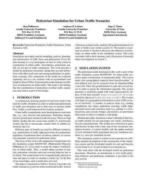
Pedestrian Simulation for Urban Traffic Scenarios
Pedestrian Simulation for Urban Traffic Scenarios
Pedestrian Simulation for Urban Traffic Scenarios

Create successful ePaper yourself
Turn your PDF publications into a flip-book with our unique Google optimized e-Paper software.
Jörg Dallmeyer<br />
Goethe University Frankfurt<br />
P.O. Box 11 19 32<br />
60054 Frankfurt, Germany<br />
dallmeyer@cs.uni-frankfurt.de<br />
<strong>Pedestrian</strong> <strong>Simulation</strong> <strong>for</strong> <strong>Urban</strong> <strong>Traffic</strong> <strong>Scenarios</strong><br />
Keywords: <strong>Pedestrian</strong> <strong>Simulation</strong>, <strong>Traffic</strong> <strong>Simulation</strong>, <strong>Urban</strong><br />
<strong>Scenarios</strong>, GIS<br />
Abstract<br />
<strong>Simulation</strong>s are widely used <strong>for</strong> modeling, analysis, planning,<br />
and optimization of traffic flows and phenomena. Every human<br />
moving in a city participates at least to some extent as<br />
a pedestrian in urban traffic. Nevertheless, pedestrians usually<br />
are not part of traffic simulations. This work presents a<br />
model <strong>for</strong> pedestrian movement, taking into account interactions<br />
with other road users and among pedestrians on pedestrian<br />
crossings. The components of the model are evaluated<br />
separately and in a city scenario with an accumulated road<br />
length of about 550km. Experimental results indicate an influence<br />
of pedestrians on urban traffic. This leads to the finding,<br />
that the consideration of pedestrians in urban traffic simulation<br />
may lead to a gain of knowledge.<br />
1 INTRODUCTION<br />
A continuously growing amount of road users leads to the<br />
need <strong>for</strong> traffic simulation in order to understand phenomena<br />
of traffic jam <strong>for</strong>mation and to find ways to increase traffic<br />
flow. <strong>Traffic</strong> is well understood <strong>for</strong> freeway scenarios.<br />
<strong>Urban</strong> traffic comprehends more heterogeneous road users<br />
like, e.g., cars, bicycles and pedestrians. <strong>Pedestrian</strong> simulation<br />
has gained more attention in the last years. There are high<br />
fidelity models like the social <strong>for</strong>ce model [7], macroscopic<br />
models like [8] or microscopic models built on cellular automatons<br />
like [1].<br />
Different types of models are used <strong>for</strong> different scenarios,<br />
e.g., optimization of traffic light green times <strong>for</strong> pedestrians,<br />
regulation of pedestrian flows at railway stations, or evacuation<br />
and panic scenarios <strong>for</strong> pedestrian safety.<br />
The focus of this work is the integration of pedestrians into<br />
the simulation system MAINS 2 IM (MultimodAl INnercity<br />
SIMulation) [3, 12] in order to study the impact of pedestrians<br />
on urban traffic. Thus, a model taking account of realistic<br />
pedestrian velocities and road crossing behavior has to<br />
be found. The model needs to be computationally efficient in<br />
time and space in order to simulate a whole city. To the best<br />
of our knowledge, such a model does not exist.<br />
The paper is structured as follows: Section 2 describes the<br />
traffic simulation system <strong>for</strong> urban multimodal traffic. Section<br />
Andreas D. Lattner<br />
Goethe University Frankfurt<br />
P.O. Box 11 19 32<br />
60054 Frankfurt, Germany<br />
lattner@cs.uni-frankfurt.de<br />
Ingo J. Timm<br />
University of Trier<br />
54296 Trier, Germany<br />
ingo.timm@uni-trier.de<br />
3 discusses related works, dealing with pedestrian behavior in<br />
order to build a new model (section 4). The model is examined<br />
in section 5. Section 6 discusses the influence of pedestrians<br />
on urban traffic in the simulation system. This work<br />
concludes with a short summary and a discussion of potential<br />
future investigations in section 7.<br />
2 SIMULATION SYSTEM<br />
The pedestrian model developed in this work is part of the<br />
traffic simulation system MAINS 2 IM <strong>for</strong> urban traffic scenarios<br />
under consideration of multimodal traffic. The system<br />
deals with cartographical material from OpenStreetMap 1 . A<br />
user-defined area can be extracted from an OpenStreetMap<br />
(.osm) file. Then, the geoin<strong>for</strong>mation is split into several layers<br />
in order to group the in<strong>for</strong>mation logically. The system<br />
generates a simulation graph with roads represented by objects<br />
of the data structure EdgeIn<strong>for</strong>mation (EI), connected<br />
by objects of NodeIn<strong>for</strong>mation (NI). This is done<br />
with help of a geographical in<strong>for</strong>mation system (GIS) on basis<br />
of GeoTools 2 . A number of analysis steps (e.g., finding<br />
roundabouts, bus routes, pedestrian crossings, traffic lights<br />
and much more) and correction steps (e.g., putting NIs at intersections<br />
and consider bridges and tunnels) are per<strong>for</strong>med<br />
afterwards in order to compute a valid graph.<br />
Multimodal traffic simulation is done with help of three basic<br />
traffic models <strong>for</strong> cars (passenger cars, trucks, and buses),<br />
bicycles and pedestrians. The models are continuous in space<br />
and discrete in time with a time step of one second per simulation<br />
iteration. A control module calls the update methods<br />
of each simulated traffic participant once per simulation iteration,<br />
i.e., once per simulated second.<br />
The simulation system is written in Java and runs on a PC.<br />
More detailed descriptions of the construction of the simulation<br />
system and the developed models <strong>for</strong> cars and bicycles<br />
can be found in [3, 4] and on http://www.mainsim.eu.<br />
This work deals with the developed model <strong>for</strong> pedestrian<br />
movement. There<strong>for</strong>e, an introduction to real world pedestrian<br />
behavior and pedestrian simulation is provided in the<br />
next section.<br />
1 http://www.openstreetmap.org<br />
2 http://www.geotools.org
3 PEDESTRIANS IN URBAN TRAFFIC<br />
<strong>Pedestrian</strong> behavior with regard to the interplay between<br />
road users and pedestrians is dependent on walking velocities<br />
of pedestrians and the road crossing behavior. This section<br />
discusses relevant literature in this field.<br />
The modeling of pedestrians <strong>for</strong> simulation of road networks<br />
has been discussed in [10], proposing a model based<br />
on the vehicle model of VISSIM [15]. The work has the focus<br />
of creating a model with realistic flow-velocity-density<br />
relationships. The shortcoming of this approach is the lack of<br />
two-way traffic, which is important <strong>for</strong> pedestrians.<br />
Different studies on pedestrian walking velocities have<br />
been per<strong>for</strong>med. A review is provided in [11]; in the following<br />
we briefly summarize the most important insights. A<br />
pedestrian p chooses velocity vp with respect to its physical<br />
constitution and whether p walks on a sidewalk or crosses<br />
a road. Crossing velocity is dependent on whether p is crossing<br />
with or without right of way. Additionally, aggressiveness<br />
increases velocity. This is modeled with help of an aggressiveness<br />
factor AF. These major findings have been derived<br />
from several studies monitoring different inner city crossings<br />
at different places [11].<br />
When p attempts to cross a road and is not able to do so due<br />
to road traffic, aggressiveness of p increases. Aggressiveness<br />
affects the walking velocity increasingly, when p finally is<br />
able to cross the road. Referring to [9], this may result in a<br />
maximum velocity increment of 0.5m · s −1 .<br />
The lowest velocities are walked on sidewalks. When<br />
crossing a road, pedestrians tend to speed up. The more hazardous,<br />
the faster. When crossing with right of way, pedestrians<br />
are slower than without right of way. The slowest crossing<br />
velocities are walked on crosswalks. At pedestrian lights, the<br />
waiting time until p is able to cross, increases aggressiveness<br />
and thus velocity.<br />
Each of these cases has to be separated with respect to<br />
the physical constitution of p. Men are slightly faster than<br />
women. The elderly are slower than adults and children. Finally,<br />
different localities lead to different velocities [11].<br />
When a pedestrian p decides to cross a road, p determines<br />
the estimated crossing time [13]<br />
ECT = w<br />
+ AF (1)<br />
vp<br />
where w is the width of the road. The distribution of ECT<br />
among pedestrians has been investigated in [2]. A mean ECT<br />
of ECT ≈ 7s at a road with w = 9.1m and a mean velocity<br />
of v = 1.2m · s −1 leads to a mean AF of AF ≈ −0.58s. This<br />
means, that pedestrians tend to underestimate the time needed<br />
to cross a road.<br />
These findings build the basis <strong>for</strong> our model of pedestrian<br />
movements.<br />
Figure 1. Positioning of pedestrian way objects on intersections.<br />
4 PEDESTRIAN MODEL<br />
The interaction between road users and pedestrians is one<br />
of the central aspects of this work. At first, pedestrians need<br />
to find their way through the simulation graph (subsection<br />
4.1). Interaction with road users will only take place, when<br />
pedestrians cross roads. Thus, a mesoscopic simulation model<br />
<strong>for</strong> pedestrians is introduced in this section. It consists of one<br />
model <strong>for</strong> sidewalk movements (subsection 4.2) and another<br />
model <strong>for</strong> crossing roads at pedestrian crossings (subsection<br />
4.3).<br />
4.1 Routing<br />
The calculation of fastest ways in a graph data structure is a<br />
well known problem. In this work, precalculated routes from<br />
each NIa to each NIb can be used as well as online calculated<br />
routes with help of the A* search algorithm and a probabilitybased<br />
routing mechanism [3]. The result of each algorithm is<br />
a list of EIs and a list of NIs, defining the route to be walked.<br />
In the beginning, it is randomly chosen, which side of the<br />
road a pedestrian stands on. Then, a heuristic algorithm calculates<br />
where to cross the roads during the walk through the<br />
calculated route. Crossing can be done on EIs if there is a sufficient<br />
gap. Additionally, NIs store pedestrian ways, allowing<br />
<strong>for</strong> crossing and pedestrian interaction. Figure 1 shows an intersection.<br />
NI is connected to three EIs : EI1...EI3. Each<br />
dashed line shows the position of a pedestrian way.<br />
A pedestrian has to cross a road, e.g., whenever the following<br />
EI is connected to the current EI into a direction which<br />
is oppositely to the side of the road of the pedestrian. The<br />
pedestrian plan of road crossings privileges pedestrian crossings<br />
and traffic lights (both stored in NIs) over crossing the<br />
road without right of way. Additionally, NIs are used to cross<br />
a road, when crossing on an EI was planned, but not possible.<br />
The models <strong>for</strong> movement and crossing on EIs and NIs are<br />
different. The following sections 4.2 and 4.3 discuss both.<br />
4.2 Sidewalk Movement<br />
With regard to computational efficiency, pedestrians are<br />
simulated with a very simple model when walking on sidewalks.<br />
Let N b a (µ,σ) = min(max(N (µ,σ),a),b) be Gaussian<br />
distributed random number with µ and σ bounded to the<br />
interval [a···b]. Each pedestrian distinguishes his base velocities<br />
<strong>for</strong> sidewalks α, <strong>for</strong> crossing with right of way β and
Figure 2. <strong>Pedestrian</strong> road crossing behavior.<br />
Figure 3. <strong>Pedestrian</strong> way: Measures and lanes.<br />
without right of way χ in � m · s −1� :<br />
α = N 1.75<br />
0.5 (1.33, 0.25) (2)<br />
β = N 1.5·α<br />
α (1.5, 0.5) (3)<br />
χ = N 2·α<br />
α (1.8, 0.5) (4)<br />
These values correspond to the literature review given in [11].<br />
Assuming that smaller interactions between pedestrians on<br />
sidewalks average in time and space, pedestrians move linearly<br />
without interaction with other pedestrians. For determining<br />
ECT , pedestrians are modeled with a base AF of<br />
AF = N +3<br />
−3 (−0.5, 1.0) (5)<br />
In order to cross a road, pedestrian p calculates ECT and enters<br />
the road, when no road user passes the current road position<br />
of p, be<strong>for</strong>e p leaves the road adding a safety distance<br />
of two seconds, as shown in Figure 2. In this example, the<br />
pedestrian will not cross the road, because the car on the right<br />
side will reach its position be<strong>for</strong>e the crossing is done with<br />
the safety distance of 2s.<br />
Crossing a road is done at right angle to the course of the<br />
EI. This is also done in linear movement, because it is unlikely<br />
that interaction with other pedestrians will occur in<br />
these situations. When a pedestrian has started crossing the<br />
road, he will not abort it. When ECT was too low (e.g., because<br />
of a negative AF), road users need to brake in order to<br />
avoid an accident. In these cases, cars are interfered by pedestrians.<br />
4.3 <strong>Pedestrian</strong> Interaction at Crossings<br />
Crossings are the places where pedestrians may interact<br />
with each other, e.g., because several pedestrians may use a<br />
traffic light at once. Thus, a microscopic model <strong>for</strong> pedestrian<br />
movement is used to model pedestrian ways, which are placed<br />
at NIs. Figure 3 shows the composition of pedestrian ways.<br />
1 function update(iteration)<br />
2 if iteration �= iterationOld then<br />
3 iterationOld ← iteration;<br />
4 checkQueue();<br />
5 <strong>for</strong>each <strong>Pedestrian</strong> p do<br />
6 determineUsableLanes())<br />
7 <strong>for</strong>each <strong>Pedestrian</strong> p do<br />
8 chooseLane()<br />
9 <strong>for</strong>each <strong>Pedestrian</strong> p do<br />
10 provideLane()<br />
11 <strong>for</strong>each <strong>Pedestrian</strong> p do<br />
12 calcV()<br />
13 <strong>for</strong>each <strong>Pedestrian</strong> p do<br />
14 f .pos ← f .pos + v;<br />
15 if f .pos ≥ l then<br />
16 f .crossingNI←false;<br />
17 remove(p);<br />
Figure 4. update()-method of way-objects.<br />
The pedestrian way is separated into w lanes (width of the<br />
crossing) and has a length of l (width of the EI to cross).<br />
The proposed model is a space continuous adaptation of the<br />
cellular automaton based model, described in [1], permitting<br />
individual pedestrian velocities, that are not covered by [1].<br />
The model reproduces the interaction between pedestrians,<br />
walking in both directions on the way object. The basic algorithm<br />
is shown in Figure 4.<br />
Whenever a pedestrian p is on a way object w, it <strong>for</strong>wards<br />
the update call to w. Lines 2 and 3 assure that the way is only<br />
updated once per iteration.<br />
Each pedestrian starting a crossing action on a way chooses<br />
its lane at first. If no free lane is available, one lane will be<br />
chosen randomly and the pedestrian will be put into a queue<br />
<strong>for</strong> waiting pedestrians. Line 4 checks <strong>for</strong> pedestrians, waiting<br />
to enter the way and adds them when their lane provides a free<br />
entry position.<br />
Each pedestrian p calculates the magnitude of usable lanes<br />
in the neighborhood N lane of its current lane as shown in<br />
equation 6.<br />
N lane = {p.lane − 1, p.lane, p.lane + 1} ∩ {1,··· ,w} (6)<br />
If possible sidestep positions of different pedestrians interfere<br />
with each other, only one of them may use the corresponding<br />
lane. Due to the avoidance of asynchronisms, the lane choosing<br />
process is divided into an update (line 8) and a provide<br />
(line 10) step.<br />
In line 8, each pedestrian p calculates the gaps g(l) to the<br />
next pedestrian <strong>for</strong> each lane l ∈ N lane in the direction of
travel of p. A rating <strong>for</strong> the lanes ϑ(l) is calculated. It is identical<br />
to g(l) and is halved if the next pedestrian is opposing<br />
traffic. ϑ(l) is limited to a maximum visual range of 10m.<br />
A usage probability of upl is assigned to each lane l ∈<br />
N lane . If the current lane p.lane of p has the maximum ϑ(l)<br />
in all lanes l ∈ N lane , its probability up p.lane will be set to<br />
95% and the residual 5% are split <strong>for</strong> the rest of lanes in<br />
N lane . When the current lane is not with maximum rating,<br />
the probabilities will be computed using equation 7.<br />
pl = ϑ(l)<br />
⎛<br />
⎞<br />
⎝ ∑<br />
l∈Nlane<br />
ϑ(l) ⎠<br />
−1<br />
∀ l ∈ N lane<br />
Each pedestrian randomly selects his new lane with the calculated<br />
probability distribution. <strong>Pedestrian</strong>s thus choose the<br />
lane, promising to be the fastest with respect to the gaps and<br />
opposing pedestrians. This also leads to the <strong>for</strong>mation of trails<br />
in both directions. In line 10, the lane changes are per<strong>for</strong>med.<br />
Each pedestrian calculates his new velocity in line 12 after<br />
equation 8.<br />
v = min(ϑ(p.lane),vmax) (8)<br />
The velocity vmax is the desired velocity of the corresponding<br />
pedestrian. Equation 8 thus leads to desired velocities<br />
bounded to the given gaps on the corresponding lanes. If no<br />
movement is possible because of opposing traffic, the two affected<br />
pedestrians will come to pass with probability ppass =<br />
0.15. The velocity then becomes vpass = 0.25 · vmax.<br />
Lines 14 to 17 per<strong>for</strong>m the movement of each pedestrian<br />
on the way and will remove it when he has reached the end of<br />
the way. The crossingNI-flag of the corresponding pedestrian<br />
is set to false and it will proceed on the other side of road or<br />
new EI in the next iteration.<br />
5 MODEL EVALUATION<br />
This section evaluates the presented model <strong>for</strong> pedestrian<br />
movement. Unless otherwise specified, experiments are done<br />
in the map extract shown in Figure 5. It is a whole city with<br />
about 89,000 inhabitants.<br />
The following subsections 5.1 to 5.3 discuss different parameters<br />
of the pedestrian model.<br />
5.1 <strong>Pedestrian</strong> Velocity<br />
This subsection discusses pedestrian velocities during simulation.<br />
Each pedestrian is enhanced by an analysis module<br />
which protocols velocities and other parameters. The velocities<br />
are separated <strong>for</strong> different incidents. The average velocity<br />
v over the whole walk of each pedestrian is recorded. The<br />
velocities on sidewalks vs, during road crossing with vr and<br />
without vr right of way are recorded as well.<br />
The simulation experiment is done with a warm-up phase<br />
of 2,500 iterations, followed by a measurement phase of<br />
(7)<br />
Figure 6. Distribution of walked velocities.<br />
quantity<br />
quantity<br />
Figure 7. Distribution of aggressiveness.<br />
100,000 iterations. The composition of road users is 50%<br />
cars, 15% bicycles and 25% pedestrians. The amount of traffic<br />
participants is 3,000 which is kept constantly during the<br />
simulation time. Whenever a traffic participant finishes its<br />
travel, a new one will be generated.<br />
As shown in figure 6, the basic effects discussed in section<br />
3 are reproduced by the simulation model (vs < vr < vr). The<br />
measured velocities correspond well to field studies (e.g., [6,<br />
9, 14]).<br />
5.2 <strong>Pedestrian</strong> Aggressiveness<br />
The distribution of aggressiveness of all pedestrians is<br />
recorded <strong>for</strong> the whole simulation. Figure 7 shows a histogram<br />
of the measured data with its probability density function<br />
f and a boxplot.<br />
The shown distribution fits the claimed characteristics in<br />
section 3 and [2, 5]. Figure 8 illustrates the process of becoming<br />
aggressive. In this example, a pedestrian initially has
1224m MAINS<br />
²<br />
Multimodal<br />
Innercity<br />
<strong>Simulation</strong><br />
IM<br />
Multimodale Innerstädtische Straßenverkehrssimulation<br />
Figure 5. Map extract of the city Hanau, Germany with an accumulated length of roads of 548km, amount of EIs: 5,400 and<br />
amount of NIs: 3,878.<br />
Figure 8. Change of aggressiveness over time.<br />
a basic AF of about +0.4, leading to a behavior which is overcautious.<br />
From point a to c, the pedestrian has to wait <strong>for</strong> a<br />
sufficient gap in order to cross a road. His aggressiveness increases<br />
with step size 0.1 · s −1 . This value is not documented<br />
in literature but shows the basic principle. Finally, the crossing<br />
action takes place and the aggressiveness recovers.<br />
5.3 <strong>Pedestrian</strong> Crossings<br />
<strong>Pedestrian</strong> crossings can be analyzed with help of the well<br />
known density (ρ) - mean velocity (v) diagram. The traffic<br />
density of a pedestrian way is calculated as stated in equation<br />
9.<br />
ρ = #pedestrians<br />
C<br />
(9)<br />
The capacity of a pedestrian way is C = w·l ·(0.457) −1 . This<br />
definition is according to [1] which defines cells with width<br />
of 0.457m being fully occupied by one pedestrian.<br />
The ρ - v relation has to be divided according to the amount<br />
of pedestrians walking in both directions, because different<br />
compositions lead to different ρ - v relations.<br />
In order to analyze the relation, a single pedestrian way<br />
object is used <strong>for</strong> simulation. It has five lanes and a length of<br />
l = 10 · 0.457m and thus leads to a realistic pedestrian crossing.<br />
The amount of pedestrians is set to one <strong>for</strong> the first run<br />
and is then increased by 1, until 75 runs have been made.<br />
The results represent average values of 10 replications <strong>for</strong><br />
each setting. After a settlement phase of 500 iterations, 5,000<br />
iterations are used <strong>for</strong> measurements of the average velocity<br />
v of all pedestrians on the way. This procedure is per<strong>for</strong>med<br />
<strong>for</strong> different compositions of directions of travel with<br />
50%,60%,··· ,100% pedestrians walking into one direction<br />
and the rest into the other direction. Figure 9 shows the resulting<br />
diagram.<br />
As can be seen, the maximum density differs in relation to<br />
the composition of walking directions. This results from the<br />
queuing process of the algorithm, shown in figure 4. <strong>Pedestrian</strong>s<br />
walk faster, when there is no opposing traffic and there<strong>for</strong>e<br />
the distances between two subsequent pedestrians increase.<br />
Figure 9 shows that the more balanced the distribution of<br />
walking directions is, the higher the maximum values of ρ<br />
get and the lower the mean velocity v. This is in line with the<br />
results presented in [1] with the difference that only realistic<br />
densities <strong>for</strong> urban traffic road crossings are generated.<br />
It seems to be likely that only parts of the shown figure 9<br />
occur in urban traffic. Hence, another experiment comes back
100<br />
90<br />
80 7060<br />
50<br />
Figure 9. Density velocity relation <strong>for</strong> a pedestrian way.<br />
Figure 10. Density velocity relation <strong>for</strong> all pedestrian ways<br />
in Hanau with relative frequencies fi (ρ).<br />
to the scenario of the city Hanau, shown in figure 5. Every<br />
pedestrian way in the simulation records pairs of data <strong>for</strong> ρ<br />
and v, whenever at least one pedestrian uses it. The measured<br />
values of ρ are grouped into ρ-intervals of width 0.005. This<br />
is done because the huge amount of metered values would<br />
lead to point clouds not enabling to see the underlying effects.<br />
Intervals with less than 11 values are dropped, because<br />
of the risk of overvaluing outliers. The composition of walking<br />
directions is not distinguished <strong>for</strong> this experiment. Figure<br />
10 presents the ρ - v plot <strong>for</strong> the urban simulation.<br />
Additionally, the maximum velocity vmax <strong>for</strong> each group<br />
of ρ and the relative frequencies fi (ρ) are plotted. The curves<br />
300 350 400 450 500<br />
averaged travel time (cars)<br />
0 1.000 2.000 3.000 4.000<br />
#pedestrians<br />
Figure 11. Influence of pedestrians on urban car traffic:<br />
Comparison of travel times of cars with varying amounts of<br />
pedestrians. Each boxplot represents 1,000 values.<br />
<strong>for</strong> v and vmax result from regression analysis. The plot<br />
shows that most results have been generated at low densities.<br />
The values of vmax decrease rapidly with increasing ρ,<br />
because fast pedestrians are hindered by slower ones. A maximum<br />
density of ρmax = 0.16 though suggests that pedestrians<br />
could have an influence on urban road traffic, because of<br />
roads being blocked by pedestrians notably times.<br />
6 INFLUENCE ON URBAN TRAFFIC<br />
The previous section has shown that the developed model<br />
<strong>for</strong> pedestrian movement reproduces the basic effects and coherences<br />
as reported previously in literature. This section investigates<br />
the influence of simulated pedestrians on urban<br />
traffic. Simulating pedestrians leads to additional computational<br />
ef<strong>for</strong>t and there<strong>for</strong>e should only be done if a significant<br />
effect on urban traffic can be shown (or if pedestrians are in<br />
focus of the corresponding study).<br />
The map excerpt presented in figure 5 is used <strong>for</strong> another<br />
experiment. 2,000 simulated road users (95% cars, 5% bicycles)<br />
are created. After a settlement phase of 1,000 iterations,<br />
the travel times of each car leaving the simulation are<br />
recorded. This is done <strong>for</strong> 10,000 iterations and afterwards<br />
averaged to the value t. The amount of road users is kept<br />
constantly through the simulation by adding a new road user,<br />
whenever another one has left the simulation.<br />
The experiment is repeated with identical road users complemented<br />
with 0, 1,000, 2,000, 3,000 and 4,000 pedestrians.<br />
The whole procedure is repeated 1,000 times <strong>for</strong> all five settings.<br />
Figure 11 shows the simulation results.<br />
A tendency to increasing travel times of cars <strong>for</strong> increasing<br />
amounts of pedestrians can be observed. The jitter of the<br />
simulation results also increases, due to the probabilistic sim-
#pedestrians t [s]<br />
0 410.9319<br />
1,000 416.3292<br />
2,000 419.8662<br />
3,000 423.2393<br />
4,000 426.7230<br />
Table 1. Comparison of average travel times of cars t [s]<br />
with different amounts of pedestrians. Averaged over 1,000<br />
simulation runs each.<br />
Hypothesis p p < α *<br />
H a 0 3,157 · 10 −8 �<br />
H b 0 1,478 · 10 −4 �<br />
H c 0 5,37 · 10 −4 �<br />
H d 0 2,803 · 10 −4 �<br />
Table 2. p-value comparisons <strong>for</strong> H a 0 ···Hd 0 .<br />
ulation model. Table 1 compares the average travel times, extracted<br />
from the simulation results.<br />
The results show an increasing travel time <strong>for</strong> cars with increasing<br />
amounts of pedestrians. Let tt (x) be the averaged<br />
travel time obtained with x · 10 3 pedestrians. In order to examine<br />
if an increasing amount of pedestrians results in increasing<br />
travel times <strong>for</strong> cars in the simulation, the hypotheses<br />
shown in equations 10 to 13 are proposed.<br />
H a 0 : tt (0) ≥ tt (1) (10)<br />
H b 0 : tt (1) ≥ tt (2) (11)<br />
H c 0 : tt (2) ≥ tt (3) (12)<br />
H d 0 : tt (3) ≥ tt (4) (13)<br />
The free statistics software R-project 3 is used to run t-tests<br />
in order to find out if significant differences are given in the<br />
measured data. This is done via multiple testing. Each hypothesis<br />
includes at least one simulation result control sample<br />
which is used twice <strong>for</strong> testing. The error level α = 0.05 thus<br />
has to be adjusted after the method of Bonferroni to:<br />
α * = α<br />
= 0.025 (14)<br />
2<br />
The results of the t-tests are shown in table 2. All results<br />
of the statistical tests are significant <strong>for</strong> the selected error<br />
level and there<strong>for</strong>e indicate that a lower number of pedestrians<br />
leads to lower travel times on average:<br />
tt (0) < tt (1) < tt (2) < tt (3) < tt (4) (15)<br />
The results indicate that pedestrians do actually have an influence<br />
on car traffic: <strong>Pedestrian</strong>s slow down car traffic in urban<br />
scenarios in the built simulation system MAINS 2 IM.<br />
3 http://www.r-project.org/<br />
7 SUMMARY AND PERSPECTIVES<br />
The behavior of pedestrians in urban traffic has been discussed.<br />
A bi-modular model <strong>for</strong> pedestrian movement has<br />
been developed, taking account of interaction on pedestrian<br />
crossings. It could be shown that the model can replicate observations<br />
with respect to field studies. The correlation of traffic<br />
density and mean velocity on pedestrian crossings could<br />
be reproduced. The presented model <strong>for</strong> pedestrian movement<br />
deals with individual velocities based on field studies.<br />
The traffic of whole cities can still be simulated under usage<br />
of the presented model.<br />
<strong>Simulation</strong> results indicate that pedestrians slow down road<br />
traffic in a significant range. In future work it should be examined<br />
if an analysis of simulation results leads to an understanding,<br />
how often and how intense these influences take<br />
place in relation to different areas of a simulated city. After<br />
this step, only the effects (cars need to brake, because of<br />
pedestrians using traffic lights, pedestrian crossings or crossing<br />
roads without right of way), but not the originators (the<br />
pedestrians) would be needed to be simulated.<br />
So far, only the influences of pedestrian behavior on cars<br />
has been evaluated. It would be interesting to see how different<br />
intervention actions on urban traffic, e.g., different velocity<br />
restrictions or new traffic-free environments affect pedestrian<br />
travels.<br />
The simulation system is able to readout bus routes from<br />
OpenStreetMap. When a bus stops in real world, several<br />
pedestrians enter and leave the bus and thus strong effects in<br />
road traffic could emerge, especially <strong>for</strong> high traffic densities.<br />
Currently buses are implemented, but pedestrians do net yet<br />
enter or leave them.<br />
<strong>Traffic</strong> engineers only have two main possibilities to enable<br />
pedestrians to cross roads: (a) traffic lights and (b) pedestrian<br />
crossings. These are only two actions. An optimization<br />
method, e.g., Simulated Annealing could be used to minimize<br />
travel times <strong>for</strong> road users under optimization of interchanging<br />
(a) and (b) at the places, one of them is set. This could<br />
also be done in the face of minimization of fuel consumption<br />
and CO2 emissions <strong>for</strong> whole cities.<br />
REFERENCES<br />
[1] Victor J. Blue and Jeffrey L. Adler. Cellular automata<br />
microsimulation <strong>for</strong> modeling bi-directional pedestrian<br />
walkways. Transportation Research Part B: Methodological,<br />
35(3):293 – 312, 2001.<br />
[2] Marcus A. Brewer, Kay Fitzpatrick, Jeffrey A.<br />
Whitacre, and Dominique Lord. Exploration of pedestrian<br />
gap-acceptance behavior at selected locations.<br />
Transportation Research Record: Journal of the Transportation<br />
Research Board, 1982:132–140, 2006. ISSN:<br />
0361-1981.
[3] Jörg Dallmeyer, Andreas D. Lattner, and Ingo J. Timm.<br />
From GIS to Mixed <strong>Traffic</strong> <strong>Simulation</strong> in <strong>Urban</strong> <strong>Scenarios</strong>.<br />
In Jason Liu, Francesco Quaglia, Stephan Eidenbenz,<br />
and Stephen Gilmore, editors, 4th International<br />
ICST Conference on <strong>Simulation</strong> Tools and Techniques,<br />
SIMUTools ’11, Barcelona, Spain, March 22 - 24, 2011,<br />
pages 134–143. ICST (Institute <strong>for</strong> Computer Sciences,<br />
Social-In<strong>for</strong>matics and Telecommunications Engineering),<br />
Brüssel, 2011. ISBN 978-1-936968-00-8.<br />
[4] Jörg Dallmeyer, Andreas D. Lattner, and Ingo J. Timm.<br />
Data Mining <strong>for</strong> Geoin<strong>for</strong>matics: Methods and Applications,<br />
chapter GIS-based <strong>Traffic</strong> <strong>Simulation</strong> using OSM.<br />
Cervone, Guido and Lin, Jessica and Waters, Nigel<br />
(eds.) Springer, 2012. (accepted).<br />
[5] Sanghamitra Das, Charles F. Manski, and Mark D.<br />
Manuszak. Walk or wait? an empirical analysis of street<br />
crossing decisions. Journal of Applied Econometrics,<br />
20(4):529–548, 2005.<br />
[6] K. Fitzpatrick, M. A. Brewer, and S. Turner. Another<br />
look at pedestrian walking speed. In Proceedings of<br />
the 85th Annual Meeting of the Transportation Research<br />
Board, Washington, DC, USA., 2006.<br />
[7] Dirk Helbing and Péter Molnár. Social <strong>for</strong>ce model <strong>for</strong><br />
pedestrian dynamics. Physical Review E, 51(5):4282–<br />
4286, May 1995.<br />
[8] Roger L. Hughes. The flow of human crowds. Annual<br />
Review of Fluid Mechanics, 35(1):169–182, 2003.<br />
[9] Muhammad Moazzam Ishaque. Policies <strong>for</strong> <strong>Pedestrian</strong><br />
Access: Multi-Modal Trade-off analysis using Micro-<br />
<strong>Simulation</strong> Techniques. PhD thesis, Centre <strong>for</strong> Transport<br />
Studies Imperial College London, 2006.<br />
[10] Muhammad Moazzam Ishaque and Robert B Noland.<br />
<strong>Pedestrian</strong> modeling in urban road networks: Issues,<br />
limitations and opportunities offered by microsimulation.<br />
9th Annual Computers in <strong>Urban</strong> Planning<br />
and <strong>Urban</strong> Management, London, page 9, 2005.<br />
[11] Muhammad Moazzam Ishaque and Robert B. Noland.<br />
Behavioural issues in pedestrian speed choice and street<br />
crossing behaviour: A review. In Transport Reviews: A<br />
Transnational Transdisciplinary Journal, volume 28(1),<br />
pages 61–85, Jan 2008.<br />
[12] Andreas D. Lattner, Jörg Dallmeyer, and Ingo J. Timm.<br />
Learning dynamic adaptation strategies in agent-based<br />
traffic simulation experiments. In Ninth German Conference<br />
on Multi-Agent System Technologies (MATES<br />
2011), pages 77–88. Springer: Berlin, LNCS 6973,<br />
Klügl, F.; Ossowski, S., 2011. ISBN: 978-3-642-24602-<br />
9.<br />
[13] Michele Ottomanelli, Leonardo Caggiani, Iannucci<br />
Giuseppe, and Domenico Sassanelli. An adaptive<br />
neuro-fuzzy inference system <strong>for</strong> simulation of pedestrians<br />
behaviour at unsignalized roadway crossings. 14th<br />
Online World Conference on Soft Computing in Industrial<br />
Application, 14, 2009.<br />
[14] Y. Tanaboriboon, S. S. Hwa, and C. H. Chor. <strong>Pedestrian</strong><br />
characteristics study in singapore. Journal of Transportation<br />
Engineering, 112:229–235, 1986.<br />
[15] Rainer Wiedemann. <strong>Simulation</strong> des Straßenverkehrsflusses.<br />
Schriftenreihe des IfV, 8, 1974.<br />
BIOGRAPHY<br />
Jörg Dallmeyer received the bachelor degree (2008) as<br />
well as the master degree (2009) in computer science at the<br />
Goethe University of Frankfurt am Main, Germany. Since<br />
December 2009, he is a PhD student at the chair <strong>for</strong> “In<strong>for</strong>mation<br />
Systems and <strong>Simulation</strong>” at the Goethe University<br />
Frankfurt. His research interests are actor based simulation<br />
<strong>for</strong> the field of traffic simulation under consideration of multimodal<br />
traffic and the building of simulation systems from<br />
geographical in<strong>for</strong>mation.<br />
Andreas D. Lattner received the Diploma degree in computer<br />
science at the University of Bremen, Germany in 2000.<br />
From December 2000 to March 2007 he was working as research<br />
scientist at the Center <strong>for</strong> Computing Technologies<br />
(TZI) at the University of Bremen. In 2007 he obtained the<br />
doctor’s degree <strong>for</strong> his thesis on “Temporal Pattern Mining<br />
in Dynamic Environments”. He works now as a postdoctoral<br />
researcher at the chair <strong>for</strong> “In<strong>for</strong>mation Systems and <strong>Simulation</strong>”<br />
at the Goethe University Frankfurt. His research interests<br />
include knowledge discovery in simulation experiments,<br />
temporal pattern mining, and multi-agent systems.<br />
Ingo J. Timm received Diploma degree (1997), PhD<br />
(2004) and venia legendi (2006) in computer science from<br />
University of Bremen. From 1998 to 2006, he has been PhD<br />
student, research assistant, visiting and senior researcher, and<br />
managing director at University of Bremen, Technical University<br />
Ilmenau, and Indiana University Purdue University<br />
- Indianapolis. In 2006, Ingo Timm was appointed full professor<br />
<strong>for</strong> In<strong>for</strong>mation Systems and <strong>Simulation</strong> at Goethe-<br />
University Frankfurt. Since 2010, he holds a chair <strong>for</strong> Business<br />
In<strong>for</strong>matics at University of Trier. He works on in<strong>for</strong>mation<br />
systems, knowledge-based systems in logistics and<br />
medicine. His special interests lie on strategic management<br />
of autonomous software systems, actor-based simulation and<br />
knowledge-based support to simulation systems.<br />
Acknowledgement This work was made possible by<br />
the MainCampus scholarship of the Stiftung Polytechnische<br />
Gesellschaft Frankfurt am Main.