ASAR Practical 1: SAR Processing and Analyses Tools
ASAR Practical 1: SAR Processing and Analyses Tools
ASAR Practical 1: SAR Processing and Analyses Tools

Create successful ePaper yourself
Turn your PDF publications into a flip-book with our unique Google optimized e-Paper software.
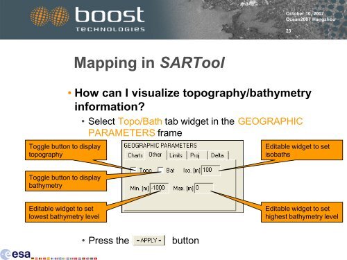
Toggle button to display<br />
topography<br />
Toggle button to display<br />
bathymetry<br />
Editable widget to set<br />
lowest bathymetry level<br />
Mapping in <strong>SAR</strong>Tool<br />
October 10, 2007<br />
Ocean2007 Hangzhou<br />
• How can I visualize topography/bathymetry<br />
information?<br />
• Select Topo/Bath tab widget in the GEOGRAPHIC<br />
PARAMETERS frame<br />
• Press the button<br />
23<br />
Editable widget to set<br />
isobaths<br />
Editable widget to set<br />
highest bathymetry level