Nature, consistance, volume et objet de l'ouvrage ... - Webissimo
Nature, consistance, volume et objet de l'ouvrage ... - Webissimo
Nature, consistance, volume et objet de l'ouvrage ... - Webissimo

You also want an ePaper? Increase the reach of your titles
YUMPU automatically turns print PDFs into web optimized ePapers that Google loves.
A304-DLE-Pièce3-V1b<br />
Pièce 3 – <strong>Nature</strong>, <strong>consistance</strong>, <strong>volume</strong> <strong>et</strong> obj<strong>et</strong> <strong>de</strong> l’ouvrage, rubriques <strong>de</strong> la nomenclature<br />
Sommaire <strong>de</strong>s illustrations<br />
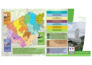
Carte 1 :Localisation du ruisseau du Cléfay ............................................................................. 26<br />
Carte 2 : Localisation du ruisseau <strong>de</strong> la Chattoire .................................................................... 27<br />
Carte 3 : Localisation du ruisseau <strong>de</strong> la Ferme Lemoine .......................................................... 28<br />
Carte 4 : Localisation du ruisseau <strong>de</strong> Marbay ........................................................................... 29<br />
Carte 5 : Localisation du ruisseau <strong>de</strong> la Folie ........................................................................... 30<br />
Carte 6 : Localisation du ruisseau <strong>de</strong> Core ............................................................................... 31<br />
Carte 7 : Localisation du ruisseau <strong>de</strong>s Rej<strong>et</strong>s ........................................................................... 32<br />
Carte 8 : Localisation du ruisseau <strong>de</strong> Praële ............................................................................ 33<br />
Carte 9 : Localisation <strong>de</strong>s casiers <strong>de</strong> la modélisation ............................................................... 34<br />
Carte 10 : Zone inondable Q10 du This après proj<strong>et</strong> ................................................................ 36<br />
Carte 11 : zone inondable Q100 du This après proj<strong>et</strong> .............................................................. 37<br />
Carte 12 : Localisation du ruisseau <strong>de</strong> Margouzy ..................................................................... 38<br />
Carte 13 : Localisation <strong>de</strong>s casiers <strong>de</strong> la modélisation sur la vallée du Thin ............................ 39<br />
Carte 14 : Localisation <strong>de</strong>s ouvrages sur le Thin ...................................................................... 39<br />
Carte 15 : Zone inondable Q10 du Thin après proj<strong>et</strong> ................................................................ 41<br />
Carte 16 : zone inondable Q100 du Thin après proj<strong>et</strong> .............................................................. 42<br />
Carte 17 : zone inondable Q100 du bois <strong>de</strong> la Haye après proj<strong>et</strong> ............................................ 44<br />
Carte 18 : Localisation du ruisseau <strong>de</strong> Hardoncelle.................................................................. 45<br />
Carte 19 : Localisation <strong>de</strong>s casiers <strong>et</strong> <strong>de</strong>s ouvrages sur l’Audry ............................................... 46<br />
Carte 20 : Zone inondable Q10 <strong>de</strong> l’Audry après proj<strong>et</strong> ............................................................ 47<br />
Carte 21 : Zone inondable Q100 <strong>de</strong> l’Audry après proj<strong>et</strong> .......................................................... 48<br />
Carte 22 :Franchissement <strong>de</strong> la Sormonne .............................................................................. 50<br />
Carte 23 : Localisation du ruisseau <strong>de</strong> Mondigny ..................................................................... 51<br />
Carte 24 : Localisation du ruisseau <strong>de</strong> Faux pré ...................................................................... 52<br />
Carte 25 : Localisation du ruisseau du Grand Hongréau .......................................................... 53<br />
Carte 26 : Bassin versant routier n°1 ........................................................................................ 61<br />
Carte 27 : Bassin versant routier n°2 ........................................................................................ 62<br />
Carte 28 : Bassin versant routier n°3 ........................................................................................ 63<br />
Carte 29 : Bassin versant routier n°4 ........................................................................................ 64<br />
Carte 30 : Bassin versant routier n°5 ........................................................................................ 65<br />
Carte 31 : Bassin versant routier n°6 ........................................................................................ 66<br />
Carte 32 : Bassin versant routier n°7 ........................................................................................ 67<br />
Carte 33 : Bassin versant routier n°8 ........................................................................................ 68<br />
Carte 34 : Bassin versant routier n°9 ........................................................................................ 69<br />
Carte 35 : Bassin 9 bis .............................................................................................................. 70<br />
Carte 36 : Bassin versant routier n°10 ...................................................................................... 71<br />
Carte 37 : Bassin versant routier n°11 ...................................................................................... 72<br />
Carte 38 : Bassin versant routier n°12 ...................................................................................... 73<br />
Carte 39 : Bassin versant routier n°13 ...................................................................................... 74<br />
Carte 40 : Bassin versant routier n°14 ...................................................................................... 75<br />
Carte 41 : Bassin versant routier n°15 ...................................................................................... 76<br />
Carte 42 : Bassin versant routier n°16 ...................................................................................... 77<br />
Carte 43 : Bassin versant routier n°17 ...................................................................................... 78<br />
Carte 44 : Bassin versant routier n°18 ...................................................................................... 79<br />
Carte 45 : Bassin versant routier n°19 ...................................................................................... 80<br />
Carte 46 : Bassin versant routier n°20 ...................................................................................... 81<br />
Carte 47 : Plan <strong>de</strong> localisation <strong>de</strong> l’aire <strong>de</strong> Belval ..................................................................... 82<br />
4<br />
Carte 48 : Plan <strong>de</strong> localisation <strong>de</strong> l’aire <strong>de</strong> Rocroi ..................................................................... 83<br />
Carte 49 : Vue en plan rectification du ruisseau <strong>de</strong> Cléfay ........................................................ 85<br />
Carte 50 : Profil en long <strong>et</strong> en travers <strong>de</strong> la rectification du Cléfay ............................................ 86<br />
Carte 51 : Vue en plan rectification du ruisseau <strong>de</strong> la Ferme Lemoine ..................................... 87<br />
Carte 52 : Profil en long <strong>et</strong> en travers rectification du ruisseau <strong>de</strong> la Ferme Lemoine ............... 88<br />
Carte 53: Création d’un nouveau lit pour assurer la continuité du ru <strong>de</strong>s Vaux ......................... 89<br />
Carte 54 : Dérivation du ruisseau <strong>de</strong> Vaux – vue en plan ......................................................... 90<br />
Carte 55 : Profil en long <strong>et</strong> en travers ruisseau <strong>de</strong>s Vaux ......................................................... 91<br />
Carte 56 : Vue en plan dérivation This section courante ........................................................... 94<br />
Carte 57 : Profil en long dérivation du This section courante .................................................... 95<br />
Carte 58 : Vue en plan dérivation du This barreau amont ......................................................... 96<br />
Carte 59 : Profil en long du This barreau amont ........................................................................ 97<br />
Carte 60 : This Profil en travers 2 .............................................................................................. 98<br />
Carte 61 : This Profil en travers 2bis ......................................................................................... 99<br />
Carte 62 : This Profil en travers 3 ............................................................................................ 100<br />
Carte 63 : This Profil en travers 4 ............................................................................................ 101<br />
Carte 64 : This Profil en travers 5 ............................................................................................ 102<br />
Carte 65 : This Profil en travers 6 ............................................................................................ 103<br />
Carte 66 : This Profil en travers 7 ............................................................................................ 104<br />
Carte 67 : This Profil en travers 8 ............................................................................................ 105<br />
Carte 68 : This Profil en travers 9 ............................................................................................ 106<br />
Carte 69 : This Profil en travers 10 .......................................................................................... 107<br />
Carte 70 : This Profil en travers 11 .......................................................................................... 108<br />
Carte 71 : Vue en plan dérivation du ruisseau du Thin ............................................................ 111<br />
Carte 72 : Profil en long dérivation du Thin ............................................................................. 112<br />
Carte 73 : Thin Profil en travers 1 ............................................................................................ 113<br />
Carte 74 : Thin Profil en travers 2 ............................................................................................ 114<br />
Carte 75 : Thin Profil en travers 3 ............................................................................................ 115<br />
Carte 76 : Thin Profil en travers 4 ............................................................................................ 116<br />
Carte 77 : Thin profil en travers 5 ............................................................................................ 117<br />
Carte 78 : Rétablissement <strong>et</strong> dérivation du Grand Hongréau .................................................. 119<br />
Carte 79 : Profil en long Grand Hongréau ............................................................................... 120<br />
Carte 80 : Profils en travers rectification Grand Hongréau ...................................................... 121<br />
Carte 81 : Zone <strong>de</strong> compensation <strong>de</strong>s zones inondables Secteur du This .............................. 124<br />
Carte 82 : Zone <strong>de</strong> compensation <strong>de</strong>s zones inondables Secteur du Thin ............................. 126<br />
Carte 83 : Zone <strong>de</strong> compensation <strong>de</strong>s zones inondables Secteur du Bois <strong>de</strong> la Haye ........... 128<br />
Carte 84 : Zone <strong>de</strong> compensation <strong>de</strong>s zones inondables Secteur du <strong>de</strong> l’Audry .................... 130<br />
Carte 85 : Localisation <strong>de</strong>s zones humi<strong>de</strong>s – secteur <strong>de</strong> l’échangeur <strong>de</strong> la Chattoire ............. 132<br />
Carte 86 : Localisation <strong>de</strong>s secteurs drainés au niveau du secteur <strong>de</strong> l’échangeur <strong>de</strong> la<br />
Chattoire .................................................................................................................................. 132<br />
Carte 87 : Localisation <strong>de</strong>s zones humi<strong>de</strong>s – secteur du Marbay <strong>et</strong> <strong>de</strong> Praële ....................... 133<br />
Carte 88 : Localisation <strong>de</strong>s secteurs drainés au niveau du secteur du Marbay <strong>et</strong> <strong>de</strong> Praële .. 133<br />
Carte 89 : Localisation <strong>de</strong>s zones humi<strong>de</strong>s – secteur <strong>de</strong> l’Audry ............................................ 134<br />
Carte 90 : Localisation <strong>de</strong>s zones humi<strong>de</strong>s – secteur <strong>de</strong> la Sormonne <strong>et</strong> <strong>de</strong> Mondigny .......... 134<br />
Carte 91 : Localisation <strong>de</strong>s zones humi<strong>de</strong>s – secteur du plateau <strong>de</strong> Rocroi ........................... 135<br />
Carte 92 : Localisation <strong>de</strong>s secteurs drainés au niveau du plateau <strong>de</strong> Rocroi ........................ 135