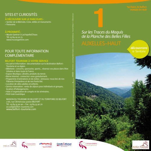
1. Sur les traces du maquis de la Planche des belles filles
1. Sur les traces du maquis de la Planche des belles filles
1. Sur les traces du maquis de la Planche des belles filles

You also want an ePaper? Increase the reach of your titles
YUMPU automatically turns print PDFs into web optimized ePapers that Google loves.
SITES ET CURIOSITÉS<br />
À DÉCOUVRIR SUR LE PARCOURS :<br />
<br />
<br />
À PROXIMITÉ :<br />
<br />
Tél. 03 84 29 20 73<br />
www.museegantner.com<br />
POUR TOUTE INFORMATION<br />
COMPLÉMENTAIRE<br />
BELFORT TOURISME À VOTRE SERVICE<br />
<br />
Tourisme et sa région.<br />
<br />
Urbaine et dans toute <strong>la</strong> France.<br />
<br />
<br />
<br />
Flâneries Printanières et <strong>de</strong> nos Festiv’été.<br />
<br />
<br />
location d’hébergements.<br />
<br />
<br />
MAISON DU TOURISME DE BELFORT ET DU TERRITOIRE DE BELFORT<br />
<br />
<br />
accueil@belfort-tourisme.com<br />
www.belfort-tourisme.com<br />
(20223) - Crédits photos : photothèque Belfort Tourisme- G Daumas - Conseil Général 90 – Vincent Thiébaut - X - Édition mai 2011<br />
1<br />
<strong>Sur</strong> <strong>les</strong> Traces <strong>du</strong> Maquis<br />
<strong>de</strong> <strong>la</strong> P<strong>la</strong>nche <strong>de</strong>s Bel<strong>les</strong> Fil<strong>les</strong><br />
AUXELLES-HAUT<br />
Territoire <strong>de</strong> Belfort<br />
VOSGES DU SUD<br />
découvrons<br />
le Territoire
© I.G.N. Scan 25<br />
© Extrait carte IGN 3520<br />
ET TOP 25 Ballon d’Alsace<br />
Echelle : 1 : 25 000<br />
© Autorisation Club Vosgien 110201<br />
pour l’utilisation <strong>de</strong>s signes <strong>de</strong> balisage<br />
© Club Vosgien - © FFRP pour <strong>les</strong> GR<br />
© IGN-PARIS 2011 - Autorisation N° 5211-019<br />
Repro<strong>du</strong>ction interdite<br />
1<br />
<strong>Sur</strong><br />
<strong>les</strong> <strong>traces</strong><br />
<strong>du</strong> Maquis<br />
<strong>de</strong> <strong>la</strong> P<strong>la</strong>nche<br />
<strong>de</strong>s Bel<strong>les</strong> Fil<strong>les</strong><br />
5<br />
Départ :<br />
par <strong>les</strong> D465 et D13.<br />
Parking : avant <strong>la</strong> Mairie d’AUXELLES-HAUT<br />
Balisage :<br />
Distance :Dénivelé positif 833m Dénivelé total : 1666m<br />
4<br />
3<br />
2<br />
6<br />
7<br />
8<br />
1
Altitu<strong>de</strong> en m<br />
1300<br />
1200<br />
1100<br />
1000<br />
900<br />
800<br />
700<br />
600<br />
500<br />
400<br />
300<br />
Col <strong>du</strong> Querty<br />
Auxel<strong>les</strong>-Haut<br />
Auberge <strong>de</strong> <strong>la</strong><br />
Haute-P<strong>la</strong>nche<br />
1 2 3 4 5 6 7<br />
Abris <strong>du</strong><br />
Mont Menard<br />
Auxel<strong>les</strong>-Haut<br />
Distance en km<br />
8 9 10 11 12<br />
<br />
1 Départ : <br />
Étangs. Après <strong>les</strong><br />
<br />
<br />
plus régulièrement et parvient bientôt au col <strong>du</strong> Querty.<br />
2 <br />
<br />
<br />
<br />
<br />
chalets.<br />
3 <br />
<br />
<br />
4 <br />
le suivre à gauche. Après être passé sous l’une <strong>de</strong>s remontées mécani-<br />
<br />
5 <br />
<br />
<br />
<br />
sur une crête puis revient dans le Territoire <strong>de</strong> Belfort. Après une <strong>de</strong>scente<br />
<br />
bel<strong>les</strong> hêtraies. Il parvient à un espace découvert : c’est <strong>la</strong> Lan<strong>de</strong> <strong>du</strong> Mont<br />
<br />
6 <br />
<br />
7 <br />
<br />
le monument <strong>du</strong> maire Lamboley.<br />
8 <br />
Descendre en direction <strong>de</strong> l’église et <strong>du</strong> parking par <strong>la</strong> rue <strong>de</strong> <strong>la</strong> Stolle 1 .<br />
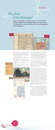
Les F.F.I. (Forces Françaises <strong>de</strong> l’Intérieur)<br />
<strong>de</strong> <strong>la</strong> P<strong>la</strong>nche <strong>de</strong>s Bel<strong>les</strong> Fil<strong>les</strong><br />
Vous allez emprunter le ‘chemin <strong>de</strong> <strong>la</strong> mémoire’ réalisé par l’association <strong>du</strong><br />
Souvenir Français. Au cours <strong>de</strong> cette promena<strong>de</strong> vous découvrirai un haut<br />
<br />
installés à côté <strong>de</strong>s stèl<strong>les</strong> ou sont tombés <strong>les</strong> résistants vous raconteront<br />
<br />
<br />
<br />
<br />
en un véritable camp retranché. Bientôt point <strong>de</strong> mire <strong>de</strong> l’occupant<br />
<br />
<br />
Le 19 septembre 1944 a lieu un assaut général <strong>du</strong> massif.<br />
<br />
<br />
<br />
<br />
<br />
Française.<br />
La Lan<strong>de</strong> <strong>du</strong> Mont Ménard<br />
<br />
<br />
<br />
Par <strong>la</strong> route puis par un mauvais chemin on parvient à ce versant<br />
<br />
<br />
permettre le pâturage <strong>de</strong>s chèvres et <strong>de</strong> quelques vaches. À partir <strong>de</strong> <strong>la</strong><br />
<br />
<br />
ème ème siècle).<br />
<br />
<br />
<br />
<br />
y paissent maintenant en pério<strong>de</strong> estivale.
Vosges<br />
Haute-<br />
Saône<br />
1<br />
2<br />
3<br />
4<br />
5<br />
6<br />
7<br />
8<br />
9<br />
10<br />
11<br />
12<br />
13<br />
1<br />
FRANCHE-<br />
COMTE<br />
LORRAINE<br />
18<br />
2<br />
17<br />
Ballon<br />
d’Alsace 16<br />
21<br />
14 Giromagny 12<br />
25 26 Malsaucy<br />
27<br />
19<br />
9<br />
6 7<br />
5<br />
3<br />
Belfort<br />
24 Gare<br />
23<br />
TGV<br />
8<br />
Doubs<br />
CONTREFORTS<br />
DU JURA<br />
<strong>Sur</strong> <strong>les</strong> Traces <strong>du</strong> Maquis<br />
<strong>de</strong> <strong>la</strong> P<strong>la</strong>nche <strong>de</strong>s Bel<strong>les</strong> Fil<strong>les</strong><br />
La Ba<strong>la</strong><strong>de</strong> <strong>de</strong>s Points <strong>de</strong> Vue<br />
L’Ouvrage <strong>de</strong> <strong>la</strong> Côte d’Essert<br />
Le Sentier <strong>de</strong>s Bornes<br />
Du Sentier <strong>de</strong> <strong>la</strong> Roselière à celui<br />
<strong>de</strong>s Hauts <strong>de</strong> Belfort<br />
La Promena<strong>de</strong> en Forêt <strong>du</strong> Mont<br />
Le Tour <strong>de</strong> Haut Bois<br />
Du Bois <strong>de</strong> <strong>la</strong> Duchesse<br />
à <strong>la</strong> Bourbeuse<br />
Dans le Salbert<br />
Les Hautes Bornes<br />
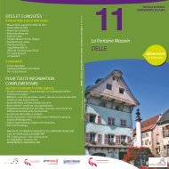
La Fontaine Mazarin<br />
Du Fayé à <strong>la</strong> Tête le Moine<br />
<strong>Sur</strong> le Chemin<br />
<strong>de</strong>s Moines <strong>de</strong> Cluny<br />
VOSGES DU SUD<br />
4<br />
10<br />
13<br />
15<br />
Delle<br />
11<br />
22<br />
14<br />
15<br />
16<br />
17<br />
18<br />
19<br />
20<br />
21<br />
22<br />
23<br />
24<br />
25<br />
26<br />
27<br />
PLAINE DE BELFORT<br />
SUISSE<br />
Fiches randonnées<br />
également disponib<strong>les</strong><br />
Haut-Rhin<br />
ALSACE<br />
20<br />
SUNDGAU<br />
BELFORTAIN<br />
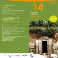
Le Sentier <strong>de</strong>s Mines<br />
Le Sentier <strong>du</strong> Verchat<br />
<strong>Sur</strong> <strong>les</strong> Hauts <strong>de</strong> Lama<strong>de</strong>leine<br />
Val <strong>de</strong>s Anges<br />
La Haute Vallée <strong>de</strong> <strong>la</strong> Savoureuse<br />
Le Tour <strong>du</strong> Ballon<br />
La Ba<strong>la</strong><strong>de</strong> <strong>de</strong>s Champs Cerisiers<br />
Le Tour <strong>de</strong> Rechesy<br />
Le Baerenkopf <strong>de</strong>puis<br />
Rougemont-le-Château<br />
<strong>Sur</strong> <strong>les</strong> Pas <strong>de</strong> St-Dizier-l’Evêque<br />
Bermont - Le Bermontour<br />
Dorans - Le Sentier <strong>de</strong>s Fontaines<br />
Les Vies <strong>de</strong>s Evettes<br />
La Promena<strong>de</strong> <strong>du</strong> Verbote<br />
Le Tour <strong>du</strong> Malsaucy<br />
L’ensemble <strong>de</strong>s fiches est téléchargeable et imprimable gratuitement sur le site<br />
Internet <strong>de</strong> <strong>la</strong> Maison <strong>du</strong> Tourisme www.belfort-tourisme.com et sur le site <strong>du</strong><br />
Conseil Général <strong>du</strong> Territoire <strong>de</strong> Belfort www.cg90.fr<br />
Les 15 fiches <strong>de</strong> couleur ont été éditées et sont en vente à <strong>la</strong> Maison <strong>du</strong><br />
Tourisme <strong>de</strong> Belfort et <strong>du</strong> Territoire <strong>de</strong> Belfort.<br />
RECOMMANDATIONS AUX RANDONNEURS<br />
Rythme <strong>de</strong> marche<br />
<br />
400 m <strong>de</strong> dénivelé par heure en <strong>de</strong>scente.<br />
Pensez y<br />
<br />
vous écarter <strong>du</strong> parcours balisé. Vous allez emprunter <strong>de</strong>s sentiers situés sur<br />
<strong>de</strong>s propriétés privées. Respectez <strong>les</strong> clôtures et prenez gar<strong>de</strong> au bétail. De<br />
nombreuses espèces végéta<strong>les</strong> sont rares ou protégées. Evitez <strong>la</strong> cueillette<br />
<strong>de</strong>s fleurs et respectez <strong>les</strong> arbres. Notre région est riche en faune à plumes et<br />
<br />
<br />
<br />
<br />
<br />
manger. Prévoir une trousse <strong>de</strong> secours. Les itinéraires sont susceptib<strong>les</strong> <strong>de</strong><br />
subir <strong>de</strong>s modifications ne figurant pas sur <strong>les</strong> fiches.<br />
ADRESSES UTILES<br />
Maison <strong>du</strong> Tourisme <strong>de</strong> Belfort<br />
et <strong>du</strong> Territoire <strong>de</strong> Belfort<br />
<br />
<br />
www.belfort-tourisme.com<br />
accueil@belfort-tourisme.com<br />
Office <strong>de</strong> Tourisme <strong>de</strong> Delle<br />
Halle <strong>de</strong>s cinq fontaines - 90100 Delle<br />
<br />
omt@<strong>de</strong>lle.fr<br />
Point informations / tourisme<br />
<strong>du</strong> ballon d’Alsace<br />
Tél. 03 29 25 20 38<br />
infotourisme@smiba.fr<br />
Comité départemental <strong>de</strong> randonnée –<br />
Territoire <strong>de</strong> Belfort<br />
<br />
Tél. 09 75 90 16 86<br />
co<strong>de</strong>rando.90@orange.fr<br />
<br />
Répon<strong>de</strong>ur Météo France<br />
Tél. 0 899 71 02 90<br />
www.meteo.fr<br />
Club Alpin Français (CAF)<br />
<br />
Tél. 03 84 29 03 11<br />
<br />
Club Sous-Vosgien <strong>de</strong>s Sentiers<br />
Caserne n°4 90200 Giromagny<br />
Mr. Dusouillez Michel – Prési<strong>de</strong>nt<br />
Tél. 03 84 21 39 47<br />
Compagnie Belfort Loisirs (CBL)<br />
Tél. 03 84 22 63 08<br />
<br />
www.cbl-belfort.com<br />
Découverte <strong>de</strong>s 3 vallées <strong>du</strong> Ballon<br />
d’Alsace<br />
<br />
Tél. 06 80 03 34 40 - 03 84 23 15 12<br />
<strong>de</strong>couverte3vallees@wanadoo.fr<br />
www.<strong>de</strong>couvertemontagne.net<br />
Montagne Plus<br />
M. Samuel COUDOURNAC<br />
Tél. 03 69 19 99 16 - 06 64 64 29 79<br />
contactmontagneplus@orange.fr<br />
www.montagneplus.fr<br />
RandoSudVosges<br />
M. Gérard DEMANGE<br />
06 87 98 94 80 - 03 29 25 35 83<br />
gerard@randosudvosges.com<br />
www.randosudvosges.com<br />
Compagnie <strong>de</strong>s Accompagnateurs en<br />
Montagne Massif <strong>de</strong>s Vosges Bureau <strong>du</strong><br />
Ballon d’Alsace<br />
M. Jean-Louis FRETTI<br />
06 70 55 73 37<br />
<br />
www.rando-vosges.com<br />
« Document non contractuel. Les informations présentes<br />
dans ce dépliant sont va<strong>la</strong>b<strong>les</strong> à l’heure où nous le<br />
rédigeons et sont susceptib<strong>les</strong> d’évoluer. Merci <strong>de</strong> nous<br />
<br />
qui seront intégrées à <strong>la</strong> prochaine réédition ».