Présentation du PCDN et carte du réseau écologique de l'entité d ...
Présentation du PCDN et carte du réseau écologique de l'entité d ...
Présentation du PCDN et carte du réseau écologique de l'entité d ...

Create successful ePaper yourself
Turn your PDF publications into a flip-book with our unique Google optimized e-Paper software.
PROJETS EN COURS ET RÉALISÉS<br />
BALADES organisées dans différents endroits <strong>de</strong> l’entité afin<br />
<strong>de</strong> perm<strong>et</strong>tre aux riverains <strong>de</strong> découvrir leur environnement naturel<br />
<strong>et</strong> <strong>de</strong> les sensibiliser au <strong>réseau</strong> <strong>écologique</strong>.<br />
Sensibilisation aux espèces arbustives indigènes, aux fleurs<br />
nectarifères <strong>et</strong> à la faune qui en dépend (oiseaux, papillons,<br />
insectes, hérissons...): diffusion d’un fol<strong>de</strong>r, <strong>de</strong> brochures lors<br />
d’animations diverses.<br />
Aménagement <strong>de</strong> différents sites afin <strong>de</strong> maintenir ou <strong>de</strong><br />
rétablir le <strong>réseau</strong> <strong>écologique</strong>: plantation <strong>de</strong> haies, d’arbres fruitiers<br />
hautes tiges <strong>et</strong> valorisation par <strong>de</strong>s panneaux didactiques.<br />
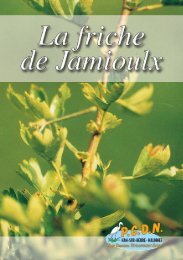
Gestion <strong>et</strong> protection <strong>de</strong> la friche <strong>de</strong> la gare <strong>de</strong> Jamioulx;<br />
création d’un circuit didactique ouvert à tous.<br />
Mise en valeur <strong>de</strong>s abrupts <strong>de</strong> la carrière <strong>de</strong> Cour-sur-Heure:<br />
zone calcaire thermophile d’une richesse floristique remarquable.<br />
Favoriser <strong>et</strong> protéger les batraciens en maintenant <strong>de</strong>s mares<br />
dans le milieu forestier <strong>et</strong> en menant une campagne <strong>de</strong> protection<br />
lors <strong>de</strong>s migrations.<br />
Ces proj<strong>et</strong>s sont élaborés <strong>et</strong> réalisés avec d’autres associations<br />
telles que les syndicats d’initiative, les écoles, les cercles horticoles,<br />
les pépiniéristes, les associations sportives, l’administration<br />
communale, la Région wallonne <strong>et</strong> toute autre personne ou<br />
association passionnée <strong>de</strong><br />
Nature...<br />
Donnons un avenir<br />
à nos enfants...
Photo: Iles <strong>de</strong> Vie<br />
Photo: Iles <strong>de</strong> Vie<br />
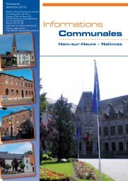
Le Plan Communal<br />
<strong>de</strong> Développement <strong>de</strong> la Nature (<strong>PCDN</strong>)<br />
<strong>de</strong> Ham-sur-Heure-Nalinnes!<br />
LE P.C.D.N.: UN OBJECTIF<br />
LE P.C.D.N. a pour objectif <strong>de</strong><br />
recréer <strong>et</strong> maintenir la diversité <strong>de</strong>s<br />
milieux biologiques qui nous<br />
entourent tout en respectant <strong>et</strong> en<br />
favorisant le développement<br />
économique <strong>et</strong> social <strong>de</strong>s habitants.<br />
Il vise à sauvegar<strong>de</strong>r <strong>et</strong> à améliorer<br />
le patrimoine naturel <strong>et</strong> paysager en<br />
concertation <strong>et</strong> en harmonie avec ce<br />
développement.<br />
D’autre part, la nature n’est pas<br />
seulement emprisonnée dans <strong>de</strong>s<br />
réserves naturelles ou <strong>de</strong>s domaines<br />
publics, elle côtoie chaque activité<br />
<strong>de</strong> l’homme, chaque lieu, <strong>du</strong> jardin à<br />
la cour <strong>de</strong> l’usine, <strong>du</strong> bord <strong>de</strong> la<br />
route à la toiture émoussée <strong>du</strong><br />
voisin. Et, avant tout, elle est<br />
l’affaire <strong>de</strong> TOUS.<br />
Le <strong>PCDN</strong> propose une<br />
citoyenn<strong>et</strong>é active, un partenariat<br />
<strong>de</strong> personnes amenant chacun sa<br />
propre expertise.<br />
LE P.C.D.N.<br />
CHEZ NOUS À<br />
HAM-SUR-HEURE -<br />
NALINNES<br />
C’EST en 1997 que la<br />
candidature <strong>de</strong> notre commune a été<br />
r<strong>et</strong>enue par la Région wallonne pour<br />
développer un P.C.D.N. sur son<br />
territoire.<br />
Il s’ouvre à tout un chacun:<br />
l’administration communale, <strong>de</strong>s<br />
particuliers intéressés par la nature,<br />
<strong>de</strong>s professionnels, forestiers ou<br />
agriculteurs, <strong>de</strong>s ASBL, <strong>de</strong>s<br />
associations, <strong>et</strong>c.<br />
Chacun y est toujours le<br />
bienvenu.<br />
LE P.C.D.N. POSSÈDE<br />
UN OUTIL PRÉCIEUX<br />
POUR bien orienter les actions<br />
<strong>du</strong> P.C.D.N., il était indispensable <strong>de</strong><br />
réaliser un état <strong>de</strong>s lieux <strong>de</strong>s<br />
richesses naturelles <strong>de</strong> notre<br />
commune.<br />
Le Laboratoire<br />
d’Ecologie <strong>de</strong>s Prairies<br />
(UCL) a été chargé <strong>de</strong><br />
réaliser en 1998 un<br />
inventaire <strong>du</strong> patrimoine<br />
naturel <strong>et</strong> paysager <strong>de</strong><br />
l’entité.<br />
C<strong>et</strong> inventaire a<br />
débouché sur l’élaboration<br />
d’un rapport d’étu<strong>de</strong> <strong>et</strong> <strong>de</strong><br />
<strong>de</strong>ux <strong>carte</strong>s, l’une<br />
reprenant les richesses <strong>du</strong><br />
patrimoine naturel <strong>de</strong><br />
l’entité, l’autre<br />
représentant les richesses<br />
<strong>du</strong> patrimoine paysager. A partir <strong>de</strong><br />
ce rapport <strong>et</strong> <strong>de</strong> ces <strong>de</strong>ux <strong>carte</strong>s, <strong>de</strong>s<br />
plans d’actions peuvent ensuite être<br />
proposés.<br />
NOTRE entité a la chance <strong>de</strong><br />
possé<strong>de</strong>r une gran<strong>de</strong> diversité <strong>de</strong><br />
milieux naturels (forêts, carrières,<br />
prairies humi<strong>de</strong>s...). C<strong>et</strong>te variété <strong>de</strong><br />
milieux offre nourriture, abri <strong>et</strong> site<br />
<strong>de</strong> repro<strong>du</strong>ction à <strong>de</strong> nombreuses<br />
espèces animales <strong>et</strong> végétales<br />
déterminées.<br />
Vous trouverez à l’intérieur <strong>de</strong> ce<br />
document une repro<strong>du</strong>ction<br />
Carte <strong>de</strong>s couloirs <strong>de</strong> liaison<br />
QU’EST ce qu’un couloir<br />
<strong>de</strong> liaison<br />
Pour décrire les possibilités<br />
<strong>de</strong> déplacement <strong>de</strong>s populations<br />
d’espèces sauvages au sein d’un<br />
<strong>réseau</strong> <strong>écologique</strong>, on parle <strong>de</strong><br />
couloirs <strong>de</strong> liaison.<br />
Les différents couloirs<br />
<strong>de</strong> liaison sont repris sur<br />
c<strong>et</strong>te <strong>carte</strong>.<br />
Dessus<br />
les Viviers<br />
THUIN<br />
GOZEE<br />
Ruisseau<br />
<strong>de</strong> Marbisoeul<br />
HAM-SUR-HEURE<br />
Florenchamp<br />
COUR-SUR-HEURE<br />
Au <strong>de</strong>ssus<br />
<strong>de</strong> la Pasture<br />
MARBAIX<br />
LA-TOUR<br />
Coron St-Anne<br />
MONTIGNY-LE-TILLEUL<br />
Le Vivier<br />
Try à la Flochère<br />
*<br />
Ruisseau<br />
<strong>de</strong> Biersenrieu<br />
Les Minières<br />
WALCOURT<br />
Gomerée<br />
*<br />
*<br />
Couloirs <strong>de</strong> liaison existants ou potentiels.<br />
*<br />
simplifiée <strong>de</strong> la <strong>carte</strong> <strong>du</strong> <strong>réseau</strong><br />
<strong>écologique</strong> <strong>et</strong> <strong>du</strong> patrimoine naturel<br />
<strong>de</strong> l’entité.<br />
Les zones possédant la plus<br />
gran<strong>de</strong> diversité biologique sont<br />
marquées par une étoile. Six sont<br />
illustrées, chacune représentant un<br />
milieu bien particulier.<br />
*<br />
Bois <strong>de</strong> la Forêt<br />
*<br />
Bois communal<br />
*<br />
*<br />
Carrière <strong>de</strong> Cour-sur-Heure<br />
*<br />
**<br />
*<br />
Taille à<br />
Franes<br />
BERZEE<br />
*<br />
MONT-SUR-MARCHIENNE<br />
*<br />
Carrière<br />
<strong>de</strong> Jamioulx<br />
*<br />
JAMIOULX<br />
Ruisseau<br />
<strong>du</strong> Cheneau<br />
Fontenelle<br />
Hob<strong>et</strong>te<br />
*<br />
Le Moulin<br />
THY-LE-CHATEAU<br />
P<strong>et</strong>rias<br />
NALINNES<br />
Haut Bruard<br />
Ruisseau<br />
<strong>du</strong> Moulin<br />
*<br />
*<br />
MARCINELLE<br />
*<br />
Couture<br />
Pairain<br />
Haies<br />
La Faisan<strong>de</strong>rie<br />
LE RÉSEAU ÉCOLOGIQUE:<br />
C’EST QUOI<br />
Pour en savoir plus:<br />
IL peut se définir comme<br />
l’ensemble <strong>de</strong>s habitats susceptibles<br />
<strong>de</strong> fournir un milieu <strong>de</strong> vie,<br />
temporaire ou permanent, aux<br />
espèces animales <strong>et</strong> végétales<br />
sauvages, perm<strong>et</strong>tant d’assurer leur<br />
survie à long terme.<br />
Ce <strong>réseau</strong> est constitué:<br />
- <strong>de</strong> ZONES CENTRALES (ex.: réserves<br />
naturelles, zones <strong>de</strong> grand intérêt<br />
biologique) où la conservation <strong>de</strong> la<br />
nature est prioritaire<br />
- <strong>de</strong> ZONES DE DÉVELOPPEMENT<br />
(ex.: une carrière en exploitation,<br />
une forêt <strong>de</strong> pro<strong>du</strong>ction) où la<br />
préservation <strong>de</strong>s espèces <strong>et</strong> le<br />
facteur économique sont<br />
compatibles<br />
- <strong>de</strong> COULOIRS DE LIAISONS<br />
(schématisés ci-contre) (ex.: haie,<br />
bosqu<strong>et</strong>, ban<strong>de</strong> boisée, bords <strong>de</strong><br />
route...) perm<strong>et</strong>tant <strong>de</strong> relier les<br />
autres zones entre elles <strong>et</strong> assurer<br />
ainsi la libre circulation <strong>de</strong>s espèces<br />
animales <strong>et</strong> végétales sauvages <strong>et</strong><br />
<strong>de</strong> ce fait leur survie!<br />
Carrière<br />
<strong>de</strong> Borgnery<br />
La Ferrée<br />
*<br />
*<br />
*<br />
Ruisseau<br />
<strong>du</strong> Moulin<br />
Tingre-<br />
Mont<br />
Ruisseau<br />
<strong>de</strong> la Praile<br />
Ruisseau<br />
<strong>de</strong>s Monts<br />
Monts<br />
GOURDINNE<br />
vous pouvez consulter l’étu<strong>de</strong> <strong>et</strong> la <strong>carte</strong> <strong>du</strong> <strong>réseau</strong><br />
<strong>écologique</strong> au service Environnement <strong>de</strong> l’Administration<br />
communale <strong>de</strong> Ham-sur-Heure-Nalinnes<br />
Chemin d’Oultre Heure 20 - 6120 Ham-sur-Heure-Nalinnes<br />
Tél. 00 32 (0)71 22 93 59<br />
Intern<strong>et</strong>: www.ham-sur-heure-nalinnes.be<br />
Ruisseau<br />
Ferrée<br />
Le Bultia<br />
LOVERVAL<br />
TARCIENNE<br />
GERPINNES
<strong>de</strong>s Saules<br />
Rue Grogerie<br />
La <strong>carte</strong><br />
<strong>du</strong> <strong>réseau</strong> <strong>écologique</strong><br />
Zone arborée:<br />
vallon principal <strong>de</strong> la Taille à Frasnes<br />
Le vallon principal <strong>de</strong> la Taille à Frasnes est<br />
constitué d’un milieu typique <strong>et</strong> remarquable: une<br />
érablière <strong>de</strong> ravin. On y trouve <strong>de</strong> nombreuses<br />
espèces végétales comme le dryoptéris<br />
dilaté, la fougère mâle, la fougère femelle,<br />
l’orme champêtre, la mélique penchée, le<br />
frêne, l’érable sycomore, <strong>et</strong>c.<br />
Zone herbeuse: la Praie<br />
C<strong>et</strong>te gran<strong>de</strong> zone marécageuse<br />
longeant le chemin <strong>de</strong> fer est remarquable<br />
par son éten<strong>du</strong>e <strong>et</strong> par la présence <strong>de</strong><br />
nombreuses espèces typiques <strong>de</strong>s milieux<br />
humi<strong>de</strong>s, comme l’iris jaune, la reine-<strong>de</strong>sprés,<br />
le lychnis fleur-<strong>de</strong>-coucou, <strong>et</strong>c. Elle fait<br />
partie intégrante <strong>du</strong> patrimoine naturel <strong>de</strong><br />
Ham-sur-Heure-Nalinnes.<br />
Rue <strong>de</strong> Marbisoeul<br />
Chemin<br />
Dessus<br />
les Viviers<br />
<strong>du</strong><br />
Bouchon<br />
Al'Trouille<br />
Rue Boulanger<br />
Ruisseau<br />
<strong>de</strong> Marbisoeul<br />
Rue <strong>de</strong> Marbisoeul<br />
Rue<br />
Rue Gen<strong>de</strong>bien<br />
Ando<br />
uche Rue Lievin Rue Carly<br />
R. St-Christophe<br />
R ue<br />
Rue Joncky<br />
Bourgogne<br />
R. Miserque<br />
Rue<br />
R. Tour<strong>et</strong>te<br />
HAM-SUR-HEURE<br />
Florenchamp<br />
THUIN<br />
GOZEE<br />
Rue Gen<strong>de</strong>bien<br />
Fosterie<br />
R. <strong>de</strong>s Sables<br />
Rue Chalmagne<br />
Avenue Roi<br />
Baudouin<br />
Rue <strong>de</strong> la Pasture<br />
Rue <strong>de</strong>s Sablières<br />
Ru<br />
e<br />
Sainte-Barbe<br />
Le Vivier<br />
*<br />
Ruisseau<br />
<strong>de</strong> Biersenrieu<br />
Rue DemoulinChemin <strong>de</strong> Marbaix<br />
Chemin Florenchamps<br />
Rue<br />
Chemin Florenchamp<br />
COUR-SUR-HEURE<br />
Au <strong>de</strong>ssus<br />
<strong>de</strong> la Pasture<br />
MARBAIX<br />
LA-TOUR<br />
Coron St-Anne<br />
Entité <strong>de</strong><br />
MONTIGNY-LE-TILLEUL<br />
Terne Crama<br />
Chemin <strong>de</strong><br />
Chemin <strong>de</strong>s Trois Arbres<br />
la<br />
Bois Rombut<br />
Folie<br />
Rue <strong>de</strong>s Minières<br />
Rue Belle Vue<br />
Bois Rombut<br />
Rue <strong>de</strong> Gillemont<br />
Rue<br />
Rue<br />
Saint-Martin<br />
<strong>de</strong>s Minières<br />
Fond <strong>de</strong>s Bosqu<strong>et</strong>s<br />
R. ST-Feuillen<br />
Terme<br />
au Thym<br />
Rue <strong>de</strong>s Carrières<br />
Rue <strong>de</strong> Thuillies<br />
Rue St-Martin<br />
Rue P<strong>et</strong>it Bois<br />
R u e<br />
Chemin <strong>du</strong><br />
Panama<br />
Ch.<br />
Beau Chemin<br />
Ch. <strong>de</strong>s<br />
Tienne<strong>du</strong> Fire<br />
P<strong>et</strong>ite Corniche<br />
Rue Saint-Jean<br />
<strong>de</strong>s<br />
Rue<br />
Chemin <strong>de</strong> la Folie<br />
La Vaucelle<br />
Rue<br />
R<br />
a u x<br />
Ste-Anne<br />
Rue <strong>de</strong> Bon Air<br />
Route <strong>de</strong><br />
M oissons<br />
Gd Place<br />
R. St-Roch<br />
<strong>du</strong> Calvaire<br />
Ch. <strong>de</strong> la Rocaille<br />
Rue <strong>de</strong> la Ganterie<br />
Rue <strong>de</strong> la<br />
Berzée<br />
Chemin <strong>de</strong> la Belle Epine<br />
Rue <strong>du</strong> Cygne<br />
Panama<br />
A. <strong>de</strong><br />
R. Hurtebise<br />
<strong>du</strong><br />
Chemin<br />
Chemin <strong>de</strong> Gomerée<br />
Rue <strong>de</strong> la Praie Ru<br />
la Cowarte<br />
Rue Abel Dubray<br />
R. Froi<strong>de</strong><br />
R. Montant<br />
Chemin d'Hameau Chemin d'Hameau<br />
Chemin <strong>de</strong> la Malaise<br />
Station<br />
e <strong>de</strong> la Praie<br />
Rue<br />
Rue<br />
Ch.<br />
Rue Ranwez<br />
Tienne <strong>de</strong>s Coqs<br />
Ch. <strong>de</strong> la Forêt<br />
Rue<br />
R. <strong>du</strong> Vieux Chemin<br />
<strong>du</strong> Loto<br />
Richard Carlier<br />
St-Pierre<br />
C. <strong>de</strong>s<br />
Chemin <strong>de</strong>s Vaches<br />
Rue<br />
Rue <strong>de</strong> l'Eglise<br />
Aubépines<br />
Rue <strong>du</strong> Gros Caillou<br />
Chemin <strong>de</strong><br />
Chemin d'Oultre-Heure<br />
<strong>du</strong><br />
A. <strong>de</strong>s Fauv<strong>et</strong>tes<br />
Rue <strong>de</strong>s Hay<strong>et</strong>tes<br />
Rue <strong>de</strong> la Pannerie<br />
Tordoir<br />
Chemin<br />
A. <strong>de</strong>s Pinsons<br />
Rue <strong>de</strong> Jamioulx<br />
Rue <strong>de</strong> Jamioulx<br />
Pl. <strong>de</strong><br />
Beignée<br />
Biatrooz<br />
<strong>de</strong> Gomerée<br />
Rue Hubl<strong>et</strong>te<br />
Rue <strong>de</strong> la Verrerie<br />
Allée <strong>de</strong> Mortfayt<br />
Mortfayt<br />
Allée<br />
d es Ecureuils<br />
Al. <strong>de</strong>s Rossignols<br />
Rue Baudouin le Prince<br />
Rue <strong>de</strong> l'Amérique<br />
Al. Tulipier<br />
Rue <strong>du</strong><br />
Sentier Gersouille<br />
Point<br />
Rue Rive <strong>de</strong> l'Heure<br />
Allée <strong>de</strong><br />
Rue Val d'Heure<br />
Boucle<br />
d<br />
la Charmille<br />
Rue<br />
<strong>de</strong><br />
l'heure<br />
Fayat<br />
' Arrêt<br />
Allée <strong>de</strong> Mortfayt<br />
Ch. <strong>de</strong>s Sart s<br />
Rue<br />
Rue<br />
la<br />
<strong>de</strong><br />
Pré<br />
Rue Pré Al Rocq<br />
Al<br />
Biatrooz<br />
Ch. <strong>de</strong>s Forges <strong>de</strong><br />
Rocq<br />
Foli<strong>et</strong>te<br />
Rue d'Andremont<br />
Chemin d'Oultre-Heure<br />
Chemin d'Hameau<br />
BERZEE<br />
d'Andre mont<br />
R ue<br />
Rue Claque<strong>de</strong>nt<br />
MONT-SUR-MARCHIENNE<br />
Ham-sur-Heure - Nalinnes<br />
Une simplification <strong>de</strong>s emplacements<br />
a été faite pour un meilleur aperçu<br />
en relation avec la dimension <strong>de</strong> la <strong>carte</strong>.<br />
Try à la Flochère<br />
Les Minières<br />
WALCOURT<br />
Gomerée<br />
*<br />
*<br />
*<br />
*<br />
Bois <strong>de</strong> la Forêt<br />
*<br />
Bois communal<br />
*<br />
*<br />
Carrière <strong>de</strong> Cour-sur-Heure<br />
Rue <strong>de</strong> Jamioulx<br />
* *<br />
*<br />
*<br />
Rue par <strong>de</strong>là<br />
l'Eau<br />
*<br />
Taille à<br />
Franes<br />
Rue<br />
R. Tassenière<br />
Rue <strong>de</strong>s Béguines<br />
<strong>de</strong>s Déportés Rue D.<br />
Thomas<br />
R. W. Brogneaux<br />
R. <strong>du</strong> Prince Evêque<br />
Rue R. Astrid<br />
Rue<br />
Rue V<br />
Rue <strong>de</strong> Nalinnes<br />
Vandamme<br />
*<br />
Ruisseau<br />
<strong>du</strong> Cheneau<br />
Rue<br />
Rue <strong>de</strong>s Bruyères<br />
ert Logis<br />
R. Pré Colin<br />
<strong>du</strong><br />
Hameau<br />
Rue <strong>du</strong><br />
Carrière<br />
<strong>de</strong> Jamioulx<br />
Rue <strong>du</strong> Cheneau<br />
*<br />
Rue <strong>de</strong> la Chapelle<br />
Fontenelle<br />
Rue Fontenelle<br />
Rue <strong>de</strong>s Bruyères<br />
JAMIOULX<br />
Vivier<br />
R.<br />
Rue <strong>du</strong><br />
Yernisseaut<br />
Cheneau<br />
Rue<br />
Rue <strong>de</strong> Ham-sur-Heure<br />
Hob<strong>et</strong>te<br />
Vandamme<br />
*<br />
Ch. Bernard<br />
Rue Grogerie<br />
Le Moulin<br />
Fonte nelle<br />
Ru<br />
Rue<br />
Rue Grogerie<br />
e<br />
Rue <strong>du</strong> Moulin<br />
<strong>de</strong>s<br />
Sept<br />
P<strong>et</strong>ites<br />
R. Fontenelle<br />
Rue <strong>de</strong> Ham-sur-Heure<br />
Rue <strong>du</strong> Moulin<br />
Rue <strong>du</strong> Sanatorium<br />
Rue <strong>de</strong>s Sept P<strong>et</strong>ites<br />
Rue Pairain<br />
R. Nouvelle<br />
Rue Chapeau <strong>de</strong> Curé<br />
Rue P<strong>et</strong>rias Rue P<strong>et</strong>rias<br />
Rue Grogerie<br />
Baronval<br />
THY-LE-CHATEAU<br />
P<strong>et</strong>rias<br />
Ch.<br />
Vert<br />
Chemin <strong>du</strong> Haut Bruard<br />
Rue Warinaue<br />
Rue Warinaue<br />
Rue <strong>du</strong> Hameau<br />
R. <strong>de</strong>s Noyers<br />
NALINNES<br />
Ruisseau<br />
<strong>du</strong> Moulin<br />
Rue Lava le<br />
Rue<br />
Chemin Vert<br />
<strong>de</strong> Marcinelle<br />
Rue P<strong>et</strong>rias<br />
Longuenque<br />
Haut Bruard<br />
*<br />
*<br />
*<br />
Les sites «marqués d’une étoile<br />
rouge» sont <strong>de</strong>s sites reconnus<br />
dans l’Etu<strong>de</strong> <strong>du</strong> patrimoine<br />
naturel <strong>de</strong> Ham-sur-Heure-<br />
Nalinnes par le Laboratoire<br />
d’Ecologie <strong>de</strong>s Prairies, comme<br />
présentant un intérêt biologique<br />
important, voire exceptionnel.<br />
MARCINELLE<br />
Rue Lavalle<br />
Rue Pairain<br />
Rue <strong>de</strong> la Dime<br />
Rue <strong>du</strong> Cim<strong>et</strong>ière<br />
Rue <strong>de</strong> Marcinelle<br />
Rue <strong>de</strong> Marcinelle<br />
Rue <strong>de</strong>s<br />
Rue<br />
R. D r . P. Maître<br />
Couturelles<br />
R. <strong>du</strong> Meunier<br />
Bois<br />
Stien<strong>et</strong>te<br />
Rue Grand Do<br />
Rue Pairain<br />
Ch. <strong>de</strong>s Goutte a ux<br />
*<br />
Place<br />
<strong>de</strong>s Haies<br />
Rue Nicolas Monnom<br />
Chemin<br />
Rue <strong>de</strong>s Fosses<br />
uze<br />
Rue<br />
Pairain<br />
Haies<br />
Ch. <strong>de</strong> Foresse<br />
<strong>de</strong>s Lorias<br />
Couture<br />
Rue <strong>de</strong> Gourdinne<br />
R. <strong>du</strong> Noir Chien<br />
Rue <strong>de</strong>s Haies<br />
La Faisan<strong>de</strong>rie<br />
<strong>du</strong> Grain Noir<br />
Rue Couture<br />
Carrière<br />
<strong>de</strong> Borgnery<br />
Rue Praille<br />
Rue Tingremont<br />
Rue Ferrée<br />
Clos <strong>de</strong>s Pommiers<br />
Rue Tingremont<br />
Rue Couture<br />
Rue <strong>de</strong> Gourdinne<br />
Allée <strong>du</strong> Bois<br />
La Ferrée<br />
*<br />
Rue<strong>de</strong><br />
Rue Tingremont<br />
Chemin d e<br />
Chau<strong>de</strong>ville<br />
l a<br />
Allée<br />
d<br />
Ruisseau<br />
<strong>du</strong> Moulin<br />
Chemin <strong>de</strong> Log<strong>et</strong>te<br />
*<br />
*<br />
Rue Praille<br />
Bungalows<br />
Fleuris<br />
Ch. Napoléon<br />
Faisan<strong>de</strong>rie<br />
Rue <strong>de</strong>s Monts<br />
Rue <strong>de</strong> Châtel<strong>et</strong><br />
Av. <strong>de</strong>s Crocus<br />
es Iris<br />
Rue <strong>de</strong>s<br />
Rue <strong>de</strong> Châtel<strong>et</strong><br />
R. <strong>du</strong> Tilleul<br />
Tingre-<br />
Mont<br />
Rue H<br />
Rue <strong>de</strong> Châtel<strong>et</strong><br />
Rue <strong>de</strong>s Prés Verts<br />
ousseroule<br />
Rue <strong>de</strong>s Monts<br />
Rue Praille<br />
Rue d'Acoz<br />
Ruisseau<br />
<strong>de</strong> la Praile<br />
Légen<strong>de</strong> <strong>carte</strong><br />
*<br />
Chemin <strong>de</strong> Florennes<br />
Couloirs <strong>de</strong> liaison<br />
Eaux <strong>de</strong> surface<br />
Forêts<br />
Milieu herbeux<br />
Milieu mi-herbeux<br />
mi-arboré<br />
Milieu rocheux<br />
Milieu vergers<br />
hautes tiges<br />
Zone grand intérêt<br />
biologique<br />
Rue <strong>du</strong> Courtillonn<strong>et</strong><br />
Rue Warchissaux<br />
Rue Ferrée<br />
Ruisseau<br />
<strong>de</strong>s Monts<br />
Monts<br />
R. <strong>de</strong>s Bouleaux<br />
Chemin <strong>de</strong>s Sarts <strong>de</strong> Louvroy<br />
R. <strong>de</strong>s Chênes<br />
Rue Lumsonry<br />
Ruisseau<br />
Ferrée<br />
Rue<br />
R.<br />
Allée <strong>de</strong>s Erables<br />
Rue <strong>de</strong> la Charrière<br />
GOURDINNE<br />
Le Bultia<br />
<strong>de</strong>s Nois<strong>et</strong>iers<br />
<strong>de</strong>s Charmes<br />
Rue<br />
d u<br />
LOVERVAL<br />
Rue<br />
Rue d'Acoz<br />
Rue <strong>de</strong>s Boutis<br />
Louvroy<br />
<strong>de</strong> la<br />
Vallée<br />
la<br />
<strong>de</strong><br />
Rue<br />
Vallée<br />
Chemin <strong>de</strong>s Sarts <strong>de</strong> Louvroy<br />
Rue <strong>de</strong>s Hêtres<br />
Louvroy<br />
Rue <strong>du</strong><br />
Rue <strong>de</strong>s Frênes<br />
Rue <strong>de</strong>s Boutis<br />
Planté<br />
R.<br />
Neuve<br />
R.<br />
Acoz<br />
Place<br />
<strong>du</strong> Bultia<br />
R. <strong>de</strong>s Ecoles<br />
B ois<br />
Rue <strong>du</strong><br />
N5 Rue <strong>de</strong> Philippeville N5<br />
Rue <strong>du</strong> Bois Planté<br />
Rue<br />
<strong>du</strong> Bultia<br />
TARCIENNE<br />
GERPINNES<br />
Milieux rocheux:<br />
la Réserve naturelle<br />
domaniale<br />
<strong>de</strong> Jamioulx<br />
Eaux <strong>de</strong> surface:<br />
la vallée <strong>de</strong> l’Eau d’Heure<br />
L’Eau d’Heure, rivière sillonnant notre<br />
commune, constitue avec son cortège <strong>de</strong><br />
milieux divers un pôle important <strong>du</strong> <strong>réseau</strong><br />
<strong>écologique</strong> <strong>de</strong> notre entité.<br />
Photos: Iles <strong>de</strong> Vie<br />
Zone mi-herbeuse mi-arborée:<br />
site <strong>de</strong> la P<strong>et</strong>ite Bruyère<br />
Le site dit «P<strong>et</strong>ite Bruyère» est une<br />
ancienne lan<strong>de</strong> recolonisée par le bouleau,<br />
le chêne <strong>et</strong> le saule. Le sous-bois est très<br />
diversifié en espèces <strong>de</strong>s milieux humi<strong>de</strong>s,<br />
comme la laîche étoilée, le cirse <strong>de</strong>s marais,<br />
l’iris jaune, <strong>et</strong>c.<br />
Vergers hautes tiges:<br />
un verger à Nalinnes<br />
Notre entité, comme tant d’autres, a subi<br />
<strong>de</strong>puis <strong>de</strong>s décennies une importante régression<br />
<strong>de</strong>s vergers <strong>de</strong> hautes tiges. Ceux-ci sont pourtant<br />
les <strong>de</strong>rniers représentants <strong>de</strong> nombreuses variétés<br />
fruitières rustiques, aux saveurs multiples,<br />
adaptées à la région <strong>et</strong> résistantes aux maladies.<br />
De plus, ils offrent souvent un refuge à une flore<br />
<strong>et</strong> une faune diversifiées, comme les oiseaux<br />
cavernicoles qui affectionnent les vieux arbres, ou<br />
les insectes pollinisateurs comme les abeilles.<br />
C<strong>et</strong>te ancienne carrière<br />
<strong>et</strong> le marais qui la bor<strong>de</strong><br />
constituent un ensemble remarquable formé d’une mosaïque <strong>de</strong> milieux<br />
différents d’un grand intérêt biologique. Des espèces typiques <strong>de</strong>s zones<br />
humi<strong>de</strong>s comme les carex, la menthe aquatique ou les joncs côtoient <strong>de</strong>s espèces<br />
<strong>de</strong>s milieux calcaires ou plus secs comme l’origan ou la mauve musquée.