Zuheir ALTAMIMI - Implication de l'IGN dans les ... - Recherche
Zuheir ALTAMIMI - Implication de l'IGN dans les ... - Recherche
Zuheir ALTAMIMI - Implication de l'IGN dans les ... - Recherche

Create successful ePaper yourself
Turn your PDF publications into a flip-book with our unique Google optimized e-Paper software.
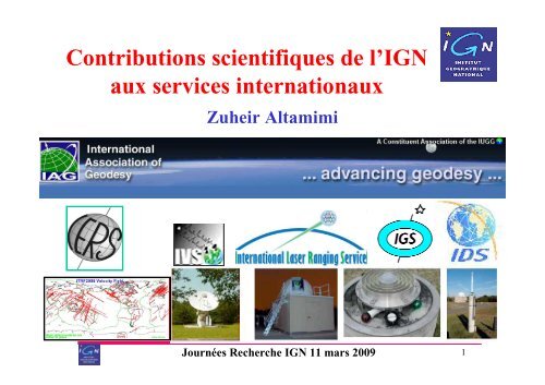
Contributions scientifiques <strong>de</strong> l’IGN<br />
aux services internationaux<br />
<strong>Zuheir</strong> Altamimi<br />
Journées <strong>Recherche</strong> IGN 11 mars 2009<br />
1
Sommaire<br />
• La géodésie mo<strong>de</strong>rne et sa contribution aux<br />
géosciences<br />
• L’Association Internationale <strong>de</strong> Géodésie<br />
• Les services <strong>de</strong>s techniques spatia<strong>les</strong><br />
• Contribution <strong>de</strong> l’IGN<br />
• Illustrations par <strong>de</strong>s résultats récents:<br />
– Analyse <strong>de</strong> données<br />
– ITRF<br />
– Niveau <strong>de</strong>s mers<br />
– Tectonique <strong>de</strong>s plaques<br />
– Effets <strong>de</strong> surcharge<br />
Journées <strong>Recherche</strong> IGN 11 mars 2009<br />
2
La géodésie<br />
• Discipline fondamentale pour <strong>les</strong> applications en<br />
science <strong>de</strong> la Terre<br />
• est la seule capable à réaliser un système <strong>de</strong><br />
référence terrestre global<br />
• Le progrès accompli par la géodésie <strong>de</strong>puis plus<br />
d’un quart <strong>de</strong> siècle est le fruit <strong>de</strong> contributions<br />
internationa<strong>les</strong> fondées sur le volontariat et la<br />
coopération pour l’intérêt scientifique<br />
• ==> Création <strong>de</strong> services scientifiques<br />
Journées <strong>Recherche</strong> IGN 11 mars 2009<br />
3
La géodésie mesure la Terre<br />
<strong>dans</strong> l’espace et <strong>dans</strong> le temps<br />
• Les changements géométriques <strong>de</strong> la surface <strong>de</strong> la<br />
Terre:<br />
– Déformations horizonta<strong>les</strong> et vertica<strong>les</strong> <strong>de</strong> la croûte<br />
terrestre<br />
– Variations spatia<strong>les</strong> et temporel<strong>les</strong> <strong>de</strong>s surface<br />
océaniques et <strong>de</strong>s glaciers<br />
– La géodésie ne mesure pas <strong>les</strong> déformations vertica<strong>les</strong><br />
<strong>de</strong>s fonds <strong>de</strong>s océans…<br />
• Fluctuation <strong>de</strong> l’orientation <strong>de</strong> la Terre <strong>dans</strong><br />
l’espace<br />
• Variations spatio-temporel<strong>les</strong> du champ <strong>de</strong><br />
gravité terrestre<br />
Journées <strong>Recherche</strong> IGN 11 mars 2009<br />
4
La géodésie contribue à la compréhension <strong>de</strong><br />
phénomènes géophysiques<br />
• Niveau <strong>de</strong>s mers Changement climatique<br />
• Mouvement crustal: tectoniques, tremblement <strong>de</strong><br />
Terre, éruptions volcaniques…<br />
• Surcharges hydrologique et atmosphérique<br />
• Circulation océanique<br />
• Marrées terrestre, océanique, polaire et<br />
atmosphérique<br />
• Rebond post glaciaire (GIA - Glacial Isostatic Adjustment )<br />
Journées <strong>Recherche</strong> IGN 11 mars 2009<br />
5
Association Internationale <strong>de</strong> Géodésie<br />
• Une <strong>de</strong>s 9 associations qui composent l’UGGI<br />
• 1862: Mitteleuropäische Gradmessung (Central European Arc Measurement)<br />
• 1867: Europäische Gradmessung (European Arc Measurement)<br />
• 1886: Internationale Erdmessung (International Association of Geo<strong>de</strong>sy,<br />
Association Géodésique Internationale)<br />
• 1922: (AG <strong>de</strong> l’UGGI, Rome): International Association of Geo<strong>de</strong>sy<br />
• Secrétaires Généraux: G. Perrier, P. Tardi, JJ. Levallois,<br />
M. Louis, C. Boucher, Ch. Tcherning, H. Drewes<br />
• Prési<strong>de</strong>nt actuel: Michael Si<strong>de</strong>ris (Canada)<br />
• Vice Prési<strong>de</strong>nt: Chris Rizos (Australia)<br />
Journées <strong>Recherche</strong> IGN 11 mars 2009<br />
6
Association Internationale <strong>de</strong> Géodésie<br />
aujourd’hui (2007 – 2011)<br />
• Commission 1: Reference Frames<br />
– Presi<strong>de</strong>nt: <strong>Zuheir</strong> Altamimi (France)<br />
• Commission 2: Gravity Field<br />
– Presi<strong>de</strong>nt: Yoichi Fukuda (Japan)<br />
• Commission 3: Geodynamics and Earth Rotation<br />
– Presi<strong>de</strong>nt: Michael Bevis (USA)<br />
• Commission 4: Positioning and Applications<br />
– Presi<strong>de</strong>nt: Sandra Verhagen (The Netherlands)<br />
• Inter-commission Committee on Theory<br />
– Presi<strong>de</strong>nt: Nico Sneeuw (Germany)<br />
• Global Geo<strong>de</strong>tic Observing System (GGOS)<br />
– Chair: Markus Rothacher (Switzerland)<br />
• 15 International Scientific Services<br />
Journées <strong>Recherche</strong> IGN 11 mars 2009<br />
7
IAG Commission 1 Structure<br />
• Sub-Com1.1: Coordination of Space Techniques<br />
Presi<strong>de</strong>nt: M. Rothacher (Germany)<br />
• Sub-Com1.2: Global Reference Frames<br />
Presi<strong>de</strong>nt: C. Boucher (France)<br />
• Sub-Com1.3: Regional Reference Frames<br />
Presi<strong>de</strong>nt: J. Torres (Portugal)<br />
– SC1.3 a: Europe (EUREF) ========= (Contribution IGN)<br />
Chair: J. Ih<strong>de</strong> (Germany)<br />
– SC1.3 b South and Central America<br />
Chair: C. Brunini (Argentina)<br />
– SC1.3 c: North America<br />
Chairs: R. Snay (USA), M. Craymer (Canada)<br />
– SC1.3 d: Africa<br />
Chair: R. Wonnacott (South Africa)<br />
– SC1.3 e: Asia-Pacific<br />
Chair: S. Matsuzaka (Japan)<br />
– SC1.3 f: Antarctica<br />
Chair: R. Dietrich (Germany)<br />
• Sub-Com1.4: Interaction of Ce<strong>les</strong>tial and Terrestrial Reference Frames<br />
Presi<strong>de</strong>nt: H. Schuh (Austria)<br />
Journées <strong>Recherche</strong> IGN 11 mars 2009<br />
8
Global Geo<strong>de</strong>tic Observing System (GGOS)<br />
• The Global Geo<strong>de</strong>tic Observing System works with the IAG<br />
components to provi<strong>de</strong> the geo<strong>de</strong>tic infrastructure necessary<br />
for monitoring the Earth system and global change research<br />
• GGOS <strong>de</strong>pends on the IAG Services and Commissions<br />
• GGOS is IAG's central interface to the scientific<br />
community and to society in general<br />
• IAG is a participating organization of the Group on Earth<br />
Observations (GEO). GGOS acts on behalf of the IAG in<br />
GEO and actively contributes to the Global Earth<br />
Observation System of Systems (GEOSS)<br />
Journées <strong>Recherche</strong> IGN 11 mars 2009<br />
9
Global Geo<strong>de</strong>tic Observing System (GGOS)<br />
Journées <strong>Recherche</strong> IGN 11 mars 2009<br />
10
Association Internationale <strong>de</strong> Géodésie<br />
Services internationaux associés<br />
• International Earth Rotation and Reference Systems<br />
Service (IERS) (1988)<br />
• Intern. GNSS Service (IGS) (1994)<br />
• Intern. Laser Ranging Service (ILRS) (1998)<br />
• Intern. VLBI Service (IVS) (1999)<br />
• Intern. DORIS Service (IDS) (2003)<br />
http://www.iag-aig.org/<br />
Journées <strong>Recherche</strong> IGN 11 mars 2009<br />
11
Structure générale <strong>de</strong>s services<br />
• Governing/Directing Board<br />
• Analysis Centers (5 – 8 centres)<br />
• Combination Center<br />
• Data Centers<br />
• Operation Center (Network Management)<br />
• Analysis Working Group<br />
• Analysis Coordinator<br />
• Working Groups<br />
• Pilot Projects<br />
Journées <strong>Recherche</strong> IGN 11 mars 2009<br />
12
Centre d’analyse DORIS pour l’IDS<br />
• Responsable: Pascal Willis<br />
• Logiciel :<br />
– Gipsy/Oasis<br />
• Analyse opérationnelle:<br />
– Solutions hebdomadaires pour l’IDS<br />
• Travaux <strong>de</strong> recherche:<br />
– Amélioration continue <strong>de</strong> la stratégie d’analyse<br />
– Influence <strong>de</strong> la pression <strong>de</strong> radiation solaire sur <strong>les</strong><br />
composantes <strong>de</strong> l’origine du repère terrestre<br />
– Etu<strong>de</strong> du frottement atmosphérique<br />
– Confrontation <strong>de</strong>s résultats DORIS aux<br />
modè<strong>les</strong>/données géophysiques<br />
Journées <strong>Recherche</strong> IGN 11 mars 2009<br />
13
Résultat DORIS récent<br />
Gobinddass et al., JASR, submitted<br />
Journées <strong>Recherche</strong> IGN 11 mars 2009<br />
14
Comparaison <strong>de</strong>s signaux annuels entre <strong>les</strong><br />
modè<strong>les</strong> géophysiques et <strong>les</strong> observations<br />
Représentation polaire TX<br />
Représentation polaire TZ<br />
Gobinddass et al., JASR, submitted<br />
Représentation polaire TY<br />
Journées <strong>Recherche</strong> IGN 11 mars 2009<br />
15
IDS-1 WRMS<br />
Journées <strong>Recherche</strong> IGN 11 mars 2009<br />
16
IDS-1Intrinsic Origin and Scale<br />
Journées <strong>Recherche</strong> IGN 11 mars 2009<br />
17
Centre d’analyse GRGS <strong>de</strong> l’ILRS<br />
- Centre d’analyse officiellement reconnu en septembre 2007<br />
- Membres :<br />
F. Deleflie, O. Laurain, D. Féraudy, P. Exertier (OCA/GEOAZUR)<br />
D. Coulot (IGN/LAREG)<br />
- Logiciels utilisés :<br />
* GINS/DYNAMO (CNES/GRGS)<br />
* MATLO (IGN/GRGS/LAREG)<br />
- Calculs opérationnels récents :<br />
* Contribution à l’ITRF2008, via l’ILRS<br />
* Solutions hebdomadaires : EOP, position <strong>de</strong> stations<br />
- Activité opérationnelle parallèle :<br />
* Solution <strong>de</strong> référence « GRGS »<br />
- Travaux <strong>de</strong> recherche récents :<br />
* Séries temporel<strong>les</strong> <strong>de</strong> coefficients du champ <strong>de</strong> gravité, sur le long terme<br />
* Prise en compte d’un modèle d’effets <strong>de</strong> charge (stations, champ gravité)<br />
* Impact <strong>de</strong>s biais en distance sur l’échelle du repère<br />
* Réseaux Génétiquement Modifiés<br />
Journées <strong>Recherche</strong> IGN 11 mars 2009<br />
18
Centre d’analyse GRGS <strong>de</strong> l’ILRS<br />
Exemple <strong>de</strong> la translation TY<br />
entre la solution GRGS V20<br />
et l’ITRF2005<br />
- Activités opérationnel<strong>les</strong> à venir :<br />
* Poursuite <strong>de</strong> la solution hebdomadaire<br />
* Solution journalière<br />
* Retraitement <strong>de</strong>s données historiques (1976-1993)<br />
* Prise en compte du format CRD (Consolidated Laser Ranging Data)<br />
* Fourniture <strong>de</strong>s orbites <strong>de</strong>s <strong>de</strong>ux satellites LAGEOS <br />
- Travaux <strong>de</strong> recherche à venir :<br />
* Champ <strong>de</strong> gravité complet pour <strong>les</strong> bas <strong>de</strong>grés (<strong>de</strong>gré < 20)<br />
* Poursuite <strong>de</strong> la prise en compte <strong>de</strong>s effets <strong>de</strong> charge<br />
* Impact <strong>de</strong>s erreurs orbita<strong>les</strong> sur le repère<br />
* Stratégie optimale d’estimation <strong>de</strong>s biais en distance<br />
* Constellation <strong>de</strong> satellites (Stella, Starlette, LAGEOS 1-2, Etalon 1-2)<br />
* Densification du réseau <strong>de</strong> poursuite<br />
* Poursuite <strong>de</strong>s RGM<br />
Journées <strong>Recherche</strong> IGN 11 mars 2009<br />
19
International Earth Rotation and Reference<br />
Systems Service (IERS)<br />
Established in 1987 (started Jan. 1, 1988) by IAU and IUGG<br />
to realize/maintain/provi<strong>de</strong>:<br />
• The International Ce<strong>les</strong>tial Reference System (ICRS)<br />
• The International Terrestrial Reference System<br />
(ITRS)<br />
• Earth Orientation Parameters (EOP)<br />
• Geophysical data to interpret time/space variations<br />
in the ICRF, ITRF & EOP<br />
• Standards, constants and mo<strong>de</strong>ls (i.e., conventions)<br />
http://www.iers.org/<br />
Journées <strong>Recherche</strong> IGN 11 mars 2009<br />
20
IERS Structure<br />
Journées <strong>Recherche</strong> IGN 11 mars 2009<br />
21
International Terrestrial Reference System (ITRS)<br />
• L’IGN (LAREG) a la responsabilité du centre<br />
du produit ITRS/ITRF<br />
• Adopté par l'UGGI en 1991 (réaffirmé en 2007)<br />
pour <strong>les</strong> applications en sciences <strong>de</strong> la Terre<br />
• Adopté <strong>de</strong> fait par la communauté scientifique<br />
– Article JGR sur l’ITRF2000 cité 270 fois (base ISI)<br />
• L’AIG œuvre pour l’adoption <strong>de</strong> l’ITRS par<br />
d’autres communautés (GT animé par Clau<strong>de</strong><br />
Boucher):<br />
– Norme ISO<br />
– Une gouvernance internationale (UN, BIPM, GEO)<br />
Journées <strong>Recherche</strong> IGN 11 mars 2009<br />
22
The International Terrestrial Reference Frame (ITRF)<br />
• La combinaison <strong>de</strong>s techniques est fondamentale<br />
pour réaliser un système <strong>de</strong> référence stable en<br />
origine, échelle avec une couverture suffisante<br />
• L’élément clé <strong>de</strong> la construction <strong>de</strong> l’ITRF est la<br />
disponibilité d’un nombre suffisant <strong>de</strong> sites colocalisés<br />
<strong>de</strong> haute précision<br />
• Menace: dégradation <strong>de</strong> l’infrastructure géodésique<br />
• ==> Exige la contribution et l’engament<br />
d’organismes internationaux sur le long terme<br />
Journées <strong>Recherche</strong> IGN 11 mars 2009<br />
23
Site <strong>de</strong> Co-localisation<br />
• Site ayant au moins <strong>de</strong>ux instruments <strong>de</strong> mesure (distants <strong>de</strong><br />
qq centaines <strong>de</strong> mètres)<br />
• Rattachement 3-D, par géodésie classique et/ou GPS<br />
• Coordonnées différentiel<strong>les</strong> (DX, DY, DZ) sont disponib<strong>les</strong><br />
DX (GPS,VLBI)<br />
= X VLBI<br />
- X GPS<br />
GPS<br />
VLBI<br />
SLR<br />
DORIS<br />
Journées <strong>Recherche</strong> IGN 11 mars 2009<br />
24
Current Co-locations (2007)<br />
Journées <strong>Recherche</strong> IGN 11 mars 2009<br />
25
Current networks: stations observed in 2007<br />
VLBI<br />
SLR<br />
GPS/IGS<br />
Weaknesses & Threats: SLR & VLBI poor networks<br />
DORIS<br />
Journées <strong>Recherche</strong> IGN 11 mars 2009<br />
26
Current Co-locations DORIS-GPS<br />
(37)<br />
Journées <strong>Recherche</strong> IGN 11 mars 2009<br />
27
Strenghts :<br />
Contribution of Geo<strong>de</strong>tic Techniques to the ITRF<br />
Mix of techniques<br />
is fundamental to<br />
realize a frame that<br />
is stable in origin,<br />
scale, and with<br />
sufficient coverage<br />
Technique<br />
Signal<br />
Source<br />
Obs. Type<br />
Ce<strong>les</strong>tial<br />
Frame & UT1<br />
Polar Motion<br />
VLBI<br />
Microwave<br />
Quasars<br />
Time difference<br />
Yes<br />
Yes<br />
SLR<br />
Optical<br />
Satellite<br />
Two-way absolute<br />
range<br />
No<br />
Yes<br />
GPS<br />
Microwave<br />
Satellites<br />
Range change<br />
No<br />
Yes<br />
DORIS<br />
No<br />
Yes<br />
Scale<br />
Yes<br />
Yes<br />
Yes<br />
Yes<br />
From:<br />
Ries et al., 2005,<br />
(Modified)<br />
Geocenter<br />
ITRF Origin<br />
Geographic<br />
Density<br />
No<br />
No<br />
Yes<br />
No<br />
Yes<br />
Yes<br />
Yes<br />
Yes<br />
Real-time &<br />
ITRF access<br />
Yes<br />
Yes<br />
Yes<br />
Yes<br />
Decadal<br />
Stability<br />
Yes<br />
Yes<br />
Yes<br />
Yes<br />
ITRF Orientation time evolution Yes Yes Yes<br />
Journées <strong>Recherche</strong> IGN 11 mars 2009<br />
28
Le logiciel CATREF<br />
Combination and Analysis of Terrestrial Reference Frames<br />
• Développement commencé en 1995 avec la création du<br />
format SINEX (variance complète)<br />
• Opère par module pour:<br />
– Enlever <strong>les</strong> contraintes initia<strong>les</strong><br />
– Appliquer <strong>de</strong>s contraintes minima<strong>les</strong> et/ou internes<br />
– Combiner <strong>de</strong>s solutions globa<strong>les</strong> (pos., vit. & EOP)<br />
– Cumuler <strong>de</strong>s séries temporel<strong>les</strong> (X(t) & EOP)<br />
– Différentes options <strong>de</strong> définition du RRT combiné<br />
• Exporté (Australie, Canada, Allemagne, Belgique, Hongrie,<br />
GB, Pologne, Portugal,USA, ...)<br />
• Utilisé <strong>dans</strong> la réalisation du SRT Galileo:<br />
– Galileo Terrestrial Reference Frame (GTRF)<br />
– Consortium européen: Galileo Geo<strong>de</strong>ctic Service Provi<strong>de</strong>r (GGSP)<br />
Journées <strong>Recherche</strong> IGN 11 mars 2009<br />
29
ITRF and Science Requirements<br />
• Long-term stable ITRF: 0.1 mm/yr<br />
==> Stable: linear behaviour of the TRF parameters, i.e.<br />
with no discontinuity :<br />
– Origin Components: 0.1 mm/yr<br />
– Scale 0.01 ppb/yr (0.06 mm/yr)<br />
Value<br />
Unstable parameter<br />
Value<br />
Stable parameter<br />
time<br />
Current status ≥ 1 mm/yr<br />
time<br />
Journées <strong>Recherche</strong> IGN 11 mars 2009<br />
30
SLR Origin & Scale Variation (wrt ITRF2000)<br />
1.8 mm/yr<br />
Journées <strong>Recherche</strong> IGN 11 mars 2009<br />
31
Conséquence <strong>de</strong> la dérive Tz / ITRF2000 sur <strong>les</strong><br />
vitesses vertica<strong>les</strong><br />
Vh = δTz sin(ϕ)<br />
Journées <strong>Recherche</strong> IGN 11 mars 2009<br />
32
Conséquence <strong>de</strong> la dérive Tz (ITRF2000 =>ITRF2005)<br />
sur <strong>les</strong> vitesses vertica<strong>les</strong><br />
Journées <strong>Recherche</strong> IGN 11 mars 2009<br />
33
Impact of Terrestrial Reference Frame on Global Mean Sea<br />
Level Estimate (CSR95 + ITRF2000 vs. ITRF2005)<br />
Mean radial orbit differences by cycle, computed between orbits based on the ITRF2005<br />
reference frame and the GGM02 (Grace-<strong>de</strong>rived) gravity mo<strong>de</strong>l and those on the<br />
TOPEX/Poseidon MGDR-B (CSR95) and Jason-1 GDR-B (ITRF2000) GDR’s. Differences are<br />
sampled only over the oceans. The very low frequency signature of the differences maps directly<br />
into the estimated global MSL trend. Shorter periods of 5 – 7 years reveal significant rates of<br />
change exceeding 0.4 mm/yr.<br />
Update to: Beckley, B., F. Lemoine, S. Luthcke, R. Ray, and N. Zelensky (2007),<br />
A reassessment of global and regional mean sea level trends from TOPEX and Jason-1 altimetry<br />
based on revised reference frame and orbits,<br />
Geophysical Research Letters, doi:101029/2007GL030002.<br />
Journées <strong>Recherche</strong> IGN 11 mars 2009<br />
34
Impact of the Terrestrial Reference Frame on<br />
Regional Mean Sea Level Trends<br />
Regional TOPEX (1993-2002) Sea<br />
Surface Height Trend differences from<br />
direct impact of the ITRF2005<br />
(GGM02C) minus CSR95 (JGM3) orbit<br />
differences. The positive values in the<br />
northern hemisphere indicate a previous<br />
un<strong>de</strong>restimation of MSL of up to 1.5<br />
mm/yr in the northeast Atlantic based on<br />
earlier terrestrial reference frame<br />
realizations.<br />
Beckley, B., F. Lemoine, S. Luthcke, R. Ray, and N. Zelensky (2007),<br />
A reassessment of global and regional mean sea level trends from TOPEX and Jason-1 altimetry<br />
based on revised reference frame and orbits,<br />
Geophysical Research Letters, doi:101029/2007GL030002.<br />
Journées <strong>Recherche</strong> IGN 11 mars 2009<br />
35
Conséquence <strong>de</strong> la dérive Tz (ITRF2000 =>ITRF2005)<br />
sur <strong>les</strong> vitesses vertica<strong>les</strong><br />
Journées <strong>Recherche</strong> IGN 11 mars 2009<br />
36
Global and Regional Mean Sea Level Trends from TOPEX/Poseidon and Jason-1 Altimetry<br />
1993 – 2008 MSL rate = 3.21± 0.41<br />
mm/yr<br />
1993-1998<br />
Mean=3.02 mm/yr<br />
2003-2008<br />
Mean=2.10 mm/yr<br />
Global mean sea level (MSL) variations are estimated from the combined 16 year record of T/P and Jason-1 altimetry based on<br />
revised orbits adhering to a consistent terrestrial reference frame (ITRF2005)and unified geophysical mo<strong>de</strong>ling. The thin red curve is<br />
the global Reynolds’ sea surface temperature variations for comparison. The MSL linear rate of 3.21 mm/yr (no GIA adjustment) is<br />
<strong>de</strong>rived after removal of annual and semi-annual signals. The global MSL rate is modulated by inter-<strong>de</strong>cadal type signals<br />
(such as El Nino and La Nina). The top right figure shows regional MSL rates during the <strong>de</strong>velopment of the 1997 El Niño while the<br />
lower figure shows impact of current La Niña conditions. The launch of OSTM (Jason-2) will further extend the TOPEX & Jason-1<br />
altimeter data time series and will improve <strong>de</strong>tection of subtle longer-period signals and allow a better un<strong>de</strong>rstanding of their impact<br />
on future MSL trends.<br />
Journées <strong>Recherche</strong> IGN 11 mars 2009<br />
mm/yr<br />
Beckley, B., F. Lemoine, S. Luthcke, R. Ray, and N. Zelensky, NASA Goddard Space Flight Center, May 2008<br />
37
GPS UP Velocities vs GIA<br />
Expressed in ITRF2005<br />
Expressed inITRF2000<br />
GIA<br />
Journées <strong>Recherche</strong> IGN 11 mars 2009<br />
38
TIGA: GPS velocities at TG... How well do they work<br />
ICE5Gv1.2 + VM4 mo<strong>de</strong>ls<br />
(Peltier 2004)<br />
Journées <strong>Recherche</strong> IGN 11 mars 2009<br />
39
Interprétation <strong>de</strong>s paramètres d’Helmert – effets <strong>de</strong> surcharge/réseau<br />
Translation ILRS<br />
Translations SLR<br />
Prédiction <strong>de</strong>s translations à l’ai<strong>de</strong><br />
d’un modèle <strong>de</strong> surcharge<br />
Mouvement du géocentre issu du<br />
même modèle<br />
Remerciement: Tonie van Dam pour le<br />
modèle <strong>de</strong> surcharge<br />
Echelle VLBI<br />
Les variations <strong>de</strong> l’échelle VLBI semblent être provoquées par:<br />
- <strong>les</strong> effets <strong>de</strong> surcharge<br />
- la déformation thermique <strong>de</strong>s antennes VLBI<br />
Collilieux, 2007<br />
Journées <strong>Recherche</strong> IGN 11 mars 2009<br />
40
GPS Mean Residuals (effets <strong>de</strong> surcharge)<br />
N<br />
E<br />
Up<br />
Journées <strong>Recherche</strong> IGN 11 mars 2009<br />
41
ITRF2005 Site Velocities with σ < 3mm/y<br />
Journées <strong>Recherche</strong> IGN 11 mars 2009<br />
42
Pacific<br />
Africa<br />
Amur<br />
Antarctica<br />
Arabia<br />
Australia<br />
Caribbean<br />
Eurasia<br />
India<br />
North America<br />
Nazca<br />
Okhotsk<br />
South America<br />
Somalia<br />
Yangtze<br />
Sites ITRF2005 utilisés <strong>dans</strong> l’estimation <strong>de</strong> pô<strong>les</strong><br />
<strong>de</strong> rotations <strong>de</strong>s plaques tectoniques<br />
Journées <strong>Recherche</strong> IGN 11 mars 2009<br />
43
Mouvement AFRC (NUBI) – EURA<br />
Nubia-Eurasia velocity ~50% slower than NUVEL1-A prediction<br />
Journées <strong>Recherche</strong> IGN 11 mars 2009<br />
44
First Galileo Terrestrial Reference Frame<br />
GTRF07v01 horizontal velocities<br />
Journées <strong>Recherche</strong> IGN 11 mars 2009<br />
45
Résumé <strong>de</strong> la contribution <strong>de</strong> l’IGN<br />
• IAG:<br />
• IERS:<br />
• IDS :<br />
• ILRS:<br />
• IGS:<br />
Commission 1, GGOS, EUREF<br />
ITRF<br />
centre d’analyse et <strong>de</strong> données (SGN)<br />
centre d’analyse associé<br />
Centre <strong>de</strong> données (SGN)<br />
• Organisation <strong>de</strong> sessions/congres scientifiques<br />
– AGU<br />
– EGU<br />
– IAG<br />
• Publication Scientifiques<br />
Journées <strong>Recherche</strong> IGN 11 mars 2009<br />
46
• L’importance:<br />
Mot <strong>de</strong> la fin<br />
– <strong>de</strong> la géodésie en géosciences<br />
– <strong>de</strong>s services internationaux<br />
– <strong>de</strong> la contribution <strong>de</strong>s organismes en général<br />
– <strong>de</strong> la contribution <strong>de</strong> l’IGN en particulier<br />
• Les menaces:<br />
– Dégradation <strong>de</strong>s réseaux géodésiques, sauf peut être<br />
DORIS<br />
– Matière grise: jeunes cerveaux et enseignement en<br />
géodésie<br />
Journées <strong>Recherche</strong> IGN 11 mars 2009<br />
47