In<strong>de</strong>xentité, 67copierentité, 67couperentité, 67, 71couverture ArcInfo binaire, 41croiser, 46déplacerentités, 66diagramme, 61effaceranneau, 70entité, 68partie, 70fenêtre propriété, 47fusionnerentité, 71MapInfo, 41noeudoutil, 67numérisation avancée, 69couche existante, 69numériser, 65outilnoeud, 67outils d’édition basique, 66outils <strong>de</strong> numérisation avancée, 69PostGIS, 41refaire, 69remo<strong>de</strong>lerentité, 70renduscouleur continue, 48symbole gradué, 47symbole unique, 47valeur unique, 48rotationsymbole, 71shapefiles ESRI, 39simplifier, 69SpatiaLite, voir SpatiaLitestyles, 48symbologie, 47transparence, 50CRS, 88documentation, 1EPSG, 95ESRIshapefiles, 39extensionevis, 146, 151extensions, 133, 185GRASSboîte à outils, 137, 185barre d’échelle, 138convertisseur OGR, 137copyright, 137diagram, 137diagramme, 185DXF2Shape, 137export MapServer, 137ftools, 137géoréférencement, 137gdaltools, 137georaster, 138gestion, 133gps, 137impression rapi<strong>de</strong>, 138Installateur d’extensions, 186installation, 134, 138, 185Interpolation, 137mise à jour, 134north arrow, 137paramètre, 140principales, 137Raster Terrain Mo<strong>de</strong>lling, 137saisie <strong>de</strong> coordonnees, 137spit, 138, 185texte <strong>de</strong>limite, 137types, 133Zoom vers un point, 186fenêtre principale, 19fichiers MIF, 39fichiers SHP, 39fichiers TAB, 39géoréfencementoutil, 159GDALformats supportés, 190GRASSboîte à outilsmodules, 193i<strong>de</strong>ntifierWMS, 89in<strong>de</strong>x spatialshapefiles, 40installation, 13légen<strong>de</strong>, 24licenseexception, 215FDL, 217GPL, 213MapInfofichiers MIF, 39fichiers TAB, 39menus, 19mesure, 28aires, 28angles, 28longueur, 28mise en page226 <strong>QGIS</strong> <strong>1.6</strong>.0 <strong>Manuel</strong> <strong>Utilisateur</strong>
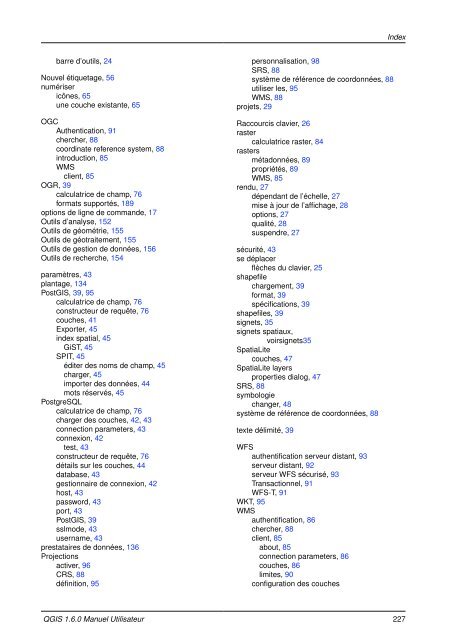
In<strong>de</strong>xbarre d’outils, 24Nouvel étiquetage, 56numérisericônes, 65une couche existante, 65OGCAuthentication, 91chercher, 88coordinate reference system, 88introduction, 85WMSclient, 85OGR, 39calculatrice <strong>de</strong> champ, 76formats supportés, 189options <strong>de</strong> ligne <strong>de</strong> comman<strong>de</strong>, 17Outils d’analyse, 152Outils <strong>de</strong> géométrie, 155Outils <strong>de</strong> géotraitement, 155Outils <strong>de</strong> gestion <strong>de</strong> données, 156Outils <strong>de</strong> recherche, 154paramètres, 43plantage, 134PostGIS, 39, 95calculatrice <strong>de</strong> champ, 76constructeur <strong>de</strong> requête, 76couches, 41Exporter, 45in<strong>de</strong>x spatial, 45GiST, 45SPIT, 45éditer <strong>de</strong>s noms <strong>de</strong> champ, 45charger, 45importer <strong>de</strong>s données, 44mots réservés, 45PostgreSQLcalculatrice <strong>de</strong> champ, 76charger <strong>de</strong>s couches, 42, 43connection parameters, 43connexion, 42test, 43constructeur <strong>de</strong> requête, 76détails sur les couches, 44database, 43gestionnaire <strong>de</strong> connexion, 42host, 43password, 43port, 43PostGIS, 39sslmo<strong>de</strong>, 43username, 43prestataires <strong>de</strong> données, 136Projectionsactiver, 96CRS, 88définition, 95personnalisation, 98SRS, 88système <strong>de</strong> référence <strong>de</strong> coordonnées, 88utiliser les, 95WMS, 88projets, 29Raccourcis clavier, 26rastercalculatrice raster, 84rastersmétadonnées, 89propriétés, 89WMS, 85rendu, 27dépendant <strong>de</strong> l’échelle, 27mise à jour <strong>de</strong> l’affichage, 28options, 27qualité, 28suspendre, 27sécurité, 43se déplacerflèches du clavier, 25shapefilechargement, 39format, 39spécifications, 39shapefiles, 39signets, 35signets spatiaux,voirsignets35SpatiaLitecouches, 47SpatiaLite layersproperties dialog, 47SRS, 88symbologiechanger, 48système <strong>de</strong> référence <strong>de</strong> coordonnées, 88texte délimité, 39WFSauthentification serveur distant, 93serveur distant, 92serveur WFS sécurisé, 93Transactionnel, 91WFS-T, 91WKT, 95WMSauthentification, 86chercher, 88client, 85about, 85connection parameters, 86couches, 86limites, 90configuration <strong>de</strong>s couches<strong>QGIS</strong> <strong>1.6</strong>.0 <strong>Manuel</strong> <strong>Utilisateur</strong> 227
- Page 1:
Quantum GISManuel de l’utilisateu
- Page 5 and 6:
Table des matièresPréambuleLicenc
- Page 7 and 8:
5 Les données raster 795.1 Que son
- Page 9 and 10:
11.13.1 Gérer les connexions . . .
- Page 11 and 12:
4.28 Constructeur de requêtes . .
- Page 13 and 14:
Liste des tableaux4.1 Paramètres d
- Page 15 and 16:
Astuce QGIS1 DOCUMENTATION À JOUR
- Page 17 and 18:
Avant-proposBienvenue dans le monde
- Page 19 and 20:
FonctionnalitésÉtendre les foncti
- Page 21:
Fonctionnalités- Possibilité de d
- Page 25 and 26:
1. Introduction au SIGUn Système d
- Page 27:
1.1.2. Les données vectoriellesetc
- Page 30 and 31:
2.3. Étape pratiqueGEOGCS["NAD27",
- Page 33 and 34:
3. Aperçu des fonctionnalitésApr
- Page 35 and 36:
3.2. Interface de QGISQuand QGIS d
- Page 37 and 38:
3.2.1. Barre de MenuOption du menu
- Page 39 and 40:
3.2.2. Barre d’outilsOption du me
- Page 41 and 42:
3.2.4. Vue de la carte- Ajouter un
- Page 43 and 44:
3.2.8. Aide contextuelledans un fic
- Page 45 and 46:
3.4.2. Sélectionner et désélecti
- Page 47 and 48:
- Cacher l’écran de démarrage-
- Page 49 and 50:
FIGURE 3.5.: Paramétrer un proxyVo
- Page 51 and 52:
3.9. Signets spatiauxLes signets sp
- Page 53:
3.10.4. Configuration GPSFIGURE 3.9
- Page 56 and 57:
4.1. Shapefiles ESRIFIGURE 4.1.: Aj
- Page 58 and 59:
4.2. Couches PostGISFIGURE 4.3.: QG
- Page 60 and 61:
4.2. Couches PostGIS- Si la fenêtr
- Page 62 and 63:
4.2. Couches PostGISLa syntaxe pour
- Page 64 and 65:
4.4. La fenêtre Propriété des co
- Page 66 and 67:
4.4. La fenêtre Propriété des co
- Page 68 and 69:
4.4. La fenêtre Propriété des co
- Page 70 and 71:
4.4. La fenêtre Propriété des co
- Page 72 and 73:
4.4. La fenêtre Propriété des co
- Page 74 and 75:
4.4. La fenêtre Propriété des co
- Page 76 and 77:
4.4. La fenêtre Propriété des co
- Page 78 and 79:
4.5. ÉditerFIGURE 4.19.: Dialogue
- Page 80 and 81:
4.5. Éditerune valeur moindre. De
- Page 82 and 83:
4.5. ÉditerIcon Purpose Icon Purpo
- Page 84 and 85:
4.5. Éditeralors représentées au
- Page 86 and 87:
4.5. ÉditerFIGURE 4.23.: Annuler e
- Page 88 and 89:
4.5. ÉditerFIGURE 4.25.: Fenêtre
- Page 90 and 91:
4.5. ÉditerFIGURE 4.27.: Table d
- Page 92 and 93:
4.8. Calculatrice de champAstuce QG
- Page 95 and 96:
5. Les données rasterCette section
- Page 97 and 98:
5.3.2. Onglet transparenceFIGURE 5.
- Page 99 and 100:
5.3.4. Onglet général5.3.4. Ongle
- Page 101 and 102:
6. Les données OGCQGIS gère le WM
- Page 103 and 104:
6.2.3. Charger des couches WMSFIGUR
- Page 105 and 106:
6.2.6. Utiliser l’outil Identifie
- Page 107 and 108:
Astuce QGIS 31 ACCÉDER DES COUCHES
- Page 109:
6.4.1. Charger une couche WFSAstuce
- Page 112 and 113:
7.3. Définir une projection à la
- Page 114 and 115:
7.4. Système de Coordonnées de R
- Page 117 and 118:
8. Intégration du SIG GRASSL’ext
- Page 119 and 120:
8.3.1. Créer un nouveau SECTEUR GR
- Page 121 and 122:
7. Cliquez sur Suivant , vérifiez
- Page 123 and 124:
Astuce QGIS 38 NUMÉRISATION DE POL
- Page 125 and 126:
Astuce QGIS 39 CRÉATION D’UNE SO
- Page 127 and 128:
8.9.1. Travailler avec les modules
- Page 129 and 130:
8.9.2. Exemples de modules GRASS(a)
- Page 131 and 132:
8.9.2. Exemples de modules GRASSFIG
- Page 133:
8.9.4. Paramètrer la boite à outi
- Page 136 and 137:
9.1. Utiliser le Composeur d’Impr
- Page 138 and 139:
9.1. Utiliser le Composeur d’Impr
- Page 140 and 141:
9.1. Utiliser le Composeur d’Impr
- Page 142 and 143:
9.1. Utiliser le Composeur d’Impr
- Page 144 and 145:
9.4. Ajouter une table attributaire
- Page 146 and 147:
9.4. Ajouter une table attributaire
- Page 149 and 150:
10. Les extensions de QGISQGIS repo
- Page 151 and 152:
10.1.3. Utiliser l’installeur d
- Page 153 and 154:
11. Utilisation des extensions prin
- Page 155 and 156:
Cliquez pour sélectionner le SCR
- Page 157 and 158:
FIGURE 11.4.: L’extension Échell
- Page 159 and 160:
Mettre en œuvre l’extension1. D
- Page 161 and 162:
11.5.1. Navigateur d’évènementF
- Page 163 and 164:
11.5.2. Connexion à une base de do
- Page 165 and 166:
11.5.2. Connexion à une base de do
- Page 167 and 168:
Balisequeryshortdescriptiondescript
- Page 169 and 170:
11.7.2. La bibliothèque GDALPolygo
- Page 171 and 172:
11.7.3. ExemplesOutils de géotrait
- Page 173 and 174:
11.7.3. ExemplesFIGURE 11.14.: La f
- Page 175 and 176:
11.8. L’extension de géoréfére
- Page 177 and 178:
FIGURE 11.19.: Ajout de points à l
- Page 179 and 180:
11.9. Extension GPS11.9.1. Qu’est
- Page 181 and 182:
11.9.5. Envoyer des données GPS ve
- Page 183 and 184:
FIGURE 11.24.: Interpolation TIN su
- Page 185 and 186:
11.11.3. Test du fichier .mapWeb Te
- Page 187 and 188:
11.13. Extension de GeoRaster Oracl
- Page 189 and 190:
UPDATE cities SET image = gr WHERE
- Page 191 and 192: 11.14.1. Interface utilisateur de b
- Page 193 and 194: 11.14.4. Éditer des données OSM d
- Page 195 and 196: 11.14.5. Éditer les relations- Lor
- Page 197 and 198: 11.14.8. Charger des données sur l
- Page 199 and 200: FIGURE 11.39.: Fenêtre d’erreur
- Page 201 and 202: FIGURE 11.43.: Résultat d’Impres
- Page 203 and 204: 11.19.2. IRCqgis-tracCette liste fo
- Page 205 and 206: A. Formats de Données supportésQu
- Page 207: - Atlantis MFF- Multi-resolution Se
- Page 210 and 211: B.1. Modules d’import et d’expo
- Page 212 and 213: B.1. Modules d’import et d’expo
- Page 214 and 215: B.4. Modules de données raster de
- Page 216 and 217: B.4. Modules de données raster de
- Page 218 and 219: B.4. Modules de données raster de
- Page 220 and 221: B.5. Modules de données vecteur de
- Page 222 and 223: B.5. Modules de données vecteur de
- Page 224 and 225: B.6. Modules de données d’imager
- Page 226 and 227: B.8. Modules 3D de la boîte à out
- Page 229 and 230: C. GNU General Public LicenseGNU GE
- Page 231: this License would be to refrain en
- Page 234 and 235: C.1. Quantum GIS Qt exception for G
- Page 236 and 237: C.1. Quantum GIS Qt exception for G
- Page 238 and 239: ADDENDUM : How to use this License
- Page 241: IndexÉchantillon de données, 13é


