Manuel Utilisateur de QGIS 1.6 - Free
Manuel Utilisateur de QGIS 1.6 - Free
Manuel Utilisateur de QGIS 1.6 - Free
Create successful ePaper yourself
Turn your PDF publications into a flip-book with our unique Google optimized e-Paper software.
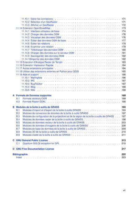
11.13.1 Gérer les connexions . . . . . . . . . . . . . . . . . . . . . . . . . . . . . . . . . . . . 17111.13.2 Sélection d’un GeoRaster . . . . . . . . . . . . . . . . . . . . . . . . . . . . . . . . . . 17111.13.3 Afficher un GeoRaster . . . . . . . . . . . . . . . . . . . . . . . . . . . . . . . . . . . . 17211.14 Extension OpenStreetMap . . . . . . . . . . . . . . . . . . . . . . . . . . . . . . . . . . . . . . 17311.14.1 Interface utilisateur <strong>de</strong> base . . . . . . . . . . . . . . . . . . . . . . . . . . . . . . . . . 17411.14.2 Charger <strong>de</strong>s données OSM . . . . . . . . . . . . . . . . . . . . . . . . . . . . . . . . . 17611.14.3 Visualiser <strong>de</strong>s données OSM . . . . . . . . . . . . . . . . . . . . . . . . . . . . . . . . 17611.14.4 Éditer <strong>de</strong>s données OSM <strong>de</strong> base . . . . . . . . . . . . . . . . . . . . . . . . . . . . . 17711.14.5 Éditer les relations . . . . . . . . . . . . . . . . . . . . . . . . . . . . . . . . . . . . . . 17911.14.6 Examiner une relation . . . . . . . . . . . . . . . . . . . . . . . . . . . . . . . . . . . . 17911.14.7 Télécharger <strong>de</strong>s données OSM . . . . . . . . . . . . . . . . . . . . . . . . . . . . . . . 18011.14.8 Charger <strong>de</strong>s données sur le serveur OSM . . . . . . . . . . . . . . . . . . . . . . . . . 18111.14.9 Sauvegar<strong>de</strong>r <strong>de</strong>s données OSM . . . . . . . . . . . . . . . . . . . . . . . . . . . . . . 18211.14.10Importer <strong>de</strong>s données OSM . . . . . . . . . . . . . . . . . . . . . . . . . . . . . . . . . 18211.15 Extension d’Analyse Raster <strong>de</strong> Terrain . . . . . . . . . . . . . . . . . . . . . . . . . . . . . . . 18311.16 Extension Impression Rapi<strong>de</strong> . . . . . . . . . . . . . . . . . . . . . . . . . . . . . . . . . . . . 18411.17 Autres extensions principales . . . . . . . . . . . . . . . . . . . . . . . . . . . . . . . . . . . . 18411.18 Utiliser <strong>de</strong>s extensions externes en Python pour <strong>QGIS</strong> . . . . . . . . . . . . . . . . . . . . . . 18511.19 Ai<strong>de</strong> et support . . . . . . . . . . . . . . . . . . . . . . . . . . . . . . . . . . . . . . . . . . . . 18611.19.1 Mailinglists . . . . . . . . . . . . . . . . . . . . . . . . . . . . . . . . . . . . . . . . . . 18611.19.2 IRC . . . . . . . . . . . . . . . . . . . . . . . . . . . . . . . . . . . . . . . . . . . . . . 18711.19.3 BugTracker . . . . . . . . . . . . . . . . . . . . . . . . . . . . . . . . . . . . . . . . . . 18711.19.4 Blog . . . . . . . . . . . . . . . . . . . . . . . . . . . . . . . . . . . . . . . . . . . . . . 18811.19.5 Wiki . . . . . . . . . . . . . . . . . . . . . . . . . . . . . . . . . . . . . . . . . . . . . . 188A Formats <strong>de</strong> Données supportés 189A.1 Formats vecteurs OGR . . . . . . . . . . . . . . . . . . . . . . . . . . . . . . . . . . . . . . . . 189A.2 Formats Raster GDAL . . . . . . . . . . . . . . . . . . . . . . . . . . . . . . . . . . . . . . . . 190B Modules <strong>de</strong> la boîte à outils <strong>de</strong> GRASS 193B.1 Modules d’import et d’export <strong>de</strong> la boîte à outils GRASS . . . . . . . . . . . . . . . . . . . . . 193B.2 Modules <strong>de</strong> conversion <strong>de</strong> données <strong>de</strong> la boîte à outils GRASS . . . . . . . . . . . . . . . . . 197B.3 Modules <strong>de</strong> configuration <strong>de</strong> la projections et <strong>de</strong> la région <strong>de</strong> la boîte à outils <strong>de</strong> GRASS . . . 197B.4 Modules <strong>de</strong> données raster <strong>de</strong> la boîte à outils <strong>de</strong> GRASS . . . . . . . . . . . . . . . . . . . . 198B.5 Modules <strong>de</strong> données vecteur <strong>de</strong> la boîte à outils <strong>de</strong> GRASS . . . . . . . . . . . . . . . . . . . 203B.6 Modules <strong>de</strong> données d’imagerie <strong>de</strong> la boîte à outils <strong>de</strong> GRASS . . . . . . . . . . . . . . . . . 208B.7 Modules <strong>de</strong> base <strong>de</strong> données <strong>de</strong> la boîte à outils <strong>de</strong> GRASS . . . . . . . . . . . . . . . . . . . 209B.8 Modules 3D <strong>de</strong> la boîte à outils <strong>de</strong> GRASS . . . . . . . . . . . . . . . . . . . . . . . . . . . . . 210B.9 Modules d’ai<strong>de</strong> <strong>de</strong> la boîte à outils <strong>de</strong> GRASS . . . . . . . . . . . . . . . . . . . . . . . . . . . 211C GNU General Public License 213C.1 Quantum GIS Qt exception for GPL . . . . . . . . . . . . . . . . . . . . . . . . . . . . . . . . . 215D GNU <strong>Free</strong> Documentation License 217Bibliographie 222In<strong>de</strong>x . . . . . . . . . . . . . . . . . . . . . . . . . . . . . . . . . . . . . . . . . . . . . . . . . . . . . 223vii


