

Implementation Of GIS MyGDI - Malaysia Geoportal
Implementation Of GIS MyGDI - Malaysia Geoportal
Implementation Of GIS MyGDI - Malaysia Geoportal
SHOW LESS

Create successful ePaper yourself
Turn your PDF publications into a flip-book with our unique Google optimized e-Paper software.
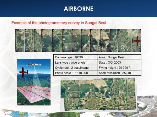
AIRBORNE<br />
Example of the photogrammtery survey in Sungai Besi<br />
Camera type : RC30<br />
Area : Sungai Besi<br />
Lens type : wide angle Date : OCt 2003<br />
Cycle rate : 2 sec./image Flying height : 20 000 ft<br />
Photo scale : 1: 10 000 Scan resolution : 25 µm


