

Guida delle spiagge - Camping Village TESONIS
Guida delle spiagge - Camping Village TESONIS
Guida delle spiagge - Camping Village TESONIS

Create successful ePaper yourself
Turn your PDF publications into a flip-book with our unique Google optimized e-Paper software.
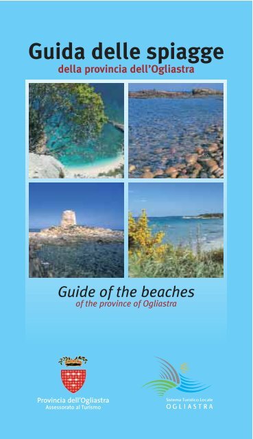
<strong>Guida</strong> <strong>delle</strong> <strong>spiagge</strong><br />
della provincia dell’Ogliastra<br />
Guide of the beaches<br />
of the province of Ogliastra<br />
Provincia dell’Ogliastra<br />
Assessorato al Turismo
<strong>Guida</strong> <strong>delle</strong> <strong>spiagge</strong><br />
della provincia dell’Ogliastra<br />
Guide of the beaches<br />
of the province of Ogliastra
Cala Luna<br />
Cala Sisine
Baunei<br />
Cala Luna<br />
È quasi certamente la spiaggia più celebre della Sardegna.<br />
Il bianchissimo arenile, affacciato su acque blu cobalto, è<br />
caratterizzato dalla presenza di ampie grotte naturali e da<br />
un boschetto di oleandri rosa.<br />
Si raggiunge via mare, con mezzi propri o tramite escursioni in<br />
motobarca con partenza da Santa Maria Navarrese ed Arbatax,<br />
oppure via terra, con un trekking a piedi di 4 ore: si parte da<br />
Teletottes (venendo da Baunei sulla SS 125, si devia a destra dopo<br />
circa 17 km, prima del bivio per Urzulei) e si segue il greto del<br />
torrente, la codula di Luna, fino al mare.<br />
Servizi: ristorante, bar, noleggio natanti, noleggio ombrelloni e sdraio.<br />
It is almost certainly the most renowned beach in Sardinia. The dazzling white<br />
beach set against cobalt blue waters is characterized by the presence of wide<br />
natural caves and a thick growth of pink oleander shrubs.<br />
It can be reached by sea, with private boats or through organized boat tours<br />
leaving from Santa Maria Navarrese and Arbatax; or by land, with a 4 hour<br />
hike: the starting point is Teletottes (coming from Baunei on SS125, turn right<br />
after about 17 km, before the turnoff for Urzulei); from there you can follow<br />
the stream bed, the codula di Luna, to the sea.<br />
Services: restaurant, cafè, boat rental, beach chair and umbrella rental.<br />
Cala Sisine<br />
Adagiata tra due costoni scoscesi, ricoperti di macchia mediterranea<br />
dai toni verde scuro, è un’incantevole caletta di sabbia candida che<br />
degrada in acque turchine, dai riflessi cangianti.<br />
Dal mare è accessibile con mezzi propri o tramite escursioni in<br />
motobarca da Santa Maria Navarrese ed Arbatax. Da terra si può<br />
raggiungere a piedi, in 2-3 ore, oppure in auto, lungo il medesimo<br />
percorso: si parte dall’altopiano del Golgo, a 8 km da Baunei, e si<br />
costeggia il greto del torrente Sisine. L’ultima area di parcheggio è a<br />
5 km dalla spiaggia.<br />
Servizi: ristorante, bar.<br />
Nestled between two sheer rock faces, covered in dark green Mediterranean<br />
scrub, it is an enchanting pristine white sand cove which recedes into<br />
shimmering turquoise waters.<br />
It can be accessed via sea with private boats or through organized boat tours<br />
leaving from Santa Maria Navarrese or Arbatax.<br />
By land it can be accessed on foot, in 2-3 hours, or by car, along the same<br />
route: you start at the Golgo plateau, 8 km from Baunei, and follow the bed of<br />
the Sisine stream. The last parking area is 5 km away from the beach.<br />
Services: restaurant, cafè.<br />
5
Cala Biriola<br />
Sovrastata da uno strapiombo roccioso e da un fitto bosco di lecci, è<br />
una lingua di sabbia finissima di calcare bianco, impreziosita da un<br />
piccolo arco di roccia naturale a pelo d’acqua. La grande varietà dei<br />
fondali la rende particolarmente interessante per gli amanti <strong>delle</strong><br />
immersioni.<br />
Si raggiunge via mare, con mezzi privati o tramite escursioni in<br />
motobarca da Santa Maria Navarrese e Arbatax. Da terra è<br />
accessibile soltanto a piedi, lungo un percorso di trekking molto<br />
impegnativo che parte dall’altopiano del Golgo, a 8 km da Baunei.<br />
Servizi: assenti.<br />
Dominated by a rocky cliff and a thick helm oak forest, it is a strip of<br />
extremely fine white limestone sand, enriched by a small natural rock arch that<br />
skims the sea’s surface. The great diversity of the sea bottom makes it<br />
particularly noteworthy for those who love scuba diving.<br />
It can be accessed via sea with private boats or through organized boat tours<br />
leaving from Santa Maria Navarrese or Arbatax.<br />
By land, it can only be reached on foot via a very challenging hike with its<br />
starting point on the Golgo plateau, 8 km<br />
from Baunei.<br />
Services: none.<br />
Services: disabled access, parking area, bar<br />
Cala Mariolu<br />
Affacciata su un mare color smeraldo,<br />
con ricchi e variopinti fondali ideali per<br />
le immersioni, è chiamata anche<br />
“Ispuligidenìe”, in sardo pulci di neve,<br />
per la forma dei minuscoli sassolini,<br />
lisci e bianchi, che compongono la<br />
spiaggia. Dall’acqua spuntano alcune<br />
Cala Mariolu<br />
rocce calcaree a formare piccoli isolotti.<br />
Si raggiunge via mare, con mezzi<br />
propri o tramite escursioni in motobarca da Santa Maria Navarrese<br />
e Arbatax, oppure via terra, con un trekking che parte dall’altopiano<br />
del Golgo, a 8 km da Baunei; il percorso, di circa 3 ore, è di elevata<br />
difficoltà<br />
escursionistica.<br />
Servizi: chiosco-bar<br />
aperti in periodo<br />
estivo.<br />
Cala Biriola
Looking out onto an emerald sea with rich and colourful underwater scenery<br />
ideal for scuba diving, it is also known as “Ispuligidenìe” (meaning “snow<br />
fleas” in Sardinian) because of the tiny, smooth white pebbles that make up<br />
the beach itself. Several limestone rocks emerge from the water, forming little<br />
islands.<br />
It can be accessed via sea with private boats or through organized boat tours<br />
leaving from Santa Maria Navarrese or Arbatax; or by land, through a highly<br />
challenging 3 hour hike with a starting point on the Golgo plateau, 8 km from<br />
Baunei.<br />
Services: kiosk-cafes open for summer season.<br />
Spiaggia dei Gabbiani<br />
La piccola caletta di sassolini bianchi è circondata dalle alte scogliere<br />
di Punta Ispuligi e da pareti calcaree punteggiate di verde della<br />
macchia mediterranea, che creano un effetto di grande impatto<br />
scenografico. Il mare, celeste e incontaminato, è caratterizzato da<br />
bassi fondali da cui emergono scogli bianchi.<br />
Si raggiunge via mare, con mezzi propri o tramite escursioni in<br />
motobarca da Santa Maria Navarrese e Arbatax, oppure via terra,<br />
percorrendo per il primo tratto il trekking per Cala Mariolu ma,<br />
giunti in prossimità del mare, proseguendo verso destra.<br />
Servizi: assenti.<br />
This small white pebble cove is surrounded by the high cliffs of Punta Ispuligi<br />
and by limestone rock faces dotted by green Mediterranean scrub, creating a<br />
striking, picturesque landscape. The sea, clear blue and unspoiled, is<br />
characterized by shallow waters from which white rocks emerge. It can be<br />
accessed via sea with private boats or through organized boat tours leaving<br />
from Santa Maria Navarrese or Arbatax; or by land, following the hike<br />
towards Cala Mariolu in the first stretch and turning right once you approach<br />
the sea.<br />
Services: none.<br />
Cala Goloritzé<br />
La bellezza di questa caletta<br />
incontaminata, unica nel suo<br />
genere per colori e atmosfere, è<br />
valsa la nomina di “Monumento<br />
Nazionale Italiano”. Delimitata a<br />
sud da un arco naturale, la<br />
spiaggia è formata da sassolini<br />
bianchi che contrastano con il<br />
turchese dei fondali da cui<br />
sgorgano alcune sorgenti<br />
sottomarine.<br />
Si raggiunge via mare, con mezzi<br />
7<br />
Cala Goloritzè
propri o tramite escursioni in motobarca da Santa Maria Navarrese<br />
e Arbatax, oppure via terra, con un trekking che parte dall’altopiano<br />
del Golgo, a 8 km da Baunei; il percorso dura circa un’ora ed è<br />
facilmente praticabile da chi è abituato a camminare, il sito di Cala<br />
Goloritzè è sottoposto a vincoli di tutela integrale in quanto<br />
individuato come monumento naturale della Sardegna e sito di<br />
interesse mondiale da parte dell’ Unesco.<br />
Servizi: assenti.<br />
The beauty of this unspoiled cove, truly unique for its colours and ambience,<br />
has earned it the title of “Italian National Monument”. Bordered by a natural<br />
archway to the south, the beach is made up of white pebbles that sharply<br />
contrast with the turquoise waters from which several underwater springs<br />
surge.<br />
It can be accessed via sea with private boats or through organized boat tours<br />
leaving from Santa Maria Navarrese or Arbatax; or by land, through a hike<br />
with a starting point on the Golgo Plateau, 8 km from Baunei- the trail can be<br />
easily followed by those accustomed to walking. The Goloritzè cove site is<br />
under total protection because it has both natural monument and Unesco<br />
World Heritage site status.<br />
Services: none.<br />
Forrola<br />
A ridosso della roccia calcarea di Pedra Longa, la <strong>spiagge</strong>tta di<br />
Forrola si presenta con ciottoli di diverse dimensioni, levigati dal<br />
mare. Poco frequentata, si distingue per le sue acque trasparenti e<br />
cristalline che custodiscono magnifici fondali, ambiti dagli amanti<br />
della pesca subacquea e dello snorkeling.<br />
Si raggiunge via mare, con mezzi propri o tramite escursioni in<br />
motobarca da Santa Maria Navarrese e Arbatax, oppure via terra,<br />
tramite un sentiero di circa mezz’ora che parte da Pedra Longa.<br />
Servizi: assenti.<br />
Sheltered by of the limestone Pedra Longa rock, the small Forrola beach is<br />
made up of stones of various sizes worn smooth by the sea.<br />
Seldom crowded, it stands out because of its crystal clear waters, which<br />
harbour magnificent underwater scenery, sought out by scuba diving and<br />
snorkelling enthusiasts.<br />
It can be accessed via sea with private boats or through organized boat tours<br />
leaving from Santa Maria Navarrese or Arbatax; or by land, hiking<br />
a half-hour trail with a starting point in Pedra Longa.<br />
Services: none.<br />
8
Santa Maria Navarrese<br />
Situata nell’omonimo centro abitato, è un’ampia spiaggia di sabbia a<br />
grana media alternata a scogli, orlata dalla vegetazione e ben riparata<br />
dai venti. Dominata da una torre costiera spagnola, è chiusa a sud<br />
da una scogliera e a nord dal porto turistico, da cui partono le<br />
escursioni nelle calette del Golfo di Orosei.<br />
Da Baunei si raggiunge prendendo la SS 125 in direzione sud, dopo<br />
5,5 km svoltare a sinistra sulla SP 63 e percorrerla per 3 km fino a<br />
incontrare il paese di Santa Maria Navarrese.<br />
Servizi: accessibile ai diversamente abili, parcheggio, campeggio, hotel,<br />
bar, ristoranti, noleggio ombrelloni e sdraio, noleggio natanti, nuovo<br />
porto turistico della Marina di Baunei con i principali servizi per i<br />
diportisti.<br />
Situated in the homonymous town, it is an expansive beach with alternating<br />
patches of medium-grained sand and rocks, fringed by vegetation and shielded<br />
from the wind. Dominated by a Spanish coastal tower, it is enclosed by rock<br />
formations to the south and a tourist port that serves as a starting point for<br />
boat excursions to the Golfo di Orosei’s coves to the north.<br />
From Baunei, it can be reached by taking SS 125 south, turning left onto SP 63<br />
after 5.5 km, and following that road for 3 km until the edge of the town Santa<br />
Maria Navarrese.<br />
Services: disabled beach access, parking, camping, hotel, cafes,<br />
restaurants, beach chair and umbrella rental, boat<br />
rental, new tourist port in the Baunei Marina with<br />
standard facilities for visitors.<br />
Lotzorai<br />
Tancau<br />
Caratterizzata dal colore dorato della sabbia, di media<br />
grammatura, è un’ampia spiaggia attrezzata che si estende per un<br />
lungo tratto di costa. Contornata da un’ombrosa pineta e da bassi<br />
fondali, ideali per i giochi dei bambini, si presta a piacevoli e<br />
rilassanti passeggiate.<br />
Da Lotzorai si raggiunge prendendo la SS 125 in direzione nord,<br />
dopo 600 m svoltare a destra imboccando la SP 63, percorrerla per<br />
2,4 km, quindi svoltare a destra seguendo le indicazioni per Tancau.<br />
Servizi: accessibile ai diversamente abili, parcheggio, campeggio, hotel,<br />
bar, ristorante, noleggio ombrelloni e sdraio.<br />
Characterized by the golden colour of the medium- grained sand, it is a large<br />
well-equipped beach that extends along a long stretch of coastline. Bordered by<br />
a shady pine forest and featuring shallow waters ideally suited for young<br />
children to play in, it is perfect for pleasant and relaxing walks. From Lotzorai<br />
9
Lido <strong>delle</strong> Rose
it can be reached by taking SS 125 north, turning right onto SP63<br />
after 600 m, following that road for 2.4 km, and finally turning right,<br />
looking out for signs to Tancau.<br />
Services: disabled beach access, parking, camping, hotel, cafè,<br />
restaurant, beach chair and umbrella rental.<br />
Pollu<br />
È la continuazione naturale della spiaggia di Tancau, di cui mantiene<br />
il colore dorato della sabbia e i vasti spazi. Le acque antistanti,<br />
limpide e cristalline, sono molto pescose. È l’ideale per chi ama la<br />
tranquillità.<br />
Per raggiungerla, uscire dal centro abitato di Lotzorai, al bivio di<br />
Donigala andare a sinistra e seguire le indicazioni per la spiaggia.<br />
Servizi: accessibile ai diversamente abili, parcheggio, campeggio, bar,<br />
ristorante, noleggio ombrelloni e sdraio, noleggio natanti.<br />
It is the natural continuation of Tancau beach, with which it shares the golden<br />
colour of the sand and the wide open spaces. The surrounding waters, crystal<br />
clear and clean, are excellent fishing grounds. It is ideal for those who love<br />
peace and quiet. You can reach it by exiting the town Lotzorai, turning left at<br />
the Donigala crossroads and following directions to the beach.<br />
Services: disabled beach access, parking, camping, bar, restaurant,<br />
beach chair and umbrella rental, boat rental.<br />
Lido <strong>delle</strong> Rose<br />
Orlata da una fitta pineta, ombra riposante nelle ore più calde, è<br />
un’ampia spiaggia di sabbia chiara che si stende davanti a un mare<br />
cristallino e pescoso, con fondo sabbioso, dal quale emerge il<br />
pittoresco scoglio di porfido rosso, l’isolotto d’Ogliastra. I bassi<br />
fondali si prestano a piacevoli passeggiate a mezz’acqua e a lunghe<br />
nuotate.<br />
Per raggiungerla, uscire dal centro abitato di Lotzorai, al bivio di<br />
Donigala andare a sinistra, quindi subito a destra seguendo le<br />
indicazioni per la spiaggia.<br />
Servizi: accessibile ai diversamente abili, parcheggio, campeggio, bar,<br />
ristorante, noleggio ombrelloni e sdraio, noleggio natanti.<br />
Bordered by a thick pine forest, offering relaxing shade during the hottest<br />
hours of the day, it is a large light-coloured sandy beach extending before<br />
crystal clear waters excellent for fishing. A picturesque red porfid rock<br />
(Ogliastra’s little island) emerges from the sandy seabed. The shallow waters<br />
are perfect for wading or long swims.<br />
To reach it, exit the town Lotzorai, turn left at the Donigala crossroads, and<br />
then take an immediate right, following signs to the beach.<br />
Services: disabled beach access, parking, camping, cafè, restaurant,<br />
beach chair and umbrella rental, boat rental.<br />
11
Iscrixedda<br />
È la continuazione a sud della lunga spiaggia dorata del Lido <strong>delle</strong><br />
Rose, e termina in prossimità della foce del Rio Girasole. Rinfrescata<br />
da una bella pineta alle spalle, che ospita il campeggio omonimo, è il<br />
luogo ideale per trascorrere rilassanti giornate al mare.<br />
Per raggiungerla, uscire dal centro abitato da Lotzorai, al bivio di<br />
Donigala andare a sinistra, quindi subito a destra e seguire le<br />
indicazioni per il campeggio Iscrixedda.<br />
Servizi: accessibile ai diversamente abili, parcheggio, campeggio, bar,<br />
ristorante, noleggio ombrelloni e sdraio, noleggio natanti.<br />
It is the natural continuation of the long golden beach Lido <strong>delle</strong> Rose and it<br />
ends towards the mouth of the Rio Girasole. Shaded by a beautiful pine forest<br />
in the back which is home to the homonymous campground, it is an ideal place<br />
to spend relaxing days by the sea.<br />
To reach it, leave the town Lotzorai, turn left at the Donigala crossroads, then<br />
take an immediate right and follow signs to Iscrixedda campground.<br />
Services: disabled beach access, parking, camping, cafè, restaurant,<br />
beach chair and umbrella rental, boat rental.<br />
Isola Manna<br />
L’arenile di sabbia dorata, molto grossa e mista a ghiaia, occupa il<br />
territorio costiero più a sud di Lotzorai, affacciato su un tratto di<br />
mare incantevole. Il contrasto cromatico tra il verde della pineta alle<br />
spalle e l’azzurro cangiante dell’acqua, fa della spiaggia un’oasi<br />
particolarmente gradevole e rilassante.<br />
Da Lotzorai, si raggiunge prendendo la SS 125 in direzione sud e<br />
seguendo le indicazioni per lo stagno di Tortolì, a ridosso del quale<br />
si trova la spiaggia.<br />
Servizi: parcheggio, bar, noleggio ombrelloni e sdraio, noleggio<br />
natanti.<br />
This golden beach, made up of large-grained sand mixed with pebbles,<br />
occupies the coastal area south of Lotzorai and faces an enchanting stretch of<br />
sea. The colour contrast between the green of the pine forest in the back and<br />
the shimmering blue hues of the water makes this beach a remarkably pleasant<br />
and relaxing oasis.<br />
From Lotzorai, it can be reached by taking SS 125 south and following signs to<br />
Tortolì Pond (Stagno di Tortolì), which is contiguous to the beach.<br />
Services: parking, cafè, beach chair and umbrella rental, boat rental.<br />
12
Tortolì<br />
Spiaggia Riva di Ponente<br />
Conosciuta anche con il nome di “La Capannina”, è delimitata a<br />
nord dal porto di Arbatax e dallo stagno di Tortolì. È una spiaggia<br />
molto ampia, di sabbia bianca e fine, dove è piacevolissimo stare<br />
anche per godere della vista meravigliosa, che arriva ad abbracciare le<br />
cime del Supramonte.<br />
Da Tortolì si raggiunge percorrendo la SS 125dir fino alla località di<br />
Arbatax; la spiaggia si trova esattamente alle spalle del porto.<br />
Servizi: parcheggio, bar.<br />
Also know as “La Capannina”, it is bordered by the Arbatax seaport to the<br />
north and by the Tortolì pond. It is a very large white sand beach. It is<br />
wonderful to enjoy the beautiful view there, which includes the peaks of the<br />
Supramonte mountains.<br />
From Tortolì it can be reached by taking SS125dir to Arbatax; the beach is<br />
precisely in the back of the seaport area.<br />
Services: parking, café.<br />
Baia di Calamoresca<br />
La suggestiva caletta è incastonata tra imponenti rocce e scogli dalle<br />
sfumature rossastre tipiche di questo tratto di costa, che si riflettono<br />
nelle acque cristalline creando luci e contrasti di rara bellezza. È<br />
particolarmente apprezzata dagli amanti di pesca subacquea per via<br />
degli splendidi fondali, ricchi di vegetazione sottomarina.<br />
Da Tortolì si raggiunge percorrendo la SS 125dir fino alla località di<br />
Arbatax; in prossimità del porto, seguire le indicazioni per Cala<br />
Moresca, a cui si accede tramite una scalinata in cemento.<br />
Servizi: parcheggio, hotel, bar, ristorante, noleggio ombrelloni e<br />
sdraio, noleggio natanti.<br />
This picturesque cove is nestled between imposing<br />
reddish rocks typical of this stretch of coastline.<br />
Their reflection in the crystal clear waters creates<br />
Calamoresca<br />
Porto Frailis
contrast and tricks of light of rare beauty. It is particularly appreciated by<br />
deep-sea fishing enthusiasts because of the amazing underwater scenery, rife<br />
with marine vegetation.<br />
From Tortolì it can be reached by following SS125dir until Arbatax and<br />
looking out for directions to Calamoresca near the port. You access the beach<br />
by climbing down a concrete staircase.<br />
Services: parking, hotel, cafè, restaurant, beach chair and umbrella<br />
rental, boat rental.<br />
Baia di Porto Frailis<br />
Riparata dai venti e delimitata da scogli piatti sia a nord che a sud, è<br />
una piccola insenatura di sabbia argentea che si apre tra i graniti<br />
della costa, a sud di Capo Bellavista. Riservata e ben protetta dai<br />
venti, offre tranquillità e relax, ma anche divertimento agli amanti<br />
degli sport acquatici.<br />
Da Tortolì si raggiunge percorrendo la SS 125dir fino alla località di<br />
Arbatax; in prossimità del porto, seguire le indicazioni per Porto<br />
Frailis.<br />
Servizi: parcheggio, campeggio, hotel, bar, ristorante, noleggio<br />
ombrelloni e sdraio, noleggio natanti.<br />
Shielded from the wind and bordered by flat rocks to both north and south, it<br />
is a small inlet of silvery sand stretching out between the granite formations<br />
along the coast, south of Capo Bellavista. Secluded and well protected from the<br />
wind, it offers peace and quiet as well as fun for water sports enthusiasts.<br />
From Tortolì it can be reached by following SS125dir to Arbatax and looking<br />
for signs to Porto Frailis around the seaport.<br />
Services: parking, camping, hotel, cafè, restaurant, beach chair and<br />
umbrella rental, boat rental.<br />
Golfo di San Gemiliano<br />
La splendida baia di sabbia dorata si estende per più di 2 km<br />
intorno al Golfo di San<br />
Gemiliano, dominato dalla<br />
torre omonima e<br />
impreziosito da una ricca<br />
vegetazione a macchia<br />
mediterranea. Esposta ai<br />
venti, è un vero paradiso per<br />
i windsurfisti.<br />
Da Tortolì seguire la<br />
SS 125dir, quindi, prima di<br />
entrare nell’abitato di<br />
Arbatax, svoltare a destra in<br />
via San Gemiliano, una<br />
San Gemiliano<br />
strada in leggera salita che<br />
14
porta alla torre; tutte le traverse a destra conducono al golfo,<br />
al centro del quale si trova la spiaggia.<br />
Servizi: accessibile ai diversamente abili, parcheggio, hotel, bar,<br />
ristorante, noleggio ombrelloni e sdraio, noleggio natanti.<br />
This magnificent golden sand beach extends for over 2 km around the Gulf of<br />
San Gemilano, its beauty enhanced by the homonymous tower that rises up<br />
above it and the lush Mediterranean vegetation. Exposed to the wind, it is a<br />
real windsurfer’s paradise.<br />
From Tortolì, follow SS125dir; then, before entering the town Arbatax, turn<br />
right onto Via San Gemiliano, a slightly uphill road leading to the tower; all<br />
the cross-streets to the right lead to the gulf at the centre of which the beach is<br />
located.<br />
Services: disabled beach access, parking, hotel, café, restaurant,<br />
beach chair and umbrella rental, boat rental.<br />
Spiaggia di Sos Flores<br />
È la spiaggia più meridionale del Golfo di San Gemiliano. Si<br />
presenta con sabbia a grani medi e uniformi dalle sfumature dorate,<br />
ridossata da una ricca vegetazione di macchia mediterranea e<br />
affacciata su un mare cristallino, con fondali bassi e sabbiosi. Ha<br />
una vita notturna molto animata.<br />
Da Tortolì, seguire la SS 125dir, quindi svoltare a destra verso<br />
l’aeroporto e seguire le indicazioni per il campeggio Sos Flores.<br />
Servizi: accessibile ai diversamente abili, parcheggio, campeggio, hotel,<br />
bar, ristoranti, noleggio ombrelloni e sdraio, noleggio natanti.<br />
It is San Gemiliano Gulf ’s southernmost beach. It is made up of golden, evenly<br />
sized medium-grained sand. Set against a backdrop of flourishing<br />
Mediterranean scrub, it looks out onto a crystal clear sea with a shallow and<br />
sandy bottom. It features a very lively nightlife. From Tortolì, follow SS125dir,<br />
turn right towards the airport and follow signs to Sos Flores campground.<br />
Services: disabled beach access, parking, camping, hotel, café’,<br />
restaurant, beach chair and umbrella rental, boat rental.<br />
Prima Spiaggia di Orrì<br />
Con la sua sabbia fine dai riflessi argentei che degrada lentamente in<br />
un mare dagli innumerevoli cromatismi, è il tratto più a nord del<br />
Lido di Orrì. La spiaggia è molto vasta ed è alternata a scogli di<br />
granito grigio levigati dal mare.<br />
Per raggiungerla, uscire dal centro abitato di Tortolì lungo via<br />
Garibaldi, dopo 500 m svoltare a sinistra e continuare per circa<br />
3,5 km, fino a raggiungere il mare: sulla sinistra si incontra la prima<br />
spiaggia di Orrì.<br />
Servizi: parcheggio, bar, noleggio ombrelloni e sdraio, noleggio<br />
natanti.<br />
15
Lido di Orrì
Located in the northernmost section of the Lido di Orrì, this fine-grained<br />
silvery beach seems to melt into the sea’s kaleidoscope of colours. It is very large<br />
and contains sectors of grey granite rocks worn smooth by the sea.<br />
To reach it, leave the town Tortolì on via Garibaldi, turn left after 500 m and<br />
follow that road for about 3.5 km until you see the sea: to your left you will see<br />
the first Orrì beach.<br />
Services: parking, café, beach chair and umbrella rental, boat rental.<br />
Lido di Orrì<br />
Gioiello della costa ogliastrina, è una spiaggia di sabbia bianca,<br />
finissima, lunga una quindicina di chilometri e intervallata da alcuni<br />
scogli che creano deliziose insenature e calette. Considerata una<br />
<strong>delle</strong> <strong>spiagge</strong> più pulite e belle della Sardegna, è caratterizzata da<br />
bassi fondali e da acque color celeste chiarissimo.<br />
Per raggiungerla, uscire dal centro abitato di Tortolì lungo via<br />
Garibaldi, dopo 500 m svoltare a sinistra e continuare per circa<br />
3,5 km, fino a raggiungere la spiaggia.<br />
Servizi: parcheggio, campeggio, bar, ristoranti, noleggio ombrelloni e<br />
sdraio, noleggio natanti.<br />
A jewel of the Ogliastra coast, it is a white fine-grained beach, about fifteen<br />
kilometres long, broken up by rock formations that form delightful little inlets<br />
and coves. It is considered one of Sardinia’s cleanest and most beautiful<br />
beaches, and it is characterized by shallow waters and a crystal clear, very light<br />
blue sea.<br />
To reach it, leave Tortolì town on via Garibaldi, turn left after 500 m and<br />
follow that road for about 3.5 km, until you reach the beach.<br />
Services: parking, camping, café, restaurant, beach chair and<br />
umbrella rental, boat rental.<br />
Foxilioni<br />
Continuazione naturale del Lido<br />
di Orrì, il lungo arenile di sabbia<br />
bianca e fine è protetto da dune<br />
punteggiate qua e là dal verde della<br />
macchia mediterranea. I bassi<br />
fondali e le acque trasparenti ne<br />
fanno una meta particolarmente<br />
apprezzata dagli amanti dello<br />
snorkeling.<br />
Foxilioni<br />
Per raggiungerla, uscire dal centro abitato di Tortolì lungo via<br />
Garibaldi, dopo 500 m svoltare a sinistra, continuare per circa<br />
3,5 km, superare le <strong>spiagge</strong> del Lido di Orrì, quindi seguire le<br />
indicazioni per Foxilioni.<br />
Servizi: accessibile ai diversamente abili, parcheggio, bar, ristorante,<br />
noleggio ombrelloni e sdraio, noleggio natanti.<br />
17
The natural continuation of the Lido di Orrì, this long stretch of white sandy<br />
beach is protected by dunes and dotted with the green hues of the<br />
Mediterranean vegetation. Its shallow, clear waters make it a favourite<br />
destination of snorkelling enthusiasts.<br />
To reach it, leave Tortolì town on via Garibaldi, turn left after 500 m and<br />
follow that road for about 3.5 km, pass the Lido di Orrì beaches, and then<br />
follow signs to Foxilioni.<br />
Services: disabled beach access, parking, café, restaurant, beach chair<br />
and umbrella rental, boat rental.<br />
Il Golfetto<br />
L’acqua trasparente, la sabbia candida e finissima, il verde intenso<br />
della vegetazione a ridosso, fanno di questa spiaggia il fiore<br />
all’occhiello del Lido di Orrì. Incantevole e incontaminata, si affaccia<br />
su acque dai colori cangianti, con fondali ricchi di vita sottomarina<br />
da esplorare con maschera e pinne.<br />
Per raggiungerla, uscire dal centro abitato di Tortolì lungo via<br />
Garibaldi, dopo 500 m svoltare a sinistra, continuare per circa<br />
3,5 km, superare le <strong>spiagge</strong> di Orrì fino a incontrare un rettilineo<br />
dove si nota una roccia con la scritta “Il Golfetto” sulla sinistra.<br />
Servizi: parcheggio, bar, noleggio ombrelloni e sdraio.<br />
The clear water, the super-fine pure white sand and the intense green colour of<br />
the surrounding vegetation make this beach the most prized spot in the Lido di<br />
Orrì . It is enchanting and unspoiled, and stretches out towards brightly<br />
shimmering water rich in sea life ready to be explored with snorkelling gear.<br />
To reach it, leave Tortolì town on via Garibaldi, turn left after 500 m and<br />
follow that road for about 3.5 km, past the Orrì beaches and to a straight<br />
stretch of road along which you will see a rock bearing the sign “Il Golfetto” to<br />
your left.<br />
Services: parking, café, beach chair and umbrella<br />
rental.<br />
Tortolì-Barisardo<br />
Spiaggia di Cea<br />
Particolarmente amata dai tuffatori per la<br />
presenza, a pochi metri della riva, dei due<br />
faraglioni di porfido rosso - is scoglius arrubius -<br />
la lunga striscia di sabbia fine e bianca si estende<br />
per oltre 1 km. Intervallata da scogli piatti, è orlata alle spalle da una<br />
fresca vegetazione, in un insieme cromatico di rara bellezza.<br />
Da Tortolì, prendere la SS 125 verso sud e dopo circa 6 km svoltare a<br />
sinistra; percorrere altri 3 km fino a raggiungere l’abitato di Cea e<br />
quindi la spiaggia, ben segnalata.<br />
18
Da Barisardo, prendere la SS 125 verso nord e dopo circa 3 km,<br />
svoltare a destra; percorrere altri 3 km fino a raggiungere l’abitato di<br />
Cea e quindi la spiaggia, ben segnalata.<br />
Servizi: parcheggio, bar, noleggio ombrelloni e sdraio, noleggio<br />
natanti.<br />
Particularly appreciated by diving enthusiasts because of two red porfid cliffs<br />
near the shore - “is scoglius arrubius”- it is a long strip of fine white sand<br />
extending for over 1 km. Broken up by flat rocks, it is bordered by shady<br />
vegetation, creating a colourful effect of rare beauty.<br />
From Tortolì, take SS 125 south and turn left after about 6 km; keep going for<br />
another 3 km until you reach the town Cea and then the beach, which is clearly<br />
marked by signs.<br />
From Barisardo, take SS 125 north and after about 3 km turn right; keep going<br />
for about 3 km until you reach the town Cea and then the beach, which is<br />
clearly marked by signs.<br />
Services: parking, café, beach chair and umbrella rental, boat rental.<br />
Barisardo<br />
Punta Niedda<br />
La spettacolare lingua di scogli di Punta Niedda è la<br />
conclusione naturale della spiaggia di Cea, al cui<br />
candore si sovrappone il nero <strong>delle</strong> rocce basaltiche di origine<br />
vulcanica. Le acque in cui specchia la scogliera sono ricchissime di<br />
flora e fauna, ideali per chi ama le immersioni e lo snorkeling.<br />
Dal centro abitato di Barisardo, andare verso la località Torre di Barì;<br />
dopo circa 3 km svoltare a sinistra verso Cea, lungo la strada che<br />
attraversa l’altopiano basaltico di Teccu; giunti all’incrocio, svoltare a<br />
sinistra; pochi metri prima della deviazione per Cea girare a destra<br />
in una strada sterrata che conduce a Punta Niedda.<br />
Servizi: parcheggio.<br />
This spectacular strip of rocks at Punta Niedda is Cea beach’s endpoint. Its<br />
whiteness contrasts sharply against the black volcanic basalt rocks. The<br />
surrounding waters are flourishing with flora and fauna, making them ideal<br />
for diving and snorkelling enthusiasts.<br />
From Barisardo town, go towards Torre di Barì; after about 3 km turn left<br />
towards Cea, along the road that stretches across the basalt Teccu plateau;<br />
once you arrive at the crossroads, turn left; a few meters before the turnoff to<br />
Cea turn right onto a dirt road that leads to Punta Niedda.<br />
Services: parking.<br />
Punta Su Mastixi<br />
Selvaggia e solitaria, la scogliera di Punta Su Mastixi si estende tra<br />
19
Punta Niedda e la caletta di S’Abba e S’Ulimu. Le falesie scure, alte<br />
alcune decine di metri, si ergono davanti a un mare dai colori unici,<br />
con riflessi che mutano dall’azzurro chiarissimo al blu cobalto. La<br />
vista, impagabile, spazia da Capo Sferracavallo a Capo Monte Santo.<br />
Dal centro abitato di Barisardo, andare verso la località Torre di Barì;<br />
dopo circa 3 km svoltare a sinistra verso Cea, lungo la strada che<br />
attraversa l’altopiano basaltico di Teccu; giunti all’incrocio,<br />
proseguire diritto fino a Punta Su Mastixi.<br />
Servizi: parcheggio.<br />
Wild and secluded, this rocky section of coast at Su Mastixi Point stretches<br />
from Punta Niedda to the coves S’Abba e S’Ulimu. Le dark cliffs, several tens of<br />
meters high, jut up before of a uniquely coloured sea that shines with shades<br />
that go from the lightest of blues to deep cobalt. The priceless view stretches<br />
from Sferracacallo Cape to Monte Santo Cape.<br />
From Barisardo town, go towards Torre di Barì; after about 3 km turn left<br />
towards Cea, along the road that stretches across the basalt plateau of Teccu;<br />
once you arrive at the crossroads, keep going straight until you reach Su<br />
Mastixi point.<br />
Services: parking.<br />
S’Abba e S’Ulimu<br />
È una cala molto suggestiva, delimitata da pareti basaltiche che si<br />
tuffano nel mare creando un gioco spettacolare di luci e colori. Alle<br />
spalle si sviluppa l’altopiano di Teccu, ricoperto da una fitta<br />
vegetazione che scende quasi fino al mare. La scogliera a nord<br />
presenta stupende piscine naturali.<br />
Dal centro abitato di Barisardo, andare verso la località Torre di Barì;<br />
dopo circa 3 km svoltare a sinistra<br />
verso Cea, lungo la strada che<br />
attraversa l’altopiano basaltico di<br />
Teccu; giunti all’incrocio, svoltare<br />
a sinistra e pochi metri prima<br />
della deviazione per Cea girare a<br />
Torre di Barì<br />
Spiagge di Barì<br />
20
destra in una strada sterrata che conduce a Punta Niedda: la cala si<br />
trova a ridosso di quest’ultima.<br />
Servizi: parcheggio.<br />
It is a very striking cove enclosed by basalt rock faces that plummet into the<br />
sea, creating a spectacular colour and light show. To the back, the Teccu<br />
plateau rises up covered in thick vegetation that nearly reaches the sea. The<br />
rocky shores to the north create amazing natural pools.<br />
From Barisardo town, go towards Torre di Barì; after about 3 km turn left<br />
towards Cea, along the road that stretches across the basalt Teccu plateau;<br />
once you arrive at the crossroads, turn left and, a few meters before the turnoff<br />
to Cea, turn right onto a dirt road that leads to Niedda Point; the cove is next<br />
to the aforementioned Point.<br />
Services: parking.<br />
Torre di Barì<br />
Lunga circa 8 km e larga un centinaio di metri, è divisa in due dal<br />
promontorio con la torre spagnola che domina il lungo tratto di<br />
mare. La parte a nord è di sabbia grossa di colore ocra, quella a sud<br />
di sassolini grigi e sabbia fine. Soleggiata fino al tramonto, è lambita<br />
da acque azzurre con fondali ricchi e colorati.<br />
Dal centro abitato di Barisardo, si raggiunge seguendo le indicazioni<br />
per la località Torre di Barì, da cui dista circa 4 km.<br />
Servizi: accessibile ai diversamente abili, parcheggio, campeggi, hotel,<br />
bar, ristoranti, noleggio ombrelloni e sdraio, noleggio natanti.<br />
About 8 km long and one hundred meters wide, it is divided in two by the<br />
promontory with the Spanish tower that looks out over this stretch of sea. The<br />
northern area has large-grained ochre-coloured sand, while the southern<br />
section is made up of grey pebbles and fine sand. It stays sunny until sunset<br />
and is lapped by azure waters with a lively and colourful sea floor.<br />
From Barisardo town, you can reach it by following signs<br />
to Torre di Barì, which is about 4 km away.<br />
Sa Marina
Services: disabled beach access, parking, camping, hotel, café,<br />
restaurant, beach chair and umbrella rental, boat rental.<br />
Sa Marina<br />
Delimitata a sud dal promontorio granitico che la separa dalla<br />
spiaggia di Torre di Barì, è caratterizzata da sabbia chiara mista a<br />
ciottoli, affacciata su acque cristalline con tonalità azzurre<br />
particolarmente intense. Ben esposta ai venti, è molto apprezzata<br />
dai surfisti e dai kiters.<br />
Dal centro abitato di Barisardo, si raggiunge seguendo le indicazioni<br />
per la località Torre di Barì, a circa 4 km; da qui seguire le<br />
indicazioni per Sa Marina.<br />
Servizi: accessibile ai diversamente abili, parcheggio, campeggi, hotel,<br />
bar, ristoranti, noleggio ombrelloni e sdraio, noleggio natanti.<br />
Bordered to the south by the granite promontory that divides it from the Torre<br />
di Barì beach, it is characterized by light-coloured sand mixed with shingles as<br />
well as by its crystal clear, intensely azure waters. Exposed to the wind, it is<br />
truly appreciated by surfers and kiters.<br />
From Barisardo town, you can reach it by following directions to Torre di Barì,<br />
about 4 km away; from here, follow signs to Sa Marina.<br />
Services: disabled beach access, parking, camping, hotel, café,<br />
restaurant, beach chair and umbrella rental, boat rental.<br />
Foxi<br />
Prende il nome dalla foce - foxi in sardo - di un torrente che sfocia<br />
in questo tratto di mare, caratterizzando la spiaggia con la presenza<br />
della tipica vegetazione palustre e di molte specie faunistiche come<br />
folaghe, germani reali, aironi. La sabbia, bianca e fine, degrada<br />
dolcemente nelle acque verdi e trasparenti.<br />
Dal centro abitato di Barisardo si raggiunge seguendo le indicazioni<br />
per Torre di Barì, a circa 4 km; imboccare la strada che conduce alle<br />
<strong>spiagge</strong> fino a trovare l’ingresso per la spiaggia di Foxi.<br />
Servizi: parcheggio, campeggi, bar, ristoranti, noleggio ombrelloni e<br />
sdraio, noleggio natanti.<br />
This beach gets its name from the “mouth”- foxi in Sardinian- of a stream that<br />
flows into this stretch of sea, a feature that explains its characteristic wetland<br />
vegetation and varied fauna, including coots, mallards and herons.<br />
The sand, white and fine-grained, seems to gently melt into the clear green<br />
waters.<br />
From Barisardo town, you can reach it by following directions to Torre di Barì,<br />
about 4 km away; from there, take the road that leads to the beaches until you<br />
see the entrance to Foxi beach.<br />
Services: parking, camping, café, restaurant, beach chair and<br />
umbrella rental, boat rental.<br />
22
Pranargia<br />
Orlata da una fresca pineta, l’ampia spiaggia di Pranargia è costituita<br />
da sabbia chiara mista a ciottoli e si estende per alcuni chilometri.<br />
Poco affollata, è apprezzata dagli amanti della pesca subacquea e<br />
dello snorkeling, grazie alla varietà di pesci che popolano i suoi<br />
fondali.<br />
Dal centro abitato di Barisardo, si raggiunge seguendo le indicazioni<br />
per Torre di Barì, a circa 4 km; imboccare la strada per le <strong>spiagge</strong> e,<br />
dopo aver oltrepassato Sa Marina e Foxi, si incontrano i diversi<br />
ingressi alla spiaggia di Pranargia.<br />
Servizi: parcheggio, campeggi, bar.<br />
Bordered by a cool pine forest and extending for several kilometres, the<br />
expansive Pranargia beach is formed by light-coloured sand mixed with<br />
shingles. It is not very crowded and is a favourite for deep sea fishing and<br />
snorkelling enthusiasts thanks to the large variety of fish that populate its<br />
waters.<br />
From Barisardo town, you can reach it by following directions to Torre di<br />
Barì, about 4 km away; from there, take the road that leads to the beaches, go<br />
past Sa Marina and Foxi, and take one of several entrances to Pranargia<br />
beach.<br />
Services: parking, camping, café.<br />
Barisardo-Cardedu<br />
Foddini<br />
È una bella spiaggia di sabbia bianca,<br />
abbastanza fine, caratterizzata da un fondale<br />
che degrada rapidamente. Esposta ai venti, in<br />
particolare allo scirocco, è frequentata dagli<br />
appassionati di windsurf e kitesurf, che possono esibirsi nelle<br />
acrobazie più spericolate.<br />
Da Barisardo, prendere la SS 125 in direzione sud e, in prossimità di<br />
Cardedu, girare a sinistra verso la località di Buon Cammino, quindi<br />
seguire le indicazioni per i campeggi di Pranargia, dopo i quali si<br />
trova Foddini.<br />
Dal centro abitato di Cardedu dirigersi verso la località di Buon<br />
Cammino, quindi seguire le indicazioni per i campeggi di Pranargia,<br />
dopo i quali si trova Foddini.<br />
Servizi: parcheggio, campeggi.<br />
It is a beautiful white, rather fine-grained sandy beach, characterized by its<br />
waters, which quickly deepen close to the shore. Exposed to the wind,<br />
particularly from the south-east (sirocco), it is frequented by windsurfing and<br />
kite surfing enthusiasts, who can show off their most daring and spectacular<br />
23
Museddu<br />
Su Sirboni
moves here. From Barisardo, take SS 125 south and turn left near Cardedu,<br />
towards Buon Cammino; then follow signs for Pranargia campgrounds, after<br />
which Foddini is located.<br />
Services: parking, camping.<br />
Cardedu<br />
Museddu<br />
Conosciuta anche con il nome di Sa Perda ’e Pera, è<br />
una spiaggia di sabbia chiara mista a ghiaia che degrada<br />
rapidamente nell’azzurro cangiante del mare su cui si affaccia.<br />
Orlata da un bosco di eucalipti, è ideale per passeggiate a piedi o a<br />
cavallo ma è frequentata anche dai surfisti e dagli amanti di sport<br />
acquatici.<br />
Dal centro abitato di Cardedu, dirigersi verso la località di Buon<br />
Cammino e, superato un ponte, seguire le indicazioni per le <strong>spiagge</strong><br />
di Marina di Cardedu; Museddu è ben segnalata.<br />
Servizi: accessibile ai diversamente abili, parcheggio, campeggio, hotel,<br />
bar, ristorante, noleggio ombrelloni e sdraio, noleggio natanti.<br />
Also known by the name Sa Perda ‘e Pera, it is a light-coloured sand and<br />
pebble beach that recedes into bright blue waters. Bordered by a eucalyptus<br />
forest, it is perfectly suited for walks on foot or horseback rides and is also a<br />
favourite of surfers and water sport enthusiasts. From Cardedu town, go<br />
towards Buon Cammino; once you pass the bridge, follow signs to Marina di<br />
Cardedu; there are clear signs marking Museddu beach.<br />
Services: disabled beach access, parking, camping, hotel, café,<br />
restaurant, beach chair and umbrella rental, boat rental.<br />
La Spiaggetta<br />
Si trova all’estremità meridionale del tratto di costa rocciosa di<br />
Cardedu, caratterizzata da forme frastagliate e dal peculiare colore<br />
rossastro <strong>delle</strong> rocce. La spiaggia è formata da ciottoli piuttosto<br />
grossi levigati dal mare e dal vento, ed è orlata da una bassa macchia<br />
mediterranea.<br />
Dal centro abitato di Cardedu, dirigersi verso la località di Buon<br />
Cammino e, superato un ponte, seguire le indicazioni per le <strong>spiagge</strong><br />
di Marina di Cardedu; la Spiaggetta si trova dopo la spiaggia di<br />
Museddu.<br />
Servizi: noleggio natanti.<br />
It is located at the southern tip of Cardedu’s rocky coast, and is characterized<br />
by jagged shapes and the unmistakeable reddish colour of the rocks. The beach<br />
is made up of rather large rocks eroded by the sea and wind, and it is fringed<br />
by low-growing Mediterranean scrub.<br />
25
From Cardedu town, go towards Buon Cammino; once you pass the bridge,<br />
follow signs to Marina di Cardedu; the Spiaggetta can be found after<br />
Museddu beach.<br />
Services: boat rental.<br />
Gairo<br />
Baccu e Praidas<br />
Il litorale di Baccu e Praidas si presenta selvaggio e<br />
suggestivo, caratterizzato dalla presenza dei porfidi<br />
di colore rossastro tipici della zona. Si specchia in<br />
acque trasparenti e cristalline, che lasciano<br />
intravedere in profondità i coloratissimi fondali<br />
popolati da numerosi pesci. Uscire dalla SS 125 in prossimità di<br />
Cardedu, svoltando verso Buon Cammino e dopo 3 km girare a<br />
destra; percorrere altri 6 km seguendo le indicazioni per il mare:<br />
Baccu e Praidas si trova vicino alla Baia di Gairo.<br />
Servizi: parcheggio.<br />
The coastline along Baccu e Praidas is striking and wild, characterized by the<br />
red porfid rocks that are typical of this area. It stretches along crystal clear<br />
waters; you can see through to the colourful sea bottom, which is teeming with<br />
life. Exit SS125 near Cardedu, turning towards Buon Cammino; after 3 km,<br />
turn right; keep on that road for another 6 km following signs to the sea: Baccu<br />
e Praidas is located near Gairo Bay (Baia di Gairo).<br />
Services: parking.<br />
Spiaggia di Su Sirboni<br />
Davanti ad acque limpide e turchesi, è una caletta di sabbia bianca<br />
che pare incastonata tra gli scogli rossi e la folta vegetazione a<br />
ridosso, dove un tempo circolavano indisturbati i cinghiali, su<br />
sirboni. È frequentata dagli appassionati di pesca subacquea e di<br />
snorkeling.<br />
Uscire dalla SS 125 in prossimità di Cardedu svoltando verso Buon<br />
Cammino e dopo 3 km girare a destra; percorrere altri 6 km, seguire<br />
le indicazioni per il mare tenendosi sempre a destra fino a<br />
incontrare una strada in leggera salita. Percorrerla fino alla spiaggia,<br />
a cui si accede tramite un sentiero di circa 300 m.<br />
Servizi: parcheggio.<br />
Facing clean turquoise waters, it is a little white sand cove that seems to be<br />
wedged between red rocks and thick vegetation, in which boars (su sirboni)<br />
used to roam undisturbed.<br />
It is frequented by deep sea fishing and snorkelling enthusiasts.<br />
Exit SS125 near Cardedu, turning towards Buon Cammino; after 3 km, turn<br />
26
Coccorrocci
ight; keep on that road for another 6 km following signs to the sea taking care<br />
to bear right until you reach a slightly uphill road. Take it all the way to the<br />
beach, which can be accessed via a trail that is around 300 m long.<br />
Services: parking.<br />
Cala e Luas<br />
La piccola falce di sabbia bianchissima si apre lungo la scogliera<br />
frastagliata e aspra, chiusa da un promontorio di porfido rossastro,<br />
in un paesaggio del tutto incontaminato. Alle spalle un piccolo<br />
canyon, punteggiato di rosmarini e elicriso, si inoltra a valle, creando<br />
un contrasto con il chiarore <strong>delle</strong> acque sottostanti davvero unico.<br />
Uscire dalla SS 125 in prossimità di Cardedu svoltando verso Buon<br />
Cammino e dopo 3 km girare a destra; percorrere altri 6 km, seguire<br />
le indicazioni per il mare tenendosi sempre a destra fino a<br />
incontrare una strada in leggera salita: Cala e Luas si trova poco<br />
dopo la spiaggia di Su Sirboni.<br />
Servizi: parcheggio.<br />
It is a crescent-shaped pure-white beach that opens before the jagged, rugged<br />
rocks and is cut off by a reddish porfid rock promontory in a truly unspoiled<br />
landscape. To the back there is a small canyon that winds towards the valley.<br />
Dotted with rosemary and helychrysum plants, it creates a truly exceptional<br />
contrast with the bright colours of the sea. Exit SS 125 near Cardedu turning<br />
towards Buon Cammino and turn right after 3 km; follow that road for<br />
another 6 km, follow signs to the sea taking care to bear right until you reach a<br />
slightly uphill road: Cala e Luas is located not far from Su Sirboni beach.<br />
Services: parking.<br />
Coccorrocci<br />
È una bella insenatura orlata dai ginepri, costituita da grossi ciottoli<br />
levigati dal mare, dai colori che sfumano dal grigio-verde al rosa.<br />
Racchiusa in modo spettacolare dai monti, che quasi a picco<br />
incombono sulla spiaggia, grazie alla posizione esposta al vento è<br />
meta ideale per i surfisti, ma anche degli amanti della pesca<br />
subacquea.<br />
Uscire dalla SS 125 in prossimità di Cardedu svoltando verso Buon<br />
Cammino e dopo 3 km girare a destra; percorrere altri 6 km, seguire<br />
le indicazioni per il mare tenendosi sempre a destra fino a<br />
incontrare una strada in leggera salita, al termine della quale si trova<br />
la spiaggia.<br />
Servizi: parcheggio, campeggio, bar.<br />
It is a beautiful inlet bordered by juniper trees. The beach is characterized by<br />
large stones worn smooth by the sea that feature shades of colour that go from<br />
grey-green to pink. It is nestled spectacularly between mountains that form<br />
cliffs that nearly hang over the beach. Because it is quite windswept, it is<br />
28
perfect for windsurfers, but it also a favourite of deep sea fishing enthusiasts.<br />
Exit SS 125 near Cardedu turning towards Buon Cammino and turn right<br />
after 3 km; follow that road for another 6 km, follow signs for the sea taking<br />
care to bear right until you reach a slightly uphill road, at the end of which you<br />
will find the beach.<br />
Services: parking, camping, café.<br />
Tertenia<br />
Spiaggia di Foxi Manna<br />
Lunga quasi un chilometro, è una striscia di sabbia chiara<br />
abbastanza fine, orlata da una rigogliosa vegetazione. Il mare è<br />
caratterizzato da bassi fondali, particolarmente adatti per i bambini<br />
ma anche per piacevoli nuotate con maschera e pinne. Da Tertenia,<br />
prendere la strada che porta al litorale della Marina di Tertenia; dopo<br />
una decina di chilometri, a un bivio, svoltare a sinistra: la spiaggia si<br />
trova a circa 1 km.<br />
Servizi: ampio parcheggio, campeggio, hotel, bar, ristoranti, noleggio<br />
ombrelloni e sdraio, noleggio natanti.<br />
Nearly a kilometre long, it is a strip of fine, light-coloured sand surrounded by<br />
lush vegetation. The waters are shallow, making them particularly suited for<br />
Foxi Manna<br />
29
young children but also delightful for anyone who enjoys snorkelling.<br />
From Tertenia, take to road that leads to the Marina di Tertenia coast; after<br />
around ten kilometres, at the turnoff, turn left: the beach is about 1 km away.<br />
Services: plentiful parking, camping, hotel, café, restaurant, beach<br />
chair and umbrella rental, boat rental.<br />
Spiaggia di Foxi Murdegu o Melisenda<br />
È una spiaggia molto naturale e incontaminata, con ampi spazi,<br />
costituita da un fondo di sabbia chiara fine mista a ciottoli. Grazie<br />
alla buona esposizione ai venti, è meta ideale per i surfisti.<br />
Da Tertenia, prendere la strada che porta al litorale della Marina di<br />
Tertenia; dopo una decina di chilometri svoltare a destra, seguendo<br />
le indicazioni per la località Foxi Murdegu.<br />
Servizi: ampio parcheggio, campeggio, hotel, bar, ristoranti, noleggio<br />
ombrelloni e sdraio.<br />
It is a very natural and unspoiled beach, with wide open spaces and lightcoloured<br />
fine sand mixed with stones. Thanks to its exposure to the wind, it is<br />
perfect for surfers.<br />
From Tertenia, take to road that leads to the Marina di Tertenia coast; after<br />
around ten kilometres turn right, following signs for Foxi Murdegu.<br />
Services: plentiful parking, camping, hotel, café, restaurant, beach<br />
chair and umbrella rental.<br />
30
© Copyright 2008 by Carlo Delfino editore<br />
Via Caniga, 29/b - 07100 Sassari<br />
Tel. +39 079 262661 - Fax +39 079 261926<br />
www.carlodelfinoeditore.it - info@carlodelfinoeditore.it<br />
www.madebysardinia.it<br />
La riproduzione anche parziale deve essere autorizzata dall’Editore<br />
No part of this brochure can be reproduced without the prior permission of the editor<br />
Coordinamento editoriale/Publishing coordination: Giovanna De Murtas<br />
Progetto grafico e testi/Graphic project and texts: essegierre srl, Cagliari<br />
Traduzioni/ Translations: Genziana Lay<br />
Impaginazione/Make-up: : Giovanna Bucalossi<br />
Segreteria di redazione/Secretary of the editorial office: Lavinia Foddai<br />
Le foto di pag. 4, 6 e 7 sono state gentilmente concesse dalla Provincia dell’Ogliastra.<br />
Le foto di pag. 10, 13, 14, 16, 17, 20 in alto a destra, 21, 27 sono di Egidio Trainito.
Provincia dell’Ogliastra<br />
Assessorato al Turismo<br />
Via Pietro Pistis<br />
08045 Lanusei<br />
Tel. 0782-42108 Fax 0782-41053<br />
Via Cedrino 24<br />
08048 Tortolì<br />
Tel. e Fax 0782-660000<br />
Ufficio Turismo, Promozione del Territorio<br />
Via Cedrino 24 - 08048 Tortolì<br />
Tel. e Fax 0782-660000<br />
E-mail: turismo@provincia.ogliastra.it<br />
www.provincia.ogliastra.it


