

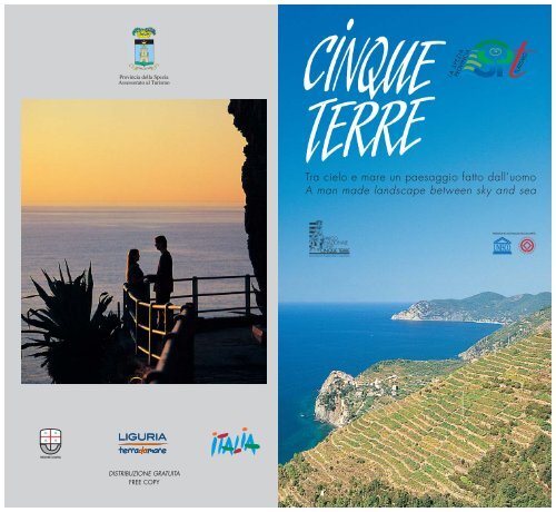
Tra cielo e mare un paesaggio fatto dall'uomo A man made ...
Tra cielo e mare un paesaggio fatto dall'uomo A man made ...
Tra cielo e mare un paesaggio fatto dall'uomo A man made ...

You also want an ePaper? Increase the reach of your titles
YUMPU automatically turns print PDFs into web optimized ePapers that Google loves.
Provincia della Spezia<br />
Assessorato al Turismo<br />
<strong>Tra</strong> <strong>cielo</strong> e <strong>mare</strong> <strong>un</strong> <strong>paesaggio</strong> <strong>fatto</strong> dall’uomo<br />
A <strong>man</strong> <strong>made</strong> landscape between sky and sea<br />
DISTRIBUZIONE GRATUITA<br />
FREE COPY
UN PAESAGGIO FATTO DALL’UOMO<br />
Nel corso dei secoli l’uomo, con <strong>un</strong> lavoro costante e collettivo, è stato capace di<br />
creare questo <strong>paesaggio</strong>, <strong>un</strong>ico al mondo, racchiuso in <strong>un</strong>o scrigno tra P<strong>un</strong>ta Mesco<br />
e P<strong>un</strong>ta Monte Nero. Un angolo di Liguria dove generazioni hanno lavorato per<br />
creare questa monumentale architettura paesaggistica che sono i terrazzamenti a<br />
picco sul <strong>mare</strong>. Sorretti da più di 7000 km lineari di muri a “secco”, sapientemente<br />
messi in opera senza alc<strong>un</strong> legante cementizio, sono coltivati a vigneto fino quasi<br />
a lambire le onde del <strong>mare</strong>.<br />
Le Cinque Terre, riconosciute dall’Unesco “Patrimonio Mondiale dell’U<strong>man</strong>ità”,<br />
sono oggi Parco Nazionale e Area Marina Protetta con il proposito di tutelare questa<br />
grande eredità culturale.
A MAN MADE LANDSCAPE<br />
Over the centuries, through constant collective work, <strong>man</strong> has <strong>man</strong>aged to create<br />
this landscape, the only one of its kind in the world, safely kept inside a treasure<br />
chest between P<strong>un</strong>ta Mesco and P<strong>un</strong>ta Monte Nero. A little corner of Liguria where<br />
generations have worked to create this monument in landscape architecture represented<br />
by the steep terraces sloping down to the sea. Held up by over 7000 km of dry stone<br />
walling, cleverly built without any kind of cement, they are cultivated as vineyards<br />
that reach down to almost touch the lapping sea waves.<br />
The Cinque Terre, recognised by the Unesco “Mankind’s World Heritage”, are today<br />
a National Park and Protected Marine Area with the aim of protecting this great<br />
cultural heritage.<br />
1
LUNGO I SENTIERI DELLA MACCHIA MEDITERRANEA<br />
Il modo migliore per scoprire, cercare di capire e “gustare” le Cinque Terre è senza<br />
dubbio quello di percorrerle a piedi. L<strong>un</strong>go i sentieri e le scalinate centenarie, che fino<br />
a poco tempo fa erano le <strong>un</strong>iche vie di collegamento tra i cinque borghi, si subisce<br />
l’incanto di questo <strong>paesaggio</strong> e dei suoi panorami appesi tra <strong>cielo</strong> e <strong>mare</strong>. I terrazzamenti<br />
coltivati a vigneto si alternano con fasce di ulivi e là dove l’opera dell’uomo è cessata<br />
la macchia mediterranea ha ripreso tutti i suoi diritti con i tondi cespugli delle euforbie,<br />
le ginestre, i cisti bianchi e rosei, le agavi che p<strong>un</strong>teggiano il <strong>paesaggio</strong> e il forte profumo<br />
speziato dell’elicriso.<br />
Il sentiero più famoso delle Cinque Terre è la Via dell’Amore, in parte tagliato nella<br />
roccia a picco sul <strong>mare</strong>, che collega Manarola a Riomaggiore.<br />
2
ALONG THE PATHS OF THE MEDITERRANEAN BUSH<br />
Without doubt, the best way to discover, to try and <strong>un</strong>derstand and enjoy the Cinque<br />
Terre is to visit it on foot. Along the paths and the centuries old flights of steps, which<br />
up to a short while ago were the only comm<strong>un</strong>ication routes between the five villages,<br />
you come <strong>un</strong>der the magic of this landscape and its panoramas suspended between sky<br />
and sea. The terraced vineyards alternate with strips of olive trees and where <strong>man</strong> has<br />
abandoned the soil, the Mediterranean bush has taken over again, with ro<strong>un</strong>d euphorbia<br />
bushes, broom, white and pink cystus and the agaves that dot the landscape and heady,<br />
spicy perfume of the eternal flower.<br />
The most famous path of the Cinque Terre is the “Via dell’Amore”, connecting Manarola<br />
to Riomaggiore and partially cut out of the steep cliffs overlooking the sea.<br />
3
IL MARE DI SCOGLIO DELLE CINQUE TERRE<br />
La popolazione di questi luoghi, originariamente agricola, viveva sulle alture. Scesa sul<br />
litorale quando il <strong>mare</strong>, finite le incursioni saracene, è diventato sicuro, ha popolato i<br />
borghi alla foce dei torrenti in riva al <strong>mare</strong>.<br />
Il <strong>paesaggio</strong> delle Cinque Terre è aspro e selvaggio ed anche la costa rispecchia questa<br />
natura. Alte falesie che si tuffano a strapiombo nei fondali blu cobalto del <strong>mare</strong><br />
nascondono minuscole spiagge di ghiaia a Riomaggiore e Vernazza o piccoli “scali”,<br />
come a Manarola, per tirare le barche “a secco” quando il <strong>mare</strong> è in tempesta. Qui,<br />
in estate, i bagnanti si mescolano ai pescatori. <strong>Tra</strong> Vernazza e Corniglia si raggi<strong>un</strong>ge a<br />
piedi la ro<strong>man</strong>tica spiaggetta di Guvano. Una spiaggia più ampia in sabbia, attrezzata,<br />
si trova solo a Monterosso al Mare.<br />
4
THE ROCKY SEA OF THE CINQUE TERRE<br />
The inhabitants of these places had agricultural origins and lived on the hills. They<br />
came down to the coast, once the Saracens had finished invading, when the sea<br />
became safe and populated the villages at the mouths of the rivers along the shore.<br />
Cinque Terre landscape is harsh and wild and even the coast reflects this nature.<br />
High cliffs reaching down into the cobalt blue depths of the sea hide minute shingle<br />
beaches at Riomaggiore and Vernazza or tiny “ports” like at Manarola, for pulling<br />
up the boats when the sea is rough. Here, in summer, s<strong>un</strong>bathers mix with fishermen.<br />
Between Vernazza and Corniglia there is the ro<strong>man</strong>tic beach of Guvano, to be<br />
reached on foot. A larger sandy beach, with facilities, can be fo<strong>un</strong>d only at Monterosso<br />
al Mare.<br />
5
I BORGHI<br />
Nel medioevo il nome “terra” designava il borgo. Da qui il nome Cinque Terre. Passata<br />
P<strong>un</strong>ta Mesco, arrivando da Genova, il primo paese che si incontra è Monterosso al<br />
Mare, l’<strong>un</strong>ico borgo con ampia spiaggia ed <strong>un</strong>a passeggiata a <strong>mare</strong> che collega il centro<br />
storico al nuovo quartiere di Fegina.<br />
Vernazza, situata alla foce di <strong>un</strong> torrente, è protetta naturalmente dalle insidie del <strong>mare</strong><br />
da <strong>un</strong> promontorio roccioso ed è, da sempre, l’<strong>un</strong>ico approdo sicuro delle Cinque Terre.<br />
Corniglia, la sola a non essere sul <strong>mare</strong>, ma adagiata su <strong>un</strong>a collina circondata da vigneti,<br />
ha <strong>un</strong> suo fascino dolcemente campestre. Manarola e Riomaggiore, aggrappati alla<br />
roccia, con le case affastellate in <strong>un</strong> variopinto mosaico affacciate sul <strong>mare</strong>, sono dei<br />
cinque paesi i più tipici e selvaggi.<br />
6
THE VILLAGES<br />
In medieval times, the name “terra” (land) meant village. From this origin comes the<br />
name Cinque Terre (five villages). Having ro<strong>un</strong>ded P<strong>un</strong>ta Mesco, coming from Genoa,<br />
the first village is Monterosso al Mare, the only one with a large beach and promenade<br />
connecting its historical centre to the new Fegina quarter.<br />
Vernazza, located at the mouth of a river, is naturally protected from the threat of the<br />
sea by a rocky promontory and it has always been the only safe landing point in the<br />
Cinque Terre. Corniglia, the only village not on the sea, but nestling on a hill surro<strong>un</strong>ded<br />
by vineyards, has its own sweetly co<strong>un</strong>trified appeal. Manarola and Riomaggiore, clinging<br />
to the rock face, with their houses piled up in a multi-coloured mosaic overlooking the<br />
sea, are the most typical and <strong>un</strong>spoilt villages of the five.<br />
7
CHIESE ROMANICHE E SANTUARI<br />
La ricchezza monumentale delle Cinque Terre è espressa nelle sue chiese tardo-ro<strong>man</strong>iche.<br />
Tre di queste portano in facciata dei bellissimi rosoni, veri fiori di pietra: San Pietro a<br />
Corniglia, forse la più antica, San Lorenzo a Manarola che domina il borgo e San<br />
Giovanni Battista a Monterosso con la facciata genovese a strisce bianche e nere.<br />
Notevoli i due portali laterali del XIV secolo nella chiesa di Riomaggiore. Molto suggestivo<br />
il campanile ottagonale della chiesa di Vernazza, l’<strong>un</strong>ica edificata sul <strong>mare</strong> nell’ansa<br />
protetta del porticciolo. Rilevanti per la loro posizione molto panoramica sono gli antichi<br />
santuari edificati l<strong>un</strong>go la strada che si snoda in collina, <strong>un</strong>o per ciasc<strong>un</strong> paese. Sovrasta<br />
Monterosso N.S. di Soviore con annessa foresteria. Quindi la Madonna di Reggio sopra<br />
Vernazza, San Bernardino che domina Corniglia, l’antica chiesa ro<strong>man</strong>ica della Madonna<br />
della Salute sopra Manarola, la Madonna di Montenero in testa a Riomaggiore.<br />
8
ROMANESQUE CHURCHES AND SHRINES<br />
Cinque Terre’s monumental wealth is expressed in its late Ro<strong>man</strong>esque churches. Three<br />
have facades with beautiful rosettes, real stone flowers; San Pietro in Corniglia, probably<br />
the most ancient, San Lorenzo in Manarola dominating the village and San Giovanni<br />
Battista in Monterosso with its Genoese façade in black and white stripes. The two 14th<br />
Century side portals on the Riomaggiore church are also worthy of note. The church in<br />
Vernazza, the only one built on the sea in the protected inlet of the port, has a fascinating<br />
octagonal bell tower. The ancient shrines built on the winding hill road have a wonderfully<br />
panoramic position, one for each village. Overlooking Monterosso there is N.S. di Soviore<br />
with its annexed lodge. Then there is the Madonna di Reggio above Vernazza, San<br />
Bernardino that overlooks Corniglia, the ancient Ro<strong>man</strong>esque church of the Madonna<br />
della Salute above Manarola and the Madonna di Montenero at the top of Riomaggiore.<br />
9
VINI VENDEMMIA E GASTRONOMIA<br />
Le Cinque Terre, oltre che per il caratteristico <strong>paesaggio</strong>, sono famose per i vini DOC<br />
che vi si producono. I terrazzamenti coltivati a vigneto, che nel mese di settembre si<br />
ani<strong>man</strong>o di uomini e donne che portano attraverso le fasce ceste ricolme di uva dorata,<br />
offrono <strong>un</strong> bianco secco ed <strong>un</strong> passito, lo Sciachetrà, raro e prezioso. Solo uve selezionate,<br />
dopo <strong>un</strong> appassimento in arieggiate soffitte al riparo dall’umidità e dalla luce del sole,<br />
saranno pronte per la produzione di questo famoso vino dolce. La cucina di questi<br />
luoghi tra<strong>man</strong>da le vecchie ricette e le erbe aromatiche, che nascono spontanee, ne<br />
esaltano i sapori primari; si possono gustare torte di riso e di verdura con zucchine,<br />
bietole, borragine ed “erbette” selvatiche. Ma il <strong>mare</strong> è senza dubbio il principale<br />
protagonista a tavola con abbondante scelta di pesce fresco. In estate c’è la ricchezza<br />
e la bontà delle acciughe di Monterosso pescate con la lampara.<br />
10
WINES, HARVESTING AND GASTRONOMY<br />
The Cinque Terre, apart from its characteristic landscape, is also famous for the DOC<br />
wines produced here. The terraced vineyards, which in the months of September are<br />
full of men and women using headbands to carry baskets overflowing with golden<br />
grapes, offer a dry white and Sciachetrà, a rare precious raisin wine. Only selected<br />
grapes, after drying in airy attics away from the damp and the s<strong>un</strong>light, will be ready<br />
for the production of this famous sweet wine. The cuisine of these places hands down<br />
old recipes through generations and the herbs, which grow wild, enhance the basic<br />
flavours; it is possible to taste pies <strong>made</strong> with rice and vegetables, with courgettes, silver<br />
beet, borage and wild salad leaves. Without doubt however, the sea plays the main role<br />
at the table, with a wide choice of fresh fish. In summer there is the wealth and the<br />
goodness of Monterosso anchovies caught using special fishing lights to attract the fish.<br />
11
EVENTI E FESTE RELIGIOSE<br />
Festa dell’Ass<strong>un</strong>ta al Santuario di Soviore<br />
Infiorata del Corpus Domini a Monterosso<br />
Festa dei limoni a Monterosso<br />
Festa di San Lorenzo a Manarola con<br />
processione, parte del percorso<br />
in barca da Palaedo alla marina<br />
Festa della Madonna della Salute a Volastra<br />
Festa della Madonna di Montenero<br />
Il Presepe luminoso di Manarola<br />
I grandi murales di Silvio Benedetto<br />
nelle stazioni di Riomaggiore e Vernazza<br />
12
EVENTS AND RELIGIOUS FESTIVALS<br />
Festa dell’Ass<strong>un</strong>ta at the Santuario di Soviore<br />
Corpus Domini flower adorning in Monterosso<br />
Lemon festival in Monterosso<br />
San Lorenzo festival in Manarola with a<br />
procession, part of the route<br />
by boat from Palaedo to the seafront<br />
Madonna della Salute Festival in Volastra<br />
Madonna di Montenero Festival<br />
The Illuminated Nativity at Manarola<br />
The big murales of Silvio Benedetto in<br />
Riomaggiore and Vernazza railway stations<br />
13
PARCO NAZIONALE DELLE CINQUE TERRE Area Marina Protetta delle Cinque Terre<br />
Il Parco Nazionale delle Cinque Terre è il primo parco italiano creato per tutelare <strong>un</strong><br />
<strong>paesaggio</strong> in massima parte costruito dall’uomo. Per raggi<strong>un</strong>gere i propri obiettivi l’Ente<br />
Parco favorisce lo sviluppo di <strong>un</strong> turismo responsabile, capace quindi di investire<br />
nell’identità dei luoghi e dei prodotti del territorio, per arrivare a salvare quindi l’immenso<br />
patrimonio dei terrazzamenti, ora in pericolo. Ma non solo. Gli elementi naturali, così<br />
evidenti l<strong>un</strong>go i sentieri, vengono valorizzati (in special modo la macchia mediterranea<br />
e l’avifa<strong>un</strong>a) nel Centro di Osservazioni Naturalistiche di Torre Guardiola.<br />
L’Area Marina Protetta inoltre tutela e divulga gli ambienti sommersi, in particolare quelli<br />
corrispondenti ai due principali promontori, Capo di Monte Nero e P<strong>un</strong>ta Mesco, che<br />
ancora ospitano importanti popolamenti dei fondali rocciosi. La riserva promuove<br />
immersioni guidate e attività di scoperta delle forme di vita marine a favore dei ragazzi.<br />
14
CINQUE TERRE NATIONAL PARK Cinque Terre Protected Marine Area<br />
The Cinque Terre National Park is the first Italian park created to safeguard a landscape<br />
that has been mostly built by <strong>man</strong>. To achieve its objectives, the Park Organisation<br />
encourages the development of responsible tourism, able therefore to invest in the<br />
identity of the places and the territory’s products, and thus save its immense heritage<br />
of terracing, now endangered. But not only. The natural elements that are so evident<br />
along the paths, are to be promoted (especially the Mediterranean bush and bee species)<br />
in the Torre Guardiola Naturalistic Observation Centre. The Protected Marine Area also<br />
protects and reveals submerged environments, in particular those corresponding to the<br />
two main promontories, Capo di Monte Nero and P<strong>un</strong>ta Mesco, which are still home<br />
to important sections of rocky seabed. The reserve promotes guided immersions and<br />
discovery activities into the forms of marine life for children.<br />
15
INFORMAZIONI/INFORMATION:<br />
PROVINCIA DELLA SPEZIA<br />
Servizio Turismo<br />
Viale Mazzini, 47 - 19100 La Spezia<br />
Tel. 0187 254311 - Fax. 0187 770908<br />
Internet: www.turismoprovincia.laspezia.it<br />
e-mail: area9@provincia.sp.it<br />
UFFICI DI INFORMAZIONE<br />
E DI ACCOGLIENZA TURISTICA<br />
INFORMATION AND TOURIST<br />
WELCOME OFFICE<br />
LA SPEZIA<br />
Viale Italia, 5<br />
Tel. 0187 770900<br />
Stazione Ferroviaria Centrale<br />
Railway Central Station<br />
P.le Medaglie D’Oro · Tel. 0187 718997<br />
Fax 0187 770908 · e-mail: iat_spezia@provincia.sp.it<br />
PARCO<br />
NAZIONALE<br />
DELLE<br />
CINQUE TERRE<br />
Area Marina Protetta delle Cinque Terre<br />
PARCO NAZIONALE DELLE CINQUE TERRE<br />
Via T. Signorini, 118 · 19017 Riomaggiore<br />
Tel. 0187 76031 - 760211<br />
Fax. 0187 760061- 920866<br />
e-mail: info@parconazionale5terre.it<br />
www.parconazionale5terre.it<br />
CENTRI ACCOGLIENZA PARCO NAZIONALE<br />
NATIONAL PARK WELCOME OFFICES<br />
La Spezia c/o Stazione<br />
Tel. 0187 743500 - Fax 0187 709743<br />
e-mail:accoglienzaspezia@parconazionale5terre.it<br />
Riomaggiore P.zza Rio Finale, 26 · 19017 Riomaggiore<br />
Tel. 0187 920633 · Fax 0187 760092<br />
e-mail: viadellamore@libero.it<br />
accoglienzariomaggiore@parconazionale5terre.it<br />
Internet Point - P.zza Rio Finale · Tel. 0187 760515<br />
netpointriomaggiore@parconazionale5terre.it<br />
Lavaccio: c/o parcheggio · Tel. 0187 920440<br />
Manarola<br />
Corniglia<br />
Vernazza<br />
Monterosso<br />
Stazione Manarola<br />
Tel. 0187 760511<br />
accoglienza<strong>man</strong>arola@parconazionale5terre.it<br />
Via alla Stazione · 19010 Corniglia<br />
Tel. 0187 812523 · Fax 0187 812524<br />
accoglienzacorniglia@parconazionale5terre.it<br />
Via Roma, 51 · 19018 Vernazza<br />
Tel. 0187 812533 · Fax 0187 812546<br />
accoglienzavernazza@parconazionale5terre.it<br />
Via Fegina, 40 · 19016 Monterosso al Mare<br />
Tel. 0187 817059 · Fax 0187 817151<br />
accoglienzamonterosso@parconazionale5terre.it<br />
Corpo Forestale dello Stato Tel. 0187 760031<br />
C.T.A. - Coordinamento Tel. 0187 817119<br />
Territoriale Ambientale<br />
Pubblicazione realizzata in collaborazione<br />
con il Parco Nazionale delle Cinque Terre<br />
Publication realized in collaboration<br />
with the Cinque Terre National Park<br />
Direttore e coordinatore della pubblicazione<br />
Publication director and coordinator<br />
Lucia Solaro Vicini<br />
Ricerca iconografica e impaginazione<br />
Iconographic research and page layout<br />
André Leuba<br />
Fotografie/Photographs<br />
Archivio Regione Liguria<br />
Archivio Parco Nazionale delle Cinque Terre<br />
Archivio Parrocchiale Manarola<br />
Altre fotografie/Other Photographs<br />
Mino A<strong>man</strong>dola - Roberto Buratta - Moreno Carbone<br />
- Sergio Fregoso - Fabio Giacomazzi - Walter Torri<br />
Edizione/Edition 2008<br />
© Provincia della Spezia<br />
Assessorato al Turismo<br />
Fotolito e fotocomposizione<br />
Offset and photo printing<br />
B&B Grafica Digitale S.r.l.<br />
www.bebgraficadigitale.it<br />
Stampa/Printing: Pacini Editore Ospedaletto (PI)<br />
<strong>Tra</strong>duzioni/<strong>Tra</strong>nslated by<br />
Liguria <strong>Tra</strong>duce Soc. di Com<strong>un</strong>icazione p.c.r.l.<br />
Eurologos Genova - www.eurologos.com<br />
Foto di copertina/Cover photograph:<br />
Corniglia circonadata dai vigneti,<br />
sullo sfondo P<strong>un</strong>ta Mesco<br />
Corniglia surro<strong>un</strong>ded by vineyards,<br />
P<strong>un</strong>ta Mesco in the backgro<strong>un</strong>d<br />
Retro copertina/Back cover: Via dell’Amore
)(<br />
Bonassola<br />
Framura<br />
Deiva Marina<br />
1<br />
Levanto<br />
P. Spiaggia<br />
Carrodano<br />
M. Ve’ o<br />
Focone<br />
1<br />
P. della Gatta<br />
CARRODANO Levanto<br />
A12<br />
)(<br />
1<br />
487 mt<br />
Sentieri/Footpaths<br />
M. Rossini<br />
Colla dei Bagari<br />
10<br />
Scoglio Gagiato<br />
1 Porto Venere - Levanto 12h<br />
Porto Venere - Campiglia 2h<br />
Campiglia - Telegrafo<br />
1h<br />
Telegrafo - Sella La Croce 1h<br />
Sella La Croce - La Cigoletta 1h 40m<br />
La Cigoletta - Drignana 2h<br />
Drignana - Soviore<br />
1h<br />
Soviore- S. Antonio - Levanto 2h 30m<br />
2 Riomaggiore - Monterosso 4h 30m<br />
Riomaggiore - Manarola<br />
20m<br />
Manarola - Corniglia<br />
1h<br />
Corniglia - Vernazza<br />
1h 30m<br />
Vernazza - Monterosso 2h<br />
3 Riomaggiore - Telegrafo 1h 40m<br />
3a Riomaggiore - Telegrafo 1h 40m<br />
4 Biassa - Schiara 2h 15m<br />
4b Fossola - Campiglia<br />
1h 20m<br />
4c Fossola - S.Antonio<br />
1h<br />
01 Riomaggiore - Sella La Croce 2h 15m<br />
02 Manarola - innesto n°1 2h<br />
6 Manarola - Aia del Cane 2h 30m<br />
6d Volastra - Case Pianca<br />
1h<br />
7 Vernazza - La Cigoletta 2h 20m<br />
7a Corniglia - Prato del Monte 1h 15m<br />
8 Vernazza - Foce di Drignana 1h 30m<br />
8b M.na di Reggio - Il Termine 1h 30m<br />
9 Monterosso - M.na di Soviore 1h 30m<br />
10 Monterosso - S.Antonio 1h<br />
12 Colla di Gritta - Levanto 40m<br />
)(<br />
330 mt<br />
Colla di Gritta<br />
Sella<br />
S. Antonio<br />
314 mt<br />
S.Antonio<br />
Semaforo<br />
)(<br />
Passo del Bracco<br />
P<strong>un</strong>ta Mesco<br />
1<br />
9<br />
Monterosso<br />
al Mare<br />
M. Crocettola<br />
Mad. di<br />
Soviore<br />
602 mt<br />
17<br />
9<br />
M. Albereto<br />
M. Soviore<br />
2<br />
P. Corone<br />
8/b<br />
P. Molinara<br />
)(<br />
543 mt<br />
il Termine<br />
Sella Schisarola<br />
M. S.Croce<br />
8/b<br />
P. Linà<br />
Pignone<br />
Vernazza<br />
BRUGNATO<br />
A12<br />
8<br />
8<br />
1<br />
Foce di Drignana<br />
I sentieri indicati sono tutti generalmente percorribili, anche se<br />
occorre prestare sempre attenzione ai dislivelli da superare ed<br />
ai p<strong>un</strong>ti esposti.<br />
A causa del fondo a volte accidentato si consiglia di dotarsi di<br />
calzature adeguate.<br />
In caso di cattivo tempo alc<strong>un</strong>i tratti del sentiero n°2, per il pericolo<br />
di frane, possono venire chiusi per precauzione. Informarsi in<br />
loco sulla loro percorribilità.<br />
You always have to be very careful because of the different<br />
levels of the gro<strong>un</strong>d, the paths may slope steeply down-upwards<br />
and to the open spots, especially the ones overlooking ravines.<br />
Due to <strong>un</strong>even gro<strong>un</strong>d in some places we would recommend<br />
suitable footwear.<br />
In bad weather certain parts of footpath no.2 are closed for<br />
safety reasons as there is a risk of landslides.<br />
È possibile noleggiare biciclette o cavalli con il supporto di<br />
validi accompagnatori in appositi p<strong>un</strong>ti attrezzati dal Parco<br />
delle Cinque Terre. Situati in fascia medio alta sono<br />
raggi<strong>un</strong>gibili con i servizi della mobilità interna del Parco.<br />
Si possono fare originali escursioni su di <strong>un</strong>a carrozza trainata<br />
da cavalli.<br />
It is possible to hire bikes or horses with the assistance of<br />
competent guides in places specially equipped for that purpose<br />
by the Cinque Terre Park. Situated in a middle-high belt, they<br />
can be reached using the internal means of transport of the<br />
Park. One can make <strong>un</strong>usual excursions on a horse-drawn<br />
carriage.<br />
)(<br />
)(<br />
Drignana<br />
Madonna<br />
di Reggio<br />
M. Malpertuso<br />
7<br />
P. Palma<br />
812 mt<br />
Le Stalle<br />
2<br />
Prato<br />
di Corvara<br />
Vernazzola<br />
Murro<br />
)(<br />
7<br />
)(<br />
Guvano<br />
P. del Luogo<br />
1<br />
M. Castello<br />
M. Gaginara<br />
La Cigoletta Prato<br />
del Monte<br />
7<br />
S. Bernardino<br />
385 mt<br />
785 mt<br />
771 mt<br />
)(<br />
7/a<br />
Corniglia<br />
)(<br />
7/a<br />
7/a<br />
C.se Pianca<br />
6/d<br />
C.Porciana<br />
Casella/Valdipino<br />
M. Marvede<br />
660 mt<br />
2<br />
6/d<br />
Spiaggione di Corniglia<br />
P<strong>un</strong>ta Buonfiglio<br />
Serenella<br />
Valdipino<br />
6<br />
Madonna<br />
della Salute<br />
Manarola<br />
6<br />
5<br />
Aia del Cane<br />
M. Le Croci<br />
Volastra<br />
340 mt<br />
6<br />
Quaratica<br />
1<br />
02<br />
Via dell’Amore<br />
Riomaggiore<br />
LEGENDA/MAP SYMBOLS<br />
M. Capri<br />
785 mt<br />
CANTINA<br />
SOCIALE<br />
Groppo<br />
2<br />
Area Parco Nazionale delle Cinque Terre<br />
Cinque Terre National Park<br />
Strade principali<br />
Main roads<br />
Strade secondarie<br />
Secondary roads<br />
Sentiero longitudinale a monte<br />
Inland longitudinal paths<br />
Sentiero longitudinale a <strong>mare</strong><br />
Coastal longitudinal paths<br />
Sentieri trasversali<br />
<strong>Tra</strong>nsversal paths<br />
Ferrovia<br />
200 mt<br />
Area Marina Protetta delle Cinque Terre<br />
Cinque Terre Protected Marine Area<br />
Zona A<br />
La zona A (delimitata da boe di<br />
segnalazione gialle) rappresenta<br />
l’area di maggior pregio<br />
naturalistico (P<strong>un</strong>ta Mesco).<br />
Zona B<br />
Railway lines<br />
Linea traghetti<br />
Ferry routes<br />
Menhir di<br />
M. Capri<br />
01<br />
)(<br />
02<br />
La zona B insiste su due aree. La<br />
prima rappresenta <strong>un</strong>a fascia di<br />
rispetto della zona A. La seconda<br />
circonda il Capo di Monte Nero.<br />
Zone A (bordered by yellow Zone B covers two areas. The<br />
marker buoys) covers the area of first one represents a zone A.<br />
greatest natural wealth (P<strong>un</strong>ta The second one surro<strong>un</strong>ds the<br />
Mesco).<br />
“Capo di Monte Nero”.<br />
Codeglia<br />
M. Galera<br />
Sella<br />
La Croce<br />
01<br />
1<br />
3 3/a<br />
Madonna<br />
di Monte Nero<br />
Torre Guardiola<br />
C. di Monte Nero P<strong>un</strong>ta del Cavo<br />
)(<br />
341 mt<br />
Carpena/La Foce<br />
M. Grosso<br />
Zona C<br />
M. Verrugoli<br />
745 mt<br />
)(<br />
P<strong>un</strong>ta Pineda<br />
Bivio Bramapane<br />
Lemmen<br />
3<br />
Campi<br />
Sella di<br />
Carpena<br />
)(<br />
)(<br />
516 mt<br />
M. Fraschi<br />
P<strong>un</strong>ta Merlino<br />
Telegrafo<br />
4/b<br />
4/c<br />
La Foce<br />
4<br />
4/c<br />
Biassa<br />
4<br />
Fossola<br />
4/b<br />
Seno<br />
di Fòssola<br />
P<strong>un</strong>ta di Monesteroli<br />
La zona C include e collega i<br />
due promontori, ponendo sotto<br />
osservazione e tutela <strong>un</strong>a vasta<br />
area di fondi sabbiosi e rocciosi.<br />
Zone C includes and links the<br />
two most distant headlands and<br />
allows both the observation and<br />
protection of a wide area<br />
characterised by alternating rocky<br />
and sandy bottoms.<br />
Da/from MILANO via Genova<br />
A7<br />
MILANO → GENOVA A12<br />
→ LA SPEZIA<br />
Da/from MILANO via Parma<br />
MILANO A1<br />
→ PARMA A15<br />
→ LA SPEZIA<br />
Da/from TORINO<br />
TORINO A21<br />
→ ALESSANDRIA A26<br />
→ GENOVA A12<br />
→ LA SPEZIA<br />
Da/from VENTIMIGLIA<br />
VENTIMIGLIA A10<br />
→ GENOVA A12<br />
→ LA SPEZIA<br />
Da/from ROMA via Firenze<br />
ROMA A1<br />
→ FIRENZE A11<br />
→ PISA A12<br />
→ LA SPEZIA<br />
Da/from ROMA via Grosseto<br />
ROMA SS1<br />
→ LIVORNO A12<br />
→ LA SPEZIA<br />
Ferrovia / Railway<br />
ROMA - GENOVA - TORINO<br />
BOLOGNA - PARMA - GENOVA<br />
Aeroporti / Airports<br />
PISA 84 Km - GENOVA 112 Km<br />
)(<br />
Valico di<br />
S. Antonio<br />
511 mt<br />
4<br />
Menhir di<br />
<strong>Tra</strong>monti<br />
4/b<br />
4<br />
Monesteroli<br />
Scoglio Ferale<br />
4<br />
Schiara<br />
205 mt<br />
1<br />
Campiglia<br />
4/b<br />
La Spezia<br />
382 mt<br />
)(<br />
Il Chioso<br />
P. del Persico<br />
Il Persico<br />
1<br />
Albana<br />
L<br />
I<br />
G<br />
Acquasanta<br />
Marola<br />
Le Rosse<br />
U<br />
R<br />
GENOVA<br />
I<br />
MILANO<br />
A<br />
LA SPEZIA<br />
M. Castellana<br />
496 mt<br />
PARMA<br />
PISA<br />
BOLOGNA<br />
FIRENZE<br />
VENEZIA<br />
M. Muzzerone<br />
310 mt<br />
ROMA<br />
AUTOSTRADA<br />
A12 - A15<br />
Porto Venere<br />
Lerici<br />
Golfo<br />
dei Poeti<br />
Isola Palmaria


