CARTOGRAFIA BÁSICA - Universidade Federal de São Carlos
CARTOGRAFIA BÁSICA - Universidade Federal de São Carlos
CARTOGRAFIA BÁSICA - Universidade Federal de São Carlos

You also want an ePaper? Increase the reach of your titles
YUMPU automatically turns print PDFs into web optimized ePapers that Google loves.
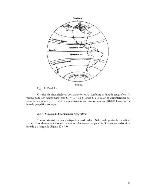
Fig. 11 - Paralelos<br />
O valor da circunferência dos paralelos varia conforme a latitu<strong>de</strong> geográfica. A<br />
mesma po<strong>de</strong> ser <strong>de</strong>terminada por: CP = CE Cos φ, on<strong>de</strong> CP é o valor da circunferência no<br />
paralelo <strong>de</strong>sejado, CE é o valor da circunferência no equador terrestre (40.000 km) e φ é a<br />
latitu<strong>de</strong> geográfica do lugar.<br />
2.4.1 - Sistema <strong>de</strong> Coor<strong>de</strong>nadas Geográficas<br />
Trata-se do sistema mais antigo <strong>de</strong> coor<strong>de</strong>nadas. Nele, cada ponto da superfície<br />
terrestre é localizado na interseção <strong>de</strong> um meridiano com um paralelo. Suas coor<strong>de</strong>nadas são a<br />
latitu<strong>de</strong> e a longitu<strong>de</strong> (Figura 12 e 13).<br />
33