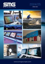
SMG Issue 48.1
2023 Marine Electronics Catalogue with the latest products from leading brands such as Raymarine, Garmin, Furuno and many others.
2023 Marine Electronics Catalogue with the latest products from leading brands such as Raymarine, Garmin, Furuno and many others.

Create successful ePaper yourself
Turn your PDF publications into a flip-book with our unique Google optimized e-Paper software.
PLATINUM®+CARTOGRAPHY<br />
REGULAR £239.99<br />
LARGE £319.99<br />
ALL THE CONTENT OF NAVIONICS+,<br />
ENHANCED WITH ADDITIONAL VIEWING OPTIONS<br />
Designed with the most demanding boaters and serious anglers<br />
in mind, all the marine content of Navionics+ is enhanced with<br />
additional viewing options that take your boating experience<br />
to the next level. Easily download premium features to your<br />
Platinum+ card using the Navionics Chart Installer software.<br />
RELIEF SHADING<br />
The Navionics relief shading<br />
feature brings bottom detail to<br />
life, from shallow flats to deep<br />
offshore canyons, in a vivid,<br />
colourful representation that<br />
helps boaters gain a better<br />
understanding of bottom<br />
topography. Available in selected<br />
areas.<br />
Visit www.navionics.com for<br />
more details.<br />
SATELLITE IMAGERY WITH<br />
SONARCHART SHADING<br />
OVERLAY<br />
Created from SonarChart 0.5<br />
metre contour data, varying<br />
shades of blue reveal changes in<br />
depth such as channels and dropoffs.<br />
This improves situational<br />
awareness and give clear, visual<br />
clues to fish-holding structure.<br />
3-D VIEW<br />
Dynamic 3D View allows<br />
customizing of the chart to<br />
highlight key features for a better<br />
awareness of the surroundings. 3<br />
3 Compatibility with 3D View varies<br />
depending on the chartplotter<br />
model<br />
AERIAL PHOTOGRAPHY<br />
Aerial and panoramic<br />
photography of ports, marinas,<br />
bridges, docks, boat ramps, dams<br />
and navigational landmarks<br />
offers superior situational<br />
awareness.<br />
UPDATED CHARTS EVERY DAY<br />
EVEN ONE SMALL CHANGE CAN MAKE A<br />
BIG DIFFERENCE - WE MAKE UP TO<br />
5,000 PER DAY<br />
We redraw shorelines, refine bathymetry, update Notices to<br />
Mariners and marine protected areas, integrate changes to<br />
navigational aids, marinas, docks, boat slipways, reefs, rocks,<br />
wrecks, and fish attractors.<br />
Visit Navionics.com to see worldwide updates on our Heatmap,<br />
view the latest charts on our Chart Viewer, and download them<br />
anytime.1<br />
1<br />
An active subscription is required.<br />
All prices SRP inc VAT at 04/2023. For trade prices and stock availability visit www.smgeurope.com<br />
83 NAVIONICS