Ormond Scenic Loop & Trail - Florida Scenic Highways
Ormond Scenic Loop & Trail - Florida Scenic Highways
Ormond Scenic Loop & Trail - Florida Scenic Highways

You also want an ePaper? Increase the reach of your titles
YUMPU automatically turns print PDFs into web optimized ePapers that Google loves.
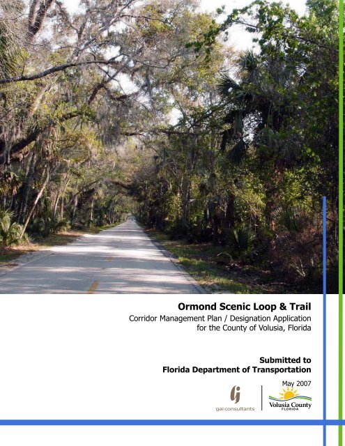
<strong>Ormond</strong> <strong>Scenic</strong> <strong>Loop</strong> & <strong>Trail</strong><br />
Corridor Management Plan / Designation Application<br />
for the County of Volusia, <strong>Florida</strong><br />
Submitted to<br />
<strong>Florida</strong> Department of Transportation<br />
May 2007
i<br />
<strong>Ormond</strong> <strong>Scenic</strong> <strong>Loop</strong> & <strong>Trail</strong> Corridor Management Plan<br />
Produced by the <strong>Ormond</strong> <strong>Scenic</strong> <strong>Loop</strong> & <strong>Trail</strong> Corridor Advocacy Group<br />
with assistance from GAI Consultants, Inc.<br />
MAY 2007<br />
The <strong>Ormond</strong> <strong>Scenic</strong> <strong>Loop</strong> & <strong>Trail</strong> acknowledges the following organizations for their assistance<br />
and support throughout the development of this project:<br />
<strong>Florida</strong> Department of Transportation, District 5<br />
County of Volusia<br />
City of <strong>Ormond</strong> Beach<br />
Heritage Crossroads: Miles of History Corridor Advocacy Group<br />
A1A <strong>Scenic</strong> & Historic Coastal Byway<br />
<strong>Florida</strong> Department of Environmental Protection<br />
Daytona Beach Community College<br />
<strong>Florida</strong> Power & Light<br />
Photographs by Skip Lowery, Rob Bird, Laura Bamberger, J. Walker Fischer, Leslie Whittaker,<br />
Richard Gardner, Scott Veix, Lou Kellenberger, Anne Barca, Charles Littlewood, the <strong>Ormond</strong><br />
Beach Historical Trust, and the <strong>Florida</strong> Department of Environmental Protection<br />
GAI Consultants, Inc.<br />
618 East South Street<br />
Orlando, <strong>Florida</strong> 32804<br />
(p) 407.423.8398<br />
(f) 407.843.1070<br />
www.gaiconsultants.com
<strong>Ormond</strong> <strong>Scenic</strong> <strong>Loop</strong> & <strong>Trail</strong> – Corridor Management Plan<br />
ii<br />
Secretary Signage Page<br />
As Secretary of the <strong>Florida</strong> Department of Transportation, the signature below indicates the approval and<br />
endorsement of this Corridor Management Plan and this corridor for designation as a <strong>Florida</strong> <strong>Scenic</strong> Highway.<br />
FDOT approval of this management plan represents our agreement to serve in a partnership with the Corridor<br />
Management Entity to preserve, enhance and maintain the designated scenic highway corridor. We recognize<br />
the grass roots initiative and strong local support for this corridor demonstrated by the communities involved<br />
in the preparation of this management plan. This corridor management plan acknowledges that the<br />
designated corridor will be subject to the requirements of the Section 1046(c) of the ISTEA which added a<br />
new subsection (s) to 23 USC 131 precluding outdoor advertising on designated scenic highways, and<br />
requirements of the Uniform Relocation Act. I hereby designate this corridor as a <strong>Florida</strong> <strong>Scenic</strong> Highway.<br />
Denver J. Stutler, Jr.<br />
Secretary of Transportation<br />
Date
<strong>Ormond</strong> <strong>Scenic</strong> <strong>Loop</strong> & <strong>Trail</strong> – Corridor Management Plan<br />
iv<br />
Executive Summary:<br />
The <strong>Ormond</strong> <strong>Scenic</strong> <strong>Loop</strong> & <strong>Trail</strong> is the culmination of a great community effort. Originally<br />
organized as two Corridor Advocacy Groups, the Historic <strong>Ormond</strong>-by-the-Sea <strong>Scenic</strong> <strong>Trail</strong> and the<br />
<strong>Ormond</strong> Beach <strong>Scenic</strong> <strong>Loop</strong>, the forces were joined to create the <strong>Ormond</strong> <strong>Scenic</strong> <strong>Loop</strong> & <strong>Trail</strong><br />
(OSL&T) Corridor Advocacy Group and this Corridor Management Plan.<br />
The OSL&T Corridor starts on A1A at the Flagler County line and extends south from the Flagler<br />
A1A <strong>Scenic</strong> and Historic Coastal Byway to Granada Boulevard (SR 40). It then extends west on<br />
SR 40 to North Beach Street where it turns north and continues along North Beach Street, Old<br />
Dixie Highway, Walter Boardman Road then turns east on Highbridge Road back to A1A and the<br />
Atlantic Ocean. The OSL&T also includes John Anderson Drive from SR 40 to Highbridge Road.<br />
This creates a figure-eight roadway with a 0.9 mile extension along Pine Tree Drive.<br />
The OSL&T Corridor Management Entity (CME) is being formed to preserve and enhance the<br />
Intrinsic Resources of the Corridor. The beauty of the Atlantic Ocean drive along the eastern part<br />
of the Corridor will be enhanced with landscaping and improved parking. The historic structures<br />
along the southern portion of the Corridor will be preserved with the oversight of the <strong>Ormond</strong><br />
Beach Historic Landmark Preservation Board and the Volusia County Historic Preservation<br />
Ordinance.<br />
The CME will work with the Volusia County and City of <strong>Ormond</strong> Beach staff to identify potential<br />
trail projects and develop a Master Plan in coordination with the <strong>Florida</strong> State Park staff. The<br />
CME will help staff by obtaining letters of support and the hosting of public meetings to assist in<br />
the award of grant money to fund identified project segments.<br />
The CME will work with the City, County and the FDOT to implement traffic calming measures<br />
and improve safety. As part of the Master Plan needed sidewalks will also be identified and the<br />
CME will work with the appropriate agencies to ensure their installation.<br />
The CME will also identify a series of educational and informational sign opportunities. They will<br />
assemble the local knowledge and background that will be given to a designer for the creation of<br />
a cohesive sign program. The signs will draw visitors through the Corridor with an interpretation<br />
of the area’s history, flora, fauna, habitats, water bodies and land forms. This information is<br />
graphically depicted in the Action Plan Map in Section 13 at the end of this document.
<strong>Ormond</strong> <strong>Scenic</strong> <strong>Loop</strong> & <strong>Trail</strong> – Corridor Management Plan<br />
x<br />
Responses to SHAC Comments:<br />
Historic <strong>Ormond</strong>-by-the-Sea (HOSST) Responses<br />
1. The Designation Application/Corridor Management Plan (CMP) has incorporated<br />
additional photos and graphics.<br />
2. Benny Woodham, Tomoka State Park Manager was very involved in the development of<br />
the CMP.<br />
3. The Community Participation Plan was expanded and the joining of the HOSST and OBSL<br />
CAGs into a coherent whole has brought added support to the greater effort.<br />
4. Additional local support has been attained through community outreach and letters of<br />
support have been included in Appendix B.<br />
5. The requested correction has been made.<br />
6. All figures and addendums have been revised, properly referenced, and made consistent.<br />
7. This page is intended to serve as the requested memorandum.<br />
<strong>Ormond</strong> Beach <strong>Scenic</strong> <strong>Loop</strong> (OBSL) Responses<br />
1. A paragraph has been added to the Designation Application on interpretation in the Park.<br />
The Action Plan includes the addition of interpretive panels throughout the Corridor.<br />
Several panels describing the natural, cultural, historical and archeological resources<br />
should be constructed in Tomoka State Park as a part of this program.<br />
2. The Action Plan includes the addition of interpretive panels throughout the Corridor.<br />
Several panels describing the natural, cultural, historical and archeological resources<br />
should be constructed in Tomoka State Park as a part of this program. Further research<br />
will need to be done to design appropriate archeological interpretive panels<br />
3. The development pressures continue and the CAG members have remained active in<br />
their struggle to preserve the resources. The local Comprehensive Plans are both quite<br />
thorough in their range of protections.<br />
4. Many more cultural resources were added to the Designation Application.<br />
5. Adding traffic calming methods to the roadway is a part of the Action Plan.
<strong>Ormond</strong> <strong>Scenic</strong> <strong>Loop</strong> & <strong>Trail</strong> – Corridor Management Plan<br />
xi<br />
Table of Contents<br />
<strong>Ormond</strong> <strong>Scenic</strong> <strong>Loop</strong> & <strong>Trail</strong> Corridor Management Plan Title Page<br />
Secretary Signature Page<br />
Designation Application<br />
Executive Summary<br />
Summary of SHAC Meeting<br />
Responses to SHAC Comments<br />
i<br />
ii<br />
iii<br />
iv<br />
v<br />
x<br />
Section 1: Background Conditions Analysis 1<br />
1.1 Corridor Limits 1<br />
1.2 Roadway/ROW Description 5<br />
1.3 Existing Land Use and Zoning 11<br />
1.4 Signage 15<br />
1.5 Future Land Use 17<br />
1.6 Safety Issues 21<br />
1.7 Traffic Volumes/User Types 27<br />
1.8 Levels of Service 31<br />
1.9 Transportation Planning 34<br />
1.10 Roadway Improvements 38<br />
1.11 Social and Economic Conditions 39<br />
1.12 Tourism and User Facilities 40<br />
1.13 Other Programs 41<br />
Section 2: Intrinsic Resource Assessment and Designation Criteria 43<br />
2.1 Universal Criteria 43<br />
2.2 Resource Specific Criteria 57<br />
Section 3: Corridor Vision 97<br />
Section 4: Goals, Objectives, and Strategies 99
<strong>Ormond</strong> <strong>Scenic</strong> <strong>Loop</strong> & <strong>Trail</strong> – Corridor Management Plan<br />
xii<br />
Section 5: Corridor’s Story 104<br />
Section 6: Corridor Management Entity 109<br />
Section 7: Community Participation Program 118<br />
Section 8: Local Support 123<br />
Section 9: Protection Techniques 125<br />
Section 10: Funding and Promotion 128<br />
Section 11: Relationship to Comprehensive Plan 132<br />
Section 12: Partnerships and Agreements 139<br />
Section 13: Action Plan 148<br />
Tables<br />
Table 1: <strong>Ormond</strong> <strong>Scenic</strong> <strong>Loop</strong> & <strong>Trail</strong> Roadway Cross-Section Summary 8<br />
Table 2: <strong>Ormond</strong> <strong>Scenic</strong> <strong>Loop</strong> & <strong>Trail</strong> Crash Summary 23<br />
Table 3: <strong>Ormond</strong> <strong>Scenic</strong> <strong>Loop</strong> & <strong>Trail</strong> Crash Analysis - Segment Sections 25<br />
Table 4: <strong>Ormond</strong> <strong>Scenic</strong> <strong>Loop</strong> & <strong>Trail</strong> Crash Analysis - Spot Locations 26<br />
Table 5: <strong>Ormond</strong> <strong>Scenic</strong> <strong>Loop</strong> & <strong>Trail</strong> Traffic Volume and Level of Service 30<br />
Table 6: <strong>Ormond</strong> <strong>Scenic</strong> <strong>Loop</strong> & <strong>Trail</strong> Traffic Volume and Level of Service with<br />
Adopted 2025 AADT & LOS 33<br />
Table 7: Single-Family New House Construction Building Permits 39<br />
Table 8: Relationship to Comprehensive Plans of Volusia County and the City of<br />
<strong>Ormond</strong> Beach 132<br />
Table 9: Corridor Enhancements 150<br />
Table 10: Community Participation 152<br />
Table 11: Administration and Coordination 153<br />
Figures<br />
Figure 1: Map of Southeast US 40<br />
Figure 2: Household Income 1999 40<br />
Figure 3: 2000 Estimate of House Values 40
<strong>Ormond</strong> <strong>Scenic</strong> <strong>Loop</strong> & <strong>Trail</strong> – Corridor Management Plan<br />
xiii<br />
Maps<br />
Map 1: <strong>Ormond</strong> <strong>Scenic</strong> <strong>Loop</strong> & <strong>Trail</strong> Location Map 3<br />
Map 2: <strong>Ormond</strong> <strong>Scenic</strong> <strong>Loop</strong> & <strong>Trail</strong> Volusia County Mileage map 4<br />
Map 3: <strong>Ormond</strong> <strong>Scenic</strong> <strong>Loop</strong> & <strong>Trail</strong> Roadway Right-of-Way (southern half) 6<br />
Map 4: <strong>Ormond</strong> <strong>Scenic</strong> <strong>Loop</strong> & <strong>Trail</strong> Roadway Right-of-Way (northern half) 7<br />
Map 5: <strong>Ormond</strong> <strong>Scenic</strong> <strong>Loop</strong> & <strong>Trail</strong> Existing Zoning (southern half) 13<br />
Map 6: <strong>Ormond</strong> <strong>Scenic</strong> <strong>Loop</strong> & <strong>Trail</strong> Existing Zoning (northern half) 14<br />
Map 7: <strong>Ormond</strong> <strong>Scenic</strong> <strong>Loop</strong> & <strong>Trail</strong> Future Land Use (southern half) 19<br />
Map 8: <strong>Ormond</strong> <strong>Scenic</strong> <strong>Loop</strong> & <strong>Trail</strong> Future Land Use (northern half) 20<br />
Map 9: <strong>Ormond</strong> <strong>Scenic</strong> <strong>Loop</strong> & <strong>Trail</strong> Historical, Recreational, and<br />
Cultural Resources (southern half) 73<br />
Map 10: <strong>Ormond</strong> <strong>Scenic</strong> <strong>Loop</strong> & <strong>Trail</strong> Historical, Recreational, and<br />
Cultural Resources (northern half) 74<br />
Map 11: Action Plan Map 154<br />
Appendix A: Resolutions & Partnership Agreements<br />
Appendix B: Letters of Support<br />
Appendix C: Local Media Support<br />
Appendix D: City of <strong>Ormond</strong> Beach Comprehensive Plan<br />
Appendix E: Volusia County Comprehensive Plan<br />
Appendix F: Planned Roadway Improvements<br />
Appendix G: CAG Meeting Minutes<br />
Appendix H: <strong>Florida</strong> Department of Transportation Eligibility Letter<br />
Appendix I: Hotels / Motels and Restaurants<br />
Appendix J: Bylaws<br />
Appendix K: Historic Structures List and Map
<strong>Ormond</strong> <strong>Scenic</strong> <strong>Loop</strong> & <strong>Trail</strong> – Corridor Management Plan<br />
1<br />
Section 1: Background Conditions Analysis<br />
1.1 Corridor Limits<br />
Map 1 (p 3) illustrates the alignment of the <strong>Ormond</strong> <strong>Scenic</strong> <strong>Loop</strong> & <strong>Trail</strong> (Corridor) and its surrounding area.<br />
The <strong>Ormond</strong> <strong>Scenic</strong> <strong>Loop</strong> & <strong>Trail</strong> is located about six miles north of Daytona Beach and eight miles south of<br />
the City of Flagler Beach. The Corridor is a two-lane paved roadway, located in the Northeast section of<br />
Volusia County (see Maps 5 & 6: Zoning). Most of the Corridor parallels the shorelines of the Atlantic Ocean,<br />
the Halifax River and the Halifax Creek. The scenic highway starts on SR A1A at the border of Volusia County<br />
and Flagler County and forms a loop by extending southward on A1A to Granada Boulevard (SR 40) then west<br />
to North Beach Street which becomes Old Dixie Highway to the intersection with Walter Boardman Lane. The<br />
Corridor extends east along Walter Boardman Lane to Highbridge Road and terminates at SR A1A. The<br />
inclusion of John Anderson Drive (CR 2803) creates two loops or a figure eight making the total length of<br />
33.98 miles. This includes the extension along Pine Tree Drive (CR 2820) west for a distance of 0.9 miles.<br />
Highbridge Road<br />
The <strong>Ormond</strong> <strong>Scenic</strong> <strong>Loop</strong> & <strong>Trail</strong> connects with two other <strong>Scenic</strong> <strong>Highways</strong> including the Heritage Crossroads:<br />
Miles of History proposed <strong>Scenic</strong> Highway at the corners of Old Dixie Highway (CR 2002) and Walter<br />
Boardman Lane (CR 2002) and again at Walter Boardman Lane (CR 2002) and Highbridge Road. “The <strong>Loop</strong>”<br />
as envisioned by the “Save the <strong>Loop</strong>” group is the western half of the figure eight. The segment of A1A that<br />
runs from Granada Boulevard to the Flagler County line meets the southern terminus of the A1A <strong>Scenic</strong> &<br />
Historic Coastal Byway. State Road 40 (SR 40) locally known as Granada Boulevard is seeking <strong>Florida</strong> <strong>Scenic</strong><br />
Highway designation as the <strong>Florida</strong> Black Bear <strong>Scenic</strong> Byway several miles west of the <strong>Ormond</strong> <strong>Scenic</strong> <strong>Loop</strong> &<br />
<strong>Trail</strong>.<br />
Original Halifax River Bridge
<strong>Ormond</strong> <strong>Scenic</strong> <strong>Loop</strong> & <strong>Trail</strong> – Corridor Management Plan<br />
2<br />
There are no billboards along the Corridor and Designation will prevent the introduction of new billboards.<br />
The County has required developments along Old Dixie Highway to provide a 200 foot setback which will help<br />
preserve the canopied roadway. Turn lanes and acceleration/deceleration lanes will reduce some of the<br />
canopy cover, but the developments were grandfathered in and the impacts will be kept to a minimum<br />
through County staff review. There are currently no plans to acquire additional lands along the Corridor.<br />
Related Goals, Objectives and the Specific Strategies are:<br />
<br />
<br />
<br />
<br />
<br />
<br />
<br />
<br />
Strategy 1.1.3 Coordinate with jurisdictional authorities.<br />
Strategy 1.1.4 Develop on-going maintenance strategy.<br />
Strategy 1.1.5 Identify sources of grants and matching dollars for grant applications.<br />
Strategy 1.1.6 Plant Live Oak along the Highbridge segment between A1A and John Anderson Drive.<br />
Strategy 1.4.4 Create and implement a master plan that will strategize and coordinate overall long and<br />
short-term activities along the corridor including the management of vegetation, land acquisition, scenic<br />
easements, design of improvements and new construction.<br />
The Master Plan shall include but is not limited to:<br />
Bus shelters<br />
Bike rest stops<br />
Water fountain facilities<br />
Trash receptacles<br />
Signage/information kiosks indicating location of public facilities (i.e. restrooms and water)<br />
Strategy 1.4.5 Add <strong>Scenic</strong> Highway protections to the City of <strong>Ormond</strong> Beach and Volusia County<br />
Comprehensive Plans.<br />
Strategy 2.3.3 Design and build sidewalks/trails along Highbridge Road.<br />
Strategy 2.3.4 Design and build meandering trail.<br />
Action Plan 1-1, 1-2, 1-3, 1-4 and 1-5
<strong>Ormond</strong> <strong>Scenic</strong> <strong>Loop</strong> & <strong>Trail</strong> – Corridor Management Plan<br />
3<br />
<strong>Ormond</strong> <strong>Scenic</strong> <strong>Loop</strong> & <strong>Trail</strong> Location Map
<strong>Ormond</strong> <strong>Scenic</strong> <strong>Loop</strong> & <strong>Trail</strong> – Corridor Management Plan<br />
4<br />
Volusia County Mileage Map
<strong>Ormond</strong> <strong>Scenic</strong> <strong>Loop</strong> & <strong>Trail</strong> – Corridor Management Plan<br />
5<br />
1.2 Roadway/Right-of-Way (ROW) Description<br />
The <strong>Ormond</strong> <strong>Scenic</strong> <strong>Loop</strong> & <strong>Trail</strong> runs primarily north/south and connects several communities within<br />
unincorporated Volusia County and the City of <strong>Ormond</strong> Beach. The Corridor has long stretches of roadway<br />
where the Live Oaks reach gracefully over the road and provide a complete canopy. Driving through these<br />
sections provides the visitor with a glimpse of historic <strong>Florida</strong> roadways before the advent of divided four-lane<br />
highways (see maps 3 and 4).<br />
Roadway and <strong>Trail</strong><br />
North Beach Street, Old Dixie Highway, Walter Boardman Lane, and Highbridge Road are classified as minor<br />
collectors and maintained from Halifax Drive to High Bridge Road by Volusia County and the section from<br />
Halifax Drive to SR 40 is maintained by <strong>Ormond</strong> Beach. John Anderson Drive within the City of <strong>Ormond</strong> Beach<br />
is classified as a major collector and is maintained by the City of <strong>Ormond</strong> Beach. Pine Tree Drive is a local<br />
street maintained by Volusia County.<br />
SR A1A is in the State Highway System and is classified by the <strong>Florida</strong> Department of Transportation (FDOT)<br />
as a minor arterial. Also known as Ocean Shore Boulevard, this section of the proposed <strong>Scenic</strong> Highway<br />
begins at the Flagler/Volusia County line and extends south to Granada Boulevard following the Atlantic Ocean<br />
shoreline. The right of way for SR A1A varies from approximately 80 feet to 100 feet along the proposed<br />
scenic Corridor. SR A1A in Flagler County is currently designated as a <strong>Florida</strong> <strong>Scenic</strong> Highway and a National<br />
<strong>Scenic</strong> Byway. The FDOT is responsible for maintenance of SR A1A. Tree trimmings and repairs to road<br />
shoulders, asphalt, signs, pavement markings and reflective pavement markers are done on an as-needed<br />
basis. Volusia County has the responsibility for maintenance of the pedestrian/bike path, which parallels SR<br />
A1A, and for trash collection at publicly owned beach walkovers.<br />
The Corridor is comprised of various roadway widths which are summarized in Table 1 and the right-of-way<br />
widths are displayed on Maps 3 and 4. Pine Tree Drive is owned and maintained by Volusia County through a<br />
Prescriptive Easement only, and therefore there is no defined right-of-way width for this segment of the<br />
Corridor. The pavement has minor to significant stress indicated by various types of cracking and decline of<br />
the surface. Examples of deterioration found were alligator cracking, longitudinal cracking, reflective cracking,<br />
and edge failure. There is a natural shoulder along most of the Corridor with the exception of several spots<br />
where historic trees are found near the edge of the pavement.
<strong>Ormond</strong> <strong>Scenic</strong> <strong>Loop</strong> & <strong>Trail</strong> – Corridor Management Plan<br />
6<br />
Insert map 3 here
<strong>Ormond</strong> <strong>Scenic</strong> <strong>Loop</strong> & <strong>Trail</strong> – Corridor Management Plan<br />
7<br />
Insert map 4 here
<strong>Ormond</strong> <strong>Scenic</strong> <strong>Loop</strong> & <strong>Trail</strong> – Corridor Management Plan<br />
8<br />
Table 1: <strong>Ormond</strong> <strong>Scenic</strong> <strong>Loop</strong> & <strong>Trail</strong> Roadway Cross-Section Summary<br />
Section of <strong>Loop</strong> Width of Travel Lanes Width of Existing Sidewalk<br />
North Beach Street at Hernandez Avenue Two 10 foot lanes 5 foot sidewalk on west side<br />
North Beach Street at Sanchez Avenue Two 10 foot lanes 4 foot sidewalk on west side<br />
North Beach Street at Crystal Circle Two 10 foot lanes 6 foot sidewalk on west side<br />
North Beach Street at Inglesa Avenue Two 9.5 foot lanes 8 foot trail on west side<br />
Old Dixie Highway at Halifax Plantation<br />
Old Dixie Highway at Walter Boardman<br />
Lane<br />
Two 11 foot lanes and a 11 foot<br />
turn lane<br />
Two 10 foot lanes<br />
No facility<br />
No facility<br />
Walter Boardman Lane Two 9 foot lanes No facility<br />
Highbridge Road at Walter Boardman<br />
Lane<br />
Two 9 foot lanes<br />
No facility<br />
Highbridge Road at John Anderson Drive Two 12 foot lanes No facility<br />
John Anderson at Pelican Dunes Two 8 foot lanes No facility<br />
John Anderson Drive at Surfside Drive Two 9.5 foot lanes No facility<br />
John Anderson Drive at Seaside/Seaview<br />
Drives<br />
Two 10 foot lanes<br />
No facility<br />
John Anderson Drive at Neptune Avenue Two 10 foot lanes No facility<br />
John Anderson Drive at Orchard Lane Two 10 foot lanes No facility<br />
Pine Tree Drive (west 0.9 miles) Two 10 foot lanes No facility<br />
Ocean Shore Boulevard (A1A) Two 12 foot lanes 4 foot multi-use path on west<br />
side<br />
Granada Boulevard (SR 40) Four 12 foot lanes & shoulders Sidewalks on both sides<br />
The two lane drawbridge on Highbridge Road is operated and maintained by Volusia County. The high-rise<br />
fixed bridge and roadway along Granada Boulevard is maintained by the FDOT as a part of SR 40. The City of<br />
<strong>Ormond</strong> Beach maintains that portion of the Corridor that is within the City limits and Volusia County<br />
maintains the portion that is within the unincorporated area on the north.<br />
Within the rights-of-way are overhead power lines maintained by <strong>Florida</strong> Power and Light (FP&L). The City of<br />
<strong>Ormond</strong> Beach has water, sanitary sewer, and stormwater facilities serving the residents that line the southern<br />
portion of the Corridor. Any digging in the Corridor shall be preceded by a call to Sunshine One to locate all<br />
underground utilities prior to commencement of construction related activities.
<strong>Ormond</strong> <strong>Scenic</strong> <strong>Loop</strong> & <strong>Trail</strong> – Corridor Management Plan<br />
9<br />
Landscaping is limited to privately maintained lawns that extend into the right-of-way and native landscaping<br />
in the park areas. Many mature trees that exist along the Corridor are so close to the roadway that providing<br />
continuous sidewalks will be impeded or achieved only at the cost of the loss of the trees.<br />
No right-of-way acquisitions are planned at this time. But the Action Plan contemplates future right-of-way<br />
purchases for bicycle and pedestrian safety improvements. Potentially, Tomoka State Park could allow projects<br />
within their jurisdiction as well. If acquisitions are required in the future the lead agency will coordinate with<br />
the FDOT District 5 Right-of-Way Office on any acquisition planned or anticipated along the Corridor which is<br />
or will be related to the Corridor regardless of party involved in the property or property rights acquisition. In<br />
compliance with 23 CFR 710.513, which was effective January 21, 2000, the District Right-of-Way Office was<br />
mandated responsibility for overseeing compliance with the Federal Uniform Relocation and Real Property<br />
Acquisition Policy Act of 1970 (refered to as the Uniform Act) on all property and property rights acquisition<br />
where Federal Highway Administration (FHWA) (Title 23) federal funds are to be used in any project phase or<br />
where there is anticipated or intent to use FHWA federal funds at some future point in any project phase. The<br />
use of FHWA funding or intent to use FHWA funding “federalizes” the Corridor and all subsequent property or<br />
property rights acquisition related to the scenic highway regardless of parties involved. The coordination<br />
ensures that any acquisition subsequently pursued on behalf of the Corridor will be in accordance with the<br />
Uniform Relocation and Real Properties Acquisition Policy Act of 1970.<br />
Drawbridge at Highbridge Road<br />
Related Goals, Objectives and the Specific Strategies are:<br />
<br />
<br />
<br />
<br />
<br />
<br />
<br />
<br />
Strategy 1.1.1 Bury Utilities.<br />
Strategy 1.1.4 Develop on-going maintenance strategy.<br />
Strategy 1.1.6 Plant Live Oak along the Highbridge segment between A1A and John Anderson Drive.<br />
Strategy 1.2.1 Bury utilities.<br />
Strategy 1.2.2 Remove no parking signs (recreate) and replace with native ground cover/scrubs to<br />
communicate no parking strategy without signs.<br />
Strategy 1.2.4 Develop on-going maintenance strategy.<br />
Strategy 1.3.1 Provide additional 1-2 car scenic pull-offs.<br />
Strategy 1.4.1 Create overlay district.
<strong>Ormond</strong> <strong>Scenic</strong> <strong>Loop</strong> & <strong>Trail</strong> – Corridor Management Plan<br />
10<br />
<br />
<br />
<br />
<br />
<br />
<br />
<br />
<br />
<br />
<br />
<br />
<br />
<br />
<br />
<br />
<br />
<br />
<br />
<br />
<br />
<br />
Strategy 1.4.2 Coordinate, monitor and establish public and private signage standards for the scenic<br />
Corridor.<br />
Strategy 1.4.3 Bury utilities.<br />
Strategy 1.4.4 Create and implement a master plan that will strategize and coordinate overall long and<br />
short-term activities along the Corridor including the management of vegetation, land<br />
acquisition, scenic easements, design of improvements and new construction.<br />
The Master Plan shall include but is not limited to:<br />
- Bus shelters;<br />
- Bike rest stops;<br />
- Water fountain facilities;<br />
- Trash receptacles; and<br />
- Signage/information kiosks indicating location of public facilities (i.e. restrooms and<br />
water)<br />
Strategy 1.4.5 Add <strong>Scenic</strong> Highway protections to the City of <strong>Ormond</strong> Beach and Volusia County<br />
Comprehensive Plans.<br />
Strategy 2.1.1 Develop a standard <strong>Ormond</strong>-by-the-Sea signage program as part of Overlay District.<br />
Strategy 2.1.2 Coordinate with jurisdictional entities to develop/implement the signage program.<br />
Strategy 2.2.2 Adopt an Overlay District with design standards.<br />
Strategy 2.3.2 Design and build landscaped pull-offs on A1A, Old Dixie Highway, Walter Boardman Lane,<br />
Highbridge Road and other locations where feasible.<br />
Strategy 2.3.3 Design and build sidewalks/trails along Highbridge Road.<br />
Strategy 2.3.4 Design and build meandering trail.<br />
Strategy 2.3.6 Create bike-ped Master Plan.<br />
Strategy 4.1.6 Develop appropriate informational/educational signage.<br />
Strategy 5.1.1 Develop safe pedestrian and non-motorized facilities.<br />
Strategy 5.1.4 Develop solar lighting along pedestrian walkways.<br />
Strategy 5.1.5 Utilize turtle friendly lighting along A1A.<br />
Strategy 5.1.6 Encourage use of solar lighting of streetlights with turtle blinds along pedestrian walkway.<br />
Strategy 5.1.7 Design and install traffic calming devices, for example:<br />
Install speed tables along Old Dixie Highway.<br />
Strategy 5.2.1 Develop bike/pedestrian paths.<br />
Strategy 5.2.2 Develop bike rest areas.<br />
Strategy 5.2.3 Provide water fountains.<br />
Strategy 5.3.3 Develop signage plan for roadway.<br />
Action Plan 1-1, 1-2, 1-3, 1-4 and 1-5
<strong>Ormond</strong> <strong>Scenic</strong> <strong>Loop</strong> & <strong>Trail</strong> – Corridor Management Plan<br />
11<br />
1.3 Existing Land Use and Zoning<br />
Land located along the Highbridge Road Corridor is mostly either zoned Conservation or Resource Corridor<br />
(RC). The Conservation lands are comprised of property that is included within the North Peninsula State<br />
Recreation Area, Bulow Creek State Park and Tomoka State Park. RC zoned areas represent private property<br />
that is environmentally sensitive.<br />
A significant portion of the northern reach of the Corridor is in public ownership and is used for natural<br />
resource preservation purposes and resource compatible recreation. The public land is zoned Conservation.<br />
Land on the west side of Old Dixie Highway along the northern portion of the Corridor is mostly developed<br />
with single-family residential uses associated with approved Developments of Regional Impact (DRI). The<br />
residential developments within the DRI areas are zoned Planned Unit Development. Land located further<br />
south along the southern section of the Corridor is mostly either environmentally sensitive land, or property<br />
that is located within the Bulow Creek State Park and Tomoka State Park. Land within the Park is zoned<br />
Conservation, and environmentally sensitive land in private ownership is zoned Resource Corridor.<br />
There is an area located north of the Old Dixie Highway Bridge over the Tomoka River that is subdivided and<br />
there are a few single-family dwellings developed in this area. This area is zoned A-3. Land located along the<br />
Corridor south of the Tomoka State Park is located within the City of <strong>Ormond</strong> Beach. Uses are mostly<br />
residential with commensurate residential-type zoning classifications. Land uses intensify along the Granada<br />
Boulevard section of the Corridor. There are office and commercial uses that flank Granada Boulevard. These<br />
areas have been assigned commercial-type zoning categories that recognize the commercial development<br />
pattern.<br />
Uses within the City of <strong>Ormond</strong> Beach on North Beach Street and John Anderson Drive are low density<br />
residential. John Anderson Drive has an Historic Overlay District designation which further protects, enhances<br />
and perpetuates the existence and use of those grouped and individual archaeological sites and structures of<br />
local, state or national historical significance; to stabilize and improve property values near such sites and<br />
structures; to protect the City's cultural, archaeological, and social heritage; to foster civic pride in the beauty<br />
and accomplishments of the past; to foster social stability; to protect and enhance the City's attractiveness to<br />
potential residents and visitors; to strengthen the economy of the City; and to promote the use of historic<br />
preservation process of the education, health and welfare of the people of the City. The Historic Landmark<br />
Preservation Board meets once a month to review any applications to structures within this district to ensure<br />
that the original historic nature of any structure is not compromised.<br />
The section of Granada Boulevard from Beach Street to A1A Ocean Shore Boulevard is within the Downtown<br />
Overlay District. The purpose of this overlay district is to provide site design flexibility and to maintain a high<br />
level of aesthetic quality. The intent of the regulations are to create an aesthetically attractive and<br />
harmoniously designed downtown area which is a pleasant experience for shoppers and visitors; enhance and<br />
protect a traditional downtown character; promote redevelopment and infill development; create an<br />
economically beneficial business environment supporting land use and locational needs for smaller businesses,<br />
particularly those serving local markets; establish design guidelines for both private and public entities; and<br />
allow design flexibility in development/redevelopment of the properties in the downtown area.
<strong>Ormond</strong> <strong>Scenic</strong> <strong>Loop</strong> & <strong>Trail</strong> – Corridor Management Plan<br />
12<br />
Along the SR A1A portion of this Corridor the zoning is mixed with business, residential and tourist uses. The<br />
eastern side of SR A1A from Plaza Drive to Roberta Drive is mixed with commercial, tourist and residential<br />
uses. The land use is mixed with single-family homes alongside condominiums and motels. Once the<br />
highway bends towards the east at Roberta Drive the only development is that of public walkways and private<br />
deck areas where one may view the ocean.<br />
On the west side of SR A1A there are also mixed uses where commercial, tourist and residential uses coexist.<br />
There is a large shopping center about one half mile north of the southern boundary of this application. A<br />
large grocery chain is the major retail outlet and the anchor of the shopping center that also has several<br />
individual personal care services outlets, a flower shop, two discount stores and two small restaurants. This<br />
is the largest commercial center in the Corridor. The residential uses on the west side of the highway include<br />
two-family and multi-family residences.<br />
The Volusia County Bicentennial Park is located about three tenths of a mile north of Roberta Drive. This is an<br />
area for public recreational use. The park’s boundary stretches from the east at the ocean to the west across<br />
John Anderson Drive to the Halifax River.<br />
From the southern boundary of the North Peninsula State Recreational Area to the north boundary of the<br />
Corridor, the land use is described as resource recreational and conservation area. Development is restricted<br />
such that no structures can be built on the conservation area and only structures sanctioned and permitted by<br />
the State of <strong>Florida</strong> and County Environmental agencies will be approved.<br />
The land use on either side of Highbridge Road, between SR A1A and John Anderson Drive, is resource<br />
recreational. The road bisects the North Peninsula State Recreation Area.<br />
On John Anderson Drive to the southern boundary of the North Peninsula State Recreation Area both the east<br />
and west side of the highway is designated as conservation and resource recreational use. From the southern<br />
boundary to the city limits of <strong>Ormond</strong> Beach land use is mainly single-family homes. Seabridge Park, a county<br />
maintained facility, borders the Halifax River and is located on the west side of John Anderson Drive about 1.5<br />
miles south of the North Peninsula State Recreational Area. Also about 2 miles north of the southern<br />
boundary of John Anderson Drive on this Corridor is the Volusia County Bicentennial Park on both the east and<br />
west sides of the thoroughfare.<br />
The Corridor along John Anderson Drive north to the <strong>Ormond</strong> Beach City limits is used predominately for<br />
residential uses and is assigned both municipal and County residential type zoning classifications. (see Maps 5<br />
and 6)
<strong>Ormond</strong> <strong>Scenic</strong> <strong>Loop</strong> & <strong>Trail</strong> – Corridor Management Plan<br />
13<br />
Insert map 5
<strong>Ormond</strong> <strong>Scenic</strong> <strong>Loop</strong> & <strong>Trail</strong> – Corridor Management Plan<br />
14<br />
Insert map 6
<strong>Ormond</strong> <strong>Scenic</strong> <strong>Loop</strong> & <strong>Trail</strong> – Corridor Management Plan<br />
15<br />
1.4 Signage<br />
There are no large billboards located at any point on the proposed scenic highway. If billboards were located<br />
along the scenic Corridor, the Corridor Advocacy Group (CAG) would coordinate with the State Outdoor<br />
Advertising Administrator. In 1991, Section 1046(c) of the ISTEA added a new subsection(s) to 23 USC 131,<br />
which precludes outdoor advertising on designated scenic highways/byways. Once a Corridor has been<br />
designated as a <strong>Florida</strong> <strong>Scenic</strong> Highway, the Outdoor Advertising Office is precluded from issuing new permits<br />
for outdoor advertising signs within the control zone of the Interstate and national Highway Systems, the<br />
Federal Aid Primary System (as of June 1, 1991) and the State Highway System along the Corridor.<br />
Existing signs do not become nonconforming as a result of the scenic<br />
highway designation. However, other conditions (e.g., land use/zoning)<br />
may cause a change to the sign’s conformity status. Coordination with the<br />
Outdoor Advertising Office is necessary to ensure an inventory of the signs<br />
is performed by the State within thirty calendar days of the date the<br />
Secretary signs the letter designating the Corridor. The application for<br />
eligibility and Corridor management plans should also be routed for review<br />
to the State Outdoor Advertising Administrator so they may plan properly<br />
for these responsibilities.<br />
Any acquisition planned or anticipated along the Corridor will be done in<br />
coordination with the district Right-of-Way Office. Outdoor advertising sign<br />
acquisition will require payment of just compensation (no amortization) on<br />
the Interstate, National Highway System or the Federal Aid Primary System<br />
(as of 1991). This is a federal requirement under Title 23, U.S. Code 131,<br />
Section (s).<br />
There are numerous on-site “point of sale” signs located along SR A1A. The Volusia County Code<br />
Enforcement office does enforcement of the signage regulations.<br />
Volusia County’s Zoning Ordinance, Section 822.00, Sign Regulations (Addendum 1.5), prohibits the following<br />
types of signs in unincorporated Volusia County: nongovernmental signs erected on public property or public<br />
rights-of-way; signs affixed to trees, shrubbery, vines, utility poles, or beach sand dune walkover structures;<br />
festoon and/or sandwich signs; off-premises signs; temporary roof or temporary projecting signs; any sign<br />
that obstructs the sightline at private or public driveways; signs erected in view of any highway which imitate<br />
or resemble official traffic-control devices; revolving or flashing signs; any sign of an obscene nature; portable<br />
signs; or signs affixed to or painted upon a retention wall. In residential zoning, the maximum allowable sign<br />
copy area permitted is 4.5 square feet for single family residential areas of less than 5 acres; 16 square feet<br />
for multi-family residential areas; and 32 square feet for Non-Residential permitted principle uses. For<br />
commercial zoning, the maximum copy area permitted per premises is based on a formula for the linear foot<br />
of total lot frontage and the number of permitted principle uses. The maximum height for ground signs is 30<br />
feet, except for signs in B-6 zoning, which may not exceed 50 feet. However, since all roadways that<br />
constitute the proposed scenic routes are County designated thoroughfares, the provisions of Section 827.00<br />
of Ordinance No. 808 apply. This section establishes Non-Residential Development Design Standards that limit<br />
ground signs to a monument type with a maximum height of 8 feet and a maximum sign copy area of 40
<strong>Ormond</strong> <strong>Scenic</strong> <strong>Loop</strong> & <strong>Trail</strong> – Corridor Management Plan<br />
16<br />
square feet. For all premises abutting the Atlantic Ocean, no ground signs shall be erected between a principle<br />
building and the ocean.<br />
There are a few on-site, “point of sale” signs located in the City of <strong>Ormond</strong> Beach. These signs are regulated<br />
by the City. The City’s Code Enforcement office is responsible for the enforcement of the signage regulations.<br />
Given the Recreation and Residential Zoning in the unincorporated areas, the only signage allowed will be<br />
subdivision entryway signs.<br />
The City of <strong>Ormond</strong> Beach’s Land Development Code Chapter 3, Article IV – Sign Regulations governs the<br />
size, number, type and locations of signs within the City limits. The CAG has identified more uniform and less<br />
intrusive signage as a priority issue in the Corridor.<br />
Volusia County approved an educational program to protect manatees. As a part of this program signs were<br />
placed at various boat launches along the Corridor informing the public of the dangers boaters can pose to the<br />
manatees. Additional signage could describe the importance of flooding and fire in native environments or the<br />
restoration projects along and by the Corridor. The planning for educational and historical markers has been<br />
initiated by the local agencies along the Corridor and the CAG could build upon their previous work.<br />
Code enforcement of the existing sign ordinances is a vital companion goal to the previous recommendation.<br />
The CAG should assist the County and the City in tracking/reporting violations thereby preserving the<br />
aesthetics of the Corridor. The Volusia County and City of <strong>Ormond</strong> Beach sign regulations were included in<br />
the Eligibility Application Appendix.<br />
Related Goals, Objectives and the Specific Strategies are:<br />
Strategy 1.2.2 Remove no parking signs (recreate) and replace with native ground cover/scrubs to<br />
communicate no parking strategy without signs.<br />
Strategy 1.4.2 Coordinate, monitor and establish public and private signage standards for the scenic<br />
Corridor.<br />
Strategy 2.1.1 Develop a standard <strong>Ormond</strong>-by-the-Sea signage program as part of Overlay District.<br />
Strategy 2.1.2 Coordinate with jurisdictional entities to develop/implement the signage program.<br />
Strategy 5.3.1 Develop a sign inventory.<br />
Strategy 5.3.3 Develop signage plan for roadway.<br />
Action Plan 1-1<br />
Educational and historic interpretive panels (kiosk displays) could be placed within the public spaces (and with<br />
permission at institutional places) along the Corridor that highlight the unique qualities of the Corridor.<br />
Specifically, panels at the historic structures along the Corridor can promote historic resources. An historic<br />
panel could include a description of the structure, the history of the area, and a background of the<br />
institution/structure/area. Other educational opportunities include panels to mark historic trees near pull offs<br />
with a description of the type of tree and how long it has lived there. A panel could be strategically placed<br />
explaining the history of the Timucuan Villages near the site of Norocoro. A display with educational<br />
information on how to help sea birds affected by fishing hooks is another possibility.
<strong>Ormond</strong> <strong>Scenic</strong> <strong>Loop</strong> & <strong>Trail</strong> – Corridor Management Plan<br />
17<br />
Related Goals, Objectives and the Specific Strategies are:<br />
Strategy 1.3.1 Provide additional 1-2 car scenic pull-offs.<br />
Strategy 1.4.2 Coordinate, monitor and establish public and private signage standards for the<br />
scenic Corridor.<br />
Strategy 1.4.4 Create and implement a master plan that will strategize and coordinate overall long and<br />
short-term activities along the Corridor including the management of vegetation, land<br />
acquisition, scenic easements, design of improvements and new construction.<br />
The Master Plan shall include but is not limited to:<br />
- Bus shelters;<br />
- Bike rest stops;<br />
- Water fountain facilities;<br />
- Trash receptacles; and<br />
- Signage/information kiosks indicating location of public facilities (i.e. restrooms<br />
- and water)<br />
Strategy 2.3.2 Design and build landscaped pull-offs on A1A, Old Dixie Highway, Walter Boardman Lane,<br />
Highbridge Road and other locations where feasible.<br />
Strategy 4.1.6 Develop appropriate informational/educational signage.<br />
Strategy 5.3.3 Develop signage plan for roadway.<br />
Action Plan 1-1<br />
1.5 Future Land Use<br />
Tomoka State Park, Bulow Creek State Park and the North Peninsula State Park are designated with<br />
Conservation Future Land Use. One small area of private land designated Low Impact Urban Land Use exists<br />
within Tomoka State Park.<br />
It is anticipated that the areas to the north and west of the Corridor will be subdivided and developed as<br />
single-family homes. There is potential that some multi-family structures could be developed as part of the<br />
mix. The Future Land Use is depicted graphically on Map 7 and 8.<br />
The Corridor is located within two jurisdictions-unincorporated Volusia County and the City of <strong>Ormond</strong> Beach.<br />
The Future Land Use nomenclature is unique for each jurisdiction. Many of the Future Land Use designations<br />
for land along the Corridor within the County tend to be non-urban, resource-based categories. Public land is<br />
designated as Conservation and land that has environmental merit that is in private ownership is designated<br />
as Environmental Systems Corridor (ESC). However, there are County Urban Low Intensity Future Land Uses<br />
assigned to land located along the Corridor.<br />
The developed land along John Anderson Drive is designated with the Urban Low Intensity (ULI) designation.<br />
The ULI essentially recognizes the residential development pattern that exists along much of John Anderson<br />
Drive. A significant area located along the northwestern section of the Corridor located west of Old Dixie<br />
Highway has also been assigned an Urban Low Intensity (ULI) land use designation. The ULI in this area<br />
recognizes Development of Regional Impacts (DRI) projects that were approved in the 1970’s and 1980’s. The
<strong>Ormond</strong> <strong>Scenic</strong> <strong>Loop</strong> & <strong>Trail</strong> – Corridor Management Plan<br />
18<br />
DRI projects are referred to as Halifax Plantation and National Gardens. The primary development type in both<br />
DRI projects is residential with ancillary recreation (golf courses). However, the Halifax Plantation DRI does<br />
contain a commercial node located in the northern section of the project near the I-95 Interchange.<br />
Along A1A the Conservation Future Land Use Land Use on the north end transitions to an urbanized area with<br />
Urban Medium Intensity, Urban High Intensity, Recreation and Commercial Future Land Uses. Within the City<br />
of <strong>Ormond</strong> Beach the Corridor is mostly developed at an urban scale and the Future Land Uses assigned by<br />
the City are urban in nature. The portion of the Corridor within the City limits has Urban Low Intensity,<br />
Urban Medium Intensity, Urban High Intensity, Tourist Commercial and Commercial Future Land Uses. The<br />
parcels that front Granada Boulevard have Commercial, Conservation and Public/Semi-public Future Land Use<br />
designations. On North Beach Street, the next parcel north of the Commercial Land Use has Office Land Use<br />
designation. Some areas with the North Peninsula State Park have an Environmental Systems Corridor Future<br />
Land Use designation. (see Maps 7 and 8)<br />
Related Goals, Objectives and the specific Strategies are:<br />
Strategy 1.4.1 Create overlay district.<br />
Strategy 1.4.5 Add <strong>Scenic</strong> Highway protections to the City of <strong>Ormond</strong> Beach and Volusia County<br />
Comprehensive Plans.<br />
Strategy 2.2.2 Adopt an Overlay District with design standards.<br />
Action Plan 1-3, 1-4, 3-2, 3-3 and 3-4
<strong>Ormond</strong> <strong>Scenic</strong> <strong>Loop</strong> & <strong>Trail</strong> – Corridor Management Plan<br />
19<br />
Insert map 7
<strong>Ormond</strong> <strong>Scenic</strong> <strong>Loop</strong> & <strong>Trail</strong> – Corridor Management Plan<br />
20<br />
Insert map 8
<strong>Ormond</strong> <strong>Scenic</strong> <strong>Loop</strong> & <strong>Trail</strong> – Corridor Management Plan<br />
21<br />
1.6 Safety Issues<br />
An important part of the evaluation of roadside safety and operation issues is the examination of accident data<br />
along the Corridor. Collision data was collected by Volusia County for crashes that have occurred along the<br />
Corridor for the last three years. The crash rate, critical crash rate, and safety ratio were calculated for the<br />
Corridor. Most sections and spots analyzed were determined to be a high crash location or segment. The<br />
crash summary for the Corridor is shown in Table 2. Table 3 shows a Crash Analysis by segments and Table 4<br />
shows a Crash Analysis by spot locations that was prepared by TEI/HNTB. Included in the Eligibility<br />
Application Appendix was a detailed listing of each crash. Nineteen of the crashes were a result of hitting a<br />
tree. This implies that although the trees are a major component of the beauty and uniqueness of the<br />
Corridor their proximity to the roadway does, to an extent, pose a safety issue.<br />
Cyclist riding along<br />
the trail<br />
The <strong>Ormond</strong> <strong>Scenic</strong> <strong>Loop</strong> & <strong>Trail</strong> is heavily used by touring and competitive cyclists as well as runners. There<br />
are a number of publicized events, for example, the annual Save <strong>Ormond</strong> <strong>Scenic</strong> <strong>Loop</strong> & <strong>Trail</strong> 5k run each<br />
year. There is a concern in the local community that dangerous conditions have developed, and the CAG<br />
intends to address this matter such that runners, cyclists and vehicular traffic are safely accommodated.<br />
According to County crash data there has only been one vehicular/bike collision when a north-bound vehicle<br />
on North Beach Street turned left onto Wilmette Avenue and collided with a south bound bicyclist in the<br />
intersection. The <strong>Florida</strong> Traffic Crash Report was included in the Eligibility Application Appendix. Traffic<br />
calming and improved bicycle lanes are a part of the CMP Action Plan.<br />
The paved pedestrian/bike path along the west side of SR A1A within the scenic corridor is physically<br />
separated from the roadway and is relatively safe for bicyclists, walkers, skaters, and joggers. The<br />
pedestrian/bike path is approximately four feet wide and extends the entire length of SR A1A along the<br />
proposed Corridor. Local users are good stewards of the path; they avoid littering and pick up debris. Refuse<br />
containers are present at many of the dune walkovers along SR A1A. SR A1A safely accommodates two-wheel<br />
drive automobiles.
<strong>Ormond</strong> <strong>Scenic</strong> <strong>Loop</strong> & <strong>Trail</strong> – Corridor Management Plan<br />
22<br />
Both Highbridge Road and John Anderson Drive lack a pedestrian/bike path and paved shoulders. Currently<br />
cyclists, walkers, skaters, and joggers all share the two lane undivided roadways. With an increasing<br />
population and subsequent increasing automobile traffic volume in the area, the safety of cyclists, walkers and<br />
joggers is a concern for the CAG. Both Highbridge Road and John Anderson Drive safely accommodate twowheel<br />
drive automobiles.<br />
Related Goals, Objectives and the specific Strategies are:<br />
Strategy 2.3.3 Design and build sidewalks/trails along Highbridge Road.<br />
Strategy 2.3.4 Design and build meandering trail.<br />
Strategy 2.3.6 Create bike-ped Master Plan.<br />
Strategy 5.1.1 Develop safe pedestrian and non-motorized facilities.<br />
Strategy 5.1.2 Enforce the speed limits.<br />
Strategy 5.1.3 Seek law enforcement office’s and transportation engineers’ advice on traffic calming<br />
options.<br />
Strategy 5.1.7 Design and install traffic calming devices, for example:<br />
Install speed tables along Old Dixie Highway.<br />
Strategy 5.2.1 Develop bike/pedestrian paths.<br />
Action Plan 1-2 and 1-6
<strong>Ormond</strong> <strong>Scenic</strong> <strong>Loop</strong> & <strong>Trail</strong> – Corridor Management Plan<br />
23<br />
Table 2: <strong>Ormond</strong> <strong>Scenic</strong> <strong>Loop</strong> & <strong>Trail</strong> Crash Summary<br />
Crash Summary: July 2000-July 2001<br />
Number of<br />
Crashes at Night<br />
or Dusk<br />
Number of Number of<br />
Street<br />
Crashes Injuries<br />
North Beach Street 33 11 6 3 (9%)<br />
Number of Crashes where<br />
speeding was reported a<br />
factor<br />
Pine Tree Road 1 0 0 None reported<br />
Old Dixie Highway 2 2 1 None reported<br />
Walter Boardman Lane 7 2 2 3 (43%)<br />
Highbridge Road 0 0 0 None reported<br />
John Anderson Drive 41 17 12 4 (10%)<br />
A1A – SR 40 to Volusia/Flagler<br />
County Line<br />
120 65 36 4<br />
SR 40 – A1A to N. Beach<br />
Street<br />
84 47 17 1<br />
Crash Summary: July 2001-July 2002<br />
North Beach Street 26 12 17 1<br />
Pine Tree Road 1 0 0 None reported<br />
Old Dixie Highway 12 6 3 1<br />
Walter Boardman Lane 2 0 3 None reported<br />
Highbridge Road 15 12 7 None reported<br />
John Anderson Drive 21 11 5 2<br />
A1A – SR 40 to Volusia/Flagler<br />
County Line<br />
117 88 25 1<br />
SR 40 – A1A to N. Beach<br />
Street<br />
91 34 18 0<br />
Crash Summary: July 2002-July 2003<br />
North Beach Street 36 12 5 1 (3%)<br />
Pine Tree Road 1 0 0 None reported<br />
Old Dixie Highway 13 5 3 3 (23%)<br />
Walter Boardman Lane 5 1 3 None reported<br />
Highbridge Road 2 1 1 1 (50%)<br />
John Anderson Drive 39 10 13 4 (10%)
<strong>Ormond</strong> <strong>Scenic</strong> <strong>Loop</strong> & <strong>Trail</strong> – Corridor Management Plan<br />
24<br />
A1A – SR 40 to Volusia/Flagler<br />
County Line<br />
127 71 34 0<br />
Table 2: <strong>Ormond</strong> <strong>Scenic</strong> <strong>Loop</strong> & <strong>Trail</strong> Crash Summary Continued<br />
SR 40 – A1A to N. Beach<br />
Street<br />
95 26 19 2<br />
Crash Summary: July 2003-July 2004<br />
North Beach Street 26 12 17 1<br />
Pine Tree Road 1 0 0 None reported<br />
Old Dixie Highway 12 6 3 1<br />
Walter Boardman Lane 2 0 3 None reported<br />
Highbridge Road 15 12 7 None reported<br />
John Anderson Drive 21 11 5 2<br />
A1A – SR 40 to Volusia/Flagler<br />
County Line<br />
SR 40 – A1A to N. Beach<br />
Street<br />
151 74 47 4<br />
80 27 10 1
<strong>Ormond</strong> <strong>Scenic</strong> <strong>Loop</strong> & <strong>Trail</strong> – Corridor Management Plan<br />
25<br />
Tables 3 and 4 show the results by segment of the analysis conducted for these crashes. These tables were<br />
created by TEI/HNTB for the “<strong>Loop</strong>” segments and information on the HOSST segments were provided as<br />
Addendum 1.6 in the HOSST Eligibility Application. The safety ratio was calculated. A value greater than 1.0<br />
indicates a high crash location.<br />
Table 3: <strong>Ormond</strong> <strong>Scenic</strong> <strong>Loop</strong> & <strong>Trail</strong> Crash Analysis-Segment Sections<br />
Segment Year Safety Ratio<br />
Intersection Crashes<br />
Considered in<br />
segment<br />
Total Crashes<br />
Considered in<br />
segment<br />
2001 2.51 16 31<br />
Beach Street between Granada<br />
and Oak Forest Drive<br />
2002 2.49 16 31<br />
2003 2.20 19 35<br />
Old Dixie Highway between Inglesa<br />
Avenue and Pine Tree Drive<br />
Old Dixie Highway between Pine<br />
Tree Drive and Walter Boardman<br />
Lane<br />
Old Dixie Highway between Walter<br />
Boardman Lane and I-95<br />
John Anderson Drive between<br />
Pelican Dunes Drive and<br />
Bicentennial Park<br />
John Anderson Drive between<br />
Bicentennial Park and Granada<br />
Boulevard<br />
2001 1.06 0 2<br />
2002 3.26 3 7<br />
2003 2.14 4 5<br />
2001 0.20 0 1<br />
2002 1.36 8 8<br />
2003 1.50 8 10<br />
2001 2.08 0 7<br />
2002 2.43 5 9<br />
2003 7.71 4 36<br />
2001 1.36 0 9<br />
2002 0.95 0 6<br />
2003 0.98 0 6<br />
2001 2.87 7 28<br />
2002 3.20 10 28<br />
2003 2.08 14 29
<strong>Ormond</strong> <strong>Scenic</strong> <strong>Loop</strong> & <strong>Trail</strong> – Corridor Management Plan<br />
26<br />
Table 4<br />
<strong>Ormond</strong> <strong>Scenic</strong> <strong>Loop</strong> & <strong>Trail</strong> Crash Analysis-Spot Locations<br />
Location<br />
John Anderson Drive and Highbridge Road<br />
Safety Total Crashes Considered at<br />
Year Ratio Location<br />
2001 2.10 5<br />
2002 0.83 2<br />
2003 1.91 5<br />
Walter Boardman Lane and Highbridge Road<br />
2001 3.81 8<br />
2002 1.64 4<br />
2003 1.71 5
<strong>Ormond</strong> <strong>Scenic</strong> <strong>Loop</strong> & <strong>Trail</strong> – Corridor Management Plan<br />
27<br />
1.7 Traffic Volumes/User Types<br />
John Anderson Drive had Average Annual Daily Traffic (AADT) along the southern portion (Concord Drive to<br />
Amsden Drive) around 5,000 vehicles per day (3,480 – 6,710) and operates at a Level of Service (LOS) of D.<br />
Along the southern portion (Amsden Drive to SR 40) the AADT was just over 8,000 vehicles per day and<br />
operates at an LOS of E. SR 40 within the Corridor had an AADT of 38,000 vehicles per day and operates at<br />
an LOS of C.<br />
North Beach Street from the Tomoka River Bridge to Inglesia Avenue had an AADT of 2,500 vehicles per day<br />
and operates at an LOS of C. From Inglesia to Dix Avenue the AADT steadily increased from an AADT of just<br />
under 6,000 vehicles per day to 8,500 vehicles per day in 2004 and operates at an LOS of C. Beach Street<br />
from Dix Avenue to SR 40 had an AADT of just over 10,000 vehicles per day and operates at an LOS of D.<br />
Old Dixie Highway had AADT counts between 2,000 and 3,000 vehicles per day and operates at an LOS of C.<br />
Walter Boardman Lane had an AADT count of just over 3,000 vehicles per day and operates at an LOS of C.<br />
Highbridge Rd. had an AADT count of under 2,500 vehicles per day and operates at an LOS of C.<br />
Pine Tree Drive had an AADT count of almost 3,000 vehicles per day west of Village Drive and only around<br />
1,500 vehicles per day east of Village Drive and operated at an LOS of C.<br />
In addition to passenger cars and trucks carrying people to home, work, school and play, the Corridor is a<br />
favorite route for motorcycle riders. There is also use of the Corridor by construction vehicles building new<br />
roads and infrastructure for subdivisions and the homes that will be erected therein. The County has<br />
requested that construction vehicles use US 1. The Corridor is also popular with bicyclists, walkers, joggers,<br />
hikers, birders, campers and sightseers. Avid bicyclists enjoy riding the entire loop while walkers and joggers<br />
mostly use the segments that are in proximity to their homes. Birders and sightseers will travel the entire<br />
loop because of the richness of the various habitats and vistas. Local residents and campers utilize the<br />
Corridor as a transportation facility to get from point A to point B.<br />
Related Goals, Objectives and the specific Strategies are:<br />
<br />
<br />
Strategy 1.4.4 Create and implement a master plan that will strategize and coordinate overall long and<br />
short-term activities along the Corridor including the management of vegetation, land<br />
acquisition, scenic easements, design of improvements and new construction.<br />
The Master Plan shall include but is not limited to:<br />
- Bus shelters;<br />
- Bike rest stops;<br />
- Water fountain facilities;<br />
- Trash receptacles; and<br />
- Signage/information kiosks indicating location of public facilities (i.e. restrooms and<br />
water)<br />
Strategy 2.3.2 Create landscaped pull-offs on A1A, Old Dixie Highway, Walter Boardman Lane, Highbridge<br />
Road and other locations where feasible.
<strong>Ormond</strong> <strong>Scenic</strong> <strong>Loop</strong> & <strong>Trail</strong> – Corridor Management Plan<br />
28<br />
<br />
<br />
<br />
<br />
<br />
<br />
Strategy 2.3.3 Design and build sidewalks/trails along Highbridge Road.<br />
Strategy 2.3.4 Design and build meandering trail.<br />
Strategy 2.3.6 Create bike-ped Master Plan.<br />
Strategy 5.1.1 Develop safe pedestrian and non-motorized facilities.<br />
Strategy 5.1.2 Enforce the speed limits.<br />
Strategy 5.1.3 Have law enforcement offices and transportation engineers advise on traffic calming<br />
options.<br />
Strategy 5.1.7 Install traffic calming devices:<br />
Install speed tables along Old Dixie Highway.<br />
Strategy 5.2.1 Develop bike/pedestrian paths.<br />
Strategy 5.2.2 Develop bike rest areas.<br />
Strategy 5.2.4 Investigate feasibility of operating a trolley system.<br />
Strategy 5.2.5 Sponsor events that promote non-motorized transportation.<br />
Action Plan 1-2 and 1-3<br />
SR A1A functions as a popular bicycle, walking, skating, and jogging route due to the natural scenic views of<br />
the Atlantic Ocean. A separated four-foot wide paved pedestrian/bicycle path exists along the west side of the<br />
road. Usage is heaviest in the morning and evening hours. The four-foot path is not wide enough to<br />
accommodate multiple users with walkers and joggers frequently having to step off the path to accommodate<br />
those on bikes, skates, and non-motorized scooters.<br />
John Anderson Drive and Highbridge Road are both part of a 23-mile loop frequented by bicycle enthusiasts<br />
and the site of numerous outdoor sports races. In addition, the magnificent moss-covered oak canopy and<br />
breathtaking view of the Halifax River make this a popular pedestrian route. Both roads lack a pedestrian/bike<br />
path and/or paved shoulders. Implementing a separated path would increase pedestrian safety and bicycling<br />
safety; however, construction would be difficult given the proximity of canopy trees to the existing roads.<br />
Related Goals, Objectives and the specific Strategies are:<br />
<br />
<br />
<br />
<br />
<br />
Strategy 1.4.4 Create and implement a master plan that will strategize and coordinate overall long and<br />
short-term activities along the Corridor including the management of vegetation, land<br />
acquisition, scenic easements, design of improvements and new construction.<br />
The Master Plan shall include but is not limited to:<br />
- Bus shelters;<br />
- Bike rest stops;<br />
- Water fountain facilities;<br />
- Trash receptacles; and<br />
- Signage/information kiosks indicating location of public facilities (i.e. restrooms and<br />
water)<br />
Strategy 2.3.2 Create landscaped pull-offs on A1A, Old Dixie Highway, Walter Boardman Lane, Highbridge<br />
Road and other locations where feasible.<br />
Strategy 2.3.3 Design and build sidewalks/trails along Highbridge Road.<br />
Strategy 2.3.4 Design and build meandering trail.<br />
Strategy 2.3.6 Create bike-ped Master Plan.
<strong>Ormond</strong> <strong>Scenic</strong> <strong>Loop</strong> & <strong>Trail</strong> – Corridor Management Plan<br />
29<br />
<br />
<br />
<br />
Strategy 5.1.1 Develop safe pedestrian and non-motorized facilities.<br />
Strategy 5.1.2 Enforce the speed limits.<br />
Strategy 5.1.3 Have law enforcement offices and transportation engineers advise on traffic calming<br />
options.<br />
Strategy 5.1.7 Install traffic calming devices:<br />
Install speed tables along Old Dixie Highway.<br />
Strategy 5.2.1 Develop bike/pedestrian paths.<br />
Strategy 5.2.2 Develop bike rest areas.<br />
Strategy 5.2.4 Investigate feasibility of operating a trolley system.<br />
Strategy 5.2.5 Sponsor events that promote non-motorized transportation.<br />
Action Plan 1-2 and 1-3
<strong>Ormond</strong> <strong>Scenic</strong> <strong>Loop</strong> & <strong>Trail</strong> – Corridor Management Plan<br />
30<br />
Table 5: <strong>Ormond</strong> <strong>Scenic</strong> <strong>Loop</strong> & <strong>Trail</strong> Traffic Volume and Level of Service<br />
Road Name Limits 2004 2004<br />
AADT LOS<br />
Beach Street Tomoka River Bridge to Inglesa Avenue 2,520 C<br />
Beach Street Inglesa Avenue to Domicilio Avenue 5,880 C<br />
Beach Street Domicilio Avenue to Wilmette Avenue 6,060 C<br />
Beach Street Wilmette Avenue to Hernandez Avenue 8,320 C<br />
Beach Street Hernandez Avenue to Dix Avenue 8,500 C<br />
Beach Street Dix Avenue to SR 40 10,070 D<br />
Highbridge Rd. Walter Boardman Ln. to Knox Bridge 2,270 C<br />
Highbridge Rd. Knox Bridge to John Anderson Drive 2,400 C<br />
Highbridge Rd. John Anderson Drive to SR A1A 1,910 C<br />
John Anderson Drive Highbridge Rd. to Capistrano Drive 820 C<br />
John Anderson Drive Capistrano Drive to Beau Rivage Drive 1601 C<br />
John Anderson Drive Beau Rivage Drive to Berkley Rd. 1700 C<br />
John Anderson Drive Berkley Rd. to Aqua Vista Drive 3350 C<br />
John Anderson Drive Aqua Vista Drive to Concord Drive 3480 C<br />
John Anderson Drive Concord Drive to Palm Drive 4960 D<br />
John Anderson Drive Palm Drive to Essex Drive 5250 D<br />
John Anderson Drive Essex Drive to Halifax Drive 6710 D<br />
John Anderson Drive Halifax Drive to Amsden Drive 5020 D<br />
John Anderson Drive Amsden Drive to SR 40 8340 E<br />
Old Dixie Hwy. Walter Boardman Ln. to Jones Island Rd. 3,160 C<br />
Old Dixie Hwy. Jones Island Rd. to Pine Tree Drive 2,600 C<br />
Old Dixie Hwy. Pine Tree Drive to Tomoka River (N. Beach Street) 2,280 C<br />
Pine Tree Drive Village Drive to midpoint 1,510 C<br />
Pine Tree Drive Midpoint to Old Dixie Hwy. 1,500 C<br />
SR A1A – Ocean Shore Boulevard Westmayer Place to N. 17 th Street 6,900 B<br />
SR A1A – Ocean Shore Boulevard N. 17 th Street to SR 100 8,300 C<br />
SR A1A – Ocean Shore Boulevard SR 100 to South 23 rd Street 9,600 C
<strong>Ormond</strong> <strong>Scenic</strong> <strong>Loop</strong> & <strong>Trail</strong> – Corridor Management Plan<br />
31<br />
Table 5: <strong>Ormond</strong> <strong>Scenic</strong> <strong>Loop</strong> & <strong>Trail</strong> Traffic Volume and Level of Service Continued<br />
SR A1A – Ocean Shore Boulevard South 23 rd Street to Volusia County Line 7,600 C<br />
SR A1A – Ocean Shore Boulevard Flagler County to Kathy Drive 11,400 C<br />
SR A1A – Ocean Shore Boulevard Kathy Drive to Ocean Terrace 21,500 E<br />
SR A1A – Ocean Shore Boulevard Ocean Terrace to SR 40 (Granada Boulevard) 22,500 E<br />
SR 40 – Granada Boulevard US 1to John Anderson Drive 38,000 C<br />
SR 40 – Granada Boulevard John Anderson Drive to SR A1A 20,500 C<br />
1.8 Levels of Service<br />
Levels of Service (LOS) are indicated above in Table 5 for each segment of the Corridor. Table 6 shows this<br />
same information in relation to the 2025 adopted AADT and LOS information.<br />
The Volusia County Comprehensive Plan indicates that Old Dixie Highway, North Beach Street, Walter<br />
Boardman Lane, Highbridge Road and John Anderson Drive are constrained roadways by County Policy.<br />
Without this protection, the thoroughfare system would require upgrades to the facility if the LOS dropped<br />
below the designated threshold. Old Dixie Highway, North Beach Street and John Anderson Drive are<br />
constrained at LOS E. LOS E indicates a flow that is unstable with short stoppages, and maneuvering room is<br />
severely limited. Walter Boardman Lane and Highbridge Road are constrained at LOS C. All new development<br />
must demonstrate that it will not exceed these LOS capacities. In general, the operation of the road should<br />
not impact its designation as a <strong>Scenic</strong> Highway.<br />
The current operating level of service (LOS) for most of the segments is LOS C. This indicates that travel<br />
flows are stable but maneuverability may be slightly restricted with longer queues at the intersections. Four<br />
segments of John Anderson Drive are operating at LOS D and the southern most segment of this roadway<br />
(immediately north of Granada Boulevard) is operating at LOS E. In general the operating characteristics of<br />
the road do not impact its designation as a <strong>Florida</strong> <strong>Scenic</strong> Highway.<br />
SR A1A has an LOS of B on the northernmost section, LOS C on the four middle sections and LOS E on the<br />
two southernmost (just north of SR 40) sections. An LOS of E represents a high-density but stable flow with<br />
speed and freedom to maneuver severely restricted and the driver or pedestrian experiencing a generally poor<br />
level of comfort and convenience. Highbridge Road has a LOS of C as provided by Volusia County. Projected<br />
future LOS for John Anderson Drive and Highbridge Road remain at their current ratings of E and C<br />
respectively.<br />
The vision of the CAG is for SR A1A, John Anderson Drive, Old Dixie Highway, North Beach Street, Walter<br />
Boardman Lane and Highbridge Road to remain two-laned roads. To assist in control of the LOS, the CAG<br />
recommends promotion of alternative modes of transportation, including extending and/or widening the<br />
bicycle/pedestrian path, busses or trolleys with provisions for bikes, increasing the tree canopy and providing<br />
sheltered rest areas along the bicycle/pedestrian paths to increase user comfort.
<strong>Ormond</strong> <strong>Scenic</strong> <strong>Loop</strong> & <strong>Trail</strong> – Corridor Management Plan<br />
32<br />
Related Goals, Objectives and the specific Strategies are:<br />
Strategy 1.4.4 Create and implement a master plan that will strategize and coordinate overall long and<br />
short-term activities along the Corridor including the management of vegetation, land<br />
acquisition, scenic easements, design of improvements and new construction.<br />
The Master Plan shall include:<br />
Bus shelters;<br />
Bike rest stops;<br />
Water fountain facilities;<br />
Trash receptacles; and<br />
Signage/information kiosks indicating location of public facilities (i.e. restrooms and water).<br />
Strategy 2.3.2 Create landscaped pull-offs on AIA, Old Dixie Highway, Walter Boardman Lane, Highbridge<br />
Road and other locations where feasible.<br />
Strategy 2.3.3 Design and build sidewalks/trails along Highbridge Road.<br />
Strategy 2.3.4 Design and build meandering trail.<br />
Strategy 2.3.6 Create bike-ped Master Plan.<br />
Strategy 5.1.1 Develop safe pedestrian and non-motorized facilities.<br />
Strategy 5.1.2 Enforce the speed limits.<br />
Strategy 5.1.3 Have law enforcement offices and transportation engineers advise on traffic calming<br />
options.<br />
Strategy 5.1.7 Install traffic calming devices:<br />
Install speed tables along Old Dixie Highway.<br />
Strategy 5.2.1 Develop bike/pedestrian paths.<br />
Strategy 5.2.2 Develop bike rest areas.<br />
Strategy 5.2.4 Investigate feasibility of operating a trolley system.<br />
Strategy 5.2.5 Sponsor events that promote non-motorized transportation.<br />
Action Plan 1-2, 1-3 and 1-6
<strong>Ormond</strong> <strong>Scenic</strong> <strong>Loop</strong> & <strong>Trail</strong> – Corridor Management Plan<br />
33<br />
Table 6: <strong>Ormond</strong> <strong>Scenic</strong> <strong>Loop</strong> & <strong>Trail</strong> Traffic Volume and Level of Service with Adopted<br />
2025 AADT & LOS<br />
2004 2004 Adopted Adopted 2025 Adopted 2025<br />
Road Name Limits 2004 2004 Allowable LOS 2025 2025 Allowable LOS<br />
AADT LOS LOS Capacity AADT LOS LOS Capacity<br />
Beach Street<br />
Tomoka River<br />
Bridge to Inglesa 2,520 C E 15,600 10,450 D E 15,600<br />
Ave.<br />
Beach Street<br />
Inglesa Ave. to<br />
Domicilio Ave.<br />
5,880 C E 15,600 10,450 D E 15,600<br />
Beach Street<br />
Domicilio Ave. to<br />
Wilmette Ave.<br />
6,060 C E 15,600 13,290 D E 15,600<br />
Beach Street<br />
Wilmette Ave. to<br />
Hernandez Ave.<br />
8,320 C E 15,600 9,404 D E 15,600<br />
Beach Street<br />
Hernandez Ave. to<br />
Dix Ave.<br />
8,500 C E 15,600 9,404 D E 15,600<br />
Beach Street Dix Ave. to SR 40 10,070 D E 15,600 9,404 D E 15,600<br />
Walter Boardman<br />
Highbridge Rd.<br />
Ln. to Knox Bridge<br />
2,270 C E 9,600 10,831 F E 9,600<br />
Knox Bridge to<br />
Highbridge Rd. John Anderson 2,400 C E 9,600 10,831 F E 9,600<br />
Dr.<br />
Highbridge Rd.<br />
John Anderson<br />
Dr. to SR A1A<br />
1,910 C E 9,600 9,100 E E 9,600<br />
John Anderson Highbridge Rd. to<br />
Dr. Capistrano Dr.<br />
820 C E 10,080 2,222 C E 10,080<br />
John Anderson Capistrano Dr. to<br />
Dr. Beau Rivage Dr.<br />
1601 C E 10,080 2,222 C E 10,080<br />
John Anderson Beau Rivage Dr.<br />
Dr. to Berkley Rd.<br />
1700 C E 10,080 4,303 D E 10,080<br />
John Anderson Berkley Rd. to<br />
Dr. Aqua Vista Dr.<br />
3350 C E 10,080 4,303 D E 10,080<br />
John Anderson Aqua Vista Dr. to<br />
Dr. Concord Dr.<br />
3480 C E 10,080 6,731 D E 10,080<br />
John Anderson Concord Dr. to<br />
Dr.<br />
Palm Dr.<br />
4960 D E 10,080 6,731 D E 10,080<br />
John Anderson Palm Dr. to Essex<br />
Dr.<br />
Dr.<br />
5250 D E 10,080 9,196 E E 10,080<br />
John Anderson Essex Dr. to<br />
Dr. Halifax Dr.<br />
6710 D E 10,080 9,196 E E 10,080<br />
John Anderson Halifax Dr. to<br />
Dr. Amsden Dr.<br />
5020 D E 10,080 9,032 E E 10,080<br />
John Anderson Amsden Dr. to SR<br />
Dr.<br />
40<br />
8340 E E 10,080 9,032 E E 10,080<br />
Old Dixie Hwy.<br />
I-95 to Old Kings<br />
Rd.<br />
8,500 E E 10,080 7,135 D E 10,080<br />
Old Dixie Hwy.<br />
Old Kings Rd. to<br />
Walter Boardman 4,450 D E 9,600 10,253 F E 9,600<br />
Ln.<br />
Old Dixie Hwy.<br />
Walter Boardman<br />
Ln. to Jones 3,160 C E 9,600 11,478 F E 9,600<br />
Island Rd.<br />
Old Dixie Hwy.<br />
Jones Island Rd.<br />
to Pine Tree Dr.<br />
2,600 C E 9,600 11,478 F E 9,600<br />
Old Dixie Hwy.<br />
Pine Tree Dr. to<br />
Tomoka River<br />
2,280 C E 9,600 10,450 F E 9,600<br />
Pine Tree Dr. US 1 to Village Dr. 2,870 C E 10,080 3,563 C E 10,080<br />
Pine Tree Dr.<br />
Pine Tree Dr.<br />
SR A1A -<br />
Ocean Shore<br />
Blvd.<br />
SR A1A -<br />
Ocean Shore<br />
Blvd.<br />
SR A1A -<br />
Ocean Shore<br />
Blvd.<br />
SR 40<br />
(Granada Blvd)<br />
Village Dr. to<br />
midpoint<br />
midpoint to Old<br />
Dixie Hwy.<br />
Flager County to<br />
Kathy Dr.<br />
Kathy Dr. to<br />
Ocean Terrace<br />
Ocean Terrace to<br />
SR 40 (Granada<br />
Blvd)<br />
US 1 to John<br />
Anderson Dr.<br />
1,510 C E 9,600 2,982 C E 9,600<br />
1,500 C E 9,600 2,982 C E 9,600<br />
11,400 C D 19,600 15,379 D D 19,600<br />
21,500 E D 19,600 19,860 E D 19,600<br />
22,500 E D 19,600 25,746 E D 19,600<br />
38,000 C D 61,800 58,234 D D 61,800<br />
SR 40<br />
(Granada Blvd)<br />
John Anderson<br />
Dr. to SR A1A<br />
20,500 C D 31,065 35,831 F D 33,915
<strong>Ormond</strong> <strong>Scenic</strong> <strong>Loop</strong> & <strong>Trail</strong> – Corridor Management Plan<br />
34<br />
1.9 Transportation Planning<br />
Transportation Planning for the proposed scenic Corridor is coordinated among Volusia County, the City of<br />
<strong>Ormond</strong> Beach, the Volusia County Metropolitan Planning Organization (MPO), and the <strong>Florida</strong> Department of<br />
Transportation. Currently, there are no roadway improvement projects planned or funded within the Corridor.<br />
VOTRAN, the Volusia County transportation service provider, provides public transportation and has several<br />
routes that proceed along and cross several sections of the Corridor. Route 3 runs along North Beach Street<br />
and Route 1A drops down to John Anderson Drive for two short sections.<br />
The Volusia Smart Growth Implementation Committee’s Final Report issued in August of 2005 included the<br />
following Transportation Planning analysis and recommendations.<br />
Meeting the Infrastructure Needs of Smart Growth<br />
Background<br />
Smart growth seeks to make efficient use of infrastructure and to use the provision of infrastructure to<br />
encourage smart growth development. A review of selected zoning ordinances and local government<br />
comprehensive plans for cities in Volusia County revealed that plan provisions for infrastructure to support<br />
new development are strong and would be sufficient to support smart growth. None of the plans reviewed,<br />
however, illustrate smart growth patterns through infrastructure provisions.<br />
The recommendations in this section single out four infrastructure issues of special relevance to smart growth:<br />
transportation concurrency management, transportation levels of service, water supply and conservation, and<br />
the possibility that smart growth policies might shift infrastructure costs from one area to another.<br />
A myriad of differences in how jurisdictions administer transportation concurrency, including differences in<br />
how jurisdictions calculate levels of service and how they calculate the transportation impacts of new<br />
development, distort the efforts of individual jurisdictions to promote “smart growth,” and sometimes result in<br />
unaddressed impacts across jurisdictional boundaries.<br />
Currently, roadway levels of service (LOS) sometimes work against the smart growth goals of orderly, compact<br />
development. Lower levels of service on the county portion of roads than on the same roads within municipal<br />
boundaries result in greater capacity appearing to be available in rural areas, and provide an incentive for<br />
“sprawl,” -- i.e. development at a greater distance from established urban areas and infrastructure.<br />
Lastly, the denser development called for by smart growth has the potential to concentrate the infrastructure<br />
(and especially transportation) impacts of new development into smaller areas, in or near already urbanized<br />
areas. In order to make smart growth work equitably, mechanisms must be found to harness and concentrate<br />
the financial resources provided by new development in ways that offset the impacts to those areas, whether<br />
they are in the county or within a municipality.
<strong>Ormond</strong> <strong>Scenic</strong> <strong>Loop</strong> & <strong>Trail</strong> – Corridor Management Plan<br />
35<br />
Recommendation E1<br />
Coordinated Approach to Transportation Concurrency Management [SB 360]<br />
Volusia County and Volusia municipalities should develop a single, coordinated approach to defining and<br />
implementing transportation concurrency. This should include a common approach to designating and<br />
calculating levels of service, and an entity or mechanism charged with making final concurrency decisions if<br />
local governments cannot agree. This entity may be the decision-making board described in Recommendation<br />
V5. The Volusia Metropolitan Planning Organization (MPO) should be tasked with providing a recommendation<br />
for action by the decision-making board in cases where the local governments cannot agree.<br />
Recommendation E2<br />
Coordinated Approach to Transportation Levels of Service [SB 360]<br />
Volusia County and Volusia municipalities should coordinate transportation levels of service designations to<br />
support the direction of development to agreed-upon areas.<br />
Recommendation E3<br />
<strong>Scenic</strong> Roads<br />
The county and the cities should jointly establish a scenic road program to protect the character of scenic<br />
roads such as <strong>Ormond</strong> <strong>Scenic</strong> <strong>Loop</strong> & <strong>Trail</strong>. The program should:<br />
<br />
<br />
<br />
Identify the values that contribute to the scenic character of the road (including, among others, historical<br />
significance, natural beauty, scenic vistas, trees and vegetation);<br />
Develop corridor management plans to protect those values;<br />
Establish guidelines for allowable improvements, buffers, minimum setbacks, speed limits, design and<br />
development standards, access management, and tree and canopy protection.<br />
The protection afforded by the program should remain unaffected if the road is annexed by a municipality.<br />
Recommendation E4<br />
Transit<br />
Mass transit has the potential to contribute significantly to the smart growth goals of compact development<br />
and vibrant, walkable, livable communities, if appropriately integrated with other strategies. The county and<br />
cities should cooperate to implement transit options that support smart growth. This cooperation should<br />
include the following.<br />
<br />
<br />
<br />
Planning, where appropriate, for areas with sufficient density (approximately 8-units per/acre or higher) to<br />
support transit options such as light rail.<br />
Support for commuter rail between all of Volusia County and other counties in the region.<br />
Support for the transit goals identified by Volusia jurisdictions through the Volusia MPO.<br />
Recommendation E5<br />
Smart Growth Alternatives in Studies of Proposed Transportation Improvements<br />
Any analysis of proposed improvements to a roadway should include specific alternatives that accommodate<br />
and promote the principles of livable and walkable communities.
<strong>Ormond</strong> <strong>Scenic</strong> <strong>Loop</strong> & <strong>Trail</strong> – Corridor Management Plan<br />
36<br />
Roadway Use<br />
SR A1A is a two-lane undivided highway except for short stretches where turning lanes are provided. Previous<br />
public discussions regarding four-laning SR A1A have been rejected due to the increased traffic pressures it<br />
would place on the barrier island as well as in the potential negative impact on the mostly residential<br />
communities. Increased development pressures in the community have lead to the implementation of turning<br />
lanes in both the commercial district and new residential communities. Limited public transportation is<br />
available along the southern portion of SR A1A along the proposed Corridor.<br />
John Anderson Drive is a two-lane, asphalt paved, undivided highway. No shoulders or turning lanes are<br />
provided. Highbridge Road is also a two-lane, asphalt paved, undivided highway with limited shoulders and<br />
no turning lanes. Except for school busses, no public transportation system serves either of these two roads.<br />
Related Goals, Objectives and the specific Strategies are:<br />
Strategy 2.3.2 Create landscaped pull-offs on A1A, Old Dixie Highway, Walter Boardman Lane, Highbridge<br />
Road and other locations where feasible.<br />
Strategy 5.1.3 Have law enforcement offices and transportation engineers advise on traffic calming<br />
options.<br />
Strategy 5.1.7 Install traffic calming devices:<br />
Install speed tables along Old Dixie Highway.<br />
Action Plan 1-2 and 1-6<br />
Bicycle and Pedestrian Use<br />
Along the west side of SR A1A in the proposed Corridor, there is a newly<br />
completed, separated, paved path that varies in width and can be as wide<br />
as six feet. There is a four-foot bike and pedestrian path called the East<br />
Coast Greenway. This popular path meanders along coastal scrub and<br />
beach ecosystems and offers magnificent views of the Atlantic Ocean and<br />
natural dunes. The path provides access to all of the public parks along<br />
SR A1A. There is an increasing use of the path by people seeking<br />
exercise, recreation or alternative means of transportation to businesses<br />
and public facilities along SR A1A. Usage is heaviest in the morning and<br />
evening hours. The four-foot path is not wide enough to accommodate<br />
multiple users with walkers and joggers frequently having to step off the<br />
path to accommodate those on bikes, skates, and non-motorized scooters.
<strong>Ormond</strong> <strong>Scenic</strong> <strong>Loop</strong> & <strong>Trail</strong> – Corridor Management Plan<br />
37<br />
John Anderson Drive and Highbridge Road are both part of a 23-mile loop frequented by bicycle enthusiasts<br />
and the site of numerous outdoor sports races. In addition, the magnificent moss-covered oak canopy and<br />
breathtaking view of the Halifax River make this a popular pedestrian route. Both roads lack a pedestrian/bike<br />
path and/or paved shoulders. Cyclists, walkers and joggers all share the two lane undivided roadways.<br />
Implementing a separated path would increase pedestrian safety and bicycling safety; however, construction<br />
on John Anderson Drive would be difficult given the proximity of canopy trees to the existing roads.<br />
Related Goals, Objectives and the specific Strategies are:<br />
Strategy 1.4.4 Create and implement a master plan that will strategize and coordinate overall long and<br />
short-term activities along the Corridor including the management of vegetation, land<br />
acquisition, scenic easements, design of improvements and new construction.<br />
The Master Plan shall include:<br />
- Bus shelters;<br />
- Bike rest stops;<br />
- Water fountain facilities;<br />
- Trash receptacles; and<br />
- Signage/information kiosks indicating location of public facilities (i.e. restrooms and<br />
water).<br />
Strategy 2.3.3 Design and build sidewalks/trails along Highbridge Road.<br />
Strategy 2.3.4 Design and build meandering trail.<br />
Strategy 2.3.6 Create bike-ped Master Plan.<br />
Strategy 5.1.1 Develop safe pedestrian and non-motorized facilities.<br />
Strategy 5.2.1 Develop bike/pedestrian paths<br />
Strategy 5.2.2 Develop bike rest areas.<br />
Strategy 5.2.5 Sponsor events that promote non-motorized transportation.<br />
Action Plan 1-2 and 1-6
<strong>Ormond</strong> <strong>Scenic</strong> <strong>Loop</strong> & <strong>Trail</strong> – Corridor Management Plan<br />
38<br />
1.10 Roadway Improvements<br />
Since the roads are on the constrained list as contained in the County’s Comp Plan, there are no plans to<br />
widen any of the facilities included in the proposed <strong>Scenic</strong> Corridor, with the exception of turn<br />
lanes for Halifax Plantation, Unit 2, Section M and Plantation Oaks, Unit 1a. Also, no major road<br />
improvements are planned or programmed in the FDOT work program. According to the Volusia County MPO<br />
Transportation Improvement Program FY 2003/2004 – 2007/2008 (Appendix F), no major roadway work<br />
and/or improvements are scheduled by the local governments for the proposed scenic Corridor in the near<br />
future. The developers of Plantation Oaks and Halifax Plantation will be required to make improvements that<br />
will provide access and safe turning movements.<br />
SR A1A was resurfaced from Roberta Drive in <strong>Ormond</strong>-By-The-Sea to the Volusia/Flagler County line in the<br />
spring of 2004 and no future improvements are envisioned by FDOT at this time. Once the Corridor is<br />
established as a <strong>Florida</strong> <strong>Scenic</strong> Highway, grants may be pursued for bicycle and pedestrian improvements to<br />
the Corridor. Additional road improvements will be made as required by the respective jurisdictions’ Land<br />
Development Codes (i.e. acceleration and deceleration lanes, left turn lanes and signal/intersection<br />
improvements).
<strong>Ormond</strong> <strong>Scenic</strong> <strong>Loop</strong> & <strong>Trail</strong> – Corridor Management Plan<br />
39<br />
Related Goals, Objectives and the Specific Strategies are:<br />
Strategy 2.3.2 Create landscaped pull-offs on AIA, Old Dixie Highway, Walter Boardman Lane, Highbridge<br />
Road and other locations where feasible.<br />
Strategy 5.1.3 Have law enforcement offices and transportation engineers advise on traffic<br />
calming options.<br />
Strategy 5.1.7 Install traffic calming devices:<br />
Install speed tables along Old Dixie Highway.<br />
Action Plan 1-2 and 1-6<br />
1.11 Social and Economic Conditions<br />
The area population in 2000 was 36,301 and is estimated to have grown to 37,929 by July of 2004. The<br />
median age of the population is 47.5 years and 46.7% of the population is male and 53.3% is female. Median<br />
household income was $43,364 and median house value was $110,400 according to the last census in 2000.<br />
The socioeconomic characteristics of the area reveal a growing population and rising home values. As with<br />
most of <strong>Florida</strong> this area has seen steady home building and a varying cost of construction that trends overall<br />
upwards, particularly in the most recent years. Forty percent of the population is college educated and only<br />
twelve percent are without a high school diploma. Income and home value distribution suggest a solid<br />
middle-class community with an unemployment rate of only 3.3 percent. A mean travel time of twenty<br />
minutes indicates that many of the residents commute thirty miles or more to work.<br />
Table 7: Single-family New House Construction Building Permits<br />
Year # of Buildings Average Cost<br />
1996 197 average cost: $136,400<br />
1997 231 average cost: $124,400<br />
1998 275 average cost: $126,700<br />
1999 286 average cost: $140,500<br />
2000 210 average cost: $157,800<br />
2001 222 average cost: $144,300<br />
2002 241 average cost: $165,300<br />
2003 304 average cost: $233,500<br />
2004 340 average cost: $251,700
<strong>Ormond</strong> <strong>Scenic</strong> <strong>Loop</strong> & <strong>Trail</strong> – Corridor Management Plan<br />
40<br />
For population 25 years and over in <strong>Ormond</strong> Beach:<br />
Figure 1<br />
High school or higher: 88.0%<br />
Bachelor's degree or higher: 29.1%<br />
Graduate or professional degree: 10.8%<br />
Unemployed: 3.3%<br />
Mean travel time to work: 20.6 minutes<br />
For population 15 years and over in <strong>Ormond</strong> Beach:<br />
Never married: 17.4%<br />
Now married: 60.1%<br />
Separated: 1.0%<br />
Widowed: 10.1%<br />
Divorced: 11.4%<br />
Industries providing employment in the area are educational, health and social services (22.2%), Retail trade<br />
(13.0%), Professional, scientific, management, administrative, and waste management services (11.8%), Arts,<br />
entertainment, recreation, accommodation and food services (10.8%).<br />
Figure 2 Figure 3<br />
1.12 Tourism and User Facilities<br />
Four State Parks and eight local parks along the Corridor provide varying recreational opportunities to attract<br />
visitors. Birding, hiking, camping, boating, canoeing, fishing, and historical interpretation are some of the<br />
activities enjoyed by local residents and visitors alike along the <strong>Ormond</strong> <strong>Scenic</strong> <strong>Loop</strong> & <strong>Trail</strong>. Details on each<br />
park can be found in the Intrinsic Resources section.<br />
Gas stations, grocery stores and restaurants to fit all tastes from fast food to fine dining are available along<br />
A1A and Granada Boulevard. Map Quest lists 30 restaurants within 1.57 miles of the intersection of A1A and
<strong>Ormond</strong> <strong>Scenic</strong> <strong>Loop</strong> & <strong>Trail</strong> – Corridor Management Plan<br />
41<br />
Granada Boulevard and 150 within 4.37 miles of the same intersection. Map Quest lists 12 hotels/motels<br />
within one mile of the intersection of A1A and Granada Boulevard and 141 less than six miles from the same<br />
intersection. Printouts of the hotel/motel and restaurant listings and accompanying maps are included in<br />
Appendix I.<br />
The Daytona Beach Area Convention & Visitor Bureau website provides links to providers of surfing and sailing<br />
lessons in the area of the Corridor. They also provide links to charter fishing captains and kayak rentals.<br />
They promote the McDonald House at 38 East Granada Boulevard and highlight the two-hour Trolley tour that<br />
includes over 30 historic sites, the Fairchild Oak and the three chimneys plantation ruins. Also on their site is<br />
information on the Birthplace of Speed Park, Bulow Plantation Ruins, Dummett Sugar Mill Ruins, The<br />
Casements, Tomoka Mounds & Middens, the <strong>Ormond</strong> Memorial Art Museum & Gardens, and the Fred Dana<br />
Marsh Museum.<br />
The <strong>Ormond</strong> Beach Chamber of Commerce promotes the historic roadways that constitute <strong>Ormond</strong> <strong>Scenic</strong><br />
<strong>Loop</strong> & <strong>Trail</strong> in several ways. They include information about these roadways in the brochure racks in the<br />
Visitor Center at 165 W. Granada Boulevard where they have over 7,000 visitors a year. They include<br />
information about <strong>Ormond</strong> <strong>Scenic</strong> <strong>Loop</strong> & <strong>Trail</strong> in the Visitor Information and Restaurant and Accommodations<br />
brochures, the Visitors Guide and Business Directory, and on the Chamber’s high-traffic website.<br />
Tomoka and Bulow Creek State Park attendance is calculated by the park’s fiscal year which runs from July-<br />
June. The figures below reflect the attendance during the time period of July 1, 2005 through June 30, 2006.<br />
Tomoka – 92,908<br />
Bulow Creek – 64,110<br />
1.13 Other Programs<br />
The following is a list of public and private resource-based programs or entities within the proposed Corridor.<br />
Volusia County Parks and Recreation<br />
Volusia County Metropolitan Planning Organization<br />
East Coast Greenway<br />
Southern Passages: The Atlantic Heritage Coast<br />
Garden Club of the Halifax Country<br />
<strong>Ormond</strong> Beach Garden Club<br />
<strong>Florida</strong> Native Plant Society<br />
Great <strong>Florida</strong> Birding <strong>Trail</strong><br />
Historic Landmark Preservation Board<br />
<strong>Florida</strong> Boating Improvement Program<br />
Street Johns River Water Management District<br />
Northern Coastal Basin Program<br />
Save Our Rivers Program<br />
<strong>Florida</strong> Inland Navigation District<br />
Waterway Assistance Program<br />
State of <strong>Florida</strong> Adopt-A-Highway Program<br />
<strong>Florida</strong> Department of Environmental Protection<br />
Office of Greenways and <strong>Trail</strong>s
<strong>Ormond</strong> <strong>Scenic</strong> <strong>Loop</strong> & <strong>Trail</strong> – Corridor Management Plan<br />
42<br />
<br />
<br />
National Recreational <strong>Trail</strong>s Program<br />
<strong>Florida</strong> Division of Recreation and Parks<br />
<strong>Florida</strong> Recreation and Development Assistance Program<br />
<strong>Florida</strong> Communities Trust<br />
<strong>Florida</strong> Forever Program<br />
Conservation and Recreational Lands Program<br />
Many of the above entities have on-going programs that benefit the community of <strong>Ormond</strong> Beach and<br />
unincorporated Volusia County. The CAG believes that through designation of the scenic Corridor, it could<br />
become the link to foster partnering of these entities to provide unique educational and recreational<br />
opportunities as well as enhancing the enjoyment of the natural environment.
<strong>Ormond</strong> <strong>Scenic</strong> <strong>Loop</strong> & <strong>Trail</strong> – Corridor Management Plan<br />
43<br />
Section 2: Intrinsic Resource Assessment & Designation Criteria<br />
Universal Criteria:<br />
2.1 Universal Criteria #1<br />
Resource(s) must be visible from the roadway.<br />
Most of the Intrinsic Resources are visible from the roadway. Those that are not immediately visible are easily<br />
accessible by entering the parks that flank the roadway.<br />
Cultural Resources:<br />
There is a performing arts center and Senior Center located a few blocks west of the<br />
Corridor on Andrews Street near Wilmette Avenue. A community center is located at<br />
the Rockefeller’s summer residence known as the Casements. Located in the Tomoka<br />
State Park is the Fred Dana Marsh Museum. Mr. Marsh was a well known artist and<br />
sculptor who constructed the monument that is in the park for Chief Tomokie in 1955.<br />
Another historic structure and museum is maintained by the <strong>Ormond</strong> Beach Historical<br />
Trust located at 38 East Granada Boulevard. There is an annual 5K run held as an<br />
awareness event by the “Save the <strong>Loop</strong>” group.<br />
Historic Resources:<br />
The City of <strong>Ormond</strong> Beach has a number of historic homes extending west from North Beach Street.<br />
Included along the Corridor is the Hammock House (311 John Anderson Drive), Rowellen/Lisnaroe Home (253<br />
John Anderson Drive), the William McNary Home (166 North Beach Street), the Dix House (178 North Beach<br />
Street), the <strong>Ormond</strong> Beach Women’s Club (42 North Beach Street), the <strong>Ormond</strong> Yacht Club (63 North Beach<br />
Street), Pilgrims’ Rest Primative Baptist Church (Riverfront Park), and the Hotel <strong>Ormond</strong> Cupola (Fortuno<br />
Park). The Number 9 Plantation house, located at 2887 John Anderson Drive, was rebuilt in 1897 on the<br />
remains of an ancient Indian shell mound using salvaged mahogany logs from the shipwrecked Vera Cruz.<br />
One of the last remaining World War II submarine lookout towers in the State of <strong>Florida</strong> is located adjacent to<br />
A1A. James <strong>Ormond</strong>’s Tomb is located in the park that bears his name on Old Dixie Highway. Also along Old<br />
Dixie highway is the Dumment Plantation Ruins which are visible from the roadway. There are ten other<br />
known plantation sites within Tomoka State Park, including the Mount Oswald Plantation which is one of the<br />
largest in the area.<br />
World War II Submarine Tower
<strong>Ormond</strong> <strong>Scenic</strong> <strong>Loop</strong> & <strong>Trail</strong> – Corridor Management Plan<br />
44<br />
Archeological Resources:<br />
The area’s history dates back to the Freshwater tribe of the Timucuan Indians who<br />
lived along the banks of the Halifax River as part of a culture that remained relatively<br />
unchanged for more than 5,000 years. The Timucuan Indian village site of Nocoroco is<br />
also located in Tomoka State Park and is listed on the National Register of Historic<br />
Places. Prehistoric shell middens are located along John Anderson Drive and in<br />
Tomoka State Park containing the remains of oysters harvested by these peoples from<br />
the river and tiny coquina clams gathered from the ocean sides. Bones of shark, sea<br />
turtle and manatee are also found in these significant archeological sites.<br />
Recreational Resources:<br />
Dummet Plantation Ruins<br />
Within the North Peninsula State Park, recreational uses include picnicking, swimming, sport fishing, cast<br />
netting, kayaking, surfing, beachcombing, and nature study. A separated bicycle/pedestrian path runs along<br />
the length of Ocean Shore Boulevard. Tom Renick Park and numerous pull offs provide beach recreational<br />
opportunities include picnicking, swimming, sport fishing, cast netting, kayaking, surfing, beachcombing, and<br />
nature study. Bicentennial Park offers public parking, nature trails, picnic pavilions, barbeque grills, a gazebo,<br />
ball fields, playground equipment, tennis, basketball, shuffleboard and racquetball courts, a fishing and boat<br />
dock and a community building. The park has restroom and shower facilities available for visitors.<br />
Bicentennial Park is adjacent to the bicycle/pedestrian park.<br />
Tomoka State Park offers, boating, canoeing, fishing, camping,<br />
picnicking, nature trails, and a visitor center. Bulow Creek<br />
State Park offers hiking, fishing, and picnicking. All of these<br />
areas are part of the Great <strong>Florida</strong> Birding trail and offer<br />
wonderful opportunities for birdwatchers.<br />
“The <strong>Loop</strong>,” a 23-mile road system is frequented by bicycling<br />
enthusiasts and the site of numerous outdoor sports races.<br />
Highbridge Park, located west of the drawbridge, is a 6-acre<br />
park offering boat ramps, picnic pavilions and restrooms.<br />
There are five public fishing docks located along John<br />
Anderson Drive.<br />
Seabridge Park<br />
Natural Resources:<br />
The North Peninsula State Park offers its natural beauty of vast expanses of water, natural <strong>Florida</strong> scrub<br />
vegetation, and wildlife preserve. Magnificent views of the Atlantic Ocean, Halifax River (Intracoastal<br />
Waterway) and the Tomoka Basin are visible from the Park. Loggerhead, green, and leatherback turtles use<br />
the sandy beaches of the Atlantic Ocean for nesting. Northern right whales and humpback whales can be<br />
seen just offshore during migration seasons. Pods of dolphin feeding and playing are a common sight that<br />
can be seen while driving on this section of the Corridor. Most of Ocean Shore Boulevard offers unobstructed<br />
views of the Atlantic Ocean over natural dunes as well.<br />
Mt. Oswald Plantation
<strong>Ormond</strong> <strong>Scenic</strong> <strong>Loop</strong> & <strong>Trail</strong> – Corridor Management Plan<br />
45<br />
Bicentennial Park offers ocean dune, ocean scrub habitat, the Atlantic beach, and the Halifax River<br />
(Intracoastal Waterway) environments within its boundaries. A butterfly garden featuring native plantings is<br />
located within this park. The vast marshes of the Tomoka Basin can be viewed from many locations along the<br />
Corridor. The Corridor provides visitors’ natural beauty as it winds its way along the river highlighting the<br />
Tomoka marsh and offers the traveler long stretches of canopied roadway.<br />
<strong>Scenic</strong> Resources:<br />
The <strong>Ormond</strong> <strong>Scenic</strong> <strong>Loop</strong> & <strong>Trail</strong> includes the famous “<strong>Ormond</strong> <strong>Scenic</strong> <strong>Loop</strong>” and 10-miles of barrier island<br />
which separates the river and the Ocean along A1A. Along the Corridor, the traveler sees natural dunes and<br />
wildlife habitat, magnificent views of the Atlantic Ocean, the vast marshes of the Tomoka Basin, the Tomoka<br />
River, the Halifax River and a spectacular hammock of twisted palms, oaks, and pines that form a canopy over<br />
parts of John Anderson Drive, North Beach Street, Old Dixie Highway and Walter Boardman Road.<br />
2.2 Universal Criteria #2<br />
The Corridor must “tell a story” that relates to its intrinsic resources.<br />
The complete Corridor’s Story appears in Section 5. The following has<br />
been abbreviated for inclusion in this section:<br />
The communities surrounding the <strong>Ormond</strong> <strong>Scenic</strong> <strong>Loop</strong> & <strong>Trail</strong> have a<br />
long, rich history beginning approximately 20,000 years ago during the<br />
last Glacial Period. It is closely linked to three bodies of water – the<br />
Atlantic Ocean, the Halifax River and the Tomoka River. The<br />
surrounding lands are located on the Silver Bluff Terrace – an ancient<br />
ocean bottom. Giant ground sloths, saber-toothed tigers, mastodons,<br />
and prehistoric horses once roamed the forests surrounding these<br />
waters.<br />
View of the Halifax River<br />
Early inhabitants hunted and fished along the Halifax and Tomoka<br />
Rivers, leaving behind mounds filled with broken pottery, arrowheads,<br />
and shellfish remains. The earliest known inhabitants were the<br />
Timucuan Indians during the early 1500’s. Their settlement called
<strong>Ormond</strong> <strong>Scenic</strong> <strong>Loop</strong> & <strong>Trail</strong> – Corridor Management Plan<br />
46<br />
Nocoroco is thought to have been located in Tomoka State Park with its entrance on North Beach Street.<br />
Prehistoric shell middens are also located along John Anderson Drive containing the remains of oysters, tiny<br />
coquina clams and bones of sharks, sea turtles and manatees.<br />
At the end of the Seven Years War in Europe, Spain ceded <strong>Florida</strong> to the British. Britain gave out many land<br />
grants, including 20,000 acres to Richard Oswald in 1766. Mount Oswald became a rice and indigo plantation,<br />
encompassing what is now Tomoka State Park. There are eleven known plantation sites within the Tomoka<br />
State Park area and all are accessible from the <strong>Ormond</strong> <strong>Scenic</strong> <strong>Loop</strong> & <strong>Trail</strong>. Later, <strong>Florida</strong> reverted to Spain<br />
and Mount Oswald and other early plantations fell into ruins. Spanish land grants of the early 1800’s brought<br />
a new wave of settlers. Landmarks of the second Spanish period, the McCrae Plantation Ruins and Addison<br />
Blockhouse, are examples of 19th century plantation architecture. This plantation, like many in the area, was<br />
destroyed during the Second Seminole War. The effective reprisals of the Seminole Indians in 1835-36 laid<br />
waste to the plantation economy in this part of the state, from which it never recovered.<br />
In the 1870’s, a new wave of settlers arrived. In her book <strong>Ormond</strong>-On-The-<br />
Halifax, Alice Strickland describes the area as: “The land was covered with a<br />
dense, tangled forest of palmettos, scrub oaks, and pine trees which Bacon<br />
cleared out with axe and grub hoe. The Bacon’s first home was a palmetto<br />
cabin, but later Bacon built a small, two story house with a large coquina rock<br />
fireplace on top of the Indian shell mound.” The Bacons constructed a third<br />
home, which still stands on John Anderson Drive, from salvaged mahogany<br />
logs that washed ashore from the wreck of the City of Vera Cruz.<br />
Sunset over the Marsh<br />
Alice Strickland also gives us an accounting of the tragic shipwrecks that occurred during the hurricane season<br />
of 1880. “The largest of these ships was the City of Vera Cruz, bound from New York to Havana, which was<br />
carrying over a hundred passengers. As the ship broke up in the immense waves, passengers and crew were<br />
thrown into the sea, and only a few reached shore alive…the settlers formed a sort of vigilance committee to<br />
bury the human bodies strewn along the beach north of <strong>Ormond</strong> which were being attacked by wild hogs.<br />
Sixty-seven of these bodies were interred in one huge pit dug back of the first row of dunes.” In December of<br />
1896, another fierce hurricane grounded the Nathan Cobb just offshore. One resident and several crew<br />
members perished. Salvage from the Nathan Cobb was used to build a cottage, also called the Nathan Cobb,<br />
on Orchard Lane just north of the Hotel <strong>Ormond</strong>. The cottage stands today and is accessible from John<br />
Anderson Drive.<br />
The first bridge over the Halifax River was built in 1887 and connected the<br />
peninsula and the mainland. Today Granada Boulevard and a graceful highrise<br />
descendant of the first Halifax River Bridge form the southern border of<br />
the <strong>Ormond</strong> <strong>Scenic</strong> <strong>Loop</strong> & <strong>Trail</strong>.<br />
Many wealthy travelers stopped here, including John D. Rockefeller. Other<br />
notable travelers included Henry Ford, Will Rogers, and the Prince of Wales.<br />
On December 18, 1918, John D. Rockefeller made <strong>Ormond</strong> Beach his winter<br />
home by moving into “The Casements,” a three-story house on the corner of<br />
Granada and Riverside Drive which borders the Halifax River, now one of the<br />
premier historical landmarks along the <strong>Ormond</strong> <strong>Scenic</strong> <strong>Loop</strong> & <strong>Trail</strong>. The City<br />
Pilgrims’ Rest<br />
Primitive Baptist Church
<strong>Ormond</strong> <strong>Scenic</strong> <strong>Loop</strong> & <strong>Trail</strong> – Corridor Management Plan<br />
47<br />
of <strong>Ormond</strong> Beach purchased the property in 1973 and the building was restored and preserved as a cultural<br />
and civic center for the community.<br />
Hammock House, which was built in 1878, still stands at 311 John Anderson Drive. The <strong>Ormond</strong> Union<br />
Church was incorporated September 21, 1888. Next door is the Anderson Price Memorial Building which<br />
served as the home of the Village Improvement Association in the early 20th century and was the first public<br />
library in <strong>Ormond</strong> Beach. Across from the church on the Halifax River is the <strong>Ormond</strong> Yacht Club, which was<br />
built in 1910and provides a striking component of the viewshed at the south end of the Corridor. Further north<br />
at 166 N. Beach Street stands the William McNary house. Immediately north of the McNary house is the Dix<br />
House. Originally built as almost identical houses, the Dix House retains its open upper and lower porches. It<br />
was here that the citizens of then New Britain voted to incorporate the city under the name <strong>Ormond</strong> Beach on<br />
April 22, 1880. The first meeting of the <strong>Ormond</strong> City Council took place at the Dix House on May 8, 1880.<br />
These buildings are all on the National Register of Historic Places<br />
In 1926 Ocean Shore Boulevard (A1A) was constructed and opened<br />
the forbidding wilderness of scrub jungle that existed between<br />
Street Augustine and <strong>Ormond</strong> Beach. In the early 1950’s one of<br />
the first subdivisions north of the City was called “<strong>Ormond</strong>-By-The-<br />
Sea.” North of <strong>Ormond</strong>-by-the-Sea to Flagler County is the North<br />
Peninsula State Park, nearly three miles long and extending from<br />
ocean to river. The park is a pristine undeveloped dune scrub, an<br />
ecosystem that has nearly vanished from the rest of <strong>Florida</strong>'s east<br />
coaStreet It is here that the <strong>Ormond</strong> <strong>Scenic</strong> <strong>Loop</strong> & <strong>Trail</strong> will meet<br />
the A1A <strong>Scenic</strong> & Historic Coastal Byway.<br />
View of the Halifax River<br />
Members of the Coast Guard Auxiliary during World War II,<br />
manned the lookout tower in <strong>Ormond</strong>-By-The-Sea around the<br />
clock as they searched the coast for German submarines. This<br />
restored structure still stands today. A wooden tower in the rear<br />
of the <strong>Ormond</strong> Beach fire station on East Granada Avenue also<br />
became a watchtower. German submarines arrived off the<br />
Atlantic Coast in January 1942 and by May of that year, 180<br />
vessels had been sunk. The Coast Guard Auxiliary responded to<br />
aid the sinking vessels and rescued those who were forced to<br />
abandon ship.<br />
World War II Submarine Tower<br />
In 1903, the first automobile speed trials were held on the beach starting near<br />
the current Granada beach approach at A1A at the southeast corner of the<br />
Corridor. The hard packed sands of <strong>Ormond</strong> Beach were a perfect solution to<br />
less than suitable road conditions. Today, the Birthplace of Speed Park, which<br />
includes 2 historic car replicas, stands at the historic intersection. This spot also<br />
marks the northernmost point where individuals can still drive their cars on the<br />
beach. Stanley Steamer cars came to <strong>Ormond</strong> Beach on January 24, 2006 to<br />
celebrate the 100th anniversary of a Stanley car setting the most famous land<br />
speed record on the beach on January 26, 1906.<br />
Stanley Steamer
<strong>Ormond</strong> <strong>Scenic</strong> <strong>Loop</strong> & <strong>Trail</strong> – Corridor Management Plan<br />
48<br />
For over a century the citizens of <strong>Ormond</strong> Beach and the surrounding communities and visitors to the area<br />
alike have learned to love and value the natural vistas and historic structures they see from the roadways that<br />
make up the <strong>Ormond</strong> <strong>Scenic</strong> <strong>Loop</strong> & <strong>Trail</strong>. Those within the community are deeply concerned with preserving<br />
and protecting the remaining unspoiled areas of forests, swamps, scrub dunes, and coastal marshes with its<br />
abundance of ecological systems and historic value in this area. The <strong>Ormond</strong> <strong>Scenic</strong> <strong>Loop</strong> & <strong>Trail</strong> intends to<br />
contribute to this worthy endeavor through its efforts to establish the Corridor as a <strong>Florida</strong> <strong>Scenic</strong> Highway.<br />
2.3 Universal Criteria #3<br />
The roadway must be a public road that safely accommodates two-wheel drive automobiles.<br />
The <strong>Ormond</strong> <strong>Scenic</strong> <strong>Loop</strong> & <strong>Trail</strong> consists of A1A, Granada Boulevard (SR 40), North Beach Street, Pine Tree<br />
Drive, Old Dixie Highway, Walter Boardman Lane, Highbridge Road and John Anderson Drive. All the included<br />
roadway segments are public streets that safely accommodate two-wheel drive vehicles. The areas that do,<br />
and do not, have sidewalks is detailed in Section 1.2 Roadway/Right-of Way (ROW) Description Section in<br />
Table 1 .<br />
John Anderson Drive<br />
2.4 Universal Criteria #4<br />
The Corridor must exhibit significant, exceptional, and distinctive features of the region it traverses.<br />
Details on specific resources can be found in the Intrinsic Resources section. A summary of how the Corridor<br />
meets Universal Criteria #4 follows:<br />
Significant: The proposed Corridor includes four state and six local public parks as well as ten miles of<br />
beach. The scenic Corridor offers travelers the unique opportunity to visit three “Old <strong>Florida</strong>” environments<br />
while driving, biking, or hiking along a connected figure-eight shaped Corridor. Along the Corridor, the<br />
traveler sees natural dunes and wildlife habitat, magnificent views of the Atlantic Ocean, the vast marshes of<br />
the Tomoka Basin, and a spectacular hammock of twisted palms, oaks, and pines that form a canopy over<br />
parts of John Anderson Drive, North Beach Street, Old Dixie Highway and Walter Boardman Lane. The<br />
Corridor provides opportunities for visitors to observe varied plant and animal species. The Intrinsic<br />
Resources section details the resources in each park and provides information on cultural, historical,<br />
recreational and natural elements within the Corridor.<br />
Exceptional: The long stretch of undeveloped Atlantic Ocean beach that can be viewed by passing motorists<br />
is an exceptional feature not found elsewhere on the <strong>Florida</strong> coaStreet The canopied roadways are also an<br />
exceptional feature rarely found in the midst of urban areas.
<strong>Ormond</strong> <strong>Scenic</strong> <strong>Loop</strong> & <strong>Trail</strong> – Corridor Management Plan<br />
49<br />
Distinctive: As one of the last <strong>Florida</strong> east coast communities to develop, Volusia County was able to take<br />
steps through its land planning and public land purchases to protect its northern coastal resources and<br />
attempt to avoid loss of the natural resources while providing access to the public through its oceanfront and<br />
riverfront parks. The State also played a significant part in the preservation of the area through the<br />
establishment of the North Peninsula State Park, Tomoka State Park, and Bulow Creek State Park. The<br />
Addison Blockhouse State Park is within the Corridor, but it is not easily accessible. The advent of eco-heritage<br />
tourism and the importance of the preserved natural amenities associated with eco-heritage tourism have only<br />
increased the significance of the <strong>Ormond</strong> <strong>Scenic</strong> <strong>Loop</strong> & <strong>Trail</strong>. Recreational and scenic opportunities abound.<br />
The community offers visitors easy public access to both the river and ocean for fishing, swimming, boating,<br />
hiking, bicycling, and exploration of the beauty of old-time <strong>Florida</strong>.<br />
2.5 Universal Criteria #5<br />
The Roadway must be at least one mile in length and, if appropriate, provide access to the resources.<br />
The proposed Corridor is 33.98 miles in length and provides access to all the resources described. The<br />
<strong>Ormond</strong> <strong>Scenic</strong> <strong>Loop</strong> & <strong>Trail</strong> consists of A1A, Granada Boulevard (SR 40), North Beach Street, Pine Tree Drive,<br />
Old Dixie Highway, Walter Boardman Lane, Highbridge Road and John Anderson Drive. In addition to the<br />
roadways contained in this application the Corridor will link directly with two other <strong>Scenic</strong> highways and is a<br />
short distance from a third. The segment of A1A that runs from Granada Boulevard to the Flagler County line<br />
meets the southern terminus of the A1A <strong>Scenic</strong> & Historic Coastal Byway. The Heritage Crossroads: Miles of<br />
History proposed <strong>Scenic</strong> Highway connects at the corners of Old Dixie Highway (CR 2002) and Walter<br />
Boardman Lane (CR 2002) and again at Walter Boardman Lane (CR 2002) and Highbridge Road. State Road<br />
40 (SR 40) locally known as Granada Boulevard is seeking <strong>Florida</strong> <strong>Scenic</strong> Highway designation as the <strong>Florida</strong><br />
Black Bear <strong>Scenic</strong> Byway several miles west of the <strong>Ormond</strong> <strong>Scenic</strong> <strong>Loop</strong> & <strong>Trail</strong>.<br />
2.6 Universal Criteria #6<br />
A majority of the Corridor must exhibit the qualifying resources. These resources should be as continuous as<br />
possible, for the present and the future.<br />
Major portions of the Corridor are protected by publicly held land in conservation areas, state parks and<br />
recreation areas and county parks, preserves, and greenways. These public lands ensure that the resources<br />
are protected for the present and future. The resources are continuous throughout the Corridor with scenic,<br />
cultural and historic resources in the urbanized sections and natural, recreational, and scenic resources in the<br />
publicly owned sections. The Intrinsic Resources section provides details on each of the resources.<br />
2.7 Universal Criteria #7<br />
A Corridor Advocacy Group (CAG) must be organized to support the scenic highway designation.<br />
The <strong>Ormond</strong> <strong>Scenic</strong> <strong>Loop</strong> & <strong>Trail</strong> CAG was formed by the consolidation of the Historic <strong>Ormond</strong>-by-the-Sea<br />
<strong>Scenic</strong> <strong>Trail</strong> CAG and the <strong>Ormond</strong> Beach <strong>Scenic</strong> <strong>Loop</strong> CAG. The two CAGs have evolved into a larger group<br />
and the synergy has resulted in a more powerful set of enthusiasts. By-laws of the <strong>Ormond</strong> <strong>Scenic</strong> <strong>Loop</strong> &<br />
<strong>Trail</strong> Corridor Management Entity are included in Appendix J.<br />
2.8 Universal Criteria #8<br />
A Community Participation Program must be developed and implemented.<br />
The CAG has encouraged residents and business interests within the Corridor to participate in the activities of<br />
the Corridor and, in particular, in the development of the Corridor Management Plan. News articles have
<strong>Ormond</strong> <strong>Scenic</strong> <strong>Loop</strong> & <strong>Trail</strong> – Corridor Management Plan<br />
50<br />
chronicled the activities of the CAG as well as ongoing activities within the Corridor (see Appendix C). CAG<br />
membership is open to all interested parties and continues to increase.<br />
The Community Participation Section details the public outreach approaches, the dates of CAG meetings and<br />
presentations. Sample meeting minutes from both past CAGs and the current OSL&T CAG are provided in<br />
Appendix G. The Partnership and Agreements section includes resolutions and agreements.<br />
CAG meeting<br />
2.9 Universal Criteria #9<br />
Strong local support must be demonstrated.<br />
Strong local support is apparent through the growing membership in the CAG. The CAG represents many<br />
local civic and environmental organizations as well as businesses. As demonstrated by resolutions and letters<br />
of support, the governmental entities and local organizations support the scenic highway designation for the<br />
<strong>Ormond</strong> <strong>Scenic</strong> <strong>Loop</strong> & <strong>Trail</strong> (see Appendix A and B). News articles are included in Appendix C.<br />
Resolutions and/or letters of support were received during the Eligibility Application phase from the following:<br />
Volusia County Council, Resolution No. 2004-86<br />
Representative Sandra Adams, District 33<br />
Representative Joe H. Pickens, District 21<br />
Representative Doug Wiles, District 20<br />
Representative Pat Patterson, District 26<br />
Senator Evelyn J. Lynn, District 7<br />
Representative Suzanne Kosmas, District 28<br />
Representative Joyce Cusack, District 27<br />
Daytona Beach Area Convention & Visitor Bureau<br />
<strong>Ormond</strong> By The Sea Rotary Club<br />
Regions Bank<br />
Fraternal Order of Eagles #4435<br />
Laurel Park-Flamingo Crossing, Inc.<br />
CAG Membership List (see following page)
<strong>Ormond</strong> <strong>Scenic</strong> <strong>Loop</strong> & <strong>Trail</strong> – Corridor Management Plan<br />
51<br />
<br />
<br />
<br />
<br />
<br />
<br />
<br />
<br />
<br />
<br />
<br />
<br />
<br />
<br />
<br />
Department of Environmental Protection<br />
<strong>Florida</strong> Native Plant Society – Charles Cuidera<br />
Volusia County Metropolitan Planning Organization Resolution<br />
City of <strong>Ormond</strong> Beach Resolution<br />
Cottages by the Sea of <strong>Ormond</strong> Beach<br />
<strong>Ormond</strong> Beach Historical Trust, Inc.<br />
Citizens for <strong>Ormond</strong> Beach, Inc.<br />
<strong>Ormond</strong> Beach Chamber of Commerce<br />
Democratic Club of the Halifax Area<br />
Flagler Audubon Society<br />
<strong>Ormond</strong> Beach Garden Club<br />
The <strong>Florida</strong> Senate - Senator James “Jim” King, Jr.<br />
East Coast Plein Air Group<br />
Shadow Woods Neighborhood Association, Inc.<br />
Halifax River Audubon<br />
Additional letters were received during the Designation Application phase from the following organizations:<br />
Department of Environmental Protection<br />
<strong>Florida</strong> Native Plant Society – Charles Cuidera<br />
Volusia County Metropolitan Planning Organization Resolution<br />
City of <strong>Ormond</strong> Beach Resolution<br />
Cottages by the Sea of <strong>Ormond</strong> Beach<br />
<strong>Ormond</strong> Beach Historical Trust, Inc.<br />
Citizens for <strong>Ormond</strong> Beach, Inc.<br />
<strong>Ormond</strong> Beach Chamber of Commerce<br />
Democratic Club of the Halifax Area<br />
Flagler Audubon Society<br />
<strong>Ormond</strong> Beach Garden Club<br />
The <strong>Florida</strong> Senate - Senator James “Jim” King, Jr.<br />
East Coast Plein Air Group<br />
Shadow Woods Neighborhood Association, Inc.<br />
Halifax River Audubon
<strong>Ormond</strong> <strong>Scenic</strong> <strong>Loop</strong> & <strong>Trail</strong> – Corridor Management Plan<br />
52<br />
<strong>Ormond</strong> <strong>Scenic</strong> <strong>Loop</strong> & <strong>Trail</strong> – CAG Membership List<br />
Revised 8/25/06<br />
for use of CAG members only; not to be distributed<br />
Individual Members<br />
Name Affiliation Address Telephone E-mail<br />
Acton, Mark & Susan<br />
710 Kristina Court<br />
Port Orange, FL 32127<br />
386-788-7185 macton@cfl.rr.com;<br />
susanaction@cfl.rr.com<br />
Akers, John Liaison for City of OB 111 Shady Branch <strong>Trail</strong> 673-5575 area3yr@earthlink.net<br />
<strong>Ormond</strong> Beach, FL 32174 252-6438<br />
Anne Wilson* A1A <strong>Scenic</strong> Highway 386-445-2399 awilson@pcf.net<br />
Apgar, Bill** Dir., Leisure Services <strong>Florida</strong> Avenue<br />
Deland, FL 32720<br />
Balogh, Garry** FDOT/EMO 719 S. Woodland Blvd<br />
386-943-5393 garry.balogh@dot.state.fl.us<br />
DeLand, FL 32720<br />
Bamberger, Laura, OBTS CAG<br />
101 Beau Rivage Drive 441-7120 flbamb@bellsouth.net<br />
David & Stephanie<br />
<strong>Ormond</strong> Beach, FL 32176<br />
Bartow, Robert &<br />
600 Jimmy Ann Drive #1312 386-366-1521 randrbartow@yahoo.com<br />
Renae<br />
Daytona Beach, FL 32114<br />
Big John Big Talk radio 735 Flanders Avenue<br />
677-4122<br />
Daytona Beach, FL<br />
Biggs, Marcia M. <strong>Ormond</strong> Beach<br />
395 S. Atlantic Avenue<br />
672-0103<br />
Historical Society <strong>Ormond</strong> Beach, FL 32176<br />
Bird, Rob<br />
26 Silk Oaks Drive<br />
441-3930 rbird1@cfl.rr.com<br />
<strong>Ormond</strong>-by-the-Sea, FL 32176<br />
Blum, Gladys AARP 40 Sand Dollar Drive<br />
441-7375<br />
<strong>Ormond</strong> Beach, FL<br />
Bonanno, Annette<br />
acbon@aol.com<br />
Bostrom, Jim<br />
11 Brookside Circle<br />
672-2301 bostromj@earthlink.net<br />
<strong>Ormond</strong> Beach, FL 32174<br />
Boyette, Nancy<br />
20 Tomoka Avenue<br />
<strong>Ormond</strong> Beach 32174<br />
Braun, Leslie G.<br />
18 Morning Dew<br />
<strong>Ormond</strong> Beach, FL 32174<br />
Bruno, Frank<br />
Volusia Co. Council 4330 Candlewood<br />
767-2072<br />
Chair<br />
Ponce Inlet, FL<br />
Bunke, Jeff<br />
721 Sleepy Hollow Drive 386-767-3583 rector@egracepo.org<br />
Port Orange, FL 32127<br />
Burdette, H.S.<br />
hsburdette@cfl.rr.com<br />
Burke, Carl<br />
Shadow Woods HOA 3216 Galty Circle<br />
677-9563 cjb57@cfl.rr.com<br />
(Halifax Plantation) <strong>Ormond</strong> Beach, FL 32174<br />
Capozzi, Tony<br />
1532 Poplar Drive<br />
386-677-0154 Tony@extracareinc.com<br />
<strong>Ormond</strong> Beach, FL 32174<br />
Caputo, Evelyn<br />
8 Rivocean Drive<br />
441-7488<br />
<strong>Ormond</strong> Beach, FL 32176<br />
Caugley, Betty<br />
1 John Anderson Drive 677-8195<br />
<strong>Ormond</strong> Beach, FL 32176<br />
Claypoole, Randy<br />
19 #7 Fisherman’s Landing 677-6605<br />
<strong>Ormond</strong> Beach, FL 32176<br />
Coffee, Jackie & Dan AARP, Sierra Club 22 Spanish Waters Drive 441-7772<br />
<strong>Ormond</strong> Beach, FL<br />
Collins, Cheryl<br />
707 Dougherty Street<br />
cac3cac@mac.com<br />
New Smyrna Beach, FL 32168<br />
Costello, Fred Mayor, <strong>Ormond</strong> Beach 1 Tomoka Core Way<br />
386-677-8702 fredcdds@aol.com<br />
<strong>Ormond</strong> Beach, FL 32174<br />
Countryman, Ed OB Chamber of 590 John Anderson Drive 614-4967
<strong>Ormond</strong> <strong>Scenic</strong> <strong>Loop</strong> & <strong>Trail</strong> – Corridor Management Plan<br />
53<br />
Name Affiliation Address Telephone E-mail<br />
Commerce<br />
<strong>Ormond</strong> Beach, FL<br />
Crittenden, Tim &<br />
117 Barrier Isle Drive<br />
233-3037 ccrittenden@cfl.rr.com<br />
Betty<br />
<strong>Ormond</strong> Beach, FL 32176<br />
Cruze, Vernon<br />
104 Beau Rivage Drive 441-2116<br />
<strong>Ormond</strong> Beach, FL<br />
Csabi, Jim & Kim<br />
320 S. Brighton Drive<br />
386-767-8450 csabik@dbcc.edu<br />
Port Orange, FL 32127<br />
Cunningham, Bob 100 Bent Tree Drive, #149 386-323-9842<br />
Daytona Beach, FL 32114<br />
Darz, Paul<br />
120 Brendale Drive<br />
441-2119<br />
<strong>Ormond</strong> Beach, FL<br />
Davies, Kurtland &<br />
Gaia<br />
113 Green Forest Drive<br />
<strong>Ormond</strong> Beach, FL 32174<br />
386-615-2427 kurt.gaia.davies@mindspring<br />
.com<br />
Davis, Deanie Garden Club of the 1350 S. Peninsula Drive 257-4999 mdean123@msn.com<br />
Halifax Country<br />
Daytona Beach, FL 32118<br />
Del Ninno, Mike<br />
10 Sand Dollar Drive<br />
386-846-1333 mdelninno@cfl.rr.com<br />
<strong>Ormond</strong> Beach, FL 32176<br />
Dillard, Richard<br />
6 Riverside Circle<br />
<strong>Ormond</strong> Beach, FL 32176<br />
Dowling, Scott<br />
13 Arrowhead Circle<br />
672-7985<br />
<strong>Ormond</strong> Beach, FL 32174<br />
Duffy, Anne K.<br />
42 Seabreeze Drive<br />
441-2554<br />
<strong>Ormond</strong> Beach, FL<br />
DuToit, Charles Tomoka State Park <strong>Ormond</strong> Beach, FL 32174 676-4075 Charles.DuToit@dep.state.fl.<br />
us<br />
Elliott, Phil Save the <strong>Loop</strong> 435 Ocean Shore Blvd<br />
672-6100 pelliott@mail.com<br />
<strong>Ormond</strong> Beach, FL 32176<br />
Finkle, Jim<br />
1457 Carlow Circle<br />
673-3918 donaormnd@aol.com<br />
<strong>Ormond</strong> Beach, FL 32174<br />
Fox, Margaret<br />
416 Secluded oaks Terrace 386-734-6754 scottandpeggy@juno.com<br />
DeLand, FL 32724<br />
Foy, Norman W.<br />
4 Riverside Circle<br />
672-2439 nfoy@aol.com<br />
<strong>Ormond</strong> Beach, FL 32176<br />
Francoeur, Paul & Jeri<br />
1 Sharon Terrace<br />
386-615-4990<br />
<strong>Ormond</strong> Beach, FL 32174<br />
French, Anna Mae<br />
amfrench1@earthlink.net<br />
Futch, Ron<br />
613 English Oaks<br />
788-0806<br />
Port Orange, FL 32127<br />
Garber, Dick & Kitty Halifax Democratic Club 1162 Athlone<br />
671-6118 Garbercns@aol.com<br />
<strong>Ormond</strong> Beach, FL 32174<br />
Gardner, Richard OBTS CAG 122 Mariners Drive<br />
441-1653(H) rkgmgt@cfl.rr.com<br />
<strong>Ormond</strong> Beach, FL 32176 299-1655 (w)<br />
Gentile, Joseph<br />
356 Yorktowne Drive<br />
788-5268 snappyjoeg@yahoo.com<br />
Daytona Beach, FL 32119<br />
Gillooley, Lori O.B. City Council 40 Sycamore Circle<br />
672-7267 lori@halifaxhabitat.org<br />
<strong>Ormond</strong> Beach, FL 32174<br />
Glover, Jane<br />
132 Riverwalk Court<br />
<strong>Ormond</strong> Beach, FL 32176<br />
441-2826(H)<br />
258-0555(W)<br />
Graff, Todd & Wendy<br />
50 Carrolwood Circle<br />
386-677-4814 fishqueen123@aol.com<br />
<strong>Ormond</strong> Beach, FL 32174<br />
Hall, Jim P.O. Box 261<br />
672-4512<br />
<strong>Ormond</strong> Beach, FL 32175<br />
Harbuck, C.Buck DBTC 822 N. Beach Street<br />
673-0595 cbuckharbuck@earthlink.net.<br />
<strong>Ormond</strong> Beach, FL 32174<br />
Haroutunian, Kathy Laurel Park Realty 1010 Ocean Shore Boulevard<br />
<strong>Ormond</strong> Beach, FL<br />
441-1684
<strong>Ormond</strong> <strong>Scenic</strong> <strong>Loop</strong> & <strong>Trail</strong> – Corridor Management Plan<br />
54<br />
Name Affiliation Address Telephone E-mail<br />
Harris, Victor G.<br />
3241 Riverview Lane<br />
386-763-0010 gerryvgh1@juno.com<br />
Port Orange, FL 32127<br />
Hawasly, Mona Save the <strong>Loop</strong> 64 Wye Drive<br />
677-3920 Movango2@aol.com<br />
<strong>Ormond</strong> Beach, FL 32176<br />
Helm, Charlie* Flagler <strong>Scenic</strong> Highway AIA Ocean Shore/P.O.Box 328 386-439-1627<br />
Group<br />
Flagler Beach, FL 32136<br />
Hennessy, June<br />
704 Riveroak<br />
677-1359<br />
<strong>Ormond</strong> Beach, FL 32176<br />
Higgle, Trudie <strong>Ormond</strong> Beach, FL 673-2490<br />
Holleran, Teri** <strong>Ormond</strong> Beach, Senior<br />
holleran@ormondbeach.org<br />
Planner<br />
Holness, Betty** Vol. Co. Mgr. Office 123 W. Indiana Avenue 736-5920<br />
Deland, FL 32720<br />
Jaeger, Alice Save the <strong>Loop</strong> 447 Triton Road<br />
677-1667 thejaegers@bellsouth.net<br />
<strong>Ormond</strong> Beach FL 32176<br />
Jaynes, Joe 116 Wilmans Boulevard, Apt. 6 255-3327 jjaynes@clearwire.net<br />
Daytona Beach, FL 32118 299-2441<br />
Jaynes, Karon<br />
kjaynes@clearwire.net<br />
Johnson, Neil &<br />
12 Katrinas Drive<br />
673-1285<br />
Latricia<br />
<strong>Ormond</strong> Beach, FL 32174<br />
Jones, Tracey<br />
2131 S. Riverside Drive<br />
Edgewater, FL 32141<br />
386-428-4828 tracey@marinediscoverycent<br />
er.org<br />
Kalaydjian, Linda<br />
748 Peninsula Dr<br />
672-5910 lindakalaj@aol.com<br />
<strong>Ormond</strong> Beach, FL 32176<br />
Kashmer, Ann R. resident, John Anderson 1111 Brickell Ave., Suite 2775<br />
Miami, FL 33131<br />
305-603-2302 ann_kashmer@fanniemae.co<br />
m<br />
King, Betty<br />
71 Crestwood Circle<br />
677-8370<br />
<strong>Ormond</strong> beach, FL 32176<br />
Klein, Tim & Betty<br />
24 Crest Drive<br />
441-1739 kleinelizabeth@msn.com<br />
<strong>Ormond</strong> Beach, FL 32176<br />
Klinefelter, John<br />
46 Sea Harbor Drive East<br />
<strong>Ormond</strong> Beach, FL<br />
Kornel, Laureen** Volusia Co. Planning & Comprehensive Planning, Rm DB – 239-7776 lkornel@co.volusia.fl.us<br />
Development<br />
202, 123 W. Indiana Ave.,<br />
Deland, FL 32720<br />
DeLand – 736-<br />
5959<br />
LaHue, Marsha<br />
8 Sea Island Drive<br />
441-1261<br />
<strong>Ormond</strong> Beach, FL 32176<br />
Leveroni, Mary Lu Historic Trust 677-6841 mleveroni@cfl.rr.com<br />
Lloyd, Jim & Mary<br />
729 Prospect Point Drive 386-677-1131<br />
Port Orange, FL 32127<br />
Lohmann, Richard Native Plant Society 1 Holly Circle<br />
441-4104<br />
<strong>Ormond</strong> Beach, FL<br />
Lumaghi, Louis Volusia Anthropological<br />
lumaghi@695online.com<br />
Society<br />
Martin, Michelle<br />
707 Dougherty Street<br />
386-426-8392<br />
New Smyrna Beach, FL 32168<br />
Massey, Sue<br />
Fernandina Beach, FL<br />
Maxwell, Joan Daytona Beach Track 143 Northbrook Lane<br />
673-7479 MXW34@aol.com<br />
Club<br />
<strong>Ormond</strong> Beach, FL 32174<br />
Mazanec, William Jr.<br />
212 Grove Street<br />
<strong>Ormond</strong> Beach, FL 32174<br />
McCallen, Mercedes<br />
40 Longfellow Cir<br />
441-1160<br />
<strong>Ormond</strong> Beach, FL 32176<br />
McCounough, Gloria 25 Poinsettia 441-5562
<strong>Ormond</strong> <strong>Scenic</strong> <strong>Loop</strong> & <strong>Trail</strong> – Corridor Management Plan<br />
55<br />
Name Affiliation Address Telephone E-mail<br />
<strong>Ormond</strong> Beach, FL<br />
McDougal, Carla<br />
104 Gray Dove Court<br />
386-299-9166 crmcd2003@yahoo.com<br />
Daytona Beach, FL 32119<br />
McGee, Archie<br />
558 Wood Grove Street 673-5685<br />
<strong>Ormond</strong> Beach, FL 32174<br />
McNeill, Suzanne & Shadow Woods HOA 3227 Galty Circle<br />
671-6143 smcn1919@yahoo.com<br />
Tom<br />
(Halifax Plantation) <strong>Ormond</strong> Beach, FL 32174<br />
Mielecki, Tim OBTS CAG 2305 Ocean Shore Boulevard 441-9960 mielecki@bellsouth.net<br />
<strong>Ormond</strong> Beach, FL 32176-3603<br />
Morejon, Oscar & Liz<br />
308 River Bluff Drive<br />
386-677-9795 drsmorejon@aol.com<br />
<strong>Ormond</strong> Beach, FL 32174<br />
Morris, Jeanne Garden Club of the 9 Tomoka View Drive<br />
677-2881<br />
Halifax Country<br />
<strong>Ormond</strong> Beach, FL 32174<br />
Mueller, Arabella<br />
580 Taylor Road<br />
386-235-6700 arm2001@aol.com<br />
Port Orange, FL 32127<br />
Otakie, Babs<br />
127 Ocean Aire Terrace North 386-453-6813<br />
<strong>Ormond</strong> Beach, FL 32176<br />
Parkerson, Sue Historic Landmark 110 N. Beach St<br />
672-3528 jbpark@bellsouth.net<br />
Preservation Board <strong>Ormond</strong> Beach, FL 32174<br />
Partington, William <strong>Ormond</strong> Main Street,<br />
ahc_locksmith@hotmail.com<br />
Sr.<br />
Inc.<br />
<strong>Ormond</strong> Yacht Club<br />
Pellett, Dave<br />
Shadow Wood HOA 3220 Galty Circle<br />
673-8241 dvapellett@bellsouth.net<br />
(Halifax Plantation) <strong>Ormond</strong> Beach, FL 32174<br />
Perry, Ruth<br />
Landscape architect, Orlando, FL 32806<br />
Tom Renick Park<br />
Pettigrew, Dale &<br />
673-1918 dfpettigrew@bellsouth.net<br />
Fran<br />
Pflieger, Dorothy OB Garden Club 761 River Oaks Drive West 672-6133<br />
<strong>Ormond</strong> Beach, FL 32174<br />
Press, Martin & Rita Save the <strong>Loop</strong> 875 Wilmette Ave<br />
673-9503 rpress4852@aol.com<br />
<strong>Ormond</strong> Beach, FL 32174<br />
Price, Marty 441-2727 cbtsfl@bellsouth.net<br />
Pruett, Kathleen Save the <strong>Loop</strong> 741 N. Halifax Drive<br />
441-9100 pruettphoto@cfl.rr.com<br />
<strong>Ormond</strong> Beach, FL 32176<br />
Renick, Janet & Pat<br />
1520 Ridge Avenue<br />
Holly Hill, FL<br />
Renick, John & Jim<br />
227 Walker Street<br />
Holly Hill, FL<br />
Renick, Summer<br />
31796 Whisper Lake<br />
407-681-9071<br />
Winter Park, FL<br />
Rich, Sharon FL Native Plant Soc 304-7824 sharonbrich@yahoo.com<br />
Rigg, Gordon OBTS Rotary 182 Grove Street<br />
<strong>Ormond</strong> Beach, FL<br />
Robel, Cheryl<br />
914 Rollins Avenue<br />
386-676-3934<br />
<strong>Ormond</strong> Beach, FL 32176<br />
Russo, Gladys<br />
13 Glen Arbor park<br />
677-7954<br />
<strong>Ormond</strong> Beach, FL 32174<br />
Samarasekera, ACJ ERAU Athletics Dept. Daytona Beach, FL 32114 386-871-4631 samarasa@erau.edu<br />
Sauter, Lois<br />
1501 Ocean Shore<br />
386-441-2226<br />
<strong>Ormond</strong> Beach, FL 32176<br />
Schaefer, Neal OBTS Rotary 1537 Ocean Shore<br />
441-1023<br />
<strong>Ormond</strong> Beach, FL<br />
Shaw, Steve<br />
1513 Ocean Shore<br />
441-6884<br />
<strong>Ormond</strong> Beach, FL 32176<br />
Sibley, Linda P.O. 730614 334-3731 lindagsibley@cfl.rr.com
<strong>Ormond</strong> <strong>Scenic</strong> <strong>Loop</strong> & <strong>Trail</strong> – Corridor Management Plan<br />
56<br />
Name Affiliation Address Telephone E-mail<br />
<strong>Ormond</strong> Beach, FL 32173<br />
Siracusa, Ray<br />
951 E. South Lakewood 386-756-1274<br />
Terrace<br />
Port Orange, FL 32127<br />
Smith, Lynn Save the <strong>Loop</strong> 64 Wye Drive<br />
677-3920 Sunfreek2@aol.com<br />
<strong>Ormond</strong> Beach, FL 32176<br />
Smith, Rick Save the <strong>Loop</strong> 241 Ponce De Leon Drive 441-7126<br />
<strong>Ormond</strong> Beach, FL 32176-7874<br />
Steiner, Suzanne Save the <strong>Loop</strong> 5905 Luke Lane<br />
673-7795 suzstein@bellsouth.net<br />
Flagler Beach, FL 32136<br />
Taylor, Edd & Joan 1700 Bishop Boulevard, #108 386-226-9392<br />
Holly Hill, FL 32117<br />
Tillman, Debbie<br />
4 Marsh Ridge Watch<br />
<strong>Ormond</strong> Beach, FL 32174<br />
Voigt, Peter Sierra Club 4037 Acorn Drive<br />
673-4246<br />
<strong>Ormond</strong> Beach, FL 32174<br />
Weeks, Minnie<br />
2250 Ocean Shore Boulevard 441-1644<br />
#26<br />
<strong>Ormond</strong> Beach, FL 32176<br />
Wehr, Paula<br />
Halifax River Audubon; 1229 Londonderry Cir<br />
673-5332 paulawehr@bellsouth.net<br />
OB Garden Club <strong>Ormond</strong> Beach, FL 32174<br />
Welch, Doug & Bev<br />
2100 Ocean Shore<br />
441-7431<br />
<strong>Ormond</strong> Beach, FL<br />
Wheeler, Mark<br />
35 Pine Grove Drive<br />
386-586-6580 wheelmarks@bellsouth.net<br />
Palm coast, FL 32164<br />
Williams, Jody AARP 36 Sea Harbor Drive<br />
441-8054<br />
<strong>Ormond</strong> Beach, FL<br />
Williamson, Gordon & Sierra Club, VFEAC 1400 Maravia<br />
677-2007 Fsp2a@aol.com<br />
Natalie<br />
Holly Hill, FL 32117<br />
Winter, Joseph J., Jr.<br />
2790 Ocean Shore Boulevard,<br />
N-9<br />
441-8971 (h)<br />
441-8805 (w)<br />
<strong>Ormond</strong> Beach, FL 32176<br />
Woodham, Benny Tomoka State Park 676-4075 Benny.Woodham@dep.state<br />
.fl.us<br />
Woodruff, Gary 673-2070<br />
Worden, Pam<br />
pkrgpam@aol.com<br />
* Do not include on regular distribution list; notify if they can provide guidance as needed<br />
** Technical Support<br />
2.10 Universal Criteria #10<br />
A Corridor Management Plan must be developed with the endorsement of local government.<br />
Volusia County and the City of <strong>Ormond</strong> Beach have passed resolutions in support of the <strong>Ormond</strong> <strong>Scenic</strong> <strong>Loop</strong><br />
& <strong>Trail</strong> and they are included in the Local Support Section. The <strong>Ormond</strong> <strong>Scenic</strong> <strong>Loop</strong> & <strong>Trail</strong> Corridor<br />
Management Plan/Designation Application will be submitted to the District <strong>Scenic</strong> Highway Coordinator and<br />
the <strong>Florida</strong> Department of Transportation. Upon review and recommendation of the <strong>Scenic</strong> Highway Advisory<br />
Committee (SHAC) the Application/CMP will be forwarded to Secretary of the <strong>Florida</strong> Department of<br />
Transportation. The signing of the Application/CMP by Secretary will complete the designation process.
<strong>Ormond</strong> <strong>Scenic</strong> <strong>Loop</strong> & <strong>Trail</strong> – Corridor Management Plan<br />
57<br />
2.2 Resource Specific Criteria<br />
Cultural:<br />
Located in the Tomoka State Park is the Fred Dana Marsh Museum. Mr. Marsh was a well know artist and<br />
sculptor who constructed the monument that is in the park for Chief Tomokie in 1955.<br />
Chief Tomokie Statue<br />
<strong>Ormond</strong> Beach Historical Trust Museum<br />
There is a performing arts center and Senior Center located a few blocks west of the Corridor on Andrews<br />
Street near Wilmette Avenue. Along Granada Boulevard, a community center is located at the Rockefeller’s<br />
summer residence known as the Casements. Another historic structure and museum is maintained by the<br />
<strong>Ormond</strong> Beach Historical Trust located at 38 East Granada Boulevard.<br />
Rockefeller Residence
<strong>Ormond</strong> <strong>Scenic</strong> <strong>Loop</strong> & <strong>Trail</strong> – Corridor Management Plan<br />
58<br />
Cultural, Educational, and Civic Events:<br />
Independence Day Celebration<br />
The City’s Leisure Services Department holds a gala annual Independence Day Celebration. The event includes<br />
different genres of music on all four corners of the Granada Bridge, as well as diversified food and drink<br />
vendors, ice cream and the new Patriotic Kids Park featuring costumed characters, games, crafts, activities,<br />
inflatable games and much more. The grand finale, as always, is the fireworks display shot from a barge in the<br />
Halifax River on the south side of the Granada Bridge.<br />
The fireworks begin at 9:30 pm with free shuttle buses, courtesy of Votran, available from 6-10 pm at<br />
designated stops from the parking areas.<br />
Music events include Jazz and Rhythm & Blues at the City Hall Plaza; original music at the Bailey<br />
Riverbridge Gardens; country and rock at the Rockefeller Gardens; and Barbershop at the New Patriotic<br />
Kids Park at Fortunato.<br />
<strong>Ormond</strong> Main Street Inaugural Fall Festival<br />
October 14, 2006<br />
Casements Riverfront Park<br />
The Festival includes Chili/Chowder/Soup cook-off, 5k walk and race, music and vendors.<br />
$10 admission includes food. Final plans for beer/wine are still in the works. It will be served but permits for<br />
sale have yet to be finalized. Otherwise…free with food.<br />
$15 pre-registration for 5k includes ticket to the festival. Tickets are $20 day of the event.<br />
<strong>Ormond</strong> Main Street Holiday Caroling<br />
December 9, 2006<br />
(before Tree Lighting and Parade)<br />
City of <strong>Ormond</strong> Beach Calendar of Events<br />
A Magical (Movie) Evening at The Casements<br />
Friday, October 6<br />
6 – 9 p.m.<br />
Guess what PG-13 movie we will be showing?<br />
Admission $2.50 for Adults and Children<br />
Complimentary Popcorn & Soft Drinks<br />
Moms and Dads: The choice is yours!<br />
Go out on the town knowing that your children<br />
are safe and having fun OR come enjoy the show<br />
with your family. Feel free to bring your own bagged dinner.<br />
- Call 676-3216 for information/reservations.
<strong>Ormond</strong> <strong>Scenic</strong> <strong>Loop</strong> & <strong>Trail</strong> – Corridor Management Plan<br />
59<br />
Baseball & Sports Card Show<br />
Rare and affordable cards and collectibles from the top dealers in the area.<br />
Date: October 7<br />
9 a.m. – 4 p.m.<br />
Free Admission<br />
The Casements, 25 Riverside Drive<br />
Call 676-3216 / Casements@ormondbeach.org<br />
The Amazing World of Illusion<br />
City of <strong>Ormond</strong> Beach Performance Series<br />
Oct. 7 at 7 p.m. Tickets: $10 / $7<br />
<strong>Ormond</strong> Beach Performing Arts Center<br />
399 N. US-1. Box Office: 676-3375<br />
Soup R' Chili Chowder Cook Off Fall Festival<br />
Presented by <strong>Ormond</strong> Main Street<br />
All-you-can-eat soup, chili and chowder!<br />
Saturday, Oct. 14 from 11 a.m. to 3 p.m.<br />
Adults $10; Children free.<br />
The Casements, 25 Riverside Drive<br />
<strong>Ormond</strong> Beach's finest restaurants will compete:<br />
Billy's Tap Room, Chili's <strong>Ormond</strong>, Crispers, English Rose Tea Room, Gryphons Lark, Halifax Plantation Golf<br />
Club "Tavern On The Green", Hull's Seafood Kitchen, Kahuna Grill, La's Bistro, Lovece's Italian, River Grille On<br />
The Tomoka, Woody's Bar B Q.<br />
<strong>Ormond</strong> Beach City Commission will judge 1st and 2nd place...community will judge People's Choice.<br />
"Childrens Corner" featuring Costume Parade (Kids, wear your costumes), Moonwalk, Crafts, Games and<br />
Pumpkin Patch...Sponsored by The PACE Center for Girls. Continuous Live Music.<br />
Halifax Urban Ministries and Second Harvest Food Bank collecting non perishable food items. Meet <strong>Ormond</strong><br />
Beach Historical Trust Members.<br />
Thanks to our sponsors: Bright House Network; Adams Cameron & Co., Realtors; Cypress Coquina Bank;<br />
Mitchell Noel Insurance; and Publix.<br />
Call 676-3216 / Casements@ormondbeach.org<br />
School Holiday Day Camps<br />
Monday, Oct. 16* – The Drama of Mask-Making<br />
Friday, Nov. 10* - A Salute to Veterans<br />
Monday, Feb. 19* - Presidents’ Day<br />
Friday, March 16* - Spring ‘n Things<br />
*In conjunction with <strong>Ormond</strong> Memorial Art Museum
<strong>Ormond</strong> <strong>Scenic</strong> <strong>Loop</strong> & <strong>Trail</strong> – Corridor Management Plan<br />
60<br />
Camps meet from 8 a.m. – 5 p.m.; Students bring bag lunch/drink<br />
Resident $25; Non-resident $32.50<br />
Interested parents may register their children at either The Casements, 676-3216, or the <strong>Ormond</strong> Memorial<br />
Art Museum, 676-3347.<br />
Annual 2006 <strong>Ormond</strong> Beach Senior Games<br />
Qualifying events for the <strong>Florida</strong> Sports Foundation State Senior Games<br />
For adults 50 years and older<br />
October 27 to November 5, 2006<br />
Registration Dates: October 2 to 6 from 10:00 a.m. to 2:00 p.m.<br />
<strong>Ormond</strong> Beach Senior Center<br />
351 Andrews Street<br />
Call 676-3256 / daly@ormondbeach.org<br />
Highwaymen Collectors Showcase<br />
Nov. 9-11 at The Casements<br />
Local Highwaymen Art collectors will be sharing<br />
favorite paintings from their personal collections.<br />
November 9-11 at The Casements, 25 Riverside Drive<br />
Silent Auction and Drawing for Sam Newton Original Painting.<br />
Admission is free, with donations accepted to benefit Neighbor To Family, Inc., a local foster care service that<br />
keeps siblings together.<br />
Event Schedule:<br />
- Thursday Nov. 9: 6 p.m. – 7 p.m. - Private reception; 7 p.m. – 9 p.m. - Open to public.<br />
- Friday, Nov. 10: 8 a.m. – 5 p.m. - Exhibition open to public.<br />
Noon: “Preserving and Restoring Your Artwork” - Bonnie McNamara, Pruet Conservation Studio, Geneva FL.<br />
Following her presentation, Mrs. McNamara will, for a donation to Neighbor To Family, Inc., assess your<br />
artwork and recommend specific procedures for preservation and restoration.<br />
- Saturday, Nov. 11: 10 a.m. – 3 p.m. – Exhibition open to public<br />
1 p.m. – “<strong>Florida</strong>’s Highwaymen: Legendary Landscapes” - Bob Beatty, Orange County Regional History<br />
Center Copies of Mr. Beatty’s book will be available for purchase.<br />
2:45 p.m. – Drawing and silent auction results<br />
For more information, please contact: Greg Milliken, Vice-President of Corporate Communications for Neighbor<br />
To Family, Inc. at 523-1440, ext. 128, Gregory.Milliken@neighbortofamily.org.<br />
49th Annual Gaslight Parade & Antique Car Show<br />
Celebrate our Birthplace of Speed Heritage<br />
Sponsored by the Antique Auto Club of America - Volusia Region<br />
Nov. 24-25 - Beachside in <strong>Ormond</strong> Beach<br />
- Parade starts at 7 p.m. on Nov. 24 at The Casements, 25 Riverside Drive<br />
- Car Show is 10 a.m. to 3 p.m. on Nov. 25 at Fortunato Park, 2 John Anderson Drive, with an awards<br />
ceremony at 2:30 p.m. Call (386) 441-7793
<strong>Ormond</strong> <strong>Scenic</strong> <strong>Loop</strong> & <strong>Trail</strong> – Corridor Management Plan<br />
61<br />
The Casements Guild Christmas Walk<br />
Saturday and Sunday, December 2 & 3<br />
10:00 a.m. to 4:00 p.m. daily<br />
Admission $4 adults, $1 children 5-12<br />
The Casements, 25 Riverside Drive<br />
Call 676-3216 / Casements@ormondbeach.org<br />
19th Annual Native American Festival<br />
Sat. & Sun., Jan 6 & 7<br />
10 am – 9 pm<br />
Rockefeller Gardens<br />
Adults $5, Seniors $4, Children 4-17 years, $3<br />
Pre-registration is required.<br />
The Casements, 25 Riverside Drive<br />
Call 676-3216 / Casements@ormondbeach.org<br />
Starry, Starry Night<br />
Friday, Jan 12, 2007<br />
Gallery-to-Gallery event<br />
Free Admission<br />
Pre-registration is required.<br />
The Casements, 25 Riverside Drive<br />
Call 676-3216 / Casements@ormondbeach.org<br />
<strong>Ormond</strong> Beach Garden Club<br />
Sweetheart Flower Show and Tea<br />
February 7, 2007<br />
11:00 a.m. to 3:00 p.m.<br />
Admission to be announced.<br />
The Casements, 25 Riverside Drive<br />
Call 676-3216 / Casements@ormondbeach.org<br />
Daytona Beach Orchid Society<br />
“Orchid Mardi Gras”<br />
Saturday, February 24 and Sunday, February 25, 2007<br />
10:00 a.m. to 5:00 p.m. daily<br />
Admission $3<br />
The Casements, 25 Riverside Drive<br />
Call 676-3216 / Casements@ormondbeach.org<br />
<strong>Scenic</strong> Trolley Tours of <strong>Ormond</strong> Beach<br />
Sponsored by the <strong>Ormond</strong> Beach Historical Trust
<strong>Ormond</strong> <strong>Scenic</strong> <strong>Loop</strong> & <strong>Trail</strong> – Corridor Management Plan<br />
62<br />
Call for tour dates. The tour covers over 30 historical sites, including the Fairchild Oak and the Three<br />
Chimneys. Passengers will see many old homes, some built by pioneers of our city. The tour takes 2 hours.<br />
Price: $15 for adults or $13.50 for senior citizens. Group rates are available.<br />
For details on tour dates and times, please stop by the Historical Trust Welcome Center at the historic<br />
MacDonald House, 38 E. Granada Blvd, or call 386-677-7005.<br />
Classes:<br />
Typing Kids Computer Class<br />
Residents $44; Non residents $57.20<br />
Call if interested.<br />
The Casements, 25 Riverside Drive<br />
Call 676-3216 / Casements@ormondbeach.org<br />
Adult Computer Keyboarding Class<br />
Call if interested.<br />
Resident $44; Non-resident $57.20<br />
The Casements, 25 Riverside Drive<br />
Call 676-3216 / Casements@ormondbeach.org<br />
Tai Chi<br />
Instructor: John Riddick<br />
Ages: Adults, teens 16+ (w/parent permission)<br />
Fees: Resident $39.60 Non-resident: $51.48<br />
Wednesdays<br />
Next 6-week class begins Wed., August 9; Sept 27<br />
7:00 p.m. to 9:00 p.m.<br />
Supplies: water bottle, towel<br />
Note: Beginners must attend first class of new session.<br />
Class size is limited.<br />
Pre-registration is required.<br />
The Casements, 25 Riverside Drive<br />
Call 676-3216 / Casements@ormondbeach.org<br />
Chair Pilates<br />
Jocelyn Daley instructs<br />
Learn basic Pilates-based exercises from a chair. No mat exercises; easy, slow movements that help build<br />
muscle tone and assist with balance and stress reduction. Jocelyn Daley is a certified Pilates instructor and will<br />
modify a personal program depending on each student’s needs.<br />
Begins Tuesday, Sept 12, 6 weeks; Tuesday/Thursday<br />
2:00 – 3:00 p.m.<br />
Resident $52.80<br />
Non-resident $68.64<br />
Preregistration is required.<br />
The Casements, 25 Riverside Drive<br />
Call 676-3216 / Casements@ormondbeach.org<br />
Humana Medicare Informational Seminar<br />
Sept. 13, 9 a.m. -11 a.m. Free!<br />
Pre-registration is required.
<strong>Ormond</strong> <strong>Scenic</strong> <strong>Loop</strong> & <strong>Trail</strong> – Corridor Management Plan<br />
63<br />
The Casements, 25 Riverside Drive<br />
Call 676-3216 / Casements@ormondbeach.org<br />
Daytona Beach Orchid Society Workshops<br />
(Room 205)<br />
September 19, October 17;<br />
7:00 – 9:00 p.m.<br />
The Casements, 25 Riverside Drive<br />
Call 676-3216 / Casements@ormondbeach.org<br />
Teacher Duty Days<br />
Oct. 16 – Fall Crafts<br />
Pre-registration is required.<br />
The Casements, 25 Riverside Drive<br />
Call 676-3216 / Casements@ormondbeach.org<br />
Free Crime Prevention Seminar at The Casements<br />
October is Crime Prevention Month!<br />
Presented by Metro Crime Prevention of <strong>Florida</strong><br />
Wed., Oct 11, 10 – 11 a.m.<br />
(Meet instructor Dorothy Strong, 1st degree Black Belt, and learn about her upcoming self-defense classes.)<br />
Topics discussed at Seminar: Personal security considerations, Purse snatching and muggings, Carjackings and<br />
rape, Motel/Hotel security, Home/Auto Security Systems, Precautions when using ATMs, Handguns and<br />
Alternate weapons<br />
Self-Defense Class<br />
Dorothy Strong<br />
Mondays, meets in Dance Studio<br />
Oct. 16; 23; 30 & Nov 6<br />
2:00 p.m. – 3:30 p.m.<br />
Call for fees<br />
Pre-registration is required.<br />
The Casements, 25 Riverside Drive<br />
Call 676-3216 / Casements@ormondbeach.org<br />
Self-Defense Class<br />
Dorothy Strong<br />
Mondays, meets in Dance Studio<br />
Oct. 16; 23; 30 & Nov 6<br />
2:00 p.m. – 3:30 p.m.<br />
Call for fees.<br />
Pre-registration is required.<br />
The Casements, 25 Riverside Drive<br />
Call 676-3216 / Casements@ormondbeach.org<br />
Junior Tennis Lessons<br />
The City of <strong>Ormond</strong> Beach Tennis Center located at 38 E. Granada Boulevard, would like to announce the day<br />
and times for September junior tennis lessons.<br />
Tuesday and Thursday Classes begin, September 7, 2006<br />
Ages 6 - 10 / 3:30 - 4:30 p.m. ( 6 yr. olds must be in the first grade)
<strong>Ormond</strong> <strong>Scenic</strong> <strong>Loop</strong> & <strong>Trail</strong> – Corridor Management Plan<br />
64<br />
Ages 11 - 17 / 4:30 - 5:30 p.m.<br />
Wednesday and Friday classes begin, September 13, 2006<br />
6 - 10 yr. olds 4:00 - 5:00 p.m. ( 6 yr. olds must be in the first grade)<br />
11 - 17 yr. olds 5:00 - 6:00 p.m.<br />
Saturday classes begin, September 9, 2006<br />
6 - 10 yr. olds 9:00 - 10:00 a.m. ( 6 yr. olds must be in the first grade)<br />
11 - 17 yr. olds 10:15 - 11:15 a.m.<br />
Pre-registration is required.<br />
Fees for classes 2 days per week are: resident $38.50 non-resident $50.05<br />
Fees for classes 1 day per week are: resident $26.40 non-resident $34.32<br />
38 E. Granada Boulevard<br />
For more information please phone 676-3285.<br />
Writing Workshop: Selling Your Writing<br />
This workshop will show you how to sell your writing to multiple markets. Multi-published author Barbara<br />
Cameron will show you how to find which market to write for, how to submit, pitfalls to publishing and more.<br />
Cost: $33 resident, $42.90 non resident for Saturday, Sept. 9 from 9:00 a.m. to noon.<br />
Barbara Cameron has been published in a variety of markets including fiction and non-fiction as well as<br />
newspapers and magazines. Her latest book is Everything Robert's Rules of Order and Everything Wedding<br />
Budget Book, both by Adams Media. She's also sold nine novels to publishers including Harlequin, Silhouette,<br />
Dell and Pioneer Communications. Awards include the very first Golden Heart Award from the Romance<br />
Writers of America and many regional writing awards. Three of her stories were televised on HBO/Cinemax as<br />
part of a Shades of Love series. She's also a newspaper magazine editor and teaches communications classes<br />
at Embry-Riddle Aeronautical University.<br />
Preregistration is required.<br />
The Casements, 25 Riverside Drive<br />
Call 676-3216 / Casements@ormondbeach.org<br />
My Big Fat Greek Cooking Class<br />
Elaine Pitenis instructs<br />
Saturdays, 9:00 a.m. – 12:00 noon<br />
Resident $41.80 plus $22 supply fee<br />
Non-Resident $54.34 plus $22 supply fee<br />
Group discounts for three or more students registering<br />
Class size is limited.<br />
August 19 Pastitso, Stuffed Grape Leaves, Spinach and Feta Phyllo Triangles, Greek Salad,<br />
and Galaktoboureko<br />
September 23 Chicken Souvlaki, Rice Pilaf, Spinach and Feta Cheese Triangles, Tzaziki, Greek Salad, and<br />
Baklava<br />
Pre-registration is required.<br />
The Casements, 25 Riverside Drive<br />
Call 676-3216 / Casements@ormondbeach.org<br />
Vittoria’s Secret Italian Recipes<br />
Renowned Italian Chef, Vittoria Agostini instructs<br />
9:30 a.m. – 11:30 a.m.<br />
Main Dish – Piatto Forte<br />
Oct 16 Pasta Gemelli with meatballs in mushroom and wine sauce<br />
Oct 23 Tagliatelle with sauce Alla Bolognese<br />
Oct 30 Pork Chops with red/yellow peppers and burgundy sauce<br />
Nov 6 Beefsteakeet Alla Fiorentina
<strong>Ormond</strong> <strong>Scenic</strong> <strong>Loop</strong> & <strong>Trail</strong> – Corridor Management Plan<br />
65<br />
Desserts<br />
Nov 13 Steps to successful baking; fresh fruits and sweet fruit dip<br />
Nov 20 Tiramisu – Make Ahead<br />
Nov 27 Christmas Zippole (Pasta Fritta)<br />
Dec 4 Pezzi Di Nocciole (Hazelnut Brittle); Mango/Crisp berries<br />
Resident $27.50 per class, $12 supply fee<br />
Non-Resident $35.75 per classs; $12 supply fee<br />
*Wednesday evening classes will be arranged on demand.<br />
Pre-registration is required.<br />
The Casements, 25 Riverside Drive<br />
Call 676-3216 / Casements@ormondbeach.org<br />
One-Stroke Painting<br />
Instructor: Patricia Jenkins<br />
Ages: Adults, teens 16+ (w/parent permission)<br />
Fees: Resident $33; Non-resident $42.90<br />
Tuesdays<br />
10:00 a.m. – 12:00 noon<br />
August 15, 22 & 29<br />
September 12, 19 & 26<br />
October 10, 17 & 24<br />
Resident - $33; Non-Resident - $42.90<br />
Pre-registration is required!<br />
The Casements, 25 Riverside Drive<br />
Call 676-3216 / Casements@ormondbeach.org<br />
Beginning Guitar Lessons<br />
for ages 11 – 16 years<br />
Lew Welge is the instructor.<br />
Saturdays, beginning September 9, 2006<br />
8:30 am – 9:30 am<br />
4 week session<br />
Resident $33<br />
Non-resident $42.90<br />
Pre-registration is required.<br />
The Casements, 25 Riverside Drive<br />
Call 676-3216 / Casements@ormondbeach.org<br />
Hatha Yoga<br />
Instructor: Barbara Adams<br />
Ages: Adults, teen 16+ (w/parent permission)<br />
Supplies: Exercise mat, towel<br />
Tuesdays or Thursdays<br />
10:00 a.m. – 11:30 a.m.<br />
Begins August 15; Oct 10<br />
8 weeks<br />
Resident $61.60; non-resident $80.08<br />
Thursdays<br />
6:30 p.m. – 8:00 p.m.<br />
Begins August 17; Oct 12
<strong>Ormond</strong> <strong>Scenic</strong> <strong>Loop</strong> & <strong>Trail</strong> – Corridor Management Plan<br />
66<br />
8 weeks<br />
Resident $61.60; non-resident $80.08<br />
Pre-registration is required.<br />
The Casements, 25 Riverside Drive<br />
Call 676-3216 / Casements@ormondbeach.org<br />
Relief Wood Carving<br />
Instructor: George Street Pierre<br />
Ages: Adults, teens 16+ (w/parent permission)<br />
Fees: (Yearly fee begins Jan 1) $11; ($14.30 NR)<br />
Ongoing classes<br />
Wednesdays<br />
7:00 p.m. to 9:00 p.m.<br />
Supply List given in class.<br />
Pre-registration is required.<br />
The Casements, 25 Riverside Drive<br />
Call 676-3216 / Casements@ormondbeach.org<br />
Conversational Italian<br />
Mr. Lee Strong, instructor, Veteran of Foreign<br />
Language Department; US Naval Academy, Annapolis, MD<br />
Wednesdays, Oct 25; Nov 1, 8, 15, 29; Dec 1<br />
6-8:00 pm; 6 weeks<br />
Resident - $33.00<br />
Non-Resident – $42.90<br />
Pre-registration is required.<br />
The Casements, 25 Riverside Drive<br />
Call 676-3216 / Casements@ormondbeach.org<br />
Ongoing Weekend Guided Studio with Linda King<br />
Saturdays 1:00 p.m. to 3:00 p.m.<br />
$18.00 members, $20.00 non-members<br />
<strong>Ormond</strong> Memorial Art Museum and Gardens<br />
78 E. Granada Boulevard. Call 676-3347.<br />
Tomoka State Park Events<br />
Stanley Steamer 100-year Anniversary<br />
January 2006. Gathering of vintage steam cars and ceremonial lap around “The <strong>Loop</strong>.”<br />
Trolley Tours<br />
Trolley Tours run twice a month along ‘The <strong>Loop</strong>” by The <strong>Ormond</strong> Beach Historical TruStreet<br />
“Discover Our History”<br />
Monthly free lectures at the Anderson Price Memorial Building (a National Register of Historic Places home).
<strong>Ormond</strong> <strong>Scenic</strong> <strong>Loop</strong> & <strong>Trail</strong> – Corridor Management Plan<br />
67<br />
Visitor Center<br />
A visitor center houses artworks by artist Fred Dana Marsh, wildlife displays, Native American artifacts,<br />
exhibits about <strong>Florida</strong>’s history, and offers a video on the story of Tomoka State Park and the surrounding<br />
areas.<br />
Tomoka Remembers<br />
The Volusia Anthropological Society (VAS) will participate in Tomoka Remembers on Saturday, Oct. 14 at<br />
Tomoka State Park. Tomoka Remembers is a continuing park activity that features historical re-enactments<br />
and demonstrations of traditional crafts. On October 14, a Trapper Trader from the 1700’s will be encamped<br />
on the grounds of the Visitor Center across the park road from the Boat Basin. VAS will be inside the Visitor<br />
Center; the VAS presentation features old photographs and recent information from field surveys of the<br />
homesteads, citrus groves, and cattle range that once occupied the hammocks and coastal islands in present<br />
day Bulow Creek State Park, along the northern section of <strong>Ormond</strong> <strong>Scenic</strong> <strong>Loop</strong> & <strong>Trail</strong> from Old Dixie<br />
Highway to Highbridge Road. Tomoka Remembers is open from 9:00am to 3:00pm. The park entrance fee is<br />
$4.00 per vehicle. The VAS program, Mound Grave and the Bulow Homesteads, will be given hourly.<br />
Related Goals, Objectives and the Specific Strategies are:<br />
Strategy 4.1.8 Provide outreach at public events.<br />
Strategy 5.2.5 Sponsor events that promote non-motorized transportation.<br />
Action Plan 2-1 through 2-7 and 3-5<br />
Historical:<br />
Several sites in the Corridor are on the National Register for Historic Places including the Nocoroco Village Site,<br />
the Hammock House, and the James <strong>Ormond</strong> II Tomb. There are also additional sites that are eligible for<br />
National Register listing. The histories of several of these structures are described below. The locations of the<br />
historical structures are depicted on the Historical, Recreational and Cultural Resources Map (Maps 9 and 10).<br />
A list of historic structures and a map of their locations is included in Appendix K.<br />
A. Hammock Home (311 John Anderson Drive)<br />
Hammock Home was built by Joseph Downing Price, co-founder of the <strong>Ormond</strong> Hotel and promoter of<br />
<strong>Ormond</strong> Beach. Built in 1878, the house is shaded by large oak trees. The property was listed in the National<br />
Register of Historic Places in 1989 and is currently a private residence. (Note: May be seen from the Corridor<br />
but not open to the public.)<br />
Hammock Home
<strong>Ormond</strong> <strong>Scenic</strong> <strong>Loop</strong> & <strong>Trail</strong> – Corridor Management Plan<br />
68<br />
B. Rowallan/Lisnaroe (253 John Anderson Drive)<br />
Lisnaroe is a 28 room Neo-classical style home built in 1913. The house was originally known as Rowallan<br />
and renamed Lisnaroe by Eileen Butts, the third owner. While under the ownership of Mrs. Butts, Lisnaroe<br />
was a popular setting for parties, teas, luncheons, dinners and weddings. The house was placed on the<br />
National Register of Historic Places in 1988. Most recently sold in 1997, it is currently a private residence.<br />
(Note: May be seen from the Corridor but not open to the public.)<br />
C. Number “9” Plantation (2887 John Anderson Drive)<br />
Number “9” Plantation<br />
In 1876 Chauncey A. Bacon, an architect and Civil War veteran from New Britain, Connecticut, purchased 172<br />
acres in present day <strong>Ormond</strong>-by-the- Sea and named it the Number Nine Plantation. The land stretched from<br />
the Halifax River to the Atlantic Ocean and was so named by its first owner, Chauncey Bacon, because it was<br />
the ninth piece of property he had looked at for purchase. Mrs. Bacon became the first teacher in the colony<br />
of New Britain, present day <strong>Ormond</strong> Beach. The Number Nine became one of the most famous groves in<br />
<strong>Florida</strong> with 1,200 orange trees, 1,500 nursery trees and multiple varieties of grapes, peaches, and other<br />
citrus fruits. The Number Nine was a favorite picnic ground for the early settlers of New Britain (present day<br />
<strong>Ormond</strong> Beach) with picnickers and other guests traveling by boat on the Halifax River since no roads along<br />
the riverfront on the east side of the Halifax River existed.<br />
The current house was built in approximately 1897 on the remains of an ancient Indian shell mound using<br />
salvaged mahogany logs from the shipwrecked Vera Cruz. It is believed that sixty-seven (67) victims of this<br />
disaster were buried by the occupants of the Number 9 Plantation in a mass grave near the beach at the<br />
northeast portion of the plantation grounds.<br />
While the Number “9” Plantation house can be seen from the Corridor, it is not open to the public.<br />
D. William McNary Home (166 North Beach Street)<br />
This was one of the first houses built (c. 1870) on the mainland side of the Halifax River. William McNary<br />
retired from the Corbin Lock Company in New Britain, Connecticut and his family settled on land extending<br />
from present day Dix Avenue to Hernandez Avenue. The McNary groves extended from west of Yonge Street<br />
to Nova Road. (Note: Viewable from the Corridor but not open to the public.)<br />
William McNary Home
<strong>Ormond</strong> <strong>Scenic</strong> <strong>Loop</strong> & <strong>Trail</strong> – Corridor Management Plan<br />
69<br />
E. Dix House (178 North Beach Street)<br />
This house belonged to Misses Eliza and Ruth Dix, sisters-in-law of William McNary. It was built shortly after<br />
the McNary home (c. 1870) was built and the two homes were nearly identical. Originally a boarding house,<br />
the second story later became known as Dix Hall and hosted parties, church services and political meetings. It<br />
was here that the citizens of New Britain voted to incorporate and change its name to <strong>Ormond</strong>. Dix House<br />
was placed on the National Register of Historic Places in 1989. (Note: May be seen from the Corridor but not<br />
open to the public.)<br />
Dix House<br />
F. James <strong>Ormond</strong> Tomb (Old Dixie Highway – James <strong>Ormond</strong> Tomb Park)<br />
James <strong>Ormond</strong> II fled to <strong>Florida</strong> from Scotland to escape debtor’s prison and settled on a Spanish land grant<br />
his father received north of present day <strong>Ormond</strong> Beach. There he built Damietta Plantation. When James<br />
<strong>Ormond</strong> II died in 1829, he was buried on the plantation. His tombstone reads “James <strong>Ormond</strong> – Died<br />
September 4, 1829 – An Honest Man.” The tomb is located in James <strong>Ormond</strong> Tomb Park.<br />
James <strong>Ormond</strong> Tomb<br />
G. Hotel <strong>Ormond</strong> Cupola (John Anderson Drive – Fortunato<br />
Park)<br />
In 1992 when the Hotel <strong>Ormond</strong> was demolished, the <strong>Ormond</strong> Beach<br />
Historical Trust persuaded the owner and city to save the cupola from<br />
the north roof. In 1997, when Fortunato Park was developed, the<br />
Trust had a structure built to hold the cupola. The cupola currently<br />
serves as the centerpiece of the park. The <strong>Ormond</strong> Beach City<br />
Commission designated the cupola as an historic landmark in 1998.
<strong>Ormond</strong> <strong>Scenic</strong> <strong>Loop</strong> & <strong>Trail</strong> – Corridor Management Plan<br />
70<br />
H. Dummett Plantation Ruins (Old Dixie Highway)<br />
Colonel Thomas Dummett was a planter and an officer in the British Marines in Barbados; he escaped the<br />
slave insurrection on the island in 1816 and sailed to the United States. He lived in Connecticut briefly and<br />
then moved to <strong>Florida</strong>, where he bought land and built the Dummett Plantation. The Dummetts fled to Street<br />
Augustine at the start of the Second Seminole War. The Dummett Sugar Mill Ruins is one of 11 known<br />
plantation sites within the Tomoka State Park and is visible from Old Dixie Highway.<br />
I. <strong>Ormond</strong> Beach Women’s Club (42 North Beach<br />
Street)<br />
Built in 1912, this building was first the Anderson Price<br />
Memorial Library. In 1957 the name was changed to the<br />
<strong>Ormond</strong> Beach Women’s Club and the contents of their library<br />
were given to the new city library. The <strong>Ormond</strong> Beach<br />
Women’s Club was started in 1892, when 16 citizens met at<br />
the <strong>Ormond</strong> Union Church and formed the Village<br />
Improvement Association. At first men were allowed to join,<br />
but later membership was restricted to women. This building<br />
is on the National Register of Historic Places and was placed<br />
on the Register in 1984.<br />
J. <strong>Ormond</strong> Beach Yacht Club (63 North Beach Street)<br />
A preservation group is actively working to place the Yacht Club, an<br />
historic building (originally built in 1910) on the National Register of<br />
Historic Places. They currently are seeking donations to maintain<br />
the structure and have been able to complete minor repairs. The<br />
structure has been used by a variety of groups through the years.<br />
Initially the Yacht Club was a men’s club, and then home to the<br />
Modern Woodmen of America in 1934.<br />
<strong>Ormond</strong> Beach Yacht Club
<strong>Ormond</strong> <strong>Scenic</strong> <strong>Loop</strong> & <strong>Trail</strong> – Corridor Management Plan<br />
71<br />
K. Pilgrims’ Rest Primitive Baptist Church (Riverfront Park)<br />
The church was relocated from Granada Boulevard to its current location at Riverfront Park. It is believed to<br />
be the oldest structure in the City of <strong>Ormond</strong> Beach.<br />
Pilgrims’ Rest<br />
Primitive Baptist Church<br />
L. World War II Submarine Tower<br />
Located just a few feet east of Ocean Shore Boulevard and fully visible<br />
from the roadway, this is one of the last remaining World War II<br />
submarine lookout towers in the State of <strong>Florida</strong>. Members of the Coast<br />
Guard Auxiliary Flotilla 44, called Flotilla 1-3 during World War II,<br />
manned the tower around the clock as they searched the coast for<br />
German submarines. Flotilla 44, Daytona Beach – 7 th CG District, is one<br />
of the oldest Coast Guard Auxiliary flotillas in the United States. Fifteen<br />
local individuals along with some from New Smyrna Beach took the<br />
qualifying exams five days after the bombing of Pearl Harbor and the<br />
entrance of the United States into World War II. Flotilla 1-3 (present day<br />
Flotilla 44) was formally chartered on December 18, 1941.<br />
German submarines arrived off the Atlantic Coast in January 1942. By<br />
May of that year, 180 vessels had been sunk. The Coast Guard Auxiliary<br />
responded to aid the sinking vessels and rescued those who were forced<br />
to abandon ship. At times, these U-boat engagements could be seen by people on the beach. In addition to<br />
their responsibilities for patrolling the beaches of Volusia and Flagler Counties, members of Flotilla 1-3 also<br />
conducted river patrols on the Intracoastal Waterway and patrolled the offshore waters of the Atlantic Ocean<br />
searching for harbor infiltrators and enemy submarines.<br />
Related Goals, Objectives and the Specific Strategies are:<br />
<br />
<br />
<br />
<br />
<br />
Strategy 1.1.5 Identify sources of grants and matching dollars for grant applications.<br />
Strategy 1.3.3 Retrofit existing structures for storm resistance.<br />
Strategy 1.3.4 Rebuild the <strong>Ormond</strong> Pier.<br />
Strategy 2.2.2 Adopt an Overlay District with design standards.<br />
Strategy 4.1.1 Develop educational programs.
<strong>Ormond</strong> <strong>Scenic</strong> <strong>Loop</strong> & <strong>Trail</strong> – Corridor Management Plan<br />
72<br />
Strategy 4.1.2 Create an interpretive plan.<br />
Strategy 4.1.4 Develop brochures and other educational literature.<br />
Strategy 4.1.6 Develop appropriate informational/educational signage.<br />
Action Plan 1-1, 1-3, 1-4, 2-5, 2-6 and 2-8
<strong>Ormond</strong> <strong>Scenic</strong> <strong>Loop</strong> & <strong>Trail</strong> – Corridor Management Plan<br />
73<br />
Insert map 9
<strong>Ormond</strong> <strong>Scenic</strong> <strong>Loop</strong> & <strong>Trail</strong> – Corridor Management Plan<br />
74<br />
insert map 10
<strong>Ormond</strong> <strong>Scenic</strong> <strong>Loop</strong> & <strong>Trail</strong> – Corridor Management Plan<br />
75<br />
Archeological:<br />
A 1989 archeological study by Piper Archaeological Research, Inc.<br />
identified the coastal zone of Volusia County as an archaeologically<br />
sensitive area. The study found that most recorded sites occur within<br />
the coastal zone, which encompasses both the coastal ridges and the<br />
lagoons. The archaeological potential of this area is considered to be<br />
very high. Archaeological sites can be expected to be found adjacent<br />
to any water source and occasionally in isolated palm hammocks and<br />
tree islands. In some cases shell middens and mounds may occur in<br />
the middle of a mangrove foreStreet This study noted deficiencies in<br />
the state archaeological file information and found that there is a lack<br />
of substantive information about the County’s resources.<br />
“<br />
Tomoka<br />
State Park contains some of the most important archaeological sites in Volusia<br />
County. Through the efforts of the Department of Natural Resources, these sites are<br />
protected and, in the near future, will be interpreted for the public to enjoy.<br />
Remnants of Street Johns Period (approximately 500 B.C.—1500 A.D) can be found<br />
throughout the northern end of Tomoka State Park peninsula, especially along the<br />
shorelines. Here, portions of once extensive oyster middens remain as evidence of<br />
prehistoric activity at this locale, a strategic point of land which is surrounded by rich<br />
lagoons and protected from hurricanes by an eastern barrier island.<br />
A late Street Johns period village, named Nocoroco, once existed along the western shores<br />
of the peninsula. This Timucuan Indian town was documented by Spanish explorer Alvaro<br />
Mexia in 1605. Because it dates to such a late period, it is possible that Nocoroco was one<br />
of the last Timucuan strongholds in northeast <strong>Florida</strong>.<br />
Although currently not accessible to the public, the site of Tomoka Stone exists to the<br />
southeast of Nocoroco. The Late Archaic (7000 – 2000 BC) is characterized by fused, stonelike<br />
masses of coquina shell, Orange fiber-tempered pottery, shark’s teeth, and animal<br />
bone, hence the name Tomoka Stone. The lower levels of this site have been inundated or<br />
drowned by a rising sea level, thus remarkably preserving prehistoric materials in the<br />
coquina midden.<br />
Animal and plant remains recovered from Tomoka Stone indicate that prehistoric peoples<br />
were living at this site year-round. To the west, the Strickland Mound complex occurs. A<br />
series of early coquina middens and mounded burials, the group of sites remains as one of<br />
the most interesting prehistoric complexes in <strong>Florida</strong>. Information from these sites<br />
indicates that the Tomoka peninsula was inhabited early on by Middle Archaic peoples.<br />
Source: True Natives: The Prehistory of Volusia County. By Dana Ste. Claire;<br />
The Museum of Arts and Sciences, Daytona Beach, <strong>Florida</strong> 1992.<br />
”<br />
The Action Plan includes the addition of interpretive panels throughout the Corridor. Several panels describing<br />
the natural, cultural, historical and archeological resources should be constructed in Tomoka State Park as a<br />
part of this program.<br />
Related Goals, Objectives and the Specific Strategies are:<br />
Strategy 4.1.1 Develop educational programs.<br />
Strategy 4.1.2 Create an interpretive plan.
<strong>Ormond</strong> <strong>Scenic</strong> <strong>Loop</strong> & <strong>Trail</strong> – Corridor Management Plan<br />
76<br />
Strategy 4.1.4 Develop brochures and other educational literature.<br />
Strategy 4.1.6 Develop appropriate informational/educational signage.<br />
Action Plan 1-1, 2-5, and 2-8<br />
Recreational:<br />
Recreational opportunities abound along the Corridor. There are three State Parks along the Corridor and<br />
another within three-quarters of a mile of the proposed Corridor. There are also numerous Volusia County<br />
and City of <strong>Ormond</strong> Beach facilities of various sizes. Activities such as swimming, fishing, hiking, biking,<br />
jogging, rollerblading, motorcycle riding, camping, boating, canoeing/kayaking, bird-watching, and sightseeing<br />
are available within the Corridor limits. Locations of the Recreational Resources are depicted on Maps 9 and<br />
10.<br />
Fortunato Park<br />
A. North Peninsula State Park<br />
Beginning at the Flagler/Volusia County line on SR A1A, the North Peninsula State Park is a 522.26 acre nature<br />
preserve and refuge that spans the width of the peninsula. The park area west of Ocean Shore Boulevard is<br />
maintained as a natural preserve for <strong>Florida</strong> scrub jays, gopher tortoises and other wildlife. On the east side,<br />
SR A1A offers travelers a magnificent view of the Atlantic Ocean while showcasing 2 ½ miles of natural dunes<br />
and pristine shorelines. Public parking and a handicapped accessible dune walkover are provided for the<br />
public at the intersection of SR A1A and Highbridge Road. Along part of the west side, John Anderson Drive<br />
takes travelers along the banks of the Halifax River (Intracoastal Waterway) along a hammock of twisted<br />
palms, oaks, and pines, which form a canopy over the roadway. Areas of prehistoric activity are located along<br />
the banks of the Halifax River at the southern edge of the North Peninsula State Park. The park is intersected<br />
by Highbridge Road, which connects SR A1A with John Anderson Drive and serves as a gateway to an<br />
uninterrupted green Corridor of more than 10,000 acres.<br />
North Peninsula State Park
<strong>Ormond</strong> <strong>Scenic</strong> <strong>Loop</strong> & <strong>Trail</strong> – Corridor Management Plan<br />
77<br />
B. Bulow Creek State Park<br />
Bulow Creek State Park offers hiking, biking trails, and parking at a trailhead<br />
with restroom facilities. Items of historical interest include the Fairchild Oak<br />
and coquina ruins of a land title office. The Fairchild Oak was dedicated by the<br />
Leigh Portland Cement Company in the memory of Drive David Fairchild. Drive<br />
Fairchild was an American botanist who introduced the soybean and many<br />
other valuable forms of plant life to the United States. Additionally, the park<br />
offers a picnic shelter and an interpretive kiosk at the Dummett Sugar Mill<br />
Ruins. A wildlife observation deck is available north of Walter Boardman Lane<br />
near the existing trail crossing and existing pull off.<br />
Fairchild Oak at Bulow Creek State Park<br />
C. Addison Block House Historic State Park<br />
The Addison Block House Historic State Park was donated to the park system in 1939 and contains historic<br />
ruins. It is located approximately three quarters of a mile west of North Beach Street and is currently isolated<br />
by private property. There is a small interpretive sign and the site can be accessed by canoe.<br />
Tomoka River near<br />
<strong>Ormond</strong> and Daytona<br />
D. Tomoka State Park<br />
Tomoka State Park is one of the oldest designated parks in the State of <strong>Florida</strong><br />
and additional parcels have been added over the years. The park offers<br />
numerous locations for picnics with barbeques, nature trails, and an historic<br />
marker identifying the Tomokie sculpture and providing information about the<br />
Chief Indian that inspired it. Additional amenities include a marina with a ramp<br />
and dock, a canoe launch, concessions, campsites, bathhouses, fishing docks, the<br />
gravestone for James <strong>Ormond</strong> II, and a museum.<br />
In addition to housing works of the artist it is named after, the Fred Dana Marsh<br />
Museum has exhibits on the ecology and history of the Park. On the second<br />
Saturday of each month, living history interpreters discuss their time period and<br />
crafts with visitors. The Action Plan includes the addition of interpretive panels<br />
throughout the Corridor. Several panels describing the natural, cultural, historical<br />
and archeological resources should be constructed in Tomoka State Park as a part<br />
of this program.
<strong>Ormond</strong> <strong>Scenic</strong> <strong>Loop</strong> & <strong>Trail</strong> – Corridor Management Plan<br />
78<br />
E. Great <strong>Florida</strong> Birding <strong>Trail</strong><br />
The Great Birding <strong>Trail</strong> is sponsored by the <strong>Florida</strong> Fish and Wildlife Conservation Commission. The birding<br />
trail is a collection of sites throughout <strong>Florida</strong> that are selected for their excellent bird watching or bird<br />
educational opportunities. Eventually it will be a 2,000 mile trail designed to conserve and enhance <strong>Florida</strong>’s<br />
bird habitat by promoting bird watching activities, environmental education, and economic opportunity. The<br />
trail proceeds through the northern section of the Corridor and identifies different bird species present in the<br />
three State Parks, located within the <strong>Ormond</strong> <strong>Scenic</strong> <strong>Loop</strong> & <strong>Trail</strong>. Bird species found at the North Peninsula<br />
State Park include terns, gulls, shorebirds, gannets and <strong>Florida</strong> scrub jays. In the Tomoka State Park common<br />
types of birds found are terns, pelicans, loons, ducks, bald eagles, and swallow-tailed kites. Bulow Creek<br />
State Park is home to avocets, dunlin, yellowlegs, sandpipers, and ducks.<br />
F. Fishing and Boating Docks - Volusia County<br />
Volusia County maintains several county fishing and boat docks along the Corridor including Park, Briggs Drive<br />
Fishing Dock, Ocean Shore Drive Fishing Dock, Roberta Road Fishing Dock, San Jose Fishing Dock, Seabridge<br />
Riverfront Park, and the Highbridge Park. The Briggs Drive Fishing Dock, San Jose Fishing Dock, Roberta<br />
Road Fishing Dock and the Ocean Shore Fishing Docks provide limited pull off access opportunities with dock<br />
access to the Halifax River.<br />
G. James <strong>Ormond</strong> Tomb Park - Volusia County<br />
James <strong>Ormond</strong> Tomb Park is an historical site and contains the tomb of James <strong>Ormond</strong> II. There are<br />
historical markers identifying the site as well as parking, restrooms, a playground and volleyball court.<br />
H. Bicentennial Park – Volusia County<br />
Bicentennial Park is a 40 acre ocean-to-river park offering numerous<br />
recreational opportunities as well as access to the Atlantic beaches and<br />
Intracoastal Waterway. Parking, restrooms and showers are available.<br />
Special events are periodically held at the park to improve public<br />
awareness and encourage stewardship and protection of natural<br />
resources. Bulletin boards are posted with information to assist visitors<br />
in safely enjoying and observing their natural surroundings. Bicentennial<br />
Park offers visitors the opportunity to hike nature trails showcasing<br />
“natural” <strong>Florida</strong> and to wander through a butterfly garden featuring<br />
native plantings. Visitors have the unique opportunity to walk through<br />
the changing <strong>Florida</strong> habitat between the river and sea.<br />
I. Seabridge Riverfront Park and Highbridge Park - Volusia County<br />
Seabridge Riverfront Park contains a fishing dock, an educational marker, pull off opportunity, and a winding<br />
boardwalk. Highbridge Park offers a boat launch in addition to picnic facilities overlooking the Halifax River.<br />
Both parks offer a fishing pier, a pavilion, parking, and restrooms.
<strong>Ormond</strong> <strong>Scenic</strong> <strong>Loop</strong> & <strong>Trail</strong> – Corridor Management Plan<br />
79<br />
J. Community Parks - City of <strong>Ormond</strong> Beach<br />
The City of <strong>Ormond</strong> Beach supports several recreational areas along the<br />
Corridor such as the Bailey River Bridge Garden Park, Fortunato Park,<br />
Neptune Bench Park, Halifax “Porter” Park, Dix River-Front Park, Huguenot<br />
Park, and the Santa Lucia Bench Park. Santa Lucia Bench, Neptune<br />
Bench, Fortunato and Bailey River Bridge Garden Parks offer pull off<br />
and/or parking opportunities. The Santa Lucia offers river views with a<br />
bench. The Neptune Bench offers river access.<br />
K. Bailey River Bridge Garden Park - City of <strong>Ormond</strong> Beach<br />
The Bailey River Bridge Garden Park offers a fishing pier, docks and an<br />
historic church that has been relocated to the site. An historical marker at<br />
the site notes this location as the first place an American-Christian<br />
wedding was conducted.<br />
L. Tom Renick Beachfront Park – Volusia County<br />
Tom Renick is a 1.25-acre beachfront park named in honor of one of<br />
Volusia County’s lifeguards. This beautiful park offers public parking,<br />
restroom and shower facilities, picnic pavilions and a children’s<br />
playground. Tom Renick Park offers visitors a magnificent view of the<br />
Atlantic Ocean while showcasing natural dunes and native vegetation.<br />
M. Fortunato Park - City of <strong>Ormond</strong> Beach<br />
Fortunato Park is a larger park with extensive parking, benches, picnic facilities, a gazebo, a playground, a<br />
non-motorized boat ramp, and a fishing pier/dock. This park is also home to the cupola from the Historic<br />
<strong>Ormond</strong> Hotel, which used to be located across the street from the park and is labeled with an historic<br />
marker.<br />
Fortunato Park<br />
Related Goals, Objectives and the Specific Strategies are:<br />
Strategy 2.3.3 Design and build sidewalks/trails along Highbridge Road.<br />
Strategy 2.3.4 Design and build meandering trail.<br />
Strategy 2.3.6 Create bike-ped Master Plan.<br />
Strategy 5.1.1 Develop safe pedestrian and non-motorized facilities.<br />
Strategy 5.2.1 Develop bike/pedestrian paths.<br />
Strategy 5.2.2 Develop bike rest areas.<br />
Action Plan 1-2, 1-6 and 2-8
<strong>Ormond</strong> <strong>Scenic</strong> <strong>Loop</strong> & <strong>Trail</strong> – Corridor Management Plan<br />
80<br />
Natural:<br />
Bulow Creek State Park offers items of natural interest<br />
including the Fairchild Oak. The Fairchild Oak was<br />
dedicated by the Leigh Portland Cement Company in the<br />
memory of Drive David Fairchild. Drive Fairchild was an<br />
American botanist who introduced the soybean and many<br />
other valuable forms of plant life to the United States. A<br />
wildlife observation deck is available north of Walter<br />
Boardman Lane near the existing trail crossing and<br />
existing pull off.<br />
The vast and diverse areas of conservation and public<br />
lands near the Corridor offer habitats for many species,<br />
some considered endangered and threatened. Additionally<br />
there are areas of generalized urban sections with<br />
significant historic trees throughout the Corridor.<br />
Tomoka River<br />
The natural vegetation in Tomoka State Park is comprised of tidal marshes, xeric hammock, scrubby<br />
Flatwoods, scrub, and mesic Flatwoods. Further north within Bulow Creek and North Peninsula State Parks<br />
there are additional saltwater marshes, wetlands, pine/mesic oak, cabbage palm hammock, temperate<br />
hammocks, tidal flats, and coastal scrub. There are many canopied sections of signature trees both within the<br />
park areas as well as the urban regions with extensive stretches along Old Dixie Highway and Walter<br />
Boardman Lane.<br />
The existing natural vegetation serves as habitat for a variety of animal communities comprised of bobcat,<br />
white tail deer, owls, turkeys, raccoons, armadillos and tortoise. Invasive plants have been reported in the<br />
state parks in the form of Brazilian Pepper, Elephant Ear, and Air Potato Vine along Old Dixie Highway.<br />
Several habitat preservation projects are underway in the<br />
State Parks. A dune Restoration and <strong>Florida</strong> Scrub Jay<br />
Restoration Project are located in the North Peninsula State<br />
Park. The Tomoka Marsh Restoration Project is within the<br />
Tomoka State Park. Additionally, there is the Bulow Creek<br />
Pine Plantation Restoration area in Bulow State Park and<br />
Stormwater Restoration projects near Korona Canal. There is<br />
a large area designated as habitat and conservation area for<br />
the American swallow-tailed kite by the <strong>Florida</strong> Fish and<br />
Wildlife Conservation Commission.<br />
Halfiax River<br />
One of the most significant scenic qualities of <strong>Ormond</strong> <strong>Scenic</strong> <strong>Loop</strong> & <strong>Trail</strong> is the existing tree canopy and<br />
historic trees. With additional development along the Corridor these tree canopies could be threatened.<br />
Invasive plants also represent a significant threat to the trees and landscape in the area. Many areas along<br />
the Corridor are littered with invasive plant species that if left unchecked may destroy the native population<br />
and change the habitat necessary for the continued growth of the native flora and fauna.
<strong>Ormond</strong> <strong>Scenic</strong> <strong>Loop</strong> & <strong>Trail</strong> – Corridor Management Plan<br />
81<br />
There are several bodies of water along and crossing Corridor. The largest body of water, after the Atlantic<br />
Ocean along the eastern edge, is the Halifax River which is an estuary that opens to the Ocean at Ponce<br />
DeLeon Inlet, south of the Corridor. Estuaries occur where freshwater meets and mixes with salty ocean<br />
waters and are among the most productive ecosystems in nature. Granada Boulevard and Highbridge Road<br />
cross the Halifax River. Several creeks, canals, and rivers empty into the Halifax River such as Thompson<br />
Creek, Strickland Creek, Dodson Canal, Tomoka River, Strickland Canal, Bulow Creek, and Halifax Creek.<br />
Tomoka River<br />
The waters near the <strong>Ormond</strong> <strong>Scenic</strong> <strong>Loop</strong> & <strong>Trail</strong><br />
provide natural beauty and homes for animals such<br />
as the manatee, bottle-nose dolphin, marine turtles,<br />
and the river otter. Over one hundred fish species<br />
ranging from right and humpback whales,<br />
largemouth bass, sunfish, red drum, black drum,<br />
spotted sea trout, anchovy, weakfish, spot and<br />
croaker call these rivers home. The wetland habitats<br />
serve several types of wading birds such as the little<br />
blue heron, snowy egret, tri-colored heron, white<br />
ibis, great egret, yellow-crowned night heron, blackcrowned<br />
night heron and wood stork.<br />
Animals and Plants located in the <strong>Ormond</strong> <strong>Scenic</strong> <strong>Loop</strong> & <strong>Trail</strong><br />
Photos by: Scott Veix, Lou Kellenberger, Anne Barca, & Charles Littlewood
<strong>Ormond</strong> <strong>Scenic</strong> <strong>Loop</strong> & <strong>Trail</strong> – Corridor Management Plan<br />
82<br />
Tomoka State Park prepared the following lists of birds and habitat that can be found in the area.
<strong>Ormond</strong> <strong>Scenic</strong> <strong>Loop</strong> & <strong>Trail</strong> – Corridor Management Plan<br />
83
<strong>Ormond</strong> <strong>Scenic</strong> <strong>Loop</strong> & <strong>Trail</strong> – Corridor Management Plan<br />
84
<strong>Ormond</strong> <strong>Scenic</strong> <strong>Loop</strong> & <strong>Trail</strong> – Corridor Management Plan<br />
85
<strong>Ormond</strong> <strong>Scenic</strong> <strong>Loop</strong> & <strong>Trail</strong> – Corridor Management Plan<br />
86
<strong>Ormond</strong> <strong>Scenic</strong> <strong>Loop</strong> & <strong>Trail</strong> – Corridor Management Plan<br />
87
<strong>Ormond</strong> <strong>Scenic</strong> <strong>Loop</strong> & <strong>Trail</strong> – Corridor Management Plan<br />
88
<strong>Ormond</strong> <strong>Scenic</strong> <strong>Loop</strong> & <strong>Trail</strong> – Corridor Management Plan<br />
89
<strong>Ormond</strong> <strong>Scenic</strong> <strong>Loop</strong> & <strong>Trail</strong> – Corridor Management Plan<br />
90
<strong>Ormond</strong> <strong>Scenic</strong> <strong>Loop</strong> & <strong>Trail</strong> – Corridor Management Plan<br />
91
<strong>Ormond</strong> <strong>Scenic</strong> <strong>Loop</strong> & <strong>Trail</strong> – Corridor Management Plan<br />
92
<strong>Ormond</strong> <strong>Scenic</strong> <strong>Loop</strong> & <strong>Trail</strong> – Corridor Management Plan<br />
93
<strong>Ormond</strong> <strong>Scenic</strong> <strong>Loop</strong> & <strong>Trail</strong> – Corridor Management Plan<br />
94<br />
The Street Johns River Water Management District (SJRWMD) currently manages the water quality in the<br />
Northern Coastal Basin with oversight through governmental regulations. They monitor and assess estuary<br />
health, respond to current issues, and address future management needs. Bulow Creek is an estuarine tidal<br />
stream located in southeastern Flagler county which drains Graham Swamp into Smith Creek, and ultimately<br />
to the Halifax River.<br />
View of Halifax River<br />
from County Park<br />
The creek is sampled at a bridge every other month by the SJRWMD under the ambient monitoring program.<br />
The creek is about 0.6 meter deep, with a moderate temperature range over the sampling period.<br />
Conductivity and major ions are high compared to freshwaters, but below average when compared to other<br />
estuaries. This means that there is a substantial freshwater input to the creek at the location where it is<br />
sampled. The median dissolved oxygen value is low compared to other estuarine sites, but is above the FDEP<br />
standard for Class 3 surface waters. The pH is neutral, no doubt moderated by the high level of alkalinity in<br />
the water. Total organic carbon (TOC) is above average compared to other estuarine sites, but doesn't affect<br />
water pH very much due to the buffering capacity of the water. Like most estuarine waters, the creek has very<br />
hard water. The TOC may contribute to the high color and correspondingly low Secchi depth. Average Total<br />
Suspended Solids (TSS) load may contribute to the above average turbidity seen in the creek. Nutrient values<br />
are about average and probably contribute a little to the chlorophyll concentrations, which are above average.<br />
In summary, the analytes monitored indicate that the creek has fair water quality overall according to the<br />
trophic state index.<br />
“<br />
The Tomoka Marsh Aquatic Preserve protects a lasting legacy, a magical part of old <strong>Florida</strong>,<br />
where waters from palm lined subtropical rivers mix with vast salt marshes just back from<br />
the sea. This rich estuary serves as a nursery for so many species identified with <strong>Florida</strong> like<br />
manatees, snook, blue crabs, and wading birds. Perhaps just as important, it captures its<br />
place name from the Timucua, the last of the native tribes who lived in close relationship with<br />
these unique lands and waters. Protection of these lands did not just come about on its own<br />
but through partnership between the state, county, conservation organizations, and<br />
concerned citizens who continue to appreciate the magical sense of place which is the<br />
Tomoka.<br />
Clay Henderson<br />
Former Volusia County Council<br />
President emeritus, <strong>Florida</strong> Audubon Society<br />
”<br />
The Tomoka Marsh Aquatic Preserve was designated in 1969 for the purpose of preserving the biological<br />
resources of the estuarine system and is managed by the <strong>Florida</strong> Department of Environmental Protection.<br />
The aquatic preserve is a valuable nursery area for fish, shrimp, and crabs caught commercially and<br />
recreationally.
<strong>Ormond</strong> <strong>Scenic</strong> <strong>Loop</strong> & <strong>Trail</strong> – Corridor Management Plan<br />
95<br />
In 1989, the <strong>Florida</strong> legislature designated the Tomoka River, Strickland Creek, Thompson Creek, and Dodson<br />
Creek as a Manatee Sanctuary. Manatees use the Tomoka River system as a place to rest, feed, drink fresh<br />
water, mate, and give birth. The area was expanded in 1991 to include boat speed restrictions in all the<br />
waters near the Corridor, placing the greatest restrictions on speed in the area of the Tomoka River System.<br />
Volusia County has extended protections for the manatee to include a monofilament recycling program,<br />
requiring the use of bilge socks, and educational programs.<br />
All waters within the parks’ boundaries and the aquatic<br />
preserve are considered Outstanding <strong>Florida</strong> Waters (OFW).<br />
This designation restricts the Department of Environmental<br />
Protection from issuing permits for direct pollutant discharges.<br />
Permits for new dredging and filling must be shown to be in<br />
the public intereStreet<br />
Non-point sources of pollution including stormwater runoff in<br />
the basin can degrade surface water quality. Most reports find<br />
the water quality is fair and improving with the exception of<br />
the area near Bulow Creek State Park on Old Dixie Highway<br />
where the conditions are reported fair but decreasing in<br />
quality.<br />
Tomoka Marsh - Aquatic Preserve<br />
Related Goals, Objectives, and Specific Strategies<br />
Strategy 1.1.2 Obtain recommendations and plans from native plant society.<br />
Strategy 1.1.6 Plant Live Oak along the Highbridge segment between A1A and John Anderson Drive.<br />
Strategy 1.2.6 Solicit citizen volunteers to plant donated sea oats (and other appropriate species) from<br />
Volusia County on the dunes.<br />
Strategy 1.2.7 Support the state’s efforts to enhance and protect native habitat in Tomoka, Bulow Creek,<br />
and North Peninsula State Parks.<br />
Strategy 1.2.8 Support and maintain river and ocean access parks.<br />
Strategy 5.1.4 Develop solar lighting along pedestrian walkways.<br />
Strategy 5.1.5 Utilize turtle friendly lighting along A1A.<br />
Strategy 5.1.6 Encourage use of solar lighting of streetlights with turtle blinds along pedestrian walkway.<br />
Action Plan 1-3<br />
<strong>Scenic</strong>:<br />
The scenic qualities along the Corridor are exceptional and at the same time visually diverse, ranging from<br />
river shore views, beautiful flora and fauna, historic trees, historic structures, ocean, to the Halifax River views<br />
from the Granada Bridge and Highbridge Road.<br />
The natural resources in the Corridor are abundant and especially concentrated in the northern and western<br />
two-thirds of the Corridor. <strong>Scenic</strong> views include well established tree canopies, saltwater marshes with<br />
abundant waterfowl, Bulow Creek and Tomoka River crossings, wetlands and ponds, tidal flats, canals, and<br />
costal scrub habitat. The community has reported frequent sightings of wildlife on land, in the sea, and in the<br />
air. Sightings of endangered and threatened species are not unusual and include the bald eagle, wood stork,<br />
sandhill crane, the <strong>Florida</strong> manatee, and the peregrine falcon.
<strong>Ormond</strong> <strong>Scenic</strong> <strong>Loop</strong> & <strong>Trail</strong> – Corridor Management Plan<br />
96<br />
Wood Stork on the <strong>Ormond</strong> <strong>Scenic</strong> <strong>Loop</strong> &<br />
<strong>Trail</strong> Courtesy of Walker Fisher<br />
Historic trees are found all along the Corridor. These trees create a very scenic Corridor with a full canopy<br />
stretching over the roadway. Historic structures are predominantly found in the southern section of the<br />
Corridor and vary in age and function although most serve as single family residences. Panoramic views of<br />
the shorelines are available at several locations along the Corridor.<br />
Bulow Creek and Tomoka State Park<br />
The State Parks offer many scenic vistas through a variety of habitats. Areas within the Parks are<br />
photographed by residents and visitors as representative of native <strong>Florida</strong> landscapes.<br />
Ocean Shore Boulevard and the North Peninsula State Park<br />
Ocean Shore Boulevard (SR A1A) runs along the Atlantic Ocean and offers breathtaking views of the Atlantic<br />
Ocean and natural dunes. Public parking is provided at multiple lots located along Ocean Shore Boulevard and<br />
a separate paved bicycle/pedestrian path runs along the length of Ocean Shore Boulevard. The North<br />
Peninsula state Park offers scenic <strong>Florida</strong> scrub habitat as it stretches from the Atlantic Ocean to the Halifax<br />
River.<br />
John Anderson Drive<br />
This road takes travelers along the banks of the Halifax River (Intracoastal Waterway) along a hammock of<br />
twisted palms, oaks, and pines, which form a canopy over the roadway. The southern portion of the roadway<br />
is flanked with stately homes with views of the river peeking out from between the structures.<br />
Related Goals, Objectives, and Specific Strategies<br />
Strategy 1.1.1 Bury utilities.<br />
Strategy 1.2.1 Bury utilities.<br />
Strategy 1.4.1 Create overlay district.<br />
Strategy 2.3.2 Design and build landscaped pull-offs on A1A, Old Dixie Highway, Walter Boardman Lane,<br />
Highbridge Road and other locations where feasible.<br />
Strategy 2.3.6 Create bike-ped Master Plan.<br />
Action Plan 1-2, 1-3 and 1-5
<strong>Ormond</strong> <strong>Scenic</strong> <strong>Loop</strong> & <strong>Trail</strong> – Corridor Management Plan<br />
97<br />
Section 3: Corridor Vision<br />
In our vision, 20 years from now the <strong>Ormond</strong> <strong>Scenic</strong> <strong>Loop</strong> & <strong>Trail</strong> is made up of nearly 40 miles of looping<br />
two-lane public roadway that is a significant regional asset granting the community and visitors alike access to<br />
a unique combination of past and present <strong>Florida</strong> that showcases many outstanding historical, archaeological,<br />
recreational, natural, and scenic resources that truly capture the essence of <strong>Florida</strong>.<br />
The <strong>Ormond</strong> <strong>Scenic</strong> <strong>Loop</strong> & <strong>Trail</strong> traverses some of the most beautiful and diverse natural scenery remaining<br />
in all of northeast <strong>Florida</strong>. There is ready access to the Atlantic Ocean, North Peninsula, Tomoka and Bulow<br />
Creek State Parks, and numerous city and county parks. The roadway view includes unobstructed vistas of<br />
two rivers, creeks and marshes, barrier island dunes and beach, and historic dwellings. The <strong>Ormond</strong> <strong>Scenic</strong><br />
<strong>Loop</strong> & <strong>Trail</strong> now preserves the natural and cultural integrity of this unique coastal community by linking the<br />
roads and the people who use them through advocacy, education, scenic resource protection and roadway<br />
and Corridor enhancements.<br />
Advocacy has awarded us a zoning overlay district guiding vigorous business enterprise while protecting our<br />
scenic resources and preserving the contour and character of our stunning dune and maritime forest<br />
ecosystem with its rich array of state, county, and city parks, rivers, creeks, and ocean shore habitat for native<br />
species, natural settings and historic landmarks.<br />
Education has brought residents, visitors, and community and state leaders to an active awareness of the<br />
wealth of natural, scenic, and historical diversity in the <strong>Ormond</strong> <strong>Scenic</strong> <strong>Loop</strong> & <strong>Trail</strong>. The Corridor’s vital<br />
contribution to the quality of life of those who live and travel here, and of the value of proudly preserving it as<br />
a legacy for future generations through proactive community involvement and wise and respectful interaction<br />
with our environment.<br />
We have enhanced our roadway and Corridor to accommodate bicycle and pedestrian facilities and safety<br />
improvements. Power lines have been buried and public structures retrofitted for storm-worthiness. Invasive<br />
plant species have been eradicated and the native biodiversity of the area allowed to flourish. Native<br />
vegetation has been restored or added to enhance the Corridor and its natural scenic vistas. Our natural<br />
resources are managed and sustainable.
<strong>Ormond</strong> <strong>Scenic</strong> <strong>Loop</strong> & <strong>Trail</strong> – Corridor Management Plan<br />
98<br />
Travelers of the scenic corridor experience river vistas, salt water marshes,<br />
canopied ecosystems, native flora and fauna, and extensive tidal flats. They<br />
see a wide variety of wading birds fishing in the wetland areas.<br />
Many come here to fish and to enjoy the natural beauty. Many stop along<br />
the way for side trips to visit museums, historic ruins, the tomb of James<br />
<strong>Ormond</strong>, and the famous old Fairchild Oak. Sun bathing, walking the beach,<br />
surfing, bicycling, bird-watching, hiking the trails, fishing and crabbing,<br />
jogging, picnicking, canoeing, kayaking, sailing and boating are every-day<br />
activities along the <strong>Ormond</strong> <strong>Scenic</strong> <strong>Loop</strong> & <strong>Trail</strong>. The <strong>Ormond</strong> <strong>Scenic</strong> <strong>Loop</strong> &<br />
<strong>Trail</strong> has joined nearly two dozen other scenic roadways as a <strong>Florida</strong> <strong>Scenic</strong><br />
Highway, contributing to a higher quality of life statewide and serving as a<br />
model to other communities of how to live richly and well by staying in touch<br />
with our history and natural environment.
<strong>Ormond</strong> <strong>Scenic</strong> <strong>Loop</strong> & <strong>Trail</strong> – Corridor Management Plan<br />
99<br />
Section 4: Goals, Objectives, and Strategies<br />
Goal 1<br />
Resource Protection, Maintenance, Preservation, and Enhancement<br />
Protect, preserve, maintain, and enhance the natural, recreational, archaeological, scenic, and historic/cultural<br />
resources along the Corridor.<br />
Objective 1.1<br />
Create and maintain a canopied roadway of native plant species within the Corridor.<br />
Strategy 1.1.1 Bury utilities.<br />
Strategy 1.1.2 Obtain recommendations and plans from native plant society.<br />
Strategy 1.1.3 Coordinate with jurisdictional authorities.<br />
Strategy 1.1.4 Develop on-going maintenance strategy.<br />
Strategy 1.1.5 Identify sources of grants and matching dollars for grant applications.<br />
Strategy 1.1.6 Plant Live Oak along the Highbridge segment between A1A and John Anderson Drive.<br />
Objective 1.2<br />
Enhance and protect vistas featuring the ocean, dunes, river, salt marsh, scrub habitat, salt marsh and rightsof-way.<br />
Strategy 1.2.1 Bury utilities.<br />
<br />
<br />
<br />
<br />
<br />
<br />
<br />
Strategy 1.2.2 Remove no parking signs (recreate) and replace with native ground cover/scrubs to<br />
communicate no parking strategy without signs.<br />
Strategy 1.2.3 Obtain recommendations and plans from native plant society.<br />
Strategy 1.2.4 Develop on-going maintenance strategy.<br />
Strategy 1.2.5 Identify sources of grants and matching dollars for grant applications.<br />
Strategy 1.2.6 Solicit citizen volunteers to plant donated sea oats (and other appropriate species) from<br />
Volusia County on the dunes.<br />
Strategy 1.2.7 Support the state’s efforts to enhance and protect native habitat in Tomoka, Bulow Creek,<br />
and North Peninsula State Parks.<br />
Strategy 1.2.8 Support and maintain the river and ocean access parks.<br />
Objective 1.3<br />
Develop provisions for safe and aesthetically attractive public facilities that protect resources while enhancing<br />
the visitors’ experience and education.<br />
Strategy 1.3.1 Provide additional 1-2 car scenic pull-offs.<br />
Strategy 1.3.2 Obtain recommendations and plans from native plant society.<br />
Strategy 1.3.3 Retrofit existing structures for storm resistance.<br />
Strategy 1.3.4 Rebuild the <strong>Ormond</strong> Pier.
<strong>Ormond</strong> <strong>Scenic</strong> <strong>Loop</strong> & <strong>Trail</strong> – Corridor Management Plan<br />
100<br />
Objective 1.4<br />
Provide special protections for the scenic highway Corridor.<br />
Strategy 1.4.1 Create overlay district.<br />
Strategy 1.4.2 Coordinate, monitor and establish public and private signage standards for the scenic<br />
Corridor.<br />
Strategy 1.4.3 Bury utilities.<br />
Strategy 1.4.4 Create and implement a master plan that will strategize and coordinate overall long and<br />
short-term activities along the Corridor including the management of vegetation, land<br />
acquisition, scenic easements, design of improvements and new construction.<br />
The Master Plan shall include but is not limited to:<br />
Bus shelters;<br />
Bike rest stops;<br />
Water fountain facilities;<br />
Trash receptacles; and<br />
Signage/information kiosks indicating location of public facilities (i.e. restrooms and water)<br />
Strategy 1.4.5 Add <strong>Scenic</strong> Highway protections to the City of <strong>Ormond</strong> Beach and Volusia County<br />
Comprehensive Plans.<br />
Goal 2<br />
Economic Development<br />
Encourage sustainable economic activities that preserve the ambiance and scenic vistas of the Corridor.<br />
Objective 2.1<br />
Promote appropriate signage theme for commercial and educational information while preserving the natural<br />
integrity of the Corridor.<br />
<br />
<br />
Strategy 2.1.1 Develop a standard <strong>Ormond</strong>-by-the-Sea signage program as part of Overlay District.<br />
Strategy 2.1.2 Coordinate with jurisdictional entities to develop/implement the signage program.<br />
Objective 2.2<br />
Require new development and businesses within the Corridor to incorporate the <strong>Scenic</strong> Highway Vision into<br />
their development plans and encourage existing businesses to upgrade their frontage to blend with the natural<br />
surroundings.<br />
Strategy 2.2.1 Develop an incentive program.<br />
Strategy 2.2.2 Adopt an Overlay District with design standards.<br />
Objective 2.3<br />
Improve tourist infrastructure within the Corridor to ensure access and connectivity for motorists, bicyclists,<br />
and pedestrians to have an educational and enjoyable experience without adversely impacting the resources.<br />
<br />
Strategy 2.3.1 Coordinate with jurisdictional entities.
<strong>Ormond</strong> <strong>Scenic</strong> <strong>Loop</strong> & <strong>Trail</strong> – Corridor Management Plan<br />
101<br />
<br />
<br />
<br />
<br />
<br />
Strategy 2.3.2 Design and build landscaped pull-offs on A1A, Old Dixie Highway, Walter Boardman Lane,<br />
Highbridge Road and other locations where feasible.<br />
Strategy 2.3.3 Design and build sidewalks/trails along Highbridge Road.<br />
Strategy 2.3.4 Design and build meandering trail.<br />
Strategy 2.3.5 Identify funding sources.<br />
Strategy 2.3.6 Create bike-ped Master Plan.<br />
Goal 3<br />
Community Support and Participation<br />
Provide and leverage the continued support of local residents, businesses, and local government for the <strong>Scenic</strong><br />
<strong>Highways</strong> Program and initiate participation in Corridor planning, decisions and activities.<br />
Objective 3.1<br />
Maintain the scenic highway CME organization and hold public meetings.<br />
Strategy 3.1.1 Hold regular advertised public meetings to inform the community of the on-going goals,<br />
objectives and strategies and actions taken to accomplish them while seeking input from<br />
the community to help promote, maintain and enhance the Corridor.<br />
Objective 3.2<br />
Advise the public of meetings and events in the Corridor.<br />
Strategy 3.2.1 Develop and maintain website.<br />
Strategy 3.2.2 Include meeting notices in monthly City of <strong>Ormond</strong> Beach water bill.<br />
Strategy 3.2.3 Create notices as Public Service Announcements.<br />
Strategy 3.2.4 Create and submit notices to local media.<br />
Strategy 3.2.5 Communicate with Homeowners and Condo Associations.<br />
Objective 3.3<br />
Gain community support from the local businesses and organizations.<br />
Strategy 3.3.1 Provide speakers for business & organization meetings.<br />
Strategy 3.3.2 Develop incentives and reward programs.<br />
Strategy 3.3.3 Provide forums.<br />
Strategy 3.3.4 Develop projects involving local business and organizations.<br />
Strategy 3.3.5 Provide opportunities for residents and businesses along the Corridor to participate in the<br />
planning and decisions made for the Corridor during scenic meetings and through website.<br />
Strategy 3.3.6 Invite park managers, “Friends of Parks” organization members, Homeowners Associations,<br />
environmental groups and local business organizations to send representatives to the CME<br />
meetings.
<strong>Ormond</strong> <strong>Scenic</strong> <strong>Loop</strong> & <strong>Trail</strong> – Corridor Management Plan<br />
102<br />
Goal 4<br />
Public Education<br />
Promote and increase public knowledge on the unique aspects of the Corridor.<br />
Objective 4.1<br />
Provide educational programs, literature, internet websites and appropriate informational signs through a<br />
coordinated effort of the various public and private Corridor entities to explain the unique natural, historic and<br />
cultural elements of the Corridor.<br />
Strategy 4.1.1 Develop educational programs.<br />
Strategy 4.1.2 Create an interpretive plan.<br />
Strategy 4.1.3 Co-partner with foundations.<br />
Strategy 4.1.4 Develop brochures and other educational literature.<br />
Strategy 4.1.5 Develop and maintain website.<br />
Strategy 4.1.6 Develop appropriate informational/educational signage.<br />
Strategy 4.1.7 Create and continue to utilize speakers bureau.<br />
Strategy 4.1.8 Provide outreach at public events.<br />
Strategy 4.1.9 Create a Media Relations position on the CME Board.<br />
Strategy 4.1.10 Install FSHP signs.<br />
Strategy 4.1.11 Seek National <strong>Scenic</strong> Byway Designation.<br />
Goal 5<br />
Transportation and Safety<br />
Provide aesthetically pleasing enhancements along the Corridor, including its rights-of-way and the adjacent<br />
public and private lands, to promote alternative modes of transportation and maintain optimum safety<br />
conditions for all users.<br />
Objective 5.1<br />
Provide a safe, convenient and efficient transportation system, both motorized and non-motorized, within the<br />
Corridor.<br />
Strategy 5.1.1 Develop safe pedestrian and non-motorized facilities.<br />
Strategy 5.1.2 Enforce the speed limits.<br />
Strategy 5.1.3 Seek law enforcement office’s and transportation engineers’ advice on traffic calming<br />
options.<br />
Strategy 5.1.4 Develop solar lighting along pedestrian walkways.<br />
Strategy 5.1.5 Utilize turtle friendly lighting along A1A.<br />
Strategy 5.1.6 Encourage use of solar lighting of streetlights with turtle blinds along pedestrian walkway.<br />
Strategy 5.1.7 Design and install traffic calming devices, for example:<br />
Install speed tables along Old Dixie Highway.
<strong>Ormond</strong> <strong>Scenic</strong> <strong>Loop</strong> & <strong>Trail</strong> – Corridor Management Plan<br />
103<br />
Objective 5.2<br />
Promote alternative modes of transportation.<br />
Strategy 5.2.1 Develop bike/pedestrian paths.<br />
Strategy 5.2.2 Develop bike rest areas.<br />
Strategy 5.2.3 Provide water fountains.<br />
Strategy 5.2.4 Investigate feasibility of operating a trolley system.<br />
Strategy 5.2.5 Sponsor events that promote non-motorized transportation.<br />
Objective 5.3<br />
Enhance scenic drives by regulating signs.<br />
Strategy 5.3.1 Develop a sign inventory.<br />
Strategy 5.3.2 Coordinate with jurisdictional entities.<br />
Strategy 5.3.3 Develop signage plan for roadway.
<strong>Ormond</strong> <strong>Scenic</strong> <strong>Loop</strong> & <strong>Trail</strong> – Corridor Management Plan<br />
104<br />
Section 5: Corridor’s Story<br />
The communities surrounding The <strong>Ormond</strong> <strong>Scenic</strong> <strong>Loop</strong> and <strong>Trail</strong> have a<br />
long, rich history that begins approximately 20,000 years ago during the<br />
last Glacial Period and is closely linked to three bodies of water – the<br />
Atlantic Ocean, the Halifax River and the Tomoka River. The Halifax River<br />
is actually an arm of the Atlantic Ocean that thrusts northward from Ponce<br />
de Leon Inlet to the south and splits the land into two sections. The<br />
Tomoka Basin, the source of the Halifax River, is located about twentythree<br />
miles north of Ponce de Leon Inlet and is fed from the southwest by<br />
the Tomoka River, a fresh water river. The surrounding lands are located<br />
on the Silver Bluff Terrace – an ancient ocean bottom. Giant ground<br />
sloths, saber-toothed tigers, mastodons, and prehistoric horses once<br />
roamed the forests surrounding these waters. On the east side of the<br />
Halifax River is a narrow peninsula approximately a mile wide. The<br />
northern most portion of the peninsula in Volusia County is known as<br />
<strong>Ormond</strong>-By-The-Sea. Following the peninsula south from the Flagler<br />
County line for about 8 miles brings us to the City of <strong>Ormond</strong> Beach, which<br />
is separated by the Halifax River into beachside and mainland segments.<br />
The northern mainland side of The <strong>Ormond</strong> <strong>Scenic</strong> <strong>Loop</strong> and <strong>Trail</strong> corridor<br />
sits in unincorporated Volusia County.<br />
View of the Halifax River<br />
Descendants of primitive Asiatics, who came to be known as Indians, migrated to <strong>Florida</strong> approximately twelve<br />
thousand years ago. They came to hunt the mammoths, musk oxen and caribou. These early inhabitants<br />
hunted and fished along the Halifax and Tomoka Rivers, leaving behind mounds filled with broken pottery,<br />
arrowheads, and shellfish remains. The earliest inhabitants of the area that we have knowledge of are the<br />
Timucuan Indians who lived along the banks of the Halifax and Tomoka Rivers during the early 1500’s. Their<br />
primary settlement was called Nocoroco and is thought to be located in what now is Tomoka State Park, which<br />
faces the Tomoka Basin and welcomes visitors through its entrance on North Beach Street, the western limb<br />
of the <strong>Ormond</strong> <strong>Scenic</strong> <strong>Loop</strong> & <strong>Trail</strong>. Nocoroco was mentioned in a 1569 memorial to the king of Spain by<br />
Captain Antonio de Prado who noted that the village was situated between two rivers (now known as Tomoka<br />
and Halifax). Princess Issena of the Timucuan Indian Tribe married French Huguenot nobleman Ernst D'Erlach<br />
in 1566. An engraved rock marks the site near the primitive church on the northwest corner of the Granada<br />
Bridge. In 1605, Spanish explorer Alvaro Mexia mapped the area. Prehistoric shell middens are located<br />
along John Anderson Drive containing the remains of oysters harvested by these peoples from the river and<br />
tiny coquina clams gathered from the ocean side. Bones of shark, sea turtle and manatee are also found in<br />
these significant archeological sites. Because of this bounty of river and sea, the natives who lived in villages<br />
once located along the Halifax and Tomoka Rivers never practiced agriculture until the arrival of the Spanish.<br />
The Timucuan villages of Cacaroy and Cicale are believed to have been located along the banks of the Halifax<br />
River in present day <strong>Ormond</strong>-By-The-Sea. The Cacaroy settlement is believed to have been located just south<br />
of Bicentennial Park, with the Cicale settlement approximately one mile further south along the banks of the<br />
river. The Timucuans disappeared entirely by the early 1800’s, perhaps decimated by diseases brought by<br />
European settlers.<br />
At the end of the Seven Years War in Europe, Spain ceded <strong>Florida</strong> to the British in exchange for Cuba. Britain<br />
gave out many land grants to settlers, including 20,000 acres to Richard Oswald in 1766. Mount Oswald
<strong>Ormond</strong> <strong>Scenic</strong> <strong>Loop</strong> & <strong>Trail</strong> – Corridor Management Plan<br />
105<br />
became a rice and indigo plantation, encompassing what is now Tomoka<br />
State Park. There are eleven known plantation sites within the Tomoka State<br />
Park area all of which can be seen and are accessible from the <strong>Ormond</strong><br />
<strong>Scenic</strong> <strong>Loop</strong> & <strong>Trail</strong>. During the survey of these land grants, the Halifax<br />
River received its name in honor of Lord Halifax. Later, <strong>Florida</strong> reverted to<br />
Spain and Mount Oswald and other early plantations fell into ruins. Spanish<br />
land grants of the early 1800’s brought a new wave of settlers from the<br />
Bahamas. Spain remained in possession of <strong>Florida</strong> from 1783 until 1821,<br />
when it became a United States territory. Some of the earliest settlers to<br />
the area included James and George Anderson, who came to <strong>Ormond</strong> with a<br />
Spanish land grant and took over what had been Mount Oswald. <strong>Loop</strong> road<br />
Sunset over the Marsh<br />
John Anderson Drive is named after their family. Captain James <strong>Ormond</strong> received a 2,000-acre land grant<br />
that he called Damietta Plantation. James <strong>Ormond</strong> II died in 1829 and is buried in <strong>Ormond</strong> Tomb Park located<br />
on Old Dixie Highway. A landmark of the second Spanish period is located in the vicinity of Pine Tree Drive.<br />
What was once the Addison Land Grant was later sold in part to the McCrae brothers. This landmark, known<br />
as the McCrae Plantation Ruins and Addison Blockhouse, are important examples of 19th century plantation<br />
architecture. This plantation, like many in the area, was destroyed during the Second Seminole War. The<br />
effective reprisals of the Seminole Indians in 1835-36 laid waste to the plantation economy in this part of the<br />
state, from which it never recovered. During the course of the next fifty years, these lands lay dormant<br />
allowing nature to take its course.<br />
In the 1870’s, a new wave of settlers arrived, including a group employed by the Corbin Lock Company of<br />
New Britain, Connecticut, who named the area New Britain. In 1876 Chauncey A. Bacon, an architect and<br />
Civil War veteran from New Britain, Connecticut, purchased 172 acres in present day <strong>Ormond</strong>-By-The-Sea and<br />
named it the Number Nine Plantation. Mrs. Bacon became the first teacher in the colony of New Britain,<br />
present day <strong>Ormond</strong> Beach. In her book <strong>Ormond</strong>-On-The-Halifax, Alice Strickland describes the site: “The<br />
land was covered with a dense, tangled forest of palmettos, scrub oaks, and pine trees which Bacon cleared<br />
out with axe and grub hoe. The Bacon’s first home was a palmetto cabin, but later Bacon built a small, two<br />
story house with a large coquina rock fireplace on top of the Indian shell mound. Eventually this house<br />
became the ‘jelly house’ where Jennie Bacon, and their son, Earl, made delicious jams, jellies, and preserves<br />
that were sold on the property and also shipped to all parts of the country.” The Bacons constructed a third<br />
home, which still stands on John Anderson Drive, from salvaged mahogany logs that washed ashore from the<br />
wreck of the City of Vera Cruz. The Number Nine was a favorite<br />
picnic ground for the early settlers of New Britain with picnickers<br />
and other guests traveling by boat on the Halifax River since no<br />
roads along the riverfront on the east side of the Halifax River<br />
existed. The Bostrom brothers came to what is now called<br />
Riverside Drive and built a fine home called Bosarve, which means<br />
“Home Place” in Swedish. Like the Bacons, the Bostroms built<br />
three homes altogether on the same site; the first was a palmetto<br />
shack, then a two-story frame house and eventually a third home<br />
with some of the lumber coming from Jacksonville and some<br />
salvaged from ship wrecks. Alice Strickland’s book describes the<br />
shingles as being homemade and “the bricks for the chimney were<br />
pilfered from old plantation ruins”. Bosarve, which is still filled<br />
with magnificent old oak trees, was torn down in recent years and View of the Halifax River<br />
a modern home now occupies the site.
<strong>Ormond</strong> <strong>Scenic</strong> <strong>Loop</strong> & <strong>Trail</strong> – Corridor Management Plan<br />
106<br />
Alice Strickland also gives us an accounting of the tragic shipwrecks that occurred during the hurricane season<br />
of 1880, the most severe storms ever experienced by the early settlers. Strickland wrote: “The largest of<br />
these ships was the City of Vera Cruz, bound from New York to Havana, which was carrying over a hundred<br />
passengers. As the ship broke up in the immense waves, passengers and crew were thrown into the sea, and<br />
only a few reached shore alive…the settlers formed a sort of vigilance committee to bury the human bodies<br />
strewn along the beach north of <strong>Ormond</strong> and which were being attacked by wild hogs. Sixty-seven of these<br />
bodies were interred in one huge pit dug back of the first row of dunes just north of Number Nine Plantation.<br />
For many years a large timber set upright in the ground marked the spot, but was finally destroyed by woods<br />
fires”. The first cottage built on the beach was constructed from salvaged materials from the Vera Cruz and<br />
named in the ship’s honor. In the 1880’s this cottage rented in the summer for $30 per month. At the time of<br />
his death in 1911, John Anderson bequest the Vera Cruz cottage to William Fagen. In December of 1896,<br />
another fierce hurricane grounded the Nathan Cobb just offshore. Citizens of <strong>Ormond</strong> attempted a rescue of<br />
the crew despite high rough surf. One resident and several crew members perished. Salvage from the<br />
Nathan Cobb was used to build a cottage, also called the Nathan Cobb, on Orchard Lane just north of the<br />
Hotel <strong>Ormond</strong>. The cottage stands today and is accessible from John Anderson Drive.<br />
The first bridge over the Halifax River was built in 1887 and connected the<br />
peninsula and the mainland. Today Granada Boulevard and a graceful highrise<br />
descendant of the first Halifax River Bridge form the southern border of<br />
the <strong>Ormond</strong> <strong>Scenic</strong> <strong>Loop</strong> & <strong>Trail</strong>. John Anderson and J.D. Price bought part of<br />
the Bostrom property and built the first wing of the Hotel <strong>Ormond</strong>, along with<br />
winter visitor and Wall Street broker Stephen Van Cullen White, which opened<br />
on January 1, 1888. Many wealthy travelers stopped here, including John D.<br />
Rockefeller who rented a complete floor of the hotel. Other notable travelers<br />
included Henry Ford, Will Rogers, and the Prince of Wales. In 1890, Henry<br />
Morison Flagler purchased the structure and enlarged it. In 1904, Flagler<br />
added the <strong>Ormond</strong> Garage on the hotel property. The 104-year-old hotel is<br />
now gone, demolished on May 26, 1992, and recently replaced by the Heritage<br />
Condominium. The restored hotel cupola, now a small museum displaying<br />
memorabilia, is located in Fortunato Park across the street from the original<br />
Pilgrims’ Rest<br />
Primitive Baptist Church<br />
site, visible from both John Anderson Drive and Granada Boulevard. Hammock House, which was built in<br />
1878 by the hotel’s co-founder J.D. Price, still stands at 311 John Anderson Drive and is listed on the National<br />
Register of Historic Places.<br />
On December 18, 1918, John D. Rockefeller made <strong>Ormond</strong> Beach his winter home by moving into “The<br />
Casements”, a three-story house on the corner of Granada and Riverside Drive which borders the Halifax<br />
River. On May 23, 1937, Rockefeller passed away while at The Casements. The Rockefeller family sold the<br />
home in 1941 and it became a junior college for young women. The property changed hands a number of<br />
times after that with the citizens fighting off efforts to redevelop the property as condominiums in the 1970’s.<br />
The City of <strong>Ormond</strong> Beach purchased the property in 1973 and the building was restored and preserved as a<br />
cultural and civic center for the community. The Casements is one of the premier historical landmarks along<br />
the <strong>Ormond</strong> <strong>Scenic</strong> <strong>Loop</strong> & <strong>Trail</strong>.<br />
A subscription for a church building was started in 1884 and a river front lot at the corner of Lincoln and<br />
Beach Streets was donated. Lumber for the church was ordered from Jacksonville, but the schooner carrying<br />
it ran aground and the captain could not get it afloat. Community members got the lumber from the schooner<br />
and crafted it into a raft. Working all night, the group poled the raft six miles to <strong>Ormond</strong> where, with help
<strong>Ormond</strong> <strong>Scenic</strong> <strong>Loop</strong> & <strong>Trail</strong> – Corridor Management Plan<br />
107<br />
from other citizens, they carried the lumber ashore, dried it and then began construction of the church<br />
building. The <strong>Ormond</strong> Union Church was incorporated September 21, 1888. Across from the church, directly<br />
on the Halifax River, is the <strong>Ormond</strong> Yacht Club, which was built in 1910 and is on the National Register of<br />
Historic Places. The wooden clubhouse stands stalwartly over the water at the end of its pier, a striking<br />
component of the viewshed at the south end of the <strong>Ormond</strong> <strong>Scenic</strong> <strong>Loop</strong> & <strong>Trail</strong>. Further north at 166 N.<br />
Beach Street stands the William McNary house. William McNary lied about his age when he enlisted with his<br />
son, Clarence, to fight for the Union in the Civil War because he was too old for conscription. McNary had<br />
been a cabinetmaker for the Corbin Lock Company in Connecticut and this family became one of the most<br />
prominent in the colony. Immediately north of the McNary house is the Dix House, which was built for Mrs.<br />
McNary’s sisters, Ruth and Eliza Dix. Originally built as almost identical houses, the Dix House retains its open<br />
upper and lower porches and is on the National Register of Historic Places. It was here that the citizens of<br />
then New Britain voted to incorporate the city under the name <strong>Ormond</strong> Beach on April 22, 1880. The first<br />
meeting of the <strong>Ormond</strong> City Council took place at the Dix House on May 8, 1880.<br />
The 1920’s brought a real estate boom to both mainland and beachside <strong>Ormond</strong> Beach. In 1926 Oceanshore<br />
Boulevard (A1A) was constructed and opened the forbidding wilderness of scrub jungle that existed between<br />
Street Augustine and <strong>Ormond</strong> Beach. This improved access led to the beginning of residential subdivisions<br />
along the peninsula. In the early 1950’s a residential construction boom started in the beachside area north<br />
of <strong>Ormond</strong> Beach. One of the first subdivisions was called “<strong>Ormond</strong>-By-The-Sea”, a name that eventually<br />
became the identity for that community. Between <strong>Ormond</strong>-by-the-Sea and the Flagler County line to the north<br />
lays North Peninsula State Park. Nearly three miles long and extending across the peninsula from ocean to<br />
river, the park is a pristine undeveloped dune scrub, an ecosystem that has nearly vanished from the rest of<br />
<strong>Florida</strong>'s east coaStreet It is here that the <strong>Ormond</strong> <strong>Scenic</strong> <strong>Loop</strong> and <strong>Trail</strong> will meet the A1A <strong>Scenic</strong> & Historic<br />
Coastal Byway, with the intent of receiving national status as well.<br />
Five days after the bombing of Pearl Harbor and the United States<br />
entrance into World War II, fifteen local individuals along with<br />
some New Smyrna Beach residents took the qualifying exams for<br />
the Coast Guard Auxiliary. Members of the Coast Guard Auxiliary<br />
Flotilla 44, called Flotilla 1-3 during World War II, manned the<br />
lookout tower in <strong>Ormond</strong>-By-The-Sea around the clock as they<br />
searched the coast for German submarines. This restored<br />
structure still stands today. A wooden tower in the rear of the<br />
<strong>Ormond</strong> Beach fire station on East Granada Avenue also became a<br />
watchtower. Flotilla 44, Daytona Beach – 7 th CG District, is one of<br />
the oldest Coast Guard Auxiliary flotillas in the United States.<br />
World War II Submarine Tower<br />
Flotilla 1-3 (present day Flotilla 44) was formally chartered on December 18, 1941. German submarines<br />
arrived off the Atlantic Coast in January 1942. By May of that year, 180 vessels had been sunk. The Coast<br />
Guard Auxiliary responded to aid the sinking vessels and rescued those who were forced to abandon ship. At<br />
times, people on the beach could see these U-boat engagements. In addition to their responsibilities for<br />
patrolling the beaches of Volusia and Flagler Counties, members of Flotilla 1-3 also conducted river patrols on<br />
the Intracoastal Waterway and patrolled the offshore waters of the Atlantic Ocean searching for harbor<br />
infiltrators and enemy submarines.<br />
Stanley Steamer cars came to <strong>Ormond</strong> Beach on January 24, 2006 to celebrate the 100 th anniversary of a<br />
Stanley car setting the most famous land speed record on the beach on January 26, 1906. Stanley car owners
<strong>Ormond</strong> <strong>Scenic</strong> <strong>Loop</strong> & <strong>Trail</strong> – Corridor Management Plan<br />
108<br />
came from as far away as Great Britain to mark the anniversary.<br />
Owners prefer to drive the cars rather than display them; they all<br />
raved about the magnificent beauty when they completed driving "The<br />
<strong>Loop</strong>."<br />
For over a century the citizens of <strong>Ormond</strong> Beach and the surrounding<br />
communities and visitors to the area alike have learned to love and<br />
value the natural vistas and historic structures they see from the<br />
roadways that make up the <strong>Ormond</strong> <strong>Scenic</strong> <strong>Loop</strong> and <strong>Trail</strong>. Those<br />
within the community are deeply concerned with preserving and<br />
protecting the remaining unspoiled areas of forests, swamps, scrub<br />
Stanley Steamer car<br />
dunes, and coastal marshes with its abundance of ecological systems and historic value in this area. The<br />
<strong>Ormond</strong> <strong>Scenic</strong> <strong>Loop</strong> and <strong>Trail</strong> hopes to contribute to this worthy endeavor through its efforts to establish the<br />
corridor as a <strong>Florida</strong> <strong>Scenic</strong> Highway.
<strong>Ormond</strong> <strong>Scenic</strong> <strong>Loop</strong> & <strong>Trail</strong> – Corridor Management Plan<br />
109<br />
Section 6: Corridor Management Entity (CME)<br />
The <strong>Ormond</strong> <strong>Scenic</strong> <strong>Loop</strong> & <strong>Trail</strong> CAG was formed with the merging of the <strong>Ormond</strong> Beach <strong>Scenic</strong> <strong>Loop</strong> CAG<br />
and the Historic <strong>Ormond</strong>-by-the-Sea CAG. These two groups joined forces and merged their roadways into a<br />
more comprehensive whole by adding the section of A1A from Granada Boulevard to the City limits and the<br />
section of Granada Boulevard from A1A to John Anderson Drive. This resulted in the figure 8 double loop and<br />
a much stronger and vibrant Corridor Advocacy Group. The CAG adopted the bylaws included as Appendix J<br />
on August 23, 2006. The following is the executed <strong>Ormond</strong> <strong>Scenic</strong> <strong>Loop</strong> & <strong>Trail</strong> Corridor Management<br />
Agreement:
<strong>Ormond</strong> <strong>Scenic</strong> <strong>Loop</strong> & <strong>Trail</strong> – Corridor Management Plan<br />
110<br />
.
<strong>Ormond</strong> <strong>Scenic</strong> <strong>Loop</strong> & <strong>Trail</strong> – Corridor Management Plan<br />
111
<strong>Ormond</strong> <strong>Scenic</strong> <strong>Loop</strong> & <strong>Trail</strong> – Corridor Management Plan<br />
112
<strong>Ormond</strong> <strong>Scenic</strong> <strong>Loop</strong> & <strong>Trail</strong> – Corridor Management Plan<br />
113
<strong>Ormond</strong> <strong>Scenic</strong> <strong>Loop</strong> & <strong>Trail</strong> – Corridor Management Plan<br />
114
<strong>Ormond</strong> <strong>Scenic</strong> <strong>Loop</strong> & <strong>Trail</strong> – Corridor Management Plan<br />
115
<strong>Ormond</strong> <strong>Scenic</strong> <strong>Loop</strong> & <strong>Trail</strong> – Corridor Management Plan<br />
116
<strong>Ormond</strong> <strong>Scenic</strong> <strong>Loop</strong> & <strong>Trail</strong> – Corridor Management Plan<br />
117
<strong>Ormond</strong> <strong>Scenic</strong> <strong>Loop</strong> & <strong>Trail</strong> – Corridor Management Plan<br />
118<br />
Section 7: Community Participation Program<br />
To demonstrate the level of community participation and plans for future public input we’ve included the<br />
adopted Community Participation Plan. Also included is a list of meeting dates for all three CAGs and the<br />
future meeting schedule for the <strong>Ormond</strong> <strong>Scenic</strong> <strong>Loop</strong> & <strong>Trail</strong> (OSL&T) CAG. Sample minutes from the two<br />
former CAGs (Historic <strong>Ormond</strong>-by-the-Sea <strong>Scenic</strong> <strong>Trail</strong> and <strong>Ormond</strong> Beach <strong>Scenic</strong> <strong>Loop</strong>) and one from the time<br />
when the two groups were melding together to form the OSL&T. Sample meeting minutes are included in<br />
Appendix G.<br />
Outline of the Community Participation Program<br />
Step 1: Identified all groups and individuals that have an interest in the scenic Corridor designation.<br />
Those adjacent to the Corridor<br />
Those with a special interest in the Corridor<br />
Others<br />
Step 2: Evaluate public outreach approaches<br />
A. Public meetings which provide public information exchange forum<br />
1) CAG members present Corridor information at meetings of local organizations<br />
a. Organize a speaker’s bureau<br />
b. Develop visual aids for presentations: video, maps, fact sheets, etc.<br />
c. Market speakers’ bureau to organizations, schools, etc.<br />
d. Promote membership in the CAG<br />
e. Other<br />
2) CAG holds workshops and “open houses”<br />
a. Publicity<br />
(1) Meetings are advertised in the local newspaper and on the City and County websites<br />
(2) Meetings are advertised in newsletters of interested organizations<br />
(3) Fliers or newsletter are posted on community bulletin boards and county website<br />
(4) Radio and/or TV free public service announcements<br />
(5) Other<br />
b. Workshop Format<br />
(1) Project Team<br />
(2) Agenda<br />
(3) Displays, fact Sheets, video, registration, comment cards, etc.<br />
(4) Other
<strong>Ormond</strong> <strong>Scenic</strong> <strong>Loop</strong> & <strong>Trail</strong> – Corridor Management Plan<br />
119<br />
3) CAG has regular meetings<br />
a. Publicity<br />
(1) Newspaper<br />
(2) Newsletter<br />
(3) E-mail<br />
(4) Other<br />
b. Newsletter<br />
c. City, County and CAG websites<br />
d. Newspaper articles<br />
e. Fact sheets and/or brochures<br />
f. Surveys<br />
g. Record of Support<br />
(1) Letters<br />
(2) Petitions<br />
(3) Resolutions, ordinances, policies<br />
(4) Newspaper articles<br />
(5) Survey results<br />
Step 3: Develop local, regional, state and national partnerships.<br />
A. Parks along the Corridor<br />
B. Businesses and Chambers of Commerce<br />
C. Civic and Social Organizations<br />
D. Homeowners Associations<br />
E. Special Interest Groups<br />
F. Governmental Agencies including TDC and EDC<br />
G. Other<br />
Historic <strong>Ormond</strong>-by-the-Sea <strong>Scenic</strong> <strong>Trail</strong> Meetings<br />
December 1, 2004<br />
January 6, 2005<br />
February 3, 2005<br />
April 6, 2005<br />
May 19, 2005<br />
July 20, 2005
<strong>Ormond</strong> <strong>Scenic</strong> <strong>Loop</strong> & <strong>Trail</strong> – Corridor Management Plan<br />
120<br />
September 7, 2005<br />
November 9, 2005<br />
December 14, 2005<br />
January 11, 2006<br />
February 8, 2006<br />
March 8, 2006<br />
April 12, 2006<br />
Other Public Meetings Attended<br />
Information about the <strong>Scenic</strong> Highway efforts and activities is provided on a community website developed by<br />
the CAG. The site is www.savetheloop.org. Recently the CAG Chairperson Joe Jaynes has attended meetings<br />
to provide updates on the status of activities, the goals of the CAG and show the <strong>Loop</strong> video. The Chair has<br />
made the following presentations:<br />
February 2, 2006 – County Council of Volusia County<br />
February 14, 2006 – GE Women (Rita Press made this presentation)<br />
March 6, 2006 – Metropolitan Planning Commission Executive Commission<br />
March 7, 2006 – <strong>Ormond</strong> Beach City Commission<br />
March 8, 2006 – Bicycle and Pedestrian Committee of the Metropolitan Planning Commission<br />
March 15, 2006 – East Central <strong>Florida</strong> Regional Planning Council in Maitland<br />
April 12, 2006 – HOSST CAG meeting<br />
April 18, 2006 – <strong>Ormond</strong> Beach Kiwanis Club<br />
May 25, 2006 – <strong>Ormond</strong> Beach Chamber of Commerce<br />
<strong>Ormond</strong> Beach <strong>Scenic</strong> <strong>Loop</strong> Meetings<br />
January 29, 2005<br />
February 9, 2005<br />
February 23, 2005<br />
March 23, 2005<br />
April 27, 2005<br />
May 25, 2005<br />
June 22, 2005<br />
July 18, 2005 – FDOT Workshop<br />
August 24, 2005<br />
September 28, 2005<br />
October 26, 2005<br />
November 30, 2005<br />
December 21, 2005<br />
January 25, 2006<br />
February 22, 2006<br />
March 22, 2006
<strong>Ormond</strong> <strong>Scenic</strong> <strong>Loop</strong> & <strong>Trail</strong> – Corridor Management Plan<br />
121<br />
<strong>Ormond</strong> <strong>Scenic</strong> <strong>Loop</strong> & <strong>Trail</strong> Meetings<br />
April 26, 2006<br />
May 24, 2006<br />
June 28, 2006<br />
July 26, 2006<br />
August 23, 2006<br />
September 27, 2006<br />
October 25, 2006<br />
Future OSLT Meetings<br />
November 29, 2006<br />
December 20, 2006<br />
Organizations invited to join <strong>Ormond</strong> <strong>Scenic</strong> <strong>Loop</strong> & <strong>Trail</strong> and/or send representatives<br />
A1A <strong>Scenic</strong> & Historic Coastal Byway<br />
City of <strong>Ormond</strong> Beach<br />
Daytona Beach Track Club<br />
<strong>Florida</strong> Native Plant Society<br />
Garden Club of the Halifax Country<br />
Halifax Democratic Club<br />
Halifax River Audubon Society<br />
Historic Landmark Preservation Board<br />
Historic Trust<br />
<strong>Ormond</strong> Beach Garden Club<br />
Residents on John Anderson Drive<br />
Save the <strong>Loop</strong><br />
Shadow Woods Home Owners’ Association, Halifax Plantation<br />
Sierra Club<br />
Tomoka State Park<br />
Volusia Anthropological Society<br />
Volusia County Council<br />
Volusia County Growth and Resource Management Department<br />
Volusia/Flagler Environmental Action Council<br />
Plans for future Community Participation<br />
The OSL&T CME plans to continue holding regular evening meetings and inviting more of the local citizens to<br />
become involved. The meetings will be advertised and held in the public library to ensure handicap<br />
accessibility for all who wish to attend. The County and City will continue to post the meetings on their<br />
meeting notices and they will continue to send staff representatives. The CME will continue to send email<br />
announcements of upcoming meetings to their extensive, and continually growing, list of interested citizens.
<strong>Ormond</strong> <strong>Scenic</strong> <strong>Loop</strong> & <strong>Trail</strong> – Corridor Management Plan<br />
122<br />
The Corridor video will be shown regularly on the government channel to develop interest and awareness.<br />
Visitors to the State parks will be given brochures to introduce them to the unique resources within the<br />
Corridor. The local newspapers, television and radio stations will be contacted and asked to cover events that<br />
the CME and other organizations hold along the Corridor.<br />
CME members will continue to seek out clubs, groups and organizations that regularly invite speakers. They<br />
will provide speakers to talk about the <strong>Ormond</strong> <strong>Scenic</strong> <strong>Loop</strong> & <strong>Trail</strong> to the groups’ members and invite them to<br />
become involved.
<strong>Ormond</strong> <strong>Scenic</strong> <strong>Loop</strong> & <strong>Trail</strong> – Corridor Management Plan<br />
123<br />
Section 8: Local Support for the Corridor<br />
The Volusia County Government and the City of <strong>Ormond</strong> Beach have, and shall continue to, support local,<br />
state, and federal scenic highway designations which promote community pride, provide a positive community<br />
self image, provide a pleasant driving and pedestrian experience, preserve, and protect unique scenic,<br />
historical, archaeological, cultural, recreational, aesthetic and environmentally significant resources.<br />
The following organizations have written resolutions and Letters of Support. Resolutions and Partnership<br />
Agreements are included as Appendix A. Letters of Support are included as Appendix B and Local Media<br />
Support is included in Appendix C.<br />
Appendix A: Resolutions & Partnership Agreements<br />
<br />
<br />
<br />
<br />
<br />
Volusia County Metropolitan Planning Organization Resolution<br />
Volusia County Resolution<br />
City of <strong>Ormond</strong> Beach Letter & Resolution<br />
Corridor Management Entity Partnership Agreement - <strong>Florida</strong> Park Service<br />
Corridor Management Entity Partnership Agreement – <strong>Florida</strong> Power & Light<br />
Appendix B: Letters of Support<br />
Department of Environmental Protection. Benny M. Woodland Jr. (Park Manager). October 5, 2006.<br />
<strong>Florida</strong> Native Plant Society. Charles Cuidera (Past President 2004). September 9, 2006.<br />
Cottages by the Sea of <strong>Ormond</strong> Beach. Meredith W. Price (President).<br />
<strong>Ormond</strong> Beach Historical Trust, Inc. Mary-Lu Leveroni (Treasurer). August 20, 2006<br />
Citizens of <strong>Ormond</strong> Beach, Inc. Brian Daly (President). September 14, 2006.<br />
<strong>Ormond</strong> Beach Chamber of Commerce. Andrew Cripps (Executive Director). June 14, 2006.<br />
Democratic Club of the Halifax Area. Mary K. Garbor (President). August 23, 2006.<br />
Flagler Audubon Society. Neil Jarrel (Co-President). September 22, 2006.<br />
<strong>Ormond</strong> Beach Garden Club. Dorothy Hartley (President). July 10, 2006.<br />
Senator James “Jim” King, Jr. August 30, 2006.<br />
East Coast Plein Air Group. Barbara Perrotti.<br />
Shadow Woods Neighborhood Association, Inc. David A. Pellett (President). July 24, 2006.<br />
Halifax River Audubon. John Roessler (President). July 5, 2006.<br />
City of <strong>Ormond</strong> Beach – Historic Landmark Preservation Board. Robert Thomas (Chair). September 19, 2006.<br />
Appendix C: Media Support<br />
Lowery, Skip. <strong>Scenic</strong> Tour of <strong>Ormond</strong>. <strong>Ormond</strong> Magazine.<br />
Holton, Tom. The <strong>Loop</strong> closer to becoming a scenic highway. www.HometownNewsOL.com. October 20, 2006.
<strong>Ormond</strong> <strong>Scenic</strong> <strong>Loop</strong> & <strong>Trail</strong> – Corridor Management Plan<br />
124<br />
Lane, Mark. The <strong>Loop</strong> loses more ancient oak trees. The News-Journal. September 10, 2006.<br />
Jachim, Jessica. <strong>Scenic</strong> highway designation sought: Group sends final application for approval. <strong>Ormond</strong> Beach<br />
Hometown News. March 24, 2006.<br />
Vaughan, Vanessa. Celebrating the <strong>Loop</strong>. The Trust for Public Land – Conserving Land for People. Fall/Winter<br />
2005. Volume 5 No. 4.<br />
Perry, Carol. Beautiful Byways. Geico Direct. Spring 2006.<br />
Horowitz, Ethan. In The <strong>Loop</strong>: New group joins scenic-trail queStreet The Orlando Sentinel. April 26, 2006.<br />
<strong>Ormond</strong> <strong>Scenic</strong> <strong>Loop</strong> Gains Approval From the Department of Transportation. Seniors Today. 2006. Volume XV<br />
– Issue 19.<br />
Lelis, Ludmilla. <strong>Scenic</strong> road heads toward turning point again. The Orlando Sentinel. September 3, 2006.<br />
Pulver, Dinah Voyles. A <strong>Scenic</strong> Status Symbol. The Daytona Beach Journal, Local Section. November 29, 2006.<br />
Roberts, Lisa. Route offers beauty by mile. The Orlando Sentinel. January 6, 2007.
<strong>Ormond</strong> <strong>Scenic</strong> <strong>Loop</strong> & <strong>Trail</strong> – Corridor Management Plan<br />
125<br />
Section 9: Protection Techniques<br />
Current Protection Policies and Techniques<br />
Each State Park located along the Corridor has a developed Management Plan that provides for the protection<br />
of their resources. The <strong>Florida</strong> State Parks system preserves representative portions of the state’s original<br />
natural lands for all time, and makes them accessible for public enjoyment and recreation. The state park<br />
system has grown to encompass over 600,000 acres of diverse conservation lands - a substantial and<br />
irreplaceable part of the public’s natural heritage. However, simply acquiring land does not ensure<br />
preservation of its resources. The lands must be actively managed to retain the values for which they were<br />
acquired.<br />
The health of <strong>Florida</strong>’s ecosystems depends on dynamic natural processes associated with fire, hydrology, and<br />
a delicate ecological balance between native species. The State Park resource management goal is to restore<br />
and maintain the original landscapes of <strong>Florida</strong> State Parks by reestablishing these processes. In this way we<br />
insure that citizens and visitors experience healthy old-growth forests, wildflower-blanketed prairies, freeflowing<br />
springs, and an abundance of diverse native wildlife in The Real <strong>Florida</strong>.<br />
Natural resource management of the uplands in <strong>Florida</strong> State Park system involves four major activities:<br />
prescribed burning, invasive exotic species control, hydrological restoration, and other kinds of habitat<br />
restoration. Most of this work is done by park staff as a part of their day to day activities, which also include<br />
the many other aspects of providing recreational facilities and opportunities.<br />
The <strong>Scenic</strong> Highway section of the Transportation Element of <strong>Ormond</strong> Beach’s and Volusia County’s<br />
Comprehensive Plans specifically provides protection for <strong>Scenic</strong> <strong>Highways</strong>. <strong>Scenic</strong> Highway designation will<br />
protect the Corridor from the introduction of Outdoor Advertising Structures (billboards) along roadways that<br />
are a part of the State Highway System. Further protection in the form of an overlay Zoning District is one of<br />
the adopted Stategies of the Corridor Management Plan.<br />
Volusia County and the City of <strong>Ormond</strong> Beach have Land Development Regulations that control growth and<br />
development and help to protect the Corridor’s intrinsic resources. These Codes regulate the removal of trees,<br />
the landscape requirements for new developments, the preservation of wetlands, the buffering requirements<br />
between different uses, the landscaping requirements for parking areas and the size, number and installation<br />
of signage.<br />
The development of the CMP builds upon the hard work completed by stakeholders to date. Volusia County’s<br />
and City of <strong>Ormond</strong> Beach’s Comprehensive Plans address numerous areas of protection for the eligibility<br />
elements (see Appendix D and Appendix E). Volusia County and the City of <strong>Ormond</strong> Beach Future Land Use<br />
elements in their Comprehensive Plans direct growth to maintain the County’s/City’s character.<br />
The Transportation Element of Volusia County’s Comprehensive Plan identifies all the County roadway facilities<br />
along the <strong>Ormond</strong> <strong>Scenic</strong> <strong>Loop</strong> & <strong>Trail</strong> as constrained roads by County Policy. In addition, it designates The<br />
<strong>Ormond</strong> <strong>Scenic</strong> <strong>Loop</strong> & <strong>Trail</strong> Corridor as scenic. The City of <strong>Ormond</strong> Beach has designated Beach Street and
<strong>Ormond</strong> <strong>Scenic</strong> <strong>Loop</strong> & <strong>Trail</strong> – Corridor Management Plan<br />
126<br />
John Anderson Drive within the City limits as scenic roads. The City of <strong>Ormond</strong> Beach has also designated<br />
John Anderson Drive and North Beach Street within the city limits as Canopy Roads in the Land Development<br />
Code and set protections for existing trees allowing for mitigation of tree canopy should the road be<br />
expanded.<br />
The Conservation Element of the Volusia Comprehensive Plan supports the Natural Resources Management<br />
Areas (NRMA) through special use areas with an Environmental System Corridor (ESC). This element stresses<br />
the importance of connectivity of natural resources. This element protects the headwaters of the Tomoka<br />
River and Tomoka Basin. It also addresses manatee protection, specifically the importance of protecting<br />
critical habitat, regulating and enforcing boat speeds, using signage to designate manatee areas, and the<br />
dissemination of educational materials. The ESC encompasses much of the land area around the Intracoastal<br />
Waterway.<br />
Additionally, <strong>Ormond</strong> Beach and Volusia County have a Coastal Management Element in their Comprehensive<br />
Plans. The plans purpose is to plan for and, where appropriate, restrict development activities where such<br />
activities would damage or destroy coastal resources, protect human life and limit public expenditures in areas<br />
that are subject to destruction by natural disaster. The Coastal Management Elements addresses land use,<br />
water quality, beach and dune systems, coastal hazards, public access, public services, and intergovernmental<br />
coordination. This element specifically protects watersheds/water bodies and includes the Tomoka and Halifax<br />
Rivers.<br />
The Recreation, Open Space, and Historic Preservation Elements of the Volusia County Comprehensive Plan<br />
provide protection and guidance for historical and recreational resources along the Corridor. Similarly, the City<br />
of <strong>Ormond</strong> Beach’s Cultural Affairs Element and Recreation and Open Space Element serve as guidance within<br />
the City limits.<br />
Volusia County’s Land Development Ordinance provides regulations to implement the Comprehensive Plan for<br />
development and management of public and private lands within Volusia County. The City of <strong>Ormond</strong> Beach<br />
implements its Comprehensive Plan through its Land Development Code.<br />
The Street Johns River Water Management District (SJRWMD) regulates water quality impacts. An<br />
Environmental Resources Permit from the SJRWMD is required for every development that adds more than<br />
5,000 square feet of impervious area. These permits are based on the treatment of stormwater runoff based<br />
on pre and post conditions and typically require on-site retention and treatment. This is to ensure that<br />
stormwater runoff is not carrying pollutants into surface water bodies and to provide aquifer recharge.<br />
Related Goals, Objectives and the specific Strategies are:<br />
Strategy 1.4.1 Create overlay district.<br />
Strategy 1.4.2 Coordinate, monitor, and establish public and private signage standards for the scenic<br />
corridor.<br />
Strategy 1.4.3 Bury utilities.
<strong>Ormond</strong> <strong>Scenic</strong> <strong>Loop</strong> & <strong>Trail</strong> – Corridor Management Plan<br />
127<br />
Strategy 1.4.4 Create and implement a master plan that will strategize and coordinate overall long and<br />
short-term activities along the corridor including the management of vegetation, land<br />
acquisition, scenic easements, design of improvements and new construction.<br />
The Master Plan shall include:<br />
<br />
<br />
<br />
<br />
<br />
<br />
<br />
<br />
<br />
<br />
<br />
<br />
Bus shelters;<br />
Bike rest stops;<br />
Water fountain facilities;<br />
Trash receptacles; and<br />
Signage/information kiosks indicating location of public facilities (i.e. restrooms and water).<br />
Strategy 1.4.5 Add <strong>Scenic</strong> Highway protections to the City of <strong>Ormond</strong> Beach and Volusia County<br />
Comprehensive Plans.<br />
Strategy 2.1.1 Develop a standard <strong>Ormond</strong>-by-the-Sea signage program as part of Overlay District.<br />
Strategy 2.1.2 Coordinate with jurisdiction entities to develop/implement the signage program.<br />
Strategy 2.2.2 Adopt an Overlay District with design standards.<br />
Strategy 5.3.1 Develop a sign inventory.<br />
Strategy 5.3.2 Coordinate with jurisdictional entities.<br />
Strategy 5.3.3 Develop signage plan for roadway.<br />
Action Plan 1-1, 1-4, 1-5, 3-3, 3-3 and 3-4
<strong>Ormond</strong> <strong>Scenic</strong> <strong>Loop</strong> & <strong>Trail</strong> – Corridor Management Plan<br />
128<br />
Section 10: Funding and Promotion<br />
Funding:<br />
There are a number of state, federal, and private funding sources available to implement the actions and<br />
strategies in the CMP. The <strong>Ormond</strong> <strong>Scenic</strong> <strong>Loop</strong> & <strong>Trail</strong> Corridor Management Entity will work with the City of<br />
<strong>Ormond</strong> Beach and Volusia County to secure grant funding to help realize improvements in the Corridor. The<br />
following is a partial list of available grant sources:<br />
<strong>Florida</strong> Recreation Development Assistance Program (FRDAP)<br />
Administered by the <strong>Florida</strong> Department of Environmental Protection, FRDAP grants are used to fund<br />
recreational facilities identified in the State Comprehensive Outdoor Recreation Plan (SCORP). Points are<br />
awarded for the number of new and renovated facilities included in the project scope. Projects under $50,000<br />
require no local match. Projects between $50,000 and $150,000 require a 25% local match and projects over<br />
$150,000 require a 50/50 match. Maximum grant amount is $200,000.<br />
Deadline: typically in September/October for funding the following July<br />
Recreational <strong>Trail</strong>s Program (RTP)<br />
Administered by the <strong>Florida</strong> Department of Environmental Protection, RTP grants fund trail construction,<br />
renovation and trail user education. RTP grants require 20-50% local match and applications are scored<br />
higher if the local match is more than 20%. Maximum grant amount is $100,000 for non-motorized and<br />
$250,000 for motorized.<br />
Deadline: currently being revised<br />
Land and Water Conservation Fund (LWCF)<br />
Administered by the <strong>Florida</strong> Department of Environmental Protection, LWCF grant funds may be used for<br />
acquisition and development of public outdoor recreation facilities. The LWCF program is funded by the Clean<br />
Water Act so it is federal money passed to the states and Federal Rules apply. LWCF grants require a 50/50<br />
non-federal match. Maximum grant amount is $200,000.<br />
Deadline: typically in March<br />
<strong>Florida</strong> Communities Trust (FCT) – Forever <strong>Florida</strong> Program<br />
FCT funds are provided by proceeds the State receives from the sale of document stamps and is a dedicated<br />
ten-year program. The <strong>Florida</strong> Forever program provides grant funds for the acquisition of public lands only<br />
for the purpose of open space, conservation and outdoor recreation. FCT has a complex scoring system that<br />
ties into a community’s Comprehensive Plan. Maximum grant award is $6.6 million.<br />
Deadline: May 2007<br />
Section 319 Non-point Source Management Implementation Grant<br />
Administered by the <strong>Florida</strong> Department of Environmental Protection, Section 319 grants are funded by the<br />
EPA through the Clean Water Act. A minimum 40 percent non-federal match is required and Water<br />
Management District funds can often be blended into the local match. Urban stormwater retrofit and regional
<strong>Ormond</strong> <strong>Scenic</strong> <strong>Loop</strong> & <strong>Trail</strong> – Corridor Management Plan<br />
129<br />
stormwater treatment facilities are funded with this program. Broad financial partnerships are encouraged<br />
and improve an application’s score.<br />
Deadline: July 1, 2007<br />
Urban and Community Forestry Grants (UCFG) Program<br />
The UCFG program provides 50/50 matching grants for the development or enhancement of community<br />
forestry programs. Projects include demonstration projects (tree planting), ordinance creation or revision,<br />
surveying and inventorying including GIS mapping, Management Plan creation or revision, education, and<br />
training. First time applicants can request up to $50,000 and previously awarded communities can request up<br />
to $35,000. Tree planting projects are limited to $15,000 and information and education projects are limited<br />
to $10,000.<br />
Deadline: typically in March<br />
Historic Preservation Grants-In-Aid Program<br />
The Department of State, Bureau of Historic Preservation administers this program. Most projects submitted<br />
are for the restoration of publicly owned historic structures, but also eligible are archeological projects and the<br />
preservation of other historic resources. Special Category Grants can range up to $250,000 and are funded by<br />
legislative appropriation.<br />
Deadline: May 2007<br />
Waterways Assistance Program (WAP)<br />
The <strong>Florida</strong> Inland Navigation District (FIND) administers the WAP program under the auspices of a twelve<br />
member Board of (Governor appointed) Directors from each of the twelve counties that form the District. The<br />
program is funded by ad valorem (property) taxes assessed on all the coastal counties that comprise the<br />
District. To be eligible for funding, projects must in some way benefit boating and/or the Intracoastal<br />
Waterway. Most projects require a 50 percent match, but channel dredging requires only a 25% local match.<br />
The WAP provides $6-7 million to local governments annually.<br />
Deadline: April 2007<br />
ECHO Grants<br />
Volusia County ECHO (Environment, Cultural, Historic, and Outdoor Recreation) grants in aid program was<br />
developed late in 2000 and was established to provide environmental, ecological, cultural, historical, and<br />
outdoor recreational opportunities. Funding is distributed on a competitive basis with other proposed projects<br />
in the Volusia County. The applicant must also demonstrate matching funds.<br />
Enhancement Grants<br />
Transportation Enhancement Program (TEA) was established under the Intermodal Surface Transportation<br />
Equity Act (ISTEA) and is continued with TEA-21 to enrich the experience of the traveling public. The Federal<br />
Highway Administration administers TEA funds and includes a federal TEA funding contribution of up to 80%<br />
of the total project coStreet The sponsor’s local match makes up the remaining 20%. TEA funds are not a<br />
grant; they are facilitated through a contract between the sponsor and <strong>Florida</strong> Department of Transportation<br />
and prioritized by the local Metropolitan Planning Organization.
<strong>Ormond</strong> <strong>Scenic</strong> <strong>Loop</strong> & <strong>Trail</strong> – Corridor Management Plan<br />
130<br />
National <strong>Scenic</strong> Byway Grants<br />
National <strong>Scenic</strong> Byways Program discretionary funds are available for projects along highways designated as<br />
National <strong>Scenic</strong> Byways, All-American Roads, State scenic byways or Indian tribe scenic byways. The Safe,<br />
Accountable, Flexible, Efficient Transportation Equity Act: A Legacy for Users; P.L. 109-59 authorizes $35.0<br />
million in FY 2007 for the National <strong>Scenic</strong> Byways Program.<br />
Deadline: March 19, 2007<br />
Additional sources for partnerships, promotion, and funding can be found in a variety of private, non-profit<br />
organizations, and other state resources that include:<br />
<br />
<br />
<br />
<br />
<br />
<br />
<br />
<br />
<br />
<br />
<br />
<br />
<br />
<br />
<br />
<br />
<br />
<br />
<br />
<br />
<br />
<br />
<br />
<br />
<br />
<br />
<br />
<br />
<br />
The City of <strong>Ormond</strong> Beach<br />
Tomoka State Park, Bulow Creek State Park, and the North Peninsula State Park<br />
<strong>Florida</strong> Inland Navigation District<br />
FDOT Beautification Grant program<br />
National <strong>Scenic</strong> Byway Grant program<br />
Businesses and residents of Volusia County, City of <strong>Ormond</strong> Beach, and <strong>Ormond</strong> by the Sea<br />
<strong>Ormond</strong> Beach Chamber of Commerce<br />
Save the <strong>Loop</strong> Committee<br />
<strong>Ormond</strong> Beach Garden Club<br />
Local Scout Troops<br />
Save the Manatee Club<br />
Halifax River Audubon<br />
<strong>Ormond</strong> Beach Historical Trust<br />
Volusia Anthropological Society<br />
Keep <strong>Florida</strong> Beautiful, Inc.<br />
Save the Yacht Club<br />
Social and Fraternal Organizations<br />
Recreational Clubs<br />
United States Fish and Wildlife Service<br />
Environmental Protection Agency<br />
<strong>Florida</strong> Cooperative Extension Service<br />
<strong>Florida</strong> State Corrections Agency<br />
Rudolf Steiner Foundation<br />
Wildlife Foundation of <strong>Florida</strong><br />
EGBAR foundation<br />
Sea Turtle Volunteer Patrol Program<br />
Volusia County Metropolitan Planning Organization<br />
The Trust for Public Land (TPL)<br />
Street Johns River Water Management District
<strong>Ormond</strong> <strong>Scenic</strong> <strong>Loop</strong> & <strong>Trail</strong> – Corridor Management Plan<br />
131<br />
Examples of partnership opportunities and creative fundraising activities could include:<br />
<br />
<br />
<br />
<br />
<br />
<br />
<br />
<br />
Local businesses donate landscaping materials and have signage on on-site furniture along the Corridor<br />
Local walk-a-thon or bike-a-thons<br />
Continued events such as those sponsored by the “Save the <strong>Loop</strong>” group, which raise awareness of the<br />
Corridor as well as possible funding for improvements<br />
Local brochure of the Corridor sponsored by advertisers<br />
Benefits, fairs, and festivals<br />
Selling calendars<br />
“Seed Money” campaign – selling wildflower seeds<br />
Charitable donations from citizens and businesses<br />
A top priority of the CME is to further develop this preliminary list of funding sources and to pursue meetings<br />
with local agencies and elected officials to gain support, materials, and any necessary supporting<br />
documentation for application to funding sources. Seeking out private funding sources may expedite<br />
implementation of the Corridor’s long and short-term goals.<br />
Promotion<br />
The previous efforts of the CAG in marketing and promotion have included printing of informational flyers and<br />
attending events where flyers were distributed and support signatures were gathered. The Save the <strong>Loop</strong><br />
group, with a number of overlapping members who participated with the CAG, has been promoting the<br />
preservation of the canopied roadways for the past several years. Presentations have been made by the CAG<br />
members to Volusia County, the City of <strong>Ormond</strong> Beach, the Metropolitan Planning Organization and other civic<br />
groups. Creating and selling calendars has been considered as a method of raising funds and promoting the<br />
<strong>Scenic</strong> Highway. The CAG has also established and maintained a website at savetheloop.org to promote the<br />
<strong>Ormond</strong> <strong>Scenic</strong> <strong>Loop</strong> & <strong>Trail</strong>. The experience of driving the <strong>Loop</strong> and/or A1A generates substantial word of<br />
mouth promotion. Driving the <strong>Loop</strong> and cruising A1A are favorite activities of the motorcyclists drawn by<br />
Daytona Beach to Bikeweek and BiketoberfeStreet<br />
The CME plans to continue meeting monthly. They plan to develop a brochure in 2007 and distribute them<br />
throughout the area. Tomoka State Park staff has volunteered to help distribute and promote. Visit <strong>Florida</strong><br />
will be asked to provide advice and technical assistance in the development of a plan for promotion, with<br />
achievable timelines, for the CME to implement.
<strong>Ormond</strong> <strong>Scenic</strong> <strong>Loop</strong> & <strong>Trail</strong> – Corridor Management Plan<br />
132<br />
Section 11: Relationship to Comprehensive Plan<br />
The Volusia County and City of <strong>Ormond</strong> Beach Comprehensive Plans are replete with Goals, Objectives and<br />
Policies that support and reinforce the Goals of the <strong>Ormond</strong> <strong>Scenic</strong> <strong>Loop</strong> & <strong>Trail</strong> <strong>Scenic</strong> Highway. Each<br />
element in the respective plans was analyzed and the following chart was developed to document the support.<br />
Both Comprehensive Plans have numerous specific references to <strong>Scenic</strong> <strong>Highways</strong> and complete sections<br />
devoted exclusively to <strong>Scenic</strong> Highway protection.<br />
The CAG has been working with Volusia County and the City of <strong>Ormond</strong> Beach to assure that a map of the<br />
Corridor, the Corridor Vision and the adopted Goals, Objectives, and Strategies will be added to both<br />
Comprehensive Plans once the <strong>Ormond</strong> <strong>Scenic</strong> <strong>Loop</strong> & <strong>Trail</strong> is designated a <strong>Florida</strong> <strong>Scenic</strong> Highway. The<br />
<strong>Ormond</strong> <strong>Scenic</strong> <strong>Loop</strong> & <strong>Trail</strong> CME will continue to represent the Corridor in public meetings in support of the<br />
Comprehensive Plan amendments.<br />
Table 8: Relationship to Comprehensive Plans of Volusia County and the City of <strong>Ormond</strong> Beach<br />
OSL&T Volusia County City of <strong>Ormond</strong> Beach<br />
Goal 1 Future Land Use<br />
Policy 1.1.1.3 c. d. e. & l.<br />
Policy 1.1.3.11<br />
Policy 1.2.1.3<br />
Policy 1.2.2.9<br />
Policy 1.2.2.15<br />
Policy 1.2.2.19 & .20<br />
Policy 1.2.3.1<br />
Policy 1.2.3.8<br />
Transportation<br />
Policy 2.2.1.3<br />
Goal 2.3<br />
Policies 2.3.1.1 - 2.3.2.4<br />
Coastal Management<br />
Policy 11.1.1.1<br />
Policy 11.1.1.3<br />
Policy 11.1.1.4<br />
Policy 11.1.1.5<br />
Policy 11.1.1.6<br />
Policy 11.1.1.7<br />
Policy 11.1.1.12<br />
Policy 11.1.1.15<br />
Policy 11.1.1.16<br />
Future Land Use<br />
Policy 1.1.1<br />
Policy 1.1.3<br />
Policy 1.1.7<br />
Policy 1.2.5<br />
Policy 1.2.13<br />
Policy 1.2.14<br />
Policy 1.5.3<br />
Policy 1.6.2<br />
Policy 1.6.5<br />
Policy 1.6.6<br />
Policy 3.1.1<br />
Policy 3.1.2<br />
Policies 3.2.1 & 2<br />
Policies 3.3.1-5<br />
Policies 3.4.1-4<br />
Policies 4.1.2-6<br />
Policies 4.3.1-3<br />
Policies 4.4.1-3<br />
Policy 5.2.1<br />
Policy 5.2.3<br />
Policy 5.3.9<br />
Policy 1.10.3
<strong>Ormond</strong> <strong>Scenic</strong> <strong>Loop</strong> & <strong>Trail</strong> – Corridor Management Plan<br />
133<br />
Policy 11.1.1.17<br />
Policy 11.2.1.3<br />
Policy 11.2.2.6<br />
Policy 11.2.3.1<br />
Policy 11.2.4.1<br />
Policy 11.2.4.3<br />
Policy 11.2.4.6<br />
Policy 11.2.4.10<br />
Policy 11.4.1.1<br />
Policy 11.4.1.6<br />
Policy 11.4.1.8<br />
Policy 11.4.1.9<br />
Policy 11.4.1.10<br />
Policy 11.4.1.15<br />
Policy 11.4.1.17<br />
Policy 11.4.1.18<br />
Policy 11.6.1.4<br />
Policy 11.6.1.7<br />
Policy 11.6.5.1<br />
Policy 11.6.5.2<br />
Policy 11.6.5.3<br />
Policy 11.8.1.1<br />
Policy 11.8.1.3<br />
Policy 11.8.10<br />
Conservation<br />
Policy 12.1.2.1<br />
Policy 12.1.2.7<br />
Policy 12.1.2.8<br />
Policy 12.2.1.10<br />
Policy 12.2.1.1<br />
Policy 12.2.1.2<br />
Policy 12.2.1.4<br />
Policy 12.2.1.6<br />
Policy 12.2.2.2<br />
Policy 12.2.2.3<br />
Policy 12.2.2.4<br />
Policy 12.2.2.6<br />
Policy 12.2.2.7<br />
Policies 1.10.6 & 7<br />
Policies 1.14.1-4<br />
Conservation<br />
Policies 1.1.1-7<br />
Policy 1.2.6<br />
Policy 1.3.1<br />
Policies 1.4.1-6<br />
Policy 1.5.1<br />
Policies 5.1.1-8<br />
Policies 5.2.1-15<br />
Policies 5.3.1-3<br />
Policies 5.4.1-47<br />
Policies 6.1.1-29<br />
Policies 7.2.1 & 2<br />
Coastal<br />
Policy 1.1.3<br />
Policy 1.2.3<br />
Policies 1.2.5-8<br />
Policies 1.3.1-3<br />
Policies 1.5.1 & 2<br />
Policy 1.5.4<br />
Policy 1.6.4<br />
Policy 1.6.7<br />
Policy 1.6.11<br />
Policies 1.7.1 & 2<br />
Policy 1.7.5<br />
Policies 2.1.1-10<br />
Policies 2.2.1-9<br />
Policies 2.3.1-5<br />
Policies 2.4.1-10<br />
Policies 3.2.1-12<br />
Policies 3.3.1-6<br />
Policies 3.4.1-8<br />
Policies 4.1.1-5<br />
Policies 4.2.1-3<br />
Policies 5.1.1-5<br />
Policies 5.2.1-11<br />
Policies 7.1.1-4
<strong>Ormond</strong> <strong>Scenic</strong> <strong>Loop</strong> & <strong>Trail</strong> – Corridor Management Plan<br />
134<br />
Goal 2<br />
Policy 12.2.2.8<br />
Policy 12.2.2.9<br />
Policy 12.2.3.4<br />
Policies 12.2.4.1-10<br />
Policy 12.3.1.5<br />
Policy 12.4.1.1<br />
Policy 12.4.1.3<br />
Recreation<br />
Policies 13.1.2.1-5<br />
Policies 13.1.3.1-5<br />
Policies 13.1.4.1-5<br />
Policies 13.1.6.1-11<br />
Policies 13.2.1.1-5<br />
Policies 13.2.2.1-4<br />
Policies 13.2.3.1-10<br />
Policies 13.2.4.1, 3-6<br />
Historic Preservation<br />
Policies 17.1.1.1-4<br />
Policies 17.1.2.1-3<br />
Policies 17.1.3.1-11<br />
Policies 17.1.4.1-7<br />
Policies 17.2.2.1-6<br />
Policies 17.4.1.1-3<br />
Policies 17.4.2.1-3<br />
Cultural Facilities<br />
Policy 18.1.1.1<br />
Policies 18.1.2.1 & 2<br />
Policies 18.1.3.1-4<br />
Policies 18.1.4.1-3<br />
Policies 18.1.5.1-3<br />
Policies 18.1.6.1-6<br />
Future Land Use<br />
Policy 1.3.1.2<br />
Transportation<br />
Goal 2.3<br />
Conservation<br />
Policy 12.2.4.9<br />
Historic Preservation<br />
Policies 7.4.1 & 2<br />
Policy 7.5.1<br />
Policies 7.6.1 & 2<br />
Policies 7.7.1-3<br />
Policies 7.8.1 & 2<br />
Policies 7.9.1 & 2<br />
Policies 7.9.7 & 8<br />
Policies 7.10.1-9<br />
Policies 8.1.1-13<br />
Policies 8.2.1 & 2<br />
Recreation<br />
Policy 1.4.1<br />
Policies 1.5.1-7<br />
Policies 1.6.1-4<br />
Policies 1.7.1-7<br />
Policies 1.8.1-3<br />
Policies 1.10.1-5<br />
Policies 1.10.7-9<br />
Policies 1.11.1-6<br />
Policies 1.12.1 & 2<br />
Policies 1.13.1-9<br />
Cultural<br />
Policies 1.1.1-3<br />
Policies 1.2.9 & 10<br />
Policies 1.3.1-5<br />
Policy 1.4.1 & 2<br />
Policies 1.5.1-5<br />
Policy 1.6.1<br />
Policies 1.7.1 & 2<br />
Policies 1.8.1-12<br />
Future Land Use<br />
Policy 3.3.6<br />
Coastal<br />
Policy 1.4.1 & 2<br />
Recreation<br />
Policy 1.4.1<br />
Cultural
<strong>Ormond</strong> <strong>Scenic</strong> <strong>Loop</strong> & <strong>Trail</strong> – Corridor Management Plan<br />
135<br />
Goal 3<br />
Goal 4<br />
Policies 17.1.4.1-7<br />
Policies 17.4.1.1-3<br />
Policies 17.4.2.2-3<br />
Cultural Facilities<br />
Policies 18.1.3.1-4<br />
Policies 18.1.4.1-3<br />
Policies 18.1.5.1-3<br />
Policies 18.1.6.1-6<br />
Policies 18.1.7.1 & 2<br />
Future Land Use<br />
Policy 1.2.2.21<br />
Transportation<br />
Goal 2.3<br />
Policies 2.3.1.1 - 2.3.2.5<br />
Coastal Management<br />
Policy 11.8.1.1<br />
Recreation<br />
Policy 13.1.4.7<br />
Policies 13.1.4.13-17<br />
Historic Preservation<br />
Policy 17.1.1.4<br />
Policy 17.1.2.3<br />
Policy 17.1.4.7<br />
Cultural Facilities<br />
Policies 18.1.2.1 & 2<br />
Policies 18.1.3.1-4<br />
Policies 18.1.4.1-3<br />
Policies 18.1.5.1-3<br />
Policies 18.1.6.1-6<br />
Future Land Use<br />
Policy 1.2.2.21<br />
Transportation<br />
Policy 2.1.2.30<br />
Goal 2.3<br />
Policies 2.3.1.1 - 2.3.2.5<br />
Coastal Management<br />
Policy 11.1.1.1<br />
Policy 11.2.2.5<br />
Policies 1.6.1<br />
Future Land Use<br />
Policy 3.5.1<br />
Policies 6.1.1 & 2<br />
Transportation<br />
Policy 1.1.3<br />
Recreation<br />
Policy 1.1.9<br />
Policies 1.2.1 & 2<br />
Policies 1.2.5 & 7<br />
Policy 1.4.1<br />
Cultural<br />
Policy 1.4.3<br />
Policies 1.6.1<br />
Transportation<br />
Policy 1.13.3<br />
Conservation<br />
Policy 1.1.6<br />
Policy 1.2.12<br />
Policy 1.3.3<br />
Policy 6.1.17<br />
Policy 6.2.1<br />
Coastal
<strong>Ormond</strong> <strong>Scenic</strong> <strong>Loop</strong> & <strong>Trail</strong> – Corridor Management Plan<br />
136<br />
Goal 5<br />
Policy 11.2.4.4<br />
Policy 11.2.4.7<br />
Policy 11.4.1.13<br />
Policy 11.4.1.14<br />
Policy 11.8.1.4<br />
Policy 11.8.2.3<br />
Conservation<br />
Policy 12.2.1.10<br />
Policy 12.3.1.6<br />
Recreation<br />
Policies 13.1.3.1-5<br />
Policy 13.2.4.6<br />
Historic Preservation<br />
Policies 17.1.1-4<br />
Policies 17.1.2.1-3<br />
Policies 17.2.1.1-3<br />
Policies 17.3.2.1-4<br />
Policy 17.4.2.1<br />
Cultural Facilities<br />
Policies 18.1.1.1 & 2<br />
Policies 18.1.2.1 & 2<br />
Policies 18.1.3.1-4<br />
Policies 18.1.4.1-3<br />
Policies 18.1.5.1-3<br />
Policies 18.1.6.1-6<br />
Policy 18.1.7.4<br />
Future Land Use<br />
Policy 1.1.1.3 i<br />
Policy 1.1.1.6<br />
Policy 1.1.1.7<br />
Policy 1.1.1.11<br />
Policy 1.1.1.13<br />
Policy 1.1.3.5<br />
Policy 1.3.1.14<br />
Transportation<br />
Policy 2.1.1.13 & .14<br />
Policy 2.1.1..23 & .24<br />
Policy 2.1.2.10<br />
Policy 1.7.3<br />
Policy 3.1.1<br />
Policy 5.2.12<br />
Recreation<br />
Policies 1.1.1-5<br />
Policy 1.4.1<br />
Future Land Use<br />
Policy 5.3.10<br />
Transportation<br />
Policy 1.1.3<br />
Policies 1.5.1-8<br />
Policy 1.7.1<br />
Policy 1.13.3<br />
Policies 1.14.1-4<br />
Policy 1.15.1<br />
Conservation<br />
Policy 8.1.2<br />
Policies 8.1.6-8
<strong>Ormond</strong> <strong>Scenic</strong> <strong>Loop</strong> & <strong>Trail</strong> – Corridor Management Plan<br />
137<br />
Policy 2.1.10.1 & .2<br />
Goal 2.3<br />
Policies 2.3.1.1 - 2.3.2.5<br />
Coastal Management<br />
Policy 11.2.4.8<br />
Policy 11.2.4.9<br />
Policy 11.2.4.10<br />
Policy 11.6.1.5<br />
Policy 11.8.1.4<br />
Policy 11.8.2.3<br />
Policy 11.8.4.2<br />
Conservation<br />
Policy 12.3.1.3<br />
Policy 12.3.1.8<br />
Recreation<br />
Policies 13.1.1.3-13<br />
Policies 13.1.2.1-5<br />
Policies 13.1.3.1-5<br />
Policy 13.2.3.2<br />
Cultural Facilities<br />
Policy 18.1.7.3<br />
Coastal<br />
Policy 1.1.3<br />
Recreation<br />
Policy 1.2.8<br />
Policies 1.3.1-4<br />
Policies 1.6.1, 2 & 4<br />
Policies 1.7.1-7<br />
Cultural<br />
Policy 1.5.4<br />
The following are draft Comprehensive Plan Amendments for Volusia County and City of <strong>Ormond</strong> Beach for<br />
consideration in furtherance of the Goals, Objectives, and Strategies of the <strong>Ormond</strong> <strong>Scenic</strong> <strong>Loop</strong> & <strong>Trail</strong>:<br />
<strong>Ormond</strong> Beach Comprehensive Plan<br />
Draft Revisions<br />
Transportation Element<br />
Policy 1.5.9 In coordination with Volusia County and the FDOT the City shall prepare a Master Plan for the<br />
<strong>Ormond</strong> <strong>Scenic</strong> <strong>Loop</strong> & <strong>Trail</strong> that will provide for safe bicycle and pedestrian circulation, traffic calming and<br />
aesthetic improvements.<br />
Policy 1.10.6 Add: “A1A and Granada Boulevard.”<br />
Land Use Element<br />
Policy 2.2.5 Infrastructure and utility structures, such as cellular communications, water, sewer, and energy<br />
transmission shall be designed and located to minimize adverse visual impacts on the landscape. Utilities shall<br />
locate underground to the maximum extent possible. (The guidelines that address towers and antennae in<br />
the County’s Land Development Regulations could be amended for County-wide implementation as well.)
<strong>Ormond</strong> <strong>Scenic</strong> <strong>Loop</strong> & <strong>Trail</strong> – Corridor Management Plan<br />
138<br />
Conservation Element<br />
Policy 5.2.15 The City of <strong>Ormond</strong> Beach shall cooperate with Volusia County in the development of an<br />
interpretive/educational signage program along the <strong>Ormond</strong> <strong>Scenic</strong> <strong>Loop</strong> & <strong>Trail</strong> Corridor. The display kiosks<br />
will highlight the flora, fauna, land forms, water bodies and historical/archeological resources along the<br />
Corridor.<br />
Policy 5.2.16 Provide additional pull-off parking along the <strong>Ormond</strong> <strong>Scenic</strong> <strong>Loop</strong> & <strong>Trail</strong> for safe enjoyment of<br />
the natural and scenic resources.<br />
Coastal Management Element<br />
Policy 7.10.1 Add: “A1A from Granada Boulevard north to the City limits” and “Granada Boulevard from A1A<br />
to North Beach Street.”<br />
Volusia County Comprehensive Plan<br />
Draft Revisions<br />
Future Land Use Element<br />
Policy 1.1.1.16 Infrastructure and utility structures, such as cellular communications, water, sewer, and<br />
energy transmission shall be designed and located to minimize adverse visual impacts on the landscape.<br />
Utilities shall locate underground to the maximum extent possible.<br />
Transportation Element<br />
Policy 2.1.10.6 In coordination with the City of <strong>Ormond</strong> Beach and the FDOT the County shall prepare a<br />
Master Plan for the <strong>Ormond</strong> <strong>Scenic</strong> <strong>Loop</strong> & <strong>Trail</strong> that will provide for safe bicycle and pedestrian circulation,<br />
traffic calming and aesthetic improvements<br />
Policy 2.1.10.7 Provide additional pull-off parking along the <strong>Ormond</strong> <strong>Scenic</strong> <strong>Loop</strong> & <strong>Trail</strong> for safe enjoyment<br />
of the natural and scenic resources.<br />
Coastal Management Element<br />
Policy 11.2.4.8 Volusia County shall cooperate with the City of <strong>Ormond</strong> Beach in the development of an<br />
interpretive/educational signage program along the <strong>Ormond</strong> <strong>Scenic</strong> <strong>Loop</strong> & <strong>Trail</strong> Corridor. The display kiosks<br />
will highlight the flora, fauna, land forms, water bodies and historical/archeological resources along the<br />
Corridor.
<strong>Ormond</strong> <strong>Scenic</strong> <strong>Loop</strong> & <strong>Trail</strong> – Corridor Management Plan<br />
139<br />
Section 12: Partnerships and Agreements<br />
Potential Partnerships<br />
<br />
<br />
<br />
<br />
<br />
<br />
In partnership with The City of <strong>Ormond</strong> Beach and Volusia County apply for the grants identified in the<br />
funding section.<br />
Partner with developers to add more landscaping along their subdivisions.<br />
Partner with the Chamber of Commerce, the Tourist Development Council and Visit <strong>Florida</strong> to develop<br />
brochures.<br />
Daytona Beach Community College partnered with the <strong>Ormond</strong> Beach <strong>Scenic</strong> <strong>Loop</strong> to create their Corridor<br />
Video and they have committed to creating a video for the combined/expanded Corridor.<br />
The Save the <strong>Loop</strong> organization will partner with the CME to sponsor the annual 5K Run.<br />
The CME can partner with the local garden clubs to add landscaping in the right-of-way.
<strong>Ormond</strong> <strong>Scenic</strong> <strong>Loop</strong> & <strong>Trail</strong> – Corridor Management Plan<br />
140<br />
<strong>Ormond</strong> <strong>Scenic</strong> <strong>Loop</strong> & <strong>Trail</strong> Corridor Management Agreement
<strong>Ormond</strong> <strong>Scenic</strong> <strong>Loop</strong> & <strong>Trail</strong> – Corridor Management Plan<br />
141
<strong>Ormond</strong> <strong>Scenic</strong> <strong>Loop</strong> & <strong>Trail</strong> – Corridor Management Plan<br />
142
<strong>Ormond</strong> <strong>Scenic</strong> <strong>Loop</strong> & <strong>Trail</strong> – Corridor Management Plan<br />
143
<strong>Ormond</strong> <strong>Scenic</strong> <strong>Loop</strong> & <strong>Trail</strong> – Corridor Management Plan<br />
144
<strong>Ormond</strong> <strong>Scenic</strong> <strong>Loop</strong> & <strong>Trail</strong> – Corridor Management Plan<br />
145
<strong>Ormond</strong> <strong>Scenic</strong> <strong>Loop</strong> & <strong>Trail</strong> – Corridor Management Plan<br />
146
<strong>Ormond</strong> <strong>Scenic</strong> <strong>Loop</strong> & <strong>Trail</strong> – Corridor Management Plan<br />
147
<strong>Ormond</strong> <strong>Scenic</strong> <strong>Loop</strong> & <strong>Trail</strong> – Corridor Management Plan<br />
148<br />
Section 13: Executive Summary of the Action Plan<br />
The <strong>Ormond</strong> Beach <strong>Scenic</strong> <strong>Loop</strong> & <strong>Trail</strong> Corridor Management Entity (CME) is committed to the<br />
implementation of this Corridor Management Plan. The unique beauty of the Corridor demands protection and<br />
preservation for future generations’ enjoyment. The canopied roadways, the vast Ocean vistas, the natural,<br />
recreational, historical and archeological resources form the heart and culture of the community.<br />
Upon Designation the CME will ensure the placement of <strong>Florida</strong> <strong>Scenic</strong> Highway signage and host a ribbon<br />
cutting to celebrate the achievement. Then an effort to identify the informational/educational signage<br />
opportunities with emphasis on the natural environment (i.e. birds, marine life, habitat, etc.), the historical<br />
and archeological stories that will make the Corridor come to life will be distilled and designed. Locations will<br />
then be identified and funding sought to construct the panels and the kiosks that will house them.<br />
The visitors’ experience will have deeper relevance if they understand more about the plants, animals and the<br />
habitat they share. This can be done through a self-guided series of colorful display boards. The early history<br />
and prehistory also needs to be interpreted so that people can appreciate how earlier inhabitants lived in this<br />
area. The Corridor’s story needs to be told in a compelling fashion with great pictures and creative design. A<br />
series of similarly designed educational signs will help to tie the Corridor together and draw the visitor from<br />
one segment to the next.<br />
The CME will coordinate the development of a Master Plan for the Corridor with special attention paid to<br />
bicycle and non-motorized enjoyment of the area. The Master Plan will need to focus on safety issues and<br />
incorporate traffic calming measures as well as beautification projects. To implement the Master Plan the CME<br />
will look to Volusia County and the City of <strong>Ormond</strong> Beach to adopt an overlay zoning district and include the<br />
Goals, Objectives and Strategies of the Comprehensive Management Plan in their Comprehensive Plans.<br />
The CME will continue to hold regularly scheduled meetings and communicate with interested citizens through<br />
email, water bills, informational brochures and their website. The CME will co-host events, build public<br />
awareness and seek designation of the Corridor as a National <strong>Scenic</strong> Byway as an extension of the A1A <strong>Scenic</strong><br />
& Historic Coastal Byway.<br />
This Action Plan is a programming tool to gain perspective on potential projects and efforts by the CME and<br />
partnering entities. Later during the master planning phase, a more detailed capital improvements plan<br />
should be provided based on cost estimates. A steadily increasing level of refinement needs to occur with the<br />
actions and costs as the Corridor progresses.<br />
The CAG has established the action items. The priority scheduling (Per Fiscal Year) is mainly guided by the<br />
potential availability of funding and the length of time it takes to implement each action item. For example, in<br />
Table 1, Corridor Enhancements: master planning usually occurs before the design phase; which occurs before<br />
construction. It is easier to fund and implement landscape work before burying utilities so the landscape work<br />
would be prioritized ahead. Community Participation and Administration must be constant throughout the<br />
years.
<strong>Ormond</strong> <strong>Scenic</strong> <strong>Loop</strong> & <strong>Trail</strong> – Corridor Management Plan<br />
149<br />
Safety of the corridor users is a key concern along the <strong>Ormond</strong> <strong>Scenic</strong> <strong>Loop</strong> & <strong>Trail</strong>. It is important to<br />
implement safety oriented items before aesthetic items. The bicycle and pedestrian system is an example of a<br />
critical safety item. Speed controls along North Beach Street, Old Dixie Highway, Walter Boardman Lane,<br />
Highbridge Road, and John Anderson Drive are also important.<br />
This Action Plan defines the Corridor Management Plan Action Items (Column 2), as distinct categories which<br />
are correlated with the Goals, Objectives and Strategies (Column 3). These Action Items are then correlated<br />
to the Responsible Entity (Column 4) and then Funding Source (Column 5). The specific Tasks (Column 6)<br />
and the estimated Fiscal Year (Column 7) based on a January 1, 2007 start date.<br />
The Action Plan is composed of three tables:<br />
Table 9:<br />
Table 10:<br />
Table 11:<br />
Corridor Enhancements<br />
Community Participation<br />
Administration and Coordination<br />
The abbreviations used on these tables are provided at the end of Table 10.
<strong>Ormond</strong> <strong>Scenic</strong> <strong>Loop</strong> & <strong>Trail</strong><br />
Action Plan<br />
150<br />
Table 9 – Corridor Enhancements<br />
No.<br />
Action<br />
Goals,<br />
Objectives<br />
& Strategies<br />
Responsible<br />
Entity<br />
Funding<br />
Sources/<br />
Partners<br />
Task<br />
Fiscal<br />
Year<br />
1-1 SCENIC<br />
HIGHWAY SIGNS<br />
OBJ 2.1,<br />
STRAT 2.1.1,<br />
2.1.2<br />
OBJ 5.1,<br />
STRAT 5.1.2,<br />
5.1.3<br />
OBJ 5.3,<br />
STRAT 5.3.1,<br />
5.3.2, 5.3.3<br />
CME; FDOT;<br />
Volusia County<br />
FDOT &<br />
Volusia County<br />
FDOT;<br />
Volusia Co.<br />
DESIGN<br />
FL <strong>Scenic</strong> Hwy.<br />
signs<br />
Entrance<br />
monuments<br />
Speed limits<br />
adjustments<br />
CONSTRUCT<br />
FL <strong>Scenic</strong> Hwy.<br />
Signs<br />
Entrance<br />
Monuments<br />
Speed limits<br />
adjustments<br />
07<br />
07-08<br />
1-2 SCENIC LOOP<br />
TRAIL &<br />
GREENWAY<br />
OBJ 1.3,<br />
STRAT 1.3.1,<br />
1.3.3, 1.3.4<br />
OBJ 1.4,<br />
STRAT1.4.4<br />
OBJ 2.3,<br />
STRAT 2.3.1,<br />
2.3.2, 2.3.3,<br />
2.3.4, 2.3.5,<br />
2.3.6<br />
OBJ 5.1,<br />
STRAT 5.1.1,<br />
5.1.4, 5.1.5,<br />
5.1.6, 5.1.7<br />
OBJ 5.2,<br />
STRAT 5.2.1,<br />
5.2.2, 5.2.3,<br />
5.2.4, 5.2.5<br />
OBJ 5.3,<br />
STRAT 5.3.2,<br />
5.3.3<br />
FDOT, CME &<br />
Volusia County<br />
Volusia County<br />
Volusia County<br />
Volusia County<br />
FDOT D-5<br />
(TE / FSH);<br />
FDEP FRDAP;<br />
FIND<br />
MASTER PLAN<br />
<strong>Trail</strong>, crossings,<br />
trailheads,<br />
overlooks<br />
<strong>Scenic</strong> viewsheds<br />
DESIGN<br />
<strong>Trail</strong> with safe<br />
crossings,<br />
trailheads and<br />
overlooks<br />
R/W acquisition<br />
plan<br />
CONSTRUCT<br />
<strong>Trail</strong>, crossings,<br />
trailheads,<br />
overlooks<br />
R/W ACQUISITION<br />
<strong>Scenic</strong> viewsheds<br />
07-08<br />
08-09<br />
09-12<br />
09-19<br />
1-3 SCENIC<br />
LANDSCAPE<br />
ENHANCEMENTS<br />
OBJ 1.1<br />
STRAT 1.1.2,<br />
1.1.3, 1.1.4,<br />
1.1.5, 1.1.6<br />
OBJ 1.2<br />
STRAT 1.2.3,<br />
1.2.4, 1.2.5,<br />
1.2.6, 1.2.7,<br />
1.2.8<br />
OBJ 1.3<br />
STRAT 1.3.1<br />
FDOT; Volusia<br />
County, City of<br />
<strong>Ormond</strong> Beach<br />
FDOT D-5 &<br />
CEMO Hwy<br />
Beautification<br />
;<br />
Volusia Co<br />
MASTER PLAN<br />
Combine with 1-2<br />
above<br />
DESIGN (All<br />
roadways)<br />
Landscape and<br />
wildflower/ FSH<br />
brochure<br />
Curbs; water;<br />
plantings<br />
CONSTRUCT<br />
07-08<br />
08-09<br />
09-10<br />
11-13<br />
11-13
<strong>Ormond</strong> <strong>Scenic</strong> <strong>Loop</strong> & <strong>Trail</strong><br />
Action Plan<br />
151<br />
<br />
<br />
<br />
A1A & other street<br />
trees<br />
Curbs; water;<br />
plantings<br />
Groundcover<br />
plantings<br />
1-4 SCENIC BYWAY<br />
OVERLAY<br />
DISTRICT<br />
OBJ 1.4,<br />
STRAT 1.4.1,<br />
1.4.2, 1.4.3,<br />
1.4.4, 1.4.5<br />
OBJ 2.2,<br />
STRAT 2.2.1,<br />
2.2.2<br />
FDOT; Volusia<br />
County, City of<br />
<strong>Ormond</strong> Beach<br />
FDOT D-5 &;<br />
Volusia Co;<br />
City of<br />
<strong>Ormond</strong><br />
Beach; other<br />
partners to<br />
be identified<br />
MASTER PLAN<br />
Combine with 1-2<br />
above<br />
DESIGN (All<br />
roadways)<br />
Overlay district<br />
items<br />
CONSTRUCT<br />
<br />
Overlay district<br />
items<br />
07-08<br />
TBD<br />
1-5 BURY UTILITIES OBJ 1.1<br />
STRAT 1.1.1,<br />
1.1.3, 1.1.4,<br />
1.1.5<br />
OBJ 1.2<br />
STRAT 1.2.1<br />
FP&L<br />
Volusia County<br />
FP&L<br />
Volusia Co<br />
DESIGN<br />
<br />
By FP&L (All<br />
necessary streets)<br />
CONSTRUCT<br />
By FP&L<br />
TBD<br />
TBD<br />
Abbreviations: provided at end of Action Plan
<strong>Ormond</strong> <strong>Scenic</strong> <strong>Loop</strong> & <strong>Trail</strong><br />
Action Plan<br />
152<br />
Table 10 – Community Participation<br />
No.<br />
Action<br />
Goals,<br />
Objectives<br />
& Strategies<br />
Responsible<br />
Entity<br />
Funding<br />
Sources/<br />
Partners<br />
Task<br />
Fiscal<br />
Year<br />
2-1 OBTAIN & ACT<br />
UPON PUBLIC<br />
INPUT<br />
OBJ 3.1,<br />
STRAT All<br />
OBJ 3.2,<br />
STRAT All<br />
OBJ 3.3,<br />
STRAT All<br />
OBJ 4.1,<br />
STRAT All<br />
CME<br />
Volunteers &<br />
CME Gov’t.<br />
staff<br />
appointees<br />
Management and<br />
Strategies that reflect<br />
the public will<br />
Monthly meetings<br />
Bi-yearly public<br />
worksessions<br />
New appointees<br />
Ongoing<br />
2-2 DEVELOP<br />
EMAIL LISTING<br />
& NEWSLETTER<br />
OBJ 3.2,<br />
STRAT All<br />
CME<br />
Volunteers &<br />
CME Gov’t.<br />
staff<br />
appointees<br />
Email Newsletter, Public<br />
Education<br />
Ongoing<br />
2-3 FURTHER<br />
DEVELOP<br />
BYWAY<br />
WEBSITE<br />
OBJ 3.2<br />
STRAT 3.2.1<br />
OBJ 4.1<br />
STRAT 4.1.5<br />
CME<br />
Volunteers &<br />
CME Gov’t.<br />
staff<br />
appointees<br />
Website with linkages;<br />
Public education; CMP;<br />
Action Plan bullets<br />
Ongoing<br />
2-4 HOLD<br />
REGULAR<br />
ADVERTISED<br />
PUBLIC<br />
MEETINGS<br />
OBJ 3.1,<br />
STRAT 3.1.1<br />
OBJ 3.3<br />
STRAT 3.3.6<br />
CME<br />
Volunteers &<br />
CME Gov’t.<br />
staff<br />
appointees<br />
Public involvement;<br />
Public education<br />
Ongoing<br />
2-5 PRODUCE<br />
BROCHURE OF<br />
UNIQUE<br />
RESOURCES<br />
OBJ 4.1<br />
STRAT 4.1.4<br />
CME, FDOT<br />
FDOT; Volusia<br />
County; City of<br />
<strong>Ormond</strong> Beach<br />
Hardcopy and electronic<br />
brochure<br />
Ongoing<br />
2-6 PRODUCE<br />
ADDITIONAL<br />
PRESENTATIO<br />
NS<br />
OBJ 3.3<br />
STRAT 3.3.1,<br />
3.3.3<br />
OBJ 4.1<br />
STRAT 4.1.7,<br />
4.1.8<br />
CME<br />
FDOT; Volusia<br />
County; City of<br />
<strong>Ormond</strong> Beach<br />
Powerpoint<br />
presentation; Maps;<br />
Posters; Video updates<br />
Ongoing<br />
2-7 PARTICIPATE<br />
IN BYWAY<br />
EVENTS<br />
OBJ 3.2<br />
STRAT 3.2.3<br />
OBJ 4.1<br />
STRAT 4.1.8<br />
CME<br />
Volunteers &<br />
CME Gov’t.<br />
staff<br />
appointees<br />
Public involvement;<br />
Public education; Events<br />
management<br />
Ongoing<br />
Abbreviations: provided at end of Action Plan
<strong>Ormond</strong> <strong>Scenic</strong> <strong>Loop</strong> & <strong>Trail</strong><br />
Action Plan<br />
153<br />
Table 11 – Administration and Coordination<br />
No.<br />
Action<br />
Goals,<br />
Objectives<br />
& Strategies<br />
Responsible<br />
Entity<br />
Funding<br />
Sources/<br />
Partners<br />
Task<br />
Fiscal<br />
Year<br />
3-1 ESTABLISH CME OBJ 1.3,<br />
STRAT 1.3.1<br />
CAG<br />
Volunteers &<br />
CAG Gov’t. staff<br />
appointees<br />
Mechanism to initiate<br />
and implement CMP<br />
projects<br />
2007<br />
3-2 AMEND<br />
VOLUSIA<br />
COUNTY<br />
COMPREHENSI<br />
VE PLAN<br />
REFLECTING<br />
CMP<br />
OBJ 1.4,<br />
STRAT 1.4.5<br />
CME; Volusia<br />
County<br />
Volunteers &<br />
CME Gov’t. staff<br />
appointees<br />
Comprehensive Plan<br />
Amendments<br />
2008<br />
3-3 AMEND CITY OF<br />
ORMOND<br />
BEACH<br />
COMPREHENSI-<br />
VE PLAN<br />
REFLECTING<br />
CMP<br />
OBJ 1.4,<br />
STRAT 1.4.5<br />
CME; City of<br />
<strong>Ormond</strong> Beach<br />
Volunteers &<br />
CME Gov’t. staff<br />
appointees<br />
Comprehensive Plan<br />
Amendments<br />
2008<br />
3-4 CREATE AND<br />
ADOPT<br />
ORDINANCES<br />
TO IMPLEMENT<br />
CMP<br />
OBJ 2.1,<br />
STRAT 2.2.2,<br />
2.1.2; OBJ<br />
2.2,<br />
STRAT 2.2.1,<br />
2.2.2; OBJ<br />
2.3,<br />
STRAT 2.3.1<br />
CME; Volusia<br />
County; City<br />
of <strong>Ormond</strong><br />
Beach<br />
Volunteers &<br />
CME Gov’t. staff<br />
appointees<br />
Ordinances facilitating<br />
Goals and Vision of<br />
CMP<br />
2008<br />
-<br />
2009<br />
Abbreviations<br />
CEMO <strong>Florida</strong> Department of Transportation Central Environmental Management Office<br />
CME Corridor Management Entity for the <strong>Florida</strong> <strong>Scenic</strong> Highway Program (Successor to the Corridor Advisory Group/<br />
CAG)<br />
FDEP <strong>Florida</strong> Department of Environmental Protection; FRDAP <strong>Florida</strong> Recreational Development Assistance Program<br />
FDOT <strong>Florida</strong> Department of Transportation; D-5 District Five; TE Transportation Enhancements (TEA 21 Federal<br />
funding source)<br />
FIND <strong>Florida</strong> Inland Navigation District<br />
FSH <strong>Florida</strong> <strong>Scenic</strong> Highway<br />
Overlook Place to observe quality scenic setting/viewshed, possible higher elevation, seating, bicycle rack, shelter (varies)<br />
<strong>Trail</strong> Shared use trail as a bicycle and pedestrian interconnected system<br />
<strong>Trail</strong>head Access point to shared trail, usually with parking, drinking water, shelter, interpretive displays, map, safety<br />
information, per ADA<br />
Viewshed Particularly scenic view or vista usually to natural, cultural or historic setting, sometimes roadway itself.
<strong>Ormond</strong> <strong>Scenic</strong> <strong>Loop</strong> & <strong>Trail</strong> – Corridor Management Plan<br />
Appendix A – Resolutions & Partnership Agreements<br />
Volusia County Metropolitan Planning Organization Resolution
<strong>Ormond</strong> <strong>Scenic</strong> <strong>Loop</strong> & <strong>Trail</strong> – Corridor Management Plan
<strong>Ormond</strong> <strong>Scenic</strong> <strong>Loop</strong> & <strong>Trail</strong> – Corridor Management Plan<br />
City of <strong>Ormond</strong> Beach Letter & Resolution
<strong>Ormond</strong> <strong>Scenic</strong> <strong>Loop</strong> & <strong>Trail</strong> – Corridor Management Plan
<strong>Ormond</strong> <strong>Scenic</strong> <strong>Loop</strong> & <strong>Trail</strong> – Corridor Management Plan
<strong>Ormond</strong> <strong>Scenic</strong> <strong>Loop</strong> & <strong>Trail</strong> – Corridor Management Plan
<strong>Ormond</strong> <strong>Scenic</strong> <strong>Loop</strong> & <strong>Trail</strong> – Corridor Management Plan
<strong>Ormond</strong> <strong>Scenic</strong> <strong>Loop</strong> & <strong>Trail</strong> – Corridor Management Plan
<strong>Ormond</strong> <strong>Scenic</strong> <strong>Loop</strong> & <strong>Trail</strong> – Corridor Management Plan<br />
Volusia County Resolution
<strong>Ormond</strong> <strong>Scenic</strong> <strong>Loop</strong> & <strong>Trail</strong> – Corridor Management Plan
<strong>Ormond</strong> <strong>Scenic</strong> <strong>Loop</strong> & <strong>Trail</strong> – Corridor Management Plan
<strong>Ormond</strong> <strong>Scenic</strong> <strong>Loop</strong> & <strong>Trail</strong> – Corridor Management Plan
<strong>Ormond</strong> <strong>Scenic</strong> <strong>Loop</strong> & <strong>Trail</strong> – Corridor Management Plan
<strong>Ormond</strong> <strong>Scenic</strong> <strong>Loop</strong> & <strong>Trail</strong> – Corridor Management Plan<br />
Corridor Management Entity Partnership Agreement – <strong>Florida</strong> Park Service
<strong>Ormond</strong> <strong>Scenic</strong> <strong>Loop</strong> & <strong>Trail</strong> – Corridor Management Plan<br />
Corridor Management Entity Partnership Agreement – <strong>Florida</strong> Power & Light
<strong>Ormond</strong> <strong>Scenic</strong> <strong>Loop</strong> & <strong>Trail</strong> – Corridor Management Plan<br />
Appendix B – Letters of Support<br />
Department of Environmental Protection
<strong>Ormond</strong> <strong>Scenic</strong> <strong>Loop</strong> & <strong>Trail</strong> – Corridor Management Plan<br />
<strong>Florida</strong> Native Plant Society Letter from Charles Cuidera
<strong>Ormond</strong> <strong>Scenic</strong> <strong>Loop</strong> & <strong>Trail</strong> – Corridor Management Plan
<strong>Ormond</strong> <strong>Scenic</strong> <strong>Loop</strong> & <strong>Trail</strong> – Corridor Management Plan<br />
Cottages by the Sea of <strong>Ormond</strong> Beach
<strong>Ormond</strong> <strong>Scenic</strong> <strong>Loop</strong> & <strong>Trail</strong> – Corridor Management Plan<br />
<strong>Ormond</strong> Beach Historical Trust, Inc.
<strong>Ormond</strong> <strong>Scenic</strong> <strong>Loop</strong> & <strong>Trail</strong> – Corridor Management Plan<br />
Citizens for <strong>Ormond</strong> Beach, Inc.
<strong>Ormond</strong> <strong>Scenic</strong> <strong>Loop</strong> & <strong>Trail</strong> – Corridor Management Plan<br />
<strong>Ormond</strong> Beach Chamber of Commerce
<strong>Ormond</strong> <strong>Scenic</strong> <strong>Loop</strong> & <strong>Trail</strong> – Corridor Management Plan<br />
Democratic Club of the Halifax Area
<strong>Ormond</strong> <strong>Scenic</strong> <strong>Loop</strong> & <strong>Trail</strong> – Corridor Management Plan<br />
Flagler Audubon Society
<strong>Ormond</strong> <strong>Scenic</strong> <strong>Loop</strong> & <strong>Trail</strong> – Corridor Management Plan<br />
<strong>Ormond</strong> Beach Garden Club
<strong>Ormond</strong> <strong>Scenic</strong> <strong>Loop</strong> & <strong>Trail</strong> – Corridor Management Plan<br />
Senator James “Jim” King, Jr.
<strong>Ormond</strong> <strong>Scenic</strong> <strong>Loop</strong> & <strong>Trail</strong> – Corridor Management Plan<br />
East Coast Plein Air Group
<strong>Ormond</strong> <strong>Scenic</strong> <strong>Loop</strong> & <strong>Trail</strong> – Corridor Management Plan<br />
Shadow Woods Neighborhood Association, Inc.
<strong>Ormond</strong> <strong>Scenic</strong> <strong>Loop</strong> & <strong>Trail</strong> – Corridor Management Plan<br />
Halifax River Audubon
<strong>Ormond</strong> <strong>Scenic</strong> <strong>Loop</strong> & <strong>Trail</strong> – Corridor Management Plan<br />
City of <strong>Ormond</strong> Beach – Historic Landmark Preservation Board