Ormond Scenic Loop & Trail - Florida Scenic Highways
Ormond Scenic Loop & Trail - Florida Scenic Highways
Ormond Scenic Loop & Trail - Florida Scenic Highways

Create successful ePaper yourself
Turn your PDF publications into a flip-book with our unique Google optimized e-Paper software.
<strong>Ormond</strong> <strong>Scenic</strong> <strong>Loop</strong> & <strong>Trail</strong> – Corridor Management Plan<br />
36<br />
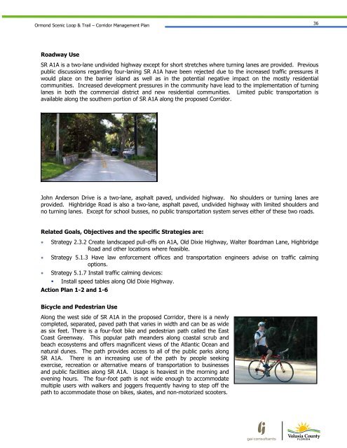
Roadway Use<br />
SR A1A is a two-lane undivided highway except for short stretches where turning lanes are provided. Previous<br />
public discussions regarding four-laning SR A1A have been rejected due to the increased traffic pressures it<br />
would place on the barrier island as well as in the potential negative impact on the mostly residential<br />
communities. Increased development pressures in the community have lead to the implementation of turning<br />
lanes in both the commercial district and new residential communities. Limited public transportation is<br />
available along the southern portion of SR A1A along the proposed Corridor.<br />
John Anderson Drive is a two-lane, asphalt paved, undivided highway. No shoulders or turning lanes are<br />
provided. Highbridge Road is also a two-lane, asphalt paved, undivided highway with limited shoulders and<br />
no turning lanes. Except for school busses, no public transportation system serves either of these two roads.<br />
Related Goals, Objectives and the specific Strategies are:<br />
Strategy 2.3.2 Create landscaped pull-offs on A1A, Old Dixie Highway, Walter Boardman Lane, Highbridge<br />
Road and other locations where feasible.<br />
Strategy 5.1.3 Have law enforcement offices and transportation engineers advise on traffic calming<br />
options.<br />
Strategy 5.1.7 Install traffic calming devices:<br />
Install speed tables along Old Dixie Highway.<br />
Action Plan 1-2 and 1-6<br />
Bicycle and Pedestrian Use<br />
Along the west side of SR A1A in the proposed Corridor, there is a newly<br />
completed, separated, paved path that varies in width and can be as wide<br />
as six feet. There is a four-foot bike and pedestrian path called the East<br />
Coast Greenway. This popular path meanders along coastal scrub and<br />
beach ecosystems and offers magnificent views of the Atlantic Ocean and<br />
natural dunes. The path provides access to all of the public parks along<br />
SR A1A. There is an increasing use of the path by people seeking<br />
exercise, recreation or alternative means of transportation to businesses<br />
and public facilities along SR A1A. Usage is heaviest in the morning and<br />
evening hours. The four-foot path is not wide enough to accommodate<br />
multiple users with walkers and joggers frequently having to step off the<br />
path to accommodate those on bikes, skates, and non-motorized scooters.