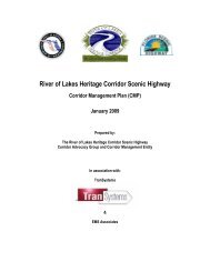
Ormond Scenic Loop & Trail - Florida Scenic Highways
Ormond Scenic Loop & Trail - Florida Scenic Highways
Ormond Scenic Loop & Trail - Florida Scenic Highways

Create successful ePaper yourself
Turn your PDF publications into a flip-book with our unique Google optimized e-Paper software.
<strong>Ormond</strong> <strong>Scenic</strong> <strong>Loop</strong> & <strong>Trail</strong> – Corridor Management Plan<br />
28<br />
<br />
<br />
<br />
<br />
<br />
<br />
Strategy 2.3.3 Design and build sidewalks/trails along Highbridge Road.<br />
Strategy 2.3.4 Design and build meandering trail.<br />
Strategy 2.3.6 Create bike-ped Master Plan.<br />
Strategy 5.1.1 Develop safe pedestrian and non-motorized facilities.<br />
Strategy 5.1.2 Enforce the speed limits.<br />
Strategy 5.1.3 Have law enforcement offices and transportation engineers advise on traffic calming<br />
options.<br />
Strategy 5.1.7 Install traffic calming devices:<br />
Install speed tables along Old Dixie Highway.<br />
Strategy 5.2.1 Develop bike/pedestrian paths.<br />
Strategy 5.2.2 Develop bike rest areas.<br />
Strategy 5.2.4 Investigate feasibility of operating a trolley system.<br />
Strategy 5.2.5 Sponsor events that promote non-motorized transportation.<br />
Action Plan 1-2 and 1-3<br />
SR A1A functions as a popular bicycle, walking, skating, and jogging route due to the natural scenic views of<br />
the Atlantic Ocean. A separated four-foot wide paved pedestrian/bicycle path exists along the west side of the<br />
road. Usage is heaviest in the morning and evening hours. The four-foot path is not wide enough to<br />
accommodate multiple users with walkers and joggers frequently having to step off the path to accommodate<br />
those on bikes, skates, and non-motorized scooters.<br />
John Anderson Drive and Highbridge Road are both part of a 23-mile loop frequented by bicycle enthusiasts<br />
and the site of numerous outdoor sports races. In addition, the magnificent moss-covered oak canopy and<br />
breathtaking view of the Halifax River make this a popular pedestrian route. Both roads lack a pedestrian/bike<br />
path and/or paved shoulders. Implementing a separated path would increase pedestrian safety and bicycling<br />
safety; however, construction would be difficult given the proximity of canopy trees to the existing roads.<br />
Related Goals, Objectives and the specific Strategies are:<br />
<br />
<br />
<br />
<br />
<br />
Strategy 1.4.4 Create and implement a master plan that will strategize and coordinate overall long and<br />
short-term activities along the Corridor including the management of vegetation, land<br />
acquisition, scenic easements, design of improvements and new construction.<br />
The Master Plan shall include but is not limited to:<br />
- Bus shelters;<br />
- Bike rest stops;<br />
- Water fountain facilities;<br />
- Trash receptacles; and<br />
- Signage/information kiosks indicating location of public facilities (i.e. restrooms and<br />
water)<br />
Strategy 2.3.2 Create landscaped pull-offs on A1A, Old Dixie Highway, Walter Boardman Lane, Highbridge<br />
Road and other locations where feasible.<br />
Strategy 2.3.3 Design and build sidewalks/trails along Highbridge Road.<br />
Strategy 2.3.4 Design and build meandering trail.<br />
Strategy 2.3.6 Create bike-ped Master Plan.