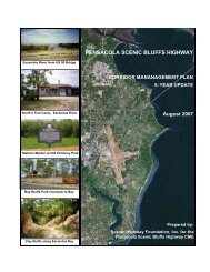
Ormond Scenic Loop & Trail - Florida Scenic Highways
Ormond Scenic Loop & Trail - Florida Scenic Highways
Ormond Scenic Loop & Trail - Florida Scenic Highways

Create successful ePaper yourself
Turn your PDF publications into a flip-book with our unique Google optimized e-Paper software.
<strong>Ormond</strong> <strong>Scenic</strong> <strong>Loop</strong> & <strong>Trail</strong> – Corridor Management Plan<br />
12<br />
Along the SR A1A portion of this Corridor the zoning is mixed with business, residential and tourist uses. The<br />
eastern side of SR A1A from Plaza Drive to Roberta Drive is mixed with commercial, tourist and residential<br />
uses. The land use is mixed with single-family homes alongside condominiums and motels. Once the<br />
highway bends towards the east at Roberta Drive the only development is that of public walkways and private<br />
deck areas where one may view the ocean.<br />
On the west side of SR A1A there are also mixed uses where commercial, tourist and residential uses coexist.<br />
There is a large shopping center about one half mile north of the southern boundary of this application. A<br />
large grocery chain is the major retail outlet and the anchor of the shopping center that also has several<br />
individual personal care services outlets, a flower shop, two discount stores and two small restaurants. This<br />
is the largest commercial center in the Corridor. The residential uses on the west side of the highway include<br />
two-family and multi-family residences.<br />
The Volusia County Bicentennial Park is located about three tenths of a mile north of Roberta Drive. This is an<br />
area for public recreational use. The park’s boundary stretches from the east at the ocean to the west across<br />
John Anderson Drive to the Halifax River.<br />
From the southern boundary of the North Peninsula State Recreational Area to the north boundary of the<br />
Corridor, the land use is described as resource recreational and conservation area. Development is restricted<br />
such that no structures can be built on the conservation area and only structures sanctioned and permitted by<br />
the State of <strong>Florida</strong> and County Environmental agencies will be approved.<br />
The land use on either side of Highbridge Road, between SR A1A and John Anderson Drive, is resource<br />
recreational. The road bisects the North Peninsula State Recreation Area.<br />
On John Anderson Drive to the southern boundary of the North Peninsula State Recreation Area both the east<br />
and west side of the highway is designated as conservation and resource recreational use. From the southern<br />
boundary to the city limits of <strong>Ormond</strong> Beach land use is mainly single-family homes. Seabridge Park, a county<br />
maintained facility, borders the Halifax River and is located on the west side of John Anderson Drive about 1.5<br />
miles south of the North Peninsula State Recreational Area. Also about 2 miles north of the southern<br />
boundary of John Anderson Drive on this Corridor is the Volusia County Bicentennial Park on both the east and<br />
west sides of the thoroughfare.<br />
The Corridor along John Anderson Drive north to the <strong>Ormond</strong> Beach City limits is used predominately for<br />
residential uses and is assigned both municipal and County residential type zoning classifications. (see Maps 5<br />
and 6)