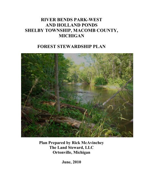
RIVER BENDS PARK-WEST AND HOLLAND ... - Shelby Township
RIVER BENDS PARK-WEST AND HOLLAND ... - Shelby Township
RIVER BENDS PARK-WEST AND HOLLAND ... - Shelby Township

You also want an ePaper? Increase the reach of your titles
YUMPU automatically turns print PDFs into web optimized ePapers that Google loves.
<strong>RIVER</strong> <strong>BENDS</strong> <strong>PARK</strong>-<strong>WEST</strong><br />
<strong>AND</strong> HOLL<strong>AND</strong> PONDS<br />
SHELBY TOWNSHIP, MACOMB COUNTY,<br />
MICHIGAN<br />
FOREST STEWARDSHIP PLAN<br />
Plan Prepared by Rick McAvinchey<br />
The Land Steward, LLC<br />
Ortonville, Michigan<br />
June, 2010
FOREST<br />
STEWARDSHIP<br />
PLAN<br />
<strong>RIVER</strong><br />
<strong>BENDS</strong><br />
<strong>PARK</strong>-<br />
<strong>WEST</strong><br />
<strong>AND</strong><br />
HOLL<strong>AND</strong><br />
PONDS<br />
JUNE 2010
V. APPENDICES
APPENDIX A: SOILS INFORMATION
APPENDIX B: WILDLIFE <strong>AND</strong> FORESTRY<br />
INFORMATION
APPENDIX C: TRAILS INFORMATION
APPENDIX D: PLANTS LIST
FOREST STEWARDSHIP PLAN<br />
<strong>WEST</strong> <strong>RIVER</strong> <strong>BENDS</strong> <strong>PARK</strong> <strong>AND</strong> HOLL<strong>AND</strong> PONDS<br />
SHELBY TOWNSHIP,<br />
MACOMB COUNTY, MICHIGAN<br />
This is a forest management plan developed under current Federal and State forest stewardship guidelines.<br />
Date Prepared: June, 2010<br />
Plan Time Frame: 2010 - 2019<br />
Property Owner(s): Charter <strong>Township</strong> of <strong>Shelby</strong><br />
Address: 52700 Van Dyke Road<br />
<strong>Shelby</strong> <strong>Township</strong>, Michigan 48316<br />
Telephone: 586 7312645<br />
Email: jyoungblood@shelbytwp.org<br />
1
Legal description or directions to site:<br />
The west half of River Bends Park includes lands in the south half of the southwest quarter of Section 18,<br />
and the north half and southeast quarter of Section 19, <strong>Shelby</strong> <strong>Township</strong>. The west half of the Park lies<br />
between DeQuindre Road on the west and Ryan Road on the east, south of 23 Mile Road and north of<br />
Hamlin Road. Established trails within the west half of the park include the Holland Ponds trails, accessed<br />
from the parking lot on the west side of Ryan Road, just south of where 22 Mile Road connects with Ryan,<br />
and a portion of the old Conrail railroad, accessed from Yates Cider Mill on Avon Road just south of 23<br />
Mile Road. There are two old abandoned roads used for fishing access immediately north and south of the<br />
Clinton River on the west side of Ryan Road. These have gated entrances, and there is space at each for one<br />
or two vehicles to park between Ryan Road and the gates. The northern portion of the Park in Section 18<br />
can also be accessed at the parking lot for the former Soccer City complex, along 23 Mile Road.<br />
Property Code: 23-07-18-300-014; 23-07-19-100-013; 23-07-19-400-005<br />
Prepared By: Rick McAvinchey<br />
Company: The Land Steward, LLC<br />
Address: 300 Woodbridge Lane<br />
Ortonville, Michigan 48462<br />
Telephone: 2486277109 home 2484623524 mobile<br />
Email: landsteward@juno.com<br />
Approvals:<br />
Landowner: Date:<br />
Preparer: Date:<br />
Approving Agency: Date:<br />
2
Landowner Assessment<br />
I. GENERAL INFORMATION<br />
Description of resources and level of interest from the landowner:<br />
<strong>Shelby</strong> <strong>Township</strong> Parks, Recreation and Maintenance Department will maintain and improve trails and other<br />
recreation facilities, wildlife habitats and cultural resources in River Bends Park using <strong>Township</strong> employees<br />
and equipment, and volunteer help. The time and expenses will vary annually.<br />
Landowner's goals for the property:<br />
- Provide both local and broad-scale variation in the overstory canopy<br />
- Maintain a closed overstory canopy with an open or sparse understory<br />
- Minimize disturbance<br />
- Leave many big trees<br />
- Promote vegetation that displays colorful foliage and/or fruit in autumn<br />
- Promote vegetation that displays attractive flowers<br />
- Promote vegetation that produces interesting fruit (berries, seeds, nuts, etc.)<br />
- Protect and improve wildlife habitats for native species.<br />
- Maintain water and soil quality, and protect wetlands and riparian areas.<br />
- Enhance biological diversity on a local level<br />
- Promote a variety of forest types<br />
- Restore native ecosystem elements<br />
- Discourage or eliminate exotic elements<br />
- Develop hiking trails<br />
- Protect water resources<br />
3
General Property Information<br />
Total land area: 390.6 Acres<br />
Number of stands: 31 stands<br />
Region/subsection or ecosystem type:<br />
General property description:<br />
The west side of River Bends Park, even more than the east side, is an amazing and very important remnant<br />
of relatively undisturbed or regenerated wild forests, wetlands and river channels. It also includes the<br />
Holland Ponds complex of highly disturbed habitats that are transforming into acceptably naturalized<br />
swamps, ponds and surrounding upland forests, with durable access roads through the middle and south of<br />
the ponds. Segments of the old Clinton-Kalamazoo Canal still exist in the Holland Ponds complex and in<br />
the northwest forest between the former Conrail railroad bed and 23 Mile Road. In the forest just south of<br />
the Holland Ponds complex is the foundation of a building that is reputed to be a former park ranger's house<br />
or office. Also south of the Holland Ponds is an extensive wetland complex, which blends into Clinton<br />
River floodplain forest. The Park encompasses both sides of the river west of Holland Ponds north and west<br />
almost to Dequindre Road at Avon Road. Much of the parkland between the river and Dequindre Road was<br />
formerly owned by the Earl family, acquired decades ago by Michigan DNR as part of the Rochester-Utica<br />
State Recreation Area, and transferred to the <strong>Township</strong> with the rest of the Park around 1994.<br />
The wetlands and river floodplain complex provide valuable habitats for a wide variety of wildlife species,<br />
including a rookery for great blue herons. The upland forest and clearings in the former Earl property offer<br />
early- and mid-successional habitats for many other songbirds, deer, turkeys, rabbits, opossums, snakes and<br />
some raptors. Conversely, the bulldozed clearings along 23 Mile Road are notable for their absence of<br />
important wildlife habitats.<br />
Description of surrounding properties:<br />
There is considerable interaction between sections of the Park and certain surrounding properties. There is a<br />
direct and intentional cooperative connection between Yates Cider Mill and the north compartment of the<br />
Park, via the old Conrail railroad bed. There is a foot trail, called the Cider Mill Trail, which connects this<br />
railroad trail to the Holland Ponds complex off Ryan Road. There is evidence of periodic use of the<br />
informal Park trails by neighbors along the two small roads off Dequindre Road, in Stand 26 and Stands 17 -<br />
22 in the former Earl estate. The most significant interaction is from members of the Detroit Sportsman‟s<br />
Congress, who have developed an extensive field and 3D archery trail system almost entirely on the Park<br />
property. This trail is at least 6,325 feet long and occupies at least 14.28 acres in the Park.<br />
Soils information:<br />
Basic soils information, including maps and tables, is located in Appendix A of this plan. Soil type<br />
descriptions in this plan are taken from the Web Soil Survey, and from the Macomb County Soil Survey<br />
book, published in 1971. Soils information provided in the Web Soil Survey is synthesized from<br />
information in the Soil Survey book. The soil maps in this book were constructed in 1969 from 1955 and<br />
1964 aerial photographs. Therefore, while the soils underlying most stands have not changed since 1969,<br />
4
the vegetation growing in some stands may be very different from what was there in 1955 and 1964.<br />
Especially in stands that were gravel or clay pits, or open fields in those years, primary succession has been<br />
proceeding, and most formerly open areas are now filling in with trees and shrubs. Further soils information<br />
is included in descriptions of many forested stands.<br />
Management access:<br />
Vehicular access for management of the Park is primarily through the Holland Ponds roads, along the old<br />
railroad trail from Yates Cider Mill, and at the Soccer City complex along 23 Mile Road. There is also a<br />
road in the southeast corner of Section 18, the first road on the east side of DeQuindre Road south of Avon<br />
Road, which services 3 private homes. This road passes through <strong>Township</strong> property after the second home,<br />
connecting to foot trails in Stands 27 and 26. Approximately 1200 feet south of this road is the old driveway<br />
entrance to the Earl homesite. This gated driveway is another access point for management of a system of<br />
informal trails in the former Earl family homestead portion of the Park, and may become a public access<br />
point if these trails are updated as a formal trail system.<br />
Presence of threatened and endangered species:<br />
Michigan Natural Features Inventory (MNFI) database search shows information on 11 threatened (T),<br />
endangered (E) or special concern (SC) plant and animal species, and one being considered for listed status<br />
(X), found at various times in Section 18 or Section 19 or both. They are listed in a table following this<br />
section. The following are the plants and animals, with their state or federal status, and the year(s) they were<br />
observed in or near the west side of the Park:<br />
5
Common Name Scientific Name Status Year Observed<br />
American burying Nicrophorus State X 1934<br />
beetle<br />
americanus<br />
Downy Gentian Gentiana<br />
puberulenta<br />
State E 1848<br />
Gattinger's<br />
Gerardia<br />
Agalinis gattingeri State E 1914<br />
Hill's Thistle Cirsium hillii State SC 1896<br />
Missouri Rock- Arabis<br />
State SC 1914<br />
cress<br />
missouriensis var.<br />
deamii<br />
Panicled<br />
Hieracium State T 1843<br />
Hawkweed paniculatum<br />
Richardson's Sedge Carex richardsonii State SC 1854, 1927<br />
Snowy Orchis Galearis spectabilis State T 1916, 1919<br />
Stiff Gentian Gentianella<br />
quinquefolia<br />
State T 1923<br />
Spotted Turtle Clemmys guttata State T 1981<br />
Most of these species were observed in or near the Park before there was a threatened and endangered list.<br />
I did not find any of these species in my investigations of the Park.<br />
Cultural importance:<br />
In Stand 4, south of Holland Ponds is an old road that leads to the foundation of a small house or<br />
combination house/office. This building is believed to have been a park ranger house or office prior to the<br />
acquisition of the park by the Michigan Department of Natural Resources. At the end of a short abandoned<br />
road in Stand 1, south of the Clinton River, are areas of asphalt pavement, large I-beams and other old metal<br />
appliances rusting away. There was no obvious sign of buildings reputed to have been there. At the end of<br />
the abandoned road in Stand 1 on the north side of the river were the foundations of very small houses or<br />
cottages, a small rectangular fenced area that suggests an old tiny garden or a grave site, and two old swing<br />
sets rusting away. At the former Earl homesite there remained a large garage structure with an attached<br />
concrete channel or raceway, which may have been part of a small hydro-electric system. There was also a<br />
small concrete bridge over the creek at that location. There were also remnants of at least 2 small house<br />
foundations near the river in Stand 27, along with an old sports car, some old fence and a bicycle.<br />
The former Conrail railroad bed and the former Clinton-Kalamazoo Canal are significant remnants of the<br />
transportation systems of two previous eras in our state's history. Interpretive information furnished in the<br />
forms of signage and/or brochures might help acquaint people with these relics of times before the modern<br />
highway system.<br />
Map information:<br />
A map based on an aerial photograph is included in the plan. Items with an asterisk are shown on the map:<br />
* North arrow (required)<br />
* Scale bar (required)<br />
* Legend (required)<br />
Locator map<br />
* Stand boundaries<br />
6
II. MAPS<br />
Stand Maps with Trails<br />
Topographic Map<br />
Recommended Practices Maps<br />
7
III. ST<strong>AND</strong> DESCRIPTIONS<br />
<strong>AND</strong><br />
MANAGEMENT RECOMMENDATIONS<br />
13
EXISTING CONDITIONS FOR 'ST<strong>AND</strong> 1. SOUTHEAST FLOODPLAIN'<br />
Land area: 75.34 Acres<br />
Land use history: This floodplain forest may have been here as forest for 100 years or more, as some of the<br />
larger trees are in that age range. There is evidence of a small community or camp at the end of an<br />
abandoned road on the north side of the river, and remains of a business or other old human activity at the<br />
end of a short road south of the river.<br />
Forest Type:<br />
-Existing: Southern Hardwood Floodplain Forest<br />
-Potential: Same<br />
Successional trend: Pole-size to large sawlog-size eastern cottonwoods and silver maples dominate this<br />
extensive and variable river floodplain stand. Also numerous among sawlog-size trees are black willow,<br />
black maple, American sycamore, sugar maple and American basswood. Other trees present in the canopy<br />
are black walnut, boxelder, American elm, bitternut hickory, red maple, northern red oak, swamp white oak,<br />
white oak, bur oak and green ash. The understory includes ash, buckthorn, bur oak, boxelder, silver, black,<br />
red and sugar maples, elm, non-native honeysuckles, sycamore, hawthorn and basswood. Ground vegetation<br />
and vines includes poison ivy, wild grape, Virginia creeper, black swallowwort, multiflora rose, barberry,<br />
various goldenrods, reed canary grass, common St. John's-wort, jewelweed, stinging nettle, garlic mustard,<br />
various thistles, moneywort, enchanter's nightshade, dames rocket, ostrich fern, dandelion, wild strawberries,<br />
meadow horsetail, white avens, wood sorrel, jack-in-the-pulpit, white grass, spotted Joe-Pye-weed, small<br />
forget-me-not, iris, violet, agrimony, early meadow-rue, currant, wild parsnip, bedstraw, sedges, wild<br />
geranium, wild leek, green dragon and giant ragweed.<br />
Forest health: There were no obvious signs of disease, insect infestation or malnutrition among the trees and<br />
shrubs in this stand. The ash trees are dead or dying from emerald ash borer infestation.<br />
Site quality: Site index is estimated at 66 for Silver maple. This stand appears to be a moderate site for<br />
growing silver maples and cottonwoods, and in some areas of higher ground it supports good quality sugar<br />
maple and black walnut. A site index of 66 for silver maple is in the low to moderate range.<br />
Approximate age: 93 Size Class: Medium Sawlogs (17.5 - 23.5")<br />
Trees per acre: 178 Mean Stand Diameter: 16 in.<br />
Basal Area (BA): 69 Acceptable BA: 90 or more<br />
Growth Rate: % Timber Quality: medium<br />
Stocking: Total basal area of 69 square feet per acre is toward the low end of the fully stocked range for this<br />
forest type, equivalent to just over 50% stocked, or 50% of the average maximum stocking expected in<br />
undisturbed stands of similar size and species composition. This relative density is in the optimum range for<br />
best individual tree growth, with excellent growth rate of the largest trees, good growth of medium to<br />
smaller trees, and low mortality from crowding.<br />
Cottonwood and silver maple together comprise nearly 40% of the total basal area, and black willow, black<br />
maple, sycamore, sugar maple and basswood account for another 44% of the basal area. Three oak species<br />
make up only 3 percent of the basal area. Basal area is a method used by foresters to approximate density<br />
14
and size of trees in a forest stand, based on sample plots done at randomly or systematically chosen<br />
locations. If a circular acre of trees around a plot center were all cut down, leaving 4.5 foot tall stumps, the<br />
sum of the area of the tops of all those stumps in that acre, calculated in square inches and converted to<br />
square feet, would be the basal area for that acre. Basal area is expressed in square feet per acre, for all trees<br />
of all diameter sizes combined, or for all the trees of each species. When sampling trees in a forest, foresters<br />
typically measure diameter of the trees at 4.5 feet above the ground, referred to as diameter at breast height,<br />
or DBH.<br />
Stand volume: 19 Gross cords per acre<br />
Habitat and wildlife use: It is well known by researchers and land managers that the ecological integrity of<br />
stream corridors is directly related to surrounding terrestrial plant communities. Perhaps the highest use of<br />
riparian (river-side) forests is to protect water quality while providing much needed habitat combinations for<br />
many different species of wildlife, on the land and in the water. The guilds of fish, turtles and frogs,<br />
salamanders and mudpuppies, crayfish and other crustaceans, snails and insect larvae that find home in a<br />
particular stream or river depend on the relative temperatures and chemical nature of the water. In general,<br />
the cooler the average temperatures of a river, the healthier the river remains and the more diverse the fauna<br />
will be. Keeping undisturbed buffers of forest vegetation along both sides of a stream will keep water cooler<br />
in summer, and provide thermal cover along the stream in winter. Forest vegetation also serves to stabilize<br />
stream banks, minimizing erosion during flood events, and covering and anchoring forest soil, keeping more<br />
of it in place on land and out of the stream during heavy rains and snow melt. Another important element of<br />
a river is how much microhabitat is available for shelter, feeding sites and reproductive sites for fish,<br />
amphibians, insects and others. The Clinton River as it passes through River Bends Park would be<br />
considered a type C stream in David Rosgen's stream classification/river morphology descriptive system 4 .<br />
The river has meandering channels with frequent point bar development, and continuous series of welldefined<br />
ripples and pools. The dominant streambed material is gravel. The sensitivity of the river channel<br />
to disturbance, and stream bank erosion potential are both very high, the supply of sediment is high, and the<br />
recovery potential following disturbance is good. The controlling influence of terrestrial vegetation is very<br />
high. The adjacent forest contributes trees and other woody debris with each major storm and flood event.<br />
All these physical characteristics contribute to a rich diversity of habitat elements and spaces for fish, turtles,<br />
insects and other guilds, which in turn provide food sources for otters, raccoon, mink, herons, kingfishers,<br />
swallows, beaver, deer, snakes and many other wildlife groups. Rivers offer a unique menu of food items<br />
for visiting wildlife - fish, crustaceans, aquatic insects, plants, reptiles and amphibians, some of which are<br />
themselves predators 5 . Riverbanks provide easy access to drinking water, den sites for muskrats and<br />
beavers, nesting sites for bank swallows and eastern phoebes, and often sunny spots for the growth of<br />
grasses, nuts and berries. Phoebes will also make use of the undersides of bridges as nest sites. Several<br />
species of bats find roost trees and caves in riparian corridors, including silver-haired bats, and Indiana bats<br />
in at least the southern two tiers of Michigan counties. River otters, bald eagles, northern water snakes and<br />
several turtles are among the many predator species that may use the river corridors in the Park. In addition<br />
to providing food and shelter habitats for relatively stationary wildlife species, riparian corridors provide<br />
safe travel corridors for many large and small individual animals on the move from one territory to another.<br />
Also there are wildlife species, from deep forest birds like pileated woodpeckers to red-shouldered hawks to<br />
several warblers, as well as certain salamanders, that need large uninterrupted tracts of forest to live and<br />
prosper. The relatively large blocks of riparian and adjacent upland forests in the Park are among few<br />
contiguous forested communities in southeast Michigan that may provide for the needs of these animals.<br />
For these and other reasons the riparian corridors in the Park can perhaps be considered the single most<br />
important group of habitat communities to protect from disturbance, to monitor and in some locations to<br />
restore buffers of undisturbed natural vegetation. Recommendations for the widths of natural vegetation<br />
buffers along streams, lakes and other wetland types vary greatly, from an absolute minimum of 10 feet in<br />
very urban settings 6 , to more than 700 feet on either side of large rivers in very rural or wild settings 7 . The<br />
minimum buffer width agreed upon by most researchers and land managers is between 50 and 100 feet. The<br />
15
Natural Resources Conservation Service (NRCS) provides guidelines for at least 100 foot wide vegetated<br />
buffers, with no disturbance allowed within a minimum of 50 feet along each side of the stream, and<br />
minimal disturbances such as hiking trails allowed within the next 50 foot band out from the stream 8 .<br />
<strong>Shelby</strong> <strong>Township</strong> is able to offer very good to excellent protection for these highly valuable stretches of the<br />
Clinton River corridor by prohibiting or limiting human-caused disturbances.<br />
Recreational opportunities: The most obvious recreation activity currently taking place in these floodplain<br />
forests is fishing along the Clinton River. Some people also use the abandoned roads and foot paths along<br />
the river for nature walks and hikes in the woods. There could be seasonal harvest of fruits, nuts,<br />
mushrooms and other edible or medicinal plants occurring in these forests. With improved trails, there<br />
could be better opportunities for hiking or biking in pursuit of picnicking or bird watching in areas currently<br />
seldom used by human visitors. Small groups of dedicated people have been canoeing and<br />
Asphalt beginning of one of two abandoned roads into this stand. Ryan Road in background.<br />
kayaking on the river for many years. The Parks and Recreation Board may want to add one or more fishing<br />
platforms at the river, perhaps at the river near the end of the abandoned road on the north side of the river,<br />
if that road is rejuvenated as a trail. Another option may be to develop a small picnic area near the old swing<br />
sets at the end of this north road. Also Park managers may wish to consider improving and linking to a foot<br />
trail from the area of the end of the abandoned road along the north side of the river, north along the east<br />
side of the river to link up with the west end of the Holland Ponds roadways at Stand 12. Interestingly, there<br />
is a 2008 map of the Holland Ponds area of the Park, made by Clear Communications Group, which shows<br />
16
just such a trail in existence along the river. This is a simple fisherman's trail, like those along the river<br />
below the railroad trail, which might be easily improved with slight rerouting for general hiking use. This<br />
trail is depicted on the map as linking to the Cider Mill Trail. The abandoned road north of the river in<br />
Stand 1 is roughly one-third mile, and the connecting trail along the river to the west end of Holland Ponds<br />
road would be another 0.57 mile. To complete a loop, one would hike about 0.61 mile back to the Holland<br />
Ponds parking lot, then about a third of a mile south on Ryan Road back to the beginning of the abandoned<br />
road, for a total round trip of about 1.84 miles.<br />
Peninsula inside tight bend in river in Stand 1: river in three directions.<br />
Potential for timber production: There is potential for development of some high value sawtimber and<br />
veneer in this floodplain forest, referred to as Elm-Ash-Cottonwood forest type by the U.S. Forest Service 1 .<br />
This can include the following cover types: black ash-American elm-red maple; silver maple-American elm;<br />
cottonwood; sugarberry-American elm-green ash; sycamore-sweetgum-American elm; and black willow,<br />
with many associated species. This type is common on land subject to annual flooding and can survive<br />
flooding during as much as 50 percent of the growing season. Cottonwoods and willows are pioneer species<br />
which cannot subsequently regenerate in their own shade (they are considered shade-intolerant), and are<br />
gradually replaced by more shade tolerant species including silver maple, American elm, green ash,<br />
sycamore and river or yellow birch. Although timber management for the purpose of current or future<br />
economic return from periodic sale of trees (timber harvest) is not currently a goal of the <strong>Township</strong> for River<br />
Bends Park, the floodplain hardwood forest is a primary source of habitats for a variety of wildlife. Timber<br />
harvest is one way to provide the disturbances necessary to regenerate the pioneer species of this forest type<br />
17
and thereby provide the diversity of habitats that are desirable for wildlife. Most of the ash trees in the Park<br />
are either dead or dying from emerald ash borer infestation. If dead ash trees in small designated areas were<br />
offered to private individuals for firewood, or to firewood producers, their removal might expose mineral<br />
soil and eliminate some competing vegetation. If light and soil moisture are sufficient and this partial<br />
harvest is done in the dormant season and/or in mid-to-late-summer, natural reproduction of cottonwood,<br />
willow, yellow birch and sycamore can be expected. Their seeds are transported by wind and water, require<br />
mineral soil and direct sunlight to germinate, and remain viable only for a few days or weeks. Seeds of<br />
silver maple, American elm and green ash can germinate on moist litter as well as on mineral soil, and make<br />
best early growth in partial shade. They can regenerate profusely from either seed or vegetatively after<br />
cutting or disturbance. Elm-ash-cottonwood is a pioneer to intermediate type that cannot be maintained<br />
without management or natural disturbance. Flooding and timber removal provide important conditions for<br />
its establishment and continued existence.<br />
In current markets the majority of tree species in floodplain forests have low commercial value, the<br />
exceptions being the occasional good quality black walnut, black cherry and sugar maple. The best use of<br />
deciduous wetland forests is the protection of the water resources that produce them and the unique biota<br />
associated with them 2 .<br />
Potential for other uses:<br />
Water quality issues: The <strong>Township</strong> has important water quality issues to deal with in the Forester estate<br />
north and east of the Park, and may not be entirely able to protect water quality in private and<br />
commercial/industrial properties upstream of the Park, except through ordinances. Within the Park, the best<br />
way to protect the quality of water resources is to maintain relatively undisturbed natural vegetation along<br />
both sides of the river, and within and around the various other wetlands in the Park. This includes<br />
maintaining healthy and natural upland vegetation communities throughout the Park. It could also include<br />
developing long-term cooperative relationships to adopt and promote best management practices with your<br />
neighboring landowners around the Park boundaries.<br />
Important natural features: The Clinton River and its adjacent riparian corridor is the most important set of<br />
natural features in this stand and others, and may be the most important natural features in the Park.<br />
18
MANAGEMENT PLANS FOR 'ST<strong>AND</strong> 1. SOUTHEAST FLOODPLAIN'<br />
Landowner's objectives for this stand: Retain the forest in its current condition for wildlife habitat, river<br />
corridor protection and water quality. Remove trees only to improve wildlife and fisheries habitat, to further<br />
recreation opportunities and forest health, and possibly for private or municipal production of firewood,<br />
mostly ash. Consider improving or creating a hiking trail from the end of the abandoned road north of the<br />
river, north along the east side of the river to the west end of Holland Ponds roads. Retain all cavity and den<br />
trees, and promote the placement and annual maintenance of roosting and nesting boxes or tire structures for<br />
birds, bats, squirrels or raccoons. Consider improving recreational access by restoring old roads to<br />
walking/biking trails, and by adding fishing platforms at strategic points along riverbanks. Retain most<br />
near-shore trees and woody debris in the river and along the shore, except those blocking trails.<br />
Silvicultural Prescription:<br />
Recommended silvicultural system: Uneven-aged management, favoring cottonwood, silver and red<br />
maples, swamp white, bur and white oaks, and sycamore.<br />
Details of the silvicultural prescription: Manage the riparian forest for wildlife and fisheries habitats, and for<br />
water quality. Remove primarily dead ash trees and other dead trees for private or municipal firewood<br />
production. Retain most trees within at least 100 feet of the river on both sides, and restrict motorized<br />
wheeled or track vehicles from operating in that buffer zone. Retain trees and other woody debris along the<br />
banks of the river and in-stream as habitat elements for fish and other river animals, and to reduce erosion of<br />
stream banks. Retain den trees and cavity trees, productive fruit and nut trees and large "wolf" trees,<br />
especially oaks, hickories and others that provide crops of acorns or nuts.<br />
Planned Activities:<br />
2011: Clear and improve old roads south and north of river for hiking and biking. Restrict motorized<br />
vehicle access.<br />
Begin salvaging dead ash trees for firewood or timber. Open to firewood producers or public.<br />
Priority: 1<br />
2012: Place bird and mammal roosting and nesting structures in forest. Maintain annually or biennially.<br />
Priority: 2<br />
2013: Install fishing platform at riverbank, accessed by trail.<br />
Also begin improving informal riverbank trail from end of north road toward Stand 12.<br />
Priority: 1<br />
19
Small vernal pond south of Clinton River in Stand 1.<br />
2014: Continue improving riverside trail to Stand 12.<br />
Also develop picnic area near old swings at end of north road.<br />
Priority: 1<br />
2015: Check and maintain nesting and roosting boxes and platforms.<br />
Priority: 4<br />
2017: Check and maintain nest and roosting boxes and platforms.<br />
Priority: 5<br />
2019: Check and maintain nest and roosting boxes.<br />
Priority: 4<br />
20
One of several large steel girders at end of south abandoned road.<br />
21
EXISTING CONDITIONS FOR 'ST<strong>AND</strong> 2. SOUTH<strong>WEST</strong> CLEARING'<br />
Land area: 3.4 Acres<br />
Land use history:<br />
It appears that this small spot may have been cleared along with the adjacent large landfill area to the west,<br />
or with the open fields now used for trailer/recreational vehicle storage adjacent to the south.<br />
Forest Type:<br />
-Existing: Birch-Cottonwood-Pine Savannah<br />
-Potential: Same<br />
Successional trend: This is a mostly open clearing, with a few scattered paper birch, cottonwood, Scots<br />
pine, red cedar and sycamore trees of pole size or smaller. There are also willows, buckthorn, autumn olive,<br />
blue spruce and ground juniper. Ground vegetation includes grasses, sedges, bulrush, black-eyed Susan,<br />
butterflyweed, white asters and spotted Joe-Pye-weed. The soils map indicates that this clearing was part of<br />
a larger gravel pit in the past, although the land surface is more flat than bowl-shaped as most gravel pits are.<br />
If left alone this clearing will probably follow its natural successional trend toward an upland forest of the<br />
same tree species.<br />
Forest health: The trees and other vegetation appear to be quite healthy, with no apparent insect or disease<br />
infestations.<br />
Site quality: Site quality is not known, with no indication of poor quality.<br />
Approximate age: 42 Size Class: Poles (5.5 - 11.5")<br />
Trees per acre: 2-4 Mean Stand Diameter: 8 in.<br />
Basal Area (BA): Very low Acceptable BA:<br />
Growth Rate: % Timber Quality:<br />
Stocking: This clearing has only scattered trees, as described above.<br />
Stand volume:<br />
Habitat and wildlife use: This clearing is not a forest opening in the usual sense, because it is not<br />
surrounded by forest but is adjacent to large private land field areas to the west and south. Still the value of<br />
this clearing to a variety of wildlife species in the adjacent forest is fairly high. It offers turkeys and other<br />
birds, deer, mice and other animals areas to feed on plant foods and abundant insects in summer, in relative<br />
safety without venturing out into the very large open fields west and south. Because this clearing has some<br />
larger trees along the west and south edges, and the forest to the east and north, it is likely also used as a<br />
hunting ground for hawks and owls, perching in some of the same trees that offer visual cover for deer and<br />
others. It is likely that this clearing is or may be used by woodcock for their courtship flights.<br />
22
Even though they provide fruits for many birds, the buckthorn and autumn olive in this clearing are highly<br />
invasive plants and should be removed by cutting and immediately applying herbicide to the low stumps.<br />
If Park managers wish to maintain this clearing in its present successional stage, they will need to set back<br />
succession by disking or mowing every three to five years, being careful to avoid damaging any trees and<br />
shrubs they want to keep. A mix of native grasses and forbs, such as Canada wild-rye, little bluestem,<br />
Indian grass and bush clover, along with wildflowers could be planted in the more open areas of the clearing<br />
after disking. Fruit bearing shrubs and trees could be planted near the edges of the clearing to support a<br />
greater variety of wildlife, including bees, moths and butterflies.<br />
Recreational opportunities: Being off any trail system from within the Park, it is not likely that this clearing<br />
will receive much use from Park visitors. However, there is an established trail connecting the landfill trails<br />
to the west with the Clinton River, passing through the middle of this clearing and into Stand 1. This trail<br />
was used by people on 4-wheeled ATVs just before I surveyed this stand. This trail, clearing and forest area<br />
were also used by an elder nudist celebrating Independence Day.<br />
Park managers may want to close this trail from the landfill, at least to vehicular use.<br />
Potential for timber production: This little clearing provides a small area of herbaceous vegetation with<br />
scattered trees and shrubs, important for a variety of wildlife species. There is no need to consider managing<br />
this clearing for timber production.<br />
Potential for other uses:<br />
Water quality issues: As long as there is no increase in human activity that involves toxic chemicals use,<br />
there should be no particular water quality concerns with this stand.<br />
Important natural features: The clearing itself with its mostly herbaceous vegetation plus scattered shrubs<br />
and trees should be considered an important natural feature, adjacent as it is to large blocks of forest.<br />
MANAGEMENT PLANS FOR 'ST<strong>AND</strong> 2. SOUTH<strong>WEST</strong> CLEARING'<br />
Landowner's objectives for this stand: Maintain and improve wildlife habitat.<br />
Silvicultural Prescription:<br />
Recommended silvicultural system: None<br />
Details of the silvicultural prescription: Remove non-native invasive shrubs. Maintain this clearing in its<br />
current successional stage by disking or mowing every 3 to 5 years. Plant native grasses and wildflowers,<br />
especially after disking. Plant fruiting trees and shrubs in clumps around edges, especially near the forest.<br />
Planned Activities:<br />
2010: Block vehicle access at trail from landfill.<br />
Remove buckthorn and autumn olive.<br />
Priority: 3<br />
23
2011: Disc open areas of clearing. Plant native grasses and wildflowers.<br />
Priority: 2<br />
2012: Plant fruiting and nut trees and shrubs.<br />
Priority: 3<br />
2015: Disc to maintain clear areas and reseed if necessary.<br />
Priority: 5<br />
2019: Mow to maintain open areas.<br />
Priority: 4<br />
24
EXISTING CONDITIONS FOR 'ST<strong>AND</strong> 3. CENTRAL SWAMP'<br />
Land area: 32 Acres<br />
Land use history: More than half of this stand is over Tawas muck, which occurs in swamps, along<br />
waterways, and in depressions in the uplands. The water table is near the surface most of the year unless the<br />
soil is artificially drained. Runoff is therefore very slow. Most areas of the county with this soil are wooded<br />
or idle land. The rest of the stand is over Cohoctah fine sandy loam, floodplain soils that are poorly drained,<br />
have a high water table and are frequently flooded. Because of these limitations for agriculture these soils<br />
are mainly used as wildlife habitat and intermittent pasture. Native vegetation consists of elm, oaks, maple,<br />
ash, willows, grasses and reeds.<br />
With these soils, it is most likely that this stand has been in its current semi-wooded, wetland status for a<br />
very long time.<br />
Forest Type:<br />
-Existing: Cedar-Cottonwood-Yellow Birch-Basswood<br />
-Potential: Same<br />
Successional trend: This is a varied wetland stand, with some areas at the west end dominated by northern<br />
white-cedar, areas in the northeast corner dominated by tamarack and elm, much of the central areas<br />
inhabited by scattered cottonwoods, black willows and few silver maples. Phragmites and cattails<br />
dominated the ground vegetation in most areas of this stand, with nearly pure stands of either or both in<br />
several locations. A few locations had open water in July. There were green ash trees in several plot<br />
locations, nearly all dead. The few other individual trees found in or near plots included bur, white and red<br />
oaks, American basswood, white pine, yellow birch and sycamore. Shrubs and vines included sandbar<br />
willow, buckthorn, Virginia creeper, hornbeam, poison ivy and river grape. Herbaceous vegetation also<br />
included duckweed, reed canary grass, several sedges, bulrush, skunk cabbage, moneywort, jewelweed,<br />
swamp and common milkweeds, sensitive fern, goldenrods, stinging nettle, St. John's-wort, fireweed,<br />
dogbane, mullein, wild parsnip, swamp horsetail, purple loosestrife, virgin's bower, spotted Joe-Pye-weed,<br />
boneset and bedstraw.<br />
Forest health: Nearly all of the ash trees in the stand, as in the entire Park, were dead or dying, presumably<br />
from emerald ash borer. About half of the tamaracks in the northeast corner were dead from unknown<br />
causes. There were no other conditions noted during inspection of this stand that would indicate insect or<br />
disease infestations, or other tree health problems.<br />
Site quality: Most of the trees in this stand were of slightly poor to moderate quality as potential timber.<br />
They are doing well in their role as swamp trees providing wildlife habitats.<br />
Approximate age: 70 Size Class: Poles (5.5 - 11.5")<br />
Trees per acre: 129 Mean Stand Diameter: 9.7 in.<br />
Basal Area (BA): 34 Acceptable BA:<br />
Growth Rate: % Timber Quality: low<br />
25
Stocking: Stocking of trees is quite variable in this stand, ranging from nearly 70 square feet per acre of<br />
basal area in the northern white-cedar grove at the west end to no trees at all in a few plot locations. Swamp<br />
hardwoods and white pine are sparse in most locations in the stand; therefore the trees per acre and basal<br />
area estimated for the entire stand were elevated by inclusion of a couple plots with many northern whitecedars,<br />
and are not representative of the stand as a whole.<br />
Stand volume: 6 Gross total cords/acre<br />
One of several swampy areas. Buckthorn in left foreground.<br />
Habitat and wildlife use: Most notable and maybe noticeable of the wildlife using this swamp stand is the<br />
great blue heron rookery near the center of the stand. There were at least 18 heron nests observed in<br />
cottonwood trees, most apparently in use by herons. This swamp may also provide habitats for mink,<br />
muskrats, beaver, maybe otter, deer, squirrels, barred owls, various woodpecker species, wood ducks,<br />
nuthatches, different warblers, chickadees, snakes, turtles, frogs, toads, salamanders, Indiana and/or other<br />
bats, dragonflies, butterflies and other insects 10 .<br />
Den and cavity trees should be preserved and managed throughout this swamp forest. Installing nest boxes<br />
for wood ducks, woodpeckers and others will add further housing options that may be lacking now.<br />
Buckthorn and other invasives should be removed from this and all parts of the Park as much as possible<br />
within the Park's budget, which can be a good project for volunteers.<br />
26
Recreational opportunities: The west end of the stand is along the south edge of the Holland Ponds complex<br />
of roads and trails, and therefore gets some visitation by Park patrons. The rest of this stand is not readily<br />
accessible, and is probably visited by only a hardy few each year. Bird watching and nature observation,<br />
with or without a camera, are the most likely recreational activities in most of the stand.<br />
Potential for timber production: Other than the small grove of northern white-cedar, tamarack, basswood,<br />
oaks and elm at the west end, there is little potential for sustainable timber production in this stand.<br />
Potential for other uses:<br />
Water quality issues: The most important water management strategy for this swamp is to protect the water<br />
sources and enhance adjacent uplands, with undisturbed buffer zones at least 100 feet where possible. Do<br />
not change the water levels in the swamp by draining water from adjacent uplands into the swamp or<br />
diverting any of its current water supply 10 .<br />
Important natural features: Besides the swamp itself, a great blue heron rookery is an important natural<br />
feature that needs to be protected from disturbance.<br />
MANAGEMENT PLANS FOR 'ST<strong>AND</strong> 3. CENTRAL SWAMP'<br />
Landowner's objectives for this stand: Protect the swamp in its current condition. Prevent disturbance to the<br />
great blue herons and other wildlife living there.<br />
Silvicultural Prescription:<br />
Recommended silvicultural system: Uneven-aged management, favoring cottonwoods, silver maples, oaks,<br />
and basswood.<br />
Details of the silvicultural prescription: Since this hardwood-conifer swamp is under-stocked in most areas,<br />
there is little need to open the canopy for the purpose of stimulating the understory vegetation. Hence there<br />
is no need for any timber harvest activities within this stand. Protect den, nest and cavity trees. Control<br />
buckthorn.<br />
Planned Activities:<br />
2010: Remove buckthorn, Phragmites and other invasives. Do 1-2 acres per year.<br />
Priority: 4<br />
2011: Control invasives.<br />
Priority: 3<br />
2012: Control invasives.<br />
Priority: 4<br />
2013: Install nest and roosting boxes and platforms.<br />
Control invasives.<br />
Priority: 5<br />
27
2014: Control invasives.<br />
Priority: 4<br />
2015: Check and maintain nest and roosting structures.<br />
Priority: 4<br />
2016: Control invasives.<br />
Priority: 4<br />
2017: Check and maintain nest and roosting structures.<br />
Priority: 4<br />
2018: Control invasives.<br />
Priority: 3<br />
2019: Check and maintain nest and roosting structures.<br />
Priority: 4<br />
28
EXISTING CONDITIONS FOR 'ST<strong>AND</strong> 4. OAK-HICKORY'<br />
Land area: 7 Acres<br />
Land use history: The foundation of an old park ranger station or home remains at the southern part of this<br />
stand, just north of part of the Stand 3 swamp. Unverified information suggests that this ranger station was<br />
in use by Huron-Clinton Metroparks prior to ownership by Michigan DNR as Rochester-Utica State<br />
Recreation Area.<br />
Forest Type:<br />
-Existing: Oak-Hickory<br />
-Potential: Black Cherry-Maple<br />
Successional trend: Red oak, pignut hickory, black cherry and sycamore dominated this stand, with small<br />
numbers of sugar and red maple, pin oak and shagbark hickory pole-size trees. Just north of the old ranger<br />
station foundation were groves of larger white pine and northern white-cedar. East along the trail defining<br />
the northern boundary of this stand were also cottonwoods, quaking aspen and black maple. Understory<br />
trees, shrubs and vines included dogwoods, ash, multiflora rose, staghorn sumac, elm, cherry, shagbark<br />
hickory, silver maple, non-native honeysuckle, buckthorn, barberry, wild grape, Virginia creeper and poison<br />
ivy. Ground vegetation included prickly gooseberry, ebony spleenwort, goldenrods, enchanter‟s-nightshade,<br />
garlic mustard, Pennsylvania sedge, other sedges, St. John‟s-wort. At the old ranger station site were<br />
periwinkle, jack-in-the-pulpit and New York fern.<br />
Forest health: All the trees in this small stand appeared in good health, with no evidence of insect or disease<br />
infestation or environmental problems.<br />
Site quality: Site index is estimated at 65 for red oak. This site appeared to be of good quality for<br />
supporting mixed hardwoods and the pine and white-cedars growing there. The Boyer loamy sand<br />
underlying this stand has moderately rapid to rapid permeability, slow runoff and very rapid infiltration, with<br />
medium available moisture capacity. Natural fertility is moderately low. The native vegetation is deciduous<br />
hardwoods, chiefly oak, hickory and maple.<br />
Approximate age: 66 Size Class: Small Sawlogs (11.5 - 17.5")<br />
Trees per acre: 160 Mean Stand Diameter: 11.6 in.<br />
Basal Area (BA): 77 Acceptable BA:<br />
Growth Rate: % Timber Quality: high<br />
Stocking: Northern red oak accounted for 39% of the basal area, with pignut hickory and black cherry each<br />
comprising 17% of basal area. Sycamore accounted for 9%, and red and sugar maples, white pine and pin<br />
oak each contributed 4%. Other trees present in very low numbers were eastern cottonwood, northern<br />
white-cedar, quaking aspen and black maple.<br />
Stand volume: 20.5 Gross total cords/acre<br />
29
Habitat and wildlife use: This stand was primarily a dry hardwood oak-hickory type, with minor<br />
components of maples, black cherry and shagbark hickory. Birds that live in oak-hickory forests include<br />
great-crested flycatcher, eastern wood pewee, rose-breasted grosbeak, scarlet tanager, blue jay, ovenbird,<br />
black-capped chickadee, white-breasted nuthatch, red-bellied and downy woodpeckers, northern flicker,<br />
ruffed grouse and wild turkeys 10 . White-tailed deer, squirrels, deer mice and voles are the most common<br />
mammals. Many of these species prefer and depend on acorns, but the hickory nuts with their hard shells<br />
are significant foods primarily for wood duck, wild turkey, squirrels and chipmunk. Hickory nuts and/or<br />
flowers are incidental foods in the diets of ring-necked pheasant, bobwhite quail, crow, rose-breasted<br />
grosbeak, blue jay, white-breasted nuthatch and red-bellied woodpecker. Yellow-bellied sapsuckers feed on<br />
the sap. Deer feed on leaves, twigs and nuts, white-footed mice feed on leaves and nuts, and raccoon, rabbit,<br />
gray fox and black bear feed on hickory nuts and/or bark.<br />
Recreational opportunities: This stand is a destination site as part of the Holland Ponds complex, and<br />
receives frequent visitation by patrons. The old ranger station foundation could be made much more<br />
interesting if an interpretive sign with old pictures of the building and the rangers using it, perhaps with a<br />
floor plan of the building, were assembled and erected at the site. This could be accompanied with an old<br />
map of the park or recreation area at the time the building was used. There is a side trail going east along<br />
the hilltop, with a bench in serious need of graffito removal. This particular trail was established and signed<br />
to allow visitors to get a glimpse of the heron rookery to the south. For better viewing, some tree branches<br />
or entire small trees may need to be cut out of the way at different locations along the hilltop.<br />
Potential for timber production: If timber production were a goal of the Park, this small stand may be worth<br />
managing for long-term sustainable harvest. The oaks, sugar maple and black cherry are the most valuable<br />
species in current markets. Nearly all the species in this stand provide valuable food sources and<br />
nesting/roosting sites for wildlife, so they should be maintained for that purpose. The maples are more<br />
shade tolerant than oaks and hickories, and without some kind of disturbance, such as fire, wind-throw or<br />
timber harvest, the oak-hickory forest will eventually convert to maple-beech or some other forest type 10 .<br />
This stand is very accessible by Holland Pond roads.<br />
Potential for other uses:<br />
Water quality issues: Activities in this stand which could potentially allow chemical pollutants to fall on the<br />
ground surface should be avoided, as such pollutants could migrate downhill to the swamp below.<br />
Important natural features: All the trees in this stand have importance for wildlife and people. The slopes<br />
are also important features, influencing vegetation and wildlife use.<br />
MANAGEMENT PLANS FOR 'ST<strong>AND</strong> 4. OAK-HICKORY'<br />
Landowner's objectives for this stand: Maintain this mixed hardwood/conifer forest for its aesthetic, wildlife<br />
and recreation values. If feasible, add interpretive signing next to the old ranger station foundation.<br />
Maintain the various trails in and along this stand.<br />
Silvicultural Prescription:<br />
Recommended silvicultural system: Uneven-aged management, favoring oaks, hickories, and maples.<br />
Details of the silvicultural prescription: If perpetuating the oak-hickory dominance in this stand is<br />
considered important, periodic small disturbances may be necessary to open the forest floor to sunlight,<br />
allowing oak and hickory seedlings to grow. Planting these seedlings would help the process. Alternatively<br />
30
the stand can be allowed to eventually convert to a maple-dominated forest, which may take a few human<br />
generations.<br />
Planned Activities:<br />
2010: Remove branches or small trees along trail to improve heron rookery viewing.<br />
Clean graffito from bench.<br />
Priority: 3<br />
2011: Develop and install historical signage at old ranger station foundation.<br />
Maintain all trails in stand.<br />
Consider planning for timber management.<br />
Priority: 4<br />
2012: Remove branches or small trees to improve views of heron rookery.<br />
Priority: 2<br />
2013: Maintain trails within stand.<br />
Priority: 4<br />
2015: Keep views of heron rookery clear of branches and small trees.<br />
Priority: 5<br />
2016: Maintain trails in stand.<br />
Priority: 5<br />
2019: Maintain trails in stand. Maintain benches and signage.<br />
Maintain views of heron rookery by removing branches and small trees.<br />
Priority: 3<br />
31
EXISTING CONDITIONS FOR 'ST<strong>AND</strong> 5. WATER LILY POND'<br />
Land area: 4.4 Acres<br />
Land use history: This and the other Holland Ponds were created at the direction of the Environmental<br />
Protection Agency as part of a remediation effort for the G&H landfill to the north, date unknown.<br />
Forest Type:<br />
-Existing: Excavated pond<br />
-Potential:<br />
Successional trend: This is an apparently excavated pond with the surrounding banks. At the water's edge<br />
and in water were cattails, Phragmites, sandbar willow, swamp thistle, 3-square, purple loosestrife, sedges,<br />
red-osier dogwood and water lily. On the shore and bank were grasses, common milkweed, spotted<br />
knapweed, goldenrods, Queen-Anne's-lace, St. John‟s-wort, ash seedlings, daylily, buckthorn, burdock,<br />
yellow and white sweet-clovers, birdfoot trefoil, tartarian honeysuckle, yarrow, basswood seedlings, small<br />
cottonwoods, everlasting pea, mulberry and poison ivy.<br />
Forest health: Plants were growing well, and waterfowl, blackbirds and other wildlife were using the pond<br />
and shore.<br />
Site quality: Acceptable for plant growth.<br />
Habitat and wildlife use: The water lilies, cattails, Phragmites and purple loosestrife and surrounding<br />
shoreline vegetation offer habitat elements for a variety of birds, including herons and waterfowl, plus<br />
muskrats, deer, woodchucks, mice, snakes, turtles and frogs. Swallows and bats would feed on the abundant<br />
insects. Presence of fish in the pond is unknown.<br />
Phragmites and especially purple loosestrife are highly invasive aquatic plants that most land management<br />
agencies in Michigan are trying to control or eradicate.<br />
Recreational opportunities: If the water and soil of the pond have been tested and found to be free of toxic<br />
chemicals, this pond could theoretically be used for fishing and boating in spring-summer-fall, and ice<br />
skating in winter. Primary recreational use seemed to be bird-watching and photography.<br />
Potential for timber production: None.<br />
Potential for other uses:<br />
Water quality issues: This pond and others in the Holland Ponds complex were created to help deal with a<br />
highly polluted landfill to the north. The <strong>Township</strong>, Michigan Department of Environmental Quality and the<br />
Environmental Protection Agency have been monitoring these ponds for toxic chemicals since they were<br />
first created.<br />
Important natural features: While the pond is apparently man-made, it functions as a facsimile of a natural<br />
pond in many ways, and offers important habitats for a variety of wildlife.<br />
32
MANAGEMENT PLANS FOR 'ST<strong>AND</strong> 5. WATER LILY POND'<br />
Landowner's objectives for this stand: Maintain and enhance wildlife habitats. Try to prevent introduction<br />
of non-native animals and plants into the ponds.<br />
Silvicultural Prescription: None.<br />
Planned Activities:<br />
2010: Determine if fishing, boating and ice skating are safe activities, allow them if safe.<br />
Priority: 7<br />
2011: Begin control of purple loosestrife and Phragmites.<br />
Add trees and root wads for fish cover, plus turtle, duck and heron resting logs.<br />
Priority: 5<br />
33
EXISTING CONDITIONS FOR 'ST<strong>AND</strong> 6. FROG POND'<br />
Land area: 1.16 Acres<br />
Land use history: This is another excavated pond related to remediation of the G&H landfill, excavation<br />
date unknown.<br />
Forest Type:<br />
-Existing: Willow, cottonwood and northern white-cedar around excavated pond.<br />
Successional trend: Willows, ash, cottonwood and dogwoods are the dominant woody vegetation. Plants in<br />
the water and on shore are similar to those in the Water Lily pond. There was a small stand of northern<br />
white-cedar at the west end of this pond, next to the north-side trail. Phragmites were growing there also.<br />
There were cottonwoods of various sizes with honeysuckles along the north shore of this pond.<br />
Forest health: See comments for Stand 5.<br />
Stocking: None.<br />
Habitat and wildlife use: In addition to the recommendations for Stand 5 pond, the trees and shrubs around<br />
the shoreline of this and Stands 10 and 11 ponds provide shade to keep the waters cooler in summer and<br />
some thermal cover in the winter. The shrubs provide shade for animals using the shore in summer as<br />
resting or nesting sites, while providing some food sources. The trees along the shore serve as staging areas<br />
and predator escape cover for birds coming to the pond from the nearby forest. When large branches or<br />
entire trees fall into the edge of the pond, they provide some habitat and cover elements for aquatic insects,<br />
frogs, toads, and fish, and resting logs for turtles, ducks and herons. It is important to retain trees, logs and<br />
large branches that fall into or along the edges of ponds, and to add them to ponds that don't have trees<br />
growing along their shores, such as Stands 5, 12 and 13. Logs and other woody debris are important habitat<br />
elements that are missing in those ponds.<br />
Recreational opportunities: See Stand 5. There is a chain-link fence along the north side of this pond which<br />
doesn't seem to serve any purpose. Perhaps this pond could be used for fishing, or boating, or ice skating in<br />
winter.<br />
Potential for timber production: None.<br />
Potential for other uses: There is no apparent purpose for the armored overflow channel at the east end of<br />
the road between Stands 6 and 11. No suggestion to remove it.<br />
Water quality issues: See Stand 5 comments.<br />
Important natural features: See Stand 5 comments.<br />
34
One view of Stand 6 pond. Note the heavy algae growth.<br />
MANAGEMENT PLANS FOR 'ST<strong>AND</strong> 6. FROG POND'<br />
Landowner's objectives for this stand: Maintain and enhance wildlife habitats and use, for wildlife benefit<br />
and for viewing opportunities for visitors.<br />
Silvicultural Prescription: None.<br />
Planned Activities:<br />
2010: Determine if fishing, boating and ice skating are safe activities. Allow them if safe.<br />
Priority: 5<br />
2012: Add trees and root wads for fish cover if needed. Add turtle, duck and heron resting logs if needed.<br />
Retain trees that fall into water along shore.<br />
Priority: 3<br />
35
EXISTING CONDITIONS FOR 'ST<strong>AND</strong> 7. SWAMP FOREST'<br />
Land area: 9 Acres<br />
Land use history: The soils map shows this entire Holland Ponds area as a former gravel pit. Yet some of<br />
the larger cottonwoods are estimated to be close to or over 100 years old. Those trees may have been spared<br />
during the gravel extraction.<br />
Forest Type:<br />
-Existing: Cottonwood-Sycamore-Basswood<br />
-Potential: Same<br />
Successional trend: Cottonwoods were dominant here, from small to large sawlog size. Next in abundance<br />
were American basswood, American elm and sycamore, mostly small pole-size. Other trees were paper<br />
birch* and black maple. Understory trees and shrubs included elm, basswood, ash, pignut hickory,<br />
buckthorn, autumn olive*, gray dogwood, tartarian and amur honeysuckles and multiflora rose. Virginia<br />
creeper, wild grape, poison ivy, swamp white oak seedlings*, white avens, enchanter‟s-nightshade, marsh<br />
and swamp horsetails, Queen-Anne's-lace, black swallow-wort*, American raspberry*, wood sorrel*, white<br />
sweet-clover* and birdfoot trefoil were also present (* along road). There were also a few black cherries<br />
and large sycamores along the canal.<br />
Forest health: There were no signs of poor health among the trees and shrubs present, except that the ash<br />
trees encountered were dead.<br />
Site quality: Site index is estimated at 70 for eastern cottonwood. This appeared to be a slightly better than<br />
average site for cottonwoods.<br />
Approximate age: 76 Size Class: Small Sawlogs (11.5 - 17.5")<br />
Trees per acre: 136 Mean Stand Diameter: 12 in.<br />
Basal Area (BA): 53.3 Acceptable BA:<br />
Growth Rate: % Timber Quality: medium<br />
Stocking: Cottonwood made up 38% of the estimated basal area, with basswood and elm each making up<br />
19%. Sycamore accounted for 13% of basal area, and paper birch and black maple each made up 6%. By<br />
timber management standards this is an understocked stand, almost as sparse as a savannah.<br />
Stand volume: 13 Gross total cords/acre<br />
Habitat and wildlife use: This habitat is similar to the floodplain forest of Stand 1, but with ponds rather<br />
than river as the water bodies. Some of the wildlife species will use both plant communities, but this stand<br />
is too small and broken up for deep woods species such as pileated woodpeckers or veeries. It offers<br />
36
important wildlife habitat complexes.<br />
Recreational opportunities: The most likely recreation happening around this stand would be bird watching<br />
and photography. Some people may also try to harvest fruits, roots or other parts of certain plants and<br />
mushrooms. Hiking and biking are performed around the perimeter of this stand almost daily.<br />
Potential for timber production: Cottonwoods were growing well in the east half of this forested stand.<br />
There were areas of standing water with few trees in the center of the stand. None of the tree species found<br />
in this stand has any significant value in current timber markets. This stand is best left to grow for wildlife<br />
habitats.<br />
Potential for other uses:<br />
Water quality issues: If the water of the Holland Ponds are polluted with toxic chemicals from the G&H<br />
landfill, the soils beneath this stand may also be contaminated. Even so, all manner of wildlife species make<br />
use of the ponds, so activities that could further pollute these waters should not be allowed in this stand or<br />
along the roads.<br />
Important natural features: Along the south edge of this stand there exists the linear remnant of the<br />
Kalamazoo-Clinton Canal, still holding water. This is not a natural feature, but it has been supporting frogs,<br />
turtles, herons, ducks, muskrats and deer, and trees for many decades, so it has habitat value.<br />
MANAGEMENT PLANS FOR 'ST<strong>AND</strong> 7. SWAMP FOREST'<br />
Landowner's objectives for this stand: Maintain and enhance wildlife habitat values of this slightly swampy<br />
forest stand.<br />
Silvicultural Prescription:<br />
Recommended silvicultural system: Uneven-aged management, favoring cottonwood and basswood.<br />
Details of the silvicultural prescription: These trees should best be allowed to grow for the wildlife habitats<br />
they provide. There is no need or compelling reason to harvest them.<br />
Planned Activities:<br />
There are no activities planned for this stand.<br />
37
EXISTING CONDITIONS FOR 'ST<strong>AND</strong> 8. COTTONWOOD'<br />
Land area: 2.6 Acres<br />
Land use history: Like other parts of this Holland Ponds complex, the soils map shows this area as a former<br />
gravel pit.<br />
Forest Type:<br />
-Existing: Cottonwood<br />
-Potential:<br />
Successional trend: Cottonwood was the main tree in this relatively upland stand located between wetland<br />
areas. All were poles or small sawlogs. There were a few twisted or corkscrew willows. In the understory<br />
were sycamore, autumn olive, buckthorn and sandbar willow. Ground vegetation in the sparse forest<br />
included birch, buckthorn, marsh and swamp horsetails, Canada anemone, bee balm, goldenrod, poison ivy,<br />
tartarian honeysuckle, daisy, yarrow, heal-all, tall buttercup, aster and grasses. Vegetation in the southwest<br />
corner, devoid of tree cover, included birdfoot trefoil, crown vetch, yarrow, sandbar willow, a sycamore<br />
sapling, spotted knapweed, curly dock, staghorn sumac, common milkweed, Queen-Anne's-lace, quackgrass,<br />
English plantain, brome, redtop grass, bouncing bet, wild grape and white sweet-clover.<br />
Forest health: Trees appear to be healthy, but autumn olive, tartarian honeysuckle and buckthorn should be<br />
controlled or eradicated.<br />
Site quality: Site index is estimated at 65 for cottonwood, a moderate to good site for cottonwoods and<br />
associated species.<br />
Approximate age: 66 Size Class: Poles (5.5 - 11.5")<br />
Trees per acre: 36 Mean Stand Diameter: 9.9 in.<br />
Basal Area (BA): 15.4 Acceptable BA:<br />
Growth Rate: % Timber Quality: medium<br />
Stocking: Pole-size and small sawlog size cottonwoods make up 98% of the trees surveyed. Corkscrew<br />
willow is the other tree species.<br />
Stand volume: 3.7 Gross total cords/acre<br />
Habitat and wildlife use: As an upland area surrounded on 3 sides by wetlands, this small stand is probably<br />
used by a large variety of wildlife species, especially birds. With the small clearing in the center and the<br />
extensive shrub component, it is not surprising that woodcock were observed using the stand. Others<br />
observed were catbird, goldfinch, purple finch and cedar waxwings. Unfortunately much of the shrub<br />
component consisted of autumn olive and buckthorn, which provide abundant foods for birds but are highly<br />
invasive. These should be removed, and replaced with appropriate native fruiting shrubs.<br />
Recreational opportunities: Wildlife observation is perhaps the most likely human recreation that may take<br />
place here. Another would be gathering wild edible foods. There are some small open areas in the middle<br />
38
of the stand that would lend themselves to picnicking.<br />
Potential for timber production: There is little reason to consider harvesting trees in this small stand. The<br />
cottonwoods growing there are of little commercial value, but are of greater value to wildlife and people if<br />
left in place.<br />
Potential for other uses:<br />
Water quality issues: As with all uplands near water, any pollutants dumped on the land will work their way<br />
into the water. The likelihood of toxic chemical spills in this little stand is quite low.<br />
Important natural features: The higher elevation of this stand relative to the surrounding low wetlands<br />
makes this a very important resting, feeding, travelling and likely young-rearing site for deer, for many<br />
birds, turtles and snakes, frogs, toads and maybe salamanders. The fairly open tree canopy, small clearing<br />
and dense shrub component make this potentially ideal habitat for woodcock, ruffed grouse, rabbits, and<br />
mice, and those hawks, owls, foxes, coyotes and others who hunt them.<br />
MANAGEMENT PLANS FOR 'ST<strong>AND</strong> 8. COTTONWOOD'<br />
Landowner's objectives for this stand: Maintain and enhance this upland cottonwood stand for wildlife<br />
habitat elements it provides. Remove autumn olive and buckthorn.<br />
Perhaps allow visitors to discover this place on their own, without overt signage or direction.<br />
Silvicultural Prescription:<br />
Recommended silvicultural system:<br />
Details of the silvicultural prescription: There is no silvicultural prescription for this small stand. Protect<br />
the trees and shrubs for the wildlife habitat they provide. However, the buckthorn and autumn olive that<br />
have taken over parts of this stand should be removed and replaced with native fruiting shrubs.<br />
Planned Activities:<br />
2011: Place 1 or 2 picnic tables in open areas, improve trail from west end to reach picnic tables.<br />
Priority: 8<br />
2012: Remove autumn olive and buckthorn.<br />
Priority: 6<br />
2013: Plant native fruiting and nut shrubs and trees.<br />
Priority: 7<br />
39
EXISTING CONDITIONS FOR 'ST<strong>AND</strong> 9. BUR OAK-IRONWOOD'<br />
Land area: 3.1 Acres<br />
Land use history: This stand was apparently heavily modified from any natural landscape it may have been<br />
before its gravel pit period. Ditches were dug throughout, and the spoils piled to form ridges. The ditches<br />
and other open water areas held water in July.<br />
Forest Type:<br />
-Existing: Oak-Elm-Ironwood<br />
-Potential: Lowland Hardwoods<br />
Successional trend: This is a very disturbed stand, mainly made up of ridges alternating with water-filled<br />
ditches and open water areas. Most of the trees were on the ridges. The trees recorded were bur oak, elm,<br />
hop-hornbeam (ironwood), and green ashes which were dead. In the understory were buckthorn, hophornbeam<br />
and staghorn sumac. Ground vegetation was sparse, consisting of goldenrod, St. John's-wort,<br />
buckthorn and silver maple seedlings, and barberry.<br />
Forest health: The trees and shrubs appeared to be reasonably healthy. The true health of these<br />
contaminated areas is unknown. Ash trees have died or were dying in July.<br />
Site quality: Site index was estimated at a moderate 66 for Bur oak.<br />
With ridges and troughs this stand is not expected to grow high quality trees, nor trees at high density.<br />
Approximate age: 62 Size Class: Poles (5.5 - 11.5")<br />
Trees per acre: 400 Mean Stand Diameter: 7 in.<br />
Basal Area (BA): 50 Acceptable BA:<br />
Growth Rate: % Timber Quality: medium<br />
Stocking: Large pole-size bur oaks, small pole-size elms and sapling hop-hornbeam made up the fairly<br />
sparse tree canopy of this swampy stand.<br />
Stand volume: 7 Gross total cords/acre<br />
Habitat and wildlife use: This stand has developed into a hardwood swamp community, and as such has<br />
much the same habitat elements and wildlife use as Stand 7 and Stands 1 and 3. See those stand narratives<br />
for descriptions of wildlife species that may use these vegetation types, and for management and habitat<br />
improvement recommendations. The buckthorn and perhaps barberry in this stand should be eliminated.<br />
Recreational opportunities: Few people probably enter this stand. Those that move quietly into this wet<br />
forest probably have many opportunities to observe wildlife species and activity that are not available to<br />
those who pass by on the main trails.<br />
Potential for timber production: There is no reason to consider timber management for this swampy forest<br />
stand. The tree canopy provides shelter, nesting sites, foods and predator escape cover for a variety of<br />
40
wildlife species.<br />
Potential for other uses:<br />
Water quality issues: Much of this stand has standing water, and it is adjacent to the Stand 10 pond.<br />
Therefore extra caution must be used to prevent any petroleum products or other toxic chemicals from<br />
spilling within or near these stands. This is not likely with only occasional foot traffic into this swamp.<br />
Important natural features: The native trees, shrubs and other plants are the natural features of this highly<br />
modified land area. They are healing the many scars left by people with heavy equipment.<br />
MANAGEMENT PLANS FOR 'ST<strong>AND</strong> 9. BUR OAK-IRONWOOD'<br />
Landowner's objectives for this stand: Protect the vegetation and waters of this stand from disturbance and<br />
pollutants. Maintain the current water regime in the stand by avoiding changes in water input and outflow<br />
through the stand. Remove invasive plants. Add nest boxes or platforms for wood ducks, woodpeckers,<br />
owls or forest small mammals, including bats.<br />
Silvicultural Prescription:<br />
Recommended silvicultural system: Uneven-aged management, favoring bur oak.<br />
Details of the silvicultural prescription: There is no active silvicultural prescription for this stand.<br />
Planned Activities:<br />
2013: Control buckthorn and barberry.<br />
Priority: 7<br />
2014: Add nest boxes and platforms for wood ducks, owls, woodpeckers, small mammals and bats.<br />
Priority: 5<br />
41
EXISTING CONDITIONS FOR 'ST<strong>AND</strong> 10. MUSKRAT POND'<br />
Land area: 4.4 Acres<br />
Land use history: This pond was probably part of a gravel pit in the past, before the Holland Ponds complex<br />
was developed.<br />
Forest Type:<br />
-Existing: None<br />
-Potential: Swamp<br />
Successional trend: Vegetation is similar to that in Stands 5 and 6 ponds, with willows, buckthorn, elm,<br />
oaks and maples around the shoreline and emergents such as cattails, Phragmites, bulrush, sedges and some<br />
purple loosestrife in the shallow water near shore. Sawlog-size cottonwood and sycamore form the narrow<br />
forest between the pond and parking lot.<br />
Duck just north of road in Stand 10. Plenty of resting logs here.<br />
42
Forest health: Ducks and other waterfowl, wading birds, frogs and turtles use these ponds. One hopes the<br />
water and substrate are reasonably free of toxins.<br />
Site quality: Not applicable.<br />
Stocking: Not applicable.<br />
Habitat and wildlife use: See narratives for Stands 5 and 6. There are wood duck boxes on metal pipes, plus<br />
some smaller bird house, 10 inches tall and narrow, also over the water.<br />
Recreational opportunities: Wildlife viewing and photography may be the most important recreational uses<br />
for people walking the road past this pond. There may be fishing practiced here as well.<br />
Potential for timber production: None.<br />
Potential for other uses:<br />
Water quality issues: See narratives for Stands 5, 6 and 9. A culvert under the road connects the west end<br />
of this pond with a wet area of Stand 7.<br />
Important natural features: The Holland Ponds, while not natural features, are becoming naturalized by the<br />
healing properties of the plants that grow there and the animals that use them.<br />
MANAGEMENT PLANS FOR 'ST<strong>AND</strong> 10. MUSKRAT POND'<br />
Landowner's objectives for this stand: Protect the water regime of the pond by not causing water to be<br />
added or taken away by human modifications to adjacent land areas.<br />
Maintain and enhance wildlife habitats with nest boxes and platforms as time, materials and workers are<br />
available.<br />
Silvicultural Prescription: Very limited.<br />
Recommended silvicultural system: None.<br />
Details of the silvicultural prescription: Maintain tree and native shrub cover around the shoreline of the<br />
pond.<br />
Planned Activities:<br />
2015: Add nesting platforms for ducks and geese. Plan to inspect for use and maintain platforms annually<br />
or biennially.<br />
Priority: 6<br />
43
EXISTING CONDITIONS FOR 'ST<strong>AND</strong> 11. SNAPPER POND'<br />
Land area: 2.85 Acres<br />
Land use history: See Stand 10 narrative.<br />
Forest Type:<br />
-Existing: Excavated Pond<br />
-Potential:<br />
Successional trend: Very similar to Stands 10 and 6 ponds. Cottonwood, sycamore, dead ash and black<br />
cherry grow on north east end, with these species plus pin oak in the southeast corner.<br />
Forest health: See Stand 10 narrative.<br />
Habitat and wildlife use: See Stands 5 and 6 narratives. Small bird house in a tree at the shore. Geese on<br />
very small islands, possibly nesting. This pond could use duck boxes and goose nesting platforms.<br />
Recreational opportunities: See Stand 10 narrative. There were informal trails along the shore.<br />
The old barn foundation at the parking lot could be a great sun garden, or a roof-less pavilion, if cleared out.<br />
Potential for timber production: None.<br />
Potential for other uses:<br />
Water quality issues: Same as for Stands 5,6 and 10.<br />
Important natural features: See Stand 10 narrative.<br />
MANAGEMENT PLANS FOR 'ST<strong>AND</strong> 11. SNAPPER POND'<br />
Landowner's objectives for this stand: Same as for Stands 6 and 10.<br />
Silvicultural Prescription: Protection of existing trees.<br />
Details of the silvicultural prescription: Maintain native trees and shrubs around the shoreline of the pond,<br />
to stabilize the soil and provide shade and wildlife habitats.<br />
Planned Activities:<br />
2016: Add wood duck boxes, duck and geese nesting platforms. Plan to inspect and maintain structures at<br />
least biennially.<br />
Priority: 2<br />
44
Swamp, showing emergents, scattered trees and wood duck box.<br />
45
EXISTING CONDITIONS FOR 'ST<strong>AND</strong> 12. SMALL POND'<br />
Land area: 0.7 Acres<br />
Land use history: Same as the other excavated ponds in the complex, it was a gravel pit as part of the G&H<br />
landfill remediation operation required by EPA.<br />
Forest Type: -Existing: Excavated Pond<br />
Successional trend: The actual pond is 0.7 acres, with 2.27 acres of grassy field rising up away from the<br />
pond. Pond vegetation and surrounding shoreline and field vegetation is similar to that in and around Stand<br />
5 pond. There were cottonwood saplings, plus autumn olive and non-native honeysuckles around the pond.<br />
There were also willows and autumn olive growing around the spillway at the south end of the pond. In the<br />
clearing west of the pond, beyond the fence, were autumn olive, spotted knapweed and various grasses, plus<br />
at least one apple tree.<br />
Forest health: No forest growing at this pond. See Stand 10 narrative.<br />
Habitat and wildlife use: See Stands 5 and 6 narratives. There were bird houses in the clearing north of the<br />
pond. More so than Stands 6, 10 and 11 ponds, the shore and area around this pond is lacking tree and shrub<br />
cover. It would be very useful for wildlife cover and wildlife use of this pond to plant some native Michigan<br />
conifer and hardwood trees around at least half the perimeter, and plant native fruiting shrubs adjacent to the<br />
trees, on the pond side in some areas and on the other side in other spots, such as closer to the woods on the<br />
west. Those down near the water should include shrubs like viburnums and dogwoods that grow in moist or<br />
wetter sites. See Landscaping for Wildlife for choices of trees and shrubs.<br />
Recreational opportunities: Same as for Stands 5, 6, 10 and 11 ponds. There is an anchored sloping bench<br />
uphill north of the pond. The Park management may want to add amphitheater bench seating along one of<br />
the back slopes of this pond, preferably the north side, as a place to hold interpretive talks. A permanently<br />
anchored table near the pond would also be useful for talks. It would be useful to clear 2 or more view<br />
windows through the Phragmites in order to see into the pond.<br />
The clearing west of the fence is a very nice overlook spot to look down at the abandoned river loop. I<br />
observed wood ducks in that idle river loop.<br />
Potential for timber production: None.<br />
Potential for other uses: Water flows from Water Lily Pond west into this small pond through a culvert.<br />
Water leaves this pond at the south outlet culvert, forming a 2 to 3 foot wide stream flowing southeast into<br />
the Phragmites field at the west end of Stand 3.<br />
At the inlet from Stand 5 was a depth gauge, reading 1.08. The clamp fell off the top of the lower meter<br />
section. Couldn't find the missing nuts.<br />
Water quality issues: Same as with the other ponds, pollution avoidance is important.<br />
Important natural features: This man-made pond has not changed since its creation nearly as much as Stands<br />
6, 10 and 11 ponds. It needs some help healing, with a change in management approach.<br />
46
MANAGEMENT PLANS FOR 'ST<strong>AND</strong> 12. SMALL POND'<br />
Landowner's objectives for this stand: Maintain and improve habitat for wildlife, including any fish that<br />
may inhabit this small pond. This should include planting trees and shrubs around the perimeter and on<br />
portions of the grassy slopes out from the pond. Add resting logs and one or more large stumps with root<br />
wads for additional cover and loafing areas.<br />
Silvicultural Prescription: Add trees and shrubs for wildlife habitat in the open clearing around the pond.<br />
Details of the silvicultural prescription: Plant conifer and hardwood trees and fruiting shrubs in clumps for<br />
improved wildlife cover and food sources around at least half the pond perimeter.<br />
Planned Activities:<br />
2011: Consider adding amphitheater bench seating on northeast slope above pond, for Park interpretive<br />
programs. Add a permanent table near pond for presentations.<br />
Place turtle-duck loafing logs and 1 or more stumps with root-wads in water for fish cover.<br />
Priority: 5<br />
2013: Plant Michigan native conifer and hardwood trees and fruiting shrubs around at least half the<br />
perimeter of the open upland areas of the stand.<br />
Priority: 1<br />
47
EXISTING CONDITIONS FOR 'ST<strong>AND</strong> 13. WATERFOWL POND'<br />
Land area: 1.75 Acres<br />
Land use history: According to the soil survey information this pond began as a gravel pit. The shore and<br />
upland around the pond are being revegetated naturally by succession.<br />
Forest Type: -Existing: Excavated pond<br />
Successional trend: Cattails, sedges, bulrush, Phragmites and other emergents line the shores. Willows,<br />
cottonwood, red-osier dogwoods surround the pond. Other vegetation is similar to Stand 5 pond.<br />
Forest health: The combination of water and surrounding vegetation appears to be in a positive balance.<br />
Habitat and wildlife use: Wildlife use is similar to the other ponds, possibly more use by waterfowl for<br />
nesting as indicated by the more developed emergent and shore vegetation. This may be a good place for<br />
duck and goose nesting platforms in addition to existing wood duck boxes. It is important to remember that<br />
any nesting or roosting boxes placed in the Park to increase available nesting sites must be well constructed<br />
and installed, permanently numbered, and inspected and maintained at least every other year. Inspect boxes<br />
to keep records of their use and hatching/fledging success. Also nesting boxes easily become infested with<br />
bird lice, mites and sometimes fleas. These parasites can be a heavy burden on hatchling birds, sometimes<br />
overwhelming their energy and immune systems. Boxes need to be cleaned out and refilled with fresh wood<br />
shavings or other nesting material, required by wood ducks and some other birds, before nesting season,<br />
preferably every year if possible. Try to assign these tasks to enthusiastic, reliable volunteers.<br />
Recreational opportunities: This pond is already fitted with interpretive signing, encouraging visitors to<br />
observe the many animals that use its varied habitats. Observation and photography are probably the most<br />
frequent recreational use here. This might be a good place to build a photo blind, on a platform along the<br />
shore somewhere, or at a strategic spot on the hillside in Stand 14. This may also be the pond to use with<br />
canoes and poke boats to get back into the hidden places. For this it may be useful to build a small dock.<br />
Potential for timber production: None.<br />
Potential for other uses: One of the concerns of Park managers was the introduction of unwanted non-native<br />
fish species into the ponds. It is doubtful that Park managers can prevent visitors from introducing foreign<br />
fish into the ponds. If this has been a problem in the past, perhaps the best way to deal with it is to work<br />
with MDNRE fisheries biologists to set up a means of monitoring fish species and populations in each pond.<br />
Then when an unwanted species shows up, the biologist team can advise the Park on the best ways to<br />
remove non-native species, preferably without eliminating welcome fish species. One relatively benign<br />
method would be to encourage your usual fishing visitors, along with new fishers, to learn to recognize<br />
native fish species, and non-native unwanted species, perhaps with some training sessions or workshops.<br />
You would then set up a data collection system that they can contribute to. When an unwelcome species<br />
appears in a particular pond, they will let you know, and they may even be able to selectively remove that<br />
species over a season in the course of their fishing. Such a system would require close cooperation between<br />
Park managers and this trained cadre of fishing volunteers. This is not a fool-proof, absolute way to control<br />
unwanted fish that appear in the ponds, but it would develop good working relationships with another guild<br />
of volunteers, giving them a sense of responsibility to the Park that they may not feel now. Park managers<br />
may prefer such an approach to fish management rather than depending on DNRE biologists' use of nets and<br />
chemical poisons.<br />
48
The Natural Resources Conservation Service (NRCS) has a similar precedent in its Earth Team Volunteer<br />
Program. Information about this program is available by calling 1-888-L<strong>AND</strong>CARE, and on the USDA-<br />
NRCS website.<br />
Water quality issues: Water chemistry needs to be, and probably already is, monitored regularly to<br />
determine if this pond is a healthy place for wildlife and people.<br />
Important natural features: Native vegetation and animals in and around this gravel pit pond are the<br />
important natural features associated with it.<br />
MANAGEMENT PLANS FOR 'ST<strong>AND</strong> 13. WATERFOWL POND'<br />
Landowner's objectives for this stand: Maintain and enhance wildlife habitats in and around this pond.<br />
Provide recreation opportunities, including environmental education. Consider allowing exploration of the<br />
pond by canoe or poke boat by visitors. Protect water quality, and prevent bank erosion. Monitor fish<br />
populations in this and the other Holland Ponds, remove unwanted introduced problem fish species.<br />
Silvicultural Prescription: There is no silvicultural prescription for this pond.<br />
Planned Activities:<br />
2012: Install wood duck box if none present, plus duck and goose nesting platforms. All nesting and<br />
roosting boxes should be numbered. Plan to inspect for use and clean out boxes annually or biennially,<br />
according to a schedule (cultivate a few reliable and fascinated volunteers to handle these bird and mammal<br />
house duties - use data is important to collect and keep).<br />
Consider building a photo blind in a strategic location along shore.<br />
Priority: 3<br />
2013: Consider installing a small boat dock somewhere around this pond shore. This may be a good pond<br />
to explore by poke boat or canoe.<br />
Priority: 4<br />
49
EXISTING CONDITIONS FOR 'ST<strong>AND</strong> 14. POND BUILDINGS'<br />
Land area: 10.0 Acres<br />
Land use history: The soils map shows this stand as part of the gravel pit in the 1950's and 60's. The<br />
buildings may have been established when the ponds were excavated to attempt to mitigate toxins in the<br />
landfill to the north.<br />
Forest Type:<br />
-Existing: Cottonwood-Sycamore-Black Maple<br />
-Potential:<br />
Successional trend: North of Stand 13 pond and the buildings was a small forested patch of sawlog-size<br />
cottonwoods, with younger sycamores. Along the south edge of the forest was an east-west ridge, partially<br />
covered with multiflora rose and non-native honeysuckle. Young maples and oaks were growing along the<br />
pond edge. In the clearing west of Stand 13 pond were scattered autumn olive, multiflora rose, non-native<br />
honeysuckle and eastern red cedar. In the forested area south of the buildings, along the canal were larger<br />
cottonwood, sycamore, black maple and younger red oak. Autumn olive is abundant along the canal. There<br />
is a large weeping willow in the yard west of the building.<br />
Forest health: The trees appeared to be relatively healthy, with no insect or disease problems noted.<br />
Autumn olive, non-native honeysuckles and multiflora rose need to be controlled or eradicated throughout<br />
this and other stands.<br />
Site quality: Site index is estimated at 82 for cottonwood. The higher ground areas of this stand are<br />
relatively dry, while those areas closer to the pond and the canal have more mesic soils. Fertility is probably<br />
fairly low in this former gravel pit. Cottonwoods are growing well.<br />
Approximate age: 64 Size Class: Medium Sawlogs (17.5 - 23.5")<br />
Trees per acre: 80 Mean Stand Diameter: 18 in.<br />
Basal Area (BA): 74 Acceptable BA:<br />
Growth Rate: % Timber Quality: medium<br />
Stocking: Basal area in the forested areas of the stand was between 70 and 130 square feet per acre, which is<br />
in the low and middle of the fully stocked range. Cottonwoods were medium to large sawlog-size,<br />
sycamores were pole-size in the north woods patch and small sawlogs in the south. Black maples in the<br />
south were poles, with sapling and small pole-size red oaks. Measures below are for the wooded portions of<br />
the stand only.<br />
Stand volume: 19 net total cords per acre<br />
Habitat and wildlife use: The combination of pond, clearing and forest patches can be attractive to many<br />
birds, including red-tailed and marsh hawks, ducks, geese, herons and egrets, grebes, woodpeckers,<br />
kingfishers, blackbirds and many smaller forest birds. Muskrats, mink, mice, voles, woodchucks and deer<br />
are among the mammals that would and probably do make use of this complex, along with turtles, frogs,<br />
50
salamanders and snakes. There are a few bluebird houses in the yard west of the building. Nest boxes in the<br />
north forest patch and along the canal should receive use by birds. After removing the autumn olive,<br />
multiflora rose and non-native honeysuckle, plant clumps of red cedar, white pine and white spruce in 3 to 4<br />
spots around the clearing, at the edge and 1 or 2 places near the center. Also plant clumps of fruiting shrubs<br />
such as shadbush, Alleghany serviceberry, red-osier and gray dogwoods, maple-leaf viburnum and highbush<br />
cranberry (viburnum), elderberry, scarlet elder, American plum, Nanking cherry, chokecherry, sand cherry,<br />
mountain ash, winterberry, cotoneaster, buffaloberry, staghorn and smooth sumacs, Siberian, "red-splendor"<br />
and "prairie fire" crabapples or blueberry. Add nut and acorn trees such as beaked or American hazel, any<br />
of the oaks, American chestnut, bitternut, shagbark and shellbark hickories, and black walnut or butternut.<br />
In between the clumps of shrubs or trees it would be good to establish some areas of native grasses and<br />
legumes, and mixes of butterfly, bee and moth plants. See "Landscaping for Wildlife" from Minnesota DNR<br />
for excellent information and lists of butterfly larvae and nectar plants, plus bee and moth plants, oriole and<br />
hummingbird plants, grasses and legumes. Park managers can put volunteers to work transforming many of<br />
the lightly-vegetated clearings in the Park to lush and productive habitats for wildlife.<br />
Recreational opportunities: There was a small east-west hiking trail along the north side of the Stand 13<br />
pond, with 4 by 4 inch wooden posts along the shoreline apparently delineating this trail. The trail leads<br />
from the road on the east toward the buildings at the west side of the stand.<br />
The clearing west of Stand 13 pond could be a good location for a picnic area, or another pavilion with<br />
tables. This could be the base from which wildlife activities in the pond are observed.<br />
Potential for timber production: Roughly 4.3 acres is wooded to the north of Stand 13 pond and the<br />
buildings, while around 1.4 acres is wooded south of the buildings along the canal. These areas may have<br />
been spared during the gravel pit operations prior to the 1950's. The cottonwoods appear to be at least 70<br />
years old, although I did not take core samples to count their ages. Cottonwood and sycamore have low to<br />
moderate value, respectively, in current markets, and are not in much demand except as pallet wood. Black<br />
maple and red oak are higher value trees, and it may be worth managing for those in the long term. A major<br />
drawback is the small size of the wooded patches in this stand. Timber harvest in the Park, if approved as a<br />
forest management activity, would be conducted as a series of small harvests in many stands during one<br />
period. Of all the forested upland stands in the Park and Holland Ponds, this stand and Stand 4 may be the<br />
easiest to access with logging equipment.<br />
Potential for other uses:<br />
Water quality issues: Care must be used in all activities within this stand to avoid spilling chemicals on the<br />
ground that would work through the soil into the pond water table.<br />
Important natural features: Neither a gravel pit, an excavated pond nor a canal are natural features, but the<br />
unstoppable forces of nature are revegetating this highly disturbed landscape.<br />
MANAGEMENT PLANS FOR 'ST<strong>AND</strong> 14. POND BUILDINGS'<br />
Landowner's objectives for this stand: Protect water and soil quality. Protect and improve wildlife habitats.<br />
Provide recreational opportunities for Park visitors. Maintain the buildings and protect them from damage<br />
from visitors. Manage the forested areas for tree health, and to control invasive species. Maintain the<br />
integrity of the old canal.<br />
51
Silvicultural Prescription:<br />
Recommended silvicultural system: Uneven-aged management, favoring cottonwood, sycamore, black<br />
maple and red oak. Target maximum diameter is 34 inches. The desired cutting cycle is 16 years.<br />
Details of the silvicultural prescription: If acceptable to the <strong>Township</strong>, manage forested areas by favoring<br />
young oaks and maples in the south forest patch, and periodically thinning the cottonwoods and sycamores<br />
in both north and south. Maintain a well-stocked forest in each patch by removing individual trees or small<br />
patches of 1 to 4 trees per location.<br />
Remove non-native invasives. Plant conifer clumps, and clumps of fruit and nut shrubs and trees in the<br />
clearing west of the pond.<br />
Planned Activities:<br />
2010: Begin to eradicate invasive plants.<br />
Priority: 7<br />
2011: Continue eradicating invasive plants.<br />
Plant clumps of conifers, fruit and nut trees.<br />
Priority: 7<br />
2012: Continue planting trees and shrubs.<br />
Plant grasses, legumes, butterfly, moth, bee, hummingbird and oriole plants in remaining open spaces.<br />
Consider setting up a picnic area.<br />
Priority: 7<br />
2014: Begin to thin cottonwoods and sycamores, favor maple and oak.<br />
Priority: 7<br />
52
EXISTING CONDITIONS FOR 'ST<strong>AND</strong> 15. NORTH FLOODPLAIN'<br />
Land area: 41.4 Acres<br />
Land use history: The floodplain is entirely over Cohoctah fine sandy loam, with no evidence of gravel or<br />
borrow pits. Therefore it is reasonable to predict that most of this floodplain has been forested for a long<br />
time.<br />
Forest Type:<br />
-Existing: Southern Floodplain Hardwood Forest<br />
-Potential: Same<br />
Successional trend: Predominant trees were silver and black maples, sycamore, cottonwood and American<br />
elm, with smaller numbers of black walnut, white oak, American basswood, swamp white oak, sugar maple<br />
and black willow. Most or all of the ash trees surveyed were dead. The understory included black maple,<br />
ash, elm, boxelder, sycamore, basswood, black cherry, hawthorn, prickly ash, hornbeam, sugar maple, gray<br />
dogwood, Norway spruce, staghorn sumac, swamp white oak, hop-hornbeam, black walnut, highbushcranberry,<br />
buckthorn and honeysuckle. Ground vegetation varied greatly and included Virginia wild-rye, St.<br />
John's-wort, brome, bottlebrush grass, stinging nettle, bee-balm, white vervain, goldenrod, tall sunflower,<br />
violets, Virginia creeper, enchanter‟s-nightshade, early meadow-rue, river grape, ostrich fern, bedstraw, wild<br />
geranium, poison ivy, jewelweed, prickly gooseberry, forget-me-not, reed canary grass, skunk cabbage,<br />
sensitive fern, white avens, dame's rocket, red raspberry, crown vetch, marsh horsetail, white grass, wood<br />
sorrel, black swallow-wort, Virginia knotweed, swamp dock, moneywort, multiflora rose, false nettle, wild<br />
leek, garlic mustard, and Phragmites.<br />
Forest health: Other than ash trees killed by emerald ash borers, the trees and shrubs, in fact all the<br />
vegetation in the forest appears to be healthy. There are buckthorns, multiflora rose, garlic mustard, black<br />
swallow-wort and perhaps other non-native invasive plant species in the forest that need to be removed or<br />
controlled.<br />
Site quality: Site index is estimated at 74 for silver maple, which is about average for a hardwood floodplain<br />
forest in southern Michigan. Quality of trees appears to be moderate to good.<br />
Approximate age: 116 Size Class: Medium Sawlogs (17.5 - 23.5")<br />
Trees per acre: 115 Mean Stand Diameter: 17.2 in.<br />
Basal Area (BA): 83.3 Acceptable BA:<br />
Growth Rate: % Timber Quality: medium<br />
Stocking: An estimated basal area of 83 is in the middle of the acceptable range of basal areas (70-95) for<br />
mixed hardwood forests in Michigan. Silver maple, black maple and sycamore account for 61% of the<br />
estimated basal area, with cottonwood and American elm adding another 19%. Black walnut, white oak and<br />
basswood comprise another 15% of the basal area. Of these tree species present, all but elm averaged<br />
sawlog size. The relative stand density is estimated at 63% of the average maximum stocking expected in<br />
undisturbed stands of similar size and species composition. At this optimum relative density, growth rates<br />
of the biggest trees is probably excellent, growth rate of the medium and small trees is probably good, and<br />
53
mortality due to crowding is likely low.<br />
Stand volume: 25 Gross total cords/acre<br />
Habitat and wildlife use: This floodplain forest is quite similar to Stand 1, and the narrative information,<br />
concepts and suggestions for Stand 1 apply to this stand as well.<br />
There was recent beaver chewing on large cottonwoods along the river in the east end of Stand 15.<br />
Recreational opportunities: Canoeing, fishing and hiking are the most likely activities visitors enjoy in this<br />
floodplain. There has been another recreation activity occurring in this stand and Stands 17 and 19. Over<br />
the past 2 or more decades the Detroit Sportsman's Congress (DSC), which owns much of the property<br />
adjacent to the Park to the south in Section 19, has developed an extensive field archery and 3D target<br />
archery range almost entirely within the Park boundaries. This trail system is at least 6,325 feet in length<br />
and occupies at least 14.28 acres of the Park. The DSC may have developed this trail system without the<br />
<strong>Township</strong>'s knowledge or permission. This trail system was discovered during my forest inventory survey<br />
of Stands 19, 17 and 15.<br />
Four ditched draws lead south from Stand 12 pond through Stand 15 to the swampy areas of Stand 3 and 15.<br />
The west draw is straighter than the others and serves as a trail south to the Clinton River across from DSC's<br />
eastern buildings and property. This may be a good trail link from Holland Ponds road system to the<br />
informal fishing trail that exists along much of the east bank of the river from the west side of Stand 1<br />
through Stand 15 and into Stand 16.<br />
Potential for timber production: This stand is very similar to Stand 1, the southeast floodplain. Refer to the<br />
Stand 1 narrative for ideas for this stand as well.<br />
Potential for other uses:<br />
Water quality issues: Refer to Stand 1 narrative.<br />
Important natural features: The Clinton River is the most significant and important natural feature of this<br />
floodplain stand, having created the floodplain, and is constantly altering it. The river creates the diversity<br />
of macro- and micro-habitats in the floodplain, and influences wildlife use throughout the Park and<br />
surrounding lands.<br />
MANAGEMENT PLANS FOR 'ST<strong>AND</strong> 15. NORTH FLOODPLAIN'<br />
Landowner's objectives for this stand: Protect and perpetuate the forest in its current species composition.<br />
Plant and/or favor oaks, hickories, black walnut, cottonwood, willows, aspen, hazel and black cherry for the<br />
foods they provide for many wildlife species.<br />
Consider removing dead ash as firewood in accessible areas, to create small openings in the forest canopy.<br />
This will allow sunlight to the forest floor and stimulate understory growth, especially shade -intolerant<br />
species.<br />
Protect the conditions and integrity of the river, by maintaining an undisturbed buffer of natural vegetation at<br />
least 100 feet wide on both sides of the river where possible. Work with neighbors on this and other<br />
practices to protect the river.<br />
54
Silvicultural Prescription:<br />
Recommended silvicultural system: Uneven-aged management, favoring maples, sycamore, cottonwood,<br />
oaks, and black walnut.<br />
Details of the silvicultural prescription: Protect the floodplain forest from biologically unnecessary human<br />
disturbance. Allow fallen trees, large limbs and other woody debris to accumulate along the river banks to<br />
help stabilize the banks and reduce erosion.<br />
Consider removing dead ash trees in accessible sites, to open the forest canopy and promote understory<br />
development. However, keep such new openings small to avoid further fragmenting the forest.<br />
Planned Activities:<br />
2012: Consider firewood harvest operation for dead ash, either by firewood producers or general public.<br />
If accepted, plan harvest with consulting forester and implement.<br />
Priority: 5<br />
2013: Formalize westernmost north-south draw to develop connecting trail from Stand 12 to riverside trail<br />
being developed through Stands 1 and 15.<br />
Priority: 3<br />
2014: Begin to install nesting and roosting boxes and platforms for wood ducks, owls, woodpeckers,<br />
perhaps squirrels. Number, describe and map each and add to Park nesting structure database and<br />
inspection/maintenance schedule.<br />
Priority: 7<br />
55
One of the shooting platforms in the DSC archery trail system.<br />
56
EXISTING CONDITIONS FOR 'ST<strong>AND</strong> 16. CIDER TRAIL WOODS'<br />
Land area: 11.94 Acres<br />
Land use history: According to the property maps and information I received from the <strong>Township</strong> assessor‟s<br />
office, most of this stand, between the river and the fence along the east boundary of the forest, is part of<br />
Parcel 23-07-19-200-008, part of the former Forrester Estate, part of the G&H Landfill. It does not belong<br />
to the <strong>Township</strong>. The rest of that parcel was part of the landfill, but the part that is currently forest was not<br />
cleared for landfill use. In spite of this ownership, that part of the stand owned by G&H seems to be<br />
managed as part of the Park, with the Cider Mill trail laid out through it, linking the old railroad trail from<br />
Yates Cider Mill with the Holland Ponds complex.<br />
Forest Type:<br />
-Existing: Sycamore-Maple-Ash-Basswood-Oak<br />
-Potential: Maple-Oak<br />
Successional trend: Sawlog-size sycamore, white oak and silver maple dominate the canopy in much of this<br />
stand. Small sawlog-size butternut, black walnut and a few living ash are the second group by abundance.<br />
Smaller sugar maple, basswood, elm and northern white-cedar also occurred in the stand. Understory<br />
included the listed tree species plus boxelder, hawthorn, hornbeam, buckthorn, prickly ash, honeysuckle,<br />
multiflora rose, Virginia creeper, river grape, oriental bittersweet and poison ivy. Ground vegetation species<br />
were enchanter's nightshade, jack-in-the-pulpit, sedges, bloodroot, Virginia knotweed, reed canary grass,<br />
field horsetail, moneywort, jewelweed, white vervain, garlic mustard, avens, tall meadow-rue, prickly<br />
gooseberry, goldenrod, swamp white oak seedlings, red raspberry, stinging nettle, wood sorrel and wild<br />
geranium.<br />
Water plantain, southern blue flag (iris), arrow-root, wood sunflower, wild calla and hawthorn were<br />
observed near the bridge at the base of the stairs in the south half of the trail.<br />
Forest health: Most ash trees have died, presumably from emerald ash borer. The rest of the trees appeared<br />
to be healthy.<br />
Site quality: Site index was estimated at about 70 for white oak, which indicates quite a good site for<br />
growing white oaks and associated trees. The stand is floodplain hardwoods, with drier areas where sugar<br />
maple and black walnut thrive.<br />
Approximate age: 83 Size Class: Small Sawlogs (11.5 - 17.5")<br />
Trees per acre: 176 Mean Stand Diameter: 12.7 in.<br />
Basal Area (BA): 103 Acceptable BA:<br />
Growth Rate: % Timber Quality: high<br />
Stocking: Small to medium sawlog-size sycamores, ash, white oak, butternut, silver maple and black walnut<br />
make up about 64% of the basal area of this stand. The rest is comprised of smaller sugar maple, basswood,<br />
elm and northern white-cedar. Relative stand density is estimated at 75%, which is in the optimum range for<br />
best individual tree growth. Trees of acceptable quality for future growing stock provide enough stocking<br />
57
y themselves to warrant stand management.<br />
Stand volume: 28.5 Gross total cords/acre<br />
Habitat and wildlife use: See the narrative for Stand 1 for wildlife that would use this floodplain stand, and<br />
suggestions for management. My only note about wildlife observations was that mosquitoes were quite<br />
dense here.<br />
Recreational opportunities: Canoeing, fishing and hiking or biking the Cider Mill trail would appear to be<br />
the primary recreational uses of this stand, and it does get a great deal of use. Hardy individuals and<br />
families use the trail quite often. Bird watching, photography and foraging for wild edibles may also be<br />
common. Work needs to be done on the very north end of the trail where it joins the old railroad trail, with<br />
improvement needed to the steps, to the railroad bank and a foot bridge there.<br />
Potential for timber production: Certainly there are some good quality trees in this stand which have value<br />
in current timber markets, such as black walnut, butternut, white oak and sycamore. If <strong>Township</strong> managers<br />
become interested in timber harvest, it might be advantageous to harvest trees in parts of this stand, while<br />
leaving at least a 100 foot buffer of natural forest vegetation along the river undisturbed. Access to the area<br />
outside such a buffer would be difficult unless the landfill fence was breached to enter the forest from there.<br />
The potential for timber production in this stand is low at this time, but could improve with some access<br />
concessions.<br />
Potential for other uses: In the south part of this stand, next to Stand 12, a fence remains with a slight road<br />
to the west of the fence. It appears that this fence can and should be removed to allow access to the small<br />
clearing immediately south.<br />
Water quality issues: In addition to the issues stated for the other floodplain stands, use of the trail through<br />
this stand must not be allowed to contribute trash to the river or land, nor cause erosion of the river banks<br />
from off-trail use.<br />
Important natural features: The river is the natural feature that affects all the plants and animals that grow in<br />
or use this floodplain.<br />
MANAGEMENT PLANS FOR 'ST<strong>AND</strong> 16. CIDER TRAIL WOODS'<br />
Landowner's objectives for this stand: This forest stand must remain intact to protect the integrity of the<br />
river and minimize soil erosion from the land and the river banks.<br />
Wildlife habitats will be maintained and enhanced where needed and achievable.<br />
Hiking, biking, fishing, canoeing and other recreational activities will be provided for Park visitors.<br />
Silvicultural Prescription:<br />
Recommended silvicultural system: Uneven-aged management, favoring larger mast-producing trees.<br />
Target maximum diameter is 34 inches. The desired cutting cycle is 16 years.<br />
Details of the silvicultural prescription: Maintain the forest stand for wildlife habitats it provides, and to<br />
protect the riparian community. Consider single tree or small group selection harvest east of a 100 foot<br />
buffer along the river.<br />
58
Planned Activities:<br />
2010: Improve Cider Mill Trail, especially at north end where it joins railroad trail. Plan and build new<br />
bridge and steps up railroad bank.<br />
Consider removing fence west of Stand 12.<br />
Priority: 1<br />
2011: Continue improvements to the Cider Mill Trail.<br />
Priority: 4<br />
2015: Consider planning and implementing a selection timber harvest in the portion of Stand 16 outside a<br />
100 foot buffer along the river. Work with a consulting forester to develop and market the harvest.<br />
Priority: 2<br />
2016: Install appropriate nesting and roosting boxes in the forest and along the river. Add them to the<br />
nesting and roosting structure database and schedule.<br />
Priority: 2<br />
59
EXISTING CONDITIONS FOR 'ST<strong>AND</strong> 17. EARL UPL<strong>AND</strong> EAST'<br />
Land area: 26.28 Acres<br />
Land use history: This stand appears to have been forested for at least the past 80 years. It is part of the<br />
former Earl estate, which was deeded to the state of Michigan well before 1994 when <strong>Shelby</strong> <strong>Township</strong><br />
acquired the Park.<br />
Forest Type:<br />
-Existing: Mesic hardwoods<br />
-Potential:<br />
Successional trend: Red oak, cottonwood and red maple averaged medium sawlog-size, and black walnut,<br />
white oak, silver maple, sugar maple, paper birch, butternut, bur oak and sycamore averaged small sawlogsize.<br />
Pole-size trees included ironwood, shagbark hickory, black maple, yellow birch, beech and elm.<br />
Understory trees and shrubs included hornbeam, ash, black cherry, prickly ash, sugar maple, basswood,<br />
beech, witch-hazel, black maple, honeysuckle, multiflora rose, elm, gray dogwood and shagbark hickory.<br />
Ground vegetation and vines included Virginia creeper, raspberry, tall meadow-rue, St. John's-wort, white<br />
avens, white grass, white vervain, goldenrod, sedges. Virginia knotweed, may-apple, smooth brome,<br />
cleavers, aster, Virginia wild-rye, grasses, poison ivy, agrimony, river grape, blackberry, early meadow-rue,<br />
wood sorrel, false solomon-seal, enchanter's-nightshade, wild geranium, dame's rocket, Christmas fern,<br />
rattlesnake-root, tall lettuce, wood anemone, jack-in-the-pulpit, black-eyed Susan and black raspberry.<br />
Forest health: All elements of this stand appear to be healthy and growing.<br />
Site quality: This stand appears to be a fairly high quality site, with a site index for black walnut of 65, well<br />
above average.<br />
Approximate age: 83 Size Class: Small Sawlogs (11.5 - 17.5")<br />
Trees per acre: 177 Mean Stand Diameter: 12.4 in.<br />
Basal Area (BA): 80 Acceptable BA:<br />
Growth Rate: % Timber Quality: high<br />
Stocking: Black walnut, elm, red oak, white oak, silver maple and American beech made up 74% of the<br />
estimated basal area. Sugar maple, paper birch, yellow birch, butternut, bur oak, red and black maples,<br />
cottonwood, shagbark hickory, ironwood and sycamore made up the remaining stocking of trees. Relative<br />
stand density was 71%, in the optimum range for best individual tree growth.<br />
Stand volume: 20.6 Gross total cords/acre<br />
Habitat and wildlife use: This stand is similar in tree size and species composition to Stand 4. See this<br />
section in the Stand 4 narrative for descriptions of wildlife species that will use this forest type, and for<br />
suggestions for management. The primary wildlife management principles that apply are to: 1) favor tree<br />
and shrub species that provide both good quality timber and nuts, fruits and other food sources; and 2) retain<br />
cavity, den and "wolf" trees, at least 2-4 dead standing trees (snags) and 1-2 logs on the ground per acre,<br />
60
while maintaining a reasonably intact forest canopy to avoid further fragmentation of the forest 10 .<br />
Recreational opportunities: There is an informal system of trails in the northern half of this stand,<br />
apparently remaining from the Earl estate, with some possibly developed by neighbors. Some of these trails<br />
may be formalized and improved to present another system of looping foot and bike trails for public use.<br />
The DSC archery trail system lies within the south half of this stand.<br />
Potential for timber production: The high variety of tree species present indicates a mix of southern<br />
hardwood floodplain and southern mesic deciduous forests. This stand has good potential for long-term<br />
sustainable timber management. Red and white oaks, black walnut and sugar maple have moderately high<br />
to very high value in current timber markets, and except for sugar maple their value to wildlife is high. Red,<br />
silver and black maples, yellow and paper birches, and bur oak have moderate market value. Elm, beech,<br />
butternut, hickories, cottonwood, butternut, hop hornbeam and sycamore have relatively low value as timber<br />
trees 3 . Having stated that, the upland stands that support the growth of sugar maple, beech, oaks, ash, black<br />
cherry, hickory and other hardwoods are the most valuable for timber production 3 . In general, management<br />
of mesic deciduous upland forests involves careful selective harvesting of a few mature trees plus crowded<br />
and poor form younger trees per acre. If oaks and other moderately shade tolerant species are to be favored,<br />
it is necessary to use single and small group selection, making small patch clearcuts of 1/2 to 1 acre or<br />
larger. In this way the less shade tolerant species can eventually reestablish themselves as members of the<br />
overstory canopy. Such thinning is used to favor tree species most valuable for timber and wildlife 2 . There<br />
are existing trails to access much of this stand with wheeled equipment.<br />
Under the current <strong>Township</strong> prohibition on harvesting trees in the Park for income, this still might be a good<br />
stand to develop a demonstration area for timber stand improvement, where smaller and/or lesser value trees<br />
are removed to allow more valuable, better form trees to grow faster with less competition.<br />
If <strong>Township</strong> policy should change in the future to allow timber harvest for income, this stand may be one of<br />
the two best stands for long-term sustainable timber management, the other being the adjacent Stand 21<br />
black walnut grove. In that case, the <strong>Township</strong>, through the Parks, Recreation and Maintenance<br />
Department, would be best to contract the services of a consulting forester to choose trees that could be<br />
harvested for income and to improve the remaining forest for future harvests and for wildlife habitats,<br />
recreation and water quality. A consulting forester would work to ensure that good, science-based<br />
sustainable forest management practices are used in a timber harvest, in accordance with this forest<br />
management plan, and to protect the short-term and long-term forest management interests of the <strong>Township</strong>.<br />
Trees to harvest would be marked, as would the boundaries of the sale area(s), and the consulting forester<br />
would solicit bids from logging companies interested in the sale. With approval of one of the bids, the<br />
forester would write up a contract between the <strong>Township</strong> and the chosen logging company for the timber<br />
sale, and then administer the sale to be sure the logging company complied with the terms of the contract.<br />
As compensation for this service the consulting forester would charge either a percentage of the <strong>Township</strong>'s<br />
income from the sale, or would charge an hourly fee and probably some amount per miles driven for the<br />
project.<br />
Potential for other uses: Where there are sufficient sugar and black maple trees of small sawlog size or<br />
larger, there is the potential for operating a maple syrup production operation. If interested, the <strong>Township</strong><br />
can find books on the subject, plus considerable information from the Michigan State University Extension<br />
office. This could potentially become an annual activity operated by a volunteer group, similar to the way<br />
Master Gardeners manage the Shadbush Teaching Gardens. The Master Woodlot Managers might be the<br />
first place to look for such interested volunteers.<br />
Water quality issues: There are no particular water quality issues in this stand.<br />
61
Important natural features: This mostly upland forest adjacent to the river floodplain forest is an important<br />
natural feature, which is fortunately in the protective custody of the <strong>Township</strong>.<br />
MANAGEMENT PLANS FOR 'ST<strong>AND</strong> 17. EARL UPL<strong>AND</strong> EAST'<br />
Landowner's objectives for this stand: Maintain a healthy forest, which provides habitat for a diversity of<br />
wildlife species, and dispersed passive recreation opportunities for local residents. Improve trails for public<br />
use. Harvest trees if necessary to improve wildlife habitats, maintain tree health, enhance recreation<br />
opportunities, safeguard Park users and possibly provide firewood.<br />
Silvicultural Prescription:<br />
Recommended silvicultural system: Uneven-aged management, favoring oaks, sugar maple, hickories, and<br />
black walnut. Target maximum diameter is 30 inches. The desired cutting cycle is 11 years.<br />
Details of the silvicultural prescription: Level One: Clear out dead trees or other hazard trees within a tree<br />
height of the new hiking trails or existing archery trails. Market any valuable logs and firewood, or allow<br />
tops to be taken as firewood by township crews or local residents on a permit basis.<br />
Level Two: In addition to removing hazard trees along the trails, develop a forest stand improvement (FSI)<br />
demonstration area along the hiking trail. Show trees marked as crop trees, and others marked to remove,<br />
with explanatory signage. Market harvested trees as timber and firewood. Treat 2-4 acre patches annually<br />
or semi-annually.<br />
Level Three: If the <strong>Township</strong> accepts periodic timber harvest as a legitimate forest management practice to<br />
raise funds for other parks management projects: in addition to the above hazard tree removal and FSI<br />
demonstration area, develop an unevenaged forest management demonstration area.<br />
In about one-third of the stand use small patch clearcuts about one acre in size combined with group<br />
selection harvest of a few trees in different locations to harvest timber sustainably and maintain a diversity<br />
of tree species. In another third choose crop trees to favor, and remove poorly formed competing trees<br />
around each crop tree.<br />
Planned Activities:<br />
2010: Develop and improve existing trail system from Earl home site north to Stand 25.<br />
Resolve DSC archery trail matter.<br />
Priority: 2<br />
2011: Consider harvesting trees using unevenaged management system. Work with consulting forester to<br />
prepare and administer initial timber harvest.<br />
Develop forest stand improvement demonstration area, with interpretive signage, in this stand and/or in<br />
Stand 21.<br />
Priority: 3<br />
62
2012: Consider developing maple syrup production operation, run by volunteers.<br />
Priority: 9<br />
2013: Continue developing maple syrup production operation.<br />
Priority: 10<br />
The largest 3-D target in the DSC archery trail.<br />
63
One of several bridges in the archery course.<br />
A field archery target backdrop.<br />
64
The main north-south road with several shooting stations.<br />
65
EXISTING CONDITIONS FOR 'ST<strong>AND</strong> 18. TRAIL CLEARING'<br />
Land area: 7.8 Acres<br />
Land use history: According to the soils map, this clearing was the result of a clay pit. Although the ground<br />
surface is mostly flat, it may have been a clay pit at one time that was eventually filled in or leveled.<br />
Because the original surface vegetation was removed, the vegetation layers growing now are comprised<br />
almost entirely of early successional plant communities.<br />
Forest Type:<br />
-Existing: Old Field with Black Cherry, Aspen, Cottonwood<br />
-Potential:<br />
Successional trend: Old field filling in with black cherry and aspen poles, larger cottonwood, boxelder,<br />
autumn olive, buckthorn, gray dogwood, multiflora rose, red oak saplings, ninebark, blackberry, raspberry,<br />
grape and poison ivy vines. Also goldenrods, Queen Anne‟s-lace, timothy, spotted knapweed, heal-all, wild<br />
bergamot, field horsetail, avens, false solomon-seal, ebony spleenwort and other grasses and sedge.<br />
Forest health: Autumn olive, buckthorn and spotted knapweed are invasive non-native species of<br />
considerable concern, and should be eradicated where they are found in the Park. Otherwise the plant<br />
communities in this stand appear to be healthy.<br />
Site quality: Because the organic layers of this stand's soils were removed during borrow pit operations in<br />
the past, the productivity of this stand will be relatively low for centuries while the A horizons of the soil<br />
slowly redevelop. This appears to be a dry-mesic site.<br />
Approximate age: 21 Size Class: Poles (5.5 - 11.5")<br />
Trees per acre: N/A Mean Stand Diameter: 8 in.<br />
Basal Area (BA): N/A Acceptable BA:<br />
Growth Rate: % Timber Quality: medium<br />
Stocking: The trees in this clearing are so sparse that no measure of stocking was attempted. There are<br />
aspen poles in a small clone in the east side, with scattered black cherry poles, a few red oak saplings, and<br />
buckthorn and autumn olive shrubs throughout the stand. There are also scattered boxelders and a few<br />
larger cottonwoods in certain locations.<br />
Stand volume: N/A<br />
Habitat and wildlife use: A variety of birds, mammals, reptiles and insects require early successional habitat<br />
for all or part of their cover and food needs. Among these are deer mouse, voles, rabbits, woodchucks,<br />
shrews, foxes and deer 5 . Great horned owls and red-tailed hawks are among the raptors that will hunt in<br />
these clearings. Ruffed grouse and woodcock use them for feeding and rearing their young, and woodcocks<br />
for courtship behaviors. Snakes, salamanders and toads make use of these clearings for much of their habitat<br />
needs. Some of the songbirds found at these small clearings are goldfinch, flicker, rufous-sided towhee,<br />
66
gray catbird, song sparrow, indigo bunting and brown thrasher.<br />
One of the practices to improve wildlife habitats in shrubby clearings is to plant clumps or clusters of food<br />
and/or cover shrubs, such as summer fruiting native species saskatoon berry, downy, Bartram, shadblow,<br />
apple, running and Alleghany serviceberries (all Amelanchier species), wild and Canada plums, pin cherry<br />
and common chokecherry (all Prunus species), highbush blackberry, northern dewberry, black raspberry, red<br />
raspberry and thimbleberry (all Rubus species), American elderberry, lowbush and velvetleaf blueberries<br />
and lingenberry (Vaccinium species), black huckleberry, and black and buffalo currants, prickly gooseberry<br />
and gooseberry (all Ribes species). Native shrubs that provide foods and cover in fall and winter include<br />
gray, round-leaved, red-osier and alternate-leaf dogwoods and bunchberry (all Cornus species), silverberry,<br />
winterberry, various apples and crabapples, silver and Canadian buffaloberries (Sheperdia species),<br />
Arrowwood viburnum, American highbush cranberry, witherod and nannyberry (all Viburnum species),<br />
bearberry, black chokeberry, eastern wahoo, and common snowberry, wolfberry, and coralberry (all<br />
Symphoricarpos species). You may also consider planting pasture and meadow roses (but not multiflora<br />
rose), and beaked and American hazel (Corylus species). In this and any open stand the <strong>Township</strong> wants to<br />
reforest, some important nut and acorn trees to consider planting are painted buckeye, American chestnut,<br />
bitternut, shagbark and shellbark hickories (Carya species), butternut and black walnut (Juglans species),<br />
white, swamp white, scarlet, northern pin, bur, northern red and black oaks (Quercus species) and bigtooth<br />
and quaking aspens (Populus species). It is also important to provide roosting, nesting and winter thermal<br />
cover for birds and other small animals, by planting clusters of conifers. Some of the better native conifers<br />
that provide the best shelter and some foods are eastern white and red pines (Pinus species), eastern red<br />
cedar, northern white-cedar, white spruce and balsam fir. One more way to provide cover for small<br />
mammals, woodchucks, rabbits and snakes (and sometimes hunting sites for weasels and mink) is to use cut<br />
branches and logs, rocks or old ceramic or concrete drain tiles to build brush piles. More branches can be<br />
added to these brush piles indefinitely. Before leaving the subject of nesting and roosting cover, you must<br />
also consider building, installing and maintaining nesting and roosting boxes and platforms, for open stands<br />
as well as throughout the forested stands and in wetlands. The excellent book "Woodworking for Wildlife",<br />
available from your local conservation district office, has dozens of plans and instructions for making these<br />
boxes and platforms for a large number of birds and mammals that would use them.<br />
Recreational opportunities: The extensive network of existing dirt trails that access much of this stand can<br />
be selectively used as part of a larger trail network in the Park west of the river (see Recreation Map). There<br />
is also good potential for a group camping area in this stand, to be used by Scout troops or other youth<br />
groups. Parking can be at the Earl homesite, and campers can carry their gear the short distance back to the<br />
center of the stand. There is the opportunity for Saturday night campfires, for fun and ceremony, to be held<br />
at the campfire ring in Stand 25, next to the river. Campers can walk the trail system from the camping area<br />
to the campfire circle single file, usually in silence, and return to their campsites in the dark. This would<br />
lend itself especially well to solemn ceremonies such as Order of the Arrow initiation, or the awarding of<br />
higher Boy Scout ranks such as Life or Eagle, or Gold Badge in Girl Scouts. The stand and surrounding<br />
forests offer ample firewood. Water would need to be provided by the groups using the site. If this group<br />
camping area became a reality and was working well, there could be a potential to build camping cabins and<br />
a central dining hall eventually. See examples below of an existing setup at Kenai National Wildlife<br />
Refuge‟s Outdoor Education Center in Alaska.<br />
67
Campfire circle at Outdoor Education Center (OEC), where much training takes place.<br />
Concrete Outhouse at OEC.<br />
68
Camping cabin at Kenai NWR OEC.<br />
Bear Den dining/working hall at OEC.<br />
69
Interior of Bear Den.<br />
Firewood crib at OEC.<br />
70
Potential for timber production: With the surrounding landscape in <strong>Shelby</strong> <strong>Township</strong> and just west in<br />
Rochester largely denuded of forest, there may be a compelling resource management purpose to reforest<br />
this clearing, to reverse forest fragmentation. However, there is considerable value in this essentially shrubsapling<br />
opening for many species of wildlife (see below). Therefore, it may be advisable to reforest only the<br />
southwest quarter of the clearing, and retain the remainder as a shrub-sapling-pole clearing that is slowly<br />
revegetating. Although much of the shrub component consists of autumn olive and buckthorn, these should<br />
be eradicated, which will help keep the clearing open longer. Plant a variety of oaks, hickories, hazelnuts,<br />
serviceberries and blueberries to reforest parts of this stand.<br />
Potential for other uses:<br />
Water quality issues: This stand is far enough from the river and tributary streams that there should be no<br />
water quality issues or concerns with the proposed activities and management.<br />
Important natural features: The natural features in this stand are the trees and shrubs that are reclaiming this<br />
former clay pit.<br />
Part of the informal trail system in Stand 18.<br />
71
MANAGEMENT PLANS FOR 'ST<strong>AND</strong> 18. TRAIL CLEARING'<br />
Landowner's objectives for this stand: Maintain and improve aesthetics, wildlife habitat and water and soil<br />
quality. Develop recreation opportunities.<br />
Silvicultural Prescription: Reforest portion of clearing, preserve the remainder as clearing.<br />
Details of the silvicultural prescription: Remove invasive autumn olive, buckthorn and honeysuckles.<br />
Consider reforesting the southwest quarter of the stand with oaks, hickories, hazelnuts and maybe beech,<br />
and fruiting shrubs such as amelanchier, dogwoods and viburnums.<br />
Planned Activities:<br />
2010: Choose segments of existing trail network to improve for public use. Work on selected segments.<br />
Develop map of trail system.<br />
Priority: 1<br />
2011: Continue trail improvements as needed.<br />
Develop group camping area in this stand, for use by Scout troops, 4-H and other groups.<br />
Priority: 2<br />
2013: Work to eradicate invasive plant species throughout stand. Make brush piles at edges of stand with<br />
cuttings.<br />
Priority: 3<br />
2014: Plant fruiting shrubs and small nut trees in clumps around edges of clearing.<br />
Priority: 6<br />
2015: Reforest southwest quarter of clearing.<br />
Install bluebird and swallow nest boxes along edges of clearing. Number each and add to database and<br />
maintenance schedule. Assign volunteers to monitor boxes annually.<br />
Priority: 1<br />
2017: If group camping area is working well, consider upgrading site to include central dining hall and<br />
maybe camping cabins, similar to those at Kenai National Wildlife Refuge.<br />
Priority: 1<br />
72
EXISTING CONDITIONS FOR 'ST<strong>AND</strong> 19. LOWL<strong>AND</strong> HARDWOOD'<br />
Land area: 21.8 Acres<br />
Land use history: This stand apparently was forested for most of the past century. Some buildings and<br />
other human deposits from the Earl homestead are found in the north end of the stand. The Detroit<br />
Sportsman's Congress has developed an extensive archery trail in the south area of the stand, also developed<br />
in Stands 17 and 18.<br />
Forest Type:<br />
-Existing: Cottonwood, black walnut, red maple<br />
-Potential:<br />
Successional trend: Sawlog size black walnut, cottonwood, silver maple and black willow, and smaller red<br />
maple, elm, basswood and boxelder were the dominant trees, with some northern white-cedar, aspen, black<br />
cherry and mostly dead ash. Understory plants included ash saplings, boxelder, non-native honeysuckle,<br />
buckthorn, staghorn sumac and gray dogwood, multiflora rose, plus poison ivy, wild grape, Virginia creeper<br />
and black swallowwort vines. Ground vegetation included garlic mustard, white avens, dame‟s rocket,<br />
enchanter‟s-nightshade, jewelweed, reed canary grass, smooth brome, boneset, goldenrods, white vervain,<br />
ostrich fern, stinging nettles, cleavers, red raspberry, blackberry, pokeweed, St. John's-wort, common<br />
plantain, heal-all, wild bergamot, field horsetail and white aster.<br />
Forest health: Fairly healthy black walnut trees are in the north end of the stand. There is general decay of<br />
the trees in all but the northern and southern ends of this stand. Most of the center of the stand is a lowland<br />
floodplain around the small stream that flows from north to south through this stand and Stands 18 and 17.<br />
In much of the floodplain the trees are sparse, in poor condition and species of low value, mostly<br />
cottonwood, black willow and boxelder. Many trees have fallen over.<br />
Site quality: Site index of 65 indicates that the north end of the stand may be an above average site for<br />
growing black walnut. The central area of the stand is wet enough that the trees appear to be of low quality.<br />
Approximate age: 98 Size Class: Medium Sawlogs (17.5 - 23.5")<br />
Trees per acre: 58 Mean Stand Diameter: 16 in.<br />
Basal Area (BA): 45 Acceptable BA: 70<br />
Growth Rate: % Timber Quality: low<br />
Stocking: Eastern cottonwood small, medium and large sawlogs make up almost 37% of the total basal area.<br />
Black walnut, black willow and red maple sawlogs account for another 37% of basal area. Pole-size<br />
boxelder, American elm, quaking aspen and black cherry, and small sawlog silver maple make up the<br />
remaining stocking. Relative stand density of 38% is below optimum for best individual tree growth, so<br />
growth rate of open-grown large trees is probably excellent, growth of smaller trees is probably good, and<br />
mortality due to crowding is probably low. Large open-grown trees do not usually make good timber trees,<br />
but may make good food and shelter trees for wildlife if they are mast-producing species (nuts and fruits).<br />
73
Stand volume: 15 gross total cords per acre<br />
Habitat and wildlife use: The majority of this stand is lowland floodplain, and the habitat it provides is<br />
similar to Stands 1, 15 and 16. One difference is the close proximity to Dequindre Road, the traffic of which<br />
may deter some wildlife species that prefer less disturbance, such as thrushes, some woodpeckers,<br />
ovenbirds, and some warblers.<br />
Recreational opportunities: One major recreational activity already occurring is use of the DSC 3-D archery<br />
trail. This trail system could also be used for birding or nature walks, and the bridges could provide<br />
numerous fishing access sites, if the creek supports sufficient stocks of fish.<br />
Potential for timber production: The best timber production potential was in the north end of this stand.<br />
The black walnut stand in the north end, just south of the old Earl garage, had medium to large sawlog size<br />
trees, with good form. If timber harvest becomes an option for the <strong>Township</strong>, this may be one small place to<br />
harvest from. Meanwhile the lower floodplain areas of this stand may be good places to plant new trees,<br />
including bur and swamp white oaks, white pine, black walnut, sugar and red maples, hickories and black<br />
cherry. Plant red and white oaks and sugar maple in the higher ground areas, sugar maple especially in<br />
shaded areas. These tree seedlings will probably need to be protected with tree tubes, and competing<br />
vegetation will need to be controlled for the first few years with mulch or mowing. I'm not suggesting<br />
planting trees in evenly-spaced rows as a plantation, but rather scattering trees throughout the stand in a<br />
more natural pattern. This should take no more than 130 trees per acre, planted over several spring seasons.<br />
Potential for other uses:<br />
Water quality issues: Ideally there should be no well-travelled road near any stream, but winter salt and<br />
petroleum-based fluids from automobiles must certainly wash off Dequindre road and into the stream each<br />
year. The only realistic way to minimize these pollutants from entering the stream (and hence the Clinton<br />
River) is to maintain vegetation buffers between the road and stream.<br />
Important natural features: The small stream that flows north to south through the stand is a defining natural<br />
feature, affecting habitats and wildlife use throughout the stand.<br />
MANAGEMENT PLANS FOR 'ST<strong>AND</strong> 19. LOWL<strong>AND</strong> HARDWOOD'<br />
Landowner's objectives for this stand: Maintain forest health. Maintain stream water quality and wildlife<br />
and fish habitats. Develop recreation opportunities where appropriate. Maintain forest aesthetic condition,<br />
especially as seen from Dequindre Road. Control invasive shrubs and herbaceous plants.<br />
Silvicultural Prescription:<br />
Recommended silvicultural system: Uneven-aged management, favoring black walnut and red maple.<br />
Target maximum diameter is 28 inches. The desired cutting cycle is 12 years.<br />
Details of the silvicultural prescription: Reforest areas of the stand with low tree density. If timber harvest<br />
in the Park is approved by the <strong>Township</strong>, the black walnut sawlogs in the north end of this stand should be<br />
considered for thinning and timber stand improvement.<br />
74
Planned Activities:<br />
2010: Once the DSC archery trail matter is settled, begin using the trail for guided birding/nature walks,<br />
or fishing from bridges.<br />
Priority: 9<br />
2015: Reforest areas of stand with sparse tree cover, mostly middle and south end of stand. Reestablish<br />
forest buffer along stream. Plant appropriate oaks, hickories, maples and walnut according to conditions at<br />
specific locations.<br />
Priority: 3<br />
2016: Consider managing to favor and harvest walnut trees at north end of stand. This would include<br />
harvesting walnut trees at economic maturity, and removing poor quality trees through forest stand<br />
improvement. Work with a consulting forester for this project.<br />
Priority: 1<br />
75
EXISTING CONDITIONS FOR 'ST<strong>AND</strong> 20. EARL HOME SITE'<br />
Land area: 2.3 Acres<br />
Land use history: This mostly open area had been the home site of the Earl estate for several decades. The<br />
old garage and bridge are still intact.<br />
Forest Type:<br />
-Existing: Boxelder, Cottonwood, Sycamore<br />
-Potential:<br />
Successional trend: This is the mostly open home site of the Earl estate, with a few scattered sycamore and<br />
cottonwood large sawlog trees, smaller Norway maple and apples, and a Chinese chestnut. In the northeast<br />
corner is a grove of pole- and small sawlog-size boxelders, with an understory of buckthorn, ash saplings,<br />
grape and non-native honeysuckle, and ground vegetation including dame‟s rocket, garlic mustard, avens,<br />
prickly gooseberry, virgin's bower and Virginia knotweed. The more open areas have mostly grasses,<br />
goldenrods, wood sorrel, St. Johnswort, white vervain, white asters, avens and red raspberries.<br />
Forest health: Boxelders are the majority of trees, and they appear to be as healthy as boxelders typically<br />
are.<br />
Site quality: Site index was estimated at 56 for eastern cottonwood. Site quality for tree growth is difficult<br />
to assess in a mostly open grassy stand. The boxelders are growing rapidly. The site appears to be<br />
relatively fertile.<br />
Approximate age: 38 Size Class: Small Sawlogs (11.5 - 17.5")<br />
Trees per acre: 212 Mean Stand Diameter: 10.7 in.<br />
Basal Area (BA): 70 Acceptable BA:<br />
Growth Rate: % Timber Quality: low<br />
Stocking: The boxelder poles and small sawlogs make up 86% of the estimated basal area, with sawlog size<br />
cottonwood and sycamore and smaller Norway maple and one Chinese chestnut contributing the remainder.<br />
The majority of this stand remains a grassy clearing.<br />
Stand volume: 15 gross total cords per acre<br />
Habitat and wildlife use: Wildlife use will be similar to that for Stand 18, with a variety of birds foraging<br />
for insects in the tall grasses, and deer feeding on the grasses and forbs and, with squirrels, on chestnuts<br />
from the one Chinese chestnut tree. Some of the animals that feed on maple seeds and buds are ruffed<br />
grouse, wild turkey, purple finch, goldfinch, evening, pine and rose-breasted grosbeak, red-breasted<br />
nuthatch, yellow-bellied sapsucker, fox, gray and red squirrels and eastern chipmunk, and meadow and<br />
white-footed mice. Beavers and rabbits eat the seeds, flowers, bark and twigs, and deer feed on maple twigs<br />
and foliage. Buckthorn, non-native honeysuckles, garlic mustard and dame‟s rocket should be eradicated or<br />
at least controlled in this stand and throughout the Park, to allow native plants to flourish. Consider adding a<br />
few bluebird houses around the perimeter of the stand on the east side, and perhaps a bat house on or near<br />
76
the old garage.<br />
Recreational opportunities: This open grassy stand will probably be managed as an informal parking lot if<br />
the trail system is improved and opened to the public, or if Stand 18 is developed as a group camping area.<br />
Potential for timber production: Timber production is not a reasonable goal for this stand. It will probably<br />
be kept open by annual mowing to maintain a park-like appearance, and serve as an informal parking lot.<br />
Potential for other uses: One note: the locked cable closing the driveway into this stand from Dequindre<br />
Road was clamped around a tree at the north side, and was killing the tree, including the last time I stopped<br />
there in April. The cable needs to be loosened so the tree can live.<br />
Water quality issues: Keep parking areas away from the stream in the southwest corner of this stand, to<br />
reduce the risk of pollutants leaking from cars and trucks reaching the stream waters.<br />
Important natural features: The stream that enters the property in this stand is the most notable natural<br />
feature. It is not known if this grassy savannah was originally open or cleared from previous forest.<br />
MANAGEMENT PLANS FOR 'ST<strong>AND</strong> 20. EARL HOME SITE'<br />
Landowner's objectives for this stand: Maintain the stand in mostly open grassy vegetation. Maintain health<br />
of the existing trees and native shrubs. Eradicate non-native invasive shrubs and forbs. Manage parts of this<br />
stand as an informal trail-head parking lot.<br />
Silvicultural Prescription: No silvicultural prescription for this stand. Control invasive shrubs.<br />
Planned Activities:<br />
2010: Improve existing trail system, beginning in this stand. Develop simple, informal trailhead parking<br />
lot for no more than a dozen cars, preferably fewer. Priority: 1<br />
2011: Eradicate invasive plant species.<br />
Priority: 8<br />
2013: Add bluebird/wren houses around perimeter of clearing, and bat house on or near old garage.<br />
Priority: 8<br />
77
EXISTING CONDITIONS FOR 'ST<strong>AND</strong> 21. BLACK WALNUT'<br />
Land area: 3.4 Acres<br />
Land use history: These black walnuts do not appear to have been planted in rows, as a plantation. Yet<br />
many of the medium and larger trees have numbered aluminum tags nailed to them. A check with Michigan<br />
DNR foresters produced no knowledge of any study that would explain the tags.<br />
Forest Type:<br />
-Existing: Black walnut, elm<br />
-Potential: Same<br />
Successional trend: Black walnuts, from poles to large sawlog-size, are the dominant tree species found in<br />
this long east-west oriented stand. Also present in small numbers are hawthorn, prickly ash, honeysuckle,<br />
staghorn sumac and dogwood. Vines include grape, Virginia creeper and greenbrier. Ground vegetation<br />
includes red raspberry, Virginia knotweed, goldenrods, yellow avens, agrimony, cleavers, may-apple, white<br />
vervain, Virginia wild-rye, path rush, St. John‟s-wort and wild bergamot.<br />
Forest health: Most of the walnuts appeared to be extremely healthy, and growing well. The only invasive<br />
shrubs found in the stand were non-native honeysuckles, which should be controlled.<br />
Site quality: Site index was estimated at 74 for black walnut, which means this is considered an above<br />
average site for growth of black walnuts. The Cohoctah fine sandy loam shown on the soil map for this<br />
stand is considered primarily a floodplain soil type, although this stand is on higher ground than the<br />
floodplain to the east and south, indicated in part by the healthy black walnut trees growing there. Most<br />
areas of this soil type have high water tables and flood one or more times per year, so they do not allow deep<br />
tree root growth deep enough to hold the trees firm against high winds.<br />
Approximate age: 59 Size Class: Medium Sawlogs (17.5 - 23.5")<br />
Trees per acre: 88 Mean Stand Diameter: 13.6 in.<br />
Basal Area (BA): 57 Acceptable BA:<br />
Growth Rate: % Timber Quality: high<br />
Stocking: Black walnuts make up 88 percent of the estimated basal area of the stand. Diameters (dbh) of<br />
those trees sampled in plots ranged evenly from 7 inches up to 19 inches, and also 36 inches. The only other<br />
trees sampled were a 7 inch dbh hawthorn and an 11 inch dbh elm.<br />
Relative stand density of 59 percent is in the optimum range for best individual tree growth. Growth rate of<br />
the largest trees is probably excellent, of smaller trees is probably good, and mortality due to crowding is<br />
likely to be low.<br />
This stocking percent is just above the minimum for full stocking.<br />
Stand volume: 16 gross total cords per acre<br />
78
Habitat and wildlife use: This forest stand provides the same habitat benefits as any other upland hardwood<br />
stand. Fox, gray and red squirrels, and red-bellied woodpeckers, are known to eat black walnuts, and<br />
beavers use the wood. Of course many birds may nest in the crowns or cavities of these trees, and<br />
salamanders, frogs and toads, and invertebrates such as worms and slugs inhabit the forest floor.<br />
Recreational opportunities: As mentioned in the Timber production potential section, the current informal<br />
trail system passes through this stand, and this trail system could be improved and opened to the public with<br />
minimal modifications. If a Forest Stand Improvement (FSI) demonstration area is developed in this stand<br />
and/or adjacent Stand 17, this can be a site for repeat workshops over time with forest landowners learning<br />
how to improve their own woodlots.<br />
Black walnuts are a valuable food item for squirrels and a few other wildlife species, and for humans willing<br />
to work a bit for the nuts. The green hulls over the nuts also have valuable medicinal properties, one of<br />
which is to rid humans and pets of internal parasites. Park managers may want to look at regulations for any<br />
restrictions on foraging of black walnuts.<br />
Potential for timber production: This stand, along with Stand 17, may have the highest value for timber<br />
management in this half of the Park. Good form, healthy black walnut trees remain among the most<br />
valuable species in timber markets, and this is nearly a pure stand of black walnut. It is recommended that<br />
the <strong>Township</strong> consider developing a forest stand improvement (FSI) demonstration area in this stand, with<br />
informational signing. The existing informal trail system passes through this stand, making it likely that<br />
many people would read the information. The <strong>Township</strong> could also conduct FSI or timber management<br />
workshops here and in Stand 17, including hands-on workshops for Master Woodlot Managers. The<br />
minimum required tree removal would be for hazard trees that appear likely to fall on the trail once it is<br />
opened to the public (pro-active management), or for trees or large limbs that have fallen across the trail<br />
(twice-yearly or as-needed maintenance).<br />
If the <strong>Township</strong> decided to allow periodic timber harvest for sustainable forest management as well as<br />
income for Park operations, this would be a good forest stand to start. This stand, with many smaller<br />
diameter trees and fewer older trees, resembles an uneven-aged distribution. In sustainable timber<br />
harvesting in the hardwood forest, especially with shade-tolerant species, you aim to have an uneven-aged<br />
stand and to harvest the maturing timber as it reaches the largest economic size, while leaving plentiful<br />
younger trees to continue growing 3 . Optimum stocking after harvest in a northern hardwood forest stand<br />
should consist of 60 to 70 square feet of basal area per acre in trees greater than 9.5 inches dbh. One should<br />
not reduce saw logs below 50 square feet per acre or leave above 90 square feet per acre 11 . The estimated<br />
basal area per acre in such trees, averaged over the two plots sampled, is 40 square feet, below what is<br />
considered minimum stocking. However, parts of this stand are stocked with 80 or more square feet of basal<br />
area in small sawlog-size trees, and other areas of the stand are more like a savannah, with 30 square feet of<br />
sawlog basal area per acre. Therefore the areas of this stand with lower sawlog stocking should be left to<br />
grow, and a FSI thinning operation planned to remove poorly formed smaller trees that may be crowding<br />
better form trees. Trees that are crooked, diseased or otherwise damaged will never make useful sawlogs,<br />
and these are the trees that would be removed in a FSI operation. However, most trees in the sparsely<br />
stocked areas of this stand will be left to provide enough stocking to encourage the upward growth of other<br />
trees, since current stocking is below the minimum desirable level.<br />
If timber harvest becomes acceptable to the <strong>Township</strong>, the first activity recommended would be to have two<br />
or more veneer buyers come to the stand and determine if any of the walnut trees are of veneer quality at<br />
that time. If so, those individual trees that have reached their economic potential could be sold and<br />
harvested for income to the Park, while most remaining walnut trees would be left to grow larger. It would<br />
be best to obtain the services of a consulting forester to prepare and administer any harvest or FSI<br />
79
operations.<br />
Potential for other uses:<br />
Water quality issues: This stand is far enough away from the river and stream that there should be no<br />
specific water quality issues. There were old 55 gallon drums discovered just south of the main east-west<br />
trail near Plot 2, but no water nearby to leak into.<br />
Important natural features: The forest of mostly black walnut trees represents the most important natural<br />
feature here.<br />
MANAGEMENT PLANS FOR 'ST<strong>AND</strong> 21. BLACK WALNUT'<br />
Landowner's objectives for this stand: Protect and improve wildlife habitat, especially for native wildlife<br />
species.<br />
Harvest trees as needed for safety reasons, and to improve forest health and recreation values.<br />
Improve recreation opportunities, including improving the existing informal trail system for public use.<br />
Silvicultural Prescription:<br />
Recommended silvicultural system: Uneven-aged management, favoring black walnut. Target maximum<br />
diameter is 28 inches. The desired cutting cycle is 16 years.<br />
Details of the silvicultural prescription: At minimum, remove hazard trees and large branches that threaten<br />
trail users or impede trail use.<br />
Consider developing a FSI demonstration area in this stand and Stand 17, with informational signage and<br />
periodic workshops.<br />
If the <strong>Township</strong> decides to allow some carefully planned timber harvest for sustainable forest management<br />
and periodic income, begin with an inspection by veneer buyers for veneer quality black walnut. Sell any<br />
larger veneer quality trees. Follow this with a planned limited FSI operation. Leave most trees to grow in<br />
the sparsely stocked areas of the stand until stocking reaches at least 80 square feet of basal area per acre<br />
(16-22 years).<br />
Planned Activities:<br />
2010: Improve trail system.<br />
Clean up 55 gallon drums next to trail.<br />
Have veneer buyers evaluate walnut trees. Sell those mature trees considered veneer or high quality sawlog<br />
trees. Work with consulting forester.<br />
Priority: 2<br />
2011: Develop forest stand improvement demonstration area, perhaps with one in Stand 17.<br />
Continue trail improvements.<br />
Continue walnut timber harvest if necessary.<br />
Priority: 2<br />
2012: Continue to develop forest stand improvement (FSI) demonstration area.<br />
Plan and present an FSI workshop, perhaps with help from a consulting forester, MSU Extension forester,<br />
MDNRE foresters. Invite Master Woodlot Managers to participate.<br />
80
Priority: 2<br />
2015: Conduct second FSI workshop. Have Master Woodlot Managers help plan workshop.<br />
Priority: 1<br />
2018: Conduct third FSI workshop in Stand 21 and/or 17.<br />
Evaluate walnut trees for further harvest this year.<br />
Priority: 2<br />
81
EXISTING CONDITIONS FOR 'ST<strong>AND</strong> 22. SAVANNAH'<br />
Land area: 13.4 Acres<br />
Land use history: The soil survey map shows the west portion of this stand was a clay pit, and most of the<br />
rest of the stand as a cleared field. It is not known if the open fields shown in the soils survey map were<br />
crop fields. This area was designated as a stand because it is slowly filling in with trees and shrubs, a<br />
different vegetative cover composition and age-class from the mature forests in adjacent stands.<br />
Parts of the northern edges of the stand, adjacent to private parcels to the north, have been maintained in<br />
lawn, apparently by the adjacent landowners.<br />
Forest Type:<br />
-Existing: Cottonwood, Silver Maple, Black Walnut, Elm<br />
-Potential: Same plus Aspen<br />
Successional trend: The soils map shows the west part of this stand as a former clay pit, and the rest having<br />
been open field in the past. The current savannah consisted of scattered sawlog-size cottonwood and silver<br />
maple, with pole-size black walnut and black cherry, and small sapling-pole aspen thickets. Small trees and<br />
shrubs included hawthorn, ash, quaking aspen, non-native honeysuckle, buckthorn, pale dogwood, prickly<br />
ash and multiflora rose. Woody vines and ground vegetation included wild grape, poison ivy, Virginia<br />
creeper, red raspberry, blackberry, prickly gooseberry, dewberry, goldenrod, heal-all, St. John‟s-wort,<br />
enchanter's-nightshade, white vervain, cleavers, Queen Anne's-lace, jack-in-the-pulpit, wood anemone,<br />
sunflower, flowering spurge, path rush, field horsetail, agrimony, wild strawberry, Virginia knotweed,<br />
parsnip, two sedges, and grasses.<br />
Forest health: Trees and shrubs appeared to be healthy. There were buckthorn and multiflora rose that are<br />
invasive plants and should be eradicated or controlled.<br />
Site quality: Site index is estimated at 85, an above average site for silver maple and other tree species.<br />
Parts of the stand that were not excavated for clay are most likely more fertile than the pit area in the west.<br />
Approximate age: 80 Size Class: Small Sawlogs (11.5 - 17.5")<br />
Trees per acre: 55 Mean Stand Diameter: 12 in.<br />
Basal Area (BA): 25 Acceptable BA:<br />
Growth Rate: % Timber Quality: medium<br />
Stocking: Silver maple and cottonwood sampled were medium sawlog-size, making up 20% and 40% of the<br />
estimated basal area, respectively. Black walnuts were pole-size, making up 40% of the basal area. There<br />
was also a small thicket of quaking aspen saplings and poles. Overall this stand can be considered a<br />
savannah, with its low density of mostly scattered trees.<br />
Stand volume: 5.4 gross total cords per acre<br />
82
Habitat and wildlife use: This section is well covered for Stand 18.<br />
Recreational opportunities: One branch of the informal trail system loops within this stand, and parts of this<br />
existing trail system may be formalized and improved for public use. This would provide easier access to<br />
this area for Parks and Recreation-sponsored guided bird, flower, wild edible plants, night-time owl and<br />
other walks with the naturalist and others.<br />
Potential for timber production: This stand is in the density range of a savannah, and need not be considered<br />
for timber production at this time. Sparser areas could be reforested by planting a variety of hardwood and<br />
conifer tree species in naturalized clumps around the stand. The best trees to manage in natural stands are<br />
white ash (no longer true with emerald ash borer), red maple, silver maple, cottonwood, sycamore and red<br />
oak.<br />
Potential for other uses:<br />
Water quality issues: Being a distance from the river and creek, the major water quality issue for this stand<br />
is protecting the soils and groundwater from chemical spills and other obvious pollutants.<br />
Important natural features: With part of this clearing resulting from an old clay pit and the rest from cleared<br />
fields, it cannot be considered a natural feature as a whole. However many of the species that are<br />
revegetating this clearing are Michigan natives, part of the natural process of succession.<br />
MANAGEMENT PLANS FOR 'ST<strong>AND</strong> 22. SAVANNAH'<br />
Landowner's objectives for this stand: Maintain and protect wildlife habitat, water and soil quality and<br />
aesthetics of the stand. Develop recreational opportunities. Provide for visitor safety to the extent feasible.<br />
Silvicultural Prescription:<br />
Recommended silvicultural system: Uneven-aged management, favoring black walnut, oaks, aspen, and<br />
maples. Target maximum diameter is 34 inches. The desired cutting cycle is 18 years.<br />
Details of the silvicultural prescription: Control or eradicate non-native invasive woody and herbaceous<br />
plants. Consider partially reforesting some sparser areas by planting naturally arranged clumps of<br />
hardwoods and conifers, with fruit and nut shrubs and trees, near edges of the stand.<br />
Planned Activities:<br />
2010: Improve trail system as part of overall effort to formalize these trails and open them to the public.<br />
Choose and clear short route to connect existing trail back to Stand 20 trailhead.<br />
Close and sign trail segments where they connect with private neighbors' properties.<br />
Priority: 2<br />
2014: Reforest selected sparse areas of the stand with hardwoods, conifers and fruiting shrubs. This is an<br />
excellent volunteer project.<br />
Priority: 5<br />
83
EXISTING CONDITIONS FOR 'ST<strong>AND</strong> 25. <strong>RIVER</strong> CLEARING'<br />
Land area: 3.1 Acres<br />
Land use history: Part or all of this cleared stand appears to have been mostly open back when the soils map<br />
aerial photos were taken. Currently it appeared that the neighbors along the west half of the stand have<br />
periodically mowed the open portion, and kept a path mowed to the river from their yard, and a path mowed<br />
along the river. Also it appeared that the east end clearing, in the bend of the river, is kept open by either<br />
mowing or burning annually. There was a large, frequently used fire pit in the middle of the clearing, with a<br />
picnic table and large supply of miscellaneous wood. A driving trail was kept open by apparently frequent<br />
use between the stand and another neighbor directly west of the clearing. Evidence suggested that this<br />
neighbor may have supplied and used the fire pit repeatedly.<br />
Forest Type:<br />
-Existing: Cottonwood savannah<br />
-Potential:<br />
Successional trend: Scattered clumps of cottonwoods, dead or dying ash, poles and small sawlogs. Sawlog<br />
black willow individuals and sandbar willow shrubs along river. Ash and buckthorn saplings in center area.<br />
West clearing is mowed occasionally, east end is a grassy field. Ground vegetation in center area of stand<br />
includes field horsetail, goldenrods, St. Johnswort, jewelweed, poison ivy and wild parsnip.<br />
Forest health: Other than ash trees dying, there were no forest or grassland health problems discovered in<br />
this stand.<br />
Site quality: Trees are very sparse, and they were not aged or measured for site index.<br />
Approximate age: 36 Size Class: Poles (5.5 - 11.5")<br />
Trees per acre: N/A Mean Stand Diameter: 8 in.<br />
Basal Area (BA): 8 Acceptable BA:<br />
Growth Rate: % Timber Quality: low<br />
Stocking: There were trees along the river bank, and one small grove of pole-size elms and cottonwoods in<br />
the southeast half of the stand. There were dead and dying ash trees there also. Most of the stand is open or<br />
savannah.<br />
Stand volume:<br />
Habitat and wildlife use: Most of the same conditions and principles described in this section for Stand 18<br />
also apply to this long narrow clearing, with the additional condition of being directly along the Clinton<br />
River. Therefore most of the wildlife species that make use of river floodplains, described in Stand 1<br />
narrative, will be found here also. The Park needs to be careful to maintain existing trees and shrubs, and<br />
could plant more in small patches at the edges of some of the more open areas of this stand. Also a few<br />
wood duck boxes could be installed on trees along the shore or a short distance away from shore. These<br />
84
would need to be monitored and maintained annually.<br />
Recreational opportunities: This stand currently appears to serve the local neighborhood residents as a place<br />
to enjoy bonfires and walk or sit along the river. With the effort to improve and formalize the current trail<br />
system in the former Earl estate, the trail and bonfire area can be incorporated into this system as a<br />
destination for campfire programs. If a youth camping area is developed as suggested for Stand 18, campers<br />
could follow the trail system to arrive at the bonfire area at the east end of Stand 25 for ceremonies and<br />
campfire programs, which are standard parts of Boy Scout and Girl Scout campouts. Another option for this<br />
stand is to make a small trailhead parking area for a few cars at the west end of Stand 25, or preferably in<br />
Stand 27. Park visitors could then hike or bike the whole trail system west and south of the river, or as<br />
much as they want, and return either on the trails or along Dequindre Road to their vehicles, or stage a<br />
second vehicle at the parking lot at the former Earl home site. Walking or biking along Dequindre Road<br />
may be too potentially hazardous to promote it as part of a loop in this way. For official Park campfire<br />
programs or guided walks, parking would probably be limited to a small area in either Stand 27 or Stand 25.<br />
Potential for timber production: The value of this clearing along the river is probably greater for habitat<br />
diversity than it could be for timber management. It is an early successional stage, similar to what might<br />
exist if a major flood had scoured away the trees, shrubs and other vegetation and returned the site to bare<br />
soil, as often happens along Alaska rivers. If any planting is warranted, it would be to add fruit- and nutproducing<br />
shrubs and small trees in clumps along the edges of open areas.<br />
Cohoctah soils are grouped with others that are somewhat poorly drained and poorly drained, moderately<br />
coarsely textured to moderately finely textured soils. Water tables are high, flooding is a hazard, and natural<br />
fertility is moderately high or moderate. Most areas of these soils have such severe limitations for trees that<br />
their use as woodland is questionable 9 . Natural regeneration is not dependable, because overflowing streams<br />
wash away the seeds and the stands tend to be scattered. Seedling mortality is severe. Windthrow is a<br />
moderate to severe hazard because the water table keeps tree roots from penetrating deeply enough to hold<br />
the trees firm against high winds. In order of descending priority, the best trees to manage in natural stands<br />
are white ash, red maple, silver maple, cottonwood, sycamore and red oak. Cottonwood is the only tree<br />
recommended for planting.<br />
Potential for other uses: There was an old township sign on a tree along the river in the west half of Stand<br />
25, similar to the sign at the Earl home site, warning people not to trespass on this tract. If it is to be opened<br />
to the public, that sign may need to be removed.<br />
Water quality issues: All important best management practices for water quality need to be implemented in<br />
planning for management of this stand. See the appendix for a brochure on these practices. The most<br />
important are to maintain at least a 100 foot wide naturally vegetated buffer along the river, with no mowing<br />
down to the river bank, and to prevent discharge of chemical and mineral pollutants that could wash into the<br />
river with heavy rains or snowmelt.<br />
Important natural features: This long narrow clearing is bordered by the most important natural feature in<br />
the Park, the Clinton River. The clearing itself is probably not natural, but it helps to maintain biodiversity<br />
in the Park.<br />
85
MANAGEMENT PLANS FOR 'ST<strong>AND</strong> 25. <strong>RIVER</strong> CLEARING'<br />
Landowner's objectives for this stand: Maintain and improve wildlife habitats. Protect water and soil<br />
quality. Provide opportunities for passive recreation. Provide for public safety.<br />
Details of the silvicultural prescription:<br />
Manage as a clearing, allowing natural succession to progress. Control invasive shrubs and herbaceous<br />
plants. Consider planting clumps of fruit- and nut-bearing shrubs and small trees along the edges of the<br />
stand. Manage for (in this case that means accept) red and silver maples, cottonwood, sycamore and red,<br />
white, bur and swamp white oaks.<br />
Planned Activities:<br />
2011: Improve and formalize existing trails through the stand and along river edge. Close and sign trail<br />
where it connects to south neighboring property, perhaps with an agreement with the neighbor for<br />
occasional use with written permission from Park manager each time. Work out use agreement with north<br />
neighbors, if necessary.<br />
Improve or replace existing bonfire pit and picnic table.<br />
Develop small informal trailhead parking area, preferably in Stand 27, or in Stand 25.<br />
Perhaps remove <strong>Township</strong> sign on tree along river.<br />
Priority: 6<br />
2013: Install a couple of wood duck boxes at or near the river bank. Number and enter them into database<br />
and schedule. Assign volunteers to monitor them.<br />
Priority: 9<br />
2014: Add clumps of fruit and nut shrubs and trees along edges of this stand.<br />
Priority: 7<br />
86
EXISTING CONDITIONS FOR 'ST<strong>AND</strong> 26. <strong>RIVER</strong> HARDWOODS'<br />
Land area: 8.4 Acres<br />
Land use history: History of the stand is not known.<br />
Forest Type:<br />
-Existing: Black Cherry-Maple<br />
-Potential: Black Cherry-Maple<br />
Successional trend: Forest trees were silver maple, black cherry, white oak, swamp white oak, cottonwood,<br />
sycamore, basswood, aspen and elm, with dead ash. Understory included honeysuckle, buckthorn, boxelder,<br />
shadbush, hawthorn, and apple. Ground vegetation was made up of white avens, Virginia creeper, poison<br />
ivy, bedstraw, greenbrier, tall meadow-rue, white grass, river grape, false Solomon-seal, wild geranium,<br />
raspberry, dame‟s rocket, goldenrod and sedges.<br />
Forest health: Except for having numerous buckthorn and non-native honeysuckle shrubs, this stand of trees<br />
and smaller plants seemed to be quite healthy.<br />
Site quality: Site index was estimated at 65 for eastern cottonwood, which is at the low end of average. The<br />
soil under this stand is mostly Cohoctah fine sandy loam, 0 to 2% slopes, which, as described in Stand 25, is<br />
considered poor soil for growing and keeping trees. However, tree growth and variety in this stand are<br />
rather good.<br />
Approximate age: 55 Size Class: Small Sawlogs (11.5 - 17.5")<br />
Trees per acre: 91 Mean Stand Diameter: 11.4 in.<br />
Basal Area (BA): 48 Acceptable BA: 60-90<br />
Growth Rate: % Timber Quality: medium<br />
Stocking: The largest trees, medium sawlog-size, surveyed in this stand were silver maple and sycamore,<br />
while swamp white and white oaks, silver maple, black cherry, cottonwood and basswood were all small<br />
sawlog-size. Pole-size trees include silver maple, black cherry, sycamore, American elm, ash and aspen.<br />
Relative stand density is estimated at 34 percent of the average maximum stocking expected in undisturbed<br />
stands of similar size and species composition, below optimum for best individual tree growth. Even though<br />
trees growth rates are good to excellent at this low density, relatively open-grown trees usually grow large<br />
crowns with many side branches, which are usually not good timber trees. Hardwood trees need to be<br />
somewhat more crowded to grow taller and straighter, because they then reach for greater access to sunlight.<br />
These taller, straighter and less branchy trees make better timber than open-grown trees. The estimated<br />
basal area in this stand is 48 square feet per acre. For good timber management hardwood forests need to<br />
have between 60 and 90 square feet of basal area per acre. This will crowd the trees just enough to force<br />
them to reach skyward in competition for sunlight.<br />
Stand volume: 13 gross total cords per acre<br />
87
Habitat and wildlife use: Wildlife use and habitat management of floodplain forests is well described in<br />
Stand 1 narrative, and the same information applies to this stand. There is a small wetland in the portion of<br />
this stand just south of the private road.<br />
Recreational opportunities: If this area is opened to general public use, Stands 26, 27 and 25 can be<br />
expected to be used for fishing access along the river. Close proximity to homes on two sides would likely<br />
deter most people from engaging in other recreational activities, such as picnicking or gathering mushrooms<br />
and other wild edibles.<br />
Potential for timber production: The soils under this stand are Cohoctah fine sandy loam, with severe<br />
limitations for growing trees as described for Stand 25. Therefore this is not an ideal candidate stand for<br />
high quality forest management. One rule of good forest management is to refrain from harvesting trees<br />
within a minimum 100 foot buffer along a river. A buffer of that width would restrict timber harvest from<br />
approximately 1.4 acres along the river, or about 1/6 of the stand. That still leaves at least 6 acres in which<br />
to harvest timber in this stand. If timber management becomes an acceptable option for this stand, a forest<br />
stand improvement (FSI) project would be appropriate to remove a small number of poor quality trees to<br />
allow better quality trees to grow faster and more robust. Some planting may also be appropriate to increase<br />
the basal area of chosen trees in the stand, if a separate seedling/sapling survey indicates a scarcity of<br />
desirable young trees in the understory.<br />
Potential for other uses:<br />
Water quality issues: See this section for Stand 25.<br />
Important natural features: The Clinton River is the important natural feature.<br />
MANAGEMENT PLANS FOR 'ST<strong>AND</strong> 26. <strong>RIVER</strong> HARDWOODS'<br />
Landowner's objectives for this stand: Maintain and improve forest aesthetics, wildlife habitat, forest health<br />
and water and soil quality. Provide opportunities for passive recreation. Protect fisheries and the riparian<br />
corridor. Control invasive plant species.<br />
Recommended silvicultural system: Uneven-aged management, favoring oaks, sycamore, and black cherry.<br />
Target maximum diameter is 34 inches. The desired cutting cycle is 12 years.<br />
Details of the silvicultural prescription: Manage this stand to maintain an undisturbed buffer of forest<br />
vegetation along the river, at least 100 feet wide. If timber harvest becomes an acceptable option in the<br />
Park, consider conducting a forest stand improvement project, and managing the higher quality trees in this<br />
stand for eventual harvest. Planting hardwood trees may be an option to increase density of trees.<br />
Planned Activities:<br />
2010: Conduct seedling/ sapling survey throughout stand to determine if under-planting is needed for full<br />
stocking of trees. Park naturalist or consulting forester can do this.<br />
Priority: 7<br />
2012: Conduct FSI project to improve growth of high quality trees. Do not cut within 100 foot buffer<br />
along river. Have forester mark trees to remove.<br />
Priority: 8<br />
88
EXISTING CONDITIONS FOR 'ST<strong>AND</strong> 27. CEDAR-TAMARACK'<br />
Land area: 1.7 Acres<br />
Land use history: This small patch of woods between the private road and the river still had an old driveway<br />
leading to at least 2 small house foundations near the river. There were northern white-cedar groves, an old<br />
sports car body, an old bicycle and numerous other remains of human habitation. There are also humanmaintained<br />
trails parallel to the river, still being mowed, presumably by the neighbors to the east.<br />
Forest Type:<br />
-Existing: Cedar-Tamarack-Sycamore<br />
-Potential:<br />
Successional trend: South of the private road: field of goldenrods with staghorn sumac and ash saplings;<br />
also river grape, poison ivy, garlic mustard, raspberry and yarrow.<br />
North of road: northern white-cedar, tamarack, bitternut hickory, sycamore, with red oak, Chinese chestnut,<br />
poison ivy, goldenrod, stinging nettle, St. John‟s-wort, bouncing bet, swallow-wort, wood sorrel and garlic<br />
mustard.<br />
Forest health: The forest and field appeared to be quite healthy, except for the presence of garlic mustard<br />
and swallow-wort. This should be removed, and monitored for 2-3 years.<br />
Site quality: Site index is estimated around 50 for northern white-cedar, which is well above average<br />
growth. Soils that formed this stand are mostly Cohoctah and Ceresco fine sandy loams, with Boyer sandy<br />
loam south of the private road.<br />
Approximate age: 50 Size Class: Small Sawlogs (11.5 - 17.5")<br />
Trees per acre: 99 Mean Stand Diameter: 11.0 in.<br />
Basal Area (BA): 30 Acceptable BA: 60-80<br />
Growth Rate: % Timber Quality: medium<br />
Stocking: Sawlog-size northern white-cedar and tamarack are the dominant trees in this sparsely forested<br />
stand. The white-cedars especially were in clusters or groves. Sycamores were pole-size, with understory<br />
trees including bitternut hickory, sycamore and red oak.<br />
Stand volume: 6 gross total cords per acre<br />
Habitat and wildlife use: This riparian forest will have similar wildlife use as that described for Stand 1.<br />
Recreational opportunities: After the old car, bicycle, fence and other human debris is removed from this<br />
stand, a small (3 to 4 car) trailhead parking area could be established using the current old driveway north of<br />
the road or the small open field south of the road. Plans for establishing this site as a trailhead should<br />
probably be discussed with the three neighbor families along the private road before any work begins.<br />
89
Potential for timber production: The Cohoctah and Ceresco fine sandy loam soils that grow this stand are<br />
not very productive soils for tree growth. As described for Stand 25, these soils can have severe limitations<br />
for growing trees. The best trees to manage in natural stands, in order of priority, are white ash, red and<br />
silver maples, cottonwood, sycamore and red oak. Cottonwood is the best tree for planting. Of these trees,<br />
only red oak has significant value in current timber markets. White ash is nearly gone due to infestation of<br />
emerald ash borer. Cottonwood has very low value, used now mostly for pallets. Red maple can have<br />
moderate timber value in southeast Michigan when grown in upland soils. Northern white-cedar can have<br />
moderate timber value in current markets. Overall, the best management option for this stand is to maintain<br />
this savannah for wildlife and recreation values, and as an intact buffer along the river.<br />
Potential for other uses:<br />
Water quality issues: Being located next to Clinton River and next to a small wetland makes it important to<br />
exercise careful management in this stand to prevent water pollution, stream bank erosion and removal of<br />
the forest canopy along the river.<br />
Important natural features: The river and the white-cedar trees are the most important natural features<br />
affecting this stand.<br />
MANAGEMENT PLANS FOR 'ST<strong>AND</strong> 27. CEDAR-TAMARACK'<br />
Landowner's objectives for this stand: Maintain aesthetics, maintain and enhance wildlife and fish habitats,<br />
protect water and soil quality and riparian zone. Provide for passive recreation.<br />
Silvicultural Prescription:<br />
Recommended silvicultural system: Uneven-aged management, favoring red oak, northern white-cedar,<br />
sycamore, and hickory. Target maximum diameter is 34 inches. The desired cutting cycle is 18 years.<br />
Details of the silvicultural prescription: No silvicultural prescription at this time for this stand.<br />
Planned Activities:<br />
2011: Develop very small, informal trailhead parking lot, either north of access road, or in clearing south<br />
of road.<br />
Remove old car, fence, bicycle and other junk.<br />
Priority: 4<br />
90
Old house foundation near river,<br />
one of at least two.<br />
Old sport convertible of unknown<br />
make next to the old driveway.<br />
.<br />
91
EXISTING CONDITIONS FOR 'ST<strong>AND</strong> 28. RAILROAD FOREST'<br />
Land area: 21.7 Acres<br />
Land use history: This stand was bisected by the old railroad, and was modified by the construction of the<br />
railroad bed. The small stream that flows southeast through the stand passes under the railroad through<br />
culverts. Informal foot trails have developed along the riverbank, mostly by people fishing and enjoying the<br />
river. This is one of the most frequently used and viewed stands in the Park, due to many Yates cider mill<br />
customers and fishers walking the old railroad, just out for a walk or accessing the riverbank.<br />
Forest Type:<br />
-Existing: Oak-Hickory<br />
-Potential: Oak-Hickory<br />
Successional trend: This variable forest stand was dominated by small to large sawlog-size white oak and<br />
sycamore, pole-size to small sawlog-size basswood, bur and swamp white oaks, shagbark hickory, quaking<br />
aspen and cottonwood, and sapling American elm and black cherry. Ash trees were dead. Understory trees,<br />
shrubs and vines included basswood, hickory, ash, buckthorn, dogwood, barberry, apple, prickly ash,<br />
honeysuckle, blue beech, multiflora rose, oriental bittersweet, raspberry, Virginia creeper and poison ivy .<br />
Herbaceous vegetation included enchanter‟s-nightshade, bedstraw, wild geraniums, field and marsh<br />
horsetails, Joe-Pye-weed, boneset, willow-herb, goldenrod, St. John‟s-wort, southern blue flag, green-brier,<br />
turtlehead, jewelweed, Virginia knotweed, skunk cabbage and garlic mustard.<br />
Forest health: Several problematic invasive plants were found in this stand, including non-native<br />
honeysuckles, buckthorn, oriental bittersweet, barberry and garlic mustard. These should be controlled or<br />
eradicated if possible. There were no insect or disease problems noted in the stand, and the trees appeared<br />
generally healthy.<br />
Site quality: Site index is estimated at 60 for white oak, an above average site. This site was quite variable,<br />
with upland mesic areas and lower floodplain areas along both the Clinton River and the small stream.<br />
Therefore the trees and smaller vegetation included those characteristic of upland sites, such as white oak,<br />
basswood and black cherry, and floodplain sites, such as cottonwood, American elm and swamp white oak.<br />
Bur oak, sycamore, shagbark hickory and quaking aspen are typical of transition zones between upland and<br />
floodplain forests. The upland areas of the stand are capable of supporting more valuable tree species, the<br />
lower areas sustain a useful combination of species for wildlife habitats and shading the streams.<br />
Approximate age: 88 Size Class: Small Sawlogs (11.5 - 17.5")<br />
Trees per acre: 211 Mean Stand Diameter: 12.7 in.<br />
Basal Area (BA): 63 Acceptable BA: 60-90<br />
Growth Rate: % Timber Quality: medium<br />
Stocking: Stocking of trees was quite variable in different parts of this stand; high basal area (120 square<br />
feet/acre) in the southeast end, within the best range of basal area for good tree growth at the west end (80<br />
square feet/acre), and very low at plots in the middle half of the stand, especially near the small stream (10-<br />
20 square feet/acre). If timber management were a goal for this stand, the sparse upland areas in the west<br />
92
half might be planted to oaks, sugar maples, black cherry and/or black walnut to raise the stocking levels<br />
with more valuable trees, while the areas along the small stream would be kept intact as a vegetated buffer.<br />
Stand volume: 15 gross total cords per acre<br />
Habitat and wildlife use: Wildlife use of the lower floodplain areas would be similar to that described for<br />
Stand 1, while the uplands would also be used by wildlife species described for Stands 4 and 17. There are<br />
low marshy wetland spots in both Stand 29 to the east and 30 to the north, so this is quite a variable complex<br />
of wildlife habitats in a relatively small space. Manage standing snags, den and wolf trees, and down trees<br />
and logs for nesting, roosting and feeding sites for a large variety of wildlife species. Consider building and<br />
installing a variety of nesting and roosting boxes and platforms for woodpeckers, wood ducks, owls,<br />
raccoons, squirrels and other wildlife species that use human-provided structures. Remember, however, that<br />
nest boxes need to be inspected and maintained annually or at least biennially after they are installed. This<br />
can be a good project for volunteer woodworkers initially, and for certain dedicated people that enjoy<br />
inspecting and keeping yearly data on the use of these nest boxes, by the intended birds or other birds, mice,<br />
squirrels and others. See Minnesota DNR's excellent book "Woodworking for Wildlife", which is available<br />
from Conservation Districts and some birding supply stores. It has many plans and directions for placement<br />
of nesting and roosting structures. You probably already have it in the nature center.<br />
Recreational opportunities: The old Penn-Central or Conrail railroad trail currently gets heavy use by<br />
visitors to Yates Cider Mill, just west of the Park property. Some folks use the Cider Mill trail, through<br />
Stand 16, to reach the Holland Pond trail system.<br />
There exists an informal hiking trail along the south and west side of the old canal that begins in Stand 29 at<br />
the east end of the old railroad trail and continues west almost to the Yates property. This small walking<br />
trail, which follows the ridge along the canal, was probably maintained in recent years by people exploring<br />
the forest. With a small effort this trail could be cleared out, maybe signed, and connected through Stands<br />
30 and 28 back to the west end of the railroad trail, thereby creating a loop trail for the hardier visitors<br />
parked at Yates lot. Another consideration is to connect this small trail to the old Soccer City site along 23<br />
Mile Road, by means of a small bridge across the canal. This would allow people to access this trail system<br />
and the north section of the Park without parking at Yates mill. Those who wished could also park at Soccer<br />
City and follow the Cider Mill trail to the Holland Ponds complex.<br />
Park managers should consider using National Park Service/ U.S. Forest Service style rustic log bridges for<br />
any small foot bridges built in the Park. Examples are included in the Appendix. These bridges are<br />
inexpensive, can be built with minimal labor, including volunteer labor, and are safe and very durable for<br />
decades.<br />
Some thoughts about trail signing are in order. People have come up with various means of helping trail<br />
users figure out where they are. One simple system that works very well is to have a map of the trail system<br />
posted at each intersection, with a letter on the map at each intersection. The letter of the intersection the<br />
sign is at is marked on the signpost, usually routed into the post, or on a separate small 4 x 4 attached board,<br />
and painted a bright color. It is important to orient all intersection signs so that when reading the map the<br />
person is facing north, and this is clearly stated on the map. That way there is little or no confusion about<br />
which way to go toward a destination. Such a map can be drawn for each separate trail system.<br />
This also becomes very useful when managers are using a trail log to evaluate segments of a trail, or do<br />
maintenance on segments of trail. Each segment has a two letter designation, such as B-C or G-H. River<br />
Bends Park Trail Log samples are in the Trails appendix.<br />
Potential for timber production: This entire stand is over Cohoctah fine sandy loam, which as described<br />
before has considerable limitations for growing high quality trees. Judging from the current tree species and<br />
93
conditions, Stand 28 has some potential to grow high quality trees on the higher ground areas, at the west<br />
and east ends of the stand. Access to the north side of the small stream could be difficult, especially at the<br />
east end. Access to the west half might be easier, if timber operators were able to enter along the railroad<br />
trail from Yates Cider Mill parking lot. A small forest access road at the west end of the stand could be<br />
designed as a dual-purpose connecting trail between the railroad trail and the west end of an upgraded canal<br />
trail (see the Recreational opportunities section below).<br />
Potential for other uses:<br />
Water quality issues: In all human activities within and along this stand, it is important to use best<br />
management practices to avoid spilling detergents, petroleum products and other chemicals on the ground or<br />
water, and to the extent possible maintain an undisturbed buffer of forest and shrub canopy along both river<br />
and stream for erosion control, filtering of spilled products before they reach the water, and keeping the<br />
waters shaded and cool in summer.<br />
Important natural features: The stream and Clinton River are important natural features within and<br />
bordering this stand, as are the very large sycamore and white oak trees growing there.<br />
Small stream in Stand 28, looking east. Sparse tree cover near the stream, with mostly herbaceous<br />
vegetation (wet meadow) in the stream floodplain.<br />
94
MANAGEMENT PLANS FOR 'ST<strong>AND</strong> 28. RAILROAD FOREST'<br />
Landowner's objectives for this stand: Protect water and soil quality. Protect, maintain and improve<br />
wildlife and fish habitats and aesthetic values of this stand. Provide fishing, hiking and other recreational<br />
opportunities within this stand and connecting to other stands in the Park. Manage trees in the forest for<br />
health, wildlife and fish habitats, removal of hazard trees, and potentially for firewood and timber<br />
production.<br />
Silvicultural Prescription:<br />
Recommended silvicultural system: Uneven-aged management, favoring oaks, sycamore, black cherry,<br />
basswood and hickory. Target maximum diameter is 34 inches. The desired cutting cycle is 16 years.<br />
Details of the silvicultural prescription: To favor and perpetuate the oaks and hickories in this stand,<br />
especially for timber management if chosen as a goal, even-aged management using small patch clearcuts or<br />
shelterwood harvests (i.e. removing about half of the overstory trees) is recommended. Thinning the stand<br />
to invigorate large mast-producing oaks and other species is an alternative that would create less aesthetic<br />
impacts while still promoting oaks and hickory. Protect snags, den trees and wolf trees.<br />
Sloping area of young maple and older sycamore, with full sapling layer.<br />
95
Planned Activities:<br />
2012: Develop connecting trail from west end of canal trail to near west end of railroad trail. This can<br />
also be used as an access road for timber harvest if approved by <strong>Township</strong>.<br />
Priority: 1<br />
2013: Consider thinning upland areas of Stand 28, to remove some fully mature trees and smaller poorer<br />
quality trees. Work with consulting forester to prepare and administer sale.<br />
Priority: 6<br />
2018: Install nesting and roosting boxes and nesting platforms for wood ducks, owls, woodpeckers, bats<br />
and others. Number and add each to database and schedule. Assign volunteers to monitor them.<br />
Priority: 1<br />
Bees visiting Joe-Pye-weed in Stand 28.<br />
96
EXISTING CONDITIONS FOR 'ST<strong>AND</strong> 29. CANAL HARDWOODS'<br />
Land area: 10.6 Acres<br />
Land use history: This complex stand appears to have been formed between the confluence of the old<br />
Clinton-Kalamazoo Canal and the Railroad. The two ridges that resulted from the construction of these<br />
travel ways essentially boxed in the previously open lowland on two sides. Based on tree size, this stand has<br />
been forested for at least several decades.<br />
Forest Type:<br />
-Existing: Elm-ash-cottonwood<br />
-Potential: Lowland hardwoods<br />
Successional trend: This stand amounts to a mixed lowland - high ridge complex, with an upland guild of<br />
tree species on a central ridge, and a mix of mesic and floodplain species along the canal ridge and in lower<br />
parts of the stand. The stand included some small marsh and bog areas. The higher ground areas had<br />
chinkapin, pin and red oaks, black cherry and dead ash, with understory trees and shrubs including elm,<br />
silver maple, black cherry, autumn olive, dogwood, buckthorn, prickly ash and non-native honeysuckle.<br />
Smaller shrubs, vines and ground vegetation included poison ivy, Virginia creeper, prickly gooseberry, red<br />
raspberry, cleavers, St. Johnswort and Pennsylvania sedge. In the middle and lower ground plots the trees<br />
sampled were cottonwood, northern white-cedar, black and silver maples, white, swamp white and bur oaks,<br />
basswood, American elm and dead ash, with honeysuckle, basswood, white and bur oaks, black cherry, ash,<br />
alternate-leaf dogwood and multiflora rose in the understory. Poison ivy, Virginia creeper, raspberry, river<br />
grape, blue flag iris, swamp thistle, goldenrod, jewelweed, St. John‟s-wort, cleavers, boneset, Joe-Pye-weed,<br />
false nettle, enchanter‟s-nightshade, Canada anemone and maidenhair fern were the smaller plants present.<br />
Forest health: Other than the invasives buckthorn, autumn olive, non-native honeysuckle and multiflora<br />
rose, this stand of trees appears to be quite healthy, with no obvious insect or disease problems.<br />
Site quality: The variety of trees and other plant species in the upland areas indicated fairly high quality<br />
sites. Estimated site index of 78 for silver maple indicates an average site for growing silver maple.<br />
Uplands are on ridges, with xeric to mesic soil conditions. Lowlands are wet-mesic to wet. Uplands are<br />
more capable of supporting sustained vigorous tree growth than the lowlands.<br />
Approximate age: 90 Size Class: Large Sawlogs (23.5" +)<br />
Trees per acre: 111 Mean Stand Diameter: 14.5 in.<br />
Basal Area (BA): 73.3 Acceptable BA: 73.3<br />
Growth Rate: % Timber Quality: medium<br />
Stocking: Medium and large sawlog cottonwoods, small sawlog red and chinkapin oaks, northern whitecedar,<br />
silver maple and basswood, and pole-size black cherry comprised the bulk of the live trees. The<br />
upland canal ridge area was well stocked with healthy trees, while the lowland areas in the west side of the<br />
stand were lightly stocked. Both areas have a variety of age classes.<br />
97
Stand volume: 23 gross total cords per acre<br />
Habitat and wildlife use: Wildlife species use of similar lowland and upland forested habitats is described in<br />
this section for Stands 3 and 4, respectively. This stand has good locations to place wood duck boxes, both<br />
along the canal and in the wetlands.<br />
Recreational opportunities: The most likely recreational activities to occur in this stand would be hiking<br />
along the old canal trail, by people who stroll along the old railroad trail from the cider mill. If the canal<br />
ridge trail is cleared of obstacles, it can become a regularly used trail as it exists now. See this section in<br />
Stand 28 for further discussion of potential enhancements to this primitive trail. Other recreational activities<br />
could, and may already, include foraging for wild edible berries, nuts, mushrooms and herbs.<br />
Potential for timber production: The ridge areas have some potential for sustainable high quality forest<br />
growth, although it would be impractical to attempt timber harvests on the narrow ridge-tops and slopes. It<br />
is also recommended that an undisturbed natural vegetated buffer be maintained within at least 100 feet<br />
along a water body, which would include the old canal and the small marsh communities in the lowlands of<br />
this stand. Boyer loamy sands, which underlie the canal area, are significantly better for tree growth than<br />
Cohoctah fine sandy loam, Tawas muck or Wasepi sandy loam, which underlie the lower areas of the stand.<br />
On Boyer soils the best tree species to manage in natural stands are oaks, sugar maple, basswood, beech and<br />
walnut. White pine is best for planting, followed by red pine, white spruce and jack pine. There would be<br />
no point in trying to manage high quality trees for timber harvest in the lowland portions of this stand. The<br />
limitations for seedling establishment and potential for windthrow due to shallow root systems are severe.<br />
Best trees to manage in the lowland soils are red and silver maples, cottonwood, sycamore, basswood,<br />
swamp white oak and red oak. Recommended trees to plant include white pine, cottonwood, white spruce,<br />
Norway spruce, white-cedar and Austrian pine. Overall the trees within this stand are best maintained for<br />
the various wildlife habitats they provide.<br />
Potential for other uses:<br />
Water quality issues: Certainly this is an area in the Park where it is critically important to use best<br />
management practices to keep pollutants out of the wetlands and the canal. The risk of negatively impacting<br />
water quality within this stand is relatively low, due to the types of activities that usually take place there.<br />
At most, people merely hike on the trail in this stand.<br />
Important natural features: The marshy areas may be natural features, or they may have been created by<br />
construction of both the canal and the railroad. They function now as important natural features. The canal<br />
itself is not a body of flowing water, but functions as a linear pond, offering the same wetland benefits as an<br />
oxbow lake.<br />
MANAGEMENT PLANS FOR 'ST<strong>AND</strong> 29. CANAL HARDWOODS'<br />
Landowner's objectives for this stand: Protect and enhance aesthetics and wildlife habitats. Protect water<br />
and soil quality. Provide recreational opportunities. Manage the trees in this complex for wildlife habitats<br />
and to promote safety of Park visitors by removing hazard trees along the trail.<br />
Silvicultural Prescription:<br />
Recommended silvicultural system: Uneven-aged management, favoring oaks, basswood, maples,<br />
cottonwood, and hickories. Target maximum diameter is 34 inches. The desired cutting cycle is 13 years.<br />
98
Details of the silvicultural prescription: Maintain a forest canopy where it currently exists in the uplands<br />
and lowlands of this stand. Remove hazard trees as they occur along the trails. Remove or control nonnative<br />
invasive species of woody plants. Preserve most den and wolf trees and snags.<br />
Planned Activities:<br />
2012: Improve and formalize old trail along canal. Remove hazard trees along trail.<br />
Priority: 1<br />
2015: Control or eradicate non-native invasive plants (a volunteer project).<br />
Priority: 6<br />
2016: Install wood duck boxes along canal and in wetlands. Number and add to database and schedule.<br />
Assign volunteers to monitor and maintain boxes.<br />
Priority: 3<br />
99
EXISTING CONDITIONS FOR 'ST<strong>AND</strong> 30. LOWL<strong>AND</strong> SAVANNAH'<br />
Land area: 14.1 Acres<br />
Land use history: History of this stand is not known, except as part of the old canal route.<br />
Forest Type:<br />
-Existing: Cottonwood-Elm-Sycamore<br />
-Potential: Same<br />
Successional trend: Cottonwood, basswood, sycamore, elm, silver maple and black cherry dominated the<br />
canopy, with fewer numbers of boxelder, bitternut hickory and tamarack. Dead ash trees were common.<br />
The understory was dominated by hickory, swamp white oak, hawthorn, elm, ash, sycamore, staghorn<br />
sumac, non-native honeysuckles, dogwood, buckthorn and multiflora rose. Ground plants and vines<br />
consisted of red raspberry, oriental bittersweet, poison ivy, wild grape, currant, Virginia creeper, ash<br />
seedlings, jewelweed, goldenrod, Joe-Pye-weed, Virginia knotweed, garlic mustard, Virginia wild-rye,<br />
nightshade, false nettle, early meadow-rue, cattail, bur-reed, ferns. Buttonbush grows in the canal.<br />
Forest health: Buckthorn, oriental bittersweet, non-native honeysuckles, multiflora rose and garlic mustard<br />
are alien invasive plants that need to be eradicated or controlled in this stand. Other than ash trees dead<br />
from emerald ash borers, there were no observed insect and disease infestations.<br />
Site quality: This stand is a mesic to wet-mesic, mostly open savannah, with two small, more densely<br />
forested areas in the west half. Cottonwoods, silver maple, sycamore and black cherry are growing very<br />
well. Site index for cottonwood was estimated at 75, which indicates an average site for growing<br />
cottonwoods.<br />
Approximate age: 94 Size Class: Medium Sawlogs (17.5 - 23.5")<br />
Trees per acre: 89 Mean Stand Diameter: 16.3 in.<br />
Basal Area (BA): 60 Acceptable BA: 60-90<br />
Growth Rate: % Timber Quality: medium<br />
Stocking: From a timber production perspective this mostly low density savannah was not fully stocked with<br />
trees. Estimated basal area of 60 square feet per acre averaged over 4 plots is misleading, however, since<br />
Plot 4 was at the middle of a cattail marsh with no trees recorded. The estimated average basal area of just<br />
the 3 plots with trees is 80 square feet per acre, and the average number of trees per acre is then estimated at<br />
118. This puts the forested portion of Stand 30 near the low end of a fully stocked stand, at around 57<br />
percent stocking 1 .<br />
Stand volume: 19 gross total cords per acre<br />
Habitat and wildlife use: Ecologically this stand provides floodplain forest habitats, even though it is cut off<br />
from the Clinton River by the railroad. The wildlife species and habitat management concerns expressed for<br />
Stand 1, with the exceptions of promoting woody debris in the river, apply also to this stand.<br />
100
Recreational opportunities: This stand, like Stands 29 and 31, encompasses parts of the old canal and the<br />
canal trail. Considering how wet some areas of this stand are, hiking the trail along the old canal is the most<br />
likely recreation activity. Foraging for wild edible foods could be another, as could bird watching.<br />
Potential for timber production: I described this stand in my notes as areas of open savannah with adjacent<br />
areas of regularly stocked forest. Stocking across this stand is variable, but overall it is in the low end of<br />
what is considered a fully stocked stand. Nearly all of Stand 30 is based on Ceresco fine sandy loam (Cf).<br />
These somewhat poorly drained, moderately coarse textured soils are formed in floodplains of rivers and<br />
streams. They are subject to flooding one or more times each year. An intermittent high water table and<br />
frequent flooding are the major limitations for growing crops, and to a lesser extent limitations for growing<br />
and maintaining forest cover. The native vegetation consists of elm, oak, maple, ash, willow and grasses 9 .<br />
Before the canal and then the railroad were built, this stand was within the floodplains of the small stream<br />
and also the Clinton River. As stated earlier, the best trees to manage in natural stands over Ceresco fine<br />
sandy loam are white ash, red maple, silver maple, cottonwood, sycamore and red oak 9 . Cottonwood is the<br />
only species recommended for planting in the soil survey book. Ecologically, the elm-ash-cottonwood<br />
forest type is found on alluvial soils along rivers and streams throughout the North Central States 1 . This is a<br />
subclimax type that follows pure cottonwood and willow pioneer stands which establish wherever sufficient<br />
light and moist bare soil are available. Cottonwood and willow cannot regenerate under shade and are<br />
gradually replaced by more shade tolerant species including silver maple, American elm, green ash,<br />
sycamore and river birch. Thus this stand is currently in a transitional successional stage short of the climax<br />
stage.<br />
Recommendations in the Manager's Handbook for Elm-Ash-Cottonwood in the North Central States 1 (1984)<br />
suggest that for a stand where site index is 70 or greater, as this stand, where dominant-codominant trees<br />
average less than 24 inches dbh as they do here, where the stand contains no patches ready for final harvest<br />
(i.e. patches where dominant-codominant trees average 24 inches dbh or more), and the stand is considered<br />
fully stocked, that is at least 50 percent stocked, that the stand be thinned down to the 50% stocking level.<br />
However, there is no point in thinning down to 50 percent stocking from the current 57 percent stocking, as<br />
that would probably not be enough volume of timber to make a commercial thinning viable at this time. For<br />
management purposes the stand is only marginally fully stocked, or marginally under-stocked, so the<br />
recommendation for that condition is to clearcut when merchantable. The stand would become<br />
merchantable when the dominant-codominant trees average at least 24 inches dbh. This could develop in<br />
another dozen or so years.<br />
The reason for the recommendation to clearcut the stand when the dominant-codominant trees average 24<br />
inches dbh or larger is that most tree species in this forest type are intolerant of shade, that is they cannot<br />
grow well under the shade of an existing forest canopy. This includes cottonwood, sycamore, black willow,<br />
black cherry, bitternut hickory and green ash. American elm is intermediate in shade tolerance, while<br />
basswood and silver maple are tolerant of shade. Only these three species of the forest community present<br />
in this stand can grow well in the shade of an existing forest canopy. In this 1984 publication 1 green ash and<br />
cottonwood were considered to have high timber value, sycamore was considered of moderate value, red<br />
and silver maples were ranked moderate-low value, and elm was considered to be of low value. In current<br />
markets ash has very little value except as firewood, due to the emerald ash borer epidemic, while<br />
cottonwood is only used as pallet material, and is of low value. On a good site red and silver maples can<br />
have at least moderate value in current markets.<br />
If the <strong>Township</strong> decided to engage in more intensive forest management for goals which included periodic<br />
timber harvest, this stand could be at best a demonstration of floodplain forest management for moderate to<br />
low value timber species, with clearcutting as the most likely harvest strategy. If not, this floodplain forest<br />
should be protected for the good wildlife habitats it supports.<br />
101
Potential for other uses:<br />
Water quality issues: Recommended harvests or other passive activities should have little if any effect on<br />
water quality or quantity as the stand is relatively flat, with slow runoff. Water yields may increase slightly<br />
following timber harvest, but will soon return to normal as reproduction is established 1 .<br />
Important natural features: The cattail marsh in the east end of this stand may be the most significant natural<br />
feature. The areas of savannah, with low density trees and a varied collection of shrubs and vines,<br />
contribute to the diversity of the plant community in this northern compartment of the Park.<br />
MANAGEMENT PLANS FOR 'ST<strong>AND</strong> 30. LOWL<strong>AND</strong> SAVANNAH'<br />
Landowner's objectives for this stand: Protect water and soil quality, protect and enhance wildlife habitats.<br />
Provide for recreation opportunities. Maintain safe conditions for Park visitors.<br />
Silvicultural Prescription:<br />
Recommended silvicultural system: Even-aged management, favoring silver maple, sycamore, black cherry,<br />
and bitternut hickory. Desired rotation age is 66 years.<br />
Details of the silvicultural prescription: When the stand becomes merchantable, that is average dbh of<br />
dominants-codominants reaches or exceeds 24 inches, clearcut patches of the stand. Manage regeneration.<br />
Planned Activities:<br />
2019: Check size, age and density of trees to consider if harvest is appropriate at that time.<br />
Priority: 1<br />
Joe-Pye-weed, goldenrod and others.<br />
102
EXISTING CONDITIONS FOR 'ST<strong>AND</strong> ST<strong>AND</strong> 31. CEDAR-COTTONWOOD'<br />
Land area: 8 Acres<br />
Land use history: The north half of the stand was part of a gravel pit, reflected now in the rough old mounds<br />
and east west ridges. The south part of the stand appears to have been undisturbed since the old canal was<br />
constructed, although the white-cedars and tamaracks are not as old as the canal. Numerous recently placed<br />
numbered orange flags suggest that clearing done for athletic fields along 23 Mile Road may have been<br />
originally intended to extend south to within 1 chain of the canal.<br />
Forest Type:<br />
-Existing: White-cedar-cottonwood-tamarack<br />
-Potential: Same<br />
Successional trend: The south part of this stand was a very dense upland white-cedar stand just uphill from<br />
the canal, with tamarack and basswood in smaller numbers. Ground vegetation was sparse there, with<br />
buckthorn, ash, skunk cabbage and grass. The north part of the stand regenerated from an old gravel pit, and<br />
had sparse white-cedar and cottonwood, with a few black cherry, red oak and boxelder. Understory was ash,<br />
hickory, sycamore, maple-leaf viburnum, basswood, non-native honeysuckle, buckthorn, autumn olive, red<br />
oak, ash and alternate-leaf dogwood. Also present were poison ivy, Virginia creeper, raspberry, skunk<br />
cabbage, goldenrod and common scouring rush (horsetail).<br />
Forest health: Insect or disease problems were not detected among the trees in the stand. Autumn olive,<br />
buckthorn and non-native honeysuckles should be controlled or eradicated.<br />
Site quality: Site index is estimated at 67 for eastern cottonwood. The gravel pit portion of this stand is<br />
estimated to be a poor to moderate site for growing eastern cottonwood and white-cedar, with low moisture<br />
and low organic content being the most limiting factors for tree establishment. The south half is over a<br />
narrow east-west band of Boyer loamy sand, which is very good soil for growing higher quality hardwood<br />
and conifer trees. The area of the canal is in Ceresco fine sandy loam, which as mentioned earlier can be<br />
moderately to severely limited for tree establishment and growth. Cottonwood is the only species<br />
recommended for planting in this soil type.<br />
Approximate age: 70 Size Class: Poles (5.5 - 11.5")<br />
Trees per acre: 884 Mean Stand Diameter: 9.5 in.<br />
Basal Area (BA): 140 Acceptable BA: 80-100<br />
Growth Rate: % Timber Quality: Medium<br />
Stocking: The white-cedar, tamarack and basswood in the south and white-cedars in the north were nearly<br />
all sapling and pole-size, while the cottonwood in the north half were small to large sawlog-size. Basal area<br />
at the southern plot just north of the canal was an unusually high 190 square feet per acre of pole-size trees,<br />
with 100 square feet of saplings per acre. This is a very well-stocked white-cedar stand. As one would<br />
expect, stocking of cottonwood and white-cedar in the gravel pit portion of the stand was relatively<br />
moderate, at just 60 to 70 square feet per acre. Also as expected, several sapling tree and shrub species are<br />
103
quickly filling in the gaps.<br />
Stand volume: 21 gross total cords per acre<br />
Habitat and wildlife use: Most of the same birds, amphibians, reptiles and mammals that use Stand 30 will<br />
be found in Stand 31, especially the southern areas close to the canal. This dense white-cedar stand provides<br />
excellent thermal cover in winter for deer, turkeys if present, and many smaller bird species, and nesting<br />
sites for many birds, including perhaps saw-whet owls and mourning doves. Just uphill from the dense<br />
white-cedar grove is a very small forest pond area, less than 1/4 acre. This depression may be a remnant of<br />
the gravel pit. Wildlife species that use the former gravel pit area with its scattered trees and fairly dense<br />
shrubs would be similar to those described for Stands 22 and 18. This may be a good stand for installation<br />
of a variety of small bird, owl and squirrel nesting or roosting structures, especially near the canal, provided<br />
they are maintained regularly over time.<br />
Recreational opportunities: This stand is available for hikers on the canal trail, and to bird watchers and<br />
others who may access it from the cleared areas along 23 Mile Road.<br />
Potential for timber production: The upland area of the stand north of the canal and not in the former gravel<br />
pit area should have excellent potential for growing white-cedar, white pine, white spruce, and jack pine,<br />
and high quality hardwoods including oaks, sugar maple, basswood, beech and walnut. It is now occupied<br />
with mostly white-cedar, and is most certainly an upland white-cedar stand, which is very different from the<br />
familiar white-cedar/tamarack swamps common in northern lower and upper peninsulas of Michigan (and<br />
the remnant cedar swamps in your own Shadbush Tract and in Stony Creek Metropark). It probably<br />
developed after a disturbance that removed the previous vegetative cover, and is effectively and ecologically<br />
a transition zone between upland and lowland areas.<br />
Northern white-cedar is shade tolerant, grows slowly, and can be relatively short-lived, although I have<br />
cored white-cedar trees along rivers in Michigan that were over 340 years old. Stunted white-cedars have<br />
been found growing on limestone cliffs in Ontario that were over 700 years old, and one was found along<br />
the St. Lawrence River that was over 1,200 years old 12 . Known for its resistance to rot, white-cedar posts<br />
and wood is used commonly for construction in and near water - in cedar-strip canoes, boats, fence posts,<br />
shingles and dock posts. Cedar splits easily so is also used for split-rail fences. Native peoples used whitecedar<br />
to prevent scurvy, and taught this practice to French settlers, giving rise to the name arborvitae or "tree<br />
of life" 12 .<br />
Because white-cedar will reproduce with an uneven-aged management system 2 , the <strong>Township</strong> could conduct<br />
periodic selective harvests of cedar trees for posts to be used for rustic construction projects within the<br />
Parks. If timber is removed, it should be done in small cuts that harvest one to four trees at a time, which<br />
will imitate natural disturbances 10 . To prevent soil compaction and disturbance, and to benefit deer and<br />
rabbits, such small harvests should be carried out in winter when the soil is frozen and the foliage from<br />
harvested trees will be welcome food for those browsers. Do not remove more than one-fifth of the trees at<br />
any one time, to maintain the forested buffer along the canal. While clearcuts or small strip cuts are often<br />
used to harvest and regenerate white-cedar stands, this stand is so small that it would be best to keep it<br />
intact, with only minimal disturbance as described above.<br />
In the very north part of this stand are large sawlog cottonwoods, which could be harvested if there were<br />
another harvest taking place in another stand, such as Stand 30. Cottonwoods are not a high value timber<br />
species in current markets, so it is not likely that a logging company would go to the expense of bringing<br />
their equipment to the site just for those few large trees.<br />
104
Potential for other uses:<br />
Water quality issues: Maintaining a forested buffer along the canal and small pond, and avoiding activities<br />
that could spill petroleum products and other harmful chemicals on the land will prevent most problems with<br />
water quality in or near this stand.<br />
Important natural features: The young white-cedar forest is one important natural feature in this stand. It<br />
provides important thermal cover for birds, rabbits and deer, especially in winter, as well as supplementing<br />
their winter food sources.<br />
MANAGEMENT PLANS FOR 'ST<strong>AND</strong> 31. CEDAR-COTTONWOOD'<br />
Landowner's objectives for this stand: Maintain water, soil and aesthetic quality. Protect and enhance<br />
wildlife habitats. Provide for recreation opportunities if appropriate, and for Park visitor safety.<br />
Silvicultural Prescription:<br />
Recommended silvicultural system: Uneven-aged management, favoring northern white-cedar, basswood,<br />
cottonwood, tamarack, and oaks. Target maximum diameter is 24 inches. The desired cutting cycle is 6<br />
years.<br />
Details of the silvicultural prescription: Control or eradicate invasive autumn olive, buckthorn and nonnative<br />
honeysuckles. This stand can be a source of cedar posts and poles for Park or <strong>Township</strong> projects, by<br />
periodically removing individual trees or small groups of up to four trees in one spot, removing no more<br />
than one-fifth of the total trees in any area of the stand at one time. Such harvest should be restricted to<br />
winter when the ground is frozen.<br />
The large cottonwoods in the north part of this stand, near 23 Mile Road, could be selectively harvested if<br />
other harvests were taking place in other areas of the Park.<br />
Planned Activities:<br />
2011: Periodically thin cedar stand for posts.<br />
Priority: 7<br />
2015: Thin cedar stand for posts, if needed.<br />
Priority: 8<br />
2017: Install variety of small bird, owl and squirrel nesting and roosting structures.<br />
Priority: 3<br />
2019: Thin cedar stand for posts, if needed.<br />
Priority: 5<br />
105
EXISTING CONDITIONS FOR 'ST<strong>AND</strong> 32. 23 MILE CLEARING'<br />
Land area: 6.7 Acres<br />
Land use history: Almost the entire area along 23 Mile Road that is now Park property was a gravel pit in<br />
the 1950's and 60's. As described for Stand 31 much of that cleared and destroyed land has grown back to a<br />
mix of trees and other vegetation. This stand was cleared of vegetation again in the past decade, to make<br />
room for proposed field sports. The sports field development did not occur, and the cleared field remains,<br />
slowly revegetating.<br />
Forest Type:<br />
-Existing: Cleared field<br />
-Potential: Spruce-Fir<br />
Successional trend: This area along the south side of 23 Mile Road, just east of Dequindre Road and the<br />
Yates homesite, was cleared by bulldozer several years ago as part of a proposed field sports complex.<br />
White fir and white spruce saplings were planted in the southeast portion of this clearing. Also growing in<br />
that area were an abundance of boneset, with Joe-Pye-weed, goldenrod, great lobelia, blue vervain and<br />
patches of Phragmites.<br />
Forest health: The fir and spruce trees planted appeared to be healthy, with no signs of insect or disease<br />
problems.<br />
Site quality: The productivity of this site was destroyed with excavation of the gravel pit, and has once<br />
again been bulldozed free of vegetation and any topsoil that had re-established during the intervening years.<br />
Soil organic matter will very slowly accumulate if allowed to.<br />
Approximate age: 8 Size Class: Saplings (1 - 5.5")<br />
Trees per acre: 0 Mean Stand Diameter: 2 in.<br />
Basal Area (BA): 0 Acceptable BA:<br />
Growth Rate: % Timber Quality: None<br />
Stocking: There was no forest here to describe, only a few planted young fir and spruce that were small<br />
Christmas tree size.<br />
Stand volume: 0<br />
Habitat and wildlife use: See this section for Stand 18 for a good description of wildlife habitat concerns<br />
and potential, and for wildlife species that may use revegetating old fields. Being adjacent to 23 Mile Road<br />
will probably limit some animals from making use of this clearing, until a visual barrier of trees and shrubs<br />
develops or is planted along the road.<br />
Recreational opportunities: If the proposed sports fields are not developed, the most likely recreation<br />
activities for this clearing would be to pass through it on the way to the forest to the south. It would also be<br />
possible to place a small collection of picnic tables here (or in the Soccer City clearing) for people too busy<br />
106
to venture into the Park proper to relax for a short time. Another possibility for this and/or Stand 33 would<br />
be an informal field archery course, or target archery, especially if the Detroit Sportsman's Congress field<br />
archery course down Dequindre Road does not continue or is not made available to Park visitors. If both<br />
clearings were included in such an archery complex, there could be a maintained path developed through or<br />
along the forest between the two clearings.<br />
Potential for timber production: There is currently no timber production in the near future for this stand. If<br />
proposed sports fields are to be developed, reforest areas surrounding the fields with mostly Michigan native<br />
trees, shrubs and forbs, in natural arrangements, to the edges of the clearing. If the proposed sports fields<br />
are not to be built at this site, the best management practice would be to reforest the clearing, with natural<br />
arrangements of mixtures of spruce, white-cedar and white pine in zones, interspersed with zones of bigtooth<br />
aspen, red and white oaks, sugar maple, sycamore, black cherry and black walnut. Leave a couple of<br />
small 1/2 acre irregular-shaped areas open, in the south and east edges next to existing forest.<br />
Potential for other uses:<br />
Water quality issues: There should be no significant water quality issues with this stand.<br />
Important natural features: Due to the repeated clearings suffered by this site, there are no important natural<br />
features remaining except the exposed subsoil.<br />
MANAGEMENT PLANS FOR 'ST<strong>AND</strong> 32. 23 MILE CLEARING'<br />
Landowner's objectives for this stand: Provide recreation opportunities for Park visitors, and/or protect soil<br />
and water quality. Improve wildlife habitats and aesthetic qualities of the site. Reforest parts or all of the<br />
clearing.<br />
Silvicultural Prescription:<br />
Recommended silvicultural system: Uneven-aged management, favoring oaks, sugar maple, hickories,<br />
white pine, white-cedar, fir, spruce and aspen. Target maximum diameter is 44 inches. The desired cutting<br />
cycle is 18 years.<br />
Details of the silvicultural prescription: Consider partial or complete reforestation of this very disturbed<br />
clearing, with a mix of mostly Michigan native species in zones. Once established, follow unevenaged<br />
management.<br />
Planned Activities:<br />
2013: Reforest with native trees, shrubs and forbs in natural arrangements around sports fields: or, if not to<br />
be used for sports fields, reforest most of clearing.<br />
Design and install field archery course, in Stand 32s and 33, with connecting trail through Stand 31.<br />
Priority: 2<br />
2015: Install picnic tables in remaining clearing, or in Stand 33.<br />
Priority: 7<br />
107
A clump of spruce, white-cedar and apple. Good cover and food together.<br />
108
EXISTING CONDITIONS FOR 'ST<strong>AND</strong> 33. SOCCER CITY'<br />
Land area: 13.9 Acres<br />
Land use history: Forest, then gravel pit, then young forest, then cleared for Soccer City, which is now<br />
abandoned.<br />
Forest Type:<br />
-Existing: Clearing<br />
-Potential: Mixed hardwoods/conifers<br />
Successional trend: All forest was cleared from this site when the Soccer City building and lots were built.<br />
Herbaceous vegetation species present were crabgrass, red clovers, birdfoot trefoil, common ragweed,<br />
Queen-Ann's-lace, dandelions, green foxtail, small hop clover, common plantain, horseweed, goldenrod and<br />
boneset.<br />
Forest health: There is no forest stand here.<br />
Site quality: The soil that remains varies from quite dry to mesic or slightly moist. Most of this former<br />
gravel pit has poor fertility and little organic matter in the surface layer of soil. The site will probably<br />
support aspen, cottonwood, pines and spruce.<br />
Habitat and wildlife use: See this section for Stand 32.<br />
Recreational opportunities: See this section for Stand 32 for suggestions.<br />
Potential for timber production: The asphalt pavement east of the Soccer City building was being covered<br />
with piles of soil. This may be an attempt at revegetating the site. Trees planted in a thin layer of soil over<br />
asphalt would likely do very poorly. The unpaved areas of this site could be reforested, as described for<br />
Stand 32.<br />
Potential for other uses:<br />
Water quality issues: There are no significant water quality concerns for this site, other than keeping<br />
petroleum products and other toxic chemicals off the ground, especially at the south end, overlooking the<br />
wetland forest. A silt fence placed before the initial clearing was still in place along the south edge.<br />
Important natural features: There are no natural features remaining at this site.<br />
MANAGEMENT PLANS FOR 'ST<strong>AND</strong> 33. SOCCER CITY'<br />
Landowner's objectives for this stand: Same as for Stand 32.<br />
Silvicultural Prescription:<br />
Recommended silvicultural system: Uneven-aged management, favoring oaks, sugar maple, hickories,<br />
white pine, white spruce, white-cedar and aspen. Target maximum diameter is 44 inches. The desired<br />
cutting cycle is 18 years.<br />
109
Details of the silvicultural prescription: Same as for Stand 32.<br />
Planned Activities:<br />
2013: Consider developing a trail and bridge over the canal to connect from Soccer City parking lot to the<br />
old canal trail.<br />
Design and install field archery course, in Stands 32 and 33, with connecting trail through Stand 31.<br />
Priority: 2<br />
2014: Reforest unpaved areas not used for sports fields with mostly Michigan native trees, shrubs, grasses<br />
and wildflowers.<br />
Priority: 2<br />
110
IV. SUMMARY INFORMATION<br />
111
DETAILED PLAN RECOMMENDATIONS BY YEAR<br />
- 2010 -<br />
'Stand 16. Cider Trail Woods' - Priority 1: Improve Cider Mill Trail, especially at north end where it joins<br />
railroad trail. Plan and build new bridge and steps up railroad bank.<br />
Consider removing fence west of Stand 12.<br />
'Stand 20. Earl Home site' - Priority 1: Improve existing trail system, beginning in this stand. Develop<br />
simple, informal trailhead parking lot for no more than a dozen cars, preferably fewer.<br />
'Stand 18. Trail Clearing' - Priority 1: Choose segments of existing trail network to improve for public use.<br />
Work on selected segments. Develop map of trail system.<br />
'Stand 21. Black Walnut' - Priority 1: Improve trail system.<br />
Clean up 55 gallon drums next to trail.<br />
Have veneer buyers evaluate walnut trees. Sell those mature trees considered veneer or high quality sawlog<br />
trees. Work with consulting forester.<br />
'Stand 22. Savannah' – Priority 2: Improve trail system as part of overall effort to formalize these trails and<br />
open them to the public. Choose and clear short route to connect existing trail back to Stand 20 trailhead.<br />
Close and sign trail segments where they connect with private neighbors' properties.<br />
'Stand 17. Earl Upland East' - Priority 2: Develop and improve existing trail system from Earl home site<br />
north to Stand 25.<br />
Resolve DSC archery trail matter.<br />
'Stand 4. Oak-Hickory' - Priority 3: Remove branches or small trees along trail to improve heron rookery<br />
viewing.<br />
Clean graffiti from bench.<br />
'Stand 2. Southwest Clearing' - Priority 3: Block vehicle access at trail from landfill.<br />
Remove buckthorn and autumn olive.<br />
'Stand 3. Central Swamp' - Priority 4: Remove buckthorn, Phragmites and other invasives. Do 1-2 acres per<br />
year.<br />
'Stand 6. Frog Pond' - Priority 5: Determine if fishing, boating and ice skating are safe activities. Allow<br />
them if safe.<br />
'Stand 5. Water Lily Pond' - Priority 7: Determine if fishing, boating and ice skating are safe activities, allow<br />
them if safe.<br />
112
‟Stand 14. Buildings Pond‟ – Priority 7: Begin to eradicate invasive plants.<br />
'Stand 26. River Hardwoods' - Priority 7: Conduct seedling/ sapling survey throughout stand to determine if<br />
under-planting is needed for full stocking of trees. Park naturalist or consulting forester can do this.<br />
'Stand 19. Lowland Hardwood' - Priority 9: Once the DSC archery trail matter is settled, begin using the trail<br />
for guided birding/nature walks, or fishing from bridges.<br />
- 2011 -<br />
'Stand 1. Southeast Floodplain' - Priority 1: Clear and improve old roads south and north of river for hiking<br />
and biking. Restrict motorized vehicle access.<br />
Begin salvaging dead ash trees for firewood or timber. Open to firewood producers or public.<br />
'Stand 2. Southwest Clearing' - Priority 2: Disc open areas of clearing. Plant native grasses and wildflowers.<br />
'Stand 18. Trail Clearing' - Priority 2: Continue trail improvements as needed.<br />
Develop group camping area in this stand, for use by Scout troops, 4-H and other groups.<br />
'Stand 21. Black Walnut' - Priority 2: Develop forest stand improvement demonstration area, perhaps with<br />
one in Stand 17.<br />
Continue trail improvements.<br />
Continue walnut timber harvest if necessary.<br />
'Stand 3. Central Swamp' - Priority 3: Control invasives.<br />
'Stand 17. Earl Upland East' - Priority 3: Consider harvesting trees using unevenaged management system.<br />
Work with consulting forester to prepare and administer initial timber harvest.<br />
Develop forest stand improvement demonstration area, with interpretive signage, in this stand and/or in<br />
Stand 21.<br />
'Stand 4. Oak-Hickory' - Priority 4: Develop and install historical signage at old ranger station foundation.<br />
Maintain all trails in stand.<br />
Consider planning for timber management.<br />
'Stand 16. Cider Trail Woods' - Priority 4: Continue improvements to the Cider Mill Trail.<br />
'Stand 27. Cedar-Tamarack' - Priority 4: Develop very small, informal trailhead parking lot, either north of<br />
access road, or in clearing south of road.<br />
Remove old car, fence, bicycle and other junk.<br />
'Stand 5. Water Lily Pond' - Priority 5: Begin control of purple loosestrife and Phragmites. Add trees and<br />
root wads for fish cover, plus turtle, duck and heron resting logs.<br />
'Stand 12. Small Pond' - Priority 5: Consider adding amphitheater bench seating on northeast slope above<br />
pond, for Park interpretive programs. Add a permanent table near pond for presentations.<br />
113
Place turtle-duck loafing logs, and 1 or more stumps with root-wads in water for fish cover.<br />
'Stand 25. River Clearing' - Priority 6: Improve and formalize existing trails through the stand and along<br />
river edge. Close and sign trail where it connects to south neighboring property, perhaps with an agreement<br />
with the neighbor for occasional use with written permission from Park manager each time. Work out use<br />
agreement with north neighbors, if necessary.<br />
Improve or replace existing bonfire pit and picnic table.<br />
Develop small informal trailhead parking area, preferably in Stand 27, or in Stand 25.<br />
Perhaps remove <strong>Township</strong> sign on tree along river.<br />
„Stand 14. Building Pond‟- Priority 7: Continue eradicating invasive plants.<br />
Plant clumps of conifers, fruit and nut trees.<br />
'Stand 31. Cedar-Cottonwood' - Priority 7: Periodically thin cedar stand for posts.<br />
'Stand 8. Cottonwood' - Priority 8: Place 1 or 2 picnic tables in open areas, improve trail from west end to<br />
reach picnic tables.<br />
'Stand 20. Earl Home site' - Priority 8: Eradicate invasive plant species.<br />
- 2012 -<br />
'Stand 29. Canal Hardwoods' - Priority 1: Improve and formalize old trail along canal. Remove hazard trees<br />
along trail.<br />
'Stand 28. Railroad Forest' - Priority 1: Develop connecting trail from west end of canal trail to near west<br />
end of railroad trail. This can also be used as an access road for timber harvest if approved by <strong>Township</strong>.<br />
'Stand 21. Black Walnut' - Priority 2: Continue to develop forest stand improvement (FSI) demonstration<br />
area.<br />
Plan and present an FSI workshop, perhaps with help from a consulting forester, MSU Extension forester,<br />
MDNRE foresters. Invite Master Woodlot Managers to participate.<br />
'Stand 4. Oak-Hickory' - Priority 2: Remove branches or small trees to improve views of heron rookery.<br />
'Stand 6. Frog Pond' - Priority 3: Add trees and root wads for fish cover if needed. Add turtle, duck and<br />
heron resting logs if needed. Retain trees that fall into water along shore.<br />
'Stand 13. Waterfowl Pond' - Priority 3: Install wood duck box if none present, plus duck and goose nesting<br />
platforms. All nesting and roosting boxes should be numbered. Plan to inspect for use and clean out boxes<br />
annually or biennially, according to a schedule (cultivate a few reliable and fascinated volunteers to handle<br />
these bird and mammal house duties - use data is important to collect and keep).<br />
Consider building a photo blind in a strategic location along shore.<br />
'Stand 2. Southwest Clearing' - Priority 3: Plant fruiting and nut trees and shrubs.<br />
'Stand 3. Central Swamp' - Priority 4: Control invasives.<br />
114
'Stand 1. Southeast Floodplain' - Priority 5: Place bird and mammal roosting and nesting structures in forest.<br />
Maintain annually.<br />
'Stand 15. North Floodplain' - Priority 5: Consider firewood harvest operation for dead ash, either by<br />
firewood producers or general public. If accepted, plan harvest with consulting forester and implement.<br />
'Stand 8. Cottonwood' - Priority 6: Remove autumn olive and buckthorn.<br />
„Stand 14. Pond Buildings‟ – Priority 7: Continue planting trees and shrubs.<br />
Plant grasses, legumes, butterfly, moth, bee, hummingbird and oriole plants in remaining open spaces.<br />
Consider setting up a picnic area.<br />
'Stand 26. River Hardwoods' - Priority 8: Conduct FSI project to improve growth of high quality trees. Do<br />
not cut within 100 foot buffer along river. Have forester mark trees to remove.<br />
'Stand 17. Earl Upland East' - Priority 9: Consider developing maple syrup production operation, run by<br />
volunteers.<br />
- 2013 -<br />
'Stand 12. Small Pond' - Priority 1: Plant Michigan native conifer and hardwood trees and fruiting shrubs<br />
around at least half the perimeter of the open upland areas of the stand.<br />
'Stand 1. Southeast Floodplain' - Priority 1: Install fishing platform at riverbank, accessed by trail.<br />
Also begin improving informal riverbank trail from end of north road toward Stand 12.<br />
„Stand 32. 23 Mile Clearing‟ – Priority 2: Reforest with native trees, shrubs and forbs in natural<br />
arrangements around sports fields: or, if not to be used for sports fields, reforest most of clearing.<br />
Design and install field archery course, in Stands 32 and 33, with connecting trail through Stand 31.<br />
„Stand 33. Soccer City‟ – Priority 2: Consider developing a trail and bridge over the canal to connect from<br />
Soccer City parking lot to the old canal trail.<br />
Design and install field archery course, in Stands 32 and 33, with connecting trail through Stand 31.<br />
'Stand 18. Trail Clearing' - Priority 3: Work to eradicate invasive plant species throughout stand. Make<br />
brush piles at edges of stand with cuttings.<br />
'Stand 15. North Floodplain' - Priority 3: Formalize westernmost north-south draw to develop connecting<br />
trail from Stand 12 to riverside trail being developed through Stands 1 and 15.<br />
'Stand 4. Oak-Hickory' - Priority 4: Maintain trails within stand.<br />
'Stand 13. Waterfowl Pond' - Priority 4: Consider installing a small boat dock somewhere around this pond<br />
shore. This may be a good pond to explore by poke boat or canoe.<br />
115
'Stand 3. Central Swamp' - Priority 5: Install nest and roosting boxes and platforms.<br />
Control invasives.<br />
'Stand 28. Railroad Forest' - Priority 6: Consider thinning upland areas of Stand 28, to remove some fully<br />
mature trees and smaller poorer quality trees. Work with consulting forester to prepare and administer sale.<br />
'Stand 9. Bur Oak-Ironwood' - Priority 7: Control buckthorn and barberry.<br />
'Stand 8. Cottonwood' - Priority 7: Plant native fruiting and nut shrubs and trees.<br />
'Stand 20. Earl Home site' - Priority 8: Add bluebird/wren houses around perimeter of clearing, and bat<br />
house on or near old garage.<br />
'Stand 25. River Clearing' - Priority 9: Install a couple of wood duck boxes at or near the river bank.<br />
Number and enter them into database and schedule. Assign volunteers to monitor them.<br />
'Stand 17. Earl Upland East' - Priority 10: Continue developing maple syrup production operation.<br />
- 2014 -<br />
'Stand 1. Southeast Floodplain' - Priority 1: Continue improving riverside trail to Stand 12.<br />
Also develop picnic area near old swings at end of north road.<br />
„Stand 33. Soccer City‟ – Priority 2: Reforest unpaved areas not used for sports fields with mostly Michigan<br />
native trees, shrubs, grasses and wildflowers.<br />
'Stand 3. Central Swamp' - Priority 4: Control invasives.<br />
'Stand 9. Bur Oak-Ironwood' - Priority 5: Add nest boxes and platforms for wood ducks, owls, woodpeckers,<br />
small mammals and bats.<br />
'Stand 22. Savannah' - Priority 5: Reforest selected sparse areas of the stand with hardwoods, conifers and<br />
fruiting shrubs. This is an excellent volunteer project.<br />
'Stand 18. Trail Clearing' - Priority 6: Plant fruiting shrubs and small nut trees in clumps around edges of<br />
clearing.<br />
„Stand 14. Pond Buildings‟ – Priority 7: Begin to thin cottonwoods and sycamores, favor maple and oak.<br />
'Stand 15. North Floodplain' - Priority 7: Begin to install nesting and roosting boxes and platforms for wood<br />
ducks, owls, woodpeckers, perhaps squirrels. Number, describe and map each and add to Park nesting<br />
structure database and inspection/maintenance schedule.<br />
'Stand 25. River Clearing' - Priority 7: Add clumps of fruit and nut shrubs and trees along edges of this<br />
stand.<br />
- 2015 -<br />
116
'Stand 21. Black Walnut' - Priority 1: Conduct second FSI workshop. Have Master Woodlot Managers help<br />
plan workshop.<br />
'Stand 18. Trail Clearing' - Priority 1: Reforest southwest quarter of clearing.<br />
Install bluebird and swallow nest boxes along edges of clearing. Number each and add to database and<br />
maintenance schedule. Assign volunteers to monitor boxes annually.<br />
'Stand 16. Cider Trail Woods' - Priority 2: Consider planning and implementing a selection timber harvest in<br />
the portion of Stand 16 outside a 100 foot buffer along the river. Work with a consulting forester to develop<br />
and market the harvest.<br />
'Stand 19. Lowland Hardwood' - Priority 3: Reforest areas of stand with sparse tree cover, mostly middle<br />
and south end of stand. Reestablish forest buffer along stream. Plant appropriate oaks, hickories, maples,<br />
walnut according to specific locations.<br />
'Stand 1. Southeast Floodplain' - Priority 4: Check and maintain nesting and roosting boxes and platforms.<br />
'Stand 3. Central Swamp' - Priority 4: Check and maintain nest and roosting structures.<br />
'Stand 2. Southwest Clearing' - Priority 5: Disc to maintain clear areas and reseed if necessary.<br />
'Stand 4. Oak-Hickory' - Priority 5: Keep views of heron rookery clear of branches and small trees.<br />
'Stand 10. Muskrat Pond' - Priority 6: Add nesting platforms for ducks and geese. Plan to inspect for use<br />
and maintain platforms annually or biennially.<br />
'Stand 29. Canal Hardwoods' - Priority 6: Control or eradicate non-native invasive plants (a volunteer<br />
project).<br />
„Stand 32. 23 Mile Clearing‟ – Priority 7: Install picnic tables in remaining clearing, or in Stand 33.<br />
'Stand 31. Cedar-Cottonwood' - Priority 8: Thin cedar stand for posts, if needed.<br />
- 2016 -<br />
'Stand 19. Lowland Hardwood' - Priority 1: Consider managing to favor and harvest walnut trees at north<br />
end of stand. This would include harvesting walnut trees at economic maturity, and removing poor quality<br />
trees through forest stand improvement. Work with a consulting forester for this project.<br />
'Stand 11. Snapper Pond' - Priority 2: Add wood duck boxes, duck and geese nesting platforms. Plan to<br />
inspect and maintain structures at least biennially.<br />
'Stand 29. Canal Hardwoods' - Priority 3: Install wood duck boxes along canal and in wetlands. Number and<br />
add to database and schedule. Assign volunteers to monitor and maintain boxes.<br />
'Stand 3. Central Swamp' - Priority 4: Control invasives.<br />
'Stand 4. Oak-Hickory' - Priority 5: Maintain trails in stand.<br />
117
- 2017 -<br />
'Stand 18. Trail Clearing' - Priority 1: If group camping area is working well, consider upgrading site to<br />
include central dining hall and maybe camping cabins, similar to those at Kenai National Wildlife Refuge.<br />
'Stand 16. Cider Trail Woods' - Priority 2: Install appropriate nesting and roosting boxes in the forest and<br />
along the river. Add them to the nesting and roosting structure database and schedule.<br />
'Stand 31. Cedar-Cottonwood' - Priority 3: Install variety of small bird, owl and squirrel nesting and roosting<br />
structures.<br />
'Stand 3. Central Swamp' - Priority 4: Check and maintain nest and roosting structures.<br />
'Stand 1. Southeast Floodplain' - Priority 5: Check and maintain nest and roosting boxes and platforms.<br />
- 2018 -<br />
'Stand 28. Railroad Forest' - Priority 1: Install nesting and roosting boxes and nesting platforms for wood<br />
ducks, owls, woodpeckers, bats and others. Number and add each to database and schedule. Assign<br />
volunteers to monitor them.<br />
'Stand 21. Black Walnut' - Priority 2: Conduct third FSI workshop in Stand 21 and/or 17.<br />
Evaluate walnut trees for further harvest this year.<br />
'Stand 3. Central Swamp' - Priority 3: Control invasives.<br />
- 2019 -<br />
'Stand 30. Lowland Savannah' - Priority 1: Check size, age and density of trees to consider if harvest is<br />
appropriate at that time.<br />
'Stand 2. Southwest Clearing' - Priority 2: Mow to maintain open areas.<br />
'Stand 4. Oak-Hickory' - Priority 3: Maintain trails in stand. Maintain benches and signage.<br />
Maintain views of heron rookery by removing branches and small trees.<br />
'Stand 3. Central Swamp' - Priority 4: Check and maintain nest and roosting structures.<br />
'Stand 1. Southeast Floodplain' - Priority 4: Check and maintain nest and roosting boxes.<br />
'Stand 31. Cedar-Cottonwood' - Priority 5: Thin cedar stand for posts, if needed.<br />
118
COMPARISON OF MANAGEMENT UNITS ON THE PROPERTY<br />
UNIT ACRES COVER TYPE ST<strong>AND</strong> BASAL SILVICULTURAL<br />
DBH AREA SYSTEM<br />
Stand 1. Southeast<br />
75.34 Southern 16 in. 69 Unevenaged mgmt.<br />
Floodplain<br />
Hardwood<br />
Floodplain<br />
Forest<br />
Stand 2. Southwest Clearing 3.4 Birch-<br />
Cottonwood-<br />
Pine Savannah<br />
8 in. Very low<br />
Stand 3. Central Swamp 32 Cedar-<br />
Cottonwood-<br />
Yellow Birch-<br />
Basswood<br />
9.7 in. 34 Unevenaged mgmt.<br />
Stand 4. Oak-Hickory 7 Oak-Hickory 11.6 in. 77 Unevenaged mgmt.<br />
Stand 5. Water Lily Pond 4.4 Excavated pond in.<br />
Stand 6. Frog Pond 1.16 Willows around<br />
excavated pond<br />
in.<br />
Stand 7. Swamp Forest 9 Cottonwood-<br />
Sycamore-<br />
Basswood<br />
12 in. 53.3 Unevenaged mgmt.<br />
Stand 8. Cottonwood 2.6 Cottonwood 9.9 in. 15.4<br />
Stand 9. Bur Oak-Ironwood 3.1 Oak-Elm-<br />
Ironwood<br />
7 in. 50 Unevenaged mgmt.<br />
Stand 10. Muskrat Pond 4.4 None in.<br />
Stand 11. Snapper Pond 2.85 Excavated Pond in.<br />
Stand 12. Small Pond 0.7 Excavated Pond in.<br />
Stand 13. Waterfowl Pond 1.75 Excavated pond in.<br />
Stand 14. Pond Buildings 10.0 Cottonwood- 18 in. 94 Unevenaged mgmt.<br />
Sycamore-<br />
Maximum diameter<br />
Black Maple<br />
34 inches. Cutting<br />
cycle of 16 years.<br />
Stand 15. North Floodplain 41.4 Southern<br />
Floodplain<br />
Hardwood<br />
Forest<br />
17.2 in. 83.3 Unevenaged mgmt.<br />
Stand 16. Cider Trail Woods 11.94 Sycamore- 12.7 in. 103 Unevenaged mgmt.<br />
Maple-Ash-<br />
Maximum diameter<br />
Basswood-Oak<br />
34 inches. Cutting<br />
cycle of 16 years.<br />
Stand 17. Earl Upland East 26.28 Mesic<br />
12.4 in. 80 Unevenaged mgmt.<br />
hardwoods<br />
Maximum diameter<br />
30 inches. Cutting<br />
cycle of 11 years.<br />
Stand 18. Trail Clearing 7.8 Old Field with<br />
Black Cherry,<br />
Aspen,<br />
Cottonwood<br />
8 in. N/A<br />
119
UNIT ACRES COVER TYPE ST<strong>AND</strong> BASAL SILVICULTURAL<br />
DBH AREA SYSTEM<br />
Stand 19. Lowland<br />
21.8 Cottonwood, 16 in. 45 Unevenaged mgmt.<br />
Hardwood<br />
black walnut,<br />
Maximum diameter<br />
red maple<br />
28 inches. Cutting<br />
cycle of 12 years.<br />
Stand 20. Earl Homesite 2.3 Boxelder,<br />
Cottonwood,<br />
Sycamore<br />
10.7 in. 70<br />
Stand 21. Black Walnut 3.4 Black walnut, 13.6 in. 57 Unevenaged mgmt.<br />
elm<br />
Maximum diameter<br />
28 inches. Cutting<br />
cycle of 16 years.<br />
Stand 22. Savannah 13.4 Cottonwood, 12 in. 25 Unevenaged mgmt.<br />
Silver Maple,<br />
Maximum diameter<br />
Black Walnut,<br />
34 inches. Cutting<br />
Elm<br />
cycle of 18 years.<br />
Stand 25. River Clearing 3.1 Cottonwood<br />
savannah<br />
8 in. 8<br />
Stand 26. River Hardwoods 8.4 Black Cherry- 11.4 in. 48 Unevenaged mgmt.<br />
Maple<br />
Maximum diameter<br />
34 inches. Cutting<br />
cycle of 12 years.<br />
Stand 27. Cedar-Tamarack 1.7 Cedar- 11.0 in. 30 Unevenaged mgmt.<br />
Tamarack-<br />
Maximum diameter<br />
Sycamore<br />
34 inches. Cutting<br />
cycle of 18 years.<br />
Stand 28. Railroad Forest 21.7 Oak-Hickory 12.7 in. 63 Unevenaged mgmt.<br />
Maximum diameter<br />
34 inches. Cutting<br />
cycle of 16 years.<br />
Stand 29. Canal Hardwoods 10.6 Elm-ash- 14.5 in. 73.3 Unevenaged mgmt.<br />
cottonwood<br />
Maximum diameter<br />
34 inches. Cutting<br />
cycle of 13 years.<br />
Stand 30. Lowland Savannah 14.1 Cottonwood- 16.3 in. 60 Even aged mgmt.<br />
Elm-Sycamore<br />
Rotation age is 66<br />
years.<br />
Stand 31. Cedar-Cottonwood 8 White-cedar- 9.5 in. 140 Unevenaged mgmt.<br />
cottonwood<br />
Maximum diameter<br />
tamarack<br />
24 inches. Cutting<br />
cycle of 6 years.<br />
Stand 32. 23 Mile Clearing 6.7 Cleared field 2 in. 0 Unevenaged mgmt.<br />
Maximum diameter<br />
44 inches. Cutting<br />
cycle of 18 years.<br />
Stand 33. Soccer City 13.9 Clearing<br />
120<br />
0 in. 0 Unevenaged mgmt.<br />
Maximum diameter<br />
44 inches. Cutting<br />
cycle of 18 years.
Sources (Numbered) for West River Bends Park/Holland Ponds Forest<br />
Stewardship Plan, Plant Identification Manuals Used, and Recommended<br />
Literature<br />
(1) Manager’s handbook for elm-ash-Cottonwood in the North Central States. Gen. Tech. Rep.<br />
NC-98. Charles C. Myers; Roland G. Buchman. St. Paul, MN: U.S. Department of Agriculture,<br />
Forest Service, North Central Forest Experiment Station; 1984. 11 p.<br />
(2) Michigan Forest Communities: A Field Guide and Reference. Donald I. Dickmann. Michigan<br />
State University Extension, 2004.<br />
(3)The Woodlot Management Handbook. Stewart Hilts and Peter Mitchell. Firefly Books, Ltd.,<br />
1999.<br />
(4) Field Guide for Stream Classification. Dave Rosgen and Lee Silvey. Wildland Hydrology<br />
Consultants, 1996. Pagosa Springs, CO.<br />
(5) Northwoods Wildlife: A Watcher’s Guide to Habitats. Janine M. Benyus. North Central forest<br />
Experiment Station, USDA Forest Service, St. Paul, Minnesota. NorthWord Press, Minocqua,<br />
Wisconsin. Lake States Interpretive Association. 1989.<br />
(6) Streamside booklet<br />
(7) Conservation Thresholds for Land Use Planners. Christina Kennedy, Jessica Wilkinson,<br />
Jennifer Balch. Environmental Law Institute, Washington, D.C. 2003.<br />
(8) Riparian Forest Buffer (Acre) 391. Technical Guide, Section IV. Natural Resources<br />
Conservation Service, USDA.<br />
(9) Soil Survey of Macomb County, Michigan. United States Department of Agriculture, Soil<br />
Conservation Service, and Michigan Agricultural Experiment Station. 1971.<br />
(10) Managing Michigan’s Wildlife: A Landowner’s Guide. Mark Sargent and Kelly Siciliano<br />
Carter, editors. Michigan Private Lands Working Group. Printed by Michigan United<br />
Conservation Clubs, PO Box 30235, Lansing, Michigan 48909. 517 3711041:<br />
(11) Manager’s Handbook for Northern Hardwoods in the North Central States. General Technical<br />
Report NC-39. Carl H. Tubbs. North Central Forest Experiment Station, U.S. Department of<br />
Agriculture, Forest Service. 1977.<br />
(12) Trees of Michigan. Linda Kershaw. Lone Pine Publishing, International Inc., Auburn,<br />
Washington. 2006.<br />
Plant Identification Guides used:<br />
121
Michigan Flora: A guide to the identification and occurrence of the native and naturalized seedplants<br />
of the state, Parts I, II and III. Edward G. Voss. Cranbrook Institute of Science and<br />
University of Michigan Herbarium, 1972, 1985, 1996.<br />
Manual of Vascular Plants of Northeastern United States and adjacent Canada, Second Edition.<br />
Henry A. Gleason and Arthur Cronquist. The New York Botanical Garden. 1991.<br />
Illustrated Companion to Gleason and Cronquist’s Manual: Illustrations of the Vascular Plants of<br />
Northeastern United States and adjacent Canada. Noel H. Holmgren. The New York Botanical<br />
Garden. 1998.<br />
Michigan Trees: A Guide to the Trees of Michigan and the Great Lakes Region. Burton V. Barnes<br />
and Warren H. Wagner, Jr. The University of Michigan Press. 1996 printing.<br />
Shrubs of Michigan. Cecil Billington. Cranbrook Institute of Science, Bulletin 20, Second Edition.<br />
1943, 1977.<br />
A Field Guide to Wildflowers of Northeastern and Northcentral North America. Roger Tory<br />
Peterson and Margaret McKenny. Houghton Mifflin Company, Boston. 1968.<br />
A Field Guide to the Ferns and Their Related Families of Northeastern and Central North<br />
America. Boughton Cobb, illustrated by Laura Louise Foster. Houghton Mifflin Company,<br />
Boston. 1956, 1963. 1984.<br />
The Shrub Identification Book. George W. D. Symonds. William Morrow & Company, New<br />
York. 1963.<br />
Fern Finder: Native Ferns of the Midwest and Northeast. :Nature Study Guild Publishers,<br />
Rochester, New York. 1981.<br />
Grasses: An Identification Guide. Lauren Brown. Houghton Mifflin Company, New York.<br />
Sponsored by the Roger Tory Peterson Institute. 1979.<br />
How to Identify Grasses and Grasslike Plants (Sedges and Rushes). H. D. Harrington. The<br />
Swallow Press, Inc., Chicago. 1977.<br />
122
Also various pamphlets and articles from USDA Natural Resources Conservation Service and<br />
Forest Service, Michigan State University Extension, Pennsylvania State University Extension and<br />
Michigan Department of Natural Resources.<br />
Recommended:<br />
*American Wildlife and Plants: A Guide to Wildlife Food Habits. Alexander C. Martin, Herbert S.<br />
Zim, Arnold L. Nelson. USDI Fish and Wildlife Service. Dover Publications, Inc. New York.<br />
1961. This book is quite dated, but useful.<br />
*Living With Michigan’s Wetlands: A Landowner’s Guide. Third Printing. Wilfred Cwikiel. Tip<br />
of the Mitt Watershed Council, Conway, Michigan. 1998<br />
*Landscaping for Wildlife. Carrol L. Henderson. Minnesota Department of Natural Resources,<br />
1987. Highly Recommended: also by Henderson: Woodworking for Wildlife, Homes for Birds and<br />
Mammals.<br />
*Lakescaping for Wildlife and Water Quality. Carrol L. Henderson, Carolyn J. Dindorf, Fred J.<br />
Rozumalski. Minnesota Department of Natural Resources.<br />
*Woodlands and Wildlife. Jerry Hassinger, Lou Hoffman, Michael Puglisi, Terry Rader, and<br />
Robert Wingard. Pennsylvania State University, 1979. Recommended<br />
**Wildlife and Timber from Private Lands: A Landowner’s Guide to Planning. D.J. Decker, J.W.<br />
Kelley, T.W. Seamans and R.R. Roth. Cornell University Cooperative Extension Bulletin 193,<br />
1983.<br />
**Managing Northern Forests for Wildlife. Gordon W. Gullion. Minnesota Agricultural<br />
Experiment Station, St. Paul, Minnesota, Publication No. 13,442, in conjunction with The Ruffed<br />
Grouse Society, 1984.<br />
123
124
125
Appendix D: Plants List<br />
Plants discovered in the Holland Ponds and west River Bends Park property, Sections 18 and 19, <strong>Shelby</strong> <strong>Township</strong>, Macomb<br />
County, Michigan. Surveyed during June and July, 2009 by Rick McAvinchey.<br />
Key: ST = Status (E = Endangered, T = Threatened, SC = Special Concern, X = Extirpated)<br />
C = Coefficient of Conservatism (Range from 0 for plants that may be found almost anywhere, to 10 for a plant that is likely to<br />
occur in a landscape relatively unaltered from pre-European settlement vegetation condition.)<br />
W = Wetness Coefficient: Ranges from -5 for obligate wetland species (OBL), which almost always occur in wetlands under<br />
natural conditions; to 0 for facultative species (FAC) which are equally likely to occur in wetlands or non-wetlands; to 5 for<br />
upland species (UPL) which almost never occur in wetlands under natural conditions.<br />
Wet = Michigan Wetland categories: Upland- UPL, Facultative Upland- FACU, Facultative- FAC, Facultative Wetland- FACW,<br />
Obligate Wetland- OBL; [ ] = Assigned for Michigan; Positive signs (+) indicating a wet tendency and negative signs (-)<br />
indicating a dry tendency are attached to the three “facultative” categories to express these exaggerated tendencies for those<br />
species.<br />
Phys = Physiognomy (A = Annual, B = Biennial, P = Perennial)<br />
Adventive (non-native) Species in this list have the scientific name written ALL UPPERCASE.<br />
Table 1. Herbaceous Plants<br />
Family Scientific Name Common Name ST C W Wet Phys<br />
Equisetaceae Equisetum fluviatile Water or Swamp Horsetail 7 -5 OBL Fern Ally<br />
Equisetaceae Equisetum hyemale Scouring Rush 2 -2 FACW Fern Ally<br />
Equisetaceae Equisetum palustre Marsh Horsetail 10 -3 FACW Fern Ally<br />
Equisetaceae Equisetum pretense Meadow Horsetail 10 -3 FACW Fern Ally<br />
Equisetaceae Equisetum arvense Field Horsetail 0 0 FAC Fern Ally<br />
Adiantaceae Adiantum pedatum Maidenhair Fern 6 1 FAC Fern<br />
Aspleniaceae Asplenium platyneuron Ebony Spleenwort 2 3 FACU Fern<br />
Aspleniaceae Thelypteris noveboracensis New York Fern 5 -1 FAC+ Fern<br />
Aspleniaceae Polystichum acrostichoides Christmas Fern 6 5 UPL Fern<br />
Onocleaceae Matteuccia struthiopteris Ostrich Fern 3 -3 FACW Fern<br />
Onocleaceae Onoclea sensibilis Sensitive Fern 2 -3 FACW Fern<br />
Typhaceae Typha latifolia Broad-leaved Cattail 1 -5 OBL P-Forb<br />
Sparganiaceae Sparganium eurycarpum Common Bur-reed 5 -5 OBL P-Forb<br />
Alismataceae Alisma plantago-aquatica Water-plantain 1 -5 OBL P-Forb<br />
i
Family<br />
(Tribe)<br />
Scientific Name Common Name ST C W Wet Phys<br />
Gramineae (Poeae) Phragmites australis Giant Reed 0 -4 FACW P-Grass<br />
Gramineae (Poeae) BROMUS INERMIS Smooth Brome 5 UPL P-Grass<br />
Gramineae (Oryzeae)<br />
Leersia virginica White Grass 5 -3 FACW P-Grass<br />
Gramineae (Agrostideae) PHLEUM PRATENSE Timothy 3 UPL P-Grass<br />
Gramineae (Agrostideae) AGROSTIS GIGANTEA Redtop 0 FAC P-Grass<br />
Gramineae (Triticeae) Elymus virginicus Virginia Wild-Rye 4 -2 FACW P-Forb<br />
Gramineae (Triticeae) Hystrix patula Bottlebrush Grass 5 5 [UPL] P-Grass<br />
Gramineae (Triticeae) AGROPYRON REPENS Quack Grass 3 FACU P-Grass<br />
Gramineae (Phalarideae) Phalaris arundinacea Reed Canary Grass 0 -4 FACW+ P-Grass<br />
Gramineae (Paniceae) SETARIA VIRIDIS Green Foxtail 5 [UPL] A-Grass<br />
Gramineae (Paniceae) DIGITARIA SPP. Crab Grass 3 FACU A-Grass<br />
Cyperaceae Carex comosa Sedge 5 -5 OBL P-Sedge<br />
Cyperaceae Carex spp. Sedge P-Sedge<br />
Cyperaceae Carex pensylvanica “Pennsylvania” Sedge 4 5 [UPL] P-Sedge<br />
Cyperaceae Scirpus americanus Threesquare -5 OBL P-Sedge<br />
Cyperaceae Scirpus spp. Bulrush -5 OBL P-Sedge<br />
Araceae Arisaema triphyllum Jack-in-the-pulpit; Indian turnip 5 -2 FACW- P-Forb<br />
Aracaea Arisaema dracontium Green Dragon; Dragon-root 8 -3 FACW P-Forb<br />
Araceae Symplocarpus foetidus Skunk-cabbage 6 -5 OBL P-Forb<br />
Lemnaceae Lemna minor Small Duckweed 5 -5 OBL A-Forb<br />
Iridaceae Iris sp. Iris; Flag 5 -5 OBL P-Forb<br />
Juncaceae Juncus tenuis Path Rush 1 0 FAC P-Forb<br />
Liliaceae HEMEROCALLIS FULVA Orange Daylily 5 [UPL] P-Forb<br />
Liliaceae Allium tricoccum Wild Leek 5 2 FACU P-Forb<br />
Liliaceae Smilacina racemosa False Spikenard 5 3 FACU P-Forb<br />
Urticaceae Urtica dioica Stinging Nettle 1 -1 FAC P-Forb<br />
Urticaceae Boehmeria cylindrica False Nettle 5 -5 OBL P-Forb<br />
Caryophyllaceae SAPONARIA OFFICINALIS Bouncing Bet; Soapwort 3 FACU P-Forb<br />
Polygonaceae Rumex verticillatus Water Dock 7 -5 OBL P-Forb<br />
Polygonaceae RUMEX CRISPUS Curly Dock -1 FAC P-Forb<br />
Polygonaceae Polygonum virginianum Jumpseed; Virginia Knotweed 4 0 FAC P-Forb<br />
Phytolaccaceae Phytolacca americana Pokeweed; Poke 2 1 FAC P-Forb<br />
Nymphaeaceae Nymphaea odorata Sweet-scented Water-lily 6 -5 OBL P-Forb<br />
Ranunculaceae Clematis virginiana Virgin‟s Bower; Clematis; Woodbine 4 0 FAC W-Vine<br />
Ranunculaceae Thalictrum dioicum Early Meadow-Rue 6 2 FACU P-Forb<br />
ii
Family Scientific Name Common Name ST C W Wet Phys<br />
Ranunculaceae Thalictrum dasycarpum Purple Meadow-Rue 3 -2 FACW P-Forb<br />
Ranunculaceae RANUNCULUS ACRIS Tall or Common Buttercup -2 FACW P-Forb<br />
Ranunculaceae Anemone canadensis Canada Anemone 4 -3 FACW P-Forb<br />
Ranunculaceae Anemone quinquefolia Wood Anemone 5 0 FAC P-Forb<br />
Berberidaceae Podophyllum peltatum May Apple 3 3 FACU P-Forb<br />
Papaveraceae Sanguinaria canadensis Bloodroot 5 4 FACU- P-Forb<br />
Cruciferae HESPERIS MATONALIS Dame‟s Rocket 5 [UPL] P-Forb<br />
Cruciferae ALLIARIA PETIOLATA Garlic Mustard 0 FAC B-Forb<br />
Rosaceae Rubus pubescens Dwarf Raspberry 4 -4 FACW+ P-Forb<br />
Rosaceae Rubus occidentalis Black Raspberry 1 5 [UPL] Shrub<br />
Rosaceae Rubus strigosus Wild Red Raspberry 2 -2 FACW- Shrub<br />
Rosaceae Rubus hispidus Swamp Dewberry 4 -3 FACW Shrub<br />
Rosaceae Rubus allegheniensis Common Blackberry 1 2 FACU+ Shrub<br />
Rosaceae Geum sp. Avens<br />
Rosaceae Geum canadense White Avens 1 0 FAC P-Forb<br />
Rosaceae Geum laciniatum Rough Avens 2 -3 FACW P-Forb<br />
Rosaceae Geum aleppicum Yellow Avens 3 -1 FAC P-Forb<br />
Rosaceae Agrimonia sp. Agrimony 2-8 FAC-UPL P-Forb<br />
Rosaceae Fragaria virginiana Wild Strawberry 2 1 FAC P-Forb<br />
Leguminaceae TRIFOLIUM PRATENSE Red Clover 2 FACU+ P-Forb<br />
Leguminaceae TRIFOLIUM DUBIUM Little Hop Clover 3 FACU A-Forb<br />
Leguminaceae MELILOTUS ALBA White Sweet-clover 3 FACU B-Forb<br />
Leguminaceae MELILOTUS OFFICINALIS Yellow Sweet-clover 3 FACU B-Forb<br />
Leguminaceae LATHYRUS SYLVESTRIS Perennial or Everlasting Pea 5 [UPL] P-Forb<br />
Leguminaceae LOTUS CORNICULATA Birdfoot Trefoil 1 FAC P-Forb<br />
Leguminaceae CORONILLA VARIA Crown-vetch 5 [UPL] P-Forb<br />
Oxalidaceae Oxalis stricta Common Yellow Wood-sorrel 0 3 FACU P-Forb<br />
Geraniaceae Geranium maculatum Wild Geranium 4 3 FACU P-Forb<br />
Balsaminaceae Impatiens capensis Spotted Touch-me-not; Jewelweed 2 -3 FACW A-Forb<br />
Guttiferae HYPERICUM PERFORATUM Common St. John‟s-wort, Klamath Weed,<br />
5 UPL P-Forb<br />
Goatweed<br />
Guttiferae Hypericum punctatum Spotted St. John‟s-wort 4 -1 FAC P-Forb<br />
Violaceae Viola sp. Violets P-Forb<br />
Lythraceae LYTHRUM SALICARIA Purple loosestrife -5 OBL P-Forb<br />
Onagraceae Circaea lutetiana Enchanter‟s Nightshade 2 3 FACU P-Forb<br />
iii
Family Scientific Name Common Name ST C W Wet Phys<br />
Onagraceae Epilobium angustifolium Fireweed; Great Willow-herb 3 0 FAC P-Forb<br />
Onagraceae Gaura biennis Biennial Gaura 2 4 FACU- B-Forb<br />
Umbelliferae DAUCUS CAROTA Queen-Anne‟s-lace 5 UPL B-Forb<br />
Umbelliferae PASTINACA SATIVA Wild Parsnip 5 [UPL] B-Forb<br />
Primulaceae LYSIMACHIA<br />
NUMMULARIA<br />
Moneywort -4 FACW P-Forb<br />
Apocynaceae Apocynum androsae-mifolium Spreading Dogbane 3 5 UPL P-Forb<br />
Asclepiadaceae VINCETOXICUM NIGRUM Black Swallow-wort 5 [UPL] P-Forb<br />
Asclepiadaceae Asclepias tuberosa Butterfly-weed 5 5 [UPL] P-Forb<br />
Asclepiadaceae Asclepias incarnate Swamp Milkweed 6 -5 OBL P-Forb<br />
Boraginaceae Myosotis spp. Forget-me-not -5 OBL P-Forb<br />
Verbenaceae Verbena urticifolia White Vervain 4 -1 FAC P-Forb<br />
Verbenaceae Verbena hastata Blue Vervain 4 -4 FACW P-Forb<br />
Labiatae Teucrium canadense Wood-sage; American Germander 4 -2 FACW- P-Forb<br />
Labiatae Prunella vulgaris Heal-all; Self-heal 0 0 FAC P-Forb<br />
Labiatae Monarda fistulosa Wild-bergamot 2 3 FACU P-Forb<br />
Labiatae Monarda didyma Oswego-tea;Bee-balm X 9 3 [FACU] P-Forb<br />
Solanaceae SOLANUM DULCAMARA Bittersweet Nightshade 0 FAC P-Forb<br />
Plantaginaceae PLANTAGO MAJOR Common Plantain -1 FAC P-Forb<br />
Plantaginaceae PLANTAGO LANCEOLATA English or Narrow-leaved Plantain;<br />
Ribgrass; Buckhorn<br />
0 FAC P-Forb<br />
Scrophulariaceae VERBASCUM THAPSUS Mullein 5 UPL B-Forb<br />
Scrophulariaceae Chelone glabra Turtlehead 7 -5 OBL P-Forb<br />
Scrophulariaceae Veronicastrum virginicum Culver‟s-root 8 0 FAC P-Forb<br />
Rubiaceae Galium aparine Cleavers;Annual Bedstraw; Goosegrass 0 3 FACU A-Forb<br />
Rubiaceae Galium triflorum Fragrant Bedstraw 4 2 FACU+ P-Forb<br />
Campanulaceae Lobelia siphilitica Great Blue Lobelia 4 -4 FACW P-Forb<br />
Compositae TARAXACUM OFFICINALE Common Dandelion 3 FACU P-Forb<br />
Compositae CHRYSANTHEMUM<br />
Oxe-eye Daisy 5 UPL P-Forb<br />
LEUCANTHEMUM<br />
Compositae Achillea millefolium Yarrow 1 3 FACU P-Forb<br />
Compositae Ambrosia trifida Great Ragweed 0 -1 FAC+ A-Forb<br />
Compositae Helianthus giganteus Tall Sunflower 5 -3 FACW P-Forb<br />
Compositae Rudbeckia hirta Black-eyed Susan 1 3 FACU P-Forb<br />
iv
Family Scientific Name Common Name ST C W Wet Phys<br />
Compositae Solidago rugosa Rough-stemmed or Swamp Goldenrod 3 -1 FAC P-Forb<br />
Compositae Solidago patula Rough-leaved Goldenrod 3 -1 FAC P-Forb<br />
Compositae Solidago sp. Goldenrod sp.<br />
Compositae Aster sp. Aster sp. P-Forb<br />
Compositae ARCTIUM MINUS Common Burdock 5 [UPL] B-Forb<br />
Compositae CENTAUREA MACULOSA Spotted Knapweed; Spotted Bluet 5 [UPL] B-Forb<br />
Compositae Prenanthes altissima Rattlesnake-root: Tall White Lettuce 5 3 FACU P-Forb<br />
Compositae Prenanthes alba Rattlesnake-root: White Lettuce 5 3 FACU P-Forb<br />
Compositae CIRSIUM ARVENSE Canada Thistle 3 FACU P-Forb<br />
Compositae Cirsium muticum Swamp Thistle 6 -5 OBL B-Forb<br />
Compositae CIRSIUM VULGARE Bull Thistle 4 FACU B-Forb<br />
Compositae CENTAUREA MACULOSA Spotted Knapweed 5 UPL B-Forb<br />
Compositae Conyza canadensis Horseweed 0 1 FAC- A-Forb<br />
Compositae Eupatorium maculatum Joe-Pye-Weed 4 -5 [OBL] P-Forb<br />
Compositae Eupatorium perfoliatum Boneset 4 -4 FACW P-Forb<br />
Araceae Arisaema dracontium Green Dragon; Dragon-root 8 -3 FACW P-Forb<br />
Araceae Arisaema triphyllum Jack-in-the-Pulpit 5 -2 FACW P-Forb<br />
v
Table 2. Trees, shrubs, woody vines (all woody plants).<br />
Family Scientific Name Common Name ST C W Wet Phys<br />
Pinaceae Larix laricina Larch; Tamarack 5 -3 FACW Tree<br />
Pinaceae Pinus strobus Eastern White Pine 3 3 FACU Tree<br />
Pinaceae Pinus resinosa Red Pine 6 3 FACU Tree<br />
Pinaceae PINUS SYLVESTRIS Scots Pine 5 UPL Tree<br />
Pinaceae ABIES CONCOLOR White Fir Tree<br />
Pinaceae Picea glauca White Spruce 3 3 FACU Tree<br />
Pinaceae PICEA ABIES Norway Spruce 5 UPL Tree<br />
Pinaceae PICEA PUNGENS Colorado Blue Spruce Tree<br />
Cupressaceae Thuja occidentalis Northern White-cedar 4 -3 FACW Tree<br />
Cupressaceae Juniperous virginiana Eastern Red-cedar 3 3 FACU Tree<br />
Cupressaceae Juniperous communis Common or Ground Juniper 4 3 [FACU] Shrub<br />
Liliaceae Smilax hispida<br />
Bristly Greenbrier 5 0 [FAC] Vine<br />
(S. tamnoides)<br />
Tiliaceae Tilia americana American Basswood 5 3 FACU Tree<br />
Elaeagnaceae ELAEAGNUS UMBELLATE Autumn Olive 3 FACU Shrub<br />
Salicaceae Populus tremuloides Quaking Aspen 1 0 FAC Tree<br />
Salicaceae Populus grandidentata Bigtooth Aspen 4 3 FACU Tree<br />
Salicaceae Populus deltoids Eastern Cottonwood 1 -1 FAC Tree<br />
Salicaceae Salix exigua Sandbar Willow 1 -5 OBL Shrub<br />
Salicaceae Salix nigra Black Willow 5 -5 OBL Tree<br />
Salicaceae Salix sp. Willow sp. Shrub<br />
Grossulariaceae Ribes cynosbati Wild or Prickly Gooseberry 4 5 UPL Shrub<br />
Grossulariaceae Ribes lacustre(?) Swamp Black Currant 6 -3 FACW Shrub<br />
Grossulariaceae Ribes sp. Currant 6 -3 FACW Shrub<br />
Hamamelidaceae Hamamelis virginiana Witch-hazel 5 3 FACU Shrub<br />
Platanaceae Platanus occidentalis Sycamore; American plane-tree; 7 -3 FACW Tree<br />
Rosaceae MALUS PUMILA Common Apple 5 UPL Tree<br />
Rosaceae Prunus serotina Black Cherry 2 3 FACU Tree<br />
Rosaceae Physocarpus opulifolius Ninebark 4 -2 FACW- Shrub<br />
Rosaceae Amelanchier sp. Serviceberry 4 5/3 UPL/ Tree/Shru<br />
FACU b<br />
Rosaceae Crataegus sp. Hawthorn 4 5 UPL Tree<br />
Rosaceae Rubus strigosus Red Raspberry 2 -2 FACW- Shrub<br />
Rosaceae Rubus allegheniensis Common Blackberry 1 2 FACU Shrub<br />
Rosaceae Rubus occidentalis Black Raspberry 1 5 UPL Shrub<br />
Rosaceae Rubus hispidus Swamp Dewberry 4 -3 FACW Shrub<br />
vi
Family Scientific Name Common Name ST C W Wet Phys<br />
Rosaceae ROSA MULTIFLORA Multiflora Rose 3 FACU Shrub<br />
Rutaceae Zanthoxylum americanum Prickly-ash 3 5 UPL Shrub<br />
Cornaceae Cornus alternifolia Alternate-leaved or Pagoda Dogwood 5 5 [UPL] Tree<br />
Cornaceae Cornus amomum Pale, Swamp or Silky Dogwood 2 -4 FACW+ Shrub<br />
Cornaceae Cornus stolonifera Red-osier Dogwood 2 -3 FACW Shrub<br />
Cornaceae Cornus foemina Gray Dogwood 1 -2 FACW- Shrub<br />
Aceraceae Acer saccharinum Silver Maple 2 -3 FACW Tree<br />
Aceraceae Acer saccharum Sugar Maple 5 3 FACU Tree<br />
Aceraceae ACER PLATANOIDES Norway Maple 5 [UPL] Tree<br />
Aceraceae Acer rubrum Red Maple 1 0 FAC Tree<br />
Aceraceae Acer nigrum Black Maple 4 3 [FACU] Tree<br />
Aceraceae Acer negundo Boxelder 0 -2 FACW- Tree<br />
Rhamnaceae RHAMNUS FRANGULA Glossy Buckthorn -1 FAC Shrub<br />
Vitaceae Parthenocissus quinquefolia Virginia creeper 5 1 FAC W-Vine<br />
Vitaceae Vitis riparia River-bank Grape 3 -2 FACW W-Vine<br />
Vitaceae Vitis aestivalis Summer Grape 6 3 FACU W-Vine<br />
Juglandaceae Juglans nigra Black Walnut 5 3 FACU Tree<br />
Juglandaceae Juglans cinerea Butternut 5 2 FACU+ Tree<br />
Juglandaceae Carya cordiformis Bitternut Hickory 5 0 FAC Tree<br />
Juglandaceae Carya glabra Pignut Hickory 5 3 FACU Tree<br />
Juglandaceae Carya ovata Shagbark Hickory 5 3 FACU Tree<br />
Betulaceae Betula papyrifera Paper Birch 2 2 FACU Tree<br />
Betulaceae Betula alleghaniensis Yellow Birch 7 0 FAC Tree<br />
Betulaceae Carpinus caroliniana Hornbeam; Blue-Beech; Musclewood 6 0 FAC Tree<br />
Betulaceae Ostrya virginiana Ironwood; Hop Hornbeam 5 4 FACU Tree<br />
Ulmaceae Ulmus americana American Elm 1 -2 FACW Tree<br />
Moraceae Morus spp. Mulberry Tree<br />
Berberidaceae BERBERIS THUNBERGII Japanese Barberry 4 FACU Shrub<br />
Lauraceae Lindera benzoin Spicebush 7 -2 FACW- Shrub<br />
Fagaceae Quercus alba White Oak 5 3 FACU Tree<br />
Fagaceae Quercus bicolor Swamp White Oak 8 -4 FACW+ Tree<br />
Fagaceae Quercus macrocarpa Bur Oak 5 1 FAC- Tree<br />
Fagaceae Quercus rubra Red Oak 5 3 FACU Tree<br />
Fagaceae Quercus palustris Pin Oak 8 -3 FACW Tree<br />
Fagaceae Quercus muehlenbergii Chinquapin Oak 5 5 [UPL] Tree<br />
Fagaceae Fagus grandifolia American Beech 6 3 FACU Tree<br />
Fagaceae CASTANEA MOLLISIMA Chinese Chestnut Tree<br />
vii
Family Scientific Name Common Name ST C W Wet Phys<br />
Oleaceae Fraxinus americana White Ash 5 3 FACU Tree<br />
Oleaceae Fraxinus pennsylvanica Green Ash 2 -3 FACW Tree<br />
Rubiaceae Cephalanthus occidentalis Buttonbush 7 -5 OBL Shrub<br />
Apocynaceae VINCA MINOR Periwinkle; “Myrtle” 5 UPL Shrub<br />
Caprifoliaceae Viburnum acerifolium Maple-leaved Viburnum 6 5 UPL Shrub<br />
Caprifoliaceae Viburnum opulus var.<br />
americanum<br />
Highbush-cranberry; Guilder-rose 5 -3 FACW Shrub<br />
Caprifoliaceae LONICERA TATARICA Tartarian Honeysuckle 3 FACU Shrub<br />
Caprifoliaceae LONICERA MAACKI Amur Honeysuckle 5 [UPL] Shrub<br />
Caprifoliaceae LONICERA SPP. Non-native Honeysuckles 3-5 FACU- Shrub<br />
Anacardiaceae Toxicodendron vernix Poison Sumac 6 -5 OBL Shrub<br />
Anacardiaceae Toxicodendron radicans Poison-ivy 2 -1 FAC W-Vine<br />
Anacardiaceae Rhus typhina Staghorn Sumac 2 5 UPL Tree<br />
Celastraceae Celastrus spp. Bittersweet Vine<br />
viii<br />
UPL
<strong>RIVER</strong> <strong>BENDS</strong> <strong>PARK</strong>, SHELBY TOWNSHIP<br />
TRAIL LOG <strong>AND</strong> CONDITION/CORRECTION SURVEY<br />
Trail Name Park West or East<br />
Location Length<br />
Maint. Level Type of Trail<br />
Logged by: Surveyed by:<br />
Date: Date:<br />
Station<br />
(dist.) Feature Condition/Correction Mat./Equip.