Location Study Procedures - New Mexico Department of ...
Location Study Procedures - New Mexico Department of ...
Location Study Procedures - New Mexico Department of ...

You also want an ePaper? Increase the reach of your titles
YUMPU automatically turns print PDFs into web optimized ePapers that Google loves.
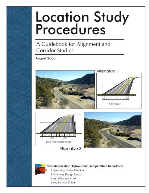
<strong>Location</strong> <strong>Study</strong><br />
<strong>Procedures</strong><br />
A Guidebook for Alignment and<br />
Corridor Studies<br />
August 2000<br />
2 LANES<br />
82’-84’<br />
6’ 8’ 12’ 12’ 6’-8’ 12’ 12’ 8’ 6’<br />
2 LANES<br />
FOUR LANES WITH MEDIAN<br />
Alternative 2<br />
<strong>New</strong> <strong>Mexico</strong> State Highway and Transportation <strong>Department</strong><br />
Engineering Design Division<br />
Preliminary Design Bureau<br />
Post Office Box 1149<br />
Santa Fe, NM 87504<br />
Alternative 1<br />
6’ 8’ 12’<br />
64’<br />
12’<br />
12’<br />
THREE LANES<br />
8’<br />
6’
TABLE OF CONTENTS<br />
SECTION 1<br />
INTRODUCTION AND<br />
PROCESS OVERVIEW<br />
SECTION 2<br />
PRELIMINARY SCOPING AND<br />
PROJECT INITIATION<br />
SECTION 3<br />
ALIGNMENT STUDY/<br />
CORRIDOR STUDY PROCESS<br />
Introduction and Purpose ........................................................................... 1-1<br />
Transportation Project Development Overview ........................................ 1-2<br />
Objective ....................................................................................................... 2-1<br />
Level <strong>of</strong> Effort and Schedule ................................................................ 2-2<br />
Identify Issues <strong>of</strong> Importance .............................................................. 2-3<br />
Establish <strong>Study</strong> Team ........................................................................... 2-5<br />
Products <strong>of</strong> Scoping and <strong>Study</strong> Initiation ........................................... 2-6<br />
Objective ....................................................................................................... 3-1<br />
NMSHTD Alignment/Corridor <strong>Study</strong> Process .......................................... 3-3<br />
PHASE A: INITIAL EVALUATION OF ALTERNATIVES .............................................. 3-4<br />
Step A.1: Agency Coordination and Public Involvement ....................... 3-6<br />
Development <strong>of</strong> the Agency Coordination<br />
& Public Involvement Program ................................................................... 3-7<br />
Step A.2: Determination <strong>of</strong> Need ............................................................ 3-10<br />
Describe Existing Transportation System ......................................... 3-11<br />
Describe Physical Condition <strong>of</strong> the Existing Facility ........................ 3-11<br />
Analysis <strong>of</strong> Land Use and Growth Trends ......................................... 3-12<br />
Analyze Existing and Future Traffic Conditions ............................... 3-12<br />
Conduct Safety Analysis ..................................................................... 3-12<br />
Purpose and Need Statement .................................................................... 3-13<br />
Recommended Documentation ................................................................ 3-15<br />
Step A.3: Existing Conditions and Constraints ..................................... 3-16<br />
Environmental Features ..................................................................... 3-17<br />
Cultural Features................................................................................. 3-17<br />
Social Features ..................................................................................... 3-17<br />
Physical Features ................................................................................. 3-17<br />
Recommended Documentation ................................................................ 3-18<br />
Step A.4: Development <strong>of</strong> <strong>Study</strong> Alternatives ....................................... 3-19<br />
Recommended Documentation ................................................................ 3-23<br />
Step A.5: Preliminary Evaluation <strong>of</strong> Alternatives .................................. 3-24<br />
Engineering Factors .................................................................................... 3-25<br />
TOC-i
TABLE OF CONTENTS<br />
SECTION 4<br />
REQUIREMENTS AND METHODS<br />
TOC-ii<br />
Environmental, Social and Cultural Factors ............................................. 3-26<br />
Step A.6: Phase A Documentation and Decisions .................................. 3-31<br />
Phase A Optional Approach ............................................................... 3-32<br />
Public Information Meeting............................................................... 3-32<br />
Identify Environmental Processing Plan ........................................... 3-32<br />
PHASE B: DETAILED EVALUATION OF ALTERNATIVES ........................................ 3-37<br />
Step B.1: Detailed Evaluation <strong>of</strong> Alternatives ........................................ 3-38<br />
Engineering Factors and Analysis ...................................................... 3-39<br />
Environmental Factors and Analysis ......................................................... 3-40<br />
Community Values ............................................................................. 3-42<br />
Value Engineering ............................................................................... 3-42<br />
Step B.2: Phase B Documentation .......................................................... 3-43<br />
Public Information Meeting............................................................... 3-44<br />
PHASE C: ENVIRONMENTAL DOCUMENTATION AND PROCESSING .......................... 3-45<br />
Step C.1: Document Preparation and Distribution .............................. 3-45<br />
Notice <strong>of</strong> Availability and Document Distribution .................................. 3-46<br />
Step C.2: Public Hearing .......................................................................... 3-48<br />
Responses to Agency and Public Comment ...................................... 3-49<br />
Step C.3: Preparation <strong>of</strong> Input Synopsis/Prepare Final EIS .................. 3-49<br />
Input Synopsis (EAs Only) ................................................................. 3-49<br />
Final EIS .............................................................................................. 3-50<br />
Step C.4: FONSI/Record <strong>of</strong> Decision ...................................................... 3-51<br />
Environmental Reevaluations .................................................................... 3-52<br />
Overview and Purpose ................................................................................. 4-1<br />
Traffic Operations and Safety ...................................................................... 4-2<br />
Preliminary Drainage Analysis .................................................................... 4-4<br />
Air Quality .................................................................................................... 4-6<br />
Noise.............................................................................................................. 4-8<br />
Social and Economic .................................................................................. 4-10<br />
Relocations .................................................................................................. 4-12<br />
Farmlands ................................................................................................... 4-14<br />
Cultural Resources ..................................................................................... 4-16<br />
Surface Water, Water Quality and Wetlands ............................................. 4-18<br />
August 2000
APPENDIX A<br />
Summary <strong>of</strong> Federal Environmental Legislation<br />
and Regulations<br />
APPENDIX B<br />
Glossary <strong>of</strong> Terms and Acronyms<br />
Table <strong>of</strong> Contents<br />
LOCATION STUDY PROCEDURES<br />
A Guidebook for Alignment Studies and Corridor Studies<br />
Floodplains ................................................................................................. 4-21<br />
Terrestrial and Aquatic Ecosystems ........................................................... 4-22<br />
Threatened, Endangered and Sensitive Species ........................................ 4-24<br />
Visual Resources ......................................................................................... 4-27<br />
Hazardous Waste ........................................................................................ 4-29<br />
TOC-iii
SECTION 1<br />
Introduction and Process Overview<br />
Maintenance<br />
and Performance<br />
Monitoring<br />
Construction<br />
Long Range<br />
Planning<br />
Preliminary<br />
and Final<br />
Design<br />
Prioritization<br />
and Programming<br />
<strong>Study</strong> and<br />
Conceptual<br />
Design
SECTION 1<br />
Introduction and Process Overview<br />
INTRODUCTION<br />
AND PURPOSE<br />
Practitioners should<br />
use this guidebook<br />
together with the <strong>Department</strong>’s<br />
Automated Project Development<br />
System to gain a more complete<br />
understanding <strong>of</strong> the various<br />
elements and scheduling requirements<br />
<strong>of</strong> alignment/corridor<br />
studies.<br />
This guidebook updates and replaces the <strong>New</strong> <strong>Mexico</strong> State High-<br />
way and Transportation <strong>Department</strong>’s (the <strong>Department</strong> or NMSHTD)<br />
Action Plan and <strong>Location</strong> <strong>Study</strong> <strong>Procedures</strong>. It has been prepared to<br />
assist transportation engineers and planners and other practitioners in conducting<br />
location studies including alignment and corridor studies. The guidebook<br />
is also intended to establish consistency in how location studies are<br />
prepared, reviewed and processed by the <strong>Department</strong>. The guidance and procedures<br />
described herein are consistent with the legislative requirements <strong>of</strong><br />
the National Environmental Policy Act (NEPA), the regulatory requirements<br />
codified in 23 CFR 770-772, and other federal and state regulations and policies<br />
related to transportation planning and project development. This guidebook,<br />
together with other <strong>Department</strong> policies and procedures, also meets the<br />
requirements <strong>of</strong> 23 CFR 771.111.h(1) for states to have procedures for carrying<br />
out a public involvement program.<br />
The guidebook is structured in a logical sequence <strong>of</strong> steps and activities that make<br />
up the alignment/corridor study process. The information begins with an overview<br />
<strong>of</strong> the larger project development process and a brief explanation <strong>of</strong> how<br />
alignment/corridor studies fit into that process. A step-by-step description <strong>of</strong> each<br />
major phase <strong>of</strong> the alignment/corridor study process is provided followed by more<br />
detailed information regarding major work activities.<br />
Practitioners should use this guidebook together with the project development<br />
flowchart developed as part <strong>of</strong> the <strong>Department</strong>’s Automated Project Development<br />
System to gain a more complete understanding <strong>of</strong> the various elements and scheduling<br />
requirements <strong>of</strong> alignment/corridor studies. A copy <strong>of</strong> the project development<br />
process flowchart is available from the <strong>Department</strong>. The flowchart specifies<br />
the sequence <strong>of</strong> activities and responsibilities for each phase <strong>of</strong> project development<br />
beginning with study scoping and ending with project construction. Crossreferences<br />
between key steps <strong>of</strong> the alignment/corridor study process and the overall<br />
project development process flowchart are included in this guidebook where appropriate.<br />
All major elements <strong>of</strong> the alignment/corridor study process are discussed within<br />
this guidebook. However, readers should understand that this guidebook is not<br />
intended to be all encompassing, nor are the procedures meant to be prescriptive.<br />
While a structured and consistent process is important, the study process requires<br />
flexibility to address issues that are unique to each situation and must integrate<br />
many different factors and issues. Accordingly, a prevailing theme <strong>of</strong> this guidebook<br />
is an interdisciplinary approach to decision making. The development and<br />
1-1
SECTION 1<br />
Introduction and Process Overview<br />
A prevailing theme <strong>of</strong><br />
this guidebook is an<br />
interdisciplinary approach to<br />
decision making. This approach<br />
leads to good engineering<br />
decisions that meet both the<br />
requirements and intent <strong>of</strong> NEPA.<br />
TRANSPORTATION<br />
PROJECT DEVELOPMENT<br />
OVERVIEW<br />
evaluation <strong>of</strong> engineering concepts requires the involvement and collaboration <strong>of</strong><br />
many people including engineers, planners, environmental specialists, cultural<br />
resource specialists, and others with expertise in project development. An interdisciplinary<br />
approach will lead to good engineering decisions that meet both the<br />
requirements and intent <strong>of</strong> NEPA.<br />
A second theme <strong>of</strong> this guidebook—and the policy <strong>of</strong> the NMSHTD—is the<br />
involvement <strong>of</strong> the public and other agencies in the decision making process.<br />
Public involvement must be a cooperative and collaborative process that involves<br />
many groups with diverse needs and perspectives. This includes federal,<br />
state, and local agencies, local jurisdictions, users <strong>of</strong> the proposed facility,<br />
property owners, the general public, and other persons or groups having a<br />
stake or interest in the final decision. Coordination with other agencies and<br />
involvement <strong>of</strong> the public must be proactive, comprehensive, and continuous<br />
through the project development process.<br />
The development <strong>of</strong> transportation projects is a multi-phased, multi-year process<br />
that involves a significant commitment <strong>of</strong> technical and financial resources.<br />
Project development involves six major phases including (1) long-range planning,<br />
(2) prioritization and programming, (3) study scoping and conceptual<br />
design, (4) preliminary and final design, (5) construction, and (6) maintenance<br />
and performance monitoring. An overview <strong>of</strong> each <strong>of</strong> these phases is<br />
provided below.<br />
1. Long-Range Planning serves to establish long-range goals, objectives,<br />
and system needs at the statewide or metropolitan planning area level.<br />
By federal law, states must develop and adopt a statewide longrange<br />
transportation plan that identifies transportation needs<br />
at least 20 years into the future. Federal law also requires<br />
metropolitan areas with a population <strong>of</strong> 50,000 or more to<br />
develop their own long-range transportation plan, with special<br />
rules for metropolitan areas over 200,000 population.<br />
Currently, three metropolitan areas are recognized within<br />
the state: Albuquerque, Santa Fe and Las Cruces. Hence,<br />
long-range transportation plans currently exist at the statewide<br />
level and for each <strong>of</strong> the three metropolitan areas.<br />
The statewide long-range transportation plan, and the<br />
plans for metropolitan areas with a population less than<br />
200,000, are not required to be fiscally constrained, (i.e., the identi-<br />
1-2 August 2000
fied transportation needs are not constrained by the availability <strong>of</strong> funding<br />
resources). In contrast, long-range transportation plans for metropolitan<br />
areas with a population greater than 200,000 are required to assess<br />
and balance the identified transportation needs with the availability <strong>of</strong><br />
funding resources. Furthermore, transportation projects in large metropolitan<br />
areas must be included in the adopted long-range transportation<br />
plan before they can be authorized for design and construction using<br />
federal funds.<br />
2. Prioritization and Programming is a collaborative effort involving the<br />
state, local jurisdictions, and implementing agencies. It is the process by<br />
which near-term transportation needs are identified and prioritized, and<br />
funding is allocated. Typically, transportation programs cover a three- to<br />
six-year period. At the statewide level, the State Transportation Improvement<br />
Program (STIP) includes needs for a six-year period, although funds<br />
are allocated only for the first three years. The transportation improvement<br />
program (TIP) for the Albuquerque metropolitan planning area<br />
covers a five-year time frame. By federal law, transportation programs<br />
must be updated every two years.<br />
Projects included in the long-range plans and programs are based on<br />
transportation needs determined by various monitoring programs designed<br />
to identify deficiencies in the transportation system (e.g., bridge,<br />
pavement and traffic monitoring systems). Projects may also be included<br />
to achieve local, state, or federal goals and objectives such as economic<br />
development. Currently, transportation needs are developed using data<br />
from the Consolidated Highway Database (CHDB) system and Highway<br />
Performance Monitoring System (HPMS).<br />
3. <strong>Study</strong> Scoping and Conceptual Design is the process whereby the improvement<br />
needs identified in the transportation improvement program<br />
are defined, the level <strong>of</strong> effort is determined, and improvement alternatives<br />
are developed and evaluated. This process establishes the “design<br />
concept and scope” for a proposed action and obtains authorization for<br />
federal funding. Design concept and scope means the type, extent and<br />
location <strong>of</strong> the improvement to be implemented. This includes design<br />
features such as the typical section, centerline, right-<strong>of</strong>-way limits, type<br />
<strong>of</strong> access control, termini, and associated drainage improvements. The<br />
product <strong>of</strong> this phase is a defined transportation improvement that is<br />
ready and authorized to be advanced into preliminary and final design.<br />
Introduction and Process Overview<br />
LOCATION STUDY PROCEDURES<br />
A Guidebook for Alignment Studies and Corridor Studies<br />
Prioritization and<br />
Programming is the<br />
process by which near-term<br />
transportation needs are identified<br />
and prioritized, and funding<br />
is allocated.<br />
<strong>Study</strong> Scoping and<br />
Conceptual Design<br />
establishes the “design concept and<br />
scope” for a proposed action and<br />
obtains authorization for federal<br />
funding.<br />
1-3
SECTION 1<br />
Introduction and Process Overview<br />
Alignment studies are<br />
prepared for less<br />
complex actions where the roadway<br />
location is already established.<br />
Corridor studies are<br />
prepared for more<br />
complex actions where the route<br />
location is not established, or the<br />
magnitude <strong>of</strong> improvements may<br />
result in a substantial change to an<br />
existing alignment.<br />
Both alignment and<br />
corridor studies address<br />
the same general steps including<br />
purpose and need, improvement<br />
alternatives, environmental, social<br />
and cultural effects, and agency<br />
coordination and public involvement.<br />
The scoping and conceptual design process is accomplished by performing<br />
a location study—either an “alignment study” or a “corridor study.”<br />
Alignment studies are prepared for less complex actions where the roadway<br />
location is already established. Changes to the roadway alignment<br />
are generally minor and limited to a shift in the centerline due to lane<br />
and/or shoulder widening, or the need to flatten horizontal or vertical<br />
curves. In contrast, corridor studies are prepared for more complex<br />
actions where the route location is not established, or the magnitude <strong>of</strong><br />
improvements may result in a substantial change to an existing alignment<br />
(e.g., a new roadway or major changes to the typical section and/<br />
or alignment <strong>of</strong> an existing highway). Examples <strong>of</strong> types <strong>of</strong> actions included<br />
in alignment studies and corridor studies and the relationship<br />
between the level <strong>of</strong> complexity and study type is illustrated in the diagram<br />
above.<br />
While the type <strong>of</strong> study may vary, the general approach is the same.<br />
Both alignment and corridor studies address the same general steps including<br />
purpose and need, improvement alternatives, environmental,<br />
social and cultural effects, and agency coordination and public involvement.<br />
The level <strong>of</strong> environmental effort and processing generally differs between<br />
alignment and corridor studies. Because alignment studies typically<br />
involve less complex actions, the amount <strong>of</strong> right-<strong>of</strong>-way<br />
acquisition, the number <strong>of</strong> relocations, and the magnitude <strong>of</strong> environmental<br />
impacts are generally minor. Consequently, environmental clearance<br />
can usually be obtained with a categorical exclusion or an<br />
1-4 August 2000
environmental assessment. Conversely, corridor studies typically involve<br />
complex actions that may require substantial right-<strong>of</strong>-way acquisition and<br />
relocations and have major environmental impacts. This type <strong>of</strong> action<br />
almost always requires the preparation <strong>of</strong> an environmental assessment or<br />
an environmental impact statement.<br />
Alignment and corridor studies are generally<br />
conducted in three distinct<br />
phases—commonly referred to as Phases<br />
A, B, and C. The first two phases serve to<br />
develop, evaluate, and refine the range <strong>of</strong><br />
possible alternatives to achieve the need<br />
for an action. The third phase involves<br />
the preparation <strong>of</strong> an environmental<br />
document and subsequent processing in accordance with NEPA. For less<br />
complex actions, especially those with a very limited range <strong>of</strong> improvement<br />
alternatives, phases A and B are <strong>of</strong>ten conducted as a single step;<br />
however, it is important that the objectives <strong>of</strong> each distinct phase are still<br />
achieved and documented when this approach is followed.<br />
A brief description <strong>of</strong> each phase <strong>of</strong> the alignment/corridor study process<br />
is covered in the following paragraphs. These steps coincide with the<br />
conceptual design subphase <strong>of</strong> scoping phase covered in the<br />
Project Development Process Flowchart.<br />
Phase A is the Initial Evaluation <strong>of</strong> Alternatives. The primary objectives <strong>of</strong><br />
this phase are: (1) verification <strong>of</strong> the need for an action, (2) development<br />
<strong>of</strong> a range <strong>of</strong> potential alternatives to achieve the need, and (3) the elimination<br />
<strong>of</strong> alternatives that are clearly not feasible. Other important elements<br />
<strong>of</strong> Phase A are the development and implementation <strong>of</strong> an agency<br />
coordination and public involvement program and determining the appropriate<br />
level <strong>of</strong> effort for subsequent environmental documentation and<br />
processing.<br />
The range <strong>of</strong> alternatives should include the no-build alternative and build<br />
alternatives. The no-build alternative should always be considered as a<br />
viable option and can serve as a baseline from which other alternatives can<br />
be compared against. Alternatives are evaluated for their effectiveness in<br />
achieving the need, their engineering feasibility, and their environmental,<br />
cultural and social effects. It is important to understand that the amount<br />
Introduction and Process Overview<br />
LOCATION STUDY PROCEDURES<br />
A Guidebook for Alignment Studies and Corridor Studies<br />
Phase A verifies the<br />
need for an action,<br />
develops a range <strong>of</strong> potential<br />
alternatives to achieve the need,<br />
and eliminates alternatives that<br />
are clearly not feasible.<br />
1-5
SECTION 1<br />
Introduction and Process Overview<br />
Phase B further<br />
evaluates and<br />
refines the alternatives advanced<br />
from Phase A.<br />
Phase C includes the<br />
preparation <strong>of</strong> either<br />
an environmental impact statement<br />
or an environmental assessment.<br />
<strong>of</strong> engineering detail and depth <strong>of</strong> analysis is not highly detailed in Phase A.<br />
As shown in the diagram, the level <strong>of</strong> detail and analysis increases as the<br />
number <strong>of</strong> alternatives decreases. Decisions to eliminate alternatives that<br />
are clearly not feasible or that are impractical can generally be made with<br />
a limited amount <strong>of</strong> engineering detail and analysis.<br />
Phase B is the Detailed Evaluation <strong>of</strong> Alternatives. This phase is intended<br />
to further evaluate and refine the alternatives advanced from Phase A. In<br />
most instances, alternatives that are clearly inferior or found to be unfeasible<br />
will be eliminated from further consideration during Phase B. This<br />
phase involves the development <strong>of</strong> additional information such as conceptual<br />
engineering plans, right-<strong>of</strong>-way requirements, costs, performance<br />
data, environmental and social effects, and other data.<br />
Information that is relevant to the decision-making<br />
process is generally developed at a level <strong>of</strong> detail sufficient<br />
to enable an equitable comparison <strong>of</strong> each alternative<br />
and to serve as the basis for the preparation <strong>of</strong><br />
an environmental document.<br />
Phase C is the Environmental Documentation and<br />
Processing Phase. This phase includes the preparation<br />
<strong>of</strong> either an environmental impact statement (EIS) or<br />
an environmental assessment (EA) and circulation <strong>of</strong><br />
the document for review and comment by affected and<br />
interested agencies, stakeholders, and the general public.<br />
Commitments and changes to the project, as appropriate,<br />
that result from agency and public comments are presented to<br />
the Federal Highway Administration (FHWA) for final action. Phase C<br />
culminates with a Record <strong>of</strong> Decision (ROD) for projects involving an<br />
EIS, or a Finding <strong>of</strong> No Significant Impact (FONSI) for projects where an<br />
EA was prepared. The ROD and FONSI serve as authorization by the<br />
FHWA for right-<strong>of</strong>-way acquisition, final design and construction.<br />
Written environmental re-evaluations are almost always required under<br />
certain conditions: (1) when an acceptable final EIS has not been submitted<br />
to FHWA within three years from the date the draft EIS was approved<br />
for circulation; (2) when major steps to advance the action have not occurred<br />
within three years after the final EIS was approved; and (3) during<br />
final design to establish whether or not the approved environmental document<br />
or categorical exclusion remains valid for the action as described<br />
in the design plans.<br />
1-6 August 2000
Agency coordination and public involvement are a crucial element <strong>of</strong> each<br />
phase <strong>of</strong> the alignment/corridor study process and must begin at the start<br />
<strong>of</strong> the first phase and continue through phase C. A properly designed<br />
and implemented public involvement program will ensure that: (1) the<br />
needs and concerns <strong>of</strong> affected agencies, stakeholders, and the general<br />
public are understood and fully considered, (2) interested groups and<br />
persons are involved in key decisions, and (3) the public is informed <strong>of</strong><br />
key decisions and progress <strong>of</strong> the study.<br />
4. Preliminary and Final Design — Preliminary and final design involves<br />
the preparation <strong>of</strong> detailed plans, specifications, and estimates that will<br />
be used for project construction. Mitigation measures, as specified in the<br />
original authorization, are integrated into the design plans. In most instances,<br />
final design cannot commence until after the project has been<br />
authorized by FHWA.<br />
As previously noted, prior environmental approvals must be re-evaluated<br />
to establish whether or not the environmental document remains<br />
valid and to ensure that project commitments made as part <strong>of</strong> the original<br />
authorization have been included, as appropriate.<br />
5. Project Construction — Project construction involves construction <strong>of</strong><br />
the authorized improvements, and final inspection <strong>of</strong> the completed<br />
project before it is opened for public use.<br />
6. Maintenance and Performance Monitoring — The project development<br />
process continues even after a completed projected is opened for<br />
public use. Periodic maintenance <strong>of</strong> the facility is necessary to maintain<br />
the roadway and right-<strong>of</strong>-way and to keep the facility in safe operating<br />
condition. Likewise, monitoring <strong>of</strong> the facility is important to track<br />
changes in traffic volume, vehicle classification, travel speeds, accident<br />
rates, and other factors. Monitoring data serves to identify emerging needs<br />
and is used as input to long-range planning and prioritization and programming.<br />
The preceding information provides an overview <strong>of</strong> the entire project development<br />
process from long-range planing to construction. The remainder <strong>of</strong><br />
this guidebook focuses on the study and conceptual design phase <strong>of</strong> the overall<br />
project development process and provides more detailed information on<br />
the steps and activities followed in the preparation <strong>of</strong> alignment studies and<br />
corridor studies.<br />
Introduction and Process Overview<br />
LOCATION STUDY PROCEDURES<br />
A Guidebook for Alignment Studies and Corridor Studies<br />
Agency coordination<br />
and public<br />
involvement are a crucial<br />
element <strong>of</strong> the study process<br />
and must begin at the start <strong>of</strong><br />
the first phase and continue<br />
through phase C.<br />
1-7
Mapping &<br />
Surveying<br />
Needs<br />
Environmental<br />
Considerations<br />
Community<br />
Concerns<br />
SECTION 2<br />
Preliminary Scoping<br />
and Project Initiation<br />
Traffic &<br />
Safety Needs<br />
<strong>Study</strong><br />
Emphasis<br />
Available<br />
Funding<br />
Right <strong>of</strong> Way<br />
Requirements<br />
Engineering<br />
Requirements<br />
& Constraints<br />
Jurisdictional<br />
Requirements
SECTION 2<br />
Preliminary Scoping<br />
and Project Initiation<br />
OBJECTIVE<br />
<strong>Study</strong> scoping and<br />
initiation establishes<br />
the level <strong>of</strong> effort and general<br />
approach for a study.<br />
The Automated<br />
Project Development<br />
System includes a list <strong>of</strong> “project<br />
attributes” which are used to help<br />
determine level <strong>of</strong> effort and to<br />
identify a realistic schedule for<br />
completing studies.<br />
<strong>Study</strong> scoping and initiation, as used in the location study process, identifies<br />
the level <strong>of</strong> effort and general approach that is appropriate for a<br />
particular study and the steps that must be undertaken to commence<br />
work. Typically, scoping and initiation are the responsibility <strong>of</strong> the NMSHTD,<br />
with involvement by FHWA, and should be performed by an interdisciplinary<br />
team with expertise in both engineering and environmental issues. Scoping<br />
and initiation are included in the “scoping phase” <strong>of</strong> NMSHTD’s Project Development<br />
Process. The major decisions made during scoping include:<br />
q The level <strong>of</strong> effort and schedule that is anticipated. This includes a<br />
determination <strong>of</strong> the type <strong>of</strong> study to be conducted, e.g., corridor study<br />
or alignment study, the anticipated level <strong>of</strong> effort required for<br />
environmental clearance, an estimate <strong>of</strong> the budget for the<br />
study, and the time required to complete the study.<br />
q The major and/or unique issues and factors<br />
that need to be considered. This could include<br />
engineering issues such as drainage, structures,<br />
or traffic operations, unique mapping needs,<br />
important environmental considerations such as<br />
wetlands or air quality, or special requirements<br />
for public involvement.<br />
q The composition <strong>of</strong> the technical study team<br />
and the specific staff that are needed to complete the study.<br />
The Automated Project Development System used by the NMSHTD includes<br />
a list <strong>of</strong> “project attributes” for most elements <strong>of</strong> project development including<br />
general environmental, environmental geology, bridge, drainage, right-<strong>of</strong>way,<br />
utilities, railroad, survey and land, and traffic and safety attributes. Project<br />
attributes are the known characteristics and requirements for which the level<br />
<strong>of</strong> effort and scheduling have been estimated based on prior experience by the<br />
NMSHTD. The list <strong>of</strong> project attributes are used as part <strong>of</strong> the alignment/<br />
corridor study scoping process to help determine level <strong>of</strong> effort and to identify<br />
a realistic schedule for completing studies.<br />
2-1
SECTION 2<br />
Preliminary Scoping and Project Initiation<br />
LEVEL OF EFFORT<br />
AND SCHEDULE<br />
Major actions within<br />
MPO jurisdictions must<br />
consider and evaluate a full range<br />
<strong>of</strong> improvement alternatives,<br />
including highway and nonhighway<br />
strategies.<br />
Projects within an air<br />
quality non-attainment<br />
or maintenance area require<br />
a project level air quality analysis.<br />
2-2<br />
Work activities and factors to be considered when making decisions about the<br />
level <strong>of</strong> effort, issues to be considered, and composition <strong>of</strong> the study team are<br />
as follows.<br />
Identifying the appropriate level <strong>of</strong> effort is an essential element <strong>of</strong> study scoping.<br />
The level <strong>of</strong> effort and detail required depends on the scope, complexity,<br />
and location <strong>of</strong> the particular study. Factors to be considered in identifying<br />
the level <strong>of</strong> effort are outlined below.<br />
1. The design concept and scope <strong>of</strong> transportation improvements that<br />
are expected to result from the project are a major factor in determining<br />
the level <strong>of</strong> effort. Typically, projects involve one <strong>of</strong> two general<br />
categories <strong>of</strong> improvements:<br />
a. Projects that involve a new transportation facility on a new<br />
alignment or substantive improvements to an existing facility<br />
(e.g., the addition <strong>of</strong> travel lanes, reconstruction <strong>of</strong> an<br />
interchange, major changes to access, or changes that<br />
substantially alter an alignment) require the preparation <strong>of</strong><br />
an environmental assessment or an environmental impact<br />
statement.<br />
b. Projects that principally involve the rehabilitation <strong>of</strong> an<br />
existing facility with relatively minor changes to the typical<br />
section and/or geometry (e.g., addition <strong>of</strong> turn lanes, passing<br />
lanes, shoulder widening, etc.) involve the preparation <strong>of</strong> an<br />
environmental assessment or, for very minor actions, a<br />
categorical exclusion.<br />
2. If the project is within or affects a metropolitan area (e.g., Albuquerque,<br />
Santa Fe or Las Cruces) and is under the jurisdiction <strong>of</strong> a metropolitan<br />
planning organization (or will be within the 20-year planning horizon),<br />
special factors need to be considered.<br />
a. Projects that involve a new major access controlled highway<br />
or capacity enhancements to an existing access controlled<br />
highway must consider and evaluate a full range <strong>of</strong><br />
improvement alternatives including highway and nonhighway<br />
strategies. Non-highway strategies could include<br />
high-occupancy vehicle lanes, transit, bicycle and pedestrian<br />
facilities, demand management strategies, and/or ITS<br />
technologies.<br />
b. Projects within an air quality non-attainment or maintenance<br />
area require a project level air quality analysis that<br />
demonstrates conformity to the State Implementation Plan.<br />
c. Projects that are within metropolitan areas with a population<br />
August 2000
Preliminary Scoping and Project Initiation<br />
<strong>of</strong> 200,000 or more must be included in an adopted longrange<br />
transportation plan and transportation improvement<br />
program before the project can be authorized for design and<br />
construction.<br />
d. Projects within the Albuquerque Metropolitan Planning Area<br />
must be included within the approved Metropolitan<br />
Transportation Plan (MTP) before they can be authorized<br />
for design and construction. Thus, it is important to<br />
anticipate the design concept and scope <strong>of</strong> the proposed<br />
improvements to ensure that they are consistent with the<br />
concept and scope assumed within the MTP and TIP. Projects<br />
that are not consistent with the MTP cannot be authorized<br />
for design and construction by FHWA.<br />
3. The project limits and study area should be identified as part <strong>of</strong> the<br />
scoping process. Projects must be based on logical termini and have<br />
independent utility. This means that the project is usable and would be<br />
a reasonable expenditure <strong>of</strong> public funds even if no additional transportation<br />
improvements are constructed within the area. In addition, the<br />
project should not restrict consideration <strong>of</strong> other alternatives for other<br />
reasonably foreseeable transportation improvements. The selection <strong>of</strong><br />
logical termini should include the following considerations:<br />
a. The termini endpoints should be rational for a transportation<br />
improvement.<br />
b. The termini should be <strong>of</strong> sufficient length to address<br />
environmental matters on a broad scope.<br />
c. The termini endpoints should be rational for review <strong>of</strong><br />
environmental effects.<br />
d. The resulting action should be usable and be a reasonable<br />
expenditure even if no additional transportation<br />
improvements in the area are made.<br />
e. The termini should not restrict consideration <strong>of</strong> alternatives<br />
for other reasonably foreseeable transportation<br />
improvements.<br />
f. The termini should not be limited to improvements that may<br />
be included in short-term transportation improvement<br />
program, but should cover the entire length <strong>of</strong> corridors that<br />
may be planned for construction in the foreseeable future.<br />
The range and complexity <strong>of</strong> issues that will be addressed affect the cost, schedule<br />
and type <strong>of</strong> staff needed to complete the conceptual design phase <strong>of</strong> the<br />
project. Thus, the identification <strong>of</strong> major engineering, environmental or public<br />
involvement factors that need to be addressed is an important part <strong>of</strong> the<br />
LOCATION STUDY PROCEDURES<br />
A Guidebook for Alignment Studies and Corridor Studies<br />
Projects must be based<br />
on logical termini and<br />
have independent utility. This means<br />
that the project is usable and would<br />
be a reasonable expenditure <strong>of</strong><br />
public funds even if no additional<br />
transportation improvements are<br />
constructed within the area.<br />
IDENTIFY ISSUES<br />
OF IMPORTANCE<br />
2-3
SECTION 2<br />
Preliminary Scoping and Project Initiation<br />
The time required to<br />
prepare traffic<br />
forecasts and the responsibility<br />
for forecasting should be<br />
considered in the project<br />
schedule and budget.<br />
The anticipated<br />
public controversy<br />
influences the extent and<br />
approach used for public<br />
outreach and community<br />
involvement.<br />
2-4<br />
scoping process. This requires input from a variety <strong>of</strong> personnel including<br />
both engineering and environmental staff. Examples <strong>of</strong> issues that could affect<br />
the cost, schedule, and staffing needs for a study include:<br />
q Engineering factors that will require specialty studies such as complex<br />
drainage, geotechnical conditions, topography and terrain, traffic<br />
operations, bridges and structures, road classification, value<br />
engineering, etc.<br />
q Mapping and surveying needs should be scoped to reflect the<br />
complexity and timing <strong>of</strong> the project. Projects that involve simple<br />
terrain in rural areas have lesser needs than projects in complex terrain<br />
and/or in highly developed urban areas. The timing <strong>of</strong> the final design<br />
phase should also be considered in establishing the mapping level <strong>of</strong><br />
effort. Detailed mapping may be cost-effective for projects that<br />
advance quickly into final design. Conversely, when several years may<br />
elapse between conceptual engineering and final design, mapping<br />
should be kept to the minimum needed to develop and evaluate design<br />
concepts. The graphic and presentation needs <strong>of</strong> the project should<br />
also be considered in establishing mapping parameters.<br />
q Traffic forecasts developed with an approved travel demand model are<br />
likely necessary in large metropolitan areas such as Albuquerque, Las<br />
Cruces or Santa Fe. The time required to prepare forecasts and the<br />
responsibility for forecasting should be factored into the project<br />
schedule and budget.<br />
q The anticipated need for additional right-<strong>of</strong>-way and/or relocations <strong>of</strong><br />
residences or businesses. This includes an investigation <strong>of</strong><br />
environmental justice, availability <strong>of</strong> replacement housing, hazardous<br />
materials contamination, community cohesion and other community<br />
effects. The acquisition <strong>of</strong> property from railroads or Indian lands<br />
requires special consideration in determining study schedule and cost.<br />
q Environmental factors that may require in-depth investigations and<br />
coordination with other agencies. These could include a wide range <strong>of</strong><br />
factors such as cultural resources, wetlands, threatened and endangered<br />
species, visual resources, air quality, hazardous materials, etc.<br />
q The anticipated public controversy influences the extent and approach<br />
used for public outreach and community involvement.<br />
August 2000
Establishing the study team for an alignment/corridor study requires that the<br />
specific technical disciplines needed for a particular effort be identified and<br />
assembled. The study team usually includes highway engineers, structural<br />
engineers, transportation planners, environmental specialists, public involvement<br />
specialists, right-<strong>of</strong>-way specialists, and others who will be involved in<br />
the day-to-day work activities <strong>of</strong> the study. Typically, the composition <strong>of</strong> this<br />
group includes the following staff:<br />
q Project Development Engineer or Team Leader<br />
q District Engineer and/or District Technical Services Engineer<br />
q FHWA Representatives<br />
q Local Jurisdiction Representatives (MPO, local agency representatives,<br />
etc.)<br />
q Environmental Specialist<br />
q Public Involvement Specialist<br />
q Right-<strong>of</strong>-Way and Utility Specialists<br />
q Other Engineering Specialists (structural, drainage, traffic, etc.)<br />
q Other Environmental Specialists (archeologists, biologists, geologists, etc.)<br />
q Consultants (optional)<br />
The composition and technical expertise <strong>of</strong> the <strong>Study</strong> Team will vary for each<br />
study; therefore, the staffing needs should be identified on a case-by-case basis.<br />
The above list serves as a useful starting point.<br />
The <strong>Study</strong> Team’s role is to perform technical investigations, develop and implement<br />
the agency coordination and public involvement plan, and develop recommendations<br />
based on the technical analysis and public comments. While<br />
the <strong>Study</strong> Team is instrumental in making decisions, the decision process requires<br />
the involvement <strong>of</strong> senior managers from the <strong>Department</strong> and FHWA<br />
with a broader view <strong>of</strong> financial resources and statewide needs.<br />
The <strong>Study</strong> Team may be assisted by a technical advisory committee (TAC)<br />
when the study is within a large metropolitan areas with multiple jurisdictions<br />
(e.g., Albuquerque metro area). The use <strong>of</strong> a TAC enhances coordination<br />
with local public works, transit, land use planning, and environmental<br />
agencies. The TAC also assists the <strong>Study</strong> Team in the identification <strong>of</strong> local<br />
issues, requirements, and needs.<br />
Preliminary Scoping and Project Initiation<br />
LOCATION STUDY PROCEDURES<br />
A Guidebook for Alignment Studies and Corridor Studies<br />
ESTABLISH STUDY TEAM<br />
The study team<br />
includes highway<br />
engineers, transportation planners,<br />
environmental specialists, public<br />
involvement specialists, right-<strong>of</strong>way<br />
specialists, and others.<br />
2-5
SECTION 2<br />
Preliminary Scoping and Project Initiation<br />
2-6<br />
A citizen advisory committee (CAC) may be needed in some circumstances—<br />
especially for complex and/or controversial studies. The composition <strong>of</strong> the<br />
CAC should include citizen representatives from neighborhoods, businesses,<br />
developer groups, service providers, special interest groups, and other groups<br />
having a stake in the study outcome. The CAC provides a forum for information<br />
exchange and serves as a liasion between the <strong>Study</strong> Team and the community<br />
at large. The CAC also assists in identifying community issues <strong>of</strong><br />
interest and concern and provides feedback to the Project Team on route alternatives<br />
and design concept alternatives to the Project Team.<br />
The products <strong>of</strong> the scoping and study initiation phase includes:<br />
PRODUCTS OF SCOPING AND<br />
q A decision on the type <strong>of</strong> study and anticipated level <strong>of</strong> environmental<br />
STUDY INITIATION<br />
processing to be conducted;<br />
q Identification <strong>of</strong> the project termini and study area boundaries;<br />
q Identification <strong>of</strong> major issues that need to be addressed and supporting<br />
information required to complete the study; and<br />
q Composition <strong>of</strong> the <strong>Study</strong> Team and a decision on the need for a TAC<br />
and/or a CAC.<br />
August 2000
Resource<br />
Agency<br />
Requirements<br />
Community<br />
Values<br />
Environmental<br />
Considerations<br />
SECTION 3<br />
Alignment <strong>Study</strong>/<br />
Corridor <strong>Study</strong> Process<br />
Transportation<br />
Needs<br />
Transportation<br />
Decisions<br />
Other<br />
Issues<br />
Community<br />
Impacts<br />
Available<br />
Funding<br />
Engineering<br />
Requirements<br />
& Constraints
SECTION 3<br />
Alignment <strong>Study</strong>/<br />
Corridor <strong>Study</strong> Process<br />
OBJECTIVE<br />
This section <strong>of</strong> the guidebook includes a step-by-step discussion <strong>of</strong> each<br />
major phase and individual work activity <strong>of</strong> the alignment/corridor<br />
study process. The discussion begins with an overview <strong>of</strong> the three<br />
major phases <strong>of</strong> the study process and is followed by a description and discussion<br />
<strong>of</strong> the individual work activities that make up each major phase. A flowchart<br />
that summarizes the steps <strong>of</strong> the overall study process is provided and<br />
illustrates how the individual steps fit together. Cross references to steps in the<br />
NMSHTD Project Development Process flowchart are provided where appropriate.<br />
Alignment studies and corridor studies are<br />
conducted in three distinct phases—referred<br />
to as Phases A, B, and C. These<br />
phases correspond to the conceptual design<br />
phase <strong>of</strong> the NMSHTD Project Development<br />
Process flowchart. Phases A and B develop, evaluate,<br />
and refine the possible alternatives. Phase C involves the<br />
preparation <strong>of</strong> an environmental document and subsequent<br />
processing in accordance with NEPA. A brief description <strong>of</strong> the objectives<br />
for each phase is provided below.<br />
q Phase A is the Initial Evaluation <strong>of</strong> Alternatives <strong>Study</strong>. The primary<br />
objectives <strong>of</strong> this phase are: (1) verification <strong>of</strong> the purpose and need for<br />
an action, (2) development <strong>of</strong> a range <strong>of</strong> potential alternatives that meet<br />
the purpose and need, and (3) elimination <strong>of</strong> alternatives that are clearly<br />
not feasible. Other important Phase A elements are the development<br />
and implementation <strong>of</strong> an agency coordination and public involvement<br />
program and the determination <strong>of</strong> the appropriate level <strong>of</strong> effort for<br />
subsequent environmental documentation and processing.<br />
q Phase B is the Detailed Evaluation <strong>of</strong> Alternatives. This phase is<br />
intended to further evaluate and refine the alternatives advanced from<br />
Phase A. Generally, this phase involves the development <strong>of</strong> additional<br />
information such as conceptual engineering plans, right-<strong>of</strong>-way<br />
requirements, costs, performance data, environmental and social effects,<br />
and other data. Information that is relevant to the decision-making<br />
3-1
SECTION 3<br />
Alignment <strong>Study</strong>/Corridor <strong>Study</strong> Process<br />
3-2<br />
process is developed at a level <strong>of</strong> detail sufficient to enable an equitable<br />
comparison <strong>of</strong> each alternative and to serve as the basis for the<br />
preparation <strong>of</strong> an environmental document. In most instances,<br />
alternatives that are clearly inferior or found to be unfeasible will be<br />
eliminated from further consideration during Phase B.<br />
q Phase C is the Environmental Documentation and Processing Phase.<br />
This phase includes the preparation <strong>of</strong> an environmental document (EA<br />
or EIS) and circulation <strong>of</strong> the document for agency and public review<br />
and comment. Review comments may result in changes to the design<br />
concept and scope <strong>of</strong> a proposed action and/or the addition <strong>of</strong><br />
commitments to mitigate adverse impacts. Review comments, changes<br />
to the proposed action, project commitments, and information<br />
pertaining to the public and agency review process are submitted to<br />
FHWA for their use in determining whether or not a the proposed action<br />
will be authorized (i.e., issuance <strong>of</strong> a FONSI or ROD).<br />
The specific activities and decisions that must be addressed during each phase<br />
<strong>of</strong> the study process are illustrated in the flow chart on the following page and<br />
discussed in greater detail in the remainder <strong>of</strong> this section.<br />
August 2000
NMSHTD Alignment/Corridor <strong>Study</strong> Process<br />
Scoping<br />
Phase<br />
Scoping<br />
and Initiation<br />
Identify Level<br />
<strong>of</strong> Effort<br />
Identify Issues<br />
<strong>of</strong> Importance<br />
Establish<br />
Project Team<br />
Determine Budget<br />
Requirements and<br />
STIP Programming<br />
Detailed Engineering<br />
and Environmental Evaluations<br />
Traffic<br />
Safety<br />
Drainage<br />
Constructability<br />
Right-<strong>of</strong>-Way<br />
Public<br />
Involvement<br />
Plan<br />
Develop<br />
PIP<br />
Public Outreach<br />
Activities<br />
Agency<br />
Coordination<br />
Initial Scoping<br />
Meeting<br />
Establish Purpose<br />
and Need<br />
Inventory Existing<br />
Trans System<br />
Identify Features<br />
<strong>of</strong> Existing Facility<br />
Analyze Land Use<br />
and Growth<br />
Existing & Future<br />
Traffic Volumes<br />
& Analysis<br />
Conduct Safety<br />
Analysis<br />
Detailed Evaluation <strong>of</strong><br />
Feasible Alternatives: Phase B<br />
Costs<br />
Environmental<br />
Social<br />
Cultural<br />
Mitigation<br />
Establish Existing<br />
Conditions/<br />
Constraints<br />
Environmental<br />
Cultural<br />
Social<br />
Physical<br />
Public & Agency Involvement<br />
Initial Value<br />
Engineering<br />
Review<br />
Phase B<br />
Conclusion<br />
NOTE: Many steps can be performed concurrently and do not rely on prior activities.<br />
Initial Evaluation <strong>of</strong> Alternatives: Phase A<br />
Select Alternatives<br />
for Advancement<br />
to Phase C<br />
Phase B<br />
Report<br />
Public<br />
Meeting<br />
Identify Potential<br />
Alternatives<br />
Identify<br />
Potential Alternatives<br />
Prepare<br />
Draft EIS<br />
Responds<br />
to Need<br />
Operational<br />
Performance<br />
Eng. Feasibility<br />
& Constructability<br />
Preliminary Evaluation<br />
<strong>of</strong> Alternatives<br />
Drainage<br />
Environmental Documentation<br />
and Processing: Phase C<br />
Public & Agency Involvement Public & Agency Involvement<br />
Prepare<br />
EA<br />
Safety<br />
Cost<br />
Public<br />
Hearing<br />
Public<br />
Hearing<br />
Right-<strong>of</strong>-way<br />
Environmental<br />
Social<br />
Cultural<br />
Prepare<br />
Final EIS<br />
Prepare<br />
Input Synopsis<br />
Phase A<br />
Report<br />
Eliminate<br />
Unfeasible<br />
Alternatives<br />
Determine<br />
Environmental<br />
Level <strong>of</strong> Effort<br />
ROD<br />
FONSI<br />
Public<br />
Meeting<br />
Preliminary and Final Design Phase
SECTION 3<br />
Alignment <strong>Study</strong>/Corridor <strong>Study</strong> Process<br />
PHASE A:<br />
INITIAL EVALUATION OF ALTERNATIVES<br />
The objective <strong>of</strong> this<br />
phase is to verify the<br />
need for improvements and to<br />
identify and evaluate improvement<br />
alternatives that may be a reasonable<br />
solution to the need for<br />
improvements.<br />
The level <strong>of</strong> effort and<br />
amount <strong>of</strong> detail<br />
varies and depends on the scope,<br />
complexity, and location <strong>of</strong> the<br />
particular study.<br />
3-4<br />
The Initial Evaluation <strong>of</strong> Alternatives study is the first phase <strong>of</strong> the<br />
three-phase alignment/corridor study process. The goal <strong>of</strong> this phase<br />
is to verify the need for improvements and to identify and evaluate<br />
improvement alternatives that may be a reasonable solution to the need for<br />
improvements. The steps to achieve this goal include the following work activities:<br />
1. Develop and implement the agency coordination and public involvement<br />
program;<br />
2. Establish or verify the purpose and need for the proposed transportation<br />
improvement;<br />
3. Identify the existing physical, economic, environmental, social and cultural<br />
conditions within the study area that may be affected by the proposed<br />
action and/or that may affect the project;<br />
4. Identify the range <strong>of</strong> alternatives that could be used to address the purpose<br />
and need;<br />
5. Perform a preliminary evaluation <strong>of</strong> each alternative for its ability to<br />
achieve the purpose and need, operational performance, engineering feasibility,<br />
constructability, safety benefits, cost, right-<strong>of</strong>-way requirements,<br />
drainage needs, and environmental, social, and cultural effects.<br />
6. Identify the environmental processing actions necessary for federal authorization.<br />
The level <strong>of</strong> effort and amount <strong>of</strong> detail required to accomplish the above<br />
activities varies and depends on the scope, complexity, and location <strong>of</strong> the<br />
particular study. In some instances, the range <strong>of</strong> alternatives and evaluation<br />
criteria is very simple and can be completed quickly. In other cases, the range<br />
<strong>of</strong> alternatives and evaluation process may require extensive effort and time to<br />
complete.<br />
Typically, Phase A concludes with a report that summarizes the purpose and<br />
need for an action, describes potential alignment alternatives, and discusses<br />
the engineering and environmental advantages and disadvantages <strong>of</strong> each alternative.<br />
The report also includes recommendations with regard to which<br />
alternatives warrant further investigation, which should be eliminated from<br />
August 2000
consideration, and the appropriate type <strong>of</strong> environmental documentation and<br />
processing. Documentation can range from a brief report that encompasses<br />
all <strong>of</strong> the requisite information or, for complex studies, may be a larger report<br />
with supplementary technical reports for specific issues such as traffic operations,<br />
safety analysis, or cultural and natural resources. In either case, it is<br />
important that the report focus on issues germane to the decision at hand and<br />
not include extraneous or irrelevant information. Statements made within<br />
the report should be supported by data and analysis.<br />
The specific work activities for each step <strong>of</strong> the Initial Evaluation <strong>of</strong> Alternatives<br />
study are described in the following pages.<br />
Alignment <strong>Study</strong>/Corridor <strong>Study</strong> Process<br />
LOCATION STUDY PROCEDURES<br />
A Guidebook for Alignment Studies and Corridor Studies<br />
3-5
SECTION 3<br />
Alignment <strong>Study</strong>/Corridor <strong>Study</strong> Process<br />
STEP A.1:<br />
AGENCY COORDINATION AND PUBLIC INVOLVEMENT<br />
Agency coordination<br />
and public involvement<br />
are a cornerstone <strong>of</strong> the<br />
project development process and<br />
are the policy <strong>of</strong> the NMSHTD.<br />
Involvement <strong>of</strong> the<br />
public must be<br />
proactive, comprehensive, and<br />
continuous through the project<br />
development process.<br />
3-6<br />
Phase A: Initial Evaluation <strong>of</strong> Alternatives<br />
Agency coordination and public involvement are a cornerstone <strong>of</strong> the<br />
project development process and are especially critical during the<br />
alignment/corridor phase. It is the policy <strong>of</strong> the NMSHTD to involve<br />
the public and other agencies in the decision making process. Public involvement<br />
must be a cooperative and collaborative process that involves many<br />
groups with diverse needs and perspectives. This includes federal, state, and<br />
local agencies, local jurisdictions, users <strong>of</strong> the proposed facility, property owners,<br />
the general public, and other persons or groups having a stake or interest<br />
in the final decision.<br />
Coordination with other agencies and involvement <strong>of</strong> the public must be proactive,<br />
comprehensive, and continuous through the project development process.<br />
Accordingly, the start <strong>of</strong> any alignment/corridor study should begin with<br />
the development and implementation <strong>of</strong> an agency coordination and public<br />
involvement program.<br />
Agency coordination includes efforts and activities to coordinate with and<br />
involve federal, state, tribal, and local agencies in the project development pro-<br />
August 2000
Step A.1: Agency Coordination and Public Involvement<br />
cess. It is an essential step <strong>of</strong> the study process and ensures that a proposed<br />
action is coordinated with and consistent with the actions, policies, and regulations<br />
<strong>of</strong> other agencies and jurisdictions.<br />
Public involvement includes efforts to inform property owners, neighborhoods,<br />
local <strong>of</strong>ficials, special interest groups, and other interested persons about a<br />
proposed action and involves these individuals and groups in the decision<br />
making process. Public involvement can occur at three levels: (1) making the<br />
public aware <strong>of</strong> a proposed action, (2) informing the public about a proposed<br />
action and its potential effects, and (3) involving the public in the decision<br />
making process. The level <strong>of</strong> public involvement will depend on the potential<br />
for the action to affect individuals and the general public and the degree they<br />
are affected. For example, minor improvements such as shoulder widening<br />
on a rural highway that will not involve right-<strong>of</strong>-way acquisition may be well<br />
served by a low-level <strong>of</strong> public involvement that is limited to a public awareness<br />
effort. Conversely, actions involving extensive right-<strong>of</strong>-way acquisition<br />
and relocations, and that may adversely affect neighborhoods or communities,<br />
need a very high level <strong>of</strong> public involvement.<br />
Agency coordination and public involvement serve to build consensus and<br />
are an essential component <strong>of</strong> the determination <strong>of</strong> needs and alternatives<br />
identification and evaluation processes, as well as in the identification and<br />
development <strong>of</strong> mitigation strategies. While coordination and involvement<br />
are a regulatory requirement, they should be viewed as an opportunity to involve<br />
agencies and the public in decisions that affect them. The input received<br />
from agencies and the public will assist the <strong>Study</strong> Team in identifying critical<br />
issues that, if not properly addressed, can delay or stop projects. Conversely, a<br />
properly developed and implemented public involvement program saves time<br />
and money and leads to good decisions that can be advanced through the final<br />
design and implementation phases <strong>of</strong> the project development process.<br />
The public involvement program is an integral element <strong>of</strong> the project development<br />
process which serves to generate information that is used by the <strong>Study</strong><br />
Team and to disseminate information developed by the <strong>Study</strong> Team. Major<br />
considerations in the development <strong>of</strong> an effective coordination and public<br />
involvement program include:<br />
q The program should have clearly stated goals and objectives, and work<br />
activities should be established to achieve the stated goals.<br />
Alignment <strong>Study</strong>/Corridor <strong>Study</strong> Process<br />
LOCATION STUDY PROCEDURES<br />
A Guidebook for Alignment Studies and Corridor Studies<br />
Public involvement<br />
can occur at three<br />
levels: making the public aware;<br />
informing the public; and involving<br />
the public.<br />
A properly developed<br />
and implemented<br />
public involvement program saves<br />
time and money and leads to good<br />
decisions.<br />
DEVELOPMENT OF THE<br />
AGENCY COORDINATION<br />
AND PUBLIC INVOLVEMENT<br />
PROGRAM<br />
3-7
SECTION 3<br />
Alignment <strong>Study</strong>/Corridor <strong>Study</strong> Process<br />
The components <strong>of</strong><br />
the public involvement<br />
program varies depending<br />
on the location and magnitude <strong>of</strong><br />
the study and the level <strong>of</strong> anticipated<br />
controversy.<br />
3-8<br />
q The program should be a dynamic process that is continually evaluated<br />
for effectiveness and modified to enhance its effectiveness.<br />
q The program should be proactive. Active efforts must be made to identify<br />
and involve agencies, communities, neighborhoods, landowners,<br />
businesses, residents and other groups that may have a stake in the<br />
outcome <strong>of</strong> the study. This requires that the <strong>Study</strong> Team take information<br />
to these stakeholders rather than waiting for them to come to the <strong>Study</strong><br />
Team.<br />
q The program should include groups that may be traditionally underrepresented<br />
in the project development process (e.g., low income, elderly,<br />
and minority groups, and non-english speaking or disabled individuals).<br />
The identification and inclusion <strong>of</strong> the under-served may require special<br />
outreach methods and accommodations.<br />
q Information generated by the process should be accessible to<br />
stakeholders. This includes making data and reports accessible and<br />
having meetings at locations and times that are reasonable for the affected<br />
groups.<br />
q Stakeholders should have an active role in the development and<br />
evaluation <strong>of</strong> concepts and should not be relegated to a review and<br />
comment role.<br />
q The format for public information meetings and public hearings should<br />
be flexible and adapted to meet the needs <strong>of</strong> a particular study and/or<br />
community. For example, some studies may require the use <strong>of</strong> open<br />
houses, workshops, or other involvement technique to most effectively<br />
achieve the objective <strong>of</strong> the public involvement plan.<br />
The components <strong>of</strong> the public involvement program varies depending on the<br />
location and magnitude <strong>of</strong> the study and the level <strong>of</strong> anticipated controversy.<br />
At a minimum, the program should include and identify the following components:<br />
1. A statement <strong>of</strong> goals and objectives to be achieved by the Program;<br />
2. The techniques used to identify stakeholder groups;<br />
Phase A: Initial Evaluation <strong>of</strong> Alternatives<br />
3. The techniques used to provide initial notification to stakeholders <strong>of</strong> the<br />
study and invite their involvement;<br />
4. The methods used to provide subsequent notification to stakeholder<br />
groups;<br />
August 2000
Step A.1: Agency Coordination and Public Involvement<br />
5. The methods used to involve stakeholders and obtain their input throughout<br />
the course <strong>of</strong> the study;<br />
6. The methods used to disseminate information throughout the course <strong>of</strong><br />
the study; and<br />
7. The number and timing <strong>of</strong> public forums and meetings that are anticipated.<br />
The agency coordination and public involvement program should be reviewed<br />
by the public involvement coordinator <strong>of</strong> the Environmental Section before<br />
implementation.<br />
Alignment <strong>Study</strong>/Corridor <strong>Study</strong> Process<br />
LOCATION STUDY PROCEDURES<br />
A Guidebook for Alignment Studies and Corridor Studies<br />
3-9
SECTION 3<br />
Alignment <strong>Study</strong>/Corridor <strong>Study</strong> Process<br />
STEP A.2: DETERMINATION OF NEED<br />
Determining the<br />
purpose and need for<br />
a proposed action is one <strong>of</strong> the<br />
most important elements <strong>of</strong> the<br />
project development process.<br />
3-10<br />
Phase A: Initial Evaluation <strong>of</strong> Alternatives<br />
Determining the purpose and need for a proposed action is one <strong>of</strong> the<br />
most important elements <strong>of</strong> the project development process. Fed-<br />
eral regulations (40 CFR 1502.13) mandate that study sponsors de-<br />
fine the underlying purpose and need which the agency is responding to by pro-<br />
posing alternatives, including the proposed action. Project purpose is a broad<br />
statement <strong>of</strong> the overall objective to be achieved by a proposed transportation<br />
improvement. Need is a more detailed explanation <strong>of</strong> the specific transportation<br />
problems or deficiencies that currently exist, or that are expected to exist<br />
in the future.<br />
A well defined purpose and need provides credibility to the study and pro-<br />
Project purpose is a<br />
motes acceptance by the public and review agencies. Furthermore, a credible<br />
broad statement <strong>of</strong> the<br />
overall objective to be achieved by a need becomes particularly important when dealing with issues that may have<br />
proposed transportation improve- unavoidable effects on protected resources such as public parks, cultural rement.<br />
Need is a more detailed sources, historic resources, etc. The ability to achieve the project need is also a<br />
explanation <strong>of</strong> the specific transpor- central factor used in the evaluation and comparison <strong>of</strong> alternatives. In short,<br />
tation problems.<br />
the need serves as the foundation for the entire study, without which the proposed<br />
action cannot and should not be advanced.<br />
August 2000
Step A.2: Determination <strong>of</strong> Need<br />
The need for a proposed action is normally based on one or more factors<br />
including capacity, safety, physical deficiencies, system continuity, and/or economic<br />
development. In some instances, the need may be in response to a<br />
legislative mandate, although the mandate is usually rooted in one <strong>of</strong> the other<br />
factors such as safety or economic development. The stated need for a proposed<br />
action must be supported by data and analysis and documented as part<br />
<strong>of</strong> the corridor study process. This requires a comprehensive review and analysis<br />
<strong>of</strong> existing and future conditions involving the transportation system and<br />
socioeconomic trends within the study area. The range <strong>of</strong> information that<br />
may be required as part <strong>of</strong> the needs analysis is summarized below. It should<br />
be recognized that some <strong>of</strong> the information is not relevant to some studies,<br />
and that the level <strong>of</strong> investigation, analysis and documentation should be commensurate<br />
with the particular study.<br />
Describe Existing Transportation System<br />
This information includes a description <strong>of</strong> the existing transportation system<br />
and functional classification <strong>of</strong> the transportation system within the study<br />
area. This includes all limited access highways, principal arterials, minor arterials,<br />
and major collector roads that exist within the study area, as well as other<br />
sources <strong>of</strong> transportation such as transit service and bicycle facilities. The<br />
functional classification <strong>of</strong> the target facility is also important in assessing needs<br />
based on its intended function.<br />
Describe Physical Condition <strong>of</strong> the Existing Facility<br />
This information provides a physical description <strong>of</strong> the facility under consideration<br />
including:<br />
n Typical section <strong>of</strong> the existing facility including number and width <strong>of</strong><br />
lanes, shoulder width, median treatment, curb and gutter, etc.;<br />
n Intersection spacing and geometry, traffic control, and signal timing and<br />
phasing;<br />
n Driveway spacing, parking, and form <strong>of</strong> access management that affects<br />
the capacity <strong>of</strong> the facility;<br />
n Roadway geometry including horizontal and vertical curvature and any<br />
notable deficiencies that affect design speed or sight distance;<br />
n Posted and design speed;<br />
n Pavement and structure condition including bridge and drainage structures;<br />
and<br />
n Other data, as needed.<br />
Alignment <strong>Study</strong>/Corridor <strong>Study</strong> Process<br />
LOCATION STUDY PROCEDURES<br />
A Guidebook for Alignment Studies and Corridor Studies<br />
A well defined purpose<br />
and need provides<br />
credibility to the study.<br />
The stated need for a<br />
proposed action must<br />
be supported by data and analysis.<br />
3-11
SECTION 3<br />
Alignment <strong>Study</strong>/Corridor <strong>Study</strong> Process<br />
3-12<br />
Phase A: Initial Evaluation <strong>of</strong> Alternatives<br />
Analysis <strong>of</strong> Land Use and Growth Trends<br />
The distribution <strong>of</strong> population and employment and growth trends is essential<br />
to understanding travel demand within an area and its effect on the facility<br />
under consideration. The analysis should be performed to a level commensurate<br />
with the needs <strong>of</strong> the study and could include:<br />
n A review <strong>of</strong> existing land use, population and employment within the<br />
study influence area;<br />
n Inventory <strong>of</strong> major destinations <strong>of</strong> trips such as major employment centers,<br />
regional shopping centers, major schools or universities, major recreational<br />
areas, etc.; and<br />
n A review <strong>of</strong> population and employment growth trends or forecasts.<br />
Projections can be based on past census data or may be based on socioeconomic<br />
projections.<br />
Analyze Existing and Future Traffic Conditions<br />
A summary <strong>of</strong> traffic volumes and operating conditions for the existing facility<br />
and other important facilities within the study influence area is essential to<br />
identifying the transportation needs within an area. The data should include<br />
the existing condition based on actual counts and future conditions based on<br />
projections. The data to be included are:<br />
n Average daily and peak hour traffic volumes for each major link and<br />
intersecting roadway. This includes existing volumes and projected volumes<br />
for the 20-year horizon;<br />
n Intersection turning-movement volumes for peak periods for each major<br />
intersection within the study influence area;<br />
n Vehicle classification data including the percentage <strong>of</strong> passenger cars,<br />
trucks, and buses. In some instances, the number <strong>of</strong> recreational vehicles<br />
may be important; and<br />
n Capacity and level <strong>of</strong> service analysis for the facility under consideration<br />
and any major links where the proposed action causes a change in<br />
travel patterns.<br />
Conduct Safety Analysis<br />
A safety analysis for the target facility should be performed. The safety analysis<br />
should include:<br />
n A review <strong>of</strong> accident data for at least the last three years for which information<br />
is available;<br />
n Accident rates should be calculated for each major segment <strong>of</strong> the roadway<br />
where the traffic volume or physical characteristics are different.<br />
August 2000
Step A.2: Determination <strong>of</strong><br />
Need<br />
The accident data should be separated by accident type and severity.<br />
The causal factors <strong>of</strong> the accidents should also be investigated to determine<br />
the factors that have contributed to accidents and to identify trends.<br />
The preparation <strong>of</strong> collision diagrams is <strong>of</strong>ten useful to help identify<br />
the factors that contribute to accidents.<br />
n Accident rates should be compared to the rates for similar facilities or<br />
system-wide averages to determine if the accident rate or severity are<br />
significantly higher than expected.<br />
The project purpose and need can be developed based on the information<br />
compiled for the above factors. Generally, the need for a transportation improvement<br />
involves one or more <strong>of</strong> the following factors:<br />
1. Physical Deficiencies – Physical deficiencies <strong>of</strong> the existing highway can<br />
serve as the basis for need under some circumstances. Substandard lane<br />
and shoulder width, substandard horizontal and vertical curves, deficient<br />
bridge structures, deficient pavement, and other physical deficiencies are<br />
examples <strong>of</strong> physical deficiencies;<br />
2. Travel Demand and Congestion – Excess travel demand (existing or<br />
future condition) within a corridor that results in congestion on an<br />
existing facility can serve as the basis to improve an existing roadway or<br />
to add a new roadway;<br />
3. Safety – Correcting an unusually high accident rate or severity index or<br />
preventing a potential safety problem from occurring can serve as grounds<br />
for improving a highway. Safety problems <strong>of</strong>ten involve other factors,<br />
such as congestion or design deficiencies, that contribute to the high<br />
accident rate;<br />
4. System Connectivity – System connectivity may serve as the basis for<br />
need if a transportation network lacks critical links that would enhance<br />
access and/or mobility within a subarea. Similar to safety, system<br />
connectivity is generally tied to other factors such as congestion on other<br />
facilities that are used because <strong>of</strong> a missing linkage in the network;<br />
5. Access – A transportation improvement may be warranted to provide<br />
access into an area such as a recreational area or an area targeted for growth<br />
by a local or regional land use planning authority;<br />
6. Economic Development – <strong>New</strong> roadways or roadway improvements<br />
may be necessary to provide access to or support the economic<br />
development plans <strong>of</strong> communities or regions; or<br />
Alignment <strong>Study</strong>/Corridor <strong>Study</strong> Process<br />
LOCATION STUDY PROCEDURES<br />
A Guidebook for Alignment Studies and Corridor Studies<br />
PURPOSE AND<br />
NEED STATEMENT<br />
3-13
SECTION 3<br />
Alignment <strong>Study</strong>/Corridor <strong>Study</strong> Process<br />
The project purpose<br />
should frame the need<br />
statement in terms <strong>of</strong> problems<br />
rather than solutions. If the project<br />
purpose is stated in terms <strong>of</strong> a<br />
solution, the outcome <strong>of</strong> the<br />
alternatives evaluation process<br />
could be perceived to be predetermined<br />
and subject to challenge.<br />
3-14<br />
Phase A: Initial Evaluation <strong>of</strong> Alternatives<br />
7. Legislative Mandate – Mandates by the federal, state or local legislative<br />
bodies are sometimes adopted that call for a particular improvement.<br />
These mandates are generally tied to other goals, such as economic<br />
development or growth management that serve as the genesis <strong>of</strong> the<br />
mandate.<br />
Once the project purpose and need have been identified, a purpose and need<br />
statement is developed. The project purpose is intended to be a broad statement<br />
that can generally be stated in a few sentences. It should frame the need<br />
statement in terms <strong>of</strong> problems rather than solutions. If the project purpose<br />
is stated in terms <strong>of</strong> a solution, the outcome <strong>of</strong> the alternatives evaluation<br />
process could be perceived to be predetermined and subject to challenge. An<br />
example <strong>of</strong> a correct and incorrect way to state a project purpose could be:<br />
n (Correct) The purpose <strong>of</strong> the proposed improvements to NM Highway ##<br />
is to improve the safety <strong>of</strong> travel on this highway.<br />
n (Incorrect) The purpose <strong>of</strong> the proposed improvements to NM Highway ##<br />
is to construct a 4-lane divided highway that improves the safety <strong>of</strong> travel<br />
on this highway.<br />
In the first purpose statement above, the need for improvements could be<br />
achieved by any one <strong>of</strong> a number <strong>of</strong> alternatives (e.g., addition <strong>of</strong> passing lanes,<br />
elimination <strong>of</strong> substandard curves, reduced speed limits, etc.). The possible<br />
alternatives could then be evaluated for their ability to achieve the project<br />
objective and compared for cost-benefit and level <strong>of</strong> impact. In the second<br />
statement, the outcome has been predetermined since only a 4-lane highway<br />
can achieve the stated objective.<br />
Another example <strong>of</strong> correct and incorrect project purpose statements could be:<br />
n (Correct) The purpose <strong>of</strong> the proposed improvements to NM Highway ##<br />
is to reduce congestion and to achieve an acceptable level <strong>of</strong> service for the<br />
length <strong>of</strong> the project.<br />
n (Incorrect) The purpose <strong>of</strong> the proposed improvements to NM Highway ##<br />
is to add additional travel lanes to the existing highway so that congestion<br />
is reduced and the level <strong>of</strong> service is improved.<br />
As was the case for the first example, the need for improvements could be<br />
achieved by various approaches such as the construction <strong>of</strong> an alternative route<br />
that diverts traffic from NM Highway ##, the use <strong>of</strong> a turning lanes to eliminate<br />
congestion caused by turning vehicles, or the use <strong>of</strong> transit to reduce the<br />
number <strong>of</strong> vehicles using the highway. In the second example, only options<br />
that add travel lanes could achieve the project objective.<br />
August 2000
Step A.2: Determination <strong>of</strong> Need<br />
The purpose and need serves as the basis for the development and evaluation<br />
<strong>of</strong> alternatives. It also serves as the foundation for the Initial Evaluation <strong>of</strong><br />
Alternatives report. The information compiled and analyzed to develop the<br />
need should be presented concisely and should use tables, charts and graphs,<br />
as appropriate, to summarize important information. For very complex studies<br />
that involve a substantial amount <strong>of</strong> information, a separate technical report<br />
may be necessary. This report should be referenced within the Initial<br />
Evaluation <strong>of</strong> Alternatives study and made available to the public for review.<br />
Alignment <strong>Study</strong>/Corridor <strong>Study</strong> Process<br />
LOCATION STUDY PROCEDURES<br />
A Guidebook for Alignment Studies and Corridor Studies<br />
RECOMMENDED<br />
DOCUMENTATION<br />
3-15
SECTION 3<br />
Alignment <strong>Study</strong>/Corridor <strong>Study</strong> Process<br />
STEP A.3:<br />
EXISTING CONDITIONS AND CONSTRAINTS<br />
From the onset <strong>of</strong><br />
the project development<br />
process, an effort<br />
should be made to avoid<br />
important and sensitive cultural,<br />
social and environmental<br />
resources.<br />
3-16<br />
Phase A: Initial Evaluation <strong>of</strong> Alternatives<br />
From the onset <strong>of</strong> the project development process, planners and engi-<br />
neers should strive to avoid important and sensitive cultural, social and<br />
environmental resources to the extent feasible. Physical features that<br />
present engineering constraints, such as unstable soils or unique landforms,<br />
should also be avoided. This requires that the physical and environmental<br />
conditions that are present within the study area be identified and assessed so<br />
that sensitive areas and problem areas are recognized early in the process and<br />
considered as alternatives are developed.<br />
The assessment <strong>of</strong> existing conditions involves two steps. The first is to inventory<br />
the existing physical, environmental, cultural, and social features within<br />
the study area. The second step is to evaluate these features to determine<br />
which, if any, could limit the location and/or type <strong>of</strong> transportation improvements<br />
that may be needed. The identification <strong>of</strong> features is typically developed<br />
from existing data sources and field reviews.<br />
August 2000
Step A.3: Existing Conditions and Constraints<br />
The features for which data should be collected include:<br />
Environmental Features<br />
n important farmlands<br />
n major floodplains<br />
n habitat for threatened and endangered species or other species <strong>of</strong><br />
concern<br />
n important habitat for game animals<br />
n wetlands<br />
n important riparian zones<br />
n sites <strong>of</strong> known contamination by hazardous materials<br />
n unique geological features<br />
n important visual resources<br />
Cultural Features<br />
n important archeological and historic sites or properties <strong>of</strong> known<br />
cultural importance<br />
n Section 4(f) properties (parks, historic sites, wildlife refuges, etc.)<br />
Social Features<br />
n neighborhoods with minority, low income, or other special status<br />
populations that may need to be evaluated for environmental justice<br />
n important community resources<br />
n schools, major medical facilities, churches<br />
n general land use patterns<br />
n noise sensitive areas<br />
Physical Features<br />
n major drainages<br />
n major land forms<br />
n mining Area<br />
n geologically unstable areas<br />
At this stage in the project development process, the area that is inventoried<br />
may be large and encompasses the entire study area. Therefore, the level <strong>of</strong><br />
detail is intended to be equally broad and will be obtained from existing data<br />
sources and field reconnaissance. Information should be compiled and presented<br />
graphically using large-scale aerial photographs, a GIS database, or other<br />
Alignment <strong>Study</strong>/Corridor <strong>Study</strong> Process<br />
LOCATION STUDY PROCEDURES<br />
A Guidebook for Alignment Studies and Corridor Studies<br />
The assessment <strong>of</strong><br />
existing conditions<br />
involves the inventory <strong>of</strong> existing<br />
physical, environmental, cultural,<br />
and social features within the<br />
study area and an evaluation <strong>of</strong><br />
these features to determine which,<br />
if any, could limit the location and/<br />
or type <strong>of</strong> transportation improvements.<br />
3-17
SECTION 3<br />
Alignment <strong>Study</strong>/Corridor <strong>Study</strong> Process<br />
3-18<br />
RECOMMENDED<br />
DOCUMENTATION<br />
Phase A: Initial Evaluation <strong>of</strong> Alternatives<br />
similar mapping base. The mapping should depict the approximate boundaries<br />
<strong>of</strong> resources and a brief description <strong>of</strong> their important features. Graphic<br />
presentations are especially useful in helping the public understand why particular<br />
alignments have been chosen.<br />
The evaluation <strong>of</strong> existing physical and environmental features includes both<br />
qualitative and quantitative analysis. For features that do not present unusual<br />
or substantive constraints, a general discussion <strong>of</strong> their presence is adequate.<br />
For others, a greater level <strong>of</strong> effort may be required to better define the geographic<br />
limits <strong>of</strong> a particular feature and their constraints to alternatives. For<br />
example, if geologically unstable areas occur within the study limits, the extent<br />
<strong>of</strong> the unstable area should be clearly defined so that the necessary action<br />
(avoidance or engineering solutions) can be anticipated in the development<br />
<strong>of</strong> alternatives. Similarly, the boundaries <strong>of</strong> sensitive environmental features,<br />
such as wetlands, Section 4(f) properties, historic sites, etc., should be identified<br />
in sufficient detail to determine if they can be avoided or if mitigation will<br />
be required.<br />
The findings <strong>of</strong> the existing conditions inventory should be documented for<br />
inclusion in the Initial Evaluation <strong>of</strong> Alternatives report. The documentation<br />
should include a description <strong>of</strong> the notable physical, cultural, environmental<br />
and social features that occur within the study area and a discussion <strong>of</strong> their<br />
importance in the development <strong>of</strong> improvement alternatives. The documentation<br />
should include quality graphics <strong>of</strong> sufficient scale to properly depict<br />
important features and convey their implications on alternatives.<br />
August 2000
STEP A.4:<br />
DEVELOPMENT OF STUDY ALTERNATIVES<br />
<strong>Study</strong> alternatives are specific transportation improvement options that<br />
could be used to satisfy a project’s purpose and need. For most rural<br />
projects and projects in small communities, the improvement alternatives<br />
generally involve variations <strong>of</strong> highway concepts such as different typical<br />
sections and/or alignments. In large metropolitan areas, the range <strong>of</strong> alternatives<br />
may be diverse and could include non-highway options such as transit,<br />
travel demand management strategies, and operational management strategies<br />
in addition to roadway-based alternatives. Regardless <strong>of</strong> the project type<br />
or location, the <strong>Study</strong> Team should strive to develop alternatives that are in<br />
balance with the communities that they serve and that are integrated with the<br />
surrounding environment.<br />
Information compiled in the first three steps <strong>of</strong> the Initial Evaluation <strong>of</strong> Alternatives<br />
study phase serve as the basis for identifying and selecting potential<br />
alternatives. Key factors that should be considered include:<br />
n The project’s purpose and need;<br />
n The need for logical termini and independent utility;<br />
n Avoidance <strong>of</strong> sensitive environment, social and cultural resources;<br />
Alignment <strong>Study</strong>/Corridor <strong>Study</strong> Process<br />
LOCATION STUDY PROCEDURES<br />
A Guidebook for Alignment Studies and Corridor Studies<br />
In large metropolitan<br />
areas, the range <strong>of</strong><br />
alternatives may include nonhighway<br />
options such as transit,<br />
travel demand management<br />
strategies, and operational<br />
management strategies in addition<br />
to roadway-based alternatives.<br />
3-19
SECTION 3<br />
Alignment <strong>Study</strong>/Corridor <strong>Study</strong> Process<br />
The no-build alternative<br />
should always be<br />
considered as a viable option. It<br />
assumes that the proposed action is<br />
not implemented, although other<br />
planned and programmed improvements<br />
to the transportation system<br />
within the study influence area are<br />
assumed to have been implemented.<br />
The type and number<br />
<strong>of</strong> alternatives vary<br />
depending on the specific circumstances<br />
<strong>of</strong> a given project.<br />
3-20<br />
n Avoidance <strong>of</strong> terrain and other physical features that require complex<br />
and costly engineering solutions; and<br />
n Available funding.<br />
The preliminary list <strong>of</strong> alternatives considered during the Initial Evaluation <strong>of</strong><br />
Alternatives study may include a wide range <strong>of</strong> options, depending on the<br />
particular type <strong>of</strong> transportation problems that are being addressed and the<br />
location <strong>of</strong> the proposed action. The range <strong>of</strong> alternatives should include the<br />
no-build alternative and build alternatives. The no-build alternative should<br />
always be considered as a viable option and can serve as a baseline from which<br />
other alternatives can be compared against. The no-build alternative assumes<br />
that the proposed action is not implemented, although other planned and<br />
programmed improvements to the transportation system within the study<br />
influence area are assumed to have been implemented. Planned and programmed<br />
means projects included in the applicable long-range transportation<br />
plan and transportation improvement program.<br />
Examples <strong>of</strong> improvement alternatives that may be applicable to different<br />
project types are provided below. It is important to note that the type and<br />
number <strong>of</strong> alternatives vary depending on the specific circumstances <strong>of</strong> a given<br />
project and need to be developed within the context <strong>of</strong> these circumstances.<br />
1. Urban projects that involve capacity improvements to existing facilities<br />
could consider the following alternatives.<br />
n No-Build Alternative.<br />
Phase A: Initial Evaluation <strong>of</strong> Alternatives<br />
n Highway Improvement Alternatives. Several highway improvement<br />
alternatives may be possible for any given project, each <strong>of</strong> which<br />
could encompass different typical sections (e.g., shoulder width,<br />
number <strong>of</strong> lanes, type <strong>of</strong> access control, etc.) and different alignments<br />
(e.g., widening to the left, right, inside, or outside, or alignment<br />
shifts to avoid sensitive areas).<br />
n Transportation System Management (TSM) alternatives include<br />
changes to signal timing and phasing or physical improvements<br />
that improve the operational efficiency <strong>of</strong> the existing facility and/<br />
or other roadways within the study area. TSM improvements are<br />
generally low cost relative to other highway improvement alternatives.<br />
n Travel Demand Management (TDM) alternatives include strategies<br />
that reduce the demand on the facility by causing temporal or<br />
August 2000
Step A.4: Development <strong>of</strong> <strong>Study</strong> Alternatives<br />
spatial shifts in traffic or that shift traffic to other travel modes<br />
such as transit, bicycles or walking.<br />
n Transit Alternatives.<br />
n Combinations <strong>of</strong> the above.<br />
2. Urban projects that are needed for system connectivity or access into a<br />
developing area could include the following alternatives:<br />
n No-Build Alternative.<br />
n Highway Improvement Alternatives that involve different facility<br />
types (e.g., expressway versus arterial highway), typical sections,<br />
horizontal alignments, and vertical alignments (e.g., depressed versus<br />
at-grade).<br />
n Transit Alternatives.<br />
n Combinations <strong>of</strong> the above.<br />
3. Alternatives for rural projects or projects within small communities that<br />
involve capacity improvements to existing facilities could include:<br />
n No-Build Alternative.<br />
n Highway Improvement Alternatives including different typical sections<br />
(e.g., rural or urban sections, number <strong>of</strong> lanes, type <strong>of</strong> access<br />
control) and different alignments (e.g., widening to the left, right,<br />
inside, or outside, or alignment shifts to avoid sensitive areas).<br />
4. Proposed actions that are needed to improve the safety <strong>of</strong> an existing<br />
facility could consider the following alternatives:<br />
n No-Build Alternative.<br />
n Build alternatives that modify the typical section such as the addition<br />
<strong>of</strong> travel lanes or passing lanes, different median treatments,<br />
improvements to roadway shoulders, etc.<br />
n Build alternatives that modify the roadway alignment such as the<br />
elimination <strong>of</strong> sight-distance problems and/or horizontal and/or<br />
vertical curve deficiencies, etc.<br />
n Facility management alternatives such as changes to the posted<br />
speed limits, advisory signing, etc.<br />
With the exception <strong>of</strong> safety projects, alternatives should be developed to serve<br />
future traffic volumes based on a horizon year <strong>of</strong> 20 years. Other engineering<br />
elements that must be identified for each alternative include:<br />
n general alignment<br />
Alignment <strong>Study</strong>/Corridor <strong>Study</strong> Process<br />
LOCATION STUDY PROCEDURES<br />
A Guidebook for Alignment Studies and Corridor Studies<br />
With the exception <strong>of</strong><br />
safety projects,<br />
alternatives should be developed<br />
to serve future traffic volumes<br />
based on a horizon year <strong>of</strong> 20 years.<br />
3-21
SECTION 3<br />
Alignment <strong>Study</strong>/Corridor <strong>Study</strong> Process<br />
While safety and<br />
efficiency must be<br />
paramount in the development<br />
<strong>of</strong> alternatives, sensitivity to the<br />
natural and human environment<br />
must be given high priority.<br />
3-22<br />
n typical section<br />
n design speed<br />
n right-<strong>of</strong>-way limits<br />
n location and configuration <strong>of</strong> intersections and/or interchanges<br />
n location and type <strong>of</strong> drainage structures<br />
Phase A: Initial Evaluation <strong>of</strong> Alternatives<br />
n location <strong>of</strong> special roadside features such as pull-outs for scenic<br />
views, historic markers, rest areas, etc.<br />
All <strong>of</strong> the above elements should be developed with the objective <strong>of</strong> being<br />
compatible with the surrounding area and should be acceptable to the communities<br />
that are affected by the proposed action. While safety and efficiency<br />
must be paramount in the development <strong>of</strong> alternatives, sensitivity to the natural<br />
and human environment must be given high priority. For some resources,<br />
direct and indirect impacts must be avoided when prudent and feasible alternatives<br />
exist that avoid impact. Resources that require the evaluation <strong>of</strong> avoidance<br />
alternatives include Section 4(f) properties (publicly owned parks,<br />
recreational areas, wildlife refuges, significant historic sites) and Section 404<br />
resources (e.g., wetlands and certain aquatic ecosystems).<br />
A key consideration in the development <strong>of</strong> alternatives is the required level <strong>of</strong><br />
mapping and surveying detail. Projects that are in rural areas with uncomplicated<br />
terrain can generally use less precise mapping and a less detailed location<br />
survey than projects involving complex terrain and/or that are in highly<br />
developed urban settings. Mapping at a scale <strong>of</strong> about 1” = 200’ with 5’ contour<br />
intervals will generally suffice for projects with gentle terrain and in undeveloped<br />
areas. Higher resolution mapping may be required for projects in<br />
complex terrain and/or highly developed urban settings. Similarly, the location<br />
survey can be limited to critical features such as culverts, boxes, major<br />
utility lines, and other physical features that are not picked up by aerial mapping.<br />
A detailed location survey is generally unnecessary during the conceptual<br />
engineering phase.<br />
When projects are expected to advance promptly into final design, more precise<br />
mapping and a detailed location survey may be cost-effective and should<br />
be considered. However, if the elapsed time is more than a few years, the<br />
mapping should be limited in scope and detail.<br />
August 2000
Step A.4: Development <strong>of</strong> <strong>Study</strong> Alternatives<br />
The development <strong>of</strong> alternatives should be documented for inclusion in the<br />
Initial Evaluation <strong>of</strong> Alternatives report. The documentation should include<br />
a summary <strong>of</strong> the process followed to identify alternatives and a description<br />
<strong>of</strong> resulting alternatives. The descriptions should include the termini, typical<br />
section, design speed, right-<strong>of</strong>-way limits, location and configuration <strong>of</strong> intersections<br />
and/or interchanges, location and type <strong>of</strong> drainage structures, location<br />
<strong>of</strong> special roadside features such as pull-outs for scenic views, historic<br />
markers, rest areas, and any other notable features. The write-up should include<br />
quality graphics <strong>of</strong> sufficient scale to properly depict important features<br />
<strong>of</strong> each alternative.<br />
Alignment <strong>Study</strong>/Corridor <strong>Study</strong> Process<br />
LOCATION STUDY PROCEDURES<br />
A Guidebook for Alignment Studies and Corridor Studies<br />
RECOMMENDED<br />
DOCUMENTATION<br />
3-23
SECTION 3<br />
Alignment <strong>Study</strong>/Corridor <strong>Study</strong> Process<br />
STEP A.5:<br />
PRELIMINARY EVALUATION OF ALTERNATIVES<br />
The preliminary<br />
evaluation <strong>of</strong> alternatives<br />
narrows the list <strong>of</strong> alternatives<br />
that are carried into the detailed<br />
evaluation phase (Phase B).<br />
3-24<br />
Phase A: Initial Evaluation <strong>of</strong> Alternatives<br />
The preliminary evaluation <strong>of</strong> alternatives narrows the list <strong>of</strong> alterna-<br />
tives that will be carried into the detailed evaluation phase (Phase B).<br />
Alternatives are eliminated that are not viable or clearly inferior to<br />
other alternatives. The evaluation process includes both qualitative and simple<br />
quantitative analysis and uses information compiled in the previous steps. The<br />
evaluation <strong>of</strong> issues is not intended to be extensive nor are the analyses intended<br />
to be detailed. Rather, the evaluation should focus on factors that are<br />
germane to the decision at hand, and the analyses should be <strong>of</strong> sufficient detail<br />
to allow a comparison <strong>of</strong> the various alternatives.<br />
The factors used to evaluate alternatives vary depending on the circumstances<br />
that are unique to every study. The evaluation criteria used to assess alternatives<br />
should be developed by the <strong>Study</strong> Team with input from the Technical<br />
Advisory Committee (when used). By obtaining consensus on the evaluation<br />
criteria before they are applied, questions about the objectivity <strong>of</strong> the criteria<br />
are avoided later in the process. The analyses must be performed by qualified<br />
engineers, planners and environmental specialists experienced in the evaluation<br />
<strong>of</strong> transportation projects.<br />
August 2000
Step A.5: Preliminary Evaluation <strong>of</strong> Alternatives<br />
As noted above, the evaluation criteria varies depending on the needs <strong>of</strong> each<br />
study. Evaluation factors that are common to most studies are outlined below.<br />
It should be noted, however, that the list does not apply to every study,<br />
and other factors may need to be considered.<br />
Engineering factors focus on operational and construction-related features<br />
<strong>of</strong> each alternative. The factors that should be considered include:<br />
q Responsiveness to the Purpose and Need – The responsiveness <strong>of</strong><br />
alternatives to the project purpose and need is a fundamental<br />
consideration in the evaluation <strong>of</strong> alternatives. Responsiveness should<br />
be based on an alternative’s ability to achieve the need, in whole or in<br />
part. Alternatives that do not meet the project need are considered to<br />
be “fatally flawed” and should be eliminated from further consideration.<br />
As discussed in Step A.2 <strong>of</strong> this section, the project purpose and need<br />
cannot be stated such that it categorically excludes potentially viable<br />
options. In large urban areas, non-highway alternatives such as bicycle<br />
lanes/trails or transit enhancements may partially address the project<br />
need and may warrant inclusion as an element <strong>of</strong> a highway<br />
improvement alternative.<br />
q Operational Performance and Mobility Benefits – The ability <strong>of</strong><br />
alternatives to serve the 20-year travel demand should be evaluated using<br />
simple analysis techniques (e.g., volume to capacity estimates, level <strong>of</strong><br />
service analysis, etc.). The mobility and accessibility benefits provided<br />
by each alternative should also be evaluated and compared.<br />
q Engineering Feasibility and Constructability – A qualitative<br />
assessment <strong>of</strong> the engineering feasibility <strong>of</strong> each alternative should be<br />
performed to compare major differences between alternatives.<br />
Feasibility should focus on major differences between alternatives that<br />
allow a general comparison <strong>of</strong> engineering difficulty. The<br />
constructability <strong>of</strong> each alternative should also be reviewed to identify<br />
conditions or flaws (e.g., traffic maintenance) that would affect the ability<br />
to construct an alternative.<br />
q Safety – The safety aspects <strong>of</strong> alternatives should be evaluated to<br />
determine if potential flaws exist that would result in an unsafe facility<br />
and/or to determine if major differences exist in the safety aspects <strong>of</strong><br />
alternatives.<br />
q Drainage – A preliminary drainage analysis should be prepared to assess<br />
the existing drainage conditions and facilities within the study area. The<br />
Alignment <strong>Study</strong>/Corridor <strong>Study</strong> Process<br />
LOCATION STUDY PROCEDURES<br />
A Guidebook for Alignment Studies and Corridor Studies<br />
ENGINEERING FACTORS<br />
3-25
SECTION 3<br />
Alignment <strong>Study</strong>/Corridor <strong>Study</strong> Process<br />
Conditions that could<br />
limit right-<strong>of</strong>-way<br />
acquisition, such as tribal lands or<br />
lands under the jurisdiction <strong>of</strong><br />
federal land management agencies,<br />
should be identified.<br />
ENVIRONMENTAL, SOCIAL<br />
AND CULTURAL FACTORS<br />
3-26<br />
analysis should include both a hydrologic analysis to establish the peak<br />
run-<strong>of</strong>f rates to each structure and a hydraulic analysis to identify the<br />
type and capacity <strong>of</strong> drainage structures.<br />
q Right-<strong>of</strong>-way Feasibility and Property Ownership – The approximate<br />
right-<strong>of</strong>-way requirements for each alternative should be estimated and<br />
compared to determine major differences in the quantity and quality <strong>of</strong><br />
right-<strong>of</strong>-way to be acquired. The comparison should include<br />
approximate costs and identify any specific factors that could affect the<br />
feasibility <strong>of</strong> right-<strong>of</strong>-way acquisition such as major utilities, relocations,<br />
rail lines, etc. Other conditions that could limit right-<strong>of</strong>-way acquisition,<br />
such as tribal lands or lands under the jurisdiction <strong>of</strong> federal land<br />
management agencies or the State Land Office, should also be identified.<br />
The right-<strong>of</strong>-way analysis should also include preliminary property<br />
ownership <strong>of</strong> the potentially affected parcels. At this stage, property<br />
ownership should be generated using information from county assessor<br />
data files. Property ownership data can also be used to notify property<br />
owners <strong>of</strong> the proposed action.<br />
q Cost – The approximate costs for each alternative should be estimated.<br />
At this stage, cost estimates are intended to provide a relative comparison<br />
<strong>of</strong> alternatives and are based on the general features <strong>of</strong> each alternative.<br />
Cost estimates should include the cost <strong>of</strong> design, right-<strong>of</strong>-way<br />
acquisition, relocations, utilities, construction, construction<br />
management, and taxes.<br />
The effects <strong>of</strong> each alternative on important environmental, social and cultural<br />
resources should be evaluated and compared. As was discussed for engineering<br />
factors, the assessment is based on existing data and field<br />
reconnaissance and is general in nature. Extensive field surveys for biological<br />
and cultural resources or detailed quantitative analyses for issues such as noise<br />
or air quality are not performed at this stage. Resources and factors that should<br />
be considered, depending on the study location and type, include but are not<br />
limited to:<br />
q Consistency with community plans and policies, and land use and<br />
development patterns.<br />
q Minority, low income or other special status populations.<br />
q Neighborhood cohesion, safety or community services.<br />
q Community values.<br />
q Police, fire and emergency medical services.<br />
Phase A: Initial Evaluation <strong>of</strong> Alternatives<br />
August 2000
Step A.5: Preliminary Evaluation <strong>of</strong> Alternatives<br />
q Access to schools, parks, churches and other community facilities.<br />
q Important farmlands.<br />
q Biological resources such as threatened and endangered species,<br />
important habitat, terrestrial and aquatic ecosystems, game animals, etc.<br />
q Aquatic resources such as streams, rivers and associated riparian habitat,<br />
wetlands, and other watercourses that qualify as Section 404 or 401<br />
resources.<br />
q Other natural resources such as air quality and visual resources.<br />
q Properties contaminated by hazardous materials.<br />
q Important archeological and historic sites or properties <strong>of</strong> known<br />
cultural importance.<br />
q Floodplains.<br />
q Important or unique geological features.<br />
q Important visual resources.<br />
q Section 4(f) properties.<br />
q Noise sensitive areas.<br />
q Others.<br />
Based on the results <strong>of</strong> preliminary evaluation, alternatives that are not feasible<br />
or clearly less desirable than others should be dismissed from further<br />
consideration. The remaining alternatives will be advanced into Phase B for a<br />
more detailed evaluation.<br />
Screening and summary matrices are a useful tool for summarizing the findings<br />
<strong>of</strong> the preliminary evaluation and comparing alternatives in a concise<br />
format. By comparing the findings <strong>of</strong> each evaluation category for each alternative,<br />
major differences (if any) between the alternatives can be quickly surmised.<br />
Matrices will vary in form and content, depending upon the<br />
circumstances <strong>of</strong> each particular study. Examples <strong>of</strong> two types <strong>of</strong> matrices are<br />
provided on the following pages.<br />
The first sample matrix provides a summary <strong>of</strong> findings for each <strong>of</strong> several<br />
major evaluation factors. This type <strong>of</strong> matrix does not interpret the analysis<br />
findings—rather it provides a quick overview and a side-by-side comparison<br />
<strong>of</strong> each alternative. A possible outcome <strong>of</strong> the information summarized in<br />
Alignment <strong>Study</strong>/Corridor <strong>Study</strong> Process<br />
LOCATION STUDY PROCEDURES<br />
A Guidebook for Alignment Studies and Corridor Studies<br />
Alternatives that are<br />
not feasible or clearly<br />
less desirable than others should<br />
be dismissed from further consideration.<br />
Screening matrices can<br />
be used to summarize<br />
the findings <strong>of</strong> the<br />
preliminary evaluation and<br />
present information in a concise<br />
and easy to understand format.<br />
3-27
SECTION 3<br />
Alignment <strong>Study</strong>/Corridor <strong>Study</strong> Process<br />
3-28<br />
Phase A: Initial Evaluation <strong>of</strong> Alternatives<br />
this matrix could be a recommendation to eliminate Alterative 1 from further<br />
consideration due to its poor traffic performance and effect on a public park –<br />
a potential 4(f) impact. This type <strong>of</strong> matrix is useful for presenting summary<br />
and comparative information to public groups or other groups when insufficient<br />
time is available to discuss the evaluation findings in detail.<br />
The second sample matrix uses a simplified rating system to compare alternatives<br />
and highlight major differences between each. In this example, the rating<br />
<strong>of</strong> alternatives is relative to the other alternatives. A finding <strong>of</strong> “very negative<br />
effects” in several evaluation categories is usually evidence that an alternative<br />
is inferior to other alternatives and should be eliminated from further consideration.<br />
A possible outcome <strong>of</strong> the data analysis summarized in matrix 2 could<br />
be the elimination <strong>of</strong> Alternatives A and D. Alternative A may be inferior to<br />
the other alternatives because <strong>of</strong> the high number <strong>of</strong> relocations and substantially<br />
greater cost. Alternative D may be flawed because <strong>of</strong> Section 4(f) impacts.<br />
This type <strong>of</strong> matrix is useful when presenting information to a technical<br />
advisory committee or a citizens advisory committee and when adequate time<br />
is available to discuss the evaluation findings in detail.<br />
Regardless <strong>of</strong> the type <strong>of</strong> matrix used, matrices are not a substitute for a proper<br />
analysis and interpretation. They should summarize the analysis and decision-making<br />
process — not be the reason for making a decision.<br />
August 2000
Step A.5: Preliminary Evaluation <strong>of</strong> Alternatives<br />
Alternative/<br />
Evaluation Factor<br />
Purpose and Need<br />
Traffic Operations<br />
Environmental<br />
Community<br />
Cultural<br />
Other Effects<br />
Right-<strong>of</strong>-Way<br />
Estimated Cost<br />
No Build<br />
Alternative<br />
Does not provide<br />
needed safety<br />
improvements.<br />
Does not meet 20-year<br />
traffic projections<br />
3 intersections operate<br />
at LOS F.<br />
2 intersections operate<br />
at LOS E.<br />
5 intersections operate<br />
at LOS D or better.<br />
Does not disturb any<br />
natural resources.<br />
Does not directly<br />
affect any<br />
neighborhoods or<br />
communities, although<br />
area residents will<br />
continue to be<br />
adversely affected by<br />
unsafe and congested<br />
conditions on the<br />
existing highway.<br />
Does not affect any<br />
cultural resources.<br />
No other known<br />
adverse effects.<br />
No Right-<strong>of</strong>-way<br />
acquired.<br />
No construction cost<br />
or right-<strong>of</strong>-way<br />
acquisition cost.<br />
Alignment <strong>Study</strong>/Corridor <strong>Study</strong> Process<br />
Sample Screening Matrix 1*<br />
LOCATION STUDY PROCEDURES<br />
A Guidebook for Alignment Studies and Corridor Studies<br />
Alternative 1 Alternative 2 Alternative 3<br />
Provides limited safety<br />
improvements.<br />
Does not meet 20-year<br />
traffic projections<br />
2 intersections operate<br />
at LOS F.<br />
1 intersections operate<br />
at LOS E.<br />
7 intersections operate<br />
at LOS D or better.<br />
Converts approximately<br />
25 acres <strong>of</strong> terrestrial<br />
habitat, 5 acres <strong>of</strong><br />
riparian habitat, and 0.5<br />
acres <strong>of</strong> wetlands.<br />
Displaces 2 residences<br />
and 1 businesses.<br />
Does not affect<br />
community cohesion.<br />
Noise levels greater<br />
than FHWA NAC at 12<br />
residences.<br />
Potentially disturbs 4<br />
archeological sites and<br />
1 potentially historic<br />
building.<br />
Affected by 2 sites <strong>of</strong><br />
known hazardous<br />
materials<br />
contamination.<br />
Acquires property from<br />
1 community park.<br />
Acquires 45 acres <strong>of</strong><br />
right-<strong>of</strong>-way.<br />
Approx. $40M for<br />
right-<strong>of</strong>-way,<br />
relocations, and<br />
construction.<br />
Improves safety by<br />
eliminating sightdistance<br />
deficiencies<br />
and providing turning<br />
lanes.<br />
Added travel lanes and<br />
turning lanes meet<br />
projected traffic flows<br />
All intersections operate<br />
at LOS D or better.<br />
Converts approximately<br />
25 acres <strong>of</strong> terrestrial<br />
habitat, 5 acres <strong>of</strong><br />
riparian habitat, and 0.5<br />
acres <strong>of</strong> wetlands.<br />
Displaces 2 residences<br />
and 1 businesses.<br />
Access to local facilities<br />
and services would be<br />
improved.<br />
Noise levels greater<br />
than FHWA NAC at 12<br />
residences.<br />
Potentially disturbs 4<br />
archeological sites and<br />
1 potentially historic<br />
building.<br />
Affected by 2 sites <strong>of</strong><br />
known hazardous<br />
materials<br />
contamination.<br />
Acquires 55 acres <strong>of</strong><br />
right-<strong>of</strong>-way.<br />
Approx. $45M for<br />
right-<strong>of</strong>-way,<br />
relocations, and<br />
construction.<br />
Improves safety by<br />
eliminating sight-distance<br />
deficiencies and providing<br />
turning lanes.<br />
Added travel lanes and<br />
turning lanes meet<br />
projected traffic flows<br />
All intersections operate at<br />
LOS D or better.<br />
Converts approximately<br />
29 acres <strong>of</strong> terrestrial<br />
habitat, 1 acre <strong>of</strong> riparian<br />
habitat, and 0.5 acres <strong>of</strong><br />
wetlands.<br />
Displaces 1 residence.<br />
Access to local facilities<br />
and services would be<br />
improved.<br />
Noise levels greater than<br />
FHWA NAC at 12<br />
residences.<br />
Potentially disturbs 3<br />
archeological sites.<br />
Affected by 2 sites <strong>of</strong><br />
known hazardous<br />
materials contamination.<br />
Acquires 50 acres <strong>of</strong> right<strong>of</strong>-way.<br />
Approx. $42M for right<strong>of</strong>-way,<br />
relocations, and<br />
construction.<br />
* The factors included in the above matrix are for illustrative purposes only. The actual factors included in a matrix must be<br />
specific to the issues that are germane to the particular action under consideration.<br />
3-29
SECTION 3<br />
Alignment <strong>Study</strong>/Corridor <strong>Study</strong> Process<br />
++ = very positive effects<br />
+ = positive effects<br />
0 = negligible or no effects<br />
- = negative effects<br />
- - = very negative effects<br />
3-30<br />
Phase A: Initial Evaluation <strong>of</strong> Alternatives<br />
Screening Matrix Example 2*<br />
Alternative<br />
Evaluation Factor No-Build A B C D<br />
Meets purpose and need - - + ++ ++ ++<br />
Traffic Operations - - + ++ + ++<br />
Safety Benefits - - + + ++ ++<br />
Drainage requirements N.A. + ++ ++ ++<br />
Land use - - 0 0 0<br />
Environmental justice 0 - 0 0 -<br />
Community - - - - - -<br />
Economic - - - 0 0 -<br />
Farmlands 0 - - - - - -<br />
Plants and animals 0 - - - -<br />
Threatened & Endangered Species 0 0 0 0 -<br />
Wetlands/Riparian habitat 0 - - - -<br />
Noise 0 - - - -<br />
Air Quality - 0 + 0 +<br />
Visual 0 - - - -<br />
Hazardous materials 0 0 0 0 -<br />
Floodplains 0 0 0 0 0<br />
Unique geological features 0 0 0 0 0<br />
Cultural resources 0 - 0 0 0<br />
Section 4(f) properties 0 0 0 0 -<br />
Right-<strong>of</strong>-way requirements N.A 35 acres 47 acres 50 acres 46 acres<br />
Number <strong>of</strong> relocations N.A 36 5 7 18<br />
Construction and R/W Costs None $50,000,000 $36,000,000 $38,000,000 $42,000,000<br />
* The factors included in the above matrix are for illustrative purposes only. The actual factors included in a matrix must be<br />
specific to the issues that are germane to the particular action under consideration.<br />
August 2000
STEP A.6:<br />
PHASE A DOCUMENTATION AND DECISIONS<br />
The information compiled and developed during Phase A is docu-<br />
mented in an Initial Evaluation <strong>of</strong> Alternatives report. For straight<br />
forward studies, the report can be a brief document that summarizes<br />
all <strong>of</strong> the requisite information. For larger, more complex studies,<br />
the report may require a more detailed document that is supported by<br />
various technical reports for specific elements (e.g., needs analysis, traffic<br />
operations, safety analysis, existing conditions report, etc.). In either case,<br />
it is important that the report focus on the issues that are germane to the<br />
decision at hand and not include extraneous or irrelevant information.<br />
All statements made within the report should be supported by data and<br />
analysis.<br />
The report should utilize quality and informative graphics, tables, matrices<br />
and other methods that enable readers to focus on key issues and compare<br />
analysis findings. The use <strong>of</strong> graphics that do not reproduce clearly<br />
should be avoided.<br />
Alignment <strong>Study</strong>/Corridor <strong>Study</strong> Process<br />
LOCATION STUDY PROCEDURES<br />
A Guidebook for Alignment Studies and Corridor Studies<br />
3-31
SECTION 3<br />
Alignment <strong>Study</strong>/Corridor <strong>Study</strong> Process<br />
The conclusion <strong>of</strong><br />
Phase A will include<br />
the elimination <strong>of</strong> unfeasible<br />
alternatives and identification <strong>of</strong> the<br />
environmental processing plan.<br />
Under some circumstances,<br />
a study may<br />
proceed into Phase B without the<br />
preparation <strong>of</strong> a Phase A report.<br />
Guidance on selecting<br />
the proper<br />
environmental processing plan<br />
can be found in FHWA’s Environmental<br />
Impact and Related<br />
<strong>Procedures</strong> (23 CFR 771) and<br />
FHWA Technical Advisory T<br />
6640.8A.<br />
3-32<br />
Phase A: Initial Evaluation <strong>of</strong> Alternatives<br />
A suggested format for the Initial Evaluation <strong>of</strong> Alternatives report is as follows:<br />
Executive Summary<br />
Chapter 1: Introduction<br />
Chapter 2: Agency Coordination and Public Involvement<br />
Chapter 3: Project Purpose and Need<br />
Chapter 4: Existing Conditions and Constraints<br />
Chapter 5: Description <strong>of</strong> Alternatives<br />
Chapter 6: Alternatives Evaluation<br />
Chapter 7: Recommendations<br />
Appendices<br />
Phase A Optional Approach<br />
Under some circumstances, a study may proceed into Phase B without the<br />
preparation <strong>of</strong> a Phase A report. This optional approach may be followed for<br />
studies where the improvement alternatives are limited in number and similar<br />
in design concept and scope, and the proposed improvements are not controversial.<br />
While a report may be unnecessary, the information compiled<br />
during Phase A should be available for review by agencies and the public. This<br />
can be done at a public information meeting, or individual meetings with<br />
affected stakeholder agencies and groups. Any comments received from stakeholders<br />
should be addressed, as appropriate, in the Phase B analyses.<br />
Public Information Meeting<br />
The conclusion <strong>of</strong> the Initial Evaluation <strong>of</strong> Alternatives study should include<br />
public meetings to update interested groups on the progress and key findings<br />
and recommendations <strong>of</strong> the initial study. The meetings also provide an opportunity<br />
for the <strong>Study</strong> Team to receive feedback from the public and for the<br />
public to comment and ask questions. Briefings to local <strong>of</strong>ficials, policy boards,<br />
community associations, or other groups having an interest in the study should<br />
also be provided.<br />
Identify Environmental Processing Plan<br />
The information compiled in the initial study is used to verify or determine<br />
the proper environmental process to be followed. Determining the correct<br />
process to follow is an important step <strong>of</strong> the project development process and<br />
August 2000
Step A.6: Phase A Documentation and Decisions<br />
affects the study schedule and budget.<br />
It also determines the type <strong>of</strong><br />
public and agency notices that<br />
must be published and the minimum<br />
duration for public review<br />
and comment <strong>of</strong> the environmental<br />
document. Guidance on selecting<br />
the proper environmental<br />
processing plan can be found in<br />
FHWA’s Environmental Impact<br />
and Related <strong>Procedures</strong> (23 CFR<br />
771) and FHWA Technical Advisory<br />
T 6640.8A. An overview <strong>of</strong> the<br />
factors that can be used to determine<br />
the proper processing plan is<br />
discussed below.<br />
Categorical Exclusions<br />
Categorical exclusions (CEs) are actions that, based on past experience with<br />
similar actions, do not involve significant environmental impacts. According<br />
to 23 CFR 771.117, actions that are normally processed with a CE include<br />
those that:<br />
n do not induce significant impacts to planned growth and land use;<br />
n do not require the relocation <strong>of</strong> significant numbers <strong>of</strong> people;<br />
n do not have a significant impact on any natural, cultural, recreational,<br />
historic, or other resource;<br />
n do not involve significant air, noise, or water quality impacts;<br />
n do not have significant impacts to travel patterns; or<br />
n do not otherwise, either individually or cumulatively, have any significant<br />
environmental impacts.<br />
The determination <strong>of</strong> significant impact requires consideration <strong>of</strong> both context<br />
and intensity. Context means that the significance <strong>of</strong> an action must be<br />
analyzed with respect to the setting <strong>of</strong> the proposed action. Intensity refers to<br />
the severity <strong>of</strong> impact and must consider a wide-range <strong>of</strong> factors such as:<br />
n beneficial and adverse effects <strong>of</strong> an action;<br />
n effects on public safety or health;<br />
n uniqueness <strong>of</strong> the affected resource;<br />
Alignment <strong>Study</strong>/Corridor <strong>Study</strong> Process<br />
LOCATION STUDY PROCEDURES<br />
A Guidebook for Alignment Studies and Corridor Studies<br />
Categorical exclusions<br />
are actions that do not<br />
involve significant environmental<br />
impacts.<br />
The determination <strong>of</strong><br />
significant impact<br />
requires consideration <strong>of</strong> both<br />
context and intensity.<br />
3-33
SECTION 3<br />
Alignment <strong>Study</strong>/Corridor <strong>Study</strong> Process<br />
The NMSHTD uses<br />
different levels <strong>of</strong><br />
documentation for the range <strong>of</strong><br />
actions that qualify as a categorical<br />
exclusion: programmatic CEs;<br />
checklist CEs; narrative CEs; and<br />
SEE CEs.<br />
3-34<br />
n level <strong>of</strong> controversy;<br />
n cumulative effects;<br />
n other laws and policies such as Section 106 or protection <strong>of</strong> threatened<br />
and endangered species; and<br />
n other factors.<br />
Categorical exclusions can include two subsets <strong>of</strong> actions. The first are actions<br />
that do not normally require documentation or further approval by<br />
FHWA. This category typically involves activities that do not lead to construction<br />
such as planning and technical studies or projects that involve only<br />
minor construction such as:<br />
n approval <strong>of</strong> utility installations;<br />
n construction <strong>of</strong> bicycle and pedestrian lanes, paths and facilities;<br />
n installation <strong>of</strong> noise barriers;<br />
n landscaping;<br />
n installation <strong>of</strong> fencing, signs, pavement markings, traffic signals, small<br />
passenger shelters, and railroad warning devices where no substantial<br />
land acquisition or traffic disruption would occur as a result <strong>of</strong> the action;<br />
and<br />
n improvements to existing rest areas and truck weigh stations.<br />
The second category <strong>of</strong> actions which meet the criteria for a CE but may require<br />
documentation and approval by FHWA include:<br />
n modernization <strong>of</strong> an existing highway by resurfacing, restoration, rehabilitation,<br />
reconstruction, adding shoulders, or adding auxiliary lanes<br />
for localized purposes such as parking, weaving, turning, or climbing;<br />
n bridge rehabilitation, reconstruction, or replacement, or the construction<br />
<strong>of</strong> grade separation to replace existing at-grade railroad crossings;<br />
n traffic operational and safety improvements; or<br />
n construction <strong>of</strong> new rest areas or weigh stations.<br />
Phase A: Initial Evaluation <strong>of</strong> Alternatives<br />
The NMSHTD uses different levels <strong>of</strong> documentation for the range <strong>of</strong> actions<br />
that qualify as a categorical exclusion: (1) programmatic CEs which do not<br />
require an evaluation or documentation; (2) a CE supported by a limited evaluation<br />
based on a checklist <strong>of</strong> environmental, social, economic, and cultural<br />
factors; (3) a CE supported by a limited narrative description and discussion<br />
<strong>of</strong> the proposed action and its potential effects; and (4) a CE supported by a<br />
August 2000
Step A.6: Phase A Documentation and Decisions<br />
description <strong>of</strong> the proposed action and a limited analysis <strong>of</strong> the action’s potential<br />
social, economic, environmental, and cultural effects (SEE CE). The<br />
documentation for the last category is referred to as a SEE report and may<br />
include public meetings. It should be noted that actions requiring extensive<br />
analysis and public involvement may not qualify as a CE and would be better<br />
handled by the preparation <strong>of</strong> an environmental assessment.<br />
Environmental Assessments<br />
Environmental assessments are prepared for proposed actions that are not a<br />
CE and when the need for an EIS is not clear. One <strong>of</strong> the purposes <strong>of</strong> an EA is<br />
to determine the need for an EIS. Proposed actions that typically follow the<br />
EA process include actions that are not expected to have significant impacts<br />
and are not controversial. Proposed actions that are normally processed as an<br />
EA include those that:<br />
n have minimal public controversy;<br />
n involve minimal right-<strong>of</strong>-way acquisition or where the acquisition will<br />
not require extensive relocations;<br />
n have minor changes to access and subarea traffic circulation;<br />
n have minor impacts to important biological or cultural resources; and<br />
n have minor impacts to neighborhoods.<br />
Environmental Impact Statements<br />
Environmental impact statements (EIS) are required for actions that cause, or<br />
are likely to cause, significant impacts to the environment. Proposed actions<br />
that normally require the preparation <strong>of</strong> an EIS include:<br />
n a new, controlled access freeway;<br />
n a highway project <strong>of</strong> four or more lanes on a new location;<br />
n highly controversial projects;<br />
n actions that involve extensive right-<strong>of</strong>-way acquisition and a substantial<br />
number <strong>of</strong> relocations <strong>of</strong> residents and/or businesses;<br />
n actions that provide new access into an area and are likely to precipitate<br />
new growth and development. Actions that have significant impacts to<br />
important biological or cultural resources; or<br />
n actions that have significant impacts to neighborhoods or communities.<br />
Alignment <strong>Study</strong>/Corridor <strong>Study</strong> Process<br />
LOCATION STUDY PROCEDURES<br />
A Guidebook for Alignment Studies and Corridor Studies<br />
Environmental<br />
assessments are<br />
prepared for proposed actions that<br />
are not a CE and when the need for<br />
an EIS is not clear.<br />
Environmental impact<br />
statements are required<br />
for actions that cause, or are<br />
likely to cause, significant impacts<br />
to the environment.<br />
3-35
SECTION 3<br />
Alignment <strong>Study</strong>/Corridor <strong>Study</strong> Process<br />
When a decision has<br />
been made to prepare<br />
an EIS, the FHWA is required to<br />
publish a “Notice <strong>of</strong> Intent” in the<br />
Federal Register.<br />
The complexity and/or<br />
controversy <strong>of</strong> actions<br />
requiring an EIS require additional<br />
time and cost to complete. The<br />
additional studies and time for<br />
review by outside agencies should<br />
be considered when determining<br />
the effort and schedule for preparing<br />
the EIS.<br />
3-36<br />
Phase A: Initial Evaluation <strong>of</strong> Alternatives<br />
When a decision has been made to prepare an EIS, the FHWA is required to<br />
publish a “Notice <strong>of</strong> Intent” (NOI) in the Federal Register. While not mandatory,<br />
it is good practice to also publish a NOI in local newspapers or other<br />
local publications.<br />
Differences exist between EAs and EISs that affect the study schedule and<br />
budget. Because EAs are prepared for less complex actions and focus on<br />
issues <strong>of</strong> potential significance, they can usually be prepared and processed<br />
in less time than an EIS. Conversely, the complexity and/or controversy <strong>of</strong><br />
actions requiring an EIS require additional time and effort to complete.<br />
Factors that affect schedule include the preparation <strong>of</strong> a draft and final document<br />
and review time for each. In addition, an EIS (and some EAs) will<br />
<strong>of</strong>ten involve the preparation <strong>of</strong> supplemental technical studies and documents<br />
(e.g., biological assessment, air quality conformity analysis, economic<br />
impact assessment, etc.). The additional studies and time for review by<br />
outside agencies should be considered when determining the budget and<br />
schedule for preparing the EIS.<br />
August 2000
PHASE B: DETAILED EVALUATION OF ALTERNATIVES<br />
Phase B <strong>of</strong> the corridor study process serves to further develop and<br />
evaluate the alternatives that were advanced from the Initial Evaluation<br />
<strong>of</strong> Alternatives study. This phase also determines which alternatives<br />
will be carried forward into Phase C. Alternatives are developed in<br />
greater engineering detail, and systematic analyses conducted to determine<br />
their performance, right-<strong>of</strong>-way needs, costs, and the environmental, social<br />
and cultural consequences. Agency coordination and involvement <strong>of</strong> stakeholders<br />
continue to be an essential component <strong>of</strong> the evaluation and decision-making<br />
process.<br />
Phase B is divided into two major efforts including engineering analysis<br />
and environmental investigations and analysis. The engineering analysis<br />
involves the preparation <strong>of</strong> conceptual engineering drawings that establishes<br />
right-<strong>of</strong>-way requirements and area <strong>of</strong> impact. The environmental analysis<br />
focuses on the detailed investigations <strong>of</strong> the direct and indirect impacts that<br />
would occur with each alternative. At this stage in the study process, the<br />
engineering and environmental investigations include in-depth quantitative<br />
analyses and serve as the basis for preparing the EIS or EA. Typically, all<br />
<strong>of</strong> the alternatives that are evaluated during Phase B are included in the<br />
environmental document prepared for Phase C, although some alternatives<br />
may be eliminated as Phase B progresses.<br />
While the focus <strong>of</strong> Phase B is split into engineering and environmental activities,<br />
neither area should be seen as secondary in importance. As discussed<br />
in Section 1, an interdisciplinary approach is essential to good<br />
decisions. This approach will require an iterative process in which design<br />
concepts are continually refined to avoid and/or minimize impacts to sensitive<br />
resources.<br />
Phase B concludes with the preparation <strong>of</strong> conceptual engineering plans<br />
that illustrate the major features <strong>of</strong> the improvement alternatives and a report<br />
that summarizes the findings <strong>of</strong> the engineering and environmental<br />
analyses. The report should focus on the issues that are germane to the<br />
decision at hand and should not include extraneous or irrelevant information.<br />
Alignment <strong>Study</strong>/Corridor <strong>Study</strong> Process<br />
LOCATION STUDY PROCEDURES<br />
A Guidebook for Alignment Studies and Corridor Studies<br />
Phase B <strong>of</strong> the corridor<br />
study process serves to<br />
further develop and evaluate the<br />
alternatives that were advanced<br />
from the Initial Evaluation <strong>of</strong><br />
Alternatives study. This phase also<br />
determines which alternatives will<br />
be carried forward into Phase C.<br />
The engineering and<br />
environmental<br />
investigations include in-depth<br />
quantitative analyses and serve as<br />
the basis for preparing the EIS or<br />
EA.<br />
3-37
SECTION 3<br />
Alignment <strong>Study</strong>/Corridor <strong>Study</strong> Process<br />
STEP B.1:<br />
DETAILED EVALUATION OF ALTERNATIVES<br />
The detailed evaluation<br />
<strong>of</strong> alternatives<br />
include both engineering and<br />
environmental evaluations.<br />
3-38<br />
Phase B: Detailed Evaluation <strong>of</strong> Alternatives<br />
The detailed evaluation <strong>of</strong> alternatives include both engineering and<br />
environmental evaluations. These require that the conceptual<br />
design plans developed in Phase A be refined and include adequate<br />
detail to determine right-<strong>of</strong>-way requirements, costs, and impacts. Typically,<br />
plans should be drawn at a scale <strong>of</strong> about 1” = 200’ although some studies may<br />
require a higher level <strong>of</strong> detail. When possible, plans should be developed<br />
from photo-based mapping to facilitate the evaluation <strong>of</strong> impacts to roadside<br />
resources. The concept plans should be developed in plan and pr<strong>of</strong>ile for each<br />
alternative and should include the following elements:<br />
n right-<strong>of</strong>-way limits<br />
n slope limits<br />
n road configuration including driving lanes, turn-lanes, median width<br />
and treatment, shoulders, curb and gutter, and surfacing tapers<br />
n geometry <strong>of</strong> intersections and/or interchanges<br />
n sidewalks, bike lanes, bicycle and pedestrian trails<br />
n location and type <strong>of</strong> drainage structures including bridges, box culverts,<br />
culverts, and ponds<br />
n locations <strong>of</strong> structure such as retaining walls and noise walls<br />
n locations <strong>of</strong> driveways, curb cuts, and intersecting roadways<br />
August 2000
Step B.1: Detailed Evaluation <strong>of</strong> Alternatives<br />
n location <strong>of</strong> special roadside features such as pull-outs for scenic views,<br />
historic markers, rest areas, bus bays, etc.<br />
n horizontal and vertical curve sections<br />
n typical sections<br />
n cross sections<br />
n the location <strong>of</strong> construction maintenance easements<br />
n parcel boundaries <strong>of</strong> properties contiguous to each alignment<br />
n landscaping<br />
The above elements are developed through an iterative evaluation process that<br />
continually refines the alternatives under consideration to avoid and/or minimize<br />
right-<strong>of</strong>-way acquisition and impacts to sensitive environmental resources<br />
and property owners.<br />
Engineering Factors and Analysis<br />
Additional engineering analyses are necessary as the alternatives are refined,<br />
in particular to assess traffic operations, safety, access, drainage, right-<strong>of</strong>-way,<br />
and costs. The level <strong>of</strong> effort for the more detailed analyses varies depending<br />
on the particular needs <strong>of</strong> the study. As a starting point, the preliminary analyses<br />
conducted during Step 5 <strong>of</strong> Phase A (Preliminary Evaluation <strong>of</strong> Alternatives)<br />
serves as the basis for the more detailed analyses. Major factors that should be<br />
considered include:<br />
q Traffic Operations and Safety – A detailed traffic analysis may be<br />
necessary to better define the operational and safety characteristics <strong>of</strong><br />
each alternative, to refine the geometric design <strong>of</strong> the roadway and<br />
intersections, and to assess the need for traffic signals. The traffic analysis<br />
should be based on traffic projections for the 20-year horizon and include<br />
capacity analyses for all major roadway links and intersections. The<br />
traffic projections used in the analysis should be prepared by the<br />
NMSHTD or other agency responsible for traffic forecasting. A technical<br />
report that identifies the assumptions, methodologies, and findings<br />
should be prepared, the content <strong>of</strong> which should be summarized in the<br />
Phase B report.<br />
q Access – Driveways and roads that intersect with the highway should be<br />
reviewed to determine if improvements to the main roadway would<br />
interfere with access or if there is a need to consolidate access points.<br />
Factors such as sight distance and grade should also be examined to<br />
Alignment <strong>Study</strong>/Corridor <strong>Study</strong> Process<br />
LOCATION STUDY PROCEDURES<br />
A Guidebook for Alignment Studies and Corridor Studies<br />
3-39
SECTION 3<br />
Alignment <strong>Study</strong>/Corridor <strong>Study</strong> Process<br />
ENVIRONMENTAL FACTORS<br />
AND ANALYSIS<br />
Field reviews with<br />
resource agencies<br />
should be conducted to facilitate a<br />
better understanding <strong>of</strong> issues<br />
from both perspectives.<br />
3-40<br />
Phase B: Detailed Evaluation <strong>of</strong> Alternatives<br />
ensure that safe access is maintained. The NMSHTD Access<br />
Management Manual should be used when evaluating access issues.<br />
q Preliminary Drainage Analysis – Additional drainage analyses are<br />
necessary to identify the specific drainage improvements required for<br />
each alternative including conceptual designs <strong>of</strong> drainage structures,<br />
ponds, and any special treatments <strong>of</strong> drainage channels that are<br />
necessary to prevent erosion. The drainage analysis should be<br />
performed according to the NMSHTD guidelines and documented in<br />
a Preliminary Drainage Report.<br />
q Constructability – The constructability <strong>of</strong> each alternative should be<br />
reviewed to ensure that they can be constructed as proposed and would<br />
not require major design changes that would have different impacts.<br />
q Right-<strong>of</strong>-way Analysis – The right-<strong>of</strong>-way requirements <strong>of</strong> each<br />
alternative should be identified after the alternatives have been refined.<br />
The analysis should delineate the location and extent <strong>of</strong> needed right<strong>of</strong>-way,<br />
the current ownership <strong>of</strong> affected parcels, and any utilities that<br />
may be affected. The analysis should also identify the approximate<br />
value <strong>of</strong> affected property for use in estimating the cost <strong>of</strong> each<br />
alternative.<br />
q Update Cost Estimates – The cost <strong>of</strong> each alternative should be<br />
estimated after the concepts have been refined. The estimates should<br />
include the cost <strong>of</strong> design, right-<strong>of</strong>-way acquisition, relocations, utilities,<br />
construction, construction management, and taxes.<br />
The environmental factors identified in Phase A are analyzed in detail as<br />
part <strong>of</strong> the Detailed Evaluation <strong>of</strong> Alternatives phase. The data and analysis<br />
compiled as part <strong>of</strong> this phase serve as the basis for the preparation <strong>of</strong> the<br />
subsequent environmental documents. Thus, the analysis must be quantitative<br />
and adequate to clearly define the impacts <strong>of</strong> each alternative, allow a<br />
comparison <strong>of</strong> alternatives, and determine the need for mitigation.<br />
Coordination with reviewing and approving resource agencies is <strong>of</strong> key importance.<br />
Discussions with these groups with regard to the analytical techniques<br />
to be used, extent <strong>of</strong> coverage, evaluation criteria, mitigation<br />
requirements, and documentation are essential to efficient and productive<br />
analysis. When possible, field reviews with resource agencies should be conducted<br />
to facilitate a better understanding <strong>of</strong> issues from both perspectives.<br />
August 2000
Step B.1: Detailed Evaluation <strong>of</strong> Alternatives<br />
Resources and factors that should be considered, depending on the study location<br />
and type, include, but are not limited to:<br />
q Consistency with community plans and policies, and land use and<br />
development patterns.<br />
q Minority, low income, or other special status populations.<br />
q Neighborhood cohesion, safety, or community services.<br />
q Police, fire and emergency medical services.<br />
q Access to schools, parks, churches, and other community facilities.<br />
q Important farmlands.<br />
q Biological resources such as threatened and endangered species,<br />
important habitat, terrestrial and aquatic ecosystems, game animals, etc.<br />
q Aquatic resources such as streams, rivers and associated riparian habitat,<br />
wetlands, and other watercourses that qualify as Section 404 or 401<br />
resources.<br />
q Other natural resources such as air quality and visual resources.<br />
q Properties contaminated by hazardous materials.<br />
q Important archeological and historic sites, or properties <strong>of</strong> known<br />
cultural importance.<br />
q Floodplains.<br />
q Important or unique geological features.<br />
q Important visual resources.<br />
q Section 4(f) properties.<br />
q Noise sensitive areas.<br />
q Others.<br />
Typically, any field surveys for cultural resources and/or biological resources<br />
conducted during this phase will consist <strong>of</strong> 100% coverage surveys. Time <strong>of</strong><br />
year may limit these surveys in some instances and need to be considered when<br />
establishing the study schedule. For example, the window <strong>of</strong> opportunity for<br />
surveying some threatened and endangered species is limited to a few weeks<br />
during the spring or summer. If this window is missed, the surveys will be<br />
delayed until the following year. Cultural resource surveys are also affected by<br />
seasonal conditions. Snow cover may prevent archeological surveys in areas<br />
with heavy snowfall. Also, snow accumulation within the right-<strong>of</strong>-way can<br />
sometimes last well into the spring months and delay field surveys.<br />
Alignment <strong>Study</strong>/Corridor <strong>Study</strong> Process<br />
LOCATION STUDY PROCEDURES<br />
A Guidebook for Alignment Studies and Corridor Studies<br />
The factors that are<br />
considered and<br />
evaluated will vary and depend on<br />
the study location and type.<br />
The window <strong>of</strong><br />
opportunity for<br />
surveying some threatened and<br />
endangered species is limited to a<br />
few weeks during the spring or<br />
summer. If this window is missed,<br />
the surveys will be delayed until<br />
the following year.<br />
3-41
SECTION 3<br />
Alignment <strong>Study</strong>/Corridor <strong>Study</strong> Process<br />
Identification <strong>of</strong><br />
community values<br />
requires listening to the members<br />
<strong>of</strong> the community and making<br />
inquiries into what is important to<br />
them.<br />
The conclusion <strong>of</strong> the<br />
Detailed Evaluation <strong>of</strong><br />
Alternatives should include a<br />
review <strong>of</strong> the recommended<br />
design concept by an independent<br />
team <strong>of</strong> engineers, planners,<br />
and environmental specialists.<br />
3-42<br />
Community Values<br />
In addition to the above factors, it is important that “community values” be<br />
considered in the evaluation <strong>of</strong> alternatives. Community values typically involve<br />
resources that are not identified as part <strong>of</strong> the normal environmental<br />
inventory process but that are important to the day-to-day lives <strong>of</strong> people<br />
within a community. While they are difficult to identify, they are an important<br />
consideration that affect how well a proposed action fits within the context<br />
<strong>of</strong> the affected community. Examples <strong>of</strong> impacts to community values<br />
could include:<br />
q The loss <strong>of</strong> farmlands in a farming community.<br />
q The loss <strong>of</strong> open space that has been traditionally used as a community<br />
gathering area for picnics, community meetings, etc.<br />
q Improvements to a roadway that will affect its character and compatibility<br />
with a community.<br />
q The loss <strong>of</strong> a way <strong>of</strong> life.<br />
Phase B: Detailed Evaluation <strong>of</strong> Alternatives<br />
The identification <strong>of</strong> community values requires listening to the members <strong>of</strong><br />
the community and making inquiries into what is important to them. This<br />
most <strong>of</strong>ten occurs in meetings with smaller groups and individuals. As is the<br />
case for all public outreach efforts, the identification <strong>of</strong> community values<br />
must be proactive and continuous throughout the study.<br />
Value Engineering<br />
The conclusion <strong>of</strong> the Detailed Evaluation <strong>of</strong> Alternatives should include a<br />
review <strong>of</strong> the recommended design concept by an independent team <strong>of</strong> engineers,<br />
planners, and environmental specialists. This review is not intended to<br />
be a comprehensive value engineering review. Its purpose is to evaluate the<br />
proposed design concept for potential constructability problems, design improvements,<br />
cost savings, and ways to reduce or eliminate impacts.<br />
August 2000
STEP B.2:<br />
PHASE B DOCUMENTATION<br />
T<br />
he engineering and environmental data and analysis compiled in<br />
Step B.1 is used to compare the advantages and disadvantages <strong>of</strong> alternatives<br />
and is documented in a Detailed Evaluation <strong>of</strong> Alternatives<br />
report. The analyses also identifies environmental issues, the magnitude <strong>of</strong><br />
impact, and potential for mitigation <strong>of</strong> impacts. The report should utilize quality<br />
and informative graphics, tables, matrices and other methods that enable<br />
readers to focus on key issues and compare analysis findings. The use <strong>of</strong> graphics<br />
that do not reproduce clearly should be avoided.<br />
Supporting technical materials and reports are prepared for certain issues,<br />
including conceptual engineering plan sets for each alternative and technical<br />
reports for:<br />
n traffic operations and safety,<br />
n drainage, wetland determination and delineation,<br />
n threatened and endangered species evaluation,<br />
n cultural resource evaluation,<br />
n air quality and noise assessment,<br />
n visual resources, and<br />
n any other major factor or resource that was the subject <strong>of</strong> extensive<br />
analysis.<br />
Alignment <strong>Study</strong>/Corridor <strong>Study</strong> Process<br />
LOCATION STUDY PROCEDURES<br />
A Guidebook for Alignment Studies and Corridor Studies<br />
3-43
SECTION 3<br />
Alignment <strong>Study</strong>/Corridor <strong>Study</strong> Process<br />
Public meetings<br />
should be held at the<br />
end <strong>of</strong> Phase B to update interested<br />
groups on the progress and<br />
key findings and recommendations<br />
<strong>of</strong> the detailed study.<br />
3-44<br />
The content <strong>of</strong> these reports should be summarized and referenced in the<br />
Phase B report.<br />
A suggested format for the Detailed Evaluation <strong>of</strong> Alternatives report is as follows:<br />
Executive Summary<br />
Chapter 1: Introduction<br />
Chapter 2: Agency Coordination and Public Involvement<br />
Chapter 3: Project Purpose and Need<br />
Chapter 4: Description <strong>of</strong> Alternatives<br />
Chapter 6: Engineering and Environmental Evaluation <strong>of</strong> Alternatives<br />
Chapter 7: Recommendations<br />
Appendices<br />
Phase B: Detailed Evaluation <strong>of</strong> Alternatives<br />
Public Information Meeting<br />
The conclusion <strong>of</strong> the Detailed Evaluation <strong>of</strong> Alternatives phase should include<br />
public meetings to update interested groups on the progress and key<br />
findings and recommendations <strong>of</strong> the detailed study, including which alternatives<br />
are to be carried forward into Phase C. The meetings also provide an<br />
opportunity for the <strong>Study</strong> Team to receive feedback from the public and for<br />
the public to comment and ask questions. Briefings to local <strong>of</strong>ficials, policy<br />
boards, community associations, or other groups having an interest in the<br />
study should also be provided.<br />
August 2000
Phase C: Environmental Documentation and Processing<br />
The preparation <strong>of</strong> an environmental assessment or an environmental<br />
impact statement and subsequent processing will conclude the alignment/corridor<br />
study process and allow the selected alternative to be<br />
advanced to the preliminary and final design phase. The technical analyses<br />
and information compiled in Phases A and B provide the basis for the document<br />
along with agency and public issues identified through the public involvement<br />
program. Phase C is not intended to involve extensive new analysis.<br />
Rather, it summarizes and discloses the information already compiled. Additional<br />
analysis and refinements to the design concept should be limited to<br />
issues that are necessary to respond to agency and public comments received<br />
at the conclusion <strong>of</strong> Phase B.<br />
STEP C.1: DOCUMENT PREPARATION AND DISTRIBUTION<br />
Regardless <strong>of</strong> whether an EA or EIS is prepared, the environmental document<br />
should provide basic information about the process that was followed to establish<br />
the need and to develop and evaluate alternatives. The document should<br />
also establish that: (1) the proposed action does not pose a serious threat to<br />
the environment, and (2) the environmental consequences <strong>of</strong> the proposed<br />
action are insignificant when weighed against the overall benefits provided to<br />
the users <strong>of</strong> the transportation improvement and the surrounding communities.<br />
Alignment <strong>Study</strong>/Corridor <strong>Study</strong> Process<br />
LOCATION STUDY PROCEDURES<br />
A Guidebook for Alignment Studies and Corridor Studies<br />
3-45
SECTION 3<br />
Alignment <strong>Study</strong>/Corridor <strong>Study</strong> Process<br />
The organization and<br />
format <strong>of</strong> environmental<br />
documents should follow the<br />
general outline described in FHWA<br />
Technical Advisory T 6640.8A.<br />
When a preferred<br />
alternative is identified,<br />
the document should clearly<br />
demonstrate that the preferred<br />
alternative is preferable because it<br />
is more consistent with the purpose<br />
and need or because it has substantially<br />
fewer impacts.<br />
While environmental<br />
documents focus on<br />
technical issues, it should be<br />
remembered that the documents<br />
are meant for public review and<br />
comment.<br />
NOTICE OF AVAILABILITY<br />
AND DOCUMENT<br />
DISTRIBUTION<br />
3-46<br />
The organization and format <strong>of</strong> environmental documents should follow the<br />
general outline described in FHWA Technical Advisory T 6640.8A. Key elements<br />
<strong>of</strong> environmental documents include:<br />
n A discussion <strong>of</strong> the project purpose and need;<br />
Phase C: Environmental Documentation and Processing<br />
n A description <strong>of</strong> the alternatives under consideration and a brief description,<br />
discussion and justification <strong>of</strong> alternatives that were dismissed;<br />
n The designation <strong>of</strong> a preferred alternative when the analyses clearly favor<br />
one alternative over the others;<br />
n A summary <strong>of</strong> the engineering and environmental analyses that were<br />
conducted for each alternative;<br />
n A discussion <strong>of</strong> impacts and measures identified to mitigate adverse impacts;<br />
and<br />
n A description <strong>of</strong> the activities used to coordinate with agencies and involve<br />
affected communities and stakeholders.<br />
When a preferred alternative is identified, the document should clearly demonstrate<br />
that the preferred alternative is preferable because it is more consistent<br />
with the purpose and need or because it has substantially fewer impacts.<br />
Environmental documents are intended to assist in decision-making. Therefore,<br />
they should be clear, concise, and focused on issues that are germane to<br />
the decision at hand. The discussion <strong>of</strong> unnecessary information should be<br />
avoided. The documents should make maximum use <strong>of</strong> matrices, tables,<br />
graphs, and other exhibits that enable readers to access and understand information<br />
quickly and easily. While environmental documents focus on technical<br />
issues, it should be remembered that the documents are meant for public<br />
review and comment. Accordingly, the use <strong>of</strong> technical terminology should<br />
be avoided.<br />
After the environmental assessment or draft environmental impact statement<br />
has been signed and authorized for distribution, the document is distributed<br />
to review agencies and made available to the public. The steps that are taken<br />
include:<br />
q Document Distribution – A copy <strong>of</strong> the document and a cover letter<br />
should be delivered to resource agencies, government agencies with<br />
jurisdiction or interest in the study, public interest groups, members <strong>of</strong><br />
the Management Team, the Technical Advisory Committee, and<br />
NMSHTD staff with expertise or interest in the study, and other groups<br />
or individuals having a stake in the study. Copies <strong>of</strong> the document should<br />
August 2000
Step C.1: Document Preparation and Distribution<br />
also be placed in local libraries, community centers, municipal <strong>of</strong>fices,<br />
and other locations within the study area readily accessible to the public.<br />
Copies should be made available to the general public and businesses<br />
directly affected by the proposed action.<br />
q The cover letter that accompanies the document should provide the<br />
length <strong>of</strong> the comment period and the address where comments should<br />
be sent. For EISs, the comment period must be a minimum <strong>of</strong> 45 days<br />
after the date the notice <strong>of</strong> availability appears in the Federal Register.<br />
EAs must have a minimum 30-day comment period after the notice <strong>of</strong><br />
availability is announced.<br />
q Publish a Notice <strong>of</strong> Availability – For EISs, the notice <strong>of</strong> availability must<br />
be published in the Federal Register by the EPA. The notice <strong>of</strong> availability<br />
is prepared by the FHWA and forwarded to EPA for publishing. The<br />
EPA must publish the notice within 14 days after the EIS is delivered to<br />
their <strong>of</strong>fice.<br />
q For EAs and for EISs, the notice <strong>of</strong> availability must also be published in<br />
local newspapers. The notice should be placed in box advertisements<br />
and should include the following information:<br />
n A brief, meaningful description <strong>of</strong> the proposed action. The description<br />
should include a high quality graphic that delineates the<br />
project location and limits.<br />
n The locations where the EIS/EA is available for review.<br />
n The names <strong>of</strong> individuals who can be contacted for more information.<br />
n Where comments should be sent and the deadline for receiving<br />
comments.<br />
n The date, location, and time <strong>of</strong> the public hearing.<br />
n The notice should also include a statement that the hearing will<br />
provide an opportunity for the public to comment on pedestrian,<br />
bicycle, and equestrian issues and cultural resource issues associated<br />
with the proposed action.<br />
In addition to announcing document availability and the public hearing in<br />
local newspapers, other outreach methods should be provided. These could<br />
include letters and flyers mailed to stakeholders, radio advertisements, newsletters,<br />
flyers distributed within the affected communities, and other similar<br />
techniques.<br />
Alignment <strong>Study</strong>/Corridor <strong>Study</strong> Process<br />
LOCATION STUDY PROCEDURES<br />
A Guidebook for Alignment Studies and Corridor Studies<br />
Copies <strong>of</strong> the environmental<br />
document<br />
should be available to the general<br />
public and businesses directly<br />
affected by the proposed action.<br />
Letters and flyers<br />
mailed to stakeholders,<br />
radio advertisements, newsletters,<br />
flyers distributed within the<br />
affected communities, and other<br />
similar techniques should be used<br />
to inform the public about<br />
meetings.<br />
3-47
SECTION 3<br />
Alignment <strong>Study</strong>/Corridor <strong>Study</strong> Process<br />
Public hearings<br />
provide the public<br />
with a formal opportunity to<br />
comment on the proposed<br />
action described in the EA or EIS<br />
and on pedestrian, bicycle, and<br />
equestrian issues as required by<br />
<strong>New</strong> <strong>Mexico</strong> statutes.<br />
Public hearings<br />
should be held at<br />
locations and at times that are<br />
accessible to the public.<br />
The format <strong>of</strong> the<br />
hearing should be<br />
flexible and techniques used to<br />
maximize the public’s opportunity<br />
to comment.<br />
3-48<br />
STEP C.2: PUBLIC HEARING<br />
Public hearings provide the public with a formal opportunity to comment on<br />
the proposed action described in the EA or EIS and on pedestrian, bicycle, and<br />
equestrian issues as required by <strong>New</strong> <strong>Mexico</strong> statutes. The public hearing<br />
concludes the public review process and is an essential component <strong>of</strong> every<br />
study. With few exceptions, all alignment/corridor studies will include a public<br />
hearing.<br />
A minimum comment period <strong>of</strong> 30 days is required for environmental assessments.<br />
Of this time, a minimum <strong>of</strong> 15 days must be provided between the<br />
public hearing and the notice <strong>of</strong> availability <strong>of</strong> the EA. For EISs, the minimum<br />
comment period is 45 days with a minimum <strong>of</strong> 30 days required between the<br />
date <strong>of</strong> document availability and the public hearing.<br />
Public hearings should be held at locations and at times that are accessible to<br />
the public. For large studies or studies that encompass a large geographic<br />
area, multiple hearings should be considered. The location(s) and time(s) <strong>of</strong><br />
the hearing should be selected to maximize public access and participation.<br />
Likewise, the format <strong>of</strong> the hearing should be flexible and techniques should<br />
be used to maximize the public’s opportunity to comment.<br />
The format <strong>of</strong> the hearing should include a presentation <strong>of</strong> key information<br />
by <strong>Study</strong> Team members, followed by a public comment period. The presentation<br />
must cover the following information:<br />
n The project’s purpose and need.<br />
Phase C: Environmental Documentation and Processing<br />
n A brief description <strong>of</strong> the alternatives that have been considered, including<br />
a description <strong>of</strong> their major design features and the identification<br />
<strong>of</strong> a preferred alternative when one has been designated.<br />
n A description <strong>of</strong> the proposed action’s impact to social, cultural, and<br />
environmental resources.<br />
n An explanation <strong>of</strong> the NMSHTD’s policies and procedures for right-<strong>of</strong>way<br />
acquisition and relocation assistance.<br />
n An explanation <strong>of</strong> the process to be followed for submitting comments,<br />
both oral and written, and how the comments will be addressed in the<br />
Input Synopsis or FEIS. The address to send written comments and the<br />
deadline for receiving comments should also be provided.<br />
Following the presentation <strong>of</strong> the above points, the meeting should be opened<br />
to comments from the public. Oral comments should be recorded verbatim<br />
August 2000
Step C.2: Public Hearing<br />
using either a stenographer or a tape recorder. While not mandatory, the use<br />
<strong>of</strong> a stenographer is preferable, especially when large groups are anticipated.<br />
Regardless <strong>of</strong> the recording method, a written transcript <strong>of</strong> the presentation<br />
and comments should be prepared.<br />
Responses to Agency and Public Comment<br />
After the close <strong>of</strong> the comment period, all comments should be assembled,<br />
indexed, and reviewed. This includes oral and written comments made at the<br />
public hearing and written comments received after the hearing but within<br />
the designated comment period. The comments should be reviewed by the<br />
<strong>Study</strong> Team and responses developed accordingly. Responses should be concise<br />
and should reference information included within the environmental<br />
document when appropriate.<br />
After all comments have been reviewed and responses have been prepared, the<br />
following issues should be decided:<br />
q Need for additional engineering investigations.<br />
q Need for additional environmental investigations.<br />
q Need for additional mitigation.<br />
q Need for additional and/or changes to the commitments identified in<br />
the EA or EIS.<br />
q Need for additional public involvement.<br />
q The format <strong>of</strong> the Final EIS (when appropriate).<br />
STEP C.3: PREPARATION OF INPUT SYNOPSIS/PREPARE FINAL EIS<br />
Input Synopsis (EAs Only)<br />
The input synopsis serves to organize and summarize information that will<br />
be used to support the request by the NMSHTD to FHWA for a Finding <strong>of</strong> No<br />
Significant Impact (FONSI). The input synopsis should be concise and limited<br />
to the information needed by FHWA including:<br />
q A brief description <strong>of</strong> the proposed action including the project location<br />
and project number.<br />
q A description <strong>of</strong> the process followed for distributing the EA and<br />
notifying the public about the EA availability and the public hearing.<br />
q A summary <strong>of</strong> oral and written comments and responses to these<br />
comments.<br />
q Changes to the proposed action made in response to comments from<br />
review agencies and the public.<br />
Alignment <strong>Study</strong>/Corridor <strong>Study</strong> Process<br />
LOCATION STUDY PROCEDURES<br />
A Guidebook for Alignment Studies and Corridor Studies<br />
Responses to comments<br />
should be<br />
concise and should reference<br />
information included within the<br />
environmental document when<br />
appropriate.<br />
The input synopsis<br />
serves to organize and<br />
summarize information that will be<br />
used to support the request by the<br />
NMSHTD to FHWA for a Finding <strong>of</strong><br />
No Significant Impact.<br />
3-49
SECTION 3<br />
Alignment <strong>Study</strong>/Corridor <strong>Study</strong> Process<br />
3-50<br />
q A summary <strong>of</strong> commitments and follow-up actions to monitor the<br />
implementation <strong>of</strong> mitigation measures.<br />
q Appended items including copies <strong>of</strong> meeting announcements, the<br />
meeting transcript, letters and comment sheets.<br />
Final EIS<br />
The Final EIS will be developed after public comments are received and additional<br />
investigations (if necessary) are completed. The Final EIS (FEIS) includes<br />
the same information as the Draft EIS (DEIS), plus additional<br />
information and specificity for the following topics:<br />
n The identification <strong>of</strong> the selected alternative.<br />
Phase C: Environmental Documentation and Processing<br />
n A summary <strong>of</strong> the public involvement activities followed to distribute<br />
the Draft EIS for review and comment.<br />
n A discussion <strong>of</strong> substantive comments received on the Draft EIS and<br />
the responses to comments.<br />
n Disclosure <strong>of</strong> unresolved issues and the steps that were taken to achieve<br />
resolution.<br />
n A description <strong>of</strong> changes to the proposed action that have been made to<br />
mitigate impacts.<br />
n A description <strong>of</strong> all mitigation measures and project commitments and<br />
a description <strong>of</strong> the monitoring activities and programs to be implemented<br />
to ensure the implementation <strong>of</strong> all mitigation measures and<br />
commitments.<br />
The notice <strong>of</strong> availability and distribution <strong>of</strong> the FEIS follows the same procedures<br />
specified for the DEIS, including a notice published in the Federal Register<br />
and local newspapers. The notice <strong>of</strong> availability should also be sent to the<br />
agencies and members <strong>of</strong> the public that provided substantive comments <strong>of</strong><br />
the DEIS. The review period for the FEIS will be a minimum <strong>of</strong> 30 days from<br />
the date <strong>of</strong> the Federal Register notice.<br />
Providing that the public involvement process was adequate for the DEIS, a<br />
public hearing is not required for the FEIS. At the conclusion <strong>of</strong> the comment<br />
period, the <strong>Study</strong> Team will assemble and evaluate any comments received<br />
and summarize the comments for submission to FHWA for use in preparing a<br />
Record <strong>of</strong> Decision.<br />
August 2000
STEP C.4: FONSI/RECORD OF DECISION<br />
The request for a FONSI is prepared by the NMSHTD and transmitted to<br />
FHWA with a copy <strong>of</strong> the environmental document and the input synopsis.<br />
The request letter should include:<br />
q a brief description <strong>of</strong> the proposed action, including the project location<br />
and project number;<br />
q a summary <strong>of</strong> the need for the proposed action;<br />
q a brief description <strong>of</strong> the alternatives considered and identification <strong>of</strong><br />
the recommended alternative;<br />
q a summary <strong>of</strong> environmental issues, mitigation measures, and<br />
commitments;<br />
q a summary <strong>of</strong> the agency coordination and public involvement<br />
activities; and<br />
q a description <strong>of</strong> any changes to the proposed action made in response<br />
to agency and public comments.<br />
The FONSI is prepared by FHWA and should be distributed to the agencies<br />
and public that commented on the EA.<br />
The request for a Record <strong>of</strong> Decision (ROD) is similar to the FONSI request.<br />
However, because the FEIS includes all <strong>of</strong> the information needed by FHWA,<br />
additional information is limited to a detailed mitigation plan. The mitigation<br />
plans describes in detail how adverse impacts will be mitigated.<br />
q The ROD is prepared by FHWA and documents the following:<br />
n The selected alternative.<br />
n The alternatives considered.<br />
n Mitigation measures taken to minimize harm to the environment.<br />
n Follow-up programs and efforts to monitor the implementation<br />
<strong>of</strong> specific mitigation measures.<br />
n Responses to substantive comments on the FEIS.<br />
Alignment <strong>Study</strong>/Corridor <strong>Study</strong> Process<br />
LOCATION STUDY PROCEDURES<br />
A Guidebook for Alignment Studies and Corridor Studies<br />
3-51
SECTION 3<br />
Alignment <strong>Study</strong>/Corridor <strong>Study</strong> Process<br />
ENVIRONMENTAL<br />
REEVALUATIONS<br />
Project authorizations<br />
for final design, right<strong>of</strong>-way<br />
acquisition, and construction<br />
must be re-evaluated during<br />
final design to determine if<br />
substantive changes have occurred<br />
that could require a new<br />
environmental document.<br />
3-52<br />
Project authorizations for final design, right-<strong>of</strong>-way acquisition,<br />
and construction must be re-evaluated during final design to<br />
determine if substantive changes have occurred in the project scope,<br />
environmental conditions, or regulatory requirements that could require a<br />
new environmental document. If substantive changes have not occurred,<br />
an environmental re-evaluation is appropriate. Re-evaluations verify that<br />
the approved environmental document (i.e., EA/FONSI or EIS/ROD) or<br />
categorical exclusion remains valid for the requested action.<br />
Guidance on re-evaluations for FHWA authorizations is provided in 23 CFR<br />
771. This guidance identifies the need for an environmental re-evaluations<br />
when: (1) an acceptable final EIS has not been submitted to FHWA within 3<br />
years from the date the draft EIS was approved for circulation; (2) major<br />
steps to advance the action have not occurred within 3 years after the final<br />
EIS was approved; and, (3) during final design to establish whether or not<br />
the approved environmental document or categorical exclusion remains<br />
valid for the action as described in the design plans.<br />
The <strong>New</strong> <strong>Mexico</strong> State Highway and Transportation <strong>Department</strong> follows<br />
FHWA guidance on environmental re-evaluations, although further clarification<br />
has been developed to aid determinations regarding when re-evaluations<br />
are needed. The NMSHTD practice is as follows:<br />
1. A re-evaluation is necessary if three or more years have elapsed since<br />
the public hearing and major steps to advance the project have not been<br />
made for any project authorization, i.e., final design, right-<strong>of</strong>-way<br />
acquisition, or construction.<br />
2. Authorizations for construction require a re-evaluation as shown in<br />
the following table:<br />
August 2000
Environmental<br />
Document<br />
Categorical Exclusion<br />
EA/FONSI<br />
EIS/ROD<br />
Alignment <strong>Study</strong>/Corridor <strong>Study</strong> Process<br />
Elapsed Time Since<br />
Document Approval<br />
Less than 1 year<br />
1 to 3 years<br />
More than 3 years<br />
Less than 1 year<br />
1 to 2 years<br />
More than 2 years<br />
Less than 1 year<br />
More than 1 year<br />
LOCATION STUDY PROCEDURES<br />
A Guidebook for Alignment Studies and Corridor Studies<br />
Re-evaluation<br />
Needs<br />
No re-evaluation needed.<br />
Verbal consultation between NMSHTD<br />
Environmental Section and FHWA 1<br />
Written approval by FHWA 2<br />
No re-evaluation required<br />
Case-by-case determination<br />
Written approval by FHWA 2<br />
Case-by-case determination<br />
Written approval by FHWA 2<br />
1. A verbal consultation includes a declaration by the project sponsor that substantive changes to the project have<br />
not occurred, environmental commitments have been met, and the CE remains valid.<br />
2. A written approval requires is an analysis that includes environmental investigations, agency coordination, and<br />
public involvement, as appropriate, to verify that the CE, EA/FONSI, or EIS/ROD remains valid. Signature approval<br />
by FHWA and/or NMSHTD is required.<br />
3-53
SECTION 4<br />
Requirements and Methods
SECTION 4<br />
Requirements and Methods<br />
OVERVIEW AND PURPOSE<br />
This section <strong>of</strong> the Guidebook provides an overview <strong>of</strong><br />
major engineering and environmental topics that are<br />
typically encountered during the alignment study/corridor<br />
study process and that require compliance/coordination<br />
with other federal and/or state regulations. The<br />
purpose <strong>of</strong> the overview is to provide general guidance<br />
to practitioners and should not be viewed as all-encompassing<br />
or prescriptive.<br />
The information for each topic is presented in the following<br />
format:<br />
n The objective to be achieved for each particular<br />
topic or resource area from the perspective <strong>of</strong> the<br />
conceptual design and environmental phase <strong>of</strong><br />
the project development process;<br />
n The relevant regulations that are applicable to<br />
each topic;<br />
n Coordination requirements with review and/or<br />
approving agencies;<br />
n An overview <strong>of</strong> the general approach and methodologies<br />
followed for performing investigations;<br />
and<br />
n The documentation requirements for supporting<br />
technical reports and/or the information that<br />
should be presented within the various documents<br />
prepared for corridor and alignment studies.<br />
In the appendix following this section, a summary <strong>of</strong><br />
environmental policies and regulations for issues that<br />
may be encountered during the conceptual design and<br />
environmental process for highway projects is provided.<br />
The summaries encompass four areas: (1) general environmental<br />
statutes and policies, (2) historic and archeological<br />
resources, (3) land use and water resources,<br />
and (4) air quality and noise. For each topic, the legislative<br />
reference, regulatory reference, purpose, applicability,<br />
general procedures, and agency coordination<br />
requirements are summarized. The information in this<br />
section and the accompanying appendix should be reviewed<br />
by engineers and planners as reference materials<br />
for environmental investigations.<br />
4-1
SECTION 4<br />
Requirements and Methods<br />
Traffic Operations and Safety<br />
Objectives<br />
The traffic operations and safety analyses serve several<br />
objectives, depending on the type and location <strong>of</strong> the<br />
project. For projects involving capacity deficiencies, the<br />
traffic analysis is essential to identifying the need for lane<br />
additions, intersection improvements, traffic control<br />
modifications, and/or other capacity enhancements. For<br />
safety projects, the traffic and safety analyses will serve<br />
to identify the factors that contribute to accidents and<br />
the solutions to mitigating these factors. In either instance,<br />
the traffic and safety analyses must be an integral<br />
part <strong>of</strong> the conceptual design process as the specific<br />
operational and safety needs are identified and alternative<br />
improvement concepts are evaluated for their effect<br />
on traffic flow and safety. In addition, the findings <strong>of</strong><br />
the traffic and safety analyses provide quantitative data<br />
that are useful in preparing the overall transportation<br />
needs analysis for a project.<br />
Relevant Guidelines and Regulations<br />
4-2<br />
n Highway Capacity Manual, Special Report 209,<br />
Transportation Research Board, National Research<br />
Council, current edition<br />
n Manual on Uniform Traffic Control Devices<br />
(MUTCD), FHWA, current edition<br />
n A Policy on Geometric Design <strong>of</strong> Highways and<br />
Streets, American Association <strong>of</strong> State Highway<br />
and Transportation Officials, 1990 (English) 1994<br />
(Metric)<br />
n <strong>New</strong> <strong>Mexico</strong> Administrative Code Rule: 18 NMAC<br />
31.6, State Highway Access Management System<br />
n NMSHTD Administrative Directive AD 232-95,<br />
dated 9/10/97, Traffic Signals<br />
n <strong>New</strong> <strong>Mexico</strong> Traffic Monitoring Standards<br />
(NMTMS), current edition<br />
n Roadside Design Guide<br />
Coordination<br />
Traffic and safety analyses require coordination with<br />
several entities, depending on the type and location <strong>of</strong><br />
the project. These include technical support staff at the<br />
statewide and district <strong>of</strong>fices <strong>of</strong> the NMSHTD, regional<br />
governments (MPOs and RPOs), and local public works<br />
agencies. These entities will have information and<br />
knowledge on traffic operations, historic and current<br />
traffic flows, accident and safety data, and operational<br />
parameters for traffic signals. Coordination is also required<br />
for the preparation <strong>of</strong> traffic projections. Normally,<br />
traffic projections for rural highways are prepared<br />
by the NMSHTD. For roadways in large metropolitan<br />
areas, traffic forecasts will generally be developed by the<br />
MPO or local public works agency in collaboration with<br />
the NMSHTD.<br />
General Approach<br />
The technical approach for traffic and safety analyses<br />
normally includes the following activities:<br />
n Field Review — A field review <strong>of</strong> the corridor<br />
should be conducted to identify physical conditions<br />
such as lane geometry, intersection geometry,<br />
posted speed limits, etc. Time should also be<br />
spent observing existing traffic operational levels<br />
and vehicle types (e.g., recreational vehicles, farm<br />
equipment) using the roadway segments and intersections<br />
within the study area. Special circumstances<br />
such as seasonal events or activities (e.g.,<br />
recreational and tourist traffic) that affect traffic<br />
volumes using a facility should also be identified.<br />
n Evaluate Existing Traffic and Safety Conditions<br />
Existing traffic operations and safety conditions<br />
should be reviewed and analyzed to assist in the<br />
identification <strong>of</strong> problems and conditions that<br />
may need to be corrected. The analyses will require<br />
existing traffic count and classification data,<br />
August 2000
TRAFFIC OPERATIONS AND SAFETY<br />
and historic accident data. Typically, three years<br />
<strong>of</strong> accident data are reviewed and evaluated. The<br />
preparation <strong>of</strong> collision diagrams may be useful<br />
in some instances to assist in identifying and understanding<br />
the factors that contribute to accidents.<br />
n Preparation <strong>of</strong> Traffic Projections — Traffic projections<br />
for the design year must be developed and<br />
used in the evaluation <strong>of</strong> future traffic operations.<br />
Typically, projections are for the 20-year horizon.<br />
Because the use <strong>of</strong> a roadway may change after<br />
improvements have been implemented, separate<br />
projections should be developed for the existing<br />
scenario and the various improvement scenarios<br />
that will be evaluated by the corridor study. This<br />
requires an iterative process involving traffic projections,<br />
traffic operations, and the development<br />
<strong>of</strong> improvement concepts.<br />
n Evaluate Future Traffic Operations — Traffic<br />
projections for the future condition and each improvement<br />
alternative must be evaluated. Depending<br />
on the type and location <strong>of</strong> the facility<br />
being evaluated, the analysis may be simple or<br />
complex. For simple projects, the evaluation is<br />
normally limited to an evaluation <strong>of</strong> roadway and<br />
intersection level <strong>of</strong> service. Projects involving<br />
multiple signalized intersections along a single<br />
route may require traffic signal progression analysis.<br />
For complex projects, such as major interstate<br />
or highway reconstruction efforts, the traffic<br />
analysis may require the evaluation <strong>of</strong> the entire<br />
street network within the project influence area,<br />
and the use <strong>of</strong> more sophisticated analytical tools<br />
such as simulation models.<br />
n Conceptual Design Assistance for Traffic Issues<br />
The findings <strong>of</strong> the traffic and safety analyses<br />
should be used in the development <strong>of</strong> design concepts<br />
for geometric issues such as the number <strong>of</strong><br />
Requirements and Methods<br />
LOCATION STUDY PROCEDURES<br />
A Guidebook for Alignment Studies and Corridor Studies<br />
lanes, the need for auxiliary lanes, intersection and<br />
interchange geometry and spacing requirements,<br />
traffic signal control, vehicle queuing needs, etc.<br />
Documentation Requirements<br />
For major alignment/corridor studies, a separate technical<br />
traffic report should be prepared that describes the<br />
analysis assumptions and methodologies, findings, and<br />
recommendations. The salient elements <strong>of</strong> the technical<br />
report should be summarized for inclusion in the<br />
corridor study report with the full report referenced as<br />
supporting documentation. Typically, the content <strong>of</strong> the<br />
report will include:<br />
n purpose<br />
n study area description<br />
n summary <strong>of</strong> existing roadway conditions and traffic<br />
operational levels<br />
n accident analysis<br />
n description <strong>of</strong> alternatives<br />
n traffic projections<br />
n design-year traffic operations analysis by facility<br />
type<br />
n comparative evaluation <strong>of</strong> alternatives<br />
n queuing analysis for critical movements, as required<br />
n signal warrants<br />
n conclusions and recommendations<br />
n attachments and separate appendices, as appropriate<br />
for the project<br />
- accident data summaries<br />
- final traffic forecasts and supporting information<br />
- traffic analysis output reports for each analysis<br />
year and alternative<br />
4-3
SECTION 4<br />
Requirements and Methods<br />
Preliminary Drainage Analysis<br />
Objective<br />
The preliminary drainage analysis and report entails the<br />
assessment <strong>of</strong> existing drainage conditions and facilities<br />
along the project, preliminary design <strong>of</strong> upgrades<br />
or new facilities as needed, and documentation <strong>of</strong> the<br />
analyses and recommendations. The primary objective<br />
<strong>of</strong> the preliminary drainage report is to identify drainage<br />
improvements that are required as part <strong>of</strong> proposed<br />
roadway improvements.<br />
Relevant Regulations and Guidelines<br />
4-4<br />
n NMSHTD Drainage Manual<br />
n Drainage Design Criteria for NMSHTD Projects<br />
n Federal Water Pollution Control Act <strong>of</strong> 1972, as<br />
amended by the Clean Water Act in 1977 and 1987<br />
(33 USC 1251-1376)<br />
n Regulations attendant to the Clean Water Act at:<br />
23 CFR 650 Subpart B and 23 CFR 771; 30 CFR<br />
209, 320-323, 325, 328 and 329; and 40 CFR 121-<br />
125, 129-131, 133, 135-136, 230 and 231<br />
n <strong>New</strong> <strong>Mexico</strong> Water Quality Act (74-6-4.C NMSA<br />
1978)<br />
n Regulations attendant to the <strong>New</strong> <strong>Mexico</strong> Water<br />
Quality Act at 20 NMAC 6.1 (“State <strong>of</strong> <strong>New</strong> <strong>Mexico</strong><br />
Standards for Interstate and Intrastate Streams”)<br />
n Relevant Tribal water quality standards<br />
Coordination<br />
The NMSHTD Drainage Section is responsible for ensuring<br />
adequate drainage design for highway projects<br />
in <strong>New</strong> <strong>Mexico</strong>, although changes to stream channels<br />
must comply with the requirements <strong>of</strong> several federal,<br />
state and local agencies. These include:<br />
n Municipal Public Works <strong>Department</strong> staff<br />
n Irrigation and Conservancy Districts<br />
n Soil & Water Conservation Districts<br />
n NM Environment <strong>Department</strong><br />
n Native American Tribal Governments<br />
n US Army Corps <strong>of</strong> Engineers<br />
n Bureau <strong>of</strong> Land Management<br />
n US Forest Service<br />
n Federal Emergency Management Agency<br />
n Others<br />
Evaluation Methods and General Approach<br />
As a starting point for the preliminary drainage design,<br />
existing conditions along the project need to be determined.<br />
The following items should be obtained:<br />
n As-built plans and previous drainage studies<br />
n USGS quadrangle maps<br />
n Soil surveys<br />
n Stream gauge data<br />
The location <strong>of</strong> existing drainage structures can be identified<br />
from the as-built plans and from field surveys. A<br />
site visit should be made to verify the drainage structure<br />
locations and sizes shown on the as-built plans.<br />
Hydrologic Analysis<br />
The hydrologic analysis serves to establish drainage flows<br />
that may affect the highway project. To begin the hydrologic<br />
analysis, the existing drainage structures should<br />
be located on USGS quadrangle maps and the drainage<br />
basin areas delineated. If the proposed project will shift<br />
the alignment <strong>of</strong> the new road a significant distance away<br />
from the existing road, the new alignment should be<br />
overlaid on the quad maps and the basin areas adjusted<br />
accordingly. If the project is for an entirely new high-<br />
August 2000
P RELIMINARYTRAFFIC OPERATIONS AND<br />
SAFETY DRAINAGE ANALYSIS<br />
way where a roadway does not currently exist, the<br />
planned alignment should be overlaid on the quad maps<br />
and drainage basins to obvious drainage crossings<br />
should be delineated.<br />
Once the drainage basins have been delineated and surface<br />
areas estimated, the specific hydrologic analysis<br />
method for each basin can be selected according to the<br />
guidelines contained in the NMSHTD Drainage Manual.<br />
Utilizing the appropriate analysis method, peak run<strong>of</strong>f<br />
rates from each basin can be calculated.<br />
Upon completing the initial hydrologic analysis, a site<br />
visit should be conducted to field verify assumptions<br />
made during the analysis and to inspect the condition<br />
<strong>of</strong> the existing drainage structures. The designer should<br />
also discuss drainage needs with pertinent maintenance<br />
staff as a source <strong>of</strong> specific drainage problems and the<br />
need for improvements that can be addressed with the<br />
new project. Adjustments to the hydrologic calculations<br />
may be necessary based on the field observations and<br />
discussions with maintenance personnel.<br />
Hydraulic Analysis<br />
The hydraulic analysis serves to determine the capacity<br />
<strong>of</strong> drainage structures and is conducted after run<strong>of</strong>f rates<br />
to each structure have been calculated. The hydraulic<br />
analysis method will vary depending on the type <strong>of</strong><br />
structure (e.g., culvert, drop inlet, bridge, etc.) and<br />
should be determined in accordance with the guidelines<br />
in the NMSHTD Drainage Manual.<br />
Typically, existing drainage structures will be extended<br />
or otherwise modified for use in new construction provided<br />
that they are structurally sound, meet current design<br />
criteria, and do not require replacement due to<br />
alignment or grade changes. Otherwise, an adequate<br />
sized replacement or new structure is recommended. If<br />
a new or replacement bridge is involved, the minimum<br />
clear opening required and minimum channel dimensions<br />
at the bridge crossing will be determined. A more<br />
Requirements and Methods<br />
LOCATION STUDY PROCEDURES<br />
A Guidebook for Alignment Studies and Corridor Studies<br />
detailed analysis <strong>of</strong> bridge structures will be required<br />
for the final drainage analysis and report.<br />
Documentation Requirements<br />
Upon completion <strong>of</strong> the hydrologic and hydraulic analyses,<br />
the drainage designer should summarize the results<br />
in a formal Preliminary Drainage Report. The report<br />
should include the following basic elements:<br />
n Project name, location, number, etc.<br />
n Drainage map with structures shown<br />
n Drainage basin characteristics (area, soil type,<br />
curve number, time <strong>of</strong> conc., run<strong>of</strong>f, etc.)<br />
n Field inspection results and patrol foreman interview<br />
n Tabulation <strong>of</strong> hydraulic performance <strong>of</strong> existing<br />
and recommended new structures<br />
n Identify sources <strong>of</strong> all data used<br />
The drainage designer should provide the report to the<br />
project engineer for review and concurrence prior to<br />
distribution. For consultant projects, the report is submitted<br />
to the Drainage Section for review and comment.<br />
Once the project engineer and Drainage Section approve<br />
the report, it should be distributed to all interested parties.<br />
4-5
SECTION 4<br />
Requirements and Methods<br />
Air Quality<br />
Objective<br />
The objective <strong>of</strong> an air quality analysis during the preliminary<br />
design phase is to evaluate the effect <strong>of</strong> a particular<br />
design concept on ambient air quality. In air<br />
quality non-attainment areas and/or maintenance areas,<br />
conformity with the state implementation plan must<br />
also be demonstrated. Non-attainment means an area<br />
that is in violation <strong>of</strong> National Ambient Air Quality Standards<br />
(NAAQS) for a criteria pollutant, i.e., carbon<br />
monoxide, nitrogen oxides, sulfur dioxide, lead, PM , 10<br />
and ozone. Maintenance area means a location that was<br />
previously in non-attainment but that has not violated<br />
NAAQS within the last three years and that has been<br />
formally classified as a maintenance area by the US EPA.<br />
At the project level, evaluations are limited to carbon<br />
monoxide. Project level analyses <strong>of</strong> small particulate<br />
matter (PM ) are not yet required until guidance is de-<br />
10<br />
veloped and published by US EPA.<br />
Relevant Regulations<br />
4-6<br />
n Clean Air Act ( as amended)<br />
n Transportation Conformity Rule: 23 U.S.C. 109<br />
(J), 42 U.S.C. 7521(a), (P.L. 101-549)<br />
n 23 CFR 771 40<br />
n CFR 51 and 93<br />
Coordination Requirements<br />
Coordination is required with the state and/or local<br />
agency having responsibility for air pollution control and<br />
air quality. Statewide, this is the responsibility <strong>of</strong> the<br />
<strong>New</strong> <strong>Mexico</strong> Environment <strong>Department</strong>, Air Quality Bureau.<br />
Transportation projects conducted within Bernalillo<br />
County must be coordinated with the Albuquerque<br />
Environmental Health <strong>Department</strong>, Air Pollution Control<br />
Division. Typically, coordination involves collaboration<br />
and agreement on the air quality modeling<br />
protocol and modeling assumptions that are to be used<br />
in the analysis.<br />
In general, air quality on tribal lands is regulated by the<br />
US EPA. In some instances, individual tribes may have<br />
their own regulations if they have established an EPAapproved<br />
air quality agency. Coordination with the local<br />
air quality <strong>of</strong>ficials is necessary in these instances.<br />
Evaluation Methods and General Approach<br />
An air quality analysis should demonstrate the effect that<br />
a project will have on ambient air quality and should be<br />
performed by persons with expertise in traffic flow and<br />
air quality modeling. The level <strong>of</strong> effort should be determined<br />
by the magnitude and location <strong>of</strong> the project:<br />
i.e., roadways with a high volume <strong>of</strong> traffic will generally<br />
require a detailed modeling analysis using EPA accepted<br />
models (e.g., CAL3QHC and Mobile5); highways<br />
with low traffic volumes in rural areas can <strong>of</strong>ten rely on<br />
qualitative analyses or data developed by previous studies.<br />
Modeling analyses should be performed following the<br />
procedures and analytical methods contained within the<br />
document Guideline for Modeling Carbon Monoxide from<br />
Road Intersections, US EPA, 1992. An analysis should be<br />
conducted for each project alternative and should be<br />
based on design-year conditions and traffic projections.<br />
Documentation Requirements<br />
The discussion <strong>of</strong> existing conditions should include a<br />
brief description <strong>of</strong> the existing transportation-related<br />
air quality concerns within the project area and should<br />
reference data from the state and local air monitoring<br />
database when pertinent and available. The discussion<br />
<strong>of</strong> impacts should include a summary <strong>of</strong> the analysis<br />
methodology and a discussion <strong>of</strong> findings for each<br />
project alternative. A comparison <strong>of</strong> findings should be<br />
August 2000
AIR QUALITY<br />
presented in matrix form when multiple alternatives are<br />
evaluated.<br />
In non-attainment and/or maintenance areas, the documentation<br />
must also include a statement <strong>of</strong> conformity.<br />
Federal conformity rules require that federally funded<br />
transportation projects must come from a conforming<br />
transportation plan and transportation program, and<br />
that the project’s design concept and scope have not<br />
changed significantly from those described in the transportation<br />
plan. In addition, the project must not cause<br />
or contribute to any new localized CO violations, increase<br />
the severity <strong>of</strong> any existing violations in CO nonattainment<br />
and maintenance areas, or delay attainment<br />
<strong>of</strong> federal ambient air quality standards.<br />
Requirements and Methods<br />
LOCATION STUDY PROCEDURES<br />
A Guidebook for Alignment Studies and Corridor Studies<br />
4-7
SECTION 4<br />
Requirements and Methods<br />
Noise<br />
Objective<br />
The objective <strong>of</strong> the noise analysis is to evaluate the effects<br />
<strong>of</strong> project alternatives on ambient noise levels and<br />
to determine the need for and feasibility <strong>of</strong> noise abatement.<br />
Noise levels may change as a consequence <strong>of</strong><br />
changes in traffic volume, travel speed, shifts in vertical<br />
and/or horizontal alignment, or changes in the types <strong>of</strong><br />
vehicles using the facility. Accordingly, 23 CFR 772 requires<br />
that noise abatement be considered for all projects<br />
involving new highways and improvements to existing<br />
highways that substantial changes the horizontal and/<br />
or vertical alignment or increases the number <strong>of</strong> through<br />
lanes.<br />
Relevant Regulations<br />
4-8<br />
n 23 CFR 772<br />
n NM Highway Commission Policy on Noise Abatement<br />
Coordination Requirements<br />
FHWA and the NMSHTD have responsibility for overseeing<br />
technical analyses for noise analysis and mitigation.<br />
Thus, coordination with other agencies is not<br />
typically required. In some instances, however, the noise<br />
effects <strong>of</strong> transportation projects on other resources,<br />
such as certain wildlife species or noise-sensitive cultural<br />
properties, may be required. These cases will require<br />
coordination with agencies such as the US Fish<br />
and Wildlife Service and/or the State Historic Preservation<br />
Officer and will involve collaboration on how impacts<br />
will be analyzed.<br />
Evaluation Methods and General Approach<br />
Noise analyses will consist <strong>of</strong> both qualitative and quantitative<br />
analysis. The preliminary evaluation <strong>of</strong> alternatives<br />
will typically be limited to a qualitative assessment.<br />
The qualitative analyses should consist <strong>of</strong> the following<br />
activities:<br />
n Identification <strong>of</strong> noise-sensitive land uses within<br />
the project area;<br />
n Noise monitoring to establish existing ambient<br />
noise levels;<br />
n A review <strong>of</strong> projected traffic volumes, travel<br />
speeds, and vehicle types expected for each alternative;<br />
and<br />
n A qualitative assessment <strong>of</strong> how noise levels would<br />
change with each alternative, and the identification<br />
<strong>of</strong> areas where high noise levels may be unacceptable.<br />
The detailed evaluation <strong>of</strong> alternatives will typically require<br />
quantitative analysis and will include the following<br />
additional steps:<br />
n A detailed modeling analysis using the FHWA<br />
Traffic Noise Model (TNM) or STAMINA 2.0<br />
model. The analysis should consider the geometric<br />
relationship <strong>of</strong> the roadway-receiver pairs, the<br />
projected traffic volumes, travel speed, and types<br />
<strong>of</strong> vehicles using each alternative. The use <strong>of</strong> each<br />
affected property must also be identified to determine<br />
the appropriate FHWA “Activity Category”<br />
to be used in determining impact.<br />
n The determination <strong>of</strong> impact and abatement will<br />
be based on FHWA Noise Abatement Criteria and<br />
the NM Highway Commission policy regarding<br />
noise abatement.<br />
n The identification and evaluation <strong>of</strong> noise abatement<br />
for all <strong>of</strong> the areas identified as impacted.<br />
n An evaluation <strong>of</strong> cost and effectiveness <strong>of</strong> noise<br />
abatement for each <strong>of</strong> the locations evaluated, and<br />
a recommendation with regard to the inclusion<br />
<strong>of</strong> noise abatement for each alternative.<br />
August 2000
N OISE<br />
Analyses should be conducted for each project alternative<br />
and should be based on design-year conditions and<br />
traffic projections.<br />
Documentation Requirements<br />
The discussion <strong>of</strong> existing conditions should include a<br />
brief description <strong>of</strong> the existing transportation-related<br />
noise sources and the findings <strong>of</strong> noise monitoring at<br />
representative locations within the project area. The discussion<br />
<strong>of</strong> impacts should include a summary <strong>of</strong> the<br />
analysis methodology and a discussion <strong>of</strong> findings and<br />
recommendations for each project alternative. A comparison<br />
<strong>of</strong> findings should be presented in matrix form<br />
when multiple alternatives are evaluated.<br />
Requirements and Methods<br />
LOCATION STUDY PROCEDURES<br />
A Guidebook for Alignment Studies and Corridor Studies<br />
4-9
SECTION 4<br />
Requirements and Methods<br />
Social and Economic<br />
Objective<br />
Highway improvements can cause a variety <strong>of</strong> short- and<br />
long-term effects on social and economic conditions.<br />
Social effects generally include factors such as displacement<br />
<strong>of</strong> residences, changes to neighborhoods, disruption<br />
<strong>of</strong> community cohesion, loss <strong>of</strong> access to<br />
community facilities, changes in travel patterns, public<br />
safety, etc. Economic effects include factors such as displacement<br />
<strong>of</strong> businesses, changes in access to highwaydependent<br />
businesses, induced need for other public<br />
expenditures, changes in employment, loss <strong>of</strong> property<br />
tax revenues, etc. The topic <strong>of</strong> relocations, addressed as<br />
a separate category, is closely-related to this topic.<br />
The evaluation <strong>of</strong> social impacts must also consider effects<br />
on special status populations that are afforded special<br />
protection by civil rights and environmental justice<br />
regulations, and policies. These include regulations to:<br />
n ensure that no person shall, on the grounds <strong>of</strong> race,<br />
color, national origin, age, sex, or disability be subjected<br />
to discrimination under any program or<br />
activity receiving federal financial assistance; and<br />
n achieve environmental justice by identifying and<br />
addressing disproportionately high and adverse<br />
human health and environmental effects on minority<br />
or low-income populations.<br />
Relevant Regulations<br />
n Title VI <strong>of</strong> the Civil Rights Act <strong>of</strong> 1964 (42 U.S.C.<br />
2000D et seq.) and related statutes<br />
4-10<br />
n 49 CFR 21<br />
n 23 CFR 200<br />
n Executive Order 12898 on Federal Actions to Address<br />
Environmental Justice in Minority and Low-<br />
Income Populations<br />
n <strong>Department</strong> <strong>of</strong> Transportation Order on Environ-<br />
mental Justice (DOT Order 5610.2)<br />
n FHWA Order 6640.23 - FHWA Actions to Address<br />
Environmental Justice in Minority and Low-Income<br />
Populations<br />
Coordination Requirements<br />
There are no mandatory coordination requirements for<br />
social and economic issues. However, FHWA is responsible<br />
for administration <strong>of</strong> policies, programs, and activities<br />
that are subject to the regulations listed above. If<br />
an environmental impact statement is prepared for a<br />
transportation project, the US EPA also reviews the<br />
document and is responsible for enforcement <strong>of</strong> civil<br />
rights and environmental justice regulations for programs<br />
within its jurisdiction.<br />
Evaluation Methods and General Approach<br />
The evaluation approach and data needs for social and<br />
economic analyses will vary widely according to the<br />
project magnitude and locations. For most projects, the<br />
following data will be collected and evaluated:<br />
n demographic information (population size, age<br />
and ethnic distribution, income);<br />
n neighborhood composition and boundaries;<br />
n housing factors (type, density, multi vs. single family,<br />
owner vs. tenant, availability);<br />
n community facilities and services (location, type,<br />
access);<br />
n businesses (number, type, size, distribution, access,<br />
clientele demographics, number and demographics<br />
<strong>of</strong> employees); and<br />
n tax base/economy (unemployment rate, income<br />
distribution, stability).<br />
August 2000
SOCIAL AND ECONOMIC<br />
The analysis should include identification and evaluation<br />
<strong>of</strong> the effects <strong>of</strong> each project alternative for the factors<br />
listed above, including both positive and negative<br />
direct, indirect, and cumulative social and economic effects.<br />
Issues to be evaluated include, but may not be<br />
limited to:<br />
n impacts to special status populations;<br />
n changes in neighborhoods or community cohesion<br />
(e.g. splitting neighborhoods, displacing residents,<br />
inducing new development, increasing or<br />
decreasing property values);<br />
n an increase or reduction in availability and accessibility<br />
to local and regional community facilities<br />
and services (e.g. direct loss <strong>of</strong> facilities which<br />
would force further travel distances, indirect effects<br />
such as loss <strong>of</strong> population supporting such<br />
facilities, barriers to police and fire protection);<br />
n increases or decreases in traffic volumes and safety<br />
<strong>of</strong> existing and proposed transportation facilities;<br />
Requirements and Methods<br />
LOCATION STUDY PROCEDURES<br />
A Guidebook for Alignment Studies and Corridor Studies<br />
n potential business displacements, indirect effects<br />
on highway-related businesses or other business<br />
centers, the potential for induced commercial<br />
growth and associated indirect effects, and effects<br />
<strong>of</strong> permanent and temporary changes in business<br />
access; and<br />
n short- and long-term effects on the regional and<br />
local economy, including shifts in levels <strong>of</strong> income,<br />
employment, and property tax revenues and loss<br />
<strong>of</strong> agricultural lands.<br />
Documentation Requirements<br />
Documentation should include a discussion <strong>of</strong> the analysis<br />
methodology and source <strong>of</strong> data use in the analysis.<br />
For unusually complex or large projects, a separate report<br />
may be prepared. Otherwise, the analysis methodology,<br />
data sources, and findings should be summarized<br />
in the environmental document.<br />
4-11
SECTION 4<br />
Requirements and Methods<br />
Relocations<br />
Objective<br />
A consequence <strong>of</strong> right-<strong>of</strong>-way acquisition for implementation<br />
<strong>of</strong> transportation projects can be the displacement<br />
<strong>of</strong> people from residential and commercial<br />
properties. Relocations can have both social and economic<br />
consequences and, thus, are closely related to<br />
those topics. The Uniform Relocation Assistance and<br />
Real Property Acquisition Act <strong>of</strong> 1970, as amended, was<br />
enacted to ensure that owners <strong>of</strong> real property acquired<br />
for transportation projects and persons displaced by<br />
those projects are treated fairly, consistently and equitably,<br />
and do not suffer disproportionate impact.<br />
An initial analysis <strong>of</strong> potential relocations is conducted<br />
during the alignment/corridor study process to identify<br />
likely relocations. A relocation program administered<br />
by the NMSHTD completes the relocation process during<br />
the final design phase when right-<strong>of</strong>-way needs are<br />
fully developed.<br />
Relevant Regulations<br />
n Uniform Relocation Assistance and Real Property<br />
Acquisition Act <strong>of</strong> 1970 (42 U.S. C. 4601 et seq.,<br />
P.L. 91-646) as amended by the Uniform Relocation<br />
Act Amendments <strong>of</strong> 1987 (P.L 100-17)<br />
n 49 CFR 24<br />
n Executive Order 12898 on Federal Actions to Address<br />
Environmental Justice in Minority and Low-<br />
Income Populations<br />
n <strong>Department</strong> <strong>of</strong> Transportation Order on Environmental<br />
Justice (DOT Order 5610.2)<br />
n FHWA Order 6640.23 - FHWA Actions to Address<br />
Environmental Justice in Minority and Low-Income<br />
Populations<br />
n FHWA Technical Advisory T6640.8A, October 30,<br />
1987 - Guidance for Preparing and Processing Environmental<br />
and Section 4(f) Documents.<br />
n NMSHTD Right-<strong>of</strong>-Way Handbook<br />
4-12<br />
Coordination Requirements<br />
Relocation issues should be coordinated through the<br />
Right -<strong>of</strong>-Way section <strong>of</strong> the NMSHTD. The <strong>New</strong><br />
<strong>Mexico</strong> <strong>of</strong>fice <strong>of</strong> the FHWA is the local federal agency<br />
contact for relocation issues.<br />
Evaluation Methods and General Approach<br />
The initial right-<strong>of</strong>-way analysis determines potential<br />
acquisitions <strong>of</strong> residential and business properties. As<br />
early as possible in the study process, the analysis should<br />
identify areas <strong>of</strong> special concern, that is, effects to particular<br />
social groups such as low-income, minority, elderly,<br />
etc. that could cause the project to be in conflict<br />
with E.O. 12898. Early identification <strong>of</strong> potential environmental<br />
justice issues will allow for design revisions<br />
to avoid those effects, as appropriate. If the effected<br />
properties cannot be avoided, measures to minimize<br />
harm must be developed. The analysis should also include<br />
a discussion <strong>of</strong> the availability <strong>of</strong> affordable and<br />
suitable replacement housing and business sites in the<br />
project vicinity and the likelihood <strong>of</strong> relocation in the<br />
area.<br />
Data that will be useful for this analysis may include,<br />
but is not limited to, the following:<br />
n demographic information for the affected area,<br />
region, and state;<br />
n an estimate <strong>of</strong> the number <strong>of</strong> households and<br />
businesses to be relocated and demographic information<br />
<strong>of</strong> property owners, tenants, and employees;<br />
and<br />
n an assessment <strong>of</strong> the existing housing and commercial<br />
property market in the area <strong>of</strong> the displaced<br />
persons (e.g. availability, condition, price<br />
range, size).<br />
August 2000
R ELOCATIONS<br />
Documentation Requirements<br />
All data used for the analysis should be fully referenced<br />
in the environmental document. A statement included<br />
in the environmental document should indicate that:<br />
n the acquisition and relocation program will be<br />
conducted in accordance with the Uniform Relocation<br />
Assistance and Real Property Acquisition<br />
Act <strong>of</strong> 1970, as amended; and<br />
n relocation resources are available to all residential<br />
and business relocatees without discrimination.<br />
Requirements and Methods<br />
LOCATION STUDY PROCEDURES<br />
A Guidebook for Alignment Studies and Corridor Studies<br />
4-13
SECTION 4<br />
Requirements and Methods<br />
Farmlands<br />
Objective<br />
Transportation projects may contribute to the unnecessary<br />
and irreversible conversion <strong>of</strong> farmland to non-agricultural<br />
uses. The objective <strong>of</strong> a farmlands analysis is<br />
to avoid or minimize effects on farmlands and maximize<br />
compatibility with state and local programs and<br />
policies to protect farmland. Farmlands, as defined by<br />
the Farmland Protection Policy Act (FPPA), include<br />
prime or unique farmlands, or farmlands <strong>of</strong> statewide<br />
importance as determined by the appropriate local unit<br />
<strong>of</strong> government. Prime farmland is land that has the best<br />
combination <strong>of</strong> physical and chemical characteristics for<br />
producing food, feed, fiber, forage, oilseed, and other<br />
agricultural crops with minimum inputs <strong>of</strong> fuel, fertilizer,<br />
pesticides, and labor, and without intolerable soil<br />
erosion, as determined by the Secretary <strong>of</strong> the <strong>Department</strong><br />
<strong>of</strong> Agriculture. Unique farmland is land other than<br />
prime farmland that is used for production <strong>of</strong> specific<br />
high-value food and fiber crops, such as citrus, tree nuts,<br />
olives, cranberries, fruits, and vegetables as determined<br />
by the Secretary <strong>of</strong> Agriculture.<br />
Relevant Regulations<br />
n Farmland Protection Policy Act <strong>of</strong> 1981: 7 U.S.C.<br />
4201-4209, (P.L. 97-98), (P.L. 99-198)<br />
4-14<br />
n 7 CFR 658<br />
n State or local policies or regulations to protect<br />
agricultural lands (e.g. zoning laws, comprehensive<br />
plan provisions)<br />
Coordination Requirements<br />
Coordination with the local U.S. <strong>Department</strong> <strong>of</strong> Agriculture,<br />
Natural Resources Conservation Service (NRCS)<br />
<strong>of</strong>fice should be undertaken early in the environmental<br />
process if assistance is needed in determining the presence<br />
<strong>of</strong> farmlands as defined by the FPPA or state or<br />
local agencies. If the analysis determines that farmlands<br />
would be affected by the proposed project, additional<br />
coordination with the NRCS must be conducted for the<br />
purpose <strong>of</strong> making a determination <strong>of</strong> whether or not<br />
to proceed with farmland conversion.<br />
Evaluation Methods and General Approach<br />
The analysis <strong>of</strong> farmland impacts requires a land evaluation<br />
to determine the presence <strong>of</strong> farmlands in or near<br />
the study corridor. Assistance in this determination may<br />
be obtained from the NRCS or other agricultural experts<br />
(e.g. <strong>New</strong> <strong>Mexico</strong> State University faculty or extension<br />
personnel).<br />
Project impacts to farmlands typically occur in one <strong>of</strong><br />
two ways. The first type <strong>of</strong> impact involves acquisition<br />
<strong>of</strong> farmland for right-<strong>of</strong>-way. Indirect impacts may also<br />
occur if the proposed roadway changes field access, disrupts<br />
irrigation, or leads to the conversion <strong>of</strong> farmland<br />
to urban uses.<br />
Data collection for each alignment should include the<br />
total number <strong>of</strong> acres and type <strong>of</strong> agricultural acreage<br />
that may be acquired, the number <strong>of</strong> farm buildings that<br />
may be acquired, the number <strong>of</strong> farm ownership tracts<br />
bisected or landlocked by the highway, and potential<br />
drainage changes that may affect specific tracts <strong>of</strong> farmland.<br />
Documentation Requirements<br />
A determination <strong>of</strong> whether or not to proceed with farmland<br />
conversions, based on severity <strong>of</strong> impacts and other<br />
environmental considerations, must be made by the<br />
FHWA in cooperation with the NRCS. If the proposed<br />
alignment will result in any farmland either being acquired<br />
for right-<strong>of</strong>-way or indirectly converted to urban<br />
uses, the NMSHTD must complete Parts I & III <strong>of</strong><br />
Form AD-1006, the Farmland Conversion Impact Rating<br />
Form, and submit it to the NRCS field <strong>of</strong>fice. The<br />
August 2000
F ARMLANDS<br />
NRCS has 45 days to determine if the affected farmland<br />
fits the definition <strong>of</strong> a farmland as defined by the FPPA.<br />
If no lands protected under the FPPA are present, the<br />
NRCS completes Part II <strong>of</strong> the form and coordination is<br />
completed. If protected lands are present, the NRCS uses<br />
a process to quantify the relative value <strong>of</strong> the affected<br />
farmlands, as described in 7 CFR 658, for reporting farmland<br />
conversion to the USDA.<br />
Requirements and Methods<br />
LOCATION STUDY PROCEDURES<br />
A Guidebook for Alignment Studies and Corridor Studies<br />
4-15
SECTION 4<br />
Requirements and Methods<br />
Cultural Resources<br />
Objective<br />
The objective <strong>of</strong> cultural resource investigations during<br />
the preliminary design phase is to identify cultural resources<br />
in the vicinity <strong>of</strong> a proposed undertaking and<br />
assess the potential effects <strong>of</strong> the proposed undertaking<br />
on these resources. Determining the potential effects <strong>of</strong><br />
an undertaking on cultural resources depends on the<br />
specific project and the relevant cultural resource laws<br />
and regulations that are activated. Generally, projects<br />
can be divided into two groups: (1) those involving the<br />
use <strong>of</strong> federal funds or occurring on lands under the<br />
jurisdiction <strong>of</strong> federal agencies and (2) those involving<br />
the use <strong>of</strong> state funds or lands under the jurisdiction <strong>of</strong><br />
state agencies.<br />
The process governing cultural resource investigations<br />
is generally termed the “Section 106” process (Section<br />
106 refers to Section 106 <strong>of</strong> the National Historic Preservation<br />
Act <strong>of</strong> 1966). Section 106 can be invoked and<br />
addressed separately or as part <strong>of</strong> the wider NEPA documentation<br />
process. If Section 106 is performed as part<br />
<strong>of</strong> NEPA, many <strong>of</strong> the objectives <strong>of</strong> Section 106 can be<br />
conducted concurrently. The degree <strong>of</strong> overlap between<br />
Section 106 and NEPA, and the final scope <strong>of</strong> work to be<br />
performed under Section 106, is ultimately determined<br />
through consultations with the SHPO.<br />
Relevant Regulations<br />
n National Historic Preservation Act <strong>of</strong> 1966 (as<br />
amended)<br />
n 36 CFR 800, Advisory Council on Historic Preservation<br />
– Protection <strong>of</strong> Historic Properties<br />
n Archaeological Resources Protection Act <strong>of</strong> 1979<br />
(36 CFR 1215)<br />
n Native American Graves Protection and Repatriation<br />
Act<br />
4-16<br />
n American Indian Religious Freedom Act<br />
n 4(f) Constructive Use<br />
n National Register Bulletin 38 (Traditional Cultural<br />
Properties)<br />
n <strong>New</strong> <strong>Mexico</strong> Cultural Properties Act<br />
n <strong>New</strong> <strong>Mexico</strong> Prehistoric and Historic Sites Preservation<br />
Act<br />
n <strong>New</strong> <strong>Mexico</strong> Unmarked Burial Statute<br />
Coordination Requirements<br />
Coordination is required with the State Historic Preservation<br />
Officer (SHPO), which has the responsibility <strong>of</strong><br />
implementing both national and state cultural resource<br />
regulations in the state <strong>of</strong> <strong>New</strong> <strong>Mexico</strong>. Coordination<br />
may also be required with particular federal and state<br />
land managing agencies that have jurisdiction over lands<br />
on which a project is located or passes through or with<br />
agencies with other jurisdictional authority. In addition,<br />
coordination is required with specific Native American<br />
groups holding lands on which a project is located<br />
or passes through. Coordination may also be necessary<br />
with Native American groups with regard to traditional<br />
cultural properties that have the potential to be affected<br />
by a proposed undertaking.<br />
Evaluation Methods and General Approach<br />
Cultural resource investigations generally follow a four<br />
step process: (1) archival records checks, (2) field survey,<br />
(3) testing, and (4) mitigation. The purpose <strong>of</strong> an<br />
archival records checks is to determine what cultural resources<br />
have been previously identified in the project<br />
area as well as to anticipate what might be encountered.<br />
These cultural resources consist <strong>of</strong> properties listed on<br />
the state and national historic registers and previously<br />
recorded archaeological sites. Once an undertaking has<br />
been more narrowly defined, a field survey <strong>of</strong> the project<br />
area is conducted. The purposes <strong>of</strong> the field survey is to<br />
August 2000
CU LT U RAL RESOURCES<br />
identify cultural resources that have not been previously<br />
identified, to assess the importance, extent, and current<br />
condition <strong>of</strong> cultural resources (both previously and<br />
newly recorded), and to evaluate the potential effect <strong>of</strong><br />
the proposed undertaking on these resources. Combined,<br />
the results <strong>of</strong> the records check and field survey<br />
are <strong>of</strong>ten referred to as the cultural resource inventory.<br />
Cultural resource investigations must be performed by<br />
qualified individuals who hold the proper permits for<br />
each particular action. Permits are issued by the SHPO<br />
and other federal and state agencies or Native American<br />
groups holding jurisdictional powers. At each stage <strong>of</strong><br />
the process coordination and consultations must take<br />
place with the SHPO and other appropriate agencies in<br />
determining proper courses <strong>of</strong> action.<br />
Requirements and Methods<br />
LOCATION STUDY PROCEDURES<br />
A Guidebook for Alignment Studies and Corridor Studies<br />
Documentation Requirements<br />
Documentation <strong>of</strong> each stage <strong>of</strong> cultural resource investigations<br />
should follow the guidelines set forth by the<br />
SHPO and <strong>New</strong> <strong>Mexico</strong> State Highway and Transportation<br />
<strong>Department</strong>, Environmental Section. Minimally,<br />
cultural resource inventories should include information<br />
on the project location and scope, environmental<br />
and cultural settings, methods, results <strong>of</strong> both the records<br />
check and field survey, and recommendations for eligibility<br />
and treatment <strong>of</strong> the cultural resources identified.<br />
Upon completion <strong>of</strong> the mitigation effort(s), project<br />
clearance can be obtained by submitting a preliminary<br />
report summarizing the mitigation efforts and results<br />
to the SHPO and other appropriate agencies. The mitigation<br />
effort culminates in the preparation and submission<br />
<strong>of</strong> a report detailing the results. In the case <strong>of</strong> data<br />
recovery this document should incorporate the research<br />
orientation, using the results <strong>of</strong> the work to address the<br />
research issues and goals.<br />
4-17
SECTION 4<br />
Requirements and Methods<br />
Surface Water, Water Quality and Wetlands<br />
Objective<br />
A transportation improvement project can affect surface<br />
water quality, aquatic organisms, wetlands or entire<br />
aquatic ecosystems. The main types <strong>of</strong> effects include<br />
degradation <strong>of</strong> water quality through increased sediment<br />
loading or introduction <strong>of</strong> pollutants into a water body,<br />
direct impacts to wetlands or other aquatic habitats, and<br />
alteration <strong>of</strong> habitats by changing drainage characteristics.<br />
Aquatic ecosystems, including wetlands, provide<br />
extremely important functions, particularly in an arid<br />
region such as <strong>New</strong> <strong>Mexico</strong>. These functions include<br />
providing habitat for a wide diversity <strong>of</strong> fish and wildlife,<br />
maintaining unique plant communities, providing<br />
flood buffering capacity, maintenance <strong>of</strong> water quality,<br />
and providing unique recreational opportunities and<br />
striking aesthetic qualities.<br />
The objective <strong>of</strong> the surface water, water quality and<br />
wetlands analysis is to provide input into the planning<br />
process so that appropriate avoidance and mitigation<br />
measures are incorporated into project design. Also, the<br />
analysis includes compliance with permitting requirements<br />
pursuant to sections 401 (401 water quality certification),<br />
402 (NPDES permit) and 404 (404 dredge and<br />
fill permit) <strong>of</strong> the federal Clean Water Act. NPDES is an<br />
acronym for National Pollutant Discharge Elimination<br />
System.<br />
The term jurisdictional wetland is used to describe<br />
aquatic habitats that meet the regulatory definition <strong>of</strong><br />
wetlands in the 1987 U.S. Army Corps <strong>of</strong> Engineers<br />
“Wetlands Delineation Manual.” Dredge and fill activities<br />
in jurisdictional wetlands are regulated under section<br />
404 <strong>of</strong> the Clean Water Act. In other surface waters,<br />
section 404 permitting is required for placement <strong>of</strong><br />
dredge or fill in a water <strong>of</strong> the United States requires 404<br />
permit authorization. In <strong>New</strong> <strong>Mexico</strong>, waters <strong>of</strong> the U.S.<br />
cover virtually all surface water drainages, from ephemeral<br />
arroyos to perennial streams.<br />
4-18<br />
Relevant Laws and Regulations<br />
n Federal Water Pollution Control Act <strong>of</strong> 1972, as<br />
amended by the Clean Water Act in 1977 and 1987<br />
(33 USC 1251-1376)<br />
n Regulations attendant to the Clean Water Act at:<br />
23 CFR 650 Subpart B and 23 CFR 771; 30 CFR<br />
209, 320-323, 325, 328 and 329; and 40 CFR 121-<br />
125, 129-131, 133, 135-136, 230 and 231<br />
n <strong>Department</strong> <strong>of</strong> Transportation Order 5660.1A<br />
n <strong>New</strong> <strong>Mexico</strong> Water Quality Act (74-6-4.C NMSA<br />
1978)<br />
n Regulations attendant to the <strong>New</strong> <strong>Mexico</strong> Water<br />
Quality Act at 20 NMAC 6.1 (“State <strong>of</strong> <strong>New</strong> <strong>Mexico</strong><br />
Standards for Interstate and Intrastate Streams”)<br />
n Relevant Tribal water quality standards<br />
n Executive Order 11990: Protection <strong>of</strong> Wetlands<br />
n Federal Highway Administration environmental<br />
impact and related procedures at 23 CFR 771<br />
Coordination Requirements<br />
Coordination is required with tribal governments, the<br />
U.S. Army Corps <strong>of</strong> Engineers, Surface Water Quality<br />
Bureau <strong>of</strong> the <strong>New</strong> <strong>Mexico</strong> Environment <strong>Department</strong>,<br />
and the U.S. Environmental Protection Agency (Region<br />
6, Dallas, Texas).<br />
Transportation projects must comply with <strong>New</strong> <strong>Mexico</strong><br />
water quality standards, which are numeric and narrative<br />
criteria defined by stream segment. Section 401 <strong>of</strong><br />
the Clean Water Act requires that water quality certification<br />
(401 permit) be obtained from the Surface Water<br />
Quality Bureau for work in any perennial water body.<br />
This permitting process ensures that the state water quality<br />
standards will be maintained. Many <strong>of</strong> the Indian<br />
tribes in <strong>New</strong> <strong>Mexico</strong> have promulgated water quality<br />
standards pursuant to their sovereign status. In this case,<br />
August 2000
SURFACE WATER, WATER QUALITY AND WETLANDS<br />
the tribal government has 401 permit authority. The<br />
U.S. Environmental Protection Agency conducts section<br />
401 permitting for tribes that have not adopted their own<br />
water quality standards.<br />
Section 402 <strong>of</strong> the Clean Water Act ensures that nonpoint<br />
source pollution from erosion and transport <strong>of</strong> sediment<br />
to surface waters is controlled. Section 402 requires<br />
compliance with National Pollutant Discharge Elimination<br />
System General Permit No. NM-R-10-0000. This<br />
general permit requires preparation <strong>of</strong> a Pollution Prevention<br />
Plan, design <strong>of</strong> a Temporary Erosion and Sediment<br />
Control Plan (TESCP), and implementation <strong>of</strong><br />
Temporary Erosion and Sediment Control Measures<br />
(TESCM) for all construction activities that disturb more<br />
than five acres <strong>of</strong> land or for smaller areas that drain<br />
directly into live streams. In <strong>New</strong> <strong>Mexico</strong>, the NPDES<br />
program is implemented by the U.S. Environmental Protection<br />
Agency.<br />
Wetlands are special aquatic sites that are recognized for<br />
their importance as fish and wildlife habitat, water quality<br />
improvement capacity, flood buffering capacities, and<br />
other functions. Placement <strong>of</strong> dredge or fill in these sites,<br />
as well as all other waters <strong>of</strong> the United States, is regulated<br />
under Section 404 <strong>of</strong> the Clean Water Act through<br />
a permitting process implemented by the U.S. Army<br />
Corps <strong>of</strong> Engineers (404 permit). Waters <strong>of</strong> the United<br />
States includes all surface water drainages in <strong>New</strong><br />
<strong>Mexico</strong>, both ephemeral and perennial.<br />
Evaluation Methods and General Approach<br />
An important consideration at the early stages <strong>of</strong> project<br />
planning is appropriate determination <strong>of</strong> the geographical<br />
extent <strong>of</strong> the analysis area. Effects to surface water<br />
resources, particularly from pollutants, sediment input,<br />
and changes in stream morphology, may occur considerable<br />
distances away from the project area. Analysis in<br />
the early stages <strong>of</strong> project development should consist<br />
<strong>of</strong>:<br />
Requirements and Methods<br />
LOCATION STUDY PROCEDURES<br />
A Guidebook for Alignment Studies and Corridor Studies<br />
n Identifying locations and characteristics <strong>of</strong> surface<br />
water bodies and potential jurisdictional wetlands<br />
in the project area through field survey and review<br />
<strong>of</strong> relevant literature;<br />
n Identifying pertinent water quality standards;<br />
n Reviewing section 404 nationwide permits to<br />
identify impact thresholds that, if exceeded, would<br />
require individual permitting (a considerably<br />
longer, more involved process); and<br />
n Initiating coordination with the U.S. Army Corps<br />
<strong>of</strong> Engineers, U.S. Fish and Wildlife Service and<br />
<strong>New</strong> <strong>Mexico</strong> <strong>Department</strong> <strong>of</strong> Game and Fish on<br />
section 404(b)(1) analysis <strong>of</strong> practicable alternatives<br />
that minimize or avoid impacts to waters <strong>of</strong><br />
the U.S., including wetlands.<br />
Because submission <strong>of</strong> the 401/404 permit application<br />
does not occur until designs are well-developed, close<br />
coordination with the regulatory and resource agencies<br />
should be conducted early to avoid “11th hour” crises<br />
that may require design modifications or result in costly<br />
delays.<br />
As the initial information is assimilated into the project<br />
development process and alternatives are defined, more<br />
detailed information will be required. At this stage, indepth<br />
field surveys to conduct jurisdictional wetland determinations,<br />
delineation and assessments may be<br />
necessary. <strong>Procedures</strong> described in the 1987 U.S. Army<br />
Corps <strong>of</strong> Engineers “Wetland Delineation Manual” must<br />
be used in conducting these field surveys. Detailed quantification<br />
<strong>of</strong> the spatial extent <strong>of</strong> impacts to wetlands and<br />
surface waters and accurate determination <strong>of</strong> excavation<br />
and fill volumes should be conducted at this stage.<br />
Also, mitigation options for unavoidable impacts may<br />
receive preliminary evaluation at this stage.<br />
4-19
SECTION 4<br />
Requirements and Methods<br />
Documentation Requirements<br />
Description <strong>of</strong> existing conditions should discuss:<br />
4-20<br />
n Designated uses for surface waters;<br />
n Any existing impairments to water quality that<br />
may be influencing attainment <strong>of</strong> designated uses;<br />
n Surface water body characteristics (e.g., annual<br />
variation in flow, channel morphology, etc.);<br />
n Relevant water quality standards and resources<br />
sensitive to water quality impacts that may result<br />
from the proposed action; and<br />
n Mapped locations, extent and characteristics <strong>of</strong><br />
jurisdictional wetlands.<br />
Surface Water, Water Quality and Wetlands<br />
Analysis <strong>of</strong> effects should consider NPDES Pollution<br />
Prevention Plan measures and Best Management Practices<br />
that address erosion and sediment transport to surface<br />
waters. Proposed mitigation measures for<br />
unavoidable wetland impacts should also be described.<br />
Analysis <strong>of</strong> effects to wetlands should address and attempt<br />
to quantify important wetland functions that will<br />
be impacted, as well as surface area affected, to provide<br />
a basis for developing mitigation measures. Changes in<br />
hydraulic conditions or surface water drainage patterns<br />
may require substantial analysis in cases where important<br />
aquatic habitats occur in the project area. If jurisdictional<br />
wetlands are found in the project area, the<br />
results <strong>of</strong> the wetland determinations, delineation and<br />
assessment should be compiled and presented in a Wetland<br />
Report for the project. This report should include<br />
copies <strong>of</strong> the field data forms.<br />
August 2000
Floodplains<br />
Objective<br />
Construction and maintenance <strong>of</strong> stream crossings in transportation<br />
corridors can adversely affect the function <strong>of</strong><br />
floodplains. Floodplains are defined as the land area immediately<br />
adjacent to an active stream channel that becomes<br />
inundated at high flows. Typically, the 100-year floodplain<br />
is referenced. The 100-year floodplain includes the land<br />
area that is inundated the flow that has a 1% probability <strong>of</strong><br />
occurring in any given year. Floodplains provide a valuable<br />
function to society by allowing the energy <strong>of</strong> flood<br />
waters to dissipate laterally and buffering the rate <strong>of</strong> river<br />
stage increase during a flood. Transportation projects that<br />
involve placement <strong>of</strong> through-fill across a floodplain and<br />
alteration <strong>of</strong> drainage patterns can result in reduced floodplain<br />
function. Detrimental effects to land uses and structures<br />
may be caused by such impacts. The objective <strong>of</strong> the<br />
floodplains analysis is to incorporate protection and restoration<br />
<strong>of</strong> the natural and beneficial values served by floodplains<br />
in project design, and to accurately assess and analyze<br />
the potential impacts to floodplains from project alternatives.<br />
Relevant Regulations<br />
n E.O. 11988 – Protection <strong>of</strong> Floodplains<br />
n Federal Highway Administration environmental<br />
impact and related procedures at 23 CFR 771<br />
n State or local floodplain zoning regulations and<br />
ordinances<br />
Coordination Requirements<br />
Executive Order 11988 requires circulation <strong>of</strong> a public notice<br />
when a federal agency proposes an action in a floodplain.<br />
This notice should contain an explanation <strong>of</strong> why<br />
the action is proposed to be located in the floodplain. Coordination<br />
with the Federal Emergency Management<br />
Agency and appropriate state or local agencies should be<br />
conducted in relevant project areas.<br />
Requirements and Methods<br />
LOCATION STUDY PROCEDURES<br />
A Guidebook for Alignment Studies and Corridor Studies<br />
Evaluation Methods and General Approach<br />
If the project area is in a floodplain, Flood Insurance Administration<br />
maps will be available and must be used to<br />
delineate floodplain boundaries. For other areas, other<br />
sources must be consulted to determine the extent <strong>of</strong> the<br />
floodplain. These sources may include the U.S. Geological<br />
Survey, U.S. Army Corps <strong>of</strong> Engineers and the NMSHTD<br />
Drainage Section. This information should be incorporated<br />
in project development in the early planning stages. As the<br />
project progresses, design features planned in the floodplain<br />
should be evaluated to determine how they will affect<br />
floodplain function.<br />
Documentation Requirements<br />
The analysis should include a discussion <strong>of</strong> :<br />
n risk resulting form the proposed action;<br />
n impacts to natural and beneficial floodplain functions;<br />
n degree to which the action provides direct or indirect<br />
support for incompatible development in the<br />
floodplain;<br />
n measures to minimize floodplain impacts; and<br />
n measures to restore and preserve the natural and<br />
beneficial floodplain functions that are impacted.<br />
A specific finding is required in the final environmental<br />
document for significant floodplain encroachments.<br />
4-21
SECTION 4<br />
Requirements and Methods<br />
Terrestrial and Aquatic Ecosystems<br />
Objectives and Background<br />
This topic encompasses analysis <strong>of</strong> fish and wildlife, vegetation,<br />
and habitat. Associated resource areas that<br />
should be considered during this analysis are sensitive<br />
species, surface water, water quality, and wetlands. Transportation<br />
projects can affect terrestrial and aquatic ecosystems<br />
directly through physical manipulation <strong>of</strong><br />
habitat, mortality <strong>of</strong> individuals caused by construction<br />
activities, elimination <strong>of</strong> populations, fragmentation <strong>of</strong><br />
habitat, and other means. Indirect impacts can also result<br />
from transportation projects. These impacts can<br />
include effects such as habitat alteration that allows invasion<br />
<strong>of</strong> non-native species, increased disturbance from<br />
traffic following completion <strong>of</strong> a project, changes in surface<br />
water temperature regimes following removal <strong>of</strong><br />
vegetation, and many others.<br />
The main objective <strong>of</strong> the terrestrial and aquatic ecosystem<br />
analysis is to identify and evaluate those factors that<br />
are most susceptible or vulnerable to project-related<br />
impacts and to assess the importance <strong>of</strong> those impacts<br />
in an appropriate context. This objective is achieved not<br />
through presentation <strong>of</strong> an encyclopedic catalog <strong>of</strong> existing<br />
ecosystem attributes, but through careful ecological<br />
analysis and accurate identification <strong>of</strong> relevant issues.<br />
Relevant Laws and Regulations<br />
n Federal Highway Administration environmental<br />
impact and related procedures at 23 CFR 771<br />
n Fish and Wildlife Coordination Act <strong>of</strong> 1934, as<br />
amended (16 USC 661-667e)<br />
4-22<br />
n Migratory Bird Treaty Act <strong>of</strong> 1918 (16 USC 7)<br />
n Pertinent federal or state land management plans<br />
n Local noxious weed ordinances and regulations<br />
Coordination Requirements<br />
Initiating coordination with the U.S. Fish and Wildlife<br />
Service, <strong>New</strong> <strong>Mexico</strong> <strong>Department</strong> <strong>of</strong> Game and Fish, and<br />
pertinent land management agencies early in the project<br />
development process is critical to obtain timely information<br />
on sensitive resources and ecosystem issues <strong>of</strong><br />
concern in the project area. This coordination should<br />
be maintained throughout project development to ensure<br />
that resource agencies have opportunities to remain<br />
involved and informed about the project development<br />
process.<br />
The Migratory Bird Treaty Act requires non-federal applicants<br />
or on-site work crews to obtain permits when<br />
birds, nests or eggs <strong>of</strong> migratory bird species will be destroyed<br />
by a project. This Act covers almost all wild birds<br />
(a list <strong>of</strong> bird species covered under the Act can be found<br />
at 50 CFR 10.13). Coordination with the U.S. Fish and<br />
Wildlife Service and <strong>New</strong> <strong>Mexico</strong> <strong>Department</strong> <strong>of</strong> Game<br />
and Fish pursuant to the Fish and Wildlife Coordination<br />
Act is required when the proposed action involves<br />
modification or control <strong>of</strong> surface waters, such as temporary<br />
diversion, channel alteration, etc. In <strong>New</strong> <strong>Mexico</strong>,<br />
this coordination is typically conducted through the<br />
Clean Water Act, section 404 permitting process.<br />
Evaluation Methods and General Approach<br />
The first consideration at the earliest stages <strong>of</strong> project<br />
development is accurately identifying sensitive resources<br />
and ecosystem issues <strong>of</strong> concern in the project area. This<br />
information should be incorporated into the planning<br />
process at the outset. Detailed investigations <strong>of</strong> sensitive<br />
resources and ecosystem issues may be necessary to<br />
develop an adequate basis for subsequent analysis. The<br />
area <strong>of</strong> analysis will vary depending on the specific resource.<br />
The area <strong>of</strong> analysis should be carefully considered<br />
at the beginning <strong>of</strong> project development.<br />
August 2000
TERRESTRIAL AND AQUATIC ECOSYSTEMS<br />
Field surveys to characterize habitats in the project area<br />
should be conducted to obtain information relevant to<br />
development <strong>of</strong> alternatives. These preliminary field<br />
surveys should also identify site-specific occurrence <strong>of</strong><br />
important ecosystem components such as:<br />
n Unique or special vegetation communities;<br />
n Habitats that support intact and functioning communities<br />
<strong>of</strong> native species;<br />
n Rare or important habitat features (e.g. nesting<br />
areas, travel corridors, calving or fawning<br />
grounds);<br />
n <strong>Location</strong>s and characteristics <strong>of</strong> aquatic habitats<br />
and associated fauna; and others.<br />
Background information from resource agency field <strong>of</strong>fices,<br />
state <strong>of</strong>fices, and available databases and literature<br />
should be assimilated to assist in identifying important<br />
terrestrial and aquatic ecosystem components in the<br />
project area.<br />
The importance <strong>of</strong> resources and ecosystem components<br />
in the project area should be assessed by evaluating them<br />
in an appropriate spatial context. Specialized surveys<br />
may be required to accurately identify and describe in<br />
detail important resources that are likely to be affected<br />
by the proposed action. A survey to identify the locations<br />
and extent <strong>of</strong> noxious weeds should be conducted<br />
when required. Such surveys are typically required when<br />
the project area includes federal lands or counties with<br />
noxious weed ordinances.<br />
Requirements and Methods<br />
LOCATION STUDY PROCEDURES<br />
A Guidebook for Alignment Studies and Corridor Studies<br />
Documentation Requirements<br />
At the early stages <strong>of</strong> project development, important<br />
ecosystem issues should be identified and impact avoidance<br />
or minimization measures should be integrated into<br />
project planning. The analysis at subsequent stages<br />
should focus on resource features that will be affected<br />
by the proposed action. Assessment <strong>of</strong> effects should be<br />
quantified to the extent possible and should be based<br />
on sound scientific information. Coordination with resource<br />
agencies and issues raised during scoping should<br />
be thoroughly documented. Appropriate mitigation<br />
measures should be developed and described for those<br />
impacts to sensitive and important ecosystem components<br />
that are unavoidable. The results <strong>of</strong> the terrestrial<br />
and aquatic ecosystem analysis should be compiled and<br />
presented in a Biological Report for the project.<br />
4-23
SECTION 4<br />
Requirements and Methods<br />
Threatened, Endangered, and Sensitive Species<br />
Objectives and Background<br />
Transportation projects can contribute to the decline <strong>of</strong><br />
sensitive plant and animal species in numerous ways.<br />
Roads can fragment populations into groups too small<br />
to persist. Important travel corridors required for movement<br />
between required habitats can be bisected, thereby<br />
preventing species from accessing these habitats or<br />
markedly increasing mortality from vehicle collisions.<br />
Roads and resulting traffic can create disturbances that<br />
force species out <strong>of</strong> a suitable area into more marginal<br />
habitats, where their probability <strong>of</strong> survival is diminished.<br />
Road construction and improvement can directly<br />
impact or alter suitable habitat and result in mortality<br />
<strong>of</strong> individuals and elimination <strong>of</strong> populations.<br />
The objective <strong>of</strong> the threatened, endangered, and sensitive<br />
species analysis is tw<strong>of</strong>old. The first objective is to<br />
incorporate avoidance and mitigation measures, to the<br />
extent practicable, into project design and the development<br />
<strong>of</strong> alternatives. The second objective is to accurately<br />
disclose effects <strong>of</strong> alternatives on sensitive species.<br />
Plant or animal species listed as endangered, threatened,<br />
proposed or candidate under the federal Endangered<br />
Species Act are protected from take, which means to<br />
harm, harass, pursue, hunt, shoot, wound, kill, trap, capture,<br />
or collect or engage in any such conduct. Harm<br />
includes significant habitat modification or degradation<br />
that results in death or injury, and harass means actions<br />
that create the likelihood <strong>of</strong> injury through disrupting<br />
normal behavior patterns. Also, critical habitat may be<br />
legally designated for listed species under the Act, in<br />
which case it is protected from destruction or adverse<br />
modification.<br />
Wildlife species may also be protected under the <strong>New</strong><br />
<strong>Mexico</strong> Wildlife Conservation Act. Species listed as endangered<br />
or threatened under this state law are protected<br />
from unauthorized capture or killing without a permit<br />
form the <strong>New</strong> <strong>Mexico</strong> <strong>Department</strong> <strong>of</strong> Game and Fish.<br />
4-24<br />
Similarly, plant species listed as endangered or threatened<br />
under the <strong>New</strong> <strong>Mexico</strong> Endangered Plant Species<br />
Act are protected from collection without a permit from<br />
the Rare Plants Program <strong>of</strong> the <strong>New</strong> <strong>Mexico</strong> Energy,<br />
Minerals and Natural Resources <strong>Department</strong>.<br />
Species <strong>of</strong> concern are designated at both the state and<br />
federal level. These species are not protected by any <strong>of</strong><br />
the three laws cited above, but they are considered sensitive<br />
because available information indicates that they<br />
may be rare or declining throughout their range and that<br />
they may potentially become eligible for listing in the<br />
future.<br />
The term listed species refers to those species that are<br />
protected under any <strong>of</strong> the three federal or state endangered<br />
species laws, while sensitive species encompasses<br />
both listed species and species <strong>of</strong> concern.<br />
Relevant Laws and Regulations<br />
n Endangered Species Act <strong>of</strong> 1973, as amended (16<br />
USC 1531-1543)<br />
n Regulations attendant to the Endangered Species<br />
Act regarding interagency consultation at 50 CFR<br />
402<br />
n Other regulations attendant to the Endangered<br />
Species Act at 7 CFR 355, 50 CFR 17, 23, 81, 222,<br />
225-227, 424, and 450-453<br />
n <strong>New</strong> <strong>Mexico</strong> Wildlife Conservation Act <strong>of</strong> 1974,<br />
as amended (17-2 NMSA 1978)<br />
n <strong>New</strong> <strong>Mexico</strong> Endangered Plant Species Act (9-10-<br />
10 NMSA 1978)<br />
n Regulation attendant to the <strong>New</strong> <strong>Mexico</strong> Endangered<br />
Plant Species Act at 19 NMAC 21.2<br />
n Federal Highway Administration environmental<br />
impact and related procedures at 23 CFR 771<br />
August 2000
THREATENED, ENDANGERED, AND SENSITIVE SPECIES<br />
Coordination Requirements<br />
Section 7 <strong>of</strong> the Endangered Species Act requires all federal<br />
agencies further the goals <strong>of</strong> the Act by:<br />
n Implementing programs for the conservation <strong>of</strong><br />
listed species; and<br />
n Ensuring that any action they authorize, fund or<br />
conduct does not jeopardize the continued existence<br />
<strong>of</strong> a listed species or result in destruction or<br />
adverse modification <strong>of</strong> designated critical habitat.<br />
The Federal Highway Administration has designated the<br />
NMSHTD as its non-federal representative for the purposes<br />
<strong>of</strong> conducting informal consultation with the U.S.<br />
Fish and Wildlife Service. If the project area includes<br />
lands managed by the Bureau <strong>of</strong> Land Management or<br />
U.S. Forest Service, species listed by those agencies as<br />
sensitive must also be considered. Consultation with<br />
the U.S. Fish and Wildlife Service should be conducted<br />
in accordance with specific agency policies. Formal consultations<br />
are conducted by the Federal Highway Administration.<br />
Coordination regarding state-listed species<br />
is an informal process conducted with the <strong>New</strong> <strong>Mexico</strong><br />
<strong>Department</strong> <strong>of</strong> Game and Fish and the Rare Plants Program<br />
<strong>of</strong> the <strong>New</strong> <strong>Mexico</strong> Energy, Minerals and Natural<br />
Resources <strong>Department</strong>.<br />
Evaluation Methods and General Approach<br />
The analysis should fully disclose all project impacts on<br />
sensitive species and document the consultation and<br />
coordination process.<br />
During the Initial Corridor <strong>Study</strong> phase, sensitive species<br />
potentially occurring in the project area should be<br />
identified using county lists requested from the U.S. Fish<br />
and Wildlife Service, <strong>New</strong> <strong>Mexico</strong> <strong>Department</strong> <strong>of</strong> Game<br />
and Fish and the Rare Plants Program <strong>of</strong> the <strong>New</strong> <strong>Mexico</strong><br />
Energy, Minerals and Natural Resources <strong>Department</strong> as<br />
a starting point. Analysis at this stage should consist <strong>of</strong>:<br />
Requirements and Methods<br />
LOCATION STUDY PROCEDURES<br />
A Guidebook for Alignment Studies and Corridor Studies<br />
n Determining which species are likely to be present<br />
based on knowledge <strong>of</strong> general habitat and distribution;<br />
n Conducting cursory field surveys to determine if<br />
suitable habitat occurs in the project area;<br />
n Review <strong>of</strong> reports or collections <strong>of</strong> sensitive species<br />
from the project area in the past; and<br />
n Review <strong>of</strong> previous survey results.<br />
The results <strong>of</strong> this initial analysis should be incorporated<br />
early in the planning process to develop alternatives and<br />
project design features that avoid impacts to sensitive<br />
species or their habitats.<br />
Endangered Species Act section 7 informal consultation<br />
with the U.S. Fish and Wildlife Service should be initiated<br />
after alternatives have been developed and a preferred<br />
action is designed well enough to allow for an<br />
accurate assessment <strong>of</strong> ecological effects. Informal consultation<br />
is initiated with a request for information on<br />
listed species in a project area. Consultation is completed<br />
by receiving concurrence from the U.S. Fish and Wildlife<br />
Service that the proposed action is not likely to adversely<br />
affect any listed species or designated critical<br />
habitat. If a determination is made that the proposed<br />
action is likely to adversely affect listed species or critical<br />
habitat, formal consultation is triggered, which directly<br />
involves the Federal Highway Administration.<br />
More intensive field surveys may be required at this stage<br />
<strong>of</strong> project development, depending upon factors such<br />
as the species involved, the likelihood <strong>of</strong> their occurrence<br />
in the project area, the importance <strong>of</strong> habitats in the<br />
project area for persistence <strong>of</strong> populations <strong>of</strong> the species,<br />
the likelihood that suitable habitats will be affected<br />
by the proposed action, the sensitivity <strong>of</strong> the species to<br />
the type <strong>of</strong> disturbance that will occur, etc. The decision<br />
to conduct more in-depth field surveys is usually a<br />
collaborative effort between the U.S. Fish and Wildlife<br />
4-25
SECTION 4<br />
Requirements and Methods<br />
Service, NMSHTD, consulting biologists, and the <strong>New</strong><br />
<strong>Mexico</strong> <strong>Department</strong> <strong>of</strong> Game and Fish or the Rare Plants<br />
Program <strong>of</strong> the <strong>New</strong> <strong>Mexico</strong> Energy, Minerals and Natural<br />
Resources <strong>Department</strong>.<br />
The requirements and specifications for field surveys to<br />
determine the occurrence <strong>of</strong> sensitive species in a project<br />
area vary markedly with the species in question. Some<br />
species surveys require considerable effort and repeated<br />
sampling to ascertain, with any degree <strong>of</strong> confidence,<br />
the occurrence <strong>of</strong> the species in a given area. Factors<br />
such as season, time <strong>of</strong> day, sampling method (e.g.,<br />
simple visual inspection <strong>of</strong> an area versus implementation<br />
<strong>of</strong> a sampling and collection technique), and required<br />
sampling replication are highly variable,<br />
depending on the species. Sampling protocols have been<br />
established for some federal-listed species, such as southwestern<br />
willow flycatcher, Mexican spotted owl, and<br />
northern goshawk. Others, such as sensitive species <strong>of</strong><br />
fish, reptiles or invertebrates require specialized techniques.<br />
In most cases, a permit from the U.S. Fish and<br />
Wildlife Service is required to conduct surveys for federal<br />
listed animal species because survey techniques may<br />
<strong>of</strong>ten result in disturbance and disruption <strong>of</strong> normal<br />
behavior <strong>of</strong> the species. Permits from the <strong>New</strong> <strong>Mexico</strong><br />
<strong>Department</strong> <strong>of</strong> Game and Fish are also required to conduct<br />
sampling for state-listed species. Collection <strong>of</strong> statelisted<br />
plants is prohibited without a permit from the Rare<br />
Plants Program <strong>of</strong> the <strong>New</strong> <strong>Mexico</strong> Energy, Minerals and<br />
Natural Resources <strong>Department</strong>.<br />
Documentation Requirements<br />
Description <strong>of</strong> existing conditions should include a summary<br />
<strong>of</strong> sensitive species potentially occurring in the<br />
project area and their habitat requirements. Designated<br />
critical habitat should also be discussed if it occurs in<br />
the project area. This information should be accurate<br />
enough to serve as the basis for an analysis <strong>of</strong> effects.<br />
Species lists received from agencies should be referenced,<br />
as should any other relevant correspondence with in-<br />
4-26<br />
Threatened, Endangered, and Sensitive Species<br />
formation on the biology, distribution, or potential effects<br />
to sensitive species. When a preferred alternative is<br />
developed well enough to accurately determine ecological<br />
effects, an analysis <strong>of</strong> impacts to listed species should<br />
be developed. The analysis <strong>of</strong> impacts should consider<br />
direct effects, interrelated and interdependent actions,<br />
indirect effects, and cumulative effects on sensitive species.<br />
The results <strong>of</strong> the threatened, endangered and sensitive<br />
species analysis should be compiled and presented<br />
in a Biological Report for the project.<br />
If the project area includes lands managed by the Bureau<br />
<strong>of</strong> Land Management or U.S. Forest Service, species<br />
listed by those agencies as sensitive must also be<br />
considered. Consultation with the U.S. Fish and Wildlife<br />
Service should be conducted in accordance with specific<br />
agency policies.<br />
August 2000
Visual Resources<br />
Objective<br />
Visual resources in a transportation project corridor may<br />
include natural resources, such as landforms, rock formations,<br />
vegetation, natural water bodies, and riparian<br />
areas, and man-made resources, including buildings,<br />
bridges, roads, reservoirs and ponds, and walls. <strong>Location</strong><br />
<strong>of</strong> these resources with respect to a transportation<br />
corridor may be in the immediate vicinity <strong>of</strong> the corridor<br />
ranging to distant views from or towards the corridor.<br />
Thus, the area <strong>of</strong> analysis for visual resources can<br />
be quite extensive.<br />
Transportation projects can diminish the scenic qualities<br />
<strong>of</strong> an existing corridor or introduce undesirable effects<br />
on landscapes from construction <strong>of</strong> a new corridor.<br />
Specific actions that may affect visual elements include<br />
removal <strong>of</strong> vegetation, destruction or alteration <strong>of</strong><br />
unique landforms, constructing steep cuts that do not<br />
allow for timely revegetation, and alteration <strong>of</strong> stream<br />
courses. The goal in planning and executing a transportation<br />
project is to avoid or minimize effects to visual<br />
quality early in the planning process. If major<br />
impacts are unavoidable, additional mitigation measures<br />
to reduce the severity <strong>of</strong> the impact should be developed.<br />
Relevant Regulations<br />
n Intermodal Surface Transportation Act <strong>of</strong> 1991,<br />
Section 1047. Scenic Byways Program: (P.L. 102-<br />
240)<br />
n Federal Highway Administration (FHWA) Technical<br />
Advisory T 6640.8A<br />
Coordination Requirements<br />
There are no specific regulatory agencies for which coordination<br />
is required for visual resources. However, as<br />
with all resource areas, coordination with the FHWA is<br />
imperative and, depending on the project location, af-<br />
Requirements and Methods<br />
LOCATION STUDY PROCEDURES<br />
A Guidebook for Alignment Studies and Corridor Studies<br />
fected federal or state land management agencies, such<br />
as the National Park Service, U.S. Forest Service, Bureau<br />
<strong>of</strong> Land Management, <strong>New</strong> <strong>Mexico</strong> State Land Office,<br />
and <strong>New</strong> <strong>Mexico</strong> State Parks Division, and counties and<br />
city governments should be consulted. Also, depending<br />
on the visual sensitivity <strong>of</strong> the project, additional coordination<br />
beyond the normal public involvement activities<br />
may be undertaken with interested persons and<br />
agency staff. For instance, the FHWA Technical Advisory<br />
suggests that, if the proposed project will include<br />
features associated with art or architecture, state and local<br />
arts councils may be asked to review the engineering<br />
design and environmental document.<br />
Evaluation Methods and General Approach<br />
At the onset <strong>of</strong> project planning (Phase A), background<br />
research should be undertaken to determine if an existing<br />
highway is currently or proposed to be <strong>of</strong>ficially designated<br />
as part <strong>of</strong> a national or state scenic byway system.<br />
Also, if the project would affect visual resources on or<br />
from a federal, state, or local park, forest, etc. or is within<br />
the jurisdiction <strong>of</strong> a county or city planning area, it is<br />
necessary to determine if any special visual designations<br />
or goals exist. Consult the land management or comprehensive<br />
plans <strong>of</strong> the affected agencies for this information.<br />
A broad-based visual resources survey should<br />
be conducted for any corridor (existing or proposed) at<br />
this stage to identify existing sensitive visual elements,<br />
both positive and negative, within the area <strong>of</strong> analysis.<br />
Public involvement through Phases A and B will assist<br />
in identification <strong>of</strong> sensitive visual resources. Avoidance<br />
measures can be more readily incorporated into the<br />
project design in these phases.<br />
Effects on scenic qualities, both positive and negative,<br />
may result from construction <strong>of</strong> a new visual element<br />
(e.g. new bridge or retaining wall) or removal <strong>of</strong> an existing<br />
visual element (e.g. cut or fill sections, removal <strong>of</strong><br />
historic bridge). Based on early engineering designs, a<br />
4-27
SECTION 4<br />
Requirements and Methods<br />
determination <strong>of</strong> the type and relative importance <strong>of</strong><br />
proposed changes to each major existing visual element<br />
must be made for each <strong>of</strong> the project alternatives. Also,<br />
new elements to be introduced as part <strong>of</strong> the project<br />
should be evaluated.<br />
For less sensitive visual areas and early engineering designs<br />
that appear to have few physical changes to visual<br />
elements, the analysis <strong>of</strong> potential impacts may be a<br />
qualitative discussion and comparison. If a project is<br />
located in a more sensitive visual area, is a new alignment,<br />
or introduces a major change to an existing corridor,<br />
a more quantitative approach to the analysis is<br />
suggested. There are several methodologies that may<br />
be utilized, including the Visual Priority Process developed<br />
by the FHWA and U.S. Forest Service and methods<br />
specific to various land management agencies. If<br />
federal, state, or locally-administered lands are involved,<br />
the analysis should follow an accepted method and the<br />
4-28<br />
Visual Resources<br />
results should be used to determine if the proposed<br />
project is in compliance with land management or comprehensive<br />
plans for the area. Coordination between<br />
NMSHTD project engineers and environmentalists and<br />
interested or affected agencies should continue throughout<br />
Phase C to minimize or otherwise mitigate effects<br />
to visually-sensitive resources.<br />
Documentation Requirements<br />
Early public involvement and agency coordination<br />
should be documented with particular emphasis on visually-sensitive<br />
areas that have special interest for the<br />
public or agencies involved. Methodologies and results<br />
<strong>of</strong> the visual resources effects analysis should be documented<br />
as part <strong>of</strong> the project file. Avoidance and minimization<br />
measures should be documented as part <strong>of</strong> the<br />
environmental document as well as inclusion <strong>of</strong> additional<br />
project-specific mitigation measures to reduce<br />
impacts to sensitive visual resources.<br />
August 2000
Hazardous Waste<br />
Objectives and Background<br />
Transportation projects can affect or be affected by sites<br />
containing hazardous waste in several ways: 1) if the<br />
NMSHTD acquires a contaminated property as part <strong>of</strong><br />
the right-<strong>of</strong>-way acquisition process; 2) if existing contamination<br />
<strong>of</strong> soils or groundwater is caused to spread<br />
during project construction; or 3) if a contaminated site<br />
poses a physical danger to construction crews or the general<br />
public. The implications <strong>of</strong> encountering hazardous<br />
waste as part <strong>of</strong> a project can be severe, including<br />
risks to public health and safety, schedule delays, increased<br />
costs, and long-term liability associated with<br />
clean-up requirements. Therefore, the primary objective<br />
<strong>of</strong> a hazardous materials investigation is to identify<br />
known and potential hazardous materials sites as early<br />
as possible in the planning process. If a site containing<br />
hazardous materials contamination is identified that<br />
would be affected by a project alternative, avoidance <strong>of</strong><br />
the site is the preferred action. However, if avoidance is<br />
not feasible, all steps should be taken to minimize project<br />
involvement and NMSHTD legal liability.<br />
Relevant Regulations<br />
n Resource Conservation and Recovery Act <strong>of</strong> 1976<br />
(RCRA)<br />
n Toxic Substances Control Act <strong>of</strong> 1976 (TSCA)<br />
n Comprehensive Environmental Response, Compensation<br />
and Liability Act <strong>of</strong> 1980 (CERCLA)<br />
n Superfund Amendments and Reauthorization Act<br />
<strong>of</strong> 1986 (SARA)<br />
n Occupational Safety and Health Act <strong>of</strong> 1971<br />
(OSHA)<br />
n <strong>New</strong> <strong>Mexico</strong> Solid Waste Management Regulations<br />
(SWMR)<br />
n <strong>New</strong> <strong>Mexico</strong> Hazardous Waste Act (NMSA 1978)<br />
n <strong>New</strong> <strong>Mexico</strong> Ground Water Protection Act<br />
(NMSA 1978)<br />
Requirements and Methods<br />
LOCATION STUDY PROCEDURES<br />
A Guidebook for Alignment Studies and Corridor Studies<br />
Coordination Requirements<br />
Consultation with various agencies and organizations is<br />
useful in identifying known or suspect sites, including:<br />
n US EPA databases, e.g., the Comprehensive Environmental<br />
Response Compensation and Liability<br />
Information System (CERCLIS), etc.;<br />
n <strong>New</strong> <strong>Mexico</strong> Environment <strong>Department</strong>, Underground<br />
Storage Tank (UST) Bureau, Ground<br />
Water Quality Bureau, Surface Water Quality Bureau,<br />
Hazardous and Radioactive Materials Bureau;<br />
n Local and Indian governments;<br />
n Interviews with property owners and/or individuals<br />
familiar with the history <strong>of</strong> the area.<br />
Evaluation and General Approach<br />
For most projects, the objectives <strong>of</strong> a hazardous waste<br />
investigation are achieved in the preparation <strong>of</strong> a Phase<br />
I Initial Site Assessment (ISA). The NMSHTD Handbook<br />
<strong>of</strong> Hazardous Waste Management establishes guidelines<br />
for the avoidance, identification, assessment and<br />
remediation <strong>of</strong> hazardous materials and wastes. The<br />
purpose <strong>of</strong> an ISA is to identify and document known<br />
and suspect waste sites. ISAs are coordinated and reviewed<br />
by NMSHTD’s Environmental Geology Section.<br />
The ISA will generally review listed sites, current and<br />
historic land uses, and include a survey for visible evidence<br />
<strong>of</strong> contamination in the project area. When hazardous<br />
waste sites are identified that could affect a<br />
project, the design team must have sufficient information<br />
to make project decisions based on the type and<br />
extent <strong>of</strong> the contamination, risks to public health and<br />
safety, the feasibility and cost <strong>of</strong> remediation measures,<br />
and liability issues. If further investigations are required<br />
to determine the extent and nature <strong>of</strong> a contaminated<br />
site, a Preliminary Site Investigation (PSI) or Detailed<br />
Site Investigation (DSI) may be initiated by the Environmental<br />
Geology Section.<br />
4-29