NM SRTS Handbook - New Mexico Department of Transportation
NM SRTS Handbook - New Mexico Department of Transportation
NM SRTS Handbook - New Mexico Department of Transportation

You also want an ePaper? Increase the reach of your titles
YUMPU automatically turns print PDFs into web optimized ePapers that Google loves.
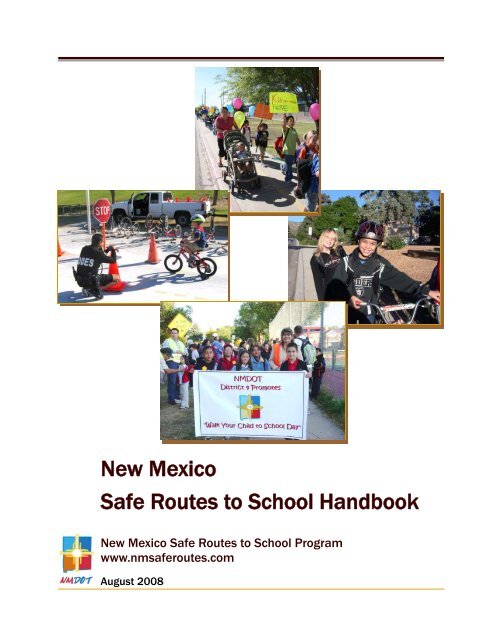
<strong>New</strong> <strong>Mexico</strong><br />
Safe Routes to School <strong>Handbook</strong><br />
<strong>New</strong> <strong>Mexico</strong> Safe Routes to School Program<br />
www.nmsaferoutes.com<br />
August 2008
<strong>New</strong> <strong>Mexico</strong> Safe Routes to School <strong>Handbook</strong><br />
Welcome to the <strong>New</strong> <strong>Mexico</strong> Safe Routes to<br />
School (<strong>SRTS</strong>) Program <strong>Handbook</strong>! The<br />
purpose <strong>of</strong> this <strong>Handbook</strong> is to help<br />
communities in <strong>New</strong> <strong>Mexico</strong> develop an<br />
Action Plan for a successful <strong>SRTS</strong> program.<br />
The <strong>Handbook</strong> is intended for use by<br />
parents, school staff, students, community<br />
leaders, local governments, and anyone else<br />
interested in encouraging safe walking and<br />
bicycling to school in <strong>New</strong> <strong>Mexico</strong>.<br />
This <strong>Handbook</strong> describes steps for<br />
developing an Action Plan. Communities<br />
receiving <strong>SRTS</strong> funds from the <strong>NM</strong><br />
<strong>Department</strong> <strong>of</strong> <strong>Transportation</strong> (<strong>NM</strong>DOT) are<br />
required to develop an Action Plan that<br />
meets the guidelines <strong>of</strong> this <strong>Handbook</strong>.<br />
A summary <strong>of</strong> the steps for developing an<br />
Action Plan appears in Appendix M, inside<br />
the back cover <strong>of</strong> this <strong>Handbook</strong>, and<br />
identifies which <strong>of</strong> these steps are required<br />
to qualify for additional <strong>NM</strong> <strong>SRTS</strong> funding.<br />
The Appendices also include a sample<br />
Action Plan worksheet, forms you can use to<br />
gather information, and additional<br />
information on <strong>SRTS</strong> program strategies.<br />
“Web Resource” boxes are provided in<br />
every chapter. The boxes include web links<br />
for information related to that chapter.<br />
Appendix J provides a summary <strong>of</strong> these<br />
resources. Appendix K provides full<br />
citations <strong>of</strong> other materials referred to in the<br />
text.<br />
For more information, please see the <strong>NM</strong><br />
<strong>SRTS</strong> web site at www.nmsaferoutes.com,<br />
or contact the <strong>NM</strong> <strong>SRTS</strong> Coordinator at<br />
(505) 476-2155 with any questions that may<br />
arise as you develop your Action Plan.<br />
Poster by student at Hillrise Elementary School, Las Cruces<br />
Prepared for <strong>New</strong> <strong>Mexico</strong> <strong>Department</strong> <strong>of</strong> <strong>Transportation</strong> (<strong>NM</strong>DOT)<br />
by Community Partners LLC and the <strong>NM</strong>DOT Planning Division<br />
with acknowledgements to the Safe Routes to School Programs<br />
<strong>of</strong> Delaware, Georgia and Maryland<br />
and special thanks to the University <strong>of</strong> <strong>New</strong> <strong>Mexico</strong> Prevention Research Center.<br />
Funded through Federal Highway Administration’s<br />
Safe Routes to School Program.
Table <strong>of</strong> Contents<br />
Chapter 1: Introduction ...................................................................1<br />
What is Safe Routes to School (<strong>SRTS</strong>)?<br />
Why Start a <strong>SRTS</strong> Program?<br />
Benefits <strong>of</strong> <strong>SRTS</strong> Programs<br />
<strong>New</strong> <strong>Mexico</strong>’s <strong>SRTS</strong> Program<br />
Text Boxes in Chapter 1: The 5 E’s <strong>of</strong> <strong>SRTS</strong>, The Need for <strong>SRTS</strong>, <strong>SRTS</strong> Benefits to<br />
Schools, Addressing Liability Concerns, <strong>NM</strong> <strong>SRTS</strong> Funds Awarded by Mid-2008, Hillrise<br />
Elementary School Pilot Project, Ditch Banks as Safe Routes to School<br />
Chapter 2: Getting Started............................................................11<br />
Form a <strong>SRTS</strong> Team<br />
Step 1: Identify <strong>SRTS</strong> Team Members<br />
Step 2: Hold the Kick-<strong>of</strong>f Meeting<br />
Text Boxes in Chapter 2: Letting People Know: Publicity, Local Champion, Tips for Conducting<br />
Successful Meetings, School Health Advisory Councils & District Wellness Policies,<br />
Tips for a Successful Program, Working with School Communities<br />
Chapter 3: Gathering Information .................................................19<br />
Step 1: Collect School Data<br />
Step 2: Get Input<br />
Parent Surveys & Student Tallies<br />
Step 3: Consider Other Information<br />
Step 4: Prepare the Base Maps<br />
Step 5: Assess Walking and Bicycling Conditions<br />
Text Boxes in Chapter 3: Hazard Busing, Involving Students, Traffic Counts, Who Owns<br />
What?, “MUTCD”<br />
Chapter 4: Developing and Writing the Action Plan......................29<br />
Step 1: Review and Organize Data<br />
Step 2: Develop Goals and Strategies<br />
Engineering, Enforcement, Education, & Encouragement Strategies<br />
Step 3: Assign Tasks<br />
Step 4: Identifying Potential Funding Sources<br />
Step 5: Evaluation<br />
Step 6: Write the Action Plan<br />
Some Final Tips for Success<br />
Text Boxes in Chapter 4: Typical Action Plan Table <strong>of</strong> Contents, If You Think There is a<br />
Speeding Problem, School Location and School Site Design, <strong>New</strong> <strong>Mexico</strong>’s Child Helmet<br />
Safety Law, Walk and Bike to School Maps<br />
www.nmsaferoutes.com i
Appendices<br />
Appendix A Sample Invitation to <strong>SRTS</strong> Team ................................................... A-1<br />
Appendix B Survey on Walking and Biking to School (Parent Survey).............. A-2<br />
Appendix C Student Arrival and Departure Tally Sheet (Student Tally Sheet) .. A-6<br />
Appendix D School Site Assessment ................................................................. A-7<br />
Appendix E Neighborhood Assessment: Street Segments................................ A-9<br />
Appendix F Neighborhood Assessment: Intersections .................................... A-11<br />
Appendix G Action Plan Worksheet (Blank) ..................................................... A-13<br />
Appendix H Action Plan Worksheet (Completed Sample) ............................... A-14<br />
Appendix I Engineering, Traffic Calming, and Pick-Up/Drop-Off Strategies... A-16<br />
Appendix J Web Resources ............................................................................ A-30<br />
Appendix K References ................................................................................... A-31<br />
Appendix L <strong>Transportation</strong> Planning Contacts in <strong>New</strong> <strong>Mexico</strong> ........................ A-32<br />
Appendix M Action Plan Development Checklist.............................................. A-33<br />
Acronyms<br />
AASHTO American Association <strong>of</strong> State Highway and <strong>Transportation</strong> Officials<br />
ADA Americans with Disabilities Act<br />
CDC U.S. Centers for Disease Control and Prevention<br />
CIP Capital Improvement Program<br />
COG Council <strong>of</strong> Governments<br />
EDD Economic Development District<br />
EPA U.S. Environmental Protection Agency<br />
ES Elementary School<br />
FHWA Federal Highway Administration<br />
K-8 Kindergarten through Eighth Grade<br />
MPO Metropolitan Planning Organization<br />
MUTCD Manual <strong>of</strong> Uniform Traffic Control Devices<br />
NC<strong>SRTS</strong> National Center for Safe Routes to Schools<br />
NHTSA National Highway Traffic Safety Administration<br />
<strong>NM</strong>DOH <strong>New</strong> <strong>Mexico</strong> <strong>Department</strong> <strong>of</strong> Health<br />
<strong>NM</strong>DOT <strong>New</strong> <strong>Mexico</strong> <strong>Department</strong> <strong>of</strong> <strong>Transportation</strong><br />
<strong>NM</strong>PED <strong>New</strong> <strong>Mexico</strong> Public Education <strong>Department</strong><br />
PTA Parent -Teacher Association<br />
PTC Parent-Teacher Committee<br />
PTO Parent-Teacher Organization<br />
RPO Regional Planning Organization<br />
SHAC School Health Advisory Council<br />
<strong>SRTS</strong> Safe Routes to School<br />
STIP Statewide <strong>Transportation</strong> Improvement Program<br />
TE <strong>Transportation</strong> Enhancements (federal funding category)<br />
ii <strong>New</strong> <strong>Mexico</strong> Safe Routes to School <strong>Handbook</strong>
Chapter One<br />
Introduction<br />
What is Safe Routes to School?<br />
Community leaders, parents and schools<br />
across the U.S. and around <strong>New</strong> <strong>Mexico</strong> are<br />
using Safe Routes to School (<strong>SRTS</strong>)<br />
programs to encourage and enable more<br />
children to safely walk and bike to school.<br />
<strong>SRTS</strong> programs support walking and<br />
bicycling as viable and healthy<br />
transportation options for children and<br />
families on their school journeys. The <strong>New</strong><br />
<strong>Mexico</strong> <strong>Department</strong> <strong>of</strong> <strong>Transportation</strong><br />
(<strong>NM</strong>DOT) developed this <strong>Handbook</strong> to<br />
help you establish a successful and<br />
sustainable <strong>SRTS</strong> program that will<br />
enhance the safety and health <strong>of</strong> your<br />
community.<br />
Why start a <strong>SRTS</strong> program?<br />
Have you ever seen a long line <strong>of</strong> cars clog<br />
the road in front <strong>of</strong> your child’s school,<br />
engines idling as they inch their way<br />
forward, impatient children squirming in the<br />
back seat? Have you seen children on their<br />
way to school, walking in the road,<br />
scurrying across a major street, or dodging<br />
cars in the school driveway? While going to<br />
school is a basic part <strong>of</strong> family life, the<br />
simple act <strong>of</strong> getting to and from school has<br />
become increasingly difficult.<br />
Thirty years ago, more than two-thirds <strong>of</strong><br />
children in the U.S. walked or biked to<br />
school. Today, that proportion has dropped<br />
to just 13 percent (Centers for Disease<br />
Control and Prevention (CDC)) (see<br />
Appendix K for full references).<br />
The “5 E’s” <strong>of</strong> <strong>SRTS</strong><br />
<strong>SRTS</strong> programs use a comprehensive “5 E”<br />
approach that includes the following elements:<br />
Education — Pedestrian and bicycle safety<br />
training for children and parents, and driver<br />
education targeting parents, neighbors and<br />
others in the community.<br />
Encouragement — Fun, educational and<br />
motivational activities that promote walking<br />
and bicycling.<br />
Enforcement — Legal enforcement <strong>of</strong> traffic<br />
laws and activities that help change unsafe<br />
behaviors <strong>of</strong> drivers, bicyclists and<br />
pedestrians.<br />
Engineering — Improvements to<br />
infrastructure, such as streets, sidewalks,<br />
trails, and crosswalks, that facilitate safe<br />
walking and bicycling.<br />
Evaluation — On-going information-gathering<br />
to determine what is working and what is not.<br />
Considering the chaos around a school<br />
during the morning drop-<strong>of</strong>f, it is not<br />
surprising that parents are reluctant to let<br />
their children walk or bicycle to school.<br />
Development in our communities has<br />
focused on motorized vehicles for decades,<br />
resulting in a built environment that makes<br />
it a challenge to get around without a car.<br />
Sometimes sidewalks, crosswalks, trails,<br />
and other bicycle and pedestrian facilities<br />
do not exist or are not connected or<br />
maintained. <strong>New</strong> schools are <strong>of</strong>ten built on<br />
the fringes <strong>of</strong> developed areas, far from<br />
(Continued on page 4)<br />
www.nmsaferoutes.com 1
Safety<br />
The Need for Safe Routes to School<br />
♦ In a nationwide survey <strong>of</strong> parents conducted in 2004, 30 percent indicated traffic danger as a<br />
barrier to allowing their children to walk or bike to school (CDC, 2005).<br />
♦ Young children are at risk for pedestrian injury because they are impulsive and have difficulty<br />
judging speed, spatial relations, and distance. Auditory and visual acuity, depth perception, and<br />
proper scanning do not fully mature until at least age 10 (Safe Kids USA).<br />
♦ Nationally, pedestrian injury is the second leading cause <strong>of</strong> unintentional injury death among<br />
children ages 5-14 (Safe Kids USA).<br />
♦ Motor vehicle crashes in which children are passengers are the leading cause <strong>of</strong> death for<br />
school-age children (National Highway Traffic Safety Administration (NHTSA) ).<br />
Congestion<br />
♦ Twenty to 25 percent <strong>of</strong> morning rush hour traffic is attributable to parents driving their children to<br />
school (NHTSA).<br />
Health and Physical Activity<br />
♦ Thirty years ago, about one half <strong>of</strong> all schoolchildren walked or bicycled to or from school,<br />
including 87 percent <strong>of</strong> those living within one mile <strong>of</strong> their school. Today fewer than 15 percent <strong>of</strong><br />
all children and adolescents use active modes <strong>of</strong> transportation, such as walking or bicycling<br />
(CDC, 2005).<br />
♦ In <strong>New</strong> <strong>Mexico</strong>, obesity affects 22 percent <strong>of</strong> adults and nearly 17 percent <strong>of</strong> youths ages 10-17.<br />
This proportion for <strong>New</strong> <strong>Mexico</strong>’s youth is the tenth highest in the nation (Trust for America’s<br />
Health (TFA), 2007).<br />
♦ Children and adolescents who are overweight are more likely to be overweight or obese as<br />
adults; overweight adults are at increased risk for heart disease, high blood pressure, stroke,<br />
diabetes, some types <strong>of</strong> cancer, and gallbladder disease (CDC, 1997).<br />
♦ The U.S. Surgeon General recommends at least 60 minutes <strong>of</strong> physical activity per day for<br />
children. Yet, among children 9 to 13 years <strong>of</strong> age, 62 percent do not engage in organized<br />
physical activity during non-school hours and 23 percent do not participate in any free-time<br />
physical activity (CDC, 2003).<br />
♦ In a survey <strong>of</strong> <strong>New</strong> <strong>Mexico</strong> high school students conducted in 2005, 26.6 percent were either<br />
overweight or at risk for becoming overweight. Thirty-nine percent <strong>of</strong> students had not<br />
participated in recommended levels <strong>of</strong> either moderate or vigorous physical activity. No physical<br />
activity was reported by 12.1 percent <strong>of</strong> students (<strong>New</strong> <strong>Mexico</strong> <strong>Department</strong> <strong>of</strong> Health (<strong>NM</strong>DOH),<br />
2005).<br />
(See Appendix K for full citations)<br />
2 <strong>New</strong> <strong>Mexico</strong> Safe Routes to School <strong>Handbook</strong>
Environment<br />
The Need for Safe Routes to School<br />
♦ Emissions from gas or diesel-powered engines in school buses, cars, and other motor vehicles<br />
and equipment are a significant source <strong>of</strong> pollution for school grounds and buildings. These<br />
emissions are a primary cause <strong>of</strong> air pollutants — carbon monoxide, hydrocarbons, nitrogen<br />
oxides, particulate matter and air toxins — that can be carcinogenic and affect human health<br />
(U.S. Environmental Protection Agency (EPA) ).<br />
♦ Air pollutants can be especially harmful to children because their respiratory systems are still<br />
developing. Children breathe more rapidly and inhale more pollutants per pound <strong>of</strong> body weight<br />
than adults (EPA).<br />
♦ Air pollution can exacerbate chronic respiratory conditions, such as asthma. Asthma currently<br />
affects an estimated 6.8 million children under 18 years <strong>of</strong> age and is the third leading cause <strong>of</strong><br />
hospitalizations among children under 15. Asthma accounts for 14 million days <strong>of</strong> school missed<br />
annually. (American Lung Association (ALA), CDC).<br />
♦ More students arrive via bicycle and on foot at schools located in neighborhoods with a good<br />
street and sidewalk network. Air quality is measurably better at such schools (EPA, 2003).<br />
♦ A four-mile round-trip bike ride can prevent 15 pounds <strong>of</strong> air pollution, factoring in pollution<br />
generated by starting and stopping (FHWA).<br />
Economics<br />
♦ In 2005, nationwide, student transportation was the third largest budget item for elementary and<br />
secondary education (National Center for Education Statistics (NCES)).<br />
♦ In <strong>New</strong> <strong>Mexico</strong>, the average annual transportation cost per pupil is nearly $575. Total K-12<br />
transportation expenditures for the state amount to over $100 million (School <strong>Transportation</strong><br />
<strong>New</strong>s (STN)).<br />
♦ <strong>New</strong> <strong>Mexico</strong> spends an estimated $324<br />
million annually on direct adult medical<br />
services (preventive, diagnostic and<br />
treatment) that can be attributed to<br />
obesity. This includes $51 million spent<br />
within the Medicare population and $84<br />
million within the Medicaid population<br />
(<strong>NM</strong>DOH, 2006).<br />
(Continued)<br />
Student Poster, Hillrise Elementary School, Las Cruces<br />
www.nmsaferoutes.com 3
where children live, where real estate that<br />
meets school site size requirements is<br />
affordable — but the direct and indirect<br />
costs <strong>of</strong> transporting children to and from<br />
school for years to come are not taken into<br />
account.<br />
Another concern parents have is exposing<br />
their children to strangers. Add to all <strong>of</strong> this<br />
increased traffic near schools and it is<br />
certainly understandable that parents are<br />
concerned about the safety <strong>of</strong> their children.<br />
Nationally, fewer than 15 percent <strong>of</strong> all<br />
school trips are made by walking or<br />
bicycling, one quarter are made on a school<br />
bus, and over half <strong>of</strong> all children arrive at<br />
school in private automobiles (FHWA,<br />
2001).<br />
The high number <strong>of</strong> motor vehicle trips to<br />
school only adds to the traffic congestion<br />
around schools and creates long lines <strong>of</strong><br />
traffic in school drop-<strong>of</strong>f zones. Other<br />
drivers stuck in these traffic jams sometimes<br />
become angry and drive aggressively. This<br />
vicious cycle continues until fewer and<br />
fewer parents are comfortable with their<br />
children walking or bicycling to school.<br />
Increased traffic congestion contributes to<br />
air pollution, impacting asthma rates among<br />
Corrales<br />
children. Childhood obesity rates have also<br />
risen dramatically in recent years, due in part<br />
to a lack <strong>of</strong> physical activity.<br />
Benefits <strong>of</strong> <strong>SRTS</strong> Programs<br />
Many <strong>of</strong> us remember a time when walking<br />
to school was part <strong>of</strong> everyday life. Many<br />
health pr<strong>of</strong>essionals and educators agree that<br />
walking and biking to school provide<br />
important opportunities for children to<br />
explore their neighborhoods, develop social<br />
skills, experience a sense <strong>of</strong> responsibility<br />
and independence, and exercise their bodies.<br />
Some teachers report that students who walk<br />
and bike to school arrive more alert and<br />
ready to learn.<br />
The benefits <strong>of</strong> <strong>SRTS</strong> programs are farreaching.<br />
<strong>SRTS</strong> programs can increase the<br />
transportation opportunities available to<br />
children through the creation <strong>of</strong> safe walking<br />
and bicycling routes. Students who walk or<br />
bicycle to school on a regular basis increase<br />
their physical activity levels, which has<br />
many health benefits.<br />
<strong>SRTS</strong> programs also bring about quality <strong>of</strong><br />
life changes in communities. In many places,<br />
the local school system and the local<br />
<strong>SRTS</strong> Benefits to Schools<br />
♦ Increased physical activity for students<br />
♦ Less traffic congestion in drop-<strong>of</strong>f / pickup<br />
zones<br />
♦ Fewer conflicts between cars, buses and<br />
students<br />
♦ Safer campus for walking and bicycling<br />
♦ Students arrive at school energized and<br />
ready to learn<br />
♦ Decreased demand for bussing<br />
4 <strong>New</strong> <strong>Mexico</strong> Safe Routes to School <strong>Handbook</strong>
government interact very little. <strong>SRTS</strong> brings<br />
them together in dialogue and partnership. In<br />
some communities, many citizens are not<br />
involved in transportation issues. <strong>SRTS</strong> is a<br />
way for families, including students, to be<br />
directly and actively involved.<br />
In many areas healthy transportation options<br />
such as walking and bicycling are seldom<br />
used. <strong>SRTS</strong> shines a spotlight on those<br />
options for children and adults beyond the<br />
journey to school and promotes making<br />
communities more accessible to everyone.<br />
When more individuals and families walk<br />
and bicycle, residents have more chances to<br />
get to know one another and can develop a<br />
greater sense <strong>of</strong> community.<br />
<strong>SRTS</strong> programs in the U.S., Canada and<br />
Europe have produced results along these<br />
lines:<br />
Addressing Liability Concerns<br />
♦ In Marin County, California, student<br />
surveys conducted before and after the<br />
<strong>SRTS</strong> program showed that the number<br />
<strong>of</strong> students biking to school increased<br />
114%, 64% more students walked to<br />
school, and carpooling increased 91%<br />
(American Journal <strong>of</strong> Public Health<br />
(AJPH), 2003).<br />
♦ Another California study demonstrated<br />
that safety improvements along a child’s<br />
usual route to school increased the<br />
proportion <strong>of</strong> children on that route who<br />
walked or biked to school (American<br />
Journal <strong>of</strong> Preventive Medicine (AJPM),<br />
2005).<br />
♦ Walking and biking to school have been<br />
shown to increase the total amount <strong>of</strong><br />
physical activity among children in<br />
several countries (AJPM, 2005 & 2007).<br />
♦ Youth who are physically active are<br />
more likely to maintain normal weight<br />
As <strong>SRTS</strong> programs have developed, some people have wondered if encouraging walking and<br />
bicycling to school may increase a school’s liability exposure. In general, the answer is no— a <strong>SRTS</strong><br />
program that simply encourages or promotes bicycling and walking to school should not, in most<br />
cases, expose schools to increased liability risk, particularly where injuries occur <strong>of</strong>f school property<br />
and parents have been reminded that the school is not responsible for supervising children who walk<br />
or bike to school. Taking concrete steps to make walking and bicycling safer will reduce the likelihood<br />
<strong>of</strong> injury, and thereby further minimize exposure to liability.<br />
Of course, schools with <strong>SRTS</strong> programs must ensure they are meeting their responsibilities for<br />
children’s safety just as they must routinely do with all other forms <strong>of</strong> school transportation and with<br />
other school activities. The school’s responsibility for safety will vary according to the individual<br />
elements <strong>of</strong> the <strong>SRTS</strong> program and the local legal context. Most likely, your school district already<br />
has policies in place to help manage its liability for various school programs and activities. A <strong>SRTS</strong><br />
program is no different—you should work closely with your school district’s administrative and legal<br />
staff to identify any particular risk management and insurance needs based on your individual<br />
program and the relevant laws <strong>of</strong> your jurisdiction. For more information on addressing liability<br />
concerns, and key measures a school can take to minimize the risk <strong>of</strong> being held liable for negligence<br />
if a student is hurt while walking or bicycling to school, see “10 Tips for Safe Routes to School<br />
Programs and Liability” from the National Center for Safe Routes to School (NC<strong>SRTS</strong>) at<br />
www.saferoutesinfo.org/resources/collateral/liabilitytipsheet.pdf.<br />
www.nmsaferoutes.com 5
and avoid or delay the onset <strong>of</strong> diabetes<br />
and cardiovascular disease (Cardiology<br />
Clinics (CC), 2004).<br />
♦ Regular physical activity in childhood<br />
and adolescence:<br />
- Improves strength and endurance<br />
- Helps build strong bones and muscles<br />
- Helps control weight<br />
- Reduces anxiety and stress and<br />
increases self-esteem<br />
- May improve blood pressure and<br />
cholesterol levels (CDC, 1997).<br />
♦ Walking to school is associated with<br />
higher overall physical activity<br />
throughout the day (AJPH, 2003; BMJ,<br />
2005).<br />
♦ Research studies show that regular<br />
participation in physical activity is<br />
associated with improved academic<br />
performance (Active Living Research<br />
(ALR), 2007).<br />
♦ During the 2004-2005 school year,<br />
research in Marin County, California<br />
indicated a 2.6 million mile reduction in<br />
vehicle miles traveled after<br />
implementation <strong>of</strong> their <strong>SRTS</strong> program.<br />
Fewer vehicle miles relates directly to<br />
the reduction <strong>of</strong> air pollutants that<br />
Albuquerque<br />
endanger public health and contribute to<br />
global warming (Marin County Dept. <strong>of</strong><br />
Public Works (MCDPW), 2005).<br />
♦ In Odense, Denmark, where the <strong>SRTS</strong><br />
concept originated, traffic-related<br />
injuries among school children were<br />
reduced by 30 percent (Troels).<br />
<strong>New</strong> <strong>Mexico</strong>’s <strong>SRTS</strong> Program<br />
In 2005, Congress established a national<br />
<strong>SRTS</strong> program as part <strong>of</strong> the federal<br />
transportation re-authorization legislation<br />
known as “SAFETEA-LU.” This program<br />
dedicates a total <strong>of</strong> $612 million from 2005<br />
to 2009 to <strong>SRTS</strong> nationwide. The federal<br />
government distributes funds to states in<br />
proportion to the number <strong>of</strong> students<br />
enrolled in kindergarten through eighthgrade<br />
(K-8) in a given state. <strong>New</strong> <strong>Mexico</strong> is<br />
one <strong>of</strong> many states that receive the minimum<br />
allocation <strong>of</strong> roughly $1 million per year.<br />
The <strong>NM</strong>DOT created its <strong>SRTS</strong> Program in<br />
2006. The <strong>New</strong> <strong>Mexico</strong> program seeks to:<br />
♦ Enable and encourage children,<br />
including those with disabilities, to walk<br />
and bicycle to school safely;<br />
♦ Make bicycling and walking to school a<br />
safer and more appealing transportation<br />
alternative, thereby encouraging a<br />
<strong>NM</strong> <strong>SRTS</strong> Funds Awarded<br />
by mid-2008<br />
Funding Cycle 1 (March 2007) - Five “Phase 1”<br />
awards at $15,000 each, for a total <strong>of</strong> $75,000<br />
Funding Cycle 2 (March 2008) - Ten “Phase 1”<br />
awards at $15,000 each, for a total <strong>of</strong><br />
$150,000; Two “Phase 2” awards totaling<br />
approximately $275,000<br />
6 <strong>New</strong> <strong>Mexico</strong> Safe Routes to School <strong>Handbook</strong>
healthy and active lifestyle from an early<br />
age; and<br />
♦ Facilitate planning, development, and<br />
implementation <strong>of</strong> activities to improve<br />
safety and reduce traffic, fuel<br />
consumption, and air pollution in the<br />
vicinity (roughly two miles) <strong>of</strong> primary<br />
and middle schools (Grades K-8).<br />
The <strong>NM</strong> <strong>SRTS</strong> program provides federal<br />
funds to eligible entities to develop and<br />
implement <strong>SRTS</strong> programs at one or more<br />
schools within a community. The program<br />
has two phases: Phase 1 provides funds to<br />
school districts and local, tribal or state<br />
entities to develop an Action Plan. These<br />
funds can be used to pay a Local Champion<br />
to coordinate and lead the planning effort,<br />
among other things. Phase 2 provides funds<br />
to implement communities’ Action Plans.<br />
This <strong>Handbook</strong> outlines the process for<br />
developing a <strong>SRTS</strong> Action Plan that will<br />
meet the Phase 2 application requirements.<br />
Required elements are described in the<br />
<strong>Handbook</strong> and summarized in Appendix M.<br />
If Phase 2 funding will be requested, the<br />
Action Plan must be approved by the <strong>NM</strong><br />
<strong>SRTS</strong> Coordinator. A Phase 2 application<br />
can then be submitted to request <strong>SRTS</strong> funds<br />
for infrastructure projects and noninfrastructure<br />
activities. Local, tribal or state<br />
government entities must be the sponsor for<br />
all applications requesting infrastructure in<br />
the public right-<strong>of</strong>-way, such as sidewalks<br />
and crosswalks on public streets. The school<br />
district can sponsor requests for<br />
infrastructure on school property, such as<br />
bike racks or sidewalks or crosswalks on the<br />
school campus. Funding requests for noninfrastructure<br />
activities, such as education,<br />
encouragement or enforcement, may be<br />
submitted by a school district or local, tribal<br />
or state entity. Infrastructure projects and<br />
non-infrastructure activities must be<br />
coordinated.<br />
All <strong>NM</strong> <strong>SRTS</strong> applications must<br />
demonstrate community and school district<br />
support for the project, as well as a<br />
commitment from a partner school with<br />
students in the K-8 grade range.<br />
Infrastructure projects must be located<br />
within public right-<strong>of</strong>-way and within two<br />
miles <strong>of</strong> a school with students in grades K-<br />
8. Funding recipients must comply with all<br />
applicable state and federal requirements.<br />
Who prepares the Action Plan?<br />
You do! A <strong>SRTS</strong> program is a local, schooland<br />
community-based initiative that requires<br />
dedicated, motivated individuals who will<br />
work together to improve the safety <strong>of</strong><br />
children walking or bicycling to and from<br />
school. The state developed this <strong>Handbook</strong><br />
to provide practical guidance based on<br />
successful <strong>SRTS</strong> programs around the<br />
country as well as federal <strong>SRTS</strong> guidelines.<br />
The goal <strong>of</strong> the <strong>Handbook</strong> is to assist you<br />
with creating an Action Plan that will result<br />
in a comprehensive and long-lasting <strong>SRTS</strong><br />
program at your school or at multiple<br />
schools in your community.<br />
Working on a Safe Routes to School Plan in Farmington<br />
www.nmsaferoutes.com 7
Anyone can develop the <strong>SRTS</strong> Action Plan,<br />
but to be successful, you will want to involve<br />
a wide range <strong>of</strong> participants, including<br />
parents, teachers, the principal, the school’s<br />
parent-teacher organization, local<br />
government <strong>of</strong>ficials, neighborhood<br />
associations, law enforcement, health<br />
pr<strong>of</strong>essionals, and other interested<br />
organizations and businesses. The <strong>SRTS</strong><br />
Action Plan is usually developed by a mix <strong>of</strong><br />
people from various groups working together<br />
as a <strong>SRTS</strong> Team.<br />
Hillrise Elementary School Pilot Project<br />
Las Cruces, <strong>NM</strong><br />
The Las Cruces Metropolitan Planning Organization (MPO) <strong>Transportation</strong> Plan, adopted in 2005,<br />
recognized the value <strong>of</strong> encouraging and enabling children to walk and bicycle to school by including<br />
policies to develop a district-wide or regional <strong>SRTS</strong> program in the Las Cruces area. The MPO<br />
organized a <strong>SRTS</strong> Steering Committee which decided to pursue a pilot project at Hillrise Elementary<br />
School during the 2006-2007 school year. Hillrise serves approximately 540 K-5 students, mostly<br />
from neighborhoods east <strong>of</strong> I-25 and south <strong>of</strong> Lohman and Foothills roads. It is one <strong>of</strong> the best<br />
examples <strong>of</strong> a neighborhood school in Las Cruces, serving a rapidly urbanizing area with a semi-rural<br />
population. MPO staff developed the pilot using <strong>SRTS</strong> guidelines set by FHWA, including the “5 E’s.”<br />
The MPO first collected baseline data about the students’ transportation habits and parents’ concerns<br />
regarding walking and biking to school, using a survey sent out through the principal’s <strong>of</strong>fice in<br />
September 2006. Of the 500 surveys, 299 were returned, a high rate <strong>of</strong> return attributable to an<br />
incentive program as well as student and parent concerns about dangerous walking and bicycling<br />
conditions. The survey found that over 85 percent <strong>of</strong> students were transported to school in the family<br />
car, only seven percent walked, and less<br />
than one percent bicycled.<br />
The next step was a walking assessment <strong>of</strong><br />
the area around the school to record<br />
existing conditions. The assessment<br />
identified several issues including high<br />
motor vehicle speeds and wide travel lanes<br />
on a nearby collector street, overgrown<br />
vegetation, lack <strong>of</strong> crosswalks, and missing<br />
or damaged sidewalks. Using this<br />
information, the <strong>SRTS</strong> Steering Committee<br />
developed a list <strong>of</strong> prioritized solutions.<br />
Web Resources<br />
♦ For more information on the <strong>NM</strong> <strong>SRTS</strong><br />
program and how to apply for funds,<br />
please visit the <strong>NM</strong> <strong>SRTS</strong> website at<br />
www.nmsaferoutes.com.<br />
♦ For more on the federal <strong>SRTS</strong> program<br />
established under SAFETEA-LU, see<br />
safety.fhwa.dot.gov/saferoutes.<br />
One <strong>of</strong> the solutions was a city engineering project to re-stripe the collector street, decreasing the<br />
width <strong>of</strong> vehicle travel lanes to 13 feet and adding nine-foot parking lanes and six-foot bike lanes on<br />
8 <strong>New</strong> <strong>Mexico</strong> Safe Routes to School <strong>Handbook</strong>
Hillrise Elementary School Pilot Project (cont.)<br />
each side <strong>of</strong> the road. Studies performed before and several times after the striping indicate a<br />
dramatic change in driver behavior, with a 46 percent decline in the number <strong>of</strong> drivers exceeding the<br />
30 mph speed limit by five mph or more. Thus the re-striping <strong>of</strong> the road, which involved nothing more<br />
than “painting white stripes,” had a significant traffic calming effect. Other engineering activities<br />
included painting new crosswalks, relocating crosswalk signs, installing flashing beacons at the<br />
crosswalks, and repairing and installing sidewalks. More recently, the City installed ADA-accessible<br />
ramps, which had been identified as a long-term engineering improvement.<br />
MPO staff worked with the City Traffic Engineer and police to address several enforcement issues as<br />
well. The City issued warnings and citations for driving violations in the crosswalk zones and for<br />
speeding. A new crossing guard assigned to the busiest intersection was seen by parents as the<br />
most significant improvement. The City also worked with property owners to trim vegetation back from<br />
sidewalks and signs in order to provide better sight distance for pedestrians and drivers.<br />
The following educational and encouragement activities were also incorporated into the pilot project:<br />
♦ A three-day bike rodeo held by the MPO and the City in conjunction with the 2006 “Walk to<br />
School Day” celebration, using bicycles donated from a local bike shop.<br />
♦ Information on the <strong>SRTS</strong> program provided to parents by the MPO and school administration<br />
during school registration and at PTO meetings.<br />
♦ Bicycling and walking tips and facts included in the school’s monthly newsletter and 30 copies <strong>of</strong><br />
a free FHWA bicycle and pedestrian safety CD provided to the school.<br />
♦ A walking and bicycling map developed by the City for distribution to all students. Parents and<br />
students were encouraged to use the map to plan the student’s route to school.<br />
♦ A poster contest held by the school in conjunction with the 2006 “Walk to School Day,” with<br />
awards handed out by the principal.<br />
On the October 4, 2006, “Walk to School Day,”<br />
300 students walked or biked to school. The<br />
school administration commented that they<br />
had never before had a day without traffic<br />
snarls, upset parents and unsafe conditions<br />
due to poor motorist behaviors.<br />
In May 2007, MPO staff conducted a follow-up<br />
survey to assess the initial outcomes <strong>of</strong> the<br />
program. Only 29 percent <strong>of</strong> the surveys were<br />
returned indicating perhaps that a lot <strong>of</strong><br />
concerns had been addressed. The survey<br />
found that walking, biking and school bus trips<br />
to and from school increased. The share <strong>of</strong> students walking to school increased to 11.4 percent and<br />
the share <strong>of</strong> students bicycling rose from 0.5 percent to 1.9 percent. The family car dropped to 78 .1<br />
percent <strong>of</strong> trips to school and 70.6 percent <strong>of</strong> trips from school.<br />
While the levels <strong>of</strong> walking and bicycling for the Hillrise population are not near those seen a<br />
generation ago, the pilot project brought a great deal <strong>of</strong> attention to the issue and resulted in physical<br />
changes that were easy to implement and very cost effective. The Principal continues to promote<br />
walking and bicycling to school, and Hillrise recently received a Phase 2 award from the <strong>NM</strong> <strong>SRTS</strong><br />
program to hire a school <strong>SRTS</strong> Coordinator and install bicycle racks.<br />
www.nmsaferoutes.com 9
Ditch Banks as Safe Routes to School<br />
Many <strong>New</strong> <strong>Mexico</strong> communities <strong>of</strong>fer unique opportunities for safe routes to school and walking<br />
school bus programs along irrigation ditches (acequias) and drainage canals. These linear corridors<br />
<strong>of</strong>ten pass near or adjacent to school grounds and have limited motor vehicle traffic issues. Current<br />
research shows that proximity to, views <strong>of</strong>, and daily exposure to natural settings increase children’s<br />
ability to focus and enhance cognitive abilities – which could mean better grades in school. Ditchbank<br />
trails <strong>of</strong>fer exposure to natural settings and physical activity opportunities for students traveling<br />
to and from school on foot or bike.<br />
Landmark legislation (SB 486) passed in 2007 by the <strong>NM</strong> legislature will allow more public access to<br />
ditch and levee systems owned by irrigation and conservancy districts in <strong>New</strong> <strong>Mexico</strong>. The bill<br />
changed state law to provide irrigation and conservancy districts with liability protection if they<br />
authorize the use <strong>of</strong> their property for trails to be established and managed by a local public body.<br />
Creating partnerships between school districts, irrigation districts, local governments and<br />
neighborhood associations is a good strategy to create safe routes along ditch banks. Together the<br />
partners can resolve trail design, management, and maintenance concerns, as well as safety and risk<br />
management issues.<br />
User safety is addressed through a trail management and maintenance plan. These plans usually<br />
include trail design considerations such as stabilized surfaces for pedestrians, bicycles, wheelchairs<br />
and strollers; gates and other motorized vehicle barriers; signs and street crossing improvements;<br />
weed/vegetation management; risk assessment field evaluations; and neighborhood stewardship<br />
strategies for periodic clean-ups and “eyes on the trail” programs. A walking school bus program<br />
using ditch trails as a route to school is one way to address user safety and risk management. With<br />
adult supervision, children are taught how to safely travel along a ditch bank, how and where to cross<br />
streets, and how to avoid any potentially hazardous areas.<br />
In Albuquerque, the “Ditches with Trails” project focuses on improving segments <strong>of</strong> ditch banks<br />
managed by the Middle Rio Grande Conservancy District. The Ditches with Trails Steering Committee<br />
is primarily addressing trail design and user safety issues along two ditch banks. At Valle Vista<br />
Elementary School in the South Valley <strong>of</strong><br />
Albuquerque, the Vecinos del Bosque<br />
Neighborhood Association hopes to<br />
demonstrate through neighborhood cleanups<br />
and a walking school bus program that<br />
a formal trail network is feasible on ditchbank<br />
rights <strong>of</strong> way. As a result <strong>of</strong> the<br />
Ditches with Trails project, there have been<br />
two successful Walk and Roll to School<br />
events along the ditch banks to the school.<br />
Other communities with ditches are<br />
beginning to consider ditch banks as<br />
potential safe routes to school.<br />
Ditch-bank trail to Valle Vista Elementary School, Albuquerque<br />
10 <strong>New</strong> <strong>Mexico</strong> Safe Routes to School <strong>Handbook</strong>
Chapter Two<br />
Getting Started<br />
Now that you know what <strong>SRTS</strong> is, why you<br />
should have a program, and how it will benefit<br />
your community, it is time to get started. This<br />
chapter describes a process to start a <strong>SRTS</strong><br />
program by developing an Action Plan that<br />
addresses the “5 E’s” described on page 1.<br />
Successful programs focus on the unique needs<br />
<strong>of</strong> an individual school community, so there is<br />
no single right way to develop a program. Steps<br />
in this handbook have worked well for others,<br />
but you may modify them as needed to suit your<br />
community.<br />
Form a <strong>SRTS</strong> Team<br />
The success <strong>of</strong> a <strong>SRTS</strong> program depends on the<br />
commitment and dedication <strong>of</strong> the <strong>SRTS</strong> team.<br />
It is essential that you establish a <strong>SRTS</strong> Team<br />
or committee that includes a broad range <strong>of</strong><br />
community members and interested parties. The<br />
<strong>SRTS</strong> Team plans and guides the development<br />
<strong>of</strong> the Action Plan, as well as implementation <strong>of</strong><br />
the <strong>SRTS</strong> activities for the school(s) in your<br />
program.<br />
Letting People Know: Publicity<br />
<strong>SRTS</strong> Process Overview<br />
Form a <strong>SRTS</strong> Team (Ch. 2)<br />
Step 1: Identify team members<br />
Step 2: Hold a kick-<strong>of</strong>f meeting<br />
Gather Information (Ch. 3)<br />
Step 1: Collect school data<br />
Step 2: Get input from parents, students, etc.<br />
Step 3: Consider other information<br />
Step 4: Prepare base maps<br />
Step 5: Assess walking and biking conditions<br />
Develop & Write the Action Plan (Ch. 4)<br />
Step 1: Review and organize data<br />
Step 2: Develop goals and strategies<br />
Step 3: Assign tasks<br />
Step 4: Identify potential funding sources<br />
Step 5: Define evaluation process<br />
Step 6: Write the plan<br />
Getting the word out about your <strong>SRTS</strong> project is important. Provide regular updates on the <strong>SRTS</strong><br />
project at parent-teacher organization meetings, at back-to-school events (if you are beginning the<br />
project at the start <strong>of</strong> the school year), and at community and neighborhood association meetings.<br />
Place a brief update in school and neighborhood newsletters or use e-mail lists to reach out to<br />
parents and community members. Keep in mind that your school may typically prepare<br />
announcements and newsletters in both English and in Spanish, so you may need assistance from<br />
the school’s translator. Local community newspapers are <strong>of</strong>ten interested in <strong>SRTS</strong> projects and these<br />
projects usually receive very positive press. With the permission <strong>of</strong> your school’s principal, contact the<br />
editor <strong>of</strong> your local paper and let them know about the project. Send them periodic updates as the<br />
project progresses. For more strategies on working with the media to promote your <strong>SRTS</strong> efforts, see<br />
the NC<strong>SRTS</strong> Guide’s section on “Media and Visibility” at www.saferoutesinfo.org/guide/media.<br />
www.nmsaferoutes.com 11
Step 1: Identify Team members<br />
The first step for setting up your <strong>SRTS</strong><br />
Team is to prepare a list <strong>of</strong> potential team<br />
members. Many individuals may be<br />
interested in helping even if they are not<br />
directly involved with the school. The<br />
following is a list <strong>of</strong> candidates to consider<br />
for your <strong>SRTS</strong> Team:<br />
♦ School principal or assistant principal<br />
(principal’s participation or approval is<br />
critical to success)<br />
♦ Three or four interested parents<br />
♦ Representative <strong>of</strong> the school’s parentteacher<br />
organization (PTA/PTC/PTO)<br />
♦ One or two teachers - consider those<br />
with outside duty before or after school<br />
as well as those working in physical<br />
education or health<br />
♦ School nurse or a representative from the<br />
school health advisory council (see text<br />
box on page 14)<br />
♦ School district coordinators for<br />
transportation, health and wellness, and/<br />
or safety and security<br />
♦ Neighborhood and community<br />
association members<br />
♦ Local government pr<strong>of</strong>essional, such as a<br />
transportation engineer, planner, or<br />
public works staff person<br />
Los Alamos<br />
♦ School resource <strong>of</strong>ficer<br />
♦ School crossing guard<br />
♦ Local bicycle and pedestrian clubs or<br />
advocates<br />
♦ Local elected <strong>of</strong>ficials or their<br />
representatives<br />
♦ Local law enforcement<br />
♦ Public health pr<strong>of</strong>essionals<br />
♦ Representative from the local <strong>NM</strong>DOT<br />
District <strong>of</strong>fice<br />
♦ Representative <strong>of</strong> the relevant MPO or<br />
RPO (see Appendix L)<br />
♦ Nearby business owners<br />
♦ Children who are already walking or<br />
bicycling to school<br />
There may be other individuals or<br />
organizations that you would like to invite to<br />
serve on your <strong>SRTS</strong> Team. Chances are,<br />
you’ve already been in contact with one or<br />
more people about this idea and they should<br />
be the first names on your list. Once you’ve<br />
put the list together (i.e., names, phone<br />
numbers, mailing addresses, and email<br />
addresses), organize a kick-<strong>of</strong>f meeting.<br />
Local Champion<br />
Many <strong>SRTS</strong> programs rely on the passion<br />
and enthusiasm <strong>of</strong> a volunteer <strong>of</strong>ten called<br />
the “local champion.” Some champions are<br />
parents at the school, but they can also be<br />
members <strong>of</strong> the school staff or the broader<br />
community. This person (or persons) can<br />
take the lead in organizing, keeping the<br />
effort moving forward, making phone calls,<br />
setting meeting dates, and following up on<br />
tasks.<br />
<strong>NM</strong> <strong>SRTS</strong> Phase 1 funds can be used to<br />
pay a local champion to coordinate the<br />
development <strong>of</strong> a <strong>SRTS</strong> Action Plan.<br />
12 <strong>New</strong> <strong>Mexico</strong> Safe Routes to School <strong>Handbook</strong>
Send a letter <strong>of</strong> invitation or an e-mail to<br />
each person to attend a kick-<strong>of</strong>f meeting. If<br />
you plan to meet at the school, which is a<br />
good idea, you need to have permission from<br />
the principal or assistant principal.<br />
Hopefully the principal is already involved<br />
in the project and eager to help. If the<br />
principal agrees, send the invitations on<br />
school letterhead (see Appendix A for a<br />
sample letter).<br />
Allow three to four weeks <strong>of</strong> lead time<br />
between the day you mail the invitations and<br />
the kick-<strong>of</strong>f meeting. Make the meeting date,<br />
time, and location as convenient as possible<br />
for everyone. The easier you make it for<br />
invitees to attend, the greater the chances are<br />
for a good turnout. If you can, make<br />
reminder calls a few days before the<br />
meeting.<br />
It is a good idea to keep all the contacts on<br />
your mailing list, even if they do not<br />
respond. In the future you may need help<br />
from some, such as local transportation<br />
<strong>of</strong>ficials and neighborhood organizations, so<br />
Tips for Conducting Successful Meetings<br />
♦ Establish a regular time and meeting place.<br />
You can download this presentation or video from<br />
www.nmsaferoutes.com to show at your first meeting.<br />
it is wise to keep them informed. You should<br />
strive to achieve broad-based community<br />
support for a walkable school neighborhood.<br />
Ideally, your Team should include ten to<br />
fifteen people. Groups larger than fifteen are<br />
sometimes hard to manage, while having<br />
groups smaller than ten increases the<br />
workload on each person.<br />
♦ Send out reminders about meetings a few days in advance. Include in the reminders the<br />
discussion topics for the meeting.<br />
♦ Set an agenda. Place items <strong>of</strong> most pressing importance about one-third <strong>of</strong> the way through the<br />
agenda; <strong>of</strong>ten people come late and others leave early.<br />
♦ Have someone facilitate the meeting. The facilitator’s job is to keep the group on track,<br />
progressing through the agenda in a timely and productive way.<br />
♦ Have someone take minutes <strong>of</strong> the meeting. Send the minutes out soon after the meeting so that<br />
those who were unable to attend can stay informed.<br />
♦ Schedule future meetings on regular days and times and in the same location to be consistent.<br />
♦ Close the meeting with a review <strong>of</strong> task assignments and appreciation for everyone’s time and<br />
efforts.<br />
www.nmsaferoutes.com 13
Farmington<br />
Step 2: Hold the kick-<strong>of</strong>f meeting<br />
Hold the kick-<strong>of</strong>f meeting for potential<br />
<strong>SRTS</strong> Team members. The purpose <strong>of</strong> the<br />
meeting is to gain support for a <strong>SRTS</strong><br />
program, have people agree to serve on the<br />
<strong>SRTS</strong> Team, and define the next steps. The<br />
kick-<strong>of</strong>f meeting is a very important event. It<br />
will set the tone, pace, and level <strong>of</strong><br />
enthusiasm for the project. Prepare well for<br />
this meeting.<br />
There are free resources to download from<br />
the <strong>NM</strong> <strong>SRTS</strong> website and other sites listed<br />
in the Web Resource Box on page 15 that<br />
can help explain <strong>SRTS</strong> programs and issues<br />
to participants. Consider showing the<br />
presentation “Why <strong>SRTS</strong> Matters,” available<br />
on DVD. If you prefer to narrate the<br />
presentation yourself, or if you do not have<br />
video equipment, there is also a <strong>SRTS</strong><br />
PowerPoint presentation.<br />
At the kick-<strong>of</strong>f meeting you should:<br />
♦ Set the scene. Talk about the school’s<br />
traffic problems and the issues children<br />
face during the journey to school.<br />
Explain the purpose <strong>of</strong> the <strong>SRTS</strong><br />
program.<br />
♦ Mention national trends. Talk about the<br />
growth in traffic, the decline in walking<br />
and bicycling among youth, and the<br />
increasing concern for children’s health.<br />
School Health Advisory Councils (SHAC) and District Wellness Policies<br />
The state Public Education <strong>Department</strong> (PED), through its “Wellness Policy Guidance,” requires<br />
every school district to have a School Health Advisory Council (SHAC) consisting <strong>of</strong> parents, school<br />
food personnel, school board members, school administrators, teachers and other school staff,<br />
students and community members. The purpose <strong>of</strong> the SHAC is to make recommendations to the<br />
school board on the development and implementation <strong>of</strong> the school district’s wellness policy.<br />
Wellness policies are required under state law so that school districts develop physical activity<br />
guidelines for before, during and/or after school. A district-wide <strong>SRTS</strong> program implemented at the<br />
school level is one strategy for compliance. If safe walk and bike to school routes are identified,<br />
schools can encourage students to walk or bicycle to and from school along these routes. In<br />
addition, or if safe routes are not available, schools can conduct activities during the school day that<br />
promote pedestrian and bicyclist safety as well as physical activity. These could include activities<br />
such as bike rodeos and mileage contests where students track the number <strong>of</strong> laps walked and are<br />
rewarded for reaching set goals.<br />
You may want to work with your local SHAC on setting up a <strong>SRTS</strong> Team, either as a sub-committee<br />
<strong>of</strong> the SHAC (with additional members) or by including the SHAC members on the <strong>SRTS</strong> Team.<br />
For more information on the PED school district wellness policy, visit www.ped.state.nm.us.<br />
14 <strong>New</strong> <strong>Mexico</strong> Safe Routes to School <strong>Handbook</strong>
♦ Explain how <strong>SRTS</strong> will work and<br />
describe the likely benefits for children,<br />
parents, staff, and the community. You<br />
may want to provide handouts. If you<br />
would like to distribute this <strong>Handbook</strong>,<br />
you can request additional copies from<br />
<strong>NM</strong>DOT or download the document<br />
from the <strong>NM</strong> <strong>SRTS</strong> website.<br />
♦ Give participants an opportunity to talk<br />
about their safety concerns. Keep a<br />
running list <strong>of</strong> problems and ideas for<br />
solutions.<br />
♦ Discuss how to involve and inform the<br />
public and consider setting up<br />
committees for specific tasks.<br />
♦ If your Team includes multiple schools,<br />
you may want to create subcommittees<br />
to manage some tasks by school. Sample<br />
tasks for subcommittees are collecting<br />
school data, putting notices in school<br />
newsletters, or maintaining<br />
communication with teachers and the<br />
principal.<br />
♦ Ask for support and involvement from<br />
everyone and assign some<br />
responsibilities to be completed before<br />
the next meeting.<br />
Web Resources<br />
♦ National Highway Safety Administration <strong>SRTS</strong> Toolkit,<br />
www.nhtsa.dot.gov/people/injury/pedbimot/bike/Safe-Routes-2002/.<br />
♦ National Center for Safe Routes to School (NC<strong>SRTS</strong>), including an<br />
On-line <strong>SRTS</strong> Guide, as well as a video, “Why Safe Routes to<br />
School Matter,” and a Powerpoint presentation highlighting the<br />
benefits <strong>of</strong> <strong>SRTS</strong>, all at www.saferoutesinfo.org/resources/<br />
marketing_presentations.cfm.<br />
♦ <strong>NM</strong> <strong>SRTS</strong>, www.nmsaferoutes.com.<br />
Alamogordo<br />
♦ Set the dates and times for future<br />
meetings.<br />
Plan for about 90 minutes for this first<br />
meeting and make sure everyone signs the<br />
attendance list. Subsequent meetings should<br />
be shorter, but the kick-<strong>of</strong>f meeting usually<br />
takes longer. Remember that meetings<br />
should be enjoyable and easy to attend. Have<br />
childcare available, provide refreshments<br />
and keep the discussion lively. You may also<br />
need a language interpreter at the meeting.<br />
Do not over-extend yourself by trying to do<br />
too much: focus your efforts on ensuring that<br />
the right people are involved and that the<br />
meeting runs smoothly.<br />
www.nmsaferoutes.com 15
Tips for a Successful Program<br />
♦ Involve potential stakeholders early and strive for their buy-in. Point out the various benefits<br />
<strong>of</strong> <strong>SRTS</strong> (see Web Resource Box on page 15 for presentations, talking points and handouts).<br />
Stakeholders include parents, teachers, law enforcement, community groups, health <strong>of</strong>ficials,<br />
and state and local transportation and public works agencies. Do not forget the students!<br />
<strong>SRTS</strong> is for their benefit and their enthusiasm will help generate success.<br />
♦ Elect a focused Team leader who has the motivation and perseverance to keep the program<br />
moving and the other committee members excited.<br />
♦ Stick to the schedule, stand by your goals, and refer back to them regularly. They will<br />
help guide you through the program.<br />
♦ Be efficient and organized in your meetings. Short, well-organized meetings are better than<br />
long meetings. Use agendas and assign someone to take notes.<br />
♦ Hold open meetings. Advertise meetings along with other school functions to invite the larger<br />
community. Include time in the meeting agenda for comments from those not on the <strong>SRTS</strong><br />
Team to comment. Be receptive and responsive to those comments.<br />
♦ Remember to be persistent but patient. Accomplishing your set goals will likely not come<br />
easily, so hang in there.<br />
♦ Celebrate successes along the way. Recognize those that have invested their time and<br />
effort in the program. This attitude will knit the <strong>SRTS</strong> committee together and provide<br />
encouragement to stay the course.<br />
16 <strong>New</strong> <strong>Mexico</strong> Safe Routes to School <strong>Handbook</strong>
Working with School Communities<br />
Schools are, in many ways, like countries. Each school, for example, has a distinct ethnic, racial, and<br />
socioeconomic population make-up. Every school has its own surrounding geography. Each has its<br />
own system <strong>of</strong> organization, determined largely by the personality and style <strong>of</strong> its leader, the principal.<br />
Each school is unique. Working with and respecting the needs, style, and organization <strong>of</strong> a school is<br />
part <strong>of</strong> your “passport” to success with a <strong>SRTS</strong> program. Here are some tips for working with school<br />
communities.<br />
1. Get to know your school. Start by building a good relationship with the principal, as s/he is the<br />
ultimate decision-maker. Know the school secretary, custodian, nurse, physical education<br />
teacher, and other teachers by name.<br />
2. Coordinate with other school groups. Many groups are part <strong>of</strong> the school community, including<br />
the Parent Teacher Association (PTA), Parent Teacher Organization (PTO), or Parent Teacher<br />
Committee (PTC); the school health or wellness council, or the district’s School Health Advisory<br />
Council (SHAC) (see box on page 14); groups working on after-school programs; and 4-H Clubs,<br />
Boys and Girls’ Clubs, and scout troops. Talk with representatives <strong>of</strong> these groups to find out how<br />
<strong>SRTS</strong> might fit into their program. Find out if the school has business partners, and what<br />
commitments they have made, or may be willing to make, to the school.<br />
3. Learn and use channels <strong>of</strong> communication. Ask about existing policies, procedures and<br />
resources for communication, such as:<br />
♦ sign-in procedures for visitors;<br />
♦ preferred methods <strong>of</strong> communication with school staff members and primary contact;<br />
♦ procedures for sending home information to parents;<br />
♦ other channels <strong>of</strong> communication, such as a weekly or monthly newsletter, parent e-mail list,<br />
website, closed circuit TV, etc.;<br />
♦ any language translation services for non-English-speaking families that are needed and/or<br />
available through the school; and<br />
♦ policies on working directly with children and/or photographing them.<br />
4. Respect the school culture. Principals are very busy. Your principal may be supportive <strong>of</strong> <strong>SRTS</strong><br />
but may not have time to respond immediately to phone calls or emails. However, it is critical to<br />
keep the principal informed and get his or her approval for every step <strong>of</strong> the program. Other<br />
school staff are also under pressure and time constraints so it is important to find ways for <strong>SRTS</strong><br />
activities to support and complement what teachers already do. Making the connection between<br />
the existing school curriculum and <strong>SRTS</strong> is a great way to do this.<br />
5. Understand the school’s calendar. Schools have their own unique yearly calendars, full <strong>of</strong> PTA<br />
events, book fairs, class trips, teacher planning days and standardized testing. To avoid conflicts,<br />
plan the full year <strong>of</strong> <strong>SRTS</strong> events early. You can also incorporate <strong>SRTS</strong> activities into other<br />
school activities, such as holding a Walk and Roll to School Day event as part <strong>of</strong> “Turn <strong>of</strong>f the TV<br />
and Get Physically Active” week.<br />
www.nmsaferoutes.com 17
Working with School Communities (cont.)<br />
6. Parents are essential! Parents are the ultimate decision-makers about how their children get<br />
to school. Parents can act as effective advocates for implementation <strong>of</strong> a <strong>SRTS</strong> Action Plan.<br />
As residents <strong>of</strong> an area, they can be the strongest voices for legal enforcement or<br />
infrastructure changes. It is important to encourage parent involvement at many different<br />
levels. There are leadership roles and “star volunteer” roles but, unlike many activities in<br />
schools, parents can also get involved without having to go to meetings or even speak<br />
English: all they have to do is walk or bicycle with their children to school or hand out stickers<br />
or refreshments.<br />
7. Involve the students. Once they are familiar with <strong>SRTS</strong>, students can be your most<br />
enthusiastic supporters. Seeking student input is an excellent way to build interest and<br />
excitement in <strong>SRTS</strong>. Children also have a unique perspective on their routes to school and<br />
can be excellent sources <strong>of</strong> information about hazards, short cuts, and “secret” routes to the<br />
school. <strong>SRTS</strong> provides many levels <strong>of</strong> involvement for children – from basic participation in<br />
<strong>SRTS</strong> activities to special involvement as volunteers.<br />
8. Make your program inclusive. Do your best to reach out and make your <strong>SRTS</strong> program as<br />
inclusive as you possibly can. The school community is more likely to integrate your program<br />
if you include everyone in the process. Here are some suggestions for reaching out:<br />
♦ Send written communications home to all families regardless <strong>of</strong> how likely they are to<br />
participate.<br />
♦ Be sure that all communications with families are translated into appropriate languages.<br />
♦ Use a wide variety <strong>of</strong> communication tools.<br />
♦ Develop activities that can incorporate as many students as possible.<br />
♦ Continuously <strong>of</strong>fer ways for school community members to get involved and avoid the<br />
perception that there is a certain <strong>SRTS</strong> “in-crowd.”<br />
♦ Communicate with the full school staff, not just the teachers and administration. With<br />
permission from the principal, call upon the cafeteria staff, the custodian, the band<br />
teacher, the school nurse, the school counselor, the school secretary, or many other<br />
school staff members that are also part <strong>of</strong> the school community – they may be delighted<br />
to be included!<br />
♦ Find ways to periodically thank and honor all participants in your program, especially<br />
those who are <strong>of</strong>ten overlooked. This can include planned events, such as a volunteer<br />
appreciation breakfast, a “thank you” poster in the hallway, a personal note, or a bouquet<br />
<strong>of</strong> flowers.<br />
18 <strong>New</strong> <strong>Mexico</strong> Safe Routes to School <strong>Handbook</strong>
Chapter Three<br />
Gathering Information<br />
Before making a list <strong>of</strong> projects or activities<br />
for the <strong>SRTS</strong> Action Plan, the <strong>SRTS</strong> Team<br />
needs to gather information and observe<br />
behavior around the school. This chapter<br />
describes the kinds <strong>of</strong> information you will<br />
need to describe safety concerns and other<br />
barriers to walking and bicycling, other<br />
information you are required to have in order<br />
to qualify for <strong>NM</strong> <strong>SRTS</strong> funding, and<br />
recommended methods for collecting this<br />
data. This chapter also explains how the<br />
information you gather will help you<br />
evaluate success after you implement the<br />
Plan.<br />
Step 1: Collect School Data<br />
Enrollment<br />
Find out what the school population is at the<br />
start <strong>of</strong> your program, and how many<br />
students live within the school walking<br />
boundary, as defined by the school or school<br />
district. The principal or school district can<br />
provide this information.<br />
School <strong>Transportation</strong><br />
School district transportation staff can<br />
provide information about how many<br />
students are eligible to ride the bus to school,<br />
and how many actually ride the bus on most<br />
days. Find out if the school makes any<br />
students eligible to ride the bus based on<br />
identified hazards rather than distance (see<br />
box). If identified hazards are addressed,<br />
these students may be able to walk to school.<br />
Each school has its own arrival and<br />
dismissal procedures. Find out where the<br />
<strong>SRTS</strong> Process Overview<br />
Form a <strong>SRTS</strong> Team (Ch. 2)<br />
Step 1: Identify team members<br />
Step 2: Hold a kick-<strong>of</strong>f meeting<br />
Gather Information (Ch. 3)<br />
Step 1: Collect school data<br />
Step 2: Get input from parents, students, etc.<br />
Step 3: Consider other information<br />
Step 4: Prepare base maps<br />
Step 5: Assess walking and biking conditions<br />
Develop & Write the Action Plan (Ch. 4)<br />
Step 1: Review and organize data<br />
Step 2: Develop goals and strategies<br />
Step 3: Assign tasks<br />
Step 4: Identify potential funding sources<br />
Step 5: Define evaluation process<br />
Step 6: Write the plan<br />
school directs walkers and bicyclists when<br />
they arrive. Ask about the school’s dismissal<br />
procedures.<br />
Some school systems require parents to<br />
submit forms indicating the mode(s) <strong>of</strong><br />
transportation their children will use during<br />
Hazard Busing<br />
<strong>NM</strong> law prohibits establishing bus routes for distances<br />
less than one mile one way from school for<br />
students in grades K-6, one and one-half miles for<br />
grades 7-9, or two miles for students in grades<br />
10-12—unless the school district indicates that<br />
“hazardous walking conditions” exist. Specific<br />
criteria to meet the definition <strong>of</strong> “hazardous” conditions<br />
are spelled out in the law (6.41.3 <strong>NM</strong>AC).<br />
Find out if any students at your school are transported<br />
by bus due to hazardous conditions.<br />
www.nmsaferoutes.com 19
the school year. Often a student is not<br />
allowed to leave school on foot or bicycle if<br />
the parent has not previously registered him<br />
or her as a walker or bike-rider. This data<br />
may provide the number <strong>of</strong> potential<br />
walkers/bike-riders, but may not reflect<br />
actual numbers walking or biking on a daily<br />
basis.<br />
Find out if the school(s) included in the<br />
Action Plan have policies requiring students<br />
to use a certain type <strong>of</strong> transportation, or<br />
prohibiting them from using others. Some<br />
schools do not allow children to ride bikes to<br />
school, for example.<br />
Obtain a map showing the school attendance<br />
and walking boundaries. You will use this<br />
information to help create your base map<br />
(see Step 4). Occasionally it may be<br />
possible to adjust school attendance<br />
boundaries to encourage or allow more<br />
walking, but this has to be done at the school<br />
district level.<br />
Step 2: Get Input<br />
The most effective <strong>SRTS</strong> programs take full<br />
advantage <strong>of</strong> the first-hand experience <strong>of</strong><br />
students, parents, and teachers at the school.<br />
These are the people who witness safety<br />
problems on a daily basis, and their opinions<br />
Assessing routes in Corrales<br />
are important. It is also essential to gather<br />
input from the broader neighborhood<br />
community. Residents will want a say in<br />
what happens in their neighborhood.<br />
You can collect some <strong>of</strong> this information<br />
before assembling a <strong>SRTS</strong> Team if you think<br />
it will help convince <strong>of</strong>ficials, school<br />
administrators, and others <strong>of</strong> the project’s<br />
importance. But you may want to wait until<br />
after the kick-<strong>of</strong>f meeting, when you know<br />
there is a team <strong>of</strong> people willing to make<br />
<strong>SRTS</strong> a reality.<br />
Discuss the Project with Teachers and<br />
School Staff<br />
Find a convenient time, such as a school<br />
staff meeting, to make a presentation to<br />
teachers and other staff about the <strong>SRTS</strong><br />
project. Ask about student attitudes, unsafe<br />
behaviors, and other concerns. Ask the<br />
teachers if they teach pedestrian and bicycle<br />
safety skills and if so, to whom, how <strong>of</strong>ten,<br />
how many hours <strong>of</strong> instruction, etc. This is a<br />
good time to find out if they are interested in<br />
teaching more lessons on bicycle and<br />
pedestrian safety.<br />
Conduct Parent Surveys and Student<br />
Tallies<br />
The <strong>NM</strong> <strong>SRTS</strong> program provides two forms<br />
to assist with the collection <strong>of</strong> data on<br />
students’ transportation choices and parents’<br />
concerns about school transportation issues.<br />
The Survey on Walking and Biking to School<br />
(“Parent Survey”) and the Student Arrival<br />
and Departure Tally Sheet (“Student Tally<br />
Sheet”) are both available in Appendices B<br />
and C and on the <strong>NM</strong> <strong>SRTS</strong> website.<br />
You must conduct surveys using these forms<br />
if you wish to be eligible for <strong>NM</strong> <strong>SRTS</strong><br />
20 <strong>New</strong> <strong>Mexico</strong> Safe Routes to School <strong>Handbook</strong>
funding. The information gathered in these<br />
surveys will:<br />
♦ Establish baseline data for the numbers<br />
<strong>of</strong> students currently walking and<br />
bicycling to school, before your program<br />
begins.<br />
♦ Provide a better understanding <strong>of</strong> the<br />
current situation and issues.<br />
♦ Help you evaluate program success once<br />
your program is established.<br />
Parent Survey: The Parent Survey collects<br />
parents’ perceptions and opinions <strong>of</strong><br />
conditions near the school, as well as what<br />
types <strong>of</strong> improvements would be needed for<br />
them to feel comfortable enough to let their<br />
child walk or bicycle to school. The Parent<br />
Survey asks how children get to school and<br />
why families choose the travel mode they<br />
do. The survey also asks parents to identify<br />
any safety concerns along the school route<br />
and barriers to walking and bicycling. The<br />
survey targets families who live within a<br />
two-mile radius <strong>of</strong> the school.<br />
There are different options for distributing<br />
the Parent Surveys. The <strong>SRTS</strong> Team should<br />
select the option that is most convenient but<br />
will generate the highest rate <strong>of</strong> return. Some<br />
options are:<br />
♦ Send Parent Survey forms home with<br />
students. Many schools send information<br />
home to parents on a particular day <strong>of</strong><br />
the week.<br />
♦ Mail surveys directly to parents. This is<br />
an option if you have access to addresses<br />
and funds for mailing costs.<br />
♦ Distribute surveys at the beginning <strong>of</strong> the<br />
school year in school welcome packets.<br />
Include clear instructions about returning the<br />
survey (to the child’s teacher, to the school<br />
<strong>of</strong>fice, to a drop box, etc.). Tell parents when<br />
the completed survey form is due and give<br />
them ten days to two weeks to fill it out.<br />
Including a letter from the principal with the<br />
Parent Survey can also serve as a schoolwide<br />
introduction to your <strong>SRTS</strong> program. If<br />
the survey goes out to parents <strong>of</strong> all students<br />
at the school, you may want to provide<br />
incentives to students who return the survey.<br />
Stickers, pencils or other prizes motivate<br />
students to ask their parents to complete the<br />
survey. You can also <strong>of</strong>fer a reward to the<br />
class with the highest rate <strong>of</strong> return.<br />
Student Tally Sheet: The Student Tally<br />
Sheet is a record <strong>of</strong> how children get to<br />
school. It provides tallies <strong>of</strong> how many walk,<br />
bicycle, ride the bus, are driven by their<br />
parents, or use some other transportation<br />
mode. The Student Tally Sheet is filled out<br />
by classroom teachers, usually in the first<br />
class <strong>of</strong> the day. Teachers ask students to<br />
raise their hands to show how they got to<br />
school and how they plan to go home.<br />
Tallies are conducted on any two days<br />
between Tuesday, Wednesday and Thursday<br />
<strong>of</strong> one week.<br />
Compile the Survey Data<br />
The National Center for Safe Routes to<br />
School (NC<strong>SRTS</strong>) provides data entry<br />
services at no charge to anyone using the<br />
Parent Survey and Student Tally Sheets in<br />
any state, including <strong>New</strong> <strong>Mexico</strong>. The data<br />
is entered into an on-line national database<br />
which is used to track the progress and<br />
success <strong>of</strong> <strong>SRTS</strong> programs on national and<br />
state levels. While your data will be included<br />
in this database, only you, others you<br />
designate, and the <strong>NM</strong> <strong>SRTS</strong> coordinator<br />
www.nmsaferoutes.com 21
Involving Students<br />
You may want to provide opportunities for<br />
student input and involvement in the<br />
process. Here are some suggestions:<br />
♦ Have students develop and fill out their<br />
own survey. This encourages children to<br />
think about transportation as an issue in<br />
which they can be involved. Because<br />
surveys require reading and writing, this<br />
tool is most appropriate for students in<br />
grades 3 and up. Students can tally the<br />
survey data as a social science project.<br />
♦ Have students create a map showing<br />
where they live and the route they walk<br />
to school. Ask students to show where<br />
safety improvements are needed along<br />
their route and why. Ask them to draw<br />
the things they like about their walking<br />
route, such as a pretty yard, a park, or a<br />
friend’s house, as well as what they<br />
don’t like, such as a mean dog or a busy<br />
intersection. Have students who arrive<br />
by bus or car focus on traffic safety<br />
issues at the school site.<br />
will have direct access to your school data.<br />
See www.saferoutesinfo.org/data for more<br />
information. Instructions for using this<br />
service are on the <strong>NM</strong> <strong>SRTS</strong> website.<br />
You may also decide to record and analyze<br />
the survey data yourself. Computerized<br />
spreadsheets can be helpful. Be prepared to<br />
record more data than you actually need. For<br />
example, sometimes parents use the survey<br />
as an avenue to vent about bus routes or<br />
other school issues that may not seem<br />
pertinent. It is best to keep all the<br />
information, in case it becomes useful later.<br />
The data entry may be tedious, but the<br />
surveys yield a lot <strong>of</strong> useful information.<br />
Ask the Community<br />
Ideally, you included representatives <strong>of</strong> a<br />
local community group or neighborhood<br />
organization on your <strong>SRTS</strong> Team. If not, it<br />
will be particularly important that you gather<br />
input from them during this phase <strong>of</strong> the<br />
project. They may already be working to<br />
address some <strong>of</strong> the problems you identify<br />
and they may have strong opinions about<br />
what should happen on their neighborhood<br />
streets. There are many ways to get input<br />
from the neighborhood. Some ideas include:<br />
♦ Make a presentation at a local<br />
association meeting, and follow with<br />
discussion <strong>of</strong> issues.<br />
♦ Talk to local environmental or other<br />
advocacy groups.<br />
♦ Have volunteers knock on doors to get<br />
input about the project (“Knock and<br />
Talk”).<br />
Student Route Map, Valle Vista Elementary School, Albuq.<br />
22 <strong>New</strong> <strong>Mexico</strong> Safe Routes to School <strong>Handbook</strong>
♦ Invite neighborhood residents to<br />
participate in a workshop about the<br />
<strong>SRTS</strong> program.<br />
If you decide to hold a <strong>SRTS</strong> workshop, you<br />
can begin with the same presentation you<br />
made to the <strong>SRTS</strong> Team. Then invite<br />
participants to work on a copy <strong>of</strong> the base<br />
map (see Step 4), marking where they feel<br />
improvements may be needed and why. Let<br />
participants know how you intend to use the<br />
information they provide and how they can<br />
stay informed about your progress. This may<br />
be a good opportunity to ask for volunteers<br />
to help at special <strong>SRTS</strong> event days or other<br />
activities.<br />
Step 3: Consider Other Information<br />
Other information that may contribute to<br />
your <strong>SRTS</strong> Action Plan include planned<br />
improvements, the number <strong>of</strong> vehicles using<br />
the roadways during school hours, traffic<br />
speeds, and crashes.<br />
Planned Improvements<br />
Find out if improvements are planned on<br />
streets within two miles <strong>of</strong> the schools in<br />
your Plan, and if funds are available to<br />
construct the planned projects within the<br />
next five years. Sometimes pedestrian<br />
improvements are included in street projects.<br />
For example, if the pavement on a street is<br />
replaced, the project will usually include<br />
curb ramps and other sidewalk upgrades<br />
required by the Americans with Disabilities<br />
Act (ADA). Create a list <strong>of</strong> these projects<br />
and mark the improvements on the base<br />
maps (described under Step 4). The purpose<br />
<strong>of</strong> collecting this research is to avoid<br />
duplication <strong>of</strong> efforts. If a project to install<br />
sidewalks on one <strong>of</strong> the routes to school has<br />
already been funded, perhaps your <strong>SRTS</strong><br />
Team can request funds for other<br />
improvements.<br />
Your local planning, public works or streets<br />
departments are the best sources <strong>of</strong><br />
information on planned and programmed<br />
roadway improvements. If the school is near<br />
a state highway, you may also need to<br />
contact the <strong>NM</strong>DOT district <strong>of</strong>fice. Another<br />
source <strong>of</strong> information is the Regional<br />
Planning Organization (RPO) or<br />
Metropolitan Planning Organization (MPO),<br />
agencies that oversee regional transportation<br />
improvement plans in your area. For contact<br />
information for your area, please see<br />
Appendix L.<br />
Count Motorized Vehicles<br />
Counting the number <strong>of</strong> motorized vehicles<br />
at a few key locations can help provide a<br />
picture <strong>of</strong> traffic safety conditions for<br />
Traffic Counts<br />
Traffic counts are rough estimates at best. Motor<br />
vehicle traffic as well as pedestrian and bicycle<br />
traffic can vary greatly depending on a variety <strong>of</strong><br />
factors. Here are some variables that can impact<br />
your data:<br />
♦ weather – rain or threat <strong>of</strong> rain, cold, or<br />
extreme heat<br />
♦ time <strong>of</strong> year<br />
♦ time <strong>of</strong> sunrise / sunset<br />
♦ road construction in the area<br />
♦ before- and after-school clubs and activities<br />
♦ days on which students have to carry large<br />
musical instruments or homework projects<br />
♦ community activities<br />
www.nmsaferoutes.com 23
walkers and bike-riders. Observations should<br />
focus on points where students must cross<br />
the path <strong>of</strong> motorized traffic. Choose<br />
locations, such as crosswalks, near the school<br />
or on major routes to school. Station observers<br />
for one-hour observation periods during peak<br />
school travel time. Observers should count<br />
and record motorized vehicles as they pass a<br />
particular point. If the road is heavily<br />
traveled in both directions, station an<br />
observer on each side, and have each<br />
observer record vehicles passing only on<br />
their side. Your local road department,<br />
<strong>NM</strong>DOT District Office, RPO, or MPO may<br />
already have traffic counts that you can use.<br />
Who Owns What?<br />
When discussing engineering changes, you need to know who owns or maintains the roads,<br />
sidewalks, and any land you may want to alter. Having representatives <strong>of</strong> the relevant agencies on<br />
your <strong>SRTS</strong> team can help speed up the process <strong>of</strong> understanding your options and opportunities.<br />
♦ Some roads are state highways and fall under the jurisdiction <strong>of</strong> the <strong>NM</strong>DOT. These roads are<br />
typically identified with <strong>NM</strong> or US route numbers. The <strong>SRTS</strong> Team should address requests for<br />
changes on or around these roads to the appropriate <strong>NM</strong>DOT District Office (see Appendix L for<br />
contact information).<br />
♦ Local roads are typically owned and maintained by a municipality (city, town, or village), county,<br />
or tribal government. In some cases, local governments have assumed responsibility for urban<br />
segments <strong>of</strong> state highways; sometimes several entities own and maintain different portions <strong>of</strong><br />
the same road.<br />
♦ School districts are usually responsible for school grounds and school driveways.<br />
♦ Public right-<strong>of</strong>-way typically includes the paved portion <strong>of</strong> the road as well as some width <strong>of</strong><br />
adjacent land on either side. There is usually enough right-<strong>of</strong>-way for sidewalks, power poles, fire<br />
hydrants, etc. Find out how wide the right-<strong>of</strong>-way is and how much <strong>of</strong> that is paved.<br />
♦ You may also need to find out whether a public entity or a private individual owns land where you<br />
would like to locate sidewalks, trails, or other improvements.<br />
♦ Your local planner, traffic engineer or public works department can help answer roadway and<br />
land ownership questions.<br />
The <strong>NM</strong>DOT counts traffic on state roads.<br />
Many local transportation departments also<br />
have vehicle counts in the form <strong>of</strong> Average<br />
Daily Traffic (ADT). This data may be<br />
useful, but keep in mind that these numbers<br />
are counts over a 24-hour period. <strong>SRTS</strong> data<br />
should focus on peak school travel hours<br />
when student walkers and bike-riders are<br />
actually traveling to and from school.<br />
Your <strong>SRTS</strong> Team may want to count the<br />
number <strong>of</strong> motorized vehicles on the school<br />
campus, such as private vehicles in the drop<strong>of</strong>f/pick-up<br />
zones and the number <strong>of</strong> buses.<br />
If you want to reduce traffic congestion<br />
around the school or decrease the number <strong>of</strong><br />
students arriving by car, this information<br />
24 <strong>New</strong> <strong>Mexico</strong> Safe Routes to School <strong>Handbook</strong>
will help you evaluate the impact <strong>of</strong> your<br />
efforts later in the process.<br />
Speed Data<br />
If speeding is a concern in a particular<br />
location, you can ask your local police<br />
department about speed surveys to record the<br />
average speed <strong>of</strong> motorized vehicles there.<br />
The numbers <strong>of</strong> speeding tickets written is<br />
another way to document speeding issues in a<br />
particular location. Some communities<br />
support a “Neighborhood Speed Watch”<br />
through radar-lending programs. Residents<br />
use radar to measure speeds after receiving<br />
training from the police.<br />
Crash Data<br />
Crash data can be obtained from your local<br />
police department. If an intersection in your<br />
study area has a history <strong>of</strong> crashes,<br />
particularly involving pedestrians or<br />
bicyclists, this information helps illustrate the<br />
problem that needs to be addressed. However,<br />
crash data should not be relied on to measure<br />
your program’s success. Crashes are usually<br />
infrequent, and one crash alone can skew<br />
statistical analysis.<br />
Step 4: Prepare the Base Maps<br />
Maps provide an important tool for studying<br />
current and potential walking and bicycling<br />
routes to school. You will need to have two<br />
base maps for the <strong>SRTS</strong> Team: a School<br />
Neighborhood Map and a School Site Map.<br />
There are a few elements common to both<br />
base maps. It’s best to use aerial maps that<br />
show actual photographed features. A local<br />
government traffic engineer, public works<br />
<strong>of</strong>ficial, or planner may be able to help you<br />
create the base maps. If the school is adjacent<br />
to a state highway, the <strong>NM</strong>DOT district traffic<br />
engineer may also be able to help. You can<br />
also use on-line mapping tools, such as<br />
Google Maps (www.google.com/maps).<br />
The maps should be produced at a sufficient<br />
scale for people to add notes and sketches.<br />
They should have a north arrow and a scale in<br />
feet or miles. There should be an area for a<br />
legend <strong>of</strong> markings and symbols used. Some<br />
features may be hand drawn on the map.<br />
The School Neighborhood Map should show<br />
the following features:<br />
♦ Location <strong>of</strong> the school and the area around<br />
it within a two-mile radius<br />
♦ School attendance boundary<br />
♦ School walking boundary<br />
♦ Street names<br />
♦ Sidewalks and formal or informal paths<br />
♦ Marked crosswalk locations<br />
♦ On-street bicycle facilities such as bike<br />
lanes, paved shoulders, or wide curb lanes<br />
♦ Traffic calming features<br />
The School Site Map is a larger-scale aerial<br />
map <strong>of</strong> the school property and streets<br />
immediately surrounding the school campus.<br />
Use this map to show:<br />
Corrales<br />
www.nmsaferoutes.com 25
♦ Bus and parent drop-<strong>of</strong>f and pick-up<br />
zones<br />
♦ Sidewalks<br />
♦ Parking areas<br />
♦ Bike rack locations<br />
Identify traffic circulation patterns, such as<br />
how buses and private vehicles enter and<br />
exit the property, as well as walking and<br />
bicycling routes. Other information you can<br />
add to both maps as it is gathered includes:<br />
♦ Road configurations (two-lane, four lane<br />
with median, etc.)<br />
♦ Traffic and/or pedestrian controls (stop<br />
signs, traffic signals, etc)<br />
♦ Posted speed limits<br />
♦ Crossing guard locations<br />
♦ School zone sign type and location<br />
The base maps will be used later in the<br />
Action Plan process to develop “Walk and<br />
Bike to School Maps” (see pages 38-39) and<br />
to study issues and select strategies.<br />
Step 5: Assess Walking and<br />
Bicycling Conditions<br />
Your next step is to assess existing<br />
conditions at the school site and along the<br />
walking/bicycling routes. The main goals <strong>of</strong><br />
assessments are:<br />
1. To make a list <strong>of</strong> specific locations on<br />
the school site and surrounding streets<br />
that need improvements; and<br />
Web Resources<br />
The National Center for Safe Routes to School<br />
provides Bikeability and Walkability Checklists<br />
at www.saferoutesinfo.org/resources.<br />
2. To develop a “Walk and Bike to School<br />
Map,” once routes are considered safe.<br />
You will assess conditions on the school<br />
site, at adjacent intersections, and on streets<br />
and key intersections in surrounding<br />
neighborhoods. The process focuses on<br />
identifying problems and opportunities.<br />
Solutions will come later.<br />
<strong>NM</strong> <strong>SRTS</strong> funds can be used to pay a<br />
consultant to help conduct the assessments,<br />
provided that you have received approval<br />
from the <strong>NM</strong>DOT for this expense.<br />
However, the <strong>SRTS</strong> Team members should<br />
participate in the process because assessing<br />
conditions is one <strong>of</strong> the best ways to learn<br />
about issues around a school and along the<br />
routes to school. Include key agency experts<br />
who can inform observations and help<br />
formulate strategies to address issues that<br />
arise.<br />
You can record observations on maps, note<br />
paper, or on a variety <strong>of</strong> different forms or<br />
checklists. These include “Bikeability and<br />
Walkability Checklists” (see Web Resource<br />
Box), “School Site Assessment,”<br />
“Neighborhood Assessment: Street<br />
Segments,” and “Neighborhood Assessment:<br />
Intersections.” The latter three forms are<br />
available in Appendices D-F <strong>of</strong> this<br />
<strong>Handbook</strong> and on the <strong>NM</strong> <strong>SRTS</strong> website.<br />
School Site Assessment<br />
The school site is assessed by walking the<br />
school site and observing traffic flow and<br />
behaviors during arrival and dismissal time.<br />
Position <strong>SRTS</strong> Team members or other<br />
volunteers at different locations so they are<br />
able to observe children arriving and leaving<br />
all around the school.<br />
26 <strong>New</strong> <strong>Mexico</strong> Safe Routes to School <strong>Handbook</strong>
Assign at least one person to take<br />
photographs. Digital photography <strong>of</strong><br />
problems and opportunities is a good way to<br />
record data. You will probably refer to the<br />
pictures many times as the <strong>SRTS</strong> Team<br />
discusses the issues.<br />
Plan your walking assessment so it includes<br />
time to watch what happens at the school<br />
during the morning drop-<strong>of</strong>f and the<br />
afternoon pick-up periods. Traffic conditions<br />
at these two times <strong>of</strong> day differ widely, so<br />
you should evaluate the area at least twice. If<br />
possible, observe on more than one day.<br />
Talk to parents, teachers, students, and<br />
crossing guards about the issues.<br />
Measure sidewalks and watch to see if they<br />
are wide enough for students. Review and<br />
record parking restriction signs and bus or<br />
private vehicle loading signs around the<br />
school. Watch to see if motorists are obeying<br />
the signs. Also, note street light locations<br />
around the school. Use the intersection<br />
assessment forms described below for each<br />
street intersection adjacent to the school.<br />
When you finish, summarize the problems<br />
and opportunities. One way to do this is to<br />
make notes and sketches on the School Site<br />
Map described on pages 25-26. Another<br />
method is to make a list on a flip chart and<br />
invite everyone to add their comments.<br />
Neighborhood Assessment<br />
The purpose <strong>of</strong> a neighborhood assessment<br />
is to identify the best routes for walking or<br />
biking to school and back, and to identify<br />
improvements needed along those routes.<br />
The <strong>SRTS</strong> Team needs to assess routes from<br />
every residence within the school walking<br />
boundary, whether or not a student currently<br />
<strong>SRTS</strong> Team members and other volunteers doing<br />
assessments can use maps, checklists, or assessment<br />
forms in Appendices D-F to record field observations.<br />
During assessments, observers are stationed at all<br />
entrances and exits while children arrive and depart.<br />
Conditions to watch for include obstacles on the sidewalk<br />
that might force children into the street.<br />
Observers should talk with crossing guards and driveway<br />
monitors to learn more about the issues. They should<br />
note if the guards have proper equipment (see “MUTCD”<br />
text box on next page) and are well-trained.<br />
www.nmsaferoutes.com 27
lives there. Students may not live in some <strong>of</strong><br />
the homes now, but they could move in later.<br />
Two Neighborhood Assessment forms are<br />
available in this document to help: One<br />
focusing on street segments (Appendix E)<br />
and the other on intersections (Appendix F).<br />
The recommended process for conducting<br />
the neighborhood assessment is:<br />
♦ Divide the <strong>SRTS</strong> Team and other<br />
volunteers into groups.<br />
♦ Provide each group with a camera for<br />
photographing deficiencies.<br />
♦ Give each group an aerial map showing<br />
the school and their assigned route to<br />
assess.<br />
♦ Provide each group with a clipboard and<br />
forms (if you are using them) for each<br />
“MUTCD”<br />
intersection and roadway segment in<br />
their assigned route.<br />
♦ Give each group a list <strong>of</strong> places and<br />
issues that have arisen in surveys, during<br />
meetings, or in other ways, so they can<br />
validate the issues in the field.<br />
♦ Each group should walk the route<br />
assigned, filling out forms or taking<br />
notes as they proceed.<br />
♦ Collect completed forms or notes.<br />
♦ Create a summary <strong>of</strong> the information<br />
collected and/or indicate the issues on<br />
the School Neighborhood map. You will<br />
use this information when you identify<br />
concerns and when you create a Walk<br />
and Bike to School Map (see pages 38-<br />
39).<br />
♦<br />
The Manual <strong>of</strong> Uniform Traffic Control Devices (MUTCD) is a detailed description <strong>of</strong> signs, pavement<br />
markings, and other traffic control devices developed by the Federal Highways Administration (FHWA) in<br />
order to standardize messages to users <strong>of</strong> our transportation system across the country. The current<br />
Manual (“2003 Edition with Revisions Number 1 and 2”) , as well as revisions proposed for adaptation in<br />
2008, are available on the FHWA website at http://mutcd.fhwa.dot.gov.<br />
Part 7 <strong>of</strong> the MUTCD, entitled “Traffic Controls for School Areas,” includes<br />
detailed sections on signage, striping, signals and crossing supervision for<br />
areas around schools. According to the MUTCD Chapter 7E, vehicular and<br />
pedestrian traffic in school areas may be controlled by adult crossing guards<br />
or uniformed law enforcement. Student<br />
patrols may also be employed but only to<br />
control pedestrian traffic.<br />
According to the MUTCD, adult crossing<br />
guards should be well-trained and should<br />
have:<br />
♦ high-visibility retro-reflective safety apparel, and<br />
♦ a hand-held STOP paddle in octagonal shape, at least 18 inches in<br />
size, with the word message STOP on both sides, in minimum six-inch<br />
white letters, on a red field with a white border.<br />
28 <strong>New</strong> <strong>Mexico</strong> Safe Routes to School <strong>Handbook</strong>
Chapter Four<br />
Developing and Writing the Action Plan<br />
Now that the <strong>SRTS</strong> Team has evaluated<br />
school site and route conditions, and<br />
received input from parents, teachers,<br />
students, and the community, it is time to<br />
create a <strong>SRTS</strong> Action Plan. This chapter<br />
guides you through steps that result in an<br />
Action Plan that summarizes current<br />
conditions and describes what the <strong>SRTS</strong><br />
Team is going to do to change the situation.<br />
The Action Plan Worksheet in Appendix G<br />
is an optional tool for organizing and<br />
tracking your Action Plan. See<br />
www.nmsaferoutes.com for a link to the<br />
electronic version <strong>of</strong> the Action Plan<br />
Worksheet. Appendix H provides an<br />
example <strong>of</strong> how to use the worksheet.<br />
Typical Action Plan<br />
Table <strong>of</strong> Contents<br />
♦ Introduction: “Snapshot” <strong>of</strong> the plan<br />
♦ Background: Current situation<br />
♦ Goals: What you want to change<br />
♦ Strategies: Your approach to changes<br />
♦ Tasks: What needs to be done<br />
♦ Evaluation: Measuring progress toward<br />
goals<br />
♦ Timeline: When the task will be completed<br />
♦ How your efforts will be funded<br />
Step 1: Review and Organize Data<br />
The first step is to review and organize the<br />
data gathered. This process may give you<br />
new insights into the issues and potential<br />
solutions. Begin by transferring all sitespecific<br />
issues onto the School<br />
<strong>SRTS</strong> Process Overview<br />
Form a <strong>SRTS</strong> Team (Ch. 2)<br />
Step 1: Identify team members<br />
Step 2: Hold a kick-<strong>of</strong>f meeting<br />
Gather Information (Ch. 3)<br />
Step 1: Collect school data<br />
Step 2: Get input from parents, students, etc.<br />
Step 3: Consider other information<br />
Step 4: Prepare base maps<br />
Step 5: Assess walking and biking conditions<br />
Develop & Write the Action Plan (Ch. 4)<br />
Step 1: Review and organize data<br />
Step 2: Develop goals and strategies<br />
Step 3: Assign tasks<br />
Step 4: Identify potential funding sources<br />
Step 5: Define evaluation process<br />
Step 6: Write the plan<br />
Neighborhood and School Site base maps<br />
described in Chapter 3. Include issues<br />
discovered during assessments, concerns<br />
expressed by school staff or neighbors,<br />
comments received on surveys, and other<br />
sources.<br />
Some issues may be behavioral, such as<br />
improper street crossings or illegal parking.<br />
Others may involve security—for example,<br />
Parent Surveys may reveal fears about<br />
someone living on one <strong>of</strong> the streets. Create<br />
a list <strong>of</strong> these concerns and combine them<br />
with issues noted on the base maps. This<br />
combined list <strong>of</strong> issues is the foundation for<br />
www.nmsaferoutes.com 29
your <strong>SRTS</strong> Action Plan and will help you<br />
define goals for your program.<br />
Step 2: Develop Goals & Strategies<br />
Goals describe what you hope to achieve in<br />
your program. There are two priority <strong>SRTS</strong><br />
goals: 1) To create safe routes for walking<br />
and biking to and from school, and 2) To<br />
increase the number <strong>of</strong> children walking and<br />
biking to and from school.<br />
You will want to discuss and develop<br />
strategies that address the issues you have<br />
identified and can help you achieve your<br />
goals. Strategies can be grouped into the<br />
four “E’s” <strong>of</strong> engineering, education,<br />
enforcement, and encouragement. There<br />
may be several strategies for some issues.<br />
For example, if students are having problems<br />
crossing a highway or street, the <strong>SRTS</strong><br />
Team might recommend looking into an<br />
engineering strategy, such as installing a<br />
“median refuge” island to protect pedestrians<br />
in mid-crossing, as well as an enforcement<br />
strategy, such as providing a crossing guard,<br />
or a strategy focusing on driver education.<br />
If You Think There is a Speeding Problem...<br />
♦ Talk to your police <strong>of</strong>ficers, neighbors, and community leaders to find out if they agree that<br />
speeding is a problem. If others support your concerns, you are more likely to be heard when you<br />
ask for help solving the problem. Your local police department may be able to monitor speeds<br />
using electronic devices. The most accurate data is collected when the devices are not noticed by<br />
drivers. “Speed trailers” can collect speed data, but they also influence behavior, so the data may<br />
not be the same as it would be when the trailer is not visible.<br />
♦ To address a speeding problem, begin with education. Let people know why speeding is a<br />
problem. Include messages in community and school newsletters, on signs in the neighborhood,<br />
or on school or church marquees. You can also involve the media. The education campaign may<br />
not slow everyone, so at some point you will need enforcement to step in. For more details, see<br />
the “Enforcement” Chapter <strong>of</strong> the Online <strong>SRTS</strong> Guide at www.saferoutesinfo.org. The National<br />
Highway Traffic Safety Administration (NHTSA) <strong>of</strong>fers a free 2007 Speed Campaign Tool Kit at<br />
www.nhtsa.dot.gov, including media releases, public service announcements, and video clips for<br />
television.<br />
♦ Speed trailers or speed signs show passing drivers their speeds and the posted speed. They help<br />
reduce speeds, but the effect is usually temporary. They are most effective when used with<br />
enforcement. For example, the speed trailer could be displayed for three days and on the fourth<br />
day, police ticket speeders.<br />
♦ Traffic calming measures are physical changes to streets that are intended to slow drivers. These<br />
measures can be the most effective long-term strategy to reduce motor vehicle speeds. They will<br />
have the most impact on people who live in the immediate area. For example, if a speed hump is<br />
installed on a street near the school, the people who live on that street or use it to access their<br />
street must drive over the hump each time they leave and return. To get their support, you will<br />
need to include them when you gather the information described in Chapter 3. An open public<br />
process will allow them to share their concerns and help decide what steps are needed to fix the<br />
problems. To learn more about traffic calming, see pages A26-A27 in Appendix I.<br />
30 <strong>New</strong> <strong>Mexico</strong> Safe Routes to School <strong>Handbook</strong>
The <strong>SRTS</strong> Team should discuss various<br />
strategies, and then pick one or more to<br />
address each issue.<br />
Engineering Strategies<br />
Engineering strategies focus on<br />
physical changes to the walking and<br />
bicycling environment, including major<br />
infrastructure improvements in the<br />
neighborhood or on the school site as well as<br />
relatively minor changes to signage and<br />
pavement markings.<br />
Some basic engineering improvements you<br />
might be able to make to the streets around<br />
the school are installing or updating signs,<br />
improving markings at crosswalks and in<br />
school zones, and installing flashing school<br />
zone signs. Larger projects might include<br />
building or improving sidewalks, creating<br />
safer street crossings, providing<br />
neighborhood trail connections, or changing<br />
pick-up and drop-<strong>of</strong>f patterns on the school<br />
grounds. Appendix I includes details on<br />
these and other engineering strategies.<br />
Engineering measures proposed by the<br />
<strong>SRTS</strong> Team should follow standard<br />
practices or guidelines established by<br />
AASHTO, the MUTCD, or another reliable<br />
Engineering strategies include efforts to slow traffic, such as<br />
the traffic calming circle shown above. For more on traffic<br />
calming, see box on page 30 and see pages A-26-27 in<br />
Appendix I.<br />
Web Resources<br />
Pr<strong>of</strong>essional guidance relating to engineering<br />
strategies is available through the following<br />
sites:<br />
♦ Manual <strong>of</strong> Uniform Traffic Control Devices<br />
(MUTCD), http://mutcd.fhwa.dot.gov.<br />
♦ Institute <strong>of</strong> <strong>Transportation</strong> Engineers (ITE),<br />
www.ite.org.<br />
♦ Publications from the American Association<br />
<strong>of</strong> State Highway and <strong>Transportation</strong><br />
Officials (AASHTO) (see page A-20) are not<br />
available on line but can be ordered at<br />
www.transportation.org.<br />
<strong>NM</strong>DOT’s Bicycle, Pedestrian, Equestrian<br />
(BPE) Program, working with your local <strong>NM</strong>DOT<br />
District Office, can assist with design and policy<br />
issues relating to non-motorized modes within<br />
the state transportation system. For more, see<br />
http://nmshtd.state.nm.us/main.asp?<br />
secid=11190.<br />
source <strong>of</strong> guidance such as the Institute <strong>of</strong><br />
<strong>Transportation</strong> Engineers (ITE) (see Web<br />
Resource Box and text box on p. 28).<br />
Perhaps an engineer on your team can take<br />
the lead in recommending these strategies, or<br />
you may have other members who can<br />
explain the pros and cons <strong>of</strong> proposed<br />
engineering measures. You can also ask for<br />
help from staff at agencies that have<br />
jurisdiction over the street or property that<br />
you want to improve.<br />
Some engineering strategies, such as<br />
changes to on-street parking rules or traffic<br />
signal timing, may involve adjusting school<br />
or local government policies. Be sure to<br />
address smaller issues too, such as<br />
overgrown trees and brushes, trash cans,<br />
snow and ice, and utility guy wires that force<br />
pedestrians to step into the street. Some <strong>of</strong><br />
www.nmsaferoutes.com 31
School Location and School Site Design<br />
School location and site design are key factors in creating safe routes to school. The school site<br />
includes the physical location <strong>of</strong> the school and the school property around it. Many state and local<br />
policies favor construction <strong>of</strong> new schools outside <strong>of</strong> residential areas over renovation <strong>of</strong> existing<br />
neighborhood schools. This can have enormous impact on students’ ability to walk or ride a<br />
bicycle to school.<br />
Seven interrelated elements <strong>of</strong> the site affect school trip safety: buildings, buses, private vehicles,<br />
service vehicles, pedestrians/bicyclists, utilities, and playgrounds. If you are designing a new<br />
school, redesigning an existing school, or making minor changes such as redesigning the drop-<strong>of</strong>f/<br />
pick-up zone, design for the safety and convenience <strong>of</strong> all users. Strategies to consider include:<br />
♦ Separate uses. Separate bus driveways and parking lots from car driveways and parking.<br />
Separate pedestrian and bicyclist routes from motor vehicle routes.<br />
♦ Design bus and vehicle loading areas for one-way, counter-clockwise circulation so the<br />
passenger door will be on the building or curb side.<br />
♦ Keep children away from the edge <strong>of</strong> sidewalks in bus loading areas by painting “stand-back”<br />
lines or by providing a buffer area between the bus and waiting area.<br />
♦ Provide vehicle access to the school from at least two different streets. More access points<br />
result in less congestion and more efficient traffic flow.<br />
♦ Provide a driveway long enough to accommodate all cars waiting to pick-up or drop-<strong>of</strong>f<br />
students to avoid backing up into the street. Place the pick-up/drop-<strong>of</strong>f zone at the far end <strong>of</strong><br />
the parking lot or driveway to maximize on-site vehicle storage.<br />
♦ Provide pedestrian and bike access points from all points around the school.<br />
♦ Minimize road, driveway, and parking lot crossings by students and staff. When crossings are<br />
necessary, consider using raised crosswalks.<br />
♦ Lay out sidewalks in the most direct route possible and connect buildings with short, direct<br />
walkways. Pedestrians, especially children, will choose the shortest, most direct route<br />
between Points A and B.<br />
♦ Provide all-weather paved walkways and sidewalks on the school site that connect with local<br />
sidewalks around the school and adjacent streets. Ideally sidewalks should be 8 to 10 feet<br />
wide near the school.<br />
♦ Provide adequate lighting at entrances, and along sidewalks to promote safety and enhance<br />
the appearance and security <strong>of</strong> the building(s).<br />
♦ Provide adequate fencing, railings, and/or bollards (posts) to protect pedestrians from<br />
movements by service vehicles, such as food delivery trucks.<br />
♦ Prohibit curb parking near crosswalks, at driveways, and at building entrances to maximize<br />
visibility <strong>of</strong> pedestrians and other vehicles.<br />
For more information, see sources listed in the Web Resource Box on page 33.<br />
32 <strong>New</strong> <strong>Mexico</strong> Safe Routes to School <strong>Handbook</strong>
Web Resources<br />
♦ Safe Routes to School National Partnership,<br />
“School Siting: Location affects the potential to<br />
walk or bike,” www.saferoutespartnership.org/<br />
state/5638/5652.<br />
♦ Arizona’s Traffic Safety for School Areas<br />
Guide, www.azdot.gov/Highways/traffic/<br />
standards/School_Safety/Schoolsafety.pdf.<br />
♦ Safe Routes to School Guide, Student drop-<strong>of</strong>f<br />
and Pick-up, www.saferoutesinfo.org/guide/<br />
pdf/<strong>SRTS</strong>-Guide_Drop<strong>of</strong>f-Pickup.pdf.<br />
the solutions for these issues may take less<br />
time and money than major infrastructure<br />
projects. This makes them rewarding because<br />
you can quickly see the results <strong>of</strong> your efforts.<br />
But they are <strong>of</strong>ten recurring problems and your<br />
<strong>SRTS</strong> Team may need to work persistently<br />
with the appropriate partner(s) to address them.<br />
Enforcement Strategies<br />
If your list <strong>of</strong> concerns includes unsafe<br />
behaviors such as speeding, illegal turns,<br />
passing stopped school buses, or neighborhood<br />
crime, you may want to include enforcement in<br />
your strategies. If your police or sheriff’s<br />
<strong>of</strong>fice is not already involved with your <strong>SRTS</strong><br />
program, you need to ask for their help now.<br />
Explain your concerns and let them tell you<br />
how they can help. They may be willing to<br />
partner with you to implement some <strong>of</strong> your<br />
ideas, or they may have other ideas.<br />
A sample <strong>of</strong> enforcement ideas for <strong>SRTS</strong><br />
programs includes:<br />
♦ “Corner Captains” — volunteer parents or<br />
citizens positioned at specific locations<br />
along a school route each day. They<br />
provide an adult presence in the<br />
neighborhood and monitor the safety <strong>of</strong><br />
children as they walk to and from<br />
school.<br />
♦ “Paperwork Patrol” — Police <strong>of</strong>ten<br />
spend time in their vehicles completing<br />
paperwork. Several communities have<br />
started programs where police park on<br />
the street in front <strong>of</strong> local schools to<br />
complete their paperwork. Even though<br />
they may not be writing tickets, their<br />
presence <strong>of</strong>ten helps reduce speeding.<br />
♦ “Cops on Bikes” — Bicycle-mounted<br />
police are highly visible. They can<br />
provide added safety and security for<br />
children walking or bicycling to and<br />
from school. They are also role models<br />
for children who ride bicycles.<br />
Education Strategies<br />
All <strong>SRTS</strong> programs should include<br />
education. Strategies might include teaching<br />
students how to safely walk or bike, or<br />
Flyers and other downloadable resources available at<br />
www.saferoutesinfo.org can help you get started on<br />
education programs quickly.<br />
www.nmsaferoutes.com 33
eminding drivers to obey speed limits.<br />
Education might mean educating trash<br />
collectors not to place empty cans on the<br />
sidewalks or reminding neighbors not to<br />
block sidewalks with their cars. The<br />
educational strategy will be as unique as the<br />
issue.<br />
Review your list <strong>of</strong> concerns and identify<br />
those you can address with education<br />
strategies. For example, if you observed<br />
during the walking assessments that<br />
neighbors <strong>of</strong>ten block sidewalks with their<br />
cars, education may be your first strategy. If<br />
they do not cooperate, you may need<br />
enforcement to follow up.<br />
Often, education will be one <strong>of</strong> several<br />
strategies. For example, you may have a<br />
crosswalk where visibility is limited because<br />
drivers ignore parking restrictions. In the<br />
long term, you may want to install bulb-outs,<br />
which are extensions <strong>of</strong> the curb into the<br />
roadway to improve pedestrian visibility and<br />
shorten the crosswalk. While you work to<br />
get the bulb-outs funded and built, you could<br />
try to change driver behavior by making sure<br />
they know that parking on or near the corner<br />
is unsafe and not allowed. You could<br />
reinforce your educational message by<br />
providing more signs, painting the curb or<br />
using traffic safety cones to prevent parking.<br />
The adult education method you choose<br />
depends on the issue. If you want to address<br />
a speeding problem, education will be the<br />
most effective if it is combined with<br />
enforcement measures (see “If You Think<br />
There is a Speeding Problem...” on page 30).<br />
If your program covers several schools or an<br />
entire community, you may want to use<br />
radio or television to promote your message.<br />
If your program includes one school, the<br />
most effective approach may be to hand out<br />
flyers to drivers or to make presentations at<br />
school and neighborhood meetings.<br />
Safety education for children should be part<br />
<strong>of</strong> your program. The National Center for<br />
Safe Routes to School (see Web Resource<br />
box on following page) recommends that<br />
education programs cover pedestrian and<br />
bicyclist safety skills, personal safety, and<br />
the health and environmental benefits <strong>of</strong><br />
walking and bicycling. Education activities<br />
can include school-wide assemblies,<br />
Assemblies like the one above reach many students at<br />
once. Above, students practice signaling a right turn.<br />
Hands-on training, as shown below, gives children an<br />
opportunity to practice (Hillrise Elementary School, Las<br />
Cruces).<br />
34 <strong>New</strong> <strong>Mexico</strong> Safe Routes to School <strong>Handbook</strong>
classroom presentations by outside sources,<br />
classroom lessons that support other learning<br />
areas, and skills events such as bicycle<br />
rodeos. The goal is to provide enough skills<br />
training so students can apply and practice<br />
the safety rules they learn. The <strong>SRTS</strong> Team<br />
should work with the school to develop a<br />
program that fits the school’s curriculum and<br />
resources.<br />
Some <strong>of</strong> the safety programs available are<br />
listed below. A web search will reveal many<br />
more, as new ideas are quickly emerging.<br />
Most program personnel freely share their<br />
materials, so do some research before<br />
developing new programs, brochures, lesson<br />
plans, or other educational materials. You<br />
may be able to obtain an original file and<br />
just add your school or program name.<br />
The Maryland Pedestrian and Bicycle Safety<br />
Education Program includes pedestrian<br />
safety programs for kindergarten through<br />
second grade students, and a bicycle safety<br />
program for third through fifth grade<br />
students (see Web Resource Box). The<br />
pedestrian and bicycle sections each contain<br />
<strong>New</strong> <strong>Mexico</strong>’s Child Helmet Safety Law<br />
In 2007, the <strong>New</strong> <strong>Mexico</strong> legislature passed the Child Helmet Safety Act into law, requiring that children and youth<br />
under 18 years <strong>of</strong> age to wear a helmet when using bicycles, tricycles, skateboards, scooters, or skates on public<br />
property in <strong>New</strong> <strong>Mexico</strong>. A violation could result in a fine issued to the child’s parent or guardian. The law also<br />
requires that anyone renting bicycles, skates, scooters or skateboards must provide a helmet to a minor who will be<br />
an operator or passenger, if the minor does not already have a helmet in possession.<br />
Now that we have a law, related educational efforts need to be increased. The <strong>NM</strong> <strong>SRTS</strong> Program has teamed up<br />
with the <strong>NM</strong> <strong>Department</strong> <strong>of</strong> Health, the <strong>NM</strong> Brain Injury Advisory Council and the University <strong>of</strong> <strong>New</strong> <strong>Mexico</strong><br />
Prevention Research Center to create the “<strong>NM</strong> Helmets for Kids Coalition,” whose goals are to increase awareness<br />
<strong>of</strong> the Child Helmet Safety Law and to make helmets and educational materials available to communities<br />
throughout the state. For more information, promotional materials, and other resources, see http://<br />
nmchildhelmetlaw.com/. For the full text <strong>of</strong> this and other state laws relating to bicycling and walking in <strong>New</strong><br />
<strong>Mexico</strong>, see “Applicable State Laws” compiled by the <strong>NM</strong>DOT’s BPE Program at http://nmshtd.state.nm.us/<br />
main.asp?secid=15678.<br />
four core lessons which teach safety skills. If<br />
teachers have time, they can use the<br />
classroom lessons to reinforce hands-on<br />
lessons. The program’s multi-disciplinary<br />
“Learner Outcomes” include:<br />
♦ Health, Safety and Injury Prevention (K-<br />
3): Take precautions and follow rules<br />
that are basic to safe daily living.<br />
♦ Health, Health Behaviors (K-3):<br />
Demonstrate skills to improve or<br />
maintain personal health.<br />
♦ Social Studies, Geography (PreK-3):<br />
Explain why some locations are better<br />
than others for specific human activities.<br />
Web Resources<br />
♦ National Center for Safe Routes to School:<br />
Education strategies are discussed in the<br />
Center’s “<strong>SRTS</strong> Guide” at<br />
www.saferoutesinfo.org/guide/education/.<br />
♦ Maryland Pedestrian and Bicycle Safety<br />
Education Program, Administrators’ Guide,<br />
available at www.walktoschool.org/<br />
downloads/ped-bike-safety_admin.pdf.<br />
www.nmsaferoutes.com 35
♦ Writing, Writing to Inform (PreK-3):<br />
Develop and organize facts to convey<br />
information.<br />
♦ Health, Safety and Injury Prevention (4-<br />
5): Eliminate or modify specific<br />
hazardous situations.<br />
♦ Health, Goal-Setting and Decision-<br />
Making (4-5): Predict how decisions<br />
regarding health behaviors have<br />
consequences for self and others.<br />
♦ Social Studies, Geography (4-5):<br />
Construct and interpret maps.<br />
Encouragement Strategies<br />
Children who do not usually walk or bicycle<br />
to school may not change their<br />
transportation habits without some<br />
encouragement. Or they might want to walk<br />
or bike, but have parents who prefer to drive<br />
them to school. Parents who find it more<br />
convenient to drop their children <strong>of</strong>f rather<br />
than have them ride the school bus, walk, or<br />
bicycle may not realize they are contributing<br />
to safety and pollution problems.<br />
Strategies to encourage walking and<br />
bicycling to school include events and<br />
activities that invite people to try a different<br />
form <strong>of</strong> transportation on selected days. For<br />
students who live far away, it may be<br />
Hillrise Elementary School, Las Cruces<br />
desirable to encourage carpooling or riding<br />
the school bus to a designated “remote”<br />
drop-<strong>of</strong>f/pick-up point and walking from<br />
there. For students within the school walking<br />
boundaries, the strategy may be to encourage<br />
them to try walking or bicycling instead <strong>of</strong><br />
riding in a vehicle with parents or siblings.<br />
Encouragement activities <strong>of</strong>ten require many<br />
volunteers and a lot <strong>of</strong> planning. Many<br />
schools start by hosting a one-day event,<br />
such as the “International Walk to School<br />
Day” each October, which is promoted as<br />
“Walk and Roll to School Day” in <strong>New</strong><br />
<strong>Mexico</strong>. After organizing one event, many<br />
schools expand the program to include<br />
events that occur more <strong>of</strong>ten, such as<br />
“Walking Wednesdays.”<br />
Ideally, encouragement programs should not<br />
begin until after parents have received a<br />
Walk and Bike to School Map that<br />
designates recommended safe routes (see<br />
page 38-39). However, while you are<br />
working on making your school routes safer,<br />
you could encourage parents to let their<br />
children participate in a Walking School Bus<br />
or provide some other escort for students.<br />
Web Resources<br />
♦ For more information on encouragement<br />
activities from the National Center for<br />
Safe Routes to Schools (NC<strong>SRTS</strong>), see<br />
www.saferoutesinfo.org/guide/<br />
encouragement.<br />
♦ A Walking School Bus program guide is<br />
available from the NC<strong>SRTS</strong> at<br />
www.saferoutesinfo.org/guide/<br />
walking_school_bus/index.cfm,<br />
36 <strong>New</strong> <strong>Mexico</strong> Safe Routes to School <strong>Handbook</strong>
Las Cruces<br />
A Walking School Bus is a group <strong>of</strong> children<br />
walking to school accompanied by one or<br />
more adults. The Walking School Bus may<br />
be informal, such as when two families take<br />
turns walking their children to school, or it<br />
may be formal, with planned routes and<br />
meeting sites, a timetable, and a schedule <strong>of</strong><br />
trained volunteers. A “how-to” guide is<br />
available from the National Center for Safe<br />
Routes to School (NC<strong>SRTS</strong>) in “The<br />
Walking School Bus: Combining Safety,<br />
Fun and the Walk to School.” Bicycle Trains<br />
are similar programs for bicyclists (see Web<br />
Resource box on page 36).<br />
If you establish formal programs, make sure<br />
that volunteers are trained regarding<br />
pedestrian and bicycle safety and their<br />
responsibilities for ensuring that children are<br />
safe on their journey to and from school.<br />
Volunteers may also need to be screened if<br />
they will be supervising children as part <strong>of</strong> a<br />
<strong>SRTS</strong> activity. At a minimum, the school<br />
should follow the recommended procedures<br />
outlined by the NC<strong>SRTS</strong>, as well as any<br />
rules, policies, or protocols established by<br />
the school district for school-sponsored<br />
activities occurring <strong>of</strong>f school property.<br />
“Frequent Walker” and “Frequent Biker”<br />
contests provide students with an incentive<br />
to walk or bicycle to school. When frequent<br />
mileage cards are used, the student has a<br />
hole punched in the card each time he or she<br />
walks or bicycles to school. When the card is<br />
full, the student can trade it in for a prize, or<br />
use it to enter a contest for a bigger prize.<br />
Prioritizing Strategies<br />
Now that you have gone through these four<br />
E’s to compile your <strong>SRTS</strong> strategies,<br />
prioritize those strategies with safety as the<br />
first consideration. If there are no safe<br />
walking and bicycling routes yet, you should<br />
include encouragement programs in your<br />
Action Plan, but delay them until you have<br />
addressed safety problems. Identify any<br />
“quick wins” that can help generate<br />
enthusiasm early in the program. Make<br />
efforts to gain support and funding for some<br />
<strong>of</strong> your long-term strategies, such as<br />
engineering improvements, a high priority.<br />
Do not put those strategies that may take a<br />
long time to the bottom <strong>of</strong> your priority list<br />
just because they are long-term and<br />
challenging!<br />
To be eligible for funds from the <strong>NM</strong> <strong>SRTS</strong><br />
program, your Action Plan should address<br />
and discuss all five E’s—education,<br />
encouragement, engineering, and<br />
enforcement, plus evaluation (which is<br />
discussed under “Step 5” on page 43).<br />
Step 3: Assign Tasks<br />
Each strategy will require one or more tasks.<br />
How will the <strong>SRTS</strong> Team complete them?<br />
Who will do each one? When does each task<br />
need to be finished? Review the strategies<br />
for each issue. List the task(s) to perform,<br />
(Continued on page 40)<br />
www.nmsaferoutes.com 37
Walk and Bike to School Maps<br />
The purpose <strong>of</strong> the Walk and Bike to School Map is to identify the safest routes for children to use<br />
when they walk or bicycle to school. As shown in the sample on the opposite page, arrows on the<br />
map direct students to preferred streets and crossings.<br />
Chapter 3 <strong>of</strong> this <strong>Handbook</strong> has the <strong>SRTS</strong> Team updating the base maps to include the issues<br />
identified as data was gathered. When the base maps reflect all site-specific issues, the <strong>SRTS</strong><br />
Team should meet and decide which routes are most suitable for walking and bicycling to school.<br />
The <strong>SRTS</strong> Team may decide improvements are needed before any route is acceptable. In that<br />
case, finalizing the Walk and Bike to School Map can be included as a strategy to complete later.<br />
The <strong>SRTS</strong> Team should not finalize and distribute the Walk and Bike to School Map until it’s decided<br />
that the safety level <strong>of</strong> the routes is adequate.*<br />
To develop the Map, team members need to delineate desirable walking routes using the following<br />
guidelines:<br />
1. Draw lines and arrows showing the walking routes on each side <strong>of</strong> every street within the walking<br />
attendance boundary. The map should guide children to streets with sidewalks.<br />
2. The arrows should show the direction <strong>of</strong> walking toward the school.<br />
3. Start on the streets nearest the school and work out to include a route from ALL homes or apartments<br />
within the walking boundary.<br />
4. Show the most appropriate places to cross each street based on points 5 and 6 below. Minimize<br />
the number <strong>of</strong> crossings and crossing locations.<br />
5. Utilize existing school crosswalks, crossing guards, traffic signals, and stop signs to suggest<br />
where students should cross streets. In some cases crossing guards may need to be reassigned<br />
or added to a key crossing location.<br />
6. The shortest route is not always the safest route. The goal is to identify the safest route. Avoid<br />
walking routes along busy streets when there is an alternate route inside the neighborhood.<br />
A similar approach can be taken to identify desirable bicycle routes to school. Your local traffic engineer<br />
or public works <strong>of</strong>ficial should review the map before it is finalized. Duplicate the final map<br />
and give copies to all families living within the walking attendance boundary. Consider developing a<br />
bilingual or a separate Spanish-language version <strong>of</strong> the map. Encourage parents to explain the<br />
walking and bicycling routes to their children. Parents should also conduct a test run by walking<br />
with their child on the selected route. The school should keep a large size map in the school <strong>of</strong>fice.<br />
Update the map when there is a significant change within the walking attendance boundary, such<br />
as a new segment <strong>of</strong> sidewalk or a change in intersection design, or when the boundary itself<br />
changes. The <strong>SRTS</strong> Team should periodically evaluate the walking and bicycling routes, preferably<br />
once a year.<br />
* Students may currently be walking or bicycling along unsafe routes, and addressing safety issues<br />
on these routes may take a long time. Rather than discouraging students from walking or bicycling,<br />
the <strong>SRTS</strong> Team may want to establish a Walking School Bus program. See pages 36-37 for more<br />
information and a web resource.<br />
38 <strong>New</strong> <strong>Mexico</strong> Safe Routes to School <strong>Handbook</strong>
Sample Map<br />
Sample map from Phoenix, Arizona<br />
www.nmsaferoutes.com 39
Recreational trails like this one in Farmington can link<br />
schools to neighborhoods.<br />
who will complete the task, and when you<br />
expect to do the work.<br />
If you use the electronic version <strong>of</strong> the<br />
Action Plan Worksheet (as shown in<br />
Appendix G and available at<br />
www.nmsaferoutes.com) or a similar<br />
electronic form to organize information, you<br />
can update the status <strong>of</strong> each strategy and<br />
task without rewriting information. This will<br />
help you track progress.<br />
Step 4: Identify Potential Funding<br />
Sources<br />
In order to implement your strategies you<br />
will need to consider potential funding<br />
sources. Some <strong>of</strong> the strategies you<br />
identified may not be costly in terms <strong>of</strong><br />
dollars but they may require other resources,<br />
such as volunteers or donations from your<br />
community. Review the following list <strong>of</strong><br />
funding sources, explore other funding<br />
possibilities with your <strong>SRTS</strong> Team and other<br />
partners, and identify one or more<br />
possibilities for each strategy.<br />
Safe Routes to School Funds<br />
The <strong>NM</strong> <strong>SRTS</strong> Program provides federal<br />
funds on a cost reimbursement basis to help<br />
communities establish local <strong>SRTS</strong> Programs.<br />
<strong>New</strong> <strong>Mexico</strong> has been allocated roughly<br />
$1,000,000 per year from the Federal<br />
Highways Administration (FHWA) for a<br />
five-year period to cover the costs <strong>of</strong><br />
statewide and local activities. For more<br />
information and an application, see<br />
www.nmsaferoutes.com. Engineering and<br />
and other program activities can be funded<br />
once communities have developed an <strong>SRTS</strong><br />
Action Plan. Eligibility requirements are<br />
summarized in Appendix M.<br />
Other Federal <strong>Transportation</strong> Funds<br />
The federal government provides funds to<br />
states for transportation infrastructure<br />
Web Resources<br />
♦ For information on the use <strong>of</strong> federal<br />
<strong>Transportation</strong> Enhancements funding for<br />
bicycle and pedestrian facilities as well as<br />
safety education activities, see the National<br />
<strong>Transportation</strong> Enhancements Clearinghouse<br />
(NTEC) at www.enhancements.org.<br />
♦ For more on <strong>New</strong> <strong>Mexico</strong>’s federally-funded<br />
Recreational Trails Program, see <strong>New</strong><br />
<strong>Mexico</strong> State Parks, www.emnrd.state.nm.us/<br />
PRD/rectrails.htm.<br />
♦ For information on the federal Community<br />
Development Block Grant (CDBG) program,<br />
see www.hud.gov/<strong>of</strong>fices/cpd/<br />
communitydevelopment/programs.<br />
♦ For a listing <strong>of</strong> possible private grant funders,<br />
see The Foundation Center at http://<br />
foundationcenter.org/findfunders.<br />
♦ For other fundraising and incentive ideas, see<br />
Fundsnet Services Online,<br />
www.fundsnetservices.com.<br />
40 <strong>New</strong> <strong>Mexico</strong> Safe Routes to School <strong>Handbook</strong>
projects, including engineering<br />
improvements for bicyclists and pedestrian.<br />
Local jurisdictions in <strong>New</strong> <strong>Mexico</strong> can<br />
develop transportation plans and apply for<br />
these federal funds through their MPO or<br />
RPO (see Appendix L for contact<br />
information), which work with <strong>NM</strong>DOT to<br />
include proposed projects in the Statewide<br />
<strong>Transportation</strong> Improvement Program<br />
(STIP). The local jurisdiction usually must<br />
provide a match to the federal funds,<br />
typically 20 percent <strong>of</strong> the total cost.<br />
Bicycle and pedestrian facilities may be<br />
proposed as a stand-alone project or they can<br />
be included as part <strong>of</strong> a larger road<br />
construction or other transportation project,<br />
if one is planned. Typically, stand-alone<br />
projects focusing on bicycle and pedestrian<br />
needs are supported through special federal<br />
funding streams administered by <strong>NM</strong>DOT,<br />
such as federal <strong>Transportation</strong><br />
Enhancements (TE) (see Web Resource<br />
Box). But facilities for pedestrians and<br />
bicyclists qualify for almost all road funding<br />
categories, so their inclusion in larger<br />
projects should not be reliant on availability<br />
<strong>of</strong> special funding such as TE.<br />
Some federal funds are available through<br />
competitive application processes, such as<br />
<strong>NM</strong>DOT’s Highway Safety Improvement<br />
Program. <strong>SRTS</strong> Teams can work with their<br />
local jurisdiction, MPO, or RPO to include<br />
some <strong>of</strong> their recommended engineering<br />
strategies in these applications.<br />
Recreational Trail Program<br />
The federal Recreational Trails Program<br />
(RTP) is a potential funding source for trails<br />
that link neighborhoods and schools. In <strong>New</strong><br />
<strong>Mexico</strong>, this program is administered by the<br />
<strong>New</strong> <strong>Mexico</strong> State Parks Division, which<br />
provides successful applicants with up to 80<br />
percent <strong>of</strong> project funds to develop, improve,<br />
and maintain trails. Eligible applicants<br />
include local, state, and federal agencies,<br />
Native American tribes and pueblos, and<br />
non-pr<strong>of</strong>it organizations in partnership with<br />
eligible agencies. In 2008, $932,500 was<br />
available for non-motorized trails.<br />
Community Development Block Grant<br />
(CDBG)<br />
The CDBG program is a flexible program<br />
under the U.S. <strong>Department</strong> <strong>of</strong> Housing and<br />
Urban Development that provides<br />
communities with resources to address a<br />
wide range <strong>of</strong> unique community<br />
development needs. The program provides<br />
annual grants on a formula basis to 1180<br />
state or local government entities.<br />
Local Capital Improvement Program<br />
The Capital Improvement Program (CIP) is<br />
a city or county plan that identifies projects<br />
programmed for construction over the next<br />
four to six years. The CIP provides a<br />
schedule and identifies options for financing<br />
each project.<br />
During the data gathering steps described in<br />
Chapter 3, you identified who owns and<br />
manages roadways near your school. If your<br />
Action Plan includes engineering<br />
improvements that are not already in the<br />
local CIP, contact the applicable agency and<br />
ask about adding your project(s) to the CIP.<br />
The agency may commit to including some<br />
<strong>of</strong> your recommended improvements in the<br />
near future or your projects may be included<br />
in other long-term plans. The agency may<br />
respond that your proposed projects are not<br />
feasible for various reasons. Do not give up,<br />
because there may be other ways to fund the<br />
project.<br />
www.nmsaferoutes.com 41
Other Public Funding<br />
There may be other sources <strong>of</strong> public<br />
funding unique to your area. Your local<br />
health department may have access to funds<br />
for physical activity programs. A local<br />
college or university may have research<br />
money to conduct a study on physical<br />
activity in children, or your local police<br />
department may have public safety funds for<br />
traffic efforts. Significant investment in<br />
transportation and safety in <strong>New</strong> <strong>Mexico</strong><br />
comes through state legislative allocations<br />
such as “capital outlay projects.” Your<br />
partners and community leaders may know<br />
about other funding sources.<br />
Private Grants<br />
Private foundations and grant-making<br />
institutions can be excellent sources for nonpr<strong>of</strong>its<br />
and school systems to find funding<br />
for education and encouragement activities.<br />
There is a lot <strong>of</strong> interest among some grant<br />
providers to fund programs related to school<br />
health and physical activity. <strong>SRTS</strong> also<br />
addresses other common objectives in the<br />
areas <strong>of</strong> transportation, safety, environment,<br />
individual self-reliance, and communitybuilding.<br />
Local school systems, principals, and<br />
teachers <strong>of</strong>ten receive information about<br />
small grant opportunities that focus on<br />
schools. Local health, safety, transportation,<br />
and environmental organizations may also<br />
be aware <strong>of</strong> funding sources that fit a <strong>SRTS</strong><br />
program.<br />
Activity-Specific Funding<br />
Local sources may provide limited funding<br />
for projects with specific goals. The school<br />
parent-teacher group, for example, might<br />
fund a Walk and Roll to School Day event, a<br />
Frequent Walker and Bike-Rider Program,<br />
or an inexpensive improvement such as a<br />
sign or a bike rack. A local safety group,<br />
police department, or bicycle organization<br />
might help fund pedestrian or bicycle safety<br />
classes. Sometimes neighborhood or civic<br />
associations provide small grants for specific<br />
activities. Even an interested individual<br />
might make a donation earmarked for a<br />
particular project.<br />
You can also approach local businesses or<br />
business groups for sponsorship <strong>of</strong> an event,<br />
promotional materials such as T-shirts, or a<br />
minor improvement. Bicycle shops and<br />
sporting good or “outdoors” stores are <strong>of</strong>ten<br />
excellent sources <strong>of</strong> support. Other local<br />
businesses may be able to provide<br />
refreshments for events, printing services,<br />
prizes for contests and events, equipment for<br />
safety classes, or other supplies that can<br />
reduce costs. Consult with school staff<br />
before asking for support from the business<br />
community. Schools have many needs and<br />
must prioritize their requests.<br />
Fund-raising Events<br />
School-based groups, such as parent-teacher<br />
groups, are <strong>of</strong>ten experts at fund-raising<br />
events. Bake sales, spaghetti suppers, silent<br />
auctions, “hat days,” and T-shirt sales are<br />
among the many techniques in the fundraising<br />
toolkit. You may want to work on<br />
one <strong>of</strong> the events your school groups usually<br />
host and ask that a portion <strong>of</strong> the proceeds<br />
go to <strong>SRTS</strong>. You can also consider holding<br />
separate events that reinforce the <strong>SRTS</strong><br />
concepts, such as a walkathon or a bike ride<br />
fund-raiser.<br />
There may also be an opportunity to “piggy<br />
back” on another fund-raiser event. For<br />
example, if there is a diabetes walkathon, or<br />
a charity bike ride in your community, you<br />
42 <strong>New</strong> <strong>Mexico</strong> Safe Routes to School <strong>Handbook</strong>
may be able to get some <strong>of</strong> the proceeds<br />
donated to your <strong>SRTS</strong> program, or at least<br />
be allowed to set up a table and solicit for<br />
donations.<br />
In-Kind Support<br />
In-kind support, such as volunteer hours or<br />
donated supplies, provides many benefits to<br />
<strong>SRTS</strong> programs. In-kind support reduces<br />
cash requirements and the interaction helps<br />
build and nurture community relationships.<br />
You can <strong>of</strong>ten use in-kind support to meet<br />
match requirements for other funding<br />
sources.<br />
Many educational and encouragement<br />
strategies require little or no funding, but<br />
they do require lots <strong>of</strong> volunteer time. Talk<br />
to parents, teachers, and community<br />
members about helping. Contact<br />
organizations such as bike shops, travel<br />
associations such as the American<br />
Automobile Association (AAA), police, fire<br />
and emergency response services, hospitals,<br />
and public health or community health<br />
services. They can <strong>of</strong>ten provide incentives<br />
at little or no cost. Talk to local law<br />
enforcement about additional enforcement<br />
around the school, if needed.<br />
Volunteers from your school’s PTA, PTC, or<br />
PTO, health organizations, a biking or<br />
walking club, a local high school, or even a<br />
local business might assist with Walking<br />
School Bus or Bike Train programs.<br />
Volunteers can help staff events, make<br />
posters, conduct surveys, or fix bikes.<br />
Student intern programs through universities<br />
are excellent resources. Civic clubs or<br />
individuals who understand local<br />
government systems may help bring<br />
attention to needed traffic enforcement or<br />
Dexter<br />
infrastructure improvements around a<br />
school.<br />
Parents and students can help with many <strong>of</strong><br />
the activities involved in <strong>SRTS</strong>. Volunteer<br />
participation can get the work done while<br />
fostering deeper community involvement in<br />
the program. Often senior citizens are<br />
available and interested in participating. Be<br />
sure to check with the principal about<br />
procedures that apply when volunteers<br />
interact directly with students.<br />
Step 5: Evaluation<br />
Your <strong>SRTS</strong> program should also include a<br />
plan for evaluation. Evaluation is one <strong>of</strong> the<br />
five “E's" <strong>of</strong> a complete <strong>SRTS</strong> program. The<br />
purpose <strong>of</strong> evaluation is to assess the<br />
effectiveness <strong>of</strong> your strategies and measure<br />
your program’s overall success. It will help<br />
you decide if what you are doing is working<br />
or if you need to change strategies.<br />
Evaluation will help answer the question <strong>of</strong><br />
whether or not you have met your goals.<br />
As a minimum, you should use the Student<br />
Tally and the Parent Survey to measure your<br />
success in achieving the two primary <strong>SRTS</strong><br />
goals: 1) To create safe routes for walking<br />
and biking to and from school and 2) To<br />
increase the numbers <strong>of</strong> those walking and<br />
biking to and from school. As explained in<br />
www.nmsaferoutes.com 43
Web Resource<br />
♦ Evaluation methods are covered in<br />
more detail in the National Center for<br />
Safe Routes to School’s On-line <strong>SRTS</strong><br />
Guide at www.saferoutesinfo.org/guide/<br />
evaluation.<br />
Chapter 3, you should collect data using the<br />
Student Tally and Parent Survey forms at the<br />
beginning <strong>of</strong> the Plan development process<br />
and before you begin implementing your<br />
strategies. Collect the data again when you<br />
want to know if you have made progress<br />
toward your goal <strong>of</strong> increasing the number<br />
<strong>of</strong> children who walk and bike to and from<br />
school.<br />
You can also evaluate each <strong>of</strong> your strategies<br />
to assess progress and effectiveness. For<br />
example, if one <strong>of</strong> your strategies to achieve<br />
the goal <strong>of</strong> increased walking is to start a<br />
Walking School Bus program, you could<br />
evaluate by answering questions such as:<br />
Was the program established as intended and<br />
by the time proposed? How many children<br />
signed up initially? How many children are<br />
participating after two months, four months,<br />
and six months? You could create a simple<br />
tally sheet for the Walking School Bus<br />
leaders to use to count the number <strong>of</strong><br />
children participating on a daily, weekly, or<br />
monthly basis to collect data.<br />
If you find that the number <strong>of</strong> participants is<br />
increasing over time, perhaps due to good<br />
advertising for the program and the<br />
effectiveness <strong>of</strong> your encouragement<br />
activities, then you can claim a success!<br />
You can use your data from the Walking<br />
School Bus tally sheets as a measure toward<br />
the achievement <strong>of</strong> one <strong>of</strong> your primary<br />
<strong>SRTS</strong> goals – increasing the number <strong>of</strong><br />
children walking to school. But if you find<br />
your participant numbers are dropping over<br />
time, you will probably want to try to figure<br />
out what you need to do to increase<br />
participation. For example, you might want<br />
to increase advertising, talk to parents to see<br />
what their concerns might be about using the<br />
Walking School Bus, or look into any<br />
problems with logistics or dependability <strong>of</strong><br />
walk leaders.<br />
When you write your evaluation strategy, it<br />
is helpful to be specific about what you want<br />
to achieve. If you write, “Start a Walking<br />
School Bus Program by September 2008,<br />
and recruit at least 20 students within the<br />
first month and 10 additional students for the<br />
next 3 months,” it makes your progress<br />
easier to monitor. If one <strong>of</strong> your strategies is<br />
to lower car speeds in the school zone, your<br />
strategy could be to, “Lower the speed <strong>of</strong> the<br />
cars traveling in the school zone so that at<br />
least 80 percent <strong>of</strong> the cars are traveling at<br />
the speed limit.” To evaluate this strategy,<br />
you will need speed data before starting<br />
education and enforcement activities, and<br />
some time after. You could ask your local<br />
traffic engineering or police departments if<br />
they will work with you to monitor before<br />
and after speeds. If results show that more<br />
cars in the school zone are traveling within<br />
the speed limit since you started your <strong>SRTS</strong><br />
activities, it shows progress toward one <strong>of</strong><br />
Jemez Pueblo<br />
44 <strong>New</strong> <strong>Mexico</strong> Safe Routes to School <strong>Handbook</strong>
your primary goals – to create safe routes to<br />
school!<br />
See the sample Action Plan Worksheet in<br />
Appendix H for more examples on how to<br />
evaluate your strategies. For more<br />
information, see the NC<strong>SRTS</strong> link listed in<br />
the Web Resource Box.<br />
Step 6: Write the Action Plan<br />
When you have gathered the data, as<br />
described in Chapter 3, and completed steps<br />
1-5 in this chapter, you are ready to write the<br />
Action Plan. You can use any format for the<br />
Action Plan, but you should consider<br />
including the following elements in your<br />
Plan:<br />
Table <strong>of</strong> Contents<br />
Identify key sections <strong>of</strong> the Plan.<br />
Introduction<br />
An introduction summarizes the main issues<br />
and strategies, along with some background<br />
information. It is best to write the<br />
introduction after writing the rest <strong>of</strong> the Plan<br />
and then you can “cut and paste” to create<br />
the one-to-two paragraph introduction.<br />
Background<br />
Describe the school(s) covered by your Plan,<br />
including the information described in<br />
Chapter 3. You should also include a<br />
description <strong>of</strong> the <strong>SRTS</strong> team and the<br />
planning process, addressing:<br />
♦ Team members and their roles in<br />
developing the Action Plan.<br />
♦ Other partners and their roles.<br />
♦ Team history (for example, perhaps the<br />
team is a subcommittee <strong>of</strong> another<br />
committee).<br />
♦ The process used to develop the Plan.<br />
♦ A summary <strong>of</strong> Team meetings and<br />
events, such as bike rodeos,<br />
presentations at PTA/PTC/PTO<br />
meetings, or attendance at other<br />
neighborhood meetings.<br />
♦ Community characteristics, such as<br />
population, history, economy, and other<br />
issues that relate to <strong>SRTS</strong>.<br />
Goals<br />
Describe the goals <strong>of</strong> your program,<br />
including the priority goals <strong>of</strong> creating safe<br />
routes and increasing the number <strong>of</strong> walkers<br />
and bicyclists.<br />
Strategies and Tasks<br />
List the strategies the <strong>SRTS</strong> Team selected<br />
and the tasks you will perform to implement<br />
the strategies. Include tasks and expected<br />
completion dates. If you used the Action<br />
Plan Worksheet, simply include the form. If<br />
you did not use the form, classify each<br />
strategy as one <strong>of</strong> the “E’s” - engineering,<br />
enforcement, education, or encouragement.<br />
Evaluation<br />
Explain how you will evaluate the success <strong>of</strong><br />
your strategies when they are completed. If<br />
you used the Action Plan Worksheet, you<br />
will have listed evaluation methods for your<br />
various strategies. Include a description <strong>of</strong><br />
how you will use the Student Tally forms<br />
and the Parent Surveys to measure your<br />
priority goals.<br />
www.nmsaferoutes.com 45
Completing the Action Plan<br />
Your Action Plan will serve as a guide for<br />
your activities and as a document for public<br />
reference. If you followed the steps and<br />
completed each <strong>of</strong> the tasks outlined in this<br />
<strong>Handbook</strong>, your Action Plan may qualify<br />
you for <strong>NM</strong> <strong>SRTS</strong> Phase 2 funds, which are<br />
intended to help you implement the Plan.<br />
You will need to submit your Plan to the<br />
<strong>NM</strong> <strong>SRTS</strong> Coordinator for approval. (For<br />
information on the application process, see<br />
www.nmsaferoutes.com.)<br />
The Plan may be useful when applying for<br />
other sources <strong>of</strong> funds. It can help inform<br />
local <strong>of</strong>ficials and parents about the issues<br />
and build community support for your <strong>SRTS</strong><br />
program. It also can serve as important<br />
documentation <strong>of</strong> your systematic efforts to<br />
take appropriate steps to address any safety<br />
issues that have been identified.<br />
You will need more than one copy, so keep<br />
the Action Plan as concise as possible. Keep<br />
the backup information, such as walking<br />
assessment forms, base maps and parent<br />
surveys.<br />
Some Final Tips for Success<br />
Congratulations! You’re on your way to<br />
starting an <strong>SRTS</strong> program that can make a<br />
big difference to the safety and physical<br />
health <strong>of</strong> your children and help strengthen<br />
your community’s support for walking and<br />
bicycling. In addition to this handbook,<br />
there are many more resources that are listed<br />
in the appendices that will help you develop<br />
your program. Remember there is no<br />
specific “right way” to run your program—<br />
take the best ideas that are presented here<br />
and use your own creativity to develop a<br />
program that works best for your school(s).<br />
Here are some final tips:<br />
♦ Involve key stakeholders and get them to<br />
buy into the <strong>SRTS</strong> program<br />
♦ Find one or more champions within the<br />
school, such as the principal, school<br />
nurse, or a teacher, who will help to<br />
sustain the program and make it an<br />
integral component <strong>of</strong> the school.<br />
♦ Stick to the schedule and stand by your<br />
goals, referring back to them as you go.<br />
♦ Be efficient in your <strong>SRTS</strong> meetings—<br />
short meetings are better than long<br />
meetings. Make the meetings “open.”<br />
Advertise them along with other school<br />
functions to let the larger community<br />
attend. Have a spot on the meeting<br />
agenda to allow for those not on the<br />
<strong>SRTS</strong> team to comment, and be<br />
receptive and responsive to those<br />
comments.<br />
♦ Remember that persistence and patience<br />
will be required—accomplishing your<br />
set goals will likely not come easily.<br />
♦ Finally, celebrate successes along the<br />
way and recognize those that have<br />
invested their time and effort in the<br />
Program. This is an important aspect <strong>of</strong><br />
an <strong>SRTS</strong> program—it will knit the <strong>SRTS</strong><br />
team together and provide<br />
encouragement and incentive to stay the<br />
course.<br />
♦ Have fun!<br />
46 <strong>New</strong> <strong>Mexico</strong> Safe Routes to School <strong>Handbook</strong>
Appendices<br />
Appendix A Sample Invitation to <strong>SRTS</strong> Team<br />
Appendix B Survey on Walking and Biking to School (Parent Survey)<br />
Appendix C Student Arrival and Departure Tally Sheet (Student Tally Sheet)<br />
Appendix D School Site Assessment<br />
Appendix E Neighborhood Assessment: Street Segments<br />
Appendix F Neighborhood Assessment: Intersections<br />
Appendix G Action Plan Worksheet (Blank)<br />
Appendix H Action Plan Worksheet (Completed Sample)<br />
Appendix I Engineering, Traffic Calming, and Pick-Up/Drop-Off Strategies<br />
Appendix J Web Resources<br />
Appendix K References<br />
Appendix L <strong>Transportation</strong> Planning Contacts in <strong>New</strong> <strong>Mexico</strong><br />
Appendix M Action Plan Development Checklist<br />
www.nmsaferoutes.com A-47
A-48 <strong>NM</strong> <strong>SRTS</strong> <strong>Handbook</strong> Appendix
Appendix A Sample Invitation to <strong>SRTS</strong> Team<br />
(School letterhead)<br />
(DATE)<br />
(TO: NAME, ADDRESS)<br />
Re: Safe Routes to School Team<br />
Dear (NAME):<br />
You are invited to join the Safe Routes to School (<strong>SRTS</strong>) Team at ______ School.<br />
The purpose <strong>of</strong> the <strong>SRTS</strong> Team is to ensure that safer walking and bicycling routes<br />
to school are provided for our children and to educate our children and their<br />
parents about safe walking and cycling. Our goal is to develop a <strong>SRTS</strong> Action<br />
Plan that will 1) help create safe walking and bicycling routes to school and<br />
2) encourage more students to walk and bike to school.<br />
We have scheduled a <strong>SRTS</strong> Team kick-<strong>of</strong>f meeting on (DATE) at (TIME). The<br />
meeting will be held at (PLACE). Refreshments and child care will be provided.<br />
Please RSVP to me at (PHONE # or E-MAIL ADDRESS) so I can plan<br />
accordingly. Thank you in advance for your help with this important program and<br />
we look forward to seeing you at the meeting!<br />
Sincerely,<br />
NAME<br />
ADDRESS<br />
Cc: Principal<br />
(OTHERS)<br />
www.nmsaferoutes.com A-1
Appendix B Survey on Walking and Biking to School (Parent Survey)<br />
A-2 <strong>NM</strong> <strong>SRTS</strong> <strong>Handbook</strong> Appendix
www.nmsaferoutes.com A-3
Appendix B (cont.) Parent Survey (in Spanish)<br />
A-4 <strong>NM</strong> <strong>SRTS</strong> <strong>Handbook</strong> Appendix
www.nmsaferoutes.com A-5
Appendix C Student Arrival and Departure Tally Sheet (Student Tally Sheet)<br />
A-6 <strong>NM</strong> <strong>SRTS</strong> <strong>Handbook</strong> Appendix
Appendix D School Site Assessment<br />
www.nmsaferoutes.com A-7
A-8 <strong>NM</strong> <strong>SRTS</strong> <strong>Handbook</strong> Appendix
Appendix E Neighborhood Assessment: Street Segments<br />
www.nmsaferoutes.com A-9
A-10 <strong>NM</strong> <strong>SRTS</strong> <strong>Handbook</strong> Appendix
Appendix F Neighborhood Assessment: Intersections<br />
www.nmsaferoutes.com A-11
A-12 <strong>NM</strong> <strong>SRTS</strong> <strong>Handbook</strong> Appendix
Appendix G Action Plan Worksheet (Blank)<br />
Action Plan Form<br />
Name <strong>of</strong> School:<br />
Strategies<br />
Evaluation<br />
Potential<br />
Funding<br />
Source<br />
Tasks When? Who?<br />
Engineering<br />
Enforcement<br />
Encouragement<br />
Education<br />
Issue Description<br />
Issue #<br />
1<br />
2<br />
3<br />
4<br />
www.nmsaferoutes.com A-13<br />
5<br />
6<br />
7<br />
8<br />
9<br />
10
Action Plan Worksheet - SAMPLE<br />
Sample Elementary<br />
School<br />
Name <strong>of</strong> School:<br />
Appendix H Action Plan Worksheet (Completed Sample)<br />
Strategies<br />
Evaluation<br />
Potential<br />
Funding<br />
Source<br />
Tasks When? Who?<br />
Engineering<br />
Education<br />
Enforcement<br />
Encouragement<br />
Issue Description<br />
Issue #<br />
How many flyers<br />
handed out<br />
and when?<br />
None required<br />
Sally<br />
Smith<br />
Beginning<br />
<strong>of</strong> school<br />
year<br />
Develop and hand<br />
out flyers.<br />
X<br />
Educate parents about<br />
using school bus, carpooling,<br />
or walking children<br />
to school.<br />
Traffic queue during<br />
pick up backs<br />
up into street<br />
1<br />
Date project<br />
completed?<br />
School DistrictImprovement<br />
Bond<br />
School<br />
<strong>Transportation</strong><br />
Rep<br />
12-24<br />
months<br />
Talk to school district<br />
superintendent.<br />
X<br />
Lengthen <strong>of</strong>f-street pick<br />
up/drop <strong>of</strong>f lane.<br />
# <strong>of</strong> students<br />
trained/<br />
working?<br />
When?<br />
<strong>NM</strong> <strong>SRTS</strong><br />
for safety<br />
vests<br />
John<br />
Wright<br />
August 08<br />
Find and train volunteers,<br />
purchase<br />
safety vests.<br />
X<br />
Use valet attendents in<br />
pick up during dismissal.<br />
Date started? #<br />
<strong>of</strong> students participating?<br />
<strong>NM</strong>DOT for<br />
incentive<br />
items<br />
Jill Sanchez<br />
Ongoing<br />
beginning<br />
Sept 08<br />
Determine structure,<br />
recruit/train volunteers,<br />
select routes,<br />
send home flyers,<br />
sign up students.<br />
Start Walking School Bus<br />
program.<br />
Only 1/3 <strong>of</strong> students<br />
in walking<br />
boundary are walking<br />
to school per<br />
Student Travel<br />
Tally.<br />
A-14 <strong>NM</strong> <strong>SRTS</strong> <strong>Handbook</strong> Appendix<br />
X<br />
2<br />
Date rodeo<br />
held? # <strong>of</strong> attendees?<br />
Fundraiser<br />
and local<br />
donations.<br />
Jill Sanchez<br />
Sept 08<br />
Work with Safe Kids<br />
and Fire <strong>Department</strong><br />
to hold a bike<br />
rodeo.<br />
X<br />
Educate students on<br />
bike/ped safety.<br />
# <strong>of</strong> participants?<br />
<strong>NM</strong> <strong>SRTS</strong><br />
goodies<br />
John<br />
Wright<br />
October 8,<br />
2008<br />
Organize eventinvolve<br />
Safe Kids,<br />
Police, PTA.<br />
X<br />
Hold Walk and Roll to<br />
School Day event.<br />
Was mapping<br />
process accomplished<br />
and<br />
map created?<br />
Is there a process<br />
for updating<br />
the map?<br />
None required<br />
Sally<br />
Smith;<br />
Jason<br />
Billings;<br />
Jill Sanchez<br />
Start mappingprocess<br />
in May<br />
08 with<br />
draft to engineer<br />
by<br />
June 08.<br />
Use data from assessments<br />
to determine<br />
if safe routes<br />
exist and to identify<br />
needed improvements;<br />
submit draft<br />
maps to principal<br />
and city engineer for<br />
approval.<br />
X X<br />
Create Walk and Bike to<br />
School Map; update as<br />
routes are improved and/<br />
or on an annual basis.
Date completed?<br />
School DistrictMaintenanceProgram<br />
Jason<br />
Billings<br />
City to paint<br />
before<br />
school<br />
starts.<br />
Cones purchased<br />
by<br />
District.<br />
X Ask city to install.<br />
Extend no parking zone;<br />
use cones to prevent<br />
parking during pick-up<br />
hours.<br />
Parked cars obscure<br />
visibility on<br />
NE corner <strong>of</strong><br />
School Street and<br />
First; no curb<br />
ramps<br />
3<br />
Is city providing<br />
this service and<br />
how <strong>of</strong>ten?<br />
None required<br />
Jason<br />
Billings<br />
After no<br />
parking<br />
zone is<br />
painted.<br />
Talk to police department.<br />
X<br />
Ask city to provide sporadic<br />
law enforcement to<br />
ticket cars parked in no<br />
parking zone.<br />
Date completed?<br />
ADA and<br />
<strong>SRTS</strong><br />
funds.<br />
Jason<br />
Billings<br />
Estimated<br />
at 36<br />
months to<br />
complete.<br />
Meet with city and<br />
DOT engineers.<br />
X<br />
Install bulb out with ADA<br />
curb ramps.<br />
Date presentation<br />
provided<br />
and # <strong>of</strong> parents<br />
who attended?<br />
None required<br />
Jill Sanchez<br />
At Sept 08<br />
PTA meeting.<br />
Talk to police department<br />
community<br />
<strong>of</strong>ficer.<br />
X<br />
Ask local law enforcment<br />
to provide presentation<br />
on stranger danger and<br />
safety.<br />
Parent Survey indicates<br />
"stranger<br />
danger" concerns<br />
4<br />
Was signal timing<br />
changed? Is<br />
there enough<br />
time to cross?<br />
City/DOT<br />
partnership:<br />
ADA/<strong>SRTS</strong><br />
funds<br />
Jason<br />
Billings<br />
May 08<br />
Ask city to check<br />
and possibly retime<br />
signal.<br />
Retime traffic signal. X<br />
Students cant<br />
cross Elm Street<br />
due to short light<br />
5<br />
Did meeting<br />
occur? Who<br />
attended?<br />
Unknown at<br />
this time.<br />
Jason<br />
Billings<br />
Make appointment<br />
with <strong>NM</strong>DOT district<br />
engineer or representative.<br />
Discuss and explore traffic<br />
calming measures,<br />
possibly median "refuge<br />
island" with DOT district.<br />
Highway 000 is<br />
difficult to cross.<br />
www.nmsaferoutes.com A-15<br />
May 08<br />
X<br />
6<br />
Were shoulders<br />
cleared? Have<br />
funds been obtained<br />
for the<br />
sidewalks?<br />
Date sidewalks<br />
built?<br />
Capital Outlay<br />
funds,<br />
<strong>Transportation</strong>Enhancement<br />
funds,<br />
<strong>SRTS</strong><br />
Phase 2<br />
funds, or<br />
other state/<br />
federal<br />
funds<br />
Jason<br />
Billings<br />
Talk to city<br />
May 08<br />
Check route map to<br />
see if alternative<br />
route available. Talk<br />
to city about cleaning<br />
shoulder. See if<br />
Public Works can<br />
include sidewalks in<br />
the Capital Improvement<br />
Program. Ask<br />
RPO about TE<br />
funds. Consider applying<br />
for Phase 2<br />
<strong>SRTS</strong> funds.<br />
X X<br />
Sidewalks are needed<br />
but may not be possible<br />
for several years.<br />
Students walking<br />
in road along<br />
Spring Street.<br />
7
Appendix I: Engineering, Traffic Calming, and Pick-Up/Drop-Off Strategies<br />
Engineering Strategies<br />
The following strategies may help your <strong>SRTS</strong> Team identify potential school-area engineering<br />
improvements. It is important to consult with a traffic engineer or staff from your local public<br />
works or streets department as you develop engineering design solutions.<br />
Signs and Pavement Markings<br />
Traffic signs and pavement markings inform drivers and pedestrians about traffic regulations,<br />
pedestrian crossings, and parking in and near the school. Some typical signs and markings are<br />
illustrated on this page. Signs and markings are low-cost strategies for managing traffic and<br />
improving safety around schools.<br />
Signs and markings are regulated by the Manual on Uniform Traffic Control Devices<br />
(MUTCD) (see http://mutcd.fhwa.dot.gov). Chapter 7 <strong>of</strong> the MUTCD covers traffic control for<br />
school areas. Local practices and regulations can also affect the use <strong>of</strong> signs and markings on<br />
public streets. School district policies could influence sign use on school property. If new<br />
signs are part <strong>of</strong> your school site plan, you will need support from the entity that has jurisdiction<br />
for that street. For example, on a city or county street, the public works or streets department<br />
has jurisdiction. On state highways, the <strong>New</strong> <strong>Mexico</strong> <strong>Department</strong> <strong>of</strong> <strong>Transportation</strong> (<strong>NM</strong>DOT)<br />
must be involved. Work with the appropriate agency or agencies early in the process so they<br />
can <strong>of</strong>fer their expertise when the <strong>SRTS</strong> Team is identifying problems and selecting solutions.<br />
School Crossing Signs<br />
The MUTCD designates school pentagon signs for use in advance<br />
<strong>of</strong> and at school crossings. While the MUTCD states that these<br />
signs may be placed at all types <strong>of</strong> school crossings, some<br />
communities more commonly use them at locations where the<br />
street that is being crossed does not have a traffic light or stop<br />
sign (“uncontrolled” crossings). Check the MUTCD and local<br />
regulations as to where they may be installed in your community.<br />
Consistency is important. The use <strong>of</strong> brighter fluorescent yellowgreen<br />
signs provides greater visibility to drivers than standard<br />
yellow school signs. Signs should not be overused or underused;<br />
when installed, they need to be maintained.<br />
Highly Reflective Plastic Post Inserts<br />
These post covers increase sign<br />
visibility. In Phoenix, AZ, all school<br />
warning signs on arterial streets have<br />
these post covers and the signs are<br />
enlarged to 42” wide, the largest sign a<br />
U-channel post can handle without<br />
wind-load problems.<br />
In-crosswalk Sign<br />
In-street signs may be<br />
placed at crosswalks<br />
during student crossing<br />
times. Some come with<br />
handles for ease <strong>of</strong><br />
placement and removal.<br />
A-16 <strong>NM</strong> <strong>SRTS</strong> <strong>Handbook</strong> Appendix
Speed Limit Signs<br />
The MUTCD provides guidance for installing school area<br />
speed limit signs at the beginning <strong>of</strong> school property or at<br />
a specified distance in advance <strong>of</strong> marked school<br />
crosswalks. As shown on the left, this signage can both<br />
notify drivers that they are entering a school zone and<br />
display the posted speed limit, which typically ranges<br />
between 15 and 25 miles per hour in school zones. These<br />
devices are important but should not be overused, because<br />
excessive use will eventually lead motorists to ignore the<br />
devices. Driver feedback signs like those shown on the<br />
left can be used to remind drivers <strong>of</strong> their speed. The sign<br />
on the bottom left compares driver speed to the speed<br />
limit. The other feedback sign is solar-powered.<br />
School Flashers<br />
School flasher speed limit signs may be appropriate<br />
for some busy streets. These signs/flashers are<br />
expensive and require on-going maintenance. Timers<br />
should be checked periodically. Problems can occur<br />
with special school schedules (e.g., half days). With<br />
some timers, the entire school year schedule can be<br />
programmed into the flasher unit. Some flashers are<br />
solar-powered.<br />
Parking and Traffic Circulation Signs<br />
A variety <strong>of</strong> signs can be used to help guide and control traffic flow<br />
and parking on school property and adjacent streets. Parking<br />
restrictions are needed to regulate parent parking, but care must be<br />
taken to not push motorists into adjacent neighborhoods or deny<br />
parents appropriate and adequate space for parking and student drop<strong>of</strong>f<br />
and pick-up. Parking for after-school activities or for other, nonschool<br />
activities (e.g. sports, recreation) should be provided. Signs<br />
can provide parking time limits to supplement curb markings. Care<br />
should be taken not to be overly restrictive or put too much<br />
information on the signs or they will be confusing to drivers and<br />
might be ignored.<br />
www.nmsaferoutes.com A-17
STOP Signs<br />
STOP signs are used at unsignalized intersections where<br />
right-<strong>of</strong>-way must be regulated due to busy traffic, high<br />
speeds, crash problems, or restricted driver visibility.<br />
The MUTCD states that STOP signs may be used to<br />
control vehicles as part <strong>of</strong> the school traffic plan. It also<br />
states that STOP signs should not be used for speed<br />
control. When a STOP sign is used, the MUTCD<br />
specifies that it should stop the street carrying the lowest<br />
amount <strong>of</strong> traffic. Multi-way STOP signs can be<br />
installed as mitigation for a pattern <strong>of</strong> right-angle<br />
crashes or to manage vehicle, pedestrian and bicycle<br />
traffic that exceeds minimum volumes specified by<br />
regulating agencies. Traffic should be about equal on<br />
both streets for multi-way STOP signs. STOP signs may<br />
be accompanied by a stop bar and pavement stencil in<br />
order to increase visibility and driver awareness.<br />
Curb Markings<br />
Painted curbs help inform drivers <strong>of</strong> parking or<br />
passenger loading regulations in and around the<br />
school. They may be used to restrict parking in<br />
loading zones, near corners or crosswalks, and in<br />
other locations as needed to improve visibility. At<br />
a minimum, 30 feet should be kept clear in<br />
advance <strong>of</strong> marked crosswalks; at times, 50 feet or<br />
more may be necessary. This will help pedestrians<br />
and drivers see each other better. More clear<br />
distance is better, but parking restrictions have to<br />
be balanced with the need for parent parking and<br />
drop-<strong>of</strong>f zones. The MUTCD requires the use <strong>of</strong><br />
signs with curb markings in areas where snow or<br />
ice could cover the markings.<br />
Pavement Markings<br />
Various pavement markings in the streets and on<br />
school property can help clarify driver requirements<br />
or alert drivers they are approaching a school.<br />
Markings in public rights-<strong>of</strong>-way must comply with<br />
MUTCD and local jurisdiction requirements.<br />
A-18 <strong>NM</strong> <strong>SRTS</strong> <strong>Handbook</strong> Appendix
Crosswalk Markings<br />
Under <strong>New</strong> <strong>Mexico</strong> law, operators <strong>of</strong> vehicles must yield<br />
to pedestrians in crosswalks. Street crossings are legally<br />
considered to be crosswalks at ALL public street<br />
intersections, within the connections <strong>of</strong> the lateral lines <strong>of</strong><br />
sidewalks on opposite sides <strong>of</strong> the street, regardless <strong>of</strong><br />
whether a crosswalk is marked or not. Crosswalks are<br />
marked in order to indicate a preferred crossing location<br />
and to alert drivers to an <strong>of</strong>ten-used crossing. Where<br />
students are directed to a particular location, appropriate<br />
traffic control, including traffic signals and crossing<br />
guards, can be provided. “Walk and Bike to School”<br />
maps can aid in identifying which crosswalks should be<br />
marked. Marking crosswalks may facilitate pedestrian<br />
movements but in the absence <strong>of</strong> other measures, such as<br />
signage, signals, or crossing guards, will not necessarily<br />
slow traffic or reduce crashes.<br />
There are various ways to mark a crosswalk. The highestvisibility<br />
markings include the “ladder” (above right) and<br />
“continental” (shown in image below) patterns. Some<br />
agencies use cold plastic or thermo-plastic markings<br />
instead <strong>of</strong> paint partly because <strong>of</strong> their longer life and<br />
Ladder crosswalk marking<br />
Parallel marking<br />
Web Resource<br />
For more information on where to mark<br />
crosswalks, see FHWA’s “Safety Effects <strong>of</strong><br />
Marked Vs Unmarked Crosswalks at<br />
Uncontrolled Locations” at /www.tfhrc.gov/<br />
safety/pubs/04100/index.htm .<br />
lower maintenance costs. Ladder or continental markings can be spaced between tire tracks to<br />
increase longevity. Check with your local jurisdiction regarding policies for school-area<br />
crosswalk markings. Crosswalk markings should be applied consistently and the markings<br />
should be periodically maintained.<br />
Advance Stop Bar or Yield Line<br />
For crosswalks across four or more lanes <strong>of</strong> traffic without an<br />
accompanying crossing guard, traffic signal, and/or STOP<br />
sign, marking the crosswalk is generally not recommended<br />
(see Web Resource Box). A major reason for this is that<br />
vehicles in adjacent lanes tend to block visibility between<br />
motorists approaching the crosswalk and pedestrians entering<br />
the crosswalk. Where a crosswalk is marked at an<br />
uncontrolled location with multiple lanes (including those with<br />
a crossing guard), marking a yield line well in advance <strong>of</strong> the<br />
crosswalk can give pedestrians and motorists additional space<br />
and time to see each other. Marking an advance yield line<br />
works best when accompanied by a sign indicating “YIELD<br />
HERE TO PEDESTRIANS,” as provided for in the MUTCD.<br />
Advance stop bars are rarely used at traffic signals because<br />
they result in much longer clearance intervals for motorists.<br />
www.nmsaferoutes.com A-19
Sidewalks and Paths<br />
There are many resources available for the design <strong>of</strong> sidewalks and bike facilities. Key<br />
resources are two American Association <strong>of</strong> State Highway and <strong>Transportation</strong> Officials<br />
(AASHTO) publications: “Guide for the Planning, Design, and Operation <strong>of</strong> Pedestrian<br />
Facilities” and “Guidelines for the Development <strong>of</strong> Bicycle Facilities.”<br />
Buffer<br />
Sidewalks should be separated from moving<br />
traffic by a buffer area. A buffer is the<br />
distance between the sidewalks and the<br />
roadway. Buffers can include a landscaped<br />
area as shown above, bike lanes as shown on<br />
the right, and/or on-street parking. AASHTO<br />
recommends buffers two-to-four feet wide on<br />
local and collector streets, and five-to-six<br />
feet wide on arterial streets.<br />
Sidewalk Width<br />
Sidewalks should be a minimum <strong>of</strong><br />
four feet wide to meet AASHTO<br />
guidelines and five feet wide to meet<br />
ADA guidelines, but the preferred<br />
width is at least six feet. Sidewalks near<br />
schools should be eight-to-ten feet<br />
wide.<br />
Americans with Disabilities Act (ADA)<br />
Pedestrian facilities should be designed to meet the needs <strong>of</strong> people <strong>of</strong> all ages and abilities. In<br />
general, if an able-bodied person has access, the Americans with Disabilities Act (ADA)<br />
requires access to also be available for people using wheelchairs, people with visual<br />
impairments, etc. The U.S. Access Board publishes recommendations and requirements for<br />
sidewalks and paths under their public rights-<strong>of</strong>-way rulings. See www.access-board.gov for<br />
more information.<br />
When improvements are made to sidewalks or streets,<br />
ADA accessibility requirements must be met. Include<br />
costs for the installation <strong>of</strong> curb ramps for wheelchair<br />
users and truncated domes (shown at left) for people<br />
with visual impairments in your cost estimates.<br />
A-20 <strong>NM</strong> <strong>SRTS</strong> <strong>Handbook</strong> Appendix
Shoulders<br />
AASHTO states that where rural highways enter small<br />
towns and pedestrian routes are needed, paved<br />
sidewalks should be provided. AASHTO also states<br />
sidewalks may not be needed on local streets with less<br />
than 400 vehicles per day, though it is not good<br />
practice to have an entire neighborhood without<br />
sidewalks. Providing shoulders is known to be safer<br />
than not having any space for pedestrians. If paved<br />
streets that lack sidewalks are unnecessarily wide,<br />
painting a stripe along the edge to visually narrow the<br />
vehicle space provides space for people to walk or ride<br />
a bike and may reduce vehicle speeds by a small<br />
amount. A shoulder may be marked as a bike lane if it<br />
is at least four feet wide, but in no circumstances<br />
should it be marked as a two-way bicycle facility.<br />
Trails/Paths<br />
Trails or paths are appropriate in some locations and<br />
can greatly shorten the distance for children to walk or<br />
bike to school. They must be designed properly where<br />
they intersect public roadways in order to minimize the<br />
risk <strong>of</strong> crashes. Alignments that are independent <strong>of</strong><br />
roadways, such as rivers, arroyos, abandoned or active<br />
rail lines, and utility easements, can make excellent<br />
corridors for shared-use paths (see page 10 for<br />
information about trails along irrigation ditches in <strong>New</strong><br />
<strong>Mexico</strong>). Trails using roadway alignments, known as<br />
“side-paths,” tend to create significant conflicts for<br />
bicyclists, particularly where crossing driveways and<br />
intersections. It is typically more desirable to build<br />
sidewalks rather than multi-use paths along roadways.<br />
Under most conditions, the minimum recommended<br />
paved width for two-directional shared use paths is ten<br />
feet. When heavy traffic is expected, a path width <strong>of</strong><br />
twelve to fourteen feet is preferred. Pavement can be<br />
asphalt or concrete. Bollards (posts) at trail or path<br />
entrances may be considered to prevent motor vehicle<br />
access. If bollards are used, one should be placed in<br />
the center <strong>of</strong> the trail to effectively separate directional<br />
traffic. Thus the number <strong>of</strong> bollards used at a given<br />
location should be an odd number, typically one or<br />
three. Spacing between bollards should not be less than<br />
four feet; five feet is the desirable minimum per<br />
AASHTO. Bollards should be brightly colored or have<br />
bright reflective strips. They can be locking to allow<br />
maintenance vehicle access.<br />
www.nmsaferoutes.com A-21
Bike Lanes<br />
Marked bicycle lanes may be appropriate on busy streets<br />
like collectors and arterials. On-street bike lanes<br />
promote bicycle use and provide a comfortable place for<br />
novice and experienced bicyclists to ride. They also may<br />
serve to provide a buffer between pedestrians on<br />
sidewalks and moving vehicles. The preferred width <strong>of</strong><br />
marked bicycle lanes is at least five feet, though as an<br />
absolute minimum four feet may be adequate (excluding<br />
gutter apron). Bicycle lanes should be designated<br />
through the use <strong>of</strong> signs and painted symbols with a<br />
directional arrow. Bike lanes greater than seven feet<br />
wide may create problems, as sometimes motorists may<br />
try to use the bike lane as a travel lane.<br />
Street Crossing Improvements<br />
Bike Racks<br />
A good bike rack should hold the bike frame without bending the wheel, and it<br />
should have no moving parts. Bike racks should be placed in a convenient and<br />
visible location, such as near the school entrance, that will minimize<br />
vandalism and maximize use while avoiding conflicts with driveways, buses,<br />
and pedestrians. Recommended bike racks are discussed in “Bicycle Parking<br />
Guidelines” at www.apbp.org (see Appendix J). In some instances multiple<br />
bike racks may be used to prevent bicyclists from having to ride across the<br />
school campus.<br />
Strategies below and on the next page describe methods to shorten crossing distance, reduce pedestrian<br />
exposure to traffic, and improve visibility between pedestrians and drivers at crossing locations.<br />
Curb Extensions / Bulb Outs<br />
Curb extensions improve visibility at crossings by allowing pedestrians to see and be seen from behind<br />
parked cars. They also shorten crossing distances and reduce pedestrian exposure to moving traffic. The<br />
installation <strong>of</strong> a curb extension will prevent drivers from parking on the crosswalk, or within 30 feet <strong>of</strong><br />
the crosswalk. Curb extensions must be designed to accommodate drainage but should not be used if<br />
they will block an on-street bike lane.<br />
A-22 <strong>NM</strong> <strong>SRTS</strong> <strong>Handbook</strong> Appendix
Waiting Areas and Stand-Back Lines<br />
To keep children further back from busy streets<br />
while waiting to cross, larger waiting areas can<br />
be built and “stand-back” lines painted. This<br />
was done at the location in the picture on the<br />
right, where students previously had to wait on<br />
a five-foot wide sidewalk directly adjacent to<br />
the roadway. The stand-back line gives<br />
something for a crossing guard to point at when<br />
instructing students to stand back from the<br />
street.<br />
Existing street<br />
Graphic illustration <strong>of</strong> street after road diet<br />
Crossing Islands<br />
Crossing islands simplify crossings and reduce<br />
pedestrian exposure to traffic. By breaking the<br />
crossing into two stages, crossing islands allow<br />
pedestrians to focus on one direction <strong>of</strong> vehicle<br />
travel at a time. Slanting the pedestrian channel<br />
within the median to the right can help put pedestrians<br />
and bicyclists in the proper position — facing<br />
oncoming traffic. Crossing islands may not<br />
be desirable where they prevent left turns at<br />
driveways or intersections.<br />
Road Diet<br />
A “road diet” reduces the number <strong>of</strong> motor vehicle<br />
lanes. In the example on the left, before the road<br />
diet, pedestrians must cross four travel lanes, there<br />
is no buffer between the roadway and the sidewalk,<br />
and there is no designated place for bicyclists. It is<br />
also hard for motorists to make left turns into<br />
driveways and side streets.<br />
The road diet illustrated at lower left changed the<br />
four-lane road to a three-lane road with on-street<br />
bikes lanes and a two-way center turn lane.<br />
Reducing the number <strong>of</strong> lanes improves pedestrian<br />
crossings along the entire corridor by halving the<br />
number <strong>of</strong> through lanes that must be crossed and<br />
facilitating the placement <strong>of</strong> crossing islands in<br />
some locations. Adjacent residents and businesses<br />
also benefit from this change because left turns into<br />
and out <strong>of</strong> their property are now easier. The bike<br />
lanes provide a buffer between moving traffic and<br />
pedestrians walking along the sidewalks and a place<br />
for bicyclists to ride. Road diets from four to three<br />
lanes can be done with daily traffic volumes up to<br />
20,000 vehicles per day and are <strong>of</strong>ten associated<br />
with vehicle crash reductions <strong>of</strong> 50 percent.<br />
www.nmsaferoutes.com A-23
Traffic Signals<br />
Traffic signals are used at intersections that meet conditions established in the MUTCD. Their<br />
purpose is to assign right-<strong>of</strong>-way and provide for the orderly movement <strong>of</strong> traffic. They are<br />
sometimes used to interrupt heavy traffic to allow side-street traffic or pedestrians to cross.<br />
Poorly conceived or unjustified traffic signals can create excessive delay, contribute to red light<br />
running or other violations, cause diversion <strong>of</strong> traffic onto less adequate routes that have fewer<br />
stops, increase liability, and increase the frequency <strong>of</strong> collisions. <strong>New</strong> traffic signal installations<br />
are very expensive. Costs vary, but are likely to be in the range <strong>of</strong> $150,000 to $330,000,<br />
Pedestrians at Signalized Intersections<br />
Traffic signals are the highest form <strong>of</strong> traffic control. Providing for the safety and convenience<br />
<strong>of</strong> pedestrians at intersections requires the following considerations:<br />
Restricting right turns on a red light can<br />
help reduce conflicts between<br />
pedestrians and drivers.<br />
Pedestrian countdown signals provide<br />
pedestrians with information about time<br />
remaining in the crossing phase.<br />
(photo: Oakland Metropolitan <strong>Transportation</strong> Commission)<br />
♦ Mark pedestrian crosswalks on all sides <strong>of</strong> an intersection<br />
where pedestrian crossings are permitted. If a<br />
crossing is prohibited, it must be blocked in accordance<br />
with ADA requirements.<br />
♦ Provide pedestrian signal indications (“WALK,”<br />
“DON’T WALK” symbols) at every crossing.<br />
Countdown signals providing pedestrians with information<br />
on how much time is left to cross may soon<br />
be required by the MUTCD (see bottom photo at<br />
left).<br />
♦ Integrate the “WALK” signal into standard signal<br />
phases wherever possible, so that pedestrian<br />
pushbuttons are not needed. If pedestrian pushbuttons<br />
are needed to call for a “WALK” signal, they<br />
should be in clear view and must be wheelchairaccessible,<br />
close to the top <strong>of</strong> the wheelchair ramp.<br />
♦ Fully accessible landings should be in place on all<br />
corners to provide a safe place for people to wait.<br />
♦ Provide vehicle stop bars on all approaches to keep<br />
the crosswalk clear for pedestrians and to reduce<br />
conflicts between pedestrians in crosswalks and motorists<br />
attempting right turns at red lights.<br />
♦ Provide adequate time for pedestrians to cross before<br />
the “DON’T WALK” (flashing raised hand symbol)<br />
is displayed. The flashing raised hand symbol needs<br />
to allow enough time to cross the entire street at a<br />
normal walking speed. Countdown signals are the<br />
best way to provide pedestrians with information<br />
they need about the time remaining in this phase.<br />
A-24 <strong>NM</strong> <strong>SRTS</strong> <strong>Handbook</strong> Appendix
Maintenance<br />
Maintenance <strong>of</strong> sidewalks, traffic signs,<br />
crosswalk markings, traffic signals, street<br />
lights, street surfaces, and landscaping along<br />
sidewalks or at corners is essential. An annual<br />
maintenance program should be established<br />
for infrastructure around schools and in<br />
adjacent neighborhoods.<br />
Worn signs, crosswalk markings, and other markings should<br />
be replaced.<br />
Sidewalks sections should be replaced where tree roots or<br />
other problems have created irregular surfaces.<br />
Overgrown landscaping can force children into the street.<br />
Temporary obstacles, such as those in the photos below,<br />
are also problems. These types <strong>of</strong> problems may require<br />
some effort to correct, but they are generally low-cost<br />
measures.<br />
www.nmsaferoutes.com A-25
Traffic Calming Measures<br />
Traffic calming is a way to design or re-design streets to promote slower speeds. Properly<br />
designed “calming” treatments create physical and visual cues that encourage drivers to travel<br />
at slower speeds. A traffic calmed roadway creates the desired effect without relying on traffic<br />
signs, signals, or police enforcement. Traffic calming can be controversial. Neighbors are<br />
sometimes concerned that traffic calming one street may move the faster traffic to their street.<br />
Some neighbors find the treatments like speed humps unsightly or noisy, and do not want them<br />
near their house. Collaborate with your neighbors about the problems and potential solutions to<br />
gain support before proposing changes. Traffic calming includes both speed reduction and<br />
volume control measures. Below and on the next page are example <strong>of</strong> traffic calming measures.<br />
For more information, see www.ite.org/traffic/tcdevices.asp.<br />
Speed Humps<br />
Speed humps are raised, rounded sections <strong>of</strong><br />
pavement designed to slow vehicles on a roadway.<br />
They are about 3.5 to 4 inches high and 12 feet<br />
across, and are most suitable for use on residential<br />
or local streets rather than major streets or state<br />
roads. Many communities have found speed<br />
humps to be controversial due to concerns around<br />
noise, drainage, and effects on emergency vehicle<br />
response times. They should be installed only<br />
when a large degree <strong>of</strong> public support exists.<br />
Chicane<br />
Speed Tables<br />
Speed tables are similar to speed humps, however<br />
they have a flat section in the middle and ramps on<br />
the ends. They can have colored or textured pavements<br />
on the flat top, which is <strong>of</strong>ten used as a crosswalk.<br />
They are typically long enough for the entire<br />
wheelbase <strong>of</strong> a passenger car to rest on top.<br />
Speed hump<br />
Chicane<br />
Chicanes are curb extensions that alternate<br />
from one side <strong>of</strong> the street to the other, forming<br />
S-shaped curbs, which produce a traffic slowing<br />
effect. They can be used in combination<br />
with median islands and center line markings<br />
to guide motorists through the serpentine path.<br />
Speed table<br />
A-26 <strong>NM</strong> <strong>SRTS</strong> <strong>Handbook</strong> Appendix
Choker Neckdown in school zone<br />
Curb extension at “T” Intersection<br />
Lane Narrowing Measures<br />
Neckdowns, chokers, and curb extensions as shown above are methods for slowing traffic by<br />
narrowing the curb-to-curb width <strong>of</strong> the roadway. Additional measures are painted lines for<br />
bike lanes or shoulders (shown on page A-21), bulb outs (shown on page A-22), and crossing<br />
islands (shown on page A-23). These measures can be combined with crosswalks to increase<br />
pedestrian visibility and create more comfortable pedestrian crossings.<br />
Roundabouts<br />
Modern roundabouts are an intersection<br />
control device, like a traffic signal or STOP<br />
sign, but they function quite differently. At<br />
a roundabout, vehicles move<br />
counterclockwise around a circular center<br />
island that is designed to slow traffic.<br />
Entering vehicles yield to circulating<br />
vehicles. Splitter islands at each entry point<br />
serve as pedestrian refuges where<br />
pedestrians only have to cross one direction<br />
<strong>of</strong> traffic at a time. Bicyclists can pass<br />
Roundabout (www.pedbikeimages.org / Portland Office <strong>of</strong> <strong>Transportation</strong>)<br />
through the roundabout as vehicles or they<br />
can leave the roadway to use the sidewalks<br />
and crosswalks.<br />
Traffic Calming Circles<br />
Traffic calming circles are raised islands in the<br />
center <strong>of</strong> an unsignalized intersection. Drivers<br />
maneuver around the central island rather than<br />
proceeding straight. Large vehicles are permitted<br />
to turn left in front <strong>of</strong> the circle in some<br />
jurisdictions. In some cases, traffic calming circles<br />
can be converted to small roundabouts by adding<br />
painted or concrete splitter islands and roundabout<br />
signing and markings. Traffic calming circles can<br />
replace two- and four-way STOP controls on local<br />
streets. Roundabouts and smaller traffic circles<br />
must be designed to accommodate school buses<br />
Traffic calming circle<br />
and other large vehicles that will use it.<br />
www.nmsaferoutes.com A-27
Pick-up and Drop-Off Strategies<br />
Drivers dropping <strong>of</strong>f and picking up children at schools <strong>of</strong>ten create traffic chaos around<br />
schools. Reducing and managing traffic around schools makes it safer for students to walk and<br />
bicycle to school. Strategies for improving traffic flow around school are described on the next<br />
two pages. Some strategies, such as curb striping and signing, are also discussed above under<br />
“Engineering Strategies.”<br />
Develop and enforce drop-<strong>of</strong>f and pick-up rules<br />
Give parents handouts with drop-<strong>of</strong>f and pick-up rules. Include information about the <strong>SRTS</strong><br />
program and the benefits <strong>of</strong> allowing children to walk or bicycle to school. Prepare maps<br />
showing pick-up and drop-<strong>of</strong>f locations and routes <strong>of</strong> travel through the parking lot. Have<br />
school personnel, police and volunteers periodically monitor drop-<strong>of</strong>f and pick-up conditions<br />
and provide guidance to drivers. Post signs to prohibit parking in pick-up and drop-<strong>of</strong>f zones<br />
and require parents to stay in their vehicles. Mark the curb at the drop-<strong>of</strong>f /pick-up locations.<br />
Encourage Carpooling<br />
Promote carpooling to help reduce the number <strong>of</strong> vehicles near the school. Incentives could<br />
include strategies such as drop-<strong>of</strong>f and pick-up lanes for carpools only.<br />
Create “Park and Walk” or Remote Pick-Up/Drop-Off Program<br />
Identify parking areas further away from the school to drop-<strong>of</strong>f and pick-up children. Examples<br />
are nearby parks, a community center, or church parking lot. Parents might want to join their<br />
students for the short walk to school from the parking location. For a school-wide plan, ask for<br />
permission to share nearby parking areas during arrival and dismissal. Children can walk<br />
between the school and parking area (s), escorted by school staff or volunteers, if needed.<br />
Stagger Bell Times<br />
Start and end different grade levels at different times, e.g., K-2 and 3-5. Staggering start and<br />
dismissal times by 20 to 30 minutes may be enough to eliminate traffic congestion.<br />
Separate Uses<br />
Paint, signs, and bumpers like those in<br />
the image on the right are simple and<br />
inexpensive ways to separate buses,<br />
drivers picking up or dropping <strong>of</strong>f<br />
students, and students who are walking or<br />
bicycling. Inexpensive orange traffic<br />
cones can be used to keep drivers from<br />
entering bus-only areas. See text box<br />
School Site Design on page 32 for more<br />
information about separating uses.<br />
A-28 <strong>NM</strong> <strong>SRTS</strong> <strong>Handbook</strong> Appendix
Use a Valet<br />
Cars pull up and a “valet” (school staff, parent volunteers or older students) opens the door to<br />
expedite pick-up and drop-<strong>of</strong>f. Drivers remain in the vehicle. The valet should wear a bright<br />
safety vest to be more visible to drivers and to help identify themselves as a valet.<br />
Cones<br />
Orange traffic cones are portable and inexpensive.<br />
They can be used to prevent drivers from parking<br />
in or entering undesirable areas on school property,<br />
or to alert drivers to other conditions. Traffic<br />
cones can also be used to highlight crosswalk<br />
lines. Check with the jurisdiction in charge before<br />
placing cones on public streets.<br />
Drop-<strong>of</strong>f and Pick-up Lanes<br />
Some schools create drop-<strong>of</strong>f and pick-up lanes on streets adjacent to the school or on the<br />
school grounds. Drop-<strong>of</strong>f/pick-up lanes established on public streets must be authorized by the<br />
local agency. These lanes can be established by paint, signs and/or orange traffic cones.<br />
Multiple Drop-<strong>of</strong>f and Pick-up Lanes Inside Parking Lots<br />
To prevent parent drop-<strong>of</strong>f and pick-up traffic from backing onto and blocking adjacent public<br />
streets, two or three lanes can be marked to store more cars in the parking lot and school driveways.<br />
The multiple drop-<strong>of</strong>f lanes can be marked with paint or traffic cones. A parking lot attendant<br />
can be used to allow one car at a time to enter the loading area from alternating lanes.<br />
If multiple lanes <strong>of</strong> cars are loaded at the same time, both lanes must come to a complete stop<br />
while valets escort the children into or out <strong>of</strong> their cars. Parking lot attendants and valets<br />
should wear bright orange or fluorescent yellow-green safety vests.<br />
Student Identification Placards in Cars for Pick-up<br />
To speed up the student loading process, parents can place placards on the front passenger<br />
dashboard/windshield or passenger side window identifying the student name, grade, and<br />
teacher. The valet can call out students quicker and in a more orderly fashion.<br />
Web Resource<br />
For more on student drop-<strong>of</strong>f and pick-up<br />
strategies, see the NC<strong>SRTS</strong> Online Guide at<br />
www.saferoutesinfo.org/guide/pdf/<strong>SRTS</strong>-<br />
Guide_Drop<strong>of</strong>f-Pickup.pdf.<br />
www.nmsaferoutes.com A-29
Appendix J Web Resources<br />
State <strong>of</strong> <strong>New</strong> <strong>Mexico</strong><br />
<strong>NM</strong> Safe Routes to School Program www.nmsaferoutes.com<br />
<strong>NM</strong> Public Education <strong>Department</strong> www.ped.state.nm.us<br />
<strong>NM</strong> <strong>Department</strong> <strong>of</strong> <strong>Transportation</strong> http://nmshtd.state.nm.us<br />
Bicycle, Pedestrian, Equestrian (BPE) Program .../main.asp?secid=11190<br />
Applicable State Laws (BPE)<br />
.../upload/images/Bicycle_Pedestrian_Esquestrian/Applicable%20State%20Laws.pdf<br />
<strong>NM</strong> Helmets for Kids Coalition http://nmchildhelmetlaw.com<br />
<strong>NM</strong> State Parks, Recreational Trails Program www.emnrd.state.nm.us/PRD/rectrails.htm<br />
National Center for Safe Routes to School (NC<strong>SRTS</strong>)<br />
NC<strong>SRTS</strong> www.saferoutesinfo.org<br />
On-line Safe Routes to School Guide .../guide<br />
Education strategies .../guide/education<br />
Encouragement strategies .../guide/encouragement<br />
Enforcement strategies .../guide/enforcement<br />
Evaluation strategies .../guide/evaluation<br />
Student drop-<strong>of</strong>f and Pick-up Strategies .../guide/pdf/<strong>SRTS</strong>-Guide_Drop<strong>of</strong>f-Pickup.pdf<br />
Walking School Bus program guide .../guide/walking_school_bus<br />
Working with the Media .../guide/media<br />
Resources (Checklists, Presentations, etc.) .../resources<br />
Resources for Gathering and Using <strong>SRTS</strong> Data .../data<br />
Ten Tips for <strong>SRTS</strong> Programs and Liability .../resources/collateral/liabilitytipsheet.pdf<br />
Other National Resources<br />
American Assoc. <strong>of</strong> State Highway & Transp. Officials (AASHTO) www.transportation.org<br />
Association <strong>of</strong> Bicycle and Pedestrian Pr<strong>of</strong>essionals (APBP) www.apbp.org<br />
APBP Bicycle Rack Guidelines .../pdfsanddocs/Resources/Bicycle%20Parking%20Guidelines.pdf<br />
FHWA, National <strong>SRTS</strong> Program http://safety.fhwa.dot.gov/saferoutes/<br />
FHWA, “Safety Effects <strong>of</strong> Marked vs. Unmarked Crosswalks at Uncontrolled Locations”<br />
www.tfhrc.gov/safety/pubs/04100/index.htm<br />
Manual <strong>of</strong> Uniform Traffic Control Devices (MUTCD) http://mutcd.fhwa.dot.gov<br />
National Highway Traffic Safety Administration (NHTSA) www.nhtsa.dot.gov<br />
NHTSA <strong>SRTS</strong> Toolkit www.nhtsa.dot.gov/people/injury/pedbimot/bike/Safe-Routes-2002/<br />
Natl. Park Service: Rivers, Trails & Conservation Assistance www.nps.gov/ncrc/programs/rtca/<br />
National <strong>Transportation</strong> Enhancements Clearinghouse www.enhancements.org<br />
Pedestrian and Bicycle Information Center www.pedbikeinfo.org<br />
Safe Routes to School National Partnership www.saferoutespartnership.org<br />
“School Siting: Location affects the potential to walk or bike.” .../state/5638/5652<br />
U.S. Access Board www.access-board.gov<br />
U.S. Dept. <strong>of</strong> Housing and Urban Development, CDBG Program<br />
www.hud.gov/<strong>of</strong>fices/cpd/communitydevelopment/programs<br />
U.S. Walk to School Information www.walktoschool.org<br />
Other Resources<br />
Arizona Dept. <strong>of</strong> <strong>Transportation</strong>’s “Traffic Safety for School Areas Guide”<br />
www.azdot.gov/Highways/traffic/standards/School_Safety/Schoolsafety.pdf<br />
The Foundation Center http://foundationcenter.org/findfunders<br />
Fundsnet Services Online www.fundsnetservices.com<br />
Google Maps www.google.com/maps<br />
Institute for <strong>Transportation</strong> Engineers, Traffic Calming www.ite.org/traffic/tcdevices.asp<br />
Maryland Pedestrian and Bicycle Safety Education Program, Administrators’ Guide<br />
www.walktoschool.org/downloads/ped-bike-safety_admin.pdf<br />
A-30 <strong>NM</strong> <strong>SRTS</strong> <strong>Handbook</strong> Appendix
Appendix K References<br />
ALA American Lung Association (www.lungusa.org).<br />
AJPH, 2003 Staunton CE, Hubsmith D, Kallins W. “Promoting safe walking and biking to<br />
school: The Marin County success story.” American Journal <strong>of</strong> Public Health<br />
93(9) (2003), pp. 1431-34.<br />
AJPM, 2003 Cooper AR et al. “Commuting to school: Are children who walk more physiccally<br />
active?” American Journal <strong>of</strong> Preventive Medicine 25(4) (2003).<br />
AJPM, 2005 Boarnet MG, Anderson CL, Day K, McMillan T, Alfonzo M. “Evaluation <strong>of</strong> the<br />
California safe routes to school legislation: Urban form changes and children’s<br />
active transportation to school.” American Journal <strong>of</strong> Preventive Medicine<br />
28(2S2) (2005), pp. 134-140.<br />
AJPM, 2007 Martin SL, Lee SM, Lowry R. “National prevalence and correlates <strong>of</strong> walking<br />
and bicycling to school.” American Journal <strong>of</strong> Preventive Medicine 33(2)<br />
(2007), pp. 98-105.<br />
ALR, 2007 Active Living Research. Active Education: Physical Education, Physical Activity<br />
and Academic Performance, 2007.<br />
BMJ, 2005 Alexander LM et al., “The broader impact <strong>of</strong> walking to school among adolescents:<br />
seven day accelerometry based study.” BMJonline, 17 August<br />
2005.<br />
CC, 2004 Mensah GA, et al. “Obesity, metabolic syndrome and type 2 diabetes:<br />
Emerging epidemics and their cardiovascular implications.” Cardiology Clinics<br />
22(4) (Nov 2004), pp. 485-504.<br />
CDC, 1997 Morbidity and Mortality Weekly Report, Mar. 7, 1997 (“Guidelines for School<br />
and Community Programs to Promote Lifelong Physical Activity Among<br />
Young People”).<br />
CDC, 2003 Morbidity and Mortality Weekly Report, Sept. 22, 2003.<br />
CDC, 2005 Morbidity and Mortality Weekly Report, Sept. 30, 2005.<br />
EPA, 2003 Travel and Environmental Implications <strong>of</strong> School Siting, October 2003.<br />
FHWA, 2001 Federal Highway Administration, 2001 National Household Travel Survey.<br />
MCDPW, 2005 Marin County <strong>Department</strong> <strong>of</strong> Public Works. Safe Routes to Schools Program<br />
Evaluation, 2004-2005.<br />
NCES National Center for Education Statistics (http://nces.ed.gov/)<br />
NHTSA National Highway Traffic Safety Administration (www.nhtsa.dot.gov).<br />
<strong>NM</strong>DOH, 2005 <strong>New</strong> <strong>Mexico</strong> Youth Risk and Resiliency Survey, 2005.<br />
<strong>NM</strong>DOH, 2006 The <strong>New</strong> <strong>Mexico</strong> Plan to Promote Healthier Weight, 2006-2015<br />
TFAH, 2007 Trust for America’s Health, F as in Fat 2007.<br />
Safe Kids USA Safe Kids USA (www.usa.safekids.org).<br />
STN School <strong>Transportation</strong> <strong>New</strong>s (www.stnonline.com).<br />
Troel, 2006 Troel, A. “Safe Routes give healthy cycling children.” Cykelby<br />
(www.cykelby.dk/eng_safe%20routes.asp), 2006.<br />
www.nmsaferoutes.com A-31
Appendix L <strong>Transportation</strong> Planning Contacts in <strong>New</strong> <strong>Mexico</strong><br />
Metropolitan Planning Organizations<br />
Farmington MPO – (505) 599-1466<br />
Las Cruces MPO – (575) 528-3022<br />
Mid-Region MPO (Albuquerque area) – (505) 247-1750<br />
Santa Fe MPO – (505) 955-6614<br />
El Paso MPO – (915) 591-9735<br />
Regional Planning Organizations<br />
Mid-Region RPO – (505) 247-1750<br />
Northeast RPO:<br />
• Guadalupe, Harding, Quay & Union Counties (Eastern Plains COG) – (575) 762-7714<br />
• Colfax, Mora and San Miguel Counties (North Central <strong>NM</strong> EDD ) – (505) 827-7313<br />
Northern Pueblos RPO – (505) 827-7414<br />
Northwest RPO – (505) 722-4327<br />
South Central RPO – (575) 744-0039<br />
Southeast RPO:<br />
• Chaves, Eddy, Otero, Lincoln & Lea Counties (Southeast <strong>NM</strong> EDD) – (575) 624-6131<br />
• Curry, De Baca, and Roosevelt Counties (Eastern Plains COG) – (575) 762-7714<br />
Southwest RPO – (575) 388-1509<br />
<strong>New</strong> <strong>Mexico</strong> <strong>Department</strong> <strong>of</strong> <strong>Transportation</strong> District Offices<br />
<strong>NM</strong>DOT District 1 (Deming) – (575) 544-6530<br />
<strong>NM</strong>DOT District 2 (Roswell) – (575) 637-7201<br />
<strong>NM</strong>DOT District 3 (Albuquerque) – (505) 841-2700<br />
<strong>NM</strong>DOT District 4 (Las Vegas) – (505) 454-3600<br />
<strong>NM</strong>DOT District 5 (Santa Fe) – (505) 476-4200<br />
<strong>NM</strong>DOT District 6 (Milan/Grants) – (505) 285-3206<br />
A-32 <strong>NM</strong> <strong>SRTS</strong> <strong>Handbook</strong> Appendix
Appendix M Action Plan Development Checklist<br />
Page<br />
no.<br />
Step in Action Plan<br />
<strong>NM</strong> <strong>SRTS</strong><br />
Phase 2<br />
Eligibility<br />
Requirement<br />
11 Form a <strong>SRTS</strong> Team X<br />
12 ♦ Identify team members X<br />
12 ♦ Identify a champion<br />
14 ♦ Hold a kick-<strong>of</strong>f meeting X<br />
19 Gather Information X<br />
19 ♦ Enrollment data X<br />
19 ♦ School transportation policies X<br />
20 ♦ Input from teachers, students, community X<br />
21 ♦ Conduct and summarize Parent Surveys X<br />
21 ♦ Conduct and summarize Student Tallies X<br />
23 ♦ Improvements planned on nearby streets X<br />
23 ♦ Motor vehicle traffic counts at key locations<br />
25 ♦ Driver speeds<br />
25 ♦ Crash data<br />
25 Prepare Base Maps X<br />
25 ♦ Produce aerial or other map <strong>of</strong> neighborhood with:<br />
Street names<br />
Circle showing two mile radius around school<br />
Walking and attendance boundaries<br />
Sidewalk and/or path locations visible or added by hand<br />
Marked crosswalks visible or added by hand<br />
On-street bike lanes visible or added by hand<br />
Traffic calming features visible or added by hand<br />
X<br />
25 ♦ Produce larger-scale map <strong>of</strong> school property showing the above plus:<br />
Bus and parent drop-<strong>of</strong>f / pick-up zones<br />
Parking areas<br />
Bike rack locations<br />
X<br />
26 Assess Walking and Bicycling Conditions X<br />
26 ♦ Assess school site and adjacent intersections X<br />
27 ♦ Observe student arrival and departure X<br />
27 ♦ Assess neighborhood X<br />
26-28 ♦ Update base map by adding assessment information, including:<br />
Road configuration (two-lane, four-lane, medians, etc.)<br />
Traffic controls: STOP signs, traffic signals, etc.<br />
Posted speed limits<br />
Crossing guard locations<br />
School zone sign type and location<br />
X<br />
29 Review and Organize Data X<br />
29 ♦ Transfer site-specific issues onto base maps<br />
30 ♦ Develop goals and strategies X<br />
37 ♦ Prioritize strategies X<br />
37 ♦ Assign tasks and schedule due dates X<br />
40 ♦ Identify potential funding sources X<br />
43 ♦ Develop plan to evaluate success after strategies begin X<br />
45 ♦ Write plan X<br />
38-39 ♦ Develop Walk and Bike to School Maps (if safe routes exist) X<br />
www.nmsaferoutes.com A-33<br />
Completed
<strong>New</strong> <strong>Mexico</strong> Safe Routes to School Program<br />
<strong>New</strong> <strong>Mexico</strong> <strong>Department</strong> <strong>of</strong> <strong>Transportation</strong><br />
<strong>Transportation</strong> Programs Division<br />
PO Box 1149<br />
Santa Fe, <strong>NM</strong> 87504-1149<br />
tel. (505) 476-2155<br />
www.nmsaferoutes.com