emergency relief items compendium of generic specifications
emergency relief items compendium of generic specifications
emergency relief items compendium of generic specifications

Create successful ePaper yourself
Turn your PDF publications into a flip-book with our unique Google optimized e-Paper software.
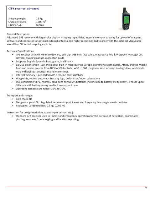
GPS receiver, advanced<br />
Shipping weight: 0.5 kg<br />
Shipping volume: 0.005 m 3<br />
UNCCS Code: 467465<br />
General Description:<br />
Advanced GPS receiver with large color display, mapping capabilities, internal memory, capacity for upload <strong>of</strong> mapping<br />
s<strong>of</strong>tware and connector for optional external antenna. It is highly recommended to order with the optional MapSource<br />
WorldMap CD for full mapping capacity.<br />
Technical Specifications:<br />
GPS receiver with: 64 MB microSD card, belt clip, USB interface cable, mapSource Trip & Waypoint Manager CD,<br />
lanyard, owner's manual, quick-start guide<br />
Supports English, Spanish, Portuguese, and French<br />
Big 256-color screen (160-240 pixels), built-in map covering Europe, extreme western Russia, Africa, and the Middle<br />
East, and covers an area from N75 to S60 Latitude, W30 to E60 Longitude. Also included is a high-level worldwide<br />
map with political boundaries and major cities.<br />
Internal memory is preloaded with a marine point database<br />
Waypoints, routes, automatic tracking logs, built-in sun/moon calculations<br />
USB connection to PC, microSD card, runs on two AA batteries (not included), battery life typically 18 hours up to<br />
30 hours with battery saving enabled, waterpro<strong>of</strong> case<br />
Operating temperature range -15ºC to 70ºC<br />
Transport and storage:<br />
Cold chain: No<br />
Dangerous good: No. Regulated, requires import license and frequency licensing in most countries.<br />
Packaging: Cardboard box, 0.5 kg, 0.005 m3<br />
Instruction for use (prescription, quantity per person, etc.):<br />
Standard GPS receiver used in routine and <strong>emergency</strong> operations for the purpose <strong>of</strong> navigation, coordinates<br />
plotting, waypoint/route logging and location reporting.<br />
14