the status and distribution of the greater one-horned rhino in nepal
the status and distribution of the greater one-horned rhino in nepal
the status and distribution of the greater one-horned rhino in nepal

Create successful ePaper yourself
Turn your PDF publications into a flip-book with our unique Google optimized e-Paper software.
12<br />
THE STATUS AND DISTRIBUTION OF THE GREATER ONE HORNED RHINO IN NEPAL<br />
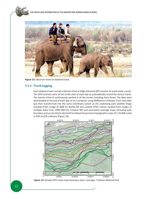
Figure 13: Observer team on elephant back<br />
3.3.1. Track logg<strong>in</strong>g<br />
Each elephant team carried a Garm<strong>in</strong> eTrex-H (High Antenna) GPS receiver to avoid under counts.<br />
The GPS receivers were all set at <strong>the</strong> start <strong>of</strong> each day to automati cally record <strong>the</strong> census tracks.<br />
The Garm<strong>in</strong> eTrex-H conti nuously worked <strong>in</strong> all <strong>the</strong> terra<strong>in</strong> <strong>in</strong>clud<strong>in</strong>g thick forest. The data were<br />
downloaded at <strong>the</strong> end <strong>of</strong> each day on to a computer us<strong>in</strong>g DNRGarm<strong>in</strong> s<strong>of</strong>t ware. Each track data<br />
was <strong>the</strong>n transformed <strong>in</strong>to <strong>the</strong> same coord<strong>in</strong>ate system as <strong>the</strong> underly<strong>in</strong>g park satellite image<br />
(L<strong>and</strong>sat ETM+ image <strong>of</strong> 2006 for Bardia NP <strong>and</strong> L<strong>and</strong>sat ETM+ mosaic created from images <strong>of</strong><br />
multi ple dates from 1999-2002 for Chitwan NP) <strong>and</strong> associated coverage maps (<strong>in</strong>clud<strong>in</strong>g park<br />
boundary <strong>and</strong> survey blocks derived from Nepal Government topographic maps <strong>of</strong> 1:25,000 scale)<br />
<strong>in</strong> ESRI ArcGIS s<strong>of</strong>t ware (Figure 14).<br />
Figure 14: Sample GPS tracks map show<strong>in</strong>g a day’s coverage - Chitwan Nati onal Park