MPA Symposium - Zoological Society of London
MPA Symposium - Zoological Society of London
MPA Symposium - Zoological Society of London

Create successful ePaper yourself
Turn your PDF publications into a flip-book with our unique Google optimized e-Paper software.
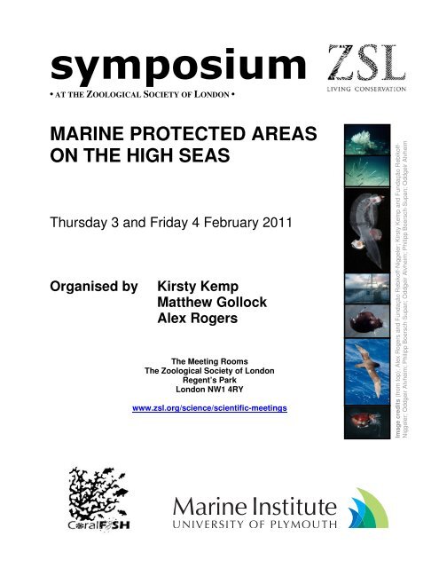
symposium<br />
• AT THE ZOOLOGICAL SOCIETY OF LONDON •<br />
MARINE PROTECTED AREAS<br />
ON THE HIGH SEAS<br />
Thursday 3 and Friday 4 February 2011<br />
Organised by Kirsty Kemp<br />
Matthew Gollock<br />
Alex Rogers<br />
The Meeting Rooms<br />
The <strong>Zoological</strong> <strong>Society</strong> <strong>of</strong> <strong>London</strong><br />
Regent’s Park<br />
<strong>London</strong> NW1 4RY<br />
www.zsl.org/science/scientific-meetings<br />
Image credits (from top): Alex Rogers and Fundação Rebik<strong>of</strong>f-Niggeler; Kirsty Kemp and Fundação Rebik<strong>of</strong>f-<br />
Niggeler; Oddgeir Alvheim; Philipp Boersch-Supan; Oddgeir Alvheim; Philipp Boersch-Supan; Oddgeir Alvheim
MARINE PROTECTED AREAS ON THE HIGH SEAS<br />
AN INTERNATIONAL SYMPOSIUM HELD AT ZSL ON 3 AND 4 FEBRUARY 2011<br />
ABSTRACTS OF TALKS<br />
9.15–9.30 Welcome from Tim Blackburn<br />
Director, Institute <strong>of</strong> Zoology, <strong>Zoological</strong> <strong>Society</strong> <strong>of</strong> <strong>London</strong><br />
SESSION I: DO <strong>MPA</strong>s WORK? (PROGRESS TOWARDS 2012 GOALS and the STATE OF<br />
PROGRESS ON HIGH SEAS <strong>MPA</strong>s)<br />
Chair: Kirsty Kemp (Institute <strong>of</strong> Zoology, ZSL)<br />
9.30–9.55 The need for High Sea Marine Protected Areas<br />
Alex D. Rogers, Department <strong>of</strong> Zoology, University <strong>of</strong> Oxford, UK<br />
The oceans have a mean depth <strong>of</strong> 3800m and comprise 90% <strong>of</strong> the Earth’s biosphere, the<br />
majority <strong>of</strong> which is constituted by the high seas. This region includes the water column and<br />
seabed and hosts a startling variety <strong>of</strong> ecosystems, a high diversity <strong>of</strong> species and plays a<br />
pivotal role in the Earth system. At present, the high seas are governed through a principle <strong>of</strong><br />
mare liberum or freedom <strong>of</strong> the seas. However, the dramatic increase in human activities<br />
exploiting the resources <strong>of</strong> the high seas or impacting on them has rendered this concept a<br />
recipe for uncontrolled destruction <strong>of</strong> the natural capitol <strong>of</strong> our oceans. Moreover, the variety <strong>of</strong><br />
human activities now taking place in our seas will inevitably force us to adopt marine spatial<br />
planning not only within the exclusive economic zones <strong>of</strong> states but beyond them, in the high<br />
seas. It is essential that marine protected areas form a key part <strong>of</strong> such efforts to manage<br />
activities on the high seas. The United Nations Convention on the Law <strong>of</strong> the Sea (UNCLOS)<br />
has resulted in management <strong>of</strong> some activities in the oceans. Mining, for example, is managed<br />
by the International Seabed Authority, whilst fishing, in many areas <strong>of</strong> the high seas is managed<br />
with varying degrees <strong>of</strong> success by Regional Fisheries Management Organisations. However,<br />
conventional forms <strong>of</strong> management are <strong>of</strong>ten either focused upon the biotic resource being<br />
exploited (target species) or has a narrow regional focus. Such forms <strong>of</strong> management allow the<br />
degradation <strong>of</strong> diversity at a variety <strong>of</strong> levels and will inevitably end in the extinction <strong>of</strong> species<br />
and loss <strong>of</strong> goods and services to humankind. Marine protected areas can protect the wider<br />
diversity <strong>of</strong> marine ecosystems including by-catch species from fishing and important biophysical<br />
structure in the oceans critical for ecosystem integrity. They can allow the rebuilding <strong>of</strong> fish<br />
stocks with associated overspill and improved recruitment to the surrounding ecosystem and act<br />
as an important insurance mechanism when management fails. Science must now address<br />
important questions as to how to maximise the conservation and economic benefits <strong>of</strong> networks<br />
<strong>of</strong> high seas marine protected areas whilst fitting them into a broader context <strong>of</strong> ocean<br />
management. Politicians, lawyers and managers must work towards filling the legislative gaps<br />
that currently prevent the adoption <strong>of</strong> a holistic approach to sustainable management <strong>of</strong><br />
ecosystems beyond national jurisdiction.<br />
For further information, please contact: Publications and Meetings, ZSL, Regent’s Park, <strong>London</strong> NW1 4RY, UK. anne.braae@zsl.org
MARINE PROTECTED AREAS ON THE HIGH SEAS<br />
AN INTERNATIONAL SYMPOSIUM HELD AT ZSL ON 3 AND 4 FEBRUARY 2011<br />
ABSTRACTS OF TALKS<br />
9.55–10.20 Progress with global ocean protection<br />
Dan Laffoley, Senior Advisor, Marine Science and Conservation, IUCN, and<br />
Marine Vice Chair, IUCN’s World Commission on Protected Areas UK<br />
In recent decades many countries have signed up to targets for the protection and management<br />
<strong>of</strong> the world’s ocean. This is at a global scale, through such fora and agreements as the World<br />
Summit on Sustainable Development and the Convention on Biological Diversity. A number <strong>of</strong><br />
regional targets have also been created within this context by country leaders working together,<br />
such as in the coral triangle in the Far East and the Caribbean. At the same time there has been<br />
a growing recognition <strong>of</strong> the need to focus attention on areas beyond national jurisdictions, as<br />
the footprint <strong>of</strong> human impacts moves ever further from the coast into deeper waters in search <strong>of</strong><br />
resources. In recent years a significant scale-up <strong>of</strong> activity has occurred to secure protection for<br />
the High Seas.<br />
This presentation will provide an introductory context and overview to the symposium, by<br />
considering progress against global ocean protection targets. It will explain the current<br />
achievements, the amount <strong>of</strong> ocean now within <strong>MPA</strong>s, as well as identifying challenges for the<br />
future. This will include an understanding <strong>of</strong> significant moves by some countries to scale-up the<br />
level <strong>of</strong> protection provided, perhaps 100 fold, through the identification <strong>of</strong> large <strong>MPA</strong>s that are<br />
<strong>of</strong>ten fully no-take, where extraction <strong>of</strong> living resources is prohibited. The presentation will also<br />
touch on some <strong>of</strong> the new guidance and mechanisms that are being employed to attract greater<br />
attention to ocean protection, and to engage a greater understanding in policy advisors and<br />
decision makers <strong>of</strong> the need for urgent action.<br />
10.20–10.45 Quantifying the impact <strong>of</strong> the almost complete cessation <strong>of</strong> commercial<br />
fishing on the Piscean population <strong>of</strong> the northern North Sea during<br />
World War II<br />
Doug Beare, Wageningen IMARES, Netherlands<br />
Understanding the mechanisms via which commercial fishing pressures, management regimes<br />
and environmental changes interact with the ecology <strong>of</strong> wild fish populations is a key question<br />
for fisheries management science. Such questions are, however, difficult to address using<br />
recent time-series datasets, say 1950 to the present, because fishing pressure was sustained<br />
and ubiquitous during that period. The only reliable way to separate the effect <strong>of</strong> fishing from that<br />
<strong>of</strong> the environment would be to set up huge 'designed experiments' in which different marine<br />
regions were subjected to different 'treatments'. Manipulation <strong>of</strong> such large ecosystems is ,<br />
however, probably impossible. An 'experiment' did, however, occur in the North Sea during<br />
World War II (WWII) when commercial fishing ceased almost completely. Using scientific trawl<br />
survey data collected before and after the WWII, I will show how the Piscean population (agestructure,<br />
size structure, diversity, species richness) reacted to this sudden change in<br />
exploitation. I will also comment on the lessons these observations can teach us in the context<br />
<strong>of</strong> Marine Protected Areas.<br />
10.45–11.15 POSTER SESSION (TEA/COFFEE)<br />
For further information, please contact: Publications and Meetings, ZSL, Regent’s Park, <strong>London</strong> NW1 4RY, UK. anne.braae@zsl.org
MARINE PROTECTED AREAS ON THE HIGH SEAS<br />
AN INTERNATIONAL SYMPOSIUM HELD AT ZSL ON 3 AND 4 FEBRUARY 2011<br />
ABSTRACTS OF TALKS<br />
SESSION I (cont): DO <strong>MPA</strong>s WORK? (PROGRESS TOWARDS 2012 GOALS and the STATE<br />
OF PROGRESS ON HIGH SEAS <strong>MPA</strong>s)<br />
Chair: Matthew Gollock (International Marine and Freshwater Conservation Programme, ZSL)<br />
11.15–11.40 Extrapolating lessons learned from coastal and nearshore <strong>MPA</strong>s to<br />
increase efficiency and connectivity for effective high seas <strong>MPA</strong>s<br />
Colleen Corrigan, United Nations Environment Programme- World<br />
Conservation Monitoring Centre, Cambridge, UK<br />
As we move toward the World Summit on Sustainable Development 2012 marine target and the<br />
continued implementation <strong>of</strong> the Convention on Biological Diversity’s Programme <strong>of</strong> Work on<br />
Marine and Coastal Biodiversity, it is clear that we are globally short <strong>of</strong> our marine protection<br />
targets and that a large percentage <strong>of</strong> the ocean is simply not represented in current marine<br />
protection efforts. Despite the trend toward establishment <strong>of</strong> large-scale marine protected areas<br />
(<strong>MPA</strong>s), it is imperative that we accelerate our progress in protecting areas <strong>of</strong> the high seas that<br />
are severely underrepresented. As technical capacities to access, research, and monitor high<br />
seas areas improves, so does our knowledge about best practices in protecting and effectively<br />
managing nearshore marine environments. In addition, we have underestimated the contribution<br />
<strong>of</strong> indigenous peoples and local communities who can provide lessons from their customary<br />
practices in governing marine managed and protected areas, as well as important socioeconomic<br />
considerations that can be beneficial to high seas <strong>MPA</strong>s. There is a great need to<br />
begin synthesizing lessons learned from the processes that oversee the more than 5000 existing<br />
<strong>MPA</strong>s around the world so that we can adapt and apply these lessons to the successful<br />
implementation <strong>of</strong> <strong>MPA</strong>s on the high seas. This presentation will explore a range <strong>of</strong> concepts<br />
that can be extrapolated from our collective years <strong>of</strong> rich experience in designing, planning and<br />
implementing coastal <strong>MPA</strong>s to help increase the efficiency toward which we plan and implement<br />
high seas <strong>MPA</strong>s. Insights will be shared from a Pacific-based mapping project that reviews<br />
large-scale connectivity across political boundaries, bringing together the biological processes<br />
and species-specific migratory routes that extend from near-shore areas to the high seas. It will<br />
also present input on the linkage between local communities, social contexts, and cultural<br />
customs that can influence our collective work in protecting static and dynamic areas <strong>of</strong> the high<br />
seas.<br />
11.40–12.05 Assessing capture risk <strong>of</strong> pelagic fish by satellite-tracked longline<br />
vessels and the effectiveness <strong>of</strong> Marine Protected Areas<br />
Nicolas E. Humphries 1 , Nuno Queiroz 1,2 , Gonzalo Mucientes 3 , Lara Sousa 2<br />
and David W. Sims 1<br />
1 Marine Biological Association <strong>of</strong> the United Kingdom, Plymouth, UK<br />
2 CIBIO – U.P., Centro de Investigação em Biodiversidade e Recursos<br />
Genéticos, Campus Agrário de Vairão, Vairão, Portugal<br />
3 Instituto de Investigaciones Marinas, CSIC, Vigo, Spain<br />
In order to assess whether a possible Marine Protected Area (<strong>MPA</strong>) will be effective it is<br />
desirable to have an understanding <strong>of</strong> the three dimensional spatio-temporal interactions<br />
between the fishing fleet and the fish population needing protection. Without such reference,<br />
an <strong>MPA</strong> could feasibly be created where fish might be abundant but where fishing pressure is<br />
already low, or may lead to unnecessarily reduced fishing in areas where there is in fact little<br />
sustained interaction with target, or perhaps more likely, by-caught species. Ideally, therefore,<br />
For further information, please contact: Publications and Meetings, ZSL, Regent’s Park, <strong>London</strong> NW1 4RY, UK. anne.braae@zsl.org
MARINE PROTECTED AREAS ON THE HIGH SEAS<br />
AN INTERNATIONAL SYMPOSIUM HELD AT ZSL ON 3 AND 4 FEBRUARY 2011<br />
ABSTRACTS OF TALKS<br />
detailed information about the movements <strong>of</strong> both fish and fishery should be used when<br />
planning an <strong>MPA</strong>.<br />
In the case <strong>of</strong> the Spanish and Portuguese longlining fleets, vessel movements are tracked by<br />
GPS and recorded as part <strong>of</strong> the vessel monitoring system (VMS). Using this data we mapped<br />
the distribution <strong>of</strong> fishing effort spatially and through time for the Northeast Atlantic, providing<br />
interesting insights into the spatio-temporal distribution <strong>of</strong> fishing effort. Because the vessels<br />
target swordfish (Xiphias gladius) it is likely that the observed distribution reflects that <strong>of</strong> the<br />
movements, migrations and habitat preferences <strong>of</strong> swordfish. Blue sharks (Prionace glauca)<br />
are an important by-catch species <strong>of</strong> longline vessels and, because the sharks have different<br />
movements and habitat preferences to swordfish, the impact <strong>of</strong> the fishery on the species is<br />
more difficult to assess, especially as there is no formal management <strong>of</strong> pelagic shark catches<br />
in this area.<br />
Satellite tracking data on individual blue sharks has allowed us to record their thermal<br />
preferences and general movement patterns. This information was used to parameterise a<br />
simulation <strong>of</strong> a generic pelagic predator, with similar movement patterns and seasonal<br />
migrations to the blue shark, moving through the Northeast Atlantic. Individual, annual<br />
movements were then ‘run’ in time with the longline vessel movements and close spatial<br />
interactions, indicative <strong>of</strong> capture events or increased capture risk, were recorded. We then<br />
placed different sized <strong>MPA</strong>s at different locations to assess the relative impact on capture risk<br />
for the model sharks. The results <strong>of</strong> the analysis will be described. It is evident that the results<br />
provide interesting insights into the effect that <strong>MPA</strong>s, fleet reductions or seasonal closures<br />
might have on the fishing pressure experienced by non-target species.<br />
12.05–12.30 High Seas Marine Protected Areas: How could they work?<br />
Phil MacMullen, Seafish, UK<br />
Fisheries are notoriously difficult to manage. With all the resources available in developed<br />
economies it has taken over 100 years to understand the science <strong>of</strong> exploited marine<br />
ecosystems, and governments are still struggling to apply this understanding effectively.<br />
Fishermen want to be independent and they instinctively resist most attempts at monitoring and<br />
control. Prescriptive management has its place but can only ever be a part <strong>of</strong> the answer.<br />
Market forces are another part <strong>of</strong> the jigsaw but how do we use them most effectively? We need<br />
to put together a package <strong>of</strong> measures and provisions tailored to work with the forces that drive<br />
the behaviour <strong>of</strong> fishermen. This presentation looks at some lessons learned and identifies the<br />
tools in the toolbox, and the factors that need to be taken into account, if we are to seek<br />
confidence in compliance.<br />
12.30–13.00 DISCUSSION LED BY PANEL OF SESSION I SPEAKERS<br />
13.00–14.00 LUNCH<br />
For further information, please contact: Publications and Meetings, ZSL, Regent’s Park, <strong>London</strong> NW1 4RY, UK. anne.braae@zsl.org
MARINE PROTECTED AREAS ON THE HIGH SEAS<br />
AN INTERNATIONAL SYMPOSIUM HELD AT ZSL ON 3 AND 4 FEBRUARY 2011<br />
ABSTRACTS OF TALKS<br />
SESSION II: BARRIERS TO PROGRESS<br />
Chair: Alex D. Rogers (University <strong>of</strong> Oxford, UK)<br />
14.00–14.25 Legal and technical barriers towards progress<br />
Matthew Gianni, Deep Sea Conservation Coalition, Netherlands<br />
Abstract not available at time <strong>of</strong> print.<br />
14.25–14.50 Monitoring, control and surveillance options for high seas Marine<br />
Protected Areas<br />
John Pearce, MRAG Ltd, UK<br />
Marine Protected Areas in high seas fisheries have been highlighted as a possible means to<br />
protect habitats and fish stocks that may be subjected to increased levels <strong>of</strong> fishing effort by<br />
both legitimate regulated and unregulated fishing vessels. The particular monitoring, control<br />
and surveillance requirements <strong>of</strong> different types <strong>of</strong> high seas <strong>MPA</strong>s are discussed. The current<br />
toolkit <strong>of</strong> potential methods and means <strong>of</strong> monitoring, control and surveillance <strong>of</strong> fisheries are<br />
then presented along with their applicability to the requirements. The costs <strong>of</strong> MCS <strong>of</strong> high<br />
seas <strong>MPA</strong>s are highlighted.<br />
14.50–15.15 Establishing <strong>MPA</strong>s where the high seas overlays the continental shelf<br />
Daniel Owen, Fenners Chambers, UK<br />
Where coastal States have an outer continental shelf (i.e. a shelf extending beyond 200 nm from<br />
the baseline), the water column above that outer shelf will be high seas. The scientific case for<br />
an <strong>MPA</strong> in such circumstances may relate to the water column or to the seabed or both. This<br />
presentation will examine the interaction between the international law <strong>of</strong> the sea's regimes for<br />
the high seas and the continental shelf, with a view to identifying how intergovernmental<br />
organisations, such as regional seas organisations and regional fisheries management<br />
organisations, may cooperate with relevant coastal States, and vice versa, in order to achieve<br />
effective protection for the marine environment.<br />
15.15–15.45 POSTER SESSION (TEA/COFFEE)<br />
For further information, please contact: Publications and Meetings, ZSL, Regent’s Park, <strong>London</strong> NW1 4RY, UK. anne.braae@zsl.org
MARINE PROTECTED AREAS ON THE HIGH SEAS<br />
AN INTERNATIONAL SYMPOSIUM HELD AT ZSL ON 3 AND 4 FEBRUARY 2011<br />
ABSTRACTS OF TALKS<br />
SESSION III: SOLUTIONS AND POLICY<br />
Chair: Alex D. Rogers (University <strong>of</strong> Oxford, UK)<br />
15.45–16.10 The economic aspect <strong>of</strong> <strong>MPA</strong> development<br />
Pippa Gravestock, University <strong>of</strong> York, UK<br />
This presentation will look at the current state <strong>of</strong> knowledge <strong>of</strong> the costs and benefits <strong>of</strong> High<br />
Seas Marine Protected Areas (HS<strong>MPA</strong>s).<br />
Marine conservationists operate in an environment where their plans and priorities are set<br />
against very powerful forces – political, economic and cultural. Any attempt to shift policy<br />
towards a more benign framework for the world’s oceans must understand the broader socioeconomic<br />
context in which policy objectives are pursued. This applies especially in an<br />
environment <strong>of</strong> scarce resources and constant competition for funds.<br />
The main focus <strong>of</strong> this presentation will be on the costs <strong>of</strong> HS<strong>MPA</strong> implementation. A practical<br />
understanding <strong>of</strong> implementation costs is highly desirable for effective planning as the various<br />
programmes currently attempting to establish HS<strong>MPA</strong> networks around the world move forward.<br />
Looking at data from HS<strong>MPA</strong> proxies, such as large <strong>of</strong>f-shore protected areas and fishery<br />
management zones, it seems likely that the costs <strong>of</strong> implementing a HS<strong>MPA</strong> or network <strong>of</strong><br />
protected areas will be considerable, not always easy to estimate in advance and likely to be<br />
incurred by a range <strong>of</strong> service providers. The scale <strong>of</strong> these costs in any given situation will<br />
depend on a range <strong>of</strong> criteria including the size <strong>of</strong> the protected area, its objectives,<br />
management organisations and location and the governance <strong>of</strong> the relevant fisheries.<br />
Not all <strong>of</strong> the costs <strong>of</strong> implementing a HS<strong>MPA</strong> or a network <strong>of</strong> HS<strong>MPA</strong>s are the direct<br />
implementation costs. Another group <strong>of</strong> costs that must be considered are the opportunity costs<br />
associated with implementation – in other words the costs <strong>of</strong> forsaking certain economic<br />
activities in order to create the protected area. Research suggests that the potential opportunity<br />
costs <strong>of</strong> creating a HS<strong>MPA</strong> network covering 10% <strong>of</strong> the high seas would be de minimis in<br />
relation to the size <strong>of</strong> the global fishery catch: representing a reduction <strong>of</strong> less than 1% in the<br />
annual marine capture fisheries take. In addition, only a handful <strong>of</strong> the mostly wealthy western<br />
nations who dominate the high seas bottom trawl industry (estimated to be 12 in total) would be<br />
impacted by the creation <strong>of</strong> such an area.<br />
The establishment <strong>of</strong> a network <strong>of</strong> HS<strong>MPA</strong>s should also bring benefits, including the<br />
preservation <strong>of</strong> a healthy marine ecosystem for future generations. Efforts to analyse and<br />
quantify the economic value <strong>of</strong> these benefits are still at an early stage and this is a subject that<br />
will be reviewed only at a high level in this presentation.<br />
When assessing the overall case for creating HS<strong>MPA</strong>s, some obvious questions relate to who<br />
should pay for them, how funding should be channelled and to whom the benefits would accrue.<br />
In some cases there may be a disconnection between who is asked to bear the costs and who<br />
sees the benefits. One pool <strong>of</strong> money <strong>of</strong>ten identified by conservationists as an obvious source<br />
<strong>of</strong> funding for a global HS<strong>MPA</strong> programme is the vast subsidies issued by governments to high<br />
seas fishing fleets. Achieving a redirection <strong>of</strong> this funding is not something that seems likely to<br />
happen any time soon – the majority <strong>of</strong> subsidies to high seas bottom-trawl fleets are made by<br />
countries with little or no historical interest in marine conservation priorities.<br />
For further information, please contact: Publications and Meetings, ZSL, Regent’s Park, <strong>London</strong> NW1 4RY, UK. anne.braae@zsl.org
MARINE PROTECTED AREAS ON THE HIGH SEAS<br />
AN INTERNATIONAL SYMPOSIUM HELD AT ZSL ON 3 AND 4 FEBRUARY 2011<br />
ABSTRACTS OF TALKS<br />
16.10–16.35 What is needed in terms <strong>of</strong> law to facilitate progress towards the 2012<br />
goals?<br />
Kristina M. Gjerde and Anna Rulska-Domino, IUCN Global Marine Programme,<br />
Poland<br />
The biggest hurdle to establishing protected areas in the ocean beyond national jurisdiction was<br />
long thought to be scientific. However, initiatives such as the Census <strong>of</strong> Marine Life<br />
(www.CoML.org) and the Global Marine Biodiversity Initiative (www.GOBI.org) are shedding new<br />
light on the once remote open ocean and deep sea, making it realistic to seek to identify key<br />
habitats and migratory corridors.<br />
Challenges however remain on the institutional and legal side. In 2008, the parties to the<br />
Convention on Biological Diversity (CBD) adopted scientific criteria for identifying ‘ecologically or<br />
biologically significant areas’ and guidance for designing networks <strong>of</strong> protected areas in the open<br />
ocean and deep sea. In 2010, the CBD agreed a scientific process through regional workshops<br />
to help States to identify ecologically or biologically significant areas based on these CBD<br />
criteria.<br />
While specific places can be protected through existing international and regional processes and<br />
agreements, we lack a global legal instrument that lays out the procedures and responsibilities<br />
for protecting areas in the high seas or seabed area. What exists instead is a patchwork <strong>of</strong><br />
agreements and bodies that govern specific human uses, such as fishing, shipping or seabed<br />
mining, under the general umbrella <strong>of</strong> the United Nations Convention on the Law <strong>of</strong> the Sea.<br />
While the Law <strong>of</strong> the Sea Convention contains a very explicit obligation for all States to protect<br />
and preserve the marine environment, it did not provide a clear institutional arrangement to<br />
accomplish this. A global-scale agreement could support such efforts by enhancing progress<br />
across all regions and sectors, and not just in regions with the scientific, legal and technical<br />
capacity to manage large ocean areas.<br />
The United Nations has established an informal working group specifically to discuss and<br />
develop recommendations on the conservation and sustainable use <strong>of</strong> marine biological diversity<br />
in areas beyond national jurisdiction. At the Working Group’s third meeting in February 2010,<br />
governments expressed willingness to accelerate progress on protected areas.<br />
Recommendations <strong>of</strong> the Working Group have been endorsed by United Nations General<br />
Assembly resolution. To facilitate the scale <strong>of</strong> progress needed to meet the 2012 WSSD target<br />
for representative networks <strong>of</strong> marine protected areas, this informal UN Working Group will need<br />
to tackle the institutional and legal challenges.<br />
At the same time, wider reforms will be needed to ensure international and cross-sectoral<br />
cooperation and to increase capacities to sustainably and equitably manage ocean resources<br />
beyond the zones <strong>of</strong> national jurisdiction.<br />
For further information, please contact: Publications and Meetings, ZSL, Regent’s Park, <strong>London</strong> NW1 4RY, UK. anne.braae@zsl.org
MARINE PROTECTED AREAS ON THE HIGH SEAS<br />
AN INTERNATIONAL SYMPOSIUM HELD AT ZSL ON 3 AND 4 FEBRUARY 2011<br />
ABSTRACTS OF TALKS<br />
16.35–17.00 WWF´s engagement towards establishing a comprehensive network <strong>of</strong><br />
marine protected areas in the high seas<br />
Christian Neumann and Sabine Christiansen,<br />
International WWF Centre for Marine Conservation<br />
Ecosystems in areas beyond national jurisdiction are affected by a range <strong>of</strong> human activities.<br />
Fishing, and in particular bottom fishing, has been identified as the most significant impact on<br />
biodiversity and ecosystem integrity; however, shipping, pollution and the looming extraction <strong>of</strong><br />
mineral resources pose further risks. While sectoral competent authorities, such as Regional<br />
Fisheries Management Organisations (RFMOs), the International Maritime Organisation (IMO)<br />
and the International Seabed Authority (ISA), can address threats to ecosystems arising from<br />
activities falling within their regulatory mandate, only few international bodies take a crosssectoral,<br />
comprehensive approach to spatial conservation in areas beyond national jurisdiction.<br />
WWF addresses this gap by coordinating through its world-wide network an integrated local,<br />
regional and global effort to establishing <strong>MPA</strong>s in areas beyond national jurisdiction. Working<br />
on a wide range <strong>of</strong> issues, WWF engages in dialogues with governments, regional and global<br />
organisations, including scientific advisory bodies, such as International Council for the<br />
Exploration <strong>of</strong> the Sea (ICES), towards achieving comprehensive conservation in the High<br />
Seas. The presentation will provide examples <strong>of</strong> this global engagement.<br />
17.00–17.30 DISCUSSION LED BY PANEL OF SESSION II AND III SPEAKERS<br />
17.30–18.45 POSTER SESSION with cash bar<br />
18.45 End <strong>of</strong> Day One<br />
19.00–21.00 <strong>Symposium</strong> dinner for speakers and guests with tickets<br />
For further information, please contact: Publications and Meetings, ZSL, Regent’s Park, <strong>London</strong> NW1 4RY, UK. anne.braae@zsl.org
MARINE PROTECTED AREAS ON THE HIGH SEAS<br />
AN INTERNATIONAL SYMPOSIUM HELD AT ZSL ON 3 AND 4 FEBRUARY 2011<br />
ABSTRACTS OF TALKS<br />
SESSION IV: SOLUTIONS AND THE TRANSLATION OF SCIENCE INTO POLICY<br />
Chair: Kirsty Kemp (Institute <strong>of</strong> Zoology, ZSL)<br />
9.00–9.25 Minimizing fisheries displacement in <strong>of</strong>fshore <strong>MPA</strong> design<br />
Jason M. Hall-Spencer, Mariagrazia Graziano, Emma L. Jackson and Martin J.<br />
Attrill, Marine Institute, University <strong>of</strong> Plymouth, UK<br />
Fisheries closures are rapidly being developed to protect vulnerable marine ecosystems<br />
worldwide. It is possible to create lose-lose situations with the loss <strong>of</strong> good fishing grounds<br />
within fisheries closures causing displacement <strong>of</strong> effort that may increase damage to sensitive<br />
habitat types, create unintended conflicts with other uses <strong>of</strong> the seas or forcing fishermen further<br />
<strong>of</strong>fshore, increasing fuel costs and CO2 emissions. Displacement <strong>of</strong> demersal towed gear is<br />
highly likely if closures are set up in areas that are currently heavily fished with towed demersal<br />
gear and have conservation objectives designed to protect or allow the recovery <strong>of</strong> features that<br />
are vulnerable to the effects <strong>of</strong> demersal towed gear. Win-win situations are also possible;<br />
satellite monitoring <strong>of</strong> fishing vessel activity indicates that <strong>of</strong>fshore closures can work effectively<br />
with good compliance by international fleets even in remote areas. Here we show how remote<br />
fisheries closures have been designed to protect Lophelia pertusa habitat in a region <strong>of</strong> the NE<br />
Atlantic that straddles the EU fishing zone and the high seas. Scientific records, fishers’<br />
knowledge and surveillance data on fishing activity can be combined to provide a powerful tool<br />
for the design <strong>of</strong> Marine Protected Areas that minimises displacement <strong>of</strong> fishing effort.<br />
This work is funded by the EC Framework 7 project Knowledge-based Sustainable Management<br />
for Europe’s Seas (KnowSeas-226675).<br />
9.25–9.50 Understanding deep sea Vulnerable Marine Ecosystems and Fisheries in<br />
the NW Atlantic: links between productivity and biodiversity<br />
Andrew Kenny and Christopher Barrio Frojan, CEFAS, UK<br />
Over-fishing, together with climate change and other human pressures, is producing impacts <strong>of</strong><br />
unprecedented intensity and frequency on both shallow and deep-sea ecosystems, causing<br />
changes in biodiversity, structure and organisation <strong>of</strong> marine assemblages directly and indirectly.<br />
A general relationship exists between marine ecosystem productivity and biodiversity, such that<br />
increased biodiversity is <strong>of</strong>ten associated with enhanced productivity and biomass when<br />
measured at the regional scale, but when assessed at more local scales and in closed systems,<br />
patterns are found to be mainly unimodal. By contrast, analysis <strong>of</strong> certain biotic components <strong>of</strong><br />
deep-sea ecosystems has shown that functioning <strong>of</strong> these ecosystems is not only positively, but<br />
is exponentially related to biodiversity. Such results suggest that higher biodiversity in the deep<br />
sea supports higher rates <strong>of</strong> ecosystem processes and an increased efficiency with which these<br />
processes are performed. These exponential relationships support the hypothesis that mutually<br />
positive functional interactions (ecological facilitation) are much more prevalent in deep-sea<br />
ecosystems compared with coastal and shelf-sea ecosystems, and it seems likely this is<br />
associated (in part) with increased environmental stability and increased habitat structural<br />
complexity. In particular, the importance <strong>of</strong> habitat structural complexity in facilitating increased<br />
benthic productivity in the deep sea has probably been underestimated. This assertion (if<br />
proven) would have significant implications for fisheries management in the deep sea, as it<br />
highlights the importance <strong>of</strong> protecting seabed habitats in order to sustain deep-sea fisheries<br />
production compared to shallow shelf-sea ecosystems.<br />
For further information, please contact: Publications and Meetings, ZSL, Regent’s Park, <strong>London</strong> NW1 4RY, UK. anne.braae@zsl.org
MARINE PROTECTED AREAS ON THE HIGH SEAS<br />
AN INTERNATIONAL SYMPOSIUM HELD AT ZSL ON 3 AND 4 FEBRUARY 2011<br />
ABSTRACTS OF TALKS<br />
We propose to present a relatively crude unified comparative analysis <strong>of</strong> deep-sea and shelf-sea<br />
ecosystems to evaluate biological, structural and functional benthic diversity in relation to<br />
fisheries management approaches.<br />
9.50–10.15 The application <strong>of</strong> habitat mapping and predictive modelling in high seas<br />
<strong>MPA</strong> network design: lessons from the UK deep-sea <strong>MPA</strong> project<br />
Kerry Howell 1 , Jaime Davies 1 , Heather Stewart 2 , Colin Jacons 3 , Inés Pulido<br />
Endrino 1 , Sophie Mowles 1 , Andy Foggo 1 , Neil Golding 4 , Charlotte Marshall 1<br />
and Bhavani Narayanaswamy 5<br />
1 Marine Institute, University <strong>of</strong> Plymouth, UK, 2 British Geological Survey, UK,<br />
3 National Oceanography Centre, Southampton, UK, 4 Joint Nature<br />
Conservation Committee, UK, 5 Scottish Association for Marine Science, UK<br />
Internationally there is political momentum to establish networks <strong>of</strong> marine protected areas<br />
(<strong>MPA</strong>s) in the high seas for the conservation <strong>of</strong> biodiversity. Practical implementation <strong>of</strong> such<br />
networks requires at its base biologically meaningful maps on which to base the complex task<br />
that is <strong>MPA</strong> network design. Species and habitat distribution data in the deep-sea and high seas<br />
are sparse, therefore how do we produce maps <strong>of</strong> use with the data that are available? We<br />
present an example from the UK deep-sea <strong>MPA</strong> project and illustrate its application to the highseas.<br />
Broad-scale biologically meaningful maps are produced using a three level classification<br />
system comprising (biogeography, depth, and substrate) that captures what is known about the<br />
variation in benthic biological communities in the UK deep-sea. As substrate maps are not<br />
available for much <strong>of</strong> the high seas, the use <strong>of</strong> geomophological surrogates and their biological<br />
meaning is discussed; as well as the use <strong>of</strong> additional surrogates that may be required in order<br />
to produce globally biologically meaningful maps for high seas areas. Predictive species<br />
distribution modelling is a natural extension <strong>of</strong> habitat mapping in that it effectively uses<br />
integrated maps <strong>of</strong> environmental variables (‘habitat’ maps) to predict the distribution <strong>of</strong> species<br />
<strong>of</strong> interest. These approaches can also be applied to biological ‘habitats’, such as cold water<br />
coral reefs, sponge aggregations and coral gardens. Fine-scale maps <strong>of</strong> the distribution <strong>of</strong><br />
vulnerable marine ecosystems (VMEs) are produced using predictive modelling approaches<br />
(Maxent) and the importance <strong>of</strong> habitat vs species level predictions at a fine scale is illustrated<br />
using the example <strong>of</strong> Lophelia pertusa reef on Hatton Bank and George Bligh Bank (NE<br />
Atlantic). The application <strong>of</strong> predictive modelling approaches in the wider high seas is<br />
discussed.<br />
10.15–10.45 POSTER SESSION (TEA/COFFEE)<br />
For further information, please contact: Publications and Meetings, ZSL, Regent’s Park, <strong>London</strong> NW1 4RY, UK. anne.braae@zsl.org
MARINE PROTECTED AREAS ON THE HIGH SEAS<br />
AN INTERNATIONAL SYMPOSIUM HELD AT ZSL ON 3 AND 4 FEBRUARY 2011<br />
ABSTRACTS OF TALKS<br />
SESSION IV (cont): SOLUTIONS AND THE TRANSLATION OF SCIENCE INTO POLICY<br />
Chair: Alex D. Rogers (University <strong>of</strong> Oxford)<br />
10.45–11.10 The South Orkney Islands Southern Shelf Marine Protected Area<br />
Susie Grant, Phil Trathan, Janet Silk and J. Tratolos, British Antarctic Survey,<br />
Cambridge, UK<br />
The South Orkney Islands Southern Shelf Marine Protected Area was agreed by the<br />
Commission for the Conservation <strong>of</strong> Antarctic Marine Living Resources (CCAMLR) in November<br />
2009. It is the world’s first marine protected area (<strong>MPA</strong>) located entirely within the ‘High Seas’.<br />
The <strong>MPA</strong> covers a large area <strong>of</strong> the Southern Ocean, south <strong>of</strong> the South Orkney Islands. The<br />
<strong>MPA</strong> was the result <strong>of</strong> four years <strong>of</strong> development work. It is just less than 94,000 square<br />
kilometers, which is more than four times the size <strong>of</strong> Wales. No fishing activities and no<br />
discharge or refuse disposal from fishing vessels are allowed in the area, which will allow<br />
scientists to better monitor the effects <strong>of</strong> human activities and climate change on the Southern<br />
Ocean.<br />
The marine protected area for the South Orkneys includes important sections <strong>of</strong> an<br />
oceanographic feature known as the Weddell Front, which marks the northern limit <strong>of</strong> waters<br />
characteristic <strong>of</strong> the Weddell Sea and the southern limit <strong>of</strong> the Weddell Scotia Confluence. The<br />
Weddell Scotia Confluence is a key habitat for Antarctic krill, one <strong>of</strong> the main species harvested<br />
in the Antarctic and a key focus for CCAMLR. The <strong>MPA</strong> also includes important foraging areas<br />
for Adélie penguins that breed at the South Orkney Islands, and important submarine shelf areas<br />
and seamounts, including areas that have recently been shown to have high biodiversity.<br />
The South Orkneys <strong>MPA</strong> will thus better conserve marine biodiversity and forms the first link in a<br />
representative system <strong>of</strong> marine protected areas for the Antarctic. Planning to develop the other<br />
parts <strong>of</strong> the system are under active consideration by CCAMLR scientists. The network will help<br />
conserve important ecosystem processes, vulnerable areas, and create reference sites that can<br />
be used to make scientific comparisons between fished areas and no-take areas. Such<br />
networks will become increasingly important as climate change impacts become increasingly<br />
evident in the Antarctic in the future.<br />
11.10–11.35 BirdLife’s marine Important Bird Areas Programme – providing the<br />
science behind candidate <strong>MPA</strong>s for seabirds<br />
Ben Lascelles and Phillip Taylor, BirdLife International Global Seabird<br />
Programme, UK<br />
The BirdLife Important Bird Area (IBA) programme has been used to provide scientific<br />
justification for the selection <strong>of</strong> priority sites for conservation for over 25 years. In recent years it<br />
has been adapted and extended to the marine environment, including the high seas.<br />
This talk will present an outline <strong>of</strong> BirdLife’s marine IBA Programme and highlight our work with<br />
the scientific community to develop several datasets to help determine the location <strong>of</strong> priority<br />
sites for seabird conservation. It will focus on the Global Procellariiform Tracking Database and<br />
explain the innovative analysis techniques we have been using to identify priority sites using the<br />
data held there. The analysis includes developing measures <strong>of</strong> regularity and intensity <strong>of</strong> use <strong>of</strong><br />
For further information, please contact: Publications and Meetings, ZSL, Regent’s Park, <strong>London</strong> NW1 4RY, UK. anne.braae@zsl.org
MARINE PROTECTED AREAS ON THE HIGH SEAS<br />
AN INTERNATIONAL SYMPOSIUM HELD AT ZSL ON 3 AND 4 FEBRUARY 2011<br />
ABSTRACTS OF TALKS<br />
an area, concepts that we have found are readily understandable in policy arenas, such as the<br />
EU Birds Directive and the Convention on Biological Diversity.<br />
Having described the methods we use to identify a site we will explain how we go about<br />
describing it using a combination <strong>of</strong> habitat modelling and other techniques. The overall aim is<br />
to assess why a particular site is located where it is, and determining what the underlying<br />
important environmental variables are. This can provide vital information for future management<br />
and allows us to determine whether fixed spatial or mobile/temporal <strong>MPA</strong>s might be appropriate.<br />
We will touch on what the appropriate monitoring and management <strong>of</strong> such areas is likely to<br />
involve. This will to some degree depend on the species involved, but will not necessarily mean<br />
closure or no-take zones, but it is likely to include enforcement <strong>of</strong> bycatch mitigation measures,<br />
assessment <strong>of</strong> key prey species, oil spill management plans etc.<br />
Finally, we will highlight how BirdLife plans to develop this work in the coming years, and how<br />
we hope to link to relevant policy mechanisms and improve the sustainable management <strong>of</strong> the<br />
oceans.<br />
11.35–12.00 Chemosynthetic ecosystems: Understanding what’s at risk and tools for<br />
effective management<br />
Cindy Lee Van Dover 1 , Craig R. Smith 2 , Laurent Godet 3 and the Dinard<br />
Workshop Participants<br />
1 Marine Laboratory, Nicholas School <strong>of</strong> the Environment, Duke University,<br />
USA, 2 Department <strong>of</strong> Oceanography, University <strong>of</strong> Hawaii at Manoa, Honolulu,<br />
USA, 3 Laboratoire Géolittomer (UMR 6554 LETG), Université de Nantes,<br />
France<br />
Discovery <strong>of</strong> chemosynthetic ecosystems in the 1970s changed the way we think about<br />
dynamic processes <strong>of</strong> the Earth and Ocean and about the extremes at which life can exist on<br />
this planet and elsewhere in the universe. Chemosynthetic ecosystems support organisms that<br />
rely on microbial primary production based on energy from chemical reactions, i.e., organisms<br />
with exquisite biochemical, physiological, morphological, and behavioural adaptations to their<br />
environment. Since their discovery, chemosynthetic ecosystems have served as living libraries<br />
for science stakeholders, and scientific literature on these ecosystems is abundant, <strong>of</strong> high<br />
impact, and expanding exponentially. In addition to their biodiversity and ecosystem services,<br />
a major conservation stake <strong>of</strong> chemosynthetic ecosystems is thus a type <strong>of</strong> service seldom<br />
reported in conservation studies: their knowledge value. The potential for environmental<br />
impacts resulting from scientific research at hydrothermal vents motivated the InterRidge<br />
Statement <strong>of</strong> Commitment to Responsible Research Practices at Hydrothermal Vents. While<br />
this Statement reminds scientists <strong>of</strong> their responsibilities as stewards <strong>of</strong> the environment they<br />
study, management areas that include conservation and scientific research objectives are likely<br />
more effective stewardship tools. A greater level <strong>of</strong> threat to chemosynthetic ecosystems is<br />
posed by industries that seek to mine mineral deposits at vents or engage in oil and gas<br />
extraction near seeps, and by the extensive collateral impacts <strong>of</strong> bottom fishing. Oil extraction<br />
and bottom trawling already affect large areas <strong>of</strong> potential seep habitat, and licensing activity<br />
for mining exploration around hydrothermal vent systems is underway. These activities impose<br />
urgency to establishment <strong>of</strong> guidelines for networks <strong>of</strong> managed chemosynthetic areas in<br />
regions within and beyond national jurisdiction. We present a set <strong>of</strong> design principles<br />
formulated to safeguard biodiversity, ecosystem function, and the knowledge value <strong>of</strong><br />
chemosynthetic ecosystems within the framework <strong>of</strong> exploitation <strong>of</strong> seabed resources. The<br />
patchy distribution <strong>of</strong> chemosynthetic ecosystems in space and time requires coarse- to fine-<br />
For further information, please contact: Publications and Meetings, ZSL, Regent’s Park, <strong>London</strong> NW1 4RY, UK. anne.braae@zsl.org
MARINE PROTECTED AREAS ON THE HIGH SEAS<br />
AN INTERNATIONAL SYMPOSIUM HELD AT ZSL ON 3 AND 4 FEBRUARY 2011<br />
ABSTRACTS OF TALKS<br />
filter spatial management strategies, depending on where habitat patch distributions fall along a<br />
gradient from semi-continuous to highly dispersed across a bioregion. Because the distribution<br />
and biogeography <strong>of</strong> chemosynthetic habitats in the deep sea are still very poorly known,<br />
management plans to maintain ecological, scientific, and commercial values must be adaptive<br />
to incorporate increasing ecosystem knowledge and demand trust and collaboration among all<br />
stakeholders.<br />
12.00–12.30 DISCUSSION LED BY PANEL OF SESSION IV MORNING SPEAKERS<br />
12.30–13.30 LUNCH<br />
SESSION IV (cont): SOLUTIONS AND THE TRANSLATION OF SCIENCE INTO POLICY<br />
Chair: Matthew Gollock (International Marine and Freshwater Conservation Programme, ZSL)<br />
13.30–13.55 The establishment <strong>of</strong> the OSPAR network <strong>of</strong> <strong>MPA</strong>s including in the High<br />
Seas <strong>of</strong> the North East Atlantic<br />
Henning von Nordheim and Tim Packeiser, German Federal Agency for Nature<br />
Conservation, Germany<br />
The ministers for the environment <strong>of</strong> the Contracting Parties to the Oslo-Paris (OSPAR) and<br />
Helsinki (HELCOM) Conventions agreed in 2003 during their joint meeting in Bremen, Germany,<br />
to establish by 2010 an ecologically coherent network <strong>of</strong> well-managed Marine Protected Areas<br />
(<strong>MPA</strong>s) in the Baltic Sea and the North-East Atlantic. This commitment is seen as a significant<br />
and coordinated regional contribution to the agreement <strong>of</strong> the World Summit <strong>of</strong> Sustainable<br />
Development/WSSD in 2002 in Johannesburg, South Africa, to establish a worldwide network <strong>of</strong><br />
protected areas by 2012, including in the marine realm.<br />
Until the Ministerial Meeting <strong>of</strong> the OSPAR Contracting Parties in September 2010 (Bergen,<br />
Norway) the OSPAR Network <strong>of</strong> <strong>MPA</strong>s consisted <strong>of</strong> 159 sites collectively covering 147 322 km²<br />
in the North-East Atlantic.<br />
With the aim to extend the Network <strong>of</strong> <strong>MPA</strong>s to the Wider Atlantic Region which makes up about<br />
40% <strong>of</strong> the OSPAR maritime area, OSPAR has over the past years assumed a pioneering role<br />
in the global process to establish <strong>MPA</strong>s in Areas beyond National Jurisdiction (ABNJ). With<br />
substantial support <strong>of</strong> the scientific community, a number <strong>of</strong> ecologically and biologically<br />
significant areas that are representative for the diverse open-ocean and deep-sea ecosystems in<br />
the North-East Atlantic have been identified. The resulting proposals for <strong>MPA</strong>s in ABNJ,<br />
however, remained subject to agreement by OSPAR Contracting Parties on a number <strong>of</strong><br />
complex political and legal issues, in particular in conjunction with recent submissions by some<br />
Contracting Parties for an extended continental shelf within the OSPAR maritime area.<br />
As a conclusion <strong>of</strong> a longsome process <strong>of</strong> negotiations, the OSPAR Ministers finally agreed on<br />
24 September 2010 on the establishment <strong>of</strong> a network <strong>of</strong> additional six Marine Protected Areas<br />
in the High Seas <strong>of</strong> the North-East Atlantic. These <strong>MPA</strong>s cover a total area <strong>of</strong> 285 000 km² and<br />
protect a series <strong>of</strong> seamounts and sections <strong>of</strong> the Mid-Atlantic Ridge (MAR) hosting a range <strong>of</strong><br />
For further information, please contact: Publications and Meetings, ZSL, Regent’s Park, <strong>London</strong> NW1 4RY, UK. anne.braae@zsl.org
MARINE PROTECTED AREAS ON THE HIGH SEAS<br />
AN INTERNATIONAL SYMPOSIUM HELD AT ZSL ON 3 AND 4 FEBRUARY 2011<br />
ABSTRACTS OF TALKS<br />
vulnerable deep-sea habitats and species. While two <strong>of</strong> these <strong>MPA</strong>s are situated entirely in<br />
Areas beyond National Jurisdiction, the four other <strong>MPA</strong>s have been established in collaboration<br />
with Portugal as the seabed in these areas is subject to the submission by Portugal for an<br />
extended continental shelf.<br />
This ground-breaking decision by OSPAR Ministers on ocean governance has extended the<br />
coverage <strong>of</strong> the OSPAR Network <strong>of</strong> <strong>MPA</strong>s to about 427 000 km² or 3.1% <strong>of</strong> the North-East<br />
Atlantic, and it might well set a precedent for other regions working towards the WSSD goal <strong>of</strong><br />
implementing representative systems <strong>of</strong> <strong>MPA</strong>s by 2012.<br />
13.55–14.20 Bottom fisheries closures introduced by Atlantic RFMOs as elements <strong>of</strong><br />
new regulatory frameworks to facilitate sustainable resource utilization<br />
and conserve biodiversity<br />
Odd Aksel Bergstad, Institute <strong>of</strong> Marine Research, Norway<br />
During the past decade, efforts to regulate Atlantic fisheries for deepwater resources in areas<br />
beyond national jurisdiction increased significantly. Conservation <strong>of</strong> vulnerable benthic<br />
invertebrate species and fish resources were key aims, maintaining also a potential for<br />
continued or future sustainable resource utilization.<br />
Governments and relevant international fisheries management organizations introduced<br />
comprehensive classical fishery management measures, including closure <strong>of</strong> sub-areas to<br />
certain fisheries and practices. Background and principles underlying current regulations are<br />
explained and discussed, including the interaction between science and management, and<br />
between management organizations with complimentary authorities and roles.<br />
A need for an analysis <strong>of</strong> the effectiveness <strong>of</strong> the new regulatory framework is recognised. Such<br />
a review would have to consider the relative impacts <strong>of</strong> new regulations and other factors, such<br />
as rising fuel costs, reduced subsidies, and enhanced fishing opportunities elsewhere. A<br />
provisional evaluation <strong>of</strong> current fishery trends in view <strong>of</strong> recent regulatory efforts suggests that<br />
the incentive to fish unsustainably on the high seas is significantly reduced. <strong>MPA</strong>s introduced by<br />
regional fisheries management organizations constituted just one <strong>of</strong> several regulatory elements<br />
together creating a new environment for deepwater fisheries on the high seas.<br />
14.20–14.45 Data gaps and Quiet <strong>MPA</strong>s: use <strong>of</strong> passive acoustic monitoring to detect<br />
presence <strong>of</strong> whales and dolphins and to quantify human use<br />
Rob Williams, Erin Ashe, Erich Hoyt and Kristin Kaschner<br />
University <strong>of</strong> St Andrews, UK<br />
The <strong>MPA</strong> siting algorithms used in conservation planning s<strong>of</strong>tware have a well-known tendency<br />
to gravitate toward data-rich areas. This has important implications for marine biodiversity<br />
protection, where the high cost <strong>of</strong> ship-board surveys <strong>of</strong>ten results in patchy data. When spatial<br />
bias in sampling is ignored, selection <strong>of</strong> priority areas will be biased toward locations <strong>of</strong> sampling<br />
points. We recently completed a gap analysis that compiled and mapped density estimates for<br />
cetaceans (whales, dolphins and porpoises) in the North Pacific from line transect data. We<br />
found that much <strong>of</strong> the North Pacific beyond the range <strong>of</strong> countries' EEZs was unsurveyed.<br />
Marxan best practice requires filling in those data gaps, but there is little guidance for cases<br />
where ‘gaps’ constitute large fractions <strong>of</strong> the Earth’s surface. We see two complementary<br />
options. One <strong>of</strong> us (KK) has pioneered methods to predict cetacean distribution based on<br />
habitat suitability models. Another (RW) has developed methods for filling in data gaps with<br />
For further information, please contact: Publications and Meetings, ZSL, Regent’s Park, <strong>London</strong> NW1 4RY, UK. anne.braae@zsl.org
MARINE PROTECTED AREAS ON THE HIGH SEAS<br />
AN INTERNATIONAL SYMPOSIUM HELD AT ZSL ON 3 AND 4 FEBRUARY 2011<br />
ABSTRACTS OF TALKS<br />
relatively low-cost field work, through platform-<strong>of</strong>-opportunity surveys on the high seas, coastal,<br />
small-boat surveys and recently through autonomous passive acoustic monitoring on continental<br />
shelf waters <strong>of</strong> British Columbia, Canada. Acoustic monitoring can detect the presence <strong>of</strong><br />
vocalizing cetaceans in poorly surveyed areas and seasons, while simultaneously measuring<br />
ambient noise levels, which constitute an important human-use layer for measuring habitat<br />
quality for acoustically sensitive species. Acoustic research now allows estimation <strong>of</strong> acoustic<br />
space that whales lose from chronic shipping and seismic survey noise. Some policy<br />
frameworks, such as Canada’s Species at Risk Act and possibly the EU Habitats Directive, may<br />
allow this science to lead to mitigation through <strong>MPA</strong> planning. Our vision is for a network <strong>of</strong><br />
Quiet <strong>MPA</strong>s. Our recommended approach would (1) map data and gaps, (2) make predictions<br />
about species presence based on habitat suitability, and (3) test those predictions on a randomly<br />
chosen subset <strong>of</strong> regions and species using field data collected from surveys and passive<br />
acoustic monitoring. Based on our experience on the continental shelf, we see our approach as<br />
one that could be transported to the high seas. We cannot consider <strong>MPA</strong>s to be wholly<br />
protected if the management plans ignore acoustic elements, given the importance <strong>of</strong> sound as<br />
the primary modality by which many marine species obtain information about their environments.<br />
14.45–15.15 POSTER SESSION (TEA/COFFEE)<br />
SESSION IV (cont): SOLUTIONS AND THE TRANSLATION OF SCIENCE INTO POLICY<br />
Chair: Kirsty Kemp (Institute <strong>of</strong> Zoology, ZSL)<br />
15.15–15.40 Seamounts are hotspots <strong>of</strong> pelagic biodiversity in the open oceans and<br />
areas <strong>of</strong> special interest for management <strong>of</strong> marine pelagic predators<br />
Telmo Morato 1 , Simon D. Hoyle 2 , Valerie Allain 2 and Simon J. Nicol 2 ,<br />
1 Universidade dos Açores, Portugal, 2 Oceanic Fisheries Program, Secretariat<br />
<strong>of</strong> the Pacific Community, Noumea, New Caledonia<br />
The identification <strong>of</strong> biodiversity hotspots and their management for conservation have been<br />
hypothesized as effective ways to protect many species. There has been a significant effort to<br />
identify and map these areas at a global scale, but the coarse resolution <strong>of</strong> most datasets<br />
masks the small-scale patterns associated with coastal habitats or seamounts. We used tuna<br />
longline observer data to investigate the role <strong>of</strong> seamounts in aggregating large pelagic<br />
biodiversity and to identify which pelagic species are associated with seamounts. Our analysis<br />
indicates that seamounts are hotspots <strong>of</strong> pelagic biodiversity. Higher species richness was<br />
detected in association with seamounts than with coastal or oceanic areas. Seamounts were<br />
found to have higher species diversity within 30–40 km <strong>of</strong> the summit, whereas for sets close to<br />
coastal habitat the diversity was lower and fairly constant with distance. Higher probability <strong>of</strong><br />
capture and higher number <strong>of</strong> fish caught were detected for some shark, billfish, tuna, and<br />
other by-catch species. Our study supports hypotheses that seamounts may be areas <strong>of</strong><br />
special interest for management for marine pelagic predators. We have also evaluated the<br />
existence <strong>of</strong> an association between seamounts and tuna longline fisheries at the ocean basin<br />
scale to identify significant seamounts for tuna in the western and central Pacific Ocean. Our<br />
study identified many seamounts throughout the western Pacific Ocean that may act as<br />
important aggregating points for tuna species. This indicates that management <strong>of</strong> seamounts<br />
For further information, please contact: Publications and Meetings, ZSL, Regent’s Park, <strong>London</strong> NW1 4RY, UK. anne.braae@zsl.org
MARINE PROTECTED AREAS ON THE HIGH SEAS<br />
AN INTERNATIONAL SYMPOSIUM HELD AT ZSL ON 3 AND 4 FEBRUARY 2011<br />
ABSTRACTS OF TALKS<br />
is important Pacific-wide, but management approaches must take account <strong>of</strong> local conditions.<br />
Management <strong>of</strong> tuna and biodiversity resources in the region would benefit from considering<br />
such effects.<br />
Morato, T., S.D. Hoyle, V. Allain, and S.J. Nicol (2010) Seamounts are hotspots <strong>of</strong> pelagic biodiversity in the open ocean.<br />
Proceedings <strong>of</strong> the National Academy <strong>of</strong> Science USA 107(21): 9707-9711. doi:10.1073/pnas.0910290107.<br />
http://www.pnas.org/content/early/2010/05/05/0910290107.full.pdf+html<br />
Morato, T., S.D. Hoyle, V. Allain, S.J. Nicol (2010) Tuna longline fishing around West and Central Pacific seamounts. PLoS<br />
ONE 5(12): e14453. doi:10.1371/journal.pone.0014453.<br />
15.40–16.05 Effects <strong>of</strong> high seas <strong>MPA</strong>s on commercial fisheries: Examples from the<br />
Atlantic and Indian Oceans’ tuna fleets<br />
Emmanuel Chassot 1 , Edgar Torres 1 , David M. Kaplan 1 , Daniel Gaertner 1 ,<br />
Misael Morales 1 , Alicia Delgado 2 , Javier Ariz 2 , 1 IRD, Centre de Recherche<br />
Halieutique, UMR 212 EME (IRD/Ifremer/U Montpellier II), France, 2 IEO,<br />
Centro Oceanográfico de Canarias, Canary Islands, Spain<br />
The impact <strong>of</strong> high seas <strong>MPA</strong>s on commercial fishing fleets is a central question in the debate<br />
about the efficacy and utility <strong>of</strong> such measures for managing pelagic ecosystems. There are at<br />
least two well-studied cases <strong>of</strong> spatial closures that impacted high-seas tropical tuna fisheries.<br />
In the eastern tropical Atlantic, a partial temporal closure was implemented in 1996 to reduce the<br />
catch <strong>of</strong> juvenile tropical tuna species. This closure did reduce overall catch <strong>of</strong> juveniles by<br />
European fleets, but there was a significant displacement <strong>of</strong> fishing effort to non-closure areas<br />
and non-observance <strong>of</strong> the closure by certain fleets led to its virtual abandonment in 2005. In<br />
the Indian Ocean, the Somali EEZ has been <strong>of</strong>f limits for fishing since 2004 and pirate activity<br />
has significantly reduced fishing activity in a large area around Somalia since 2007. Tuna<br />
catches in this zone historically represent no less than 25% <strong>of</strong> the total Indian Ocean catch by<br />
European fleets and are dominated by small, <strong>of</strong>ten immature, individuals caught <strong>of</strong>f artificial fish<br />
aggregation devices (FADs). Fishing activity in the area has been significantly reduced by this<br />
‘closure’, particularly in 2008 when pirate activity was at its peak and before military intervention<br />
reduced risk from piracy, but the European fishing fleet has been able to recoup most losses in<br />
other areas <strong>of</strong> the Indian Ocean and a number <strong>of</strong> fishing boats have switched to the Atlantic<br />
Ocean, <strong>of</strong>ten fishing in areas previously in the eastern Atlantic temporal closure. These<br />
examples demonstrate the potential <strong>of</strong> reducing juvenile catches with large, well-placed<br />
protected areas, but also the complexity <strong>of</strong> reactions by the fishing industry to closures that can<br />
reduce or eliminate any benefits.<br />
16.05–16.30 Options for fisheries-independent monitoring in pelagic <strong>MPA</strong>s<br />
Matthew Gollock and Heather Koldeway, Conservation Programmes, ZSL, UK<br />
On 1 April 2010, the British Government announced designation <strong>of</strong> the British Indian Ocean<br />
Territory or Chagos Archipelago (Chagos/BIOT) as the world’s largest marine protected area<br />
(<strong>MPA</strong>). This near pristine ocean ecosystem now represents 16% <strong>of</strong> the world’s fully protected<br />
coral reef, 60% <strong>of</strong> the world’s no-take protected areas and an uncontaminated reference site for<br />
ecological studies. While the benefits <strong>of</strong> <strong>MPA</strong>s for coral-reef dwelling species are established,<br />
there is uncertainty about their effects on pelagic migratory species such as tuna, tuna-like<br />
species and elasmobranchs. Further, the majority <strong>of</strong> available data on pelagic species is<br />
fisheries-based – primarily from long-line and purse seine tuna fisheries. Consequently, we<br />
need to assess available techniques, modelling approaches and emerging technologies that<br />
For further information, please contact: Publications and Meetings, ZSL, Regent’s Park, <strong>London</strong> NW1 4RY, UK. anne.braae@zsl.org
MARINE PROTECTED AREAS ON THE HIGH SEAS<br />
AN INTERNATIONAL SYMPOSIUM HELD AT ZSL ON 3 AND 4 FEBRUARY 2011<br />
ABSTRACTS OF TALKS<br />
could be applied to monitor these large pelagic predators. Additional considerations include the<br />
lack <strong>of</strong> baseline data, available resources and the remote nature <strong>of</strong> Chagos/BIOT.<br />
On the 12–13 July 2010 a multi-stakeholder workshop was held at ZSL to address, and<br />
prioritise, the future options for management and research in the Chagos/BIOT <strong>MPA</strong>, however, it<br />
was also an opportunity to address monitoring options for pelagic species in the open ocean<br />
generally. Expert opinion was gathered in relation to what methods would be available, what<br />
time scale they should be used over and how they could work complementarily. After the<br />
workshop, more focussed research was carried out in the form <strong>of</strong> an intra-ZSL meeting on the<br />
subject, and a literature search carried out by MSc students.<br />
This presentation will review existing and potential methodologies and discuss what might be<br />
most appropriate for researching the response <strong>of</strong> pelagic species to the new <strong>MPA</strong>. The authors<br />
would greatly appreciate comments and input on this review.<br />
16.30–17.30 DISCUSSION LED BY PANEL OF SESSION IV AFTERNOON SPEAKERS<br />
17.30 End <strong>of</strong> <strong>Symposium</strong><br />
For further information, please contact: Publications and Meetings, ZSL, Regent’s Park, <strong>London</strong> NW1 4RY, UK. anne.braae@zsl.org
MARINE PROTECTED AREAS ON THE HIGH SEAS<br />
A TWO-DAY INTERNATIONAL SYMPOSIUM HELD AT ZSL ON 3 AND 4 FEBRUARY 2011<br />
POSTER ABSTRACTS<br />
MARINE PROTECTED AREAS ON THE HIGH SEAS<br />
3 AND 4 FEBRUARY 2011 — SYMPOSIUM<br />
RESEARCH POSTERS PRESENTED<br />
Evaluating the effectiveness <strong>of</strong> <strong>MPA</strong>s in the open ocean: how do changes in fishing fleet<br />
dynamics impact upon conservation objectives?<br />
Davies, T.<br />
Imperial College <strong>London</strong>, UK. Email: timothy.davies08@imperial.ac.uk<br />
No-take <strong>MPA</strong>s intentionally exclude fishing activity, causing fleet dynamics to change as fishers<br />
inevitably respond to the closure <strong>of</strong> their fishing grounds. It has been argued that in the open<br />
ocean, displacement <strong>of</strong> fishing effort has the potential to diminish the conservation benefits <strong>of</strong><br />
<strong>MPA</strong>s, with fishing pressure continuing to impact upon populations <strong>of</strong> highly migratory species<br />
as they move outside <strong>of</strong> reserve boundaries. An additional threat is the persistence <strong>of</strong> illegal<br />
fishing within a closed area, which may increase if fishers perceive improved fishing<br />
opportunities within an <strong>MPA</strong>.<br />
My research aims to model the response <strong>of</strong> fishing fleets to a protected area established in an<br />
open ocean system, in order to explore the effectiveness <strong>of</strong> area-based management in<br />
conserving highly mobile, pelagic species. Models representing tuna fleets and pelagic<br />
species <strong>of</strong> the Western Indian Ocean will simulate a system that contains a protected area<br />
based on the recently established Chagos <strong>MPA</strong>. In addition to the current <strong>MPA</strong> fixed area<br />
design, a number <strong>of</strong> alternative reserve configurations will also be evaluated against a set <strong>of</strong><br />
holistic conservation objectives (rather than narrow objectives related to fisheries<br />
management).<br />
The principal focus <strong>of</strong> the project is to construct realistic models <strong>of</strong> fleet dynamics, which<br />
account for the social, cultural, institutional and economic drivers <strong>of</strong> fisher behaviour, for both<br />
the legal and illegal tuna fleets operating in the Western Indian Ocean. This will involve direct<br />
interviews with tuna fishermen, analysis <strong>of</strong> fisheries data and review <strong>of</strong> historical illegal activity<br />
within British Indian Ocean Territory. Models will be used to predict the threat <strong>of</strong> illegal fishing<br />
within the <strong>MPA</strong>, as well as the impact <strong>of</strong> effort displacement on populations <strong>of</strong> highly migratory<br />
species.<br />
This poster describes my early findings, including a short literature review <strong>of</strong> the utility <strong>of</strong><br />
pelagic <strong>MPA</strong>s based on the Chagos <strong>MPA</strong> public consultation.<br />
High seas deep-sea fisheries in an ecosystem context: the South-West Indian Ocean<br />
Ridge project<br />
Rogers, A.D. 1 , Boersch-Supan, P. 1,2 and Kemp, K. 3<br />
1 University <strong>of</strong> Oxford, UK, 2 Pelagic Ecology Research Group, Scottish Oceans Institute,<br />
University <strong>of</strong> St Andrews, Fife, UK, 3 Institute <strong>of</strong> Zoology, <strong>Zoological</strong> <strong>Society</strong> <strong>of</strong> <strong>London</strong>, UK.<br />
Email: alex.rogers@zoo.ox.ac.uk<br />
The ecology <strong>of</strong> seamounts <strong>of</strong> the Indian Ocean is almost unstudied. However, exploitation <strong>of</strong><br />
fisheries resources associated with seamounts in the region has taken place at least since the<br />
early 1980s. The South West Indian Ocean Ridge (SWIOR) is a range <strong>of</strong> seamounts in the<br />
high seas that were subject to a major boom-bust fishery for orange roughy in the early 1990s<br />
and are still subject to deep-sea bottom fishing. To date the management <strong>of</strong> the deep-sea<br />
For further information, please contact Scientific Publications and Meetings, ZSL, Regent’s Park, <strong>London</strong> NW1 4RY, UK. anne.braae@zsl.org
MARINE PROTECTED AREAS ON THE HIGH SEAS<br />
A TWO-DAY INTERNATIONAL SYMPOSIUM HELD AT ZSL ON 3 AND 4 FEBRUARY 2011<br />
POSTER ABSTRACTS<br />
bottom fisheries on the SWIOR has been undertaken by industry and for reasons <strong>of</strong><br />
commercial sensitivity little information is available publicly on fishing activities or stock status.<br />
Delays in the initiation <strong>of</strong> a regional fisheries management organisation, the South Indian<br />
Ocean Fisheries Agreement (SIOFA), have led to the voluntary designation <strong>of</strong> protected areas<br />
by the fishing industry in the region. However, there is little understanding <strong>of</strong> what is driving the<br />
production <strong>of</strong> these ecosystems, what the status is <strong>of</strong> targeted and non-targeted fish<br />
populations and whether voluntary management measures have been effective in protecting<br />
vulnerable marine ecosystems.<br />
We describe the development <strong>of</strong> a new project aimed at furnishing fisheries and environmental<br />
managers in the southern Indian Ocean with data on the ecosystems <strong>of</strong> the SWIOR. The<br />
project, funded by the GEF and implemented by UNDP / IUCN, has undertaken a cruise to<br />
investigate the pelagic biology <strong>of</strong> the SWIOR. Data were collected on biological oceanography,<br />
pelagic communities and aquatic predators (birds). Results indicate that seamount fisheries<br />
may be driven by trapping <strong>of</strong> migrating mesopelagic zooplankton and micronekton<br />
communities. Furthermore, important new data on the distribution <strong>of</strong> deep-water pelagic<br />
communities, including both new records for the region and new species <strong>of</strong> organisms have<br />
been collected. In 2011 a further cruise will be undertaken to survey and sample benthic<br />
ecosystems <strong>of</strong> the seamounts both within and outside <strong>of</strong> voluntary benthic protected areas.<br />
The project is the result <strong>of</strong> international collaboration between scientists, intergovernmental<br />
organisations and the fishing industry. The implications <strong>of</strong> the project for high seas fisheries<br />
management, <strong>MPA</strong> designation within the region and capacity building are discussed.<br />
Preliminary proposal <strong>of</strong> marine areas in the High Seas <strong>of</strong> the SW Atlantic to be<br />
considered for protection<br />
Portela, J. 1 , Acosta, J. 2 , Cristobo, J. 4 , Parra, S. 3 , Muñoz, A. 5 , del Río, J.L. 1 , Tel, E. 1 and<br />
Patrocinio, T. 1<br />
1 Instituto Español de Oceanografía, Centro Oceanográfico de Vigo, Spain, 2 Instituto Español<br />
de Oceanografía, Sede Central de Madrid, Spain, 3 Instituto Español de Oceanografía, Centro<br />
Oceanográfico de A Coruña, Spain, 4 Instituto Español de Oceanografía, Centro Oceanográfico<br />
de Gijón, Spain, 5 Grupo Multidisciplinar de Cartografiado (TRAGSATEC-SGM), Spain.<br />
Email: julio.portela@vi.ieo.es<br />
This study examines ongoing concerns about the effects <strong>of</strong> bottom trawling on benthic<br />
Vulnerable Marine Ecosystems (VME) on the High Seas <strong>of</strong> the Southwest Atlantic, and<br />
explores the proposal <strong>of</strong> marine areas to be considered for protection in the zone. Currently,<br />
this region is the only significant area for High Seas fisheries not covered by a Regional<br />
Fisheries Management Organisation (RFMO). Information gathered during 13 multidisciplinary<br />
research cruises conducted between late 2007 and early 2010, led to a preliminary<br />
identification <strong>of</strong> areas where the presence <strong>of</strong> vulnerable organisms was considered significant.<br />
Great densities and biomass <strong>of</strong> octocorals, sponges, colony scleractinians (Bathelia candida)<br />
and large hydrocorals (Errina spp., Cheiloporidion pulvinatum, Sporadopora sp. and Stylaster<br />
densicaulis) were found at intermediate depths (401–1000 m), whereas shallow waters (
MARINE PROTECTED AREAS ON THE HIGH SEAS<br />
A TWO-DAY INTERNATIONAL SYMPOSIUM HELD AT ZSL ON 3 AND 4 FEBRUARY 2011<br />
POSTER ABSTRACTS<br />
Seamount classification system to aid <strong>MPA</strong> design in the High Seas<br />
Clark, M.R., Watling, L., Rowden, A.A., Guinotte, J.M., Smith, C.R. and Rogers, A.D.<br />
National Institute <strong>of</strong> Water and Atmospheric Research, New Zealand.<br />
Email: m.clark@niwa.co.nz<br />
Seamounts are prominent features <strong>of</strong> the world’s seafloor, and are the target <strong>of</strong> deep-sea<br />
commercial fisheries, and <strong>of</strong> interest for minerals exploitation. They host vulnerable benthic<br />
communities, which can be rapidly and severely impacted by human activities. There have<br />
been recent calls to establish networks <strong>of</strong> marine protected areas on the High Seas, including<br />
seamounts. However, there is little biological information on the benthic communities on<br />
seamounts and this has limited the ability <strong>of</strong> scientists to inform managers about seamounts,<br />
that should be protected as part <strong>of</strong> a network. In this poster we present a seamount<br />
classification based on ‘biologically meaningful’ physical variables for which global-scale data<br />
are available. The approach involves the use <strong>of</strong> a general biogeographic classification for the<br />
bathyal depth zone (near-surface to 3500 m), and then uses four key environmental variables<br />
(overlying export production, summit depth, oxygen levels, and seamount proximity) to group<br />
seamounts with similar characteristics. This procedure is done in a simple hierarchical manner<br />
which results in 194 seamount classes throughout the world’s oceans. The method was<br />
compared against a multivariate approach, and ground-truthed against octocoral data for the<br />
North Atlantic. We believe that it provides biologically realistic groupings, in a transparent<br />
process that can be used to either directly select, or aid the selection <strong>of</strong>, seamounts to be<br />
protected.<br />
INDEEP – A new International Network for Scientific Investigations <strong>of</strong> Deep-Sea<br />
Ecosystems<br />
Baker, M.C. 1 , Consalvey, M. 2 , Ramirez-Llodra, E. 3 , Menot, L 4 , Narayanaswamy, B.E. 5 , Tyler,<br />
P. 1 , Smith, C. 6 , Clark, M 2 , Carney, R. 7 and Sibuet, M. 8<br />
1 University <strong>of</strong> Southampton, 2 National Institute <strong>of</strong> Water and Atmospheric Research, New<br />
Zealand, 3 Institut de Ciències del Mar, CSIC, Spain, 4 Ifremer-Brest, France, 5 Scottish<br />
Association for Marine Science, UK, 6 University <strong>of</strong> Hawaii, USA, 7 Louisiana State University,<br />
USA, 8 Institut Océanographique de Paris, France. Email: Mb11@noc.soton.ac.uk<br />
Following in the footsteps <strong>of</strong> the International Census <strong>of</strong> Marine Life programme (2000-2010),<br />
INDEEP is a newly-funded programme (Fondation Total) with a focus to determine the global<br />
biodiversity and functioning <strong>of</strong> deep-sea ecosystems in order to achieve a synthesis <strong>of</strong> sound<br />
knowledge that can be used in the formation <strong>of</strong> sustainable management strategies, bridging<br />
the gap between science and policy. During the initial 3 year phase, INDEEP will play a major<br />
role in bringing together efforts from across the globe and from a wide range <strong>of</strong> expertise in<br />
relation to investigation <strong>of</strong> the deep-sea ecosystems under 5 major themes: 1) Taxonomy and<br />
evolution, 2) Global biodiversity and biogeography, 3) Population connectivity, 4) Ecosystem<br />
functioning and 5) Anthropogenic impact and social policy. INDEEP will lead to the<br />
development <strong>of</strong> new large-scale scientific proposals involving teams and infrastructure from<br />
different nations and will provide the necessary framework for coordination <strong>of</strong> such large-scale<br />
efforts. It is the intention <strong>of</strong> INDEEP to capture the momentum <strong>of</strong> collaboration generated<br />
during the past 10 years <strong>of</strong> the Census to ensure it continues and grows in the long-term future<br />
and includes future generations <strong>of</strong> deep-sea scientists.<br />
For more information visit www.indeep-project.org or contact Dr Maria Baker<br />
(mb11@noc.soton.ac.uk) and Dr Mireille Consalvey (m.consalvey@niwa.co.nz), INDEEP<br />
Project Managers.<br />
For further information, please contact Scientific Publications and Meetings, ZSL, Regent’s Park, <strong>London</strong> NW1 4RY, UK. anne.braae@zsl.org
MARINE PROTECTED AREAS ON THE HIGH SEAS<br />
A TWO-DAY INTERNATIONAL SYMPOSIUM HELD AT ZSL ON 3 AND 4 FEBRUARY 2011<br />
POSTER ABSTRACTS<br />
Using Species-Area Relationships to set baseline conservation targets for the deep/high<br />
seas <strong>of</strong> the North East Atlantic<br />
Foster, N.L., Howell, K.L. and Foggo, A.<br />
Marine Biology and Ecology Research Centre, School <strong>of</strong> Marine Science and Engineering,<br />
University <strong>of</strong> Plymouth, UK. Email: nicola.foster@plymouth.ac.uk<br />
Despite being the largest ecosystem on Earth, the deep-sea remains the least explored and<br />
understood. However, what little we do know suggests that the deep-sea supports high levels<br />
<strong>of</strong> biodiversity as well as important biological and mineral resources, and thus warrants<br />
protection within <strong>MPA</strong> networks. In recent years, the importance <strong>of</strong> deep-sea habitats has been<br />
recognised both nationally and internationally and efforts are currently underway to implement<br />
<strong>MPA</strong> networks in the deep NE Atlantic. In order to ensure effective <strong>MPA</strong> networks for this area,<br />
it is imperative that baseline information be available to inform conservation targets. The UK<br />
Deep-Sea <strong>MPA</strong> Network Project has, for the past 5 years, undertaken research to support the<br />
implementation <strong>of</strong> <strong>MPA</strong> networks in the UK’s deep-sea area. In the current study, part <strong>of</strong> the<br />
project’s ongoing programme <strong>of</strong> research, Species-Area Relationships (SAR) were assessed<br />
for data collected from the NE Atlantic during 2005 and 2006, using the freeware EstimateS.<br />
Conservation targets are predicted for the UK’s deep-sea area in the depth range 200-1100m,<br />
using the estimated z-value from the SAR. Preliminary results suggest an <strong>MPA</strong> network<br />
incorporating 10% <strong>of</strong> the UK’s deep-sea area would protect less than 50% <strong>of</strong> species, with this<br />
increasing to approximately 70% <strong>of</strong> species for an <strong>MPA</strong> incorporating 30% <strong>of</strong> the deep-sea<br />
area. However, significant differences were observed in species richness and community<br />
structure for different substrate types (based on the Wentworth Scale and modified Folk<br />
Classification), with ‘coral rubble’ and ‘boulders and cobbles’ supporting significantly more<br />
species per sampling area than ‘bedrock’ and ‘sandy gravel’ substrates. These differences<br />
suggest a blanket conservation target across all substrates may not be appropriate for the<br />
deep-sea. Based on the results <strong>of</strong> the current study it is recommended that information<br />
regarding species richness and substrate type be incorporated into the planning <strong>of</strong> <strong>MPA</strong><br />
networks within the deep/high sea environments to ensure that the most effective <strong>MPA</strong><br />
network is implemented.<br />
Quantifying interactions between satellite-tracked bycatch species and longline vessels<br />
for assessing placement <strong>of</strong> high seas Marine Protected Areas (<strong>MPA</strong>s)<br />
Queiroz, N. 1 , Humphries, N.E. 2 , Mucientes, G. 3 , Sousa, L. 1 and Sims, D.W. 2<br />
1 CIBIO – U.P., Centro de Investigação em Biodiversidade e Recursos Genéticos, Campus<br />
Agrário de Vairão, Portugal, 2 Marine Biological Association, UK, 3 Instituto de Investigaciones<br />
Marinas, CSIC, Spain. Email: nuno.queiroz@gmail.com<br />
Surface longlines are widely known to interact with several marine predators, and are linked to<br />
declines in targeted and bycatch species in the open ocean, including seabirds, turtles, tunas<br />
and sharks. Many large pelagic sharks are <strong>of</strong> current conservation concern because <strong>of</strong> their<br />
vulnerability to overfishing and rapid declines in populations. Using vessel monitoring system<br />
(VMS) data from surface longliners operating in the North East Atlantic and recorded<br />
movements <strong>of</strong> blue sharks Prionace glauca from satellite-linked transmitters, we investigate the<br />
vulnerability <strong>of</strong> sharks to bycatch mortality. Longlines were deployed over an extensive area for<br />
a cumulative number <strong>of</strong> 17,853 days, with fishing effort concentrated in four main areas:<br />
southwest <strong>of</strong> Ireland, south <strong>of</strong> the Azores, west <strong>of</strong> the Iberian Peninsula and southwest <strong>of</strong> the<br />
Canary Islands. Tracked blue sharks occupied a broad range <strong>of</strong> sea surface temperatures<br />
(SSTs), ranging from 15.2 to 24.6ºC and displayed high space-use <strong>of</strong> coastal/shelf edge areas,<br />
with seven individuals (35%) spending at least one day-at-risk from longlines. Confirmed<br />
For further information, please contact Scientific Publications and Meetings, ZSL, Regent’s Park, <strong>London</strong> NW1 4RY, UK. anne.braae@zsl.org
MARINE PROTECTED AREAS ON THE HIGH SEAS<br />
A TWO-DAY INTERNATIONAL SYMPOSIUM HELD AT ZSL ON 3 AND 4 FEBRUARY 2011<br />
POSTER ABSTRACTS<br />
fishing induced mortality <strong>of</strong> satellite-tracked blue sharks was around ~11%, with four sharks<br />
being caught by longliners over the 8–120 d <strong>of</strong> tracking time. Our results indicate that different<br />
segments <strong>of</strong> the blue shark population may be facing differential risk from spatially<br />
heterogeneous longlining effort, depending on which geographical regions are occupied at<br />
specific times. Mitigation measures, such as the implementation <strong>of</strong> high seas marine protected<br />
areas (<strong>MPA</strong>s) or fleet reductions, could be put in place to minimize bycatch <strong>of</strong> pelagic sharks.<br />
Fixed vs. mobile/temporal oceanic <strong>MPA</strong>s: what does the spatial ecology <strong>of</strong> open ocean<br />
sharks tells us?<br />
Afonso, P. 1 , Filmalter, J. 2 , Vandeperre, F. 1 and Dagorn, L. 2<br />
1 IMAR/University <strong>of</strong> the Azores, Portugal, 2 IRD, Seychelles. Email: afonso@uac.pt<br />
Pelagic sharks are amongst the main bycatch species <strong>of</strong> open ocean, large-scale industrial<br />
fisheries. This is the case for the tropical purse seine tuna fishery and the surface longlining, in<br />
which pelagic sharks can comprise up to 80 percent <strong>of</strong> the catch. Concurrently, nearly all <strong>of</strong><br />
these species are listed as threatened, owing to biological and ecological characteristics which<br />
render them vulnerable to the effects <strong>of</strong> exploitation. Pressure for mitigation measures that can<br />
halt overexploitation is growing, with spatial closures increasingly being seen as a major tool.<br />
However, concerns exist as to the feasibility and efficacy <strong>of</strong> such closures, particularly for<br />
species where individuals are typically migratory and range over large areas, including EEZs<br />
and the High Seas. Here we present a preliminary analysis using new and existing information<br />
on the spatial ecology <strong>of</strong> blueshark and silky shark, the main bycatch species <strong>of</strong> the two<br />
fisheries in the Atlantic and Indian Oceans. Individual telemetry tracks <strong>of</strong> tagged sharks and<br />
fisheries data are examined in order to discuss and evaluate the adequacy <strong>of</strong> time/area<br />
closures that could attempt to protect populations or segments <strong>of</strong> the populations <strong>of</strong> these two<br />
species.<br />
Regional fisheries management organizations, marine protected areas, and coexisting<br />
on the high seas<br />
Cullis-Suzuki, S.<br />
UBC Fisheries Centre, USA. Email: sarikacullissuzuki@gmail.com<br />
Current fisheries management on the high seas has been brought into question recently, as<br />
many fish stocks in this area have declined. The establishment <strong>of</strong> high seas marine protected<br />
areas (HS<strong>MPA</strong>s), proposed to help prevent fisheries collapse and preserve biodiversity, will<br />
undoubtedly require the acceptance and participation <strong>of</strong> global regional fisheries management<br />
organizations (RFMOs), the international bodies tasked with managing and conserving fish<br />
stocks in the high seas. This study evaluates the effectiveness <strong>of</strong> the world’s current RFMOs<br />
using a two-tiered approach: first, in theory, as determined by their organization’s alignment<br />
with best practice standards; and second, in practice, as determined by the state <strong>of</strong> the stocks<br />
they manage, and taking into account biomass and fishing pressure reference points and<br />
trends through time. Results indicate an overall low effectiveness <strong>of</strong> RFMOs both in theory and<br />
in practice, with average assessment scores <strong>of</strong> 57% and 49%, respectively. Indeed, two-thirds<br />
<strong>of</strong> stocks evaluated and under RFMO management are either depleted or overexploited.<br />
Results also reveal no connection between scores in theory and in practice, indicating an<br />
inconsistency between RFMO intent and action. These results were presented at the United<br />
Nations Straddling Fish Stocks Review Conference this year in New York; reactions and<br />
comments from RFMO representatives attending the Conference could also prove useful in the<br />
HS<strong>MPA</strong> discussion.<br />
For further information, please contact Scientific Publications and Meetings, ZSL, Regent’s Park, <strong>London</strong> NW1 4RY, UK. anne.braae@zsl.org
<strong>MPA</strong>s on Google Earth<br />
Bos, O.<br />
IMARES, Netherlands. Email: Oscar.bos@wur.nl<br />
MARINE PROTECTED AREAS ON THE HIGH SEAS<br />
A TWO-DAY INTERNATIONAL SYMPOSIUM HELD AT ZSL ON 3 AND 4 FEBRUARY 2011<br />
POSTER ABSTRACTS<br />
When we talk about <strong>MPA</strong>s, an obvious question is: where are they? Although some maps<br />
exist, finding them on the internet is not that easy. Therefore we have compiled a Google Earth<br />
map with <strong>MPA</strong>s all over the world. More specifically, we show areas closed to bottom fisheries<br />
on the high seas (UNGA resolution 61/105) that should protect vulnerable marine ecosystems,<br />
such as deep sea corals and sponges. For each area we have compiled a factsheet with some<br />
more information. The temporal development <strong>of</strong> the closed areas can be viewed by using the<br />
time-slider, which makes it clear that the closed areas are not closed forever yet. Furthermore,<br />
we have plotted locations <strong>of</strong> vulnerable habitats such as cold corals, hydrothermal vents and<br />
cold seeps. The file is available online at www.highseasmpas.org and hopefully serves as an<br />
easily accessible source <strong>of</strong> information for policy makers, scientist and other interested people.<br />
Marine Protected Areas as a “response” tool for NE Atlantic coral reef protection<br />
Graziano, M., Hall-Spencer, J.M., Jackson, E.L. and Attrill, M.<br />
Marine Institute, University <strong>of</strong> Plymouth, UK<br />
Email: mariagrazia.graziano@plymouth.ac.uk, jason.hall-spencer@plymouth.ac.uk<br />
The NE Atlantic region has rich and varied deep-water coral habitats, formed both by hard<br />
corals (scleractinians) as well as other coral groups. Lophelia pertusa forms the most extensive<br />
reefs which typically occur at 200–1000 m depth; these reefs are fragile and vulnerable to<br />
physical damage. The reefs are high in biological diversity, support commercial species <strong>of</strong> fish<br />
and include other hard coral genera such as Madrepora and Desmophyllum. European<br />
Lophelia pertusa reefs have undergone well-documented declines due to destructive fishing<br />
practices but recent Marine Protected Areas have been designed to aid their protection and<br />
recovery (Hall-Spencer et al., 2009). Corals that do not form reefs, such as gorgonian coral<br />
gardens and isolated ancient antipatharian colonies, are not adequately protected in EU waters<br />
(Le Guilloux et al., 2010) and the current design <strong>of</strong> protected areas does not take into account<br />
the emerging threat <strong>of</strong> ocean acidification due to anthropogenic CO2 emissions, which is<br />
thought to already be affecting these vulnerable deep-water ecosystems (Tittensor et al.,<br />
2010). The EU KnowSeas project is bridging the science-policy divide to help with the planning<br />
and design <strong>of</strong> new <strong>MPA</strong>s that take into account predicted changes in ocean chemistry to best<br />
protect vulnerable marine ecosystems. Our analyses apply the DPSWR (Drivers, Pressures,<br />
State, Welfare, Responses) framework to deep-sea corals using <strong>MPA</strong>s as the societal<br />
“response” to the conservation <strong>of</strong> these habitats.<br />
Hall-Spencer, J.M., Tasker, M., S<strong>of</strong>fker, M., Christiansen, S., Rogers, S., Campbell, M. and Hoydal, K. (2009) The<br />
design <strong>of</strong> Marine Protected Areas on High Seas and territorial waters <strong>of</strong> Rockall. Marine Ecology Progress Series<br />
397: 305–308.<br />
Le Guilloux, E., Hall-Spencer, J.M., Soeffker, M.K. and Olu-Le Roy, K. (2010) Association between the squat<br />
lobster Gastroptychus formosus (Filhol, 1884) and cold-water corals in the North Atlantic. Journal <strong>of</strong> the Marine<br />
Biological Association <strong>of</strong> the United Kingdom 90: 1363–1369.<br />
Tittensor, D.P., Baco, A.R., Hall-Spencer, J.M, Orr, J.C. and Rogers, A.D. (2010) Seamounts as refugia from<br />
ocean acidification for cold-water stony corals. Marine Ecology 31 (Suppl. 1) (2010) 212-225.<br />
For further information, please contact Scientific Publications and Meetings, ZSL, Regent’s Park, <strong>London</strong> NW1 4RY, UK. anne.braae@zsl.org
MARINE PROTECTED AREAS ON THE HIGH SEAS<br />
A TWO-DAY INTERNATIONAL SYMPOSIUM HELD AT ZSL ON 3 AND 4 FEBRUARY 2011<br />
POSTER ABSTRACTS<br />
Measures to improve fisheries management on the High Seas<br />
Harding, S. 1 *, Clark, E. 1 , Gardiner-Smith, B. 2 and Rogers, A. 3<br />
1 Institute <strong>of</strong> Zoology, <strong>Zoological</strong> <strong>Society</strong> <strong>of</strong> <strong>London</strong>, UK; 2 Globe International, <strong>London</strong>, UK;<br />
3 University <strong>of</strong> Oxford, UK<br />
Email: simonharding@ioz.ac.uk<br />
The United Nations Convention on Law <strong>of</strong> the Sea (UNCLOS, 1982) and the 1995 Fish Stocks<br />
Agreement (UNFSA, 1995) set the fundamental principles and obligations for the management<br />
<strong>of</strong> fisheries under international law. In addition, the 1995 UN FAO Code <strong>of</strong> Conduct for<br />
Responsible Fisheries and associated FAO instruments further elaborate on these principles<br />
and obligations, particularly regarding the application <strong>of</strong> the precautionary approach and<br />
sustainable ecosystem-based management <strong>of</strong> fisheries (FAO, 1995). Key to international<br />
cooperation and the multilateral implementation <strong>of</strong> these agreements are regional and subregional<br />
fisheries management organisations (RFMOs). These bodies are responsible for the<br />
management <strong>of</strong> fisheries on the High Seas, and in the case <strong>of</strong> straddling and highly migratory<br />
fish stocks, in national waters. States are required by UNCLOS and the UNFSA to join and<br />
cooperate with these bodies and to establish and abide by regulations to sustainably manage<br />
harvested fish stocks and protect their associated ecosystems (FAO, 1995; Hurry et al., 2008)<br />
There is clear evidence that many overexploited or collapsed fish stocks are a result <strong>of</strong> the<br />
failure <strong>of</strong> States to comply with their obligations under international law and the failure <strong>of</strong><br />
RFMOs to sustainably manage fisheries. Problems with certain RFMOs have been identified<br />
as the following main issues: (1) many RFMO conventions need updating to incorporate the<br />
provisions <strong>of</strong> the UNFSA and other internationally agreed standards and modern principles <strong>of</strong><br />
fisheries management; (2) a failure <strong>of</strong> States to provide timely and accurate catch and bycatch<br />
data; (3) lack <strong>of</strong> compliance by States with the rules and recommendations <strong>of</strong> RFMOs; (4) a<br />
lack <strong>of</strong> transparency in decision making; (5) failure to establish management measures<br />
consistent with scientific information and advice; (6) decision making structures which allow<br />
one or more States to block or ‘opt out’ <strong>of</strong> compliance with needed regulations; (7) IUU fishing;<br />
(8) inadequate funding (Hurry et al., 2008).<br />
To address these issues a series <strong>of</strong> policy recommendations were developed through an<br />
extensive consultative process with fisheries experts, which were finalised by international<br />
legislators at a meeting <strong>of</strong> the GLOBE International Commission on Land Use Change and<br />
Ecosystems in June 2010. Key measures to improve fisheries management on the High Seas<br />
such as reforming RFMOs, improving accountability and compliance with existing legislation<br />
and tackling IUU fishing will be presented.<br />
United Nations Convention on the Law <strong>of</strong> the Sea (1982)<br />
United Nations General Assembly (1995). Agreement for the implementation <strong>of</strong> the provisions <strong>of</strong> the United Nations<br />
Convention on the Law <strong>of</strong> the Sea <strong>of</strong> 10 December 1982 relating to the conservation and management <strong>of</strong> straddling<br />
fish stocks and highly migratory fish stocks.<br />
FAO (1995). Code <strong>of</strong> Conduct for Responsible Fisheries. FAO, Rome.<br />
Hurry, G.D. et al. (2008) Report <strong>of</strong> the Independent Review. International Commission for the Conservation <strong>of</strong> Atlantic<br />
Tunas (ICCAT).<br />
For further information, please contact Scientific Publications and Meetings, ZSL, Regent’s Park, <strong>London</strong> NW1 4RY, UK. anne.braae@zsl.org
MARINE PROTECTED AREAS ON THE HIGH SEAS<br />
A TWO-DAY INTERNATIONAL SYMPOSIUM HELD AT ZSL ON 3 AND 4 FEBRUARY 2011<br />
POSTER ABSTRACTS<br />
CoralFISH: Ecosystem based management <strong>of</strong> corals, fish and fisheries in the deep<br />
waters <strong>of</strong> Europe and beyond.<br />
Grehan, A.<br />
Earth and Ocean Sciences, NUI Galway, Ireland.<br />
Email: anthony.grehan@nuigalway.ie<br />
The CoralFISH project is a Collaborative Project funded under the European Commission's<br />
Framework 7 programme. CoralFISH brings together a unique consortium <strong>of</strong> deep-sea<br />
fisheries biologists, ecosystem researchers/modellers, economists and a fishing industry SME,<br />
in a collaboration to collect data from key European marine eco-regions. CoralFISH is: (1)<br />
developing essential methodologies and indicators for baseline and subsequent monitoring <strong>of</strong><br />
closed areas, (2) integrating fish into coral ecosystem models to better understand coral fishcarrying<br />
capacity, (3) evaluating the distribution <strong>of</strong> deepwater bottom fishing effort to identify<br />
areas <strong>of</strong> potential interaction and impact upon coral habitat, (4) accessing the use <strong>of</strong> genetic<br />
fingerprinting to determine the potential erosion <strong>of</strong> genetic fitness <strong>of</strong> corals due to long-term<br />
exposure to fishing impacts, (5) constructing bio-economic models to assess management<br />
effects on corals and fisheries to provide policy options, and (6) producing as a key output,<br />
habitat suitability maps both regionally and for OSPAR Region V to identify areas likely to<br />
contain vulnerable habitat. The latter can be used as a tool by RMFO's in the sustainable<br />
management <strong>of</strong> fisheries in accordance with UNGA resolution 61/105.<br />
For further information, please contact Scientific Publications and Meetings, ZSL, Regent’s Park, <strong>London</strong> NW1 4RY, UK. anne.braae@zsl.org