PRO Plan Chapter 5 - Development Plan - City of Woodinville
PRO Plan Chapter 5 - Development Plan - City of Woodinville
PRO Plan Chapter 5 - Development Plan - City of Woodinville

You also want an ePaper? Increase the reach of your titles
YUMPU automatically turns print PDFs into web optimized ePapers that Google loves.
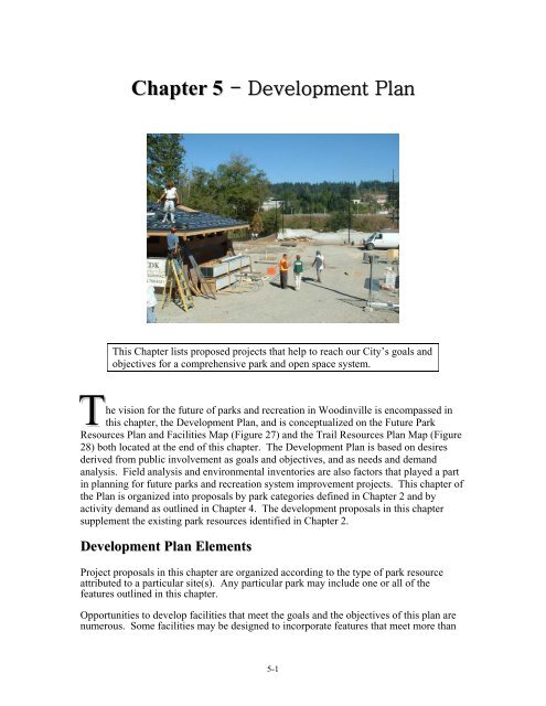
<strong>Chapter</strong> 5 - <strong>Development</strong> <strong>Plan</strong><br />
This <strong>Chapter</strong> lists proposed projects that help to reach our <strong>City</strong>’s goals and<br />
objectives for a comprehensive park and open space system.<br />
T<br />
he vision for the future <strong>of</strong> parks and recreation in <strong>Woodinville</strong> is encompassed in<br />
this chapter, the <strong>Development</strong> <strong>Plan</strong>, and is conceptualized on the Future Park<br />
Resources <strong>Plan</strong> and Facilities Map (Figure 27) and the Trail Resources <strong>Plan</strong> Map (Figure<br />
28) both located at the end <strong>of</strong> this chapter. The <strong>Development</strong> <strong>Plan</strong> is based on desires<br />
derived from public involvement as goals and objectives, and as needs and demand<br />
analysis. Field analysis and environmental inventories are also factors that played a part<br />
in planning for future parks and recreation system improvement projects. This chapter <strong>of</strong><br />
the <strong>Plan</strong> is organized into proposals by park categories defined in <strong>Chapter</strong> 2 and by<br />
activity demand as outlined in <strong>Chapter</strong> 4. The development proposals in this chapter<br />
supplement the existing park resources identified in <strong>Chapter</strong> 2.<br />
<strong>Development</strong> <strong>Plan</strong> Elements<br />
Project proposals in this chapter are organized according to the type <strong>of</strong> park resource<br />
attributed to a particular site(s). Any particular park may include one or all <strong>of</strong> the<br />
features outlined in this chapter.<br />
Opportunities to develop facilities that meet the goals and the objectives <strong>of</strong> this plan are<br />
numerous. Some facilities may be designed to incorporate features that meet more than<br />
5-1
one objective. Opportunities may arise that are not included in this list and some projects<br />
listed here may not be feasible in the current six-year capital improvement program or in<br />
the future, or may differ from the vision described here. This list <strong>of</strong> projects is intended<br />
to show how proposed projects may be developed in working toward the vision.<br />
Flexibility and resourcefulness will dictate that this chapter be updated to match the<br />
needs <strong>of</strong> an evolving community. While the city’s Capital Improvement <strong>Plan</strong> and yearly<br />
budget process will identify obligated funds, this document sets forth the vision for<br />
achieving the goals and objectives in this plan.<br />
The descriptions provided in this section describe the improvements that are proposed<br />
under each major type <strong>of</strong> development plan element - see each element for a composite<br />
description for any particular site.<br />
Existing park resources are not included in this chapter, unless they are proposed to be<br />
modified in any manner during the plan period or later.<br />
Neighborhood Parks<br />
Neighborhood parks should be developed on a local basis to provide playgrounds and<br />
grassy field facilities for pickup games, youth sports, and leagues <strong>of</strong> interest to<br />
neighborhood children and families. These local park improvements will be combined<br />
with picnic shelters and tables, trail systems, natural areas, local schools, and other<br />
facilities to create an accessible neighborhood service system.<br />
Neighborhood parks may be sited as independent properties or portions <strong>of</strong> other sites that<br />
include trail corridors, resource activities, multi-use indoor centers or other public<br />
facilities. Where feasible and appropriate, these facilities may also be sited on lands that<br />
are owned and operated for other public purposes.<br />
Generally, these facilities could be located at sites serviced by trails and local bicycling<br />
streets that are convenient to younger age neighborhood youth and families. They are not<br />
usually improved with restrooms or parking if they are ideally distributed in the<br />
community.<br />
Neighborhood parks should be developed to provide flexible play capabilities - ideally<br />
providing one or two, small to full-sized fields at one location. Some sites may be<br />
designed to provide high capacity, flexible configurations on large grass or dirt areas with<br />
portable goal and backstop stanchions to allow for varied age groups and activities. They<br />
also usually contain court games such as tennis and volleyball and other recreation<br />
activities.<br />
Vision<br />
As described, the neighborhood parks vision will: a) provide flexible, informal<br />
playgrounds, court games, and play areas, and b) be suited to younger age and<br />
local neighborhood game activities, and c) be located on sites convenient to<br />
neighborhood youth and families, and d) be at sites that co-locate with elementary<br />
schools and facilities.<br />
Proposed Neighborhood Park Projects<br />
• Little Bear Creek Park – North Industrial neighborhood. The<br />
project is located at the street end <strong>of</strong> 14 th Avenue NE, between SR<br />
522 and Little Bear Creek. It will conserve a portion <strong>of</strong> the 6.48<br />
5-2
acre site for areas for water quality protection, wildlife habitat, and<br />
open space buffer. Trails, viewpoints, fishing access, picnic<br />
facilities, parking areas, and other resource activity improvements<br />
will be developed at accessible locations within the acquired<br />
properties. Open field and play areas and court games may be<br />
developed here. See the Little Bear Creek Linear Park Master<br />
<strong>Plan</strong> (2003) for more information. Part <strong>of</strong> the site is also included<br />
in the Resource/ Open Space section.<br />
• Quail Ridge Mini Park – Upper West Ridge neighborhood.<br />
This 0.35 acre lot in the Quail Ridge subdivision sits adjacent to<br />
the PSP&L power line easement.<br />
The undeveloped site could be developed with a playground for the<br />
subdivision.<br />
• Tanglin Ridge Mini Park – <strong>Woodinville</strong> Heights<br />
neighborhood. This 0.15 acre lot located at 151st Avenue NE and<br />
NE 185th Street in the Tanglin Ridge subdivision.<br />
The lot is currently undeveloped and is a potential playground site.<br />
• Wellington/202nd Street Homeowner’s Association (HOA)<br />
– West Wellington neighborhood. This 3.4 acre HOA woodland<br />
property is located on the corner <strong>of</strong> NE 202nd Street and 153rd<br />
Place NE.<br />
The site is covered with mature deciduous trees and ground cover<br />
vegetation. A small portion <strong>of</strong> the site has been occasionally<br />
cleared by neighborhood residents for local play and picnic<br />
activities.<br />
The small clearing could be developed to allow picnic, playground,<br />
and other local neighborhood play activities. The balance <strong>of</strong> the<br />
site, however, should be retained as a natural area.<br />
• Woodin Glen Pond – Wedge neighborhood. This 1.3 acre<br />
wetland is located on a tributary stream <strong>of</strong> Little Bear Creek on NE<br />
192nd Place - see the description under the chapter on existing<br />
facilities.<br />
The undeveloped site includes a surface pond, surrounding<br />
wetlands, and wooded buffer area. A storm water access<br />
road/pathway has been developed along the eastside <strong>of</strong> the pond to<br />
allow for city maintenance vehicles.<br />
Viewpoints, picnic tables, a small lawn play area, playground, and<br />
wildlife viewing blinds could be developed adjacent to NE 192nd<br />
Place around the periphery <strong>of</strong> the natural area.<br />
• <strong>Woodinville</strong> Water District Tanks – East Wellington<br />
neighborhood. This 9.0 acre woodland property is located on the<br />
corner <strong>of</strong> 156th Avenue NE and NE 203rd Street.<br />
Water storage tanks are located in the northwest corner <strong>of</strong> the site<br />
adjacent to the street intersection. The balance <strong>of</strong> the site, however,<br />
5-3
is covered with mostly mature evergreen trees and ground cover<br />
vegetation.<br />
Access trails, picnic tables, and possibly a local neighborhood park<br />
containing court games and a playground could be developed on<br />
the site.<br />
• Undetermined Park Sites – According to the Demand<br />
Analysis in <strong>Chapter</strong> 4 <strong>of</strong> this <strong>Plan</strong>, every neighborhood, except the<br />
Tourist District and the Industrial neighborhoods require<br />
neighborhood park facilities because their housing density is low<br />
and good access would be unavailable to centrally located<br />
facilities. Ratio-standards level <strong>of</strong> service is also an issue to a<br />
lesser extent.<br />
Some neighborhoods, such as the West Ridge neighborhoods or<br />
the Wellington neighborhoods, may be able to develop centrally<br />
located and larger parks and not duplicate facilities. This will<br />
require real estate creativity and must occur very soon as sites are<br />
scarce throughout the <strong>City</strong>.<br />
These parks will require improvements such as field and court<br />
games, and playgrounds.<br />
Community Parks<br />
Community park facilities should be developed to provide athletic fields for older youth<br />
and young, adult-league tournaments, and other peak competition day, events, and<br />
schedules - thereby freeing fields located at elementary schools, middle schools,<br />
neighborhood parks, and other local sites for younger age league participant games,<br />
practices, and neighborhood resident pickup play.<br />
Parks <strong>of</strong> this scale may be located at sites served by and adjacent to arterial roads that are<br />
convenient to older age youths and adult league organizations. They are usually<br />
developed with restrooms, concession buildings and a parking lot to accommodate peak<br />
events or schedules. They are also improved with tennis, basketball, volleyball courts,<br />
picnic and other recreational facilities.<br />
Community parks typically provide sustained, high capacity play capabilities - providing<br />
at least three to five full-size competition fields at one location. In some cases<br />
competitive athletic facilities may be combined with middle or high schools. Most sites<br />
will be designed to provide high capacity, fixed field configurations including grass or<br />
dirt fields with permanent goals and backstops, perimeter fencing, spectator seating, and<br />
night-lighting systems.<br />
Vision<br />
The Community Parks vision will: a) provide the highest quality competitive play<br />
athletic facilities, b) be <strong>of</strong> the highest capacity playing improvement designs, c) be<br />
within convenient proximity to organized adult and older age recreational league<br />
playing populations, d) be at sites that do not disrupt adjacent land uses, and e) be<br />
at sites that co-locate with schools and/or utilize other major public facilities. The<br />
strategy will alleviate overcrowding on smaller, more local park and elementary<br />
school fields so these sites can be used for younger age league participant games,<br />
practice sessions, and neighborhood resident pickup games.<br />
5-4
Proposed Community Park Projects<br />
• Nelson Homestead - Reinwood/Leota neighborhood.<br />
This property is located at the east end <strong>of</strong> 151 st Way NE.<br />
The site has potential for conservation <strong>of</strong> open space. A portion <strong>of</strong><br />
the site may develop to provide access to Woodin Creek walking<br />
trail. The west and east boundaries could be conserved in tree<br />
stands to continue transition with the wooded ravines and corridors<br />
adjacent to the site. Part <strong>of</strong> the site may be improved to provide<br />
community park or neighborhood park facilities such as a sports<br />
field, court games, play areas, picnic places and other special event<br />
activities.<br />
• Wellington Hills Country Club - West Wellington<br />
neighborhood. This project may acquire and develop a portion <strong>of</strong><br />
the 80.6 acre site located on Wellington Hills Drive just north <strong>of</strong><br />
existing city limits in Snohomish County for a competitive athletic<br />
park as a joint venture with King and Snohomish Counties,<br />
Bothell, and possibly area athletic leagues.<br />
• Woodin Creek Park - Town Center neighborhood. This 4.1<br />
acre partly developed park property is located on the east bank <strong>of</strong><br />
the Sammamish River <strong>of</strong>f 131st Avenue NE (South Bypass) - see<br />
the description under the chapter on existing facilities. This project<br />
will augment current development with outdoor field and court<br />
games and gardens for neighborhood and community residents.<br />
• Undetermined Athletic Field Sites - The upland plateau area<br />
east <strong>of</strong> the <strong>Woodinville</strong> central business district and out to the<br />
eastern city limits will require a competitive athletic field site for<br />
soccer and baseball and other organized field games.<br />
Resource/Open Space Parks<br />
Resource lands that retain wildlife habitat for threatened and endangered species<br />
throughout the city and urban growth area should be protected. Generally, open space<br />
lands may conserve, restore, and provide access to wetlands, woodlands, foraging and<br />
nesting areas, migration corridors, and other unique ecological areas - especially along<br />
the Sammamish River, Little Bear Creek, Woodin Creek, Derby Creek that drains <strong>of</strong>f<br />
Hollywood Hill and drainage ways from Kingsgate, and the wooded hillsides and ravines<br />
abutting the Sammamish River Valley.<br />
Lands should also be acquired that conserve viable wildlife habitat or migration corridors<br />
between and within the city's developed areas including occasional wetlands, bogs,<br />
woods, ravines, and other features in the downtown, industrial districts, and residential<br />
neighborhoods.<br />
To the extent possible and practical, resource lands should link preserved open spaces in<br />
adjacent municipal jurisdictions (even though these lands may not be publicly accessible)<br />
to create wildlife migration corridors, greenways, and open space networks that visually<br />
define and separate urban areas from each other in accordance with the objectives <strong>of</strong> the<br />
Washington State Growth Management Act (GMA).<br />
5-5
To the extent practical, some resource lands could provide riparian enhancement,<br />
structural hydrologic improvements, nature and interpretive trails, exhibits, and<br />
interpretive facilities to increase public awareness and appreciation for significant and<br />
visually interesting wildlife features. Some supporting services may also be developed<br />
including limited wildlife viewing blinds, trailheads, parking lots, and restrooms.<br />
Resource activities may be located on independent properties or include portions <strong>of</strong> other<br />
sites provided for resource activities, trail corridors, or other public facilities. Open space<br />
land may also be developed on other public-owned lands subject to public use<br />
agreements or easements; or on lands acquired for other public purposes including storm<br />
water management, groundwater recharge, and wastewater treatment. And, open space<br />
land may also involve backyard sanctuaries created and maintained by the efforts <strong>of</strong><br />
private landowners and volunteers.<br />
Vision<br />
As described herein, resource and open space parks will be realized through: a)<br />
acquisition <strong>of</strong> title and/or development rights <strong>of</strong> habitat lands that would<br />
otherwise be developed for other land uses, b) provisions for public access and<br />
interpretive use on private ownership land, and c) conservation for wildlife<br />
migration corridors through developing urban areas and neighborhoods.<br />
Proposed Resource/Open Space Park Projects<br />
• John Muir Ravine – Lower West Ridge neighborhood. This<br />
project should conserve or acquire the drainage stream and ravine<br />
within the city limits that drains east from John Muir Elementary<br />
School to the Sammamish River valley.<br />
The project will conserve this area for water quality protection,<br />
wildlife habitat, and open space buffer. A portion <strong>of</strong> the ravine<br />
may be developed for a local access, walking trail. The trail may<br />
be developed in association with Chateau Ste. Michelle Winery to<br />
link with the winery trail system, drainage areas, and retention<br />
pond.<br />
• Little Bear Creek Linear Park – North Industrial, Wedge and<br />
Valley Industrial neighborhoods. Where possible and practical,<br />
this project should conserve or acquire additional riparian habitat,<br />
wetland areas, and woodlands located along the Little Bear Creek<br />
corridor on the east and west sides <strong>of</strong> SR522, including the<br />
remaining undeveloped and underdeveloped parcels located north<br />
and south <strong>of</strong> NE 195 th Street, and parcels adjacent to the proposed<br />
SL&E Railroad Rail/Trail.<br />
The project will conserve these areas for water quality protection,<br />
wildlife habitat, and open space buffer. Trails, viewpoints, picnic<br />
facilities, and active and passive recreation activities may be<br />
developed. The park site, adjacent to 134 th Avenue NE, is a major<br />
candidate for these types <strong>of</strong> improvements. Other minimal<br />
improvements may be developed at accessible sites along the<br />
corridor. Parking areas may be located at central access points<br />
along the route, and trails, bridges and landscaping may link the<br />
downtown area with the Little Bear Creek Linear Park and<br />
5-6
adjacent residential areas. The site is also included under<br />
neighborhood parks as it may be suitable for neighborhood park<br />
components. See the Little Bear Creek Linear Park Master <strong>Plan</strong><br />
(2003) for more detail.<br />
• Miller’s Ridge Native Growth Protection Easement<br />
(NGPE) – Upper W. Ridge neighborhood. This project should<br />
conserve the 7.3 acre wooded ravine located at 128th Avenue NE,<br />
and NE 156th Street, and acquire trail easements therein to connect<br />
the Norway Hill Trail with the <strong>Woodinville</strong> Valley Trail in the<br />
southern part <strong>of</strong> West Ridge.<br />
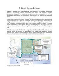
Woodin Creek Corridor – Town Center neighborhood. This<br />
project will conserve or acquire the Woodin Creek corridor<br />
through the downtown district adjacent to NE 171st Street<br />
including a segment located between the developments on the<br />
northwest corner <strong>of</strong> 140th Avenue NE and NE 175th Street.<br />
The project will conserve this area for water quality protection,<br />
wildlife habitat, and open space buffer. Occasional portions <strong>of</strong> the<br />
ravine or roadway may be developed for a Woodin Creek walking<br />
trail. A portion <strong>of</strong> the site between Kentucky Fried Chicken and the<br />
ravine may be developed for a Woodin Creek walking trailhead.<br />
Picnic facilities and other local access improvements may be<br />
developed at the edges <strong>of</strong> the conservation area in conjunction with<br />
adjacent property owners.<br />
• <strong>Woodinville</strong> Valley Trail – Tourist District and Valley<br />
Industrial neighborhood. This project should conserve or acquire<br />
the stream corridor that parallels the <strong>Woodinville</strong> Valley Trail<br />
along NE 145 th Street east from the Hollywood Schoolhouse to<br />
155 th Avenue NE and adjoining the Tolt River Pipeline right <strong>of</strong><br />
way.<br />
The project will conserve this area for water quality protection,<br />
wildlife habitat, and open space buffer. Occasional portions <strong>of</strong> the<br />
ravine or roadway may be enhanced by a local access, walking<br />
trail.<br />
Native Growth Protection Easements (NGPE) and Homeowners’<br />
Associations (HOA) – Proposed resource/open space projects<br />
Reinwood/Woodview Crest NGPE – <strong>Woodinville</strong> Heights and<br />
Reinwood/Leota neighborhoods. These 18.4 acre native growth<br />
protection easements are located within the wooded ravines that<br />
traverse the residential developments on the east hillsides between<br />
NE 184th and 181st Place, and NE 178th Street and NE 179th<br />
Drive.<br />
The dedications conserve woodland cover, wildlife migration<br />
routes, and steep hillsides between the lands that have been<br />
developed for detached single family dwelling units. The smaller<br />
northern segment adjoins the Nelson property on the east<br />
5-7
oundary. The larger southern segment extends from the south<br />
boundary <strong>of</strong> the Nelson property west down the hillside to the<br />
stormwater retention ponds located on NE <strong>Woodinville</strong>-Duvall<br />
Road. A tributary stream flows through this segment and into<br />
Woodin Creek.<br />
Walking trails, viewpoints, picnic tables, and other passive<br />
improvements could be developed along the open space corridors<br />
and the stormwater retention ponds.<br />
• Queensgate HOA – East Wellington. This 3.5 acre<br />
homeowner association (HOA) property is located between NE<br />
203rd Street and NE 198th Street.<br />
An extended portion <strong>of</strong> the site abuts the <strong>Woodinville</strong> Water<br />
District tank property on NE 203rd Street. The property conserves<br />
a wetland area that eventually drains south towards Lake Leota,<br />
and surrounding wooded riparian areas.<br />
An access trail could be developed through the site to link with<br />
trails on the <strong>Woodinville</strong> Water District tank property.<br />
• Winchester Hills NGPE – Upper West Ridge neighborhood.<br />
This 7.5 acre property is located in the heavily wooded, steeply<br />
sloping ravine at the eastern end <strong>of</strong> NE 160th Place, overlooking<br />
the Sammamish valley.<br />
The northern and eastern portion <strong>of</strong> the site lies next to the West<br />
Slope Resource property owned by the <strong>City</strong>. The tract has<br />
potential for trail connections to the valley floor.<br />
Conservancy Actions – part <strong>of</strong> proposed resource/open space<br />
projects<br />
• Critical area ordinances – Special environmental, shoreline,<br />
and steep slope protections have been incorporated into the city's<br />
zoning ordinance and environmental policy codes. The codes<br />
identify the probable location <strong>of</strong> properties determined to be<br />
environmentally sensitive lands or critical areas not capable or<br />
suitable <strong>of</strong> being developed for urban uses in accordance with the<br />
provisions <strong>of</strong> the Washington State Growth Management Act<br />
(GMA).<br />
Many properties will remain in private ownership. The critical<br />
environmental features will be appropriately conserved through<br />
performance designations in the shoreline, steep slope, and<br />
environmental area provisions. In addition, the Endangered<br />
Species Act has influenced setback and surface water run<strong>of</strong>f<br />
regulations to protect water quality. The codes identify uses that<br />
do not endanger the land or adjacent properties or other land uses<br />
within the city.<br />
5-8
Zoning and site development standards should be used to further<br />
identify land use or density, cluster site development concepts or<br />
other performance trade<strong>of</strong>fs whereby adjacent property could be<br />
developed in exchange for the conservation and possible<br />
dedication <strong>of</strong> these lands within the natural state for open space<br />
and wildlife habitat conservancies.<br />
These actions will conserve the critical environmental wetlands,<br />
wooded riparian corridors, and steep hillsides that extend along the<br />
edge <strong>of</strong> the Sammamish River, Little Bear Creek, Hollywood Hills,<br />
and Kingsgate areas.<br />
Special Use Parks and Facilities<br />
Facilities may be acquired, utilized or developed to provide special activities for the<br />
general population on a limited or special event occasion and/or for special interest<br />
populations at appropriate sites throughout the city. Special use facilities may include a<br />
community center, historical, cultural or nature interpretive centers, marinas and boating<br />
activities, and similar special interest services.<br />
Special use facilities may be independent properties or portions <strong>of</strong> other sites that include<br />
trail corridors, resource activities, athletic facilities, indoor recreation centers or other<br />
public facilities.<br />
Special use facilities may be sited on other public-owned lands or under lease agreements<br />
with private land owners or organizations or on purchased properties.<br />
Vision<br />
As described, the special use facilities vision will: a) provide specialized facilities<br />
for the general population for a special event or activity, b) accommodate<br />
specialized user group interests that are able and willing to pay user fees and<br />
charges or donate labor, operation, and other services, c) be in a manner that is<br />
cost effective, and d) be equitable in regards to those activities that accommodate<br />
the general population.<br />
Proposed Special Use Facilities<br />
• <strong>Woodinville</strong> Community Center (WCC) – Town Center<br />
neighborhood. The <strong>City</strong> has a Civic Center Master <strong>Plan</strong> (2004) for<br />
the 3.74 acre Community Center site adjacent to <strong>City</strong> Hall at NE<br />
175 th Street and 133 rd Avenue NE, and is in the process <strong>of</strong><br />
designing interim improvements to the Community Center. Future<br />
improvements will replace the existing Community Center located<br />
in the old Sorenson School building at the same location.<br />
The Community Center will be developed to provide indoor<br />
activities on a year-round basis throughout, and centrally<br />
accessible to city residents for day and evening use. The facilities<br />
will be developed within a market oriented service concept that<br />
protects the specialized investments that have already been made<br />
in these facilities by the city, school district, county, and private<br />
organizations.<br />
5-9
Indoor community or recreation facilities will provide space for<br />
gymnasiums and court games, physical conditioning, arts and<br />
crafts, class and instruction rooms, meeting facilities, kitchens and<br />
dining, daycare and latch key, teen and senior areas, and special<br />
population resource activities.<br />
When practical, the Center will be utilized for after school<br />
programs that provide indoor court recreation space, class and<br />
instruction space, meeting facilities, kitchen and dining as rental<br />
space.<br />
A courtyard and/or outdoor assembly area, picnic tables, parking<br />
facilities, and a variety <strong>of</strong> other supporting features may be<br />
installed in terraces extending from the building's lower and rear<br />
floor levels.<br />
• Aquatic Facilities<br />
Due to the expense <strong>of</strong> construction, operation, and maintenance <strong>of</strong><br />
aquatic facilities, municipalities are more and more likely to seek<br />
regional solutions or pursue private/public partnerships to meet the<br />
aquatic needs <strong>of</strong> citizens.<br />
<strong>Woodinville</strong> inherited a pool when it took possession <strong>of</strong> the<br />
Sorenson School property from the Northshore School District.<br />
This surplus property contained the Sorenson Pool, which was<br />
closed in January <strong>of</strong> 2003 due to system failures and the high cost<br />
<strong>of</strong> estimated repairs.<br />
To <strong>of</strong>fset the loss <strong>of</strong> the pool, <strong>Woodinville</strong> joined a consortium <strong>of</strong><br />
Northshore cities in contributing to the subsidy necessary to keep<br />
the Northshore Pool in Bothell in operation when King County<br />
abandoned it along with other aging Forward Thrust Pools. As a<br />
member <strong>of</strong> the Northshore Parks and Recreation Service Area<br />
(PRSA), a junior taxing entity with a geographic area roughly<br />
equivalent to the Northshore School District, the <strong>City</strong> also helped<br />
to pay for an aquatic needs assessment to determine the future<br />
facilities needed in the area.<br />
The remaining publicly owned pools in the area, Northshore Pool<br />
in Bothell and Saint Edwards Pool in Kenmore are now operated<br />
by Northwest Center, a nonpr<strong>of</strong>it agency, with a subsidy funded by<br />
a consortium <strong>of</strong> cities and other agencies.<br />
The study recommended that the cities <strong>of</strong> Kenmore, Bothell, and<br />
<strong>Woodinville</strong> collaborate on the construction <strong>of</strong> a single new<br />
facility. The project concept includes an indoor 25-meter x 25yard<br />
competitive pool with a diving board, a 6,000-square-foot<br />
indoor leisure pool, a warm-water therapy pool with necessary<br />
support facilities and future expansion potential. The ideal site for<br />
this facility would be centrally located within the PRSA, near an<br />
arterial for convenient access and high visibility. Ultimately,<br />
5-10
support for a facility may be dependent on its location and will<br />
most likely require voter approved bonds.<br />
<strong>Woodinville</strong> continues to participate in finding a regional solution<br />
to the potential closure <strong>of</strong> pools and may look outside the PRSA<br />
for partnerships or solutions that bring high quality aquatic<br />
facilities and programs to residents as part <strong>of</strong> a comprehensive<br />
system <strong>of</strong> recreation opportunities.<br />
Tourist <strong>Development</strong>s<br />
<strong>Woodinville</strong> should encourage leisure time activities provided at any <strong>of</strong><br />
the following properties:<br />
• Chateau Ste. Michelle Winery – Tourist District. This<br />
privately owned, existing commercial winery and tasting facility is<br />
located on NE 145th Street within city limits. The building<br />
complex contains the winery's local production and storage<br />
facilities along with tasting rooms, retail store, and touring<br />
facilities. The complex also includes a separate catered party<br />
building, the restored and historic chateau, and an outdoor stage<br />
and summer concert performance area.<br />
The site represents a significant resource that can be enjoyed<br />
throughout the year by the general public.<br />
• Columbia Winery – Tourist District. This commercial winery<br />
and tasting facility is located on NE 145th Street within city limits<br />
across the street from the Chateau Ste. Michelle Winery. The<br />
building complex contains the winery's local production and<br />
storage facilities along with tasting rooms, retail store, and touring<br />
facilities. The grounds have been improved with gardens, rental<br />
space for special events and an outdoor picnic area.<br />
The site is a popular destination for the Spirit <strong>of</strong> Washington<br />
Dinner Train that operates on Burlington Northern Railroad track<br />
from the old depot located in downtown Renton.<br />
• <strong>Woodinville</strong> Community Gardens – This site is adjacent to<br />
the Town Center District. The site is located on the south side <strong>of</strong><br />
NE 171 st Street at about 136 th Avenue NE extended. This site will<br />
become the permanent home for the <strong>Woodinville</strong> Farmers’ Market,<br />
and feature demonstration farms, interpretive and historic exhibits,<br />
and sustainable farm education.<br />
• Hollywood Schoolhouse – Tourist District. This property is<br />
located on 148th Avenue NE and NE 145th Street within existing<br />
city limits and the designated tourist district - see the description<br />
under the chapter on existing facilities. The original wooden oneroom<br />
Derby Schoolhouse was built on the site in 1892. The Derby<br />
Schoolhouse was subsequently replaced with this classic, 2 story,<br />
brick building in 1912. The School District Number 83 building<br />
was subsequently sold to private owners who refurbished the<br />
5-11
structure for ground floor retail stores and a top floor wedding and<br />
meeting facility.<br />
• JB Instant Lawn - Adjacent to the Tourist District. This<br />
commercial sod growing enterprise and retail nursery at NE 145 th<br />
Street between the Chateau St. Michelle and the Sammamish River<br />
is the location <strong>of</strong> the <strong>City</strong>’s 4 th <strong>of</strong> July celebration every year.<br />
• Redhook Brewery – Tourist District. This commercial<br />
microbrewery is located on NE 145th Street within city limits<br />
directly adjacent to the Columbia Winery. The building complex<br />
contains the brewery's local production and storage facilities along<br />
with dining/pub facility, retail store, touring facilities, rental space<br />
for meetings and special events, and an outdoor beer garden. The<br />
grounds have been improved with wetland and wildlife interpretive<br />
sites and exhibits, ornamental gardens, outdoor picnic patio and<br />
beer garden. The brewery also has developed an outdoor<br />
amphitheater adjacent to the city's Sammamish River Trail. A 1.3<br />
acre area in the northeast portion <strong>of</strong> the site has been developed by<br />
a private party for a ropes challenge course, a team–building<br />
survivor-type apparatus that teaches team skills to groups.<br />
• Silver Lake Winery – Tourist District. This commercial<br />
winery was developed on the historic Carlberg-Anderson farm<br />
property located on <strong>Woodinville</strong>-Redmond Road within existing<br />
city limits. The building complex contains the winery's local<br />
production and storage facilities along with tasting rooms, retail<br />
store, touring facilities, and an historic museum. The grounds are<br />
proposed to be improved with gardens and an outdoor picnic area.<br />
• Willows Lodge – Tourist District. The lodge is located on NE<br />
145 th Street adjacent to the Sammamish River on five acres <strong>of</strong><br />
landscaped grounds. There are 88 guest rooms and a spa at the<br />
facility and two restaurants and meeting facilities. A public trail<br />
connects the grounds with a public canoe/kayak launch on the<br />
Sammamish River and with the <strong>Woodinville</strong> Valley Trail at NE<br />
145 th Street.<br />
Linear Trails<br />
Linear Trails generally refer to <strong>of</strong>f-road, natural corridor paths used for a variety <strong>of</strong><br />
transportation modes. This section <strong>of</strong> the <strong>Development</strong> <strong>Plan</strong> is organized by modal type.<br />
There are six modal types <strong>of</strong> trails identified in this <strong>Plan</strong>: Water trails, Horse trails,<br />
Walking and Hiking trails, Off-Road Mountain bike trails, On-road bicycle touring<br />
routes, and Multipurpose trails. Table 6 at the end <strong>of</strong> this section is a Summary Matrix <strong>of</strong><br />
the trail proposals in this chapter <strong>of</strong> the <strong>PRO</strong> <strong>Plan</strong>, and Figure 29 contains illustrations <strong>of</strong><br />
trail standards, dimensions and other details associated with the proposed trails.<br />
5-12
Water Trails<br />
A water access system should be developed for dory, sport yak, canoes, kayaks, and other<br />
car top boating activities. The water trails will provide access to the Sammamish River<br />
that is not readily accessible or suitable for power boats or other larger water craft.<br />
Where possible, water trailheads should be located to coincide with and use other trail<br />
corridors, resource conservancies, and other park and recreational facility services<br />
including parking lots, restrooms, and utilities. When provided on separate sites, water<br />
trailheads may be improved with launch ramps or landings, picnic tables, parking lots,<br />
restrooms, and other services.<br />
The water trail proposed in this plan along the Sammamish River has been identified by<br />
paddle boating enthusiasts working in conjunction with state, federal, and other boating<br />
interest groups including the Washington Water Trails Association and Puget Sound<br />
Marine Trail Organization. Water trail development projects may use the same<br />
cooperative, joint venture approach to formally designate and improve routes and<br />
trailheads and/or to develop new launching sites, landings, rest stops, camping areas, and<br />
other water trail services throughout the region.<br />
Vision<br />
As described, the water trail vision will increase and promote: a) public access to<br />
the area's significant fresh water resources - particularly for car-top boating<br />
enthusiasts, and b) scenic natural areas and features <strong>of</strong> interest that can not be<br />
accessed from other trail systems for boating enthusiasts <strong>of</strong> all skill levels and for<br />
extended boating durations and trips.<br />
Proposed Water Trails<br />
• Sammamish River Water Trail – Valley Industrial,<br />
Tourist District, and Town Center neighborhoods. This is a fresh<br />
water trail developed by the Washington Water Trails Association<br />
with the assistance <strong>of</strong> the Washington State Parks & Recreation<br />
Commission, King County, and the <strong>City</strong> <strong>of</strong> <strong>Woodinville</strong>.<br />
The Sammamish River Water Trail extends from the south end <strong>of</strong><br />
Lake Sammamish in Issaquah on the Sammamish River through<br />
Redmond, <strong>Woodinville</strong>, Bothell and Kenmore to Lake<br />
Washington, then through the Montlake Cut in Seattle to Lake<br />
Union, and potentially through the Hiram M. Chittenden Locks to<br />
Puget Sound. The upper reaches <strong>of</strong> the trail follow portions <strong>of</strong> the<br />
historic steamer boat routes that serviced early pioneer<br />
developments.<br />
The complete trail can be navigated by a variety <strong>of</strong> non-motorized<br />
craft including kayak, canoe, paddle boat for day trips - potentially,<br />
the full length <strong>of</strong> the trail. The trail provides a paddling experience<br />
through shorelines, woodlands, and farmlands in the river valley<br />
linking the Issaquah, Redmond, <strong>Woodinville</strong>, Bothell, and Lake<br />
Washington urban areas.<br />
5-13
Hand-carry craft launch sites are designated and/or can be made<br />
from Lake Sammamish State Park in Issaquah, Marymoor,<br />
Lagoon, and 60 Acres Parks in Redmond, Bothell Landing and<br />
Blyth Park in Bothell, Log Boom Park in Kenmore, the Canoe<br />
House at the University <strong>of</strong> Washington, and Gas Works and<br />
Commodore Parks in Seattle, among others.<br />
In <strong>Woodinville</strong>, a hand-carry launch site with picnic tables,<br />
parking, and restroom services has been developed at Wilmot<br />
Gateway Park, and the Willows Lodge currently has a hand-carry<br />
launch on the Sammamish River. An informal, unimproved access<br />
site also, is presently provided at the Northshore Athletic Fields on<br />
NE 145th Street.<br />
Additional hand-carry launch sites should be developed at other<br />
sites along the river, especially those sites that can link the Tourist<br />
District to the Central Business District.<br />
Horse Trails<br />
A system <strong>of</strong> regional horse trails should be developed to link major environmental assets,<br />
parks, and recreational facilities throughout the area.<br />
Within developed areas, horse trails may coincide with other multipurpose trail corridors<br />
or within separate routes using powerline, pipeline, and other alignments. In some<br />
instances, horse trails may be developed as improvements within the right-<strong>of</strong>-way <strong>of</strong><br />
established vehicular corridors.<br />
Some <strong>of</strong> the horse trails designated within this plan have already been developed on an<br />
informal basis by horse riding organizations working in conjunction with public and<br />
private landowners.<br />
Vision<br />
As described, the horse trails vision is: a) to provide or formally designate<br />
equestrian access to scenic areas and other features <strong>of</strong> interest, b) for riders <strong>of</strong> all<br />
capability levels, c) for extended duration, and d) to the extent possible, within<br />
close proximity to horse riding populations.<br />
Proposed Horse Trails<br />
• Powerline Trail – Upper and Lower West Ridge<br />
neighborhoods. This proposal will bridge the Sammamish River to<br />
connect the western segment <strong>of</strong> the Tolt River Pipeline Trail with<br />
the northern ends <strong>of</strong> the Sammamish River Horse Trail using<br />
powerline right-<strong>of</strong>-way. The bridge will connect the Tolt River<br />
Pipeline Trail with the attractions along the Sammamish River<br />
Trail in the tourist district and the farmlands, riverfront, and other<br />
natural features in the valley with the ravines, woodlands, and<br />
other natural features and scenic vistas available along the bluff.<br />
5-14
• Sammamish River Horse Trail – Town Center (presently),<br />
Valley Industrial neighborhood (proposed). This regional horse<br />
trail presently provides horseback riding opportunities from the<br />
north end <strong>of</strong> Lake Sammamish to the upper reaches <strong>of</strong> Lake<br />
Washington using portions <strong>of</strong> river-control dike located within the<br />
Sammamish River Park and Trail on the east side <strong>of</strong> the river. The<br />
trail provides a riding experience through shoreline, woodlands,<br />
and farmlands in the river valley linking the Redmond and<br />
<strong>Woodinville</strong> urban areas. The trail currently travels through 0.6<br />
miles <strong>of</strong> land within the <strong>Woodinville</strong> city limits.<br />
Due to increased bike and hike user volumes along the trail,<br />
however, it is no longer practical to share the route with equestrian<br />
riders. Consequently, King County is presently developing a<br />
separate horse trail along the west bank <strong>of</strong> the Sammamish River<br />
from Marymoor Park in Redmond to the end <strong>of</strong> the Burlington<br />
Northern Railroad spur line into Bothell on <strong>Woodinville</strong> Drive.<br />
<strong>Woodinville</strong> supports King County in acquiring land to complete<br />
the in-city segment <strong>of</strong> this west-bank trail. While the trail will be<br />
dedicated primarily to equestrian users, it may also be accessed by<br />
hikers, joggers, and others who desire a s<strong>of</strong>t trail surface.<br />
An existing horse trailhead with signage, trailer parking, and<br />
restroom services is located in Marymoor Park in Redmond at the<br />
southern most terminus <strong>of</strong> the trail. Another horse trailhead is<br />
being developed at the northern most terminus <strong>of</strong> the trail on<br />
<strong>Woodinville</strong> Drive just west <strong>of</strong> existing city limits.<br />
• Tolt River Pipeline Trail – Upper and Lower West Ridge<br />
and Valley Industrial neighborhoods, and Tourist District. This<br />
regional horse trail has been developed on the Seattle Water<br />
Department's Tolt River Pipeline corridor segments located on the<br />
west and east plateaus overlooking the Sammamish River Valley.<br />
Equestrian riders, hikers, mountain bikers, and joggers use the dirt<br />
pipeline maintenance road as a trail surface.<br />
The trail segments provide a riding experience through woodlands,<br />
farmlands, and suburban neighborhoods on the plateaus potentially<br />
linking these areas with parks, trails, and other destinations within<br />
the river valley in <strong>Woodinville</strong>.<br />
The western segment <strong>of</strong> the trail within <strong>City</strong>-limits extends from<br />
<strong>Woodinville</strong>-Redmond Road, west up the hillside to 132nd Avenue<br />
NE, then west into East Norway Hill Park. This segment <strong>of</strong> the<br />
trail extends through developing suburban areas and is, therefore,<br />
lightly used by equestrian riders.<br />
If the <strong>City</strong> <strong>of</strong> <strong>Woodinville</strong> wants to facilitate improvements across<br />
the <strong>Woodinville</strong> portion <strong>of</strong> the pipeline right <strong>of</strong> way, easements<br />
will need to be acquired from the Seattle Water Department.<br />
The trail may be accessed from a trailhead at East Norway Hill<br />
Park or from the few remaining horse ranches located in the area.<br />
5-15
• <strong>Woodinville</strong>-Snohomish (SL&E) Rail Trail – Valley<br />
Industrial, Town Center, and North Industrial neighborhoods. This<br />
proposal will develop a 1.5 mile equestrian trail within existing<br />
road and railroad right-<strong>of</strong>-way between downtown <strong>Woodinville</strong><br />
and the Snohomish County line. The trail will create an extended<br />
cross-country connection between the Sammamish River Horse<br />
Trail into Redmond and the Centennial Multipurpose Trail from<br />
downtown Snohomish north to Skagit County.<br />
The trail will conserve and connect the historic Seattle, Lakeshore<br />
& Eastern Railroad (SL&E) line that served the three county<br />
region providing unique views <strong>of</strong> woodlands, wetlands, farmlands,<br />
and historic sites. The trail will begin at the King County horse<br />
trailhead on <strong>Woodinville</strong> Drive and continue through <strong>Woodinville</strong><br />
into Snohomish County on railroad right <strong>of</strong> way.<br />
Trailheads with signage, parking, and restroom services will be<br />
designated at the King County horse trailhead.<br />
Walking and Hiking Trails<br />
Walking and hiking trails should be developed to link major environmental assets, park<br />
and recreational facilities, community centers, and historical features throughout the city.<br />
Generally, walking and hiking trails will be developed as dirt, gravel, or bark surfaced<br />
routes on interior alignments through environmental features. Portions <strong>of</strong> the system<br />
within the more densely developed areas, however, may be developed as sidewalks or<br />
boardwalks with urban streetscape furnishings and amenities.<br />
Walking and hiking trails should be developed in alignments that are separate from<br />
vehicular or other motorized forms <strong>of</strong> transportation, when possible. For example,<br />
walking and hiking trails may be located within natural drainage corridors, wooded<br />
ravines, and utility easements. In some instances and for short durations, walking and<br />
hiking trail systems may be developed as improvements within the right-<strong>of</strong>-way <strong>of</strong><br />
established vehicular or other transportation corridors.<br />
Generally, walking and hiking trails may be developed to class 2-5 walking trail<br />
standards providing 2-way travel on a crushed rock, bark or compacted dirt base varying<br />
between 2 and 5 feet in width. The trails will be <strong>of</strong> a slope not more than 1:12 unless<br />
provided with stairs or other erosion controls. Class 2-3 trail segments will be handicap<br />
accessible and usable by all age and skill groups.<br />
Within the most urban alignments, walking and hiking trails may be developed to class 1<br />
walking trail standards providing 2-way travel on an asphalt or concrete surface between<br />
4 and 6 feet in width. Such sidewalk or boardwalk trails will be <strong>of</strong> a slope not more than<br />
1:50. Class 1 trail segments will be handicap accessible and usable by all age and skill<br />
groups.<br />
Walking and hiking trail corridors should be located to coincide with other park and<br />
recreational improvements or public facilities to access rest stops, parking lots, restrooms,<br />
and other services.<br />
5-16
Walking and hiking trail corridors may be independent properties or include portions <strong>of</strong><br />
other sites provided for Community Parks and Neighborhood Parks, and other park and<br />
recreational or public facility properties. Linked with conservation areas and parks, the<br />
walking and hiking trails will create a system <strong>of</strong> interconnected greenways to integrate<br />
and define the urban and natural portions <strong>of</strong> the city in accordance with the Growth<br />
Management Act's (GMA) provisions for urban separators.<br />
Vision<br />
As described, the walking and hiking trails vision will be realized by providing<br />
recreational trail opportunities within the city that: a) access natural features that<br />
may not be available otherwise, b) link open spaces, downtown, Little Bear<br />
Creek, King County’s Sammamish River Trail and conservation areas into a<br />
greenway system, c) serve persons with varied physical abilities and skills, d)<br />
establish high visibility and volume pedestrian routes through the most developed<br />
urban areas, including the Downtown central business district (CBD), e) expand<br />
the park system to connect with public properties, and f) expand roadway<br />
corridors to provide recreational and commuter trail opportunities in concert with<br />
the <strong>City</strong>’s Non-Motorized Transportation <strong>Plan</strong> (2005).<br />
Proposed Walking and Hiking Trails<br />
• Little Bear Creek Trail – Valley Industrial, Town Center,<br />
North Industrial, and Wedge neighborhoods. This class 2-3 trail<br />
will extend from the Sammamish River Park to the northern limits<br />
<strong>of</strong> Little Bear Creek. The trail will create a hiking opportunity<br />
connecting the woodlands, wetlands, and other natural areas<br />
bordering the downtown and industrial areas with residential<br />
neighborhoods. See the Little Bear Creek Linear Park Master <strong>Plan</strong><br />
(2003) for details.<br />
The trail will begin at the Sammamish River Park frontage<br />
overlooking Little Bear Creek's outfall into the Sammamish River,<br />
and then continue northwest along the bank <strong>of</strong> the creek to SR202.<br />
A direct connection is needed at SR202/131 st Avenue NE to<br />
provide uninterrupted creek-side trail passage along Little Bear<br />
Creek between reaches one and two. This could be accomplished<br />
via an underpass or constructed at-grade as part <strong>of</strong> proposed<br />
roadway improvements to the intersection <strong>of</strong> SR202 and SR522.<br />
From 131 st Avenue NE, the trail will continue east along the north<br />
bank <strong>of</strong> the creek across 134 th Avenue NE, where at 134 th the trail<br />
becomes split to either side <strong>of</strong> the creek. The western segment will<br />
cross SR522 via a pedestrian bridge over the freeway, while the<br />
eastern edge will wind north paralleling Little Bear Creek Parkway<br />
along the creek until it joins the street system at NE 195 th Street<br />
and passes under SR522.<br />
From NE 195th Street, the trail will continue west under SR522 to<br />
the west side <strong>of</strong> Little Bear Creek, then north along the creek,<br />
connecting with the existing trail segment in Rotary Community<br />
Park and through the Georgian Heights wetland buffer to NE 205 th<br />
Street.<br />
5-17
From NE 205 th Street, the trail will extend north into Snohomish<br />
County and integrate with the proposed Brightwater Treatment<br />
Facility landscape areas.<br />
Trailheads with signage, parking, and restroom services will be<br />
designated at Little Bear Creek Park, Rotary Community Park, and<br />
the Brightwater plant.<br />
• North Creek/Woodway Trail – Wedge and Valley<br />
Industrial neighborhoods. This class 1-3 trail will create a walking<br />
and hiking route around the scenic bluff overlooks <strong>of</strong> the North<br />
and Little Bear creeks in the northwest portion <strong>of</strong> the city. The trail<br />
will link wetlands, woodlands, schools, parks, employment centers,<br />
and the downtown with local neighborhood areas.<br />
From 132 nd Avenue NE, the trail will continue east on NE 195 th<br />
Street past <strong>Woodinville</strong> High School to 136 th Avenue NE and an<br />
intersection <strong>of</strong> the Little Bear Creek Linear Trail.<br />
From <strong>Woodinville</strong> High School, the trail will continue south along<br />
Little Bear Creek and/or 136 th Avenue NE to NE 186 th Street and<br />
an overlook <strong>of</strong> the downtown and Sammamish River Valley.<br />
From the overlook, the trail may cross SR522 to downtown<br />
<strong>Woodinville</strong> on a proposed future overpass (see the Little Bear<br />
Creek Linear Park Master <strong>Plan</strong>). It also will continue south along<br />
the edge <strong>of</strong> SR522 right <strong>of</strong> way if possible, or on NE 186 th Street to<br />
132 nd Avenue NE and then south to the point <strong>of</strong> beginning at the<br />
intersection with SR522.<br />
Trail spurs may extend north under powerline right <strong>of</strong> way from<br />
NE 180 th Street to Hollyhills Drive, and west from 136 th Avenue<br />
NE to Woodin Glen Pond.<br />
Trailheads with signage, parking, and restroom services may be<br />
designated at <strong>Woodinville</strong> High School, and Woodin Glen Pond<br />
among other places.<br />
• Norway Hill Trail – Upper and Lower West Ridge<br />
neighborhood. This class 3-4 hiking trail will connect the<br />
Sammamish River Horse Trail with the Tolt River Pipeline Trail.<br />
The trail will create a hiking loop through the Norway Hill<br />
residential plateau linking schools, parks, and natural features with<br />
Sammamish River Valley attractions.<br />
The trail will begin at the Sammamish River Horse Trail trailhead<br />
on <strong>Woodinville</strong> Drive, then continue south up the hillside within<br />
the wooded ravine and drainage corridor and/or parallel to the<br />
alignment <strong>of</strong> 124 th Avenue NE to NE 169 th Street.<br />
From NE 169 th Street, the trail will continue south along the west<br />
side <strong>of</strong> 124 th Avenue NE. past Woodmoor Elementary School, East<br />
Norway Hill Park, to the western segment <strong>of</strong> the Tolt River<br />
Pipeline Trail.<br />
5-18
Trailheads with signage, parking, and restroom services will be<br />
designated at the Sammamish River Horse Trail, Woodmoor<br />
Elementary, and East Norway Hill Park.<br />
• Powerline Trail – Upper and Lower W. Ridge neighborhoods.<br />
This class 3-4 hiking trail will connect the western segment <strong>of</strong> the<br />
Tolt River Pipeline Trail with the northern ends <strong>of</strong> the Sammamish<br />
River Horse Trail using powerline right-<strong>of</strong>-way. The trail will<br />
create a hiking loop along the western valley bluff linking<br />
attractions in the tourist district and the farmlands, riverfront, and<br />
other natural features in the valley with the ravines, woodlands,<br />
and other natural features and scenic vistas available along the<br />
bluff.<br />
The trail will begin at the Tolt River Pipeline Trail intersection at<br />
<strong>Woodinville</strong>-Redmond Road, then continue west on the pipeline<br />
corridor to the powerline.<br />
From the powerline intersection, the trail will continue north along<br />
the powerline corridor crossing <strong>Woodinville</strong> Drive to link with the<br />
Sammamish River Horse Trail with a spur trail through the ravine<br />
to the Sammamish River Horse Trail midway along the alignment.<br />
Trailheads with signage, parking, and restroom services will be<br />
shared with the Sammamish River Horse Trail on <strong>Woodinville</strong><br />
Drive and the <strong>Woodinville</strong>-Redmond Trail at Northshore Athletic<br />
Fields.<br />
• Sammamish River Regional Park & Trail – Town<br />
Center. This multi-purpose trail provides walking and biking<br />
opportunities on the asphalt surfaced segment along the east dike<br />
<strong>of</strong> the river, and hiking and horseback riding opportunities on a dirt<br />
surfaced segment being developed on the west dike <strong>of</strong> the river.<br />
The <strong>Woodinville</strong> trail segment is part <strong>of</strong> the larger King County<br />
Sammamish River Regional Park & (Burke-Gilman) Trail system.<br />
<strong>Woodinville</strong> has no plans for the trail as it is owned by King<br />
County. No change in ownership status is expected in the future as<br />
this is a regional resource and managed best by King County. The<br />
trail extends from Redmond through <strong>Woodinville</strong>, Bothell, and<br />
Kenmore to the University <strong>of</strong> Washington and to the Hiram M.<br />
Chittenden locks in Seattle.<br />
The trail is included here as a reference to connectivity issues for<br />
trail planning purposes within the <strong>City</strong>.<br />
Trailheads are provided at Northshore Athletic Fields, Woodin<br />
Creek Park, and at Wilmot Gateway Park in <strong>Woodinville</strong>.<br />
5-19
• Tolt River Pipeline Trail – Upper and Lower West Ridge and<br />
Valley Industrial neighborhoods, and the Tourist District. This<br />
class 3 walking and hiking trail has been developed on the Seattle<br />
Water Department's Tolt River Pipeline corridor segments located<br />
on the west and east plateaus overlooking the Sammamish River<br />
Valley. Hikers, joggers, mountain bikers, and horseback riders use<br />
the dirt pipeline maintenance road as a trail surface. This proposal<br />
will bridge the Sammamish River to link both segments into a<br />
continuous trail system using Tolt River Pipeline right-<strong>of</strong>-way.<br />
<strong>Woodinville</strong> should acquire legal easements over the valley and<br />
the west ridge segments <strong>of</strong> the trail. The eastern segment <strong>of</strong> the<br />
trail lies outside <strong>of</strong> the city boundary.<br />
The linked trail segments provide a hiking experience through<br />
woodlands, farmlands, and suburban neighborhoods on the<br />
plateaus potentially linking these areas with parks, trails, and other<br />
destinations within the river valley in <strong>Woodinville</strong>.<br />
The western segment <strong>of</strong> the trail extends from <strong>Woodinville</strong>-<br />
Redmond Road, west up the hillside to 132nd Avenue NE, then<br />
west into East Norway Hill Park. This segment <strong>of</strong> the trail extends<br />
through developing suburban areas. The trail may be accessed<br />
from a trailhead at East Norway Hill Park or from the adjacent<br />
residential neighborhoods.<br />
The eastern segment <strong>of</strong> the trail extends up into Hollywood Hills<br />
plateau and on out to the <strong>City</strong> <strong>of</strong> Duvall.<br />
• Winchester Hills Trail – Upper and Lower West Ridge and<br />
Valley Industrial neighborhoods. This class 3-4 hiking trail will<br />
extend down the hillside through the Rolling Meadows housing<br />
development to link the Norway Hill Trail with the Sammamish<br />
River Trail. The trail will create a spur route linking the valley<br />
floor with the wooded hillsides along Norway Hill. It will also<br />
include a link to trails internal to the West Slope Resource Park.<br />
The trail will begin at the Sammamish River Trail at Woodin<br />
Creek Park, then across the river on a pedestrian bridge and<br />
through a public access easement between commercial buildings.<br />
From there it will cross <strong>Woodinville</strong>-Redmond Road.<br />
From <strong>Woodinville</strong>-Redmond Road, the trail will continue up the<br />
hillside traversing the <strong>City</strong>’s West Slope Resource Park and<br />
through the series <strong>of</strong> Winchester Hills native growth protection<br />
easements (NGPE) or common property dedications to the Norway<br />
Hill Trail on 124th Avenue NE.<br />
Trailheads with signage, parking, and restroom services will be<br />
designated at Southgate Park, Rolling Meadows, and Woodmoor<br />
Elementary.<br />
5-20
• Woodin Creek/Wellington Loop Trail – Town Center,<br />
<strong>Woodinville</strong> Heights, Reinwood/Leota, and East and West<br />
Wellington neighborhoods. This class 2-3 walking trail will<br />
connect Woodin Creek Park on the Sammamish River with<br />
Wellington Hills Golf Course on the hillside overlooking Little<br />
Bear Creek. The trail will create a hiking loop linking the<br />
downtown and northeast neighborhoods. It will provide an<br />
extended hike through farmlands, ravines, woodlands, wetlands,<br />
parks, schools, and area neighborhoods.<br />
The trail will begin at Woodin Creek Park on the Sammamish<br />
River, and then continue east along the diverted banks <strong>of</strong> Woodin<br />
Creek on north right-<strong>of</strong>-way <strong>of</strong> NE 171 st Street to the natural area<br />
between the commercial areas at 140 th Avenue NE.<br />
The trail will continue east across 140 th Avenue NE at the<br />
signalized intersection with NE 171 st Street, then east along the<br />
creek or along NE 171 st Street to 143 rd Place NE, and north to the<br />
southern end <strong>of</strong> the Woodin-Nelson Creek NGPE (Native Growth<br />
Protection Easement).<br />
From 143 rd Place NE, the trail will continue east up the hillside in<br />
the Woodin-Nelson Creek NGPE through the historic Nelson<br />
homestead on the top <strong>of</strong> plateau to 151 st Avenue NE.<br />
From the Nelson property, the trail will continue north on 151 st<br />
Avenue NE to the right-<strong>of</strong>-way <strong>of</strong> NE 185 th Street, then east on the<br />
right-<strong>of</strong>-way through the signalized intersection <strong>of</strong> <strong>Woodinville</strong>-<br />
Duvall Road and 156 th Avenue NE past Leota Lake to 168 th<br />
Avenue NE.<br />
From 168 th Avenue NE, the trail will continue west across the<br />
north edge <strong>of</strong> the Leota/Wellington school property.<br />
From Wellington Elementary, the trail will continue north on 164 th<br />
Avenue NE, and continue west on NE 202 nd Street until it reaches<br />
the <strong>Woodinville</strong> Water District tank property.<br />
From the <strong>Woodinville</strong> Water District tank property, the trail will<br />
continue north on 156 th Avenue to 240 th Street SE in Snohomish<br />
County, then west to Wellington Hills Golf Course and a<br />
connection to the <strong>Woodinville</strong>-Snohomish Rail Trail.<br />
From the <strong>Woodinville</strong> Water District tank property, the West<br />
Wellington segment <strong>of</strong> the trail will continue south down 156 th<br />
Avenue NE, then west on NE 202 nd Street, south on NE 148 th<br />
Avenue to the intersection <strong>of</strong> NE N. <strong>Woodinville</strong> Way and<br />
<strong>Woodinville</strong>-Duvall Road. From there it will enter the Greenbrier<br />
Wetland Trail and continue downward through the Sirkin property<br />
to 140 th Avenue NE.<br />
5-21
Trailheads with signage, parking, and restroom services will be<br />
designated at Woodin Creek Park, the historic Nelson homestead,<br />
Leota Junior High School, the <strong>Woodinville</strong> Water District tanks,<br />
Wellington Hills Golf Course, and Greenbrier Wetland.<br />
Trail easements and/or fee-simple purchases will be required to<br />
execute this improvement.<br />
• <strong>Woodinville</strong>-Snohomish (SL&E) Rail/Trail – Valley<br />
Industrial, Town Center, and North Industrial neighborhoods. This<br />
15.0 mile, class 3 hiking trail will develop a multipurpose trail<br />
alignment within existing road and railroad right-<strong>of</strong>-way between<br />
downtown <strong>Woodinville</strong> and Snohomish. The trail will create an<br />
extended cross-country connection between the Burke-Gilman trail<br />
into Seattle, the Sammamish River Trail into Redmond, and the<br />
Centennial Trail from downtown Snohomish north to Skagit<br />
County.<br />
The trail will conserve and connect the historic SL&E Railroad<br />
line that served the three county region providing unique views <strong>of</strong><br />
woodlands, wetlands, farmlands, and historic sites.<br />
A joint rail/trail opportunity - may be realized if the Spirit <strong>of</strong><br />
Washington Dinner Train excursion were extended north from<br />
<strong>Woodinville</strong> on this alignment to connect with the old train depot<br />
at the end <strong>of</strong> the Centennial Trail in historic downtown Snohomish.<br />
An historic depot facsimile may be developed in <strong>Woodinville</strong> to<br />
provide access, possibly another terminus for train excursions.<br />
When the spur trail is discontinued into Bothell - the trail will<br />
begin at the old granary site on <strong>Woodinville</strong> Drive, then across the<br />
Sammamish River on the old wooden railroad trestle to the<br />
signalized intersection with 132nd Avenue NE/SR202 at NE 177 th<br />
Place, then east to <strong>Woodinville</strong> Memorial Cemetery.<br />
From <strong>Woodinville</strong> Memorial Cemetery, the trail will continue east<br />
in the shared right-<strong>of</strong>-way between the railroad and <strong>Woodinville</strong>-<br />
Snohomish Road to NE 190 th Street.<br />
From NE 190 th Street, the trail will continue north in the shared<br />
railroad and road right-<strong>of</strong>-way or along the eastern edge <strong>of</strong> the<br />
railroad right-<strong>of</strong>-way to Wellington Hills Golf Course.<br />
From Wellington Hills Golf Course, the trail will continue north<br />
into Snohomish County.<br />
• <strong>Woodinville</strong> Valley Trail – Tourist District and Valley<br />
Industrial neighborhoods. This class 1-2 walking and hiking trail<br />
will be extended to connect the western and eastern segments <strong>of</strong><br />
the Tolt River Pipeline Trail with the Sammamish River Regional<br />
Park & Trail.<br />
The trail will create a cross-valley hiking opportunity linking<br />
attractions in the tourist district with the farmlands, riverfront, and<br />
other natural features <strong>of</strong> the valley - and the more extended hiking<br />
5-22
opportunities available along the Sammamish River Regional Park<br />
and River Pipeline Trails.<br />
The western terminus <strong>of</strong> the trail will begin at the Tolt River<br />
Pipeline crossing <strong>of</strong> <strong>Woodinville</strong>-Redmond Road, then continue<br />
south adjacent to the roadway past Mabel’s Tavern to 137th Place<br />
NE and the Columbia Winery.<br />
From the Columbia Winery, the trail is currently improved to the<br />
east, adjacent to <strong>Woodinville</strong>-Redmond Road/NE 145 th Street, past<br />
Redhook Brewery and onto the roadway bridge across the<br />
Sammamish River to Northshore Athletic Fields and a connection<br />
with the Sammamish River Trail.<br />
From the roadway bridge crossing on NE 145 th Street, the trail will<br />
continue north on the east bank <strong>of</strong> the Sammamish River Park &<br />
Trail to the intersection with the Tolt River Pipeline, then west on<br />
the pipeline corridor to 148 th Avenue NE.<br />
From 148 th Avenue NE, although it is not within the city limits, the<br />
trail should be improved to continue east up the hillside to connect<br />
with the eastern segment <strong>of</strong> the Tolt River Pipeline Trail on the<br />
east side <strong>of</strong> the exposed pipeline crossing at 155 th Avenue NE.<br />
A trailhead with signage, parking, and restroom services could be<br />
designated within part <strong>of</strong> the parking area serving the Northshore<br />
Athletic Fields.<br />
Off-road Mountain Bike Trails<br />
A system <strong>of</strong> <strong>of</strong>f-road mountain bike trails should be developed to link major<br />
environmental assets and park resources in the <strong>City</strong>. To the extent practical and possible,<br />
<strong>of</strong>f-road mountain bike trails will link local neighborhoods to provide convenient, safe<br />
access. Mountain bike trails will also be developed within major parks and/or on public<br />
or utility rights-<strong>of</strong>-way that are safe and practical for younger, less experienced riders.<br />
To the extent possible or practical, mountain bike trails should be developed as single<br />
mode trails to USDA Forest Service mountain bike trail standards (see Trail Construction<br />
Notebook, USDA, (1997). Shared trail corridors, however, may be simply designated for<br />
joint equestrian, hiking, and mountain bike trail use.<br />
Within developed areas, mountain bike trails may coincide with other trail corridors. In<br />
some instances, mountain bike trails may be developed as improvements within the right<strong>of</strong>-way<br />
<strong>of</strong> established vehicular or other transportation corridors, particularly where these<br />
segments may provide trail access to parks or riding areas that would not be accessible<br />
otherwise.<br />
Mountain bike trails will be constructed <strong>of</strong> compacted dirt or crushed rock base at least 1-<br />
2 feet in width with an additional 3-4 feet <strong>of</strong> vegetation understory clearance on either<br />
side <strong>of</strong> the trail.<br />
Mountain bike trails will share trailhead services with other trail users when located<br />
within a multipurpose trail corridor. When mountain bike trails are provided in separate<br />
locations, trailheads may be provided with parking lots, restrooms, and other services.<br />
5-23
Vision<br />
As described, the mountain bike trails vision will: a) increase <strong>of</strong>f-road mountain<br />
bike trail access for experienced riders to scenic areas and features for extended<br />
ride durations, b) increase trail access for local residents to parks, open space<br />
corridors, and other areas <strong>of</strong> interest within the urban areas, c) serve persons with<br />
varied physical abilities and skills, and d) expand trail corridors to provide for a<br />
mixture <strong>of</strong> recreational uses.<br />
Proposed Off-road Mountain Bike Trails<br />
• Little Bear Creek Linear Trail – Valley Industrial, Town<br />
Center, N. Industrial and Wedge neighborhoods. This<br />
multipurpose trail is described in the Little Bear Creek Linear Park<br />
Master <strong>Plan</strong>, in the Walking and Hiking trail section and the<br />
Multipurpose trail section <strong>of</strong> this <strong>Chapter</strong>. It will connect the<br />
Sammamish River Trail with downtown <strong>Woodinville</strong>, Rotary Park<br />
and Snohomish County.<br />
• Powerline Trail – Upper and Lower West Ridge<br />
neighborhoods. This <strong>of</strong>f-road mountain bike trail will connect the<br />
western segment <strong>of</strong> the Tolt River Pipeline Trail with the northern<br />
ends <strong>of</strong> the Sammamish River Park & Trail using powerline right<strong>of</strong>-way.<br />
The trail will create a riding loop along the western valley<br />
bluff linking attractions in the tourist district and the farmlands,<br />
riverfront, and other natural features in the valley with the ravines,<br />
woodlands, and other natural features and scenic vistas available<br />
along the bluff.<br />
The location and trail experience has been described in the<br />
Walking and Hiking trail section <strong>of</strong> this <strong>Chapter</strong>.<br />
• Sammamish River Regional Park & Trail – Town Center<br />
and Tourist District. This is a multipurpose trail that provides<br />
walking and hiking as well as biking opportunities on a regional<br />
scale. The route is defined and explained in the Walking and<br />
Hiking trail section and the Multipurpose trail section <strong>of</strong> this<br />
<strong>Chapter</strong>.<br />
• Tolt River Pipeline Trail – Tourist District, Valley Industrial,<br />
Upper and Lower West Ridge neighborhoods. This horse, bike,<br />
and hike trail has been developed on the Seattle Water<br />
Department's Tolt River Pipeline corridor segments located on the<br />
west and east plateaus overlooking the Sammamish River Valley.<br />
Mountain bikers, hikers, joggers, and equestrian riders use the dirt<br />
pipeline maintenance road as a trail surface. This proposal will<br />
bridge across the Sammamish River in pipeline right-<strong>of</strong>-way to<br />
link the existing trail segments on each side <strong>of</strong> the valley.<br />
The trail experience and its location aspects have been described in<br />
the previous section on Walking and Hiking Trails<br />
5-24
• <strong>Woodinville</strong> Valley Trail – Tourist District and Valley<br />
Industrial neighborhoods. This mountain bike trail will connect<br />
the western and eastern segments <strong>of</strong> the Tolt River Pipeline Trail<br />
with the Sammamish River Horse Trail using road right-<strong>of</strong>-way<br />
alignments. The trail will create a cross-valley riding opportunity<br />
linking attractions in the tourist district with the farmlands,<br />
riverfront, and other natural features <strong>of</strong> the valley - and the more<br />
extended riding opportunities available along the Sammamish<br />
River Park & Trail.<br />
Location factors and a description <strong>of</strong> the trail experience can be<br />
found in the preceding section on Walking and Hiking Trails.<br />
On-road Bicycle Touring Routes<br />
Cross-city bicycle touring and commuter routes should be developed to access park<br />
resources, historical features, scenic corridors and vistas, and other features <strong>of</strong> interest to<br />
experienced bicycle touring enthusiasts. Most <strong>of</strong> these routes can be found in<br />
<strong>Woodinville</strong>’s Non-Motorized Transportation <strong>Plan</strong> (2005) and will not be duplicated in<br />
this section <strong>of</strong> the <strong>Development</strong> <strong>Plan</strong>.<br />
Where appropriate and to the extent practical and safe, bicycle touring routes should be<br />
extended into local neighborhoods to create an integrated on-road bicycling system.<br />
To the extent possible, bicycling touring routes should be developed to class 1-3 <strong>of</strong> the<br />
AASHTO Standards (2003) (American Association <strong>of</strong> State Highway & Transportation<br />
Officials) with expanded, designated or marked road shoulders and lanes. In the less<br />
congested areas, bicycle touring routes may be simply designated for joint<br />
vehicular/bicycle use <strong>of</strong> a class 4 AASHTO standard.<br />
Vision<br />
As described, the bicycle touring route vision will: a) increase on-road bicycle<br />
touring access for experienced riders to scenic areas and features, b) increase<br />
bicycle trail access for local residents, including commuters, to community<br />
facilities, schools, employment, and transit transfer centers, c) service persons<br />
with varied physical abilities and skills, and d) expand roadway corridors to<br />
provide recreational and commuter uses.<br />
Proposed On-road Bicycle Touring Route Projects<br />
• 124th Avenue NE – Upper West Ridge neighborhood. This<br />
on-road class 2-3 touring route will be developed along both<br />
shoulders <strong>of</strong> 124th Avenue NE from downtown <strong>Woodinville</strong> up<br />
Norway Hill to 124th Avenue NE, then south to NE 140th Street in<br />
cooperation <strong>of</strong> King County, then east to 132nd Avenue NE, then<br />
south to NE 124 th Street.<br />
The route will provide an on-road riding experience and local<br />
commuter route connecting residential neighborhoods on Norway<br />
Hill with neighborhood parks, schools, and downtown<br />
<strong>Woodinville</strong>.<br />
5-25
Trailheads with interpretive signage, picnic facilities, parking, and<br />
restroom services may be developed at <strong>Woodinville</strong> Civic Campus,<br />
Woodmoor Elementary School, East Norway Hill Park, Kamiakin<br />
Junior High School, John Muir Elementary, and 132nd Square<br />
Park in conjunction with King County and the <strong>City</strong> <strong>of</strong> Kirkland.<br />
• 140th Avenue NE – Town Center. This on-road class 3<br />
touring route will be developed along both shoulders <strong>of</strong> 140th<br />
Avenue NE from <strong>Woodinville</strong>-Snohomish Road/SR9 through<br />
downtown <strong>Woodinville</strong> to NE 145th Street.<br />
The route will provide an on-road riding experience through<br />
downtown <strong>Woodinville</strong> and the recreation, and agricultural<br />
districts <strong>of</strong> the Sammamish River Valley to downtown Redmond.<br />
Trailheads with interpretive signage, picnic facilities, parking, and<br />
restroom services will be developed on the downtown commercial<br />
area.<br />
• 156th Avenue NE – East and West Wellington neighborhoods.<br />
This on-road class 3-4 touring route will be developed along both<br />
shoulders <strong>of</strong> NE 156th Street from <strong>Woodinville</strong>-Duvall Road north<br />
to the <strong>City</strong> line and into Snohomish County, and Maltby.<br />
The route will provide an on-road riding experience and local<br />
resident commuter route connecting residential neighborhoods<br />
with schools, parks, and backcountry roads into the Snohomish and<br />
Snoqualmie River Valleys.<br />
Trailheads with interpretive signage, picnic facilities, parking, and<br />
restroom services will be developed at the <strong>Woodinville</strong> Water<br />
District tower, Wellington Hills Country Club, and with<br />
Snohomish County cooperation, Hidden River Middle School, and<br />
Old Maltby Schoolhouse and/or park-n-ride facility.<br />
• Lake Leota/NE 145th Street – Reinwood/Leota neighborhood<br />
and Tourist District. This on-road class 3-4 touring route will be<br />
developed along both shoulders <strong>of</strong> NE 145th Street. It can begin<br />
or end at Chateau Ste. Michelle Winery, travel through the tourist<br />
district and with cooperation from King County, up Hollywood<br />
Hill to 168th Avenue NE, then north to NE160th Street, then west<br />
to164th Avenue NE, then north around the east side <strong>of</strong> Leota Lake<br />
to <strong>Woodinville</strong>-Duvall Road.<br />
The route will provide an on-road riding experience through the<br />
urban fringe and horse estates on Hollywood Hill between the<br />
tourist district in the Sammamish River Valley and Leota Lake.<br />
Trailheads with interpretive signage, picnic facilities, parking, and<br />
restroom services will be developed at the Chateau Ste. Michelle,<br />
Hollywood Schoolhouse, and Leota Lake.<br />
5-26
• <strong>Woodinville</strong>-Duvall Road – Town Center, <strong>Woodinville</strong><br />
Heights, W. and E. Wellington, and Reinwood/Leota<br />
neighborhoods. This on-road class 3-4 touring route will be<br />
developed along both shoulders <strong>of</strong> <strong>Woodinville</strong>-Duvall Road from<br />
downtown <strong>Woodinville</strong> east on NE 175th Street/<strong>Woodinville</strong>-<br />
Duvall Road to the eastern city limits <strong>of</strong> <strong>Woodinville</strong> and<br />
ultimately to downtown Duvall with the cooperation <strong>of</strong> King<br />
County.<br />
The route will provide an on-road riding experience and local<br />
commuter route connecting residential neighborhoods with<br />
backcountry roads and into the Snohomish and Snoqualmie River<br />
Valleys.<br />
Trailheads with interpretive signage, picnic facilities, parking, and<br />
restroom services will be developed at Memorial Mead Cemetery.<br />
• <strong>Woodinville</strong>-Redmond Road/SR202 – Valley Industrial and<br />
Tourist district. This on-road class 3 touring route will be<br />
developed along both shoulders <strong>of</strong> <strong>Woodinville</strong>-Redmond<br />
Road/SR202 from <strong>Woodinville</strong> Drive south to <strong>Woodinville</strong>-<br />
Redmond Road, continue south through the tourist district to NE<br />
145th Street, east across the Sammamish Valley, then south into<br />
Redmond.<br />
The route will provide an on-road riding experience through the<br />
residential, industrial, recreational, and agricultural districts <strong>of</strong> the<br />
Sammamish River Valley from downtown <strong>Woodinville</strong> to<br />
downtown Redmond.<br />
Trailheads with interpretive signage, picnic facilities, parking, and<br />
restroom services will be developed at the Sammamish River<br />
Horse Trailhead, Silver Lake, Chateau Ste. Michelle and Columbia<br />
wineries, Redhook Brewery, Northshore Athletic Fields, and<br />
Hollywood Schoolhouse and/or park-n-ride facility.<br />
• <strong>Woodinville</strong>-Snohomish Road/SR9 – Town Center and North<br />
Industrial neighborhoods. This on-road class 3-4 touring route will<br />
be developed along both shoulders <strong>of</strong> <strong>Woodinville</strong>-Snohomish<br />
Road/SR9 from the <strong>Woodinville</strong> Civic Campus at NE 175th Street<br />
in downtown <strong>Woodinville</strong>, north through Grace and past Maltby to<br />
Snohomish.<br />
The route will provide an on-road riding experience through<br />
industrial and urban fringe developments, farm lands, and the<br />
Snohomish River Valley between downtown <strong>Woodinville</strong> and<br />
downtown Snohomish.<br />
Trailheads with interpretive signage, picnic facilities, parking, and<br />
restroom services will be developed at <strong>Woodinville</strong> Civic Campus.<br />
5-27
Multipurpose Trails<br />
Multipurpose trails should be developed to link major environmental assets, park and<br />
recreational facilities, community centers, and historical features. Generally,<br />
multipurpose trails will be developed to provide for one or more modes <strong>of</strong> recreational<br />
and commuter travel, including hiking and biking where appropriate.<br />
To the extent possible, multipurpose trails should be developed within corridors separate<br />
from vehicular or other motorized forms <strong>of</strong> transportation. For example, multipurpose<br />
trails may be located on utility easements or in separate property alignments. In some<br />
instances, the trail may be developed as improvements within the right-<strong>of</strong>-way <strong>of</strong><br />
established vehicular or other transportation corridors.<br />
Typically, multipurpose trails may be developed to class 1 walking trail and class 1<br />
AASHTO (American Association <strong>of</strong> State Highway & Transportation Officials) bicycle<br />
trail standards. The trails will provide 2-way travel on concrete, asphalt or very fine<br />
crushed rock base between 8 and 12 feet in width. The trails will be <strong>of</strong> a slope not more<br />
than 1:50, handicap accessible and usable by all age and skill groups.<br />
Trail corridors can be improved with trailhead services including rest stops, parking lots,<br />
restrooms, water and utilities. Where the trail is located in association with another park<br />
and recreational improvements or public facilities, the trailhead may be improved with<br />
active picnic, playgrounds, and play areas.<br />
Multipurpose trail corridors may be independent properties or include portions <strong>of</strong> other<br />
sites provided for resource conservancies, resource activities, athletic facilities, and other<br />
park and recreational or public facility properties. Linked with resource conservancies<br />
and resource activities, the multipurpose trails element plans will create a system <strong>of</strong><br />
interconnected greenways to integrate and define the developed portions <strong>of</strong> the urban area<br />
in accordance with the Growth Management Act's (GMA) provisions for urban<br />
separators.<br />
Multipurpose trail corridors may be developed on other publicly-owned lands using<br />
public use agreements or special easements; or on lands owned as portions <strong>of</strong> road and<br />
highway right-<strong>of</strong>-way, stream corridor conservation or buffer zones <strong>of</strong> independent title.<br />
Vision<br />
As described, the multipurpose trails vision will be realized by providing<br />
recreational trail opportunities within the urban area that: a) conserve natural<br />
features, b) define neighborhood identities, c) link community facilities, d) serve<br />
persons with varied physical abilities and skills, and e) promote commuter and<br />
other more functional transportation methods.<br />
Proposed Multipurpose Trails<br />
Trail descriptions can also be found in the separate sections <strong>of</strong> this <strong>Chapter</strong><br />
for each trail type.<br />
• Little Bear Creek Trail – Valley Industrial, Town Center,<br />
North Industrial, and Wedge neighborhoods. This class 2-3 trail<br />
will extend from the Sammamish River Park to the northern limits<br />
<strong>of</strong> Little Bear Creek following the creek alignment. The trail will<br />
create a hiking and biking opportunity connecting the woodlands,<br />
wetlands, and other natural areas bordering the downtown and<br />
5-28
industrial areas with residential neighborhoods. See the Little Bear<br />
Creek Linear Park Master <strong>Plan</strong> for details.<br />
The trail will begin at the Sammamish River Park & Trail's<br />
frontage overlooking Little Bear Creek's outfall into the<br />
Sammamish River, then continue upstream, cross SR202 via either<br />
detour to a signalized crossing, underpass or other means and<br />
continue on to Little Bear Creek Park.<br />
From 134 th Avenue NE, the trail will continue east along the north<br />
bank <strong>of</strong> the creek until it reaches a pedestrian bridge over SR522.<br />
At the west end <strong>of</strong> the bridge the trail will turn north following<br />
136 th Avenue NE and join trail segments at Rotary Community<br />
Park north to the <strong>City</strong> limits at NE 205 th Street. From NE 205 th<br />
Street, the trail will extend north into Snohomish County and onto<br />
the King County Brightwater Treatment Facility site.<br />
Trailheads with signage, parking, and restroom services will be<br />
designated at Little Bear Creek Park, Rotary Community Park, and<br />
the King County Brightwater Treatment Facility.<br />
• Powerline Trail – Upper and Lower West Ridge<br />
neighborhoods. This <strong>of</strong>f-road mountain bike/horse/hiking trail will<br />
connect the western segment <strong>of</strong> the Tolt River Pipeline Trail with<br />
the Sammamish River Park & Trail using powerline right-<strong>of</strong>-way.<br />
The trail will create a loop along the western valley bluff linking<br />
attractions in the tourist district and the farmlands, riverfront, and<br />
other natural features in the valley with the ravines, woodlands,<br />
and other natural features and scenic vistas available along the<br />
bluff.<br />
The trail will begin at the Tolt River Pipeline Trail intersection at<br />
<strong>Woodinville</strong>-Redmond Road, then continue west on the pipeline<br />
corridor to the powerline.<br />
From the powerline intersection, the trail will continue northwesterly<br />
along the powerline corridor as far as possible, potentially<br />
crossing <strong>Woodinville</strong>-Redmond Road or <strong>Woodinville</strong> Drive to link<br />
with the Sammamish River Horse Trail.<br />
Trailheads with signage, parking, and restroom services could be<br />
shared with the Sammamish River Horse Trail on <strong>Woodinville</strong><br />
Drive and the <strong>Woodinville</strong>-Redmond Trail at Northshore Athletic<br />
Fields.<br />
• Sammamish River Regional Park & Trail – Town Center<br />
neighborhood. This multipurpose trail provides walking and<br />
biking opportunities on the asphalt surfaced segment along the east<br />
dike <strong>of</strong> the river, and hiking and horseback riding opportunities on<br />
a s<strong>of</strong>t surfaced segment being developed on the west dike <strong>of</strong> the<br />
river.<br />
5-29
The <strong>Woodinville</strong> trail segment is part <strong>of</strong> the larger King County<br />
Sammamish River Regional Park & (Burke-Gilman) Trail system<br />
that extends from Redmond through <strong>Woodinville</strong>, Bothell, and<br />
Kenmore to the University <strong>of</strong> Washington and the Hiram M.<br />
Crittenden Locks - see the chapter on existing facilities.<br />
The multipurpose asphalt trail located on the east bank is one <strong>of</strong><br />
the most popular trails in the United States. This segment is one <strong>of</strong><br />
the most popular sections and is heavily used by walkers, joggers,<br />
skaters, and bicyclists throughout the year.<br />
Trailheads are provided at Northshore Athletic Fields, Woodin<br />
Creek Park, and Wilmot Gateway Park in <strong>Woodinville</strong>.<br />
A s<strong>of</strong>t surface trail may be developed on the west bank for use by<br />
hikers, joggers, and horseback riders. A horse trailhead will be<br />
developed at the end <strong>of</strong> the existing Burlington Northern Railroad<br />
spur track on the west bank <strong>of</strong> the river accessible from NE<br />
<strong>Woodinville</strong> Drive in cooperation with King County.<br />
• Tolt River Pipeline Trail – Tourist District, Valley Industrial,<br />
Lower and Upper West Ridge neighborhoods. This horse/bike,<br />
and hike trail has been developed on the Seattle Water<br />
Department's Tolt River Pipeline corridor segments located on the<br />
west and east plateaus overlooking the Sammamish River Valley.<br />
Mountain bikers, hikers, joggers, and equestrian riders use the dirt<br />
pipeline maintenance road as a trail surface. This proposal will<br />
bridge across the Sammamish River in pipeline right-<strong>of</strong>-way to<br />
link the existing trail segments on each side <strong>of</strong> the valley.<br />
The trail segments provide a riding experience through woodlands,<br />
farmlands, and suburban neighborhoods on the plateaus potentially<br />
linking these areas with parks, trails, and other destinations within<br />
the river valley in <strong>Woodinville</strong>.<br />
The western segment <strong>of</strong> the trail extends from SR202, west up the<br />
hillside to 132nd Avenue NE, and then west into East Norway Hill<br />
Park. This segment <strong>of</strong> the trail extends through developing<br />
suburban areas providing neighborhood access.<br />
The trail may be accessed from a trailhead at East Norway Hill<br />
Park or from the surrounding residential neighborhoods.<br />
The eastern segment <strong>of</strong> the trail extends east from 148 th Avenue<br />
N.E. to 155 th Avenue NE where the exposed pipeline crosses the<br />
roadway, east across 168 th Avenue NE, Avondale Road, and Bear<br />
Creek Road to the edge <strong>of</strong> the plateau overlooking the Snoqualmie<br />
River Valley at Duvall. This segment also extends south into the<br />
Redmond Watershed on power and gas pipeline easements.<br />
The trail may be accessed from roadside turnouts on 168th Avenue<br />
NE, Avondale Road, and Bear Creek Road - or from the residential<br />
areas bordering the alignment.<br />
5-30
• <strong>Woodinville</strong>-Snohomish (SL&E) Rail Trail – Tourist<br />
District, Town Center and North Industrial neighborhoods. This<br />
2.5 mile class 3 hiking, biking, and horse trail will develop a<br />
multipurpose trail alignment within existing road and railroad<br />
right-<strong>of</strong>-way between NE 145 th Street and the Snohomish County<br />
border. The trail will create an extended cross-country connection<br />
between the Sammamish River Trail and the Centennial Trail. The<br />
overall corridor is 41 miles and extends from Renton to<br />
Snohomish.<br />
The trail will conserve and connect the historic Seattle, Lakeshore<br />
& Eastern Railroad (SL&E) line that served the three county<br />
region providing unique views <strong>of</strong> woodlands, wetlands, farmlands,<br />
and historic sites.<br />
If the BNSF Railroad chooses to abandon the rail corridor within<br />
<strong>Woodinville</strong>, using the Federal Rails to Trails Act passed in 1976<br />
and expanded in 1983, it may sell, lease or donate the right-<strong>of</strong>ways<br />
on routes no longer needed for rail purposes to private<br />
organizations or local governments for interim use as trails. In<br />
doing so, the railroad may be eligible for payments or sizable tax<br />
breaks. This potential "rail-banking" guarantees that a trail can<br />
later be reactivated as a railway if needed.<br />
The abandonment <strong>of</strong> this rail line is being studied multijurisdictionally<br />
under the auspices <strong>of</strong> the Puget Sound Regional<br />
Council (PSRC) and King County has entered into negotiations<br />
with BNSF to explore the possibility <strong>of</strong> such an abandonment and<br />
sale. <strong>Woodinville</strong> supports this investigation and has participated<br />
financially in this ongoing study in order to seek partners in<br />
retaining the rail corridor for public benefit.<br />
A joint rail/trail opportunity may be realized if the Spirit <strong>of</strong><br />
Washington Dinner Train or similar excursion type rail uses were<br />
extended north from <strong>Woodinville</strong> on this alignment to connect<br />
with the old train depot at the end <strong>of</strong> the Centennial Trail in<br />
historic downtown Snohomish. An historic depot facsimile may be<br />
developed in <strong>Woodinville</strong> to provide access, possibly another<br />
terminus for train excursions.<br />
Trailheads with signage, parking, and restroom services will be<br />
designated in the Tourist District, <strong>Woodinville</strong> Civic Campus and<br />
sites within Snohomish County.<br />
The downtown segment <strong>of</strong> the trail may be located between or<br />
within portions <strong>of</strong> the right-<strong>of</strong>-way <strong>of</strong> NE 177th Place and the<br />
railroad track from Grace to <strong>Woodinville</strong> Memorial Mead<br />
Cemetery. Within this segment, the trail design features may be<br />
enhanced to match the streetscape improvements proposed within<br />
downtown <strong>Woodinville</strong>.<br />
5-31
Little Bear Creek Linear Trail loop will parallel and connect to<br />
the SL&E Rail/Trail to provide a series <strong>of</strong> hiking trail loops<br />
between the Little Bear Creek Linear Trail and other multipurpose<br />
trails.<br />
• <strong>Woodinville</strong> Valley Trail – Tourist District and Valley<br />
Industrial neighborhoods. This class 1-2 walking and hiking<br />
trail/mountain bike trail will be extended to connect the western<br />
and eastern segments <strong>of</strong> the Tolt River Pipeline Trail with the<br />
Sammamish River Regional Park & Trail.<br />
The trail will create a cross-valley hiking opportunity linking<br />
attractions in the tourist district with the farmlands, riverfront, and<br />
other natural features <strong>of</strong> the valley - and the more extended hiking<br />
opportunities available along the Sammamish River Regional Park<br />
and Tolt River Pipeline Trails.<br />
The western terminus <strong>of</strong> the trail will begin at the Tolt River<br />
Pipeline crossing <strong>of</strong> <strong>Woodinville</strong>-Redmond Road, then continue<br />
south adjacent to the roadway past Mabel’s Tavern to 137th Place<br />
NE and the Columbia Winery.<br />
From Columbia Winery, the trail will continue east adjacent to<br />
<strong>Woodinville</strong>-Redmond Road/NE 145th Street past Redhook<br />
Brewery and onto the pedestrian bridge across the Sammamish<br />
River to Northshore Athletic Fields and a connection with the<br />
Sammamish River Trail.<br />
From the bridge crossing on NE 145th Street, the trail will<br />
continue north on the east bank <strong>of</strong> the Sammamish River Park and<br />
Trail to the intersection with the Tolt River Pipeline, then west on<br />
the pipeline corridor to 148th Avenue NE.<br />
From 148th Avenue NE, the trail will continue east up the hillside<br />
to connect with the eastern segment <strong>of</strong> the Tolt River Pipeline<br />
Trail.<br />
A trailhead with signage, parking, and restroom services could be<br />
designated within part <strong>of</strong> the parking area serving the Northshore<br />
Athletic Fields.<br />
5-32
TRAIL NAME<br />
WATER<br />
TRAILS<br />
HORSE<br />
TRAILS<br />
Table 6<br />
Summary Matrix <strong>of</strong> Proposed Trails<br />
WALKING<br />
AND<br />
HIKING<br />
TRAILS<br />
OFF<br />
ROAD<br />
MTN<br />
BIKE<br />
TRAILS<br />
5-33<br />
ON ROAD<br />
BICYCLE<br />
TOURING<br />
TRAILS<br />
MULTI-<br />
PURPOSE<br />
TRAILS<br />
DEVELOPED<br />
STATUS*<br />
NEIGHBORHOOD<br />
LOCATION**<br />
124 th Avenue NE X U U<br />
140 th Avenue NE X U TC<br />
156 th Avenue NE X U EW, WW<br />
Lake Leota/NE 145 th<br />
Street<br />
Little Bear Creek<br />
Linear Trail<br />
North Creek/<br />
Woodway<br />
X U R, T<br />
X X X P V, TC, N, W<br />
X U W, V<br />
Norway Hills X U L, U<br />
Powerline<br />
Sammamish River<br />
(King County)<br />
X X X X U L, U<br />
X X X X D T, TC, V<br />
Tolt River Pipeline X X X X P L, U, V, T<br />
Winchester Hills NGPE X U L, U<br />
Woodin Creek /<br />
Wellington<br />
<strong>Woodinville</strong>/<br />
Duval Road<br />
<strong>Woodinville</strong>-Redmond<br />
Road/SR 202<br />
<strong>Woodinville</strong>-Snohomish<br />
Road/SR 9<br />
<strong>Woodinville</strong>-Snohomish<br />
Road/SL&E<br />
X P TC, WH, R, EW<br />
X U<br />
TC, WH, EW, WW,<br />
R<br />
X U T, V<br />
X U T, V<br />
X X X X U TC, V, N<br />
<strong>Woodinville</strong> Valley X X X P T, V<br />
*D- Developed, U – Undeveloped, P – Partially Developed<br />
**L – Lower West Ridge, U – Upper West Ridge, T – Tourist District, V – Valley Industrial, TC – Town Center,<br />
N – North Industrial, W – Wedge, R – Reinwood/Leota, EW – East Wellington, WW – West Wellington,<br />
WH – <strong>Woodinville</strong> Heights<br />
Streetscapes<br />
Streetscape improvements, which are a more urban form <strong>of</strong> multipurpose trail, should be<br />
developed to link neighborhoods with community facilities, public buildings, commercial<br />
business districts, and other major activity centers. Generally, streetscapes will provide<br />
for one or more modes <strong>of</strong> recreational and commuter travel use, including hiking, and<br />
biking, where appropriate - linked with public transit and other vehicular conveyance<br />
systems.
To the extent possible, streetscape improvements should be coordinated with the<br />
<strong>Woodinville</strong> Tree Board and developed within the right-<strong>of</strong>-way <strong>of</strong> established vehicular<br />
or other transportation corridors. Where appropriate or necessary, however, the right-<strong>of</strong>way<br />
or the streetscape improvement may be aligned <strong>of</strong>f the roadway to incorporate<br />
gateways, parks, storefront boardwalks or plazas, and other pedestrian spaces.<br />
Typically, the bikeway portion <strong>of</strong> streetscape corridors may be developed to class 1<br />
walking trail and class 1 AASHTO (American Association <strong>of</strong> State Highway &<br />
Transportation Officials) bicycle trail standards. The trails will provide 2-way travel on a<br />
concrete, brick pavers or asphalt base between 8 and 12 feet in width. The trails will be <strong>of</strong><br />
a slope not more than 1:50, handicap accessible and usable by all age and skill groups.<br />
Streetscape corridors should be improved with trailhead services including rest stops,<br />
parking lots, and transit connections. Where the streetscape is located in association with<br />
another park and recreational improvement or public facility, the corridor may be<br />
improved with active picnic, playgrounds, and play areas, restrooms, water, and air<br />
utilities. Where the streetscape is incorporated into adjacent retail spaces or plazas, the<br />
corridor may be improved with artworks and sculptures, water fountains, outdoor dining<br />
areas, amphitheaters and performing areas, and other activities <strong>of</strong> interest.<br />
Streetscape corridors may be contained within or extensions <strong>of</strong> the public road right-<strong>of</strong>way<br />
or include portions <strong>of</strong> other public sites acquired to define gateways or other linear<br />
park definitions. Streetscape improvements may also be developed and maintained on<br />
privately-owned lands subject to public use agreements or public access easements.<br />
Vision<br />
As described, the streetscape vision will be realized by providing recreational and<br />
commuter trail opportunities within the most urban developed areas that: a)<br />
conserve natural features, b) define gateway and commercial and/or institutional<br />
identities, c) link public facilities and commercial business centers, d) serve<br />
persons with varied physical abilities and skills, e) promote commuter and other<br />
more functional transportation methods, and f) create pedestrian-friendly access<br />
zones and activity areas that support the community's core areas.<br />
Proposed streetscape projects<br />
The following streetscapes should be developed as part <strong>of</strong> the<br />
multipurpose trail system <strong>of</strong> facilities, although supporting trailheads and<br />
services may be located within other park, school, or public facility sites:<br />
Streetscapes<br />
• NE 175th Street Streetscape - This urban streetscape<br />
improvement will be developed along the NE 175th Street right-<strong>of</strong>way<br />
from <strong>Woodinville</strong> Drive on the west to 140th Avenue NE on<br />
the east <strong>of</strong> the downtown district. The streetscape improvement<br />
will visually define the downtown district and link adjacent<br />
neighborhoods with on and <strong>of</strong>f-road bike and hike trails, public<br />
facilities, commercial business districts, and transit collection<br />
points.<br />
Where the streetscape incorporates adjacent retail store facades,<br />
the building improvements may provide overhead canopies and<br />
5-34
awnings, outdoor eating and sitting areas, vendors and<br />
concessions, and other pedestrian oriented activities.<br />
Trailheads with parking and restroom services will be developed or<br />
designated in public facilities or private commercial buildings at<br />
the Old Woodin town site on NE <strong>Woodinville</strong> Drive, <strong>Woodinville</strong><br />
Memorial Mead Cemetery, Old <strong>Woodinville</strong> Schoolhouse,<br />
DeYoung Park, and the Linden Tree at Molbak’s.<br />
• <strong>Woodinville</strong>-Snohomish Road (SL&E Rail Trail)<br />
Streetscape - This urban streetscape improvement will be<br />
developed along the <strong>Woodinville</strong>-Snohomish Road right-<strong>of</strong>-way<br />
from <strong>Woodinville</strong> Memorial Mead Cemetery at 132nd Avenue on<br />
the west to 140th Avenue NE on the northeast end <strong>of</strong> the<br />
downtown district. The streetscape improvement will visually<br />
define the downtown district and link adjacent commercial and<br />
industrial activities with the multipurpose trail along the Seattle<br />
Lakeshore & Eastern Railroad (SL&E) Rail Trail, public facilities,<br />
commercial business districts, and transit collection points.<br />
Trailheads with parking and restroom services will be developed or<br />
designated in public facilities or private commercial buildings at<br />
<strong>Woodinville</strong> Memorial Mead Cemetery, The Rainier Fund (TRF)<br />
shopping center, and the north end <strong>of</strong> 140th Avenue NE at Little<br />
Bear Creek.<br />
• 171st Street NE Streetscape - This urban streetscape<br />
improvement will be developed along the NE 171st Street right-<strong>of</strong>way<br />
from Wilmot Gateway Park on the north to 140th Avenue NE<br />
on the east <strong>of</strong> the downtown district. The streetscape improvement<br />
will visually define the downtown district and link adjacent<br />
neighborhoods with on and <strong>of</strong>f-road bike and hike trails, public<br />
facilities, commercial business districts, and transit collection<br />
points.<br />
Trailheads with parking and restroom services will be developed or<br />
designated in public facilities or private commercial buildings at<br />
Wilmot Gateway Park, Woodin Creek Park, and the <strong>Woodinville</strong><br />
Community Gardens.<br />
• 140th Avenue NE Streetscape - This urban streetscape<br />
improvement will be developed along the 140th Avenue NE right<strong>of</strong>-way<br />
from 171st Street NE on the south to <strong>Woodinville</strong>-<br />
Snohomish Road on the north <strong>of</strong> the downtown district. The<br />
streetscape improvement will visually define the downtown district<br />
and link adjacent neighborhoods with on and <strong>of</strong>f-road bike and<br />
hike trails, public facilities, commercial business districts, and<br />
transit collection points.<br />
Trailheads with parking and restroom services will be developed or<br />
designated in public facilities or private commercial buildings<br />
within the area.<br />
5-35
• NE 173 rd Streetscape/Downtown Park – This urban<br />
streetscape improvement will acquire as much as one acre <strong>of</strong><br />
public land for a downtown park serving residential and<br />
commercial development and provide a multipurpose trail along<br />
the right-<strong>of</strong>-way in a location between 133 rd Avenue and 137 th<br />
Avenue NE on NE 173 rd Street in conjunction with private<br />
development. A 12-foot multi-purpose pathway with landscaping,<br />
public art, seating, and lighting will provide a large public<br />
promenade for purposes <strong>of</strong> supporting pedestrian activity and<br />
connectivity between the <strong>Woodinville</strong> Civic Campus and<br />
Sammamish River Trail and the commercial district as proposed in<br />
the Downtown <strong>Plan</strong> for <strong>Woodinville</strong>.<br />
Gateways<br />
A series <strong>of</strong> gateway improvements and parks should be acquired<br />
and developed to define entry into the city, the downtown<br />
industrial district, downtown proper, and the tourist district at each<br />
edge <strong>of</strong> the city.<br />
The gateway improvements may include welcome signs or<br />
structures with city logos, artworks, or other enhancements.<br />
Downtown gateway sites may also incorporate special plaza or rest<br />
areas, possibly combined with transit stops. Possible gateway<br />
improvements will be sited at:<br />
• Grace - Along the <strong>Woodinville</strong> Cut-<strong>of</strong>f/67th Avenue SE at the<br />
north edge <strong>of</strong> the historic Grace town district for a city gateway<br />
and accent park.<br />
• NE 195th Street - Along the <strong>Woodinville</strong> Cut-<strong>of</strong>f/67th Avenue<br />
SE at the north edge <strong>of</strong> the downtown industrial district at NE<br />
195th Street for an industrial district gateway and accent park.<br />
• 140th Avenue NE/<strong>Woodinville</strong>-Snohomish Road - The<br />
southwest corner property located at the intersection <strong>of</strong> 140th<br />
Avenue NE and <strong>Woodinville</strong>-Snohomish Road for a downtown<br />
gateway and accent park.<br />
• 132nd Avenue NE - At the intersection with NE 175th Street<br />
to accent the downtown edge at Wilmot Gateway Park and the Old<br />
<strong>Woodinville</strong> Schoolhouse.<br />
• 132nd Avenue NE - At the intersection with NE 143 rd Street to<br />
welcome visitors to <strong>Woodinville</strong> coming from the southwest and<br />
Redmond, and to direct visitors to the Tourist District.<br />
• <strong>Woodinville</strong> Drive - At the intersection with <strong>Woodinville</strong><br />
Drive/<strong>Woodinville</strong>-Redmond Road for an historic district gateway.<br />
• 140th Avenue NE - At the intersections with NE 175th and<br />
171st Streets for downtown gateway and accent parks.<br />
5-36
Conclusions<br />
• <strong>Woodinville</strong>-Redmond Road - At the intersection with NE<br />
145th Street at Chateau Ste. Michelle and Hollywood Schoolhouse<br />
for tourist district gateway and accent parks.<br />
The preceding list <strong>of</strong> future planned parks, recreation and open space projects is<br />
representative <strong>of</strong> goals and objectives <strong>of</strong> the citizens <strong>of</strong> <strong>Woodinville</strong> and when<br />
implemented will be an achievement that realizes the vision <strong>of</strong> the <strong>City</strong>. It is an<br />
ambitious plan that responds to the needs <strong>of</strong> the residents, is sensitive to <strong>Woodinville</strong>’s<br />
unique environment and leaves no gaps in accessibility. When realized the plan will add<br />
park resources and facilities according to service needs identified on the Future Park<br />
Resources <strong>Plan</strong> and Facilities Map (Figure 27) and the Trail Resources <strong>Plan</strong> Map (Figure<br />
28). At every level <strong>of</strong> service this <strong>PRO</strong> <strong>Plan</strong> provides recreation facility attributes for the<br />
residents <strong>of</strong> the <strong>City</strong> to truly enjoy a great quality <strong>of</strong> life.<br />
Neighborhood Parks<br />
The <strong>Plan</strong> proposes that land for parks be acquired and developed in the<br />
neighborhoods for better accessibility and to respond to activity needs <strong>of</strong> the<br />
population. Neighborhood Parks are needed in and throughout the <strong>City</strong>, and in<br />
the Wellington neighborhoods, the West Ridge neighborhoods, Town Center and<br />
the Reinwood/Leota neighborhood. These are proposed to be PLOS standard-size<br />
parks with all <strong>of</strong> the associated activities, having a service radius <strong>of</strong> ½ mile.<br />
Community Parks<br />
The <strong>City</strong> Hall area complex <strong>of</strong> parks is the only facility that currently meets the<br />
definition <strong>of</strong> a community park available to residents <strong>of</strong> <strong>Woodinville</strong>. However,<br />
the residents in the Wellington neighborhoods have poor access to it. Therefore,<br />
another community park, consistent with the community park definition should be<br />
considered for that area to fill in the gap for athletic fields needs determined for<br />
the <strong>City</strong>. <strong>Woodinville</strong> should search for available properties, some <strong>of</strong> which are<br />
mentioned in this <strong>Plan</strong> to develop for such uses. That park type for the population<br />
in the eastern plateau need not be <strong>of</strong> the size mentioned in the <strong>Plan</strong>’s definition for<br />
community parks. This could be a large scaled neighborhood park with an<br />
adequate sized athletic field.<br />
Resource/Open Space Parks<br />
There is a seventeen acre PLOS surplus <strong>of</strong> resource park lands in the <strong>City</strong>. But<br />
resource lands are required as much as there are acres <strong>of</strong> properties with critical,<br />
sensitive, and environmentally important attributes. The <strong>City</strong> should strive to<br />
protect these valuable resources for their environmental quality characteristics and<br />
for their beauty and contribution to sense <strong>of</strong> place.<br />
Special Use Facilities<br />
The <strong>Woodinville</strong> Community Center is the highest priority for meeting special<br />
use needs in the <strong>City</strong>. This project should be kept on track and if required,<br />
creative funding should be pursued to make it happen.<br />
A community swimming pool is also a needed special use resource, but needs to<br />
be a shared responsibility <strong>of</strong> multiple jurisdictions, organizations or enterprises<br />
due to service area scales and costs.<br />
5-37
Linear Trails<br />
Settlement in the <strong>City</strong> <strong>of</strong> <strong>Woodinville</strong> began in the valleys and continued to<br />
expand out into the adjacent plateaus to the west north and east. There are many<br />
ravines and slopes that drain the uplands that have remained natural since early<br />
settlement times. The <strong>Development</strong> <strong>Plan</strong> proposes to have these areas facilitate<br />
transportation connections from the plateaus to the valley and vice-versa. Other<br />
natural attributes, such as the water ways are also proposed to be non-motorized<br />
means <strong>of</strong> connectivity from the neighborhoods to the vibrant valley and city<br />
center areas. Finally, major road connections to neighborhoods are seen as<br />
commuter connections across the <strong>City</strong> and beyond. Other road and trail<br />
connections not listed in the <strong>PRO</strong> <strong>Plan</strong> can be found in the <strong>City</strong>’s Non-Motorized<br />
Transportation <strong>Plan</strong> (2005).<br />
The Future <strong>of</strong> the <strong>Plan</strong><br />
The <strong>Plan</strong> is intended to be a vision for the future for recreation and health<br />
enthusiast who value a high quality <strong>of</strong> life and want to see the <strong>City</strong> <strong>of</strong><br />
<strong>Woodinville</strong> be the best that it can be now and in the years to come. The Pro <strong>Plan</strong><br />
is a part <strong>of</strong> the <strong>City</strong> Comprehensive <strong>Plan</strong> and is reviewed for consistency with the<br />
attitudes and desires <strong>of</strong> the people every six years.<br />
Strategically important sites identified in this <strong>Plan</strong> that have physical and socially<br />
valuable park, recreational and open space characteristics, are owned or controlled<br />
by city, county, state, school, utility, private homeowner associations or private<br />
commercial operators.<br />
Lands that may not be suitable for urban uses or even some kinds <strong>of</strong> developed<br />
recreation facilities are also considered to be resources, as they may provide<br />
unique habitat or open space. These combined social and physical attributes <strong>of</strong><br />
the land provide a balanced dimension to the park and recreation experience.<br />
A quality park and recreation system does not have to be implemented strictly by<br />
public monies or purchase. But, it should be developed using creative interplay <strong>of</strong><br />
public and private market resources and a variety <strong>of</strong> techniques, including leases,<br />
easements, tax incentives, design and development innovations, incentives and<br />
enlightened private property interests.<br />
5-38
§¨¦I-405<br />
§¨¦I-405<br />
124th Ave NE<br />
124th Ave NE<br />
£¤SR 522<br />
Upper West Ridge<br />
130th Ave NE<br />
132nd Ave NE<br />
Wedge<br />
Little Bear Cr. Pkwy.<br />
NE 175thSt<br />
<strong>Woodinville</strong> Redmond Rd<br />
139th Ave NE<br />
Valley Ind.<br />
<strong>Woodinville</strong> Snohomsh Rd<br />
Lower West Ridge<br />
North Ind.<br />
Town Center<br />
140th Pl NE<br />
NE 145th St<br />
Tourist District<br />
West Wellington<br />
<strong>Woodinville</strong> Heights<br />
148th Ave NE<br />
<strong>Woodinville</strong> Redmond Rd<br />
156th Ave NE<br />
NE <strong>Woodinville</strong> Duvall Rd<br />
Reinwood Leota<br />
East Wellington<br />
.<br />
Future<br />
Park Resources<br />
& Facilities Map<br />
<strong>City</strong> <strong>of</strong> <strong>Woodinville</strong><br />
Parks Recreation &<br />
Open Space <strong>Plan</strong><br />
Legend<br />
! ! ! ! !<br />
! ! ! ! !<br />
! ! ! ! !<br />
July 2005<br />
Parks & Recreation Dept.<br />
Conceptual Neigh. Park Service Area<br />
<strong>Woodinville</strong> Trails<br />
Neighborhood Parks<br />
Neigh. Park 1/4 Mile Service Area<br />
Community Parks<br />
Community Park 2 mile Service Area<br />
Special Use Parks<br />
Resource Parks<br />
Public School Property<br />
<strong>City</strong> <strong>of</strong> <strong>Woodinville</strong><br />
0 2,000 4,000<br />
Feet<br />
Figure 23<br />
5-39
North Creek/Woodway Trail<br />
Norway Hill Trail<br />
Powerline Trail<br />
! ! ! !!<br />
! ! ! ! ! ! ! ! ! ! ! ! ! ! ! ! ! ! ! !<br />
!<br />
!<br />
!<br />
!<br />
!<br />
!<br />
!<br />
! !<br />
!<br />
!<br />
! !<br />
! ! ! ! ! ! ! ! ! ! ! ! ! ! ! ! ! !<br />
Powerline Trail<br />
Tolt River PipelineTrail<br />
Little Bear Creek Linear Trail<br />
<strong>Woodinville</strong>-Snohomish (SLS&E) Rail/Trail<br />
!<br />
!! !<br />
!! !<br />
! ! ! ! ! ! ! ! ! ! ! ! ! ! ! ! ! ! ! ! ! ! ! ! ! ! ! ! ! ! ! ! ! ! ! ! ! ! ! ! ! ! ! !<br />
!<br />
!<br />
!<br />
!<br />
! ! ! ! ! ! ! !<br />
!<br />
! ! ! ! ! ! !<br />
!<br />
!<br />
!<br />
!<br />
Sammamish River Horse Trail<br />
<strong>Woodinville</strong>-Redmond Road/SR-202 Trail<br />
124th Avenue NE Trail<br />
!<br />
!<br />
! ! !<br />
!!<br />
! ! !<br />
!<br />
<strong>Woodinville</strong>-Snohomish (SLS&E) River Trail<br />
!<br />
! ! ! !<br />
!<br />
!<br />
!!<br />
! ! !<br />
140th Avenue NE Trail<br />
<strong>Woodinville</strong> Valley Trail<br />
!<br />
!<br />
Woodin Creek/Wellington Trail<br />
156thAvenueNE Trail<br />
Tolt River Pipeline Trail<br />
<strong>Woodinville</strong>-Duvall Road Trail<br />
Leota Lake/NE 145th Street Trail<br />
<strong>Woodinville</strong> - Redmond<br />
Road/SR-202<br />
Woodin Creek/Wellington Trail<br />
! ! !<br />
.<br />
Trail Resources<br />
<strong>Plan</strong> Map<br />
<strong>City</strong> <strong>of</strong> <strong>Woodinville</strong><br />
Legend<br />
! ! ! ! Off-Road<br />
Parks Recreation &<br />
Open Space <strong>Plan</strong><br />
Horse Trail<br />
July 2005<br />
Parks & Recreation Dept.<br />
( See also <strong>Woodinville</strong> Non-Motorized<br />
<strong>Plan</strong> 2005 )<br />
Mtn. Bike Trail<br />
On Road Bicycle Touring Route<br />
Walking/Hiking Trail<br />
<strong>City</strong> <strong>of</strong> <strong>Woodinville</strong><br />
0 2,000 4,000<br />
Feet<br />
Figure 24<br />
5-40
Figure 25<br />
Trail Standards<br />
5-41
5-42
5-43
5-44
5-45