Drakes Bay Range Inventory Project Report - Sacramento District
Drakes Bay Range Inventory Project Report - Sacramento District
Drakes Bay Range Inventory Project Report - Sacramento District

You also want an ePaper? Increase the reach of your titles
YUMPU automatically turns print PDFs into web optimized ePapers that Google loves.
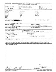
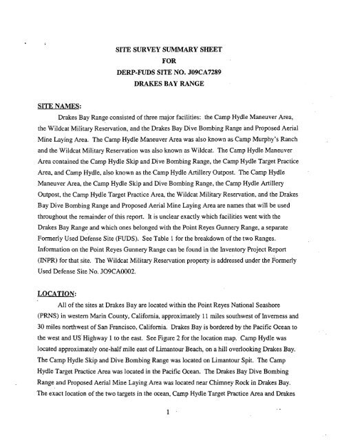
SITE NAMES:<br />
SITE SURVEY SUMMARY SHEET<br />
FOR<br />
DERP-FUDS SITE NO. J09CA7289<br />
DRAKES BAY RANGE<br />
<strong>Drakes</strong> <strong>Bay</strong> <strong>Range</strong> consisted of three major facilities: the Camp Hydle Maneuver Area,<br />
the Wildcat Military Reservation, and the <strong>Drakes</strong> <strong>Bay</strong> Dive Bombing <strong>Range</strong> and Proposed Aerial<br />
Mine Laying Area. The Camp Hydle Maneuver Area was also known as Camp Murphy's Ranch<br />
and the Wildcat Military Reservation was also known as Wildcat. The Camp Hydle Maneuver<br />
Area contained the Camp Hydle Skip and Dive Bombing <strong>Range</strong>, the Camp Hydle Target Practice<br />
Area, and Camp Hydle, also known as the Camp Hydle Artillery Outpost. The Camp Hydle<br />
Maneuver Area, the Camp Hydle Skip and Dive Bombing <strong>Range</strong>, the Camp Hydle Artillery<br />
Outpost, the Camp Hydle Target Practice Area, the Wildcat Military Reservation, and the <strong>Drakes</strong><br />
<strong>Bay</strong> Dive Bombing <strong>Range</strong> and Proposed Aerial Mine Laying Area are names that will be used<br />
throughout the remainder of this report. It is unclear exactly which facilities went with the<br />
<strong>Drakes</strong> <strong>Bay</strong> <strong>Range</strong> and which ones belonged with the Point Reyes Gunnery <strong>Range</strong>, a separate<br />
Formerly Used ~efense Site (FUDS). See Table 1for the breakdown of the two <strong>Range</strong>s.<br />
Information on the Point Reyes Gunnery <strong>Range</strong> can be found in the <strong>Inventory</strong> <strong>Project</strong> <strong>Report</strong><br />
(INPR) for that site. The Wildcat Military Reservation property is addressed under the Formerly<br />
Used Defense Site No. J09CA0002.<br />
LOCATION:<br />
All of the sites at <strong>Drakes</strong> <strong>Bay</strong> are located within the Point Reyes National Seashore<br />
(PRNS) in western Marin County, California, approximately 11 miles southwest of Inverness and<br />
30 miles northwest of San Francisco, California. <strong>Drakes</strong> <strong>Bay</strong> is bordered by the Pacific Ocean to<br />
the west and US.Highway 1 to the east. See Figure 2 for the location map. Camp Hydle was<br />
located approximately one-half mile east of Limantour Beach, on a hill overlooking <strong>Drakes</strong> <strong>Bay</strong>.<br />
The Camp Hydle Skip and Dive Bombing <strong>Range</strong> was located on Limantour Spit. The Camp<br />
Hydle Target Practice Area was located in the Pacific Ocean. The <strong>Drakes</strong> <strong>Bay</strong> Dive Bombing<br />
<strong>Range</strong> and Proposed Aerial Mine Laying Area was located near Chimney Rock in <strong>Drakes</strong> <strong>Bay</strong>.<br />
The exact location of the two targets in the ocean, Camp Hydle Target Practice Area and <strong>Drakes</strong>
INPR, <strong>Drakes</strong> <strong>Bay</strong> <strong>Range</strong><br />
<strong>Bay</strong> Dive Bombing <strong>Range</strong> and Proposed Aerial Mine Laying Area, is unclear. The Wildcat<br />
Military Reservation stood on a rugged promontory at <strong>Drakes</strong> <strong>Bay</strong> six miles southwest of Olema.<br />
See Figure 3 for the layout of <strong>Drakes</strong> <strong>Bay</strong> and the neighboring properties.<br />
SITE HISTORY:<br />
During and after World War 11, <strong>Drakes</strong> <strong>Bay</strong> <strong>Range</strong> hosted training in skip bombing, dive<br />
bombing, landing barge practice, and air sea rescue. Dive bombers operating from Hamilton<br />
Army Airfield (AM), Santa Rosa AAF, and Naval Air Station (NAS) Alameda practiced in the<br />
waters at <strong>Drakes</strong> <strong>Bay</strong>, Abbotts Lagoon, and Tomales <strong>Bay</strong>.<br />
Camp Hvdle Maneuver Area<br />
The property that formed the Camp Hydle Maneuver Area was leased from Leland<br />
Murphy under lease W59-qm-713 which expired under its own terms at an undetermined time.<br />
Lease W59-qm-7 13 was superseded by lease W59-qm-943 which secured the use of the property<br />
for the United States Army Ground Forces. The Camp Hydle Maneuver Area was occupied by<br />
the 4th Air Force by permission of the Western Defense Command. The Camp Hydle Maneuver<br />
Area, the Camp Hydle Artillery Outpost, and the Camp Hydle Skip and Dive Bombing <strong>Range</strong><br />
were located on 10,532 acres. The Target Practice Area was located in the ocean within<strong>Drakes</strong><br />
<strong>Bay</strong>. The Camp Hydle Target Practice Area was located beyond 100 yards from the mean high<br />
tide. According to the DERP-FUDS Manual, July 1996, Chapter 3, Section 3-2b (I), "clean-up<br />
of off-shore ordnance properties, beyond 100 yards of mean high tide, will not be eligible, except<br />
-in special cases where a public exposure pathway exists." Since no such pathway exists for the<br />
Camp Hydle Target Practice Area, the property is ineligible.<br />
The Camp Hydle Maneuver Area, the Camp Hydle Artillery Outpost, and the Target<br />
Practice Area were released on 15 February 1945, but lease W59-qm-943 was modified to<br />
exclude the property required for the Camp Hydle Skip and Dive Bombing <strong>Range</strong>. Supplemental<br />
Agreement No. 3 to that lease left a long sand spit (Limantour Spit) consisting of about 18 acres<br />
for the Camp Hydle Skip and Dive Bombing <strong>Range</strong>. The Camp Hydle Skip and Dive Bombing<br />
2
INPR, <strong>Drakes</strong> <strong>Bay</strong> <strong>Range</strong><br />
<strong>Range</strong> was released on 31 December 1946. The actual leases for this property have not been<br />
located, only references to theses leases have been located.<br />
The Camp Hydle Artillery Outpost was located approximately one-half mile east of<br />
Limantour Beach, on a hill over looking <strong>Drakes</strong> <strong>Bay</strong>. Mr. Charlie Zetterquist, a long time<br />
resident of the Point Reyes area, stated that there were cement filled sandbags stacked around<br />
three or four guns. Several of these sandbag shaped cement blocks are still located on the<br />
hillside and were observed during a recent site visit. During World War II, the Camp Hydle<br />
Artillery Outpost's guns performed target practice against towed targets in <strong>Drakes</strong> <strong>Bay</strong>. Other<br />
sources indicate that Battery B, a battery of four 155mm guns of the 56th Coast Artillery was<br />
stationed on Limantour Beach at <strong>Drakes</strong> <strong>Bay</strong> beginning 7 December 1941. The guns stood under<br />
camouflage nets on the beach. Nearby stood a tent used as a plotting room and the Battery's<br />
assigned searchlights and anti-aircraft machine guns. Observation crews with telephones and<br />
range scopes were positioned along the bay. The four gun battery had a large degree of<br />
autonomy for firing on suspected targets. No other battery units were in the area. Due to this<br />
information, it is believed that the Camp Hydle Artillery Outpost was Battery B of the 56th Coast<br />
Artillery. Interviews suggest that the DoD used the Camp Hydle Artillery Outpost located one-<br />
half mile east from Limantour Beach, on a hill, overlooking <strong>Drakes</strong> <strong>Bay</strong> as an Artillery Outpost<br />
during World War II. However, no information or physical evidence exists to support the exact<br />
target location for these activities, their frequency of use, or their specific types of use.<br />
The Camp Hydle Skip and Dive Bombing <strong>Range</strong> was located on Limantour Spit at<br />
<strong>Drakes</strong> <strong>Bay</strong> which was part of the property leased for Camp Hydle Maneuver Area. Mr. Lee<br />
Murphy, Jr., the son of Mr. Leland Murphy and a long time resident of the Point Reyes area,<br />
discovered a small practice bomb on Limantour Spit in 1947. No other evidence indicating the<br />
type of ordnance used at this facility has been found. The exact dates of the use of this range are<br />
unclear. No Department of Defense Action is Indicated (NDAI) for this area.<br />
<strong>Drakes</strong> <strong>Bay</strong> Dive Bombing <strong>Range</strong> and Proposed Aerial Mine Laving Area<br />
3
* INPR, <strong>Drakes</strong> <strong>Bay</strong> <strong>Range</strong><br />
<strong>Drakes</strong> <strong>Bay</strong> Dive Bombing <strong>Range</strong> was located in the ocean near <strong>Drakes</strong> <strong>Bay</strong>. The exact<br />
location of the target is unclear. According to Mrs. Scotty Mendoza, a landowner at Point Reyes,<br />
aircraft from Hamilton AAF dropped bombs which did not explode at a target near Chimney<br />
Rock inside of <strong>Drakes</strong> <strong>Bay</strong>. The target was towed by boat to this location each time it was used.<br />
These aircraft approached the target from the northeast and passed directly over the "B" Ranch<br />
house as they dove toward the target. According to Mrs. Mendoza, the target practice in <strong>Drakes</strong><br />
<strong>Bay</strong> began in December 1941 and did not end until shortly after the conclusion of the war.<br />
According to a memorandum from Headquarters, Continental Air Forces dated 6 March<br />
1946, when Santa Rosa AAJ? was being excessed, the decision was made to retain the <strong>Drakes</strong><br />
<strong>Bay</strong> Gunnery <strong>Range</strong> for use by pilots from Hamilton AAF and to attempt to re-establish the<br />
danger area with the Interdepartmental Air Traffic control Board. This gunnery range was an<br />
over-water range and did not restrict water navigation. The <strong>Drakes</strong> <strong>Bay</strong> Gunnery <strong>Range</strong> is<br />
believed to be the same area as the <strong>Drakes</strong> <strong>Bay</strong> Dive Bombing and Proposed Aerial Mine Laying<br />
Area.<br />
Prior to 1952, aerial mine laying practice was conducted in <strong>Drakes</strong> <strong>Bay</strong> by Naval Aviators<br />
from NAS Moffet Field and NAS Alameda. This target was located in the ocean. The exact<br />
location is unknown. On 31 July 1953, the <strong>District</strong> Public Works Officer, H.T. Ransford,<br />
requested the re-establishment of a permanent danger zone for the area that was used for practice<br />
aerial mine laying in <strong>Drakes</strong> <strong>Bay</strong>. United States Army Corps of Engineers (USACE) - San<br />
Francisco denied this request after a public hearing on the matter.<br />
According to a memorandum from Commander Fleet Air, Alameda, dated 4 March 1952,<br />
the Government initiated action to rescind the <strong>Drakes</strong> <strong>Bay</strong> Danger Area when target ranges at<br />
Crows Landing were to be activated. No description of the location of the <strong>Drakes</strong> <strong>Bay</strong> Danger<br />
Area has been located. The <strong>Drakes</strong> <strong>Bay</strong> Dive Bombing <strong>Range</strong> and Proposed Aerial Mine Laying<br />
Area was located beyond 100 yards of the mean high tide. According to the DERP-FUDS<br />
Manual, July 1996, Chapter 3, Section.3.2b (I), "clean-up of off-shore ordnance properties,<br />
beyond 100 yards of mean high tide, will not be eligible, except in special cases where a public<br />
4<br />
.
INPR, <strong>Drakes</strong> <strong>Bay</strong> <strong>Range</strong><br />
exposure pathway exists." Since no such pathway exists for the <strong>Drakes</strong> <strong>Bay</strong> Dive Bombing<br />
<strong>Range</strong> and Proposed Aerial Mine Laying Area, the property is ineligible.<br />
Site Deactivation and Current Uses<br />
The area around <strong>Drakes</strong> <strong>Bay</strong> comprises the PRNS. This National Seashore was<br />
established by President Kennedy in 1962, and is operated by the National Park Service under the<br />
Department of Interior. At present, the park contains over 140 miles of hiking trails, three visitor<br />
centers, biking trails, and four hike-in campgrounds. Activities available to the public include<br />
whale watching, horseback riding, bird watching, and lighthouse tours. Many of the ranches<br />
purchased by the Government continue to be operated as dairies and cattle ranches under long<br />
term leases.<br />
SITE VISITS:<br />
Two site visits were conducted at the site. The first occurred on 8 April 1998 when<br />
TechLaw Inc. was contracted by the USACE to prepare a Preliminary Assessment of Eligibility<br />
(PAE) for the site. .The second visit occurred on 29 April 1999 when USACE representatives<br />
visited the site.<br />
TechLaw Inc.<br />
Messrs. Steven Clonts and Gene Barber of TechLaw conducted a site visit of <strong>Drakes</strong> <strong>Bay</strong><br />
on April 8, 1998. The purpose of that visit was to make observations about the current condition<br />
of the site and to identify any features that might relate to the operations by the DoD.<br />
TechLaw representatives were accompanied to the former location of Camp Hydle by Mr.<br />
Charlie Zetterquist. Mr. Zetterquist pointed out Limantour Spit, and the remains of the cement<br />
filled sandbags that protected the Camp Hydle artillery guns.<br />
TechLaw proceeded to the eastern tip of the Point Reyes headlands and noted the location<br />
of Chimney Rock. TechLaw personnel noticed two cement blocks embedded in the rock atop<br />
Chimney Rock. These blocks appeared to have metal bars protruding from them. A large piece<br />
of rusty metal was also seen near the blocks. It appeared that this material had been used to<br />
5
INPR, <strong>Drakes</strong> <strong>Bay</strong> <strong>Range</strong> 6<br />
support a structure of some sort. This trail is well used by the public and an observation area is<br />
located at the end of the trail.<br />
As a result of the site visit, TechLaw developed the following conclusions:<br />
The PRNS is widely used by the public for recreational purposes, and the historic<br />
cattle ranches and dairies are still in operation over most of the site.<br />
The trails on the Point Reyes headlands are heavily traveled by park visitors.<br />
All of the bombing targets referenced in this report have been removed.<br />
Several of the structures historically utilized by the Government still stand on the<br />
PRNS.<br />
No evidence was discovered of live ordnance at any of the aerial bombing target areas<br />
investigated (TechLaw, 1998)<br />
USACE. Environmental Design Section (EDS)<br />
The site visit for the USACE was conducted on April 28, 1999, by Ms. Tracie Billington<br />
and Mr. Scott Duren of the USACE, and Mr. Clinton Huckins, USACE Unexploded Ordnance<br />
(UXO) Safety Specialist from Fort Ord, California.<br />
USACE personnel hiked along Limantour Spit, which was used by the army and was<br />
known as Camp Hydle Skip and Dive Bombing <strong>Range</strong>. While hiking on and off the trail along<br />
the spit, USACE was unable to locate any evidence suggesting DoD use of the property. No<br />
ordnance was seen, and no anomalies were located with a Schonstedt Model GA-52Cx fluxigate<br />
magnetometer. No anomalies were found on the beach either. The off-shore <strong>Drakes</strong> <strong>Bay</strong> Dive<br />
Bombing <strong>Range</strong> and Proposed Aerial Mine Laying Area was observed along with the Camp<br />
Hydle Target Practice Area. These areas are a good distance from the shore.<br />
CATEGORY OF HAZARD: NDAI<br />
AVAILABLE STUDIES AND REPORTS:
INPR, <strong>Drakes</strong> <strong>Bay</strong> <strong>Range</strong><br />
1. TechLaw hc., Lakewood Colorado. Preliminary Assessment of Eligibility, <strong>Drakes</strong> <strong>Bay</strong>,<br />
dated July 31, 1998. Contract No. DACW05-95-0004, Task Order No, 0009, prepared<br />
for the Department of the Army. Corps of Engineers, <strong>Sacramento</strong> <strong>District</strong>, <strong>Sacramento</strong>,<br />
California.<br />
PA POC: Mr. William Mullery, CESPK-ED-EB, U.S. Army Corps of Engineers, <strong>Sacramento</strong><br />
<strong>District</strong>, (916) 557-6944:<br />
RAC FORM: Attached (Appendix B)<br />
DISTRICT POC: Mr. William Mullery, CESPK-ED-EB, U.S. Army Corps of Engineers,<br />
<strong>Sacramento</strong> <strong>District</strong>, (9 16) 557-6944.<br />
7
DEFENSE ENVIRONMENTAL RESTORATION PROGRAM<br />
FORMERLY USED DEFENSE SITES<br />
FINDINGS AND DETERMXVATION OF ELIGIBILITY<br />
DRAKES BAY RANGE<br />
MARINCOUNTY, C ALIFO~<br />
SITE NO. J09CA728900<br />
FINDINGS OF FACT<br />
1. <strong>Drakes</strong> <strong>Bay</strong> <strong>Range</strong> is located in Marin County, California, and is located approximately 11<br />
miles southwest of Inverness and 30 miles northwest of San Francisco, California. It lies within<br />
the Point Reyes National Seashore. <strong>Drakes</strong> <strong>Bay</strong> <strong>Range</strong> consisted of three major facilities: the<br />
Camp Hydle Maneuver Area, the <strong>Drakes</strong> <strong>Bay</strong> Dive Bombing and Proposed Aerial Mine Laying<br />
Area, and the Wildcat Military Reservation. The Wildcat Military Reservation site is addressed<br />
under the Former Defense Site Property No. J09CA000200. The Camp Hydle Maneuver Area<br />
was leased from Leland Murphy under lease W59-qm-713 which expired under its own terms at<br />
an undetermined time. Lease W59-qm-943 superseded lease W59-qm-713. The Camp Hydle<br />
Maneuver Area consisted of the Camp Hydle Skip arid Dive Bombing <strong>Range</strong>, the Camp Hydle<br />
Target Practice Area, and the Camp Hydle Artillery Outpost. <strong>Drakes</strong> <strong>Bay</strong> Dive Bombing <strong>Range</strong><br />
was located in the ocean near <strong>Drakes</strong> <strong>Bay</strong>. The exact location of the target is unclear and a<br />
permit for the use of this target has not been found. The <strong>Drakes</strong> <strong>Bay</strong> Dive Bombing and<br />
Proposed Aerial Mine Laying Area are not eligible properties.<br />
2. During World War I1 the former Camp Hydle Maneuver Area performed target practice against<br />
towed targets in <strong>Drakes</strong> <strong>Bay</strong> out past Chimney Rock and monitered bomb targeting accuracy in<br />
<strong>Drakes</strong> <strong>Bay</strong>.<br />
3. Camp Hydle Maneuver area (lease W59-qm-943) was excessed prior to April 1945.<br />
Supplemental Agreement No. three of lease W59-qm-943 allowed the DoD to exclude the 18<br />
acres on Limantour Spit that was used for the Camp Hydle Skip and Dive Bombing <strong>Range</strong>. The<br />
Camp Hydle Skip and Dive Bombing <strong>Range</strong> was released on 31 December 1946. The release<br />
date for the <strong>Drakes</strong> <strong>Bay</strong> Dive Bombing <strong>Range</strong> and Proposed Aerial Mine Laying Area is unclear.<br />
The <strong>Drakes</strong> <strong>Bay</strong> <strong>Range</strong> and surrounding area comprise the Point Reyes National Seashore. The<br />
PRNS was established by President Kennedy in 1962.At present the park contains over 140 miles<br />
of hiking trails, three visitor centers, biking, four hike in camp grounds, whale watching,<br />
-<br />
.-
DEFENSE ENVIRONMENTAL RESTORATION PROGRAM<br />
FORMERLY USED DEFENSE SITES<br />
FINDINGS AND DETERMINATION OF ELIGIBILITY<br />
DRAKES BAY W GE<br />
MARIN COUNTY, CALIFORNIA<br />
SITE NO. J09CA728900<br />
FINDINGS OF FACT<br />
horseback riding, bird watching, and lighthouse tours. Many of the ranches purchased by the<br />
Government continue tobe operated as dairies and cattle ranches under long term leases.<br />
DETERMINATION<br />
Based on the forgoing findings of fact, within the property that comprised the former<br />
<strong>Drakes</strong> <strong>Bay</strong> only the Camp Hydle Maneuver Area (10,532 acres) has been determined to<br />
be formerly used by the Department of Defense (DoD). Therefore this site is eligible for<br />
the Defense Environmental Restoration Program for Formerly Used Defense Sites<br />
established under 10 USC 2701 et seq.<br />
Date<br />
Y<br />
Commanding
EDPUBUC\ENVlRONMENTAL\EDS\PROJECTS\K-ROSE\BODEKROl .DWG. 06/22/99, 1 :1. (1 /I XP)<br />
Bodega<br />
. SITE LOCATION I<br />
NOTES:<br />
REF: TECHLAW, INC.<br />
HEAD DRAFT FINAL CALlFORl<br />
PRELIMINARY ASSESSMENT REPORT<br />
CONTRACT NO. DACW05-95-D-0004<br />
TASK ORDER NO. 0009<br />
DRAKES BAY<br />
LOCATION MAP<br />
SCALE: . FIGURE:<br />
NOTED 2
X(EY<br />
~ 1Locations 1 Are Approximnte<br />
/<br />
1. Old Poil;t IZcycs Lifcsnving Sbtion nnd Auxiliary Lnnding<br />
2. U.S. Coast Gunrd Lifeboat Stntion<br />
3. U.S. Const Gunrd Dwclling<br />
4. U.S.Const Gunrd Lookout<br />
I<br />
I<br />
i<br />
5. Rnkc Stations<br />
6. "A" Rnnch Bnrrncks, DPP, Radar. Wntcr Towcr. nnd Paint Racks I<br />
Gn. Point Rcycs Lighlhousc<br />
7. "13" Ranch 13nrmckg'<br />
I<br />
I<br />
R. -. Radar -<br />
9. RCA Rndio<br />
4<br />
1<br />
'<br />
Aerinl Minc ~ n~ing !, Arm , ,<br />
12. Cnmp I-Iydlc<br />
13. Cnn~p Hydlc ~ ni~ct Prncticc Arcn<br />
14. wildcut Militnry Rcscrvntion<br />
IS. Tomnlcs Boy Bombing Tnrget Nenr Hog lslnnd ! 1 1<br />
I<br />
1G. Proposcd Dillon Bcnch Bombing Tnrget i<br />
17. Tomalcs Point Acrinl Minc Lnying Rangc I<br />
I<br />
18. Abbotts Lngoon Bombing Targct<br />
I<br />
I<br />
.--<br />
I I<br />
13 PRELIMINARY ASSESSMENT REPORT<br />
CONTRACT NO. DACW05-95-0-0004<br />
TASK ORDER NO. 0009<br />
NOTES: GOV'T FACILITIES AT DRAKES BAY<br />
AMERICAN AUTOMOTIVE ASSOCIATION<br />
ZALE:<br />
' NOTED<br />
FIGURE<br />
3<br />
/I